
Abandoned & Little-Known Airfields:
Alabama: Huntsville area
© 2002, © 2025 by Paul Freeman. Revised 3/1/25.
This site covers airfields in all 50 states: Click here for the site's main menu.
____________________________________________________
Please consider a financial contribution to support the continued growth & operation of this site.
Beaver Dam Auxiliary Army Airfield / Beaver Dam Airport (added 1/7/22) - Huntsville Airport (1st location) / Huntsville Flying Field / Mayfair Airport (revised 6/24/18)
Huntsville Airport (2nd location) (revised 4/26/20) - Palmer Field (added 9/18/24) - South Huntsville Airport / Rio South Airport (revised 3/1/25)
____________________________________________________
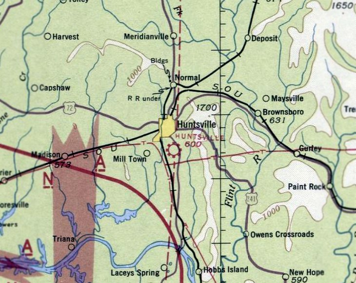
34.693, -86.786 (West of Huntsville, AL)
Palmer Field, as depicted on the 1977 USGS topo map.
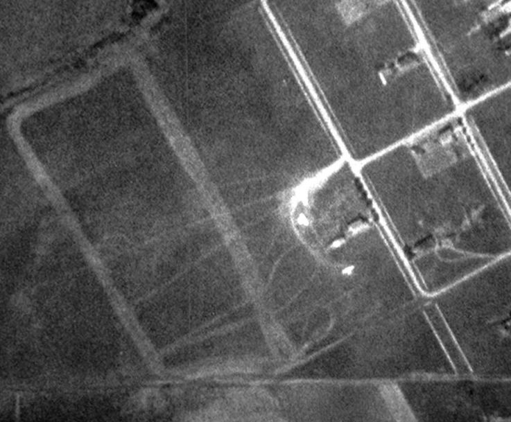
This small cropduster airfield was evidently established at some point between 1965-77,
as it was not yet depicted on a 1958 aerial photo or the 1965 USGS topo map.
The earliest depiction which has been located of Palmer Field was on the 1977 USGS topo map,
which depicted it as having a single unpaved north/south runway, with a small building on the southeast side.
The earliest photo which has been located of Palmer Field was a 1981 aerial view.
It depicted Palmer as having a single grass north/south runway, with several small buildings on the southeast side.
Palmer Field was not depicted on the September 1985 Atlanta Sectional Chart (courtesy of Jonathan Westerling).

The earliest photo which has been located of Palmer Field was a 1996 aerial view looking northeast (courtesy of Michael Hazelwood).
It depicted 2 Grumman AgCat cropduster biplanes, possibly parts of other aircraft, and a hangar, on the southeast side of a north/south grass runway.

A 1997 aerial view looking northeast depicted Palmer Field as a single grass north/south runway, with several small buildings on the southeast side.

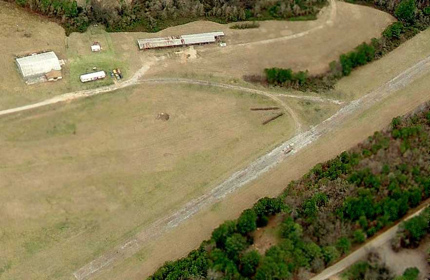
The last photo which has been located showing Palmer Field still in operation was a 2002 aerial view.
The field was in an unchanged configuration, with 2 cropdusters parked near the hangar.
Palmer Field was evidently closed at some point between 2002-2004,
as a 2004 aerial view showed Continental Drive had been built over the center of the runway, yet the hangar & 2 stranded cropduster aircraft remained on the south side.
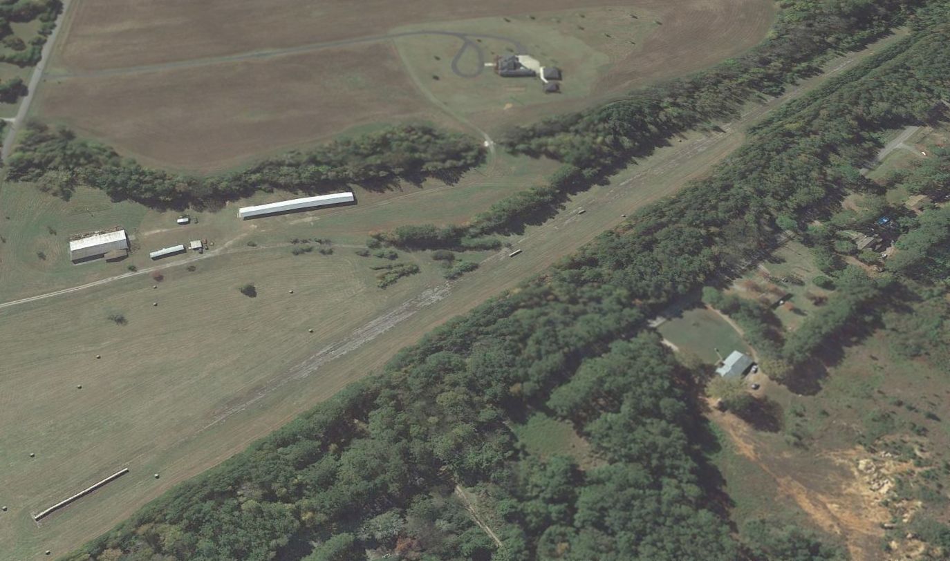
A 2009 aerial view showed Palmer Field's hangar was removed at some point between 2006-2009, erasing the last trace of this little airfield.

A 2024 aerial view looking northeast shows no trace remained of Palmer Field.
Michael Hazelwood recalled of Palmer Field, “I remember seeing the remains of what might have been an AgCat or a Stearman there in the weeds sometime around 2007, just off County Line Road.
There was also what looked like a wrecked Jet Ranger helicopter hull across County Line & south about a half mile, where old Highway 20 heads west.”
Thanks to Michael Hazelwood for pointing out this airfield.
____________________________________________________
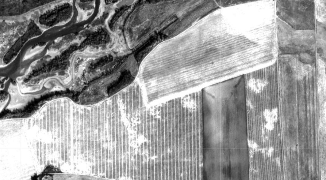
34.608, -86.865 (Southwest of Huntsville, AL)
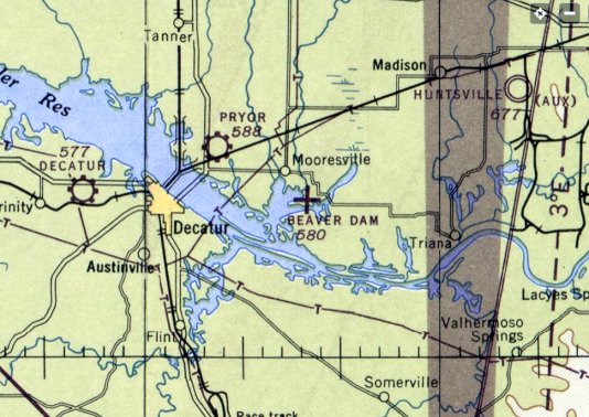
Beaver Dam Airport, as depicted on the 1946 Chattanooga Sectional Chart (courtesy of Rob Grant).
Pryor Field (in Decatur, AL) opened in October 1941, and began training USAAC flying cadets under contract to Southern Airways, Inc. & Southern Aviation Training School, Inc.
Pryor Field had 5 local auxiliary airfields for emergency & overflow landings, including Beaver Dam Auxiliary Field.
The date of construction of Beaver Dam Auxiliary Field has not been determined.
Flying training at Pryor Field was performed with Fairchild PT-19s as the primary trainer, and it also had several PT-17 Stearmans & a few P-40 Warhawks assigned.
Pryor Field was inactivated on 12/28/44, at which point Beaver Dam Field (& its other auxiliary fields) were also presumably intactived.
The earliest depiction which has been located of Beaver Dam Airport was on the April 1946 Chattanooga Sectional Chart (courtesy of Rob Grant),
which depicted Beaver Dam as a civilian auxiliary airfield.
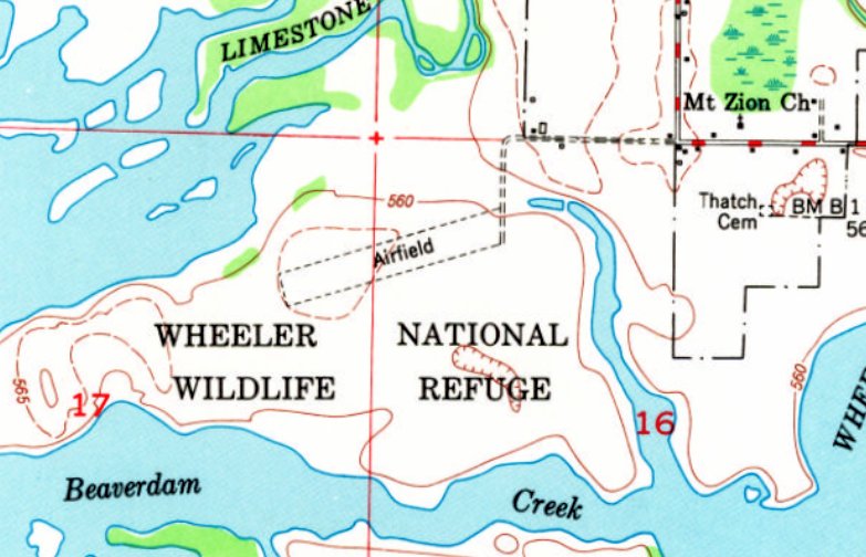
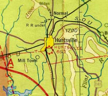
The earliest topo map depiction which has been located of Beaver Dam Airport was on the 1949 USGS topo map (courtesy of Rob Grant).
It depicted a single unpaved southwest/northeast runway, generically labeled “Airfield”.
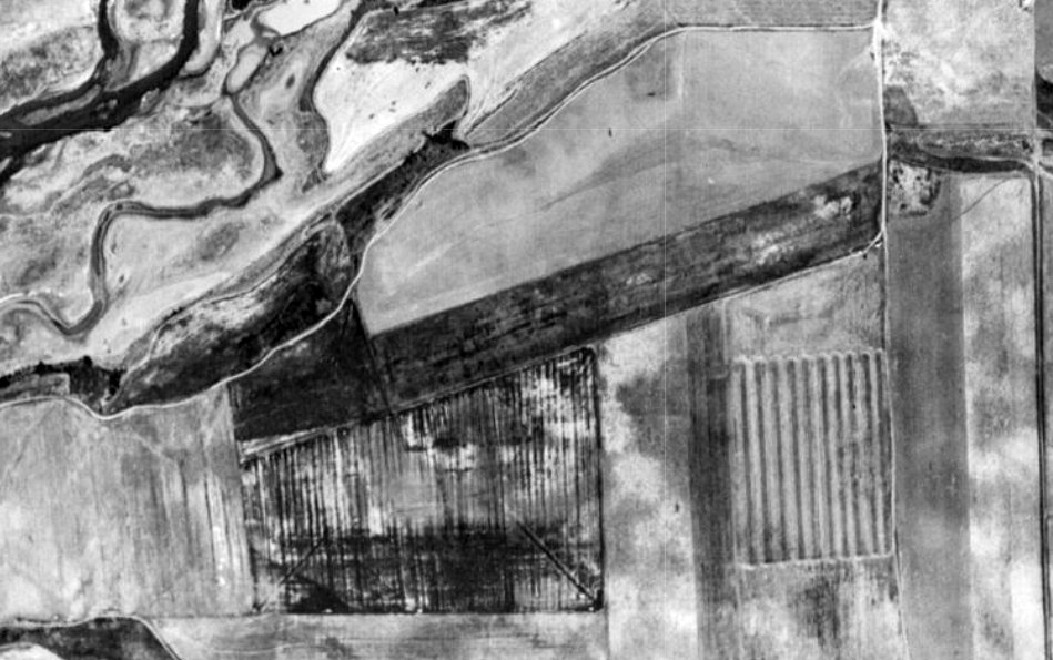
The earliest photo which has been located of Beaver Dam Airport was a 1949 aerial view (courtesy of Rob Grant).
It depicted a single unpaved southwest/northeast runway, with no other improvements.
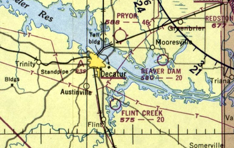
The last aeronautical depiction which is available of Beaver Dam Airport was on the January 1950 Chattanooga Sectional Chart (courtesy of Rob Grant).
The Sectional's Aerodrome table described Beaver Dam Field as a municipal airfield having a single 2,000' runway, but noted it as "Closed - TVA Field."
The last aeronautical depiction which has been located of Beaver Dam Airport was on the August 1951 Chattanooga Sectional Chart (according to Rob Grant).
It was described as a miscellaneous, government; closed, TVA field.
A 1962 aerial view (courtesy of Rob Grant) showed that the site of Beaver Dam Airport had been returned to cultivation.
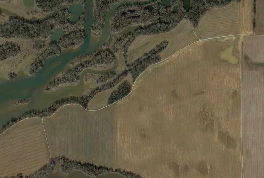
Amazingly, 70 years after Beaver Dam Airport's abandonment, a 2019 aerial view still shows a ghostly trace of the former southwest/northeast runway in the middle of a farm field.
____________________________________________________
34.71, -86.58 (South of Downtown Huntsville, AL)
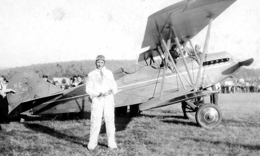
A photo of L.G. Mason in front of a Travel Air S-2000 biplane taken at the dedication of the Huntsville Flying Field in July 1931 (courtesy of Mike Sparkman, restored by Bill Grasha).
According to Mike Sparkman, “The original airport in Huntsville was known as Huntsville Flying Field or Mayfair Airport.
It had sod runways & no lighting. It opened in the early 1930s.”
The earliest depiction which has been located of the original Huntsville Airport was a photo of L.G. Mason in front of a Travel Air S-2000 biplane
taken at the dedication of the Huntsville Flying Field in July 1931 (courtesy of Mike Sparkman).
Mason had just won the “125 Horsepower Race”.
However, no airfield in Huntsville was yet listed among active airfields in The Airport Directory Company's 1933 Airport Directory (according to Chris Kennedy).
The 1934 Department of Commerce Airport Directory (courtesy of Chris Kennedy) described Huntsville as a commercial field having 4 dirt & sod runways,
with the longest being the 2,400' northeast/southwest strip.
The earliest aeronautical chart depiction which has been located of the original Huntsville Airport was on the September 1935 Chattanooga Sectional Chart.
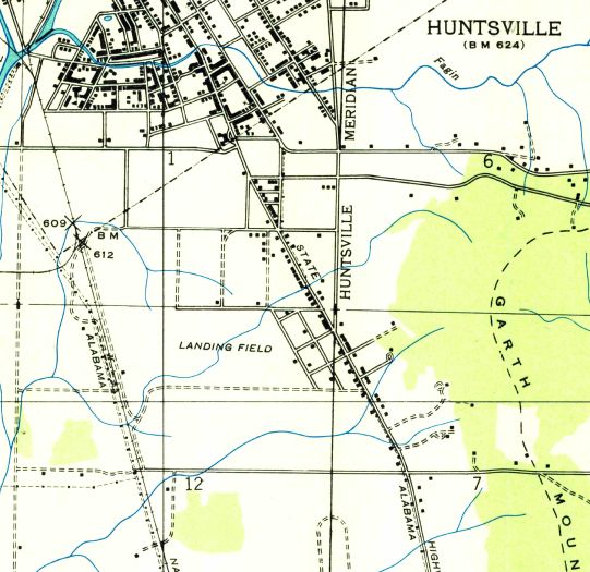
The original Huntsville Airport was labeled as “Landing Field” on the 1936 USGS topo map (courtesy of Dallam Oliver-Lee).
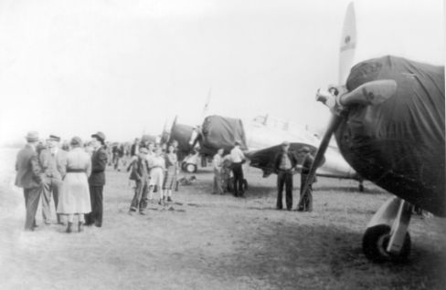
A circa 1938 photo of what appears to be a display of Seversky P-35 fighters at the Huntsville Flying Field / Mayfair Airport (courtesy of www.huntsvillerewound.com, via Billy Lenox).
According to Milt Aitken, “The Mayfair Airport had a celebration in 1938 when 18 P-35s (of the 17th Pursuit Squadron),. enroute Selfridge to Maxwell, ran out of daylight & weather in north Alabama.
Huntsville was a small cotton town but boasted the 12-story Russell Erskine Hotel, with a huge illuminated sign on the roof. Legend says that the Squadron homed on the sign & circled overhead.
Buster Pollard, owner of radio station WBHP, alerted the citizens & asked that they go to Mayfair & illuminate the field with their headlights.
The Squadron landed successfully & the pilots were wined & dined like royalty The next day avgas was trucked in & they completed thirst trip to Maxwell Field.
A period clipping from The Huntsville Times is part of a display about Huntsville airports at The Veterans Memorial Museum.”
The last photo which has been located showing the original Huntsville Airport still intact was a 1941 aerial view (courtesy of Billy Lenox & Huntsville Rewound).
The last aeronautical chart depiction which has been located of the original Huntsville Airport
was on the April 1941 Chattanooga Sectional Chart (courtesy of Chris Kennedy).
According to Mike Sparkman, “The original airport in Huntsville... was closed in 1941.”
By the time of the was on the January 1942 Chattanooga Sectional Chart (courtesy of Chris Kennedy),
the original Huntsville Airport was no longer depicted (having been replaced by a new field somewhat to the south).
A 1945 USDA aerial view (courtesy of Dallam Oliver-Lee) taken after the closure of the original Huntsville Airport
showed possibly a single grass east/west runway, with a few small buildings (hangars?) on the east side.
The 1948 AL DOT map (courtesy of Dallam Oliver-Lee) no longer depicted the original Huntsville Airport.
The 1950 USGS topo map showed a housing development covering the eastern half of the original Huntsville Airport property.
A 3/15/79 USGS aerial view (courtesy of Dallam Oliver-Lee) no longer depicted any trace of the original Huntsville Airport.

As seen in a 6/26/12 aerial view (courtesy of Dallam Oliver-Lee), not a trace of the original Huntsville Airport remains at the site.
The site of the original Huntsville Airport is located southwest of the intersection of Whitesburg Drive & Bob Wallace Avenue.
____________________________________________________
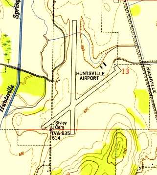
Huntsville Airport (2nd location), Huntsville, AL
34.69, -86.59 (South of Downtown Huntsville, AL)
The 2nd location of the Huntsville Airport, as depicted on the January 1942 Chattanooga Sectional Chart (courtesy of Chris Kennedy).
No airfield was depicted at this location on the 1937 USGS topo map (courtesy of Dallam Oliver-Lee).
According to Mike Sparkman, “The second [Huntsville] Airport opened in 1941.
It had 2 paved runways”, with Runway 18/36 initially being 4,000' long.
Mike continued, “The terminal building was a wooden shack... located at the northeast end of Runway 5/23.”
The earliest depiction which has been located of the 2nd Huntsville Airport
was on the January 1942 Chattanooga Sectional Chart (courtesy of Chris Kennedy).
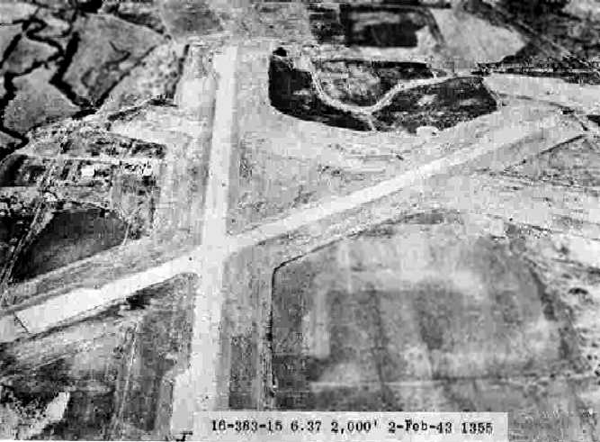
The earliest photo which has been located of the 2nd location of Huntsville Airport
was a 2/2/43 aerial view looking north from the 1945 AAF Airfield Directory (courtesy of Scott Murdock).
depicted Huntsville Municipal Airport as having 2 paved runways & a 3rd unpaved runway.
The April 1944 US Army/Navy Directory of Airfields (courtesy of Ken Mercer)
described Huntsville Airport as having a 4,000' hard-surfaced runway.
According to Mike Sparkman, “Airline service started in 1944 by PCA.”
The 1945 AAF Airfield Directory (courtesy of Scott Murdock) described Huntsville Municipal Airport
as a 720 acre irregularly-shaped property having 3 runways, the largest being the 4,000' north/south asphalt runway.
The field was not said to have any hangars,
was described as being owned by Madison County & the City of Huntsville, and operated by private interests.
According to Mike Sparkman, “Airline service started by Eastern in 1946.”
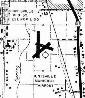
The 1948 AL DOT map (courtesy of Dallam Oliver-Lee) depicted Huntsville Municipal Airport as having 3 paved runways.
The 1950 USGS topo map (courtesy of the University of Alabama Map Library)
depicted the field as having two 4,000' paved runways,
with two small buildings (hangars?) located northeast of the runway intersection.
The 3rd runway had evidently been abandoned at some point between 1948-50, after less than 9 years.
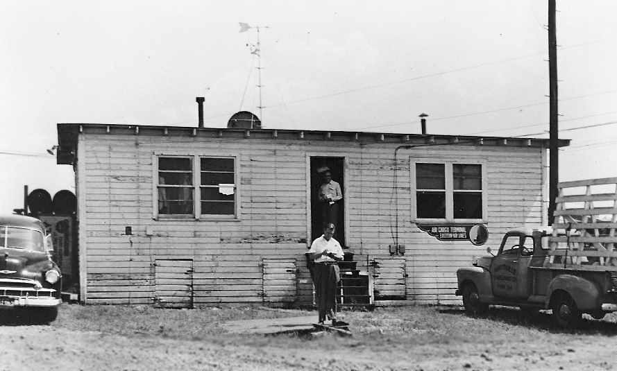
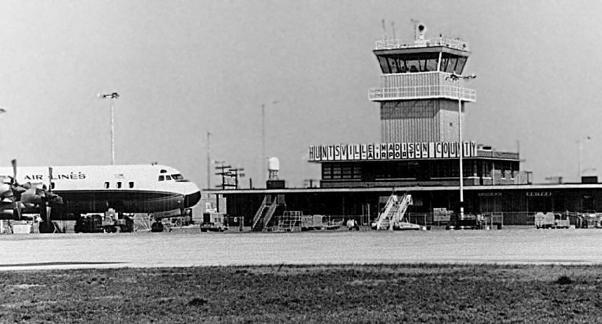
A September 1950 photo (courtesy of Johnny Johnston, restored by Bill Grasha) of the Huntsville Madison County Airport's original terminal building,
as seen during a meeting of Eastern Airlines President Eddie Rickenbacker with 24 of the airline's top corporate officials.
The sign on the right side of the building says “Air Cargo Terminal, Eastern Air Lines”.
Mike Sparkman indicated that the original wooden terminal building was used “until the building [pictured below] was built in 1951.”
Runway 8/36 “was extended to 5,200' in the mid-1950s.
The control tower was built in late 1956. Southern came in 1958.”
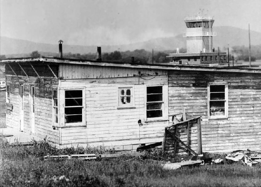
A circa 1956-68 photo (courtesy of Mike Sparkman, restored by Bill Grasha) of the original terminal building, with the new control tower in the background.
The Huntsville office of the National Weather Service opened at the Huntsville Airport in 1958.
Stephen Pershing recalled, “We moved to Huntsville in 1961.
Once when we were seeing Gale's mother off at that airport, we were on a patio overlooking the tarmac
(which I don't see in any pics of the terminal - could it have been on the roof above the first floor of the control tower building?
I remember it as on the left as you would face the front of the building).
The plane Gale's mother was on - I remember it as a 4-prop, Eastern Airlines maybe, on tricycle gear,
with the main passenger door on the port side in front, stairs wheeled up to the side -
was ready to close its door & shove off, then seemed to be waiting quite a few minutes,
when 'what to my wondering eyes should appear,' but a black Mercedes, perhaps escorted by another car, that pulled up from the left,
through a gate (?) onto the tarmac & right to the foot of the air stairs.
A dark-coated gent got out & climbed the steps to the plane. Immediately thereafter it closed up & pushed off.
Who else could that have been but Dr. von Braun?”
A 1962 Soil Conservation Service aerial photo of the Huntsville Airport (courtesy of Thomas Kallsen of the University of Alabama Map Library).
The north/south runway had been lengthened to 5,000', and had gained a parallel taxiway.
A paved ramp had also been added, northeast of the runway intersection, along with several hangars & a terminal building.
Over a dozen light aircraft were visible parked on the field, as well as two larger commercial aircraft at the passenger terminal.
The last photo which has been located showing the 2nd Huntsville Airport still in operation
was a 1962 photo (courtesy of Mike Sparkman, restored by Bill Grasha) of a Lockheed Electra in front of the control tower at Huntsville Madison County Airport.
Mike recalled, “We saw scheduled service at that airport with 727-100s of Eastern & United & DC-9s of Southern.”
Richard Sims recalled, “My father was a NASA engineer in Huntsville 1961-68, and I was born there in 1962.
I have great memories of going to see dad take-off & land on TDY trips for NASA.
We could actually walk out & hug him when he got off the steps they rolled out to the planes. Things have changed, haven't they?
One day I asked, he asked the pilot, and they let me walk up the steps & into the plane so I could see inside one.
Dad remembers landing in a DC-9 which overshot the runway, and he just knew they were going into the rock quarry,
which must have been on one end of the runway or the other.”
USGS topo map 1964 (courtesy of the University of Alabama Map Library).
Stephen Pershing recalled, “My father had always wanted to take flying lessons, and in the last year of his life, 1964-65, he did, at this airport.
He enjoyed it, used to go on a weekday afternoon.
He had learned to take off, but not yet to land, and hadn't soloed, when he got too sick to continue.
Once during the period of his lessons he & I were up on that same rooftop & a plane came in for a landing from the south.
I asked my father how fast he thought the plane was going at touchdown.
He said, I now believe, 'Right near 100.' But I was only 7, and I thought he said, are you ready? 'Reindeer Hundred.'
He went off to the hospital for the last time & died before I could ask him what on earth that meant.
The phrase was way larger than life for me, as full of mystery as he himself was to me, well into adulthood.
I think I figured out what he must have said after I was 50.
Even today, if you were to say, 'Reindeer Hundred,' anywhere near me, I'm sure it'd get my immediate attention.”
The last depiction which has been located showing the 2nd Huntsville Airport still in operation was on the August 1967 Chattanooga Sectional Chart.
It depicted Huntsville Airport as having 2 paved runways, with the longest being the 5,200' north/south runway.
According to Mike Sparkman, the 3rd location of the Huntsville Airport (southwest of the town) was opened in October of 1967.
“General aviation continued to use the old airport until early 1968 when the FBO facility was finished at the new airport.”
This location of the Huntsville Airport was labeled "Abandoned Airport" on the February 1968 Chattanooga Sectional Chart.
By 1977, the former airport was no longer depicted at all on USGS topo maps.
The last photo which has been located showing the 2nd Huntsville Airport still largely intact
was a 4/25/85 USGS aerial view (courtesy of Dallam Oliver-Lee).
James Cochrane recalled, “The old control tower was being used as a police headquarters & for the police academy when I lived in Huntsville in the 1980s.
Sometime in the mid-1990s the control tower itself was removed,
and new roads cut through the old airport (the old roads through the airport followed the runways & taxiways).
Police recruits used a section of runway for physical training (West & South of the old control building)
and another section was used for legal racing (the north section of runway) & for hosting county fairs.
The south section of runway is also used for police driving practice, and there is a National Guard armory to the west of that section.
At the far southern end is a nature trail & police training area, this is also where the police K-9 kennels were located, and a trailer for the SWAT team's offices.
In 1989, a tornado crossed through this area, damaging the training facilities at the south end of the runway,
going past the National Guard armory, past the police academy, past the fire station,
and through the intersection that is just off the picture to the right of the old control tower (it mostly followed the old crosswind runway),
killing a number of people in the strip malls, streets, and buildings east of the old airport.
Loss of life was actually fairly low, given that it struck during rush hour, and that is one of the main intersections connecting north & south Huntsville,
and the fact that the police, fire, and National Guard facilities were not damaged meant there were rescue resources immediately on scene
(the National Guard guys used their radios to contact state government in Birmingham to advise them of the situation before they started loading trucks with supplies,
they had just received their annual allocation of chemical marker lights a few weeks prior to the tornado & used all of them that night).”

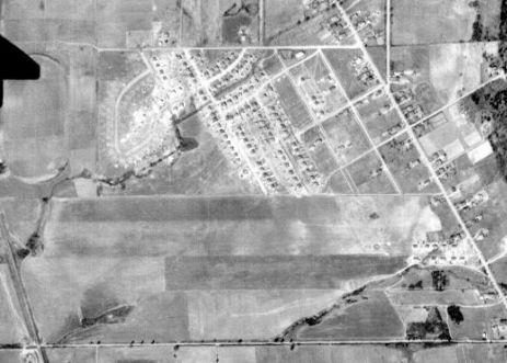
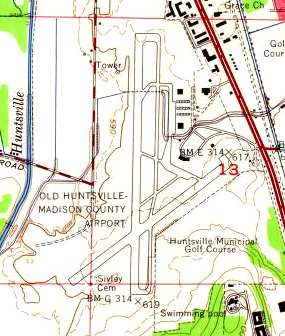
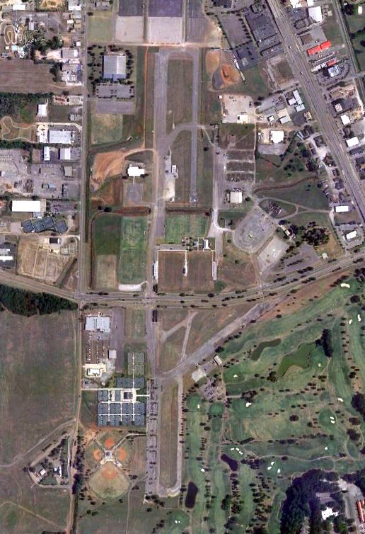
As seen in the 1998 USGS aerial photo of the site of the 2nd location of Huntsville Airport,
a baseball stadium (the Joe W. Davis Municipal Stadium) had been built over the northern end of the primary runway,
and the middle portion of the former airport has been reused as John Hunt Park.
However, substantial portions of the north/south runway & its parallel taxiway still existed, as well as a smaller length of the crosswind runway.
The primary runway had been bisected by a new road, Johnson Road SW. The former terminal building & at least one hangar also appeared to still exist.
According to Milt Aitken, “The remaining hangar at the Old Huntsville Airport, with doors wide enough to accommodate a DC-3, later became a jail annex.
In 2000 the inmates were relocated & the City Council awarded a 10-year lease to The Alabama Center of Military History to operate The Veterans Memorial Museum.
With a staff of solely volunteers, the Museum, including a replica 8th Air Force Briefing Room, became a 'Be sure to visit' tourist site.”
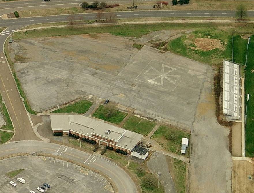
A circa 2001 aerial view looking south at the former Huntsville Airport terminal building, showing a helipad just beyond it.
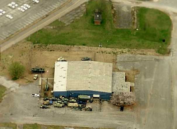
A circa 2001 aerial view looking south at a former Huntsville Airport hangar, just north of the terminal building.
Note the tank & several other armored vehicles parked around the hangar.
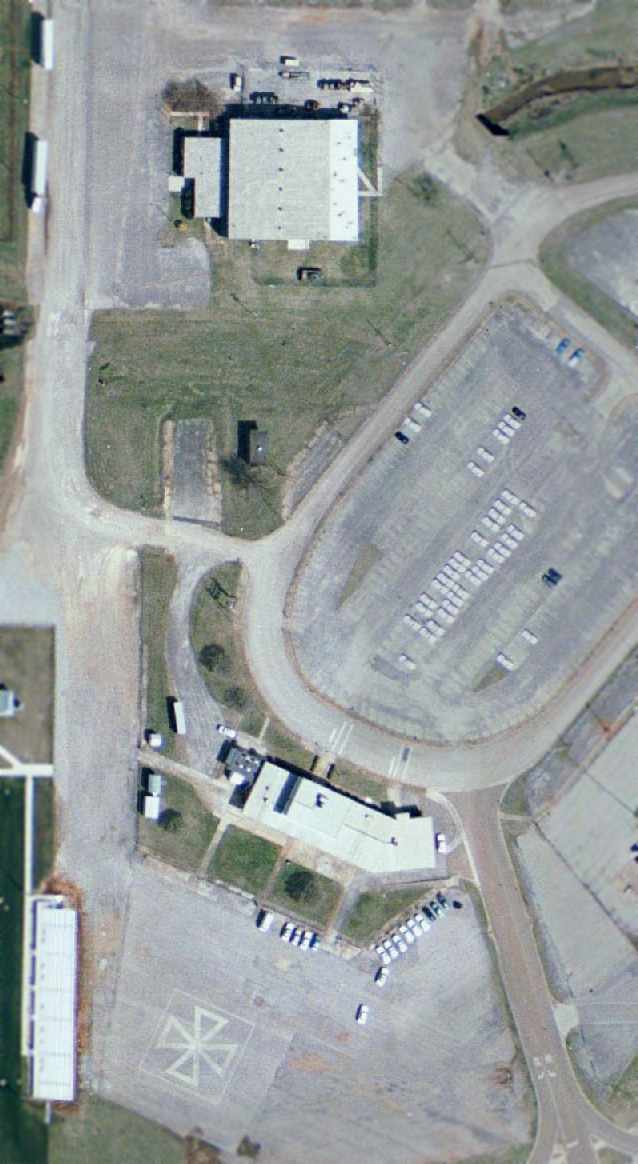
A close-up from the 2002 USGS aerial photo of the site of the 2nd location of Huntsville Airport, showing the former terminal building & hangar,
as well as a helipad marking just southwest of the terminal.
Alan Cagle reported in 2004, "The old municipal airport is now a museum & fire training site."
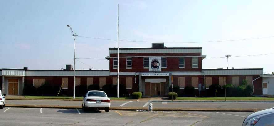
A July 2006 picture by Richard Sims of the Huntsville terminal building, with a “Huntsville Police Academy” sign.
A 2007 photo by Ron Plante looking northeast along the remains of the the former Huntsville Airport Runway 5.
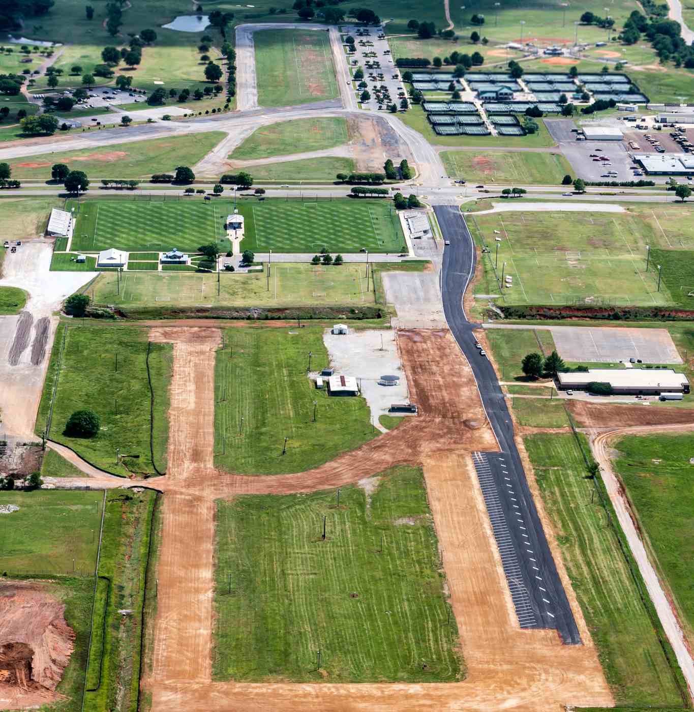
Ron Plante reported in 2007, “The site has been developed a lot in the 10 years since my last visit.
The runways are pretty much split by an east-west street named - get this - Airport Road. South of the road, the runways are barely recognizable.
In addition to the older golf course on the east side, there are now tennis courts, soccer & baseball fields, and an Army National Guard facility.
Using the 2002 aerial photo, I was able to match up the runway intersection but not much else.
The largest piece of remaining runway is north of the road, where about half of Runway 18/36 is still intact.
Southeast of this are more athletic fields, a children’s play area, fire station, fire/police training area, and a Veteran’s Memorial Museum in what used to be the jail.
A firefighter said the tower/terminal was demolished. The building foundation remains, along with tile & linoleum from the terminal floors.”
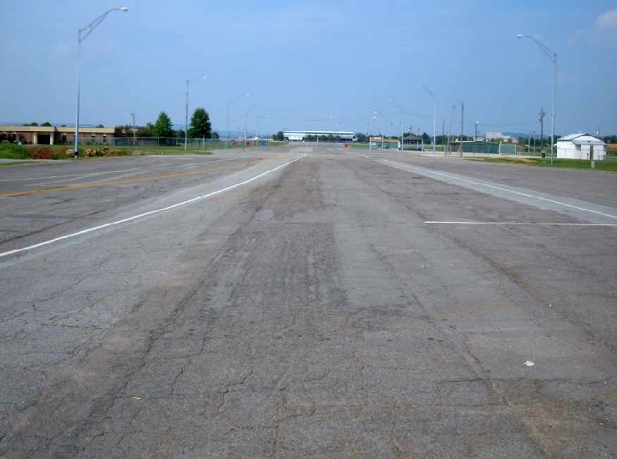
A 2007 photo by Ron Plante looking north from Airport Road along the remains of Huntsville Airport Runway 36.
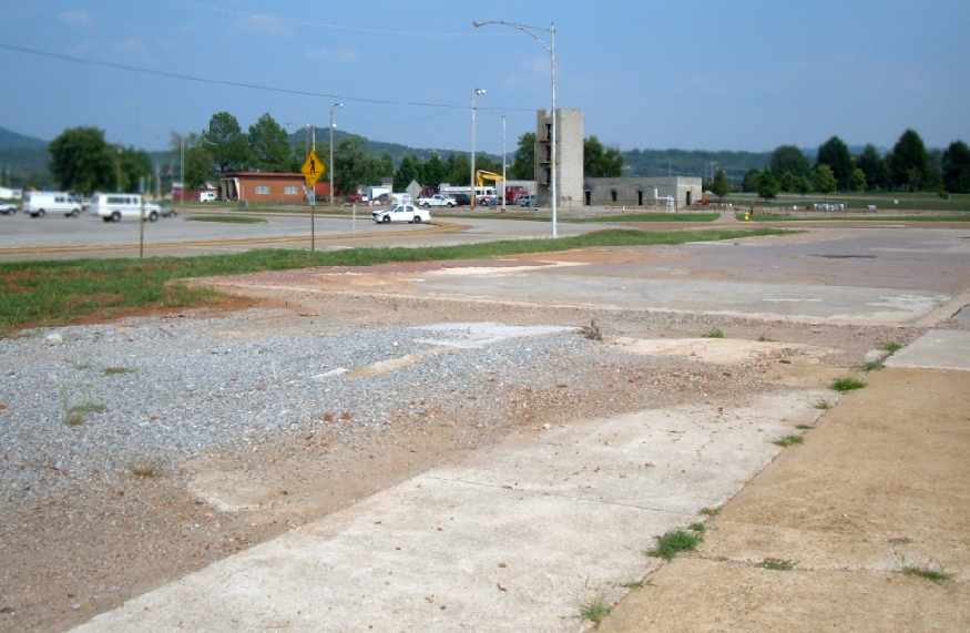
A 2007 photo by Ron Plante looking east at the site of the Huntsville Airport control tower / terminal building, with the fire training area in the background.
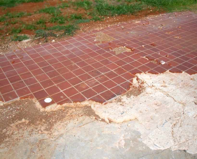
A 2007 photo by Ron Plante of the tile floor which remains at the site of the Huntsville Airport terminal building.
Richard Sims remarked on the removal of the Huntsville terminal building: “That's a shame.
This was the airport where Von Braun & all the NASA folks used during the height of the space race. That's real history.”
A 6/26/12 aerial photo (courtesy of Dallam Oliver-Lee) of the 2nd location of Huntsville Airport showed that substantial portions of the north/south runway & its parallel taxiway still existed,
as well as a smaller length of the crosswind runway.
A 5/4/16 aerial view by Marty Sellers of Sellers Photo looking south along the remains of Runway 18/36 at the 2nd location of Huntsville Airport.
Marty observed, “Park renovations are underway, and almost no taxiway or runway remains.”
According to Milt Aitken, “The [former hangar] lease was renewed & in 2025 the City began building a dedicated museum building scheduled for completion in 2026.
The hangar will be rehabilitated & remain part of the Museum. Aircraft on display include UH-1, H13, OH-58, AH-1, and RCAT.”
The site of the second Huntsville Airport is located west of the intersection of South Memorial Parkway & Airport Road SW.
____________________________________________________
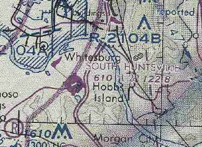
34.54, -86.61 (South of Huntsville, AL)
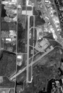
A 1970 Soil Conservation Service aerial photo of the South Huntsville Airport (courtesy of Thomas Kallsen of the University of Alabama Map Library).
South Huntsville Airport was not yet depicted on a 1958 aerial photo.
According to Kim McCutcheon, “Harold McMurran, Ruth McMurran, and Michael Leberman incorporated South Huntsville Flying Service, Inc. in Alabama on 11/5/65.”
South Huntsville Airport was not depicted on the 1966 USGS topo map.
According to Kim McCutcheon, “South Huntsville Airport began operating in May or June of 1966.
I learned to fly at South Huntsville Airport, taking my first hour of instruction there on 5/12/67.”
However, South Huntsville Airport was not yet depicted on the February 1968 Chattanooga Sectional Chart.
Kim McCutcheon recalled, “South Huntsville Airport... I worked there from September 1968 until June 1972.”
Susanna Leberman recalled, “My father was Mike Leberman one of the original founders.
I still enjoy the smell of hot tar because I can remember going with dad to tar the runway & patch here & there.
I also remember running in the tall the trails left by the planes, it was like a maze. Such fond memories.”
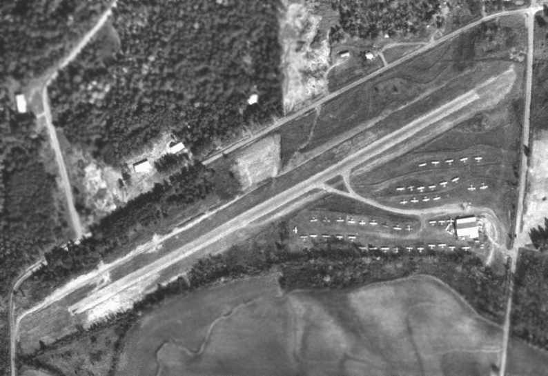
The earliest depiction which has been located of South Huntsville Airport was on a 1970 aerial photo.
It depicted South Huntsville Airport as having a single paved runway, oriented northeast/southwest,
with a taxiway leading to a single building on the southeast side of the runway.
The airport was apparently well-used,
as a total of no less than 48 light aircraft were visible parked on the southeast side of the field.
According to Alan Cagle, the reason for the creation of the South Huntsville Airport
was to provide for private pilots an airport located closer to Huntsville,
after the original Huntsville Airport was replaced by the new Huntsville International Airport in the late 1960s.

The earliest aeronautical chart depiction which has been located of South Huntsville Airport
was on the October 1970 Atlanta Sectional Chart (courtesy of Ron Plante).
It depicted South Huntsville Airport as having a single 2,200' paved northeast/southwest runway.
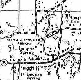
The South Huntsville Airport, as depicted on the 1975 AL Highway Department Map
(from the University of Alabama Map Library, courtesy of Chris Kennedy).
The April 1980 Atlanta Sectional Chart (courtesy of Chris Kennedy)
depicted South Huntsville as having a single 2,200' paved runway.
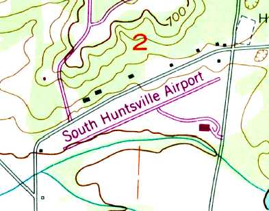
The 1982 USGS topo map depicted South Huntsville Airport as having a single northeast/southwest runway & one building on the southeast side.

At some point between 1980-85, South Huntsville Airport was evidently renamed Rio South,
as that is how it was depicted on the September 1985 Atlanta Sectional Chart (courtesy of Jonthan Westerling).
It depicted Rio South Airport as having a single 2,200' paved northeast/southwest runway.
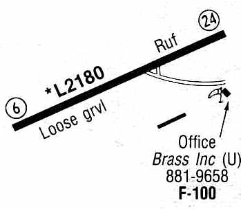
The 1986 Flight Guide (courtesy of Chris Kennedy) depicted South Huntsville Airport as having a single 2,180' loose gravel Runway 6/24.
A taxiway led to the office of Brass Inc. on the southeast corner of the field, and another long building (t-hangars?) was depicted south of the runway.
According to Kim McCutcheon, “The property upon which South Huntsville Airport was built had a 25-year lease, which expired in 1991 & was not renewed.”
According to Tony Dix, "The airport had a 20-year lease & did not renew their lease because the monthly payments were sky-high."
South Huntsville Airport evidently closed at some point between 1986-98,
as it was no longer depicted on the 1998 World Aeronautical Chart.
In a 1998 USGS aerial view looking southwest, it was not apparent if South Huntsville Airport had already been abandoned,
as the runway & buildings were still intact, but there was no sign of any usage of the field.
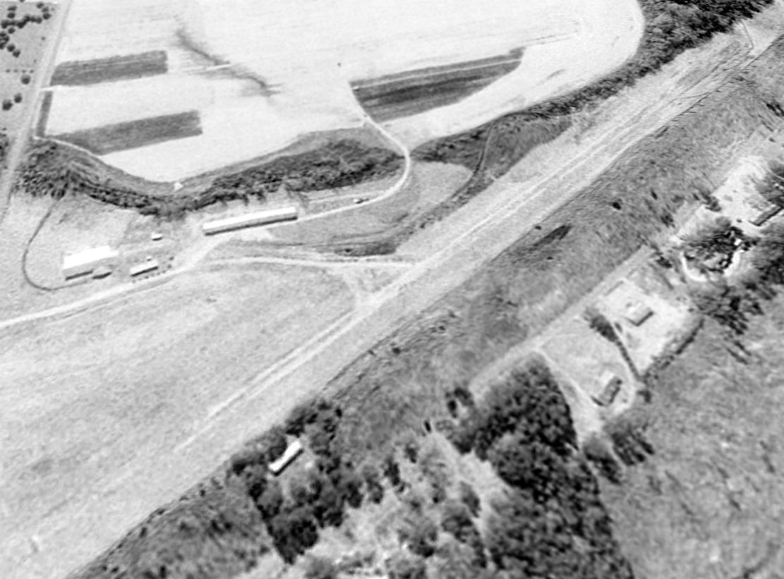
A circa 2003 aerial view looking south at the runway & hangars which remain at the site of South Huntsville Airport.
Tony Dix reported in 2005, "It is now used to store sod farm equipment."
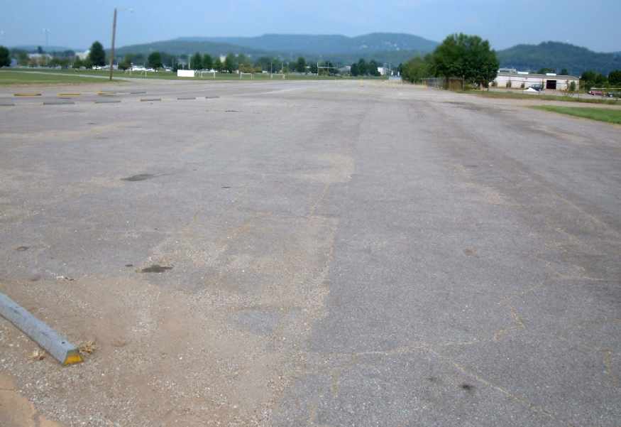
A 2015 aerial view looking southwest showed the former South Huntsville Airport to remain completely intact, though the runway pavement was deteriorated.

A 2019 photo looking west at the former South Huntsville Airport hangar, a shade hangar, and site of the runway.

A 2019 photo looking west showed the former South Huntsville Airport hangar had been removed at some point between 2019-2024.
South Huntsville Airport is located southwest of the intersection of Hough Road & Airport Road, appropriately enough.
____________________________________________________
____________________________________________________
This site covers airfields in all 50 states.