Abandoned & Little-Known Airfields:
Northwestern Alabama
© 2002, © 2024 by Paul Freeman. Revised 11/15/24.
This site covers airfields in all 50 states: Click here for the site's main menu.
____________________________________________________
Please consider a financial contribution to support the continued growth & operation of this site.
Courtland Aux AAF #1 / Danville Field / Danville Airport (revised 5/17/22) - Eutaw Municipal Airport (revised 11/15/24)
Jasper Airport / (Original) Walker County Airport (revised 1/10/21) - Red Bay Airport (revised 8/16/21)
Tri-Cities Municipal Airport (added 1/5/22) - Trinity Field / Courtland Army Auxiliary Airfield #2 (added 1/11/22)
____________________________________________________
Trinity Field / Courtland Army Auxiliary Airfield #2, Hillsboro, AL
34.638, -87.156 (West of Huntsville, AL)
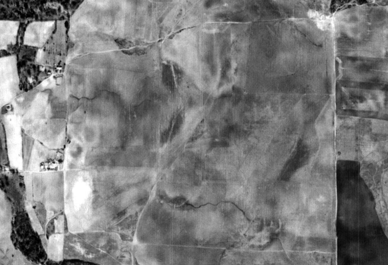
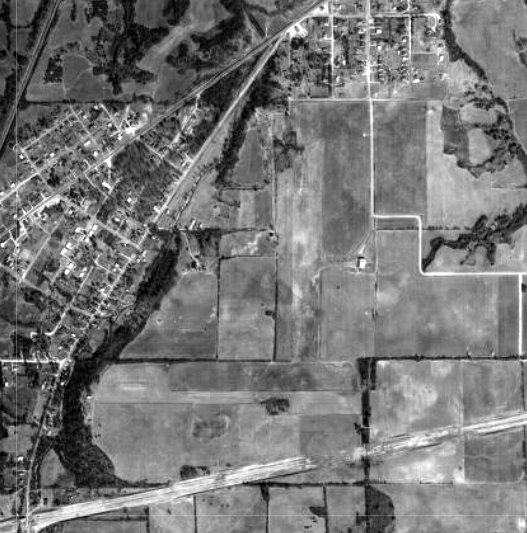
The site of Trinity Field, as depicted on a 1942 aerial photo (courtesy of Rob Grant).
Rob Grant reported, “Following the onset of World War II, the United States faced a challenging goal to train upwards of 75,000-100,000 pilots / year.
It was recognized that to achieve this goal, many new training fields would have to be constructed - hundreds across the country.
Due to the climate allowing year-round flight instruction, as well as the low airways congestion,
North Alabama was considered to be a good location for one of the new Army Air Force training fields.
Following a review by a site selection board, Courtland was chosen to receive this facility.
It was considered the best overall site of 3 evaluated within the North Alabama region.
Selection took place & the land acquired in April 1942.
Construction was rapid given the emergency wartime conditions & within 3 months the post was to be in full operation.”
Five auxiliary airfields were established to support Courtland's training activities, including Trinity Auxiliary Field (Auxiliary #2).
A 1942 aerial view of the eventual site of Trinity Field (courtesy of Rob Grant) depicted a square empty field, with no sign of aviation use.
Trinity Field was evidently established at some point between 1942-44.
The earliest depiction which has been located of Trinity Field was on the March 1944 Chattanooga Sectional Chart (courtesy of Rob Grant).
The last aeronautical chart depiction which has been located of Trinity Field was on the April 1945 Chattanooga Sectional Chart (courtesy of Rob Grant).
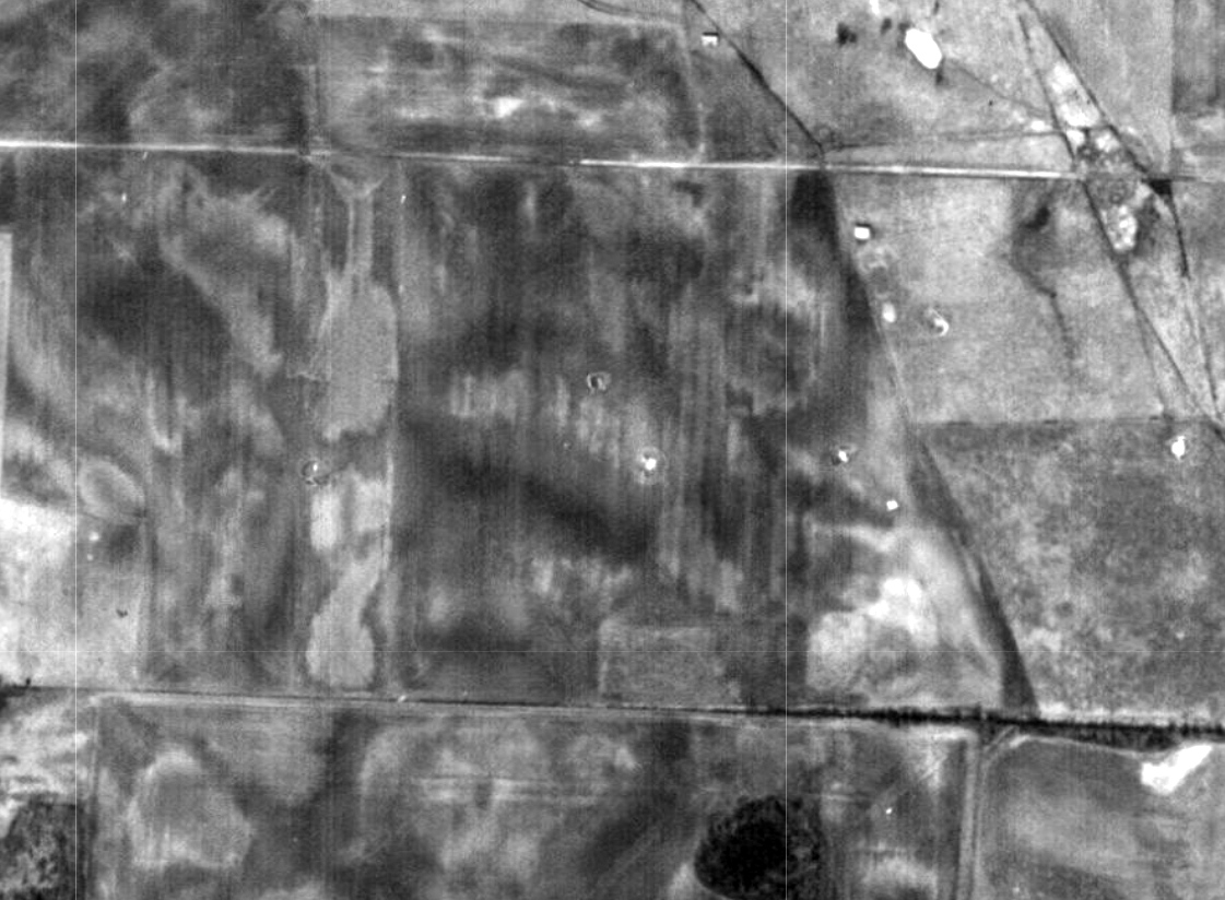
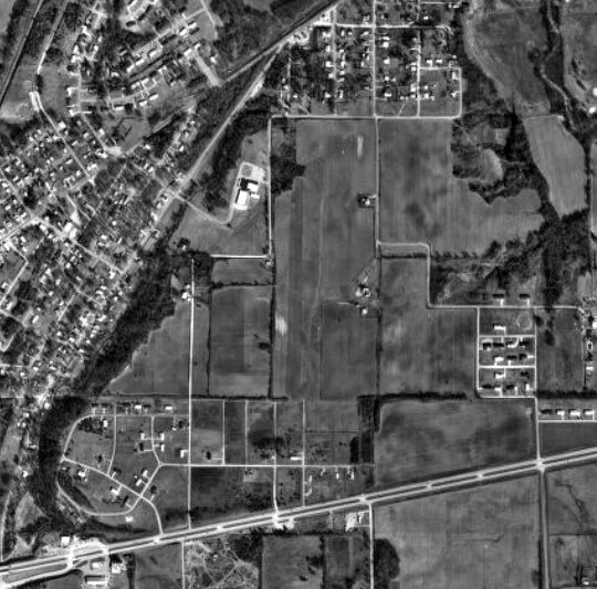
A 1963 aerial view of the site of Trinity Field (courtesy of Rob Grant) depicted a square empty field, with no sign of aviation use.
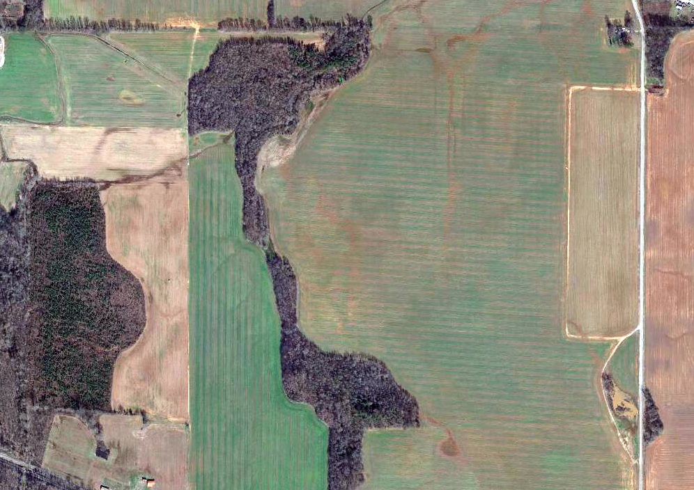
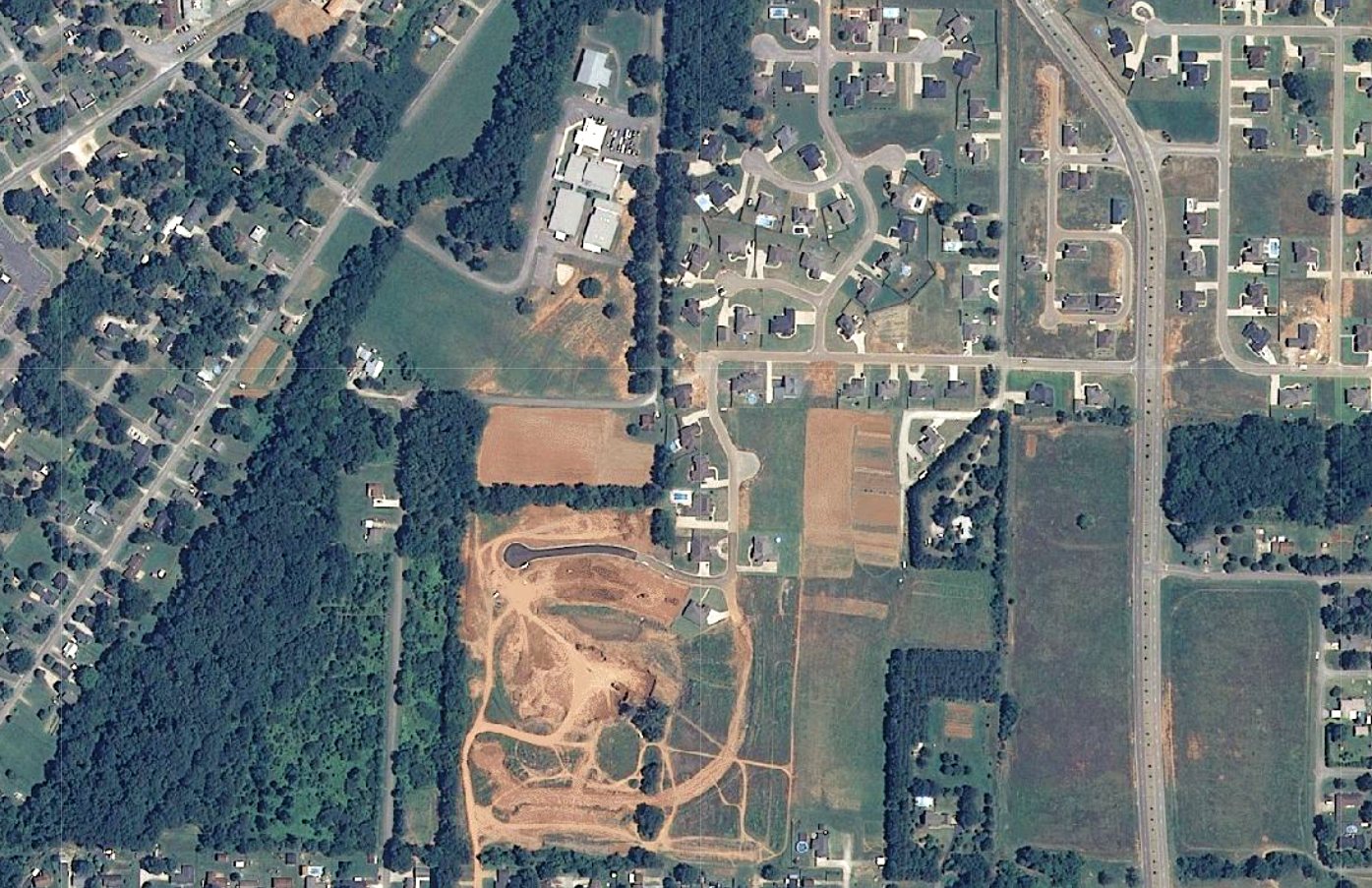
A 2020 aerial view showed no trace of Trinity Field.
Thanks to Rob Grant for pointing out this airport.
____________________________________________________
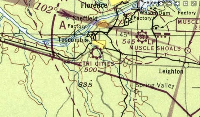
Tri-Cities Municipal Airport, Tuscumbia, AL
34.717, -87.708 (West of Huntsville, AL)
Tri-Cities Municipal Airport, as depicted on the April 1947 Chattanooga Sectional Chart (courtesy of Rob Grant).
The earliest depiction which has been located of Tri-Cities Municipal Airport was on the April 1947 Chattanooga Sectional Chart (courtesy of Rob Grant).
Rob Grant reported, “It appears that like so many small general aviation fields that were built shortly after WW2,
one of Tri-Cities Municipal Airport's main purposes was pilot training.
Tri-Cities Airport's Neill Flying Service, Inc offered primary & flight instructor training.
It was formed on 10/1/45 by S. E., Eithylle, M. W., and Betty Neill.”
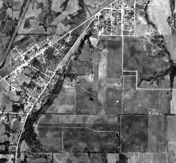
The earliest photo which has been located of Tri-Cities Municipal Airport was a 1949 aerial view (courtesy of Rob Grant).
It depicted Tri-Cities Airport as having 2 perpendicular grass runways, with a small building on the northeast side.
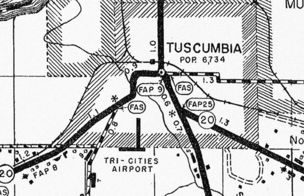
A 1949 highway map (courtesy of Rob Grant) depicted Tri-Cities Airport as having 2 perpendicular runways.
The January 1950 Sectional Chart's Aerodrome table described Tri-Cities Airport as a commercial field having 2 turf runways, with the longest being 2,600'.
Tri-Cities Airport's Neill Flying Service, Inc was dissolved on 1/30/52.
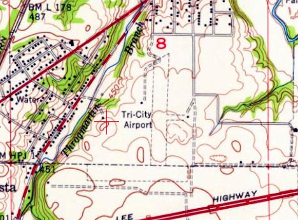
The earliest topo map depiction which has been located of Tri-Cities Airport was on the 1952 USGS topo map (courtesy of Rob Grant).
It depicted Tri-Cities Airport as having 2 perpendicular unpaved runways, with a small building on the northeast side.
A 1958 aerial view (courtesy of Rob Grant) depicted Tri-Cities Airport as remaining intact, but there did not appear to be any aircraft on the field.

The August 1960 Sectional Chart's Aerodrome table described Tri-Cities Airport as having irregular attendance, with fuel & repairs available.
The last aeronautical chart depiction which has been located of Tri-Cities Municipal Airport was on the August 1968 Chattanooga Sectional Chart (courtesy of Rob Grant).
A 1970 aerial view (courtesy of Rob Grant) depicted Tri-Cities Airport as having lost its east/west runway, but the north/south runway appeared to remain in use.
A 1981 aerial photo (courtesy of Rob Grant) appeared to show a single light plane on Tri-Cities Airport.
A 1999 aerial photo (courtesy of Rob Grant) no longer showed any planes on Tri-Cities Airport.
By the time of a 2006 aerial photo, the Tri-Cities Airport property had been bisected by Veterans Boulevard, and no remains of the airport remained.
A 2009 aerial photo showed no recognizable remains of Tri-Cities Airport.
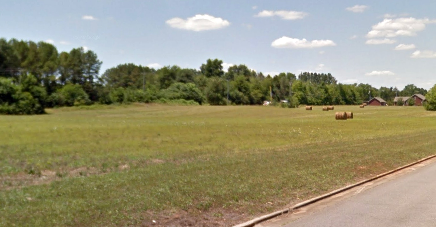
A circa 2021 photo looking northwest at the site of Tri-Cities Airport.
Thanks to Rob Grant for pointing out this airport.
____________________________________________________
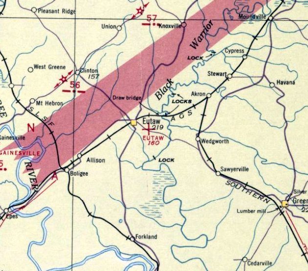
Eutaw Municipal Airport, Eutaw, AL
32.82, -87.865 (Southwest of Birmingham, AL)
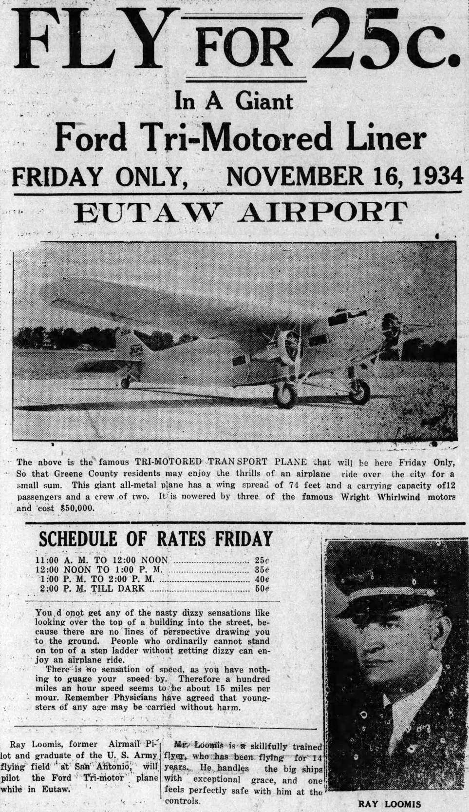
An 11/16/34 advertisement for For Tri-Motor rides which were conducted at Eutaw Airport (courtesy of Lee Corbin).
The date of establishment of this early airport has not been determined.
The earliest reference which has been located to Eutaw Airport was an 11/16/34 advertisement for For Tri-Motor rides at the airport (courtesy of Lee Corbin).
However, Eutaw Airport was not yet depicted on the September 1936 Birmingham Sectional Chart.
The earliest depiction which has been located of Eutaw Municipal Airport was on the March 1937 Birmingham Sectional Chart.
It depicted Eutaw as an auxiliary airfield.
According to its FAA Airport/Facility Directory data, Eutaw Municipal Airport was activated in April 1940, even though its chart depictions show it predated that.
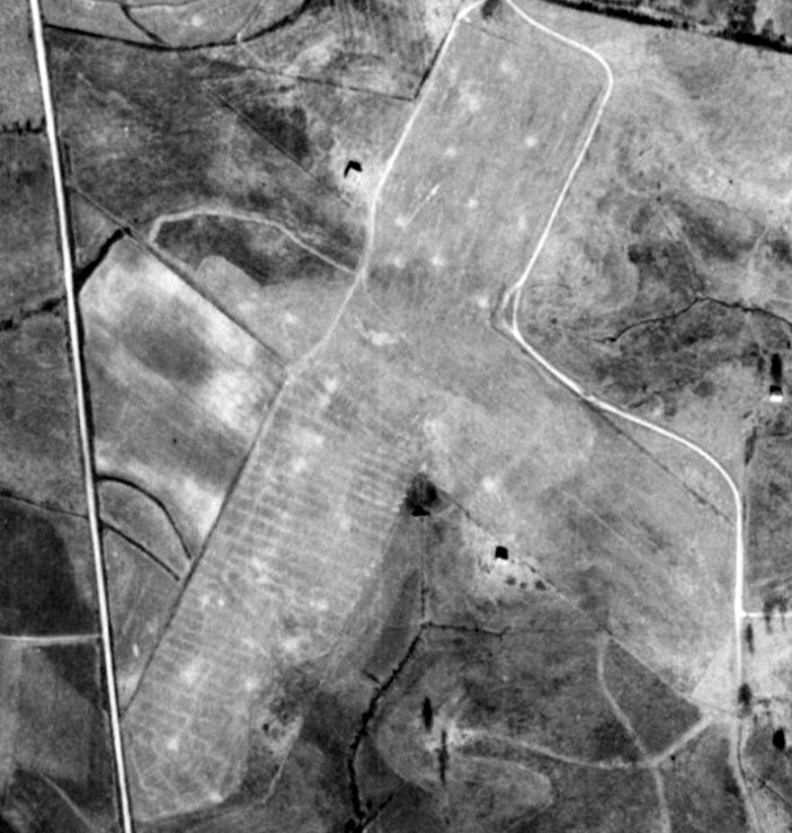
The earliest photo which has been located of Eutaw Municipal Airport was a 1942 aerial view (courtesy of Rob Grant).
It depicted Eutaw as having 2 unpaved runways, in an X-shape,
with a few small buildings, and 1 plane to the south of the runway intersection.
A 1955 aerial view depicted Eutaw Municipal Airport as having 2 unpaved runways, in an X-shape.
According to a 9/14/61 Centreville Press article (courtesy of Lee Corbin),
the “new Eutaw Airport has a paved runway 3,000'; north-northwest/south-southeast, it is located partly on the old site.”

A 2/12/74 USGS aerial photo depicted Eutaw Municipal Airport's new paved northwest/southeast runway.
A paved ramp & 1 T-hangar sat to the east, but no aircraft were seen on the field.
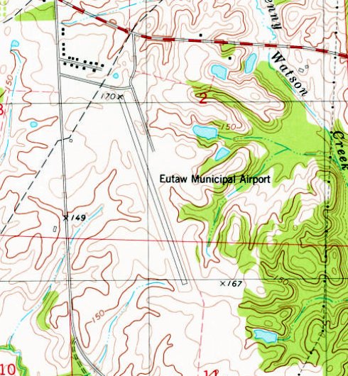
The 1980 USGS topo map depicted Eutaw Municipal Airport as having a paved northwest/southeast runway.
No buildings or other improvements were depicted.
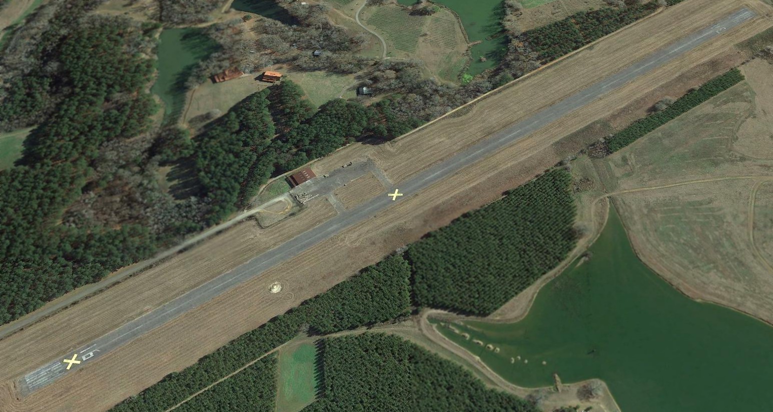
A 1992 USGS aerial view looking southeast depicted Eutaw Municipal Airport as having a paved Runway 16/34, with a paved ramp, hangar, and 1 light single-engine plane on the east side.
A 2016 aerial view still depicted Eutaw Municipal Airport's runway as being painted with active markings,
but there were no aircraft visible on the field.
Eutaw Municipal Airport was evidently closed (for reasons unknown) at some point between 2016-2017,
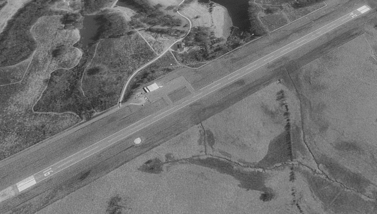
as a 2017 aerial view looking southeast showed its runway marked with 3 yellow closed-runway “X” symbols.
The airport otherwise remained intact.
As of 2019, the FAA Airport/Facility Directory described Eutaw Municipal Airport as “Closed indefinitely”.
It was said to have a 3,600' asphalt Runway 16/34, “in poor condition, severe cracking with vegetation”.
The owner & manager was listed as the Town of Eutaw.
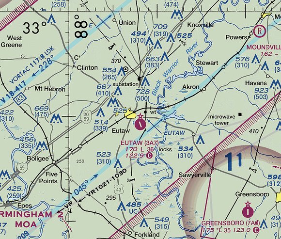
Eutaw Municipal Airport continued to be depicted on the 2019 sectional chart as an active airfield, with no indication of closure,
which is a safety hazzard given that it had been closed for at least 2 years by that point.

A December 2023 photo looking southeast at the northwest end of Eutaw Municipal Airport Runway 16.
Thanks to Lee Corbin for pointing out this airport.
____________________________________________________
34.455, -88.155 (Northwest of Birmingham, AL)
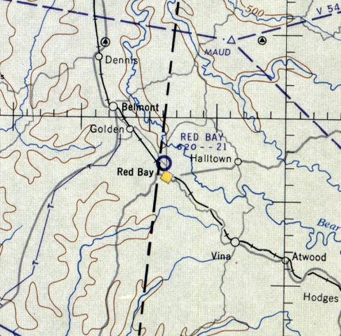
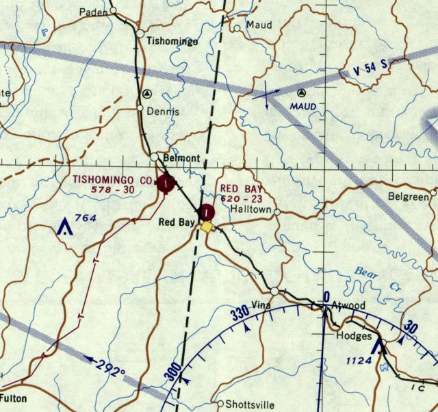
Red Bay Airport, as depicted on the February 1960 Chattanooga Sectional Chart.
Photo of the airport while in use has not been located.
The Red Bay Airport was evidently constructed at some point between 1955-69,
as it was not yet depicted on the 1951 USGS topo map
nor on the February 1955 Chattanooga Sectional Chart.
The earliest depiction which has been located of Red Bay Airport was on the February 1960 Chattanooga Sectional Chart.
It depicted Red Bay Airport as having a 2,100' unpaved runway.
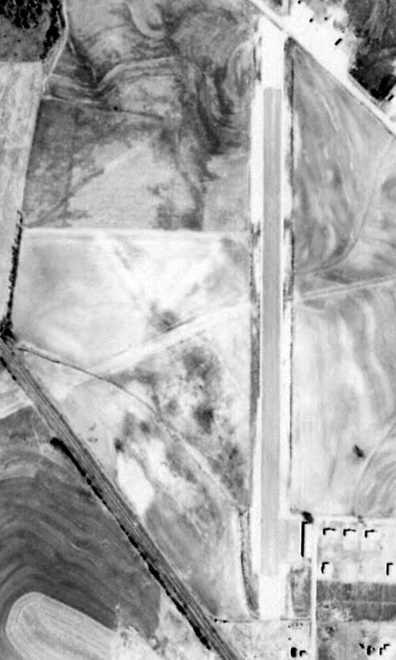
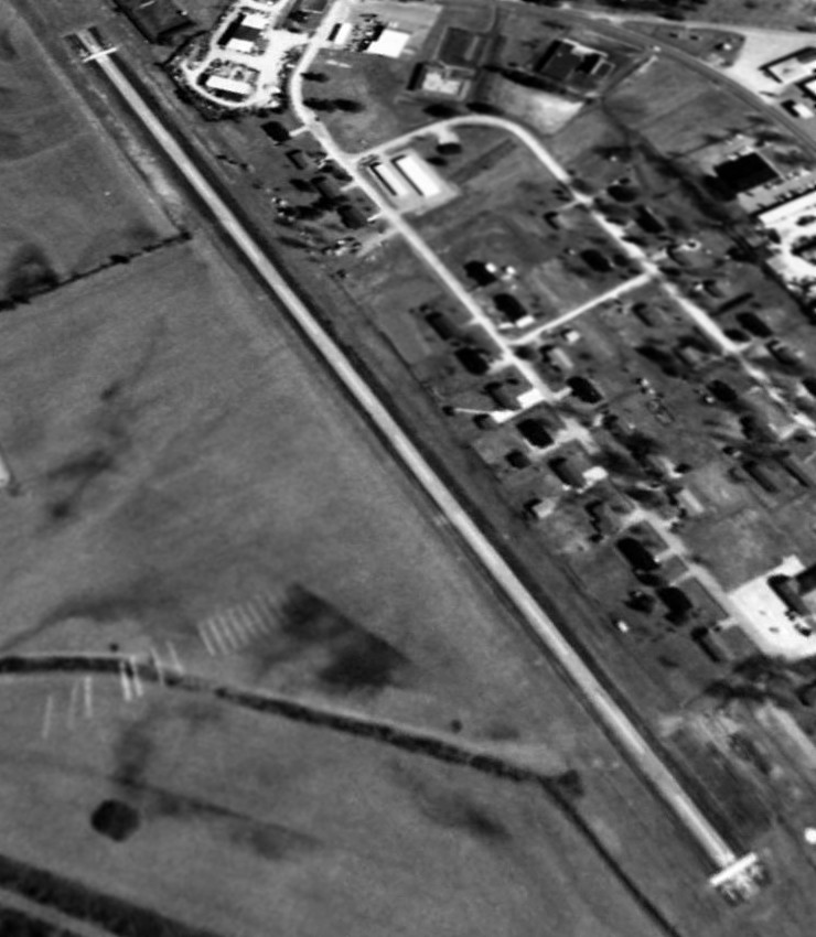
The earliest photo which has been located of Red Bay Airport was a 1963 aerial view (courtesy of Rob Grant).
It depicted Red Bay as having a paved north/south runway, with a small paved ramp & building at the southeast corner.
The last aeronautical chart depiction which has been located of Red Bay Airport was on the February 1968 Chattanooga Sectional Chart.
Red Bay had evidently gained a paved runway at some point between 1960-68, as it was depicted as having a 2,300' paved north/south runway.
The 1969 USGS topo map depicted Red Bay Airport as a single paved north/south runway, labeled simply as “Landing Strip”,
with a few small buildings on the northeast & southeast sides.
A 4/4/90 USGS aerial view depicted Red Bay as having a paved north/south runway.
A 3/2/96 USGS aerial view looking northeast depicted Red Bay as having a paved Runway 16/34.
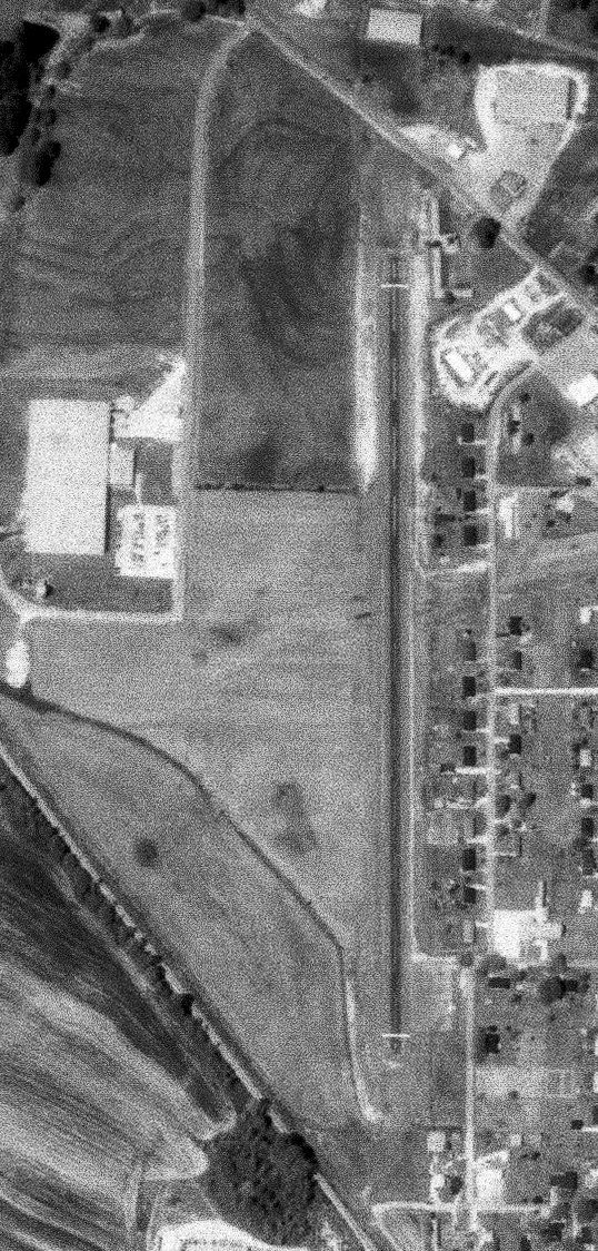
Red Bay Airport was evidently closed at some point between 1996-2004, with the property reused by Tiffin Motorhomes.
A 2004 aerial photo showed that the Red Bay Airport runway was reused to park motorhomes, with 2 buildings built over the southern portion of the runway.
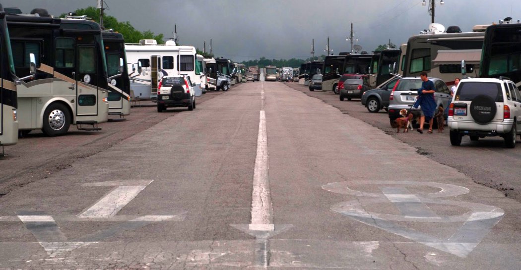
A 2010 photo looking south showing the runway markings which remain on the former Red Bay Airport Runway 18, reused to park motorhomes.
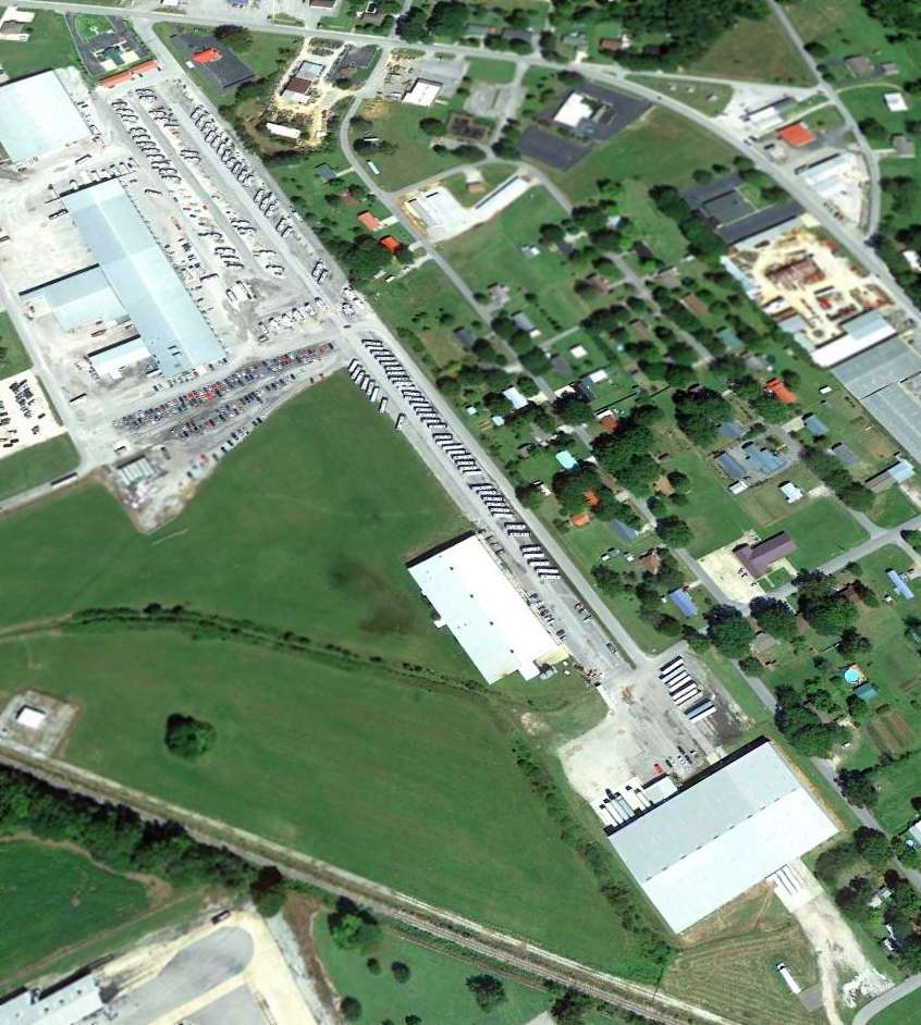
A 9/18/12 aerial view looking northeast shows the former Red Bay Airport runway, reused to park motorhomes.
The former Red Bay Airport runway is now marked as 7th Street Northwest on street maps.
Thanks to Eric Hinz for pointing out this airport.
____________________________________________________
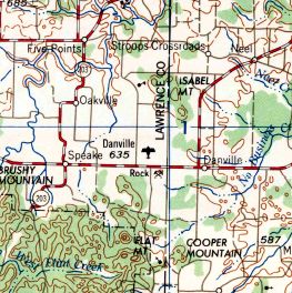
34.424, -87.119 (West of Huntsville, AL)
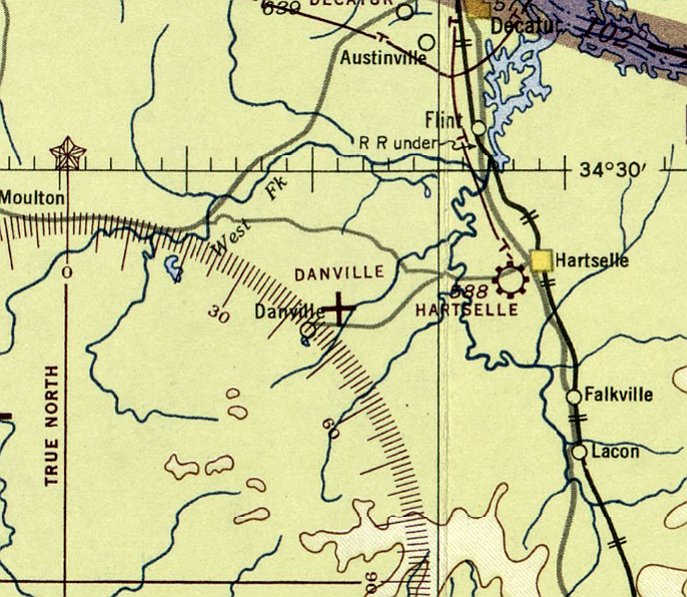
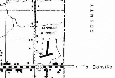
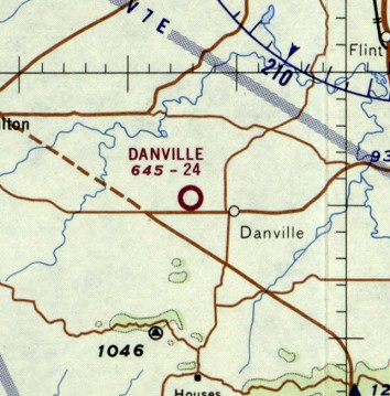
Danville Airport, as depicted on the March 1944 Chattanooga Sectional Chart.
Danville Airport was not yet depicted on a 12/19/41 aerial photo (courtesy of Dallam Oliver-Lee)
or the August 1942 Chattanooga Sectional Chart.
Danville Airport / Courtland AAF Auxiliary #1 was evidently constructed during WW2
as one of at least 4 satellite airfields which supported operations at Courtland AAF.
The earliest depiction which has been located of Danville Airport was on the March 1944 Chattanooga Sectional Chart,
which depicted Danville Airport as an auxiliary airfield.
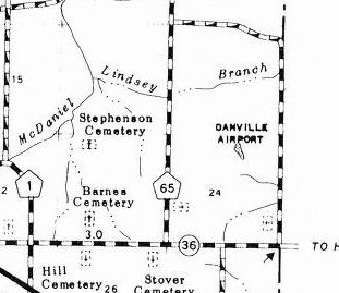
The 1949 AL DOT map (courtesy of Dallam Oliver-Lee) depicted Danville Airport as having 2 runways.
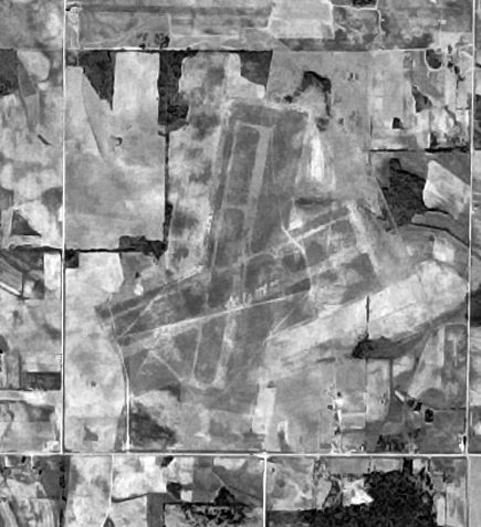
The earliest photo which has been located of Danville Field was a 10/12/53 aerial view (courtesy of Dallam Oliver-Lee).
It depicted Danville as having 2 unpaved runways, each with a parallel taxiway.
Danville Airport, as depicted on the 1958 USGS topo map (courtesy of Dallam Oliver-Lee).
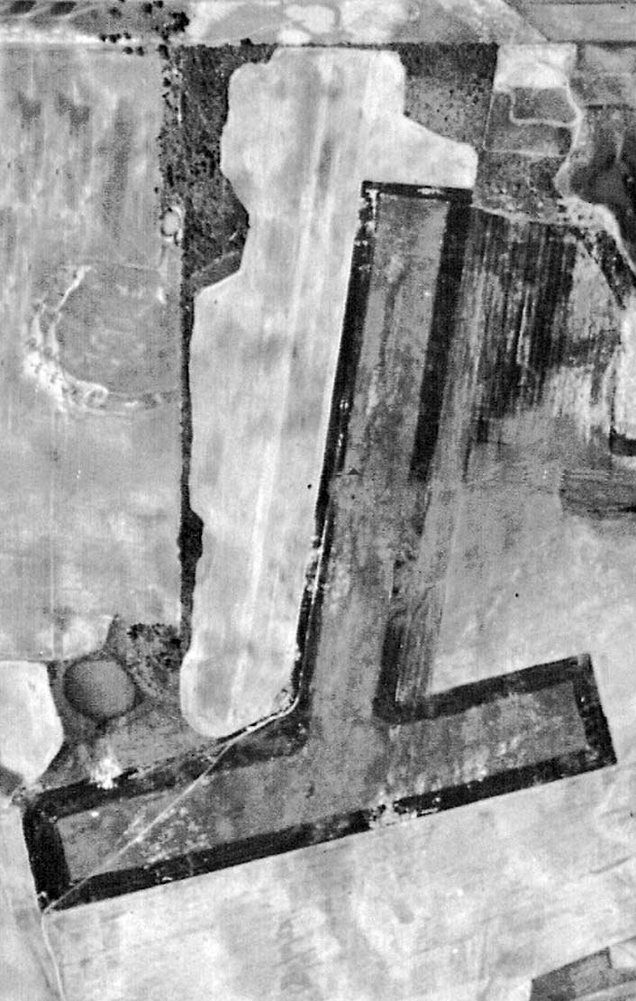
A 1958 aerial view (courtesy of Rob Grant) depicted Danville Field as having changed somewhat since the 1953 aerial photo,
with the north/south runway no longer extending south of the crosswind runway.
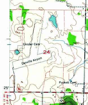
The 1960 USGS topo map (courtesy of Dallam Oliver-Lee) depicted Danville Airport as having 2 unpaved runways.
The February 1960 Chattanooga Sectional Chart depicted Danville Airport as having a 2,600' unpaved runway.
The last aeronautical chart depiction which has been located of Danville Airport was on the February 1968 Chattanooga Sectional Chart.
It depicted Danville as having a 2,400' unpaved runway.
The last depiction which has been located of Danville Airport was on the 1986 AL DOT map (courtesy of Dallam Oliver-Lee).
Danville Airport was evidently closed (for reasons unknown) at some point between 1986-89,
as it was no longer depicted on the 1989 USGS topo map (courtesy of Dallam Oliver-Lee).
As seen in a 12/12/12 aerial view (courtesy of Dallam Oliver-Lee), not a trace of Danville Airport remains at the site.
____________________________________________________
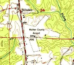
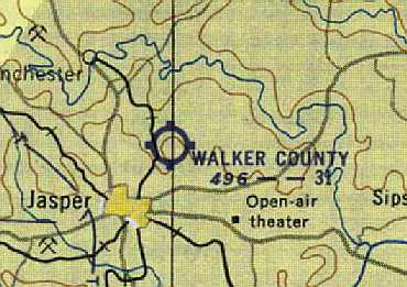
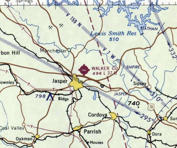
Jasper Airport / (Original) Walker County Airport (1A8), Jasper, AL
33.865, -87.264 (Northwest of Birmingham, AL)
A 1937 photo of the Jasper Airport hangar under construction (courtesy of Rob Grant).
This general aviation airport on the northeast side of Jasper was evidently established at some point in 1937,
as it was not yet depicted on the 1937 AL DOT map (courtesy of Dallam Oliver-Lee) or on the March 1937 Birmingham Sectional Chart.
The earliest depiction which has been located of Jasper Airport was a 1937 photo (courtesy of Rob Grant) showing its hangar under construction.
The earliest aeronautical chart depiction which has been located of Jasper Airport was on the October 1937 Birmingham Sectional Chart.
It depicted Jasper as a commercial/municipal airport.
The earliest photo which has been located of the Jasper Airport
was a 1/31/43 aerial view looking north from the 1945 AAF Airfield Directory (courtesy of Scott Murdock).
It depicted Jasper Airport as having 2 sod runways.
The field was evidently renamed “Walker County” Airport at some point between 1941-44,
as that is how it was listed in the March 1944 US Army/Navy Directory of Airfields (courtesy of Ken Mercer).
It described Walker County Airport as having a 3,100' runway.
The 1945 AAF Airfield Directory (courtesy of Scott Murdock) described Walker County Airport
as a 178 acre rectangular property having 2 sod runways, measuring 3,100' WNW/ESE & 2,100' northeast/southwest.
The field was said to have a single 76' x 62' wood, steel, and stone hangar.
Walker County Airport was described as being owned & operated by Walker County.
A 2/2/46 USGS aerial photo (courtesy of Dallam Oliver-Lee)
depicted Jasper as having 2 unpaved runways, with some small buildings on the south side.
The 1949 USGS topo map 1949 (courtesy of the University of Alabama Map Library) depicted Walker County Airport as having 3 unpaved runways.
Walker County Airport, as depicted on the August 1954 Birmingham USAF Sectional Chart (courtesy of Chris Kennedy).
A 1955 Soil Conservation Service Photo (courtesy of Thomas Kallsen of the University of Alabama Map Library) depicted the Walker County Airport as having 3 unpaved runways,
with several buildings or hangars just south of the runway intersection.
The 1962 AOPA Airport Directory described Walker County Airport as having a 3,700' black top Runway 10/28, a 2,750' sod Runway 4/22, and a 2,850' sod Runway 15/33.
The operator was listed as Jasper Flying Service.
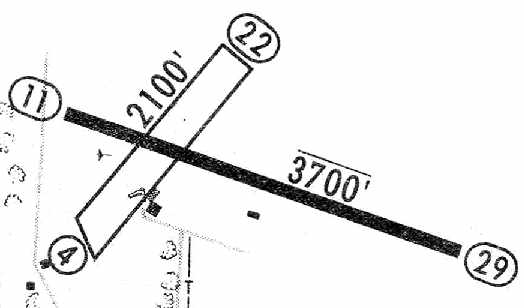
The 1965 Jeppesen Airway Manual (courtesy of Chris Kennedy) depicted the Walker County Airport as having a 3,700' paved Runway 11/29
and a 2,100 sod Runway 4/22, with 2 small buildings on the south side of the field.
The manager was listed as Ellis Haynes.
The last aeronautical chart depiction which has been located of Walker County Airport was on the October 1968 Birmingham Sectional Chart.
It depicted Walker County Airport as having a single 3,700' paved northwest/southeast runway.
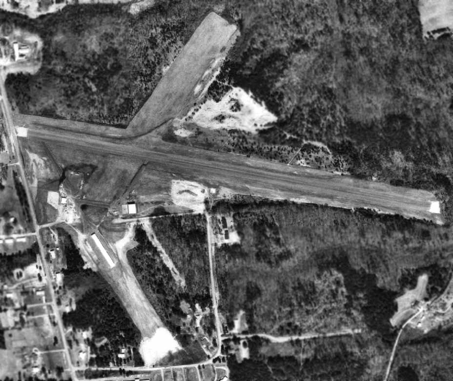
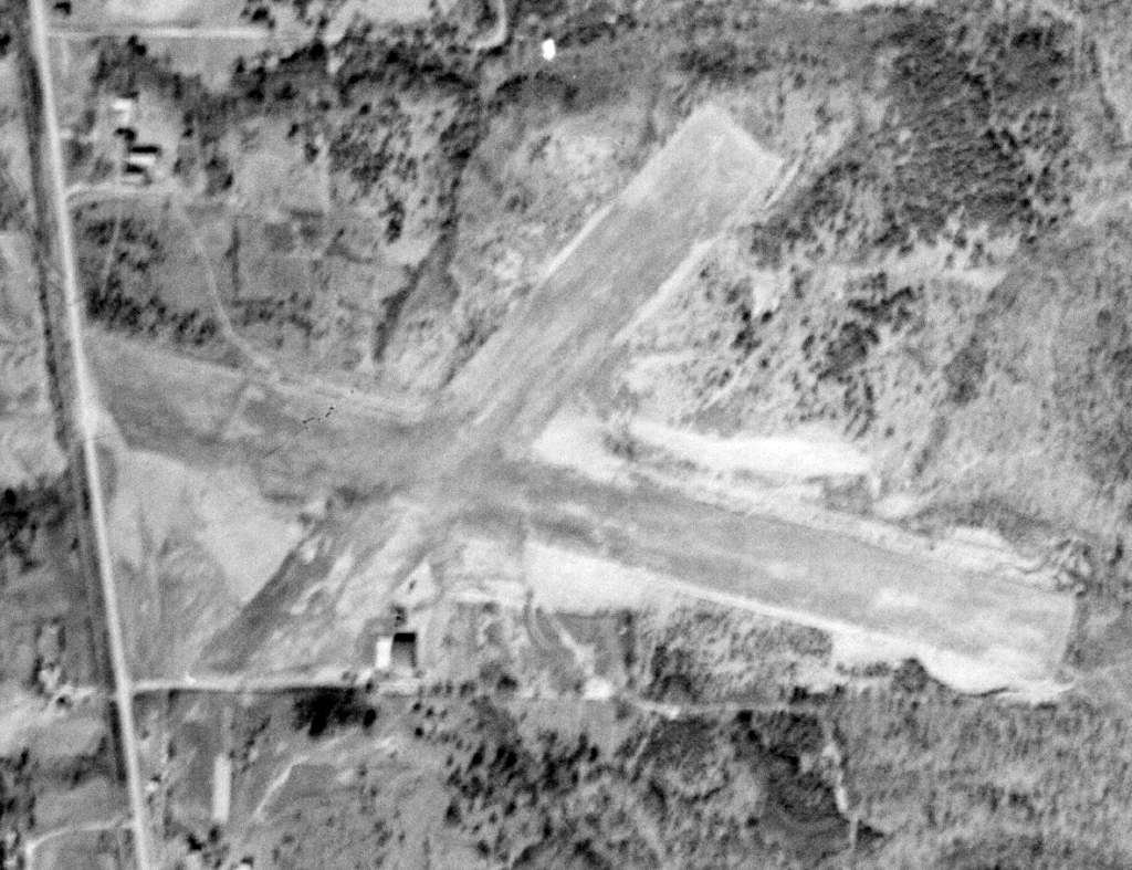
A 1972 Soil Conservation Service aerial view of Walker County Airport (courtesy of Thomas Kallsen of the University of Alabama Map Library).
By the time of this photo, the main (east/west) runway had apparently been paved.
A cleared area was still present for the grass northeast/southwest runway, but the northwest/southeast runway had been closed,
with a row of T-hangars & an aircraft parking area along its middle area.
A total of at least 10 aircraft were visible parked outside.
John Dendy recalled, “Jasper Airport... I flew out of there in the early 1970s.
The main runway had been paved. But if there was a sod runway, the FBO never said anything about it.
The main runway was all there was – not even a taxiway.
The northwest end, near the buildings, was flat for about 100 yards, but then the runway was downhill the rest of the way.
The southeast end was about 50 feet lower than the northwest end; it looked as if you were flying into a forest.
Regardless of wind, takeoffs were downhill, landings were uphill. You never wanted to take off with much tailwind – or land either. Fun.”
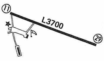
By the time of the 1980 Flight Guide (courtesy of Chris Kennedy),
the 3,700' paved Runway 11/29 was apparently the sole runway - apparently the other two sod runways had been abandoned.
Taxiways were depicted as leading to a ramp on the southwest side of the field, with two buildings.
The 1982 AOPA Airport Directory (courtesy of Ed Drury) described the Walker County Airport as having a single 3,700' asphalt Runway 11/29.
The operator was listed as Jasper Aviation.
Walker County Airport was evidently closed at some point between 1982-84,
as it was labeled "Landing Strip (Abandoned)" on the 1984 USGS topo map (courtesy of Dallam Oliver-Lee).
It had been replaced by a newly constructed Walker County Airport, 4 miles northwest.
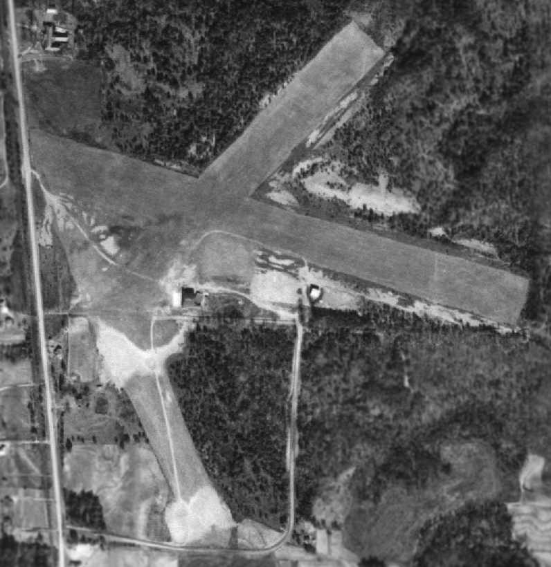
A 1999 USGS aerial photo showed the majority of Walker County Airport appeared to remain intact,
including the full length of the paved runway, and all of the hangars & other airfield buildings.
A building had been built across the western end of the main runway, though.
The original Walker County Airport was still depicted as an abandoned airfield on 2002 aeronautical charts.
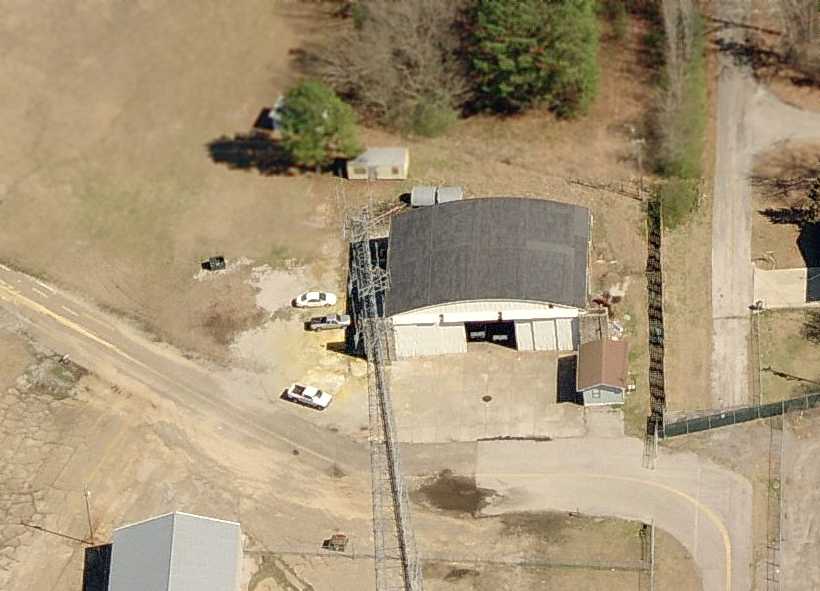
A circa 2003 aerial view looking east at a former hangar,
with a radio tower in the foreground which was built over the center of the former ramp.
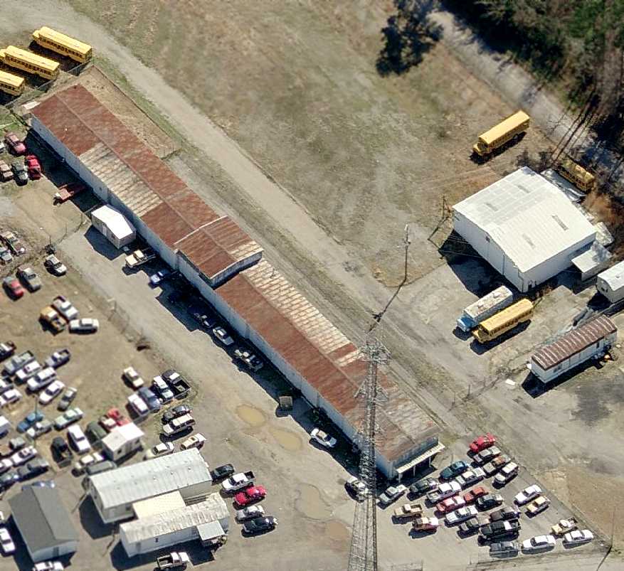
A circa 2003 aerial view looking south at the row of former T-hangars & another smaller hangar on the south side of the former airport.
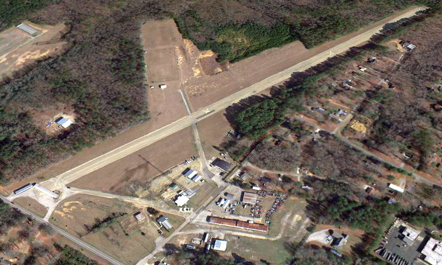
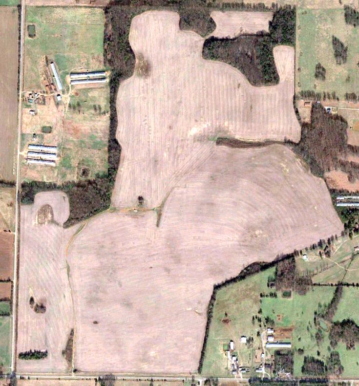
A 12/12/12 aerial view looking northeast (courtesy of Dallam Oliver-Lee) showed Jasper Airport to remain mostly intact.
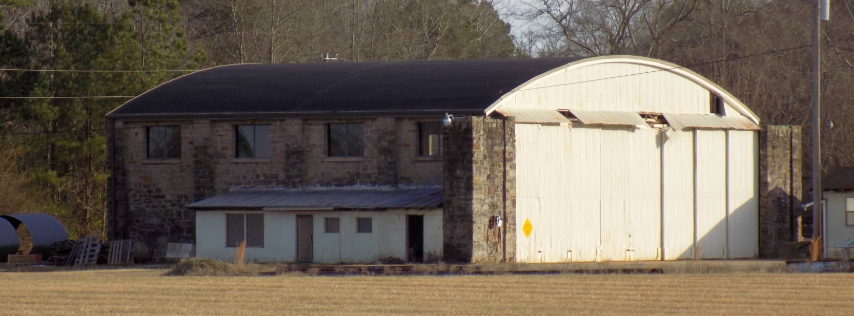
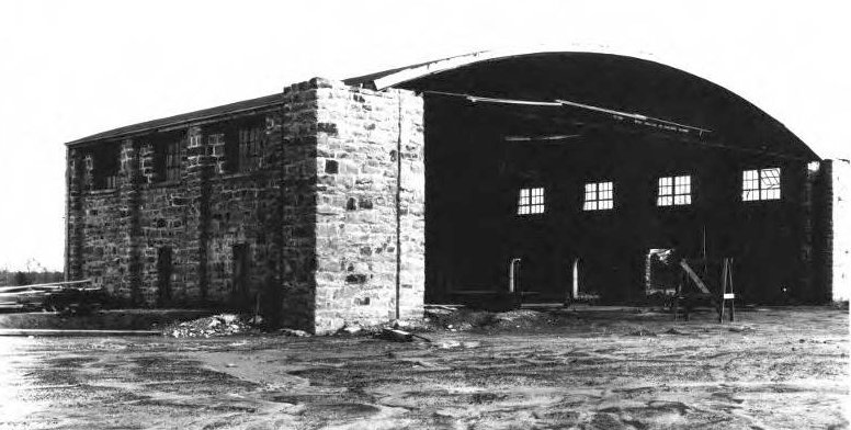
A 1/6/21 photo by Peter Huffman of the 1937 stone-walled hangar at Jasper Airport.
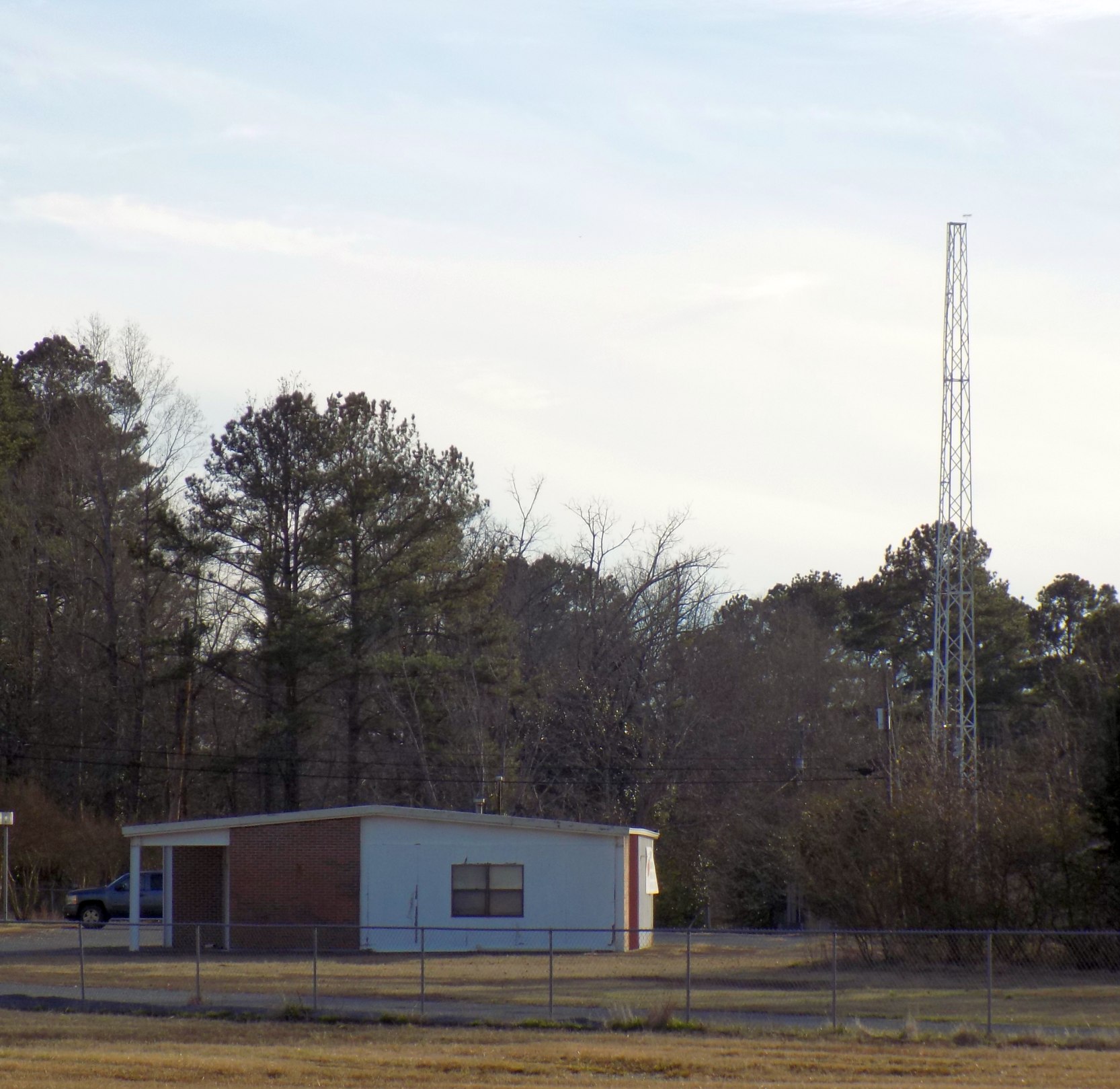
A 1/6/21 photo by Peter Huffman of a former airport office building at Jasper Airport.
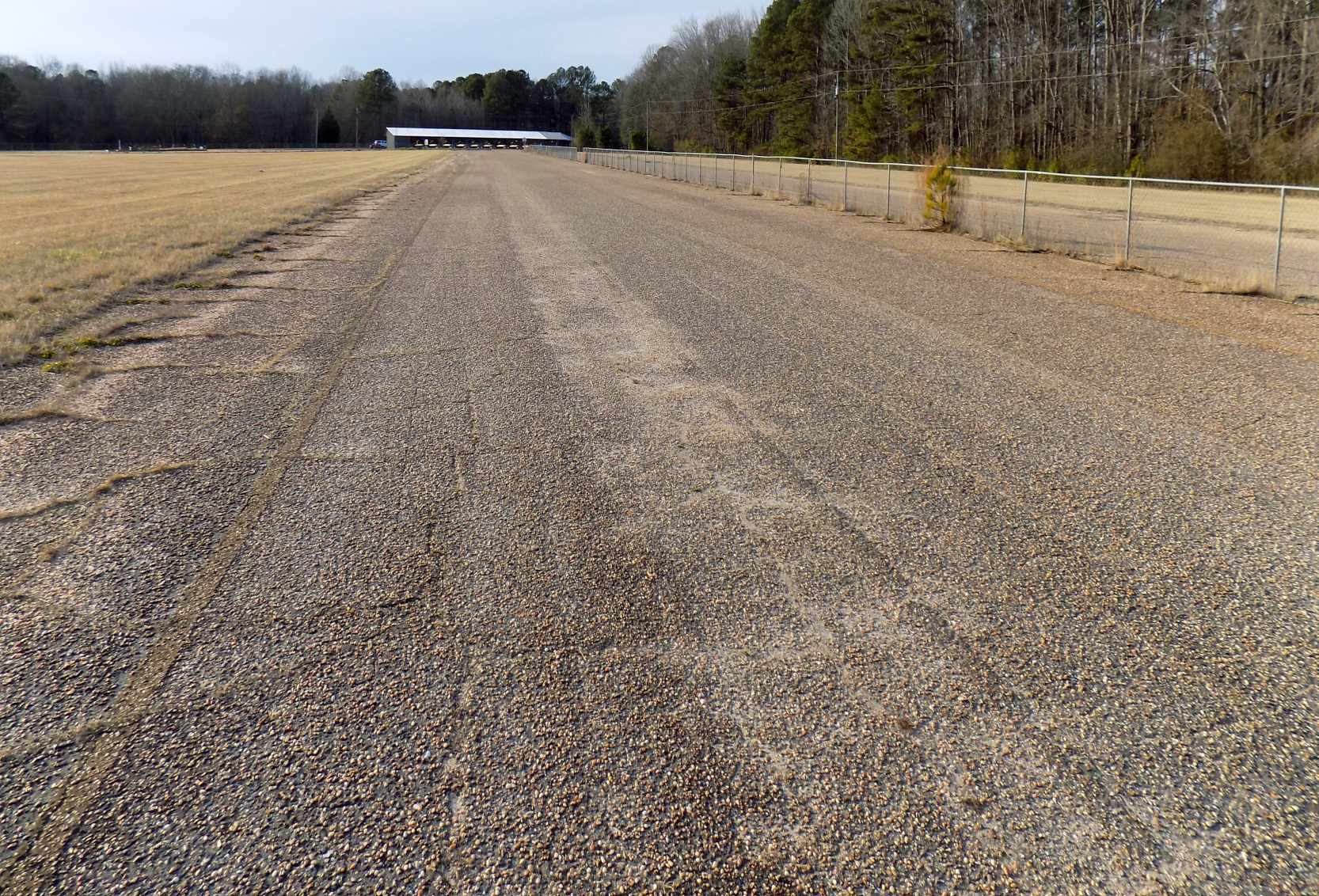
A 1/6/21 photo by Peter Huffman looking along the former Jasper Airport Runway 11.
Peter reported, “The old paved runway is still intact & in decent shape. The structure on the end of Runway 11 is a farmers' market.
A high school football field has been built over half of the old sod runway.”
Jasper Airport is located east of the intersection of Bevill Field Road & Airport Road.
____________________________________________________
____________________________________________________
This site covers airfields in all 50 states.