Abandoned & Little-Known Airfields:
Northeastern Arizona
© 2002, © 2023 by Paul Freeman. Revised 11/10/23.
____________________________________________________
Please consider a financial contribution to support the continued growth & operation of this site.
Snowflake Municipal Airport (revised 11/10/23) - Transwestern Pipeline Airfield #3 (revised 11/10/23) - Transwestern Pipeline Airfield #4 (revised 11/10/23)
____________________________________________________
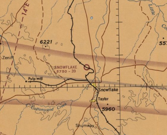
Snowflake Municipal Airport, Snowflake, AZ
34.55, -110.11 (Northeast of Phoenix, AZ)
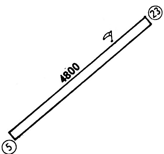
Snowflake Municipal Airport, as depicted on the April 1965 Prescott Sectional Chart.
This general aviation airport was evidently established at some point between 1961-67,
as it was not yet depicted on the 1960 USGS topo map or the March 1961 Prescott Sectional Chart.
The earliest depiction which has been located of Snowflake Municipal Airport was on the April 1965 Prescott Sectional Chart.
It depicted Snowflake as having a 3,900' unpaved runway.
The 1967 AOPA Airport Directory (courtesy of Jonathan Westerling) described Snowflake Municipal Airport as having a single 5,400' gravel Runway 5/23.
The only facilities described at Snowflake were tiedowns.
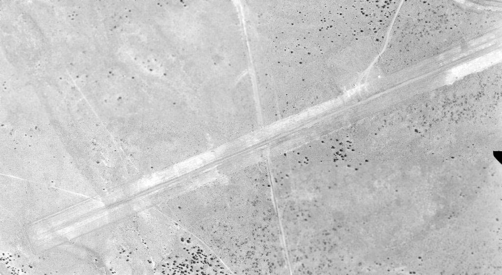
The earliest photo which has been located of Snowflake Municipal Airport was a 7/21/68 USGS aerial view.
It depicted Snowflake as having a single unpaved northeast/southwest runway.
The 1970 USGS topo map depicted Snowflake Municipal Airport as having a single northeast/southwest runway, with a ramp area on the north side.
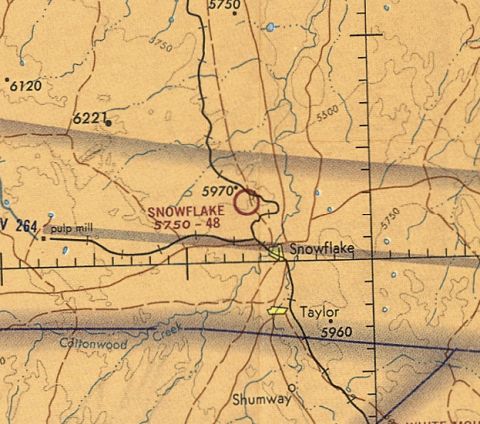
The last aeronautical chart depiction which has been located of Snowflake Municipal Airport was on the June 1971 Phoenix Sectional Chart (courtesy of Ron Plante).
It depicted Snowflake as having a 4,800' unpaved runway.
The 1973 Flight Guide (courtesy of Fred Udall) depicted Snowflake Municipal Airport as having a single 4,800' unpaved Runway 5/23.
The 1976 AOPA Airport Directory (courtesy of Jonathan Westerling)
described Snowflake Municipal Airport as having a single 4,800' dirt Runway 5/23.
Snowflake Municipal Airport was evidently closed (for reasons unknown) at some point between 1976-77,
as it was no longer listed among active airfields in the 1977 AOPA Airport Directory (according to Jonathan Westerling)
Nor depicted on the 1978 Phoenix Sectional Chart (courtesy of Jonathan Westerling).
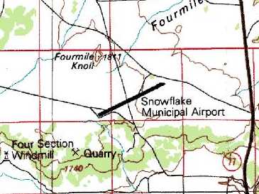
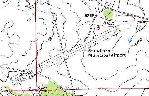
The 1980 USGS topo map depicted Snowflake Municipal Airport as having a single northeast/southwest runway.
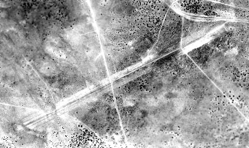
The 1996 USGS aerial photo (enhanced by Bill Grasha) depicted Snowflake Municipal Airport as having a single northeast/southwest runway.
There was no sign of any buildings, nor any sign of recent use.
Dennis Collins visited the site of Snowflake Municipal Airport in August 2010.
He reported, “It's located off what was obviously the old highway (perhaps never paved),
and the road now going down the centerline is marked as 'Old Airport Road'.
Someone at some time put serious energy into this.
It's probably a mile long, and was obviously graded, moving considerable dirt around.
They cut down hillsides by 6' or more, and built up other areas by as much. It's quite wide, maybe 200'.
There's not a sign of any building around it.
I assume that the nearby Taylor airport (not that it's a roaring place even today) took most of the traffic from Snowflake.”
An 8/15/10 aerial view by Dennis Collins (enhanced by Bill Grasha) looking west along the remains of the Snowflake Municipal Airport runway.
Dennis observed, “It doesn't stand out as much as it does on Google Earth, but you can see the outline.
It may be because we're in the middle of the Arizona Monsoon season & it's green up here.”
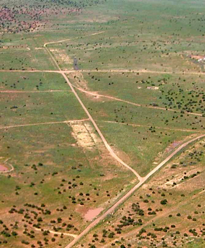
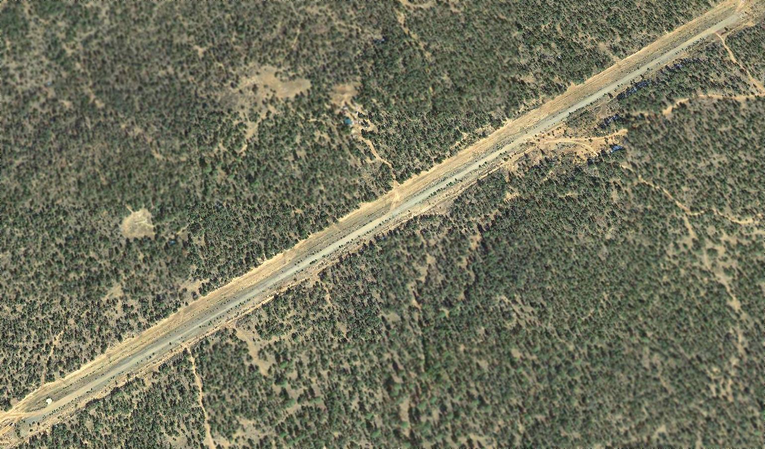
A 2014 aerial view looking southwest along the remains of the Snowflake Municipal Airport runway.
The site of Snowflake Municipal Airport is located southwest of the intersection of Ridgeview Ranch Drive & Runway Drive, appropriately enough.
____________________________________________________
Transwestern Pipeline Company Airfield #3, Leupp, AZ
35.303, -110.85 (Northeast of Phoenix, AZ)
![]()
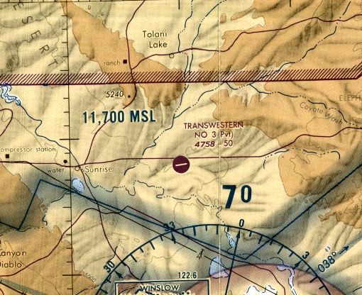
Transwestern #3 Airfield, as depicted on the July 1977 World Aeronautical Chart (courtesy of Chris Kennedy).
This was one of a network of private airfields which were built (and subsequently abandoned)
along the Transwestern Pipeline Company's pipeline in Arizona & New Mexico.
Transwestern #3 was apparently built between 1971-77,
as it was not depicted on a 1953 aerial photo, the 1957 USGS topo map, or the June 1977 Phoenix Sectional Chart (courtesy of Ron Plante).
The earliest depiction of the Transwestern #3 Airfield which has been located
was on the July 1977 World Aeronautical Chart (courtesy of Chris Kennedy).
It depicted Transwestern #3 as a private airfield having a single 5,000' east/west paved runway to the south of the pipeline.
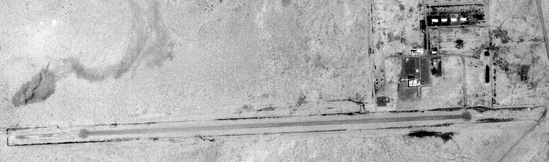
The earliest photo which has been located of the Transwestern #3 Airfield was a 6/10/79 USGS aerial view.
It depicted a single east/west paved runway just southwest of the pumping station. There did not appear to be any hangars or aircraft on the field.
The last aeronautical chart depiction which is available of the Transwestern #3 Airfield was on the 1988 Phoenix Sectional Chart (courtesy of Jonathan Westerling).
It depicted Transwestern #3 as a private airfield having a single 5,000' northeast/southwest paved runway to the south of the pipeline.
Transwestern #3 was still depicted as an active airfield on the November 1992 Phoenix Sectional Chart (according to Timothy Aanerud).
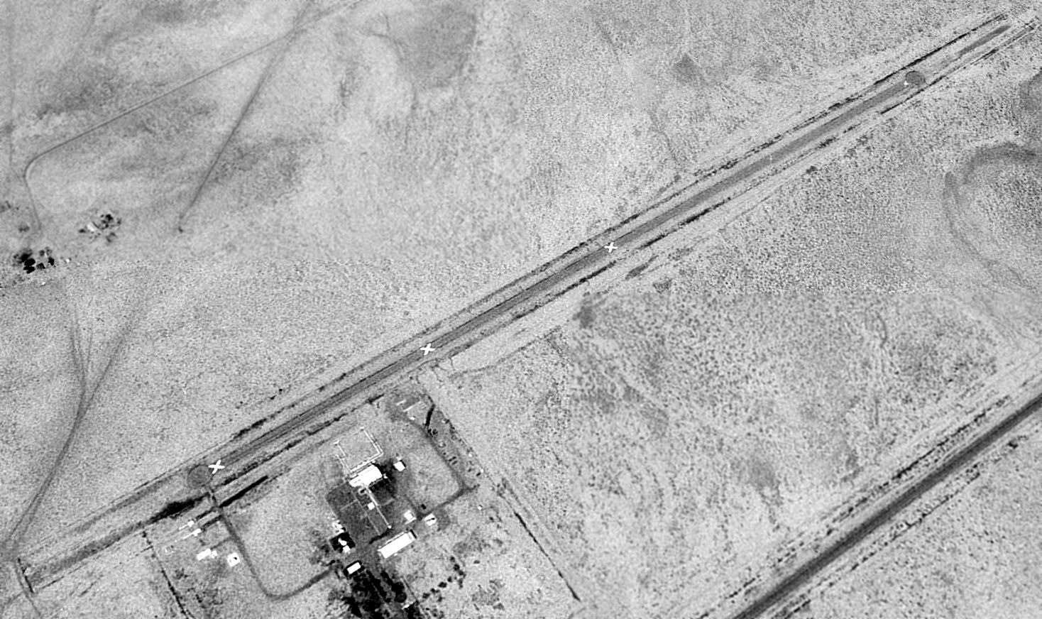
The Transwestern #3 Airfield was evidently abandoned at some point between 1992-97,
as a 1997 USGS aerial view looking southwest clearly showed the runway as being marked with closed "X" symbols.
The paved runway otherwise appeared to be in fine condition.
The complex of buildings just northeast of the runway was a pumping station, and there did not appear to have been any hangars or other buildings directly associated with the airfield.
The Transwestern #3 Airfield was depicted as an abandoned airfield on the 1998 Phoenix Sectional Chart (courtesy of Jonathan Westerling).
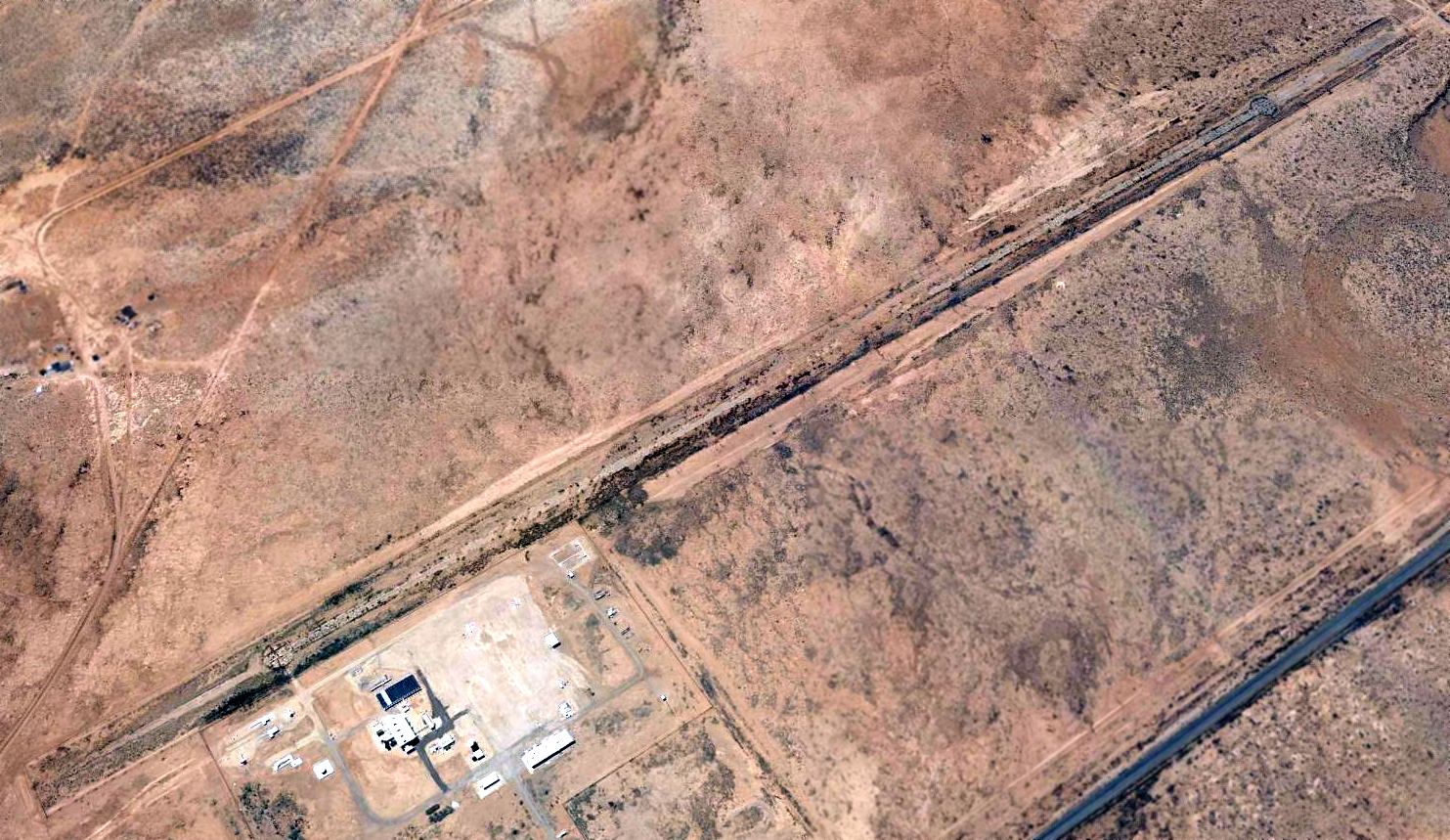
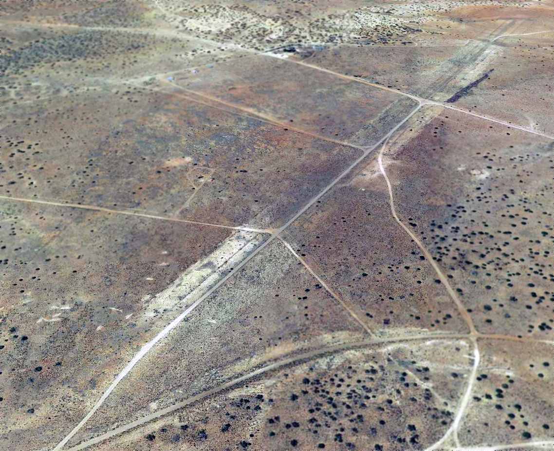
A 2015 aerial view looking southwest at the Transwestern #3 Airfield showed the runway to remain intact but very deteriorated.
The Transwestern #3 Airfield is located on the south side of Indian Route 15, six miles east of Leupp, AZ.
____________________________________________________
Transwestern Pipeline Company Airfield #4 (9E5), Ganado, AZ
35.57, -109.38 (Northeast of Phoenix, AZ)
Transwestern #4 Airfield, as depicted on the 1971 USGS topo map.
Photo of the airport while in operation has not been located.
This was one of a network of private airfields which were built (and subsequently abandoned)
along the Transwestern Pipeline Company's pipeline in Arizona & New Mexico.
The Transwestern #4 Airfield was evidently established at some point between 1963-69,
as it was not yet depicted on a 1963 aerial photo.
The earliest depiction which has been located of the Transwestern #4 Airfield was on a 1969 aerial photo.
It depicted a single northeast/southwest paved runway, east of a pumping station.
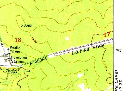
The earliest topo map depiction of the Transwestern #4 Airfield which has been located was on the 1971 USGS topo map.
It depicted a single northeast/southwest “Landing Strip” parallel to the south side of the pipeline, east of a pumping station.
Transwestern #4 was not depicted on the June 1971 Phoenix Sectional Chart (courtesy of Ron Plante)
nor listed in the 1976 AOPA Airport Directory (according to Chris Kennedy).
![]()
The earliest aeronautical chart depiction which has been located of the Transwestern #4 Airfield
was on the July 1977 World Aeronautical Chart (courtesy of Chris Kennedy).
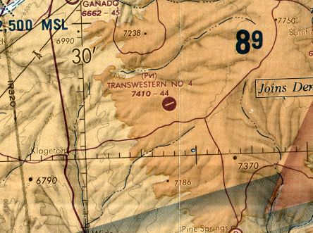
It depicted Transwestern #4 as a private airfield having a single 4,400' paved runway.
The last aeronautical chart depiction which is available of the Transwestern #4 Airfield was on the 1988 Phoenix Sectional Chart (courtesy of Jonathan Westerling).
It depicted Transwestern #4 as a private airfield having a single 4,400' northeast/southwest paved runway.
Transwestern #4 was still depicted as an active airfield on the November 1992 Phoenix Sectional Chart (according to Timothy Aanerud).
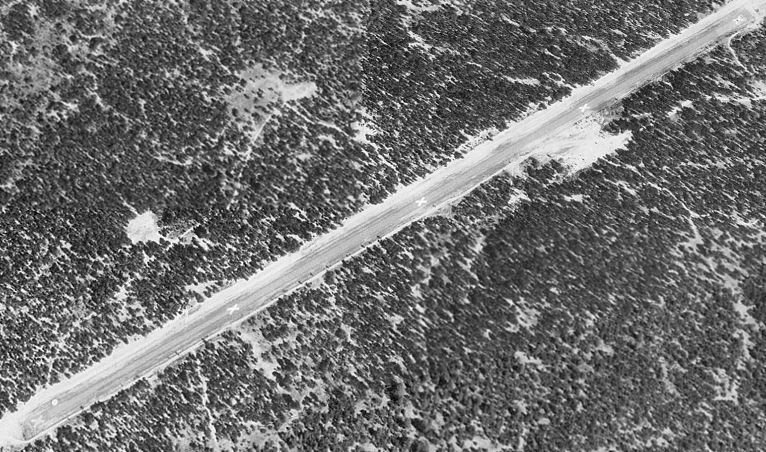
The Transwestern #4 Airfield was evidently abandoned at some point between 1992-97, as a 1997 USGS aerial view looking northeast clearly showed the runway as being marked with closed "X" symbols.
The paved runway otherwise appeared to be in fine condition.
There was a cleared ramp area adjacent to the south side of the runway, but there did not appear to have been any hangars or other buildings at the airfield.
The Transwestern #4 Airfield was depicted as an abandoned airfield on the 1998 Phoenix Sectional Chart (courtesy of Jonathan Westerling).
A 2015 aerial view looking northeast at the Transwestern #4 Airfield showed the runway to be further deteriorated but still recognizable.
The Transwestern #4 Airfield is located in an extremely remote area (so remote that the nearby roads aren't even labeled on maps), 14 miles southeast of Ganado, AZ.
____________________________________________________
Since this site was first put on the web in 1999, its popularity has grown tremendously.
If the total quantity of material on this site is to continue to grow,
it will require ever-increasing funding to pay its expenses.
Therefore, I request financial contributions from site visitors,
to help defray the increasing costs of the site
and ensure that it continues to be available & to grow.
What would you pay for a good aviation magazine, or a good aviation book?
Please consider a donation of an equivalent amount, at the least.
This site is not supported by commercial advertising –
it is purely supported by donations.
If you enjoy the site, and would like to make a financial contribution,
you
may use a credit card via
![]() :
:
Please consider checking the box to make a monthly donatation.
For a mailing address to send a check, please contact me at: paulandterryfreeman@gmail.com
If you enjoy this web site, please support it with a financial contribution.
This site covers airfields in all 50 states.