Abandoned & Little-Known Airfields:
Florida: Northeastern Jacksonville area
© 2002, © 2024 by Paul Freeman. Revised 11/30/24.
This site covers airfields in all 50 states: Click here for the site's main menu.
____________________________________________________
Please consider a financial contribution to support the continued growth & operation of this site.
____________________________________________________
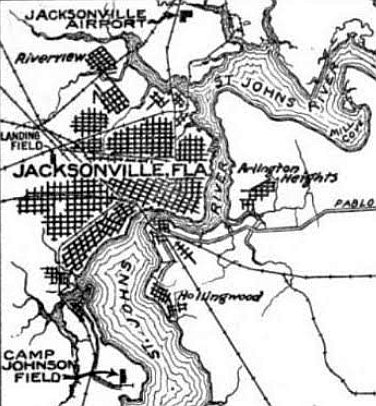
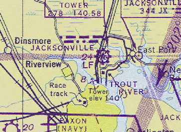
Jacksonville Municipal Airport / Jacksonville Army Airfield / Imeson Field, Jacksonville, FL
30.42, -81.64 (Southeast of Jacksonville International Airport, FL)
Jacksonville Airport, as depicted on the 12/1/26 Commerce Department Airway Bulletin (courtesy of Mike Denja).
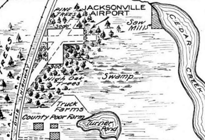
Jacksonville's original municipal airport was opened in 1927 on a 175 acre site north of downtown Jacksonville.
It had a 2,100' cinder & shell runway, a 2,500' grass runway & an administration building.
The 12/1/26 Commerce Department Airway Bulletin (courtesy of Mike Denja)
depicted Jacksonville Airport as an L-shaped property measuring 3,000' east/west, with “runways extended through surrounding pine trees.”
It was described as a “Municipal Air Mail Field, under construction, will be ready 11/1/26.”
No airport buildings were depicted, but the remarks said “Hangars & shops will be constructed.”
The weather was optimistically described as “Every day a flying day”,
and the remarks also boasted that “Thus field when completed will accommodate any type of plane.”
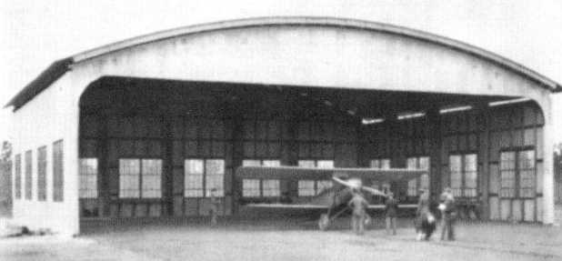
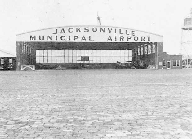
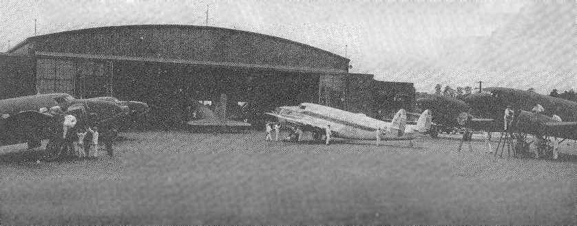
The earliest photo which has been located of Jacksonville Municipal Airport was a 1927 photo of Laurie Yonge's Waco OX biplane inside the field's still-unfinished first hangar (courtesy of Jack King),
located on the west side of the north/south runway.
Charles Lindbergh landed his Spirit of St. Louis plane here by special arrangement in 1927 while the airport was still under construction.
Jacksonville Airport was completed in December 1928.
Jacksonville Municipal Airport, as depicted on the 1929 Rand-McNally "Standard Map of GA with Air Trails" (courtesy of Chris Kennedy).
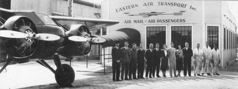
A Curtiss Kingbird & a lineup of Eastern Air Transport employees in front of Eastern's new terminal building at Jacksonville Municipal Airport (courtesy of Jack King).
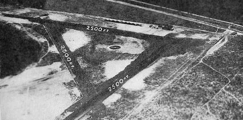
An aerial view of Jacksonville Municipal Airport from The Airport Directory Company's 1933 Airports Directory (courtesy of Chris Kennedy).
It described Jacksonville Municipal Airport as having three 2,500' asphalt runways (very substantial for 1933!).
Furthermore, it said that "A new runway 2,500' long & 500' in width, running generally northwest/southeast is being completed."
The aerial photo in the directory depicted one large hangar & a row of smaller hangars. The manager was listed as Herbert Maloney.
The operator was listed as Eastern Air Transport, which was said to provide schedule mail & passenger service.
The 1934 Department of Commerce Airport Directory (according to Chris Kennedy)
described Jacksonville Airport as having 4 "sandy, sodded, surfaced" runways, all 2,500' long.
The earliest aeronautical chart depiction which has been located of Jacksonville Airport was on the August 1935 Jacksonville Sectional Chart.
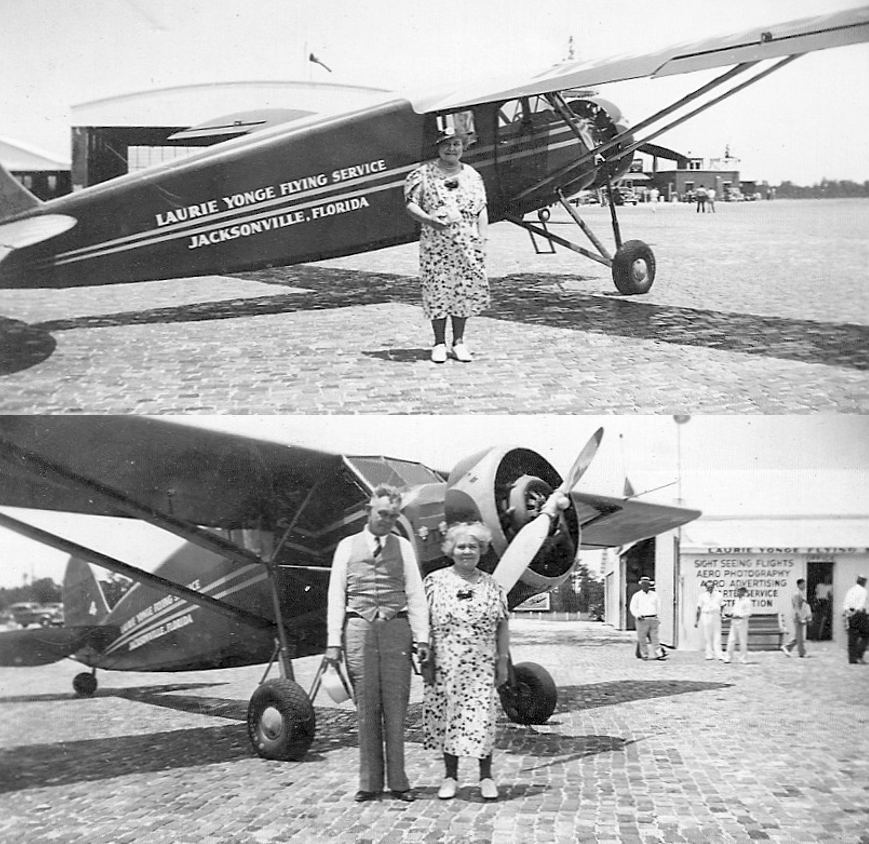
A circa 1937 photo of Laurie Yonge & his mother in front of a Yonge Flying Service Stinson "S" Junior at Imeson Field (courtesy of Jack King).
An aerial view of Jacksonville Municipal Airport from The Airport Directory Company's 1937 Airports Directory (courtesy of Bob Rambo).
It described Jacksonville Municipal Airport as having four 2,500' asphalt runways.
The aerial photo in the directory depicted a row of hangars on the side of the airfield. The manager was listed as Major H. A. Maloney.
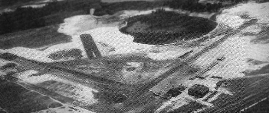
A 3/11/38 Army Air Corps aerial view looking east at Jacksonville Municipal Airport (from the National Archives, courtesy of Brian Rehwinkel).
Note the encampment at the airport on the right side of the picture (a government work camp?).
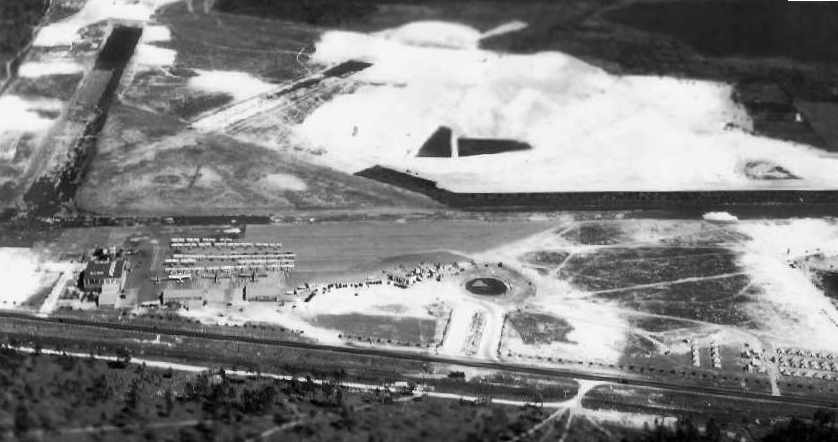
A close-up from the 3/11/38 Army Air Corps aerial view,
showing the hangar & a large number of planes on the ramp at Jacksonville Municipal Airport (from the National Archives, courtesy of Brian Rehwinkel).
An undated (circa late 1930s?) photo of several biplanes inside the Jacksonville Municipal Airport hangar (courtesy of Jack King).
An undated (circa late 1930s?) photo of 2 C-47s in front of the Jacksonville Municipal Airport hangar at what appears to have been an open house (courtesy of Mike Hull).
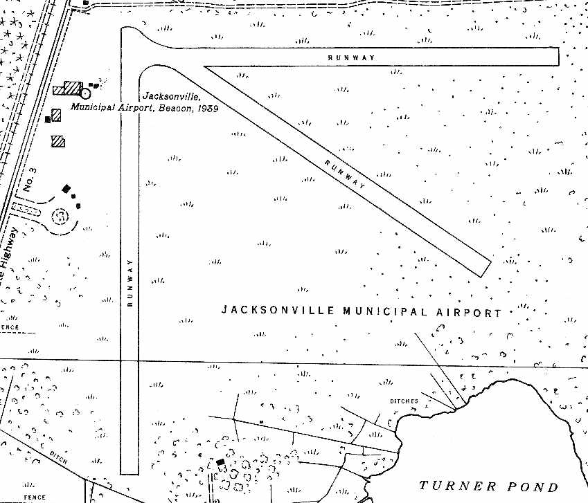
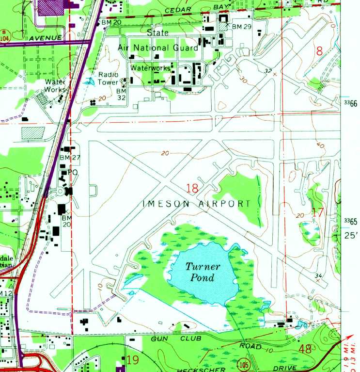
A 1939 USGS topo map of Jacksonville Municipal Airport (courtesy of Brian Rehwinkel).

A circa late 1930s photo from a postcard (courtesy of Fred Erdman) of a Douglas Eastern Airlines DC-3 in front of the Imeson Airport control tower.
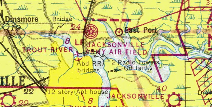
The Jacksonville office of the National Weather Service was located at Imeson Field from 1940-1971.
A 1940s view of the Jacksonville Airport terminal building.
By 1941, Jacksonville Airport had expanded to 600 acres, acquiring 5 additional hangars & a terminal building,
and 5 asphalt runways, the longest of which was 7,000'.
Airline service was provided by Eastern Airlines, Orlando Airlines, and National Airlines (which made Jacksonville its headquarters).
With the start of WW2, the Army began to use Jacksonville for antisubmarine missions in 1941.
Jacksonville was still depicted as a civilian airport on the June 1942 17M Regional Aeronautical Chart (courtesy of Chris Kennedy).
An undated photo from a December 1942 article depicting Army C-47s & National Airlines Lockheed Lodestars
around a Jacksonville Municipal Airport hangar (courtesy of Jack King).
By the time of the August 1943 17M Regional Aeronautical Chart (courtesy of Chris Kennedy), Jacksonville was labeled as an “Army Air Field”.
The Army turned over antisubmarine missions at Jacksonville to the Navy in 1943.
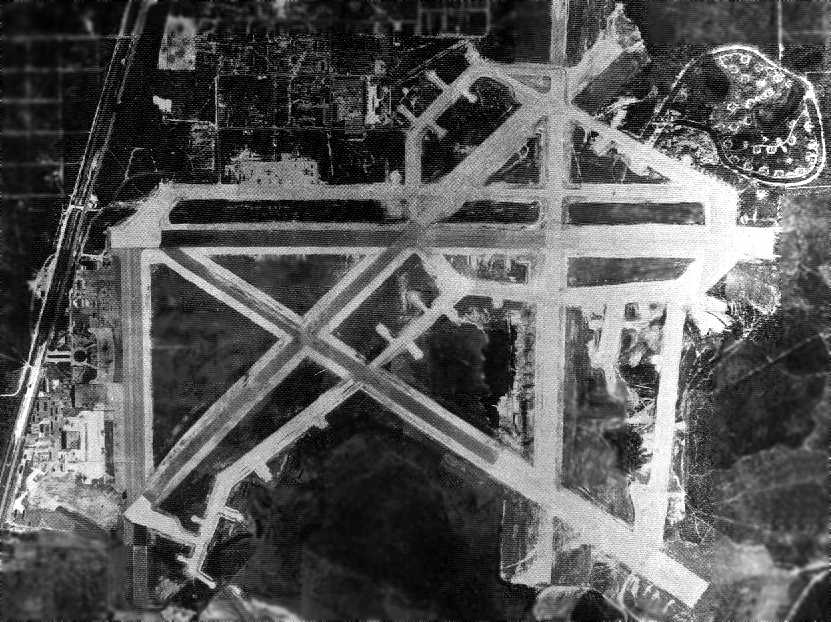
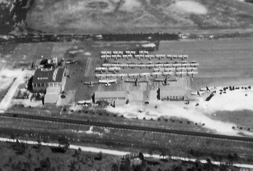
A 1944 aerial photo of Jacksonville Municipal #1 Naval Auxiliary Air Station (National Archives photo).
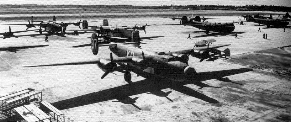
A 1944 photo of PB4Y-1 Privateers on the ramp at Jacksonville Municipal #1 Naval Auxiliary Air Station (National Archives photo).
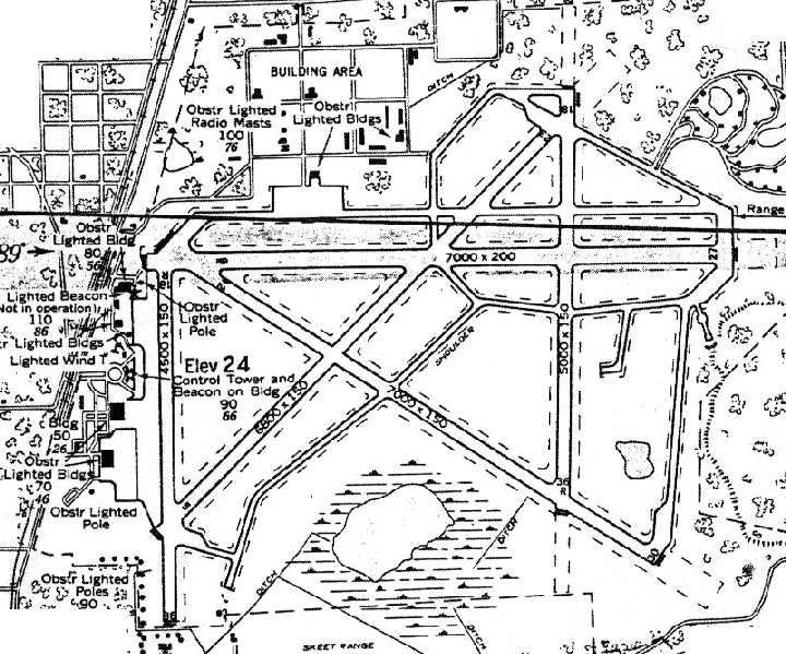
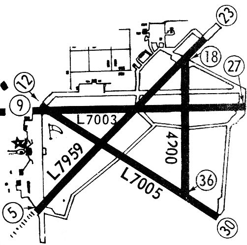
A 1944 Army diagram of Jacksonville #1 (courtesy of George Miller).
The January 1944 Jacksonville Sectional Chart (courtesy of Chris Kennedy) labeled the field as “Jacksonville Army Air Field”.
The Navy commissioned Naval Auxiliary Air Station Jacksonville #1 in 1944.
The primary Navy tenant of the base became Operational Training Units for PB4Y-1 Liberator patrol Bombers.
However, the July 1944 Jacksonville Sectional Chart (courtesy of Chris Kennedy) depicted “Jacksonville” as a civilian airfield.
By 1945, Naval Auxiliary Air Station Jacksonville began to use the improved PB4Y-2 Privateer.
The base's maximum aircraft complement was reached in 1945, with a total of 67 aircraft onboard.
Jacksonville Airport, as depicted on the February 1945 Jacksonville Sectional Chart (courtesy of Chris Kennedy).
After the end of WW2, the Navy returned the field to the City of Jacksonville,
which reopened the field as a civil airport named Imeson Field.

An undated photo from a postcard mailed in 1946 (courtesy of Fred Erdman) of a Douglas DC-4 in front of the Imeson Airport control tower.
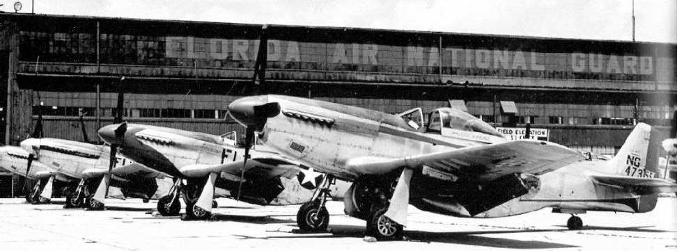
A 1947 photo of P-51 Mustangs of the Florida National Guard's 159th Fighter Squadron in front of their hangar at Imeson (courtesy of Jack King).

A 1947 photo of a National Airlines Lockheed Lodestar in front of the Imeson tower.
A circa late 1940s view of a Douglas DC-4 in front of the Jacksonville Airport terminal building.
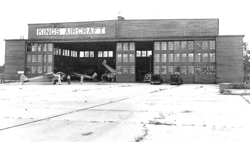
A circa 1949 photo (courtesy of Jack King) of the King's Aircraft hangar at Imeson Field.
Jack recalled, “My Dad [H.L. King Jr.] had this business at Imeson in the 1940s & 1950s.”
"Imeson" was depicted as a civilian airport on the 1949 Jacksonville Sectional Chart (according to Chris Kennedy).
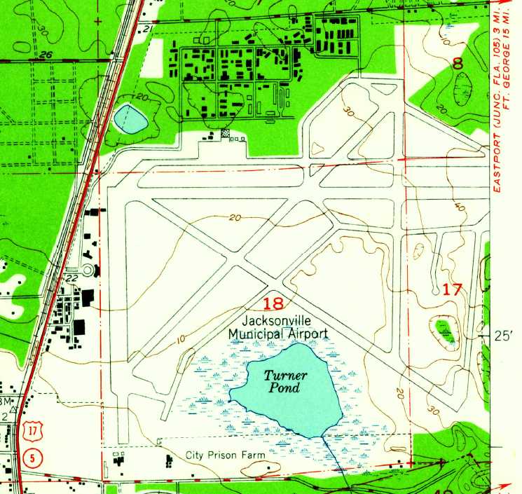
The 1950 USGS topo map depicted Jacksonville Municipal Airport as having 4 runways, numerous taxiways, several ramps & hangars.

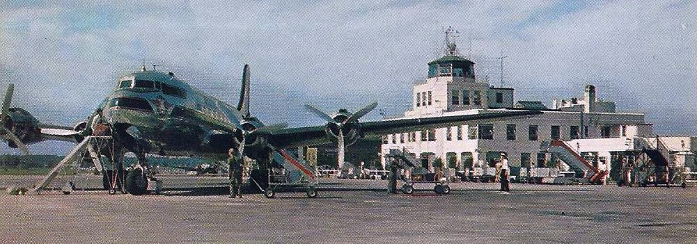
An undated photo from a 1951 postcard (courtesy of Fred Erdman) of a Lockheed L-749 Constellation in front of the Imeson Airport control tower.
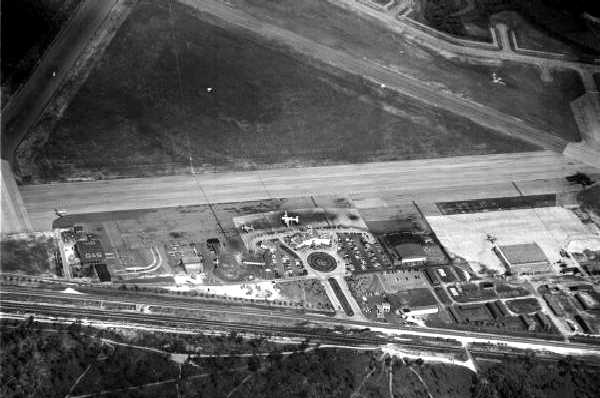
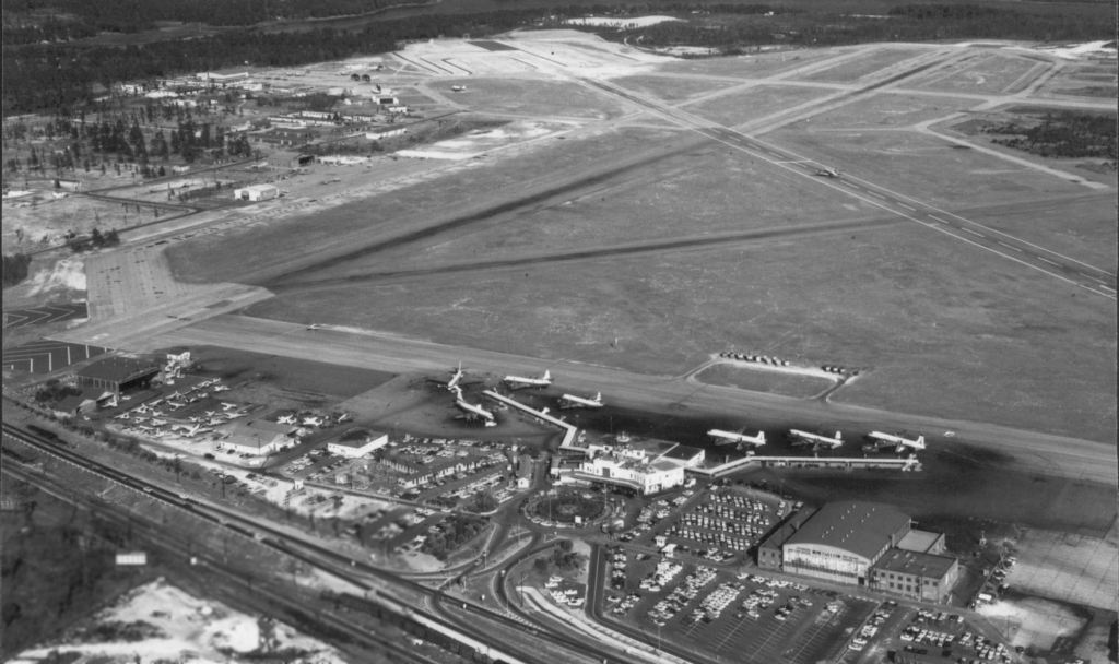
A 7/10/52 aerial view by Robert Fisher looking east at Imeson's ramp.
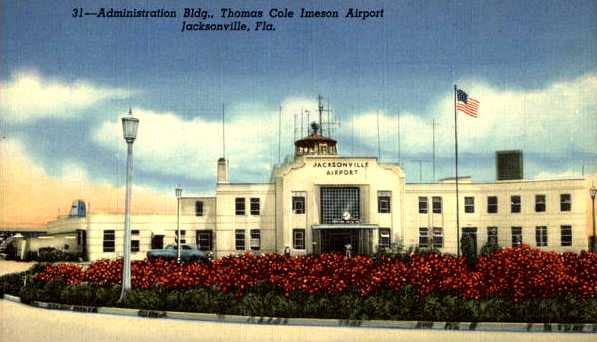
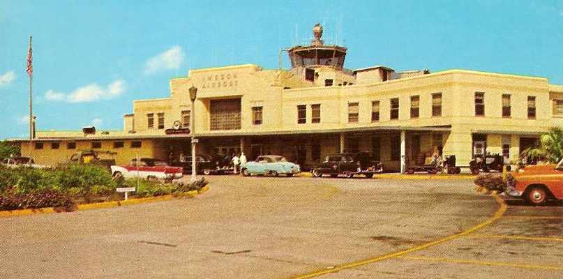
An undated colorized photo of Imeson's Administration Building from a postcard.
The postcard's caption said, “Thomas Cole Imeson Airport has become the hub of Southern Air Travel & the pride of Jacksonville,
a hustling, busy metropolis with tall buildings, fine stores, splendid & comfortable homes & everywhere one turns is a note of tropical loveliness.”
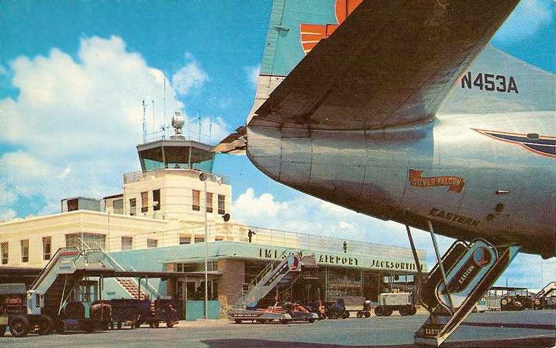
A circa 1952-57 view of an Eastern Airlines Martin 404 in front of the Imeson control tower, from a Plastichrome postcard (courtesy of Stefan Piechota).
An undated view of the Imeson terminal building, from a circa 1955 Curteich color postcard (courtesy of Stefan Piechota).
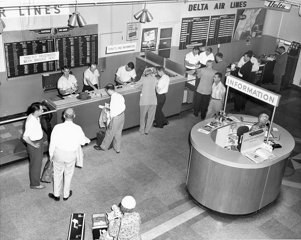
A circa 1950s photo of Imeson Airport's Eastern Airlines & Delta Airlines ticket counters.
Ed Cherry recalled, “I worked at the Air National Guard Base at Imeson Airport 1955-68.
Our little air patch was involved in lots of interesting things, some of which relate to world history.
From that northeast corner of Imeson we flew lots of different fighter aircraft with lots of interesting missions & events.
Briefly, 1955-60 we flew the F-86D & F-86L which included 24-hour runway alert as part of the air defense system.”
 7
7
Imeson Field was depicted on the February 1956 Jacksonville Sectional Chart (courtesy of Chris Kennedy) as having 4 paved runways, with the longest being 7,000'.
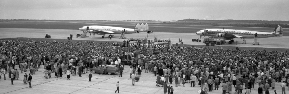
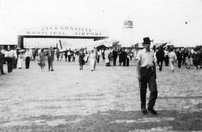
A 10/29/56 photo of President Eisenhower speaking to a crowd at Imeson Field, with 2 Lockheed Constellations in the background.

A circa 1950s photo looking out from the Imeson Field control tower, with 2 Lockheed Constellations & a Martin seen below.
Bob Gilbert recalled, “Imeson Airport... The Civil Aeronautics Administration Enroute Air Traffic Control Center was located on the 2nd floor in the south end of the terminal building.
I reported for duty there in April, 1957 as a new hire. The early days were without radar or remote air/ground communications sites.
While it was located in the terminal building at Imeson, we could keep an eye on what was going on outside,
stay in close personal contact with the control tower operators
and enjoy an occasional visit from an airline or military pilot when they had a few minutes to spare.”
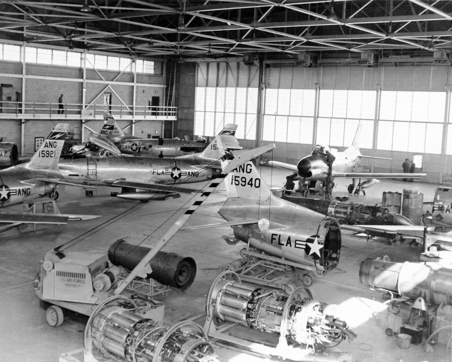
An undated (circa 1955-60) view of the interior of Imeson's Florida ANG 159th Fighter Interceptor Squadron hangar, showing F-86D-25-NA Sabres, several of which were undergoing engine swaps.
A 1957 view of Imeson's Florida ANG ramp, full of 159th Fighter Interceptor Squadron F-86L Sabres.
Ed Cherry recalled of Imeson's F-86 ANG unit, “In 1958, we were the first & only Air National Guard unit
to win the USAF worldwide weapons competition with a perfect score.”
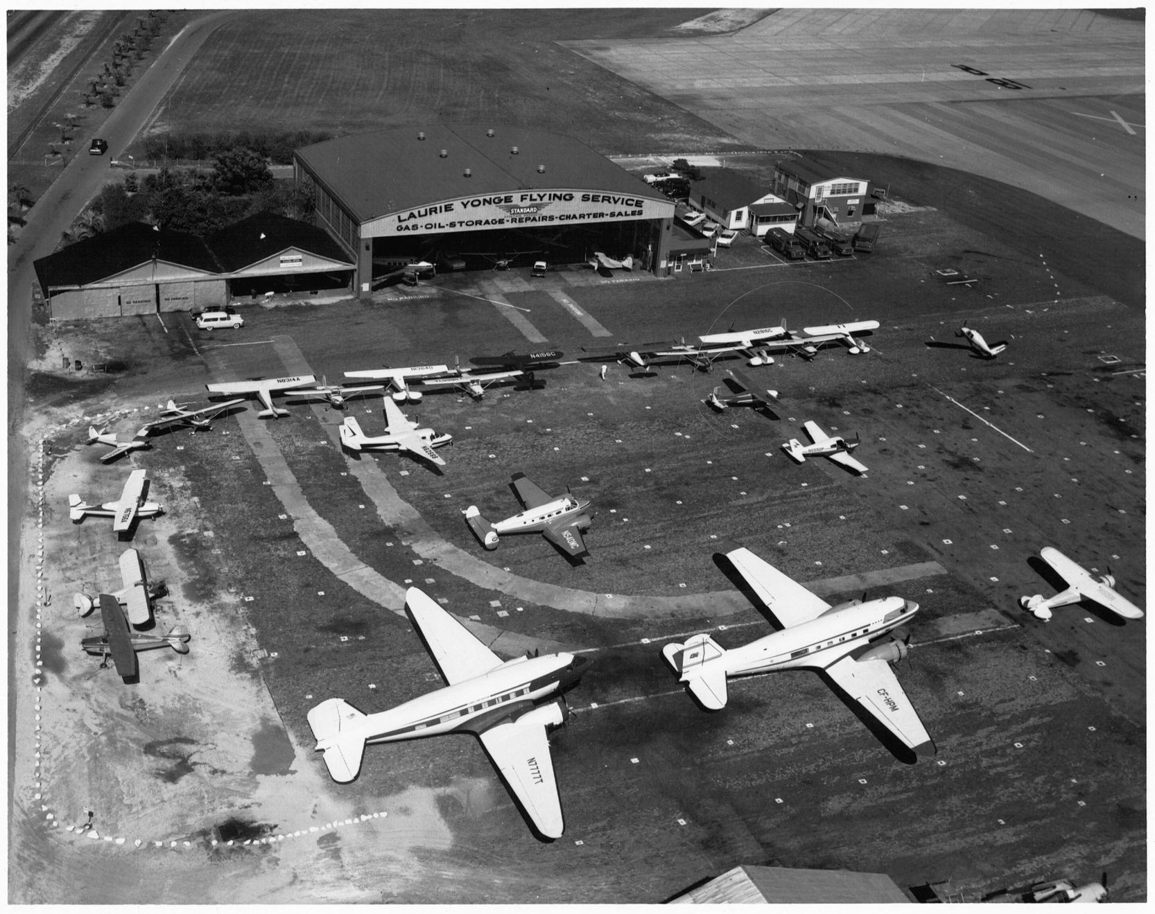
A 10/24/58 aerial view of 2 DC-3s & an amazing variety of business & general aviation aircraft in front of Imeson Field's Laurie Yonge Flying Service hangar.
Ed Cherry recalled of Imeson's F-86 ANG unit, “From 1960-68 we flew the F-102 interceptor.
Our pilots chased Russian airplanes out of Cuba all over the State of Florida.
During the missile crisis, I was working on the flight line as a mechanic, and we all carried sidearms.
I never really understood what we might have expected to happen.”
According to Merritt Ashmore, “A Constellation crashed at the middle marker of one of the runways in the 1950s.
I visited the airport in the 1960s as a young man specifically to look at the planes - mostly DC-6s as I remember.”
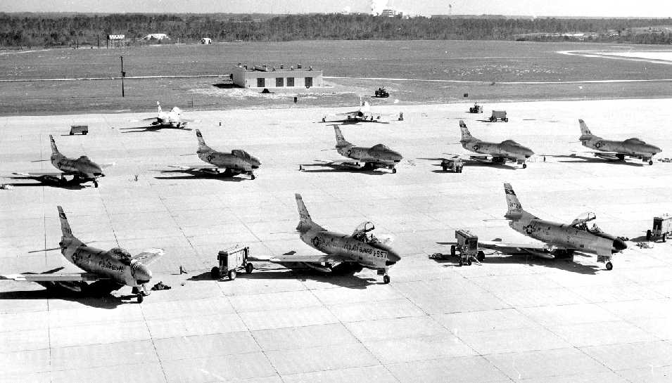
A 1960 aerial view of over 20 Convair F-102 Delta Dagger interceptors of the FL Air National Guard on the north ramp of Imeson Field.
A 1960 aerial view of the airport terminal & general aviation ramp on the west side of Imeson Field,
showing three 4-engine airliners, a DC-3, and over 30 light aircraft.
Bob Gilbert recalled, “The Enroute Air Traffic Control Center was moved [from Imeson] to its present location in Hilliard in 1961.”
Brian Rehwinkel reported, “I found information in a Florida National Guard History booklet
that highlighted a major facilities improvement [at Imeson Field] in 1961 & 1962.”
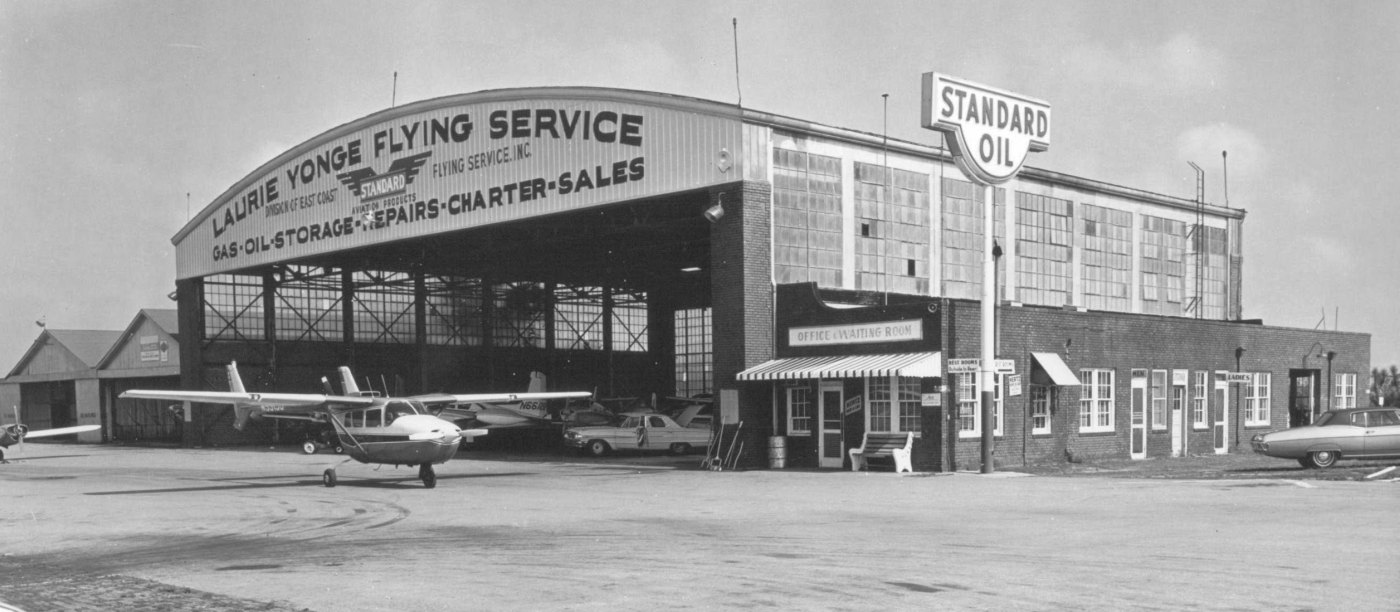
Imeson Field was described in the 1962 AOPA Airport Directory
as having 3 paved runways, and the operator was listed as Laurie Yonge Flying Service.

An undated photo from a 1962 postcard (courtesy of Fred Erdman) of a Lockheed L-188 Electra in front of the Imeson Airport control tower.
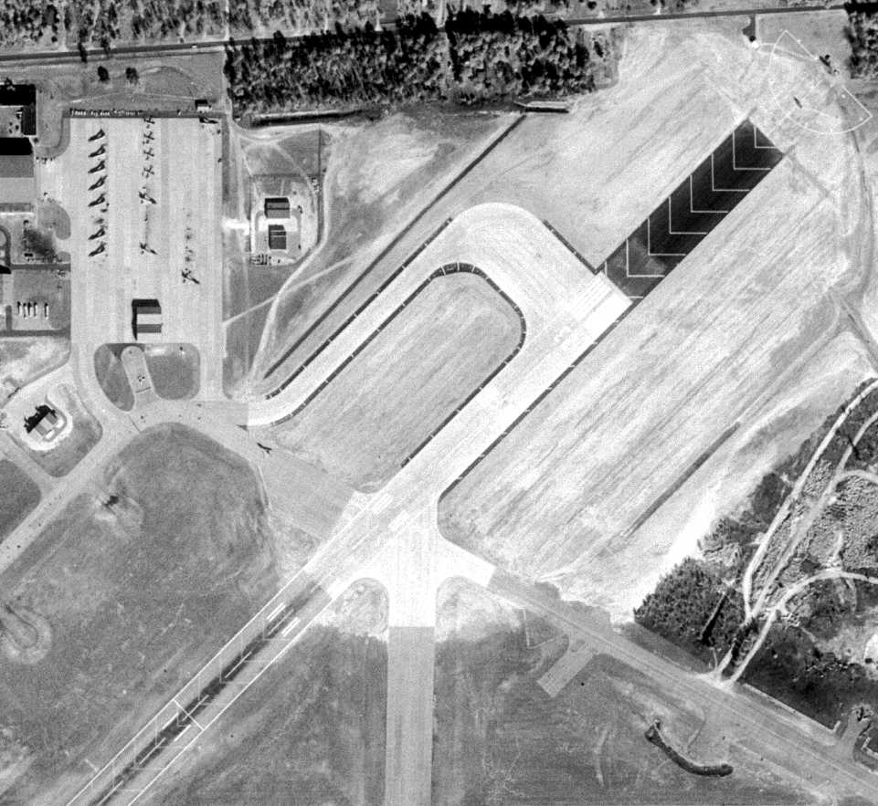
A 1/1/63 aerial view of the northeast end of Imeson Field shows an extension of Runway 23 that was evidently constructed at some point between 1960-63.
Brian observed, “The brand new concrete runway extension of approximately 1,000' is so new, there are not many tire marks in the touchdown zone.”
Note the Convair F-102 Delta Dagger interceptors of the FL Air National Guard at top-left.
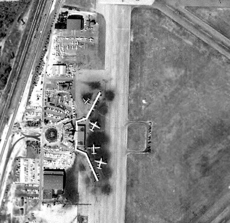
A 1/22/63 aerial view looking northeast at the Imeson Field terminal,
showing a United Airlines Caravelle & 3 National Airlines Lockheed Electras on one concourse,
and an Eastern Air Lines DC-7, Delta DC-7, and another Eastern DC-7 on the other concourse (identifications by David Henderson).
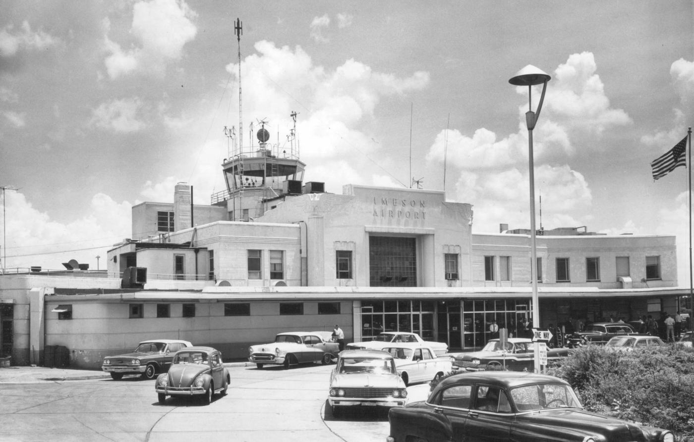
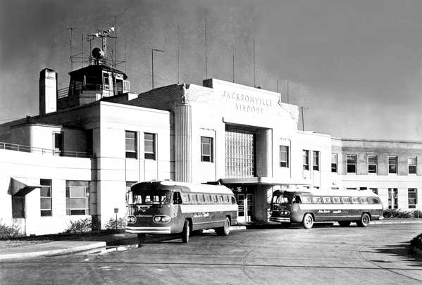
A 1963 photo (courtesy of David Henderson) of the Imeson Airport terminal building & control tower.
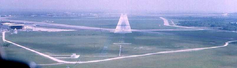
A circa 1963-64 aerial view by Parker Henderon (courtesy of David Henderson) taken on final approach to Imeson's Runway 5,
with the hangars visible on the left.
On the 1964 Jacksonville Sectional Chart, the longest runway at Imeson Field was depicted as being 7,900'.
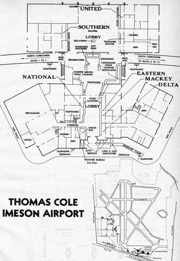
A 1964 diagram of Imeson's terminal (courtesy of David Henderson).
A 4/3/66 USDA aerial photo (courtesy of the FL DOT via Brian Rehwinkel) of Imeson Field.
Two jet airliners (727s?) are visible at the terminal on the west side of the field.
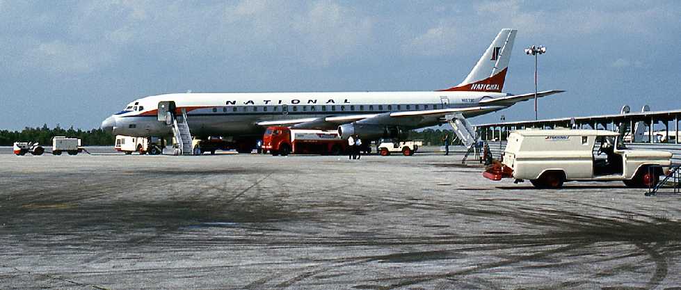
A July 1967 photo by Bob Garrard of a National Airlines Douglas DC-8-21 at Imeson.
As jet airliners were introduced, the geographic limitations which precluded further lengthening
of the runways of Imeson Field became a fatal liability.
The new Jacksonville International Airport was opened to the north in 1967.
Airline operations moved to the new airport, but military & general aviation operations remained at Imeson for a short while.
According to Ed Cherry, Imeson's F-102 ANG unit “moved to the new airport” in 1968.
The 1968 Flight Guide (courtesy of Robert Levittan) depicted Imeson Field as having 4 paved runways,
with the longest being the 7,959' Runway 5/23.
The last aeronautical chart depiction which has been located showing Imeson Field still open
was on the October 1968 Jacksonville Sectional Chart (courtesy of Ron Plante).
It depicted Imeson as having 4 paved runways, with the longest being 7,900'.
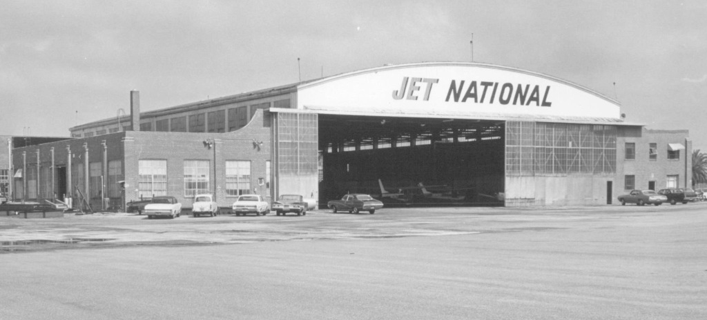
The last photo which has been located showing aircraft at Imeson Field was a 6/6/69 photo
of 2 Cessnas & a low-wing single-engine aircraft inside Imeson's Jet National hangar.
The last map depiction which has been located of Imeson Field was on the 1970 USGS topo map.
It labeled the north side of the field as belonging to the Air National Guard.
According to Wikipedia, “In 1970 Webb International Inc. purchased the former 1,500-acre airport
and turned it into a new commerce center, Imeson International Industrial Park, with numerous buildings being constructed over the former runways.”
Aerial views from 1970 & 1971 showed Imeson Field devoid of any aircraft, but still remaining completely intact.
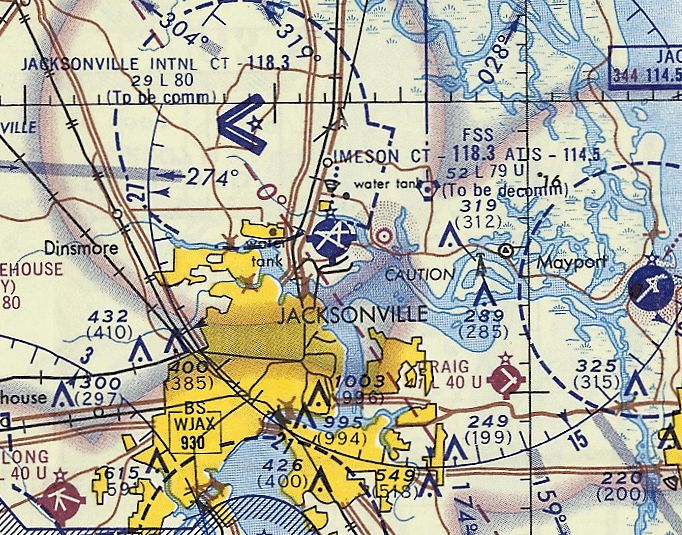
The March 1975 Jacksonville Sectional Chart (courtesy of John Ferrra) still depicted Imeson & its 4 paved runways, but noted it as “Field Closed”.
A 1980 aerial view showed that several large buildings had been constructed over the runways
on the northwestern, northeastern, and southeastern portions of Imeson Field at some point between 1971-80.
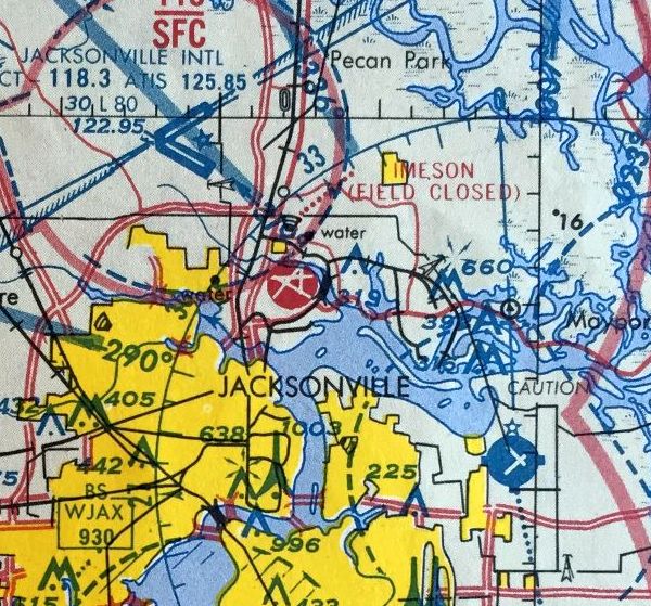
The 1985 FL Aeronautical Chart (courtesy of Alex Hauser) still depicted Imeson & its 4 paved runways, but noted it as “Field Closed”.
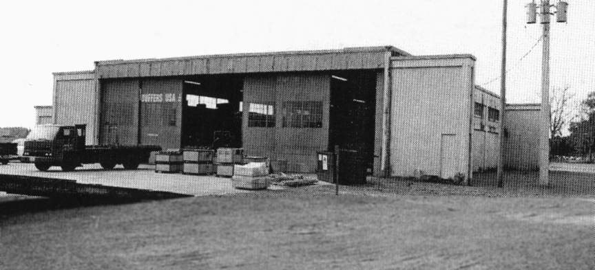
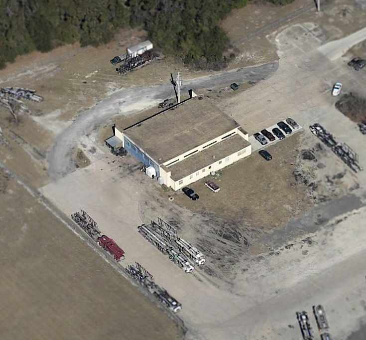
A circa-1980s photo by George Miller of the last remaining hangar at the former Jacksonville AAF.
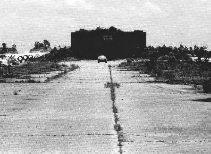
A circa-1980s photo by George Miller of the former firing range backstop building at Jacksonville AAF,
which was previously filled with tons of sand & lead.
The Imeson Field property was reused as Imeson International Industrial Park,
with numerous buildings being constructed over the former runways.
The remaining southeastern portion of Runway 30 has been reused as Imeson Park Boulevard.
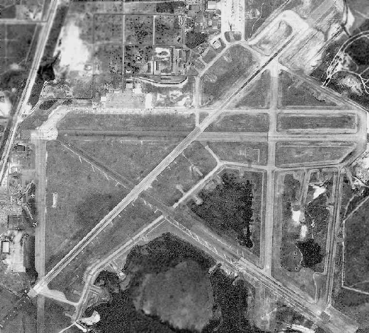
A 1994 USGS aerial view looking north showed remaining portions of at least 4 Imeson Field paved runways were still evident.
John Deffes recalled in 2003, "In the 1980s & 90s I used to practice my motocross out there at Imeson,
and was told it was the old JIA, but didn't really believe it.
Although it did indeed have some long concrete patches that made me wonder. Now I know."
John Deffes visited the site of Imeson Field in 2003. His report:
"We had a great few hours out at Imeson today.
It really is rewarding to go out to these old airfields and look around.
Of course, I guess it helps to love Aviation & Archeology."
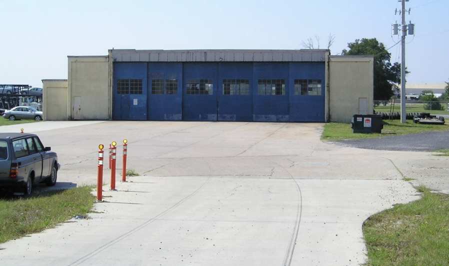
A 2003 photo by John Deffes of the only remaining hangar at Imeson Field.
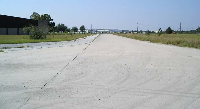
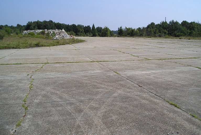
A 2003 photo by John Deffes of a remaining taxiway which led to Runways 18 & 23.
A 2003 photo by John Deffes, looking northeast at the end of Runway 23.
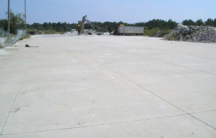
A 2003 photo by John Deffes of the former Runway 30 Hold Short area.
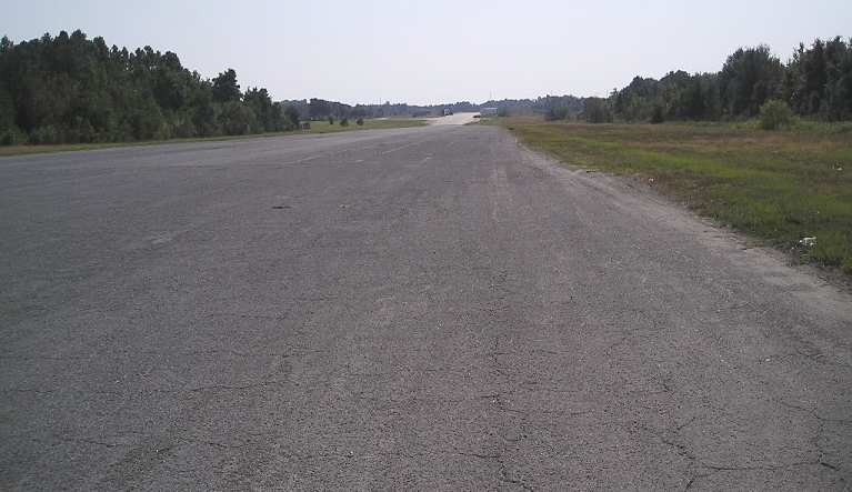
A 2003 photo by John Deffes, looking southeast along the former Runway 30.
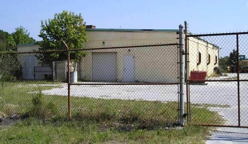
A 2003 photo by John Deffes of one of the 2 remaining former Armory buildings at Imeson Field.
John Deffes reported in 2003, "We found many portions of old runways & taxiways, and we even found the fabled old hangar.
We ran into an old fella that works out at the park, Ray, and he was a good source of info.
At first he warned us about trespassing, but after I told him I was interested in the old airfield,
he went on about, 'I was born just across the road 72 years ago.'
Suddenly we were okay & he couldn't wait to tell us everything he knew.
He told me about 2 old National Guard Armory buildings I would have never recognized without his help, and even led us there in his truck.
Ray is in the photo of the Guard Armory buildings. The fence & signs on the Guard buildings are all original.
One sign says, 'Leave matches & no lighters.'
Another sign had a small silver box with a chain in it that used to hold a telephone key (?) according to Ray.
You used the key to call a guard inside the Armory so you could get in.
Also, Ray said that the old hangar, as he remembers it, was used for tire & wheel maintenance."

A 2003 photo by John Deffes of the concrete remains of an unidentified building, located east of the only remaining hangar.
John Deffes reported in 2003, ""Ray was also able to tell me where the old Terminal building was (approximately).
It no longer stands, but we did see some bits of concrete in the field.
It was not worth photographing in my opinion, as we couldn't be sure of the location in such a large field.
Ray said that nothing of the control tower remains."
John continued, "All in all, when you really look at it, there is still quite a bit of concrete runway & taxiway left intact at Imeson.
Unfortunately, with 'No Trespassing' signs posted everywhere, and painted on the concrete,
it was difficult to get back into some of the areas where I'm sure some really juicy bits of history wait to be uncovered.
We took a chance going into areas we probably shouldn't have, but on Sunday, most folks are elsewhere.
It was great being there, and I feel that I spent a Sunday doing something really interesting & worthwhile."
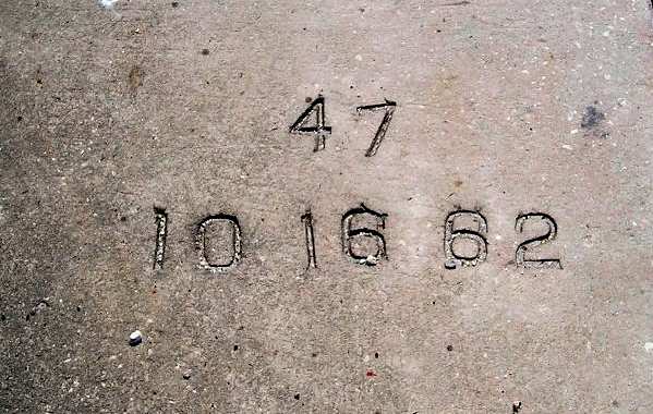
A 2003 photo by John Deffes of a marking cast within the concrete of the former Runway 23.
Brian Rehwinkel observed that the "10 16 62" is evidently the date at which Runway 23 was lengthened.
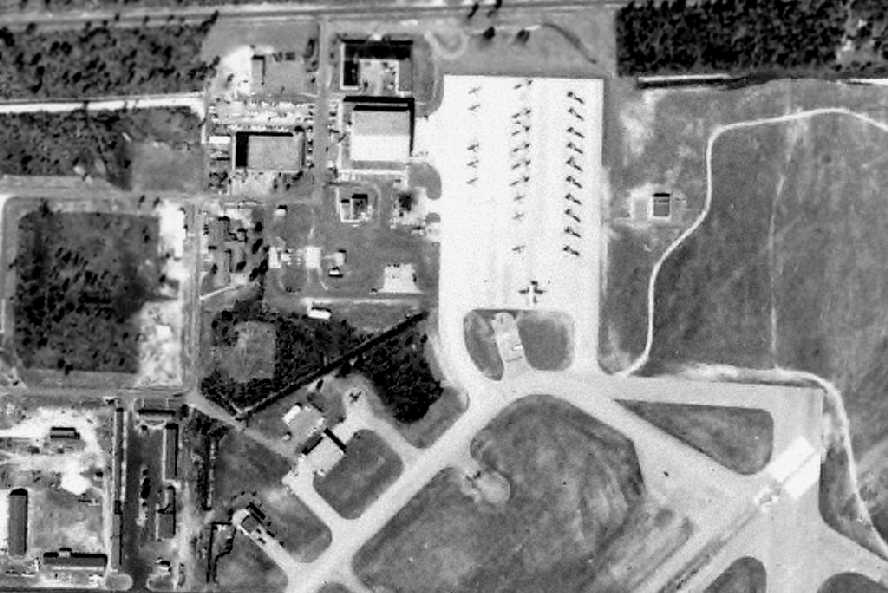
A circa 2005 aerial photo of the last remaining hangar at Imeson Field, on the north side of the site.
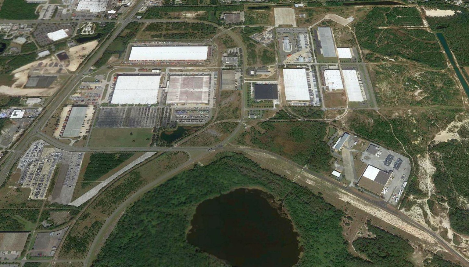
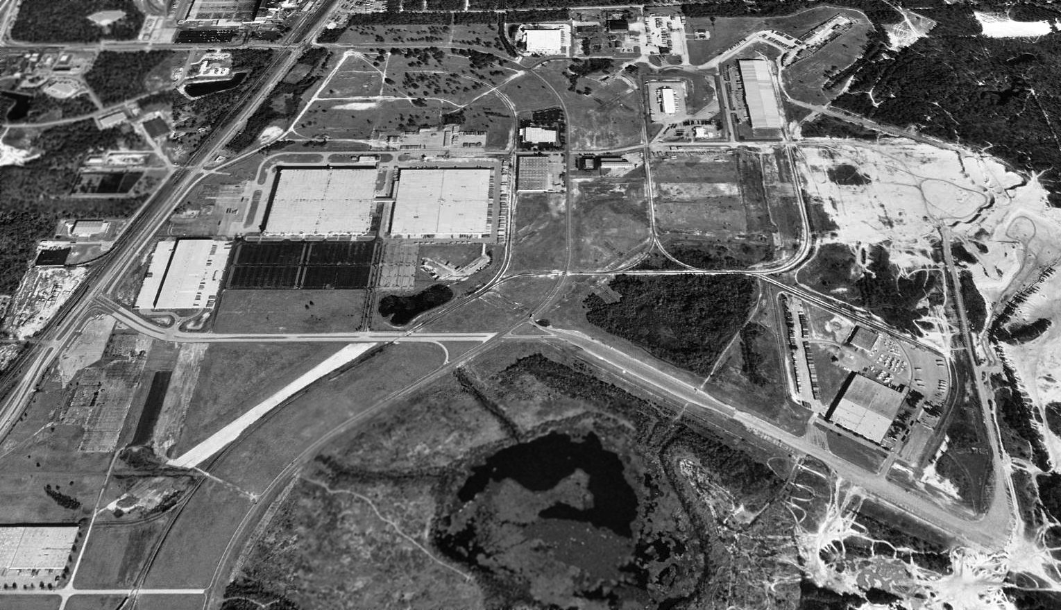
A 2017 aerial view looking north showed portions of 4 Imeson Field paved runways were still evident.
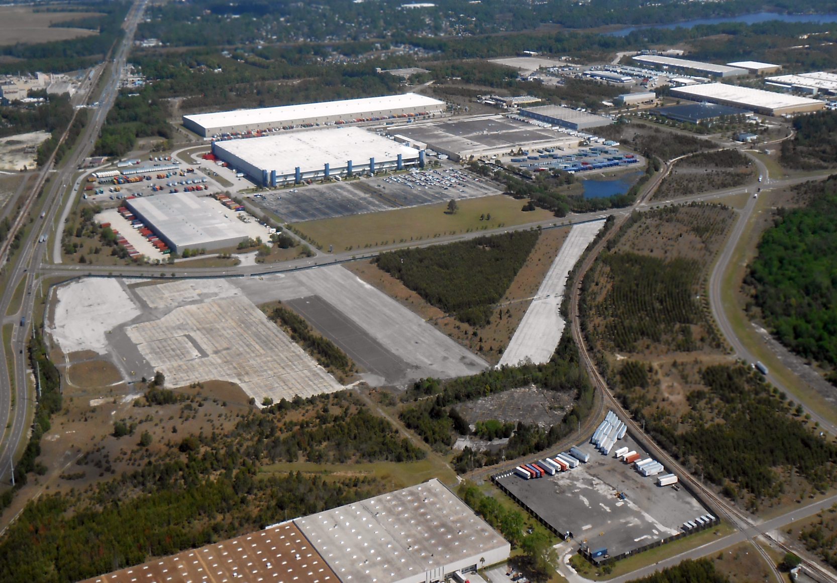
A 3/28/18 aerial view by Alex Price looking northeast at the site of Imeson Field.
In the foreground are visible the remains of the southwest portion of the ramp, and the southern portions of the north/south taxiway & Runway 5/23.
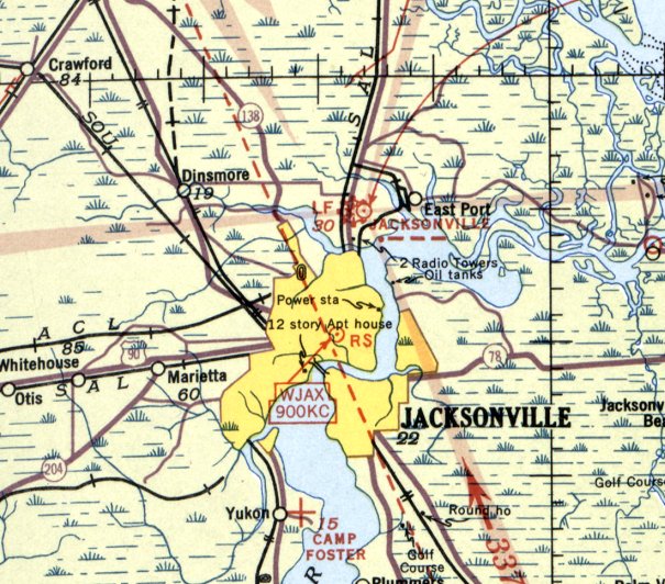
The site of Imeson Field is located southeast of the intersection of North Main Street & Busch Drive.
See also: http://celebrate2000.cjonline.com/stories/072699/his_jax26.shtml
____________________________________________________
Or if you prefer to contact me directly concerning a contribution (for a mailing address to send a check),
please contact me at: paulandterryfreeman@gmail.com
If you enjoy this web site, please support it with a financial contribution.
____________________________________________________
This site covers airfields in all 50 states.