Abandoned & Little-Known Airfields:
Florida: Northwestern Jacksonville area
© 2002, © 2025 by Paul Freeman. Revised 7/11/25.
This site covers airfields in all 50 states: Click here for the site's main menu.
____________________________________________________
Please consider a financial contribution to support the continued growth & operation of this site.
Hart NOLF / Hart Field (revised 7/11/25) - Jasper Intermediate Field (revised 2/4/21)
Mile Branch NOLF / Skytel Airport / Mile Branch Airport (revised 1/28/23) - Paxon Field / Williams Airport (revised 3/8/23)
____________________________________________________
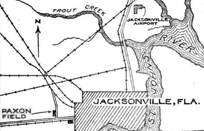
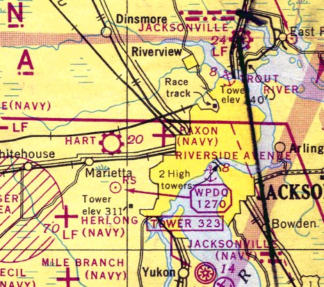
Paxon Field / Williams Airport, Jacksonville, FL
30.347, -81.72 (West of Downtown Jacksonville, FL)
Paxon Field, as depicted on the 8/16/27 Commerce Department Airway Bulletin (courtesy of Mike Denja).
According to Brian Rehwinkel, Paxon Field "was probably Jacksonville's first airfield (with the exception of the beaches).
The small field on the west side of Jacksonville (it has also been described as a 'clearing')
was apparently first used in the early 1920s.
According to information in the book 'Florida's Aviation History, The First One Hundred Years' (by Warren Brown),
this airfield was named for the property owner.
(It was also apparently called Melson Field - named after the road the field was located on).
Bessie Coleman (the world's first licensed black pilot)
was killed in a plane crash at Paxon Field while on the barn-storming circuit in 1926.
During a test flight, Bessie's Jenny went into a nose dive & Bessie was thrown from the plane to her death.
The 8/16/27 Commerce Department Airway Bulletin (courtesy of Mike Denja)
described Paxon Field as a commercial airport owned by Edward Paxon & the Curtiss-Bright Company, and operated by Laurie Yonge.
It was said to consist of a 2,600' north/south sod runway, with 1 building on the southeast side.
Laurie Yonge conducted sightseeing flights & flight instruction from Paxon Field
until gradually shifting operations in 1928 to the new Jacksonville Municipal Airport
because of its superior operating conditions (according to material courtesy of Jack King).
Paxon Field, as depicted on the 1929 Rand-McNally "Standard Map of GA with Air Trails" (courtesy of Chris Kennedy).
Tom Edwards recalled, “Paxon Field was owned by my grandmother Lily Fay Melson Paxon who married Edward Paxon.
My father, Wilber Edwards, used to collect rent for the field in the 1930s from the airport operator.”
According to Brian Rehwinkel, "I do not know if the airfield was used continually from the 1920s through the 1930s.
Of course Jacksonville opened a new airport (Jacksonville Municipal Airport) in 1927 -
which certainly would have diminished the role of Paxon Field).
However, according to Army Corps of Engineer records,
the U.S. Department of Agriculture bought 173.5 acres of land at the site in August of 1935
(I do not know the purpose for which the USDA bought the land)."
Paxon Field evidently went thru a period of closure,
as it was not depicted on the August 1935/37/41 Jacksonville Sectional Charts,
nor listed among active airfields in The Airport Directory Company's 1937 Airports Directory (courtesy of Bob Rambo).
Robert Morris recalled, “I lived in Murray Hill, Jacksonville from 1931-40.
Occasionally I think of my dad taking me out to a 'field' (just that), west of town to watch them fly model airplanes.
This was when I was probably 8 to 11 [circa 1938].
I can remember loving to get up in the skeleton of a biplane and 'pretend'.
I cannot remember any full-scale aircraft activity, so I guess the field was inactive by then.
Today, out of the blue, I remembered the name 'Paxon Field'.”
Brian Rehwinkel continued, "By March 1941, the land was transferred to the Navy
for use as an outlying airfield for Jacksonville NAS & the training command.
The Navy used the (grass) airfield for training during WW2."
A 1943 US Government aerial photo of Paxon Field, from the UF Online Library (courtesy of Brian Rehwinkel).
The photo showed the airfield to consist of a simple grass field with three runways, and no buildings or hangars.
Jerry Hale recalled, “I remember riding my bike to a plane crash at Paxon Field in about 1944.
It was an F4U Corsair; it made a large hole & the pilot was killed.”
Paxon Field still was not depicted on the January 1944 Jacksonville Sectional Chart.
The earliest aeronautical chart depiction which has been located of Paxon Field was on the July 1944 Jacksonville Sectional Chart.
It depicted "Paxon (Navy)" as an auxiliary airfield.
The 1945 AAF Airfield Directory (courtesy of Scott Murdock) described “Jacksonville NAS Auxiliary (32708 Paxon Outlying Field)”
as a rectangular property having a sod all-way landing area.
The field was described as not having any hangars,
to be owned by the U.S. Government, and operated by the Navy.
The last aeronautical chart depiction which has been located of Paxon Field was on the July 1945 Jacksonville Sectional Chart.
It depicted "Paxon (Navy)" as an auxiliary airfield.
Paxon Field was evidently closed at some point between 1945-46,
as it was no longer depicted on the February or August 1946 Jacksonville Sectional Charts.
According to Brian Rehwinkel, the Navy "eventually declared the site excess to their needs in January 1947."
The former Paxon Navy airfield was evidently (briefly) reused as a civilian airfield,
as the February 1947 Jacksonville Sectional Chart depicted Williams Airport as having a 2,500' unpaved runway.
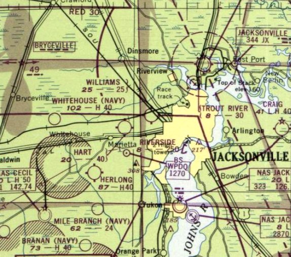
Williams Airport, as depicted on the 1947 USGS topo map.
The last aeronautical chart depiction which has been located of Williams Airport was on the August 1949 Jacksonville Sectional Chart.
It depicted Williams as a civilian airport having a 2,900' unpaved runway.
Williams Airport was evidently abandoned at some point between 1949-50,
as it was no longer depicted on the February 1950 Jacksonville Sectional Chart.
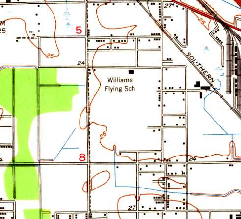
The 1950 USGS topo map depicted a single building on the north side of an open field as the “Williams Flying School”.
Tom Edwards recalled, “My grandmother [Lily Melson]
sold the property after WWII to a developer who set aside land for the Paxon schools.”
Williams Airport was no longer depicted on the 1957 USGS topo map.
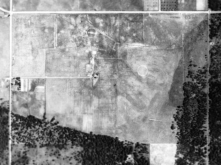
A 1960 aerial photo did not appear to show any remaining trace of Williams Airport,
with the site having been largely covered by a school.
Brian Rehwinkel observed in 2006, "The majority of the site is used by the Duval County School System
as a location for a middle school (appropriately named Paxon Junior High School)."
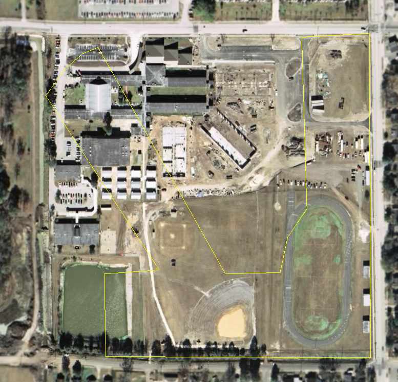
The former airfield layout of Paxon Field, as annotated by Chris Kennedy over a 2006 aerial photo.
The site of Paxon Field is located southwest of the intersection of Melson Avenue & Norman Thagard Avenue.
Norman was Valedictorian of the Paxon High School class of 1961, Astronaut, and a Marine Fighter Pilot.
____________________________________________________
Hart NOLF / Hart Field, Jacksonville, FL
30.33, -81.76 (West of Downtown Jacksonville, FL)
A 1943 US Government aerial photo of Hart NOLF, from the FL DOT (courtesy of Brian Rehwinkel).
This airfield had an extremely short life in its original role as a military airfield.
No airfield was yet depicted at this location on the 1939/41/42 Jacksonville Sectional Charts.
According to Army Corps of Engineers documents (courtesy of Brian Rehwinkel),
the Navy acquired 220 acres by lease for Hart Outlying Field in early 1942.
The Naval Air Advanced Training Command developed the site
and used it to support flight training operations in the Jacksonville area.
Only 9 months later, in November 1942, the Navy terminated the lease & returned the land to the owners.
After the Navy left, the field was apparently reused as a civilian airport for several years.
George Winterling recalled, “Hart Field on Commonwealth Avenue just west of Lane Avenue...
My first airplane ride was back in 1943 when I was 11 years old.
My father, Otto Winterling, drove to the 'airport', which was just a hangar & a sod field which looked like a cow pasture.
I climbed into a Piper Cub & sat next to the pilot.
When he revved up the engine, I watched the fat rubber tire out the window bumping off the grassy ruts.
After bouncing a few hundred yards, we smoothed out & climbed over the trees at the end of the field.
We circled the field over Beaver Street (US 90) & made a 'happy landing'.”
The earliest aeronautical chart depiction which has been located of Hart Field was on the January 1944 Jacksonville Sectional Chart.
It depicted Hart as a commercial/municipal airport.
The April 1944 US Army/Navy Directory of Airfields (courtesy of Ken Mercer) described Hart Field as having a 3,100' unpaved runway.
It also indicated that Navy flight operations were conducted from the field, which may have been inaccurate by that point.
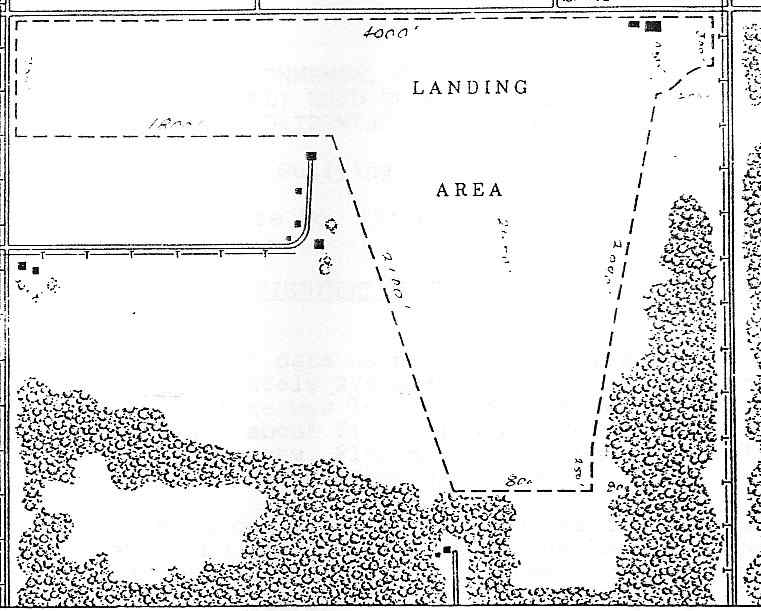
A 1945 SLR site map of depicted Hart Field as having an L-shaped landing area, measuring 4,000' east/west by 2,400' north/south.
Two buildings (hangars?) were depicted on the northeast corner of the field.
A 1945 Navy document (according to Brian Rehwinkel) described Hart Field as having 4 sod runways (the longest of which was 3,100'),
as well as having a 100' x 75' wooden hangar.
The 1945 AAF Airfield Directory (courtesy of Scott Murdock) described Hart Field
as a 500-acre irregularly-shaped property having 4 sod runways,
with the longest being a 3,100' northwest/southeast strip.
The field was described as having a 100' x 75' wooden hangar, to be owned & operated by private interests.
Dorothy Skinner recalled, “Hart's Airfield... when I was a child my grandparents & a few other relatives lived very near this airfield.
We always referred to it as Laurie Yonge's Field simply because his name was on a metal hangar (the only one that I can remember).
Some of my older cousins would go over & sweet-talk the pilots of those little Cubs into taking them up for a ride.
I don't remember if it was military or not at the time, but it was a very active field right next door to a cow pasture.
I know that Laurie Yonge's Flying Service moved to the Imeson Airport many years later.”
Hart Field, as depicted on the 1947 USGS topo map.
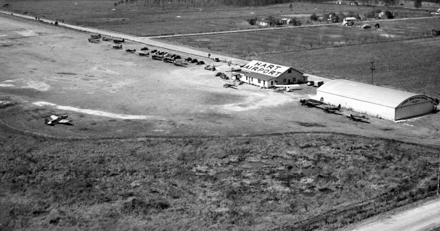
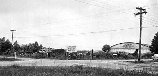
A circa 1940s aerial view by Leo Witt looking northwest at Hart Field (from the collection of John Griffis, courtesy of William Gallup).
It depicted an arch-roofed hangar (labeled “Laurie Yonge Flying Service”), an airport office (with “Hart Airport” on its roof), and 16 light aircraft parked on the grass airfield.
William Gallup reported that John Griffis was his Great Great Grandfather, “and he was the superintendent of the Jacksonville Municipal Airport back in the 1920s &/or 1930s.”
A January 1952 US Government aerial photo of Hart Field, from the FL DOT (courtesy of Brian Rehwinkel).
The field (and its hangars) still remained intact, but no aircraft were visible on the field, so it may have been closed by this point.
The last aeronautical chart depiction which has been located of Hart Field was on the August 1952 Jacksonville Sectional Chart.
It depicted Hart as having a 3,500' unpaved runway.
Hart Field was evidently abandoned at some point in 1952,
as it was no longer depicted on the August 1952 Jacksonville Sectional Chart or the 1957 USGS topo map.
A 1950s photo of a Hart Field hangar.
Hart Field appeared to remain intact on a 1960 aerial photo.
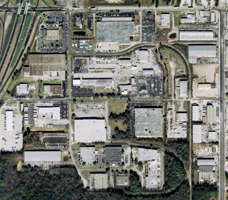
A 1971 aerial photo showed that an industrial building had been constructed over the central portion of the airfield at some point between 1960-71.
By the time of the January 1994 USGS aerial photo (courtesy of Brian Rehwinkel),
most of the site has been reused as an industrial park,
with the western portion of the former field being occupied by Interstate 295.
However, one of Hart Field's former wooden hangars remained standing, on the Northeast corner of the site.
An October 2004 photo by John Deffes of the WW2-era hangar which remains standing at the site of Hart NOLF.
"There is indeed an intact hangar there at the corner of Commonwealth & Lane Avenue.
This definitely looks like an old hangar, and as far as I can tell, matches up perfectly with the two pictures from Terraserver.
I'd like to do some more looking around the area, but it's largely an industrial area & fences are everywhere."
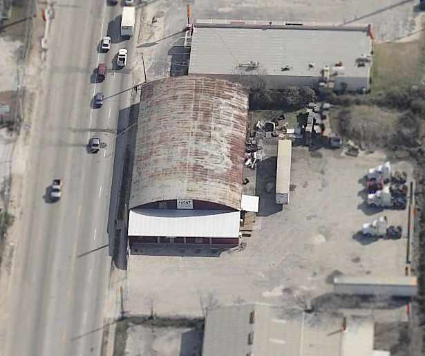
A circa 2005 aerial view looking east at the former Hart hangar.
As seen a 2006 aerial photo, one of Hart Field's former hangars remained standing, on the Northeast corner of the site.

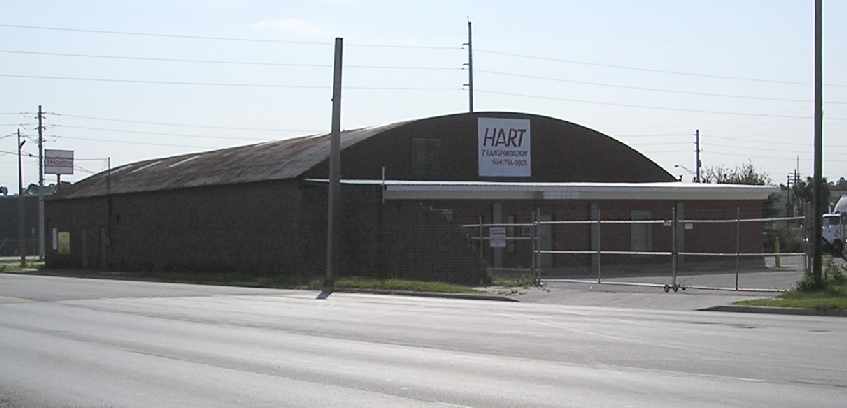
A March 2025 photo looking southwest at a former Hart Field hangar which remains on the northeast corner of the airport site, with a “Hart Transportation” sign.
The site of Hart Field is located south of the intersection of Interstate 295 & Commonwealth Avenue.
____________________________________________________
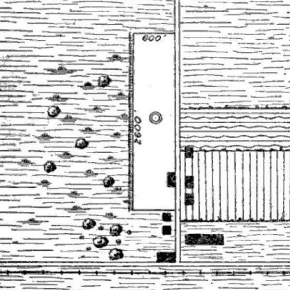
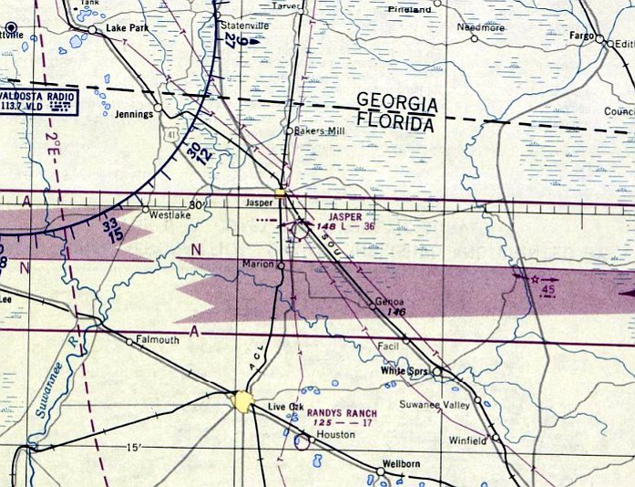
Jasper Intermediate Field, NO-JX Airway, Jasper, FL
30.483, -82.927 (West of Jacksonville, FL)
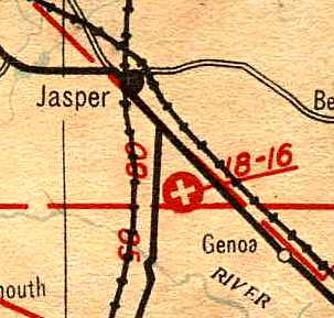
Jasper Landing Field, as depicted on the November 1936 "Official Airway Map of FL" (courtesy of Chris Kennedy).
Jasper Intermediate Field (or Site 43) was one of the Department of Commerce's network of Intermediate Fields,
which were established in the 1930s for the emergency use
of commercial aircraft flying along Airways between major cities.
Site 43 was an Intermediate Field along the New Orleans - Jacksonville Airway.
The earliest depiction which has been located of Jasper Intermediate Field
was on the November 1936 "Official Airway Map of FL" (courtesy of Chris Kennedy).
It depicted the field as having 2 runways.
The Airport Directory Company's 1937 Airports Directory (courtesy of Bob Rambo)
described the Jasper Auxiliary Field as being located 2 miles south of Jasper,
and having two sod runways: 1,800' southeast/northwest & 1,600' northwest/southeast.
Jasper Intermediate Field was not yet depicted on the April 1937 Jacksonville Sectional Chart.

The earliest Sectional Chart depiction which has been located of Jasper Intermediate Field was on the August 1939 Jacksonville Sectional Chart.
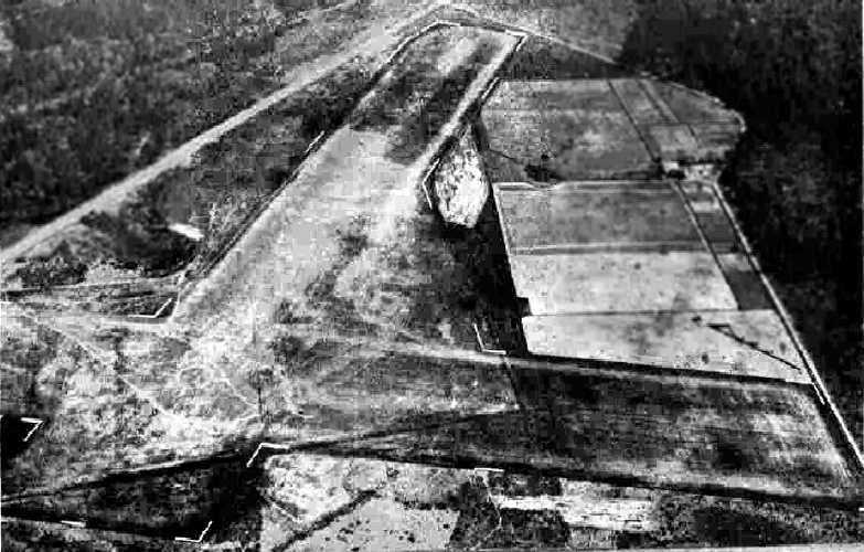
The earliest photo which has been located of Jasper Intermediate Field
was a 2/28/43 aerial view looking northeast from the 1945 AAF Airfield Directory (courtesy of Scott Murdock).
It depicted Jasper as having 2 grass runways.
The April 1944 US Army/Navy Directory of Airfields (courtesy of Ken Mercer)
described Site 43 as an Intermediate Field along the New Orleans - Jacksonville Airway.
It described the airfield as having a 3,600' unpaved runway,
and indicated that both Army & Navy flight operations were conducted from the field.
Site 43 was described in the same fashion in the December 1944 Army/Navy Airfield Directory (according to Brian Rehwinkel).
The 1945 AAF Airfield Directory (courtesy of Scott Murdock) described Jasper Intermediate Field
as an 80-acre irregularly-shaped property having 2 sod & sand runways, the longest being a 3,550' east/west strip.
The field was described as not having any hangars,
to be owned by private interests, and operated by the Civil Aeronautics Administration.
According to Brian Rehwinkel, "I have read this field was used by the Navy fields in Jacksonville
as an OLF during the war [WW2] (although the directory does not refer to it as an OLF),
so it is possible that it was not used a great deal after WW2."
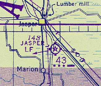
The February 1945 Jacksonville Sectional Chart (courtesy of Chris Kennedy) labeled the field as "Japser Landing Field, Site 43".
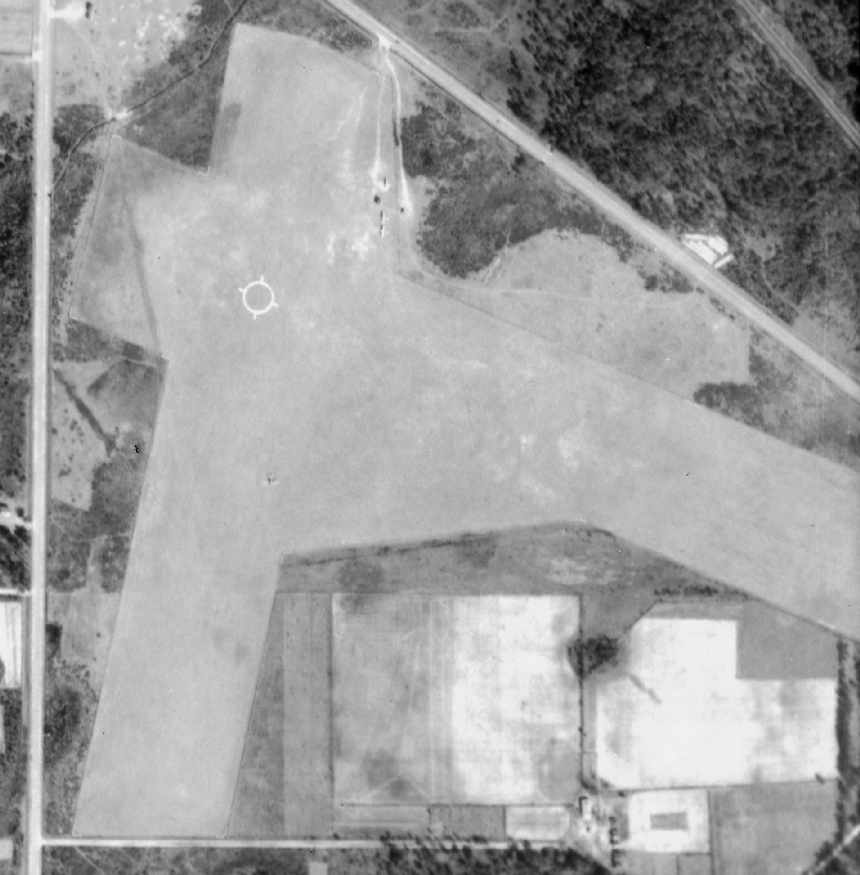
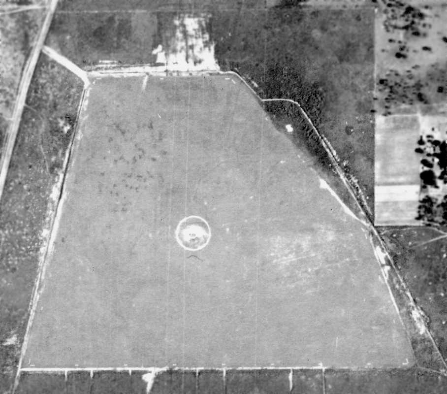
The February 1947 aerial photo, from the FL DOT (courtesy of Brian Rehwinkel)
depicted Site 43 as consisting of a grass field with 2 runways.
There did not appear to be any hangars or other permanent buildings at the airfield.
Note the 2 aircraft (type undetermined) on the field (just northeast of the runway intersection),
and a third aircraft (south of the runway intersection).
A later aerial photo of Site 43 from March 1947 (from the FL DOT, courtesy of Brian Rehwinkel)
did not happen to depict any aircraft at the field.
The last aeronautical chart depiction which has been located of Jasper Intermediate Field was on the July 1950 Jacksonville Sectional Chart.
The Site 43 Airway beacon was also still depicted as being operational.
Jasper Landing Field was apparently abandoned at some point between 1950-51,
as it was no longer depicted on the January 1951 Jacksonville Sectional Chart or the 1954 USGS topo map.
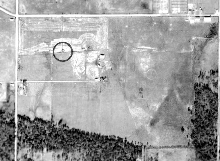
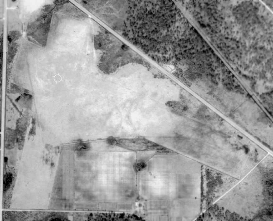
As seen in the December 1998 USGS aerial photo, the outline of Jasper's former runways was still apparent in the outline of relatively newly-planted trees,
which had been planted in neat rows in the area formerly occupied by the runways.
This suggested that the area of the former runways may have remained cleared for some period of time.
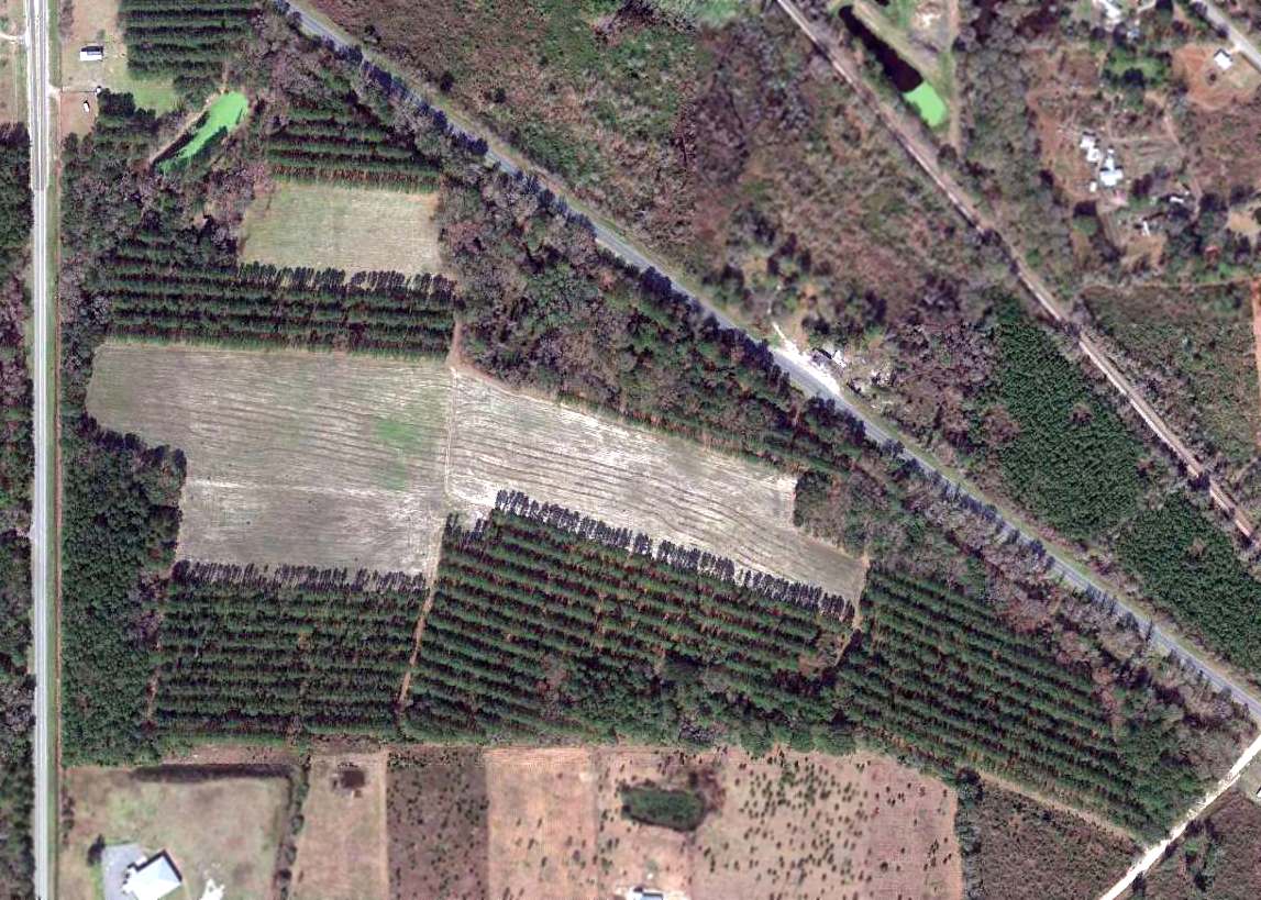
A 2015 aerial photo showed the outline of the former Jasper airfield area to still be quite recognizable.
The site of the Jasper airfield is located south of the intersection of Route 41 & Route 129, 3.5 miles Southeast of Jasper.
____________________________________________________
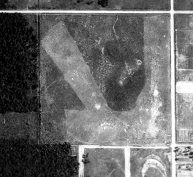
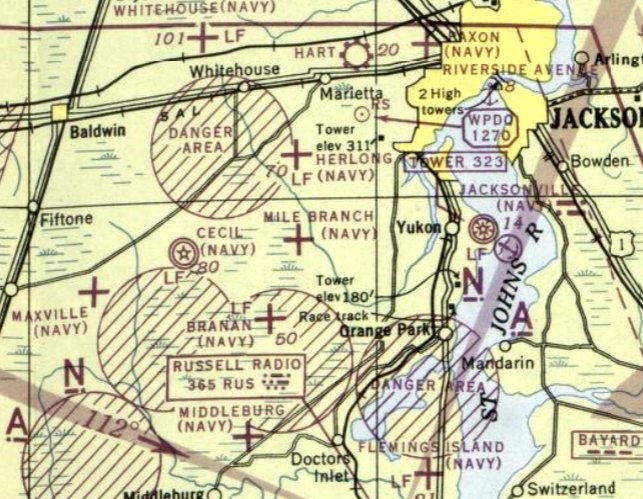
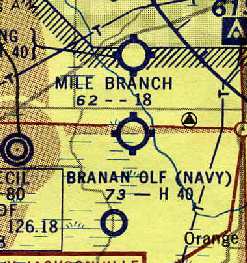
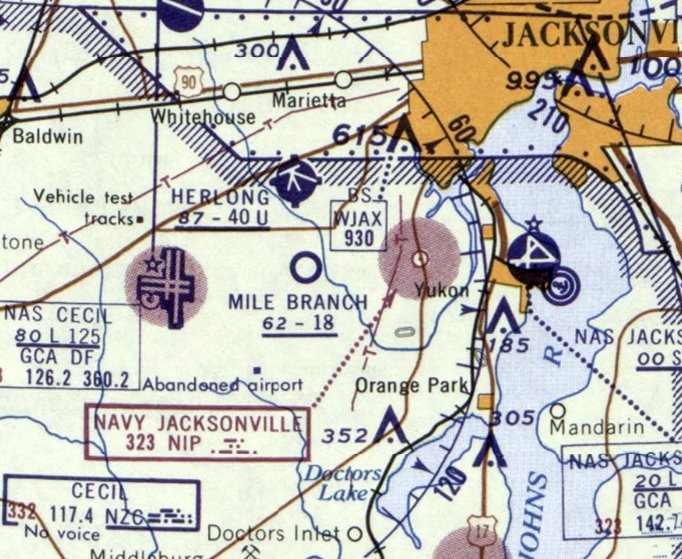
Mile Branch Naval Outlying Landing Field / Skytel Airport / Mile Branch Airport, Mile Branch, FL
30.23, -81.803 (Southwest of Jacksonville, FL)
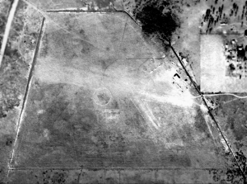
A June 1943 aerial view of Mile Branch NOLF (from the FL DOT, courtesy of Brian Rehwinkel).
Mile Branch was apparently established during WW2 as one of the large number
of auxiliary airfields used to support Naval flight training in the Jacksonville area.
According to a 2007 Army Corps of Engineers “CERCLA Preliminary Assessment” (courtesy of Prent Davis),
“Mile Branch was an open space, which after having some tree stumps removed, made a good landing field.
The initial land condemnation consisted of 158 acres.
In late 1941 the Navy acquired an additional 181 acres for the outlying field.”
The earliest depiction of Mile Branch NOLF which has been located
was a June 1943 aerial view from the FL DOT (courtesy of Brian Rehwinkel).
It depicted Mile Branch as consisting of an irregularly shaped grass field, with no buildings or hangars visible.
Mile Branch was not depicted on the January 1944 Jacksonville Sectional Chart,
listed in the April 1944 US Army/Navy Directory of Airfields (courtesy of Ken Mercer),
or listed the December 1944 Army/Navy Airfield Directory (according to Brian Rehwinkel).
This doesn't necessarily mean it was inactive by this time -
it may have been overlooked, as one of numerous small satellite airfields in the Jacksonville area.
The earliest aeronautical chart depiction which has been located of Mile Branch NOLF was on the July 1944 Jacksonville Sectional Chart.
It depicted “Mile Branch (Navy)” as an auxiliary airfield.
The 1945 AAF Airfield Directory (courtesy of Scott Murdock) described “Jacksonville NAS Auxiliary (26907 Mile Branch Outlying Field)”
as a 62 acre irregularly-shaped property having a sod all-way landing area.
The field was described as not having any hangars, to be owned by the U.S. Government, and operated by the Navy.
According to a 2007 Army Corps of Engineers “CERCLA Preliminary Assessment” (courtesy of Prent Davis),
“In March 1945 the Navy reported that Mile Branch Outlying Field was a fenced, sod field used for emergency landings only,
and there were no buildings at the field.”
According to Brian Rehwinkel, "As with many of the other OLFs in the Jacksonville area,
when the Jacksonville air stations began doing less primary pilot training, several of the OLFs were converted to bomb targets.
This was apparently the case with Mile Branch.
It was listed in August of 1945 as a bomb target for NAAS Cecil Field.
Mile Branch was owned by the Navy & was listed as inactive by February 1947.
Mile Branch may have been used after the war as an airfield."
According to a 2007 Army Corps of Engineers “CERCLA Preliminary Assessment” (courtesy of Prent Davis),
“In October 1947, officials from the WAA inspected the airfield property.
At the time, a revocable permit had been issued to Skytel Inc to operate a private flying school on the former naval airstrip.
In 1948 the government did not receive any offers to purchase the airport property,
and the WAA later reclassified the property as agricultural land.”
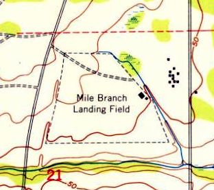
"Mile Branch Landing Field" was depicted on the 1949 USGS topo map as having an irregularly-shaped outline,
with a few small buildings along the east side.
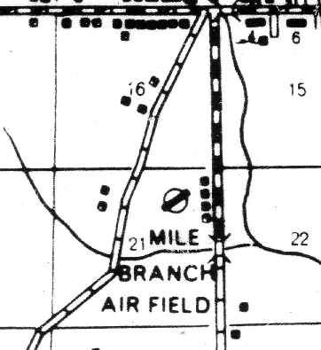
"Mile Branch Air Field", as depicted on an August 1949 FDOT County Road Map (courtesy of Brian Rehwinkel).
It is not clear from this depiction whether it was a military or civilian airfield at this point.
The former Mile Branch Navy airfield was evidently (briefly) reused as a civilian airfield,
as a “Skytel” Airport was depicted at its location on the 1949 USAF Pilot's Handbook (courtesy of Chris Kennedy).
The only photo which has been located showing aircraft at Mile Branch was a 1/6/52 aerial view from the FL DOT (courtesy of Brian Rehwinkel).
Brian Rehwinkel observed, "You can see a small hangar has been placed on the eastern edge of the field & 5 aircraft are visible.
Also visible are the outlines of 2 runways - an East/West runway & a Northwest/Southeast runway.
This photo was probably taken during the time this field was used as a civilian airport."
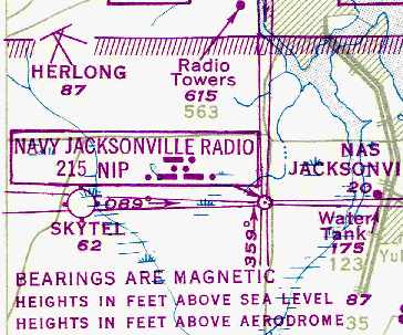
The February 1956 Jacksonville Sectional Chart (courtesy of Chris Kennedy)
depicted Mile Branch as a civilian airport with 2 runways, the longest being an 1,850' "flint" strip.
Terry Brant recalled, “On my 16th birthday, in May of 1957,
I flew a Piper Tri-Pacer over to Mile Branch from Craig Airport
and took my Private checkride with Curtis Jordan who was an A & E mechanic & flight examiner & also operated the airport.
At that time there were quite a few aircraft on the field, including Curtis' beautiful little Aeronca C-3 & about 6 others.
One had to be quite vigilant even back then, because Mile Branch was literally in the traffic pattern at Cecil
and in close proximity to several other airports, including NAS Jacksonville, restricted airspace, and the civilian airport Herlong.”
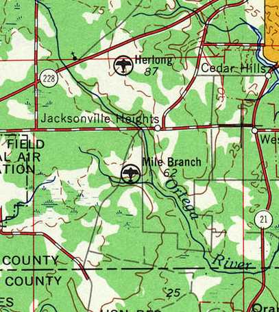
Mile Branch Airport, as depicted on the 1957 USGS topo map.
Warren Kegebein recalled, “I flew out of Mile Branch Airport from March 1957 to some time in 1959.
My first solo was in one of Curt Jordan's J-3 Cubs, N1973M.
I recall 3 runways. The runways were approximately 1,800', 1,600', and 800'.
On one occasion approaching the field I had 6 Grumman Panthers coming at me from 3 directions.
There were 2 from the right, 2 from the left and 2 from the left rear, all heading for Cecil Field.
As a student with about 20 hours it was pretty scary.
Curt's small daughter almost walked into a spinning propeller in 1959 & that prompted him to start shutting down his operation.
By 1960 I had to fly out of Herlong Field.
I seem to recall that he advertised his 3 Cubs for sale for $600, $800 and $1,200.
His C-3 Aeronca was a beautiful sight to behold.
The road to the airport, Schindler Road, was dirt with deep gullies which were impassable after a significant period of rain.”
Mile Branch was described in the 1960 Jeppesen Airway Manual (according to Chris Kennedy) as having a single 1,800' unpaved runway.
The Mile Branch Airport appeared to remain intact in a 1960 aerial photo,
but had presumably been closed, as numerous cars were visible on the east side of the airfield,
instead of the aircraft seen in the same location on a 1952 photo.
The last aeronautical chart depiction which has been located of Mile Branch Airport was on the February 1961 Jacksonville Sectional Chart.
It depicted Mile Branch as a civilian airport having an 1,800' unpaved runway.
Mile Branch Airport was apparently closed by 1962, as it was not listed in the 1962 AOPA Airport Directory,
and it was no longer depicted on the 1964 Jacksonville Sectional Chart (courtesy of John Voss).
A 1971 aerial photo showed that several more houses had been constructed over portions of the Mile Branch Airport site.
As seen in the January 1994 USGS aerial photo, the overall outline of Mile Branch Airport was still barely apparent.
The area of the former airfield had been covered by a mix of residential housing & pine trees.
The outline of the former airfield access road was still barely recognizable on the northwest corner of the property.
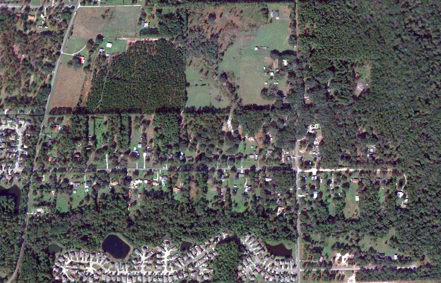
A 2015 aerial photo showed the overall outline of Mile Branch Airport was still barely apparent,
and the outline of the former airfield access road was still barely recognizable on the northwest corner of the property.
The site of Mile Branch NOLF is located northeast of the intersection of Old Middleburg Road & Marlee Road, 3 miles east of Cecil Field.
____________________________________________________
Or if you prefer to contact me directly concerning a contribution (for a mailing address to send a check),
please contact me at: paulandterryfreeman@gmail.com
If you enjoy this web site, please support it with a financial contribution.
____________________________________________________
This site covers airfields in all 50 states.