Abandoned & Little-Known Airfields:
Hawaii: Kauai island
© 2001, © 2022 by Paul Freeman. Revised 12/25/22.
____________________________________________________
Please consider a financial contribution to support the continued growth & operation of this site.
Kealia Landing Strip (added 12/25/22) - Kekaha Airstrip (added 12/24/22)
____________________________________________________
Kealia Landing Strip, Kealia, HI
22.132, -159.336 (Eastern coast of Island of Kauai, HI)
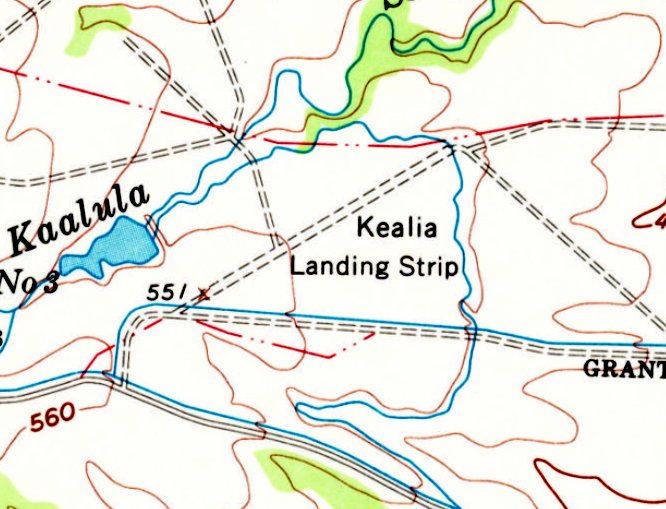
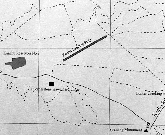
Kealia Landing Strip, as depicted on the 1963 USGS topo map.
Photo of the airfield while in use has not been located.
This small airfield on the southwest side of Kauai was evidently established at some point between 1960-63,
as it was not yet depicted on the November 1960 Hawaiian Islands Sectional Chart.
The earliest depiction which has been located of Kealia Landing Strip was on the 1963 USGS topo map,
which depicted a single northeast/southwest unpaved runway.
The earliest aeronautical chart depiction which has been located of Kealia Landing Strip was on the December 1964 Hawaiian Islands Sectional Chart.
It depicted Kealia Landing Strip as a private airfield having a single 1,900' paved northeast/southwest runway.
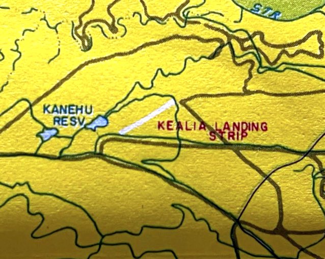
A circa 1980s map (courtesy of Kevin Walsh) depicted Kealia Landing Strip as having a single northeast/southwest runway.
The last aeronautical chart depiction which has been located of Kealia Landing Strip was on the June 1983 Hawaiian Islands Sectional Chart (courtesy of John Voss).
It depicted Kealia Landing Strip as a private airfield having a single 1,900' paved northeast/southwest runway.
Kealia Landing Strip was evidently closed (for reasons unknown) at some point between 1983-93,
as it was no longer depicted on the May 1993 Hawaiian Islands Sectional Chart (courtesy of Ron Plante).
A 2010 map (courtesy of Kevin Walsh) depicted Kealia Landing Strip as having a single northeast/southwest runway.
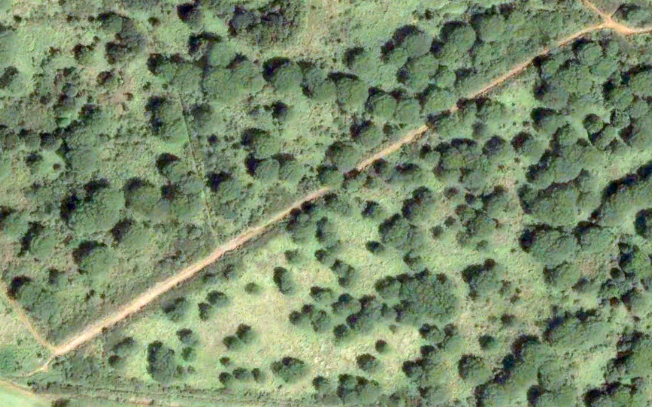
The earliest photo which is available of the Kealia Landing Strip was a 2003 aerial view.
It depicted a single northeast/southwest unpaved deteriorated runway.
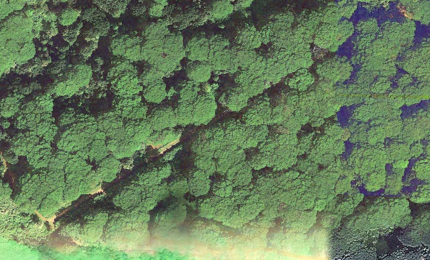
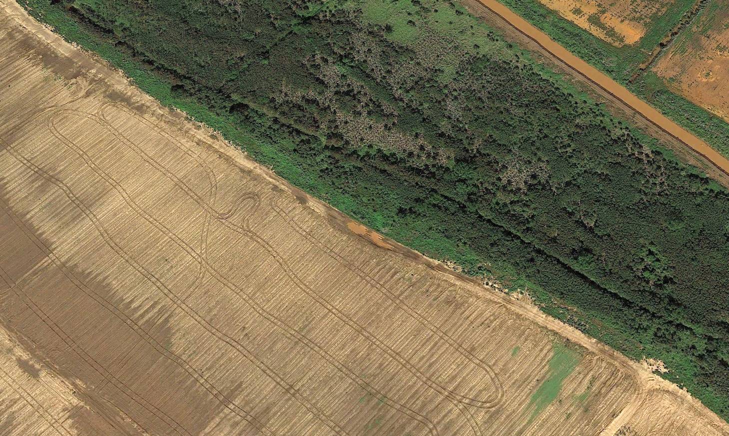
A 2013 aerial view of the site of the Kealia Landing Strip. Kevin Walsh observed, “It has been obliterated by an overgrown forest canopy.”
Thanks to Kevin Walsh for pointing out this airfield.
____________________________________________________
21.995, -159.749 (Southwestern coast of Island of Kauai, HI)
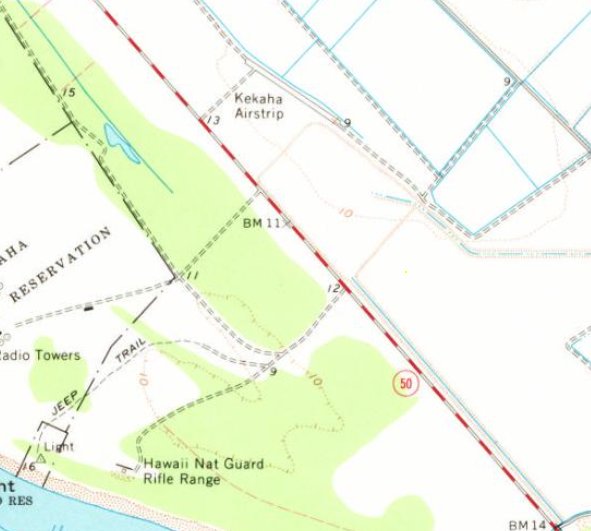
Kekaha Airstrip, as depicted on the 1963 USGS topo map.
Photo of the airfield while in use has not been located.
This small airfield on the southwest side of Kauai was evidently established at some point between 1960-63,
as it was not yet depicted on a 1950 aerial photo or the November 1960 Hawaiian Islands Sectional Chart.
The earliest depiction which has been located of Kekaha Airstrip was on the 1963 USGS topo map,
which depicted a single small northwest/southeast runway.
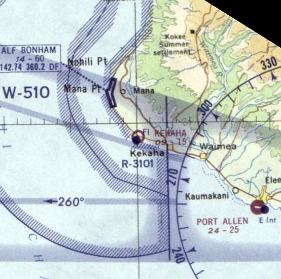
The earliest aeronautical chart depiction which has been located of Kekaha Airstrip was on the December 1964 Hawaiian Islands Sectional Chart.
It depicted Kekaha Airstrip as having a mere 1,500' unpaved runway.
The earliest photo which has been located of Kekaha Airstrip was a 1966 aerial view,
which depicted a single small northwest/southeast runway.
The last aeronautical chart depiction which has been located of Kekaha Airstrip was on the December 1967 Hawaiian Islands Sectional Chart.
It depicted Kekaha Airstrip as having a mere 1,500' unpaved runway.
Kekaha Airstrip was evidently closed (for reasons unknown) at some point between 1967-68,
as it was no longer depicted on the December 1968 Hawaiian Islands Sectional Chart.
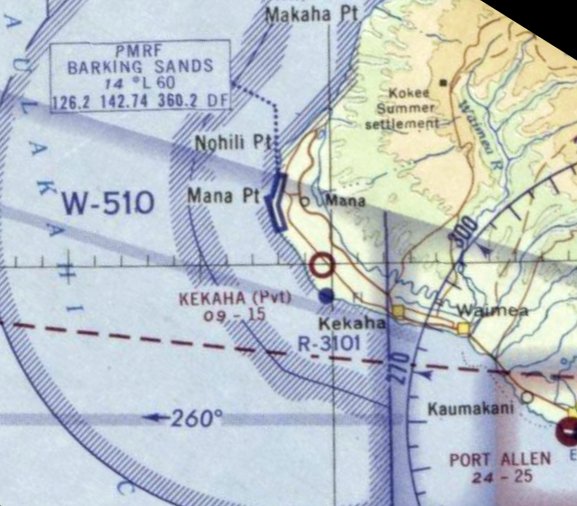
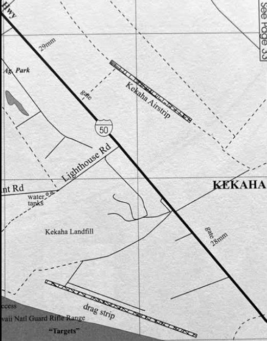
A circa 1980s map (courtesy of Kevin Walsh) depicted Kekaha Airstrip as a single small northwest/southeast runway.
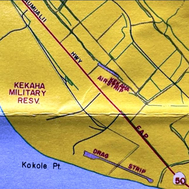
Kevin Walsh noted, “Oddly, the dragstrip [to the south] seems to have been custom-built for that purpose, and was not an abandoned airstrip.”
Kekaha Airstrip, as depicted on a circa 2000 map (courtesy of Kevin Walsh).
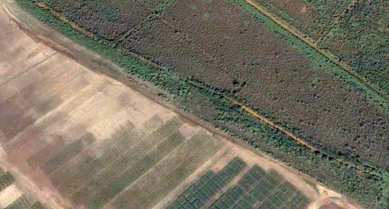
The earliest photo which is available of the Kekaha Airstrip was a 2005 aerial view looking north.
It depicted the deteriorated remains of a single small northwest/southeast runway.
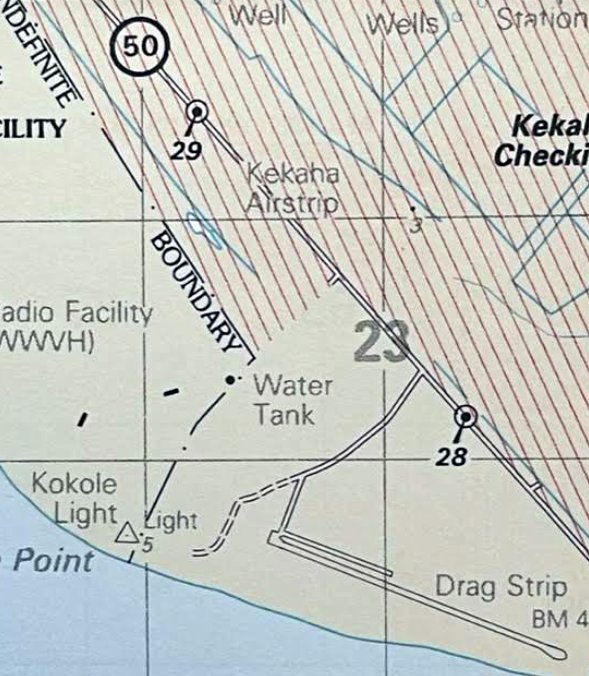
A 2010 map (courtesy of Kevin Walsh) depicted Kekaha Airstrip as a single small northwest/southeast runway.
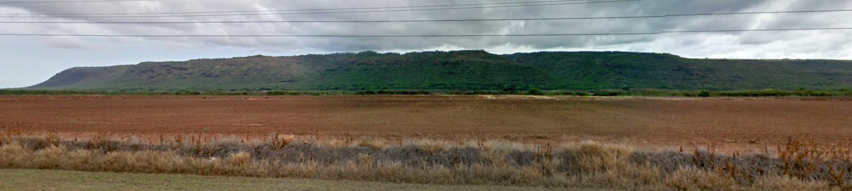
An October 2011 photo looking northeast showed no sign of Kekaha Airstrip.
A 2013 aerial view looking north depicted no trace remaining of the Kekaha Airstrip.
Thanks to Kevin Walsh for pointing out this airfield.
____________________________________________________
Or if you prefer to contact me directly concerning a contribution (for a mailing address to send a check),
please contact me at: paulandterryfreeman@gmail.com
If you enjoy this web site, please support it with a financial contribution.
____________________________________________________
This site covers airfields in all 50 states.