Abandoned & Little-Known Airfields:
Western Pacific Islands
© 2001, © 2026 by Paul Freeman. Revised 5/29/26.
This site covers airfields in all 50 states: Click here for the site's main menu.
____________________________________________________
Please consider a financial contribution to support the continued growth & operation of this site.
Baker Island Airfield (revised 11/9/22) - French Frigate Shoals NAF (revised 4/7/19) - Guam Northwest AAF / Guam Northwest AFB (revised 5/29/26)
Johnston Atoll Airport (revised 11/6/22) - Kobler Field (revised 6/9/25) - Kure Atoll Airfield (revised 11/6/22) - Leone Airfield (revised 12/22/20)
Majuro Airfield / Naval Air Facility Majuro (revised 12/22/20) - Marpi Point Field / NAB Marpi Point (revised 5/19/20) - Midway Eastern Island (revised 11/6/22) - Orote Field (revised 10/12/22)
Palmyra Atoll Airfield (revised 6/1/21) - Saipan East Field / Kagman Field / Kagman Point Field (revised 4/6/19) -Tinian West Field #4 (revised 10/4/14)
Tiyan Airfield / Air Depot Field / Harmon Field / Harmon AFB (revised 11/9/22) - Ushi Point Airfield / Tinian North Field (revised 11/9/22)
___________________________________________________
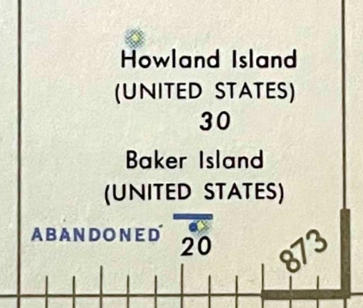
Baker Island Airfield, Baker Island
0.196, -176.478 (Southwest of Hawaii)
Baker Island Airfield, as depicted on a 1958 aeronautical chart (courtesy of Kevin Walsh).
According to Wikipedia, “Baker Island is an uninhabited atoll located just north of the equator in the central Pacific Ocean about 1,920 miles southwest of Honolulu.
The island lies almost halfway between Hawaii & Australia. The island is an unincorporated & unorganized territory of the U.S..
Its population was 4 American civilians, all of whom were evacuated in 1942 after Japanese air & naval attacks.
On 8/11/43 a US Army defense force arrived on Baker Island as part of the Gilbert & Marshall Islands campaign.
In September 1943 a 5,463' airfield was opened & was subsequently used as a staging base by 7th Air Force B-24 Liberator bombers for attacks on Mili Atoll.
The 45th Fighter Squadron operating P-40 fighters operated from the airfield from 9/1-11/27/43. By 1/1/44 the airfield was abandoned.
LORAN radio navigation station Baker was a radio operations base in operation from September 1944 to July 1946.”
The earliest depiction which has been located of Baker Island Airfield was on a 1958 aeronautical chart (courtesy of Kevin Walsh).
It depicted single east/west runway, abandoned.
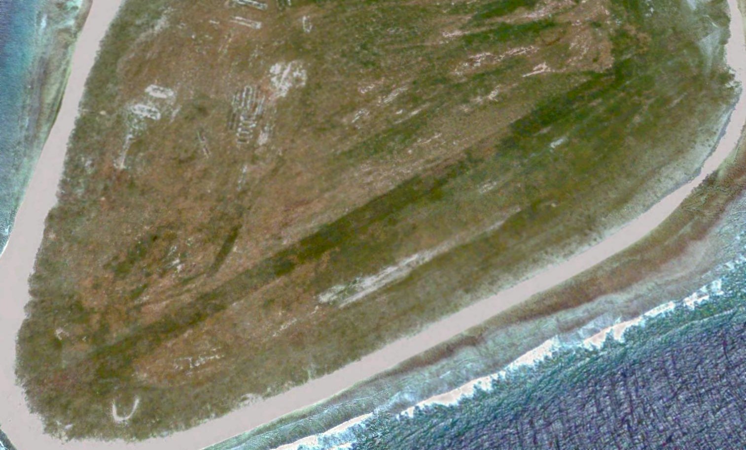
The earliest photo which has been located of Baker Island Airfield was a 2005 aerial view, which depicted the remains of a single east/west runway.
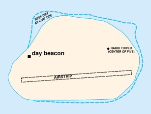
A 2007 map depicted Baker Island Airfield, along with only other features on the island: the day beacon & the 5 radio towers.
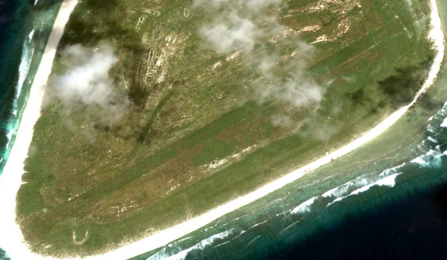
A 2014 aerial view looking northeast at Baker Island Airfield.
As of 2017, Wikipedia described, “Debris from past human occupation is scattered throughout the island.
The most noticeable remnant is the 5,400' airstrip. It is completely overgrown with vegetation & is unusable.
In the northeast section, apparently the main camp area, are the remains of several buildings & heavy equipment.
Five wooden antenna poles about 40' high remain standing in the camp.
Debris from several crashed airplanes & large equipment such as bulldozers is scattered around the island.”
Thanks to Nicholas Parr for pointing out this airfield.
____________________________________________________
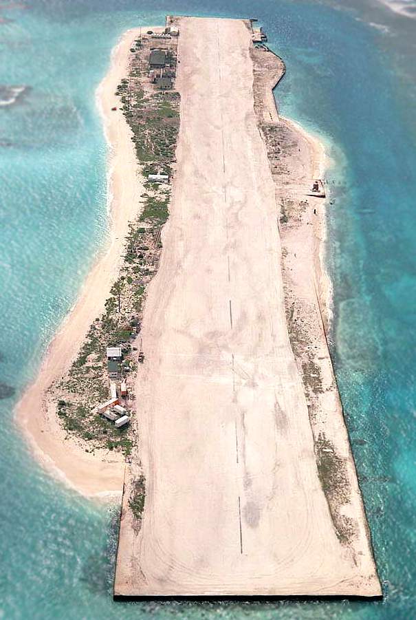
Kure Atoll Airfield, Green Island, Kure Atoll
28.39, -178.295 (West of Hawaii)
A 3/26/61 aerial view looking southeast at the Kure Atoll airfield & LORAN station.
Kure Atoll or Ocean Island is an atoll in the Pacific Ocean 48 nautical miles beyond Midway Atoll in the Northwestern Hawaiian Islands.
The only land of significant size is called Green Island on the southeast part of the atoll.
Largely neglected for most of its history, during World War II Kure was routinely visited by U.S. Navy patrols from nearby Midway
to ensure that the Japanese were not using it to refuel submarines or flying boats from submarine-tankers, for attacks elsewhere in the Hawaiian chain.
During the Battle of Midway, a Japanese Nakajima B5N "Kate" bomber, operating from aircraft carrier Hiryū,
piloted by Lieutenant Kikuchi Rokurō, and which had been involved in the initial Japanese attack on Midway's US installations,
crash-landed near Kure after being damaged by US fighters.
Once ashore, Lt. Kikuchi, Warrant Officer Yumoto Noriyoshi, and Petty Officer Narasaki Hironori refused capture
and were either killed or committed suicide when an American landing party tried to capture them.
In 1960 a United States Coast Guard LORAN station was constructed on Green Island,
and on the southwest side of the island a 4,000' northeast/southwest coral runway was built with a small ramp on the northeast side.
The station was commissioned in March 1961.
A C-121 made an emergency landing at Kure on 6/19/61.
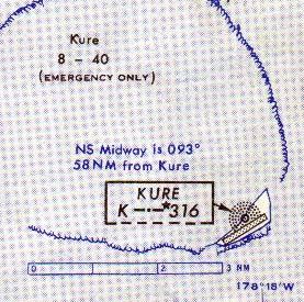
The 1963 Pacific Islands Enroute Aeronautical Chart (courtesy of John Voss) depicted Kure as an “Emergency only” airfield having a 4,000' runway & an NDB navigational beacon.
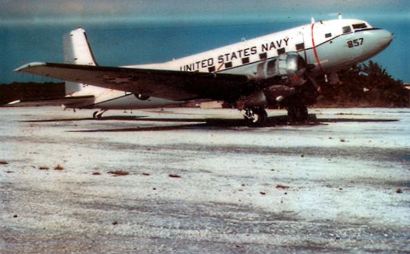
A circa 1960s photo of a Navy Douglas R4D transport at Kure Atoll.
A Boeing 707 made an emergency landing at Kure in 1966.
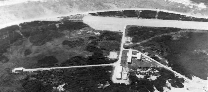
A circa 1970 aerial view looking south at the Kure Atoll Airfield & LORAN station.
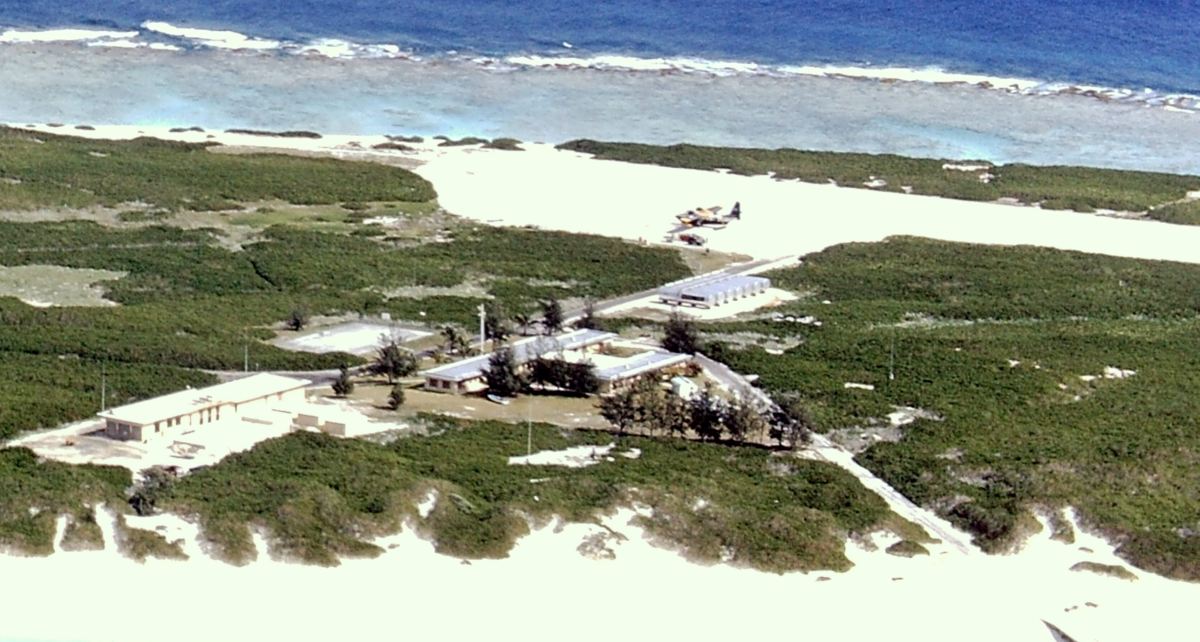
A 1971 aerial view looking southeast at the Kure Atoll Airfield & buildings for the LORAN station,
with a Grumman HU-16 Albatross amphibian on the ramp.
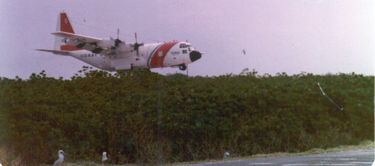
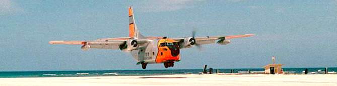
A 1979-80 photo of a Coast Guard Lockheed C-130 Hercules landing at Kure Atoll Airfield.
Kure Atoll became a state wildlife sanctuary in 1981.
Keith Dart recalled, “I was billeted at Kure Atoll from 1986-87. All the buildings were still fully intact.”
The Kure Atoll LORAN station was decommissioned on 7/2/92.
Since 1993 the Hawaii Department of Land & Natural Resources & volunteers from the Kure Atoll Conservancy group
have helped to restore the atoll to a more natural state.
Since 2010 the Division of Forestry & Wildlife has had a year-round presence on Kure Atoll.
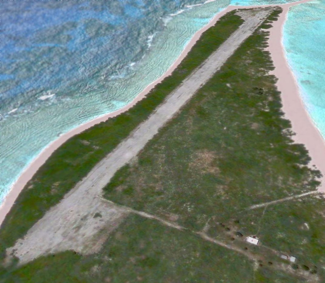
A 2005 aerial view looking southwest shows the abandoned Kure Atoll Airfield.
Note most of the buildings of the former LORAN station had been removed at some point between 1987-2005.
A 2016 aerial view looking northwest at the abandoned Kure Atoll Airfield.
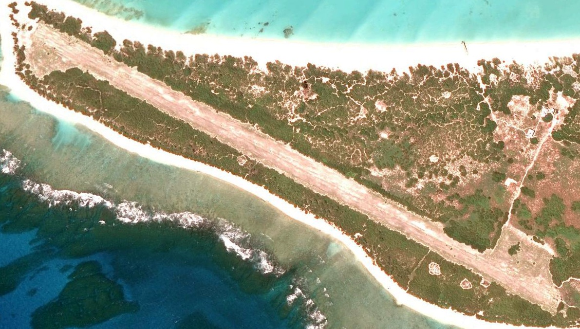
An 11/15/18 aerial view looking south at Kure Atoll Airfield taken from 37,000' by Rip Torn.
Thanks to John Voss for pointing out this airfield.
____________________________________________________
13.437, 144.64 (Southwest of Hawaii)
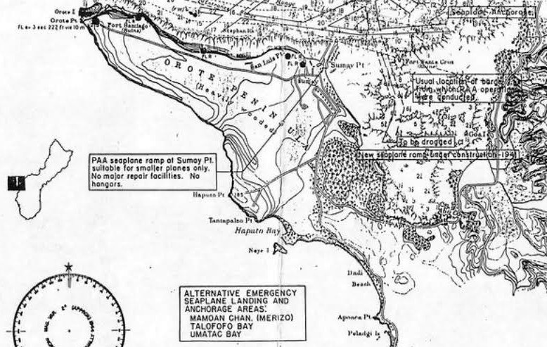
An undated map of Orote Point predating its airfield, showing Apra Harbor seaplane landing zones (courtesy of John Lawrence).
According to the National Park Service, Orote Field Guam was constructed during Japanese occupation of Guam from 1941-44 by Korean & Guamian labor.
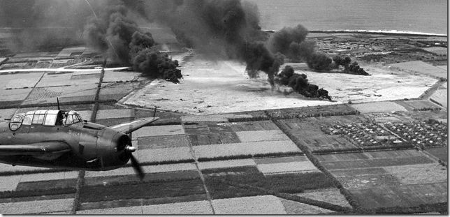
On 2/23/44 American carrier-based airplanes attacked the field, and other American raids soon followed.
During the Battle of the Philippine Sea the field was used by the Japanese carrier-based airplanes to refuel & rearm,
and Japanese airplanes based at Orote Field were also used to attack the American fleet.
As of 6/1/44 Japanese air strength on Guam consisted of 100 Zeros & 10 Gekko night fighters at Airfield #1
and 60 Ginga bombers at Airfield #2 (one of which was Orote Field).
However, American raids on 6/19/44 destroyed the landing fields, the aircraft on the ground & such aircraft that managed to take off.
American pilots reported extremely intense antiaircraft fire around Orote Field.
Fifteen Japanese airplanes crashed while attempting to land on Orote Field on 6/19/44.
On 6/20/44 numerous actions occurred in the immediate vicinity of Orote Field between American carrier airplanes
and Japanese aircraft seeking refuge at Orote Field after flying from their carriers,
or Japanese airplanes needing to refuel & rearm to attack American carriers.
Numerous dogfights took place in the air above Orote Field & numerous strikes by American airplanes destroyed Japanese facilities & airplanes on the ground.
This was significant because it denied the Japanese the use of a crucial airfield in the battle.
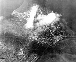
A 1944 aerial view of Orote Field during American bombardment.
The Japanese assigned the defense of Orote Peninsula to the 54th Independent Guard Unit under command of Air Group Commander Asaichi Tamai.
After the invasion on 6/21/44, the 1st Provincial Marine Brigade under command of Lt. General Lemuel Shepherd
fought its way through the village of Agat to the base of Orote Peninsula.
Here the Japanese had constructed an elaborate interlocking system of pillboxes, strongpoints & trenches.
Regiments of the 1st Provisional Marine Brigade, the 4th & 22nd, fought their way through the area.
Shortly before midnight on 6/26/44, the Japanese trapped on the peninsula staged a suicide attack & were completely wiped out.
The advancing Marines still met heavy Japanese resistance in the vicinity of the airfield, where the Japanese fought from caves & coconut bunkers.
The peninsula was declared secure on 6/29/44.
It is estimated that the Japanese lost more than 3,000 men defending Orote Peninsula.
Orote Field was used by Marine air power for close combat support missions during the liberation of Guam.
This was accomplished by Marine Air Group 21 flying Corsairs from Orote Field.
By mid-November 1944, MAG-21, now commanded by Colonel Edward Carney, was an oversized group,
having 12 squadrons based at Orote Field, 529 officers, 3,778 enlisted men & 204 aircraft.
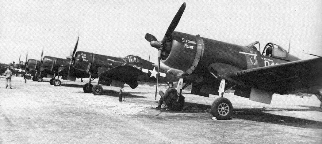
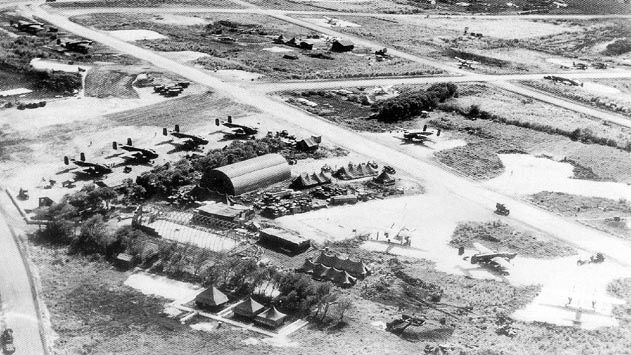
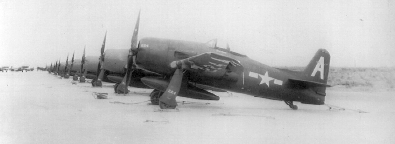
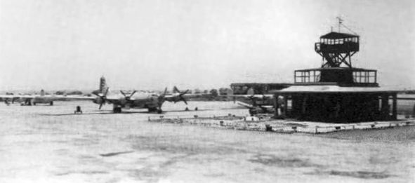
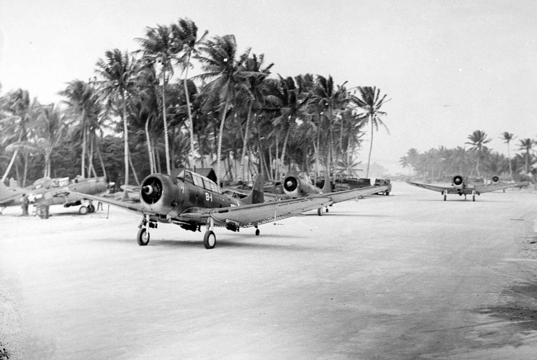
A WW2 photo of Vought F4U-1D Corsairs of Marine Air Group 21 on Orote Field (courtesy of John Voss).
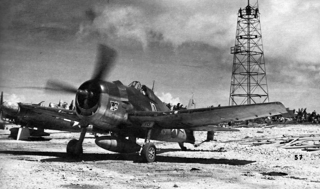
A WW2 photo of Grumman F6F-3N night fighters of VMF(N)-534 on Orote Field (courtesy of John Voss).
MAG-21 was shifted to Agana airfield in 1945, as air operations at Orote Field had always been hampered by adverse crosswinds.
The field was next used as a Navy casualty unit for the repair of damaged aircraft.
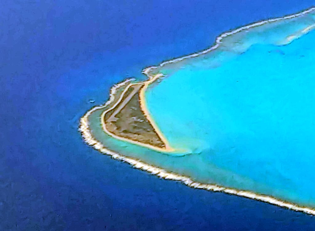
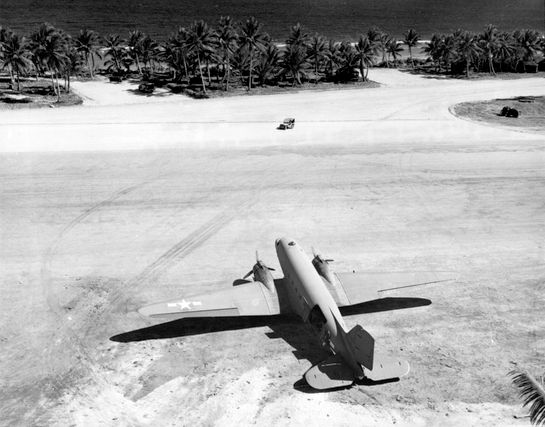
A circa 1945 aerial view looking east depicted Orote Field as having a single asphalt runway.
Gary Boothe noted, it showed “the Orote Point airfield after major development by US forces in WWII.”
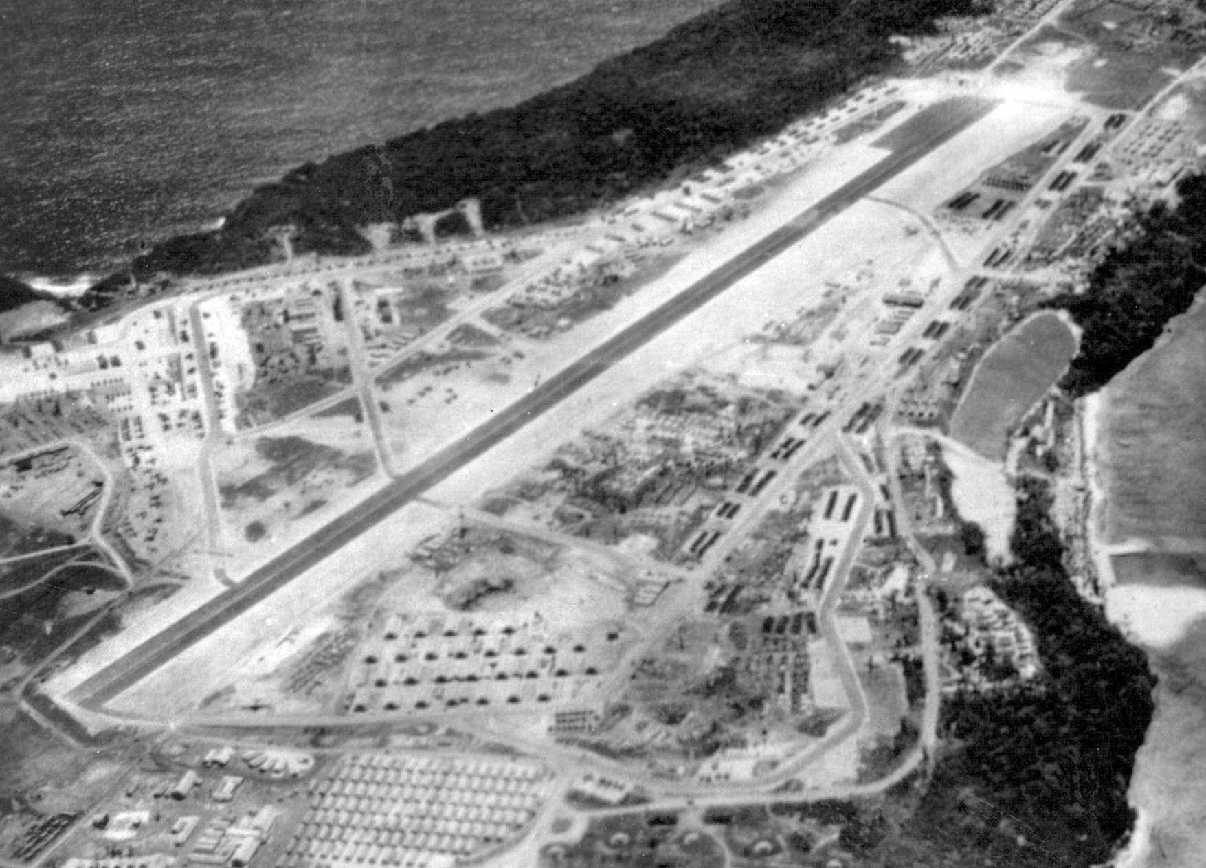
A circa 1945-46 aerial view looking west (courtesy of William Minarik) depicted Orote Field as having a single asphalt runway.
William Minarik noted, his father “was stationed on Guam (repairing PB4Y recon aircraft) from May 1945 - April 1946.”
Orote Field was finally closed to all but emergency landings in 1946.
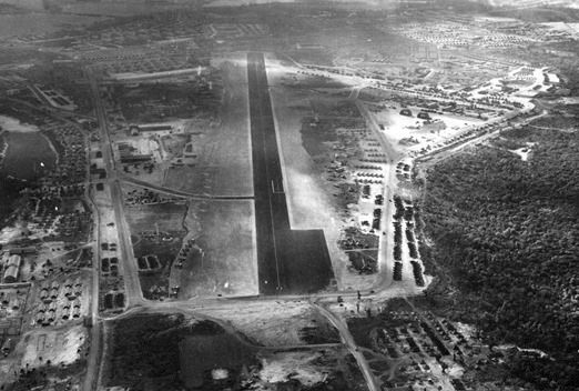
The earliest aeronautical chart depiction which has been located of Orote Field was on a 1958 World Aeronautical Chart.
It depicted Orote OLF as having a 5,500' runway.
A 3/2/67 USGS aerial view depicted Orote Field as having 2 runways.
The 1966 Pacific Terminal Areas Chart (courtesy of Kevin Walsh) no longer depicted Orote Field.
The June 1971 Hawaiian Islands & Marianas Islands Sectional Chart (courtesy of Ron Plante) depicted Orote Field as abandoned.
Jed recalled, “In 1988 I landed on [Orote Field] a couple of times even though it was closed to the public -
military helicopters were still using it then from time to time for practice.”
A 1992 aerial view by Ron Plante looking east at Orote Field showed both runways remained intact.
A 2002 aerial view showed that portions of Orote Field's main (northwest/southeast) runway had been removed at some point between 1992-2002.
But the widened portion at the northwest end had been marked with 3 helicopter landing spots.
In later years the crosswind runway has been used for C-130 touch-and-go flight training, and for helicopter training by Navy SEALs.
Orote Field was used as a tent city for the 1999 Tandem Thrust military exercise.
A 2013 aerial view looking east shows the majority of the Orote Field runways remain intact.
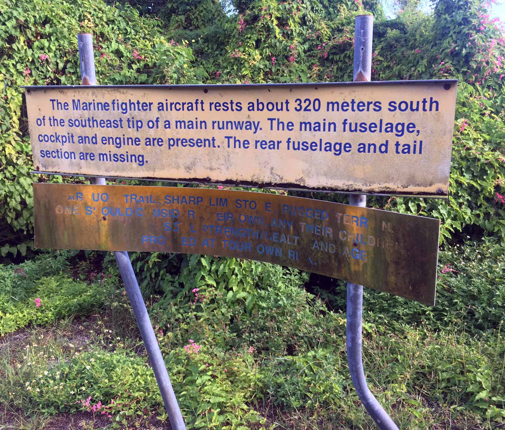
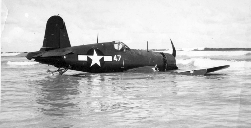
A 2018 or earlier photo of a sign describing the wreck of a WW2 Marine Corps Vought F4U Corsair fighter which rests 320m off the end of an Orote Field runway (courtesy of John Voss).
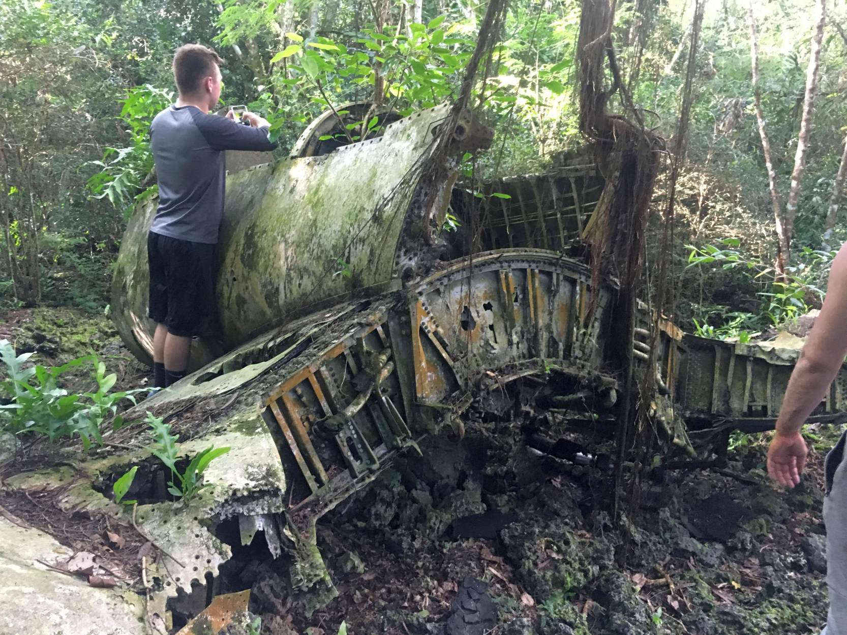
A 2018 or earlier photo of the wreck of a WW2 Marine Corps Vought F4U Corsair fighter which rests 320m off the end of an Orote Field runway (courtesy of John Voss).
____________________________________________________
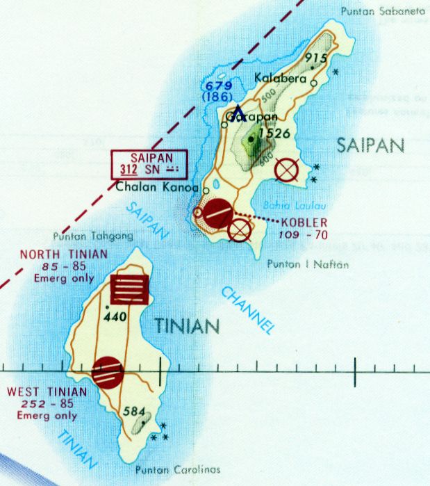
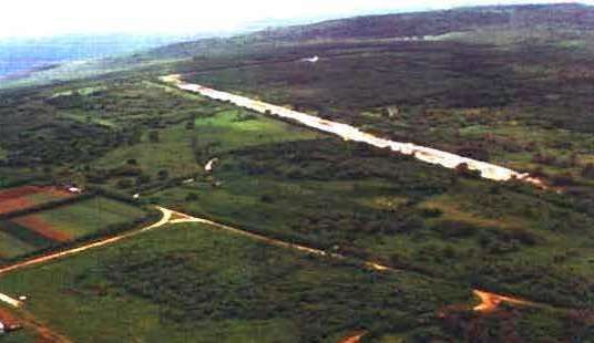
Kobler Field, Saipan, Mariana Islands
15.12, 145.71 (Southwest of Hawaii)
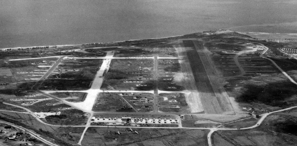
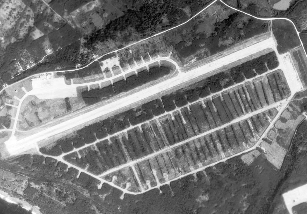
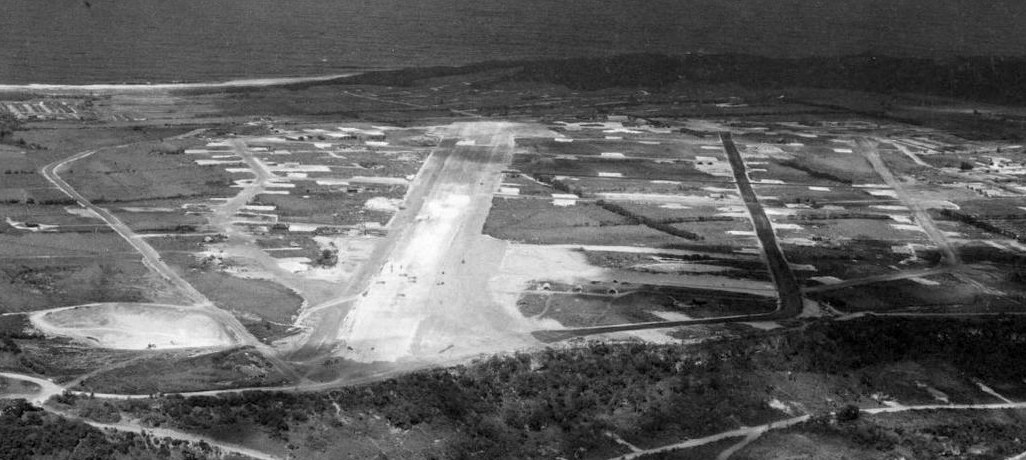
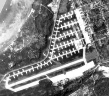
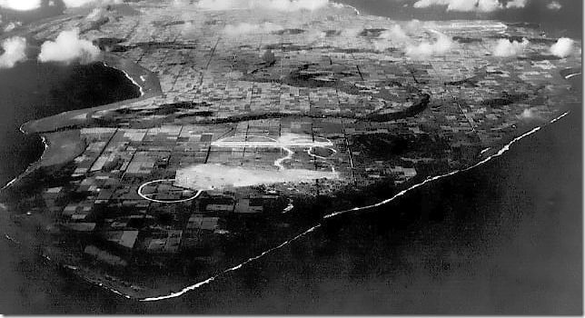
A 4/25/45 USAAF aerial view looking southwest at Kobler Field.
According to Wikipedia, Kobler Field was constructed between August & October 1944 near Aslito on the southern end of Saipan
as a base for 20th Air Force B-29 Superfortresses carrying out the strategic bombing campaign against the Japanese Home Islands.
The facility had an 8,500' runway, repair & maintenance facilities, and hardstands for 120 aircraft.
The airfield was named after Lt. Wayne Kobler, a 19th Fighter Squadron pilot who was killed on 6/27/44 while flying his P-47 on a low-level attack mission on Tinian.
As Isely Field, North Field, and West Field on Tinian became operational,
Kobler Field was increasingly used by the 20th Air Force as an auxiliary field for storage & basing of miscellaneous aircraft.
A LORAN navigation station was established at the end of Kobler Field in November 1944.
The 819th Bombardment Squadron flying B-24 Liberators deployed to Kobler Field in August 1944 to undertake attacks on Japanese islands & shipping.
The earliest depiction which has been located of Kobler Field was a 4/25/45 USAAF aerial view,
showing a single northeast/southwest runway, with an extensive system of taxiways on either side.
On 6/22/45, following a raid on Kure Naval Arsenal, a B-29 crashed at Kobler Field while attempting to land on 2 engines.
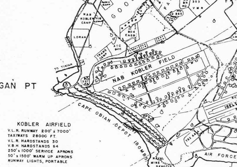
An 8/31/45 plan (courtesy of John Voss) depicted Kobler Airfield as having a 7,000' runway.
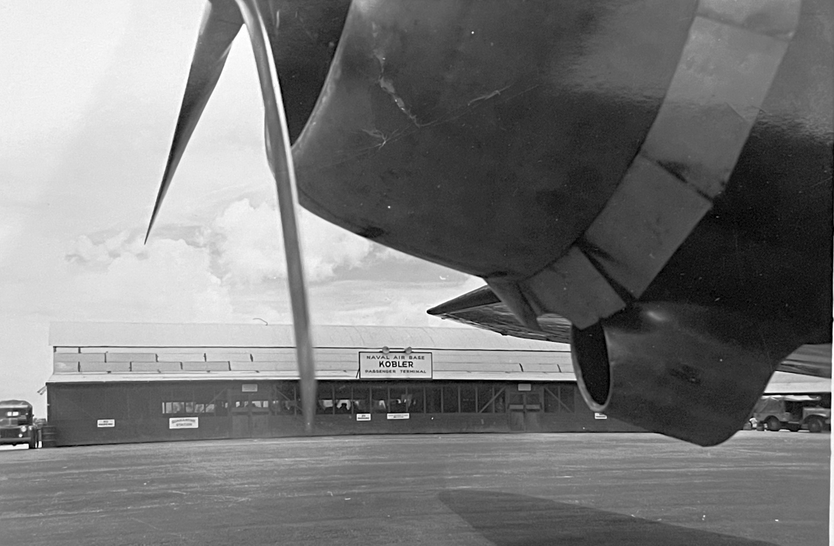
The only photo which has been located of an aircraft at Kobler Field was a circa 1940s photo of an unidentified radial-engine aircraft in front of the terminal building (courtesy of Curt Evans).
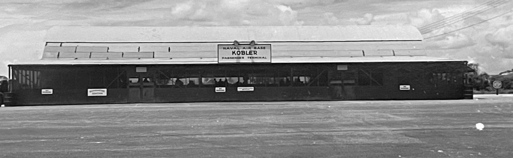
A circa 1940s photo of the “Naval Air Base Kobler Passenger Terminal” (courtesy of Curt Evans).

A circa 1940s photo of Ben Spencer & others in front of the “Naval Air Base Kobler Passenger Terminal” (courtesy of Heather Johnson).
In the post-WW2 era, Kobler Field was transferred to US Navy administration & remained under US Navy control.
VF-13A flying F4U-4s operated from Kobler Field from 1946-47.
VA-12 was shore-based at NAB Kobler Field from August 21 - September 19 & November–December 1946.
VA-1A was shore-based at NAB Kobler Field from 12/28/46 – 1/9/47
Carrier Aircraft Service Unit (CASU) 47 was also based at NAB Kobler Field.
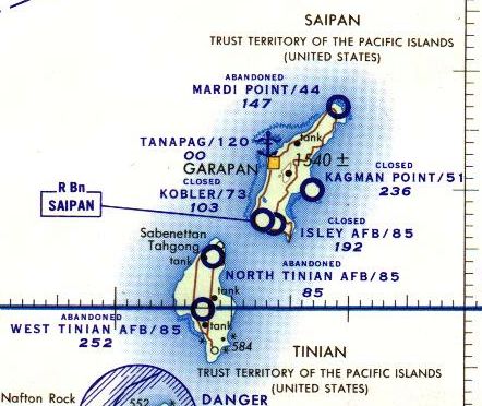
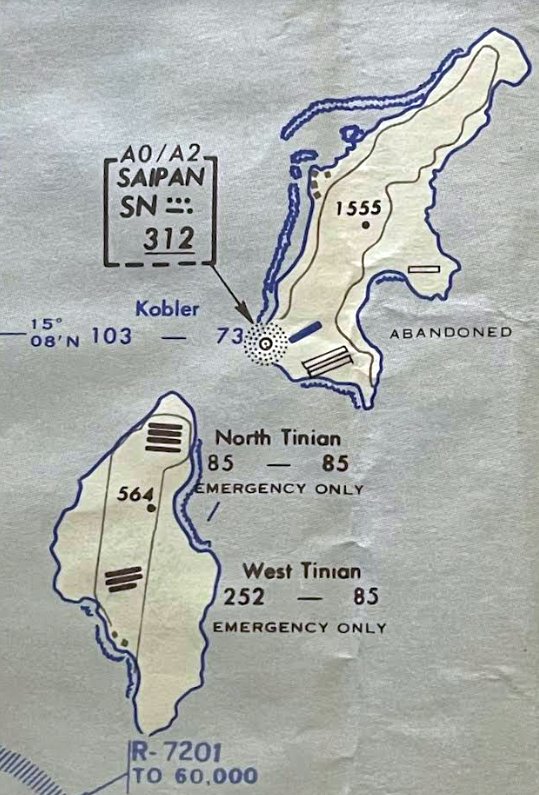
Kobler Field was depicted as closed on a 1958 World Aeronautical Chart.
Kobler Field remained under US Navy control until the early 1960s.
Kobler Field was depicted as having a single northeast/southwest runway on a 1966 aeronautical chart (courtesy of Kevin Walsh).
On 5/16/68, Continental Micronesia's first commercial flight, a Boeing 727-100 jet known as Ju Ju,
took off from Kobler Field to Honolulu International Airport.
The last photo which has been located showing Kobler Field still intact was a 1/29/69 USGS aerial view,
showing a single paved runway with a huge number of dispersal parking pads.
A 1971 Sectional Aeronautical Chart (courtesy of Ron Plante) depicted Kobler as having a 7,100' runway.
Kobler Field operated as the main airfield on Saipan until 7/25/76, when operations were moved to Saipan International Airport a few miles to the southeast.
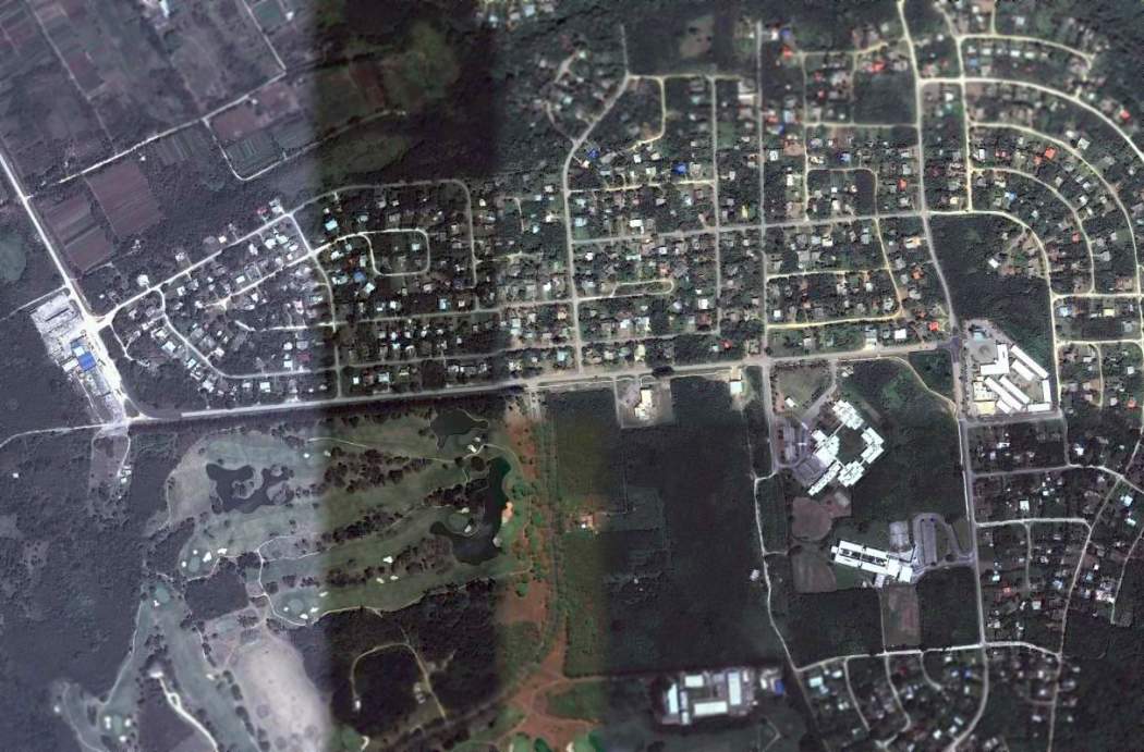
Following its closure, Kobler Field was redeveloped as Koblerville, a residential housing area, with the runway becoming Koblerville Road.
The LORAN navigation station at the end of Kobler Field was operated by the Coast Guard until January 1978.
Kobler Field was depicted as an abandoned airfield on the June 1983 Hawaiian Islands Sectional Chart (courtesy of John Voss).
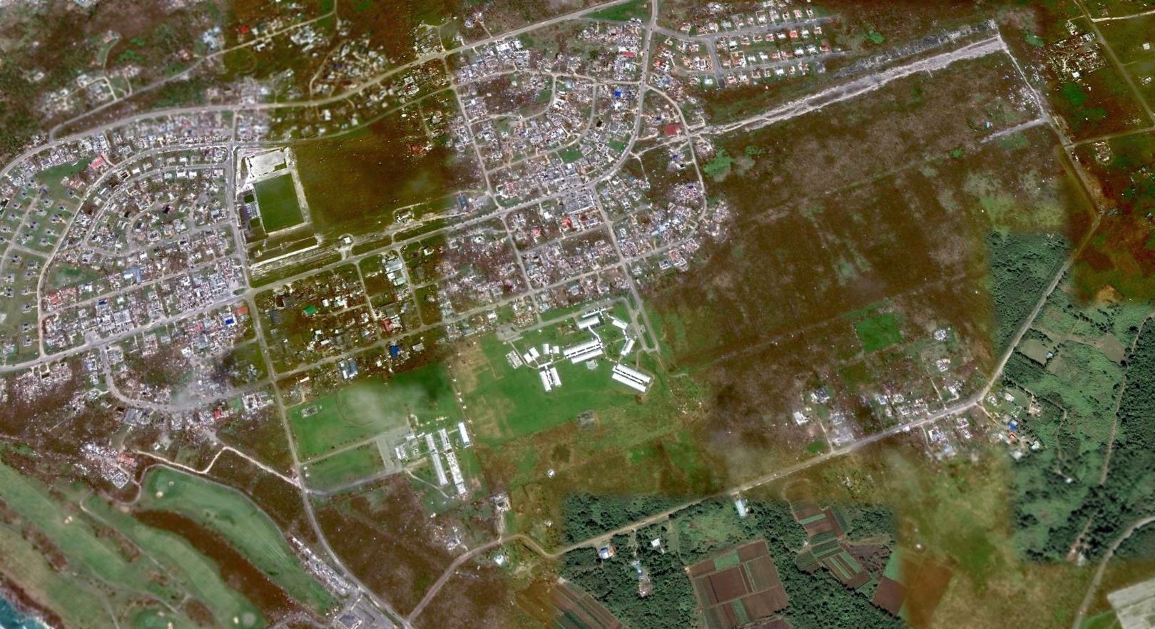
A 2014 aerial view looking north shows that Aslito Road was built over Kobler Field's runway, although portions of the runway remain intact in the center & northeast end.
____________________________________________________
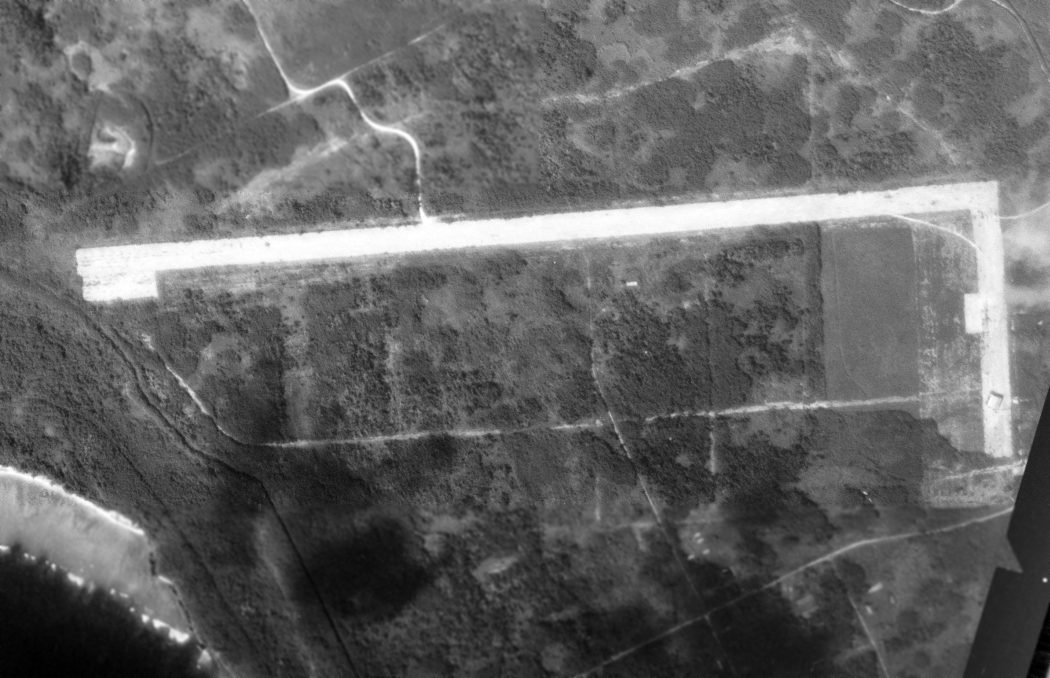
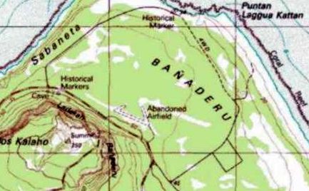
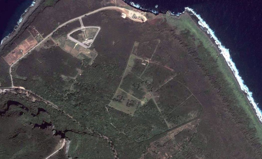
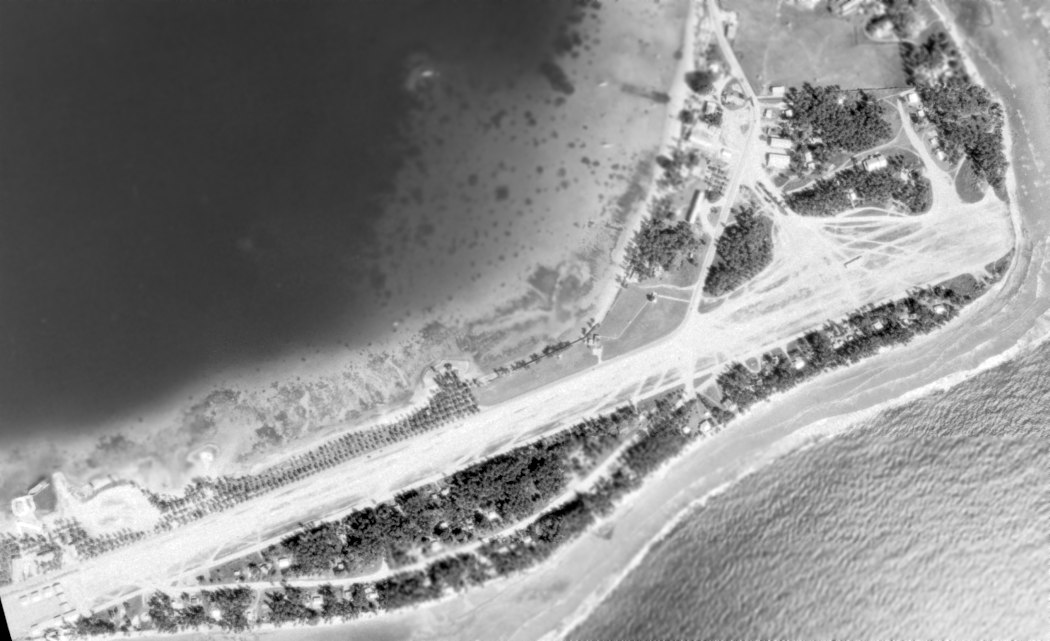
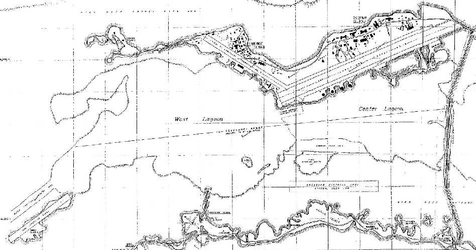
Saipan East Field / Kagman Field / Kagman Point Field, Saipan, Mariana Islands
15.17, 145.78 (Southwest of Hawaii)
A Fall 1944 USAAF photo of the ramp at Saipan East Field, showing a Consolidated B-24J-105-CO Liberator 42-109809 "Evasive Action"
of the 819th Bomb Squadron, 30th Bomb Group, C-47 Skytrains, and a B-29 Superfortress.
According to Wikipedia, following the American capture of Saipan Island in 1944, construction of American large airfields could proceed.
By the end of 1944 East Field (also known as Kagman Point Airfield) was built on the Kagman Peninsula
on the eastern end of the island, located to the north of Magicienne Bay (Laulau Bay).
The airfield become the headquarters of the 7th Air Force as well as its subordinate commands, VII Bomber & VII Fighter.
This was the first time all of the major command units of the 7th Air Force were consolidated into one location.
The earliest depiction which has been located of Saipan East Field was a fall 1944 USAAF photo of the ramp
showing a Consolidated B-24J-105-CO Liberator 42-109809 "Evasive Action"
of the 819th Bomb Squadron, 30th Bomb Group, C-47 Skytrains, and a B-29 Superfortress.
A WW2 Marine Corps aerial view of 8 North American PBJ Mitchells of VMB-612 on Kagman Field.
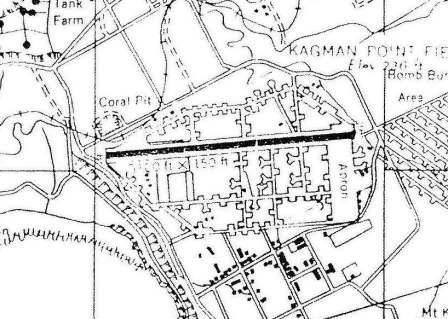
As of December 1944 Kagman's airfield facilities included a single 5,100' east/west runway,
along with an extensive taxiway & revetment area on the north & south sides of the runway.
Kagman had the tower code 'Violet'.
Operational units assigned to the station were initially P-47 Thunderbolt fighter squadrons of the 318th Fighter Group
which moved in from Hawaii in early July to support ground combat units in the Marianas.
Also, the 6th Night Fighter Squadron operated P-61 Black Widows to provide night fighter defense against Japanese night air attacks.
A 4/25/45 aerial view looking east at Kagman Field, showing a single runway & an extensive system of dispersal revetments.
Over the next few months, 7th Air Force built up their forces on Saipan, assigning the following units to East Field:
28th Photographic Reconnaissance Squadron, 7/11/44 – May 1945 (F-4 Lightning),
30th Bombardment Group, 8/4/44 – February 1945 (B-24 Liberator),
9th Troop Carrier Squadron, 8/4/44 – July 1946 (C-47),
548th Night Fighter Squadron, 12/15/44 – 1/28/45 (DET), 1/26/45 – 3/5/45 (P-61 Black Widow),
549th Night Fighter Squadron, (Air Echelon), 2/20/45 – 3/20/45 (P-61 Black Widow),
21st Fighter Group, 12/4/45 – 4/17/46 (P-51H Mustang),
41st Photographic Reconnaissance Squadron, 1/4/46 – 4/15/46 (F-4 Lightning).
A 6/24/45 USAAF photo of East Field (Kagman Airfield), showing Northrop P-61 Black Widows & Republic P-47 Thunderbolts behind a small building.
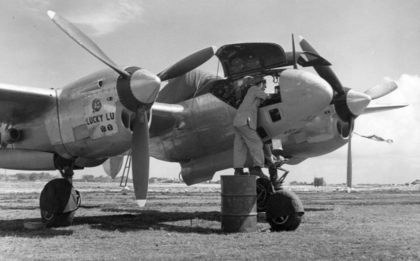
A 1945 National Archives photo of an Army photo technician servicing a Lockheed F-5B Lightning reconnaissance aircraft 'Lucky Lu' at Kagman Field.
A 7/28/45 plan (courtesy of Ron Plante) showed “Kagman Point Field” to have a 5,100' runway & an extensive taxiway system.
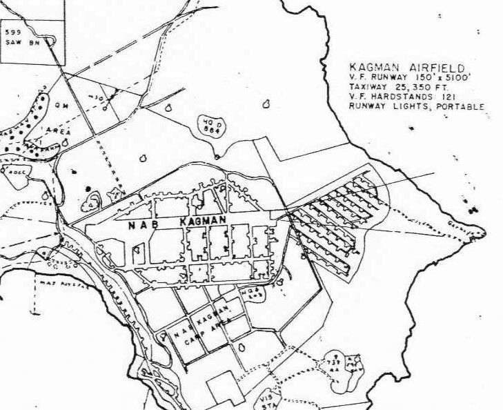
An 8/31/45 plan (courtesy of Ron Plante) showed “Kagman Airfield” to have a 5,100' runway & an extensive taxiway system.

An October 1945 USAAF photo (courtesy of John Voss) of P-47 Thunderbolts from the 318th Fighter Group taking off from Saipan East Field.
The lead ship was "Big Squaw" Republic-Evansville P-47D-20-RA Thunderbolt s/n 43-25327 19th FS, 318th FG, 7th AF assigned to John "Jack" Payne.
A circa 1944 photo of long rows of USAAF North American P-51 Mustang fighters in front of a hangar at Kagman Field (courtesy of John Voss).
By mid-1946 most USAAF units were reassigned, the military use of Kagman Point Airfield ended, and Kagman Field was reused as a civilian airport.
Kagman Field was evidently closed by 1958, as that is how “Kagman Point” was depicted on a 1958 World Aeronautical Chart.
A circa 1960 photo by Lowell Boothe (courtesy of Gary Boothe) looking south at East Field / Kagman Field.
According to Gary Boothe. “Kagman peninsula was part of the restricted area & the airfield was still in use by NTTU.”
Kagman Field was depicted as a single east/west abandoned runway on a 1966 aeronautical chart (courtesy of Kevin Walsh).
A 9/27/68 USGS aerial view showed Kagman Field's runway & apron remained intact,
but the extensive system of dispersal revetments had been overgrown & no longer recognizable.
A 1971 Sectional Aeronautical Chart (courtesy of Ron Plante) depicted Kagman as an abandoned airfield.
The last photo which has been located showing the Kagman Field runway still intact was a circa 1990 aerial view looking southeast (courtesy of Ron Plante).
The site of Kagman Field was eventually redeveloped with housing & a golf course built on the former World War II airfield.
A 1999 USGS topo map no longer depicted anything airfield elements of Kagman Field.
A 2013 aerial view shows Kagman Road overlaid over the former Kagman Field runway.
____________________________________________________
Marpi Point Field / Naval Air Base Marpi Point, Saipan, Mariana Islands
15.28, 145.82 (Southwest of Hawaii)
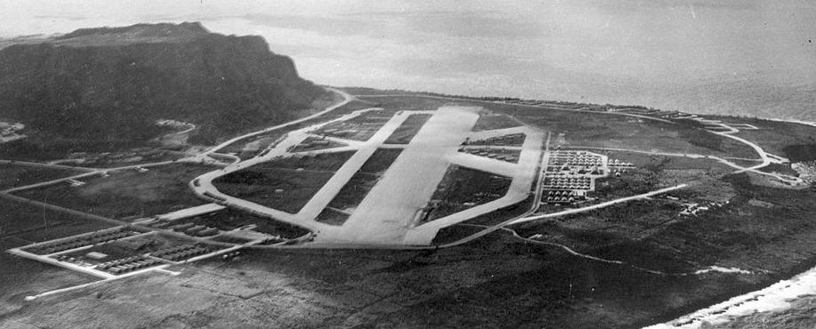
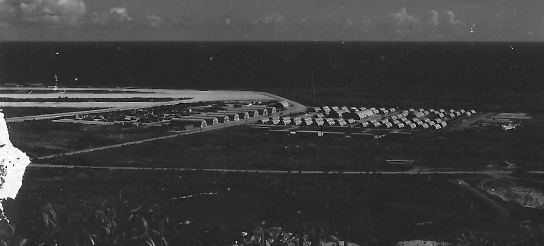
A circa 1940s aerial view looking south at Marpi Point Airfield (courtesy of John Voss).
According to Wikipedia, in March 1944 the Imperial Japanese Navy Air Service ordered the construction
of an airfield near Marpi Point on the Northern end of the island of Saipan as part of a general plan to improve defenses in the Marianas.
The 4,500' airfield was planned to handle 24 aircraft, but was still incomplete at the time of the US invasion in June 1944.
During the battle work on the runway continued to allow for the planned airlift of Japanese reinforcements to Saipan,
however this plan was abandoned when it became apparent that U.S. naval & airpower made this unfeasible.
On 7/9/44 the 24th Marines secured Marpi Point & the airfield, while the 25th Marines secured the northeast end of the island.
Saipan was declared secure on July 9.
Aircraft from VMO-2 were the first American airplanes to land at Marpi Point Field.
The U.S. Navy took possession of Marpi Point Field & the 51st Naval Construction Battalion & Construction Battalion Maintenance Unit (CBMU) 614
expanded the 4,500' runway to 7,000' & built a second 3,500' runway.
The field was renamed as NAB Marpi Point.
VMF-512 flying F4Us operated from NAB Marpi Point from October - December 1945.
Carrier Aircraft Service Unit 47 (CASU-47) was based at the field during 1945.
CBMU-616 was based at NAB Marpi Point from August 17 – 10/3/45.
On 9/23/45 USAAF Lockheed F-5G Lightning #44-26855 was written off while landing at NAB Marpi Point.
The earliest depiction which has been located of Marpi Point Airfield was a circa 1940s aerial view (courtesy of John Voss),
which depicted the field as having a single east/west runway, with numerous taxiways & dispersal parking pads.
A circa 1940s map (courtesy of John Voss) depicted “NAB Marpi” as having 2 runways, with the longest being 4,600'.
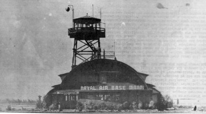
A circa 1940s photo (courtesy of John Voss) of the control tower of “Naval Air Base Marpi”.
A circa 1940s aerial view looking west at Marpi Point Airfield.
A circa 1945 aerial view looking northwest at Marpi Point Airfield (courtesy of Ron Plante),
also showing the massive number of ammunition storage facilities adjacent to the airfield.
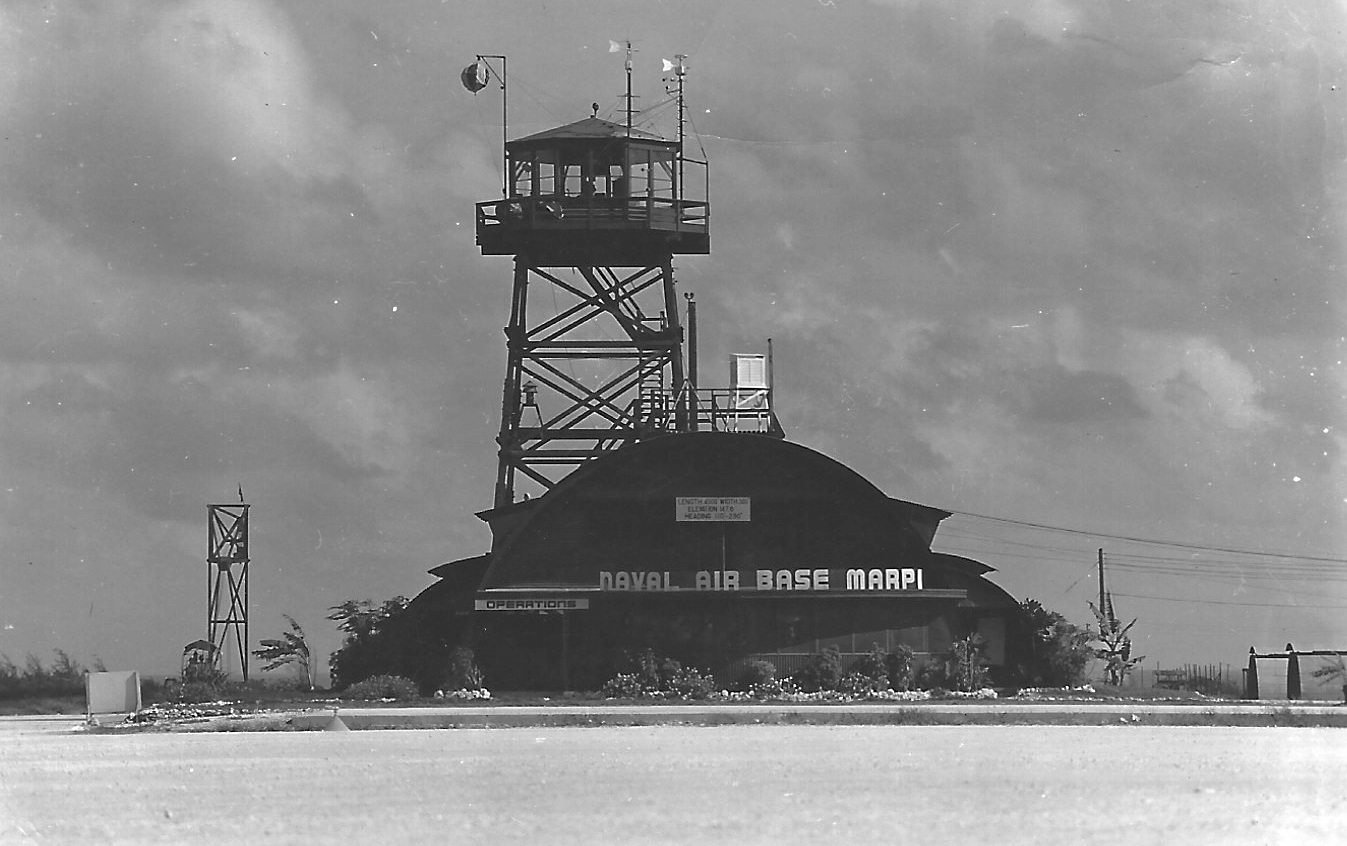
A circa 1945 photo by E.E. Simpson of the “Naval Air Base Marpi” control tower (courtesy of Anthony Horton).
Anthony Horton reported, “My grandfather, E. E. Simpson, was a sailor in CASU(F)47 stationed at Marpi Point.
He drove an oil/fuel truck on the flight line filling them up & checking gauges as a plane captain.”
A circa 1945 photo by E.E. Simpson of Quonset Huts adjacent to the Marpi Point Airfield (courtesy of Anthony Horton).
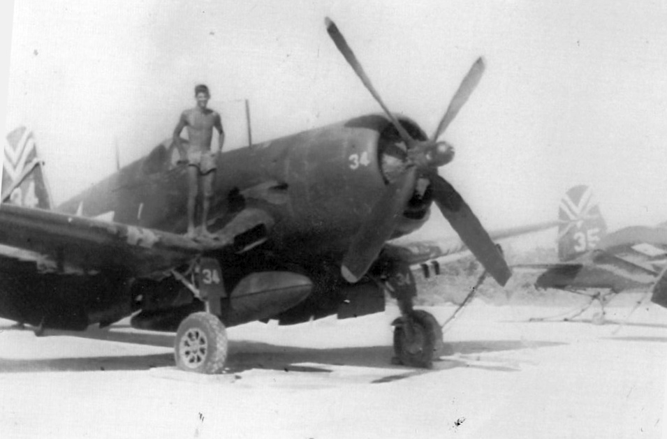
A September-December 1945 photo of G.J. Smith on the wing of his VBF-93 Vought F4U-4 Corsair on the Marpi Point Airfield coral ramp (courtesy of Terry Smith).
Terry observed, “ The inverted double chevron markings are the Pacific Theater markings for Air Group 93’s home base, the USS Boxer CV-21.”
Terry Smith recalled, “My dad [G.J. Smith] was a member of Air Group 93.
By the time they reached the war zone the atomic bomb had been dropped & the war ended.
The whole Air Group (VF-93 F6F-5 Hellcats, VB-93 SB2C-5 Helldivers, VT-93 TMB-3E Avengers, and VBF-93 F4U-4 Corsairs)
was shore based at Marpi Point for about 4 months (September-December 1945).”
A September-December 1945 photo by G.J. Smith of the wreck of a Vought F4U-4 Corsair at Marpi Point Airfield (courtesy of Terry Smith).
Terry Smith reported, the “F4U-4 landed with a hung 500 lb bomb which exploded during landing rollout killing the pilot.
'Suicide Cliff' visible in the background.”
A September-December 1945 photo by G.J. Smith of a row of brand new Grumman F8F-1 Bearcats of Navy VF-19 at Marpi Point Airfield (courtesy of Terry Smith).
John Voss recalled, “I was looking at a book that had a title of 'WWII In Color' or something like that.
Included was a photo taken on Marpi Point of a large number of Grumman Wildcats (w/wings folded) being pushed off the cliff into the ocean.”
In the post-WW2 era the entire northern region of Saipan was occupied by the CIA & the US Navy's Technical/Tactical Training Unit (TTU)
and purportedly used for training of anti-communist spies & guerrilla forces.
The only aeronautical chart depiction which has been located of Marpi Point field was on a 1958 World Aeronautical Chart.
It depicted “Mardi Point” (sic) as already being closed.
A circa 1960 photo by Lowell Boothe (courtesy of Gary Boothe) of the remains of Marpi Field.
The northern region of Saipan was returned to civilian control in 1962.
An October 1964 photo by John Voss looking north at Marpi Point.
John recalled, “I visited Marpi Point in October 1964 & found it to be completely overgrown by jungle.
The only remaining wartime structure was the large Quonset building (seen in the center of the triangle taxi strip in the 1940s photo above).
I took a photo of the same Quonset & triangle from the towering Mt. Marpi (aka 'Suicide Cliff') which is immediately behind the airfield.
At the time I was on Saipan I had to get special written permission to enter Marpi Point area giving my time of entry & I had to be out with 45 minutes 'because of all the dangers.'
If I failed to come out in the specified time 'they' were coming in to find me.
I soon found the dangers: piles & piles of rusty hand grenades & artillery shells.”

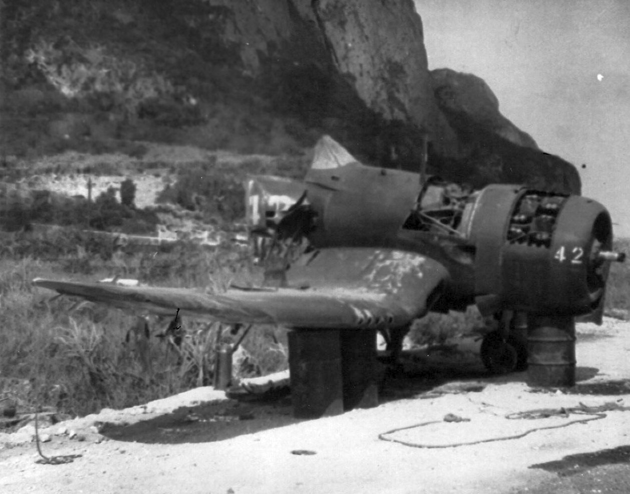
An October 1964 photo by John Voss of the wreck of a Curtiss SB2C Helldiver at the site of NAB Marpi Point.
John recalled, “The only other item I discovered was the battered remains of a Curtiss SB2C Helldiver!
It was in very sad shape being highly corroded with paper-thin skin.”
The Marpi Point airfield was not depicted at all on a 1966 aeronautical chart (courtesy of Kevin Walsh).
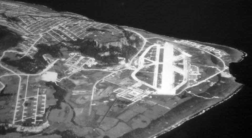
A 12/27/68 USGS aerial view showed the Marpi Point Airfield to be completely overgrown,
with only the slightest traces of this once-extensive airfield still recognizable.
Marpi Point Airfield was no longer depicted at all (even as an abandoned airfield)
on the June 1971 Hawaiian Islands & Marianas Islands Sectional Chart (courtesy of Ron Plante).
The last map depiction which has been located of Marpi Point Airfield was on the 1983 USGS topo map,
which depicted Marpi Point as an Abandoned Airfield.
John Voss reported, “Ron Plante visited the [Marpi Point] site in the 1990s & reported that the SB2C [photographed above in 1964] was nowhere to found.
It possibly may have been a victim of one of the powerful typhoons that have hit the island with gusts in excess of 200 mph.”
A 1999 USGS topo map no longer depicted anything at the site of Marpi Point Airfield.
A 2013 aerial view shows the site of Marpi Point Field to be overgrown with vegetation.
The Banzai Cliff memorial is located at western end of the former airfield.
____________________________________________________
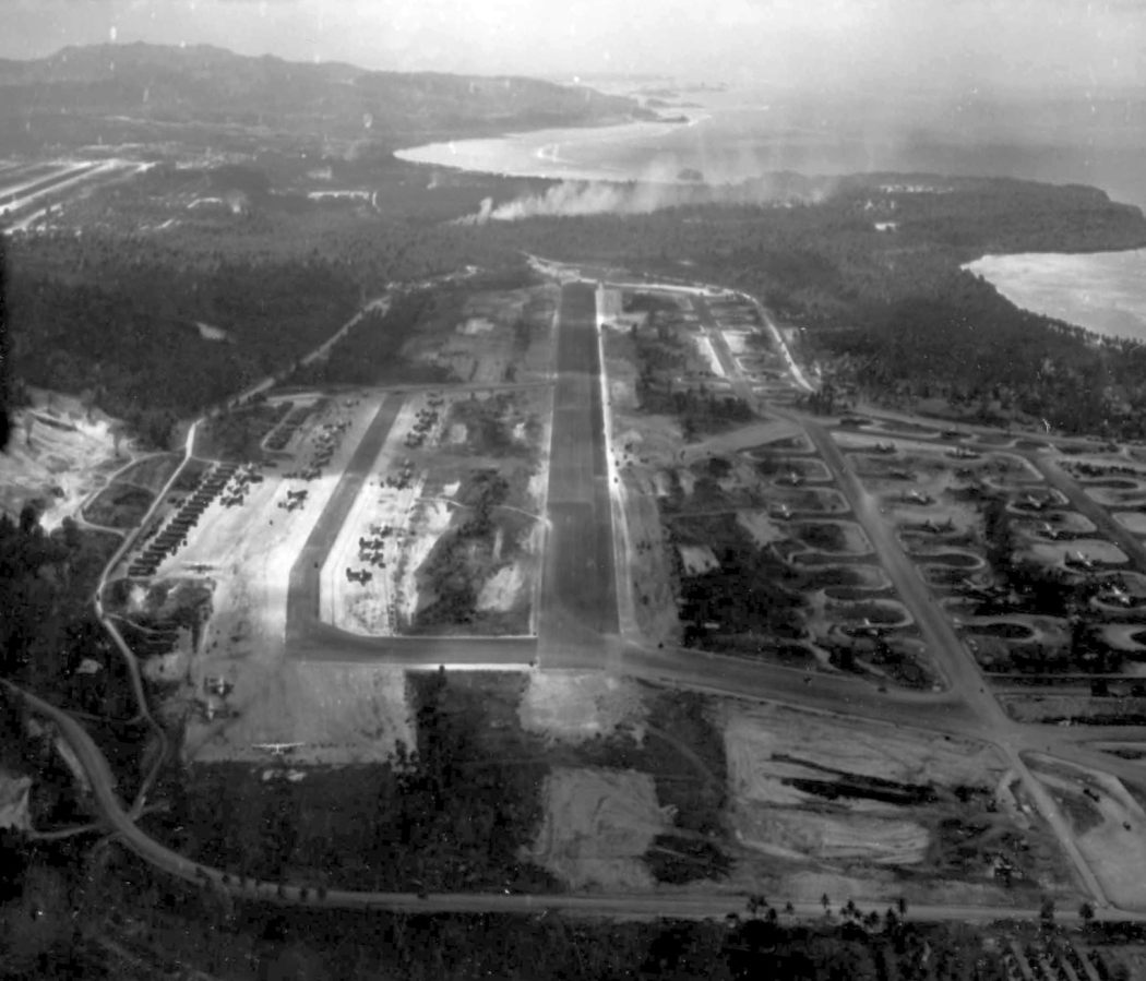
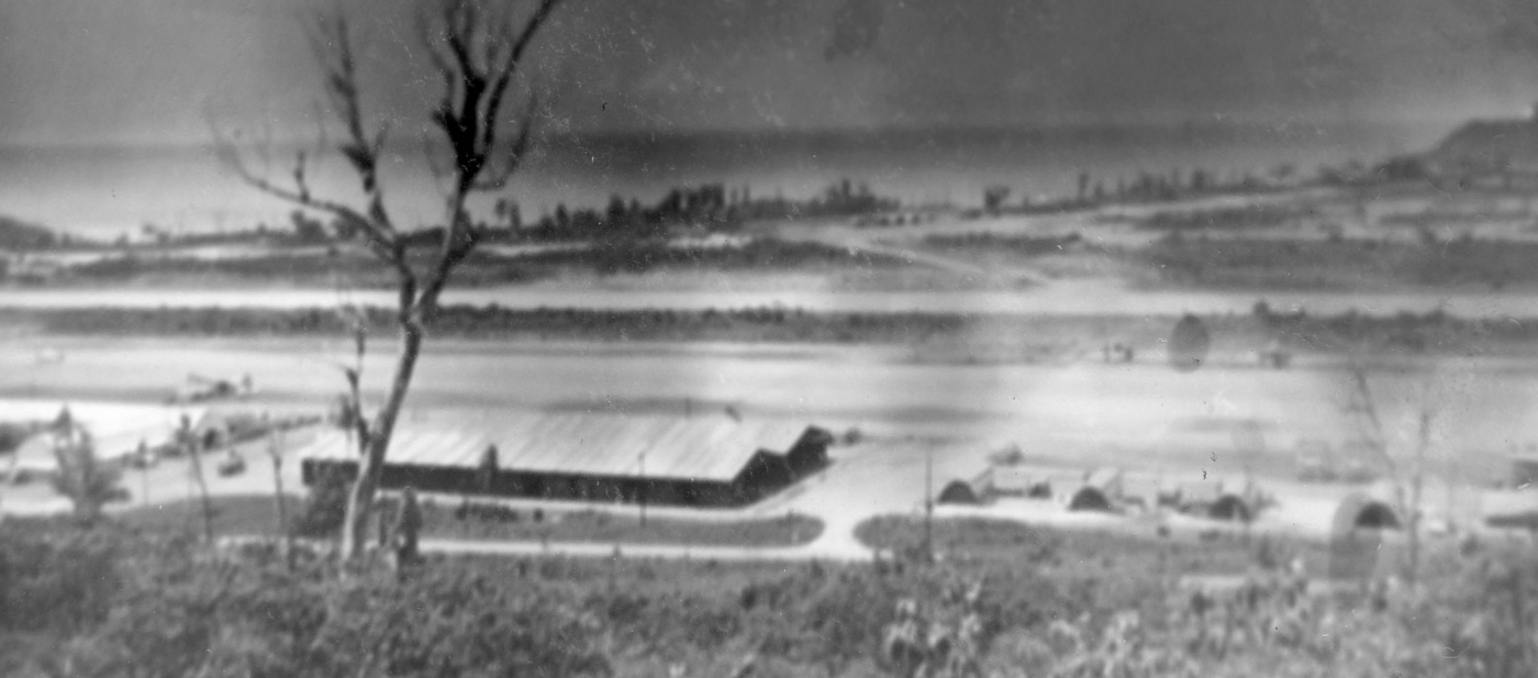
Tiyan Airfield / Air Depot Field / Harmon Field / Harmon AFB, Harmon, Guam
13.51, 144.81 (Southwest of Hawaii)
An 8/12/44 photo of Tiyan Airfield (National Archives photo).
According to Wikipedia, the Japanese had started construction on this field known as Tiyan Airfield in 1944.
Tiyan Airfield was captured by the US on 8/1/44.
The earliest depiction which has been located of Tiyan Airfield was an 8/12/44 photo (National Archives photo).
Following its capture, the Americans began began construction to expand Tiyan Airfield on 9/6/44,
and the 7,000' runway became operational on November 10, known at first as Air Depot Field.
USAAF Consolidated B-24 Liberator bombers used it at first to make raids on adjacent Japanese-controlled islands.
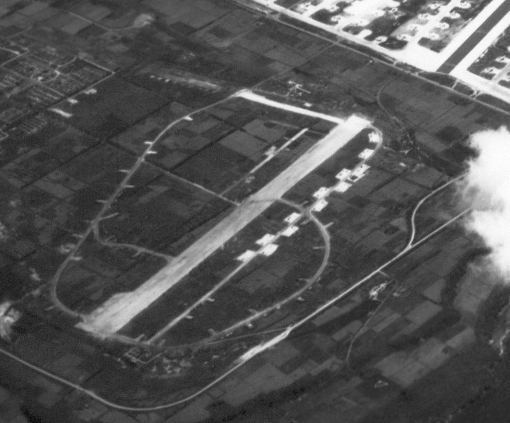
The earliest depiction which has been located of Air Depot Field was a January 1945 aerial view looking southwest,
showing the field still under construction, with a single northeast/southwest runway,
and a large quantity of B-24 bombers on the south ramp, and a large quantity of B-29 bombers in revetments on the north side.
Air Depot Field's buildings & storage areas were completed by the end of February 1945.
Air Depot Field was renamed in honor of Lieutenant General Millard Harmon, who was lost 2/26/45 on a C-87 flight from Kwajalein to Hawaii.
Harmon Field was the headquarters for the XXI Bomber Command & later 20th Air Force
which directed the B-29 Superfortress strategic bombing campaign against the Japanese Home Islands.
It was also the major B-29 aircraft depot & maintenance facility in the Western Pacific during the war, and that mission continued for Far East Air Forces until its closure.
Harmon was used operationally by the USAF 11th Bombardment Group as an operational B-29 base.
After WW2 the 9th Bombardment Group used the base for strategic reconnaissance missions
and the 374th Troop Carrier Group of the Technical Service Command used the base for transport of supplies & equipment from its depot facilities.
Major units assigned to Harmon Field were: 56th Air Depot Group, Air Technical Service Command, 9/9/44 – 8/31/45,
24th Air Depot Group, Air Technical Service Command, 9/8/44 – 7/1/49, 1,537th Army Air Forces Base Unit, 9/30/44 – 8/1/45,
XXI Bomber Command, 12/4/44 – 7/16/45, 55th Air Depot Group, Air Technical Service Command, 1/1/45 – 12/21/45,
3rd Reconnaissance Squadron (Very Long Range, Photographic), 1/11/45 – 3/15/47, 25th Air Depot Group, Air Technical Service Command, 1/21/45 – 9/1/49,
20th Air Force, 7/16/45 – 5/16/49, Western Pacific Wing, Air Transport Command, 4/10/46 – 3/1/47,
11th Bombardment Group (Very Heavy), 5/15/46 – 10/20/48, 374th Troop Carrier Group, 4/1/47 – 3/5/49,
75th Air Service Group, 5/1/47 – 9/20/48, 367th Air Service Group, 5/1/47 – 9/1/49,
9th Bombardment Group (Very Heavy), 6/9/47 – 10/20/48, Guam Air Depot (later Guam Air Materiel Area, Marianas Air Materiel Area).
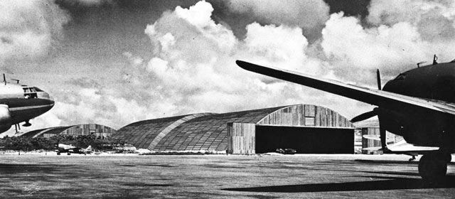
A WW2 photo of a Curtiss C-46 Commando in front of several arch-roof hangars at Harmon Field.
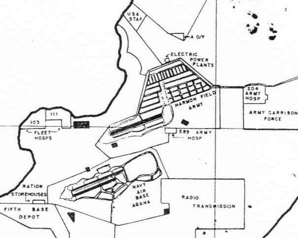
A 10/4/45 plan showed “Harmon Field Army” to have an extensive street grid to the northeast of its single runway.
The “Navy Air Base Agana” was depicted in close proximity to the southwest.
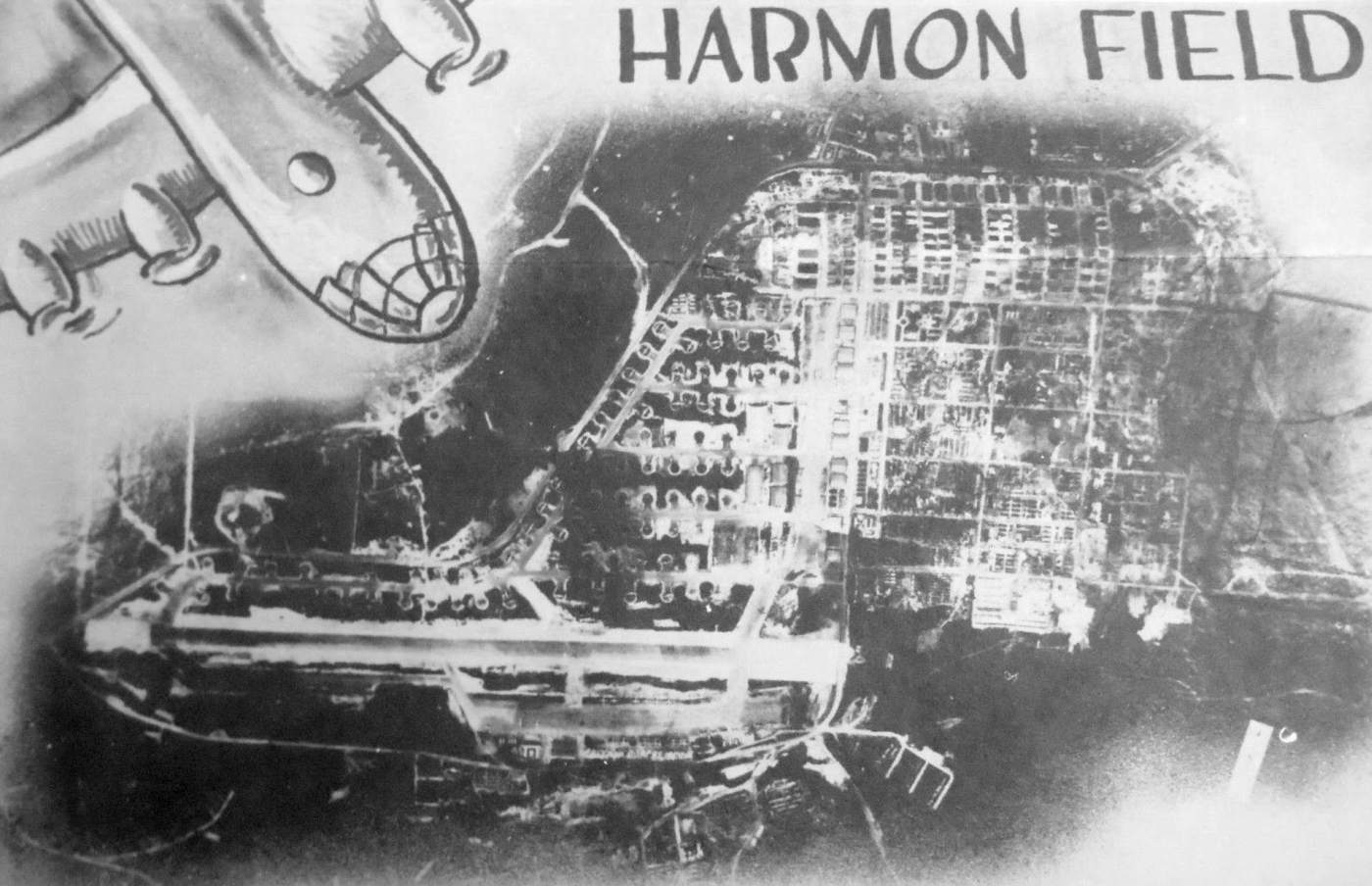
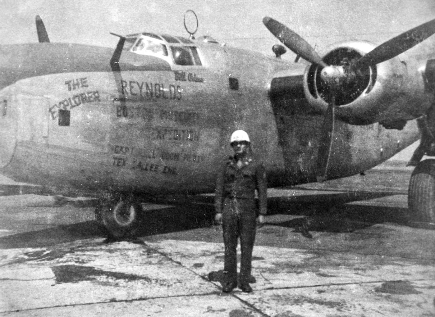
A cartoon B-29 pictured over an undated aerial view of Harmon Field from a 1945 magazine cover (courtesy of John Lawrence).
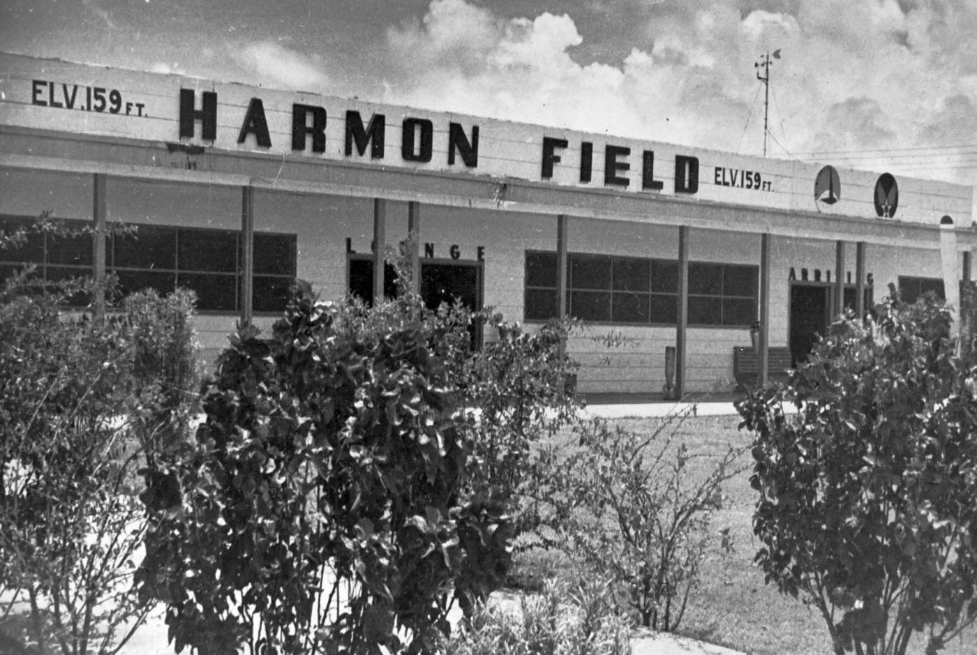
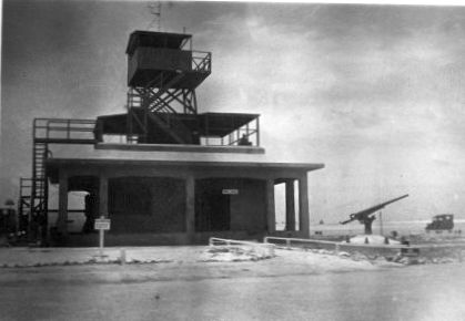
A 1948 photo by Major John Moncrief of the Harmon Field terminal (courtesy of Jamie Moncrief).
A 1948 photo by Major John Moncrief of the Harmon Field ramp (courtesy of Jamie Moncrief).
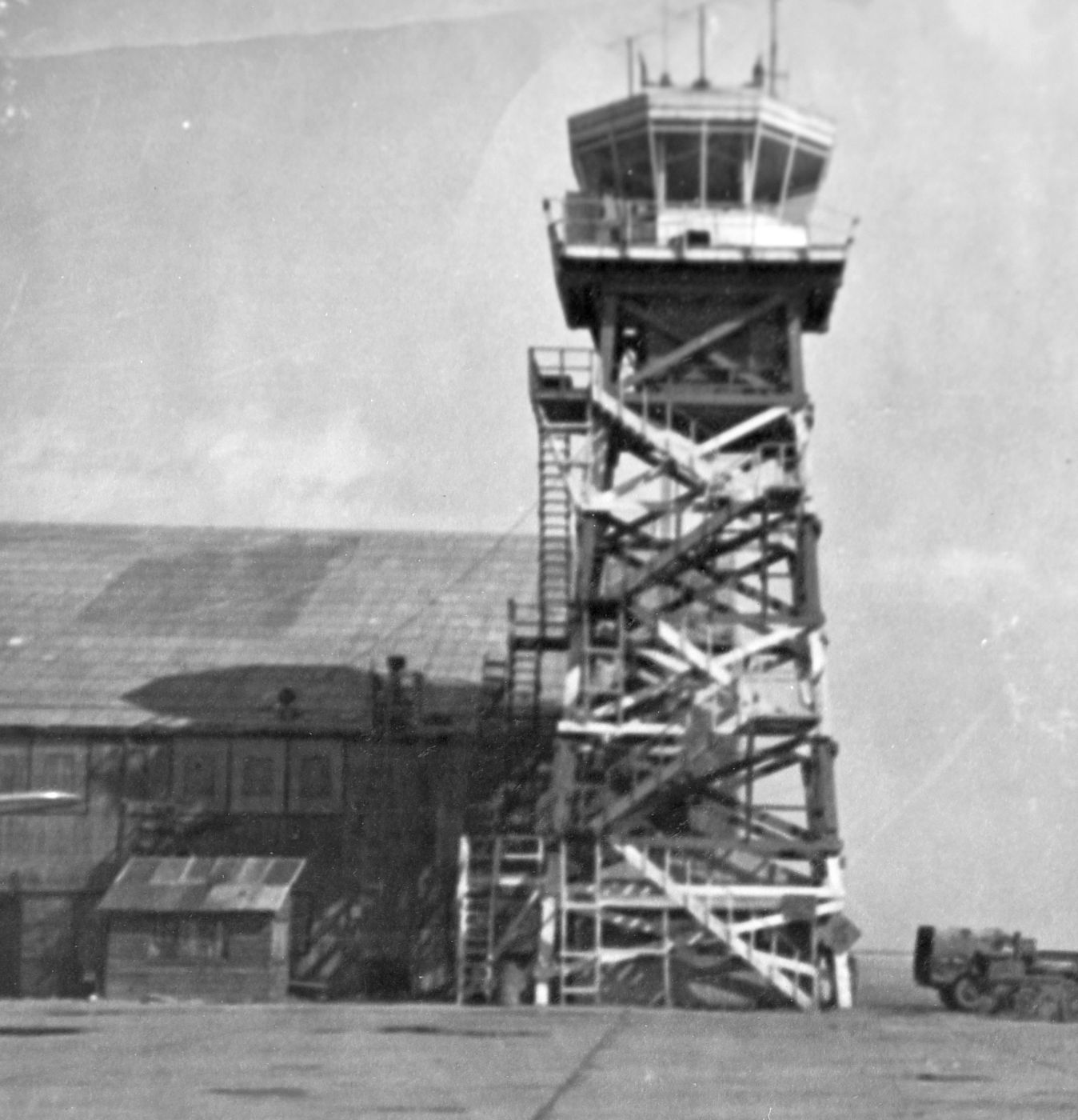
A 1948 photo by Major John Moncrief of the Harmon Field control tower (courtesy of Jamie Moncrief).
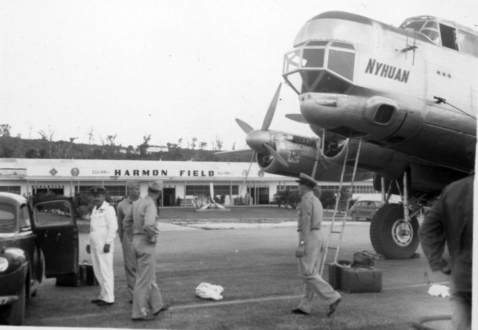
The last photo which has been located showing Harmon AFB while open was a 1949 photo of a RAAF GAF-Avro Lincoln Mk.30 'Nyhuan' A73-2 Long Range Navigation Trainer & Survey Aircraft in front of the “Harmon Field” terminal building.
Harmon AFB was closed in 1949 due to budget constraints & was merged with the neighboring Naval Air Station Agana.
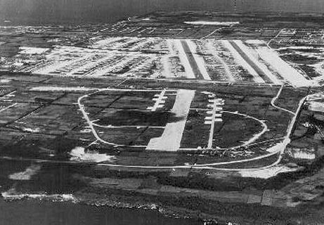
A 3/21/56 aerial view (courtesy of John Lawrence) showed Harmon AFB as having a single runway & a huge number of parking revetments.
The earliest aeronautical chart depiction which has been located of Harmon AFB was on a 1958 World Aeronautical Chart.
It depicted Harmon AFB as already being closed.
A 1964 aerial view by John Voss looking southwest at the remains of Harmon AFB,
showing the single runway & numerous taxiways & parking revetments.
A 1964 photo by John Voss looking northeast at the site of Harmon AFB from an adjacent hillside,
showing the remains of the single runway.
A 1967 USGS aerial view showed Harmon AFB as having a single runway & a huge number of parking revetments.
The last aeronautical chart depiction which has been located of Harmon AFB was on the June 1972 Hawaiian Islands Sectional Chart (courtesy of Carl Buick).
It depicted Harmon AFB as being closed, and having a single paved northeast/southwest runway.
The site of Harmon AFB eventually became an industrial area,
adjacent to the northeast side of Antonio Won Pat International Airport.
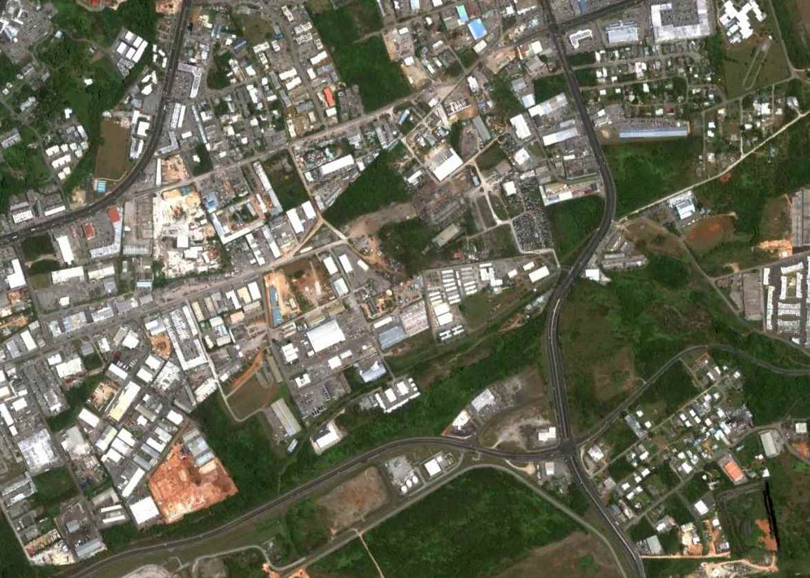
A 2013 aerial view shows the site of Harmon Field to be densely redeveloped,
but what may be a small piece of runway or ramp pavement is located in the center of the picture/
____________________________________________________
Tinian West Field #4, Tinian, Mariana Islands
15, 145.6 (Southwest of Hawaii)
A 7/8/45 USAAF aerial view looking east at Tinian West Field #4 in the foreground, with the 3 runways of West Field #1/2/3 immediately behind it.
According to Wikipedia, in 1939 large-scale military construction began on Tinian by the Japanese military.
Twelve hundred prisoners were sent to the island from Japan for the construction of airfields.
By 1944, the island had 3 military airfields with a 4th under construction.
Tinian was seized by the Allies during the Battle of Tinian from 7/24 to 8/1/44.
The earliest photo which has been located of Tinian West Field #4 was a 7/8/45 USAAF aerial view.
It depicted West Field #4 as having a single paved east/west runway, with taxiways looping around the runway with a large number of dispersal revetments.
The 3 larger parallel runways of West Field #1/2/3 were visible adjacent to the east side of West Field #4.
A 1945 aerial view (courtesy of Ron Plante) looking northeast at Tinian West Field #4.
A 1945 USAAF aerial view looking south at a B-29 overflying Tinian West Fields #1/2/3/4.
A 9/1/45 plan (courtesy of Ron Plante) of the Tinian West Field #4 & the other Tinian airfields.
A 1/29/69 USGS aerial view showed the site of Tinian West Field #4 to be completely overgrown & no longer recognizable as a former airfield.
The runway end of Tinian International Airport is visible on the east side of the site.
Tinian West Field #4 was no longer depicted at all on the 1971 Sectional Chart (courtesy of Ron Plante)
nor on the 1999 USGS topo map (courtesy of Ron Plante).
The adjacent West Field #1/2/3 eventually became Tinian International Airport.
A 2003 aerial view showed no trace of Tinian West Field #4, with the site overgrown with trees.
A 2013 aerial view showed no trace of Tinian West Field #4.
The runway end of Tinian International Airport is visible on the east side of the site.
____________________________________________________
Ushi Point Airfield / Tinian North Field, Tinian, Mariana Islands
15.07, 145.64 (Southwest of Hawaii)
A 1944 aerial view showing a Grumman TBF Avenger overflying the Ushi Point Airfield while it is under attack by U.S. Forces.
According to Wikipedia, in 1939 large-scale military construction began on Tinian by the Japanese military.
Twelve hundred prisoners were sent to the island from Japan for the construction of airfields.
By 1944, the island had 3 military airfields with a 4th under construction.
On the north end of the island, Ushi Point Airfield had a 4,380' runway
and was home to the Nakajima C6N-1 reconnaissance aircraft of the 121st Kokutai.
Until the spring of 1944, the base remained largely out of major action.
The Ushi Point Airfield & its assigned aircrews did their part to repel American advances in the Marianas Islands
but following the fall of Guam & Saipan to American forces in July 1944 it became clear that Tinian would be attacked next.
Assaulted on 7/24/44 by U.S. Marines from Saipan, the airfield was almost totally destroyed
by the American naval bombardment & air attack prior to the assault by the 4th Marine Division.
The Japanese were taken by surprise, with several aircraft being captured relatively intact inside a hangar.
Ushi Point Airfield fell to US forces on July 26 & was almost immediately handed over to the care of U.S. Navy Construction Battalions, or Seabees.
Fifteen hundred Seabees landed with the initial forces on Tinian in July 1944
and immediately set to work repairing the damaged Japanese Ushi Point Airfield, even before all the fighting had ended,
to construct what would eventually be known as Tinian North Field.
A 1944 aerial view looking south at the 2 Japanese air strips that became Runways 1 and 3 of Tinian North Field.

A July 1944 USMC photo of a Nakajima C6N-1 reconnaissance aircraft of the 121st Kokutai inside a wrecked hangar on Ushi Point Airfield after being captured by the U.S.
In the background is a Marine Curtiss R5C Commando transport plane, which had landed with a cargo of supplies & prepared to evacuate wounded Leathernecks.
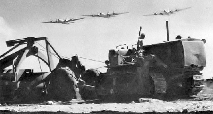
A 1944 U.S. Navy photo of Seabees viewing USAAC B-29 Superfortresses arriving at uncompleted North Field.
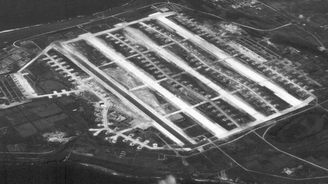
Once under American control, a massive construction project was begun on the north end of Tinian.
Operating for over 45 days & nights, often while under fire, the Seabees initially repaired & extended the existing 4,380' runway
and then added an additional 2 east/west 8,000' runways.
Nearly the entire northern end of the island was occupied by runways, the airfield area, and the various support facilities & containment areas.
The expansion of Ushi Point Airfield into North Field involved the movement of nearly 1,000,000 cubic yards of earth & coral & the accumulation of some 900,000 truck miles.
A 4th runway was constructed in May 1945 & massive hardstands built for an amazing total of 265 B-29 heavy bombers.
Upon completion, North Field was the largest airfield in the world.
A circa 1944-45 photo of the captured Japanese Ushi Point control tower building, with an antiaircraft gun at its base.
A circa 1944-45 photo of a B-24 & B-29 next to the captured Japanese Ushi Point control tower building.
North Field came under the command of 20th Air Force XXI Bomber Command,
with the 313th Bombardment Wing being the host unit at the expansive station in December 1944.
Its operational groups were: 6th Bombardment Group (Circle R), 9th Bombardment Group (Circle X),
504th Bombardment Group (Circle E), 505th Bombardment Group (Circle W), and 5th Photographic Reconnaissance Squadron (Very Long Range).
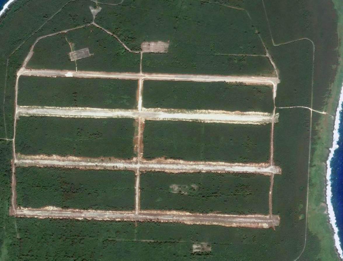
North Field's 4 runways were lettered "A", "B", "C" and "D" from north to south.
The 6th Group was parked on the south side of Runway D, then going north the 9th Group was parked between C & D.
The 504th between C & B, and the 505th on the south side of runway A.
In addition, the B-29s were assigned specific hardstands for each aircraft so the ground crew could store spares & other items for each aircraft on them.
The groups used the runway to the north side of their parking area hardstands, but this was not fast & firm,
because if there was an accident & the runway was closed, the aircraft shifted to another runway.
A 1945 USAAF aerial view looking south at a B-29 overflying Tinian North Field.
A 5th group, the 509th Composite Group, was assigned to the wing in May 1945 from Wendover AAF, Utah.
The 509th, although assigned to the 313th Bomb Wing, was operationally controlled by Headquarters, 20th Air Force.
The 509th was given a base area near the airfield on the north tip of the island,
several miles from the main installations in the center part of the island where the other groups were assigned.
The 509th aircraft almost always used runway "A" & the aircraft were parked away from the other groups on the north side of the runway.
Also unlike the other groups in the wing, the 509th used a wide variety of tail codes from various XXI Bomber Command groups,
instead of using its own, so that the group's planes could not be identified by the Japanese.
The 509th was also self-contained, and drew little in resources from the 313th Wing or its other groups.
A 1945 aerial view (courtesy of Ron Plante) looking southeast at Tinian North Field, at the time the world's largest airfield.
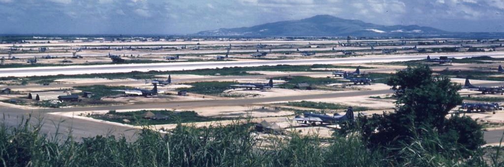
A rare 1945 color photo of the B-29s scattered over the massive North Field (courtesy of John Voss).
A 1945 U.S Government photo of North Field taken just prior to the Hiroshima bombing.
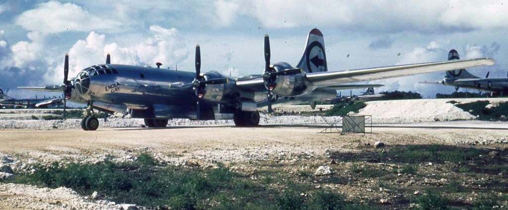
A rare 1945 color photo of the B-29 Enola Gay on Tininan North Field (courtesy of John Voss).
Tinian North Field gained further historical significance when it became the only base ever to launch a nuclear attack.
In early August, the mission of the 509th was revealed when the group flew the two atomic bomb missions from Tinian North Field to Hiroshima & Nagasaki.
In November, the 509th was relieved from assignment to the 313th Bomb Wing & was reassigned to Roswell AAF, New Mexico.
A 1945 photo of the atomic bomb assembly building on the northwest side of Tinian North Field.
After the Japanese surrender in August, 313th Bomb Wing units dropped food & supplies to Allied prisoners & participated in show-of-force flights over Japan.
The units of the 313th Bombardment Wing were either reassigned or inactivated within a few months after the end of the Pacific War.
A 9/1/45 plan (courtesy of Ron Plante) of the extensive infrastructure of Tinian North Field.
The last USAAF unit, the 505th Bombardment Group, left North Field on 6/30/46, ending its use as an operational airfield.
The 313th Bombardment Wing moved to Clark Field, Philippines on 2/1/46.
North Field was placed in a standby status until being closed on 3/30/47.
Seeing no official use after 1947, North Field was completely abandoned.
Immediately after the war, Tinian natives didn't have to farm or do work of any kind for the first 2 years
because the military left entire warehouses full of everything imaginable from food, brand new uniforms, and even ice cream makers.
Anybody who wanted a vehicle could just go pick one up & drive it until it fell apart, than go get another one.
Some abandoned B-29 hulks were left at North Field after the war, but were melted down for scrap in the 1950s.
A 1959 photo by Lowell Boothe (courtesy of Gary Boothe) of the deteriorated atomic bomb assembly building on the northwest side of Tinian North Field.
A 1964 aerial view by John Voss looking west at Tinian North Field.
John recalled, “I was aboard a U.S. Department of the Interior C-54 flying between Guam & Saipan.”
The earliest aeronautical chart depiction which has been located of North Tinian Field was on a 1966 aeronautical chart (courtesy of Kevin Walsh),
which depicted 4 parallel runways for “Emergency only”.

A 3/12/69 USGS aerial view of Tinian North Field.
A 1971 Sectional Chart (courtesy of Ron Plante) depicted “North Tinian” as having 4 parallel 8,500' paved runways,
but noted as for “Emergency only”.
North Tinian was depicted as an abandoned airfield on the June 1983 Hawaiian Islands Sectional Chart (courtesy of John Voss).
The 1999 USGS topo map (courtesy of Ron Plante) depicted the remains of the runways at Tinian North Field.
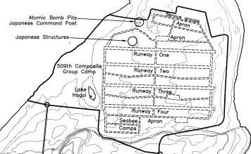
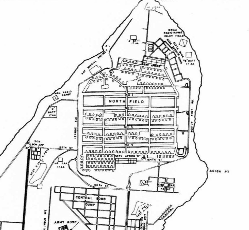
A 2001 National Park Service map labeling the components of Tinian North Field.
A 2005 photo by Gary Boothe of the foundation of the atomic bomb assembly building on the northwest side of Tinian North Field.
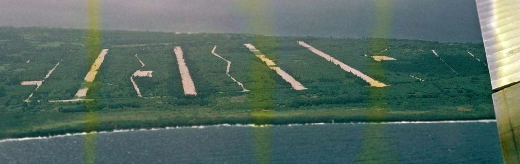
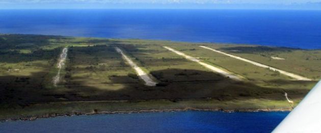
An 8/27/08 aerial view looking west at North Field's 4 overgrown runways.
North Field has been steadily reclaimed by the Tinian jungle, being abandoned & overgrown.
It is easily accessible by traveling a few miles north of San Jose on the main north-south road, "Broadway".
The crushed coral runways are grayish & weathered-looking,
but Runways Able & Baker & some of the taxiways remain drivable in an ordinary car, with occasional weedy growth on the surface.
Other than the runways, remains of former Japanese buildings & the preserved pits used to load the atomic bombs, nothing is left of the old facilities.
The forest has grown up to the edges of the runways & taxiways.

An 8/27/08 view looking along the remains of North Field's Runway Able.
An 8/27/08 photo of the preserved atomic bomb loading pit on the northwest side of North Field.
A 2009 photo of the remains of the Japanese Ushi Point control tower building.
In 2013, Baker runway was partially refurbished by the United States Marine Corps for Exercise Forager Fury II.
The exercise was a demonstration of the Marine Wing Support Squadron 171’s ability
to displace rapidly & generate significant combat power in an expeditionary environment.
A Marine Corps KC-130J Super Hercules landed on the runway on 12/5/13, only the 2nd aircraft to use North Field since 1947.
A 2013 aerial view shows the Tinian North Field runways have been considerably cleared compared to the 2008 photo.
A June 2014 aerial view by Gary Boothe looking west at North Field's 4 overgrown runways.
____________________________________________________
Majuro Airfield / Naval Air Facility Majuro, Delap Island, Marshall Islands
7.09, 171.38 (Southwest of Hawaii)
A 1944 photo of bomb-laden Marine F4U Corsairs taxiing out for an airstrike from Majuro Airfield.
According to Wikipedia, Majuro Airfield was originally established by the Imperial Japanese Navy Air Service in 1942.
The island was captured on 1/31/44 during Battle of Kwajalein by the V Amphibious Corps Marine Reconnaissance Company
and the 2nd Battalion, 106th Infantry Regiment who found it to be unoccupied.
The 100th Naval Construction Battalion began to improve the airfield creating a coral-surfaced 5,800' runway covering most of Delap Island.
By mid-March the airfield was in limited operation & by 15 April the airfield, taxiways, aprons, housing, shops, and piers were fully operational.
The Seebees also constructed roads & causeways linking Delap to the adjacent islands.
The carrier replacement plane pool was subsequently located at Majuro & a new 4,000' runway was built on Uliga Island
and a 2-lane causeway connecting Uliga & Delap was constructed.
An 800' x 150' apron was cleared & paved adjacent to the main runway to facilitate transport operations.
Fourth Marine Air Wing headquarters & Marine Air Group 13 relocated to Majuro Atoll in mid-March 1944.
Units stationed at Majuro included VF-39 operating the F6F Hellcat, VMF-155 & VMF-224 operating F4Us & VMSB-231 operating SBDs.
B-25s of the 41st Bombardment Group operating out of Bairiki (Mullinix) Airfield, Tarawa
staged through Majuro for bombing raids on Maloelap, Wotje Mili Atoll & Jaluit during March & April 1944.
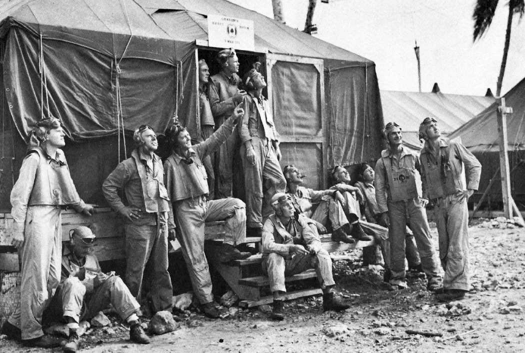
A mid-1944 photo of enlisted Marine rear-seat gunners of VMSB-231 outside their ready room on Majuro Atoll (courtesy of John Voss).

A pilot from VMSB-231 stands on the wing of his SBD at Majuro in August 1944.
A 1944 photo of bomb-laden Marine SBDs of VMSB-231 taxiing on Majuro Airfield.
A 5/2/44 photo of a Douglas R4D transport at Majuro Airfield.

An August 1945 aerial view of Majuro Airfield, showing 6 aircraft parked on the northwest side of the runway.
An undated photo of a Vought F4U Corsair fighter ditched offshore of Majuro Airfield.
Majuro Airfield was reduced to inactive status on 1/1/47 & disestablished on 6/1/47.
In the postwar period Majuro Airfield continued to serve as the airport for Majuro,
however by the mid-1960s the runway surface was deteriorating & it was becoming unsuitable for use by modern aircraft,
so it was decided to relocate the airport to its current location west of Rairok
and to utilize the area on Delap for industrial, commercial & residential development.
A circa early 1970s photo (courtesy of Hiroshi Ando) of a Continental Micronesia Boeing 727 at the old Majuro Airfield.
Hiroshi recalled, “Air Mike flew a specially-equipped 727; it had a teflon-coated belly for protection on coral reef runways.
The old runway was around 6,000' long.”
The replacement Marshall Islands International Airport opened in 1972 & Majuro Airfield ceased operation.
A 1/11/76 USGS aerial view of Majuro Airfield.

A 9/8/14 aerial view by Hiroshi Ando looking west at the site of the old Majuro Airfield.
A 9/8/14 photo by Hiroshi Ando looking west along the road built over the former Majuro Airfield runway.
Hiroshi observed, “The road where built upon the old runway is actually just half the width of the runway... the rest of the width is now occupied with large buildings.”
A 2017 aerial view shows no recognizable trace of the former Majuro Airfield.
Thanks to Hiroshi Ando for pointing out this airfield.
____________________________________________________
Leone Airfield, Taputimu, American Samoa
-14.35, -170.78 (Southwest of Hawaii)
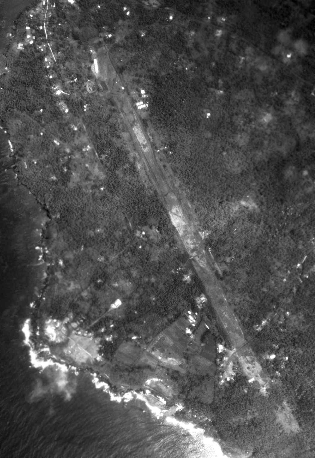
A 1/11/63 USGS aerial photo of Leone Airfield.
Jonathan Westerling reported, “Anyone who visits American Samoa today flies into Pago Pago airport –
originally built by the Navy at the beginning of World War II.
The Navy built a second airfield on Tutuila Island (American Samoa) at the beginning of the war.
This second airstrip was to be used for bomber & fighters & was constructed in the village of Leone in the southwest corner of the Island.
Known then as Leone Airfield, it was a secondary strip to the larger Tafuna Airfield which is today the international airport.
Nine months were spent constructing the runway which may have the distinction of seeing the least use of any in the Pacific!
The runway was listed with dimensions varying from 3,000'-6,000' long & 200'-400' wide.”
The first reference to the Leone Airfield is in a 1945 report “United States Naval History of Tutuila”
by USNR Lt. Cmdr. John Burke (courtesy of the American Samoa Historic Preservation Office, via Jonathan Westerling).
The report read, “In conjunction with the airstrip at Tafuna,
an emergency airstrip was under construction at Leone which was 300' by 3,000'.
It was started early in 1943 - probably in January.
The Leone airstrip was completed on 30 September 1943.
It was abandoned, however, in early 1945 because of turbulent air currents & lack of use.
Only 2 planes landed on the airstrip.”
The 1947 publication “Building the Navy’s Bases in World War II” (courtesy of Jonathan Westerling)
added “The 11th Battalion at Tutuila .... constructed Leone Airfield, a 6,000' by 400' foot bomber strip,
surfaced with volcanic cinders, and necessary supportive facilities.”
According to the American Samoa Government's “Samoan Historical Calendar”,
Ed McMahon, Johnny Carson's co-host on "The Tonight Show" was stationed there during his Marine service.
The earliest photo which has been located of Leone Airfield was a 1/11/63 USGS aerial view, which depicted a single northwest/southeast runway.
A 1967 view by Don Cole looking south along the former runway of Leone Airfield (courtesy of the Feleti Barstow Public Library via Jonathan Westerling).
A 1984 aerial view by Don Cole looking west at the Leone High School,
whose campus sits in the middle of the runway of Leone Airfield (courtesy of the American Samoa Public Library via Jonathan Westerling).
According to the 1994 report “American Samoa In World War II” prepared for the American Samoa Department of Parks & Recreation,
“The outline of the Leone airstrip is still clearly visible.
At least 2 school buildings are located on the northern end of the strip & homes have been built on the southern end.”
According to Jonathan Westerling, “The schools which are located on the old runway are the Leone High School & the Midkiff Middle School.”
The 2001 USGS topo map of Tutuila shows the abandoned runway of Leone Airfield as a straight-line road between Leone & Taputimu (courtesy of Jonathan Westerling).
A 2019 aerial view looking northeast at the remains of Leone Airfield.
Jonathan Westerling reported, “The Remnants of Leone Airfield can be seen from the air with a straight clearance road starting from the WVUV-AM radio tower to Midkiff Elementary School.”
____________________________________________________
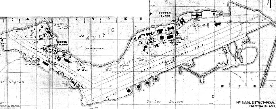
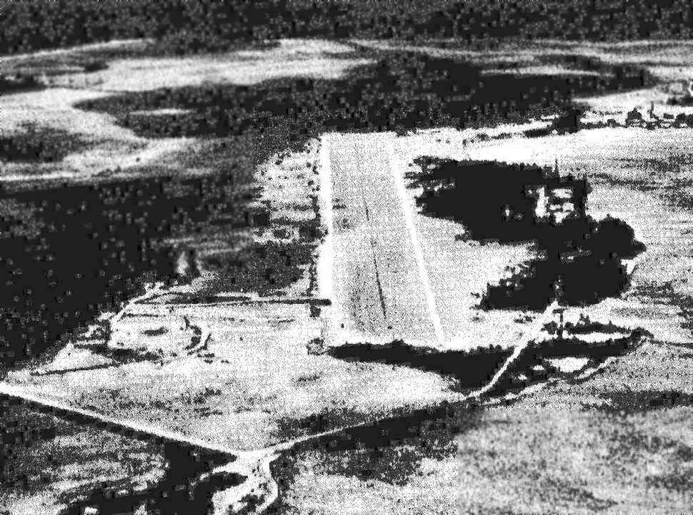
Palmyra Atoll Airfield (P16, PLPA), Palmyra Atoll
5.887, -162.08 (Southwest of Hawaii)
A 6/30/44 Navy layout of the facilities on Palmyra (courtesy of Ron Plante) depicted a total of 3 runways.
In 1934, Palmyra Atoll was placed under the Department of the Navy.
When the U.S. Navy took over to use the atoll as a Naval Air Station on 8/15/41,
the atoll was owned privately by American citizens, including Hawaiians.
According to the 11/03 issue of The Coast Defense Journal (courtesy of John Voss),
“Rear Admiral Claude Bloch announced the establishment of Naval Air Station Palmyra Island on 8/15/41,
officially opening the air station.”
According to the 11/03 issue of The Coast Defense Journal (courtesy of John Voss),
“Two Army B-17s, the 1st of many, visited briefly from Hawaii for anti-submarine patrol soon after the attack on Pearl Harbor.
The 5,000' Runway 6 on Cooper Island was completed on 1/1/42.
Another 3,700' runway was built on adjoining Menge Island.”
The earliest aircraft accident to be recorded on the Palmyra airfield was in 6/16/42.
A U.S. Army Air Force Douglas C-53 (41-20069) flew from Honolulu to Palmyra, where it was damaged beyond repair.
According to the 11/03 issue of The Coast Defense Journal (courtesy of John Voss),
“Eighteen 18 P-39s arrived on 10/24/42, only to depart on 11/2.
Long-range AAF B-24s also made frequent visits on the way to the South Pacific.
Contract civilian pilots from Pan American Airways, Consolidated Aircraft, and United Airlines,
flying cargo & personnel to the South Pacific, also refueled at Palmyra.”
According to the 11/03 issue of The Coast Defense Journal (courtesy of John Voss),
“Runway 6 was expanded in 3/44, giving it a total length of 6,160'.
A 2,500' emergency runway on Sand Island was completed on 5/15/43,
all built of compacted coral.
The earliest depiction which has been located of the Palmyra airfield was a 6/30/44 Navy layout (courtesy of Ron Plante).
It depicted a total of 3 runways: a 6,000' northeast/southwest strip on the east side of Cooper Island,
a 3,661' northwest/southeast strip on the west side of Cooper Island,
and a 2,400' northeast/southwest strip taking up almost all of tiny Sand Island on the southwest side of the Atoll.
A seaplane runway was depicted in the central lagoon,
and a CAA radio beacon was depicted on Paradise Island on the south side of the Atoll.
According to John Voss, Palmyra “was used as a fueling point for aircraft traveling between Hawaii & Australia during WWII.
Grumman F4Fs and Brewster F2As (VMF-211) were based at Palmyra for local defense.”
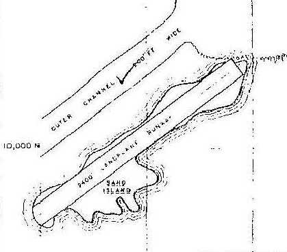
A closeup from the 6/30/44 Navy layout of Palmyra (courtesy of Ron Plante) depicted the smallest of Palmyra's 3 runways,
labeled simply as a “2,400' landplane runway” which took up most of Sand Island, located southwest of the main Palmyra facilities.
It is not known if this 3rd runway was ever actually used.
According to the 11/03 issue of The Coast Defense Journal (courtesy of John Voss),
“Air-sea rescue was initiated at the station on 8/6/44, with the arrival of a PBY-5A.”
A 6/30/45 Navy layout of the facilities on Palmyra (courtesy of Ron Plante) depicted 2 runways on the main island,
along with a large number of buildings, revetments, and other facilities.
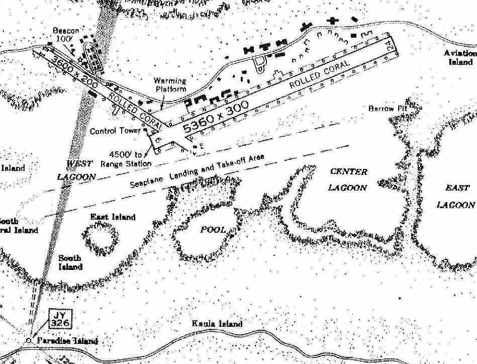
A WW2 era Navy layout of the facilities on Palmyra (courtesy of Ron Plante) depicted 2 rolled coral runways (measuring 5,360' & 3,600'),
along with a seaplane landing & takeoff area in the central lagoon, and an aeronautical radio beacon on Paradise Island to the southwest.
It described the field as having a control tower southeast of the runway intersection.
There were said to be airport buildings west of the field, but no hangars.
It also described the Sand Island Airstrip as having a 2,500' northeast/southwest coral runway, on the southwest corner of Palmyra.
A WW2 era Navy aerial view (courtesy of Ron Plante) looking northeast along Palmyra's primary runway.

A WW2 era Navy aerial view (courtesy of Jerry Morelock) looking west showing the 1 runway at Palmyra Sand Island (top-left) & 2 runways on the main island (bottom-right).
According to the 11/03 issue of The Coast Defense Journal (courtesy of John Voss),
“NAS Palmyra Island was disestablished on 2/15/47,
but it had played an important role in the supply route to the South Pacific,
and was also a base from which patrol aircraft could protect the Hawaiian Sea Frontier.”
After the war, the former property owners (the Fullard-Leo family)
fought for the return of Palmyra all the way to the U.S. Supreme Court & won in 1947.
According to the 11/03 issue of The Coast Defense Journal (courtesy of John Voss),
“The island was operated for a few years by the CAA before being abandoned.”
When Hawaii achieved statehood in 1959, Palmyra, which had been officially part of the City & County of Honolulu,
was explicitly separated from the new state as an Incorporated Territory of the U.S., administered by U.S. Department of Interior.
In 1962, the U.S. Department of Defense used the atoll for an instrumentation site during high altitude atomic weapon tests over Johnston Island.
The last recorded aircraft accident on Palmyra Island was on 1/5/80,
when a Lockheed 18 Lodestar N163R owned by Fred Sorenson was carrying 7 amateur radio operators from Honolulu to Palmyra.
While approaching the airstrip the pilot estimated a crosswind gusting to 15 knots.
However, below tree level the wind was calm. The Lodestar swerved off the runway & collided with trees.
There were no fatalities but the aircraft was totaled
N163R was pushed up into the trees on the southwest end of the runway, where it has remained ever since.

A circa 1980-2009 photo of the remains of Lockheed Lodestar N163R off the southwest end of the Palmyra runway.
In July 1990, Peter Savio of Honolulu took a lease on the atoll until the year 2065 & formed the Palmyra Development Company.
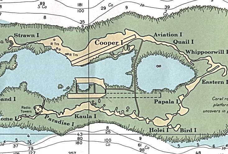
A 1991 NOAA nautical chart depicted the single remaining runway on Cooper Island,
along with the radio towers on Paradise Island.
In January 2000, the atoll was purchased by The Nature Conservancy for the purposes of coral reef conservation & research.
According to the 11/03 issue of The Coast Defense Journal (courtesy of John Voss),
The Nature Conservancy cleared the 6,000' Cooper Island airfield in 2000.
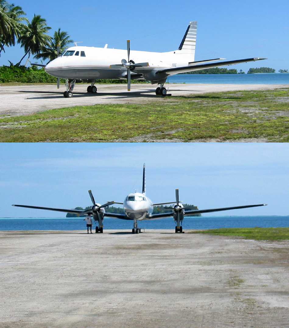
Two August 2003 photos of a Gulfstream I on Palmyra's runway.
According to the 11/03 issue of The Coast Defense Journal (courtesy of John Voss),
“Today Palmyra has returned to jungle except for the 6,000' Cooper Island airfield the Nature Conservancy cleared.
The runways on Mengle & Sand Island are overgrown,
and the many wooden buildings remaining left by the Navy have long since rotted & collapsed.
A few abandoned concrete structures remain, but they too are mostly overgrown by jungle.”
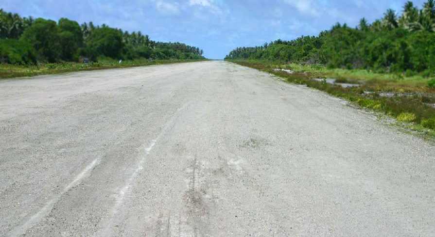
A 6/22/05 photo looking southwest along Palmyra's runway.
In November 2005, a worldwide team of scientists joined with The Nature Conservancy
to launch a new research station on the Palmyra Atoll in order to study Global warming,
disappearing coral reefs, invasive species and other global environmental threats.
In 2008, Dennis Girardot (Palmyra Station Manager for The Nature Conservancy) reported,
“We are still using one of the original runways here for flying scientists, donors and staff in to our facility here.
It is still loose coral & we need to do an upgrade on it in order to continue it's use from Hawaii.”
As of 2009, the “Palmyra (Cooper) Airport” is still listed with the FAA as a private airfield, with designators P16 & PLPA.
The remarks include, “Restricted, emergency only.”
The airfield consists of a single 5,000' treated coral Runway 6/24.
A 2016 aerial view looking northeast at Palmyra showed the single remaining runway on Cooper Island.
Only the faintest trace of the former northwest/southeast runway remained recognizable.
____________________________________________________
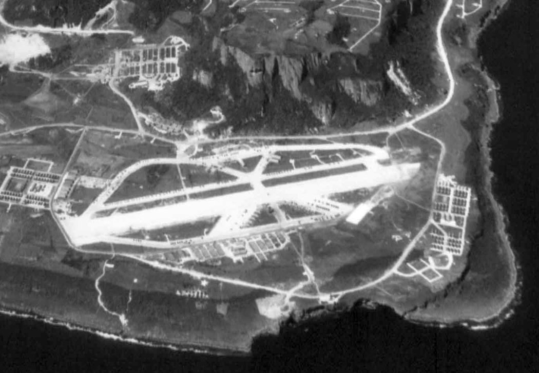
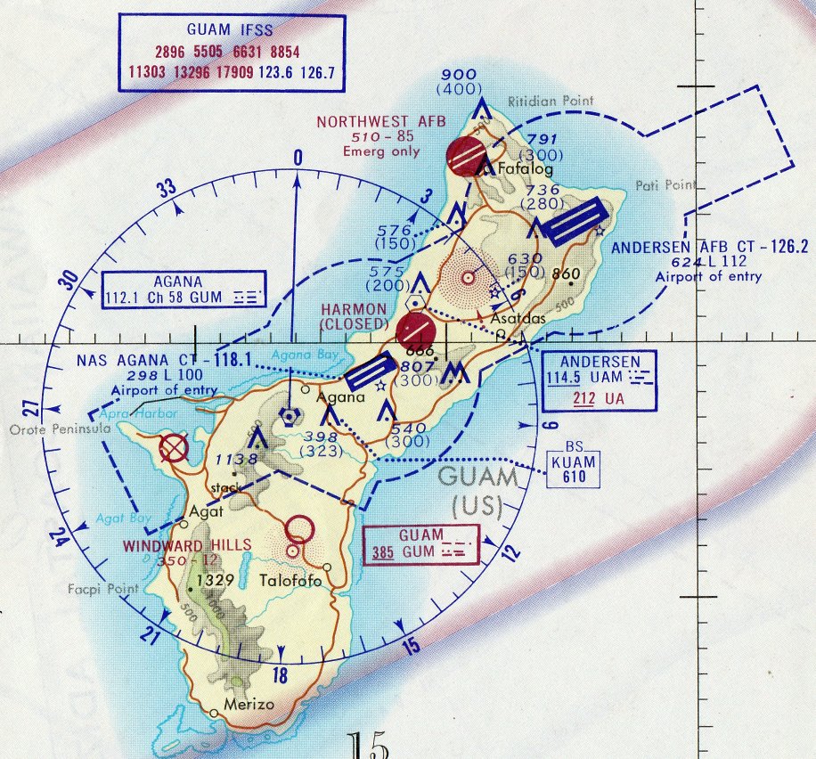
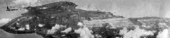
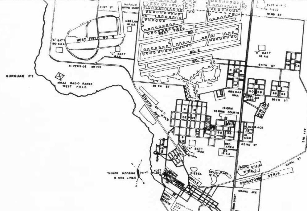
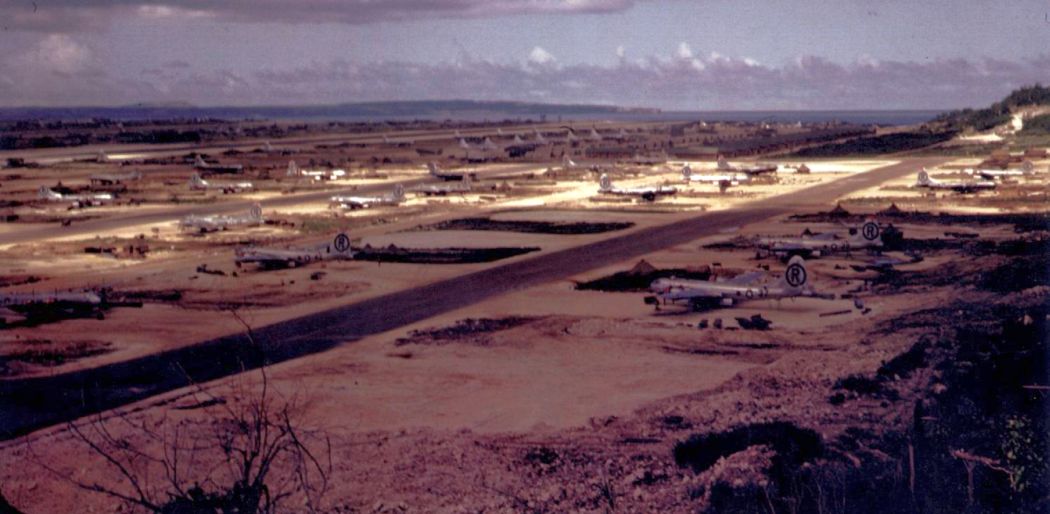
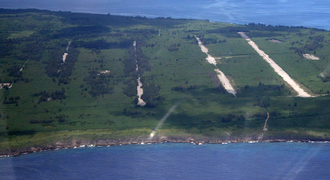
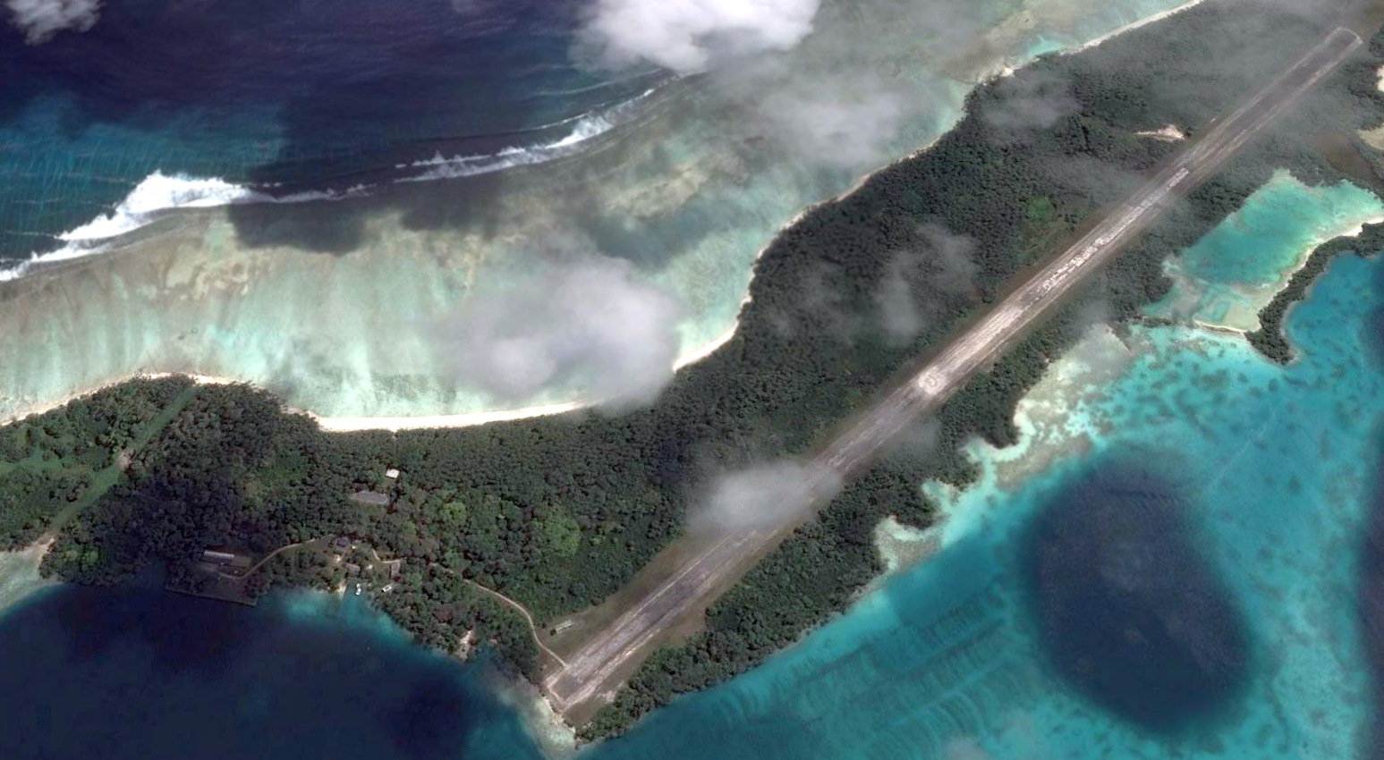
Guam Northwest Army Airfield / Guam Northwest Air Force Base,
Agafo Gumas, Guam
13.62, 144.86 (Southwest of Hawaii)
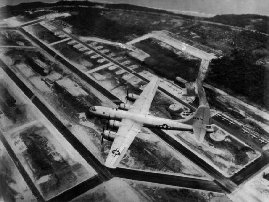
A circa 1945 aerial view (courtesy of Larry Miller & the 315th Bomb Wing Page)
looking northwest at a B-29 bomber, tail # 42-63674, of the 315th Bomb Wing, 501st Bomb Group
in flight over Guam Northwest Field.
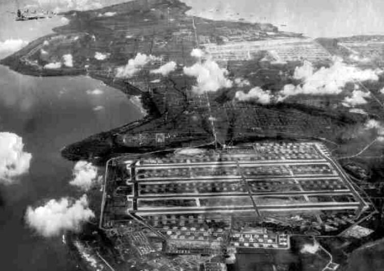
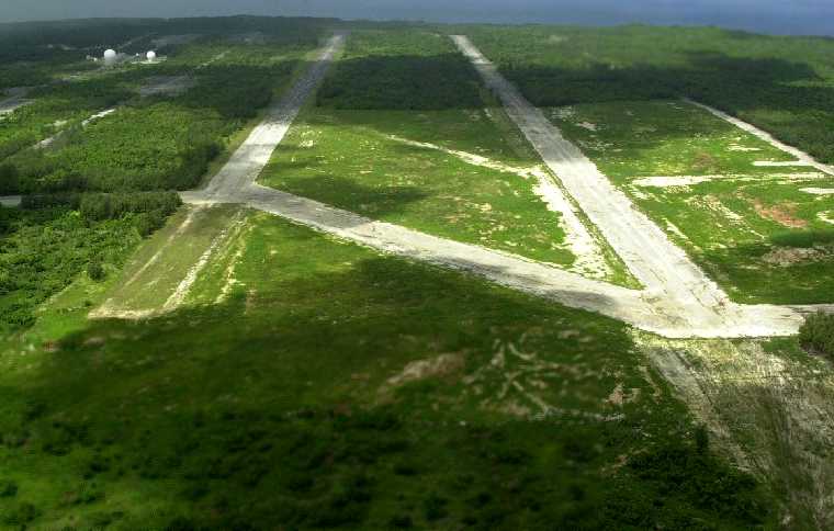
Northwest Field was constructed in 1944-45 near Ritidian Point on the northwest end of the island of Guam.
Construction was accomplished by the Army Air Corp 1865th Aviation Engineering Battalion
and Navy Construction Battalions (SeaBees).
Deployed ground echelon personnel also assisted in construction, prior to the arrival of their Groups air echelon.
Guam Northwest Field became the home of the 20th Air Force, 315th Bomb Wing, equipped with the Boeing B-29 bomber.
The first units to arrive at Northwest Field were personnel of the 315th Wing HQ, 16th & 501st Bomb Groups in April, 1945.
The 331st & 502nd Bomb Groups arrived in May, 1945.
The first B-29s arrived there in May of 1945 after undergoing crew training in the states.
The field ultimately had 2 runways, the north & south runways.
The south runway was the 1st to be completed.
However, when the first 315th aircraft were deployed to Guam,
the south runway was still under construction & they had to land at nearby North Field
(which eventually became today's Andersen AFB).
.
When the main air echelons of the 16th & 501st Bomb Groups arrived the south runway was complete, but the taxiways were not.
Aircraft had to be towed to their parking spaces over the rough coral.
By the time the air echelons of the 331st & 502nd Bomb Groups arrived, both runways were complete.
A 1940s aerial view (courtesy of Larry Miller & the 315th Bomb Wing Page) looking southeast at Northwest Field.
Note the large number of B-29s parked on the field.
The 331st Bomb Group used the ramp space in the center of the base,
the 502nd Bomb Group used the area on the east side,
and the 16th & 501st Bomb Groups used ramp space on the west side.
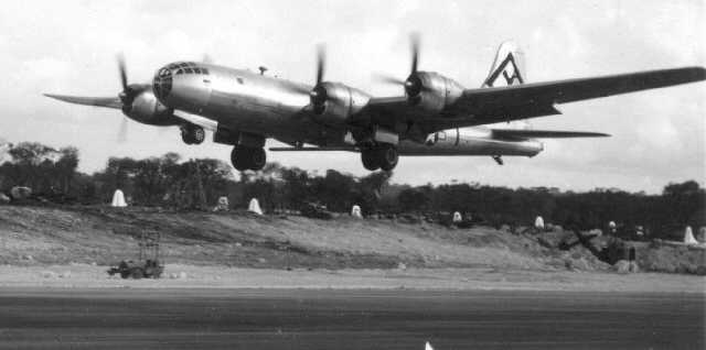
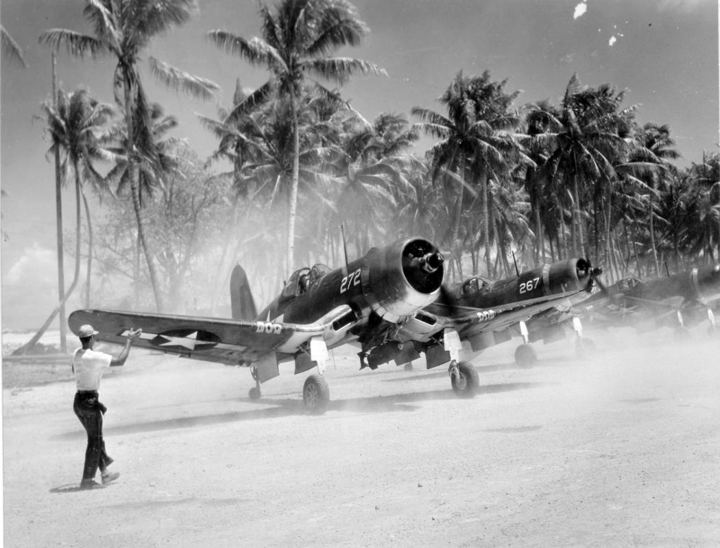
A B-29B of the 501st Bomb Group taking off from Northwest Field on 6/26/45 (courtesy of Larry Miller & the 315th Bomb Wing Page)
for first Empire mission flown by the 16th & 501st Bomb Groups.
Note the B-29B's characteristic radar antenna “wing” visible under the fuselage between the main landing gear.
Northwest Field's 315th Bomb Wing was primarily equipped with the somewhat rare B-29B version of the bomber.
The distinction of the "B"-model was to save weight by removing all of the B-29's guns & sighting equipment except the tail gun.
The weight savings gave the B-29B a slight increase in speed & range.
The 15th & final mission of the 315th Bomb Wing & the final mission of the war
was a round trip of over 3,650 miles to the Nippon Oil Company at Tsuchizakiminato
on the north west coast of Honshu, the main island of Japan.
The B-29B also had 2 new radar units installed.
The AN/APQ-7 Eagle Radar was used for bombing & navigation,
and the AN/APG-15 was used for aiming the tail gun.
These 2 radar units gave the B-29B a distinctive shape
as the APQ-7 antenna appeared as a small wing under the fuselage (between the 2 bomb bay doors)
and the APG-15 added a ball-shaped antenna to the tail of the aircraft below the tail guns.

A circa 1945 photo of a B-29B's tail turret at Northwest Field (courtesy of Larry Miller & the 315th Bomb Wing Page).
Note the B-29B's characteristic spherical tail gun radome,
as well as the central 20mm gun (which was eventually removed, leaving the normal tail gun armament of twin 0.50-caliber guns).
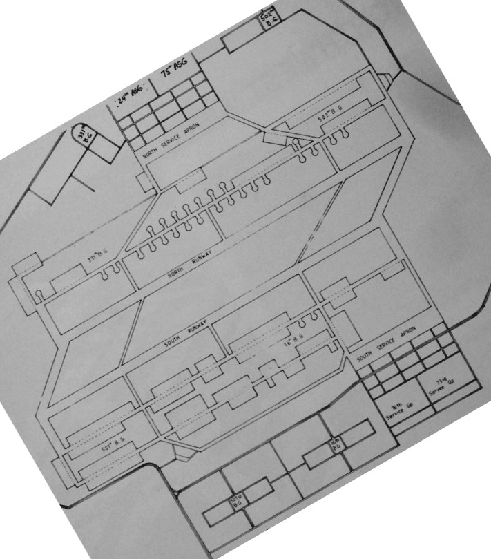
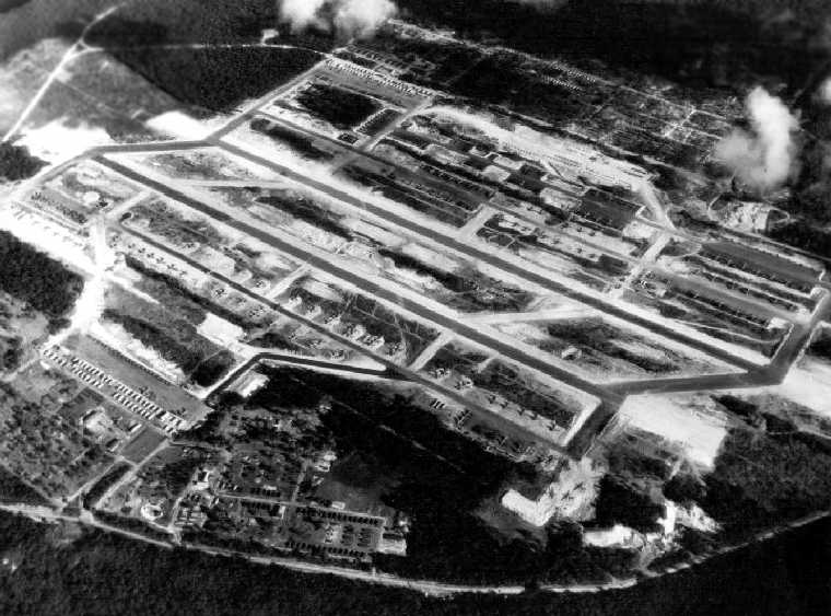
An August 1945 plan of the extensive facilities of Northwest Field (courtesy of AFHRA via Ron Plante).
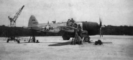
A May-June 1946 photo by Ken Moore of a P-47 being boresighted at Guam Northwest Field (courtesy of Larry Miller & the 315th Bomb Wing Page).
Ken recalled, “The outfit was the 7th Fighter Command, 21st Fighter Group, 46th Fighter Squadron.
I was with the 46th Fighter Squadron & was an armorer.
We were the only Fighter Group attached to the 20th Air Force.”
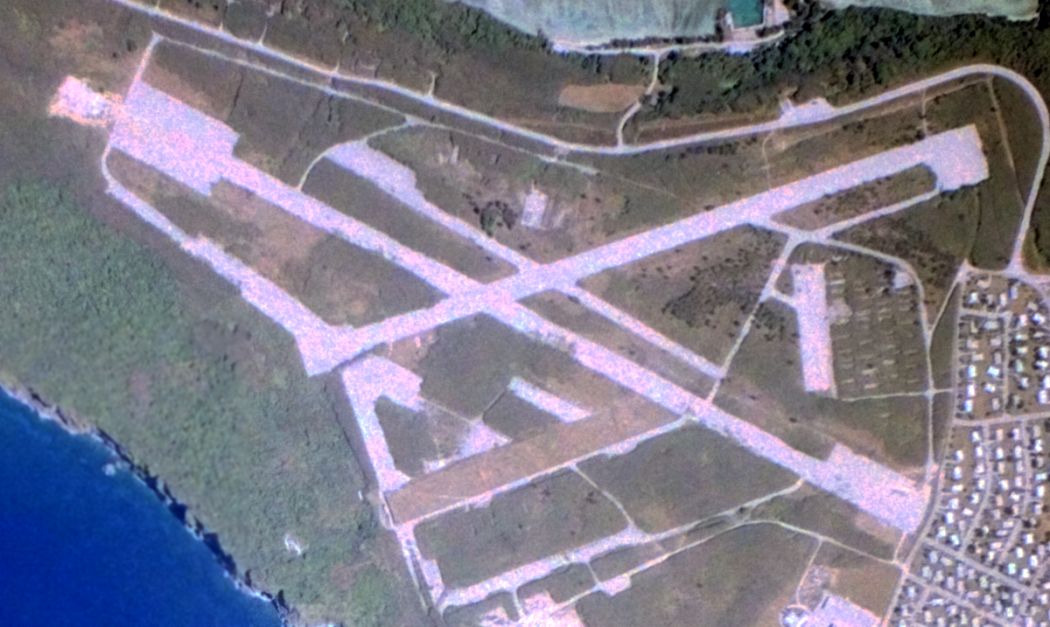
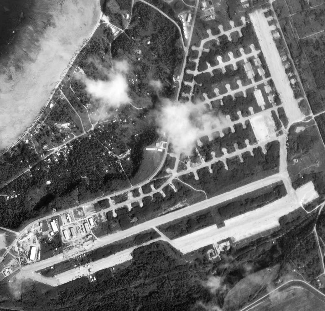
A 3/21/56 aerial view (courtesy of John Lawrence) showed the extensive airfield facilities of Northwest Field.
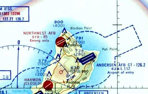
The earliest aeronautical chart depiction which has been located of Guam Northwest Field was on a 1958 World Aeronautical Chart.
It depicted “Northwest Guam AFB” as an active airfield.
The 1966 Pacific Terminal Areas Chart (courtesy of Kevin Walsh) depicted Northwest AFB as “Emergency only”.
A 3/2/67 USGS aerial view showed the extensive airfield facilities of Northwest Field.
The last aeronautical chart depiction which has been located of Guam Northwest Field
was on the June 1971 Hawaiian Islands & Marianas Islands Sectional Chart (courtesy of Ron Plante).
It depicted “Northwest AFB” as being open for emergency use only, and having 2 paved runways, with the longest being 8,500'.
John Voss recalled, “When I visited Guam I made an attempt to get on to Northwest Field but was unsuccessful
as the north end of the island fell under the jurisdiction of Anderson AFB as there was a lot of B-52 activity at the time ( i.e. Vietnam War).”
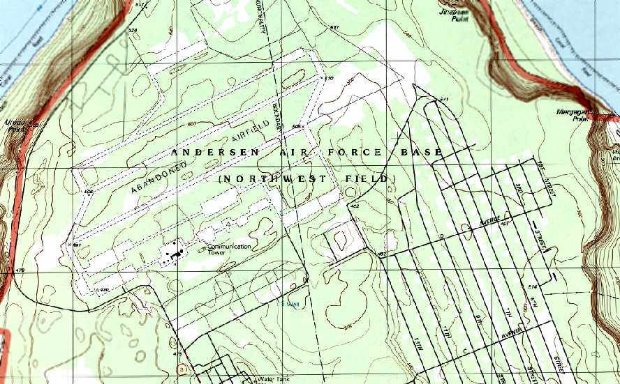
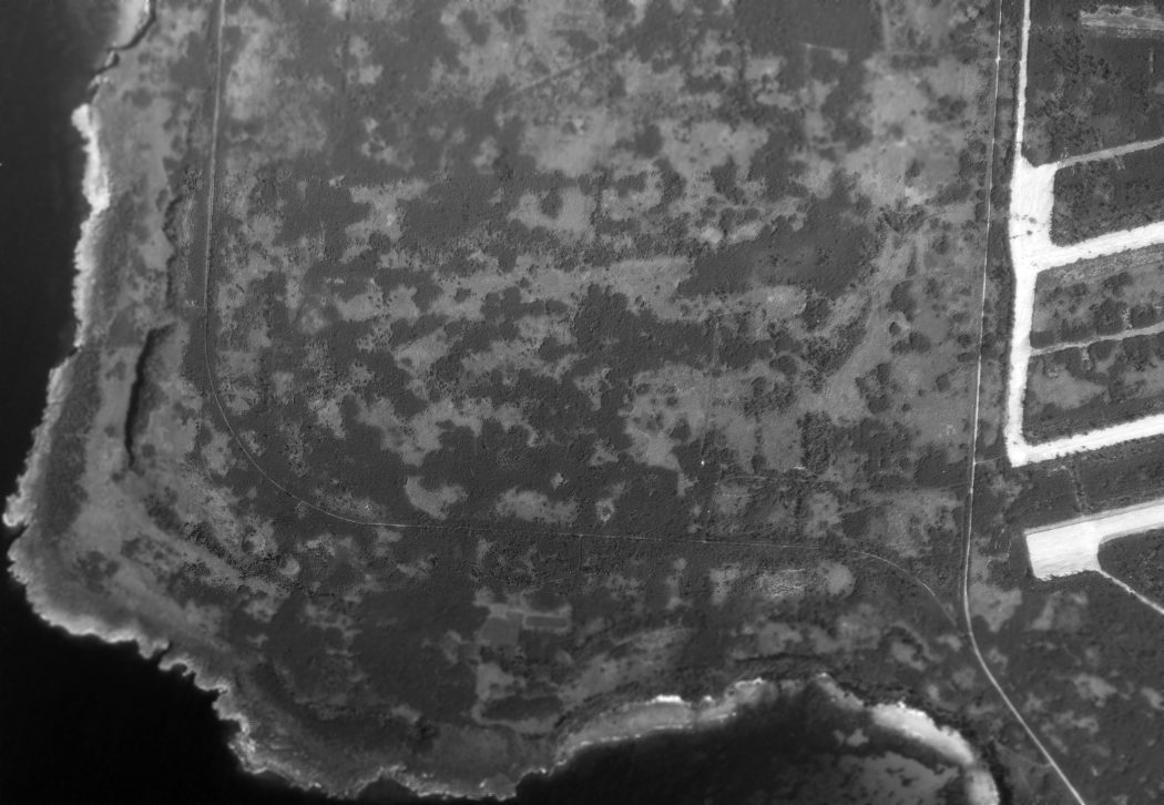
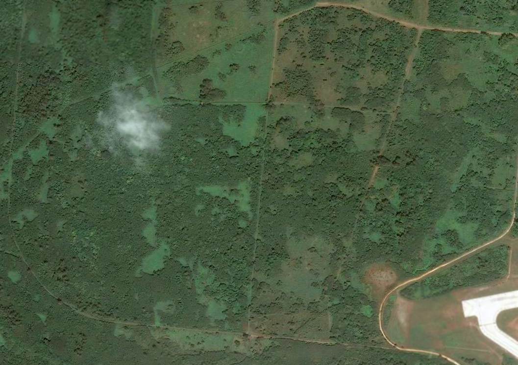
Northwest Field was closed as an airfield at some point between 1958-80,
as the 1980 USGS topo map labeled the runways of “Andersen Air Force Base (Northwest Field)” as an “Abandoned Airfield”.
Note the street grid for the huge ammunition bunker complex to the southeast of the airfield – built during the Vietnam War?
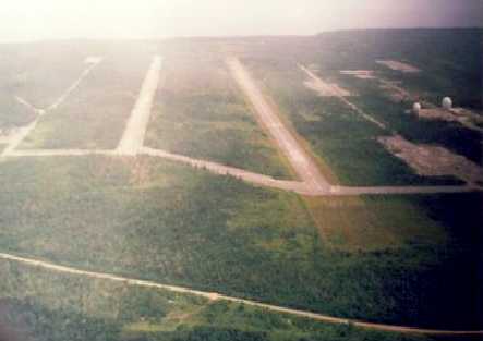
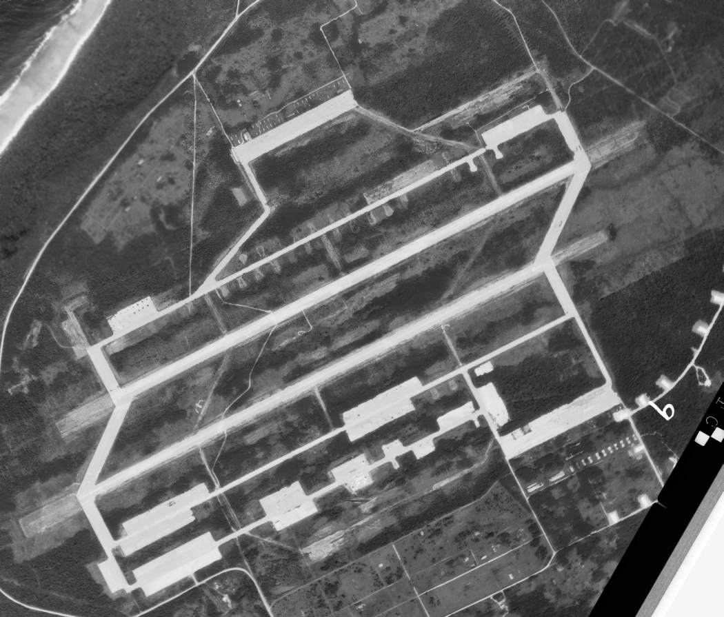
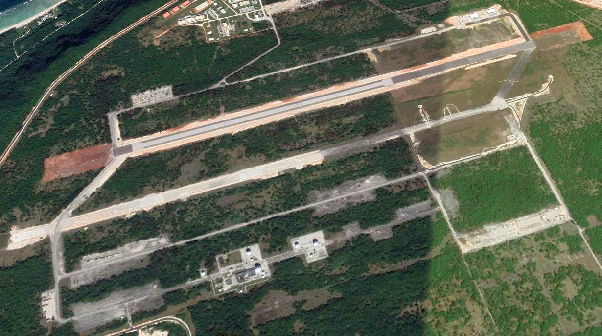
A 1992 aerial view by Ron Plante, looking northeast along the Guam Northwest runways, taken from a flying club Cessna 150.
Note the 2 radomes which were built along the south ramp.
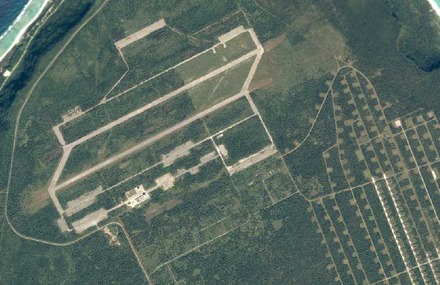
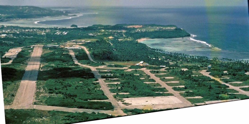
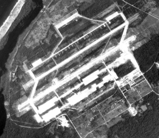
A circa 2006 aerial view of Guam Northwest Field (courtesy of Ron Plante) showed the 2 runways, ramps, and numerous taxiways.
Note the huge ammunition bunker complex to the southeast of the airfield,
and the 2 radomes on the south ramp.
An undated aerial view looking southwest along Guam Northwest Field's runways.
An article in the 7/28/08 issue of Aviation Week magazine (courtesy of Ron Plante)
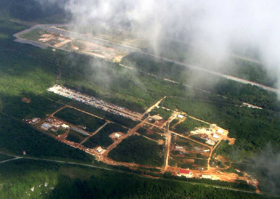
described how the Air Force was reusing Northwest Field for training purposes:
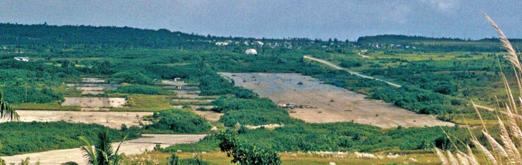
“Northwest Field, a 2,000-acre base used for World War II B-29 night bombing operations, was long deserted.
But its 8,400' twin runways, made with an extremely strong combination of crushed coral & limestone
with 1.5” of asphalt on top, and a maze of taxiways remain intact.
It’s now the heart of a rehabilitation and construction effort costing more than $200 million to provide barracks, vehicle facilities,
simulators, classrooms, armories, warehousing and training sites for these highly specialized forces.
A total of 89 projects encompass the building of 80+ facilities that include roads,
water tanks, pump houses, utilities as well as an electrical grid and substation.
The winding taxiways that once allowed the dispersal of hundreds of B-29 heavy bombers are now overhung by jungle.
In a clever piece of innovation, they are being used for practicing defense & reaction against convoy ambushes.
Other new construction includes weapons ranges, field exercise areas
and an unused residential area that has been turned into an urban assault course.
The south runway has been opened for helicopter & air-drop operations
and may eventually be used as a C-130 landing site.”
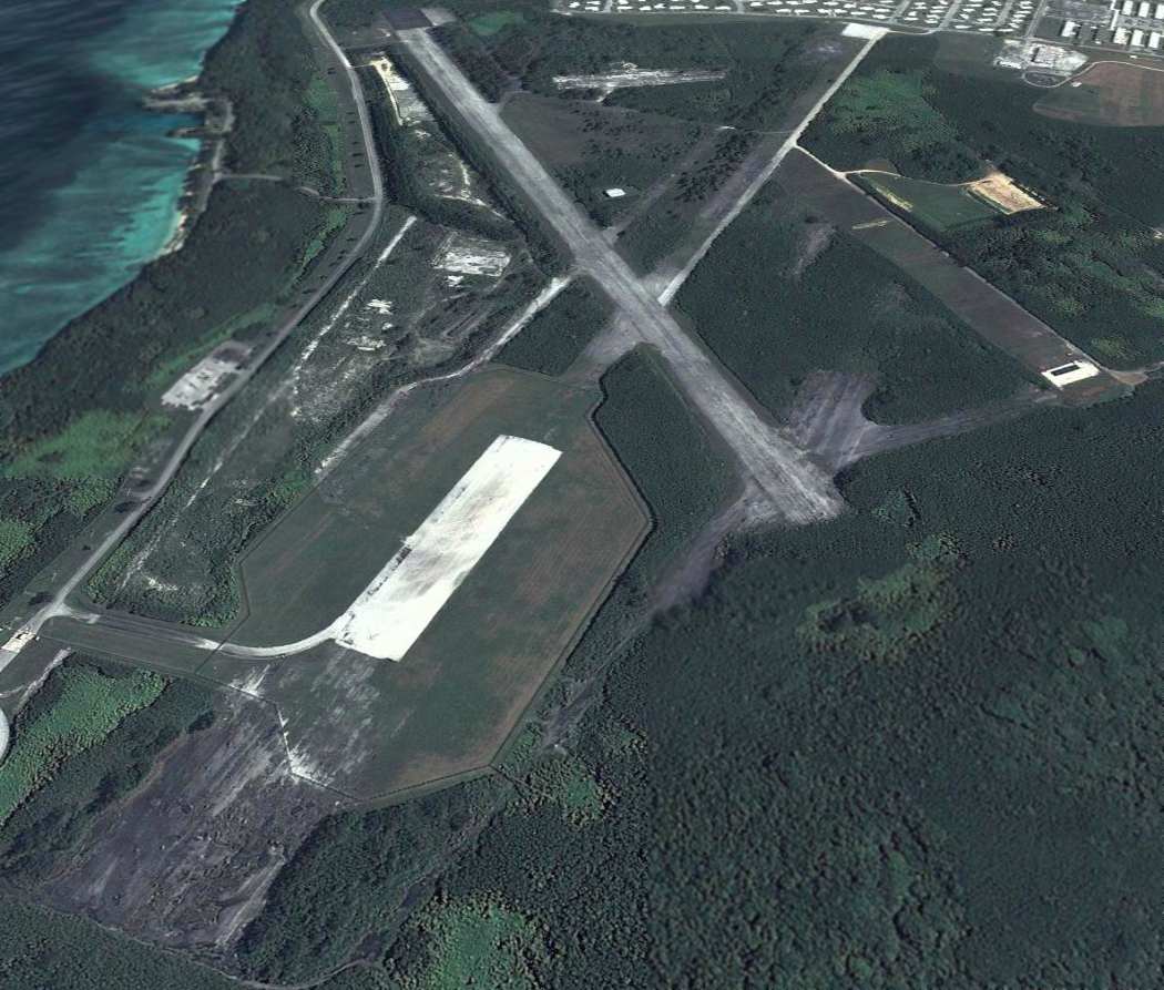
An undated aerial view looking south at Guam Northwest Field
from a 4/14/10 USAF news article about the field (courtesy of Ron Plante).
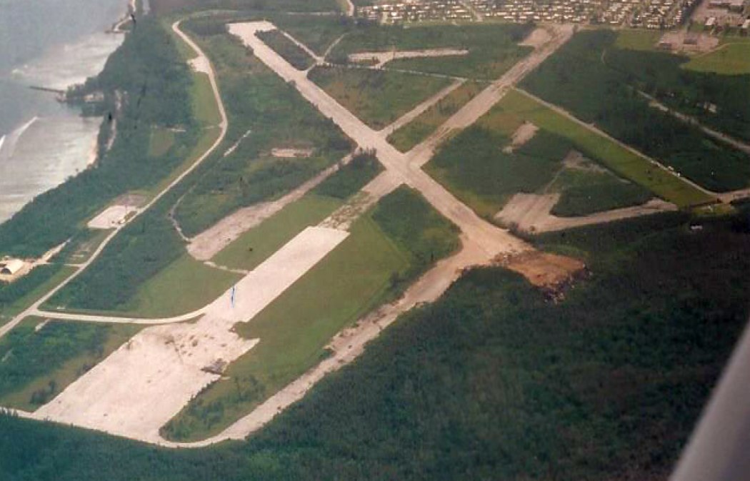
A 2020 aerial view looking north at Guam Northwest Field.
A 2024 photo by Derek Rowan of a historical plaque at Guam Northwest Field.
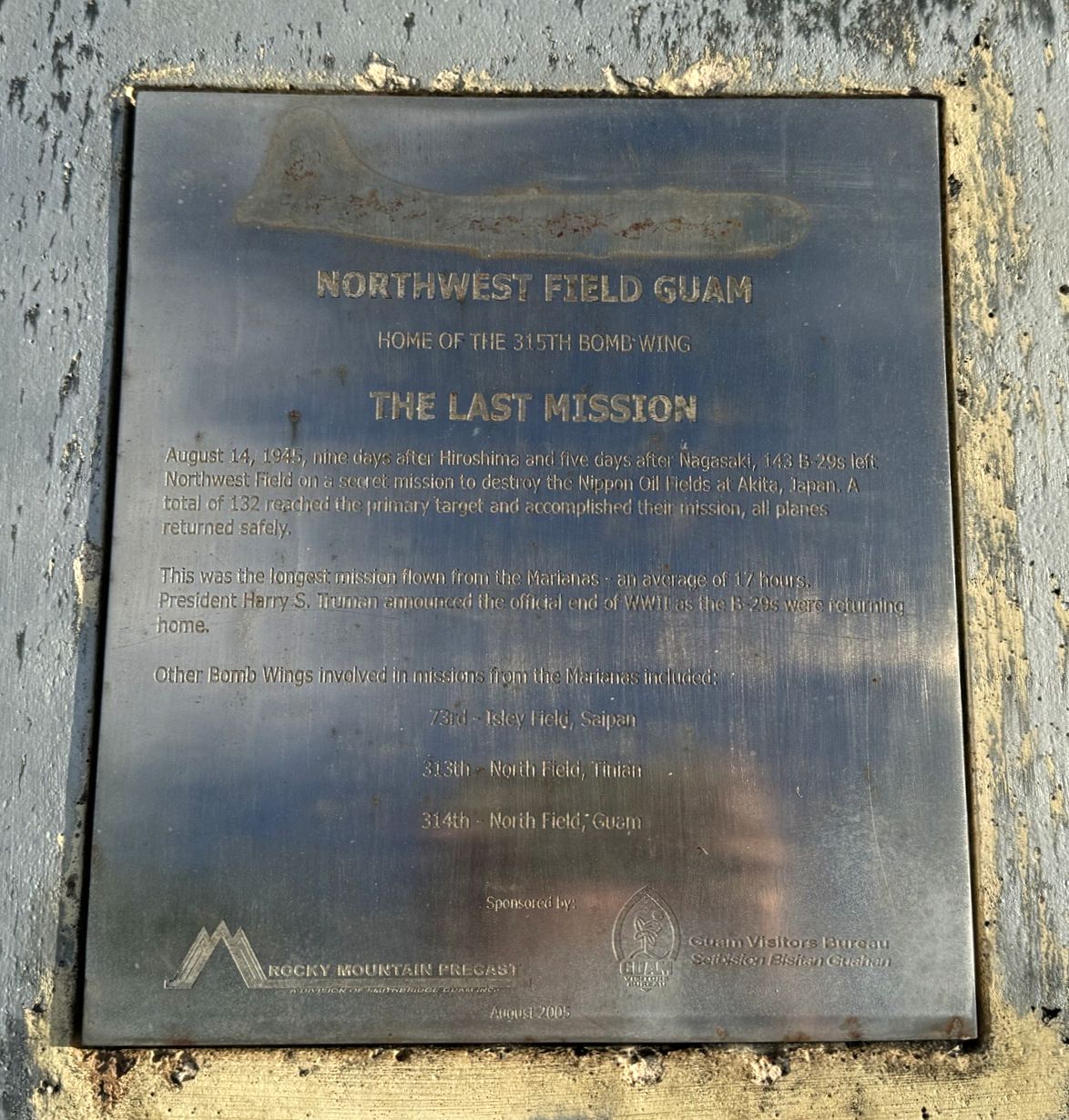
A 2024 photo by Derek Rowan of a historical plaque at Guam Northwest Field.
____________________________________________________
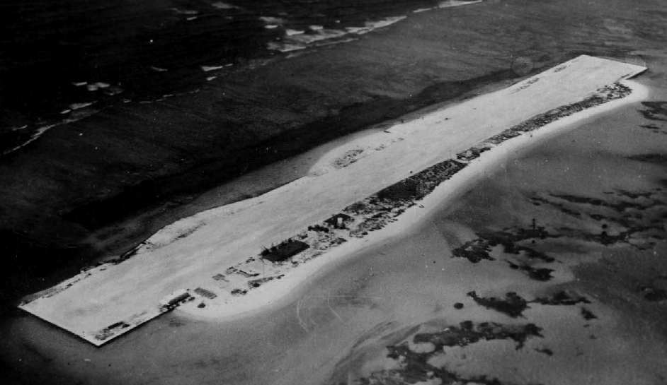
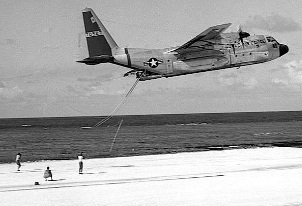
French Frigate Shoals Naval Air Facility,
Tern Island, French Frigate Shoals
23.87, -166.283 (Northwest of Hawaii)
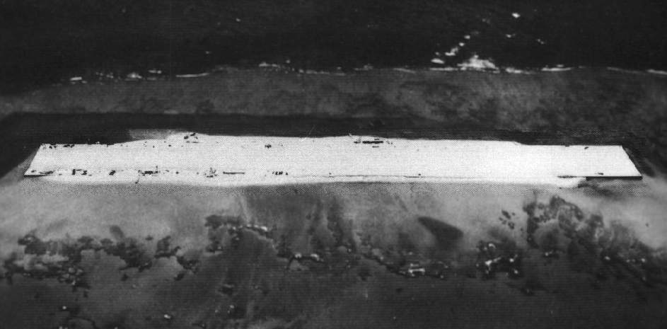
A 1943 aerial view of French Frigate Shoals (National Archives photo).
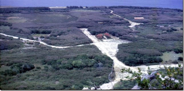
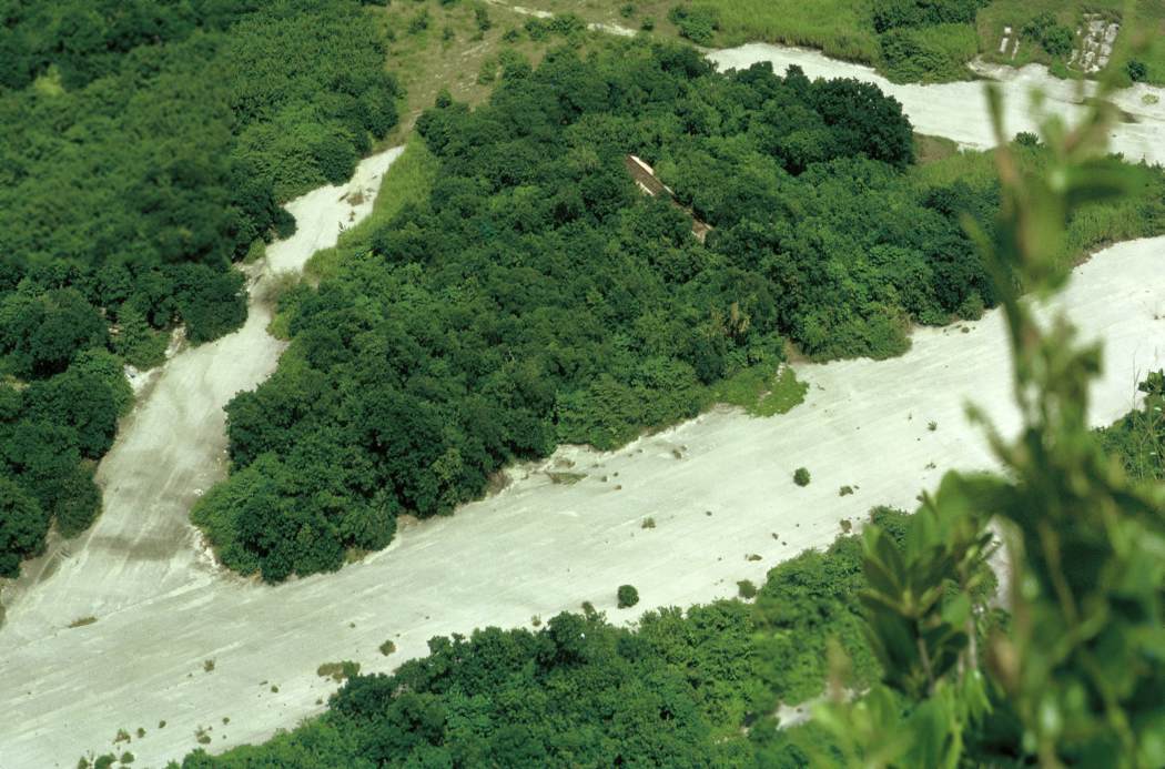
This location is one of the most spectacular & distinctive airfields in the world.
It most closely resembles an aircraft carrier,
in that nearly every available acre of land of the island is taken up by its runway.
The French Frigate Shoals consist of a crescent-shaped atoll of small islands, 18 miles in diameter.
They are located 550 miles northwest of Honolulu.
The islands first played a part in WW2 when they were included in Japanese plans
to be used to refuel seaplanes from submarines in the sheltered waters of the atoll,
as part of their campaign to conquer Midway Island.
Such a refueling was successfully carried out in 1942 by two H8K Emily flying boats,
which was refueled by a submarine within the French Frigate Shoals atoll.
The seaplanes then mounted a bombing raid on Pearl Harbor,
although they were thwarted from hitting their targets by inclement weather.
Later in 1942, elements of the 5th Seabee Battalion arrived on Tern Island to begin construction of an airfield.
The island was only a few hundred feet long, yet was expanded by dredged coral
to create 3,100' x 275' runway & a ramp area sufficient for 24 single engine aircraft.
The expanded island's area encompassed 27 acres, of which 20 were taken up by the airfield.
On the meager remaining land, partially buried Quonset Huts were erected to serve as housing,
painted white to blend in with the surrounding coral.
The typical complement was 118 men, who rotated from Pearl Harbor on a three month tour.
The station was commissioned in 1943 as an auxiliary of NAS Pearl Harbor.
It served as an emergency landing strip & refueling stop for fighter squadrons transiting between Hawaii & Midway,
and provided surveillance of the surrounding area.
It was protected by a variety of anti-aircraft artillery.
After the end of WW2, the island was swept clean by a tidal wave in 1946,
after which point the base was closed by the Navy.
In 1952, the Coast Guard built a LORAN navigation beacon tower on the island,
along with a 20 man supporting facility.
The runway was used for a weekly mail & supply flight.
The Coast Guard installation continued in operation until 1979.
A 1961 NOAA aerial photo of French Frigate Shoals.
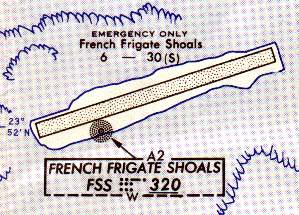
French Frigate Shoals Airfield, as depicted on the 1963 Pacific Enroute Chart (courtesy of John Voss).
Tern Island also played an interesting role during the early days of space flight.
During 1961-63, the Pacific Missile Range had a portable tracking station located at one end of the island,
operated by the Bendix Radio company, and staffed with 6-10 people.
PMR tracked not only the USAF Discoverer spacecraft but also the Soviet Union's space efforts,
including their first manned mission.
The PMR personnel lived in the Quonset Hut located about halfway down the runway,
and later, during the Starfish atomic tests, two house trailers were shipped to the island.
An undated photo of an Air Force C-130 conducting a run down the runway at French Frigate Shoals,
during which it performing a mid-air retrieval of a satellite tracking data canister.
John Caldwell recalled, “My Dad was in & out of the French Frigate Shoals area a number of times;
he said it was the most unspoiled of anything in the Hawaiian Islands.
He flew CH-53s & picked up film capsules in the water if the C-130 'Skyhook' failed to snag the parachute upon reentry from space.”
A Coast Guard C-123 landing on French Frigate Shoals in the 1960s.
A 1960s aerial view by Bill Wood of French Frigate Shoals.
An unusual shot of a CH-3B Sea King in USAF markings, by Jerry Lentz.
The helicopter visited French Frigate Shoals during the 1960s,
while assigned to a missile tracking ship visiting the island.
The Tern Island runway was used by specially equipped C-130s from Hickam AFB.
The C-130 had a rig hanging out the rear cargo door that was usually used for snagging in mid-air
the parachute of a descending Discoverer satellite capsule.
When the French Frigate Shoals tracking installation obtained data from a particularly important track,
The data tapes would be put in a fiberglass canister,
attached by a nylon rope to a grappling hook at the top of a pole erected on the runway.
This would be snagged by the C-130 in mid-air above the runway.
They would not land on FFS because the coral sand would be ingested in the engines when the props reversed.
After PMR left Tern Island, tracking was conducted on specially outfitted ships such as the USNS Longview.
USAF helicopters assigned to these ships (such as the UH-3 in the above photo)
would occasionally pay a visit to French Frigate Shoals if they were within range.
In recent years, Tern Island became part of the Hawaiian & Pacific Islands National Wildlife Refuge Complex.
A ranger station occupies the former Coast Guard buildings,
and is occupied by small groups of researchers.
The runway continues to be used for occasional personnel transfer & supply flights.
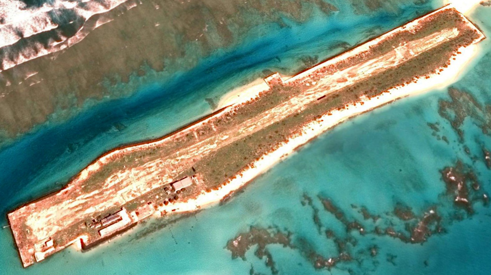
A 2014 aerial view looking northeast shows French Frigate Shoals runway remains intact though deteriorated.
See also:
http://www.letarc.net/ffsavion/
http://www.radiojerry.com/frigate/
http://www.letarc.net/ffsavion/
____________________________________________________
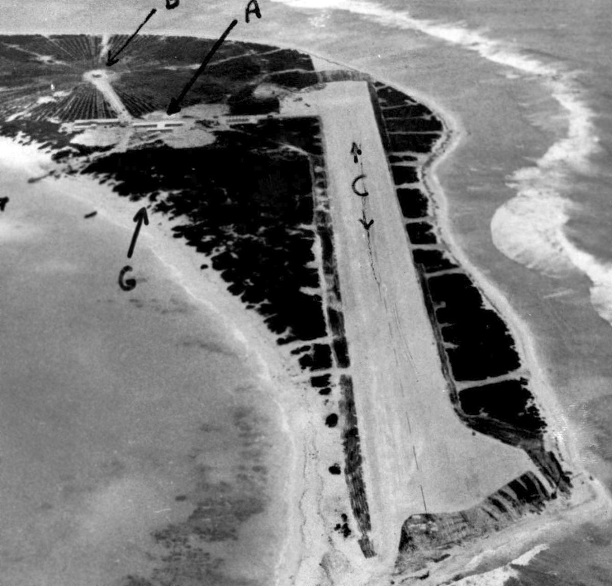
Henderson Field, Midway Eastern Island
28.21, -177.33 (Northwest of Hawaii)
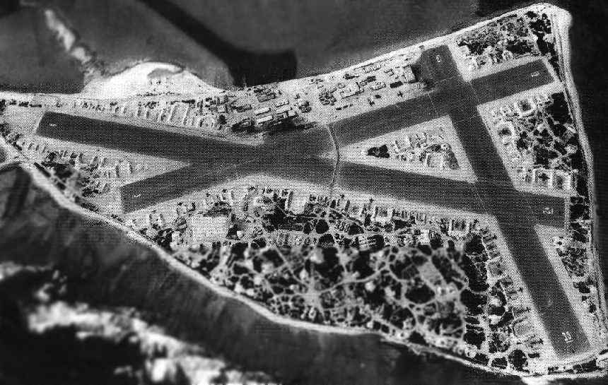
Aerial view of Eastern Island in 1944, looking north. National Archives photo.
The Midway Islands are best known as the location of the pivotal battle of the Pacific Theater of WW2.
The Midway coral atoll is approximately five miles in diameter.
The atoll has 2 islands: Sand Island (which has an area of 1,201 acres),
and the smaller Eastern Island (with 334 acres).
Naval Air Station Midway Islands was commissioned in 1941.
It consisted of a seaplane facility on Sand Island & a landplane airfield on Eastern Island.
The Eastern Island airfield initially comprised three runways, 2 hangars & a barracks,
Midway was shelled by a Japanese destroyer on the same day as the Pearl Harbor attack,
and was shelled by a submarine several months later.
During the climatic Battle of Midway in 1942,
the Japanese were so sure of their victory that they deliberately spared the runways of Eastern Island
for their use after the capture of the island.
That didn't happen, due to their overwhelming defeat in the waters surrounding Midway.
Aircraft of the Navy, Marine Corps & Army operated from Eastern Island,
and helped to turn back the Japanese Fleet.
After the Battle of Midway,
the airfield on Eastern Island was named in honor of Major Lofton Henserson, who perished in the battle.
Work also commenced on a larger airfield on Sand Island.
By the end of WW2, Eastern Island's airfield had a total of three asphalt runways:
6/24 (5,300' long), 3/21 (4,500'), and 12/30 (3,250'),
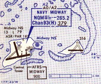
The airfields on the 2 Midway Islands,
as depicted on the 1963 Pacific Enroute Chart (courtesy of John Voss).
The airfield on Eastern Island was abandoned after WW2,
as the longer runways on Sand Island were more suitable for modern aircraft.
Eastern Island has been uninhabited since 1970.
The airfield & port facilities on Sand Island continued in use by the Navy until 1993,
at which point the islands were transferred to the Department of the Interior,
to become part of the Hawaiian & Pacific Islands National Wildlife Refuge Complex.
The airfield on Sand Island has remained open as a civil field, operated by a government contractor.
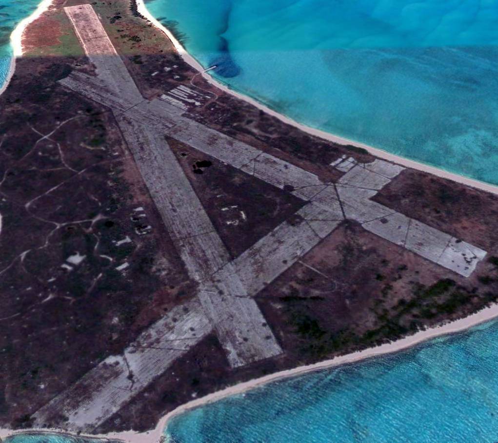
A 2007 aerial view looking west at Eastern Island, showing the 3 runways which remain intact.
Ted Brattstrom reported in 2008, “The runways are there - but the there are no buildings left on Eastern Island.
Some revetments are still present, and one of the runways had lights
and was a backup / emergency strip in the late 1990s when Midway Phoenix was running tourists to the island.
I would not have wanted to land there, as they were not cutting the weeds on the runway... it would have been a little too exciting.”
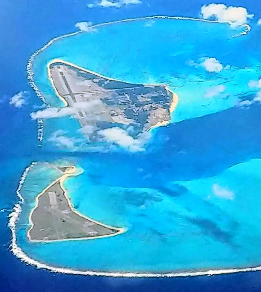
An 11/15/18 aerial view looking west at Midway Eastern Island (& Midway Sand Island in the background) taken from 37,000' by Rip Torn.
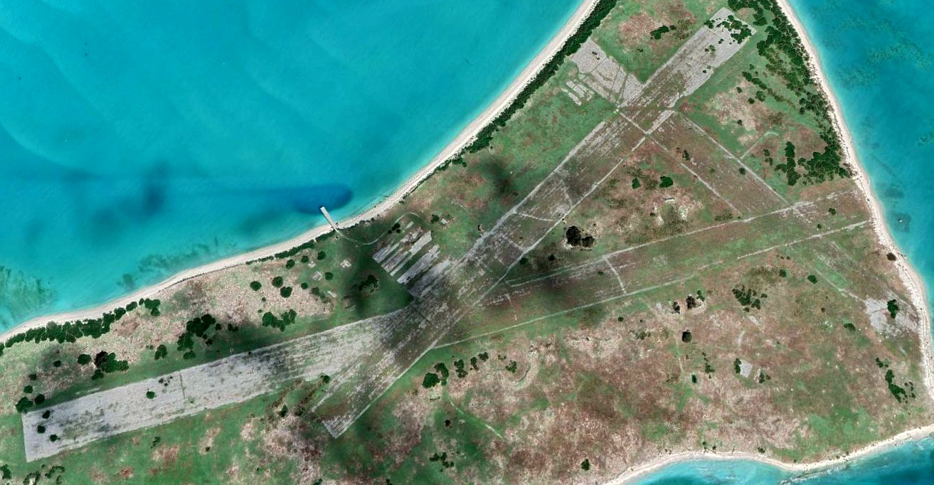
A 2022 aerial view looking north at Midway Eastern Island.
See also: http://www.globalsecurity.org/military/facility/midway.htm
____________________________________________________
Johnston Atoll Airport (PJON), Johnston Atoll
16.726, -169.54 (Southwest of Hawaii)

A WW2 era USN photo of the Johnston Atoll base headquarters & control tower (courtesy of Jerry Morelock).
Located 717 nautical miles southwest of Oahu, Johnston Atoll is one of the most isolated atolls in the world.
Johnston Atoll is a broad shallow platform of approximately 50 square miles
with a marginal reef emergent only on the northwest.
The atoll consists of four coral islands: Johnston Island, Sand Island, North Island, and East Island.
At just over 625 acres, Johnston Island is the largest island
and the base for all operations & management activities, including all personnel & community support functions.
Johnston Atoll was accidentally discovered in 1796 by Captain Joseph Pierpont of the American Brig Sally.
He published a notice of his ship's grounding in several American newspapers in 1797,
giving an accurate position & noting the 2 original islands (Johnston & Sand) and the incomplete marginal reef.
Lt. William Smith of HMS Cornwallis named the larger island for his ship's captain, Charles Johnston,
after sighting it briefly in 1807.
During the late 1800s, the Atoll was claimed by both the Kingdom of Hawaii & the US.
This claim was settled when Hawaii became a US Territory.
In 1934 Franklin Roosevelt placed the atoll under the control of the Navy.
Navy development began in earnest in 1936 with reef blasting,
dredging, landfilling & grading & construction on the islands.
The atoll was briefly shelled by Japanese naval units shortly after the Pearl Harbor attack but combat soon shifted west
and the island's role changed from an outpost to an aircraft & submarine stopover & refueling base.
The earliest depiction which has been located of the Johnston Island Airfield was a WW2 era USN photo of the Johnston Atoll base headquarters & control tower (courtesy of Jerry Morelock).
Johnston was transferred again in 1948 to the Air Force.
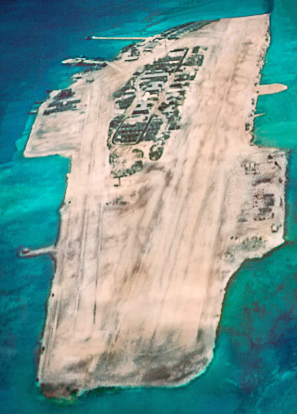
A 1949 aerial view (courtesy of Sarge Dick Clelland) looking northeast at the Johnston Island airfield.
It depicted an unpaved runway running the length of the island, and at least one aircraft parked on the north side.
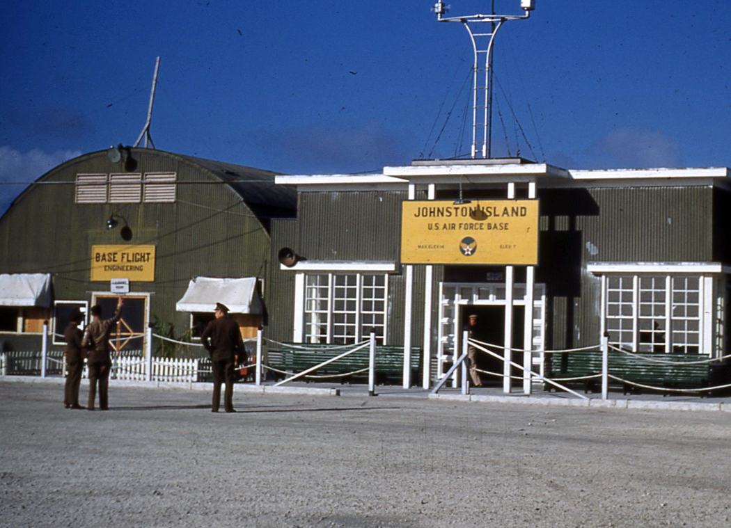
A 1951 photo by Clark Schadle of “of Base Operations on Johnson Island.
I was 6 years old & we were returning from a Army tour in Guam & our military transport had lost an engine & another started running rough.
The crew diverted to Johnson Island & we were stuck there for 3 days.
The dependents from the flight were all taken to the hospital & it was underground on Johnson Island as a child I thought that was neat!”
Chuck Salge recalled, "In 1953, my mother & I departed Parks AFB, CA on a flight to Guam.
On that flight, our plane developed engine trouble & made an emergency landing at Johnston Island.
We spent the night & awoke to water in every direction!”
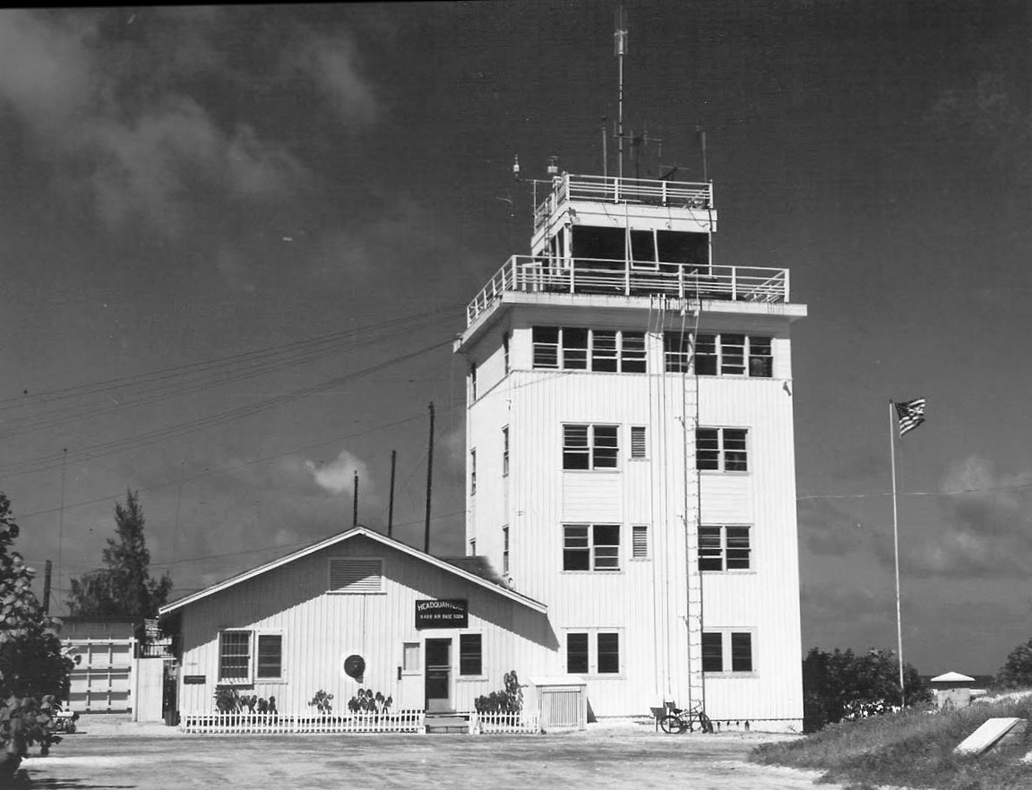
A circa 1950s photo of the Johnston Atoll base headquarters & control tower (courtesy of Joe McCusker).
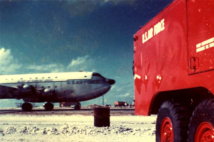
A 1956 photo by Richard Potter of a C-124 Globemaster at Johnston.
Dick Potter recalled, "I was stationed at Johnston Island AFB from Jan 1956 to Dec 1956 in the Fire Dept.
When I first arrived, there were some civilians & dependents on the island along with about 300 Air Force personnel.
The dependents & most of the active duty personnel left in May (I think)
and the base was pretty much closed down except for emergency landings.
We got 2 'turnarounds' a week.
At first they were C-97s, then we started getting C-121s (or R7Vs when the Navy came down).
I was 18 years old at the time I was there,
and thought that year would never end.
However I do have some fond memories & am still in touch with an old pal that was there at the same time."
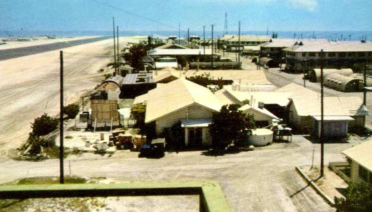
A circa 1956 postcard of the facilities at Johnston,
taken from the control tower looking south (courtesy of Richard Potter).
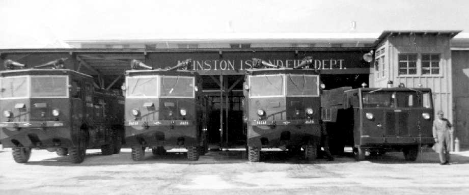
A 1956 photo by Richard Potter of the fire trucks of the Johnston Island Fire Department.
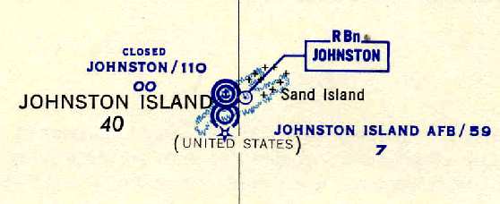
Johnston Island AFB was depicted on the 1956 Johnston Island World Aeronautical Chart (courtesy of Chris Kennedy)
as having a 5,900' runway.
In the late 1950s & early 1960s a series of high altitude nuclear tests brought new activity & attention to Johnston Atoll.
Johnston Atoll became contaminated with plutonium through 2 aborted missile launches
during high altitude nuclear weapons testing conducted in 1962.
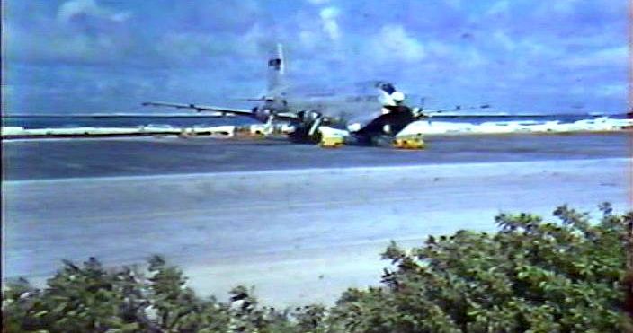
A 1962 photo by Walter Locke of a C-124 Globemaster at Johnston (courtesy of Gary Locke).
Gary Locke recalled, “My father, Walter Locke, worked for Lear Siegler”.
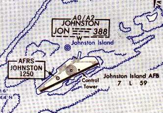
Johnston Island AFB, as depicted on the 1963 Pacific Enroute Chart (courtesy of John Voss).
A series of dredge & fill projects completed in 1964 brought the size of Johnston Island up to 625 acres from its original 46,
increased Sand Island from 10 to 22 acres, and added 2 manmade islands, North (Akau) and East (Hikina) of 25 & 18 acres.
John Caldwell recalled, “My Dad was stationed at Johnston Island during the nuclear tests – he was there when one of the rockets detonated on site – scattering plutonium over the area!
He flew CH-53s & picked up film capsules in the water if the C-130 'Skyhook' failed to snag the parachute upon reentry from space.”
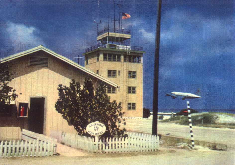
A 1964 photo by George Miller of the Johnston Atol base post office & control tower, with a C-54 departing in the background.
Beginning in 1964 a series of large open-air biological weapon tests was conducted downwind of Johnston Atoll.
The American strategic bioweapon tests involved a number of ships positioned around Johnston Atoll,
upwind from a number of barges loaded with rhesus monkey test subjects
which were exposed to agents dispensed from aircraft.
The Air Force retained operational control of Johnston Atoll until 1962,
with the exception of 4 months in 1958 when Joint Task Force 7 held operational control.
From 1962-63, Joint Task Force 8 & the Atomic Energy Commission jointly held operational control of Johnston Atoll
for the purpose of conducting high-altitude atmospheric nuclear testing operations.
In 1963, the Congressionally mandated Safeguard C provision to the Limited Test Ban Treaty
(and subsequent Nuclear Testing Treaties) formed the basis for maintaining Johnston Atoll as a readiness-to-test site
should the resumption of atmospheric nuclear testing be deemed essential to our national security.
Joint Task Force 8 retained operational control of Johnston Atoll from 1963-70
as the Limited Test Ban Treaty came into force identifying Johnston Atoll as the principal overseas readiness-to-test base.
In 1970, Johnston Atoll was again transferred to the Air Force.
Chemical weapons have been stored on Johnston Island since 1971.
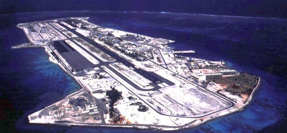
A 1973 aerial view by Richard Berger (courtesy of Paul Travis) looking west at Johnston Atoll.
Paul Travis recalled, “A plane, I think it was a C-130, had broken & some maintenance folks were flown in from Hickam AFB to work on it.
They were going on a test flight around the island & Richard talked the crew in getting a ride.”
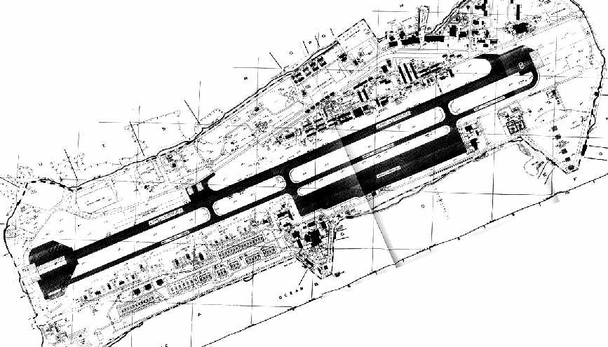
A 1981 Defense Nuclear Agency Master Plan for Johnston Atoll (courtesy of Eric Patrick).
In 1993, Congress zero-funded the Johnston Atoll Safeguard C mission
and defined its military mission as storage & destruction of chemical weapons.
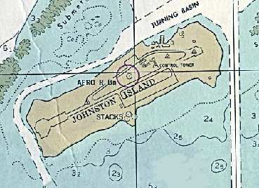
A 1990 NOAA nautical chart of Johnston Atoll.
Since 1990, an extensive operation on Johnston Island has performed the deactivation & destruction
of 400,000 rockets, bombs, projectiles, mortars, and mines containing chemical weapons.
The last of the chemical stockpile was destroyed in 2000.
The chemical weapon destruction facilities were being closed down in 2002,
with the island to revert to being a US Wildlife Refuge in 2008.
Despite the extraordinary security on the island & unknown to most travelers heading to Hawaii,
Johnston was the designated alternative landing site for long-range twin-engine aircraft.
Greg Zieber recalled, "I lived & worked on Johnston Island for 6.5 years, 1994 to mid 2000.
There were several times that the runway was used for emergency landings.
Small civil aviation type aircraft (Cessna for example), large commercial jet aircraft including a Quantas 747,
and various military aircraft also used the airfield for bona fide declared emergencies.
Some examples were low on fuel due to high headwinds, loss of cabin pressure,
passengers in need of medical attention, bird strikes etc.
Aloha Airlines also made weekly scheduled flights to the island carrying civilian & military personnel,
and also for refueling before continuing down range to the Marshall Islands.
In the 1990's there were flights almost daily, and some days saw up to 3 aircraft."
The US Army, which operated the chemical weapons destruction facility,
said in 2001 that they planned to begin to decommissioning the runway in 2002.
That would make it fail to qualify under the "extended-range twin-engine operations" (ETOPS) rules
which apply to twin engine airliners such as the 737, 757, 767, 777, MD80/90, A300/310, A319/320/321, and A330.
The problem for airline operators from Japan, Hong Kong, Australia, New Zealand & Fiji
heading toward Hawaii is that Johnston cannot be easily replaced.
Air New Zealand spokesman David Beatson said in 2002
that Johnston will be their designated alternative "while it is available."
He said his firm was considering using Majuro, the capital of the Marshall Islands,
1,420 miles southwest of Johnston.
The only other possible alternative is the bleak Kiribati atoll of Kanton, 1,300 miles to the south of Johnston.
Only a handful of people live there.
"At this point, we are not considering using Kanton, as it currently does not meet ETOPS standards,
and that is a fundamental requirement from our perspective," Beatson said.
ETOPS requires twin-engine aircraft to operate for up to 180 minutes from an "en route" alternative airport.
Boeing 767s are the most widely used aircraft for ETOPS.
Most flights from Asia to the mainland US will not be affected by the loss of Johnston
as they fly a circular route to the north & alternative airports are available across the Aleutians, Russia & Alaska.
Mid-Pacific operators also have alternatives at Midway Island, Saipan in the Northern Marianas & Wake Island.
Continental Air Micronesia served the island commercially, touching down between Honolulu & Majuro.
When the aircraft landed it was surrounded by armed soldiers & passengers were not allowed to leave the aircraft.
With a bleak look to it, fierce heat & wind & the knowledge of what was on the island,
there was seldom any incentive to get off.
As of 2003, the airfield at Johnston Atoll consisted of a single 9,000' asphalt/concrete Runway 5/23,
a parallel taxiway, and a large paved ramp along the southeast side of the runway.
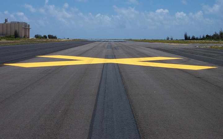
A 2004 or previous photo of the runway at Johnston, marked as closed (courtesy of Ron Plante).
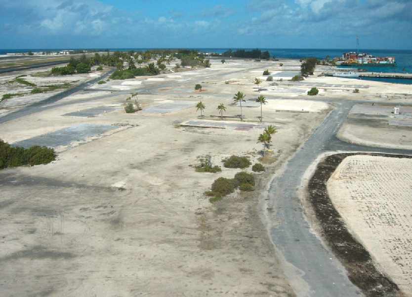
A 2004 or previous of the former housing area at Johnston (courtesy of Ron Plante), showing that all of the buildings have been removed.
The runway is visible at top-left. This photo depicts the same area as that shown in the 1956 photo several paragraphs below.
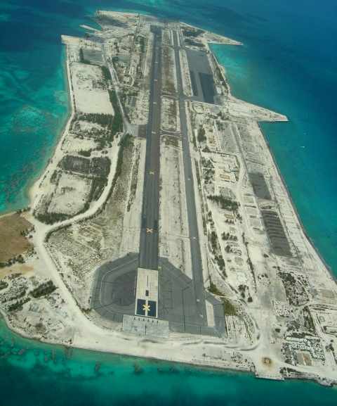
A circa 2000-2006 photo (courtesy of Ron Plante) looking northeast along Johnston's abandoned runway.
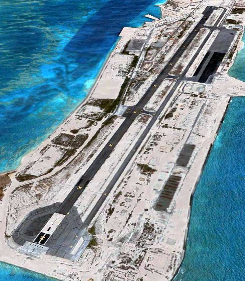
A 2007 aerial view looking northeast along Johnston's abandoned runway.
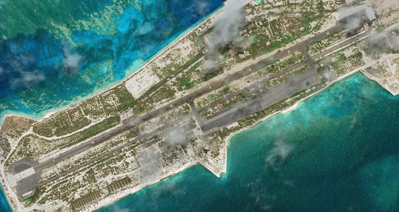
A 2022 aerial view of Johnston Atoll Airport.
Thanks to John Voss for information about Johnston Atoll Airport.
See also:
http://www.globalsecurity.org/wmd/facility/johnston_atoll.htm
http://203.97.34.63/regional14.htm
____________________________________________________
Or if you prefer to contact me directly concerning a contribution (for a mailing address to send a check),
please contact me at: paulandterryfreeman@gmail.com
If you enjoy this web site, please support it with a financial contribution.
____________________________________________________
This site covers airfields in all 50 states.