Abandoned & Little-Known Airfields:
Southeastern Illinois
© 2002, © 2024 by Paul Freeman. Revised 3/9/24.
This site covers airfields in all 50 states: Click here for the site's main menu.
Please consider a financial contribution to support the continued growth & operation of this site.
(Original) Carmi Municipal Airport (revised 3/9/234) - Dixon Springs Airport (added 10/1/16) - Homer Airport (revised 6/18/22)
____________________________________________________
(Original) Carmi Municipal Airport, Carmi, IL
38.101, -88.153 (Southeast of St Louis, MO)
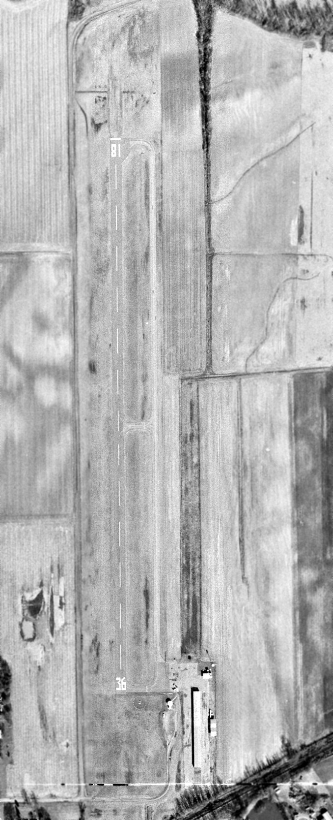
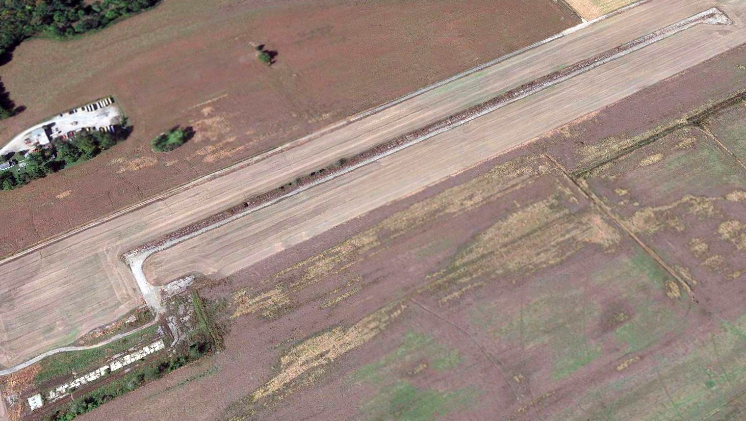
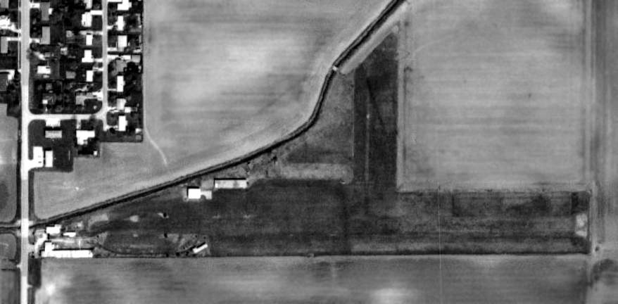
Carmi Municipal Airport, as depicted on a 1/30/73 USGS aerial photo.
This small general aviation airport was apparently built at some point between 1965-73,
as it was not yet depicted on the 1965 USGS topo map.
The earliest depiction which has been located of Carmi Municipal Airport was on a 1/30/73 USGS aerial photo.
It depicted Carmi as having a single north/south paved Runway 18/36, with a paved parallel taxiway on the east side,
and a paved ramp with a few small hangars & 1 light single-engine aircraft on the southeast side.
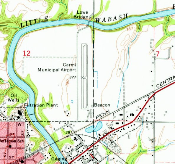
The 1974 USGS topo map depicted Carmi Municipal Airport as having a single north/south paved runway, with a paved parallel taxiway on the east side,
and a paved ramp with a few small hangars & a beacon on the southeast side.
According to the Carmi Muncipal Airport's Environmental Impact Statement (courtesy of Richard Carlson),
the original Carmi Municipal Airport was replaced in the mid-1970s by a somewhat larger airport only a mile to the southeast.
The original Carmi airport was presumably closed at that time.
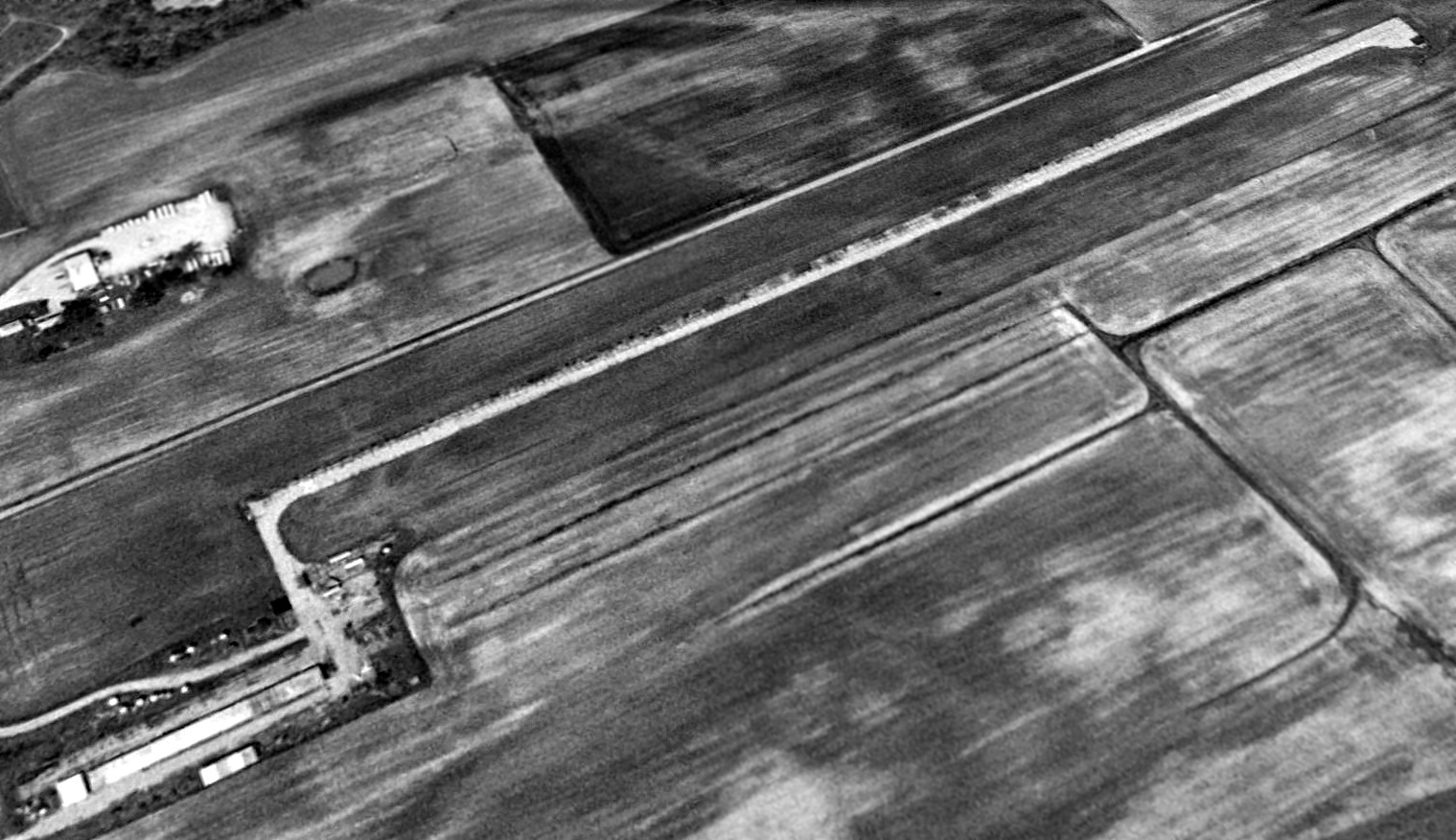
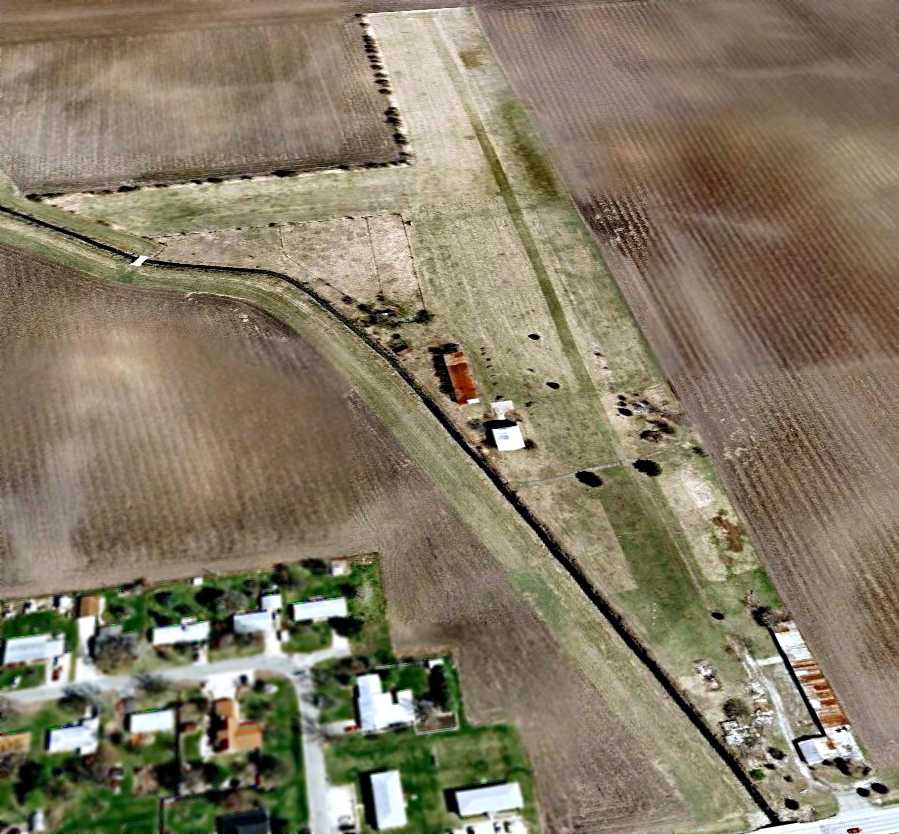
A 1994 aerial view looking northwest depicted the original Carmi Municipal Airport after its closure.
The paved runway was still intact, but the paved parallel taxiway had evidently been removed.
The paved ramp & few small hangars remained on the southeast side.
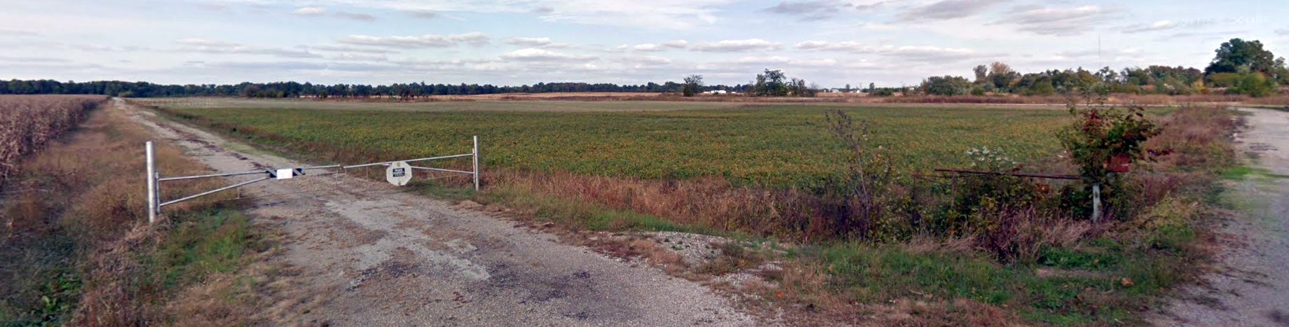
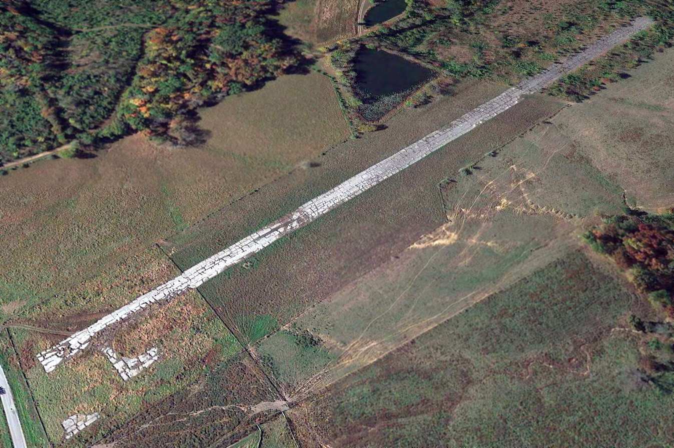
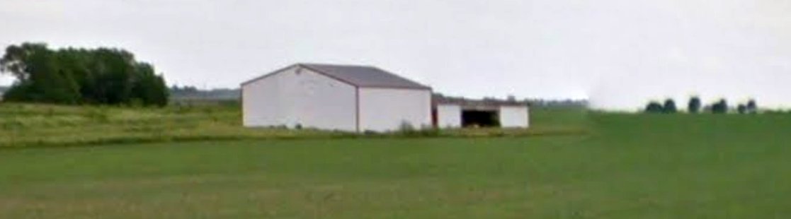
A 2013 photo looking northeast at the site of the original Carmi Municipal Airport.
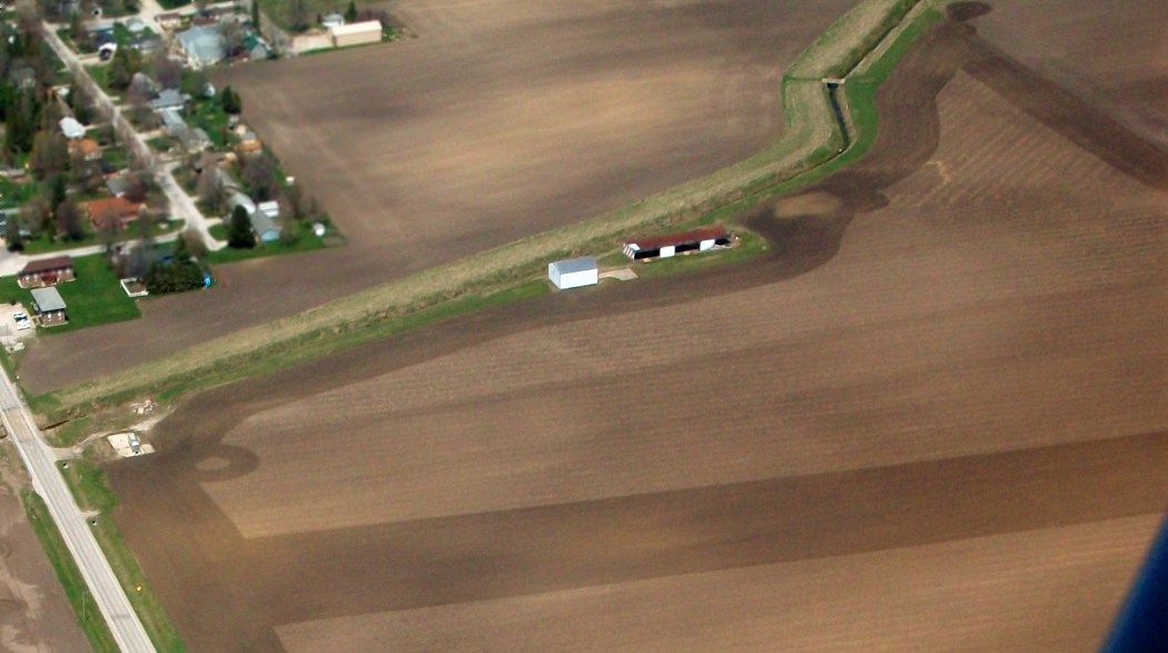
A 2016 aerial view looking northwest the original Carmi Municipal Airport's paved runway remained intact but deteriorated.
The hangar had been removed at some point between 1994-2016, with its foundation still visible.
The site of the the original Carmi Municipal Airport is located at the northern terminus of Airport Road, appropriately enough.
Thanks to Richard Carlson for pointing out this airfield.
____________________________________________________
Dixon Springs Airport, Dixon Springs, IL
37.434, -88.69 (Southeast of St Louis, MO)
Dixon Springs Airport, as depicted on the 1984 USGS topo map.
Photo of the airfield while in use has not been located.
This small general aviation airport was apparently built at some point between 1965-83,
as it was not yet depicted on a 1963 aerial photo nor on the 1965 USGS topo map.
The earliest depiction which has been located of Dixon Springs Airport was a 1983 aerial photo.
It depicted a single north/south paved runway, with a paved ramp & a single T-hangar at the southeast end.
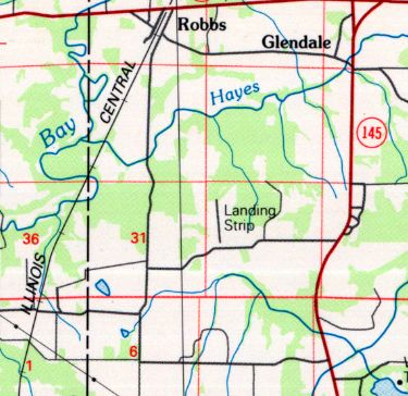
The earliest depiction which is available of Dixon Springs Airport was on the 1984 USGS topo map.
It depicted a single north/south paved runway, labeled simply as “Landing Strip”.
David Bertellotti recalled, “The Dixon Springs Airport... During my flight training I landed at this airport while on a check flight in 1987.
We landed, turned around & took off again. The strip was only 2,000' long or so, with a tiny paved area adjacent to the south threshold.
I landed there again in 1992. The pavement was in very good condition (asphalt), but other than the runway, there was nothing else that I recall - no structures, phone booth, nothing.
The University of Illinois used to access local research areas via this strip back in the day. I never saw any aircraft parked there.”
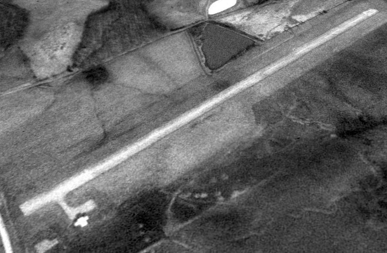
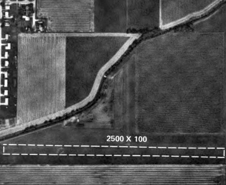
The earliest photo which has been located of the Dixon Springs Airport was a 1993 USGS aerial view looking northwest.
It depicted Dixon Springs as having a single paved north/south runway,
with a short taxiway leading to a small ramp on the southeast side with a single T-hangar.
The 1996 USGS topo map depicted Dixon Springs Airport as a single unpaved north/south runway,
labeled simply as “Landing Strip”.
A 2015 aerial view looking northwest at Dixon Springs Airport showed that the paved runway remained intact, though heavily deteriorated.
The T-hangar had been removed at some point between 1993-2015.
Dixon Springs Airport was no longer depicted at all (even as an abandoned airfield) on the 2016 Sectional Aeronautical Chart.
Dixon Springs Airport is located northwest of the intersection of Route 145 & Air Port Road, appropriately enough.
Thanks to David Bertellotti for pointing out this airfield.
____________________________________________________
Homer Airport (0I7, HMJ), Homer, IL
40.026, -87.954 (West of Indianapolis, IN)
Homer Airport, as depicted in an undated aerial view from the 1974 IL Airport Directory (from the University of IL, courtesy of Daniel McGill).
This small general aviation airport was apparently built at some point between 1971-72,
as it was not listed among active airfields in the 1971 Flight Guide (according to Chris Kennedy).
The earliest reference to Homer Airport which has been located
was in the 1972/73 Illinois Airport Directory (according to Bill Pagett).
Homer was listed as a Restricted Landing Area, having an east/west 2,200' runway.
The owner was listed as K.L. Wronke.
Greg Burnett recalled, “Homer Airport... I was one of the student pilots whose instructors took them to Homer to learn about soft-field operation.
At the time I went there (early 1970s, in a Cherokee 140), there was a wrecked twin-engine plane lying near the eastern end of Runway 9/27. That was confidence-inspiring!
We landed fine, then as we were almost up to speed for take-off, my instructor said,
'Now there’s a hump in the middle of this runway that will toss you into the air, and if you’re not going fast enough you’ll just crash back down.'
Oh, great… and we hit it… and we were in the air!
My instructor reached over a pulled on full flaps, the stall warning buzzer was going off, and we wallowed into the air at barely flying speed. Great fun!”
The earliest depiction of Homer Airport which has been located was an undated aerial view from the 1974 IL Airport Directory (from the University of IL, courtesy of Daniel McGill).
It described Homer as a Basic Utility airport, having an east/west 2,200' runway. The owner was listed as K.L. Wronke.
Homer Airport was not depicted at all on the 1975 USGS topo map.
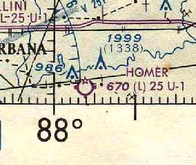
The earliest aeronautical chart depiction of Homer Airport which has been located was on the December 1976 World Aeronautical Chart (courtesy of Chris Kennedy).
It depicted Homer as having a 2,500' runway.
Old-time instructors in the area have told about taking students to "the old Homer Airport" & getting stuck there on hot summer days.
Homer Airport was described in the 1976 AOPA Airport Directory (courtesy of Chris Kennedy)
as having 2 turf runways: 2,500' Runway 9/27 & 1,100' Runway 18/36.
It was said to offer hangars, tiedowns, repairs, and charter.
The 1982 AOPA Airport Directory (courtesy of Ed Drury) described Homer as having 2 turf runways (9/27: 2,500' & 18/36: 1,200').
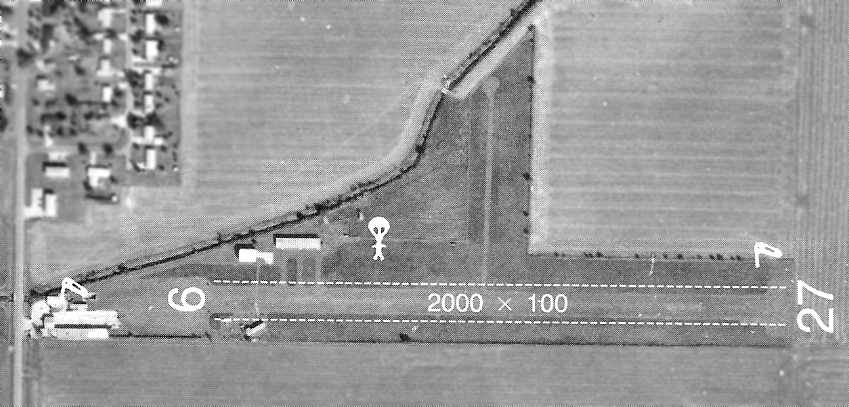
The 1992/93 Illinois Airport Directory (courtesy of Bill Pagett)
depicted Homer as having a single 2,000' unpaved Runway 9/27.
Several small hangars were located on the west & northwest sides of the field.
A parachute operation symbol was also depicted. No aircraft were visible on the field, though.
Homer Airport drifted into disarray & closed in 1994 when the owner ran into legal problems.
It was no longer listed among active airfields in the 1994/95 Illinois Airport Directory (according to Bill Pagett).
As seen in the 1998 USGS aerial photo 1998 (taken after the field's closure),
in addition to the 2 grass runways, the airport had a few small hangars & other buildings.
The airport was no longer depicted at all (even as an abandoned airfield) on recent aeronautical charts or USGS topo maps.
Homer used to have an NDB on the field (Homer, identifier HMJ, frequency 281),
which is still listed as an active navigational aid & depicted on aeronautical charts as of 2004, but reportedly the NDB hasn't operated in years.
Joel Nordness recalled, “I lived in Homer from 2004-2008, a quarter mile north of the airfield.
During that time they still had the orange balls on the power lines on the western approach of the main runway. I never did see or hear any planes taking off.”
A 4/5/08 aerial view looking southeast showed that Homer Airport remained intact,
including 2 grass runways, and a few small hangars & other buildings.
A 4/19/14 aerial view by Joel Nordness looking northeast at the remains of Homer Airport.
Joel Nordness reported, “You can definitely see the difference between my pictures & the one from 2008.
The whole area is much less apparent in the background; only some mowing lets you know where the boundaries are.
All of the smaller buildings on the west side are gone, only the hangar-like buildings in the center are left.”
A May 2018 photo looking northeast at the former Homer Airport hangars.
Homer Airport is located on the east side of Route 49, adjacent to the southeast side of the town of Homer.
Thanks to Mike O'Malley for pointing out & providing information about Homer.
____________________________________________________
Since this site was first put on the web in 1999, its popularity has grown tremendously.
If the total quantity of material on this site is to continue to grow,
it will require ever-increasing funding to pay its expenses.
Therefore, I request financial contributions from site visitors,
to help defray the increasing costs of the site
and ensure that it continues to be available & to grow.
What would you pay for a good aviation magazine, or a good aviation book?
Please consider a donation of an equivalent amount, at the least.
This site is not supported by commercial advertising –
it is purely supported by donations.
If you enjoy the site, and would like to make a financial contribution,
you
may use a credit card via
![]() :
:
Please consider checking the box to make a monthly donatation.
For a mailing address to send a check, please contact me at: paulandterryfreeman@gmail.com
If you enjoy this web site, please support it with a financial contribution.
please contact me at: paulandterryfreeman@gmail.com
If you enjoy this web site, please support it with a financial contribution.
____________________________________________________
This site covers airfields in all 50 states.