Abandoned & Little-Known Airfields:
Northern Indiana
© 2002, © 2026 by Paul Freeman. Revised 1/20/26.
This site covers airfields in all 50 states: Click here for the site's main menu.
____________________________________________________
Please consider a financial contribution to support the continued growth & operation of this site.
Aretz Airport (revised 8/17/25) - Culver Airport / Fleet Field (revised 1/3/25) - East Side Airport (added 11/21/22) - Elwood Airport (revised 1/20/26)
Frankfort Airport / Lockwood Field (revised 6/13/23) - Guy Means Airport (added 11/6/17) - Halsmer Airport (revised 2/26/19) - Helmer Intermediate Field (added 11/4/17)
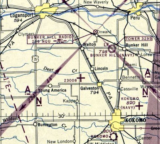
Michigan City Municipal (revised 9/30/20) - Midway Airport (revised 9/4/22) - NOLF 11713 / Converse Airport (revised 4/13/22) - NOLF 23008 / Galveston Airport (revised 4/13/22)
Servia Airport (revised 9/3/22) - Shenk Airport (revised 6/13/23) - South Bend Airport (original) / Cadet Field (added 4/12/23) - Stair Airport (revised 1/20/26)
____________________________________________________
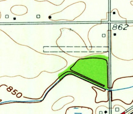
South Bend Airport (original) / Cadet Field, South Bend, IN
41.741, -86.168 (Southeast of Chicago, IL)
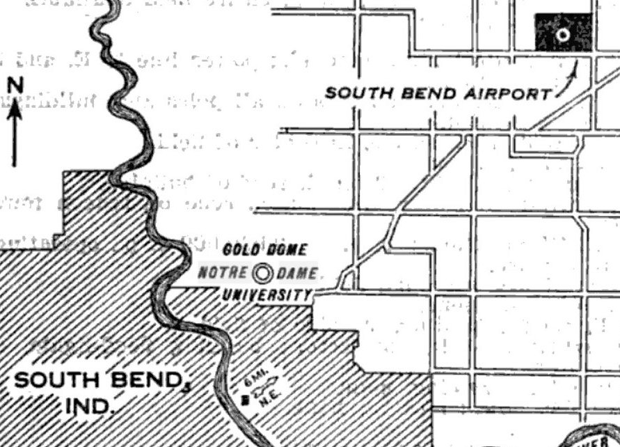
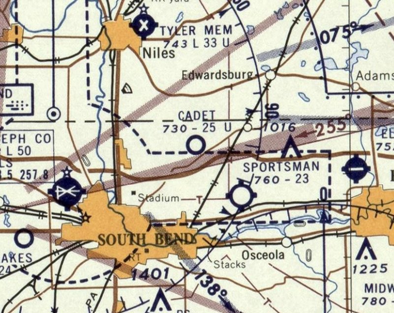
The location of the original South Bend Airport, as depicted on the 1/16/29 Commerce Department Airway Bulletin (courtesy of Mike Denja).
According to the article “Aviation Around South Bend” by Richard Simpson,
“The original South Bend Airport was northeast of the city, north of SR 23 & west of Fir Road.”
According to the 4/1/73 South Bend Tribune, South Bend Airport consisted of “4 hangars, fairly good runways for that era, and was the principal air terminal for South Bend.”
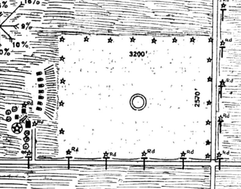
The earliest depiction which has been located of South Bend Airport was in the 1/16/29 Commerce Department Airway Bulletin (courtesy of Mike Denja).
It described South Bend as a municipal airport, owned & operated by the City of South Bend.
It consisted of a 240 acre square sandy soil & turf field, measuring 3,200' east/west.
The earliest aeronautical chart depiction which has been located of South Bend Airport was on the 1930 Sectional Chart (courtesy of Mike Denja).
It depicted South Bend as a commercial/municipal airport.
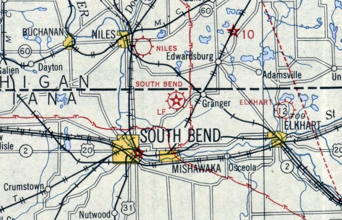
According to the article “Aviation Around South Bend” by Richard Simpson, “The original South Bend Airport would change its name to Cadet Field.”
According to the 8/9/42 South Bend Tribune, “Today will mark the official opening of Cadet field,
formerly known as the old St. Joseph County Airport, located 6 miles northeast of the city near the Edwardsburg Road.”
The new purpose of the airfield was to train pilots. It had been used for that purpose before, and was outfitted for such.
Now, with the change of the name, and management, it would be more so.
The August 1944 Sectional Chart (courtesy of Mike Denja) depicted Cadet Field as a commercial/municipal airport.
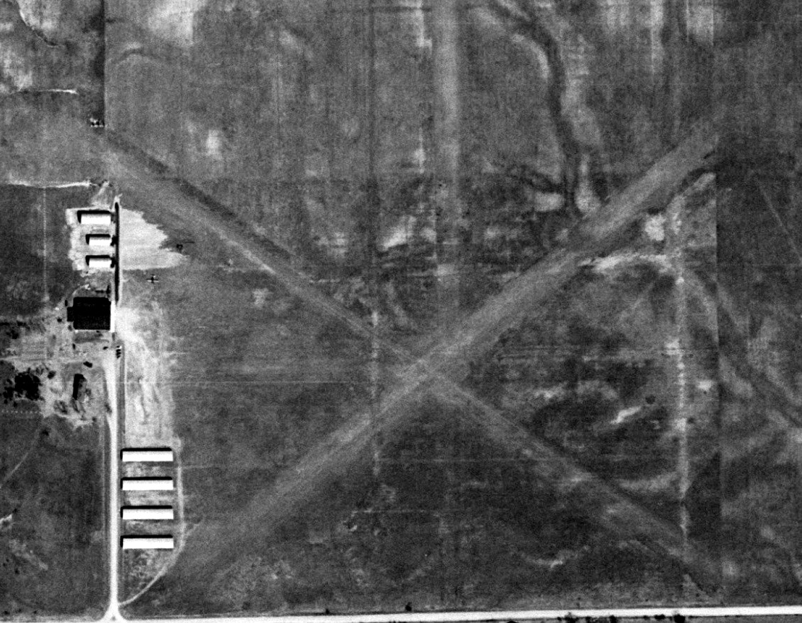
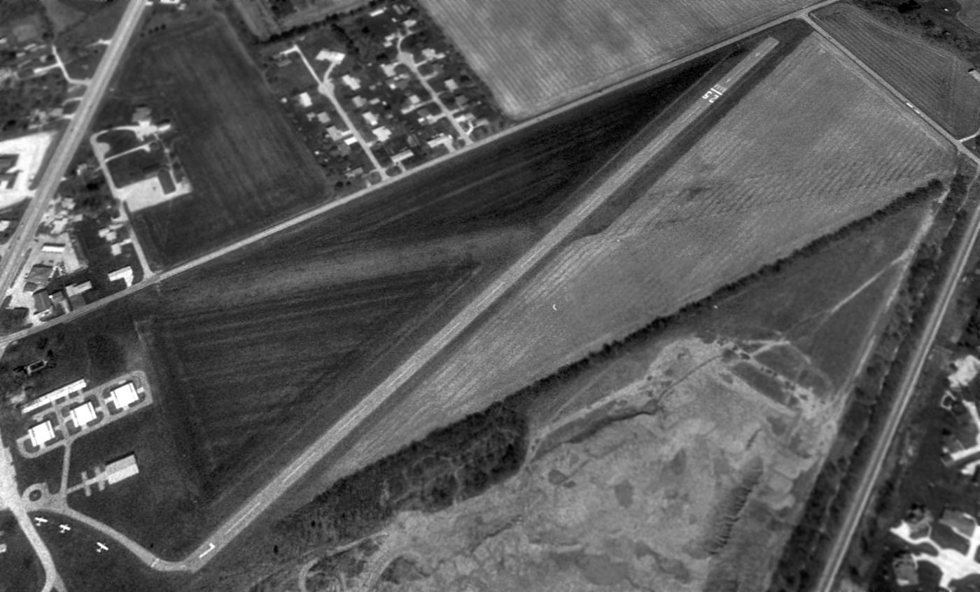
The earliest photo which has been located of Cadet Field was a 1952 aerial view (courtesy of Mike Denja).
It depicted Cadet Field as having 3 unpaved runways, with 8 hangars & 1 light single-engine plane on the west side.
The last aeronautical chart depiction which has been located of Cadet Field was on the 1957 Sectional Chart (courtesy of Mike Denja).
It depicted Cadet Field as having a 2,500' unpaved runway.
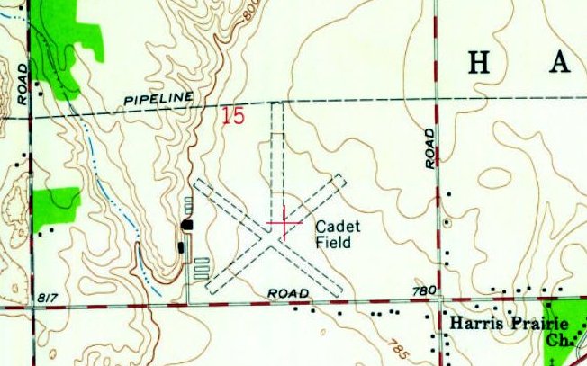
The 1958 USGS topo map (courtesy of Mike Denja) depicted Cadet Field as having 3 unpaved runways, with 8 hangars on the west side.
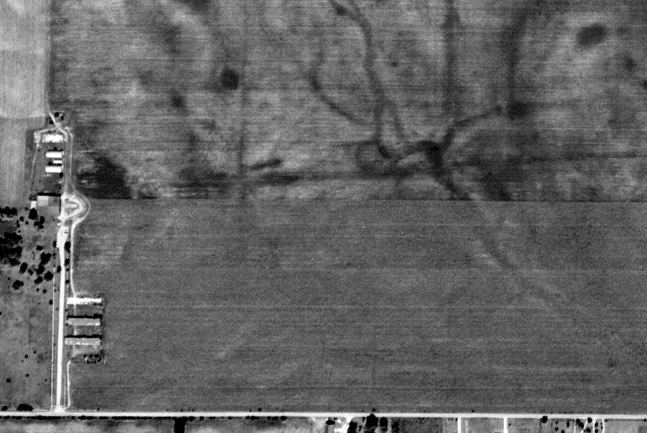
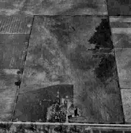
A 1960 aerial view (courtesy of Mike Denja) depicted Cadet Field presumably after it closed.
The area of the runways was still clear, but they were much less-distinct than in the 1952 photo.
The hangars remained on the west side, but there were no aircraft on the field.
A 1967 aerial view (courtesy of Mike Denja) depicted the site of Cadet Field: The area of the runways was still clear, but there was no longer any trace of their alignment.
Several hangars remained on the west side, but some had been removed.
A 1980 aerial view showed the area of the Cadet Field runways had reverted to farmland,
but several of the hangars remained on the west side.
A 1998 aerial view showed houses & streets covering the site of Cadet Field, with no trace remaining of the little airport.
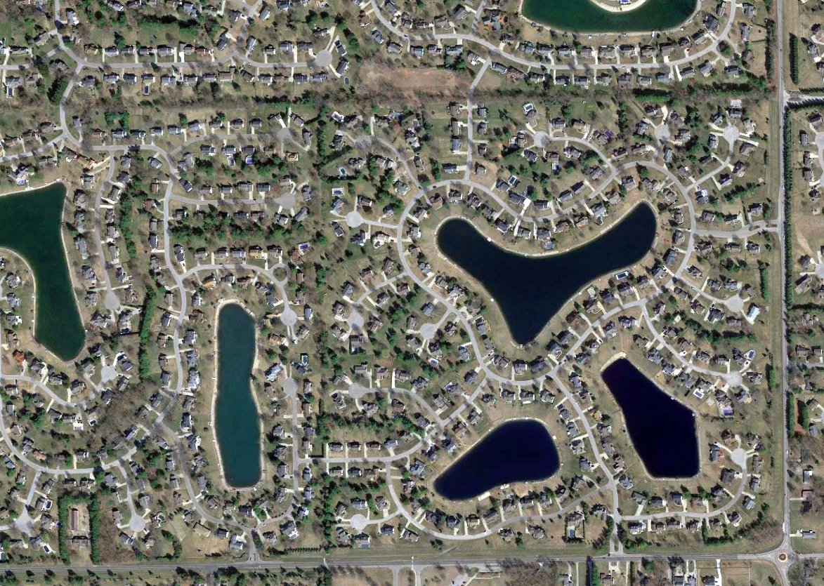
A 2021 aerial view showed houses & streets covering the site of Cadet Field, with no trace remaining of the little airport.
Thanks to Mike Denja for pointing out this airfield.
____________________________________________________
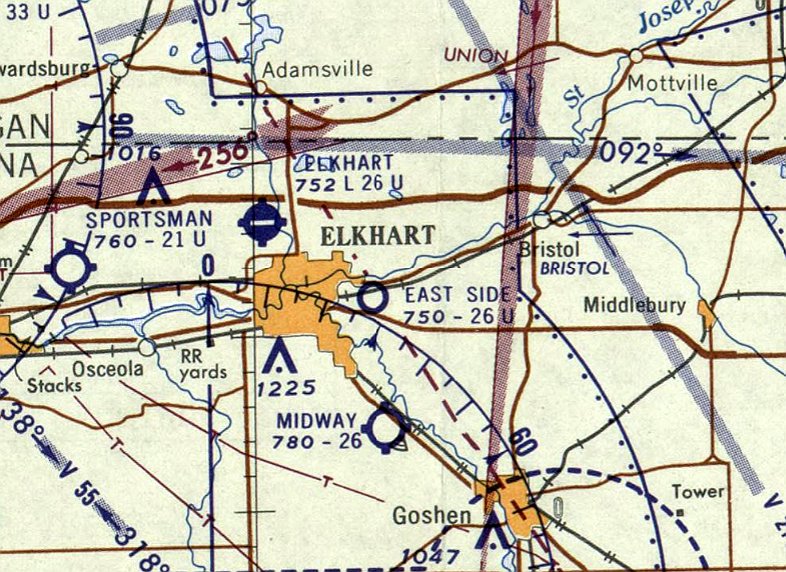
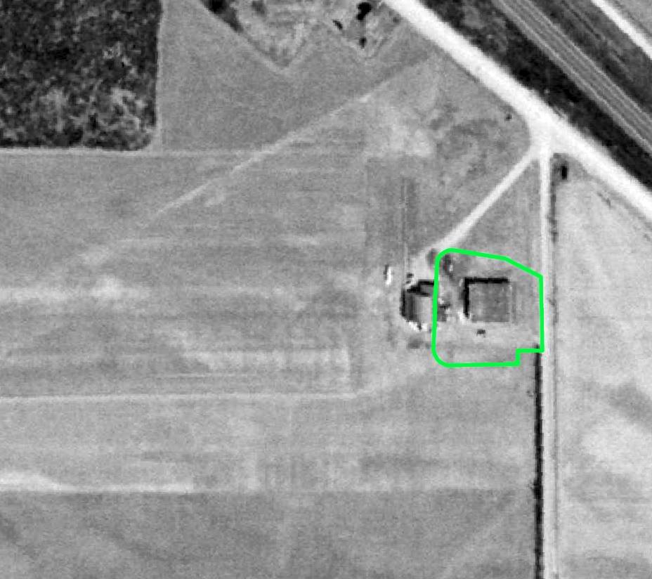
East Side Airport, Elkhart, IN
41.685, -85.921 (Northwest of Indianapolis, IN)
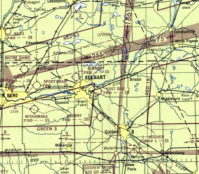
Eastside Airport, as depicted on the June 1947 Chicago Sectional Chart.
This small general aviation airport was evidently established at some point between 1946-47,
as it was not yet depicted on the December 1946 Chicago Sectional Chart.
The earliest depiction which has been located of East Side Airport was on the June 1947 Chicago Sectional Chart.
It depicted East Side Airport as having a 2,800' unpaved runway.
Hal Knight recalled, “Eastside Airport existed in the 1940s & 50s on Middleton Run Road, and had one north/south runway. My dad learned to fly there.”
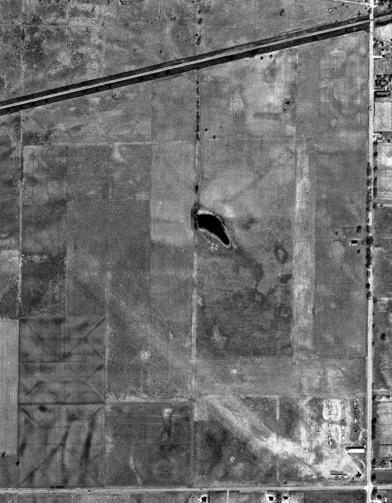
The earliest photo which has been located of East Side Airport was on the 3/27/52 USGS aerial view.
It depicted East Side Airport as having 3 unpaved runways, with 17 light single-engine planes & a few small buildings on the southeast side.
The last photo which has been located of East Side Airport was a 1957 aerial view.
It depicted the airfield configuration as remaining the same as seen in 1952, but the number of planes visible on the field had decreased to 7.
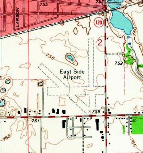
The earliest topo map depiction which has been located of East Side Airport was on the 1961 USGS topo map.
It depicted East Side Airport as having 3 unpaved runways & 1 small building on the southeast side.
The last aeronautical chart depiction which has been located of East Side Airport was on the January 1961 Chicago Sectional Chart.
It depicted East Side Airport as having a 2,600' unpaved runway.
Hal Knight recalled, “Eastside Airport was gone by the 1960s.”
East Side Airport was evidently closed (for reasons unknown) at some point between 1961-63,
as it was no longer depicted on the May 1963 Chicago Sectional Chart.
A 1967 aerial view showed buildings had covered most of the East Side Airport site, and the sole airport building on the southeast side had been removed.
A 2022 aerial view looking north showed no trace remaining of East Side Airport
Thanks to Hal Knight for pointing out this airfield.
____________________________________________________
41.626, -85.911 (Northwest of Indianapolis, IN)
Midway Airport, as depicted on the December 1946 Chicago Sectional Chart.
Midway Airport was evidently established at some point in 1946,
as it was not yet depicted on the May 1946 Chicago Sectional Chart.
The earliest depiction which has been located of Midway Airport was on the December 1946 Chicago Sectional Chart.
The earliest photo which has been located of Midway Airport was a 1952 aerial view (courtesy of Win Weeber).
It depicted Midway as having 2 grass runways, with 2 small buildings & 1 light aircraft on the northeast side.
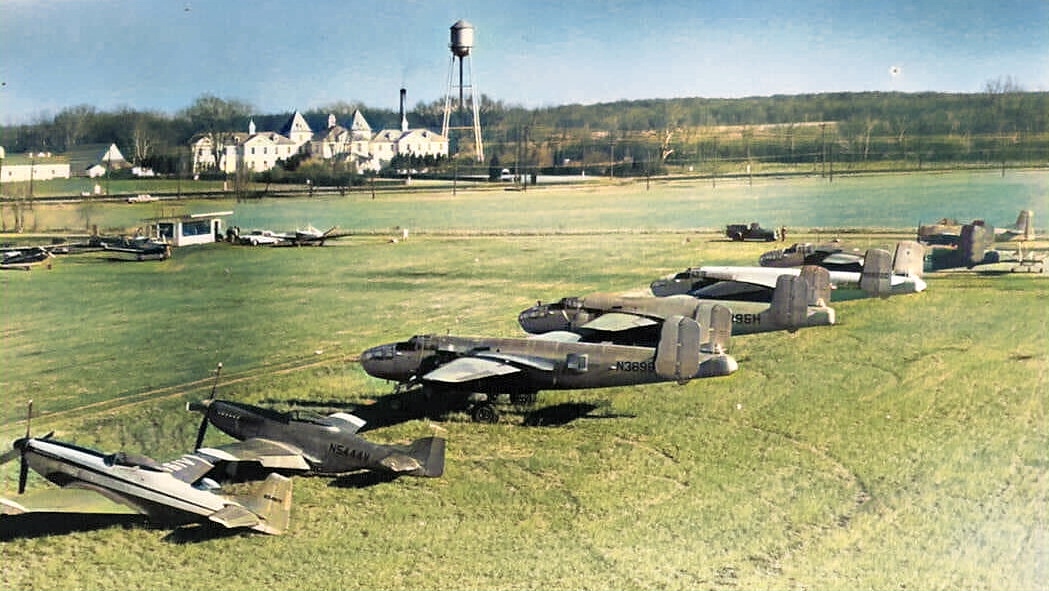
A remarkable circa 1950s photo looking east at Midway Airport (courtesy of Win Weeber. colorized by Mike Denja) showing a row of 2 North American P-51 Mustangs,
4 North American B-25 Mitchells, and a North American T-28 Trojan all in civilian colors.
A 1957 aerial view of Midway Airport (courtesy of Win Weeber) showed the number of aircraft on the field had increased to a dozen.
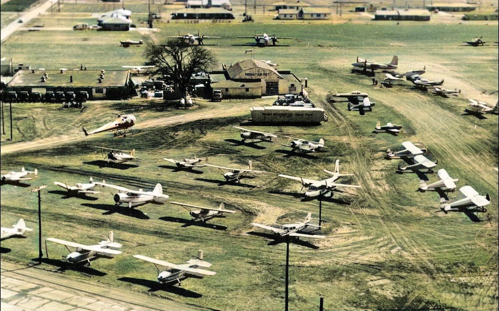
A circa 1960 aerial view looking south at Midway Airport (courtesy of Win Weeber, colorized by Mike Denja) showed a remarkable assortment of surplus military aircraft & general aviation aircraft,
including 2 B-25 Mitchell bombers, 2 P-51 Mustang fighters, an F7F Tigercat fighter, a Republic SeaBee ambphian, 3 Ercoupes, and a Brantly helicopter in-flight.
Win Weeber recalled, “The military aircraft shown were the toys of some notable local characters that bought them for fun & profit.
Shown are only 2 P-51s, but there were several more at various times. I'm pretty sure the P-51 in the background was in a line with other P-51s that are not shown in the picture.
I remember seeing at least 4 in maneuvers over our fields along with T-6s.
Scott Sigsbee recalled, “The military aircraft parked at Midway in the early 1960s were owned by Aero Enterprise.
They were sold mostly by the USAF to Aero Enterprise who in turn sold them to South American Air Forces.
The Brantly helicopters also belonged to Aero Enterprise.
Brantly was going under & Al Alson (owner of Aero Enterprise) made a deal to take over sales & distribution.
The 1960 USGS topo map depicted Midway Airport as having 2 unpaved runways, with a few small buildings on the northeast side.
Scott Sigsbee recalled, “Aero Enterprise moved from Midway about 1964. They became Aero Marine then Lake Aircraft. They moved to Sportsman’s Airpark.”
The last aeronautical chart depiction which has been located of Midway Airport was on the May 1966 Chicago Sectional Chart.
It depicted Midway as having a 2,600' unpaved runway.
Midway Airport was evidently officially closed at some point in 1966,
as it was no longer depicted on the December 1966 Chicago Sectional Chart.
Scott Sigsbee recalled, “Midway closed when the owner of the airport died in a house fire.”
Win Weebler reported, “Midway Airport... the shutdown likely was connected to the 2 double tornadoes that went on both sides of the airport on Palm Sunday, 1965.
I know exactly where the more northern pair passed. They were barely south of our farm & very much in sight from our basement window!”
A 1967 aerial view showed Midway Airport's 2 grass runways were still intact,
but houses had appeared along the northwest & south sides, surely the reason for the little airport's closure.
A 3rd building had been added on the northeast side at some point between 1952-67,
and 1 light aircraft was visible just south of that rd building.
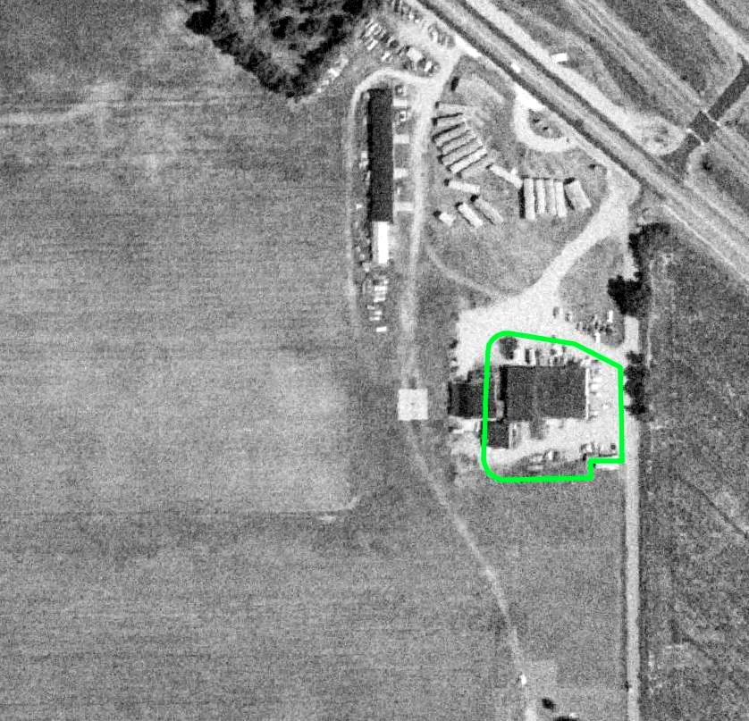
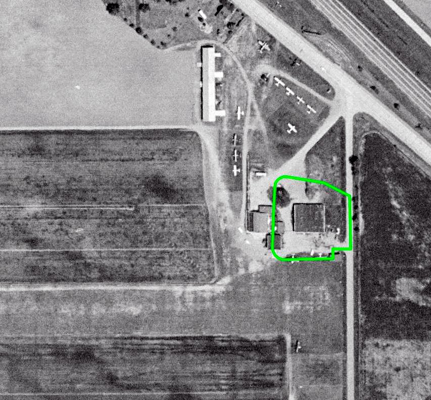
A 1973 aerial view (courtesy of Win Weeber) showed the former Midway Airport runways & buildings remained intact, but there was no sign of any aviation usage.
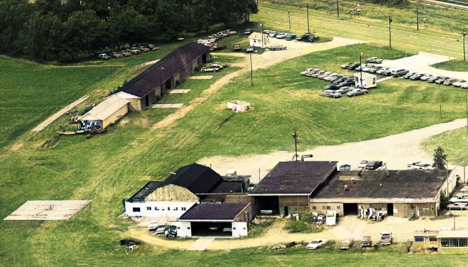
A 1974 aerial view looking northwest at the Midway Airport hangars (colorized by Mike Denja) showed a large number of cars but no planes, which would indicate it was no longer being used as an airport.
Cliff Hill recalled, “Midway airport was still active at least through 1979. I used to fly skydivers in a Cessna 182 based there from 1974-75.
There was also a Cessna 120 & Piper Apache based on the field.
In 1977-79 I used to take students to Midway to practice soft-field takeoffs & landings.
Though it didn't have runway lights, it had a light from an old rotating beacon that was pointed to light up the approach end of the runway.”
A 1981 aerial view showed the former Midway Airport runways & buildings remained intact,
but there was no sign of any aviation usage.
Strangely, even though Midway Airport had ceased being depicted on aeronautical charts since 1966,
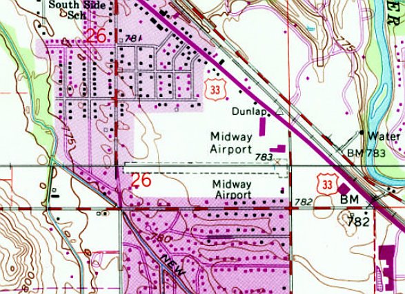
the 1994 USGS topo map still depicted it, but in a shrunken configuration with only 1 east/west unpaved runway.
A 1999 aerial view showed all traces of the former Midway Airport had been removed,
with a large retail building having been built over the center of the site.
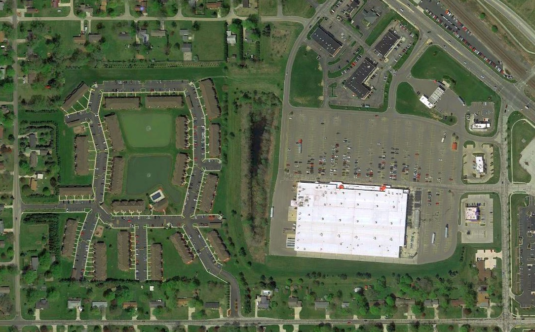
A 2017 aerial photo showed no trace remaining of Midway Airport
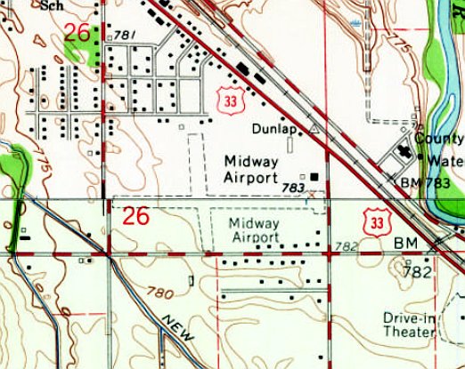
The site of Midway Airport is located southwest of the intersection of Route 33 & Ferndale Road.
Thanks to Win Weeber for pointing out this airfield.
____________________________________________________
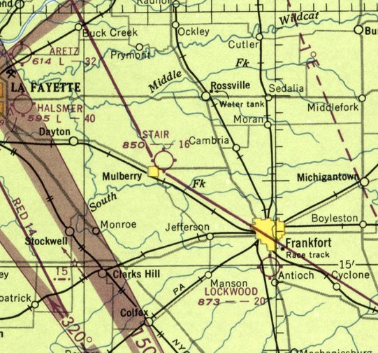
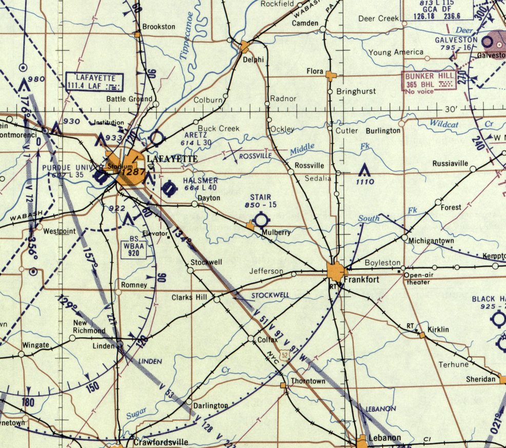
40.349, -86.661 (Northwest of Indianapolis, IN)
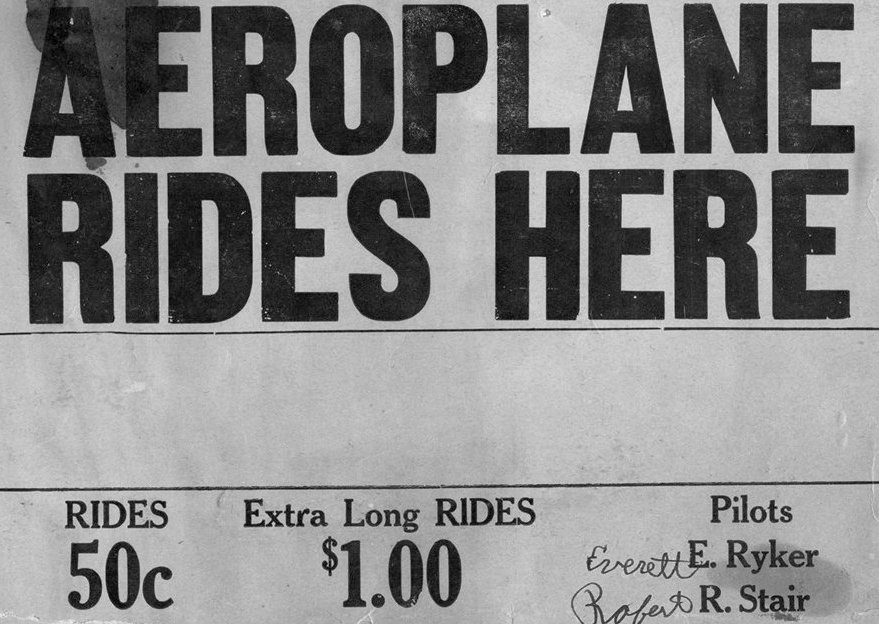
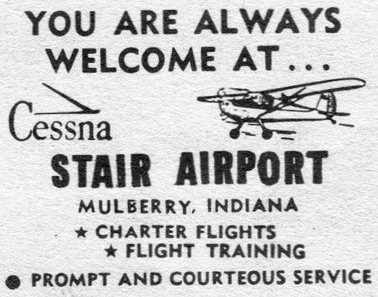
A 1930s advertisement for Aeroplane Rides at Stair Airport (courtesy of David Parker).
According to the book “Wings of Their Dreams: Purdue in Flight” bu John Norberg (courtesy of David Parker),
“John Robert Russ 'Pop' Stair... was an aviation pioneer.
He learned to fly in 1928 & opened his 12 acre airstrip in Mulberry that same year.”
David Parker reported, “Stair opened the Mulberry Flying Club there.”
A 1930s advertisement (courtesy of David Parker) touted Aeroplane Rides for 50 cents by pilots E. Ryker & R. Stair.
Stair Airport was not depicted on aeronautical charts from the 1930s (presumably overlooked as a relatively minor airfield).
David Parker reported, “During WWII Stair taught many young men to fly through the Civilian Pilot Training Program.
After the war, he bought Cessna dealership rights in Tippecanoe & Clinton counties, and reported selling them 'faster than I could deliver them.'”
The earliest depiction which has been located of Stair Airport was on the December 1948 Chicago Sectional Chart.
It depicted Stair as having a mere 1,600' unpaved runway.
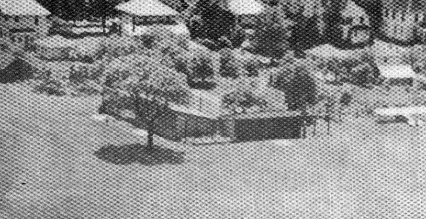
The earliest photos which have been located of Stair Airport was a series from a April 1950 Private Pilot Magazine article (courtesy of David Parker).
This aerial view depicted a single-engine tailgragger parked next to a hangar.
David Parker reported, “Private Pilot Magazine only had one publishing run. The publisher decided not to print a magazine after all, and so only the April 1950 magazine exists.”
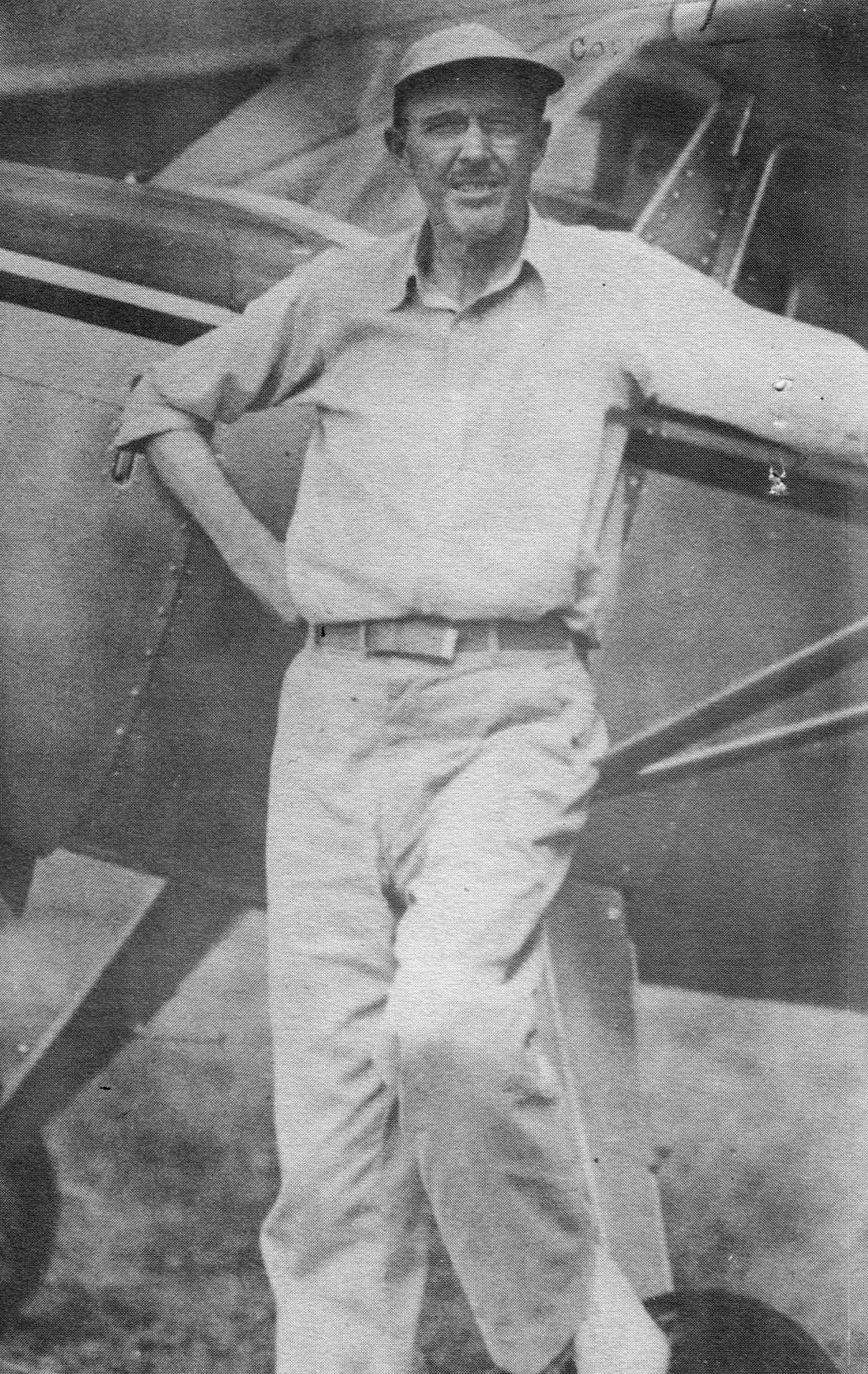
An undated photo of Pop Stair (presumably taken at Stair Airport) from the cover of the April 1950 Private Pilot Magazine (courtesy of David Parker).
An undated photo of a hangar at Stair Airport from a April 1950 Private Pilot Magazine (courtesy of David Parker).
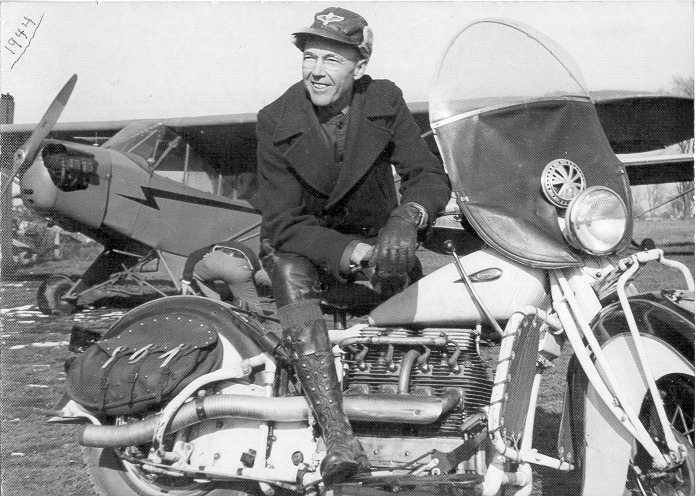
An undated photo of Pop Stair in front of a Piper Cub (presumably at Stair Airport) from a April 1950 Private Pilot Magazine (courtesy of David Parker).
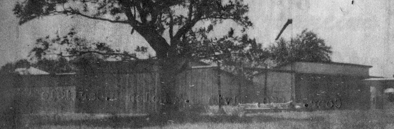
An undated advertisement for Stair Airport (courtesy of David Parker).
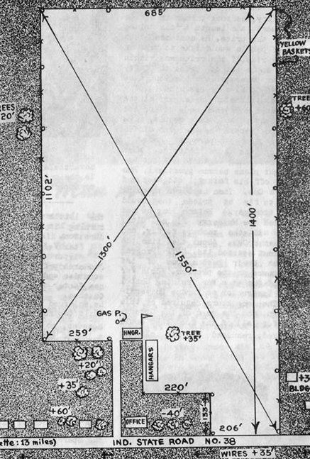
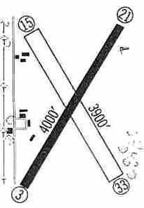
An undated diagram (courtesy of David Parker) depicted Stair Airport as a rectangular field with the longest distance being 1,550' northwest/southeast,
and with 2 hangars on the south side.

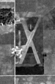
The earliest aerial view which has been located of Stair Airport was an admittedly low-resolution 9/8/52 USGS aerial photo.
It depicted Stair Airport as a rectangular grass airfield.
A 1956 aerial photo depicted Stair Airport as having 2 grass runways in an “X” shape, with 1 light single-engine plane on the southwest corner.
David Parker reported, “Stair signed a contract with Purdue University to operate his airfield as an auxiliary flight training center for their aviation program.
His most notable students probably being astronauts John Glenn & Roger Chaffee.”
Astronaut Roger Chaffee wrote a 4/4/56 letter back to Pop Stair (from the book “Fallen Astronauts: Heroes Who Died Reaching for the Moon”, courtesy of David Parker).
The last depiction which has been located of Stair Airport was on the January 1960 Chicago Sectional Chart.
It depicted Stair as having a mere 1,500' unpaved runway.
David Parker reported, “The airport closed in 1960”, for reasons unknown.
Stair Airport was no longer depicted on the 1962 USGS topo map or the May 1963 Chicago Sectional Chart.
A 1981 aerial photo showed no trace remaining of Stair Airport, with the land having been returned to cultivation.
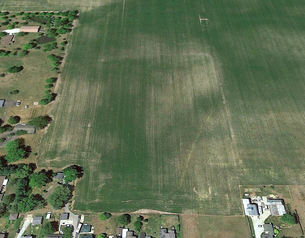
A 2022 aerial photo looking north showed no trace remaining of Stair Airport
40.349, -86.661
Thanks to David Parker for pointing out this airfield.
____________________________________________________
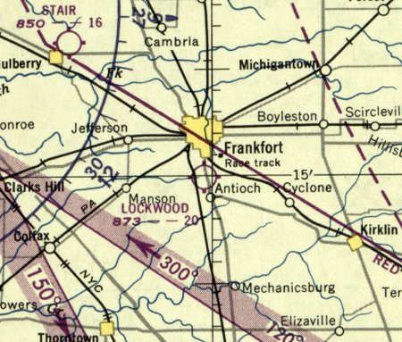
Frankfort Airport / Lockwood Field, Frankfort, IN
40.25, -86.51 (Northwest of Indianapolis, IN)
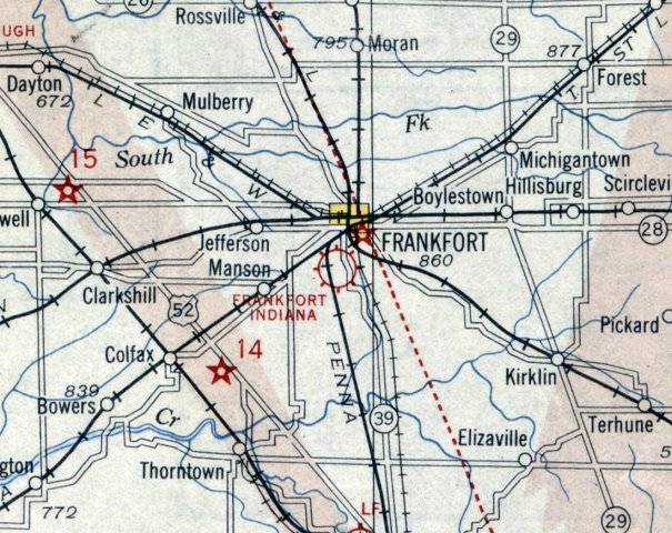
Frankfort Airport, as depicted on the December 1930 Chicago Sectional Chart.
The date of construction of this early general aviation airport has not been determined.
The earliest depiction which has been located of Frankfort Airport was on the December 1930 Chicago Sectional Chart.
It was still labeled Frankfort Airport on the January 1942 Chicago Sectional Chart.
At some point between 1942-44 it was evidently renamed Lockwood Field,
as that is how it was labeled Frankfort Airport on the June 1944 Chicago Sectional Chart.
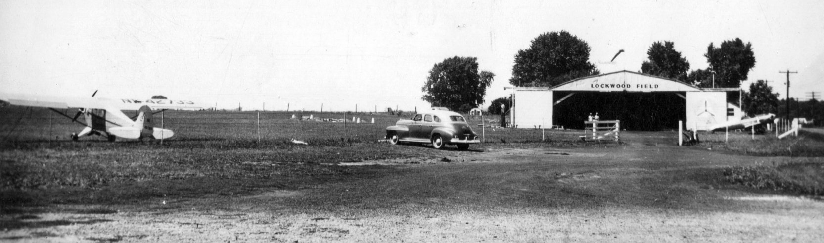
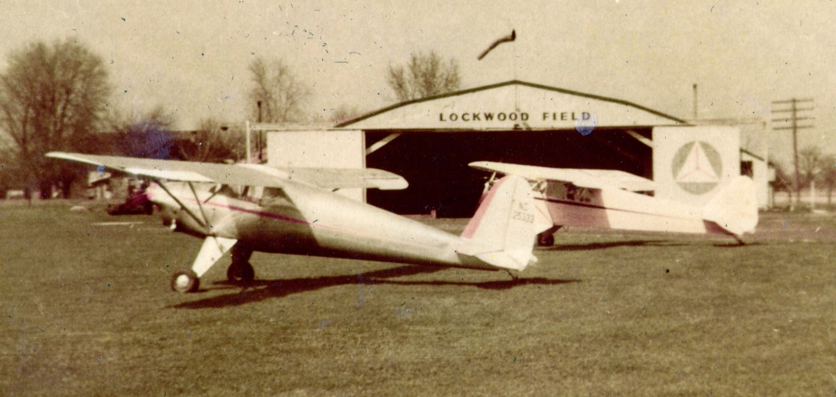
The earliest photos which have been located of Lockwood Field was a series of 1946 photos (courtesy of David Parker).
This photo depicted a Piper J3C-65 Cub parked next to the grass airfield, and a Ryan PT-22 parked in front of a hangar labeled “Lockwood Field”.
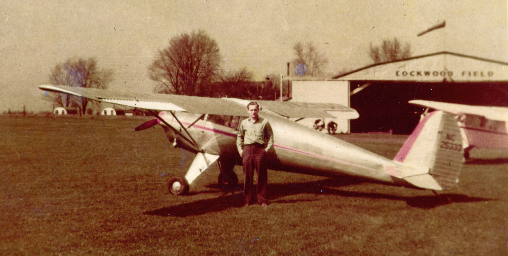
A 1946 photo (courtesy of David Parker) of an unidentified man & a Luscombe 8A in front of the Lockwood Field hangar.
A 1946 photo (courtesy of David Parker) of a Luscombe 8A & Piper Cub in front of the Lockwood Field hangar.
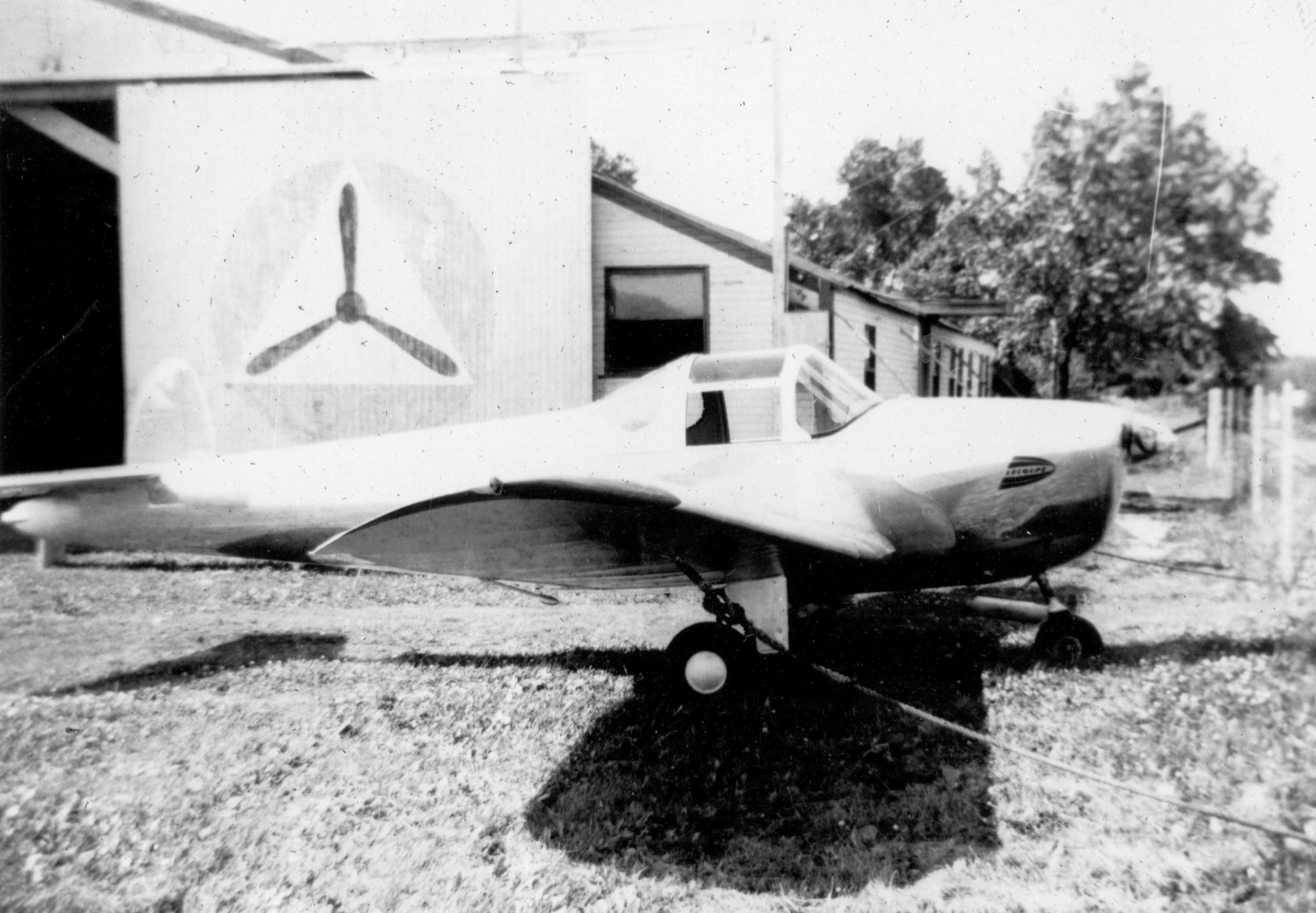
A 1946 photo (courtesy of David Parker) of an Ercoupe in front of the Lockwood Field hangar, with a large Civil Air Patrol logo on the hangar door.
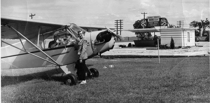
A 1946 photo (courtesy of David Parker) of a waitress serving root beer to customers inside their Piper Cub at Lockwood Field.
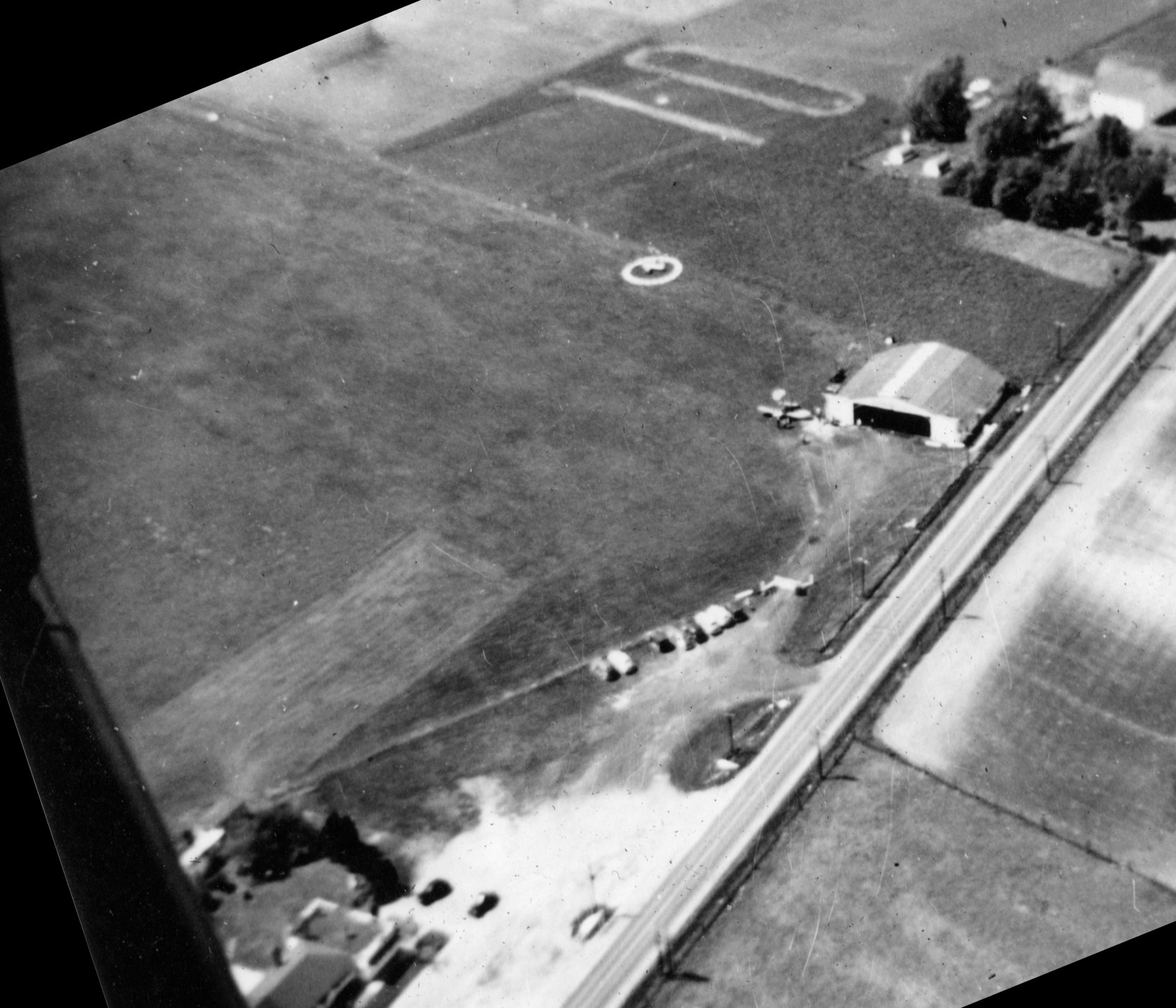
A 1946 aerial view (courtesy of David Parker) looking northwest at Lockwood Field, showing a grass airfield, 1 plane, and a hangar.
The last aeronautical chart depiction which has been located of Lockwood Field was on the November 1950 Chicago Sectional Chart.
It depicted Lockwood as having a 2,000' unpaved runway.
David Parker reported, “I was talking to a gentleman who used to fly into Lockwood with his father as a young boy. He says the airport closed in 1951.”
Lockwood Field was no longer depicted on the December 1952 Chicago Sectional Chart.
The 1963 USGS topo map no longer depicted Lockwood Field, but still depicted the airport buildings along its east side.
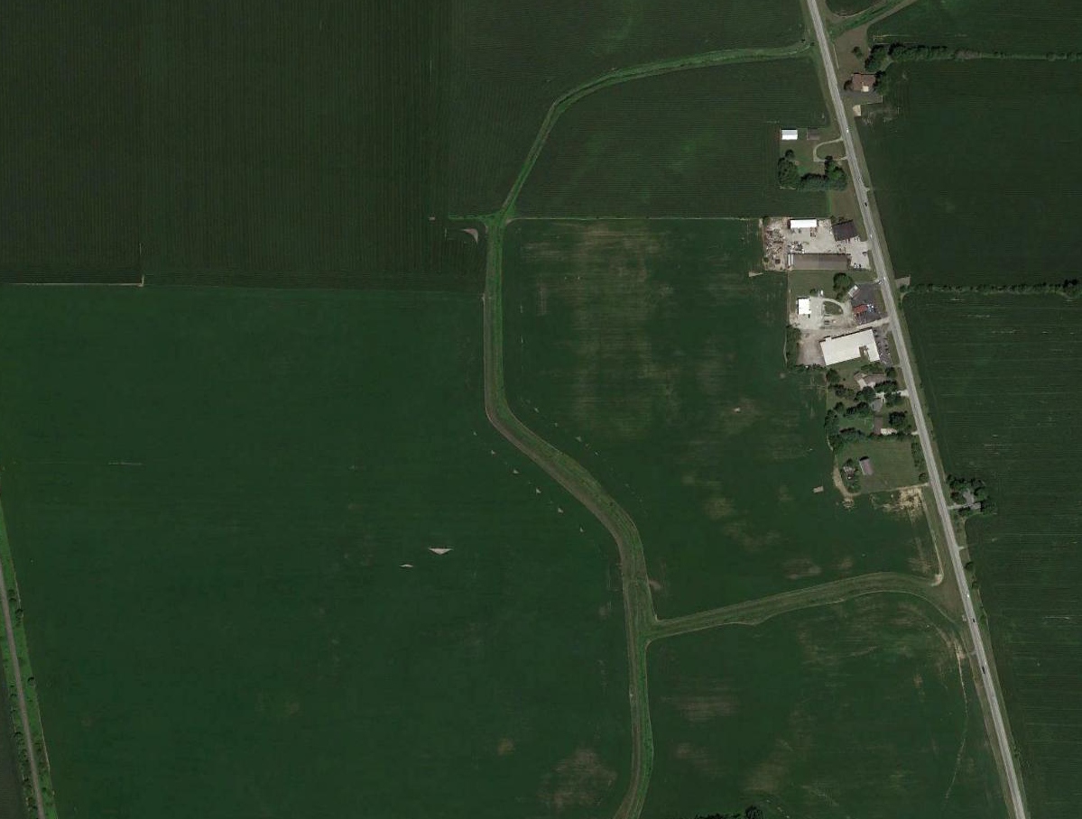
A 2018 aerial view shows the site of Lockwood Field is no longer recognizable as a former airfield, but the airport terminal building remains standing on the east side.
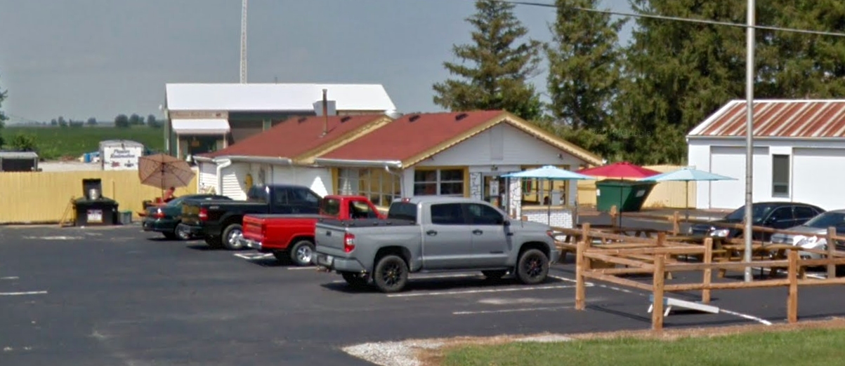
A 2018 photo looking northwest at the Oasis restaurant, which was pictured in 1946 as a root beer stand serving Lockwood Field pilots.
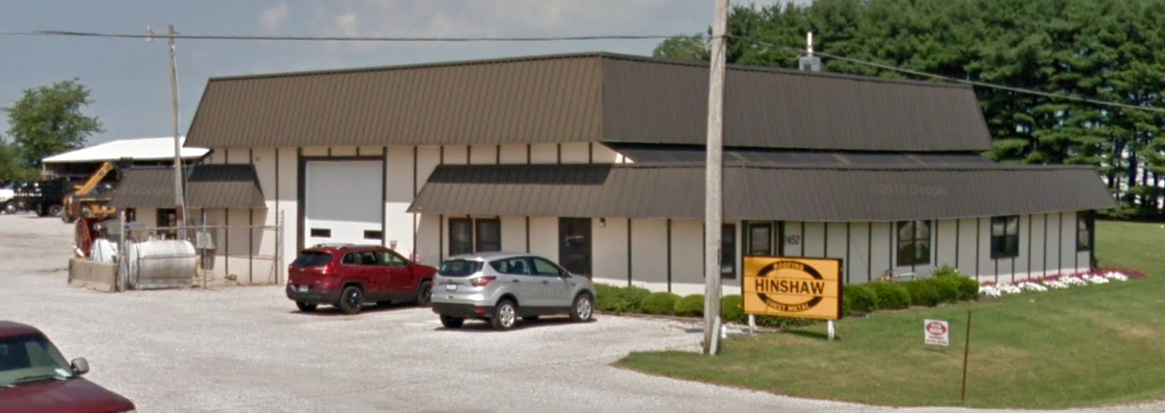
A 2018 photo looking northwest at the former Lockwood Field hangar, reused by Hinshaw Roofing.
David Parker reported in 2019, “The old terminal building is occupied by The Farm Clinic, a soil testing & agricultural consulting business.
Hinshaw Roofing & Sheet Metal sits where the hangar once stood.”
The site of Lockwood Field is located southwest of the intersection of Route 39 & West County Road 200 South.
Thanks to David Parker for pointing out this airfield.
____________________________________________________
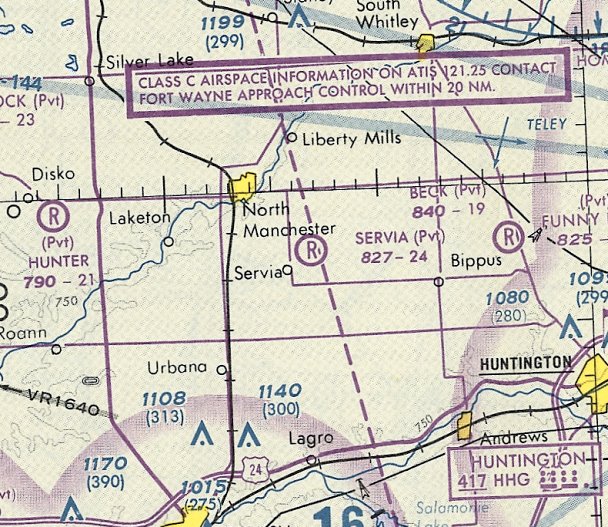
40.961, -85.732 (West of Fort Wayne, IN)
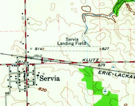
Servia Airport, as depicted on the 1961 USGS topo map.
The date of construction of this small general aviation airport has not been determined.
The earliest depiction which has been located of Servia Airport was on the 1961 USGS topo map.
It depicted “Servia Landing Field” as having an east/west unpaved runway, with a few small buildings on the west side.
Servia Airport was not yet depicted on the 1963 Chicago Sectional Chart.
The earliest aeronautical chart depiction which has been located of Servia Airport was on the 1965 Chicago Sectional Chart.
It depicted Servia Airport as having a 2,600' unpaved runway.
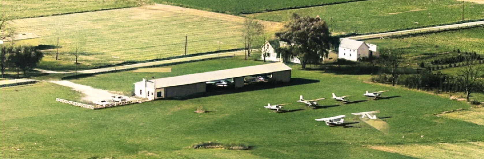
The only photo which has been located of Servia Airport was a 1968 aerial view looking northwest (colorized by Mike Denja).
It depicted 6 light single-engine aircraft parked outside the hangar on the west side, within which were at least another 2 light aircraft.
Steve Aughinbaugh recalled, “I grew on a farm a quarter mile from the Servia airport in the 1960s & 1970s.
Roy Taylor would have penny a pound days & me & some of my friends would gather up enough pop bottles & loose change to get a enough money for an airplane flight.
We would all step up on on an old farm elevator scale & Roy would do the calculations then off we would go.
I never knew if Roy broke even on those flights, but he left an impression with me.
I would help Roy occasionally washing airplanes & when I turned 16, Roy offer the ground school materials to me to start training for my pilot's license
but as a youth I was not wise enough to recognize this great opportunity & I told Roy that I had just got my drivers license & wanted to spend my time driving into town instead of studying.
What an idiot I was!”
Brian Walsh reported, “I recall the Servia Airport. Roy Taylor used to operate the airport.
I remember as a kid around 4 or 5 my dad flew out of Servia in the early 1970s.
Mr. Taylor lived at the airport which was also the terminal building. It had one grass strip & a few hangars.
Roy Taylor's daughter, Evelyn Collins, told me her youngest son flew with her father, Roy in 1982 when he was a child.”
The last aeronautical chart depiction which has been located of Servia Airport was on the October 1993 Chicago Sectional Chart (courtesy of Ron Plante).
Servia's status had changed to a private airfield, and it was depicted as having a 2,400' unpaved runway.
Brian Walsh reported, “Roy closed the airport on 11/30/90. He could no longer pass his medical at age 74, so he got out.
Roy sold 80 acres where the runway used to be to the farmer East of the Servia Airport.”
A 1998 aerial photo of the site of Servia Airport depicted no sign of aviation usage, with some of the smaller hangars having been removed,
and objects being stored on the southwest side.
Steve Aughinbaugh recalled, “It was not until 2003 that I was able to make a simulated approach to the Servia runway
turning base from downwind over the woods in on our farm & then on final making a low approach over the old grass strip, now a corn field.
Not a great as landing would have been, but it did fulfill a dream of mine from my youth.”
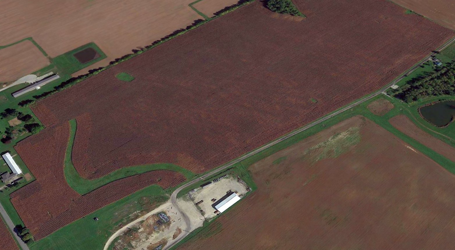
A 2016 aerial view looking northeast at the site of Servia Airport, with the runway having been returned to cultivation, but the largest hangar remaining intact on the west side.
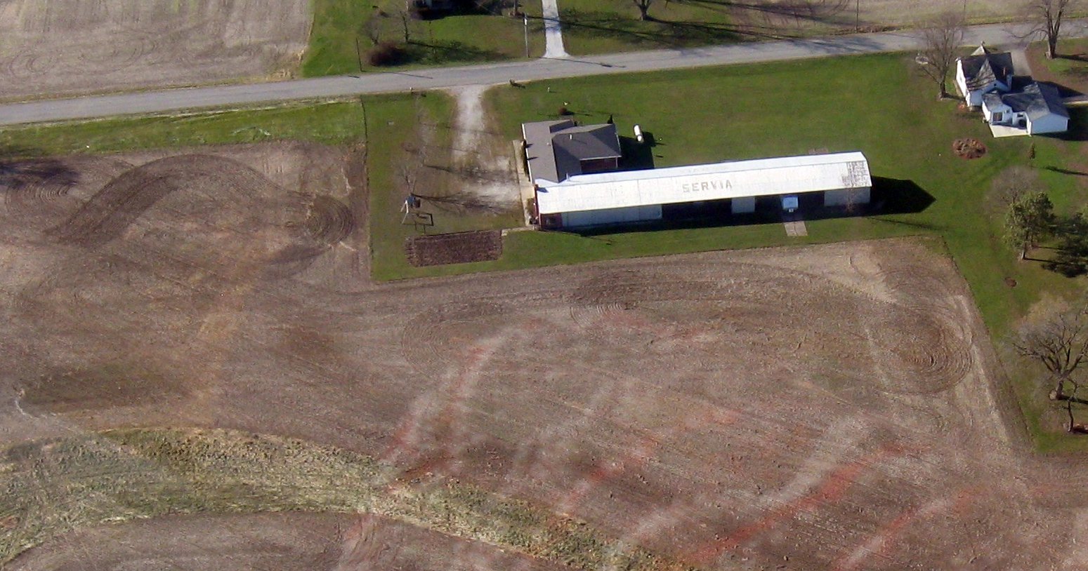
An 11/24/17 aerial view by Brian Walsh looking west at the hangar which remains on the west side of the site of Servia Airport, with the letters “Servia” still amazingly visible on its roof.
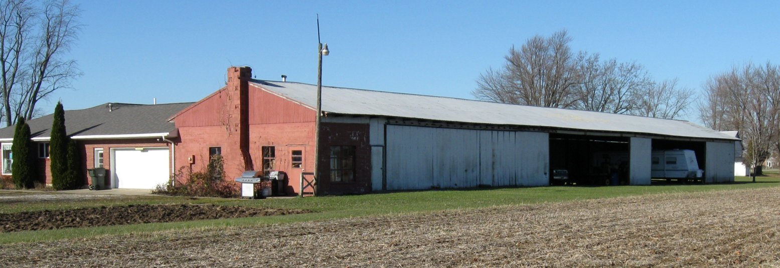
An 11/24/17 photo by Brian Walsh looking northwest at the hangar which remains on the west side of the site of Servia Airport, now adly used to store an RV instead of airplanes.
Brian Walsh reported, “I spoke with Roy Taylor's daughter, Evelyn Collins. His brother Tim bought the house & hangar. [It is a] rental property now. ”
Thanks to Brian Walsh for pointing out this airfield.
____________________________________________________
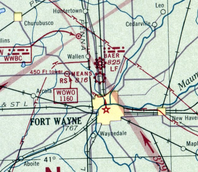
Guy Means Airport, Fort Wayne, IN
41.125, -85.153 (North of Downtown Fort Wayne, IN)
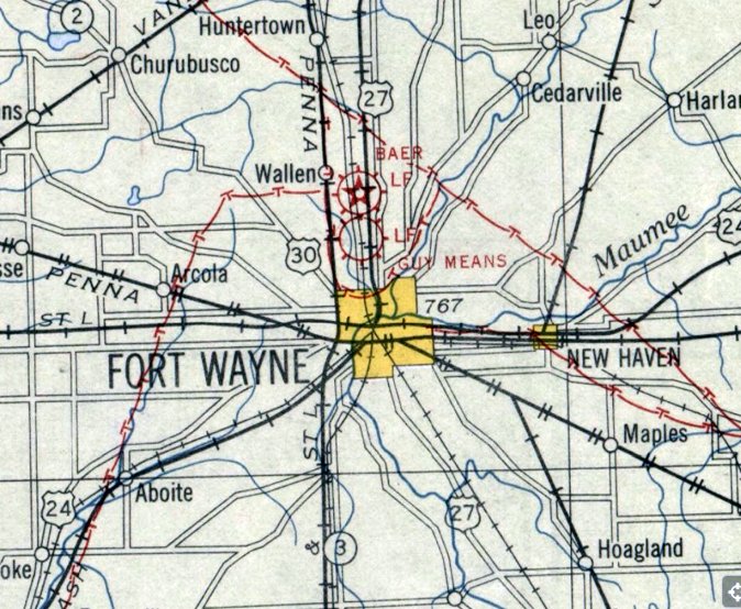
Guy Means Airport, as depicted on the 1930 Chicago Sectional Chart (courtesy of Jeff Johnston).
Photo of the airport has not been located.
The date of construction of this small general aviation airport on the north side of Fort Wayne has not been determined.
The earliest depiction which has been located of Guy Means Airport was on the 1930 Chicago Sectional Chart (courtesy of Jeff Johnston).
The 1930 Chicago Sectional Chart (courtesy of Jeff Johnston) depicted Guy Means Airport as measuring 2,810' east/west along its north edge,
with a row of small buildings along the road on the west edge.
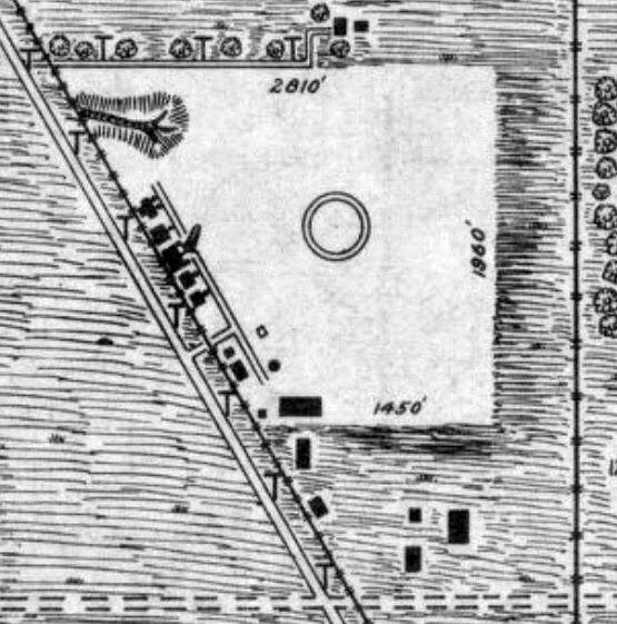
The 1931 Commerce Department Airway Bulletin (courtesy of Jeff Johnston) described Guy Means Airport
as an 88 acre irregularly-shaped sod field, measuring 1,960' x 1,450'.
It was said to have “Sweebrock” (name of the airport operator?) painted on the hangar roof & “imbedded [sic] in field”.
The last aeronautical chart depiction which has been located of Guy Means Airport was on the February 1940 Chicago Sectional Chart.
Guy Means Airport was evidently closed (for reasons unknown) at some point between 1940-42,
as it was no longer depicted on the January 1942 Chicago Sectional Chart.
A 1951 aerial photo depicted a drive-in movie theater occupying the site of Guy Means Airport.
A few small buildings along the road on the west edge may have dated from the site's airport days.
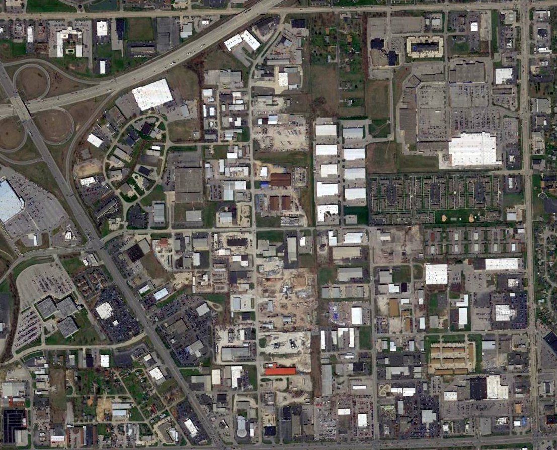
A 2016 aerial view showed no trace remaining of Guy Means Airport.
Thanks to Jeff Johnston for pointing out this airfield.
____________________________________________________
Helmer Intermediate Field, Helmer, IN
41.558, -85.189 (North of Fort Wayne, IN)
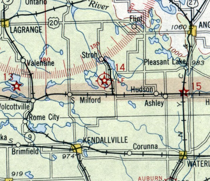
Helmer Intermediate Field, as depicted on the December 1930 Chicago Sectional Chart.
Helmer Intermediate Field was established by the Commerce Department as one of their network of hundreds of Intermediate Fields
which were built to support commercial aviation along airways between major cities.
The date of establishment of Helmer Intermediate Field has not been determined.
The earliest depiction which has been located of Helmer Intermediate Field was on the December 1930 Chicago Sectional Chart.
It depicted Helmer as Site 14 along the Chicago- New York Airway.
Department of Commerce Intermediate Airfield Helmer, Indiana C-NY 14
The 1931 Commerce Department Airway Bulletin (according to Jeff Johnston) described Helmer as a Commerce Department Intermediate Field, Site 14 along the Chicago - New York Airway.
The airfield was described as being a 44 acre irregularly-shaped sandy field having 2 runways, measuring 1,800' east/west & 1,500' north/south.
It had a directional arrow marked "14 C-NY", a 24” rotating beacon tower on the east side, and boundary, approach, and obstruction lights.
Jeff Johnston recalled, “Many years ago my father, Richard Johnston, drove the family car by a crop field & he pointed & said,
'That field was once an emergency landing strip for the airmail pilots. A lighted beacon showed them the way from California to New York.'
All I saw at the time was corn stubble. I found it hard to believe such an unremarkable field could be part of a trans-continental air route system.
Another time he told me how airmail pilots would fly low & slow then drop note-stuffed bottles into Big Long Lake, where his father had a cottage, requesting an appointment for a Pilot Medical exam.
Richard & his brother Robert would row out in a small boat & retrieve the bottle for him. His father, Dr. Donald Johnston, was an Aviation Medical Examiner.
The pilots were flying mail on the U.S. Airmail Lighted Beacon Airway that went over the lake that lay between Sites 13 & 14 on the Chicago-NY route.”

The last aeronautical chart depiction which has been located of Helmer Intermediate Field was on the September 1938 Chicago Sectional Chart.
Helmer's designation along the Chicago-Toledo Airway had changed to Site 13.
Helmer Intermediate Field was evidently closed at some point between 1938-40,
as it was no longer depicted on the February 1940 Chicago Sectional Chart.
The need for closely-spaced Intermediate Fields had been reduced by the increasing reliability of commercial aircraft.
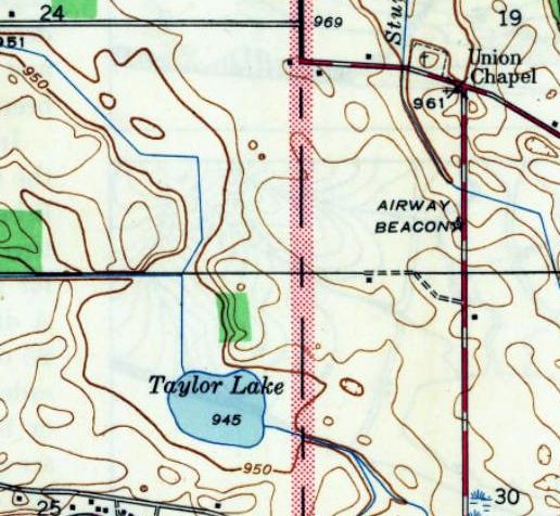
The 1942 USGS topo map continued to depict Helmer's Airway Beacon, but no longer depicted the airfield.
Jeff Johnston reported, “Two local gentleman, Larry & Jerry Perkins, reported that when they were boys in the 1940s & 1950s
the beacon would shine though their bedroom window at night & twin-engine aircraft would routinely land at the Helmer Airfield.
Jerry remembered that it was not a standard 10'x14' generator shed but a larger 20'x30' bank barn that stood close by northeast of the beacon tower.
A story from 1950 is that Elwood Parr & Fred Langly were following the beacon into the East landing runway & clipped a metal fence post about a half mile west of the runway.
The fabric on the belly of the twin-engine aircraft was torn off & the aircraft sat at the field for over a year waiting for repairs.
Fortunately the beacon & tower were preserved by being moved to & installed at Tri-State Airport in 1955 by Paul Eyster.
The last years aircraft operated out of Helmer were around 1955-60.”
A 1958 aerial photo showed the Helmer's Airway Beacon shed on the east side of the airfield,
but the airfield had been returned to cultivation, with no traces of any runways.
A 1998 aerial view showed Helmer's Airway Beacon shed remained on the east side of the airfield site.
A 2003 aerial view showed Helmer's Airway Beacon shed had been removed at some point between 1998-2003.
Jeff Johnston reported, “In 2012 Pete Yarger restored the original 1930 Helmer beacon.”
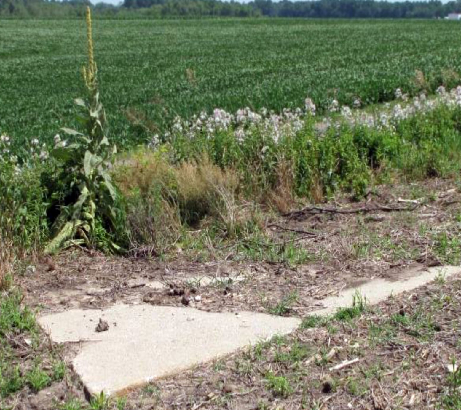
A 2013 photo of the Helmer Intermediate Field directional arrow & tower foundation (courtesy of Jeff Johnston).
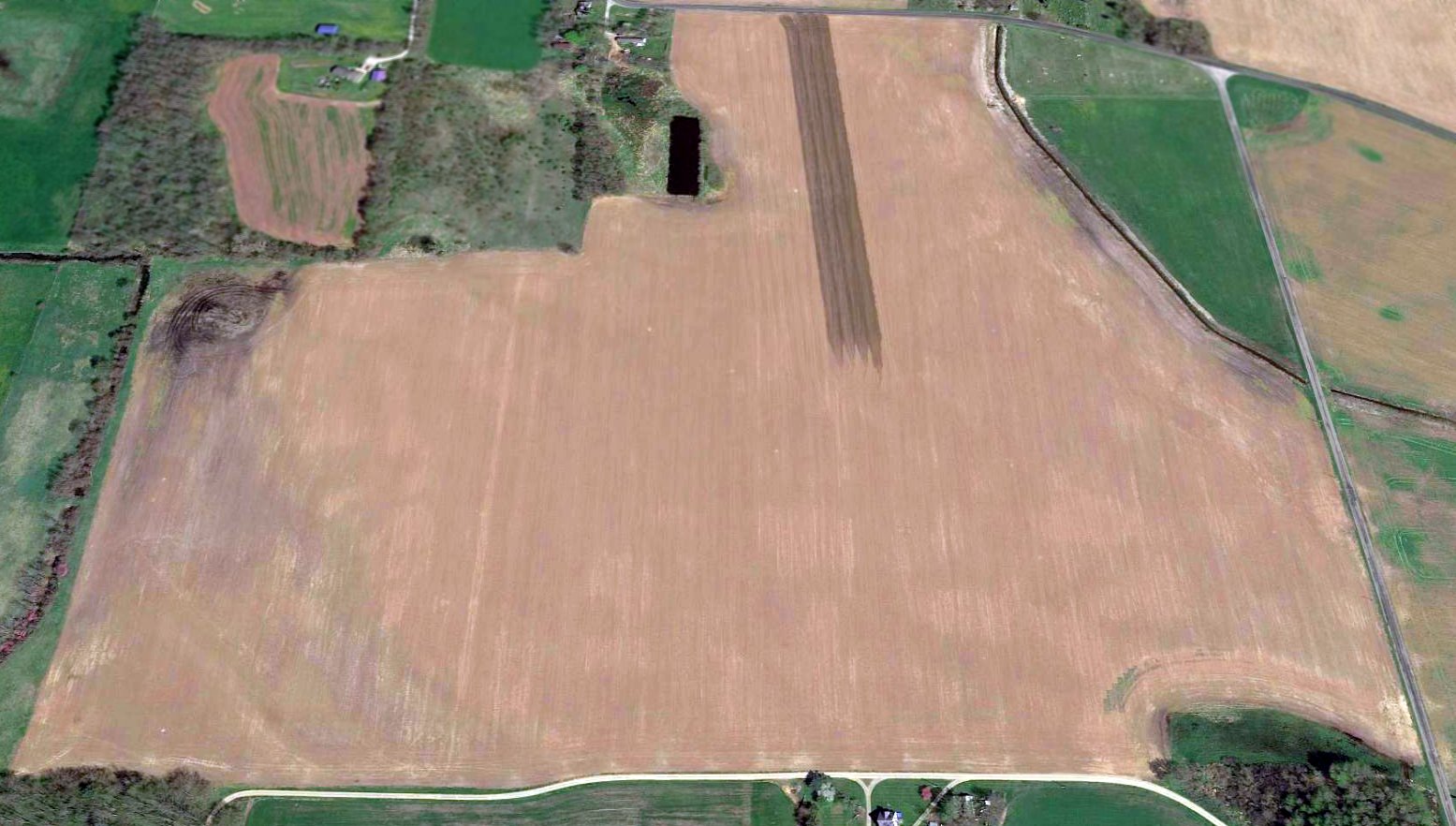
A 2017 aerial view looking north showed the site of Helmer Intermediate Field has been returned to cultivation, with no traces of any runways.
The concrete Airway arrow had been moved to the southeast corner of the airfield, barely visible as a white dot.
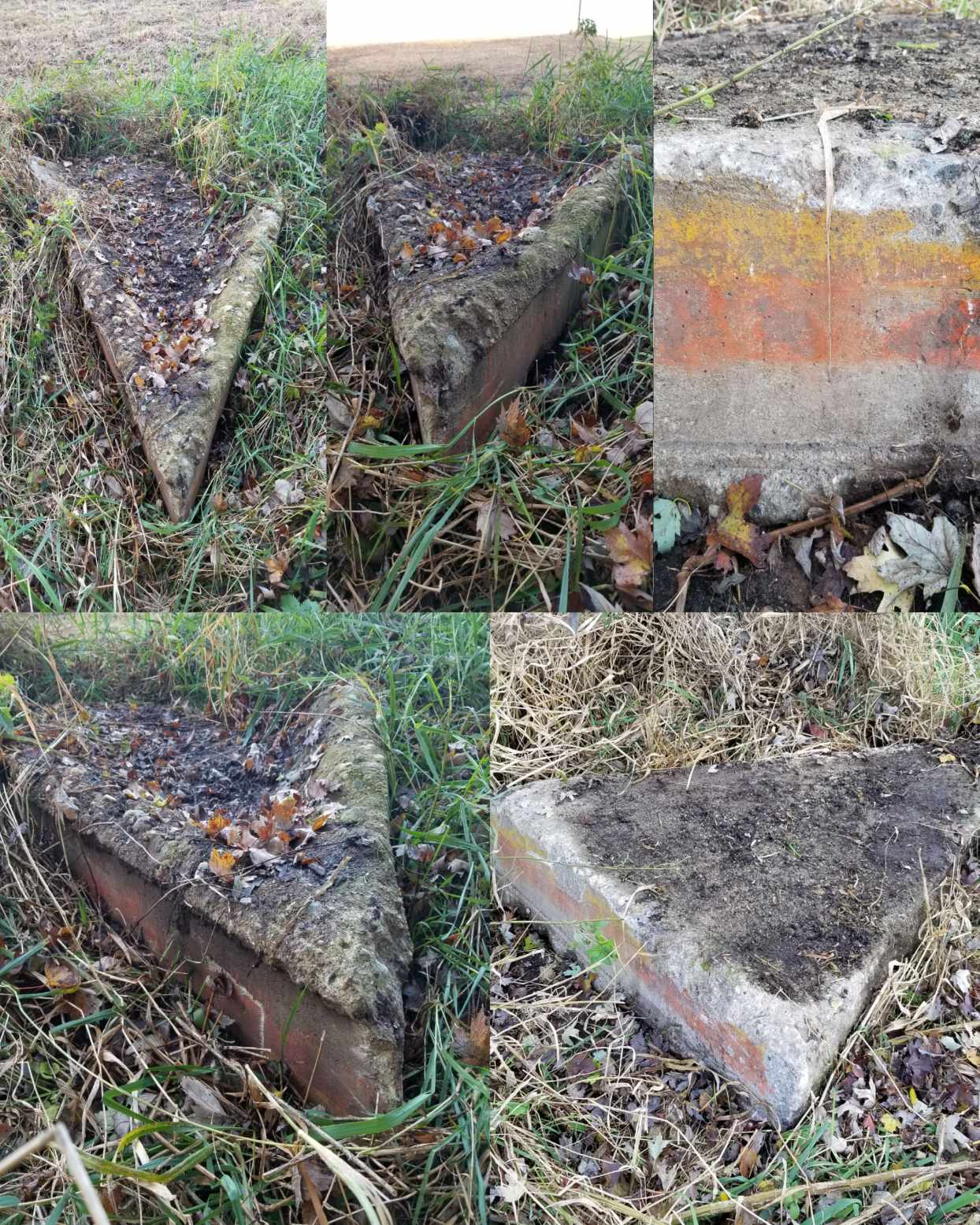
A set of 11/317 photos by Jeff Johnston of the Helmer Intermediate Field directional arrow lying in the hedge inverted.
Jeff Johnston reported in 2017, “I have been thinking about this field for decades from my father's stories.
Yesterday I found it. I was so excited! Meeting the farmers that remembered the field was a real treat.
Very little remains on site at Site 14 to indicate it was ever an airfield. From the air the grass strips are now worked fields.
On the ground the only thing I could find were the displaced cement pieces that made up the beacon tower foundation & directional arrow.
Two local gentleman, Larry & Jerry Perkins, reported that the directional arrow & tower foundations had been moved about 300 yards south from the original position in the spring of 2017.
They are putting the arrow on pallets & we are looking to move it to KABQ where the tower & beacon are.”
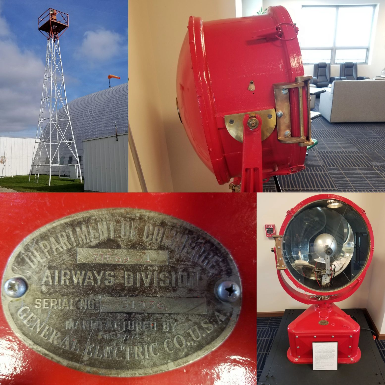
An 11/3/17 photo by Jeff Johnston of the Helmer Intermediate Field beacon.
Jeff reported, “It is now on permanent display at the Tri-State Airport (KANQ) terminal lobby.”
Thanks to Jeff Johnston for pointing out this airfield.
____________________________________________________
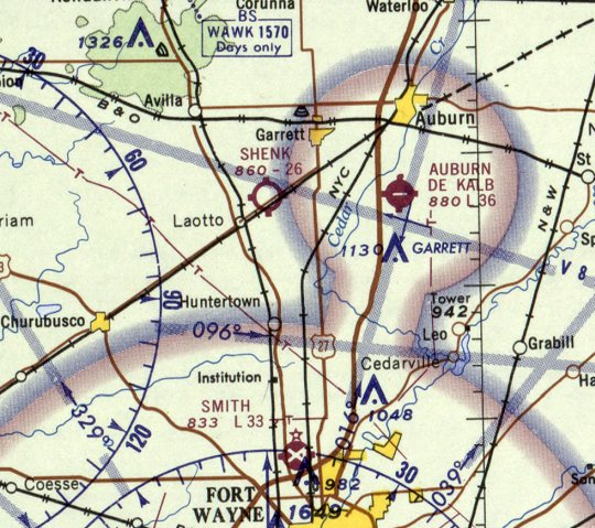
Shenk Airport (3C2), Laotto, IN
41.306, -85.18 (North of Fort Wayne, IN)
The 1957 USGS topo map depicted the unpaved east/west runway & a hangar at Shenk Airport, but without any labeling.
Jeff Johnston recalled, “Edward Shenk owned & operated the Shenk Airport starting in 1946.”
The earliest depiction which has been located of Shenk Airport was a 1951 aerial photo,
which depicted a single east/west unpaved runway, with a small building & a light single-engine aircraft on the northeast side.
However Shenk Airport may have been somewhat unofficial for its its first decade,
as it was not yet depicted on the December 1952 Chicago Sectional Chart, or subsequent Sectional Charts through 1963.
The 1957 USGS topo map depicted the unpaved east/west runway & a hangar at Shenk Airport, but without any labeling.
A 1965 aerial photo showed Shenk Airport's runway had been extended further west,
a T-hangar had been added on the southeast side of the runway,
and the number of aircraft parked outside had increased to 8.
The earliest aeronautical depiction which has been located of Shenk Airport was on the May 1965 Chicago Sectional Chart.
It depicted Shenk Airport as having a 2,600' unpaved runway.
A 1972 aerial photo showed Shenk Airport's configuration remained the same,
but the number of aircraft parked outside had decreased slightly to 5.
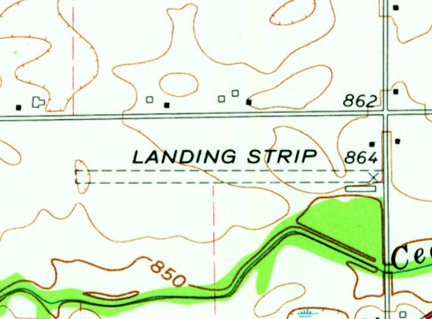
The 1973 USGS topo map depicted Shenk Airport's unpaved east/west runway & 2 hangars, labeled simply as “Landing Strip”.
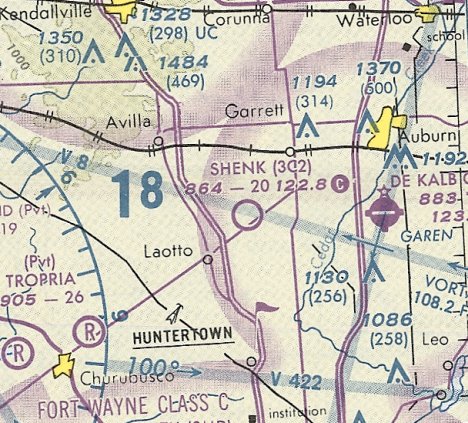
The last aeronautical chart depiction which has been located of Shenk Airport was on the October 1993 Chicago Sectional Chart (courtesy of Ron Plante).
It depicted Shenk Airport as having a 2,000' unpaved runway.
Jeff Johnston recalled, “I used to fly into Shenk Airport. Edward Shenk was a member of the quiet Birdman & a Flying Octogenerian.
Ed received an FAA award for being a certified mechanic for over 50 years.
He could often be found stitching fabric wings in his shop with a gnome rotary engine sitting in the corner in pieces.
Edward Shenk owned & operated Shenk Airport for 52 years until his passing in 1998.
The airport was closed shortly after his death.”
A 1998 aerial photo showed Shenk Airport's runway & hangars remained intact, but there were no aircraft visible on the field.
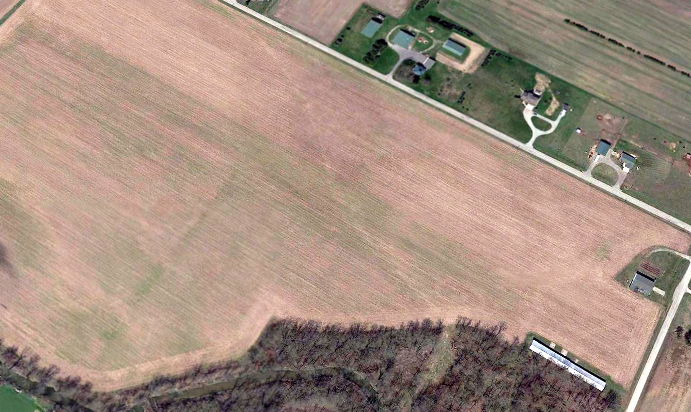
A 2016 aerial view looking northwest at the site of Shenk Airport.
Jeff Johnston observed, “All that's left is the large hangar Carl worked in & the T-hangars with very little indication there was ever runways in the plowed field.”
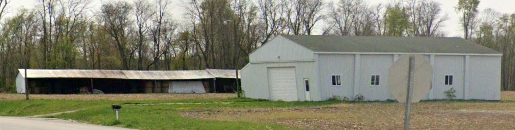
A 2023 photo looking southwest at the T-hangars & larger hangar which remain on the east side of the Shenk Airport site.
Thanks to Jeff Johnston for pointing out this airfield.
____________________________________________________
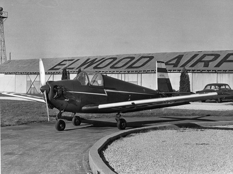
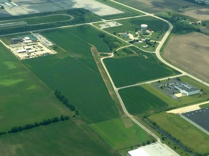
Elwood Airport (3I1), Elwood, IN
40.25, -85.83 (Northeast of Indianapolis, IN)

A 9/27/52 USGS aerial view of Elwood Airport.
According to an article in the 8/23/08 Herald Bulletin (courtesy of Mark Wright),
“Widely known as the world!s first fly-in drive-in, Elwood Airport was founded in 1946 by Don & Georgia Orbaugh of Elwood.
The airport offered sod runways for single-engine planes before gaining wider attention in 1952 when it opened an ice cream shack.
By 1953, a dining room was added to the shack & young girls wearing green uniforms with boxy green hats served customers on their planes.
The Orbaughs' daughters, Ann Brewer of Elwood & Donna Ewing of Anderson, now share ownership in the business.
Brewer said the airport was a labor of love for her father, who was a pilot & flight instructor.
Flying became popular in the 1940s, Brewer noted.
When the war ended, others sought flight instruction, and Elwood's unique restaurant & airport became a popular destination for those with miles to burn.
While Orbaugh loved the facility more than anyone, Brewer said, the dedication of area residents to the airport was shown in 1948.”
Ann Bewer recalled, “A tornado blew down the hangar, the only hangar at that time,
and the pilots & some of the farmers around helped my dad rebuild it.
He said he would never have been able to continue if they hadn't pitched in & helped.”
The earliest depiction which has been located of Elwood Airport was a 9/27/52 USGS aerial view.
It depicted Elwood Airport as having 2 perpendicular unpaved runways, with 3 rows of hangars along the northwest side,
near which were parked several light aircraft.
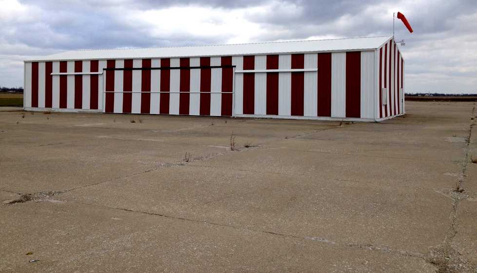
A November 1958 photo of a rare single-seat Mooney Mite in front of a hangar with “Elwood Airport” painted on its roof (courtesy of Dave Parker, via William Hazen).
William Hazen recalled, “The Mooney Mite belonged to the Elwood Airport mechanic, Jim Howren.”
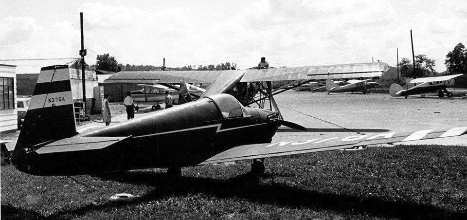
A November 1958 photo of a rare single-seat Mooney Mite in front of other aircraft & hangars at Elwood Airport (courtesy of Dave Parker, via William Hazen).
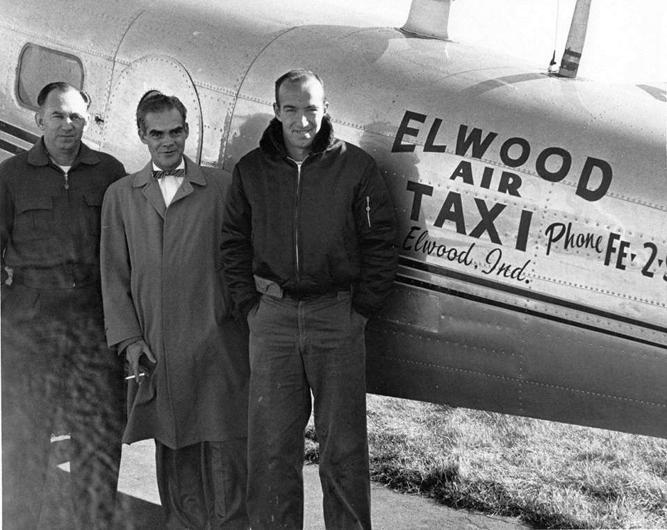
A November 1958 photo of 3 unidentified men in front of a Beech 18 / C-45 marked “Elwood Air Taxi” (courtesy of Dave Parker, via William Hazen).
The 1960 USGS topo map depicted Elwood Airport as having at least 1 unpaved runway, with several buildings along the northwest side.
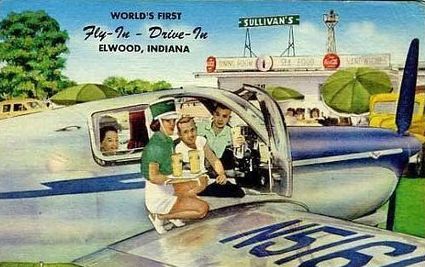
A circa 1960s colorized photo of a waitress serving food to a group in a Bonanza
at the “World's First Fly-In Drive-In, Elwood, IN” (courtesy of Ray Johnson).
An undated photo by Ray Johnson of his 1947 Aeronca Chief in front of a crowd eating at Elwood Airport's restaurant.
Ray recalled, “I flew out of Elwood Airport for years.
There was a well known mechanic who worked out of there & for Don Orbaugh for 50 years, Jim Howren, an excellent mechanic.
At one time Don Orbaugh was a Aeronca dealer.”
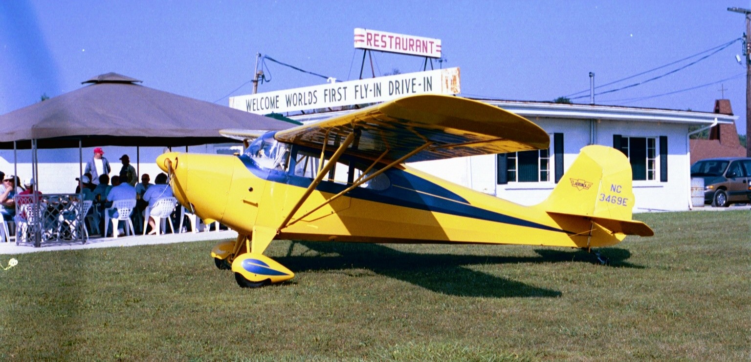
An undated photo of Mark Wright & his Cessna 152 in front of Elwood Airport's restaurant, with the sign proclaiming “Welcome World's First Fly-In Drive-In.”
Mark recalled, “I just flew in once for a hamburger. It was a neat little field!”
According to an article in the 8/23/08 Herald Bulletin (courtesy of Mark Wright),
“One glance at the smudged, tattered postcard and it's obvious that the Elwood Airport, closing September 1,
is more than just another local business lost to economic misfortune.
The postcard has kept bold colors in spite of its age.
The image clearly displays a carhop waitress kneeling on the wing of an old airplane.
She is serving drinks on a white tray to a pilot & his passengers.
For some, the airport's closing marks the end of an era where the skies were highways.
Back then, Elwood provided the only one-stop shop for ordering drive-in food from the jump seat.
The airport is slated to shut down but its iconic restaurant will remain open.
The airport has not been profitable, said airport co-owner Ann Brewer.
If it weren't for the restaurant & surrounding crops, it would have closed long ago, Brewer said.”
Mark Wright reported in 2010, “Elwood Airport... I drove by it today & realized it was closed.
The airport restaurant is still open. The grass runways have been plowed over.”
A circa 2005-2011 aerial view looking west at hangars & the airport restaurant at Elwood Airport.

An 11/4/12 photo by Tom Townsend of the Elwood Airport restaurant.
Tom Townsend reported, “I visited the former Elwood Airport on 11/4/12.
The lady at the restaurant (good food & great prices!) told us that Don, the old owner, was told by the EPA to replace the fuel tanks in the ground.
He could not afford to do so & removed them. Without fuel, few aircraft came to the field.
The owner died & left the field to his 2 daughters.
They leased the land where the runways were situated to a local farmer, who has since planted them in crops.
Remaining buildings are the restaurant, the shop & 3 hangars, only one of which is a serviceable building, the other 2 in states of decay.”
An 11/4/12 photo by Tom Townsend at the site of Elwood Airport, “Looking in the window of the shop. Note the aviation radios on the desk.”
An 11/4/12 photo by Tom Townsend at the site of Elwood Airport, of the “site of the runways.”
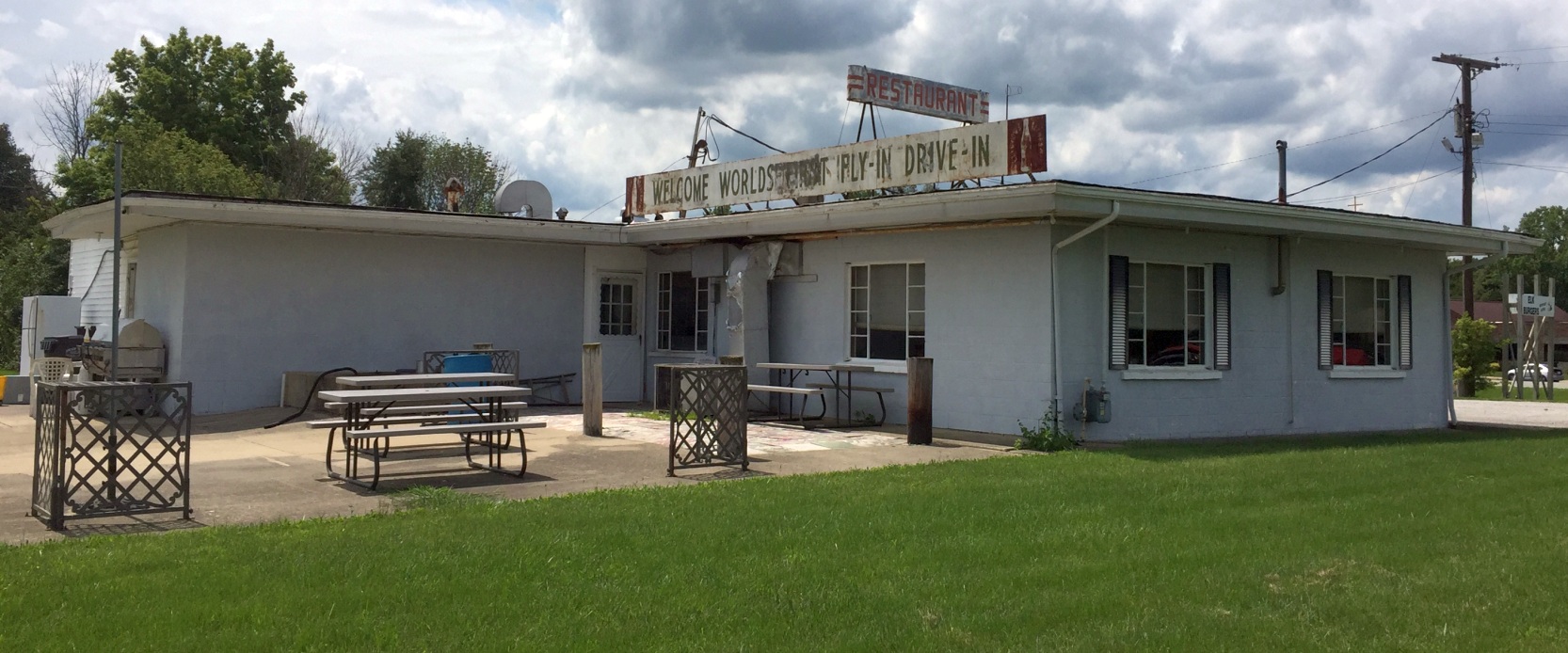
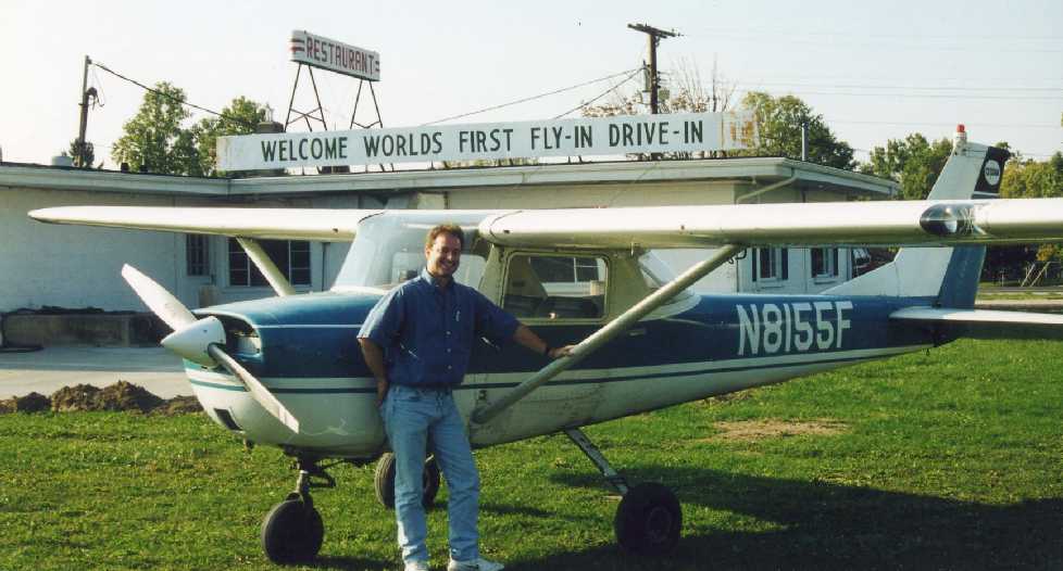
A 7/26/18 photo by Will Hazen of the Elwood Airport restaurant, the “World's First Fly-In Drive-In”.
Will reported, “I just ate in the former Elwood Airport Terminal building & had the signature Elk Burger.
The food is still excellent & they even offer packaged raw elk burgers to take home & grill up.
The hangars still stand & the airport van still sits lonely by the hangars.”

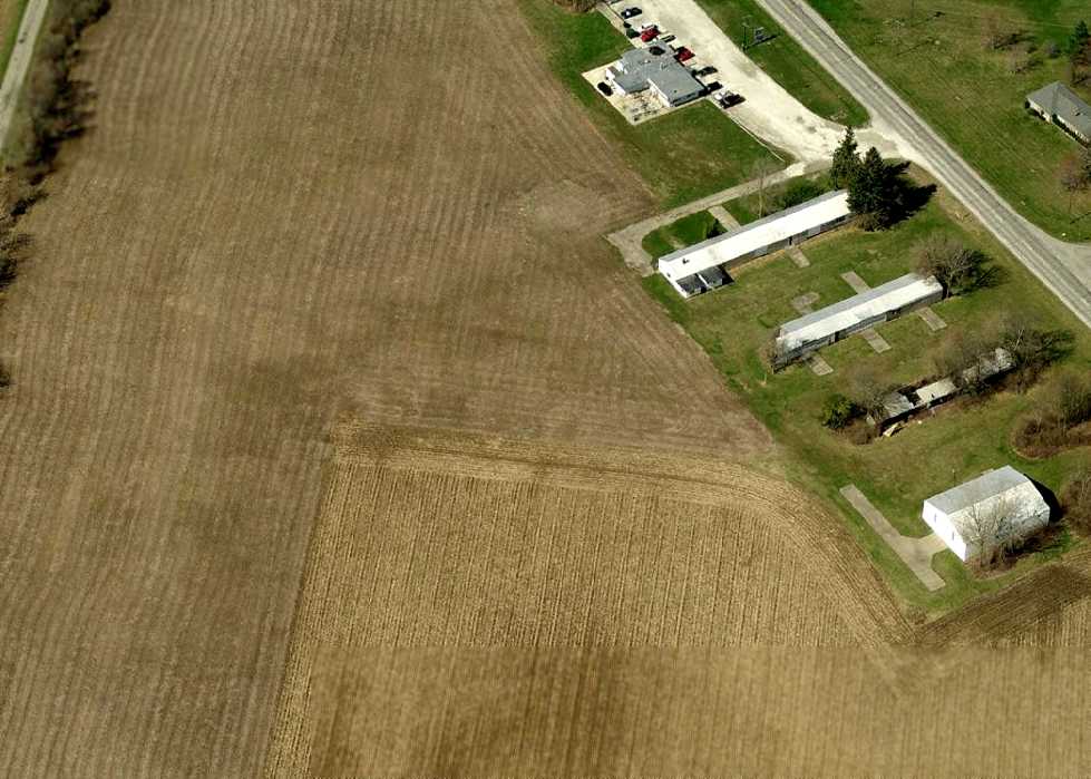
A 2024 photo looking south at the Elwood Airport restaurant.

A 2024 photo looking east at a former Elwood Airport hangar.
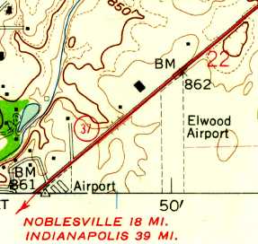
The site of Elwood Airport is located northeast of the intersection of Route 37 & Airport Road, appropriately enough.
____________________________________________________
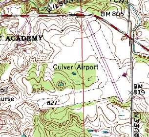
Culver Airport / Fleet Field, Culver, IN
41.22, -86.39 (North of Indianapolis, IN)

Culver Airport, as depicted on a 10/8/52 USGS aerial view.
This small airport was located adjacent to the Culver Military Academy.
James Bean recalled, “The Academy has photos of aircraft using the field in the 1920s & 1930s.”
According to Ted Frison, “The Culver newspaper said it was built in 1934 (the state allocated $18,500 for it) on land owned by the Culver Military Academy.
Fleet Field was named for Ruben Fleet - the founder of Consolidated Aircraft, [who] flew the first bag of airmail, and owned San Diego’s Lindberg Airport (in the late 1930s).
He was a 1906 graduate of the Culver Military Academy (his uncle was one of the early superintendents)
and devoted his later years to supporting the school, among other philanthropic endeavors.”
But Culver Airport was not yet listed among active airfields in the 1945 AAF Airfield Directory (courtesy of Scott Murdock).
The earliest depiction which has been located of Culver Airport was a 10/8/52 USGS aerial photo.
It depicted 2 unpaved runways, with no buildings, aircraft, or other aviation infrastructure.
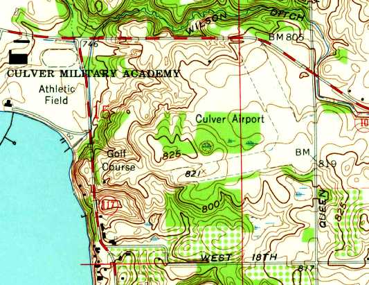
The earliest topo map depiction which has been located of Culver Airport was on the 1962 USGS topo map.
It depicted the field as having 2 unpaved runways, with no buildings.
Mark Strangio recalled, “When I attended Culver Military Academy as a cadet in 1964 he would periodically fly down to take me to South Bend or somewhere more interesting than the academy – especially as a Plebe.
My father bought a Beech 18 / C-45H technically. He would occasionally fly into the CMA airport to visit or pick me up, and we had a great time.
The Beech was a powerful airplane & could get off the grass strip (at the time – no pavement) quick enough – there was trees on every end of the runways.
Bill Lear’s son (David Lear) went to CMA at the time. I recall once his making a low pass over the Academy with his Lear Jet - pretty cool.”
According to Rich Dugger, “Located next to Culver Military Academy,
they had a flight training operation out of there mostly to Mexican students that came up for the summer sessions.
I knew the Chief Flight Instructor & also the mechanic doing maintenance on the fleet of Cherokee 140s.
Oddly enough the mechanic was the son of Joe Phillips of the Joe Philips Airport in Michigan City.”

A 4/5/71 USGS aerial view depicted Fleet Field as having 2 unpaved runways, with no buildings, aircraft, or other aviation infrastructure.
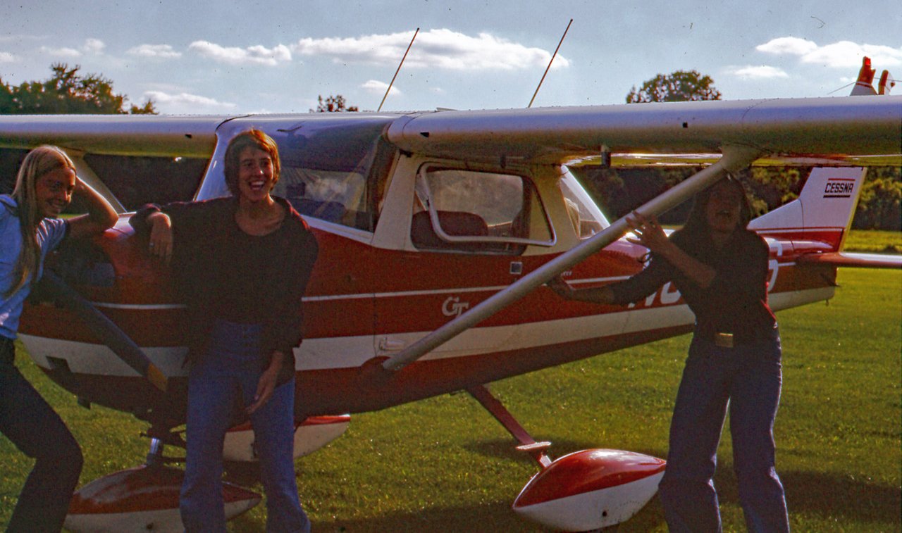
A 1972 photo by Ted Frison of “the daughters of a mentor & friend” in front of his Cessna 152 at Fleet Field.
Ted reported, “I flew in there several times in the 1970s to visit friends at the school. Airplanes are 'Babe Magnets'.”
James Bean recalled, “I was a summer school cadet of the aviation squadron, from 1973-75 & flew from Fleet for 3 summers.
In 1973 both runways were grass, and we had 3 Cherokee 140 Fight Liners (FL) for training.
The aviation summer program started in 1973.
The north/south runway was paved in 1974 & they had 5 Cherokees: three 140s & two 151 Warriors.
I graduated as Executive Officer (2nd In Command) in the summer of 1975, and had my Private Pilot Airman Certificate by August 15th.
Great experience & wonderful memories.”
The 1991 USGS topo map shows that Culver's northwest/southeast runway was evidently paved at some point between 1962-91.
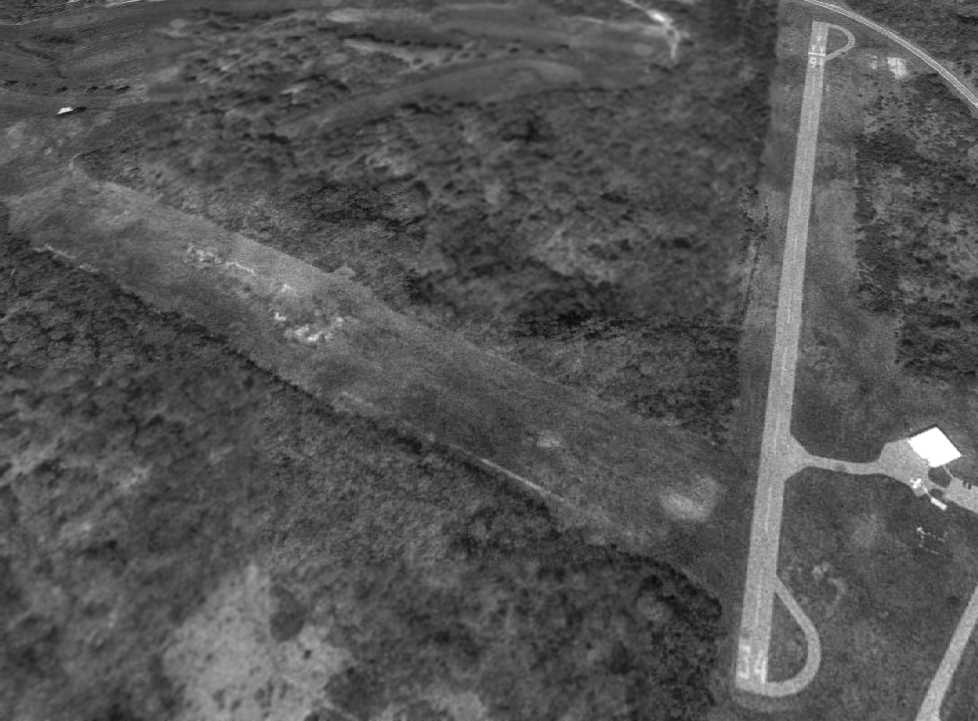
A 4/28/98 USGS aerial view looking northwest at Culver Airport showed one single-engine aircraft on the ramp next to the hangar.

The last photo which has been located showing aircraft at Fleet Field was a 7/13/03 aerial view looking northwest, which depicted 3 single-engine aircraft on its ramp.
According to Rich Dugger, “A flight instructor & a student both drowned after an engine failure shortly after takeoff.
I’ll never understand why it went into the water.
Shortly afterwards we flew over it & saw the Xs on the runway & that was the end of the flying out of Culver Airport.”
A 9/2/05 aerial view showed the Culver runway still marked as operational, but no aircraft were visible on the field.
According to Jordan Chastain, “The airfield there closed around 2005.”
A 7/27/06 showed a closed-runway “X” having been painted on each end of Culver's Runway 16/34.
An 8/13/07 aerial view showed Culver Airport to remain intact.
According to Ted Frison, “The field was closed in early 2007, following a 2005 fatal crash with a student & an instructor.
Other issues were the insurance costs, a desire to move the runways away from academy facilities, and the cost of buying a new fleet of airplanes.”
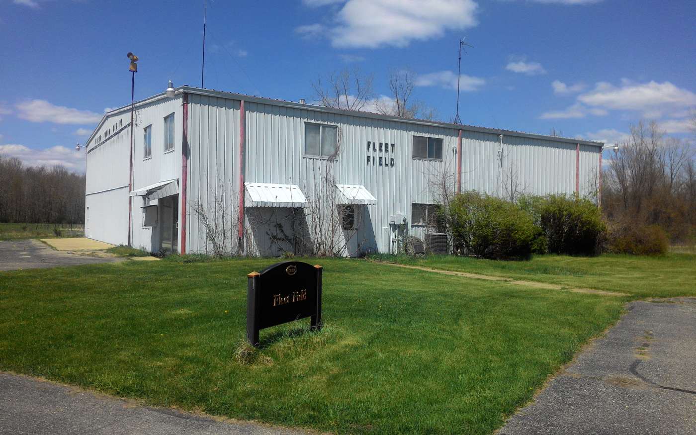
A 4/26/15 photo by Daniel Cheung of the Fleet Field hangar, which appears to remain in fine condition.
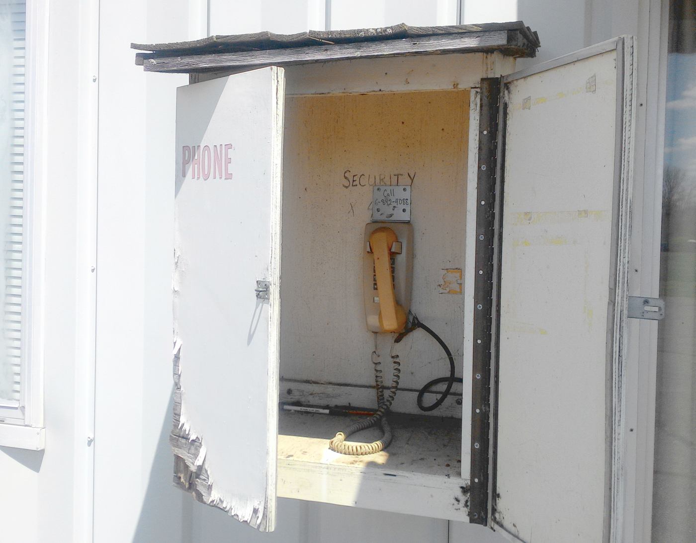
A 4/26/15 photo by Daniel Cheung of a phone box outside the Fleet Field hangar. Daniel observed remarkably, “It still has a dial tone.”
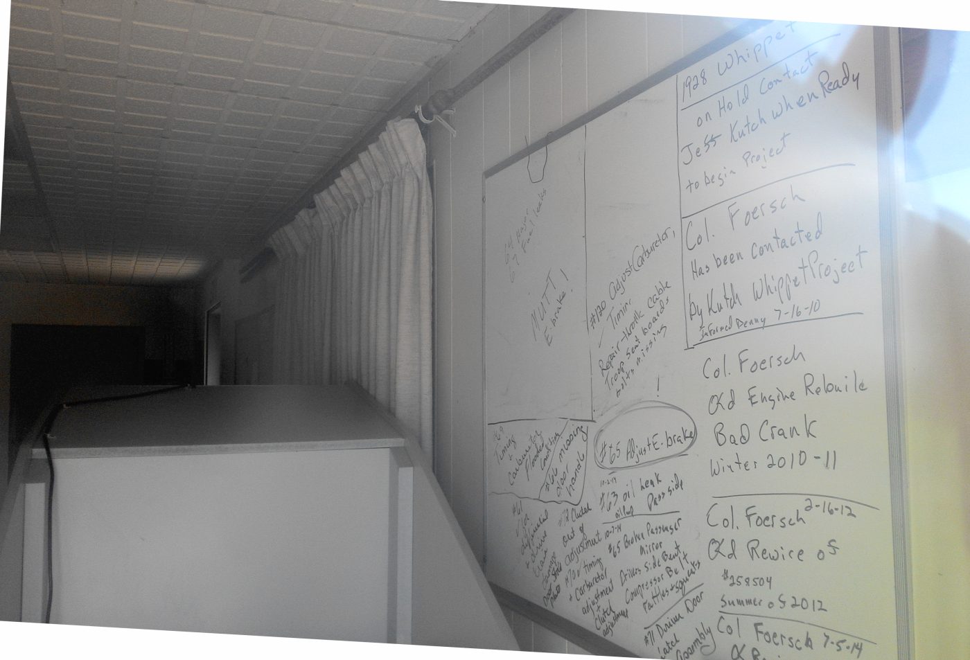
A 4/26/15 photo by Daniel Cheung of the whiteboard which remains inside the Fleet Field hangar.
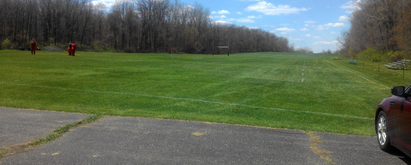
A 4/26/15 photo by Daniel Cheung of a Fleet Field runway, now reused for soccer fields.
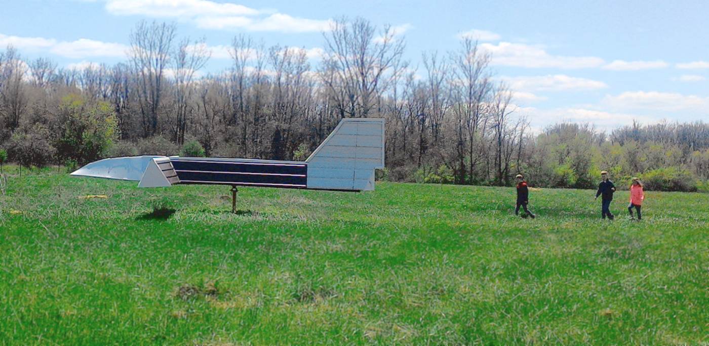
A 4/26/15 photo by Daniel Cheung of the Fleet Field wind direction indicator.
A 5/20/18 photo by Ted Frison at Fleet Field, “looking north [at the] asphalt runway torn out.
There are no plans to reopen the airport & the paved runway has been torn up. About 100' of the asphalt runway remains.”
A 5/20/18 photo by Ted Frison looking “across the ramp to the grass strip” at the Fleet Field wind indicator. “The grass strip now has a football field on it.”

A 2022 aerial view looking northwest showed southern end of the Fleet Field Runway 16/35 pavement remained intact, along with the hangar.

A 2023 photo looking southwest at the Fleet Field wind indicator.

A 2023 photo looking west at the former hangar still marked “Fleet Field”.
Fleet Field is located southwest of the intersection of Route 10 & Queen Road.
____________________________________________________
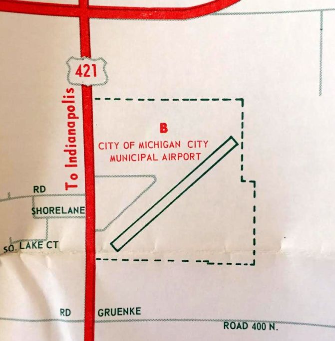
Michigan City Municipal Airport (C39), Michigan City, IN
41.67, -86.89 (Southeast of Chicago, IL)
Michigan City Municipal Airport, as depicted on the December 1949 Chicago Sectional Chart.
This general aviation airport was located on the south side of the town of Michigan City.
It is not to be confused with the similarly-named Michigan City Airport, which is located on the east side of the town.
According to Russ, "The American Air Mail Society Catalog lists an airport dedication cover
for Michigan City Municipal for 10/11/48… probably its official opening date."
Michigan City Municipal Airport was not yet depicted on the December 1948 Chicago Sectional Chart.
The earliest depiction of Michigan City Municipal Airport which has been located was on the December 1949 Chicago Sectional Chart.
It depicted Michigan City Municipal Airport as having a 3,400' unpaved runway.
Mark Strangio recalled, “I was around 11 years old when I began riding my bike to Michigan City Municipal airport.
What drew me to Michigan City Municipal was the P-51s, AT-6s, and T-28s that used to fly in for repairs.
Mustang pilots would want Farnum Brown who knew how to work on Merlins & vintage aircraft. There was also a decent market in warbirds at the time.
I loved the sound of Merlins & round engines. The downwind to Runway 4 was right over my home just North of the US 20 & 421 intersection.
When I heard the sound of the Merlins I would rush to my bike to race to the airport, and would sit there all day waiting for more. It was the best a kid could get of course.
Eventually my father bought a Piper Comanche 180 & kept it at Municipal. We flew all over IN, IL, and MI.
Around 1961–64 there were a fair number of Canadian Air Force Mustangs that would be flown into LaPorte or Michigan City to convert them to 2-place aircraft – ripping out that old radio gear.
I have pictures of Mustangs & T-6s at Michigan City Municipal.”

The 1961 Chicago Sectional Chart (courtesy of Chris Kennedy) depicted Michigan City Municipal Airport as having a single 2,200' paved runway.
The earliest photo which has been located of Michigan City Municipal Airport was a 3/1/61 USGS aerial photo.
It depicted Michigan City Municipal Airport as having a single northeast/southwest paved runway, and 5 light aircraft parked among some small buildings on the northwest side.
The 1962 AOPA Airport Directory described Michigan City Municipal Airport as having a single 2,200' bituminous Runway 4/22,
and listed the operator as the Board of Aviation Commissioners.
Mark Strangio recalled, “I started flying in 1964 & soloed at Mochigan City Municipal when I turned 16.”
A 1969 road map (courtesy of Kevin Walsh) depicted “City of Michigan City Municipal Airport”
as having a single northeast/southwest paved runway.
The last aeronautical chart depiction of Michigan City Municipal Airport which has been located was on the November 1974 Chicago Sectional Chart (courtesy of Ron Plante).
It depicted Michigan City Municipal Airport as having a single 2,400' paved northeast/southwest runway.
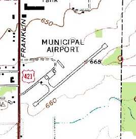
The 1980 USGS topo map depicted the field as having a small paved ramp
with several hangars on the west side of the runway.
By the time of the 1982 AOPA Airport Directory (courtesy of Ed Drury),
Michigan City Municipal Airport was described as having a 2,400' asphalt Runway 5/23.
The operator was listed as Lake Air Corporation.
According to Rich Dugger, “I used to fly out of there some & knew the manager although not very well.
Michigan City Municipal Airport was closed shortly after the manager, also the owner of the FBO,
disappeared in an airplane crash in South America before 1991.
The city was happy to see him go & used that as a reason to close the airport
and put all their resources into what was Joe Phillips Airport, now Michigan City Municipal.”
Michigan City Municipal Airport was no longer depicted on the October 1993 Chicago Sectional Chart (courtesy of Ron Plante).
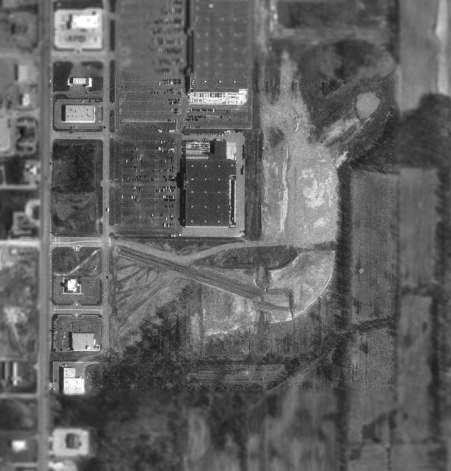
The 1998 USGS aerial photo shows that the site of Michigan City Municipal Airport
had been obliterated by the construction of a large building over the middle of the property.
The outline of the former runway can still be barely recognized on either side of the new building.
Other than that, not a trace remains of the former airport.
Dick McCloskey reported in 2005, “The site of Michigan City Municipal Airport is now a shopping mall.”
According to Rich Dugger, “What was the airport hangars is now a Lowe’s & where the runway was is now a Menard’s.”
The site of Michigan City Municipal Airport is located northeast of the intersection of Route 421 & East Kieffer Road.
____________________________________________________
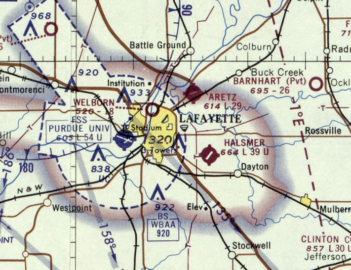
Aretz Airport (3AR), Lafayette, IN
40.46, -86.837 (Northwest of Indianapolis, IN)
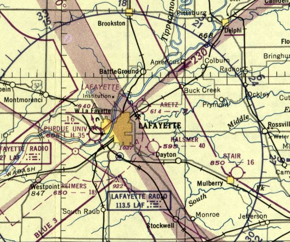
Aretz Airport, as depicted on the November 1950 Chicago Sectional Chart.
Aretz Airport was apparently opened at some point between 1946-53, as it was not yet depicted on the June 1946 Chicago Sectional Chart.
The earliest depiction which has been located of Aretz Airport was on the November 1950 Chicago Sectional Chart.
It depicted Aretz as having a 3,200' unpaved runway.
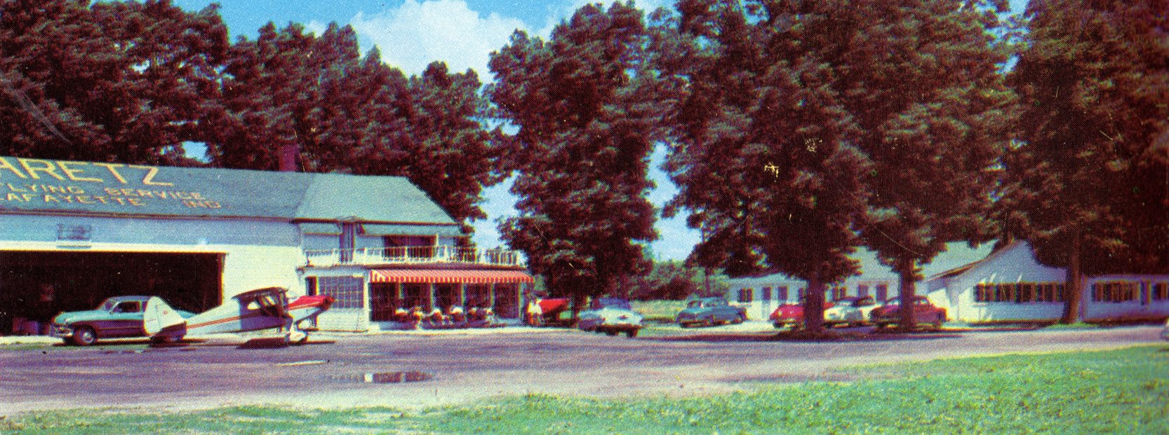
The earliest photo which has been located of Aretz Airport was a circa 1950s postcard (courtesy of David Parker) showing an Aeronca parked in front of a hangar with “Aretz Flying Service” painted on its roof.
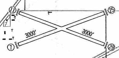
The 1960 Jeppesen Airway Manual (courtesy of Chris Kennedy) depicted Aretz as having 2 unpaved 3,000' runways (7/25 & 11/29),
along with a cluster of small buildings on the west side of the field.
In the 1962 AOPA Airport Directory, Aretz Airport was described as having two 3,000' turf runways (4/22 & 14/32),
and the operator was listed as Aretz Flying Service.
Deborah King recalled, “I was a very young (18) student pilot while learning to fly at Purdue Field.
The last part of my flight instruction was at Aretz Field, in the fall & early winter of 1968.
The runway was paved then, but I recall a lot of mud at the field, enough that I couldn't complete my instruction there.
My flight instructor was Lyle Holbo.”
The last Sectional chart depiction which has been located of Aretz Airport was on the May 1970 Chicago Sectional Chart.
Aretz had evidently gained a paved runway at some point between 1960-70, as it was depicted as having a paved 2,900' northeast/southwest runway.
By the time of the 1982 AOPA Airport Directory (courtesy of Ed Drury), Aretz had a 2,800' asphalt Runway 7/25 & a 2,900' turf Runway 11/29.
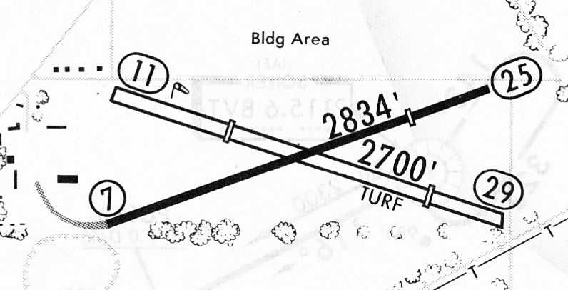
A 2/11/83 airport directory (courtesy of John Kielhofer) depicted Aretz Airport as having a 2,834' paved Runway 7/25 & a 2,700' turf Runway 11/29,
along with several buildings along the west side of the field.
Mark Bailey instructed for Ruth Aretz from 1987-91.

The 1991 IN Aeronautical Chart (courtesy of Aaron Hunt) depicted Aretz as having a 2,812' asphalt Runway 7/25 & 2,700' turf Runway 11/29.

The last aeronautical chart depiction which has been located of Aretz Airport was on the 1991 IN Aeronautical Chart (courtesy of Aaron Hunt).
It depicted Aretz as having a paved northeast/southwest runway.
Aaron Hunt recalled, “I learned to fly at Aretz in 1991-92.”
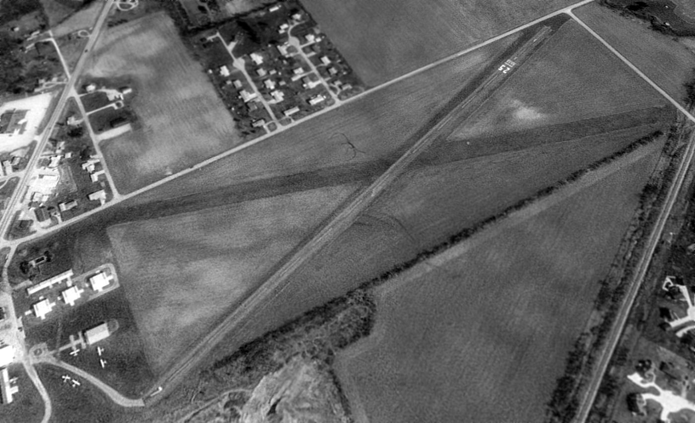
The earliest aerial photo which has been located of Aretz Airport was a 1992 USGS aerial view looking northeast.
Aretz was shown to have a paved Runway 7/25 & a grass crosswind runway.
Five light single-engine aircraft were visible parked on the southwest side amidst several small hangars.
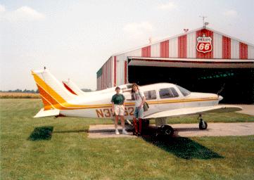
A 1995 photo by John Clear of a Piper Warrior in front of a hangar at Aretz Airport.
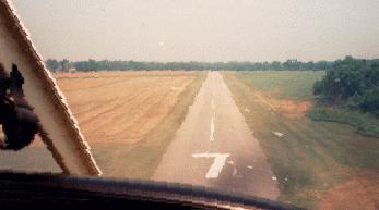
A 1995 photo by John Clear on final approach to Artez's Runway 7.
John Clear recalled, "I flew out of Artez from 1991-96.
The identifier was 3AR until sometime after I left & it was changed to IN## (don't recall what it was).
In addition to the Artez flight school,
it was also home to Purdue Pilots, the Purdue flight club
(which is different from the Purdue aviation program at LAF)."
Aretz closed as a public-use airport in about 1997, and became a private field.
The last photo which has been located showing aircraft at Aretz Airport was a 1998 USGS aerial view looking northeast.
The number of aircraft visible on the field had decreased to 3,
and the grass crosswind runway appeared to no longer be maintained.
Aretz Airport closed at some point between 1999-2002.
It was no longer depicted at all (even as an abandoned airfield) on 2002 aeronautical charts.
As an aside, Terry Aretz pointed out that the closing of Aretz Airport
was noted by Paul Harvey on his national radio show as a sad day for private aviation.
According to Terry Aretz (a relative of the owner of Aretz Airport), after the airport owner retired,
she tried to sell the property as an airport, but was not successful.
She eventually sold the land to a non-aviation business.
In Terry's words, "Tough times for small airports anymore."
Aerial photos from 2003 & 2004 showed Aretz Airport remained intact, but no aircraft were visible on the field.
A 2005 aerial view showed the construction of a large building adjacent to the midpoint of the runway.
A circa 2006 aerial view looking west at the hangars & runway which remain at the site of Aretz Airport.
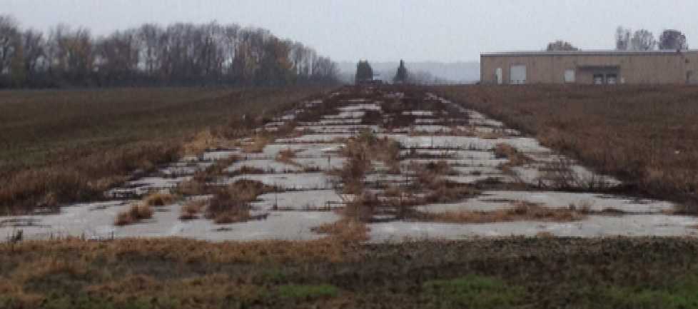
A sad October 2012 photo by Tom Townsend looking along the remains of the Aretz runway, showing this aviation infrastructure going to waste.
Tom remarked, “The runway is breaking up.”
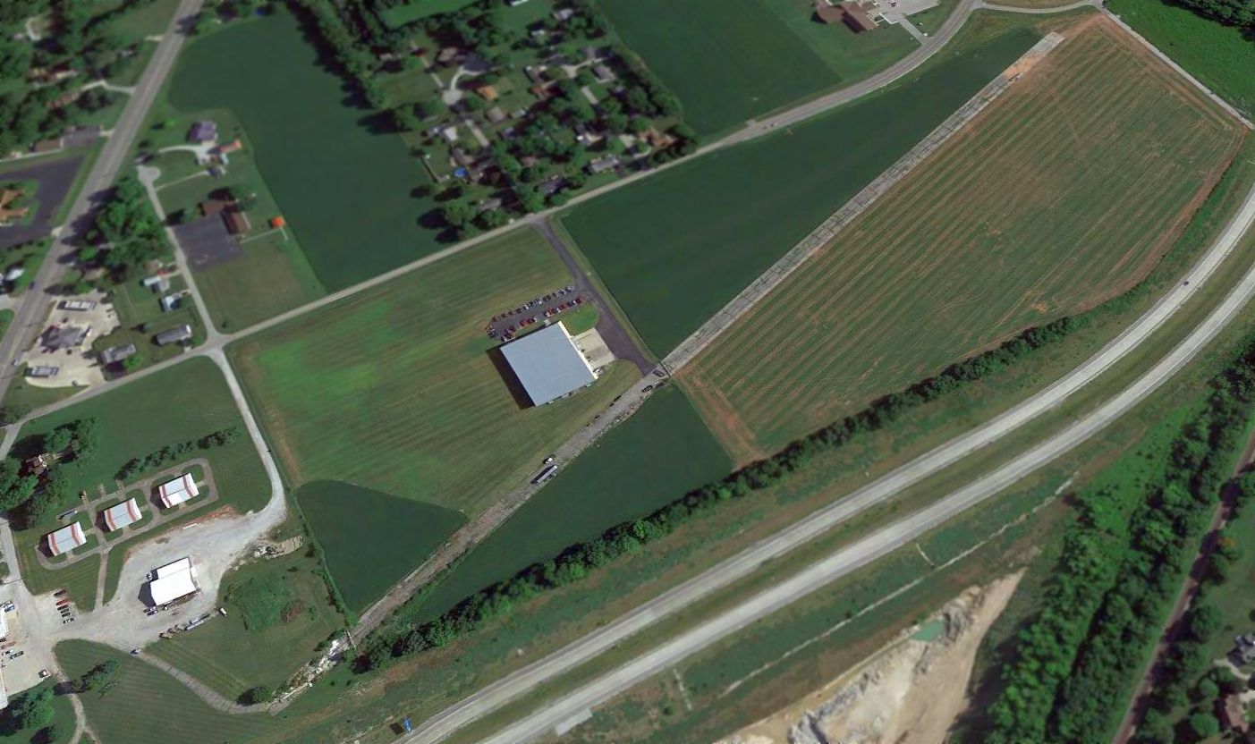
A 2015 aerial view looking northeast at the site of Aretz Airport showed the paved runway & several hangars remained intact.
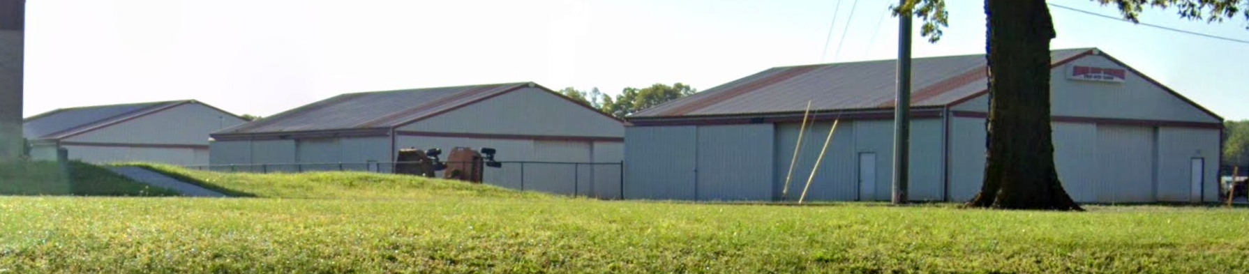
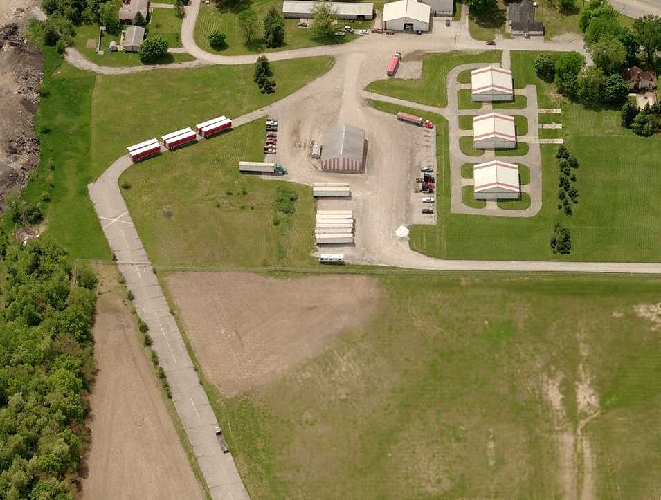
A 2022 photo looking southeast at 3 hangars which remain on the west side of the Aretz Airport site.

A 2024 aerial view looking north at the site of Aretz Airport (courtesy of Linda Swihart) showed the paved runway & several hangars remained intact.
The site of Aretz Airport is located southeast of the intersection of Route 25 & E 300 N.
____________________________________________________
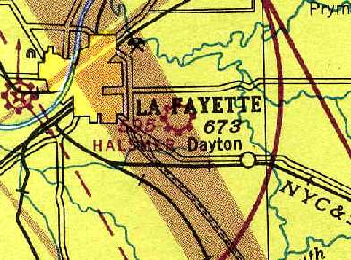
Halsmer Airport (3HM), Lafayette, IN
40.39, -86.8 (Northwest of Indianapolis, IN)
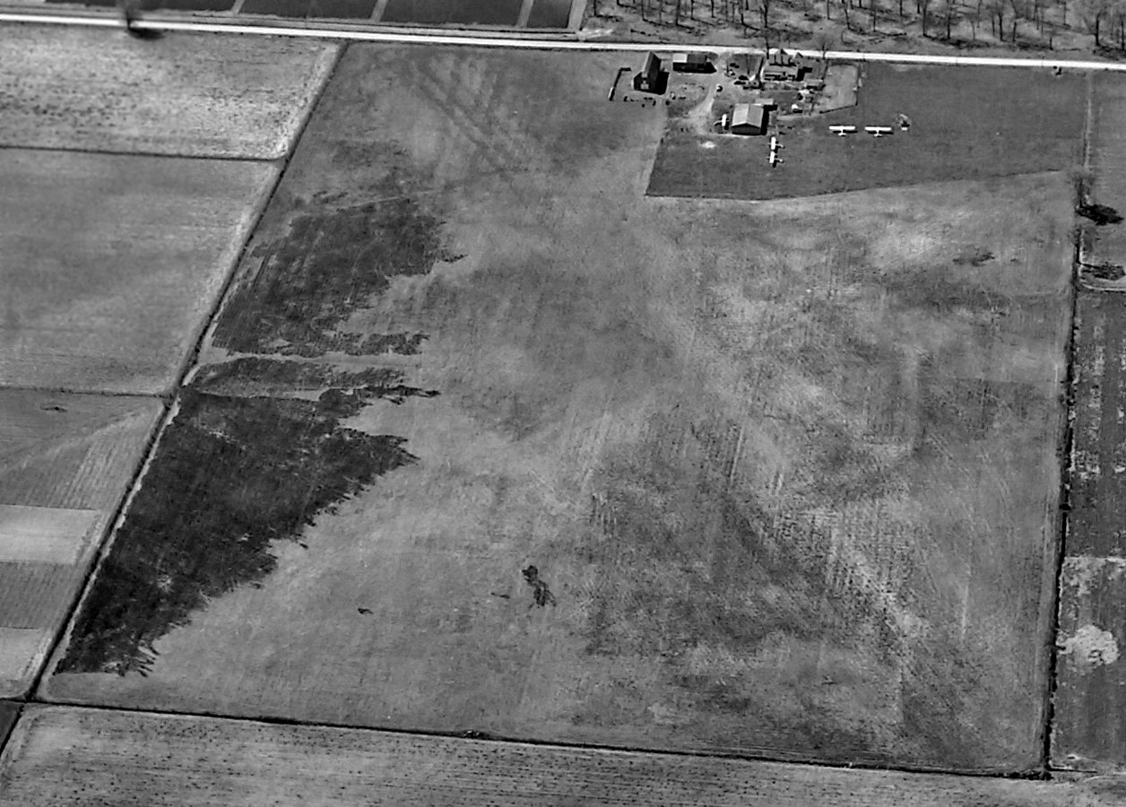
A circa 1943-45 aerial view looking east at Halsmer Airport
from the 1945 AAF Airfield Directory (courtesy of Scott Murdock).
As described on the 1988 Indiana Aeronautical Chart,
Halsmer Airport was the result of a dream of three brothers who became hooked on aviation after a trip to an air show in 1927.
Frances, John and Joseph Halsmer built their 1st planes in 1931,
and taught themselves how to fly on their father's dairy farm, which soon became Halsmer's Airport.
While all 3 Halsmer brothers taught flying, they also performed additional managerial, inspection, and licensing duties.
During WW2 the Halsmer Brothers served in the AAF
but returned soon after to form Halsmer Flying Service where they continued giving lessons and flying charters.
The earliest depiction which has been located of Halsmer Airport
was a circa 1943-45 aerial view from the 1945 AAF Airfield Directory (courtesy of Scott Murdock).
It depicted the field as being a rectangular grass area with a few buildings & several light aircraft on the west side.
The 1945 AAF Airfield Directory (courtesy of Scott Murdock) described Halsmer Airport
as a 42 acre rectangular property within which were 2 sod 1,970' runways, oriented northeast/southwest & northwest/southeast.
The field was said to have a single 75' x 40' wood hangar, and to be owned & operated by private interests.
A March 1945 aerial view looking west at Halsmer Airport (from the National Archives, courtesy of Brian Rehwinkel).
The photo depicted Halsmer as having 2 unpaved runways, with 6 light single-engine aircraft parked near a hangar & other buildings on the west side.
Brian Rehwinkel observed, “Since it was taken late in the war, I don’t know if the airport was open to civilian aircraft at this time.”
The earliest aeronautical chart depiction which has been located of Halsmer Airport
was on the 1946 Chicago Sectional Chart (courtesy of Chris Kennedy).
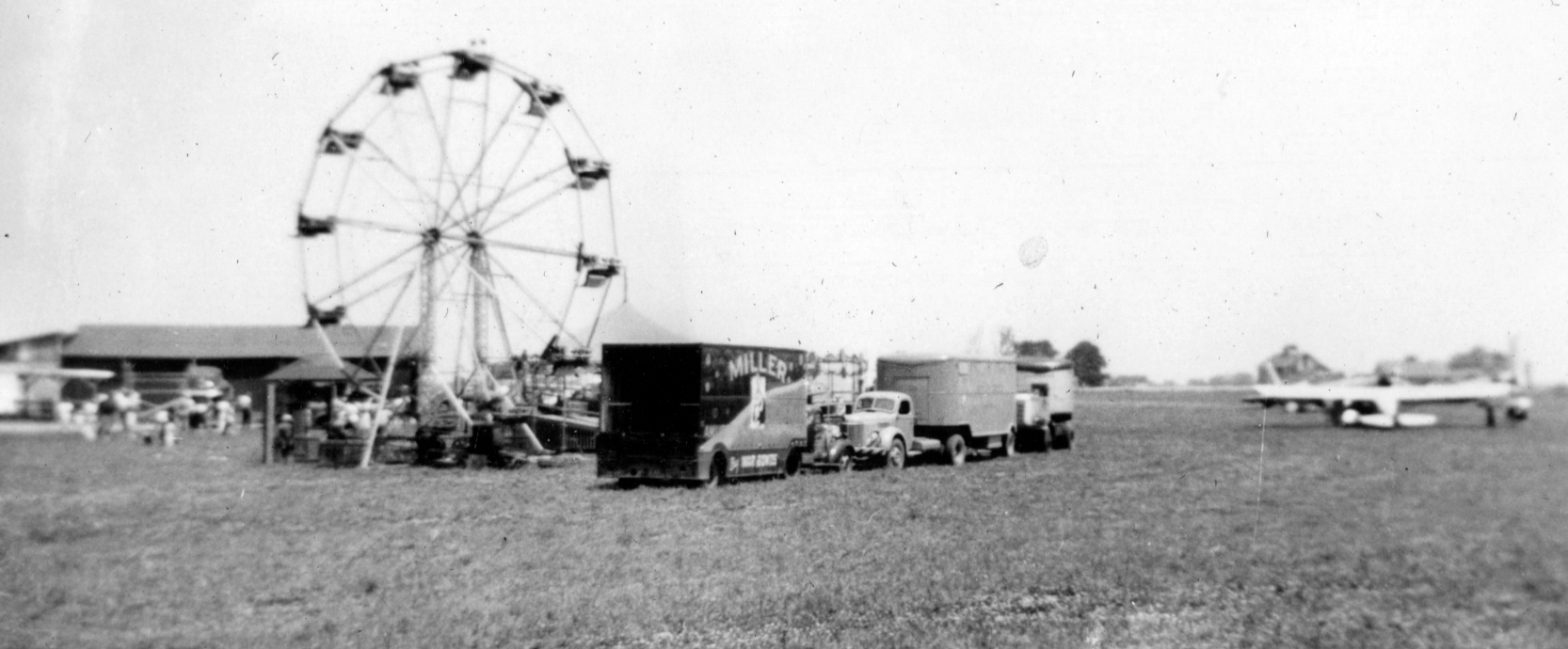
A 7/7/46 photo of a ferris wheel & several planes at carnival & airshow at Halsmer Airport (courtesy of David Parker).
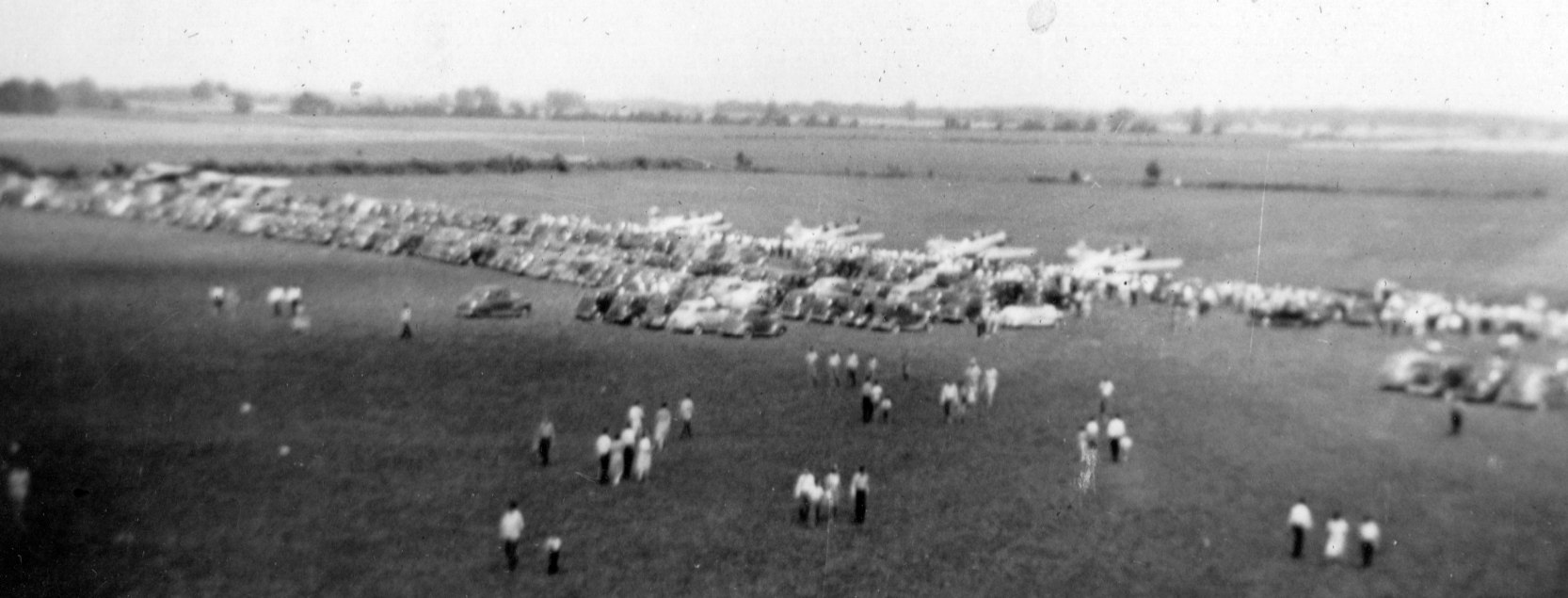
A 7/7/46 aerial view of a carnival & airshow at Halsmer Airport (courtesy of David Parker).
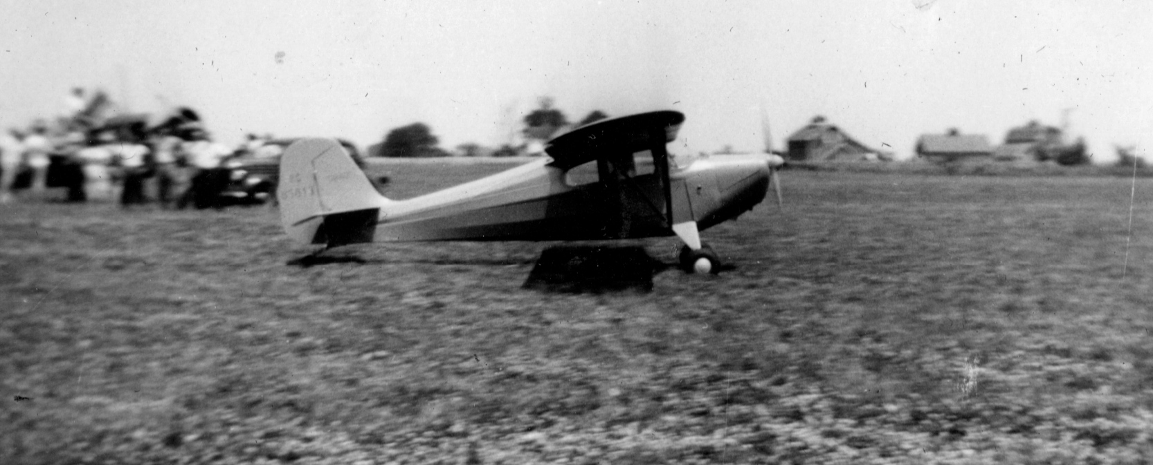
A 7/7/46 photo of an Aeronca Chief taxiing at Halsmer Airport (courtesy of David Parker).
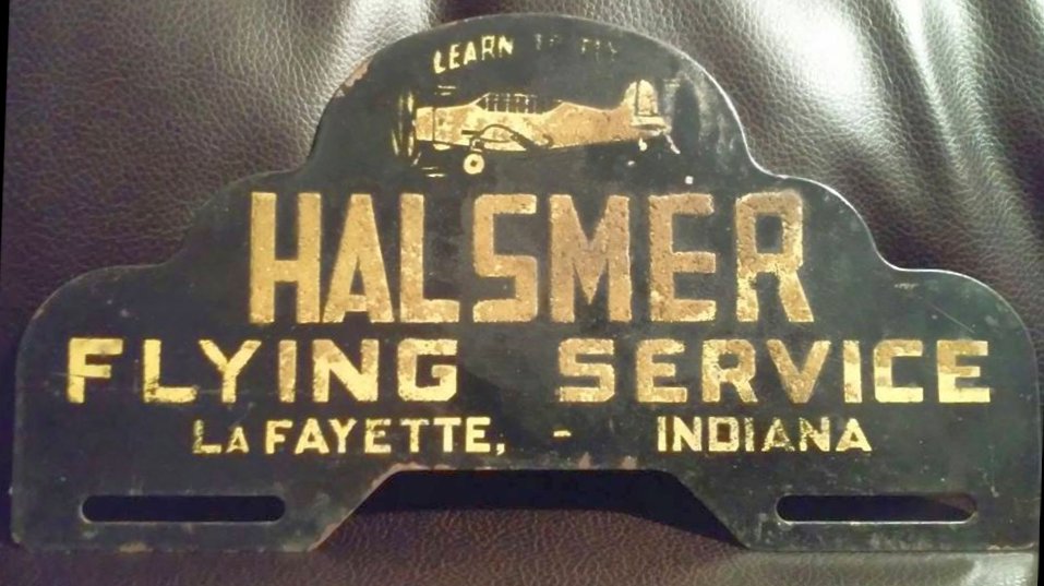
A 2019 photo by David Parker of a circa 1940s license plate frame promoting Halsmer Flying Service.
The November 1950 Chicago Sectional Chart depicted Halsmer Airport as having a 4,000' unpaved runway.
A 9/28/52 USGS aerial view depicted Halsmer Airport as having 2 unpaved runways.
The 1953 Flight Chart (courtesy of Scott O'Donnell) described Halsmer Airport as having a 4,000' runway.
Joseph Halsmer turned the airport into his personal workshop where he invented the Aero Car,
the Halsmer Safety Twin, and a push-pull airplane with fore & aft propellers.
He also claimed several records, including one for the fastest turbo-prop trans-Atlantic flight.
The 1960 Jeppesen Airway Manual (courtesy of Chris Kennedy)
depicted Halsmer as having a 4,000' paved Runway 3/21 & a 3,900' unpaved Runway 15/33,
along with several buildings along the west side of the field.
The 1962 AOPA Airport Directory described Halsmer Airport as having a 4,000' paved Runway 4/22 & a 3,900' turf Runway 13/31,
and listed the operator as Halsmer Flying Service.
Deborah King recalled, “Halsmer Airport had an active sailplane flying club.
I used to ride with either the tow pilot in a Super Cub, or in the Schweitzer 2-22.
The tow pilot was quite young, looked like a typical long-hair hippie of the late 1960s, and was actually a very skilled pilot.
You never would have guessed it by his appearance!”
A 1968 photo (courtesy of Bill Poynter) of Bill's Culver Cadet rounding a pylon during a pylon race for stock planes held at the Halsmer Airport.
Bill recalled, “I responded to a notice posted in Trade-A-Plane, and signed up to race.
There were 2 classes, one for planes with less than 100 HP & one for planes with over 100 HP.
The plane I had at the time was a Culver Cadet, which I figured would be competitive in the under 100 HP class.
The qualifying was on 8/18/68 with the races on August 24th & 25th, 1968.
None of the entrants had ever participated in a pylon race before. It was pretty scary.
A Mooney Mite with an 85HP engine came in 1st & I was 2nd in my Culver.”
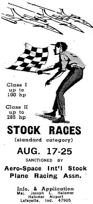
An advertisement for the 1968 air races held at Halsmer Airport (courtesy of Bill Poynter).
Note that the airplanes depicted in the advertisement were just a little bit more futuristic than the actual race planes!
The last aeronautical chart depiction which has been located of Halmser Airport was on the May 1970 Chicago Sectional Chart.
Halsmer was depicted as having a paved 3,900' northeast/southwest runway.
The last photo which has been located showing Halsmer Airport still open was an 11/8/76 USGS aerial view.
Only 1 runway was still active, with only traces of the northwest/southeast runway still visible.
The 1982 AOPA Airport Directory (courtesy of Ed Drury) described Halsmer as having a single 3,950' asphalt Runway 2/20.
The airfield status had also changed to a private facility, with the note, "Use at own risk."
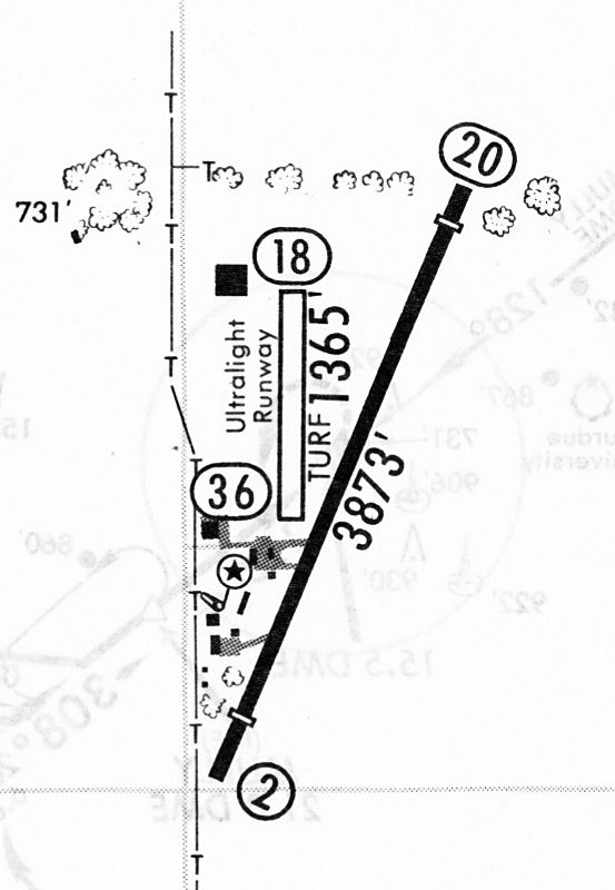
A 2/24/84 airport directory (courtesy of John Kielhofer)
depicted Halsmer as having a 3,873' paved Runway 2/20 & a 1,365' turf ultralight Runway 18/36,
along with several buildings along the west side of the field.
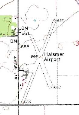
USGS topo map 1987.
According to USAF Lt. Col. Mark Bailey, "Halsmer closed in about 1988-90 to make room for the Subaru auto plant."
However, it was actually an adjacent site (to the south) on which the auto plant was built.
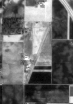
In the 1999 USGS aerial photo, the entire length of Halsmer's primary runway still remained, but was considerably deteriorated.
The airfield buildings had been removed from the former ramp area, southwest of the runway.
A 2006 aerial photo showed the majority of the pavement of the center portion of the former Halsmer Runway 3/21 still remained, although the north & south ends had been removed.
The former ramp area also remained as well. A building was built at some point between 1999-2006 at the north end of the runway.
A circa 2006 aerial view looking north showed the remains of of the Halsmer Airport runway, as well as the remains of the paved ramp.
A 6/13/15 aerial view by Rob Blue looking west showed the remains of of the Halsmer Airport runway.
A 2024 aerial photo showed the middle of the Halsmer Airport site had been covered at some point between 2015-2024 by a building of Caterpillar Logistics Services,
although portions of the traces of the runway remained.
The site of Halsmer Airport is located northeast of the intersection of E 200 S & S 500 E, just southwest of Interstate 65.
See also: http://www.blueskygirl.com/Crazy8/Crazy8/Bio/history2.html
____________________________________________________
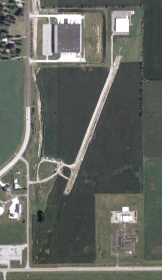
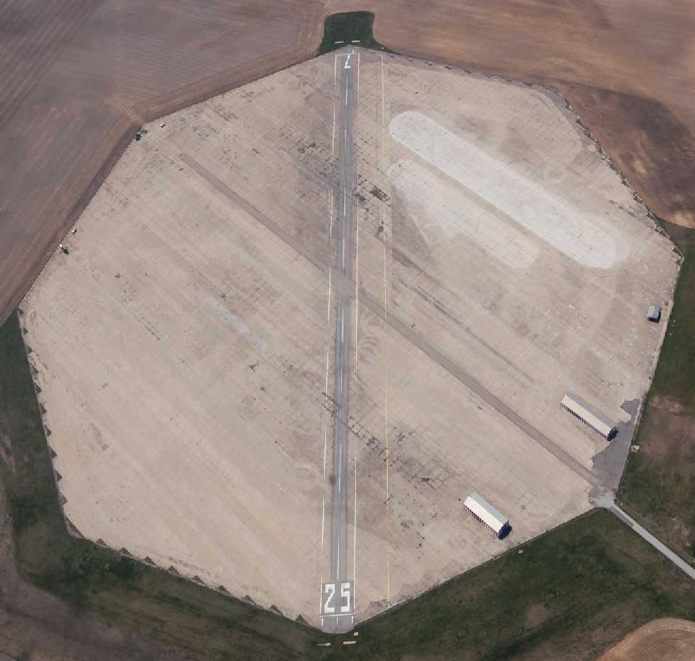
Bunker Hill Outlying Field #8 / Naval Outlying Field 11713 /
Converse Airport (1I8), Converse, IN
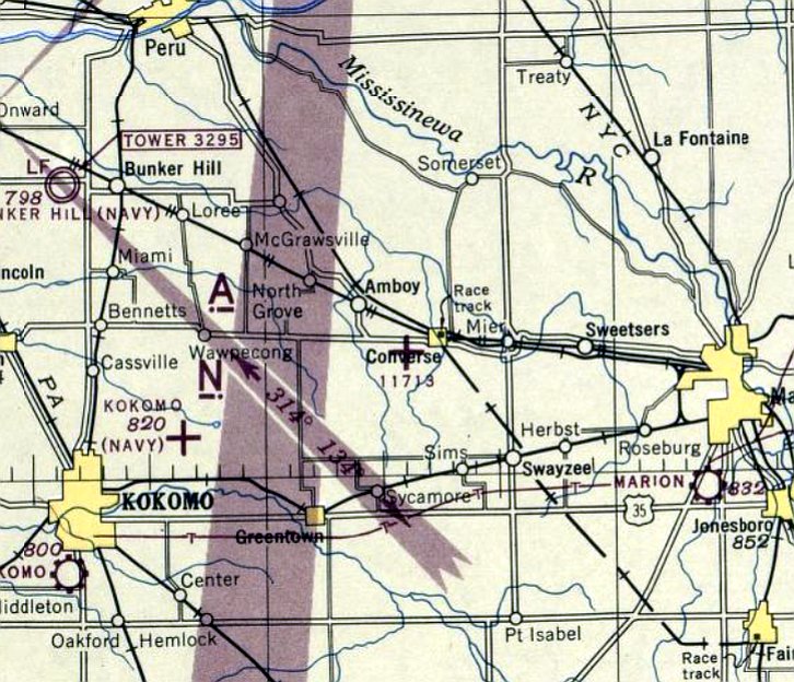
40.57, -85.89 (North of Indianapolis, IN)
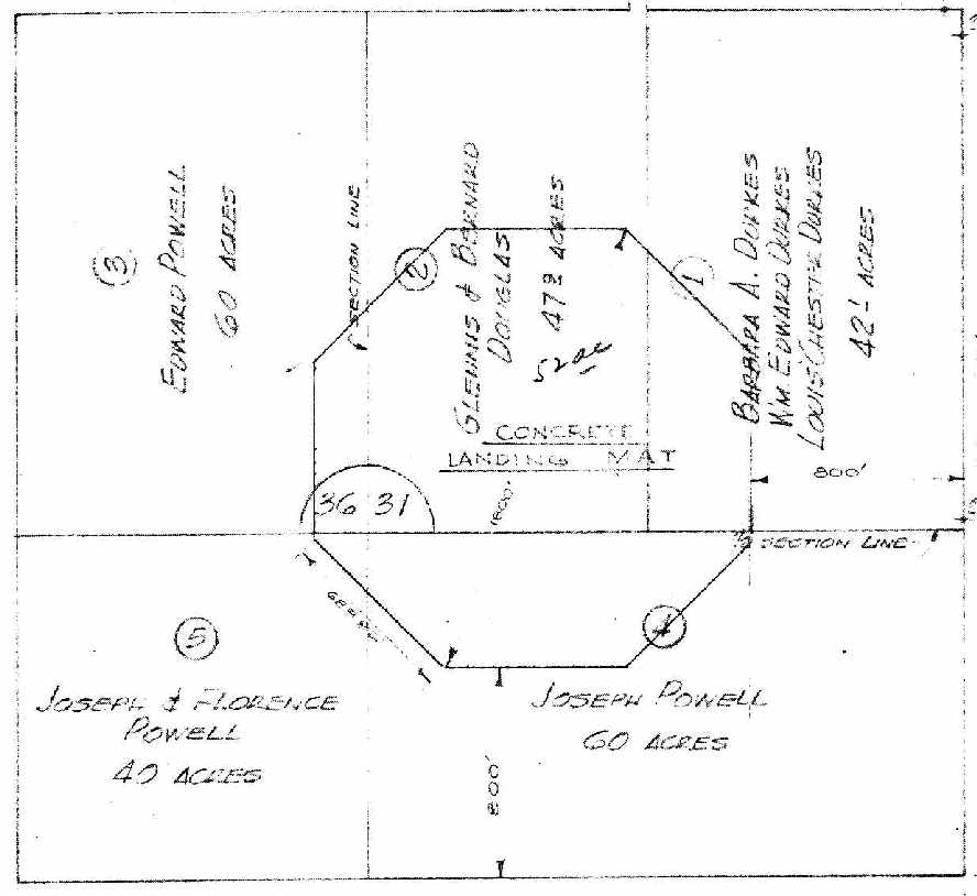
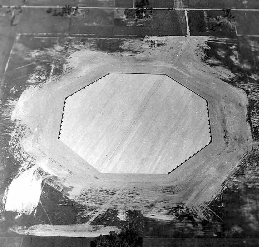
A 7/24/42 land acquisition map of “Auxiliary Landing Field #8” (National Archives, courtesy of Brian Rehwinkel).
This airfield was evidently constructed during WW2 as one of the 26 satellite airfields for Bunker Hill NAS
(which later became Grissom ARB), located a few miles to the northwest.
The date of construction of the airfield has not been determined.
No airfield at Converse was listed in the 1935 Air Pilots Register (courtesy of Michael Banks).
According to Brian Rehwinkel, this “site was leased for use as an outlying field for NAS Bunker Hill in mid 1942.
The site consisted of approximately 250 acres.”
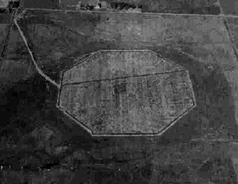
The earliest depiction which has been located of Outlying Field 11713
was a 7/24/42 land acquisition map of “Auxiliary Landing Field #8” (National Archives, courtesy of Brian Rehwinkel).
It depicted the field as a concrete octagon, measuring a maximum of 1,800' across, with no buildings.
This would appear to be the ideal airport layout -
permitting landings in any direction - never a crosswind!
Field 11713 was not yet depicted on the October 1942 Chicago Sectional Chart.
According to a January 1944 Navy memo, the concrete mat, with an 1,800’ all-way landing surface,
was added in the fall of 1943 at a cost of $492,546.
According to Brian Rehwinkel, “This was a rather unusual procedure for an Outlying Field
because the Navy made substantial improvements on land it did not own.
During WWII, the Navy generally owned the Outlying Fields
where substantial improvements were made such as concrete or asphalt surfaces.
For the many grass outlying fields, the Navy would simply lease the land & cancel the lease at the end of the war.”
The earliest photo which has been located of Outlying Field 11713
was a September 1943 aerial view looking north at the newly-constructed field (National Archives photo, courtesy of Brian Rehwinkel).
It depicted the field as a paved octagon, with no buildings.
According to Brian Rehwinkel, “The Navy eventually acquired the site (250 acres) through condemnation proceedings in early 1944.
One of the reasons given for the necessity of purchasing the property
was that it would cost the Navy less to buy the land for this field (and for Field 23008/Site 3)
than it would to remove the improvements before the leases were terminated.”
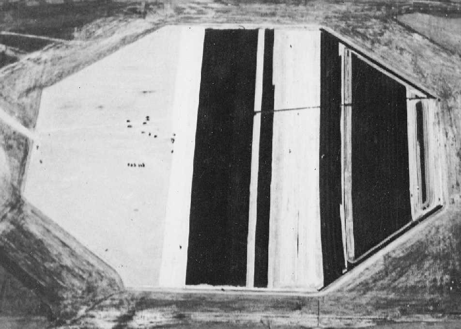
A 11/19/43 aerial view from the 1945 AAF Airfield Directory (courtesy of Scott Murdock)
depicted “Bunker Hill NAS Auxiliary (11713 Outlying Field #8)” as a paved octagon,
with no buildings visible.
The earliest aeronautical chart depiction which has been located of Outlying Field 11713 was on the April 1944 Chicago Sectional Chart.
It depicted "11713" as an auxiliary airfield.
The 1945 AAF Airfield Directory (courtesy of Scott Murdock) described “Bunker Hill NAS Auxiliary (11713 Outlying Field #8)”
as a 244 acre irregularly-shaped property within which was a 3,302' x 2,392' sod all-way field
containing a 1,800' nonreinforced concrete octagonal landing mat.
The field was not said to have any hangars,
to be owned by the U.S. Government, and operated by the Navy.
Outlying Field 11713 was apparently abandoned by the military at some point between 1945-46
(like the vast majority of the WW2 auxiliary airfields),
as it was not depicted at all on the 1946 Chicago Sectional Chart (courtesy of Chris Kennedy).
According to a 1947 War Assets Administration memo,
the 250 acre site was declared surplus by the Navy in 1947
and conveyed to the Town of Converse via quitclaim deed in November 1947.
The deed contained provisions that the town would continue to maintain the installation as a public airport.
At some point between 1947-53, it was reopened as a civilian airfield - Converse Airport.
The earliest depiction of Converse which has been located is on the 1953 Flight Chart (courtesy of Scott O'Donnell),
which depicted it as a civil airfield with a 1,600' hard surfaced landing area.
The 1962 AOPA Airport Directory described the runway configuration as "all-way landings, 52 acre concrete slab",
but included the note, "Emergency use only."
Dave Greene recalled in 2004, "I have many fond memories of my father Pat & I going there
so he could fly his model airplanes.
They even had some major regional model airplane shows there in the 1970s.
I don't ever actually recall seeing a real airplane there, but the RC guys were then allowed to use it.
When I was there in the 1970's there was an old small wood building (large shed basically), but nothing else,
the Octagon was barren, not a building on it.
Those 2 buildings went up sometime in the late 1980's I think,
and I am pretty sure they are hangars, as there is now some activity there by private pilots.
Paul Ruley recalled, "Converse is where I taught [Pat Greene] his short field take-off & landings when he was my student.
It gives the student more appreciation of just what I am having him to accomplish.
The pad is not a true 360º airport.
There is a drainage tile running north & south through the field
and is covered with wood blocks spaced a distance apart.
The aircraft could cross it, but you would want a wheel running along it as it would tend to jar your fillings loose."
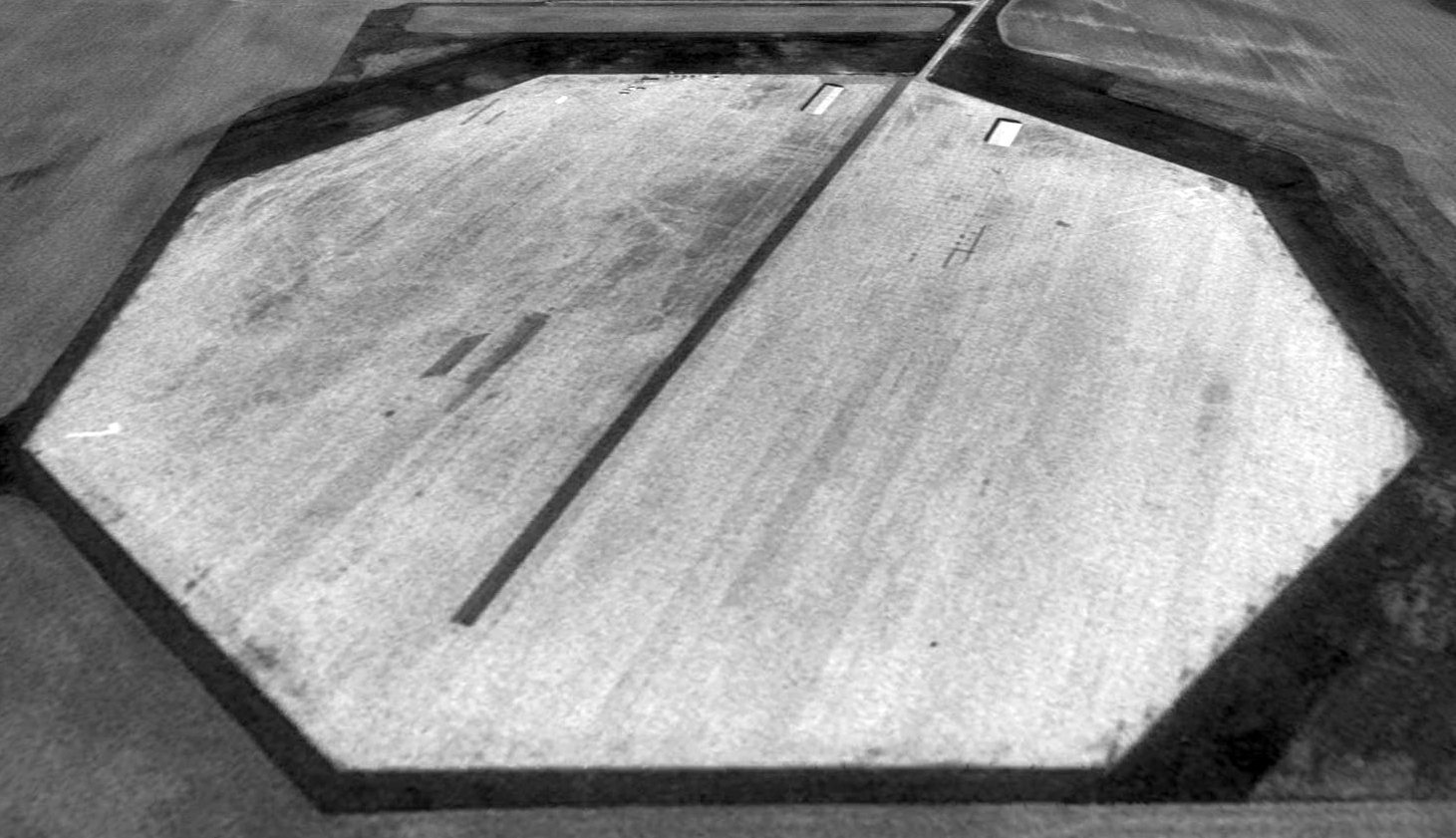
A 1998 USGS aerial view looking north showed a postwar runway painted across the concrete landing pad at Converse.
The airfield is still used as a general aviation airport, Converse Airport.
Published data in the Airport Facility Directory indicates that 5 aircraft are currently based at the field.
Max Reed (local resident & former Grissom AFB pilot) reported in 2007, “The Converse field remains in use
and was referred to in the PBS special about the attempts to fly replicas of the Wright Brothers original plane
in celebration of the 100 -year anniversary of the 1st flight.
A man named Buford Gross from Peru had built a Wright Flyer
and was wanting to prove it airworthy but had trouble getting permission from the FAA to do so.
At the last minute, some friends helped him take it out to Converse
and he attempted to get it off the ground but didn't have enough power.
Other groups were more successful, but fudged a bit with modern powerplants.
Buford's was a hand-built replica of the actual Wright Brothers engine.”
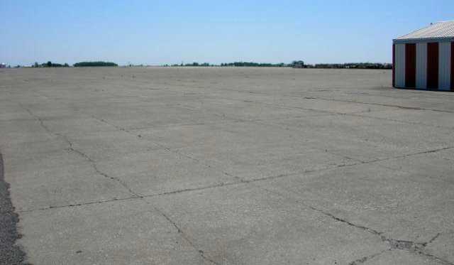
A 2007 photo by Patrick Long looking out across the concrete landing pad at Converse.
A 2010 aerial view by Bob McKenzie looking southwest at Converse Airport.
A 2010 aerial view by Bob McKenzie on final approach to Converse Airport.
Bob reported, “Converse was in much better condition than we expected.
The runway is well maintained & we landed our 182 without difficulty.
The airport is relatively deserted, but there are 6-8 T-hangars in excellent repair - all are secured & appear to contain aircraft.
An RC club uses a groomed portion of the field adjacent to the airport.
The RC club has a picnic shelter & several tables set up.”
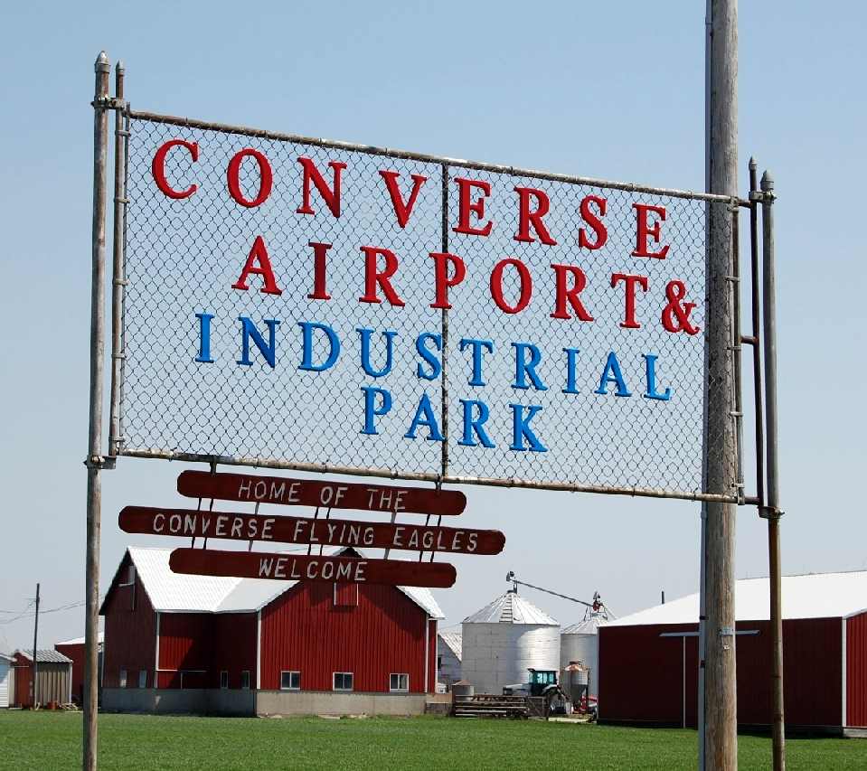
A 2010 photo by Bob McKenzie of the sign for the Converse Airport & Industrial Park, “Home of the Converse Flying Eagles”.
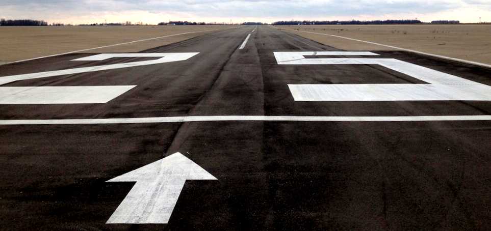
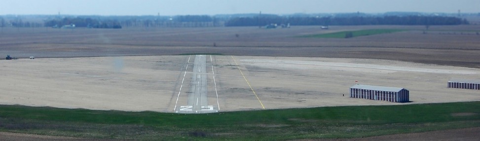
An 11/4/12 photo by Tom Townsend looking along Converse's Runway 25. Tom reported, “The octagonal pad is still there & in pretty good shape.”
An 11/4/12 photo by Tom Townsend of “The east building at the airfield.”
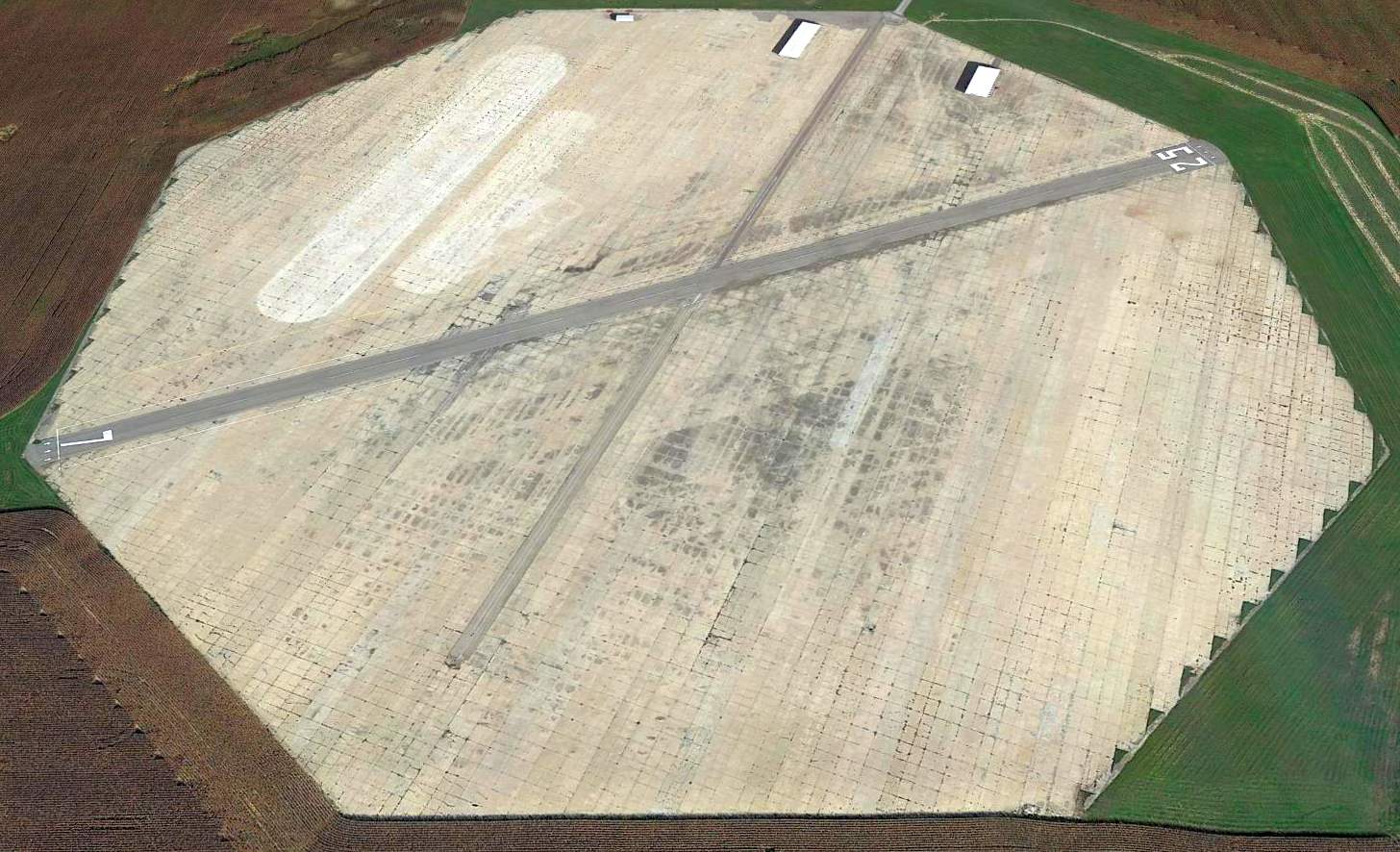
A 2014 aerial view looking north showed a postwar runway painted across the concrete landing pad at Converse.
There is another nearby auxiliary field with the same configuration at Galveston, IN (see entry below).
Thanks to Roger Johnson for pointing out this airfield.
____________________________________________________
Bunker Hill Outlying Field #3 / Naval Outlying Field 23008 /
Galveston Airport (5I6), Galveston, IN
40.586, -86.252 (North of Indianapolis, IN)
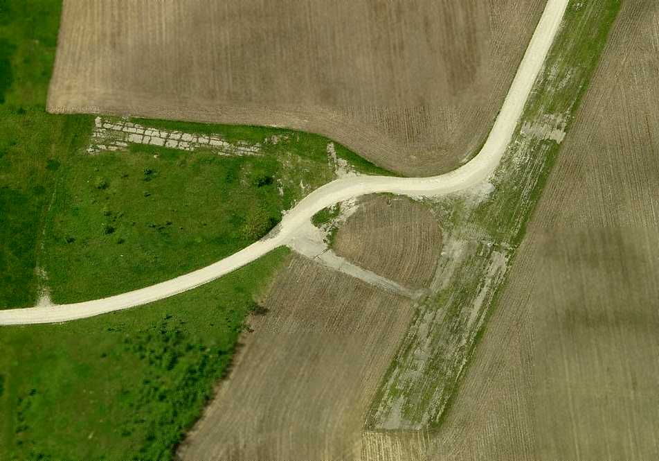
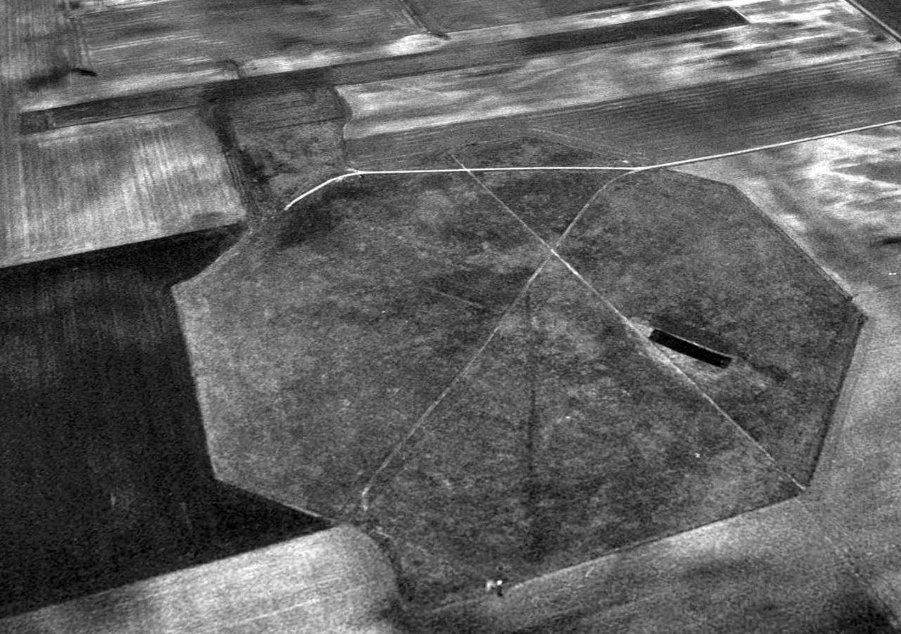
An 8/6/43 U.S. Navy aerial view looking north at Field # 23008 during the construction of its landing mat (from the National Archives, courtesy of Brian Rehwinkel).
Brian Rehwinkel reported, “This field was one of the 19 or so outlying fields
leased for use by Naval Reserve Aviation Base (NRAB) Peru [located a few miles to the northeast, and later to be redesignated NAS Bunker Hill].
The field was first leased in mid 1942 (late spring or early summer).
The Navy leased 274 acres from several landowners for about $4,500 / year.
Field # 23008 (#3), along with Field # 11713 (#8) were two of the Bunker Hill fields chosen by the Navy to received hard-surface runways.
The Navy had concerns when the fields were first leased about the effect the weather would have on the continuous use of these fields.
However, it was not until fall 1943 that these 2 fields received hard-surface runways.”
Field 23008 was not yet depicted on the October 1942 Chicago Sectional Chart.
The earliest depiction which has been located of the Galveston airfield
was an 8/6/43 U.S. Navy aerial view looking north at Field # 23008 during the construction of its landing mat (from the National Archives, courtesy of Brian Rehwinkel).
Brian observed, “It is apparent the seal coat (asphalt in this case) is being applied.
The paving for Field # 23008 was completed in August or September 1943.”
Brian continued, “The field near Galveston had an asphalt mat.”
The Navy listing of OLFs for NAS Bunker Hill described the mat for Field #3
as being a “stabilized crushed rock landing mat with black top seal, 1,800’ major axis, octagonal.”
Brian Rehwinkel reported, “Interestingly enough, the Navy saved a bunch of money by using asphalt for this field.
According to a 1/22/44 Navy memo (from the Bureau of Aeronautics to the Vice Chief of Naval Operations requesting endorsement to buy the land for the 2 fields),
Field #8 (concrete) cost about $492,000 to pave & Field #3 (asphalt) cost the Navy about $147,000.
The land for Field #23008 / #3, although originally leased by the Navy, was eventually purchased.
Just as with Field #11713 / #8, the Navy realized it would cost less to purchase the property than it would to remove the improvements when the leases ended.
One can only imagine what it would have cost to remove 50 or 60 acres of asphalt and crushed rock.”
An 11/19/43 aerial view looking north at “Bunker Hill NAS Auxiliary (23008 Outlying Field #3)”
from the 1945 AAF Airfield Directory (courtesy of Scott Murdock).
It depicted the field as a paved octagon, with no buildings visible.
This airfield has the same unusual configuration as the nearby Converse Airport:
the landing area consists of an octagon, 1,800' in diameter.
The earliest aeronautical chart depiction which has been located of the Galveston airfield was on the April 1944 Chicago Sectional Chart.
It depicted Outlying Field "23008" as an auxiliary airfield.
The 1945 AAF Airfield Directory (courtesy of Scott Murdock) described “Bunker Hill NAS Auxiliary (23008 Outlying Field #3)”
as a 272 acre irregularly-shaped property within which was a 3,563' x 3,334' sod all-way field
containing an 1,800' blacktop octagonal landing mat.
The field was not said to have any hangars,
to be owned by the U.S. Government, and operated by the Navy.
Outlying Field 23008 was apparently abandoned by the military at some point between 1945-46
(like the vast majority of the WW2 auxiliary airfields),
as it was not depicted at all on the 1946 Chicago Sectional Chart (courtesy of Chris Kennedy).
At some point between 1946-53, it was reopened as a civilian airfield - Galveston Airport.
The earliest depiction of Galveston which has been located is on the 1953 Flight Chart (courtesy of Scott O'Donnell),
which depicted it as a civil airfield with a 1,700' hard surfaced landing area.
The 1962 AOPA Airport Directory described the runway configuration
as being 2 bituminous 1,600' runways: 4/22 & 13/31.
Max Reed (local resident & former Grissom AFB pilot) recalled,
“The Galveston field appeared to have been not so well built or not so well maintained
and was grown up with weeds through the concrete when I visited it in the 1980s & was unusable.”
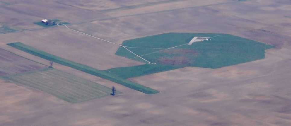
A 1998 aerial view looking northwest at Galveston Airport & the adjacent postwar grass runway.
According to Marty Catron (who lives near Galveston),
"The building at the north east corner of the property is a small building used by the local radio-controlled airplane club.
They have even restored a small bit of the old runway for their own use.
A local farmer keeps the grass and weeds mowed that have grown through the cracked asphalt over the years.
He told me they had planned to return it to tillable soil, but when they probed it, it was about four feet thick!
Another one was built near Greentown, IN,
but had been returned to tillable soil sometime in the 1960's or 1970's."
Galveston Airport is still listed as an active general aviation field,
but flying operations are conducted from an adjacent 2,700' grass runway.
The concrete octagon runway area has apparently been abandoned.
A 2010 aerial view by Bob McKenzie looking northeast at Galveston Airport.
Bob remarked that “Galveston was... overgrown with an adjacent grass runway that appears to be usable.”
Brian Rehwinkel remarked in 2010 of the Converse & Galveston airfields, “It is pretty amazing both of the fields survive 67 years after they were built.
Obviously, the concrete field has remained in better shape, but even the shape of Field # 23008 is still very apparent.
Apparently, the crushed rock base of this field has allowed the shape of the mat to survive well after the top coat of asphalt failed.”
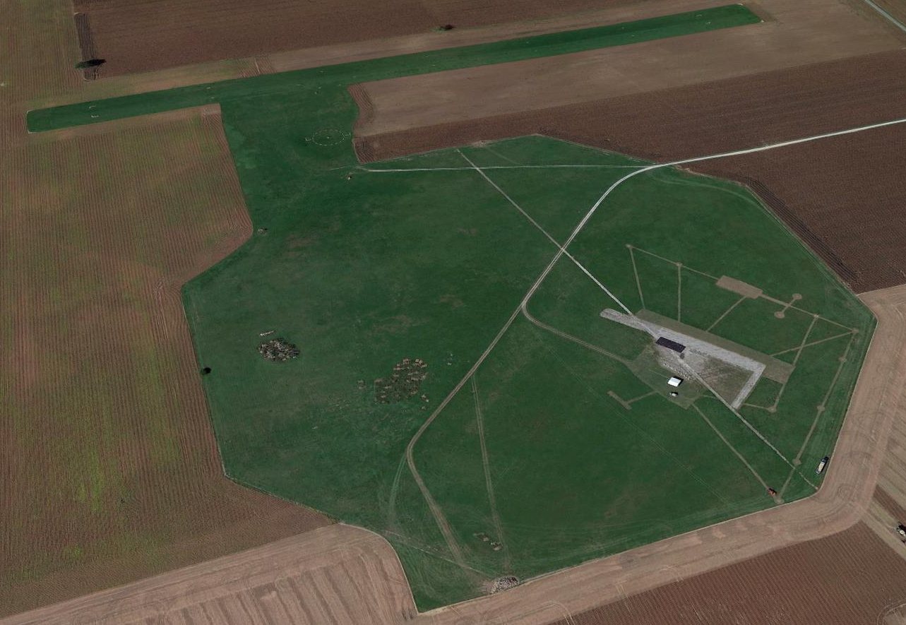
A 2014 aerial view looking northwest at Galveston Airport & the adjacent postwar grass runway.
The facilities of the radio-controlled model aircraft club are visible over the former airfield octagon.
Thanks to Roger Johnson for pointing out this airfield.
____________________________________________________
Or if you prefer to contact me directly concerning a contribution (for a mailing address to send a check),
please contact me at: paulandterryfreeman@gmail.com
If you enjoy this web site, please support it with a financial contribution.
____________________________________________________
This site covers airfields in all 50 states.