Abandoned & Little-Known Airfields:
Louisiana: Western New Orleans area
© 2002, © 2026 by Paul Freeman. Revised 2/15/26.
This site covers airfields in all 50 states: Click here for the site's main menu.
____________________________________________________
Please consider a financial contribution to support the continued growth & operation of this site.
Westwego Airport & Seaplane Base (added 10/11/23) - Wedell-Williams Airport / New Orleans Airport / Naval Outlying Landing Field 22508 (revised 2/15/26)
____________________________________________________
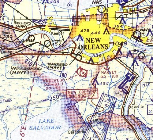
Westwego Airport & Seaplane Base, Westwego, LA
29.884, -90.138 (South of New Orleans, LA)
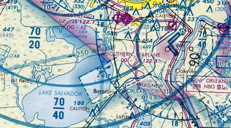
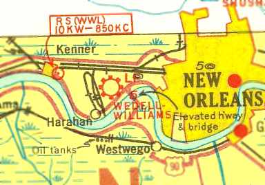
Westwego Airport & Seaplane Base, as depicted on the 1965 New Orleans Sectional Chart.
According to the legal case “YATES III v. ELMER ABC”, “Charles Elmer purchased this property in the 1950s.”
Westwego Airport was not yet depicted on the 1961 New Orleans Sectional Chart.
The legal case continued, “In 1964, Elmer drained part of the property to construct the Westwego Airport, his privately owned seaplane airport & its seaplane canal.
He used the dirt from the canal excavation to increase the elevation of the land around the airport, forming an elevated plateau above the swampy wetlands.
A flood gate was also constructed at the southern end of the seaplane canal.
The land on the seaplane or eastern side of the canal was higher than the west side. Victory Drive provided access to the property over the Northern levee.
That gap was routinely sandbagged by the City of Westwego during high water threats.”
The earliest depiction which has been located of Westwego Airport was on the 1965 New Orleans Sectional Chart.
It depicted Westwego Airport as having a 3,300' unpaved runway, with a 6,200' seaplane lane adjacent to the east.
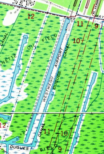
The earliest topo map depiction which has been located of Westwego Airport was on the 1965 USGS topo map.
It depicted Westwego Airport as a northeast/southwest unpaved runway on a narrow strip of land, with canals on both sides, and a few small buildings on the northeast side.
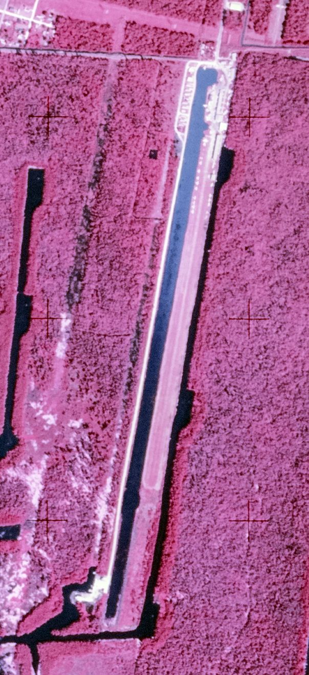
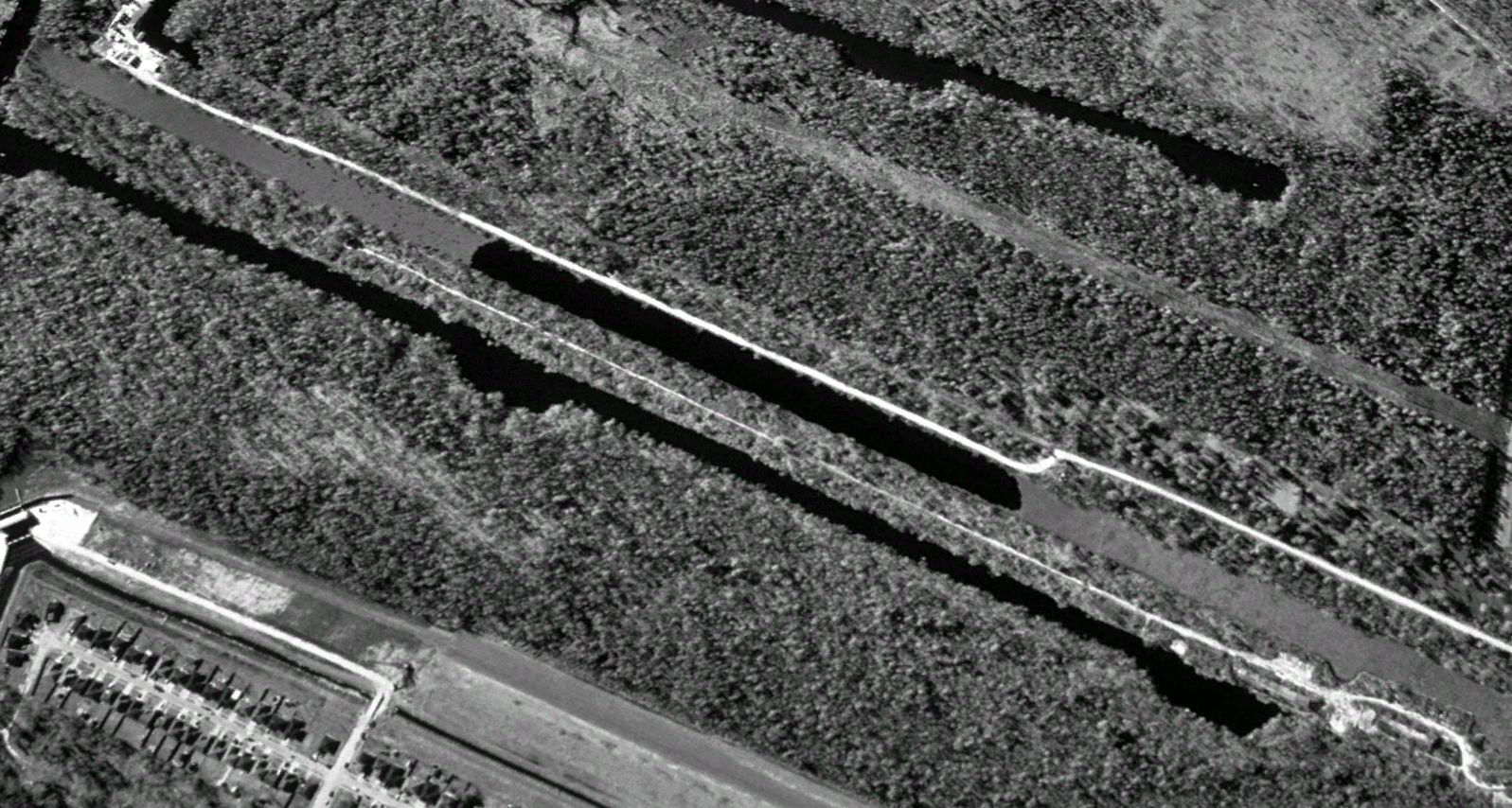
The earliest photo which has been located of Westwego Airport was a 1969 USGS false-color aerial photo.
It depicted Westwego Airport as a northeast/southwest unpaved runway on a narrow strip of land, with canals on both sides, and a few small buildings & at least 20 light aircraft on the northeast side.
The legal case continued, “Sometime in the 1960s or early 1970s, the Elmer family established a trailer park on the west side of the seaplane canal.
Around that time, a ditch was dug along the western edge of the trailer park & the excavated dirt used to build a raised embankment along that side of the trailer park.”
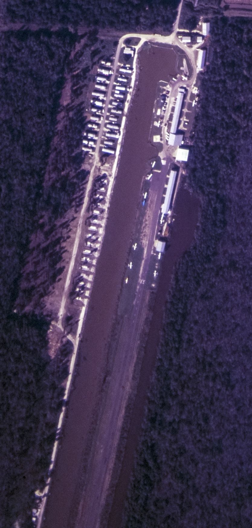
The last photo which has been located showing Westwego Airport in operation was a 1972 USGS aerial view.
The number of aircraft visible on the field had been reduced somewhat to 13.
The legal case continued, “At some point before 1985, someone, most likely the Elmer family, constructed a culvert through the Northern levee to drain water from the trailer park into the Forty Arpent Canal.
Thus, by 1985, the property around the commercial areas had been drained, the dirt used to elevate the property above the surrounding wetlands,
a drainage ditch with a raised embankment (spoil bank or levee) along west side of the trailer park constructed, a culvert built under the existing levee to drain rainwater from the trailer park,
and a flood gate control at the south end of the seaplane canal installed. The property was annexed to the City in 1967. For many years, both of the businesses thrived.”
The last aeronautical chart depiction which has been located of Westwego Airport was on the December 1983 New Orleans Sectional Chart.
It depicted Westwego Airport as having a 2,800' unpaved runway.
In contrast to the 1965 Sectional, it depicted the 6,200' seaplane lane on the opposite (west) side.
The legal case continued, “In 1985, Hurricane Juan struck the area causing severe flooding in Westwego. The hurricane caused some flooding on the Elmer property, but it was minor and the land drained fairly quickly.
Following the disaster to the Westwego residential areas, the Defendant began in earnest to implement a federal levee protection system by raising, repairing, and improving the levees.
In 1985-86, the Defendant repaired & raised the Northern & W-L levees to 6'. In 1986, interim levees were built behind the original Westwego and W-L levees.
In 1986, following numerous studies, discussions and negotiations, the Defendant & the Parish of Jefferson (the Parish)
accepted a proposed federal alignment (Modified Alternative Alignment E) for the Federal Hurricane Protection Levee, the permanent levee system.
The federal alignment basically followed the original levee alignment, but was set back 150-200 feet from the original & interim levees.
In 1987, the Defendant expropriated the properties on either side of the Elmer property for this purpose, but bypassed Elmer's land.
In 1989, Elmer's insurance agent informed him that the new levees would eventually cause the airport to flood.
Elmer closed the Westwego Airport, because he could no longer afford insurance on the property.”
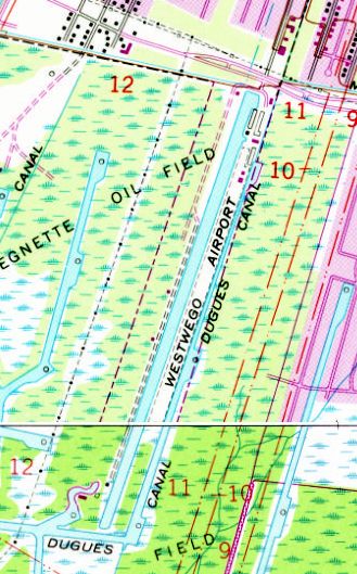
The last topo map depiction which has been located of Westwego Airport was on the 1989 USGS topo map.
It depicted Westwego Airport as a northeast/southwest unpaved runway on a narrow strip of land, with canals on both sides, and a few small buildings on the northeast side.
The legal case continued, “In April 1991, unusually heavy spring rains & winds forced water from the surrounding wetlands & bayous onto the property & up against the Northern levee causing severe flooding in the trailer park.
As a result, Elmer closed the trailer park in 1991.”
A 1998 aerial view looking southwest showed Westwego Airport after its closure, with all the buildings having been removed, and the runway overgrown.
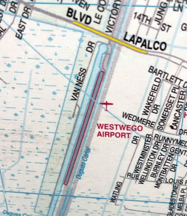
Westwego Airport was still depicted on a 1999 street map (courtesy of Maurice Trosclair), even though it had been closed for a decade by that point.
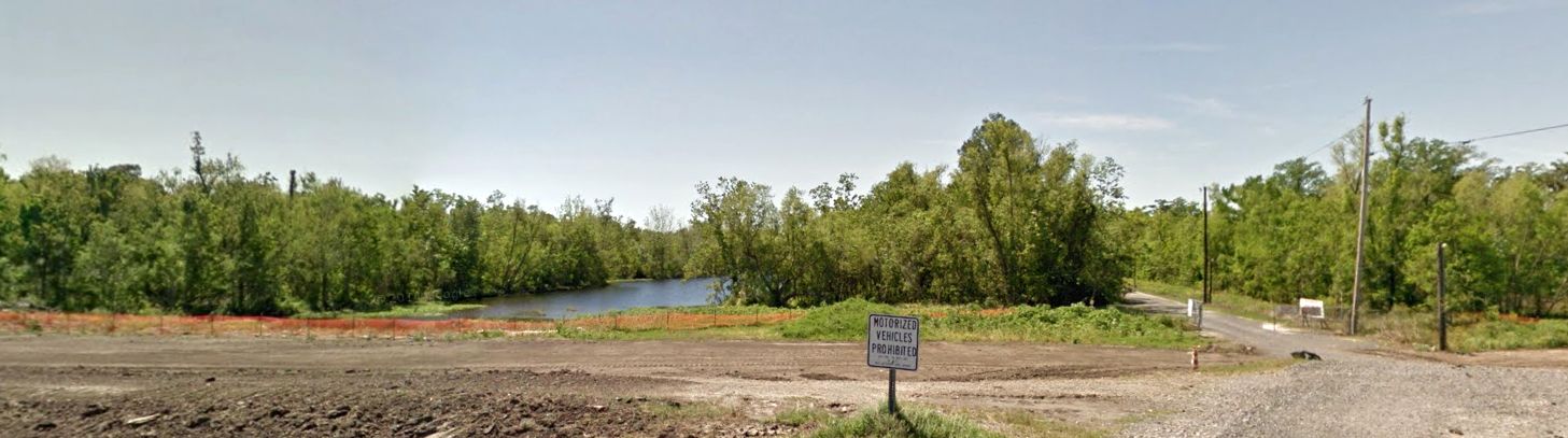
A 2011 photo looking south at the former Westwego Airport entrance.
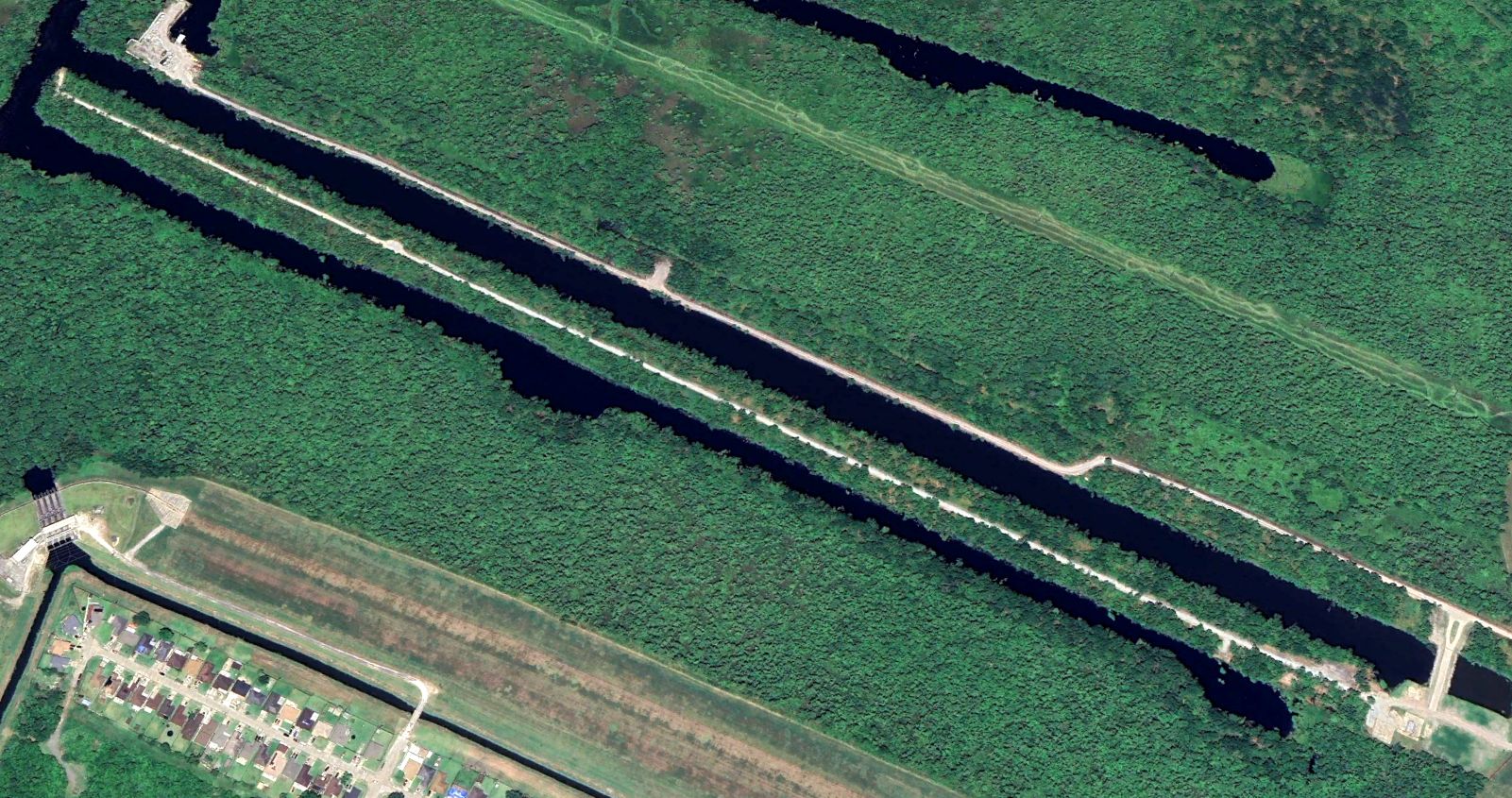
A 2023 aerial view looking southwest showed the site of Westwego Airport to remain intact though overgrown.
Thanks to Maurice Trosclair for pointing out this airfield.
____________________________________________________
Wedell-Williams Airport / New Orleans Airport / Naval Outlying Landing Field 22508, New Orleans, LA
29.951, -90.186 (West of Downtown New Orleans, LA)
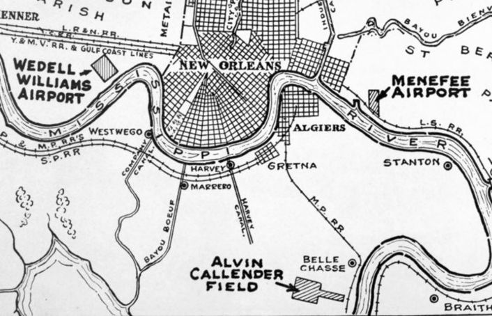
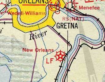
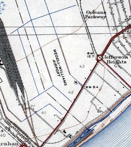
Wedell Williams Airport, as depicted on a 1929 New Orleans Association of Commerce map.
The Wedell-Williams Air Service operated flights between New Orleans & their facility in Patterson, LA.
In 1930 they established the Wedell-Williams Airport, according to a historical plaque erected at the site in 1990.
The earliest depiction which has been located of Wedell-Williams Airport was on a 1929 New Orleans Association of Commerce map.
The earliest directory reference to the Wedell-Williams Airport which has been located
was in the September 1931 Commerce Department Descriptions of Airports & Landing Fields (according to David Brooks).
It described Wedell-Williams Airport as a commercial airport consisting of an iregularly-shaped 142-acre sod field.
The field was said to have 2 runways, with the longest being 2,600'.
The earliest photo which has been located of Wedell-Williams Airport was an August 1933 aerial view (courtesy of John Anderson, Director of LSU's Cartographic Information Center).
It depicted Wedell-Williams Airport as having an unusual angled outline with an oval outline following the angled shape, and at least 2 aircraft visible near a single small hangar on the east side.
The earliest aeronautical chart depiction which has been located of Wedell-Williams Airport was on the 1934 Navy Aviation Chart V-242 (courtesy of Chris Kennedy).
Wedell-Williams Airport, as depicted on the 1935 New Orleans Sectional Chart.
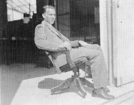
An undated photo of Raymond Braud at the Wedell-Williams Airport.
According to Vincert Caire (author of Louisiana Aviation: An Extraordinary History in Photographs),
“Braud was the airport manager there & remained until Wedell-Williams was purchased by Eastern in 1936”.
By 1936 both founders of the Wedell-Williams company had died in air crashes, according to a historical plaque erected at the site in 1990.
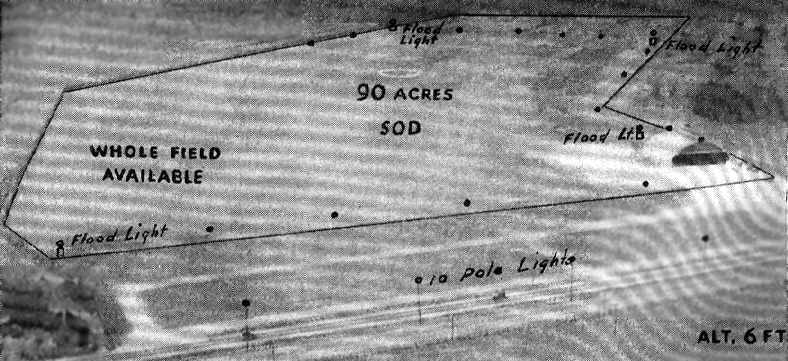
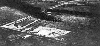
An undated aerial view looking north at the “New Orleans” Airport from The Airport Directory Company's 1937 Airport Directory (courtesy of Bob Rambo).
It described the field as a commercial airport, located 4 miles west of the center of New Orleans, and situated only 6 feet above sea level.
The field was said to consist of a 90 acre rectangular sod field. The photo showed what could have been a single building on the east side of the field.
The 1938 USGS topo map (courtesy of John Anderson) depicted Wedell-Williams Airport as having an irregularly-shaped outline
(which followed the section lines which all make a dog leg in that area due to being based on the Mississippi River banks), and having a single small building on the east side.
A circa 1930s photo of a biplane in front of the Wedell-Williams Airport hangar.
According to Brian Rehwinkel, “Two 65’ x 65’ metal hangars [were] built in 1941.”
During the Second World War, Wedell-Williams was used by the Navy as an auxiliary field to support flight training operations at NAS New Orleans.
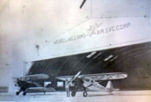
A circa 1940s photo of a biplane & monoplane in front of a hangar marked “Wedell-Williams Air Svc. Corp.”
According to Brian Rehwinkel, “The Navy began using the field in 1942 after the US Government used (according to Navy documents) a rather unconventional way of acquiring use of the field.
In May 1942, the use of the 90 acres was condemned for a period ending 11/1/45 (the land was leased)
and all of the structures & improvements on the property were taken (bought) by the government.
So, the title to the land remained in the hands of the original owners (with the government having use of the property)
and all of the structures & any improvements (including the 2 metal hangars) became government property.
According to Navy documents created in preparation for acquiring this field, the land was owned by the Illinois Central Railroad & leased to the New Orleans Air College.”
A 5/20/43 aerial view looking west from the 1945 AAF Airfield Directory (courtesy of Scott Murdock)
depicted “New Orleans NAS Auxiliary (22508 Wedell-Williams Outlying Field)” as an open grass area.
The last photo which has been located showing Wedell-Williams Airport still in operation
was a 3/9/44 USN aerial view (from the National Archives, courtesy of Brian Rehwinkel).
It depicted Wedell-Williams Airport as having a hangar on the southeast side, and 3 grass runways marked on the northwest side.
A single-engine biplane was visible as just having taken off, visible over the northeast end of the southwest/northeast runway.
The April 1944 US Army/Navy Directory of Airfields (courtesy of Ken Mercer)
indicated that the Wedell-Williams Airport conducted Navy flight operations.
The field was said to be located 5.5 miles west of New Orleans, and to have a 3,800' unpaved runway.
The June 1944 New Orleans Sectional Chart (courtesy of Chris Kennedy)
labeled Wedell-Williams as “22508”, indicating that it was being used as a satellite airfield to support flight operations at NAS New Orleans,
and the numbering indicated that this field was located 225 degrees from the parent airfield, at a distance of 08 miles.
According to Brian Rehwinkel, “The Navy used the field until sometime before September 1994 when it was determined the field was no longer needed by the Navy.
A 9/15/44 photo indicates the field was probably not be used any longer, as most of the field marking you see in the March photo are no longer present.”
The 1945 AAF Airfield Directory (courtesy of Scott Murdock) described “New Orleans NAS Auxiliary (22508 Wedell-Williams Outlying Field)”
as a 118 acre rectangular property containing a 3,210' x 2,057' all-way sod landing area.
The field was said to have two 65' square metal hangars, to be owned by the U.S. Government, and operated by the Navy.
The last aeronautical chart depiction which has been located of Wedell-Williams was on the January 1945 Beaumount Sectional Chart.
It depicted Wedell-Williams as an auxiliary airfield.
Wedell-Williams evidently closed in early 1945, as it was no longer depicted on the July 1945 Beaumont Sectional Chart.
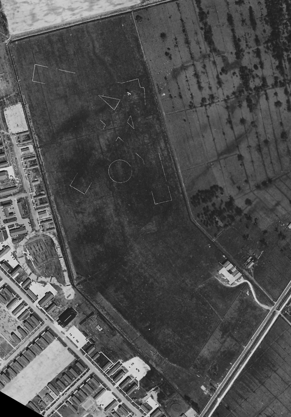
A November 1945 aerial photo (courtesy of John Anderson) of Wedell-Williams Airport.
John Anderson noted, it “shows the area as still open land but has no obvious evidence of aero operations.”
What were the 3 large circular formations that had been added to the airport property?
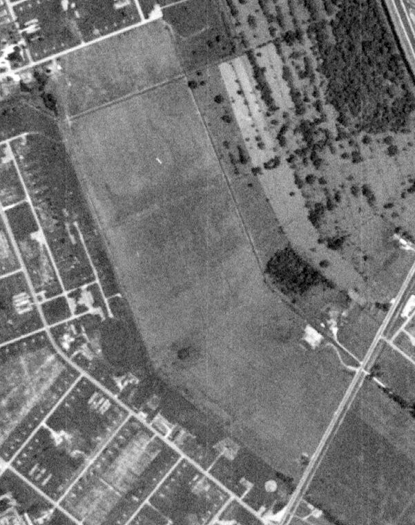
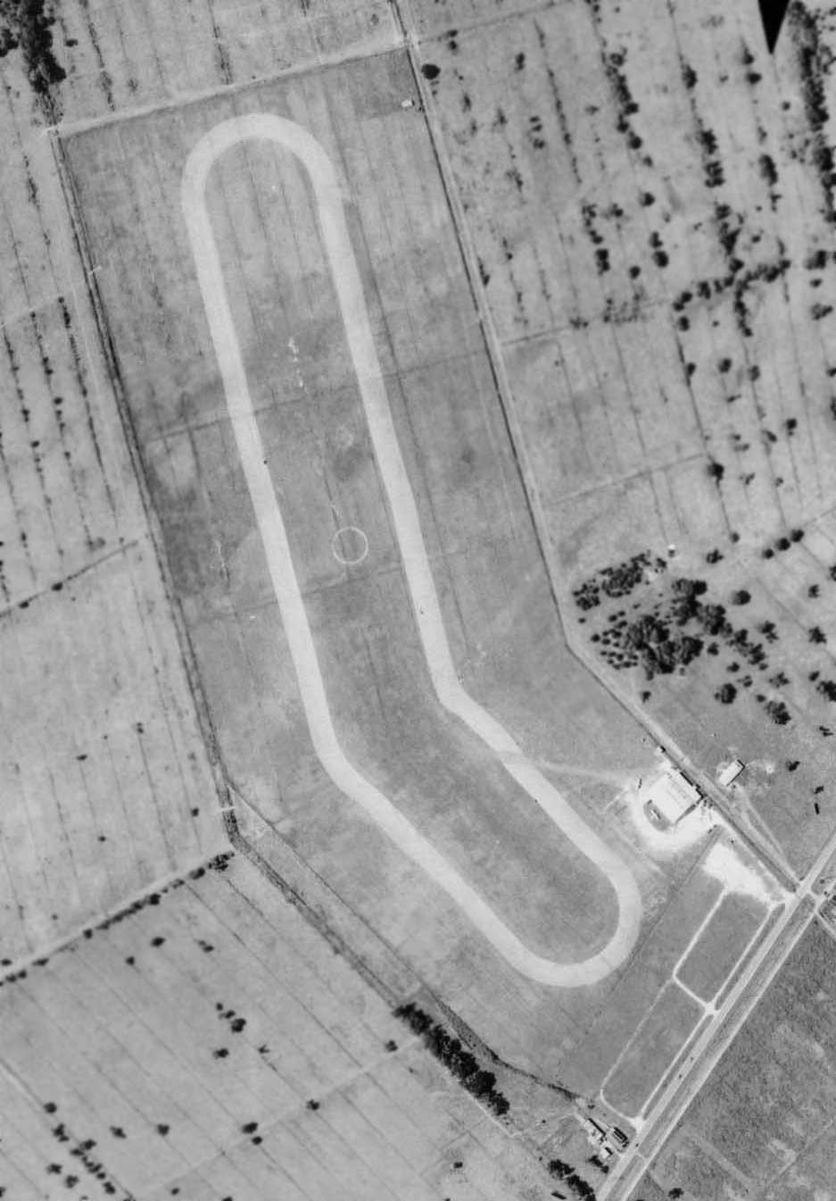
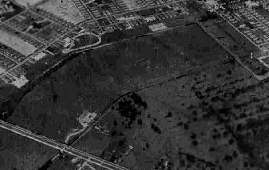
A 1952 aerial photo showed the Wedell-Williams hangar had been removed at some point between 1945-52, but the airfield was otherwise clear.
The 3 circular features previously seen in the 1945 photo had been removed.
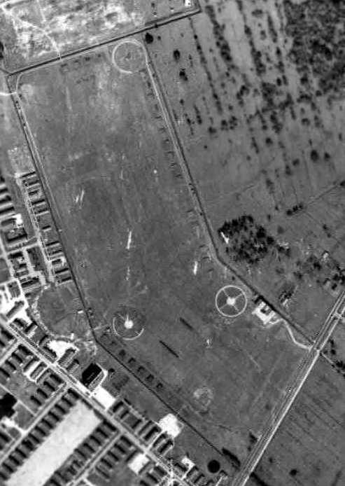
A 1964 aerial photo showed 2 large industrial buildings had been built on the southeastern part of the Wedell-Williams Airport site,
but the northwestern portion remained a clear grass field.
A historical plaque was erected at the site of Wedell-Williams Airport in 1990.
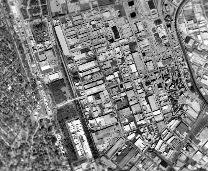
The 2002 USGS aerial photo shows the Wedell-Williams Airport site to have been densely redeveloped, with no recognizable trace of the former airport.
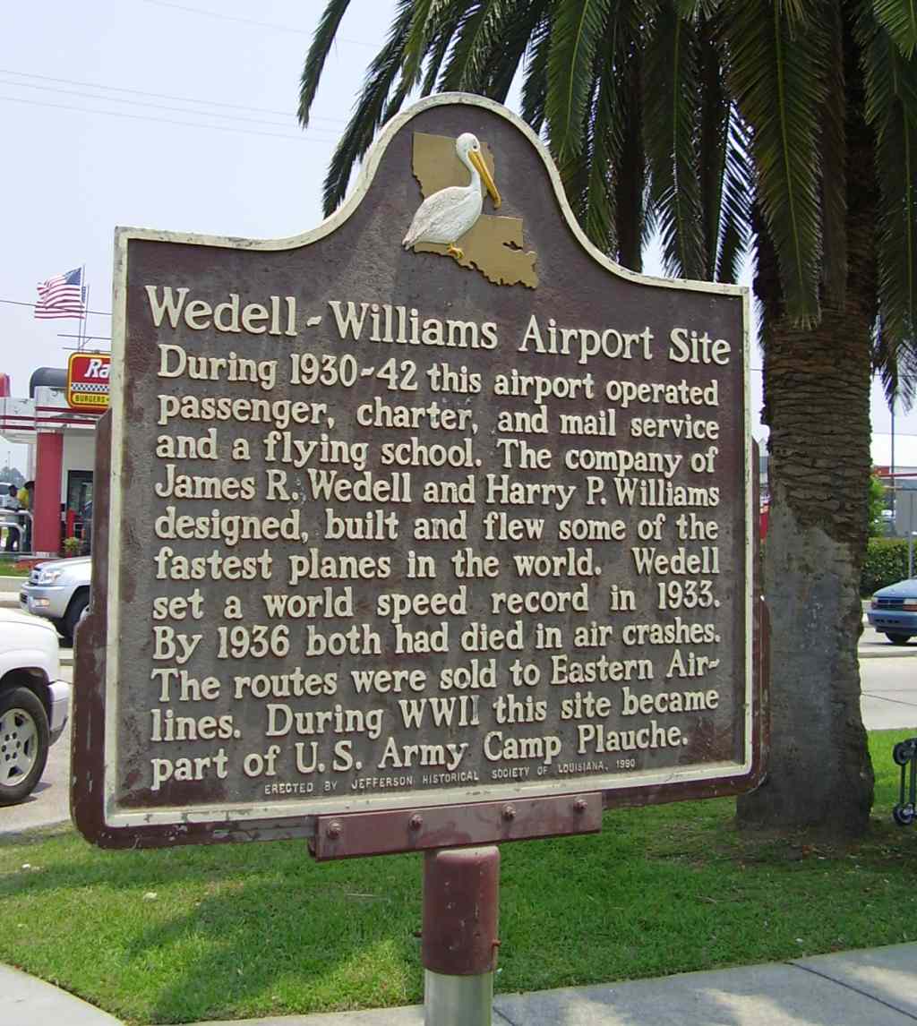
A 1990-2013 photo of a historical plaque at the site of Wedell-Williams Airport.
Wedell-Williams Airport was was located east of the intersection of Hickory Avenue & 10th Street.
____________________________________________________
Or if you prefer to contact me directly concerning a contribution (for a mailing address to send a check),
please contact me at: paulandterryfreeman@gmail.com
If you enjoy this web site, please support it with a financial contribution.
____________________________________________________
This site covers airfields in all 50 states.