Abandoned & Little-Known Airfields:
Maryland, Northeastern Baltimore area
© 2002, © 2023 by Paul Freeman. Revised 10/13/23.
____________________________________________________
Please consider a financial contribution to support the continued growth & operation of this site.
Quinn Airport / Baltimore Airpark (revised 10/13/23) - Spamer Field (added 3/30/15)
____________________________________________________
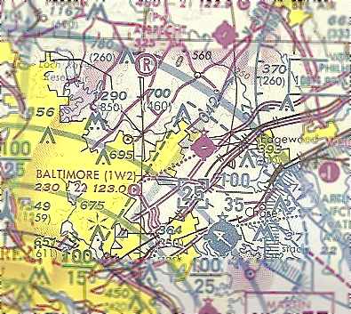
39.415, -76.489 (Northeast of Baltimore, MD)
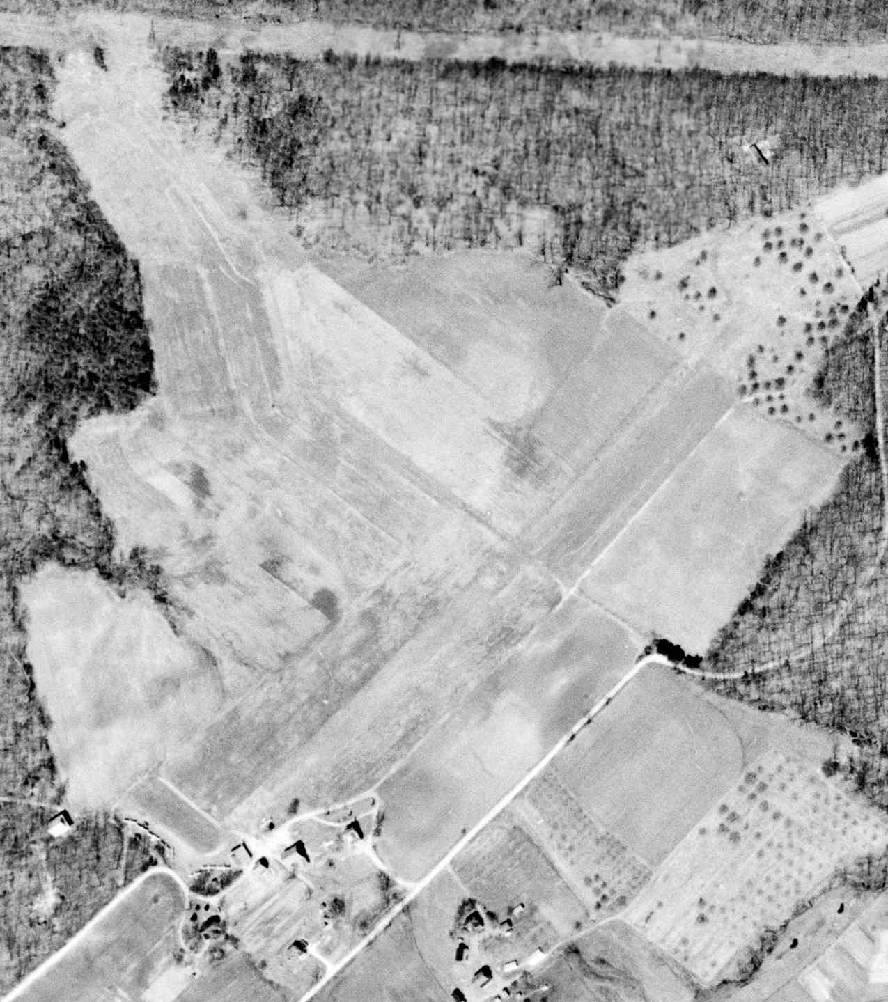
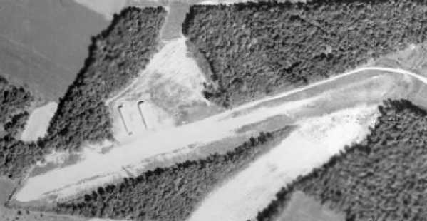
A 3/26/56 USGS aerial view of Spamer Field.
The date of construction of this general aviation field northeast of Baltimore has not been determined.
Spamer Field was not depicted on the 1945 Washington Sectional Chart (courtesy of John Voss),
nor depicted on USGS topo maps from the 1940s-70s.
The earliest depiction which has been located of Spamer Field was a 3/26/56 USGS aerial photo.
It depicted an irregularly-shaped grass field with several small buildings at the southwest end,
around which were parked 7 single-engine aircraft.
However Spamer Field was not depicted at all on the July 1956 Washington Local Aeronautical Chart (courtesy of Tim Zukas).
Jay Payne recalled, “Growing up in Perry Hall in the late 1950s & 1960s I remember Spamer Field.
There were a couple of hangars & a turf runway. They used to do a lot of skydiving mostly from a gull-winged Stinson.
There were a number of planes based there.”
Inexplicably, Spamer Field was not depicted at all on the 1964 Washington Sectional Chart.
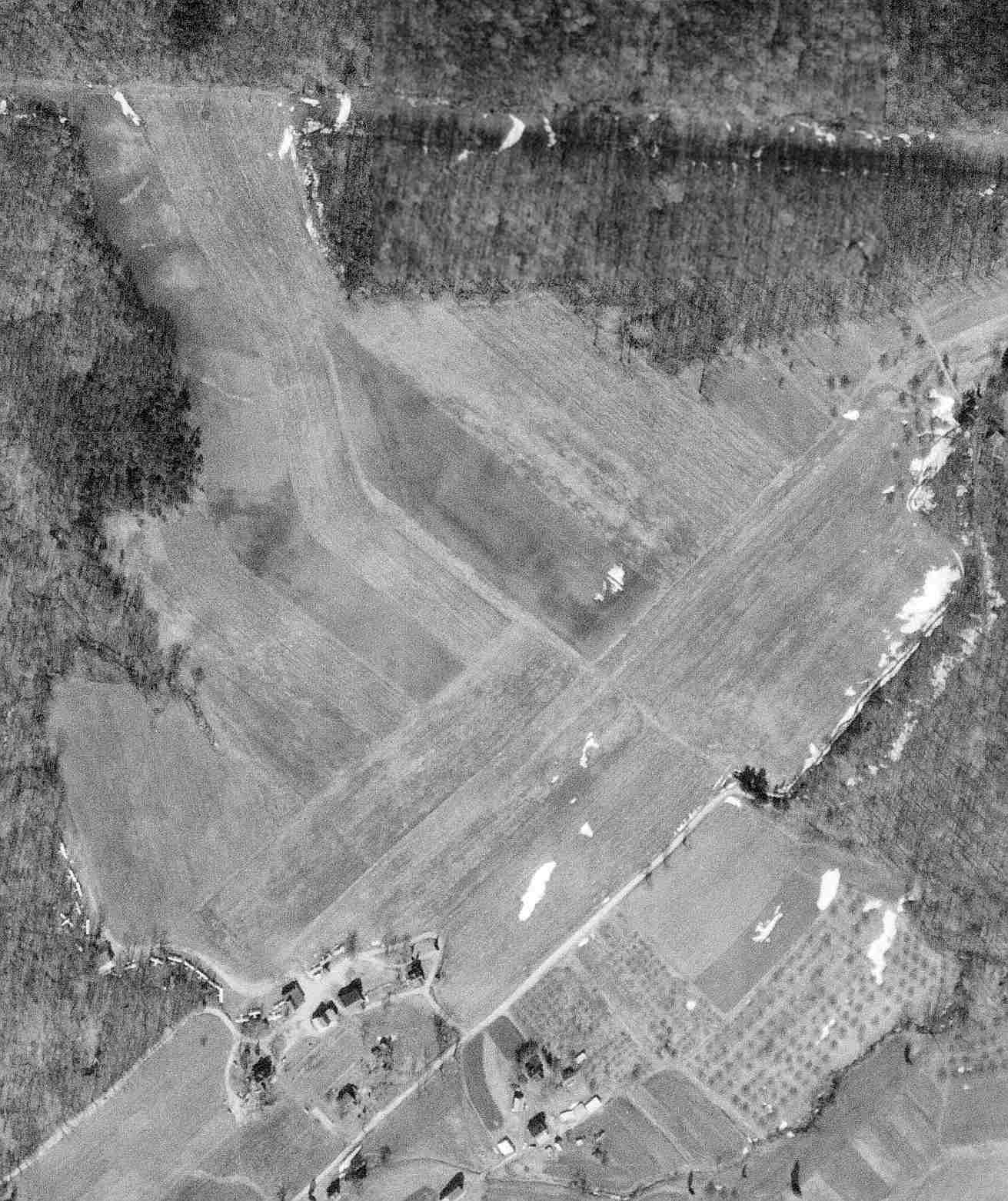
A 2/21/66 USGS aerial photo depicted Spamer Field perhaps at the zenith of its popularity,
with a total of at least 18 single-engine aircraft visible parked on the southwest end.
A 9/22/70 aerial view showed Spamer Field remained intact.
The last photo which has been located showing aircraft at Spamer Field was a 1971 aerial view, which showed 8 light aircraft on the field.
Spamer Field was not depicted at all on the 1976 Washington Sectional Chart (courtesy of Jonathan Westerling).
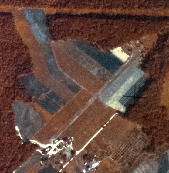
Spamer Field was evidently closed at some point between 1971-82,
as a 1982 aerial view showed houses covering the site of the little airfield.
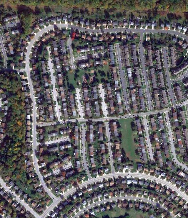
A 2014 aerial view showed no trace remaining of Spamer Field.
The site of Spamer Field is located at the intersection of Seven Courts Drive & Hickoryhurst Drive.
Thanks to Jay Payne for pointing out this airfield.
____________________________________________________
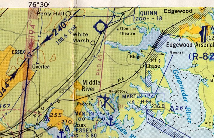
Quinn Airport / Baltimore Airpark (1W2), Perry Hall, MD
39.405, -76.427 (Northeast of Baltimore, MD)
A 1957 aerial view depicted the Quinn Airport as having a single northeast/southwest unpaved runway,
with 2 hangars along the northwest side of the field.
This little general aviation airport was a common site to many ground-bound travelers on Interstate 95,
as the little airport sat adjacent to the west side of the busy highway, just north of Baltimore.
The date of construction of Quinn Airport has not been determined.
No airfield was depicted at this location on the 1946 USGS topo map.
Steve Hackman recalled, “I grew up about 2 miles from Quinn’s
which got it’s name from Frank Quinn who was a local boy in what was at the time a rural community.
I didn’t know Mr. Quinn but I hung out around the airport a lot in my younger years.
He [Steve's uncle] felt like the strip had actually been there since 1950, but maybe only for Quinn's own use.
He also told me that Frank Quinn was an excavating contractor
and had cleared the land for the strip & graded it himself.
He said that when the airport was first built, Frank had a new Piper Tri-pacer & he used to fly with him occasionally.
The Tri-Pacer definitely dates the strip to after 1949.
I recall that as kids we were walking along I-95 as it was being built (it was still dirt)
and we were near the airport & saw a guy crash... I believe it was the first person to lose their life there.
Pappy's clearest memory of the place was that he was there to see the first plane to ever land
and he said that Frank (Quinn) had not gotten around to putting down gravel on the strip & it was pretty rough.
The plane, a low-wing something came in, touched down, bounced twice & then dug in & flipped over.
Pap said he ran over with the rest & helped push the thing back over
and since it was a doped fabric, he put his hand through it by accident.
He also said he got the prop off of it but had to give it to the accident investigator when he got there.
[Steve's uncle] said that he was there with my father when the first plane to land at Quinn's flipped over
(he remembered the plane as being a J-3 Cub)
and he is positive that he was still in school when that happened which would date the incident to around 1952.
And one comment on the runway... I noticed that the description says it was a turf runway,
but what it really was, was rough, hard-packed, rocky, rutted-up clay.
When the planes would do test run-ups dust would fly!””
The earliest depiction which has been located of Quinn Airport was a 1957 aerial view.
It depicted Quinn Airport as having a single northeast/southwest unpaved runway,
with 2 hangars along the northwest side of the field.
There were no aircraft visible on the field.
Also note that I-95 had not yet been built along the eastern edge of the airport property.
Quinn Airport may not have officially been opened by 1957 though,
as no airfield was yet depicted at this location on the August 1957 Washington Sectional Chart.
Richard Moore recalled, “At age 15 I had my first airplane ride in a J-3 there back in 1957.”
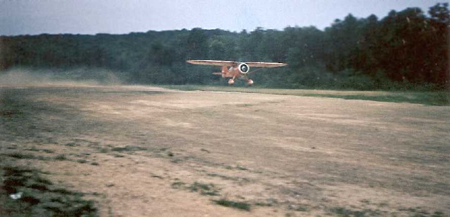
A circa 1950s photo by Mike Wotovitch of a Monocupe taking off from the unpaved runway at Quinn's.
Mike observed, “You can see the 'rooster tail' left by the Monocoupe. Its pilot was probably as relieved as I was to see it airborne.
I wonder if he had any regrets at flying such a beauty into Quinn's.
I remember the runway at one time being covered with dark cinders (possibly from Sparrows' Point [steel plant in nearby Dundalk])
which knocked hell out of a prop.”
The earliest aeronautical chart depiction which has been located of Quinn Airport was on the July 1958 Washington Local Aeronautical Chart.
It depicted Quinn as having an 1,800' unpaved runway.
Merton Meade recalled, “I used to go into Quinn regularly & it was very rough before it was paved.
I wouldn't want to have gone in there with anything with a training wheel on it.”
Steve Hackman recalled, “I used to walk through the airport & look at the planes, and always loved to stand at the end of the runway.
This would have been in the 1960s. At the time there were a variety of aircraft there.
I remember a Navion, a Stinson Reliant, a Globe Swift, a Beech Bonanza, an Ercoupe,
and a bunch of J-3 Cubs & Taylorcrafts & the like, and of course the regular Piper & Cessna stuff.
The runway ran east/west & that was the general direction of takeoff & landings also
because the runway had a pretty pronounced uphill slant in that direction.
I worked on a farm that bordered the airport & the man I worked for had taken flying lessons from Frank Quinn
and he told me that after learning to fly out of Quinn’s he had a hard time to land at any strip that didn’t come up to meet him!”
According to the book "Maryland Aloft", a 1962 MD Airport Directory "reported that the airport was operated by Herbert Shanklin.
The publication described the 1,800' sod runway as 'rough & rolling'.
On the night of 1/17/62 a fire at the airport destroyed 3 aircraft & badly damaged 2 others.
The Baltimore Evening Sun named Fred Quinn as the airport's operator in its report on the fire."
A 1964 aerial view depicted the field pretty much unchanged compared to the 1957 photo,
although there were several aircraft parked on the north side of the field,
and I-95 had been built across the eastern edge of the airport property.
Quinn Airport was described in an unchanged manner on the 1964 Washington Sectional Chart (courtesy of John Voss).
Curiously, Quinn Airport's 2 hangars & the airport entrance road were depicted on the 1966 USGS topo map,
but not the runway itself, and the airport was not labeled.
Quinn Airport was described in an unchanged manner on the 1967 Washington Sectional Chart (courtesy of John Voss).
According to the book "Maryland Aloft", "In 1967, the airport was acquired by Earl Mace & his wife Betsy.”
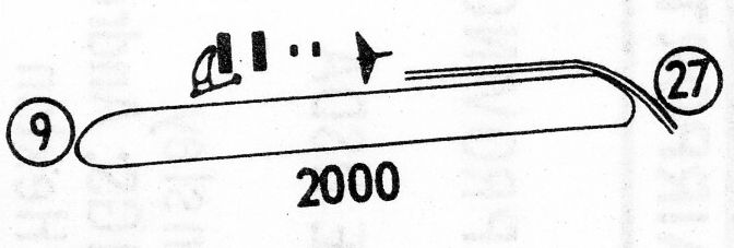
The 1968 Flight Guide depicted Quinn Airport as having a single 2,000' unpaved Runway 9/27, with 4 buildings on the northwest side of the field.

A circa late-1960s/1970s photo by Mike Wotovitch of several aircraft in front of Baltimore Airpark's paved runway,
with I-95 in the background.
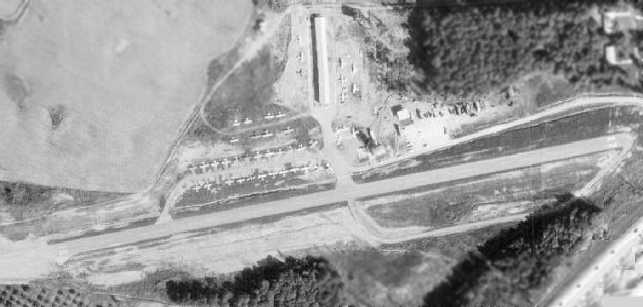
A 1971 aerial view depicted Baltimore Airpark at perhaps the zenith of its popularity,
with a total of over 40 light aircraft visible on the field.
Note that compared to the 1957 & 1964 aerial photos,
the original unpaved runway had been replaced with a paved runway on a slightly different orientation (oriented somewhat more east/west).
Also, the original set of 2 hangars had been removed, replaced by a large parking area,
and a larger hangar now sat north of the middle of the runway.
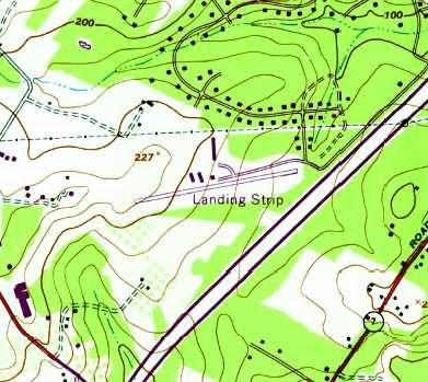
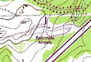
The earliest topo map depiction which has been located of Baltimore Airpark was on the 1974 USGS topo map.
It depicted a single paved northeast/southwest runway, with a few rows of T-hangars, labeled simply as “Landing Strip”.
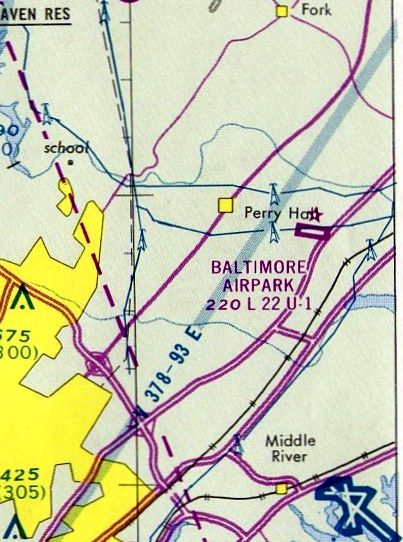
The February 1975 Washington Terminal Aeronautical Chart (courtesy of Mitchell Hymowitz)
depicted Baltimore Airpark as having a paved 2,200' northwest/southeast runway.
A 1975 aerial view looking west at Baltimore Airpark (courtesy of Aaron Harrington),
showing the proximity of Interstate 95 in the foreground.
[Martin Airport had previously been a private field, and was bought by the state & reopened as a public airport].
“The new facility attracted pilots seeking a longer runway than the single 2,200' east/west strip available at Baltimore Airpark.
The Maces eventually sold the land."
Richard Wilson recalled, “Baltimore Airpark... I first earned my tickets there starting in 1975.
Back then the runways were 10/28 and were changed to 9/27 when a later magnetic survey suggested the change.
I knew Earl & Betsy Mace well. And there were the characters that flew out of there.
Joe Zito had an interesting 4-seater 1947 Globe Swift. Betsy & Earl lived right off the end of Runway 28
and Betsy would complain about Joe's Swift as he had straight pipes on the little tiny 280 cubic inch Continental flat 6 - and it was very loud & distinctive.
Other notable aircraft were a brown & white Comanche 400 - 8484P - that spoke sweetly with the bit 8 cylinder squeezed in the cowling.”
Richard continued, “Mo (Morris) Barret learned to fly there in the late 1970s.
He earned his ticket stem to stern at Baltimore Airpark while he was in his 70s.
Mo was the corporate chef for Martin Marietta's corporate research lab.
He was also the head pastry chef for the Glenn L. Martin airport during World War II -
happily pushing out several thousand pies a day to keep all the aircraft fabricators well fed at the Martin plant.”
Richard continued, “And there was Tony - the A&P guy.
Always complaining about the aircraft from Earl Wilson's fleet down at Essex Skypark.
Earl Wilson (not Mace of Baltimore Airpark) had an 'OCD' about birds roosting on the vertical stabilizers of his planes.
So he shot at them. And occasionally he missed.
Then the planes were flown over to Baltimore Airpark so Tony could patch the little holes in the metal.
He hated that job.”
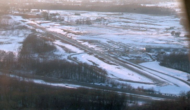
A 12/24/76 aerial view by Rick Wilson looking northwwest at Baltimore Airpark.
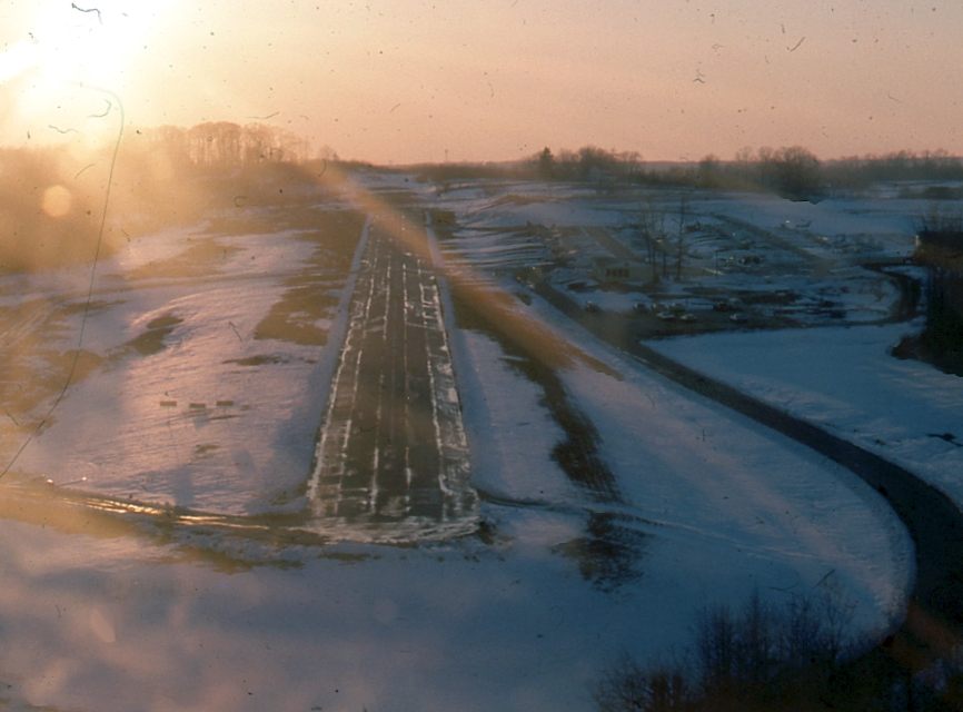
A 12/24/76 aerial view by Rick Wilson looking west from final approach to Baltimore Airpark's Runway 27.
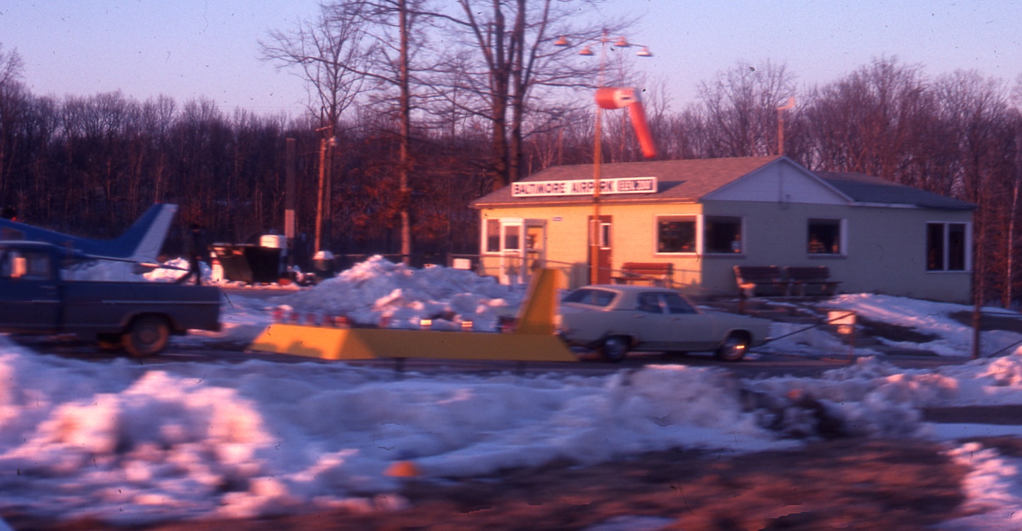
A 12/24/76 photo by Rick Wilson of Baltimore Airpark's office.
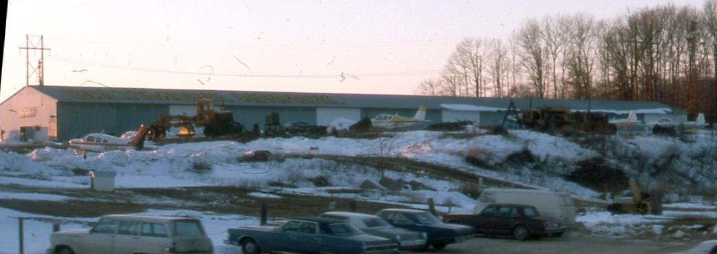
A 12/24/76 photo by Rick Wilson of a Baltimore Airpark hangar.
A circa 1976-77 photo of Richard Wilson at Baltimore Airpark, “in front of my favorite rental craft - a Piper Arrow.
It was a leaseback to Earl Mace from an accountant who used it to regularly shoot up to Las Vegas to do some work there.
He rented it through Earl's FBO when he wasn't using it. A nice bird.”
Richard Wilson recalled, “The trees in the median strip... I remember when the highway authorities really let them go -
and if it was gusty & you were just 1/3 of a VASI board low on a night approach -
you were woken up SERIOUSLY by the leaf/twig slap on the undercarriage & fuselage.
I mean - we all know what it sounds like going down a narrow country drive with brush touching our car at 20 MPH -
but on aluminum at 80 knots - it was really an eye-opener.”
Richard continued, “Earl Mace was a character in that he did so much to improve that airport by himself.
He even had a big Caterpillar 'pan' - one of those big earth-movers that had the drop-apron to scrape soil, store it, then dump it somewhere else.
He used this thing to improve the runways, tiedown areas & taxiways over the years.
And he even serviced the diesels himself. I think Earl could do most anything.
That place was a magic place back when I was just a teenager riding my 10-speed bike out there from Hillendale
to fly around on my meager 'hamburger-flipping salary'.
The 1982 AOPA Airport Directory (courtesy of Ed Drury) described Baltimore Airpark as having a single asphalt 2,200' Runway 9/27,
and listed the operator as Baltimore Aviation Service.
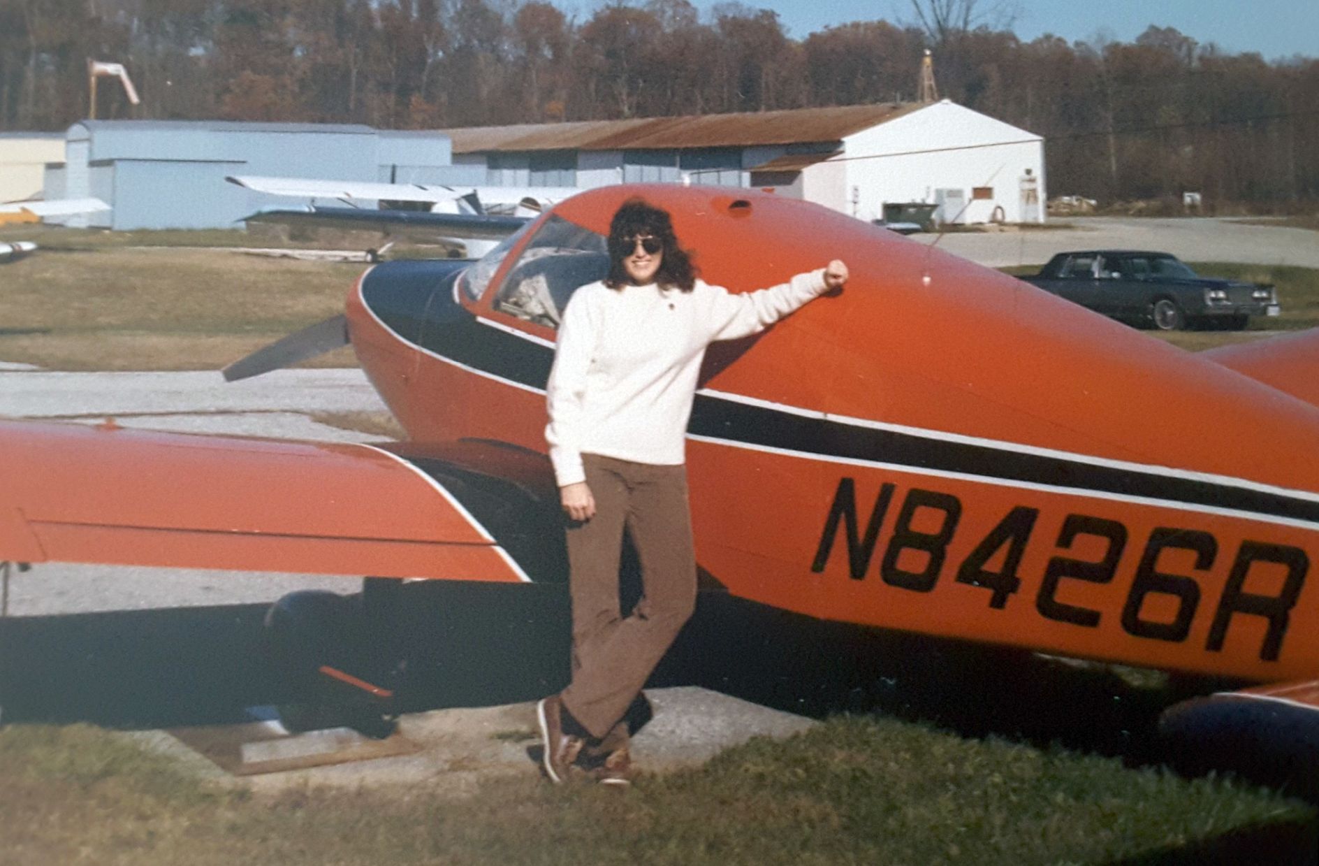
A November 1984 photo of Pat Carey & her Piper PA28 in front of the Baltimore Airpark hangars.
The 1986 USGS topo map depicted the Baltimore Airpark as having a single east/west paved runway 9/27,
with parallel taxiways running on the north & south sides,
and 3 buildings on the north side of the field.
The 1993 Jeppesen Airport Directory depicted Baltimore Airpark as having a single 2,200' paved Runway 9/27,
with parallel taxiways running on the north & south sides.
The March 1993 Washington Sectional Chart depicted Baltimore Airpark as having a single 2,200' paved runway.

A 1994 USGS aerial view looking northwest at Baltimore Airpark.
A beautiful 1998 aerial picture looking east at Baltimore Airpark by Philip K.

The last aeronautical chart depiction which has been located of Baltimore Airpark was on the August 1998 Baltimore Washington Terminal Area Chart.
It depicted Baltimore Airpark as having a single 2,200' paved runway.
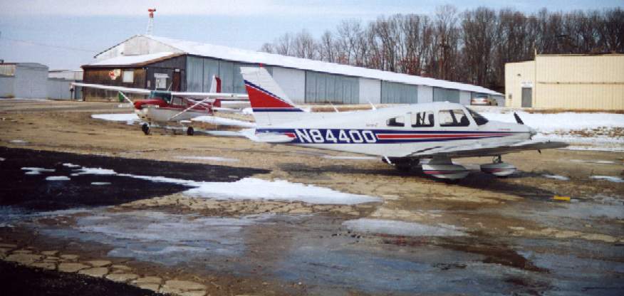
Bill Peters recalled, “I was the weekend guy at Baltimore Airpark.
The last 2 years of Baltimore Airpark I cut the grass, took money from students, etc.
I was at that airport just about every weekend & almost every weeknight.
We did not get too many aircraft other then what was based there. I sure do miss that place.”
A video of Citabria 5219X performing a takeoff, 1 aborted landing, and 1 successful landing at Baltimore Airpark on one gusty day.
According to Bill Peters, “The pilot was one of 2 brothers that flew in & out of 1W2.”
The plane was “5219X... the orange Citabria we had.
It was wrecked before the airport closed. That wasn't me that ground looped it.”
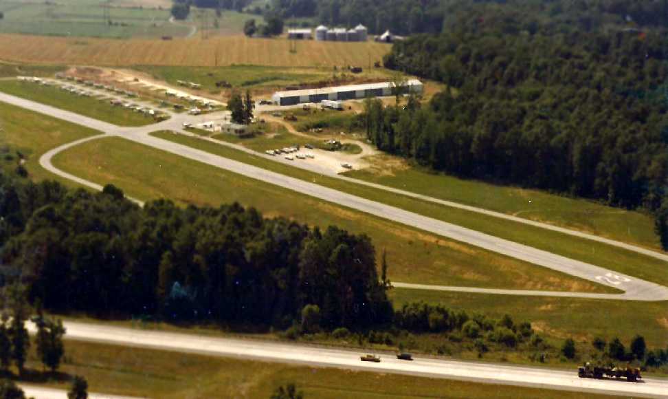
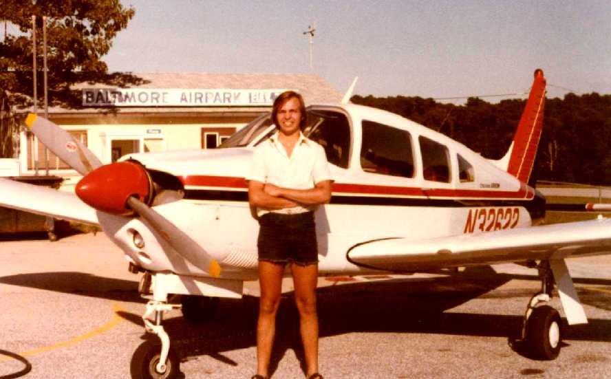
The last photos which have been located showing Baltimore Airpark still in operation was a an early 2001 photo by Paul Freeman of the Piper PA-28 Warrior he had flown in.

An early 2001 photo by Paul Freeman, just before the uphill take off from Runway 27.
Paul Freeman flew into Baltimore Airpark in early 2001, just before its closure.
The number of aircraft based at the field was a mere fraction of what it used to be, with no rental aircraft available anymore.
Approaches into Baltimore Airpark were complicated by the fact
that the approach end of Runway 27 sat very close to the heavily-traveled Interstate 95.
Departures were complicated by the fact that the airport is located
within the class D airspace of Martin State Airport,
necessitating an immediate call to the MTN tower upon departure from Baltimore Airpark.
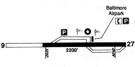
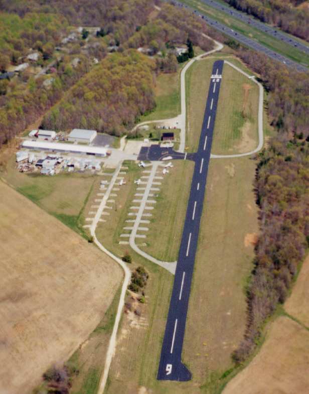
The airfield consisted of a single paved runway (9/27, 2,200' long), an office building & several hangars.
The runway was recently repaved, but sloped significantly uphill, requiring a longer takeoff run
(on what was already a short runway) when departing on Runway 27.
Unfortunately, Baltimore Airpark was closed in 2001,
with the property being redeveloped with more new houses (just what we need).
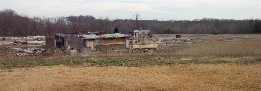
A late 2001 view of the remains of the hangars at Baltimore Airpark, in the process of being demolished.
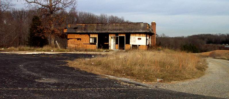
A late 2001 view of the remains of the office at Baltimore Airpark.
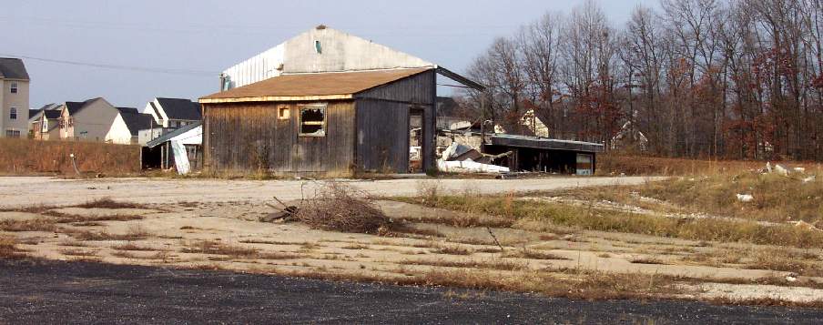
A late 2001 view of the remains of the hangars at Baltimore Airpark, in the process of being demolished.
Compare with the earlier photo taken from the same perspective, less than a year before, when the airport was still alive.
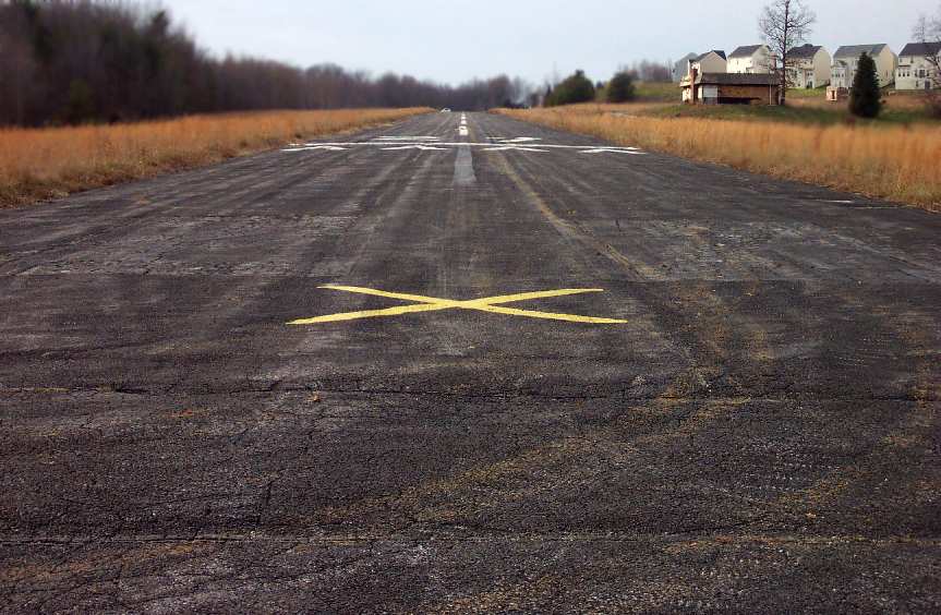
A late 2001 view looking west along Baltimore Airpark's former Runway 27, with the reason for the airport's closure visible to the right.
Compare with the earlier photo taken from the same perspective, less than a year before, when the airport was still alive.

A 2001 aerial view looking northwest at Baltimore Airpark, after the field has already been closed & the hangars demolished.
Paul Freeman visited the site in late 2001, less than a year after flying in,
to find the airport closed & in the process of being demolished.
The hangars were largely demolished, mostly just piles of twisted metal.
The airport office still stood, but was gutted, and was filled with nothing but broken glass & trash.
The runway still existed, with closed "X" markings.
The red metal letters which once spelled out “Baltimore Airpark” along the side of I-95 were piled in a heap of debris.
The reason for the airport's closure - a development of new houses - sat right up to the edge of the former airport property.
It would be only a matter of time until the housing development completely covered the airport property,
and most of the residents would have no idea what used to exist there.
MD pilot Steve Stricker reported that the runway of the former Baltimore Airpark was finally ripped up in 2003.
How sad.
Paul Freeman drove by the site of Baltimore Airpark in 2004 & was saddened to see that new houses now cover the entire site,
which is no longer recognizable as ever having been an airport.
Yet another small general aviation airport lost forever.
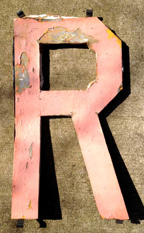
A curious remnant of Maryland aviation history: a 2013 photo of the metal letter “R”
which used to be part of the illuminated “Baltimore Airpark” sign which faced I-95 for decades.
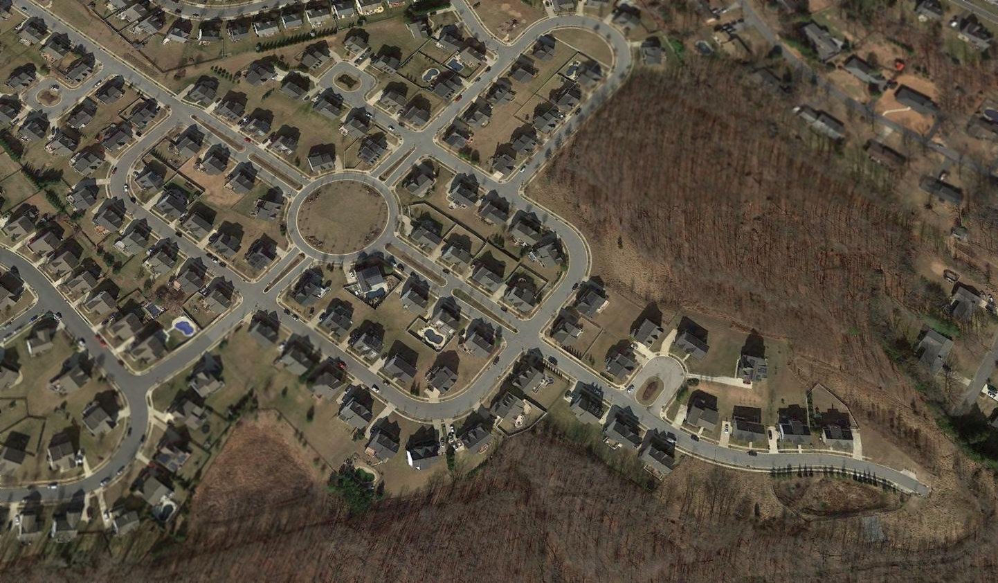
A 2017 aerial view looking northwest at the site of Baltimore Airpark, showing absolutely no trace remains of the nice little grassroots airport.
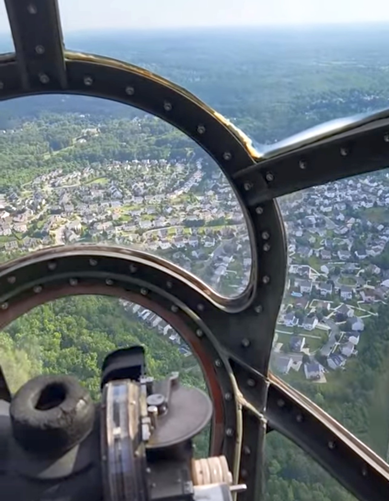
A 6/1/22 aerial view by Fredd Wilson looking north at the site of Baltimore Airpark, taken from the bombardier's station of the Boeing B-29 Superfortress “Fifi”.
The road leading to the site of Baltimore Airpark is still named Airport Road,
but it now ends just east of the housing development that now covers the site.
____________________________________________________
Or if you prefer to contact me directly concerning a contribution (for a mailing address to send a check),
please contact me at: paulandterryfreeman@gmail.com
If you enjoy this web site, please support it with a financial contribution.
____________________________________________________
This site covers airfields in all 50 states.
For the site's main menu: Home