Abandoned & Little-Known Airfields:
Western Maryland
© 2005, © 2025 by Paul Freeman. Revised 7/25/25.
This site covers airfields in all 50 states: Click here for the site's main menu.
____________________________________________________
Please consider a financial contribution to support the continued growth & operation of this site.
Bowman Airfield (revised 6/10/20) - Cumberland Airport (Pinto location) (revised 2/11/15) - Frostburg Airfield (added 7/30/22) - Moran Airfield (revised 7/25/25)
____________________________________________________
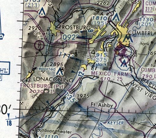
Frostburg Airfield, Frostburg, MD
39.592, -78.962 (West of Cumberland, MD)
Frostburg Airfield, as depicted on the 1976 Washington Sectional Chart (courtesy of Jonathan Westerling).
Photo of the airfield while in use has not been located.
This small private airfield was evidently established at some point between 1969-76,
as it was not yet depicted on a 1966 aerial photo nor the 1969 Huntington Sectional Chart.
The earliest depiction which has been located of Frostburg Airfield was on the 1976 Washington Sectional Chart (courtesy of Jonathan Westerling).
It depicted Frostburg Airfield as a private airfield having a mere 1,500' unpaved runway.
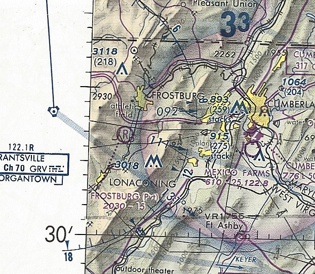
The last aeronautical chart depiction which has been located of Frostburg Airfield was on the 1981 Washington Sectional Chart.
It depicted Frostburg Airfield as a private airfield having a 1,500' unpaved runway.
Frostburg Airfield was not depicted at all on USGS topo maps from the 1980s/90s/2010s.
According to the book “Wings Over Cumberland” by Poling & Armstrong, Frostburg Airfield ceased to exist around 1985.
The earliest photo which has been located of Frostburg Airfield was a 1986 aerial view.
It depicted a single north/south grass runway, with a hangar on the southwest side, but there were no aircraft visible on the field.
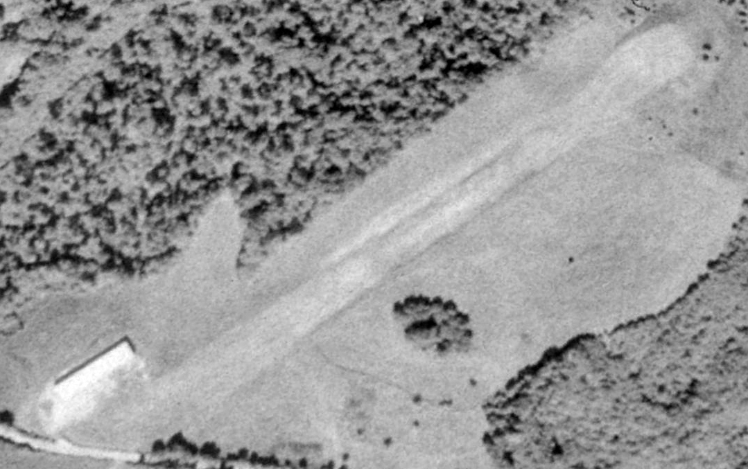
The earliest photo which is available of Frostburg Airfield was a 1988 aerial view looking northwest.
It depicted a single north/south grass runway, with a hangar on the southwest side, but there were no aircraft visible on the field.
Frostburg Airfield was no longer depicted on the 1989 Washington Sectional Chart (courtesy of Jonathan Westerling).
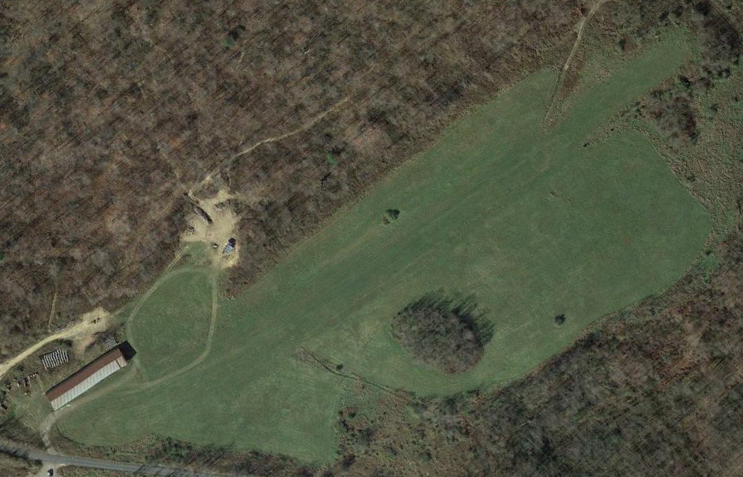
A 2016 aerial view looking northwest depicted Frostburg Airfield as having a single north/south grass runway & a hangar on the southwest side.
Glen Ward reported in 2022, “The field & many acres of surrounding land were sold a couple of years ago.
The mere lack of $2 million dollars kept me from having it!
People at a recent EAA breakfast could not recall a time when it was open.”

A 4/23/22 photo by Glen Ward looking north at the Frostburg Airfield hangar & runway.
Glen reported, “The hangars are empty & the windsock frame long ago lost its sock! The hangars look really old. There is a fueling facility in the hangar.
The runway is being kept mowed but I have never seen a plane. I am anxious to see if a plane ever appears.
They have been keeping the runway mowed down nicely! It looks like a Cub, a Champ, and a biplane ought to be sitting there.”
The site of Frostburg Airfield is located southwest of the intersection of Old Legislative Road & Squirell Neck Run Road.
Thanks to Glen Ward for pointing out this airfield.
____________________________________________________
Cumberland Airport (Pinto location), Pinto, MD
39.57, -78.85 (Southwest of Cumberland, MD)
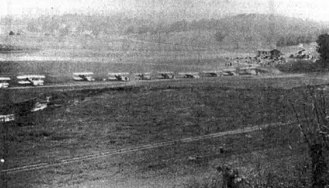
An August 10-11, 1929 photo (courtesy of Rick Harshbarger)
looking southwest at a row of Boeing biplane fighters at the “First Annual Air Circus” at the Pinto Cumberland Airport.
Most residents of Cumberland probably have no idea of the history of another Cumberland Airport,
different from the present-day Cumberland Regional Airport or Mexico Farms Airport,
which was located several miles southwest of Cumberland in the tiny town of Pinto MD.
According to an article entitled “Modern Airport Assured” in the 4/29/29 issue of the Cumberland Evening Times (courtesy of Rick Harshbarger),
““Purchase of a 75 acre farm on the McMullen Boulevard at Pinto for the establishment of a fully-equipped, modern airport for Cumberland,
was announced today by Harold Krimm, managing director of the annual Pittsburgh & Philadelphia Aircraft Shows.
Selection of the Yoder Farm, formerly the old Rawlings Farm of 13 years ago,
as the site of the new airport, will give Cumberland one of the most centrally located landing fields in the country according to Mr. Krimm.”
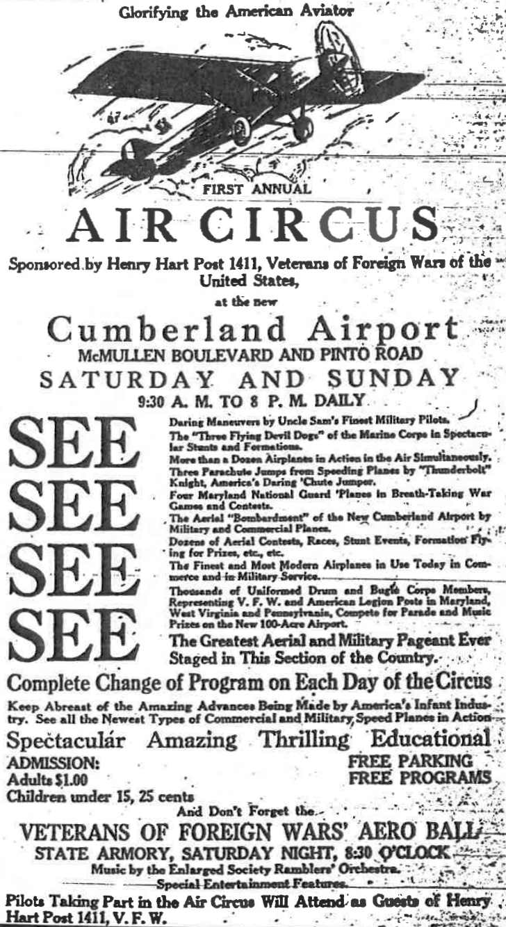
An advertisement for the August 10-11, 1929 “First Annual Air Circus” at the Pinto Cumberland Airport (courtesy of Rick Harshbarger).
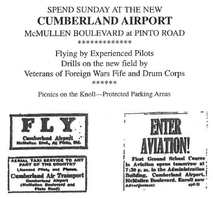
Several other 1929 advertisements promoting the Pinto Cumberland Airport (courtesy of Rick Harshbarger).
According to Wings Over Cumberland by Bob Polling & Bill Armstrong (courtesy of Rick Harshbarger),
“There is little recorded history of activity at Pinto during the remainder of 1929 & early in 1930.
Apparently no further development followed.
It appears that the promoters either decided that the airfield would not become a viable endeavor,
or lost the financial capability to continue their grandiose plans, and quietly terminated their efforts.”
The Pinto Cumberland Airport was not depicted on a 1930 Aeronautical Chart
nor on the 1934, 1936, 1938, or 1947 Huntington Sectional Charts.
According to Wings Over Cumberland by Bob Polling & Bill Armstrong (courtesy of Rick Harshbarger),
“During the late 1930s the Yoder Farm site was again used as a flying field by several local pilots.
Herb Wentz & Harold Armstrong also used the site for brief periods before & after World War II.”
A 1946 aerial photo depicted open field at the site of Pinto Cumberland Airport, with nothing recognizable as an airfield.
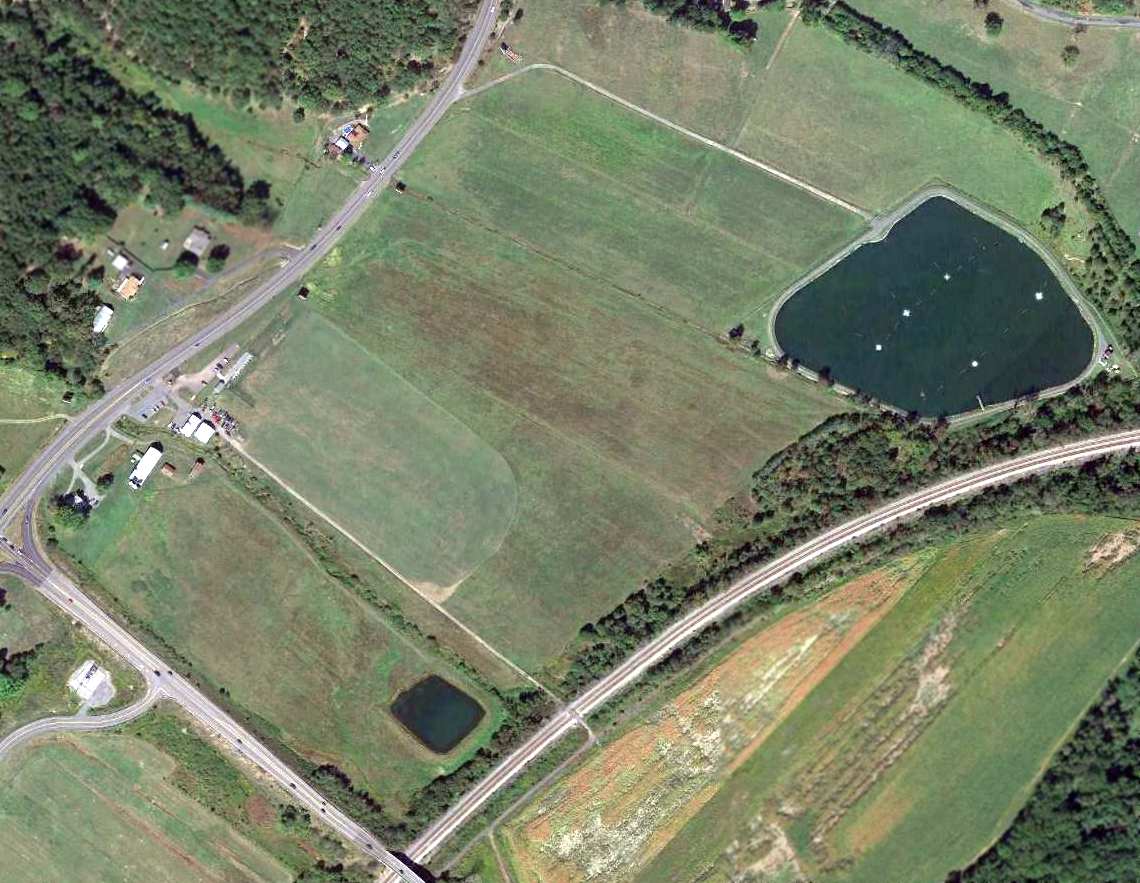
A 2013 aerial view showed no trace remaining of the Pinto Cumberland Airport.
A 2/10/15 photo by Rick Harshbarger of the site of Pinto Cumberland Airport.
Rick observed, “A portion of the old Pinto Airport is today a golf driving range.
Everytime I hit balls there I think of looking out there & seeing a biplane touching down since I have learned of this property's history.”
The site of the Pinto Cumberland Airport is located east of the intersection of Route 220 & Route 956.
Thanks to Rick Harshbarger for pointing out this airfield.
____________________________________________________
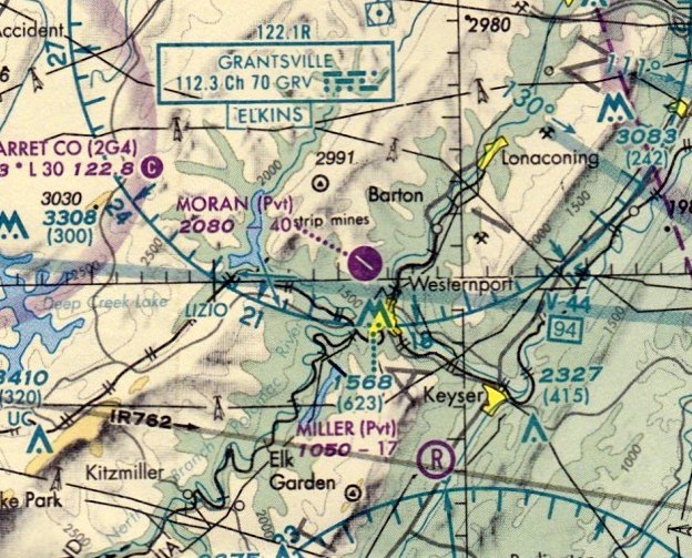
Moran Airfield (MD99), Westernport, MD
39.5, -79.07 (West of Cumberland, MD)
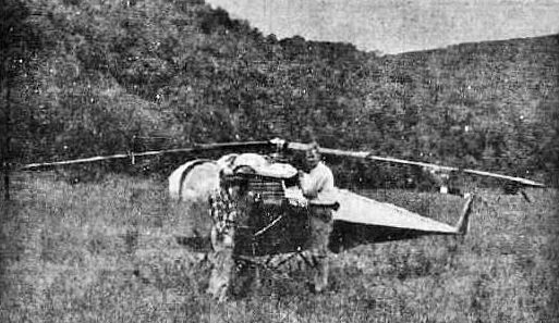
An undated photo from a 1959 article (courtesy of Rick Harshbarger) of Donald Moran with his newly-purchased Brantly B-2 helicopter, along with flight instructor Melvin Davis.
Coal company partner Donald Moran got his start in aviation when he purchased a Brantly B-2 helicopter.
An undated photo from a 1959 article (courtesy of Rick Harshbarger) showed Moran with his newly-purchased helicopter, along with flight instructor Melvin Davis.
Moran eventually went on to build a private airfield.
There was no airfield depicted at this location on a 1966 aerial photo.
According to Rick Harshbarger, “Moran Field... was built in the mid-1960s when Donald Moran, owner of Moran Coal Company
saw the potential of an airfield when reclaiming a surface mine on the mountain above his home town of Westernport MD.
He leveled off a 5,000' x 75' strip & planted grass on it & built a hangar.
The company then had a Cessna 172. As time went on Moran purchased a Skymaster, a Cessna 402, and a Bell jet helicopter.
All were based at the field except for the helicopter which was based at the coal company headquarters at the bottom of the mountain.
They would fly passengers from [the headquarters] up to the airport to the airplanes for trips.
Mr. Moran flew the 172 & the Skymaster. He built another hangar & installed runway lights & a beacon.
He hired a commercial pilot who flew the 402 & the helicopter.
He used to ride the helicopter from the bottom of the mountain to the top to get to the airport instead of driving.”
Moran Field was not yet depicted on the February 1969 Huntington Sectional Chart,
nor on the 1974 USGS topo map.
According to Rick Harshbarger, “In the summer of 1976, Moran worked out a deal with the huge paper mill in nearby Luke MD
to pave 4,000' of the runway to allow the Westvaco Corporation Learjet to use the field.
Before that time the Lear had to use the Cumberland Airport, and send ground transportation to pick up the passengers 30 miles away.
I lived in the town below the field & took my first plane ride in Moran's Skymaster.
I later worked at CBE where I fueled the Moran fleet several times per week.
I took flying lessons & used Moran Field for touch & go's.”
Moran Field was not yet depicted on the August 1976 Cincinnati Sectional Chart (according to Chris Kennedy).
Bo Bowman recalled, “Moran Field... I grew up in Westernport, so I used to use that field frequently when flying into town to visit my Father.
Don Moran, who owned the airport, was a good friend of my Father.
I remember well his helicopter & the first Cessna 172 kept at the field.
I tried to buy it when searching for my first airplane while living near Pittsburgh, but he wouldn't sell. They hardly ever used it.”

The earliest depiction which has been located of Moran Airfield was a 4/7/79 USGS aerial view.
It depicted Moran having an asphalt northwest/southeast runway, with “Moran” painted in the middle, and an asphalt ramp on the west side with 2 small buildings.
The earliest aeronautical chart depiction which has been located of Moran Airfield was on the 1980 Cincinnati Sectional Chart,
which depicted Moran as a private airfield having a 4,000' paved northwest/southeast runway.
The earliest topo map depiction of Moran Airfield which has been located was on the 1981 USGS topo map.
It depicted a single northwest/southeast runway, labeled simply as “Landing Strip”.
Photo of the airfield while in use has not been located.
Moran Airfield was listed in the 1980 & 1982 AOPA Airport Directories (according to Chris Kennedy).
The earliest photo of Moran Airfield which has been located was a 1982 USGS aerial photo.
It depicted Moran having an asphalt Runway 14/32, with “Moran” painted in the middle.
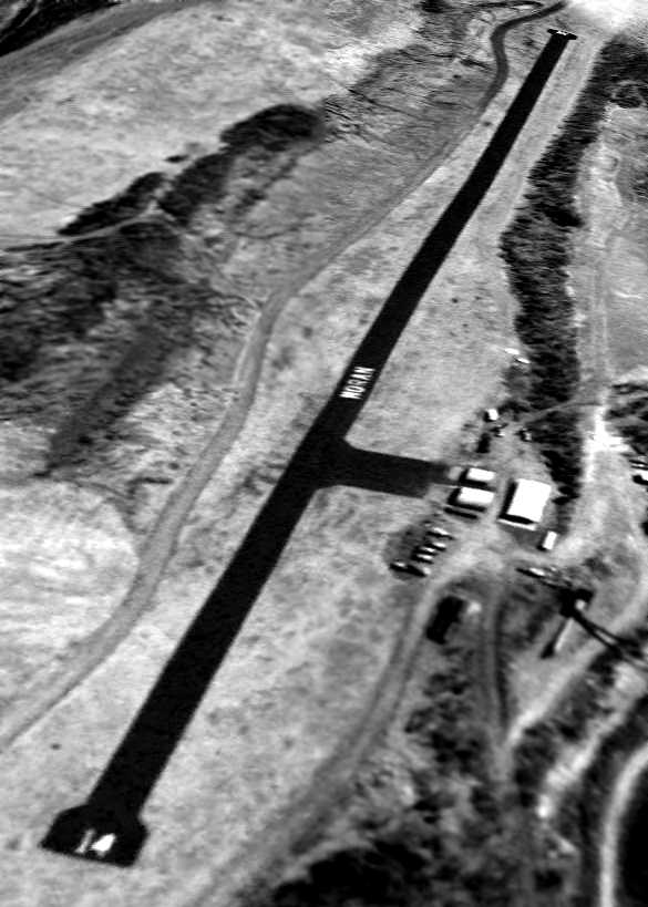
A 4/5/95 USGS aerial view looking southeast depicted Moran as having an asphalt Runway 14/32, with “Moran” painted in the middle,
with an asphalt ramp on the west side with several small buildings.
The FAA Airport/Facility Directory data for Moran Field described it as a private field having a single 4,000' asphalt Runway 14/32.
The owner was listed as the Moran Coal Company, with the manager listed as Donald Moran.
The field was said to have 2 based aircraft, including one multi-engine aircraft & one helicopter.
At the time it was operational, Moran Field was the only paved-runway private airfield in the western half of the state of Maryland.
The July 1999 Cincinnati Sectional Chart depicted Moran as a private airfield having a 4,000' paved northwest/southeast runway.
On 7/3/00, Moran Coal Company Cessna 421 N8176G piloted by F. Grazier
sustained $13,025 in damages when it struck a white-tailed deer upon landing at Moran field.
The last aeronautical chart depiction which has been located of Moran Airfield
was on the December 2003 Cincinnati Sectional Chart (according to Chris Kennedy).
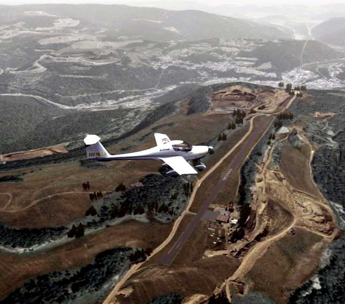
A flight simulation scenery view of a Diamond DA20 Eclipse flying over Moran Field.
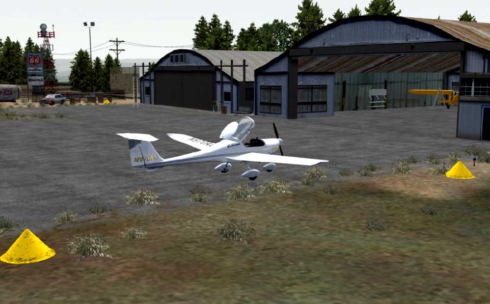
A flight simulation scenery view of a Diamond DA20 Eclipse in front of hangars at Moran Field.
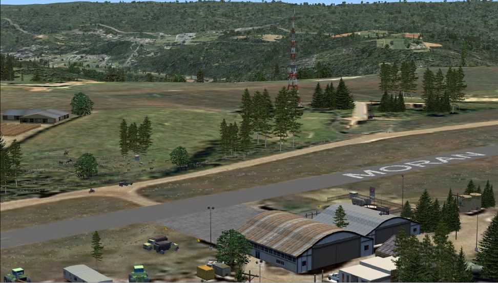
A flight simulation scenery view looking east at Moran Field.
According to Rick Harshbarger, “In the mid 2000s, with Mr. Moran getting up in years & not flying anymore, the planes were sold.
Finally, the coal operations started to use the hangars for workshops & then coal trucks started to cross the runway to get to new surface mines.
The company finally closed the field.
The mill was sold first to the Mead Corporation & then the New Page Corporation. Neither had the desire to use the airport.
It's a shame to see it closed. It has wide open approaches & was really well kept back in the day.”
A 8/25/07 aerial view depicted Moran Airfield in an unchanged manner compared to the 1995 photo.
Moran Airfield was evidently closed within the next month (for reasons unknown),
as a 9/24/07 aerial view depicted closed-runway “X” symbols having been painted on each runway end.
The airfield otherwise remained intact.
Moran Airfield was depicted as an abandoned airfield on the 2011 Cincinnati Sectional Chart.
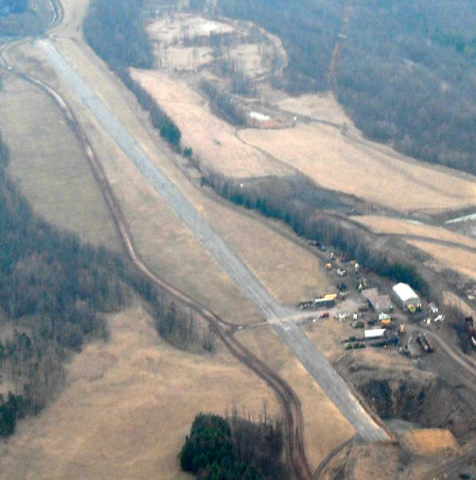
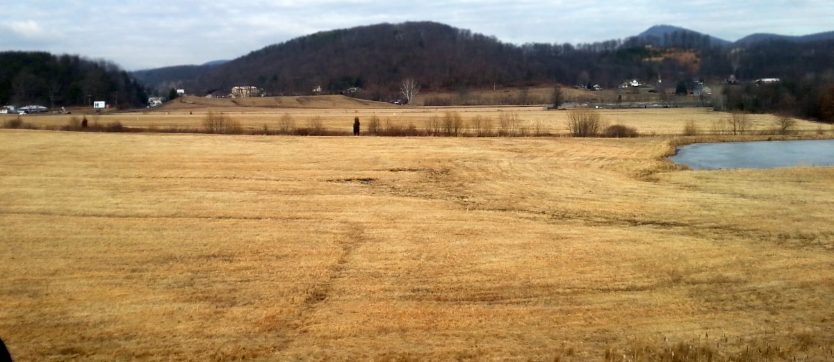
A March 2011 aerial view by Paul Freeman looking east at Moran Airfield showed the runway to remain intact,
with one closed-runway “X” symbol visible in the center.
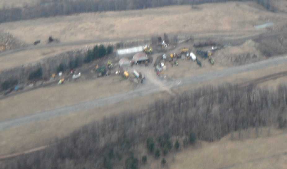
A March 2011 aerial view by Paul Freeman looking south at the hangars at Moran Airfield.
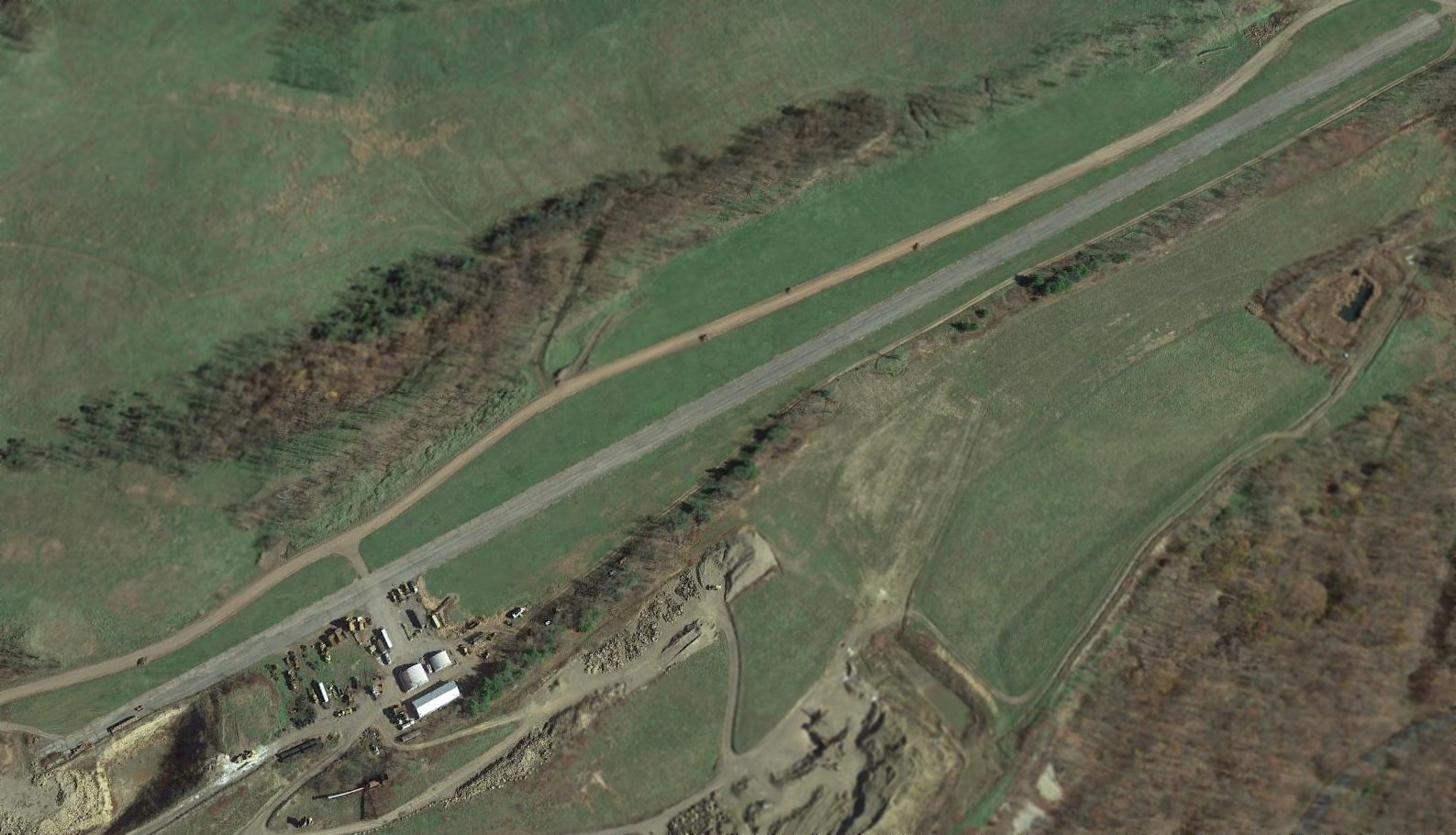
A 2016 aerial view looking northeast shows the Moran Airfield runway & hangars remain intact.
The site of Moran Airfield is located north of the intersection of Routes 135 & 46.
____________________________________________________
39.56, -79.35 (West of Cumberland, MD)

An undated photo looking west at 2 planes on the west end of Bowman Field.
The photo is evidently pre-1954, as the hangar did not yet exist (note the windsock on top of the building at left).
This picture is on display inside the Bear Creek Traders Store (as of 2011).
According to a historical plaque inside the Bear Creek Traders store,
“The Bowman family actively farmed their 97-acre homestead from the early 1920s until 1946.”
Bowman Airfield was not yet depicted on a 1946 aerial photo, nor on the 1949 USGS topo map.
According to a historical plaque inside the Bear Creek Traders store,
“During the late 1940s, a section of their farm, parallel to Mosser Road, became landing strip for single-engine aircraft.
Pilots secured permission to land on the property & the Bowmans decided to dedicate a tract of land specifically for that service.
Charles “Skeeter” Bowman noted, 'My father gave them permission
because it was the only convenient place for aircraft to land near Deep Creek Lake.
A majority of the pilots that landed on our farm were from the Pittsburgh area.'”
The plaque continued, “Bowman Airfield consisted of a grass runway, 2,300' in length, and an orange windsock.
Services at Bowman Airfield were limited.
Pilots could taxi aircraft to a location beside the landing strip & tie them down, or purchase a few gallons of fuel from a 55-gallon drum.
No fees were charged for landing services.
Skeeter remarked, 'We saw it as a means of recreation. We never saw it as a way to make money.'”
The plaque continued, “Following World War II, air travel to Deep Creek Lake increased.
Most pilots desired a short stay at Deep Creek & used Bowman Field for their travel arrangements.
Skeeter recalled, 'On busy weekends, we would often see 6-8 planes landing at our strip.
Most of the planes that came here were single-engine.'
On special occasions, other aircraft used the field such as a privately-owned BT-13 [a World War II surplus Army Air Corps basic trainer].
A flying club from Somerset PA also chose the field for a fly-in event,
thereby temporarily creating a busy flight schedule at McHenry.”
The earliest depiction which has been located of Bowman Airfield
was an undated photo looking west at 2 planes on the west end of Bowman Field.
The photo is evidently pre-1954, as the hangar did not yet exist (note the windsock on top of the building at left).
This picture is on display inside the Bear Creek Traders Store (as of 2011).
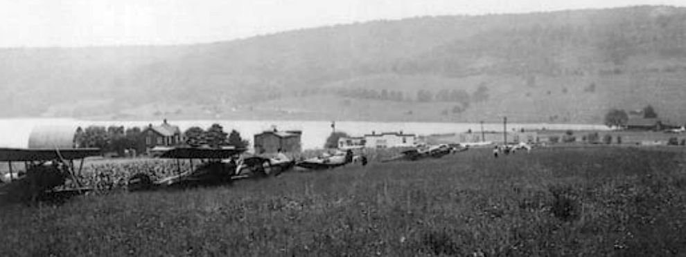
An undated photo looking west at a half-dozen biplanes & monoplanes at Bowman Field.
According to a historical plaque inside the Bear Creek Traders store,
“Two other unusual aircraft cruising there were designed for agricultural purposes.
They arrived from the eastern shore of Maryland outfitted with sprayers that would emit a mist of insecticide.
Farmers requested the service to combat aphids that were harming the local pea crop.”
Bowman Airfield was not yet depicted on the February 1954 Huntington Sectional Chart.
The earliest aeronautical chart depiction of Bowman Airfield which has been located was on the July 1954 Huntington Sectional Chart.
It depicted Bowman as a private field with a 2,300' unpaved runway.
According to a historical plaque inside the Bear Creek Traders store, “One major capital improvement to the facility occurred in 1954
when a 40' x 60' hangar was constructed to house Skeeter's private plane.
The hangar's design permitted storage of boats from nearby Bowman's Marina.
No other structures were built for commercial or private pilots & the airfield remained a family enterprise.”
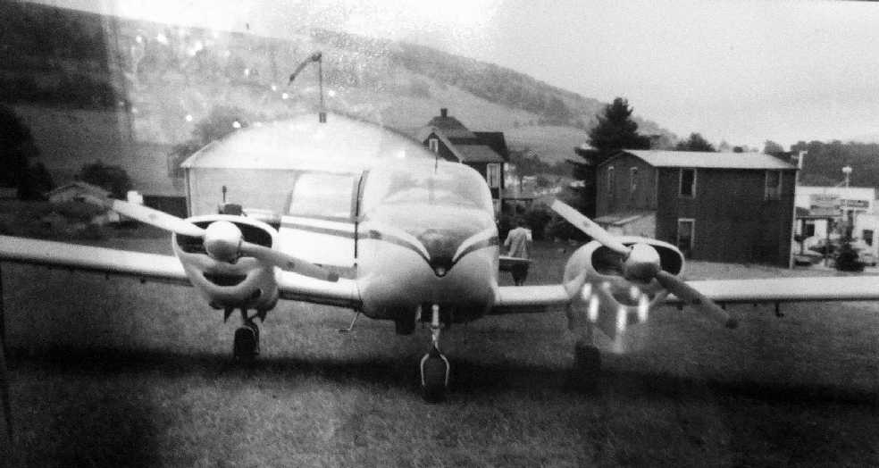
An undated photo looking southeast at a Piper Apache at Bowman Field.
This picture is on display inside the Bear Creek Traders Store (as of 2011).
According to a historical plaque inside the Bear Creek Traders store,
“The first twin-engine aircraft to land in Garrett County, a Piper Apache, cruised to Bowman Field in the late 1940s.”
However, this photo appears to be from 1954 or after, as it depicted the hangar, which was built in 1954.
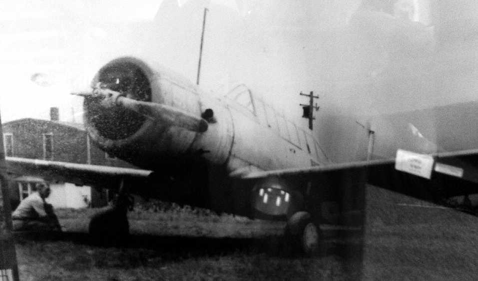
An undated photo of a military surplus Vultee BT-13 trainer at Bowman Field.
This picture is on display inside the Bear Creek Traders Store (as of 2011).
An undated aerial view looking south at the west end of Bowman Field, showing a hangar & one plane on the field.
The photo appears to be from 1954 or after, as it depicted the hangar, which was built in 1954.
This picture is on display inside the Bear Creek Traders Store (as of 2011).
The May 1958 Huntington Sectional Chart (courtesy of Chris Kennedy)
depicted Bowman as a private field, with a 2,300' unpaved runway.
The last aeronautical chart depiction of Bowman Airfield which has been located
was on the July 1960 Huntington Sectional Chart.
It depicted Bowman as a public-use airport with a 2,300' unpaved runway.
A 6/26/60 USGS aerial view showed Bowman Field as remaining clear, with possibly 3 light aircraft on the west side of the field.
Bowman Airfield was evidently closed at some point between 1958-61,
as it was no longer depicted at all on the January 1961 Huntington Sectional Chart.
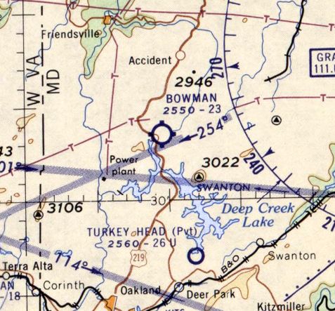
It was eventually replaced by the larger Garrett County Airport, less than a mile to the north.
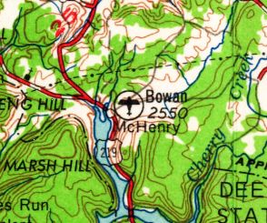
Bowman Airport was still depicted on the 1962 USGS topo map.
According to Linda Bowman Niederberger (daughter of Skeeter Bowman),
“When the 'new Route 219' was built in the early 1970s, it cut right through Bowman Field.”
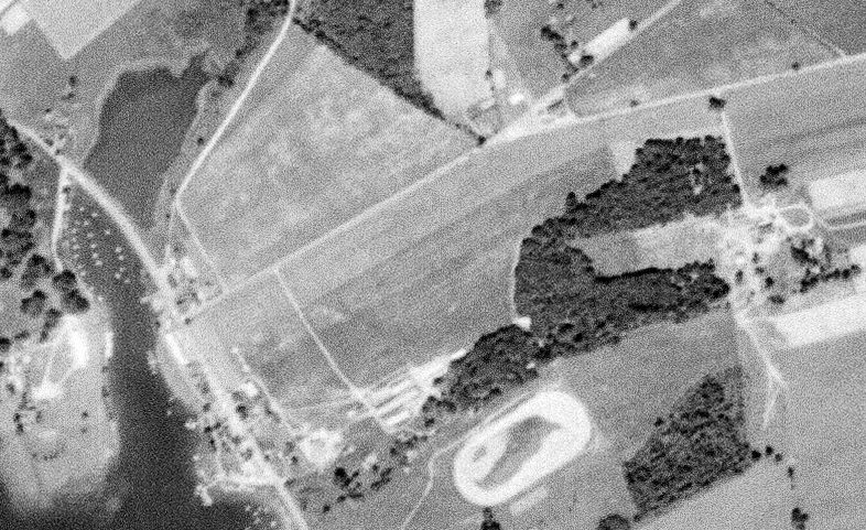
Bowman Airfield was no longer depicted on the 1974 USGS topo map.
By the time of the 1995 USGS aerial photo, there did not appear to be any large-scale trace remaining of the former Bowman Airfield.
Skeeter Bowman's 1940 Taylorcraft BC65 was purchased for the Bear Creek Traders store by Hugh Umbel so that it could be displayed.
The 784 pound aircraft was raised into its position, hanging from the ceiling via cables, in 2004.
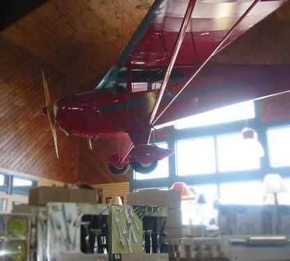
A 2005 photo by Paul Bowman (courtesy of Bo Bowman) of Skeeter Bowman's 1940 Taylorcraft,
suspended from the ceiling of the Bear Creek Traders store.
Bo Bowman reported in 2005, “In a small shopping Center just off Route 219,
there is one of those all-purpose general stores called Bear Creek Traders.
Hanging from the center of the store is a 1940 Taylorcraft that belonged to Skeeter Bowman,
the owner & main occupant of the old Bowman Field.
Below the airplane are a bunch of written plaques & some pictures relating to the Bowman family, farm, airport, etc.”
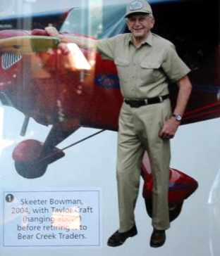
A 2005 photo (courtesy of Bo Bowman) of Skeeter Bowman in front of his 1940 Taylorcraft.
Linda Bowman Niederberger (daughter of Skeeter Bowman) reported in 2007,
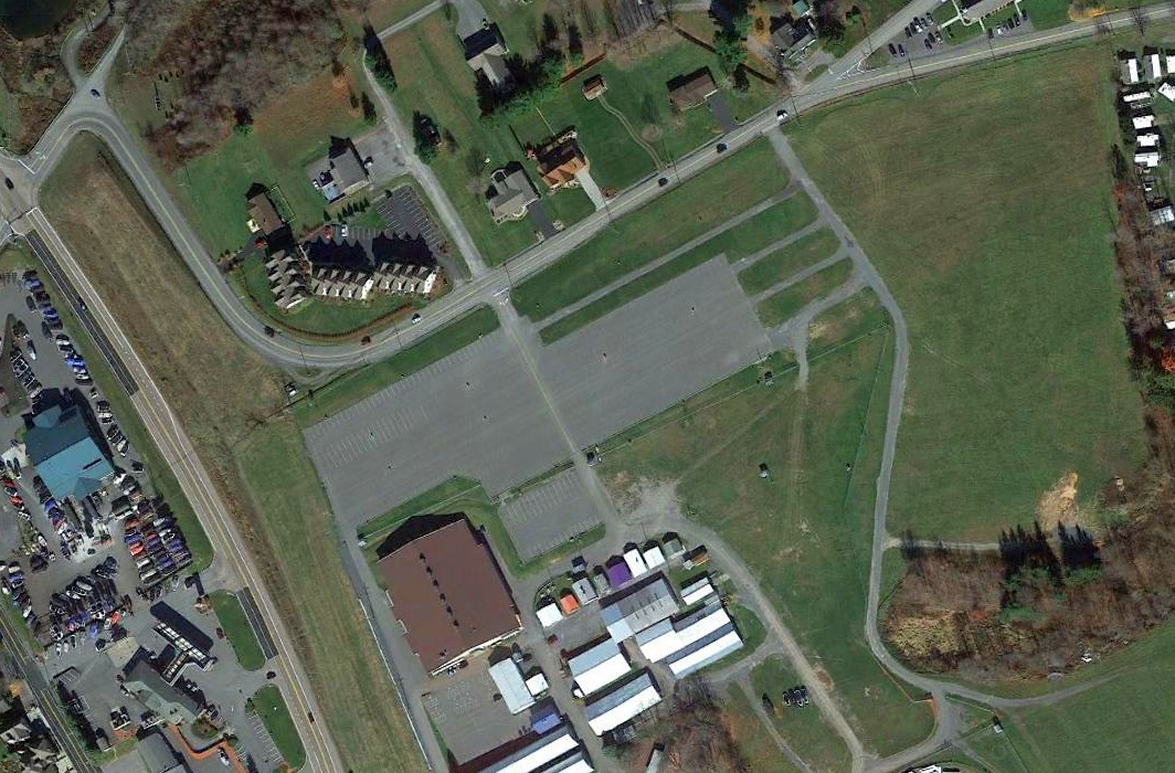
“The grass parking area of the Garrett County Fairgrounds [the eastern portion of the former airfield] is all that is left of the landing strip.
The hangar is stranded on the other side of Route 219.
The hangar is between the 2 roads [Route 219 & Deep Creek Drive], more or less surrounded by other structures.”
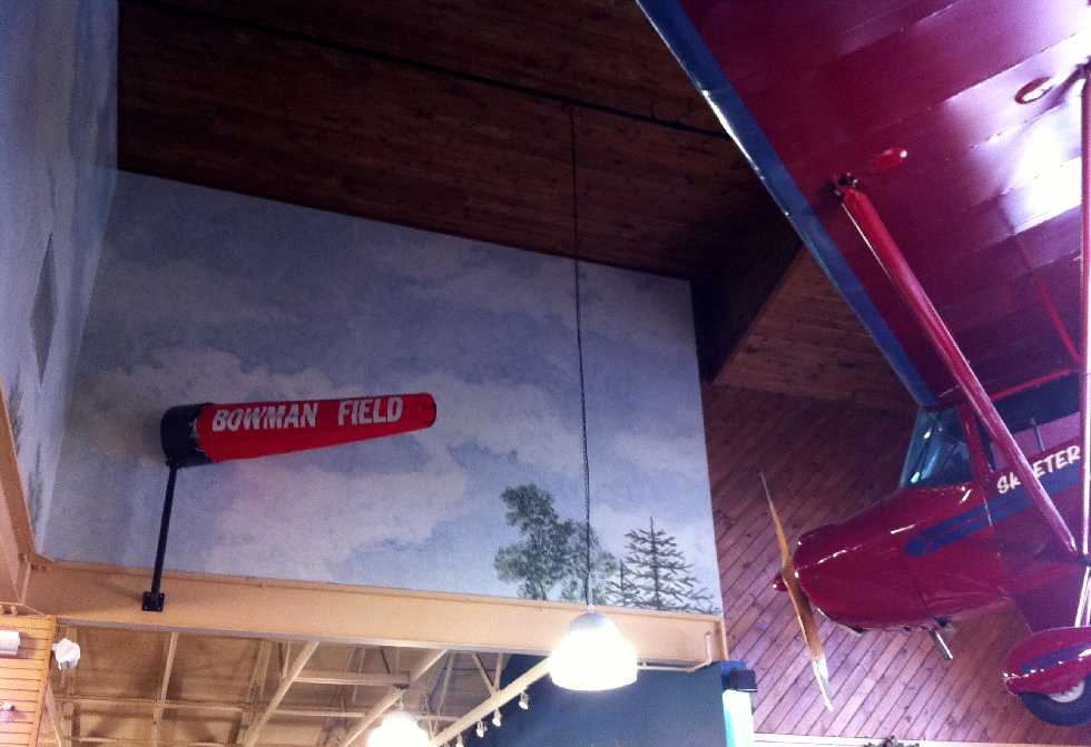
A February 2011 photo by Paul Freeman of a windsock marked “Bowman Field” along with Skeeter Bowman's Taylorcraft,
suspended from the ceiling of the Bear Creek Traders store in McHenry.
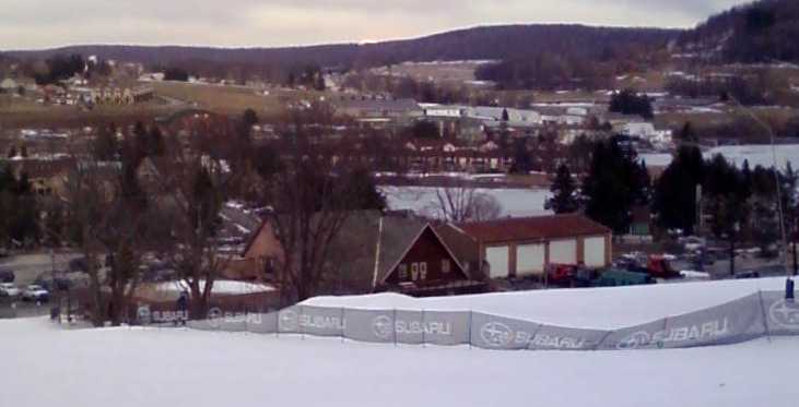
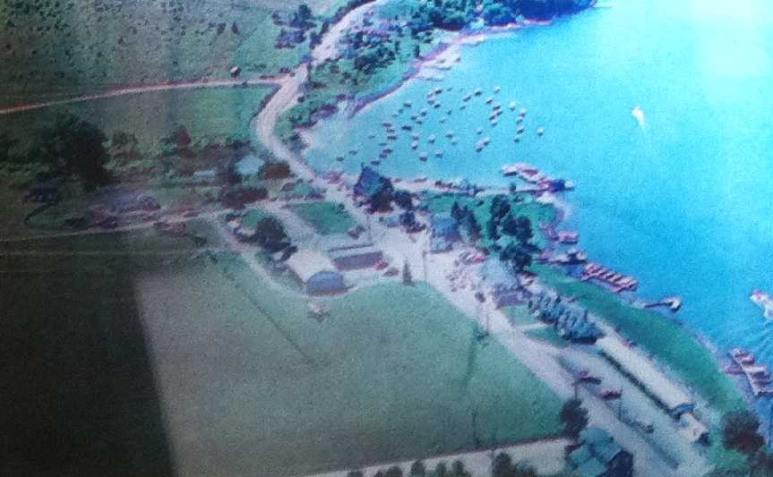
A February 2011 photo by Paul Freeman looking east at the site of Bowman Field from the ski slopes of Wisp Mountain Resort.
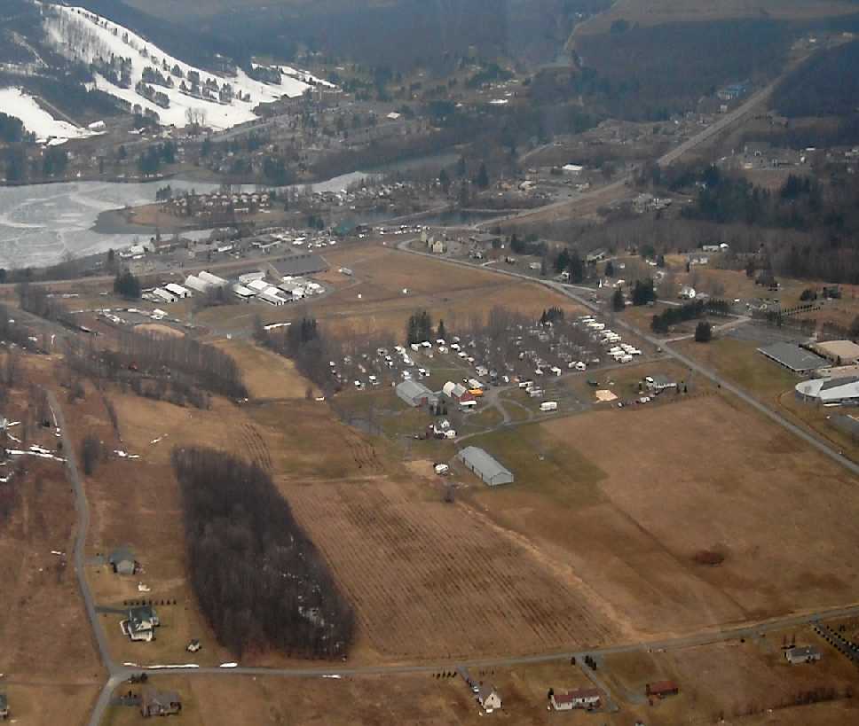
A March 2011 aerial view by Paul Freeman looking west at the site of Bowman Field, with Deep Creek Lake & the ski slopes of Wisp Mountain Resort in the background.
A 2016 aerial view did not appear to show any large-scale trace remaining of the former Bowman Airfield.
The site of Bowman Airfield is located southeast of the intersection of Mosser Road & Route 219.
Thanks to Bo Bowman for pointing out this field.
____________________________________________________
Or if you prefer to contact me directly concerning a contribution (for a mailing address to send a check),
please contact me at: paulandterryfreeman@gmail.com
If you enjoy this web site, please support it with a financial contribution.
____________________________________________________
This site covers airfields in all 50 states.
For the site's main menu: Home