Abandoned & Little-Known Airfields:
Southwestern Michigan
© 2002, © 2026 by Paul Freeman. Revised 2/15/26.
This site covers airfields in all 50 states: Click here for the site's main menu.
____________________________________________________
Please consider a financial contribution to support the continued growth & operation of this site.
Austin Lake Airport & Seaplane Base (revised 11/23/25) - Aviation Country Club (added 12/31/18) - Bean Blossom Airport (revised 7/8/22) - David Airfield / David's Airport (revised 7/23/22)
Grand Rapids Municipal Airport / Kent County Airport (revised 2/15/26) - Grand River Airpark & Seaplane Base (revised 7/27/18) - (Original) Hillsdale Airport (revised 5/6/23)
Holland Airport / Park Township Airport (rvised 4/14/24) - Jablonski Airport (revised 4/20/24) - Marks' Field (revised 2/27/24) - Morgan Field (revised 7/27/18)
Northside Airport (revised 6/14/24) - Oselka Airport (revisd 7/24/22) - Ottiger Field (added 4/19/24) - Plane Haven Airport (revised 11/23/25)
Saugatuck-Douglas Airport / Douglas Lakeside Airport (revisd 7/2/22) - Shoemaker Airport (revised 3/2/25) - South Kent Airport (revised 4/24/23) - Szekely Field (revised 12/8/22)
____________________________________________________
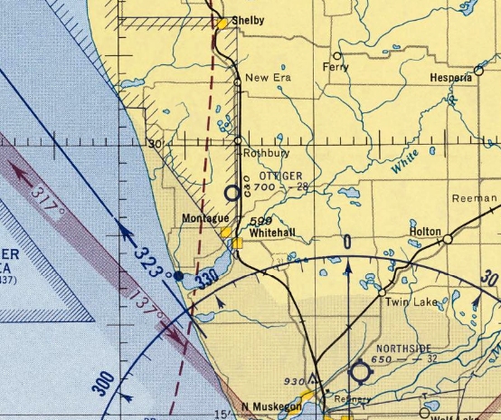
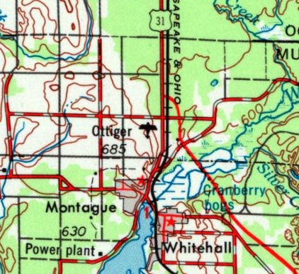
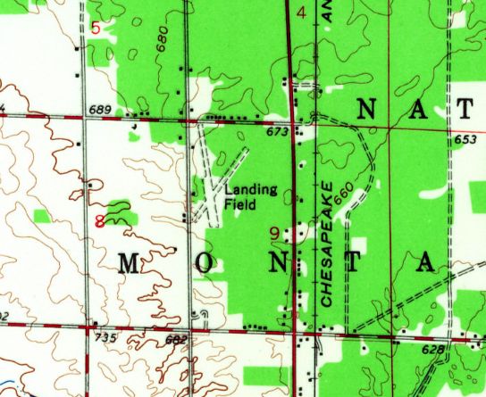
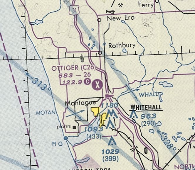
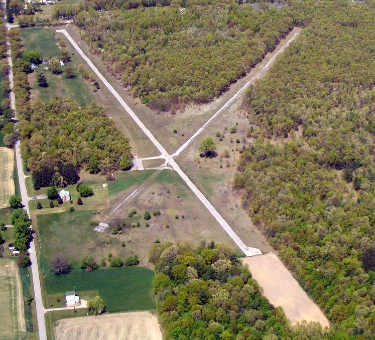
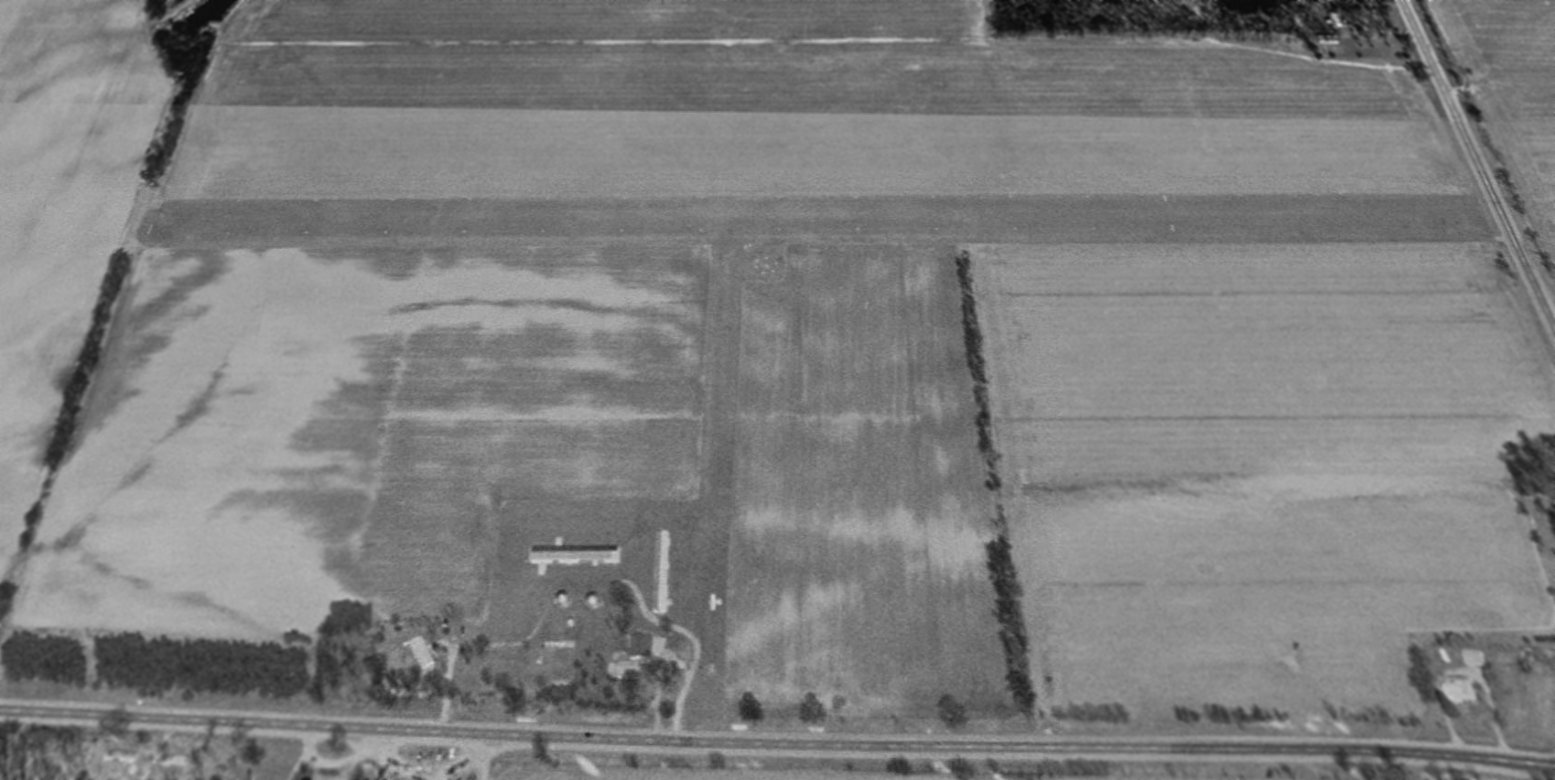
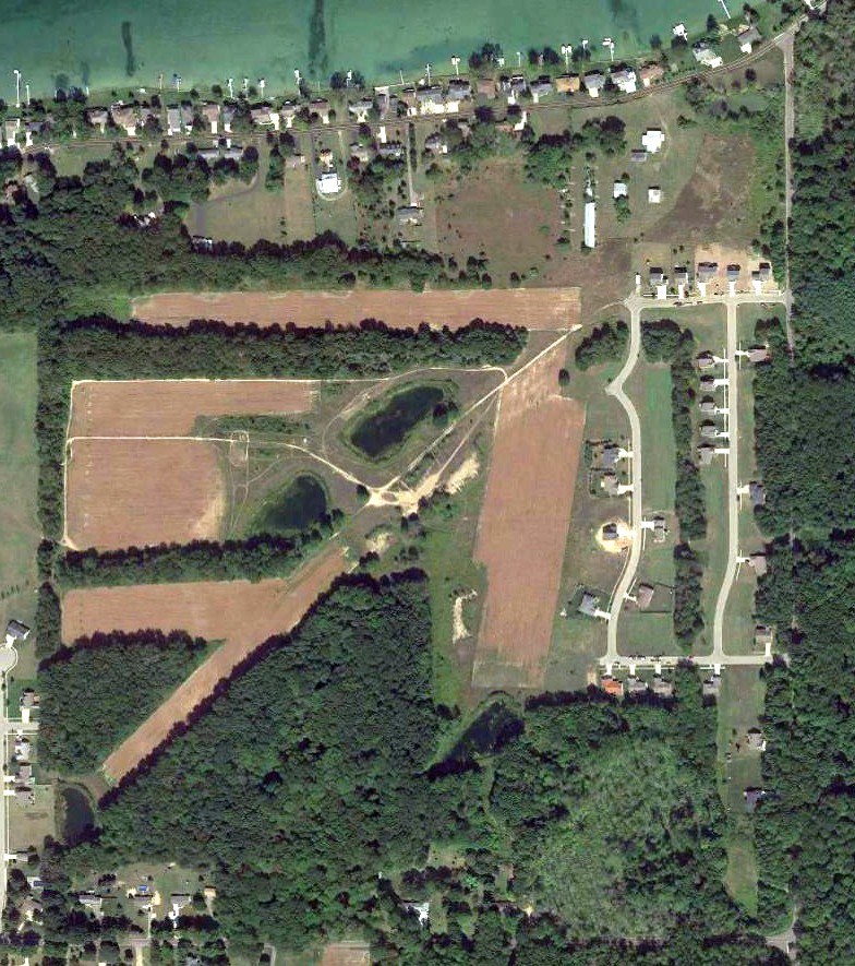
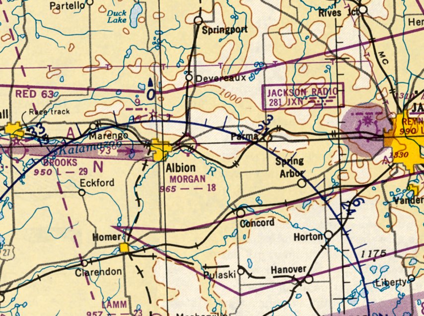
Ottiger Field (C26), Rothbury, MI
43.455, -86.354 (Northwest of Detroit, MI)
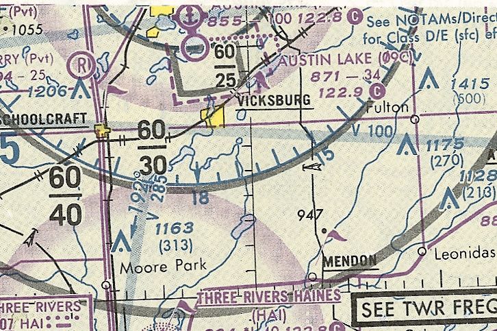
Ottiger Field, as depicted on the May 1954 Milwaukee Sectional Chart.
According to a memorial plaque at the site, Ottiger Field was founded by Fred Ottiger in 1950.
Ottiger Field was not yet depicted on the May 1953 Milwaukee Sectional Chart.
The earliest depiction which has been located of Ottiger Field was on the May 1954 Milwaukee Sectional Chart.
It depicted Ottiger as having a 2,800' unpaved runway.
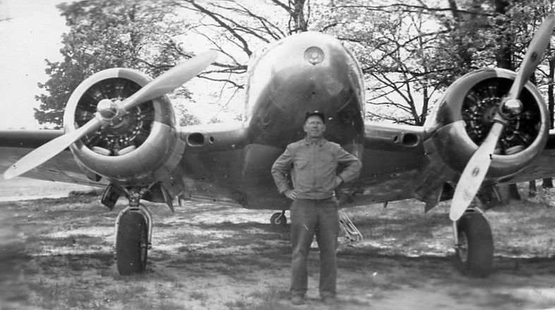
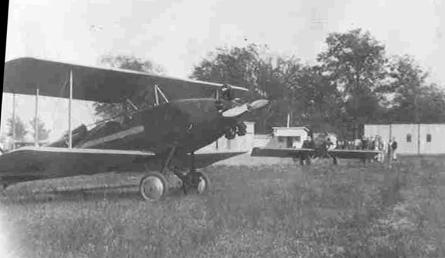
The earliest photo which has been located of Ottiger Field was a circa 1954 photo of airport founder Fred Ottiger in front of a Beech 18.
The earliest topo map depiction which has been located of Ottiger Field was on the 1954 USGS topo map.
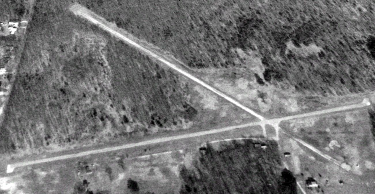
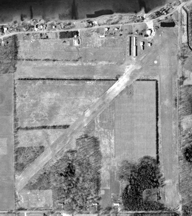
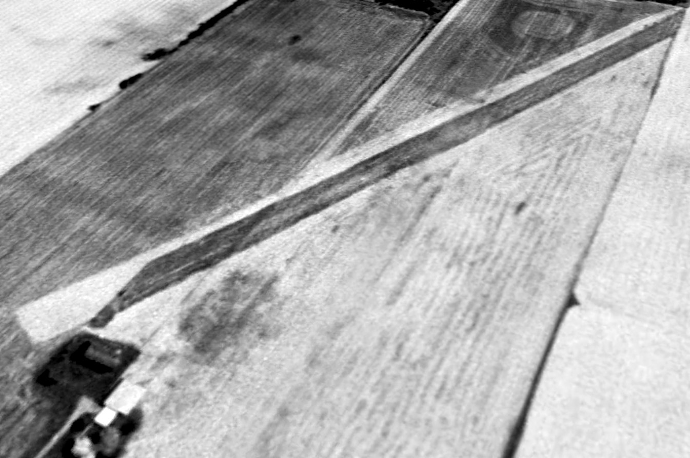
The earliest aerial photo which has been located of Ottiger Field was a 4/27/55 aerial view (courtesy of Mike Denja).
It depicted Ottiger as having 2 unpaved runways, with 2 light single-engine planes parked northwest & northeast of the runway intersection.
There did not appear to be any hangars or other airport buildings.
The 1959 USGS topo map depicted Ottiger Field as 2 unpaved runways, generically labeled “Landing Field”, with a few small buildings on the west side.
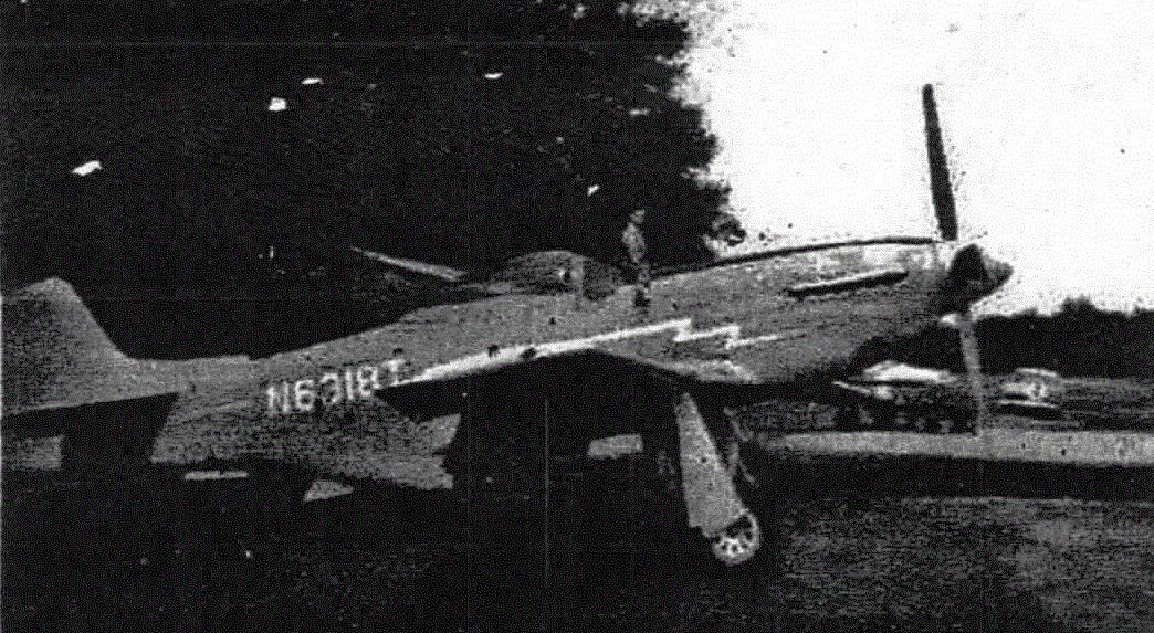
A 1962 photo of a surplus North American P-51 Mustang fighter at Ottiger Field.
A memorial plaque was placed at Ottiger Field in 1964, noting that it was “Dedicated to service & progress of private flying; founded 1950 by Fred Ottiger.”
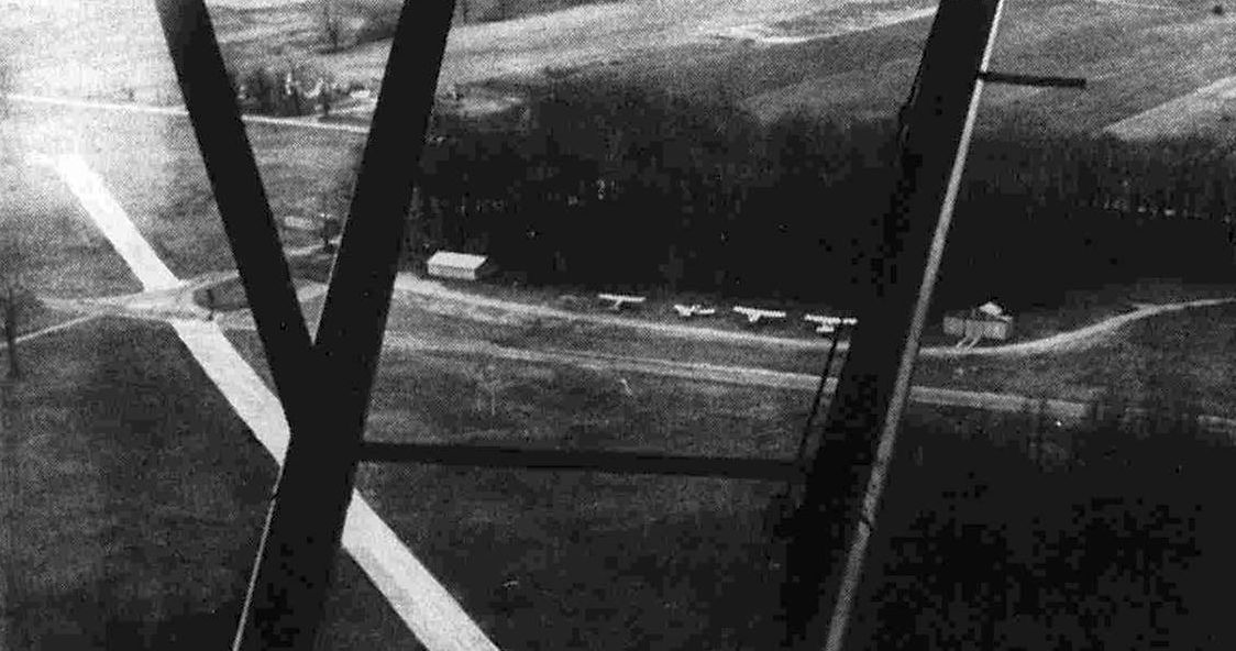
A 1970 aerial view looking west depicted 4 light single-engine planes parked between 2 small hangars at Ottiger Field.
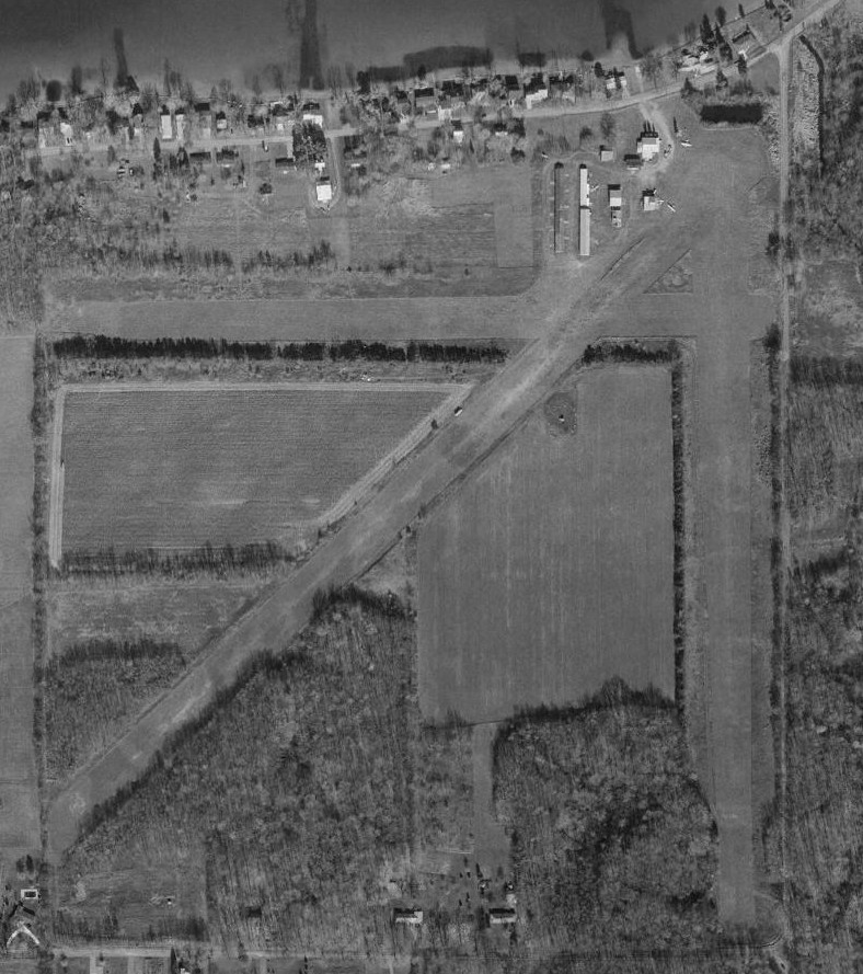
A 4/29/77 aerial view (courtesy of Mike Denja) showed 2 T-hangars had been added at Ottiger Field at some point between 1955-77,
and a total of 5 light single-engine planes were visible on the field, perhaps its zenith of popularity.
A 1993 USGS aerial view looking east showed Ottiger Field remained remained intact, but no aircraft were visible on the field.
The last aeronautical chart depiction which has been located of Ottiger Field was on the October 1993 Chicago Sectional Chart.
It depicted Ottiger as having 2 paved runways, with the longest being 2,600'.
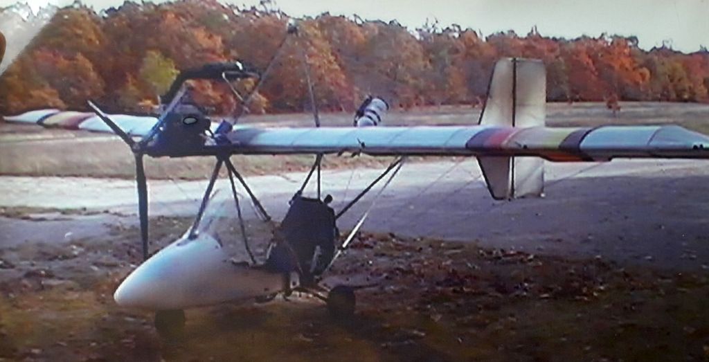
A circa 2000 photo of an ultralight aircraft (model unidentified) at Ottiger Field.
The last photo which has been located of an aircraft at Ottiger Field was a circa 2003 photo of an ultralight aircraft (model unidentified).
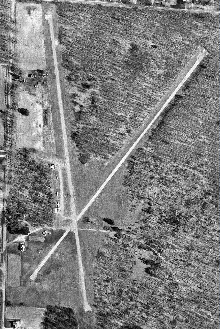
A 2006 aerial view looking north showed Ottiger Field's runways to remain mostly intact, but it appears the two hangars had been removed at some point between 1993-2006.
Ottiger Field was evidently closed (for reasons unknown) at some point between 1993-2016,
as it was no longer depicted on the 2016 Chicago Sectional Chart.
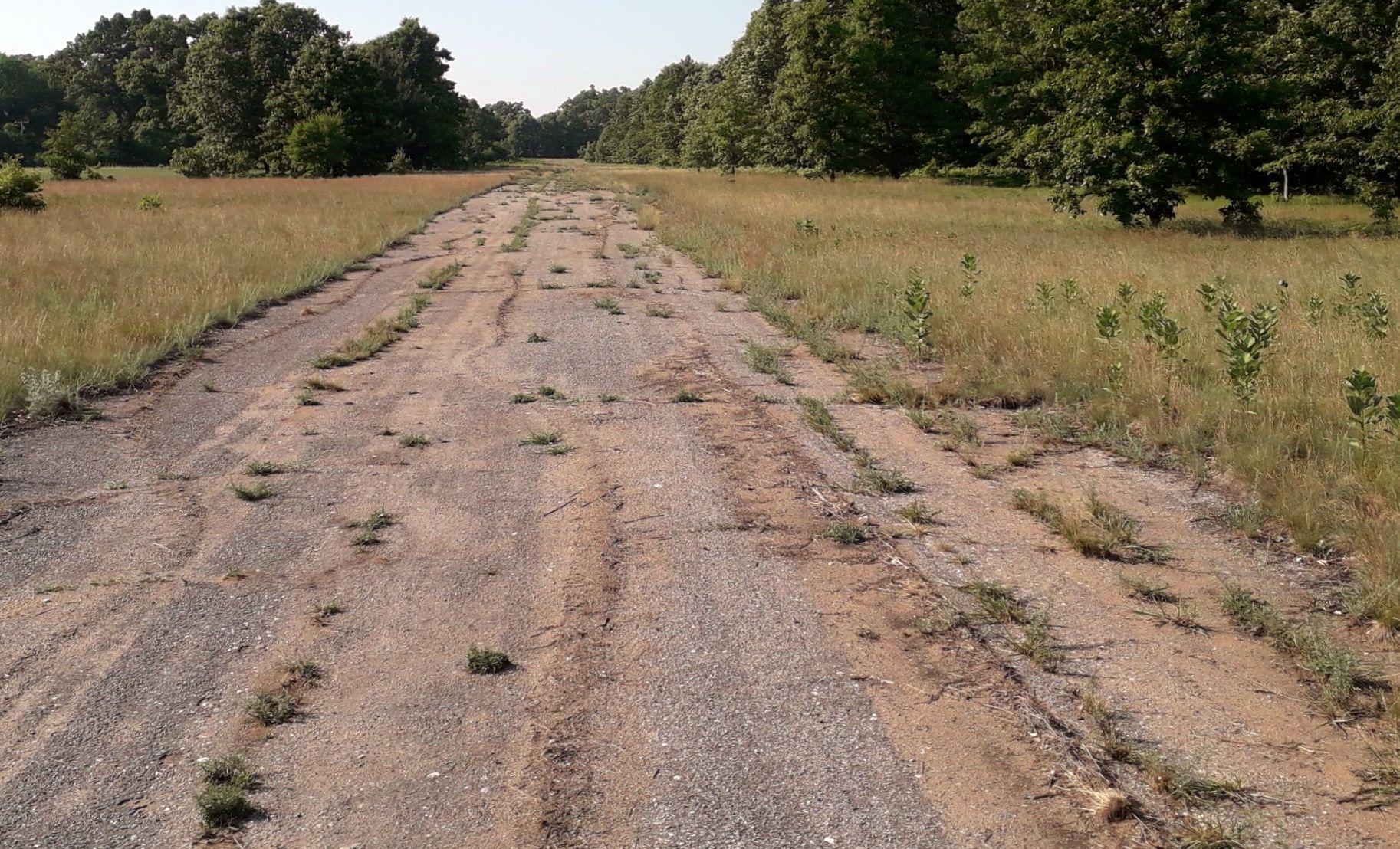
A 2018 photo looking north along the deteriorating Ottiger Field runway pavement.
A 2019 photo looking south at the deteriorating Ottiger Field runway pavement.
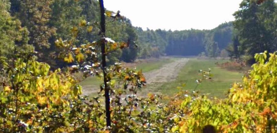
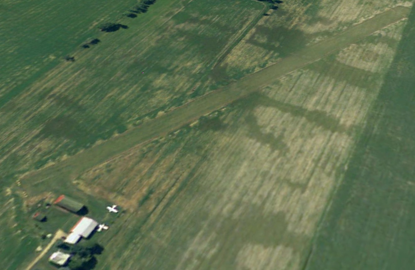
A 2022 aerial view looking east showed Ottiger Field remained intact though with no sign of recent aviation use.
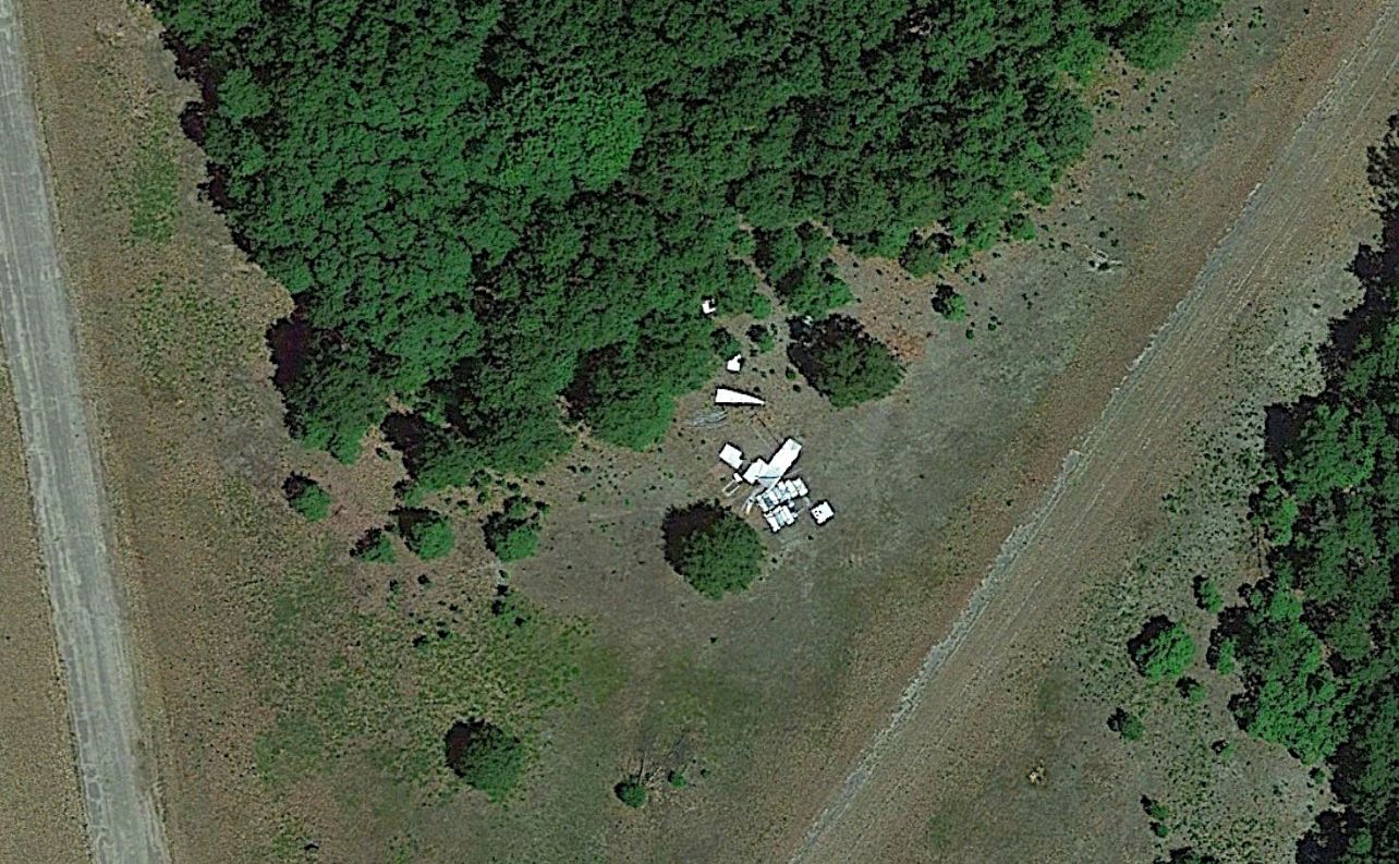
A 2022 aerial view of what may be aircraft or hangar parts north of the Ottiger Field runway intersection.
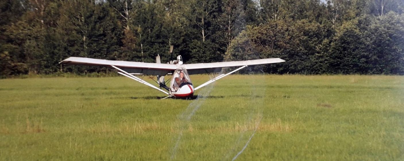
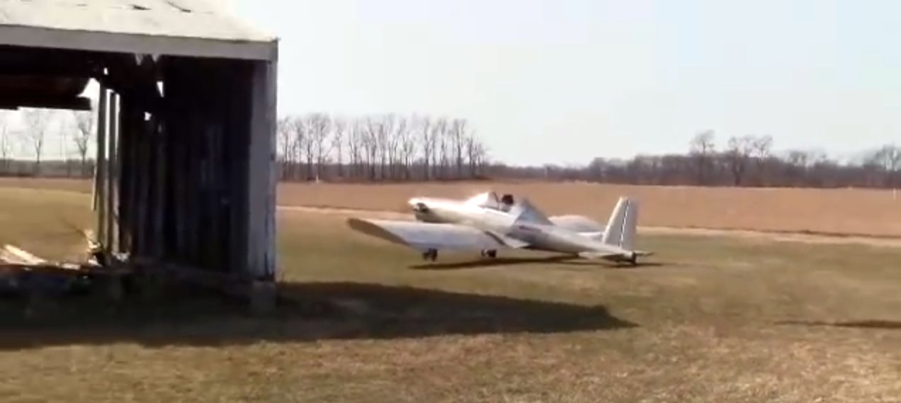
A 2022 photo of an ultralight aircraft (model undetermined) at Ottiger Field.
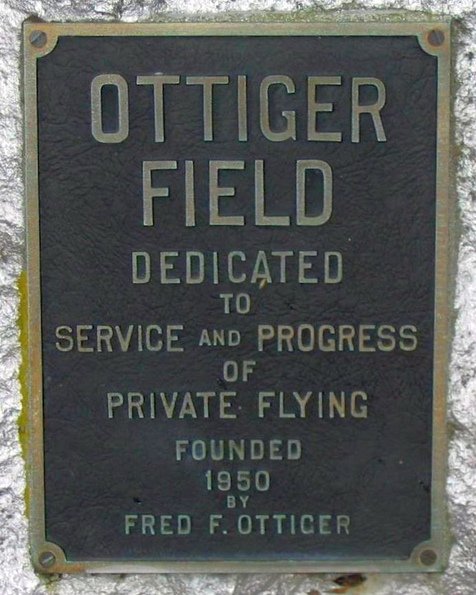
A circa 2022 photo of a memorial plaque placed at Ottiger Field in 1964.
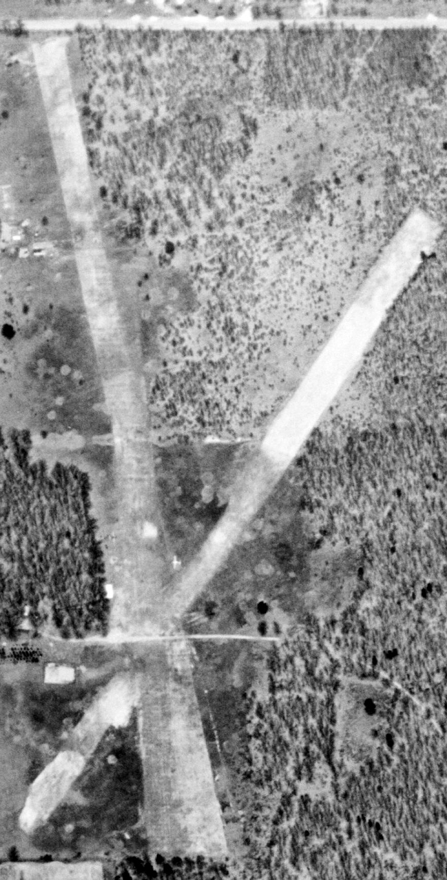
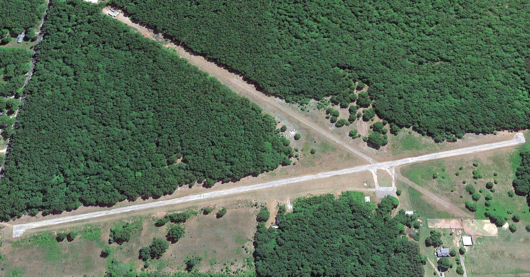
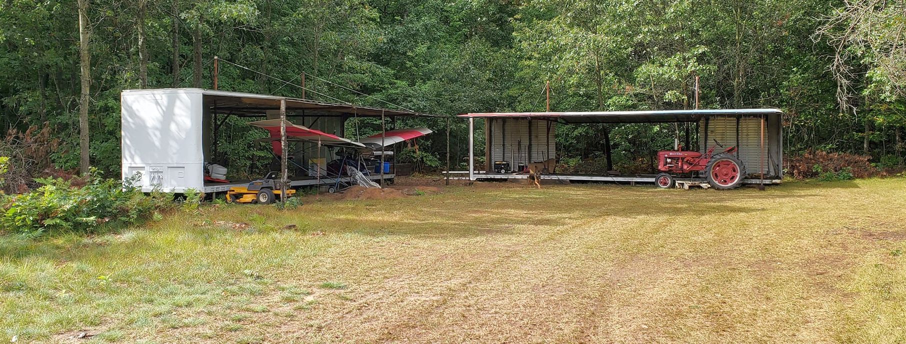
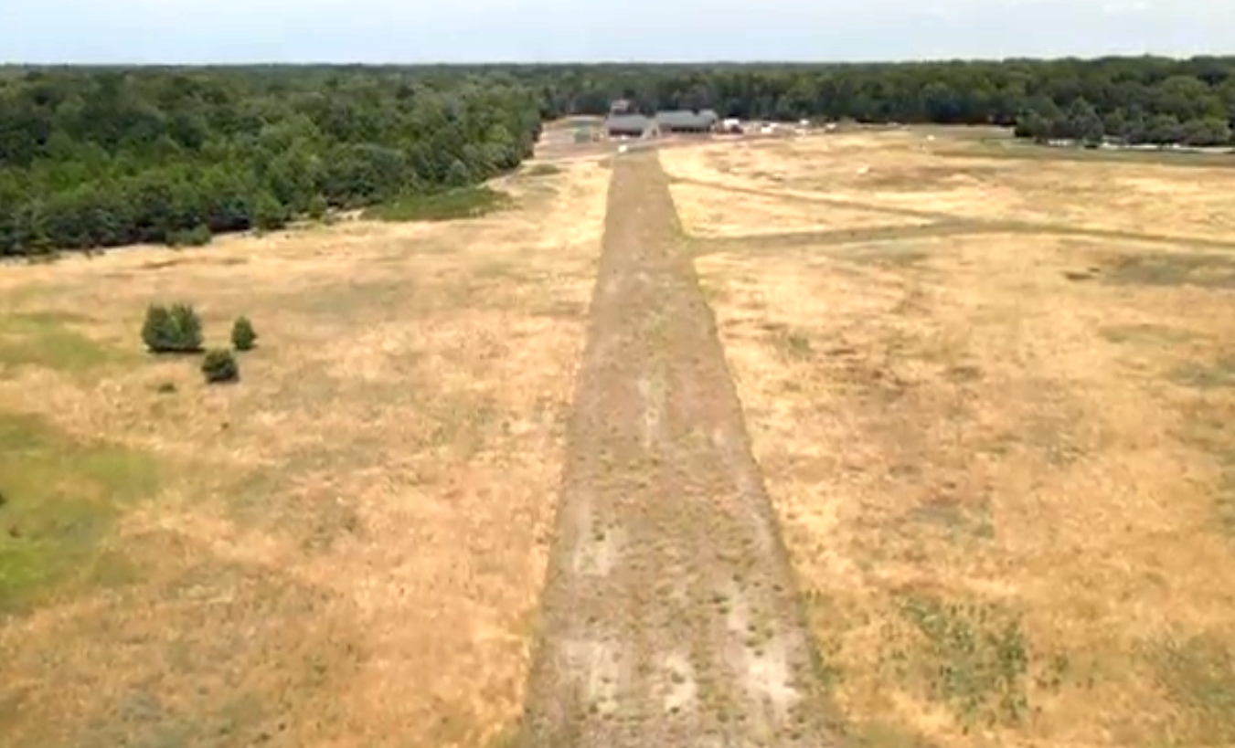
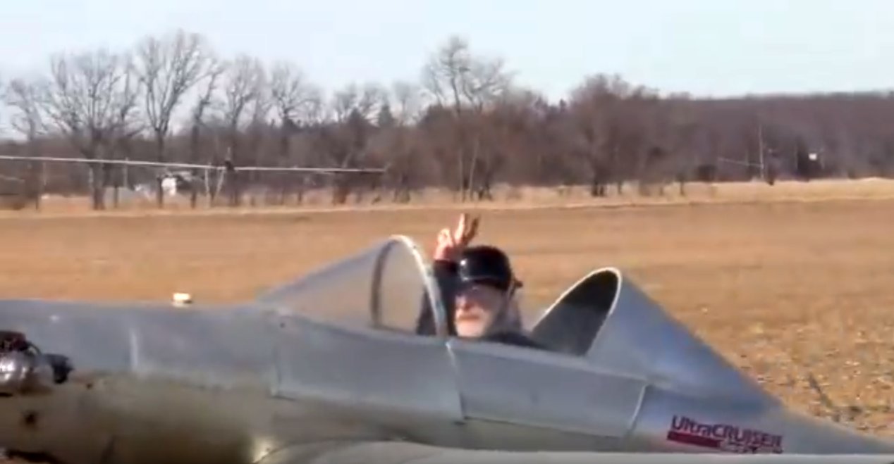
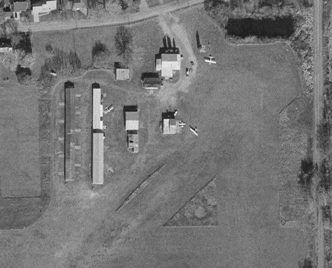
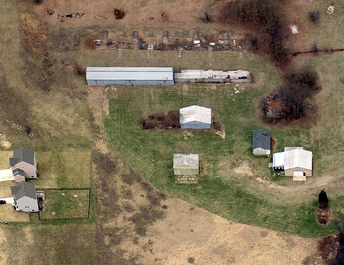
A 4/14/24 drone aerial view by Tony Driza looking northeast at Ottiger Field.
Tony Driza reported, “There had been activity at Ottiger Field as recently as last year, mostly radio-controlled model aircraft but an occasional [manned] aircraft as well.
The property was sold to a non-pilot so likely it will continue to deteriorate.”
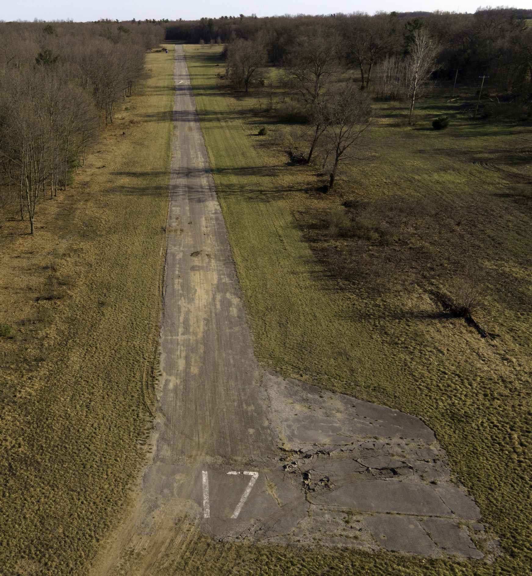
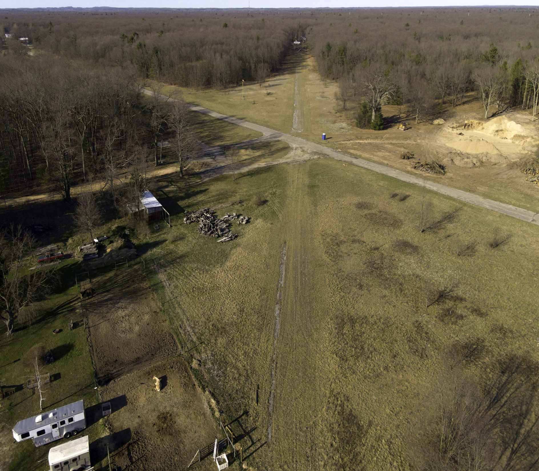
A 4/14/24 drone aerial view by Tony Driza looking south along Ottiger Field's Runway 17.
Tony Driza reported, “Runway 17/35 is in poor condition but far better than Runway 3/21 which is nearly gone. Note the really significant displace threshold to Runway 17 - the approach is over some high trees.
Sad to see this one fade away - challenging airport with winds swirling through the trees. Hard to believe it’s been over half a century since I set foot on that runway.”
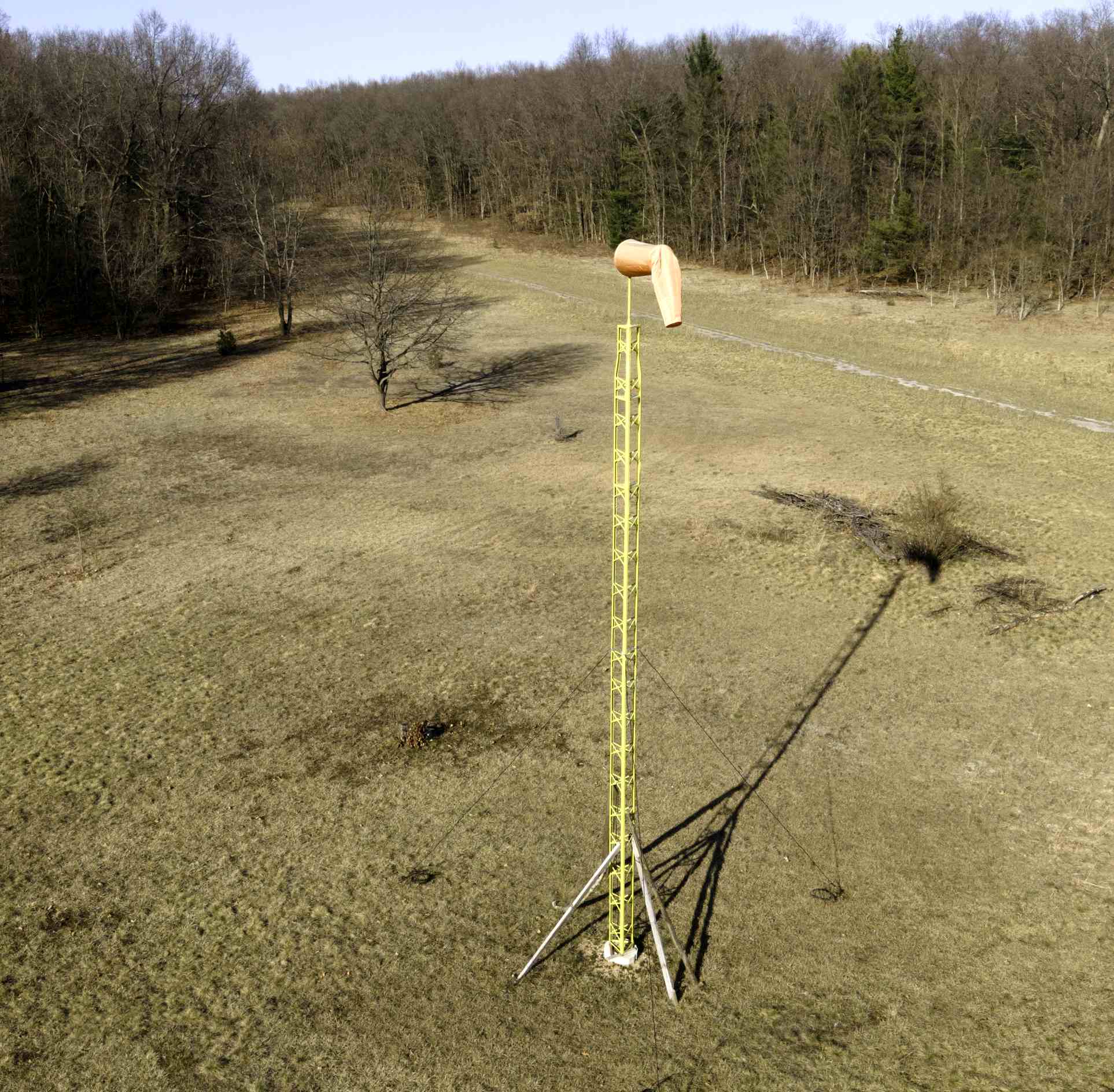
A 4/14/24 drone aerial view by Tony Driza of Ottiger Field's windsock.
Thanks to Tony Driza for pointing out this airfield.
____________________________________________________
Jablonski Airport (33C), Nunica, MI
43.082, -86.096 (Northwest of Detroit, MI)
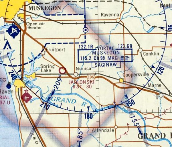
Jablonski Airport, as depicted on the May 1968 Milwaukee Sectional Chart.
This little general aviation airport was evidently established at some point between 1967-68,
as it was not yet depicted on a 1955 aerial photo or the 1967 Milwaukee Sectional Chart.
The earliest depiction which has been located of Jablonski Airport was on the May 1968 Milwaukee Sectional Chart.
It depicted Jablonski as having a 3,000' unpaved runway.
The earliest photo which has been located of Jablonski Airport was a 4/20/69 USGS aerial view (courtesy of Mike Denja).
It depicted Jablonski as having 2 perpendicular unpaved runways, with 1 small building on the southwest side.
There were no aircraft visible on the field.
Tony Driza recalled of Jablonski Airport, “Glad I had the chance to practice short/soft field takeoffs there back in the late 1960s / early 1970s.”
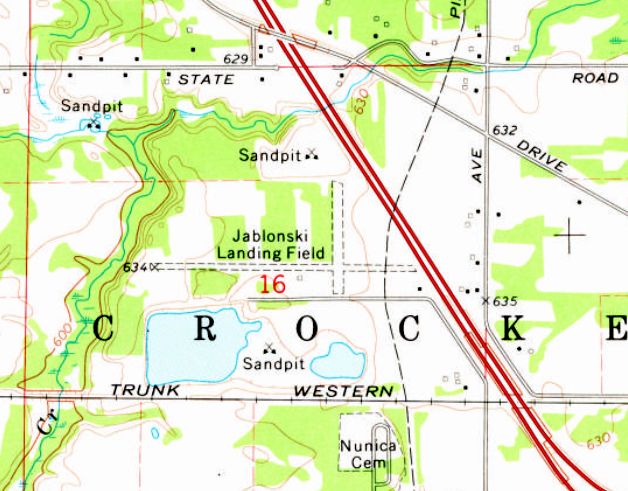
The earliest topo map depiction which has been located of Jablonski Airport was on the 1972 USGS topo map.
It depicted “Jablonski Landing Field” as having 2 perpendicular unpaved runways, with a small building on the southwest side.
The earliest photo which has been located showing aircraft at Jablonski Airport was a 1981 aerial view.
It depicted 4 light single-engine aircraft parked near a small building on the southwest side.
A 1986 aerial view showed Jablonski Airport remained in an unchanged configuration, but no aircraft were seen on the field.
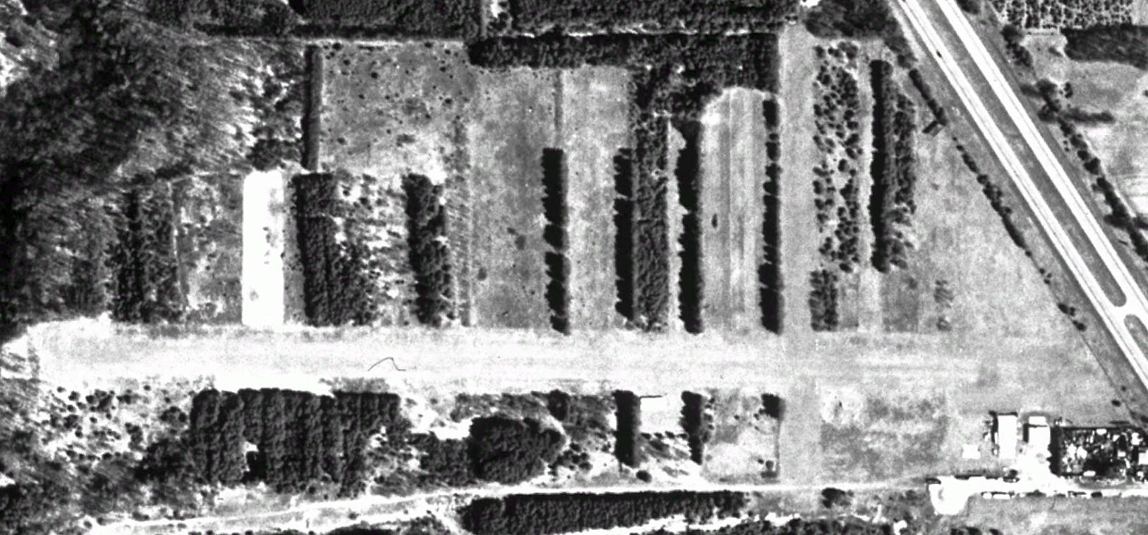
A 1997 aerial view showed Jablonski Airport remained in an unchanged configuration, but no aircraft were seen on the field.
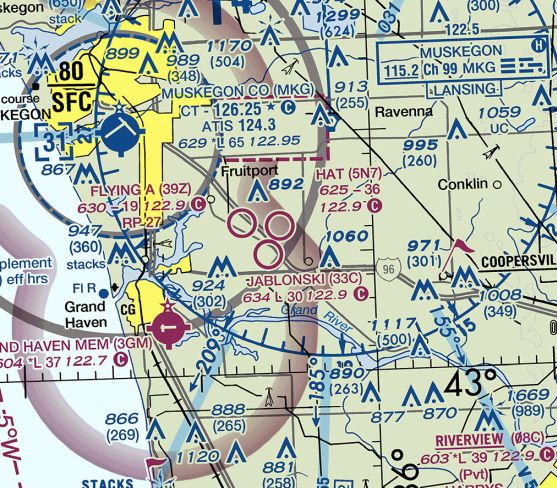
The last aeronautical chart depiction which has been located of Jablonski Airport was on the 2017 Chicago Sectional Chart (courtesy of Ryan Van Vels).
It depicted Jablonski as having a 3,000' unpaved runway.
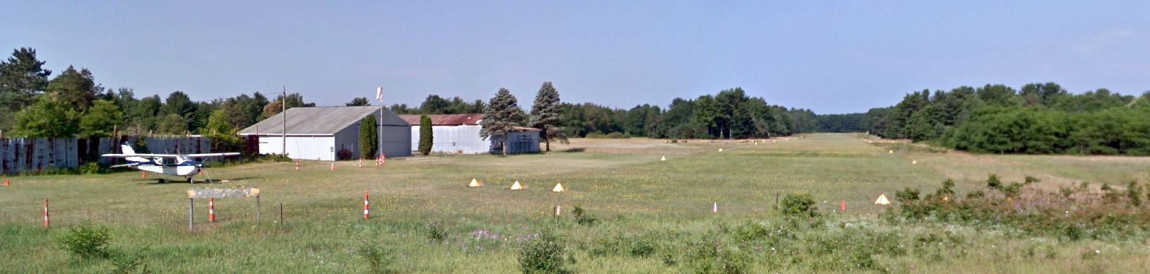
The last photo which has been located showing aircraft at Jablonski Airport was a 2018 photo looking west.
It depicted a single-engine Cessna parked near 2 small hangars on the south side of the well-marked grass east/west runway.
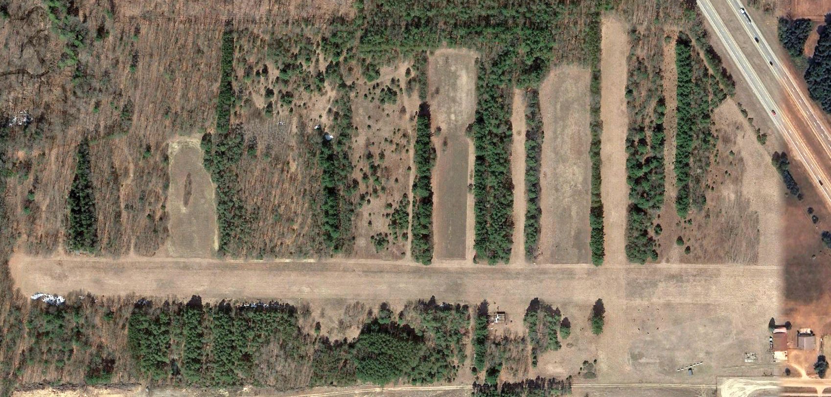
A 2021 aerial view showed Jablonski remained in an unchanged configuration, but no aircraft were seen on the field.
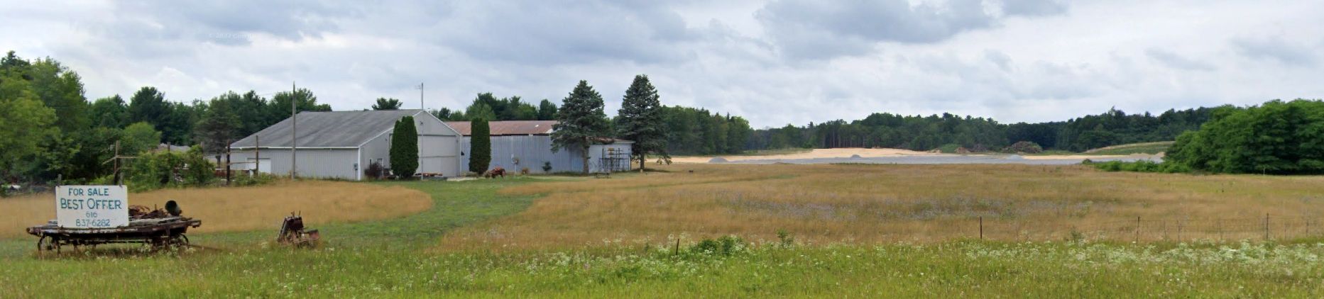
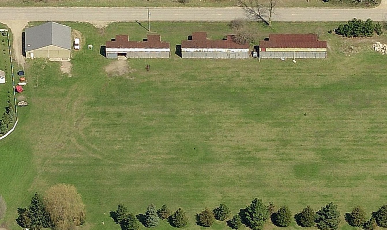
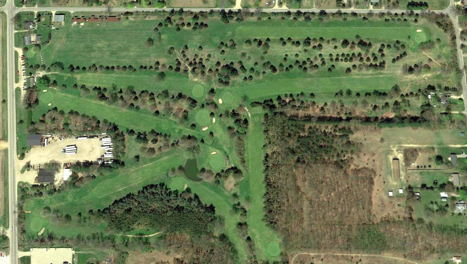
A sad 2022 photo looking west at the Jablonski Airport site showed the property had a For Sale sign.
The 2 hangars remained standing, but an aggregate pile had covered the center park of the former runway.
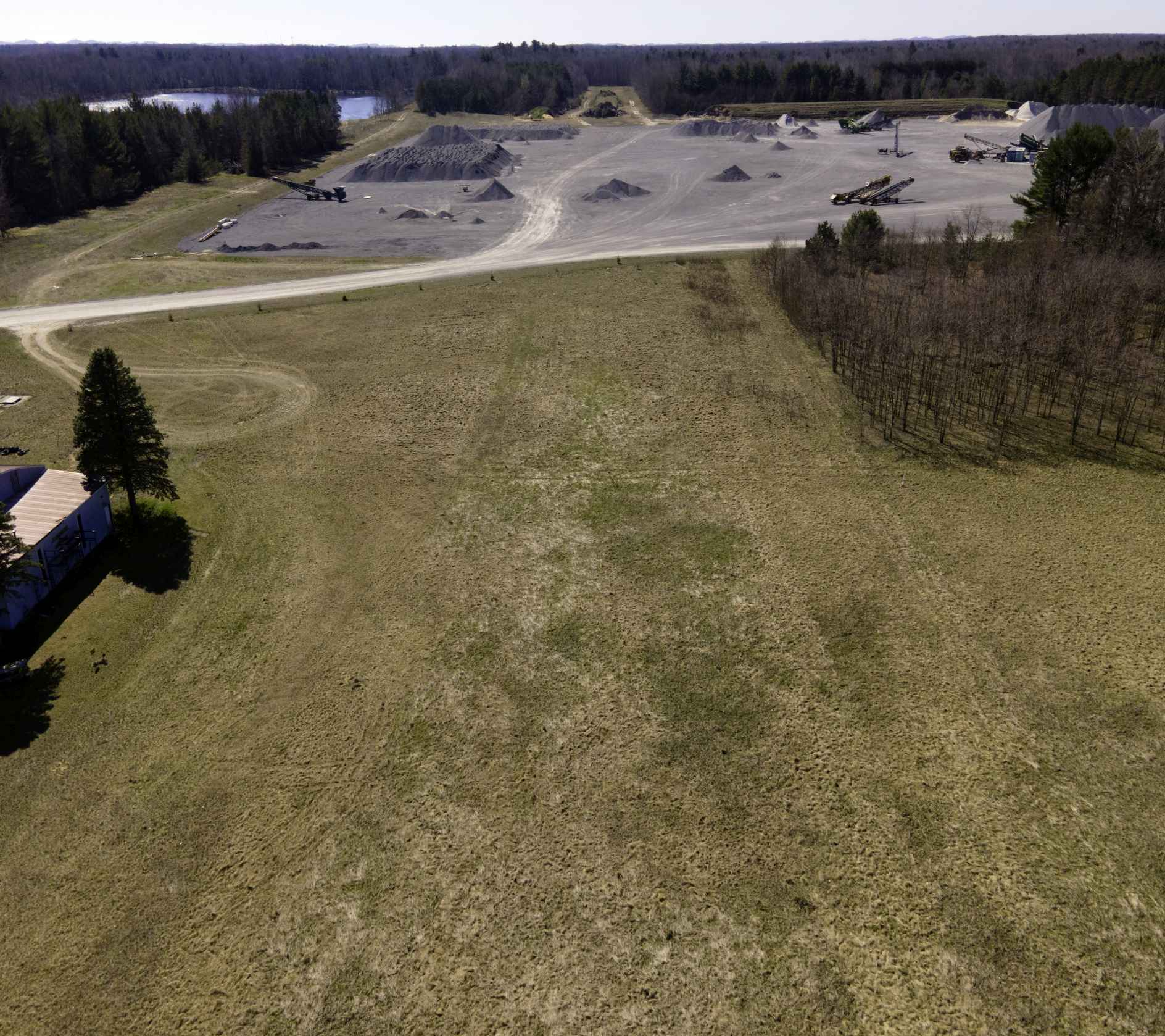
A 4/14/24 drone aerial view by Tony Driza looking west down the former Jablonski Airport Runway 27.
Tony Driza reported, “Runway 18/36 used to be just about where the start of the aggregate area begins.”
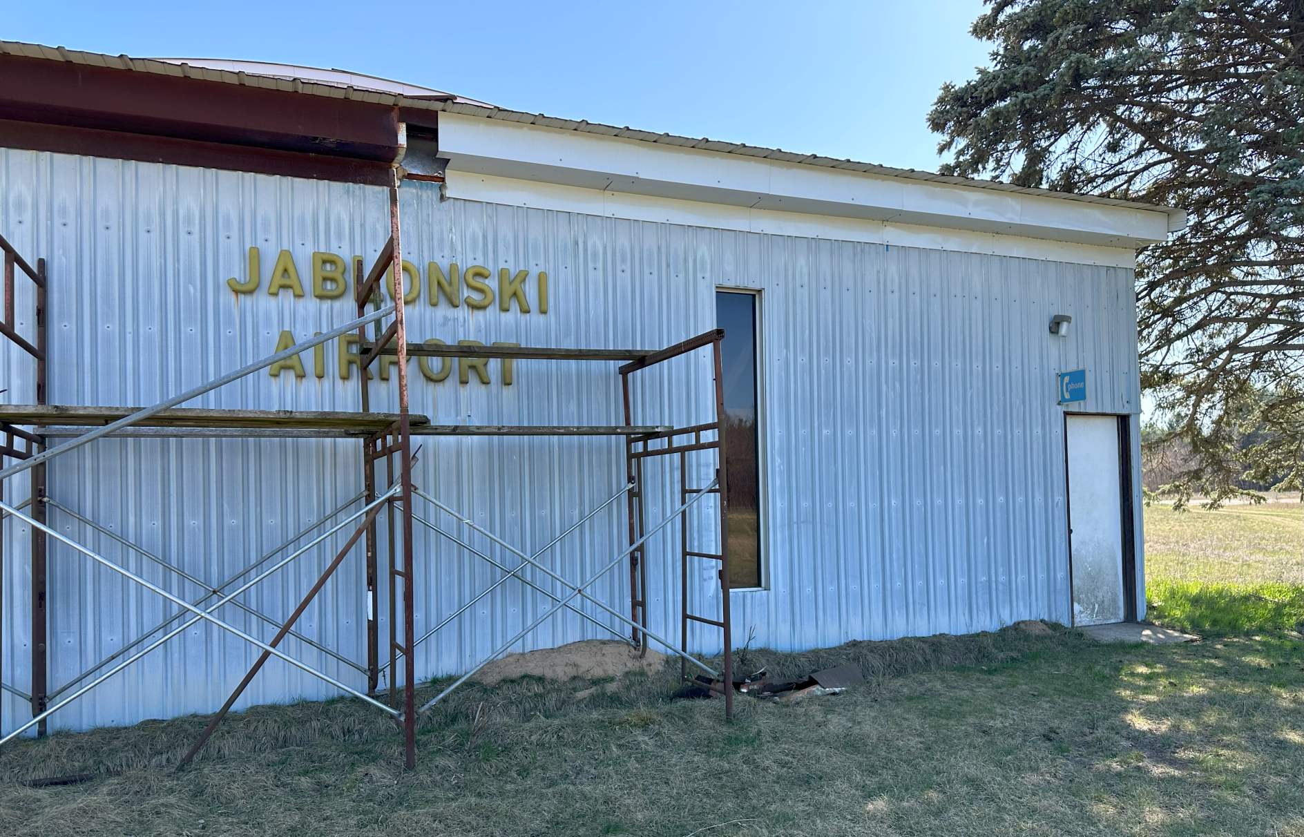
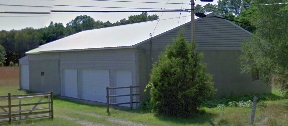
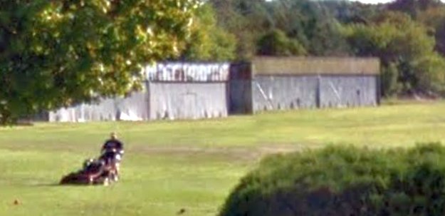
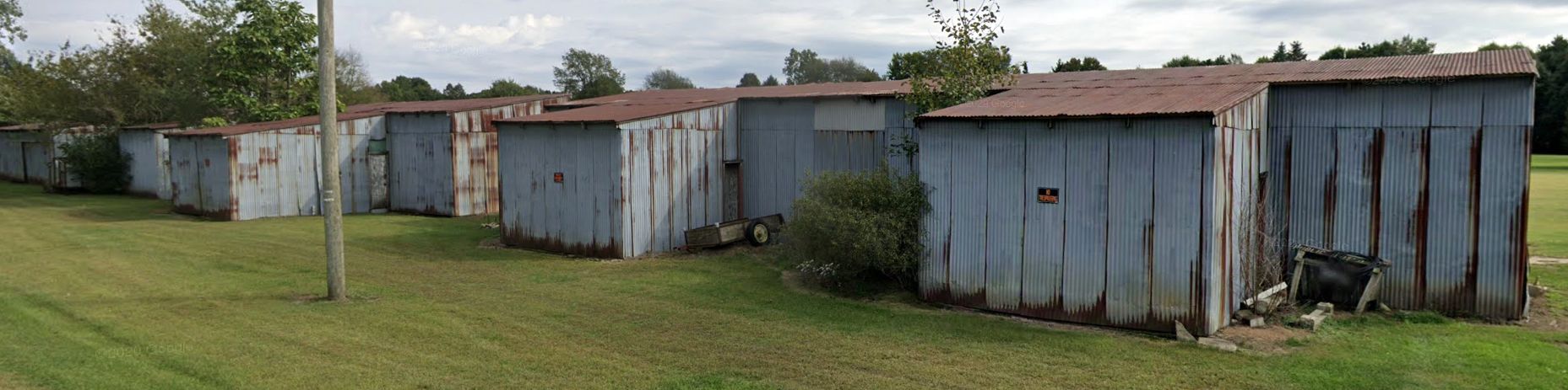
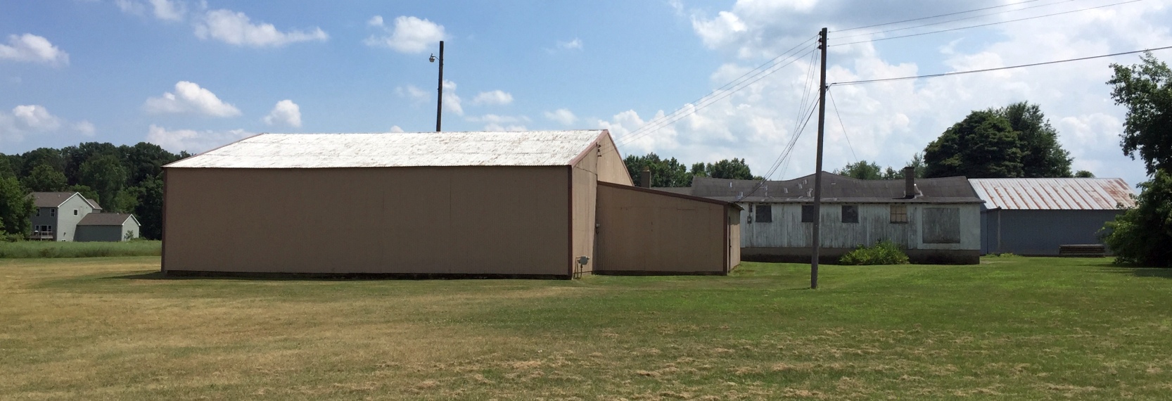
A 4/14/24 photo by Tony Driza of a former Jablonski Airport hangar.
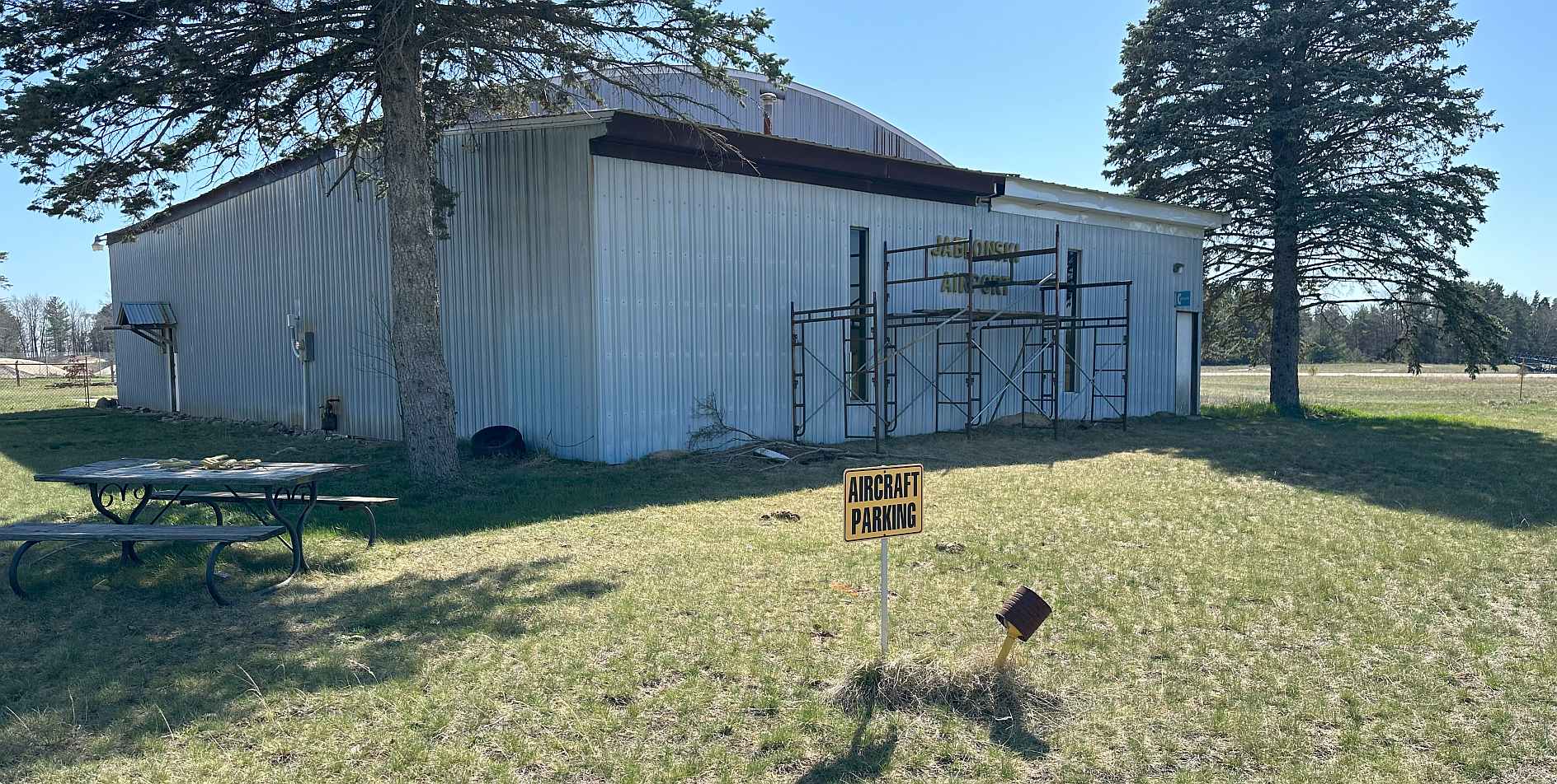
A 4/14/24 photo by Tony Driza of a former Jablonski Airport hangar.
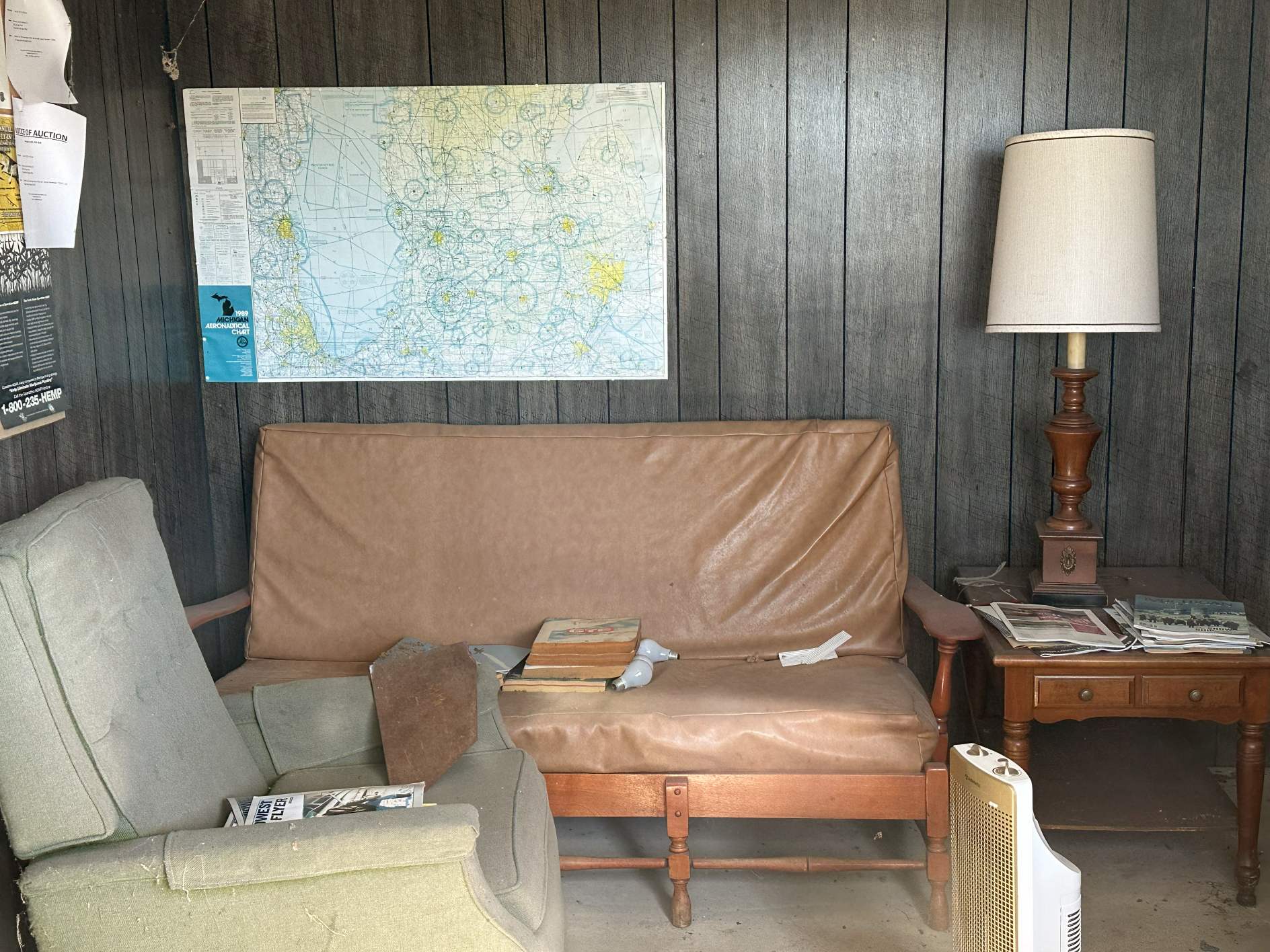
A 4/14/24 photo by Tony Driza of the former Jablonski Airport pilot lounge, with the Sectional Chart still on the wall.
Tony Driza reported, “I did peek into the window of the old pilot lounge, pretty neat. The activity that used to be there, silenced. No more tales of aviation daring-do, just the whispers of what used to be.”
Jablonski Airport was no longer depicted on the 2024 Chicago Sectional Chart.
Thanks to Tony Driza for pointing out this airfield.
____________________________________________________
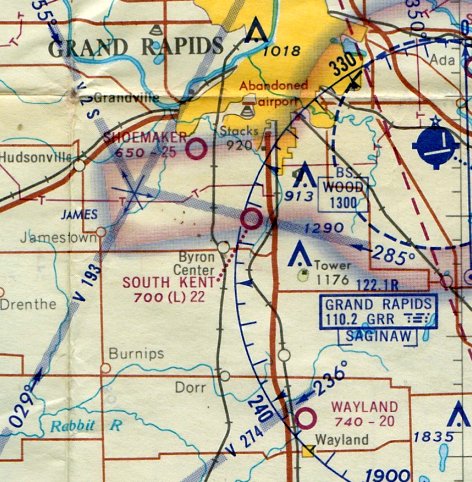
Shoemaker Airport (C08), Grandville, MI
42.881, -85.745 (Northwest of Detroit, MI)
Shoemaker Airport, as depicted on the May 1965 Milwaukee Sectional Chart.
According to a local resident, “In 1958, Fay Shoemaker developed Shoemaker Field, and Rol Palma's flight instruction operation moved across Ivanrest Road to Shoemaker (from their previous short airfield).
In 1958, the property was in the jurisdiction of the City of Wyoming. In 1959, the land was annexed to the City of Grandville.
The City of Grandville began fighting the airfield due to noise & air traffic.”
Shoemaker Airport was not yet depicted on the 1960 Milwaukee Sectional Chart.
The earliest depiction which has been located of Shoemaker Airport was on the May 1965 Milwaukee Sectional Chart.
It depicted Shoemaker as having a 2,500' unpaved runway.
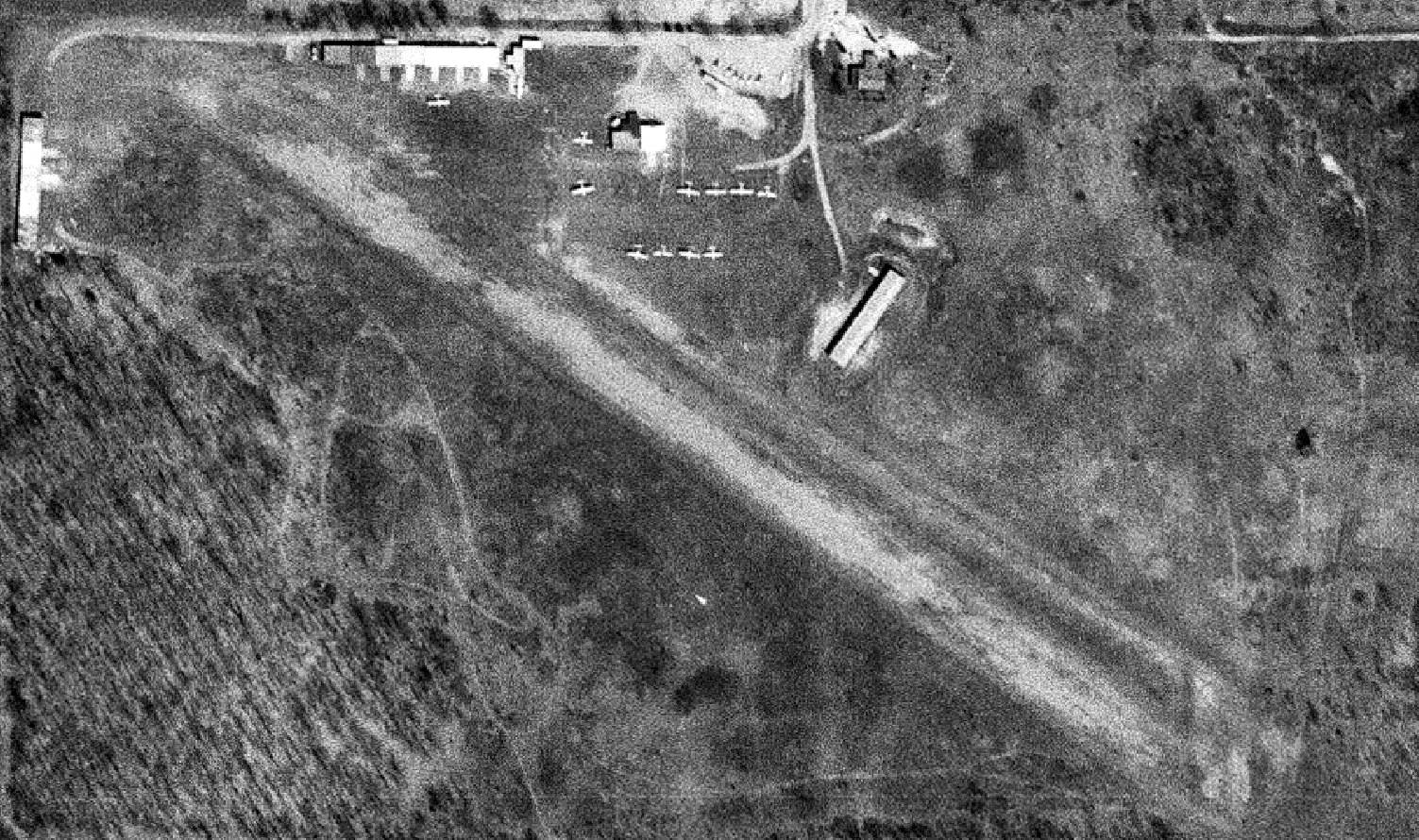
The earliest photo which has been located of Shoemaker Airport was a 10/30/65 USGS aerial view.
It depicted Shoemaker as having a single grass east/west runway, with 15 light single-engine planes & several small buildings on the northeast side.
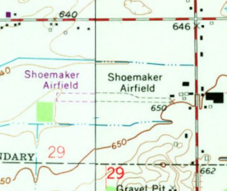
The earliest topo map depiction which has been located of Shoemaker Airport was on the 1967 USGS topo map.
It depicted Shoemaker Airfield as having a single unpaved east/west runway, with several small buildings on the northeast side.
According to a local resident, “At some point, the city of Grandville, the Shoemakers, and the Palmas agreed to move the flight training operation to South Kent, in an effort to reduce traffic from training, in exchange of the city backing off the pressure.
In its prime,
Shoemaker had 30 aircraft tied-down. This dwindled over time until
the property sold for redevelopment.”
A 1973 aerial view showed a mere 2 light single-engine planes on the northeast side of Shoemaker Airport.
The last topo map depiction which has been located of Shoemaker Airport was on the 1984 USGS topo map.
It depicted Shoemaker Airfield as having a single east/west runway.

The last aeronautical chart depiction which has been located of Shoemaker Airport was on the May 1985 Chicago Sectional Chart (courtesy of Jonathan Westerling).
It depicted Shoemaker as having a 2,200' unpaved runway.
The last photo which has been located showing aircraft at Shoemaker Airport was a 1987 aerial view,
which showed 2 light single-engine planes on the northeast side.
Shoemaker Airport was evidently closed (for reasons unknown) at some point between 1987-88,
as it was no longer depicted on the 1988 MI Aeronautical Chart (according to Ryan Van Vels).
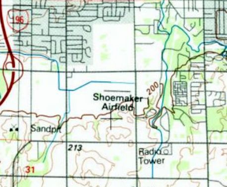
A 1999 aerial view showed no trace remaining of Shoemaker Airport, with 2 commercial buildings covering the site of the hangars,
and a road cutting through the western portion of the runway site.
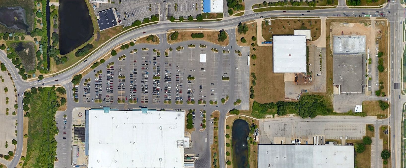
A 2022 aerial view showed no trace remaining of Shoemaker Airport.
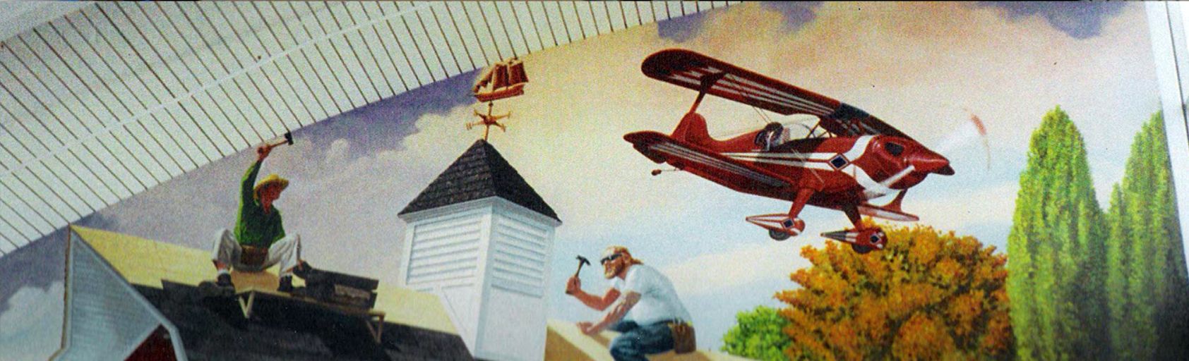
A 2024 photo by Ryan Van Vels, who reported, “RiverTown Crossings Mall is adjacent to the land, and has a mural of a biplane painted by Thomas Melvin, paying homage to Shoemaker Field.”
Thanks to Ryan Van Vels for pointing out this airfield.
____________________________________________________
42.832, -86.121 (West of Detroit, MI)
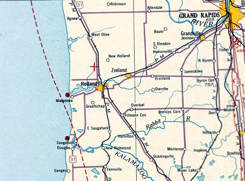
The June 1931 Milwaukee Sectional Chart depicted the airfield northwest of Holland as a unlabeled auxiliary airfield.
According to the Park Township AirPark Master Plan, the airport in Holland “began in the 1930s as a private airfield, the brainchild of aviator 'Peg' Malone,
with aspirations for regular passenger service between Milwaukee & New York, with stops at Holland, Detroit, Cleveland, Buffalo, and Syracuse.
Unfortunately, the great depression hit & the plan was shelved.”
The earliest depiction which has been located of an airfield in Holland was on the June 1931 Milwaukee Sectional Chart.
It depicted an unlabeled auxiliary airfield north-northwest of Holland,
somewhat more north than the eventual location of Szekely Field.
Was this a somewhat different earlier location, or a lack of precision by the mapmakers?
Szekely Field was not depicted on the 1932 USGS topo map.
The only photo which has been located of Szekely Field was an undated photo of a biplane & low-wing monoplane (courtesy of Mike Denja).
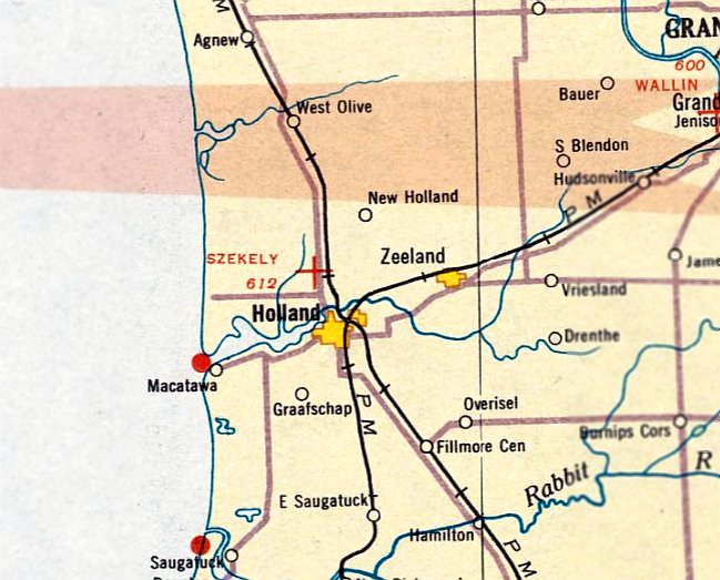
The October 1933 Milwaukee Sectional Chart depicted Szekely Field as an auxiliary airfield.
The April 1935 Milwaukee Sectional Chart continued to depicted the airfield as “Szekely”.
Szekely Field was evidently closed at some point in 1935,
as no airfield near Holland was depicted on the September 1935 Milwaukee Sectional Chart.
It was replaced by 1937 by Holland Airport, just to the south.
A 1955 aerial view showed open fields at the site of Szekely Field.
A 2022 aerial view showed no trace remaining of Szekely Field.
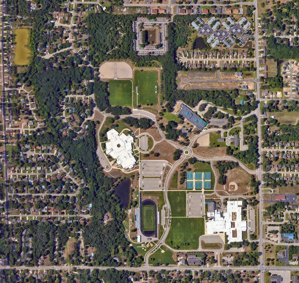
Vic VanHeest reported, “Szekely Field was near the corner of Riley Street & 136th Avenue,
the current site of West Ottawa Public Schools Middle School, Pine Creek Elementary School, and WOPS Administration building (per the Hope College JSTOR.org site).
This corroborates the oral history I’ve heard from individuals who grew up near the intersection of Riley / 136th of remnants of an abandoned airfield on that property.”
Thanks to Vic VanHeest for pointing out this airfield.
____________________________________________________
Holland Airport / Park Township Airport (KHLM), Holland, MI
42.796, -86.162 (West of Detroit, MI)
Holland Airport was depicted as a commercial/municipal airport on the June 1937 Milwaukee Sectional Chart.
Holland Airport was evidently established at some point between 1936-37,
as it was not yet depicted on the November 1936 Milwaukee Sectional Chart.
The earliest depiction which has been located of Holland Airport was on the June 1937 Milwaukee Sectional Chart.
It depicted Holland Airport as a commercial/municipal airport.
It was still labeled Holland Airport on the September 1941 Milwaukee Sectional Chart.
Holland Airport was evidently renamed Park Township Airport at some point between 1941-42,
as that is how it was labeled on the June 1942 Milwaukee Sectional Chart.
The Master Plan continued, “One item of particular note is the Airport’s role in training Pilots during World War II.
Following aviation infrastructure upgrades at the airport, the Federal Government approved the Hope College pilot training program in late 1939.
During the war, over 100 students were enrolled in Hope’s GI flight training program.
Additionally, the airport was used as a helicopter training ground for the United States war effort.”
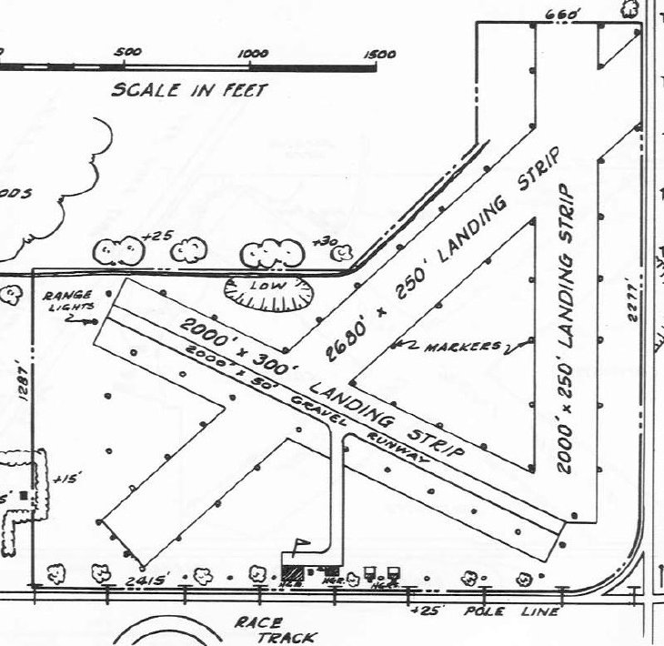
The 1947 MI Airport Directory (courtesy of Mike Denja) depicted Park Township Airport as having a 2,000' gravel northwest/southeast runway & 2 other unpaved runways.
Four small hangars were depicted on the south side.
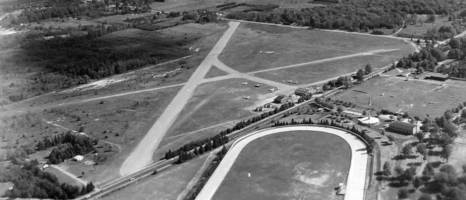
An 8/25/56 aerial view (courtesy of Mike Denja) depicted Park Township Airport as having 2 unpaved runways, with several hangars & light planes on the south side.
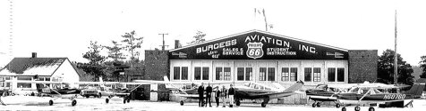
A circa 1960s photo of 5 Cessnas & a Bonanza in front of Park Township Airport's Burgess Aviation hangar.
The Master Plan continued, “The history of Park Township’s airport is intertwined with that of the development of the larger Holland region & business community.
From 1935-81, Park Township Airport was a true intergovernmental collaboration, with both Park Township & City residents’ benefiting.
In 1962, at the peak of Park Townships Airport usage; voters approved an agreement between Park Township, Holland City and Holland Charter Township to create an airport authority.
Each municipal entity had an equal vote in governance responsibility.”
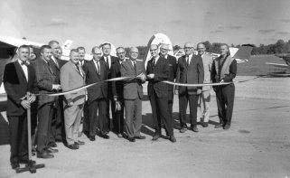
A circa 1960s photo of a ribbon-cutting ceremony at Park Township Airport.
A 7/28/68 aerial view (courtesy of Mike Denja) depicted Park Township Airport as having a gained a paved northwest/southeast runway, in addition to its unpaved crosswind runway.
Several hangars & light planes were depicted along the south side.
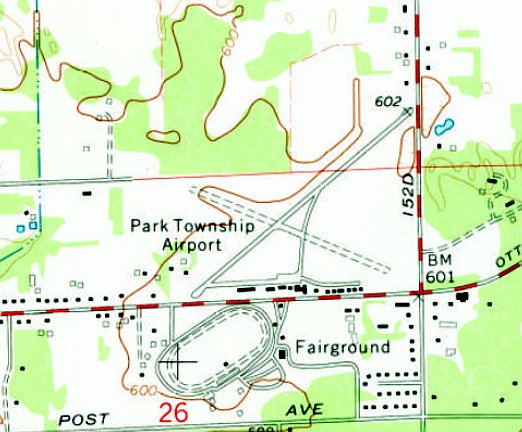
The 1972 USGS topo map depicted Park Township Airport as having a paved northwest/southeast runway & an unpaved crosswind runway.
A row of buildings were depicted along the south side.
An undated aerial view looking northeast (courtesy of Mike Denja) depicted Park Township Airport as having a paved northwest/southeast runway & an unpaved crosswind runway.
Several hangars & light planes were depicted along the south side.
The Master Plan continued, “Post WWII until the late-1970s, Park Township Airport was a well‐used asset in the Holland region.
In the early 1960s HLM was the 13th busiest airport in the State of Michigan.
During this time, the airport authority was operating, infrastructure was improved, and hangar space was in demand.
Around the late 1970s, the financial viability of the airport began to shift.
In 1979, Park Townships airport went through 2 Airport Managers (both of which acted in a Fixed Base Operator model, attempting to turn a profit).
The latter, John Veldman of Holland Airport Services was provided with a lease rate of $500/month, plus all utility charges & maintenance expenses.
Despite being well-liked in the aviation community & popular among pilots, within 3 months, Mr. Veldman resigned.
The Park Township Board of Trustees wondered aloud why 'we cannot keep a manager?'
The answer was obvious, the manager was unable to turn a profit.”
The Master Plan continued, “Around this time, Park Township leadership begin discussing the difficulty in continuously maintaining & operating an airport.
In 1981, Holland Township shifts its support to the City acquisition of the Tulip City Airport on the city’s south side, which eventually became West Michigan Regional airport.
The success of West Michigan Regional serving strictly corporate aircraft left Park Township to cater to recreational aviation uses.
Lack of financial resources, a shrinking market segment, deteriorating infrastructure
and higher hangar rates than surrounding airports lead to a slow, but steady decline of the Park Township Airport.
The Master Plan continued, “Since 1984, the Park Township airport was managed by Ottawa Aviation, a Fixed Base Operator.
Park Township owned the airport, but leased out operations & management to Ottawa Aviation under specific contractual agreements.
During this time period, the Airport operated under a steady stream of controversy & turmoil.
While Ottawa Aviation was an enthusiastic group of aviation supporters & able to raise more than $30,000 on airport improvements,
eventually the same issues of limited resources & deteriorating infrastructure continued to besiege the viability of the airport.
Over the next 30 years, the history of HLM is one of constant struggle to survive.
In 1990, the Township Board of Trustees vote to put on the ballot a 1 mill levy that would transform the airport into a recreational asset.
The vote failed by a 2-1 majority. A day following the vote, Airport supporters turned in a petition with more than 40 signatures supporting a 20 year lease for Ottawa Aviation.”
The Master Plan continued, “In 2015, the Township and Ottawa Aviation jointly decided to restructure their relationship.
Ottawa Aviation agreed to cancel their lease on the airport, and Park Township assumed control of airport operations, maintenance & oversight.
Ottawa Aviation was retained as the airport manager.
The financial operations of the airport, infrastructure upgrades, etc. would become the full responsibility of Park Township.
At this time, Airport & Township leaders believed this change would make it easier for the Park Township airport to qualify for grants,
private donations from wealthy philanthropists, and negotiate easements to remove obstacles in the airport approach plan.
As the history of the Park Townships Airport has made abundantly clear, that path to success was more difficult than initially thought.
Beginning in the fall of 2015, Skydive Holland took up operations at Park Township Airport, generating a great deal of excitement in the recreation & extreme sports community.
Opinions were mixed in the aviation community, as is often the case with skydiving operations operating out of a municipal airport.
The business operated until the spring of 2017. At that time it was determined not to renew their contract for the 2018 season.
This controversial decision created much publicity. Residents on both sides of the decision voiced their opinions, passions & desires.
On 11/9/2017, Supervisor Jerry Hunsburger & Manager Howard Fink issued a press release to explain why Skydiving Holland’s contract was not renewed.”
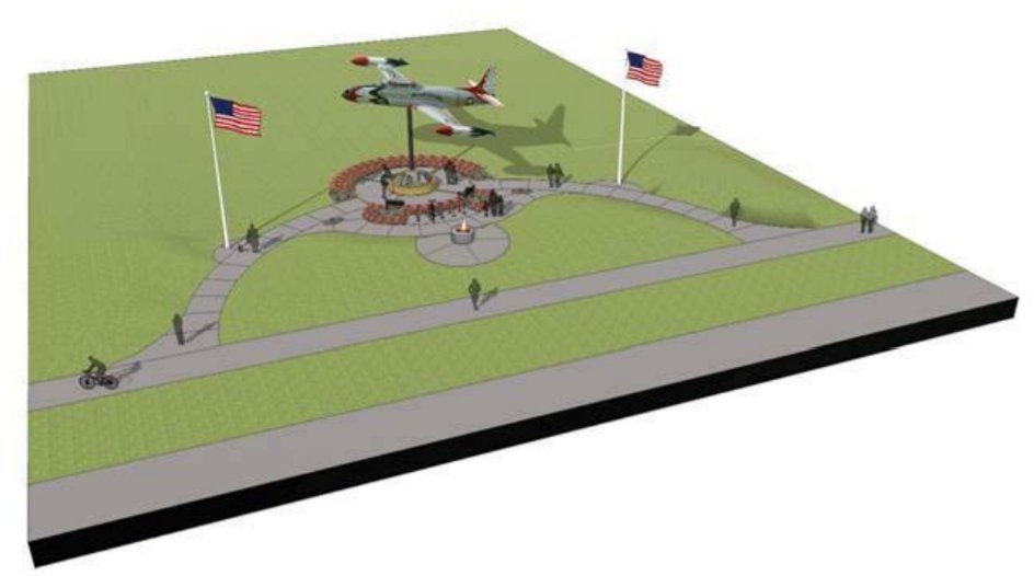
An artist's conception of Park Township Airport's T-33 Jet Memorial (from the September 2018 Park Township AirPark Master Plan).
A 9/22/18 aerial view looking north at Park Township Airport showed the only 2 aircraft visible on the field were the static display T-33 jet along the southern edge
and 1 light single-engine aircraft on the grass at the center of the photo.
According to the Park Township Airport website, as of 2020, “Most corporate planes are now located at the West Michigan Regional Airport.
Although with direct access to companies located on the north side, we still see some business traffic.
While times have changed, the airport continues to be very popular & many indicators show HLM becoming more of a 'destination' airport.
Many visitors come to enjoy a weekend or a day on the lake shore, or as a convenient way to access their boat at our local marinas.
We offer a courtesy car, tent camping area & free bicycles, although many will bring their bikes with them in their plane.”
The 2020 Sectional Chart depicted Park Township Airport as having a 3,000' paved northwest/southeast runway.
Sadly, a 3/13/2020 Detroit Free Press article (courtesy of Greg Steinmayer) entitled “One of Michigan's oldest community airports will close” reported,
“A small airport whose history includes pilot training during World War II will close after a western Michigan community rejected a property tax for upgrades.
Critics said any improvements would benefit airport users but not other members of the public in Ottawa County's Park Township.
The 10-year millage was defeated Tuesday, 56% to 45%.
The paved runway will be removed by October 1.”
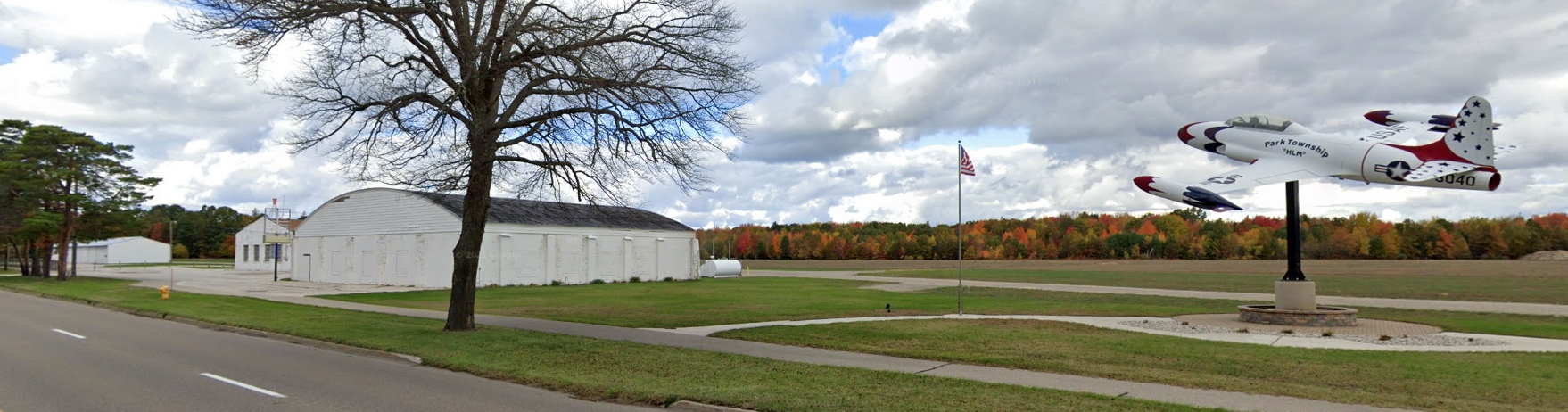
A November 2021 photo looking northwest at Park Township Airport's hangars & T-33 Jet Memorial.
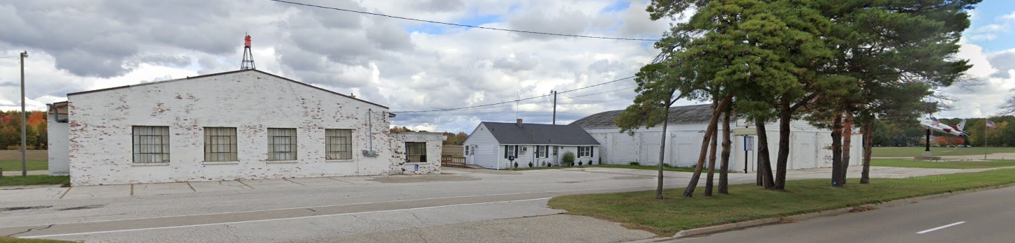
A November 2021 photo looking northeast at Park Township Airport's hangars & office.
What a crime to see this nice general aviation infrastructure going to waste.
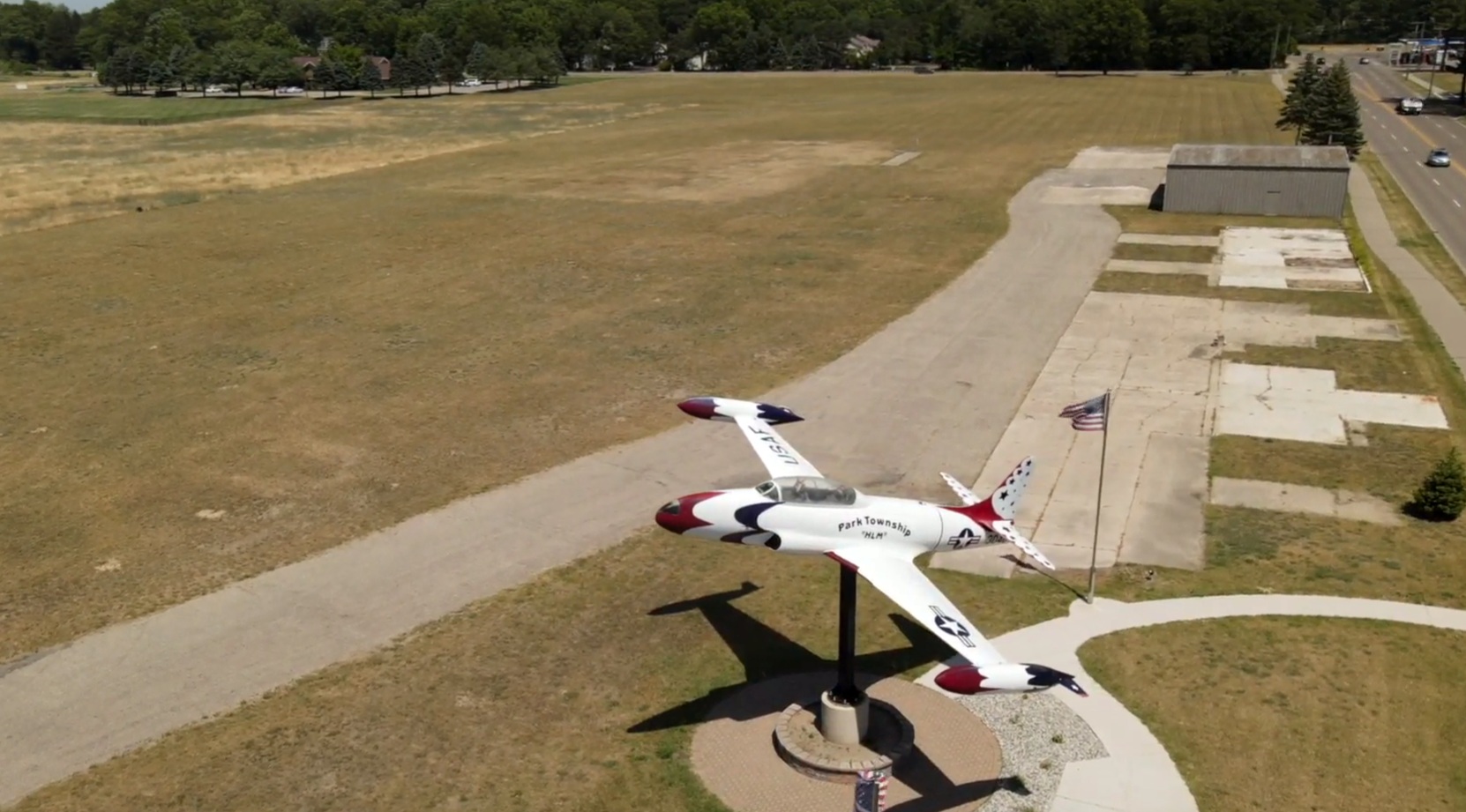
A still from a 6/30/22 drone video by Tony Driza looking east at the beautiful Lockheed T-33 mounted on a pole at Park Township Airport.
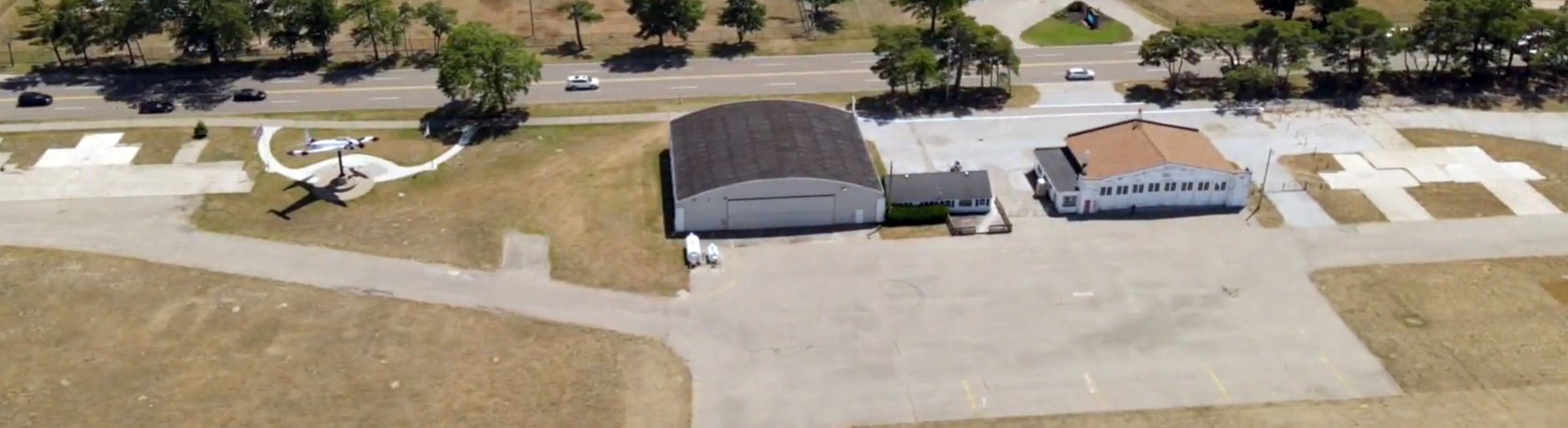
A still from a 6/30/22 drone video by Tony Driza looking south at the Park Township Airport hangars & ramp.
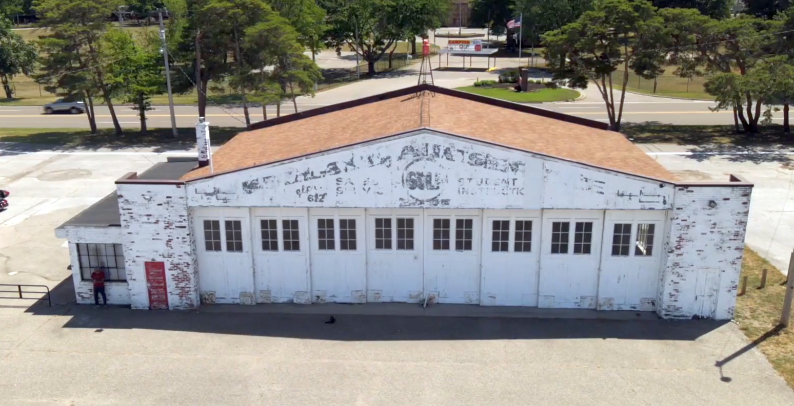
A still from a 6/30/22 drone video by Tony Driza looking south at the Park Township Airport Burgess Aviation hangar.
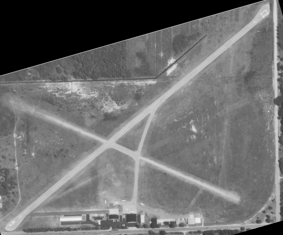
A still from a 6/30/22 drone video by Tony Driza looking along the former Park Township Airport runway.
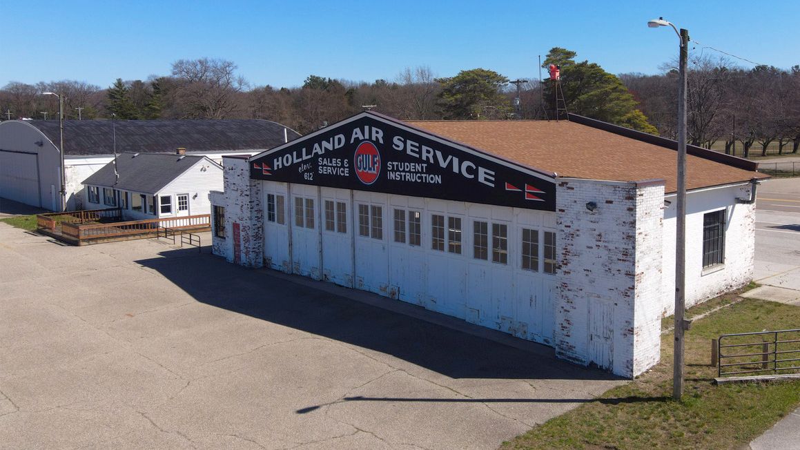
A 4/13/24 drone aerial view by Tony Drizia looking southeast at the Park Township Airport hangar, with the “Holland Air Service” markings newly repainted.
Tony reported, “Sad to see more re-development of this neat little airport, but at the same time, encouraged that perhaps part of it will endure as they have re-painted part of the old hangar.
Hangar newly paintedl kind of wish they had kept the old Burgess Aviation [markings], but this is pretty cool & encouraging that it won’t totally fade away.”
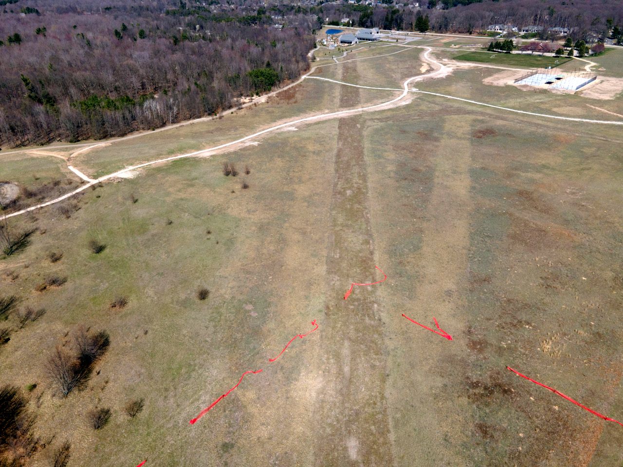
A 4/13/24 drone aerial view by Tony Drizia at the Park Township Airport site, “looking northeast down the old Runway 5.”
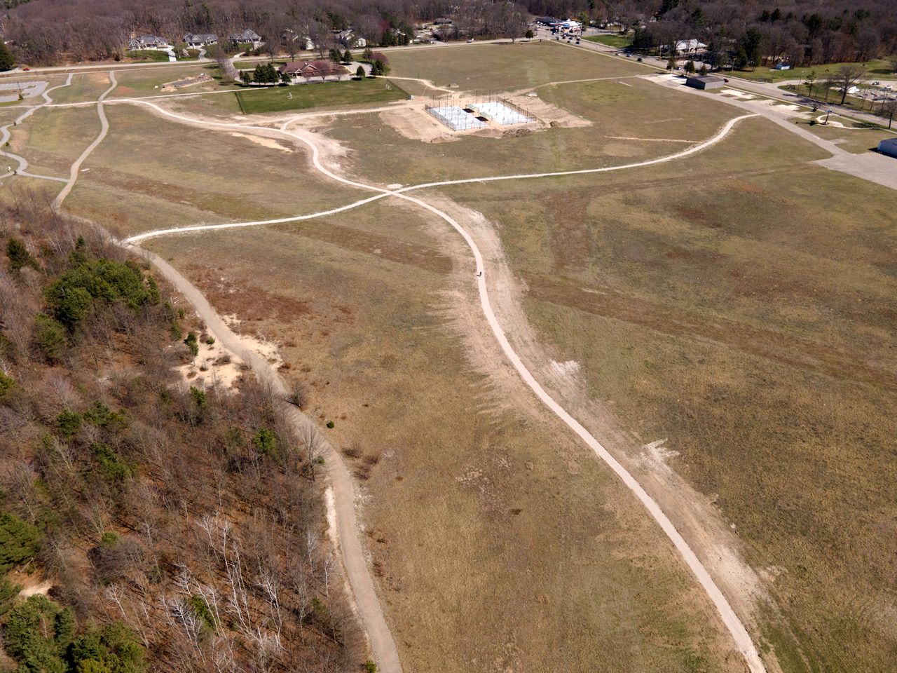
A 4/13/24 drone aerial view by Tony Drizia looking southeast at the Park Township Airport site, “with the tennis courts being built, looking down the crosswind runway.”
Thanks to Greg Steinmayer for pointing out this airfield.
____________________________________________________
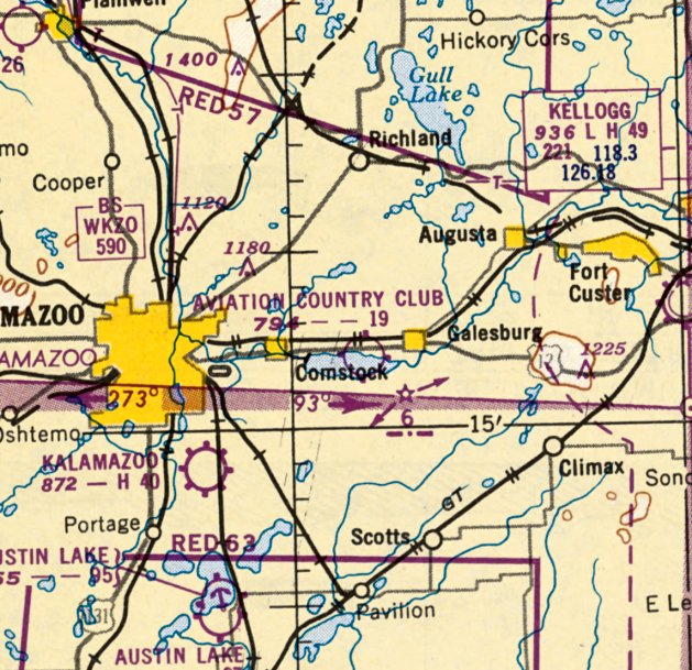
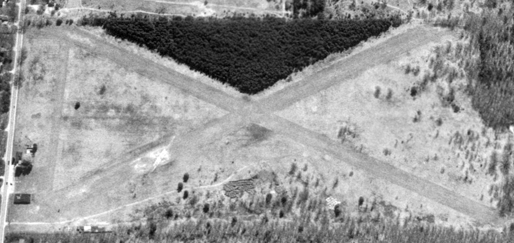
Aviation Country Club, Galesburg, MI
42.287, -85.453 (West of Detroit, MI)
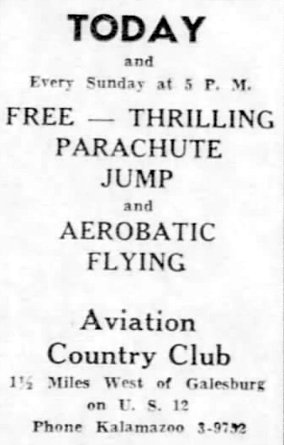
An 8/25/46 advertisement for the Galesburg Aviation Country Club (courtesy of Bill Grasha).
This small general aviation airport was evidently established at some point in 1946 (like hundreds of other small airports in the post-WW2 American general aviation boom),
as it was not yet depicted on the June 1946 Milwaukee Sectional Chart.
The earliest reference which has been located to the Galesburg Aviation Country Club was an 8/25/46 advertisement (courtesy of Bill Grasha).
It touted a “Thrilling parachute jump & aerobatic flying.”
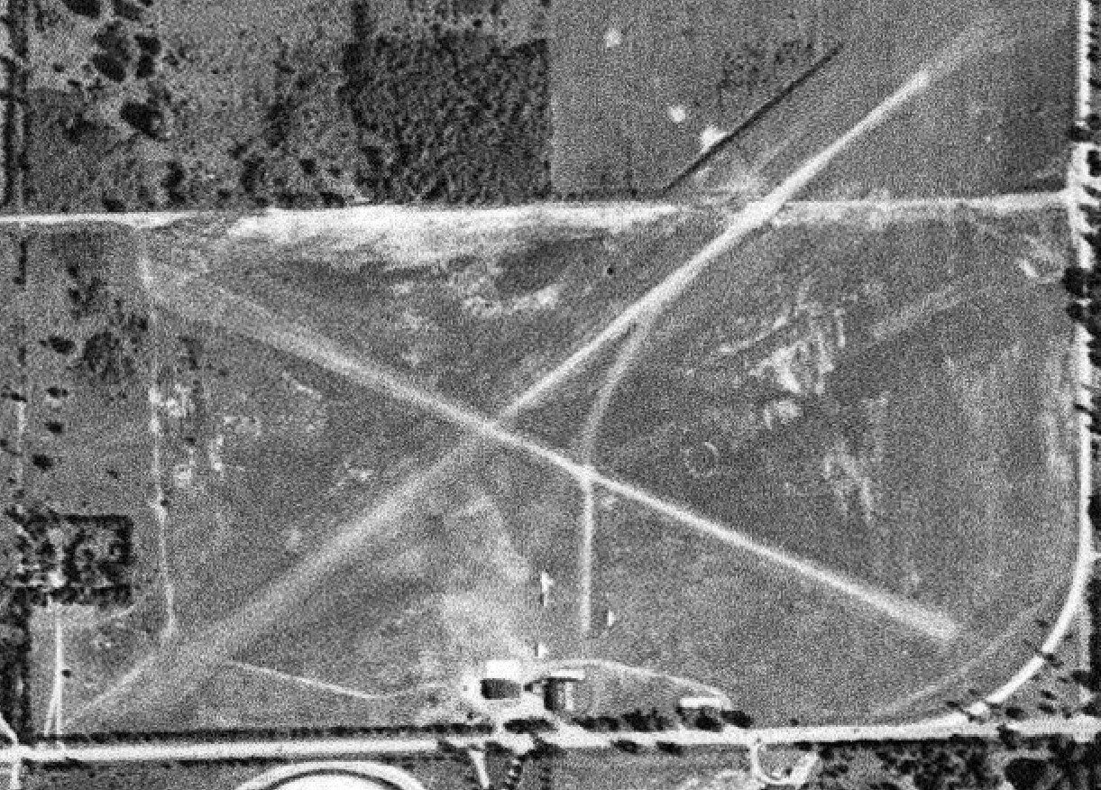
The earliest photo which has been located of Galesburg Aviation Country Club was a 12/1/46 USGS aerial view.
It depicted 2 unpaved runways in an “X” shape, with a few small buildings on the north side.
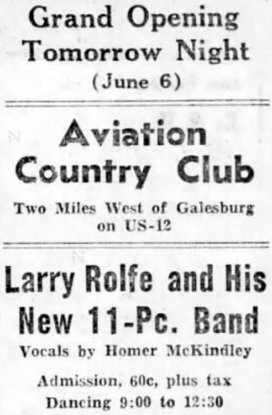
A 6/5/47 advertisement for the Galesburg Aviation Country Club (courtesy of Bill Grasha) touted its Grand Opening, featuring a band concert.
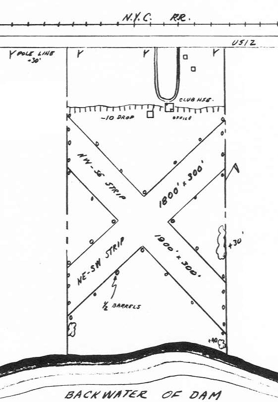
The 1947 MI Airport Directory (courtesy of Bill Grasha) depicted Galesburg Aviation Country Club as having 2 unpaved 1,800' runways,
oriented northwest/southeast & northeast/southwest, with a clubhouse & office on the north side.
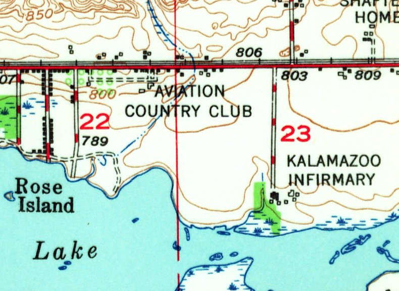
The 1947 USGS topo map depicted Galesburg Aviation Country Club as an unpaved area with several small buildings along the north side.
The only aeronautuical chart depiction which has been located of the Galesburg Aviation Country Club was on the May 1950 Milwaukee Sectional Chart.
It depicted the Aviation Country Club as having a 1,900' unpaved runway.
The Galesburg Aviation Country Club was evidently short-lived (for reasons unknown),
as it was no longer depicted on the May 1955 Milwaukee Sectional Chart.
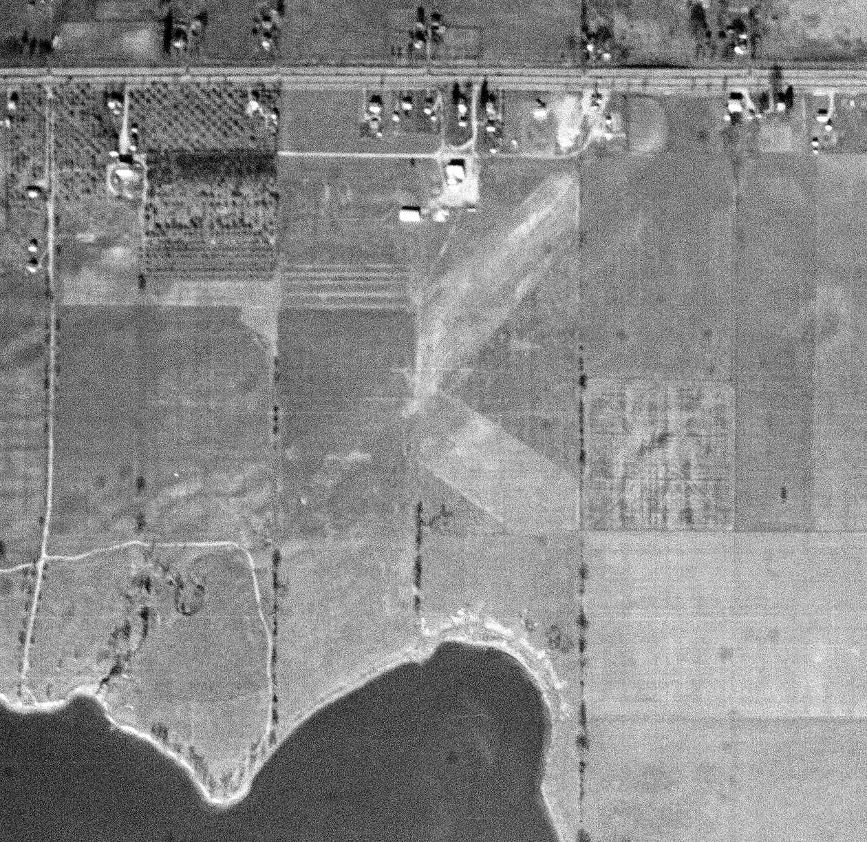
A 1961 aerial photo showed the former airfield area of the Aviation Country Club had been plowed, with runways no longer recognizable.
One airfield build (the former clubhouse?) still remained along the north side, along with the foundation of another building.
A 2017 aerial view shows no trace remaining of the Galesburg Aviation Country Club.
Thanks to Bill Grasha for pointing out this airfield.
____________________________________________________
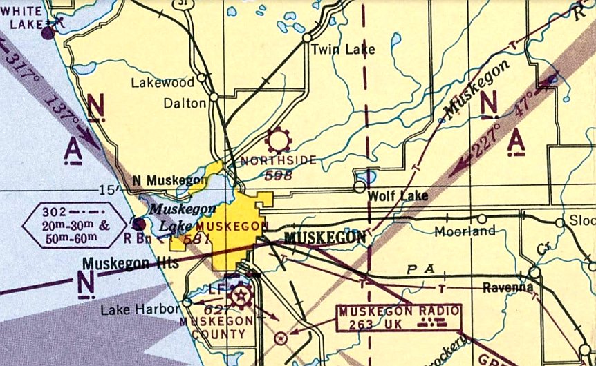
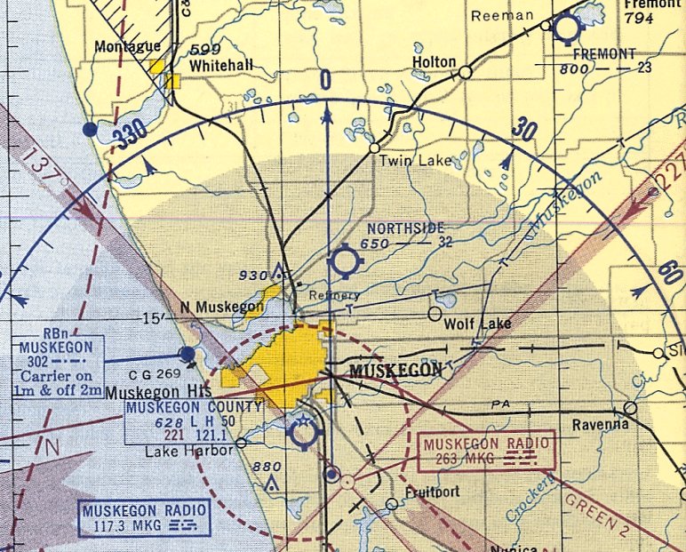
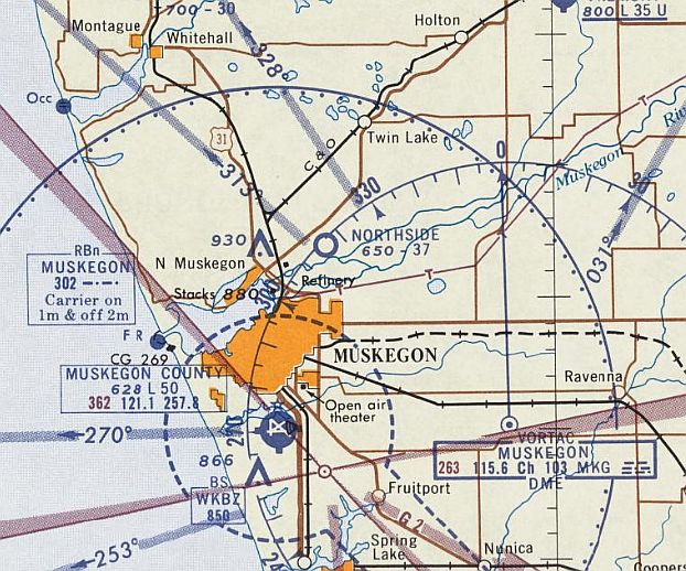
Northside Airport, North Muskegon, MI
43.291, -86.192 (Northwest of Grand Rapids, MI)
Northside Airport, as depicted on the May 1945 Milwaukee Sectional Chart (courtesy of Mike Denja).
Northside Airport was evidently established at some point between 1944-45 (like hundreds of other small airports in the US post-WW2 aviation boom),
as it was not yet depicted on the October 1944 Milwaukee Sectional Chart
The earliest depiction which has been located of Northside Airport was on the May 1945 Milwaukee Sectional Chart (courtesy of Mike Denja).
It depicted Northside Airport as as commercial/municipal airport.
According to the 7/7/17 Mlive article “$145M housing development planned in Muskegon Township” by Justine McGuire (courtesy of Bill Grasha),
Northside Airport was “in use since at least 1945.”
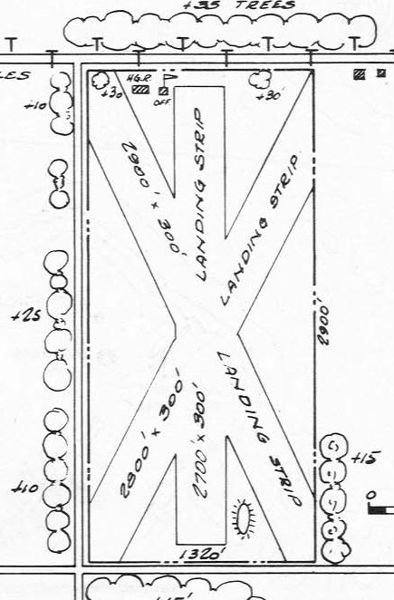
The 1947 MI Airport Directory (courtesy of Bill Grasha) depicted Northside Airport as having 3 unpaved runways, with the longest measuring 2,900' northwest/southeast.
A small hangar & office were depicted on the northwest side.
The May 1953 Milwaukee Sectional Chart depicted Northside Airport as having a 3,200' unpaved runway.

The only photo which has been located showing aircraft at Northside Airport was a 4/22/55 USGS aerial view.
It depicted Northside Airport as having 3 unpaved runways, with 3 light single-engine aircraft parked near a few small hangars on the northwest side.
The last aeronautical chart depiction which has been located of Northside Airport was on the May 1960 Milwaukee Sectional Chart.
It depicted Northside Airport as having a 3,700' unpaved runway.
Northside Airport was evidently closed at some point in 1960, as it was no longer depicted on the November 1960 Milwaukee Sectional Chart.
Northside Airport was not depicted on USGS topo maps from 1960-82.
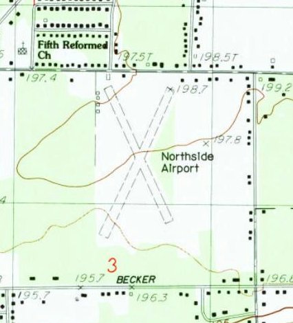
The 1985 USGS topo map depicted Northside Airport as having 2 unpaved runways, with a few small buildings along the north side.
According to the 7/7/17 Mlive article “$145M housing development planned in Muskegon Township” by Justine McGuire (courtesy of Bill Grasha),
“Tridonn Development Company purchased the property during the 1980s, and operated the airport until 1994.”
A 1994 USGS aerial view looking east showed Northside Airport as remaining intact,
though it might have been closed by this point, as there were no aircraft visible on the field.
A 2015 photo looking southwest showed a former hangar on the north side of the Northside Airport site.
According to the 7/7/17 Mlive article “$145M housing development planned in Muskegon Township” by Justine McGuire (courtesy of Bill Grasha),
“A 168-acre site that once served as Northside Airport is on its way to becoming a 364-unit housing development.”
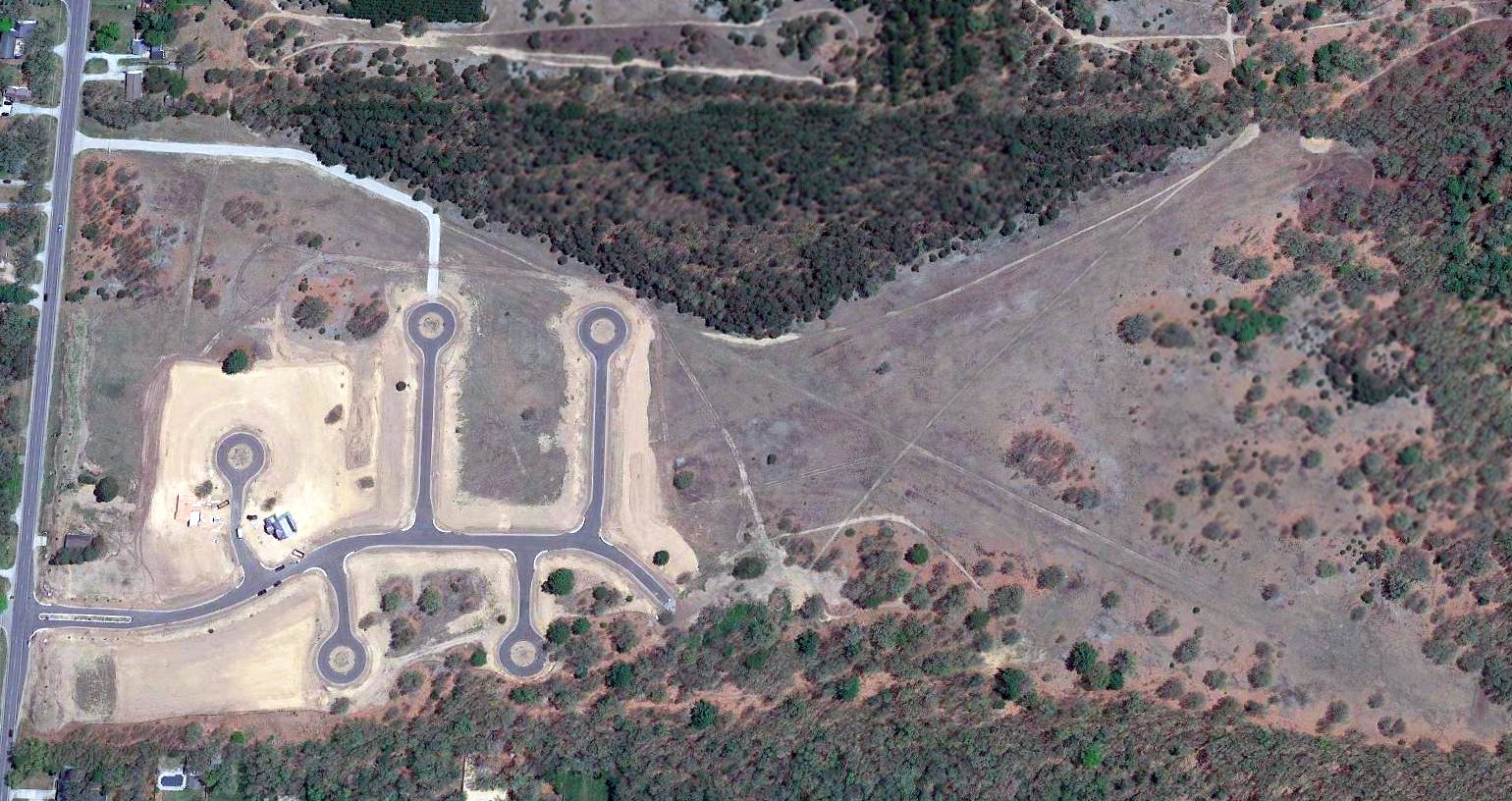
A 2018 aerial view looking east showed the site of Northside Airport being covered by residential cul-de-sacs, and the alignment of 2 runways still partially recognizable.
Yet another small American grassroots airport consumed by our insatiable need for more housing.
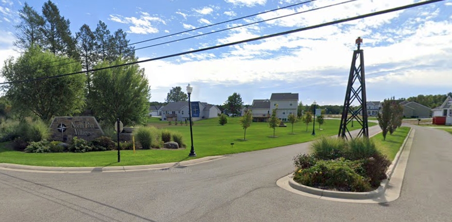
A 2021 photo looking southeast showed the entrance to the North Port Villages which covers the Northside Airport site,
with a structure appearing similar to an airport beacon tower on the same location as the hangar which was pictured in 2015.
Thanks to Bill Grasha for pointing out this airfield.
____________________________________________________
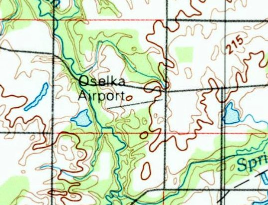
Oselka Airport, Three Oaks, MI
41.775, -86.653 (East of Chicago, IL)
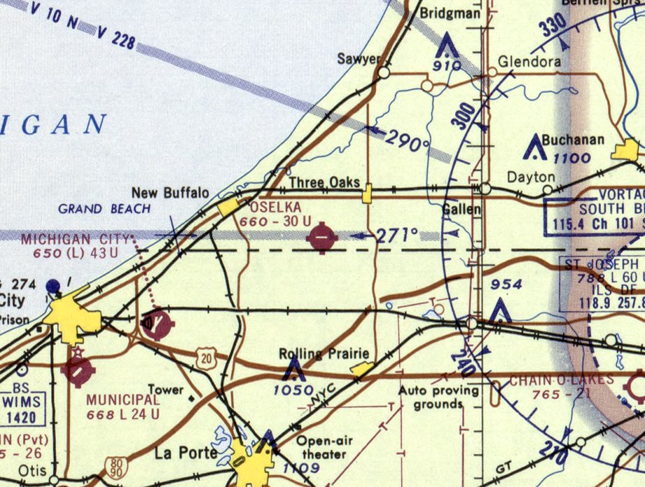
Oselka Airport, as depicted on the May 1965 Chicago Sectional Chart.
This small general aviation airport was evidently established at some point between 1963-65,
as it was not yet depicted on the May 1963 Chicago Sectional Chart.
The earliest depiction which has been located of Oselka Airport was on the May 1965 Chicago Sectional Chart.
It depicted Oselka Airport as having a 3,000' east/west paved runway.
According to his autobiography, Supreme Court Justice John Paul Stevens learned to fly at Oselka Airport.
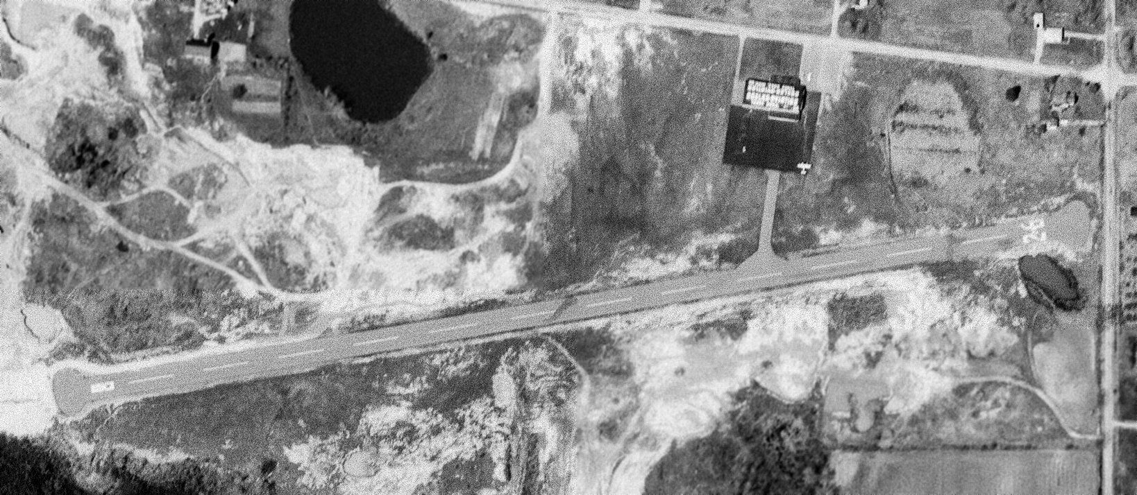
The earliest photo which has been located of Oselka Airport was a 4/20/69 USGS aerial view.
It depicted Oselka Airport as having an asphalt Runway 8/26, with an asphalt ramp on the northeast side on which 1 light aircraft was parked,
and a hangar (on which the lettering on the roof can't be distinguished).
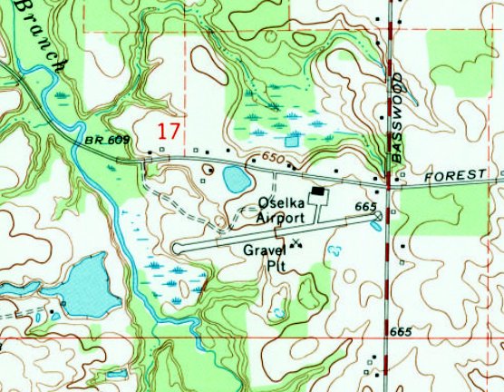
The 1970 USGS topo map depicted Oselka Airport as having a paved northeast/southwest runway, with a paved ramp & 1 hangar on the northeast side.
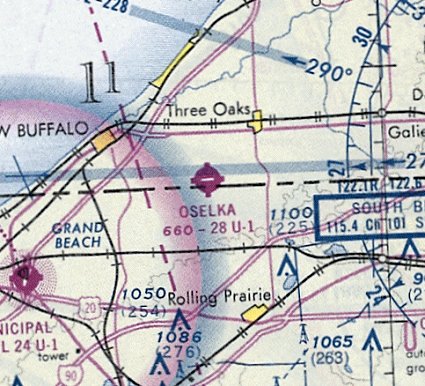
The last aeronautical chart depiction which has been located of Oselka Airport was on the November 1974 Chicago Sectional Chart.
It depicted Oselka Airport as having a 2,800' east/west paved runway.
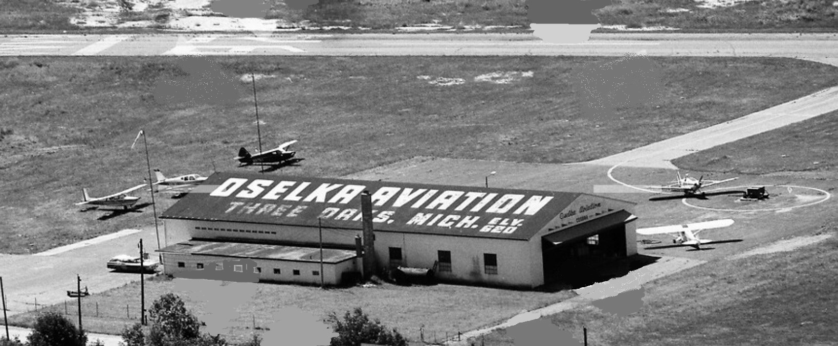
A 1976 aerial view looking south (courtesy of Mike Denja) showed 5 light single-engine planes parked on the Oselka Airport ramp,
next to the hangar which had “Oselka Aviation” painted on its roof.
The last depiction which has been located showing Oselka Airport in operation was a 1981 aerial view (courtesy of Mike Denja),
which appeared to show 2 aircraft on the ramp.
The last depiction which has been located of Oselka Airport was on the 1988 USGS topo map,
which depicted it as having a northeast/southwest paved runway.
Oselka Airport was evidently closed (for reasons unknown) at some point between 1981-93,
as it was no longer depicted on the October 1993 Chicago Sectional Chart.
A 1997 aerial photo showed the Oselka Airport hangar remained standing, but the runway had been removed & the airfield area recontoured.
According to his autobiography, Supreme Court Justice John Paul Stevens said that he was saddened to hear that the Oselka Airport property had been reused as a garbage dump.
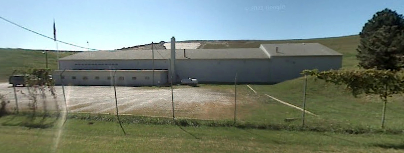
A 2007 photo looking south at the former Oselka Airport hangar.
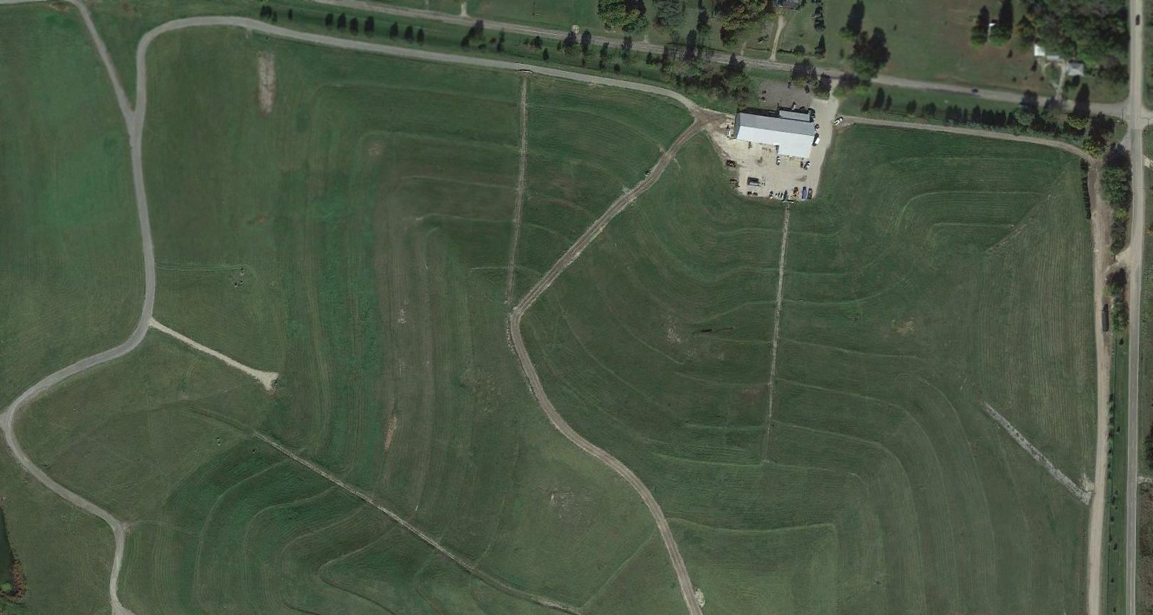
A 2016 aerial photo showed the Oselka Airport hangar remained standing, but no trace remained of the runway.
As of 2022, street maps label the Oselka Airport property as Forest Lawn Landfill.
Thanks to Scott Stribrny for pointing out this airfield.
____________________________________________________
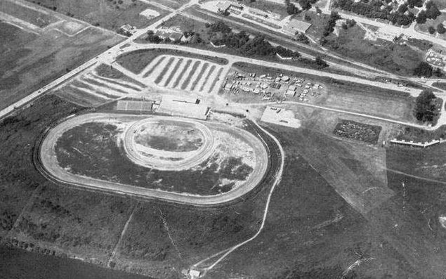
Grand River Airpark & Seaplane Base, Comstock Park, MI
43.027, -85.665 (North of Grand Rapids, MI)
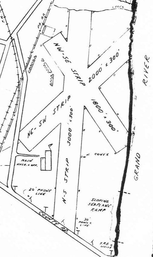
The 1947 MI Airport Directory (courtesy of Bill Grasha) depicted Grand River Airpark & Seaplane Base as having 3 unpaved runways.
Before a very brief stint as an airport, this property was the site of the West Michigan Fair.
Grand River Airpark was not yet depicted on the June 1946 Milwaukee Sectional Chart.
According to the Grand Rapids Historical Society (courtesy of Bill Grasha),
“In 1946 after World War II ended, the nation's craze turned to airplanes, because so many were involved with aircraft during the war.
Visionary O. C. Hall gambled on a 50 year lease with an option to purchase the fairgrounds & built a north/south runway with a seaplane base on the river.
Doug [Taylor] explained that much of the operations of Grand Rapids Air Park was short-lived, including an Air Service owned by the famous Amway founders, that failed horribly.”
The earliest depiction which has been located of Grand River Airpark & Seaplane Base was in the 1947 MI Airport Directory (courtesy of Bill Grasha).
It depicted Grand River as having 3 unpaved runways, with the longest measuring 3,000' north/south.
A main hangar & office were on the southwest side, with some T-hangars on the northwest side, and the seaplane ramp & seaplane base office along the Grand River on the southeast side.
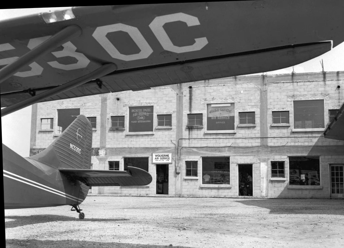
The only photo which has been located showing Grand River Airpark in operation was a 7/2/48 photo (courtesy of Bill Grasha)
of a Stinson 108-3 in front of a 2-story building housing the North Park Air Service, Wolverine Air Service, and Grand Rapids Air Service.
According to the Grand Rapids Historical Society (courtesy of Bill Grasha), “In 1949 O.C. Hall rebuilt the grandstands
as work was started on a multi-purpose racing facility with modern conveniences close in to Grand Rapids.
On 5/28/50 the Speedrome opened with 10,000 fans to watch midgets race on the 1/5th mile track.”
Although it seems unlikely the Grand Rapids Airpark continued to operate after the opening of the Speedrome on the site,
it continued to be depicted on aeronautical charts & topo maps as an operating airport for a few more years.
The earliest aeronautical chart depiction which has been located of Grand River Airpark was on the May 1950 Milwaukee Sectional Chart.
It depicted Grand River as having a 2,000' unpaved runway & a seaplane base.

The last aeronautical chart depiction which has been located of Grand River Airpark was on the May 1955 Milwaukee Sectional Chart.
It depicted Grand River as having a 2,000' unpaved runway, but the seaplane base was no longer depicted.
Grand River Airpark was evidently closed by 1955,
as a 1955 aerial photo depicted the oval Speedrome having been built over the southern portion of the airport site.
A row of T-hangars remained on the northwest side, and traces of the northern portions of the 3 runways were still apparent.
The last depiction which has been located of Grand River Airpark was on the 1958 USGS topo map.
The last photo which is available showing any trace of Grand River Airpark was a circa 1950s-60s aerial view looking southwest at the Speedrome which covered the site,
but a row of T-hangars remained on the northwest side (right side of picture), and traces of the northern portion of the runways were still visible (bottom-right).
Grand River Airpark was no longer depicted on the May 1960 Milwaukee Sectional Chart.
A 1965 aerial photo depicted the oval Speedrome occupying the site.
The T-hangars had been removed at some point between 1955-65, but traces of the runways were still apparent.
According to the Grand Rapids Historical Society (courtesy of Bill Grasha), “The Speedrome [was sold] on 8/1/66 to the State of MI for the extension of US-131 north from Grand Rapids I-96.”
A 1972 aerial photo showed the Speedrome gone, having been replaced by Route 131.
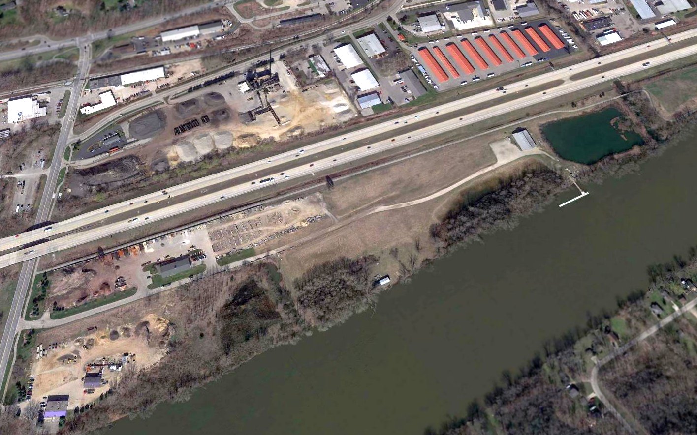
A 2016 aerial view looking northwest showed no trace of the Grand River Airpark & Seaplane Base, or even of the Speedrome which replaced the airport.
Thanks to Bill Grasha for pointing out this airfield.
____________________________________________________
David Airfield / David's Airport (9C2), Athens, MI
42.064, -85.24 (East of Chicago, IL)
David Airfield, as depicted on a 12/1/46 aerial view (courtesy of Mike Denja).
According to Wikipedia, “David's Field was built shortly after World War II by John Broberg & named to honor his twin brother who was killed on Okinawa.”
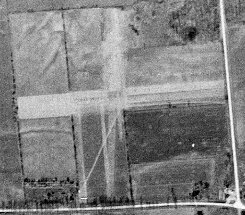
The earliest depiction which has been located of David Field was a 12/1/46 aerial view (courtesy of Mike Denja).
It depicted David Field as having 2 unpaved runways, with a few small small buildings & possibly 3 light aircraft to the southwest.
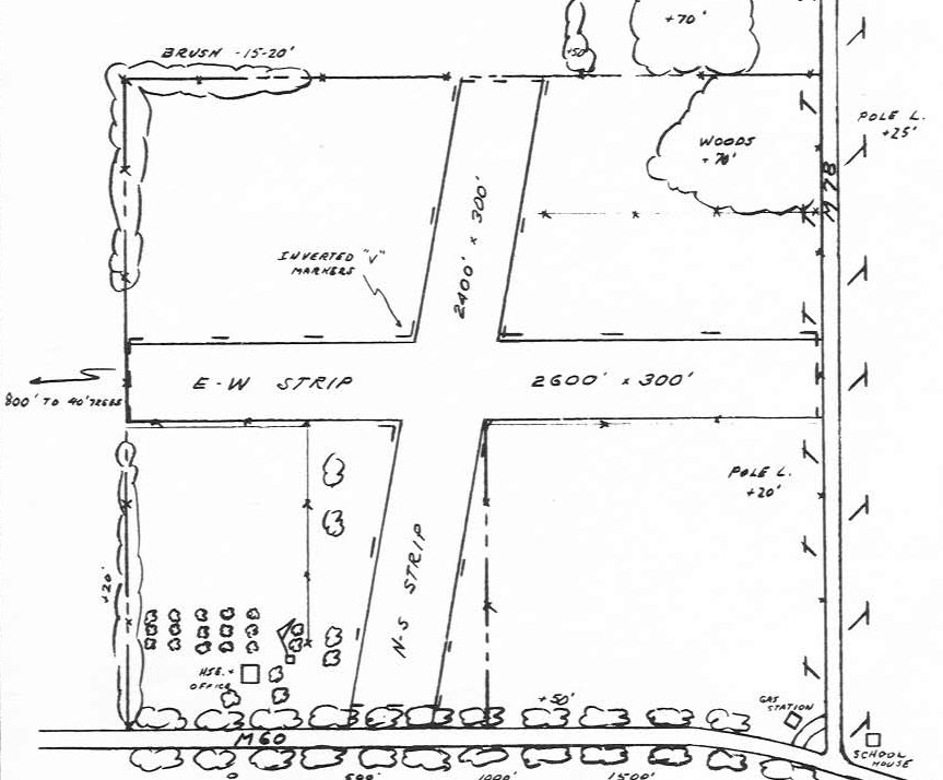
The 1947 MI Airport Directory (courtesy of Bill Grasha) depicted David Airfield as having 2 unpaved runways, measuring 2,600' east/west & 2,400' northeast/southwest.
A house, office, and one other small building were depicted on the southwest.
The earliest aeronautical chart depiction which has been located of David Field was on the June 1947 Chicago Sectional Chart (according to Mike Denja),
which depicted David Field as having a 2,600' unpaved runway.
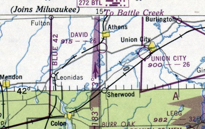
The December 1948 Chicago Sectional Chart depicted David Field as having a 2,600' unpaved runway.
According to Wikipedia, “John Broberg operated the field intermittently into the 1970s where he conducted flight training & parachute practice operations.”
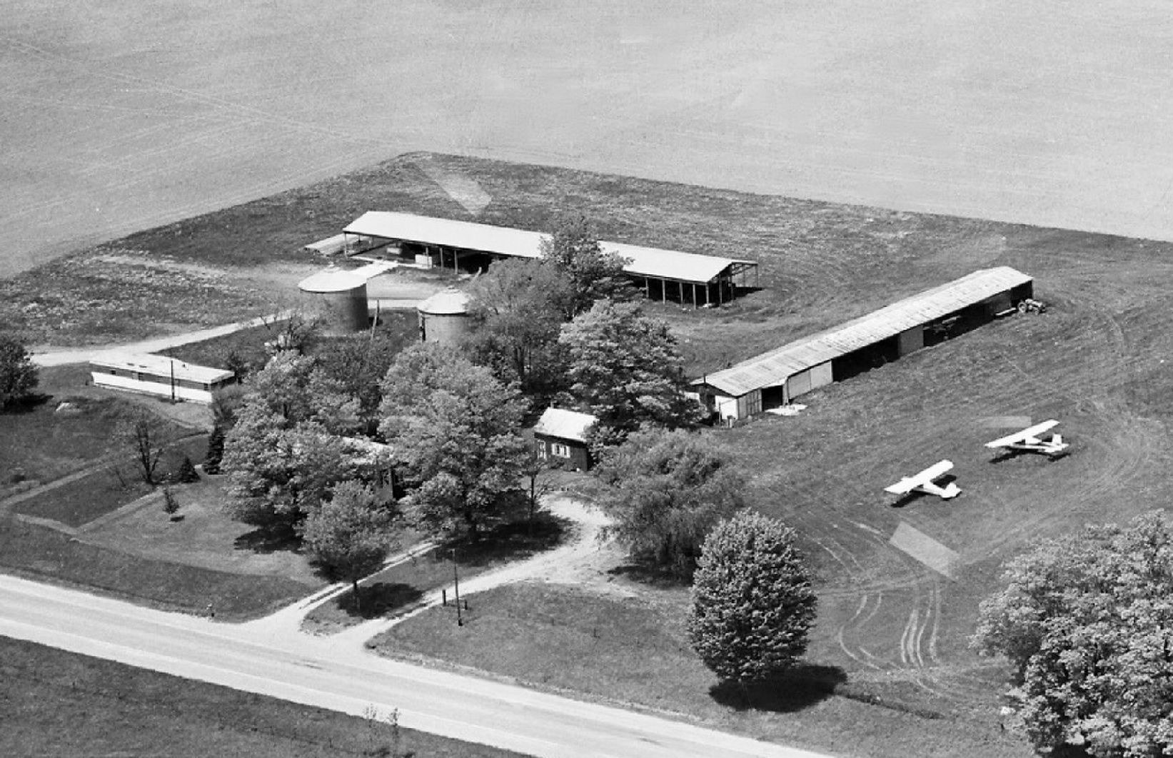
A 1978 aerial view looking north (courtesy of Mike Denja) depicted David Field as having 2 light single-engine high-wing aircraft parked near 2 hangars on the south side.
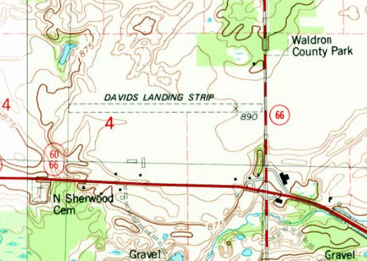
The 1982 USGS topo map depicted “David's Landing Strip” as having one east/west unpaved runway, with a few small buildings to the south.
Dan Lux recalled, “Davids Airfield... My father was the airport manager from about 1985 thru the end & lived in the house on the property. I grew up there.
It was a fantastic place to grow up - my father was a pilot & owned a PA22 Piper Pacer.
It was weekends full of Dawn Patrols & family trips. I learned to drive on that runway & I learned to ride motorcycles as well.
At one point there were 2 hangar buildings, a north/south & an east/west.
I soloed at that field & it will always have a special place in my heart.
My father Leo Lux II purchased the house & the 2 acres the house sat on from John Broberg in the mid-1980s with the agreement that he would manage 9C2 after John retired.
The airport & surrounding farmland was sold to Larry Yoder, a Mennonite farmer & longtime friend & associate of John Broberg.
Larry was a pilot & kept the airport intact & just farmed the fields around it.
For a decade WMU used it to train their pilots & they referred to the place as 'Going to shoot the field goal' because of the breaks in the treelines at both sides it looked like a field goal.
In the summers we would have the Athens burnt chicken BBQ & the northwest taxiway would be lined up with parked airplanes.
We once had a Army National Guard Cobra attack helicopter show up!”
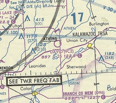
The last aeronautical chart depiction which has been located of David Field was on the October 1993 Chicago Sectional Chart (courtesy of Ron Plante).
It depicted David Field as having a 2,500' unpaved runway.
A 1999 aerial view looking north depicted David Field as having an east/west grass runway, with no sign of the previous crosswind runway.
One light single-engine aircraft was visible parked near a few small buildings on the south side, including 2 hangars.
According to its FAA Airport/Facility Directory data, as of 2005, David's Airport was owned by Mike Abu-Reezeq, consisted of 9 acres, and had one 2,500' turf Runway 9/27.
It conducted an average of 83 general aviation takeoffs & landings per month.
A 2006 aerial view showed the David Field runway appeared to still be maintained.
According to Dan Lux, “The north/south hangar was destroyed in a straight-line wind incident in 2010.”
The last images which have been located showing an aircraft at Davids Field was an early Spring 2011 video by Dan Lux of his father Leo Lux II waving from his Tin Bird ultralight after having landed at Davids Field.
A still image from an early Spring 2011 video by Dan Lux of his father Leo Lux II taxiing his Tin Bird ultralight past a Davids Field hangar.
A 2011 aerial view showed the David Field runway appeared to be in the process of being plowed up.
According to Dan Lux, “When Larry retired from farming he listed the property up for sale & that is when Mike Abu-Reezeq purchased the airport
and then leased the farming land back to one of the Mennonites in the area who happened to be Larry Yoders son-in-law.
Mike Abu-Reezeq failed to pay his property taxes to the state & ended up getting the land seized.
The Mennonites then stepped up to purchase the land on a tax sale & since Larrys son-in-law did not fly & had no interest in a airport [they] decided to plow her under.
It was a sad day & tragic loss of a historical site & at one time 9C2 was voted nicest grass strip in MI.
The airport was plowed under in late 2012 – a sad day made a lot of people very sad to see her go. Davids Airfield was a fantastic airport!
My father passed away in 2014 at the age of 63 & I think losing the airport had a lot to do with it.”
A 2017 aerial view looking north at the site of David Field showed it to be unrecognizable as a former airfield, with the runway area having been returned to cultivation.
One possible former hangar remained intact on the south side.
Thanks to Bill Grasha for pointing out this airfield.
____________________________________________________
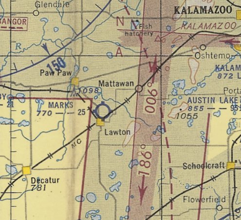
42.178, -85.847 (West of Detroit, MI)
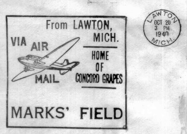
A 10/20/40 postmark commemorating the dedication of Marks' Field (courtesy of Mike Denja).
The dedication of this small general aviation airport on the north side of the town of Lawton was commemorated by a 10/20/40 postmark (courtesy of Mike Denja).
Marks Field was not yet depicted on the 1942 Milwaukee Sectional Chart.
The earliest depiction which has been located of Marks Field was on the April 1944 Milwaukee Sectional Chart (courtesy of Mike Denja).
It depicted Marks Field as a commercial/municipal airport.
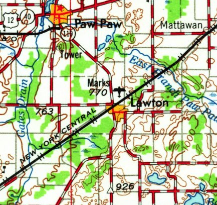
The earliest topo map depiction which has been located of Marks' Field was on the 1944 USGS topo map,
which depicted an irregularly-shaped property outline, labeled simply as “Airport”.
The 1947 MI Airport Directory (courtesy of Mike Denja) depicted Marks' Field as having 3 unpaved runways, with the longest being the 2,500' east/west strip.
A single hangar was depicted on the northwest side.

The earliest photo which has been located of Marks' Field was a 10/10/52 aerial view (courtesy of Mike Denja).
It depicted Marks' Field as having 2 unpaved runways, and some small buildings (& possibly 1 light aircraft) on the northwest side.
The May 1953 Milwaukee Sectional Chart (courtesy of Ron Plante) depicted Marks Field as having a 2,500' unpaved runway.
Marks Field was still depicted on the 1962 USGS topo map.
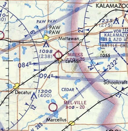
The last aeronautical chart depiction which has been located of Marks Field was on the October 1970 Chicago Sectional Chart (courtesy of Ron Plante).
It depicted Marks Field as having a 2,500' unpaved runway.
Marks Field was evidently closed (for reasons unknown) at some point between 1970-72,
as it was listed as abandoned in the 1972 Airman's Information Manual (courtesy of Miker Denja),
and no longer depicted on the November 1974 Chicago Sectional Chart (courtesy of Ron Plante).
The last photo which has been located showing an aircraft at Marks' Field was a 5/1/75 aerial view (courtesy of Mike Denja),
which evidently showed it after the airport had closed, and the southern portion had been covered by a golf course, but the hangars & 1 light single-engine plane remained on the northwestern corner.
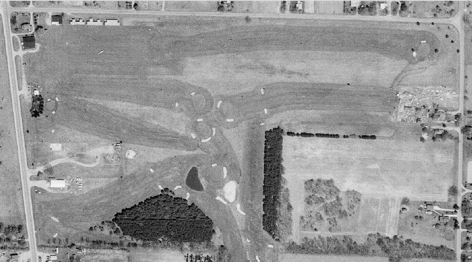
A circa 2010-2017 aerial view looking north at the former T-hangars which remain along the northwest side of the site of Marks Field.
A circa 2010-2017 photo looking northeast at the former T-hangars which remain along the northwest side of the site of Marks Field.
A 2017 aerial view of the site of Marks Field shows the former T-hangars which remain along the northwest side of the property, which otherwise is covered by a golf course.
As of 2017, the site of Marks Field was depicted on street maps as Pin High Golf Club.
A 2019 photo looking southeast at the former T-hangars which remain along the northwest side of the site of Marks Field.
A 2019 photo looking southeast at the former hangars which remain along the northwest side of the site of Marks Field.
The site of Marks Field is located southeast of the intersection of North Main Street & 66th Avenue.
Thanks to Lee Corbin for pointing out this airfield.
____________________________________________________
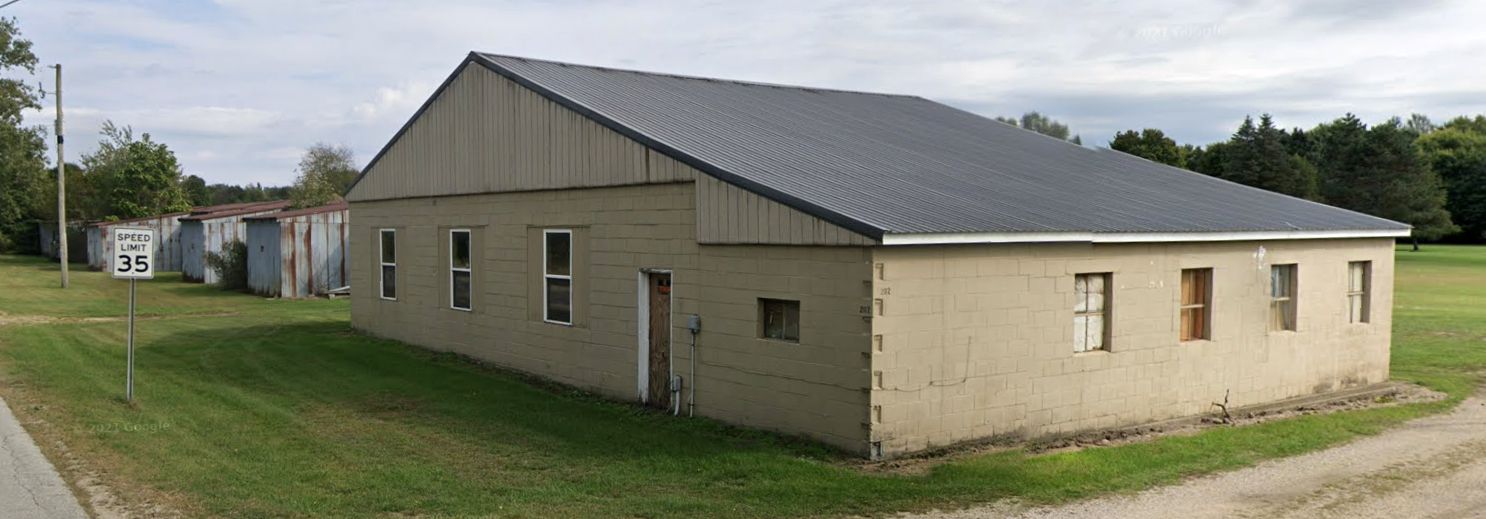
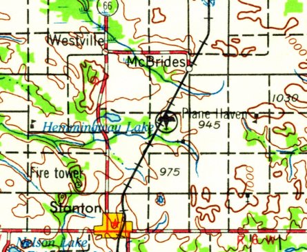
Plane Haven Airport, McBrides, MI
43.333, -85.051 (Northwest of Detroit, MI)
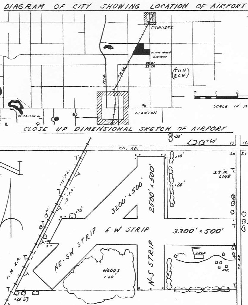
The location & layout of Plane Haven Airport, as depicted in the 1947 MI Airport Directory (courtesy of Bill Grasha).
This small general aviation airport was evidently established at some point between 1942-47,
as it was not yet depicted on the May 1947 Milwaukee Sectional Chart (courtesy of Ron Plante).
The earliest depiction which has been located of Plane Haven Airport in the in the 1947 MI Airport Directory (courtesy of Bill Grasha).
It depicted Plane Haven as having 3 unpaved runways, with the longest being a 3,300' east/west strip.
A single hangar was located on the southeast side.

The only aeronautical chart depiction which has been located of Plane Haven Airport was on the May 1953 Milwaukee Sectional Chart (courtesy of Ron Plante).
It depicted Plane Haven as having a 3,400' unpaved runway.
The last reference which has been located of Plane Haven Airport was an article (courtesy of Bill Grasha) describing the Montcalm Soil Conservation District's 1953 Air Tour.
The earliest photo which has been located of Plane Haven Airport was a 1955 aerial view.
It depicted 3 unpaved runways, with a single hangar on the southeast side.
Plane Haven may already have been closed by this point, as there were no aircraft visible.
The site of Plane Haven Airport was reused as a dragstrip, Central Michigan Dragway.
According to dragstriplist.com, “Central Michigan Dragway began operation at least as early as 1955.
They held a couple of races there on gravel before paving it.”
Plane Haven Airport was still depicted on the 1959 USGS topo map, even though it had evidently been replaced by a dragstrip 4 years prior.
A 1961 aerial photo showed the dragstrip covering the site of Plane Haven Airport,
but traces of the former multiple unpaved runways were still perceptible, and the former hangar remained on the southeast side.
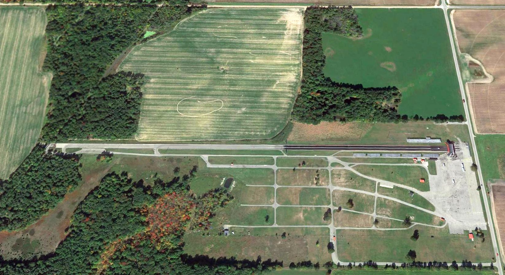
A 2014 aerial view looking north at the site of Plane Haven Airport shows the dragstrip covering the site,
but the trace of the southwest end of the southwest/southeast runway remained perceptible at bottom-left.
As of 2017, the site of Plane Haven Airport was depicted on street maps as Mid Michigan Motorplex.

A 2025 photo looking northwest at the Mid Michigan Motorplex track which reuses the former Plane Haven Airport runway.
The site of Plane Haven Airport is located southwest of the intersection of Wyman Road Northeast & East Cannonsville Road.
Thanks to Bill Grasha for pointing out this airfield.
____________________________________________________
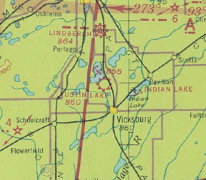
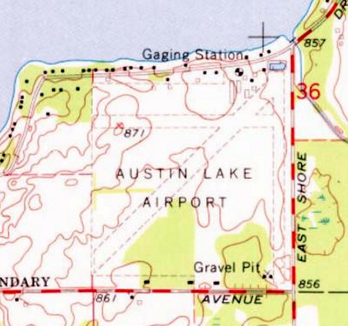
Austin Lake Airport & Seaplane Base (09C), Austin Lake, MI
42.164, -85.544 (West of Detroit, MI)
Austin Lake Airport & Seaplane Base, as depicted on the July 1942 Milwaukee Sectional Chart.
According to a Vicksburg MI History website (courtesy of Bill Grasha),
“The Austin Lake Airport was constructed on the old Woodhams farm in the 1920s by Irving Woodhams, a local aviation pioneer.
Austin Lake is one of few lakes in the area where seaplane landing are permitted.”
According to a biography of Irving Woodhams (courtesy of Bill Grasha),
"Irving & his wife Dorothy, also a professional commercial & private pilot, owned & operated the Austin Lake Airport & Seaplane Base from 1938.
For a time, the Austin Lake Airport was the only seaplane base in Michigan.
He developed that airport on training Navy students who were continuing on in aviation.
That's what he did during the war, said Donald Woodhams. Doing everything correctly was a real bug with him.
Irving, known for his attention to detail, ensured that the planes flying out of his airports had perfect safety records, a remarkable feat for the time."
Austin Lake Airport & Seaplane Base was not yet depicted on the February 1940 Milwaukee Sectional Chart,
The earliest depiction which has been located of Austin Lake Airport & Seaplane Base was on the July 1942 Milwaukee Sectional Chart,
which depicted it as a commercial/municipal airport.
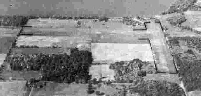
The earliest photo which has been located of Austin Lake Airport was a 9/23/43 aerial view looking north from the 1945 AAF Airfield Directory (courtesy of Scott Murdock).
It described Austin Lake Airport as having 2 perpendicular sod runways, measuring 2,680' east/west & 2,300' north/south.
The field was said to have 4 wooden hangars, and to be owned & operated by private interests.

An undated aerial view of Austin Lake Airport & Seaplane Base from an 11/19/45 Aviation News article (courtesy of Robert Adams) showed several landplanes on the airport & a single-engine Sikorsky S-39 amphibian anchored offshore.
An 11/19/45 Aviation News article (courtesy of Robert Adams) entitled “Land- Water Base In MI Typical Small field beside lake provides for both types of aircraft, with shops and hangars used jointly” detailed:
“Typical of the small inland seaplane bases which may be expected to become more numerous in the next few years is the Austin Lake Airport & Seaplane Base of Irving Woodhams, 10 miles south of Kalamazoo.
Woodhams had been operating charter service & flight instruction at Kalamazoo Municipal Airport until 1938 when he decided to open his own field on a farm his family had owned since 1912.
His field has a 2,300' North/South runway, a 2,400' East/West runway (both turf), and a half-mile of lake frontage for seaplanes.
Hangars are near the lake, and the seaplanes are hauled out of the lake at night & 'stabled' with the landplanes.
Private Base: A traffic problem during a Civilian Pilot Training program at the small field caused the use of floatplanes by one group of students.
The program was successful, but was later discontinued & since that time the seaplane base has been operated entirely for private pilots.
The lake is large enough to provide a 2 mile 'runway' in any direction with adjoining lakes nearby on 3 sides in case of forced landings.
Because of shallow water the waves never get large enough to cause taxiing difficulties, Woodhams reports, and gusty conditions are almost nonexistent.
No Boating: There are no large boats or speedboats on the lake to interfere with the floatplanes & amphibians. Most of the time he has been operating from 3-6 floatplanes.
A large group of private pilots in his area are anxious to own seaplanes & use them in hunting & fishing trips to lakes farther north, away from other means of transportation, Woodhams reports.
Currently the seaplanes are handled by a dolly & a tractor. Post-war improvements, as soon as material & labor permit, will include a ramp & improved dolly so that the plane may be hauled up on its own power.
Woodhams also is planning to construct a group of overnight cabins & a restaurant which.is scheduled to be ready next summer to serve transient pilots."

An undated aerial view of the Austin Lake Seaplane Base from an 11/19/45 Aviation News article (courtesy of Robert Adams) showed a Fairchild 24 & Aeronca floatplanes achored offshore & Aeronca & Taylorcraft floatplanes parked on the shore.
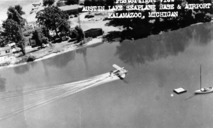
A circa 1940s aerial view of a single-engine floatplane (model unidentified) making a water takeoff or landing at Austin Lake Seaplane Base (courtesy of Bill Grasha).
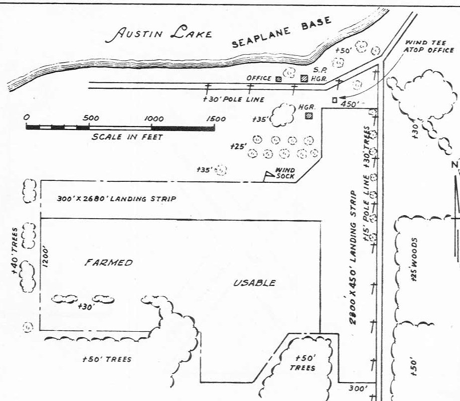
The 1947 MI Airport Directory (courtesy of Bill Grasha) depicted Austin Lake as having 2 perpendicular unpaved runways,
measuring 2,680' east/west & 2,300' north/south, with a hangar, office, and seaplane hangar on the north side.
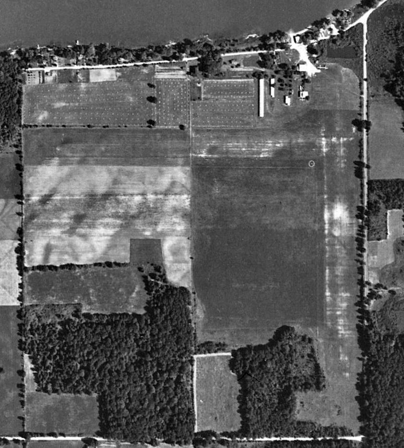
A 1950 City of Portage aerial view depicted Austin Lake Airport as having 2 perpendicular grass runways,
with 5 light single-engine aircraft parked near some small hangars on the northeast side.
An undated (circa 1950s?) photo of “Doug & his Piper Cub at Austin Lake Airport” (courtesy of Bill Grasha).
The May 1953 Milwaukee Sectional Chart depicted Austin Lake Airport as having a 2,700' unpaved runway.
According to a biography of Irving Woodhams (courtesy of Bill Grasha),
"Irving & his wife Dorothy owned & operated the Austin Lake Airport & Seaplane Base until retiring in 1963."
The 1967 USGS topo map shows Austin Lake Airport gained a 3rd unpaved runway at some point between 1950-67.
Several small buildings were depicted on the northeast side.
A 1974 City of Portage aerial view depicted Austin Lake as having 3 grass runways, with 2 light single-engine aircraft parked near some small hangars on the northeast side.
The last photo which has been located showing aircraft at Austin Lake Airport was a 1989 City of Portage aerial view.
A closeup showing 4 light single-engine aircraft at Austin Lake Airport from the 1989 City of Portage aerial view.
The last aeronautical chart depiction which has been located of Austin Lake Airport & Seaplane Base was on the October 1993 Chicago Sectional Chart (courtesy of Ron Plante).
It depicted Austin Lake Airport as having a 3,400' unpaved runway.
According to a Vicksburg MI History website (courtesy of Bill Grasha), “The Austin Lake Airport... was closed at the end of 2000.”
A circa 2010-2017 aerial view looking west shows several hangars remain standing at the site of Austin Lake Airport.
A 2015 aerial view shows the outline of 3 runways were still recognizable at the site of Austin Lake Airport,
and several former hangars remained standing on the northeast side.
A 7/4/19 photo by William Hazen of the former hangars which remain at the site of Austin Lake Airport.
William reported, “Thankfully, it appears the airport buildings themselves were not purchased by the developer, Bex Farms LLC, and may hang on a while longer.
The development of houses has largely ceased and the roads do not encroach any further than the last aerial shot.”
The site of Austin Lake Airport is located southwest of the intersection of Woodhams Avenue & East Shore Drive.
Thanks to Bill Grasha for pointing out this airfield.
____________________________________________________
Saugatuck-Douglas Airport / Douglas Lakeside Airport, Douglas, MI
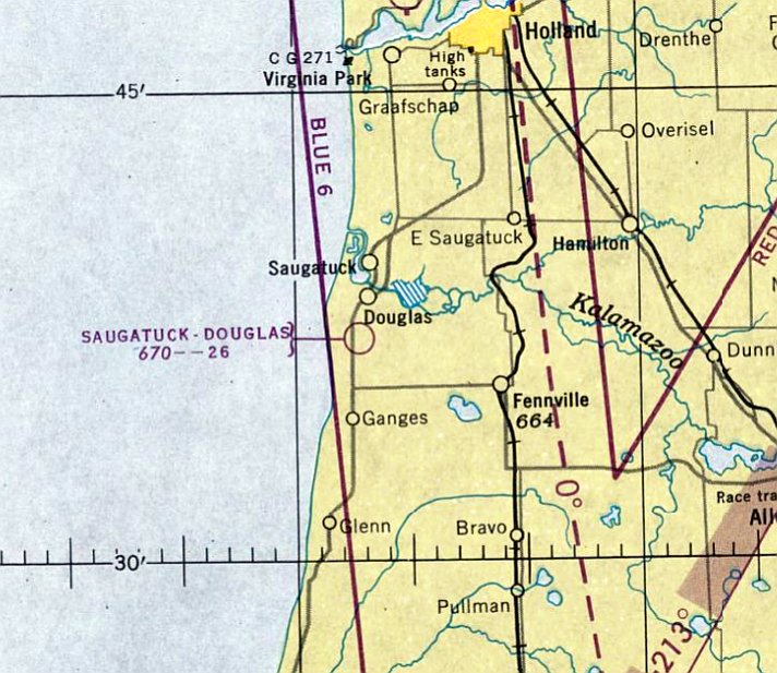
42.619, -86.207 (West of Detroit, MI)
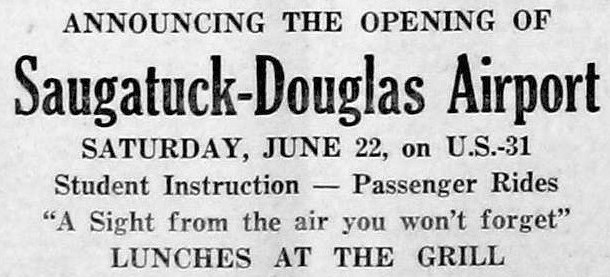
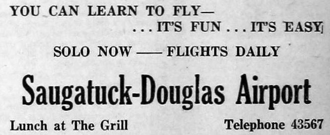
A 6/21/46 advertisement announcing the opening of Saugatuck-Douglas Airport (courtesy of Bill Grasha).
Saugatuck-Douglas Airport was not yet depicted on the June 1946 Milwaukee Sectional Chart.
According to the Saugatuck-Douglas Historical Society (courtesy of Bill Grasha),
“In June of 1946 an airport opened for business just south of Douglas, called the Saugatuck-Douglas Airport.
It was owned by Harl & Lucille Schneider & advertised 'Student instruction & scenic tours.'
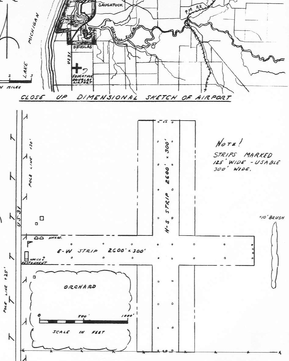
In addition, a small restaurant, known as 'The Airport Grill' served light lunches. It had two 2,500' packed-dirt runways.
In July local pilots joined together to paint the roof of a building in each town with the name of the village & directions & distance to the airport.
In Saugatuck the roof of the Jones garage carried the information; in Douglas the lumber yard roof was used.”
The historical society article continued, “Harl Schneider was one of the earliest licensed pilots in the United States.
One of his students, who had seen Schneider's pilot's license, said that the number on it was less than 100 and it was issued in 1920 or 1921.
Schneider had taught flying at an airport near Holland until he & Lucille were married & opened the Douglas facility. She was also a pilot.
They bought the old John Flagg farm just south of Douglas & Albert Crane of Fennville graded the runways.
Because of the hardpan clay formations there was some difficulty in getting the runways to drain properly.
Crane solved the drainage problem by drilling a 5 or 6' hole in the problem areas & setting off a stick of dynamite to loosen up the hardpan, then smoothing it over.
The east/west runway was built first, followed by the north/south. Later hangars were constructed along the north edge of the first runway.”
A 9/20/46 advertisement for flight training at Saugatuck-Douglas Airport (courtesy of Bill Grasha).
The earliest aeronautical chart depiction which has been located of Saugatuck-Douglas Airport was on the December 1946 Milwaukee Sectional Chart.
It depicted Saugatuck-Douglas Airport as having a 2,600' unpaved runway.
The earliest depiction which has been located of Saugatuck-Douglas Airport was in the 1947 MI Airport Directory (courtesy of Bill Grasha).
It depicted Saugatuck-Douglas Airport as having 2 perpendicular 2,600' runways,
with an office, restaurant, and 2 T-hangars on the west side.
The historical society article continued, “The airport was officially known as the Saugatuck-Douglas airport, but some bills made out to the facility use the name Douglas Lakeside Airport.
Mail was received from the Fennville post office, leading to some confusion.
Flying instruction was carried on by Harl & Lucille Schneider under the name of 'Sky High Flying Service' according to a letterhead.
They had 2 or 3 Aeronca airplanes, 2-seaters with one used by the instructor & another by the student, all painted bright yellow.
In addition, in April of 1948 the Schneiders purchased a 4-place Stinson for their own use & to give scenic rides.
The plane was brought to Douglas from Pine Bluff, AR, one of the longest flights recorded in the airport logs.
More common destinations were Manistee, Mackinaw City, Kalamazoo, and other small airports in MI & IN.
Records show that planes frequently flew to Muskegon for repairs & maintenance.
During World War II many men flew planes who had never even ridden in one before, and many others were exposed to the miracle of flight.
The post-war GI bill allowed many of the returning servicemen to attend college
and would also pay for the flying course that resulted in a private pilot's license in the interest of 'Vocational Rehabilitation'.
Pilots who had earned their wings flying military planes were another source of income as they adapted their skills to civilian life or simply revisited the thrill of flying without the combat responsibilities.
Payment directly from the federal government for veterans taking private pilot training was one of the major sources of income for the airport.
One balance sheet shows that in 1948 the operation actually made a profit of over $1,500.”
The 1950 Airman's Guide described Douglas-Saugatuck Airport as a commercial facility, having 2 runways, the longest being 2,600', and storage facilities, and fuel.
According to the Saugatuck-Douglas Historical Society (courtesy of Bill Grasha),
“Albert Crane said he remembers the first day the fuel tank was filled.
He had dug the hole, the tank was installed & covered.
That evening the West Michigan Oil Company truck had put some gas in it, but did not have sufficient in the truck to completely top it off.
That night the first really big rain of the season struck the area & the water-soaked ground began to swell. The tank came up out of the ground, with the pump on top.
Lloyd Dornan, one of the former students, sometimes gave rides to tourists & was at the airport one day when radio broadcaster Paul Harvey flew in.
He asked that his plane be refueled, 'Full, and I mean right to the top.'
Dornan did the best he could & when he was finished Harvey stuck his finger in the top of the fuel tank to make sure it was truly full.”
The historical society article continued, “When students under the GI Bill had finished their flying courses, there were not enough local people seeking lessons to make ends meet.
The airport stayed open for several more years, at least as late as 1951, but was used only by a few local people who owned their own planes & an occasional transient.
Harl & Lucille Schneider separated & Lucille married Chester Downer, also a pilot, but who also had an interest in auto racing.
About 1952 they called Crane & asked him to build an auto racing track near the back of the property, essentially behind the airport runways.
In addition to the quarter-mile dirt track Crane built bleacher seating on banks of earth.
The wooden planks that customers sat on were held in place with stakes. It was considered safer than conventional bleachers because customers could not fall through.
It was called the Airpark Speedway & featured weekly races in stock & modified open competition classes.”
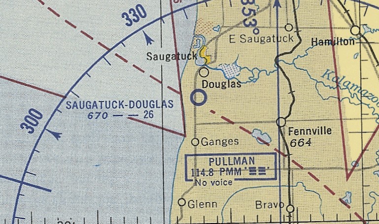
The last aeronautical chart depiction which has been located of Saugatuck-Douglas Airport was on the May 1953 Milwaukee Sectional Chart (courtesy of Ron Plante).
It depicted Saugatuck-Douglas Airport as having a 2,600' unpaved runway.
The Saugatuck-Douglas Airport was not depicted on the 1955 USGS topo map.
The earliest photo which has been located of Saugatuck-Douglas Airport was a 7/30/56 USGS aerial view.
It depicted Saugatuck-Douglas Airport as having 2 unpaved runways, with a few small buildings on the west side.
The oval racetrack was visible adjacent to the northeast side of the runways,
and presumably the airport had ceased to function by that point.
According to the Saugatuck-Douglas Historical Society (courtesy of Bill Grasha),
“Portions of the land were later sold as home sites.
The building that housed the old Airport Grill still exists remodeled as a residence.
The road to the north is what is left of the east-west runway.”
A 2016 aerial view looking north showed the outline of Saugatuck-Douglas Airport's 2 former runways were still very recognizable,
along with the oval outline of the former Airpark Speedway on the northeast side.
The site of Saugatuck-Douglas Airport is located northeast of the intersection of Blue Star Highway & Maple Lane.
Thanks to Bill Grasha for pointing out this airfield.
____________________________________________________
42.256, -84.71 (Southwest of Detroit, MI)
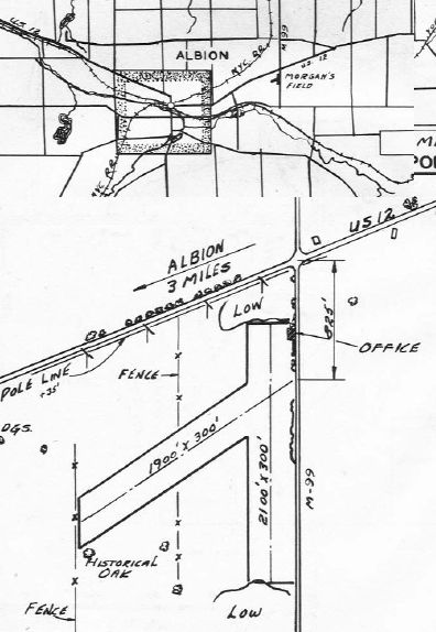
The location & layout of Morgan Field, as depicted in the 1947 MI Airport Directory (courtesy of Bill Grasha).
Morgan Field was not yet depicted on the June 1946 Milwaukee Sectional Chart.
According to the article “Morgan Field” by Frank Passic in the 11/27/94 Morning Star (courtesy of Bill Grasha),
“Albion’s airport once consisted of a 40-acre site, developed by Stanley Morgan in June 1946.
A licensed pilot & instructor, he leased the land from farmer Etril Haggit for approximately $1,500 / year.”
The airport was located southwest of M-99 & old U.S.12.
“The airport’s main office & hangar was located on Finley Road.
Morgan gave flying lessons & promoted the sport in the Albion area.
There were 2 runways. The main one ran northeast/southwest, and the secondary one north/south.
The western edge of the property was where the County Lanes bowling alley sits today.”
Frank continued, “There was a flying club called the Skyrangers, consisting of about 20 flying enthusiasts.
The group owned a 1946 Piper Cub, a 2-seat plane.
President of the club was Albion postmaster Frank Sibal, Secretary was William Bunn, with Hubert Gaskell as Treasurer.”
Frank continued, “There were 8 planes based at Morgan Field,
which included 2 light craft assigned to the MI National Guard’s 943rd Field Artillery Battalion under the command of Lt. Colonel Noble Moore.
The Guard paid $480 annually in rent to use the facilities, which helped in the overall rent costs of the land.”
The earliest dated depiction which has been located of Morgan Field was in the 1947 MI Airport Directory (courtesy of Bill Grasha).
It depicted Morgan Field as having 2 unpaved runways, measuring 2,100' north/south & 1,900' northeast/southwest.
An office was depicted on the northeast corner.
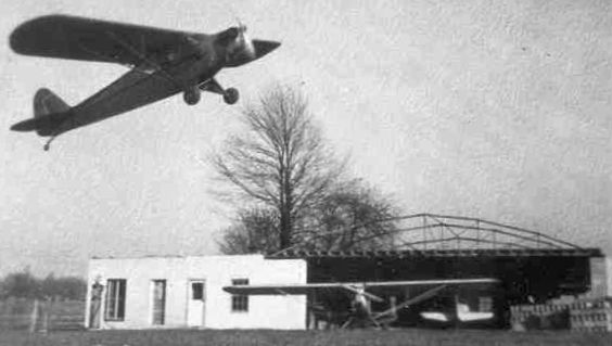
A circa 1946-51 photo (courtesy of Bill Grasha) of a Piper Cub overflying a the Morgan Field office on Finley Road, with an adjacent hangar under construction.
According to the article “Morgan Field” by Frank Passic in the 11/27/94 Morning Star (courtesy of Bill Grasha),
“In March 1950, Mr. Morgan was unable to individually bear the burden of the rent costs for the land, then amounting to $1,500 a year.
So the local Skyrangers began a subscription drive & raised the money themselves.
Albion’s 5 major industries donated funds, as well as numerous merchants.
Morgan continued to operate the facility as its manager on a sub-lease basis.”
The earliest aeronautical chart depiction which has been located of Morgan Field was on the May 1950 Milwaukee Sectional Chart.
It depicted Morgan Field as having a mere 1,800' unpaved runway.
Frank continued, “On year later however in March 1951,
it was announced that the Skyrangers were unable to raise all the funds to rent the land for another year, and that the Morgan Field would be closed.
The club announced it was selling its plane to pay off a $300 indebtedness on its lease.
Apparently, local industries were able to pay their share of the $1,500 annual rental price, but donations from merchants fell short.
The Skyrangers also announced that they were disbanding their club at the time.
Pleas by the city to keep the field open failed. The National Guard planes were moved to Brooks Field in Marshall.
Skyranger officials remarked at the time that few people realized the extent to which Morgan Field had been used
by industrial executives & salesmen coming to visit Albion manufacturing plant offices.
At least 2 planes a day were arriving for that purpose during the spring, summer, and fall seasons.”
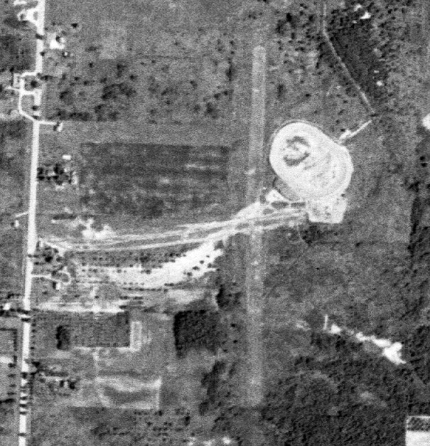
A 1956 aerial view showed a hangar still remained on the east side of the Morgan Field site,
but the runways had been returned to cultivation.
Morgan Field was no longer depicted on the 1958 USGS topo map.
Frank continued, “Amberton village, the Bowling Alley, and other enterprises were built on the former airport site, and this unique opportunity was lost forever.
Industrialists coming to Albion now have to fly into other airports & make a half-hour drive to get here.”
No trace remained of Morgan Field in a 1998 USGS aerial photo.
A 2015 aerial view showed no trace remaining of Morgan Field.
The site of Morgan Field is located southwest of the intersection of Finley Road & Michigan Avenue.
Thanks to Bill Grasha for pointing out this airfield.
____________________________________________________
Bean Blossom Airport (6B3), Corunna, MI
43.04, -84.01 (Northwest of Detroit, MI)
A 4/21/98 USGS aerial view looking southeast at Corunna Airport.
This small general aviation airport was evidently established at some point between 1993-98,
as it was not yet depicted on a 1993 aerial photo or on the October 1993 Detroit Sectional Chart.
The earliest depiction which has been located of Bean Blossom Airport was a 4/21/98 USGS aerial view.
It depicted Bean Blossom Airport as having a single unpaved northeast/southwest runway,
with a few small buildings on the north side of the field.
Jason Morford recalled, “The airport was a privately-owned, public [use] airport.
The metal barn on the left is a hangar. I think there was a Stearman based there.”
The FAA Airport/Facility Directory described Bean Blossom Airport as having a single 1,900' grass Runway 3/21.
It was said to have an annual total of 100 takeoffs or landings, of which 50% were local.
The only photo which has been located showing aircraft at Bean Blossom Airport was a 4/31/05 aerial view looking southeast.
It showed 2 light single-engine aircraft parked next to the hangar.
The last photo which has been located showing the Bean Blossom Airport runway appearing to still be maintained was a 5/31/09 aerial view looking southeast.
But there were no aircraft visible on the field.
Bean Blossom Airport had evidently been closed (for reasons unknown) by 2011,
as a 6/1/11 aerial view showed that the runway had been plowed over, but was still somewhat recognizable.
A 9/26/14 aerial view showed that only the faintest trace was remaining of the Bean Blossom Airport runway,
although the hangar still remained on the north side of the airport site.
As of 2015, street maps still showed a single northeast/southwest runway at the site of Bean Blossom Airport,
even though contemporary aerial photos showed the runway to be long-gone.
A 2020 aerial photo showed the former Bean Blosson Airport hangar had been removed at some point between 2018-2020.
The site of Bean Blossom Airport is located southeast of the intersection of Cronk Road & North Reed Road.
Thanks to Jason Morford for pointing out this airfield.
____________________________________________________
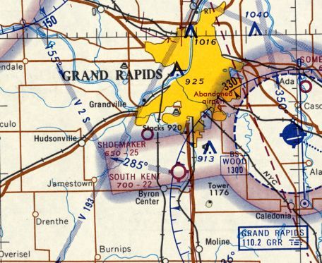
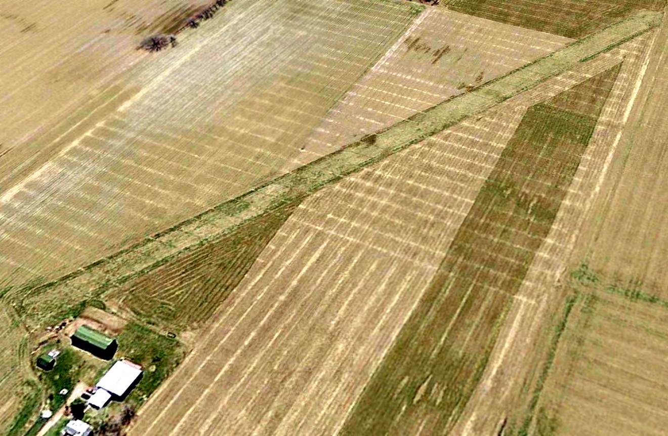
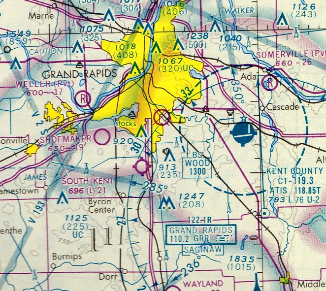
South Kent Airport, Grand Rapids, MI
42.84, -85.69 (Northwest of Detroit, MI)
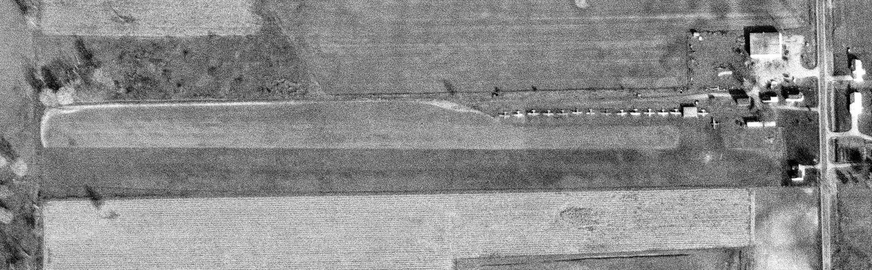
An 11/1/65 USGS aerial view of South Kent Airport.
This small general aviation airport on the south side of Grand Rapids may have been established at some point between 1950-55,
as it was not yet depicted on a 1947 aerial photo (according to Mike Denja) or the 1950 USGS topo map.
The earliest depiction which has been located of South Kent Airport was a 1955 aerial photo.
The earliest depiction which is available of South Kent Airport was an 11/1/65 USGS aerial photo.
It depicted South Kent Airport as having a single unpaved northwest/southeast runway,
with several T-hangars & 6 single-engine aircraft on the north side of the field.
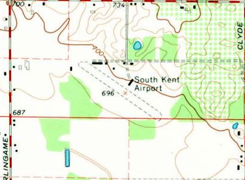
The 1967 USGS topo map depicted South Kent Airport as having a single unpaved northwest/southeast runway,
and several T-hangars on the north side of the field.
The earliest aeronautical chart depiction which has been located of South Kent Airport
was on the May 1968 Milwaukee Sectional Chart (courtesy of William Willyard).
It depicted South Kent Airport as having a 2,200' unpaved runway.
Gary Norton recalled, “South Kent is where I learned to fly in a Cessna 140 [in 1972].
Note it is a bumpy grass strip with a fence at each end of the runway; a tree line & parked airplanes, gas pumps, and buildings next to the runway.
This, coupled with a student pilot in a taildragger, should send goose bumps through pilots who understand these parameters.
Also, Calvin Molyneux was my father-in-law & an Army Air Force taught, hard-nosed instructor. This scenario was cause for extreme stress on my part.
I can’t tell you how many times it took me to learn to takeoff without Calvin’s help.
I know he had 3 persons to teach how to fly, and his patience was usually pretty short.
He had to force our minds to use right rudder to overcome the corkscrewing slipstream of air from the propeller.”
Gary continued, “Once we were in the air, we had to learn to land.
This is not the case for pilots who have 5,000' long concrete runways.
I had to learn how to land on an 1,800', fence-to-fence grass strip.
Not only was this a short field, there was a Big Red Barn when turning final for Runway 31.
One of the first maneuvers we learned to accomplish was to fly a perfect pattern. I emphasize perfect.
Calvin would not allow me to deviate 25' altitude or 0 degree direction. All corners had to be square & distances on the numbers.
I had to learn how to slip the Cessna while in final because of the trees & the aforementioned Big Red Barn.
Also, the Cessna 140 has a slippery shape & is difficult to slow.
Therefore, the landing speed has to be controlled & in a cross-controlled condition, you lose altitude while not gaining speed.
I was warned to be careful in a windy crosswind condition, because when you are cross-controlled, you have little room for correction.
Once safely on the ground, Calvin warned me to not lose concentration on landing the plane.
A characteristic of a tail dragger is a tendency to ground loop. I remember Calvin telling me that I should not finish landing until the Cessna was tied down.”
Gary continued, “South Kent Airport was managed by Roland Palma, and he owned the Fixed-Base Operator, Palma Aviation.
He was wary of us & once, as I was standing near him watching Evan go for a lesson, I heard him say, 'I am just waiting for one of you to kill yourselves.'
He really meant it from the tone of his voice & I never had an occasion to be his friend.”
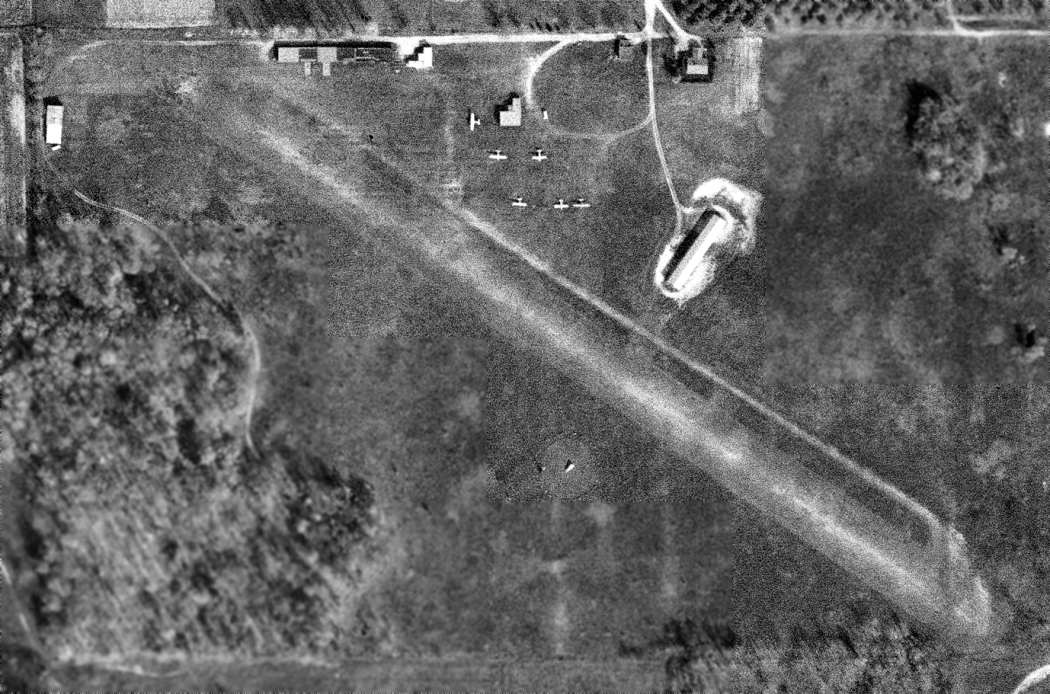
The last photo which has been located showing South Kent Airport still in operation was a 6/1/72 aerial view (courtesy of Mike Denja).
It showed the airport perhaps at its zenith of popularity, with 11 light single-engine aircraft on the north side of the field.
The last aeronautical chart depiction which has been located of South Kent Airport was on the May 1975 Chicago Sectional Chart.
It depicted South Kent Airport as having a 2,100' unpaved runway.
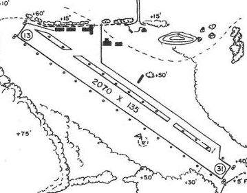
A circa 1985 MI Airport Directory (courtesy of Gary Norton)
depicted South Kent Airport as having a single 2,070' Runway 13/31, with several small hangars along the north side.
The manager was listed as Palma. Unfortunately, it also noted that the airport was scheduled for closure in the Summer of 1989.
The 1991 USGS topo map continued to depict South Kent Airport.
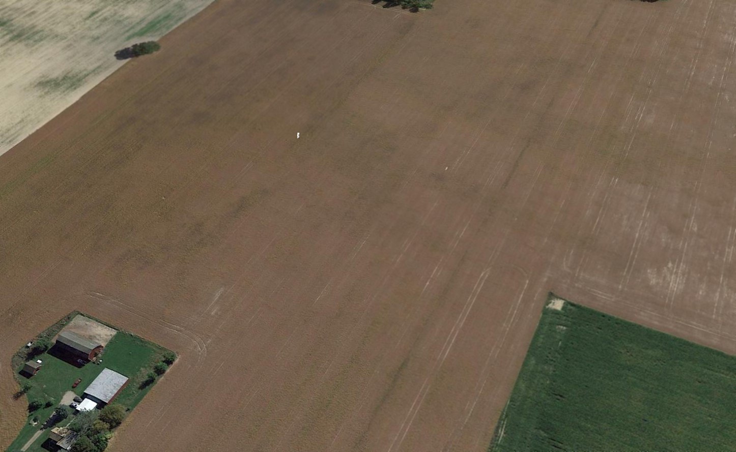
A 1999 aerial photo showed that a housing development had covered the site of South Kent Airport,
with no recognizable trace remaining of the small airport.
An 8/22/13 aerial view showed no trace remaining at the site of South Kent Airport.
As of 2014, street maps show that the site of South Kent Airport is commemorated by the names of several of the residential streets which replaced the airport,
including Airfield Drive & Runway Drive.
Thanks to Gary Norton for pointing out this airfield.
____________________________________________________
(Original) Hillsdale Airport, Hillsdale, MI
41.94, -84.65 (West of Detroit, MI)
Hillsdale Airport, as depicted on the May 1942 Chicago Sectional Chart (courtesy of Chris Kennedy).
The original Hillsdale Airport was located adjacent to the northwest side of the town.
The Hillsdale Airport may have been established at some point between 1937-38,
as it was not yet listed among active airfields in the Airport Directory Company's 1937 Airports Directory (courtesy of Bob Rambo).
The earliest reference to the Hillsdale Airport which has been located
was in the Airport Directory Company's 1938 Airports Directory (courtesy of Chris Kennedy).
It described Hillsdale as an auxiliary airfield, with 2 runways in a cross-shape:
1,900' northwest/southeast & 1,800' northeast/southwest.
The earliest depiction of the Hillsdale Airport which has been located
was on the May 1942 Chicago Sectional Chart (courtesy of Chris Kennedy).
It depicted Hillsdale as an auxiliary airfield.
The only photo which has been located showing of Hillsdale Airport in operation was a 9/19/43 aerial view looking north
from the 1945 AAF Airfield Directory (courtesy of Scott Murdock).
It depicted Hillsdale as having 2 grass runways in an X-shape.
The June 1944 U.S. Army & Navy Directory of Airfields (courtesy of Joe Benson)
described Hillsdale as having a 1,900' unpaved runway.
The 1945 AAF Airfield Directory (courtesy of Scott Murdock) described Hillsdale Municipal Airport
as a 50 acre irregularly-shaped property within which were 2 gravel & sod runways: 1,900' northwest/southeast & 1,800' northeast/southwest.
The field was not said to have any hangars,
to be owned by the City of Hillsdale, and to be operated by private interests.
According to a 1976 book published by the Hillsdale County Historical Society & the Hillsdale County Bicentennial Commission (via Michael Goble),
one evening late in the Fall of 1945, a group of 75 or 80 aviation & flying enthusiasts met to talk about organizing a Hillsdale Aviation Club.
The first president of the new organization was Bernard "Bud" Richard, an experienced pilot & flying enthusiast.
During the first year, the monthly meetings were devoted to planning & financing a clubhouse for a meeting place.
The first "Dawn Patrol" sponsored by the new club was in 1946,
and with the exception of 2 years, this has become an annual event.
With money obtained from the profits of this event,
materials were purchased for a clubhouse & office for the airport
while the members held "work bees" doing all the labor required to build a modest sized office, meeting room, and restrooms.
The earliest operator was Lloyd Brown, with Guy Pearce as instructor.
He was followed by Francis Clymer & Russell King.
The most detailed depiction of the Hillsdale Airport which has been located
was in the 1946 MI Airport Directory (courtesy of Doug Ranz).
It depicted the field as having 2 unpaved runways (1,900' northwest/southeast & 1,800' northeast/southwest),
with a hangar & office at the northeast corner of the field.
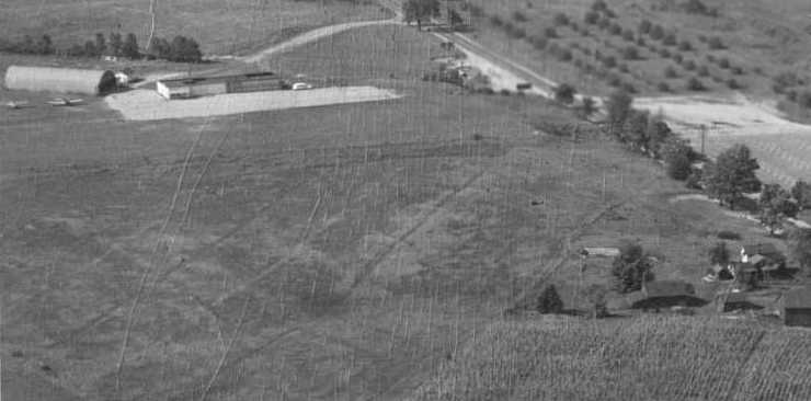
An undated (circa late 1940s?) aerial view looking north at Hillsdale Airport (courtesy of Jeff King)
showed 2 single-engine aircraft next to a ramp with 2 hangars, on the north side of a grass airfield.
Many of the students at Hillsdale were veterans, using their benefits to pay for flying lessons.
When this source of revenue began to dry up, no one wanted to manage & operate the airport.
The city had about decided to abandon it & put it back into farmland
but at this point, to avoid closing down altogether, the Aviation Club stepped in
and agreed to keep telephone, restrooms & a supply of gasoline available.
By the late 1950s the inadequacy & poor approaches of the "old" field become more & more apparent.
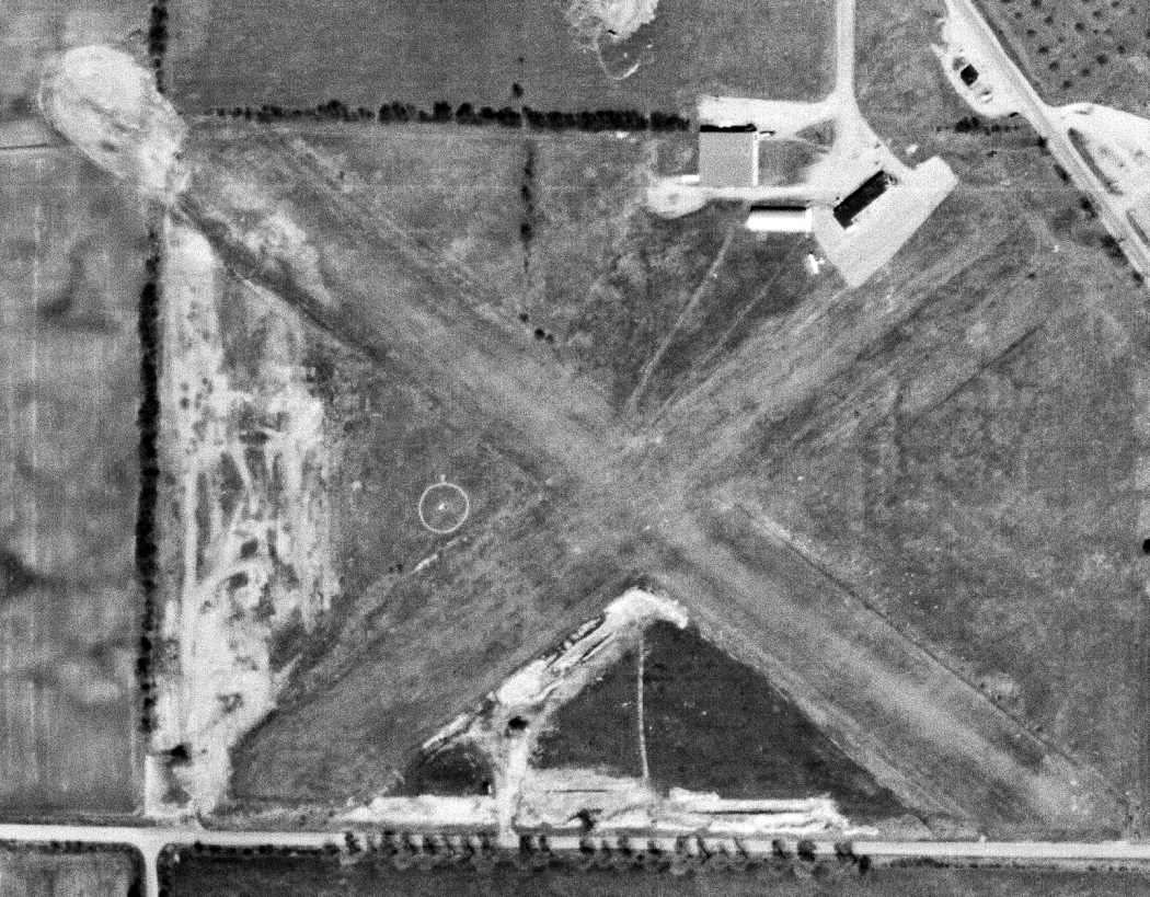
The last photo which has been located of Hillsdale Airport was a 4/25/58 USGS aerial view,
which depicted only 1 single-engine aircraft visible parked outside on the north side of the field.
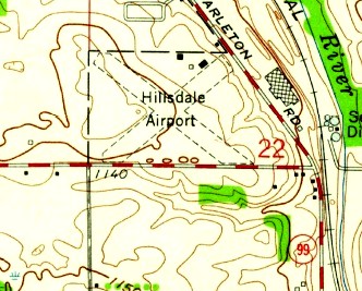
The 1959 USGS topo map (courtesy of Mike Denja) depicted Hillsdale Airport as having 2 unpaved runways,
with 2 buildings on the north side.
The 1962 AOPA Airport Directory described Hillsdale Municipal
as having 2 sod runways (1,900' Runway 13/31 & 1,800' Runway 4/22).

The last depiction which has been located of the original Hillsdale Airport was on the 1962 USGS topo map.
The original Hillsdale Airport was apparently replaced within the next year
by a new Hillsdale Municipal Airport 2 miles to the east of the town,
as only the new field was listed in the 1963 AOPA Airport Directory (according to Chris Kennedy).
The property of the original Hillsdale Airport was sold & was eventually redeveloped as an industrial park.
A 2015 aerial photo showed many buildings having covered the site of the original Hillsdale Airport.
However, Keith Wood pointed out a faint remaining trace of the former airport:
the row of trees running southeast from the center of the photo matches the southern edge of the former northwest/southeast runway.
And at least one former hangar remains on the northeast side.
A 2019 photo (courtesy of Mike Denja) of a former Hillsdale Airport hangar, reused by Litex & expanded.
The site of the original Hillsdale Airport is located northwest of the intersection of Route 99 & Mechanic Road.
Thanks to Michael Goble for pointing out this former airfield.
____________________________________________________
Grand Rapids Municipal Airport / (Original) Kent County Airport, Grand Rapids, MI
42.9, -85.65 (Northwest of Detroit, MI)
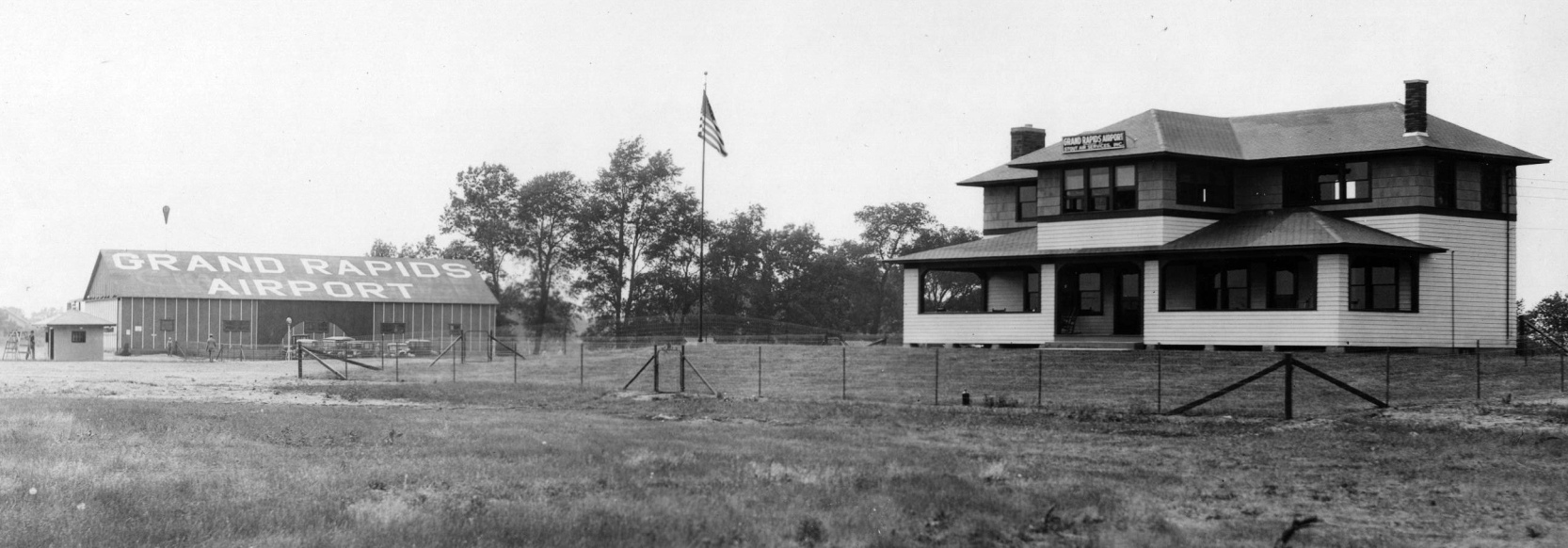
As described on the web site of the current Grand Rapids Airport,
groundbreaking for Kent County's first airport took place in 1919, on a site 4 miles from downtown Grand Rapids.
The earliest photo which has been located of Grand Rapids Municipal Airport
was a 1926 photo of a hangar & the airport office (which has a sign of “Grand Rapids Airport, Stout Air Services Inc.” (from the Grand Rapids Public Museum, courtesy of Mike Denja).

A 1926 photo of passengers boarding Miss Grand Rapids, Detroit Grand Rapids Airline Stout 2-AT-1 for the first scheduled passenger flight from Grand Rapids Airport.
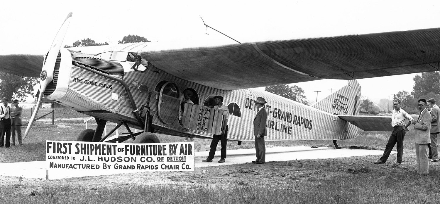
A circa 1926-27 photo of Miss Grand Rapids, Detroit Grand Rapids Airline Stout 2-AT-1 at Grand Rapids Airport, conducting the “First shipment of furniture by air”.
The United States' first regularly scheduled airline service began in 1926, between Grand Rapids & Detroit.
In 1927, Charles Lindbergh landed the Spirit of St. Louis at Kent County Airport.
This visit came only a few months after his historic New York-to-Paris flight.
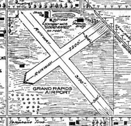
The 1927 Commerce Department Airway Bulletin (courtesy of Mike Denja) depicted Grand Rapids Airport as having 2 perpendicular runways, measuring 3,100' northwest/southeast & 2,200' northeast/southwest.
A hangar (with “Grand Rapids” on roof) & an administration building were depicted north of the runway intersection.
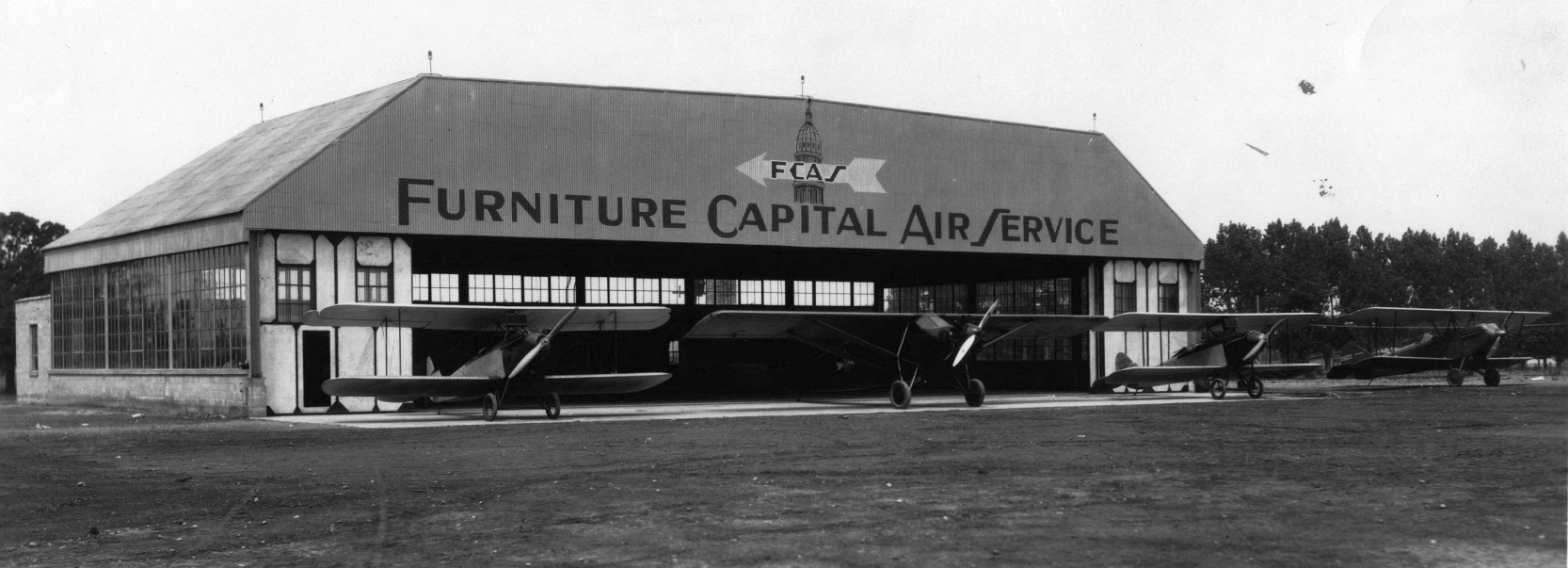
The Furniture Capital Air Service operated from 1928-35. The hangar was financed & managed by John & Jack Bryne.
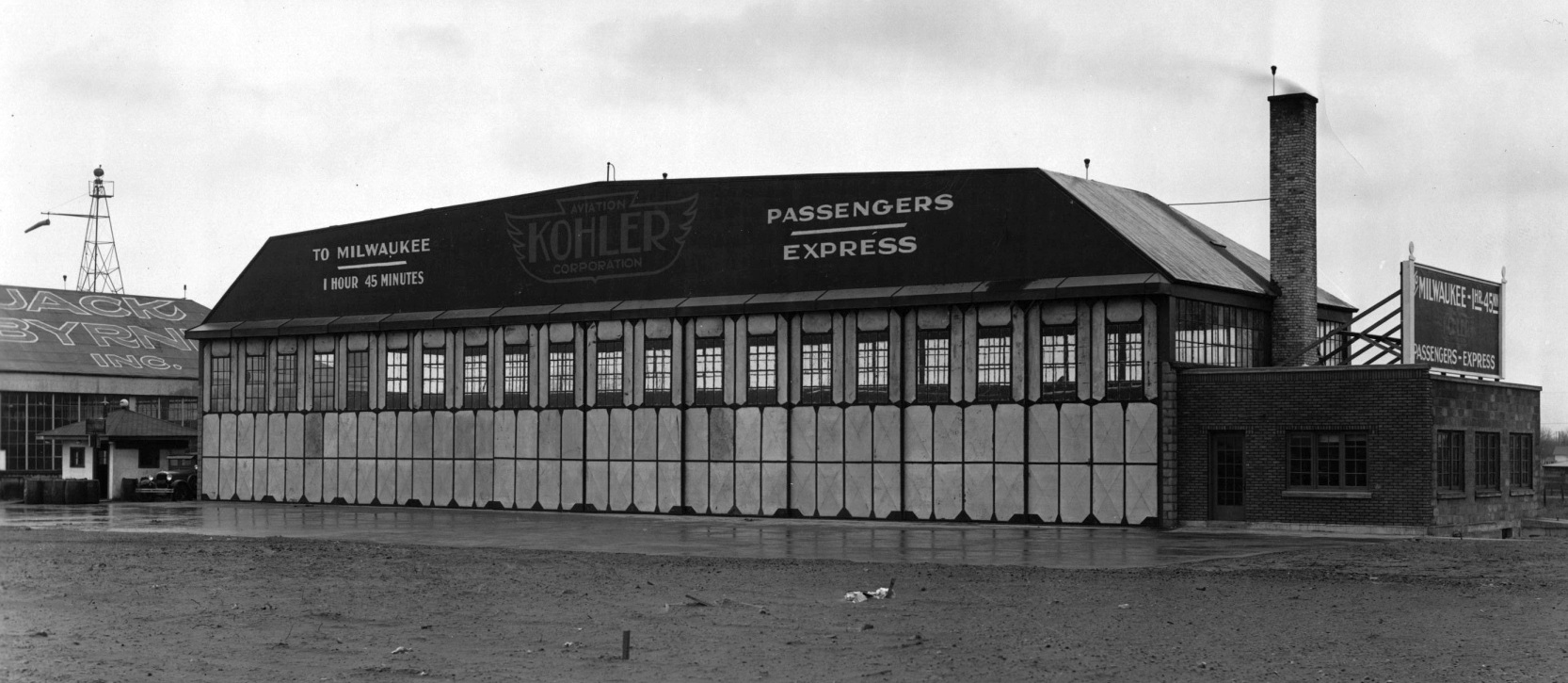
Kohler Aviation Corporation provided passenger and freight service between Grand Rapids & Milwaukee
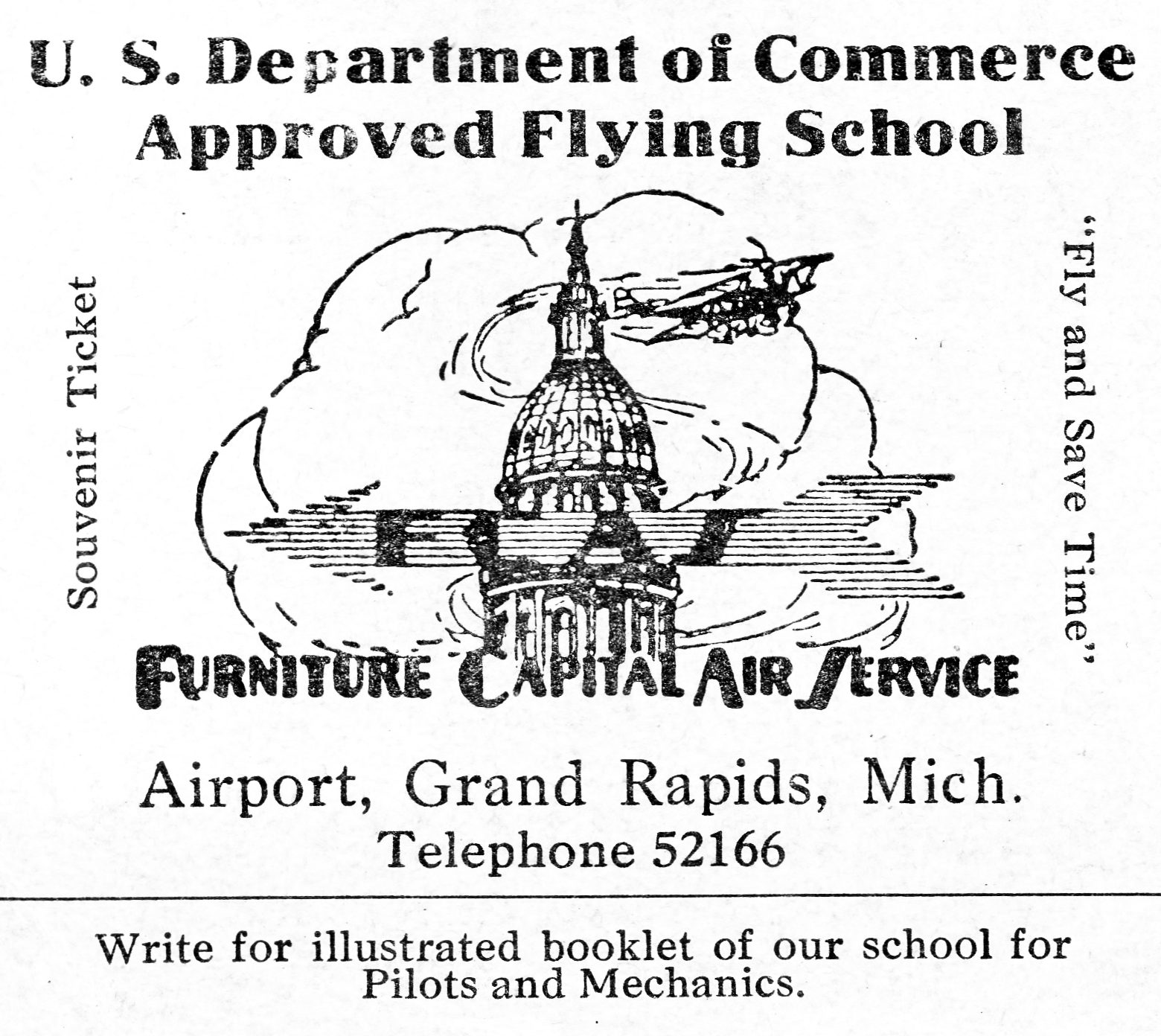
With an infusion of federal funds, the Grand Rapids Airport took on a new look in the 1930s.
WPA money was used to remodel the Administration building & build a new restaurant.
In 1930, the Kent County Board of Supervisors appointed one of its own, Tom Walsh, to manage the airport.
Tom Walsh's years of service to the airport would span almost 30 years & leave a lasting legacy.
The earliest aeronautical chart depiction which has been located of Grand Rapids Municipal Airport was on the June 1931 Milwaukee Sectional Chart.
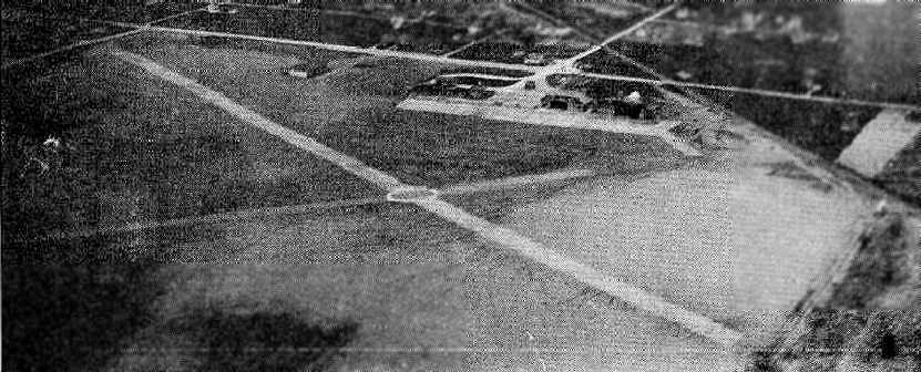
An undated aerial view looking northwest at Grand Rapids Municipal Airport
from The Airport Directory Company's 1933 Airports Directory (courtesy of Chris Kennedy).
The directory described Grand Rapids Municipal as having two 2,900' asphalt runways, and the photo depicted a ramp with several hangars.
The Manager was listed as T. E. Walsh, and the operators were listed as Furniture Capitol Air Service & Kohler Aviation Corporation.
The Airport Directory Company's 1938 Airports Directory (courtesy of Chris Kennedy) described Grand Rapids Municipal as having 4 sod runways,
with the longest being the 2,700' northeast/southwest & northwest/southeast strips.
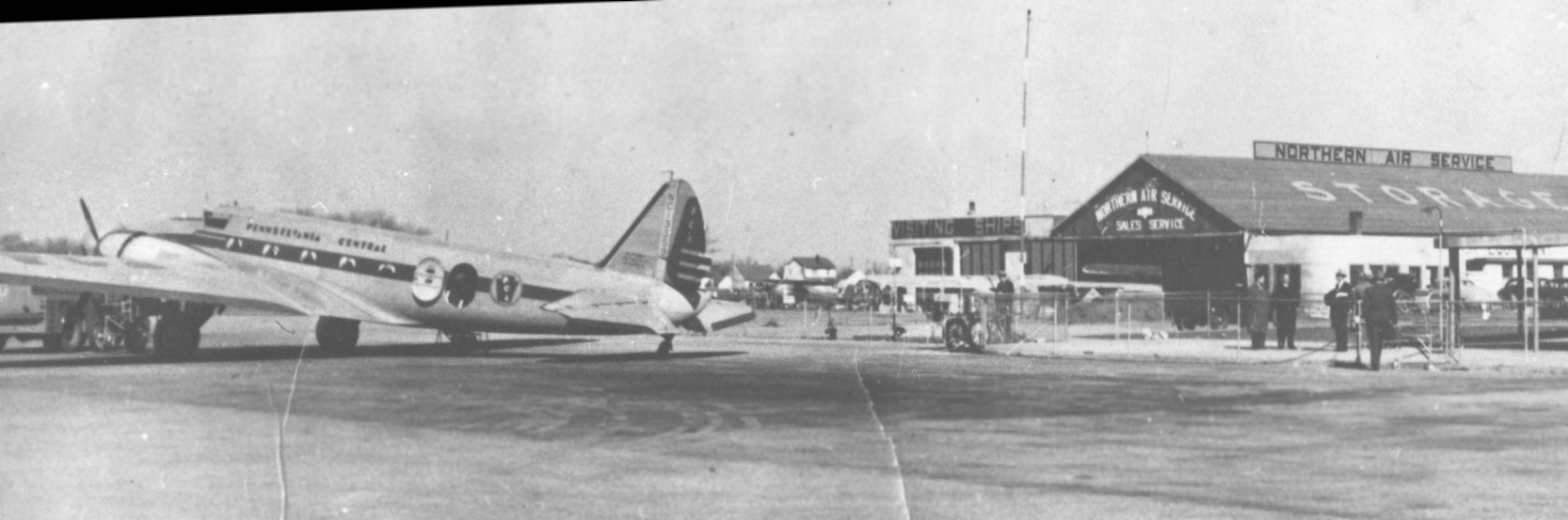
A circa 1930s/40s photo of a Pennsylvania Central Airways Boeing 247 in front of Grand Rapids Airport's Northern Air Service hangar.
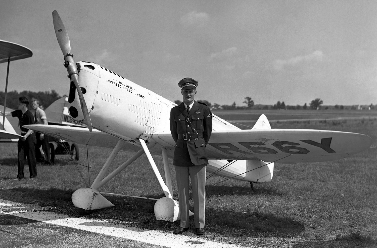
A 6/18/37 photo of “Ike”, Howard DGA-5 N56Y C/n 69 of the Fordon-Brown National Air Show at Grand Rapids Airport.
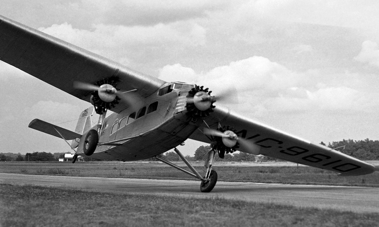
A 6/18/37 photo of Ford a-AT-B Tri-Motor NC9610 C/n 4-AT-53 performing a stunt during the Fordon-Brown National Air Show at Grand Rapids Airport.
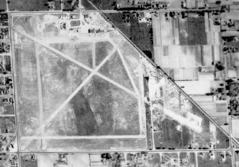
A 1938 aerial photo of Grand Rapids Airport (courtesy of Tom Byle),
shows the field's preWW2 configuration, with a number of runways in a roughly square-shaped plot of land.
However, it can be seen that construction was underway to extend the northwest/southeast runway
into a newly annexed plot of land to the southeast.
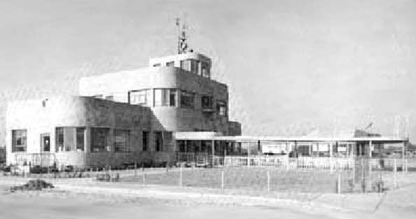
An undated photo of the new Administration building, which was completed in 1939.
It boasted the very latest heating, lighting, plumbing, and all modern conveniences of the time.
The building's 24" thick, steel-reinforced concrete walls were built to be "bomb proof".
In 1940, Grand Rapids was one of only six American cities boasting scheduled air service north, south, east, and west.
WW2 military needs in the early 1940s led to the addition of several buildings at the airport.
Because it fulfilled all requirements for night lighting,
the airport was a useful place early in the war to train transport pilots & to conduct training exercises.
The first pilot cadet training program in Michigan began at Kent County Airport in 1942.
Hundreds of military pilots eventually received their primary & advanced flight & ground school instruction
at the field over the next 2 years.
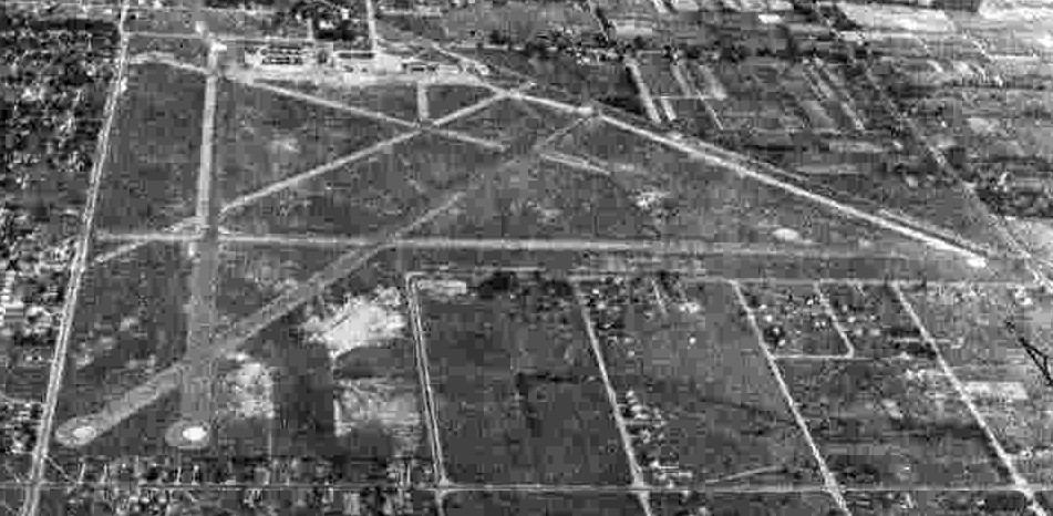
A 9/12/43 aerial view looking north at Kent County Airport from the 1945 AAF Airfield Directory (courtesy of Scott Murdock).
The directory described Kent County Airport as a 324 acre irregularly-shaped property within which were 5 runways,
with the longest being a 4,420' northwest/southeast concrete strip.
The field was said to have a total of 22 concrete hangars, ranging in size up to 120' x 60',
and to be owned & operated by Kent County.
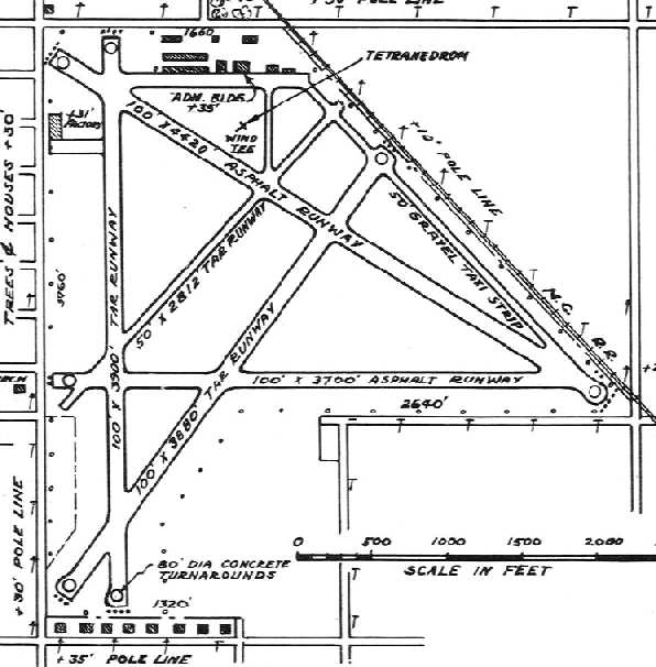
The 1946 MI Airport Directory (courtesy of Doug Ranz)
depicted the Kent County Airport as having a total of 5 asphalt or tar runways,
with the longest being the 4,400' southeast/northwest runway.
All-cargo air freight service came to Grand Rapids in 1946,
and in 1947 a new $60,000 control tower began operating atop the Administration building.
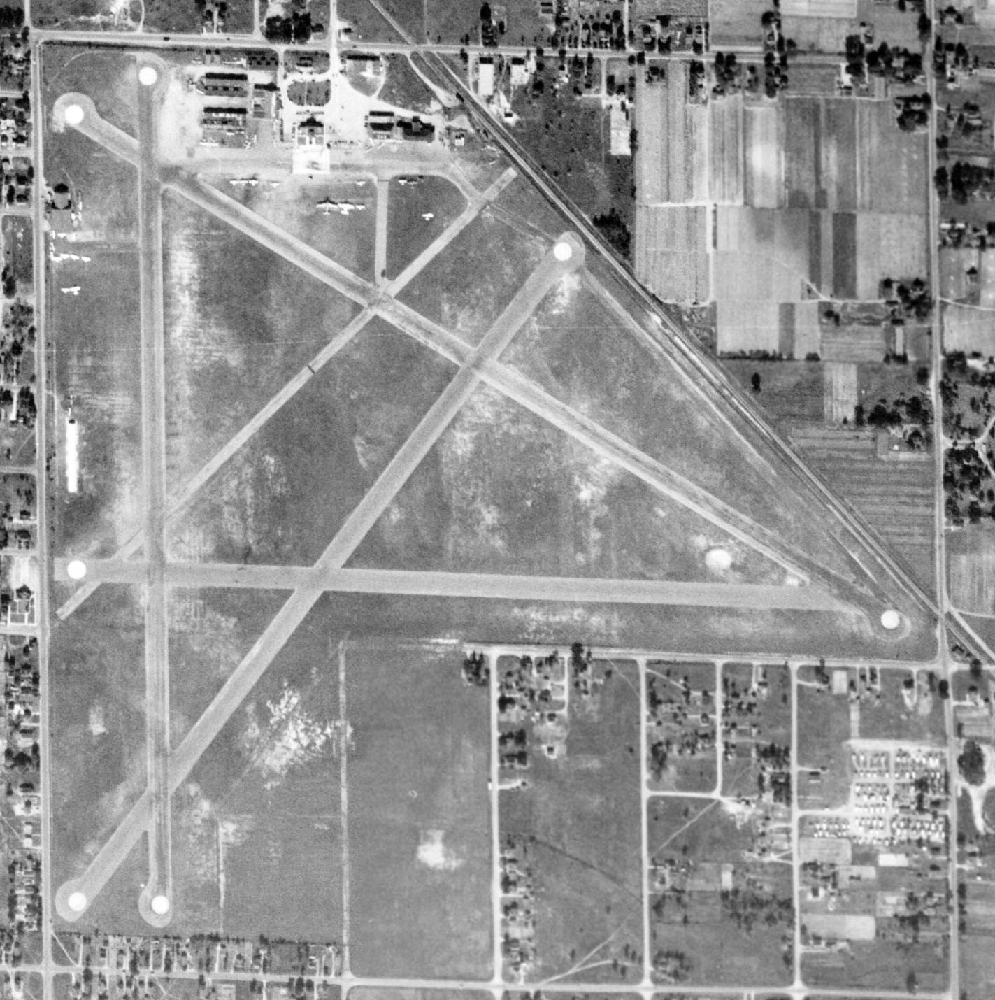
A 10/14/47 USGS aerial view depicted Kent County Airport as having 5 paved runways, with a large number of aircraft parked near hangars on the northeast corner.
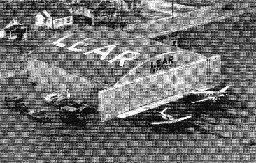
An undated aerial photo looking northwest at the Lear hangar along the southwest side of Grand Rapids Airport (courtesy of William Willyard),
from the back cover of the 1948 Lear Annual Report.
A V-tail Bonanza & a Beech 18 are parked in front of the hangar marked “Lear Service”.
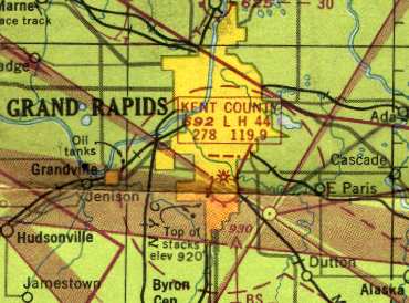
The 1949 Milwaukee Sectional Chart (courtesy of Donald Felton) depicted Kent County Airport
as having a 4,400' paved runway.
By 1949 Kent County Airport's facilities were strained to the maximum,
and the citizens of Kent County voted to expand the airport at its current location,
which would require the purchase of 120 acres & 89 houses.
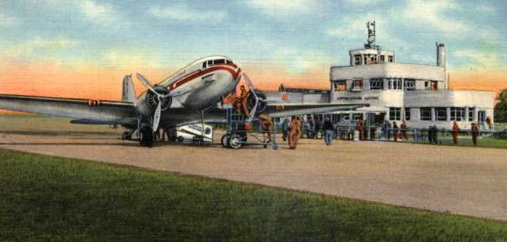
A colorized circa 1940-50s photo of a DC-3 unloading in front of the Kent County terminal.
In early 1952 the newly expanded 5,700' runway was completed.
For a time, movable gates were necessary to keep 44th Street traffic
from crossing the airport's longest runway while planes were taking off & landing.
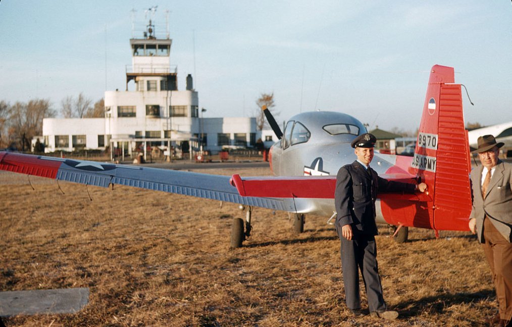
A 1952 photo (courtesy of Mike Denja ) of Lt. Don Connor & Bob Rogers & a Ryan L-17 Navion in front of the Grand Rapids control tower.
Tom Sieswerda recalled, “The old Grand Rapids Airport... I learned to fly there. I met Bill Lear when he had a hangar on the West side of the airport.
I was in the tower one day when Arthur Godfrey landed there. The controllers let me ride my bike across the northwest corner of the airport, giving me light signals.
I pulled up to his DC-3 (beautiful silver with maroon & green trim) as he was getting off. We talked awhile then after he hit the restroom he invited me onboard.
He introduced me to his copilot then asked if I thought my parents would be OK if I went on a little flight. Well, you know my answer.
After they fueled I watched the starting procedure & the taxi to Runway 4. For takeoff, I was in the bulkhead seat on the right.
After we were up, Arthur asked to point out my house which we circled. Then over my high school & downtown.
We turned West toward Grand Haven on Lake Michigan. We turned South along the coast. The copilot got up & offered me his seat.
Arthur asked if I had flown anything before & of course I said yes. 'Well, the plane is yours.'
He pointed out the altimeter & said to keep it at 3,500 feet. That worked for a while until I had to push forward on the wheel to keep altitude.
I had seen the trim wheel so I rolled it forward. OK for a while until I had to trim it up. I was confused until the copilot came up front & he and Arthur busted out.
The trick they pulled on everyone was that the copilot would walk fast all the way to the rear until the plane was trimmed out then come back to the front. A great experience.”
A 1954 aerial photo of Grand Rapids Airport (courtesy of Tom Byle) depicted the airport's new configuration,
with the new concrete Runway 18/36 extending over a significantly larger plot of land toward the south.
A hangar on the north side of the field said "Lear Northern Service" on the roof,
as well as another small hangar marked with "Lear" on the southwest side of the field.
Land had been cleared on the southeast side of the field for the new Lear factory,
but the buildings had not yet been constructed.
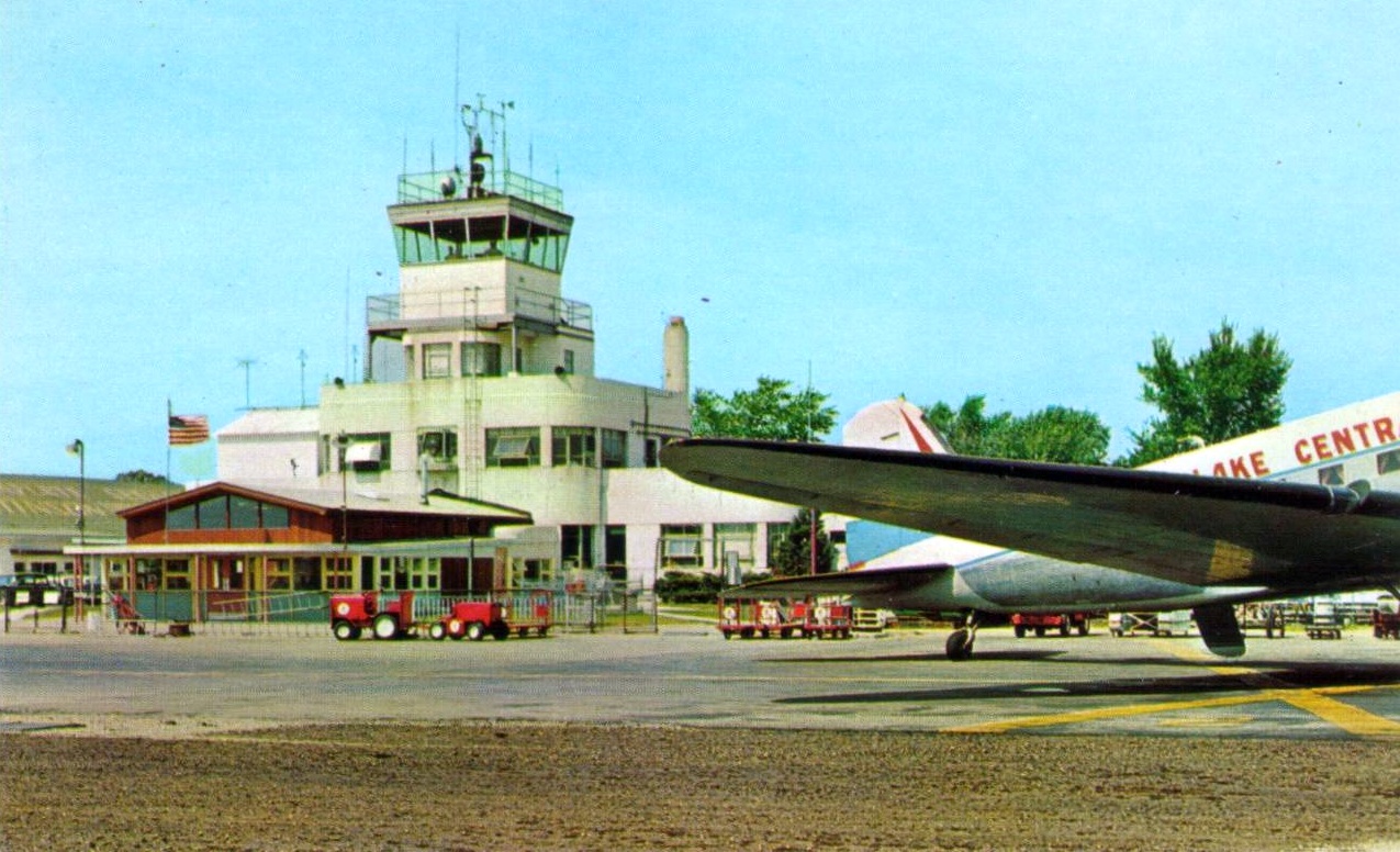
A circa 1950s colorized photo of a Lake Central Airlines Douglas DC-3 in front of the Grand Rapids control tower.
By 1956, increased air travel resulted in the airport again bursting at the seams.
In 1957 the Aeronautics Board hired an aviation consultant to conduct a study exploring which option was more feasible:
to expand & improve the existing airport or to start over on a new site.
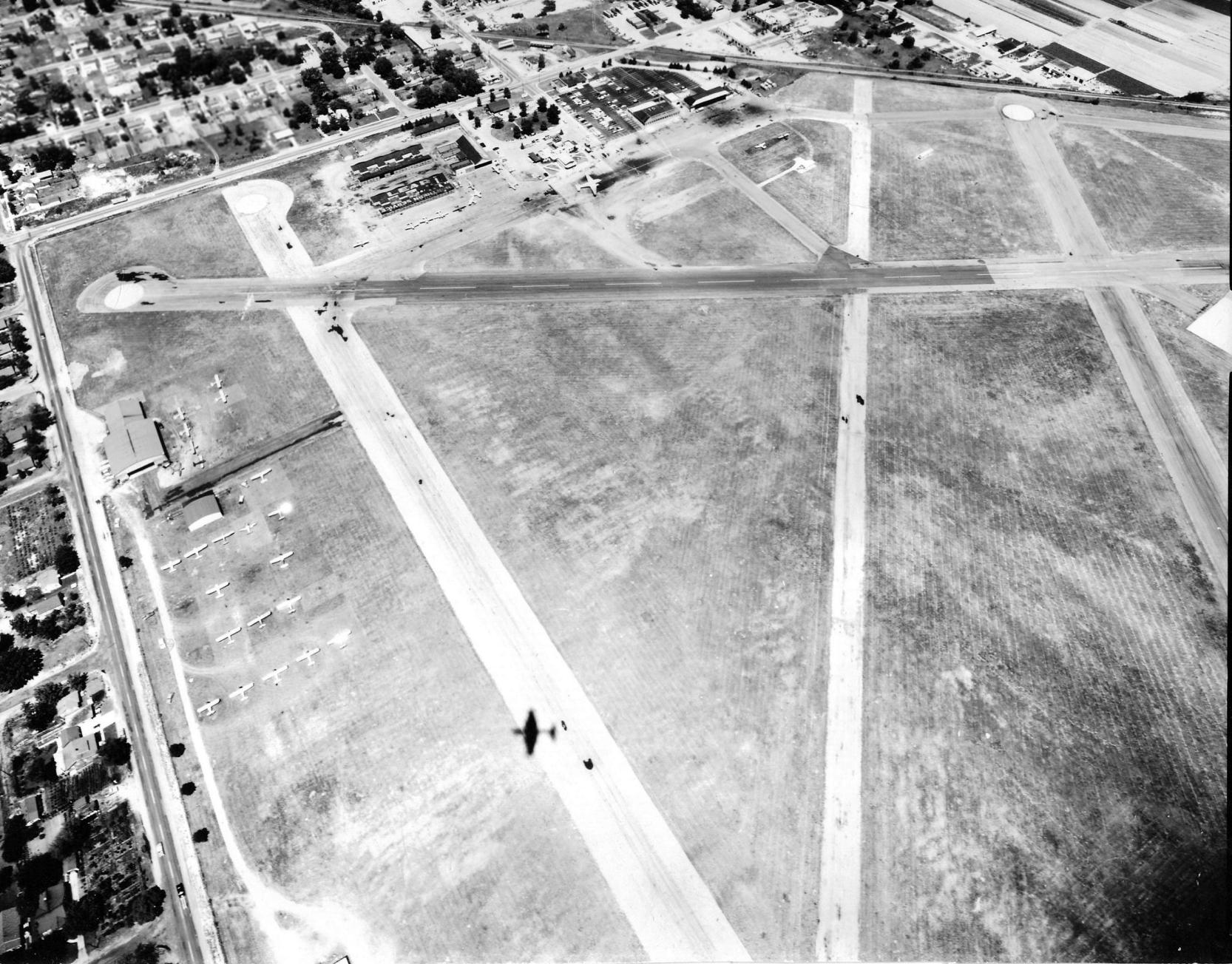
A June 1957 aerial view looking northeast at the north end of Grand Rapids Airport (courtesy of Tom Sieswerda).
Note the shadow on the runway which appears to be that of a Martin RB-57, which was often at the Grand Rapids Lear facility at the time for various tests.
It likely took the photograph.
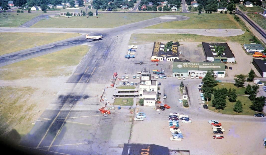
A circa late 1950s aerial view looking west at the northwest corner of Grand Rapids Municipal Airport (courtesy of Dave Thompson).
Dave Thompson observed, “The photo is looking west at the north end of Runways 18 & 12, with the terminal building in the foreground and the 'new' Lear hangars further west.
Also a cool shot of the Stinson hangar. A United Airlines DC-3 appears to be taxiing off of Runway 30.”
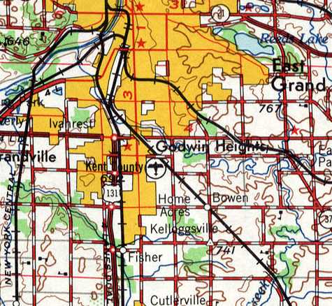
Kent County Airport, as depicted on the 1958 USGS topo map.
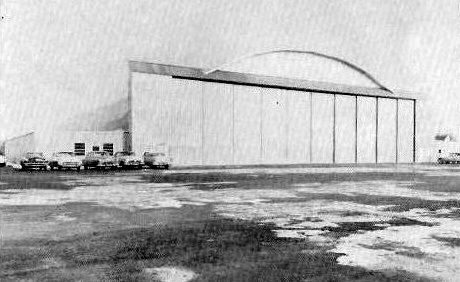
A circa 1950s/60s photo of Lear's Hangar 2 at Grand Rapids Airport.
In 1958 the decision was made to replace the original Kent County Airport with a newly constructed field in eastern Cascade Township.
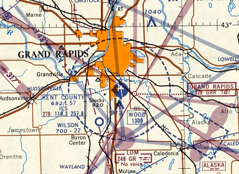
The last aeronautical chart depiction which has been located of Kent County Airport was on the May 1960 Milwaukee Sectional Chart.
It depicted Kent County Airport as having 5 paved runways, with the longest being 5,700'.
The groundbreaking for the replacement Kent County Airport was conducted in 1961.
USAF Lt. Col. Mark Bailey recalled, "I flew in United DC-6s out of the old [Kent County] airport
to Chicago many times as a youngster in the 1960s.
My father also flew in North Central DC-3s out of the airport as well."
By the time of the 1962 AOPA Airport Directory, the original Kent County Airport was in its final year of operation.
It was described as having a 5,700' concrete Runway 18/36, a 4,400 asphalt Runway 12/30, and a 3,400' asphalt Runway 4/22.
The operators were listed as Northern Air Service (Cessna) & Grand Rapids Aviation (Beechcraft),
and airline service was listed as being provided by Lake Central, North Central, and UAL.
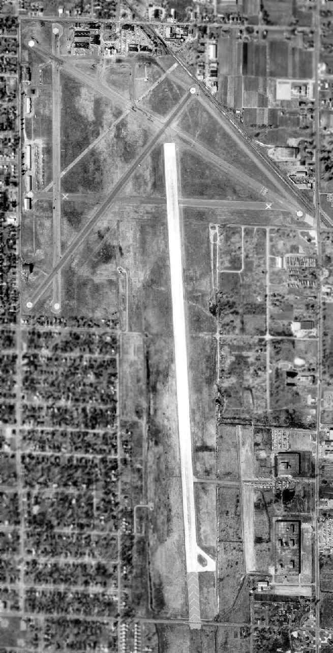
A March 1963 aerial photo of Grand Rapids Airport (courtesy of Tom Byle), taken only a few months before the field closed.
It shows the original runway layout at the north end of the field, as well as the newer concrete Runway 18/36 which extended toward the south.
"You can see where the long runway crossed 44th Street & they closed gates to let planes land & take off.
The taxiway to the east off the long north/south runway went to the Lear plant."
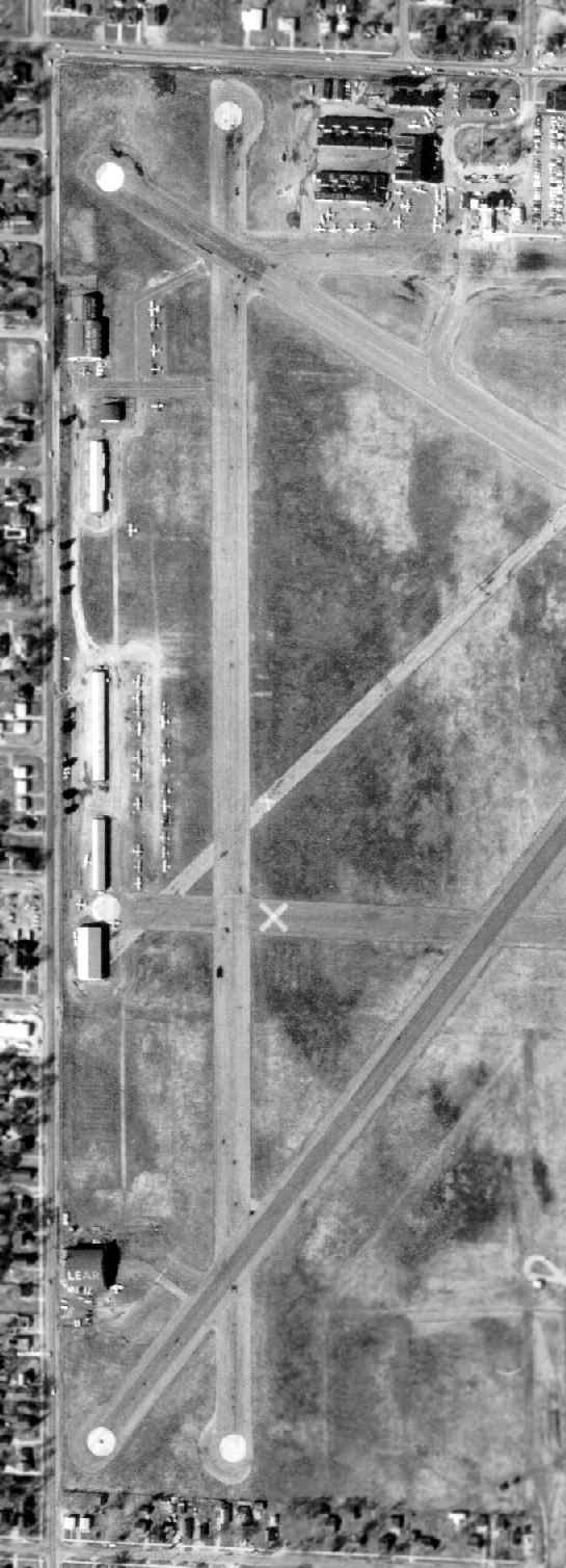
A close-up from the March 1963 aerial photo of the west side of Grand Rapids Airport (courtesy of Tom Byle),
Tom observed, “The furthest south hangar on the west side said 'Lear' on the roof.”
It was evidently a facility of Bill Lear, who went on to produce the Lear Jet.
The final transfer of all Kent County air service took place in 1963,
and the original Kent County Airport closed in November 1963 (according to Grand Rapids resident Tom Byle).
By the time of the May 1965 Milwaukee Sectional Chart,
the site of the original Kent County Airport was labeled as "Abandoned airport".

A circa 1960s photo of a beautiful Shelby Cobra at an SCCA race conducted at the Grand Rapids Airport (courtesy of Ryan Van Vels), with 2 circa 1920s hangars in the background.
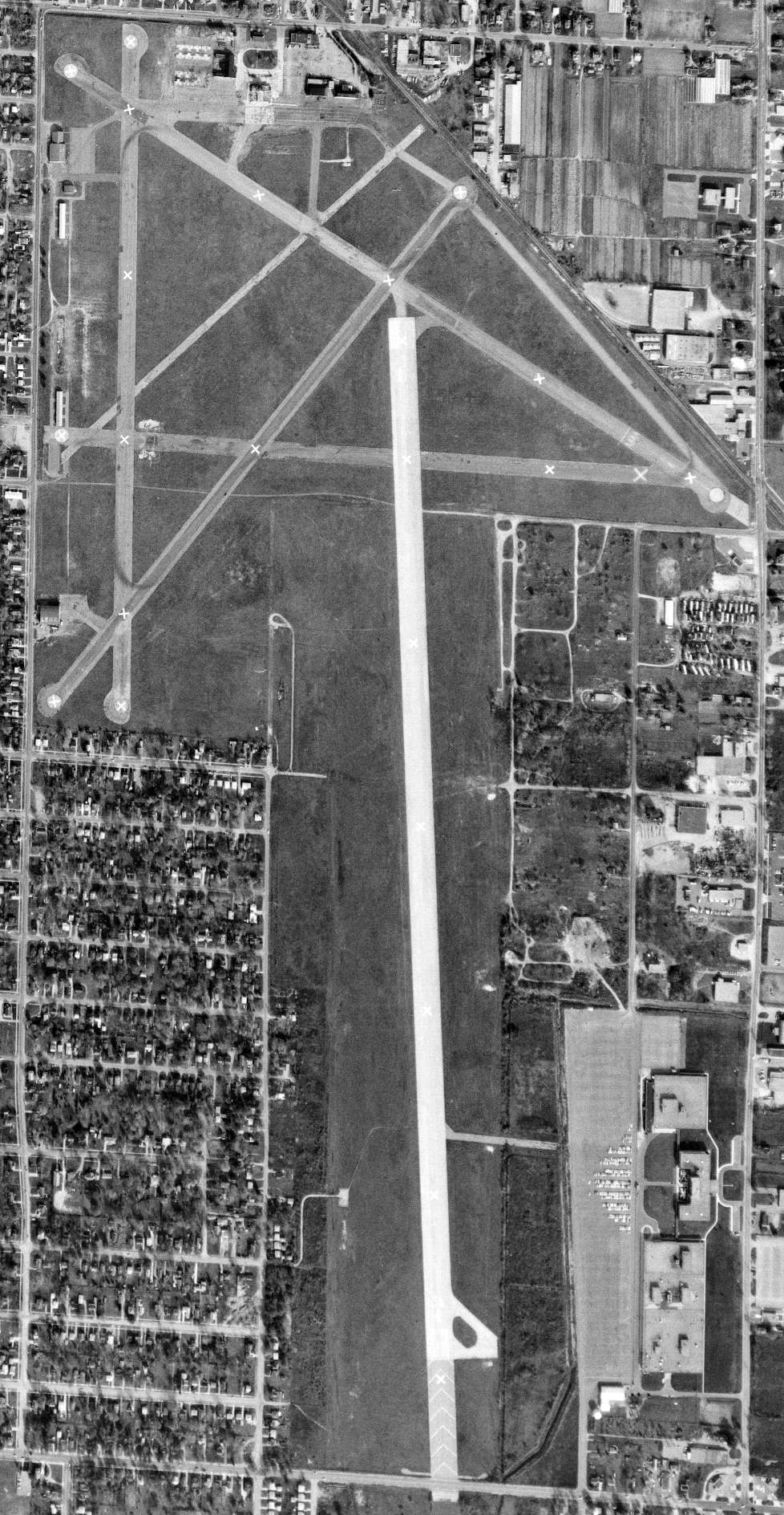
A 10/30/65 USGS aerial view showed Grand Rapids Airport 2 years after its closure, remaining intact though devoid of aircraft.
A 1972 aerial photo showed the Grand Rapids control tower building had been removed at some point between 1965-72, replaced by a large industrial building.

A circa 1970s aerial view looking east at the north end of the remains of Grand Rapids Airport (courtesy of Ryan Van Vels), showing several buildings having been erected over the former runways.
According to Tom Byle, "All the hangars were on the north & west sides of the field but were demolished to make way for the industrial park."
The site of Grand Rapids Airport was labeled "Kent Industrial Center on the 1981 UGSS topo map.
USAF Lt. Col. Mark Bailey observed, "The old airport now is an industrial park.
I last saw it 20 years ago [in the 1980s] and some pavement still existed."
Jim Saltsman reported in 2006 that he was “able to find (& stand on) portions of the original northwest/southeast runway.”
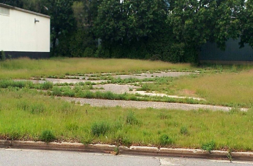
An April 2012 photo by Andrew Roberts, “part of a taxi strip heading northeast to southwest right where it connects to the original northwest to southeast runway.”
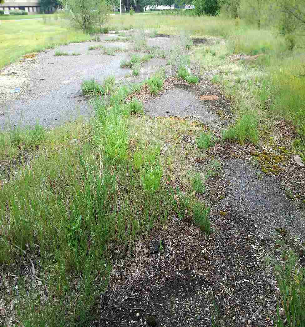
An April 2012 photo by Andrew Roberts “of part of the original northwest/southeast runway. This area is just off Roger B. Chaffee Boulevard after 32nd Street.”
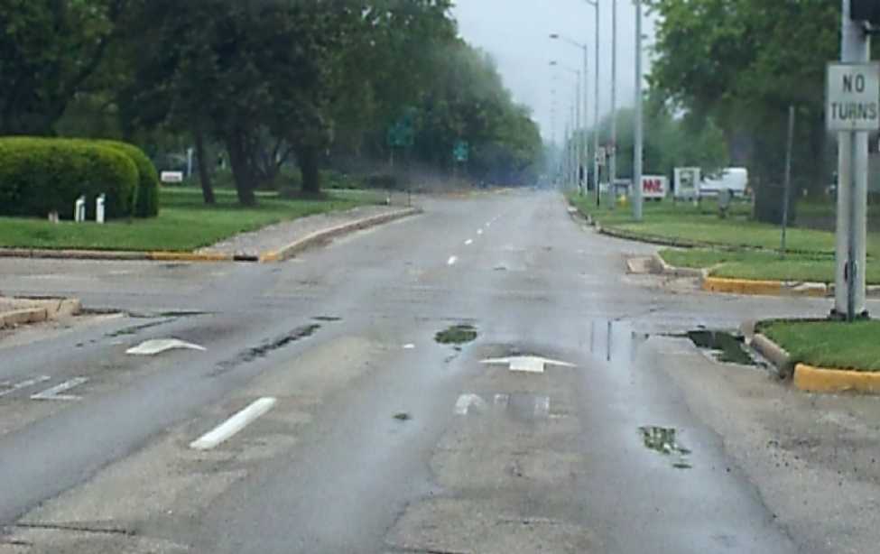
An April 2012 photo by Andrew Roberts, of “Roger B. Chaffee Boulevard at 36th Street, which was the large north/south runway.
There are a few other places where the original asphalt runways still exist for this airport, however, they are inaccessible because they are on private property.”
As can be seen in a 2016 aerial view looking northeast, the site of Kent County Airport has been heavily redeveloped with industrial buildings.
However, more than half of the former runways have been reused as streets or industrial backlots.
The most obvious of these is the former Runway 18/36 & its parallel taxiway, which have been reused as a street - Roger B Chaffee Memorial Drive SE.
Ron reported in 2017, “I live by the old Grand Rapids Municipal Airport on 36th Street & Division
and they're tearing up a historical section by 32nd Street & Division & I found some old lighting structures.”
A 2022 picture (courtesy of Mike Davey) looking southeast at a former Kent County Airport building which remains on the northwest side,
which dates back to at least 1946 & is seen is several vintage photos above.
The site of Kent County Airport is bounded by Jefferson Street Southeast to the west, Eastern Avenue to the east,
44th Street Southeast to the south, and 32nd Street Southeast to the north.
Thanks to USAF Lt. Col. Mark Bailey for pointing out this former airfield.
____________________________________________________
Or if you prefer to contact me directly concerning a contribution (for a mailing address to send a check),
please contact me at: paulandterryfreeman@gmail.com
If you enjoy this web site, please support it with a financial contribution.
____________________________________________________
This site covers airfields in all 50 states.