Abandoned & Little-Known Airfields:
Southern Minnesota
© 2002, © 2024 by Paul Freeman. Revised 3/14/24.
This site covers airfields in all 50 states: Click here for the site's main menu.
Sponsored by: “Find Trusted Home Builders in MN”
____________________________________________________
Please consider a financial contribution to support the continued growth & operation of this site.
Mankato Airport (revised 7/1/21) - (Original) Rochester Airport / Lobb Field (revised 3/9/24) - Walnut Grove Airport (revised 3/14/26)
____________________________________________________
Walnut Grove Airport, Walnut Grove, MN
44.222, -95.48 (Southwest of Minneapolis, MN)
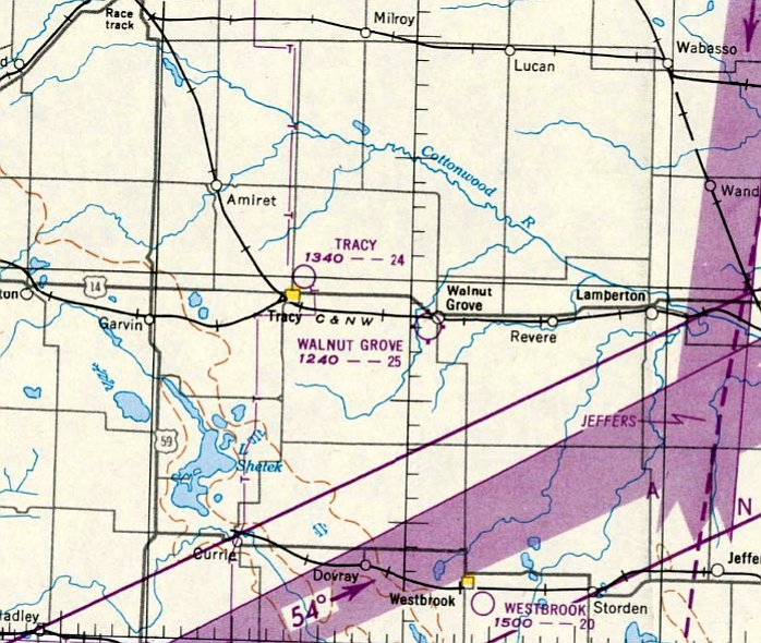
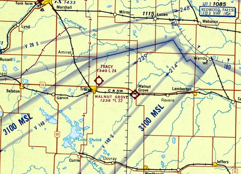
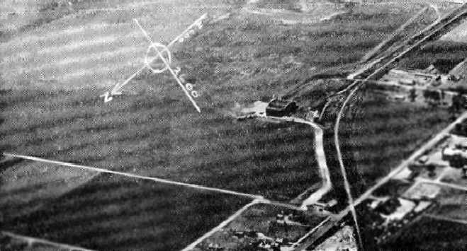
Walnut Grove Airport, as depicted on the December 1949 Twin Cities Sectional Chart.
This small general aviation airport was evidently established at some point in 1949,
as it was not yet depicted on the May 1949 Twin Cities Sectional Chart.
The earliest depiction which has been located of Walnut Grove Airport was on the December 1949 Twin Cities Sectional Chart.
It depicted Walnut Grove Airport as having a 2,500' unpaved runway.

Walnut Grove Airport, as depicted on the 1953 USGS topo map.
The earliest photo which has been located of Walnut Grove Airport was a 9/14/55 aerial view (from MHAPO).
It depicted the field as having a single north/south grass runway, with an office building & hangar at the northeast end.
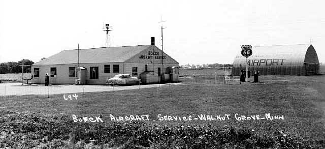
The last photo which has been located showing Walnut Grove Airport while it was in operation
was a 1958 photo of the Boeck Aircraft Service office building & a hangar (from the MN Historical Society, courtesy of Dan Hoehn).
Daniel Turner recalled, “The Boeck Aircraft Service owner/operator, Leo Boeck was a longtime friend of my grandparents.”
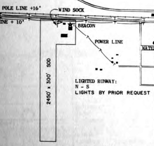
The only airport directory depiction which has been located of Walnut Grove Airport was in the 1961 MN Airport Directory.
It depicted Walnut Grove as having a single 2,450' sod north/south runway, with a few small buildings & a beacon at the northeast corner.
The last aeronautical chart depiction which has been located of Walnut Grove Airport was on the April 1968 Twin Cities Sectional Chart.
It depicted Walnut Grove Airport as having a 2,200' unpaved runway.
Walnut Grove Airport was evidently closed (for reasons unknown) at some point in 1968,
as it was no longer depicted on the November 1968 Twin Cities Sectional Chart.
According to Russ Derickson, Walnut Grove Airport had a “north/south runway, grass strip, still there in the early 1970s.”
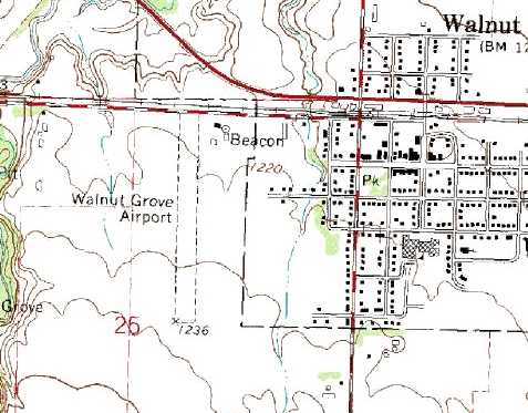
The 1980 USGS topo map depicted Walnut Grove Airport as having a single unpaved north/south runway, with a few small buildings & a beacon at the northeast corner.
The last depiction which has been located of the Walnut Grove Airport was on the 1984 USGS topo map.
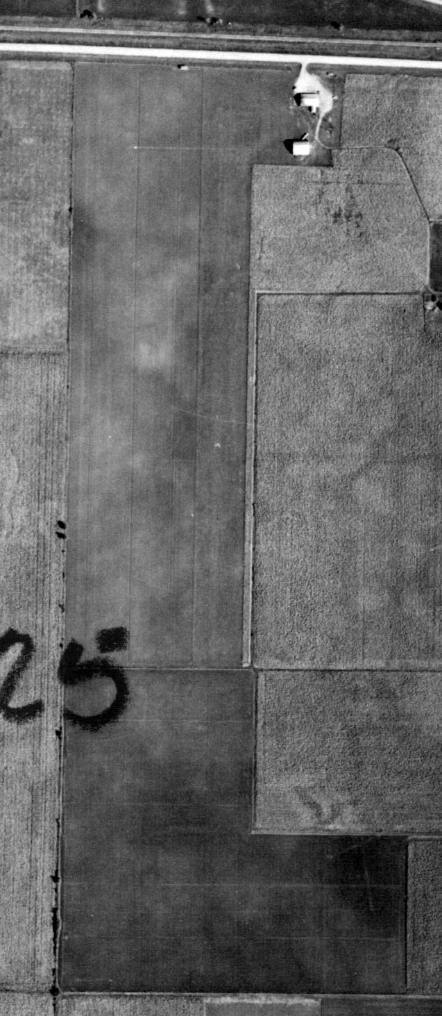
A 1996 USGS aerial photo depicted the Walnut Grove Airport runway as having been returned to cultivation, and no evident aviation use of the site.
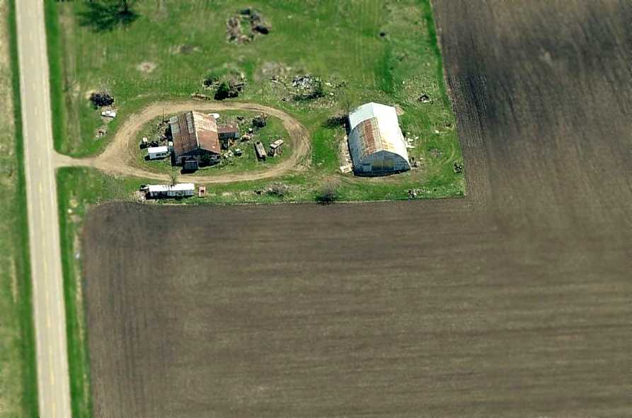
A circa 2008-2011 aerial view looking east at the Walnut Grove Airport office building & hangar (the same structures seen in the 1958 photo).
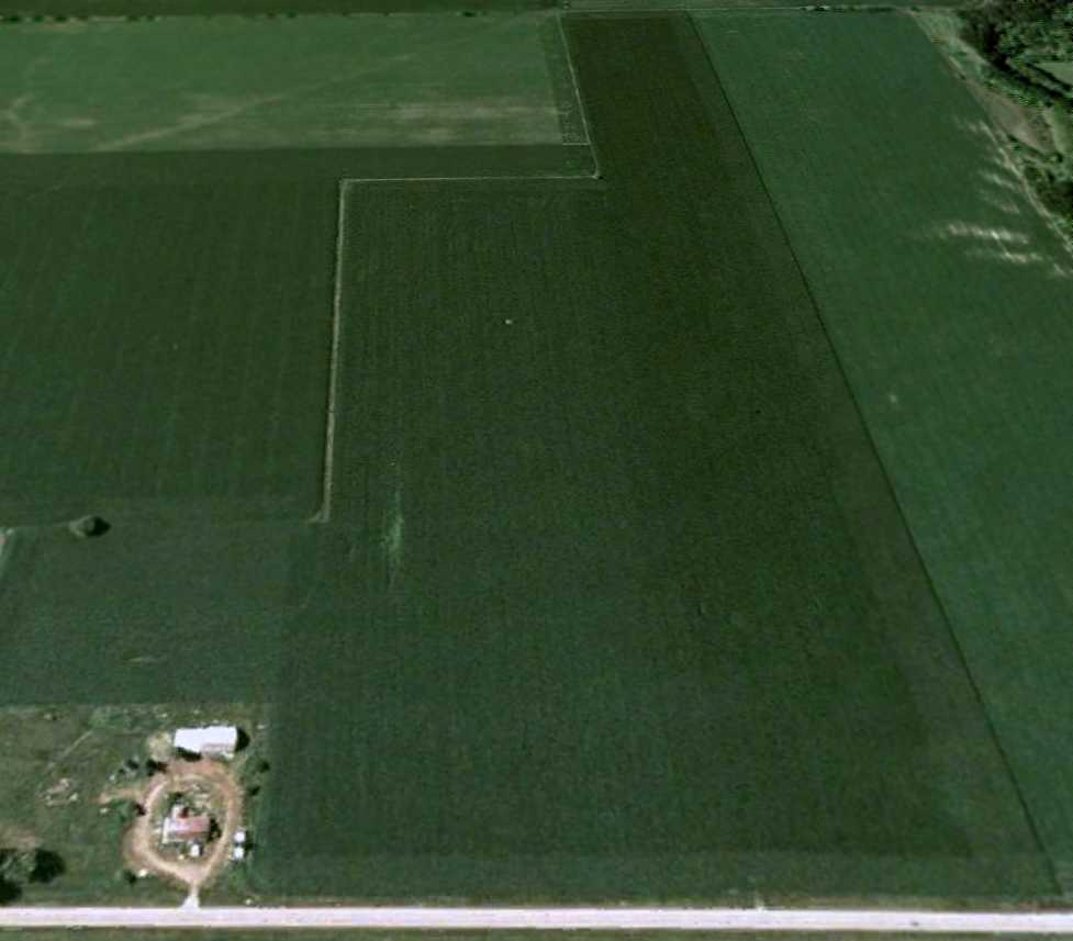
A 6/3/09 aerial view looking south at the site of Walnut Grove Airport showed the runway as having been returned to cultivation,
but the airport office building & hangar remained intact on the northeast side.
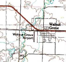
The site of Walnut Grove Airport is located southwest of the intersection of County Road 20 & South Broadway & 9th Street.
____________________________________________________
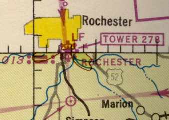
(Original) Rochester Airport / Lobb Field, Rochester, MN
44, -92.45 (Southeast of Minneapolis, MN)
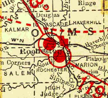
The original Rochester Airport (the airport symbol south of the town),
as depicted on the 1929 Rand McNally Standard Indexed Map with Air Trails of MN (courtesy of Chris Kennedy).
According to the website of the current Rochester International Airport (courtesy of Timothy Aanerud),
the original airport for the town of Rochester was founded in 1928 on a 285 acre parcel adjacent to the southeast side of the town.
It was originally owned & operated by the Mayo Foundation.
In 1929 the field was officially dedicated "Rochester Airport",
when the Rochester Airport Company was founded (as a subsidiary of the Mayo Foundation).
The earliest depiction of the original Rochester Airport which has been located
was on the 1929 Rand McNally Standard Indexed Map with Air Trails of MN (courtesy of Chris Kennedy).
It described Rochester as a commercial field operated by the Mayo Properties Association, Inc.
The field was described as measuring 2,900' x 2,700'.
The Airport Directory Company's 1933 Airports Directory (courtesy of Chris Kennedy)
described Rochester Airport as a 120-acre irregularly-shaped sod field, measuring 2,600' x 2,475'.
A hangar was said to have “Rochester” painted on the roof.
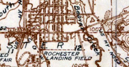
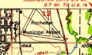
The 1935 USGS topo map depicted the “Rochester Landing Field”.
The earliest aeronautical chart depiction which has been located of Rochester Airport was on the September 1936 Dubuque Sectional Chart.
It depicted Rochester as a commercial/municipal airport.
An aerial view looking southeast at the Rochester Airport,
from The Airport Directory Company's 1937 Airport Directory (courtesy of Bob Rambo).
The directory described Rochester Airport as consisting of an irregularly-shaped sod field, measuring 2,600' x 2,485'.
The aerial photo in the directory depicted a single hangar on the northwest corner of the field.
In 1940 the Rochester Airport Company improved the facilities at the airport with paved runways,
and acquired 85 additional acres, bringing the total size of the airport to 370 acres.
A 1940 aerial view looking west at the hangar at Rochester Airport.
A winter 1940-41 aerial view of the Rochester Airport from the the book "Minnesota Aviation History 1857-1945" by Noel Allard (courtesy of Timothy Aanerud)
depicted the field as having 4 asphalt runways.
The April 1944 US Army/Navy Directory of Airfields (courtesy of Ken Mercer) described Rochester Airport as having a 3,500' hard-surface runway,
and indicated that Army flight operations were conducted from the field.
John Hanson recalled, “I grew up one block north of the airport & my dad was an aircraft inspector there until it was moved.
Hundreds of P-39 & P-63 fighters stopped at this field during WWII on their way to Alaska to be turned over to the Russians as part of the Lend-Lease program.”
Rochester Airport, as depicted on the 1944 Dubuque Sectional Chart (courtesy of Timothy Aanerud).
In 1945 the Mayo Foundation gave the airport to the city of Rochester because as a private corporation, Mayo wasn't eligible for Federal Grants.
The Rochester Airport Company continued to operate the airport under an operating agreement with the City of Rochester.
A 1948 photo (courtesy of John Hanson) looking south at Rochester Airport.
According to John, the photo “shows the airport during an improvement project.”
Several light planes were visible on the runway at the center of the photo, along with 2 DC-3s on the right side of the photo.
The airport was officially named "Lobb Field" in 1952.
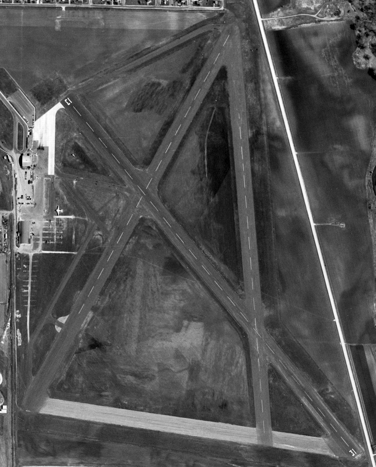
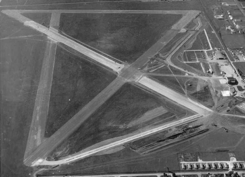
A 5/12/54 USGS aerial view depicted Lobb Field as having 4 paved runways,
with ramps, hangars, and 10 planes (including a Douglas DC-3) on the west side.
The runway at Lobb Field had evidently been somewhat lengthened at some point between 1944-55,
as the 1955 Dubuque Sectional Chart (courtesy of Timothy Aanerud) depicted the field as having a 4,500' hard-surface runway.
The 1955 USGS topo map depicted “Rochester Municipal Airport” as having 4 paved runways, with a few small buildings along the west side.
A 1956 photo (courtesy of John Hanson) looking south at Rochester Airport.
According to John, this photo “shows pretty much the condition of the airport until it was closed in 1961.”
Several light planes were visible on the ramp on the right side of the photo, including a twin-engine airliner (a Convair?).
John Hanson recalled, “I grew up one block north of the airport, just off the end of Runway 31 & completed my private pilot's license there in 1957.”
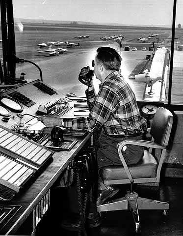
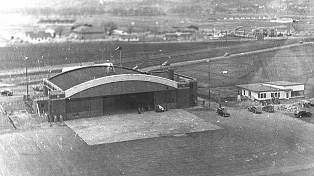
A 1958 photo of Bob Berggren (tower controller) at Lobb Airport.
In the late 1950s construction began on a replacement "Rochester Municipal Airport" to the southwest of the town.
According to John Hanson, this was “because [Lobb Field] could not be expanded to accommodate the larger airliners & was too close to the edge of town.”
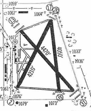
The 1960 Jeppesen Airway Manual (courtesy of Chris Kennedy)
depicted Lobb Field as having 3 paved runways (with the 4,470' Runway 13/31 being the longest),
along with a ramp on the west side of the field with several hangars.
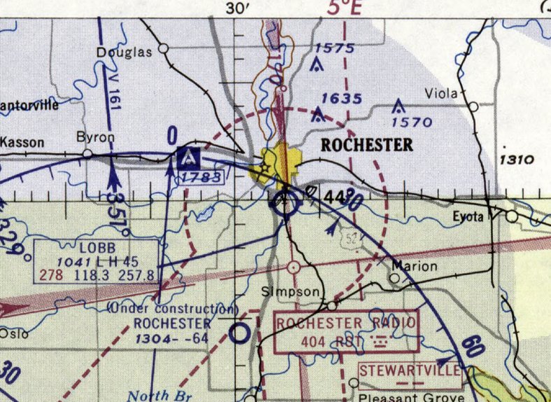
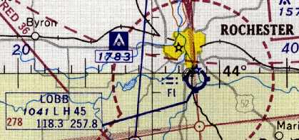
The last depiction which has been located of Lobb Field was on the June 1960 Dubuque Sectional Chart.
It depicted Lobb Field as having a 4,500' paved runway.
Note that it also depicted the under-construction Rochester Airport to the southwest, which would shortly replace Lobb Field.
In 1960 the replacement "Rochester Municipal Airport" was opened to the southwest of the town.
Lobb Field was evidently closed at some point in 1960, as it was labeled “Closed” on the December 1960 Dubuqe Sectional Chart.
Dan Schoonover recalled, “When I was very young, the routes my father drove to town were either 20th Street Southeast (the southern edge of the airport) to South Broadway
or via Olmsted County Road 1 (the eastern edge, aka 11th Avenue Southeast) to US Highway 14.
I became old enough to be aware of & remember these routes several years after the airport closed.
I can picture driving on 16th Street after it was first put in thru the center of the airfield, seeing paved runway surfaces on the south side of the road & wondering if I would see an airplane.
The airport, at its largest extent (when it closed), was bordered on the south by 20th Street Southeast, on the north by 13th Street Southeast,
on the east by 11th Avenue Southeast, and on the west primarily by the railroad tracks which run parallel to & east of 3rd Avenue Southeast.”
Robert DeBus reported, “I have lived for the past 36 years out in the middle of what was Lobb Field - now the Meadow Park area.
Remains of the runways were still southwest of my house when I moved here [1971], and I have dug up what I assumed were bits of pavement of the field.”
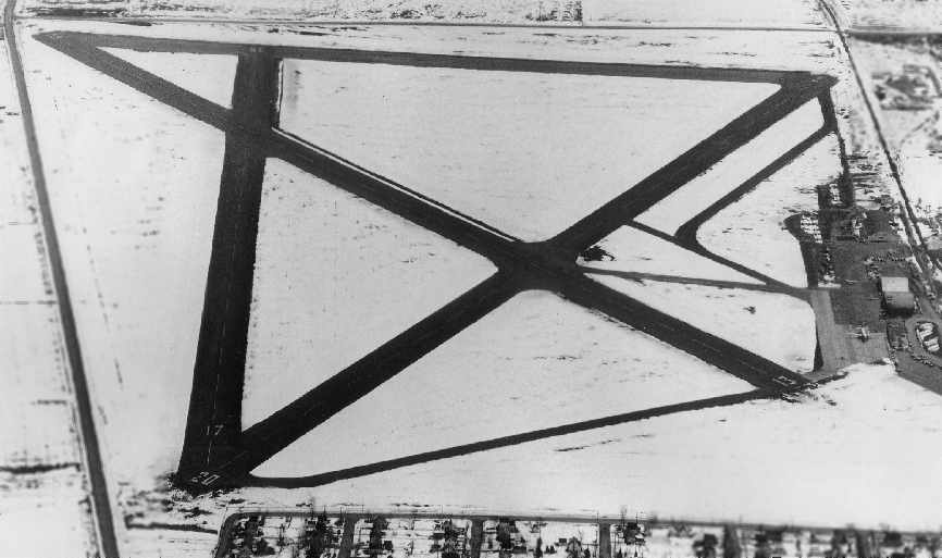
The 1972 USGS topo map depicted housing covering the Lobb Field site.
A 1972 aerial photo showed houses having been built over much of the Lobb Field site, but traces of some runways remained for the time being.
John Hanson reported in 2006, “The only building remaining from the airport is the large metal hangar next to the main hangar with the control tower.
The metal hangar was dismantled & moved about a mile and is now a truck repair shop.
I still have a brick from the other hangar with the control tower.”
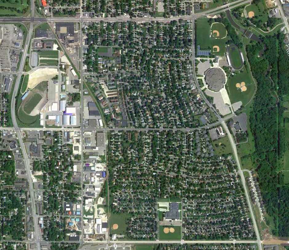
A 2011 aerial photo showed the site of Lobb Field has been largely covered by housing.
Rich Freytag reported in 2015, “When I tell people there was a 4-runway airport here they cannot believe it!”
____________________________________________________
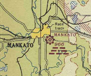
44.15, -93.983 (Southwest of Minneapolis, MN)
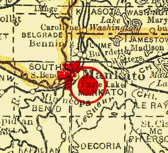
Mankto Airport, as depicted on the 1929 Rand McNally Standard Indexed Map with Air Trails of MN (courtesy of Chris Kennedy).
According to the book "Minnesota Aviation History 1857-1945" by Noel Allard (via Timothy Aanerud),
a 107-acre airport managed by Lawrence Sohler was dedicated in Mankota on September 29, 1928.
The earliest depiction of Mankato Airport which has been located
was on the 1929 Rand McNally Standard Indexed Map with Air Trails of MN (courtesy of Chris Kennedy).
It described Mankato as a commercial field operated by the Chamber of Commerce.
The field was described as measuring 2,640' x 1,750'.
An aerial view looking east at Mankato Airport from The Airport Directory Company's 1933 Airport Directory (courtesy of Chris Kennedy).
The directory depicted Mankato Airport as a rectangular grass field having two 2,600' runways.
The manager was listed as L.J. Sohler, and the operator was the Sohler Flying Service,
which provided instruction, sales, passenger flights, and taxi service.
The earliest aeronautical chart depiction which has been located of Mankato Airport was on the November 1934 Twin Cities Sectional Chart.
It depicted Mankato as a commercial/municipal airport.
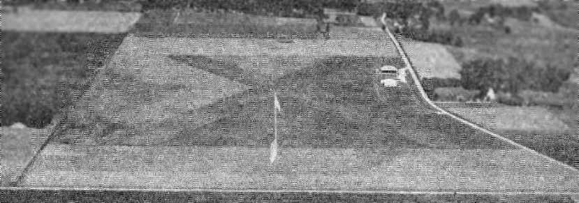
A 1938 aerial photo (from the MN DNR, courtesy of Chris Kennedy) depicted Mankato Airport as having 2 unpaved runways in an X-shape.
A hangar with a single aircraft visible was on the northeast corner of the field.
An aerial view looking north at Mankato Airport from The Airport Directory Company's 1941 Airport Directory (courtesy of Chris Kennedy).
The directory described the field as having two 2,700 sod runways, oriented northeast/southwest & northwest/southeast.
A single hangar was depicted along the east side of the field.
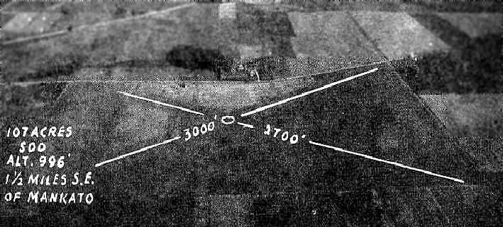
The April 1944 US Army/Navy Directory of Airfields (courtesy of Ken Mercer) described Mankato Airport as having a 2,900' unpaved runway.
It indicated that Navy flight operations were conducted from the field, and the remarks said "Intensive student training."
Mankato Airport, as depicted on the June 1944 Twin Cities Sectional Chart (courtesy of Chris Kennedy).
A 1949 aerial photo (from the MN DNR, courtesy of Chris Kennedy)
depicted a remarkable transformation which has occurred at Mankato Airport compared to the earlier photographs.
Two paved runways & paved taxiways had replaced the original airfield layout
(the 2 unpaved runways of the original layout were still visible on the east side of the field).
Several more buildings had been added along the east side of the field, and there were at least 8 light aircraft visible parked on the field.
The 1950 USGS topo map depicted Mankato Airport as having 2 paved runways
and a taxiway leading to a ramp on the northeast side with a few buildings.
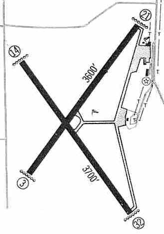
The November 1954 Twin Cities Sectional Chart (courtesy of Chris Kennedy) depicted Mankato as having a 3,700' hard surface runway.
The 1960 Jeppesen Airway Manual (courtesy of Chris Kennedy)
depicted "Mankato Memorial" Airport as having a 3,700' paved Runway 14/32 & a 3,600' paved Runway 3/21,
along with a ramp on the east side with a few buildings (hangars?).
The April 1966 Twin Cities Sectional Chart (courtesy of Chris Kennedy) depicted Mankato as having 2 paved runways, with the longest being 3,700'.
The 1967 AOPA Airport Directory (courtesy of Chris Kennedy) described Mankato Municipal Airport as having two 3,700' blacktop runways: 14/32 & 3/21.
The operator was listed as Mankato Aero Service (which was also a Piper dealer), and airline service was provided by North Central.
The last aeronautical chart depiction which has been located of the original Mankato Airport was on the April 1970 Twin Cities Sectional Chart.
It depicted Mankato as having 2 paved runways, with the longest being 3,700'.
The original Mankato Airport was evidently closed at some point in 1970,
when it was replaced by a new & larger airport to the northeast of the city.
The new Mankato Airport was depicted in the November 1970 Twin Cities Sectional Chart,
and the original Mankato Airport (to the southeast) was depicted as “Abandoned Airport”.
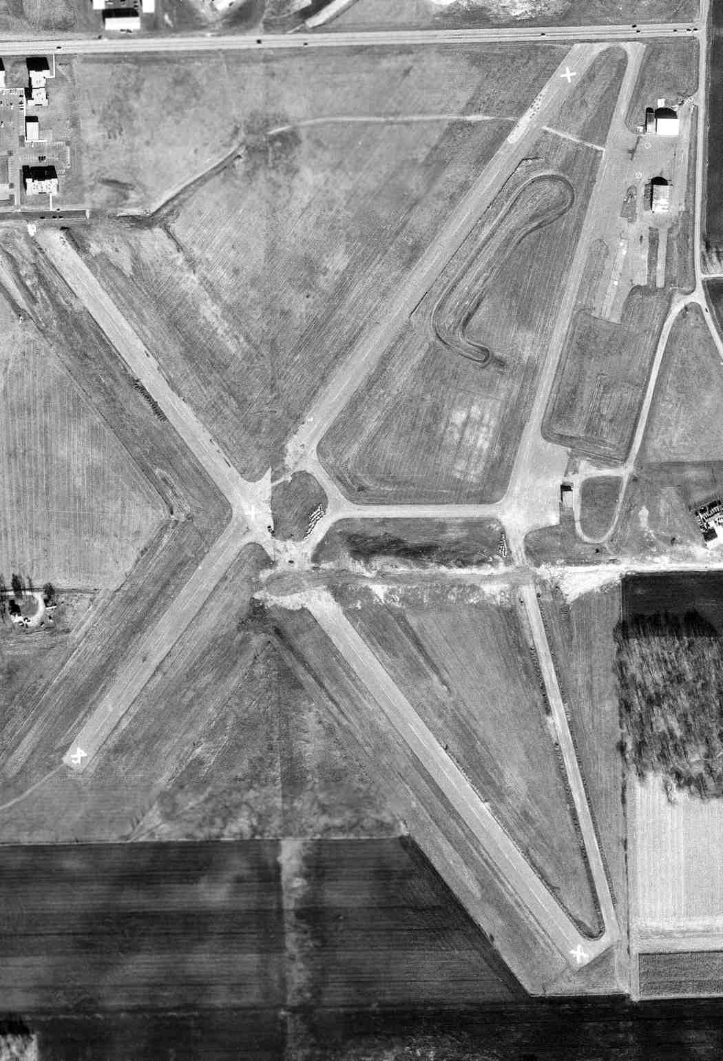
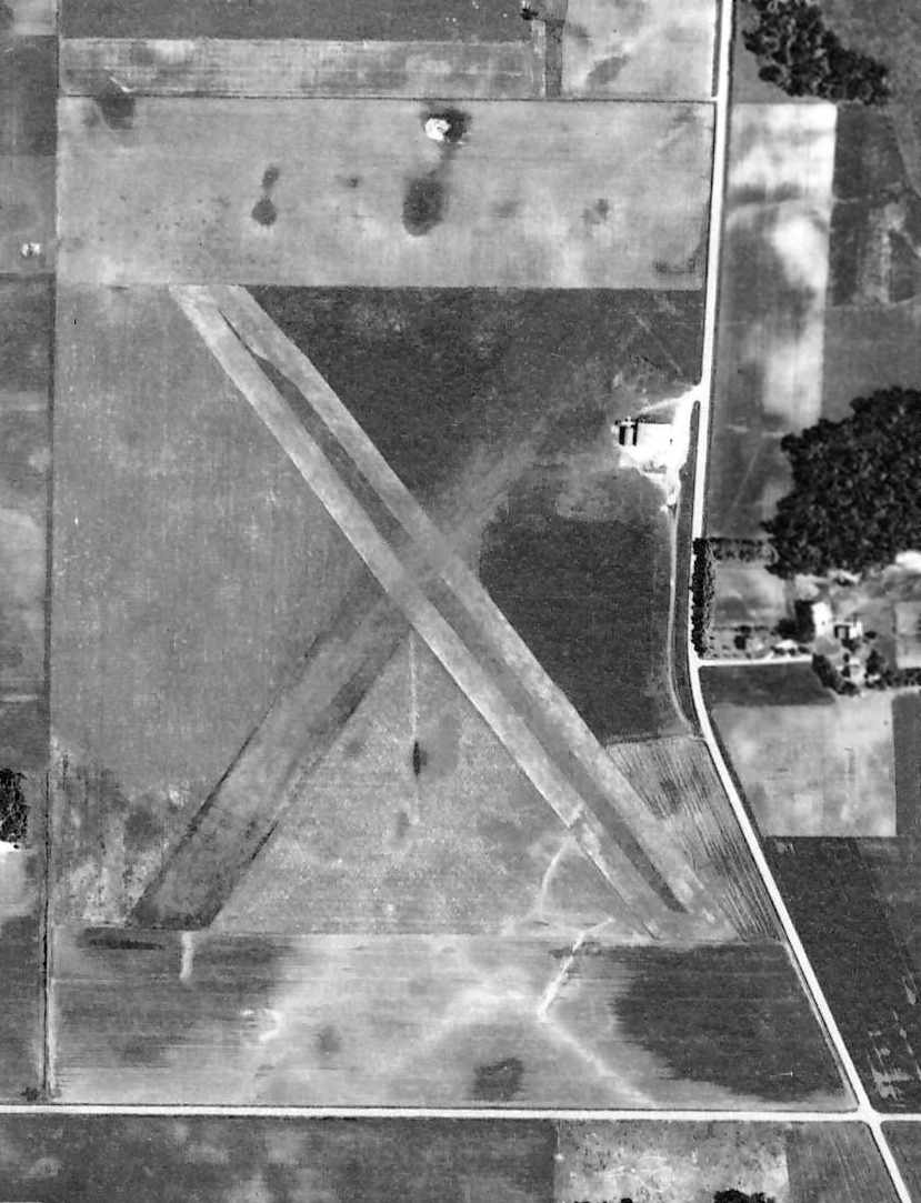
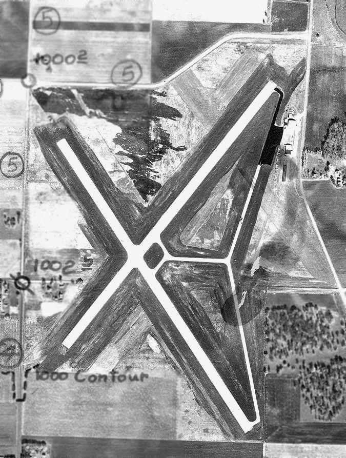
A 11/9/73 USGS aerial view depicted the Mankato Memorial Airport shortly after its closure, with the runways marked with closed “X” symbols but still intact, along 3 hangars.
Mike Endersbe recalled, “The old Mankato Airport... In the early 1970s I remember going there with my father to fly model airplanes.
At that time the runways, taxi ways & ramps were still there & usable.
Over the years I went to some local model rocket club events there.”
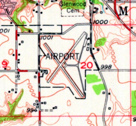
The 1974 USGS topo map still depicted the outlines of the Mankato runways.
Mike Endersbe recalled, “In the mid-1980s began flying model airplanes with my father at the site.”
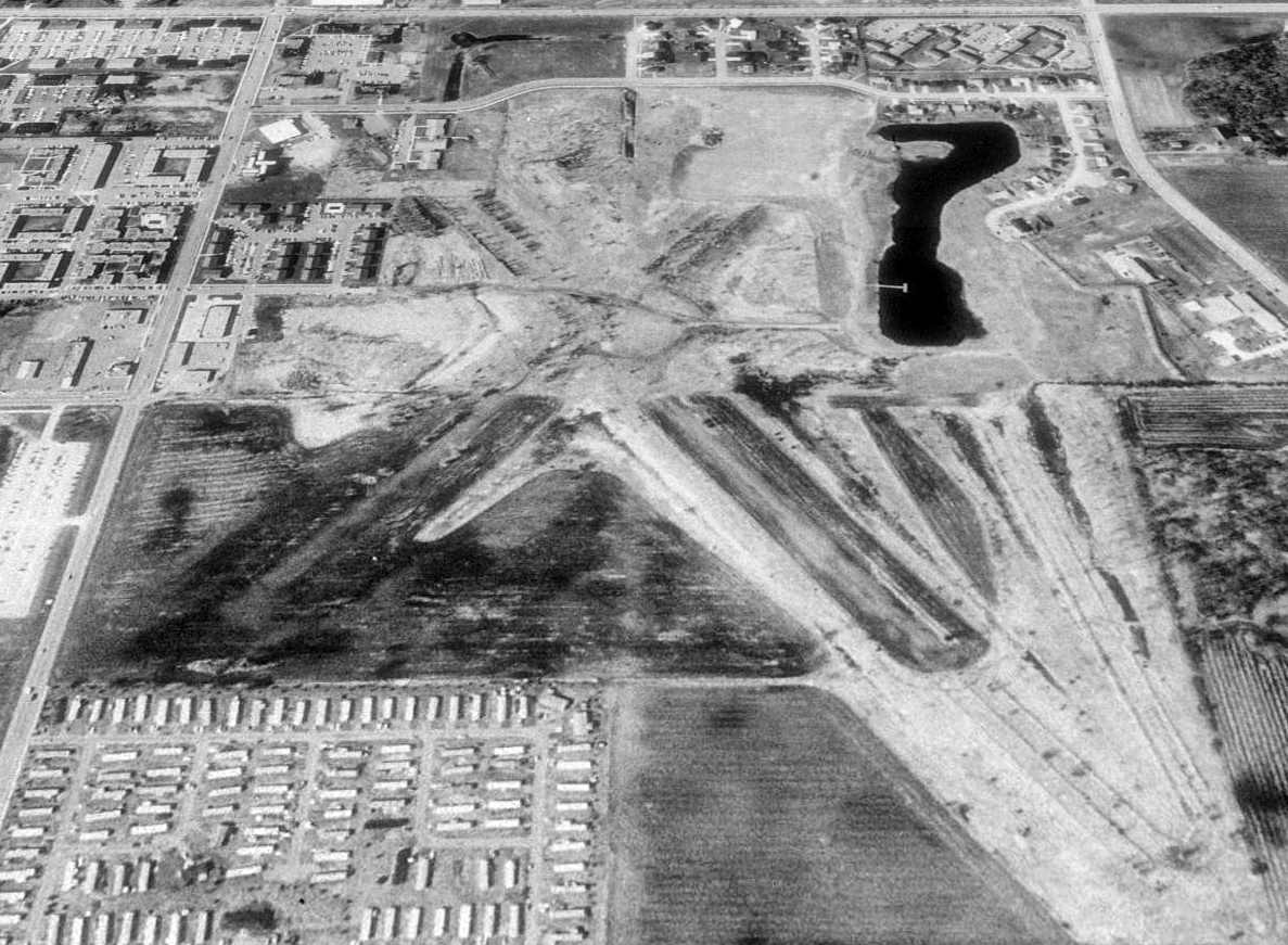
A 1991 USGS aerial view looking north showed the X-shaped runway layout of the former Mankato Airport was still recognizable.
A number of buildings have been constructed over portions of the former airport.
It is not apparent if any of the buildings on the site are original airfield buildings.
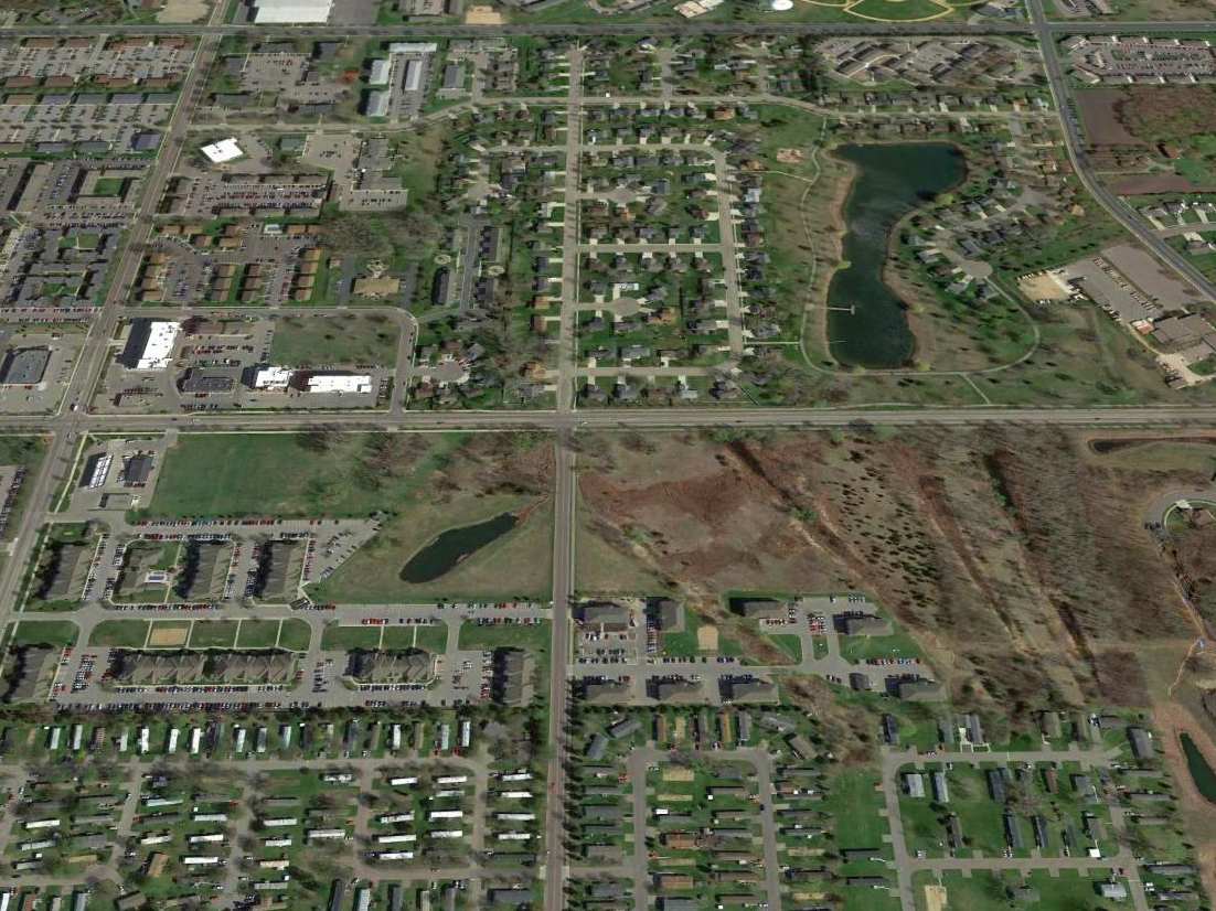
A 2015 aerial view looking north showed the site of Mankato Airport had been redeveloped with housing,
but the orientation of the southeast portion of a runway & taxiway were still barely recognizable.
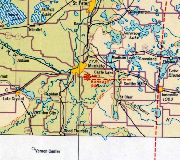
The site of Mankato Airport is located east of the intersection of Monks Avenue & Stadium Road.
____________________________________________________
Or if you prefer to contact me directly concerning a contribution (for a mailing address to send a check),
please contact me at: paulandterryfreeman@gmail.com
If you enjoy this web site, please support it with a financial contribution.
____________________________________________________
This site covers airfields in all 50 states.