Abandoned & Little-Known Airfields:
Western Minnesota
© 2002, © 2024 by Paul Freeman. Revised 2/22/24.
This site covers airfields in all 50 states: Click here for the site's main menu.
____________________________________________________
Please consider a financial contribution to support the continued growth & operation of this site.
Dawson Mills Airport / Dawson Municipal Airport (revised 2/22/24) - Original Litchfield Municipal (revised 2/22/24)
(Original) Willmar Municipal Airport / Rice Field (revised 2/22/24)
____________________________________________________
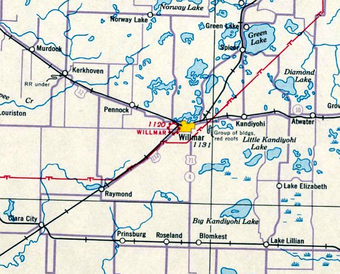
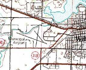
Willmar Municipal Airport (original location) / John L. Rice Field (KILL), Willmar, MN
45.116, -95.088 (West of Minneapolis, MN)
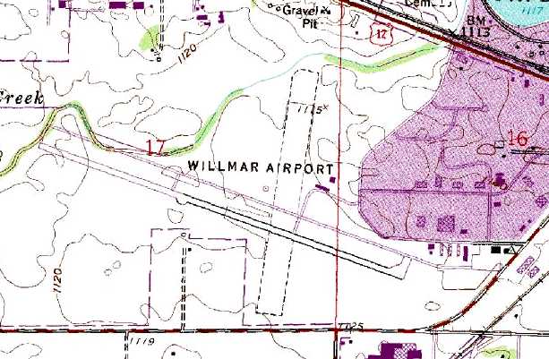
Willmar Airport, as depicted on the March 1939 Twin Cities Sectional Chart.
According to the City of Willmar website, work on the original Willmar Municipal Airport started in 1934
as part of President Roosevelt’s "New Deal" Program.
However Willmar Airport was not depicted on aeronautical charts up through the November 1937 Twin Cities Sectional Chart.
The earliest depiction which has been located of Willmar Airport was on the March 1939 Twin Cities Sectional Chart.
Willmar Municipal Airport originally served as an emergency landing field for scheduled airline service,
along a route between the Minneapolis/St. Paul area to Watertown then on to the Black Hills.
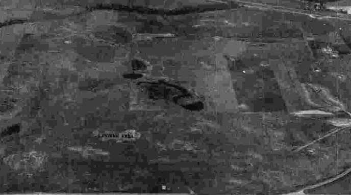
The earliest photo which has been located of the original Willmar Municipal Airport
was a 9/17/43 aerial view looking north from the 1945 AAF Airfield Directory (courtesy of Scott Murdock).
It depicted the field as an open grass area.
The 1945 AAF Airfield Directory (courtesy of Scott Murdock) described the Willmar Municipal Airport
as a 178 acre irregularly-shaped property containing 3 sod runways, the longest being a 2,760' east/west strip.
The field was said to have one 100' x 98' concrete block hangar.
Willmar Municipal Airport was described as being owned & operated by the City of Willmar,
and to be used as CAA Intermediate Field, Site #16.
A need for airport management was answered in 1945 by John & Mary Jane Rice,
whose Willmar Air Service operated for over 50 years.
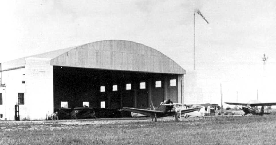
A circa 1940s photo of several monoplanes in front of & inside a hangar at the original Willmar Municipal Airport.
A 5/4/57 USGS aerial photo depicted Willmar Airport as having 3 unpaved runways.
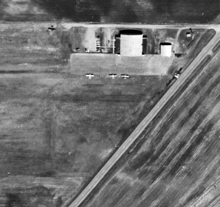
A closeup from the 5/4/57 USGS aerial photo showing 3 single-engine planes on the ramp next to the hangar on the east side of Willmar Airport.
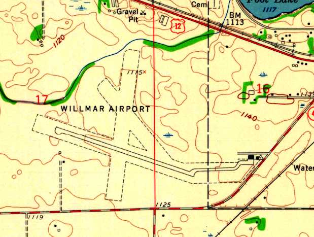
The earliest topo map depiction which has been located of Willmar Airport was on the 1958 USGS topo map.
It depicted Willmar Airport as having a single paved northwest/southeast runway, 3 unpaved runways,
and a paved taxiway leading to a ramp on the southeast side with 2 buildings.
The 1984 USGS topo map depicted Willmar Municipal Airport as having 3 runways.
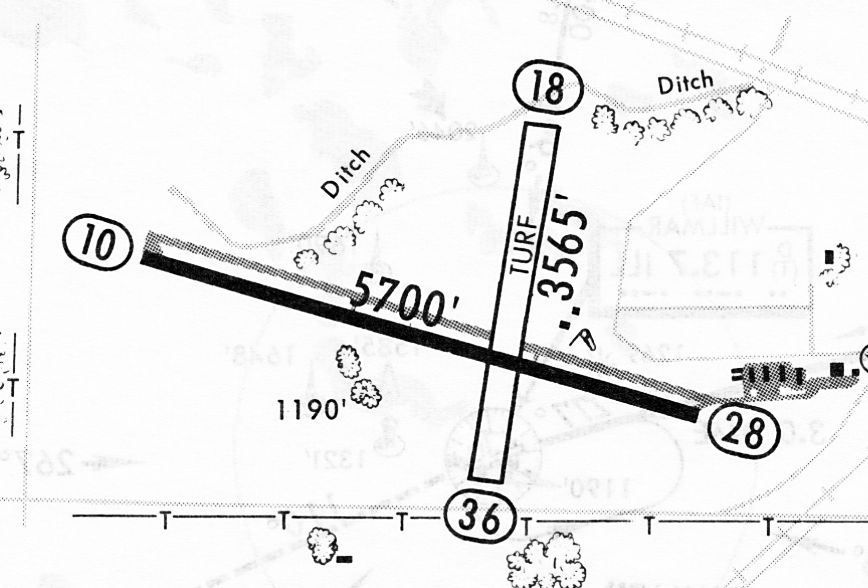
A 1/27/84 airport directory (courtesy of John Kielhofer) depicted Willmar Rice Field as having a 5,700' paved Runway 10/28 & a 3,565' turf Runway 18/36.
A parallel taxiway led to a ramp on the east side with numerous small hangars.
In later years, the Willmar Airport served a bursting industrial park adjacent to the east side of the airport property.
However, it would appear that the growth of this industrial park eventually became the reason for the replacement of the airport.
The 1994 USGS topo map depicted Willmar Airport as having a 5,700' asphalt northwest/southeast runway with a parallel taxiway & and a 3,500' crosswind grass runway.
A ramp on the southeast side had several buildings.
In 1995, a joint airport-planning group conducting several studies
and recommended replacing the original Willmar Airport by constructing a new facility 2 miles to the west.
Tony LaPatka reported, “Willmar Airport... I flew from both the old airport & the new airport.
The reasons for moving the site of the airport 2 miles west were 2-fold:
The main reason was because there wasn't adequate clear area at the approach end of the runways to install an Instrument Landing System.
The second reason was that the industrial park had grown up around the airport & there wasn't room to build additional hangars.”
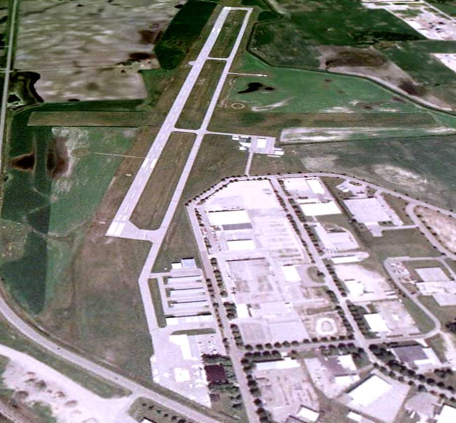
A 6/1/03 aerial view looking west at the original Willmar Municipal Airport depicted several aircraft on the ramp.
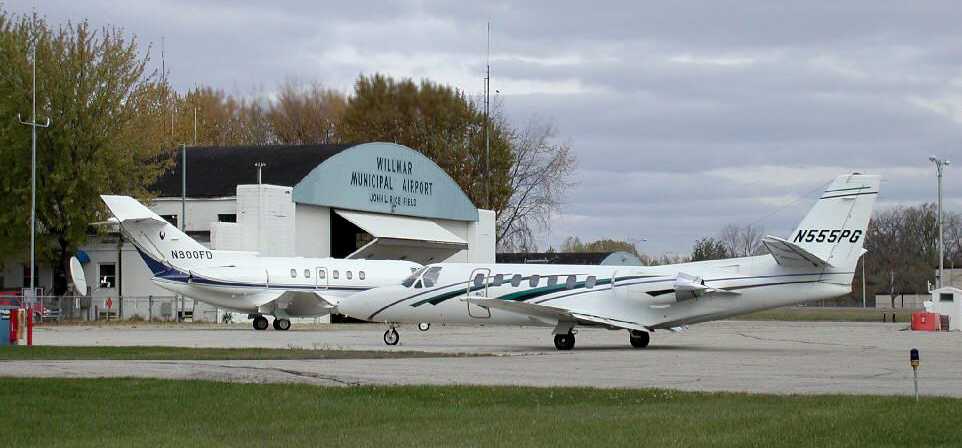
A circa 2000s photo looking northwest at a Cessna Citation & Hawker jet on the ramp in front of the Willmar hangar.
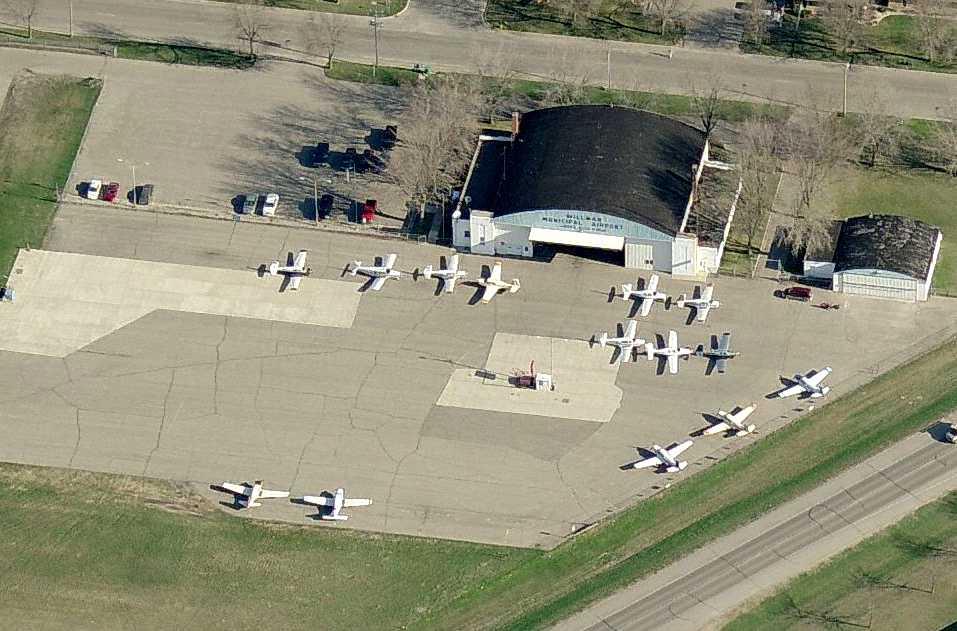
A circa 2000-2006 aerial view looking north at the original Willmar Municipal Airport ramp,
with a large number of Mooney aircraft on the ramp.
The new Willmar Municipal Airport - John L. Rice Field officially opened on 9/5/06,
at which point the original Willmar Municipal Airport was presumably closed.
The specific reason for the replacement of the original airport has not been determined,
but it is odd that the airport was replaced by a new airport with a shorter runway – only 5,500'.
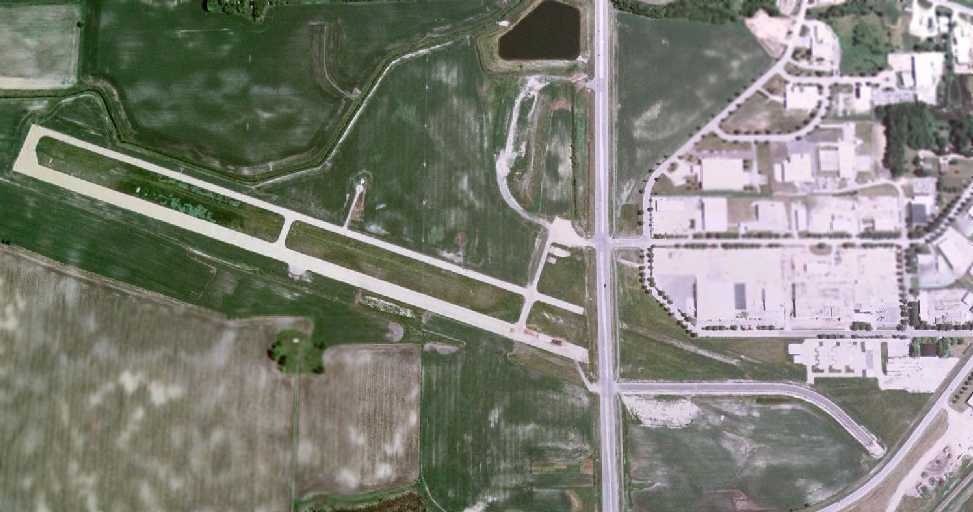
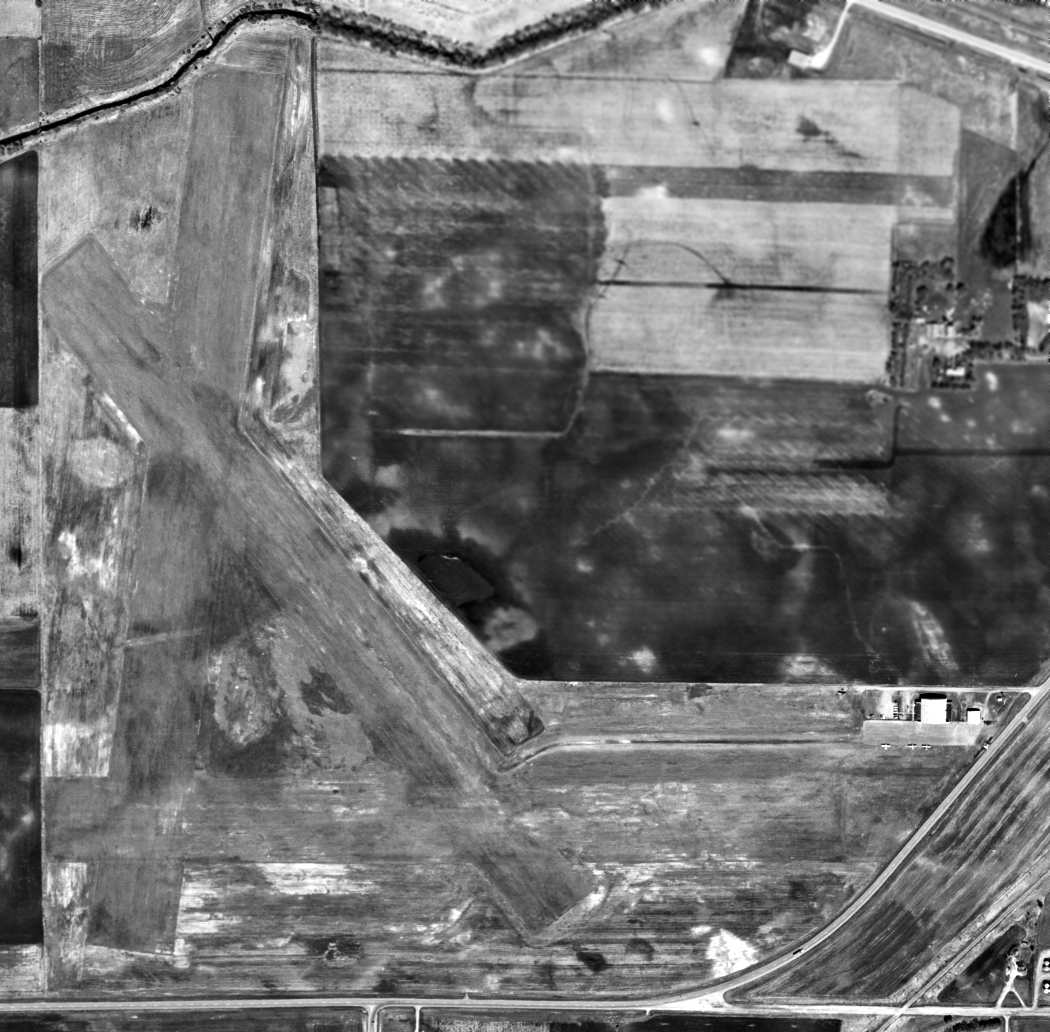
A 6/3/09 aerial view of the site of the original Willmar Municipal Airport,
showing the new road which cuts through the east side of the property.
The majority of the paved runway & taxiway remained intact, as well as the ramp & hangar.
Tony LaPatka reported in 2015, “I live approximately 1/2 mile north of the old airport.
During the past 2 years they have completely redeveloped the old airport west of Kandiyohi County Road #5, which is the road that bisected the runway.
The 2 original hangars remain but are being used by a structural steel company as a warehouse.
The original ramp area is intact but in very poor condition.”
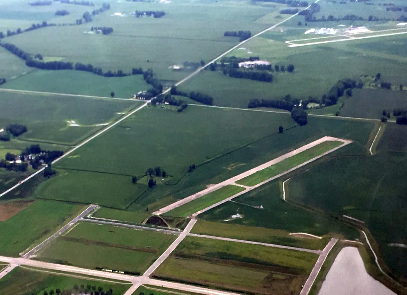
A 7/26/16 aerial view by Tim Wallace looking west/southwest at the remains of the original Willmar Municipal Airport, “with the new Willmar Airport (KBDH) in the background.”
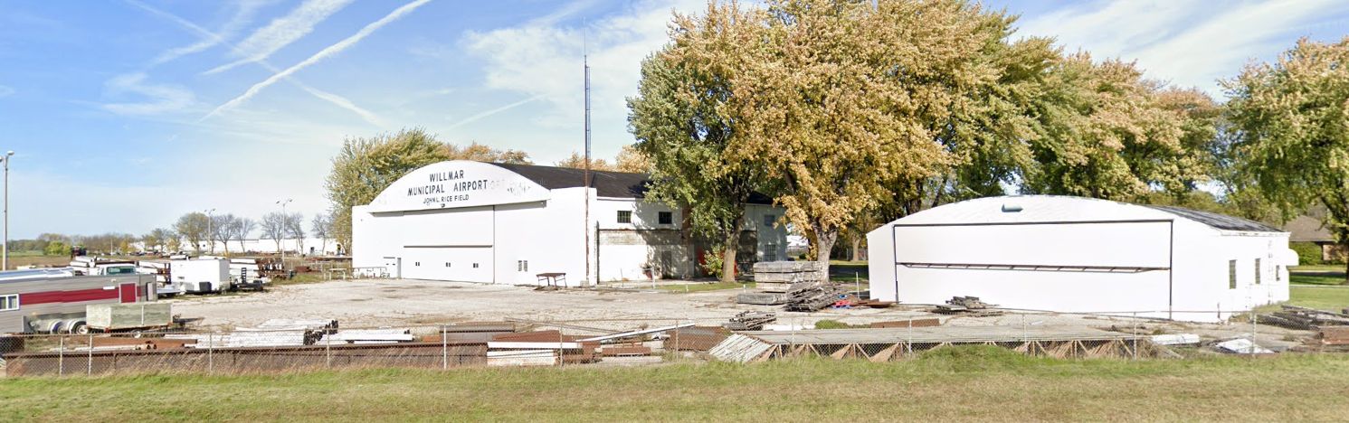
A 2019 photo looking northwest at the 2 former hangars which remain on the east side of the original Willmar Municipal Airport site,
the larger of which still bears the lettering “Wilmar Municipal Airport John L. Rice Field.”
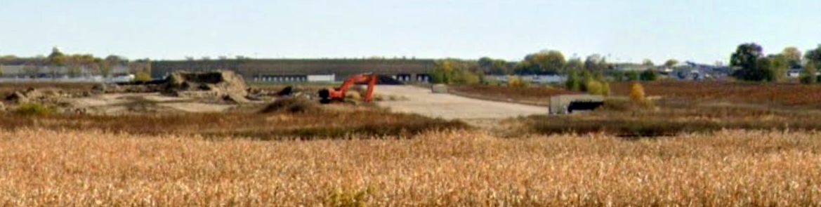
A 2023 photo looking southeast at the remains of the northwest end of the original Willmar Municipal Airport Runway 10.
Thanks to Rich Pennock for pointing out this airfield.
____________________________________________________
(Original) Litchfield Municipal Airport (Y69), Litchfield, MN
45.14, -94.52 (West of Minneapolis, MN)
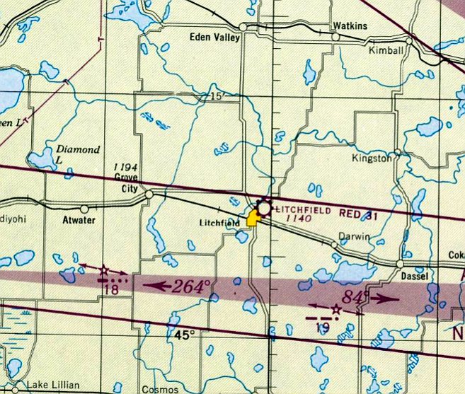
Litchfield Airport, as depicted on the June 1947 Twin Cities Sectional Chart.
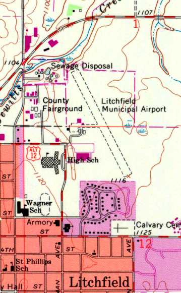
This small general aviation airport was located adjacent to the County Fairgrounds.
Litchfield Municipal Airport was evidently established at some point between 1945-47,
as it was not yet depicted at all on the December 1944 Twin Cities Sectional Chart
or listed among active airfields in the Haire Publishing Company's 1945 Airport Directory(according to Chris Kennedy).
The earliest depiction which has been located of Litchfield Airport was on the June 1947 Twin Cities Sectional Chart.
It depicted Litchfield as a commercial/municipal airport.
The earliest photo which has been located of Litchfield Airport was a 10/28/53 USGS aerial photo.
It depicted Litchfield as having a single unpaved northwest/southeast runway, with a small Quonset hut on the west side.
The April 1956 Twin Cities Sectional Chart (courtesy of Chris Kennedy) depicted Litchfield Airport as having a 2,800' unpaved runway.
The 1962 AOPA Airport Directory described Litchfield Airport as having a 2,800' turf runway.
The earliest topo map depiction which has been located of Litchfield Airport was on the 1968 USGS topo map.
It depicted Litchfield Airport as having a single unpaved northwest/southeast runway,
and a ramp on the west side with several small buildings.
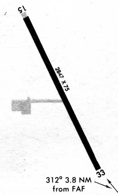
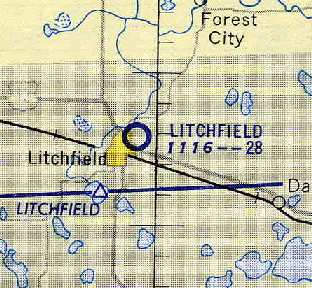
The original Litchfield Municipal Airport, as depicted on the May 1989 Approach Procedures (courtesy of Timothy Aanerud).
The original Litchfield Municipal Airport was closed when it was replaced
by the larger & more modern new Litchfield Municipal Airport (a few miles to the southeast) in 1989.
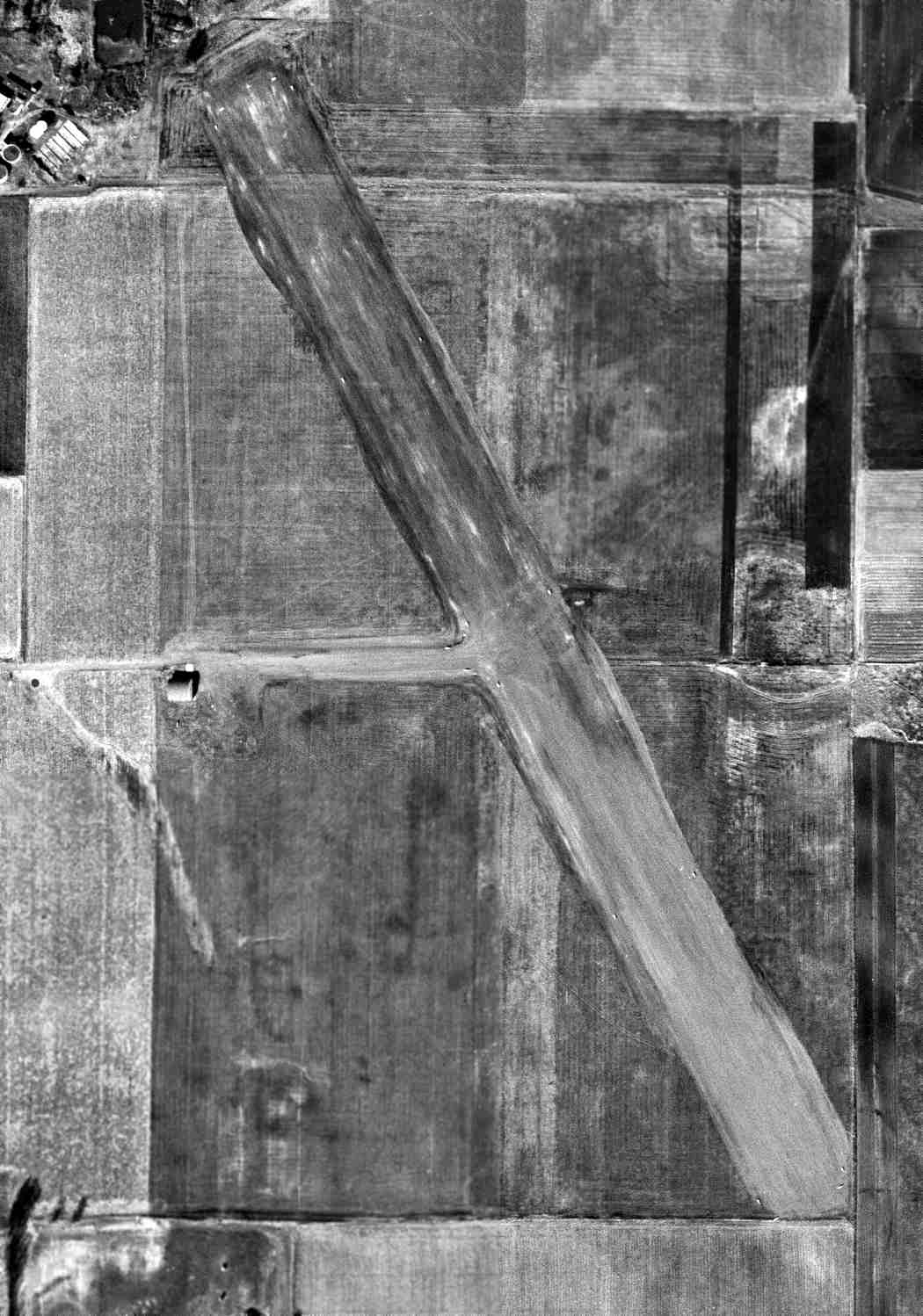
A 1991 USGS aerial view looking southeast showed the original Litchfield Municipal Airport remained intact, including a runway, taxiway, ramp, and hangars.
A circa 2008 aerial view looking south along the northern half of the Litchfield runway pavement.
The southern half had been removed at some point between 1991-2008.
A circa 2008 aerial view looking west at 2 former Litchfield hangars on the west side of the property.
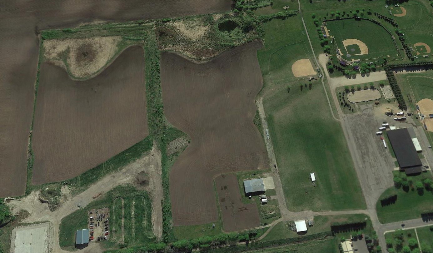
A 2017 aerial view looking southeast showed the majority of the original Litchfield Municipal Airport runway pavement had been removed, but a few hangars remained on the west side.
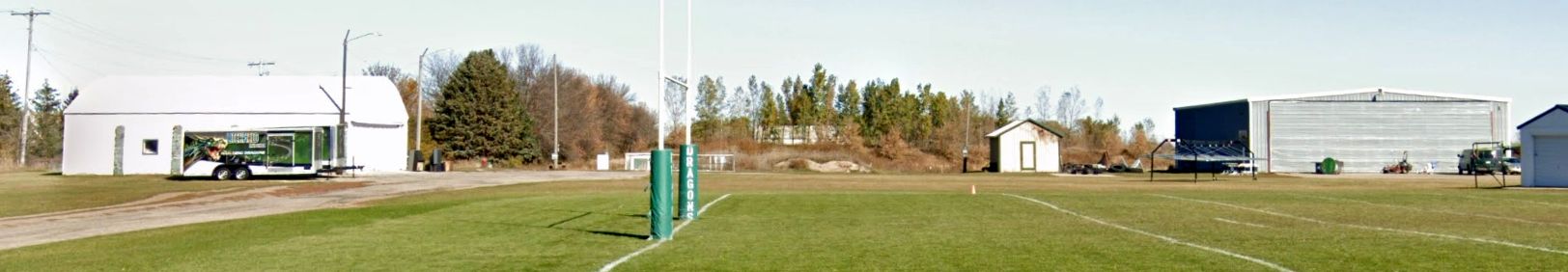
A 2022 photo looking north at 2 hangars which remain on the south side of the original Litchfield Municipal Airport site, now reused as a sports park.
Thanks to Timothy Aanerud for pointing out this airfield.
____________________________________________________
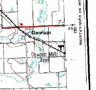
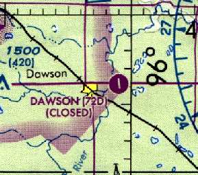
Dawson Mills Airport / Dawson Municipal Airport (72D), Dawson, MN
44.925, -96.02 (West of Minneapolis, MN)
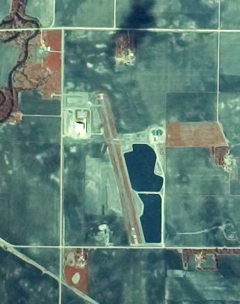
Dawson Mills Airport, as depicted on a 5/2/80 USGS aerial view.
No airfield was depicted at this location on the 1968 USGS topo map.
This general aviation airport opened in September 1977,
according to the files at the MNDOT Office of Aeronautics (according to Wayne Petersen).
However, no airport at Dawson was yet depicted on the February 1978 Twin Cities Sectional Chart (according to Chris Kennedy).
The earliest directory listing of the Dawson Airport which has been located
was in the "Undiagrammed - Low Use" section of the 1980 Flight Guide (according to Chris Kennedy).
It described the Dawson "Mills" Airport as having a 3,700' hard surface Runway 16/34.
The earliest depiction of the Dawson Airport which has been located was on a 5/2/80 USGS aerial view.
It depicted the field as having a single paved northwest/southeast runway.
Dawson Mills Airport, as depicted on the 1981 USGS topo map.
The "Undiagrammed - Low Use" section of the 1987 Flight Guide (according to Chris Kennedy)
described the Dawson Municipal Airport as having the same runway configuration.
Dawson Memorial Airport was still listed as an active airfield in the 1989 North Central Airport/Facility Directory.
According to Jon Melby (via Timothy Aanerud), the Dawson Airport "belonged to Land O Lakes food company for a while, then the feed mill.
They didn't want to maintain it, so it was abandoned."
Dawson Airport was closed on 10/30/90, according to the files at the MNDOT Office of Aeronautics (according to Wayne Petersen).

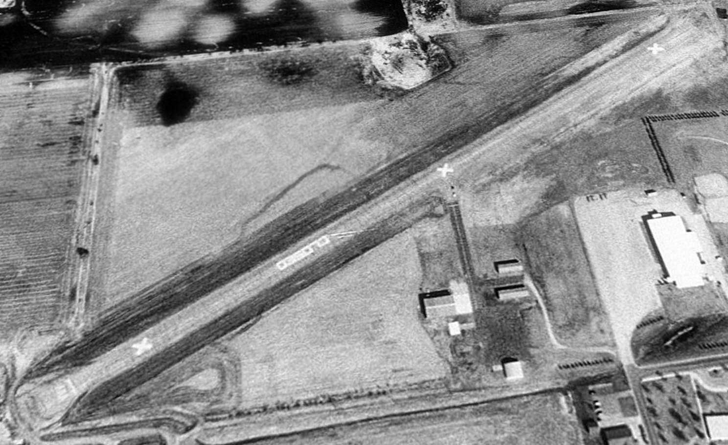
A 1991 USGS aerial view looking southeast showed Dawson Airport remained intact. It consisted of a single 3,700' asphalt Runway 16/34, a taxiway & a single small hangar.
Dawson was depicted as a closed airfield on the February 1995 Twin Cities Sectional Chart (courtesy of Timothy Aanerud).
Dawson was still depicted as an abandoned airfield on 2003 aeronautical charts.
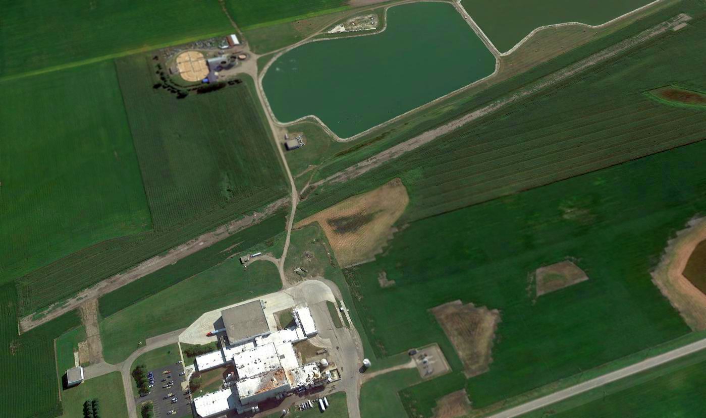
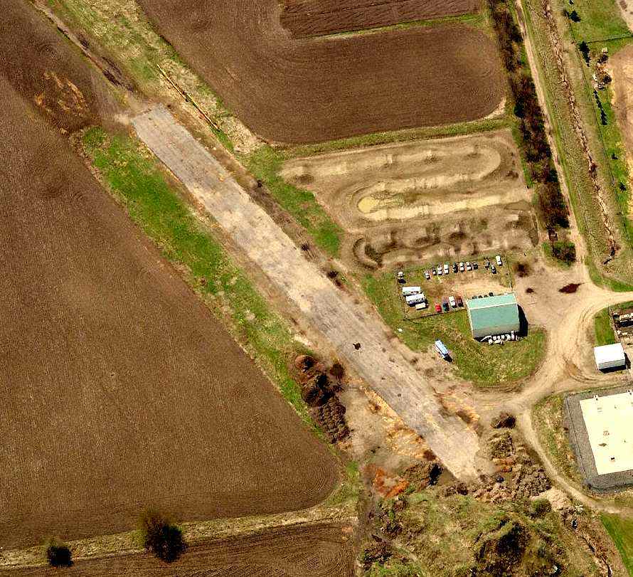
A 2015 aerial view looking southeast showed a road had been cut across the middle of the Dawson Airport runway, but the runway & hangar remained otherwise intact.
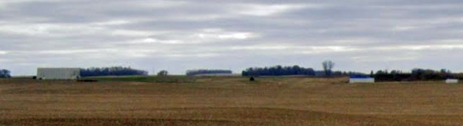
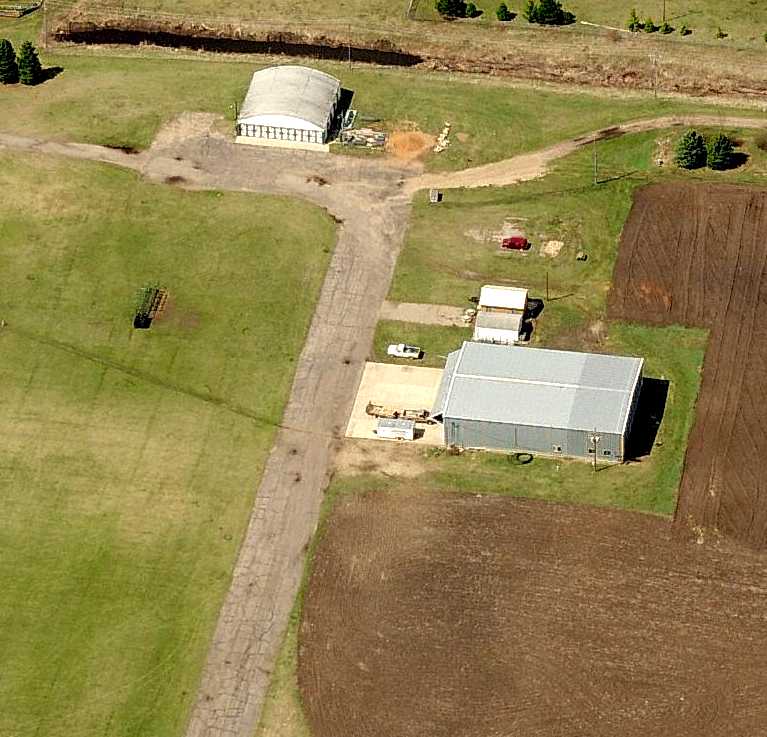
A 2023 photo looking southeast at the former hangar on the northwest side of the Dawson Airport site.
Thanks to Timothy Aanerud for pointing out this airfield.
____________________________________________________
Since this site was first put on the web in 1999, its popularity has grown tremendously.
If the total quantity of material on this site is to continue to grow,
it will require ever-increasing funding to pay its expenses.
Therefore, I request financial contributions from site visitors,
to help defray the increasing costs of the site
and ensure that it continues to be available & to grow.
What would you pay for a good aviation magazine, or a good aviation book?
Please consider a donation of an equivalent amount, at the least.
This site is not supported by commercial advertising –
it is purely supported by donations.
If you enjoy the site, and would like to make a financial contribution,
you
may use a credit card via
![]() :
:
Please consider checking the box to make a monthly donatation.
For a mailing address to send a check, please contact me at: paulandterryfreeman@gmail.com
If you enjoy this web site, please support it with a financial contribution.
please contact me at: paulandterryfreeman@gmail.com
If you enjoy this web site, please support it with a financial contribution.
____________________________________________________
This site covers airfields in all 50 states.