Abandoned & Little-Known Airfields:
New Hampshire
© 1999, © 2026 by Paul Freeman. Revised 2/15/26.
____________________________________________________
Please consider a financial contribution to support the continued growth & operation of this site.
Alstead Airfield / Whitcomb Landing Strip (revised 5/12/23) - Besse Field (added 11/17/23) - Cibor Airport / Rye Airfield (revised 1/28/23) - Daniel Webster Airport / Sanders Airfield (added 10/7/20)
Granite State Airport (added 5/10/23) - Groveton Papers Airport (revised 10/4/23) - Hawkes Airfield / Lee Airfield (added 11/19/23) - Hooksett-Manchester Airport (revised 5/12/24) - Keene Airport / Keene Airpark (added 5/10/23)
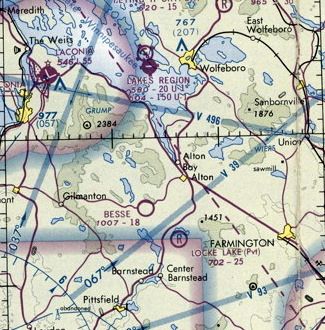
Lakes Region Airport (revised 6/30/23) - Lincoln Airport (added 4/3/24) - Morse Airfield (added 11/4/23) - Northeastern Gliderport / New England Gliderport (revised 5/12/24) - Pike Airfield (revised 5/6/16)
Riverside Airport (revised 5/25/25) - Weirs Seaplane Base (added 11/7/23) - White Mountain Airport (revised 2/15/26) - White Mountain Gateway Airport (added 11/13/23)
____________________________________________________
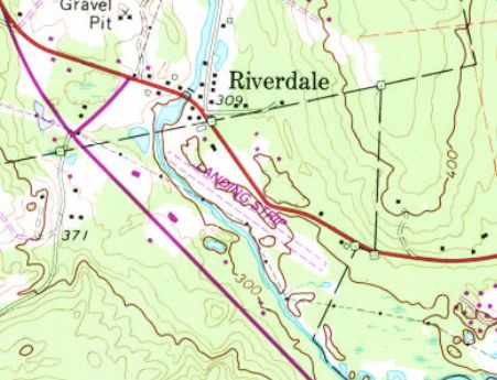
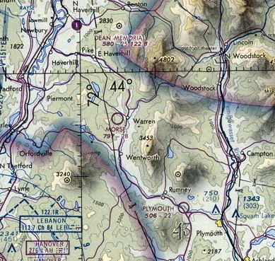
44.048, -71.682 (Northwest of Boston, MA)
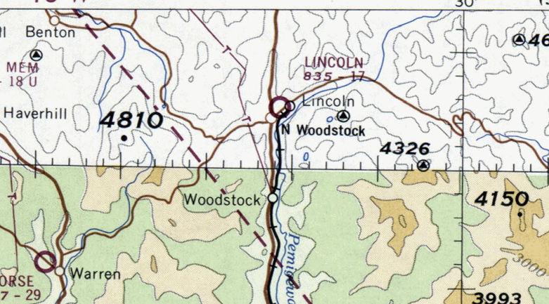
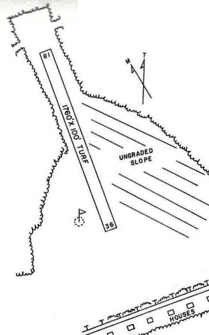
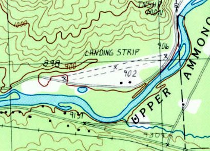
Lincoln Airport, as depicted on the 1960 Sectional Chart (courtesy of Jonathan Westerling).
According to Jonathan Westerling, “The municipal airfield in the little town of Lincoln was located on a farm built by the Henry family, who had run a successful paper mill since the 1800s.
Their estate was called Charkarohen (CHARles-KAtherine-ROse-HENry), but the airfield was colloquially referred to as 'Henry Field'.”
The first recorded landing at this location was in 1939 according to an article in the 8/23/39 Plymouth Record (courtesy of Joe Boyle & the Upper Pemigewassel Historical Society):
“About 5pm on August 23 a 4-place Stinson-Detroiter Cabin plane, NC 7784 named Skylark came down in Mr. C.B. Henry's field near the entrance to Charkarohen.
The clouds were low & it was impossible to pass over the mountains. The landing gear was smashed when it came to a stop on a stone wall.
The pilot, L.E. White & passenger Joe Bush were uninjured. They left a Boston airport at 3:30 p.m. with a load of Boston newspapers (Boston Traveler) for the Whitefield airport.
Mr. White said he had flown this route daily since it was established 5 weeks ago. This was the first time he had been forced down or failed to make the trip on time.
A large crowd gathered from the nearby villages of Lincoln & North Woodstock & about a half hour after the plane landed the leaking gasoline became ignited in some way.
There was an explosion & the Skylark burned up very quickly. A few spectators were slightly burned before they could get away from the plane.
The metal parts of the wreck were salvaged by Mr. Hadley of North Woodstock, an aviator & mechanic with World War experience.”
According to an article in the 9/22/55 Plymouth Record, “Woodstock, Fred S. Brown, Cor., 'FIRE IN GROUND CAMP'.
On Saturday evening, just before dark; Roy & Marshall Nichols of North Woodstock were flying out of the Lincoln Airport up the river.
One of them thought they saw a fire & banked the plane & took another run up the East Branch of the Pemigewasset River.
They saw the fire & landed, then reported the fire to Fire Chief Norman Fadden. He told the men to go to the fire & called the Forest Fire Warden.
The spotting of the fire while it was a smalI fire saved a big fire, as not over 200 feet away was a slash area of some 5 acres. This is the first time that a fire in North Woodstock has been spotted from the air.”
After the Henry Family sold the farm the land, the airfield was located on became the property of the Roman Catholic Church of Manchester.
According to Edmond Gionet, John Kimball, Bob MacKay & himself each had planes based at Lincoln Field.
However, Lincoln Field must have been a private/limited operation during this period as there are no records of the airfield being listed in any airport directories.
Ironically, the 1940 "Plan for the Development of Airports & Airways in New Hampshire" suggests that an emergency airfield should be established in the vicinity of Lincoln, NH.
According to "History & Heroes of New Hampshire Aviation", Lincoln was one of the airstrips built by Merit Bean in the 1950s.
Merit was a local flyer & businessman who "decided awareness that emergency strips were needed in the North Country. They would also provide access to the remote communities.
He organized a northern branch of the Aviation Association of New Hampshire & presented his idea - that with his civil engineering expertise & donations of funds, equipment, time and hard labor, they could build strips at no cost to the taxpayers.
Contractors donated use of heavy equipment, area businesses contributed funds & hours of hard labor as all worked together to build 11 airstrips in the North Country."
No citation is given in the text, but it is likely that Bean's work helped more formally establish this as a formal state airport.
According to Brenda Goodbout, her stepfather Bob MacKay flew out of the Lincoln Airport & eventually became president of the Aviation Association of New Hampshire - the State's oldest Pilot Association.
Largely through his efforts, the Lincoln Airport became a proper landing field, licensed by the state's board of aeronautics.
The earliest depiction which has been located of Lincoln Airport was on the 1960 Sectional Chart (courtesy of Jonathan Westerling).
It depicted Lincoln Airport as having a mere 1,700' unpaved runway.

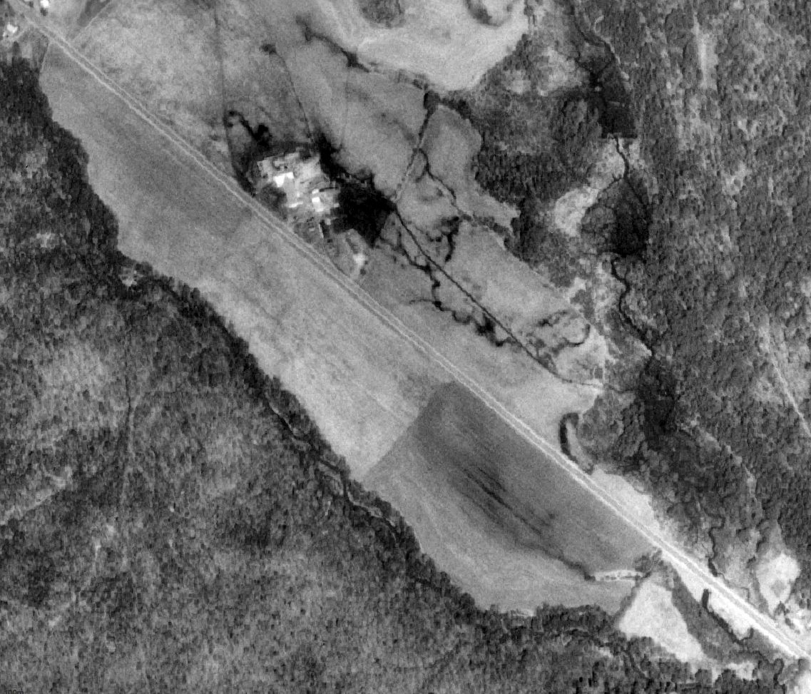
The earliest photo which has been located of Lincoln Airport was a circa 1960s aerial view (courtesy of the Upper Pemigewasset Historical Society).
It depicted Lincoln Airport as having a single northwest/southeast unpaved runway.
Two light single-engine aircraft were visible on the south end of the runway; there did not appear to be any hangars or other airport buildings.
A 1964 aerial view depicted Lincoln Airport as having a single northwest/southeast unpaved runway.
There did not appear to be any hangars or other airport buildings.
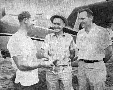
An undated photo captioned “Discussing Airport fundraising campaign held at Lincoln Airport” from the 8/11/65 Manchester Union Leader (courtesy of the Upper Pemigewasset Historical Society)
depicted Edmond Gionet, Robert MacKay, and Lloyd Hwkensen, in front of a Cessna.

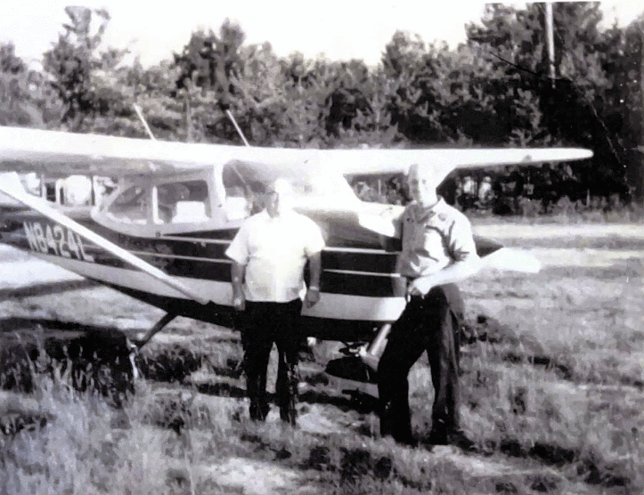
An August 1967 photo of Robert MacKay's Beechcraft Bonanza at Lincoln Airport (courtesy of Brenda Goodbout).
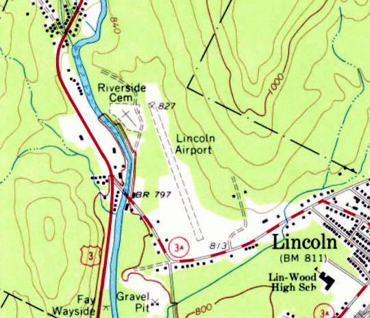
The 1967 USGS topo map depicted Lincoln Airport as having a single unpaved northwest/southeast runway, with a few small buildings on the southwest & southeast sides.
A 1969 photo of captioned “Discussing Airport fundraising campaign held at Lincoln Airport” (courtesy of the Upper Pemigewasset Historical Society)
depicted Edmond Gionet, Robert MacKay, and Lloyd Hwkensen, in front of a Cessna.
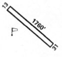
Lincoln Municipal Airport was listed in the 1969 NH Airport Directory (courtesy of the Aviation Museum of NH) as having a 1,760' turf Runway 18/36,
and the manager was listed as John LaBreque.
According to Edmond Gionel, Shirley Mahn of Whitefield, N.H. may have been the last pilot to land & take-off from Lincoln Field.
This would be in the early 1970s when the state had conducted surveys for the new extension of Route 93.
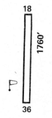
Lincoln Municipal Airport was listed in the 1972 Pilot Handboook (courtesy of Jonathan Westerling) as having a 1,760' Runway 18/36.
The last aeronautical chart depiction which has been located of Lincoln Municipal Airport was on the 1973 Boston Sectional Chart.
It continued to depict Lincoln Airport as having a 1,700' unpaved runway.
According to research conducted by Robert Worthington of North Woodstock, a request in 1973 was made for acquisition of state land for the purpose of an airstrip in Lincoln.
A January 1974 request proposed a new location of a field 2,400' long with town & state property.
If built, the field would have been located between the west side of Interstate 93 & the Pemigewasset River.
When Interstate 93 was extended north, its construction bisected the runway.
Efforts to relocate the airfield were unsuccessful, and aviation activities moved south to Plymouth Municipal Airport.
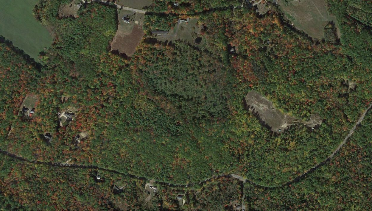
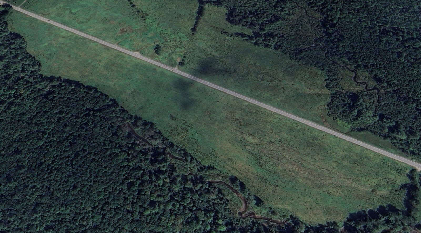
A 1986 aerial view showed no remaining trace of Lincoln Airport, with Interstate 93 having been built over the airport site.
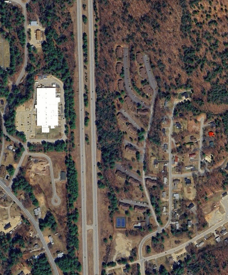
A 2023 aerial view showed no trace remaining of Lincoln Airport.
The site of Lincoln Airport is commemorated by Old Airport Road, which runs along the western edge of the former airport property.
Thanks to Jonathan Westerling for pointing out this airfield.
____________________________________________________
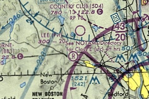
Hawkes Airfield / Lee Airfield (NH03), Goffstown, NH
43.029, -71.644 (Northwest of Boston, MA)
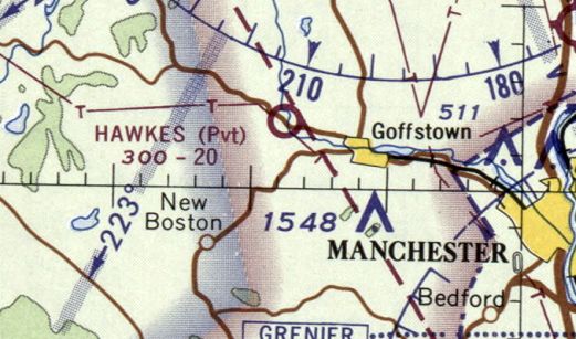
Hawkes Airfield, as depicted on the 1966 Sectional Chart (courtesy of Jonathan Westerling).
The date of establishment of this small private airfield has not been determined.
According to Joanne Hawkes Rumrill, James Hawke's daughter, "I'm pretty sure it was late 1950s that dad had a plane.
I was pretty small but remember flying with him quite often after supper.
Years later other pilots in the area were interested in using this grass strip.
Mike Riel, with his tractor turned over the soil, flattened it, and planted grass seed.
They all helped in the maintenance of the runway."
According
to the New Boston Historical Society, James Hawkes built a grass
airstrip to the east of his house.
The first aeronautical chart depiction which has been located of Hawkes Airfield was on the 1966 Sectional Chart (according to Jonathan Westerling).
It depicted Hawkes as a private airfield with a 2,000' unpaved runway.
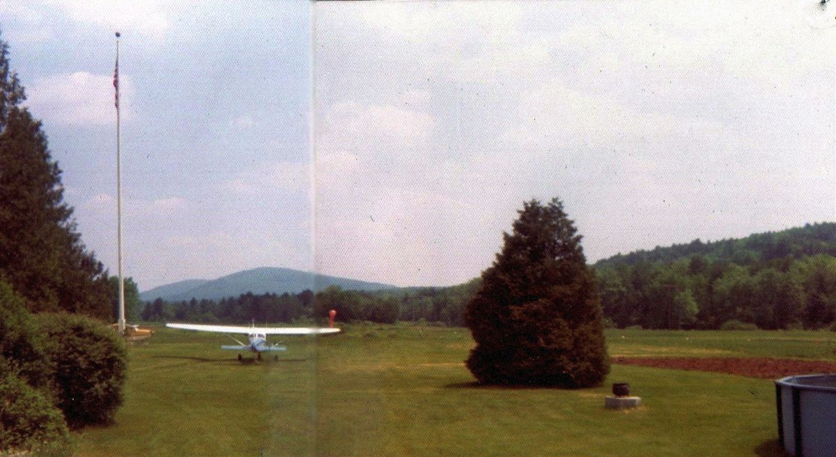
A circa 1960s/70s photo of Cal & Hank's Cessnas at Hawkes Airfield (courtesy of Joanne Hawkes Rumrill).
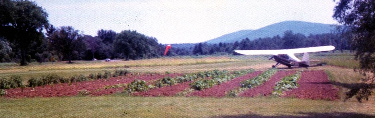
A circa 1960s/70s photo of Mike Riel's Aeronca at Hawkes Airfield (courtesy of Joanne Hawkes Rumrill).
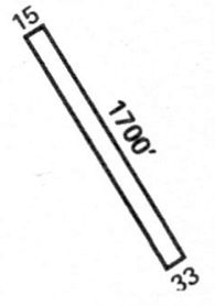
The 1972 Flight Handbook (courtesy of Jonathan Westerling) depicted Hawkes Airfield as having a 1,700' Runway 15/33.
According to the New Boston Historical Society, when the modern Route 114 was being planned, James Hawkes learned it would go right by his house.
He filed the appropriate paperwork with the state to make his airport public so that the road engineers had to reroute the highway over to the other side of the river so as to avoid interfering with a public airport.
Even after Route 114 was finished, James continued to keep his airport open to the public.
Hawkes Airfield was first listed as public airfield in the 1968 Jeppesen Eastern States Airport Directory (according to Jonathan Westerling).
It clarified that the airport was closed winters, and that both ends of the runway had a displaced threshold, effectively making the length usable for landing as 1,700'.
The
length of Hawkes Airfield was reported on the 1969 Boston Sectional
Chart as having been extended to 2,400'.
The earliest topo map depiction which has been located of Hawkes Airfield was on the 1985 USGS topo map.
It depicted a single unpaved northwest/southeast runway, generically labeled “Landing Strip”.
According to Joanne Hawkes Rumrill, the runway was frequently used to practice turf runway landings by the students of Nathaniel Hawthore College, a unique aviation-based liberal arts school in nearby Antrim.
The school closed in 1988.
According to Shawn Hawkes, in 1981 James Hawkes sold his house & the airport to Russ Lee, a USAir pilot who owned a few airplanes.
Lee continued to let other pilots that had been using the airport to continue to do so.
The airport name was changed to Lee & also became private after the purchase.
The only photo which has been located showing aircraft at Lee Airfield was a 1986 aerial view,
which showed 3 light single-engine planes parked on the north side of the runway.
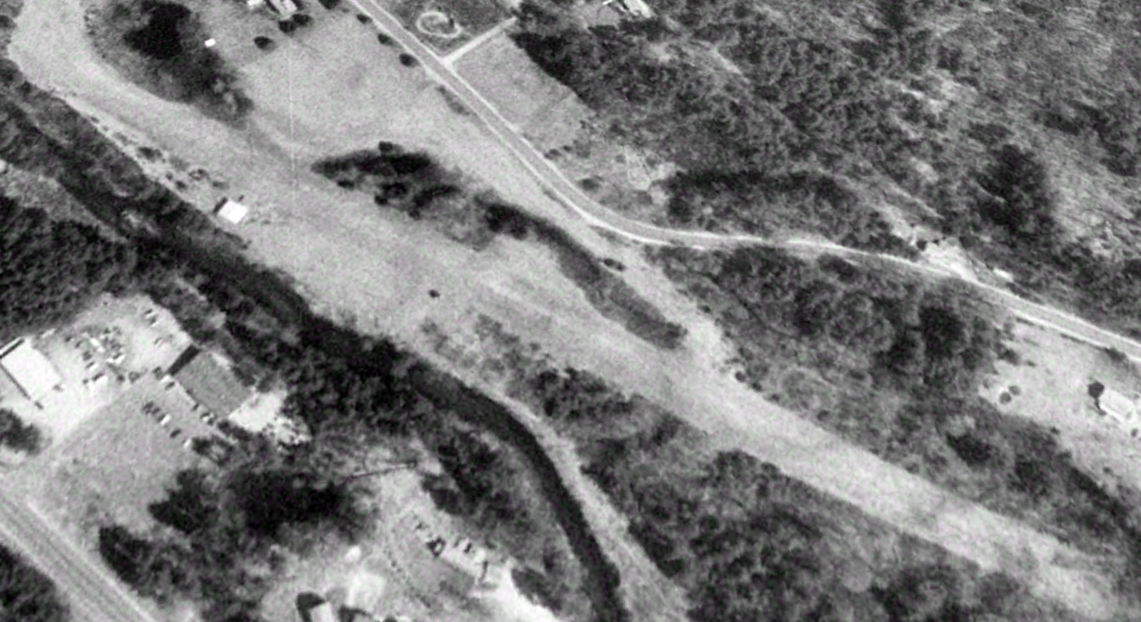
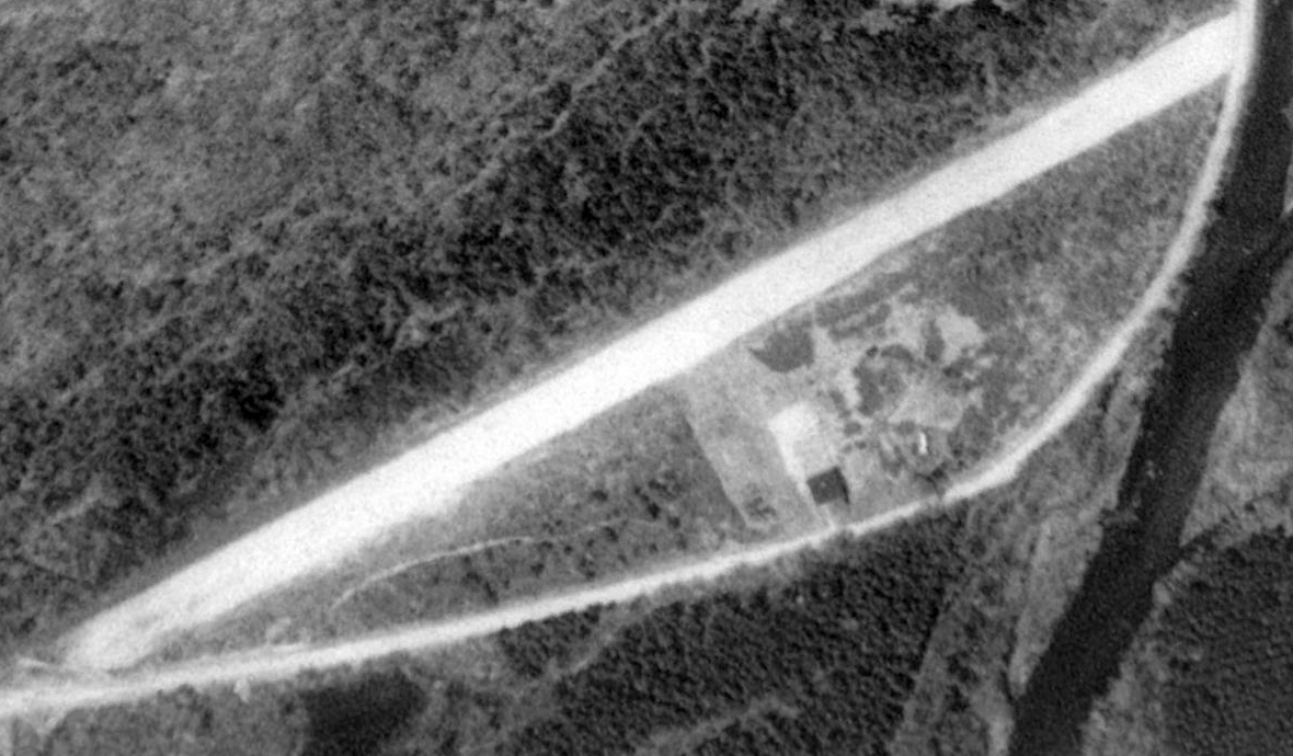
The earliest aerial photo which is available of Lee Airfield was a 1998 USGS aerial view looking north.
It depicted a single unpaved northwest/southeast runway, with a single hangar which has been added on the southwest side.
The last aeronautical chart depiction which has been located of Lee Airfield was on the 2001 Sectional Chart (courtesy of Jonathan Westerling).
It depicted Lee as a private airfield having a 2,000' unpaved runway.
Jonathan Westerling reported, “Lee Airport continued in private operation until it was closed between 2001-2004.”

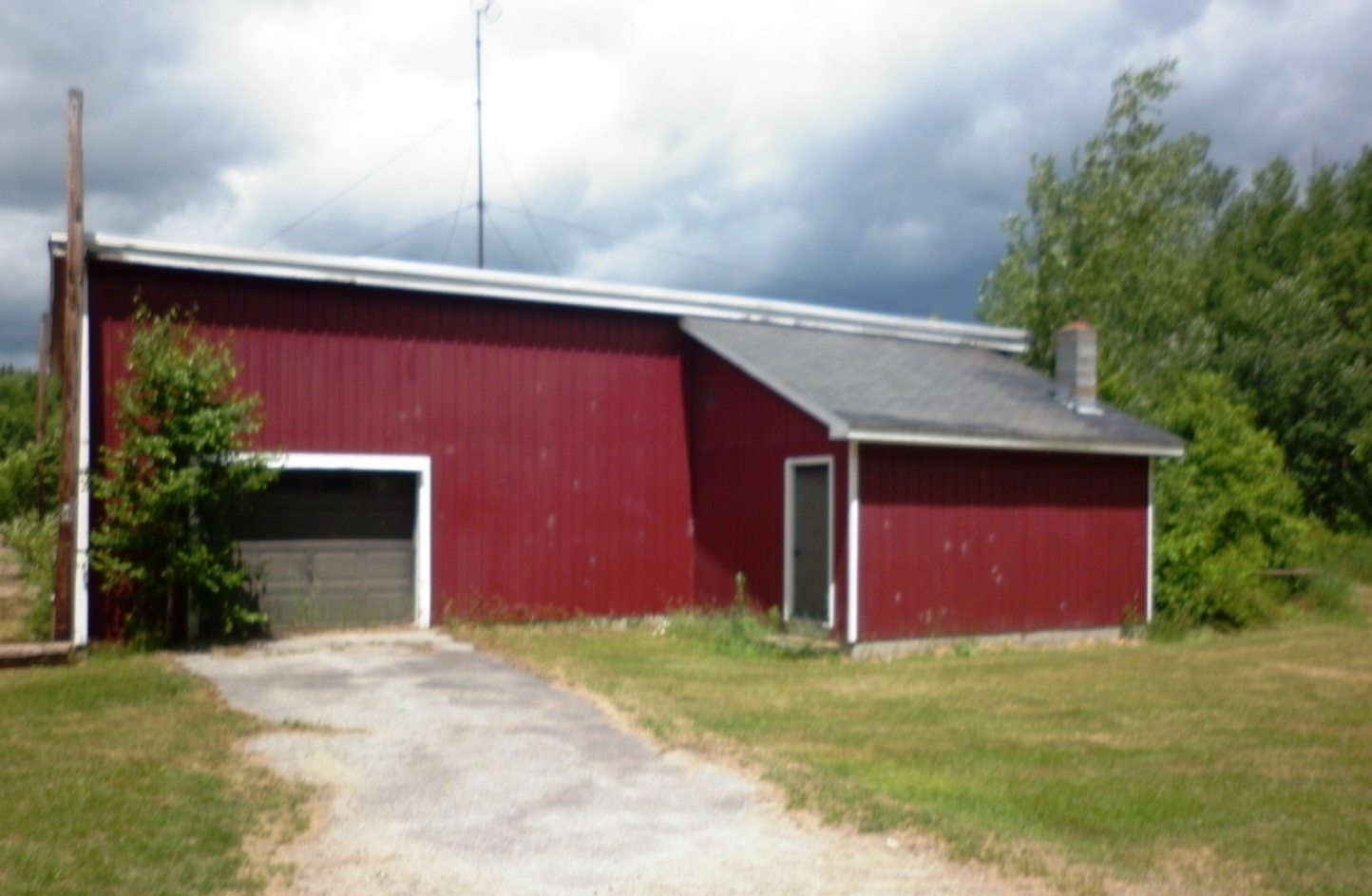
A 2009 photo looking southwest at the hangar on the southwest side of Lee Airfield.
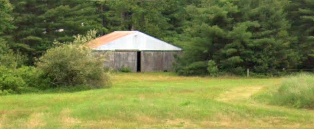
A 2023 photo looking southwest at the hangar on the southwest side of Lee Airfield.
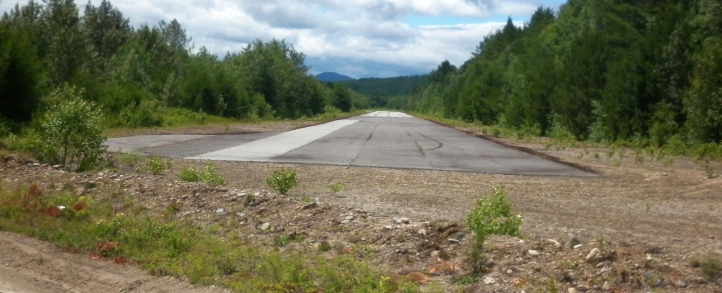
A 2023 aerial view looking north showed the Lee Airfield runway & hangar remained intact, though without any sign of recent aviation use.
Thanks to Jonathan Westerling for pointing out this airfield,
and to the Aviation Museum of New Hampshire for their support of the the original research on this airfield.
____________________________________________________
43.426, -71.268 (North of Boston, MA)
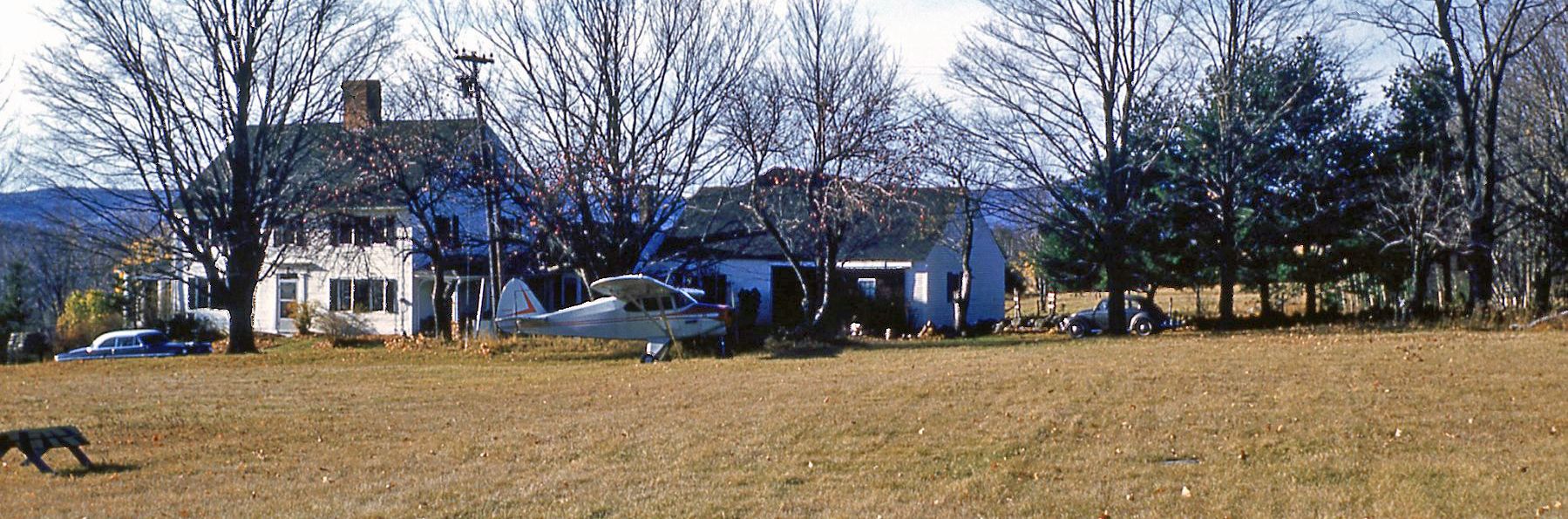
A circa mid-1950s photo of Harry Besse's Piper Tri-Pacer in front of his farmhouse (courtesy of his stepson Nick North).
According to Jonathan Westerling, “The little airport that served the small town of Gilmanton Iron Works was the result of a well-known businessman's unique commute to work.
Colonel Harry Besse served as a pilot in WW1 & WW2. He found success in Boston's financial sector but decided he wanted to live in the country.
Harry bought a farm in the town of Gilmanton & plowed himself an airstrip in the middle of his cornfield.
However, he continued to work every day in Boston as president of the the city's Stock Exchange.
Most of the year, Harry commuted the 70 miles to & from work each day in his Tripacer. He would take off from his airstrip & fly to Revere Airport.
At the end of the day he would fly back, climb out of his plane in suit & tie, then change into overalls to tend his sheep & other animals before sitting down to dinner.
Later he upgraded to a Piper Cherokee for his commute, and landed at Logan after Revere Airport closed.”
But no airfield was depicted at this location on USGS topo maps from the 1950s/60s/70s.
According to Harry's stepson Nicholas North, the reason his stepdad made his airfield public
was because “one day someone sputtered in for an emergency landing & Harry wanted to make sure people knew they were welcome to land there if they needed to.”
And so about 10 years after first clearing the field, Harry filed the required paperwork with the NH Aviation Commission
and made the necessary upgrade, cut clear zones, and kept his airstrip safe & open to the public for the next 14 years.
According to the Airman's Information Manual, Besse Field was opened to the public in June of 1963.
The earliest aeronautical chart depiction which has been located of Besse Field was on the 1965 Sectional Chart (courtesy of Jonathan Westerling).
It depicted Besse as a public-use airport having a mere 1,800' unpaved runway.
According to the 1967 AOPA Airports USA, Besse Field had an 1,855’ turf Runway 13/31.
The 1972 Flight Handbook (courtesy of Jonathan Westerling) depicted Besse Field as having a 1,760' Runway 13/31.
Jonathan Westerling reported, “Children who grew up in the community in the 1970s recall taking their first plane ride with the Colonel.
He also served as Gilmanton's town moderator for an unprecedented 30 years. His stepson told me he continued to fly after his retirement and well into his 80s.”
The last aeronautical chart depiction which has been located of Besse Field was on the 1975 Sectional Chart (courtesy of Jonathan Westerling).
It depicted Besse as a public-use airport having an 1,800' unpaved runway.
Besse field was reclassified as a private airfield in the 1975 through 1977 AOPA Airports USA directory,
but was no longer listed in the 1978 AOPA Airports USA directory.
Jonathan Westerling reported, “His stepson still owns the airport land, but the remains of the airfield departed us along with Harry in the early 1980s.”
A 2020 aerial view showed no trace remaining of Besse Field.
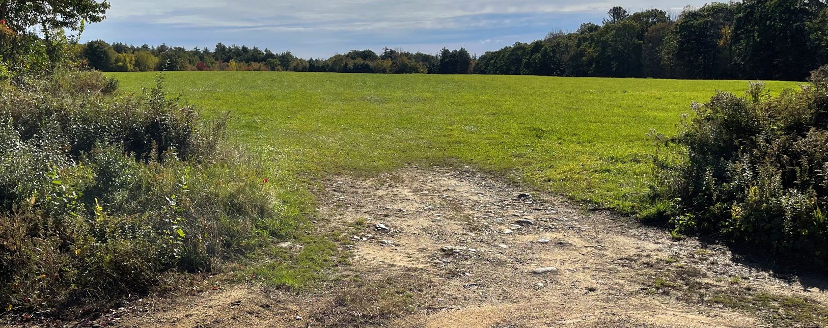
A 2023 photo of the site of Besse Field by Nate Abbott, who has lived in Harry Besse's house for the last 20+ years.
Thanks to Jonathan Westerling for pointing out this airfield,
and to the Aviation Museum of New Hampshire for their support of the the original research on this airfield.
____________________________________________________
White Mountain Gateway Airport (NH14), Freedom, NH
43.826, -71.139 (North of Boston, MA)
White Mountain Gateway Airport, as depicted on the 1986 USGS topo map.
Photo of the airfield while in use has not been located.
No airfield was yet depicted at this location on a 1981 aerial photo or the 1981 Boston Sectional Chart (courtesy of Ron Plante).
According to Jonathan Westerling, “This huge airfield was built without permission of the town & as a result caused an uproar that eventually resulted in the property becoming a town forest.”
According to the Trust for Public Lands article "Buying the Woods", in the late 1980s a developer announced plans to build an airstrip for a “fly-in” community in the town of Freedom.
The developer was William Foord. In 1985, he drew up plans for 350 new fly-in homes to be constructed & cleared a landing strip in the middle of his property.
The airfield was registered with the state & assigned the identifier NH14.
The earliest depiction which has been located of White Mountain Gateway Airport was on the 1986 USGS topo map.
It depicted a single northwest/southeast runway, generically labeled “Landing Strip”.
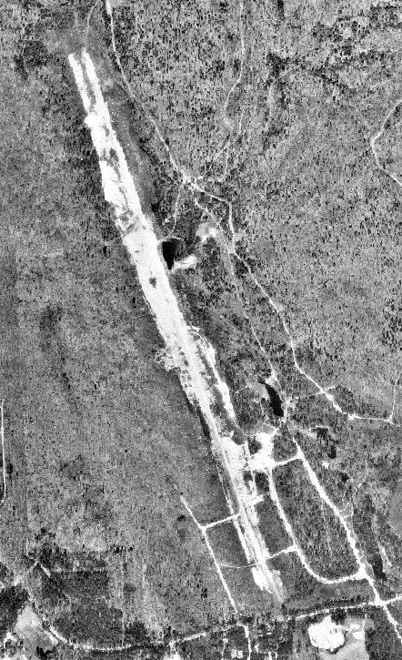
The earliest photo which has been located of White Mountain Gateway Airport was a 1992 aerial view (courtesy of Jonathan Westerling).
It depicted a single northwest/southeast unpaved runway, but with no hangars or any sign of recent aviation use.
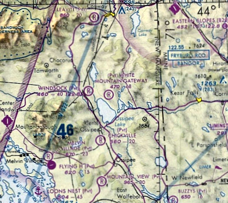
The earliest aeronautical chart depiction which has been located of White Mountain Gateway Airport was on the 1993 Sectional Chart (courtesy of Ron Plante).
It depicted White Mountain Gateway Airport as a private airfield having a 6,800' unpaved runway.
According to Jonathan Westerling, “The single Runway 17/35 was listed as gravel with a length of 6,811' - the longest unpaved runway in New England!
Was Poole planning on paving the runway to entice private jet owners to buy properties at his fly-in community?
If he was, his plans never really got off the ground so to speak.”
According to Brandy Bruttrick, Co-President of the Freedom Historical Society,
the people in the small town of 1,400 people were furious about the prospect of hundreds of additional houses
and convinced the city to deny any zoning permits to Foord, who sued the town for the right to develop the land.
He lost, and tried unsuccessfully to sell the land to other developers.
The airstrip laid largely unused & the property, the largest undeveloped parcel comprising 12% of the town, was left in a perpetual "for sale" state.
A 2001 aerial view looking southeast (courtesy of Jonathan Westerling) showed White Mountain Gateway Airport's long cleared runway
was not being kept up & the forest was beginning to impinge on the landing area.
The earliest aeronautical chart depiction which is available of White Mountain Gateway Airport was on the 2001 Sectional Chart (courtesy of Ron Plante).
It depicted White Mountain Gateway Airport as a private airfield having a 6,800' unpaved runway.
The last aeronautical chart depiction which has been located of White Mountain Gateway Airport was on the 2004 Sectional Chart (according to Jonathan Westerling).
According to the Trust for Public Lands article "Buying the Woods", Jennifer Molin became the driving force behind an effort
that eventually raised the money necessary to purchase the 2,660 acres of White Mountain Gateway Airport & make it a new public forest for the town.
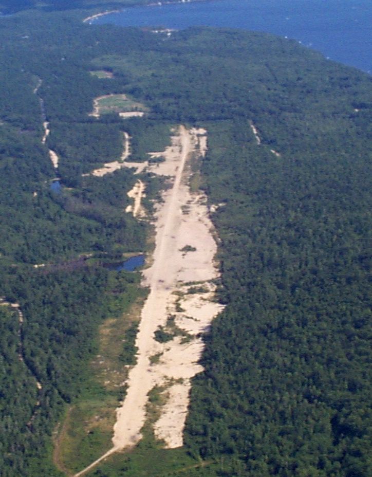
According to the Freedom town website, White Mountain Gateway Airport is documented as an emergency helicopter landing area, but mostly used by hikers & birdwatchers as Scrub Oak trail.
A 2020 aerial view looking northeast showed White Mountain Gateway Airport's runway remaining intact but deteriorated.
Thanks to Jonathan Westerling for pointing out this airfield,
and to the Aviation Museum of New Hampshire for their support of the the original research on this airfield.
____________________________________________________
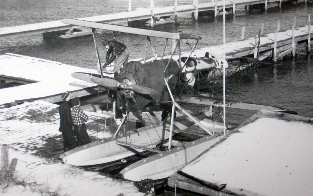
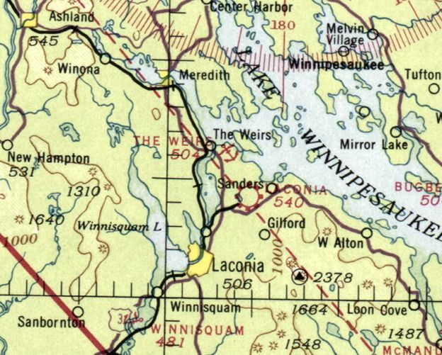
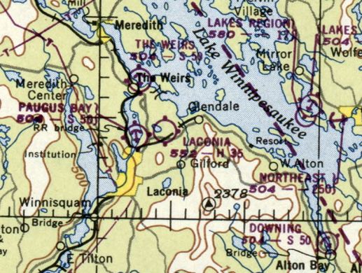
Weirs Seaplane Base, Laconia, NH
43.607, -71.458 (Northwest of Boston, MA)
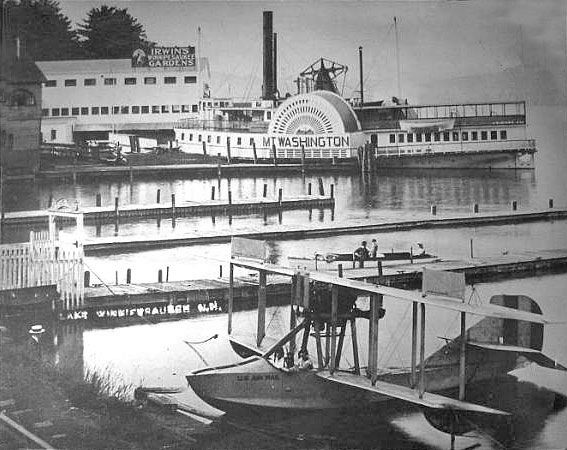
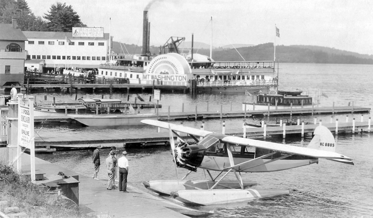
A circa 1925 photo looking north at a U.S. Air Mail Curtiss seaplane at the Weirs Seaplane Base, with the Mt. Washington paddlewheel steamship in the background..
According to Jonathan Westerling, “In 1912 Harry Atwood landed his Burgess-Wright Hydro-aeroplane on Lake Winnipesaukee & gave demonstrations & offered rides to passengers near the Winnipeaukee pier.”
According to a weirsbeach.com article, “Seven years later Jim Irwin, President of the Weirs Improvement Association read about a man who owned a seaplane at Pemberton MA.
Jim figured this would be an attraction for the Weirs.
Upon his return he called a meeting of Cale Avery, O.W. Morgan, Jim Kennon and others and got sufficient backing to close a deal with Ens. Morgan, owner of the plane;
a Curtis F Seaplane with a 95hp V-8 engine…they guaranteed $100/day for 7 days - the plane business was good & the owner stayed for 4 seasons.”
According to Bob Fogg & New Hampshire's Golden Age of Aviation, “Beginning in 1923, Robert Fogg, who ran the flight operation at the Concord Airport started offering biplane rides in a Curtis MF 'Sea Gull' flying boat.”
According to Jonathan Westerling, “However these early seaplane operations were all done was from a primitive wooden dock which hardly qualified as a Seaplane Base.
The actual establishment of the Weirs Seaplane Base occurred in 1928 when Robert Fogg's operation was moved to its own location just south of the excursion steamship Mt. Washington.
The new facility included a proper seaplane ramp & a small covered waiting area. A fuel tank & pump were also installed.”
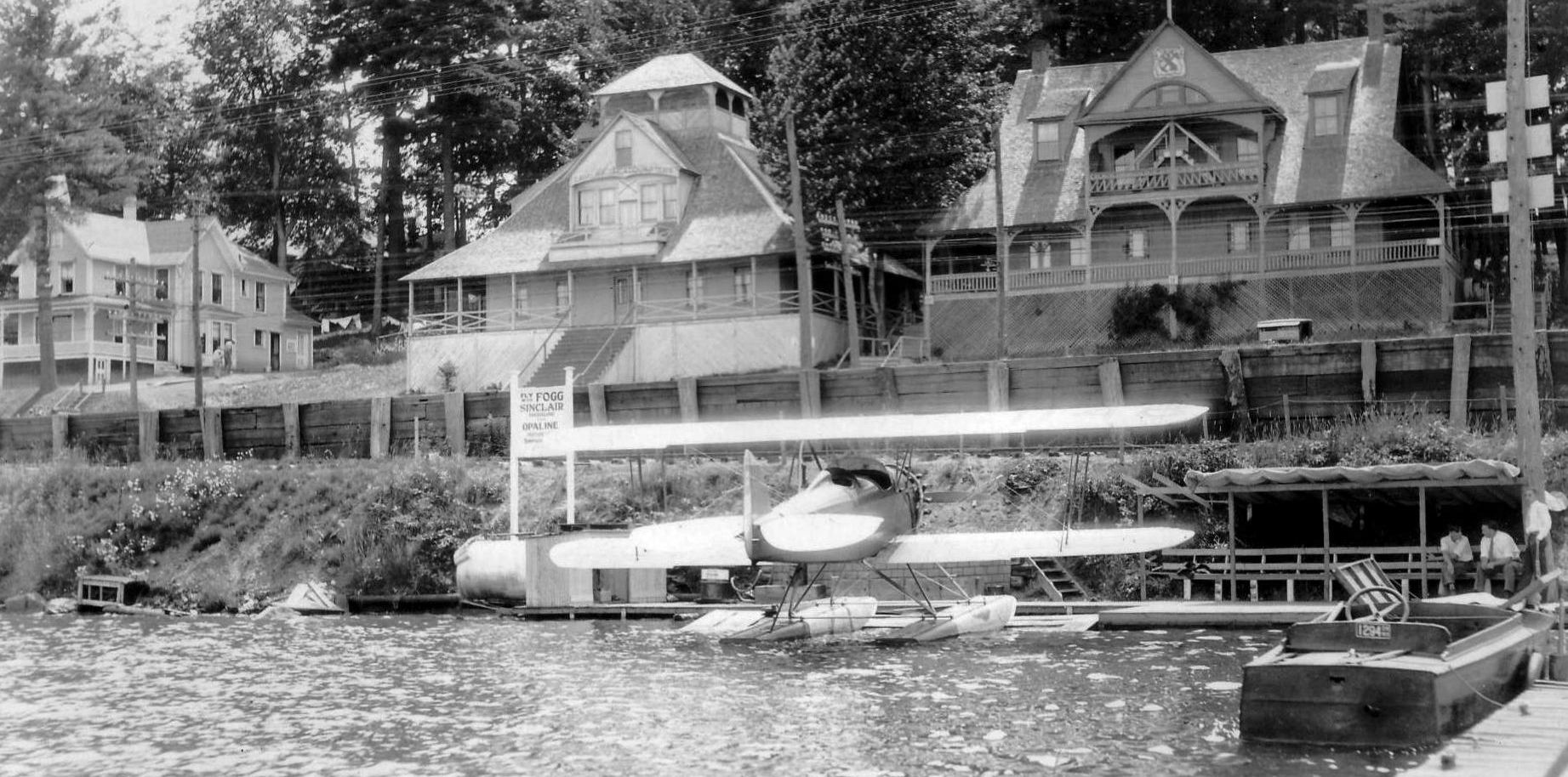
A circa 1929 photo looking southwest at a Waco dual-float biplane (courtesy of Jane Rice) showed the Weirs Seaplane base to have a single wooden ramp with a gas pump & a shaded waiting area.
The Weirs Seaplane Base was depicted as a commercial operation in the 1929 Rand McNally Air Trails guide & map as having a buoy-marked "unlimited" landing area.
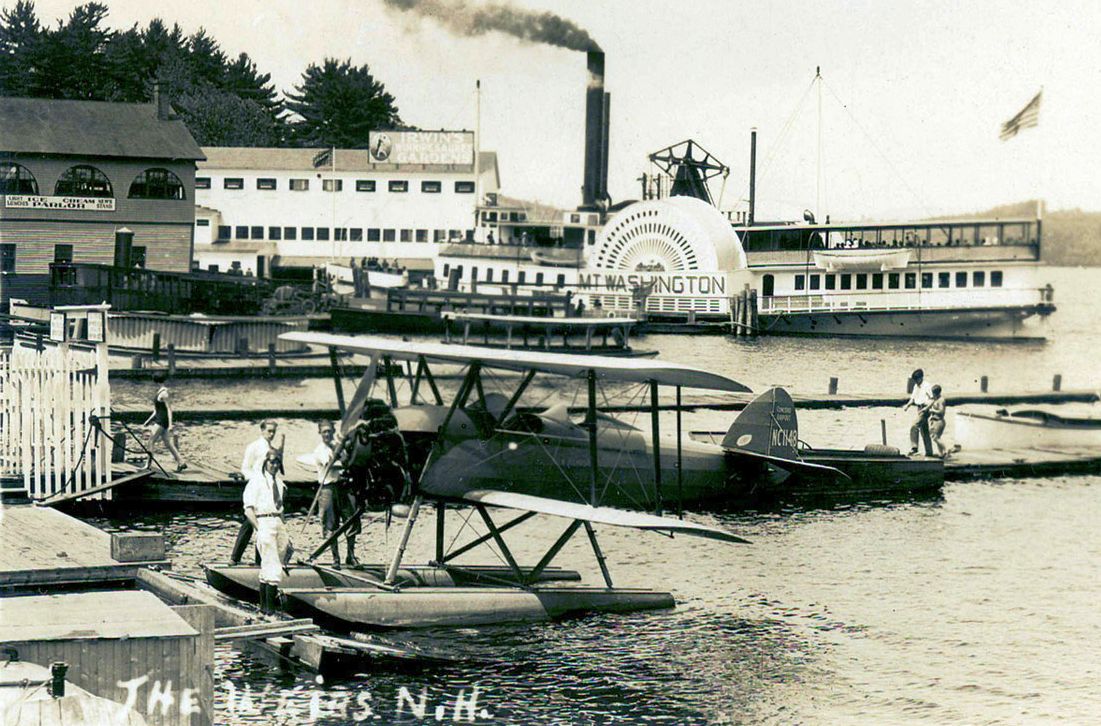
A circa 1930s photo looking north at Bob Fogg in his trademark aviator helmet & goggles standing inf front of a Waco dual-float biplane at the Weirs Seaplane Base, with the Mt. Washington paddlewheel steamship in the background.
A circa 1930s photo looking north at a Fairchild monoplane floatplane at the Weirs Seaplane Base, with the Mt. Washington paddlewheel steamship in the background.
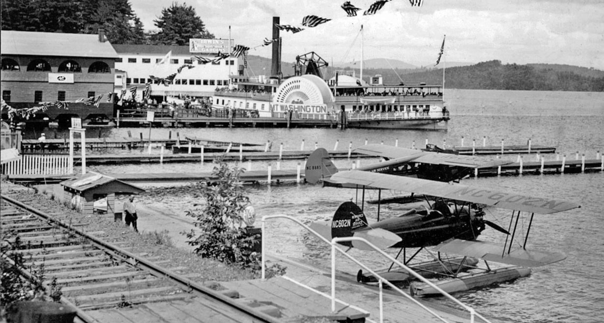
A circa 1930s photo looking north at a TravelAir 6000B monoplane floatplane & a Waco CSO biplane floatplane at the Weirs Seaplane Base, with the Mt. Washington paddlewheel steamship in the background.
A 1936 photo looking southwest at 6 pilots in front of 2 biplane floatplanes & a monoplane floatplane at Weirs Seaplane Base (courtesy of Jane Rice).
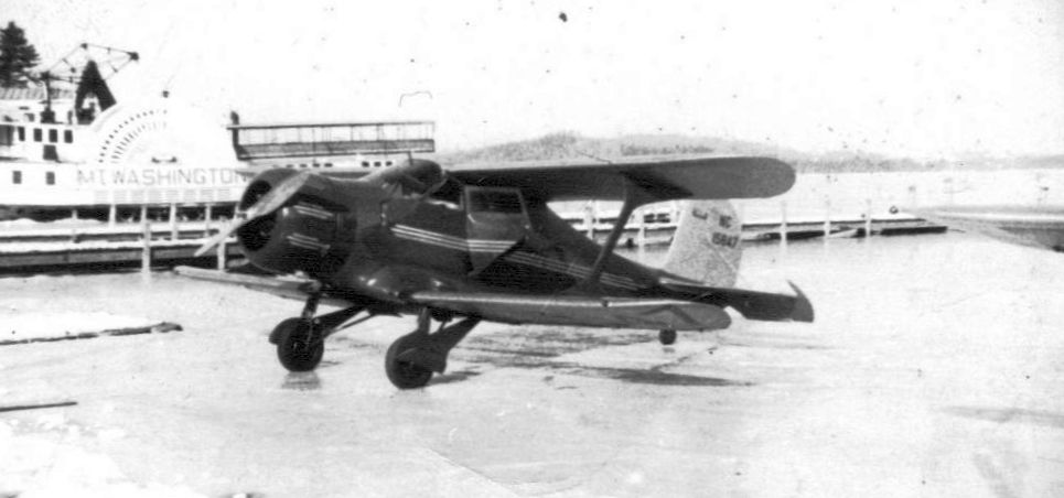
A circa 1936-37 photo looking north at a Beech Staggerwing operating from the iced-over lake at the Weirs Seaplane Base, with the Mt. Washington paddlewheel steamship in the background (courtesy of Jane Rice).
Jonathan Westerling reported, “The seaplane base generally remained open through January 1 of each year, then closed while the lake was frozen over.
Often, the freeze would be hard enough to land planes on.”
Jonathan Westerling reported, “By 1936, the facility was under the operation of Thomas Rice & was further improved.
Thomas Rice's granddaughter Jane Rice has written a book that includes numerous details about the Seaplane Base operation over the years.
The 1936 improvements included 2 additional plane ramps & a nice new operations building.”
According to an article in the August 1937 Aero Digest, an 8-passenger Sikorsky S-38 amphibian had been added to the fleet at the Seaplane Base.
The Weirs flight operations were half tours & half charters, and claimed to have carried 50,000 passengers without serious incident.
A new dock extended out into the water accommodating up to 12 seaplanes. During winters, the Sikorsky was flown to Florida & operated for the "Miami Seaplane Service", also owned by Fogg.
Jonathan Westerling reported, “The biggest controversy to occur at the Weirs Seaplane Base was when operations were suspended & all of the seaplanes flown to Boston for a week in July 1937.
Operator E.P. Rice wanted to offer night rides to bring in additional revenue, and his chief pilot Fogg insisted it was safe, but the NH Aviation Commission declined to permit it.”
The headline in the 7/19/37 Laconia Evening Citizen quoted Rice as saying “If he could not fly at night, when where & how he wanted, he would not allow his planes to be used at The Weirs in daylight.”
An emergency conference was called in Concord with the Mayor, State Senator, State Representative, and chairman of the Aviation Commission.
Fogg insisted he could demonstrate safe night landings to convince the Commission to issue the permit, but there is no record of these demonstrations ever happening.
The controversy faded & E.P. Rice brought his planes back one by one the following week & resumed operations, albeit in daytime hours only.
Jonathan Westerling reported, “In 1938 Fogg left to work at the Civil Aeronautics Association where he was put in charge of establishing new seaplane facilities around the United States.”
Jonathan Westerling reported, “In December 1939, the excursion steamboat Mt Washington burned.
The seaplane that was being kept at the Weirs Seaplane Base was also scorched in the blaze.”
A 1939 photo looking north at the remains of a burned Waco biplane floatplane at the Weirs Seaplane Base (courtesy of Jane Rice).
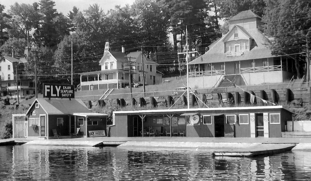
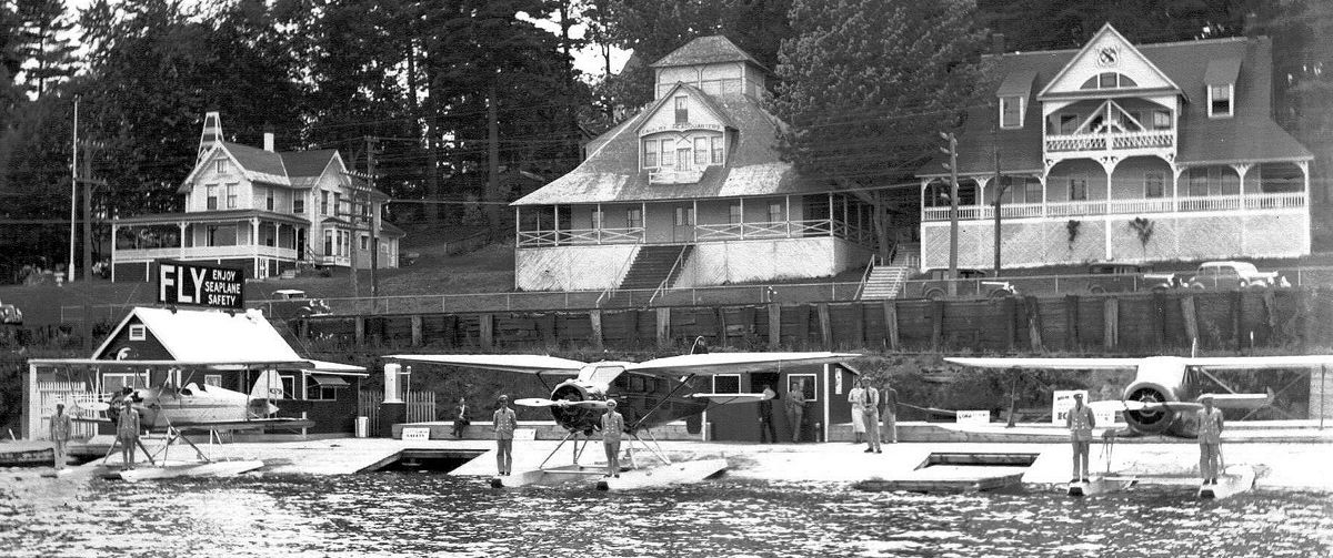
A circa 1941 photo looking southwest at the final iteration of the Weirs Seaplane Base (courtesy of Jane Rice).
A passenger waiting area had been added along with a crew area & workshop. This was definitely one of the nicest commercial seaplane bases in the United States before WW2.
The earliest aeronautical chart depiction which has been located of the Weirs Seaplane Base was on a 1942 Sectional Chart (courtesy of Jonathan Westerling), which labeled it as “The Weirs”.
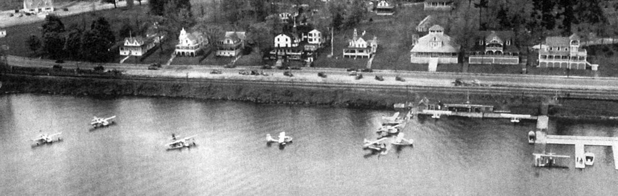
An undated aerial view looking southwest from a September 1947 Flying Magazine article, showing 11 seaplanes & floatplanes at a 1947 seaplane regatta held at Weirs Beach sponsored by AOPA.
A total of 28 seaplanes & floatplanes flew in for the event.
The 1948 Airman's Information Manual listed the Weirs Seaplane Base as having a primary 5,000' North/South landing area.
The last aeronautical chart depiction which has been located of the Weirs Seaplane Base was on a 1950 Sectional Chart (courtesy of Jonathan Westerling), which labeled it as “The Weirs”.
Jonathan Westerling reported, “Seaplane operations moved to Paugus Bay in 1951.
The Weirs Seaplane Base was listed as Inactive in the 1951 Seaplane Facility Directory.”
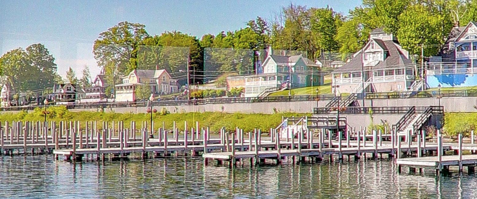
A 2016 photo looking southwest shows the same houses remaining behind the site of the Weirs Seaplane Base, but devoid of any seaplanes or boats.
Thanks to Jonathan Westerling for pointing out this airfield,
and to the Aviation Museum of New Hampshire for their support of the the original research on this airfield.
____________________________________________________
43.935, -71.912 (Northwest of Boston, MA)
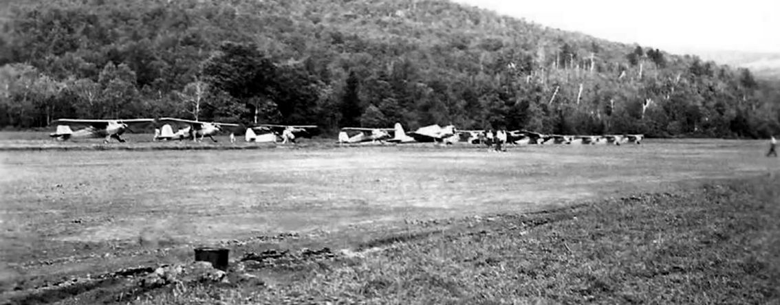
A 1947 photo of a row of a dozen single-engine aircraft at Morse Airfield (courtesy of the Warren Historical Society).
According to Jonathan Westerling, “Aside from a large nuclear missile that was installed downtown,
for decades the town of Warren's major tourist attraction was connected to a small private airfield nearby.
Ira Morse made his fortune running a New England retail shoe chain then traveled around the world hunting wildlife, buying curious artifacts, and bringing everything home.
From 1928-92, thousands of people visited the Morse Museum.
Inside they would find an 8' lioness, huge bull giraffe weighing over 3,500 pounds, skins from: hippo, elephant, wildebeast, zebra, kudu, monkey, impala, spotted hyena, rhinoceros, and crocodile.
There were 2 desiccated mummies, silver sandals belonging to a princess - a tea set made from ostrich eggs; a model of the Taj Mahal Temple.
This was an eclectic museum!”
Jonathan continued, “Ira’s son Phillip Morse became a pilot & after WW2 opened an airfield across from the family farm which he flew for almost 30 years.
According to photos provided by the Warren Historical Society, the airport had its opening celebration in 1947.”
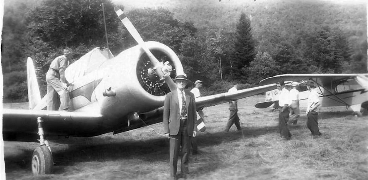
A 1947 photo of a surplus Vultee BT-13 Valiant & a Piper J3 Cub at Morse Airfield (courtesy of the Warren Historical Society).
Jonathan continued, “It was first listed as a new airfield in the January 1948 Airman’s Guide.
The runway was initially listed as a 2,700' turf strip.”
According to Brian Morse “My grandfather Philip Morse bought a Sea Bee in 1948 which they took on fishing trips to Canada.
They took off from the airfield at ‘the farm’. My uncle Phil Morse was flying… it ran out of gas. My father said the plane ‘dropped like a rock’.
No ponds close enough to glide to but they were right over some railroad tracks.
There was a work crew of 20 or so men working on the tracks. The workers all dove into the swamp next to the tracks to avoid getting hit by the plane as it slid along the tracks to a stop.
The workers sent a few flatbed cars down the tracks to transport the plane to the next town.
The next day the plane was repaired by a local mechanic & ready to fly.”
The earliest aeronautical chart depiction which has been located of Morse Airfield was on a 1949 Sectional Chart (courtesy of Jonathan Westerling).
It depicted Morse as having a 2,700' runway.
According to Janice Sackett whose father was Leslie Ball, the manager of the airport,
“People staying at the nearby Momahadun Lodge could land here & get picked up by their chauffeur.
Sometimes there'd be 9 planes tied up [at Morse Airport] during the summertime.”
Morse Airfield, as depicted on a 1951 Esso map (courtesy of Jonathan Westerling).
According to Jonathan Westerling, “It was listed at 2,900' in the 1954 Airport & Business Flying Directory.
Then revised to 2,800’ from 1969 through to its closure.”
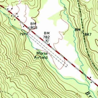
The earliest topo map depiction which has been located of Morse Airfield was on the 1973 USGS topo map.
It depicted Morse Airfield as having a single northwest/southeast unpaved runway.
There were no buildings or other improvements depicted on the airfield.
According to Jonathan Westerling, “Phil’s eyesight deteriorated & he hung up his wings in 1975 & sold the airplanes - and the airfield.”
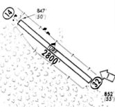
A 1976 directory (courtesy of Jonathan Westerling) depicted Morse Airfield as having a single 2,800' turf Runway 14/32.
There were no buildings or other improvements depicted on the airfield.
The last aeronautical chart depiction which has been located of Morse Airfield was on a 1976 Sectional Chart (courtesy of Jonathan Westerling).
It depicted Morse as having a 2,800' unpaved runway.
A 1992 USGS aerial view depicted the Morse Airfield unpaved runway as remaining clear.
A 2023 aerial view looking northeast depicted the Morse Airfield unpaved runway as remaining clear.
Jonathan Westerling reported in 2023, “Today the farm has been demolished & airport land donated to the Audubon society.”
Thanks to Jonathan Westerling for pointing out this airfield,
and to the Aviation Museum of New Hampshire for their support of the the original research on this airfield.
____________________________________________________
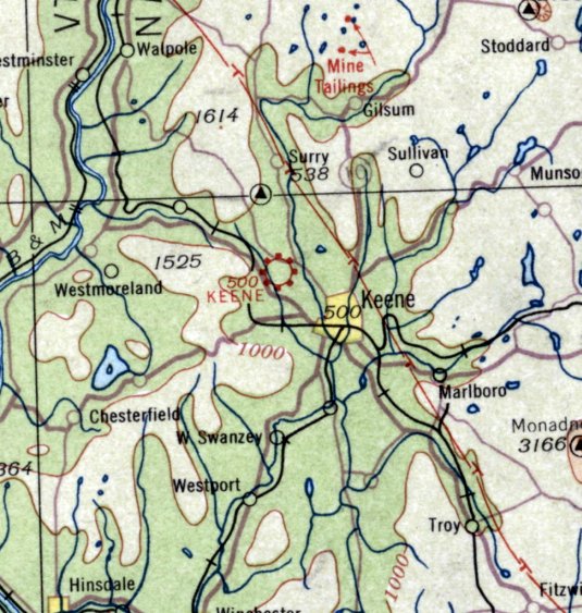
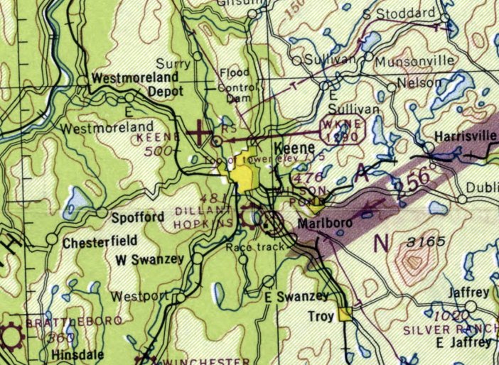
Keene Airport / Keene Airpark, Keene, NH
42.959, -72.328 (Northwest of Boston, MA)
Keene Airport, as depicted on the 9/4/28 Commerce Department Airway Bulletin (courtesy of Jonathan Westerling).
According to "Wings over Keene" by Ernest Bell & David Proper (courtesy of the Aviation Museum of NH),
support for a permanent airfield in Keene was given a significant boost thanks to a visit by the famed Spirit of St. Louis on 7/27/27:
"The city's fire alarm was sounded when Colonel Charles Lindbergh's plane appeared through the clouds & flew low over Main Street cheered by crowds in the streets & on rooftops.
Lindbergh was on a nationwide tour promoting the future of commercial aeronautics.
The message of greeting he dropped from the plane has been preserved by the Historical Society of Cheshire County."
Jonathan Westerling reported, “Two days later the City government founded an Aviation Committee & pushed to quickly establish a municipal airport in Keene.
Much work was done to create a proposal & the City Council voted unanimously in November to acquire a property & publicly finance the $15,000 construction cost.
However, on December 1, the City Attorney issued a letter quoting a state statute which prohibited cities from operating airports in NH without legislative approval & deemed city's actions illegal.
An embarrassed Airport Committee & City Council retreated from the idea & it was tabled indefinitely.”
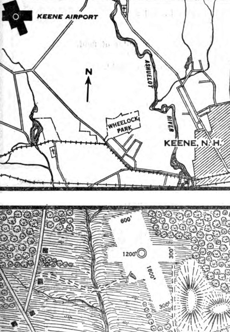
The earliest depiction which has been located of Keene Airport was in the 9/4/28 Commerce Department Airway Bulletin (courtesy of Jonathan Westerling).
It described Keene Airport as a municipal field owned by Keene National Bank, trustee,
and operated by the Aviation Committee, Chamber of Commerce.
It consisted of a 25 acre sod field, having 2 runways, measuring 1,800' northwest/southeast & 1,200' east/west.
Jonathan continued, “Unwavered by the failed city efforts, a privately-financed effort commenced in December to cut timber, grade,
and prepare the property northwest of town which had been identified as the best candidate for an airport.
The following year it was front-page news when the airport feted its opening over the weekend of 9/21/28.”
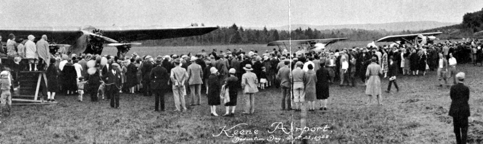
The earliest photo which has been located of Keene Airport was a photo of spectators & several airplanes at the 9/21/28 Keene Airport Dedication Day (courtesy of the Historical Society of Cheshire County).
According to an article in the following Monday's Keene Sentinel (thanks to the Digital Archives of the NH State Library),
a total of 15,000 people showed up that weekend to experience the events commemorating the opening of the new airfield.
The final cost of its construction was $20,000 & 30 airplanes were present at the opening weekend according to news reports.
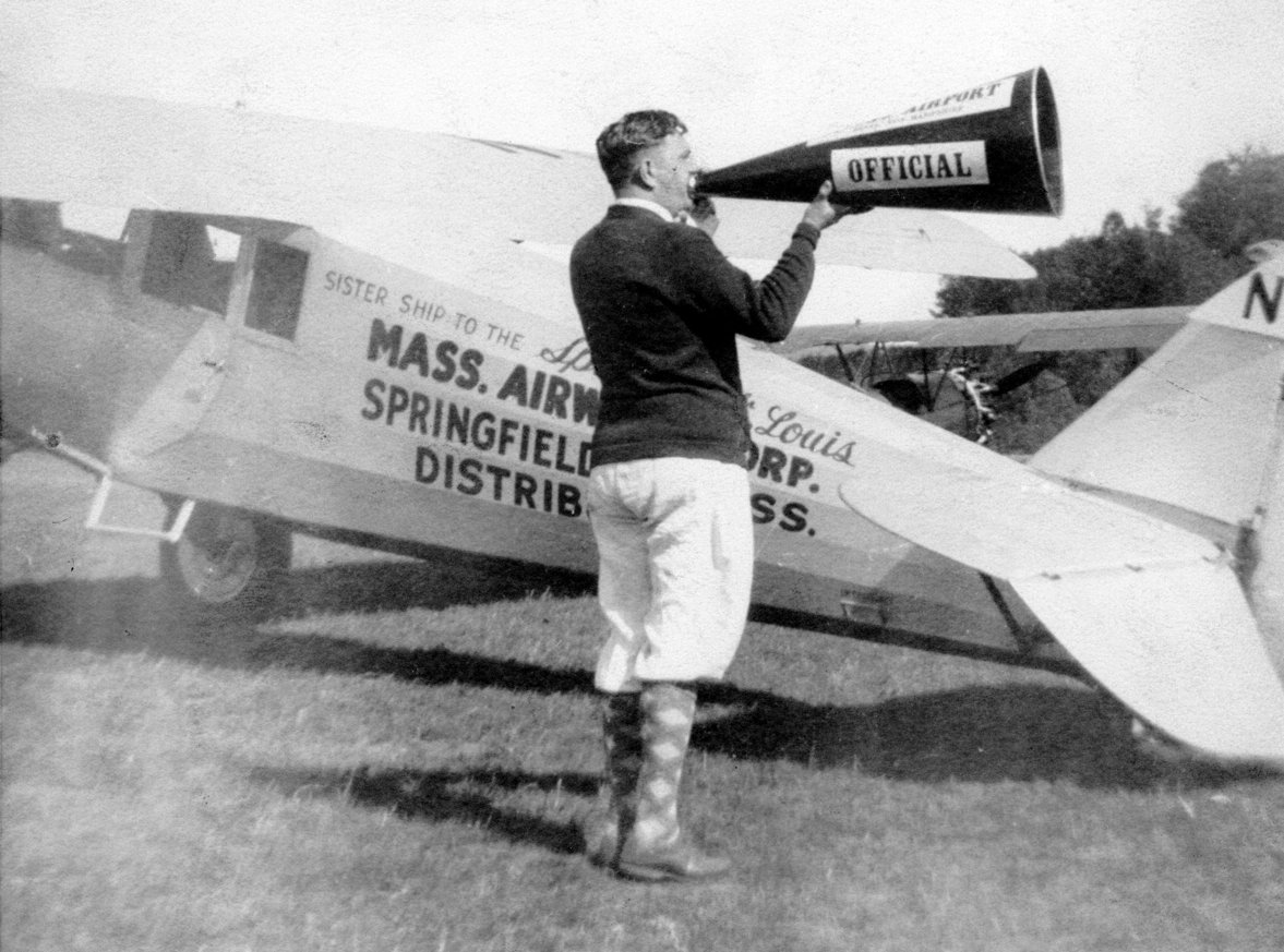
A Ryan marked “Sister ship to the Spirit of St. Louis” at the 9/21/28 Keene Airport Dedication Day (courtesy of the Historical Society of Cheshire County).
According to Transportation in Keene NH by Marium Foster, the newly opened airport "boasted one 1,800' & one 1,200' runway.
The opening celebration of the Keene Airport coincided with the 175th anniversary of the granting of Keene's charter.
The dedication attracted several thousand people, and the committee arranged for stunt flying units of the Navy & Marines to appear at the ceremony
and for NH's first aviatrix, Dorothy Putnam, to give an exhibition.
There was stunt flying, parachute jumping, air races, and passenger rides."
According to A Narrative of Keene NH 1732-1967 by David Proper, “Among the barnstorming pilots who had participated in the opening of the Keene Airport was a Manchester Scotsman, George Wilson.
He learned to fly with the Royal Air Force in 1918, and later came to the United States.
Richard & Sidney Holbrook, who were interested in the commercial possibilities of the new airport,
talked Wilson into staying in Keene as manager of their new venture, Twin State Airways.
The following year he came to Keene permanently & began his duties, which included instructing prospective pilots."
Jonathan Westerling reported, “In Spring of 1929, the State of NH changed its statute & allowed municipalities to own & operate airfields.
But the embarrassment of city officials who had tried 2 years earlier to establish an airport gave them cold feet
and the City voted against purchasing the newly completed airfield for $20,000 according to a 6/22/29 article in the journal Air Transportation.
This (plus the ensuing Great Depression) would mean that Keene would have to wait 15 years to finally gain a city-owned airport - the present-day Dilliant-Hopkins field south of town.”
Keene Airport (along with the adjacent Granite State Airport) as depicted on the 1930 Rand McNally Air Trails Map (courtesy of Jonathan Westerling).
Keene Airport was not depicted at all on 1930/35/40 USGS topo maps.
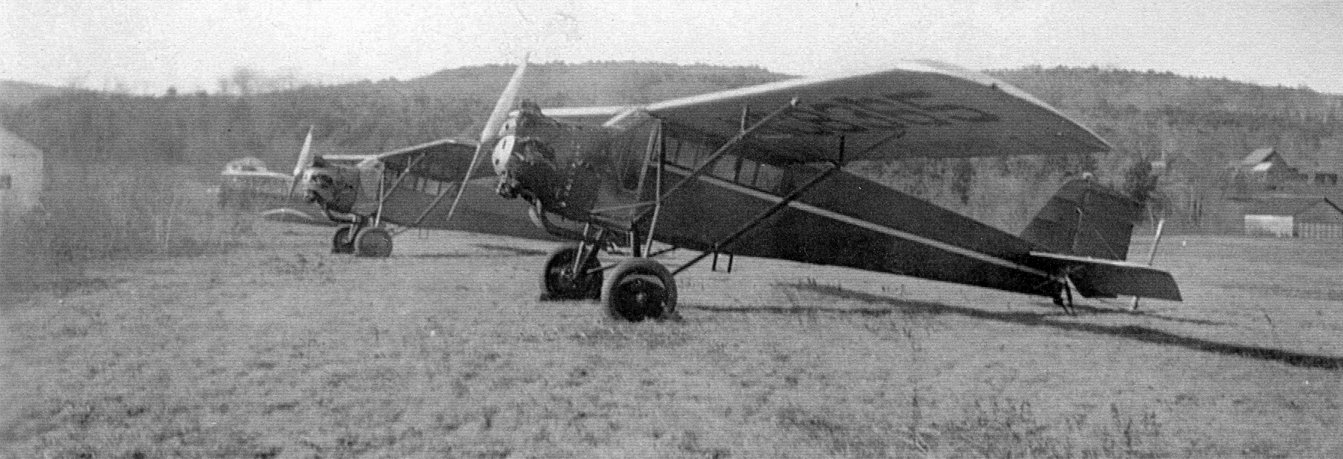
A circa 1930s photo of a biplane & 2 monoplanes (models undetermined) at Keene Airport (courtesy of the Historical Society of Cheshire County).
The earliest aeronautical chart depiction which has been located of Keene Airport was on the 1933 Sectional Chart (courtesy of Jonathan Westerling),
which depicted Keene as a commercial/municipal airport.
An undated aerial view looking north at Keene Airport from the Airport Directory Company 1937 Airport Directory (courtesy of Jonathan Westerling).
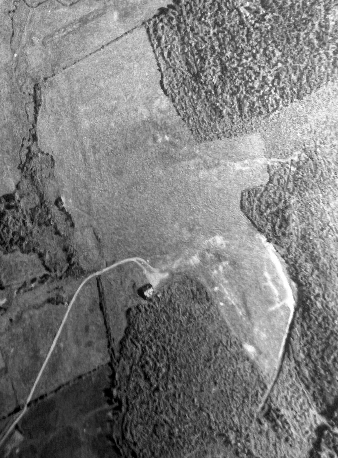
A 1939 aerial view (courtesy of the Cheshire County Conservation District) depicted Keene Airport as having 2 grass runways with a single hangar on the southwest side.
Jonathan continued, “Operation of the original Keene Airport continued through the 1930s by private interests,
initially Twin State Airways, which operated popular barnstorming shows throughout New England.
One of the managers of Twin State Airways, Richard Holbrook, would later become mayor of the city in 1940 & play a key role leading the successful effort to finally establish a city-owned airfield.”
According to "Wings over Keene" by Ernest Bell & David Proper (courtesy of the Aviation Museum of NH),
"In the fall of 1940 controversy arose in Keene's city government regarding the future location of a [new] airport.
The City's ad hoc Airport Committee recommended bringing the West Keene field to a condition acceptable to federal officials responsible for the student aircraft training program.
They obtained a small amount of city funds to improve the [original] airport & continued to investigate the possibility of a [new] field."
According to A Narrative of Keene NH 1732-1967 by David Proper, "In the fall of 1940 Lee Bowman brought his Bowman Flying Service, one of the oldest flying businesses in New England, to the Keene Airport.
He set up a civilian pilot training program which turned out fliers who later aided in the aviation program during WW2.
In 1941 the U. S. Navy set up a naval aviation cadet program in Keene, and Bowman supervised the training of some 750 young men in elementary & intermediate flying instruction.”
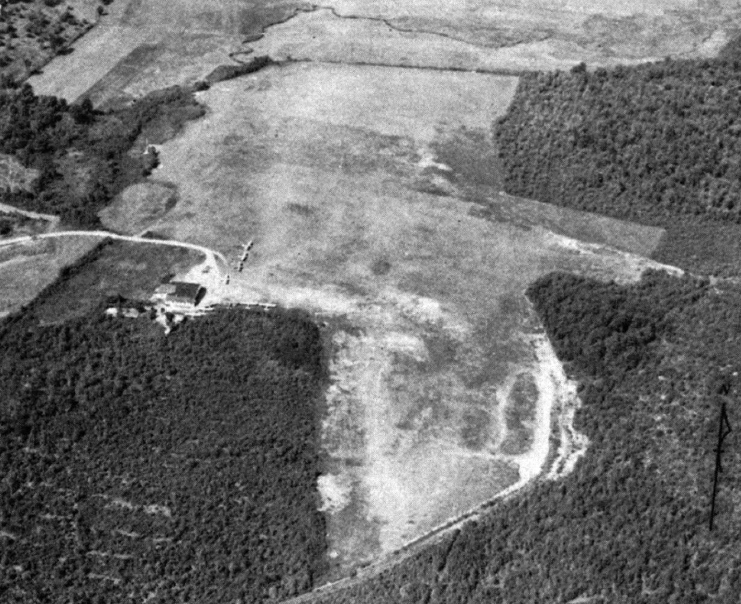
The last photo which has been located showing aircraft at Keene Airport was a 9/14/42 aerial view looking north (from the AAF Airfield Directory, courtesy of AirCorps Library),
which showed 9 light aircraft parked near the hangar.
According to A Narrative of Keene NH 1732-1967 by David Proper, "During the period of the war training service in Keene,
40 instructors, using 30 airplanes, flew students a total of 50,000 hours without a single accident.
The program turned out 650 Navy pilots."
Student flight training continued at the Keene Airport, even after the new Dilliant-Hopkins Airport was completed in 1943.
The last aeronautical chart depiction which has been located of the original Keene Airport was on the 1948 Sectional Chart (courtesy of Jonathan Westerling),
which depicted Keene as an auxiliary airfield.
The original Keene Airport was evidently closed during 1948, as the 1948 Airman's Guide listed the 'Keene Airpark' as closed.
A 1956 aerial photo showed the Keene Airport hangar standing.
A 1977 aerial view showed the Keene Airport runways remained clear,
but the hangar had been removed at some point between 1956-77.
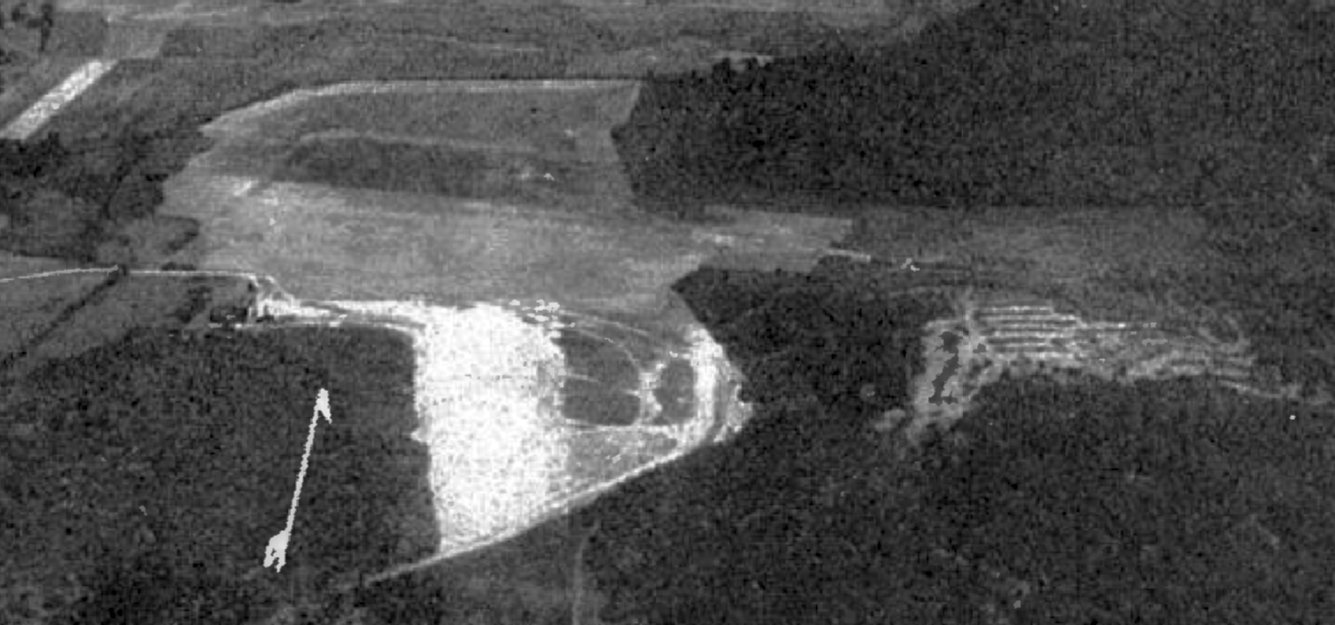
A 1998 aerial photo showed a large commercial building had been built over the Keene Airport site.
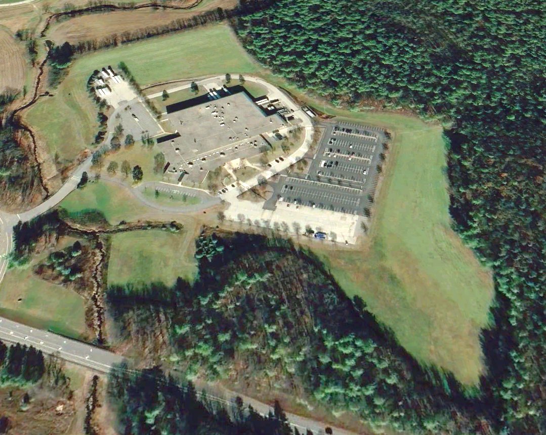
A 2020 aerial view looking north showed a large commercial building over the majority of the Keene Airport site,
but the outline of the southeastern end of the northwest/southeast runway remained recognizable.
As of 2023, road maps label the building occupying the Keene Airport site as Smiths Medical.
____________________________________________________
Granite State Airport, Keene, NH
42.953, -72.321 (Northwest of Boston, MA)
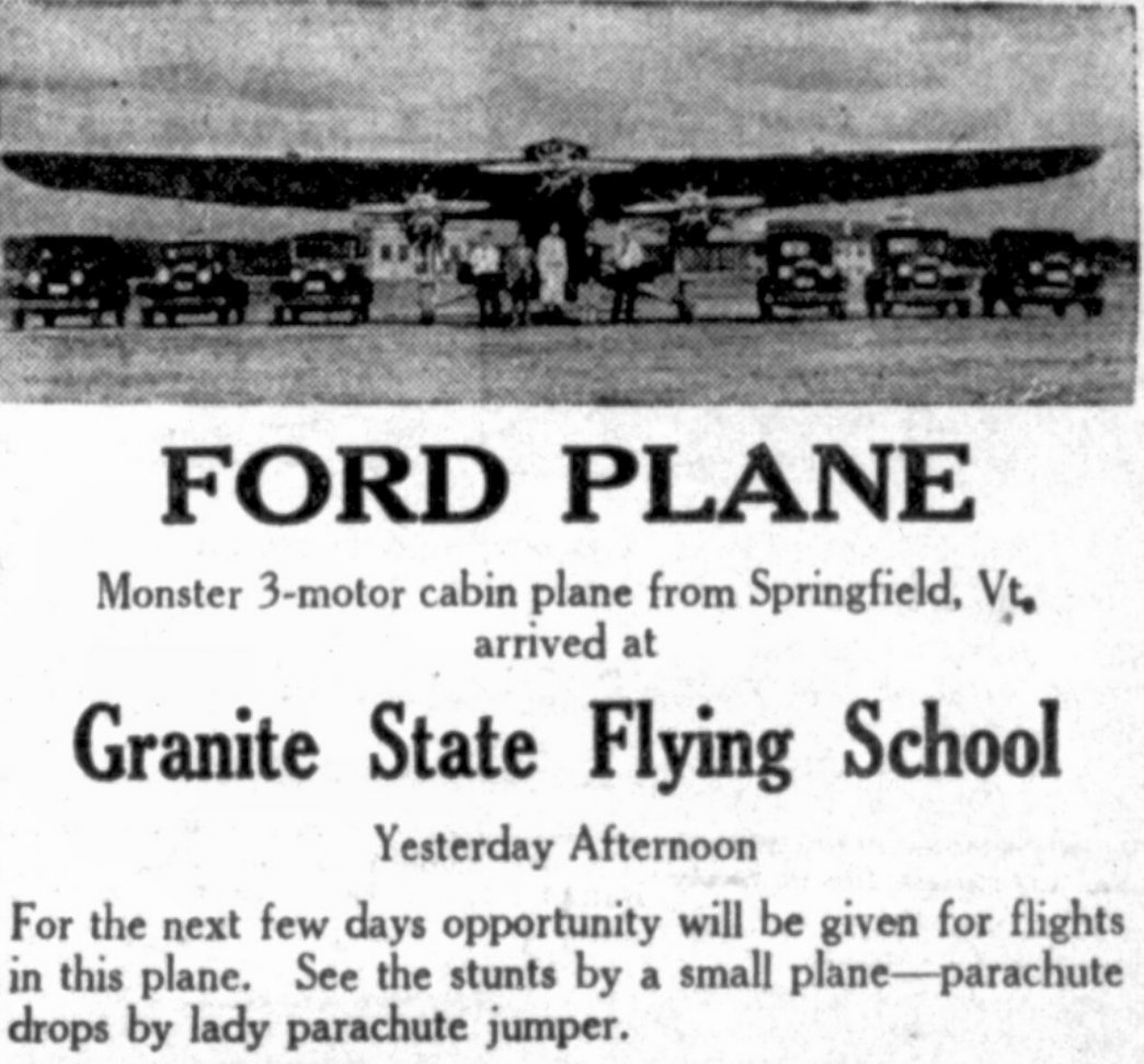
An 11/23/29 advertisement for the Granite State Flying School (courtesy of Jonathan Westerling).
Jonathan Westerling reported, “Shortly after the original Keene Airport opened its doors in 1928,
a second flying field was created on property almost immediately adjacent, but slightly closer to town referred to as 'Cook's Field'.
According to A Narrative of Keene NH 1732-1967 by David Proper, "Jimmie Laneri established a field
and flew passengers from a meadow called the Granite State Flying Field Park (now Monadnock View Cemetery & the site of Winding Brook Lodge)."
Jonathan Westerling reported, “However according to papers filed with the State, the officers of the Granite State Flying School were R.A. Gates, Jay Russell, and Arthur Olson
and newspaper articles indicate that James Laneri served as a pilot at the School.”
Jonathan
continued, “The reason for the two airfields is apparently
rooted in dramatic events which happened in the months following the
opening of Keene Airport.
According to multiple articles in the Keene Sentinel (thanks to the Digital Archives of the NH State Library),
problems came to a head when the Granite State Flying School took delivery of its 3rd plane, a high performance Curtis Challenger biplane with an OX5 motor.
The pilot, Albert Burnham arrived from Hartford CT with a passenger on October 12 but it was noted by Keene Airport officials that he was not in possession of a commercial license.
That weekend, Burnham took several flight school passengers up for rides,
but did so by picking them up from a nearby field since the Keene Airport was prohibiting him from taking passengers without a license.
When he came back to the Keene Airport for fuel, he was denied on account of his illegal operations.
Apparently in retaliation, the flight school moved all their operations to the adjacent field (referred to as 'Cook's Field') and established the Granite State Flying School Airport there.”
So Keene ended up with two airfields located in close proximity to each other,
and there has been ample confusion between the two as history fades over time, but there is no question these were in fact two separate operations.”
Jonathan
continued, “Unfortunately, less than a month after the fuel
spat,
on 11/4/28 a crash occurred at the Granite State Flight School Airport involving the very plane & pilot earlier accused of illegal operation.
The crash killed one young passenger & injured the pilot along with another passenger.”
An article in the Keene Sentinel detailing the crash investigation clarifies that the airfield was the location, but not the cause of the crash:
"The management of the flying school asks the Sentinel to correct what it believes is a wrong impression formed by many persons
who may have read the newspaper report of the fatal accident on the School's field Sunday, reference being made to the unevenness of the field.
Ray Gates of the flying school management, informs the Sentinel that Win Sargent, federal inspector, came here to make an investigation in connection with the accident, has stated that the field is not uneven."
According to an article in the Keene Sentinel, a replacement pilot & aircraft was flown in from Hartford three days later & the school re-commenced operations.
An
article in the 4/24/29 Keene
Sentinel indicated
that that the Granite State Airport had been "greatly improved"
that Spring.
The 2,000' runway had been leveled, and trees removed, and a 4-plane hangar had been built.
Granite State Airport (along with the adjacent Keene Airport) as depicted on the 1930 Rand McNally Air Trails Map (courtesy of Jonathan Westerling).
Granite State Airport was not depicted at all on 1930/35/40 USGS topo maps.
Jonathan Westerling reported, “But the depression & the multiple crashes made business difficult for the Granite State Flying School.
A February 1930 Keene Sentinel article stated that School's assets had been sold & that the airfield was being offered to the City,
but just as they had done before with the other airport, the City declined to purchase the field.”
An October article that same year detailed a lawsuit for damages in an airplane accident, "perhaps the first in the state" had been filed against the school regarding the 1928 fatal crash.
All this points to the Granite State Airport's rapid demise.
The School & airfield were evidently closed by June 1931 since an article in the Keene Sentinel noted that a middle school's airplane model
would be put on display at "the former airport of the Granite State Flying field".
Granite State Airport was no longer depicted on the 1933 Sectional Chart (courtesy of Jonathan Westerling).
A 1934 article indicated that Granite State Airport was reused for a time as a baseball park, and so was certainly in disuse by then.
No recognizable trace of Granite State Airport was seen in a 1956 aerial photo.
No recognizable trace of Granite State Airport was seen in a 2020 aerial photo.
____________________________________________________
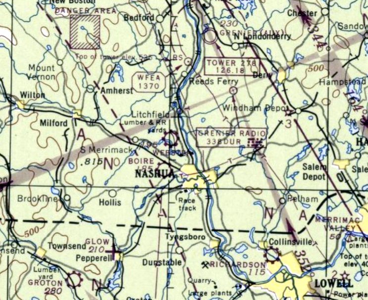
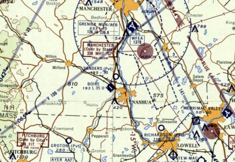
Daniel Webster Airport / Sanders Airfield, Merrimack, NH
42.808, -71.487 (Northwest of Boston, MA)
Daniel Webster Airport, as depicted on the January 1947 Boston Sectional Chart.
The date of establishment of Daniel Webster Airport has not been determined.
It was not yet depicted on the 1934/37/38/39/41 Boston Sectional Charts,
or the 1934/41/44/50 USGS topo maps.
In the late 1930s / early 1940s, as a young boy, Alan Shepard was given his first flying lesson by Arnold Butler,
the owner & operator of Daniel Webster Airport, after helping to clean an aircraft hangar.
Shepard would go on to become America's first astronaut.
Daniel Webster Airport was still not depicted on the July 1946 Boston Sectional Chart.
Vern Baisden recalled, “In June 1946 I had my first airplane ride in a Piper J5A Cruiser.
It was a dirt strip airport in Nashua; the operator on the field was Daniel Webster Airways.
It was located along the Daniel Webster Highway & there was a lake west of the field.”
The earliest depiction which has been located of Daniel Webster Airport was on the January 1947 Boston Sectional Chart,
which depicted it as a commercial/municipal airport.
The earliest photo which has been located of Daniel Webster Airport was a 1947 aerial view,
which depicted 3 unpaved runways, and 7 light single-engine planes parked near a small building on the east side.
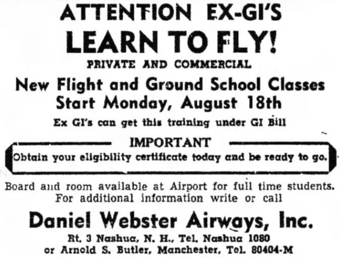
An August 1947 Nashua Telegraph advertisement for flight training at Daniel Webster Airways Inc.
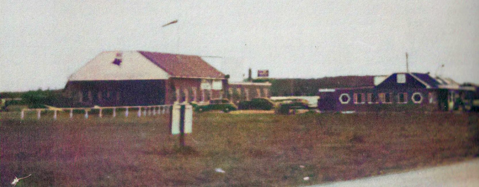
The only photo which is available of Daniel Webster Airport was a circa 1940s photo of a hangar & the airport office.
A 1952 aerial view depicted Daniel Webster Airport's runways & building as remaining intact,
but in contrast to the 1947 photo there were no aircraft visible on the field.
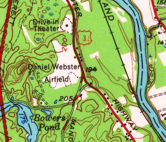
The 1953 USGS topo map depicted Daniel Webster Airport as a property outline having 3 unpaved runways, with 1 small building on the east side.
It was still depicted as Daniel Webster Airport on the November 1955 Boston Sectional Chart,
At some point the Daniel Webster Airport property was bought by Sanders Associates, an electronics manufacturer.
At some point between 1955-56 the airport was renamed Sanders Airfield,
as that is how it was depicted on the May 1956 Boston Sectional Chart.
It depicted Sanders Airfield as having a 3,000' unpaved runway.
The last aeronautical chart depiction which has been located of Sanders Airfield was on the November 1957 Boston Sectional Chart.
It depicted Sanders as private airfield having a 3,000' unpaved runway.
Sanders Airport was evidently closed at some point between 1957-58,
as it was no longer depicted on the May 1958 Boston Sectional Chart.
Scott Scarborough recalled, “It had a few old corrugated hangars & a beacon I remember as a kid.”
A 1963 aerial view of the site of Daniel Webster Airport showed the hangar remained intact,
but a 3,000' north/south clearing had been built over the former airfield, presumably some type of antenna test range.
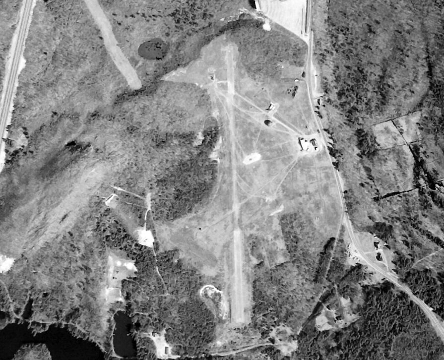
A 4/25/65 USGS aerial view (courtesy of Lee Corbin) depicted the site of Daniel Webster Airport, with the hangars remaining on the east side.
A 1978 aerial photo showed a large industrial building having been built over the former Daniel Webster Airport runways.
In 1986, Sanders Associates was bought by Lockheed Corporation.
A 1998 aerial photo showed the former Daniel Webster Airport hangars remained on the east side.
In July 2000, Lockheed announced the sale of the former Sanders operation to BAE Systems.
A 2003 aerial photo showed the former Daniel Webster Airport hangars had been removed at some point between 1998-2003,
erasing the last trace of the airport.
Ironically, between 1998-2003 the FAA Boston TRACON air traffic control facility was built adjacent to the northwest side of the Daniel Webster Airport site.
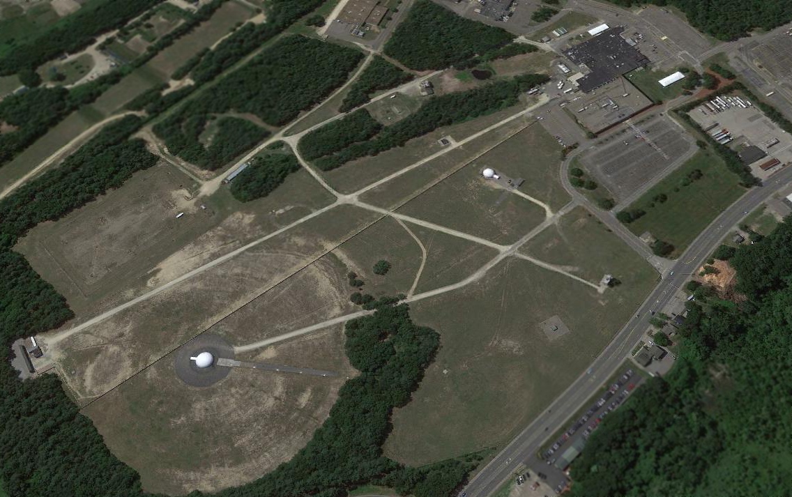
A 2019 aerial view looking northwest shows no trace remaining of Daniel Webster Airport, with the site covered by the radio testing facilities of BAE Systems.
As of 2020, street maps show the former Daniel Webster Airport property as being a BAE Systems facility.
Thanks to Lee Corbin for pointing out this airfield.
____________________________________________________
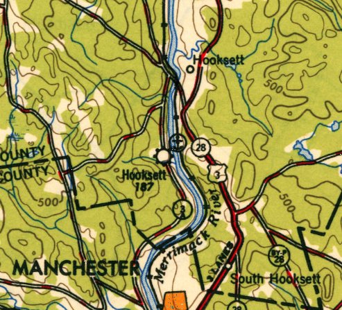
Hooksett-Manchester Airport & Seaplane Base, Hooksett, NH
43.074, -71.468 (Northwest of Boston, MA)

Hooksett Airport, as depicted on the June 1945 Boston Sectional Chart.
Hooksett Airport was not yet depicted on the November 1944 Boston Sectional Chart.
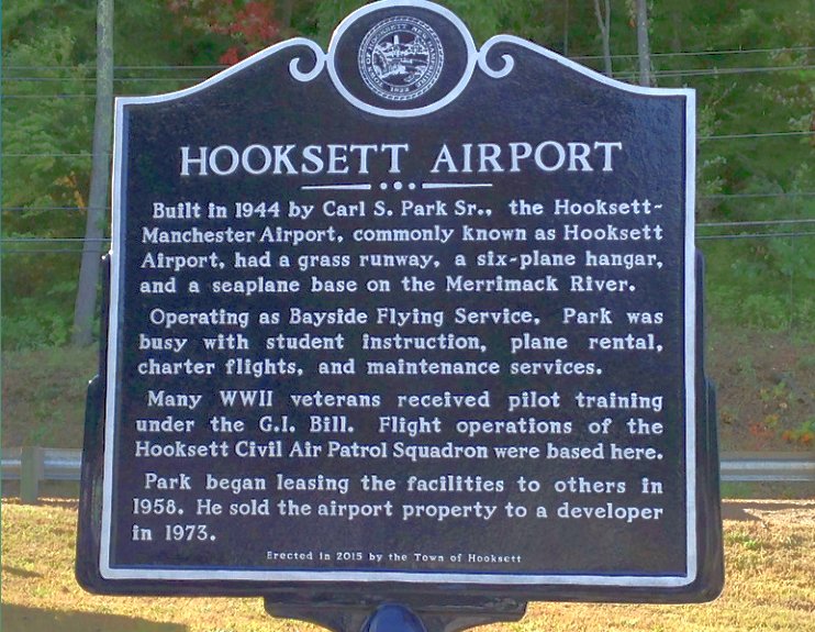
According to a historical plaque, “Built in 1944 by Carl Park, the Hooksett-Manchester Airport had a grass runway, a 6-plane hangar, and a seaplane base on the Merrimack River.
Operating as Bayside Flying Service, Park was busy with student instruction, plane rental, charter flights, and maintenance services.
Many WW2 veterans received pilot training under the GI Bill.
Flight operations of the Hooksett Civil Air Patrol Squadron were based here.”
The earliest depiction which has been located of Hooksett Airport was on the June 1945 Boston Sectional Chart,
which depicted it as a commercial/municipal airport.
The earliest airport directory listing which has been located of Hooksett Airport was in the 1946 Airman's Information Manual (courtesy of Jonathan Westerling).
It described Hooksett as having a 3,200' runway & a seaplane base.
The 1947 Decker Guide (courtesy of Jonathan Westerling) described Hooksett as having a 4,150' sod north/south runway & an unlimited seaplane landing area.
The 1948 Haire Airport Directory (courtesy of Jonathan Westerling) described Hooksett as having a 3,500' unpaved runway, but no longer mentioned a seaplane base.
The manager was listed as Carl Park.
Hooksett Airport, as depicted on the 1949 USGS topo map.
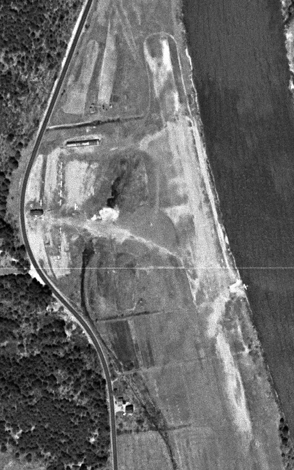
The only photo which has been located showing aircraft at Hooksett Airport was a 4/30/51 USGS aerial view.
It depicted at least 7 light single-engine aircraft parked near a few small buildings to the west of a northwest/southeast unpaved runway,
and 1 seaplane in the river at the adjacent seaplane base.
The 1954 Airport & Business Flying Directory (courtesy of Jonathan Westerling) described Hooksett-Manchester Airport as having a 3,300' unpaved runway.
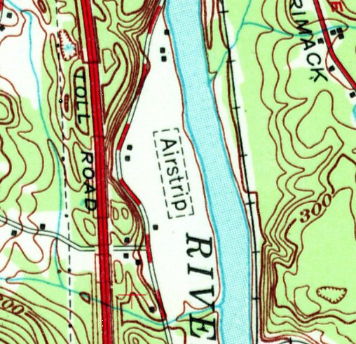
Hooksett Airport was depicted on the 1957 USGS topo map simply as a northwest/southeast unpaved runway, labeled simply as “Airstrip”,
with 2 small buildings on the northwest side.
According to a historical plaque, airport founder Carl “Park began leasing the facilities to others in 1958.”
The 1960 Airport & Business Flying Directory (courtesy of Jonathan Westerling) described Hooksett-Manchester Airport as having a 2,400' unpaved runway,
and listed the manager as Aime Dallaire.
The last aeronautical chart depiction which has been located of Hooksett Airport was on the June 1973 Boston Sectional Chart (courtesy of Ron Plante).
It depicted Hooksett Airport as having a 2,000' paved northwest/southeast runway.
According to a historical plaque, airport founder Carl Park “sold the airport property to a developer in 1973.”
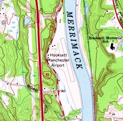
The 1974 USGS topo map It depicted Hooksett Manchester Airport as having a paved northwest/southeast runway,
with 5 small buildings on the northwest side.

The 1975 Flight Handbook (courtesy of Jonathan Westerling) depicted Hooksett Municipal Airport as having a 2,000' asphalt Runway 18/36,
and listed the operator as Bayside Flying Service.

The last depiction which has been located of Hooksett Municipal Airport was in the 1976 Flight Guide (courtesy of Jonathan Westerling).
It depicted Hooksett as having a 2,000' paved Runway 18/36.
Hooksett Airport was evidently closed at some point between 1976-79,
as it was no longer depicted on the December 1979 Boston Sectional Chart (courtesy of Ron Plante).
A 2015-18 photo (courtesy of Lee Corbin) of a historical plaque erected in 2015 by the Town of Hooksett commemorating the Hooksett Airport.
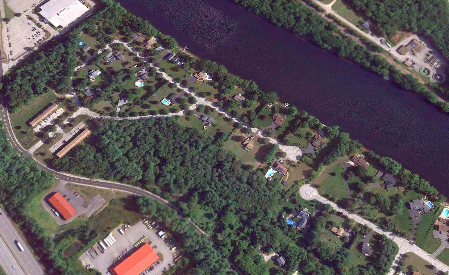
A 2017 aerial view looking northeast shows no trace remaining of Hooksett-Manchester Airport.
____________________________________________________
Groveton Papers Airport (7B1), Groveton, NH
44.615, -71.485 (North of Boston, MA)
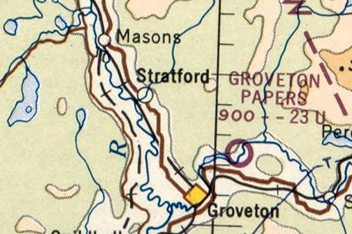
Groveton Papers Airport, as depicted on the 1965 Sectional Chart (courtesy of Jonathan Westerling).
Groveton Papers Airport was not yet depicted on the 1947 Lewiston Sectional Chart (courtesy of Ron Plante) or a 1956 aerial photo.
According to Jonathan Westerling, Groveton Papers Airport was “built about 1964.”
The earliest reference which has been located to the Groveton Papers Airport was its listing in the 1964 Airman's Guide (courtesy of Jonathan Westerling).
The earliest depiction which has been located of the Groveton Papers Airport was on the 1965 Sectional Chart (courtesy of Jonathan Westerling),
which depicted it as having a 2,300' unpaved runway.
According to Jim MacDonald, this “little-used company private airfield in Groveton [was] used & owned by the president of the Groveton Paper Board.”

The 1975 Flight Handbook (courtesy of Jonathan Westerling) described Groveton Papers Airport as having a single 2,300' Runway 9/27.
The last aeronautical chart depiction which has been located of the Groveton Papers Airport was on the 1983 Sectional Chart (courtesy of Jonathan Westerling),
which depicted it as having a 2,200' unpaved runway.
The last directory listing which has been located of Groveton Papers Airport was in the 1984 AOPA Airports USA Directory (courtesy of Jonathan Westerling).
It described Groveton Papers Airport as a private airfield having a single 2,300' gravel Runway 9/27.
Groveton Papers Airport was not yet depicted on the 1987 USGS topo map.
The earliest topo map depiction which has been located of the Groveton Papers Airport was on the 1988 USGS topo map.
It depicted a single unpaved northeast/southwest runway, labeled simply as “Landing Strip”.
The earliest photo which has been located of the Groveton Papers Airport was a 1993 USGS aerial view looking northeast.
It depicted a single unpaved northeast/southwest runway, with a ramp & small hangar on the southeast side.
Jim MacDonald reported, “A passing motorist, a local, knew all about the airstrip.
He related the factory owner, Wemyss, who lives just down the road – he used to have a dirt landing strip & he paved it sometime in the mid-1990s.
At that time, Wemyss had the land to the east across the road logged for a better landing approach.”
According to Jonathan Westerling, Groveton Papers Airport “was not shown on the 1996 Sectional Chart even though it was paved.”
Jim continued, “I drove by this airstrip in 1996. The asphalt was freshly-paved jet black, also the aprons, the surrounding ground was dug up!
Trees were cut back & only one small shack closer to the runway than where the red hangar is now. At that time, this airstrip appeared to be new construction!
Around this same time, apparently the factory owner James Wemyss’s company Grovton Paper Board (Groveton Papers Company) had a VHF AM UNICOM station license, call sign WDS5 on122.8 MHz.
Jim continued, “The town took Wausau Papers factory (by tax deed?) when it closed around 2007.
Apparently, the paper mill DID NOT own the airstrip! However they have an airplane tail # N205WP.”
A 7/2/16 photo by Jim MacDonald looking north at the Groveton Papers Airport hangar.
A 7/2/16 photo by Jim MacDonald looking west along the Groveton Papers Airport asphalt runway.
Jim McDonald reported, “In the foreground can see just off the gravel road some disturbed sandy soil, at the end of the runway.”
The date of closure of the Groveton Papers Airport has not been determined.
It was no longer depicted on the 2017 Montreal Sectional Chart.
Jim MacDonald reported in 2017, “The land is owned by the Wild River Corporation.”
A 2018 aerial view looking northeast showed the Groveton Papers Airport to remain intact.
Andy Lumley reported in 2023, “Groveton... I've landed there a few times now. Apparently it got fixed up a bit, the runway is in pretty good shape & the brush got cut back.”
Groveton Papers Airport is located northeast of the intersection of Northside Road & Bag Hill Road.
Thanks to Jim MacDonald for pointing out this airfield.
____________________________________________________
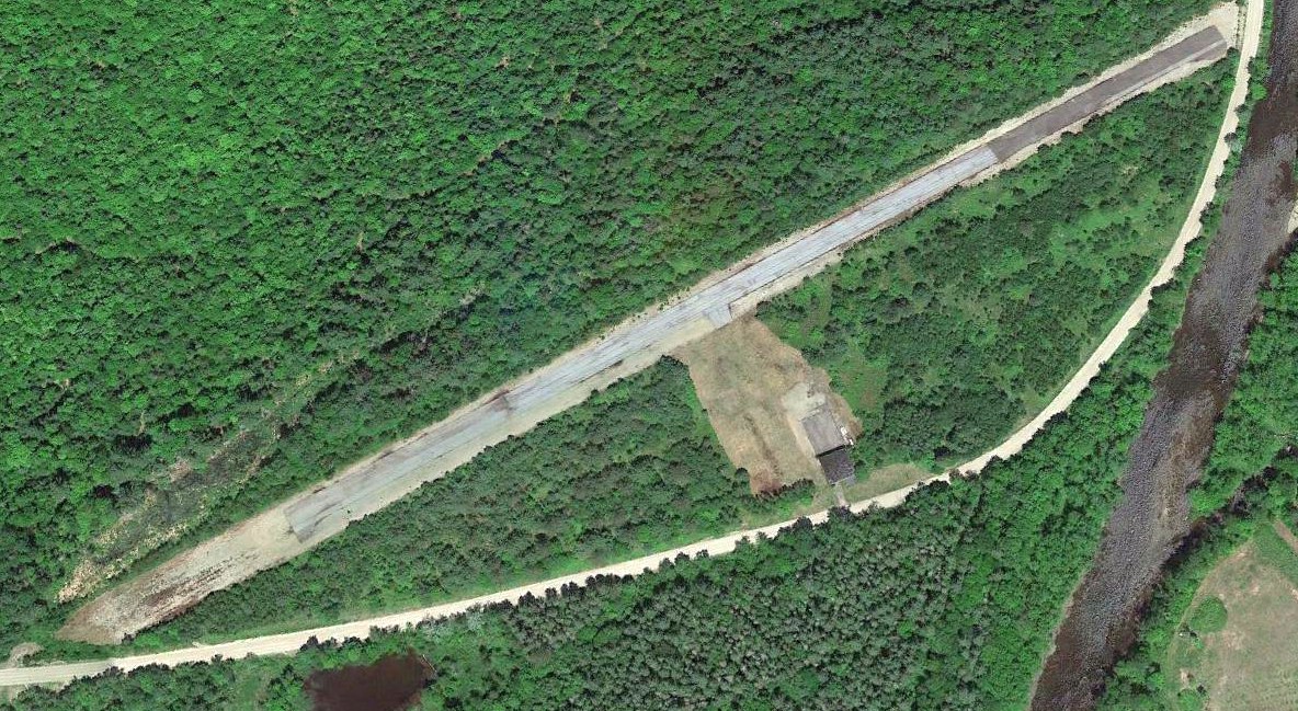
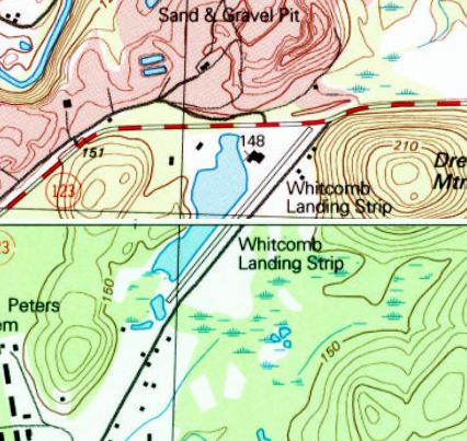
Alstead Airfield / Whitcomb Landing Strip, Walpole, NH
43.128, -72.402 (North of Boston, MA)
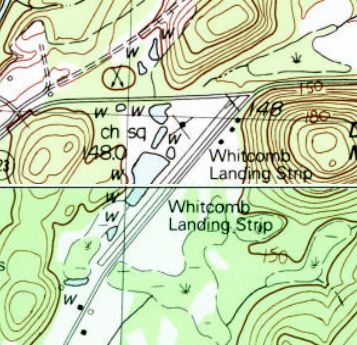
Whitcomb Landing Strip, as depicted on the 1985 USGS topo map.
This small general aviation airport was evidently established at some point between 1972-75,
as it was not yet depicted on the 1972 USGS topo map.
The earliest depiction which has been located of Whitcomb Landing Strip was on the 1985 USGS topo map.
It depicted a single paved northeast/southwest runway.
Rick Boswell reported in 2016, “I am a NH resident and have for 30+ years driven past the airport in Alstead [Whitcomb].
It was previously identified on Sectional Charts as Alstead.
In the earlier years, it was operational but shut down sometime in the last 20 or so years.”
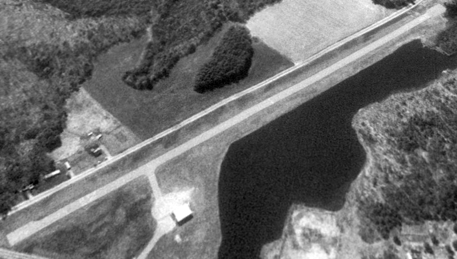
The earliest photo which has been located of Whitcomb Landing Strip was a 1992 USGS aerial view looking southeast.
It depicted Whitcomb as having a single paved runway, with a taxiway leading to a small hangar on the west side.
There were no aircraft visible on the field.
The 1998 USGS topo map depicted Whitcomb Landing Strip
as having a single paved northeast/southwest runway, with one hangar on the west side.
A 2012 photo looking southwest showed the Whitcomb Landing Strip paved runway remained intact though somewhat deteriorated, and several buildings remained on the northwest side.
A 2014 aerial view looking southeast showed the Whitcomb Landing Strip remained intact though somewhat deteriorated.
Rick Boswell reported in 2016, “A construction materials company has taken over the site.
An asphalt paving company (Whitcomb Company I think) is now located there. The paved runway remains visible but is in rough shape.”
Whitcomb Landing Strip is located southwest of the intersection of Whitcomb Road & Old Drewsville Road.
Thanks to Rick Boswell for pointing out this airfield.
____________________________________________________
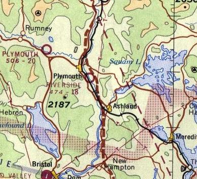
Riverside Airport, Ashland, NH
43.74, -71.67 (North of Boston, MA)
Riverside Airport, as depicted on the January 1949 Boston Sectional Chart.
This small general aviation airport was evidently established at some point between 1946-49,
as it was not yet depicted on the July 1946 Boston Sectional Chart.
The earliest depiction which has been located of Riverside Airport was on the January 1949 Boston Sectional Chart.
It depicted Riverside as having a 2,000' unpaved runway.
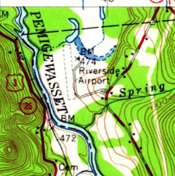
The 1956 USGS topo map depicted Riverside Airport as having a single unpaved north/south runway, with a small building on the northeast side.
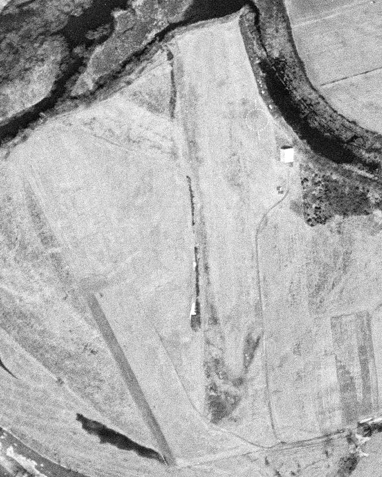
The earliest photo which has been located of Riverside Airport was a 5/2/56 USGS aerial view.
It depicted Riverside as having a single grass north/south runway, with an airport circle marking & a single hangar on the northeast side.
There were no aircraft visible on the field.
The 1965 Boston Sectional Chart depicted Riverside as having a mere 1,800' unpaved runway.
Riverside Airport looked largely unchanged in a 1972 aerial photo,
the only difference being that the airport circle marking was gone.

The last aeronautical chart depiction which has been located of Riverside Airport was on the January 1973 NY Sectional Chart (courtesy of Ron Plante).
It depicted Riverside as having a mere 1,800' unpaved runway.
Riverside Airport was evidently closed at some point in 1973,
as it was no longer depicted on the June 1963 NY Sectional Chart.
A report of a 8/23/93 accident described a Bellanca 7ECA at Riverside Airport in which its pilot walked into its moving propeller.
The last depiction which has been located of Riverside Airport was on the 1988 USGS topo map.
Dick Bicknell recalled, “Riverside was an annual fly-in fall location for Delta Pilot Reunions, in the late 1980 - early 1990s.”
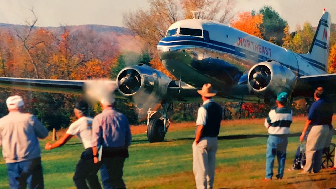
The earliest photo which has been located showing an aircraft at Riverside Airport
was an amazing circa 1990 photo by Dick Bicknell of a “a gorgeous Northeast Airlines restored DC-3 on the initial take off roll”
from the mere 1,900' grass strip during a Delta pilot reunion.
Dick recalled, “The runway was 1,900' plus the golf course which the DC-3 slid on to - the grass being covered with morning dew (no damage done).”
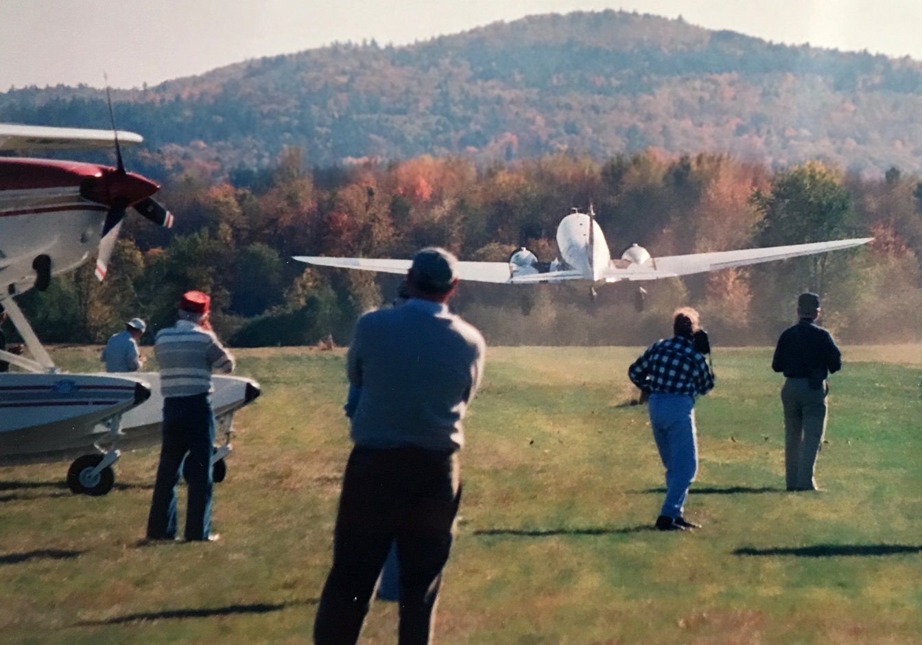
A circa 1990 photo by Dick Bicknell of the Northeast Airlines restored DC-3 departing from Riverside Airport.

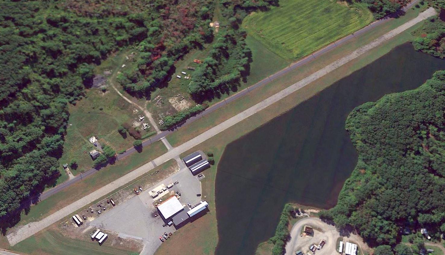
A circa 1990 aerial view by Dick Bicknell looking southeast at Riverside Airport, showing 5 light single-engine aircraft next to the hangar & nice grass runway.
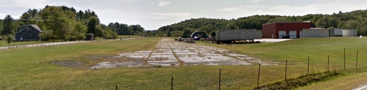
A 1998 USGS aerial photo showed the runway & hangar of Riverside Airport remained intact, but a golf course had been constructed around the field.
Riverside Airport was evidently closed at some point between 1988-2001, as the 2001 USGS topo map only labeled the site as “golf course”,
and it did not appear on the 2007 Sectional Chart (according to Dick Whittle).
According to Dick Whittle, the Riverside Airport operations moved to the nearby Plymouth Airport.
A 9/19/13 aerial view looking southeast showed the runway & hangar of Riverside Airport remained intact, surrounded by a golf course.
As of 2014, street maps labeled the site of Riverside Airport as the White Mountain Country Club.
The site of Riverside Airport is located north of the intersection of North Ashland Road & Airport Road, appropriately enough.
Thanks to Dick Whittle for pointing out this airfield.
____________________________________________________
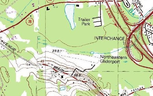
Northeastern Gliderport / New England Gliderport, Salem, NH
42.76, -71.24 (North of Boston, MA)
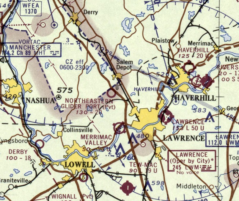
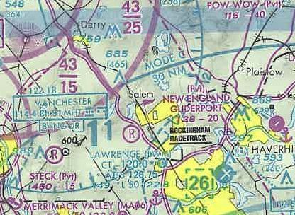
The recently opened Northeastern Glider Port, as depicted on the March 1965 Boston Sectional Chart.
No airfield was yet depicted at this location on a 1953 aerial photo,
listed in the 1963 Airmans Guide (according to Jonathan Westerling), or depicted on the 1964 Boston Sectional Chart.
According to Jonathan Westerling, “The Northeastern Gliderport was a surprisingly long-lived airfield
catering exclusively to glider operations & open from May through October.
The airfield was started by Dorothy & James Doyle on rented land in Salem NH adjacent to recently completed Interstate 93 in about 1965.
The Doyles quickly established their airfield as an exciting new aviation-oriented destination through many articles in the local paper, and even the Boston Globe.”
A 1965 ad in Soaring Magazine touted “Northeastern Gliderport is the only airport in New England set up specifically for sailplane operations.
Powered aircraft visitors are welcome.
Besides being sailplane operators we are also Schweizer sailplane dealers.
See us before you buy - NORTHEASTERN LIGHT AIRCRAFT. INC.”
The earliest depiction which has been located of the Northeastern Glider Port was on the March 1965 Boston Sectional Chart,
which depicted Northeastern Glider Port as a private airfield with a 2,000' unpaved runway.
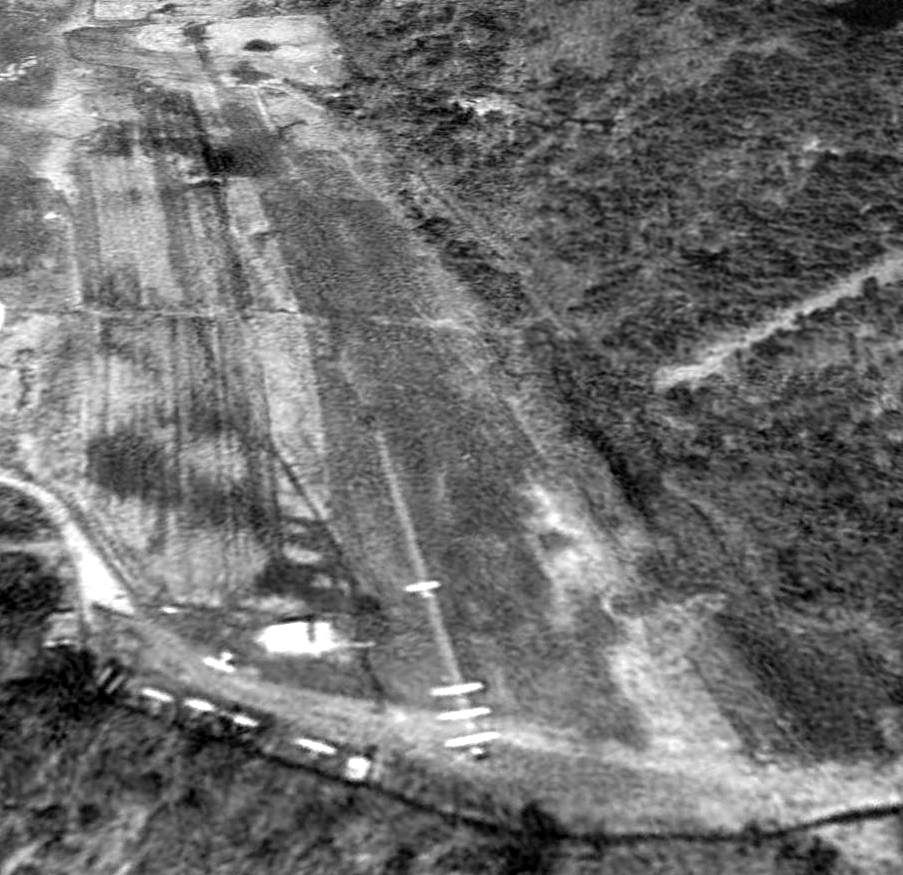
The earliest photo which has been located of the Northeastern Glider Port was a 1965 aerial view,
which depicted 2 light single-engine aircraft on the southeast side of a grass northwest/southeast runway.
According to Jonathan Westerling, “For the first several years, the airport hosted annual Glider Meets with contests for pilots & displays for spectators.
The runway was largely unchanged throughout the life of the airfield according to airport directories.
I distinctly remember watching a glider come in over the highway on final when I was a small kid in the back of our Chevy wagon.
I think it was always a private field, but it was well-used, and due to the nearby Interstate developed a public awareness even though you couldn’t see the runway.”

The earliest photo which is available of Northeastern Gliderport was a 4/18/66 USGS aerial view.
It showed Northeastern Glider Port had become very popular, with over a dozen gliders & light single-engine aircraft park on the southeast side of a grass northwest/southeast runway.
According to Jonathan Westerling, “The airfield was featured in an Associated Press news article about the 90th birthday of May Kimball.”
According to the 1966 news item (carried across the country): “If I make it to my 90th birthday, I'm going up in a glider.”
May Kimball, a sprightly, blue-eyed widow, made that pledge last year.
The idea came to her on her 89th birthday as she visited the home of her niece, Mrs. Rudolph Dietrich, in Methuen.
A glider passed over the house & Mrs. Kimball vowed then she'd take a glider ride on her 90th birthday.
She called a Methuen gliderport owner, James Doyle of Andover, and made arrangements for her first flight.
This week she achieved her ambition with an exhilarating glider flight over the Lawrence, MA area.
“Oh, how wonderful, just wonderful. It's so pretty”, Mrs, Kimball exulted when the 20 minutes of soaring was over.
According to Jonathan Westerling, “According to aerial photography, between 1966-68, a modest terminal building was constructed at the airfield.
At some point thereafter ownership of the Gliderport was transferred to Joe & Ginny Dion.”
The 1967 AOPA Airports USA guide listed Northern Gliderport as having a 2,000' grass Runway 10/28.
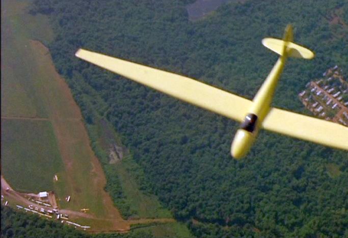
An aerial view looking west at a Schweitzer SGS 1-23H-15 glider overflying the Northeastern Gliderport from the filming of the 1968 movie “The Thomas Crown Affair” (courtesy of Jonathan Westerling).
It depicted over a dozen gliders & single-engine aircraft parked around a small building on the southeast side of an east/west grass runway.
According to Jonathan Westerling, “Portions of the movie The Thomas Crown Affair (the 1968 version) with Steve McQueen & Faye Dunaway were filmed at the Northeast Gliderport.”
According to movie-locations.com, “The airborne scenes were filmed in New Hampshire, at the former Salem Glider Airport.
Although Steve McQueen was filmed in the cockpit on the ground, a local pilot actually flew the plane.”
An online note from Eliza Proctor stated: “Regarding the gliding sequence in The Thomas Crown Affair (1968) with Steve McQueen as pilot... filmed in New England.
Close-ups of McQueen were filmed on the ground & a local glider pilot flew for all other footage [it was a Schweizer registration N9860E].
I don't know the pilot's identity... he was a friend of my father (who was asked to be McQueen's double for the film, but declined).”
In reply to this, Jack O'Leary stated, “The pilot's name was [Leonard] McMasters.
Steve McQueen was in the glider mounted on a tripod for filming cockpit scenes all done at the former Gliderport in Salem off of Brady Avenue.”
The 1987 USGS topo map (courtesy of Jonathan Westerling) depicted the Northeastern Gliderport as having a single unpaved northwest/southeast runway,
with one small building on the southeast side.
The Salem Gliderport was no longer listed in the 1989 AOPA Airports USA (according to Jonathan Westerling).
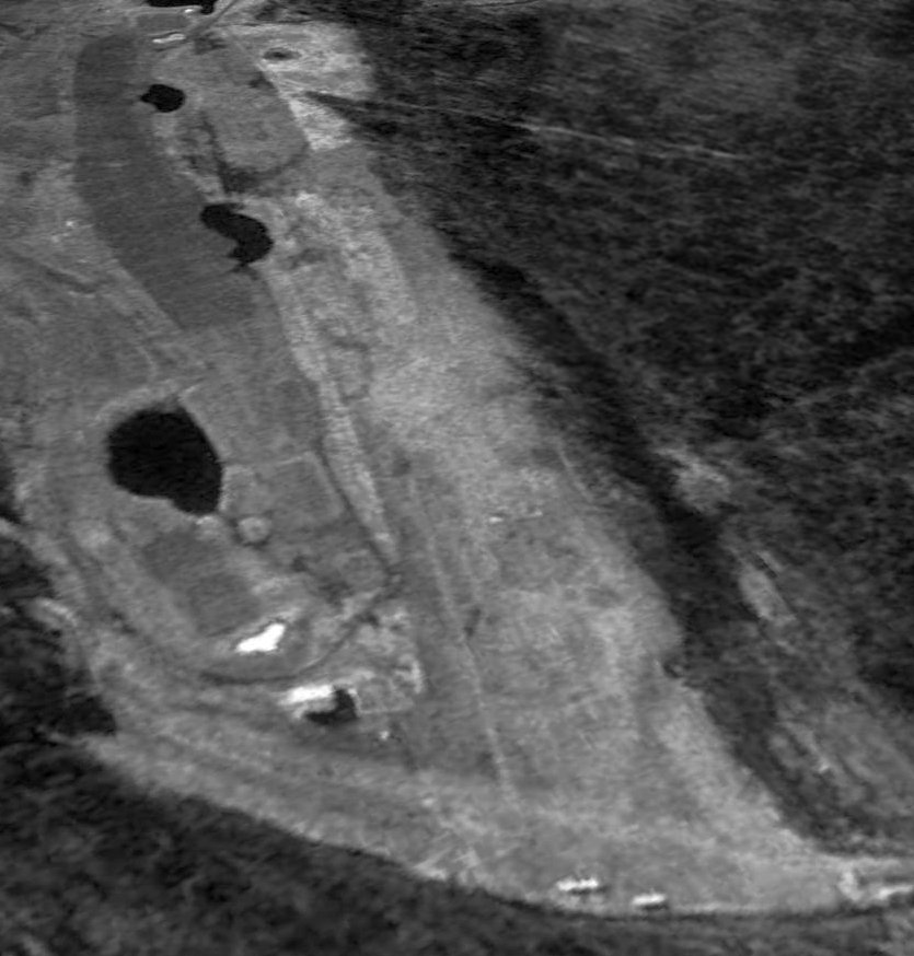
A 4/28/92 USGS aerial view looking northwest depicted 9 gliders & aircraft at the Northeastern Gliderport,
including what looked like 3 gliders lined up to be towed in turn by an aircraft ahead of them.
At some point between 1987-92 the field had evidently been renamed New England Gliderport,
as that is how it was depicted on the 1992 Boston Terminal Aeronautical Sectional Chart.
The last photo which has been located which appears to still show aircraft at the New England Gliderport was a 3/28/95 USGS aerial view looking northwest.
What appeared to be 2 single-engine aircraft were visible in the foreground at the east end of the runway.
The airport building appeared to remain standing, but construction of a golf course had started adjacent to the south side of the runway,
which would eventually take over the airport property within a few years.
According to Jonathan Westerling, “Joe & Ginny Dion ran the Gliderport until it lost its lease sometime in the 1990s.”
The last aeronautical chart depiction which has been located of the New England Gliderport
was on the 1996 Sectional Chart (courtesy of Jonathan Westerling).
The New England Gliderport evidently did not last for very long,
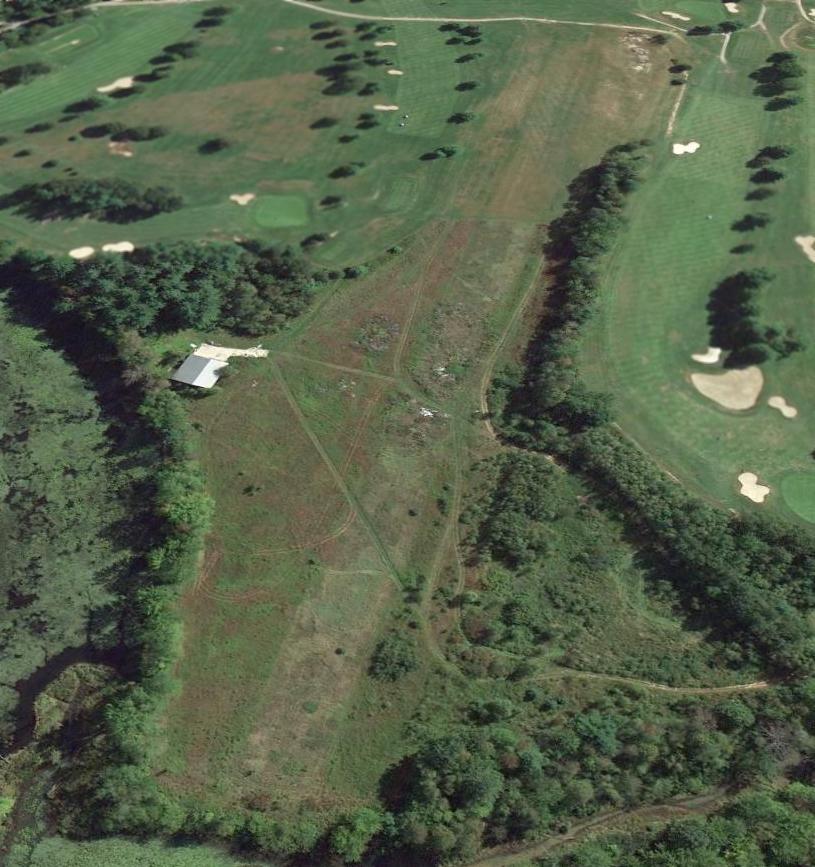
as a 4/10/98 USGS aerial photo showed a golf driving range having been built over the runway.
A 6/10/10 aerial view looking northwest showed the runway outline of Northeast Gliderport remained recognizable, although the property is used as a golf driving range.
The former airport building remains in use, presumably to support the driving range.
As of 2013 street maps label the site of Northeast Gliderport as Campbell's Scottish Highland Range golf course.
The site of Northeast Gliderport is located northwest of the intersection of Brady Avenue & Courtland Drive.
____________________________________________________
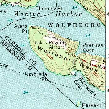
Lakes Region Airport (69NH), Wolfeboro, NH
43.59, -71.27 (North of Boston, MA)
Lakes Region Airport, as depicted on the July 1946 Boston Sectional Chart.
After the Hurricane of 1938 destroyed the huge maple syrup enterprise of his family,
Ralph Merwin Horn asked his father if he could finally build an airport on their 100+ acres of Wolfeboro Neck property.
With permission granted, Merwin pulled the stumps of hundreds of mangled maple trees.
Wolfeboro townspeople helped pull stumps too, with tractors & trucks.
Lakes Region Airport was not yet depicted on the 1945 Boston Sectional Chart (courtesy of John Voss).
According to a memorial plaque for Ralph Horn, he founded Lakes Region Airport in 1945.
The earliest depiction which has been located of Lakes Region Airport was on the July 1946 Boston Sectional Chart.
It depicted Lakes Region as a commercial/municipal airport, with an adjacent seaplane base.
Merwin married Eleanor, and the two put in exhausting hours - for 4 decades - to make the airport the busy enterprise it finally became.
Often there would be 4 floatplanes at the dock, dozens of aircraft at the tie-downs,
3 or 4 aircraft in the hangar for repairs/maintenance, and takeoffs & landings day & night.
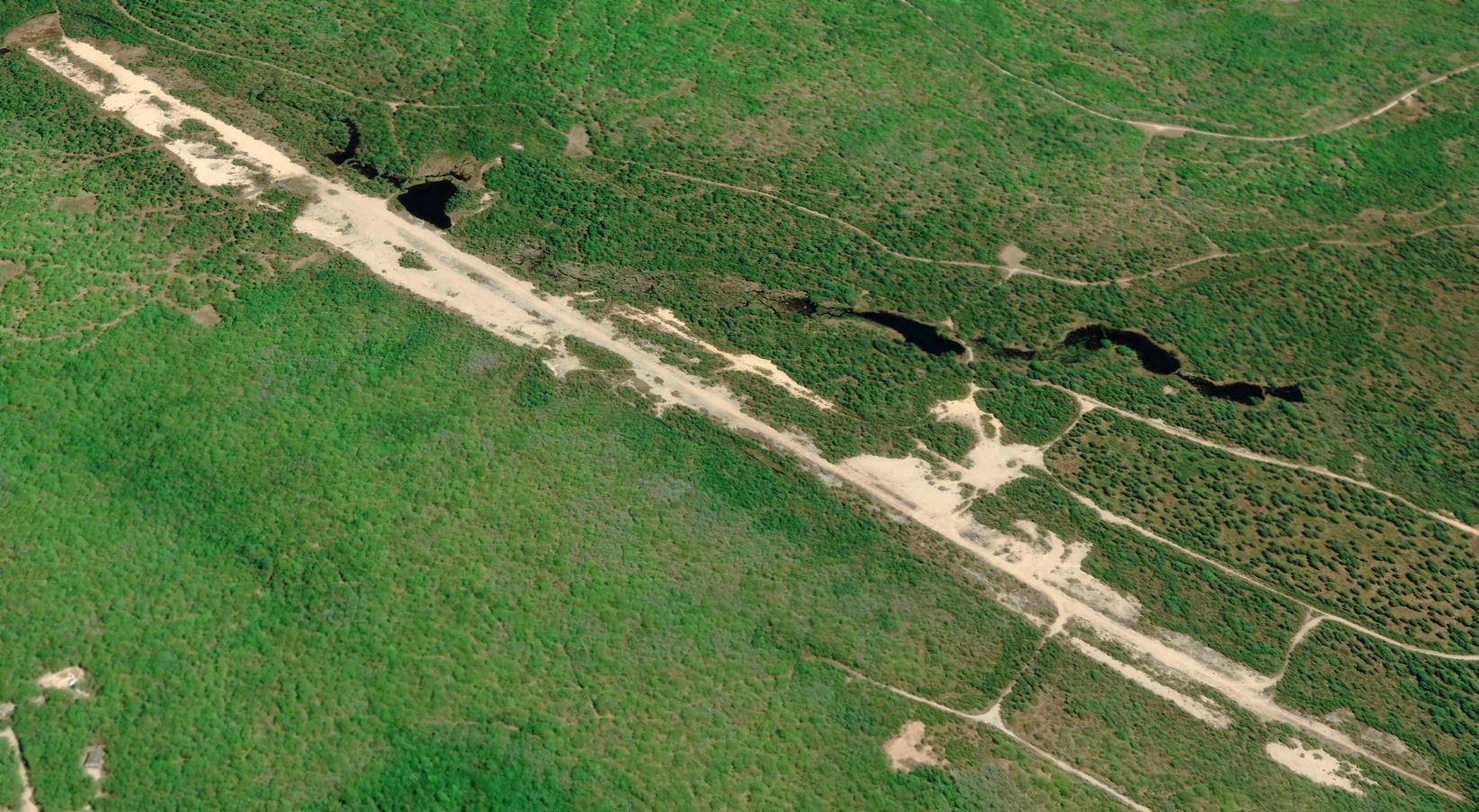
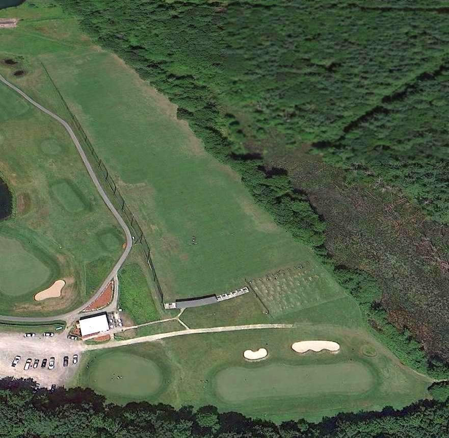
The 1956 USGS topo map depicted Lakes Region Airport as a clearing, but without any other airport-specific features.
The earliest photo which has been located of the Lakes Region Airport
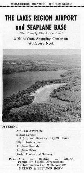
was an undated aerial view looking east from a 1956 Wolfeboro Chamber of Commerce brochure for the Lakes Region Airport & Seaplane Base.
The operators were listed as Merwin & Eleanor Horn.
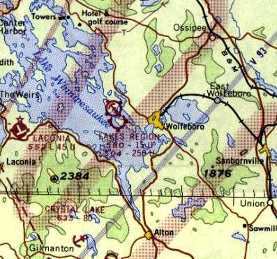
The last aeronautical chart depiction which has been located of Lakes Region Airport was on the 1965 Boston Sectional Chart (courtesy of John Voss).
It depicted Lakes Region Airport as having a 1,500' unpaved runway & an adjacent seaplane base.
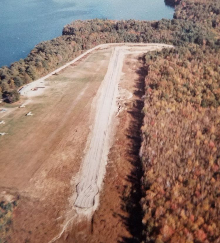
A circa 1970s aerial view looking southeast at Lakes Region Airport (courtesy of Jonathan Westerling) showed several light planes parked on the north side of the single runway.
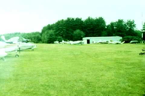
An undated photo of several planes & a hangar at Lakes Region Airport.
Acres Per Second reported that a second owner “paid $750,000 for the airport in 1995 - on a literal handshake with Ralph Horn.
Upon the 1995 airport tract's approval for development,
the Town of Wolfeboro was promised that half of the land would remain as original forest 'In Perpetuity'.”
Lakes Region Airport founder Ralph Horn passed away in 1997.
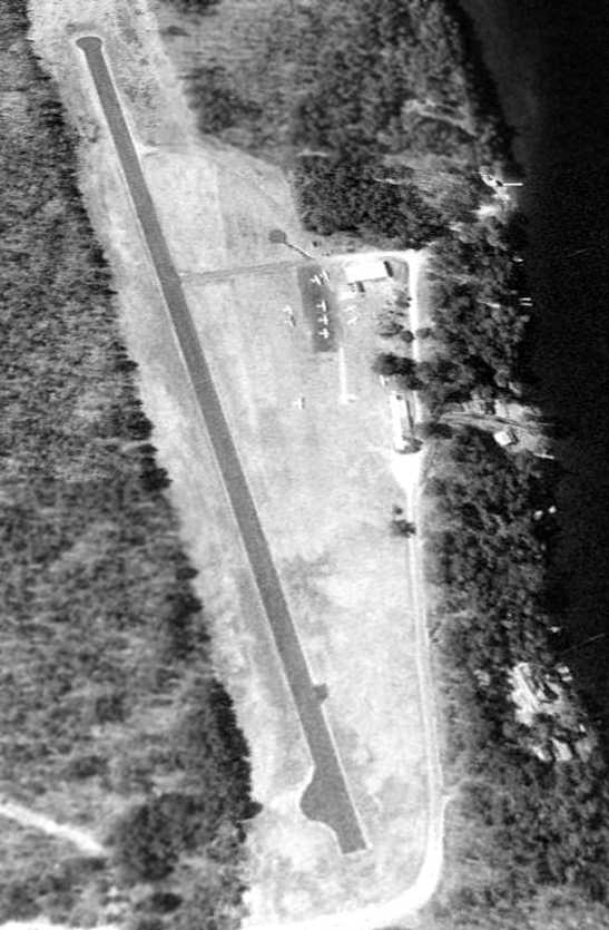
A 4/11/98 USGS aerial view looking northwest at Lakes Region Airport showed a healthy little general aviation airport,
with a single asphalt runway, a few small buildings, and 11 light aircraft.
John Zanchi recalled, “I owned an aircraft for which I rented one of the original T-hangars & had been a local year-round customer of the FBO.
I also assisted them when they needed an extra pilot, or simply a very light pilot, for scenic flights either in land or sea planes.
When we learned the airport was threatened with closure by the developer who had gained control
I was one of the 4 patrons of 8B8 who created the Committee to Save Lakes Region Airpark in 1999.
The town of Wolfeboro did want to see the airport & seaplane base preserved but the developer who had taken control from Ralph Merwin Horn
the one who wanted the airport closed, ASAP after Merwin passed away.”
John continued, “In spite of that, the airport would have been saved if the NH Attorney General's office, representing the NH DOT Div of Aeronautics,
which had a right of first refusal on the sale of the airport, had followed a course of action that we recommended which was to send a specific letter to the developer.
The State's attorney said our approach was incorrect, however a ruling against the NH Division of Aeronautics by the judge in the Superior Court of Southern Carroll County,
explicitly stated that if they had sent the letter we advised the Division of Aeronautics would have prevailed
and 8B8 would have been saved & operated by the Airport Authority that had been created by the NH legislature.
After that ruling sealed the fate of the airport the developer moved as quickly as possible to finish the shutdown of the airport & begin redevelopment as housing lots.
Eventually years later the bulk of the property was purchased by a member of the Marriott family when the developer was facing possible foreclosure.”
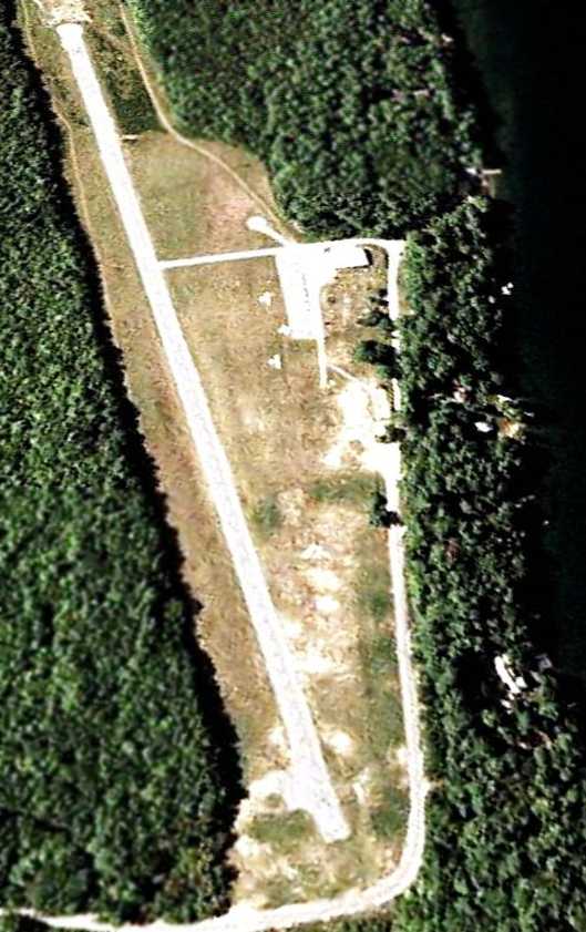
A 7/7/03 aerial view looking northwest at Lakes Region Airport showed only 3 light aircraft visible on the field.
In 2005 it was reported that the runway was scheduled to be torn up that year, with 38 home sites having been laid out covering the airport property.
Paul H. reported in 2005, “I've been traveling to Winnipesaukee every August for the past 16 years.
For most of that time, Lakes Region Airpark was the way we got there.
Even now, 3 years after I last used the airport, it seems strange to get there any other way.
To me, the Airpark was the heart & soul of the Lakes Region. Wolfeboro meant Airpark.
The seaplanes tied up at the dock were evocative of the north woods.
Coming over the dark ridges of trees to the narrow little runway, surrounded on three sides by clear water,
it was obvious that I was a long way from Washington, DC, if not in another world entirely.”
Paul H. continued, “Over my 16 years, I got a once-a-year snapshot of the Airpark, and watched its fortunes rise & fall.
There was a golden period in the mid-1990s when there were lots of people there, even a Saturday hamburger cookout.
Then, there was a bleak period of deterioration & no fuel available.
In the late 1990s, there was a brilliant recovery, and the airport returned to health.
This was short-lived, and the facility went into its final decline.
At the end, I had to use my own stakes to tie the aircraft down
and it required a long negotiation to get a local car rental place to transport us between the airpark & the Sandy Island dock.
I felt disloyal not to use Wolfeboro, but the airport was becoming almost impossible to use as a gateway to the region.”
Paul H. continued, “This summer, they started digging up the runway.
Lots of little houses on the way, all built out of ticky-tacky & all looking just the same.
All part of a general pattern of removing beauty & individuality from Wolfeboro.”
Acres Per Second reported in 2005, “The entire airport property has been re-sold to the Marriott Family: The price is yet unknown.
The seller, an insider”, had purchased the airport in 1995 from Ralph Horn.
Acres Per Second continued, “The Marriotts own a huge chunk of contiguous waterfront properties on Tuftonboro Neck (in sight of the airport)
and have been looking to buy abutters' properties which have much calmer waters on which to waterski.
One recent photo shows one end of the existing estate, so the Marriotts aren't likely to rebuild the airport or to replant the area in forest.
Since groundbreaking & dynamiting early last year, that one lakefront lot is still under construction with the usual McMansion
on a lot that extends about 300' wide, and extends nearly 400' from the water's edge.
Lot sales have been non-existent, with the 'model home' rarely visited.
It may have been that rugged, winding, jarring start to a 4-mile-ride to Wolfeboro that failed the developer.
At only 20', the lake is not particularly deep between the paired estates (Ayer's Point to Thomas Point),
so a bridge constructed between the two Marriott mega-estates can't be ruled out.”
A 10/7/06 aerial view showed the airport property in a state of redevelopment,
with most of the runway pavement having been removed at some point between 2003-2006,
along with one airport building.
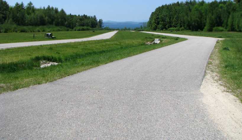
A 2010 photo by Kevin Porter looking west along the former runway at the site of Lakes Region Airport.
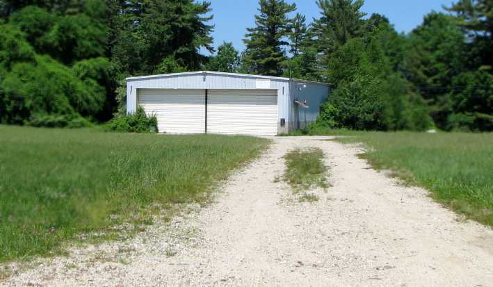
A 2010 photo by Kevin Porter looking north at a former hangar which remains at the site of Lakes Region Airport.
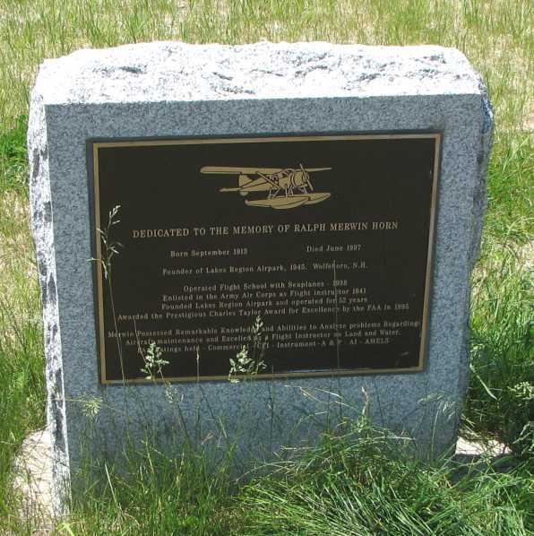
A 2010 photo by Kevin Porter of a 1997 memorial plaque dedicated to Lakes Region Airport founder Ralph Merwin.
Kevin Porter reported on a visit to the site of Lakes Region Airport in 2010:
“My GPS directed me to the airport with no indication that it had closed, but I arrived to find it in the condition depicted in Google Maps.
Some time between my GPS' last update in 2008 and May of 2010, the airport has been demolished & is in the process of being turned into a subdivision of houses.
A number of roads & utility conduits have been constructed across the former runway, and a demonstration house has been built at the west end of the runway.
The only hints of the land's former use as an airport are a small hangar along the tree line, and a plaque in place in the grass at the west end of the road network.”
As of 2011, the former airport was being marketed as a development called “Grand View Commons”.
Richard Tasker reported in 2017, “The Lakes Region Airport... I was looking forward to keeping my plane there when I retired.
Unfortunately, the airport was sold when the original owner got too old to run it any more
and developers got wind of it & convinced the new owner to close it & build homes on it & make lots of money.
As you can see [on recent aerial photos] they haven't had much success selling lots or building houses, but the airfield is no longer there.”
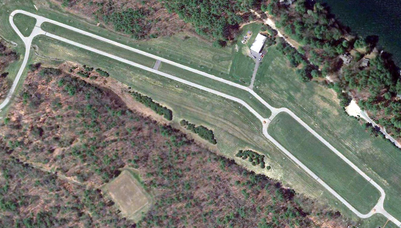
A 2018 aerial view looking northwest at the site of Lakes Region Airport showed that the site of the little airport remains vacant.
Thirteen years after the airport had been removed, the planned housing development was never built.
The site of Lakes Region Airport is located northwest of the intersection of Forest Road & Broadside Road.
____________________________________________________
Pike Airfield (8B7), Tilton, NH
43.46, -71.56 (Northwest of Boston, MA)
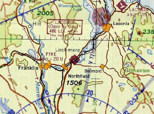
The Pike Airfield, as depicted on the March 1963 Boston Sectional Chart (courtesy of Chris Kennedy).
According to Cynthia Pike Baron, the Pike Airfield “was originally built to service 2 small aircraft:
one owned by the company & the other by one of its Vice Presidents.
The runway was used almost daily to run parts, supplies, or people to various jobs & locations
throughout New Hampshire, Vermont and Upstate New York.”
Pike Airfield was evidently established at some point between 1960-63,
as it was not yet depicted on the November 1960 Boston Sectional Chart.
The earliest depiction of the Pike Airfield which has been located
was on the March 1963 Boston Sectional Chart (courtesy of Chris Kennedy).
It depicted Pike as a public-use airfield having a single east/west paved 2,000' runway.
Pike Airfield was listed in the 1963 AOPA Airport Directory (according to Chris Kennedy).
According to Lou Maglio, “It was owned by Milo Pike who had the Pike Construction Company Asphalt Company & Paving Company.
It was listed on the old sectional as 'Pike'.
I made a few approaches by it in 1970 as my folks had a cottage up the street on Lake Winnesquam.
It was about a 1,600' paved strip with trees / power lines on each end.
I never landed as I was too 'green' & continued on to Laconia!”
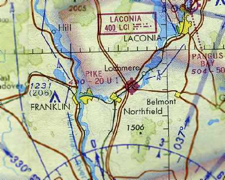
The January 1971 NY Sectional Chart (courtesy of Chris Kennedy) depicted Pike as a public-use airfield having a single east/west paved 2,000' runway.
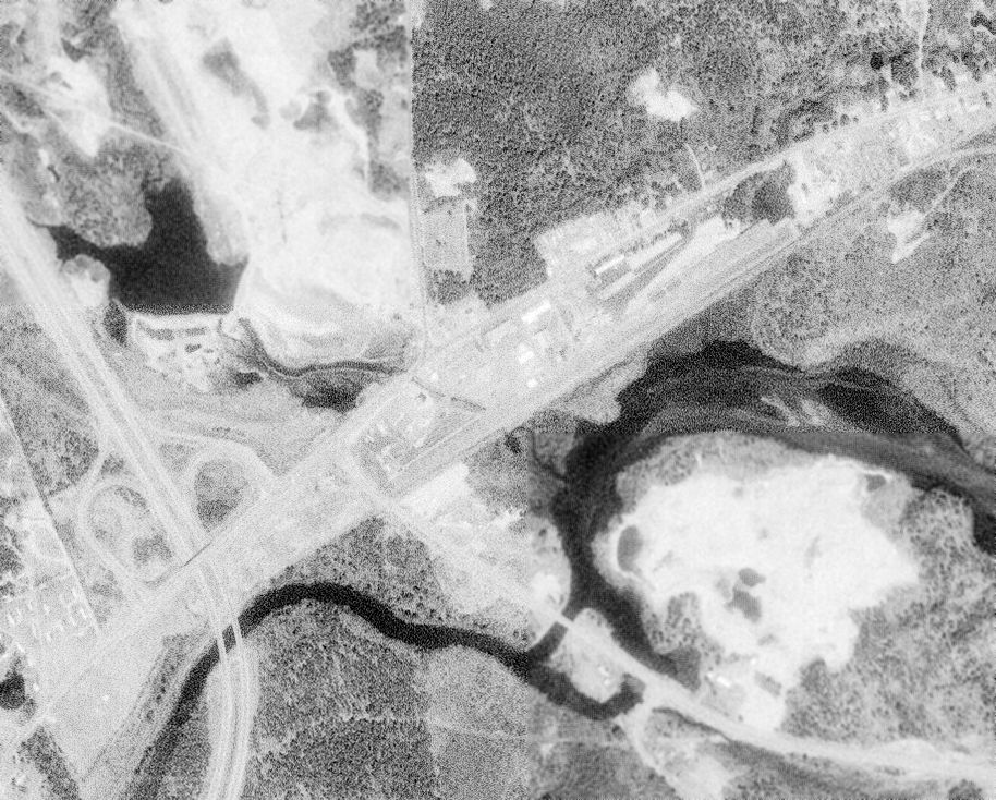
The earliest photo which has been located of the Pike Airfield was a 5/2/74 USGS aerial view.
It depicted Pike as having a single northeast/southwest runway.
Pike Airfield was listed in the “Low Use” section of the 1979 Flight Guide (according to Chris Kennedy).
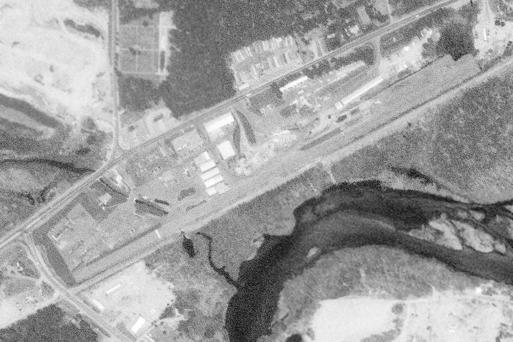
A 5/3/81 USGS aerial view depicted Pike Airfield as having a single northeast/southwest runway.
What may have been one light single-engine aircraft was visible on the north side of the eastern end of the runway.
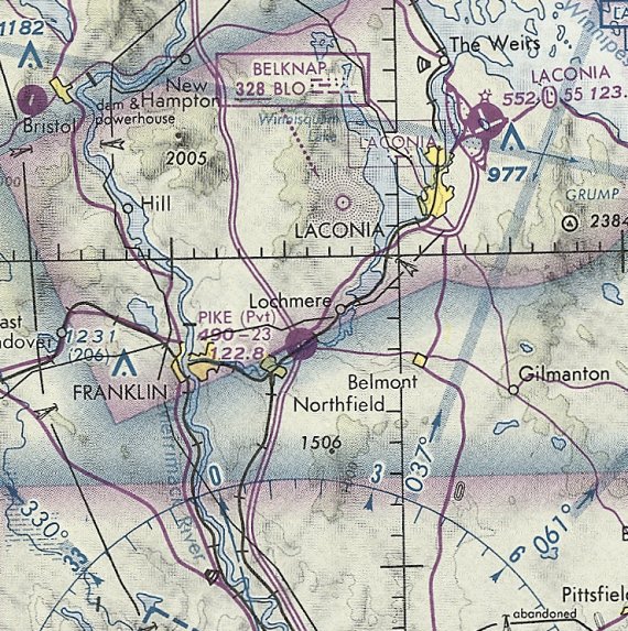
The last aeronautical chart depiction which has been located of Pike Airfield was on the June 1981 NY Sectional Chart.
It depicted Pike as a private airfield having a 2,300' paved runway.
The last directory reference to the Pike Airfield which has been located
was its listing in the 1982 AOPA Airports USA Directory (according to Chris Kennedy).
Its status had also changed to a private airfield.
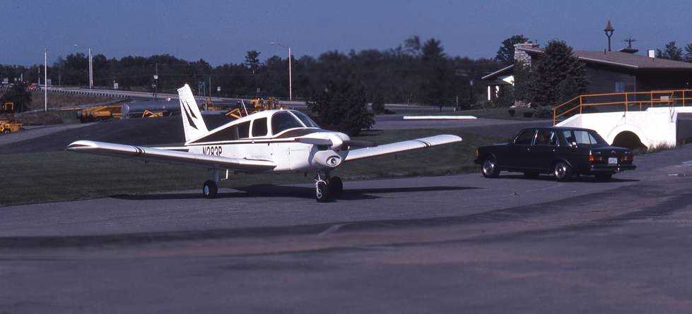
An 8/15/82 photo by Dave Murphy of his Piper “Cherokee 140 sitting in the office parking lot (not 'ramp'!) at the southwest end of the runway.
I had flown up from Mansfield to visit friends who have a home in Salisbury. Pike was the closest field to their place.
I called the folks at Pike & got permission to land & stay overnight.
I could have met my friends at Laconia, but what fun would that have been?
I regret not taking more pics of the surrounding area, but at the time I was interested in the plane with the Tonka-toys in the background!”
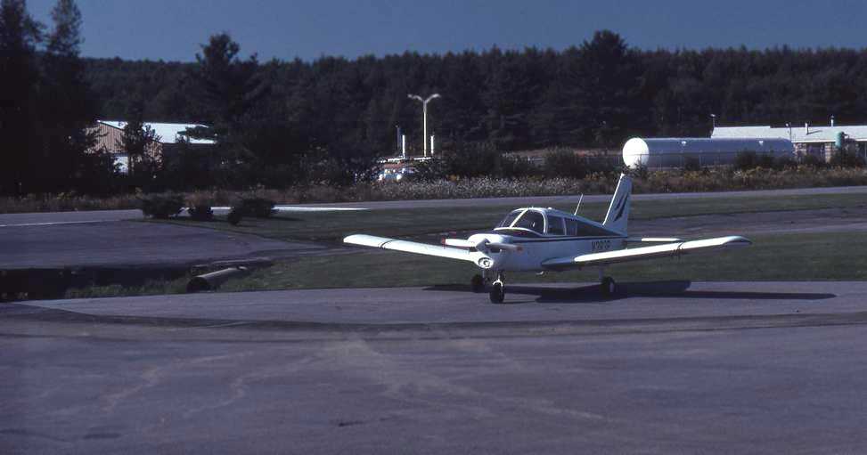
An 8/15/82 photo by Dave Murphy of his Piper Cherokee 140 at Pike Airfield.
Dave remarked, “You can see a portion of the runway & displaced threshold.
The drainage ditch flows under the runway & then under the railroad.
The approach to this end was over power lines & Route 140, which was elevated to cross over the railroad tracks.
There was a dip coming off the runway then going up a slight slope to the lot.
The runway itself may have had a camber to it to help drain rain off.
I think the runway was level with the tracks, which can't be seen behind the bushes.”
According to Cynthia Pike Baron, “In the early to mid-1980s,
the plane was replaced with a Bell Jet Ranger helicopter & the runway had pretty much seen its last days.”
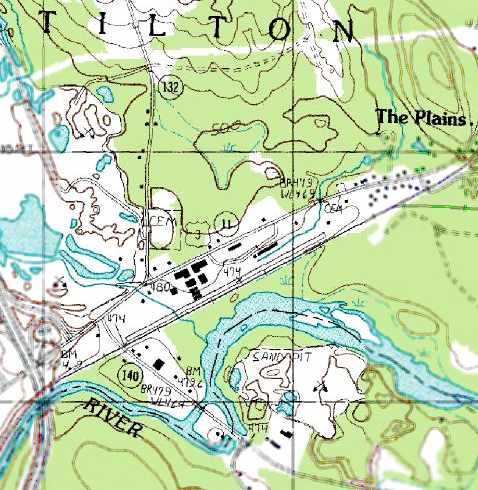
The 1987 USGS topo map still depicted a single 2,900' northeast/southwest paved runway,
but it was unlabeled, which presumably indicates the field was abandoned by that point.
Pike Airfield was no longer depicted on the December 1993 NY Sectional Chart (courtesy of Ron Plante).
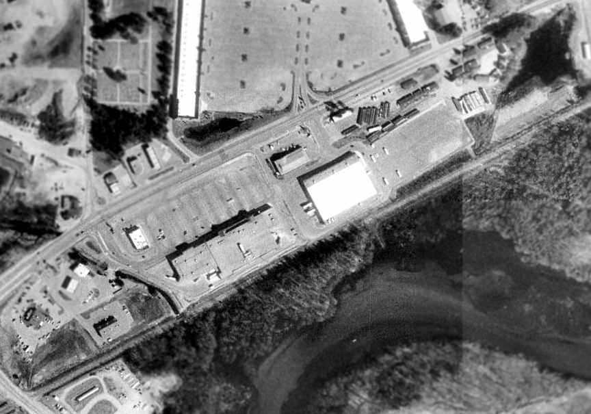
A 1998 USGS aerial photo showed several buildings had covered much of the location of the former Pike runway.
Only a small portion at the northeast corner of the former runway still appeared to remain intact.
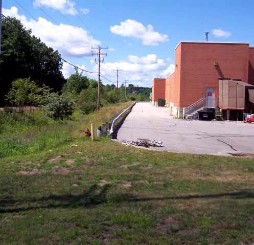
A 2006 photo by Lou Maglio, looking northwest along the location of the former Pike runway.
Lou reported that the site of the former Pike airfield “is now the access road behind a Super Stop & Shop and a BJ's Warehouse.”
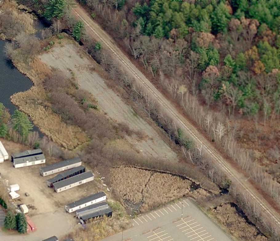
A circa 2007 aerial view looking east at the last remnant of the Pike Airfield – a small section of runway pavement on the east end.
The site of Pike Airfield is located on the south side of Route 3, just east of its intersection with Interstate 93.
____________________________________________________
Cibor Airport (NH28) / Rye Airfield, Rye, NH
43.01, -70.8 (Northeast of Boston, MA)
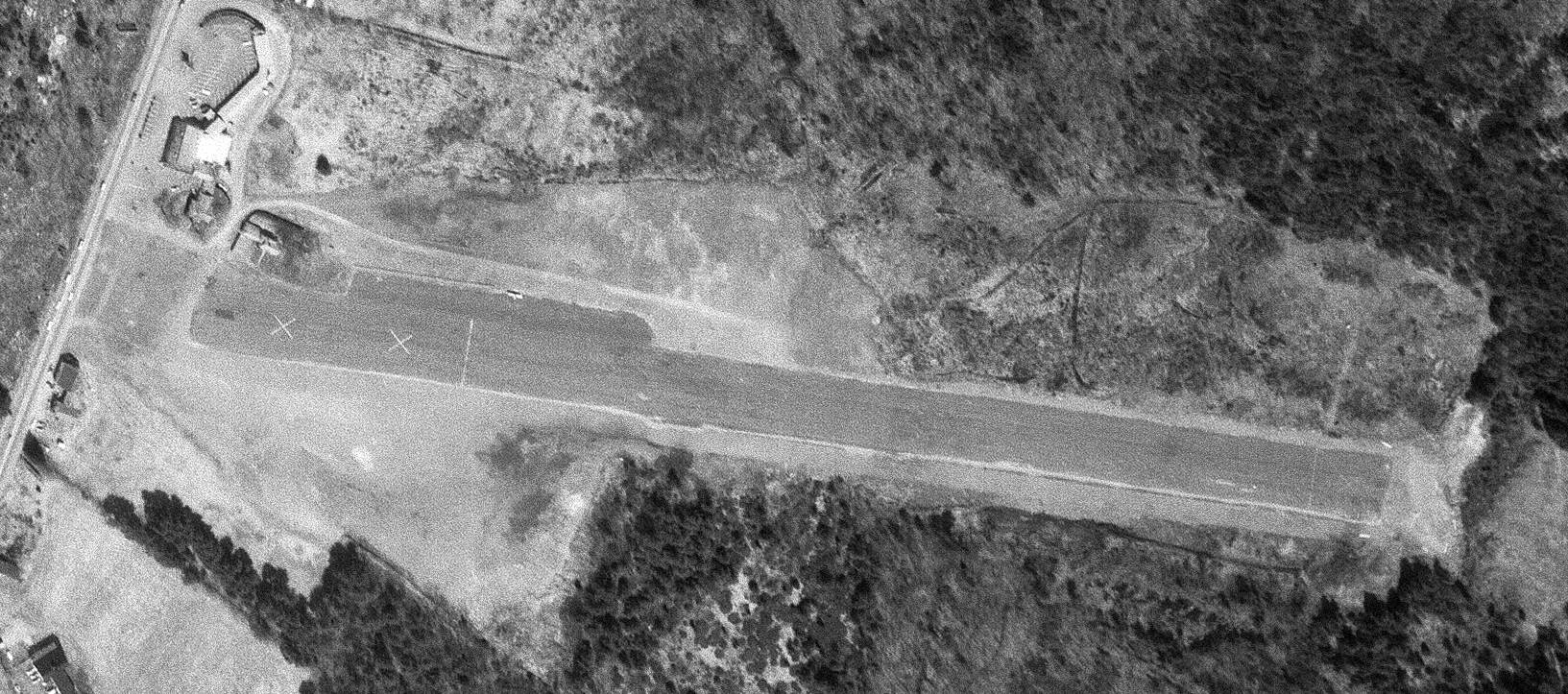
Cibor Airport, as depicted on a 4/16/73 USGS aerial photo.
This small airfield was evidently established at some point after 1962, as it was not yet depicted on a 1962 aerial photo.
According to Tom, Cibor Airport was “named for it's builder Jake Ciborowski.”
According to Mike Wheet, the members of a local radio-controlled model airplane group reported “that the field was constructed at some point in the very early 1960s,
but the town of Rye almost immediately slapped a severe restriction on the number of takeoffs & landings at the field.
The restriction effectively prevented anything but personal use by the field owner, and the airport was closed sometime the late 1960s.
The paved single Runway 10/28 had about 2,500' usable, with paved displaced thresholds of at least 500' at each end.”
No airfield at this location was depicted on the Sectional Charts from 1963/71/73/79/81/84.
Mike reported that the club “R/C Aces... were using the field for flying radio-controlled models in the early 1970s.”
The earliest photo which has been located of Cibor Airport was a 4/16/73 USGS aerial view.
It depicted a single asphalt northwest/southeast runway, with 2 closed-runway “X” symbols along the west end.
A single small building (hangar) & ramp were located on the northwest side, on which was possibly a light single-engine aircraft.
A 1974 aerial photo depicted Cibor Airport in the same configuration.
Rob Sargent recalled, “I lived across the street in Rye [from] March 1975 – July 1977, and I never saw or heard a takeoff or landing there.
A bunch of us from Pease AFB used to spend Saturdays & Sundays flying model rockets there & once in awhile saw some radio-controlled planes flying.
There was a small Quonset hut on the left but it was abandoned.”
Apparently Cibor Airport was reopened as a private field at some point between 1971-76,
as it was listed as a private field in the 1976 AOPA Airports USA Directory (according to Chris Kennedy).
It described the field as having a single 2,500' asphalt Runway 9/27, and the field's status was listed as "Private. Closed to public."
The last photo which has been located showing an aircraft at Cibor Airport was a 1978 aerial photo,
which depicted 1 light single-engine aircraft on the northwest side.
The last listing which has been located of Cibor as an active airport was in the 1982 AOPA Airports USA Directory (according to Chris Kennedy).
It described Cibor as having a single 2,500' asphalt Runway 10/28, and the field's status was listed as "Private. Closed to public."
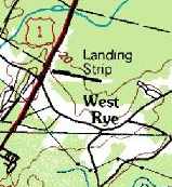
The 1985 USGS topo map depicted Cibor Airfield as a single runway, generically labeled “Landing Strip”.
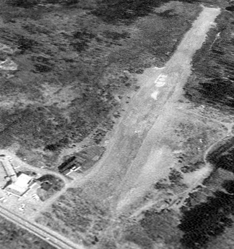
The earliest photo which is available of Cibor Airport was a 4/28/92 USGS aerial view looking northeast,
in which the airport remained intact, but there was no sign of any recent aviation usage.
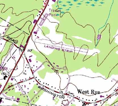
The 1993 USGS topo map still depicted a single 2,500' east/west runway, labeled simply as "Landing Strip",
along with a few small buildings along the northwest side of the property.
Ironically, Mike Wheet reported that Cibor Field was still represented in Microsoft Flight Simulator 2002.
A 2003 aerial photo showed that Airfield Road & a large building had been built over the location of the runway.
As of 2003, the site of the former airport had become the site of the “Rye Airfield” skatepark.
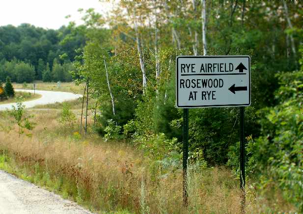
A 2005 photo by Rich Peabody of a road sign that remains for “Rye Airfield”.
Rich reported, “Apparently the builder of Cibor decided that it was a good thing to chop the trees at one end of the strip...
and apparently he did so... but the property with the trees belonged to a local judge.
Things apparently deteriorated from there... the field was slapped with restrictions because of the proximity to Pease [AFB] as well,
and the 'war' raged for about 10 years.”
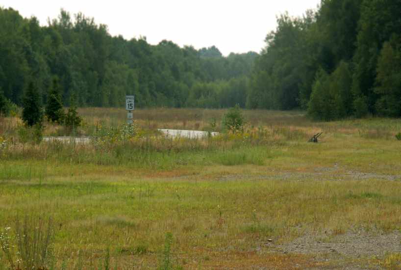
A 2005 photo by Rich Peabody looking southeast from the northwest end of the former Rye Airfield.
Tom reported in 2006 that the former airfield “is now the site of several large structures & is used as an indoor/outdoor skateboard park.
It could in no way function even as an emergency 'landing strip'.”
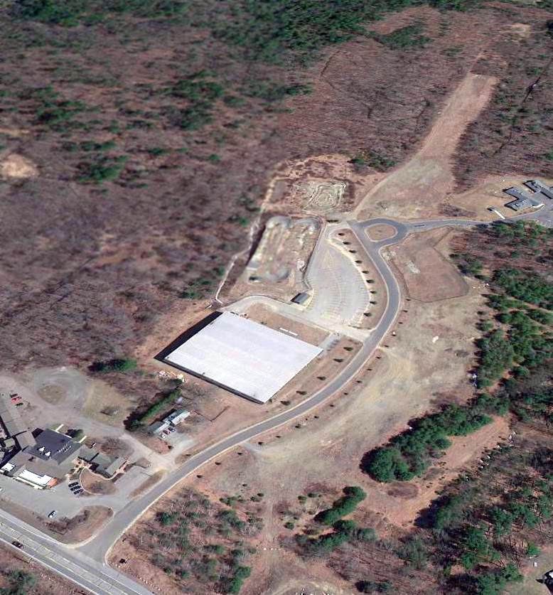
A 4/7/13 aerial view looking northeast showed the eastern runway end remained recognizable.
It also appears that several airport-related buildings remain on the northwest side (bottom-left).
The site of Cibor Airport is located northeast of the intersection of Lafayette Road & Washington Road.
____________________________________________________
White Mountain Airport (CWN) / White Mountain Heliport (05N), North Conway, NH
44.02, -71.11 (North of Boston, MA)
White Mountain Airport, as depicted on the January 1936 Lewiston Sectional Chart.
According to Wylie Apte, Jr., what would eventually become White Mountain Airport started out as a site for weekend barnstorming in 1928.
"It was then a horse racing track. As you may know racetracks were often used for landing & takeoffs as it was a known prepared surface.
My father, Wylie Sr (commercial license # 392) officially moved there with an airplane operation in 1930;
the field was then improved under the WPA projects under the Roosevelt era."
The Department of Commerce's 1934 Airport Directory (courtesy of Chris Kennedy)
described White Mountain Airport as a commercial airport having a single 1,800' sod & sand runway.
White Mountain Airport was not yet depicted on the August 1935 Lewiston Sectional Chart.
The earliest depiction which has been located of White Mountain Airport was on the January 1936 Lewiston Sectional Chart.
It depicted White Mountain Airport as a commercial/municipal airport.
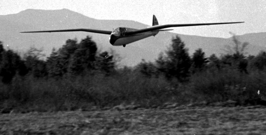
The earliest photo which has been located of White Mountain Airport was a 10/25/38 photo of Lewin Barringer making the 1st wave soaring flight in the US.
He took off from the North Conway airfield & reached an altitude of 9,500' by "climbing in the holes between the clouds."
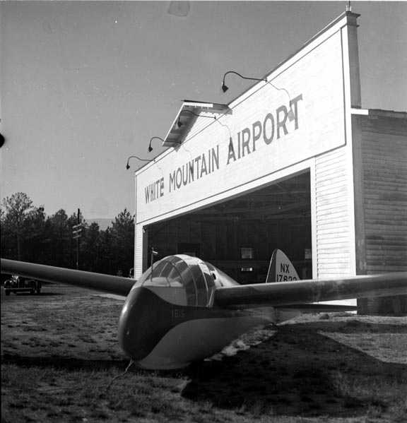
An undated photo of an Ibis sailplane (designed by Harland Ross) in front of the White Mountain Airport hangar.
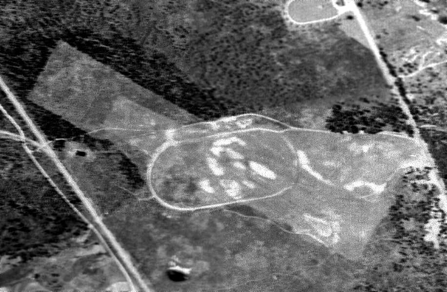
A 6/1/39 aerial view depicted White Mountain Airport as having a rectangular northwest/southeast grass runway
extending outward from the oval horse racing track which predated the airport.
Two small buildings sat on the west side of the field.
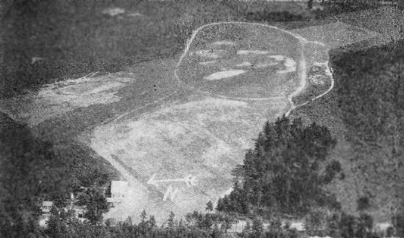
An aerial view looking east at the White Mountain Airport, from the Airport Directory Company's 1941 Airport Directory (courtesy of Chris Kennedy).
It prominently depicted the oval horse racing track which predated the airport,
with the airport's runway extending away from the track toward the northwest & southeast.
The directory described White Mountain as a commercial airport having an irregularly-shaped 2,300' x 800' grass landing area, with "additional area under development."
The field's name was said to be painted on its hangar roof.
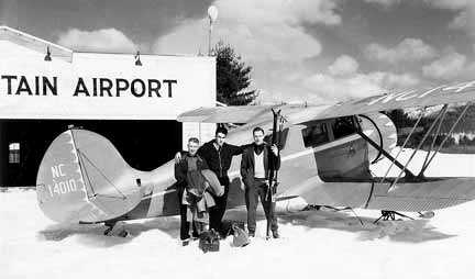
An undated photo of a ski-equipped Waco UKC biplane in front of a White Mountain Airport hangar.
According to Wylie Apte, Jr. recalled, "The property was unofficially owned by the town of Conway.
My father operated it as an airport yearly as a tenant until WW2
when he was required to close & he was recalled to active AAF duty patrolling the East coast for enemy submarines."
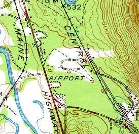
The 1942 USGS topo map labeled the site simply as "Airport", but did not depict any runways.
Instead it still depicted the oval horse racing track which predated the airport.
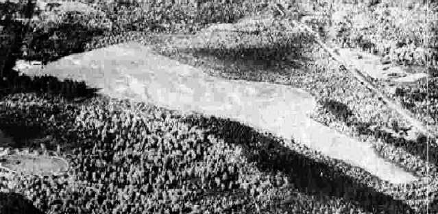
A 10/10/42 aerial view looking north from the 1945 AAF Airfield Directory (courtesy of Scott Murdock)
depicted White Mountain Airport as having a single unpaved northwest/southeast runway.
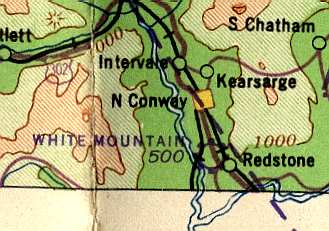
The 1942 Lewiston Sectional Chart (courtesy of Mike Keefe) depicted White Mountain as a commercial airport.
The 1945 AAF Airfield Directory (courtesy of Scott Murdock) described White Mountain Airport
as a 120 acre triangular property having 2 sod runways, measuring 2,300' northwest/southeast & 2,000' east/west.
The field was said to have a single 60' x 50' wooden hangar, and to be owned & operated by private interests.
Wylie Apte, Jr. recalled, "After the war, the town called him [Wylie Apte Sr.] in & said there was no future in aviation
and therefore he had to vacate or purchase the property.
He struggled & bought the airport at a time when financing anything was practically unheard of.
Improvements followed as aviation grew, private donations added to the airport's growth as bigger & better aircraft came along.”
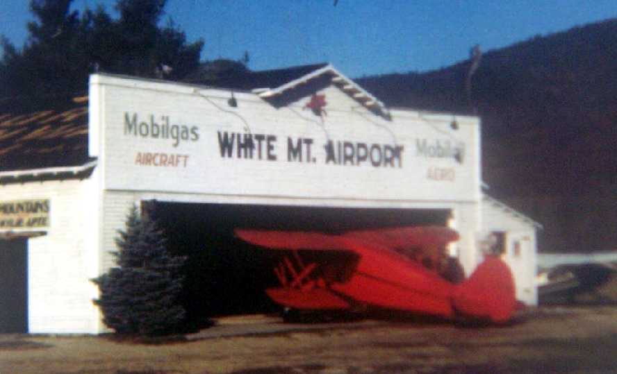
A 1955 photo of a pretty 1939 Waco VKS-7F, NC31651, in front of the White Mountain Airport hangar (courtesy of Jonathan Westerling).
According to Wylie Apte, “A new paved runway was installed in 1961, 3,000'.
Business improved to where it became a major attraction for tourism & businesses,
and commuters started buying vacation homes & depending on the airport."
The 1962 AOPA Airport Directory described White Mountain Airport as consisting of a 3,000' asphalt Runway 15/33.
The operator was listed as Wylie Apte.
A 1963 aerial view by David Cullinan looking north at the White Mountain Airport.
Dennis Yanez recalled, “White Mountain Airport... I flew out of that strip in September 1963
on a 2 hour fly around the area in a Cessna 170 called 'The Green Grasshopper' with the field operator on a sightseeing trip.
Also subsequently flew into White Mountain several times doing cross-countries for my Private Pilots License. Nice little operation!”
Tom Kenny recalled, “Wylie Apte Jr (Bunky) & my dad were great friends before my dad passed away back in 1967.
As a kid I used to go up flying in the old Wacos often (flying over 4th of July parade was fantastic).
Some of my best memories are at that old airport.
In the 1960s it was a basic strip & little log cabin office with vintage Coke machine out front.
Nothing like hanging out at the airfield on a warm summer day.”
The 1965 Boston Sectional Chart (courtesy of John Voss) depicted White Mountain Airport
as having a 2,900' paved runway & an NDB radio beacon on the field.
An undated photo of multiple gliders at White Mountain Airport,
as part of the annual Wave Camps, which were organized by Allan MacNicol & held at White Mountain from 1966 until the airport was sold.
The 1968 Boston Sectional Chart (courtesy of Mike Keefe) depicted White Mountain Airport
as having a 2,900' paved runway & an NDB radio beacon on the field.
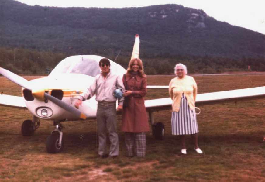
A 1971 photo of Lou Maglio, his future wife and her grandmother in front of a Piper Warrior at White Mountain Airport.
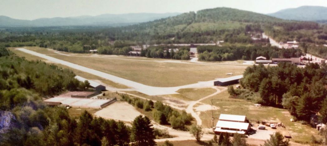
A circa 1970s aerial view by Dick Bicknell looking south at White Mountain Airport.
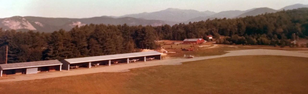
A circa 1970s aerial view by Dick Bicknell looking northwest at planes inside the hangars of White Mountain Airport.
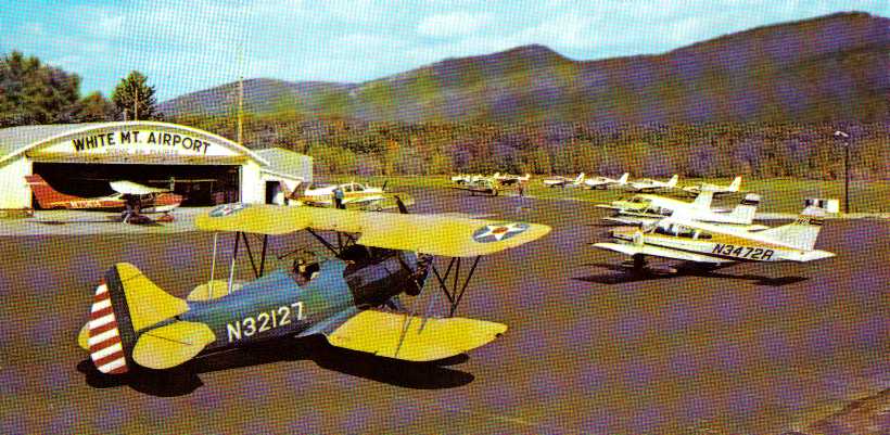
A mid-1970s view of a beautiful Waco biplane & other aircraft in front of the White Mountain Airport hangar (courtesy of Matt Deering).
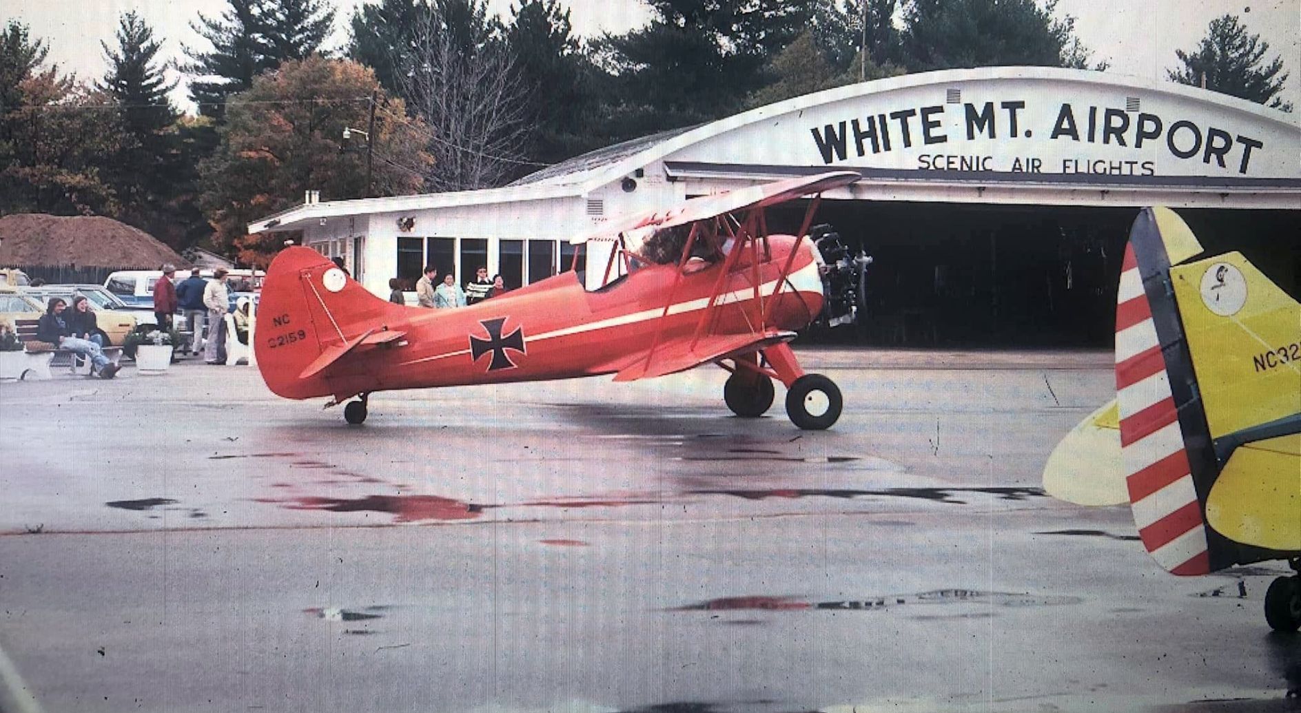
A circa 1975-76 photo of “Big Red” NC32159, a 1942 Waco UPF-7 biplane painted to resemble the Red Baron in front of the White Mountain Airport hangar (courtesy of Andrew Laverdiere).
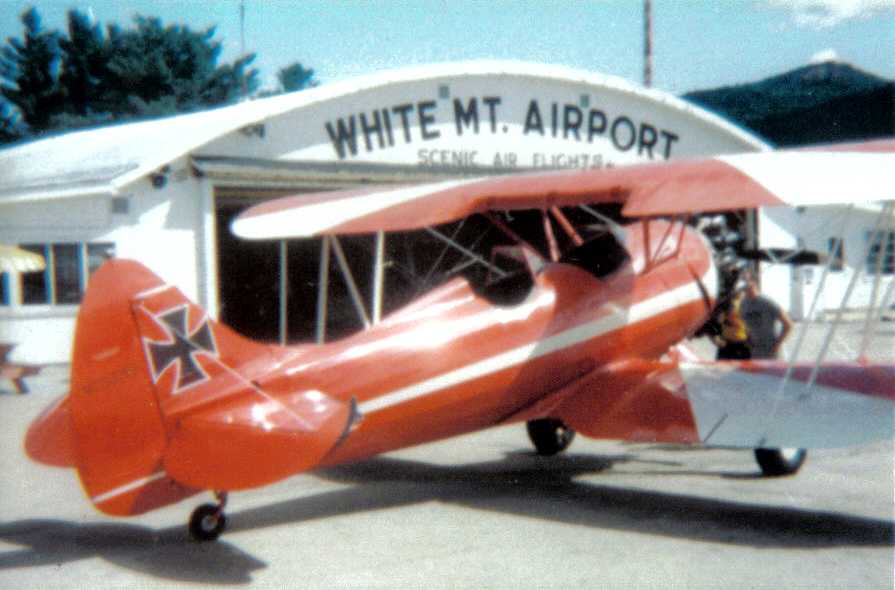
A circa 1970s photo of a Waco biplane painted to resemble the Red Baron in front of the White Mountain Airport hangar (courtesy of Matt Deering).
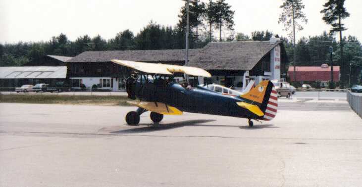
A circa 1970s photo of a Waco biplane painted in American military markings at White Mountain Airport (courtesy of Matt Deering).
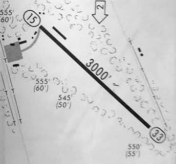
An October 1975 airport directory (courtesy of Jim Daigneau) depicted White Mountain Airport
as having a single 3,000' paved Runway 15/33,
with a taxiway leading to a ramp on the west side with several adjacent buildings, and another building on the northeast side of the runway.
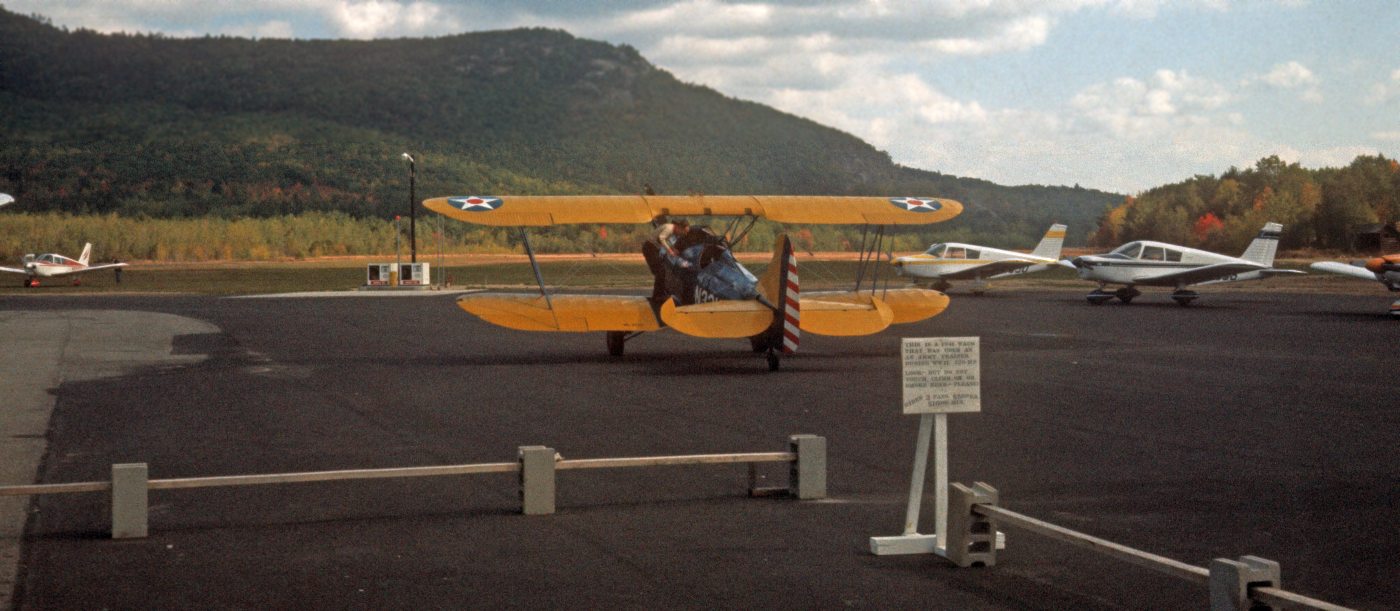
A 4/19/77 photo courtesy of David Cullinan of a beautiful Waco biplane at the White Mountain Airport.
The last photo which has been located showing White Mountain Airport in operation was a 1978 photo of a Bell 47 helicopter & a Piper Cherokee (courtesy of Matt Deering).
The last aeronautical chart depiction which has been located of White Mountain Airport was on the June 1981 NY Sectional Chart (courtesy of Ron Plante).
It depicted White Mountain Airport as a private airfield having a 3,000' paved runway.
The 1982 AOPA Airport Directory (courtesy of Ed Drury) described White Mountain Airport's runway configuration in much the same manner,
and listed the operator as White Mountain Airways.
The remarks said, "Private. Use at own risk. PPR from owner before landing.
Closed during winter months. Runway not plowed."
Jeffrey Geibel, CFII, said of White Mountain Airport, "I flew out of it in the summer of 1982."
The 1985 Flight Guide (courtesy of Chris Kennedy) depicted White Mountain Airport
as having a single 2,940' paved Runway 15/33,
with two taxiways leading to a ramp on the west side with several adjacent buildings.
One of those buildings was depicted as the location of White Mountain Airways.
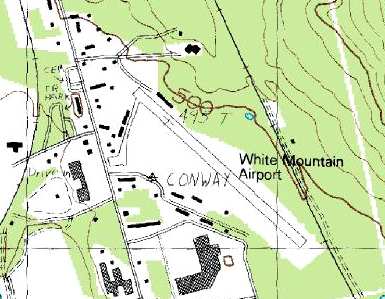
The 1987 USGS topo map depicted White Mountain Airport as having a taxiway leading from the northwest end of the runway to the south,
with several buildings (hangars?) along the west side of the taxiway.
Wylie Apte, Jr. said "I was the last & final owner of this airport, taking over from my father who started the airport.
It was closed down after a forced sale due to being taxed out of existence
by the town's greediness to raise property taxes."
According to Wylie Apte, Jr., the airport closed in the Summer of 1988.
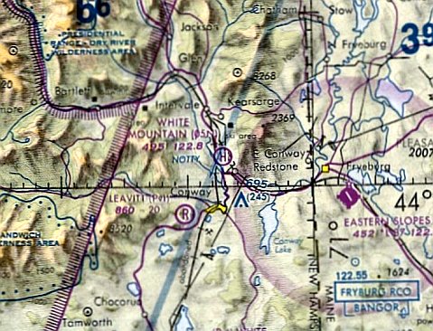
At some point between 1988-93, the former White Mountain Airport was evidently partially reused as a heliport,
as that is how it was depicted on the December 1993 NY Sectional Chart (courtesy of Ron Plante).
Jeffrey Geibel said, "There is (or was) a heliport left over from the airport circa 1995 when I was up there, but that may have gone, too.
I believe there's a street called "Airport Square" or something like that (right of the main drag) which was the entrance road to the airport."
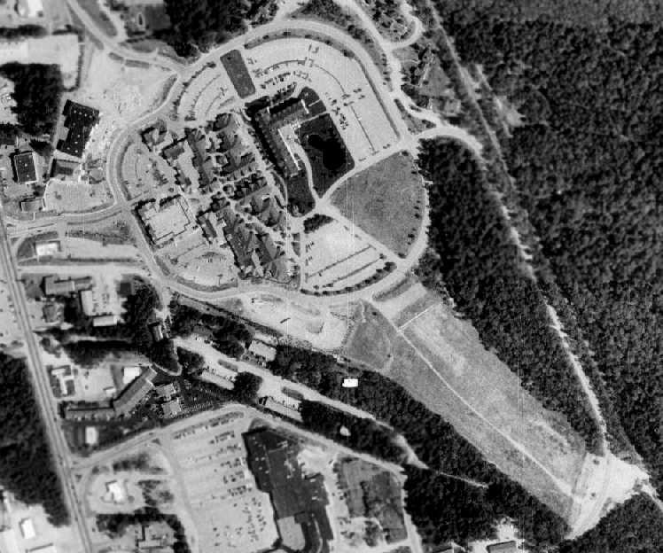
A 1999 USGS aerial photo showed the White Mountain Airport site had been covered by a factory outlet center,
several condo units, and a Sheraton Hotel (since renamed the North Conway Grand Hotel).
The southeastern half of the runway still remained visible.
The White Mountain Heliport evidently closed at some point between 1993-2001, ending the last aviation use of the property,
as it was no longer depicted on the May 2001 NY Sectional Chart (courtesy of Ron Plante).
A 2003 photo by Mike Fesko of the former White Mountain Airport hangar, reused as a Orvis retail store. Note the biplane wind indicator on the roof.
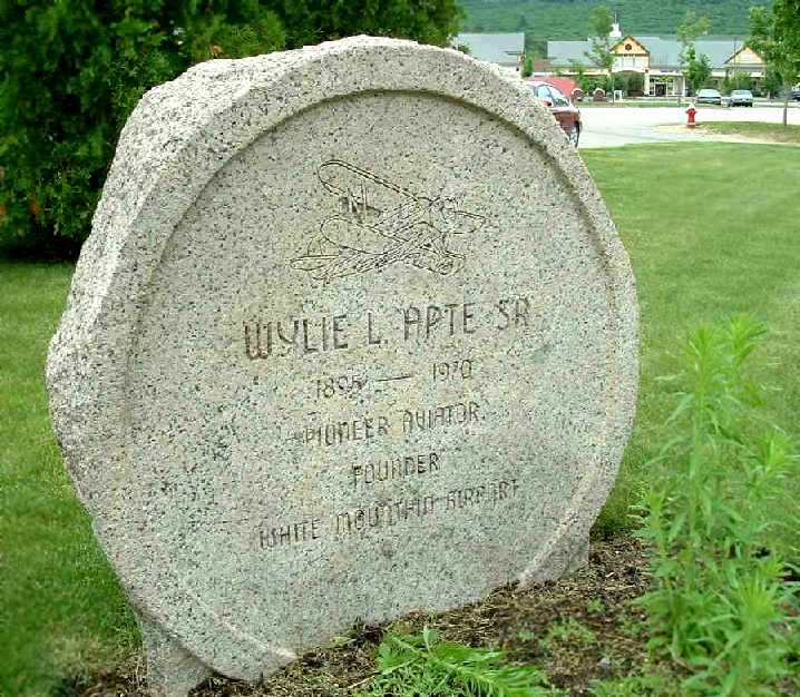
A 2003 photo by Mike Fesko of the plaque at the White Mountain Airport site which honors founder Wylie Apte Sr.
A 2018 photo looking west at the former White Mountain Airport hangar, reused as a retail store, with the biplane wind indicator on the roof.
The stone monument to airport founder Wylie Apte Sr. is on the left.
As of 2022 the former White Mountain Airport hangar was reportedly slated to be removed.
A 4/12/24 photo of the former White Mountain Airport hangar, empty & for lease.
The site of White Mountain Airport is located northeast of the intersection of Route 302 & Route 16, 2 miles southeast of North Conway.
____________________________________________________
Since this site was first put on the web in 1999, its popularity has grown tremendously.
If the total quantity of material on this site is to continue to grow,
it will require ever-increasing funding to pay its expenses.
Therefore, I request financial contributions from site visitors,
to help defray the increasing costs of the site
and ensure that it continues to be available & to grow.
What would you pay for a good aviation magazine, or a good aviation book?
Please consider a donation of an equivalent amount, at the least.
This site is not supported by commercial advertising –
it is purely supported by donations.
If you enjoy the site, and would like to make a financial contribution,
you
may use a credit card via
![]() :
:
![]()
Please consider checking the box to make a monthly donatation.
For a mailing address to send a check, please contact me at: paulandterryfreeman@gmail.com
If you enjoy this web site, please support it with a financial contribution.
____________________________________________________
This website is supported by WebHostingBuddy & Find My Electric.
____________________________________________________
This site covers airfields in all 50 states.