Abandoned & Little-Known Airfields:
New Jersey: Cape May area
© 2002, © 2020 by Paul Freeman. Revised 11/18/20.
This site covers airfields in all 50 states: Click here for the site's main menu.
____________________________________________________
Please consider a financial contribution to support the continued growth & operation of this site.
____________________________________________________
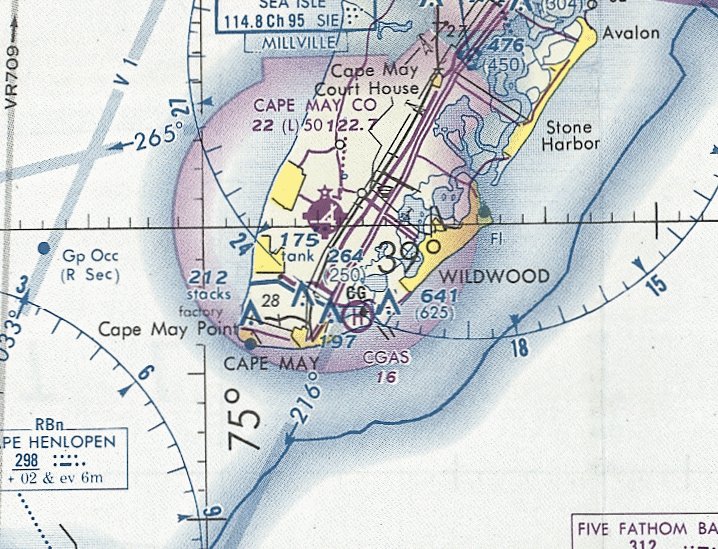
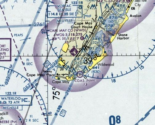
Cape May Naval Air Station / Municipal Airport /
Coast Guard Air Station (NMK), Cape May, NJ
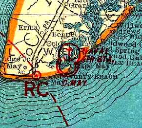
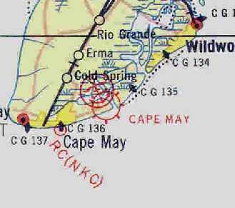
38.945, -74.885 (Southwest of Atlantic City, NJ)
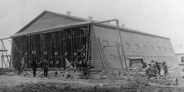
A 12/3/17 photo captioned “Workers install doors for a straight-truss type seaplane hangar at the Coastal Air Station, Cape May NJ” (courtesy of the USN Seabee Museum, via Lee Corbin).
A Naval Air Station was constructed on the eastern-most part of Cape May by the Navy in 1917.
During the First World War, Cape May operated 12 seaplanes & 1 dirigible.
The earliest photo which has been located of NAS Cape May was a 12/3/17 photo
captioned “Workers install doors for a straight-truss type seaplane hangar at the Coastal Air Station, Cape May NJ” (courtesy of the USN Seabee Museum, via Lee Corbin).
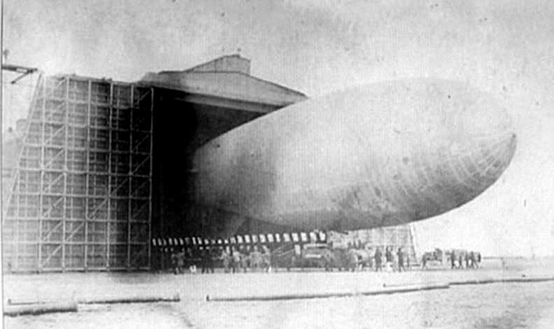
A 1918 photo of a Navy antisubmarine blimp coming out of Cape May's massive airship hangar (courtesy of Dick Gibbs).
A 1920 aerial view of NAS Cape May (courtesy of Chris Kennedy),
showing the field with several seaplane hangars & one relatively-small dirigible hangar.
In 1920, the largest hangar in the country was built there to house the dirigible ZR-2.
When the airship crashed into the English Channel on its trial run, interest diminished & the structure was never used for dirigibles.
NAS Cape May closed in 1922.
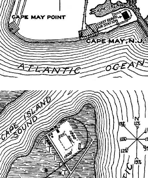
The location & layout of Naval Air Station Cape May, as depicted on the 1927 Commerce Department Airway Bulletin (courtesy of David Brooks).
The field was said to have one 726' x 156' steel-frame airship shed (significantly longer than the hangar depicted in the 1920 photo), and 3 seaplane hangars.
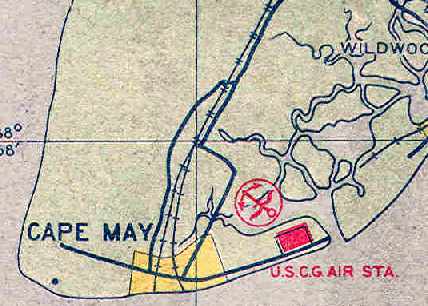
It described Cape May as a 160 acre rectangular sand, soil, and grass field, having a single 800' runway.
The Coast Guard established facilities at Cape May in 1928,
and it became one of only 2 permanent Coast Guard Air Stations.
The Cape May airfield was also used by civilian planes as a municipal airport during the early 1930s.
The earliest map depiction which has been located of the Cape May Airport
was on the 1930 "Rand McNally Standard Map of NJ With Air Trails" (courtesy of Chris Kennedy).
It described the Cape May Airport as being operated by the Chamber of Commerce.
The field was described as being a rectangle, measuring 2,200' east/west x 1,950' north/south.
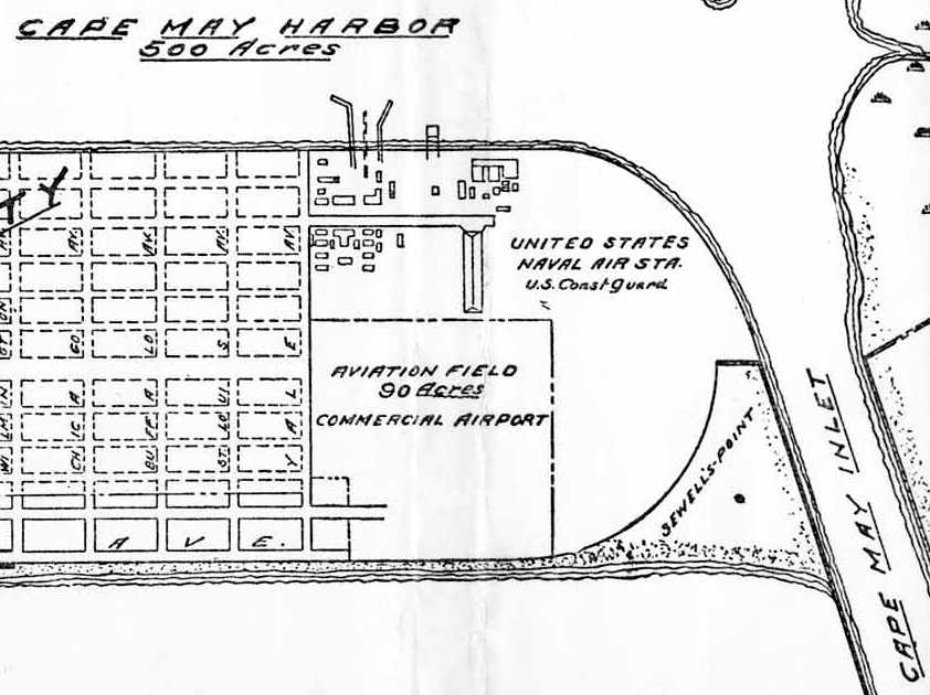
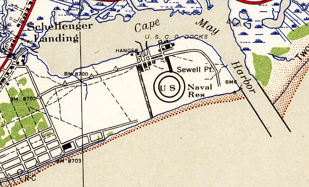
The 1931 USGS topo map (courtesy of Chris Kennedy)
depicted the Cape May Commercial Airport as occupying a 90-acre square at the southwest corner of the field,
with the "Naval Air Station, U.S. Coast Guard" occupying the remainder of the site,
with the dirigible hangar on the north side of the field.
In 1931, due to crowding of airships at NAS Lakehurst's hangars,
Lakehurst's Navy non-rigid airships were transferred temporarily to Cape May.
The Cape May hangar, although originally planned as a rigid airship hangar, was not normally used for airships.
The Cape May Airport, as depicted on the May 1932 J-18 Washington D. C. Airway Map (courtesy of Chris Kennedy).
A 1933 aerial photo depicted a single seaplane on Cape May's north ramp.
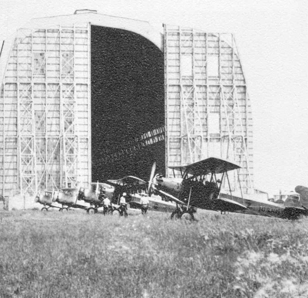
The first photo to be located showing heavier-than-air aircraft at Cape May
was a Summer 1933 photo from Naval Reserve Training Command 1916-1966 (courtesy of David Collier)
showing O2C-1 & N2C2 biplanes of the District of Columbia air reserve during their first cruise, in front of the Cape May blimp hangar.
The 1934 Department of Commerce Airport Directory (according to Chris Kennedy)
described Cape May Municipal Airport as consisting of a 2,000' square sod landing area.
The use of the Cape May airfield as a municipal airport came to an end in 1934,
when the Navy canceled Cape May County's lease on the property.
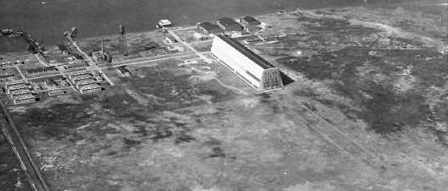
A 1934 aerial view of CGAS Cape May (courtesy of Chris Kennedy),
with the seaplane hangars at the top, and the dirigible hangar in the center.

A circa 1930s aerial view looking northwest at the Cape May dirigible hangar, and the seaplane hangars on the right.
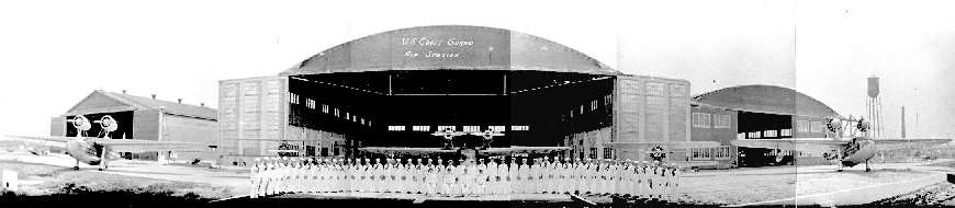
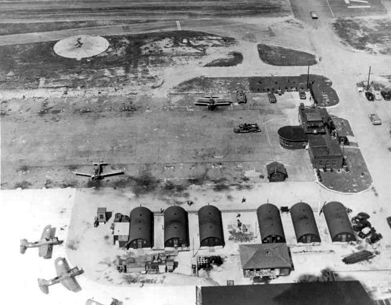
A 1934 panorama (courtesy of National Archives) looking south at of the personnel of CGAS Cape May
in front of the seaplane hangars & several large twin-engine aircraft & two single-engine biplanes.
The 1934 U.S. Navy Aviation Chart (courtesy of Chris Kennedy) depicted the U.S.C.G. Air Station as consisting of a rectangular-shaped field.
NAS Cape May, as depicted on the 1935 Washington Sectional Chart.
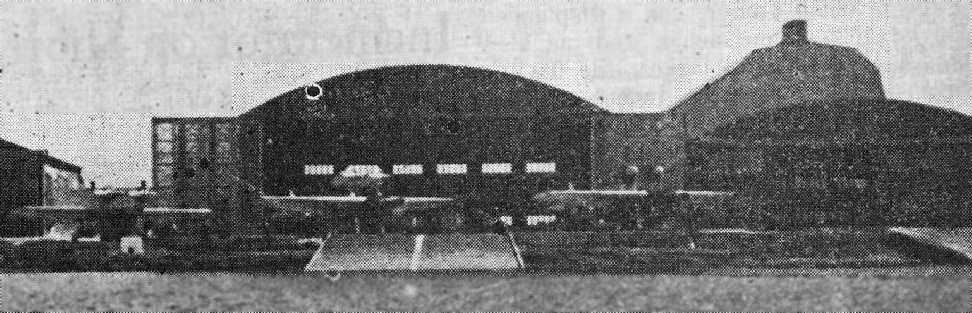
Note the Fokker flying boats, and the huge dirigible hangar in the background.
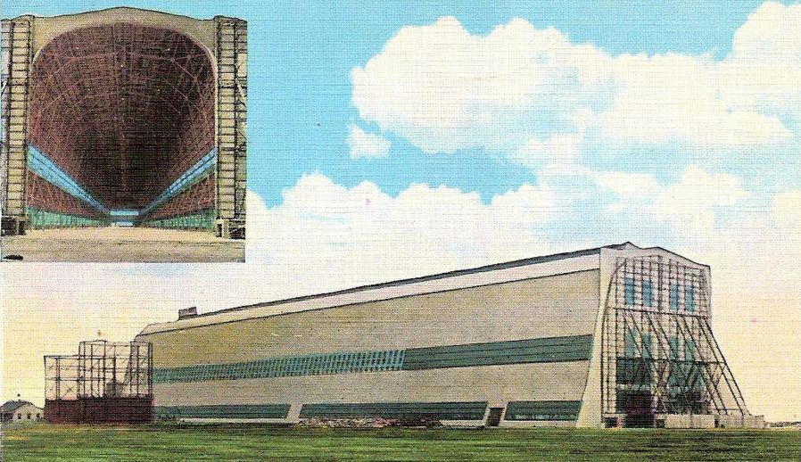
An undated colorized photo from a 1936 postcard of the “Great airship hangar, Naval Air Station, Cape May”.
The Airport Directory Company's 1937 Airports Directory (courtesy of Bob Rambo)
described "Cape May - Naval Air Station - Coast Guard" as having a rectangular 2,200' x 1,800' sod & sand landing area,
with a dirigible hangar to the northeast.
An undated (circa 1930s?) aerial view looking northeast at CGAS Cape May,
showing the dirigible hangar, and the 3 seaplane hangars behind it.
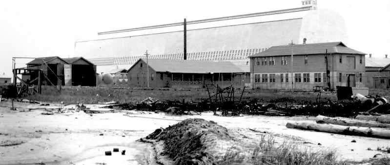
An undated (pre-1938) photo (courtesy of National Archives) of the airship hangar at CGAS Cape May.
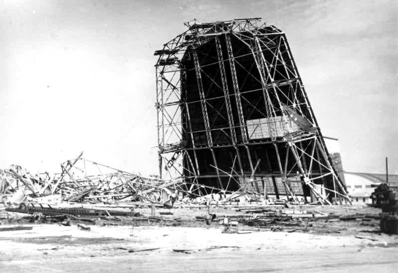
Kevin Brennan noted, “There was a humdinger of a hurricane that year [1938] -
perhaps the hangar was damaged & they decided to demolish it rather than repair it.”
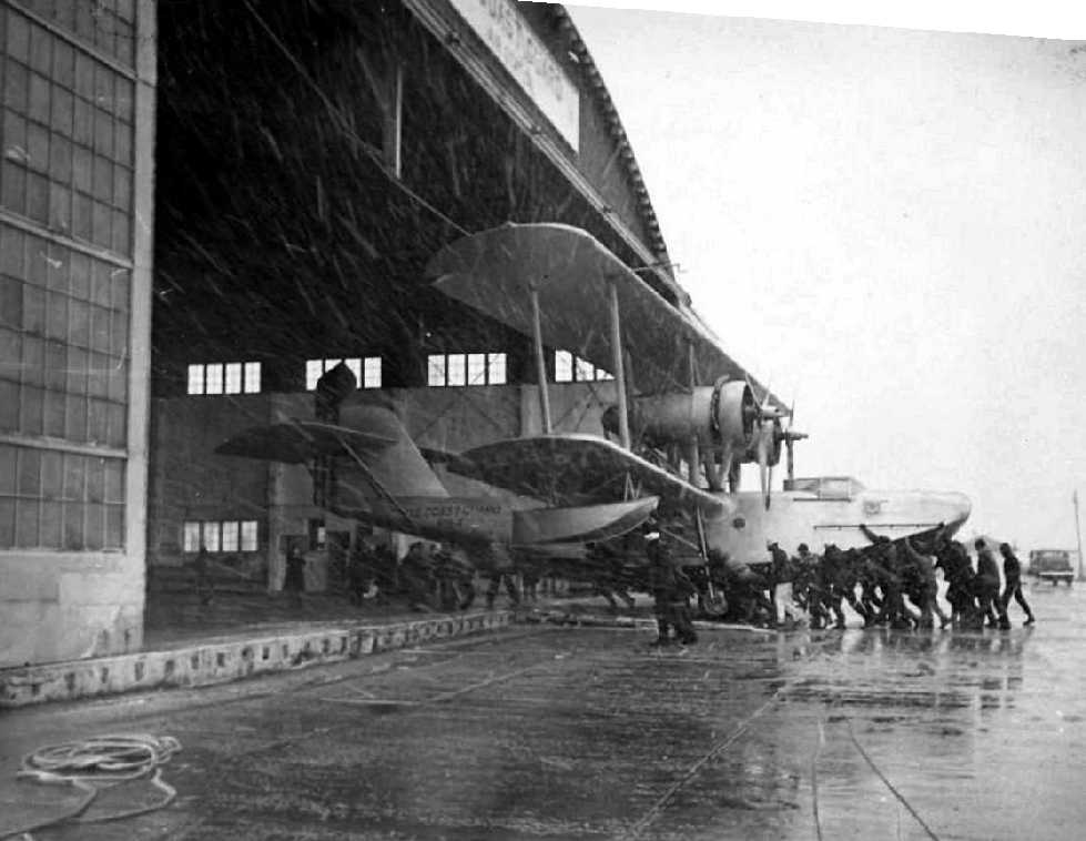
A 1938 photo of personnel pushing a rare Hall PH-2 flying boat back into its hangar at CGAS Cape May.
As part of the military buildup prior to WW2, Cape May was recommissioned by the Navy in 1940.
More acreage was filled in & a larger airstrip was constructed.
Cape May NAS, as depicted on the 1940 Washington Sectional Chart (courtesy of Mike Keefe).
The 1941 USGS topo map depicted the “U.S. Naval Reservation” airfield at Cape May.
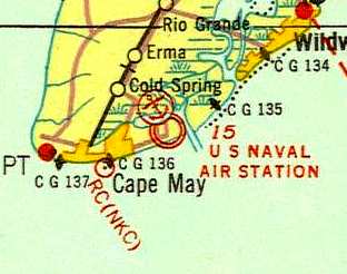
Early in the war, blimps from Lakehurst's ZP-12 used Cape May to patrol the approaches to the Delaware Bay.
Several fixed-wing Navy scouting squadrons were also based at Cape May.
Kevin Brennan observed, “Note the operations building with control tower atop.
Also note the 6 Quonset huts arranged in a 3-gap-3 configuration running north/south.”
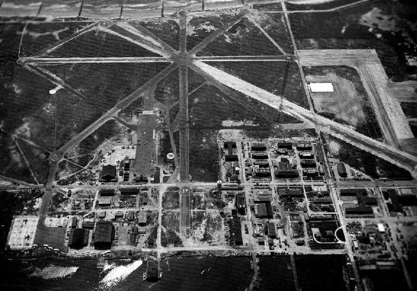
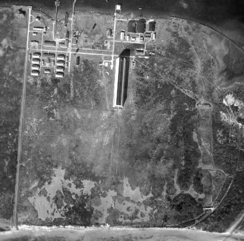
A WW2-era aerial view looking south at Cape May NAS (National Archives photo).
Kevin Brennan observed, “Note the huge paved area parallel to the east side of Runway 17 - that is the floor of the former airship hangar.
The operations building / control tower sits on the North end of the airship hangar floor.
The 6 Quonset huts are along the northeast edge of the airship hangar floor. There are 2 aircraft parked nose to Quonset huts.”
At the bottom right, by this point only 2 of the original 3 seaplane hangars still remained -
one of the arch-roof seaplane hangars had apparently been removed at some point after 1934.
At its height during WW2, the Cape May airfield consisted of a total of 5 paved runways (the largest was 3,825' long),
2 blimp mooring circles, parking aprons, hangars, and seaplane ramps.
The peak complement of the station in 1944 was 1,339 personnel.
The last photo which has been located showing fixed-wing aircraft at Cape May was a 1944 aerial view which showed several aircraft on the ramp in the center.
The airfield was depicted as having 5 paved runways.
Nothing airfield-related was depicted on the 1944 USGS topo map at Cape May – just an empty field,
most likely due wartime security concerns.
The airfield at Cape May went through a confusing series of changes in the post-WW2 period.
It was still labeled "Cape May (Navy)" on the 1946 Washington Sectional Chart (courtesy of Mike Keefe).
However, in 1946, the Navy again relinquished the base,
and it was taken back by the Coast Guard.
"CGAS Cape May" was depicted on the 1948 Washington Sectional Chart (courtesy of Ron Plante) as having a 3,500' hard-surface runway.
Strangely, "CGAS Cape May" was depicted as an active airfield on the 1951 Washington Sectional Chart (courtesy of Mike Keefe),
yet the remarks on the Aerodromes table on the chart said "Closed".
The field was described as having a total of 5 runways, with the longest being a 3,525' paved runway.
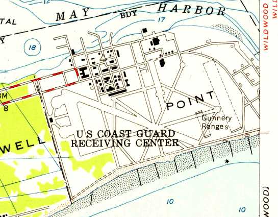
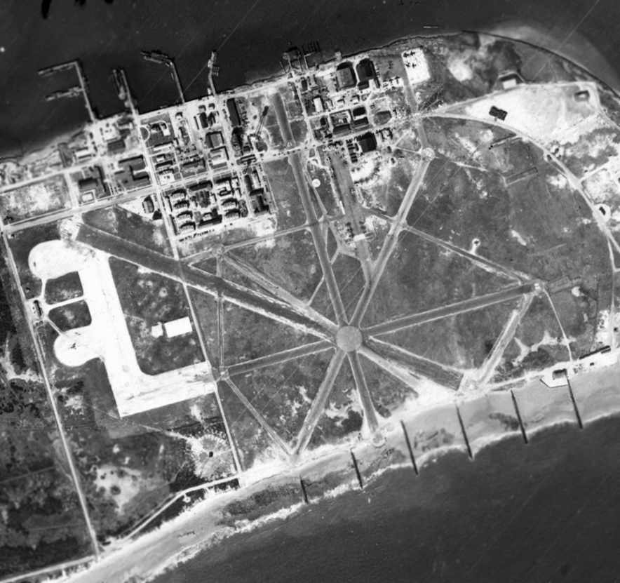
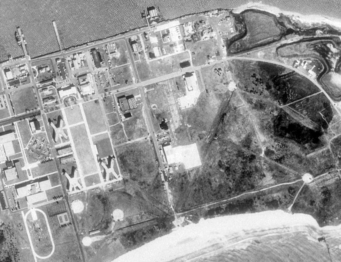
The 1954 USGS topo map depicted the spider web of paved runways & taxiways of the former Cape May airfield,
but labeled the property as “US Coast Guard Receiving Center”.
No aircraft were depicted on the Cape May airfield in a 1956 aerial photo.
Another one of the seaplane hangars had been removed at some point between 1944-56, leaving only 1 remaining.
The Cape May airfield was not depicted at all on the 1957 Washington Sectional Chart (courtesy of Mike Keefe).
The Cape May airfield was labeled "Abandoned airport" on the 1962 Washington Sectional Chart (according to Chris Kennedy).
In a 1962 aerial view, the Cape May shoreline had apparently eroded,
covering the southern portion of several of the runways (compared to the 1944 aerial photo).
No aircraft were visible on the field.
A 1963 aerial view showed that 1 seaplane hangar remained standing on the north side of the field.
The Cape May airfield was labeled "Abandoned airport" on the 1965 Washington Sectional Chart (according to Chris Kennedy),
and was depicted with the abandoned airfield symbol on the 1969 Washington Sectional Chart (according to Chris Kennedy).
A 1970 aerial view showed that the last seaplane hangar had been removed from the north side of the field at some point between 1963-70.
A hangar for helicopter use had also been constructed west of the runway.
with the remains of the WW2-era runways visible at the lower-right.
The former Cape May airfield was depicted as a heliport simply labeled "CGAS" on the March 1981 Washington Sectional Chart (courtesy of Ron Plante).
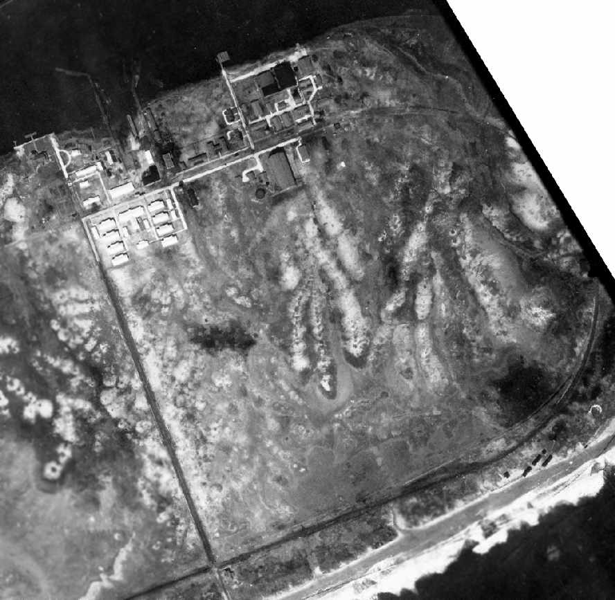
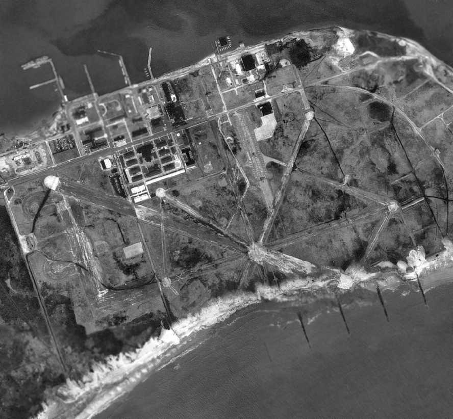
In the 1991 USGS aerial photo, the remains of 4 WW2-era former Navy runways were still visible,
but the new Coast Guard helicopter runway had not yet been built.
A WW2-era hangar was still visible northwest of the former runway intersection,
but the former operations building / control tower (which had sat to the west of it) had been removed.
The last seaplane hangar on the north side of the field had also been removed at some point between 1962-91.
As depicted on a 1995 aerial photo, at some point between 1991-95 a new helicopter-only runway was built over the remains of the abandoned Runway 3/21.
This helicopter runway was used to operate HH-65 Dolphin helicopters, and the facility was known as Cape May Coast Guard Air Station.
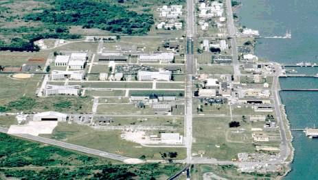
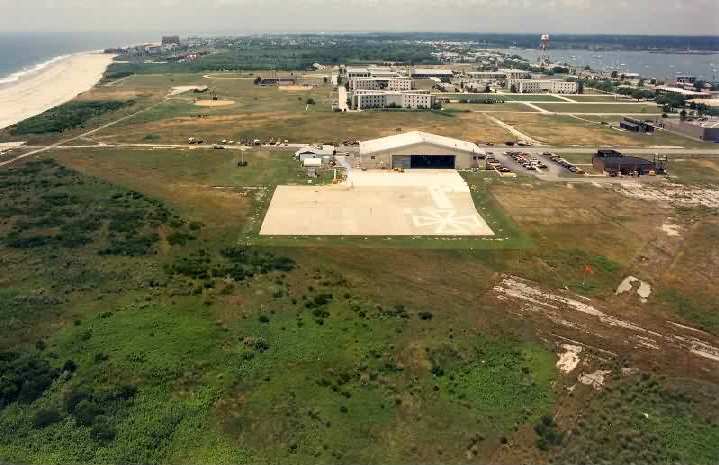
A circa 1995-2002 aerial view looking west at the Cape May facility (USCG photo).
The new Coast Guard helicopter runway is in the lower-left of picture, built over the remains of one of the WW2-era Navy runways.
The post-WW2 helicopter hangar was visible at the bottom-left, and the WW2-era hangar was visible at center-bottom.
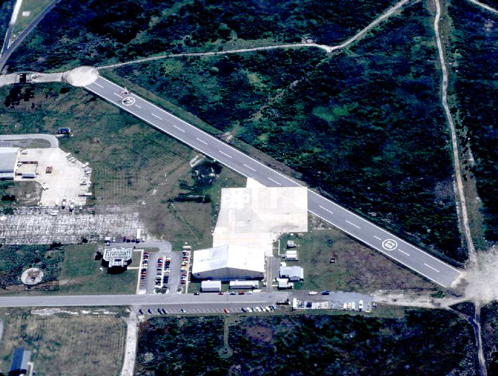
The last photo which has been located showing an aircraft operating at CGAS Cape May was a 6/3/97 USCG aerial view by Thomas Blair looking east at Runway 3/21,
with a HH-65 Dolphin hovering over the Runway 21 numbers.
Budget considerations (as well as the advanced age of the Cape May facilities)
prompted the Coast Guard to consolidate the helicopter operations of Cape May & Brooklyn, NY
at a new location at Atlantic City International Airport.
The new facility at Atlantic City International Airport opened in 1998, leaving Cape May once again without any based aircraft.
However, as of 1998 the base at Cape May was still listed in the Airport Facility Directory as an active airfield.
The former Cape May airfield was depicted as a heliport simply labeled "CGAS" on the 2002 Washington Sectional Chart (courtesy of Jonathan Westerling).
A 2002 aerial photo showed that the 1960s-era helicopter hangar on the west side of the runway
had been removed at some point between 1995-2002.
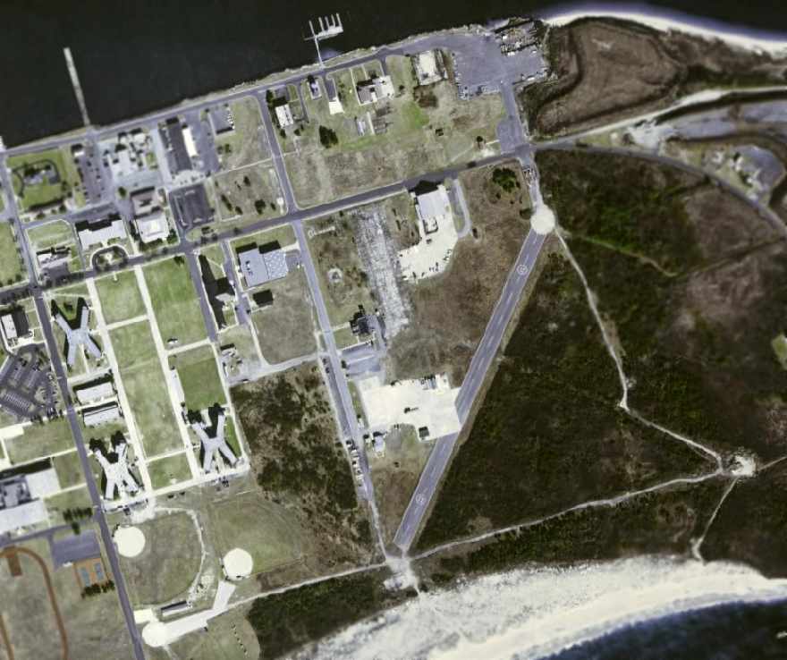
A circa 2006 aerial photo depicted the recently-constructed Runway 3/21,
as well as the remains of pavement from the WW2-era Naval Air Station.
The WW2-era hangar remained northwest of the new runway.
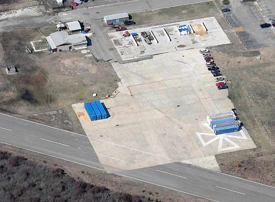
A circa 2006 aerial photo looking west at the site of the helicopter hangar located on the west side of Runway 3/21.
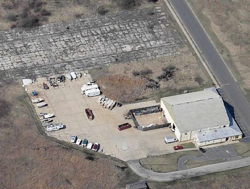
A circa 2006 aerial photo looking west at the site of WW2-era hangar located on the northwest side of Runway 3/21.
The cracked pavement in the background is the remains of the floor of the former dirigible hangar,
and the north end (right side) of that pavement is the site of the WW2-era operations building / control tower.
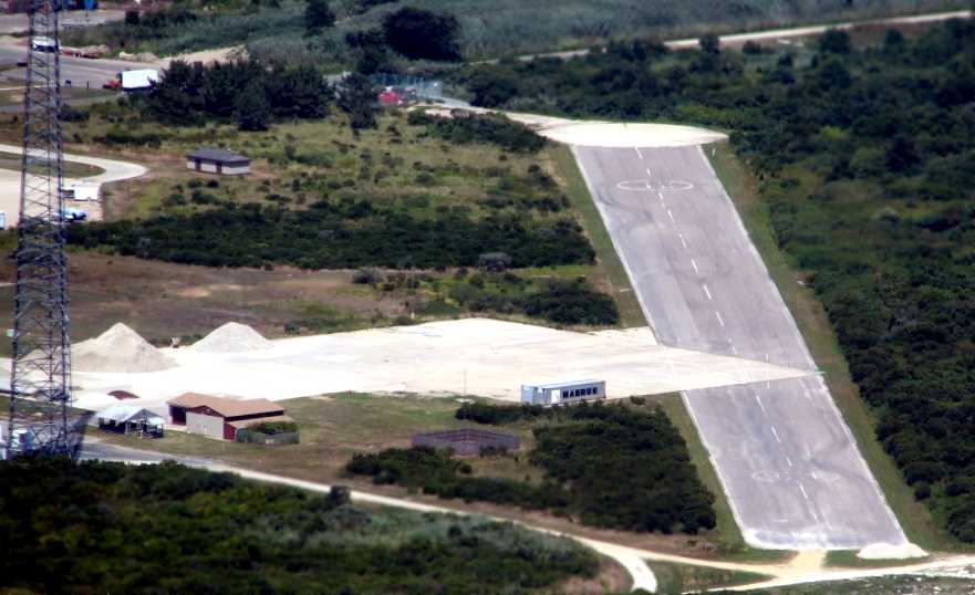
An 8/12/07 aerial view by Philip Kineyko of www.FlyinPhilsPhotos.com, looking northeast along Cape May's abandoned Runway 3/21,
and the ramp which was the previous location of the helicopter hangar.
As of 2007, the Coast Guard heliport at Cape May was no longer listed among active airfields in the FAA's Airport/Facility Directory,
nor depicted on aeronautical charts.
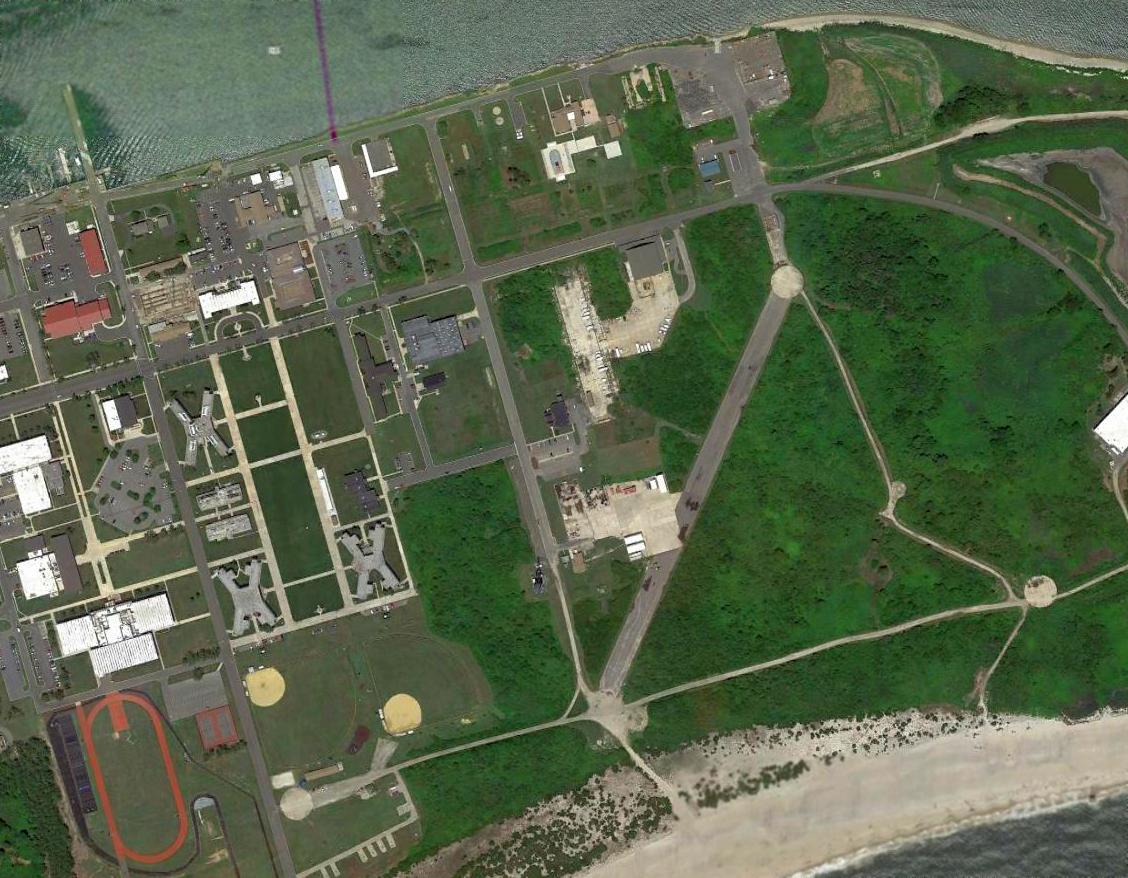
A 2015 aerial view depicted Cape May's post-WW2 Runway 3/21, along with the remains of pavement from the WW2-era Naval Air Station.
The WW2-era hangar remained northwest of the new runway.
See also: http://www.capemay.com/coastguard.html
____________________________________________________
Or if you prefer to contact me directly concerning a contribution (for a mailing address to send a check),
please contact me at: paulandterryfreeman@gmail.com
If you enjoy this web site, please support it with a financial contribution.
____________________________________________________
This site covers airfields in all 50 states.