Abandoned & Little-Known Airfields
New York City: Brooklyn, Manhattan, Bronx
© 2002, © 2026 by Paul Freeman. Revised 2/20/26.
This site covers airfields in all 50 states: Click here for the site's main menu.
____________________________________________________
Please consider a financial contribution to support the continued growth & operation of this site.
Barren Island Airport / Floyd Bennett Field / New York NAS / Brooklyn CGAS (revised 2/20/26) - Curtiss Airport / Bronx Airport (revised 10/28/24)
Governor's Island AAF (revised 2/26/18) - Pan Am Metroport Heliport (revised 8/17/25) - World Trade Center Rooftop Heliport (added 12/7/21)
____________________________________________________
World Trade Center Rooftop Heliport, New York, NY
40.711, -74.013 (Lower Manhattan, NY)
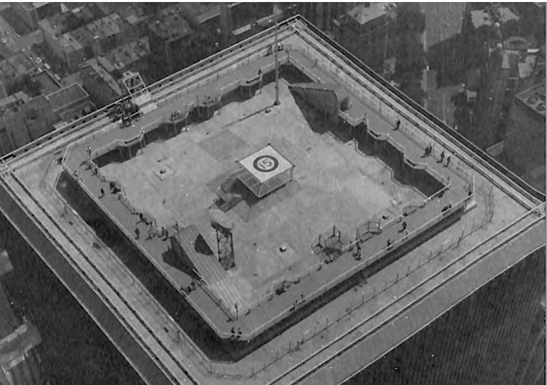
An undated aerial view looking northeast at the World Trade Center Rooftop Heliport, from the 1977 AIA Heliport Directory.
Construction began for New York's iconic World Trade Center towers on 3/21/66.
As of their 4/4/73 ribbon-cutting ceremony, the Twin Towers were the world's tallest buildings.
At some point, a small heliport was installed on center of the roof of the South Tower, 2 WTC.
The earliest depiction which has been located of the World Trade Center Rooftop Heliport was an undated aerial view from the 1977 AIA Heliport Directory.
It depicted the heliport as a small square elevated platform on the center of the South Tower roof, marked as Heliport 15,
surrounded by the observation walkway which ran around the periphery of the roof.
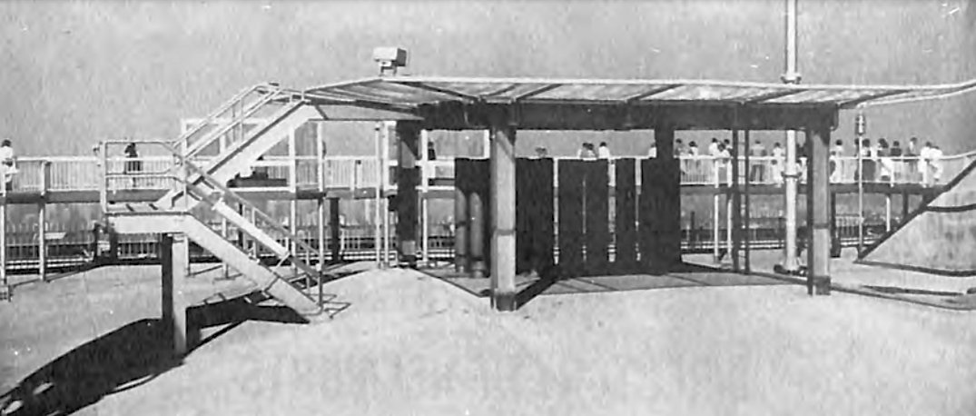
An undated profile view of the World Trade Center Rooftop Heliport, from the 1977 AIA Heliport Directory.
It was captioned, “This 55' x 50' facility is for business use by the Port Authority of NY/NJ,
as well as for emergency evacuations when the only way out is up.”
How sad that this emergency use could not have been taken advantage of, when it was ultimately needed 24 years later.

A remarkable undated aerial view looking east at the World Trade Center Rooftop Heliport,
showing the observation walkway surrounding it, and the Brooklyn Bridge visible in the background.
Inexplicably, the World Trade Center Rooftop Heliport was not depicted at all on the 1979 or 1987 NY Terminal Aeronautical Charts.
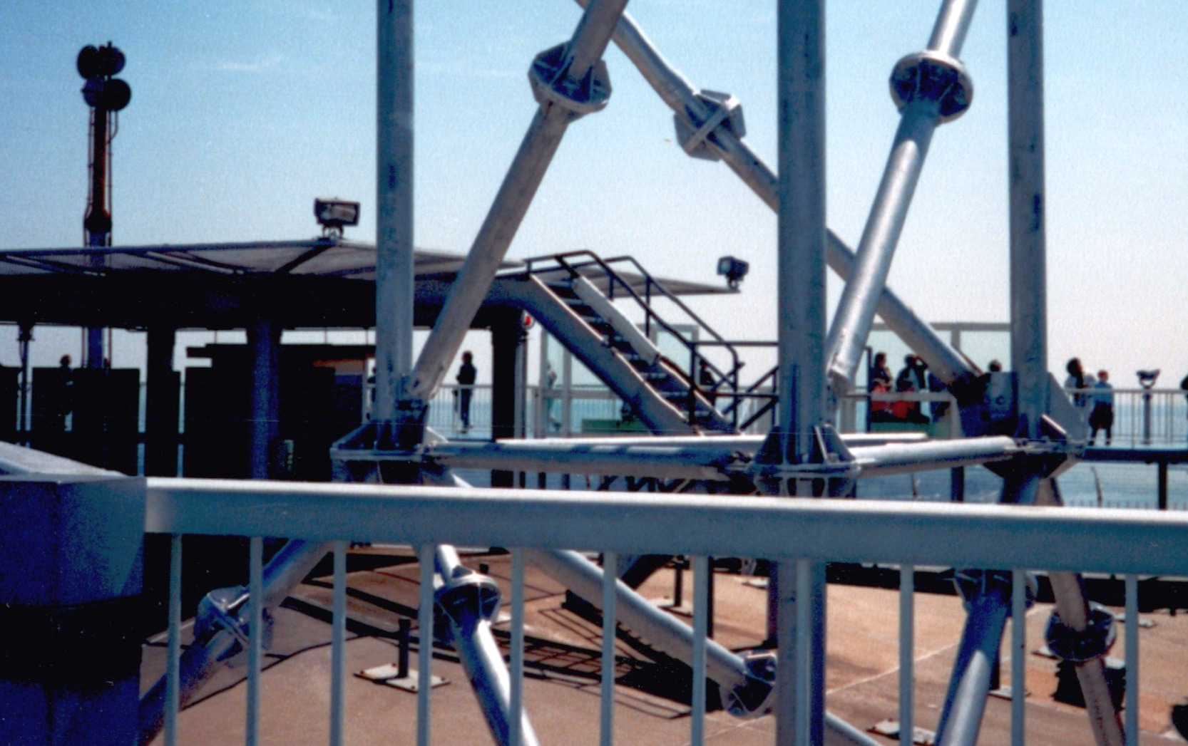
A Spring 1987 profile view of the World Trade Center Rooftop Heliport by Jonathan Westerling.
Tragically, the Twin Towers were destroyed in the 9/11/01 terrorist attacks.
____________________________________________________
Pan Am Metroport Heliport (6N4), New York, NY
40.753, -73.977 (Midtown Manhattan, NY)

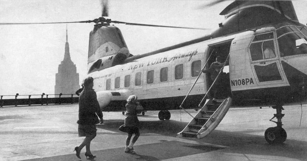
An 8/15/65 aerial view of the Beatles taking off from the Pan Am Building in a NY Airways Boeing Vertol 107-II helicopter, bound for their Shea Stadium concert (courtesy of Kevin Walsh).
The 59 story Pan Am Building was constructed in 1963 at 200 Park Avenue at East 45th Street above Grand Central Terminal in Midtown Manhattan.
It was built to serve as the headquarters of Pan American World Airways, which originally occupied 15 floors of the building.
The building was designed by Emery Roth & Sons, Pietro Belluschi and Walter Gropius in the International style.
It was the world's largest commercial office space by square footage at its opening.
The Pan Am Building was the last tall tower erected in NYC before laws were enacted preventing corporate logos & names on the tops of buildings.
It bore 15' tall "Pan Am" lettering on its north & south faces & 25' tall globe logos on the east & west.
According to Jonathan Westerling, “Shortly after its construction in 1963, a heliport was constructed on roof of the 59 story building.
According to an article in the NY Times the cost of the heliport was $1million.
It consisted of a massive flat area which covered over half of the building's rooftop with lights all around the outside
and a small 1-story terminal & waiting area in the northwest corner of the building (which still exists as of 2020).
A public outcry about potential noise pollution delayed operational approval,
but passenger service was finally begun in 1965 using a pair of twin-rotor Boeing Vertol 107-IIs capable of carrying 25 people.”
One of New York Airways' helicopter pilots was Perry Young, who was the first African American pilot of a regularly scheduled commercial airline in the United States.
Young would fly for NYA for 23 years.
The earliest photo which has been located of the Pan Am Heliport was an 8/15/65 aerial view (courtesy of Kevin Walsh) of the Beatles taking off in a NY Airways Boeing Vertol 107-II helicopter, bound for their Shea Stadium concert.
A circa 1960s photo of passengers loading onto a NY Airways Boeing Vertol 107-II helicopter at the Pan Am Heliport (courtesy of Jonathan Westerling).
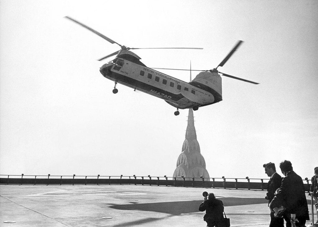
A circa 1960s photo of a NY Airways Boeing Vertol 107-II helicopter over the Pan Am Heliport, with the Chrysler Building in the background (courtesy of Jonathan Westerling).
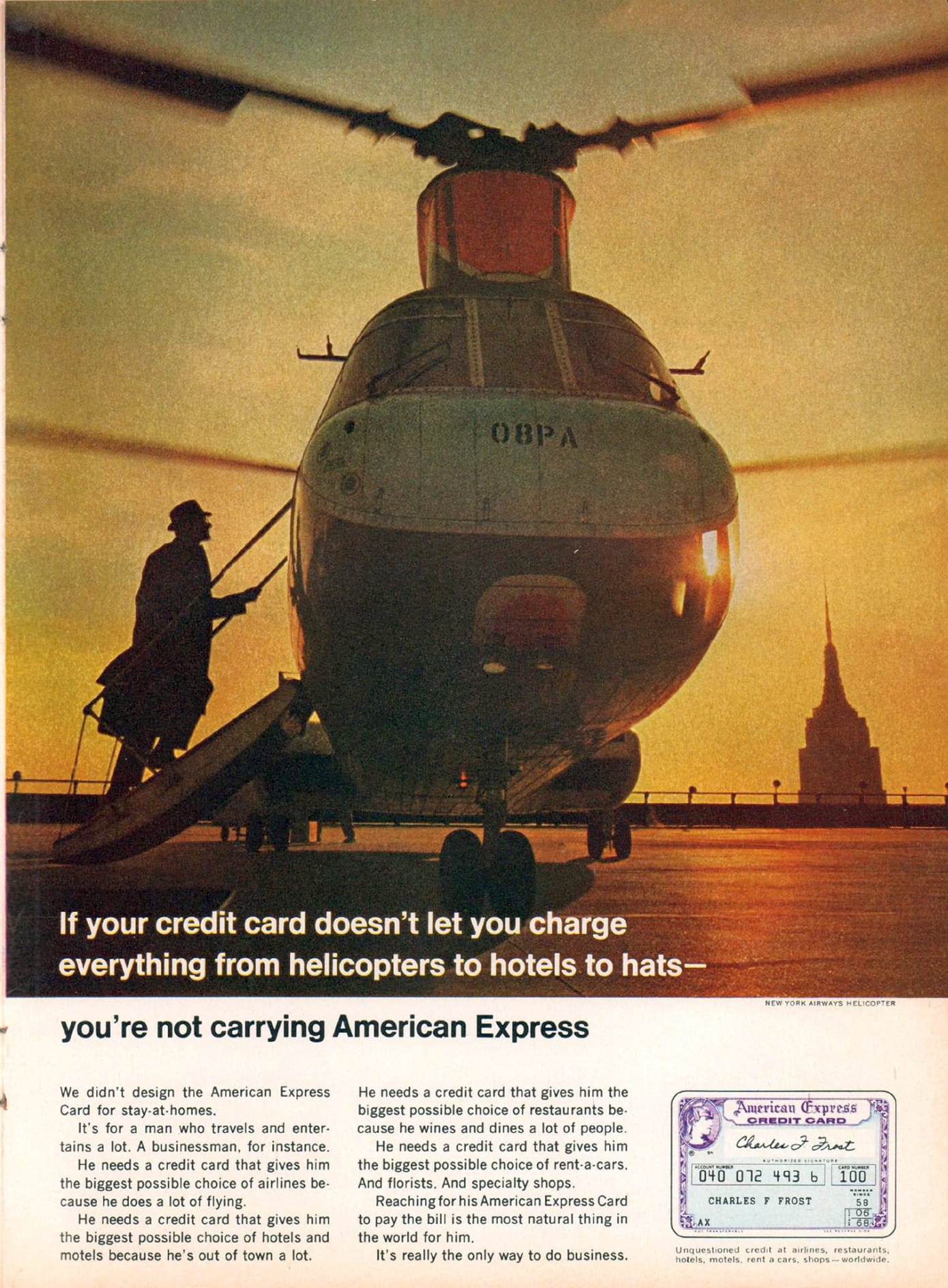
An undated photo from a 1967 American Express advertisement showing a NY Airways Boeing Vertol 107-II helicopter at the Pan Am Heliport, with the Empire State Building in the background (courtesy of Kevin Walsh).
A British newsreel (courtesy of Jonathan Westerling) stated that there were 17 trip flights each day to & from JFK & that the first paid passenger flight included NY Cardinal Francis Spellman.
A landing on the helipad was part of the 1968 Clint Eastwood film "Coogan's Bluff" where the main character lands on the Pan Am Heliport for a "business trip".
The passenger service was operated by NY Airways & continued for 3 years until February 1968.
For a short part of that time, they also offered service to Teterboro Airport.
Newspaper reports at the time cited a lack of profitability as the reason for the stoppage, but according to the NY Airways 1968 Annual Report,
the reason that service stopped was because “Pan American in August [1967] terminated its order with United Aircraft Corporation for the acquisition of 5 S-61 helicopters.
The purchase of these helicopters by Pan American" was a key part of the agreement between the 2 companies to continue to provide the ferry service.
The Pan Am Heliport was not yet depicted on the 1968 NY Local Aeronautical Chart.

A still from the 1968 movie “Coogan's Bluff” showing Clint Eastwood alighting from a NY Airways Boeing Vertol 107-II helicopter at the Pan Am Heliport (courtesy of Kevin Walsh).

A circa 1960s photo of a NY Airways Boeing Vertol 107-II helicopter at the Pan Am Heliport (courtesy of Kevin Walsh).

A circa 1960s photo of a NY Airways Boeing Vertol 107-II helicopter at the Pan Am Heliport (courtesy of Kevin Walsh).

A circa 1960s aerial view looking northeast at the Pan Am Heliport (courtesy of Kevin Walsh), showing the helicopter landing markings.

An amazing circa 1960s photo of a NY Airways Boeing Vertol 107-II helicopter landing on the Pan Am Heliport (courtesy of Kevin Walsh).
The heliport continued to operate, albeit without regular passenger service for private landings by executives.
Entries in the 1971 Airman's Information Manual and the 1972 Airport Handbook list the helipad as the "New York Metroport".
In May 1974, a young man hijacked a helicopter at gunpoint & forced the pilot to fly him to the top of the 59-story Pan Am building, where he demanded that a bikini-clad girl deliver a $2 million ransom.
The hijacker was captured by police & FBI agents after the pilot sprinted to safety & a 2nd hostage, a helicopter mechanic, tore the gun away & clubbed him.
According to Wikipedia, Service to JFK resumed in early 1977 using Sikorsky S-61s.
In February 1977 Pan Am reinstated ferry flights between the heliport & JFK Airport using 30-passenger Sikorsky S-61IL helicopters.
NY Airways again operated the flights but made an operational decision that would end up contributing to the demise of passenger service from the Pan Am Heliport:
they would not stop the rotors while loading passengers to save time & maintenance costs.
Three months later, tragedy struck on 5/16/77 when a minute after an S-61L landed & its 20 passengers disembarked,
the right front landing gear collapsed, causing the aircraft to topple onto its side with the rotors still turning.
One of the five 20' blades broke off & flew into a crowd of passengers waiting to board, killing 3 men instantly, with another dying later in a hospital.
The blade sailed over the side of the building & killed a female pedestrian on the corner of Madison Avenue & 43rd Street, and 2 other people were seriously injured.
Passenger flights from the heliport were immediately suspended, and never resumed.
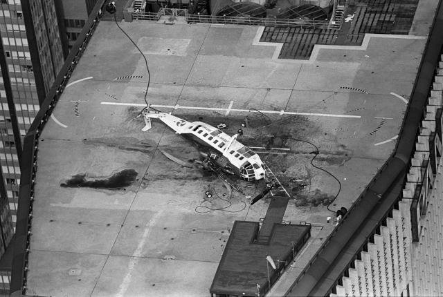
An undated aerial view looking northwest at the wreckage of the Sikorsky S-61L which crashed at the Pan An Heliport on 5/16/77 (courtesy of Jonathan Westerling).
Though commercial passenger flights never resumed, the heliport continued to operate as a private landing area for decades thereafter.
The earliest aeronautical chart depiction which has been located of the Pan Am Heliport was on the 1979 NY Terminal Aeronautical Chart.
The 1979 Airports USA (courtesy of Jonathan Westerling) listed the Pan Am heliport as having a total of four 35' square helipads of reinforced asphalt.
The Metropolitan Life Insurance Company bought the building in 1981 & used it as their headquarters, but it also remained Pan Am's headquarters.
The 1983 Airports USA (courtesy of Jonathan Westerling) listed the Pan Am heliport as having a total of four 35' square helipads of reinforced asphalt.
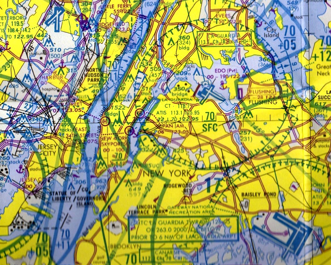
The last aeronautical chart depiction which has been located of the Pan Am Heliport was on the 1987 NY Terminal Aeronautical Chart.
By 1991, Pan Am's presence in their building had dwindled to 4 floors; during that year Pan Am moved its headquarters to Miami.
In September 1992, MetLife announced that it would remove Pan Am signage from the building, renaming it the "Met Life Building" but the name of the heliport was never changed.
The last directory which lists the Pan Am Metroport is the 2003 Airports USA.
According to the NY State Department of Transportation's 2003 Annual report on Aviation, the heliport on top of the Pan Am building was officially closed in that year.
In 2005, MetLife sold the building for $1.7billion, the highest price at the time for an office building in the US.
The buyers were a joint venture of Tishman Speyer Properties, the NYC Employees' Retirement System, and the NYC Teachers' Retirement System.
The Pan Am Heliport was no longer depicted on the May 2009 NY Terminal Aeronautical Chart.
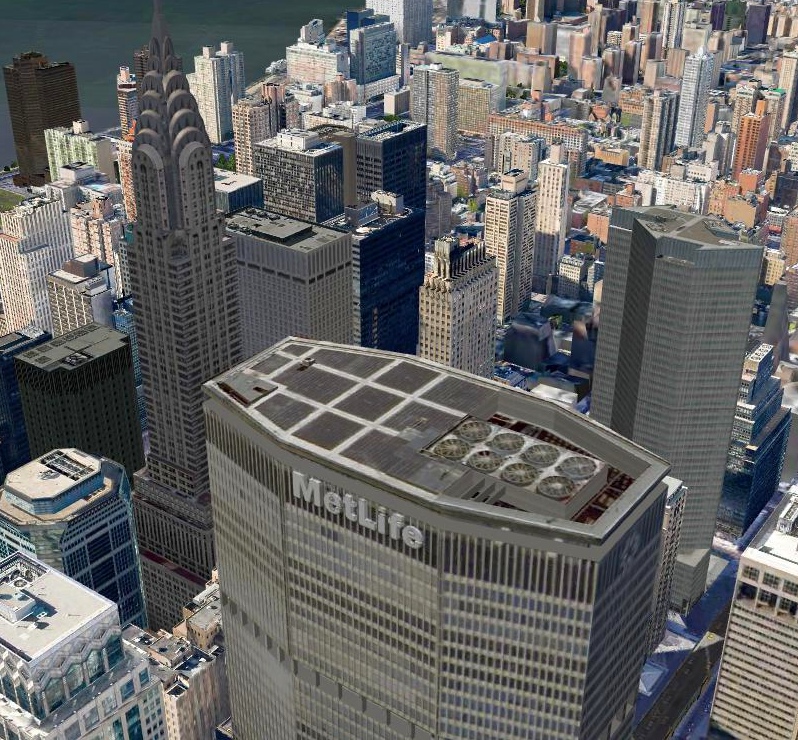
A 2019 3-D aerial depiction looking southeast at the MetLife Building, with the former Pan Am Heliport on its roof, with the Chrysler Building in the background.
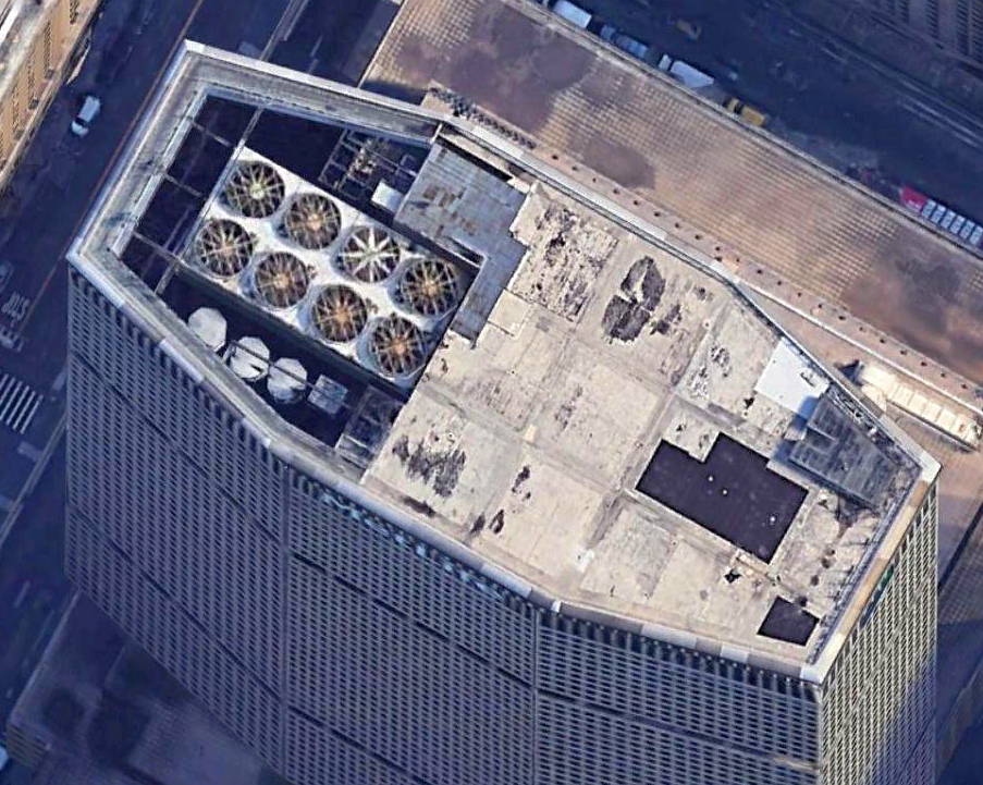
A 2019 aerial view looking north at the former Pan Am Heliport on the roof of the MetLife Building.
Thanks to Jonathan Westerling for pointing out this airfield.
____________________________________________________
Curtiss Airport / Bronx Airport, Bronx, NY
40.875, -73.829 (North of Manhattan, NY)
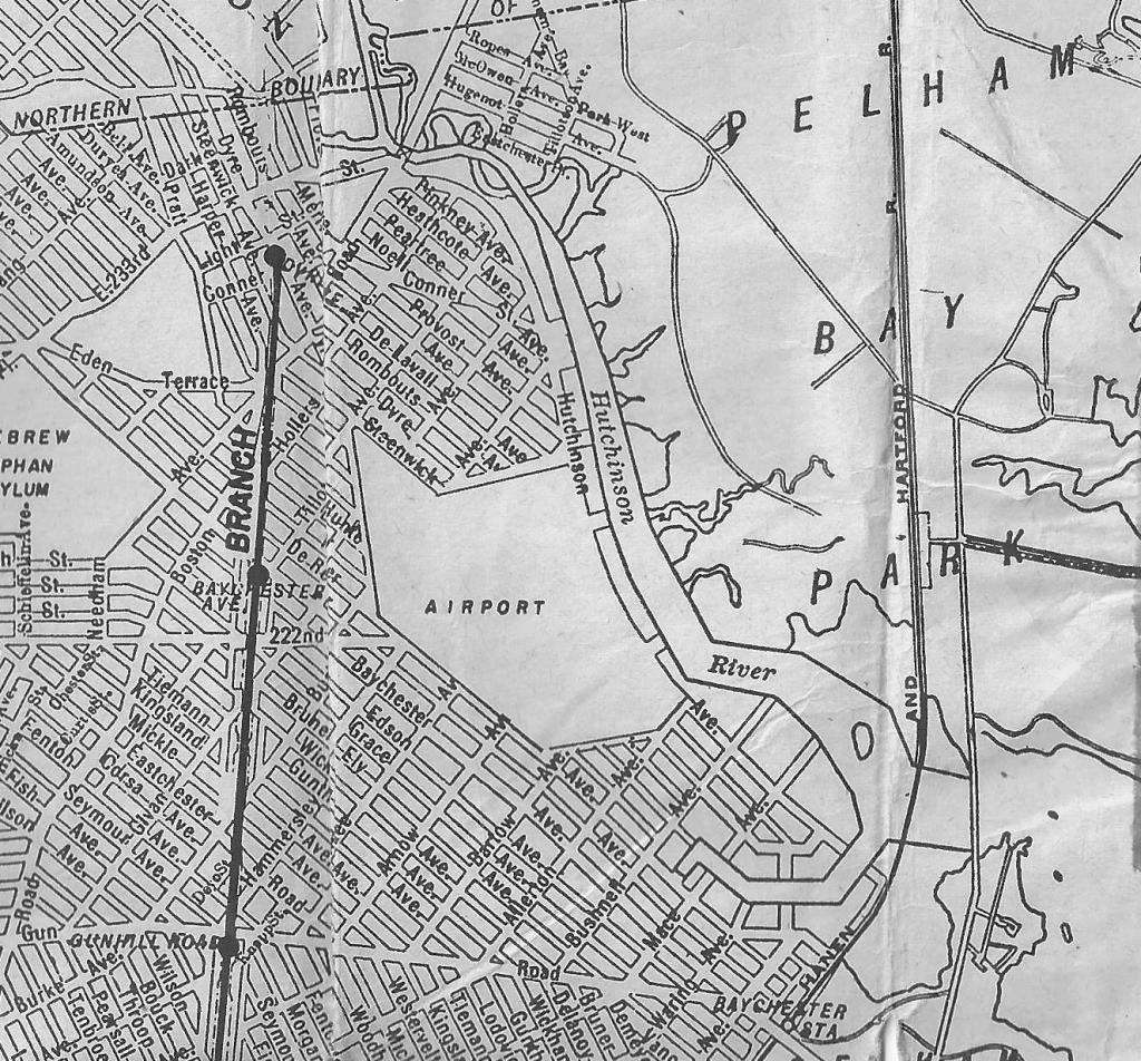
Bronx Airport / Curtiss Airport was labeled simply as “Airport” on a circa late 1930s How-To-Get-There Map (courtesy of Angelo Moscarello).
Photograph of the airport in unavailable.
How many current residents of New York City know that the location of the massive Co-Op City complex was once planned to be an airport, and later became an amusement park?
According to the 9/28/17 New York Times article “The Bronx Airport That Never Was” (courtesy of Ray Jacobelli),
“Discussion of a large airport in the New York area dates to 1925, but little was done until 1927, when Charles Lindbergh’s solo trans-Atlantic flight kicked the effort into high gear.
By the end of the year, the Commerce Department, led by future president Herbert Hoover, had identified 6 potential locations: 4 in New York City, 2 in New Jersey.
Curtiss-Wright Corporation [was] at the time the nation’s largest aviation firm.
With more than $35 million in cash on hand, Curtiss-Wright set out to expand its business from simply manufacturing aircraft to creating a system of airports across the nation.
New York was a natural fit, and the marshland of the eastern Bronx provided good value.
Curtiss-Wright quickly began buying up properties in the Bronx, hoping to create what a local newspaper described as 'the world’s largest airport on the shore of Eastchester Creek.'
Residents of the neighboring Village of Pelham Manor, understandably, did not like the idea of an airport in their backyard;
although the village was located in Westchester County, local officials attempted to alter zoning laws to prevent the airport’s construction.
The airport appeared inevitable, but in October 1929, the stock market crashed.
By 1936, Curtiss-Wright was more than a half-million dollar in arrears on its property taxes on this one site, and soon liquidated its airport subsidiary.”
No airport at this location was depicted on the August 1932 NY Sectional Chart (or later Sectional Charts).
A circa late 1930s Little Red Book Street Guide to NYC (courtesy of Angelo Moscarello)
depicted a clearing on the west bank of the Hutchinson River, labeled simply as “Airport”.
A circa 1930s-40s photo captioned “Curtiss Airport – Bronx” depicted a vacant lot,
and a 1941 photo captioned “Bronx Airport” depicted a similar scene.
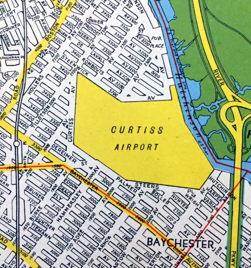
The last depiction which has been located of Curtiss Airport was a 1947 street atlas (courtesy of Kevin Walsh).
It depicted Curtiss Airport as an irregularly-shaped property outline, but without any runways or other details.
The 1947 USGS topo map did not depict an airfield at this location,
nor did a 1951 aerial photo show any recognizable trace of an airfield.
Ray Jocabelli recalled, “Bronx Curtiss Airfield... Between 1957-59 I used to accompany my Dad out to this field to fly radio-controlled single-channel model airplanes.
He was a member of the Baychester RC Model Club.”
An odd chapter in the history of this property began in the late 1950s,
when a former Disney executive who had helped plan Disneyland designed & built Freedomland on the Bronx site, billed as "The World's Largest Entertainment Center".
Freedomland opened in 1960, but then closed after only 4 years.

A circa 1960-64 depiction of the Freedomland theme park which briefly occupied the Curtiss Airport site.
Freedomland's short lifespan was apparently planned all along,
as a variance issued to the property owners allowed them to eventually build multi-story buildings on the site if they first built smaller buildings which stood safely for 5 years.
Once that timespan had elapsed, the amusement park was declared insolvent, and the huge complex of multi-story buildings of Co-Op City were constructed in 1973.
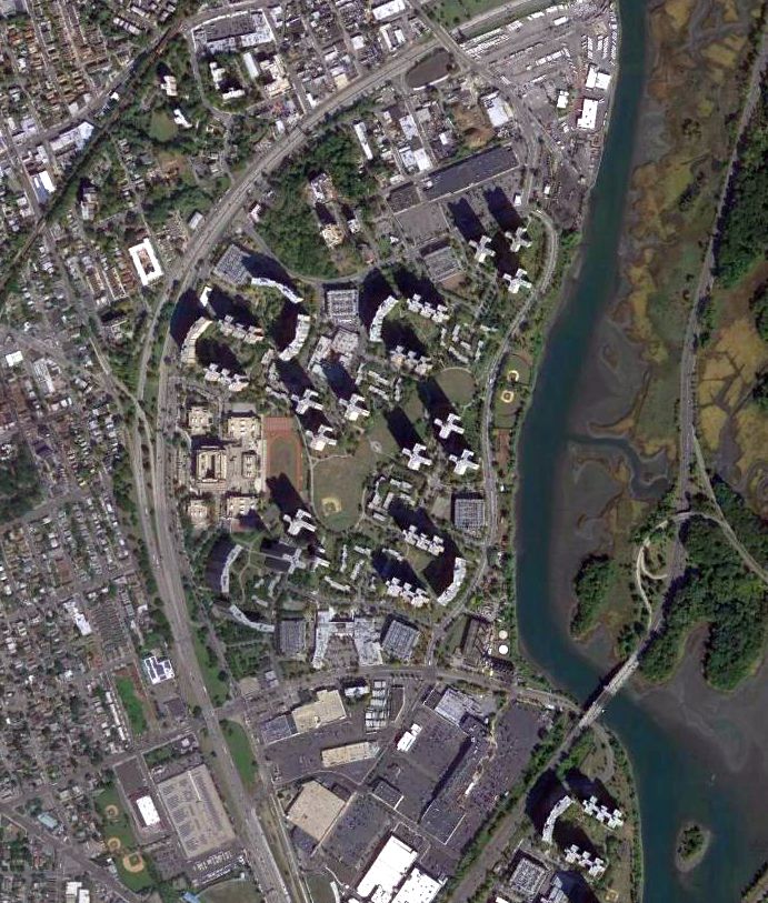
A 2014 aerial view of Co-Op City showed no remaining trace of Curtiss Airport / Bronx Airport.
The site of Curtiss Airport / Bronx Airport is located southeast of the intersection of Interstate 95 & Co-Op City Boulevard.
Thanks to Angelo Moscarello for pointing out this airfield.
____________________________________________________
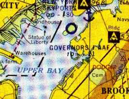
Governor's Island Army Airfield, Governor's Island, NY
40.69, -74.02 (South of Manhattan, NY)
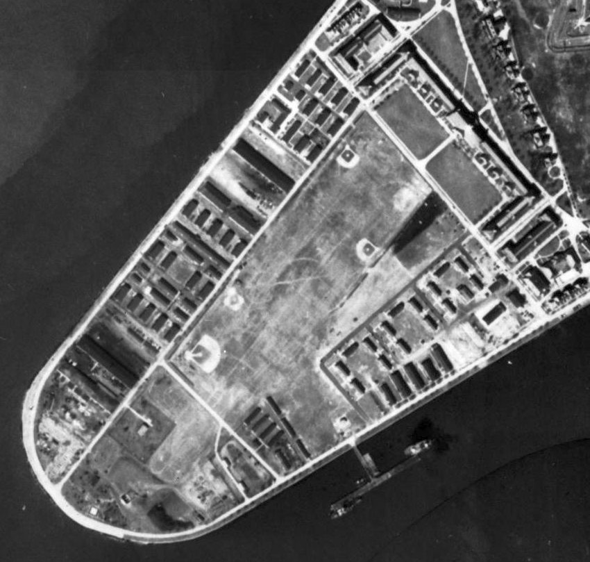
A 1924 aerial view of the southwest end of Governor's Island (from the NYCityMap, courtesy of Chris Kennedy).
How many residents of New York City know about this former military airfield
which was located on an island in the middle of New York Harbor, right next to the Statue of Liberty?
Governor's Island's connection to aviation goes all the way back to September 29, 1909,
when Wilbur Wright made the 1st flight from the Island around the Statue of Liberty.
Another historic flight occurred on May 29, 1910,
when Glenn Curtiss landed on the Island to complete his flight from Albany
and win a $10,000 prize offered by Joseph Pulitzer, publisher of the New York World.
A memorial in honor of the early Governor's Island flights was erected on the south side of Liggett Hall on December 17, 1954
by the "Early Birds", an organization of "those who flew solo before December 17, 1916."
During the next few years other flights from the Island were made by aviation pioneers,
and from May 1916 to March 1917, an aviation training center was operated there.
With the approval of Major General Leonard Wood, Commander of Governors Island,
a group of civilians established the flying school to promote the development of military aviation.
The earliest depiction which has been located of Governor's Island
was 1924 aerial view (from the NYCityMap, courtesy of Chris Kennedy).
It showed a cleared grass northeast/southwest runway,
with a row of buildings (hangars?) along the southeast side.
The Governor's Island Airfield, as depicted (the red rectangle) on a circa 1924 Sperry Instruments map of landing fields (courtesy of Tom Heitzman).
The Governor's Island Airfield was evidently closed at some point between 1924-29,
as it was no longer depicted on the 1929 Washington – New York City Air Navigation Map #3.
The next phase in the timeline of Governor's Island's connection to aviation came in the 1950s,
when the U.S. Army established a grass landing strip on the island.
The date of establishment of the Governor's Island Army Airfield has not been precisely determined.
It evidently was constructed at some point between 1950-54,
as it was not yet depicted on the 1947 USGS topo map nor on the 1950 NY Sectional Chart (courtesy of Mike Keefe).
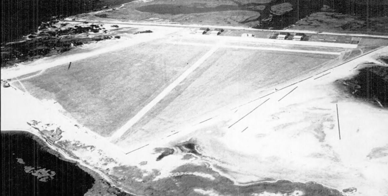
A 1951 aerial showed Governor's Island to have a single unpaved grass runway, bracketed by several baseball diamonds.
The earliest chart depiction of the Governor's Island airfield which has been located
was on the 1953 NY Terminal Aeronautical Chart (courtesy of Tim Zukas).
It depicted Governor's Island AAF as having a 2,200' unpaved runway.
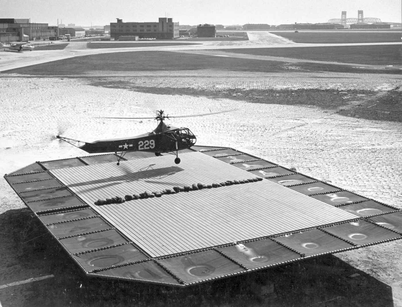
The only photo which has been located showing aircraft on Governor's Island was a 1954 aerial view,
which depicted a total of 5 single-engine aircraft parked along the northwest side of the grass runway.
The 1955 USGS topo map did not depict any runway or other aviation facilities on Governor's Island.
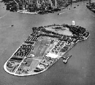
An undated (circa 1955?) aerial view looking north at Governor's Island (courtesy of Ed Drury),
with the Manhattan skyline visible in the background.
The runway was still recognizable in the center of the island, but still bracketed by several baseball diamonds.
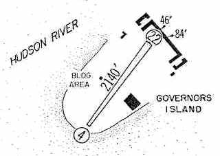
The 1960 Jeppesen Airway Manual (courtesy of Chris Kennedy)
depicted Governor's Island AAF as having a single 2,140' unpaved Runway 4/22.
The 1962 NY Local Aeronautical Chart (courtesy of Mike Keefe)
depicted Governor's Island AAF as having a 2,100' unpaved runway.
According to CAP Lt. Col. Henry Deutch, “Prior to the closing of the airfield on Governor's Island
all 1st Army aviation was headquartered at Fort Jay.
When Capehart Family Housing replaced the Governor's Island Airfield,
1st Army Fixed Wing Operations were transferred to Miller Army Airfield.”
The Governor's Island AAF was evidently closed (for reasons unknown) at some point between 1962-65,
as it was no longer depicted on the 1965 NY Sectional Chart (courtesy of John Voss).
By 1966, Governor's Island itself had been ceded by the Army to the Coast Guard,
who apparently did not find any need for an airfield on their new island.
A 1966 aerial view showed the runway remained clear, but there were no aircraft visible on the field.
The 1967 USGS topo map did not depict any runway or other aviation facilities on Governor's Island.
A 1980 aerial view showed that baseball fields had covered the former runway at some point between 1966-80.
The Coast Guard vacated Governor's Island in 1996.
The island was been planned to be reopened as a park, but those plans have been continually delayed,
and the island was still not open to the public as of 2004.
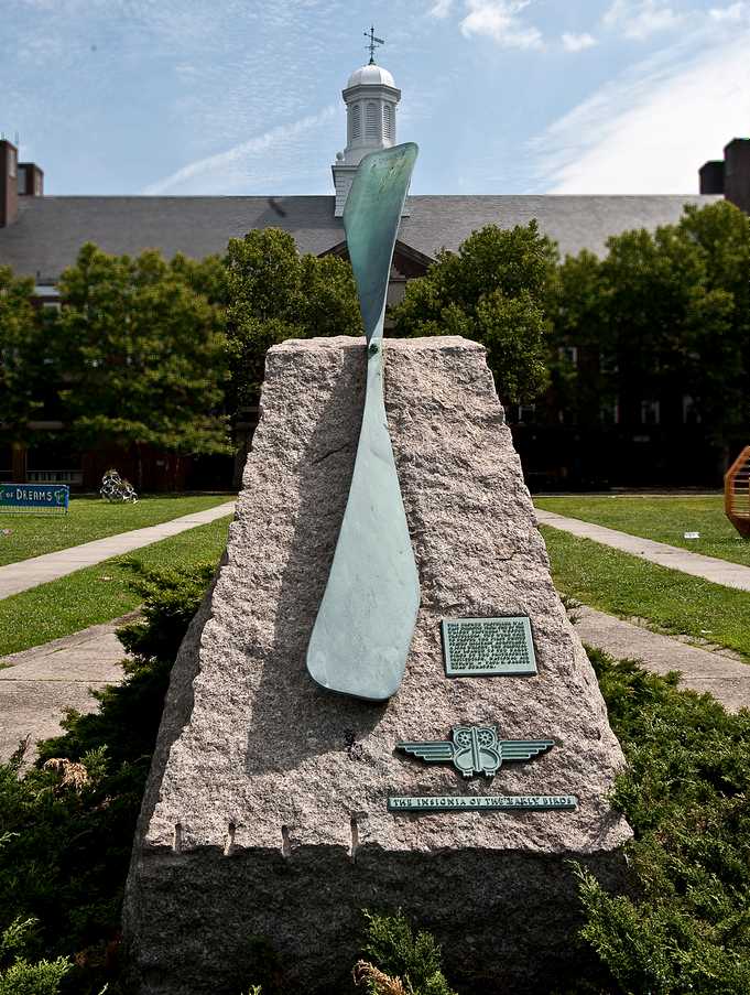
A 2009 photo by Ronald Claiborne of the monument commemorating Governor's Island's early aviation history.
The text on the monument reads: “Early aviation history was made here when these pioneers flew powered aircraft to and from this site between 1909-16.
Wilbur Wright, Lincoln Beachy, Glenn Curtiss, Eugene Ely, Charles Hamilton, Hugh Robinson, Harry Atwood, James Ward, Harry Jones. Albert Heinrich,
Harold Kanther, Victor Carlstrom, Steve MacGordon, Raynal Bolling, Ruth Law.
From May 1916 to March 1917, members of the Governors Island Training Corps flight trained here.
Captain Philip Carroll – Commanding, Filip Bjorklund – Instructor, Charles Reed, Lawrence Sperry, Walter Struthers,
Hobart Baker, William Aarned, Al Sturtevant, Frederick Blakeman. Edwin Post, Stedman Hanks, William Walton,
Cord Meyer, Albert Gaines, Charles Wiman, Howard Lapsley, James Miller, John Rutherford, Seth Low.
Major General Leonard Wood, U.S.A. - Commanding, Headquarters, Eastern Department.
Erected under the auspices of the Early Birds, an organization of those who flew solo before December 17, 1916.”
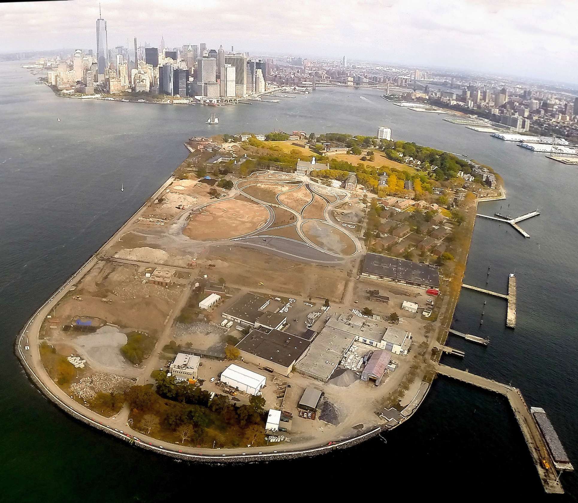
A 10/13/13 aerial view by Butch Moran looking north at the site of the Governor's Island Airfield.
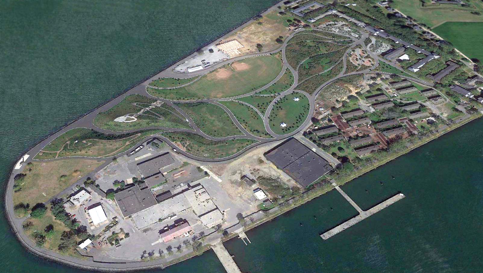
A 2017 aerial view looking north at the site of the Governor's Island Airfield.
____________________________________________________
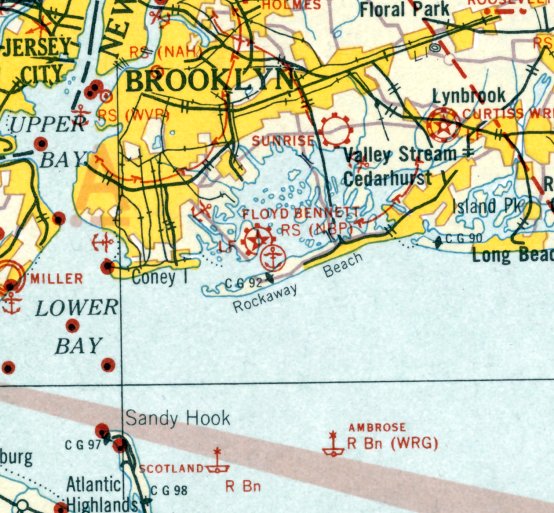
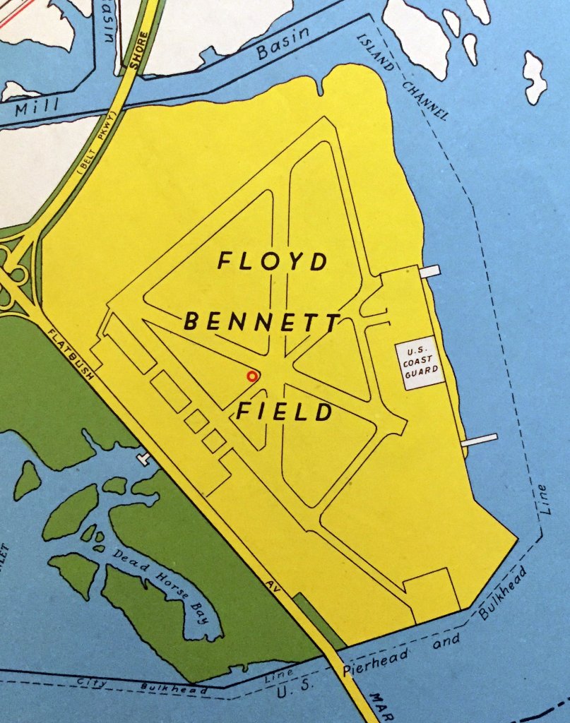
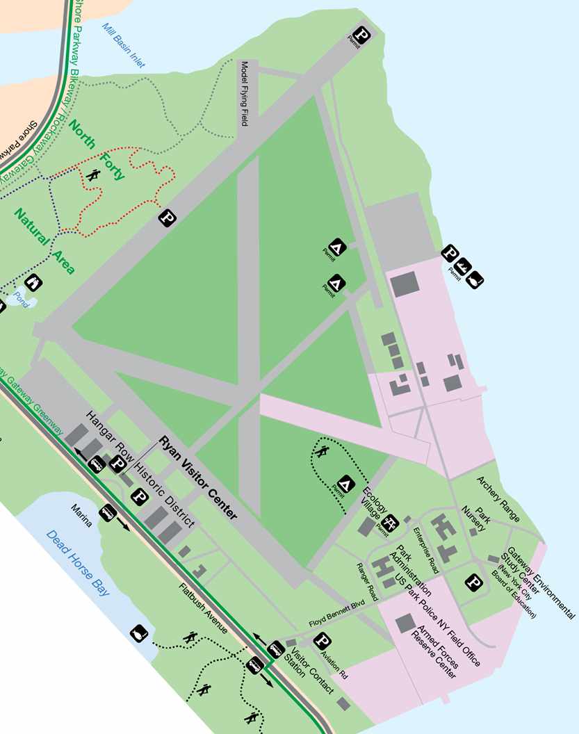
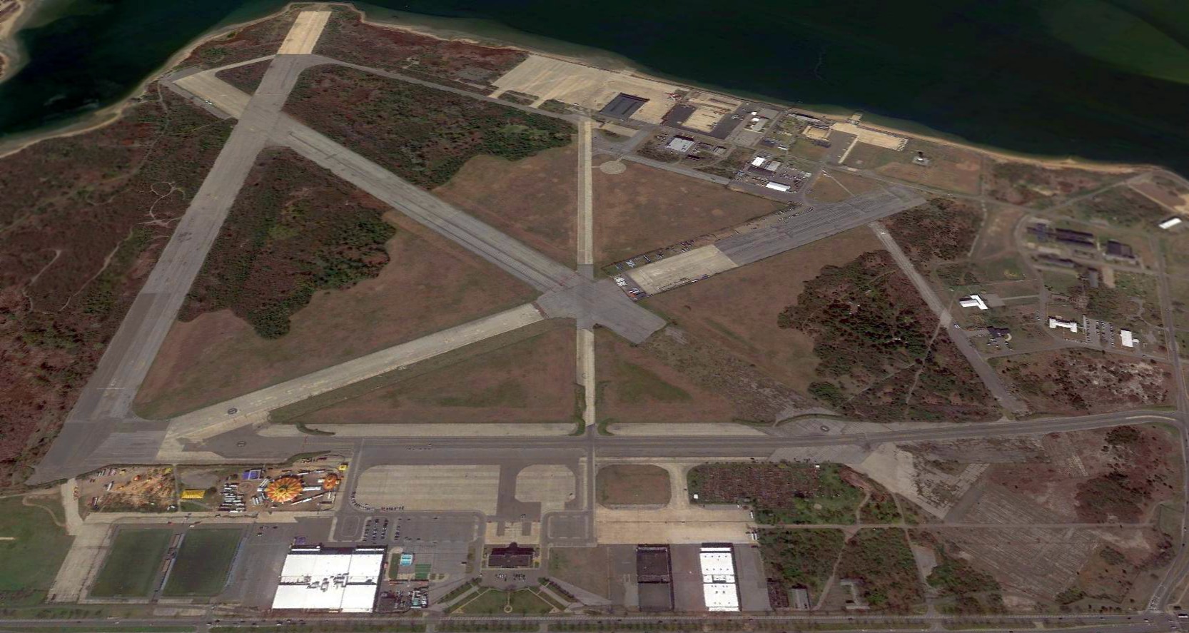
Barren Island Airport / Floyd Bennett Field / New York Naval Air Station /
Brooklyn Coast Guard Air Station (NOP), Brooklyn, NY
40.6, -73.9 (Southwest of Kennedy Airport)
The first airport on this site was a small field named Barren Island Airport.
Pilot Paul Rizzo established established Barren Island Airport in 1927.
He used a compacted dirt runway to take up customers for joy-rides.
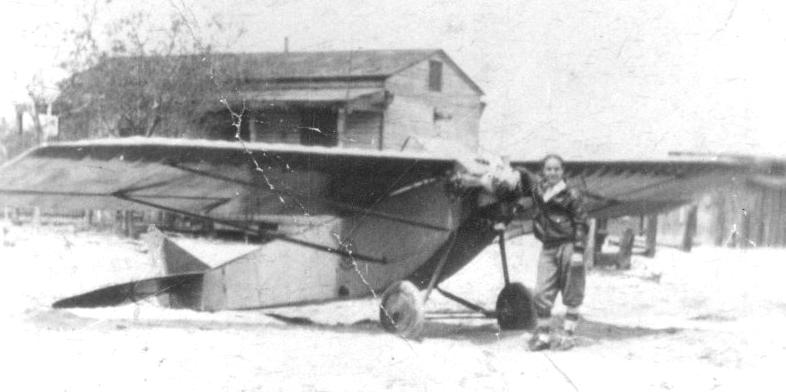
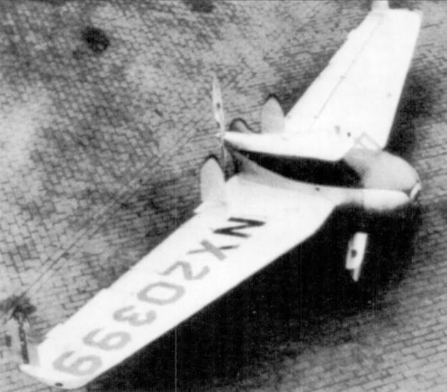
The only photo which has been located of Barren Island Airport was a circa 1927-28 photo (from the David Hill collection) of an Epps Model 1924 monoplane.
David Hill reported, “Bill Rodenberg was a friend of the owner, Norm McCandless, who bought the plane from the builder, Ben Epps Sr of Athens GA about 1928.”
According to Peter Maefield's 1972 Wings Club of NYC speech (courtesy of Dave Kanzeg),
“In 1928, in the course of the post-Lindbergh boom in aviation,
Clarence Chamberlain was commissioned by the City of New York to recommend a site for a new, close-in, airport.
He chose Barren Island - a dumping ground in Brooklyn.
New York City pumped sand out of Jamaica Bay, and made a 321-acre airport, raised some 16 feet above sea level.
It was connected to Flatbush Avenue which runs across Kings, Brooklyn to the Manhattan Bridge.
Clearly it was an excellent site, 13 miles from 42nd Street.
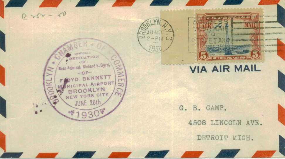
It was also given the title of 'Floyd Bennett Municipal Airport' after Admiral Richard Byrd's pilot & right-hand man on earlier Polar flights.”
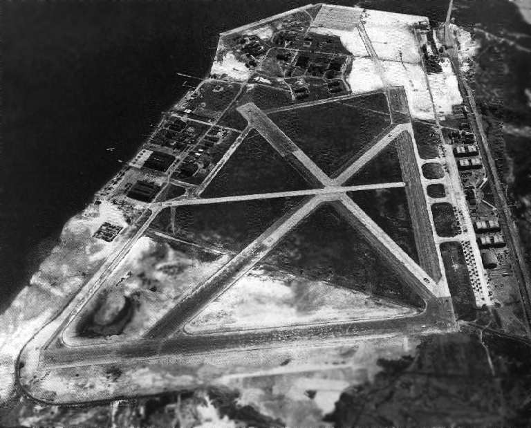
As initially constructed, Floyd Bennett Field had 2 concrete runways: 4,000' Runway 6/24 & 3,100' Runway 15/33.
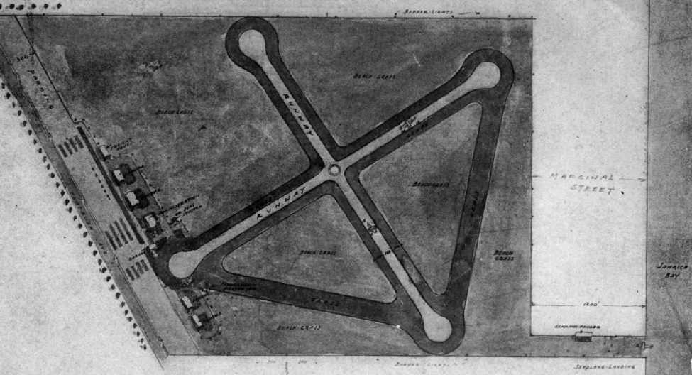
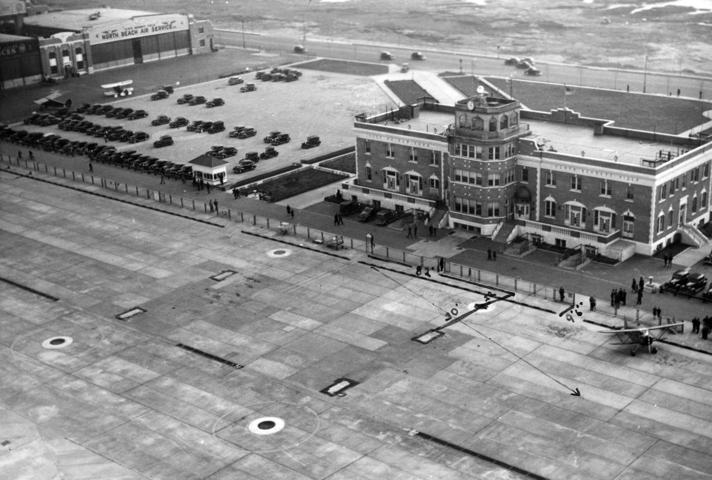
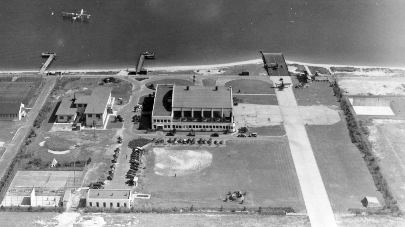
The airfield layout from the 3/29/28 Flatbush Chamber of Commerce dedication program for the “Municipal Airport for the City of New York” (courtesy of Tom Heitzman).
Upon completion of the field, Floyd Bennett was selected by the Navy as the site of one of 8 Naval Reserve Bases, with the mission of providing flight training.

The earliest aeronautical chart depiction which has been located of Floyd Bennett Field was on the 1929 Washington - New York City Air Navigation Map #3.
It depicted Floyd Bennett as having a landplane airfield & a seaplane base.
A 1929 City of NY Desk Atlas of Brooklyn depicted an outline around “Municipal Airport (Floyd Bennett Field)”.
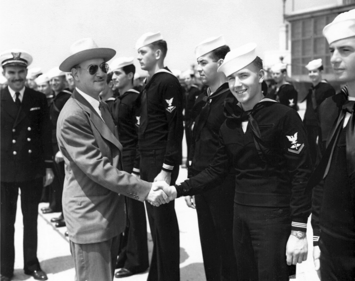
The NYPD Aviation Bureau was established at Floyd Bennett Field in 1929
when the Police Air Service Division was established from funds donated by Rodman Wanamaker, a famed World War I ace.
One of the first planes purchased was a 3-seat Loening Commuter Amphibian, powered by 90 horsepower engine.
The 3rd seat, called the "Angel" seat, was kept vacant for the angel the crew hoped would ride with them on each flight.
One of the first rescues was made when 2 swimmers were carried away by the tide.
The water was too choppy for landing, so the copilot leaped from the flying plane into the water & both swimmers were towed to shore.
According to Peter Maefield's 1972 Wings Club of NYC speech (courtesy of Dave Kanzeg),
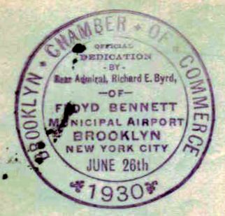
“It was dedicated as 'The Municipal Airport for the City of New York' on 5/23/31.”
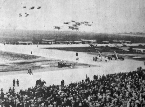
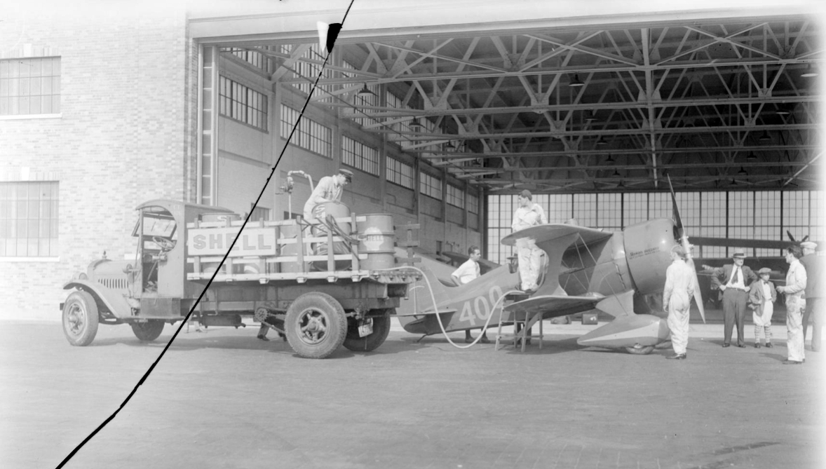
A photo captioned “Air dogfights thrill crowd at new airport” of Floyd Bennett Field from a 5/24/31 newspaper (courtesy of Butch Moran).
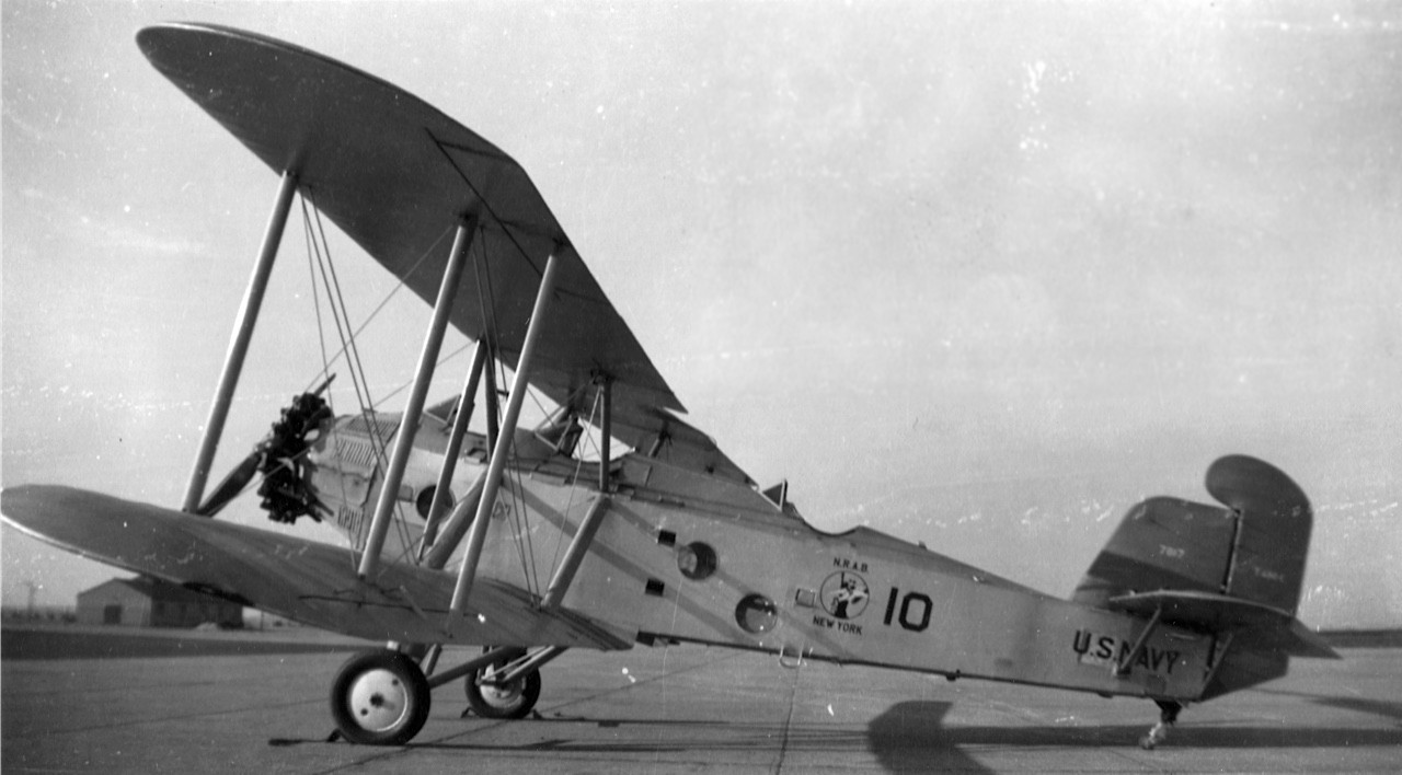
A circa 1931-38 photo of a Martin T4M-1 torpedo bomber in the markings of Naval Reserve Aviation Base NY, presumably taken at Floyd Bennett Field (courtesy of Richard Porcelli).
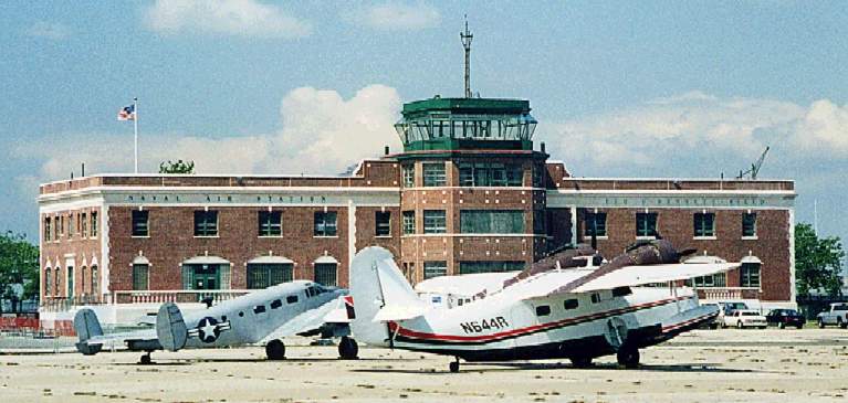
Navy operations began at the field in 1931, which was designated Brooklyn Naval Air Station.
The Army mail service also shared the field in the early years.
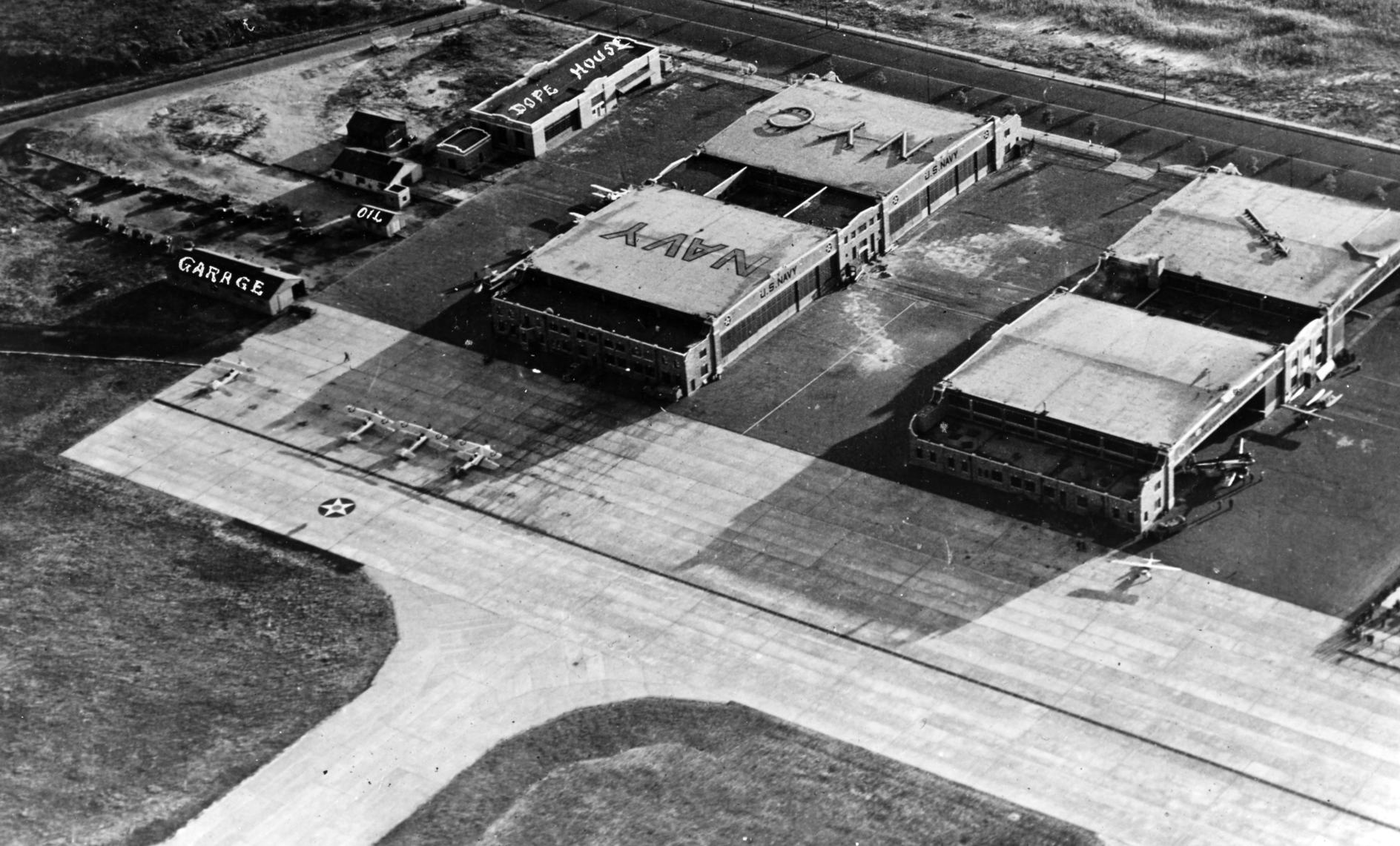
A 1931 aerial view looking east showed Floyd Bennett Field to have 2 runways & 4 hangars along the west side.
A 6/2/31 aerial view looking southwest showed Floyd Bennett Field to have 2 runways & 4 hangars along the west side.
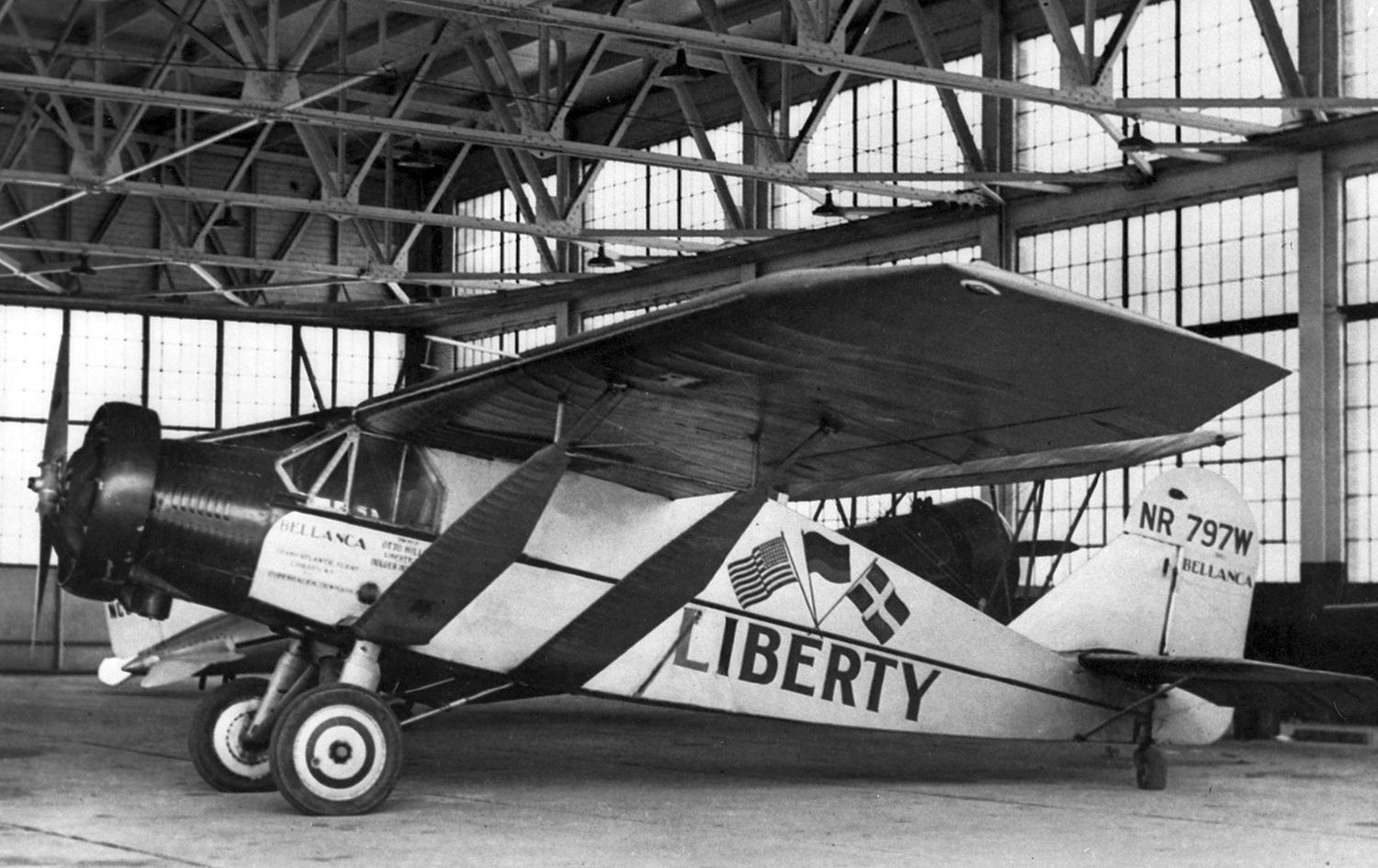
A June 1931 photo of Bellanca J-300 Pacemaker C/n 3003 NR797W “Liberty” inside a Floyd Bennett Field hangar.
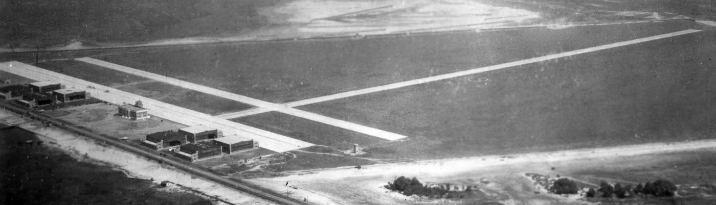
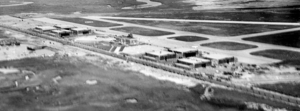
A circa early 1930s aerial view looking northeast at Floyd Bennett's hangars, terminal, and runways (courtesy of Richard Porcelli).
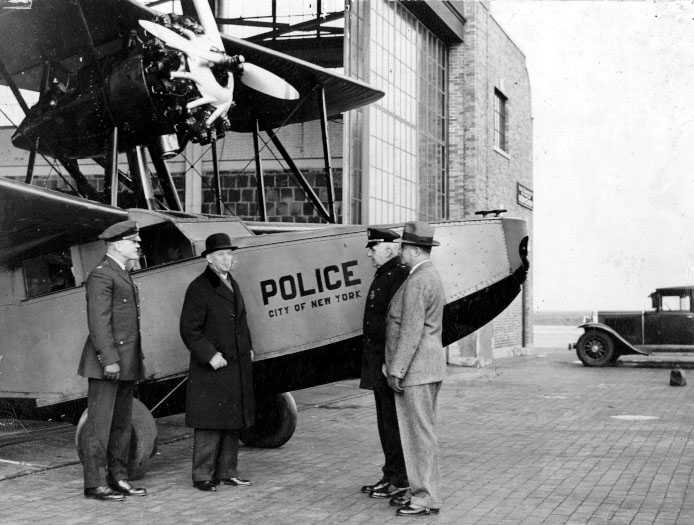
A circa 1930s photo of a NYPD Loening Commuter flying boat at Floyd Bennett.
The earliest Sectional Chart depiction which has been located of Floyd Bennett Field was on the August 1932 NY Sectional Chart.
It depicted Floyd Bennett as having a landplane airfield & a seaplane base.
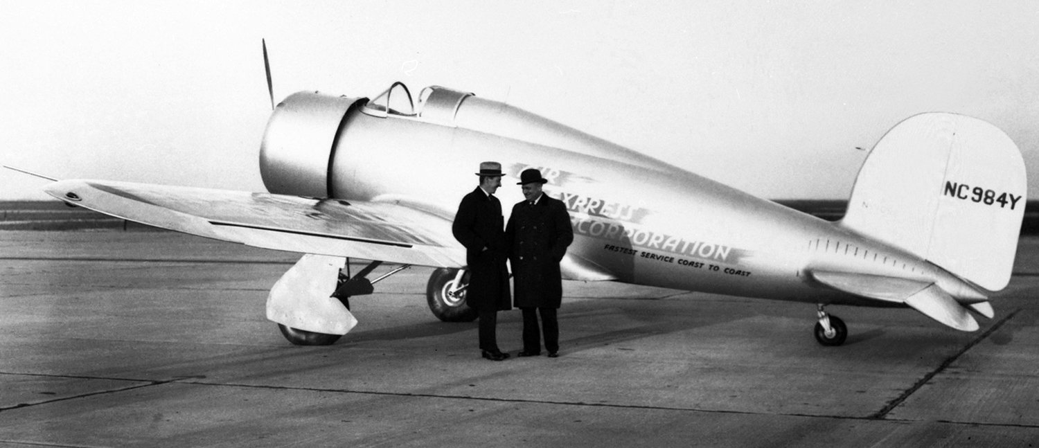
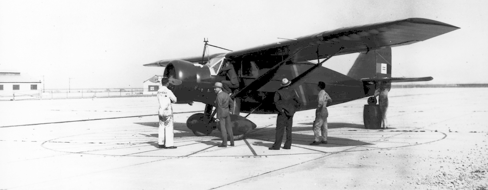
An 11/28/32 photo by Rudy Arnold of Air Express Corporation Lockheed 9 Orion NC984Y C/n 173 at Floyd Bennett Field.
Philip Philbin, on the left, was Air Express Corporation founder.
A 5/23/33 photo of Bellanca J-3-500 "Santa Lucia" at Floyd Bennett Field.
The Bellanca is having its compass compensated to prepare for General Francesco de Pinedo's ultimately unsuccessful attempted non-stop flight from Floyd Bennett Field to Persia.
According to Peter Maefield's 1972 Wings Club of NYC speech (courtesy of Dave Kanzeg),
“During the next decade [the 1930s] the field was the origin & the destination of a large number of pioneering flights -
its runways were the pathways to fame, or to disaster.
Trans-Atlantic, trans-Continental & round-the-world flights followed in quick succession;
the names in the Floyd Bennett Field's hall of fame include Boardman & Polando, Codos & Rossi, Amelia Earhart,
Mattern & Griffin, Merrill & Lambie, Howard Hughes, Pangborn & Herndon, Post & Gatty, and Roscoe Turner.
Here the Marquis Francesco de Pinedo met his death on 9/2/33 in a take-off crash.
And here, in the waters off Floyd Bennett, in Jamaica Bay, Marshal Italo Balbo brought his armada
of 24 Savoia Marchetti S.55X twin-hull flying-boats in July 1933, in the first mass crossing of the Atlantic.”
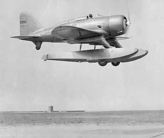
A Seversky floatplane over the Floyd Bennett runway in 1933.
A 1933 photo of Wiley Post departing Floyd Bennett Field on the 1st solo flight around the world (courtesy of Paul Siwulich).
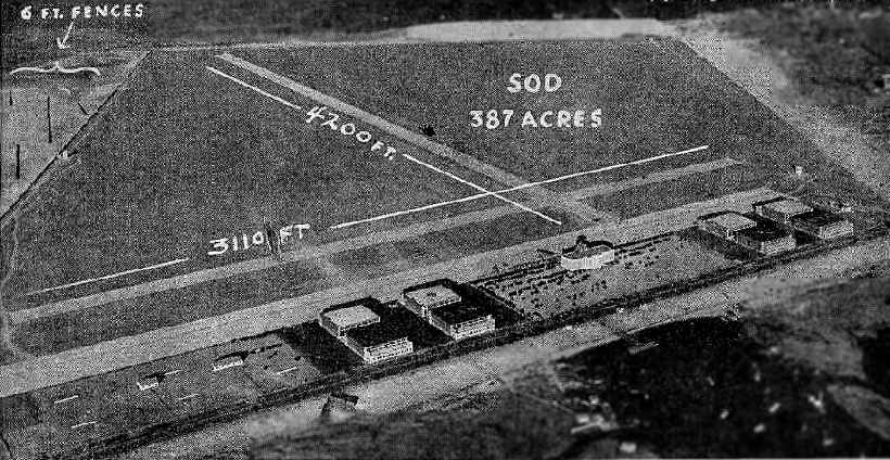
An aerial view looking southeast at Floyd Bennet Field, looking northeast,
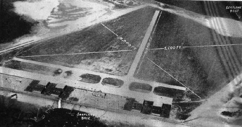
from The Airport Directory Company's 1933 Airports Directory (courtesy of Chris Kennedy).
The directory described Floyd Bennet Field as having 2 concrete runways:
4,200' northeast/southwest & 3,110' northwest/southeast.
The aerial photo in the directory depicted eight hangars, flanking the administration building.
These hangars were described as "fireproof",
and they were said to "offer the finest facilities & the most modern improvements in hangar design."
A seaplane ramp was said to already be in use,
with "a large seaplane base" planned,
"construction work on 2 seaplane hangars" to be started in the near future.
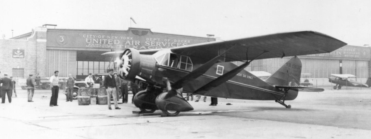
The operators were listed as Erickson & Remmert,
Nicholas-Beazley Airplane Company, Inc., United Air Services,
and the U.S. Naval Reserve Base.
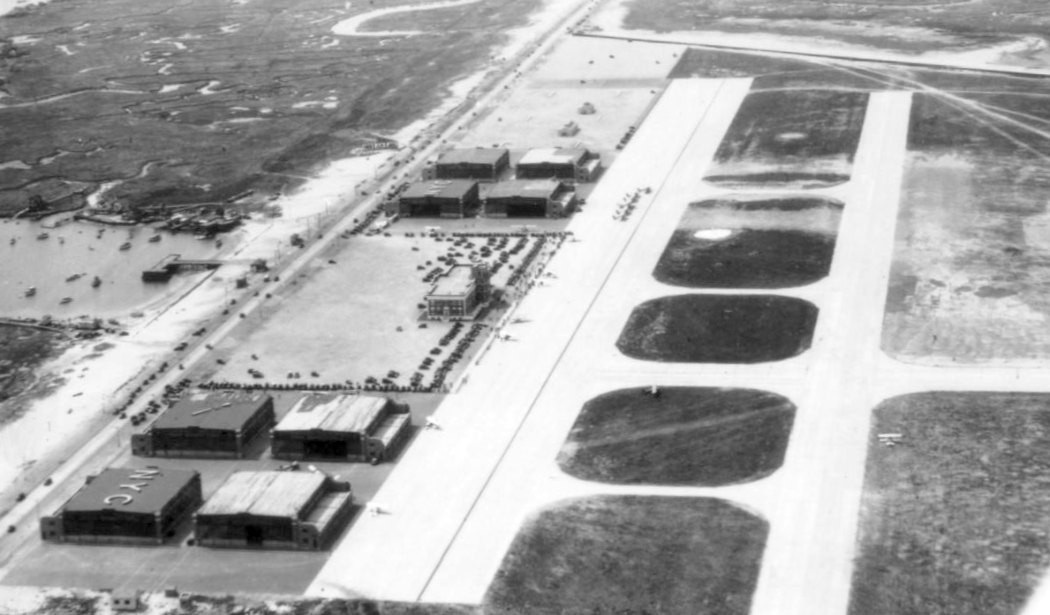
A 5/13/34 aerial view looking northwest at the hangars, terminal, ramps, and runways of Floyd Bennett Field.
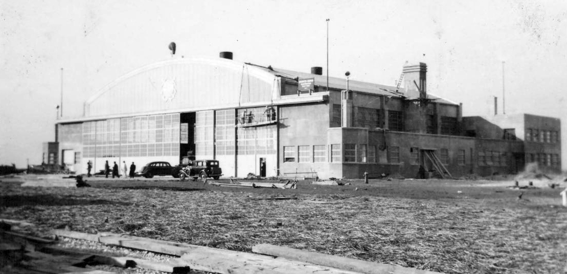
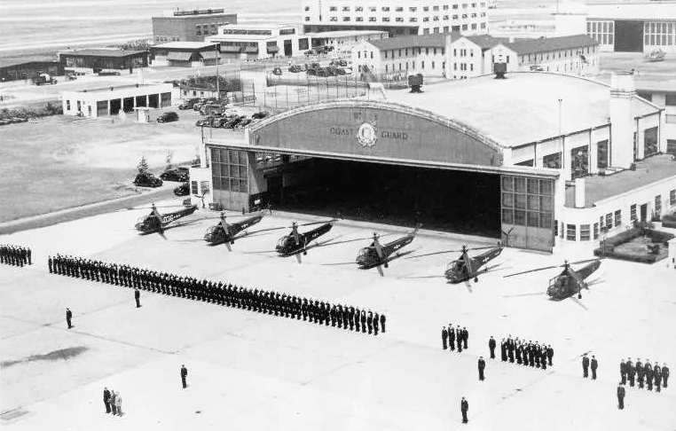
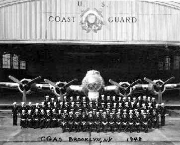
A 1934 photo of a hangar under construction at Coast Guard Air Station Brooklyn (from the National Museum of Naval Aviation).
The Army mail service moved from Floyd Bennett to Mitchel Field in 1934.
Floyd Bennett Field, as depicted on the 1934 U.S. Navy Aviation Chart (courtesy of Chris Kennedy).
According to Peter Maefield's 1972 Wings Club of NYC speech (courtesy of Dave Kanzeg),
“In May 1934 American Airlines made Floyd Bennett its commercial New York terminal in place of Newark.”
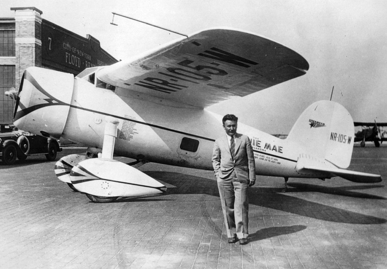
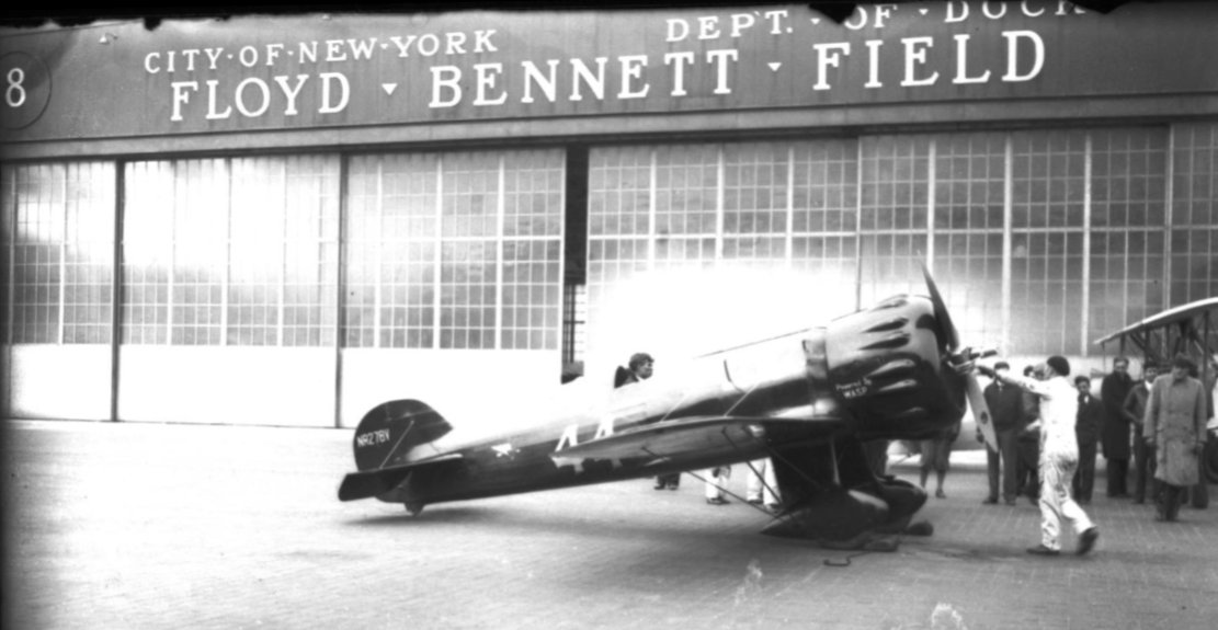
Roscoe Turner's Weddell-Williams racer, as he arrived on 9/1/34 at Floyd Bennett Field
after flying from Burbank, CA to New York in 10 hours 2 minutes, establishing a new speed record.
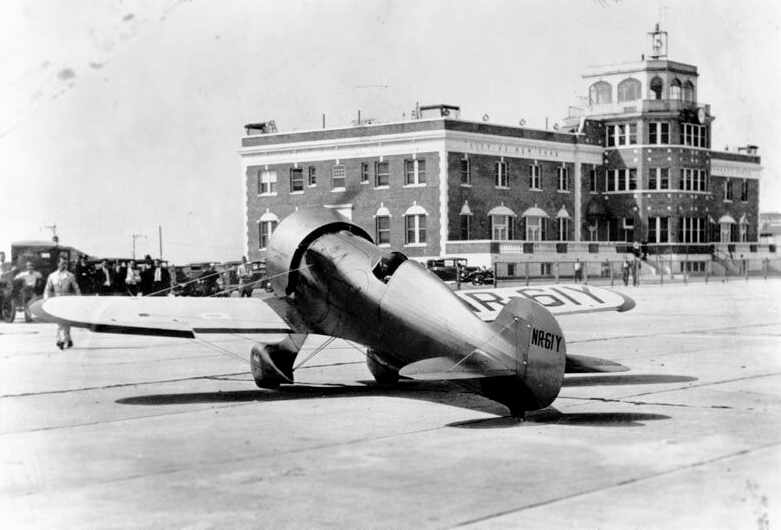
The Floyd Bennett administration building & control tower are in the background.
A circa 1930s photo of Bellanca J-300 “Leonardo da Vinci” in front of a Floyd Bennett Field hangar.
A circa 1930s photo of a Wedell Williams 44 in front of a Floyd Bennett Field hangar.
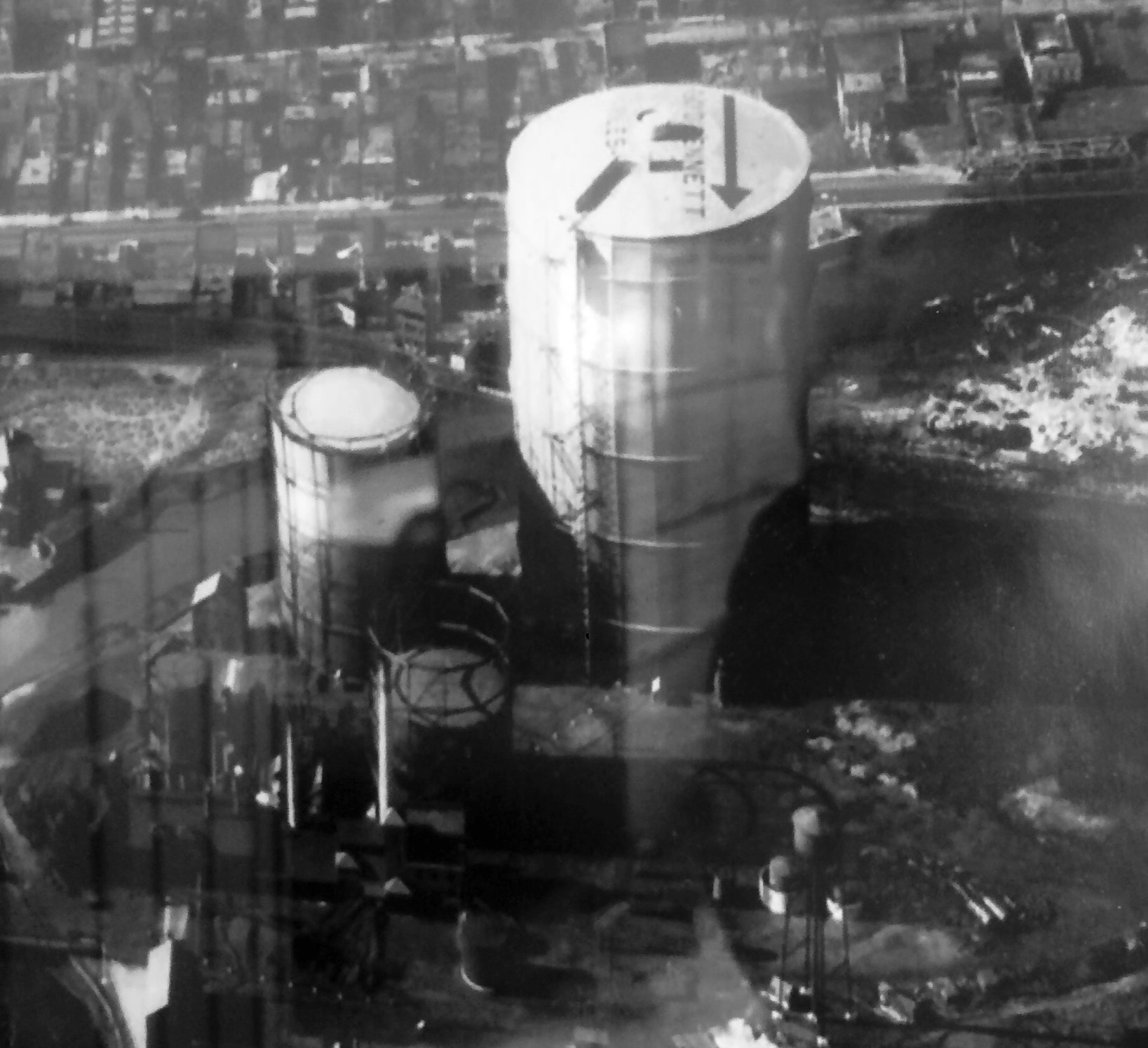
A circa 1930s aerial view of the gas tanks in Coney Island marked with an arrow & the words “Floyd Bennett” (courtesy of Butch Moran).
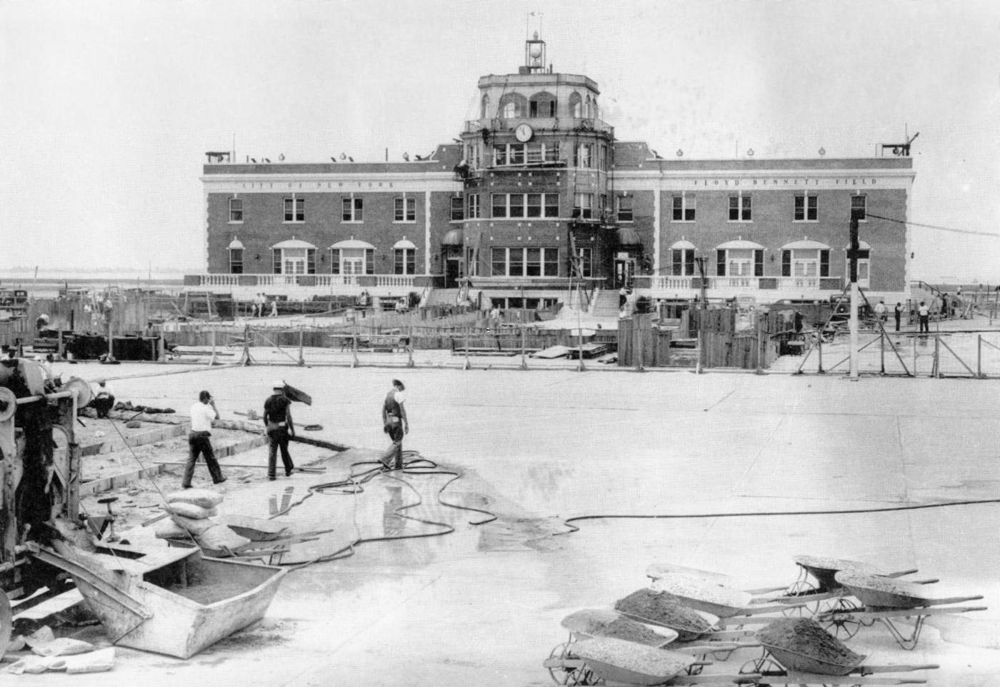
A “1935 photo of Floyd Bennett Field terminal building upgrades using WPA funding, including adding 4 access tunnels from terminal to aircraft parked on ramp
and 4 turntables to swing aircraft prior to taxiing” (from the National Park Service Archives, courtesy of Richard Porcelli).
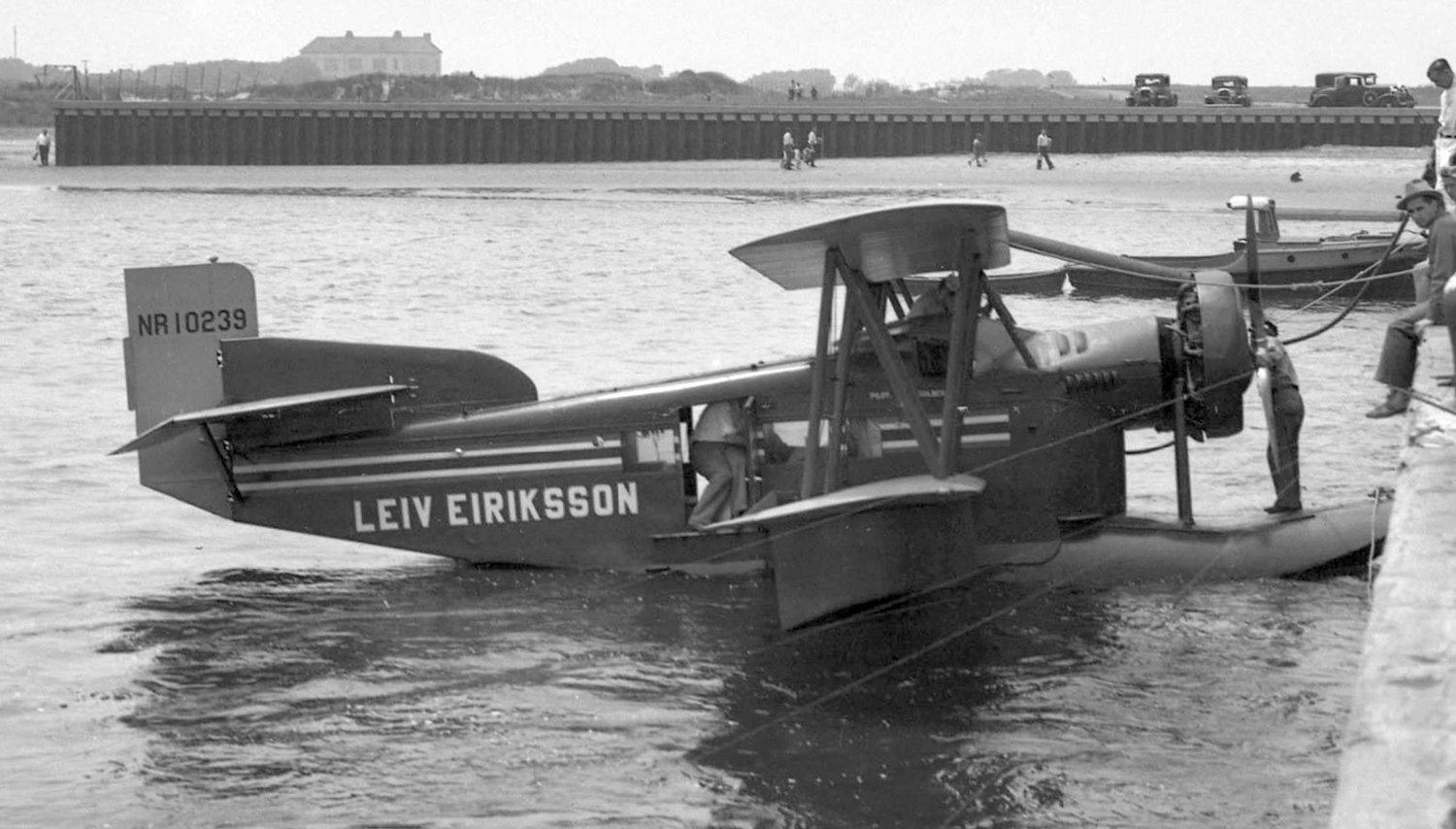
A 7/17/35 photo by Rudy Arnold of the ungainly “Leiv Eirikson” Loening C-2H Air Yacht NR10239 C/n 308 at Floyd Bennett Field.
Named for the Norse seafarer Leif Erikson, this Loening flew from America to Norway via Labrador, Greenland, Iceland and the Faroes.
Thor Solberg & Paul Oscanyan set out from NY on 7/17/35. Solberg returned as he felt the plane was wrongly loaded & they took off again without any publicity the next day. They arrived in Bergen on 8/16.
Solberg believed they were the first to fly from America-Norway, but Jimmie Mattern had flown from NY-Norway in 1933 in his Lockheed Vega.
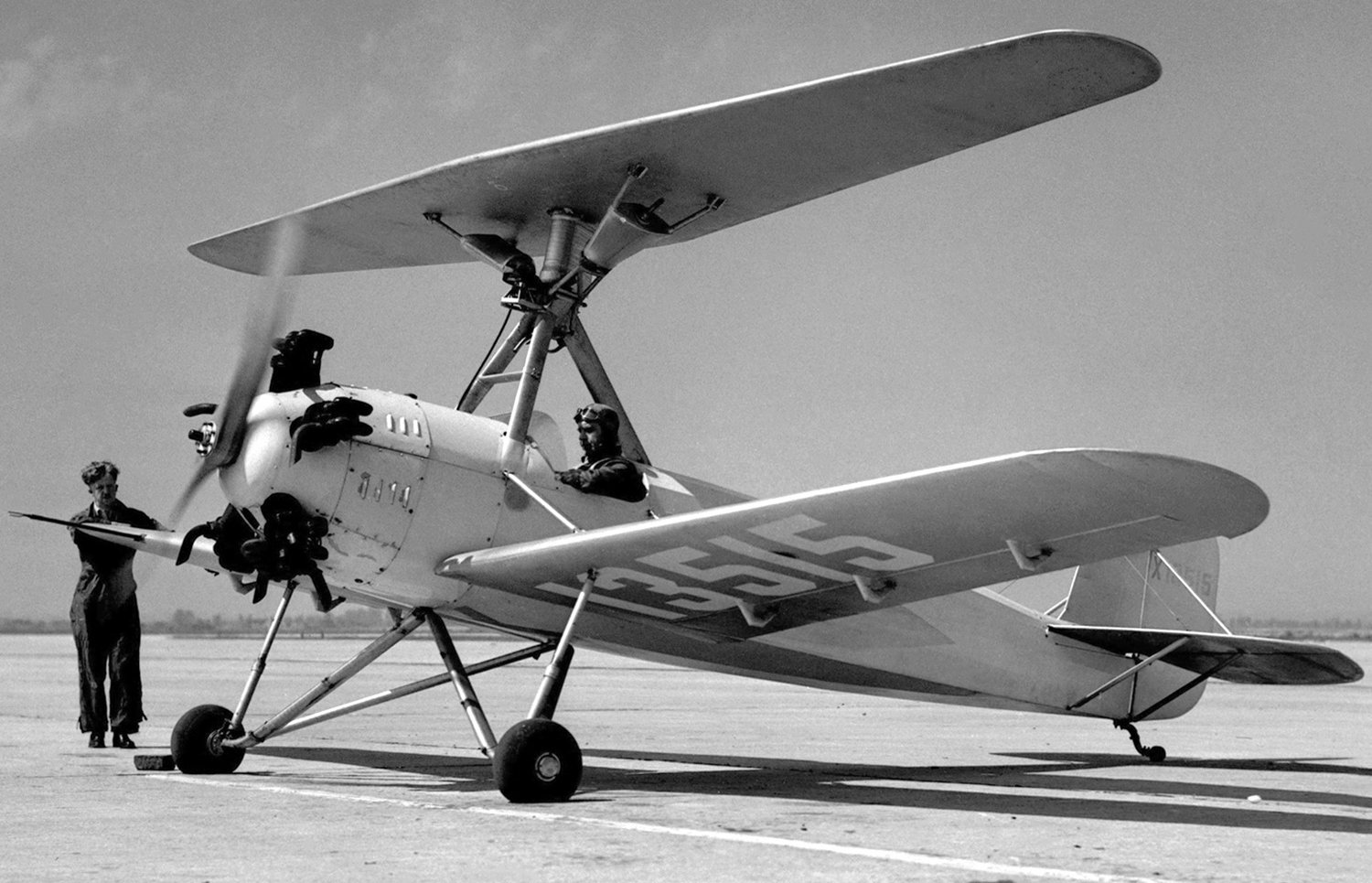
A 6/29/36 photo by Rudy Arnold of the sole Herrick HV-2A Vertaplane NX13515 at Floyd Bennett Field.
The Herrick HV-2 Vertaplane could fly as a biplane or as an autogyro. The upper wing could be unlocked, but not locked in flight.
The earlier HV-1 crashed, but the HV-2A successfully converted from fixed-wing to autogyro mode for the first time in July 1937 over its Boulevard Airport, PA base.
Test flying had already begun in 1936 and this visit to Floyd Bennett Field took place later that year.
A 1936 aerial view looking south at the Floyd Bennett terminal (from the National Park Service Archives, courtesy of Richard Porcelli).
Richard Porcelli noted, the photo was taken “after 1935 improvements; note the 4 rectangular trap doors leading to the under-ramp tunnels & 4 turntables for swinging aircraft.”
In 1936, the 3,500' Runway 1/19 & the 3,200' Runway 13/30 were added, and Runway 15/33 was slightly lengthened to 3,500'.
According to Peter Maefield's 1972 Wings Club of NYC speech (courtesy of Dave Kanzeg),
“The end of an era came in sight when, in January 1936, Mayor La Guardia leased Floyd Bennett Field to the U.S. Coast Guard for 50 years.”
A circa 1936-37 aerial view looking north at Floyd Bennett Field (courtesy of George Mihal of the Office of Image Archeology).
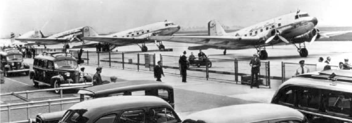
A mid-1930s photo of 4 DC-3s on the Floyd Bennett Field ramp (from the National Park Service Archives, courtesy of Richard Porcelli).
Richard Porcelli observed, the “photo is misleading; the group of aircraft are probably for an air display rather than scheduled fights
as airline service was limited to about 1 year of FBF-Boston service by American Airlines circa 1937.”
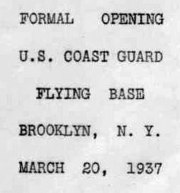
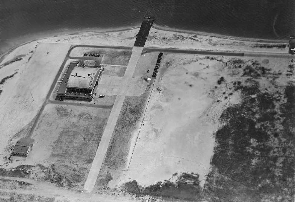
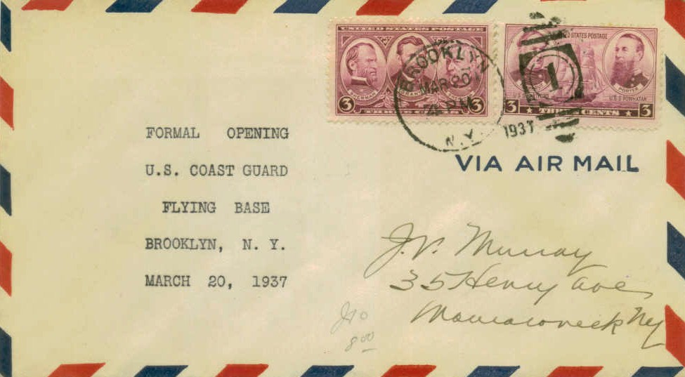
A postmark commemorated the 3/20/37 Formal Opening of the U.S. Coast Guard Base Brooklyn.
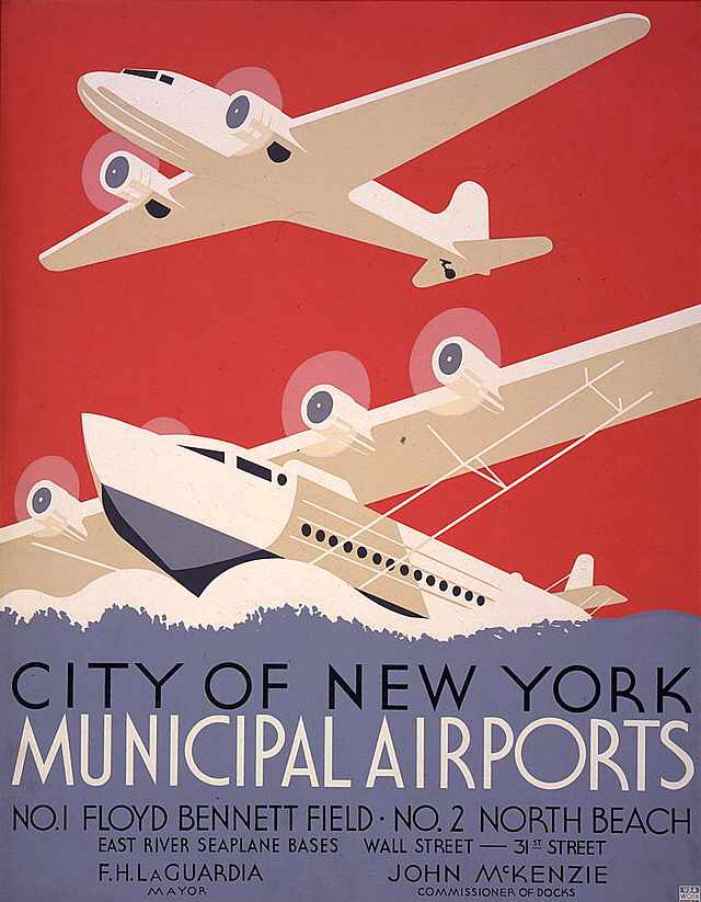
A 1937 poster promoting Floyd Bennett Field.
An aerial view of Floyd Bennet Field, looking northeast, from The Airport Directory Company's 1937 Airports Directory (courtesy of Bob Rambo).
The directory described Floyd Bennet Field as a municipal airport.
It was described as having 4 concrete runways, with the longest being a 4,200' northeast/southwest runway.
The aerial photo in the directory depicted eight hangars, flanking the administration building.
These hangars were described as "fireproof", and they were said to "offer the finest facilities & the most modern improvements in hangar design."
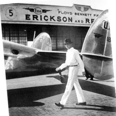
Julian Goldman recalled, “When I was a kid, I worked for my 1st airplane ride in 1937 with Jack Loesing, chief pilot for Erickson & Remmerrt.
Loesing had a devil painted on the rudder & was called the red devil. Dick Swanson had a Waco C & had Popeye painted on the rudder.
Eddy Lions had an old Curtiss Robin with a lion on the rudder. Those were lean days & they all struggled to make a living.”
A 1930s aerial view looking north at the Floyd Bennett hangars.
Photo courtesy of The Cradle of Aviation Museum, Garden City, Long Island via Leo Polaski.
The 1938 Aviation Facilities in NY State (courtesy of Bob Parmerter) described Floyd Bennett Field as having 4 concrete runways, with the longest measuring 4,200' northeast/southwest.
Eight fireproof hangars were depicted on the southwest side, and the Coast Guard Base on the southeast side.
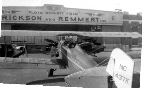
A circa 1938 photo (courtesy of Norman Kellman) of a Fleet biplane
in front of a hangar at Floyd Bennett entitled "Erickson and Remmert Inc.".
According to Jack Gordon, he purchased Fleet NC437K for “all of $100.00 & flew it for a considerable time before rebuilding.
I was given my private license flight test by a man named Milt Gerten there at Floyd Bennett in about 1938 or 1939.”
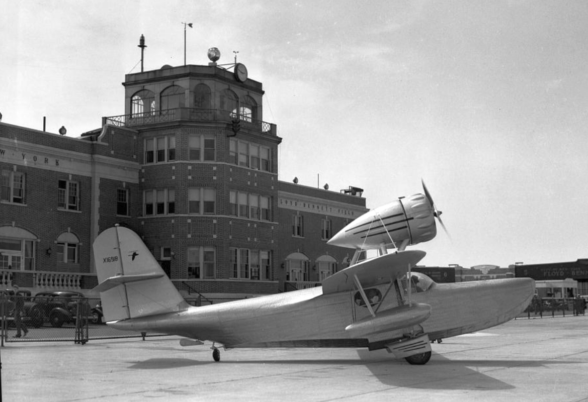
A 5/6/38 photo of the rare stainless steel Fleetwings F-5 Seabird amphibian(r/n X-16918) in front of the Floyd Bennett Field Administration Building (courtesy of Bill Engle).
Floyd Bennett Field's most storied flight was probably that of Douglas "Wrong Way" Corrigan
who in 1938, after repeatedly being denied permission by the authorities to attempt a non-stop flight to Ireland,
"accidentally" crossed the Atlantic in a second-hand surplus aircraft on a flight registered to go to California.
In the midst of the Great Depression a hero-starved nation hailed Corrigan for his "accident",
even unto giving him a ticker-tape parade in Manhattan upon his return (the authorities had him sail back on a ship).
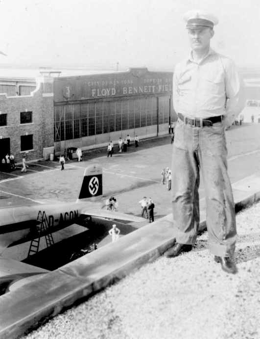
An August 10-13, 1938 photo of an unidentified man with the Focke-Wolfe Fw 200 S-1"Brandenburg" Condor in front of a Floyd Bennett hangar.
Photo courtesy of The Cradle of Aviation Museum, Garden City, Long Island via Leo Polaski
"These photographs do not belong to me, they belong to the respective Museums.
ALL permission to use these photographs in publications MUST be obtained from the Museums,
I ONLY have permission to post here as long as no profit is obtained by me."
A 1938 aerial view showing Floyd Bennett Field's newly expanded configuration of 4 paved runways.
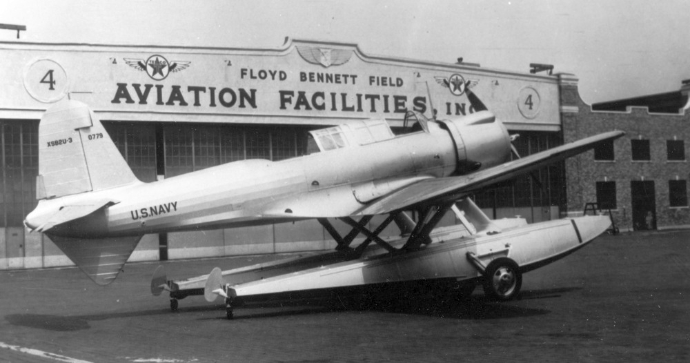
A late 1930s photo of the sole prototype Vought XSB2U-3 Vindicator in front of Floyd Bennett Field's Aviation Facilities Inc. hangar.
The XSB2U-3 was an extended-range version of the Vindicator dive-bomber with twin floats.
A 1938 photo of the sole example of the Management & Research H-70 at Floyd Bennett Field.
The H-70 was the only flying wing built on Long Island,
built for a Commerce Department program to develop new types of safe airplanes.
But it only accumulated 60 hours of flight time before ironically crashing in 1945.
An undated (presumably 1938) photo of Howard Hughes & his Lockheed Super Electra in front of Floyd Bennett's Erickson & Remmert hangar.
Famous aviator Howard Hughes departed Floyd Bennett Field on 7/9/38
in a Lockheed 14 Super Electra, named New York World's Fair 1939, on a 'Round the World' flight to promote the upcoming fair.
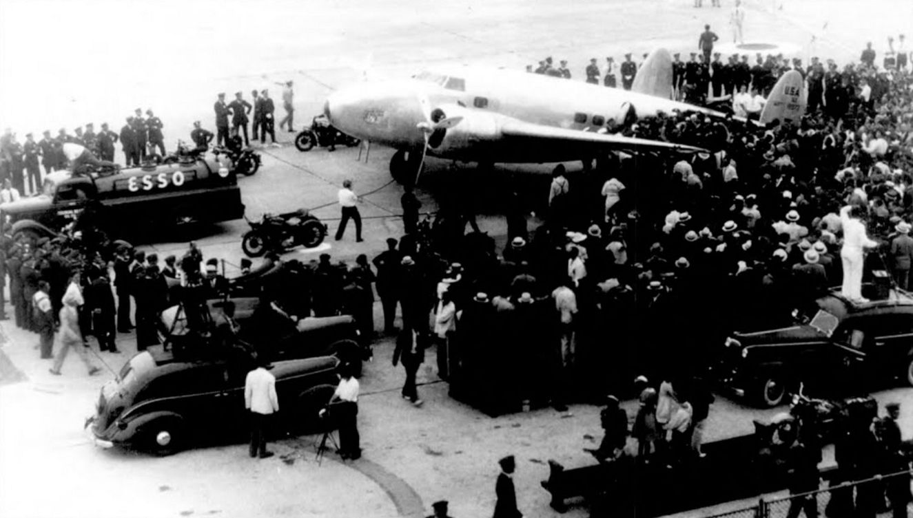
A 7/14/38 photo of Howard Hughes' Lockheed 14 Super Electra, upon returning to Floyd Bennett after completing the 14,672 mile flight in 3 days, 19 hours, 14 minutes, and 10 seconds,
thus setting a new around-the-world speed record.
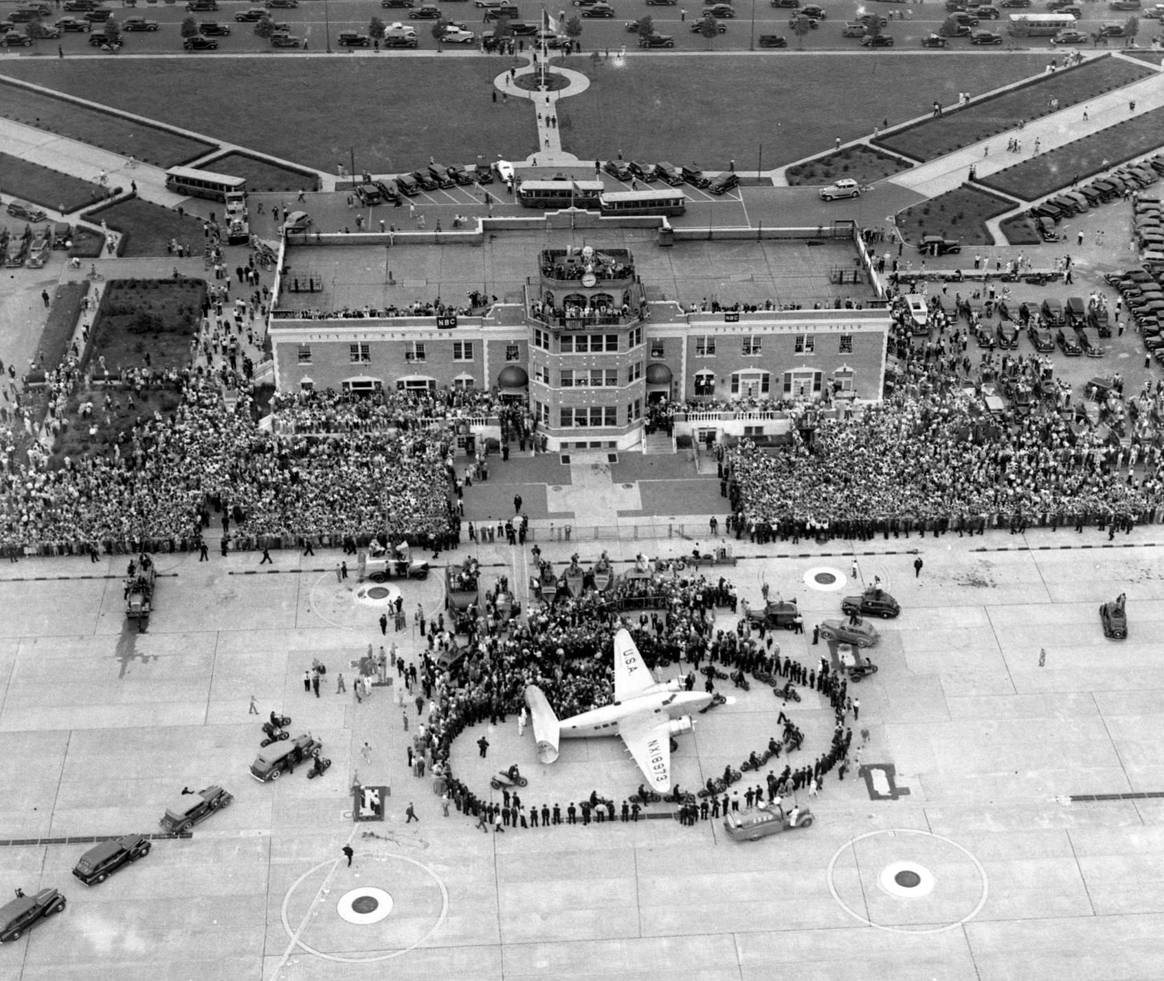
A 7/14/38 aerial view looking west at crowds around Howard Hughes' Lockheed 14 Super Electra, upon returning to Floyd Bennett after setting a new around-the-world speed record.
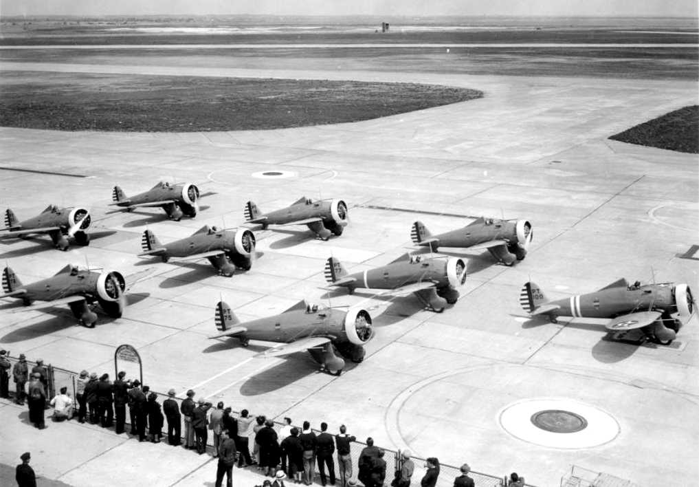
A 1938 photo of an assemblage of Army Air Corps Boeing P-26 Peashooter fighters at Floyd Bennett (courtesy of John Voss).
A 1939 street map (courtesy of Kevin Walsh) depicted Floyd Bennett Field as a smaller property outline than later depictions.
Three 1939 pictures taken at Floyd Bennett Field (courtesy of Julian Goldman).
The top photo is of Julian Goldman in front of a Waco N biplane, NC19399, owned by Erickson & Remmert.
The center picture of the Waco N coming back after a sightseeing ride.
The bottom picture is a Stinson Gullwing was flown by a guy named Kenny Neville, who also took people for rides.”
showing a hangar and a seaplane ramp leading down into the bay, with a single aircraft visible on another ramp at the right edge of the photo.
By 1939, the newer & larger LaGuardia Airport had become New York City's primary municipal airport.
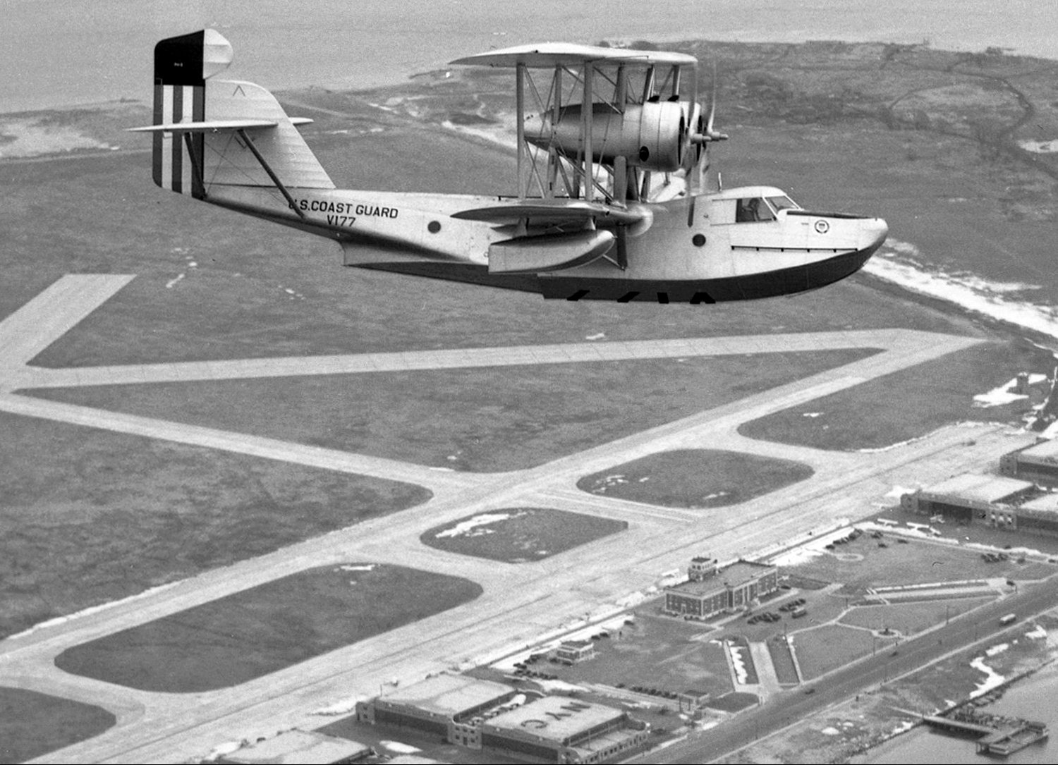
A 2/21/40 aerial view by Rudy Arnold looking southeast at a Coast Guard Hall PH-3 flying boat, V177, overflying Floyd Bennett Field.
By 1941 Floyd Bennett Field was completely taken over by the Navy, which renamed it New York NAS.
A March-April 1941 photo by Rudy Arnold of Lockheed Lodestars & a Douglas Boston at Floyd Bennett Field waiting to be shipped to Britain.
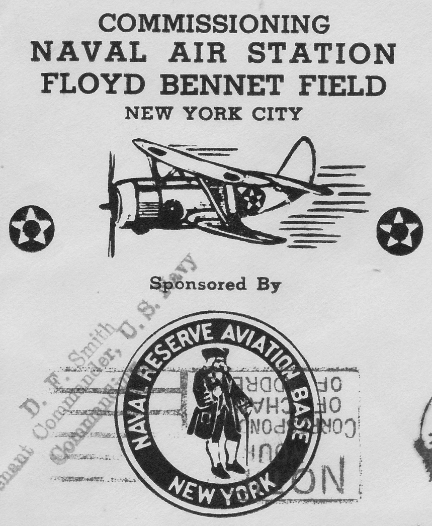
A 1941 postmark commemorated the commissioning of the “Naval Air Station Floyd Bennett Field” (courtesy of Kevin Carruth).
A 1941 photo of large numbers of Navy aircraft at Floyd Bennett Field.
A new 5,000' Runway 6/24 was constructed in 1942, running perpendicular to Flatbush Avenue on the North side of the field.
The original Runway 6/24 became taxiways T-1 & T-2 at this point, and the original Runway 15/33 also became taxiway T-10.
Runways 1/19 & 12/30 were both lengthened to 5,000'.
A circa 1942 aerial view looking west at Floyd Bennett Field.
A 1942 photo of a row of partially disassembled Lockheed Hudsons being prepared at Floyd Bennett Field for shipment to England.
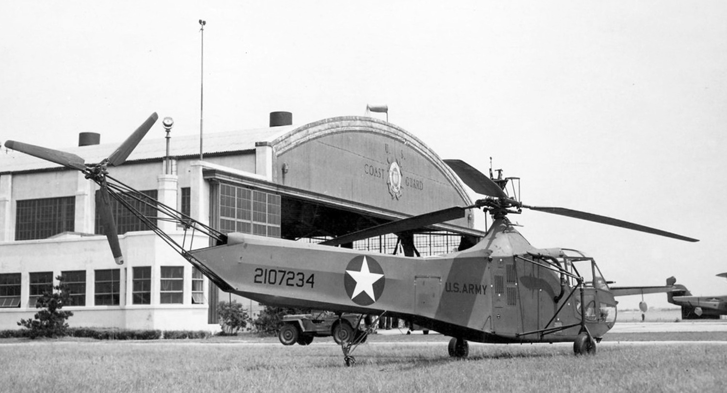
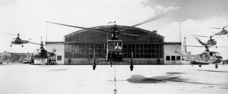
A 7/10/43 USN photo of Sikorsky YR-4A Hoverfly 42-107234 in front of Floyd Bennett Field's Coast Guard hangar.
Although it was wearing Army markings, some sources indicate this was the first helicopter delivered to the Coast Guard.
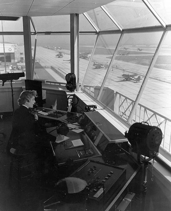
A November 1943 photo of a WAVES Control Tower Operator at work at Naval Air Station, Floyd Bennett Field,
with FM Wildcat & TBM Devastator aircraft on the ramp below.
Compare this to the 2007 tower interior photo toward the end of this article.
A 1943 photo of Coast Guardsmen greeting helicopter pioneer Igor Sikorsky at a NAS NY (Floyd Bennett Field) helicopter display (courtesy of Richard Porcelli).
as used inside a hangar at CGAS Brooklyn.
Capt Frank Erickson directed the helicopter training squadron for the Navy,
and trained students from all the US armed forces plus Canadians & British military students.
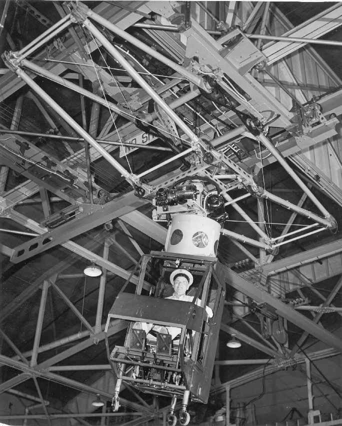
A 1944 photo of a Sikorsky R-4 helicopter on the “USS Male de Mar” rocking deck-landing training device for early helicopters at Floyd Bennett Field (courtesy of Richard Porcelli).
A 1944 aerial view looking east at the hangar & seaplane ramp of Coast Guard Air Station Brooklyn (from the National Museum of Naval Aviation),
with 3 floatplanes on the ramp, and a PBY Catalina flying boat in the water.
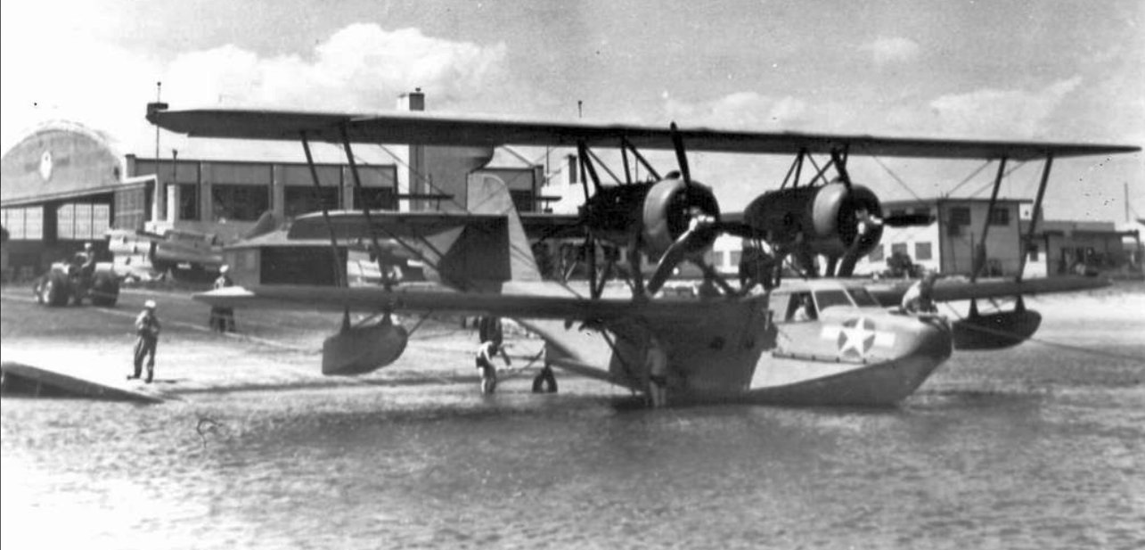
A 1944 photo looking west at a Coast Guard Hall PH-3 flying boat (V179) on the ramp at Coast Guard Air Station Floyd Bennett Field, with Curtiss SO3C-3 Seamews in the background.
A circa 1940s view of a Coast Guard Grumman J2F Duck amphibian
(which has been manufactured only a few miles away in either Bethpage or Valley Stream NY)
in front of a Floyd Bennett hangar.
A WW2-era aerial view looking southeast at New York NAS (National Archives photo).
During WW2, NAS New York reached a peak complement of 6,500, and operated both land planes & seaplanes from an adjacent ramp.
A primary mission of the base was the testing & delivery of newly completed aircraft from Long Island's many nearby aircraft factories.
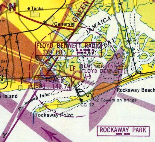
During WW2, Floyd Bennett had one satellite field, Rockaway NAS.
The 1945 AAF Airfield Directory (courtesy of Scott Murdock) described “New York NAS (Floyd Bennett Field)”
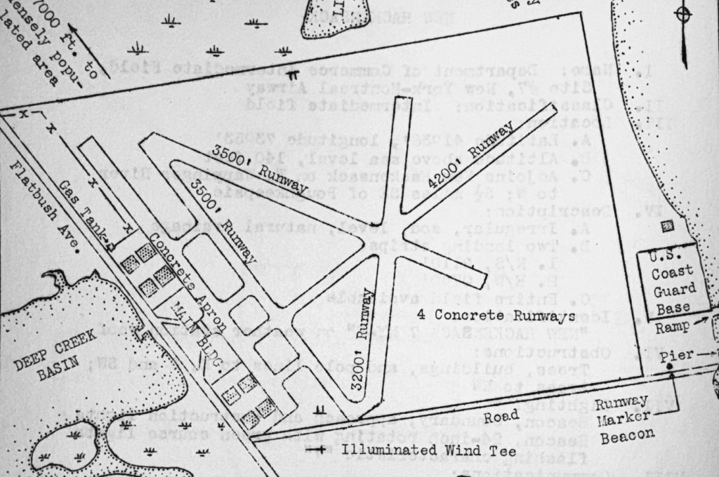
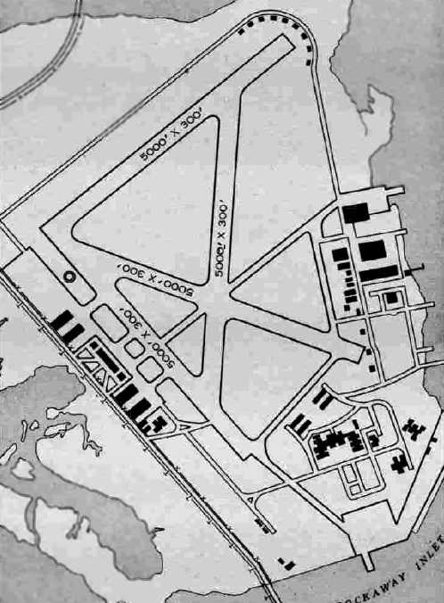
as a 1,288 acre irregularly-shaped property within which were four 5,000' asphaltic concrete runways & a blimp mooring mast.
The field was said to have a total of 9 hangars, with the largest being a 262' x 132' wood structure.
The NAS had one auxiliary field: Rockaway Beach Outlying Field.

A 3/5/45 photo of Navy Douglas R4D-5 Skytrain 17213 in front of Floyd Bennett Field Navy Hangar #4.
The August 1946 NY Terminal Aeronautical Chart (courtesy of Tim Zukas)
depicted “New York NAS (Navy) (Floyd Bennett)” as a military airfield.
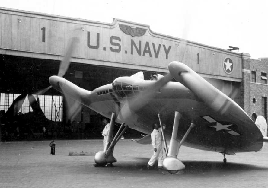
A circa 1940s view of the prototype of the incredible Chance-Vought V-173 Flying Flapjack.
An undated patch for NAS New York.
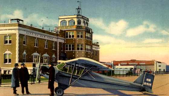
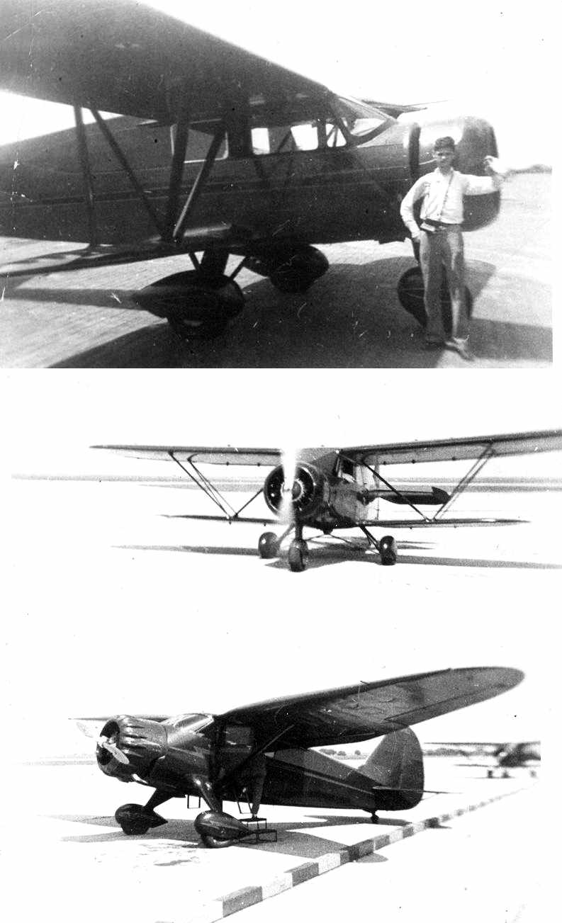
An undated colorized photo by Rudy Arnold of a Cub in front of the Floyd Bennett Field terminal.
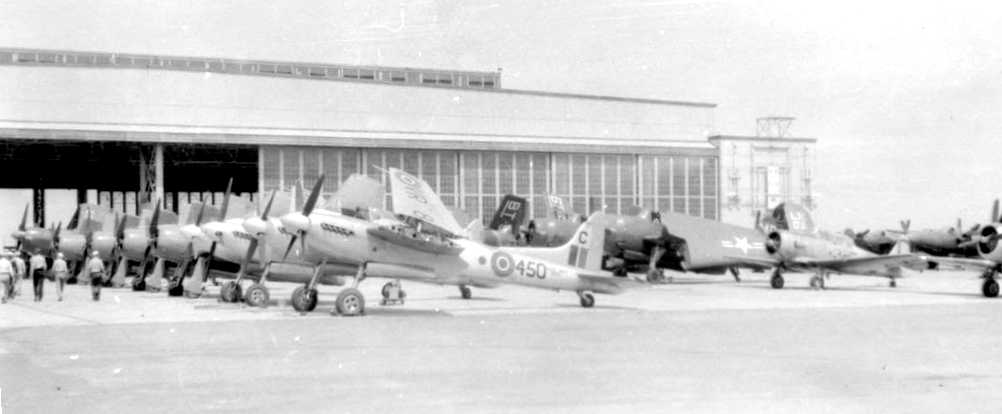
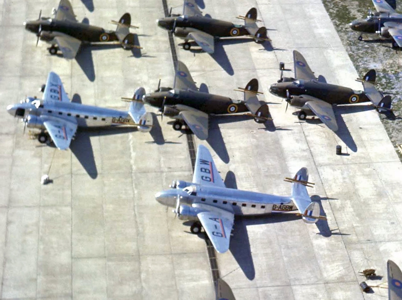
A late 1940s photo of Royal Navy Sea Hornets & American military aircraft at Floyd Bennett Field.
A 1947 street atlas (courtesy of Kevin Walsh) depicted Floyd Bennett Field as having 4 paved runways, taxiways, ramps, and the US Coast Guard base along the east side.
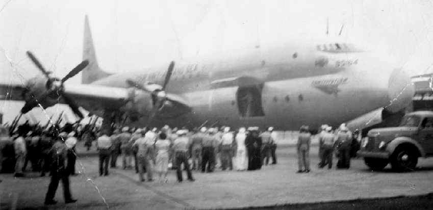
A 1947 photo of a Lockheed R6O Constitution at Floyd Bennett Field.
The Constitution remains the largest fixed-wing aircraft type ever operated by the U.S. Navy.
Photo courtesy of The Cradle of Aviation Museum, Garden City, Long Island via Leo Polaski.
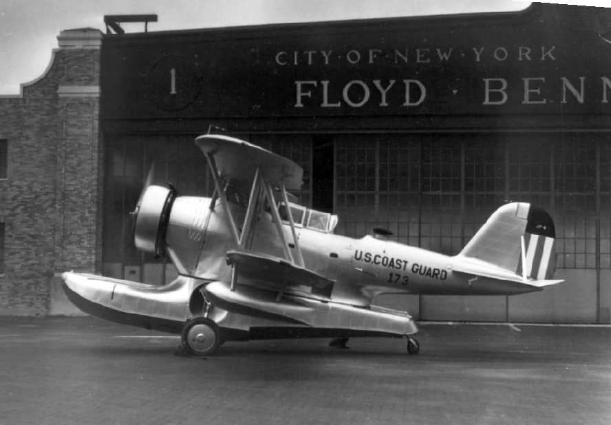
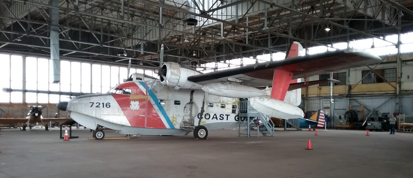
A Boeing PB-1G (Coast Guard version of the B-17) at Floyd Bennett in 1948.
Commercial flying at the field resumed after WW2, and it was once again called Floyd Bennett Municipal Airport.
The Navy continued some operations at the field, with a Naval Air Reserve Training Center being the primary remaining Navy use.
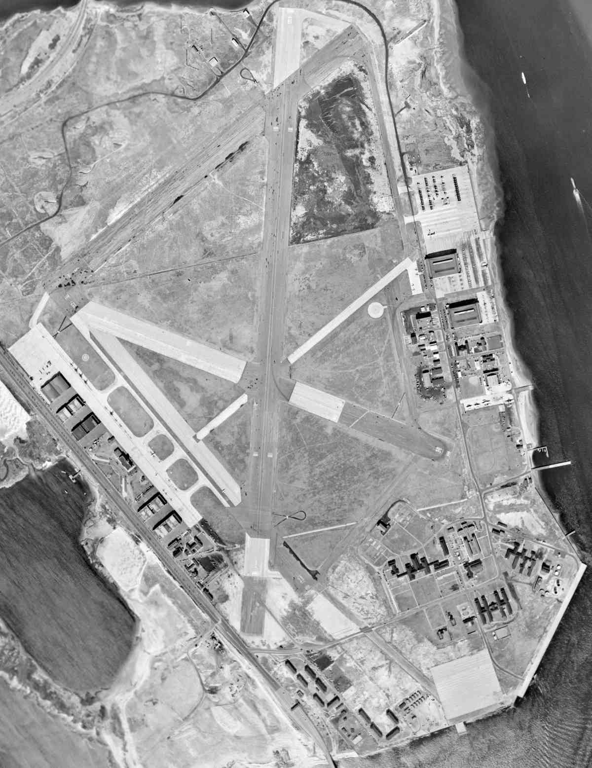
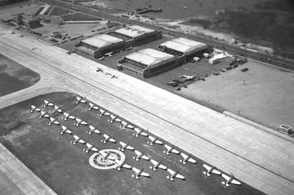
A 2/18/54 USGS aerial view showed Floyd Bennett to be well-used, with aircraft parked on both its west & east ramps.
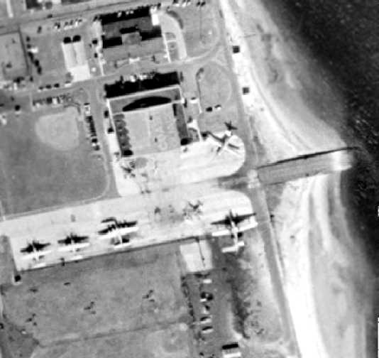
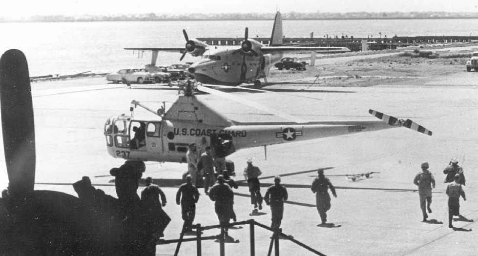
A 1954 aerial view of the Coast Guard ramp on the east side of Floyd Bennett,
showing what appear to be 2 Grumman HU-16 amphibians, a single PB-1 (Coast Guard B-17), and several smaller unidentified aircraft.
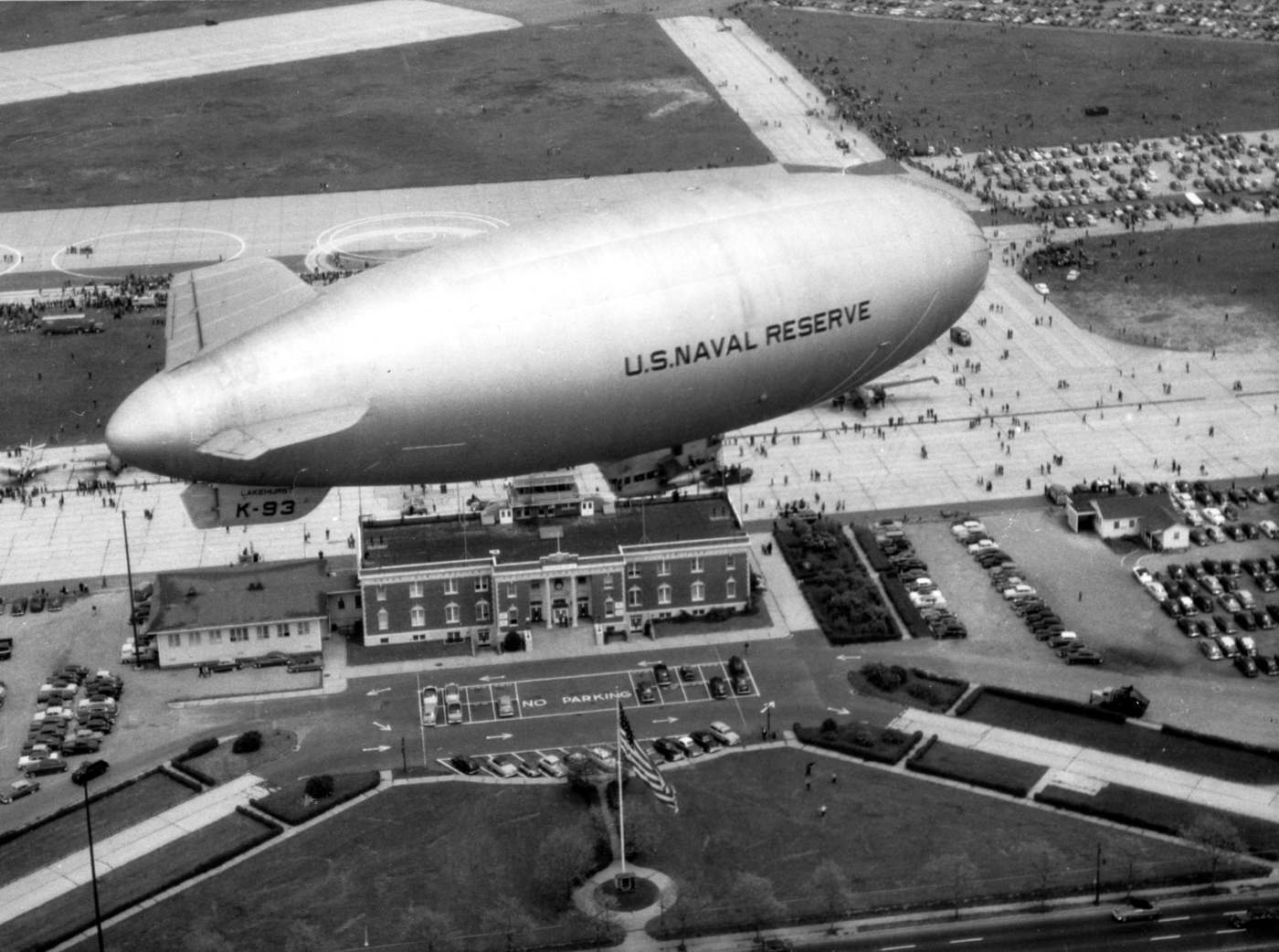
A 5/15/54 photo of a US Naval Reserve airship K-93 from NAS Lakehurst over Floyd Bennett Field (NAS NY)
during a Daily Mirror Newspaper sponsored Model Aircraft Meet Open House (courtesy of Richard Porcelli).
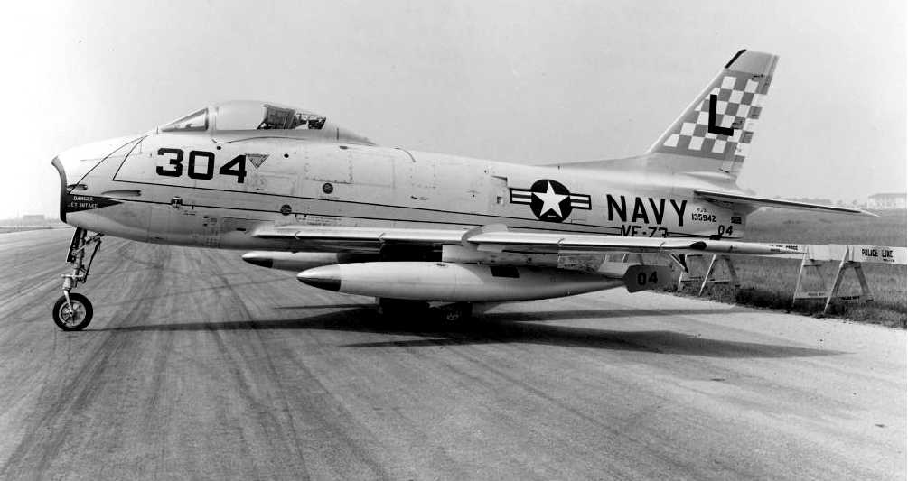
An undated (circa 1950s?) photo of a North American FJ-3 Fury fighter of VF-73 at Floyd Bennett Field.
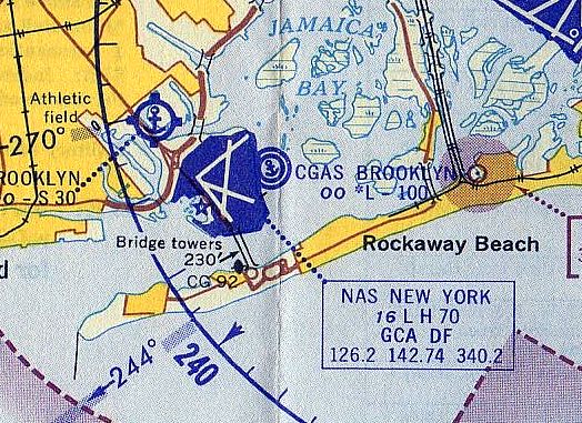
The 1964 NY Local Aeronautical Chart (courtesy of John De Nicola) depicted NAS New York as having 4 paved runways.
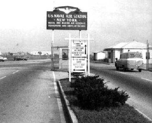
A circa 1965 photo (courtesy of Norman Kellman)
of NAS New York's main gate, off of Flatbush Avenue.
NAS New York was described on the 1965 NY Sectional Chart (courtesy of John Voss)
as having a total of four bituminous & concrete runways, with the longest being 7,000'.
However, the remarks included, "Runway 15/33 closed."
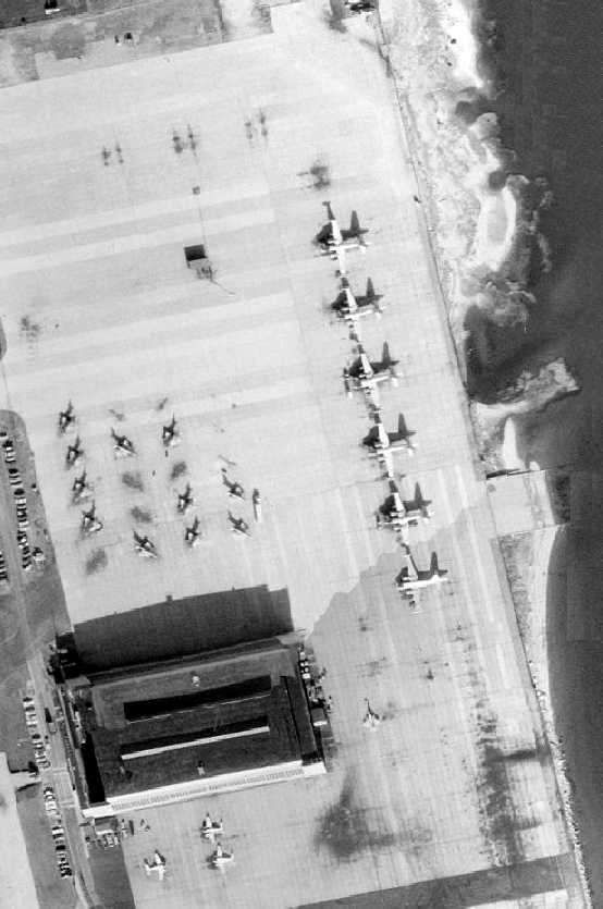
The last photo which has been located showing military aircraft based at Floyd Bennett was a 1966 aerial view,
showing large numbers of A-4 Skyhawks, P-2 Neptunes, and several smaller unidentified aircraft on the Naval Air Reserve ramp on the east side of the field.
According to Peter Maefield's 1972 Wings Club of NYC speech (courtesy of Dave Kanzeg),
“Yet another stage in the history of the old Barren Island site came in March 1971
when the title 'Naval Air Station' was dropped & Floyd Bennett became a Naval Air Reserve Training Detachment -
a technical training center for ground crews.
In that year also the Port of New York Authority discontinued negotiations with the U.S. Navy on the purchase of the field
for which the Navy sought $1,200,000 against the Port Authority's offer of $750,000 plus $300,000 annually.
Floyd Bennet remains what, clearly, could be a most valuable reserve of runway capacity to meet New York's growing commercial needs.”
The majority of the airfield property became the Gateway National Recreation Area in 1974.
The remaining property (constituting the area occupied by Coast Guard Air Station Brooklyn)
officially transferred to the Coast Guard & was no longer leased.
After the closure of the runways to fixed-wing aircraft,
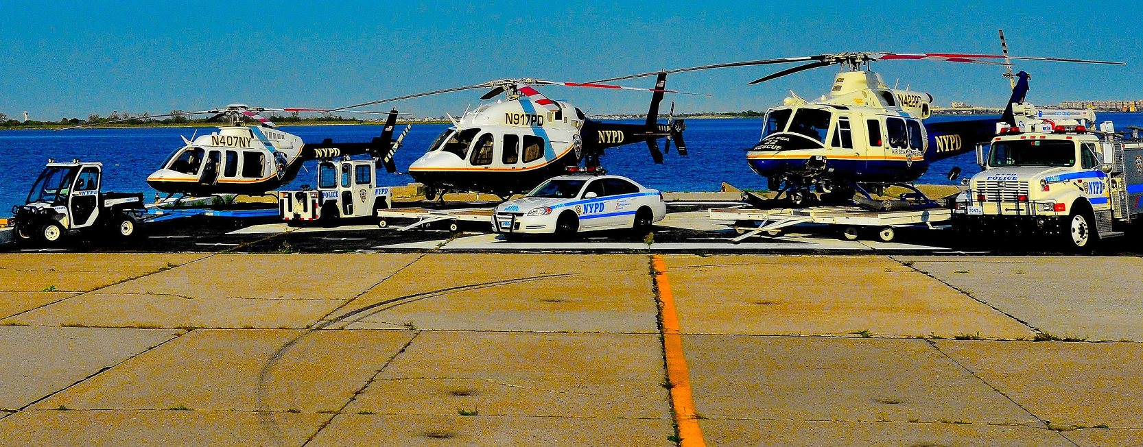
Floyd Bennett was used as a base for helicopter units of the Coast Guard & New York City Police.
The 1979 USGS topo map labeled the site as “Nav Res”.
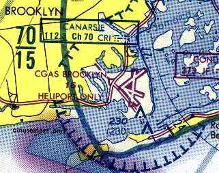
"CGAS Brooklyn" was labeled "Heliport Only" on the 1979 NY TCA Chart (courtesy of Bill Suffa),
although the runways were still depicted as well.
A 1980 aerial view depicted a mere 2 Coast Guard helicopters as the only aircraft on the extensive airfield,
quite a contrast from the 1966 photos showing an airfield packed with military aircraft.
The 1988 USGS topo map labeled the site as “Brooklyn Heliport”.
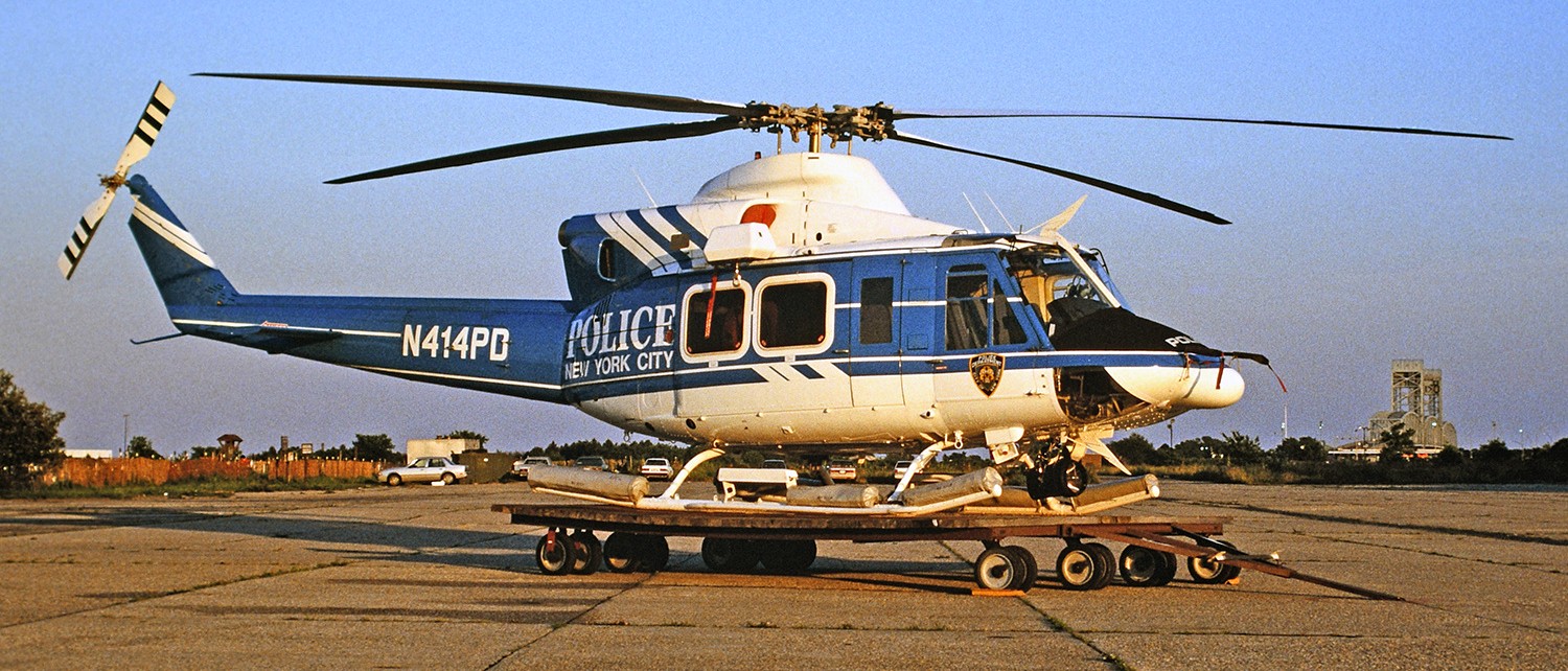
A 6/30/89 photo by Kenneth Swartz of NYPD Bell 412SP N414PD C/n 33180 on a dolly outside Floyd Bennett Field's NYPD Air Operations hangar.
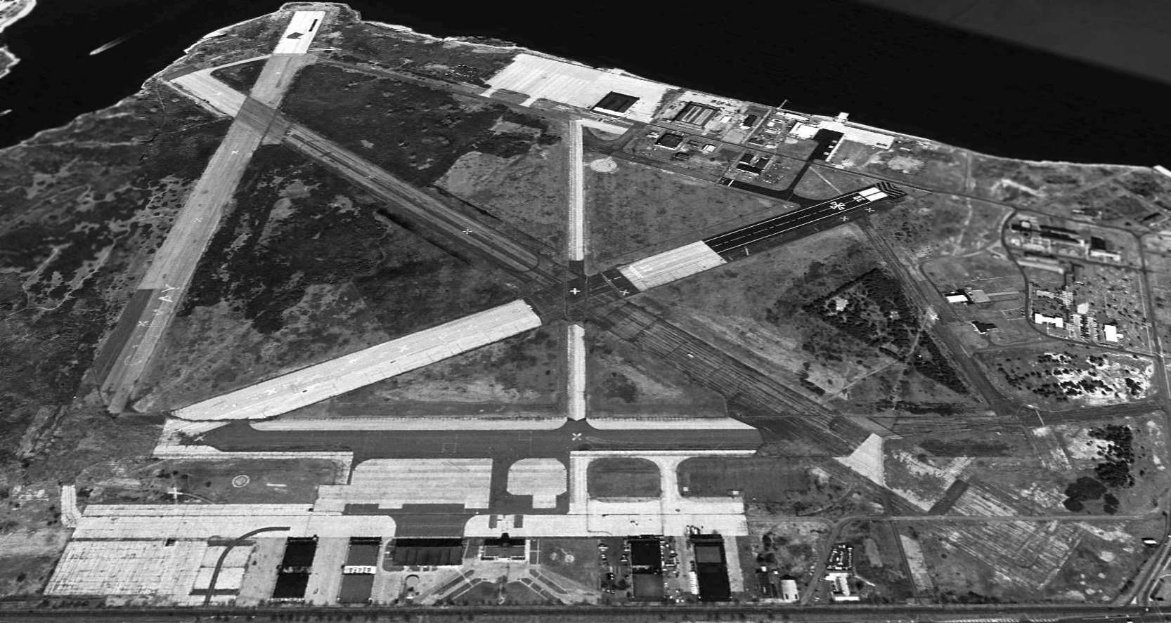
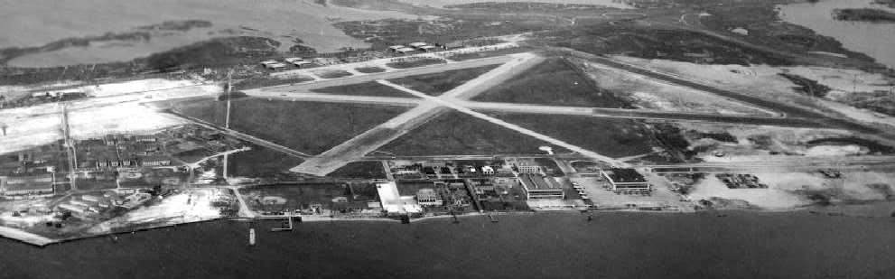
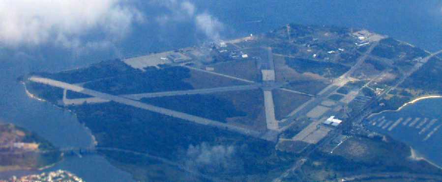
As seen in a 1994 USGS aerial view looking northeast at Floyd Bennett Field, three paved runways (the longest is approximately 7,500' long), extensive ramps & numerous hangars still existed.
The 1992 USGS topo map still labeled the site as “U.S. Naval Air Station Floyd Bennett Field”,
even though it had ceased to be a Navy installation 21 years earlier.
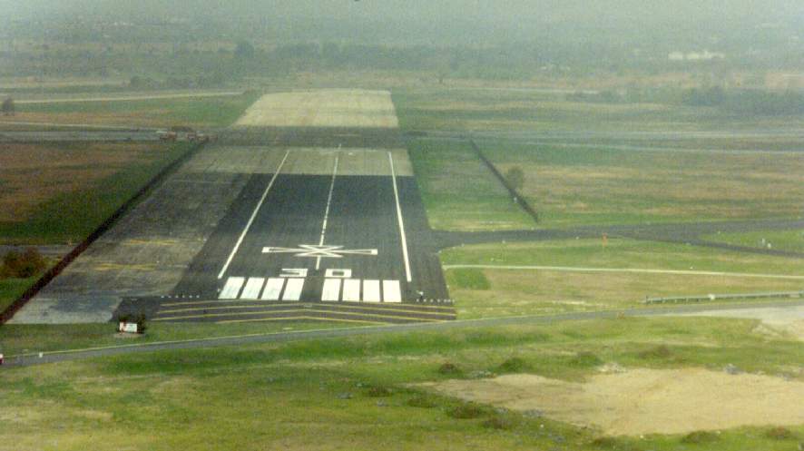
A 1994 photo by Alan Malachowsky from final approach to Runway 30, of which a 1,000' portion was re-painted
for a small fly-in of aircraft commemorating the field's 50th anniversary.
Since July 1997 the Marine Corps Reserve's 6th Communication Battalion has been based on the southeast portion of Floyd Bennett Field.
In the 1990s, budget considerations prompted the Coast Guard to consolidate the helicopter operations
of Brooklyn & Cape May NJ at a new location at Atlantic City International Airport.
The new facility at Atlantic City opened in 1998, at which point the Coast Guard Air Station Brooklyn was decommissioned.
The majority of the former Coast Guard property then transferred to the National Park Service.
A small portion remained in the possession of the USCG parent agency at the time (the Department of Transportation),
and a Doppler radar tower was placed there for use by nearby Kennedy International Airport.
The NYPD moved their aviation operation from a historic hangar to the former Coast Guard air station facilities shortly afterward.
That left the NYPD as the only remaining aviation unit on the field, and the airfield was renamed "NYPD Air Operations Heliport".
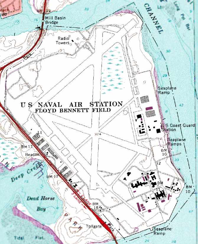
A 1998 Park Service map of Floyd Bennett Field.
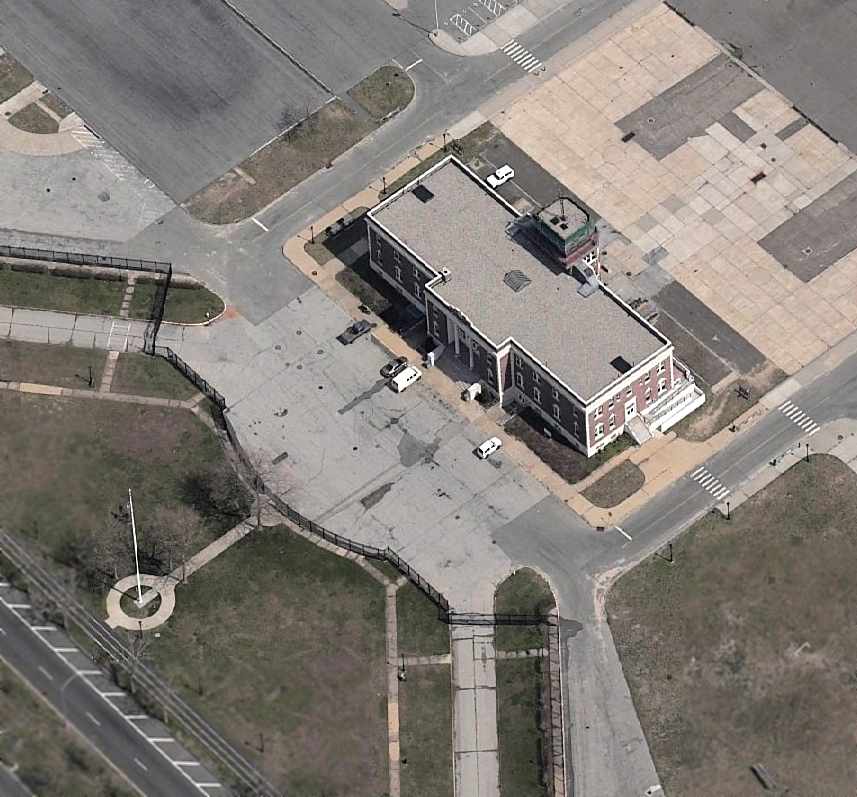
in front of the original terminal & control tower.
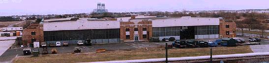
One of the historic hangars, now used by the NYPD Air Operations Unit.
The terminal & control tower are now being restored by the Park Service as the Ryan Visitor Center.
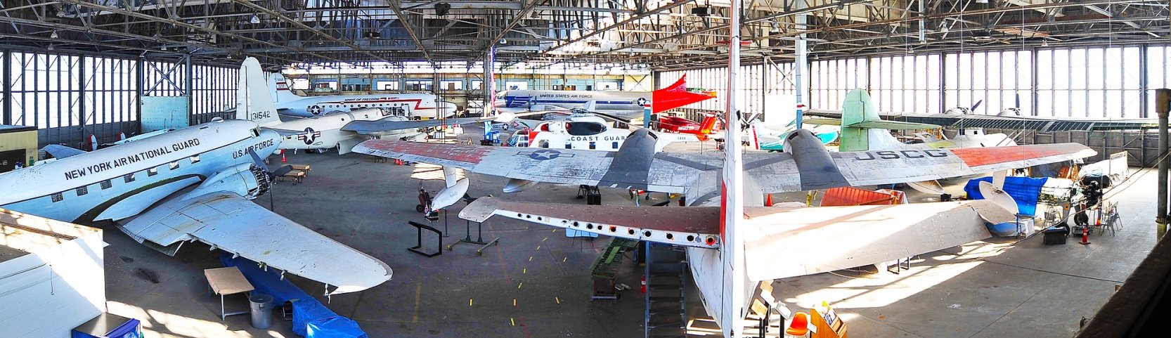
There is also a small aviation museum on the field, the Northeast Aircraft Restoration Facility,
which has been occasionally allowed to fly in aircraft being added to their collection,
even after the closure of the runways at Floyd Bennett.
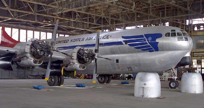
A 2002 photo by Tom Turner of a Boeing C-97 Stratofreighter,
being restored by the Berlin Airlift Historical Foundation inside Floyd Bennett Hangar B.
A 2003 photo by Tom Turner of an Airship Industries Skyship 600 which operated from the east ramp at Floyd Bennett.
Aviator Sports & Recreation Complex & the National Park Service began their relationship in 2003
to adaptively reuse 4 of Floyd Bennett Field's original hangars (combining them into one 170,000 square foot building)
and surrounding land, creating a sports complex totaling 25 acres.
As a historic site, the NPS has set forth strict guidelines
in order to uphold the integrity of the airport hangars that are in use by Aviator Sports & Recreation.
Any modifications made to the hangars are to adhere to the requirements set forth
to preserve the original aesthetic structure of the hangars.
Aviator Sports and Recreation and the NPS have made a commitment to promote the airport's history
to insure that the contributions of Floyd Bennett Field are memorialized
for the education of all visitors to Aviator Sports & Recreation.
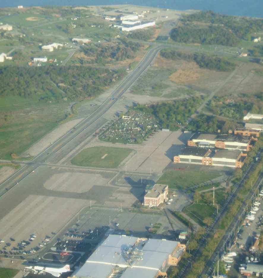
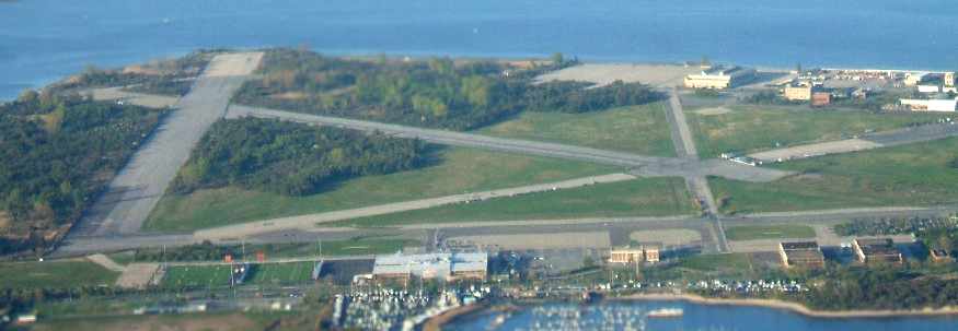
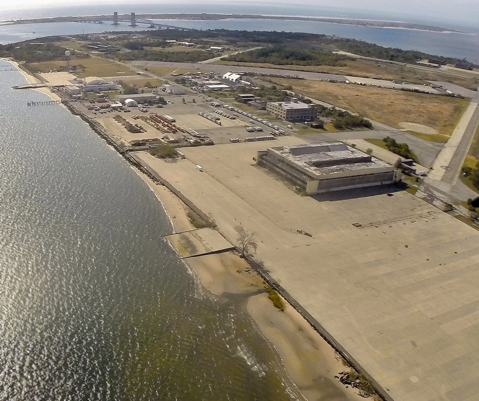
A 2005 aerial photo by Paul Freeman, taken from a Diamond Eclipse at 8,000 feet, looking southeast at Floyd Bennett.
A circa 2005 aerial photo looking north at the former Floyd Bennett terminal building.
A circa 2005 aerial photo looking north at a NYPD Bell 206 JetRanger in front of their hangar on the east side of Floyd Bennett Field.
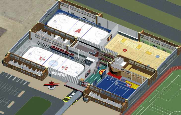
A diagram of the Aviator Sports & Recreation Complex, which opened in November 2006.
The complex was built by reusing portions of 4 original hangars on the west side of Floyd Bennett Field (along with modern construction in between),
creating 170,000 square feet of indoor recreation space.
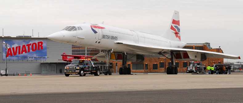
A 2006 photo of Concorde G-BOAD being towed in front of the Aviator Sports & Recreation complex on the Floyd Bennett ramp.
The historic SST had been displayed alongside Manhattan's Pier 86 at the USS Intrepid museum complex,
but the operators of Aviator Sports & Recreation agreed to temporarily relocate the plane to Floyd Bennett Field for 18 months
during the renovation of the Pier 86 complex.
The Concorde’s owner, British Airways, wanted the plane to stay on view in the city,
to continue serving as a billboard for the airline, a spokesman said.
The Concorde was towed on its barge to a ramp that extends into Jamaica Bay on the east side of Floyd Bennett Field.
A crane then lifted it onto a runway where with its oleos re-inflated,
it was towed across a runway to be parked in front of the the hangars that had been converted to house Aviator’s ice-skating rinks & basketball courts.
Aviator’s management hoped that the Concorde would draw attention to the center.
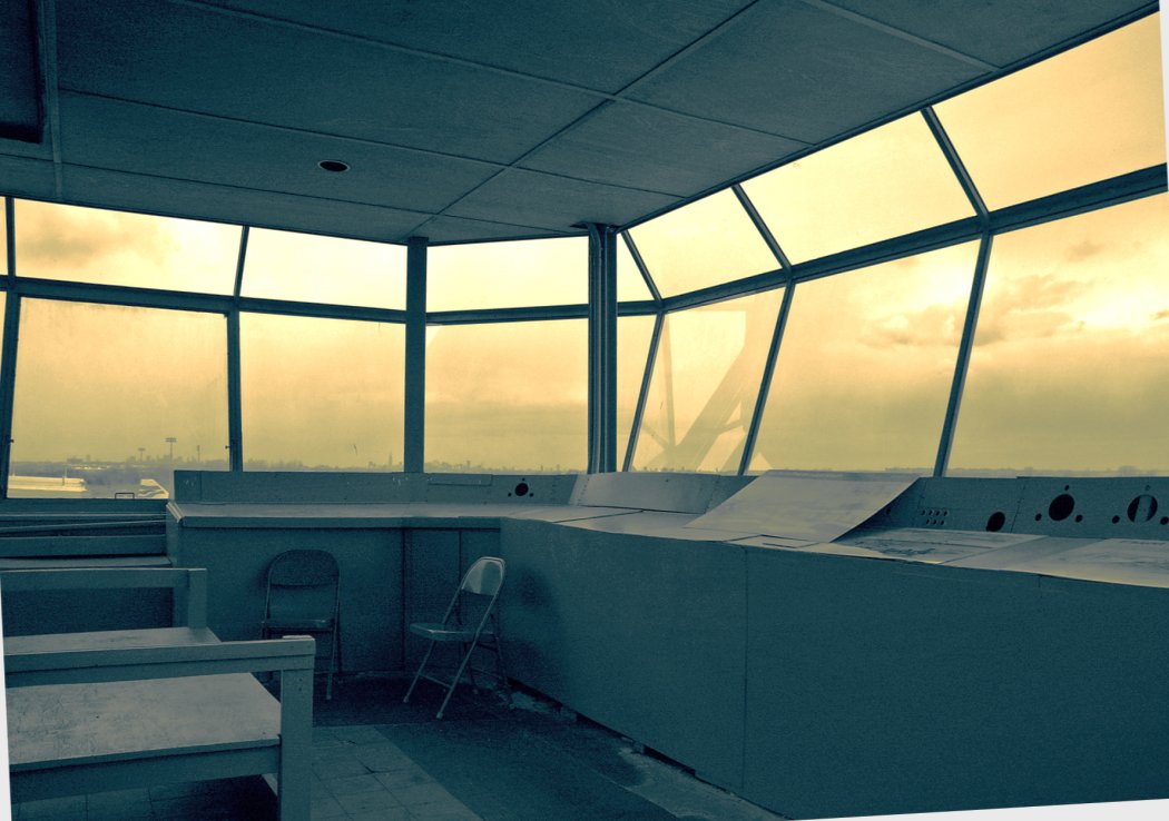
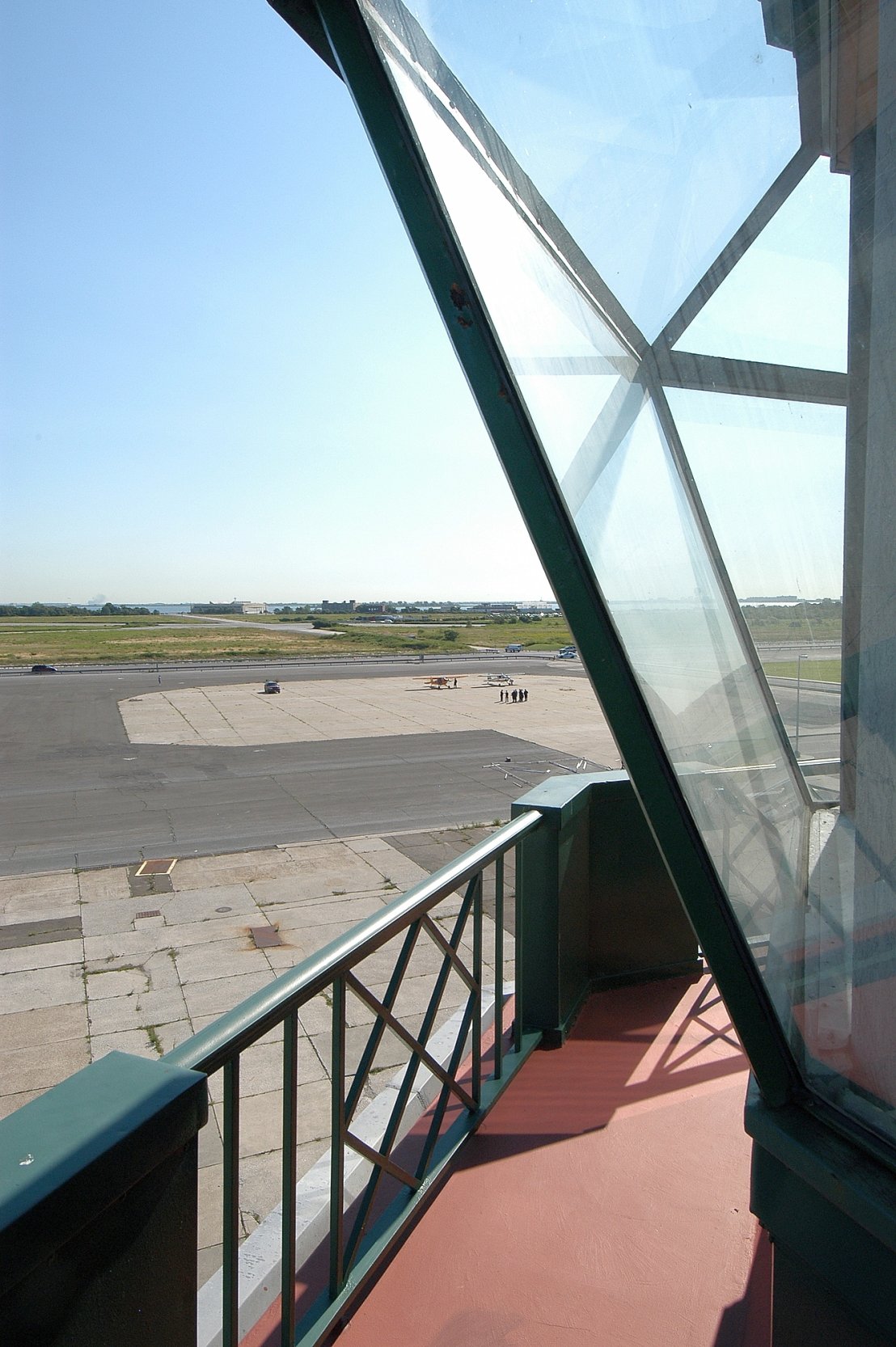
A 4/8/2007 photo looking out from the Floyd Bennett control tower. Compare this to the tower interior photo from 1943.
A 2007 photo by Mark Williams looking south at the west ramp of Floyd Bennett,
with the former terminal building & a Concorde SST at the bottom.
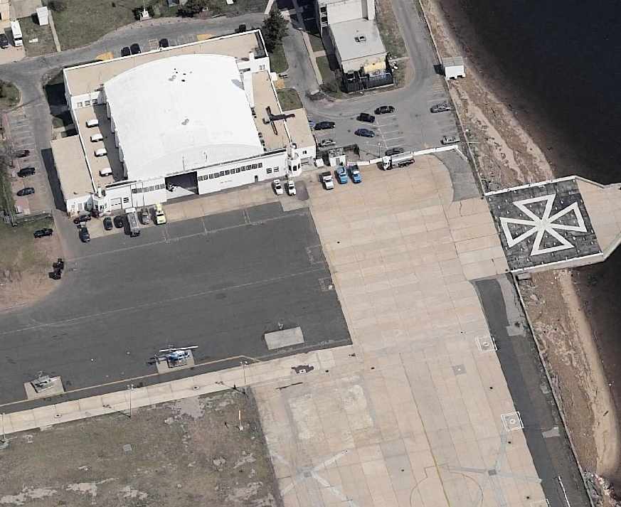
A 2007 photo by Mark Williams looking east at Floyd Bennett Field.
As of 2007, the New York City Police Department has some divisions located on the historic former airfield.
The department's aviation base, with its fleet of Bell Jet Ranger helicopters,
is housed in space leased from the National Park Service that was once the United States Coast Guard Air Station Brooklyn,
and is also now the headquarters for the NYPD Emergency Services Unit.
The Driver Training Unit is also located there,
using a section of former runway to teach new & veteran officers on the operation of the many different vehicles used by the department.
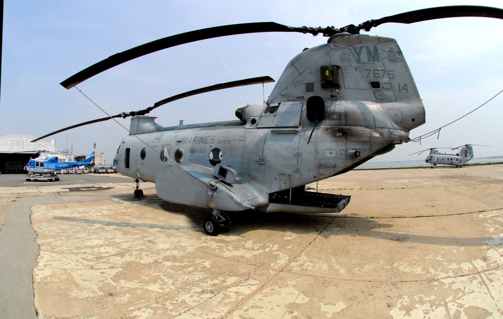
A 5/26/07 photo by Butch Moran of an NYPD Bell 412 & 2 Marine Corps Boeing CH-46 Phrogs on the Floyd Bennett Field NYPD ramp.
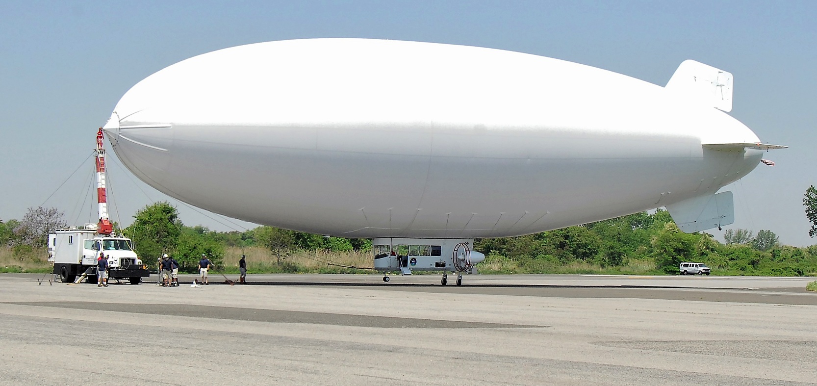
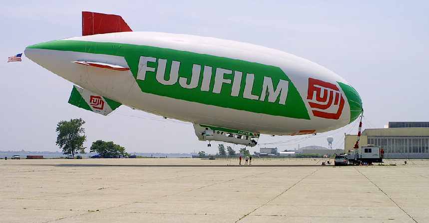
A 2007 photo by Butch Moran of a blimp (model & operator unidentified) attached to a truck-mounted mooring mast at Floyd Bennett Field.
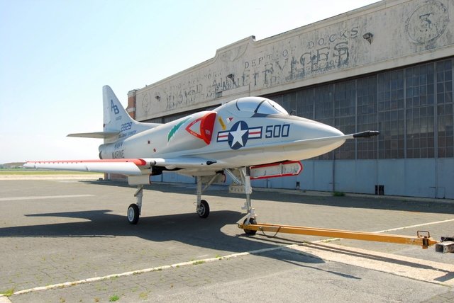
A 2007 photo by Butch Moran of a restored Douglas A-4 Skyhawk in front of a Floyd Bennett Field hangar.
An 8/14/07 photo by Butch Moran looking east from Floyd Bennett Field's control tower, before a fly-in conference.
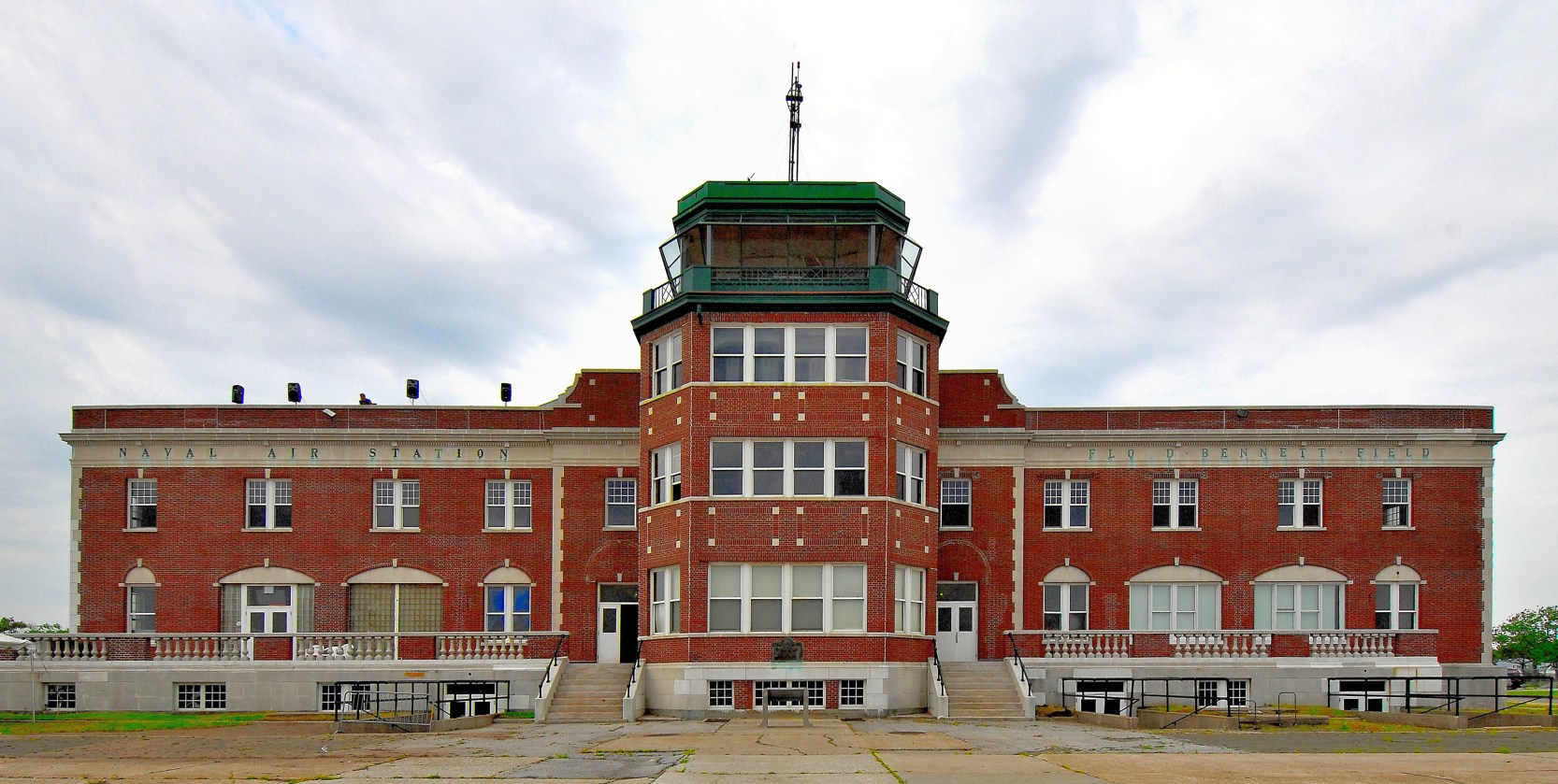
A 2007 photo by Butch Moran looking northwest at the Floyd Bennett Field control tower & terminal building.
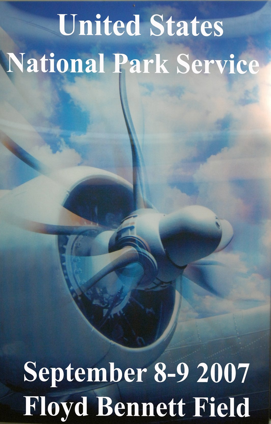
A poster created by Butch Moran to promote the 9/8/07 Floyd Bennett Field fly-in.
A 9/8/07 aerial view by Stephen Moran on approach to Floyd Bennett's Runway 24 for a Fly In.
A 9/8/07 aerial view by Stephen Moran looking north at Floyd Bennett Field during a Fly In.
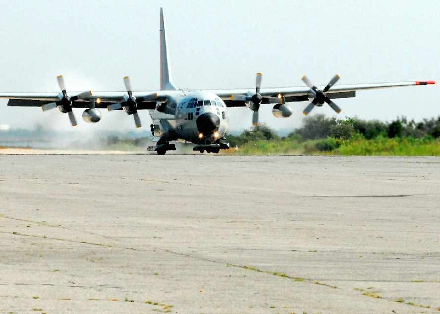
A 9/8/07 photo by Stephen Moran of a ski-equipped Lockheed LC-130 Hercules coming into Floyd Bennett for a Fly In.
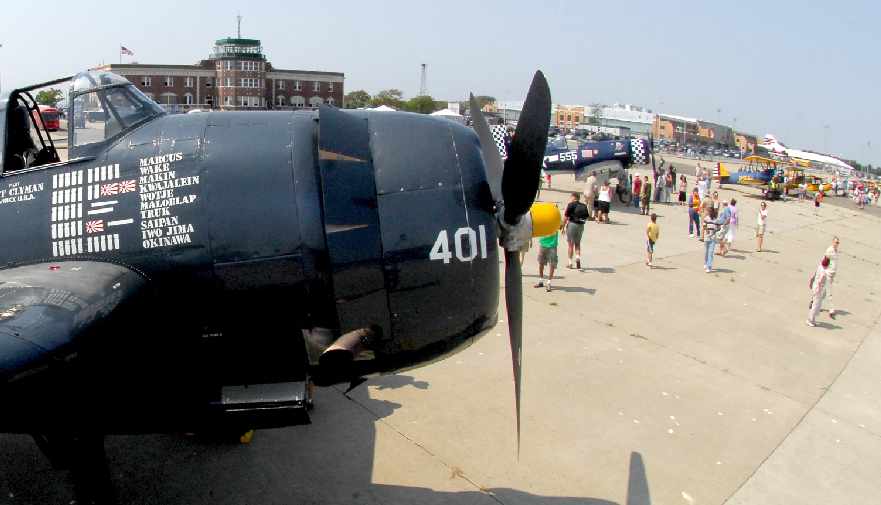
A 9/8/07 photo by Stephen Moran of a Grumman Avenger in front of the Floyd Bennett control tower
along with numerous other aircraft during a Fly In.
A 9/17/07 aerial view by Butch Moran looking west at the NYPD helicopter base & seaplane ramp on the southeast side of Floyd Bennett Field.
A 2007 photo by Butch Moran of the Berlin Airlift Historical Foundation's Boeing C-97 Stratofreighter inside Floyd Bennett Field's Hangar B.
Butch noted that the C-97's tail was folded down so as to enter the hangar.
A 2007 aerial view by Butch Moran looking southeast at Floyd Bennett Field from a blimp.
A 9/8/07 panoramic photo by Stephen Moran of a large number of warbirds gathered at Floyd Bennett for a Fly In.
A 3/25/08 photo of the abandoned Floyd Bennett Field hangars.
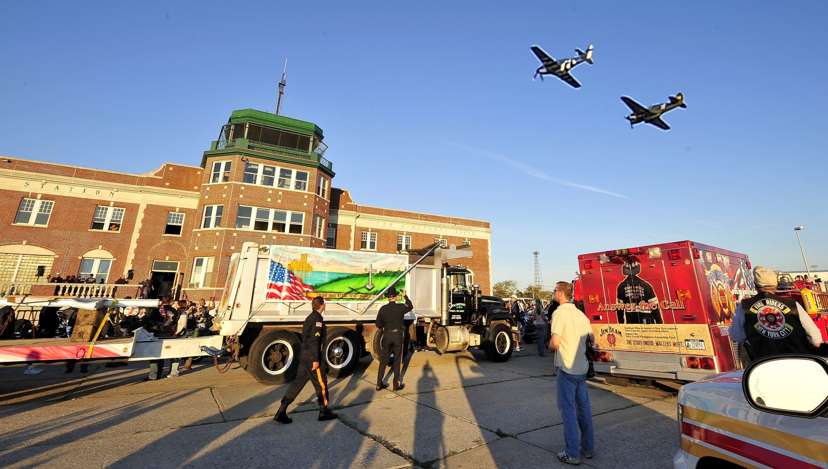
An 8/23/08 photo by Butch Morna of a P-51 Mustang & P-40 Warhawk conducting a flyover of Floyd Bennett Field before the Iron & Steel Run to DC with pieces of Word Trade Center steel.
Don Brzezinski reported in 2008, “If you go in the basement of the Administration Building you will find tunnels
that look like the subway [tiled walls] these lead out to the ramp.
There were stairs up to the surface where parked aircraft could be boarded with out crossing the ramp; quite novel for the times.”
A 2/7/09 panoramic photo by Butch Moran of a Grumman HU-16 Albatross & other aircraft inside Floyd Bennett Field Hangar B.
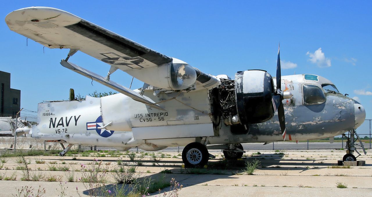
A sad 7/13/09 photo of BuNo 151664, Grumman S-2E Tracker, serial #197C,
which was first evicted from the Intrepid Air & Space Museum, then the Cradle of Aviation Museum.
It was then partially disassembled for transportation, and now sits at NAS Floyd Bennett Field.
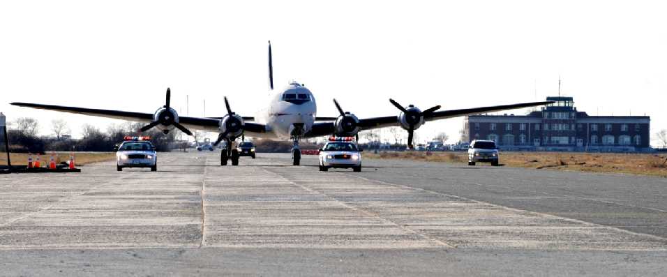
A 12/17/09 photo by Butch Moran of the Berlin Airlift Historical Foundation's Douglas C-54 “Spirit of Freedom” taxiing in from a landing,
with the historic Floyd Bennett terminal buildng in the background.
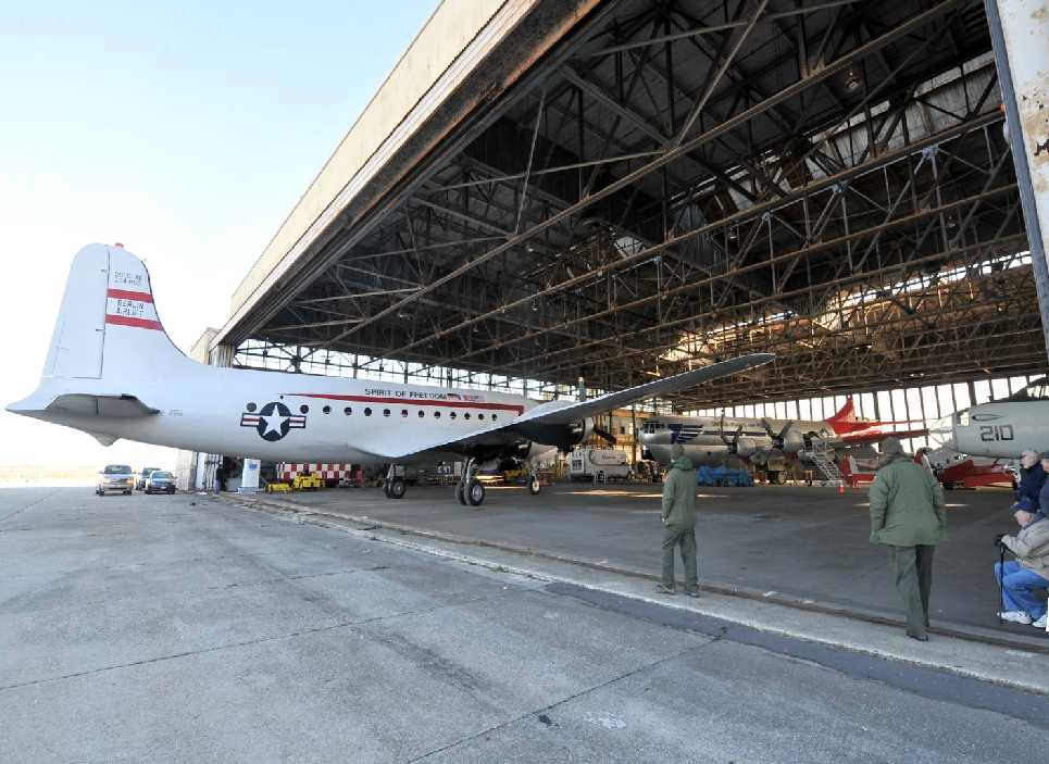
A 12/17/09 photo by Butch Moran of the Berlin Airlift Historical Foundation's Douglas C-54 “Spirit of Freedom” inside Floyd Bennett's Hangar B, with a C-97 & P-2 also visible.
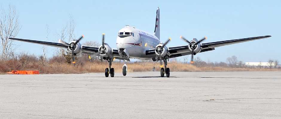
A 3/16/10 photo by Butch Moran of the Berlin Airlift Historical Foundation's Douglas C-54 “Spirit of Freedom” taking off from Floyd Bennett.
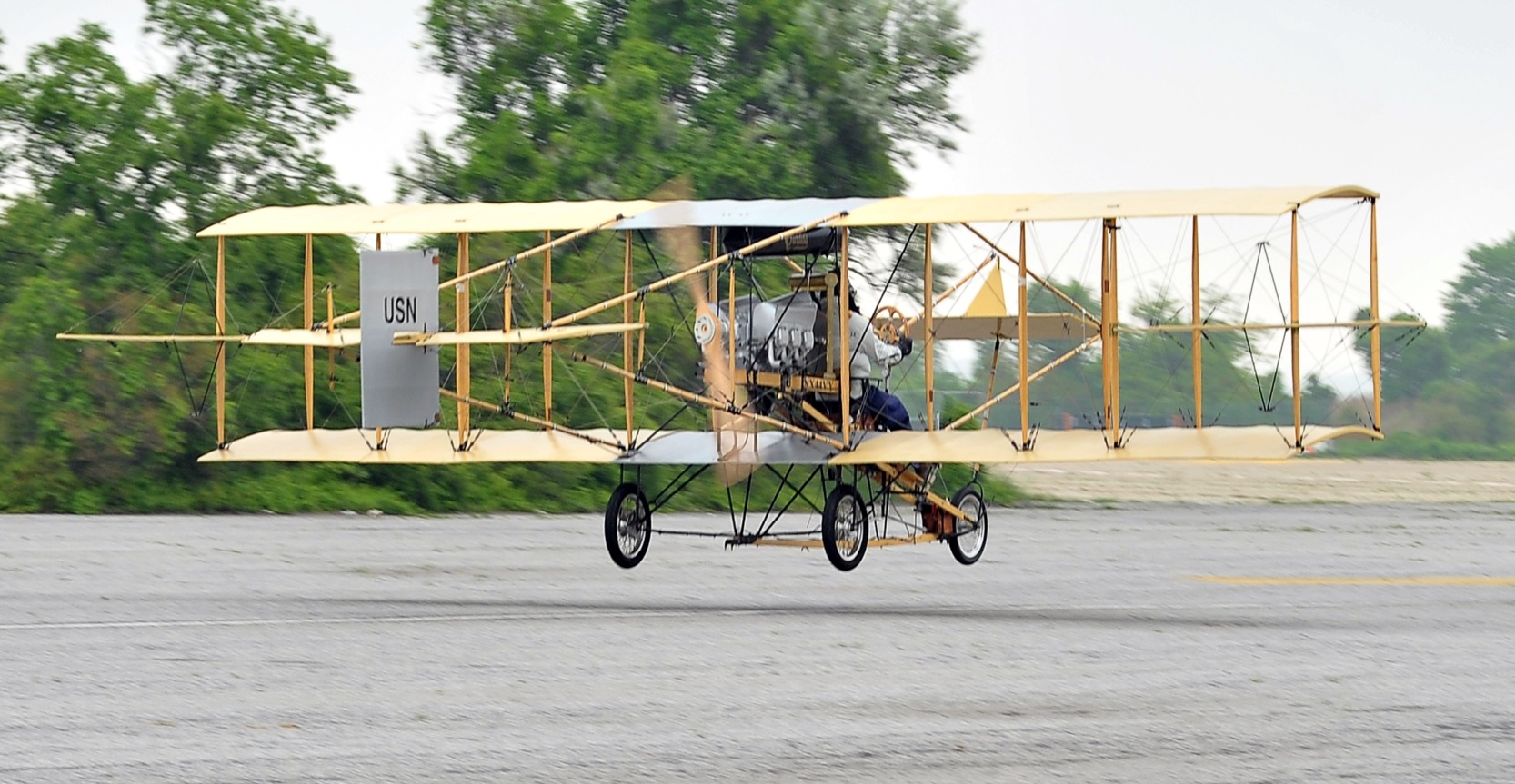
A 5/20/11 photo by Butch Mornan of Bob Coolbaugh landing at Floyd Bennett Field in his replica of the 1911 Ely-Curtiss Pusher, to commemorate the Centennial of Naval Aviation.
Bob Coolbaugh built the replica over a 3 year period.
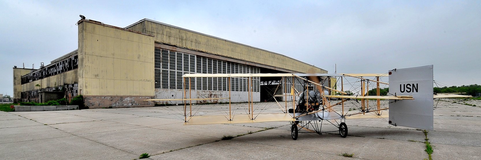
A 5/20/11 photo by Butch Mornan the replica of the 1911 Ely-Curtiss Pusher in front of Floyd Bennett Field's Hangar B.
The historic replica aircraft was on display during New York City Fleet Week.
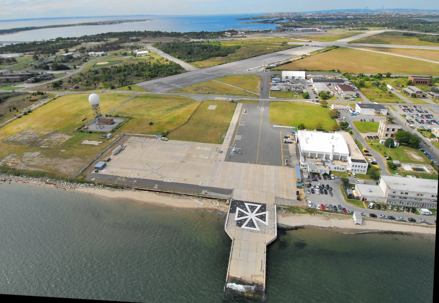
A 1/11/13 aerial view by Butch Moran looking south at the NYPD helicopter base, seaplane ramps, and Hangar B on the southeast side of Floyd Bennett Field.
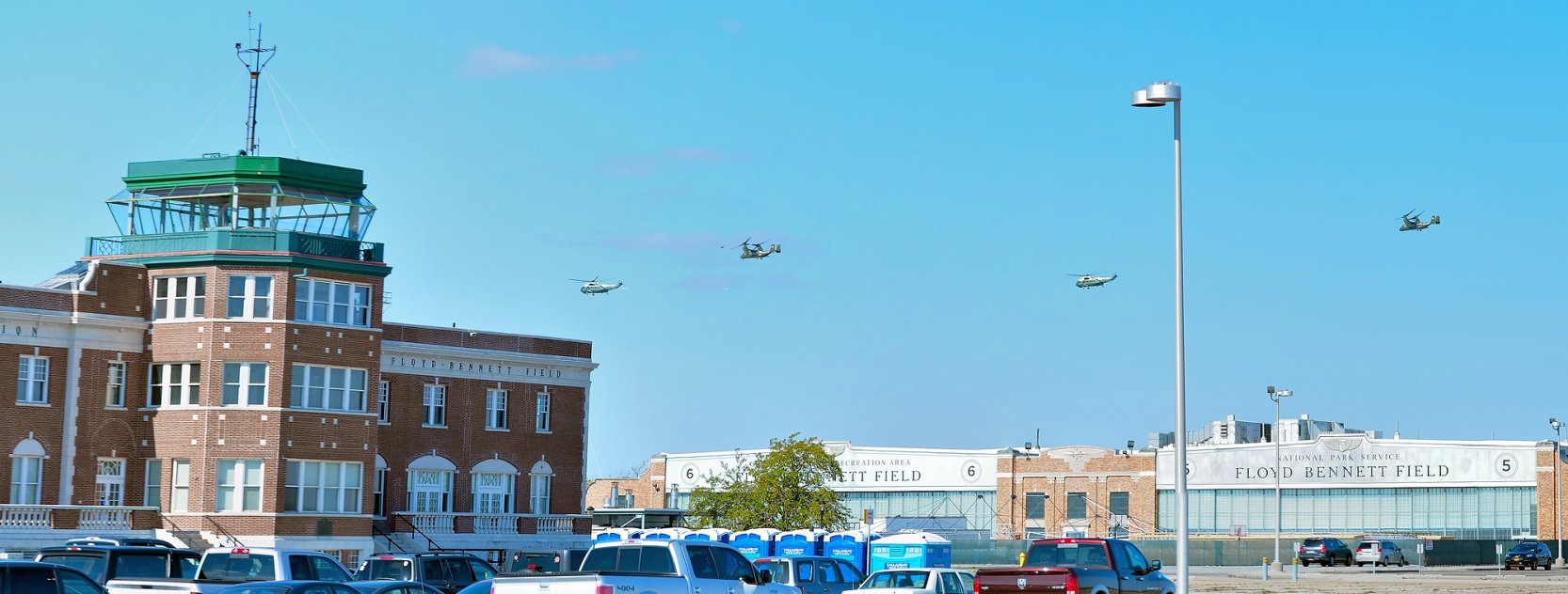
A 10/5/14 photo by Butch Moran of 2 Marine One VH-3Ds & 2 MV-22Bs overflying Floyd Bennett Field.
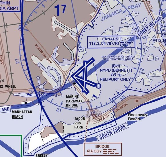
The 2015 NYC Helicopter Aeronautical Chart depicted “NYPD (Bennett)” as a private heliport,
although the extensive 4 paved runways were still depicted as well.
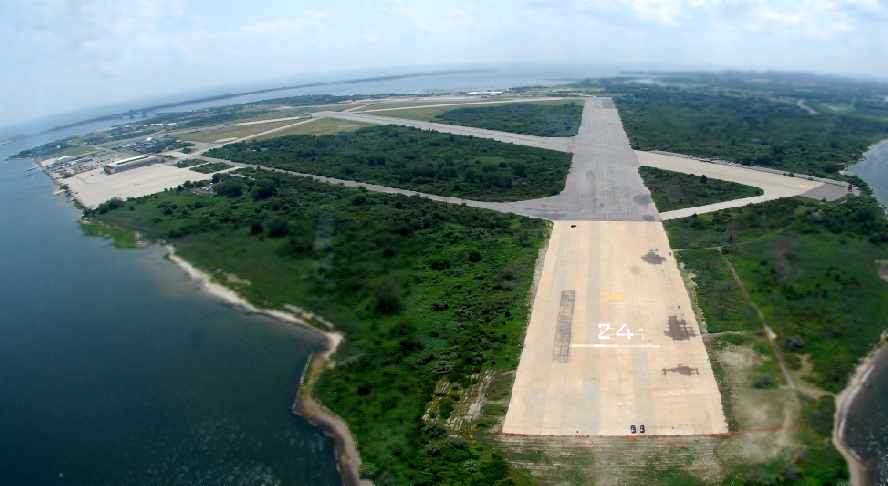
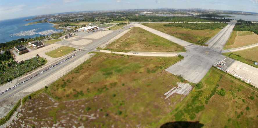
A 10/15/16 aerial view by Graeme Smith looking north at Floyd Bennett Field, with the site of Rockaway NAS also visible in the foreground.
A 2016 aerial view looking northeast at Floyd Bennett Field.
A 2016 photo by Butch Moran of the NYPD's Bell 307, 429, and 412 on Floyd Bennett Field's east ramp.
An amazing 7/23/16 photo by Butch Moran looking at Floyd Bennett Field's Hangar B from inside the cockpit of of the Berlin Airlift Historical Foundation's Boeing C-97 Stratofreighter.

A 3/30/17 photo by Ron Plante of the Berlin Airlift Historical Foundation's Boeing C-97 Stratofreighter outside Floyd Bennett Field Hangar B.
A 3/30/17 photo by Ron Plante of a Grumman HU-16 Albatross & other aircraft inside Floyd Bennett Field Hangar B.
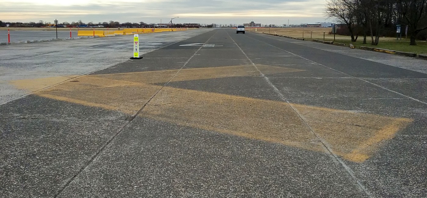
A 3/30/17 photo by Ron Plante looking west along a former Floyd Bennett Field runway or taxiway, with the terminal building visible in the background.
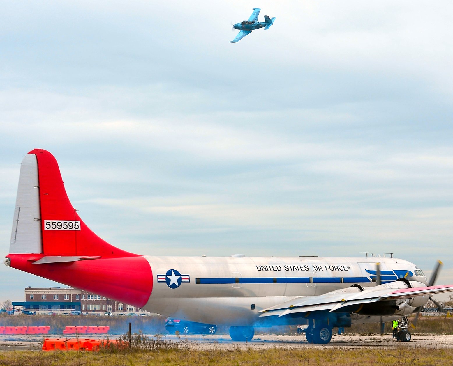
An 11/7/17 photo by Butch Moran of the Berlin Airlift Historical Foundation's Boeing C-97 Stratofreighter starting its engines, with the Floyd Bennett terminal visible in the background, and an aircraft passing overhead.
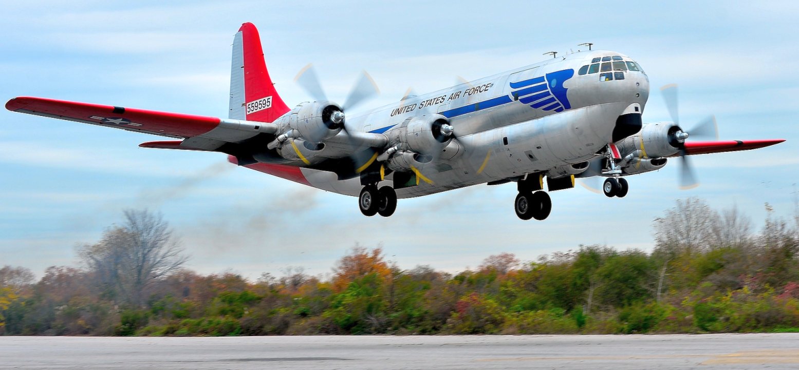
An 11/7/17 photo by Butch Moran of the Berlin Airlift Historical Foundation's Boeing C-97 Stratofreighter permanently leavingFloyd Bennett Field.
This is the world's last flying C-97.
A 12/29/17 photo by Butch Moran of a resident of Floyd Bennett Field's Hangar B, a 1940s Consolidated PBY Catalina amphibian.

A 10/7/25 photo looking west at the Floyd Bennett Field control tower.

A sad 10/7/25 photo of Floyd Bennett Field's deteriorating Hangars 3 & 4.
____________________________________________________
Or if you prefer to contact me directly concerning a contribution (for a mailing address to send a check),
please contact me at: paulandterryfreeman@gmail.com
If you enjoy this web site, please support it with a financial contribution.
____________________________________________________
This site covers airfields in all 50 states.