Abandoned & Little-Known Airfields:
Southwestern Ohio
© 2002, © 2025 by Paul Freeman. Revised 12/8/25.
This site covers airfields in all 50 states: Click here for the site's main menu.
____________________________________________________
Please consider a financial contribution to support the continued growth & operation of this site.
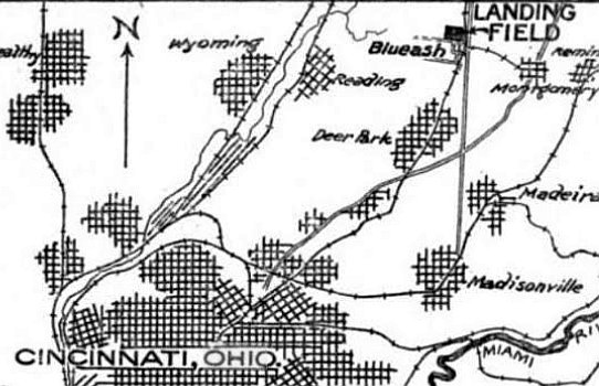
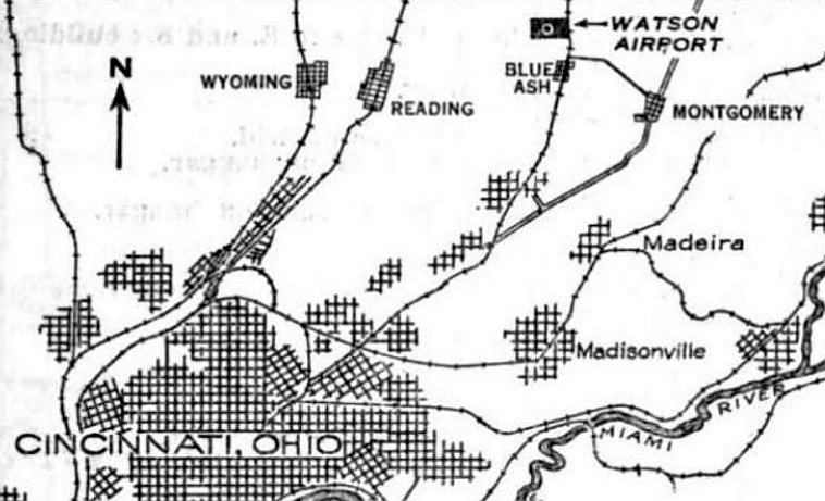
Aberdeen Airport / Tyler Airport (revised 11/26/23) - Cincinnati Incorporated Airport / Hugh Watson Field / Blue Ash Airport (revised 8/19/22)
Cincinnati Western & Southern Heliport (added 12/14/21) - Fairfield Air Depot / Wright Field / Wright AFB (revised 11/26/23)
General Electric Peebles Airfield (revised 11/15/16) - Grisard Field / Watson Airport / Parks Watson Landing Field / Blue Ash Airport (revised 3/11/23) - Lakewood Airpark (revised 12/9/17)
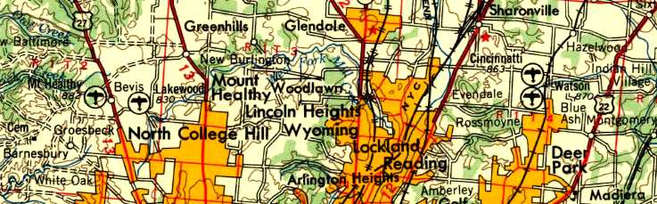
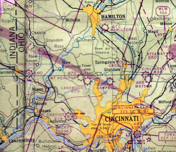
McCook Field (revised 11/26/23) - Huffman Prairie Flying Field (added 1/9/09) - Moraine Farm Airfield / Deeds Airfield (revised 11/6/25) - Mt. Healthy Airport (revised 7/2/18)
North Hamilton Airport (added 5/20/17) - San Mar Gale Airport (revised 12/8/25) - South Dayton Airport (revised 2/20/18)
Warren County Airport / Brownies Lebanon Airport / Duff Airport (revised 10/6/25) - Wright's Farm Airfield (revised 11/26/23)
____________________________________________________
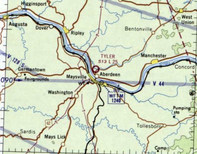
Aberdeen Airport / Tyler Airport, Aberdeen, OH
38.665, -83.771 (Southeast of Cincinnati, OH)
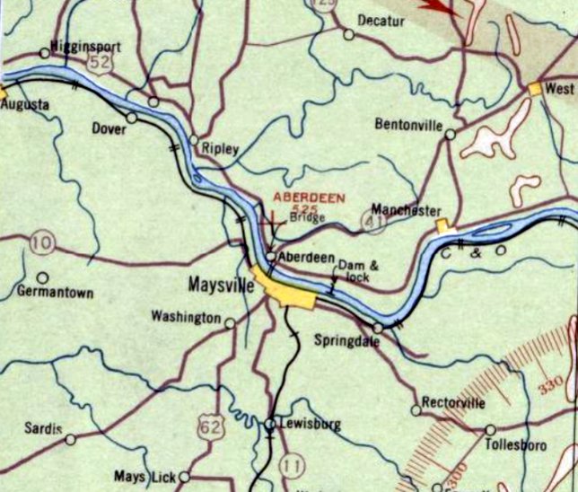
Aberdeen Airport, as depicted on the February 1934 Huntington Sectional Chart.
The date of establishment of this early airport has not been determined.
The earliest depiction which has been located of Aberdeen Airport was on the February 1934 Huntington Sectional Chart.
It depicted Aberdeen Airport as an auxiliary airfield.
The last depiction which has been located of Aberdeen Airport was on the May 1937 Huntington Sectional Chart.
Aberdeen Airport was evidently closed (presumably due to the Depression) at some point in 1937,
as it was no longer depicted on the December 1937 through October 1947 Huntington Sectional Charts.
At some point between 1947-48, the former location of Aberdeen Airport was evidently reopened as Tyler Airport,
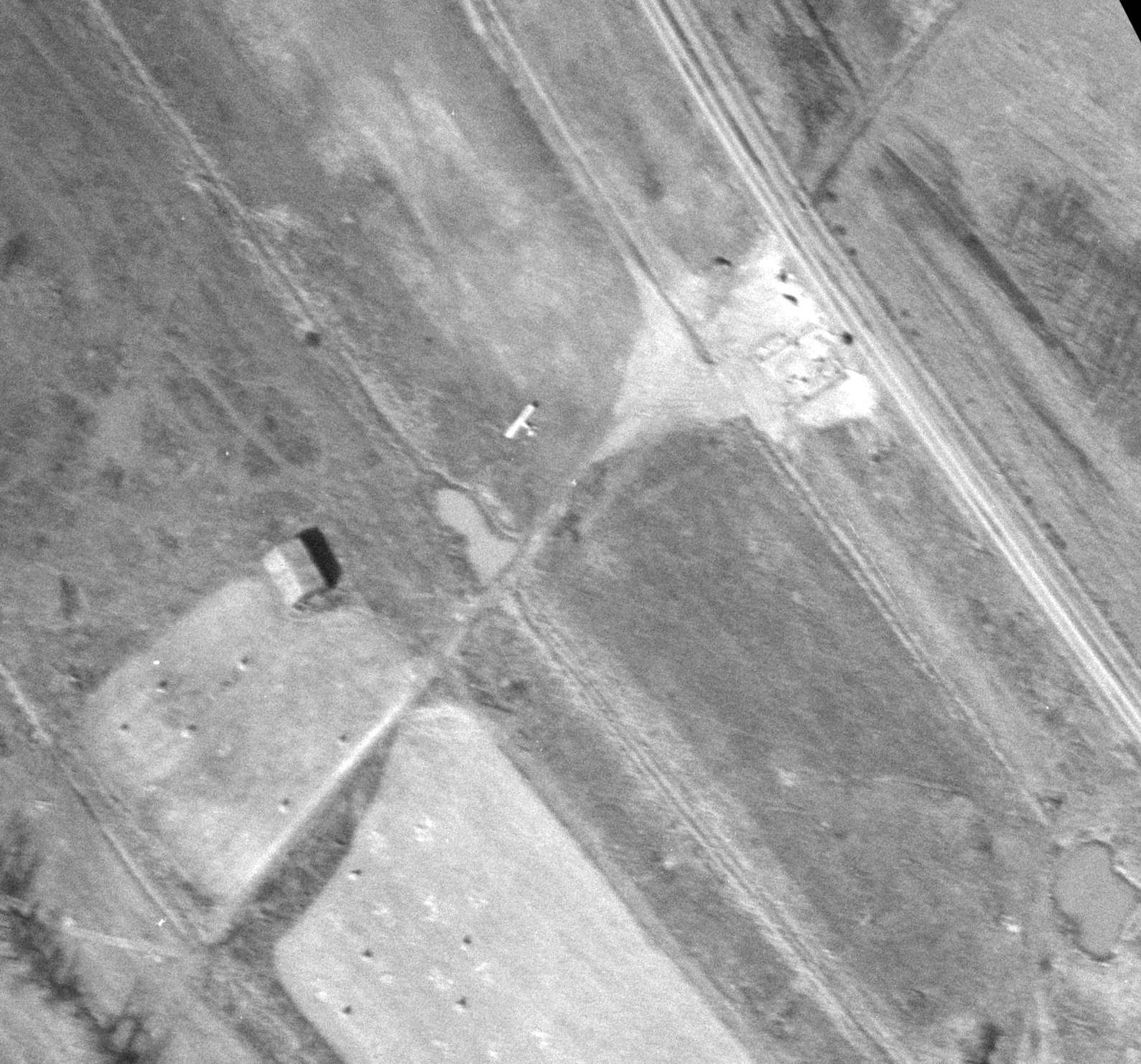
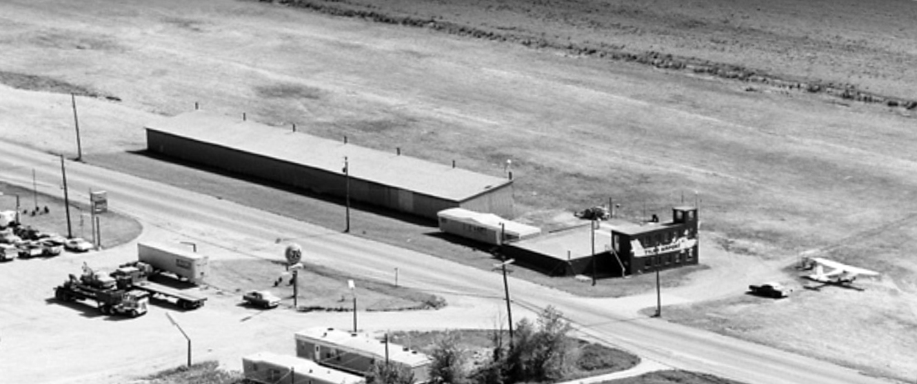
as a 3/18/48 ODoT aerial view (courtesy of Dennis Thompson) depicted ground being broken for the construction of the terminal building on the east side of the grass runway,
with 1 light single-engine aircraft visible parked on the field.
A 3/30/48 Portsmouth Times article (courtesy of Dennis Thompson) said that a 2,500' dirt runway
on the George Tyler farm at Aberdeen had been used as an emergency field for several years by private planes.
The field was being developed into Tyler Airport, including the construction of a 5-plane hangar & establishment of flight training & commercial & private flight services.
The earliest aeronautical chart depiction which has been located of Tyler Airport was on the October 1948 Huntington Sectional Chart.
It depicted Tyler Airport as having a 2,300' unpaved runway.
A 5/1/52 Clermont Sun article (courtesy of Dennis Thompson) described the Tyler Airport owner as A.A. Brown, a large stockholder in Taylorcraft Inc.
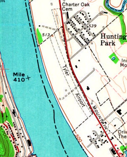
The earliest topo map depiction which has been located of Tyler Airport was on the 1961 USGS topo map.
It depicted a single unpaved northwest/southeast runway, which curved to follow the riverbank.
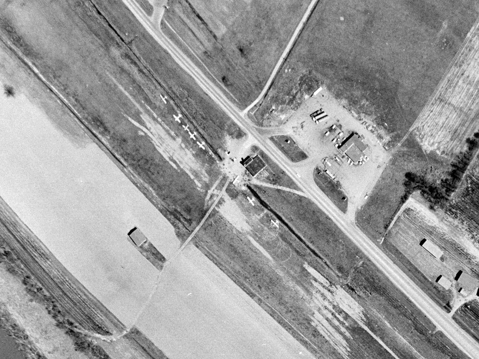
A 1962 ODoT aerial view (courtesy of Dennis Thompson) depicted Tyler Airport as having 8 light single-engine aircraft & a small hangar on the northeast side of a grass northwest/southeast runway.
The last aeronautical chart depiction which has been located of Tyler Airport was on the February 1969 Huntington Sectional Chart.
It depicted Tyler Airport as having a 2,500' unpaved runway.
A 1970 ODoT aerial view looking east (courtesy of Dennis Thompson) showed that Tyler Airport had gained a 2nd hangar at some point between 1962-70.
The number of aircraft visible parked outside had decreased to 3.
A 12/14/71 Hillsboro Press Gazette article (courtesy of Dennis Thompson) said that articles of incorporation had been filed for the Tyler Airport Incorporated.
A 1979 ODoT aerial view (courtesy of Dennis Thompson) depicted only 1 light single-engine aircraft at Tyler Airport.
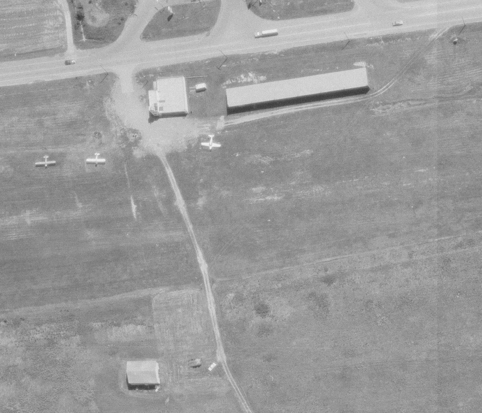
A 1983 aerial view looking southwest (courtesy of Dennis Thompson) depicted Tyler Airport as having 1 long hangar, and the original hangar (with a tower on the corner) was painted with an aircraft on its side.
One single-engine Cessna was parked outside.
Tyler Airport's 2nd hangar (the long building to the southeast) still remained standing in a 1985 aerial view.
Tyler Airport was still depicted on the 1993 USGS topo map.
Tyler Airport's 2nd hangar (the long building to the southeast) was evidently removed at some point between 1985-2004,
as it was no longer seen in a 2004 aerial view.
A 2008 photo looking west (courtesy of Dennis Thompson) showed that Tyler Airport's hangar had lost its tower on the corner at some point between 1983-2008, along with the aircraft mural on its side.
Tyler Airport was no longer depicted on the 2013 USGS topo map.
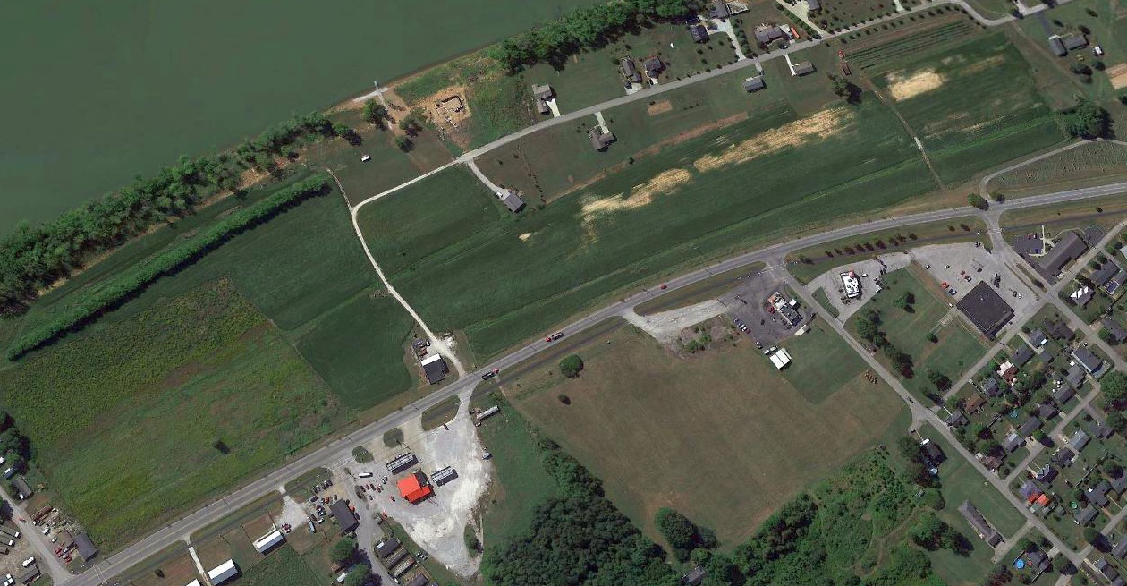
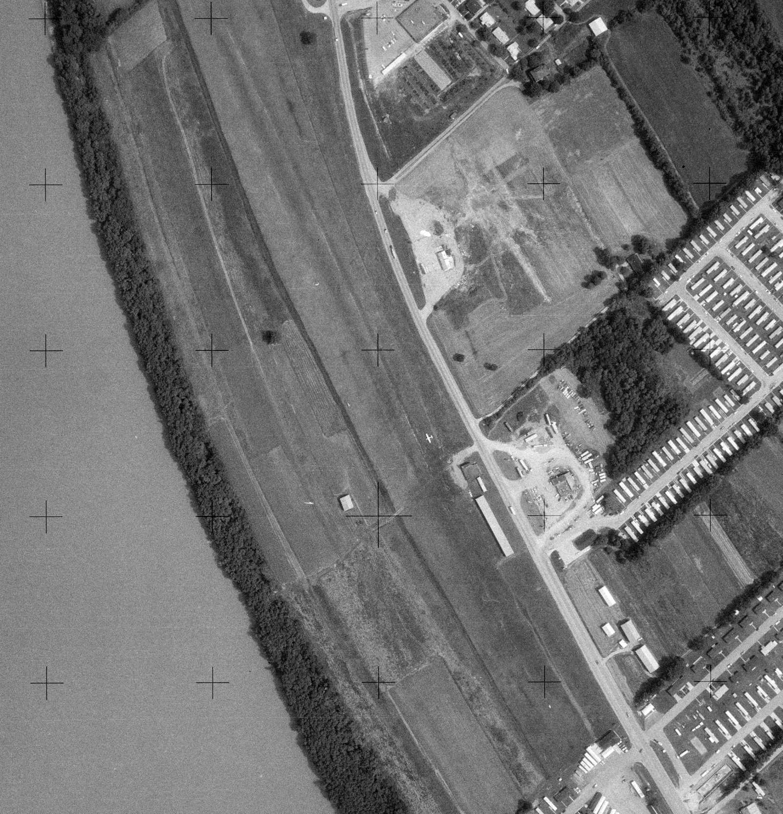
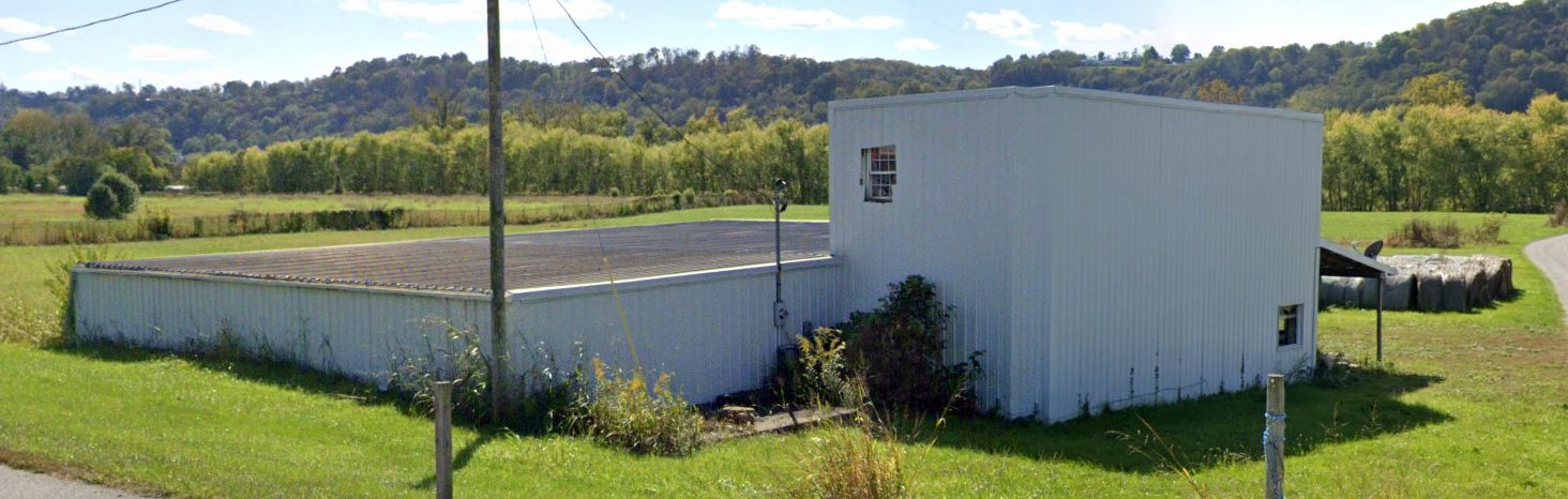
A 2016 aerial view looking west showed that Tyler Airport's original hangar remained standing, and the grass runway remained clear.
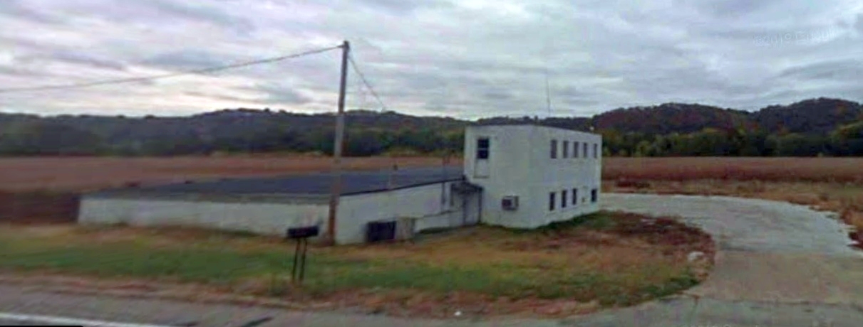
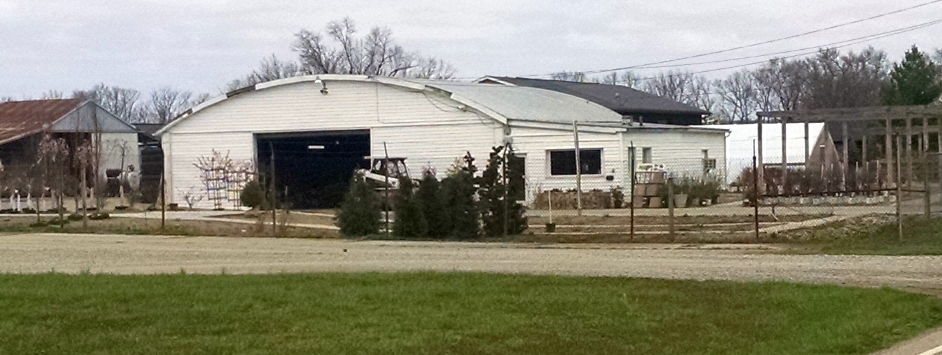
Dennis Thompson reported that as of 2022, the former Tyler Airport hangar was reused as an antique shop.
A 2023 photo looking southwest at the former Tyler Airport hangar.
Thanks to Dennis Thompson for pointing out this airfield.
____________________________________________________
Cincinnati Western & Southern Heliport (O21), Cincinnati, OH
39.1, -84.507 (Downtown Cincinnati, OH)
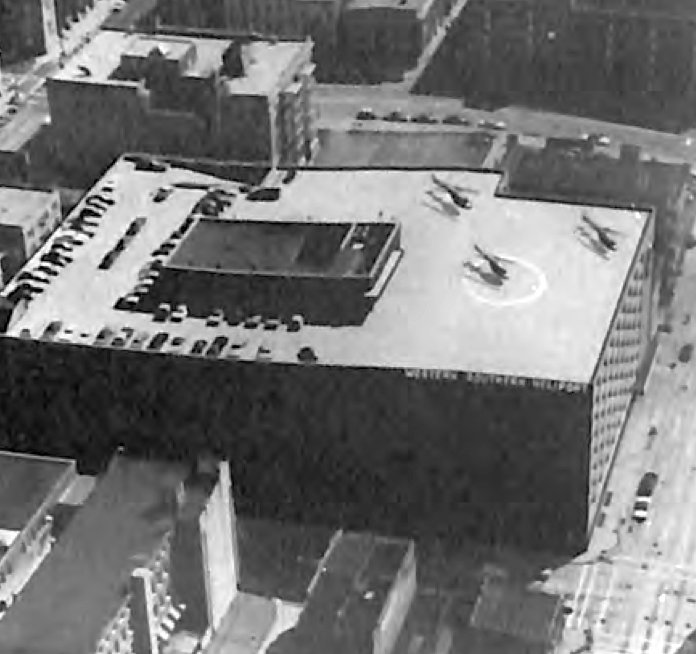
An undated aerial view looking northeast at the Cincinnati Western & Southern Heliport, from the 1975 Aerospace Industries Association Heliport Directory (courtesy of Jonathan Westerling).
Jonathan Westerling reported, “On 9/10/68 the Western & Southern Life Insurance Company
submitted a Notice of Landing Area Establishment to the FAA for a 'new landing area - heliport' for public & private use.
It was to be the first approved heliport to be located in downtown Cincinnati.
Operations commenced on 5/1/70 with twice-dally (rush hour) 'traffic-copter' reporting missions.
These were carrying Cincinnati Police Lt. Jim Stanley who reported traffic for WLW-AM, the #1 station at the time.
Stanley was their 'Eye in the sky' for 11 years, retiring in 1978 from radio & from the Cincinnati Police Department after 25 years.”
The first airfield directory listing which has been located of the Western & Southern Heliport
was in an addendum to the 1974 Airman's Information Manual as a new entry (according to Jonathan Westerling).
According to an article in the May 1989 Flying Magazine (according to Jonathan Westerling):
"With its 2,500-square-foot hangar equipped with complete maintenance facilities, and a passenger lounge with [elevator] access to the street,
pilots considered it one of the best rooftop heliports in the US, although it had no fueling facilities."
Jonathan Westerling reported, “The Western & Southern Heliport was situated on the upper level of a 10-story parking structure.
The deck elevation was approximately 125' above ground level.
Initially, almost the entire rooftop area was available for helicopter takeoffs, landings and parking.
Except for a relatively small space for automobile parking & the area of the hangar/waiting room,
usable space for helicopter operations was in excess of 35,700 square feet.
It was recorded that at one time (during a football game at adjacent Riverfront Stadium)
as many as 22 helicopters were simultaneously parked on the roof with sufficient space left for safe takeoff & landing operations.”
The earliest depiction which has been located of the Cincinnati Western & Southern Heliport was an undated aerial view looking northeast
from the 1975 Aerospace Industries Association Heliport Directory (courtesy of Jonathan Westerling).
It depicted 3 helicopters parked on the rooftop heliport, with one landing circle marking on the southern portion.
Jonathan Westerling reported, “Business was picking up for the heliport by the end of the 1970s,
then in 1980, Western & Southern demanded an almost 200% increase in rent.
Western & Southern planned to convert the now-vacant top level of its garage structure
exclusively to automobile parking & to use the hangar as a car maintenance facility.
The Fixed Base Operator, Cincinnati Airways, relocated to Lunken Airport.
However, in response to several requests from helicopter industry organizations, regional pilot groups, and the OOOT Division of Aviation,
Western & Southern agreed to maintain a portion of the original landing area open for 'Emergency Use Only'.
A section 60' x 80' was cordoned off in one corner for that purpose.
The manager of the parking operation was designated as the manager of the heliport also
and the State of OH kept the heliport certificate (license) in effect on that basis.
Notably, these proceedings were never reflected in any directory listings which continued to list the facility in its prior glory.”
Jonathan Westerling reported, “According to FAA Report DOT/FAA/PM-87/32, the Western & Southern Heliport lasted as long as it did
because of the support of the [Western & Southern] insurance company President.
He understood that the value of a heliport ls not always measured with dollars & cents on the bottom line.
He was like a shopping mall manager who realizes that the expensive parking lot outside
will never yield any return on the investment yet business would be practically impossible without it.
In much the same way, the services the heliport provided the community, in promoting commerce, improving public safety and enhancing the prestige & image of downtown Cincinnati,
were the intangible but nevertheless real benefits to be gained from having the heliport.
Unfortunately, when that gentleman died, so did the future of the heliport that bore his company's name.
His successor did not share his enthusiasm for rotary-wing aviation & withdrew the company's support.”
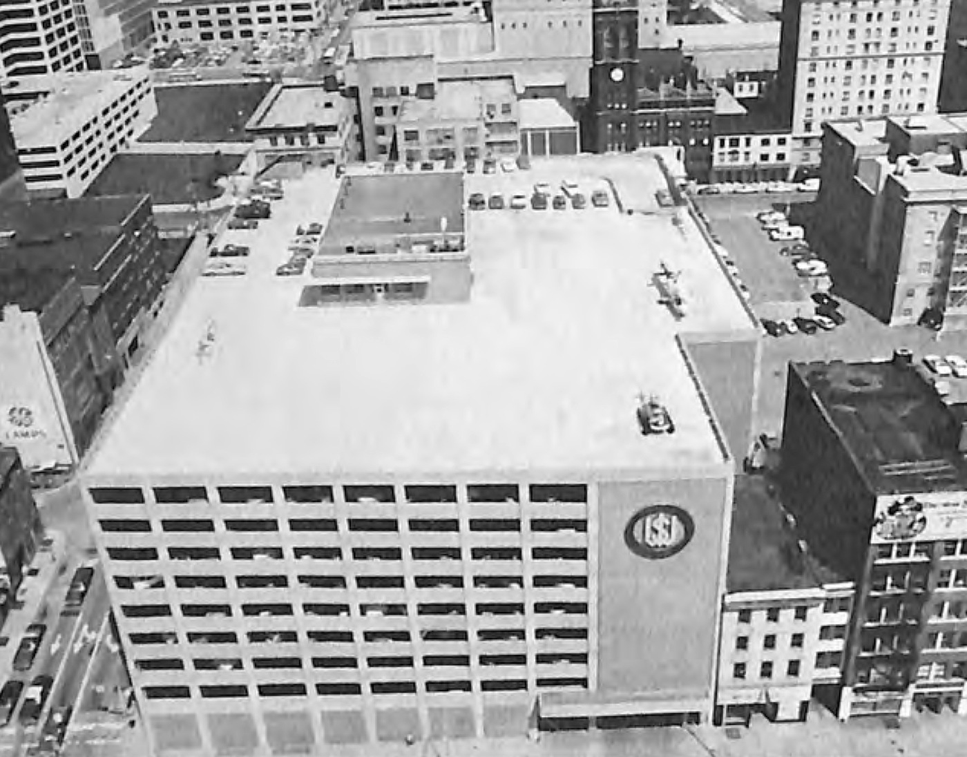
The last depiction which has been located showing the Cincinnati Western & Southern Heliport still in operation was an undated aerial view looking north
from the 1984 Aerospace Industries Association Heliport Directory (courtesy of Jonathan Westerling).
It depicted 2 or 3 helicopters parked on the rooftop heliport.
Jonathan Westerling reported, “In June 1984, the Western& Southern Life Insurance Company filed with the FAA
a Notice of Landing Area Proposal for Deactivation of the heliport.”
The demise of the Western & Southern Heliport was described as part of an article in the May 1989 Flying Magazine:
"While the heliport brought in about $10,000 / year, it could bring in $40,000 / year as a parking lot.
When the sponsoring businessman died, his successor chose cars over choppers."
An article in the 9/25/90 Cincinnati Enquirer announcing the closure of the heliport quoted the owner of the FBO:
"We might have been 10 years before our time," he said, "but now is when we need it."
"We've never had an incident or a problem."
Jonathan Westerling observed, “This was not due solely to good fortune.
The FBO's policy was to pursue to a successful resolution any sort of public relations problem, usually on a personal basis,
and this aggressive approach forestalled difficulty & prevented any real public opposition to helicopter operations in the neighborhood.”
The Western & Southern Heliport was not depicted on the November 1991 St. Louis Sectional Chart.
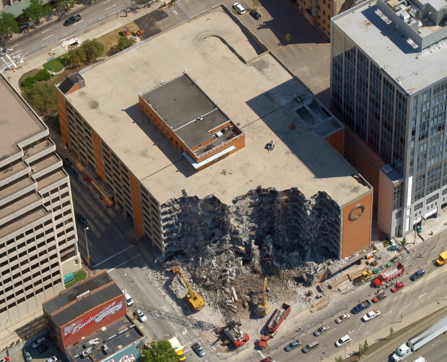
A 2007 aerial view looking northeast (courtesy of Jonathan Westerling) showed the parking garage of the former Cincinnati Western & Southern Heliport being demolished.
According to the O'Rourke Wrecking Company website, the parking garage was demolished to make way for the Queen City Square office tower.
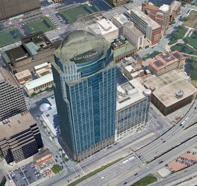
A 2017 3-D aerial view looking northeast showed showed the the Queen City Square office tower which occupies the Cincinnati Western & Southern Heliport site.
Thanks to Jonathan Westerling for pointing out this heliport.
____________________________________________________
North Hamilton Airport, Hamilton, OH
39.451, -84.531 (North of Cincinnati, OH)
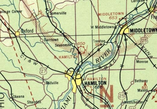
North Hamilton Airport, as depicted on the 1934 Cincinnati Sectional Chart.
The North Hamilton Airport was evidently established at some point between 1933-34,
as it was not yet depicted on the 1933 Cincinnati Sectional Chart.
The earliest depiction which has been located of North Hamilton Airport was on the 1934 Cincinnati Sectional Chart,
which depicted North Hamilton as a commercial/municipal airport.
Bob Schallip recalled, “North Hamilton Airport was owned & operated by the Treiber family.
The runway was shortened after the 1937 flood and they relocated State Route 127 & used the south end of the runway to do it.
After that it saw reduced activity. My father learned to fly there in the late 1940s.
I grew up in southwestern OH in the 1950s.
Across the road from our house was North Hamilton Airport, and most every thing was gone by the time I could remember.
Elmer Treiber was the principal behind it & he was killed in a Aeronca C3. After that it really slowed down.”
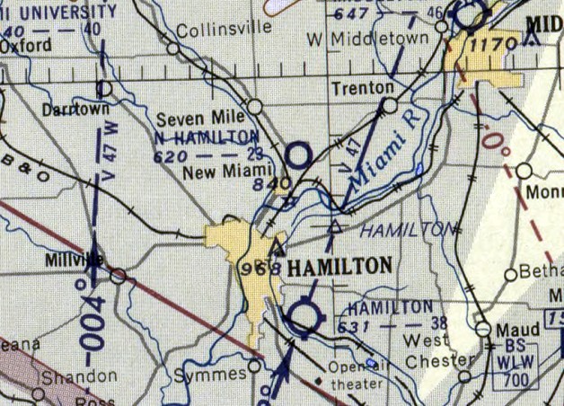
The last depiction which has been located of North Hamilton Airport was on the June 1955 Cincinnati Sectional Chart,
which depicted North Hamilton as having a 2,900' unpaved runway.
North Hamilton Airport was evidently closed at some point between 1955-56,
as it was no longer depicted on the June 1956 Cincinnati Sectional Chart (courtesy of Ron Plante).
The 1956 USGS topo map showed a drive-in movie theater having occupied the northwest portion of the North Hamilton Airport site.
A 1964 aerial photo showed the drive-in movie theater on the northwest portion of the North Hamilton Airport site,
but 1 hangar remained standing on the east side.
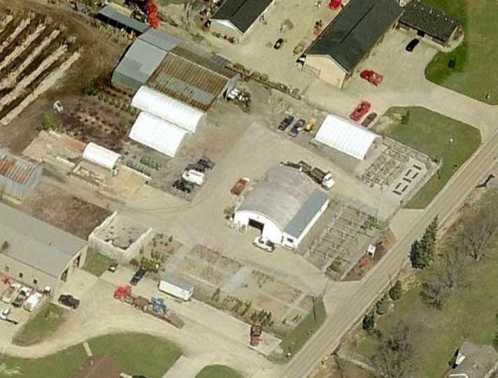
A circa 2010-2017 aerial view looking north at the hangar which remains from North Hamilton Airport.
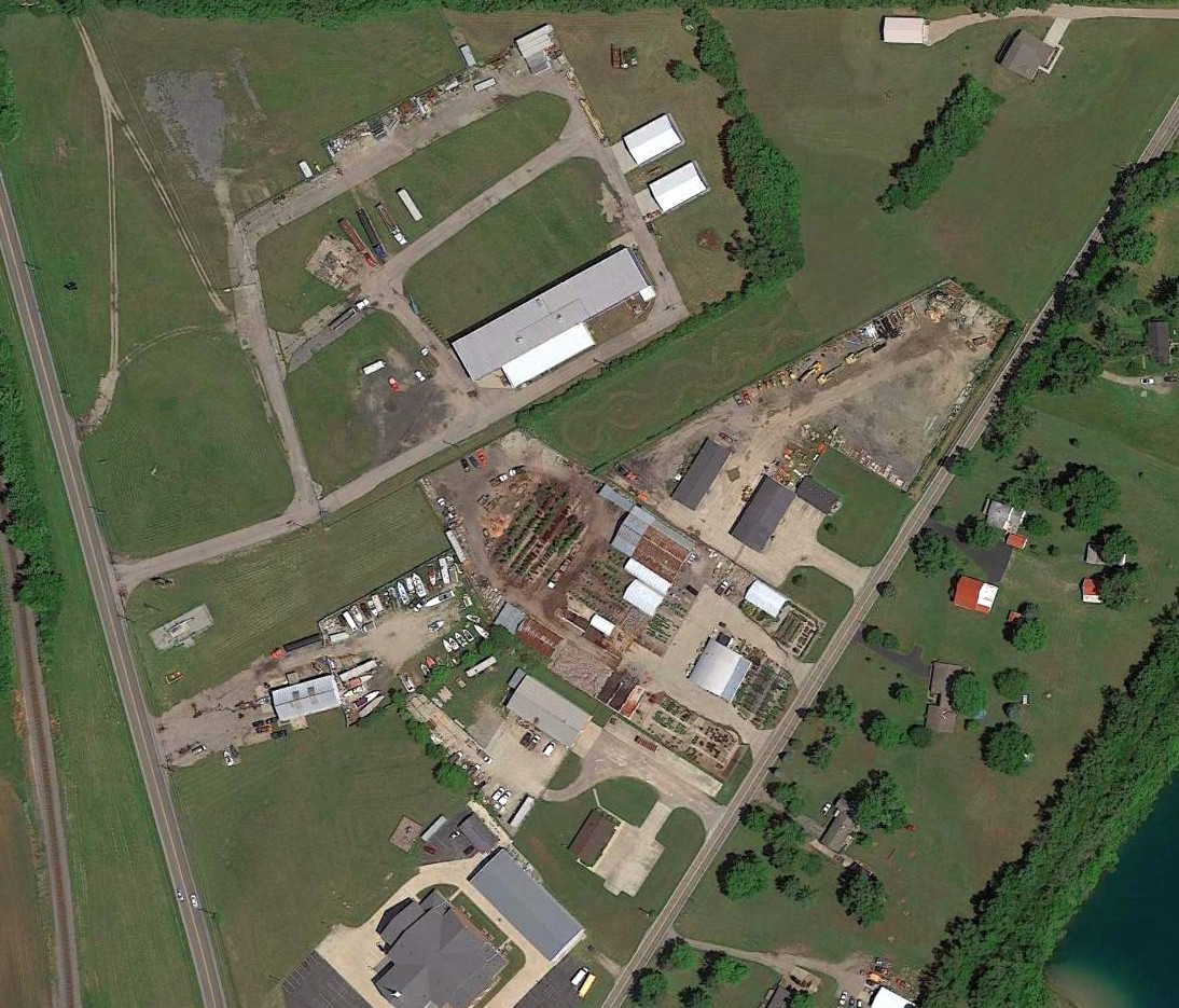
A 2016 aerial view of the site of North Hamilton Airport, showing the remaining hangar among a variety of buildings covering the site.
A 3/29/17 photo by Bob Schallip looking north at the hangar which remains from North Hamilton Airport, now reused as Wilson Garden Center.
The site of North Hamilton Airport is located northeast of the intersection of Route 127 & Jacksonburg Road.
Thanks to Bob Schallip for pointing out this airfield.
____________________________________________________
Warren County Airport (original location) / Brownies Lebanon Airport / Duff Airport, Lebanon, OH
39.398, -84.207 (South of Dayton, OH)
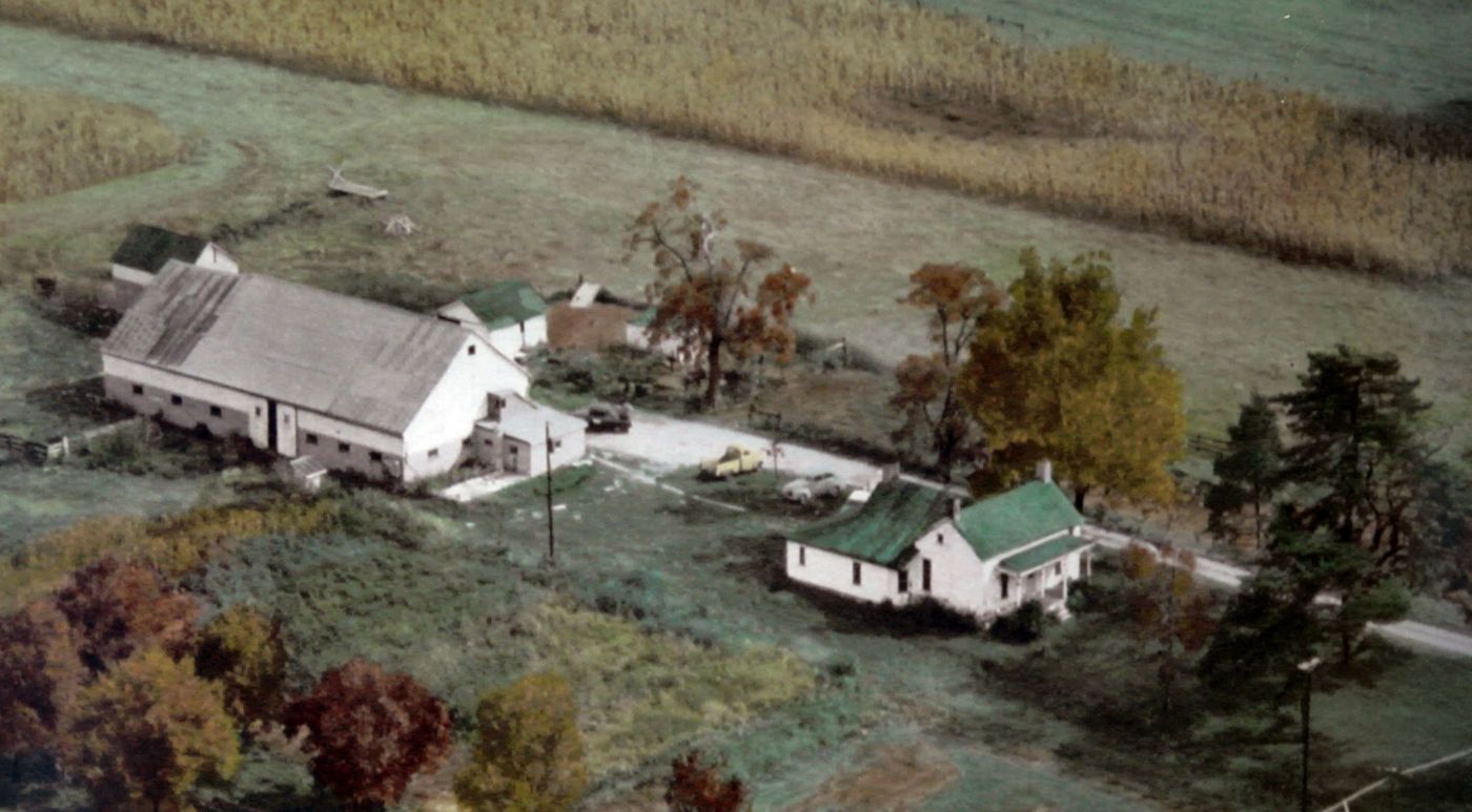
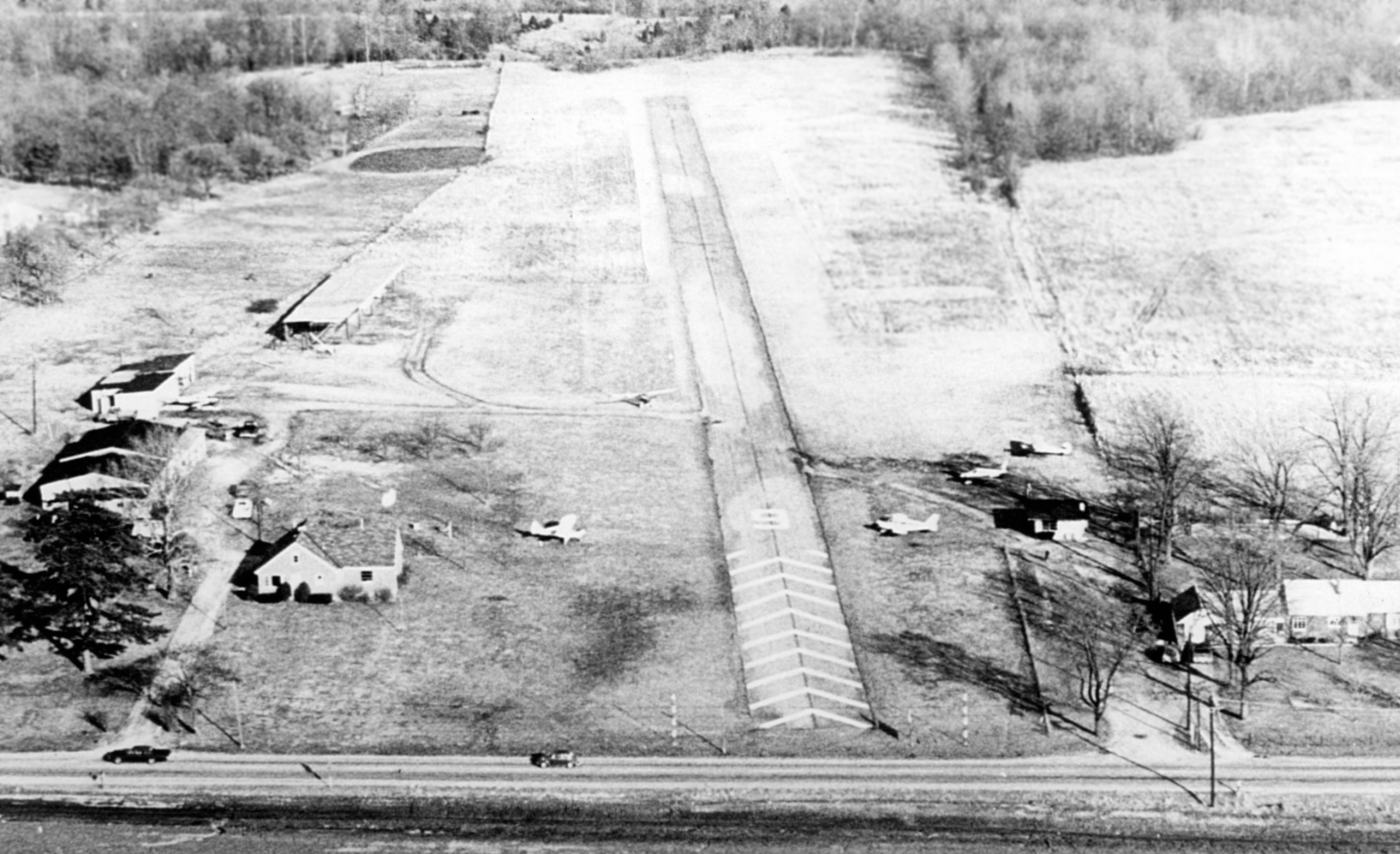
A 1952 aerial view looking southeast at Brownie's farm, with the grass runway visible in the background (courtesy of Mark Burton).
At some point before 1951, Corwin "Skeet" Fred established an east/west grass runway on his farmland.
In 1951 Clifford "Brownie" Brown purchased 150 acres of land (including the airfield) from Skeet.
Brownie relocated his machine shop business onto the property.
With Brownie's blessing, Skeet & a few others were allowed to keep their aircraft on the property & utilize the makeshift airport.
The earliest depiction which has been located of Brownie's farm airfield was a 1952 aerial view (courtesy of Mark Burton).
It depicted an east/west grass runway adjacent to a farmhouse & barn.
Brownie's airfield was not yet depicted at all on the June 1955 Cincinnati Sectional Chart.
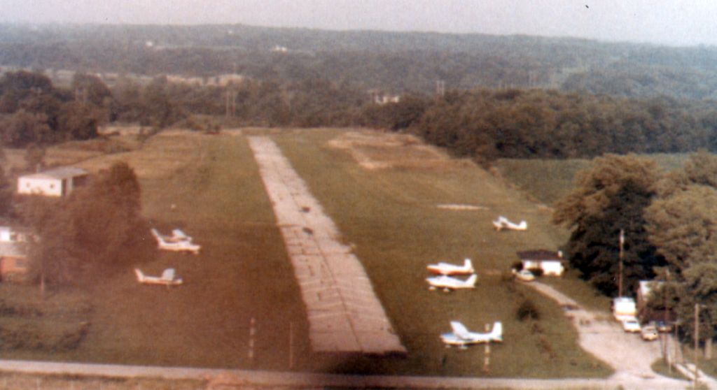
A 1956 aerial view depicted Brownie's farm airfield as having a single east/west grass runway, with a few small buildings & 1 T-hangar on the northwest side.
There were no aircraft visible on the field.
In 1959 Charlie Smith purchased the runway & some other surrounding property from Brownie.
Smith paved the runway, added lights for night operations, built an office, installed gas pumps and hired a mechanic.
It became the original Warren County Airport. By 1960, the first skydiving tenant began operations at the airfield.
The earliest aeronautical chart depiction which has been located of Warren County Airport was on the January 1960 Cincinnati Sectional Chart.
It depicted Warren County Airport as having a single 2,100' paved east/west runway.
Charlie Smith sold the airport to Homer Duff, operator of the local "Duff's Smorgasbord”.
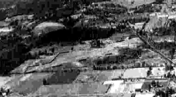
A 1964 aerial view showed that Warren County Airport had gained a 2nd T-hangar & a another long hangar at some point between 1956-64.
Two light single-engine aircraft were parked on the southwest side.
Brownie's son-in-law, Royce Burton, joined the family business in 1965 after serving in the United States Air Force.
It was still labeled as Warren County Airport on the 1966 Cincinnati Sectional Chart.
A mid-1960s aerial view (courtesy of Mark Burton) looking north at Brownie Lebanon Airport.
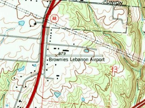
The 1966 USGS topo map depicted Brownies Lebanon Airport
as having a single paved east/west runway, with a few small buildings on the northwest & southwest sides.
At some point between 1966-68, the airport was evidently renamed (briefly) as Duff Airport,
as that is how it was labeled on the August 1968 Cincinnati Sectional Chart (courtesy of Mark Burton).
Brownie obtained his pilot's license, and purchased Warren County Airport in 1968.
He renamed the facility "Brownie Lebanon Airport".
Brownie consolidated his machine shop office with that of the airport, relocated the gas pumps & made other improvements.
The airport property was eventually under the ownership of Brownie & his Air Force veteran son-in-law, Royce.
Royce & Brownie started a charter flight company.
According to Mark Burton, “Royce was the brains & backbone behind the airport from about 1968-85, full-time, then on evenings & weekends, if you could catch him.
I don’t mean to slight Brownie (my grandfather), he had the cash to make this happen & nothing happened if he didn’t approve,
(and there was a lot he didn’t approve) it’s just that he didn’t have the vision and, I think would have been happy just having a runway 100’ from his door.”
The August 1969 Cincinnati Sectional Chart depicted Brownies Lebanon Airport as having a single 2,100' paved east/west runway.
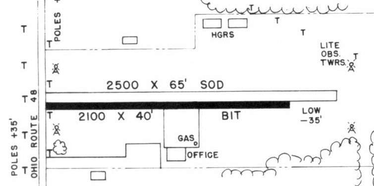
The 1970 OH Airport Directory (courtesy of Mark Burton) depicted Brownies Lebanon Airport as having a 2,100' bituminous east/west runway & a parallel 2,500' sod runway on the north side.
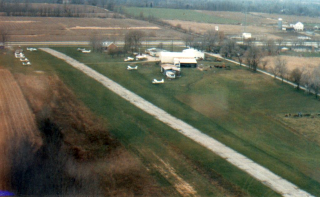
A 1970 aerial view (courtesy of Mark Burton) looking east at Brownie Lebanon Airport.
A 1970 photo (courtesy of Mark Burton) of famed aerobatic champion Dick Soucy's visit at Brownie Lebanon Airport.
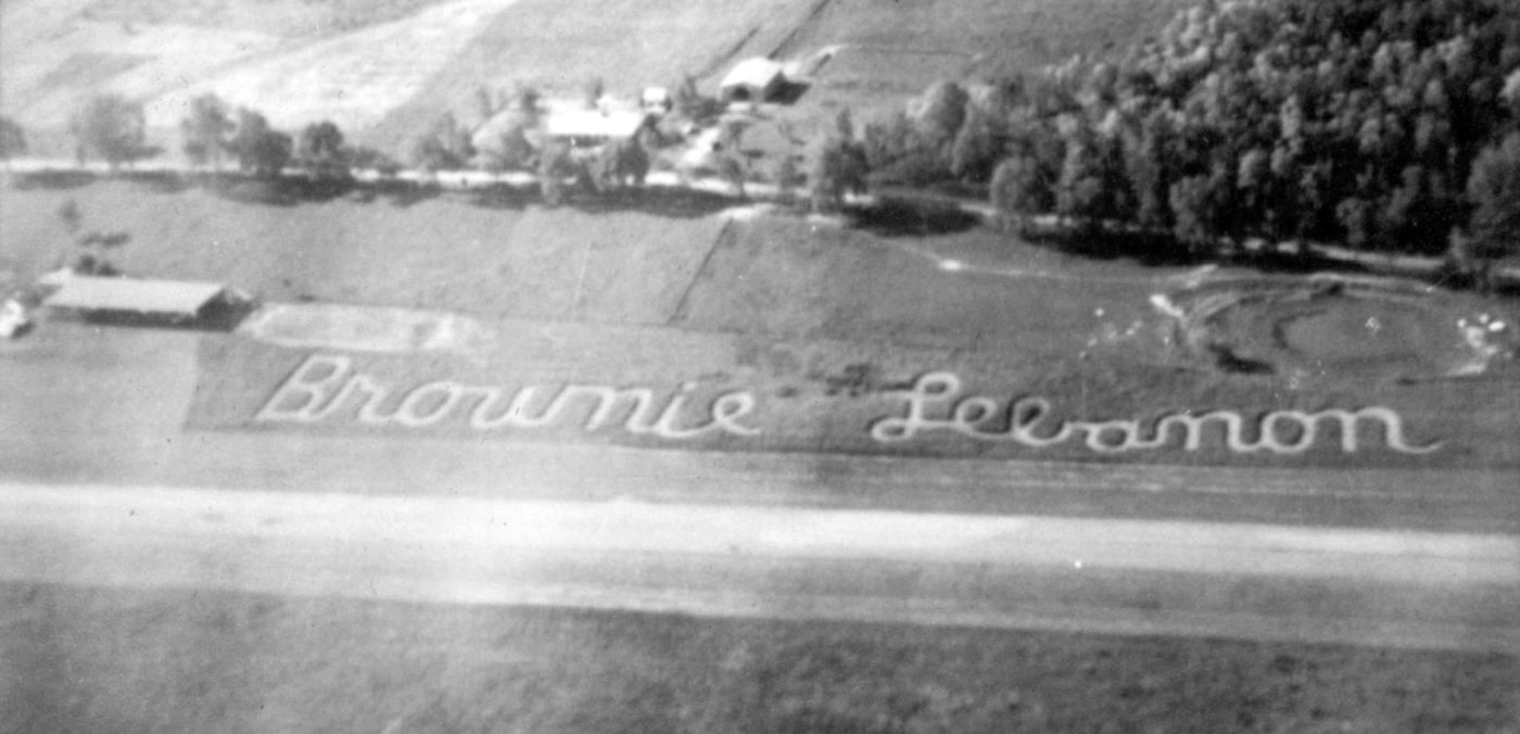
A 1970 aerial view (courtesy of Mark Burton) looking north at Brownie Lebanon Airport, showing the airport's name mowed in the grass adjacent to the runway.
Mark Burton recalled, “The hangars [on the northeast side, shown in the mid-1960s & 1970 photos] were blown down in a windstorm in January 1974.
Also in the same night the open hangar (right side of the Siamese hangars) at the north end of gravel taxiway was blown apart.
On 4/3/74 the doors of [the blue hangar pictured below] blew in & the roof blew off by winds accompanying a tornado that didn’t touch down.
1974 with 2 storms, Brownies lost all its hangars: a rough year.”
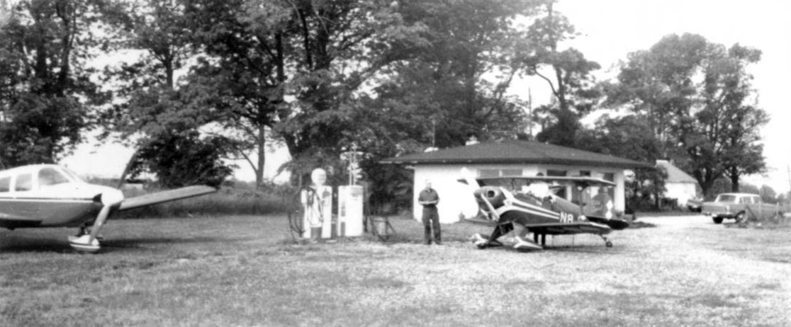
A summer 1974 photo (courtesy of Mark Burton) of a Cessna 150 & 180 at Brownies Airport in front of “the new yellow maintenance hangar that replaced the right Siamese hangar.
If you look closely at the left hangar in this photo you can see blue sky through the open doors of the left hangar [which had been damaged by wind on 4/3/74].”
In 1970, Cincinnati Skydivers was formed, and the club began performing regular jumps.
By 1972, another skydiving operation had also begun, but specifically to support the nearby Kings Island Amusement Park amusement park.
The show was a staple of the park for years until Firestone eventually dropped their sponsorship in the late 1970s.
Mark Burton recalled, “Royce & Helen lived at the house from 1976-2007.
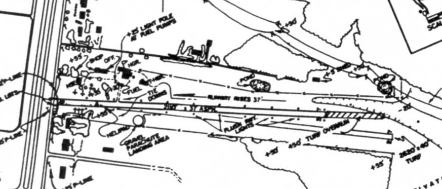
Paved [Runway] 9/27 was 2,100’ of asphalt with a 200’ displaced threshold at the road for a telephone wire, so 'modern' sectionals call the length 1,900’.
From west to east the runway sloped up about 3 or 4' for the first 250' then down 34’ in the remaining 1,850' about to the east.
So we usually landed [Runway] 27 & took off [Runway] 9. At 10 knots we’d land downhill / take off uphill.
The power lines to the east were 1,100’ from the end of the asphalt & only 14' above the east end.
So they only looked to be an true obstacle. However, one guy did manage to hit them.”
The August 1977 Cincinnati Sectional Chart (courtesy of Mark Burton) depicted Brownies Lebanon Airport as having a single paved east/west runway, measuring a mere 1,900'.
A 1977 aerial view (courtesy of Mark Burton) looking east at Brownie Lebanon Airport, looking down the alignment of the future grass runway.
A 1977 aerial view (courtesy of Mark Burton) looking northeast at Brownie Lebanon Airport.
A circa 1980 photo (courtesy of Mark Burton) of Royce Burton at a Cessna 150 at Brownie Lebanon Airport.
Kings Island kept the air show going, albeit scaled back a bit, but didn't return the show after the 1981 season.
The 1980s were tough at Brownie's, and the Cincinnati Skydiver's club called it quits.
As the recession wore on, the rising price of aviation fuel was keeping away once-active pilots.
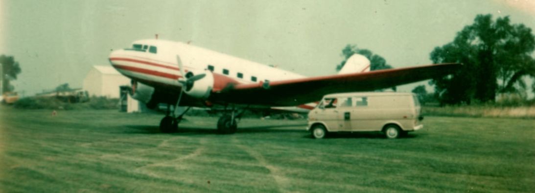
A 1982 photo (courtesy of Mark Burton) of the Brownies Airport van & a Douglas DC-3, evidently the largest aircraft ever to visit the little airport.
Brownies Airport peaked around 1983-84 with just over 30 airplanes based in its hangars.
One day when the fuel finally ran out, the decision was made to not buy anymore.
A 1985 aerial view (courtesy of Mark Burton) looking northwest at Brownie Lebanon Airport.
By 1987, the airport was sold off to Mr. Singh, and only 3-5 planes were still using the facility on rare occasions.
Singh was more interested in the land though & had purchased the airport as an investment, as Warren County was rising in population & housing.
The 1988 OH Airport Directory (courtesy of Mark Burton) depicted Brownies Lebanon Airport
as having a 2,100' asphalt east/west runway & a 2,600' sod runway aligned slightly more to the southeast.
Heber MacWilliams recalled, “Brownie's Lebanon Airport... A coworker & I decided that we should take our kids to King's Island Amusement Park & I could fly us there.
I called ahead & spoke to Helen Burton who offered to drive us all to King's Island in her family car.
So on 6/28/89 my friend & I & our 4 kids, age 9-15, flew in a Cessna 206 from Cleveland to Brownie's. No problem landing or taking off.
Mrs. Burton drove us to King's Island & came back at 4pm to give us a ride back to her airport. It was a great day.
The 1989 AOPA Airport Directory listed Brownies Lebanon Runway 9/27 as being 2,110' asphalt; no mention of a grass runway.”

The last aeronautical chart depiction which has been located of Brownies Lebanon Airport was on the November 1991 St. Louis Sectional Chart.
It depicted Brownies as having a single 2,100' paved east/west runway.
A 1994 USGS aerial view looking northeast depicted Brownies as having a single asphalt Runway 9/27, with a very closely aligned grass runway to the south.
There were no aircraft visible on the field.
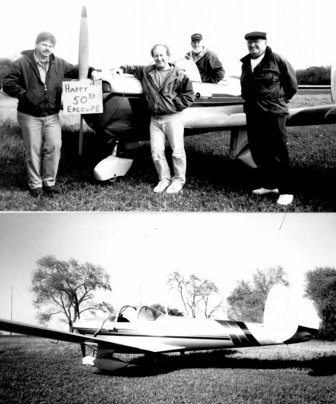
An 11/1/96 photo (courtesy of Mark Burton) at Brownies Airport on the occasion of Mark Burton's Ercoupe's “50th anniversary of its build.”
Pictured with the Ercoupe were Mark Burton, Howard McGurty, Royce Burton, and Jerry Clark.
Mark recalled, “The 4 of us had a little birthday, complete with cupcakes (yeah, we’re that kind of people).”
By 1997, a new kind of flight operation began at Brownie.
Gentle Breeze Hot Air Balloons would launch their excursions from the airfield for about 3 seasons before relocating.
Brownies Lebanon Airport was no longer depicted on the July 1999 Cincinnati Sectional Aeronautical Chart (courtesy of Ron Plante).
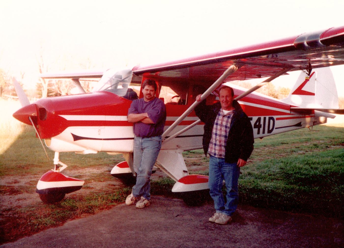
An Autumn 2000 photo (courtesy of Mark Burton) of Mark Burton & Howard McGurty in front of Piper TriPacer N7541D at Brownies Airport.
Mark Burton recalled, “The Tri Pacer was immediately after Royce had test-flown it after a year-long grizzly annual.
Howard & I were elated our fabric stayed on the tail. It was our first & so far last fabric job.”
In 2003, as a nearby golf tournament was happening & the airport remained in pseudo-existence, Mr. Singh had offered to allow parking on the airport land.
Buses used for the tournament damaged the paved runway, leaving only the previously neglected grass runway suitable for continued aircraft operations.
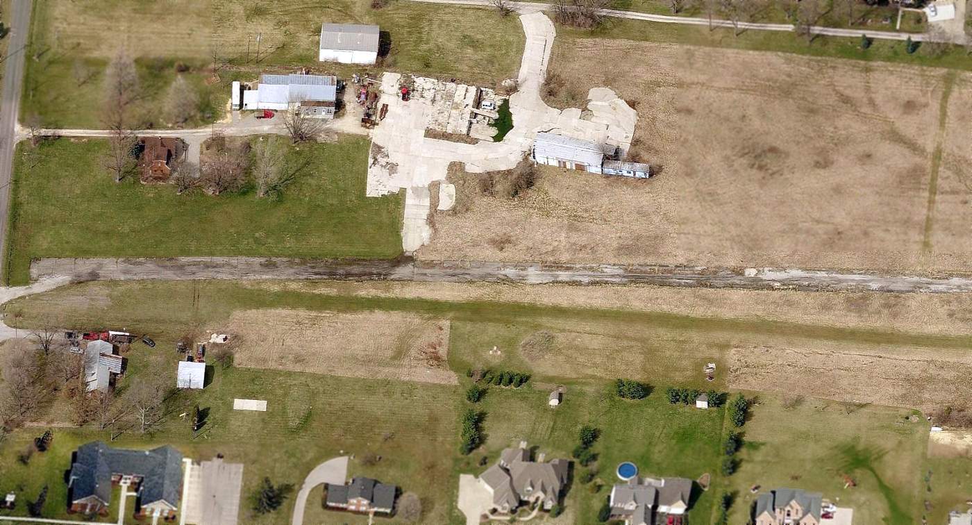
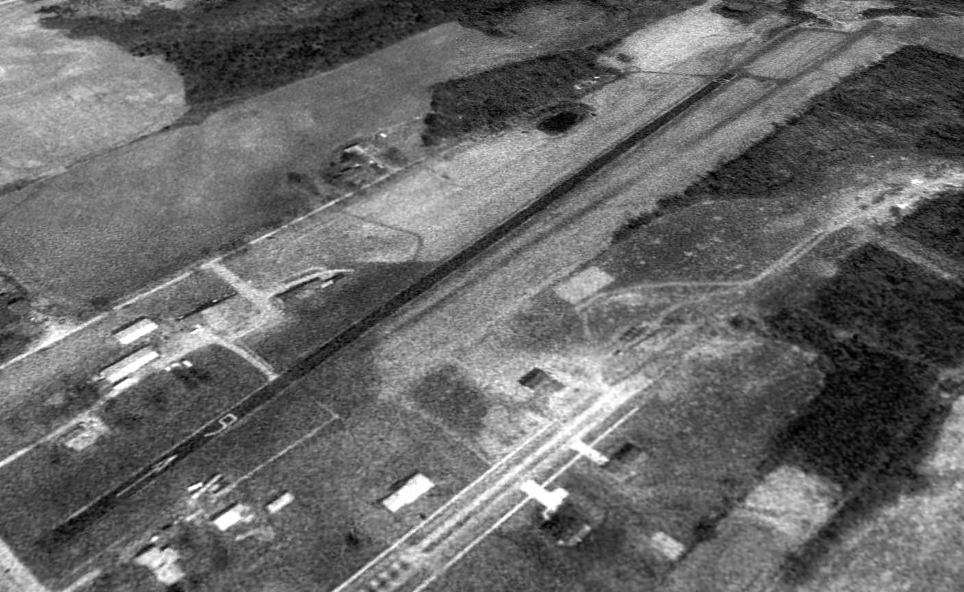
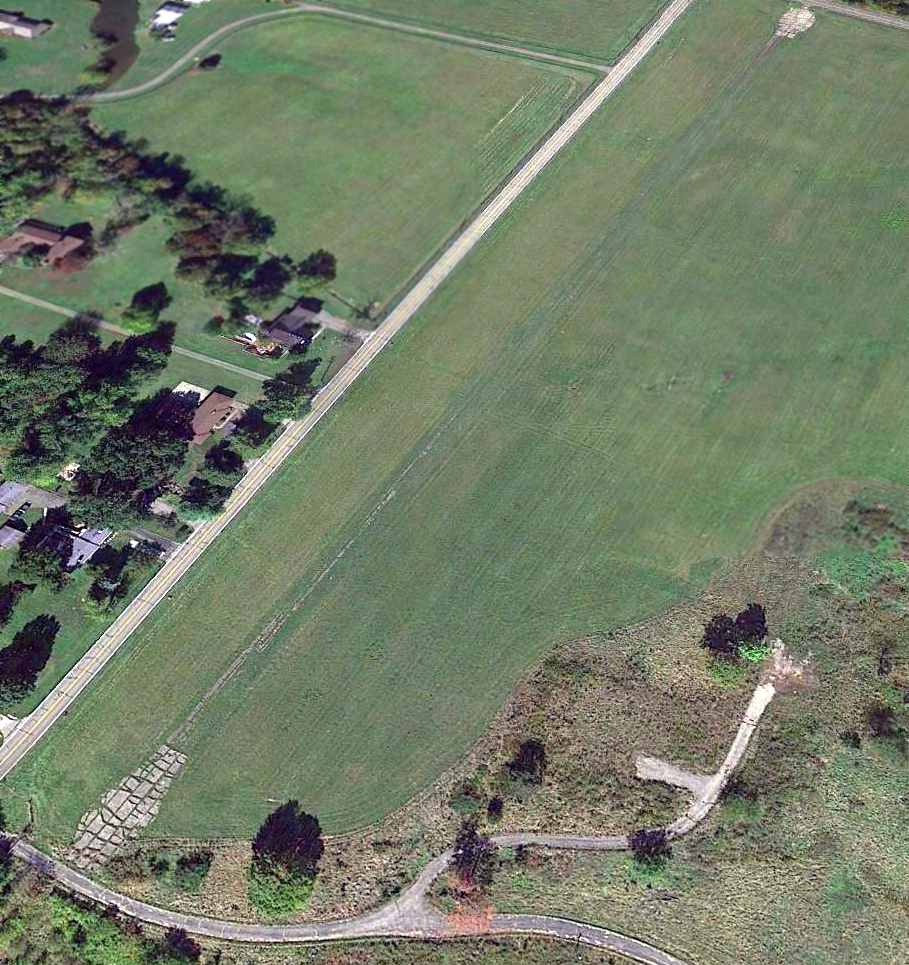
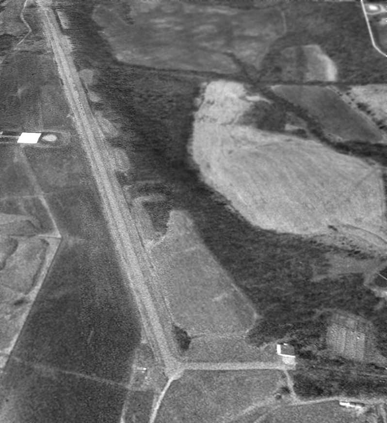
A circa 2010-2015 aerial view looking north at Brownies Lebanon Airport showed the asphalt runway to be considerably deteriorated, and no longer painted with runway markings.
A May 2012 aerial view (courtesy of Mark Burton) looking west at Brownie Lebanon Airport.
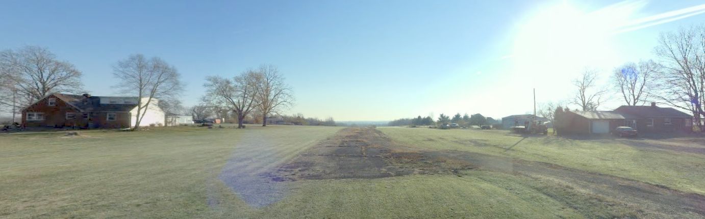
A circa 2014-2016 photo looking east at Brownies Lebanon Airport showed the deteriorated asphalt runway.
The last photo which has been located showing an aircraft at Brownies Lebanon Airport was a 2014 aerial view looking northeast.
It depicted 1 light single-engine aircraft parked on the south side of the field, which evidently continued to use the grass runway after the paved runway was no longer usable.
A 2015 aerial view looking northeast showed Brownies Lebanon Airport remained intact, though there were no longer any aircraft visible on the field.

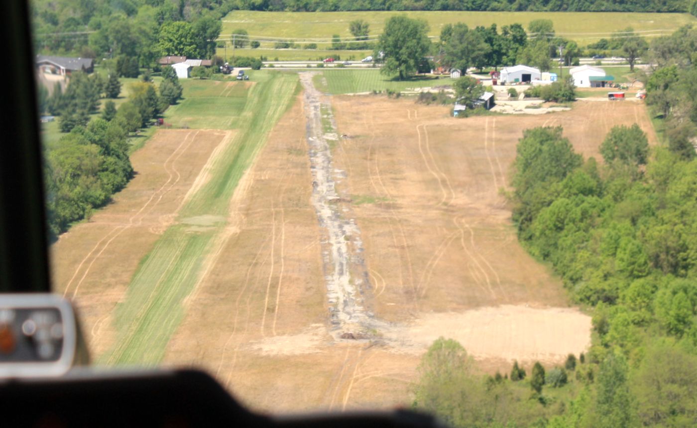
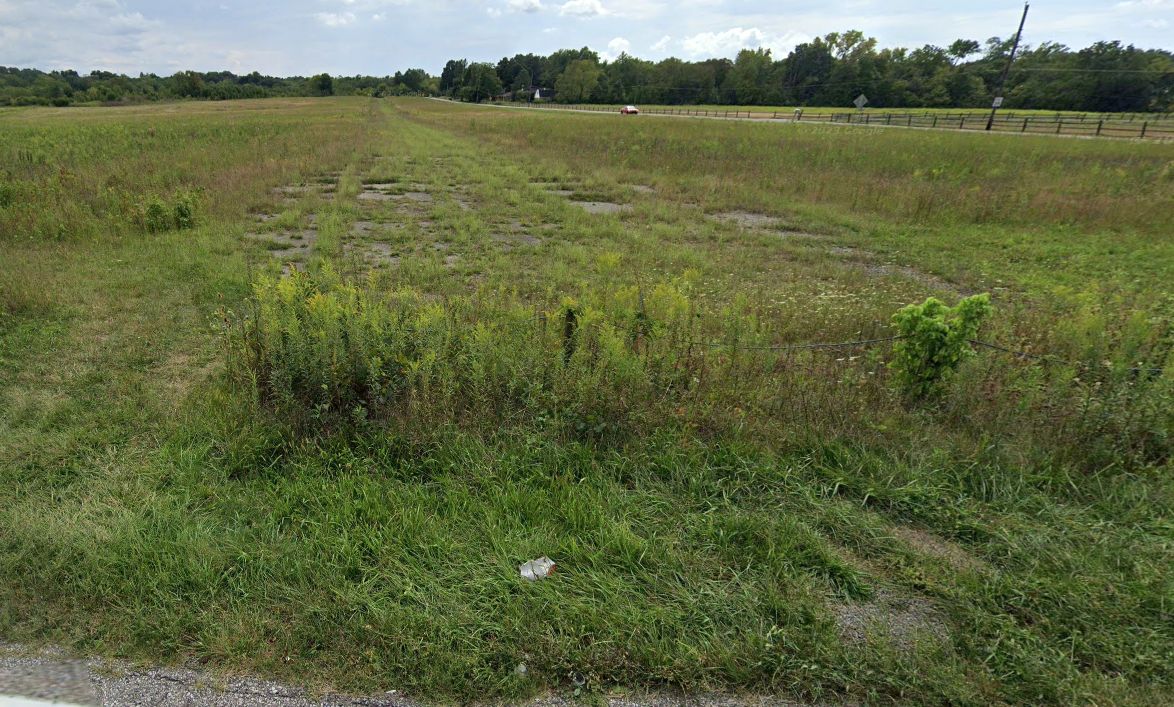
A 9/15/25 aerial view by Aaron Lock looking southwest at the Brownies Lebanon Airport site.
Aaron observed, “There’s not much left, but you can still make out the old layout from the road. Definitely not a place I’d want to try landing my Champ!”
The site of Brownies Lebanon Airport is located northeast of the intersection of Lebanon Road & Kings Way.
Thanks to Mark Burton for pointing out this airfield.
____________________________________________________
Moraine Farm Airfield / Deeds Airfield, Kettering, OH
39.695, -84.2 (South of Dayton, OH)

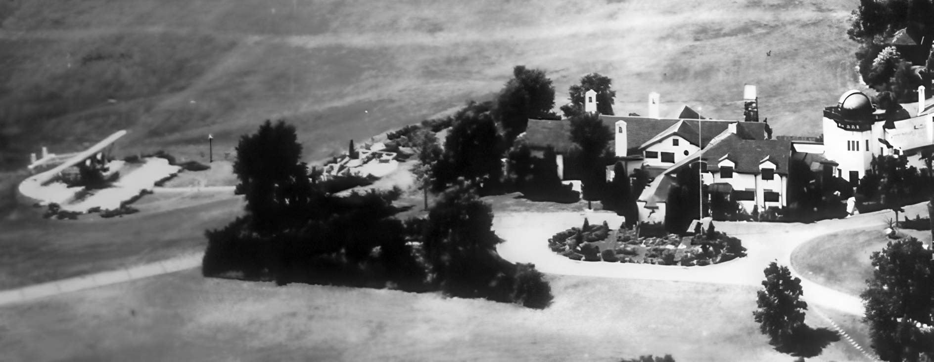
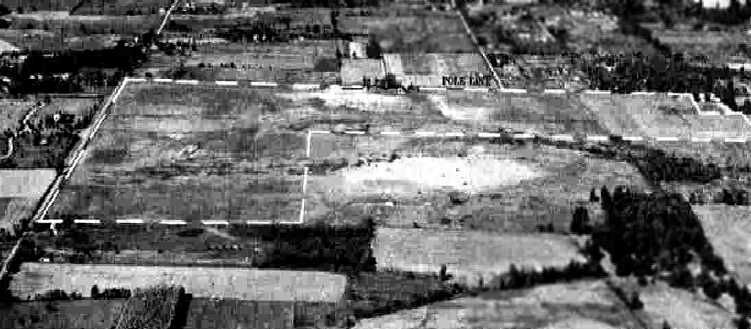
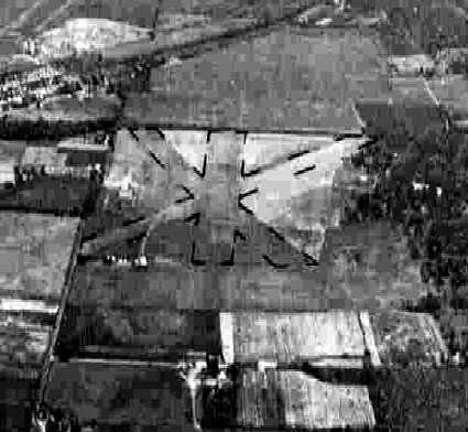
A circa late-1920s / 1930s aerial view looking northwest at the Moraine Farm Airfield (courtesy of Todd Reich, enhanced by Ed Tomme).
Edward Deeds was a prominent American engineer, inventor and industrialist.
Moraine Farm, a 1912 farmhouse was transformed by Deeds into the style of an English manor, being finished in 1921.
The 45,803-square-foot home featured an observatory from which Col. Deeds projected vacation photographs on the grounds for guests.
Its music room had a walnut Steinway piano, said to be one of the largest in the country.
Moraine Farm was also said to be the first home in the United States to have a private airstrip.
The date of construction of the Moraine Farm Airfield has not been determined.
The earliest depiction which has been located of Moraine Farm Airfield
was a circa late-1920s / 1930s aerial view looking northwest (courtesy of Todd Reich).
It depicted a large grass airfield with a large “DEEDS” marking in the center of the airfield.
A lined taxiway crossed Tait Road, connecting the airfield with the Moraine Farm mansion to the southeast.
A paved parking pad on the west side of the house had a single plane.
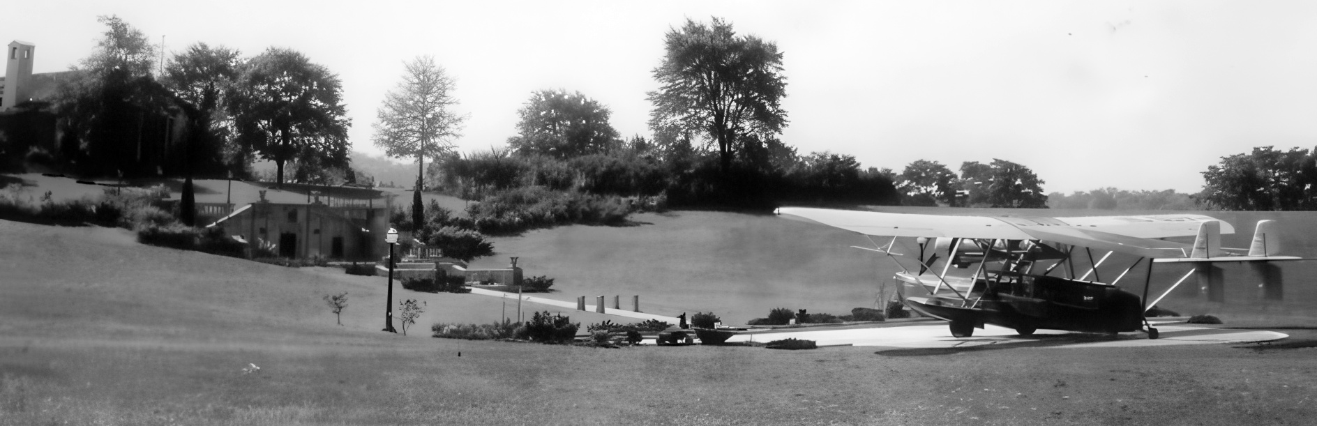
A circa late-1920s / 1930s photo looking southeast at a Sikorsky S-38 amphibian parked on the Moraine Farm Airfield parking pad (courtesy of Todd Reich, enhanced by Ed Tomme).
Todd remarked, “The structure [to the left of the plane] is like a bunker that was built in the side of the hill. The door is a tunnel that lead to the house underground.”
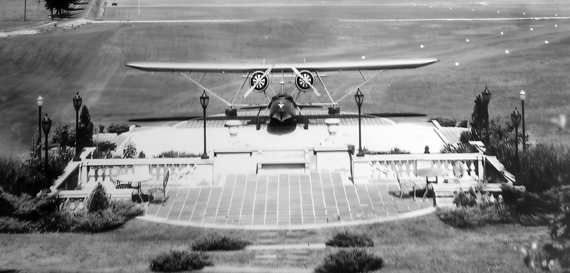
A circa late-1920s / 1930s photo looking west at a Sikorsky S-38 amphibian parked on the Moraine Farm Airfield parking pad (courtesy of Todd Reich, enhanced by Ed Tomme).
A circa late-1920s / 1930s photo looking northwest at a Sikorsky S-38 amphibian parked on the Moraine Farm Airfield parking pad (courtesy of Todd Reich, enhanced by Ed Tomme).
The earliest aeronautical chart depiction which has been located of Deeds Airfield was on the November 1933 Cincinnati Sectional Chart,
which depicted Deeds as an auxiliary airfield.
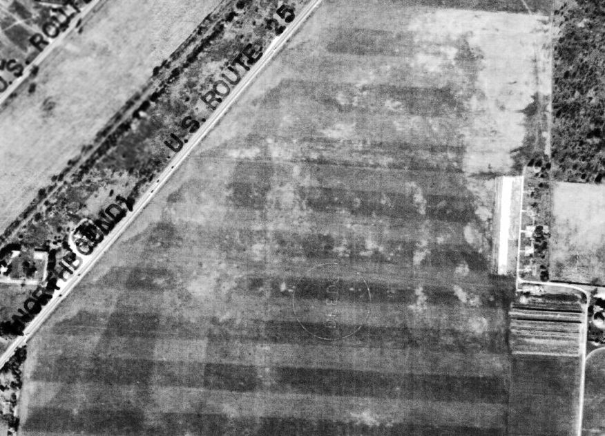
A 6/29/39 aerial view showed the Deeds Airfield remaining intact (including the “Deeds” lettering inside the airport circle marking.
But the lined taxiway previously seen in the earlier photos (crossing Tait Road, connecting the airfield with the Moraine Farm mansion to the southeast) was gone,
presumably indicating that aviation use of the property had ended by this point.
The Deeds Moraine Farm Airfield was evidently closed at some point in 1939,
as it was no longer depicted on the December 1939 Cincinnati Sectional Chart.
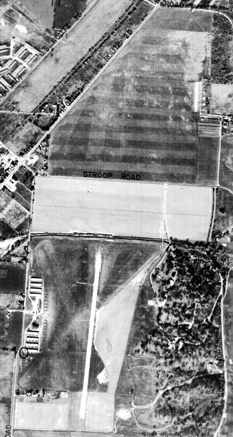
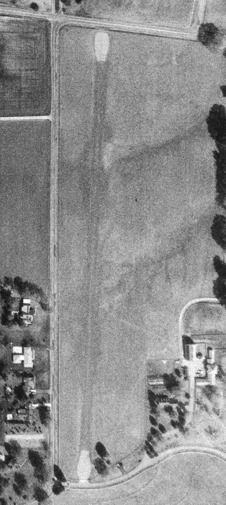
The last photo which has been located of Deeds Airfield was a 1949 aerial view (courtesy of Paul Allen),
which also showed the proximity of South Dayton Airport to the south.
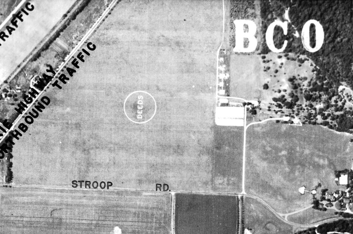
A close-up of Deeds from the 1949 aerial view (courtesy of Paul Allen),
in which Paul Allen observed, “You can see the still see the circle with the 'Deeds' legend (which I assume was a pattern cut in the grass or written with gravel).”
The 1956 USGS topo map showed that the Deeds Airfield had been covered by a housing development,
with only the Moraine Farm mansion remaining intact.
Deeds died at Moraine Farm in 1960, and the property was eventually sold to the Kettering Health Network.
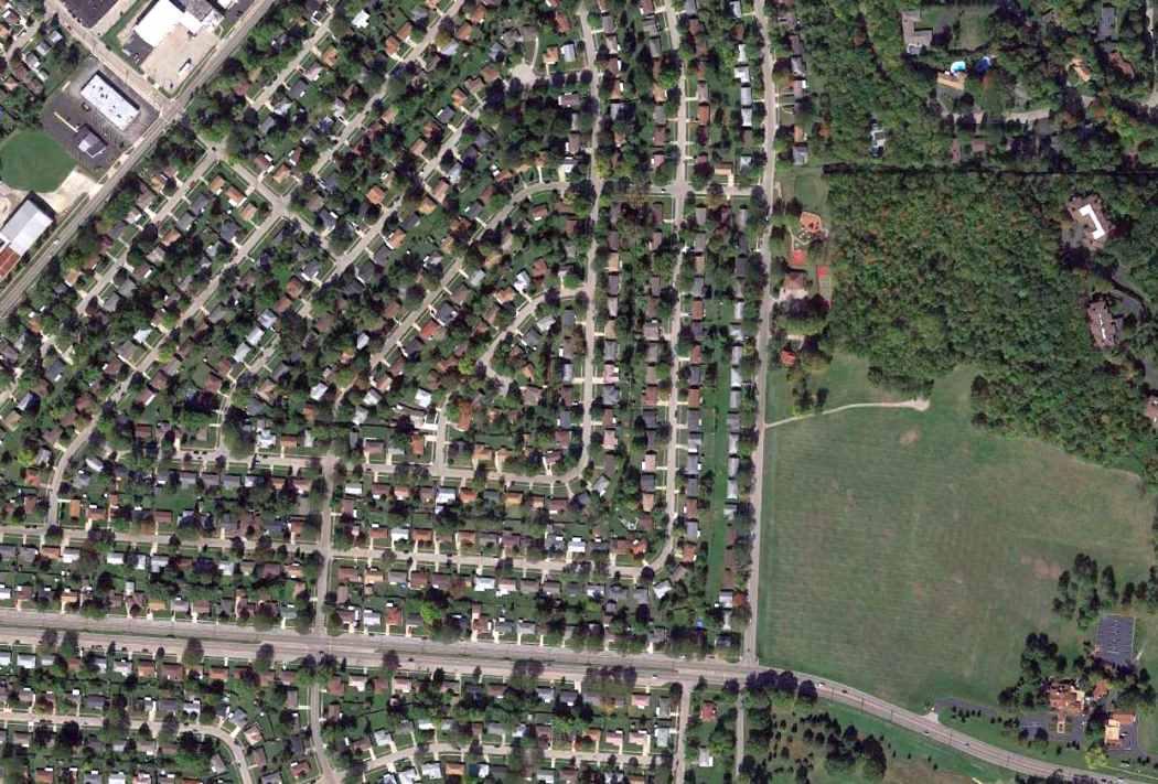
A 2013 aerial view showed the Moraine Farm Airfield to be covered with a housing development, but the Moraine Farm mansion remained intact to the southeast.
The site of Moraine Farm Airfield is located northwest of the intersection of Tait Road & West Stroop Road.
Thanks to Todd Reich for pointing out this airfield.
____________________________________________________
Wright's Farm Airfield, Cincinnati, OH
39.25, -84.504 (North of Downtown Cincinnati, OH)
The 1961 USGS topo map depicted a single north/south “Landing Strip”.
A 1949 aerial view did not yet show any airfield at this location.
Bill Arrico reported, “The Wright Farm Airfield was originally owned by Reuben Robertson, President of Champion Paper.
The airstrip was part of his estate. He would have one of Champion Paper's pilots fly the company's Cessna 310 up from Lunken Airport
to pick him up and either fly him to his destination or back to Lunken where he could board one of the company's Lockheed PVs for a longer trip.
From 1955-57 Robertson was Deputy Secretary of Defense & he would very often commute daily to & from his home to Washington DC.
My father, Robert Arrico, was one of Champion Paper's pilots from 1956-60 & was often assigned to pick up Robertson at his home with the company's 310.”
The earliest depiction which has been located of Wright's Farm Airfield was a 1956 aerial photo, which depicted a single paved north/south runway.
There did not appear to be any hangars or other aviation infrastructure.
Bill Arrico reported, “On 3/13/60 Reuben Robertson was killed in an auto accident.
With the company's subsequent reorganization the aviation department was disbanded & the remaining airplanes were sold.”
The earliest depiction which is available of Wright's Farm Airfield was the 1961 USGS topo map,
which depicted a single paved north/south runway, labeled simply as “Landing Strip”.
Wright's Farm Airfield was evidently closed by 1962, as it was not depicted on the July 1962 Dayton Local Aeronautical Chart (courtesy of Mac Hays).
The earliest photo which has been located of the Wright's Farm Airfield was a 1963 ODoT aerial view (courtesy of Dennis Thompson).
It depicted a single unpaved runway, with paved turnaround pads at each end. There did not appear to be any hangars or other airfield improvements.
Wright's Farm Airfield was not depicted on the 1966 Cincinnati Sectional Chart.
A 1968 aerial photo showed the Wright's Farm Airfield runway width had decreased somewhat compared to the 1956 photo.
The 1982 USGS topo map continued to label the Wright's Farm Airfield runway as “Landing Strip”.

A 1994 USGS aerial view looking northwest depicted Wright's Farm Airfield as having a single runway, with the pavement of the runway ends & turnaround pads remaining somewhat less deteriorated than the middle of the runway.
There did not appear to be any hangars or other airfield improvements.
Wrights Farm Airfield was not depicted on the July 2009 Cincinnati Terminal Aeronautical Chart.
A 10/10/13 aerial view looking north west showed the Wright's Farm runway remained recognizable, but the pavement of each turnaround pad at each runway end was considerably deteriorated.
Note that the house & farm buildings adjacent to the runway had been removed.
A 2023 photo looking south at the remains of the Wright's Farm runway pavement.
The site of Wright's Farm Airfield is located southeast of the intersection of McKelvey Road & Lakeridge Road.
Thanks to Roger Jollis for pointing out this airfield.
____________________________________________________
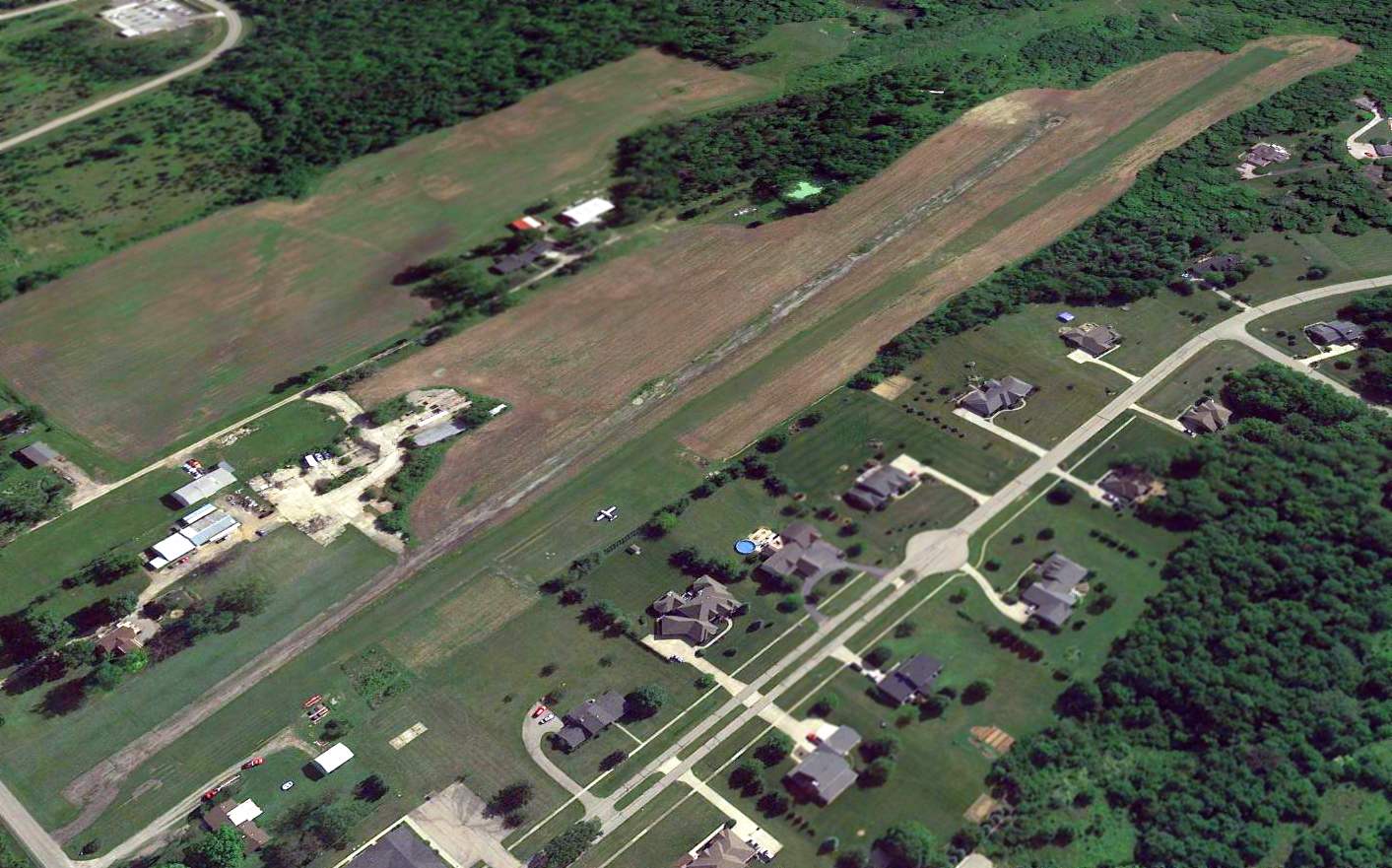
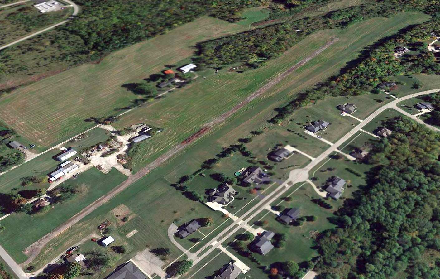
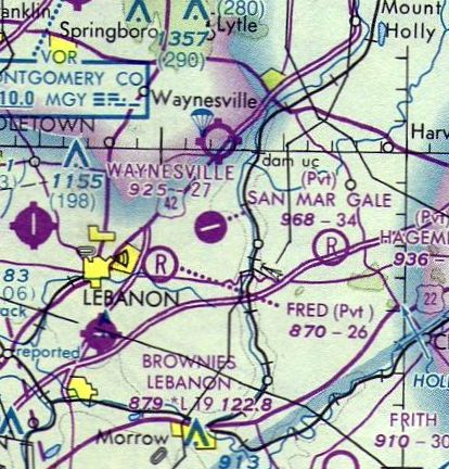
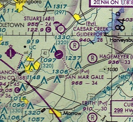
San Mar Gale Airport (OH79), Lebanon, OH
39.46, -84.134 (Northeast of Cincinnati, OH)
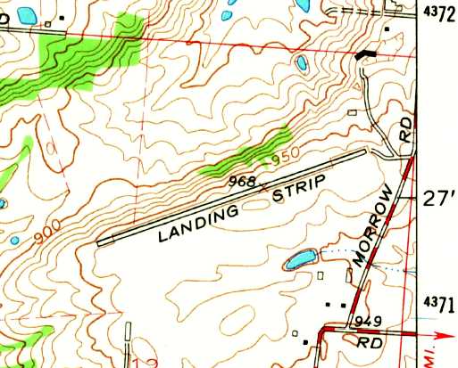
San Mar Gale Airport, as depicted on the 1966 USGS topo map.
According to Wikipedia, this property was a “3,329-acre group of farms owned by Ralph Stolle, a prominent inventor, businessman & philanthropist.”
No airfield was yet depicted at this location on the 1956 USGS topo map
nor on the July 1962 Dayton Local Aeronautical Chart (courtesy of Mac Hays).
An airfield with a single paved runway was constructed at some point between 1962-66,
as the 1966 USGS topo map depicted a single paved northeast/southwest runway, labeled simply as “Landing Strip”.
San Mar Gale Airport was not yet depicted on the August 1969 Cincinnati Sectional Chart.
The earliest aeronautical chart depiction which has been located of the San Mar Gale Airport
was on the August 1976 Cincinnati Sectional Chart (courtesy of Mitchell Hymowitz).
It depicted San Mar Gale as a private airfield having a single paved 3,400' northeast/southwest runway.
San Mar Gale Airport was depicted in an unchanged fashion on the 1984 USGS topo map.
The 1992 USGS topo map labeled the field as “San Mar Gale Airport”.
According to Wikipedia, “The name 'San Mar Gale' was derived from combination of the names of Stolle's daughters, Sandy, Mary Jo, and Gail.”
The earliest photo which has been located of the San Mar Gale Airport was a 4/1/94 USGS aerial view looking west.
It depicted San Mar Gale Airport as having a single paved runway, with a paved taxiway leading to a single hangar on the northeast side.
According to Wikipedia, “Until Stolle's death in 1996, the farm was used as a research farm for milk production.
A private airport called San Mar Gale (airport code OH79) existed on the farm until the late 1990s.”
The last aeronautical chart depiction which has been located of the San Mar Gale Airport
was on the September 1999 Cincinnati Sectional Chart (courtesy of Ron Plante).
It depicted San Mar Gale as a private airfield having a single paved 3,400' northeast/southwest runway.
According to Wikipedia, “San Mar Gale was a planned development by the Hines-Griffin Land Development Company.
This 2,500+ home planned unit development was approved by the Warren County Commissioners in February 2006.
Construction was to have begun in 2007.”
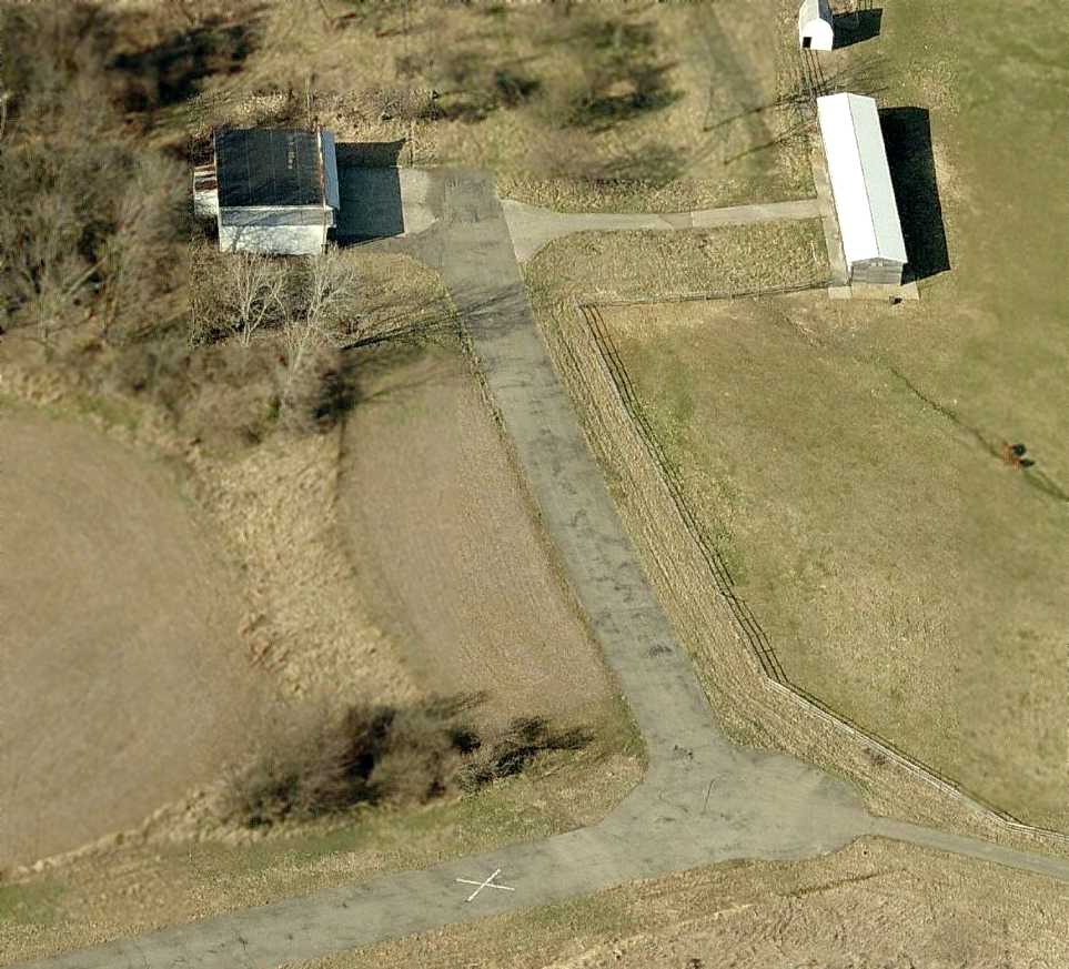
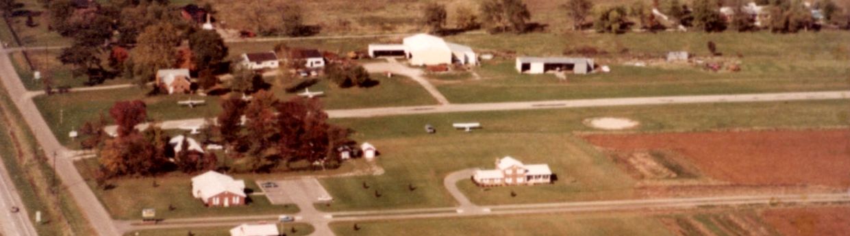
A circa 2008-2011 aerial view looking north at a hangar & other small buildings on the northeast side of San Mar Gale Airport.
The runway was marked with a closed-runway X symbol.
San Mar Gale was depicted as an abandoned airfield on the July 2009 Cincinnati Terminal Aeronautical Chart.
According to Wikipedia, the 2,500+ home planned unit development planned for San Mar Gale “was canceled as of February 2011.”

A 10/28/11 aerial view looking west depicted San Mar Gale Airport as remaining intact.

A 12/7/25 aerial view by Aaron Lock looking southwest along the former San Mar Gale Airport runway.
Aaron observed, “The runway is still intact & appears to be used by homes situated around it. It's always fascinating to see how these old strips evolve while still keeping hints of their aviation roots!”
San Mar Gale Airport is located southwest of the intersection of Hatfield Road & North Waynesville Road.
____________________________________________________
Mt. Healthy Airport, Cincinnati, OH
39.245, -84.6 (Northwest of Downtown Cincinnati, OH)
Mt. Healthy Airport, as depicted on the April 1941 Cincinnati Sectional Chart.
According to the Cincinnati Aviation Heritage Society & Museum, “The Mt. Healthy Airport was the brainchild of a forward thinking group of businessmen in the 1920s.
They saw the future of the movement of people & goods in a much more efficient manner than was currently being employed.
They also saw that the future was in air mail & strove to get the air mail routes for their airport.
Al Hochscheid, who owned 3 tailor shops in Mt. Healthy, was president of the group & owned 51%.
Clyde Yerkes was an official of the Mt. Healthy Savings & Commercial Bank.
Ed Matre was an investor. Ed Honnert was a contractor, and his equipment was used to eventually level the airport ground.
Al Huber was a real estate investor. Neil Sudbrack was a manufacturer & businessman, and Bert Hughes was a contractor.”
The Cincinnati Aviation Heritage Society & Museum continued, “The thinking back in the 1920s was that if Mt. Healthy was to grow,
it might very well grow to the west, into Colerain Township.
The group was looking for a level area where not much earth had to be moved, since back then, moving earth was a major expense.
As a result, the group looked at the Mt. Healthy area & then into Colerain Township.
In Colerain Township they discovered an area at the southwest corner of Colerain Avenue & Springdale Road.
There, the field was relatively level with just a small drainage ditch that needed filling.
This ditch was located near what was to be the front of the hangar area near Springdale Road.
The Bosserman family owned this property, and they lived in the large white house at 3672 Springdale Road, across from the future airport site.
Today this is the home of Vilas Realtors.”
The Cincinnati Aviation Heritage Society & Museum continued, “In 1927 Al Hochscheid negotiated a lease for 100 acres for the airport, at this location, from Mr. Bosserman.
Some grading was done in 1927 to make it an even more level & a better landing strip.
At this point the airport was up & operating, and a corporation in which stock was sold was being formed.
A copy of a stock certificate for 20 shares in the Mt. Healthy Airport was issued to Clinton Yerkes on the 12/1/28.
It was signed by Alfred Hochscheid, president, and Edward Matre, secretary.”
The Cincinnati Aviation Heritage Society & Museum continued, “Even though the airport had many connections with Mt. Healthy,
the prime reason it was known as the Mt. Healthy Airport was government policy.
Back in the 1920s the Civil Aviation Authority dictated that when it chartered an airport, it was generally named after the nearest town.
It did not have to be near or even associated with that town. Therefore, this airport became the Mt. Healthy Airport.”
The Cincinnati Aviation Heritage Society & Museum continued, “As the airport developed in the late 1920s,
it became a hub for aviation activity including pilot training & a ground school, and the hoped-for air mail route.
According to most aviation enthusiasts who were actively involved in the airport, there was only one runway.
It began at Colerain Avenue & ran southwest for 2,000 feet. It was also quite narrow, being only 50 feet wide.
The overhead wires on the southeast corner that ran parallel to Colerain Avenue had to be lowered so the planes would have more runways on which to land.
There were 2 hangars and a T-hangar all along Springdale Road.
The office complex was attached to the main hangar, and later a restaurant was added.
There was no control tower, only a windsock on top of the main hangar, and no fire or safety equipment other than a fire extinguisher.”
The Cincinnati Aviation Heritage Society & Museum continued, “The runway originally was grass.
The planes landing & taking off would wear the grass down to the soil itself. This was not really a problem until it would rain.
Then the soil would turn to mud & the wheels of the planes would throw the mud up & it would collect under the wings.
This could add weight to the plane & hinder the takeoff.
When the ground would dry, the airport maintenance used an old Whippet or Terra-Plane automobile that had a drag, to drag the runway and try to level it as best they could.”
The Cincinnati Aviation Heritage Society & Museum continued, “The airport operated under the original group until the fall of 1929.
At that time a fatal crash occurred just 50 or so feet from the airport proper, as the plane was landing.
This accident happened on the extreme west end of William Muehlenhard’s farm which fronts on Pippin Road & runs more than one-half mile west to the crash site.
A student taking instructions from an instructor named Stormy Wheeler, in an American Eagle Airplane, froze at the controls.
Stormy, who was a very good pilot & instructor, reached down to try to knock the student out with a fire extinguisher & gain control of the open cockpit plane, but it was too late.
Both the instructor & pilot were killed on impact.
This accident had a profound impact on Al Hochscheid, who decided to pay all the bills, liquidate any assets, and buy off the lease.
For all intents & purposes this was the end, for the time being, of the then Mt. Healthy Airport.
The airport was not listed in the 1927-28 Cincinnati phone directory, but was listed in the 1929-30 directory as the Mt. Healthy Airport at JA-7250.”
A 1932 aerial photo appeared to show a single northeast/southwest runway,
with at least one small building on the northeast side.
However the Mt. Healthy Airport was not yet depicted on the November 1933 or 1934 Cincinnati Sectional Charts.
The earliest depiction which has been located of the Mt. Healthy Airport was on the April 1941 Cincinnati Sectional Chart.
It depicted Mt Healthy as a commercial/municipal airport.
The earliest photo which has been located of the Mt. Healthy Airport was a 9/27/43 aerial view from the 1945 AAF Airfield Directory (courtesy of Scott Murdock).
The directory described Mt. Healthy Airport as an 87 acre rectangular property having a single 2,200' sod northeast/southwest runway.
The field was said to have 3 metal hangars, the largest measuring 80' x 50'.
Mt. Healthy Airport was described as being owned & operated by private interests.
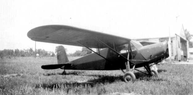
A 1945 photo of a Fairchild 24 at Mt. Healthy Airport.
According to the Cincinnati Aviation Heritage Society & Museum, “Sometime in the mid-1940s, the then operator of the airport, Jerry Greenfield,
bought truck loads of cinders from CG&E to build a cinder base for the runway.
The runway itself never was paved & never had a hard surface.”
The October 1946 Cincinnati Sectional Chart (courtesy of Dick Merrill) depicted Mt Healthy as a commercial/municipal airport.
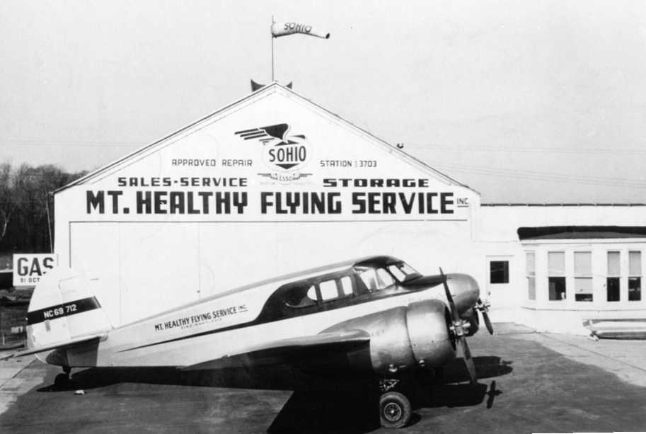
A 1946-47 photo looking northwest at a Cessna T-50 Bobcat of the Mt. Healthy Flying Service in front of their hangar.
The Cincinnati Aviation Heritage Society & Museum continued, “During its 28 years of operation, on & off,
the Mt. Healthy Airport operated under various names & had many operators.
Among the names that I have been able to uncover are Al Hochscheid, George South, Carl 'Pop' Muhlberger, and Jerry Greenfield.”
The Cincinnati Aviation Heritage Society & Museum continued, “The Airport had its ups & downs, its good years & its bad years.
There may have been periods when it was not operating at all.
In its day the Mt. Healthy Airport could have been considered a rogue-type operation.
The airport housed many illegal, unlicensed, and unregistered aircraft.
When the rumor would circulate that government inspectors might be on the way,
the airplanes were flown to farms with level fields & hidden until it was all clear, and then the planes returned to the airport.”
Mt. Healthy Airport was not depicted at all on the 1947 USGS topo map.
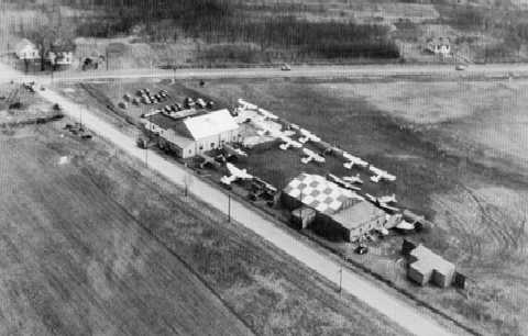
A circa 1940s aerial view looking east at Mt. Healthy Airport, showing 17 light planes & 3 hangars.
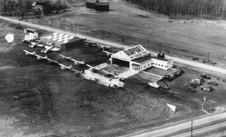
A circa 1940s aerial view looking west at Mt. Healthy Airport, showing 17 light planes & 3 hangars.
A 4/9/49 UGSS aerial photo showed Mt. Healthy Airport as having 2 unpaved runways, with 9 light single-engine aircraft parked near 2 hangars on the northeast side.
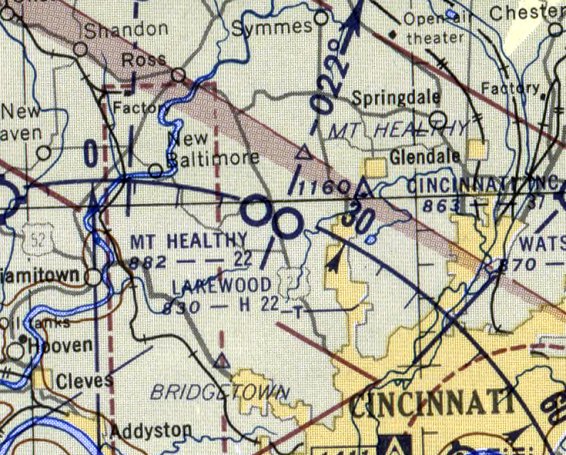
The 1953 USGS topo map depicted Mt. Healthy Landing Field as having 2 unpaved runways, with 4 small buildings on the northwest & northeast sides.
It also depicted the Lakewood Landing Field less than a mile to the east.
The last aeronautical chart depiction which has been located of Mt Healthy Airport
was on the June 1954 Cincinnati Sectional Chart (courtesy of David Stevenson).
It depicted Mt Healthy as having a 2,200' unpaved runway.
According to the Cincinnati Aviation Heritage Society & Museum, “Elmer Lierer, who for all intents & purposes lived his life as part of the airport,
said in an article in the North West Press in 1986 that the airport was in operation until 1955.
It provided to many, those many reflections of life that only a local airport like Mt. Healthy could.”
A 1956 aerial photo showed a single northeast/southwest runway, with 2 buildings on the northeast side.
There were a large number of cars visible in front of the hangars, but no aircraft.
The last map depiction which has been located of the Mt. Healthy Airport was on the 1957 USGS topo map.
No airfield was depicted at this location on the July 1962 Dayton Local Aeronautical Chart (courtesy of Mac Hays).
The 1963 USGS topo map depicted an empty space in the location of Mt. Healthy Airport.
Aerial photos from 1968 & 1970 showed the hangars & runway to remain intact.
The 1971 USGS topo map still depicted the 2 hangars on the northeast corner, and depicted the runway area as remaining clear.
The 1976 USGS topo map showed that the Northgate Mall had covered the runway location at some point between 1971-76.
The western hangar was still depicted, but the eastern hangar had vanished.
The 1982 USGS topo map showed that the last hangar had been removed at some point between 1976-82.
A 7/2/10 aerial view showed the Northgate Mall covering the site of Mt. Healthy Airport.
The site of Mt. Healthy Airport is located southwest of the intersection of Springdale Road & Colerain Avenue.
____________________________________________________
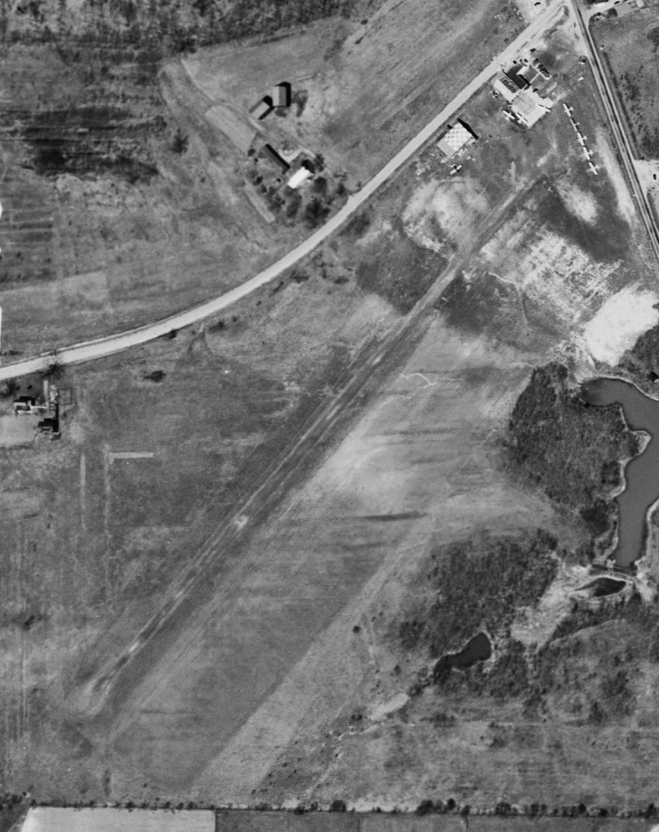
Lakewood Airpark, Cincinnati, OH
39.242, -84.582 (Northwest of Downtown Cincinnati, OH)
Lakewood Airport, as depicted the 1947 Cincinnati Sectional Chart (courtesy of Doug Ranz).
Lakewood Airport was not yet depicted on the October 1946 Cincinnati Sectional Chart (courtesy of Dick Merrill).
It was reportedly established in 1946, one of hundreds of U.S. airports established that year in the post-WW2 general aviation boom.
The earliest depiction which has been located of Lakewood Airpark was on the 1947 Cincinnati Sectional Chart (courtesy of Doug Ranz),
which depicted Lakewood as a commercial/municipal airport.
Merrie Beth Scherff recalled, “Lakewood Airport... My dad had a partnership in an airport with 2 friends - last names, Broxon & Heckinger (a WW2 pilot).
I believe they 'built' the airport in the late 1940s.”
The earliest photo which has been located of Lakewood Airpark was a 4/9/49 USGS aerial view.
Lakewood was shown to have a single east/west runway, with 2 taxiways leading to a paved ramp & 2 hangars on the south side.
Six light single-engine aircraft were visible on the ramp.
Merrie Beth Scherff recalled, “Lakewood Airport... In the early 1950s my dad would take us kids over to the airport for visits.
I remember going down a long driveway off Pippin Road just north of Compton Road.
The Airpark doggie [was] a big black cutie, probably a Labrador...who was named Cessna, 'Cess' for short.
I remember a time when the planes were 'replaced' on the lot with Army trucks.”
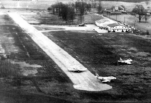
A January 1953 aerial view looking southeast at Lakewood Airpark, taken during undoubtedly this little airport's most famous episode,
in which 3 Air Force F-86 Sabre jet fighters which were forced to land on the relatively short Lakewood runway.
Lakewood was shown to have a single east/west paved 2,100' runway, with 2 taxiways leading to a paved ramp & 2 hangars on the south side.
One single-engine taildragger was visible on the ramp.
The Sabres had run low on fuel during a flight from Scott AFB to Wright-Patterson AFB,
and successfully landed on Lakewood's 2,100' runway (much shorter than what would normally be used by a swept-wing jet fighter).
The issue then became how to get the jets out of the tiny airport.
According to R. L. Makinney, “L.t. Col. Raebel asked the aeronautical engineers at Wright Pat (the 'experts‘ in matters like this) what options we had.
Specifically, could the F-86 be modified to accept JATO (Jet Assisted Takeoff) bottles to shorten the takeoff roll? Their answer: 'No, not readily.'
They recommended the birds be hauled out on flatbed trailers after removing the wings.
At that point, ownership of the airplanes would pass from our squadron to Wright Patterson, i.e. we'd just lost 3 Sabres.
After carefully evaluating the situation, Lt. Col. Raebel decided to test 3 of the Sabres at Wright-Pat to determine the best short field takeoff procedure.
Based upon the tests, and after personally inspecting the [Lakewood] strip,
Lt. Col. Raebel drew heavily on his own experience in the F-86 & made his decision (I suspect there was also a silent prayer involved here).
Contrary to the advice of all the ‘experts', we'd fly the Sabres out!
The big day turned out to be cold & blustery.
Typical February in Ohio - temperature about 30 deg F, wind gusts to 30 knots, and snow showers.
About 150 square feet of Pierced Steel Planking was laid on the muddy strip.
At a time coordinated with Greater Cincinnati Airport, each F-86 was pulled up onto the PSP, the engine was started, and the takeoff roll commenced.
One by one, the 3 Sabres accelerated to liftoff speed well short of the field boundary, then cleared the trees at the far end. WHEW!
Each one climbed to an altitude of several hundred feet, turned south across the Ohio River,
and landed at Greater Cincinnati Airport, where they were refueled and made ready for the return to George AFB.”
The 1953 USGS topo map depicted Lakewood Landing Field as having a single unpaved east/west runway, with 2 buildings on the south side.
It also depicted the Mt. Healthy Landing Field less than a mile to the west.
The last aeronautical chart depiction which has been located of Lakewood Airport
was on the June 1955 Cincinnati Sectional Chart (courtesy of Ron Plante).
It depicted Lakewood as having a 2,200' paved runway.
Lakewood Airport reportedly ceased operations in 1956, after only a 1-decade run.
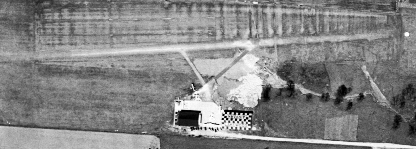
A 1956 aerial view depicted Lakeview Airport perhaps after it had closed, as no aircraft were visible on the field.
It had a single east/west runway, with 2 hangars on the south side.
The eastern hangar had a checkerboard-painted roof.
Lakewood Airport was no longer depicted on the June 1956 Cincinnati Sectional Chart (courtesy of Ron Plante).
The last map depiction which has been located of the Lakewood Airport was on the 1957 USGS topo map.
Merrie Beth Scherff recalled, “Mr. Heckinger, the pilot, moved his family to Dayton around 1960 so... maybe that's when things changed.”
The 1963 USGS topo map still depicted the 2 hangars, labeling the western hangar as “Armory”.
Residential streets had converged on the airport site from both north & south, but nothing was depicted on the site of the runway.
A 1968 aerial photo showed the runway & hangars to remain intact,
although the runway was noticeably deteriorated compared to the 1956 photo,
and houses had been built right up to the northern & southern property borders.
Merrie Beth Scherff recalled, “Probably sometime in the late 1960s, a huge chunk of the property was sold off to developers.”
The last photo which has been located showing the remains of Lakewood Airpark was a 1970 aerial view,
which depicted the runway & hangars in the same fashion as seen in 1968.
The 1976 USGS topo map showed the location of the former runway had been covered with residential streets.
Merrie Beth Scherff recalled, “The Broxon family lived on the remainder of the property until 1993, in the same house.”
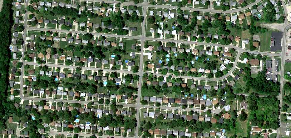
A 7/2/10 aerial view does not show any remaining trace of Lakewood Airpark.
Merrie Beth Scherff reported in 2018, the former Broxon family house “is still there.”
The site of Lakewood Airpark is located at the intersection of Burgess Drive & Windsong Drive, appropriately enough.
Thanks to Martin Dunks for pointing out this airport.
____________________________________________________
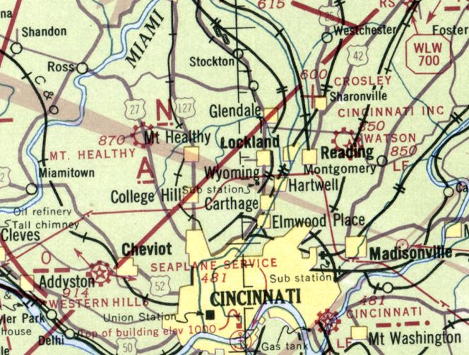
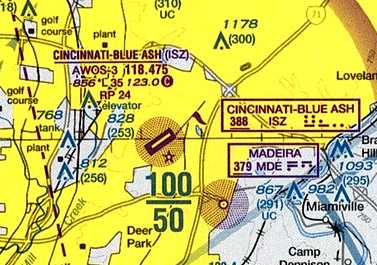
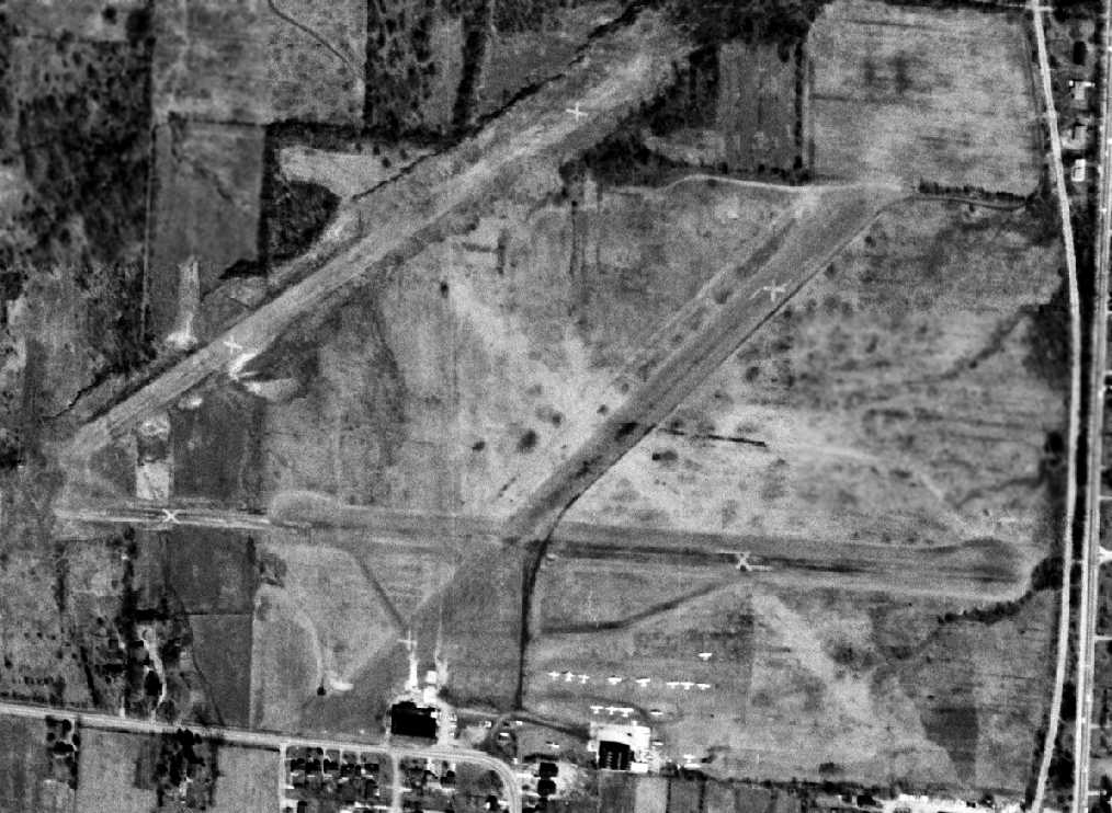
Cincinnati Incorporated Airport / Hugh Watson Field / Blue Ash Airport (I77/KISZ), Blue Ash, OH
39.25, -84.39 (Northeast of Cincinnati, OH)
Cincinnati Inc. Airport, as depicted on the April 1941 Cincinnati Sectional Chart.
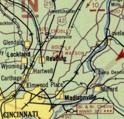
The history of the airport on the north side of this property is intertwined with another airport located only a mile to the south.
The histories of the 2 closely-located airports has become somewhat confused in other reporting,
as some other sources have failed to make the distinction that there were 2 separate airfields located in close proximity.
This has led to the reported history of this specific airport extending farther back in history than is correct,
as is indicated by dated aerial photos & maps.
A 1932 aerial view did not yet depict any airfield at this location – just farms & houses,
and the separate Watson Airport a mile to the south.
No airfield was depicted at this location on the 1939 USGS topo map.
The earliest depiction which has been located of Cincinnati Inc. Airport was on the April 1941 Cincinnati Sectional Chart,
which depicted Cincinnati Inc. as a commercial/municipal airport.
The earliest photo which has been located of Cincinnati Inc. Airport
was a 9/27/43 aerial view looking north from the 1945 AAF Airfield Directory (courtesy of Scott Murdock).
It depicted the “Cincinnati Airport, Inc.” as an L-shaped grass field with several buildings along the north side.
The 1943 Cincinnati Sectional Chart (courtesy of Dallam Oliver-Lee)
depicted “Cincinnati Inc.” as a commercial/municipal airport, with Watson Airport close-by to the south.
The 1945 AAF Airfield Directory (courtesy of Scott Murdock)
described the “Cincinnati Airport, Inc.” as a 184 acre rectangular property having 3 sod runways, with the longest being the 3,700' east/west strip.
The field was said to have 3 brick hangars, with the largest measuring 80' x 60',
and to be owned & operated by private interests.
The October 1946 Cincinnati Sectional Chart (courtesy of Dick Merrill)
depicted “Cincinnati Inc.” as a commercial/municipal airport, with Watson Airport close-by to the south.
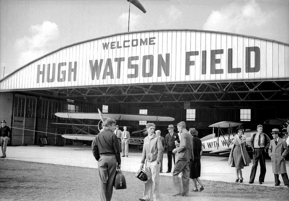
A circa 1940s photo of several unidentified biplanes inside a hangar emblazoned with “Hugh Watson Field”.
No airfield was depicted at this location on the 1948 USGS topo map.
A 4/9/49 USGS aerial view (courtesy of Dallam Oliver-Lee) depicted Cincinnati Inc Airport as an open grass field with row of hangars on the north side.
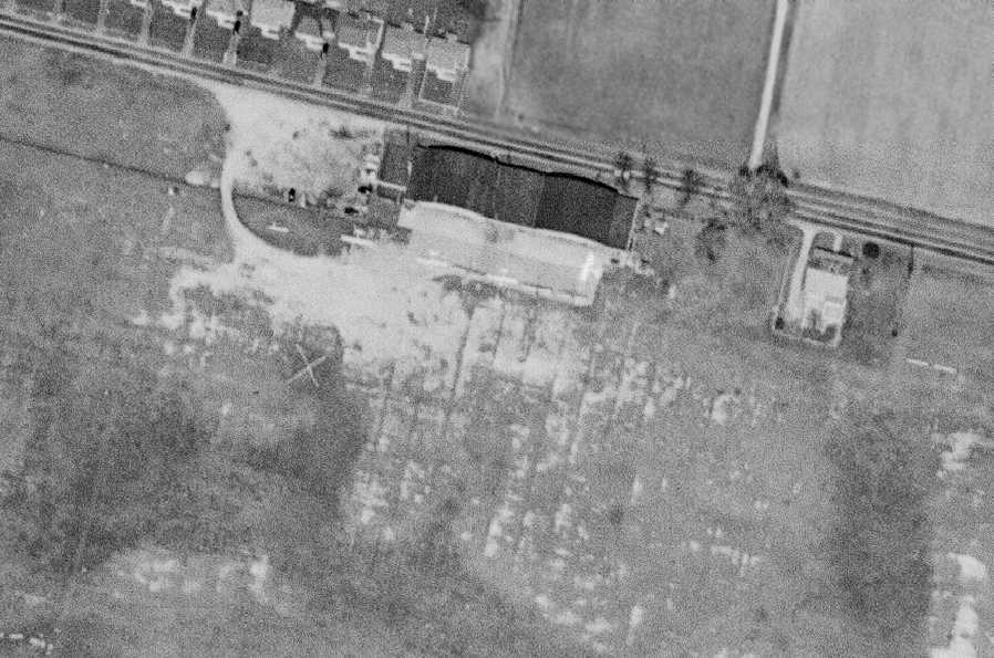
A closeup from the 4/9/49 USGS aerial view (courtesy of Dallam Oliver-Lee) showing 6 single-engine aircraft parked around the Cincinnati Inc hangars.
Blue Ash's Co-Op Aircraft Service hangar was built in 1950.
Dave Glos reported that his “father, Louis 'Moose' Glos ran the FBO” starting in 1952 at Blue Ash.
The June 1954 Cincinnati Sectional Chart (courtesy of David Stevenson)
depicted Cincinnati Inc Airport as having a 3,700' unpaved runway.
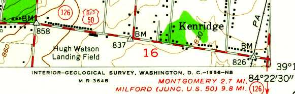
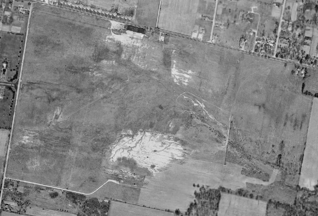
The 1955 USGS topo map depicted “Hugh Watson Landing Field” as an open area with several small buildings along the north side.
A 1956 aerial photo depicted a considerably-expanded Watson Airport,
with 3 distinct grass runways, and a dozen light planes parked around 2 hangars on the south side.
Another larger airport had appeared less than a half-mile to the northwest (which would eventually be known as Blue Ash Airport),
which would presumably replace Watson Airport.
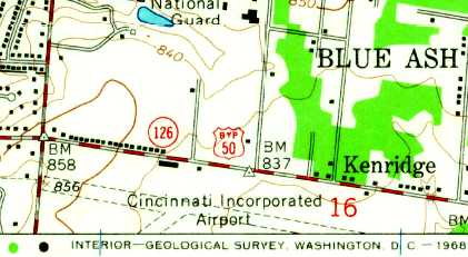
The 1957 USGS topo map depicted “Cincinnati Incorporated Airport”, along with the adjacent Watson Airport to the south.

The 1960 OH Airport Directory (courtesy of Eileen Erickson) depicted “Cincinnati Airport Inc.” as having 2 sod runways, measuring 4,400' east/west & 2,700' northeast/southwest.
The manager was listed as Louis Blos, and the remarks included “Use pattern to avoid flying over airport [to the] south.”
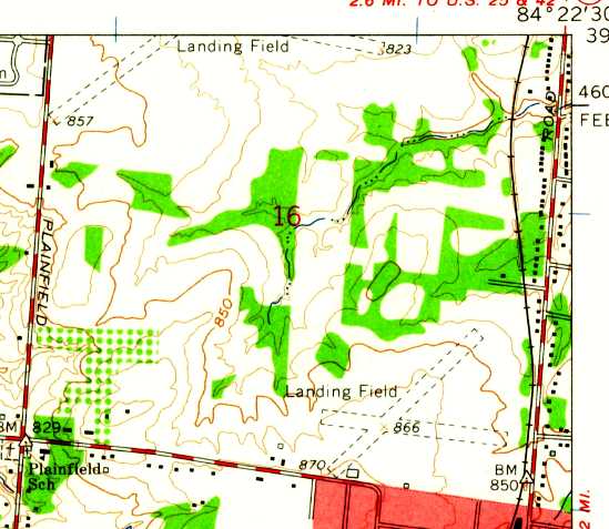
The 1961 USGS topo map depicted 2 unpaved runways (at the top), labeled simply as “Landing Field”.

The July 1962 Dayton Local Aeronautical Chart (courtesy of Mac Hays) depicted Cincinnati Inc Airport as having a 4,400' unpaved runway.
A 4/1/64 USGS aerial view (courtesy of Dallam Oliver-Lee) showed the field still having unpaved runways.
The 1965 USGS topo map depicted “Cincinnati Incorporated Airport” as having 2 unpaved runways.
The 1971 USGS topo map depicted an unpaved runway, labeled simply as “Landing Field”.
A 5/7/74 USGS aerial view (courtesy of Dallam Oliver-Lee) showed the field still having unpaved runways,
but construction was underway to the south of a new northeast/southwest runway.
The 1975 USGS topo map depicted an unpaved runway, labeled simply as “Landing Field”,
but also showed a new northeast/southwest runway “Under construction”, 1/3 of a mile to the south.
The August 1976 Cincinnati Sectional Chart (courtesy of Mitchell Hymowitz) depicted Cincinnati Blue Ash Airport as having 2 paved runways,
with the longest being 3,500'.
An 11/17/79 USGS aerial view (courtesy of Dallam Oliver-Lee) showed Blue Ash to have a northeast/southwest paved runway.
The 1981 USGS topo map depicted Cincinnati Blue Ash Airport as having a single paved northeast/southwest runway,
connected by 2 long paved taxiways to a small ramp & a cluster of small buildings on the north side.
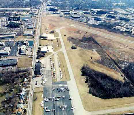
A circa 1980s aerial view looking east at a Blue Ash Airport ramp crowded with light aircraft.
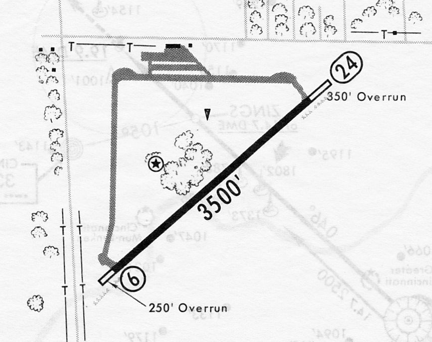
A 3/12/82 airport directory (courtesy of John Kielhofer) depicted Cincinnati Blue Ash Airport as having a single 3,500' paved Runway 6/24,
connected by 2 long paved taxiways to a ramp & 2 small buildings on the north side.
The 4/1/94 USGS aerial view looking southwest showed Blue Ash Airport to have dozens of light aircraft.
Andrew Kahn recalled, “Cincinnati/Blue Ash Airport... I trained there in the mid-1990s.
In my logbook... The identifier for Blue Ash was changed on 5/1/94 from I77 to KISZ.
In fact, the old guys always called it 'Item-77'. I never heard anyone refer to it as 'India-77' or 'Indigo-77'.
It was also the launching spot for the local Cincinnati traffic copter for 700WLW.”
According to a 2012 Cincinnati.com article by Mark Hansel, Blue Ash conducted 35,000 landings & take-offs in 1995.
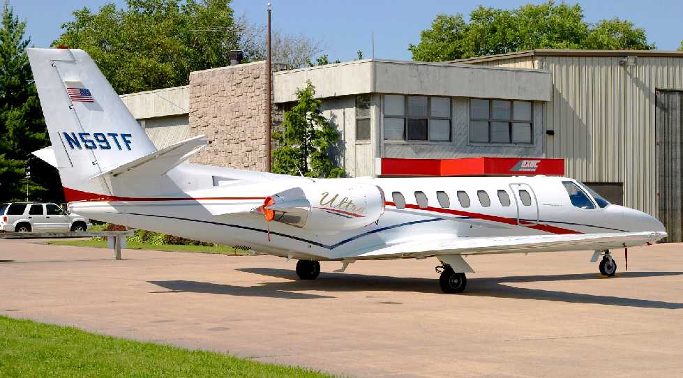
A 6/23/04 photo by Louis Rivera of a 1997 Cessna Citation 560 Ultra business jet at Blue Ash Airport.
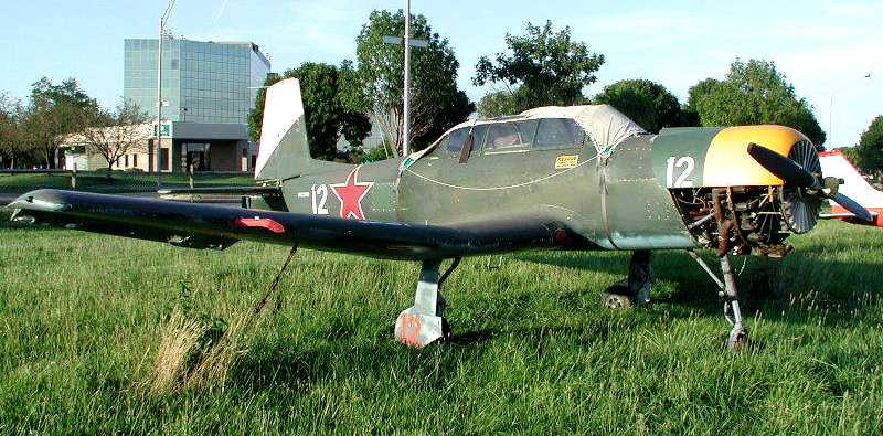
A 7/24/04 photo by Collin Gray of N63391, a 1982 Nanchang China CJ-6, C/N: 3632012 at Blue Ash Airport.
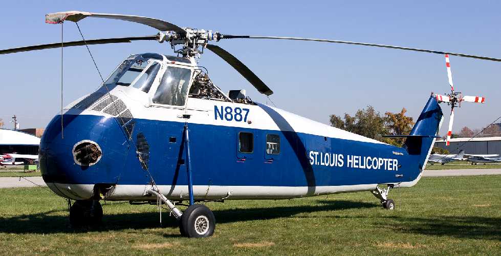
A 11/2/05 photo by Jeffrey Swayze of St. Louis Helicopter Sikorsky S-58B N887 (cn 58-0482) at Blue Ash Airport.

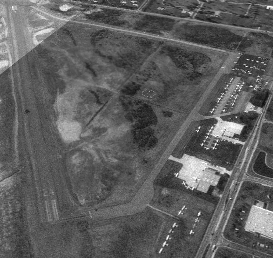
A circa 2007-2011 aerial view looking north at the well-used ramp at Blue Ash Airport.
According to a 2012 Cincinnati.com article by Mark Hansel,
“Cincinnati sold 130 of the airport's 230 acres to Blue Ash in 2007, and the City planned to reconfigure the airport on its remaining 100 acres.”
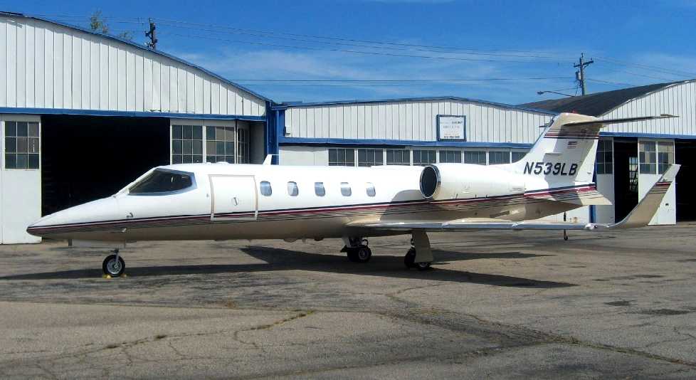
A 9/22/09 photo by Bob Simmermon of N539LB, a 1993 Learjet 31A, C/N 078 at Blue Ash Airport.
Not a very common sight to see a swept-wing jet at an airport with only a 3,500' runway.
A 10/28/11 aerial view looking southwest showed Blue Ash Airport to have dozens of light aircraft.
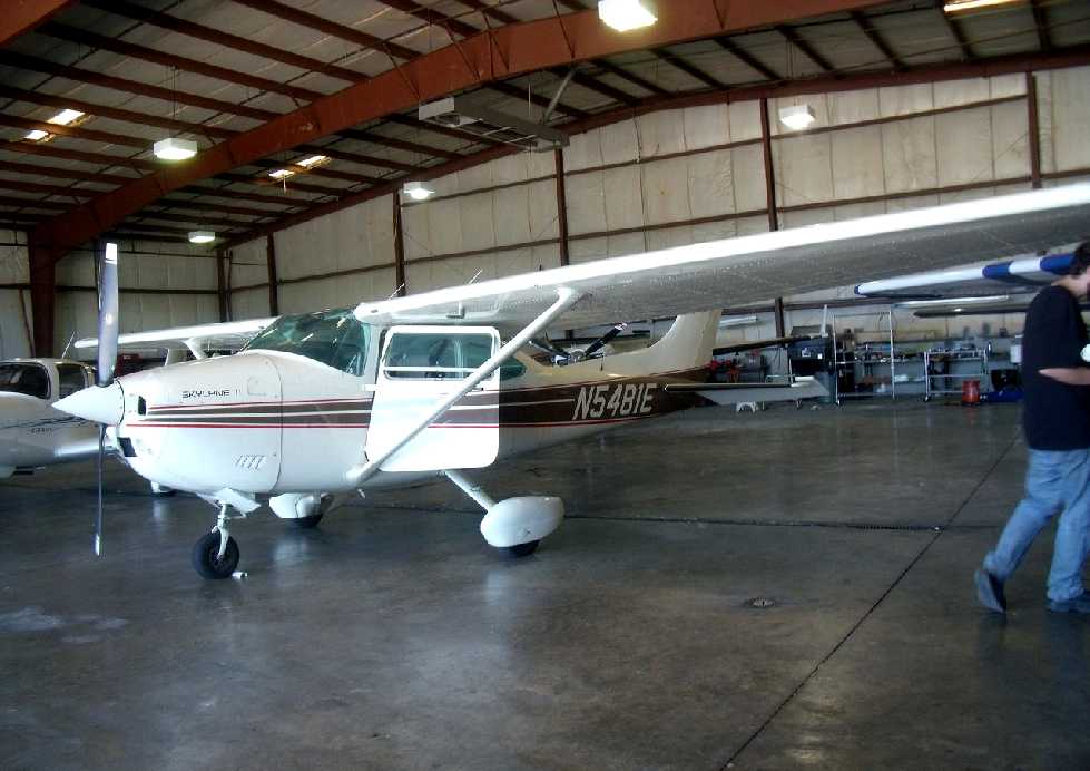
A 6/15/12 photo by Christian Maurer of Duncan Latta's N5481E, a Cessna 182R Skylane, C/N 18268325, inside a Blue Ash hangar.
This Cessna shortly thereafter became the last plane to depart Blue Ash before the airport's closure.
The 2012 Cincinnati Terminal Aeronautical Chart depicted Blue Ash as having a single 3,500' paved runway.
According to a 2012 Cincinnati.com article by Mark Hansel,
“The City of Cincinnati decided earlier this year to close the general aviation airport.
City officials want to use its aviation resources for Lunken Airport, which is much larger & more successful than the Blue Ash facility.
The City of Blue Ash plans to turn the part of the airport that houses its 3 fixed-base operators into a park.
Use of the Blue Ash Airport has declined steadily. Last year there were only 15,000 landings & take-offs there.
In a March 9 report to City Council, Cincinnati City Manager Milton Dohoney said operating the airport over the next 10 years would cost $190,000 a year
because of $40,000 annual losses in revenue & the cost of FAA-required improvements.
A partial reconfiguration of the airport on the city's 100 acres would cost $2.2 million, while a full reconfiguration would run $16 million.
Last month, Cincinnati City Hall restructured the $37.2 million sale so that the proceeds would be available to help fund the $110 million-plus streetcar project.
City officials previously said they hoped to use money from the airport’s sale to cover payments on about $11 million in streetcar bonds.
The Federal Aviation Administration, however, raised objections,
telling City Hall it would have to keep the sale revenue within its airport system, including Lunken in the East End.
By rescinding the original sale & approving a new deal with some procedural changes, the city was able to sidestep that problem.
Wednesday [8/29/12] is the last day of operations at Blue Ash Airport.”
Dave Glos reported that his “father, Louis 'Moose' Glos ran the FBO” until 2012 at Blue Ash.
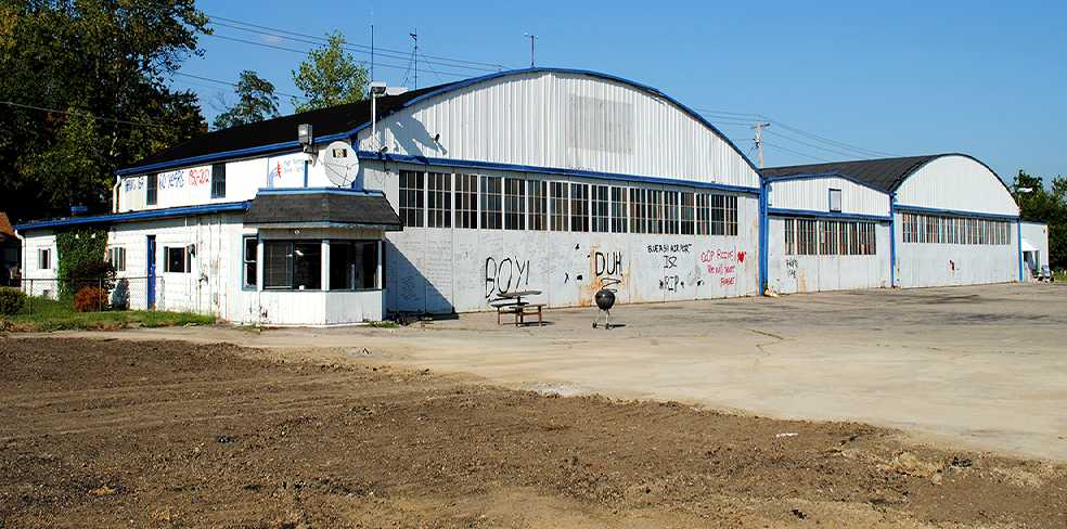
A sad 8/29/12 photo by K. Kuhn of Blue Ash's 1950 Co-Op Aircraft Service hangar, on the day of the airport's closure.
The hangar was decorated with laments of those who loved this little airport.
It would be torn down less than a month later.
Duncan Latta reported that “my plane N5481E [pictured several paragraphs above]...
was the last plane to depart the airport before it closed 8/29/12, less than a minute before it closed at 8:00.”
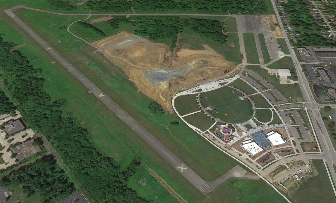
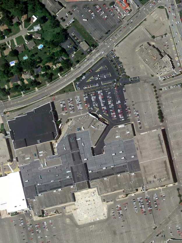
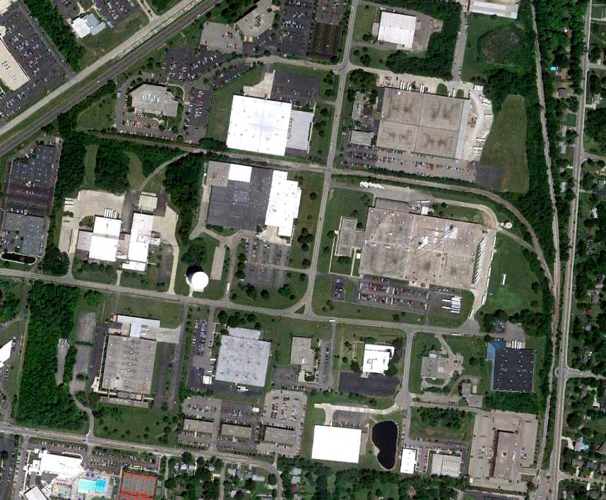
A sad sight for anyone who appreciates general aviation: a 2016 aerial view looking west showed the site of Blue Ash Airport being covered by new construction.
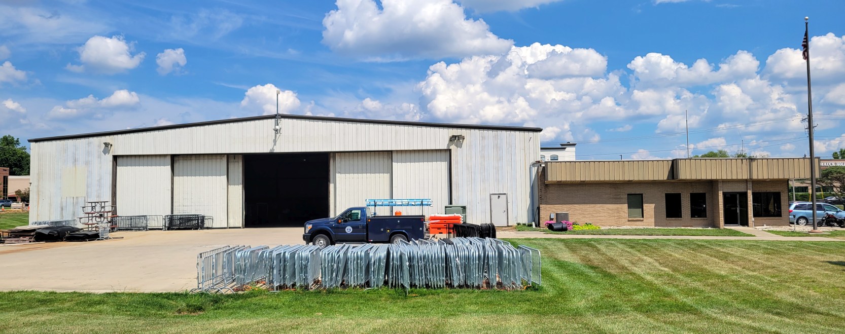
An 8/19/22 photo by Noah Stegman Rechtin of the last remaining hangar on the former Blue Ash Airport.
Noah reported, “It's now used to store maintenance equipment for Summit Park. It was previously the home of Schmidt Aviation Incorporated."
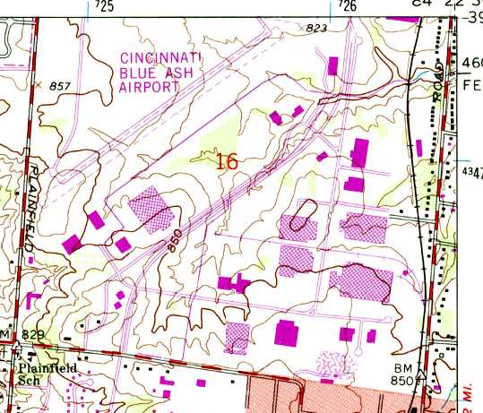
Blue Ash Airport is located southeast of the intersection of Glendale Milford Road & Plainfield Road.
____________________________________________________
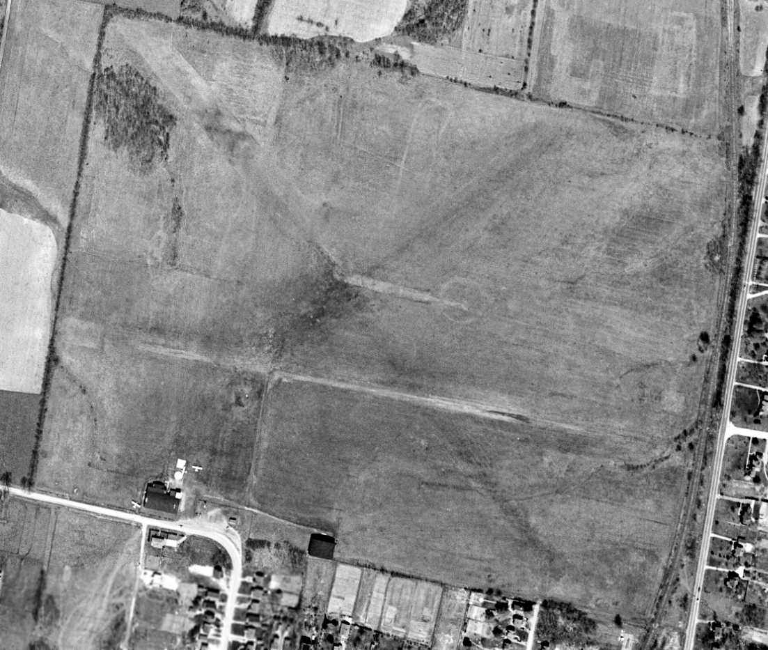
Grisard Field / Watson Airport / Parks Watson Landing Field / Blue Ash Airport, Blue Ash, OH
39.238, -84.382 (Northeast of Cincinnati, OH)
Grisard Field, as depicted on the 1/2/25 Commerce Department Airway Bulletin (courtesy of Mike Denja).
The history of the airport on the south side of this property is intertwined with another airport located only a mile to the north.
The histories of the 2 closely-located airports has become somewhat confused in other reporting,
as some other sources have failed to make the distinction that there were 2 separate airfields located in close proximity.
According to the Blue Ash Airport website, “The airport was originally known as Grisard Field
and was founded in 1921 by the Grisard Company (partially owned by Eshelby Lunken) in an attempt to lure lucrative Federal funds & airmail routes to Cincinnati.
It also housed the 359th Army Reserve Observation Squadron.
The airfield was commercially leased the next year to brothers Hugh & Parks Watson
and it became a favorite place to visit for weekend airplane rides & flying circus air shows.”
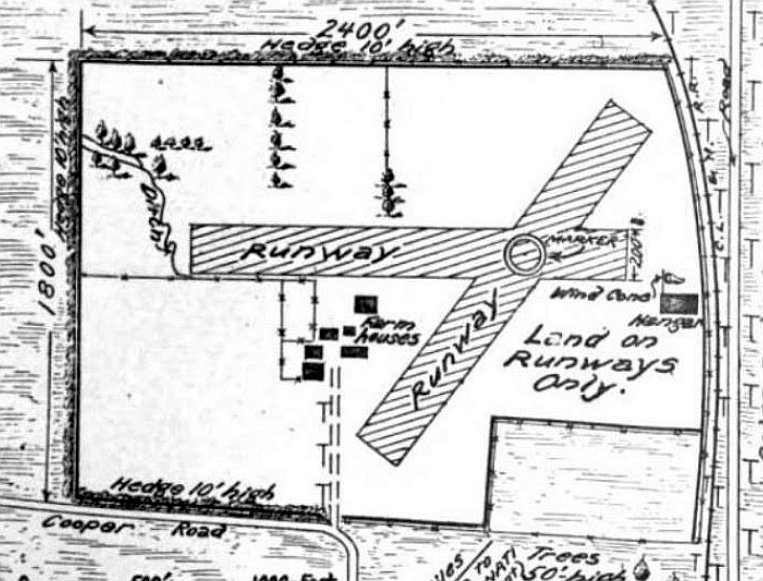
The earliest depiction which has been located of Grisard Field was on the 1/2/25 Commerce Department Airway Bulletin (courtesy of Mike Denja).
It described Grisard Field as a government airfield leased by the Army Air Service & available for municipal & commercial purposes.
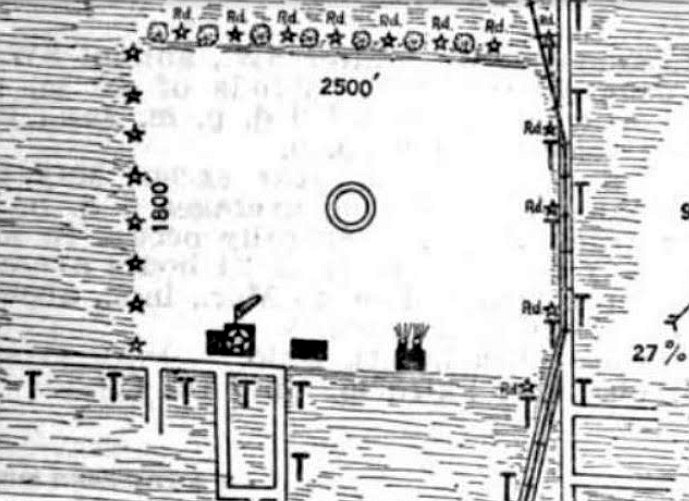
It was said to have 2 sodded runways, measuring 2,400' east/west & 1,800' northeast/southwest, with a hangar on the east side.
According to the Blue Ash Airport website, “In 1925, Eshelby Lunken & the Grisard Company sold the Blue Ash airfield to the Watson brothers.
Grisard Field now became Watson Field.”
The earliest depiction which has been located of Watson Airport was on the 4/30/29 Commerce Department Airway Bulletin (courtesy of Mike Denja).
Watson Airport was described in the 4/30/29 Commerce Department Airway Bulletin (courtesy of Mike Denja) as a commercial airport owned & operated by Watson Airport Inc.
It was said to consist of a 102 acre rectangular sod field, measuring 2,500' east/west.
Three hangars were depicted on the south side, the largest measuring 120' x 60'.
The earliest photo which has been located of Watson Airport was a 1932 aerial view,
showing the field to have a single east/west grass runway with several small buildings & a few light planes along the south side.
The earliest aeronautical chart depiction which has been located of Watson Airport was on the 1934 Cincinnati Sectional Chart.
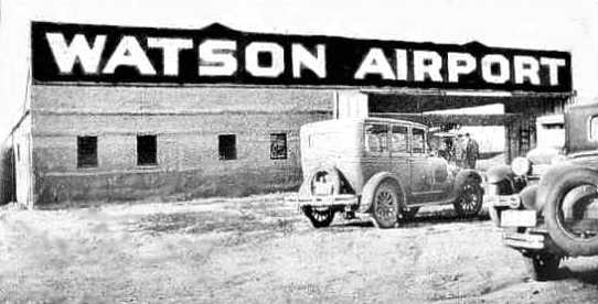
A circa 1930s photo of a hangar emblazoned with “Watson Airport”.
According to the Blue Ash Airport website, “After the 1937 flood completely submerged Lunken Airport,
Cincinnati civic leaders reconsidered the Blue Ash airport as the most promising location.
Starting in 1938, Cincinnati politicians, civic leaders & others fought with each other
in attempts to build a large commercial airport for the City of Cincinnati at the Blue Ash location.
Through the years, failed bond issues, political in-fighting & disagreements failed to produce any firm decision on building at the Blue Ash location.”
The April 1941 Cincinnati Sectional Chart depicted Watson as a commercial/municipal airport, with Cincinnati Inc. Airport close-by to the northwest.
The 1943 Cincinnati Sectional Chart (courtesy of Dallam Oliver-Lee)
depicted Watson as a commercial/municipal airport, with Cincinnati Inc. Airport close-by to the northwest.
A 9/27/43 aerial view looking north at “Parks Watson Airport” from the 1945 AAF Airfield Directory (courtesy of Scott Murdock).
The 1945 AAF Airfield Directory (courtesy of Scott Murdock) described Parks Watson Airport
as a 97 acre rectangular property having a single 2,450' east/west cinder runway.
The field was said to have 2 hangars, the largest being a 120' x 60' stone building,
and to be owned & operated by private interests.
According to Martha Lunken, “Those 2 hangars were occupied by the T. W. Smith Engine Company which later moved to Lunken Airport.”
The October 1946 Cincinnati Sectional Chart (courtesy of Dick Merrill) depicted Watson as a commercial/municipal airport.
According to the Blue Ash Airport website, “The Watson brothers sold the Blue Ash airport to the City of Cincinnati in 1946
and the airfield was renamed the Blue Ash airport.
Throughout the 1950s, there were still political efforts to build the 'Cincinnati Airport' in Blue Ash
but Blue Ash civic leaders & residents fought any major airport redevelopment issues.
As time went by, suburbs & businesses expanded & any chance for Blue Ash to become the site of a major airport dwindled.”
A 4/9/49 USGS aerial view (courtesy of Dallam Oliver-Lee) depicted Watson as an open grass field on which were discernible 3 runways,
with 2 hangars on the south side near which were visible 3 single-engine aircraft.
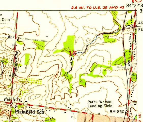
The 1953 USGS topo map depicted “Park Watson Landing Field” as an open area with several small buildings along the south side.
The last aeronautical chart depiction which has been located of Watson Airport
was on the June 1954 Cincinnati Sectional Chart (courtesy of David Stevenson).
It depicted Watson as having a 2,600' unpaved runway.
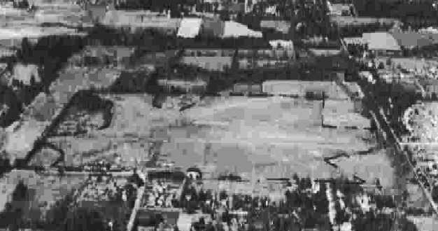
A 1956 aerial photo depicted a considerably-expanded Watson Airport,
with 3 distinct grass runways, and a dozen light planes parked around 2 hangars on the south side.
Another larger airport had appeared less than a half-mile to the northwest (which would eventually be known as Blue Ash Airport),
which would presumably replace Watson Airport.
The last map depiction which has been located which still labeled the Watson Airport was on the 1957 USGS topo map.
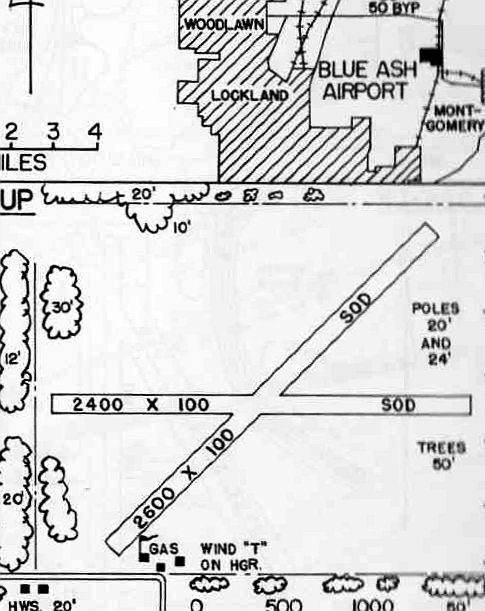
The 1960 OH Airport Directory (courtesy of Eileen Erickson) depicted “Blue Ash Airport” as having 2 sod runways, measuring 2,600' northeast/southwest & 2,400' east/west.
The manager was listed as W.B. Kennedy,
and the remarks included “Use pattern to avoid flying over airport [to the] north side.”
A 4/19/60 USGS aerial view (courtesy of Dallam Oliver-Lee) depicted Watson as a well-used airport,
with 30 light aircraft visible on the south side.
The 1961 USGS topo map depicted 2 unpaved runways (at the bottom) labeled simply as “Landing Field”, with several small buildings along the south side.
The July 1962 Dayton Local Aeronautical Chart (courtesy of Mac Hays)
depicted Cincinnati Blue Ash Airport as having a 2,900' unpaved runway.
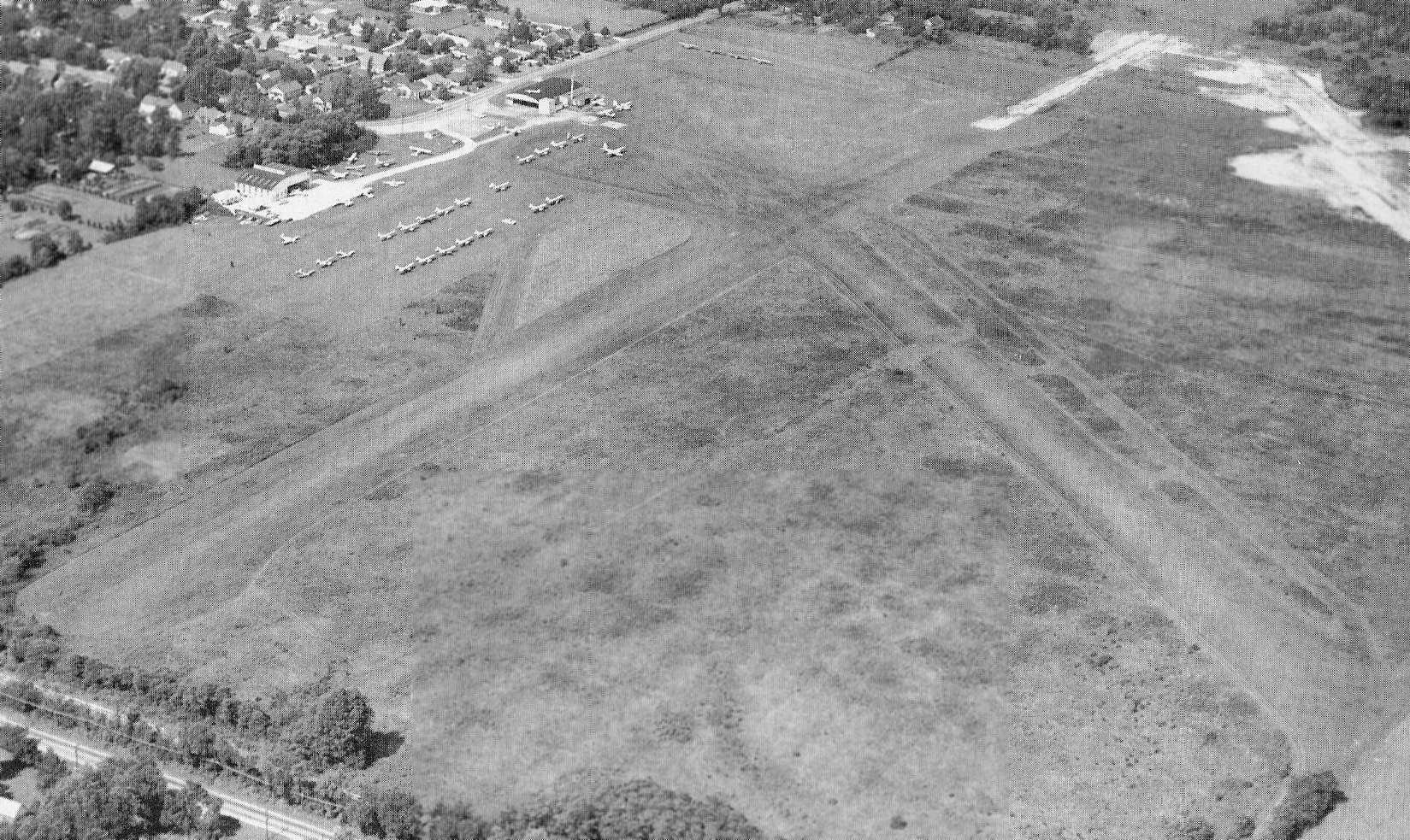
An undated aerial view by Tom Root looking northwest at Blue Ash Airport from the October 1962 issue of “The Flyer” magazine (courtesy of Daun Yeagley).
It depicted Blue Ash Airport as having 2 unpaved runways, with the longest described as 2,900'. Note also what appears to the start of construction for the paved northeast/southwest runway (at top-right).
Operator T.W. Smith Aircraft Inc. was said to be very busy, and the airport manager was listed as W.B. Kennedy.
The last photo which has been located showing Watson Airport still intact was a 4/1/64 USGS aerial view (courtesy of Dallam Oliver-Lee).
Paradoxically, it depicted closed-runway “X” symbols on both runways, yet 13 light aircraft were still visible on the field.
Another odd observation is that a 3rd runway, a parallel northeast/southwest runway had been added at some point between 1962-64, but it also was marked with closed-runway X symbols.
Watson Airport was evidently closed at some point between 1964-68,
as a 1968 aerial photo showed several commercial buildings & new streets covering the airport property.
A 4/10/70 USGS aerial view (courtesy of Dallam Oliver-Lee) showed Watson's eastern hangar remained standing,
but commercial buildings covered most of the site.
A 1994 USGS aerial view (courtesy of Dallam Oliver-Lee) showed the last hangar had been removed at some point between 1970-94.
A 7/2/10 aerial view does not show any remaining trace of Watson Airport.
The site of Watson Airport is located at the intersection of Alliance Road & Malasbury Road.
____________________________________________________
South Dayton Airport (original location), Moraine, OH
39.69, -84.21 (South of Dayton, OH)
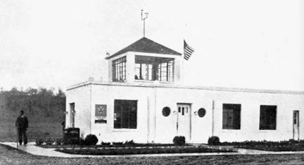
An undated photo from a January 1942 article of the South Dayton Airport administration building (courtesy of Noah Rechtin).
South Dayton Airport was not yet depicted on the 1934 Cincinnati Sectional Chart.
James Chatterton reported, “Remembrance of a child living at South Dayton Airport,1941-45:
My father, Jerry Chatterton, managed & had the airport built on leased land adjacent to the east side of Lamme Road & south of Stroop Road.
By record, the airport was dedicated 11/30/41 & as described in a 12/1/41 Dayton Daily News article.
I was born 2/27/41 & lived in the farm house bordering the south side of the airport landing field & runways until age five.
My memories that follow are fairly clear & contain a few told me latter in life.
The house was frequented by many aviation guests & pilots - I remember one man with a large mustache - later I was told: Roscoe Turner!
Winner of the Bendix & Thompson Trophies.
Several times, leaning on the fence, I watched aircraft acrobats & parachute jumps while the local airshows were underway above the field.
Living there during WWII brought about much activity as we saved cooking grease & metal items for the war effort.
I was heavily involved in war games shooting the enemy from behind a large living room couch - later I was told the airport nightwatchman gave me the name, 'Mow 'em Down'!
In fond remembrance of my parents, Phyllis & Jerry Chatterton.”
The earliest depiction which has been located of South Dayton Airport
was an undated photo from a January 1942 article of the South Dayton Airport administration building (courtesy of Noah Rechtin).
A 9/27/43 aerial view looking north at South Dayton Airport from the 1945 AAF Airfield Directory (courtesy of Scott Murdock)
depicted the field as having 3 unpaved runways.
According to Bob Luken, “The South Dayton Airport had been owned primarily by Charles Kettering, John Patterson & Col. Edwin Deeds.”
According to Dennis Gray, “There was a 4th runway there. It was [Edward] Deed's personal runway which is now West Stroop [Avenue].
Deeds might have had a hand in the South Dayton project as he was a huge advocate of air travel
saying every community of 10,000 or more should have a municipal airfield.”
The 1945 AAF Airfield Directory (courtesy of Scott Murdock) described South Dayton Airport
as a 140 acre irregularly-shaped field having 3 sod runways, the longest being the 3,185' northeast/southwest strip.
The field was said to have a single 100' x 60' cinder block hangar,
and to be owned & operated by private interests.
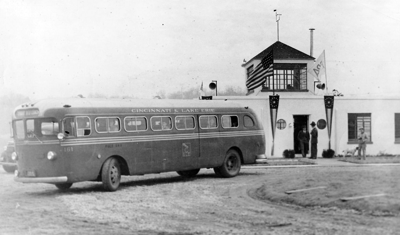
A circa 1940s photo of a Cincinnati & Lake Erie bus in front of the South Dayton Airport administration building (courtesy of Bob Luken, via James Chatterton).
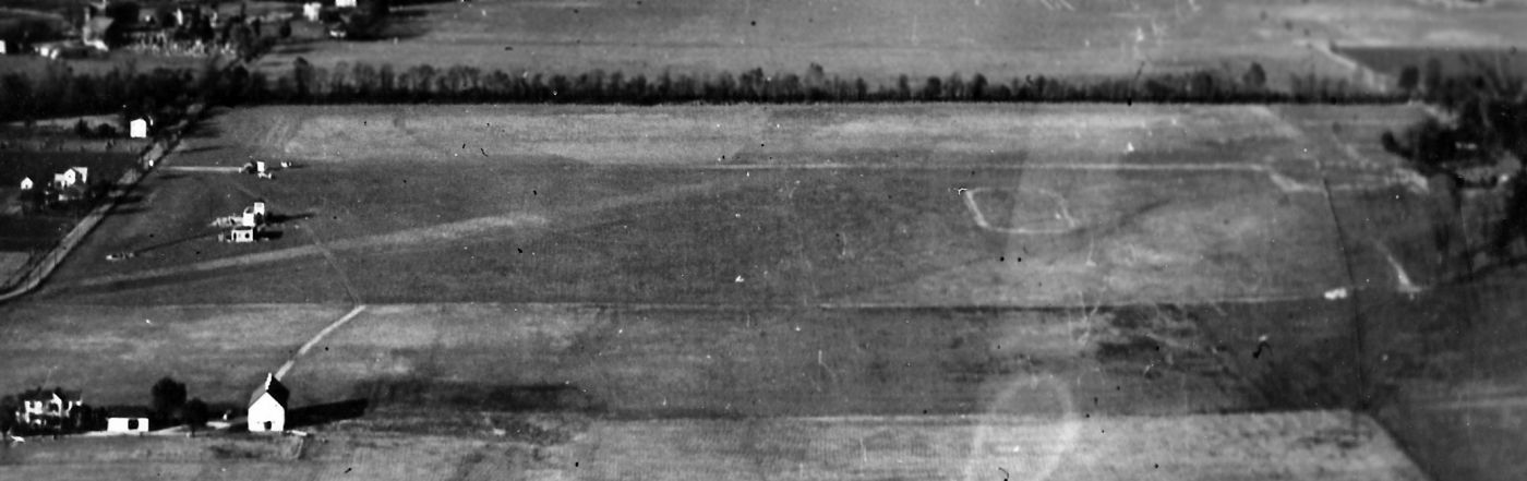
A circa 1940s aerial view looking north at South Dayton Airport (courtesy of Bob Luken, via James Chatterton).
The administration building is at middle-left, and the farm house where James Chatterton lived is at bottom-left.
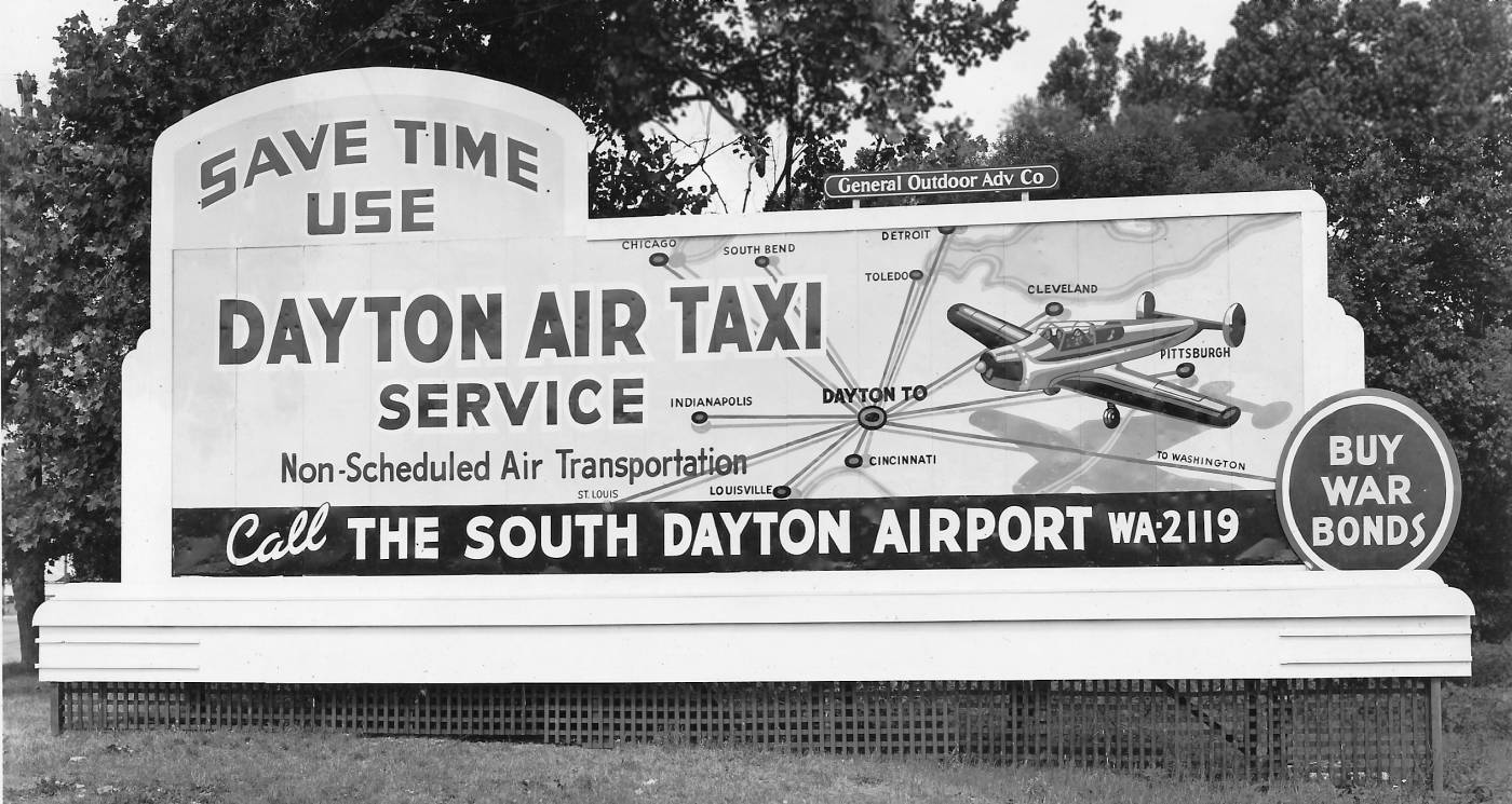
A circa 1940s photo of a sign advertising the Dayton Air Taxi Service (courtesy of Bob Luken, via James Chatterton),
started at South Dayton Airport by Bob Luken.
Bob Seslar recalled, “I was a line boy at the old original South Dayton airport 1946-47.
The airport manager was Ray Stotts. Ray’s wife operated the snack bar.
Instructors that I can remember: Earl (Pee Wee) Hartman, Norm Rice, Dick Adams,
Ike Schreiber, Virgil Eshelman (Ish), Gene Siegal, Bill Stroop, June Farren.
Line boys were: Bob Seslar, Dick Stotts (Ray’s son), Lucky Rice (Norm’s son), Jack Avery.
Bob Hoover & Chuck Yeager were there often.
Bob had a Stearman tiedown space & both were test pilots at Wright Field testing the P-80.”
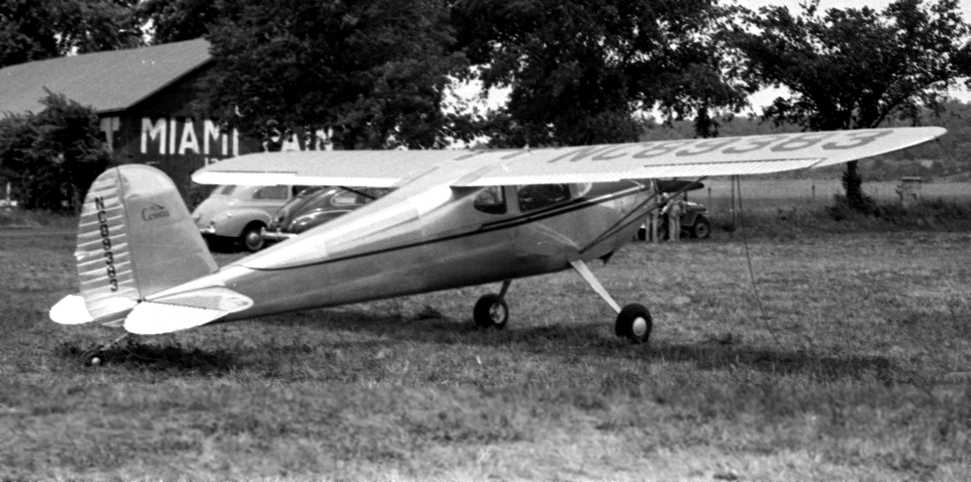
A 1947-48 photo by John Gray (courtesy of Dennis Gray) of a Cessna 140 at the South Dayton Airport.
Dennis Gray recalled of South Dayton Airport, “My father [John Gray] always talked about flying in & out of there (my grandfather had a plane).”
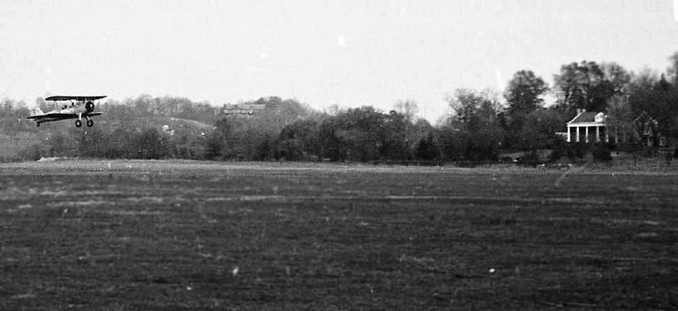
A 1947-48 photo by John Gray (courtesy of Dennis Gray) of a Stearman biplane taking off from South Dayton Airport.
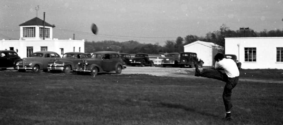
A 1947-48 photo by John Gray (courtesy of Dennis Gray) of a building with an observation tower at South Dayton Airport.
According to Dennis, it shows “some friends of my fathers playing football while apparently waiting on a sightseeing plane ride.”
A 1949 aerial view (courtesy of Paul Allen) showed that South Dayton Airport had gained a north/south paved runway at some point between 1945-49.
The outlines of the previous 3 grass runways were still visible as well.
A dozen light single-engine aircraft were visible on the west side, in addition to 9 hangars.
The last images which have been located of South Dayton Airport were stills from a movie by Julian Allen of a circa early 1950s Soaring Society of Dayton soaring meet (courtesy of Paul Allen),
showing an unidentified glider in front of South Dayton's distinctive office building.
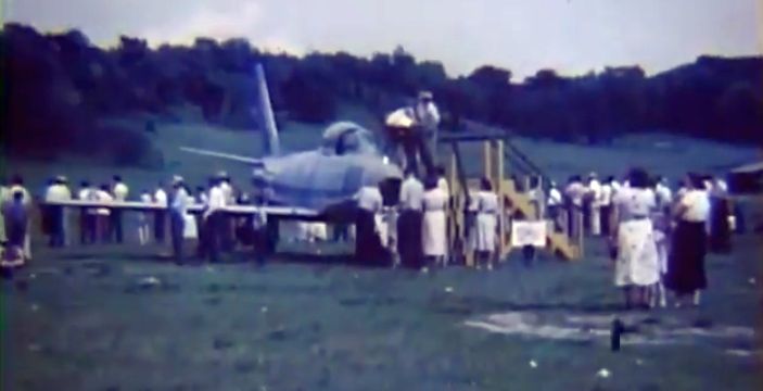
A somewhat unusual sight of a swept-wing North American F-86 Sabre jet fighter on display on the grass airfield of South Dayton Airport,
a still from a movie by Julian Allen of a circa early 1950s Soaring Society of Dayton soaring meet (courtesy of Paul Allen).
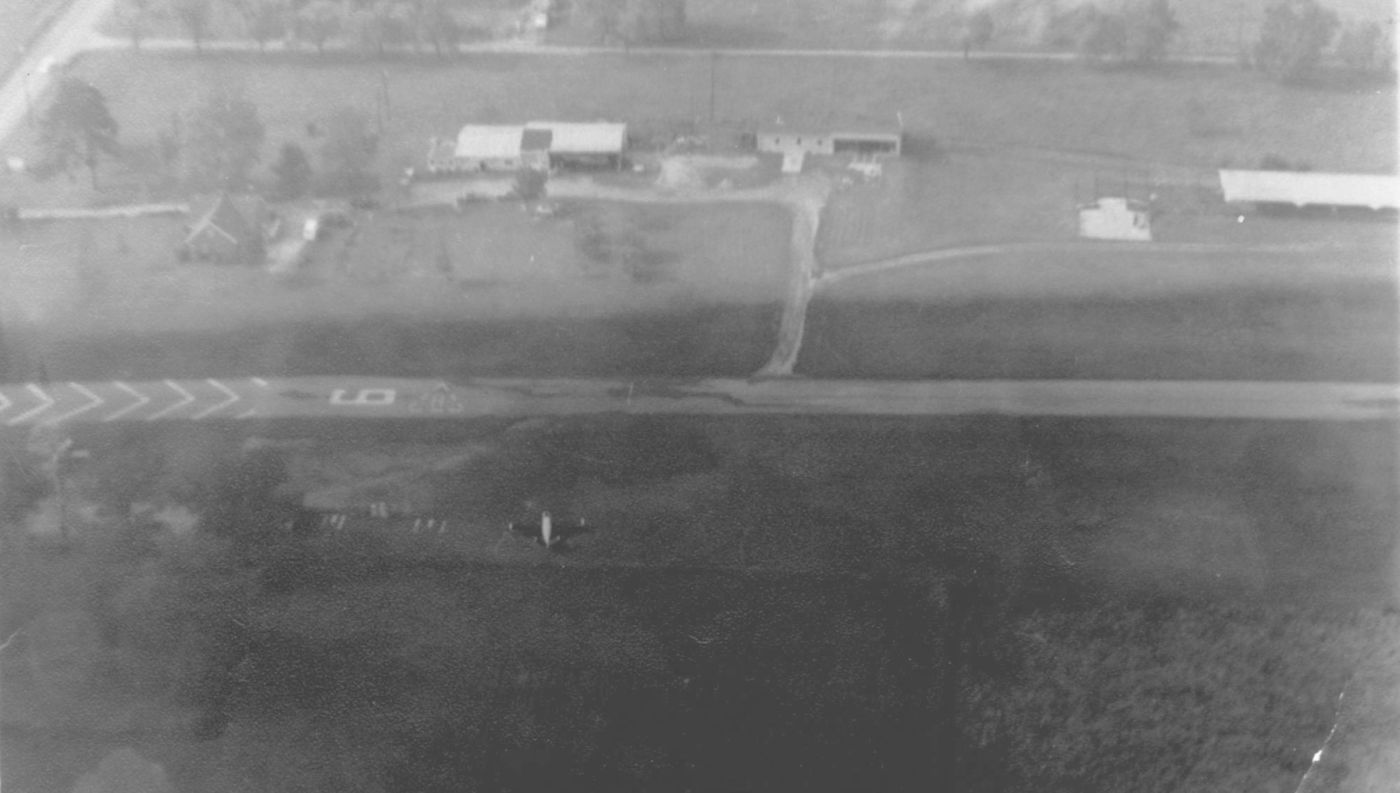
The last aeronautical chart depiction which has been located of South Dayton Airport
was on the June 1954 Cincinnati Sectional Chart (courtesy of David Stevenson).
It depicted South Dayton as having a 2,500' paved runway.
According to Dennis Gray, “The area was platted in the early 1950s.”
According to Bob Luken, “The old South Dayton airport was closed in the early 1950s
because the grass strip were no longer long enough for the newer corporate aircraft being operated by National Cash Register & General Motors.
The land was sold to Charles Huber for plat development.
I currently live on Lamme Road in one of the Huber-built homes. I believe that it was built in 1956.”
The original location of South Dayton Airport on the east side of Moraine was evidently replaced
by another field on the western side of the river by 1956,
as a 1956 aerial photo depicted a new South Dayton Airport as being located on the west side of the river (the location of the present-day Moraine Airpark),
and no longer depicted an airfield at the original location.
The 1966 USGS topo map depicted the South Dayton Airport on the west side of the river,
and no longer depicted an airfield at the original location.
The outline of South Dayton Airport, annotated by Paul Allen over a 2009 aerial view.
No recognizable trace of the airport appears to remain.
The site of South Dayton Airport is located southeast of the intersection of West Stroop Road & Lamme Road.
____________________________________________________
General Electric Airfield, Peebles, OH
38.92, -83.328 (Southeast of Cincinnati, OH)
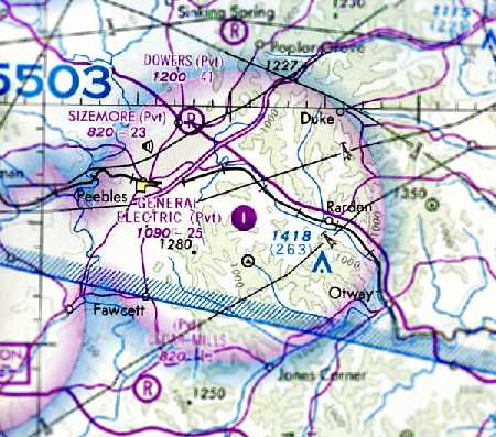
The General Electric Airfield, as depicted on the August 1976 Cincinnati Sectional Chart (courtesy of Chris Kennedy).
General Electric established their sprawling Peebles Test Site in the 1950s originally for testing of rocket engines.
Over time the role of the Peebles site shifted to evaluation of jet engines using numerous test stands spread throughout the facility's 7,000 acres.
The earliest depiction which has been located of the General Electric Peebles Airfield was a 1958 aerial view.
It depicted a single unpaved northeast/southwest runway, with no hangars or other improvements.
The General Electric Peebles Airfield was not yet depicted on the February 1970 Cincinnati Sectional Chart (according to Chris Kennedy).
The earliest aeronautical chart depiction which has been located of the General Electric Airfield
was on the August 1976 Cincinnati Sectional Chart (courtesy of Chris Kennedy).
It depicted the GE Airfield as a private airfield with a single 2,500' paved north/south runway.
GE retiree Tom Emmert recalled, “The GE strip... It was lengthened to 4,000' before 1980
to support a shuttle operation of a Cessna from Blue Ash, OH (near the GE Evendale plant) and the test facilities at Peebles.
It is a hilltop airport, with approaches resembling an aircraft carrier's.
Because of the advanced engine tests there, both proprietary & classified, the field was off limits to private aircraft.
If a private aircraft were to land there, instructions to GE personnel were to provide whatever service was required to expedite its departure.
The shuttle was discontinued about 1990 in an economy move, and the runway closed.”
Michael Bangert recalled, “The aircraft used for the shuttle operation between Blue Ash Airport & Peebles was a 1979 Cessna 310R, which I & others flew for twice-daily round-trips.
Interestingly, the hangar on the west side of the field had hangar doors on both sides so it was effectively a drive-through hangar.”
A 1982 aerial view showed General Electric Peebles Airfield to have a paved northeast/southwest runway, with several buildings on its east side.
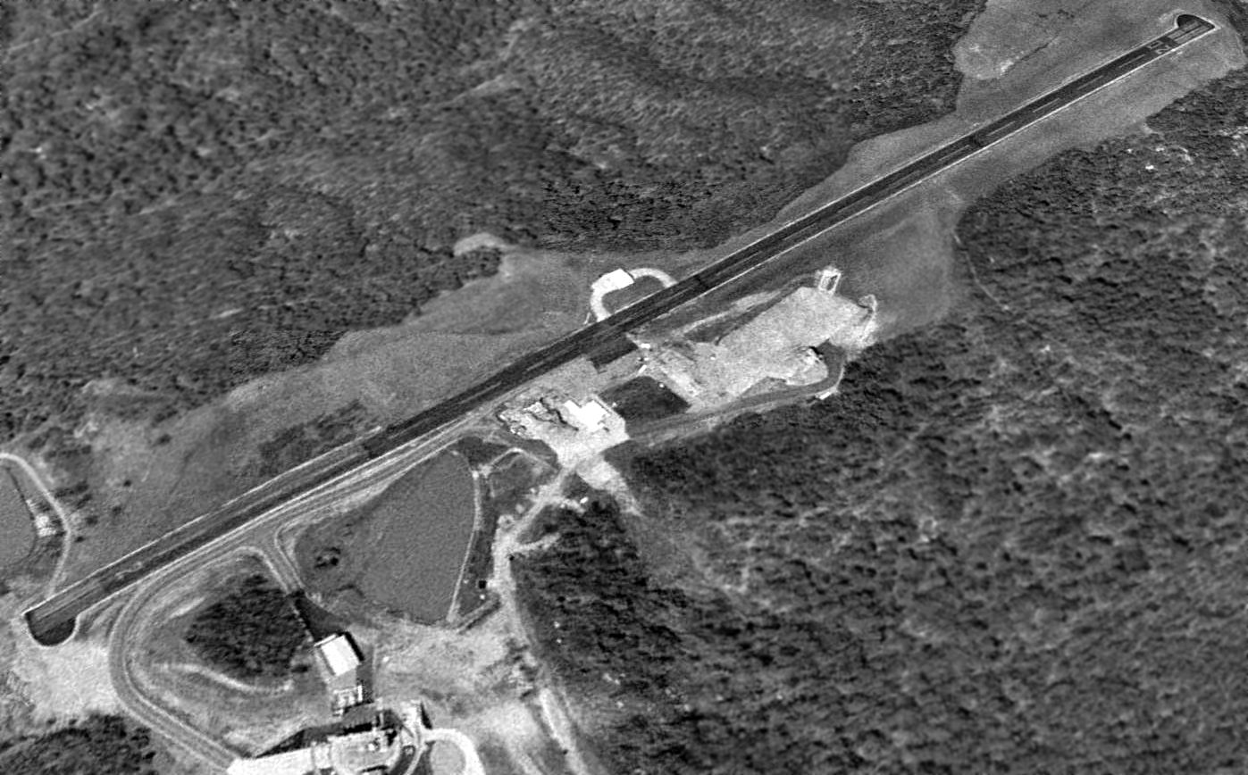
An April 1994 USGS aerial view looking northwest depicted the GE Peebles Airfield as having a single asphalt Runway 2/20,
with a single hangar on the west side of the field.
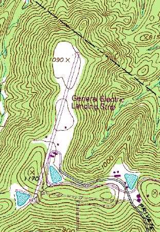
The 1995 USGS topo map depicted the General Electric Landing Strip
as a single paved northeast/southwest runway, with a few small buildings on either side of the strip.
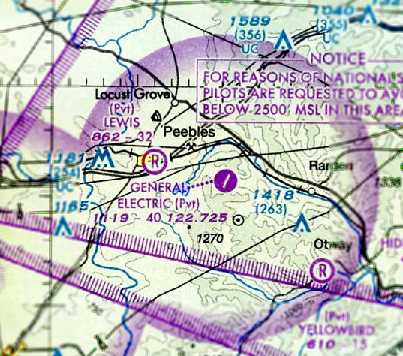
The December 2003 Cincinnati Sectional Chart (courtesy of Chris Kennedy)
depicted the General Electric Airfield as having a single paved 4,000' northeast/southwest runway.
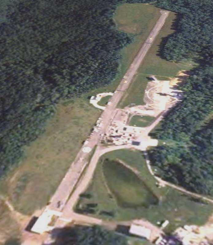
The GE Airfield was evidently closed (for reasons unknown) at some point between 2003-2006,
as a 6/17/06 aerial view looking north showed the runway marked with closed “X” symbols & being used for storage of items.
GE retiree Tom Emmert reported of the GE runway in 2010, “It is now used for equipment storage.”
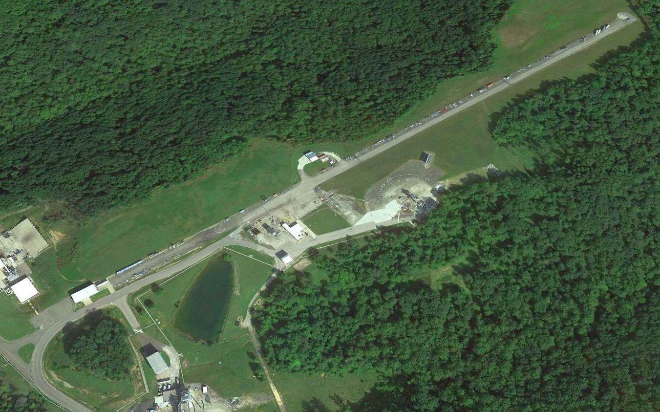
A 2015 aerial view looking northwest showed the GE Peebles runway remained intact, but being used for storage of items.
The June 2018 Cincinnati Sectional Chart depicted the General Electric Airfield as an abandoned airfield.
The site of the General Electric Airfield is located southwest of the intersection of Jaybird Road & Beaver Pond Road.
____________________________________________________
North Field / McCook Field, Kettering Park, OH
39.777, -84.19 (North of Downtown Dayton, OH)
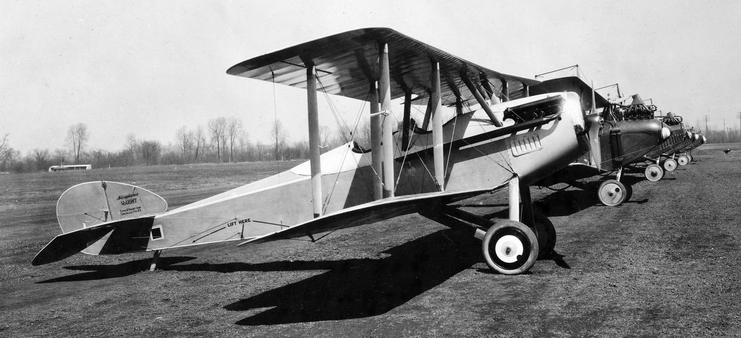
A 1918 photo of a Vought VE-7 Bluebird & other biplanes at McCook Field.
In 1917, anticipating a massive need for military airplanes by the United States during World War I,
six Dayton businessmen including Edward Deeds formed the Dayton-Wright Airplane Company.
Deeds was also interested in building a public aviation field along the Great Miami River
approximately a mile north of downtown Dayton, purchasing the property in March 1917.
He called it North Field to differentiate it from his South Field in Moraine.
The United States entered the war before Deeds could develop North Field.
Deeds sold his interest in the Dayton-Wright Company to become a member of the Aircraft Production Board,
then accepted a commission as a colonel in the Signal Corps & became Chief of the Equipment Division.
Its responsibility was to oversee the building of aircraft & engines needed for the Aviation Section.
His frustration with the fragmentation of the division & slow progress of the aviation effort
led to a recommendation to construct a temporary experimental engineering station.
His recommendation for leasing South Field for that purpose was accepted by the War Department
but was objected to by the Dayton-Wright Company, which needed the field for wartime production of new aircraft.
Instead, the Army leased North Field & opened McCook Field on 12/5/17.
McCook Field's flying field was in a flood plain between the Greater Miami & Stillwater rivers
(now the present-day Dayton park, Kettering Field, named for Charles Kettering)
and its structures were located on what was the site of the Parkside Homes Housing Project before its demolition in 2008.
Constructed during World War I, it became the location of the Aviation Service's Engineering Division in 1919.
World War I Air Service units assigned to McCook Field were:
246th Aero Squadron, November 1917, re-designated as Squadron "A", July-August 1918,
881st Aero Squadron (Repair), February 1918, re-designated as Squadron "B", July-August 1918,
Detachment #10, Air Service, Aircraft Production, August 1918-May 1919, organized as consolidation of Squadrons "A" & "B".
The earliest photo which has been located of McCook Field was a 1918 photo of a Vought VE-7 Bluebird & other biplanes.
The VE-7 was possibly a prototype under evaluation with other aircraft by the US Army Air Service.
A circa 1918 McCook group portrait, with Kiss the dog.
Frank Patterson (2nd from left) died in a crash that year; Wright-Patterson Air Force Base is named for him.
“Shorty” Schroeder (9th from left) once had his eyeballs freeze over during an altitude test.
A circa 1918 photo of Packard Lepere LUSAC 11 (with elevated rear machine gun) at McCook Field.
This was possibly the prototype of this US-built variant of a French design.
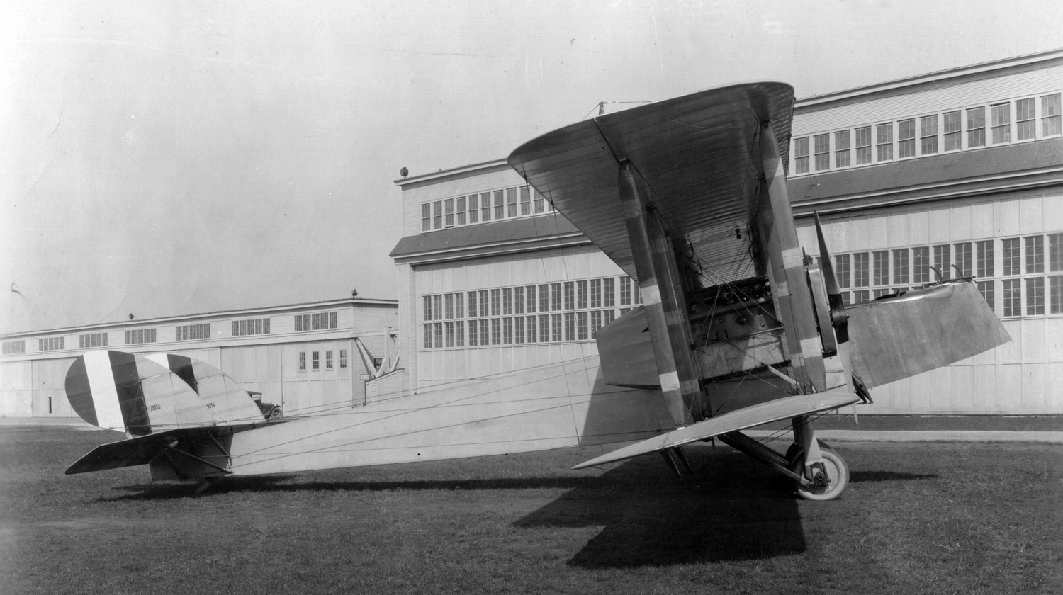
A 1919 photo of Martin MB-1 bomber 39055 (the first GMB delivered) in front of a McCook Field hangar.
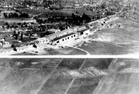
A 1921 aerial view of the hangars at McCook Field.
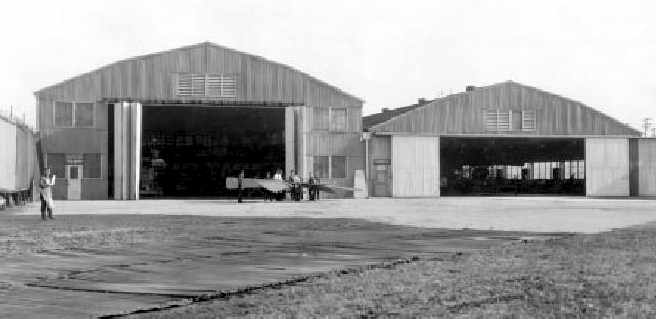
A 1922 photo of hangars at McCook Field.
A 1922 aerial view of Army airship C-2 at McCook Field (from “A Look Back... Fairfield Air Depot”, by the USAF History & Heritage Directorate, courtesy of Ron Plante).
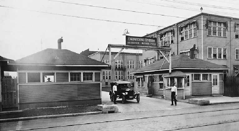
An undated photo of the entrance gate of the "Engineering Division, Air Service, McCook Field" (courtesy of Jos Heyman).
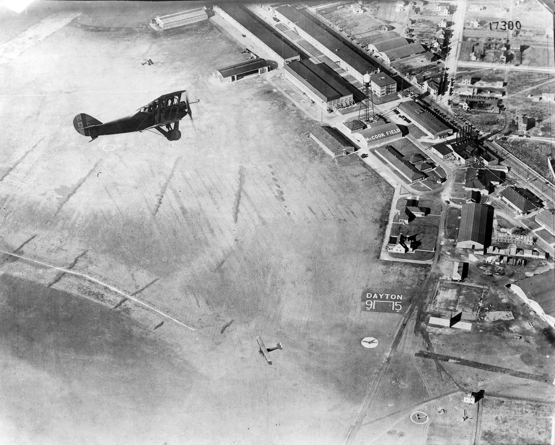
A circa 1920s USAAC aerial view looking southeast at a Packard-Le Père LUSAC-11 biplane overflying McCook Field.
This airplane (P-53) was flown by Lt. Rudolph "Shorty" Schroerder when he set new solo & 2-man world altitude records in 1919 & 1920.
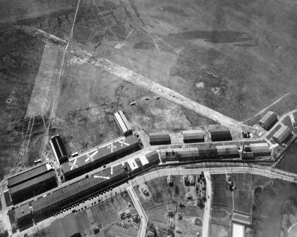
A circa mid-1920s aerial view looking southwest at McCook Field (courtesy of Tom Hietzman),
showing 5 aircraft on the field, and not the multiple directional indications painted on the roofs of the buildings.
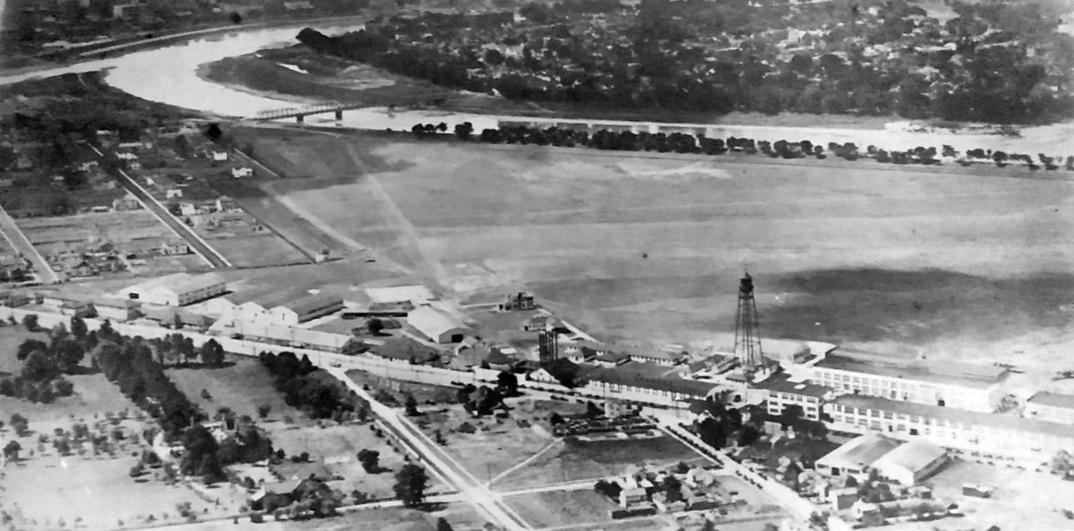
A circa 1920s aerial view looking southwest at McCook Field (photographed in 2020 at the Air Force Museum by Rex Ricks).
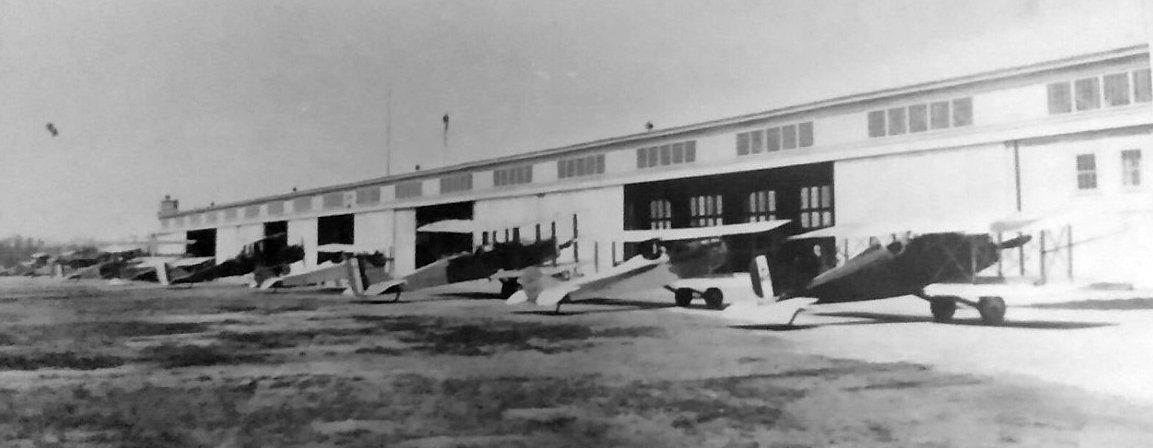
A circa 1920s photo of a row of biplanes in front of a McCook Field hangar (photographed in 2020 at the Air Force Museum by Rex Ricks).
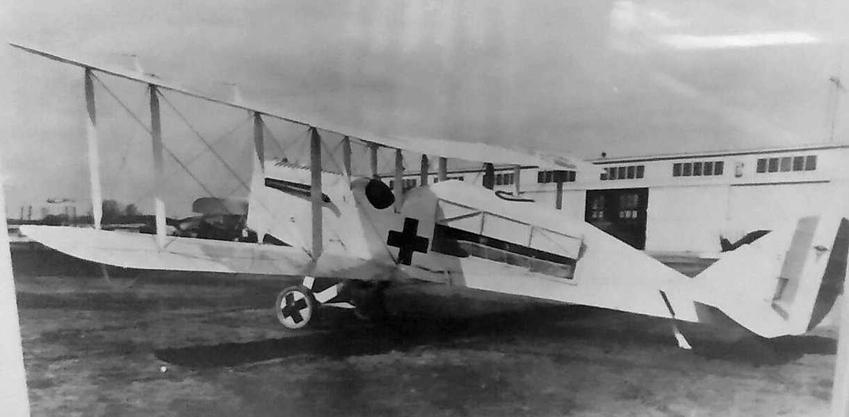
A circa 1920s photo of a de Havilland DH.4 biplane modified into an ambulance configuration in front of a McCook Field hangar (photographed in 2020 at the Air Force Museum by Rex Ricks).
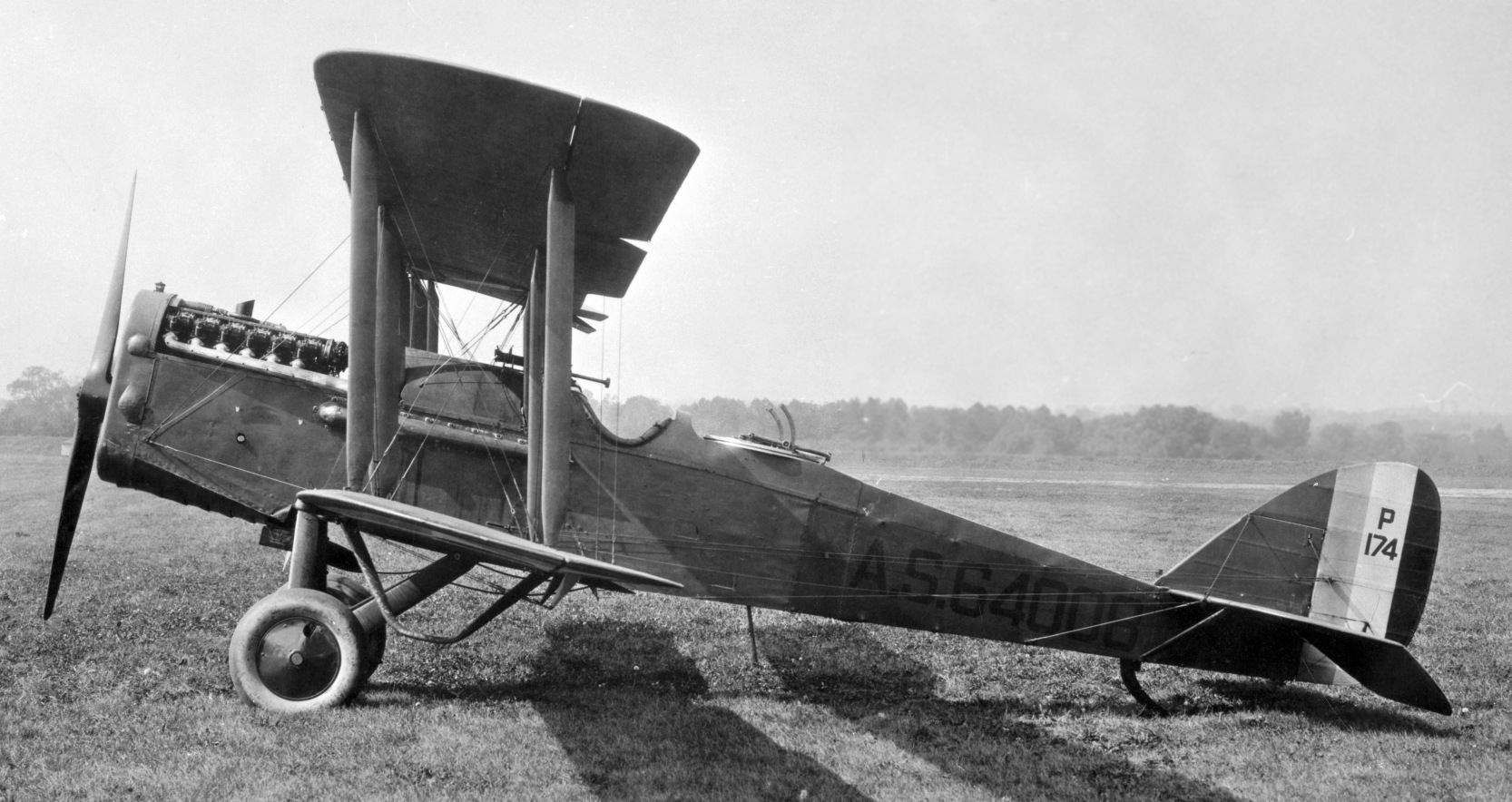
A circa 1920s USAAC photo of a de Havilland DH-4B biplane at McCook Field.
McCook Field was unusual in that to optimize flight test conditions,
it had a smooth-surfaced runway built of macadam & cinders rather than the bumpy grass runways nearly universal at the time.
However, to use the prevailing winds, the runway transected the narrow dimension of the tract & ended at a flood levee.
It was 1,000' in length at the beginning & never exceeded 2,000'.
A huge sign painted across the front of McCook's main hangar prominently warned arriving pilots: “THIS FIELD IS SMALL. USE IT ALL.”
Urban growth encroached on the space & larger aircraft being developed overtaxed the field's grass surface.
Ultimately, the field became too small for its purpose.
McCook Field had a museum (established in 1923) which was not accessible top the public.
It has been reported that the collection went in storage upon America's entry into WW2
(implying it had been transferred presumably to Wright Field),
and it does not appear that any of these aircraft found their way into the current USAF Museum's collection.
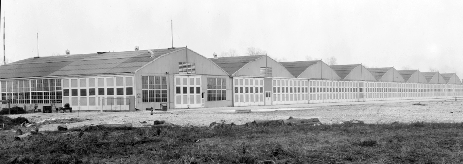
A 1923 USAAC photo of the McCook Field Museum & Armament Buildings.
A 1923 photo of the sole de Bothezat helicopter, being tested at McCook Field under Army contract.
The last photo which has been located of McCook Field was a 1924 photo of Fokker PW-7 C/n 68581.
The USAAS received 3 PW-7 fighters with Curtiss D-12 engines, and this example had fabric wing skinning, N-type struts, and bombs slung underneath.
McCook Field was built on land leased from the Dayton Metal Products Company, and every year the firm raised the rent.
McCook’s buildings, moreover, were built largely of wood, and presented a constant fire hazard.
After a much larger parcel of land had been acquired, a replacement installation - Wright Field - was dedicated by the Army in 1927.
McCook Field closed concurrent with the opening of the new Wright Field.
Beginning in March 1927, 4,500 tons of its materiel & assets were relocated by truck to the new base.
During the balance of 1927 & into 1928, caravans of trucks & rail cars carted all that was portable from McCook Field across & out of town to Wright Field:
wind tunnels, propeller test rigs, dynamometers - even manhole covers bearing the designation U.S. Army Signal Corps.
Nothing went to waste. When this had all been accomplished by the end of 1928, McCook, like ancient Carthage, was demolished & laid level with the dust.
Indeed, the ground was regraded so that nearly nothing remained of America’s first "Cradle of Aviation."
McCook Field was closed to landings of U.S. government aircraft on June 30 by order of the Air Corps,
but by then all aircraft had shifted to the Fairfield Air Intermediate Depot's field.
Ironically, one of the last flights received at McCook occurred after the order,
on July 20, when the Atlantic-Fokker C-2 transport formerly based at McCook flew in from Milwaukee
with Lts. Lester Maitland & Albert Hegenberger, two of its most distinguished alumni.
The pair had successfully accomplished the first transpacific flight, flying the Bird of Paradise to Hawaii on June 28–29,
and were on a triumphant tour whose stops included their hometowns & McCook, where the flight project started in 1919.
McCook Field was no longer depicted on the 1928 Air Navigation Map (courtesy of Chris Kennedy).
A 1956 aerial view showed the site of McCook Field to be occupied by several athletic fields.
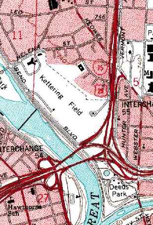
On the 1992 USGS topo map, the location of the former McCook Field was still commemorated,
as 2 parks occupying portions of the former airfield (Kettering Field & Deeds Park)
were named after 2 of the people who figured in the founding of the airfield.
A street just to the north of Kettering Field is also named McCook Avenue.
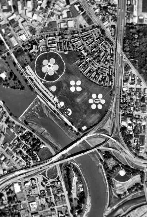
As seen in the 2000 USGS aerial photo, the site of McCook Field is occupied by several athletic fields.
The site of McCook Field is located northwest of the present-day intersection of Interstate 75 & Route,
along the eastern bank of the Miami River.
____________________________________________________
Huffman Prairie Flying Field, Dayton, OH
39.803, -84.067 (Southwest of Wright-Patterson AFB)
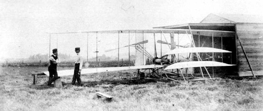
A 1904 photo of the Wright Brothers with their 2nd Wright Flyer & their hangar at Huffman Prairie.
This 84 acre patch of rough pasture outside Dayton is where the Wright brothers undertook the difficult & sometimes dangerous task
of creating a dependable, fully controllable airplane & training themselves to be pilots.
The Wright Brothers started using Hufffman Prairie in 1904.
They made hundreds of flights here after developing the 1905 Wright Flyer III (the plane they considered to be the first practical airplane),
testing the aircraft built by the Wright Company.
At the Wright Flying School, also located here, they trained more than 100 pilots,
including the flyers for the Wright Exhibition Team & the first military flyers, including Henry Arnold & Thomas Milling.
The United States Army Signal Corps purchased the field in 1917 & renamed it (along with 2,000 adjacent acres) Wilbur Wright Field.
In 1948 the area was merged with nearby Patterson Field & became Wright-Patterson Air Force Base.
Aerial photos from 1956 & 1968 showed an empty field at the site of Huffman Prairie.
At an unknown date the Huffman Prairie property came under the stewardship of the National Park Service,
which operates the historic site where visitors can see where the Wrights developed the world’s first practical airplane
as well as replicas of their 1905 hangar & launching catapult.
The associated Huffman Prairie Flying Field Interpretive Center is located at the Wright Memorial on an overlook about 2 miles from the flying field.
Huffman Prairie was declared a National Historic Landmark in 1990.
A circa 2006 aerial view looking east at the reproduction of the Huffman Prairie hangar & catapult.
A Park Service diagram showing the layout of Huffman Prairie Flying Field,
with the hangar & catapult on the east side of the oval-shaped field.
Huffman Prairie was added by the U.S. Secretary of the Interior
to the U.S. World Heritage Tentative List as part of the Dayton Aviation Sites listing in 2008.
A December 2008 photo by John Voss looking north at the reproduction of the Huffman Prairie hangar & catapult,
with Patterson Field visible in the background.
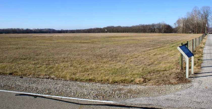
A December 2008 photo by John Voss of the Huffman Prairie Flying Field.
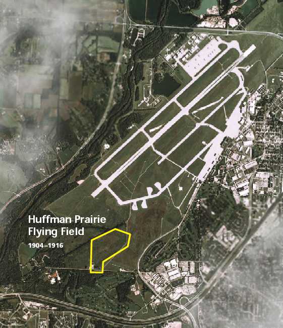
A pre-2009 photo showing the location of Huffman Prairie Flying Field relative to the adjacent massive airfield of Patterson Field.
Huffman Prairie is located northeast of the intersection of Hebble Creek Road & Pylon Road.
____________________________________________________
Fairfield Air Depot / Wright Field / Wright AFB, Dayton, OH
39.78, -84.11 (Northeast of downtown Dayton, OH)
A 5/14/18 photo of a US Army Canadian Aeroplanes Curtiss JN-4(CAN) which ground-looped at Wright Field.
In 1904-05 the Wright brothers set up their experimental flying field on Huffman Prairie in southwest Ohio.
In 1917, Wilbur Wright Field and, adjacent to it in order to provide support,
the Fairfield Aviation General Supply Depot, were established in the general area.
The earliest photo which has been located of Wright Field was a 5/14/18 photo of a US Army Canadian Aeroplanes Curtiss JN-4(CAN) which ground-looped.
After World War 1, Huffman Pairie & Wright Field were merged & redesignated Wilbur Wright Air Service Depot, but was commonly referred to as Fairfield Air Depot.
Wilbur Wright Field, as depicted on the 5/15/24 Commerce Department Airway Bulletin (courtesy of Mike Denja).
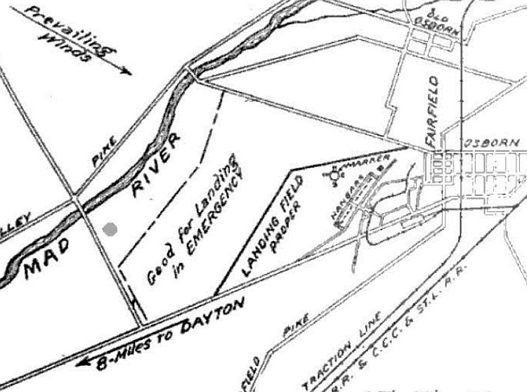
The 5/15/24 Commerce Department Airway Bulletin (courtesy of Mike Denja) described Wilbur Wright Field as being located at the Fairfield Air Intermediate Depot, U.S. Army Air Service.
It was described as 500 acres, measuring 5,505' northeast/southwest, with an additional area to the northwest labeled as “Good for landing in emergency”,
and a row of hangars was depicted on the southeast side.
A circa 1920s-30s aerial view of a large number of biplanes in front of Hangars 11 & 12 at the Fairfield Air Depot (courtesy of Lowell Scott).
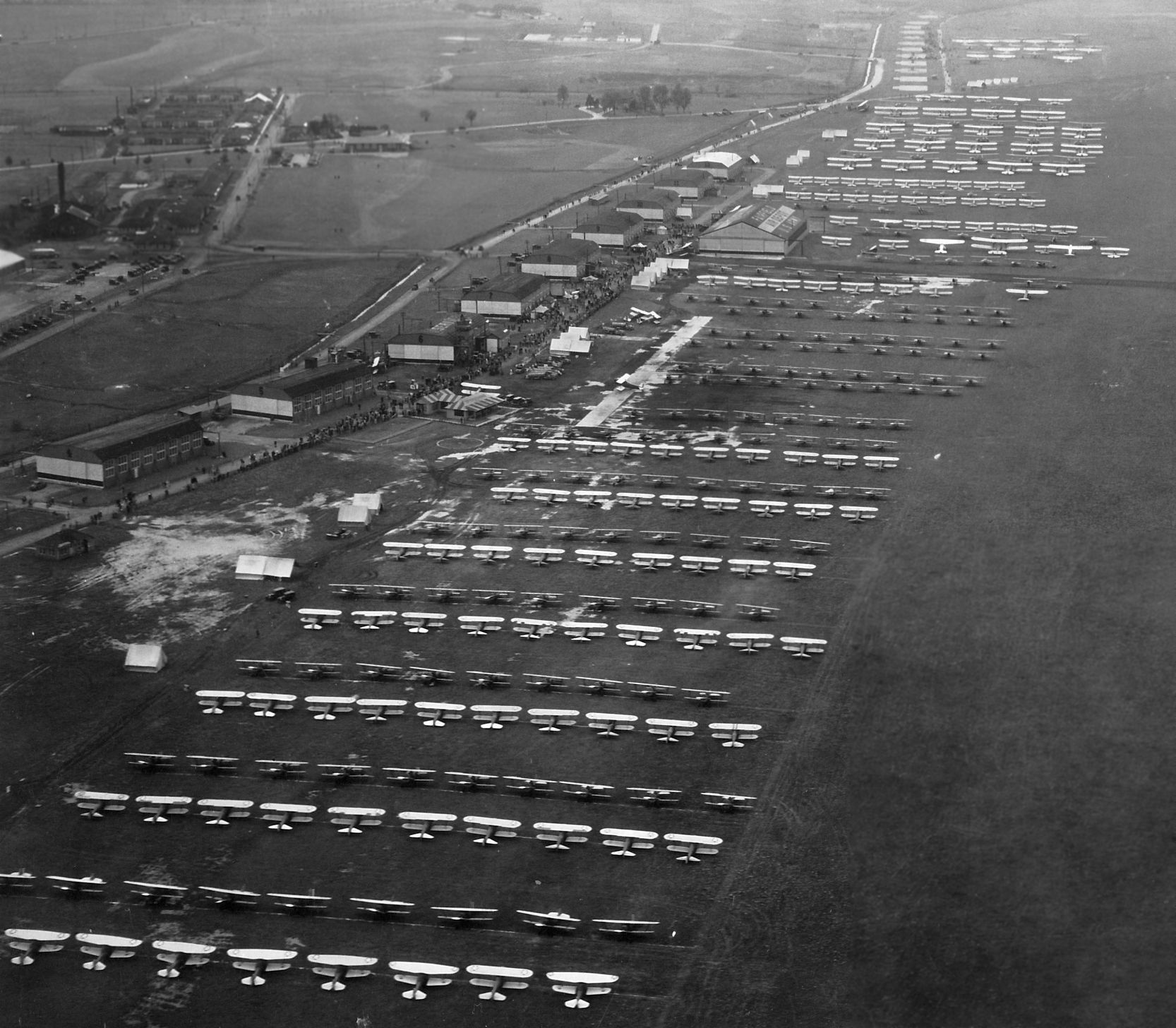
A circa 1920s-30s aerial view of a huge assemblage of biplanes at the Fairfield Air Depot (courtesy of Lowell Scott).
In 1927 the 2 fields & surrounding area (amounting to over 4,500 acres)
was dedicated as Wright Field in honor of the Wright brothers,
and became headquarters for the Army Air Corps' Material Division.
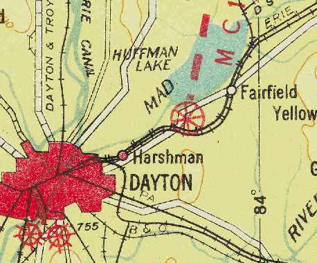
Wright Field, as depicted on the 1928 Air Navigation Map (courtesy of Chris Kennedy).
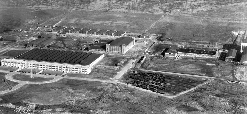
A 1928 aerial view of Wright Field (USAF photo).
In 1931 a portion of Wright Field was redesignated Patterson Field in recognition of the efforts of the Patterson family
to relocate the mission of the Airplane Engineering Division of the Army Air Corps
from too-small facilities in Dayton, known as McCook Field, to the base.
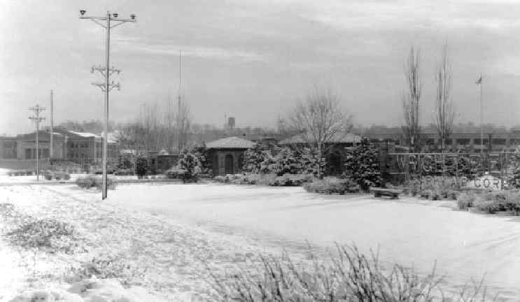
A 1930s photo of the entrance to Wright Field.
Building 12 (which originally served as the Army Air Corps Museum) is on the left.
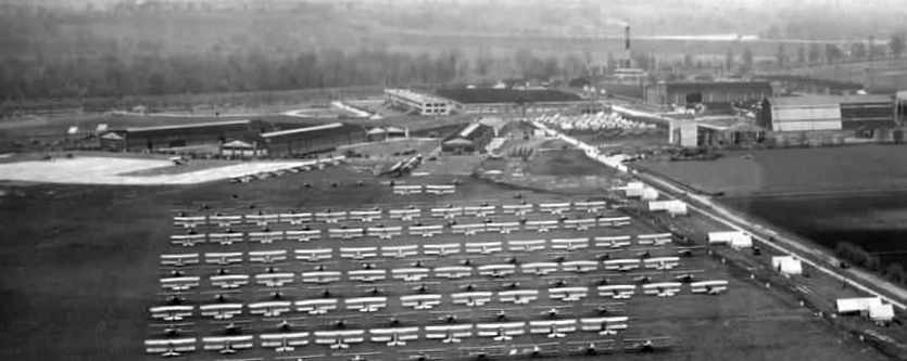
A circa 1930s aerial view of a large assemblage of biplanes at Wright Field.
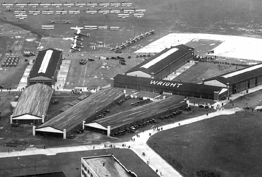
A circa 1930s aerial view of the unusual arrangement of hangars at Wright Field.
Wright Field, as depicted on the November 1933 Cincinnati Sectional Chart.
Beginning in the World War II era, and continuing afterwards, the adjacent complexes saw tremendous expansion efforts,
eventually becoming one of the AAF's largest research & development facilities.
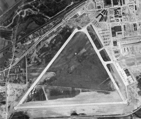
The 1944 US Army/Navy Directory of Airfields (courtesy of Ken Mercer) described Wright Field as having a 6,000' hard-surface runway,
and the remarks included, "Daily glider flying."
In 1945, Wright Field was merged with Patterson Field (adjacent to the northeast).
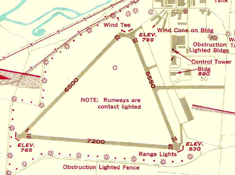
The 1946 USAAF Pilot's Handbook (courtesy of Chris Kennedy)
depicted Wright Field as having 3 paved runways (with the longest being the 7,200' Runway 10/28),
with a taxiway & a ramp on the east side of the field, along with a control tower & several other buildings.
In 1949 the entire complex was renamed Wright Patterson AFB.
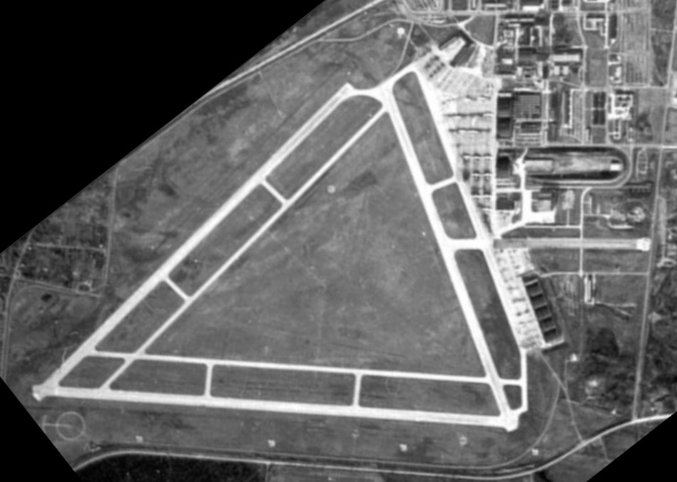
A 1950 aerial view of Wright Field (from “A Look Back... Fairfield Air Depot”, by the USAF History & Heritage Directorate, courtesy of Ron Plante).
The June 1954 Cincinnati Sectional Chart (courtesy of David Stevenson)
depicted Wright AFB as having a 7,100' paved runway.
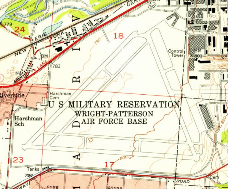
The 1955 USGS topo map depicted Wright Field as having 3 paved runways & a control tower on the east side.
A 1956 aerial photo showed several dozen aircraft of multiple types on Wright Field's east ramp.

The 1960 Jeppesen Airway Manual (courtesy of Chris Kennedy)
depicted Wright Field as having 3 paved runways (with the longest being the 7,147' Runway 9/27),
each of which had a parallel taxiway, along with a large ramp on the east side of the field.
Wright AFB was still depicted as an active airfield on the 1964 Cincinnati Sectional Chart (according to Chris Kennedy),
with Patterson AFB shown with a separate label to the northeast.
A 1968 aerial view showed a sharply smaller number of aircraft on Wright Field compared to the 1956 photo,
with several aircraft parked on Runway 5/23, and a small number of aircraft were visible on the east ramp.
Runway 16/34 was marked with closed-runway “X” symbols, with Runway 9/27 being the only runway still marked with active runway markings.
The runways of Wright Field were closed to flying operations at some point between 1968-71,
with all flying operations at Wright-Patterson conducted since then from Patterson Field exclusively.
The Air Force Museum was built over the western runway of Wright Field, and opened in 1971.
Other portions of the Wright Field runways have been reused for automobile parking & for display of museum aircraft.
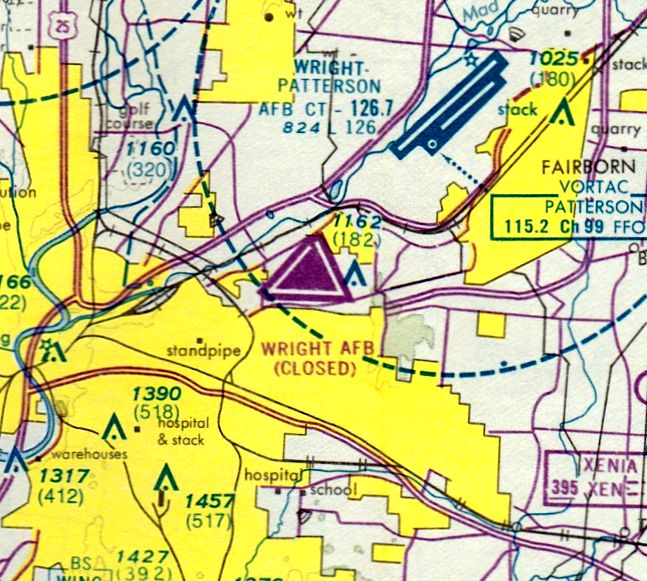
The last aeronautical chart depiction which has been located of Wright Field
was on the August 1976 Cincinnati Sectional Chart (courtesy of Mitchell Hymowitz).
It depicted “Wright AFB” as a closed airfield having 3 paved runways.
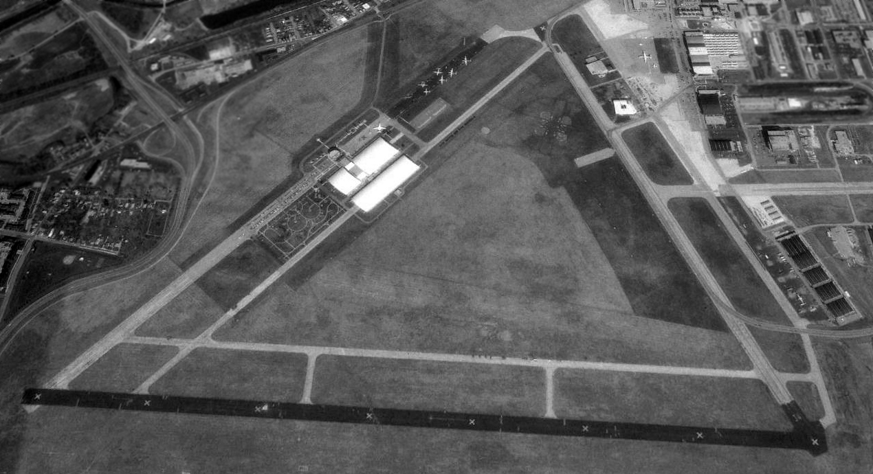
A 1994 aerial view looking north at Wright Field showing the buildings & display aircraft of the USAF Museum on the northwest & northeast sides.
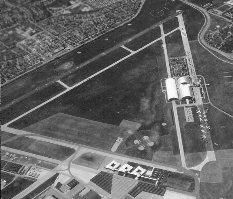
A circa 1997-98 aerial view of Wright Field by Dick Merrill, looking southwest,
with the buildings & display aircraft of the USAF Museum along the former runway on the right.
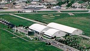
USAF Museum buildings along west runway.
As it still exists, the Wright Field airfield consists of 3 concrete runways (the longest is approximately 7,700'), taxiways, ramps & hangars.
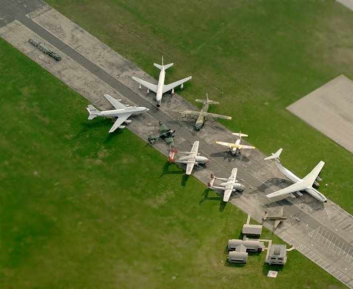
A circa 2006 aerial view looking east at a group of planes from the Air Force Museum's collection
on static display along Wright Field's former Runway 5/23.
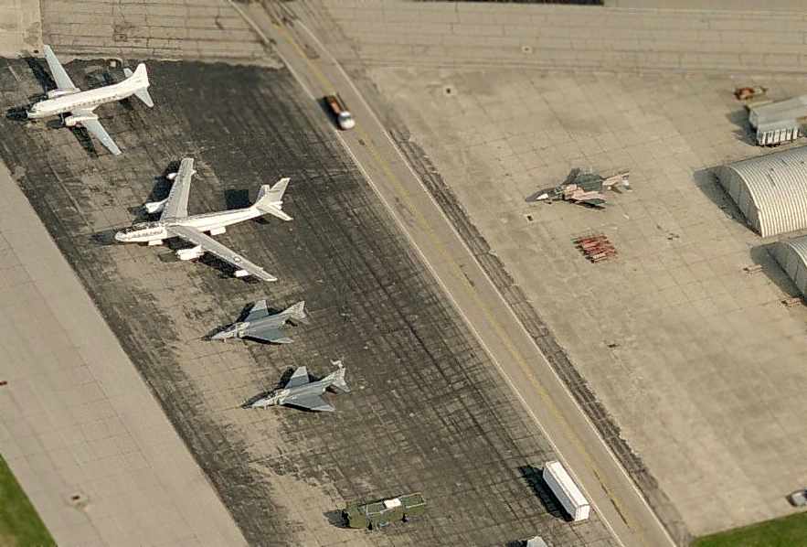
A circa 2006 aerial view looking north at a group of planes on a ramp on the southeast side of Wright Field,
presumably a storage area for the Air Force Museum's collection.
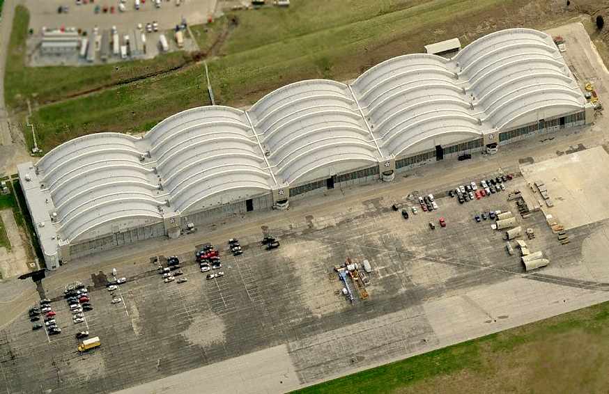
A circa 2006 aerial view looking east at a group of hangars along the southeast side of Wright Field.
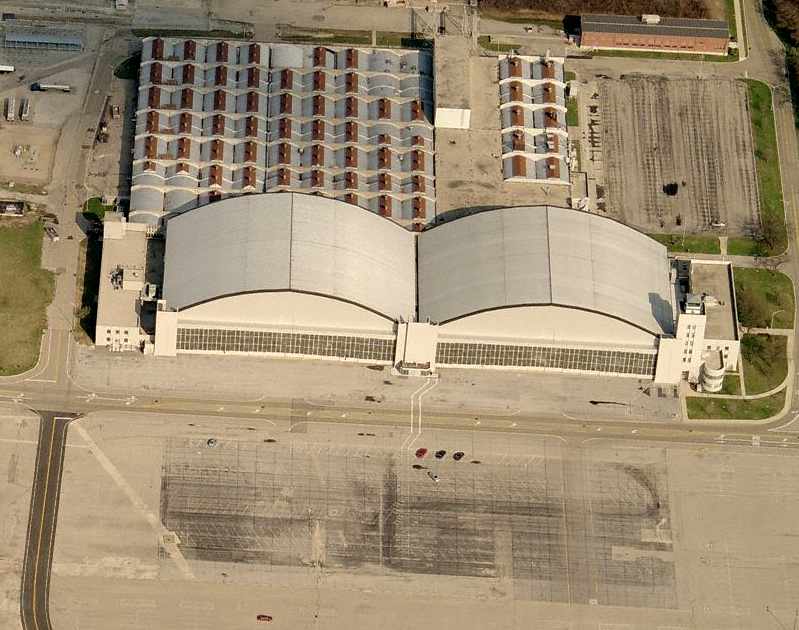
A circa 2006 aerial view looking east at 2 hangars & the former Wright Field control tower along the east side of the field.
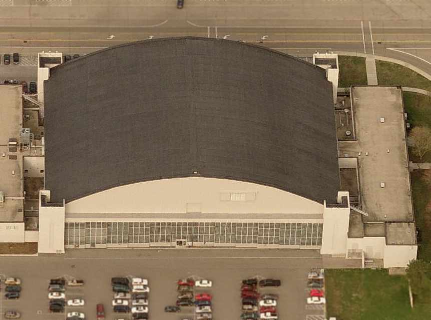
A circa 2006 aerial view looking west at a hangar on the east side of Wright Field.
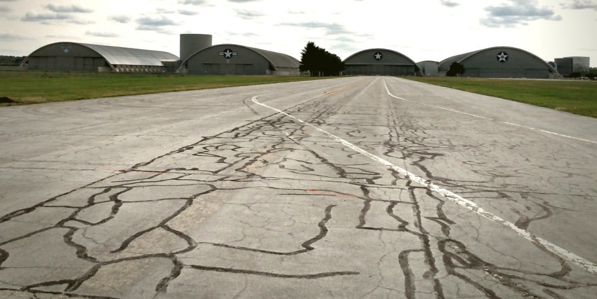
A 9/14/20 photo by Rex Ricks looking southwest along the former Wright Field Runway 23, with the Air Force Museum buildings in the background.
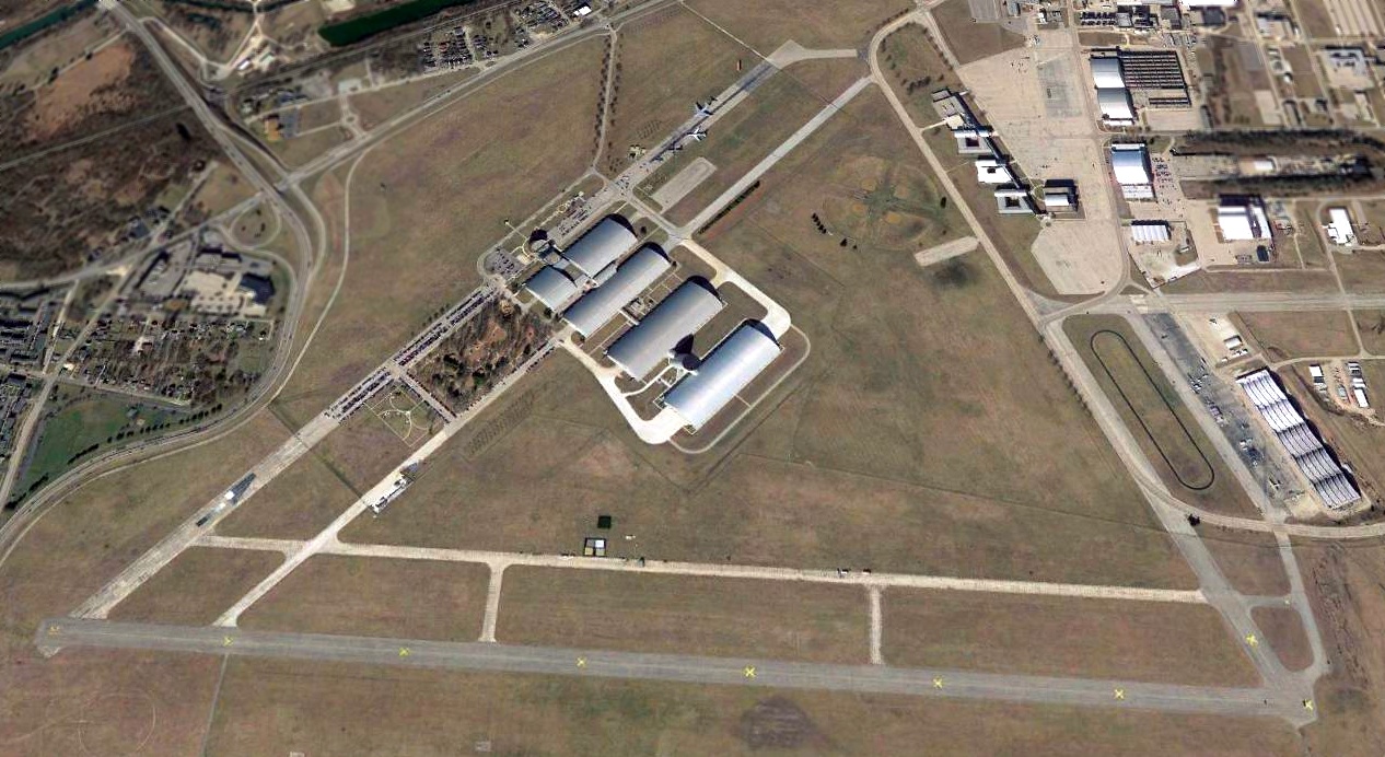
A 2020 aerial view looking north at Wright Field showing the buildings & display aircraft of the USAF Museum on the northwest & southeast sides.
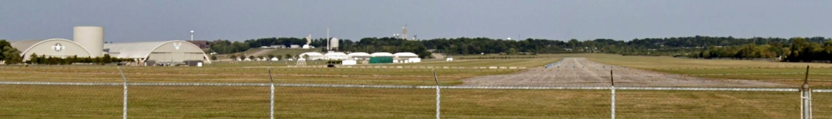
A 2023 photo looking east along the former Wright Field Runway 9, with the Air Force Museum buildings on the left.
____________________________________________________
Or if you prefer to contact me directly concerning a contribution (for a mailing address to send a check),
please contact me at: paulandterryfreeman@gmail.com
If you enjoy this web site, please support it with a financial contribution.
____________________________________________________
This site covers airfields in all 50 states.