
Abandoned & Little-Known Airfields:
Northwestern Utah
© 2002, © 2025 by Paul Freeman. Revised 8/22/25.
This site covers airfields in all 50 states: Click here for the site's main menu.
____________________________________________________
Please consider a financial contribution to support the continued growth & operation of this site.
Jake Garn Airport (revised 9/26/22) - Locomotive Springs Intermediate Field (revised 8/22/25) - Low Flight Strip (revised 11/28/20)
Mt Pleasant Airport (revised 8/22/25) - Tooele Municipal Airport (revised 8/22/25)
____________________________________________________
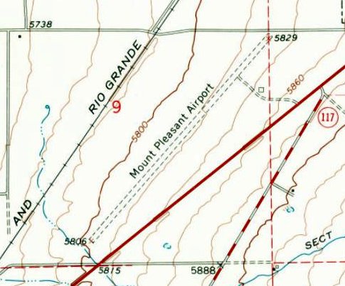
Mt Pleasant Airport, Mt Pleasant, UT
39.527, -111.476 (South of Salt Lake City, UT)
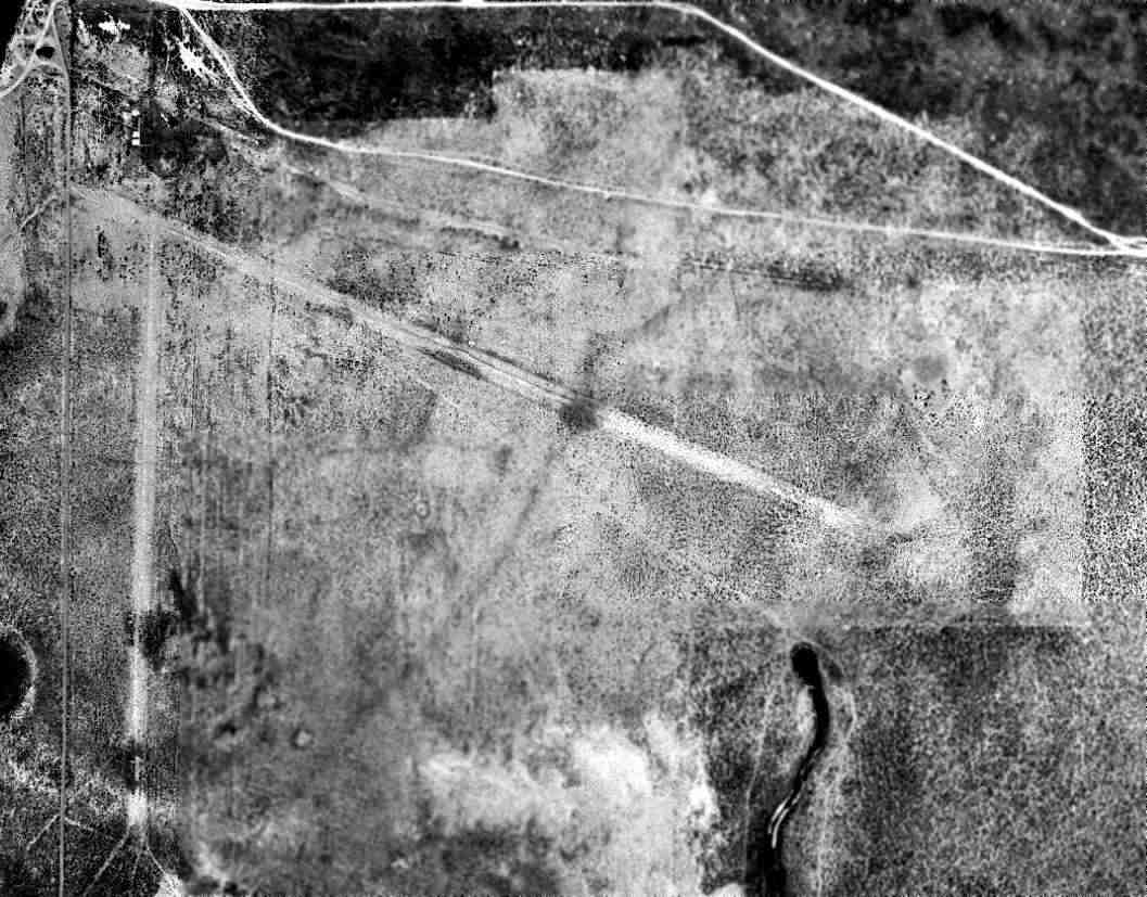
Mt Pleasant Airport, as depicted on a 10/12/38 US Soil Conservation Service aerial photo.
The date of construction of this early general aviation airport has not been determined.
The earliest photo which has been located of Mt Pleasant Airport was a 10/12/38 US Soil Conservation Service aerial photo.
It depicted 2 unpaved runways, with a hangar south of the runway intersection.
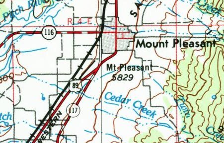
The earliest map depiction which has been located of Mt Pleasant Airport was on the 1956 USGS topo map,
which depicted it as having a northeast/southwest runway.
A 1958 aerial view depicted Mt Pleasant Airport as having a single unpaved northeast/southwest runway, with a hangar on the east side.
There was no sign of the east/west runway previously-seen in 1938.
The 1967 USGS topo map depicted Mt Pleasant Airport as having a northeast/southwest unpaved runway, with a single building on the east side.

A 2005 aerial view looking west depicted Mt Pleasant Airport as having an asphalt Runway 2/20, with 3 hangars & 4 light single-engine planes on the east side.
According to Wikipedia, Mt Pleasant Airport covered an area of 361 acres, and had a 4,264' asphalt Runway 2/20.
For the 12-month period ending 12/31/09, the airport had an average of 200 takeoffs or landings per month,
and had 5 single-engine aircraft based at the field.
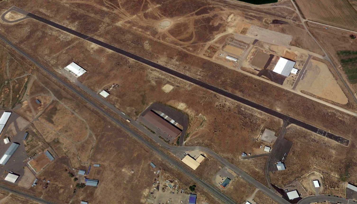
A 2015 aerial view looking west depicted Mt Pleasant Airport as having an asphalt Runway 2/20, with 3 hangars & 2 light single-engine planes on the east side.
According to Wikipedia, Mt Pleasant Airport closed in January 2016, for reasons unknown.
Mt Pleasant Airport is located west of the intersection of Blackhawk Boulevard & Airport Avenue, appropriately enough.
Thanks to Brent Rowser for pointing out this airport.
____________________________________________________
Jake Garn Airport, Eagle Mountain, UT
40.26, -112.02 (South of Salt Lake City, UT)
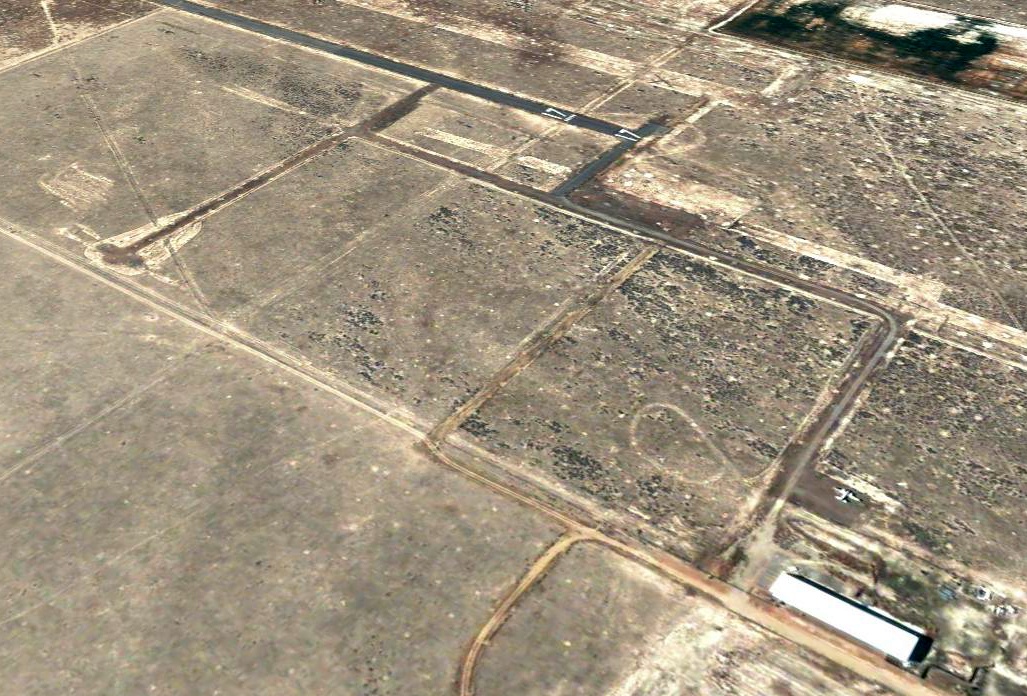
A 2003 aerial view looking southwest at Jake Garn Airport.
This is a sad tale of a “boom & bust” airport which was built to stimulate economic development, but was abandoned in a very short time.
Jake Garn Airport was evidently built at some point between 1997-2003, as it was not yet depicted on a 1997 aerial photo.
According to Joe Doherty, “Apparently in the late 1990s the plan was to build this big airport that could handle corporate jets in time for the Salt Lake City 2002 Winter Olympics.
For whatever reason it never happened, and the runway is all that is there. I'm not sure it ever even opened.”
The earliest depiction which has been located of Jake Garn Airport was a 2003 aerial photo,
which depicted a single 5,000' asphalt Runway 17/35, taxiways, and a ramp on the northeast side on which was parked one small twin-engine plane, near a building.
A much longer 10,000' parallel unpaved strip was located to the west of the paved runway.
A 2004 aerial view looking southwest showing 1 small twin-engine plane parked on Jake Garn Airport's northeast ramp.
The twin-engine plane was gone from a 2006 aerial view of Jake Garn Airport.
The earliest aeronautical chart depiction which has been located of Jake Garn Airport was on the April 2009 Salt Lake City Terminal Aeronautical Chart,
which depicted it as having a single paved north/south 2,500' runway.
The 2015 Salt Lake Helicopter Aeronautical Chart still depicted Jake Garn Airport as having a single paved north/south runway,
even though it was no longer depicted on the 2015 Sectional Chart.
Joe Doherty reported in 2015, “I'm pretty sure there's nothing that goes on there. It really is smack dab in a field that is in the middle of nowhere.
The heading numbers are still on the runway & there are not the standard yellow Xs marking it as closed.”
Pattrick Wiggins reported in 2015, “Garn Airport... it is closed to most traffic however the UT Army National Guard
does have a Memorandum of Agreement with the land owner (John Walden) to use it as a helicopter tactical airstrip.”
The last photo which has been located showing Jake Garn Airport remaining intact was a 2017 aerial view looking southwest.
The 2 former runways were deteriorated, and the building remained on the northeast side.
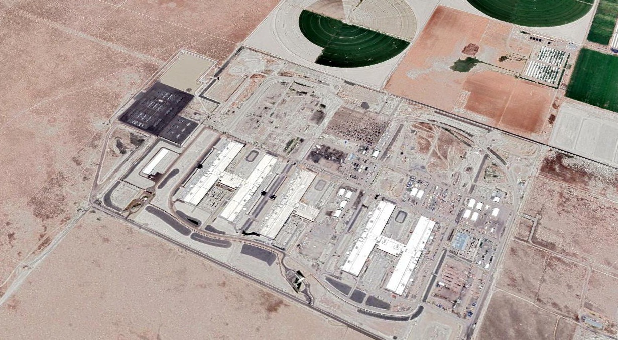
Michael Duke reported in 2019, “Jake Garn Airport has been bulldozed to make way for a new Facebook data center.
The City of Eagle Mountain Planning Commission doesn’t believe airports are useful so it first located a waste treatment facility adjacent to the runway
then made a deal with Facebook to locate a huge, secure data center on the land.”
A 2020 aerial photo showed the data center construction had covered the majority of the Jake Garn Airport property,
but the southern portion of the longer runway remained, along with the northern portion of Runway 17.
A 2017 aerial view looking southwest showing the data center construction covered the majority of the Jake Garn Airport property,
but the southern portion of the longer runway remained, along with the northern portion of Runway 17.
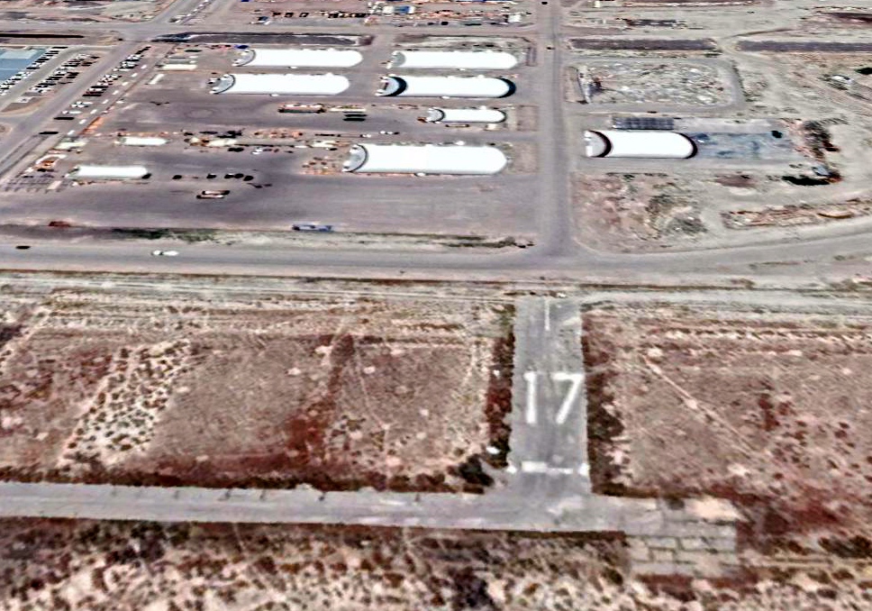
Ironically, a 2017 aerial view looking south showed the Jake Garn Airport Runway 17 numbers remained intact, on the northern edge of the property.
The Jake Garn Airport site is located at the southern terminus of Pony Express Parkway.
Thanks to Joe Doherty for pointing out this airport.
____________________________________________________
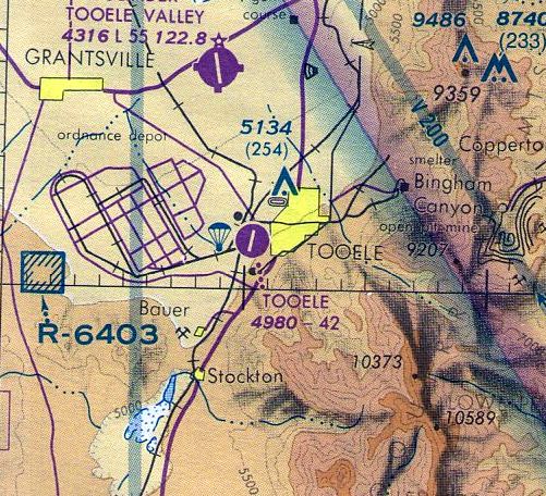
Tooele Municipal Airport (U26), Tooele, UT
40.52, -112.33 (Southwest of Salt Lake City, UT)

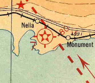
Tooele Municipal Airport, as depicted on the 1930 Air Navigation Map #33 (courtesy of Jonathan Westerling).
The date of establishment of this municipal airport has not been determined.
The earliest depiction which has been located of Tooele Municipal Airport
was on the 1930 Air Navigation Map #33 (courtesy of Jonathan Westerling).
It depicted Tooele Municipal Airport as having Commerce Department Airway Beacon 59B.
The 1932 Commerce Department Airway Bulletin #2 (according to Jonathan Westerling)
described Tooele Airport as the Department of Commerce Intermediate Field Site 59B along the Los Angeles - Salt Lake Airway, located 1.5 miles west of the town.
It was described as an irregularly-shaped 103 acre sod property measuring 2,027' x 2,640' x 1,840', with the entire field available for landing.
A directional arrow was marked “59B, LA-SL”.
It was said to have a beacon, boundary, approach, and obstruction lights, and to offer aviation fuel, day & night.
Tooele Municipal Airport may have been closed (for reasons unknown) at some point between 1932-35,
as it was no longer depicted on the December 1935 or August 1945 Salt Lake Sectional Charts.
Tooele Municipal Airport was evidently reopened at some point between 1945-46,
as the November 1946 Salt Lake Sectional Chart depicted Tooele as a municipal/commercial airport.
The September 1949 Great Salt Lake World Aeronautical Chart (courtesy of Donald Felton)
depicted Tooele as having a 3,800' unpaved runway.

The earliest photo which has been located of Tooele Municipal Airport was a 9/26/51 Utahmining aerial view.
It depicted Tooele as having 3 unpaved runways & 2 small hangars on the east side.
Tooele apparently gained a paved runway at some point between 1951-62,
as the 1962 AOPA Airport Directory described the field as having a single 4,200' paved runway.
The operator was listed as Tooele Air Service.
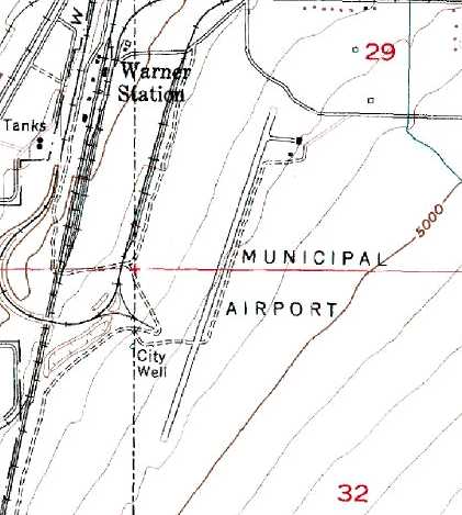
The 1969 USGS topo map depicted the Tooele Municipal Airport
as having a single paved northeast/southwest runway, with a ramp leading to 2 small buildings on the northeast side.
Tooele was listed with a similar description in the 1982 AOPA Airport Directory (courtesy of Ed Drury).
The last aeronautical chart depiction which has been located of Tooele Municipal Airport
was on the November 1986 Salt Lake Sectional Chart (courtesy of Jim Hackman).
It depicted Tooele Municipal Airport as having a 4,200' paved runway.
According to Chris Kennedy, Tooele Municipal was listed in the 1989 Airport Facility Directory.
The remarks said, "Unattended. Parachute jumping. Cracks; chips & weeds on Rwy 36 & ramp."
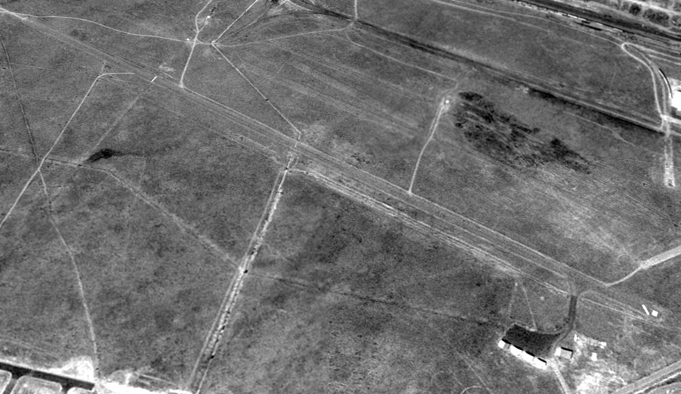
A 1997 USGS aerial view looking southwest depicted Tooele Municipal Airport as having a single 4,200' paved runway, a small paved ramp east of the northern end of the runway, and 5 small hangars.
A lone single-engine aircraft was visible parked on the ramp.
Tooele Municipal was evidently closed at some point between 1997-2003,
as a 2003 aerial photo showed closed-runway “X” symbols having been painted on each runway end.
There were no aircraft visible on the field, which otherwise remained intact.
It had been replaced by the newer Bolinder Tooele Valley Airport, several miles to the north.
Tacoma White reported in 2003, "I'd give you an update on the old Tooele Municipal Airport: it's very easy to find.
If you drive west on 700 South, and keep going after it turns to dirt, you will run right into it.
If memory serves, it is either owned or just used by a guy who owns a construction company.
The strip is due west of my house & during the winter I taught my wife how to correct skids there.
Nothing really happens there, though my wife says a plane landed there when she was walking near it about a year ago.
Still in OK shape, has some ruts dug in it that were filled in pretty good a while back.
It looks shorter than the claimed 4,000' though."
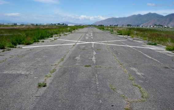
A 2005 photo by Keith Wood, looking north along the closed runway at Tooele.
“There are residential areas [to the] north.”

A 2005 photo by Keith Wood. “Note the way the houses have built in close to the hangars, which are now used for storage.”
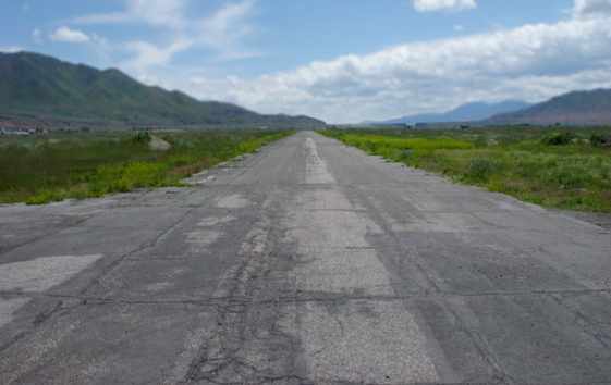
A 2005 photo by Keith Wood, looking south along the closed runway at Tooele.
“It's pretty much empty (for the time being) looking south.”
The last photo which has been located showing Tooele Municipal Airport remaining intact was a 2003 State of UT aerial view looking southwest.
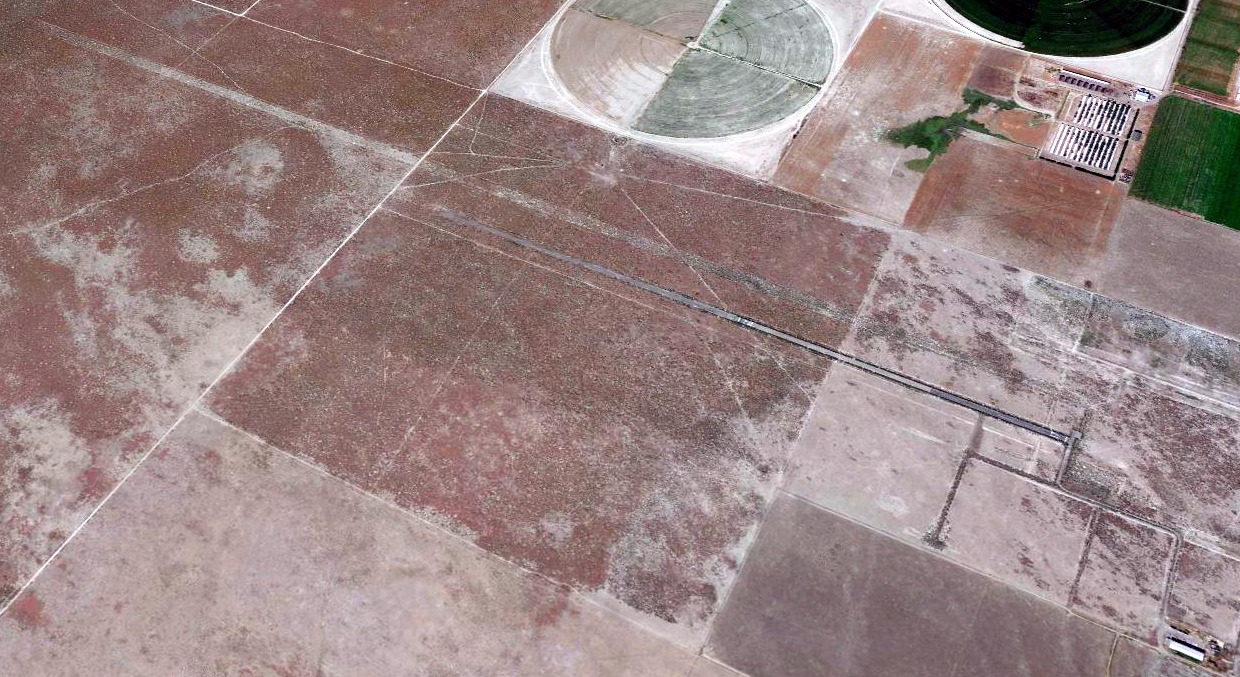
An 8/28/09 aerial view showed that the hangars & northern end of the runway had been removed, presumably cleared for new consruction.
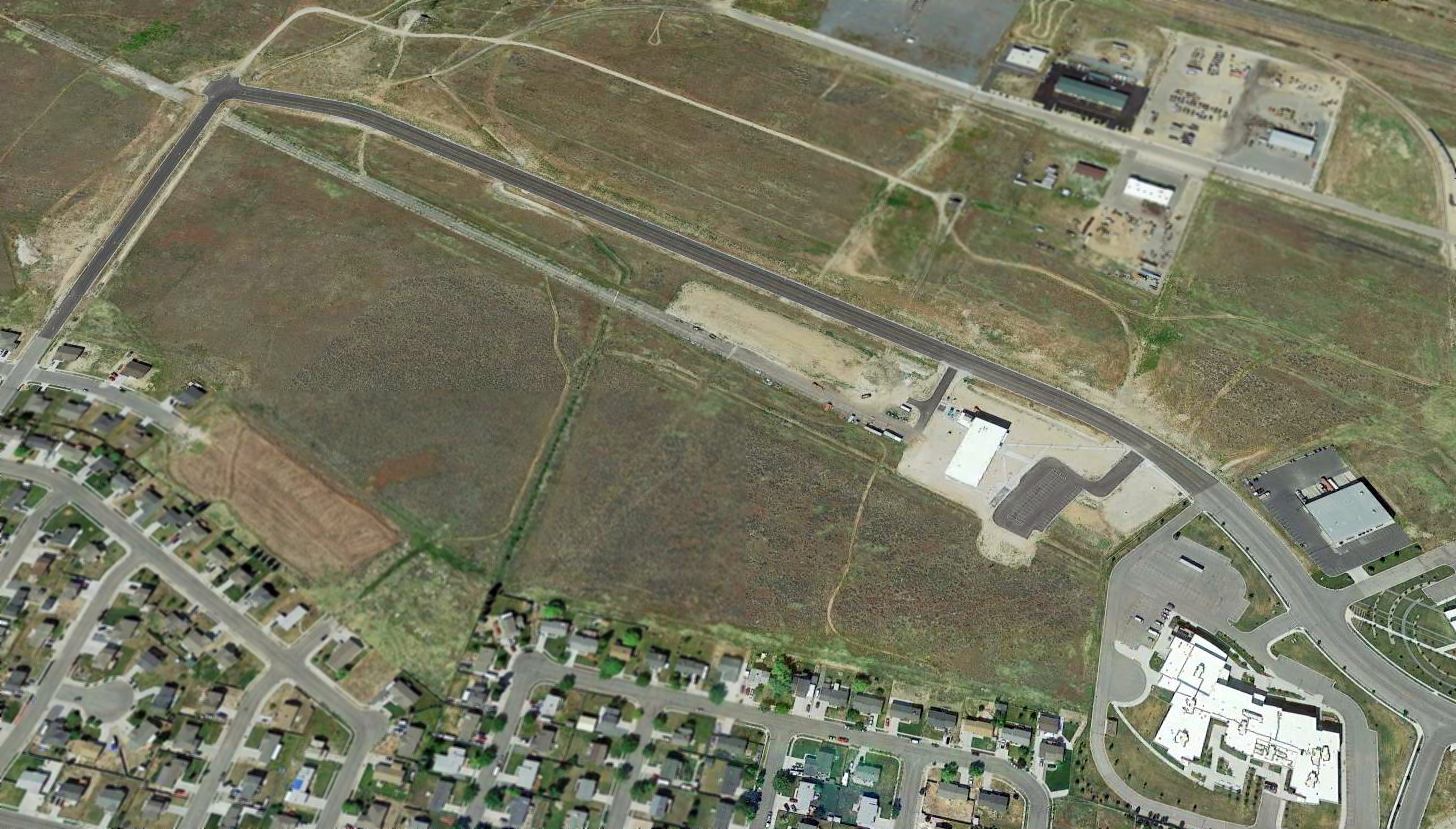
A 2015 aerial view looking southwest showed the majority of the length of the Tooele Municipal Airport runway remained intact,
though the northern end had been covered by new buildings.
____________________________________________________
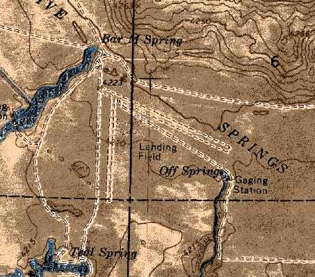
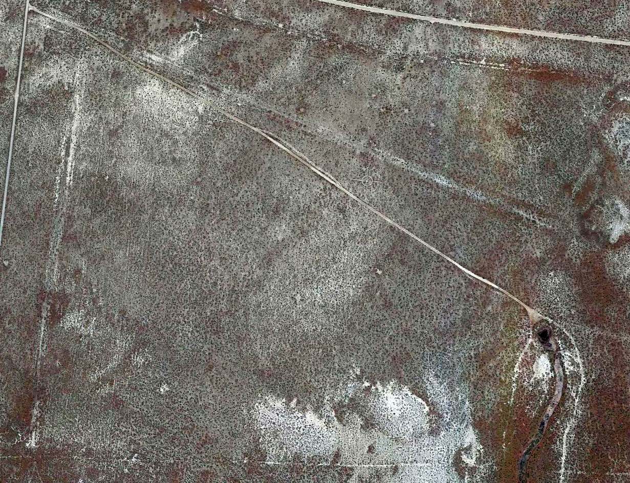
Locomotive Springs Intermediate Field, Locomotive Springs, UT
41.71, -112.92 (Northwest of Salt Lake City, UT)
Locomotive Springs Intermediate Field, as depicted on a May 1930 Airway Map (courtesy of Chris Kennedy).
Locomotive Springs was one of the Department of Commerce's network of Intermediate Fields,
which were constructed in the 1920s & 1930s along airways between major cities.
They were intended for emergency use by commercial aircraft.
The date of construction of the Locomotive Springs Intermediate Field has not been determined.
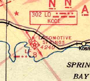
The earliest depiction which has been located of Locomotive Springs Intermediate Field was on a May 1930 Airway Map (courtesy of Chris Kennedy).
A 1933 Department of Commerce Airport Directory (courtesy of Chris Kennedy)
described Locomotive Springs as Site 7 along the Salt Lake - El Paso Airway.
It was described as consisting of a 2,000' x 1,900' rectangular sod field,
with boundary & approach lights, and a rotating beacon.
George Cox recalled, “My Father, Wilford Cox was employed by the Utah Fish & Game Department
and had our young family living at Locomotive Springs in 1939-40.
He trapped muskrats & managed the water flow at the Game Preserve.
According to my mother, there was a house they lived in on the north side of the runway, provided by the State,
and another long building that the employees at the airport lived in.
She said a family named Cook was there when they arrived & they left & a family by the name of Carlock moved in.
That family & 2 or 3 single men lived in the long building.
There were also 2 long vacant barracks that the CC Camp had left, possibly from the construction of the airport.
She said there was a Mr. Rose who was the boss of the airport that drove out occasionally.
She said she only remembers the airstrip being used by military men flying out to hunt ducks from Ft. Douglas.”
Locomotive Springs was still depicted as an active airfield
on the July 1940 Salt Lake City Sectional Chart (courtesy of Chris Kennedy).
As commercial aircraft became more reliable & longer ranged in the 1940s,
many of the more remote Intermediate Fields in the Department of Commerce's network became superfluous,
and this was most likely the case with Locomotive Springs.
It was evidently closed at some point between 1940-44,
as it was not listed in the April 1944 US Army/Navy Directory of Airfields (courtesy of Ken Mercer),
and it was not depicted on the February 1945 Salt Lake City Sectional Chart (according to Chris Kennedy).

The earliest photo which has been located of Locomotive Springs Airfield was a 1948 or 1951 aerial photo (courtesy of Jonathan Westerling).
It depicted Locomotive Springs as having 2 unpaved runways, and some small buildings on the northwest side.
Post-WW2 USGS topo maps continued to depict the 2 runways at Locomotive Springs,
but the field was labeled simply as "Landing Strips", which usually indicates that it was no longer an active airfield.
A 4/6/66 aerial photo depicted Locomotive Springs as having 2 unpaved runways, and some small buildings on the northwest side.
The 1969 USGS topo map depicted the field as having a 2,000' northwest/southeast runway & a shorter north/south runway.
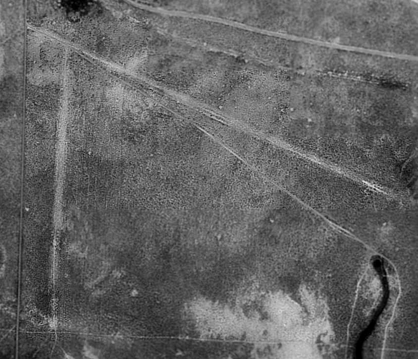
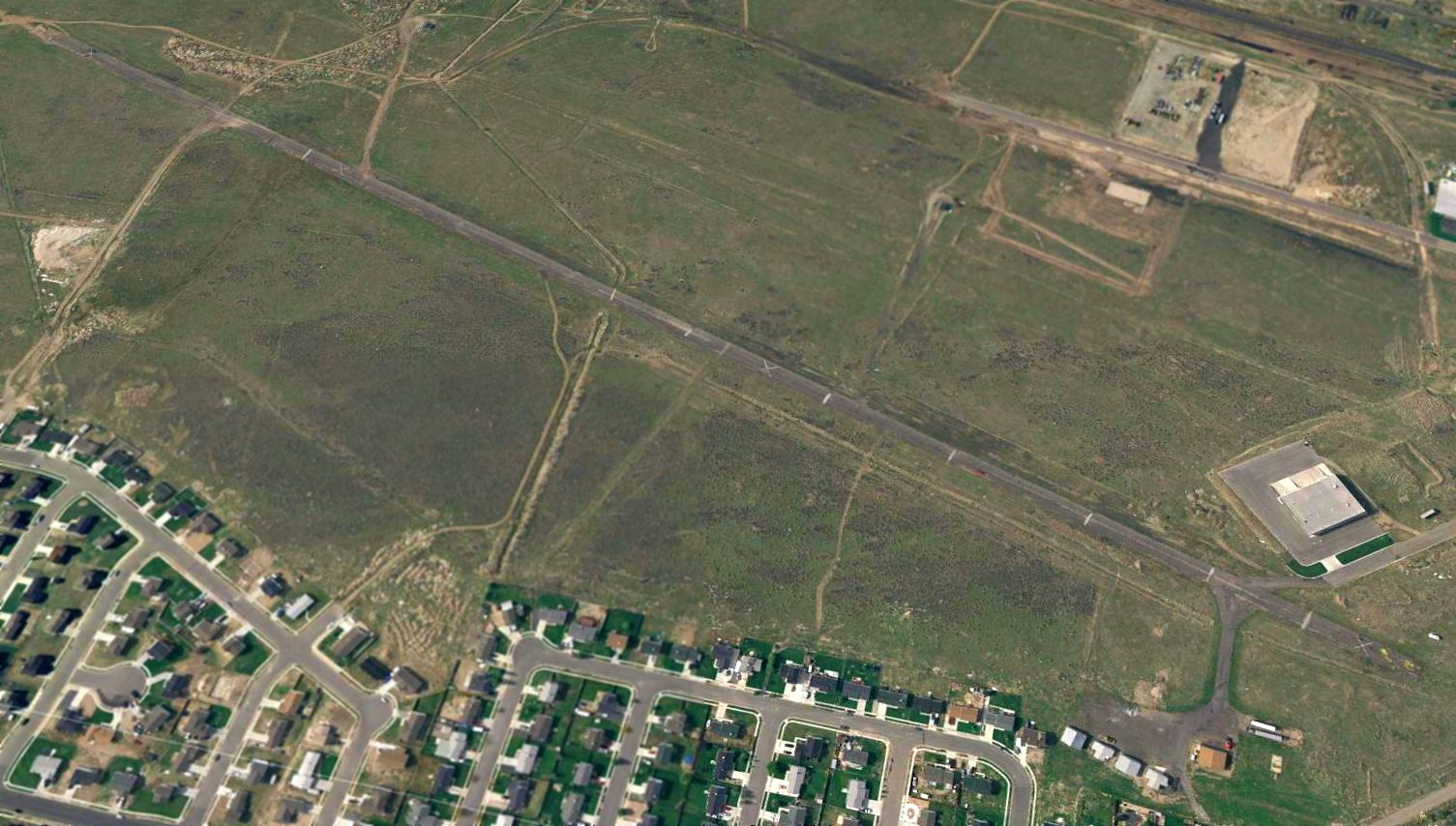
As seen in the 1993 USGS aerial photo, the desert landscape has preserved the 2 runways at Locomotive Springs remarkably well, more than 60 years after they were evidently constructed.
The buildings had been removed at some point between 1966-93.
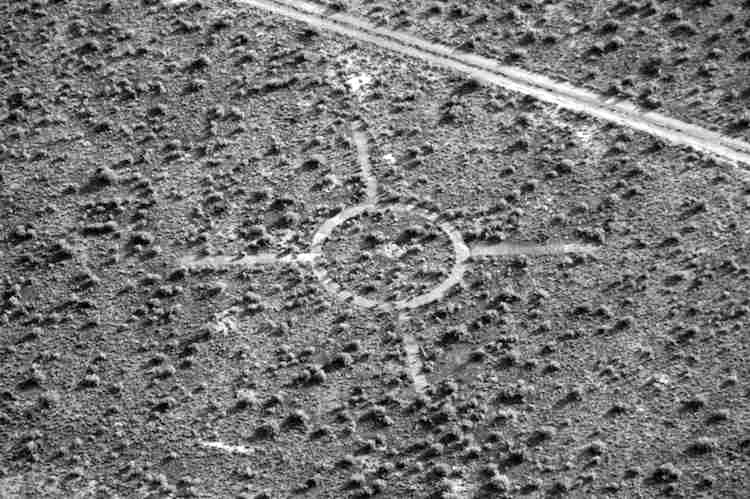
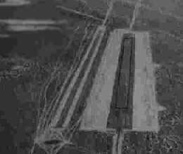
A 10/17/13 aerial view by Patrick Wiggins of the site of the Locomotive Springs windsock.
A 2017 aerial view showed the 2 runways at Locomotive Springs remained recognizable, along with the marker for the windsock.
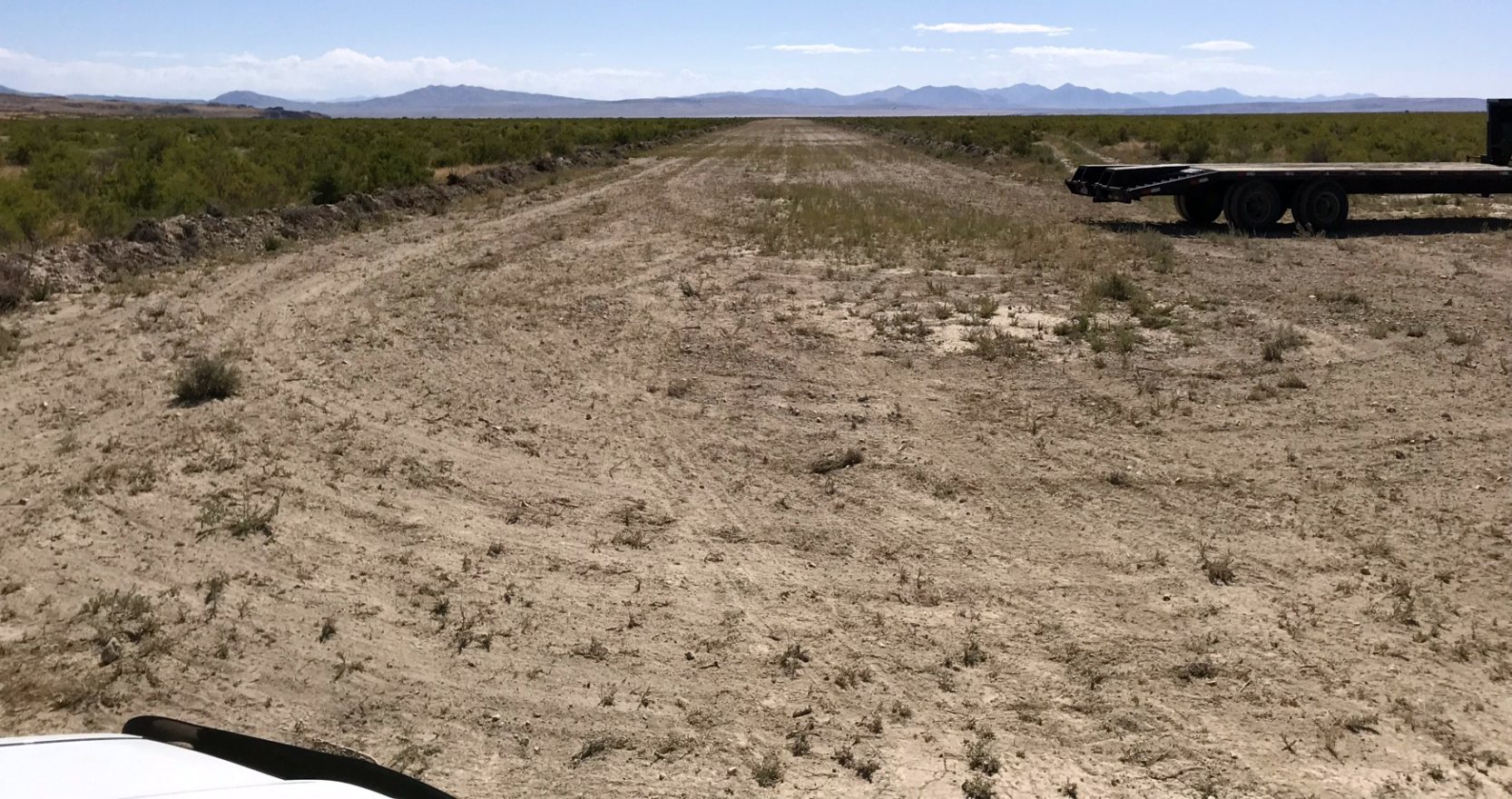
An 8/10/19 photo by Cory Wolf looking along the restored Locomotive Springs runway.
Cory reported, “After a year & a half of work by myself & the Utah Backcountry Pilots, Locomotive Springs has been rehabbed, the arrow repainted & a new windsock installed as of yesterday.
It’s now once again an active airstrip & we are working to get it back on the sectional.”
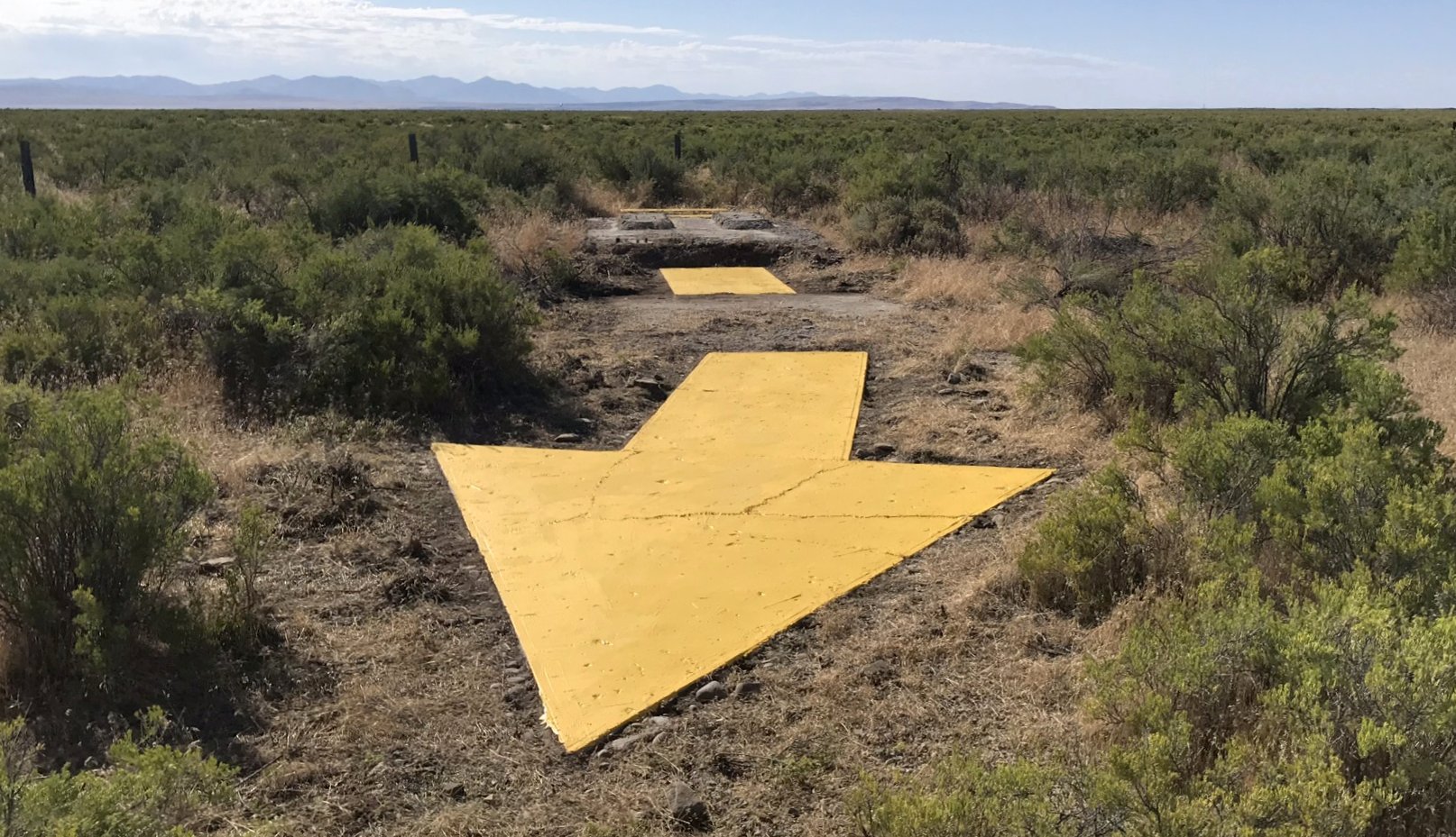
An 8/10/19 photo by Cory Wolf of the newly-repainted Locomotive Springs airway marker arrow, looking pretty good for almost 90 years old.
The Locomotive Springs airfield is located southeast of the intersection of Locomotive Road & Salt Wells Road.
____________________________________________________
40.79, -113.2 (West of Salt Lake City, UT)
A circa 1943-45 aerial view looking north at the Low Flight Strip from the 1945 AAF Airfield Directory (courtesy of Scott Murdock).
This was one of the many Flight Strips which were built by the USAAF during WW2 for the emergency use of military aircraft.
Low Flight Strip was evidently established at some point between 1942-43,
as it was not yet depicted on the August 1942 Salt Lake Sectional Chart.
The Low Flight Strip was listed on a 1943 table of 2nd Air Force Flight Strips (courtesy of John Voss),
which indicated that construction of the strip was completed in 1943.
The strip was described as consisting of a 7,130' paved runway, with a total graded length of 9,130'.
Low Flight Strip was an auxiliary field of either Wendover AAF or Salt Lake AAF during WWII (according to Keith Wood).
It consisted of a single north/south runway, which was built on top of a dirt road which led north from US Highway 40.
According to Keith Wood, “Apparently they started using the road for liaison planes,
then widened it for larger planes before finally diverting the road past the western side of the runway & paving the airstrip.”
The earliest photo which has been located of the Low Flight Strip
was a circa 1943-45 aerial view looking north from the 1945 AAF Airfield Directory (courtesy of Scott Murdock).
It depicted Low as consisting of a single, wide, north/south paved runway.
It also appeared to depict a narrower, parallel runway to the west.
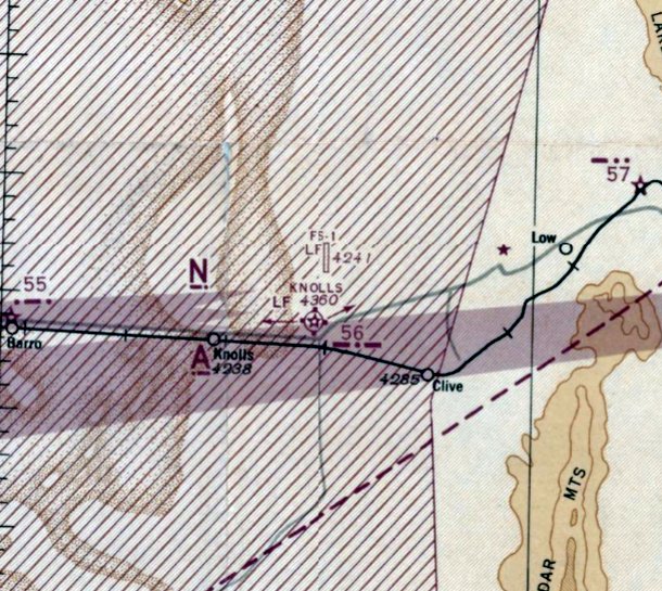
The earliest aeronautical chart depiction which has been located of the Low Flight Strip was on the January 1944 Salt Lake Sectional Chart.
It depicted “FS-1” as having a single north/south paved runway.
The 1945 AAF Airfield Directory (courtesy of Scott Murdock) described Low Flight Strip as a 276 acre rectangular property within which was a single 7,130' bituminous runway.
The field was not said to have any hangars, to be owned by the U.S. Government, and to be operated by the Public Roads Administration.
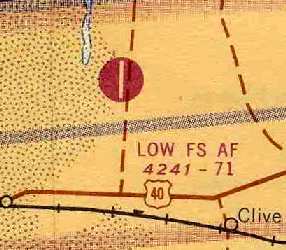
It was depicted as "Low FS" on the September 1949 Great Salt Lake World Aeronautical Chart (courtesy of Donald Felton).
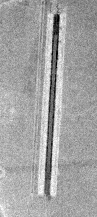
An 8/1/53 USGS aerial view depicted Low Flight Strip as having a single north/south paved runway.
The 1955 Salt Lake City Sectional Chart (according to Chris Kennedy) described "Low FS AF" as having a 7,100' hard-surface runway.
It is not known whether the Low Flight Strip was ever reused as a civilian airfield.
An article entitled “Auxiliary Field Offered for Sale” in the 7/16/63 Ogden Standard-Examiner (courtesy of Lee Corbin) reported,
“Property known as Knolls Air Force Auxiliary Field consisting of 275 acres improve with a landing strip & dormitory building is being offered by competitive sealed bids.”
Low Flight Strip, as depicted on the 1965 Salt Lake Sectional Chart (courtesy of Chris Kennedy).
The Low Flight Strip was apparently closed at some point after 1965.
Frank Cunningham recalled, “In 1976 or 1977 my son & I went for a motorcycle ride in the desert just north of Knoll.
After a short drive north of I80 I parked on a hard-surfaced area were we unloaded our bikes.
After a bit of riding I started to take account of the things which I was seeing.
The hard surface which I was parked on did not seem to be part of the road that we drove on to reach this spot. A runway I concluded at the time.
Second there was a fairly good-size pile of old boards at the north end of the area which did not fit into the landscape
and the one thing that I had been noticing, which puzzled me, stated to make some sense.
On closer look the rusty crushed metal object spread out randomly within the area which we had been riding, and near the 'runway' clearly became recognized as flatten practice bombs.
I could distinguish the flattened 4 guiding fins.”
The 1977 USGS topo map depicted the Low Flight Strip runway but did not label it at all.
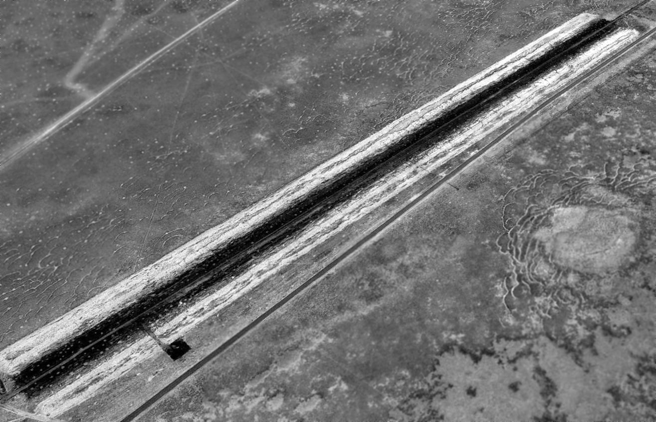
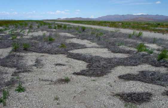
A 1997 USGS aerial view looking southeast showed the Low Flight Strip runway was remarkably well preserved.
The paved runway surface had apparently been extended at some point after the runway's initial construction,
as the length of the runway pavement was 9,300'.
There was also what appeared to be a small square paved ramp area, along the west side of the northern end of the runway.
There did not appear to be any trace of any buildings at the site.
Low Flight Strip was not depicted at all (not even as an abandoned airfield) on either recent USGS topo maps or 2002 aeronautical charts.
This seems quite strange, for a 9,300' paved runway!
A road now passes down the center of the runway of the Flight Strip.
This road runs between Interstate 80 (4 miles to the south)
and the Grassy Mountain toxic-waste facility which sits adjacent to the Flight Strip to the northwest.
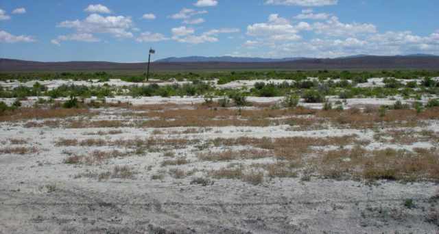
A 2005 photo by Keith Wood, looking north along the remains of the runway pavement at Low.
Keith reported, “Digging down a couple of inches through the sand covering, I hit solid pavement -
except in the center, which was pretty much pulverized by years of heavy trucks driving over it (thus to preserve the main road).”
Keith Wood visited the site of Low Flight Strip in 2005.
He reported: “The paved runway is now covered by several inches of sand,
which was done sometimes in the desert to preserve the blacktop when a field was abandoned.
This field is at the edge of restricted airspace, used for low-level training from Hill AFB,
and it's possible that it was expected to be used again.
I found no sign of ground facilities, ramp, tiedowns, etc - just the windsock & the runway.
Less than 2 minutes after I stopped on the road to start shooting, I had a van pulling up to ask what I was up to.
When I told the driver I was only shooting photos of the airstrip,
he asked if I meant to shoot the bombing range a couple of miles up the road.
He didn't know about the airstrip, and looked at the windsock pole as if finally figuring out what it was for!”
A 2005 photo by Keith Wood, looking east from the road at the windsock pole which remains erect Low.
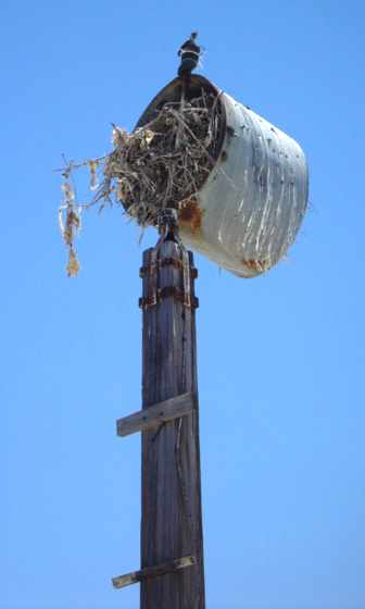
A 2005 photo by Keith Wood of the remains of a large, illuminated wind sock pole near the south end of the strip.
Power lines followed the current road, but there was no trace of wires to the windsock.
Keith reported, “Scraps of heavy orange canvas litter the ground around the post.
The metal frame from the windsock is now a nest for some large bird, so it could be said that flight operations continue.”
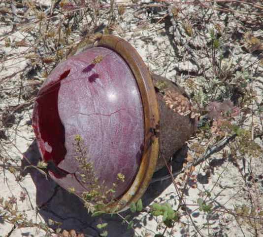
A 2005 photo by Keith Wood of the remains of the light bulb which presumably sat on top of the windsock pole.
Keith reported, “A minor mystery is that the red dome on the top light of the windsock was made of plastic, which makes it post-WWII -
indicating some use after the war!”
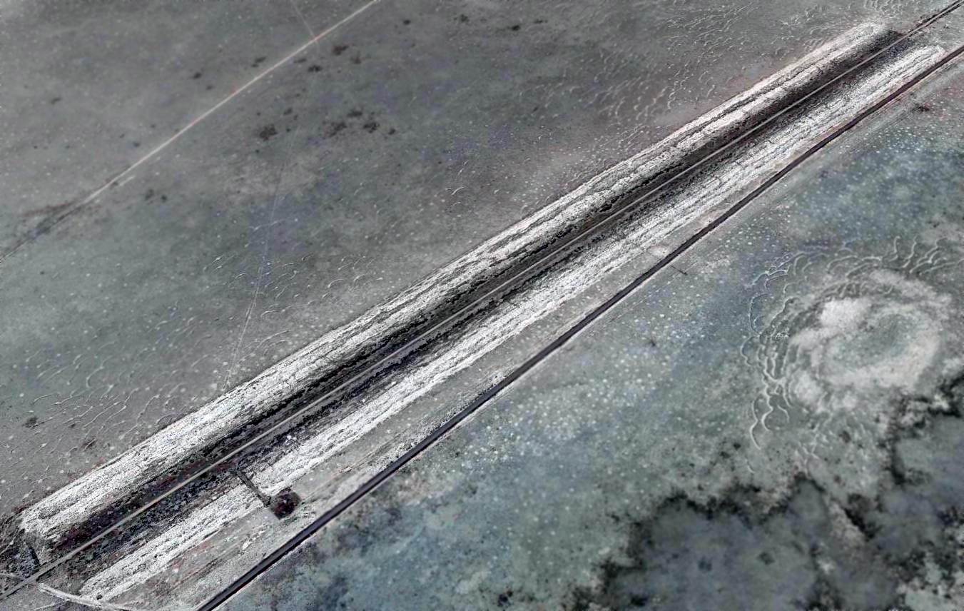
A 2015 aerial view looking southeast showed the 80+ year old Low Flight Strip runway remained remarkably well preserved.
Low Flight Strip is located 4 miles north of Interstate 80, 6 miles northeast of Knolls, UT.
____________________________________________________
Or if you prefer to contact me directly concerning a contribution (for a mailing address to send a check),
please contact me at: paulandterryfreeman@gmail.com
If you enjoy this web site, please support it with a financial contribution.
____________________________________________________
This site covers airfields in all 50 states.