Abandoned & Little-Known Airfields:
Virginia: Fauquier County
© 2002, © 2024 by Paul Freeman. Revised 9/30/24.
This site covers airfields in all 50 states: Click here for the site's main menu.
____________________________________________________
Please consider a financial contribution to support the continued growth & operation of this site.
Airlie Airport (revised 9/30/24) - Upperville Airport (revised 8/15/23)
____________________________________________________
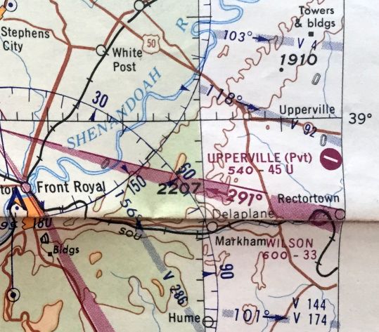
Airlie Airport (2VA9), Warrenton, VA
38.758,-77.787 (Southwest of Dulles Airport, VA)
A 4/5/65 USGS aerial view appeared to show the Airlie Airport runway under construction.
Harry Groome, a wealthy Philadelphia native, purchased this land in 1899 to build his “Airlie House,” named after a castle in Scotland.
Airlie House & Farm was operated as a modern gentleman’s estate, boasting pastures with purebred livestock in addition to the property’s extensive gardens.
In 1924, a catastrophic fire consumed Airlie House, but Groome rebuilt his residence.
A 1952 aerial photo did not yet show the Airlie Airport.
Steve Beste reported, in “1959, the astonishing Dr. Murdock Head bought the estate.
Head was a professor of medicine at George Washington University, an author, a TV personality, a documentary producer, the creator of the Airlie Conference Center, and a jailbird.
He served 10 months in Federal prison for bribing congressmen to get money for Airlie.”
According to his obituary in the Washington Post, “Dapper, erudite and energetic, Dr. Head was well-connected at high levels of government.
Over the years, he obtained millions of dollars in federal grants to finance the Airlie Foundation.”
Steve Beste reported, in “1961, Head created the Airlie House Foundation as a non-profit 'year-round, national and international conference and research center.'
The 1,000 acres he gave the Foundation did not include the land later used for the airfield.”
Steve Beste reported, in “1965, Head built the airfield. He also bought a Beech 18, and hired one-time Flying Club 1 president Jim Willess to be his pilot.”
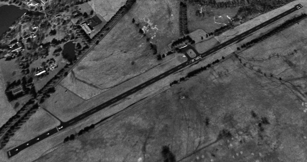
The earliest depiction which has been located of Airlie Airport was a 1965 aerial view.
It appeared to show single northeast/southwest runway still under construction, not yet paved, with a single building on the west side.
Airlie Airport was not yet depicted on the March 1966 Washington Sectional Chart.
By 1966 an aerial photo showed Airlie Airport's runway had been paved in asphalt, with “Airlie” painted along the midpoint.
The earliest aeronautical chart depiction which has been located of Airlie Airport was on the October 1966 Washington Sectional Chart.
It depicted Airlie Airport as a private airfield having a single 3,200' paved northeast/southwest runway.
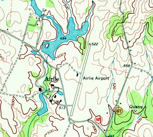
The earliest topo map depiction which has been located of Airlie Airport was on the 1970 USGS topo map.
It depicted Airlie Airport as having a single paved northeast/southwest runway, with 1 small building on the west side.

The earliest photo which is available of Airlie Airport was a 1974-76 aerial view by Greg Wesier of a beautiful red biplane (model unidentified) overflying Airlie Field.
Greg Wesier recalled, “Airlie Airport was where I worked as Pilot Mechanic on the Airlie Foundation's Twin Beech N103AF & Cessna Cardinal N104AF from 1974-76.
The Twin Beech was used to transport documentary film crews to locations as far away as Latin & South America. Some of the best flying experiences of my aviation career; many fond memories.”

The earliest photo which is available of Airlie Airport was a 1975 photo by Greg Wesier of Airlie Foundation's Twin Beech Beech 18 N103AF & Cessna Cardinal N104AF in front of the Airlie hangar, filming a trip to Alaska.

A 1975 photo by Greg Wesier of Airlie Foundation's Twin Beech Beech 18 N103AF at Airlie Airport, filming a trip to Alaska.

A 1975-76
photo (courtesy of Greg Wesier) of Greg's last flight in Airlie
Foundation's Twin Beech Beech 18 N103AF at Airlie Airport.
The 1975 Washington Terminal Aeronautical Chart depicted Airlie Airport as a private airfield having a single 3,200' paved northeast/southwest runway.

An undated photo of a Cessna 310 in front of the Airlie Airport hangar/terminal, as featured on the cover of the April 1976 Pilots Preflight magazine (courtesy of Greg Wesier).
Steve Beste reported, in “1993, geese raised at Airlie participated in one of the early Operation Migration flights, where birds are raised to follow a trike on their first migration.
This was done under the auspices of the Airlie Sanctuary, which Head had set up.
Club member Bruce Pennypacker kept his trike at the Warrenton Airpark & flew these flights for many years.”
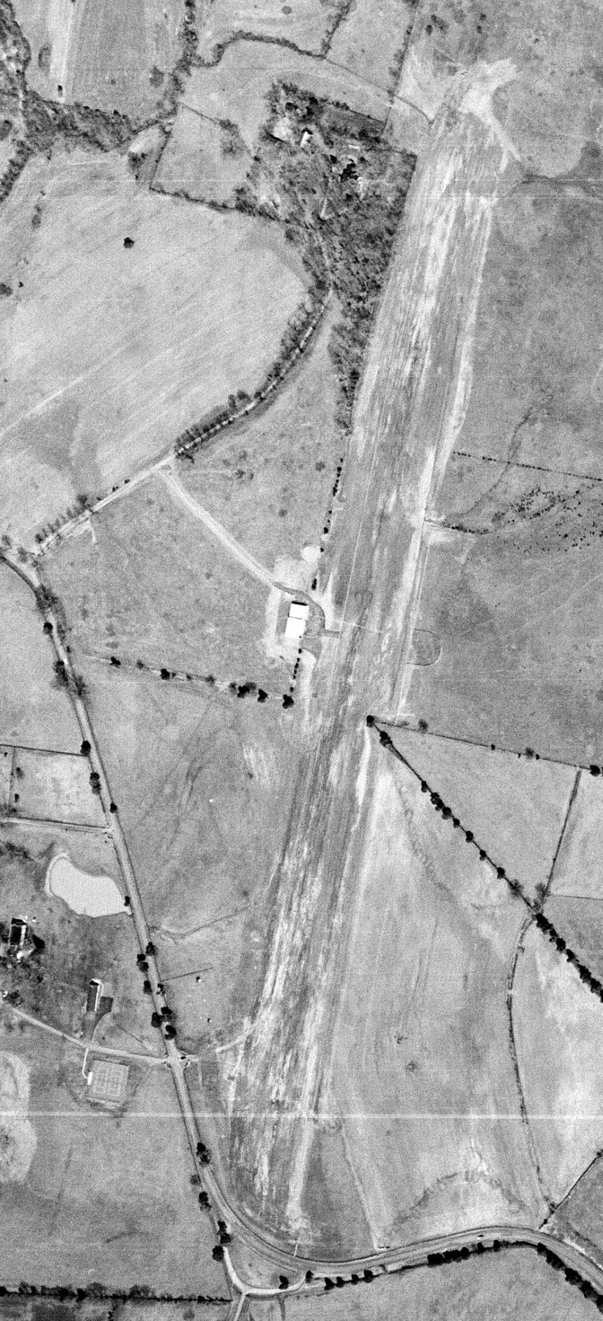
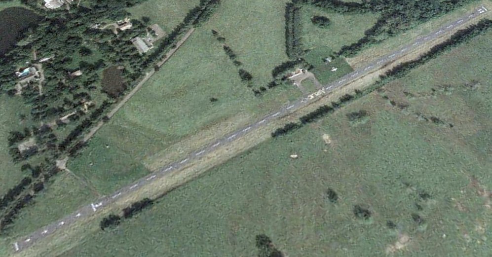
The earliest aerial view which is available of Airlie Airport was a 1994 aerial view looking northwest.
It depicted Airlie Airport as having a single asphalt Runway 3/21, with “Airlie” painted along the midpoint.
A small building & 1 light single-engine aircraft were on the west side.
Steve Beste reported, in “1994, Murdock Head died at Airlie.
The land he had not given to the Airlie Foundation – including the airfield – passed to his three children incorporated as the Kimmaren Corporation, Kimberly, Mark, and Karen, who had no interest in aviation.
[Starting in] 1994, the Airlie Foundation leased the airfield from the Kimmaren Corp.
Originally, it supported people flying in to attend conferences.”
The last photo which has been located showing an aircraft at Airlie Airport was a 2003 aerial view looking northwest.
It depicted 1 light single-engine aircraft parked on the west side of Airlie Airport.

The August 2007 Washington Sectional Chart depicted Airlie Airport as a private airfield having a single 3,200' paved northeast/southwest runway.

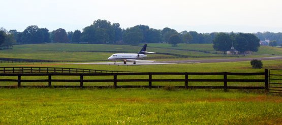
A 10/4/08 photo of Steve Beste & his ultralight in front of Airlie's terminal building.
Steve Beste recalled, “In October 2008, Hugh McElrath, my co-owner in the trike was booked for a weekend conference at Airlie through his work.
He jumped at the chance to be the only participant who arrived by private aircraft. The cool factor was irresistible.
Never mind that he had to drive out from the city to Front Royal, get the trike, and fly back in to Airlie, lashing his weekend kit in the back seat of the trike. Not a problem. This wasn’t about convenience.
He told the Airlie folks that his corporate pilot (me) would be taking the aircraft off someplace Saturday morning, returning it that afternoon. Would that be OK? Oh, certainly, sir.
And indeed, a note announcing my flight was duly tacked to the terminal building door.
Heaven knows what they made of the trike. It’s not exactly something that a captain of industry would arrive in. Where would you put the entourage?
In any case, the reservation lady was a little flummoxed by the aircraft request. Hugh reports that it took her awhile to find someone who could give permission.
That turned out to be the buildings & grounds department. That was his first clue that the airstrip was pretty peripheral to Airlie’s operations even in 2008.”
Steve continued, “I drove out to Airlie on that fine Saturday morning with a friend to find the trike sparkling in the morning sun.
We had a glorious morning flight around the countryside & then down to the Airpark for the October meeting. The friend cheerfully pitched in on Tom’s hangar project.
Then back to Airlie where we left the trike for Hugh to fly back to Front Royal on Sunday.
It was during that last landing that I noticed the skeet towers. It seems that the good people at Airlie used the south end of their runway as a skeet shooting range.
So no, that old Welcome sign really did lie – unless you count birdshot as a warm welcome.”

A 10/4/08 photo by Steve Beste of his ultralight in front of Airlie's runway.
Steve Beste recalled, “By the time I flew there in 2008, though, this was rarely done, and Airlie used the hangar as the headquarters for their Buildings & Grounds department.
I pestered the Airlie people for years trying to get permission to include the field on our poker runs. The answer was always no.”
Steve continued, in “2015, to save money, Airlie stopped leasing the airfield. Control reverted to the Kimmaren Corp.
They continued to mow the area, but repeatedly said no to my requests about the poker run.
[In] 2016, the Airlie Foundation gave the conference center & 300 acres valued at $18.8 million to American University, which now operates it says the AU website & Washington Business Insider.”
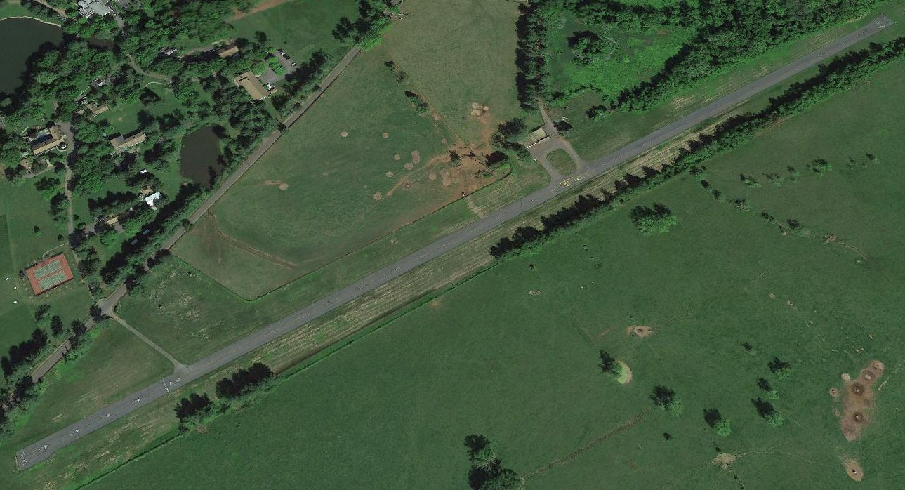
A 2017 aerial view looking northwest depicted Airlie Airport in an unchanged fashion, but no aircraft were visible on the field.

The last aeronautical chart depiction which has been located showing Airlie Airport still in operation was on the July 2019 Washington Terminal Aeronautical Chart.
It depicted Airlie Airport as a private airfield having a single 3,200' paved northeast/southwest runway.
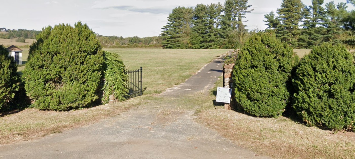
A September 2019 photo looking east at the entrance gate on the southwest side of Airlie Airport.
The white sign says “Aircraft landing area”, and the stone pillar behind it says “Transient aircraft”.
The 2019 Washington Terminal Aeronautical Chart depicted Airlie as “Closed”.

A 7/17/20 aerial view by Steve Beste looking south at Airlie Airport.
As of 2021, the FAA Airport/Facility Directory data listed Airlie Airport as having a 3,250' asphalt Runway 3/21,
owned by The Kimmaren Corp., and managed by Chris Malone.
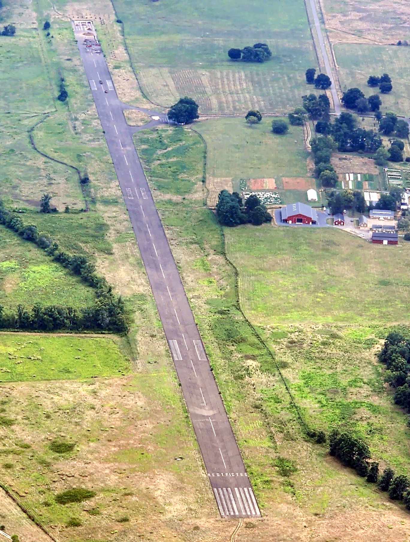
A 9/18/21 aerial view by Paul Freeman looking south depicted Airlie Airport as remaining intact.
Steve Beste reported, in “2021, the Kimmaren Corp. put the airfield, the International House, and 225 acres up for sale. Asking price: $5,375,000.
The property sold for $4,500,000 on 10/20/21 to Lion King, LLC, an entity created that summer for the purpose of doing this project.
Regarding the sale in 2021, there were always only three possible outcomes:
1. Private estate. Like Dr. Head himself, the buyer wants a private airfield & lake.
2. Aviation community. The buyer wants to keep the airfield & build houses with hangars around it as at Berryvale.
3. Normal subdivision. The buyer plans to subdivide the property into building lots.
Number 1 & 2 keep the airfield. Number 3 does not. It looks like the buyer was #3.
Mind you, at the January Flying Club meeting, Fred Briggs told me that he & Heather had looked into buying the land to build an aviation community.
But the numbers just didn’t add up. The only way to cover the purchase price was to build houses where the airfield now is.
In the end, the new owner’s intentions vis-à-vis the airfield are perfectly clear. They have de-listed it with the FAA.
After 58 years that lying Welcome sign will soon be coming down.
But then, it’s like the caddish Prince Charming in the play Into the Woods, who shrugs, 'I was raised to be charming, not sincere.'”
Ryan Miller reported in 2022, “Airlie is officially closing. The 1/27/22 charts will likely be the last to depict it open.”
The 2023 Washington Terminal Chart depicted Airlie as an abandoned airfield.

A 1/30/23 photo by Steve Beste of the Airlie Airport terminal building.

A 1/30/23 photo by Steve Beste of the Airlie welcome sign.
Steve reported, “The sign lies. In my 17 years, the airfield at Airlie has never been welcoming – except for once.”
____________________________________________________
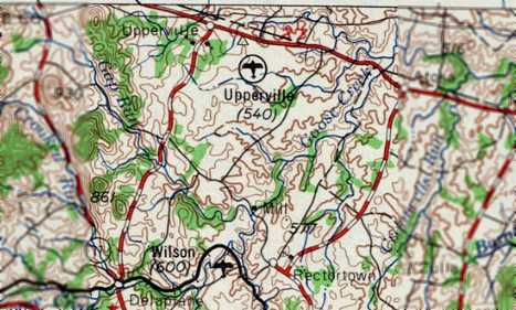
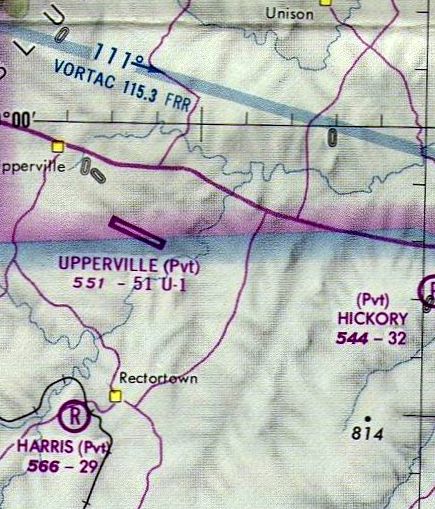
Upperville Airport (2VG2), Upperville, VA
38.971, -77.868 (Northwest of Dulles Airport, VA)
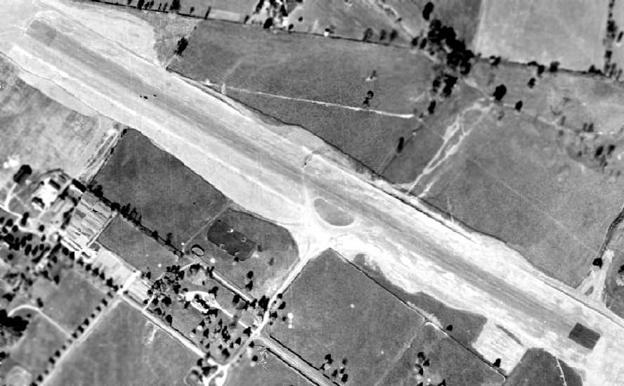
A 1957 aerial view evidently showed the Upperville runway while under construction.
Upperville Airport is a private runway located on the estate of the late Paul Mellon.
The Upperville Airport was evidently built in 1957, as a 1952 aerial view did not yet depict the runway,
while a 1957 aerial view evidently showed the Upperville runway while under construction.
It depicted the field as having a single paved runway, in its original 3,500' length.
The Upperville Airport was not yet depicted on the 1957 Washington Sectional Chart (courtesy of Mike Keefe).
The earliest aeronautical chart depiction of Upperville Airport which has been located
was on the 1960 Washington Sectional Aeronautical Chart,
which described it as having a single 3,500' bituminous runway.
The 1961 USGS topo map did not yet depict the Upperville Airport.
Upperville was listed among active airports in the 1962 AOPA Airport Directory,
by which time the runway had been lengthened to 4,500'.
Upperville Airport, as depicted on the 1963 USGS topo map.
The earliest aeronautical chart depiction which is available of Upperville Airport
was on the July 1962 Huntington Sectional Chart (courtesy of David Stevenson).
It depicted Upperville as having a single 4,500' paved northwest/southeast runway.
The 1964 Washington Sectional Chart (courtesy of John Voss)
continued to depict Upperville as having a 4,500' paved runway.
Upperville's runway was evidently lengthened again at some point between 1964-72,
as the 1972 Washington Sectional Chart (courtesy of Mike Keefe)
described Upperville as having a 5,100' paved runway.

The 1970 USGS topo map depicted Upperville Airport as having a single paved runway.

A 1974 aerial view depicted Upperville Airport at its eventual length, 5,100'.
The February 1975 Washington Terminal Aeronautical Chart (courtesy of Mitchell Hymowitz).
depicted Upperville as a private airfield having a 5,100' paved runway.
A local pilot reported, “From 1987-94 I was the pilot of a helicopter owned by Paul Mellon’s immediate neighbor to the north of his Upperville Estate,
and we often flew within sight of that airstrip, when we flew this neighbor, our employer, to his home, just north of Mr. Mellon’s Upperville estate.
Paul Mellon owned a Gulfstream G-II jet, N1929Y, which his pilots would operate for him in & out of that runway on his property.
I was told that this tail number was specifically secured for Mr. Mellon’s Gulfstream, inspired by the fact that Mr. Mellon graduated, in 1929, from Yale University (1929 & Y for Yale).
Mr. Mellon’s operation developed its own private instrument approach for that runway, based on the positioning of a non-directional beacon (Goodwin Lake GDX), just east of that runway.
We were given a 'confidential' Jeppesen Chart depiction of that approach, as a favor, by Mr. Mellon’s Gulfstream crew back then,
to use in adverse weather, if we ever needed it to find our way to our owner’s estate, just north.
We often saw N1929Y parked there at Upperville, or heard or saw it take off or land there (first generation Gulfstream IIs were very loud!).
And we saw that Gulfstream often, at Washington National Airport (DCA), where it was hangared when it wasn’t flying missions for Mr. Mellon.”
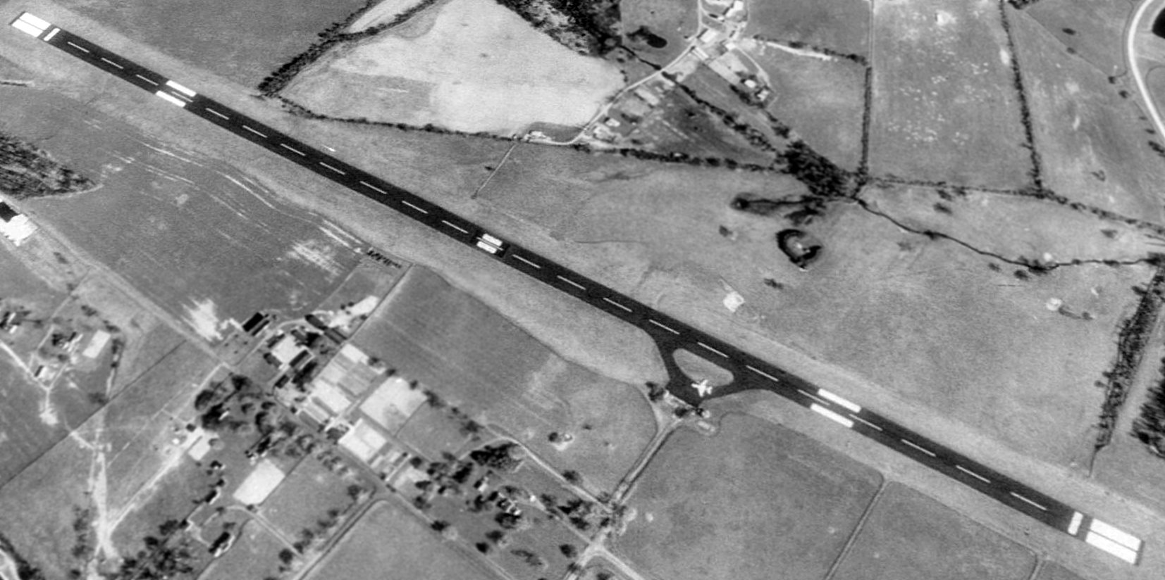
The only aerial view which has been located showing an aircraft at Upperville Airport was a 1989 aerial view looking north,
which depicted a swept-wing twin-engine business jet (presumably Mellon's Gulfstream II, N1929Y) parked on its ramp on the south side of the runway.
The single 5,100' northwest/southeast runway is lighted & is painted with instrument approach markings.
There are no hangars at the facility, just a small parking ramp along the south side of the runway.
Upperville Airport is located almost immediately underneath the busy approach path to nearby Dulles Airport's Runway 12.
Visitors to Upperville included a private Boeing 727 which once flew in for a party,
and it was once used for an emergency landing by a Dulles-bound airliner which was experiencing difficulties.
Upperville is listed in the FAA Airport/Facility Directory as a private airfield.
Although its construction & ownership by a wealthy private individual makes perfect sense,
the location of a private jet-capable paved runway (which is also very secure & rarely used)
a mere 6 miles from the Mount Weather presidential bunker would appear to invite speculation.
Was this field was constructed with some "agreement" with the federal government,
with the provision for its use in a national emergency to bring personnel in & out of the Mount Weather bunker?
Since the only aircraft facilities on the Mount Weather property consist of a grass runway for helicopters or light aircraft,
it would appear to have been highly desirable to have some nearby facility capable of handling heavier fixed-wing aircraft.
Airfield owner Paul Mellon passed away in 1999.
Aerial photo taken by Paul Freeman, 11/99, from a Diamond Katana DA20A-1.

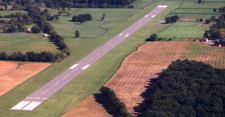
A 5/4/08 view looking west at the Upperville runway, with the windsock in the center.
An undated photo of the Upperville runway from the property's 2014 for sale listing.
Property owner Bunny Mellon passed away at 103 in 2014,
and 2,000 acres of the Oak Spring Farms, including the airfield, have been placed on the market.
For a mere $70 million, it can be yours.
The only ground-level photo which has been located showing an aircraft at Upperville Airport was a pre-2015 photo of a Dassault Falcon 2000 private jet on the Upperville runway.
The 2016 Washington Terminal Aeronautical Chart depicted Upperville as a private airfield having a 5,100' paved runway.

A 2017 aerial view looking north at Upperville Airport.
As of 2021, FAA records list the Oak Spring Garden Foundation as Upperville Airport's owner.
Ryan Miller reported in 2022, “Upperville is officially closing. The 1/27/22 charts will likely be the last to depict it open.”
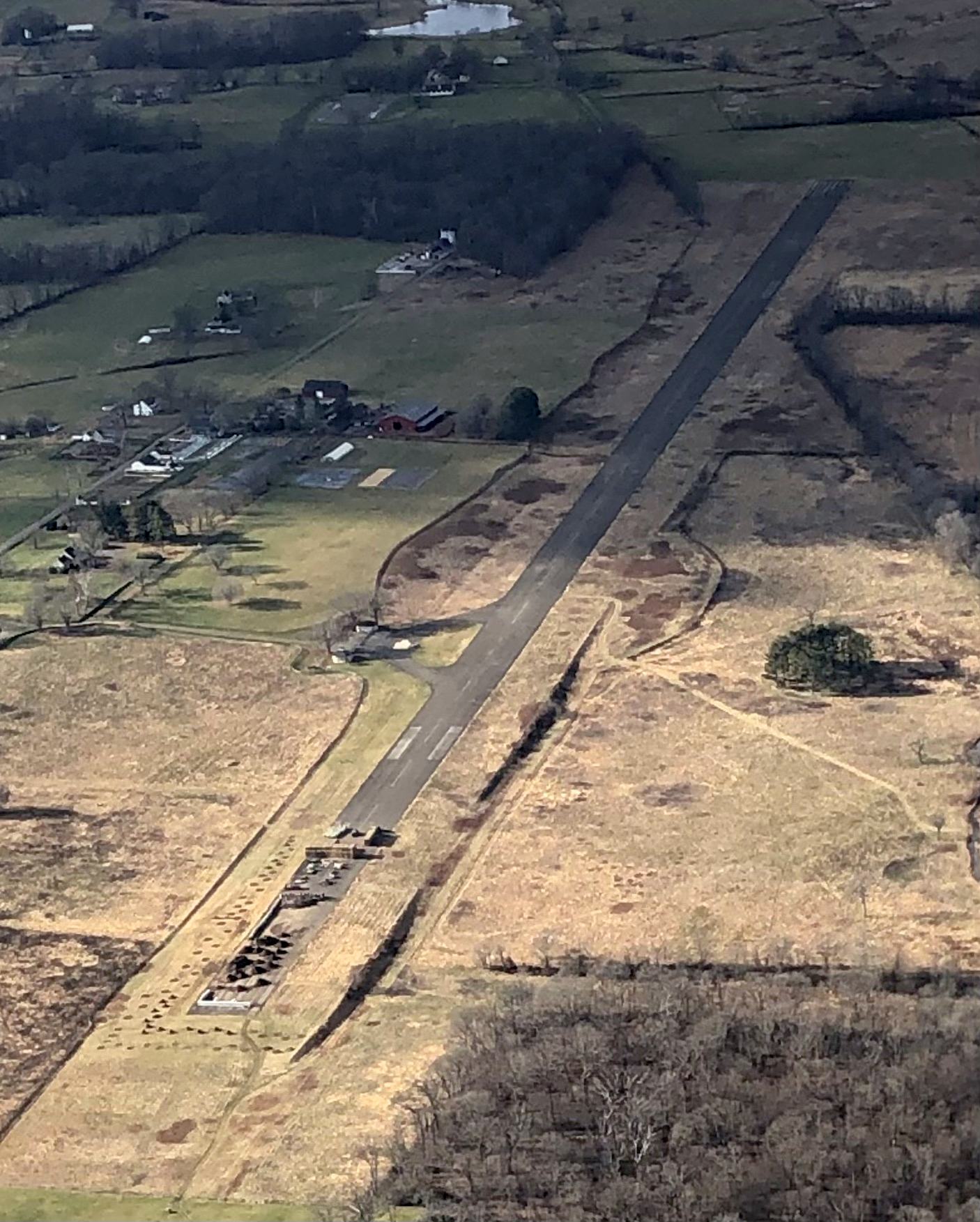
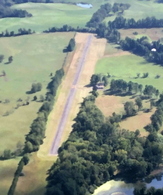
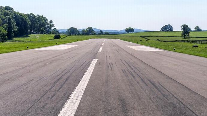
A 12/16/22 aerial view by Paul Freeman looking west shows the Upperville runway remains intact, though the eastern end is being used to store agricultural/landscaping materials.
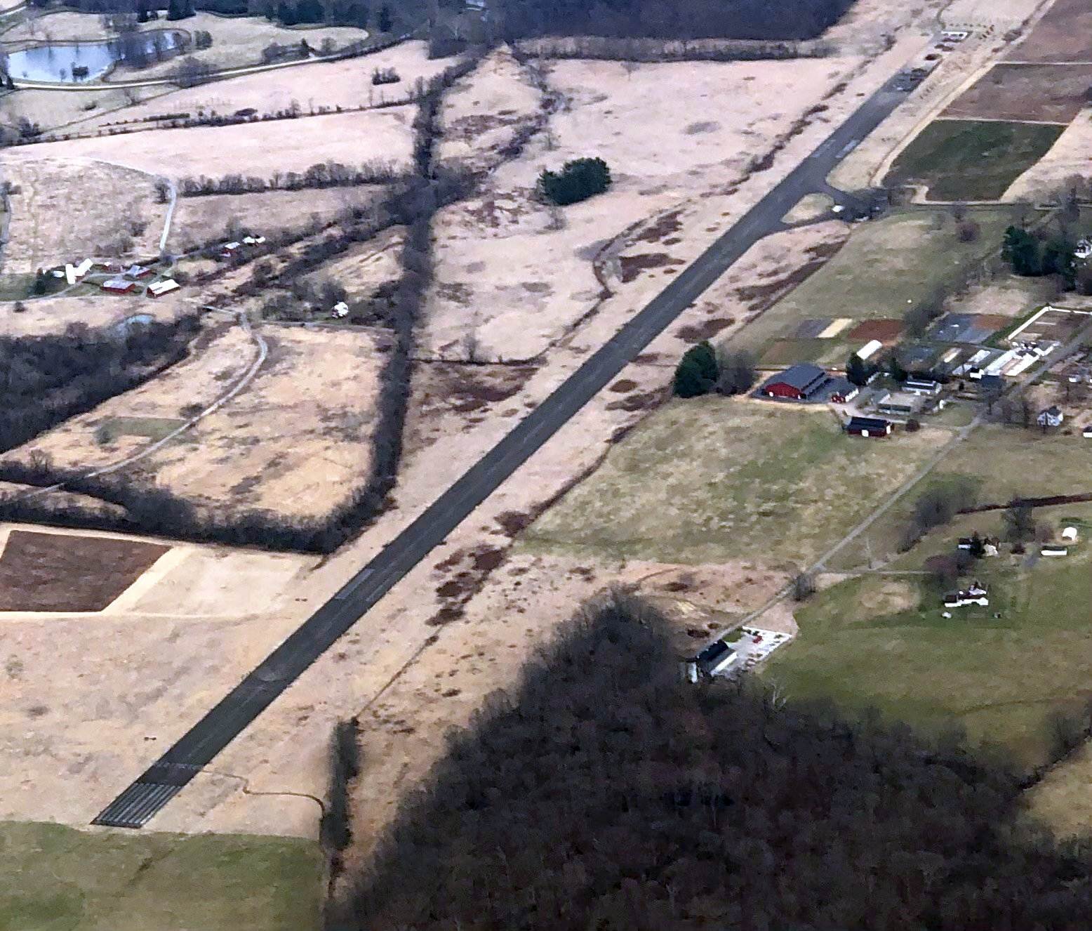
A 2/24/23 aerial view by Paul Freeman looking east shows the Upperville runway remains intact, though the eastern end is being used to store agricultural/landscaping materials.
An 8/14/23 aerial view by Tekang Wang looking east shows the Upperville runway remains intact, though the eastern end is being used to store agricultural/landscaping materials.
The 2023 Washington Terminal Chart depicted Upperville as an abandoned airfield.
____________________________________________________
Since this site was first put on the web in 1999, its popularity has grown tremendously.
If the total quantity of material on this site is to continue to grow,
it will require ever-increasing funding to pay its expenses.
Therefore, I request financial contributions from site visitors,
to help defray the increasing costs of the site
and ensure that it continues to be available & to grow.
What would you pay for a good aviation magazine, or a good aviation book?
Please consider a donation of an equivalent amount, at the least.
This site is not supported by commercial advertising –
it is purely supported by donations.
If you enjoy the site, and would like to make a financial contribution,
you
may use a credit card via
![]() :
:
Please consider checking the box to make a monthly donatation.
For a mailing address to send a check, please contact me at: paulandterryfreeman@gmail.com
If you enjoy this web site, please support it with a financial contribution.
please contact me at: paulandterryfreeman@gmail.com
If you enjoy this web site, please support it with a financial contribution.
____________________________________________________
This site covers airfields in all 50 states.