Abandoned & Little-Known Airfields:
Northern Wisconsin
© 2002, © 2025 by Paul Freeman. Revised 11/20/25.
This site covers airfields in all 50 states: Click here for the site's main menu.
____________________________________________________
Please consider a financial contribution to support the continued growth & operation of this site.
Arrowhead Airport / Rice Lake Municipal Airport (2nd location) (revised 11/20/25) - Blesch Field / Brown County Airport / Country Club Airport (revised 10/6/18)
Colby-Abbotsford Airport (revised 11/2/20) - George Whiting Field / Wittman Airport (revised 4/23/24) - (Original) Outagamie County Airport (revised 4/26/18)
Rice Lake Municipal Airport (original location) (revised 5/17/23) - Superior Municipal Airport (added 4/26/21)
Old Tomahawk Airport / Forrest Protection Airfield (revised 12/25/17) - River Falls Airport (revised 11/2/20)
____________________________________________________
George Whiting Field / Wittman Airport, Appleton, WI
44.223, -88.428 (Southwest of Green Bay, WI)
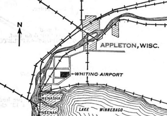
The location of Whiting Airport, as depicted in the 9/7/28 Commerce Department Airway Bulletin (courtesy of Mike Denja).
According to the Town of Menasha sesquicentennial (courtesy of Drew Knoll-Owen),
“Neenah industrialist George Whiting donated $500,000 to finance the construction of an airport on the condition it was named after him.
In 1928, 100 acres of farm land was leased from Michael Wittmann, located on the corner of present-day Appleton Road & Airport Road.
The airport was officially named George Whiting Field but was also known as Wittmann Airport.”
The earliest depiction which has been located Whiting Airport was in the 9/7/28 Commerce Department Airway Bulletin (courtesy of Mike Denja).
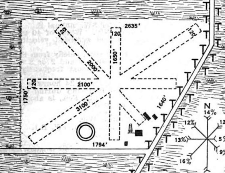
The 9/7/28 Commerce Department Airway Bulletin (courtesy of Mike Denja) described George A. Whiting Airport as a commercial airport
owned by the George A. Whiting Airport Company & operated by North American Airways Company.
It was said to consist of a 97 acre sod field containing 4 unpaved runways, the longest measuring 3,100' northeast/southwest.
A concrete/brick/steel 100'x80' hangar was depicted on the southeast side along with 3 other buildings.
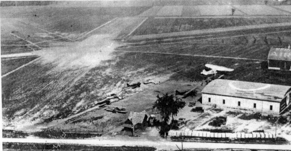
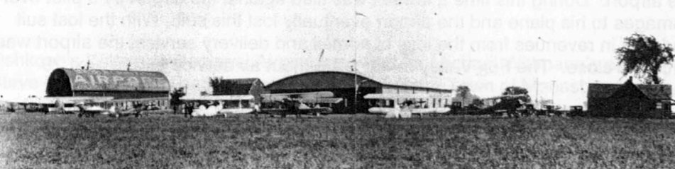
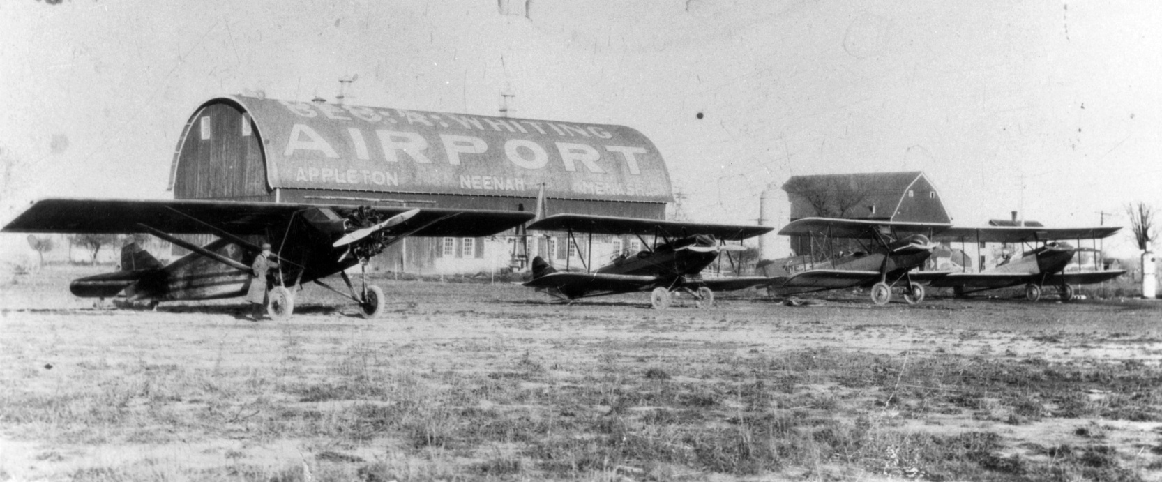
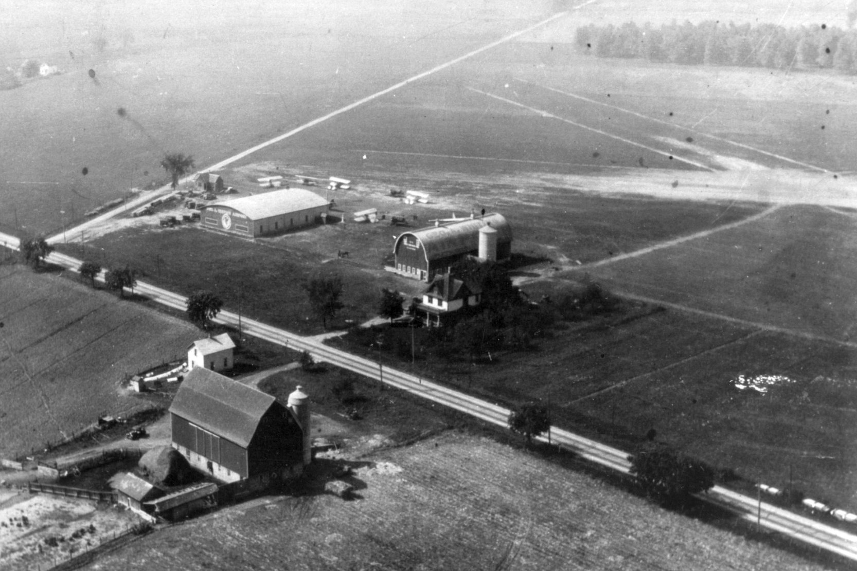
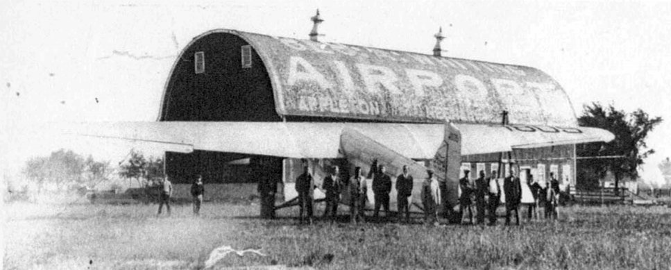
A circa 1928-30 aerial view of Whiting Field, showing multiple aircraft, the hangar, and barn (courtesy of Drew Knoll-Owen).
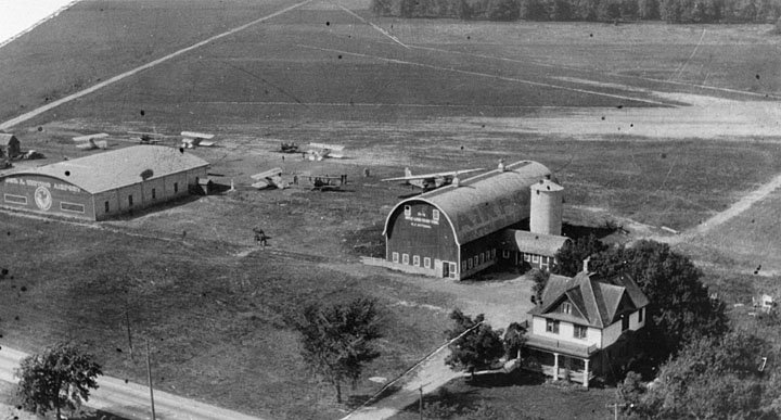
A circa 1928-30 aerial view of Whiting Field, showing multiple aircraft, the hangar, and barn (courtesy of Drew Knoll-Owen).
According to the Town of Menasha sesquicentennial (courtesy of Drew Knoll-Owen),
“Airmail service slackened in 1930 when the US Government would no longer fund airmail service to private airports.
This caused Northwest Airways to pull out of the airport. With the loss in revenues, the airport was forced to close.”
Whiting Field was no longer depicted on the May 1936 Green Bay Sectional Chart or the 1949 USGS topo map.
A 1953 aerial photo showed the former hangar remained at the southeast corner of the Whiting Field site.
The airfield area had returned to cultivation.
According to Drew Knoll-Owen, the former Whiting Airport hangar was reused as a Goodwill store, before becoming a Kitz & Pfeil Ace Hardware store.
The building gained an addition in the 1980s.”
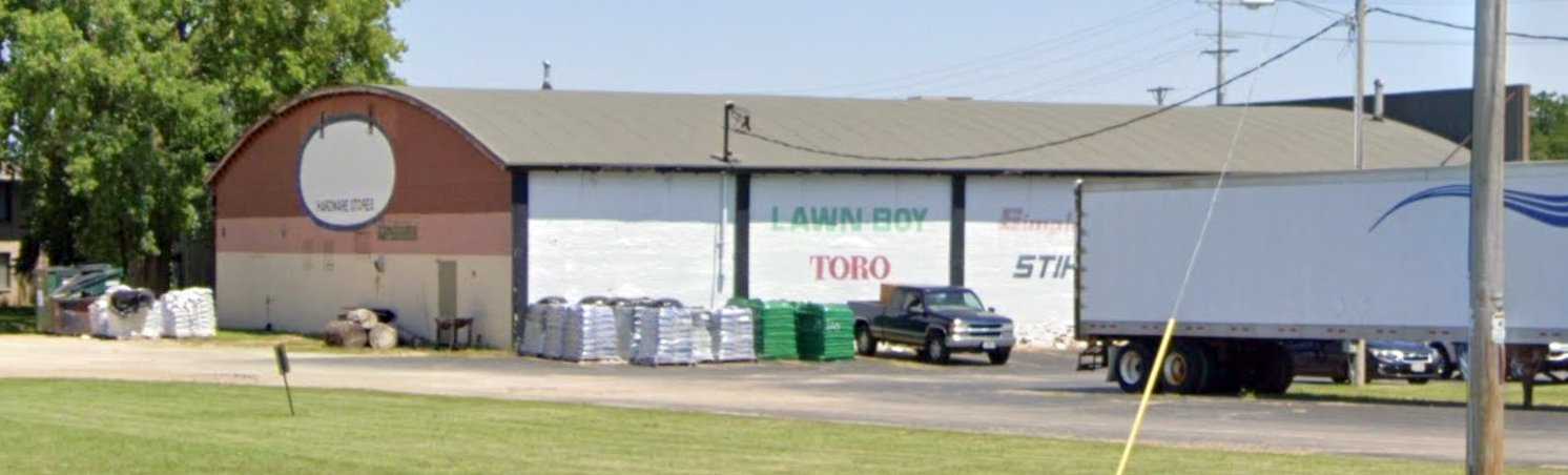
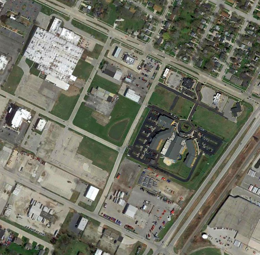
A 2019 photo looking northeast showed the former Whiting Airport hangar, reused as a hardware store.
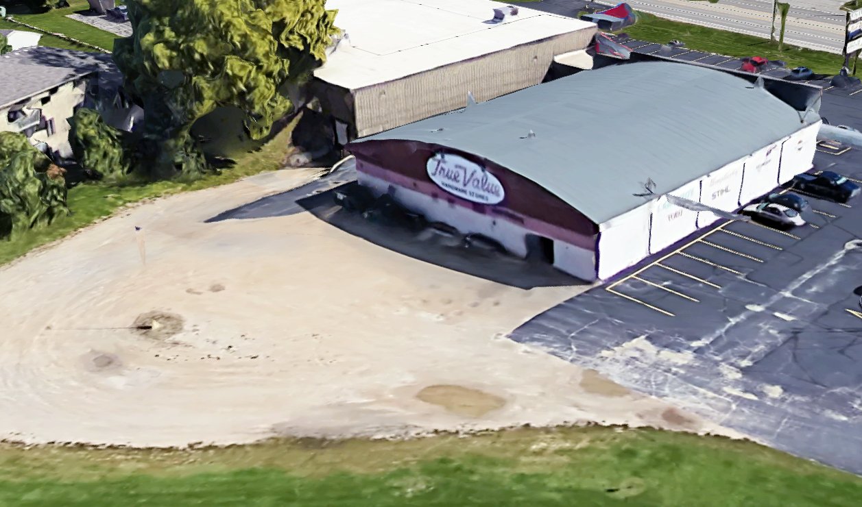
A 2021 3-D aerial view looking northeast showed the former Whiting Airport hangar, reused as a hardware store.
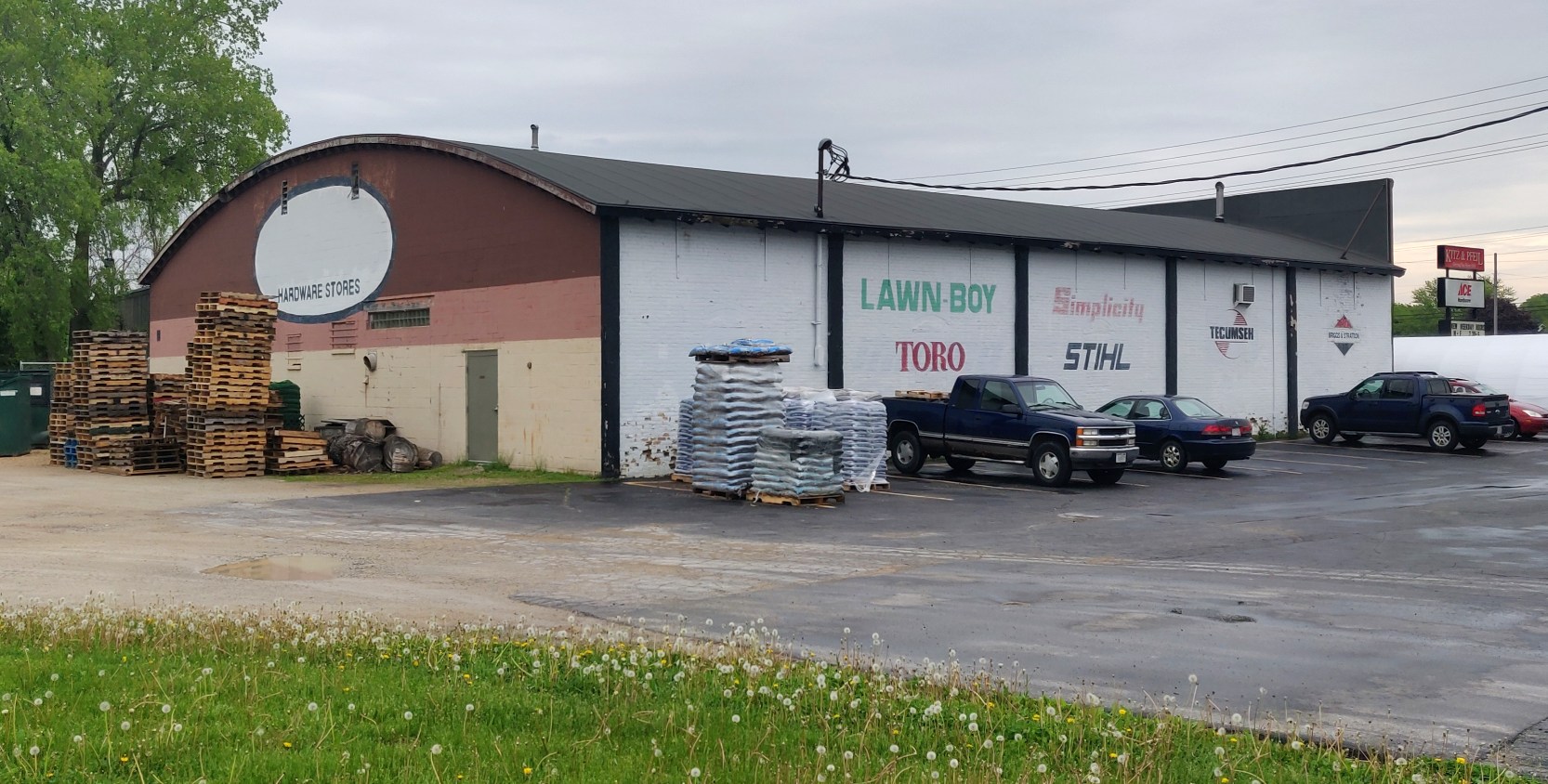
A 5/20/21 photo by Drew Knoll-Owen looking northeast showed the former Whiting Airport hangar, reused as a hardware store.
A close examination reveals a bricked-up arched window, where “Toro” is painted.
Drew reported, “Despite the internal renovations, the hangar building is still recognizable & in fair condition.”
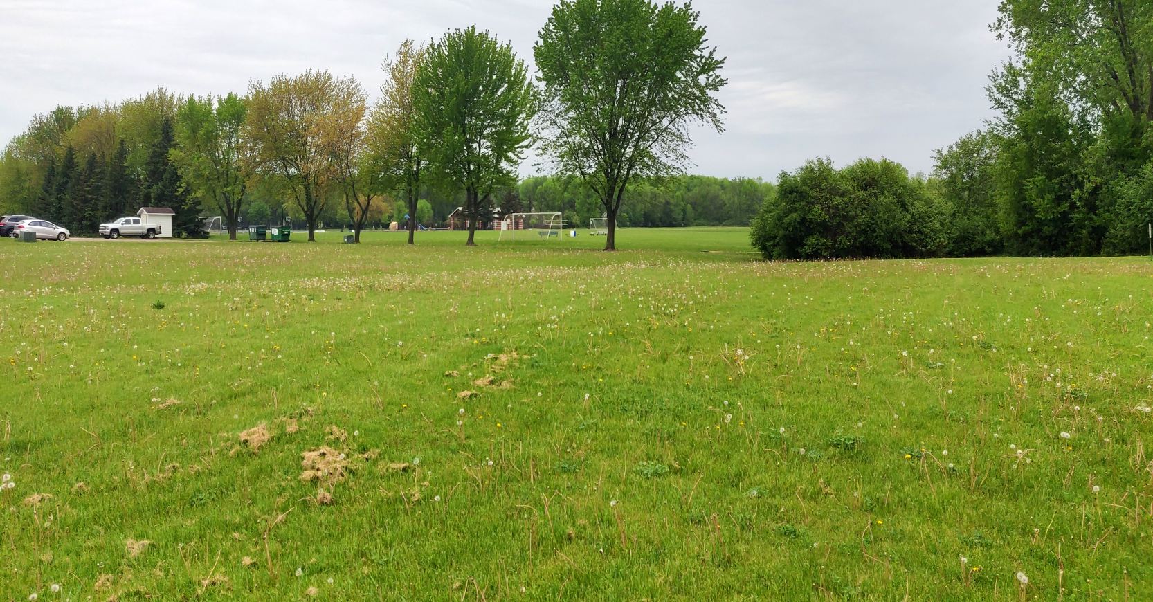
A 5/20/21 photo by Drew Knoll-Owen looking northwest along the former Whiting Airport runway alignment, now Wittmann Park.
Thanks to Drew Knoll-Owen for pointing out this airfield.
____________________________________________________
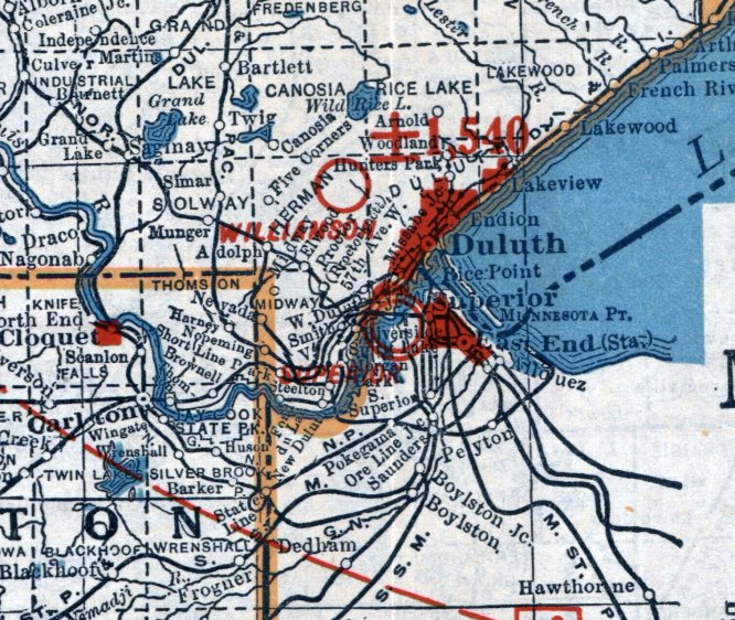
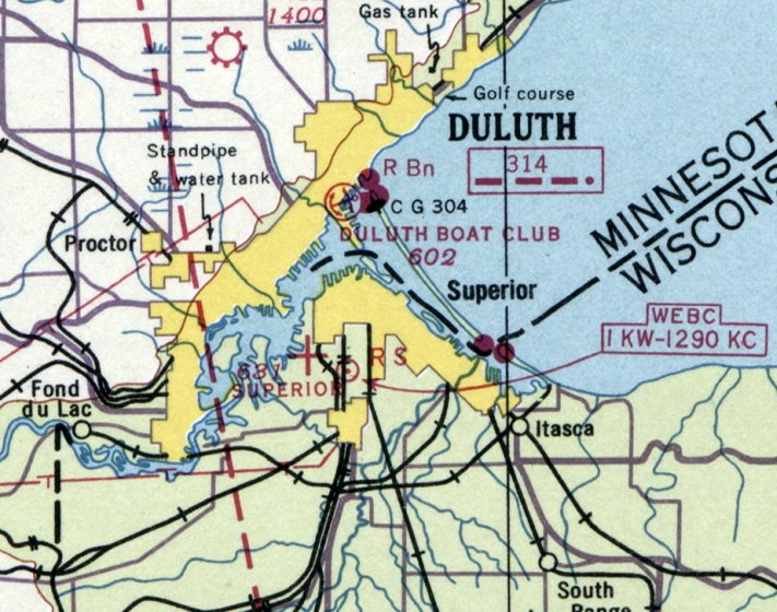
Superior Municipal Airport, Superior, WI
46.72, -92.13 (Southeast of Duluth, MN)
Superior Airport, as depicted on a 1920 Army Map of Landing Fields (courtesy of Jonathan Westerling).
Photo of the airport has not been located.
Jonathan Westerling reported, “The first airport serving in the city of Duluth, MN to be listed in airport directories was actually located in the neighboring port city of Superior WI.
As early as 1920, The Superior Golf Club's layout & location made it an ideal landing area for early fliers looking for a place to land.”
The earliest reference which has been located of Superior Airport was in the 1920 Flying Guide & Logbook (courtesy of David Brooks),
which described its landing area as 975' x 500'.
The earliest depiction which has been located of Superior Airport was on the 1920 Army Map of Landing Fields (courtesy of Jonathan Westerling).
The 1923 National Aeronautic Association's Airplane Landings Guide (courtesy of Jonathan Westerling)
listed Superior Airport as having Stanolind Aviation gasolin [sic] & Superla Aero oils available on the field, so it was as "full service" as an airport got in those days.
The 1925 US Aeronautical Bulletin #48 (courtesy of Jonathan Westerling) described Superior Airport:
"Best portion of field between railroad & a gully which runs diagonally across field from northwest to southeast,
making the available portion triangular in shape with longest runway 1,200' east/west; surface is fairly firm;
located 8 miles southeast of Superior, immediately east of the Minneapolis, St. Paul and Sault Ste. Marie railroad
about 1/2 mile south of yellow brick building of the poor farm & 1 mile west of Green Trail Highway.
Reported 10/22/24 by 2nd Lt. Robert Wimsatt, Air Service.”
Jonathan Westerling reported, “Between 1925-27, the city of Superior established the field as a fully municipal airport, separate from the golf club.
The July 1927 edition of Aero Digest detailed the first Fixed-Base Operator to operate at the field - Arrowhead Airways.
It also mentioned that hangars had been erected, and that passenger services were offered.”
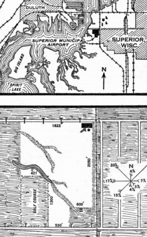
The June 1927 Airway Bulletin #400 (courtesy of Jonathan Westerling) described Superior Municipal Airport as a municipal airport
having a 78 acre L-shaped sod field, measuring 2,050' north/south, with a building at the northeast corner, and a ravine cutting across the southwest part of the field.
The Head of the Lakes Flying Club was listed as operating at the airport.
An article in the March 1928 Aero Digest mentioned that Superior Airport was "the only field at the head of the lakes" (Head of the Lakes being the nickname for the 'Twin ports' of Superior & Duluth).
It went on to say that the ravine depicted in Airway Bulletin #400 had been filled in,
yielding a bigger landing area to allow "...the takeoff or set-down of 3-motored jobs or others nearly as demanding in plenty of room to do their stuff."
It also listed Head of the Lakes Airways as being a second FBO & flight school on the airport which it further described as being located in the "Billings Park" section of Superior.
Superior Airport, as depicted on the 1930 Rand McNally Air Trails Map (courtesy of Jonathan Westerling).
The 1931-37 Department of Commerce Airway Bulletin #2 listed Superior Airport as having 3 runways, each 1,600'.
Superior Airport, as depicted on the 1934 Airport Directory Company Airport Directory (courtesy of Jonathan Westerling).
The only aeronautical chart depiction which has been located of Superior Airport was on the September 1936 Duluth Sectional Chart (courtesy of Jonathan Westerling).
It depicted Superior Airport as an auxiliary airfield.
Superior Airport was still listed in the 1937 Airport Directory Company Airport Directory (courtesy of Jonathan Westerling),
but it also mentioned that a new airport was being constructed to the southeast.
Superior Airport was replaced in October 1937 by a new, larger, airport a few miles to the southeast.
Superior Airport was not depicted on the 1939 USGS topo map.
Superior Airport was no longer depicted on the June 1941 Duluth Sectional Chart.
Instead it depicted the Bryn Ostby Airport to the southeast (which eventually evolved into today's Richard Bong Airport).
A 1952 aerial photo showed no recognizable trace remaining of Superior Municipal Airport, with the site a vacant field.
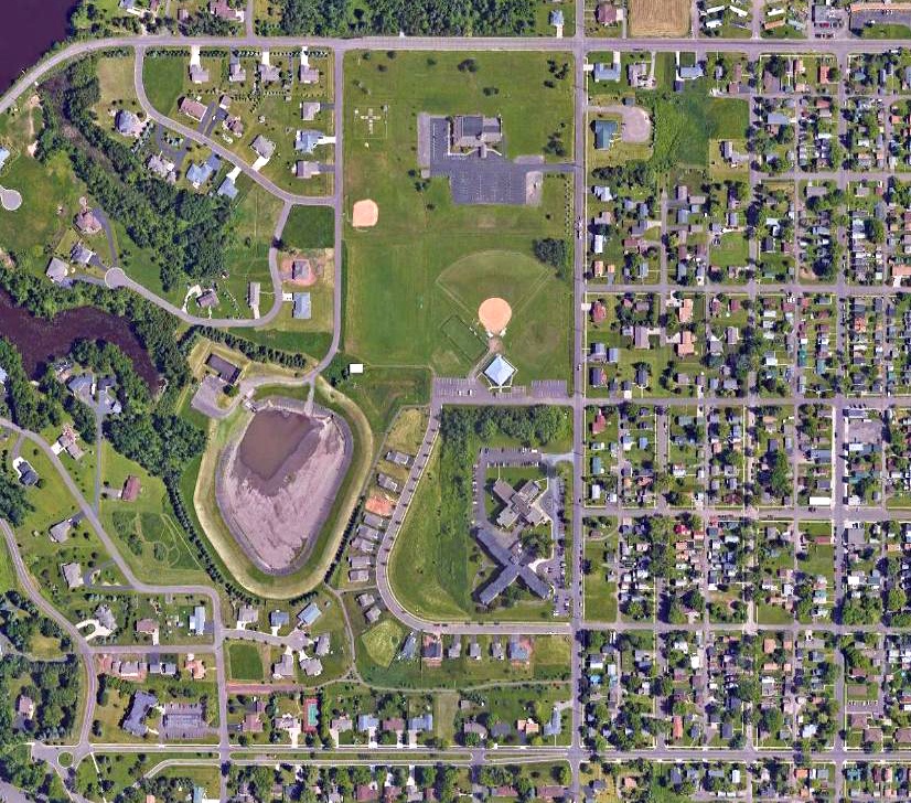
A 2016 aerial view showed no trace remaining of Superior Airport.
The site of Superior Airport is located at the intersection of Belknap Street & New York Avenue.
Thanks to Jonathan Westerling for pointing out this airfield.
____________________________________________________
Blesch Field / Brown County Airport / Country Club Airport, Green Bay, WI
44.497, -88.046 (Southwest of Downtown Green Bay, WI)
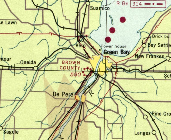
Blesch Field / Brown County Airport, as depicted on the October 1936 Green Bay Sectional Chart.
According to Micheal Goc's book “Forward in Flight – The History of Aviation in Wisconsin”, Blesch Field was formed sometime in the early 1920s
but was fairly inactive until 1927 when a hangar was built.
It was located on Highland Avenue (now Lombardi Avenue) just west of the Fox River.
It served as Green Bay's main airport for the next 2 decades.
Blesch Field was evidently renamed Brown County Airport at some point by 1936, as that is how it was depicted on the October 1936 Green Bay Sectional Chart.
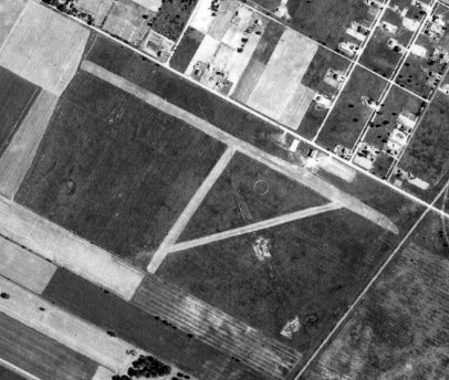
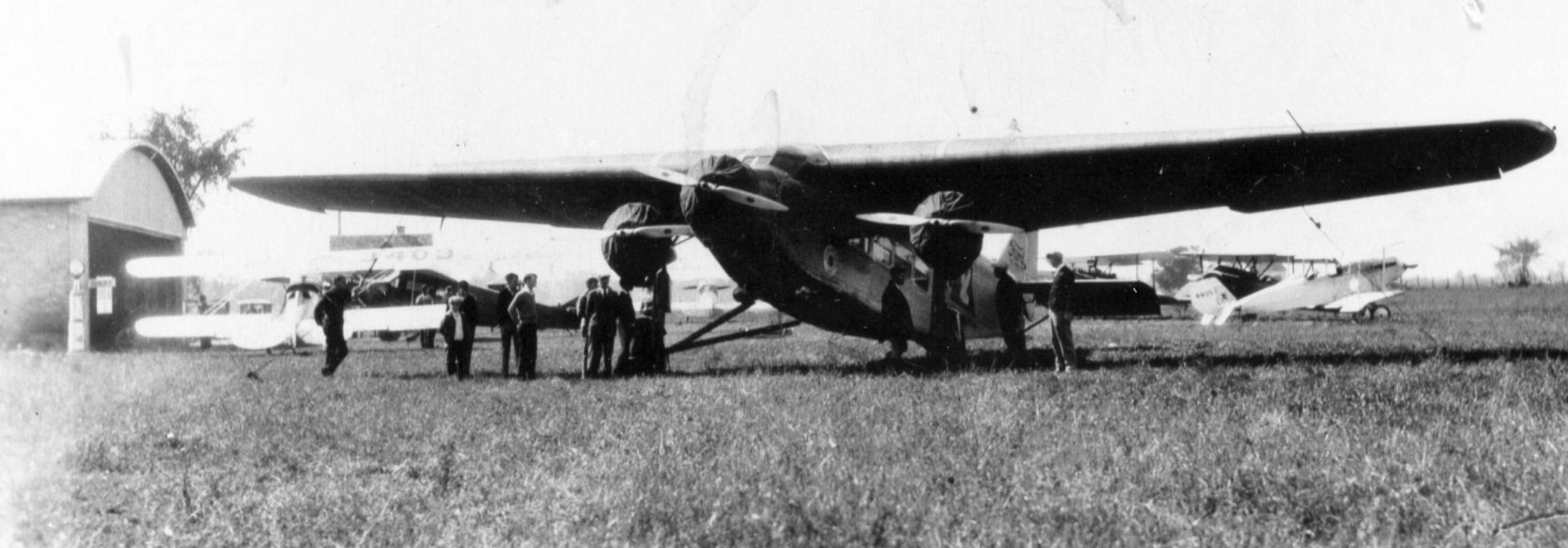
The only photo which has been located of Brown County Airport was a 6/2/38 aerial view (courtesy of Al Hatz),
which depicted Brown County as having 3 runways, with 2 hangars on the northeast side.
It was still depicted as Brown County Airport on the October 1941 Green Bay Sectional Chart.
Brown County Airport was evidently renamed Country Club Airport at some point between 1936-43, as that is how it was depicted on the December 1943 Green Bay Sectional Chart.
The last aeronautical chart depiction which has been located of Brown County Airport was on the December 1948 Green Bay Sectional Chart.
It depicted Brown County Airport as having a 2,800' unpaved runway.
According to Micheal Goc's book “Forward in Flight – The History of Aviation in Wisconsin”,
Blesch Field continued to serve as Green Bay's main airport till the new Brown County Airport (Austin Straubel Airport) was opened in 1948,
at which point Blesch Field presumably was closed.
The original Brown County Airport was no longer depicted on the November 1949 Green Bay Sectional Chart.
The 1956 USGS topo map no longer depicted Blesch Field.
A building had been built over the northeast portion, but the 2 former hangars remained intact on the northeast corner.
A 1960 aerial view showed the airfield area of Blesch Field remained mostly open, but no trace remained of the runways.
A building had been built over the northeast portion, but the 2 former hangars remained intact on the northeast corner.
A 1971 aerial view showed Blesch Field's 2 hangars had been removed at some point between 1960-71,
erasing the last trace of this early airport.
A 2017 aerial view showed no trace remaining of Blesch Field.
Thanks to Al Hatz for pointing out this airfield.
____________________________________________________
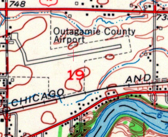
(Original) Outagamie County Airport, Appleton, WI
44.282, -88.37 (Northwest of Milwaukee, WI)
Outagamie County Airport, as depicted on the October 1936 Green Bay Sectional Chart.
According to the Appleton Airport website, “1940s... With the closing of Whiting Field, pilots moved their planes to the new Outagamie County Airport on Ballard Road in Appleton.”
The earliest depiction which has been located of Outagamie County Airport was on the October 1936 Green Bay Sectional Chart.
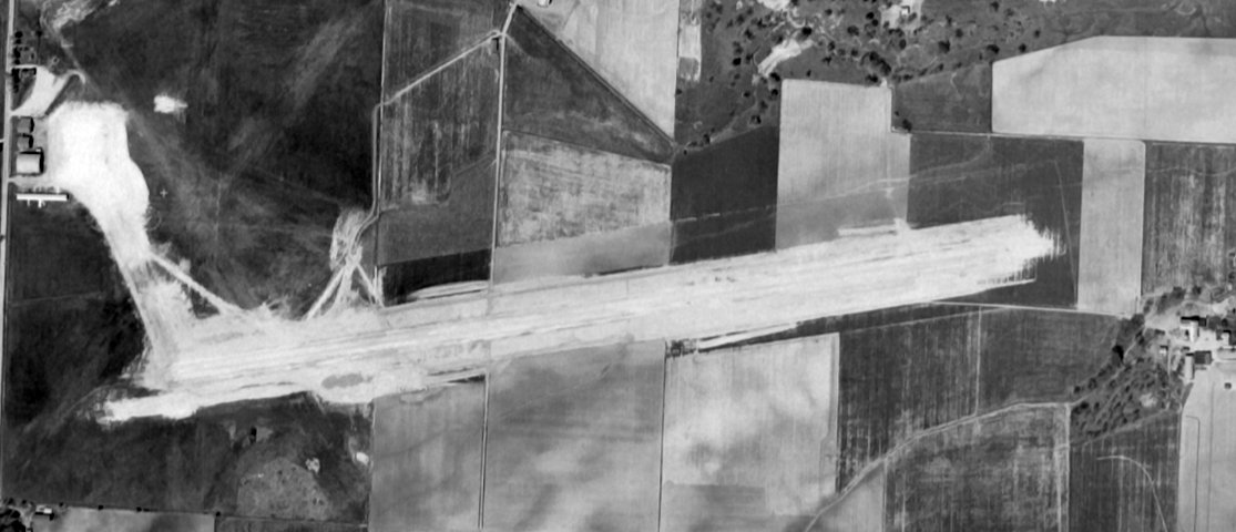
The earliest photo which has been located of the original Outagamie County Airport was a 1938 aerial view (from the WI Historic Aerial Imagery Finder, courtesy of Al Hatz).
It depicted Outagamie County Airport as having 4 unpaved runways, with 3 hangars on the northwest side.
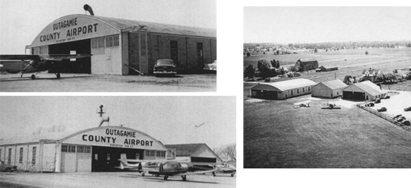
The earliest photos which have been located of the original Outagamie County Airport was a series of circa 1940s photos (courtesy of Lee Corbin)
showing an arch-roof hangar (marked “Outagamie County Airport”) & 2 smaller hangars, with a few light single-engine aircraft parked in front.
According to the Appleton Airport website, “Maxair was a full-service Fixed Base Operator which began operations at the old Ballard Road location in 1950.”
A 5/31/53 USGS aerial view (courtesy of Lee Corbin) showed the original Outagamie County Airport as having a northeast/southwest paved runway under construction,
with 4 hangars on the northwest corner.
The predecessor unpaved runways were still visible near the hangars on the west side.
The 1955 USGS topo map (courtesy of Lee Corbin) showed the original Outagamie County Airport as having a northeast/southwest paved runway,
with a taxiway leading to 3 small buildings on the northwest corner.
According to the Appleton Airport website, “In 1959 North Central Airlines service started with two DC-3 flights a day from the field.”
The last aeronautical chart depiction which has been located of the original Outagamie County Airport was on the May 1960 Green Bay Sectional Chart,
which depicted it as having a 3,700' paved runway.
According to an article in the 12/15/64 Oshkosh Northwestern (courtesy of Lee Corbin),
the original Outagamie County Airport would be abandoned on 1/15/65, when the new airport in Greenville began operation.
The original Outagamie County Airport was depicted as an abandoned airport on the May 1969 Green Bay Sectional Chart.
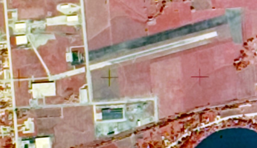
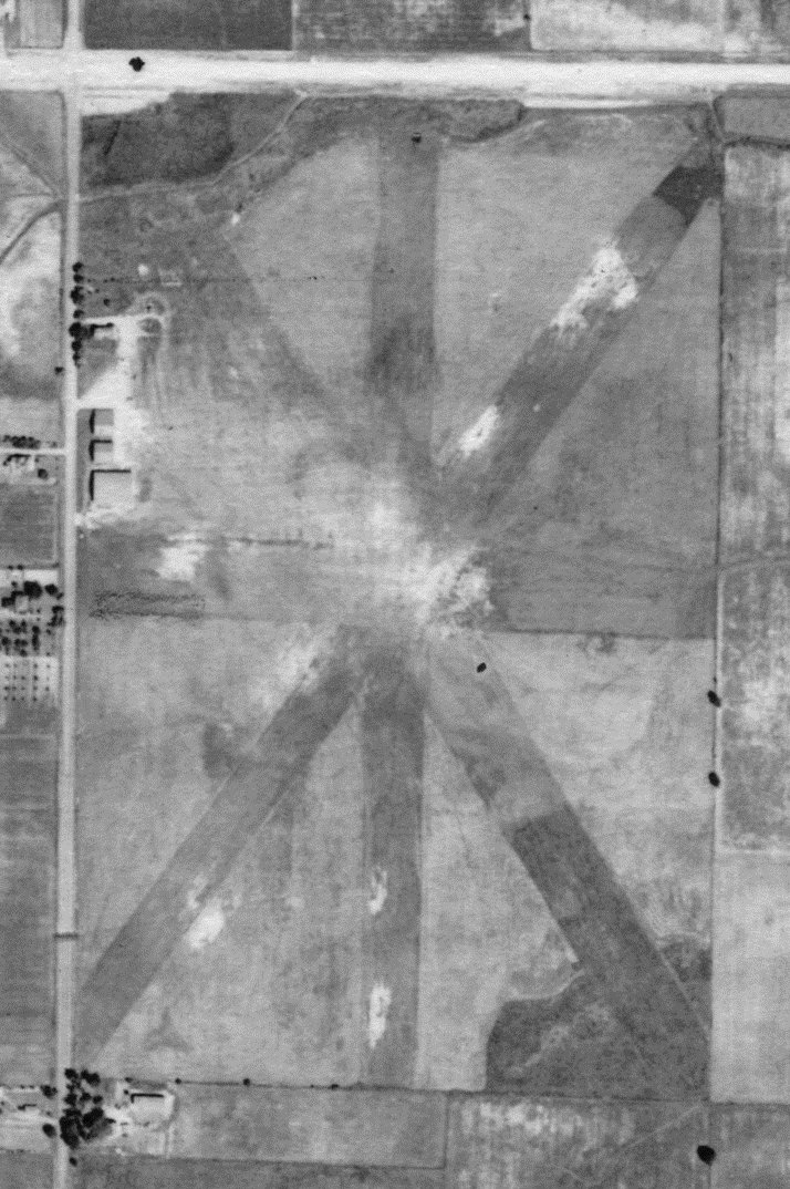
A 9/29/71 USGS aerial view (courtesy of Lee Corbin) showed a road having been built over the runway of the original Outagamie County Airport, which otherwise appeared to remain intact.
A 2017 aerial view of the site of the original Outagamie County Airport showed that portions of the paved taxiway & a small portion of runway remained on the western side, and traces of the runway remained on the eastern side.
The site of the original Outagamie County Airport is located southeast of the intersection of East Northland Avenue & North Ballard Avenue.
Thanks to Lee Corbin for pointing out this airfield.
____________________________________________________
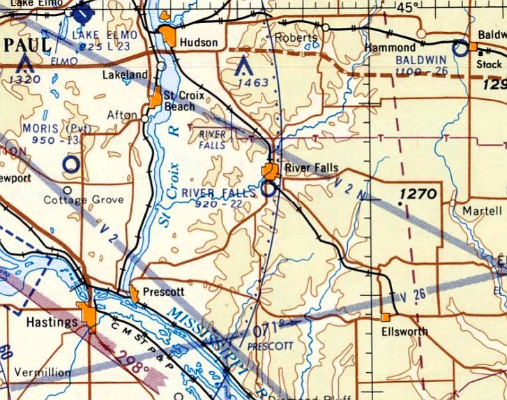
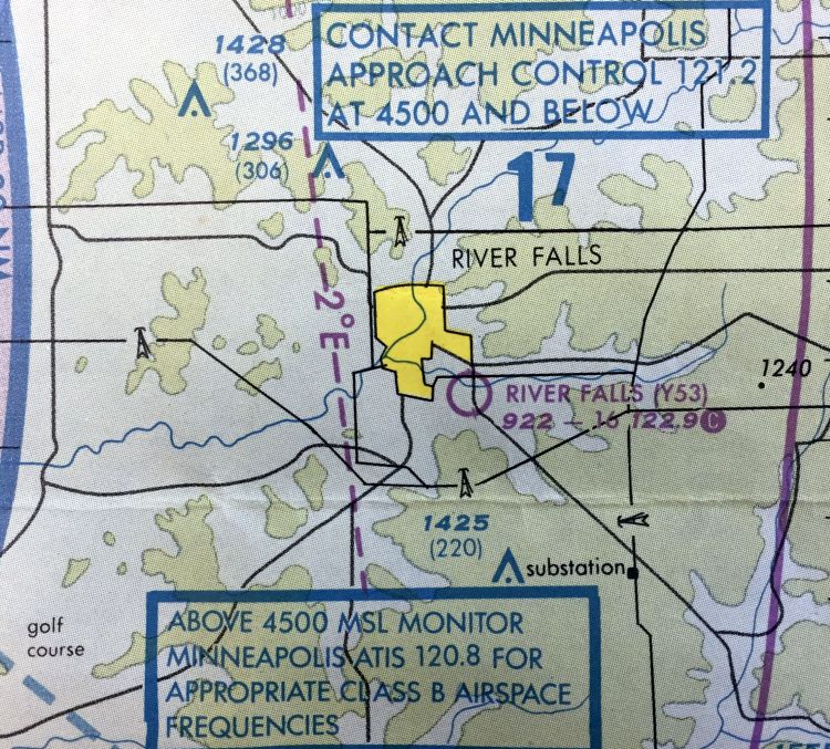
River Falls Airport (Y53), River Falls, WI
44.843, -92.616 (Southeast of Minneapolis, MN)
River Falls Airport, as depicted on the April 1960 Twin Cities Sectional Chart.
The River Falls Airport on the south side of the town of River Falls was evidently established at some point between 1959-60,
as it was not yet depicted on the 1959 USGS topo map or the 1959 Twin Cities Sectional Chart.
The earliest depiction which has been located of River Falls Airport was on the April 1960 Twin Cities Sectional Chart,
which depicted River Falls Airport as having a 2,200' unpaved runway.
The 1969 Twin Cities Sectional Chart depicted River Falls Airport as having a mere 1,800' unpaved runway.
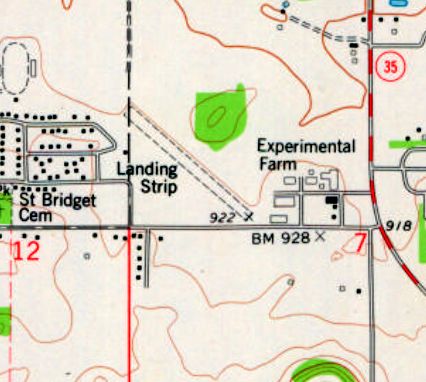
The 1974 USGS topo map depicted River Falls Airport as a single unpaved northwest/southeast runway, labeled simply as “Landing Strip”.
David Black recalled, “The University of Wisconsin - River Falls Airport... Two siblings graduated there in the 1980s.
I remember using the airfield with my dad. We were probably flying his PA-16 Clipper.
The field was to the southeast of the River Falls campus.”
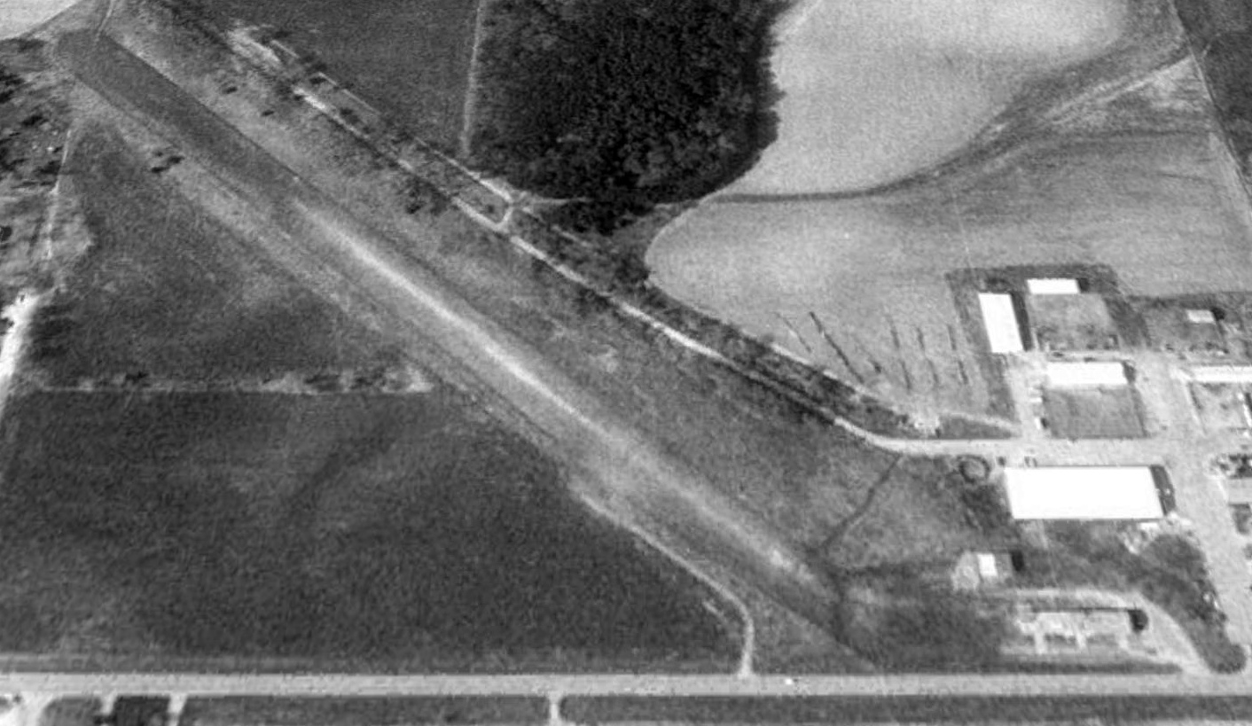
The earliest photo which has been located of River Falls Airport was a 1992 USGS aerial view looking north.
It depicted depicted River Falls Airport as having a single unpaved northwest/southeast runway, with what may have been a few small hangars on the southeast side.
The airport appeared to be abandoned, without any signs of recent aviation use.
Peter Hantelman recalled, “River Falls Airport... In May 1997, a friend of mine was dating a girl who was going to school at the University of Wisconsin-River Falls.
Somehow, though he is not a pilot, he learned that her dorm was near the old airport, and that she even faced the correct direction.
He asked me if we could fly there, to visit & impress her with a plane.
I'd been renting planes from South St. Paul Fleming Field over the summers, and it was only 18 nautical miles away.
Sure, I said, but it's a grass field, and no one answers the phone when I call to check on conditions - we may or may not land there.
When we arrived, I found the outline of what appeared to be a runway, in approximately the location where it should be.
There were no cones or dragon's teeth, no wind sock, and no buildings of any sort. Just a rough outline of unmown grass.
Based on the very questionable conditions, I elected to make a low pass first.
Flying 75 feet over the runway in landing configuration, I was quite sure this was the runway,
but that little east-west drainage/runoff ditch appeared to snake across the field at the halfway point.
It cut the field in half, as it was very clearly a foot-deep ditch. I decided there was no way I was risking this rented Piper Archer on THAT.
We waggled the wings at the dorms & went back to Fleming Field; she told him that she saw our plane.
It may have appeared on the sectional, but it was unflyable to the average general aviation plane.”
The last aeronautical chart depiction which has been located of River Falls Airport
was on the 1999 Twin Cities Sectional Chart (courtesy of David Black),
which depicted River Falls Airport as having a mere 1,600' unpaved runway.

River Falls Airport was evidently closed at some point between 1999-2016,
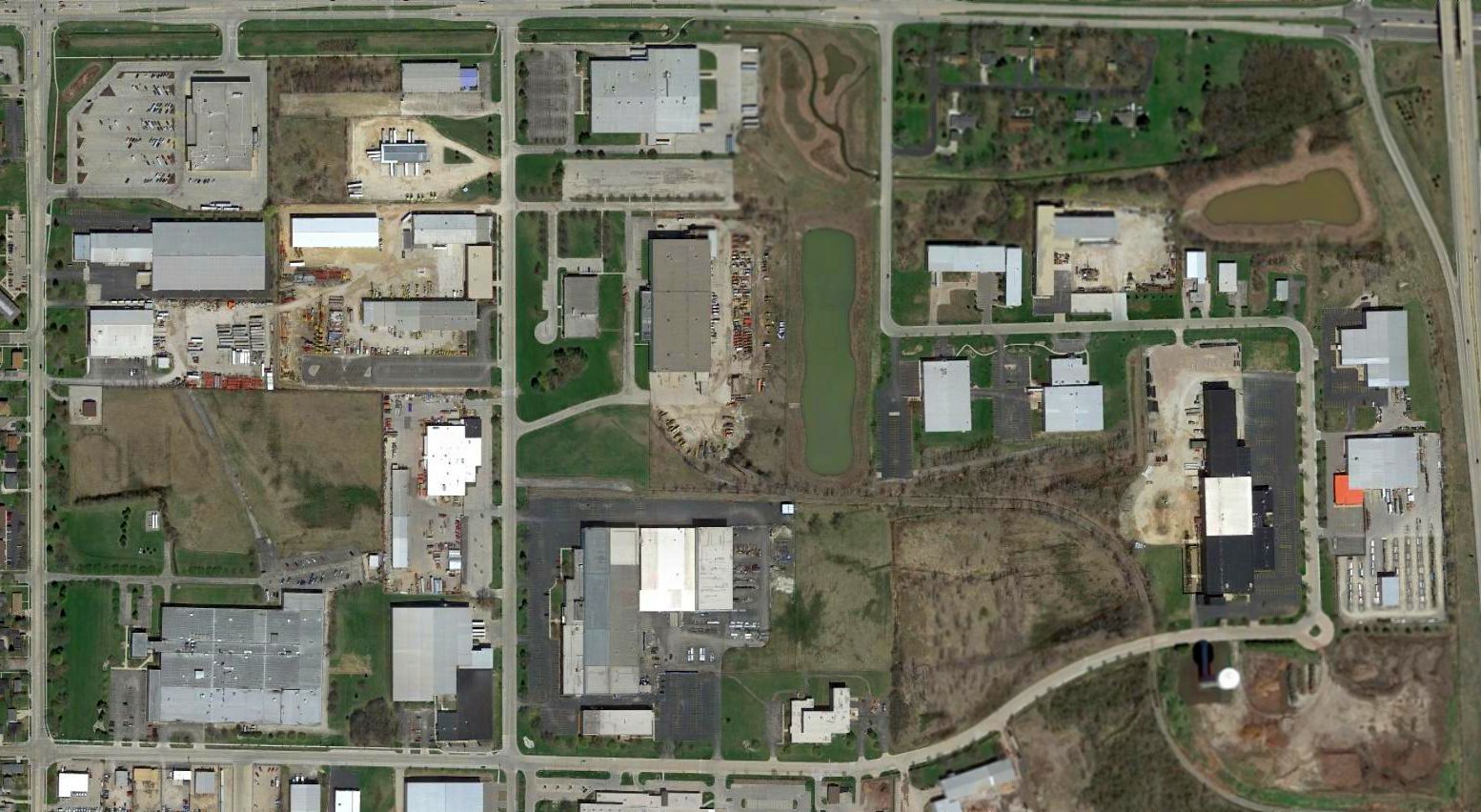
as a 2016 aerial view looking north showed no trace remaining of River Falls Airport, with the runway & hangars having been removed.
The site of River Falls Airport is located northeast of the intersection of 830th Avenue & South 6th Avenue.
Thanks to David Black for pointing out this airfield.
____________________________________________________
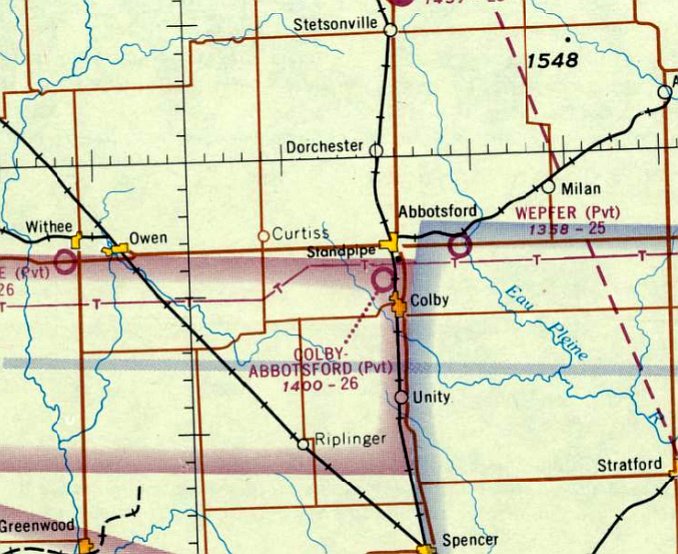
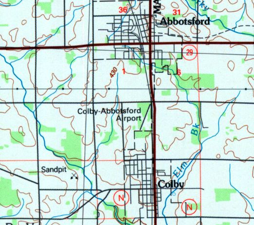
Colby-Abbotsford Airport, Abbotsford, WI
44.925, -90.32 (Northeast of Minneapolis, MN)
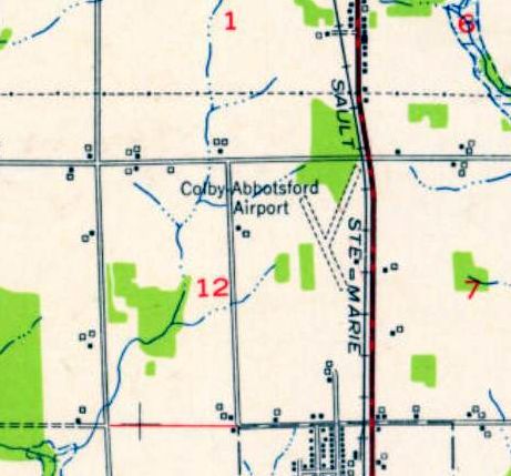
Colby-Abbotsford Airport, as depicted on the 1953 USGS topo map.
This small general aviation airport was evidently established at some point between 1945-53,
as it was not yet listed among active airfields in the 1945 AAF Airfield Directory (courtesy of Scott Murdock).
The earliest depiction which has been located of Colby-Abbotsford Airport was on the 1953 USGS topo map.
It depicted Colby-Abbotsford Airport as having 2 unpaved runways, with 2 small buildings on the east side.
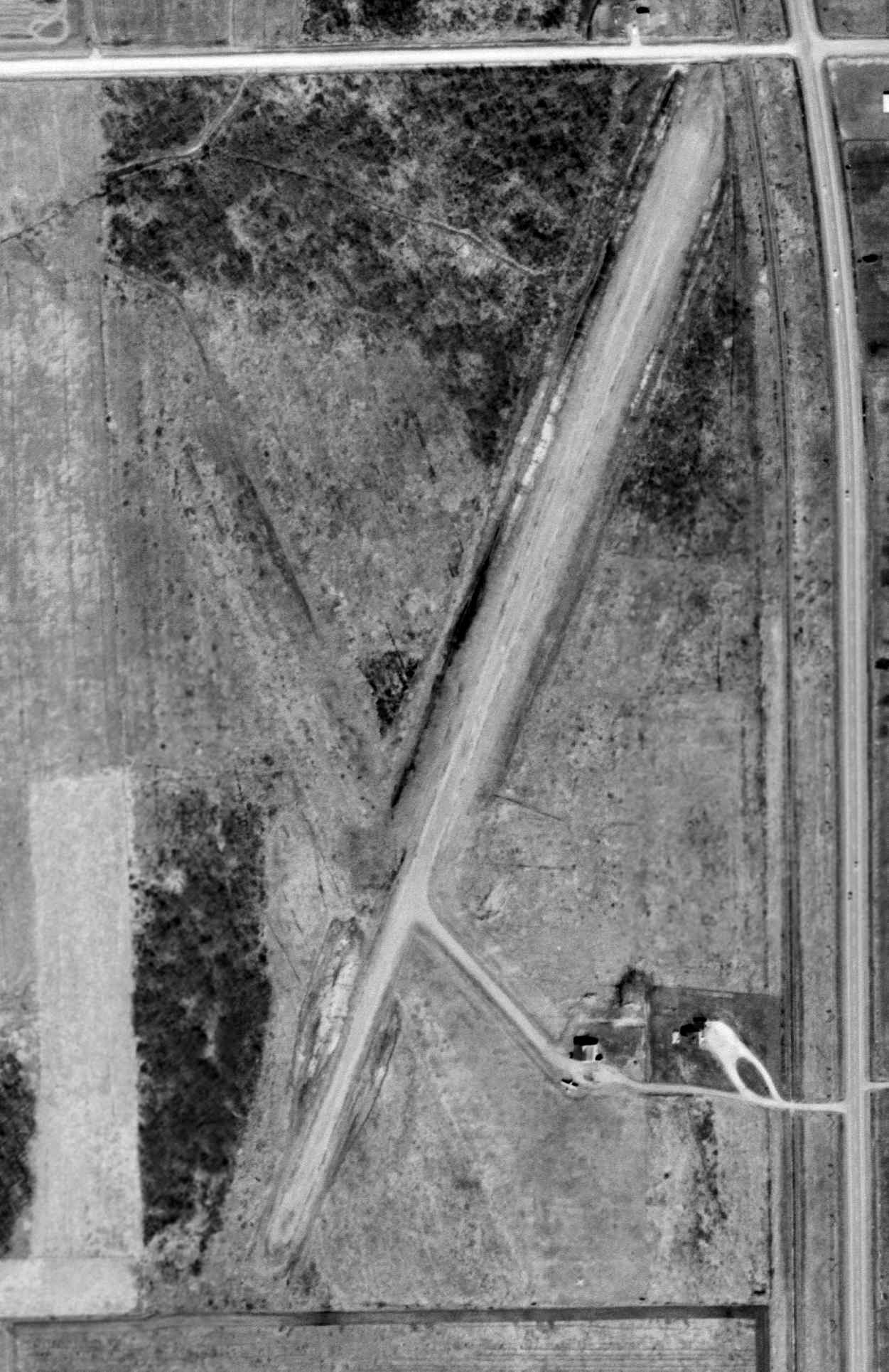
The earliest photo which has been located of Colby-Abbotsford Airport was a 1962 USGS aerial view.
It depicted Colby-Abbotsford Airport as having an unpaved northeast/southwest runway, with remnants of a northwest/southeast runway.
A taxiway lead to a hangar & 1 light single-engine aircraft on the east side.
Colby-Abbotsford Airport was not yet depicted on the April 1965 Twin Cities Sectional Chart.
The only aeronautical chart depiction which has been located of Colby-Abbotsford Airport was on the April 1966 Twin Cities Sectional Chart.
It depicted Colby-Abbotsford as a private airfield having a 2,600' unpaved runway.
The last photo which has been located showing the Colby-Abbotsford Airport presumably still in operation was a 1980 USGS aerial view.
Both the northeast/southwest & northwest/southeast runways were very distinct.
A hangar remained on the east side, but there were no aircraft parked outside.
The last map depiction which has been located showing the Colby-Abbotsford Airport was the 1988 USGS topo map.
It depicted Colby-Abbotsford Airport as having a northeast/southwest runway.
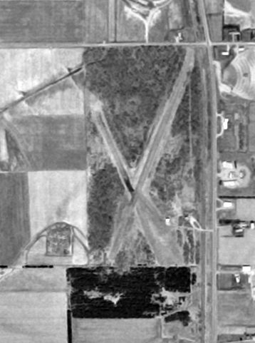
Colby-Abbotsford Airport was evidently closed at some point between 1988-99, as a 1999 aerial view looking northwest showed that a new portion of Route 29 had been built over the northeast end of the northeast/southwest runway.
The hangar remained on the east side.
A circa 2010 aerial view looking north at the side of Colby-Abbotsford Airport showed that the hangar had been removed at some point between 1999-2010, as only the foundation remained.
The path of the northeast/southwest runway remained clear.
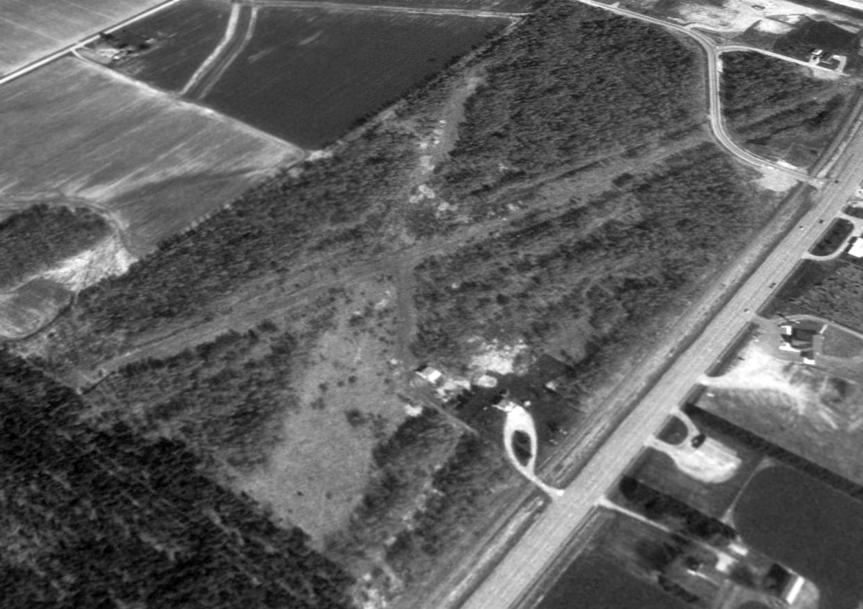
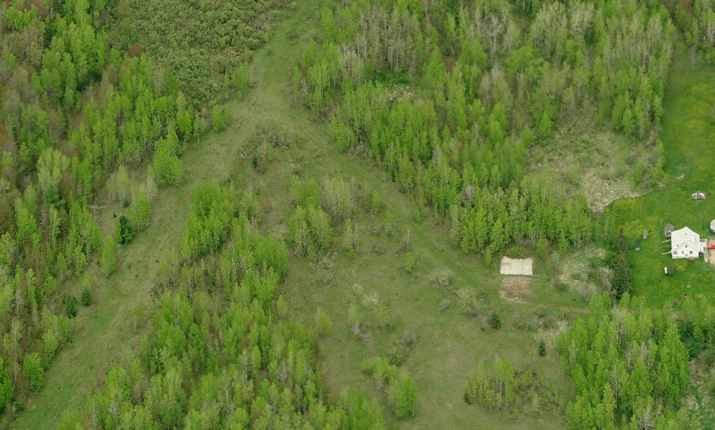
A 2012 aerial view looking northwest at the site of Colby-Abbotsford Airport showed the path of the northeast/southwest runway remained clear, and the foundation of the hangar remained recognizable.
The site of Colby-Abbotsford Airport is located southwest of the intersection of Route 13 & Oak Road.
Thanks to Brandon Vlasak for pointing out this airfield.
____________________________________________________
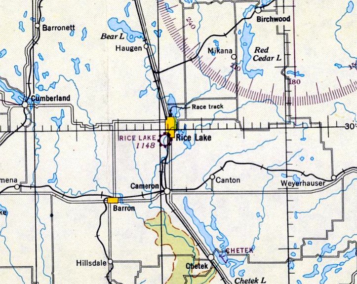
(Original) Rice Lake Municipal Airport, Rice Lake, WI
45.486, -91.737 (Northeast of Minneapolis, MN)
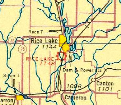
The original Rice Lake Airport, as depicted in its original location (SSW of the town) on the 1934 Twin Cities Airway Map.
The Rice Lake Municipal Airport was originally located south-southwest of the town of Rice Lake.
The date of construction of the field is unknown.
The earliest reference to the field which has been located was in the 1934 Department of Commerce Airfield Directory (according to Chris Kennedy).
It described Rice Lake Airport as consisting of a 1,320' x 1,275' sod field.
The Airport Directory Company's 1937 Airports Directory (courtesy of Bob Rambo)
described Rice Lake Municipal Airport as being 1 mile south of the center of the town.
The airfield was described as consisting of a 1,320' x 1,275' sod landing area.
The earliest photo which has been located of the original Rice Lake Airport was a 1938 aerial view (from the WI Historic Aerial Imagery Finder, courtesy of Al Hatz).
It depicted Rice Lake as having 3 unpaved runways, with a hangar & 4 light single-engine aircraft on the northeast side.
The last photo which has been located of the original Rice Lake Airport
was a circa 1943-45 aerial view from the 1945 AAF Airfield Directory (courtesy of Scott Murdock).
It depicted Rice Lake as a square grass landing area.
The 1944 US Army/Navy Directory of Airfields (courtesy of Ken Mercer) described Rice Lake Airport as being located 1 mile south of the town,
and described it as having a 1,500' unpaved runway.
The last aeronautical chart depiction which has been located of the original Rice Lake Airport was on the December 1944 Twin Cities Sectional Chart.
The 1945 AAF Airfield Directory (courtesy of Scott Murdock) described Rice Lake Municipal Airport as a 39 acre rectangular field within which were 3 sod runways,
the longest being the 1,500' northeast/southwest & northwest/southeast strips.
The field was said to have a total of 7 hangars, the largest being a 60' x 40' wood structure.
Rice Lake was said to be privately owned, but operated by the City of Rice Lake.
At some point between 1945-46, the original Rice Lake Municipal Airport was apparently replaced by a new Rice Lake Airport to the northeast of the town,
as only the new airport was depicted on the May 1946 Twin Cities Sectional Chart.
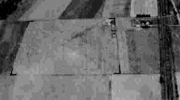
A 1948 aerial photo of the site of the original Rice Lake Municipal Airport showed some of the buildings remained, but the runway layout was barely recognizable
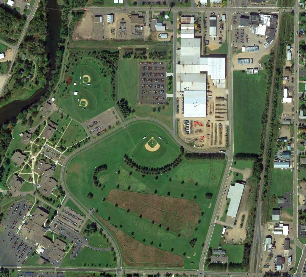
A 2015 aerial view showed no trace remaining of the original Rice Lake Municipal Airport.
The site of the original Rice Lake Municipal Airport is located southeast of the intersection of Coleman Street & Macauley Avenue.
____________________________________________________
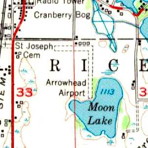
Arrowhead Airport / Rice Lake Municipal Airport (2nd location) (RIE), Rice Lake, WI
45.478, -91.722 (Northeast of Minneapolis, MN)

Arrowhead Airport, as depicted on the December 1947 Twin Cities Sectional Chart.
Arrowhead Airport, was evidently established on the southeast of the town of Rice Like at some point between 1946-47,
as it was not yet depicted on the May 1946 Twin Cities Sectional Chart.
The earliest depiction which has been located of Arrowhead Airport was on the December 1947 Twin Cities Sectional Chart.
It depicted Arrowhead as a commercial/municipal airport.
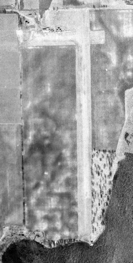
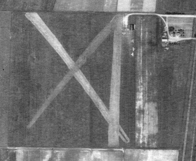
The earliest photo which has been located of Arrowhead Airport was a 4/21/48 USGS aerial view.
It depicted Arrowhead as having a north/south grass runway, with 2 light planes near some small buildings on the northwest side, and a single floatplane on the lakeshore at the south end of the runway.
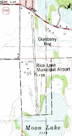
The 1951 USGS topo map depicted Arrowhead Airport as having 2 unpaved perpendicular runways & several small buildings along the north side of the field.
At some point between 1951-78, Arrowhead Airport was evidently expanded significantly toward the north,
and renamed Rice Lake Municipal Airport, as that is how it was depicted on the 1978 USGS topo map.
The last photo which has been located showing aircraft at Rice Lake Municipal Airport was a 1980 aerial view,
which showed 4 light single-engine planes parked on the west side among the hangars.
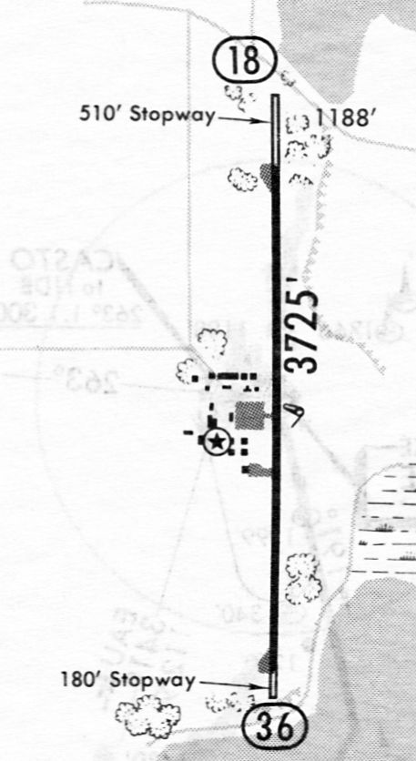
The 1982 AOPA Airport Directory (courtesy of Ed Drury) described Rice Lake Municipal Airport as having a single 3,700' asphalt Runway 18/36.
The operator was listed as Lakeland Aviation.
The last depiction which has been located showing Rice Lake Municipal Airport still operational
was on an 11/30/84 airport directory (courtesy of John Kielhofer).
It depicted Rice Lake as having a 3,725' paved Runway 18/36 with 2 ramps & several small buildings on its west side.
In 1995, a new & larger Rice Lake Regional Airport was built 5 miles southwest of the town of Rice Lake,
and the old Rice Lake Municipal Airport was presumably closed at the same time.
The old airport was depicted as an abandoned airfield on the 1998 Wisconsin Aeronautical Chart.
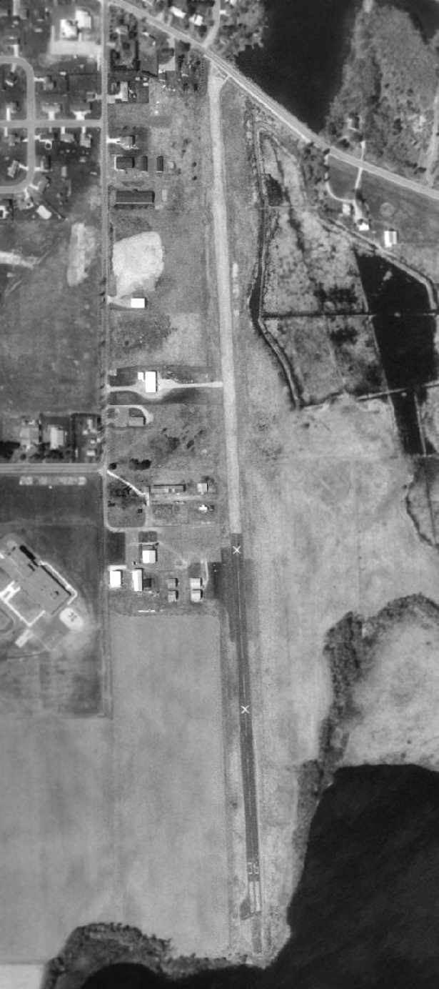
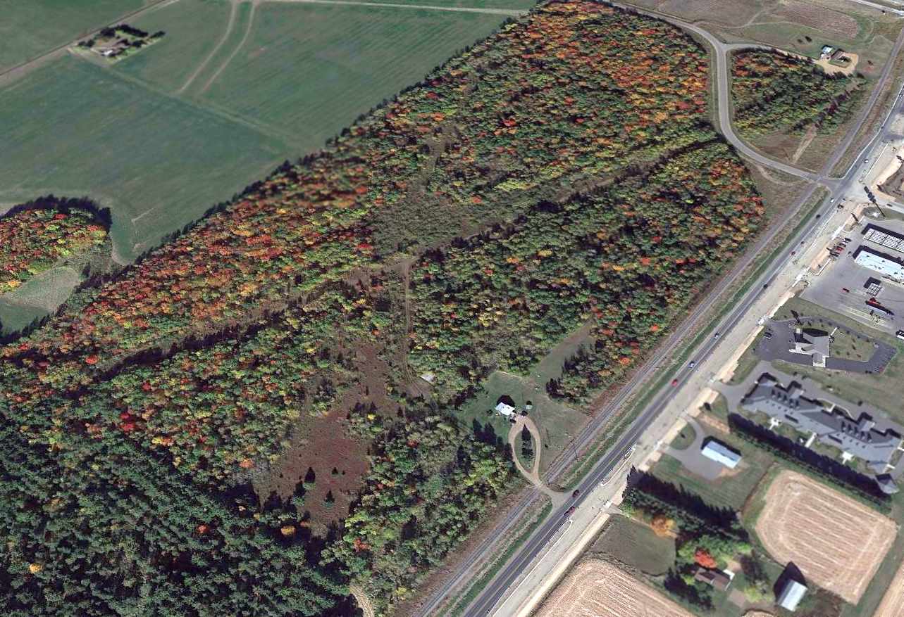
In the 1998 USGS aerial photo, the runway at Rice Lake was marked with several closed "X" symbols.
The airport was otherwise still intact, with the entire runway remaining,
and several taxiways leading to a number of small hangars on the west side of the runway.
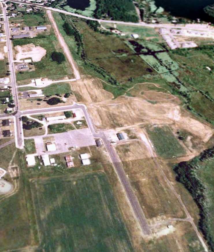
A 6/1/05 USGS aerial view looking northeast showed that the midsection of Rice Lake Municipal Airport was cut at some point between 1994-2005, and land has been cleared.
Several hangars remain intact on the west side of the runway.
A 2016 photo looking south along the remains of the Rice Lake Municipal Airport runway.
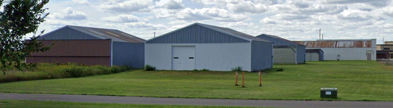
A 2019 photo looking southwest at former hangars on the west side of the Rice Lake Municipal Airport site.
The site of Rice Lake Municipal Airport is located southeast of the intersection of East Orchard Beach Lane & Kern Avenue.
____________________________________________________
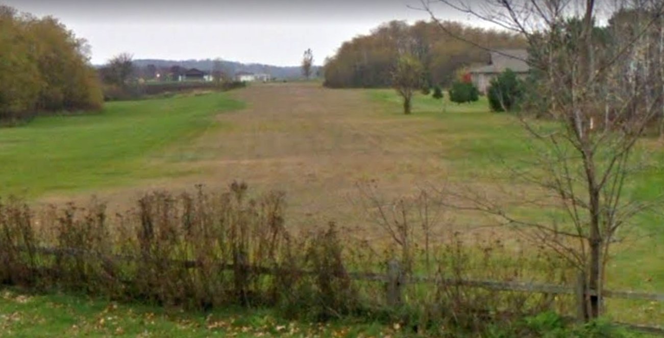
Old Tomahawk Airport / Forrest Protection Airfield, Tomahawk, WI
45.474, -89.744 (Northwest of Green Bay, WI)
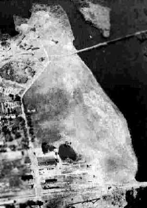
A 1938 aerial view of the original Tomahawk Airport (from the WI Historic Aerial Imagery Finder, courtesy of Al Hatz).
The date of construction of the original Tomahawk Airport has not been determined.
The earliest depiction which has been located of the original Tomahawk Airport
was a 1938 aerial view (from the WI Historic Aerial Imagery Finder, courtesy of Al Hatz).
It depicted the field as having a single unpaved east/west runway, with a hangar (with “Tomahawk” painted on its roof) on the southeast corner.
The earliest aeronautical chart depiction which has been located of the original Tomahawk Airport
was on the 1942 Regional Aeronautical Chart (courtesy of Chris Kennedy).
The earliest photo which has been located of Tomahawk Airport
was a 9/25/40 aerial view looking west from the 1945 AAF Airfield Directory (courtesy of Scott Murdock).
It depicted Tomahawk as having a grass east/west landing area.
The 1945 AAF Airfield Directory (courtesy of Scott Murdock)
described Tomahawk Airport as a 37 acre irregularly-shaped field
within which was an asphalt, sand, and gravel all-way field, measuring 1,500' northeast/southwest.
The field was said to have a single 120' x 100' concrete, brick, and steel hangar.
Tomahawk was described as being owned by the State of Wisconsin, but not currently in operation.
The 1948 Green Bay Sectional Chart (according to Chris Kennedy)
described "Tomahawk" as having a 1,500' unpaved runway.
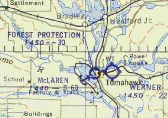
Chris Kennedy also noted that the 1948 chart depicted "another airport just across town to the east called Werner,
another one about two miles southeast of town called Allard,
and a seaplane base across the lake called McLaren - lots of airports for a small town."
A 5/28/50 USGS aerial view of Tomahawk Airport showed it to have an open grass landing area.
The dark building on the southeast side had the letters “Tomahawk” & an airport circle marking.
At some point between 1948-54 the airfield was apparently renamed "Forrest Protection",
as that is how it was labeled on the November 1954 Green Bay Sectional Chart (courtesy of Chris Kennedy).
The field was described as having a 3,000' unpaved runway.
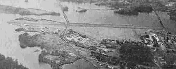
An aerial view looking north at the Tomahawk "Forrest Protection Airport",
from the 1960 Sky Eye Wisconsin Airport Directory (courtesy of Chris Kennedy).
The runway had apparently been paved at some point between 1954-60,
as the field was described as having a single 3,200' paved runway.
Note the Marin Tomahawk & Western Railroad which crossed right over the paved runway.
The remarks said "Field owned by Wisconsin Conservation Dept. & the Owens-Illinois Glass Co.
It is not a municipal field but transient aircraft may use the field."

The 1960 Jeppesen Airway Manual (courtesy of Chris Kennedy)
depicted the Forrest Protection Airport as having a single paved 3,200' Runway 7/25,
along with a former unpaved crosswind runway.
Two buildings (hangars?) were depicted on the southwest & southeast sides of the field.
The remark said "Railroad crosses runway."
The original Tomahawk Airport was apparently closed at some point prior to between 1960-64,
after being replaced by Tomahawk Regional Airport (3 miles to the west).
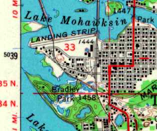
The 1966 USGS topo map depicted a single east/west runway at the site of the original Tomahawk Airport,
labeled simply as “Landing Strip”.
On the 1982 USGS topo map, the original Tomahawk Airport was no longer depicted,
but was rather depicted simply as an open unmarked area.
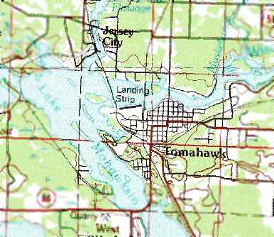
On the 1990 USGS topo map, the original Tomahawk Airport was simply labeled as “Landing Strip”.
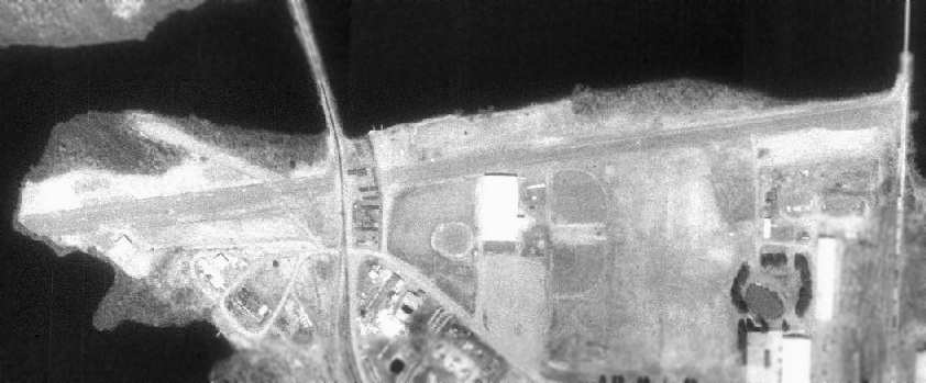
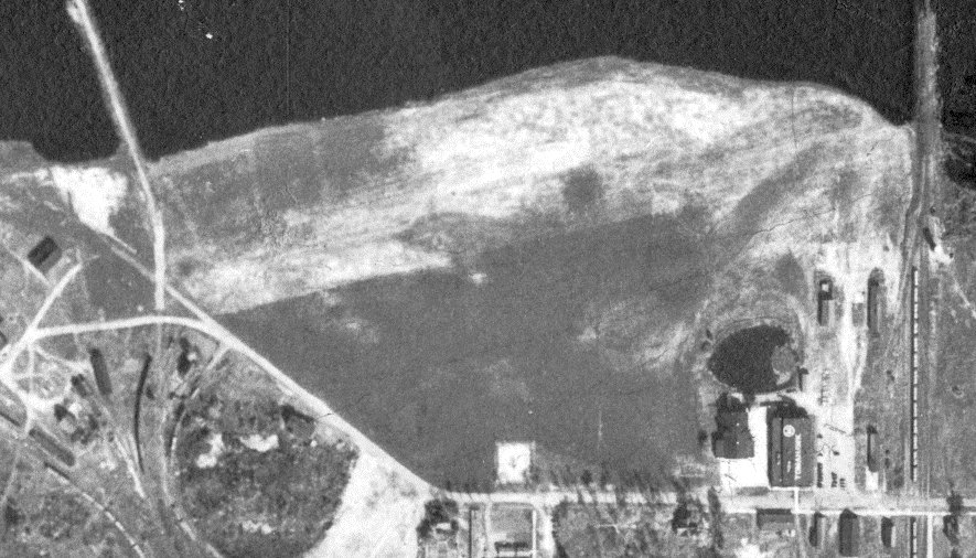
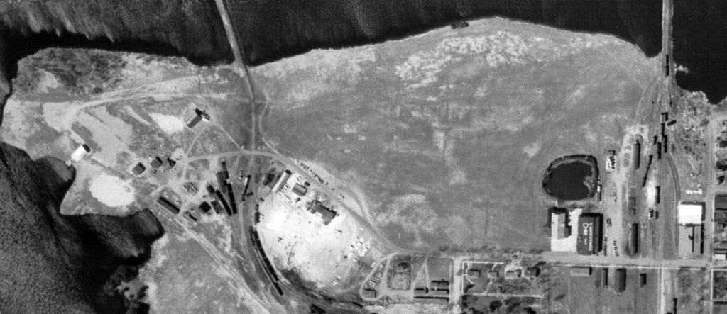
As of the 1992 USGS aerial photo, the airfield consisted of a single 3,600' paved runway,
which occupied almost the entire width of a peninsula jutting into Lake Mohawksin.
The original Tomahawk Airport was depicted as an abandoned airfield on the 1992 Sectional Aeronautical Chart (courtesy of Ed Drury).
The original Tomahawk Airport was no longer depicted at all on 2002 aeronautical charts.
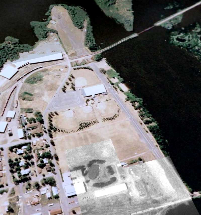
A December 30, 2005 USGS aerial view looking northwest at the site of the original Tomahawk Airport showed the remains of the paved east/west runway
as well as traces of the former crosswind runway.
The site of the original Tomahawk Airport is located at the western end of West Somo Ave.
____________________________________________________
Or if you prefer to contact me directly concerning a contribution (for a mailing address to send a check),
please contact me at: paulandterryfreeman@gmail.com
If you enjoy this web site, please support it with a financial contribution.
____________________________________________________
This site covers airfields in all 50 states.