Abandoned & Little-Known Airfields:
Eastern Alaska
© 2003, © 2026 by Paul Freeman. Revised 5/9/26.
This site covers airfields in all 50 states: Click here for the site's main menu.
____________________________________________________
Please consider a financial contribution to support the continued growth & operation of this site.
Anchorage Aviation Field / Delaney Park Airfield (revised 8/6/25) - Eightmile Lake Airfield (revised 8/6/25) - (Original) Huslia Airport (revised 12/2/18) - Miller Army Airfield (revised 7/1/20) - Naval Air Station Sitka (revised 12/12/25)
- Nuiqsut Airport (original location) (added 6/4/20) - Phillips Field (revised 1/14/22)
(Original) Point Barrow Airfield / Barrow Naval Arctic Research Laboratory Airfield / Original Point Barrow Airport (revised 11/22/23) -
Sagwon Airport (revised 11/11/24) - Wasilla Airport (original location) (added 5/9/26) - Weeks Field (revised 2/13/26)
____________________________________________________
Wasilla Airport (orignal location) (LWA, Z16), Wasilla, AK
61.584, -149.458 (Northeast of Anchorage, AK)
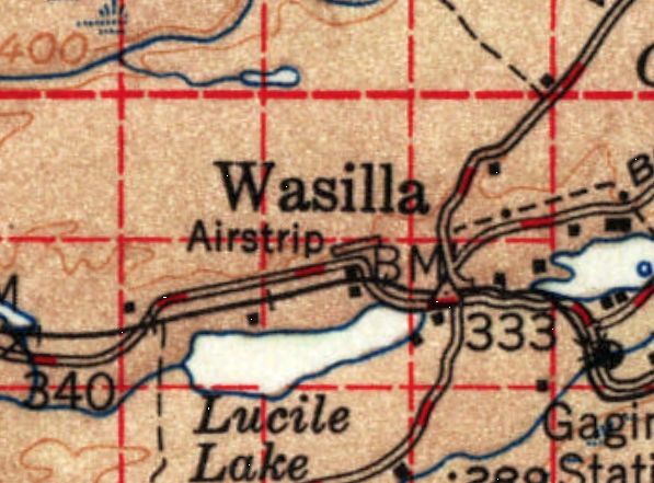
Wasilla Airport, as depicted on the 1954 USGS topo map.
The original airport for the town of Wasilla was located close to the northwest of the center of the town.
The date of construction of the original Wasilla Airport has not been determined.
The earliest depiction which has been located of Wasilla Airport was on the 1954 USGS topo map, which depicted a single short northeast/southwest runway labeled generically as “Airstrip”.
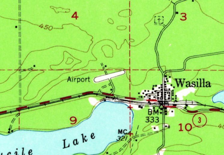
The 1963 USGS topo map depicted Wasilla Airport as a single short northeast/southwest runway labeled generically as “Airport”.
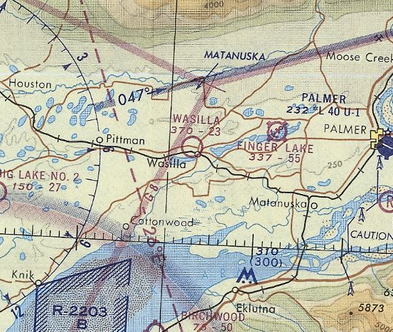
The earliest aeronautical chart depiction which has been located of Wasilla Airport was on the 1971 Anchorage Sectional Chart.
It depicted Wasilla as having a 2,300' unpaved runway.
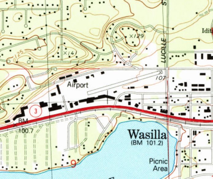
The last topo map depiction which has been located of the original Wasilla Airport was on the 1992 USGS topo map.
It depicted a single northeast/southwest runway labeled generically as “Airport”.
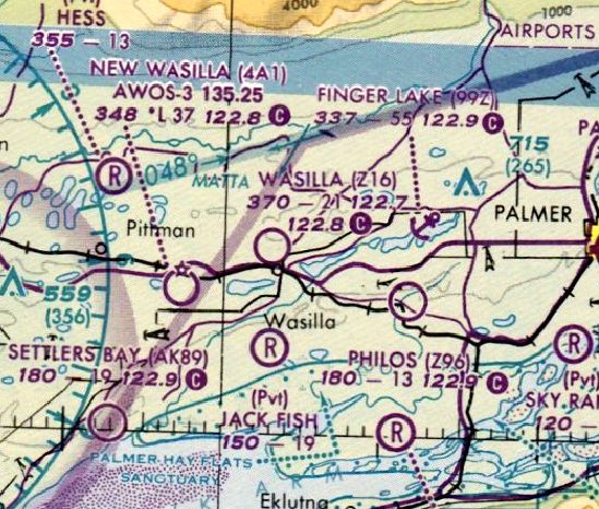
The last aeronautical chart depiction which has been located of the original Wasilla Airport was on the December 1993 Anchorage Sectional Chart.
It depicted Wasilla as having a 2,100' unpaved runway.
Note that it also depicted the “New Wasilla” Airport to the southwest, which would soon replace the old airport.
According to Tim Vasquez, the original Wasilla Airport was “closed in 1993 & turned into a park.”
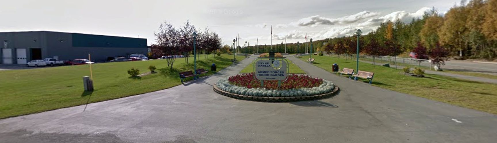
A 2021 photo looking southwest at the northeast corner of the original Wasilla Airport site, by then the location of the Armed Forces Honor Garden.
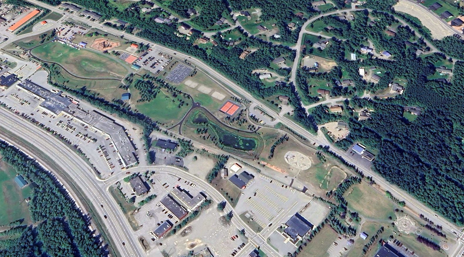
A 2022 aerial view looking northwest at the original Wasilla Airport site, reused as a park.
Thanks to Tim Vasquez for pointing out this airfield.
____________________________________________________
Nuiqsut Airport (original location), Nuiqsut, AK
70.217, -150.972 (North of Fairbanks, AK)
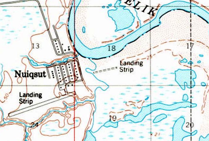
The original Nuiqsut Airport was depicted simply as “Landing Strip” on the 1984 USGS topo map.
Photo of the airfield while in use has not been located.
According to Terry Schwartz, “The Eskimo village of Nuiqsut is located on the Nechelik Channel of the Colville River on the North Coast of Alaska.
Nuiqsut was established in the early 1970s by a group of Eskimos from Barrow who had grown disenchanted with life in the big city.
The old airport must have been built almost immediately, as airports are essential in Alaska.
I flew into the old runway perhaps a couple dozen times. Located down in the river bed, it was prone to flooding & soft spots.
I never saw a published length, but a mapping program shows it to be about 2,000'.
The largest aircraft I saw operate into the old runway was my DeHavilland DHC-6 Twin Otter.
Flying a Twin Otter in Alaska is the most fun you can have with your pants on.
There were no navaids, hence no instrument approaches. No runway lighting, no airport beacon, no nothing.”
The replacement Nuiqsut Airport to the west (with a longer paved runway) became operational in June 1977.
The earliest depiction which has been located of the original Nuiqsut Airport was on the 1984 USGS topo map.
It depicted an unpaved northeast/southwest runway, labeled simply as “Landing Strip”, with the paved runway of the replacement Nuiqsut Airport to the west.
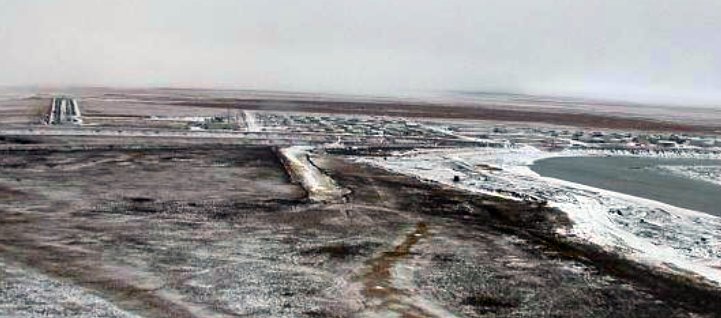
An undated aerial view showed the replacement Nuiqsut Airport at top-left, and the original runway at the center (courtesy of Terry Schwartz).
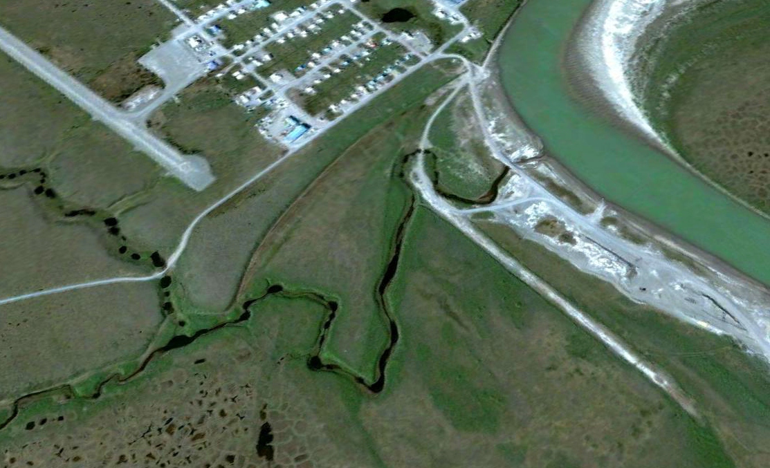
A 2005 aerial view looking northwest showed the replacement Nuiqsut Airport at top-left, and the original runway to the east.
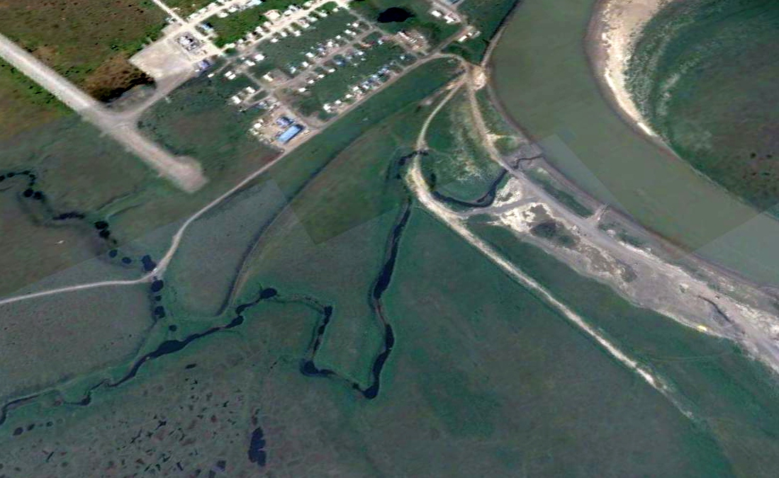
A 2016 aerial view looking northwest showed the replacement Nuiqsut Airport at top-left, and the original runway to the east.
Thanks to Terry Schwartz pointing out this airfield.
____________________________________________________
Naval Air Station Sitka, Sitka, AK
57.053, -135.352 (East of Sitka Airport, AK)

A pre-WW2 photo of a Navy PBY Catalina flying boat at NAS Sitka.
According to Wikipedia, “In consideration of the possibility of war in the Pacific Ocean,
the War Department in 1937 established a small naval station near Sitka as a base for a small fleet of PBY Catalina seaplanes.
In 1939 Congress appropriate funds for the construction of Naval Air Stations at Sitka & other sites in coastal Alaska.
The Sitka station was built on Japonski Island, just west of Sitka Harbor, on land that had been under Navy jurisdiction since the Alaska Purchase in 1867.
The Sitka Naval Air Station was formally commissioned on 10/1/39.
What was then not much more than a coal resupply station rapidly grew, with a radio station, barracks, and other facilities constructed, mainly on the north side of the island.”
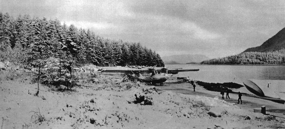
A circa 1939-40 photo of a row of Navy PBY Catalina flying boats on the NAS Sitka ramp, before its hangars were constructed.
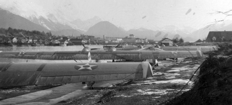
A circa 1939-40 photo of a row of Navy PBY Catalina flying boats on the NAS Sitka ramp, before its hangars were constructed.
According to Wikipedia, “The naval facilities on Japonski Island eventually grew to include several hangars, ramps into the water to facilitate the movement of seaplanes onto land,
a large concrete parking area, a control tower, 2 piers, and a number of ancillary support buildings.
On the island the Navy also had a system for landing & launching aircraft similar to that used on aircraft carriers.”
According to Sitka resident Matthew Hunter (courtesy of John Voss), “NAS Sitka had cable arrestor gear installed along a roughly 2,500' length of tarmac.
I am not aware of any painted lines during wartime. As far as I can tell, this gear was never used.
The aircraft were primarily PBY & OS2U-2, but there were at least 1 of each J2F-3 & JRF-5.
Usually there were only a couple PBYs in Sitka with most out in the Aleutians. There were many Kingfishers at Sitka & its section bases.”
According to M.L. Shettle’s book “United States Naval Air Stations of World War II”, there were 18 land-based fighter aircraft based at NAS Sitka.
John Voss noted, “If indeed there were carrier-based fighter aircraft there too it must have been a cramped ramp!”
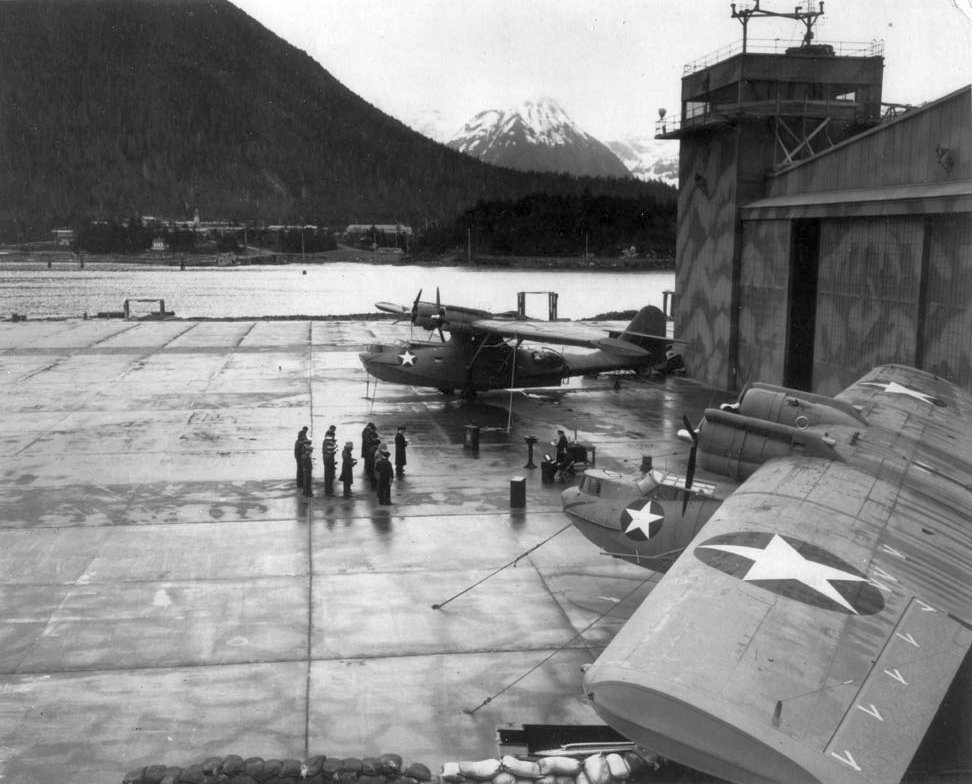
A circa 1941-44 photo of an Easter service being conducted on the NAS Sitka ramp, in front of Navy PBY Catalina flying boats & a camoflauged hangar & control tower.
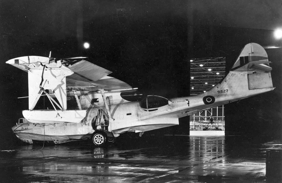
A circa 1941-44 photo of a wrecked RCAF PBY Catalina flying boat in front of an NAS Sitka hangar, with what may have been an RCAF Blackburn Shark biplane floatplane visible inside.
According to Wikipedia, “The naval station in Sitka was deactivated in June, 1944.”
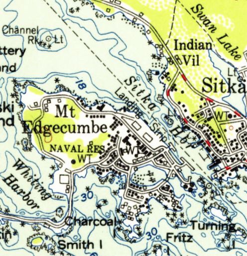
The 1956 USGS topo map depicted the 2 hangars of NAS Sitka, but also oddly labeled a “Landing Strip” in the adjacent water.
The current Sitka Airport (with a landplane runway) was eventually constructed on the opposite (western) side of Japonski Island in 1969.
As of 2003, Mt Edgecumbe High School had been constructed on the northwestern portion of the Sitka seaplane ramp.
According to Sitka resident Matthew Hunter (courtesy of John Voss), “One of the cable pits [from the WW2 arrestor gear] was removed [in approximately 2009] during a water main installation.”
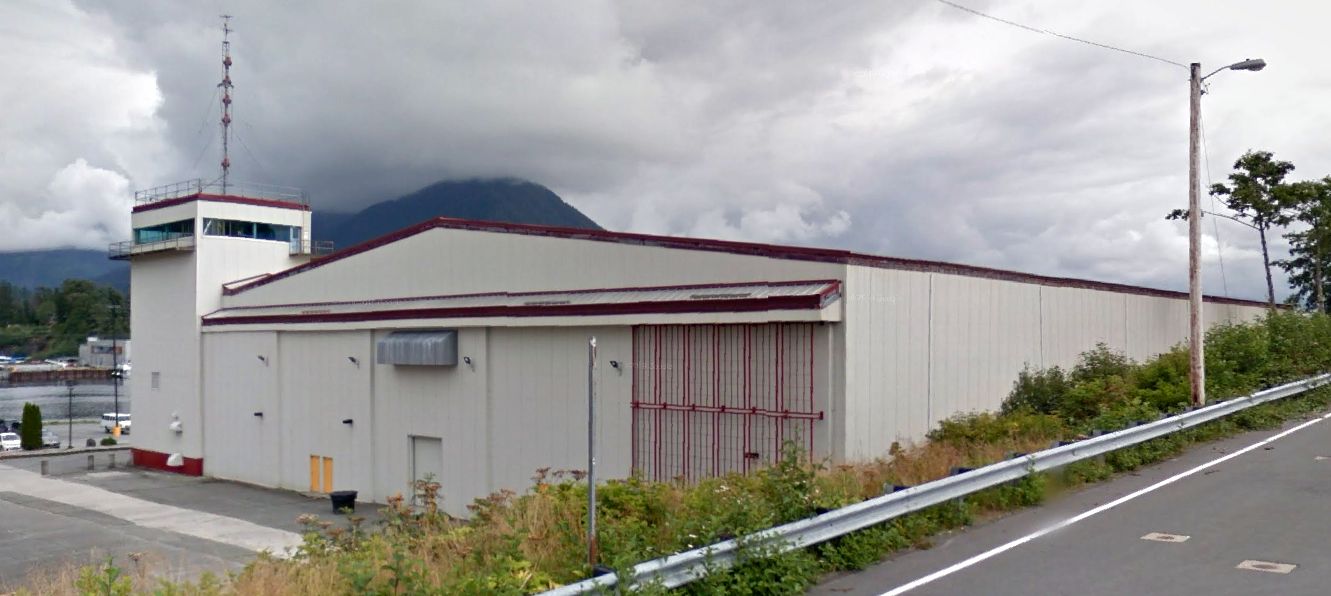
A 2011 photo looking east at the northern former NAS Sitka hangar with its attached control tower.
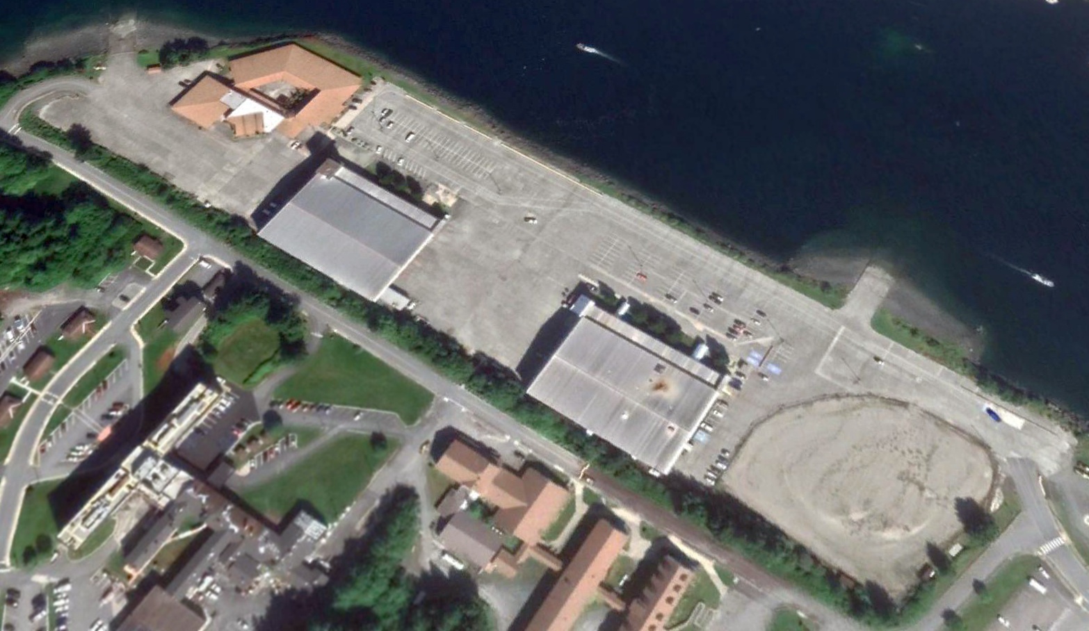
A 2018 aerial view looking northeast shows the hangars & seaplane ramp of NAS Sitka remain intact.
As of 2019, street maps show the southeastern portion of the former NAS Sitka seaplane ramp is labeled as part of the University of AK Southeast.
Sitka resident Matthew Hunter reported in 2019, “The other cable pit [from the WW2 arrestor gear] is still in place.”
Thanks to John Voss for pointing out this airfield.
____________________________________________________
Anchorage Aviation Field / Delaney Park Airfield, Anchorage, AK
61.213, -149.899 (Southwest of Downtown Anchorage, AK)
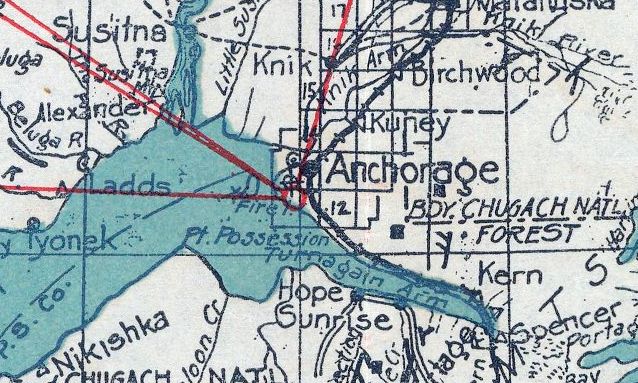
Delaney Park Airfield, as depicted on a 1927 Knoll Map Company map (courtesy of Jonathan Westerling).
According to Wikipedia, Delaney Park was established as part of the original Anchorage township plat in 1917 & named for James Delaney, one of the first mayors of Anchorage.
The park was originally used simply as a firebreak, but in 1922 it became 'The Golf Course'.
The community used the space both for a golf course and & airstrip, serving as Anchorage's first airport.
The earliest depiction which has been located of Delaney Park Airfield was on a 1927 Knoll Map Company map (courtesy of Jonathan Westerling).
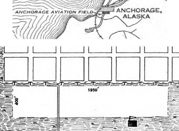
Th 9/14/29 Commerce Department Airway Bulletin #743 (courtesy of Lee Corbin) depicted the “Anchorage Aviation Field” as a 1,950' east/west sandy loam airfield measuring 18 acres, with one hangar on the southeast side.
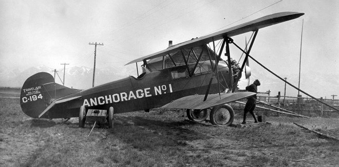
A circa 1920s photo of a Travel Air 7000 of Anchorage Air Transport seen at the Anchorage Park Airfield (courtesy of Lee Corbin).
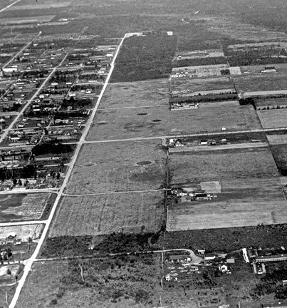
A circa 1920s-30s aerial view looking east at the Delaney Park Airfield (courtesy of Lee Corbin).
According to Wikipedia, the larger Merrill Field opened in 1932, making the Delaney Park Airfield redundant.
In 1954 the Parks & Recreation Department began to develop recreation facilities at Delaney Park for a variety of activities, including ice skating, softball, horseshoes, and tennis.
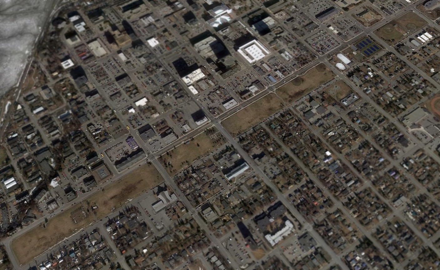
A 2011 aerial view looking northeast at the Delaney Park Airfield site.
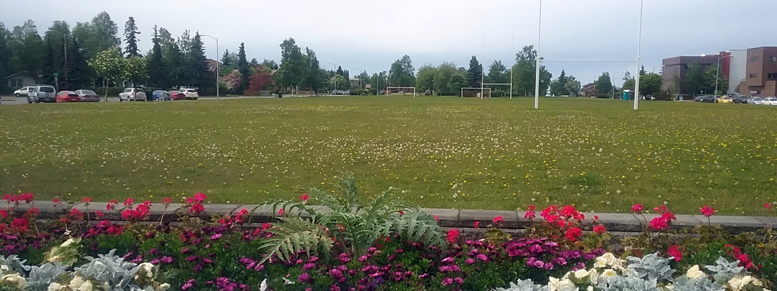
A June 2017 photo by Ron Plante of the Delaney Park Airfield site.
According to Wikipedia, as of 2017 Delaney Park is used for a variety of community events, sports, and festivals year-round.
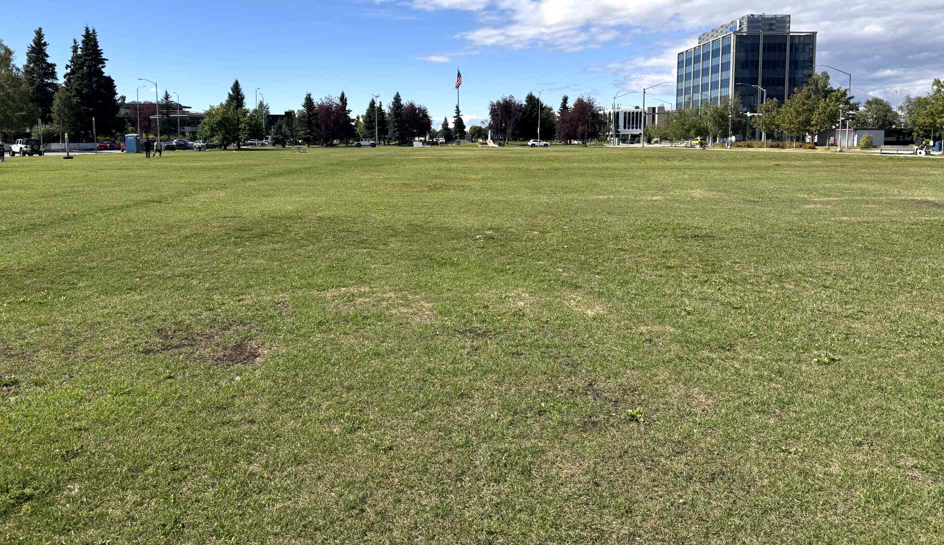
An 8/3/25 photo by Paul Freeman looking west at the Delaney Park Airfield site.
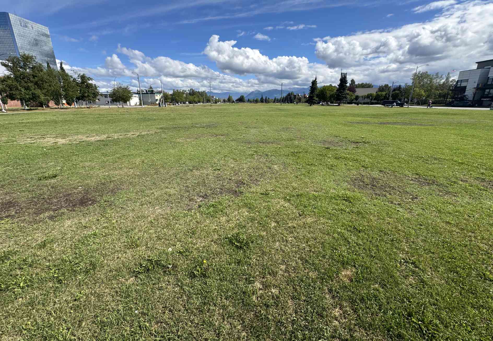
An 8/3/25 photo by Paul Freeman looking east at the Delaney Park Airfield site.
The site of Delaney Park Airfield is located south of the intersection of West 9th Avenue & I Street.
____________________________________________________
(Original) Point Barrow Airfield / Barrow Naval Arctic Research Laboratory Airfield / Original Point Barrow Airport, Barrow, AK
71.338, -156.639 (North of Anchorage, AK)
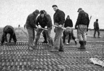
A 6/8/45 US Navy photo (courtesy of Drew Van Horne) of workers laying the Marston may runway at the original Point Barrow Airfield.
Point Barrow is located on the very northern tip of Alaska.
The date of construction of the original Point Barrow Airfield has not been determined.
The earliest reference which has been located of the Point Barrow Airfield was from Drew Van Horne,
who reported, “Wien Alaska Airlines operated flights since the 1930s from Barrow.”
The USGS paper “Exploration of Naval Petroleum Reserve #4 & Adjacent Areas Northern AK, 1944-53” (courtesy of Drew Van Horne) said,
“The airstrip at Barrow & attendant facilities were to be improved in 1945.
Several improvements were made during the year at the Barrow airfield.
In February [1945], Bartow lights were installed along the runway, and a revolving beacon was placed on the utility building.
The Barrow field became so soft in the spring thaw that it was necessary to cover it with Marston Mat (pierced steel plank).
The runway, 140' x 4,000', was so covered as well as the 50,000 square-foot parking area.
Tundra growth was mixed with the course sand of the airfield to stabilize the surface before the mat was laid, and this provided a good base.
Later an additional parking area of 31,500 square feet was graded & covered with marston mat.”
The earliest photo which has been located of the Point Barrow Airfield was a 6/8/45 US Navy photo (courtesy of Drew Van Horne) of workers laying the Marston may runway.
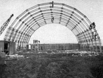
A Summer 1945 US Navy photo (courtesy of Drew Van Horne) of a hangar under construction at the original Point Barrow Airfield.
The USGS paper “Exploration of Naval Petroleum Reserve #4 & Adjacent Areas Northern AK, 1944-53” (courtesy of Drew Van Horne) continued,
“A concrete turntable 175' in diameter was constructed in August at the south end of the runway.
It was also necessary to level the landing strip by selectively raising the mat & placing sand & gravel under it.
A hangar & a radio transmitter building were started at Barrow during the year.”
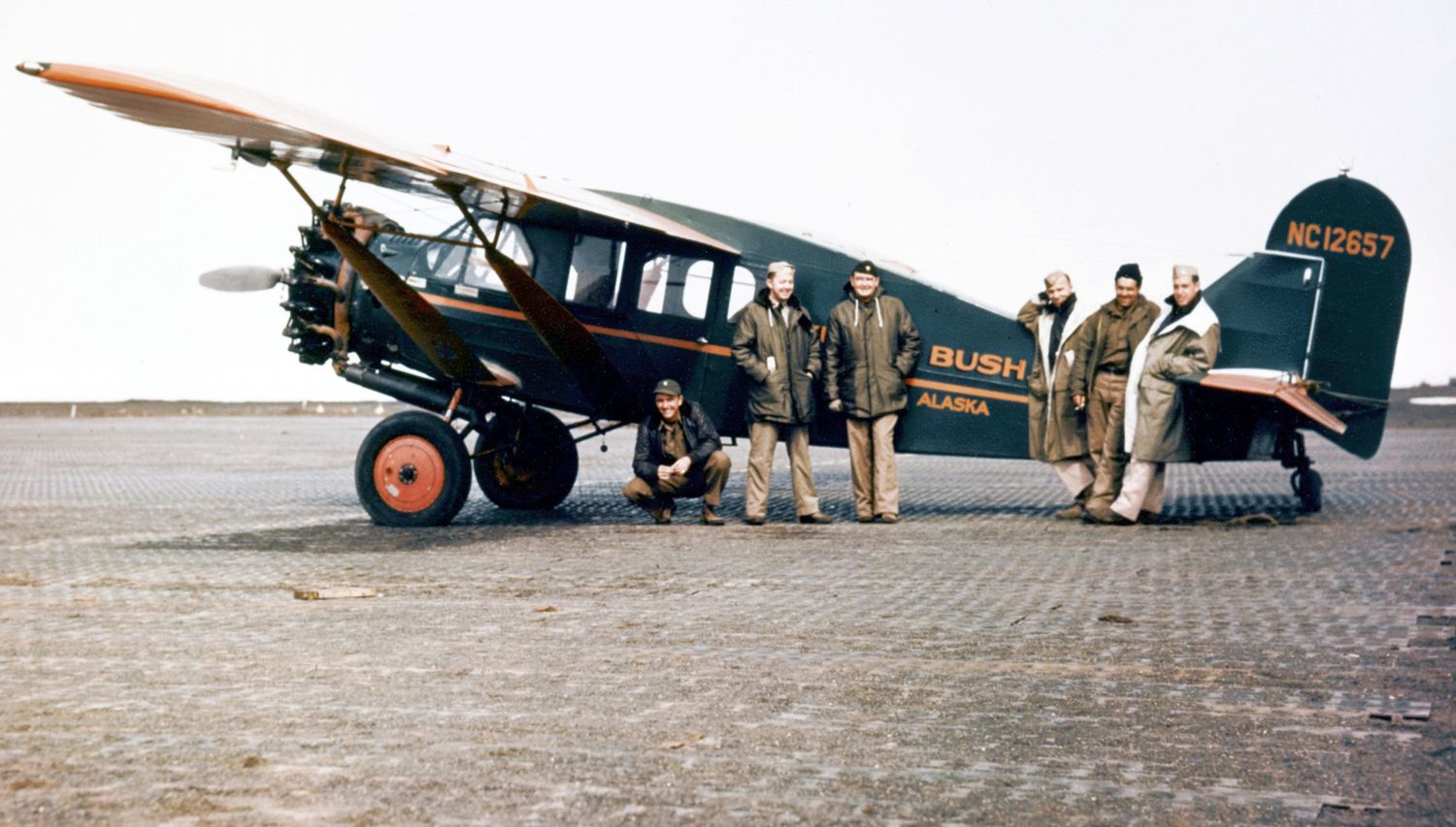
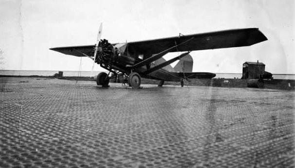
A 1945 photo of a Bellanca on Point Barrow's Marston Mat (from Alaska's Digital Archive, courtesy of Drew Van Horne).
According to Drew Van Horne, “After WW2, Wien Alaska Airlines operated 3 flights a week service with DC-3s to Fairbanks with a stop in Bettles.”
The Barrow Naval Arctic Research Laboratory was established in 1947,
and the adjacent airfield was used to support the laboratory.
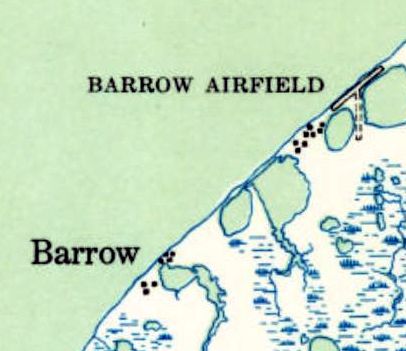
The 1949 USGS topo map depicted “Barrow Airfield” as having a northeast/southwest runway & a shorted unpaved north/south strip.
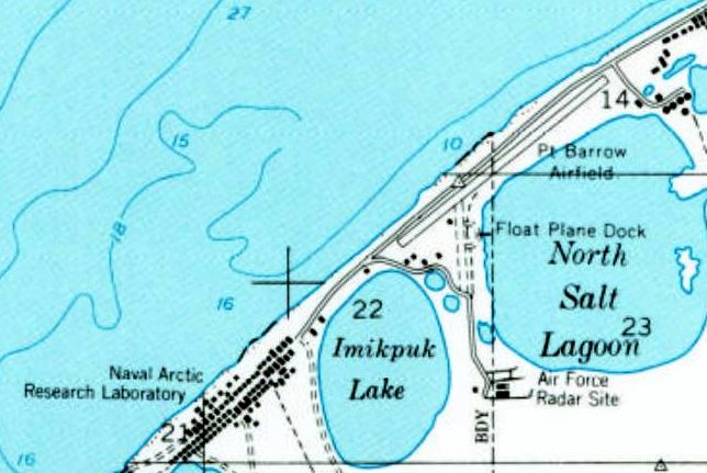
The 1955 USGS topo map depicted “Pt. Barrow Airfield” as having a northeast/southwest runway & a shorted unpaved north/south strip.
A float plane dock was depicted to the southeast, and the Air Force Radar Site was further south.
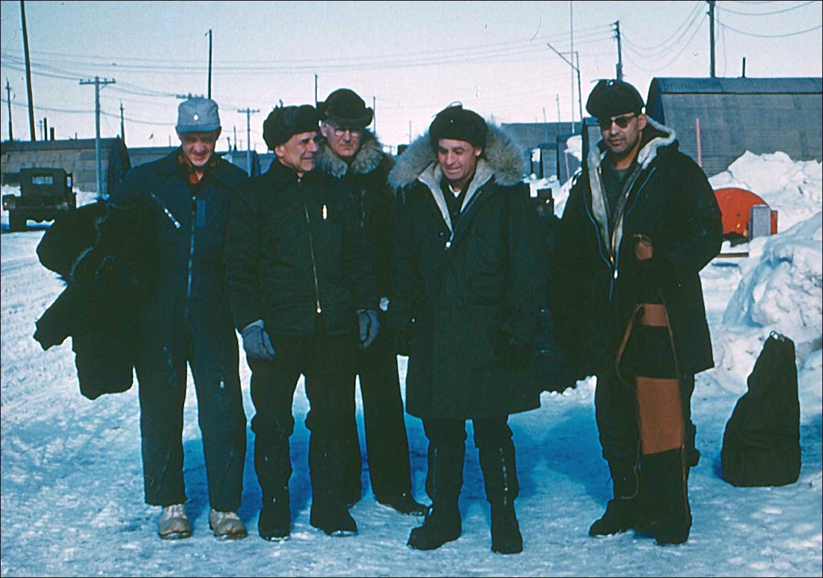
An April 1955 photo (courtesy of Terrence Schwartz) of General Jimmy Doolittle (2nd from left) on Pt. Barrow's Main Street.
Doolittle had been flown into Pt. Barrow on a USAF L-20A DeHavilland Beaver on skis, piloted by 1st Lt. Joseph Schwartz (far left).
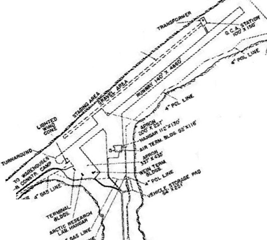
A late 1950s site plan (courtesy of Drew Van Horne) depicted the original Point Barrow Airfield as having a 4,860' southwest/northeast runway.
Drew Van Horne noted, “This is interesting as it shows the buildings at that time including the current 130' x 112' hangar (the northern-most hangar)
and the Wien terminal buildings (plural) which appear to be where the southern-most hangar is today [as of 2019].”
According to Drew Van Horne, “By 1958, [Wien Alaska Airlines] frequency increased to 4 flights a week
and F-27s were introduced in 1959 cutting the nonstop flight time from 3 hours down to 2 hours & 10 minutes to Fairbanks.
Some of the flights to Fairbanks made flag stops at Umiat & there was summer main-line service direct to Kotzebue in addition to local bush flights to Wainwright, Point Lay & Meade River (now Atqusuk).”
According to “Adaptive Governance & Climate Change” (courtesy of Drew Van Horne), “The great storm of October 1-3, 1963 damaged the airstrip, but the new airport under construction [Wiley Post Airport, to the southwest]
was far enough along to allow it to be used as a backup to fly in emergency relief & other supplies until repairs could be made.”
According to an 11/11/64 Fairbanks Daily News-Miner article (courtesy of Drew Van Horne),
in November 1964, facilities at the new Wiley Post / Will Rogers Memorial Airport were ready for Wien Alaska Airlines to move service from the joint-use military field at Point Barrow.
According to Drew Van Horne, “Wien continued to operate an intermittent weekly flight on Fridays into Point Barrow until late 1967 or early 1968
as this appears in the 8/1/67 Official Airline Guide & the 11/20/67 Wien Air Alaska timetable.
The new airport kept Point Barrow's BRW IATA code so PBA was used as the code from that point until its closure.”
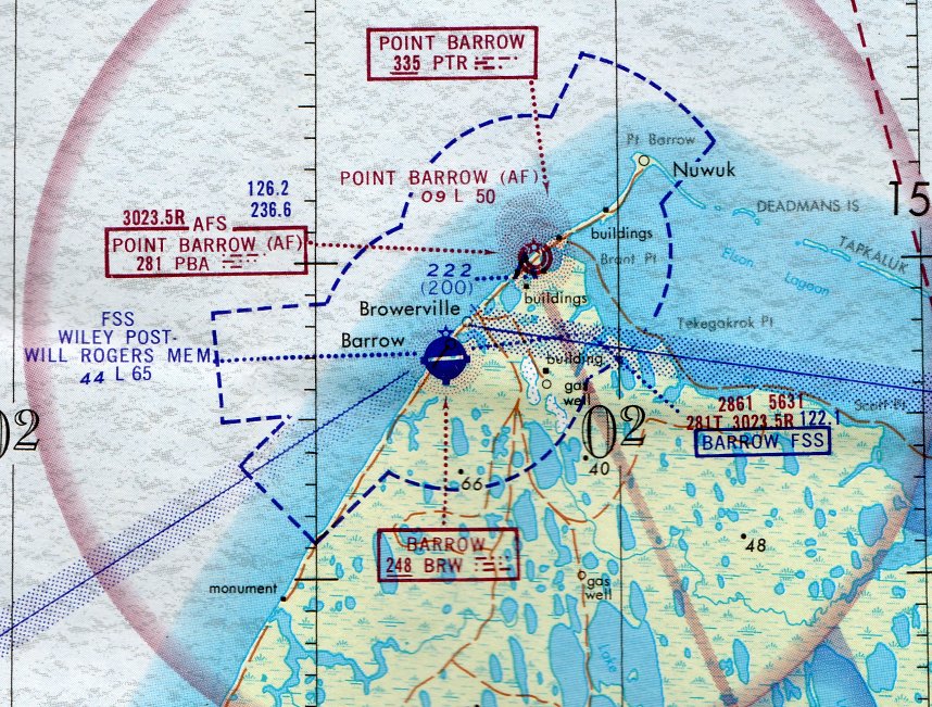
The earliest aeronautical chart depiction which has been located of the Pt. Barrow Airfield was on the 1971 Cape Lisburne Sectional Chart.
It depicted the “Point Barrow” as an Air Force airfield having a 5,000' unpaved runway.
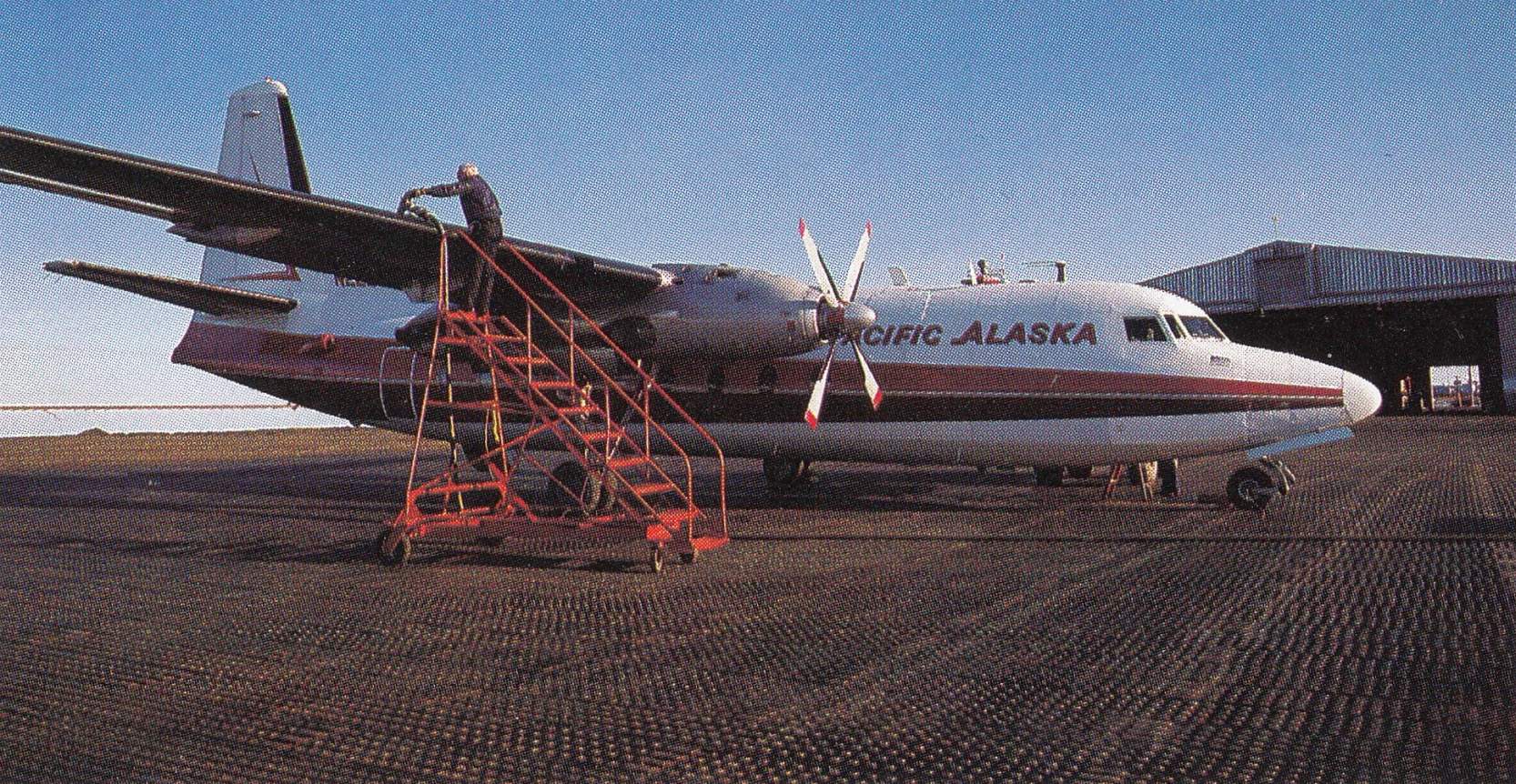
A circa 1980 photo of a Pacific Alaska Airlines Fairchild F-27 on the original Point Barrow Airfield's Martston Mat, with the DEW Line hangar in the background (courtesy of Drew Van Horne).
According to Tom Moll, “The NARL was closed in 1980 (or maybe 1981).
I worked at the Air Force radar site in Barrow from 1987-89,
and at that time the runway was operated & maintained by the radar station staff.
We received 2 or more flights per week carrying passengers & supplies for the radar site.
Most of the incoming aircraft were Fairchild F-227s operated by Pacific Alaska on a contract with the occasional AK Air National Guard or Air Force C-130 delivering large cargo.
The Air Force was the exclusive user of the runway, with the exception of very rare visiting aircraft which I believe required advanced clearance.
After all, the runway is located on an Air Force Station.
The runway was not paved. At the time I worked at the facility it was surfaced with Marston matting.
Of the 6 DEW Line sites in Alaska, the Barrow station was the only site that had a snow blower.
The snow blower was necessary to clear snow without snagging the Marston matting as a grader might.
As you can imagine, snags could puncture tires & nobody wanted that. I still remember our staff welding the matting with an acetylene torch to repair the matting.”
Tom continued, “The 2 hangars were also operated by the radar site. They were primarily used for storage of vehicles & oversized supplies.
The eastern & smaller hangar was built for the radar site & was in far better condition in the 1980s.
The western hangar was originally built for the NARL facility, but had been inherited by the radar site.
Just to the south of the eastern hangar was the Air Terminal Building (ATB).
At one time the DEWline had a great deal of passenger traffic east & west among the radar sites,
but over the years the need for a staging building for the passengers & cargo had declined, and the ATB was used solely for storage.”
In 1995 the buildings of the Barrow Naval Arctic Research Laboratory were reused as the home of Iḷisaġvik College.
The November 1997 Point Barrow Sectional Chart (courtesy of Stu Sibitzky) no longer depicted the Barrow Naval Arctic Research Laboratory Airfield.
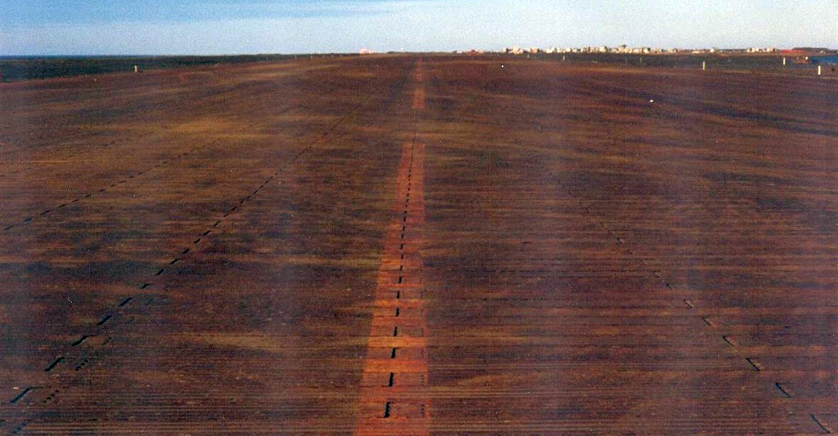
An August 2003 photo by Drew Van Horne looking northeast along the pierced steel planing runway of the original Point Barrow Airport.
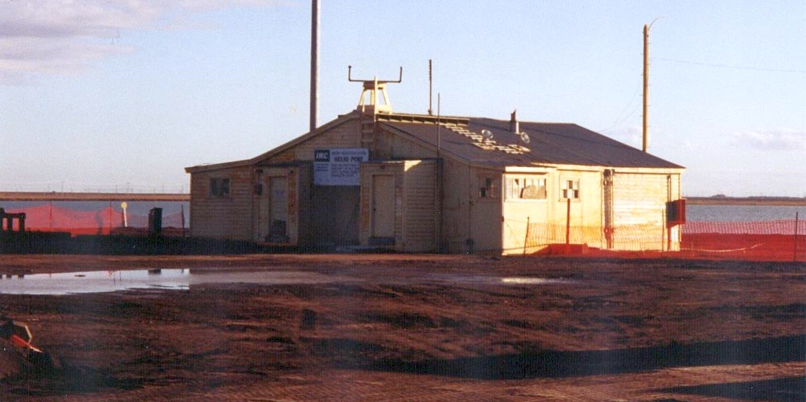
An August 2003 photo by Drew Van Horne of a building along the southern edge of the parking ramp of the original Point Barrow Airport.
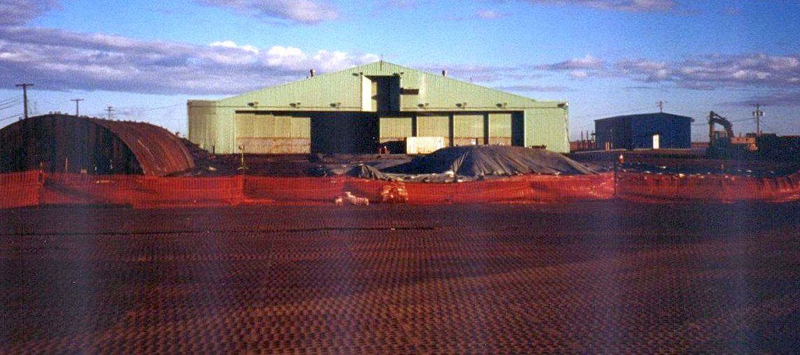
An August 2003 photo by Drew Van Horne of the main DEW Line hagar at the original Point Barrow Airport.
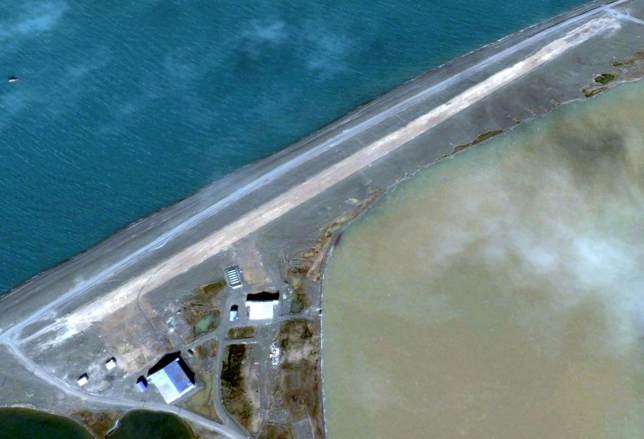
A 2005 aerial view looking north at the Barrow Naval Arctic Research Laboratory Airfield showed the northeast/southwest runway remained intact, along with 2 hangars.
According to Dave Noordeloos, “The hangar visible is huge & was still there when I visited in July 2011.
The residents of Barrow now periodically use the old runway to butcher whales.”
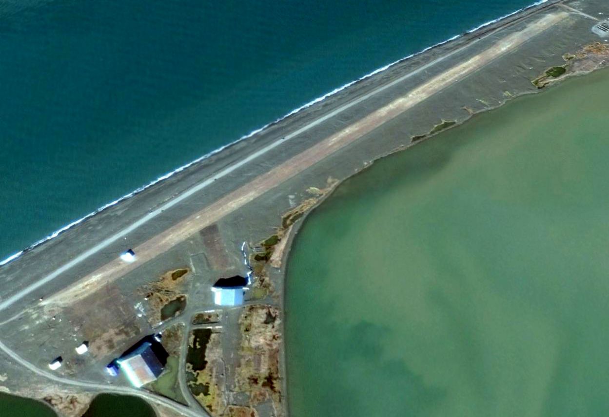
A 2014 aerial view looking north at the Barrow Naval Arctic Research Laboratory Airfield showed the northeast/southwest runway remained intact, along with 2 hangars.
Thanks to Dave Noordeloos for pointing out this airfield.
____________________________________________________
Sagwon Airport (SAG), Sagwon, AK
69.378, -148.689 (South of Prudhoe Bay, AK)
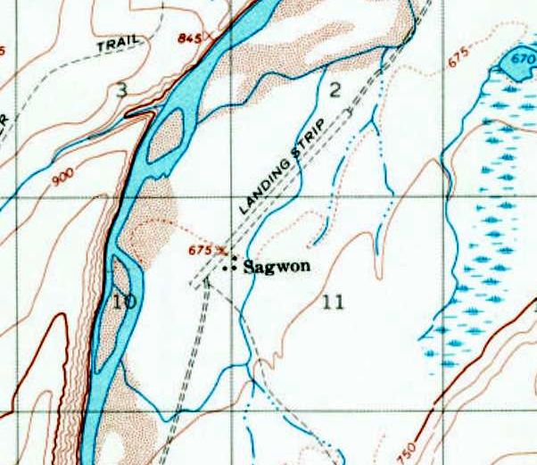
Sagwon Airport, as depicted on the 1971 USGS topo map.
This remote airfield in the Alaskan interior 56 NM south of Prudhoe Bay was evidently established at some point between 1955-71,
as it was not yet depicted on the 1955 USGS topo map.
Dick Welsh, “Interior Airways built the Sagwon runway in 1964 to support the new oil exploration.
Interior took apart a Caterpillar D-4 bulldozer & transported the pieces to Sagwon in a Beaver.
The D-4 graded the runway & used gravel from the Saginavertok River alongside.
Once the runway was long enough, they landed a Fairchild C-82 Packet with bigger equipment & building materials.
I was at Sagwon in late May & early June 1965, as a mechanic for Interior Airways.”
The earliest depiction which has been located of Sagwon Airport was on the 1971 USGS topo map,
which depicted a single unpaved northeast/southwest runway, labeled simply as “Landing Strip”,
with 3 small buildings on the southeast side.

A summer 1972 aerial view by Francis Blake looking north at Sagwon Airport, showing the unpaved runway, several buildings, and a de Havilland DHC-2 Beaver.
Francis Blake recalled, he was at Sagwon “in the summer of 1972 for a couple of months.
I have no idea when it was constructed (likely late 1960s when oil exploration began).
A small 'town', a supply point and staging area, existed when in operation.
Arctic Alaska was indeed very remote then.
If any of the crew were left behind anywhere for whatever reason (collected rock samples had priority over humans),
a large bundle of survival gear was taken out of the helo. And a rifle of puny caliber. Grizzly bears are not uncommon.
I was left behind once on a hill top; took hours to return to fetch me.
Walking on tundra was almost impossible; something like trying to walk on a floor covered with partially inflated soccer balls with water in between.”
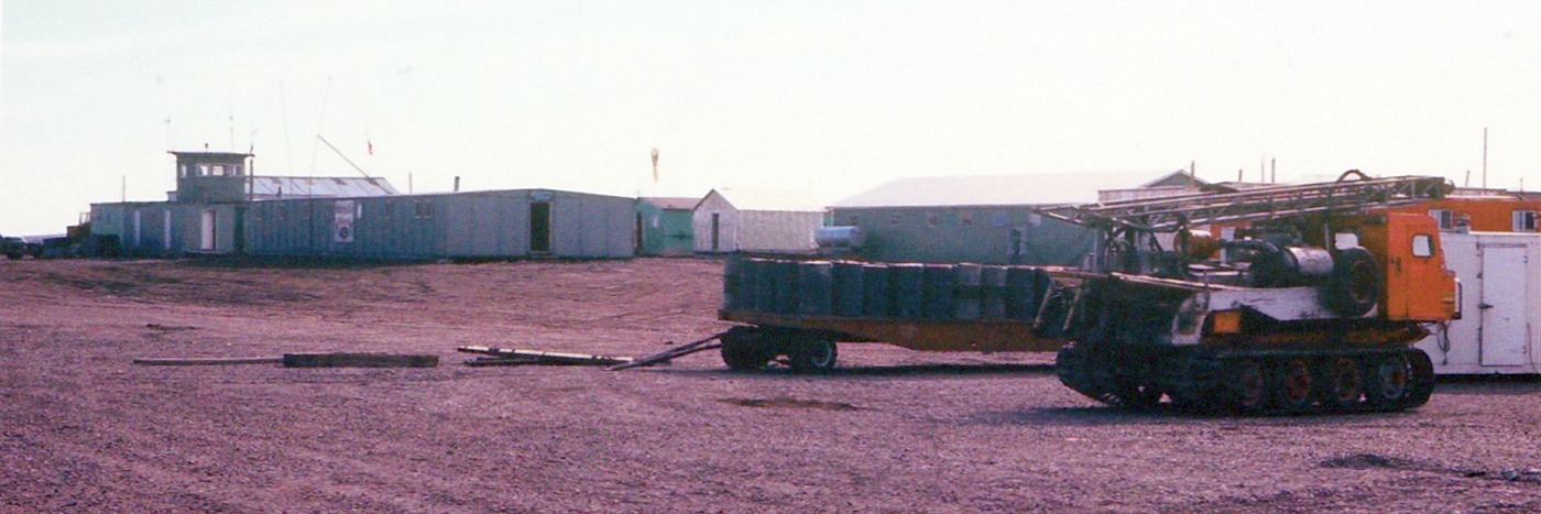
A summer 1972 photo by Francis Blake of the Sagwon Airport buildings, including its control tower.
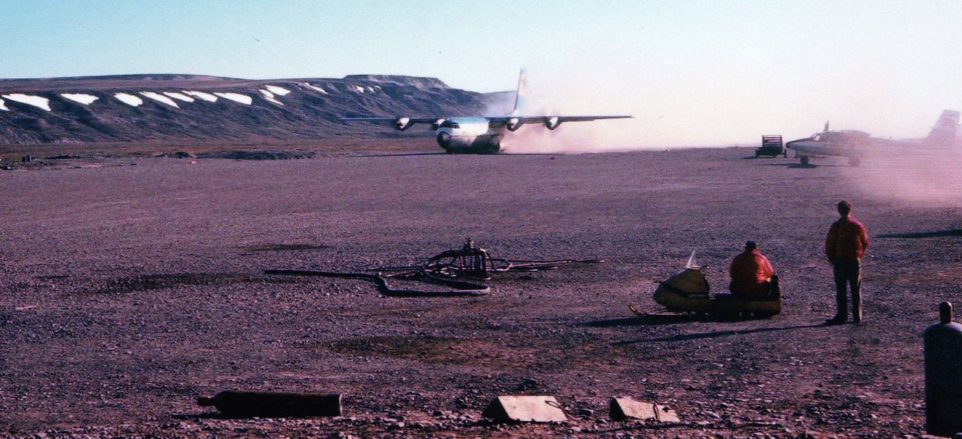
A summer 1972 photo by Francis Blake of a Lockheed L-100 Hercules (a civilian C-130) taking off from Sagwon Airport,
with a de Havilland Twin Otter visible at right.
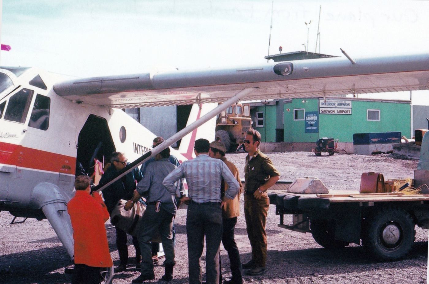
A summer 1972 photo by Francis Blake of an Interior Airway de Havilland Beaver at Sagwon Airport, “our plane from Fairbanks to Sagwon.”
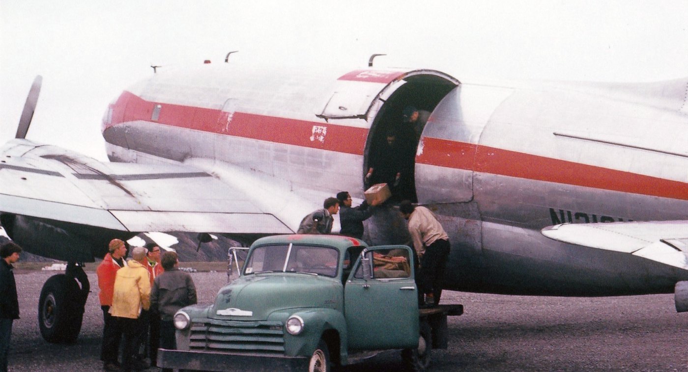
A summer 1972 photo by Francis Blake of a Curtiss C-46 Commando at Sagwon Airport.
Francis recalled that “WW2 C-46s & C-47s were our cargo carriers.”
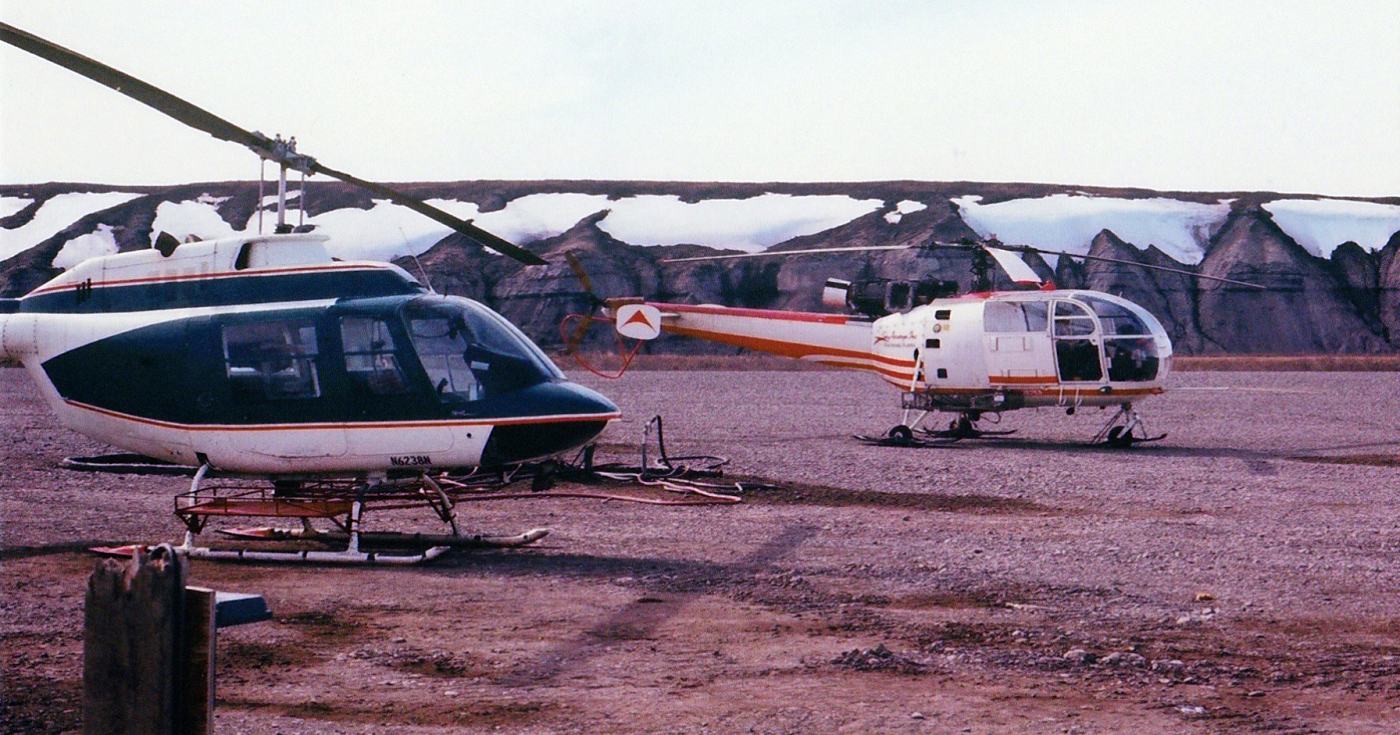
A summer 1972 photo by Francis Blake of “other company helos” at Sagwon Airport: a Bell Jet Ranger & an Aérospatiale Alouette III.
Francis recalled, “Ours was a red & white Bell Jet Ranger.”
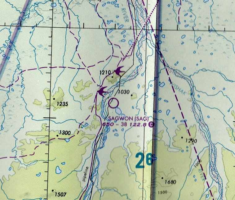
The earliest aeronautical chart depiction which has been located of Sagwon Airport was on the November 1997 Point Barrow Sectional Chart (courtesy of Stu Sibitzky).
It depicted Sagwon Airport as having a 3,800' unpaved runway.
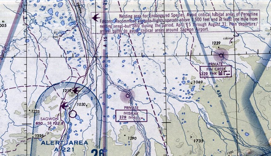
The last aeronautical chart depiction which has been located of Sagwon Airport was on the 1984 Point Barrow Sectional Chart (courtesy of Jonathan Westerling).
Sagwon's depicted runway length had increased significant to 5,800'.
Note that it also depicted a warning about the adjacent nesting area for endangered Peregrine Falcons.
Francis Blake recalled of Sagwon Airport, “I have no idea when it was abandoned. The Dalton Highway bypasses it.”
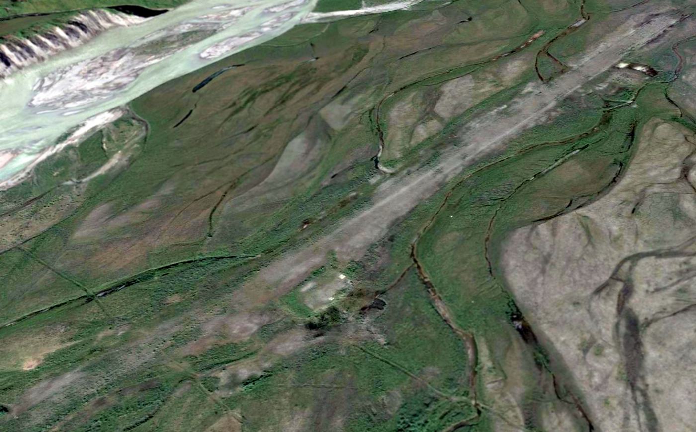
A 2014 aerial view looking north at Sagwon Airport showed the runway remained recognizable though somewhat overgrown.
There appears to be a few small building (or foundation) remaining on the southeast side.
Dick Welsh recalled, “I returned to Sagwon in 2015 in my Cessna 340 to scope out the area, but I was not able to spot the old runway or buildings.”
As of 2016, Sagwon Airport was no longer charted as an active airfield.
Thanks to Francis Blake for pointing out this airfield.
____________________________________________________
Eightmile Lake Airfield, Eightmile Lake AK
61.843, -151.11 (Northwest of Anchorage, AK)

Eighmile Lake Airfield was depicted generically as an unverified “Airport” on the June 2001 Anchorage Sectional Chart (courtesy of Stu Sibitzky).
Accordng to Kenneth Rivard, “This airstrip was built for oil exploration in the 1970s, specifically to land [a] C-130 with drill equipment.
I believe it was Alaska International. I have been on that strip several times in my PA-18”
The Eightmile Lake Airfield consisted of a mile-long (5,300') paved runway, with a paved parking ramp on the southeast side, without any buildings or other improvements.
It sits in an extremely remote area, devoid of any towns or other settlement.
Was this airfield constructed by the military, or for mining support, or some other purpose?
Eightmile Lake Airfield was not yet depicted on the December 1983 Anchorage Sectional Chart (courtesy of Stu Sibitzky).
The earliest depiction which has been located of the Eightmile Lake Airfield was on the June 2001 Anchorage Sectional Chart (courtesy of Stu Sibitzky),
which labeled it generically as an unverified “Airport”.

The earliest photo which has been located of Eightmile Lake Airfield was a 2005 aerial view looking northwest, which showed it to have a single northeast/southwest asphalt runway, with a ramp on the south side.
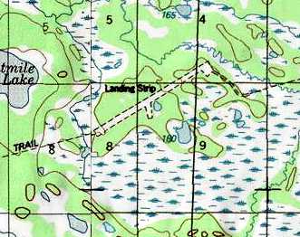
A pre-2011 USGS topo map (courtesy of Mark Hess) depicted the Eightmile Lake Airfield as a single northeast/southwest runway, with a ramp on the south side.
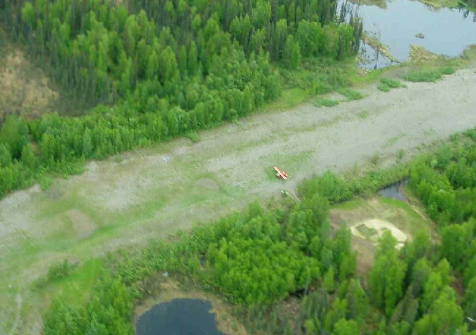
A pre-2011 aerial view (courtesy of Mark Hess) depicted a single light aircraft on the Eightmile Lake runway.
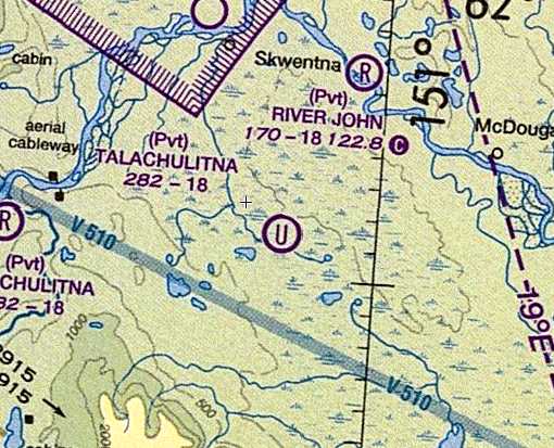
The 2011 Anchorage Sectional Chart depicted the Eightmile Lake Airfield as an “Unverified” airfield.

A 2024 aerial view looking northwest showed Eightmile Lake Airfield's runway to be deteriorated but still intact.
____________________________________________________
64.838, -147.73 (Northeast of Fairbanks International Airport, AK)
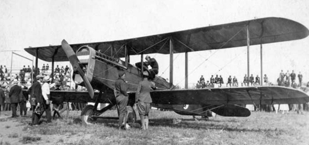
The earliest photo which has been located of a plane at the location which eventually became Weeks Field
was a 1920 photo of spectators viewing a de Havilland DH.4 biplane from the Black Wolf Squadron.
They were pictured at the old Fairbanks baseball park which would eventually become the location of Weeks Field.
According to the website of the current Fairbanks International Airport,
aviation service in the Fairbanks area was initiated at Weeks Field (also known as Weeks Ball Park) in 1923.
This multi-use facility gained importance in the community & throughout the Alaska aviation system
from the time that Carl Ben Eielson first flew into Fairbanks in 1923 to start Alaskan Airways.
A majority of Fairbanks's general aviation & commercial air traffic was eventually accommodated at Weeks Field through mid-century.
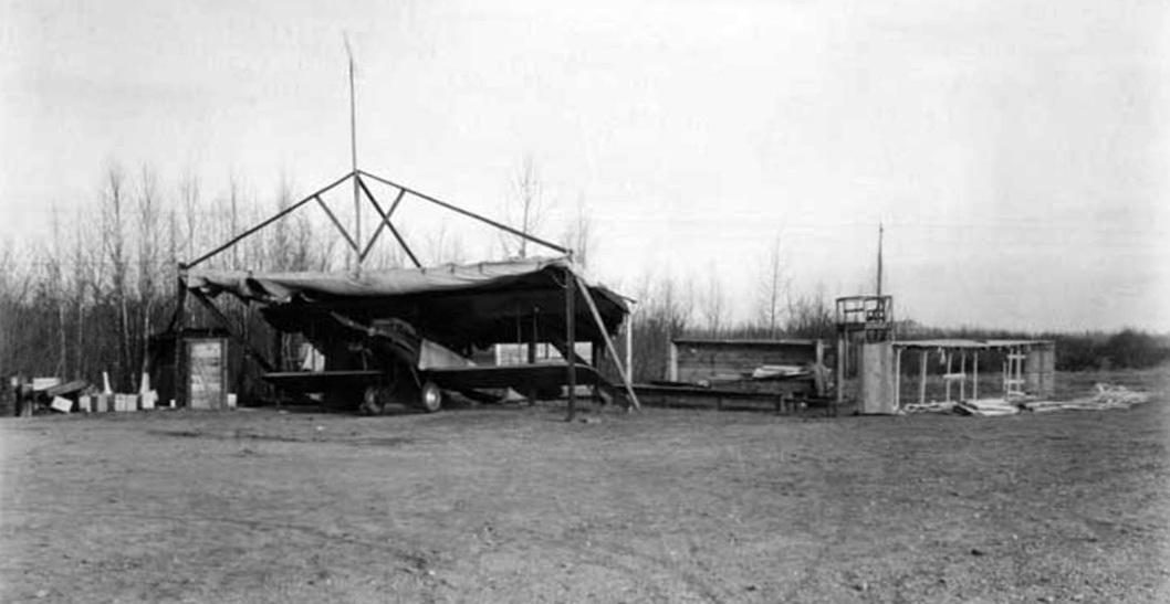
A 1924 photo of James Rodebaugh's first plane in his first hangar, in the old Fairbanks baseball park which later became Weeks Field.
This was the first commercial airplane in Fairbanks. Rodebaugh was sole owner having financed its purchase by himself.
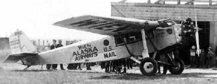
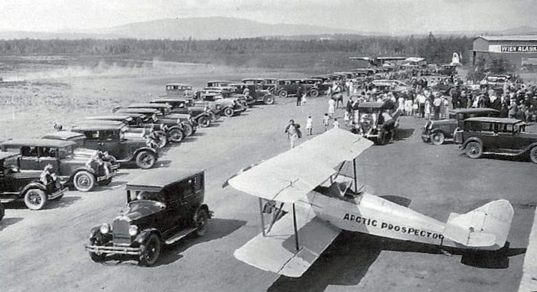
A 1929 photo of an unidentified biplane marked “Arctic Prospector” with many spectators at Weeks Field at the conclusion of the Fairbanks Air Queen Parade,
during which the Queen, Fay Jennings, got an airplane ride with bush pilot Ed Young.
A 1930 revision page of the 1929 Union Oil of California “Airplane Landing Fields of the Pacific West” (courtesy of Chris Kennedy)
described the Fairbanks “Territorial” Airport as being operated the the Alaska Road Commission.
The field was said to have two 2,000' runways(southeast/northwest & east/west), in an X configuration.
The field was said to offer hangars, fuel, and repairs.
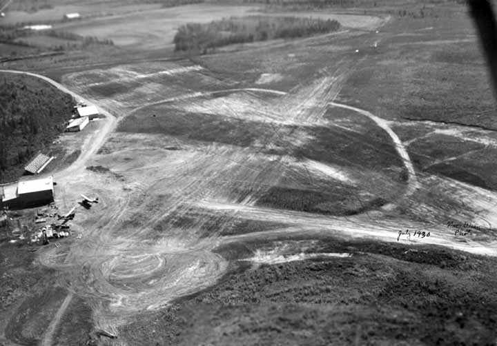
A July 1930 aerial of looking east at Weeks Field (from Alaska's Digital Archives, courtesy of Chris Kennedy).
Several hangars were visible on the north side of the field, along with 2 aircraft.
The field had several unpaved runways.
There is also what appeared to be a set of bleachers, in between the hangars.
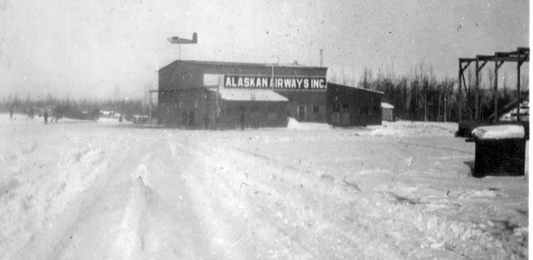
A circa 1931-32 photo by Harold Schober (courtesy of Todd Swain) of an “Alaska Airways Inc” hangar, presumably at Weeks Field.
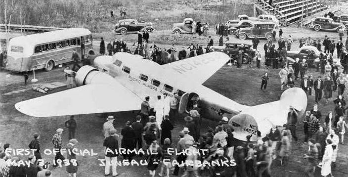
A 5/3/38 photo of Pacific Alaska Airways' Lockheed Electra at Weeks Field,
with a crowd surrounding it upon making the 1st official airmail flight from Juneau to Fairbanks.
According to John Ragle, in 1940 flight instructor Richard Ragle occupied a site on Weeks Field.
The field consisted of a gravel strip (during the summers) running from Gillam Way & ending in the town dump.
The first site occupied by Ragle was at the east end of the runway, off Gillam Way,
and the second was about midway along the north edge of the runway at the end of a skid road bulldozed through the brush.
In the latter, the installation consisted of a couple of "wanigans" on skids,
one of which was arranged so that the nose or engine nacelle of a plane
could be brought inside for the necessary, frequent, maintenance required by propeller-driven planes.
The other wanigan was used for ground-school operations.
The Ragle flying school & air service on Weeks Field continued during 1940 and early 1941
with a Federal Grant through the University of Alaska for pilot training,
and some 50 pilots graduated via this effort.
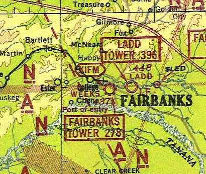
The earliest chart depiction of Weeks Field which has been located
was on the June 1942 Fairbanks Sectional Chart (courtesy of Chris Kennedy).
It depicted Weeks as a commercial/municipal airport.
The Ragle flying school at Weeks Field had ceased operations by 1943 or 1944.
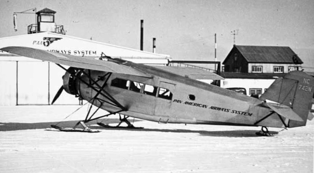
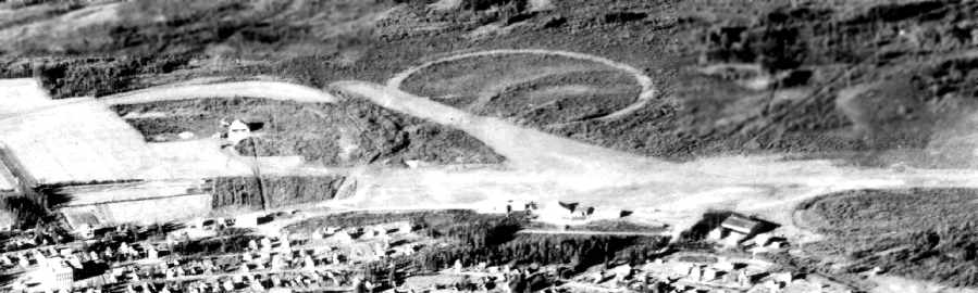
A circa 1940s aerial view looking south toward Weeks Field from a postcard (courtesy of Chris Kennedy)
depicted Weeks Field as having several hangars & unpaved runways.
The runway configuration is different than that depicted in an earlier photo.
Also depicted was a large circular marking adjacent to one runway.
According to Pat Fitzgerald, “In one of the history books about Fairbanks it tells of the news of a large dirigible that was going to land in Fairbanks (I believe on it's way around the world.)
The ship needed room to turn around & people practiced for this maneuver.
Sadly the ship never came to town & I believe that circle was it's landing & turnaround area.”
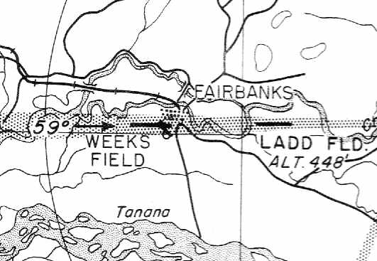
The 1945 USAAF Pilot's Handbook (courtesy of Chris Kennedy)
depicted Weeks Field as having a single east/west runway.
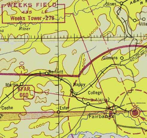
The January 1946 Fairbanks Sectional (courtesy of Chris Kennedy)
depicted Weeks Field as having a commercial/municipal airport.
City growth surrounded Weeks Field in the 1940s,
leading to plans which coalesced in 1948 for development of a new airport to the southwest of Fairbanks,
which eventually became Fairbanks International Airport.
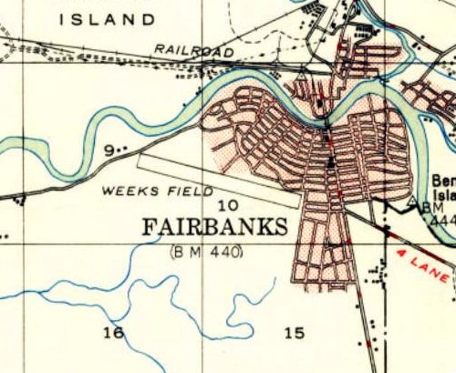
The 1949 USGS topo map depicted Weeks Field as having a single northwest/southeast runway.
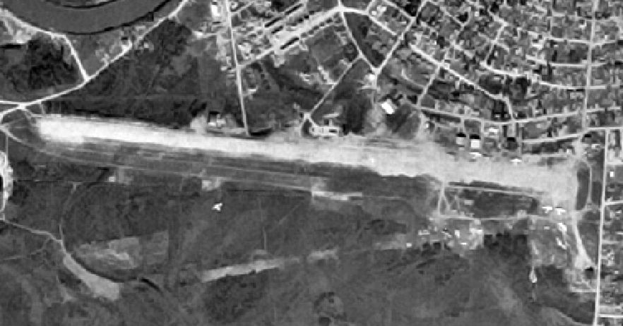
The last aerial photo which has been located of Weeks Field was an 8/8/49 USGS aerial view.
It depicted Weeks Field as having a single northwest/southeast runway,
with several planes visible around the east end of the field.
Mary recalled, “In the 1940s, 1950s, and 1960s my family lived in the old Weeks Field Restaurant; my parents turned it into our home.
It was located at 826 Smythe Street, Fairbanks, on the corner of Cowles Street & Smythe Street.”
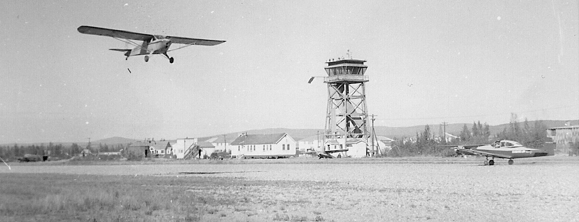
A summer 1951 photo by Melvin Monsen Sr. (courtesy of Mel Monsen) of Tony Povkovich taking off at Weeks Field in a Fairbanks Air Service Taylorcraft, with Weeks Field's distinctive control tower in the background.
Mel Monsen reported, “my Dad (Melvin Monsen Sr.) & his buddy took lessons at Weeks Field in the summer of 1951.
They were in the 4th Infantry Army Combat Team stationed at Ladd AFB.”
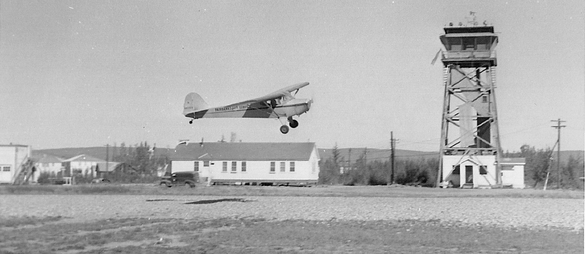
A summer 1951 photo by Melvin Monsen Sr. (courtesy of Mel Monsen) of Tony Povkovich landing at Weeks Field in a Fairbanks Air Service Taylorcraft.
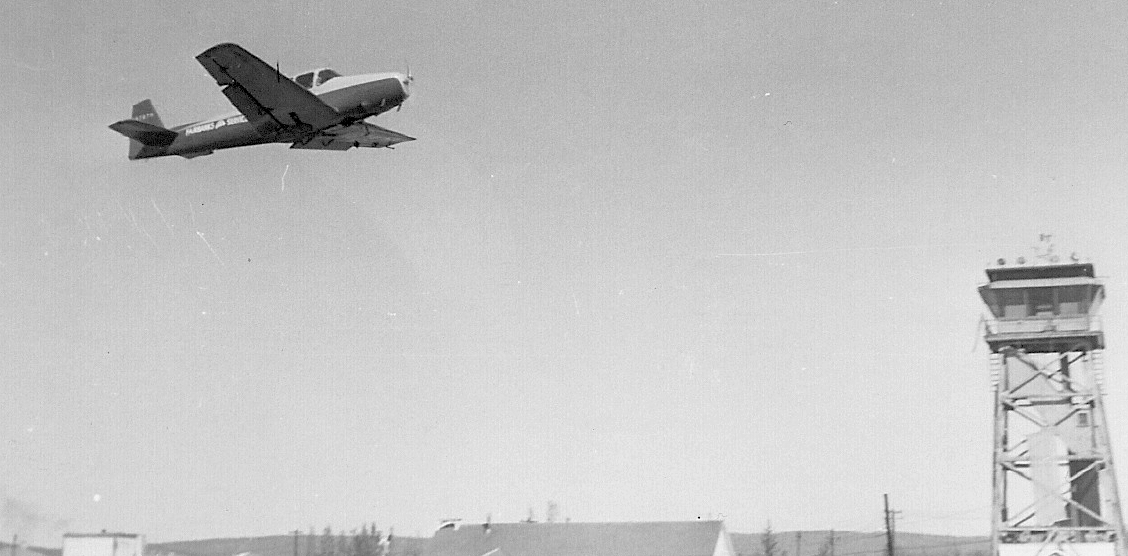
A summer 1951 photo by Melvin Monsen Sr. (courtesy of Mel Monsen) of a Fairbanks Air Service Navion taking off at Weeks Field.
The Weeks Field control tower was decommissioned on 6/1/51 (according to the Fairbanks FSS website).
Mel Monsen reported, “Weeks Field closed in 1951.
Most operators had moved to the newly opened Fairbanks International Airport.
Several operators who had felt bitter over being forced to move, led by Jess Bachner, established the Phillips Field airstrip several miles northwest of Fairbanks, near College.”
A 9/12/51 USGS aerial photo shows buildings being constructed adjacent to both sides of the Weeks Field runway.
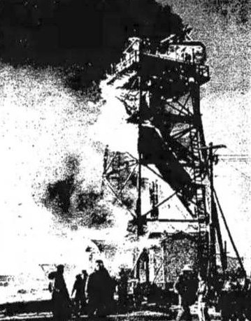
10/18/51 photo (courtesy of Mel Monsen) of the newly-abandoned Weeks Field control tower burning after being ignited by a welder's torch.
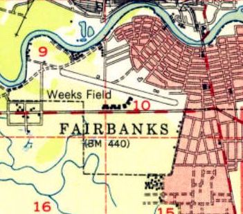
The last map depiction which has been located of Weeks Field was on the 1952 USGS topo map.
It depicted Weeks Field as having a single northwest/southeast runway, with a row of buildings to the south.
The 1955 USGS topo map depicted several streets covering the site of Weeks Field.
Mary recalled, “After many years my mother had it [the former Weeks Field Restaurant] burned down to sell the property.
Much to my dismay; as I would love to have it for historical reasons.”
A 6/14/67 USGS aerial photo no longer showed any trace of the Weeks Field runway.
At some point the site of Weeks Field was reused as Weeks Field Park.
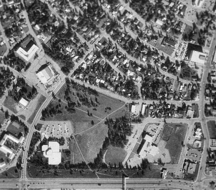
As seen in the 1998 USGS aerial photo, Weeks Field Park occupies a portion of the former airport property.
The site of Weeks Field is located northeast of the intersection of Cowles Road & Airport Way.
____________________________________________________
64.85, -147.793 (Northeast of Fairbanks International Airport, AK)
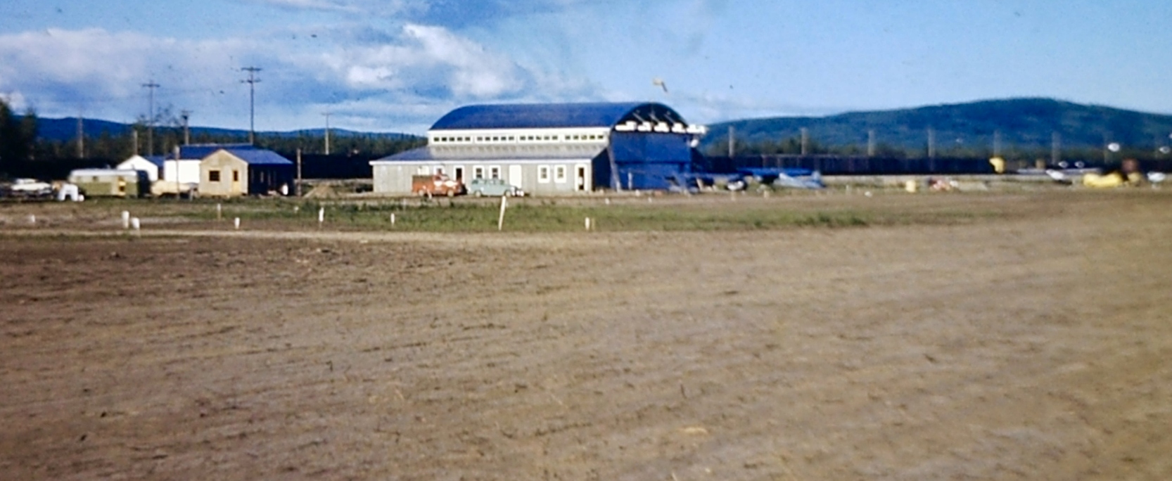
A 1952 photo by Melvin Monsen Sr. (courtesy of Mel Monsen) looking northeast at a Phillips Field hangar.
Phillips Field was not yet depicted on a 9/12/51 USGS aerial photo nor on the 1952 USGS topo map.
Mel Monsen reported, “After Weeks Field was closed several operators who had felt bitter over being forced to move, led by Jess Bachner,
established Phillips Field several miles northwest of Fairbanks.
Phillips Field opened in 1952.”
The earliest photo which has been located of Phillips Field was a 1952 photo by Melvin Monsen Sr. (courtesy of Mel Monsen) looking northeast at a Phillips Field hangar.
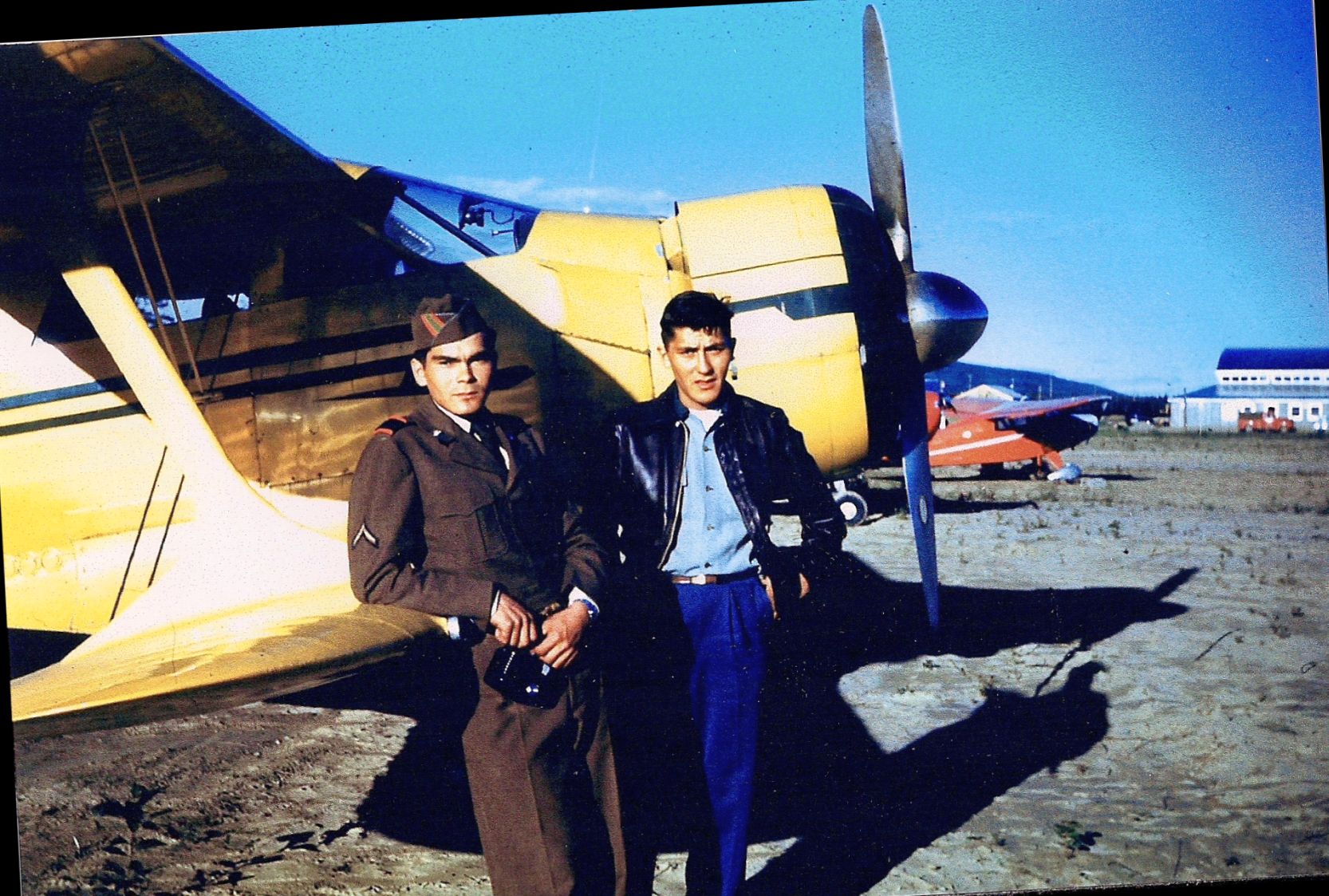
A 1952 photo by Melvin Monsen Sr. (courtesy of Mel Monsen) of Edwin & Emil Anderson in front of a Beech Staggerwing at Phillips Field.
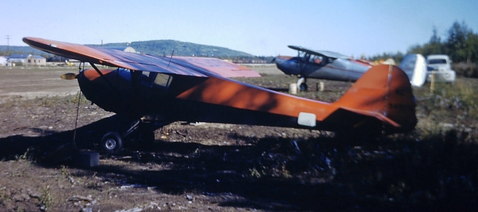
A 1952 photo by Melvin Monsen Sr. (courtesy of Mel Monsen) of Edwin's Taylorcraft at Phillips Field.
Tom Slaney recalled, “I took my first flying lesson 7/4/53 at Phillips Field.”
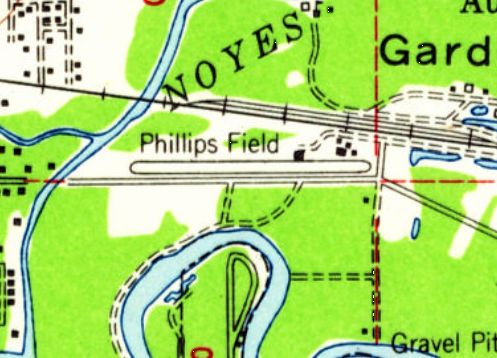
The earliest topo map depiction which has been located of Phillips Field was on the 1955 USGS topo map,
which depicted Phillips as having a single east/west runway.
Dave Menard recalled, “In the spring of 1957, I walked out to Phillips Field to see if there were any aircraft of interest.
There was one, the steel frame remains of a Fairchild Pilgrim, which had been burned by the local fire brigade as a training event (sob!).”
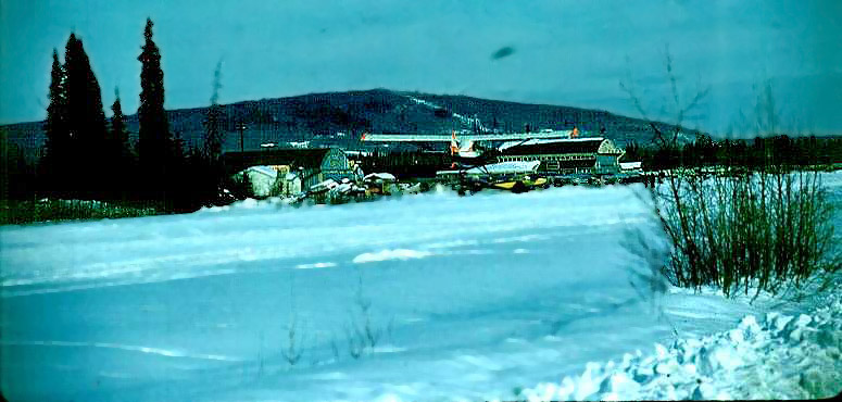
A circa 1959 photo (enhanced by Bill Grasha) looking northeast at a ski-equipped Cub landing at Phillips Field, with 2 hangars in the background.
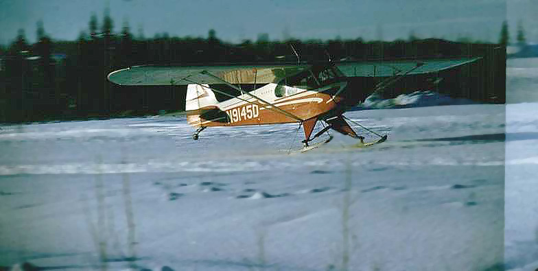
A circa 1959 photo (enhanced by Bill Grasha) of a ski-equipped Cub landing at Phillips Field.
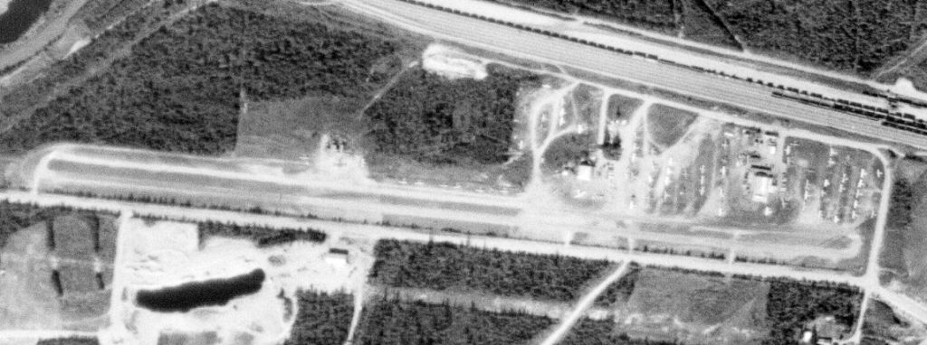
A 6/14/67 USGS aerial view depicted Phillips as having a single paved east/west runway, with several buildings & a large quantity of light aircraft on the northeast side.
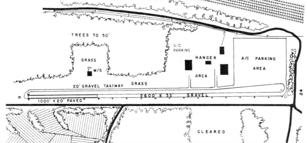
The 1968 Plan a Flight to Alaska guide (courtesy of Jonathan Westerling) depicted Phillips Field as having a single 3,600 east/west runway, of which the western 1,000' was paved.
Several hangars & buildings were depicted on the northwest & northeast sides.
The operators were listed as Howley Evans & Jess Backney, and the manager listed as Howley Evans.
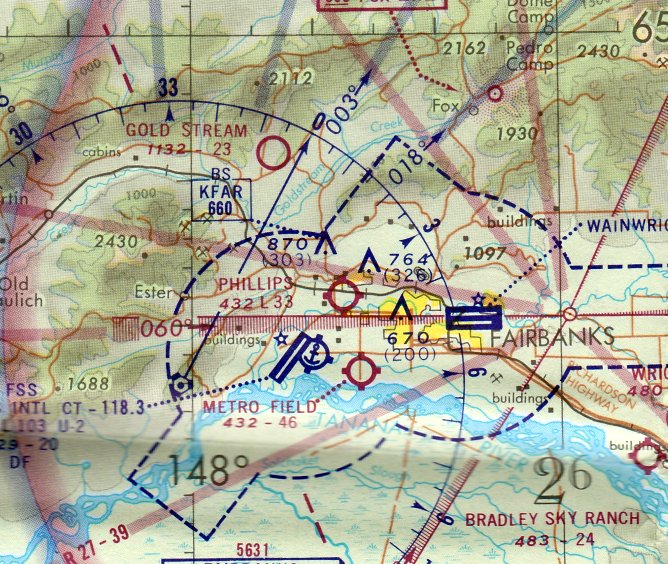
The only aeronautical chart depiction which has been located of Phillips Field was on the 1972 Fairbanks Sectional Chart.
It depicted Phillips as having a 3,800' unpaved runway.

The 1975 USGS topo map depicted Phillips Field as having a single paved east/west runway,
with a few buildings on the northeast side.
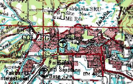
The last depiction which has been located of Phillips Field was on the 1976 USGS topo map.
Bev Hormann recalled, “Phillips Field... I know that the airfield ran into 1971-72. My ex-husband flew out of the field in the fall of 1971 headed north to work.
I remember dropping him off in a brand new 1971 canary yellow Camaro we had borrowed at the small blue at the building next to the blue hangar (that still exists [as of 2013]).”
Greg Garrels recalled that “The hangar in the [northeast corner of Phillips Field] was the location of Bachner Aircraft Service.
It was run by Jess & Ann Bachner. Among other things they were a Piper dealer. I recall getting parts there when the airport was still open.
The motto on their receipts used to say, 'We have everything...Sometimes we can't find it.'”
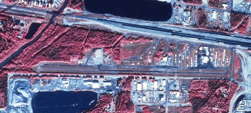
The last photo which has been located showing Phillips Field was an 8/22/86 USGS aerial view.
It depicted Phillips as having a single paved east/west runway, with several buildings & a large quantity of light aircraft on the northeast side.
Dave Critchfield reported, “In September 1989 it was still open the but shortly thereafter, it was closed to make room for the new freeway.”
Tim Rondeau recalled, “Phillips Field closed in 1991. I remember notices in the paper asking owners of the last few planes to remove them.”
Phillips Field was no longer depicted on the 1992 USGS topo map
nor on the January 1994 Fairbanks Sectional Chart (courtesy of Ron Plante).
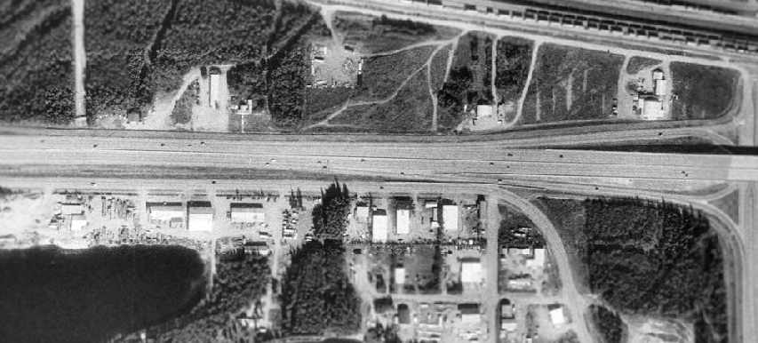
Phillips Field had been covered by the Johansen Expressway by the time of the 1998 USGS aerial view.
The expressway was built right over the runway, but at least 2 hangars remained standing on the northeast side.
It is not known if any of the buildings along the south side date to the property's days as an airport.
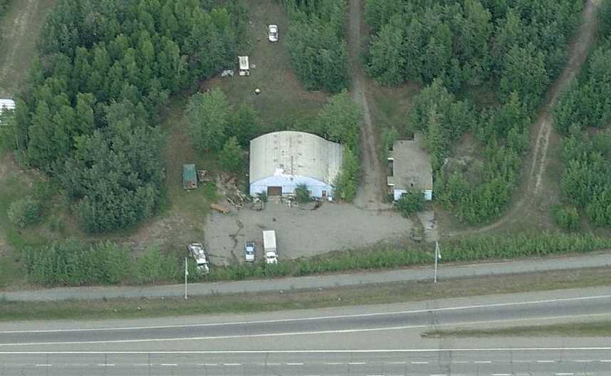
A circa 2006-2010 aerial view looking north showed a hangar remaining on the north side of the Phillips Field site.
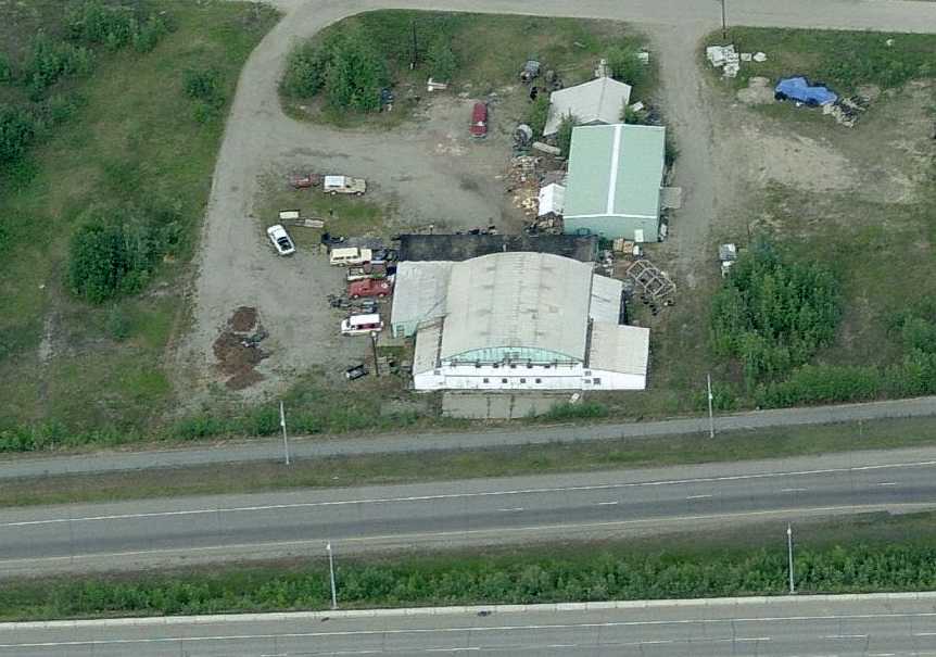
A circa 2006-2010 aerial view looking north showed the former Bachner Aircraft Service hangar remaining on the northeast corner of the Phillips Field site.
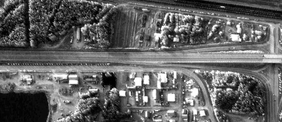
A 6/2/09 aerial view showed that the 2 hangars remained standing on the northeast side of the Phillips Field site.
Dave Critchfield reported in 2010, “Some of the hangars are still there used by other businesses.”
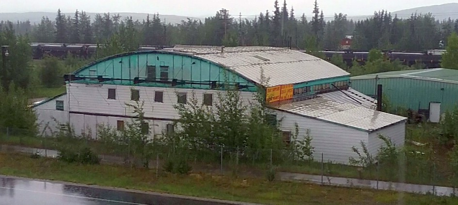
A 6/11/17 photo by Ron Plante looking northwest at the former Bachner Aircraft Service hangar remaining on the northeast corner of the Phillips Field site,
taken from the Johansen Expressway that now covers the runway.
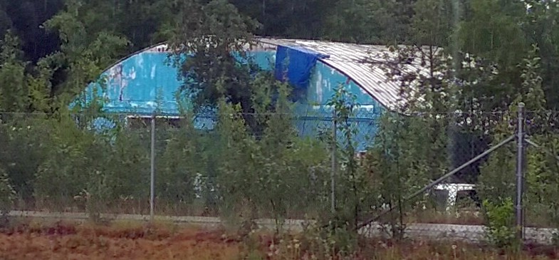
A 6/11/17 photo by Ron Plante looking northwest at a smaller former hangar remaining on the north side of the Phillips Field site,
taken from the Johansen Expressway that now covers the runway.
The site of Phillips Field is located west of the intersection of Johansen Expressway & Peger Road.
____________________________________________________
Miller Army Airfield, Cape Chiniak, AK
57.616, -152.194 (Southwest of Anchorage, AK)
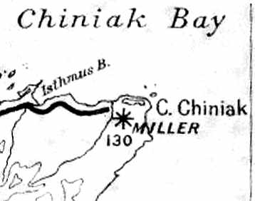
Miller Field, as depicted on a 1946 AK Road Commission Map (courtesy of Timothy Aanerud).
Miller Army Airfield was located on Kodiak Island.
It was evidently built during WW2 as a fighter landing strip,
to assist in any needed defense of Alaska.
The date of construction of Miller Field has not been determined.
It was not yet depicted on a February 1943 USAAF Air Route Manual of Alaska (according to Chris Kennedy).
The earliest depiction of Miller Field which has been located
was on a 1946 AK Road Commission Map (courtesy of Timothy Aanerud).
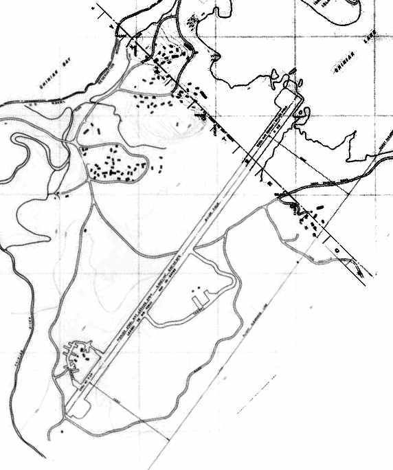
An undated topo map depicting the runway of Miller Field.
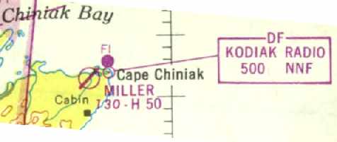
The January 1947 World Aeronautical Chart (courtesy of Timothy Aanerud)
depicted Miller as a civilian airfield, having a single 5,000' hard-surface northeast/southwest runway.
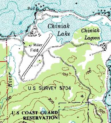
The 1949 USGS topo map depicted Miller as having a single northeast/southwest runway.

The only photo which has been located of Miller Field was a 6/1/52 USGS aerial view,
which depicted Miller as having a single northeast/southwest paved runway.
According to a book by Tony Smaker (via Timothy Aanerud),
in 1958 a C-124 managed to land at Miller Field,
but tore up good portion of the perforated steel plate which made up Miller's runway surface.
Karl Esch recalled, “My father was the XO of FASRON 114, NAS Kodiak in the late 1950s.
We had a quonset hut for a weekend cabin not far from Miller Field on Chiniak Point.
When our family trekked the 40 miles from the NAS to Chiniak for the weekend,
my father always took the family station wagon for a high speed run down Miller Field to 'blow out the carbon' and thrill his kids.
It was probably the fastest place you could drive, other than the NAS runways, on the entire island.”
Pete Azzole was at Miller Field in 1962. He recalled, "When I was there, Miller Field was merely steel matting.
I don't recall finding any structures or remnants thereof in the immediate vicinity of the field."
According to George Zonoff, “Miller Field was in active use during the period 1962-68
in support of the Air Force Kodiak Tracking Station.
During that period C-124s laden with cargo were able to land without difficulty
on the perforated metal strips despite the absence of air-to-ground communications.
In addition, technical support provided by C-54s landed as well,
although during landing it was clear the perforated landing was 'rolled up'
in front of the landing gear wheels & the aircraft rolled to a stop.
And, plenty of light private aircraft made practice landings & takeoffs during that period.
Notably, after the 1964 earthquake, many families took refuge
at the tracking station & abandoned housing facilities adjacent to the airstrip (Quonset Huts),
and were subsequently flown out on a MATS C-54 once facilities were restored in the City of Kodiak.”
In the 1960s P-3 Orions flew up from Moffett Field CA to Miller Field
to retrieve spy satellite film retrieved by C-130s & dropped off at Fort Miller.
The May 1965 Operational Navigation Chart (courtesy of Chris Kennedy)
depicted Miller Field as having a 5,000' runway.
According to Karl Esch, “All the matting was scavenged for various purposes around the island when the Navy withdrew in the early 1970s.”
Miller Field was most likely maintained until the adjacent Chiniak Kodiak Tracking Station was closed,
according to an article in the March 17 1975 issue of the Kodiak Mirror newspaper (according to Timothy Aanerud).
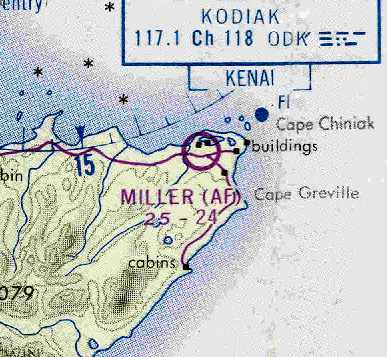
The last depiction of Miller Field as an active airfield which has been located
was on the March 1978 Kodiak Sectional Chart (courtesy of Chris Kennedy).
It depicted Miller as an Air Force airfield, but its listed runway configuration had been reduced to only a 2,400' unpaved runway.
Miller Field was evidently closed at some point between 1978-98.
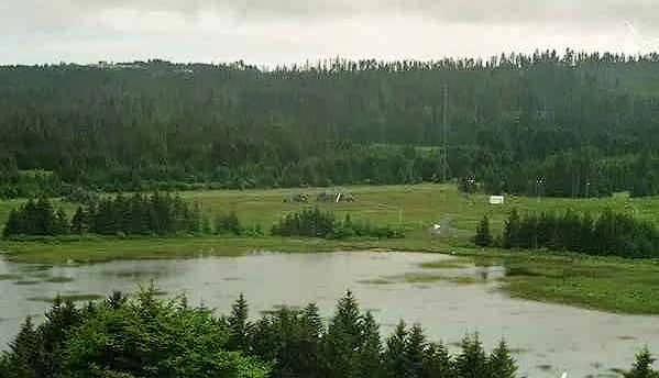
A July 1998 photo by Joe Stevens of the differential GPS transmitter just beside the Miller Field runway.
In 1998 Joe Stevens reported that the Coast Guard had "recently installed a differential GPS transmitter just beside the Miller Field runway.
The runway condition is severely potholed and some of the rusty Marston matting has been partially removed.
It is NOT suitable for landing an airplane."
George Zonoff reported, “A visit to Kodiak in 2004 revealed the metal airstrip had been completely removed
and the landing strip is reverting to native vegetation & in several more years will be completely invisible.”
Karl Esch recalled, “In 2004 & 2006, we drove on what is left of Miller Field, which is not much.
The cattle corral, made in part from Miller Field matting is alongside the road to Pasagshak Bay.
The twisted pieces of matting are near what is now the Alaska Aerospace Development Corporation launch site on Near Cape, Kodiak.”
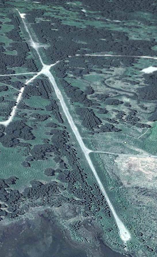
A 7/14/10 view looking southwest along Miller Field showed the runway to remain intact though deteriorated.
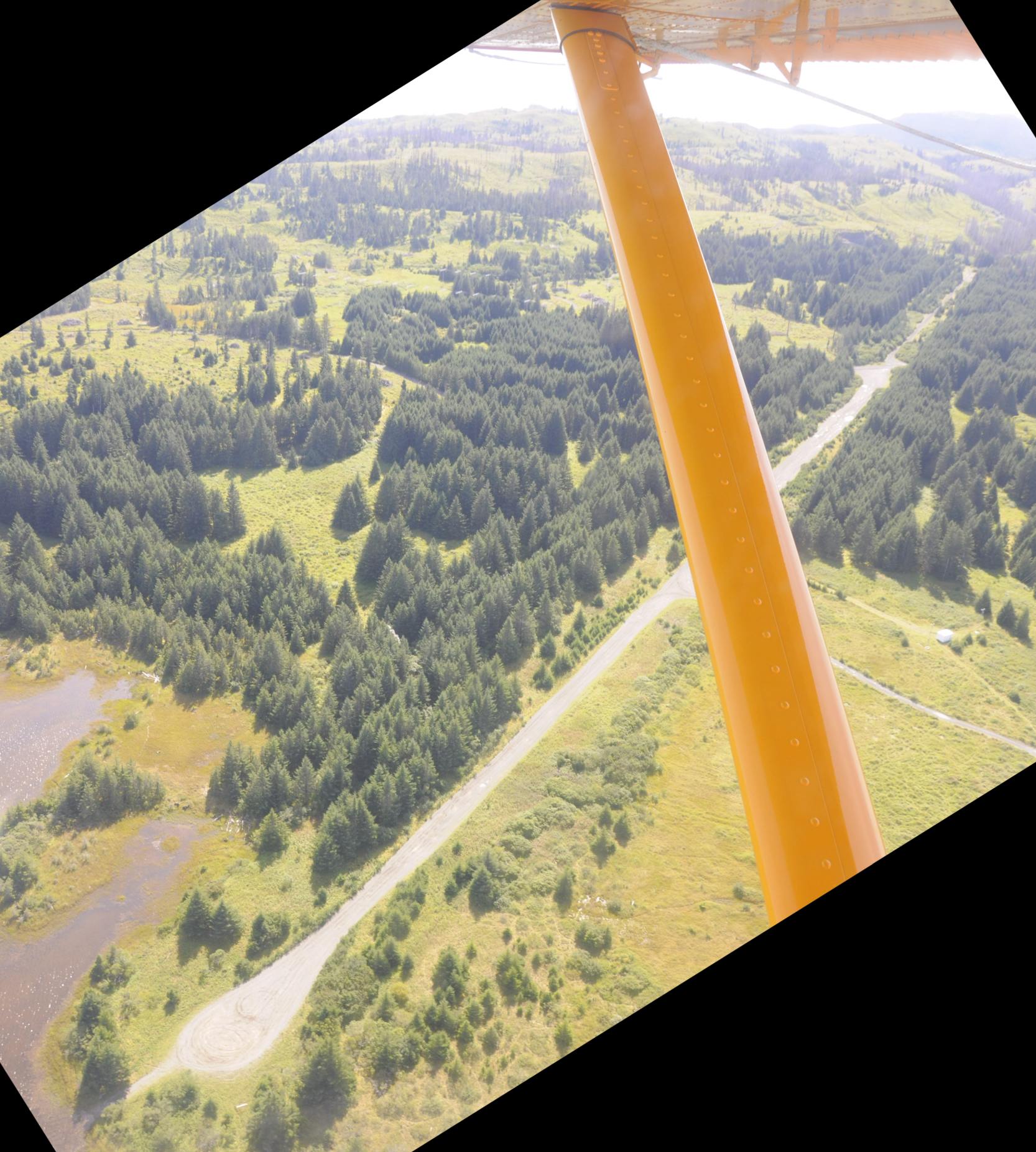
A 6/28/18 aerial view by Karl Esch looking south at the remains of the Miller Field paved runway.
Karl reported, “I recently visited Kodiak, Alaska and had the most pleasurable experience of spending 2 hours in an Andrews Air de Havilland Beaver floatplane at the hands of an extraordinarily good pilot.
Even though we spent 2 tours of duty on Kodiak in 1952-53 & 1958-61, visited numerous time since, and thought we were familiar with what Kodiak had to offer, boy were we surprised!
I have never been so close to the ground so high in the air as we were, luffing along at 100 knots looking at mountain sheep looking back at us from just off the wingtip!
Hands down the best flight of my life! On this great flight we flew over Miller Field.
All the open space on the hills in the background is the result of clear-cutting of the evergreen forest that covered these hills when Miller Field was active.
Miller Field is now a favorite place for ATV & trail bike riders to go fast.”
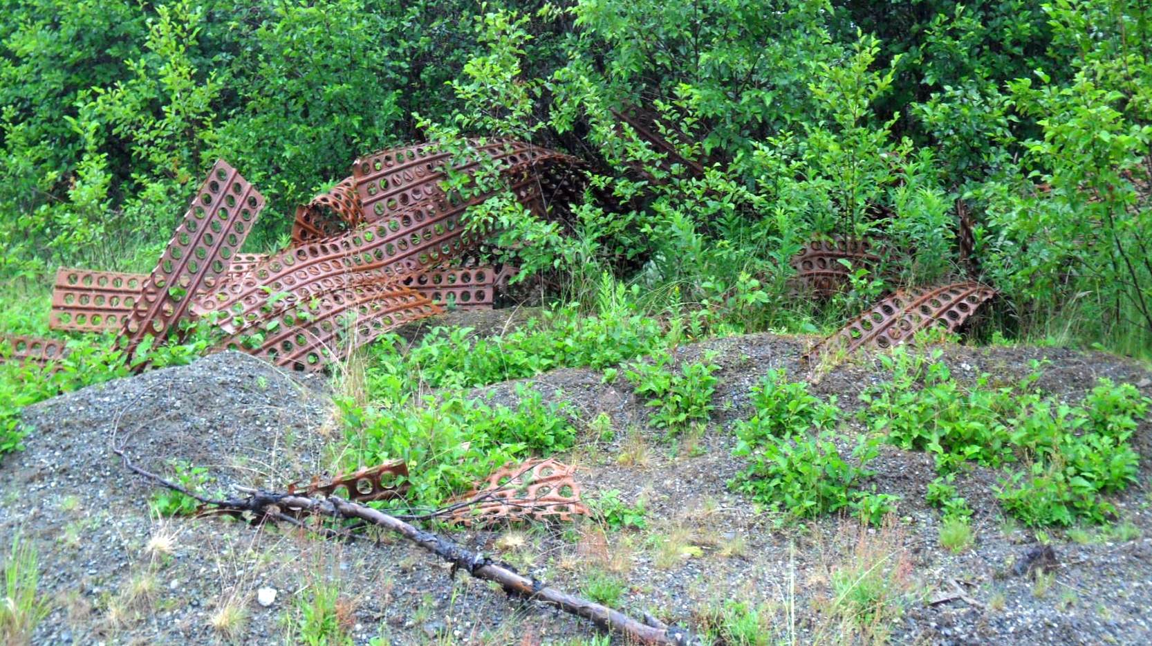
A July 2018 photo by Ruth Stuckenbruck of remains of runway Marston Matting at the site of Miller Field.
Ruth reported, “It's my feeling that there is still a lot of Marsdon strip that is covered by dirt & gravel, Although I didn't dig for it, there are places however where you can see it on the runway.”
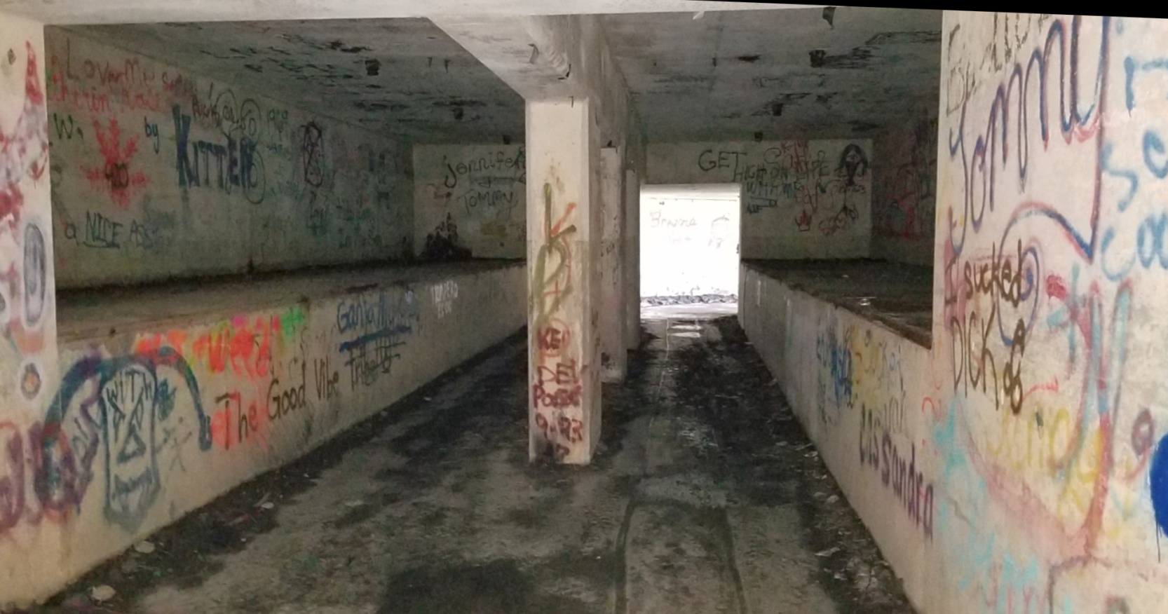
A July 2018 photo by Ruth Stuckenbruck of “the interior of a U-shaped munitions bunker” at the site of Miller Field.
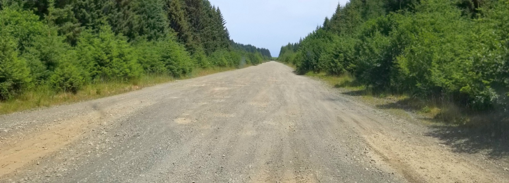
A 7/3/19 photo by Ruth Stuckenbruck looking along the remains of a Miller Field runway.
Ruth reported, “Note how the Sitka pines on the edge of the field are still short where they had been cut down to make room for the wings of the landing airplanes.
I hate to even mention the interestingest relics to be found on Kodiak as it is still such a beautiful unspoiled little island.
Most of these things are grown over with weeds & rarely found by people.
But I share this to share the joy that I had in discovering these relics & the joy that brought me back to explore the island again.”
According to Jake Marx, aerial photos show the bridge to cross the river to Miller Field “was removed between 10/19-3/20.”
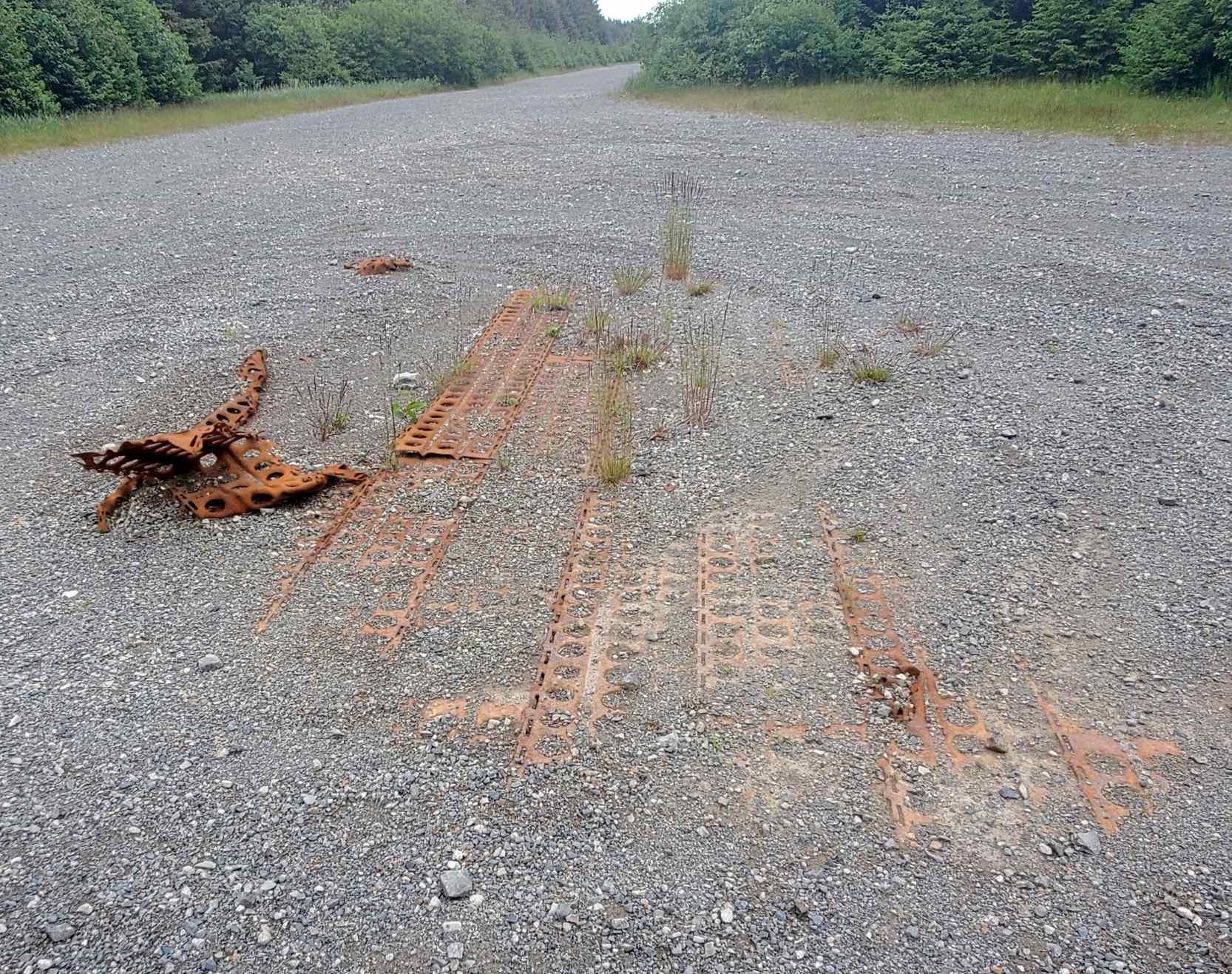
A 6/7/20 photo by Jake Marx of remains of runway Marston Matting at the site of Miller Field.
Jake reported, “The bridge to cross the river was gone; I threw on my hiking boots & walked across the river & hiked the last of the 3/4 of a mile in.
The Marston matting is still very visible.”
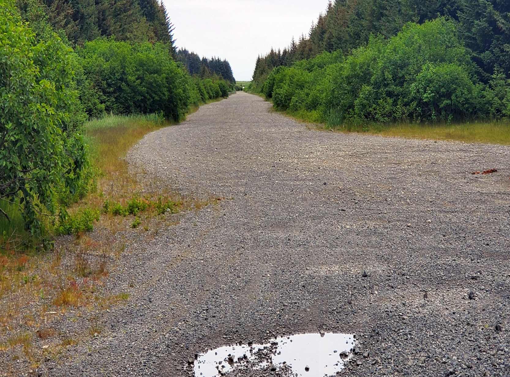
A 6/7/20 photo by Jake Marx of remains of a Miller Field runway or taxiway.
____________________________________________________
(Original) Huslia Airport, Huslia, AK
65.702, -156.382 (Northwest of Fairbanks, AK)
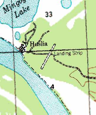
The original Huslia Airport, as depicted on the 1956 USGS topo map.
According to www.explorenorth.com, the first airport was constructed in the little community of Huslia in 1952.
The earliest depiction which has been located of the Huslia Airport was on the 1956 USGS topo map.
It depicted the “Landing Strip” southeast of the town as having a single northeast/southwest runway.
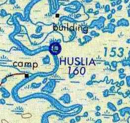
The earliest aeronautical chart depiction which has been located of the original Huslia Airport
was on the May 1965 USAF Operational Navigation Chart (courtesy of Chris Kennedy).
The January 1994 Fairbanks Sectional Chart (courtesy of Ron Plante)
depicted Huslia as having a 3,000' unpaved runway & a VOR/DME navigational beacon.
The original Huslia Airport was described in the 1995 AOPA Airport Directory (according to Jonathan Westerling)
as having a single 3,000' gravel Runway 3/21.
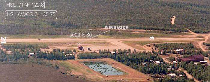
A 1995 photo of the original Huslia Airport (courtesy of the Alaska DOT, via Jonathan Westerling), while it was still open.
A small ramp along the southwest side of the runway had one small building,
but there did not appear to be any hangars.
In 1998 the decision was made to construct a new airport for Huslia that would meet current FAA standards
and provide safer year-round transportation (according to www.house.gov).
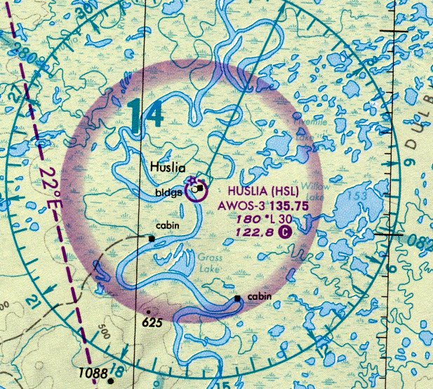
The last aeronautical chart depiction which has been located of the original Huslia Airport
was on the July 2000 Fairbanks Sectional Chart (courtesy of Stu Sibitzky).
It depicted Huslia as having a 3,000' unpaved runway & a VOR/DME navigational beacon.
The new 4,000' runway was completed in 2000, at which point the old airport was presumably closed.
According to the FAA, the cost of the new airport was $4,305,612.
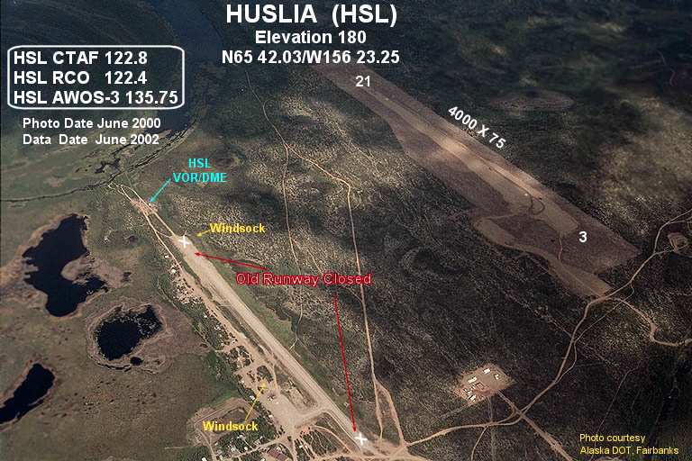
A 2000 photo (courtesy of the Alaska DOT, via Jonathan Westerling) of the original Huslia Airport (bottom left), along with the replacement airport (top right).
The original runway still exists intact, between the town & the new airport.
Thanks to Jonathan Westerling for pointing out this airfield.
____________________________________________________
Since this site was first put on the web in 1999, its popularity has grown tremendously.
If the total quantity of material on this site is to continue to grow,
it will require ever-increasing funding to pay its expenses.
Therefore, I request financial contributions from site visitors,
to help defray the increasing costs of the site
and ensure that it continues to be available & to grow.
What would you pay for a good aviation magazine, or a good aviation book?
Please consider a donation of an equivalent amount, at the least.
This site is not supported by commercial advertising –
it is purely supported by donations.
If you enjoy the site, and would like to make a financial contribution,
you
may use a credit card via
 :
:

Please consider checking the box to make a monthly donatation.
For a mailing address to send a check, please contact me at: paulandterryfreeman@gmail.com
If you enjoy this web site, please support it with a financial contribution.
____________________________________________________
This site covers airfields in all 50 states.