Abandoned & Little-Known Airfields:
California: Glendale area
© 2002, © 2026 by Paul Freeman. Revised 2/30/26.
This site covers airfields in all 50 states: Click here for the site's main menu.
For a 10th year, the CA pages of this website are sponsored by the California Pilots Association:
____________________________________________________
Please consider a financial contribution to support the continued growth & operation of this site.
Brand Field (revised 8/20/17) - Glendale Airport / Grand Central Air Terminal (revised 9/23/25)
Griffith Park Aerodrome (revised 2/20/26)
____________________________________________________
Glendale Airport / Grand Central Air Terminal, Glendale, CA
34.16, -118.286 (North of Downtown Los Angeles, CA)
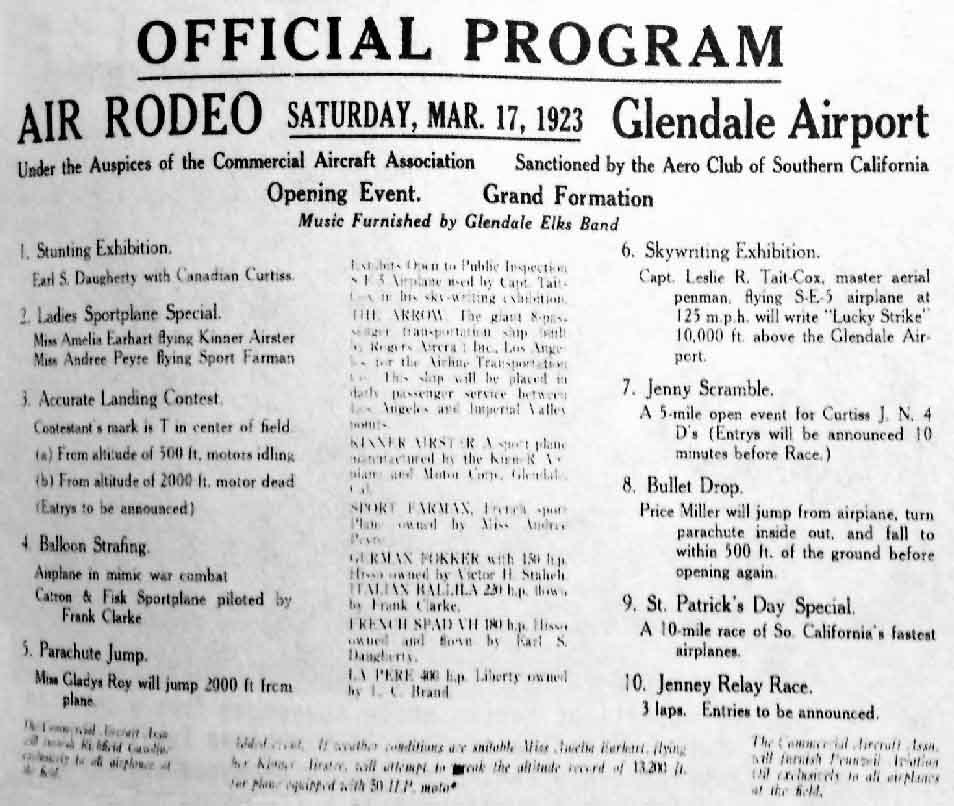
The program for the Air Rodeo commemorating the 3/17/23 dedication of Glendale Airport (courtesy of Ken Morrison).
During the first couple of years of the 1920s, a group of airplane owners made an appeal
to the Glendale Chamber of Commerce to assist them in securing a landing field where private hangars could be erected,
as well as servicing facilities & manufacture of aircraft.
A Chamber committee consisting of approached John D. Radcliffe,
a property owner who had a 33 acre site south of the Southern Pacific right-of-way
and at the southern end of Grandview Avenue (now where the Golden State Freeway and Ventura Freeway meet) about purchasing his property.
The site was purchased in 1922 for $66,000.
The city immediately began clearing the land & built a paved runway (which was very elaborate for an airport of that time).
However, their ownership of the property was short-lived due to a threatened lawsuit.
The sponsors of the threatened lawsuit put together a syndicate & took control of the airport,
paying the city in full for all funds already paid out.
Shortly thereafter, private hangars began appearing.
Glendale Airport was dedicated on 3/17/23 with an “Air Rodeo” (according to a program courtesy of Ken Morrison).
The first hangar to be constructed at the airport, labeled rather pretentiously as the Kinner Airplane & Motor Corporation,
was a mom & pop enterprise financed on a shoestring.
Bert Kinner had yet to build a successful airplane engine,
but his sprightly little biplane quickly captured the fancy of a tomboy called Amelia Earhart.
The management of the airport was placed under the direction of Maj. C. C. Moseley, one of the founders of Western Air Lines
and also the commander of the Air National Guard unit at Griffith Park Aerodrome (across the LA river from Grand Central).
For airport expansion, new capital was needed, so the remaining 20 acres were sold to Edward Spicer,
who started a new development on the property.
He purchased additional acreage until there was about 175 acres,
on which he erected permanent buildings & increased the airport's industrial use.
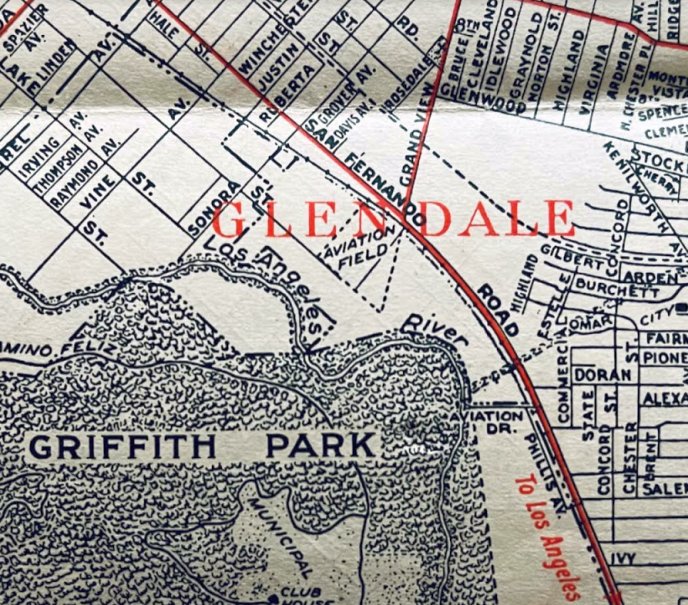
The earliest depiction which has been located of Glendale Airport was on 1924 Security Bank map (courtesy of Kevin Walsh), which depicted a regular generically labeled “Aviation Field”.
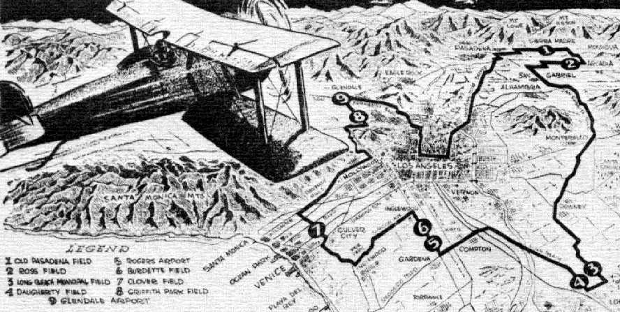
Glendale Airport was depicted on a circa-1925 LA-area airfields from Ross Diehl's Air National Guard yearbook (courtesy of Dan MacPherson).
In 1925, Thomas Slate leased space adjacent to the south side of the Glendale Airport for the construction of an all-metal dirigible,
a very novel (but ultimately unsuccessful) design.
The dirigible was made out of duralumin & was filled with hydrogen.
It was forecast to have a cruising speed of 80 mph & would accommodate 40 passengers & 5 crew.
The dirigible was to be powered by oil & driven by steam-turbine,
using one rotary blower, which would create a vacuum, instead of traditional propellers.
Slate also constructed a metal hangar, the largest built in the United States at the time.
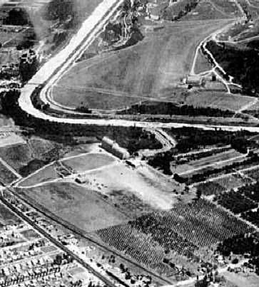
The earliest photo which has been located of Glendale Airport
was a 7/12/27 aerial view looking southeast, showing the field in an early configuration with a smaller border, with a peach orchard forming the northern border.
The Slate Aircraft Corporation dirigible hangar is visible on the south side of the field,
and Griffith Park Airport is visible across the river.
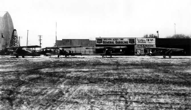
A 1927 photo of Glendale Airport showed unidentified biplanes & 1 monoplane in front of the Wilson Aero Corporation hangar,
with the Slate Aircraft Corporation dirigible hangar also visible on the left.
Will Adams recalled, “I grew up on Glendale & was 10 years old in 1927.
My stomping ground was the Grand Central Air Terminal area, which included the LA River, and the dirigible hangar.”
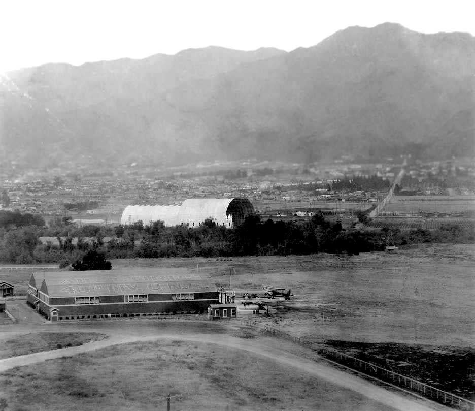
A 1927 aerial view looking northeast, with the National Guard hangars at Griffith Park Airport in the foreground,
and just across the river in the immediate background is the Slate dirigible hangar at Grand Central Air Terminal.
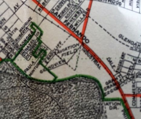
Glendale Airport was depicted on a 1927 Security Bank map (courtesy of Kevin Walsh)
as an irregularly-shaped “Aviation Field”, considerably smaller than the airfield's eventual size.
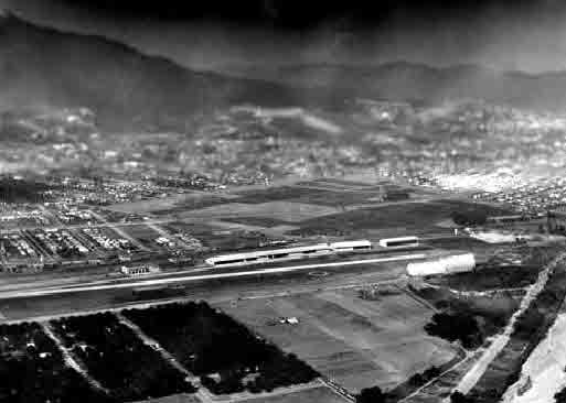
A pre-1928 aerial view looking east at Glendale Airport, showing the Slate dirigible hangar, and the row of hangars on the east side of the runway.
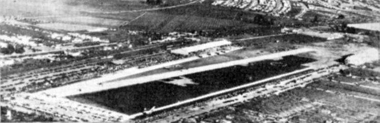
An undated aerial view of Glendale Grand Central Terminal from a LA Chamber of Commerce brochure
“Los Angeles County Spreads Her Wings, History of National Air Races, 1928” (courtesy of Tom Heitzman).
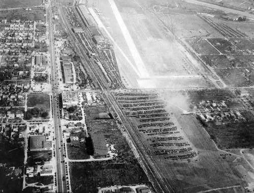
A circa 1920s aerial view looking at Glendale Grand Central Air Terminal during an Armed Forces Day event (courtesy of Kevin Walsh),
with a large number of cars parked to the north of the runway (foreground of picture).
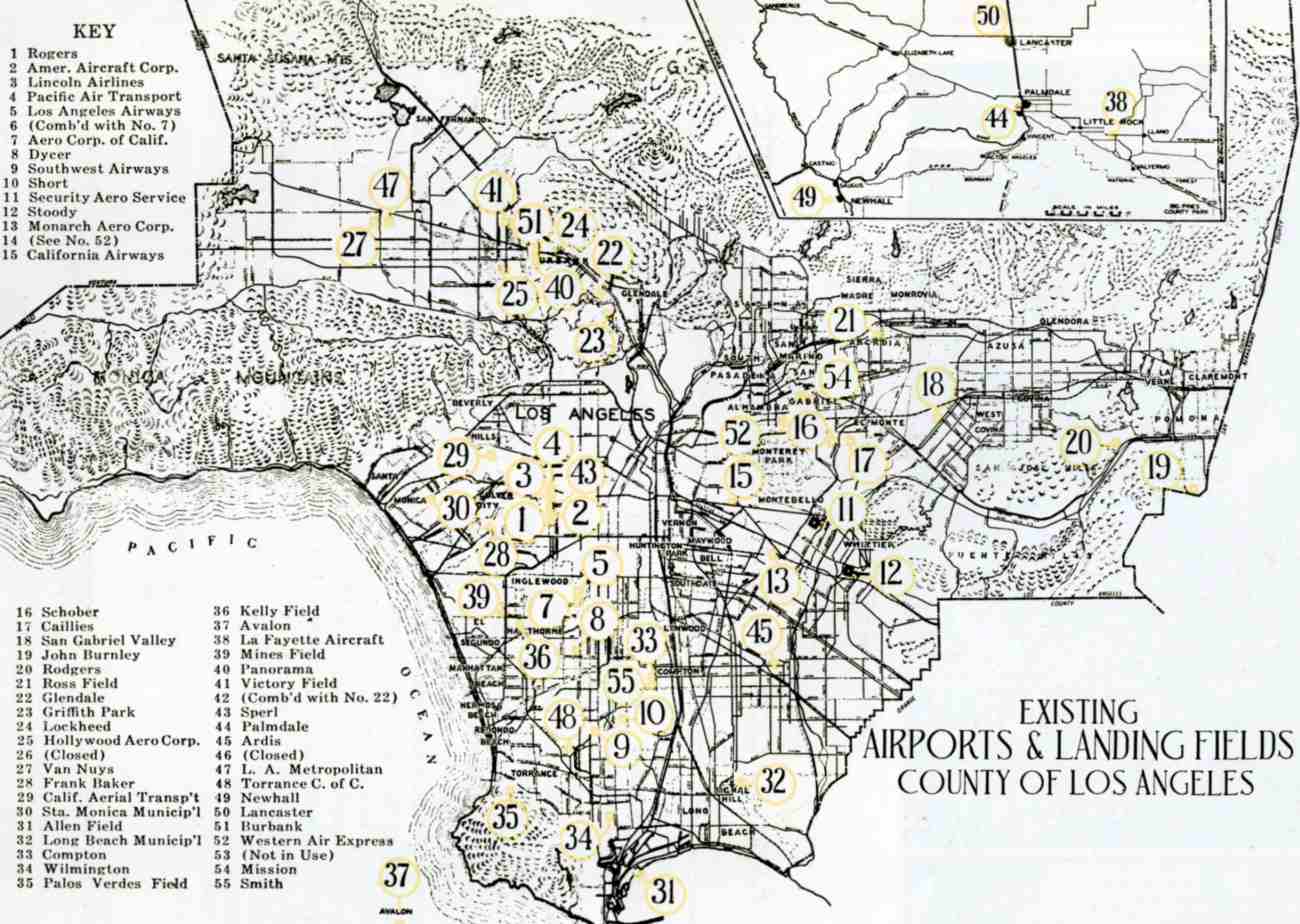
Glendale Airport, as depicted among an amazing total of 55 LA-area airports on a map from an LA Chamber of Commerce brochure
“Los Angeles County Spreads Her Wings, History of National Air Races, 1928” (courtesy of Tom Heitzman).
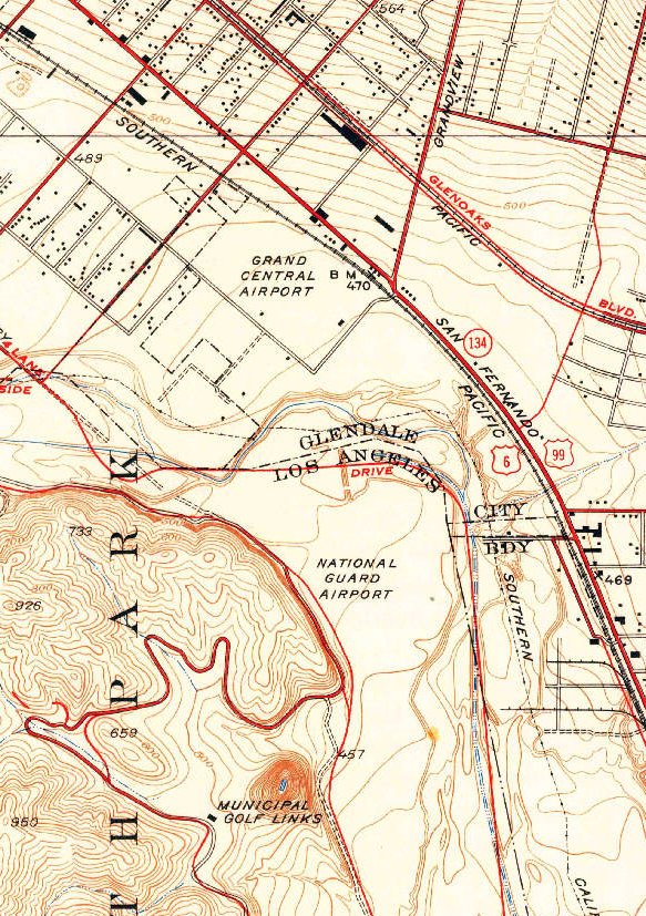
The 1928 USGS topo map depicted “Grand Central Airport” as an open area without any specific runways.
It also depicted the nearby Griffith Park “National Guard Airport” to the south.
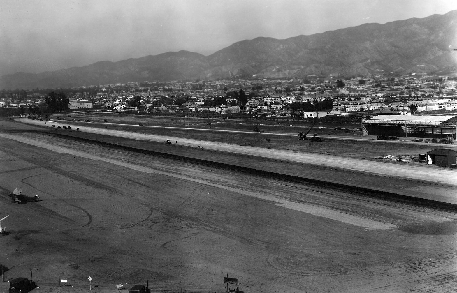
A 1928 aerial view looking northeast at Gelndale Airport, with the runway & hangar under construction, and a biplane on the left side.
In the late 1920s, a concerted effort was mounted to establish a proper municipal airport for the Los Angeles area.
Several sites were considered in the southern California area, including Glendale.
Sensing a good opportunity, Captain Charles C. Spicer, a World War I fighter pilot,
formed a syndicate of venture capitalists in 1928, to purchase the Glendale Municipal Airport & develop it further.
The airport was to be an airline terminal from the outset & the architect planned accordingly.
The Grand Central Air Terminal with its control tower was designed by architect Henry Gogerty.
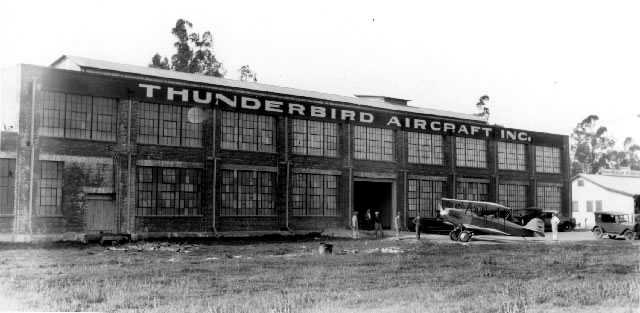
A 1928 photo of an unidentified biplane in front of the factory of Thunderbird Aircraft Inc.,
which had been established in 1927 at 900 Allen Avenue, only 2 blocks northwest of Grand Central Air Terminal.
Cliff & Phil Henderson operated a Thunderbird sales office at Grand Central Air Terminal.
The company produced a few examples of their H-14 biplane before ceasing production in 1929.
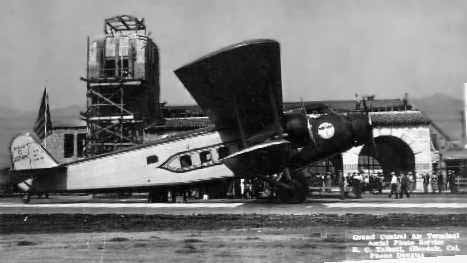
A 1928 view looking northeast at a Boeing 80-A with Glendale's Grand Central Air Terminal under construction in the background.
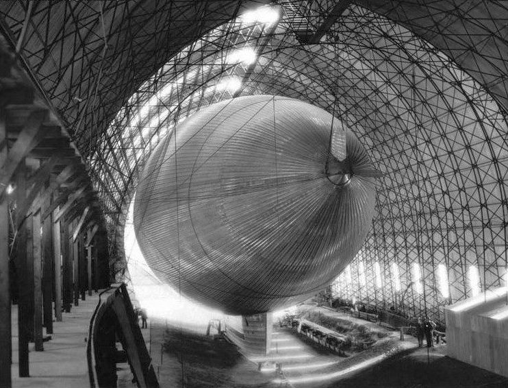
A 1928 interior view of the Slate dirigible inside its hangar at Glendale Airport.
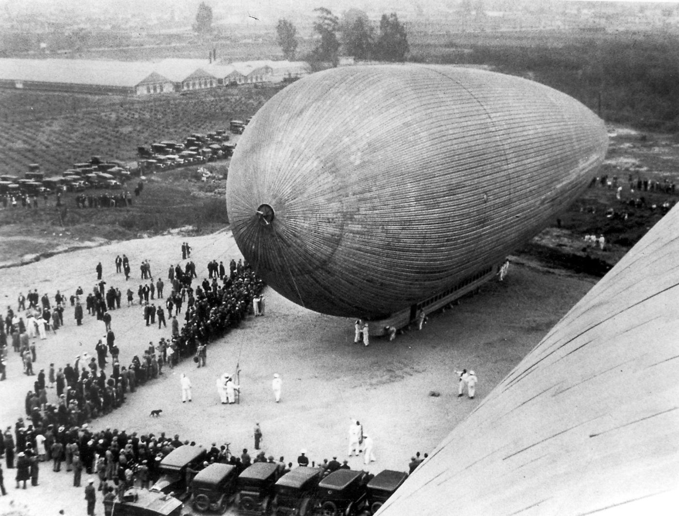
A 1928 photo of the Slate dirigible outside its hangar at Glendale Airport.
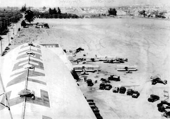
A 1928 view looking south along the Grand Central hangars, with several biplanes visible.

A 1928 photo of a Western Air Express Fokker F.10 NC4458 C/n 1000 in front of the Grand Central terminal.
In 1929 the Grand Central Air Terminal facility was sold to Curtiss-Wright for about $2,000,000.
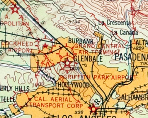
The earliest aeronautical chart depiction which has been located of Grand Central Air Terminal was on the 1929 LA – Las Vegas Air Navigation Map.

Grand Central Airport, as depicted on 1929 LA County map (courtesy of Mark Shoemaker).
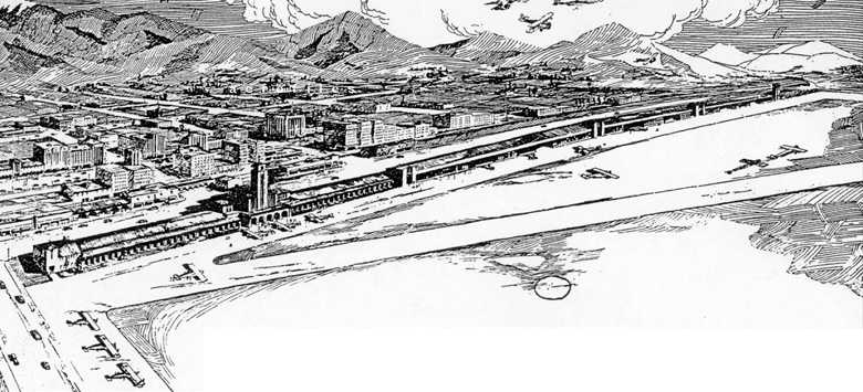
A 1929 sketch showing Grand Central Air Terminal as planned when fully completed.
The plans were mostly realized, with the exception of the buildings on either end.
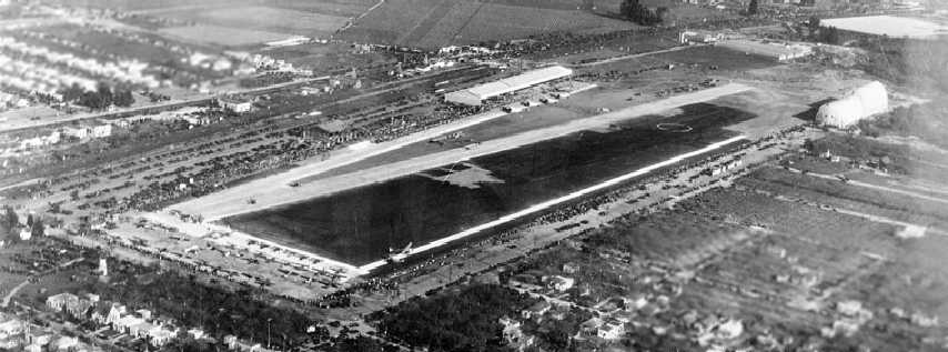
A 1929 aerial view looking southeast at Grand Central Air Terminal, presumably during its dedication.
Note the Slate Aircraft Corporation dirigible hangar at the top-right.
Hundreds of cars can be seen parked near the runway at left, and a large number of planes are parked on the north end (left side of photo).
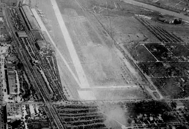
A circa late 1920s aerial view looking south at Grand Central on U.S. Army Air Force Day.
Planes are parked in front of hangars & on the field, and a large number of cars are parked on a field in the foreground.
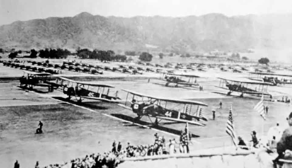
A huge fleet of military aircraft participated in the dedication of Grand Central Airport on 2/17/29 (courtesy of Ken Morrison).
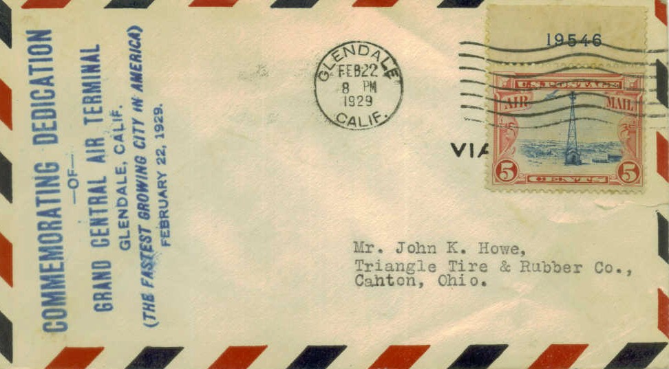
A postmark commemorated the 2/22/29 Dedication of Grand Central Air Terminal.
Grand Central Air Terminal's official opening on 2/22/29 was a gala affair.
The Hollywood film colony turned out in force, many of its luminaries arriving in their own planes.
Wallace Beery arrived piloting his own Travelair. Other attendees included Hoot Gibson, Gary Cooper, and Jean Harlow.
The first airline service from Southern California to New York was from Grand Central, piloted by Charles A. Lindbergh.
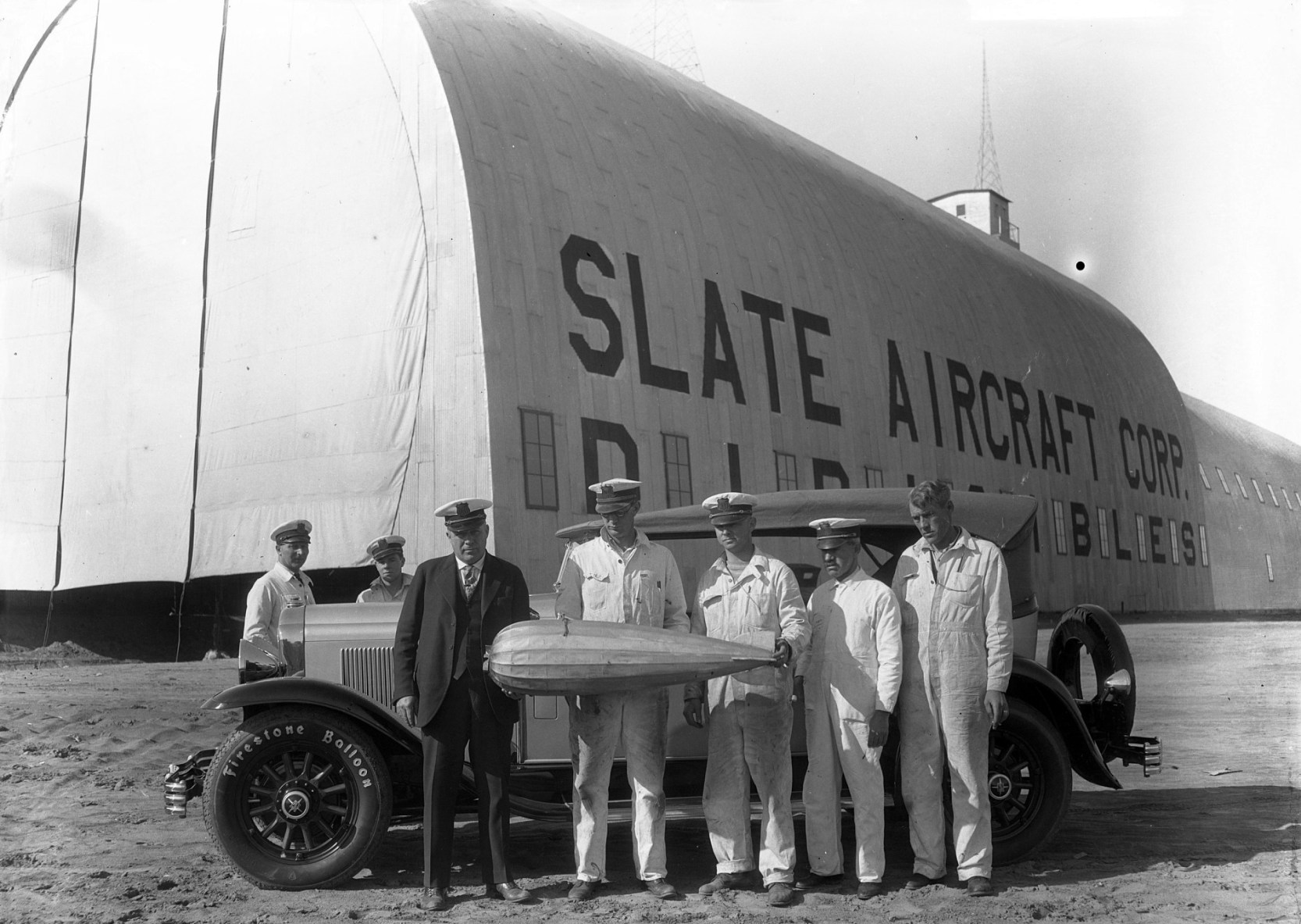
A circa 1929 photo of a group in front of Grand Central's Slate dirigible hangar.
Originally captioned: “Glendale - Photo shows Captain T.B. Slate designer & builder of the first steam-driven all-metal dirigible 'City of Glendale' on his arrival at the hangar.
Members of the crew of the revolutionary craft are shown with a tiny model of the ship which is being readied for its first flight."
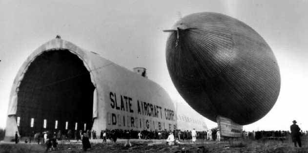
A 1929 photo of the Slate Aircraft Corporation dirigible hangar & the “City of Glendale” metal airship at Glendale.
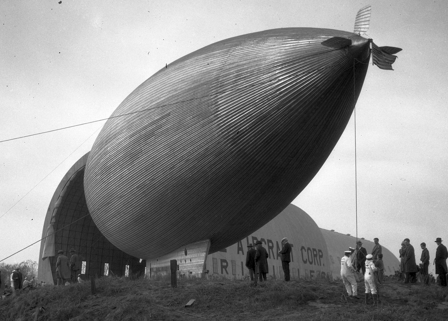
A 1929 photo of the City of Gelndale Slate dirigible outside its hangar at Glendale Airport.
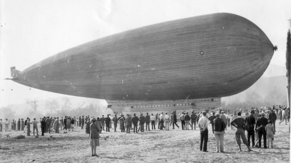
A circa 12/17/29 photo of the City of Gelndale Slate dirigible in its final configuration outside its hangar at Glendale Airport.
Slate's dirigible, christened the "The City of Glendale", became finally airborne in 1929 at Grand Central, after 2 unsuccessful attempts.
However, because of pressure build-up from a stuck fuel intake valve the dirigible's rivets popped.
The huge vessel collapsed on the ground & was put back in its hangar, where it gathered dust.
Slate lost his own fortune (along with the funds of others) in these unsuccessful efforts,
and he never attempted to build another dirigible, thus ending a curious chapter in the Grand Central history.
According to Joe Handelman, “Kreutzer built Air Coaches (Tri-motors) at Grand Central Air Terminal in the late 1920s & early 1930s.”
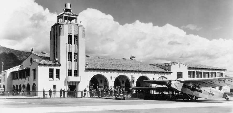
A circa 1920s-30s photo of a Ford Trimotor in front of the Grand Central Air Terminal.
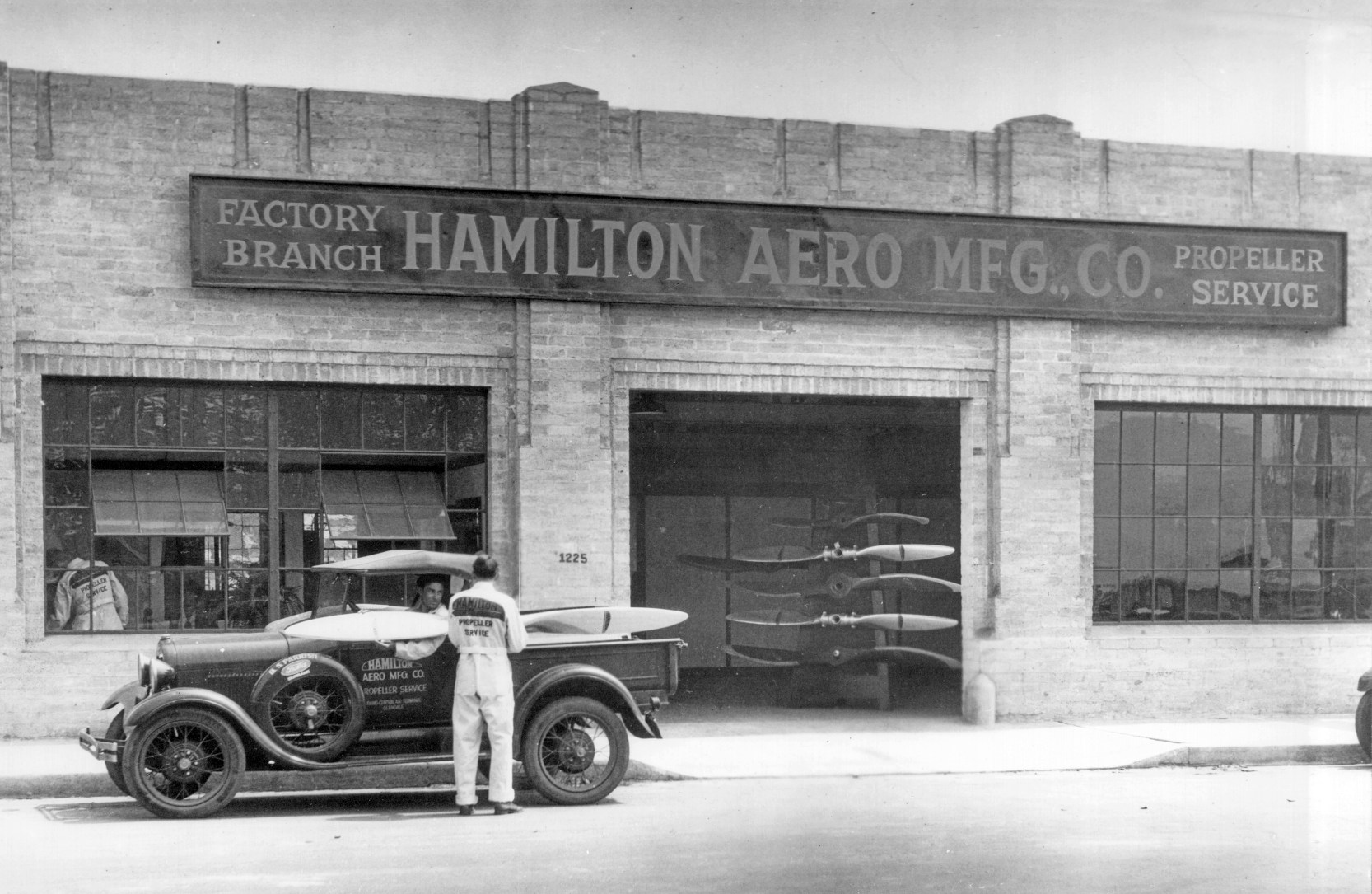
A circa 1920s/30s photo of a delivery truck painted “Hamilton Aero Mfg Co. - Propeller Service - Grand Central Air Terminal - Glendale” in front of the Hamilton Aero Manufacturing Company building
(courtesy of Andrew Smith, who obtained the photo at an auction, “among a few items reported to have come from the estate of a Pratt & Whitney executive”).
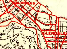
Grand Central Airport, as depicted on a 1930 street map (courtesy of Gary Alexander).
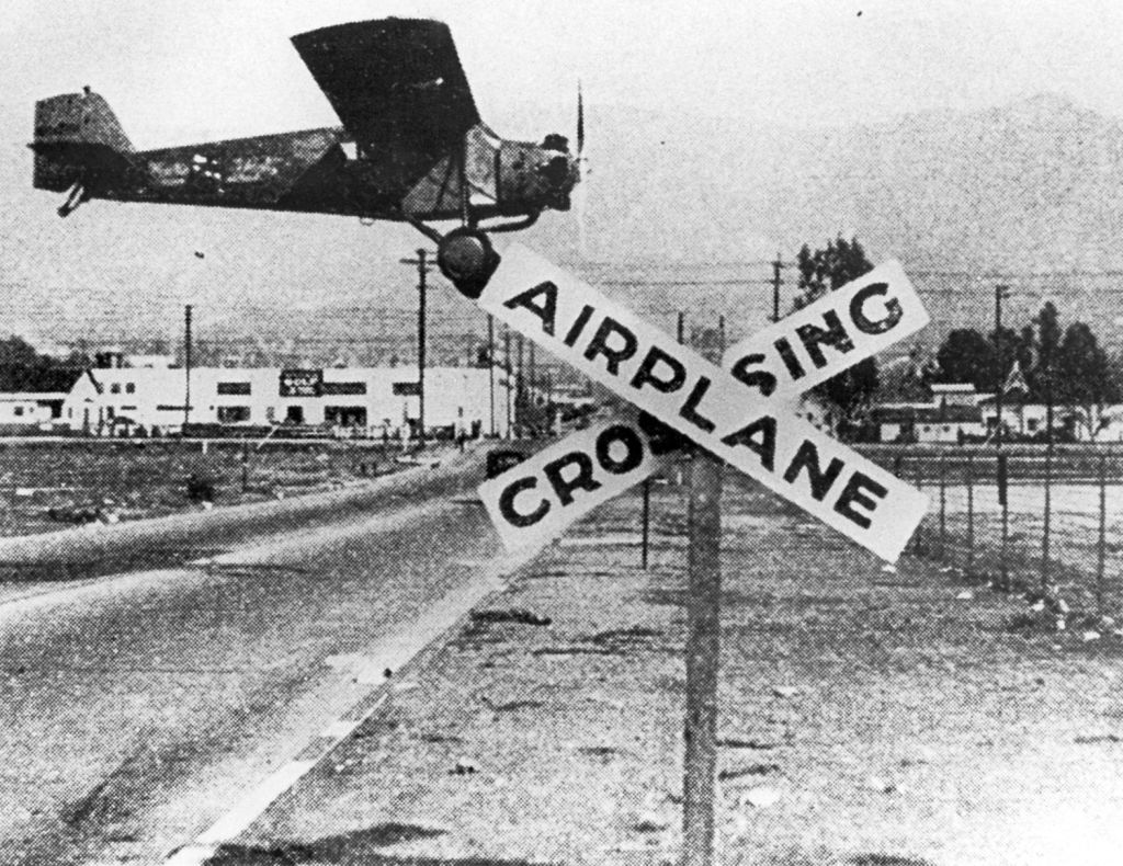
A 1930 photo of a Ryan monoplane (model undetermined) landing behind Grand Central Airport's “Airplane crossing” sign (courtesy of the Glendale Library).
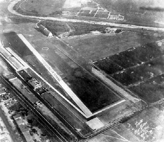
A 7/19/30 aerial view looking south at Grand Central Air Terminal.
Note the Slate Aircraft Corporation dirigible hangar at the top-left.
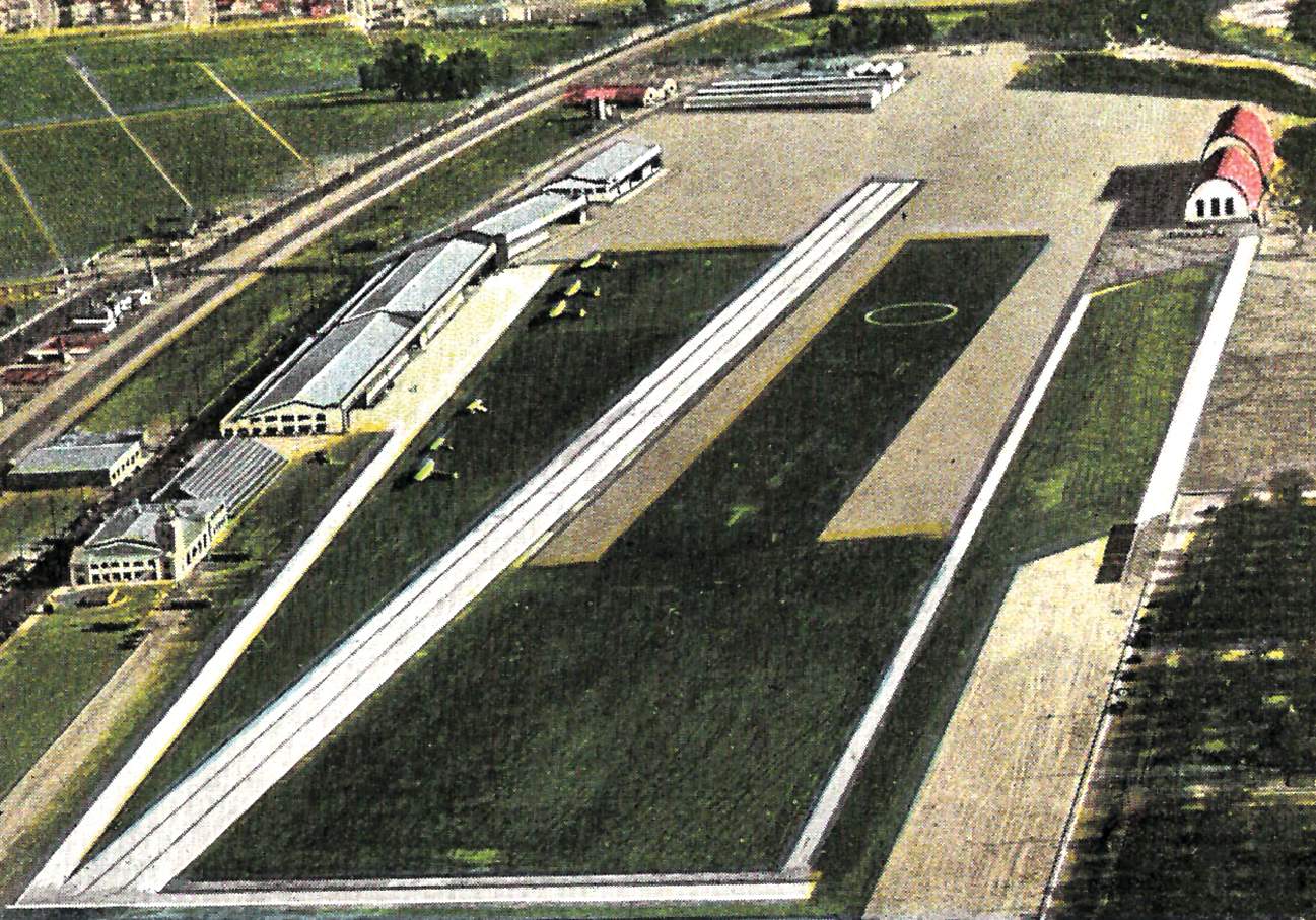
A circa 1930s colorized aerial view looking southeast at Grand Central Air Terminal, with the Slate Aircraft Corporation dirigible hangar at top-right.
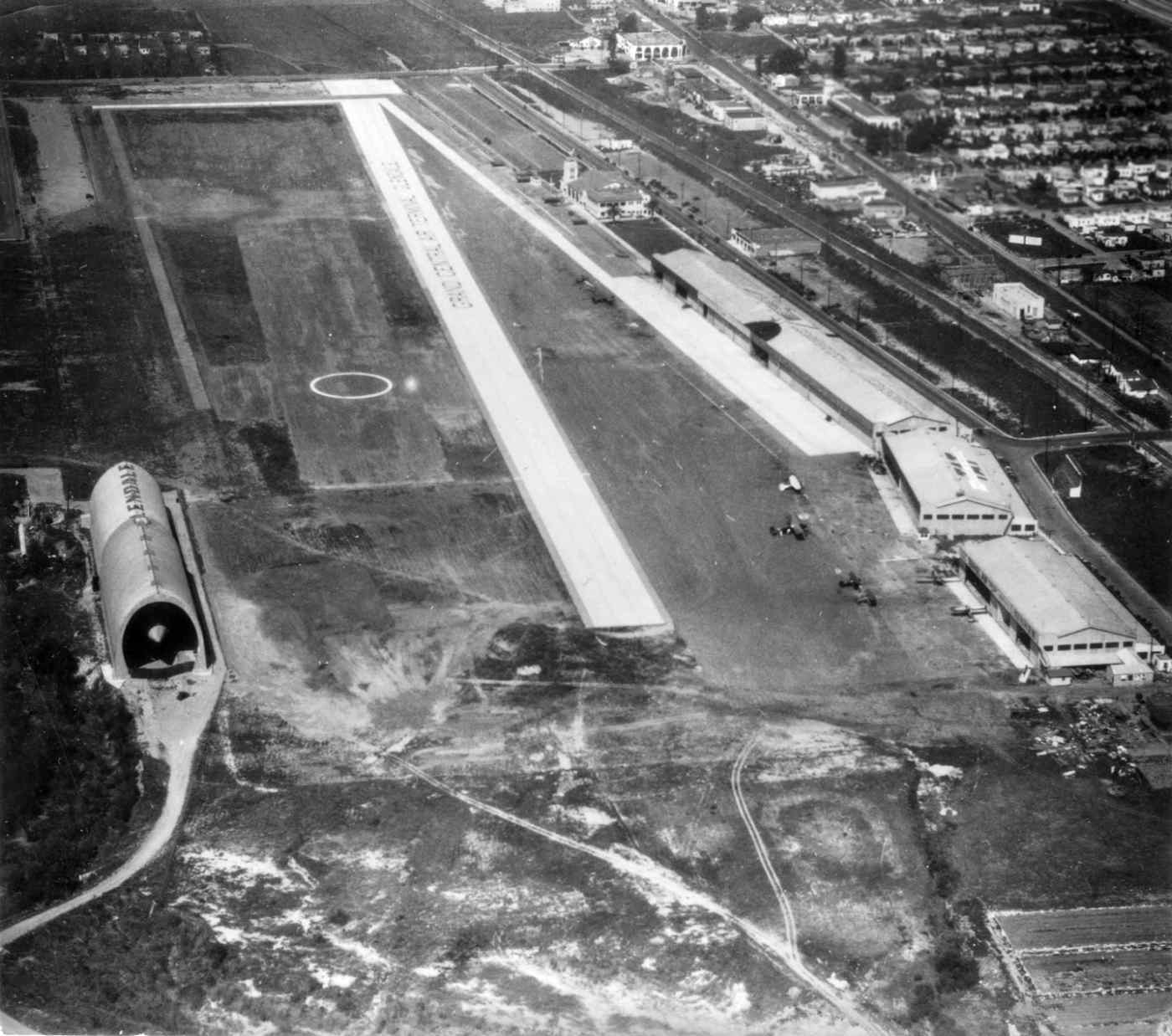
A circa late 1920s aerial view looking north at Grand Central Air Terminal, showing the Slate Aircraft Corporation's dirigible peeking out of its hangar at left,
and note the airport's name painted along the paved runway.
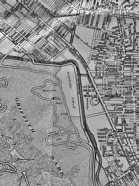
Grand Central Airport was depicted as a small property on a 1930 street map (courtesy of Kevin Walsh).
According to Tom McCart, “My Dad purchased an airplane from Kinner Motors or Airplanes (demoed by sales lady Amelia Earhart) at the Glendale Airport in 1930 or 1931.
The story from my Dad was he purchased the prototype Kinner Security Airster (Security Bank financed the Airster thus the Security part).”
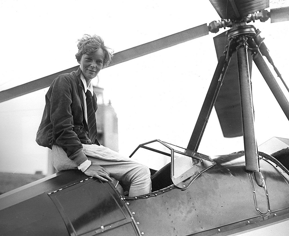
A May 1931 photo of Amelia Earhart arriving with a Beech-Nut Pitcairn PCA-2 autogiro at Grand Central Air Terminal, with its iconic control tower in the background.
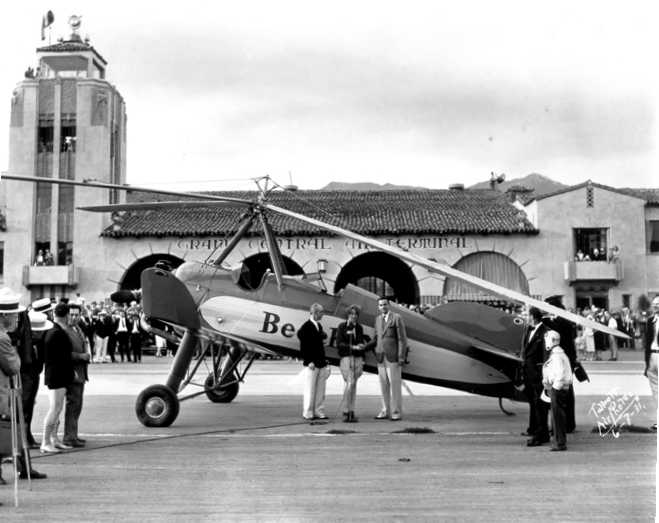
A 7/7/31 view of Amelia Earhart with the Beech-Nut Pitcairn PCA-2 autogiro at Grand Central Air Terminal.
Earhart had arrived from PA on what she thought was the first transcontinental autogiro flight, only to discover that Johnny Miller had beaten her by 10 days.
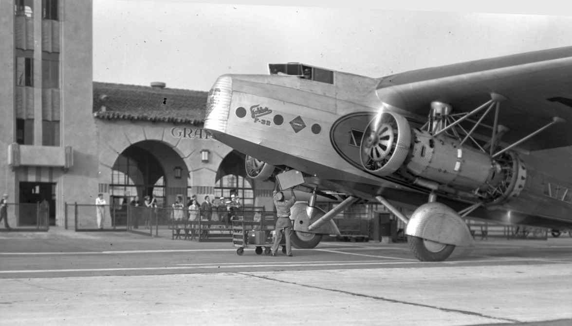
A circa 1930s photo of one of only 2 Fokker F-32 airliners which served Western Air Express, seen in front of the Grand Central Air Terminal.
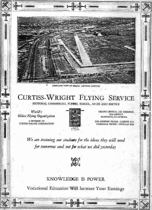
A 1932 advertisement for the Grand Central's Curtiss-Wright Flying Service featured an undated aerial view looking southeast at the field.
The concrete runway was shown, with a lineup of aircraft parked to its left, and the Slate dirigible hangar was still visible at the top-right.
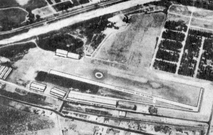
An undated aerial view looking southwest at Grand Central Air Terminal from a 1932 U.S. Navy Aviation Chart (courtesy of Roger Connor).
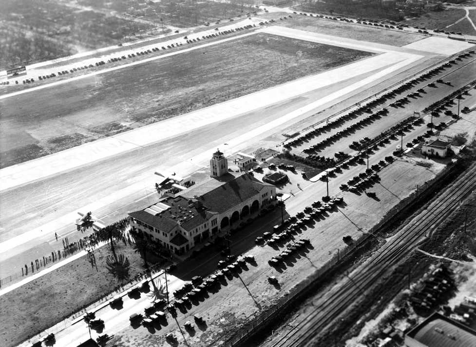
A 2/28/32 aerial view looking west at Grand Central Air Terminal.
Two small aircraft are parked directly in front of the terminal, and hundreds of automobiles are parked all around the airfield.
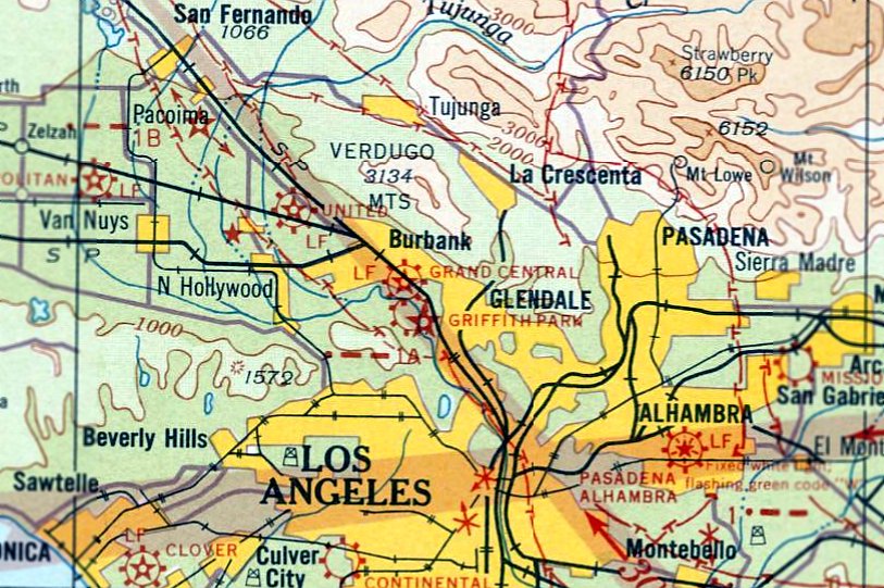
The earliest Sectional Chart depiction which has been located of Grand Central Air Terminal was on the June 1932 LA Sectional Chart.
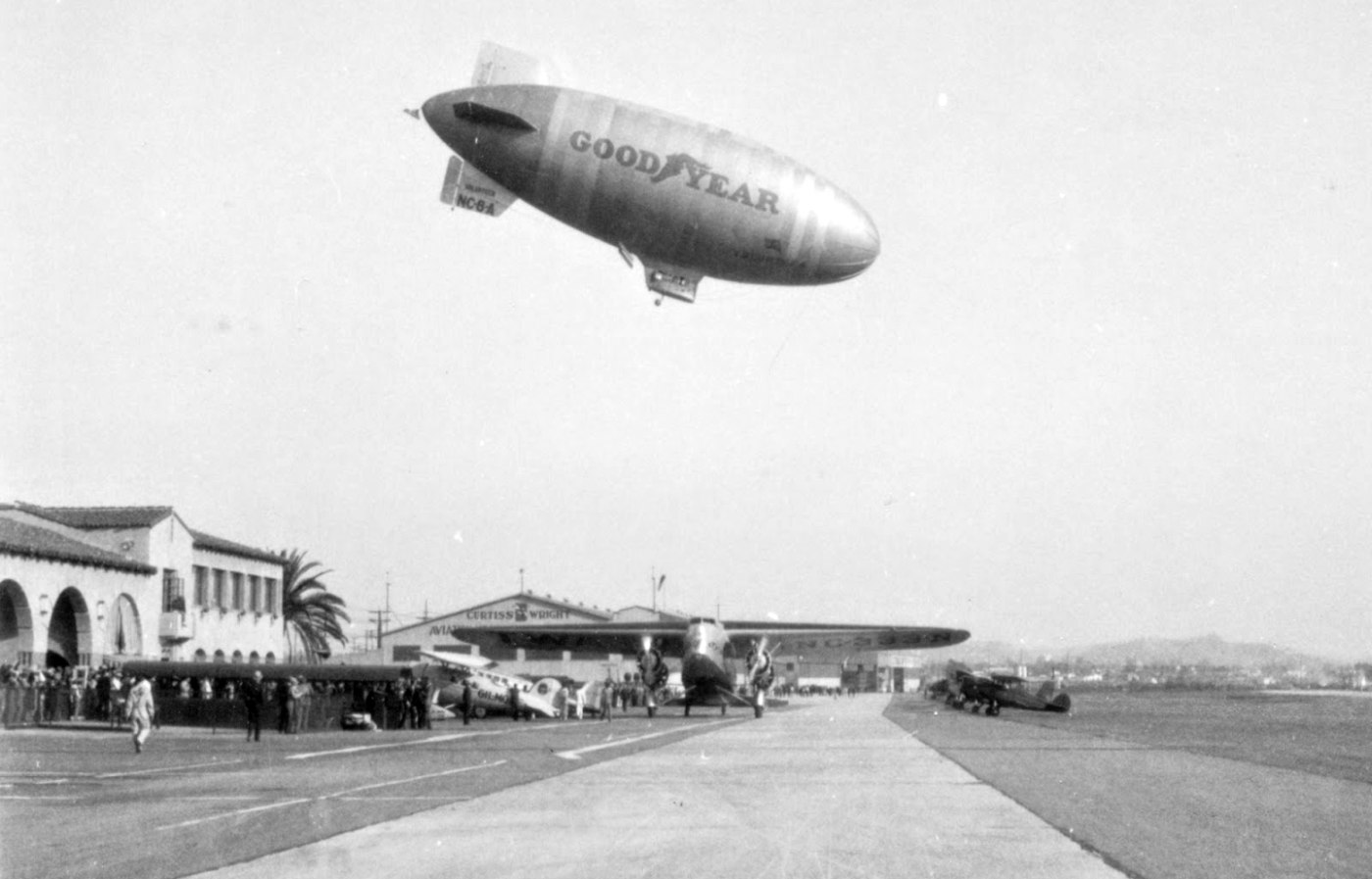
A circa 1932-33 photo of Goodyear's Type TZ airship Volunteer descending steeply for a landing at Grand Central Air Terminal
while T&WA's Fokker F-32 NC-333N taxis up to the terminal.
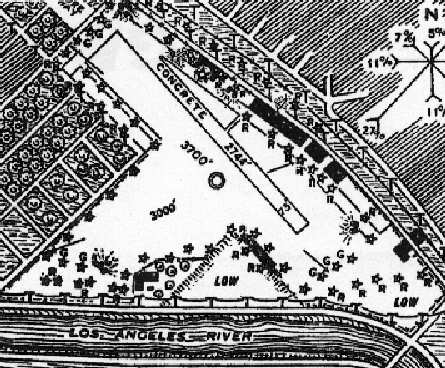
A 1933 airport directory depicted Grand Central
as having a single 2,744' concrete runway, oriented northwest/southeast,
along with a 3,700' parallel grass runway & a 3,000' crosswind grass runway.
The Slate dirigible hangar was still depicted on the south side of the field.
The airport manager was listed as C. C. Moseley.
The operators were listed as Air Associates Inc., Airplane Development Corporation,
American Airways Inc., Max Cornwell, Curtiss-Wright Approved Repair Station, Curtiss-Wright Technical Institute,
G & G Air Lines, Pacific Seaboard Air Lines, Palm Springs Air Lines, and Transcontinental & Western Air.
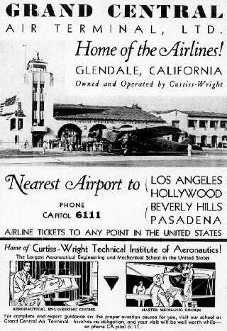
An advertisement from the 1933 National Air Races program proclaimed Grand Central Air Terminal to be the “Home of the Airlines!”

The sole prototype of the new Douglas DC-1,
which dropped in unannounced to the Grand Central Air Terminal on 8/16/33 (courtesy of Dan MacPherson).
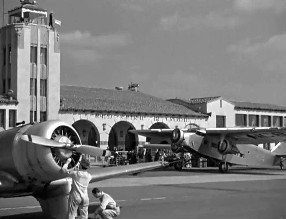
A still from the 1933 movie “Air Hostess” filmed at Grand Central Air Terminal, showing an unidentified single-engine plane & a Ford Tri-Motor,
which in the movie was a TWA flight which had arrived from Albuquerque.
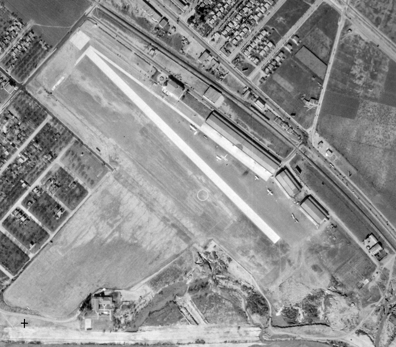
A 1/13/34 aerial view of Grand Central Air Terminal (from the UCSB Library), showing numerous aircraft parked northeast of the runway.
The Slate dirigible hangar had evidently been removed at some point between 1933-34 on the south side.
In 1934, Maj. Moseley leased the field & facilities from Curtiss-Wright, and later purchased the property.
He immediately changed the name of the technical school operated at the airport
from Curtiss-Wright Technical Institute to Cal-Aero Technical Institute.
According to Dan MacPherson, Moseley ran 3 other flight schools from his home base at Grand Central:
the Cal Aero Flight Academy at Ontario (now Chino Airport),
the Mira Loma Flight Academy at Oxnard (now Oxnard Municipal Airport),
and the Polaris Flight Academy at War Eagle Field, Lancaster (now Mira Loma Prison).
Suzanne Gilreath reported, “Grace Huntington took flying lessons in the 1930s from Joe Plosser who ran a flight school out of Glendale Central Air Terminal.
I have heard he was a fixture there. I have also seen an advertisement for his school.
Grace Huntington got her pilot’s license in 1934 or 1937.”
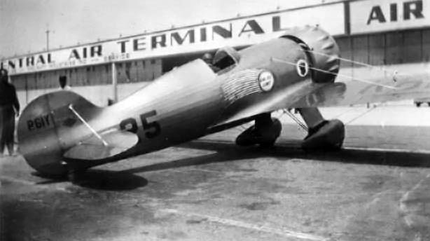
A circa 1934-36 photo of Roscoe Turner's Weddell Williams Racer in front of the Grand Central Air Terminal (courtesy of Dan Rhinehart).
In 1934, wealthy industrialist Howard Hughes leased a small building
owned by Charles Babb at 911 Air Way (on the southeast corner of the airport)
to build his Hughes Special Model A airplane (later known as the H-1 Racer).
Dick Palmer & his staff moved in at the end of April.
Before work began, Hughes (eventually to be infamous for his obsession with secrecy)
had a plywood wall erected around the construction site
and posted an armed guard on duty overnight.
Hughes brought Glen Odekirk from New York to act as shop superintendent & liaison man.
As expenses on the Racer project mounted, and with them the need for more specific accounting,
Howard established the Hughes Aircraft Company as a division of the Hughes Tool Company,
thus marking the beginning of what would eventually become a powerhouse of the American aerospace industry.
The Hughes Racer was finished on 8/10/35,
but it was trucked to Mines Field for its first flight (presumably due to Mines having a longer runway?).
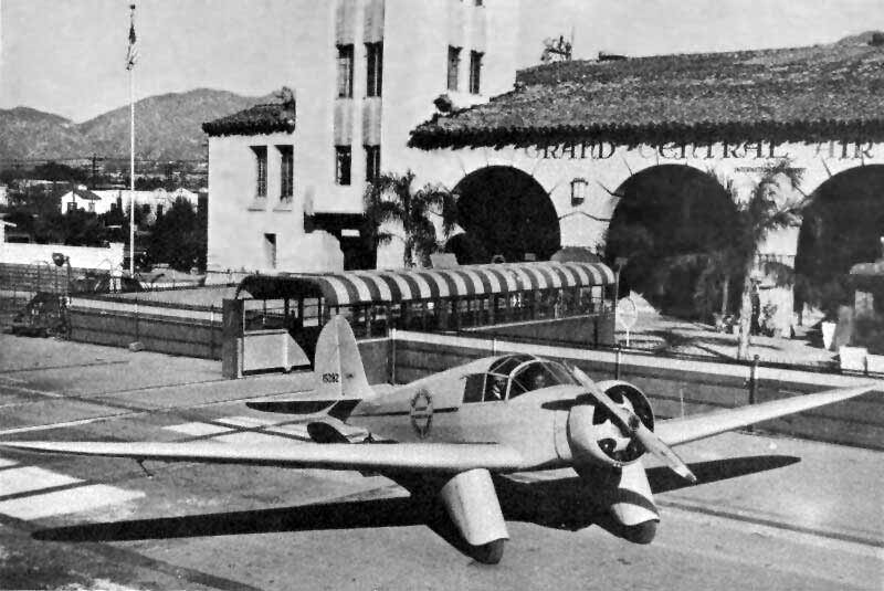
An undated photo (courtesy of Kevin Holcomb) of the 1st production example of the Aeronca LA (which first flew in 1935)
pictured in front of the tower of the Grand Central Air Terminal.
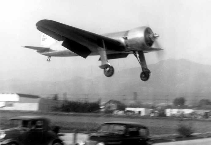
A 1935 photo of Howard Hughes landing the beautiful Hughes Special Model A (later known as the H-1) at Grand Central Air Terminal.
The record-setting H-1 had been built on the southeast corner of Grand Central Airport.
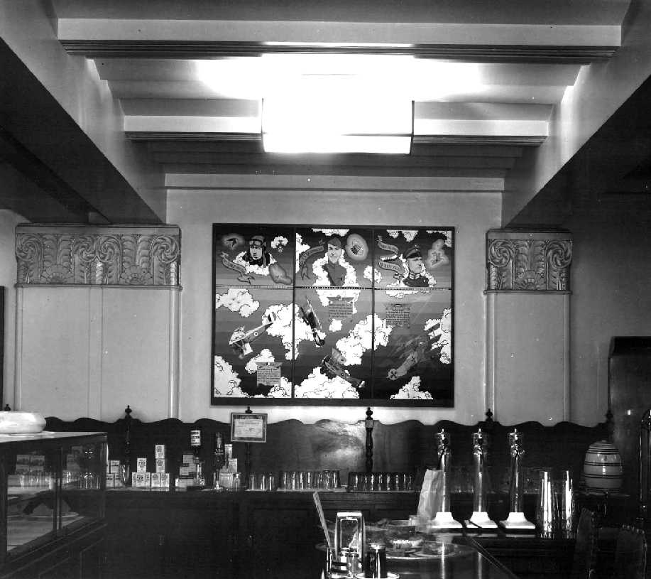
A circa 1930s view of the interior of the Grand Central Air Terminal cafe, showing the Art Deco wall features & an aviation mural.
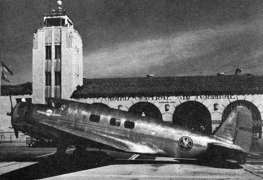
A circa 1930s photo of an American Airlines Vultee V-1 in front of Grand Central Air Terminal.
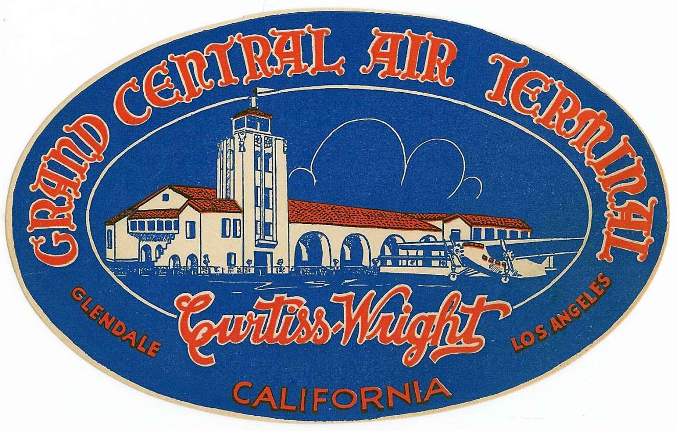
A circa 1930s Grand Central Air Terminal luggage label.
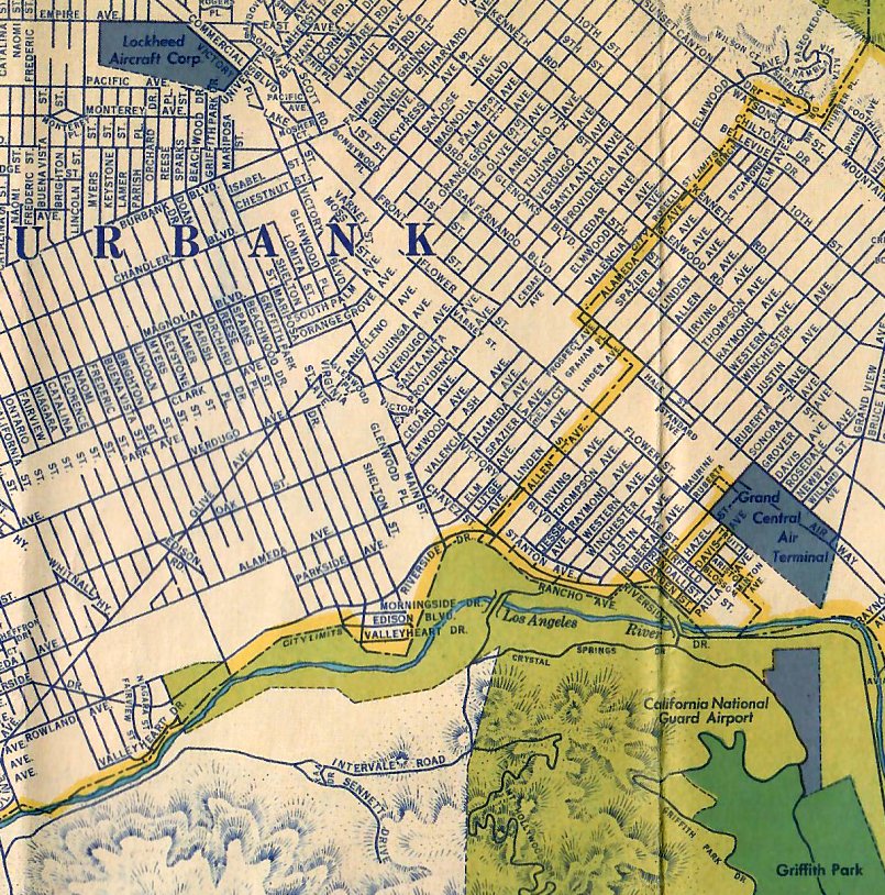
The 1935 H.M. Gousha / Shell Oil LA map (courtesy of Michael Binder) depicted “Grand Central Air Terminal” as an irregularly-shaped property outline.
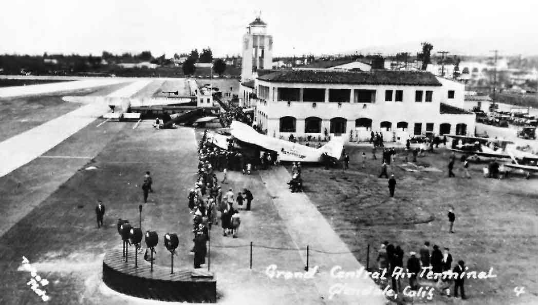
A 1936 photo of an airshow at Grand Central Air Terminal.
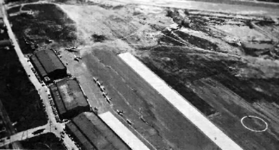
A 1936 aerial photo looking south at the hangars at the southern end of the Grand Central Air Terminal (courtesy of Ross Diehl, via Dan MacPherson).
The 2 southern most hangars (upper 2 hangars in this photo) still exist today,
while the big hangar (the Maddux hangar) no longer exists.
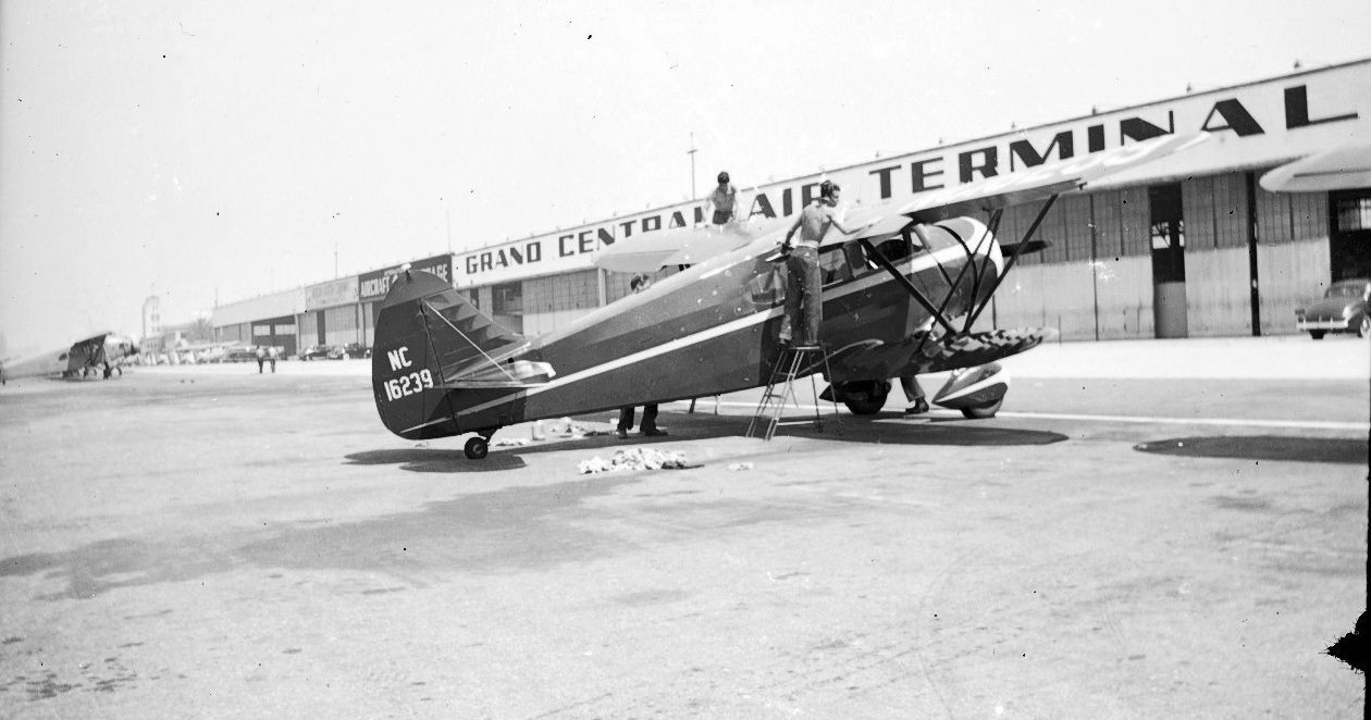
A 1930s photo of NC16239, a Waco ZQC-6, serial #4442 in front of the Grand Central Air Terminal hangars.
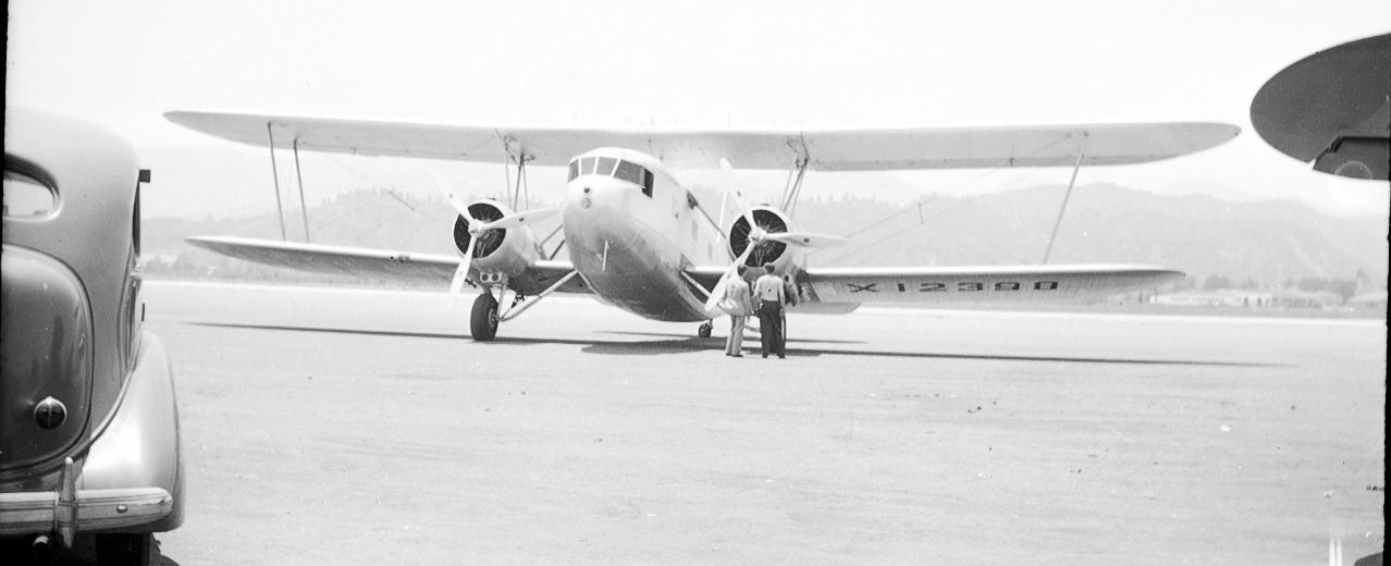
A 1930s photo of N12398, a Curtiss AT-32D Condor, serial #50, at Grand Central Air Terminal.
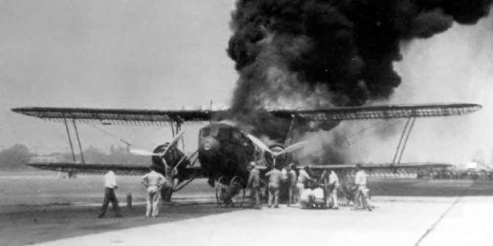
An 8/13/36 photo of an American Airlines Curtiss Condor T-32 NC12353, seen on fire at Grand Central Air Terminal.
Some spilled gas & an engine backfire resulted in the aircraft's doped linen-covered wings catching fire.
The plane was a loss but no lives were lost.

A 1936 photo by John Underwood of the American Gyro AG-4 Crusader prototype NX14429 C/n 101 at Grand Central Air Terminal.
The 4-seat twin-boom metal plane had first flown in 1935 in Denver, but the design was sold in 1936 to Glendale's Timm Aircraft Company.
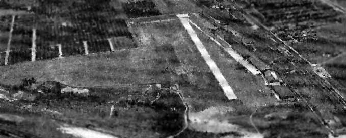
An aerial view looking north at the Grand Central Air Terminal
from The Airport Directory Company's 1937 Airports Directory (courtesy of Bob Rambo),
showing the paved north/south runway (with several large hangars along its east side),
as well as the unpaved east/west runway.
The directory described Grand Central as having 2 runways,
with the longest being a 3,700' northwest/southeast runway, of which 2,744' was paved.
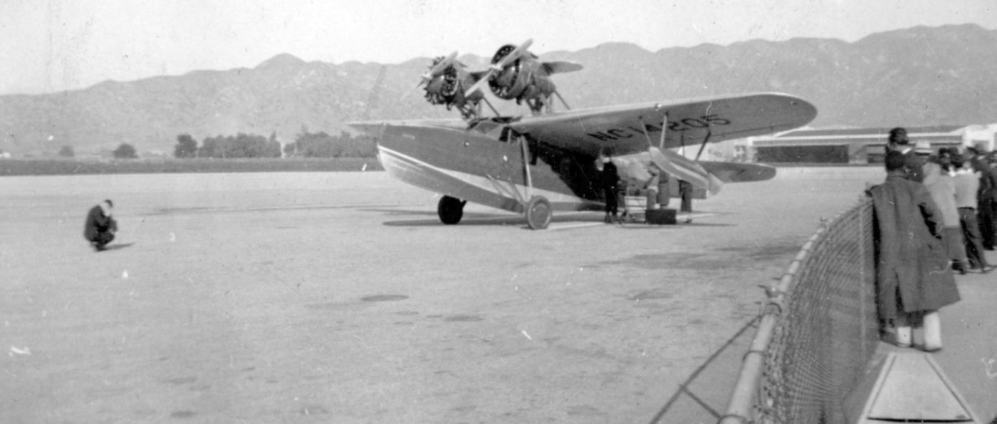
A circa 1930s photo of a Douglas Dolphin amphibian NC14205 at Grand Central Air Terminal.
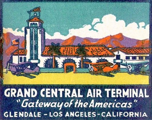
A circa 1930s promotional artwork for “Grand Central Air Terminal, “Gateway to the Americas” (courtesy of Steve Owen).
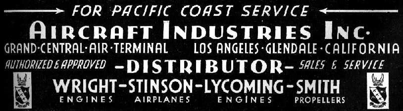
A vintage advertisement from The Airport Directory Company's 1937 Airports Directory (courtesy of Bob Rambo).
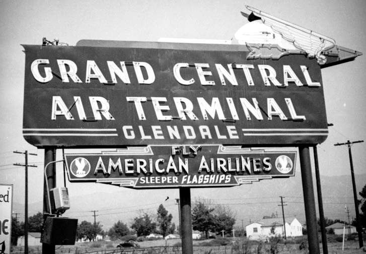
A circa 1937 photo of the sign for Grand Central Air Terminal & its American Airlines service.

A January 1937 photo of the beautiful world speed record holder Hughes H-1 at Grand Central Air Terminal.
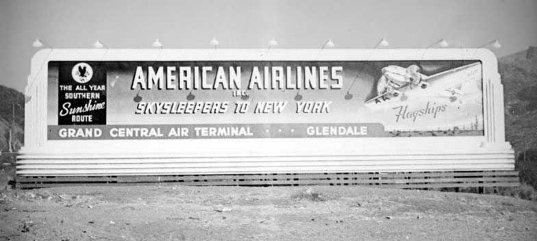
A circa 1937 photo of a sign for American Airlines' Grand Central Air Terminal service.
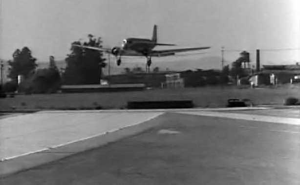
A still of a DC-2 landing at Grand Central from the 1937 movie “Hollywood Hotel” (courtesy of John Schlesinger).
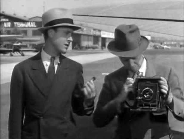
A still of 2 actors in front of a Grand Central hangar from the 1937 movie “Hollywood Hotel” (courtesy of John Schlesinger).
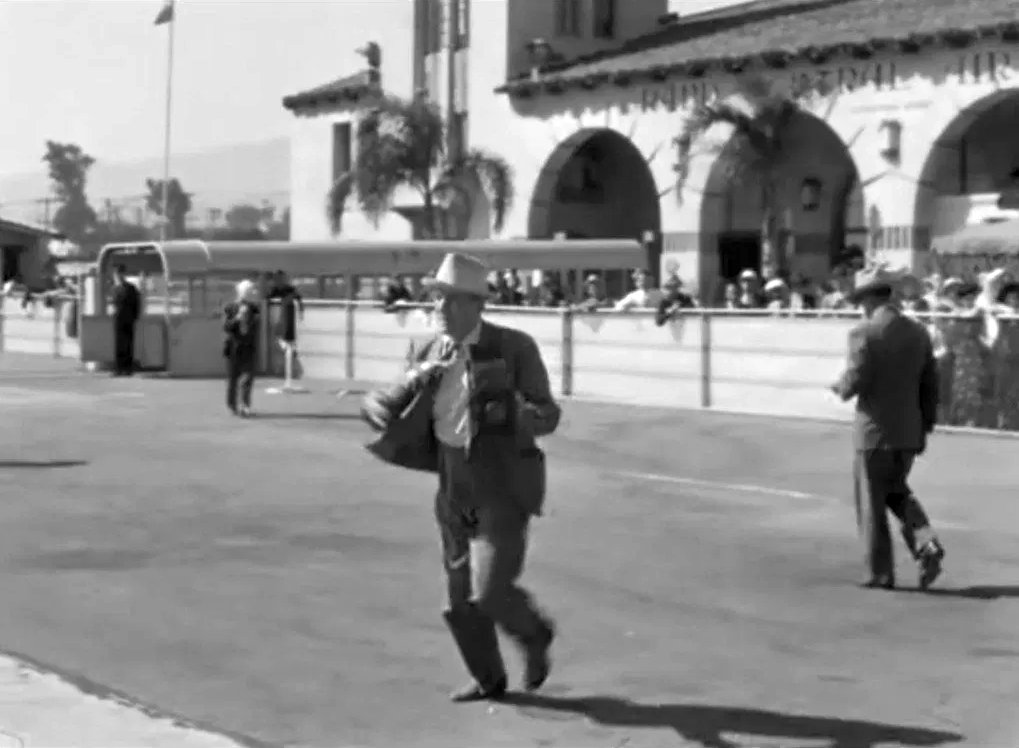
A still from the 1937 movie “Hollywood Hotel” showing saxophonist Ronny Bowers (Dick Powell) arriving at Grand Central Air Terminal.
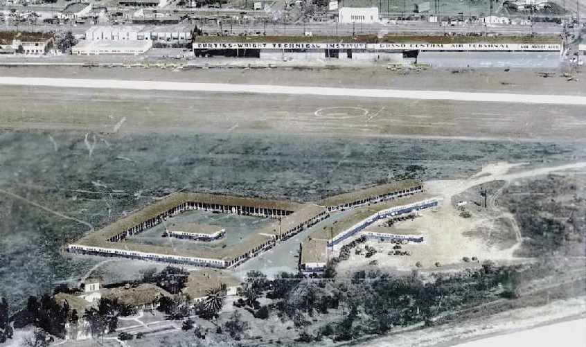
A circa 1937-39 photo (courtesy of the Southern CA Aero Club, via Don Ayres)
showing the buildings of the Cal-Aero Technical Institute (in the foreground)
which had been built at some point during 1937-39 over most of the former crosswind runway.
The hangars of the Curtiss-Wright Technical Institute were visible across the runway in the background.

The logos of the Cal-Aero schools, from an original poster, courtesy of Dan MacPherson.
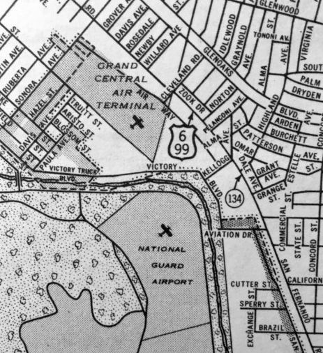
Grand Central Air Terminal & the nearby Griffith Park National Guard Airport, as depicted on a 1938 Rand-McNally Texaco map (courtesy of Kevin Walsh).
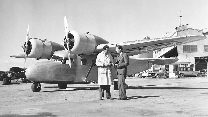
It made its maiden flight on 2/10/38 from Grand Central Air Terminal.

A 1938 photo by Ralph Johnson of the Timm T-840 prototype NX17390 C/n 201, in front of the Timm Grand Central hangar.
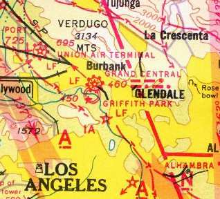
Grand Central Air Terminal, as depicted on the 1939 LA Sectional Chart (courtesy of Jon Karkow).
Suzanne Gilreath reported, “Grace Huntington set a series of altitude records. The first one was set on either 5/31/39 or 6/1/39 at Glendale Central Air Terminal.
For Grace’s training & altitude record set at Glendale, she flew her uncle Charles’ Fairchild 24.”
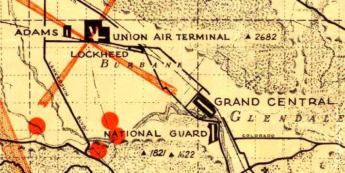
Grand Central Air Terminal, as depicted along with several other nearby airfields on the 1939 LA County Airports Map.
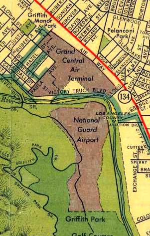
Grand Central Air Terminal & the nearby Griffith Park National Guard Airport, as depicted on the 1939 LA County Airports Map.
Will Adams recalled, “When I joined the Air Corps in 1940, the recruiting office & examining doctor's office were in the Grand Central Terminal building.”
During WW2, TWA had its western terminus at Grand Central.
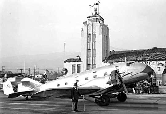
A circa 1939-43 photo of a very rare & unusual Capelis XC-12 in front of Grand Central Air Terminal.
Mr. Capelis is in front of his plane.
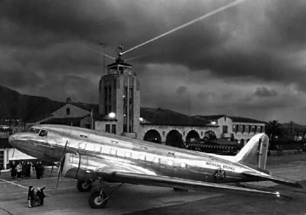
An atmospheric 1940 shot of an American Airlines Douglas Douglas Sleeper Transport DC-3,
in front of the beacon lights emanating from Grand Central's tower.
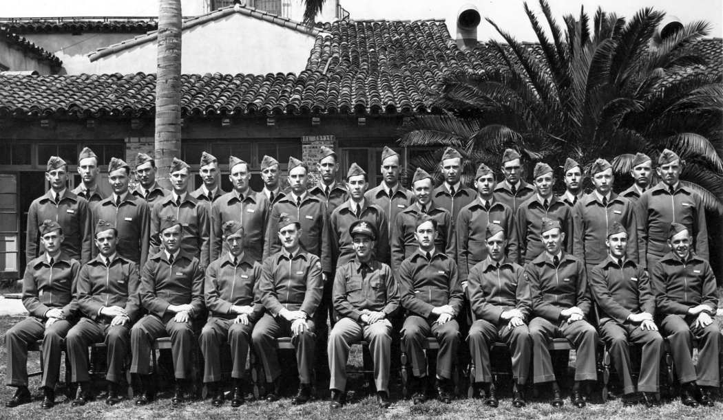
A 3/31/41 photo (courtesy of Patrick Fruedenthal) of Class 41-H of Cal Aero Training Corporation at Grand Central Airport.
Patrick Fruedenthal recalled, “My uncle was a cadet at Cal-Aero in 1941.”
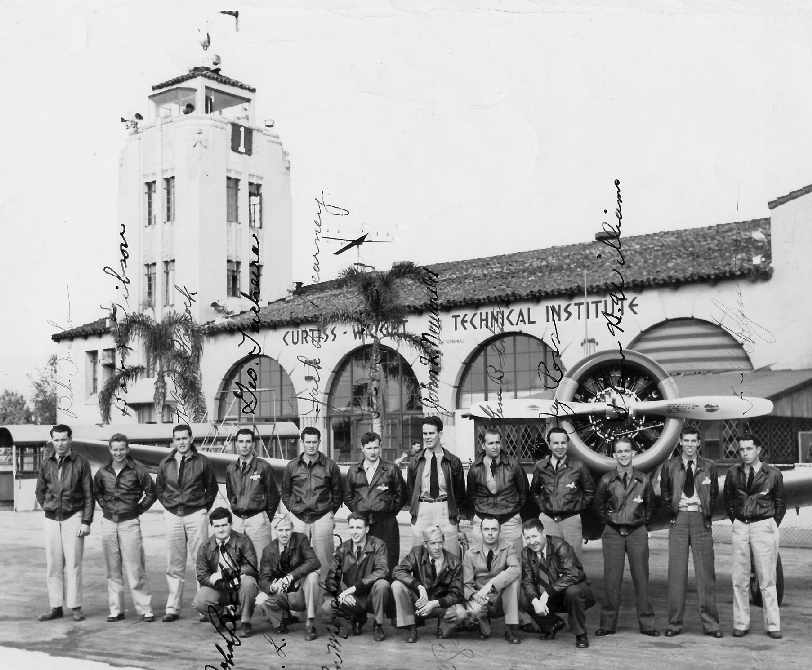
An October 1941 photo (courtesy of Sidney Linton) of Eugene Crane & others
in front of a Vultee BT-13 Valiant trainer in front of Grand Central Air Terminal,
which was marked as the “Curtiss-Wright Technical Institute.”
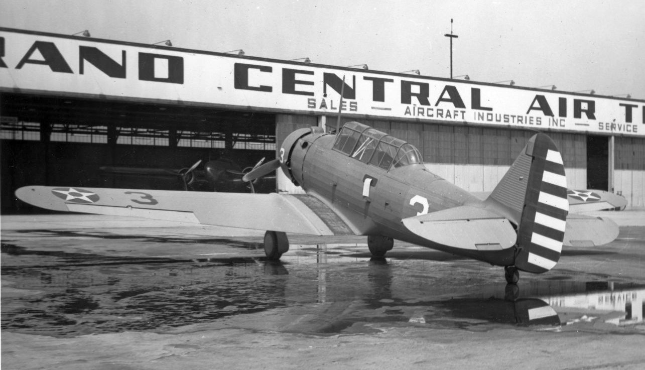
A early 1940s photo of a North American BT-9 trainer in front of the Grand Central Air Terminal hangars.
A squadron of Lockheed P-38 Lightning fighters arrived arrived at Grand Central Air Terminal in February 1942 to augment the air defense of the LA area.
Angelo Rivera recalled, “Curtiss Wright Technical Institute where many of us trained back in the early days of WW2.
Shortly after my induction into service, I was sent to that school where we spent the next 6 months
with instructors learning the whys & wherefores of what made airplanes tick.
It certainly was one great experience for a 19 year old who had never been away from home.
I arrived there in early April 1943, and for the next 6 months it was a lot of schoolwork & not much of anything else.”
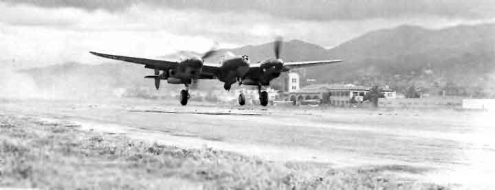
A WW2 era photo of a Lockheed P-38 Lightning fighter taking off, with the Grand Central terminal visible in the background.
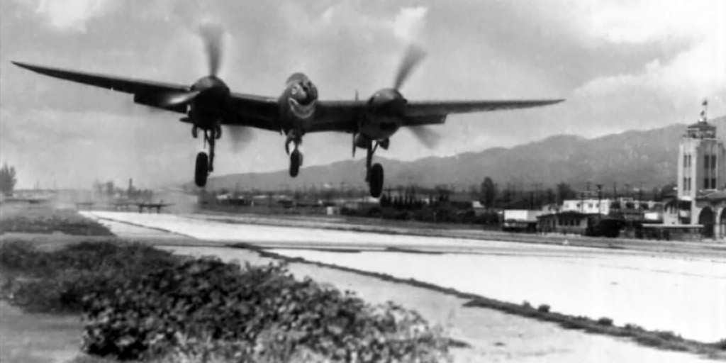
A WW2 era photo of a shark-mouthed Lockheed P-38 Lightning fighter taking off, with the Grand Central terminal visible in the background.
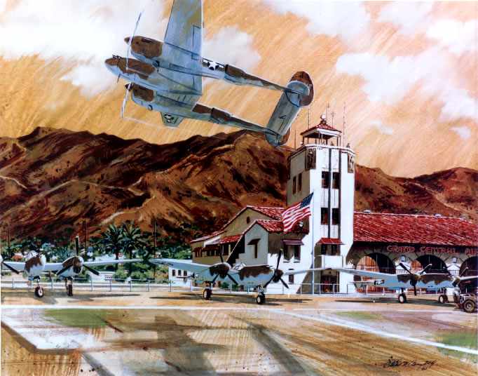
A watercolor by Collin Campbell of P-38 Lightning fighters at Grand Central Air Terminal.
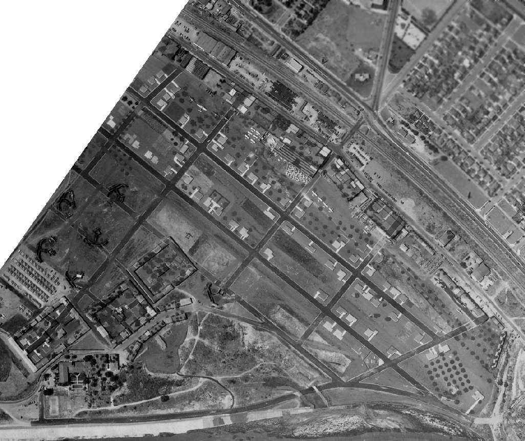
An amazing 6/6/42 U.S. Navy aerial view (courtesy of Brian Rehwinkel)
depicted the incredibly effective camouflage which was applied to the Grand Central Air Terminal during WW2.
Although the photo appears to depict a series of city streets,
a closer inspection will reveal the layout of hangars along the west side,
and the characteristic shape of the contract flying school buildings along the east side,
along with dozens of aircraft parked on the west & east side of the runway (including at least 9 P-38 Lightning fighters).
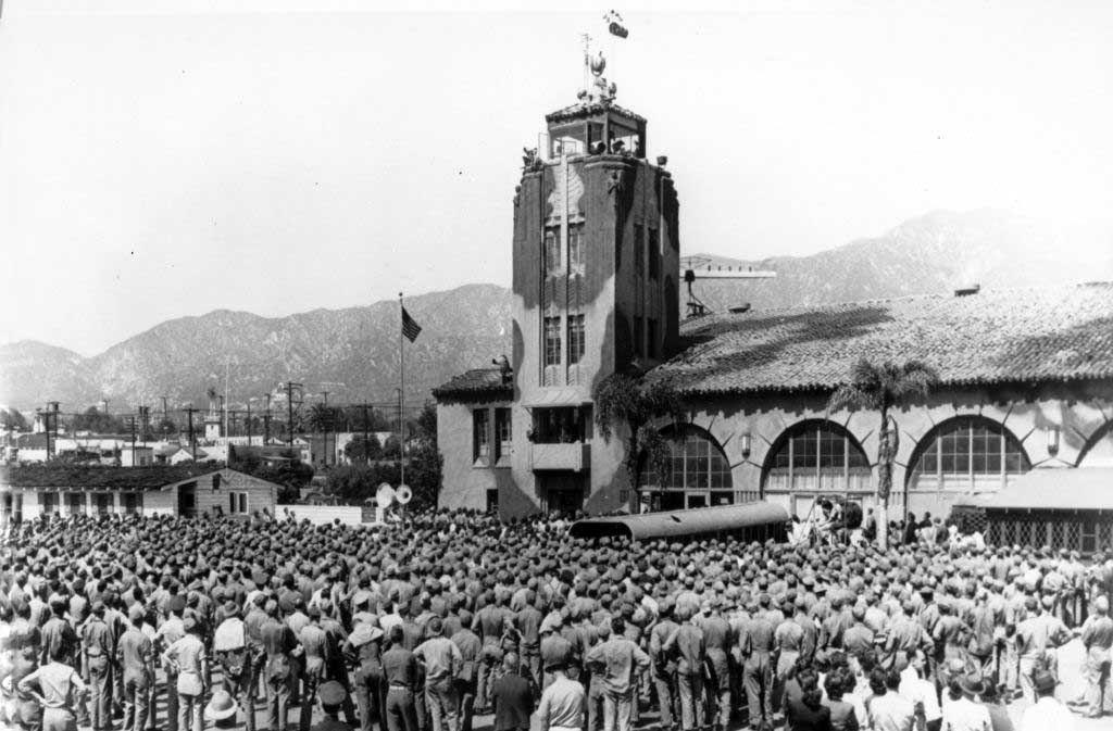
A 1942 photo of a mass gathering of servicemen in front of the camouflaged Grand Central control tower.
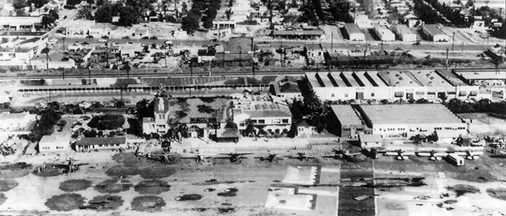
A WW2 era aerial view looking northwest at a row of aircraft in front of the camouflaged Grand Central control tower.
The 1942 USGS topo map depicted the open area of the Grand Central Airport,
but did not label it at all (most likely due to wartime security concerns).
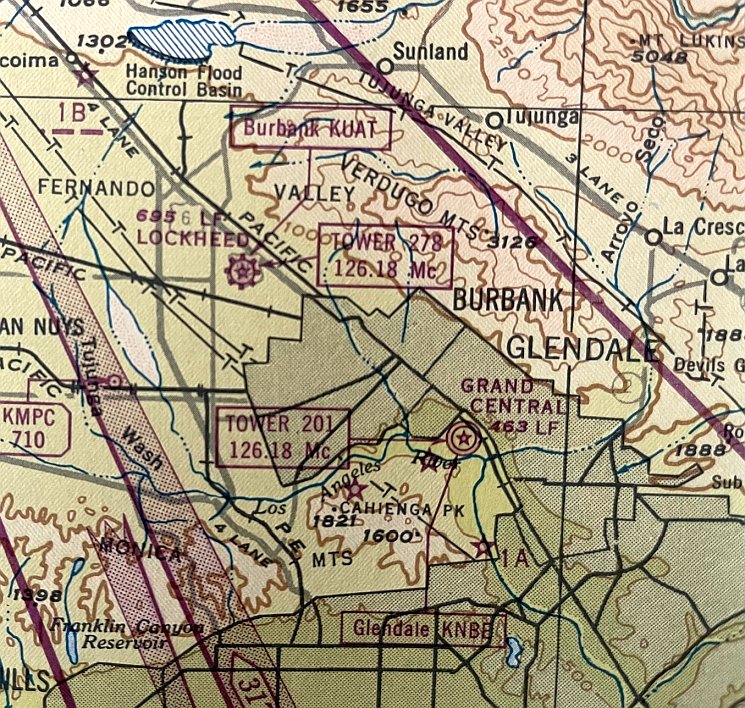
A 1943 LA Approach Chart (courtesy of Kevin Walsh) depicted Grand Central Airport as a military airfield.
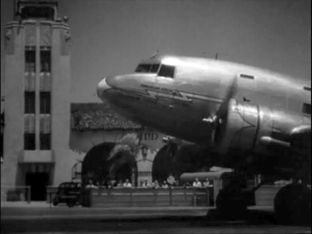
A still from the 1943 movie “Sherlock Holmes in Washington” filmed at Grand Central Air Terminal, showing a Douglas DC-3 in front of the iconic terminal.
In the movie Grand Central stood in for Transatlantic Airways’ London Terminal.
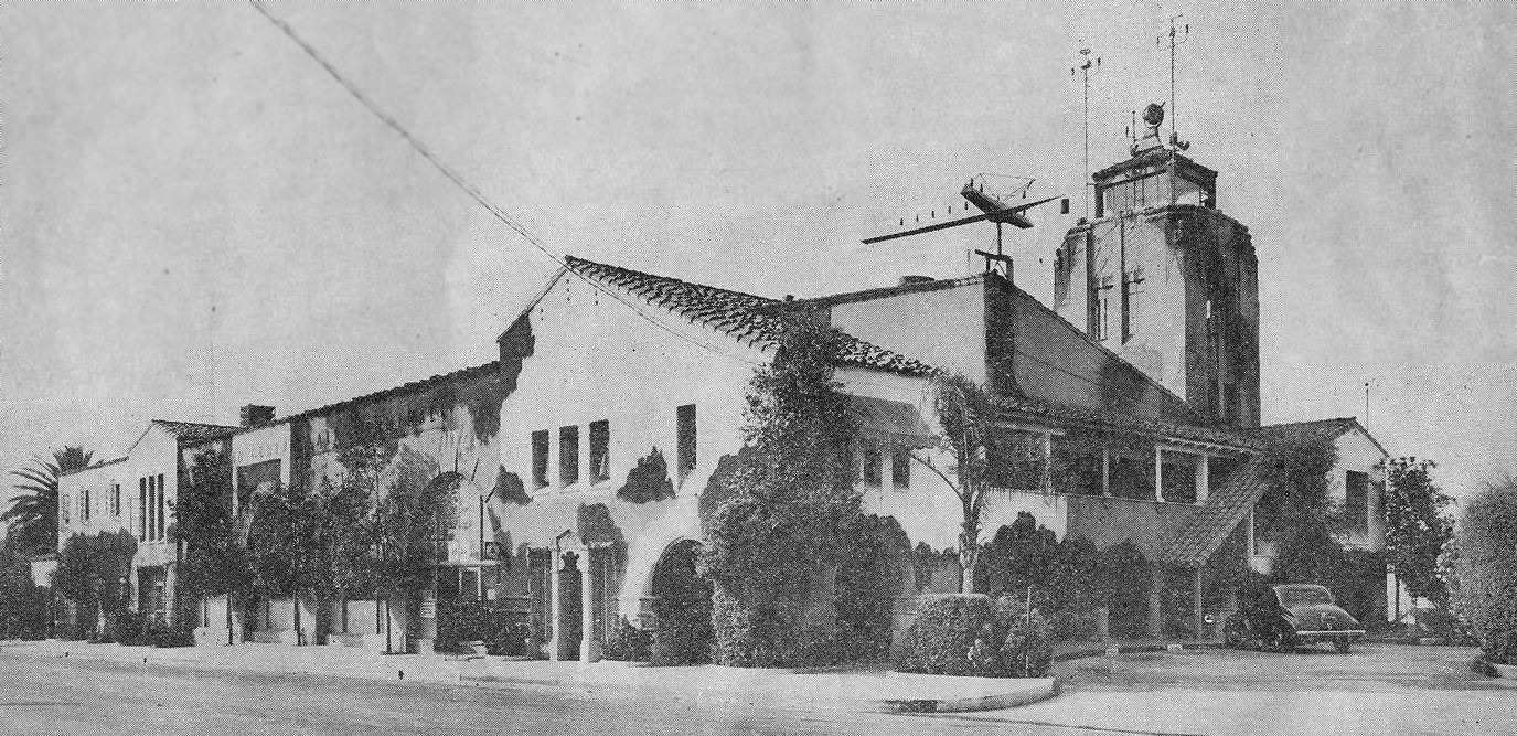
An undated photo of the camouflaged Grand Central control tower from the August 1944 BulAero, announcing “We purchase Grand Central: Famed Southern California airport is acquired by Cal-Aero Academy.”
Also note the illuminated wind indicator mounted on a corner of the terminal building.
The 1944 US Army/Navy Directory of Airfields (courtesy of Ken Mercer).
described Grand Central as having a 5,000' hard-surfaced runway,
and indicated that Army operations were conducted from the field.
Other contract flying schools operated at Grand Central during WW2,
including the Grand Central Flying School (which trained cadets for the RAF).
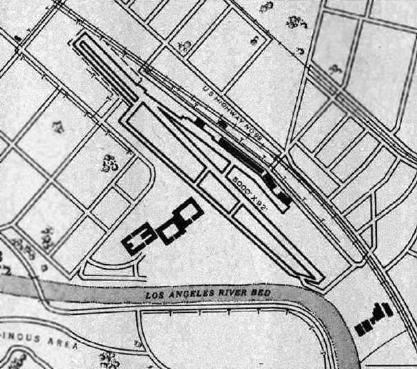
The 1945 AAF Airfield Directory (courtesy of Scott Murdock) depicted Grand Central Airport
as having a single 5,000' northwest/southeast concrete & asphalt runway,
with a parallel taxiway depicted on the southwest side.
The field was said to have a total of 5 hangars, with the largest being 200' x 130',
and the buildings of the Cal-Aero Technical Institute were depicted along the southwest side of the runway.
The field was said to be privately owned & operated.
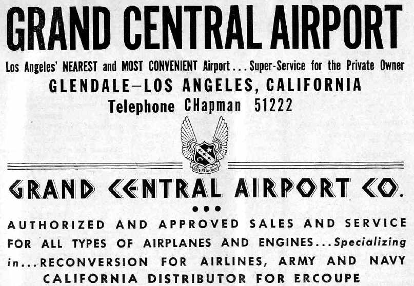
An advertisement for Grand Central Airport from the Haire Publishing Company's 1945 Airport Directory (courtesy of Chris Kennedy).
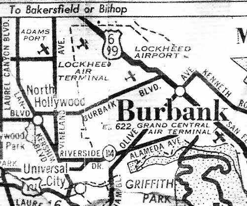
Grand Central Air Terminal, as depicted on a circa 1945 street map (courtesy of Ken Brody).
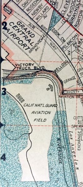
A 1945 Thomas Brothers map (courtesy of Kevin Walsh) depicted Grand Central Airport, but did not depict any runways or hangars.
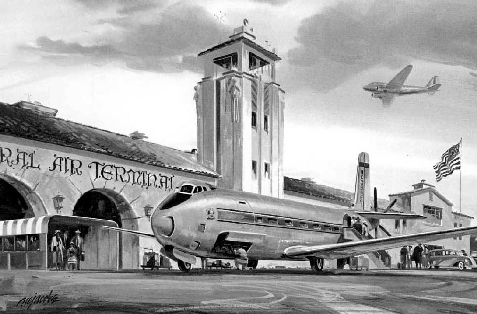
A 1946 artist's concept of the Douglas DC-8 Skybus in front of Grand Central Air Terminal.
The Skybus was an unbuilt concept for a short-range airliner based on the XB-42, with twin internal engines driving centerline contrarotating propellers.
It had no relationship to the jet aircraft built later as the DC-8.
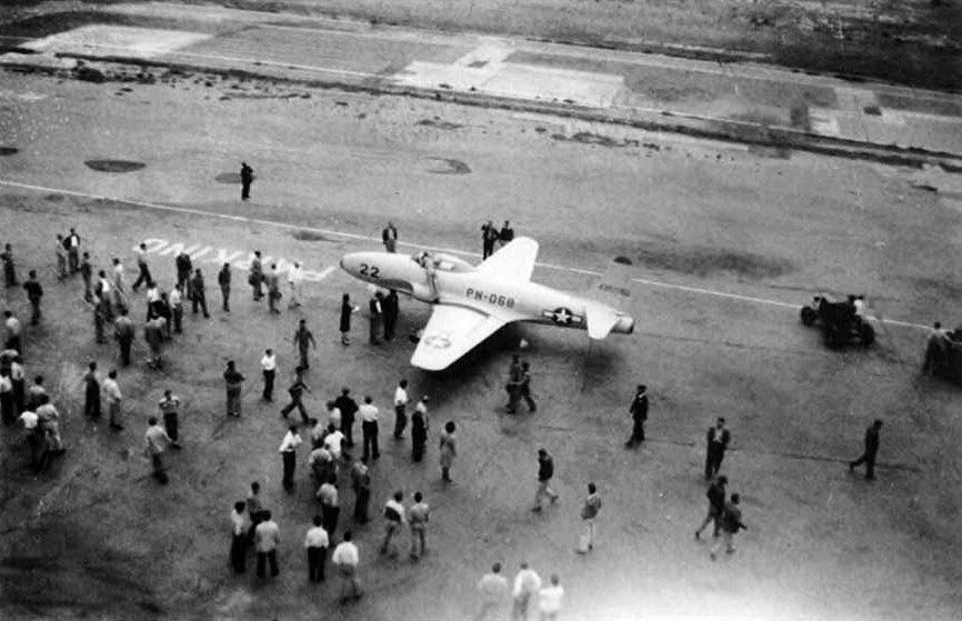
A 1946 photo of the first jet to visit Grand Central Air Terminal: one of the first Lockheed P-80 Shooting Stars, built only a few miles away.
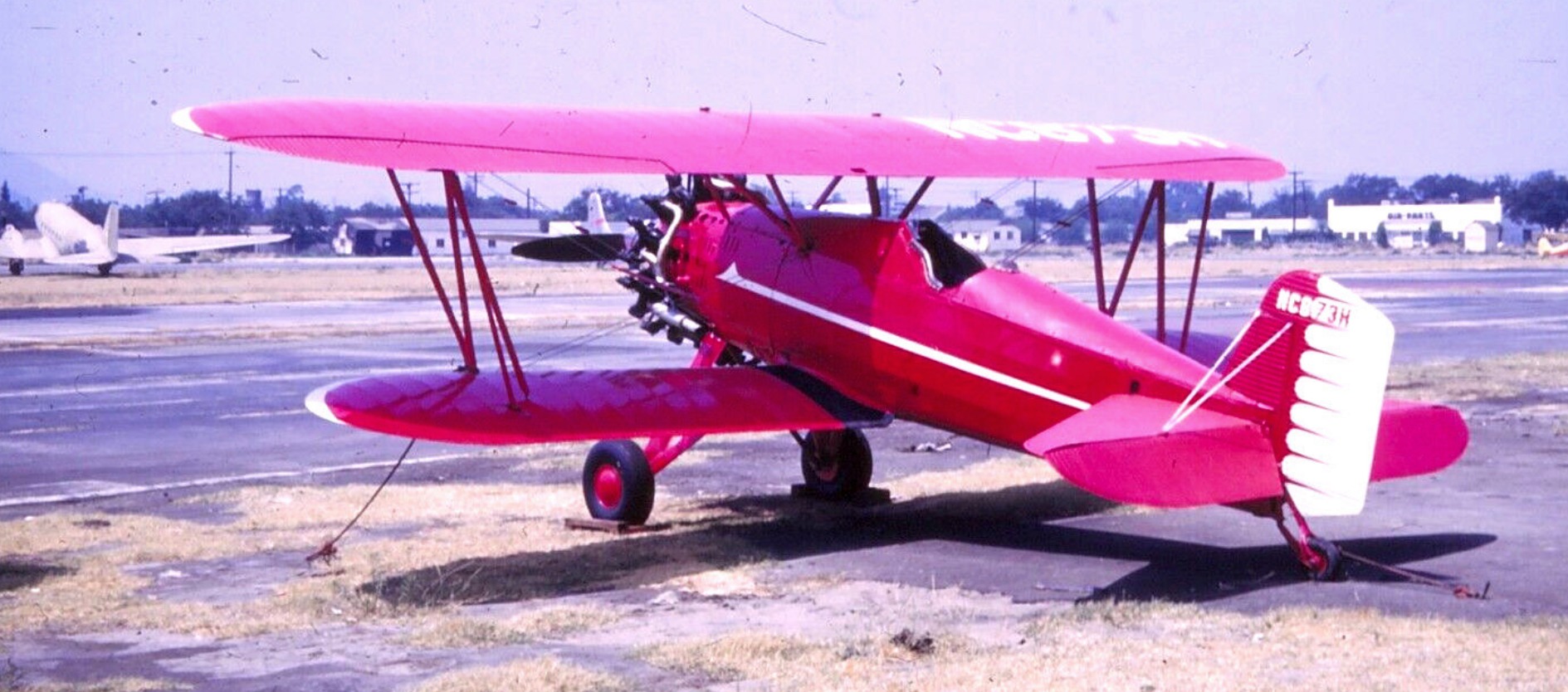
An August 1946 photo of NC873H, a single-seat Boeing 100 (civilian version of the F4B-1 fighter), C/n 1144, owned by Paul Mantz, at Grand Central Air Terminal.
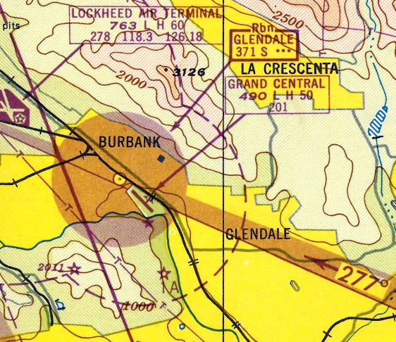
The 1947 LA Local Aeronautical Chart (courtesy of Tim Zukas)
depicted Grand Central Airport as having a 5,000' paved runway.
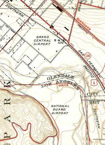
The 1948 USGS topo map depicted Grand Central Airport,
as well as the “National Guard Airport” to the south.
John Underwood recalled, “When we moved to Glendale I discovered Grand Central Airport,
where I got a job working for Maj. Moseley, which provided the means to learn to fly & eventually own several airplanes.
The upshot of all that was a book titled 'Madcaps, Millionaires & 'Mose'.
I've just finished a 2nd volume on the same subject for Arcadia Publishing, 'Grand Central Air Terminal'.”
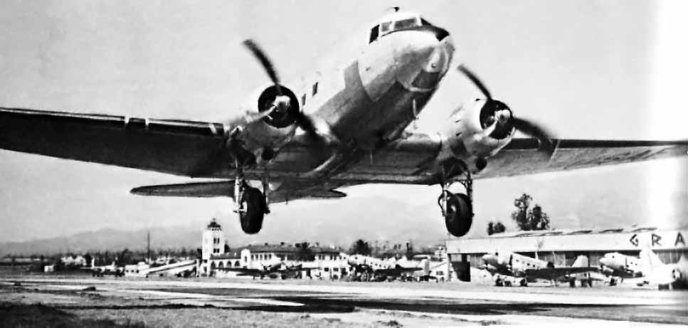
A 1948 or later photo of a USAF C-47 Skytrain departing from Grand Central.
The original caption noted that the Grand Central Aircraft Company specialized in the customizing of C-47s & DC-3s for civilian & military customers.
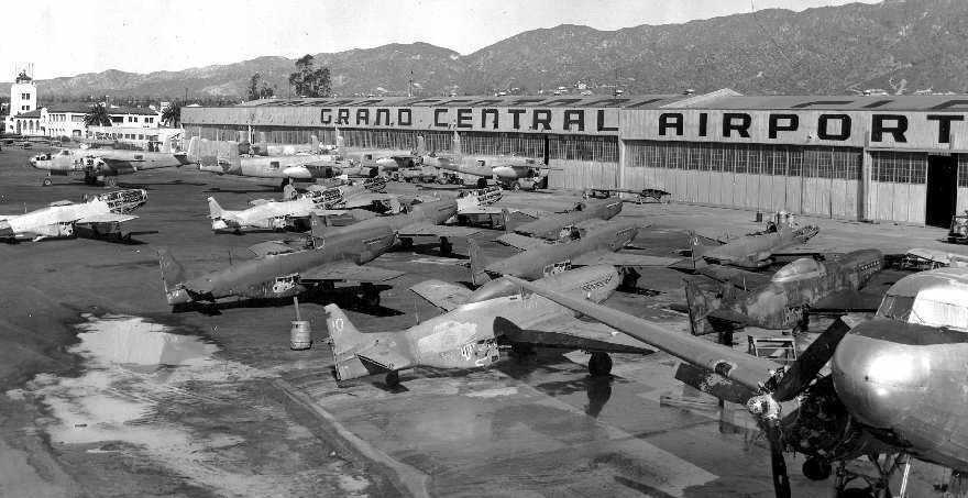
A fabulous 1949 picture by Don Ayres of the Moseley's Aircraft Overhaul & Repair Station hangars at Grand Central,
with an amazing assemblage of P-51s, B-25s, and a C-47.
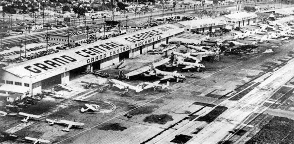
A circa 1949 aerial view looking east at the Grand Central Aircraft company hangar (courtesy of Pete Mason),
with a large number of surplus aircraft on the ramp.
Pete took a photo in 2007 of the “photo hanging on the wall of Bruce Anspaugh's hangar at Santa Paula Airport.
Bruce bought the hangar from Bill Bowers who worked as an instructor at Cal-Aero.
The photo used to hang on the walls of Cal-Fed Savings & Loan where Ken (K.D.) Johnson worked as a pilot.
When the building was going through re-model the pictures where being tossed out so K.D. saved them & gave them to Bowers.”
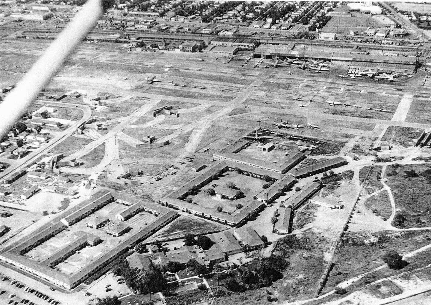
A circa late 1940s aerial view looking north at Grand Central Airport,
with the buildings of the Cal-Aero Technical Institute in the foreground, leftover WW2 aircraft parking revetments to their left,
and a large number of aircraft parked on the field.
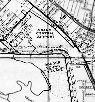
Grand Central Airport, as depicted on a 1949 street map.
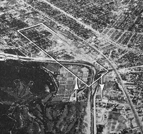
An undated aerial view looking north at Grand Central Air Terminal from the 1950 Air Photo Guide (courtesy of Kevin Walsh).
It described Grand Central Air Terminal as having a 3,750' paved Runway 12/30, and listed the manager as C.M. Clough.
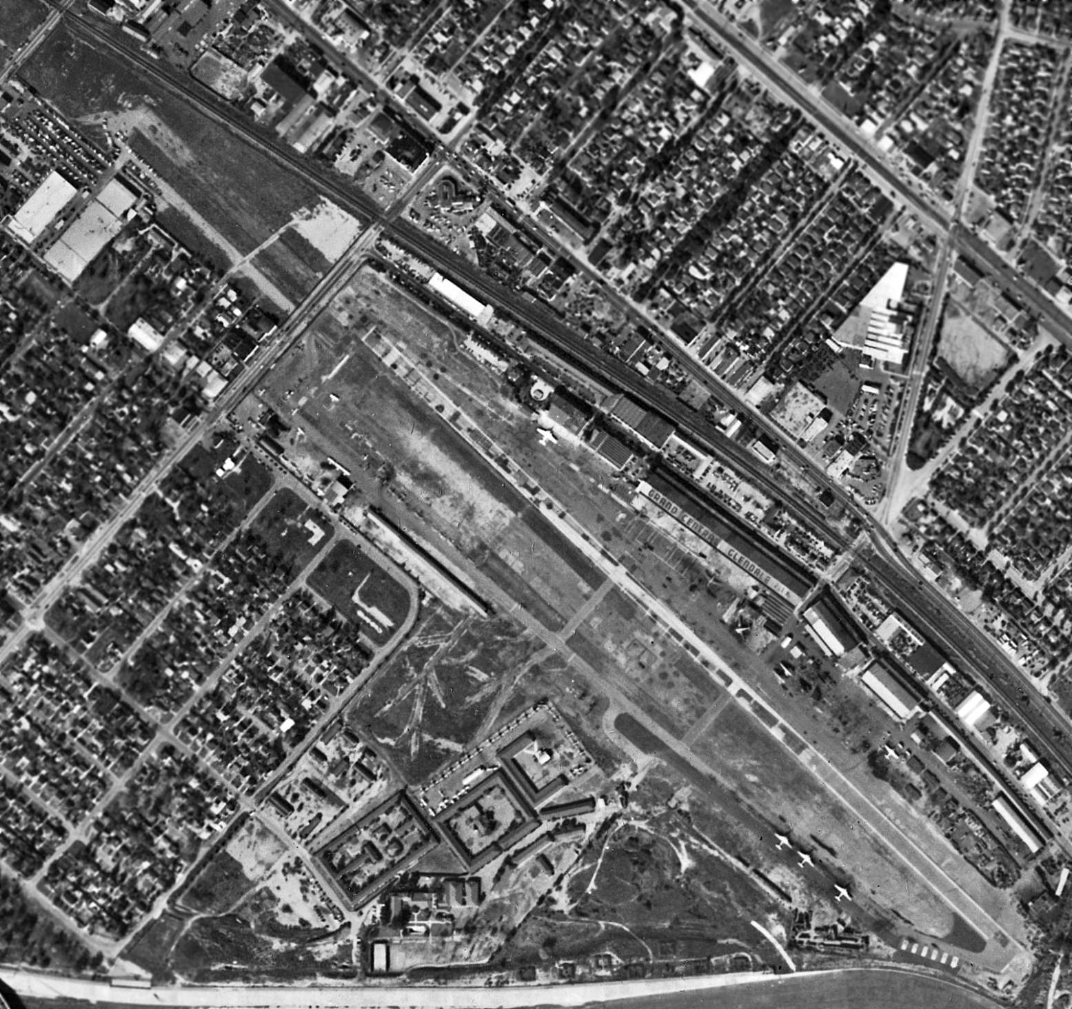
The last aerial photo which has been located showing Grand Central Airport still intact was a 12/4/52 aerial view (from the UCSB Library).
Note that the runway had been considerably truncated at some point,
as the northwestern 1,000' portion had been cut off by the construction of Sonora Avenue.
It showed 2-dozen light aircraft parked around the buildings of the Cal-Aero Technical Institute on the southwest side of the field.
The main hangars on the northeast side of the field had “Grand Central Glendale” painted along their roof.
An assortment of aircraft was scattered around the field, including several DC-3s.
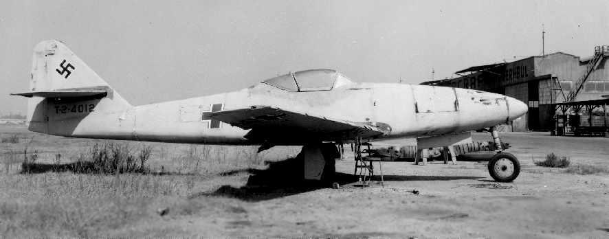
A remarkable undated photo (courtesy of Richard Eger) of a German Me-262 WW2 jet fighter (sans engines) at Grand Central.
Richard believes the Me-262 was used “in the late 1940's & early 1950's by Cal-Aero Technical Institute for mechanic training.”
Note that the hangar in the background is the exact same hangar
as pictured in the 1938 photo [several paragraphs above] of the Timm T-840 at Grand Central.
According to Richard, “The plane subsequently got its engines back, was purchased by Edward Maloney,
and migrated with Maloney to 4 different museums that he set up, the last being The Air Museum - Planes of Fame, at Chino Airport.
It was taken over by Paul Allen of Microsoft fame about November 2000,
with the intent to once again fly it, complete with original German Jumo 004 engines.”
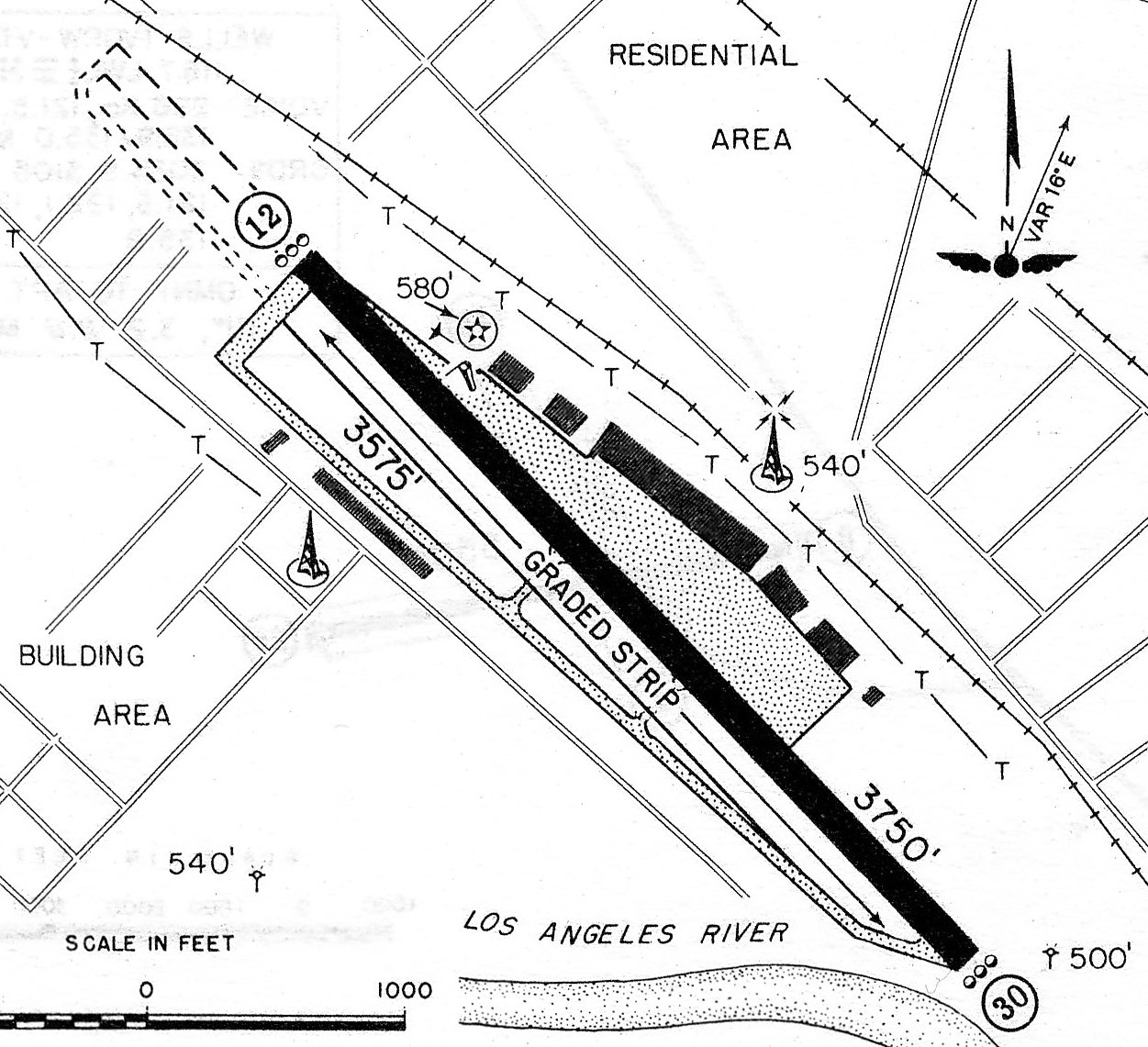
A 1953 airport diagram depicted Grand Central Airport as having a paved 3,750' Runway 12/30 (a considerable reduction in runway length compared to its 1947 depiction),
with a row of hangars on the northeast side.
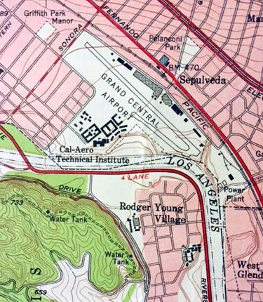
The last topo map depiction which has been located of Grand Central Airport was on the 1953 USGS topo map (courtesy of Kevin Walsh).
It depicted the runway & the row of hangars.
Grand Central was still depicted on the 1953 Flight Chart (courtesy of Scott O'Donnell),
and was described as having a 3,800' hard-surfaced runway.
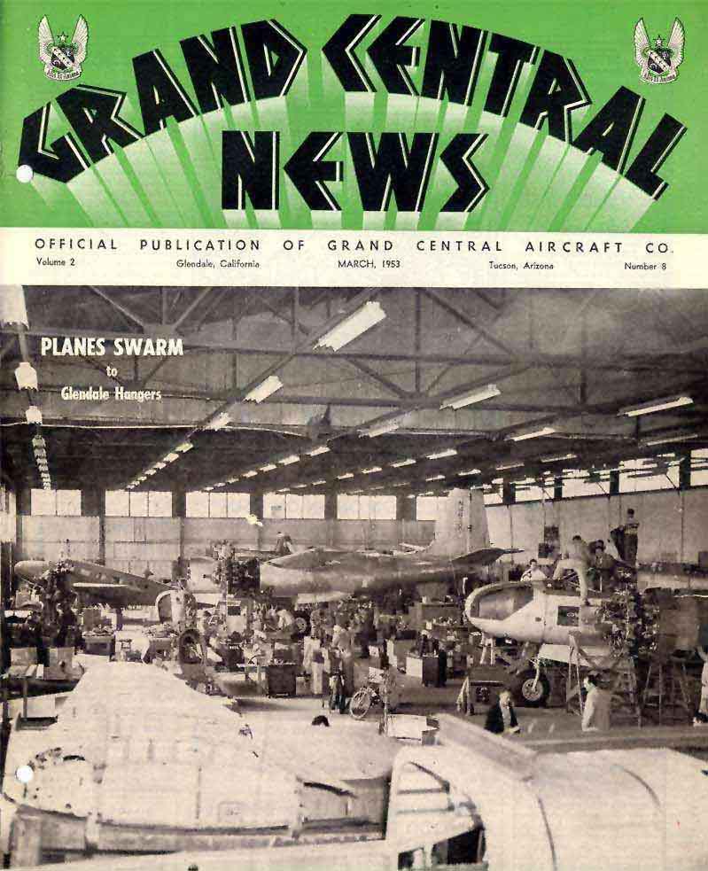
The March 1953 issue of the Grand Central News included an undated cover photo captioned “Planes Swarm to Glendale Hangars”
depicted Douglas B-26s & a Beech 18 undergoing heavy maintenance.
Grand Central was still depicted on the September 1954 USAF LA Sectional Chart (courtesy of Chris Kennedy).
It was depicted as having a 3,800' hard surface runway & a control tower.
A 1954 aerial view showed a much larger number of aircraft parked around the field than had been visible in the 1952 photo.
Bob Cannon recalled, "I remember flying my Aeronca into Glendale Grand Central in 1955."
Grand Central also played a role in the related field of rocketry,
when in 1955 Major Corliss Moseley & Charles Bartley (the inventor of rubber-based solid rocket fuel propellants)
established the Grand Central Rocket Company in the vicinity of Grand Central Air Terminal.
The company tested solid rocket propellants among the old revetments around the field.
It was there that the 3rd stages of early Vanguard rockets, including the first 2 to reach orbit, were built.
This effort became a major producer of rocket fuels, and was eventually sold to become the Lockheed Propulsion Company.
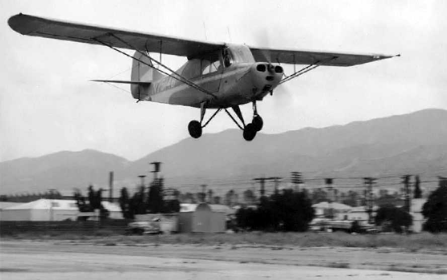
A circa 1950s photo of what appears to be a tricycle-gear conversion of an Aeronca at Grand Central Air Terminal.
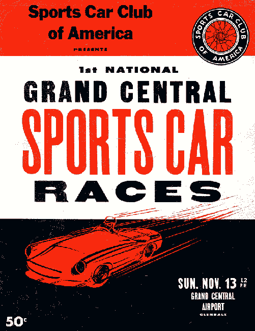
The runway of Grand Central Airport was used on 11/13/55
as the site of the Sports Car Club of America's “1st National Grand Central Sport Car Races”.
The cover of the race program listed the venue as the “Grand Central Airport”,
but it was described as the “Grand Central Industrial Center” in the body of the program.
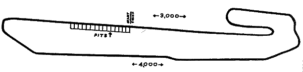
The layout of the 11/13/55 sports car race held at Grand Central (courtesy of Frank Sheffield).
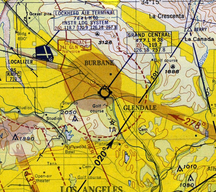
The 1956 LA Local Aeronautical Chart (courtesy of Tim Zukas) depicted Grand Central Airport as having a 3,800' paved runway.

A 1956 photo by Ed Coates of the unique Atlas H-10, N37463, in front of Grand Central's tower.
The Atlas H-10 was originally designed by Max Harlow, and at one point flew with twin-tandem Continental GO-300 engines driving contra-rotating propellers.
By the time of this photo it had been refitted with a conventional single Lycoming IO-720 engine.
According to Ed Coates, "The airport may have already been officially 'closed' & the airplanes I photographed were just sitting there.
I don't remember any actual aircraft movements on that day to be sure, but there were a lot of aircraft there, and somehow they got them all off. At least I presume they did!"

A 1/6/56 photo of Helio H-391B Courier N4104D C/n 022 making one of its dramatic STOL takeoffs from a deserted looking Grand Central Airport.
This Courier was built as a missionary plane, the first Helio sent overseas by Jungle Aviation & Radio Service.
The Spanish titles on the fuselage read “Summer Linguistics Institute, University of Oklahoma” & “Department of Education, Republic of Ecuador”.
Jack Frye had hoped to establish a new home for the Helio company at Grand Central, but was killed in an automobile accident.
According to Bill Barker (former Ford Aerospace employee),
the Ford Motor Company established the first headquarters of their Aeronutronic Division at the Grand Central Terminal Building in 1956.
An unusual aviation use of a portion of the Grand Central Air Terminal property late in its lifespan
was the heliport built by National Helicopters on the south end of the Grand Central property.
According to National Helicopters: “Facility we built in 1957 at 1000 Flower Street at the old Glendale airport.”
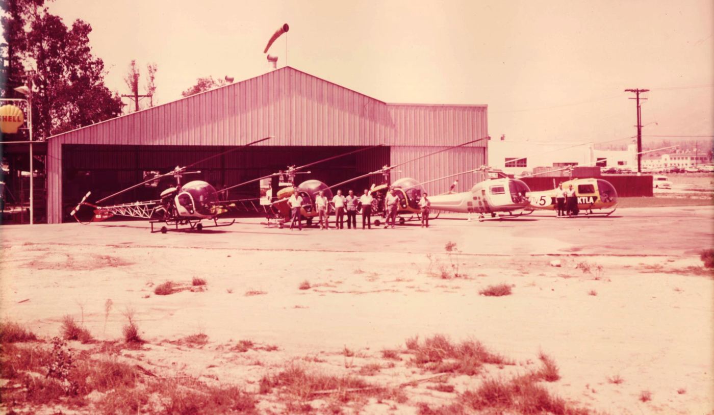
A circa 1957-59 photo (courtesy of Richard Yokley) of the last aviation use of the Glendale Grand Central Airport site:
a heliport at 1000 Flower Street, which was built at some point after 1964 on the southern edge of the Grand Central Airport property.
According to Richard Yokley, “The location & hangar was originally built by National Helicopters.”
The photo depicted 5 Bell 47 helicopters (with one in the markings of TV station KTLA) in front of a hangar with a windsock & a Shell sign.
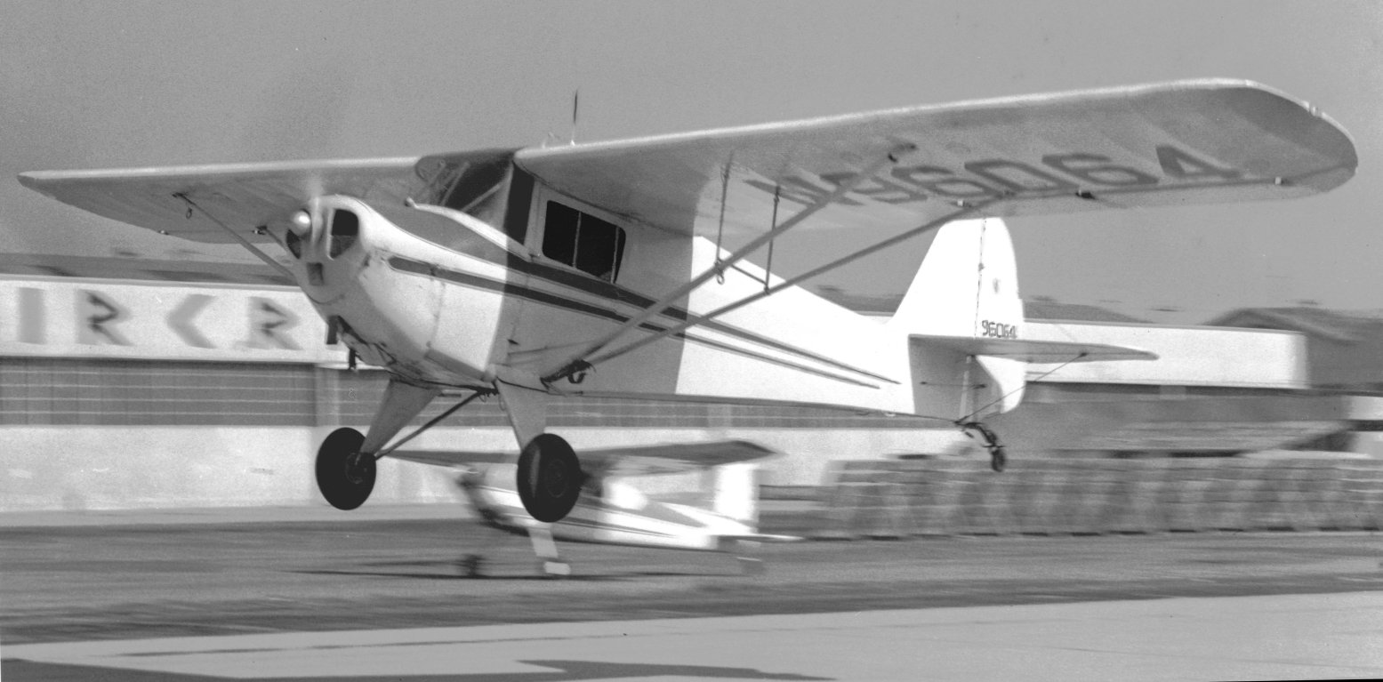
A February 1958 photo (courtesy of John Hurless) of a Taylorcraft BC-12D taking off or landing with the Grand Central Air Terminal hangars in the background.
John recalled, “That airport will always have a special meaning for me, because I was able to spend quite a few hours in the air from there, and for a short time was involved with the Civil Air Patrol.
I had my first session in a Link Trainer they had in a building on the northwest side of the airport.”
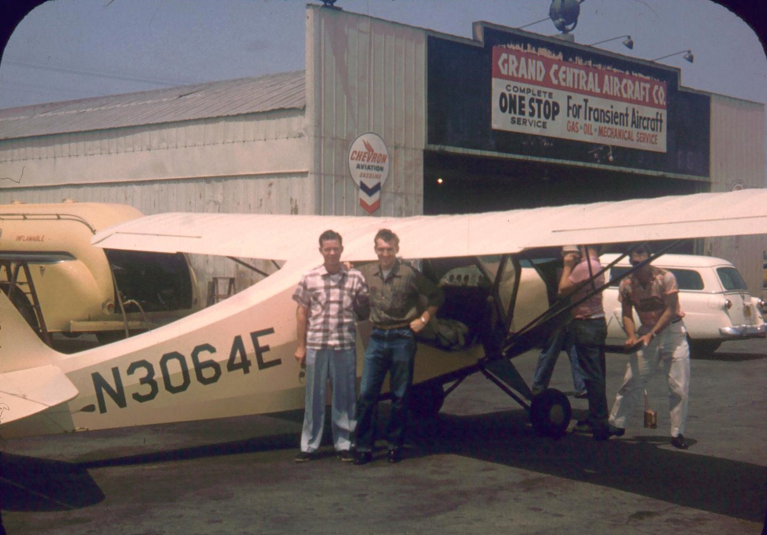
A 1958 photo (courtesy of John Hurless) of Jack Lewis, John Hurless, and Gayle Wood (under the wing) in front of an Aeronca Champ & the Grand Central Fixed Base Operator.
John recalled, “Gayle Wood & myself were members of the little flying club ran by Don Pruitt.
In all, we had 2 Aeronca Champs, a Cessna 170, and at one point a Cessna T-50 Bobcat.
The Bobcat had a metal fuselage, which was unusual for that plane.”
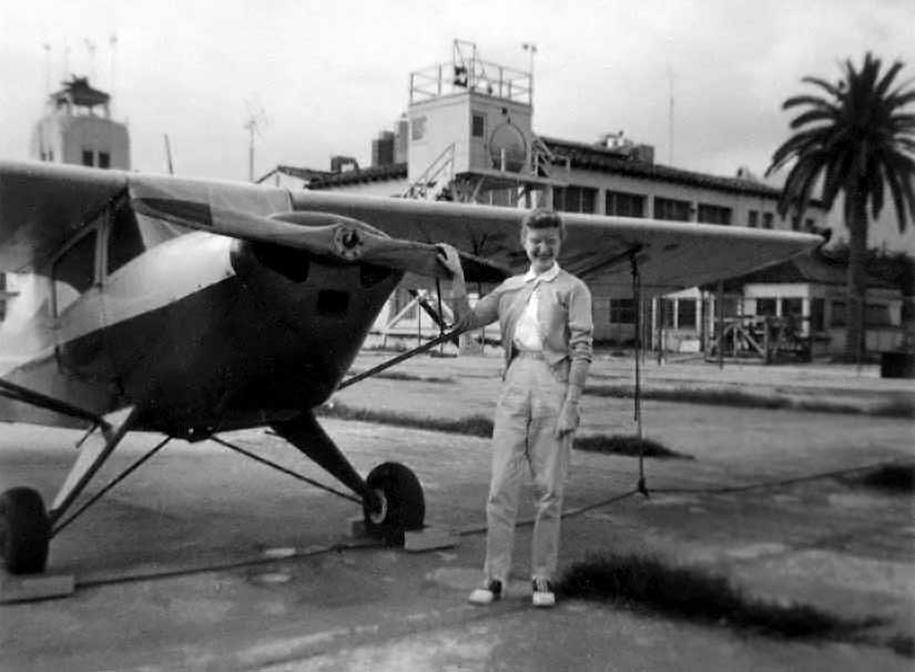
A 1958 photo by Gene Myers of his wife Jan Meyers & their 1946 Taylorcraft (BC-12-D, N43410) in front of the Grand Central terminal building.
Gene recalled, “I got my license in the Tylorcraft in 1958. We kept it at Grand Central until late 1958.”
Gene Myers recalled, “The runway had been lengthened to the north during the war & then shortened following the war.
Grand Central Aircraft was still in business & serviced civilian aircraft at that time.
The flight school was run by a Mr. Ryan (not related to Claud Ryan).
The airport had been camouflaged during the war
and there were areas of colored paint remaining on the runway when I flew out of there.
From altitude it could still give the impression of streets & houses, even in 1958.
There was an effort in 1958 to get the County to purchase the airport, but that failed.
I personally attended some meetings at the County during that effort.”
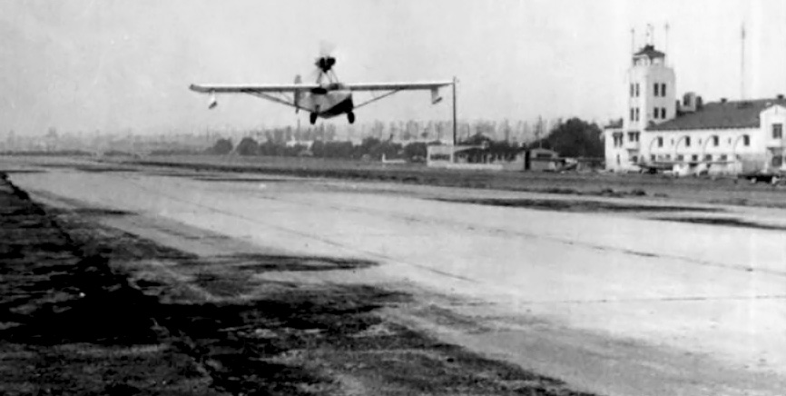
A 1958-59 photo of the prototype of the Jensen VJ-22 Chubasco departing from a deserted-looking Grand Central Air Terminal.
The VJ-22 was a homebuilt 2-place amphibian designed by Glendale inventor Volmer Jensen.
According to National Helicopters, their heliport on the south end of Grand Central Airport property
was taken over by the Los Angeles Police Department for their use as a police heliport.
According to National Helicopters, “The LAPD liked it so well they claimed the hangar & 10 acres of land under eminent domain.”
According to Dick Hart, owner of national Helicopter Service, they were forced out in 1959 when the LAPD took over the facility.
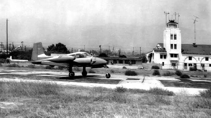
One of the last planes to leave the Grand Central Airport – a Cessna 310 – departs on 7/15/59.
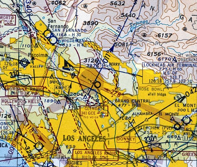
The last aeronautical chart depiction which has been located of Grand Central Air Terminal was on the September 1959 LA Sectional Chart.
It depicted Grand Central as having a 3,800' paved runway.
According to Dan Rhinehart, the very last aircraft to fly out of Grand Central was a Twin Bonanza.
It unexpectedly blew an engine & was grounded at Grand Central.
It was in one of the big hangars at the time the airport closed,
and it wasn't ready to fly until about 2-3 weeks after the airport closed.
There were strict orders that there were to be no more flights in or out after the closure deadline,
and any remaining airplanes were to be disassembled & trucked out.
There were security guards on the property from early morning until nightfall.
So the Twin Bonanza pilot came in before sunrise, rolled the airplane out of the hangar,
started the engines, quickly taxied to the end of the runway,
and without a run-up took off to the north just before sunrise, and landed a few minutes later at Burbank.
Apparently nobody noticed what had happened!
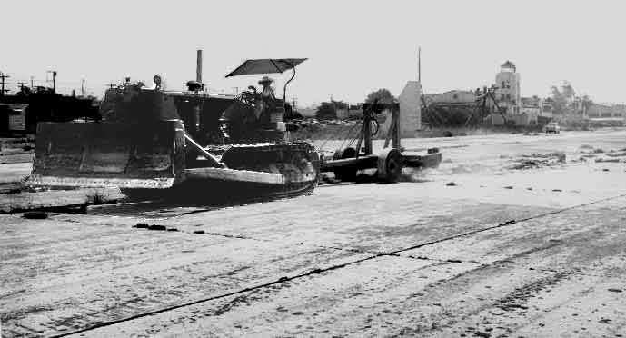
A sad sight – a bulldozer removing the runway pavement at Grand Central Airport in 1959, with the control tower visible in the background.
According to Allen Brandstater, “Mose rarely visited Grand Central Airport after the field closed in 1959.
He did continue the operation of Grand Central Aircraft (which repaired & restored prop planes until about 1974) on the site.
He never made a profit at this - he just loved old planes & invested money to preserve them.
GCA probably lost 8 or 10 million dollars from the late 1950s until it was closed shortly before his death in 1973.
The operation of the site was very profitable, however, given the rentals of his commercial real estate values & his #2 man, Bill Clough.
Aircraft maintenance & repairs continued at Grand Central for some years, but the engines, avionics, props, etc., were brought in on flatbed trucks.
Most came from Lockheed (now Bob Hope) Airport in Burbank, some from Van Nuys, Whiteman, etc.
I also think they came as far as another Moseley facility in Tucson, AZ.
Once repairs were completed, they were shipped back to wherever they came from - i.e., operational airports.”
The March 1960 LA Sectional Chart depicted Grand Central Airport as an abandoned airfield.
The Ford Aeronutronic Division relocated from Grand Central to Newport Beach in 1960.
Grand Central Air Terminal was depicted as an abandoned airport on the March 1960 LA Sectional Chart (courtesy of Dick Welsh).
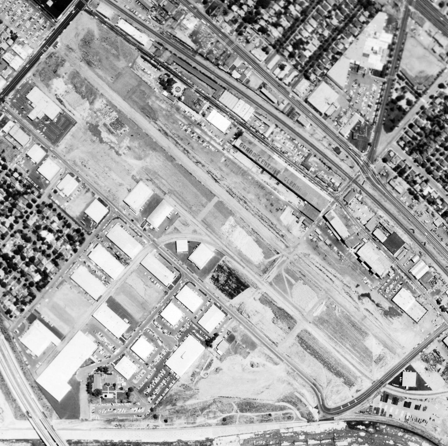
A 5/29/60 aerial view (from the UCSB Library) showing the sad sight of the Grand Central Air Terminal property after the runway pavement had been removed.
The lettering “Grand Central Glendale” was still visible on the long hangar roof.
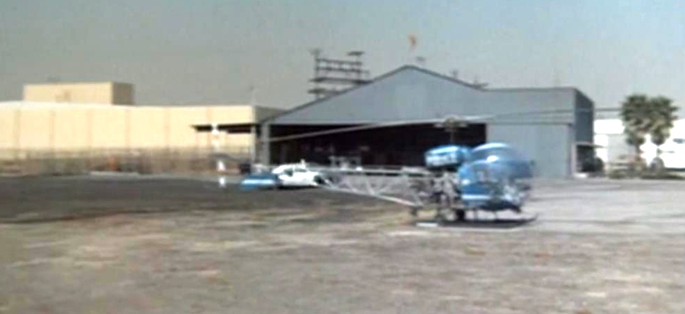
The last photo which has is available showing an aircraft at Grand Central Airport was a scene from a 1971 Adam 12 episode (courtesy of Richard Yokley)
showing a single Bell 47 in LAPD markings in front of the former National Helicopters hangar at the heliport on the south end of the Grand Central Air Terminal property.
Allen Brandstater recalled, “When I got out of the Army in late 1971, Mr. Moseley rented me (at a VERY reduced rate)
an office in the same old terminal building on Air Way.
It was on the 2nd floor, very close to the spacious office he occupied overlooking the airfield when he managed it from the early 1930s to the late 1950s.”
A 1972 aerial view showed that the distinctive buildings of the former Cal-Aero Technical Institute on the southwest side of the field
had been replaced with numerous commercial buildings, which also covered the former runway area.
The 3 main hangars on the northeast side of the field remained standing, along with the elegant terminal building.
Allen Brandstater recalled of Mose, “Shortly after his death in 1973, his widow (Audrienne) sold Grand Central to an investors' group.
The amount was $40 million. A few years later, this group sold to a Japanese firm for $75 million.
They held it a few years, but were unable to effectively capitalize on use of the land & buildings.”

A 11/25/77 USGS aerial view showed that all 3 of Grand Central Air Terminal's large hangars
(including the largest of the 3, the Maddux hangar, just southeast of the terminal building) still remained standing.
The last photo showing any aircraft at the Grand Central Airport property was a 1980 aerial view of the LAPD heliport on the south end of Grand Central Airport property.
It showed at least 5 helicopters on the numerous helicopter parking pads next to the hangar.
According to Dick Hart, owner of national Helicopter Service, The LAPD remained at 1000 Flower until 1983 when they moved to the newly-built downtown Piper Tech facility.
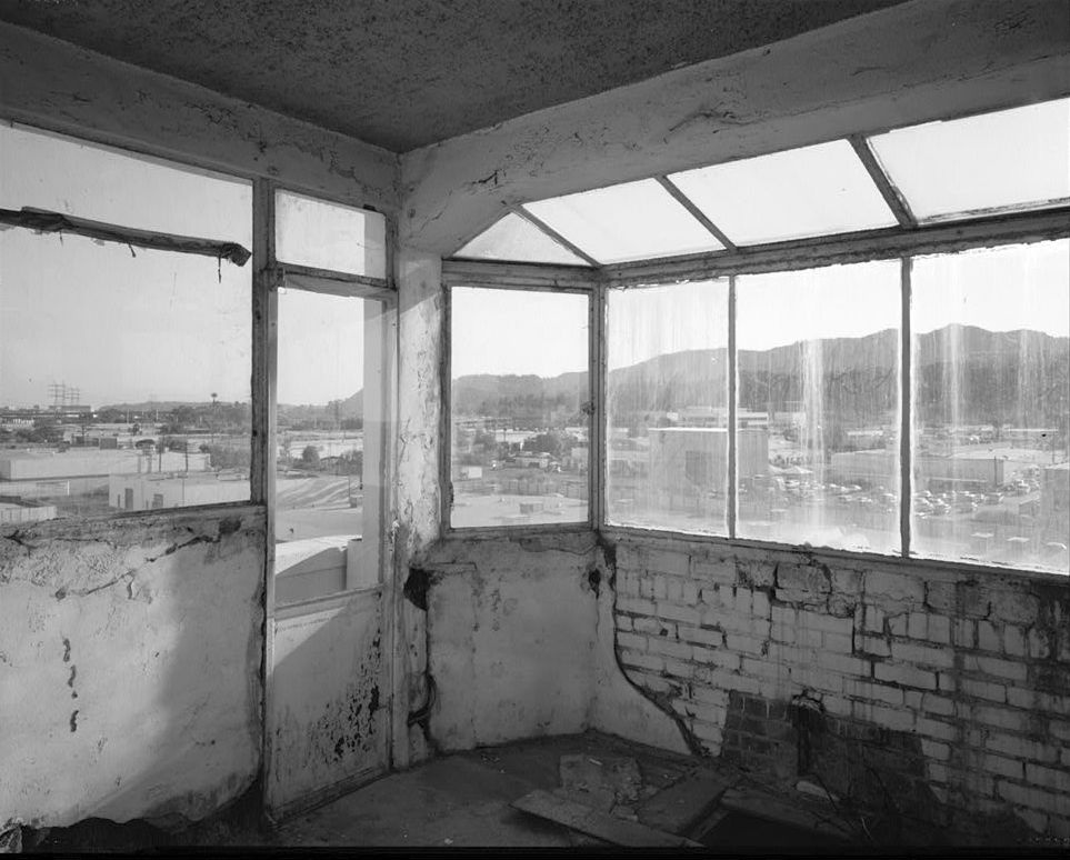
A circa 1980s interior view looking southwest from Grand Central Air Terminal's control tower cab.
Tom Kramer recalled, “Back in the 1980s I was looking for the site of this legendary airport.
When I saw the building which had what looked like a control tower on it, I knew I hit paydirt.
At the time, a law office was in the main terminal building
and I went in to confirm my suspicions that it was the old control tower & terminal.
They had a copy of a book which I purchased about Grand Central Air Terminal called “Madcaps, Millionaires and Mose”
which was a history of the airfield with dozens of photos.
At that time, the terminal building was in excellent shape & I found the 2 surviving hangars as well.”

A collage of 1984 interior views of Grand Central Air Terminal by Cecile Alessi
(courtesy of Cecile Alessi, viathe web site of the Davis-Monthan Airfield).
Cecile remarked, “I took most of the pictures from the 2nd floor walkway... looking north & south along the inside.
Interior stairs are on the south end of the building."
Note the Art Deco (Moderne) accents & the clean lines of the mezzanine.
The ceiling tiles & fluorescent lights were not original.
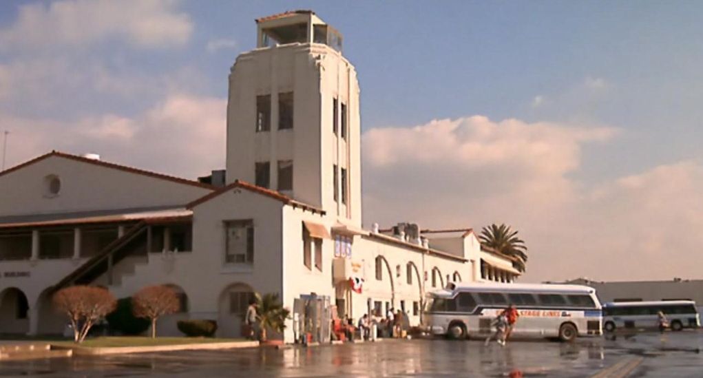
A still from the 1985 movie “Pee Wee's Big Adventure”, in which Grand Central Air Terminal was reused as a filming location standing in as a San Antonio bus station (courtesy of Greg Steinmayer).
A 1989 aerial view showed the LAPD heliport on the south end of Grand Central Airport property remained intact,
with numerous helicopter parking pads next to the hangar, but no helicopters were visible.
By this point the LAPD had presumably transferred their operations to their new Piper Technical Center heliport in downtown LA.
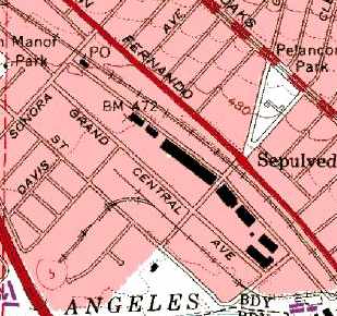
On the 1994 USGS topo map, the former runway had been reused as a street, labeled "Grand Central Avenue",
but the row of former hangars were still depicted.
A 1994 aerial view showed the LAPD heliport on the south end of Grand Central Airport property remained intact,
with numerous helicopter parking pads next to the hangar, but no helicopters were visible.
According to Allen Brandstater, “In 1994 or 1995, [the Japanese ownership group] sold it to the Disney Corporation.
The amount has not been disclosed, but I believe it to be around $200 million.”
The building in which the Hughes H-1 Racer was built, at 911 Air Way, burned to the ground in the late 1990s.
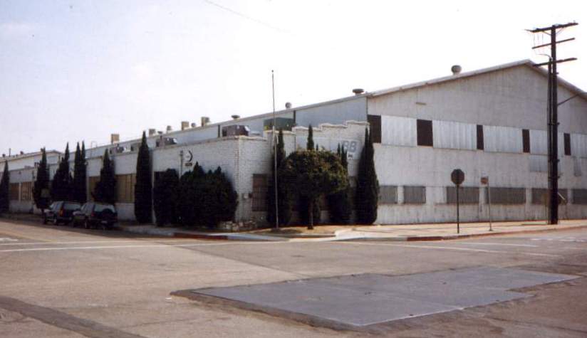
A 1998 photo by Dan Rhinehart of one of the remaining hangars at Grand Central.
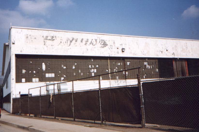
A 1998 photo by Dan Rhinehart of one of the remaining hangars,
on which the paint is peeling but the logo of the Curtiss Wright company can still be discerned.
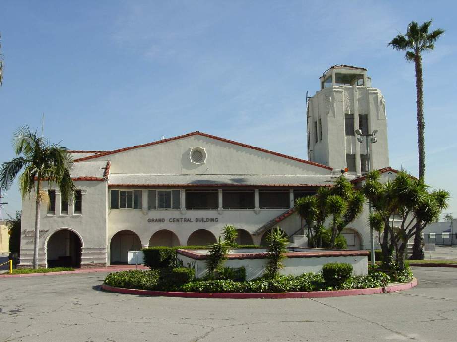
A February 2002 photo by Gabriel Shadid looking northwest at the front of the Grand Central Air Terminal.
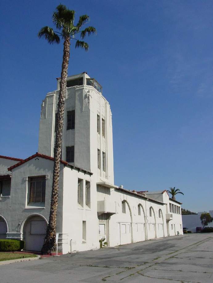
A February 2002 photo by Gabriel Shadid looking east at the former control tower of the Grand Central Air Terminal.
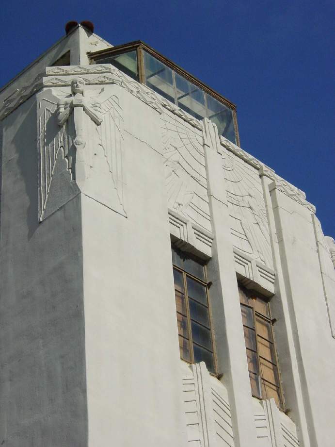
A February 2002 photo by Gabriel Shadid of the intricate detailing which surrounds the former control tower at Grand Central Air Terminal.
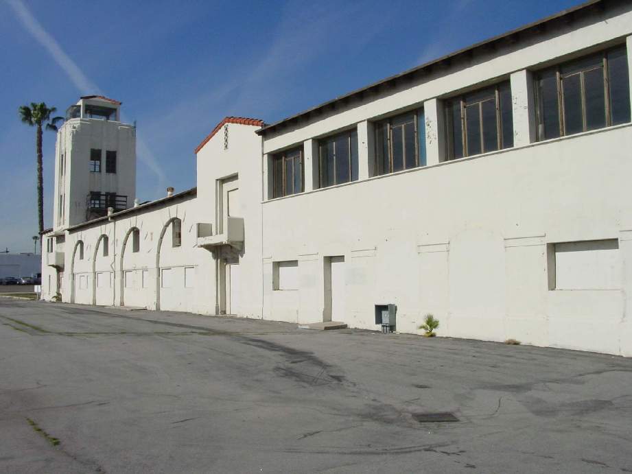
A February 2002 photo by Gabriel Shadid looking north at the former air-side of the Grand Central Air Terminal.
The largest of the 3 original hangars, the Maddux hangar, was destroyed at some point between 1994-2003, leaving 2 remaining hangars & the terminal building.
The terminal building, located at 1310 Air Way, is a National Historic Landmark.
The terminal building was owned at some point by the Walt Disney Company,
which planned to restore it as part of their Grand Central Creative Campus project (which apparently did not happen).
Danny Wilson reported in 2003, "I've been told that Air Way may have been where a taxiway once was.
I have it on good authority from a graybeard who lives nearby that that is the case.
Additionally, Grand Central Avenue was not listed in the Glendale city registry as a street
until after the airfield was decommissioned in 1955.
That street is EXTREMELY wide, wide enough to have several lanes in each direction
though there is no traffic in that industrial area.
My best guess would be that this was once where the runway stood, though I have no confirmation.
There simply is no other reason why a road would need to be that wide unless it was once used for that purpose.
Additionally, there are very old (and non-functioning) red lights on top of some of the nearby buildings in the area.
That gives visitors a clue that there was once an airport in the area."
A 2003 aerial view showed the LAPD heliport on the south end of Grand Central Airport property
had been covered by new buildings (Dreamworks) at some point between 1994-2003.
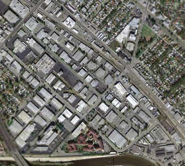
A March 2004 USGS aerial photo showed the Grand Central Air Terminal site had become an extensively developed commercial area,
and it was hard to discern any remaining trace of the former runways.
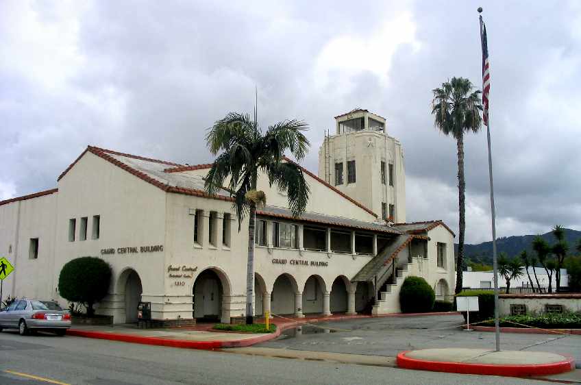
A February 2005 photo by Paul Freeman looking south at the Grand Central Air Terminal building showed it to remain intact, but it appeared to be abandoned & somewhat deteriorated.
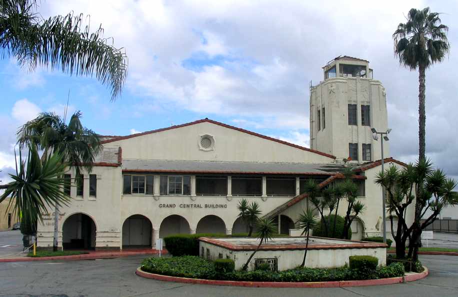
A February 2005 photo by Paul Freeman looking southeast at the front of the Grand Central Air Terminal building.
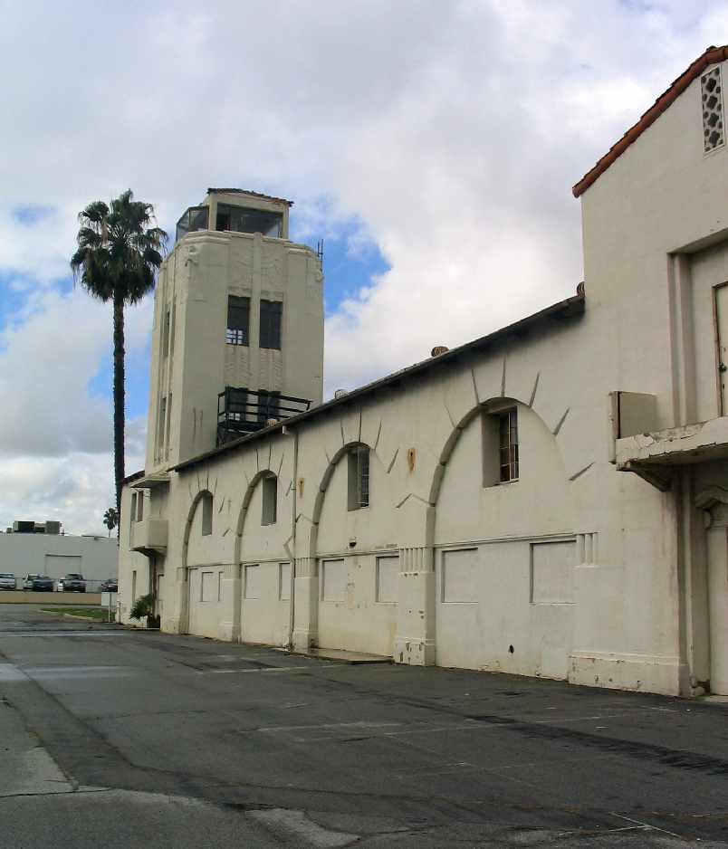
A February 2005 photo by Paul Freeman looking north at the air-side of the former Grand Central Air Terminal.
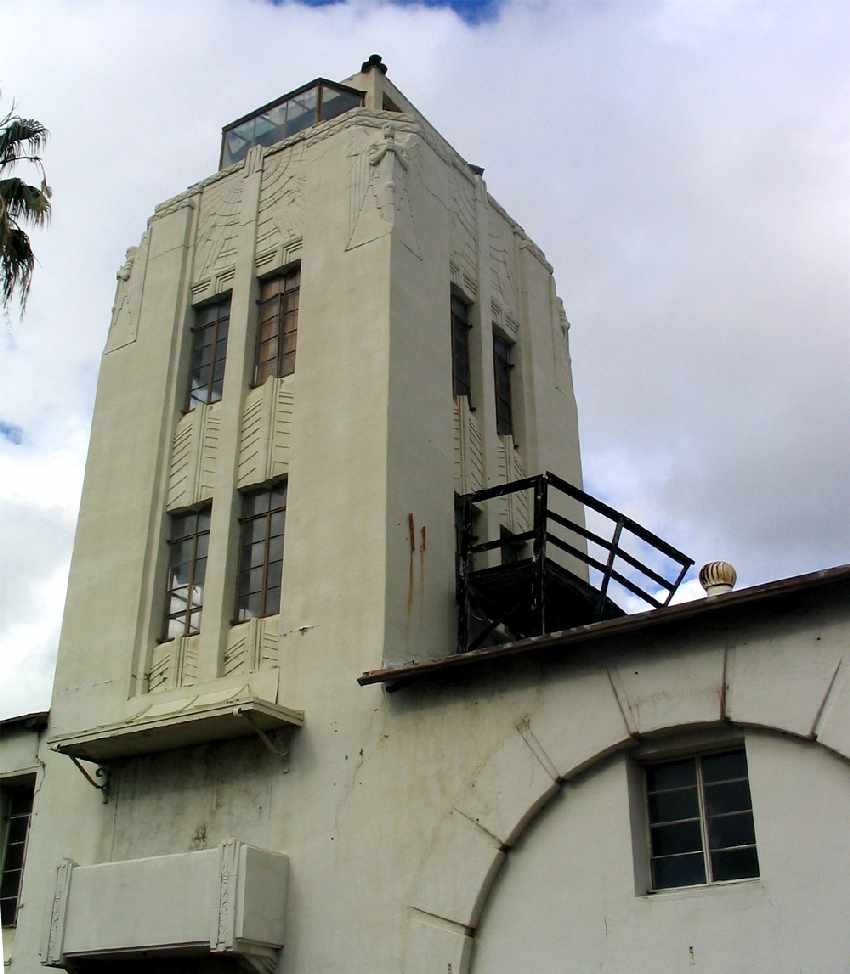
A February 2005 photo by Paul Freeman looking north at Grand Central Air Terminal's former control tower.
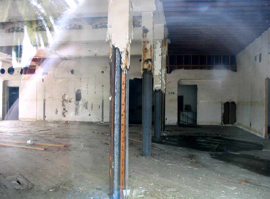
A February 2005 view by Paul Freeman looking northwest into the interior of the Grand Central Air Terminal building, now gutted.
Quite a shame to see the deterioration of the interior, compared to the 1984 interior view.
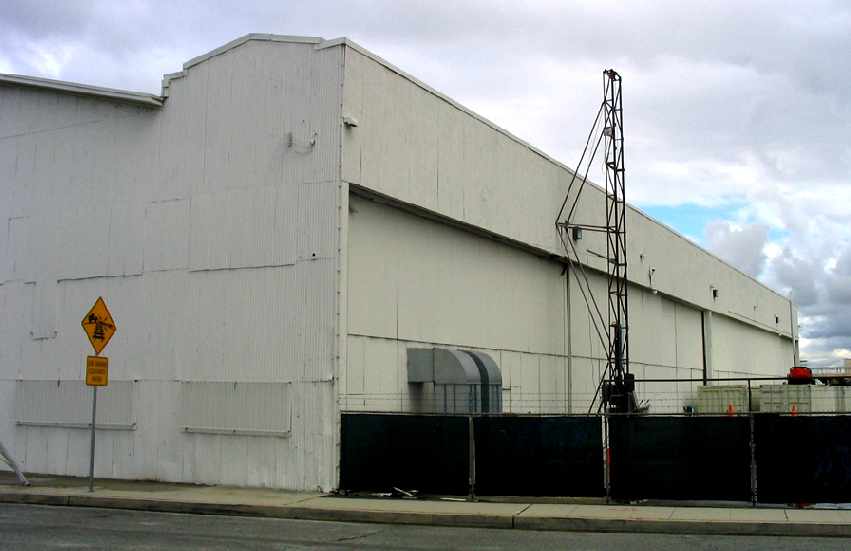
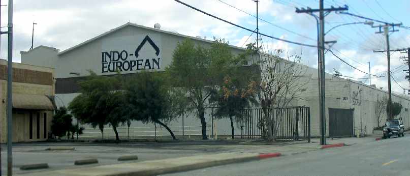
A February 2005 view by Paul Freeman looking south at the front
of the northern-most of the 2 former Grand Central Air Terminal hangars which remain standing.
Both of the former hangars appeared to be reused for commercial purposes.
A February 2005 view by Paul Freeman looking northwest at the back
of the southern-most of the 2 former Grand Central Air Terminal hangars which remain standing.
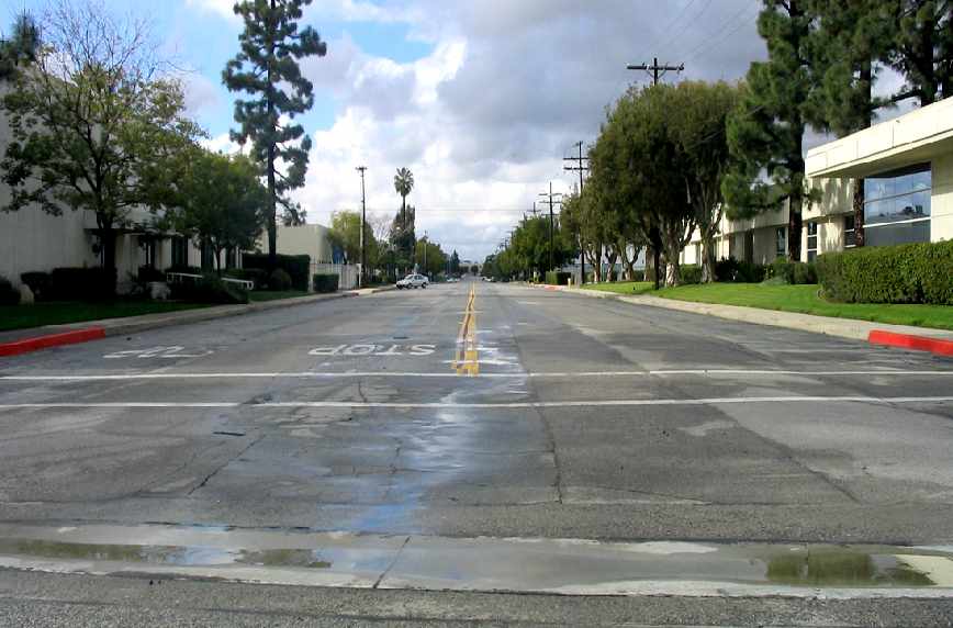
A February 2005 view by Paul Freeman looking along what is now Grand Central Avenue,
the former location of Grand Central's runway.
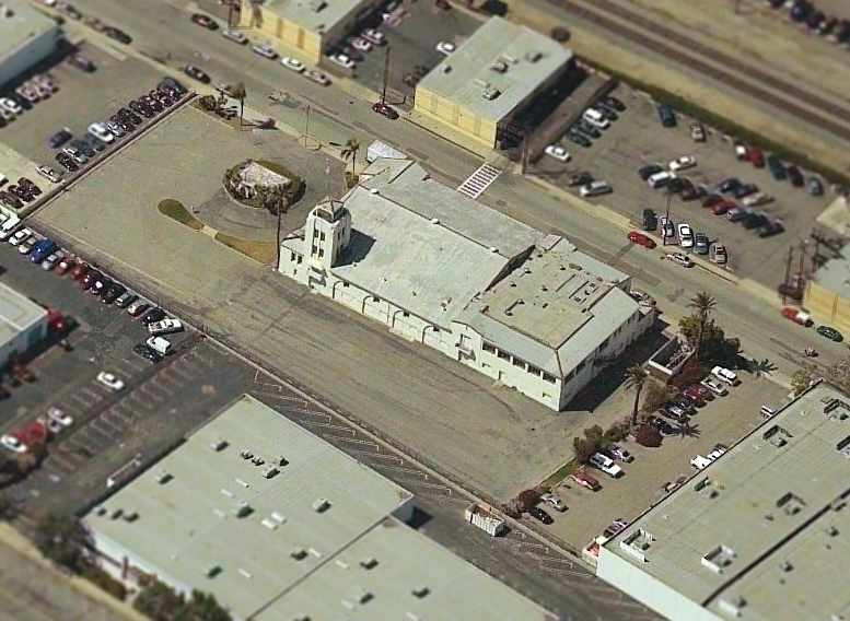
A circa 2005 aerial photo looking north at the former Grand Central terminal building.
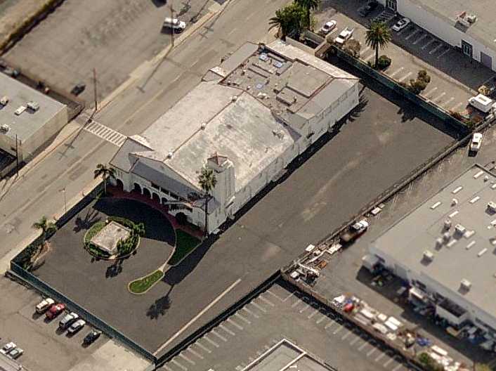
A somewhat later (circa 2006) aerial view looking east at Grand Central shows that the windows along the west side of the terminal building have been covered over.
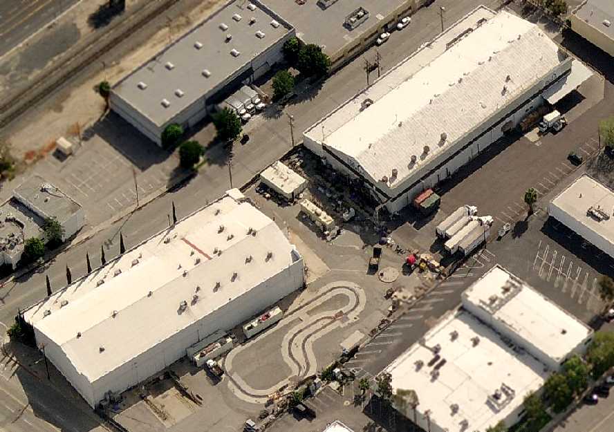
A circa 2006 aerial view looking east at the 2 former Grand Central hangars which remain standing.
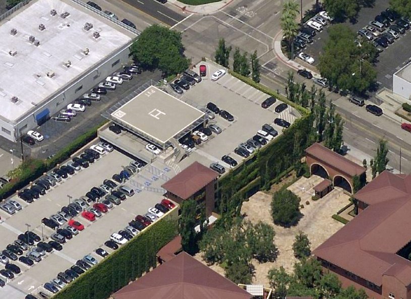
Ironically the location of the former National Helicopters / LAPD heliport on the south side of the Grand Central Air Terminal property
once again has a heliport on exactly the same spot: the “Dreamworks Helistop Glendale” (5CA0).
A 2014 photo by James Belknap of the beautiful Grand Central Air Terminal tower, with some of the cab windows boarded-up just before its restoration.
James reported, “The on-duty security guards let me roam around with my camera & try to get some of the structure on film.
This was during the time when it was pretty much unknown if Disney, who owned the property, was going to follow through on their promised restoration or not.
The deterioration of the terminal building was very evident & very sad.”
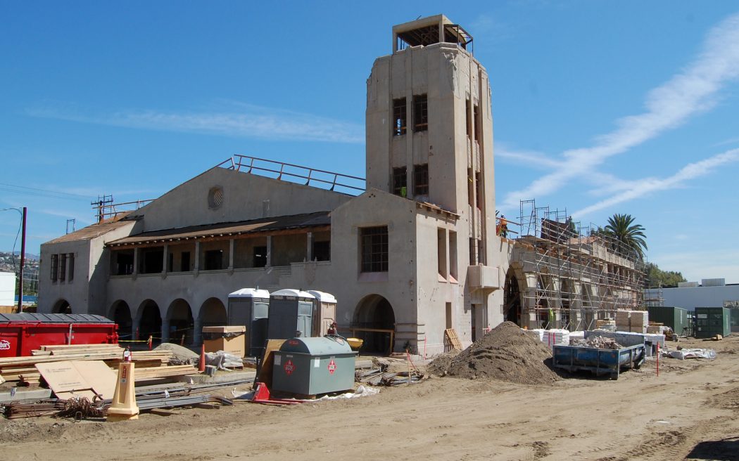
A 10/3/14 photo by John Hazlet of the Grand Central Air Terminal building, under renovation.
John reported, “Disney Corporation has undertaken a major refurbishment of the old terminal / control tower building.”
Between 2014-16, an industrial building adjcent to the southwest side of the Grand Central Air Terminal was demolished & replaced with a grass plaza.
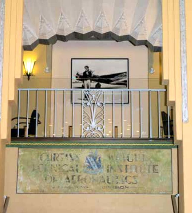
A circa 2015 photo by Hayden Hamilton of the top of the Grand Central Air Terminal Grand Hall,
showing the Curtiss Wright Technical Institute of Aeronautics sign uncovered in the staircase during restoration.
Also, note the custom made replica railing insert - just one of the many details the Disney company took the effort to recreate.
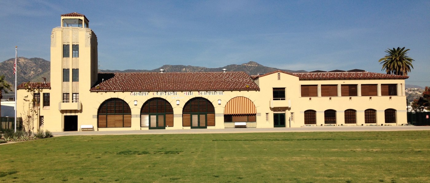
A 2/12/16 photo by G.B. Koontz looking northeast at the magnificently restored Grand Central Air Terminal building.
G.B Koontz reported, “The American Aviation Historical Society conference was held in the newly restored Grand Central Air Terminal on 12/13/16.
The Disney company did an amazing job of restoring the interior & exterior faithfully to the 1930 TAT era structure & decor.
Our group was the first ever to enter the building except for Disney employees. We had access to the lower level floor only.
The tower is not restored & remains closed. Parts of the first floor & all of the second floor is devoted to Disney offices.
The venue is stunning to say the least. Every detail of ceramic tile, roofing, lighting, windows, paint, etc., were perfect.
The building is not yet open to the general public & Disney will announce when they intend to offer it for events in the future.”
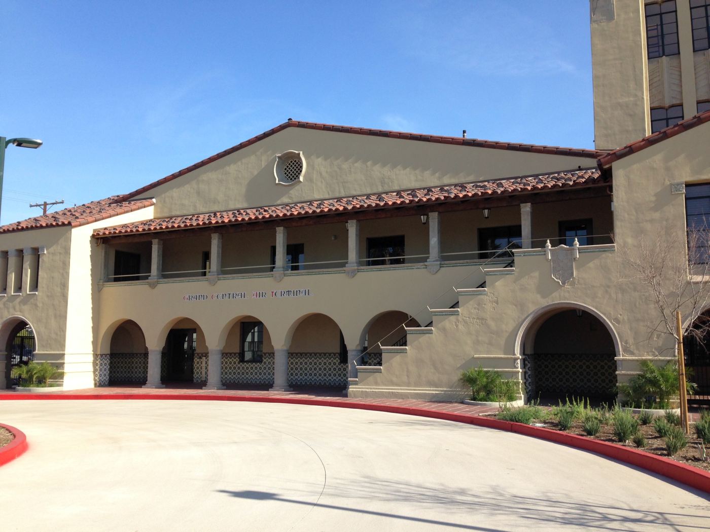
A 2/12/16 photo by G.B. Koontz looking southeast at the magnificently restored Grand Central Air Terminal building.
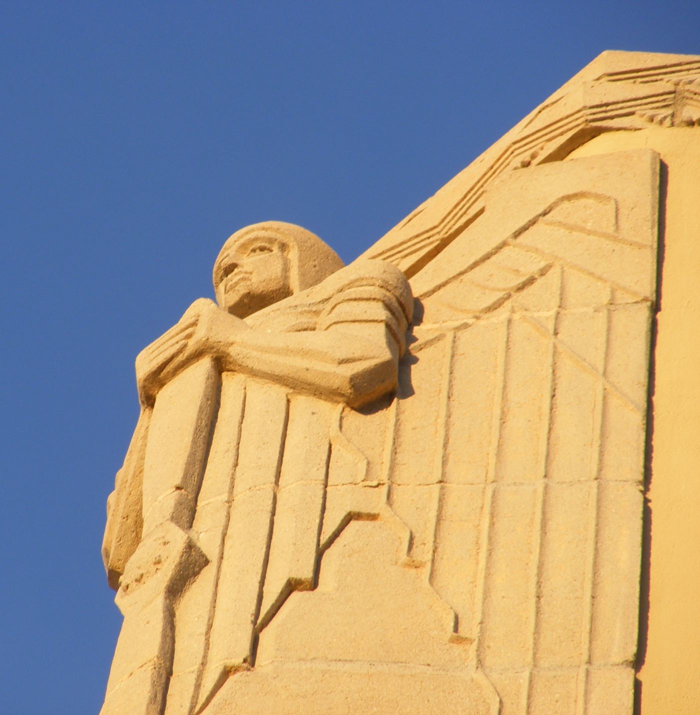
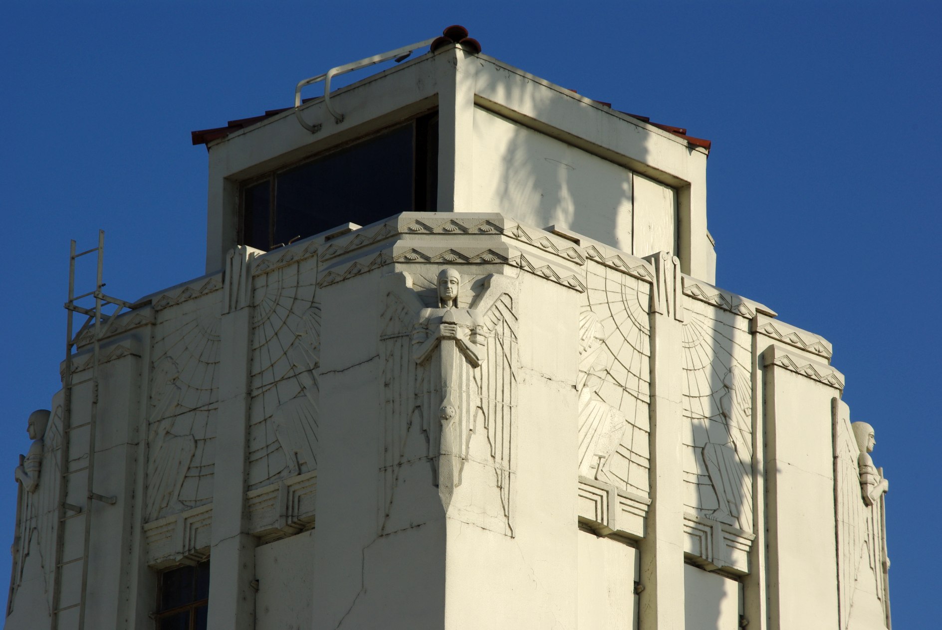
A 2/12/16 photo by G.B. Koontz of the artwork on the corner of the Grand Central Air Terminal tower.
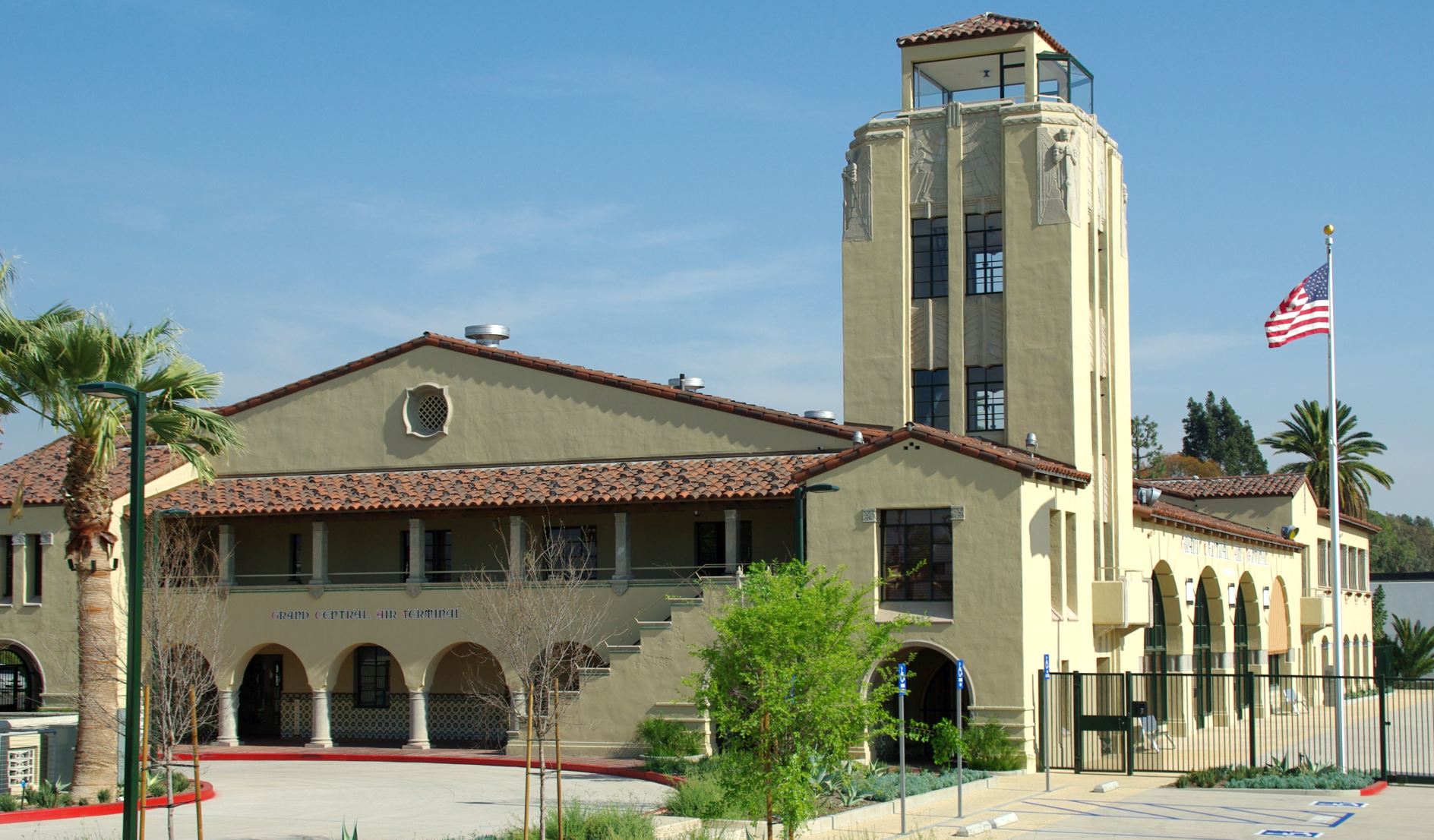
A circa 2017 photo by James Belknap of the nicely-restored Grand Central Air Terminal.
James reported, “Disney did, in fact, complete that very expensive restoration. But as a result they've been using the terminal building for their own purposes & it's now closed off to the public.
I'd hoped they would turn it into a museum or similar function, but that was not to be.”
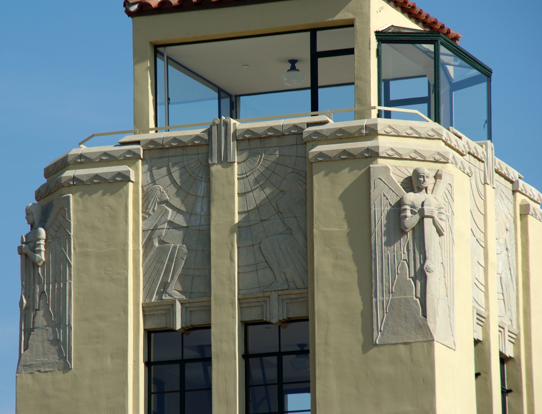
A circa 2017 photo by James Belknap of the nicely-restored Grand Central Air Terminal tower.
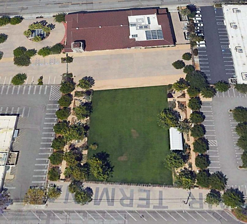
A 2021 aerial view looking northeast at the Grand Central Air Terminal building (at top).
When the grass plaza was constructed southwest of the terminal building in 2014-16, lettering spelling “AIR TERMINA” was painted along the new sidewalk at the bottom, but inexplicably omitted the last letter “L”.
As an aside, the Peterson Aviation terminal at Van Nuys Airport was constructed in the likeness of the Grand Central Air Terminal, according to Jim McNamara.
See also:
http://www.ci.glendale.ca.us/about/historic/grand_central.html
http://employees.oxy.edu/jerry/grandair.htm
____________________________________________________
Griffith Park Aerodrome, Griffith Park, CA
34.15, -118.283 (North of Downtown Los Angeles, CA)
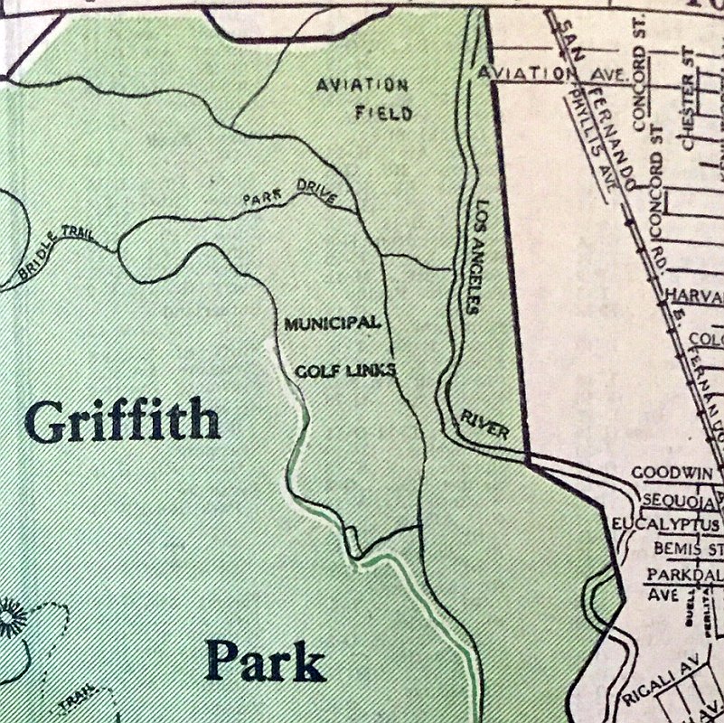
Griffith Park, “Aviation Field”, as depicted on a 1924 street map (courtesy of Kevin Walsh).
Griffith Park Aerodrome was located south of the LA River from Grand Central Air Terminal.
According to K.O. Eckland, in 1912 Van Griffith donated 100 acres of land alongside what is now Griffith Park Drive
with the request it be used to "do something to further aviation."
Once hangars were built, aviation pioneers like Glenn Martin & Silas Cristoffersen
seized the opportunity to operate from such an ideal location.
Martin's first fight school opened its doors that year & the name was unofficially changed.
The Griffith Park property was eventually handed over to State
for use by the National Guard Air Service's 40th Air Corps Division (115th Observation Squadron),
who established a base & laid 2 runways: 3,600' northwest/southeast & 2,975' oil & gravel north/south strips.
The 115th Observation Squadron was initially equipped with the Curtiss JN-4H Jenny.
The 115th was commanded by Maj. C.C. Moseley,
who was also one of the founders of Western Air Lines & the Cal-Aero Technical Institute flying schools.
The earliest depiction which has been located of Griffith Park Aerodrome was on a 1924 street map (courtesy of Kevin Walsh),
which depicted an “Aviation Field” without any other details.
Griffith Park Field, as depicted on a circa 1925 illustration of LA-area airfields from Ross Diehl's Air National Guard yearbook (courtesy of Dan MacPherson).
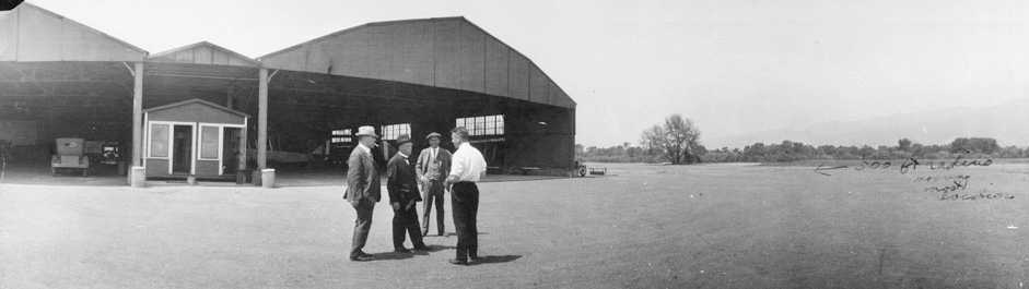
The earliest photo which has been located of Griffith Park Airport was an April 1925 photo looking west at 4 men in front of the Griffith Park hangars, with several JN4 Jenny biplanes visible inside the right hangar.
The photo's caption said “Proposed location of suggested mooring-mast”, presumably for airship operations.
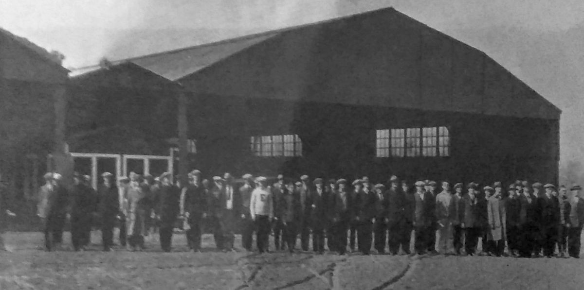
A 1925 photo of the 115th Observation Squadron's first muster in front of the Griffith Park hangars (courtesy of Rex Ricks), with many of the men still in civilian clothes.
The earliest aerial view which has been located of Griffith Park Airport was a 7/12/27 aerial photo looking southeast,
showing Grand Central Air Terminal in the foreground, and Griffith Park Airport across the river.
Griffith Park consisted of a grass field with a hangar along the west side.
A 1927 aerial view looking northeast at the National Guard hangars at Griffith Park Airport, with 3 biplanes to the right.
Just across the river in the immediate background is the Slate dirigible hangar at Grand Central Air Terminal.
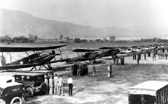
The aircraft include (from left) a Douglas C-1, 2 Douglas O-2Cs and 6 Consolidated DT-1s.
Will Adams recalled, “I grew up on Glendale & was 10 years old in 1927.
My stomping ground was the National Guard airport.
Times were different then & it was safe for a 10-year-old to wander all over the place.
I spent a lot of time at the National Guard Airport watching them fly in & out.
A 10-year-old kid hanging around didn't seem to bother them, and I had almost free run of the airport.
I clearly remember a movie scene they were shooting one time.
I think it was for Howard Hughes' Hell's Angels.”
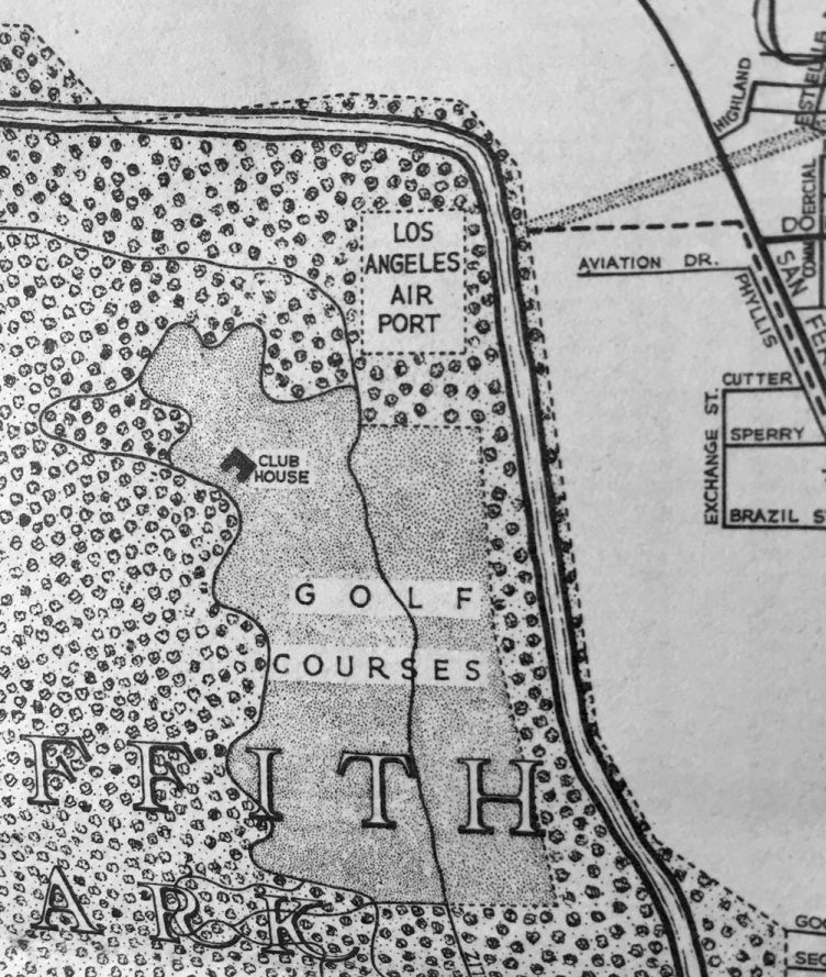
A 1927 street map (courtesy of Kevin Walsh) depicted the Griffith Park airfield as “Los Angeles Air Port”,
with a rectangular property outline.
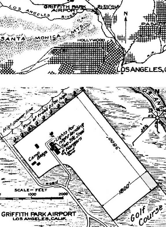
The location & layout of Griffith Park Airport from a 1927 Commerce Department Airway Bulletin (courtesy of David Brooks).
It described Griffith Park as a 157 acre rectangular sod field measuring 3,800' northwest/southeast,
with 2 steel hangars on the west side.
The owner was listed as the City Park Board, “leased to the State of CA for use of State Militia”.
The 1928 USGS topo map depicted Griffith Park “National Guard Airport” as an open area without any specific runways.
It also depicted the nearby “Grand Central Airport” to the north.
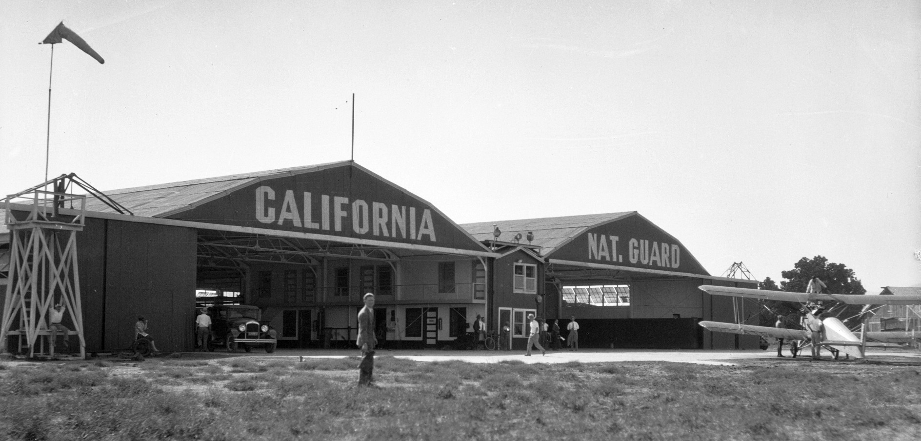
A circa 1928 photo of an unidentified biplane in front the of the CA National Guard hangars at Griffith Park (courtesy of Dave Doherty).
The earliest aeronautical chart depiction which has been located of Griffith Park Airport was on the 1929 LA – Las Vegas Air Navigation Map.
“G.P. Airpt”, as depicted on 1929 LA County map (courtesy of Mark Shoemaker).
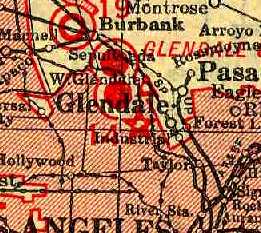
Griffith Park Aerodrome, as depicted on the 1929 "Rand McNally Standard Map of CA With Air Trails" (courtesy of Chris Kennedy).
Griffith Park Aerodrome was depicted simply as a property outline labeled as “Aviation Field” on a 1930 street map (courtesy of Kevin Walsh).
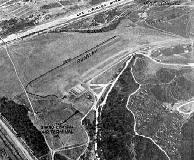
An undated aerial view looking east at the “Los Angeles California National Guard” Airfield from the 1930 Richfield Airport Directory (courtesy of Jonathan Westerling).
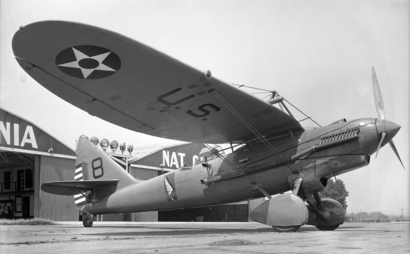
A 1930 photo of CA National Guard Douglas YIO-31A (one of only 4 built) in front of the Griffirth Park hangars.
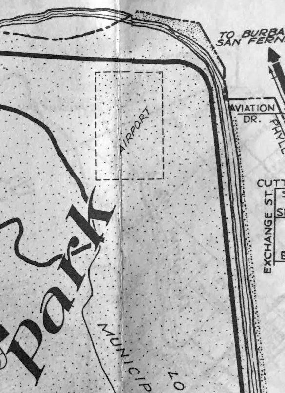
Griffith Park Aerodrome was depicted simply as a rectangular property outline labeled as “Airport” on a 1931 Automobile Club of Southern CA map (courtesy of Kevin Walsh).
Also note “Aviation Drive” to the east.
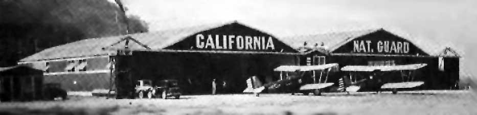
A 1932 photo of 2 unidentified biplanes in front the of the CA National Guard hangars at Griffith Park (courtesy of Ross Diehl, via Dan MacPherson).
The earliest Sectional Chart depiction which has been located of Griffith Park Aerodrome was on the June 1932 LA Sectional Chart.
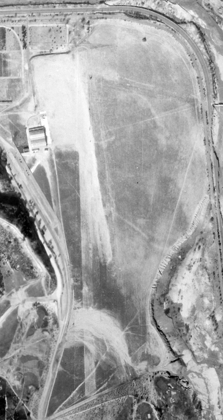
A 1/13/34 aerial view (from the UCSB Library) showed Griffith Park Aerodrome to have a single north/south grass runway, with a hangar along the west side.
There were no aircraft visible on the field.
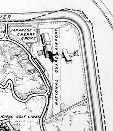
A 1935 map depicted the “National Guard Airport” as having a single unpaved north/south runway, with 2 hangars on the northwest side.
The 1935 H.M. Gousha / Shell Oil LA map (courtesy of Michael Binder) depicted the “California National Guard Airport” as an irregularly-shaped property outline.
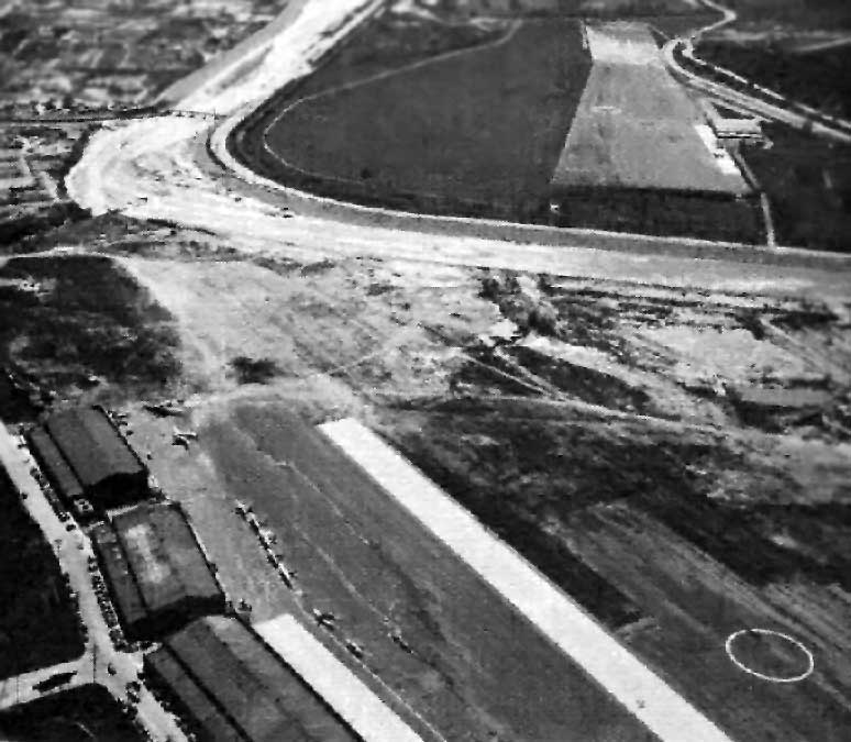
A 1936 aerial photo, looking south, showing the proximity of Griffith Park Aerodrome (upper right) to the Grand Central Air Terminal (foreground, across the LA River)
Photo is courtesy of Ross Diehl (whose father flew out of Griffith Park Aerodrome), via Dan MacPherson.
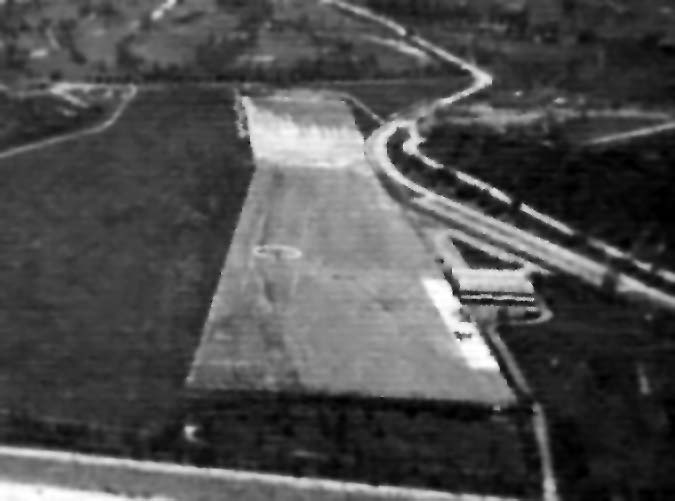
A closeup of Griffith Park Aerodrome from the above 1936 photo (courtesy of Ross Diehl, via Dan MacPherson).
A 1936 Commerce Department listing of airports & landing fields described Griffith Park
as being a military airfield with a single north/south oiled runway (1,965' x 192'),
and a single hangar with "40th Division Air Corps" on the roof.
As can be seen in the above 1936 aerial photo, the runway at Griffith Park had an unusual shape,
with the north end being about twice as wide as the south end.
The Airport Directory Company's 1937 Airports Directory (courtesy of Bob Rambo)
described Griffith Park as having a single 1,965' oiled runway.
The hangar had "40th Division Air Corps" painted on the roof.
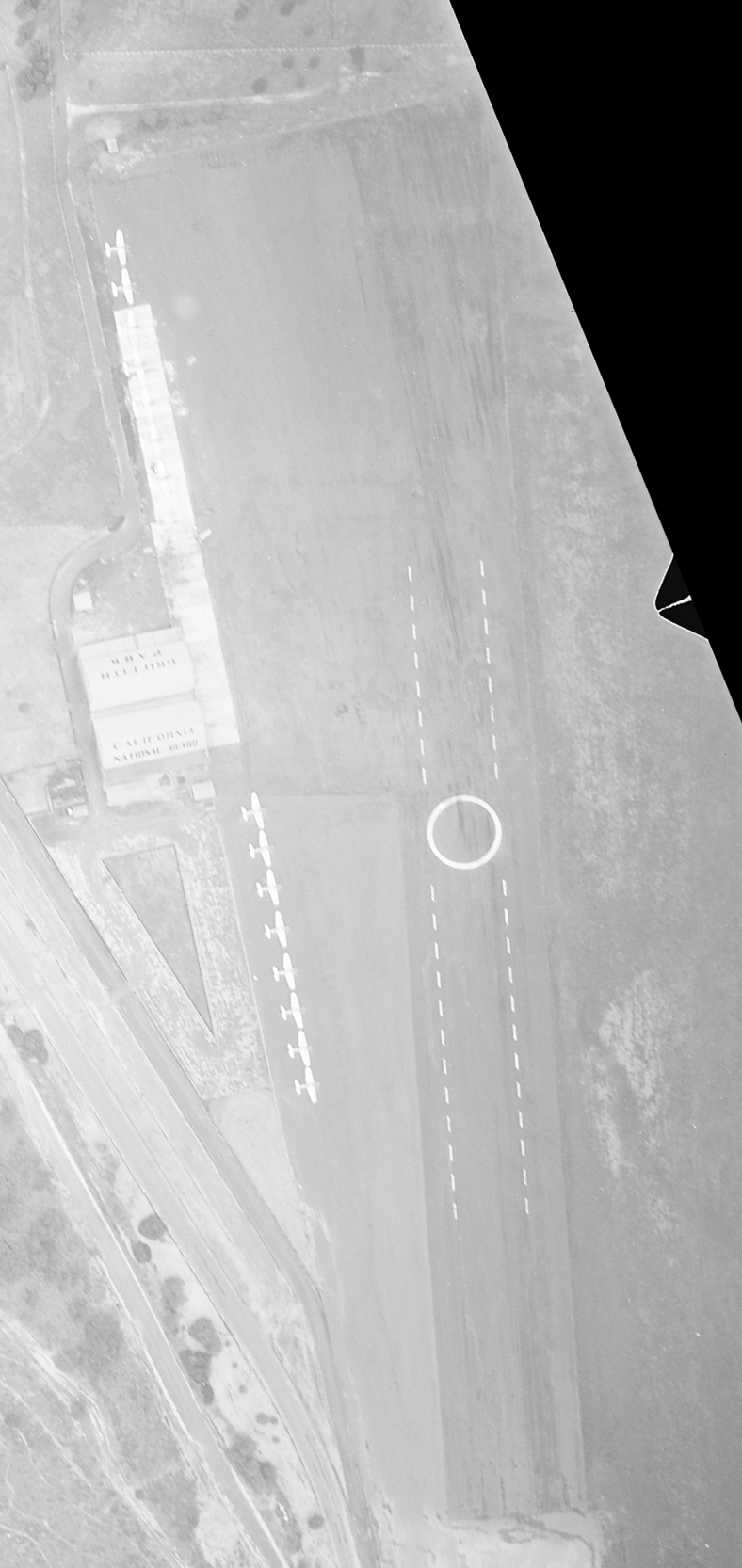
A 3/10/38 aerial view (from the USCB Photo Library) showed Griffith Park Aerodrome to have a single north/south grass runway,
with a hangar & a dozen unidentified single-engine aircraft along the west side.
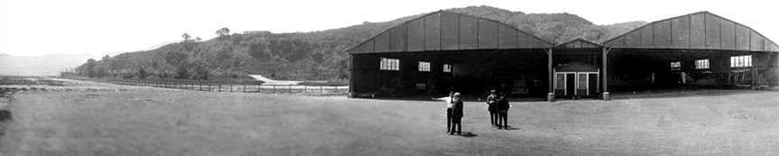
A circa 1930s panoramic shot looking southwest at the Griffith Park hangars.
Griffith Park National Guard Airport & the nearby Grand Central Air Terminal, as depicted on a 1938 Rand-McNally Texaco map (courtesy of Kevin Walsh).
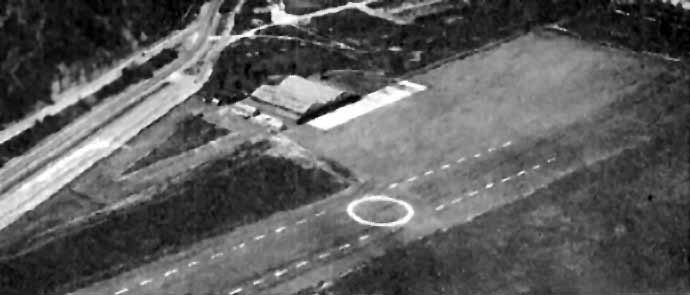
An aerial view looking northwest at Griffith Park Aerodrome
from The Airport Directory Company's 1938 Airports Directory (courtesy of Jonathan Westerling).
The directory described the field as having a single 3,000' north/south paved runway,
with a hangar marked with “40th Division Air Corps” marked on the roof.
No aircraft were visible on the field.
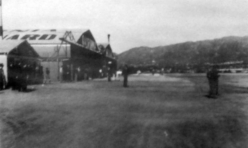
An undated photo of the “Completed hangars” at Griffith Park, from a 1/1/39 Works Projects Administration report (courtesy of Andrew Laverdiere).
The report described “Project 5517, CA National Guard Airport, Los Angeles” as having cost $35,980, using an average of 40 men/month, and lasting for 8 months.
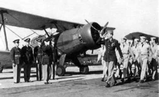
The last photo which has been located showing Griffith Park Aerodrome in operation
Training missions were flown from Griffith Park until 1939,
at which time the city Planning Commission charged that a military airport violated conditions of the original land deed.
Griffith Park National Guard Airfield, as depicted along with several other nearby airfields on the 1939 LA County Airports Map.
Griffith Park National Guard Airport & the nearby Grand Central Air Terminal, as depicted on the 1939 LA County Airports Map.
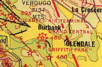
Griffith Park was still depicted as a military airfield on the 1941 LA Sectional Chart (courtesy of Chris Kennedy).
The 1942 USGS topo map depicted the open area of Griffith Park Aerodrome,
but did not label it at all (most likely due to wartime security concerns).
By 1942, the National Guard squadron had relocated from Griffith Park to the new Van Nuys AAF,
and the Griffith Park Aerodrome was evidently closed.
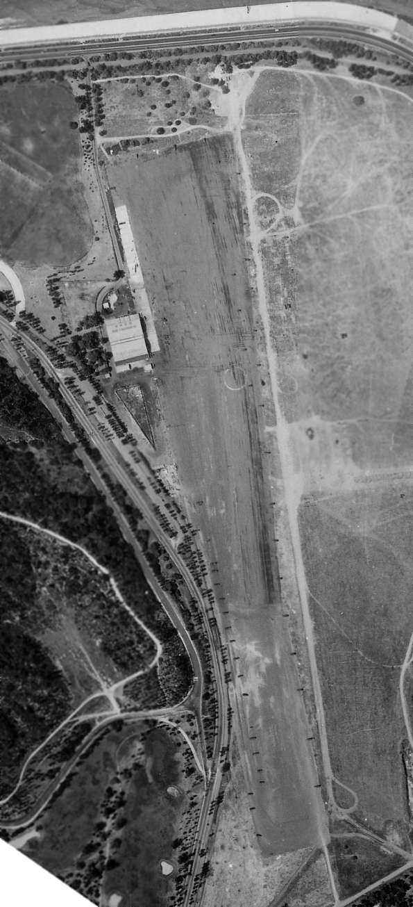
The last photo which has been located showing the Griffith Park Aerodrome remaining intact was a 6/6/42 U.S. Navy aerial view (courtesy of Brian Rehwinkel).
The hangar & runway remained intact, but the field appeared abandoned.
The Griffith Park Aerodrome was not depicted at all on the 1944 LA Sectional Chart (courtesy of John Voss).
A 1945 Thomas Brothers map (courtesy of Kevin Walsh) depicted the “California National Guard Aviation Field”
as having 4 rectangular buildings along the west side, and an unusually-shaped building along the east side.
The 1948 USGS topo map still depicted the “National Guard Airport”,
even though it had evidently been closed for several years by that point.
A 1949 street map depicted the site of Griffith Park as occupied by “Rodger Young Village”,
which was a temporary Quonset hut village for returning GI's & their families.
An undated aerial view from the 1950 Air Photo Guide (courtesy of Kevin Walsh)
showed dozens of Quonset huts of Rodger Young Village covering the airfield area of Griffith Park.
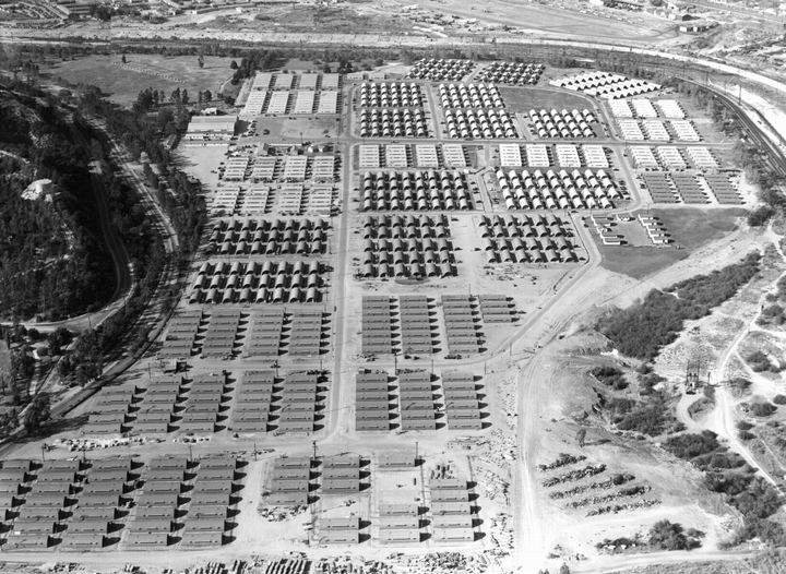
A 1952 aerial view (courtesy of Kevin Walsh) depicted the hundreds of Quonset huts of Rodger Young Village covering the airfield area of Griffith Park,
but the former hangar remained standing along the west side of the property.
Also note the runway of Grand Central Air Terminal barely visible in the background.
The 1953 USGS topo map (courtesy of Kevin Walsh) labeled the site of Griffith Park Aerodrome as Rodger Young Village.
A 1954 aerial view showed that all of the Quonset huts of Rodger Young Village had been removed at some point between 1952-54,
but the former hangar remained standing, all alone.
A 1972 aerial view showed that the former hangar had been removed at some point between 1954-72,
with all traces of the former airfield having been replaced by a parking lot for the Griffith Park Zoo.
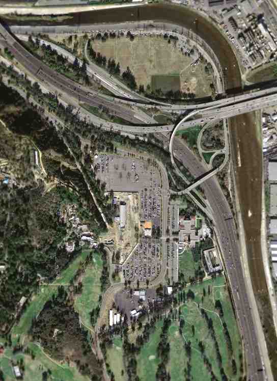
A March 2004 USGS aerial photo showed the Griffith Park Aerodrome site has been covered by the Griffith Park Zoo, with no trace remaining of the former airfield.
Drew Laverrdiere reported in 2015, “Griffith Park Aerodrome... one of the park rangers told me about a remaining structure still at the park on a hill called Beacon Hill
where there is still the foundation of a former beacon tower that was built for the airfield.”
The site of Griffith Park Aerodrome is located at the present day intersection of Interstate 5 & Route 134.
Thanks to Dan MacPherson for pointing out Griffith Park Aerodrome.
____________________________________________________
34.18, -118.278 (North of Downtown Los Angeles, CA)
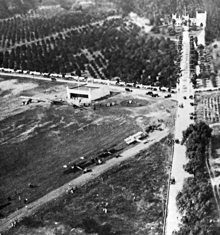
A 1921 photo by Delmar Watson of a fly-in at Brand Field, with several DH-4Bs from March Field, Neta Snook's white Curtiss Jenny, and several Pacific Standards
(from "Madcaps, Millionaires and Mose" by John Underwood, via Dan MacPherson).
Millionaire Leslie Brand built a mansion, named El Miradero, in 1904.
At an unknown date between 1904-1921, Brand established a grassy, well-manicured airfield in front of the mansion.
The airfield consisted of a 1,200' rolled dirt runway, with a white hangar at one end & a putting green on the other.
The hangar matched the architectural style of the mansion - with turrets atop each of the 4 corners.
The earliest depiction which has been located of Brand Field was a 1921 aerial view,
which depicted a hangar along the north side of a grass field, with 6 biplanes in attendence.
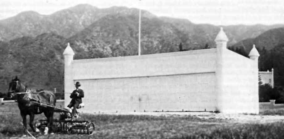
An undated photo by Margaret Beacon of millionaire L.C. Brand mowing the grass in front of his hangar
(from "Madcaps, Millionaires and Mose" by John Underwood, via Dan MacPherson).
Brand Field was listed in a 1923 LA Chamber of Commerce table of LA-area airports (courtesy of K.O. Eckland).
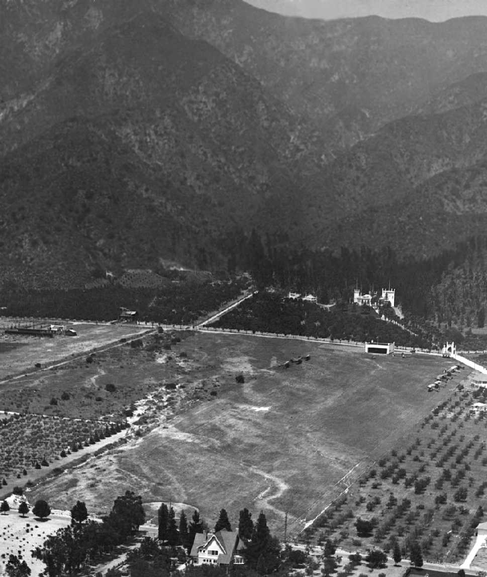
A 1923 aerial view looking north at Brand Field, showing the hangar & 10 aircraft on the field, and the mansion across the street.
Note the steep terrain – obviously takeoffs to the north wouldn't be advisable.
Only 3 aircraft are known to have been actually based at Brand Field,
but Leslie Brand apparently bought many war surplus Jennies,
some to tinker with & fly as a sport, although most languished in storage buildings.
After Leslie Brand died in the house in 1925, his property was bequeathed to the city.
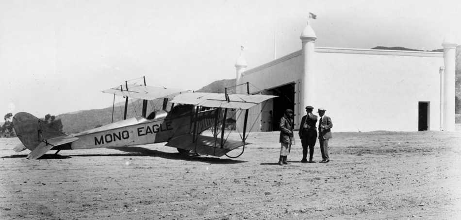
A circa 1927 photo of a Curtiss JN4 Jenny marked “Mono Eagle” & 3 men standing in front of Brand Field's distinctive hangar.
Brand Field was no longer depicted on a 1931 street map (courtesy of Gary Alexander),
but “Brand Park” was depicted, so the airfield may have ceased operation by that point.
Brand Field was also not depicted on the June 1932 LA Sectional Chart,
a 1941 street map (according to Chris Kennedy), or the 1942 USGS topo map.
A 1952 aerial photo showed that the area formerly occupied by Brand Field
had been redeveloped with dense housing, with no trace remaining of the hangar.
By 1956 the mansion had been converted into the Brand Library.
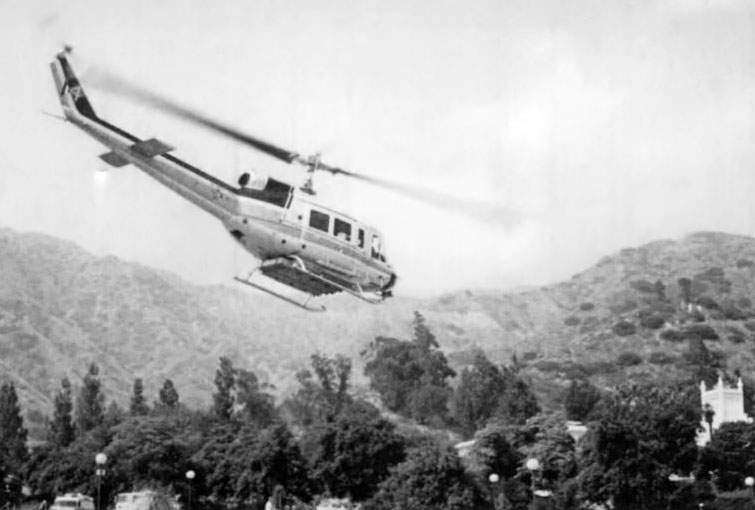
A circa 1980s photo of a Bell 212 firefighting helicopter departing from the Brand grounds, with the Brand Castle visible at bottom-right.
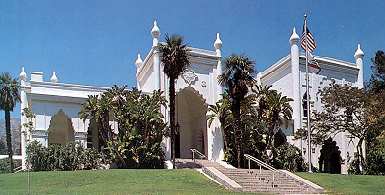
A recent photo of the Brand Castle.

A 2002 photo by Danny Wilson of a former airport beacon light tower which remains standing at the site of Brand Field.
Danny Wilson reported in 2003, "As for Brand Airport, until recently I had no idea there was ever an airport there.
But over the years I did notice an unusual structure sitting up in the hills.
It is a corrugated-steel cylinder with some sort of rotating housing on top.
There are circular canisters atop the cylinder which looked to have once house lights.
I did some research & found that this used to be one of a pair of rotating beacons that guided pilots to the airfield.
There was another beacon northwest of this one that has been lost to the elements and/or vandals.
This one still exists & is in fairly decent condition, given the circumstances.
[The above photo of the tower] was taken in 2002, and the structure was still standing as of 2003."
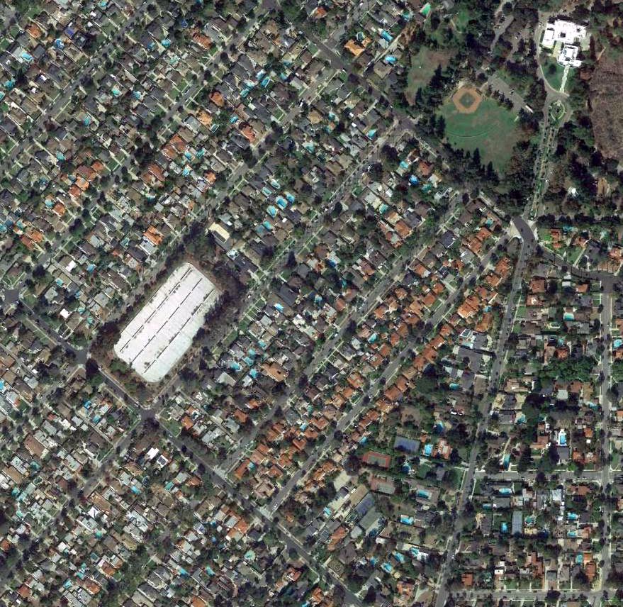
A 2016 aerial photo shows the Brand Mansion still stands (at the top-right corner of photo),
but the area of the former airfield has been covered by dense housing.
The site of Brand Field is located southwest of the intersection of Grandview Avenue & West Mountain Street.
____________________________________________________
____________________________________________________
This site covers airfields in all 50 states.