
Abandoned & Little-Known Airfields:
California: Northern Oakland area
© 2002, © 2026 by Paul Freeman. Revised 6/5/26.
This site covers airfields in all 50 states: Click here for the site's main menu.
____________________________________________________
Please consider a financial contribution to support the continued growth & operation of this site.
For a 10th year, the CA pages of this website are sponsored by the California Pilots Association:
Benicia Airport / Benicia Air Harbor (revised 6/11/25) - Berkeley Airport (revised 2/4/24)
Concord NWS Airfield (revised 2/20/26) - Diablo Air Mail Terminal / (Original) Concord Airport (revised 11/17/18) - Discovery Bay Airport (revised 9/14/19)
Hookston Field / Sherman Field (revised 6/13/25) - KnightsAirport / Stan's Airpark (revised 6/11/25) - Mare Island Naval Shipyard Airfield (revised 1/31/21)
Martinez Airport (revised 6/5/26) - Vallejo Airport / Mini Airport (revised 10/24/25) - Vallejo Sky Harbor (revised 10/24/25)
____________________________________________________
Berkeley Airport, Berkeley, CA
37.881, -122.308 (North of Oakland, CA)
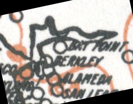
Berkeley Airport, as depicted on the 1920 Army Aerial Map of the U.S. (courtesy of Jonathan Westerling).
The date of construction of the Berkeley Airport has not been determined.
The earliest depiction which has been located of Berkeley Airport was on the 1920 Army Aerial Map of the U.S. (courtesy of Jonathan Westerling).
Jonathan Westerling reported, “In December 1922, Airmail pilot Harry Huking logged that the Berkeley Airport was maintained as an 'emergency' airport with a 2,000' east/west unpaved runway.”
It was initially located on the east side of the 4-track main-line railroad along the San Francisco Bay.
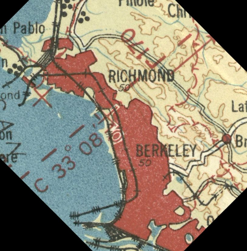
The initial location of Berkeley Airport to the east of the railroad was depicted on the 1924 U.S. Army Strip Chart (courtesy of Jonathan Westerling).
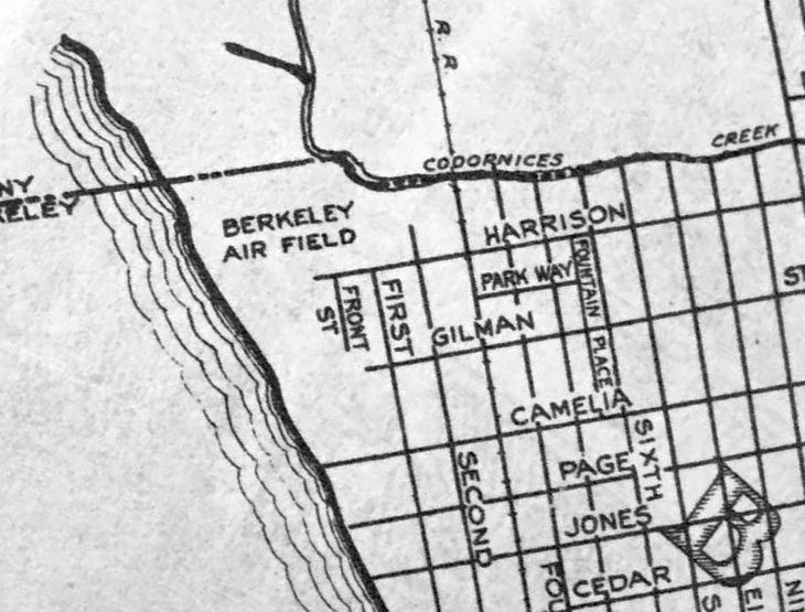
“Berkeley Air Field”, as depicted on a circa 1926 Thomas Brothers map (courtesy of Kevin Walsh).
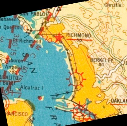
The initial location of Berkeley Airport to the east of the railroad was depicted on the 1927 U.S. Army Strip Chart (courtesy of Jonathan Westerling).
Jonathan Westerling reported, “In 1928, Berkeley Airport was relocated immediately to the west side of the same railroad tracks.
This location was on recently filled-in baylands & thus likely flatter & more open than the previous field which was even in the 1920s already surrounded by development.”
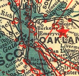
The 1929 Landing Fields of the Pacific West (courtesy of Jonathan Westerling) described Berkeley Airport as having a 1,500' unpaved runway.
The September 1929 Aero Digest (according to Jonathan Westerling) noted the "newly-established Berkeley Airport".
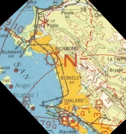
Berkeley Airport, as depicted on the 1930 U.S. Army Strip Chart (courtesy of Jonathan Westerling).
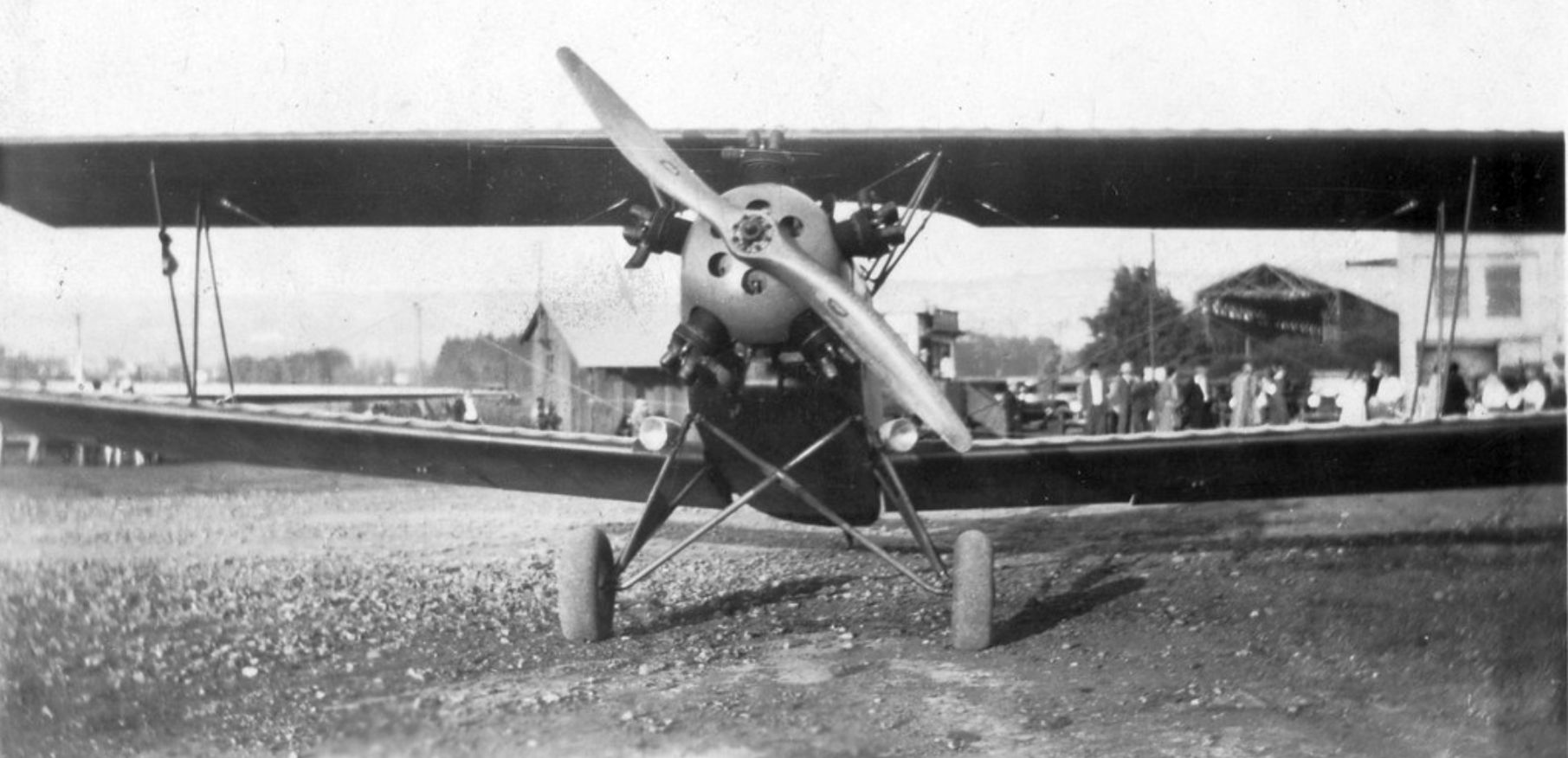
The earliest photo which has been located of Berkeley Airport was a 10/10/30 photo of a biplanes (model unidentified) in front of a spectators (used with permission of the San Diego Air & Space Museum).
The February 1930 Aero Digest (courtesy of Jonathan Westerling) described Berkely Airport in detail: "Following the construction of a large hangar & the leveling of a 3,000' runway [a greatly inflated length; the actual runway length was half that at the time],
the Berkeley Aviation Service Limited has inaugurated a commercial flying service at the Berkeley Municipal Airport.
The flying field is located on the San Francisco Bayshore, 1 mile from the University of California campus.
Frank Pierce is General Manager & Harry Abbott is Chief Pilot. Five planes are used in air taxi & student instruction work."
Sadly, Berkeley Aviation Service would be Harry Abbott's last venture as his obituary later that year recounted the crash that ended his storied career:
An 8/16/30 article entitled “Famous Pilot Killed While Testing Ship, Harry Abbott Falls At Berkeley Airport” read:
“Harry Abbott, 30, well-known California pilot & former aviation advisor to the Chinese government. was killed today when the fast Navy pursuit plane he was flying went into a spin & crashed to the field.
A score or more bystanders saw Abbott take the ship up for a speed trial. As he banked for a landing, the plane, evidently striking an air pocket, fell into a flat spin & crashed from an altitude of 400', instantly killing Abbott.
A well-known aviation pioneer in California, Abbott was the first man ever to fly the China Sea, and he inaugurated several Chinese airlines.
He was an honorary Lieutenant Colonel in the Chinese Air Corps.”
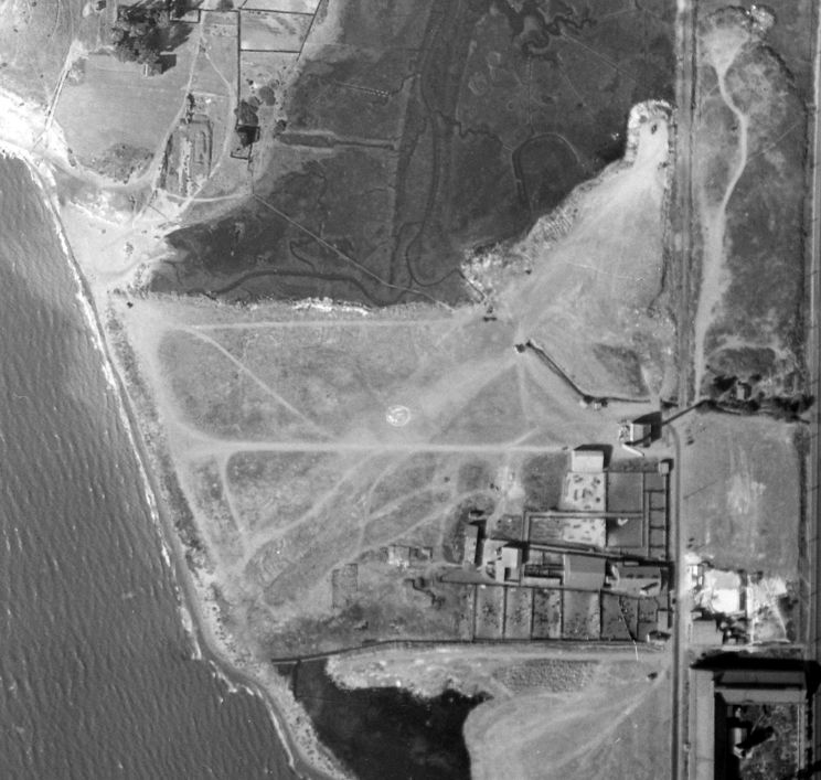
An October 1931 aerial view (from the UCSB Library) depicted Berkeley Airport as an northeast/southwest unpaved airfield with several buildings on the east side.
No aircraft were visible on the field.
Berkley Municipal Airport was inactive for a short time for reasons unknown according an addendum to the 1931 Landing Fields of the Pacific West (according to Jonathan Westerling).
Berkeley Airport re-emerged with additional runways according to the 1932 Aeronautical Bulletin #2, which indicated 3 runways measuring 1,800', 1,100', and 900'.
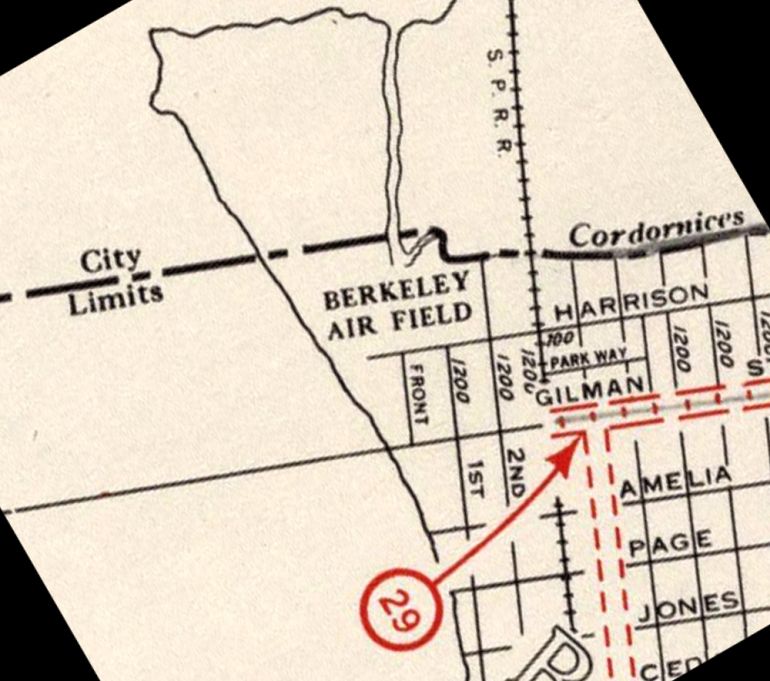
“Berkeley Air Field”, as depicted on the 1934 CA Highway Survey (courtesy of Jonathan Westerling).
A 6/21/34 East Bay Gazette article (courtesy of Jonathan Westerling) reported, “Three twin-motored U.S. Army bombers, on a reconnaissance tour from March Field, landed at Berkeley Airport yesterday afternoon.
The planes are the largest ever to land here. A few hours after landing the planes took off for Hamilton Field.”
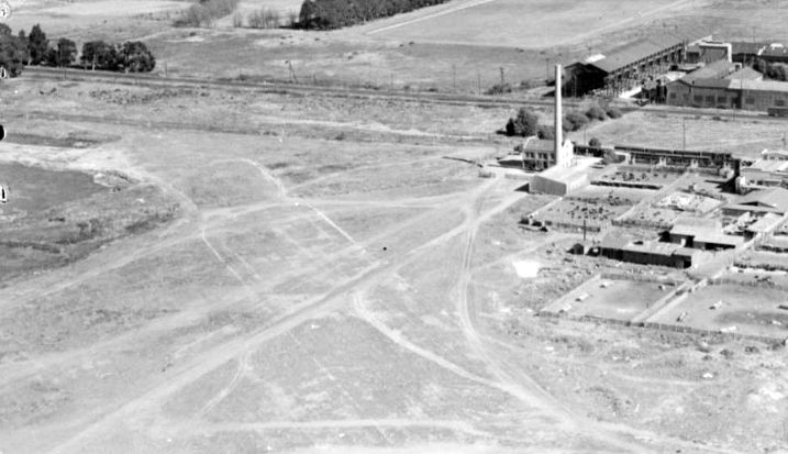
A circa 1935 aerial view looking east (courtesy of Kevin Walsh) depicted the Berkeley Airfield runway area at bottom-left, and the hangar (just in front of the smokestack).
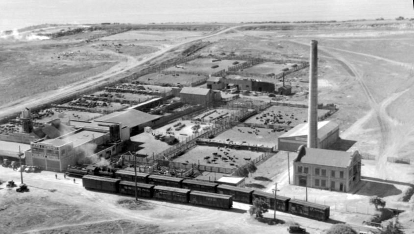
A circa 1935 aerial view looking southwest (courtesy of Kevin Walsh) depicted the Berkeley Airfield hangar just behind the smokestack.
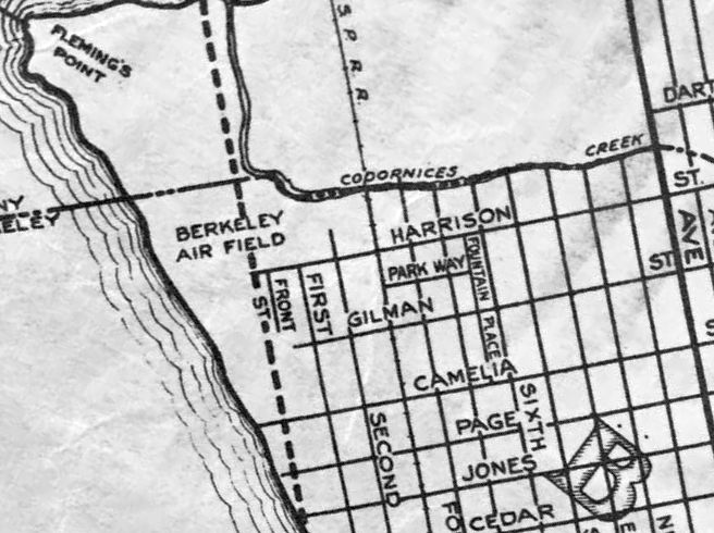
“Berkeley Air Field”, as depicted on a circa 1935 Thomas Brothers map (courtesy of Kevin Walsh).
The Bayshore Highway was depicted as under construction: the dashed line passing right through the Berkeley Air Field property.
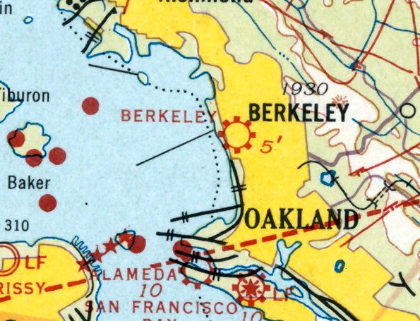
The last aeronautical depiction which has been located of Berkeley Airport was on the 1935 San Francisco Sectional Chart (courtesy of Jonathan Westerling).
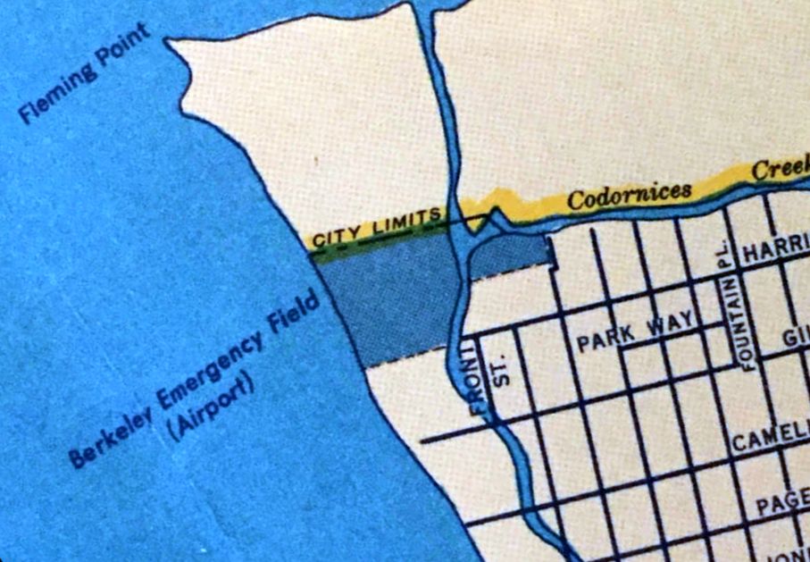
The last map depiction which has been located of Berkeley Airport was on a Shell 1936 street map (courtesy of Kevin Walsh),
which depicted “Berkeley Emergency Field (Airport)” as a property outline along the coast.
Berkeley Airport was evidently closed (for reasons unknown) at some point between 1935-36,
as it was no longer depicted on the 1936 San Francisco Sectional Chart or a 1937 street map (courtesy of Kevin Walsh).
A 1946 aerial view showed no recognizable trace remaining of Berkeley Airport, with the property covered by a large number of buildings & an expressway.
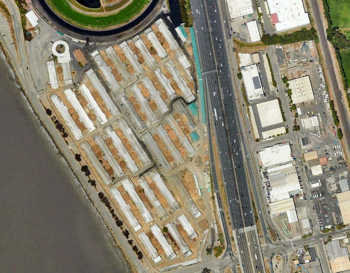
A 2022 aerial view showed no recognizable trace remaining of Berkeley Airport, with the property covered by a large number of buildings & an expressway.
Thanks to Jonathan Westerling for pointing out this airfield.
____________________________________________________
Mare Island Naval Shipyard Airfield, Vallejo, CA
38.089, -122.272 (Northeast of Oakland, CA)
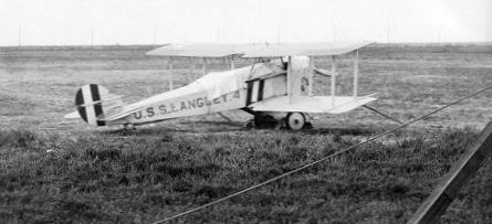
A circa 1930 photo of a Vought FU-2 biplane (the 2-seat trainer version) from the USS Langley at Mare Island (courtesy of Dann Shively).
The Mare Island Naval Shipyard was established in 1853.
Dann Shively reported (sourcing information from "Side-wheelers to Nuclear Power" by Sue Lemmon & E.D. Wichels),
“After World War 1 a supply ship, the USS Jupiter, was sent to Mare Island for retrofit
and became the Navy's first aircraft carrier, renamed the USS Langley.
It served the fleet from 1922-36 helping to develop carrier aviation.
From 1922-25, Mare Island was the site of an air station, or what local newspapers referred to as such.
It was unpaved & unlighted; any air traffic was a rare event; not much of an air station.
Photographers stayed away from it so carefully that no decent pictures of it exists.”
According to the book "Two Hours By Crow" by Howard & Judith Campbell (courtesy of Wings of History),
“This 2,000' long dirt runway was on Mare Island between 1922-25.
The idea was that the land planes could use this strip & the float-planes could use the Mare Island Strait.
In 1923 the Minelayer CM-3 'Aroostook' put into Mare Island & set up equipment & a pair of canvas-over-wooden-frame hangars at the northwest end of the Naval base.”
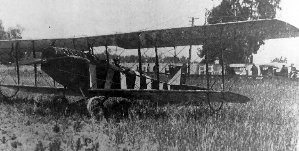
An undated photo of a Curtiss JN-4 Jenny biplane at Mare Island (courtesy of Dann Shively).
According to Dann Shively, “Some of the very early aircraft carriers that came to Mare Island, such as the USS Langley & the USS Aroostook,
had no place to 'park' their small planes while the ship was undergoing overhauls so they used the airstrip.”
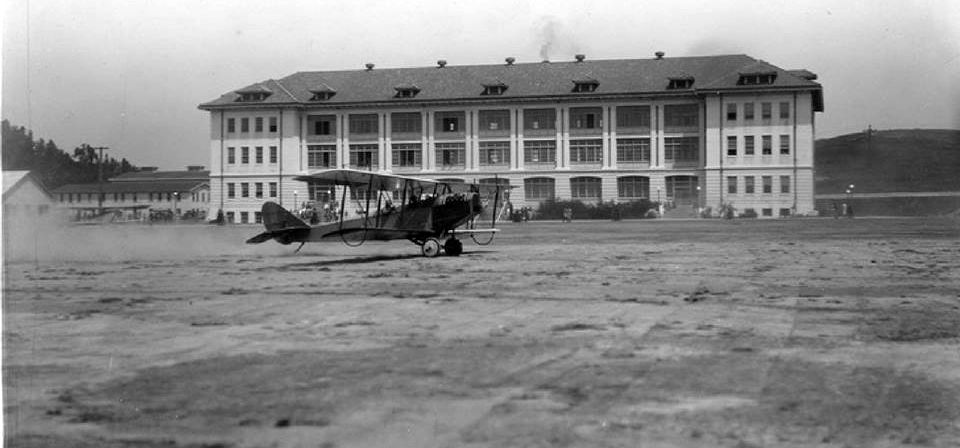
An undated photo of a Curtiss JN-4 Jenny taking off in front of the Mare Island Marine Barracks (courtesy of Dann Shively).

A diagram from the book "Two Hours By Crow" by Howard & Judith Campbell (courtesy of Wings of History), depicted Mare Island as having a single northeast/southwest runway, with canvas hangars on the southeast side.
According to Dann Shively, “It was hoped the small field could be expanded, but such hope faded in 1937, when Alameda was selected as the site for a naval base.”
There is no indication of any further aviation use of the Mare Island airfield.

An 8/25/37 USGS aerial view of Mare Island (from the UCSB Library) did not show any recognizable trace of an airfield.
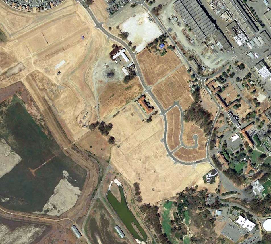
A 2014 aerial view of the general location of the Mare Island Airfield, centered on the former Marine Barracks located at 13th Street & Flagship Drive.
Thanks to Dann Shively for pointing out this airfield.
____________________________________________________
Benicia Airport / Benicia Air Harbor, Benicia, CA
38.075, -122.19 (Northeast of Oakland, CA)
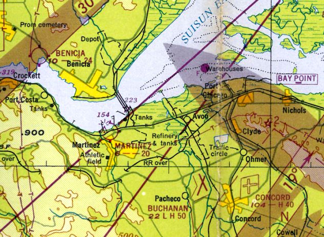
Benicia Airport, as depicted on the 1948 San Francisco Local Aeronautical Chart (courtesy of Tim Zukas).
This small general aviation airport along the north bank of the Sacramento River was not yet depicted on the 1946 Sectional Chart (courtesy of Dann Shively).
According to the book "Two Hours By Crow" by Howard & Judith Campbell (courtesy of Wings of History),
“In 1946, when the runway was opened, there was no Federal Highway 780. Access to the field was along the same route, but it was the Vallejo-Benicia Highway with no number back then.
The field had two runways. Both runways were dirt & there was an office/hangar at about mid-field on the eastern side.
The short runway did not last too long because the marshy land to its northwest end limited any further development.”
The earliest depiction which has been located of Benicia Airport
was on the 1948 San Francisco Local Aeronautical Chart (courtesy of Tim Zukas).
It depicted Benicia Airport as having a 2,400' unpaved runway.
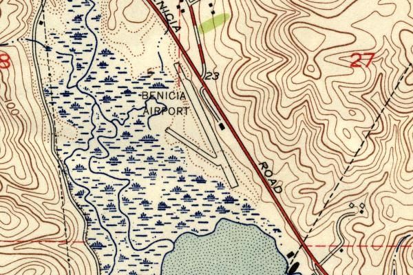
The 1950 USGS topo map (courtesy of Dann Shively) depicted Benicia Airport as having 2 runways on a narrow spit of land next to the wetlands, with one small building along the east side.
According to the book "Two Hours By Crow" by Howard & Judith Campbell (courtesy of Wings of History),
“In the 1950s, a pair of brothers taught flight instruction in their 4-seat Bellanca 14-13 Cruisair Sr., powered by a 6 cylinder 150hp Franklin 6A4-150-B3 engine.”
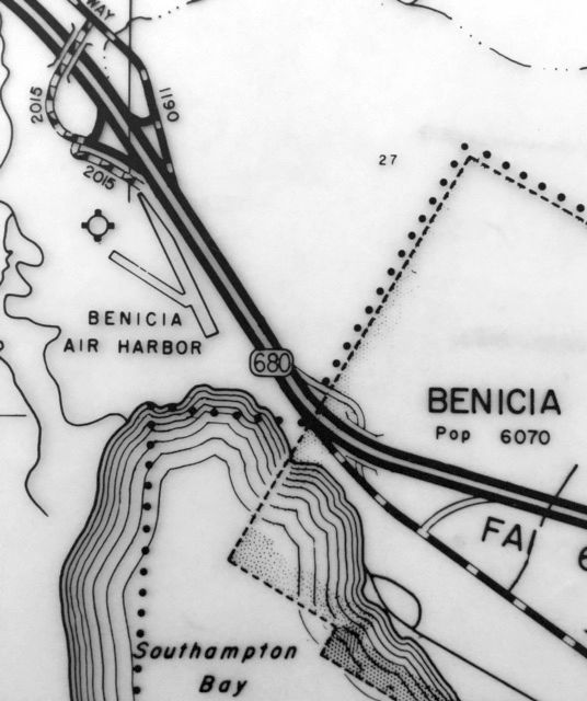
The 1955 CA Highways map (courtesy of Kevin Walsh) labeled the field as “Benicia Air Harbor”.
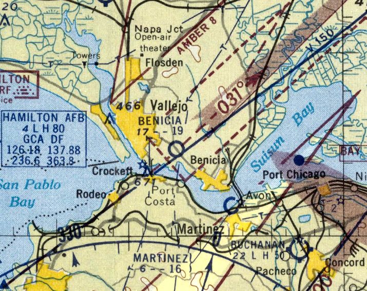
The last aeronautical chart depiction which has been located of Benicia Airport was on the September 1957 Sectional Chart.
It depicted Benicia Airport as having a mere 1,900' runway.
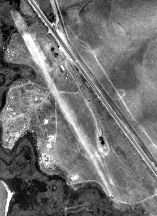
The earliest photo which has been located of Benicia Airport was a 1958 aerial view (from the UCSB Library, courtesy of Jonathan Westerling).
It depicted Benicia Airport as having a single unpaved northwest/southeast runway, with a few small buildings along the east side.
There was no sign of the previously-depicted crosswind runway.
Benicia Airport was evidently closed (for reasons unknown) at some point between 1957-58,
as it was no longer depicted on the April 1958 Sacramento Sectional Chart.
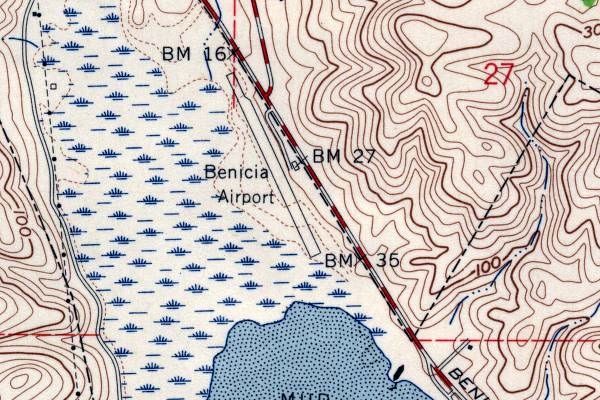
The last depiction which has been located of Benicia Airport was on the 1959 USGS topo map (courtesy of Dann Shively).
Benicia Airport was depicted in an unchanged fashion on the 1965 USGS topo map.
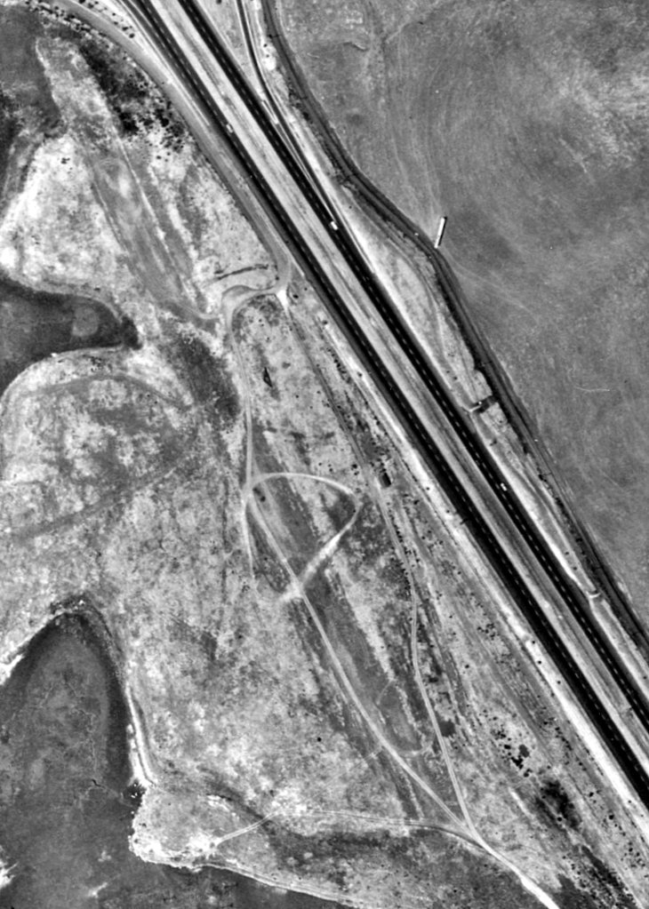
A 1965 aerial view (from the UCSB Library, courtesy of Jonathan Westerling) depicted Benicia Airport after it had evidently been abandoned,
with the runway still recognizable but deteriorated.
Benicia Airport was no longer depicted on the 1969 USGS topo map.
No trace of Benicia Airport was recognizable on a 5/22/72 USGS aerial photo.
At some point after the closure of Benicia Airport, the site was reused as a park named Benicia State Recreation Area.
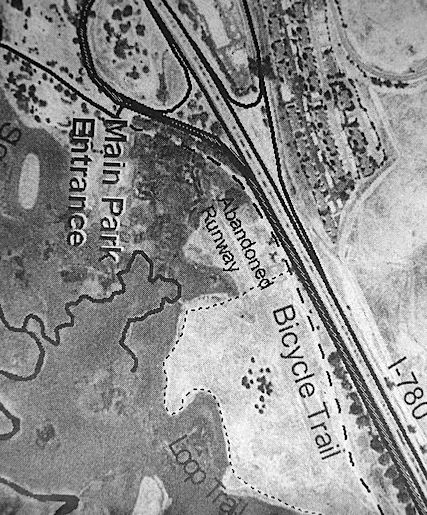
An undated aerial photo from a park map (courtesy of Dann Shively) depicted the northern portion of an abandoned runway at the site of Benicia Airport.
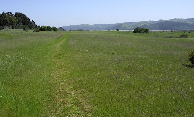
A 2006 photo by Dann Shively looking south at the Benicia State Recreation Area, showing no trace remaining of Benicia Airport.

A 2023 aerial view showed no trace remaining of Benicia Airport.
The site of Benicia Airport is located south of the intersection of Route 780 & Rose Drive.
Thanks to Dann Shively for pointing out this airfield.
____________________________________________________
Martinez Airport, Martinez, CA
38.023, -122.133 (Northeast of Oakland, CA)
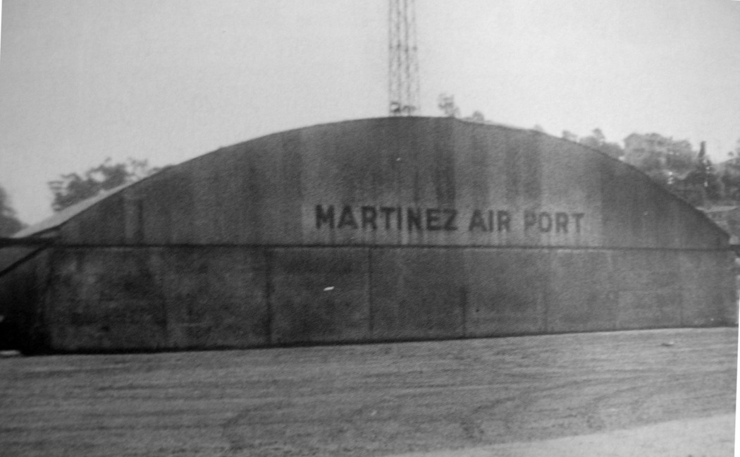
A 1937 photo of a hangar marked “Martinez Air Port”, with the radio mast visible in the background (courtesy of Dann Shively).
The 8/2327 Contra Costa Gazette contained an article on the front page saying that there is a "need in Martinez for a municipal airport."
The 1/30/28 Contra Costa Gazette added, "Martinez would be the only city in the state with an airport within its boundaries",
for which it proposed the "waterfront area now being reclaimed east of the municipal wharf.”
According to the book “Images of America: Martinez” (courtesy of Kevin Walsh),
“A deputy sheriff built the first hangar at Martinez Airport in 1933.”
According to the book "Two Hours By Crow" by Howard & Judith Campbell (courtesy of Wings of History),
“The airport was opened in July 1935, but its condition was not the best.”
Martinez Airport was not yet depicted on the May 1936 Sacramento Sectional Chart.
The earliest depiction which has been located of Martinez Airport
was a 1937 photo of a hangar marked “Martinez Air Port”, with the radio mast visible in the background (courtesy of Dann Shively).
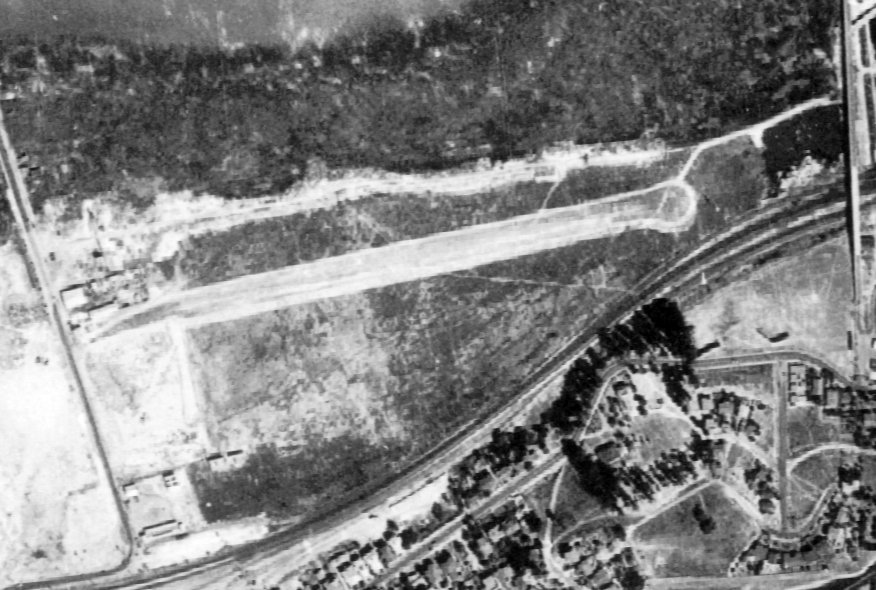
A 1937 aerial view (from the UCSB Library, courtesy of Jonathan Westerling) depicted Martinez Airport as having a single southwest/northeast runway with a few small buildings on the west side.
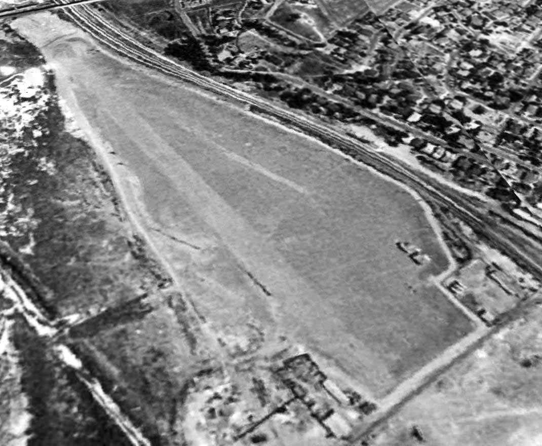
A 1939 aerial view looking southeast showed Martinez Airport to have a single east/west runway with a few small buildings on the west side.
According to the book "Two Hours By Crow" by Howard & Judith Campbell (courtesy of Wings of History), “In 1939 the dirt runway was re-oiled & extended to 1,900'.”
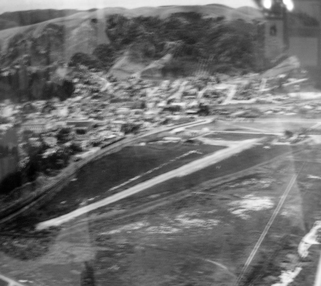
An undated aerial view looking southwest (courtesy of Dann Shively) showed Martinez Airport to have a single east/west runway with a few small buildings on the west side.
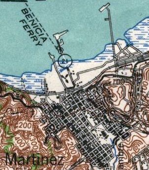
The 1940 USGS topo map (courtesy of Dann Shively) depicted Martinez Airport with the propeller symbol along the coast.
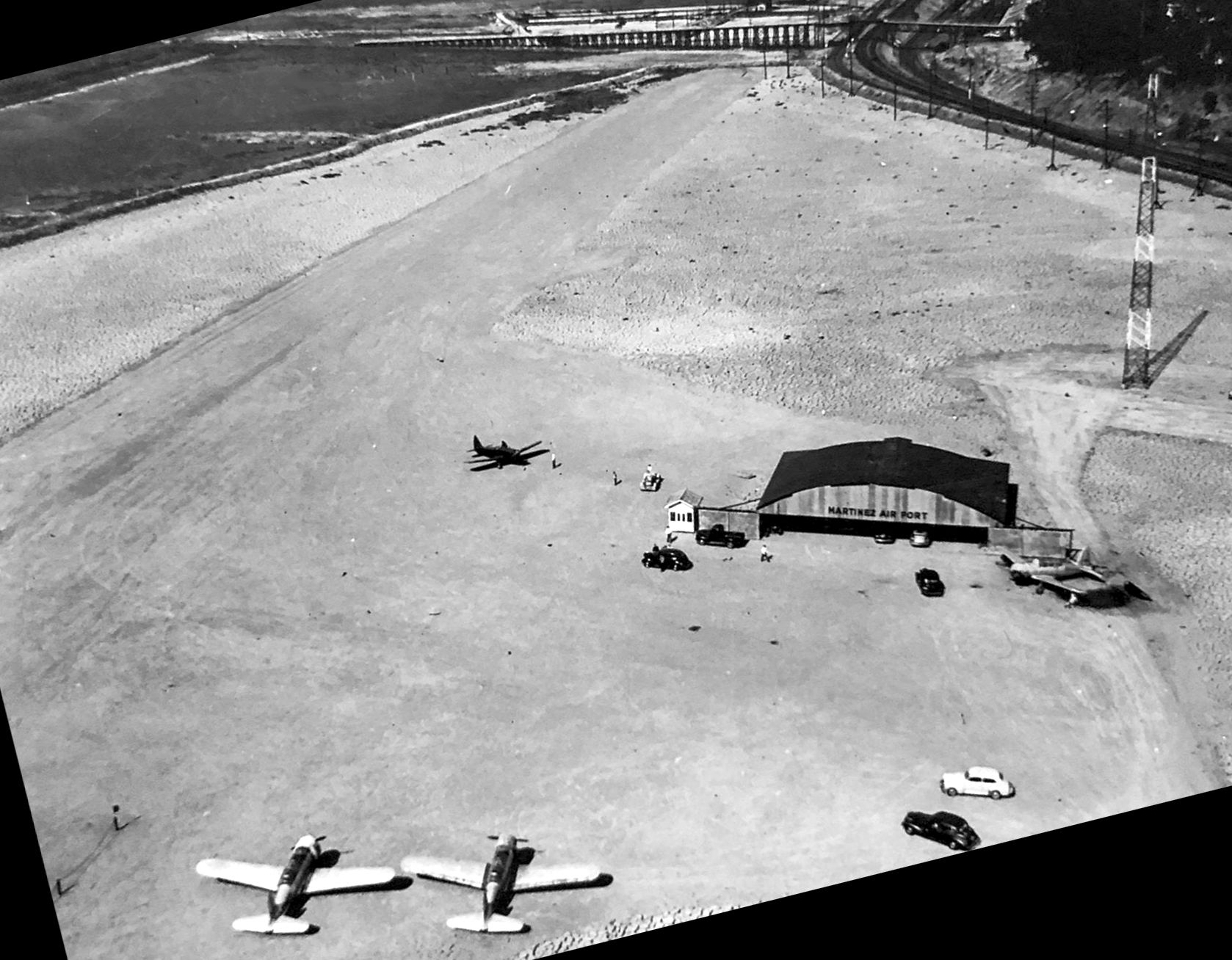
A 1941 aerial view looking east at Martinez Airport showed 4 light single-engine aircraft parked near the hangar, with the radio mast visible in the background.
According to the book "Two Hours By Crow" by Howard & Judith Campbell (courtesy of Wings of History),
“In March 1941 the Gayway Building from the 1939 Golden Gate International Exposition on Treasure Island was moved here & re-erected.
This 75' x 65' building became the main hangar on the field.
A rented airplane made a night crash landing here on 1/16/41 when they didn't know the runway was under water.
Drainage & low wires were soon taken care of & the municipal field enjoyed a short life.
May 30, 1941 saw a major event on the field as they held the 'Contra Costa Defense Cavalcade' with 65 planes mustering on the site & 'attacking' the town that night.
The city was completely 'blacked-out' & the aerial assault began when search lights picked out the 'enemy' & mock machine gun fire opened up.
Realism was enhanced by the bomb explosions at the waterfront & the local Boy Scout Troops helped control the 'panicky' crowds.
It was reported that 10,000 residents & visitors viewed these Civil Defense maneuvers.
On 12/8/41 the Army closed down all flying within 150 miles of the Pacific Ocean; the Air Park was shuttered & locked.
Martinez Airport was not listed among active airfields in the 1945 AAF Airfield Directory (courtesy of Scott Murdock),
nor depicted on the February 1946 Sacramento Sectional Chart.
According to the book "Two Hours By Crow" by Howard & Judith Campbell (courtesy of Wings of History),
“The field reopened in 1946. Flying came back, rentals & repairs started up again & the field was back in business.”
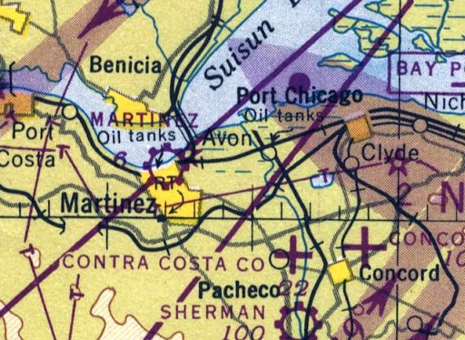
The earliest aeronautical chart depiction which has been located of Martinez Airport was on the September 1946 Sectional Chart (courtesy of Dann Shively).
It depicted Martinez as a commercial/municipal airport.
Al Blachman reported of Martinez Airport, “Norm Spitzer worked as a flight instructor there after WW II.”
William Ludwig recalled, “The runway was a dirt strip running east & west located on the north side of downtown of Martinez next to the bay.
It had a single barn-like hangar on it & that was it. A friend I knew had an Ercoupe out there for awhile,
and a kid wanted one day to take it for a joy ride & crashed it. Wes Lewis was the owner of the plane.”
The 1948 San Francisco Local Aeronautical Chart (courtesy of Tim Zukas) depicted Martinez Field as having a 2,000' unpaved runway.
According to the book "Two Hours By Crow" by Howard & Judith Campbell (courtesy of Wings of History),
“Weaver Slape took off in the fog one morning in 1949 for a trip to Reno. Thinking he would get above the fog, he banked a bit too soon & a wing hit the water.
Weaver had never learned to swim but, 'I taught myself to swim that morning.' The Aeronca is still in the river & Slape is the 'only Flying Club member that sunk an airplane.'”
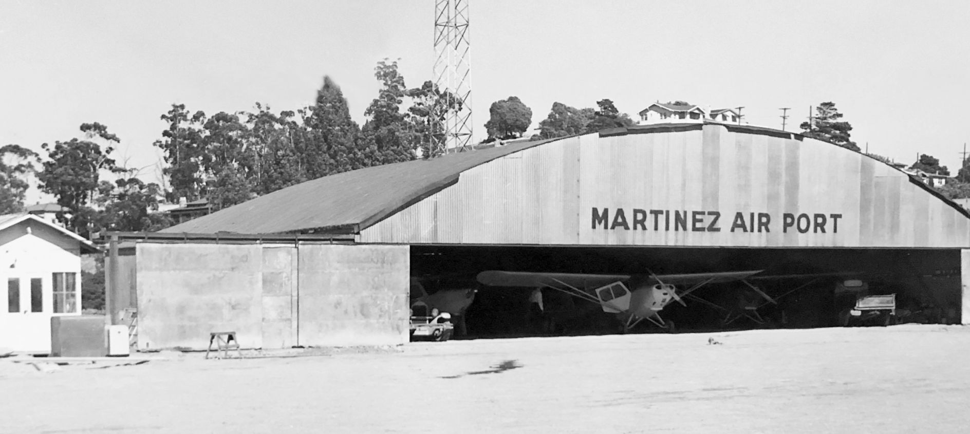
A circa 1940s/50s photo of the “Martinez Air Port” hangar, with several light aircraft inside, and the radio mast visible in the background.
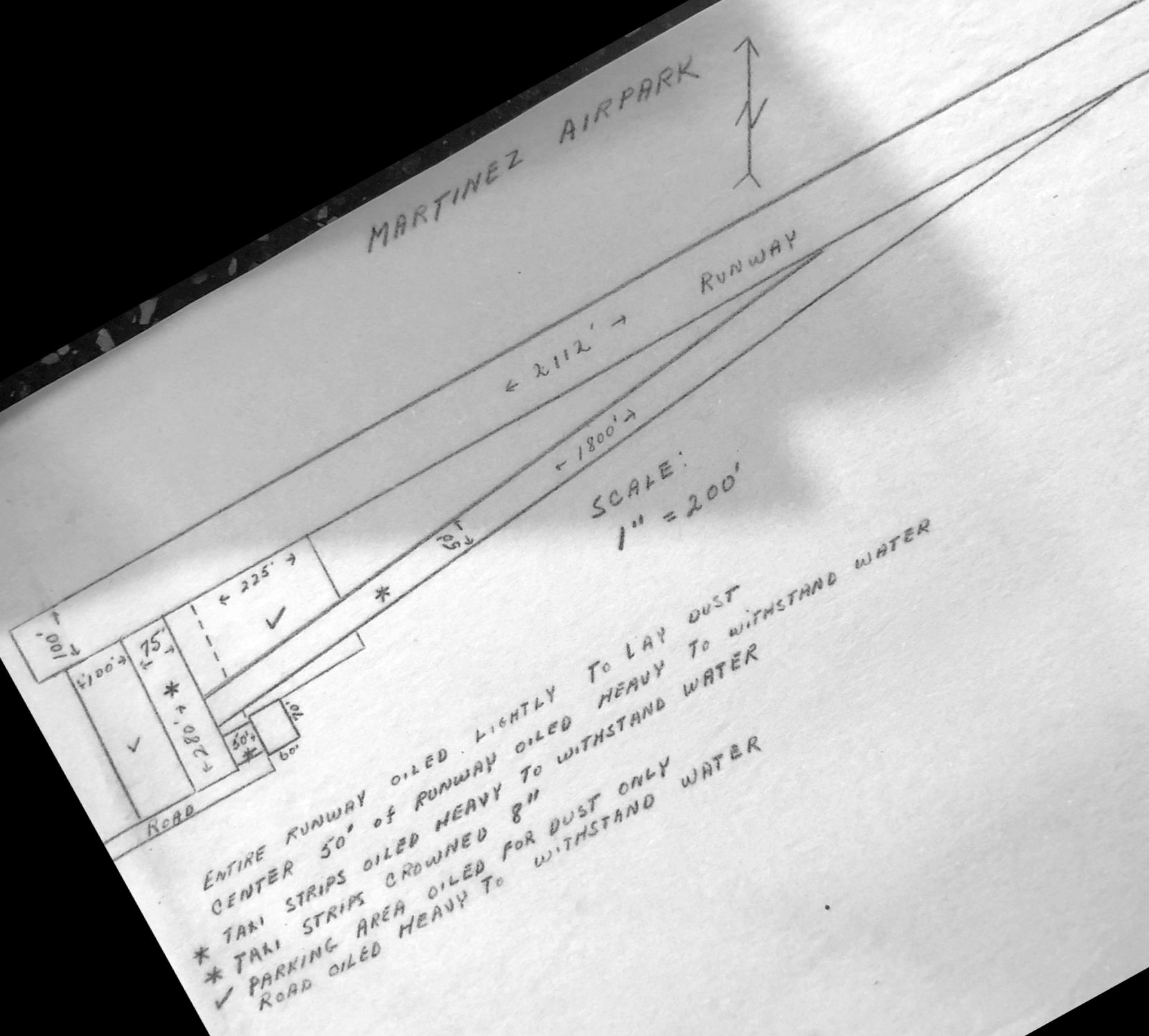
A circa 1940s/50s diagram depicted “Martinez Airpark” as having 2 runways & a hangar on the southwest side.
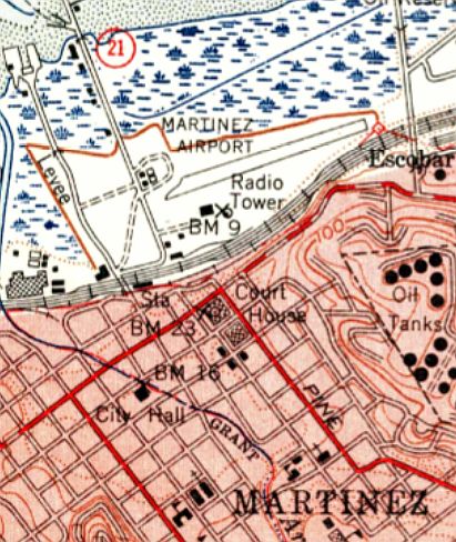
The 1950 USGS topo map depicted Martinez Airport as having a single northeast/southwest runway,
with a few small buildings on the west & southwest sides, and a radio tower on the south side.
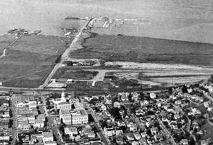
The last photo which has been located of Martinez Airport was a 1950 aerial view looking north (courtesy of Kevin Walsh).
It depicted Martinez Airport as having an east/west runway with a hangar at the southwest corner.
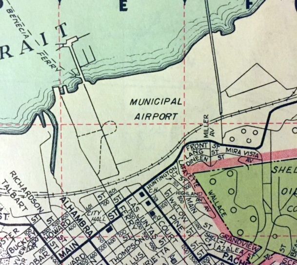
A 1953 street map simply labeled Martinez as “Municipal Airport” (courtesy of Kevin Walsh).
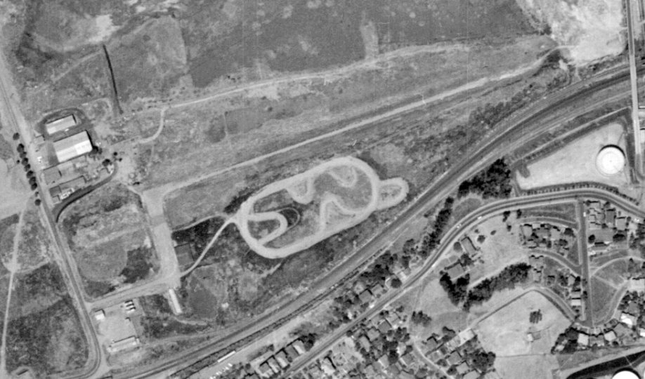
The last photo which has been located showing Martinez Airport still intact was a 1957 aerial view (from the UCSB Library, courtesy of Jonathan Westerling).
The runway & hangars appeared to remain intact, but there were no aircraft visible on the field, so it is not apparent if it was still in operation by that point.
Martinez Airport was evidently closed (for reasons unknown) at some point between 1954-58,
as a 1958 aerial view (from the UCSB Library, courtesy of Jonathan Westerling) depicted the majority of the runway had been scraped away,
with only a taxiway & hangar remaining on the southwest side.
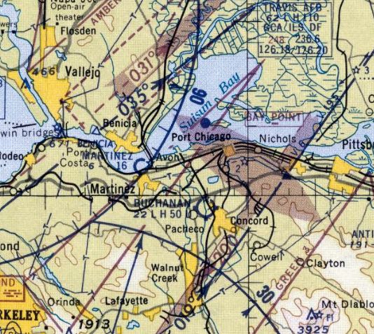
The last aeronautical chart depiction which has been located of Martinez Airport was on the March 1959 Sectional Chart.
It depicted Martinez Airport as having a mere 1,600' unpaved runway.
Martinez Airport was no longer depicted on the September 1959 Sectional Chart.
According to the book "Two Hours By Crow" by Howard & Judith Campbell (courtesy of Wings of History),
“By 1960 baseball, soccer, and bocceball fields moved in; now called Waterfront Park.”
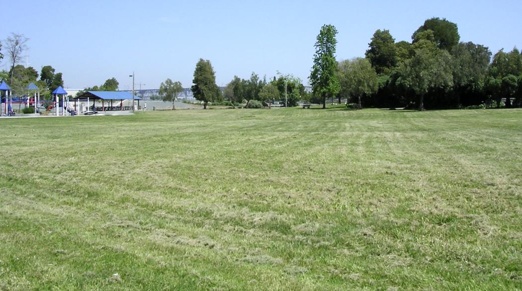
A 2006 photo by Dann Shively looking east at Waterfront Park, not showing any trace of Martinez Airport.
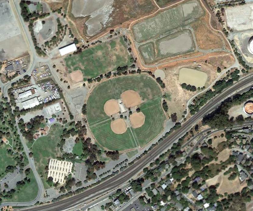
A 4/16/13 aerial view showed no trace remaining of Martinez Airport.
As of 2014, street maps labeled the site of Martinez Airport as Martinez Waterfront Park.
The site of Martinez Airport is located northeast of the intersection of Joe DiMaggio Drive & North Court Street.
Thanks to Kenneth Wetherall for pointing out this airfield.
____________________________________________________
Discovery Bay Airport, Byron, CA
37.891, -121.621 (East of Oakland, CA)
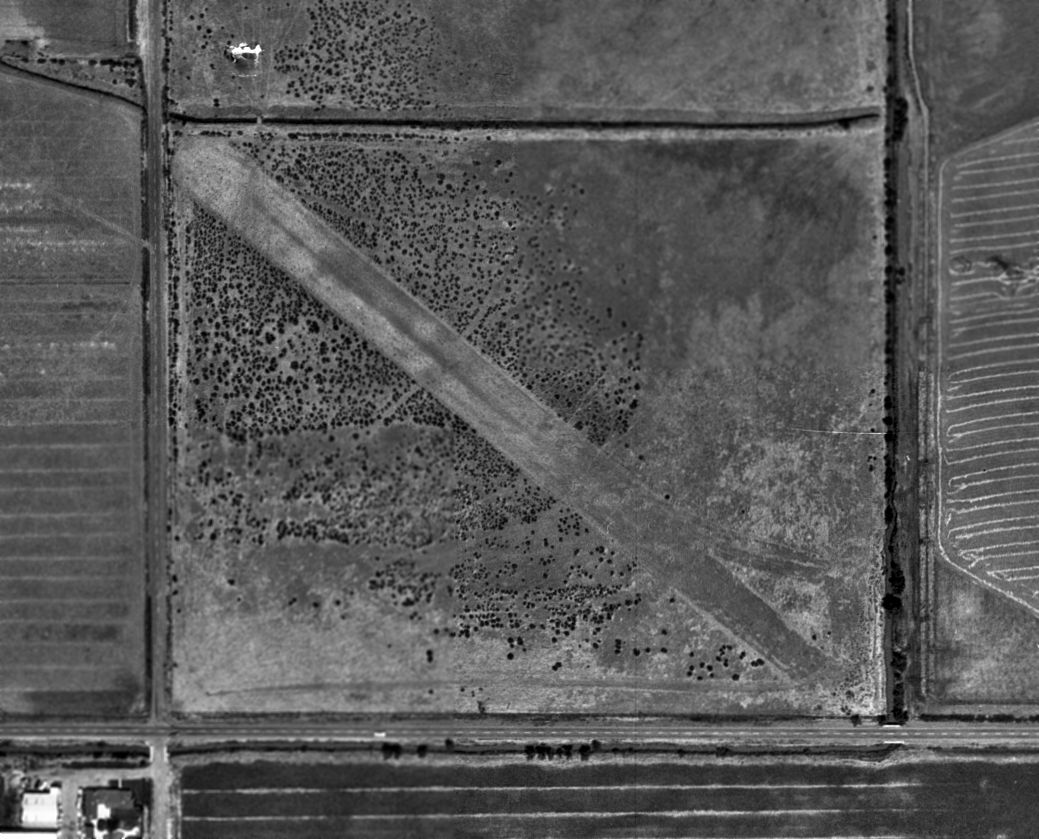
A 5/28/65 aerial photo of the Discovery Bay Airfield (from the UCSB Library).
Photo of the airport while in use has not been located.
This short-lived private airfield may have been related to the construction of the adjacent housing development.
The Discovery Bay Airport was evidently established at some point between 1959-65,
as it was not yet depicted at all on a 1959 aerial photo.
The earliest depiction of the airfield which has been located was a 5/28/65 aerial photo (from the UCSB Library).
It depicted Discovery Bay as having a single unpaved northwest/southeast runway,
but did not depict any buildings or other improvements.
Discovery Bay was not yet depicted at all on the 1966 San Francisco Sectional Chart (according to Chris Kennedy).
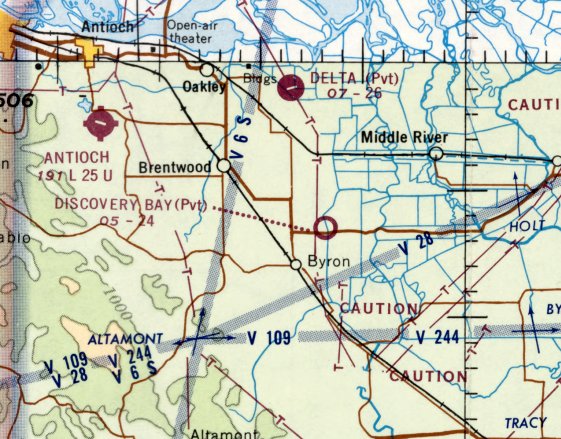
The earliest aeronautical chart depiction which has been located of the Discovery Bay Airfield was on the June 1968 San Francisco Sectional Chart.
It depicted Discovery Bay as a private airfield with a 2,400' unpaved runway.
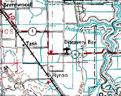
Discovery Bay Airport, as depicted on the 1969 USGS topo map.
Dann Shively recalled, “When I first started flying in 1972 I tried to explore my local area from the air as much as possible.
I noticed a small strip on my Sectional Chart called Discovery Bay.
Although I never landed there, I flew over it from time to time in the early 1970s. Nearby is the Discovery Bay development.
It's a man-made series of waterways with all houses having direct water access.
It started small in the 1970s and has grown over the years into a city with more & more waterways being added.
On the southwest corner of the development sat the small dirt or grass field.
I always thought it was somehow connected to the development,
possibly as a place for prospective buyers to land to check out property.”
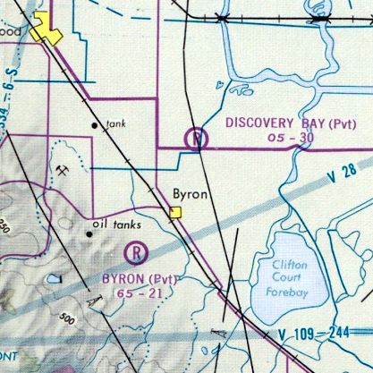
The last aeronautical chart depiction which has been located of the Discovery Bay Airfield was on the 1975 San Francisco Terminal Chart.
It depicted Discovery Bay as a private airfield with a 3,000' unpaved runway.
The only directory listing of the Discovery Bay Airport which has been located
was in the 1976 AOPA Airports USA Directory (according to Chris Kennedy).
It described the field as having a single 3,000' dirt Runway 15/33, and the field was said to be “Private, Closed to Public.”
The Discovery Bay Airport was evidently closed at some point in 1976,
as it was no longer depicted at all on the 1976 San Francisco Sectional Chart (according to Chris Kennedy),
nor on the 1976 USGS topo map (although it did depict the 1st stages of the adjacent housing development).
A 1979 aerial photo depicted the airfield in basically the same state as that seen in 1966.
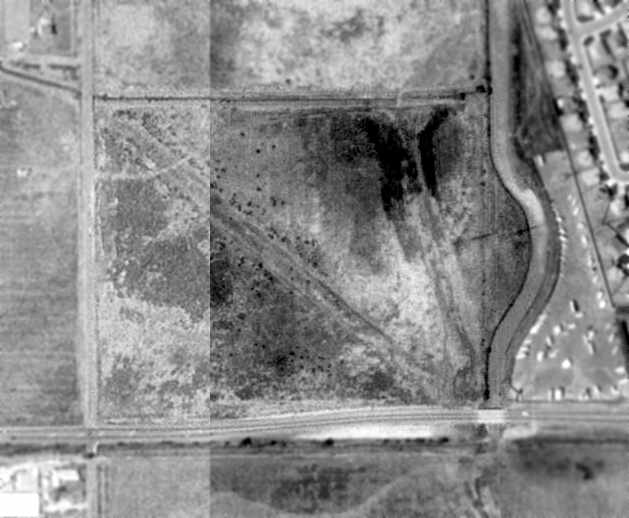
A 1993 USGS aerial photo showed the remaining outline of Discovery Bay Airfield's 2 runways (oriented northwest/southeast & north/south), but there was no sign of any buildings.
Dann Shively reported in 2005, “In the last year or so a shopping center has been built on part of the property.
I flew over it today & you can still see part of the runway on the east side. Most likely that will soon be gone as development continues in the area.”
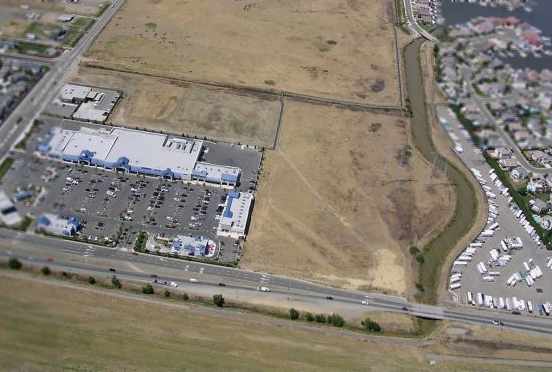
A 2005 aerial photo by Dann Shively looking north at the site of Discovery Bay Airport, showed the shopping center covering the western half of the property,
with the remains of the southeast portion of the runway still recognizable.
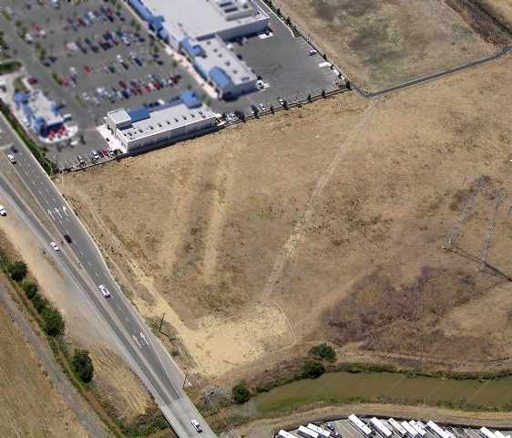
A 2005 aerial photo by Dann Shively looking northwest at the remains of the runway at Discovery Bay Airport.
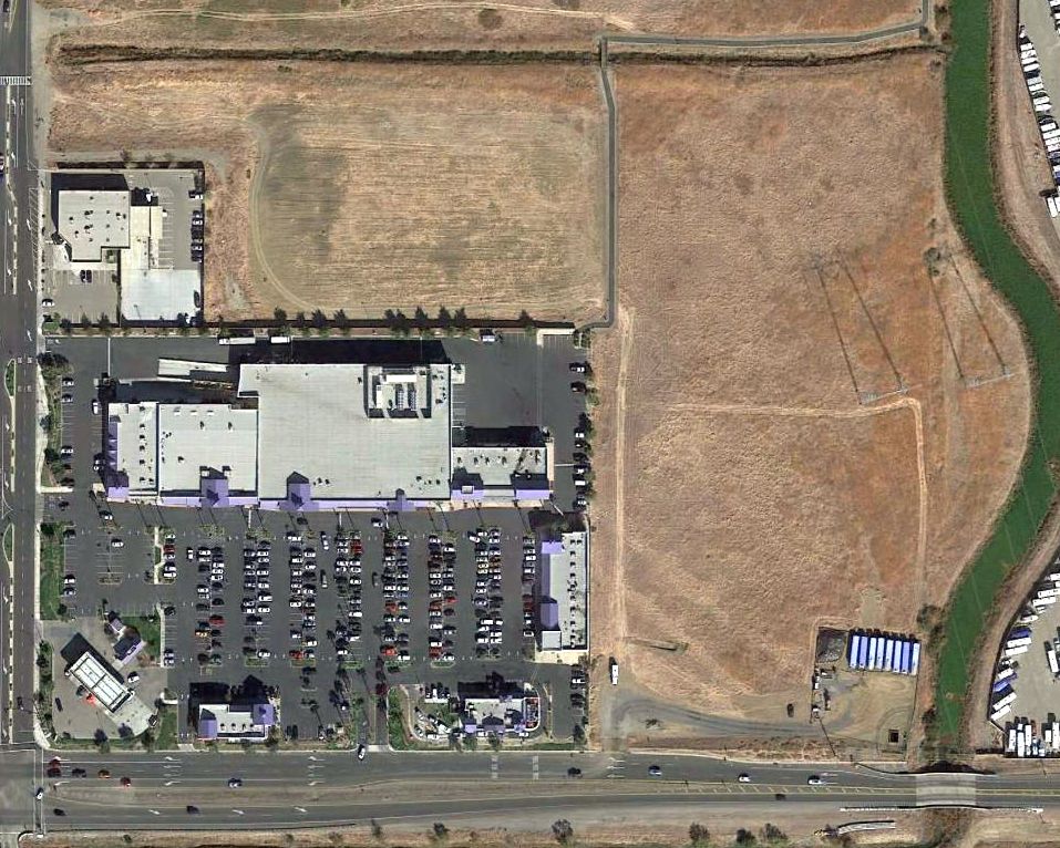
A 2015 aerial view showed that a short portion of the southeast end of the Discovery Bay Airport runway remained barely recognizable.
The site of Discovery Bay Airport is located on the northwest corner of Route 4 & Bixler Road.
____________________________________________________
Knights Airport / Stan's Airpark, Vallejo, CA
38.13, -122.27 (Northeast of Oakland, CA)
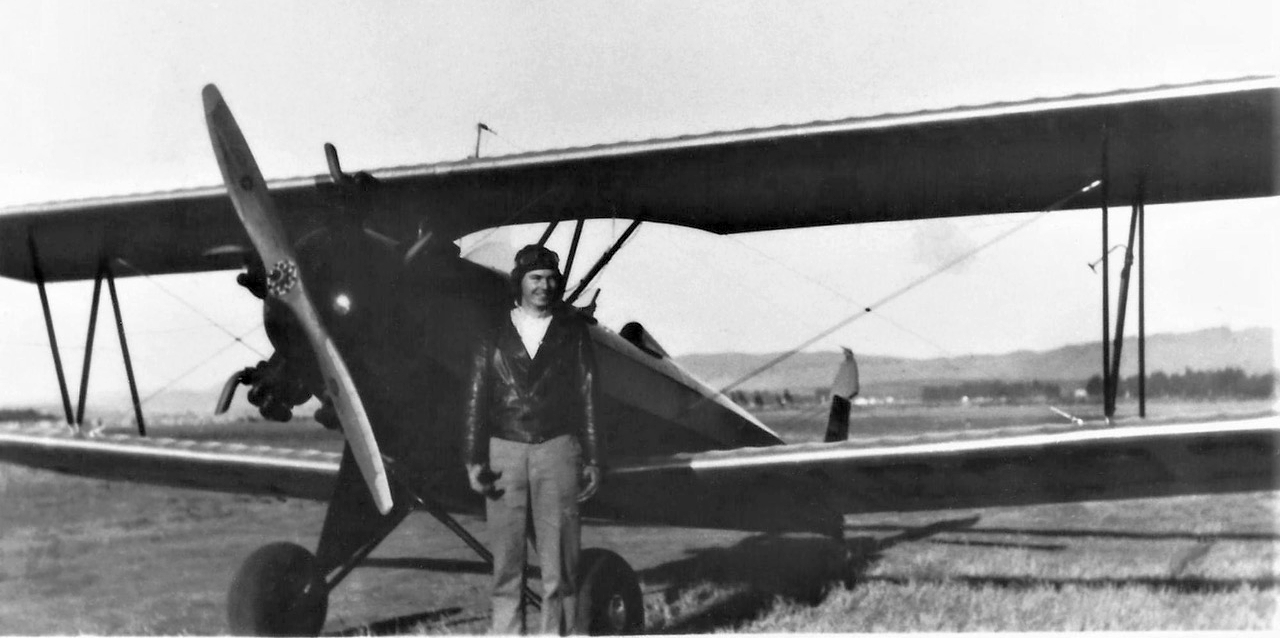
A 1935 photo of Loren Barbour in front of an unidentified biplane at Knight Airport (courtesy of Jessie Barbour, via Dann Shively).
According to the book "Two Hours By Crow" by Howard & Judith Campbell (courtesy of Wings of History),
“How an airport could have existed out on these marshy banks of the Napa River is a mystery.
About 1920 someone put in the field, we have to assume his name was Knight.”
The 1933 Standard Oil Airway Bulletin #2 described the field as "Rectangular, 50 acres, dirt, level, natural drainage; hangars & pole line on southeast. Facilities for servicing aircraft, day only."
The earliest depiction which has been located of Knight's Airport was a 1935 photo of Loren Barbour in front of an unidentified biplane (courtesy of Jessie Barbour, via Dann Shively).
According to Jessie Barbour, her husband, Loren Barbour learned to fly at Knight's Airport.

The earliest aeronautical chart depiction which has been located of Knight Airport was on the May 1936 Sacramento Sectional Chart.
It depicted Knight Airport as a commercial/municipal airport.
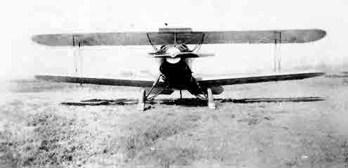
A circa 1936 photo by George Low of his International F-17 at Knight Airport.
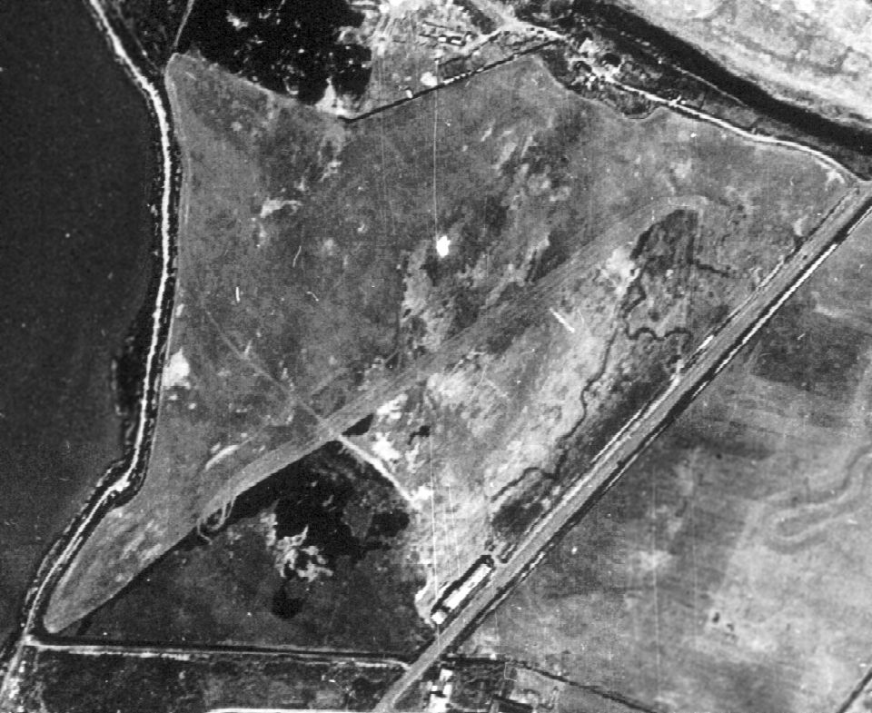
The earliest aerial photo which has been located of Knight Airport was a 10/9/37 aerial view (from the UCSB Library).
It depicted Knight Airport as having an unpaved northeast/southwest runway, with a small building on the south side.
The 1937 Standard Oil Airway Bulletin added, "Aviation fuel by truck from town, day only."
The 1941 Standard Oil Airway Bulletin changed the field's listed services as "No service."

The 1942 USGS topo map depicted Knight as an airport symbol (the propeller) along with the outline of property, but did not label the airport.

The September 1942 Sectional Chart depicted Knight Airport as an auxiliary airfield.
Knights Airport was evidently closed for a few years during WW2
(due to wartime security concerns & gas rationing, as was the case at many other small civilian airports during the war),
as it was no longer depicted on the August 1943 – February 1946 Sacramento Sectional Charts
nor listed among active airfields in the 1945 AAF Airfield Directory (courtesy of Scott Murdock).

At some point in 1946, it evidently reopened as "Stan's Airpark",
which was how it was depicted on the September 1946 Sectional Chart.
Bill McClinton recalled, “During WW2 as a kid I lived at 34 McNair Street, a couple of blocks from Stan's Airpark.
We called it Knight's I think. I went there frequently, made friends with a WW2 pilot who had a surplus BT-13.
'Helped' him polish it etc. The wing walk guy was known as 'Madman Page';
he had what I believe was a Stearman with clipped wings & a type R985 engine of 400 or 450 hp.
I remember the Mobil gas station either being built or being refurbished shortly after the war ended.
The airport, people & planes made an indelible impression.”
According to the book "Two Hours By Crow" by Howard & Judith Campbell (courtesy of Wings of History),
“When reactivated after World War II, pilots would notice that the approach of an airplane would send jackrabbits scurrying all over the runways.
In winter, after heavy rains or during high tide, the entire property would be under 2-3' of water, but the runways stood out like aircraft carrier flight decks - just stay on the pavement!
This must have been the 'natural drainage' the Standard Oil Company was talking about.”
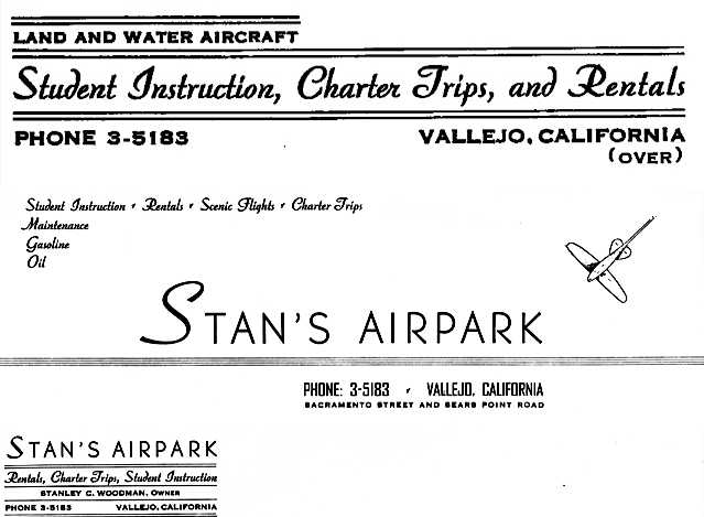
A circa 1946-48 business card for Stan's Airpark (courtesy of Stan Woodman).
Stanley Glenn Woodman recalled, “I was born the son of Stanley Clarence Woodman.
My father either owned or leased & operated the subject airport in the years immediately after World War II.
He named it 'Stan's Airpark' after his own name. He offered flight instruction & charter services.
In 1945 my father took over the airport variously known as Stan's Airpark & Knight's Airport.
Until I saw the information & sectional chart information [on this website],
I had always assumed that my father had built the airfield known to me as Stan's Airpark.
The reason that I believed my father had built the airport is from recollections of what I had heard from my mother
and clear memories that I have of my father framing buildings on the site.
He was building either the hangar, or the burger & beer joint next to the airport (named Faoro's).
Burgers, beer, and shuffle board. I hung around there as a kid - great hamburgers, but don't know about the beer as I was too young.
Another reason is that I had a photo of him (or a worker) on a bulldozer grading the crosswind runway.
The caption on the photo reads 'building the crosswind runway at Stan's Airpark'.”
Stanley continued, “I have memories of my father taking me flying from the airport on its dirt strips.
Even after my parents separated, I hung around the hangar there.
There were always biplanes & other rag-wing aircraft of the era in the hangar, under various states of repair & being repainted.
The smell of the paint dope is strong in my memory,
and whenever I am in a hobby shop & smell model airplane dope, it transports me back to those times.
I recall a number of derelict aircraft on the field, including a couple of Texan AT-6s.
I used to climb around in them & envision myself fighting the enemy in aerial combat.
I also recall once an air show held at the field.
My mother sometimes talked of a wingwalker, who parachuted from the wing of a biplane at the air show.
On that occasion, the wind carried him into a tree or some other obstacle that kept him encumbered until rescued.”
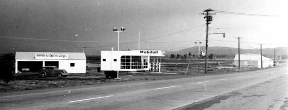
A circa 1946-48 photo of the Mobil Oil service station, burger joint, and hangar at Stan's Airpark (courtesy of Stan Woodman).
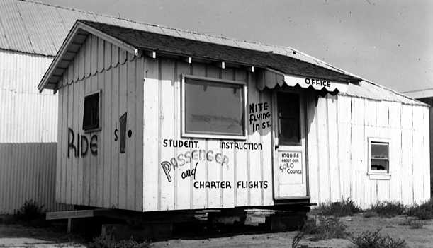
A circa 1946-48 photo of the Stan's Airpark office (courtesy of Stan Woodman).
Stanley Woodman continued, “I vaguely recall that the airfield portion of the property was sold off around the time of my parents' divorce.”
It was still depicted as Stan's Airpark on the February 1947 Sacramento Sectional Chart.
According to a 1947 Vallejo Times Herald article (courtesy of Dann Shively),
“Completion of negotiations in the sale of Stan's Air Park, including 4 airplanes & equipment,
to Bill Taylor & Harold Harodyski for $67,000 was announced yesterday by F.E. Knight & Stan Woodman, the former owners.”
Dann Shively recalled, “It was known as Knight's as long as I knew it growing up.
In fact there was a large painted sign on the hangar facing the road that read 'Knight's' airport."

At some point in 1947, the official name of the field apparently reverted to Knights Airport,
as that is now it was labeled on the August 1947 San Francisco Sectional Chart.

The February 1948 San Francisco Local Aeronautical Chart (courtesy of Tim Zukas) depicted Knights as having a 2,300' unpaved runway.
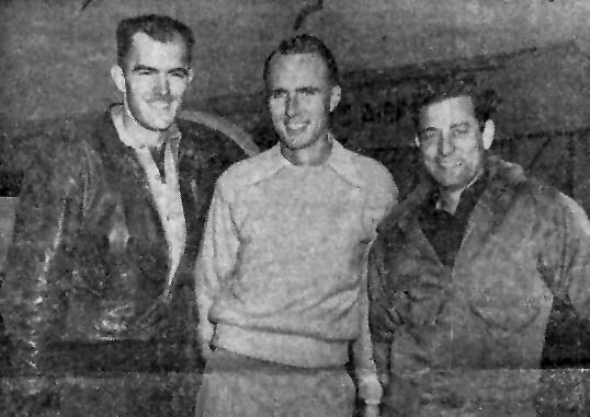
A 1948 picture (courtesy of Dann Shively) of Harold Horodyski (Knight's Airport operator),
Al Shively (who had just soloed after just 1.5 hours of instruction), and Russ Moody (Al's instructor).
Dann Shively recalled, "Growing up in Vallejo, I remember as a child when Knight's Airport was still in operation.
My dad, in 1948, as a publicity stunt, soloed an Ercoupe there after only an hour & a half of instruction."
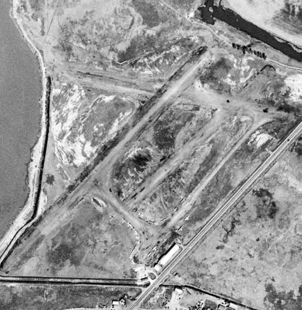
The last photo which has been located showing aircraft at Knights Airport was a 4/18/48 USGS aerial view.
It depicted the field as having 3 unpaved runways, with a dozen light aircraft parked around a few small buildings on the south side.
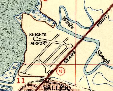
The most detailed map depiction of Knights Airport which has been located is the 1949 USGS topo map,
which depicted the field as having a total of 4 runways or taxiways, with the longest being an 1,800' northeast/southwest strip.
Stanley Glenn Woodman (son of the owner of Stan's Air Park) remarked of this depiction,
“As a young boy I used to hike, explore, and hunt that area.
It wasn't very expansive & was very marshy, being part of the Napa River delta.
It was protected by a levee to keep the river on the river side of the wall.”
Stanley Glenn Woodman recalled, “I remember my mother in the early 1950s
talking about the seawall, or levee, breaching, putting the airfield in jeopardy.”
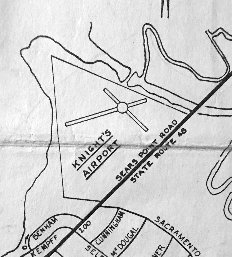
A November 1953 Vallejo Chamber of Commerce map (courtesy of Kevin Walsh) depicted Knight's Airport as having a 2 runways.
According to the book "Two Hours By Crow" by Howard & Judith Campbell (courtesy of Wings of History),
“By 1954 the runways were deteriorating & the Napa County Airport was a better choice so this field was closed.”

The last aeronautical chart depiction which has been located of Knights Airport was on the September 1955 Sectional Chart.
It described Knights as having a 2,200' unpaved runway, but it may have already been closed by this point, as it was noted as being “Emerg only”.
Knights Airport was no longer depicted on the April 1956 Sacramento Sectional Chart.
A 1957 aerial view of the Knights Airport site (from the Alexandria Digital Library @ UC Santa Barbara, courtesy of Jonathan Westerling) showed the 2 runways were still evident, but deteriorated.
The hangars remained intact, but there were no aircraft visible on the field.
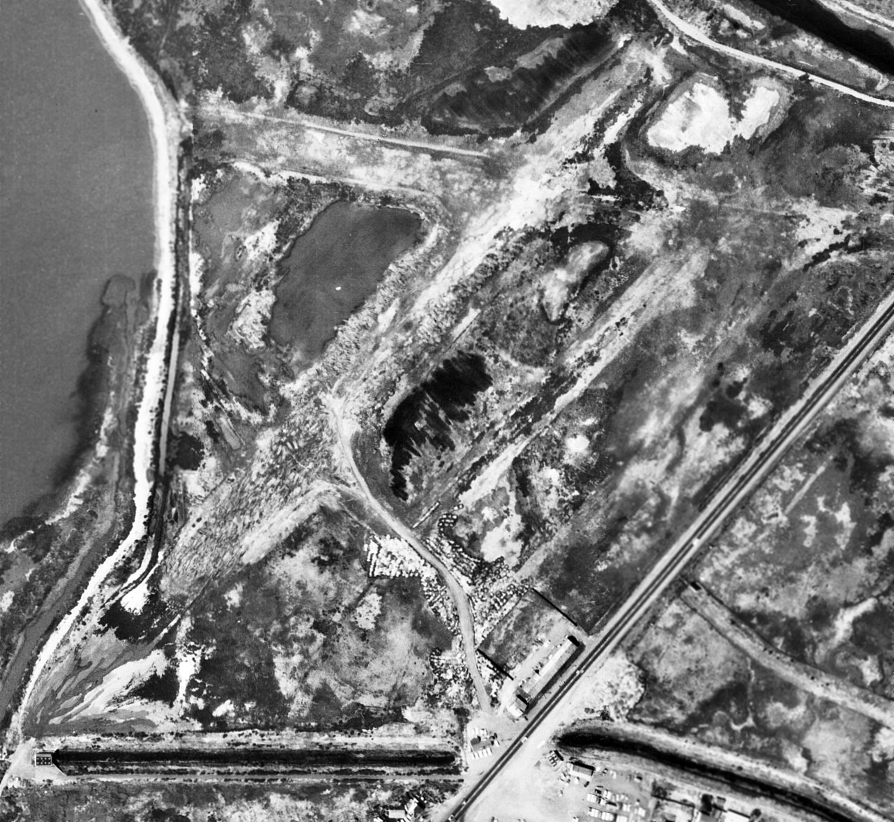
A 1965 aerial view (from the Alexandria Digital Library @ UC Santa Barbara, courtesy of Jonathan Westerling) depicted Knights Airport after its closure.
The 2 runways were further deteriorated. The southwest hangars had been removed at some point between 1957-65, but the southeast hangar remained intact.
Knights Airport was no longer depicted on the 1968 USGS topo map.
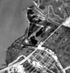
A 1970 aerial view of the site of the site of Knights Airport (from the Alexandria Digital Library @ UC Santa Barbara, courtesy of Jonathan Westerling)
still showed the remnants of the runways & what appeared to be a hangar still standing of the east side of the field.
Stanley Glenn Woodman (son of the owner of Stan's Air Park) recalled, “Many years later,
after I had become pilot out of Oakland International Airport, I often overflew the old airfield.
As I looked down, I could see the outlines of only 2 runways - a primary plus a crosswind.”
Stanley Glenn Woodman recalled, “In 1983 or 1984 there was a 'perfect storm' combination
of a heavy rainstorm, strong winds and extra high tides that caused a permanent breach in the levee.
This resulted in the entire airfield being covered in water for many years afterwards.”
The 1993 USGS aerial photo showed that the waters of the Napa River had risen over the site of Knights Airport.
Dann Shively reported in 2003, "I watched it slowly deteriorate over the years.
The office & hangar disappeared, and the runways were taken over by swamp grass until a levee broke & the whole area was under water.
Currently the stretch of Sears Point Road (Highway 37, now known as Marine World Parkway) that was next to the field, is being widened.
Shortly, what was the airport will be under a new roadway."
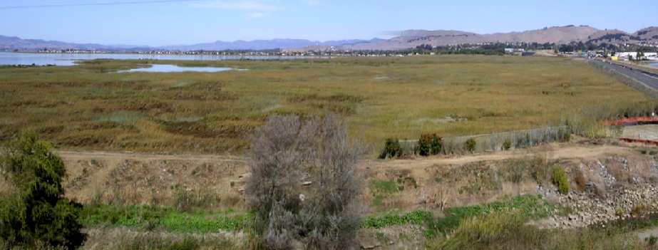
A 2003 panoramic composite photo by Dann Shively, looking east at the site of Knight's Airport.
Dann Shively visited the site of Knight's Airport in 2003, and reported:
"Highway 37 / Sears Point Road / Marine World Parkway is being widened adjacent to the old Knight's Airport in Vallejo.
There's also an interchange being built just to the west.
I climbed up on what's built so far of the interchange & got a nice shot of the former airport.
I actually stitched 2 shots together for a panorama. The shot is looking east.
That's the Napa River on the left & the highway on the right.
You can see the new section of the highway which isn't opened yet.
That new section partially or wholly covers what was one of the runways that ran along the existing 2 lane road.
As mentioned before it's a wetlands area with marsh grass & tules.
Running along the bottom of the photo is a drainage canal & levee that's evident in your old topo map of the airport."

A 2023 aerial view looking north showed the Knight's Airport site was submerged under the waters of the Napa River.
However, by comparing the runway layout in the 1949 topo map with the above aerial photo,
it is interesting to note that the land of the former Northeast/Southwest runway is apparently at a slightly higher elevation than the surrounding terrain, as it was still above water.
The Knight's Airport site is located north of the intersection of Marine World Parkway & Sacramento Street.
Thanks to Chris Kennedy for pointing out this airfield.
____________________________________________________
Vallejo Airport / Mini Airport, Vallejo, CA
38.14, -122.253 (Northeast of Oakland, CA)
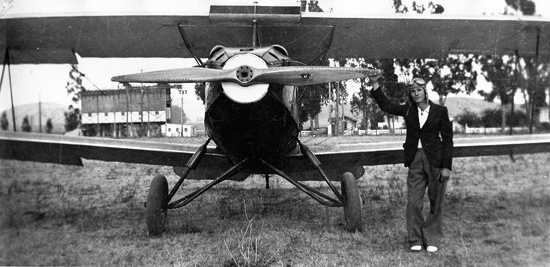
A circa 1936 photo by George Low of a friend in front of George's International F-17 at Mini Field.
The date of construction of Vallejo Airport has not been determined.
The earliest reference which has been located of Vallejo Airport came from K.O. Eckland,
who said that Western Air Lines moved half its equipment from Santa Rosa & established a flight school at Vallejo Airport in 1929.
"Vallejo" Commercial Airport was listed as being located "3 miles due north of Vallejo"
in the Standard Oil Company's 1929 "Airplane Landing Fields of the Pacific West" (courtesy of Chris Kennedy).
It was described as having a 1,500' northeast/southwest runway,
and the "main highway to Sacramento" was said to border the east side of the field.
That description seems to match later map depictions of what eventually became Vallejo Sky Harbor Airport.
By 1936, the airport had apparently been renamed "Mini" Airport.
The earliest depiction which has been located of Mini Airport
was a circa 1936 photo by George Low of a friend in front of George's International F-17 at Mini Field.
Dann Shively recalled, "The Mini family owned most of the property in that area. In fact, the site of the airport is near what is now Mini Drive."

A 1937 aerial photo (courtesy of Jonathan Westerling) showed Mini Airport to consist of an open grass field, in the center of which was a single plane.
The Airport Directory Company's 1937 Airports Directory (courtesy of Bob Rambo)
described Vallejo Airport as being located "2 miles northwest" of the town of Vallejo.
The field was said to have 3 dirt runways, with the longest being a 2,500' northeast/southwest strip.
A hangar on the southeast side of the field was described as having "Vallejo" painted on the roof.
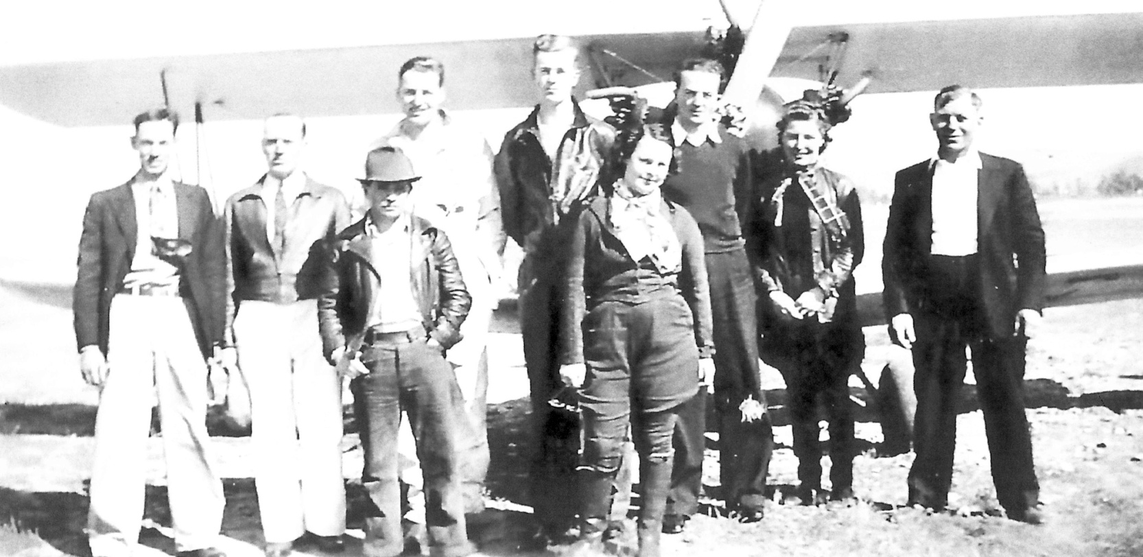
A circa 1938 photo of several aviators including some famous pilots in front of an unidentified biplane at Mini Airport (courtesy of Gary Cullen, via Dann Shively).
Dann Shively reported, “Standing in front is Douglas ('Wrongway') Corrigan, the man who claimed he accidentally flew from New York to Ireland instead of flying west to California.
Standing next to him is Beryl Markham, the first woman to fly solo across the Atlantic non-stop from east to west.
Behind them is a group of local pilots including the only other woman in the group, Vallejo resident Elaine Tracy.”
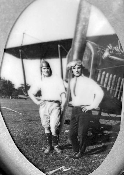
An undated photo of Rinaldo Mini & an unidentified pilot in front of an unidentified biplane after taking a ride at Mini Airport (courtesy of Jeff Mini, via Dann Shively).
Mini Airport was not yet depicted on the February 1939 Sacramento Sectional Chart.
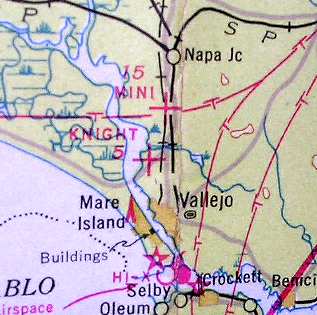
The earliest aeronautical chart depiction which has been located of Mini Airport was on the August 1939 Sectional Chart (courtesy of Dann Shively).
It depicted Mini Airport as an auxiliary airfield.
The 1942 USGS topo map depicted Mini Airport as an unlabeled property outline with an airport symbol (the propeller).

The last depiction which has been located of Mini Airport was on the December 1944 Sectional Chart.
It depicted Mini Airport as an auxiliary airfield.
Mini Airport was evidently closed at some point between 1944-45,
as it was no longer depicted on the May 1945 Sacramento Sectional Chart
nor listed among active airfields in the 1945 AAF Airfield Directory (courtesy of Scott Murdock).
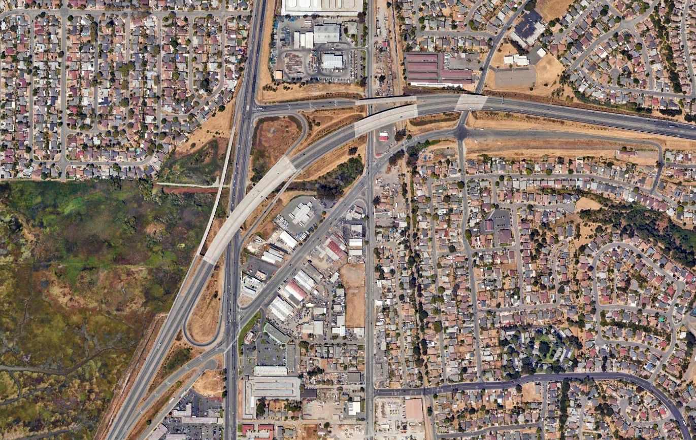
A 2023 aerial view showed no trace of Mini Airport.
According to Dann Shively, the site of Mini Airport is located west of the intersection of Louis Brown Drive & Broadway.
____________________________________________________
Vallejo Sky Harbor Airport, Vallejo, CA
38.155, -122.256 (Northeast of Oakland, CA)
Sky Harbor Airport, as depicted on the September 1946 Sectional Chart.
According to the book "Two Hours By Crow" by Howard & Judith Campbell (courtesy of Wings of History),
“Three pilots, Ernest 'Red' Sink, Luke Farmer, and W.C. Shield formed a partnership & established Vallejo Sky Harbor Airport on 2/9/46.”
The airport was was depicted as "Sky Harbor" on the 1946 Sectional Chart (courtesy of Dann Shively).
According to Joe D’Agosta's obituary (courtesy of Dann Shively), after WW2 he built & operated Sky Harbor Airport.
According to the book "Two Hours By Crow" by Howard & Judith Campbell (courtesy of Wings of History),
“The hangar burned on 11/29/47 taking 3 aircraft with it. The Administration Building & a private hangar were unharmed.”
The February 1948 San Francisco Local Aeronautical Chart (courtesy of Tim Zukas) depicted "Vallejo Sky Harbor" Airport as having a 2,500' unpaved runway.
According to the book "Two Hours By Crow" by Howard & Judith Campbell (courtesy of Wings of History),
“The new hangar was dedicated 'In memory of Arthur Cooper' on 4/28/48. Art was a parachute jumper”, killed in 1947 in Oakland.
“The guard dog for the field had only 3 legs & was called 'Prop Wash', but Duncan Miller called him '3 Point'.
Duncan had started as a flight instructor here at age 25 & left in 1948.
The 'Sky Harbor Snack Bar' formed a popular meeting point for the students & pilots,
hosted many fly-in breakfasts, and often was a meeting place for people wanting to watch airplanes.”
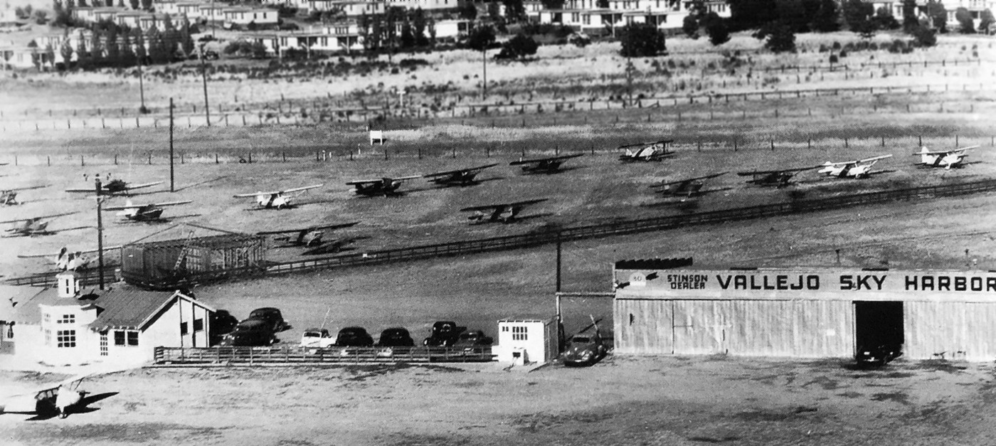
A circa late 1940s view looking northeast at Sky Harbor Airport (courtesy of Kevin Walsh),
showing 17 light single-engine aircraft, the airport office, and a hangar.
Dann Shively observed, “The railroad tracks & the highway run left to right between the planes & the houses in the background.”
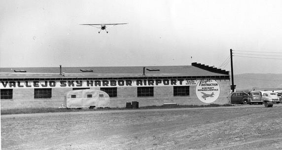
A circa late 1940s photo of a plane overflying a hangar marked “Vallejo Sky Harbor Airport” (courtesy of Dann Shively).
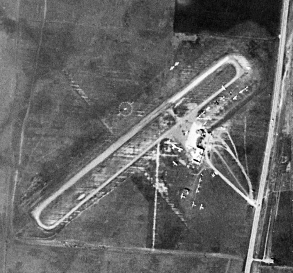
The last photo which has been located of Vallejo Sky Harbor Airport was a 3/3/48 USGS aerial view.
It depicted the field as having a single northeast/southwest runway with a parallel taxiway,
Over a dozen single-engine aircraft a few small buildings were visible on the east side.
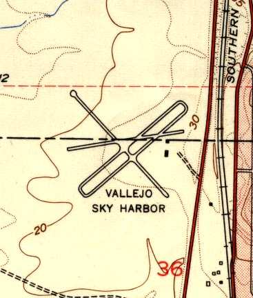
The most detailed map depiction of Vallejo Sky Harbor which has been located is the 1949 USGS topo map,
which depicted the field as having a total of four 1,800' runways or taxiways.
Two buildings or hangars appear to have been located east of the runway intersection.
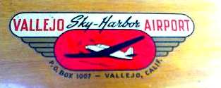
A undated propeller decal from Vallejo Sky Harbor Airport (courtesy of Dann Shively).

The last depiction which has been located of Vallejo Sky Harbor was on the September 1952 Sectional Chart.
It depicted Vallejo Sky Harbor as having a 2,100' unpaved runway.
According to the book "Two Hours By Crow" by Howard & Judith Campbell (courtesy of Wings of History),
“'Red' was killed in 1952, and Luke & W.C. were both killed in an accident.
Robert Shield & May Blender bought up their shares & finally May's son David became the final owner.
When the field closed in 1953, the hangar was left to the Mini Ranch, the land owners.”
Vallejo Sky Harbor was no longer depicted on the March 1953 Sectional Chart.
Dann Shively recalled, "I grew up in Vallejo & have been flying around the area as a broadcast news pilot for nearly 30 years.
When I was 11, in 1957, we moved to a house that was within a mile or so of the Sky Harbor Airport site.
Of course it was long gone by then & was covered by tract houses built in the 1950s. We've lost a lot of airports!"
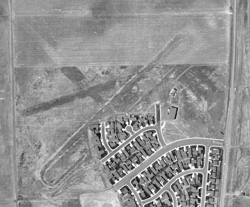
A sad sight for anyone who appreciates grassroots aviation: a 1957 aerial photo shows houses having covered the southeastern portion of the site of Vallejo Sky Harbor,
with traces of 2 different runway configurations still visible on the west, north, and east side of the houses.
A 1987 aerial photo of the site showed that it had been completely covered by houses.
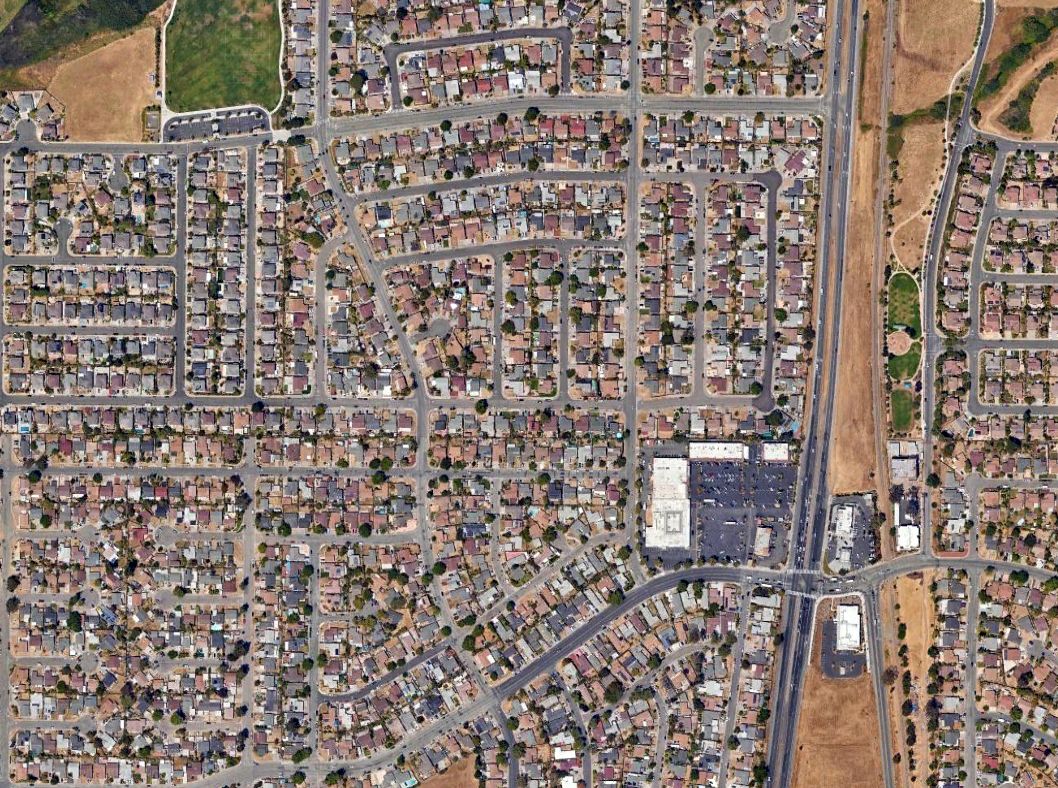
A 2023 aerial view showed the site of Vallejo Sky Harbor had been completely covered by houses, with not a trace remaining of the little airport.
According to Dann Shively, the site of Vallejo Sky Harbor is located northwest of the intersection of Route 29 & Mini Drive.
Thanks to Chris Kennedy for pointing out this airfield.
____________________________________________________
Hookston Field / Sherman Field, Pleasant Hill, CA
37.95, -122.057 (Northeast of Oakland, CA)
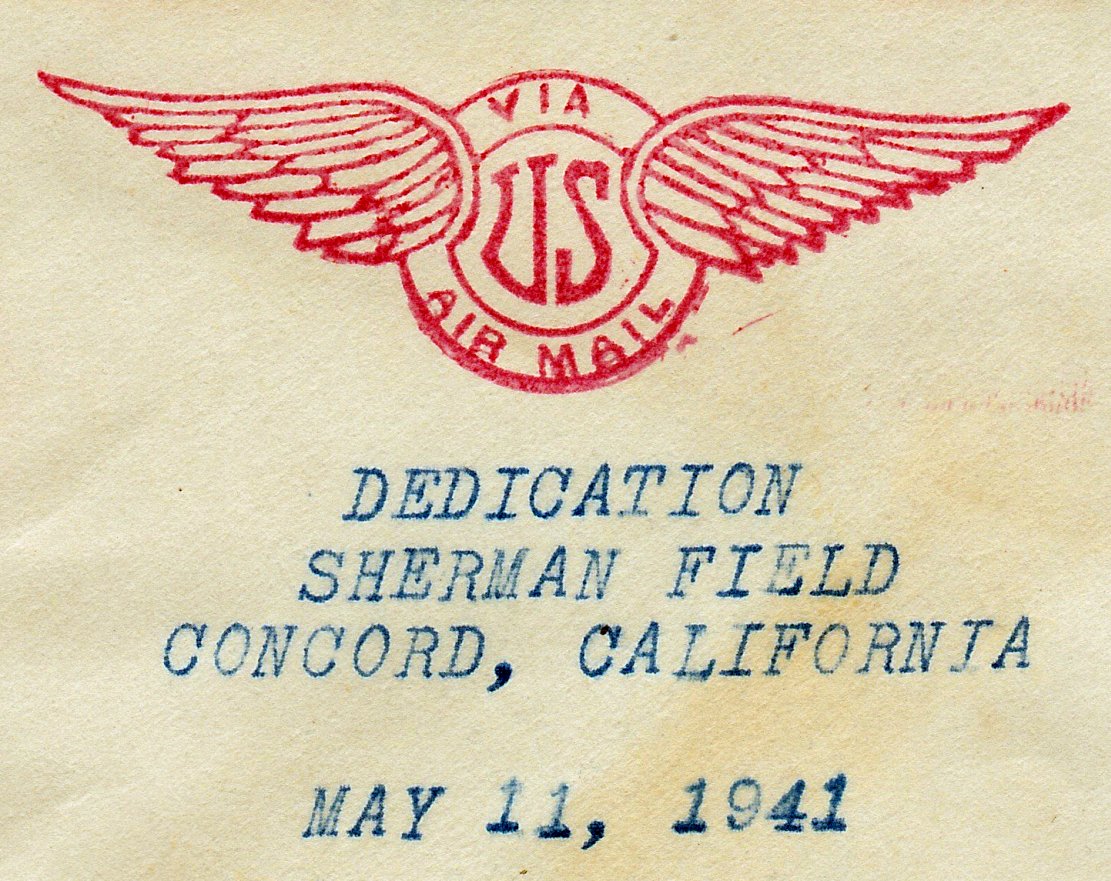
A postmark which commemorated the 5/11/41 Dedication of Sherman Field (courtesy of Kevin Carruth).
According to the book "Two Hours By Crow" by Howard & Judith Campbell (courtesy of Wings of History),
“This site was called Hookston Field & on 5/26/38 Lieutenant Charles Beatie flew a mail load off what was just an open pasture.
The field saw little action until the Postal Service opined they needed a second 'air mail' field to supplement the Diablo Air Mail Terminal.
With that endorsement, Chet Dickson bought the land & started developing it as a real airport.”
According to K.O. Eckland, a 107-acre tract at the intersection of Monument Boulevard & North Main Street was purchased by Chester Dickson in 1941.
The initial airfield consisted of a 2,150' dirt runway. The field was named for Samuel Sherman, who helped finance the field.
A postmark (courtesy of Kevin Carruth) commemorated the 5/11/41 Dedication of Sherman Field.
According to the book "Two Hours By Crow" by Howard & Judith Campbell (courtesy of Wings of History),
“The field was run by Chester Dickson. He put up a 110' x 100' hangar in early 1941 & was almost immediately forced out when the Army closed down all civil flying within 150 miles of the Pacific on 12/8/41.”
A collection of photographs has a 1941 picture of Sherman Field.
Sherman Field was not yet depicted on the December 1941 San Francisco Sectional Chart.
Sherman Field was used by Pan American Airways under contract to the Navy starting in 1942 for navigation & instrument flight training with 2 Stinson Reliants & a Waco VKS-7.
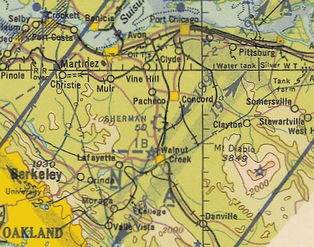
The earliest aeronautical chart depiction which has been located of Sherman Field was on the September 1942 Sacramento Sectional Chart (courtesy of Ron Plante),
which depicted Sherman Field as a commercial/municipal airport.
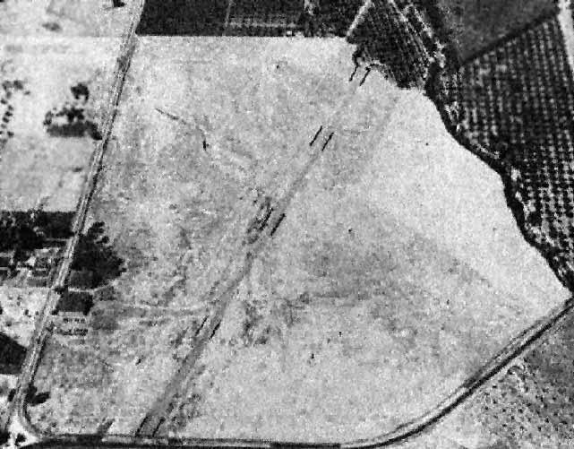
The earliest photo which is available of Sherman Field was a 8/5/43 aerial view looking north from the 1945 AAF Airfield Directory (courtesy of Scott Murdock).
It depicted Sherman Field as having a single northeast/southwest unpaved runway, with 2 hangars along the southwest side.
The use of Sherman Field by PAA for navigation & instrument flight training ended in 1944.
According to the book "Two Hours By Crow" by Howard & Judith Campbell (courtesy of Wings of History),
“Civil flying moved back in right after the end of hostilities in 1945 & the site hosted many exotic ex-war planes as well as the more common trainer types.
For a short while this was one of the Reconstruction Finance Corporation sites for the sale of surplus aircraft.
By 8/3/45 all these 'extra' aircraft had been moved to the San Jose Airport on King Road.”
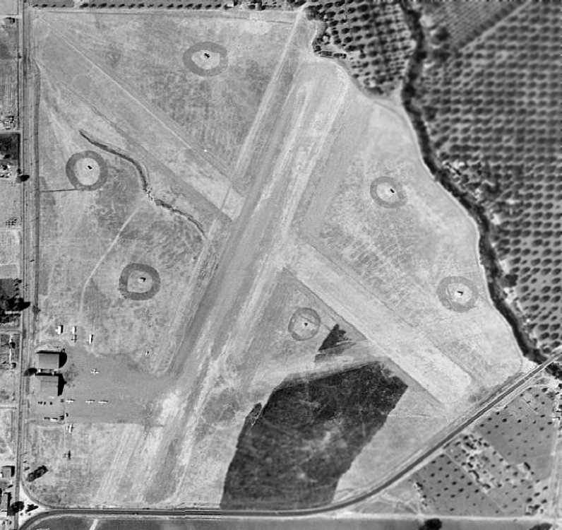
A 9/6/46 aerial view depicted Sherman Field as having 2 runways in an X-shape, with 2 hangars & several aircraft on the southwest side of the field.
What were the 6 circular items located in the grass in between the runways?
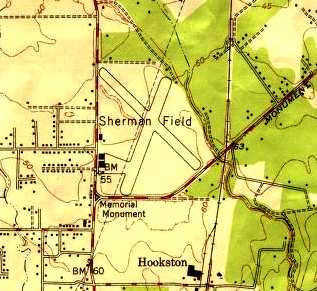
The 1947 USGS topo map depicted Sherman Field as having two 2,800' runways, and a ramp at the southwest corner with 2 hangars.
K.O. Eckland recalled that "Sherman Field was where I checked out in a PT-22
to qualify for my civil ticket after discharge from USAF in 1947."
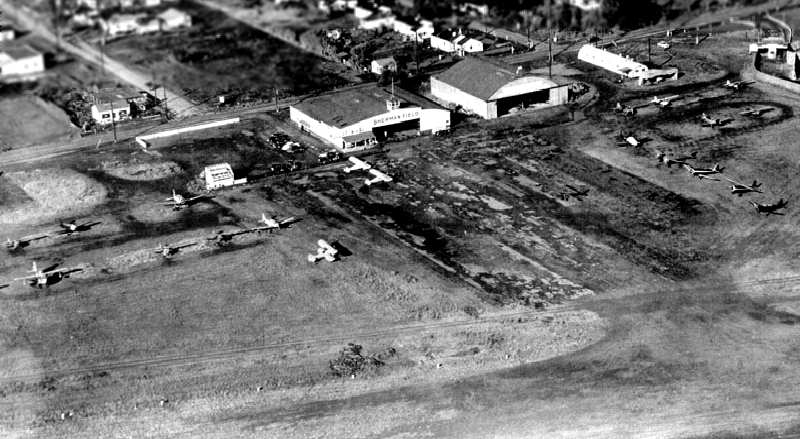
A 1948 aerial view looking northwest at the ramp & hangars at Sherman Field (courtesy of Bill Larkins, who lives adjacent to the site of the airport).
The 1948 Sacramento Sectional Chart (courtesy of Jonathan Westerling) depicted Sherman as having a 2,800' unpaved runway.
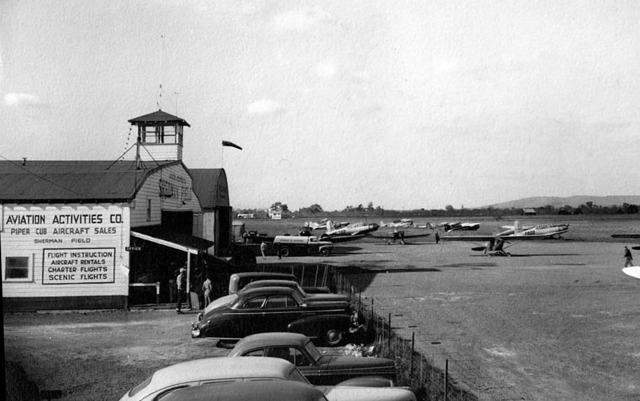
A circa late 1940s photo by Louis Roberts of Sherman Field (courtesy of Dale Roberts), showing 2 surplus Vultee BT-13 Valiants & a variety of other light general aviation aircraft in front of the hangar.
A 1949 aerial view showed that a drive-in movie theater had been squeezed in just to the west of the runway intersection.
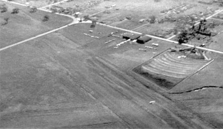
A circa late 1940s aerial view looking southwest a Sherman Field showed the drive-in movie theater squeezed in just to the west of the runway intersection,
a dozen planes parked near the hangars, and one plane at the runway intersection.
Sherman Field was still depicted on the 1949 USGS topo map.
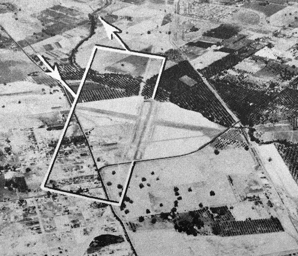
The last depiction which has been located of Sherman Field was an undated aerial view looking north from the 1950 Air Photo Guide (courtesy of Kevin Walsh).
The guide described Sherman Field as having 2 runways: 3,000' Runway 10/28 & 2,800' Runway 18/36. It listed the manager as Phillip McManamy.
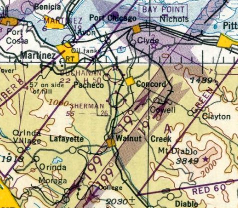
The last aeronautical chart depiction which has been located of Sherman Field was on the September 1950 San Francisco Sectional Chart.
It depicted Sherman as having a 2,600' unpaved runway.
Sherman Field was sold in 1950 for real estate development.
The last reference to Sherman Field still being in operation came from Norman Nielsen,
who recalled, “In 1951, at the age of 3, I moved to Gregory Gardens, now Pleasant Hill,
and have some vague remembrances of Sherman Field,
in particular that there was a hangar on the south side of Monument Boulevard
and that planes would sometimes taxi across the road to reach the runway.”
Sherman Field was evidently closed at some point in 1951,
as it was no longer depicted on the March 1951 San Francisco Sectional Chart.
A March 1952 Thomas Brothers map (courtesy of Kevin Walsh) showed a grid of new residential streets had been covered the site of Sherman Field.
A 1953 street map (courtesy of Kevin Walsh) showed residential streets covering the site of Sherman Field,
including one named Sherman Drive.
A 1958 aerial view showed that the hangars had been removed,
and houses covered most of the property of Sherman Field.
Ironically, the northeast/southwest runway still remained largely intact, with houses all around it,
as it would eventually form the alignment for the 680 Freeway which would pass through the site in a few years.
A 1968 aerial view showed that the 680 Freeway had been built right through the center of the former airport property,
and the location of the hangars had been redeveloped as well,
erasing any trace of the former Sherman Field.
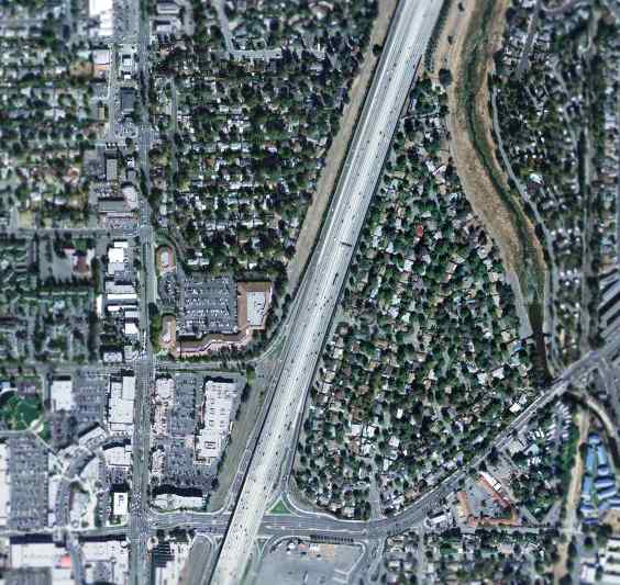
A February 2004 USGS aerial photo showed the 680 Freeway had been built through the center of the site, and not a trace of Sherman Field appeared to remain.
Sherman Field was located northeast of the intersection of Contra Costa Boulevard & Monument Boulevard.
____________________________________________________
Diablo Air Mail Terminal / Concord Airport (original location), Concord, CA
37.97, -121.995 (Northeast of Oakland, CA)
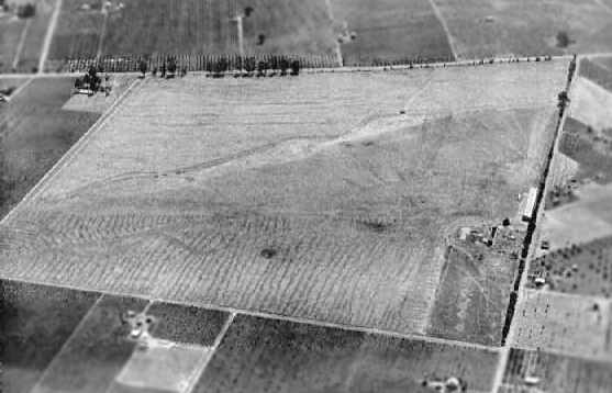
An undated aerial view looking south at the original Concord Airport by A.W. Stevens, from a 1926 magazine article (courtesy of Neil Hinckley).
The caption read, “This is the main western terminus of the transcontinental Air Mail line. Eastbound mail leaves from this field.
Westbound, the mail plane flies directly to Crissy Field, on the edge of San Francisco, unless prevented from landing there by bay fog.
From Concord Field to Crissy Field is only about 20 minutes by air.”
According to the book "Two Hours By Crow" by Howard & Judith Campbell (courtesy of Wings of History),
“Word leaked out on 11/15/24 that the U.S. Postal Service was going to open a field in Concord by leasing part of the W. C. Price Ranch.
By 1/31/25 all schools & businesses in town closed in the afternoon for the dedication of the Diablo Air Mail Terminal.
Two thousand residents listened to speeches & watched the first mail plane land on 2/3/25.
Six mail planes were based here, the Douglas M-4 & the Boeing Model 40, both powered by the 400hp Liberty engine.
By 12/31/25 the number had grown to 10 aircraft.
By 1927, the service was flying the newer Boeing Model 40-A with a 425hp Pratt & Whitney Rl340 Wasp.
The first passenger from Concord was William Hearst, nephew of the newspaper publisher, William Randolph Hearst.”
The January 1926 National Geographic Magazine featured a picture of Concord Airport in a story describing the new airmail service.
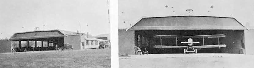
Two 1926 photos of the new hangar at Concord Airport, when the Air Mail terminal was transferred from Crissy Field (courtesy of Kevin Walsh).
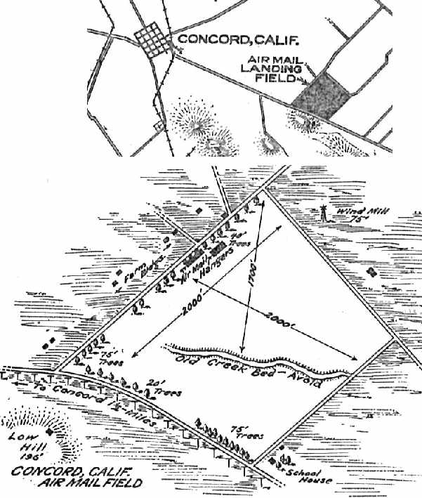
The location & layout of the “Concord Air Mail Field” as depicted in the 7/19/26 Commerce Department Aeronautical Bulletin (courtesy of Jonathan Westerling).
It described the field as measuring 2,000' northeast/southwest by 2,000' northwest/southeast, with Air Mail hangars on the northwest side of the field.
The 1927 Standard Oil of CA Airport Directory (courtesy of Chris Kennedy)
described Concord Airport as a “permanent” field, located 2 miles southeast of the city.
It was said to consist o a 2,600' x 2,200' field, which permitted landings in any direction.
Hangars were said to be located at the northeast corner.
It was also noted that “This field is used by the United States Air Mail & is to be used for emergency only.”
As private companies were taking over the airmail service, it was possible for the same planes to begin carrying passengers.
Boeing's 1st passenger flight out of Concord was recorded on 7/1/27 in a local newspaper.
According to the book "Two Hours By Crow" by Howard & Judith Campbell (courtesy of Wings of History),
“December 15, 1927 saw the closing of the Air Mail Terminal. The U.S. Postal Service lease had run out & the Commerce Department took over.
Although mail was still flown from here when Crissy Field in San Francisco or Oakland Municipal Airport was fogged-in, this of site became the Commerce Department Site 2A on the San Francisco - Salt Lake City Airway.
With the closing of the Diablo Air Mail Terminal on 12/15/27 & Commerce Department taking over the field as Site 2A,
there entered a 2-year period of court litigation in a mortgage mix-up with the end result of W. T. Nulty taking control of the acreage.”
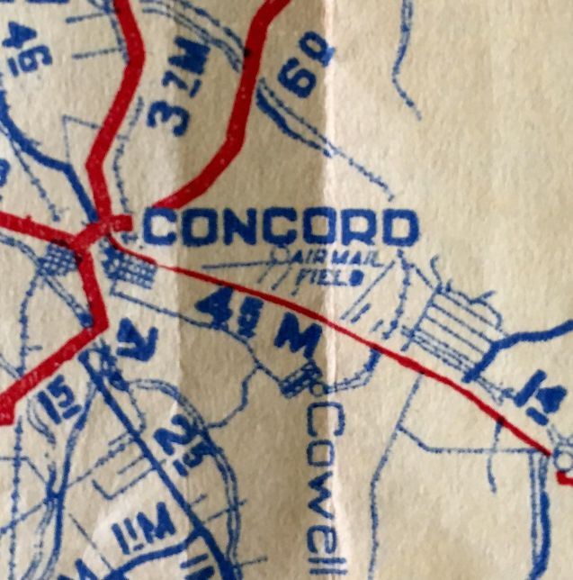
The Concord “Air Mail Field”, as depicted on the March 1928 CA State Automobile Association map (courtesy of Kevin Walsh).
According to the book "Two Hours By Crow" by Howard & Judith Campbell (courtesy of Wings of History),
“The last episode in the history of Diablo Field would be offered by the Navy in their search for a lighter-than-air base.
October 27, 1928 saw an article that they would put up a dirigible hangar & mooring mast here for their 'airships'.
Hope was dashed when the Navy selected Sunnyvale, in Santa Clara County as their base.”
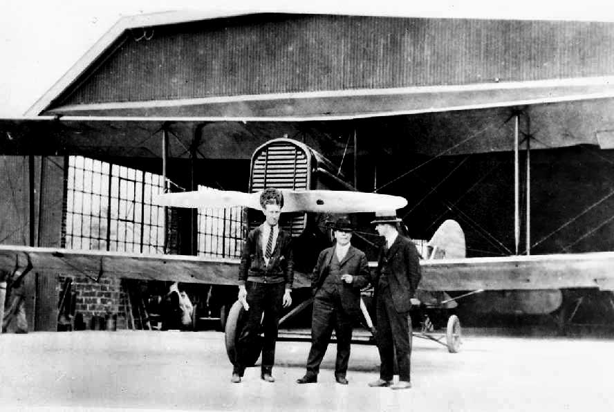
A circa 1920s photo (courtesy of Bill Larkins) of 3 unidentified men in front of a DH-4 & a hangar at the original Concord Airport.
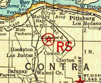
The earliest chart depiction of the Concord Airport which has been located was on the 1929 Rand McNally Air Trails Map (courtesy of Chris Kennedy).
It depicted an intermediate field just southeast of Concord.
It was described as an “Emergency” field, “open to private planes for emergency only.”
It was said to consist of an 80-acre earthen field, measuring 2,200' square, with 2 hangars on the northwest side.
According to a circa January 1986 article in the Concord Gazette (courtesy of Phil Beutel),
Clothidle Larkin recalled that the field was rededicated in the early 1930s.
According to the book "Two Hours By Crow" by Howard & Judith Campbell (courtesy of Wings of History),
“On 4/21/32 the U.S. Government leased the land with an option to buy it for $60,000; the lease & the option would expire in 1938.
There was very little use during these years as the Commerce Department rated Site 2A as an 'Emergency Field' & civilian use was strongly discouraged.
The Standard Oil Company Directory listed Site 2A as “Open to private planes for emergency only.”
The 8/27/32 Contra Costa Gazette noted "use of the field has been granted to commercial & passenger planes under specific circumstances."

The 1933 San Francisco Airway Map (courtesy of Chris Kennedy) depicted Concord as Site 2A.
The 2/18/34 Martinez Herald reported that Mr. Nulty "has leased the property to R. Hetfield, who will plant the property in tomatoes.”
Concord Airport was listed in The Airport Directory Company's 1933 Airport Directory (according to Chris Kennedy)
as the Commerce Department's Intermediate Field Site 2A, along the San Francisco – Salt Lake City Airway.
The field was said to consist of an 81-acre black loam field, along with hangars.
The original Concord Airport was no longer listed in the 1934 Commerce Department Airport Directory (according to Chris Kennedy),
depicted on the May 1936 Sacramento Sectional Chart,
or listed in The Airport Directory Company's 1937 Airport Directory (courtesy of Bob Rambo).
However, Concord was still being used in the “late 1930s”, according to Phil Cox, a charter member of the Concord Flying Club.
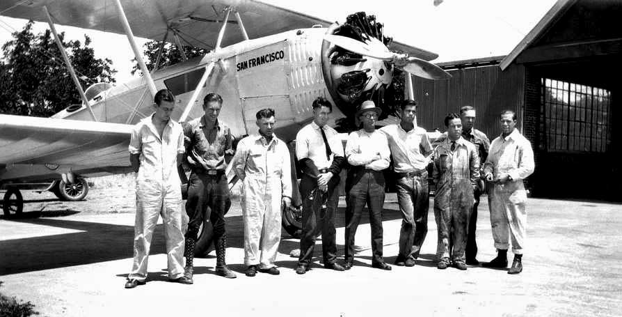
A late-1930s photo (courtesy of Bill Larkins) of an unidentified group (airmail pilots?) in front of a Boeing 40A & a hangar at the original Concord Airport.
Nick Lines recalled, “I attended Clayton Valley Elementary School in the late 1950s located on the Southeast border of the airfield.
My 3rd grade teacher recalled mail planes landing & taking off over the school house.”
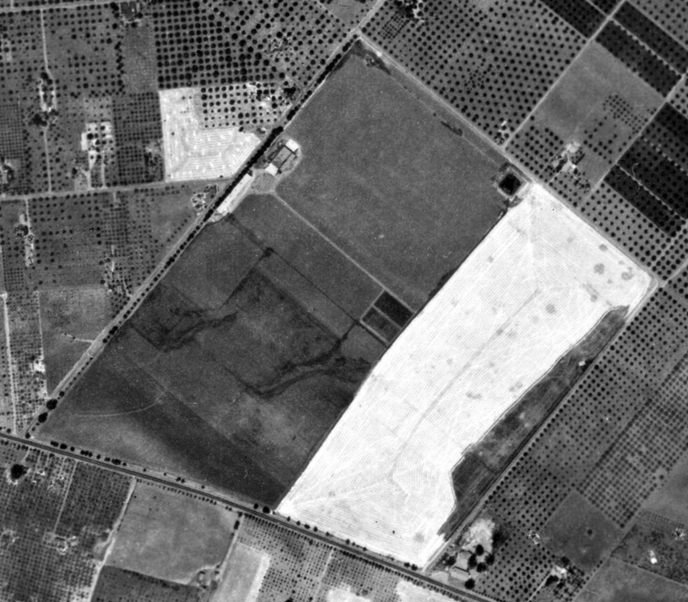
A 1939 aerial view of Concord Airport (from the Alexandria Digital Library @ UC Santa Barbara, courtesy of Jonathan Westerling) showed the hangars remained on the northwest side, but there were no aircraft visible on the field.
According to the book "Two Hours By Crow" by Howard & Judith Campbell (courtesy of Wings of History),
“Western Air College proposed in September 1940 to lease the land & conduct a school to train Army pilots, but we have found no record of this ever happening.
March 21, 1941 saw the opening of Concord Airport when the Monarch Flying Service moved its operations here from the San Francisco Bay Airdrome in Alameda & enrolled 128 students in their non-college aeronautics course.
A number of other businesses either moved or indicated they planned to move when the Alameda Airdrome closed.”
World War 2 brought an end to the original Concord Airport,
when the Sheriff removed the propeller from the Concord Flying Club's plane (due to wartime security concerns).
The aircraft was stored in a barn for the next 4 years.
The original Concord Airport was no longer depicted on the 1942 USGS topo map.
According to the book "Two Hours By Crow" by Howard & Judith Campbell (courtesy of Wings of History),
“The property was used by the Niagara Duplicator Company in 1943 to manufacture their equipment in the former hangars.
Later, the John Burton Machine Corporation moved in.”
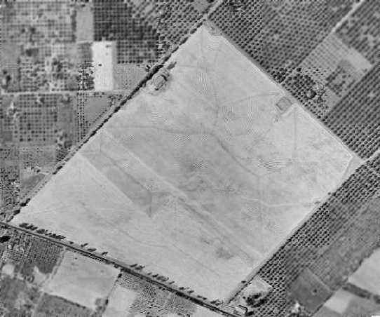
A 1946 aerial view showed the Concord Airport site was still clear, but there was no indication of aviation use.
The hangar was visible along the northwest side of the field.
A 1949 aerial view showed the site unchanged from as seen in 1946, with the airfield remaining completely clear.
Phil Beutel recalled, “I purchased Niagra Duplicator in 1950. The lease on the hangar came with the business & the owner was Mr. Nulty.
When I leased the hangar the land was all vacant except for a few houses on Clayton Road.”
Nick Lines recalled, “I attended Clayton Valley Elementary School in the late 1950s located on the Southeast border of the airfield.
The brick hangar building on West Street was a machine shop during the 1950s & 1960s.”
Neil Hinckley recalled, “Our (1950) housing development, 'Concord Village', was built over” the site of the airfield.
A 1958 aerial view showed that housing had covered about half of the site of the Concord airfield.
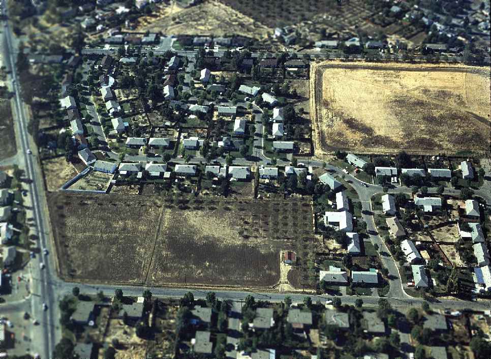
A February 1962 aerial view by Neil Hinckley looking northwest at the remains of the Concord Airfield.
Neil observed, “Clayton road at left. What remains of the airfield in 1962 is at upper right...
the encroachment of suburban housing units is almost complete.
There was an earthen berm around the field, and in a year or two the portion visible in this photo would become Eichler Homes.”
A 1966 aerial view showed that housing had filled in the remainder of the site of the Concord airfield,
with the exception of the former hangar, which remained standing along the northwest side of the field.
A 1979 aerial view showed the former Concord hangar was still standing.
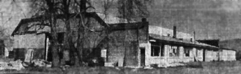
A undated photo of a remaining hangar from the original Concord Airport,
from a circa January 1986 article in the Concord Gazette (courtesy of Phil Beutel).
The article said the hangar was used in recent years by a battery exchange company & as a warehouse.
However, it had fallen into disuse, and was the subject of complaints from neighbors.
Brett McCoy recalled, “As a youth in the mid 1980s I attended Concord United Methodist Church
which was across the street from the hangar [of] the original airport of Concord.
It was indeed dilapidated but was the home of 'California Battery X-Change' as indicated by a hand-painted sign.
It the focus of much curiosity. At that time, there was still maybe 5 or 10 acres of undeveloped land behind it.
It was considered an eyesore in the middle of a residential neighborhood.”
According to the book "Two Hours By Crow" by Howard & Judith Campbell (courtesy of Wings of History),
“On 3/25/86 bulldozers erased all remnants of the hangar, and private homes & streets moved in.”
A 1988 aerial view showed the hangar site had been wiped clean,
and a 1993 aerial view showed that more houses had been built on the location.
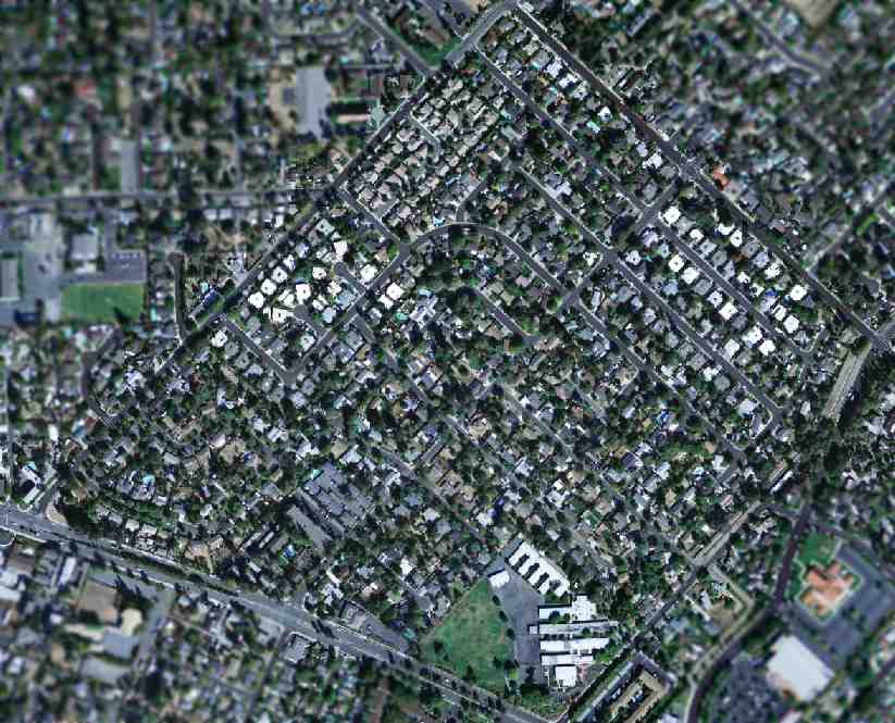
As seen in a 2004 USGS aerial photo, the site of the original Concord Airport has been densely covered in housing,
and not a trace appears to remain of the old airfield.
Phil Beutel reported in 2005, “The last I heard there was a bronze marker near the intersection of West & Chestnut.”
Neil Hinckley reported in 2005, “500 houses & a school now cover that 2,200' x 2,600' grass field.”
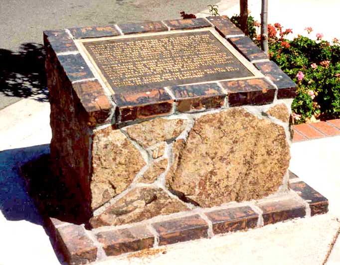
A pre-2009 photo by Bill Larkins of the historical marker on the comer of West Street & Denver Street that spells out the history of Concord Airport to remind the homeowners of their once-famous landing field & air-mail terminal.
Bill Larkins reported in 2009 that the Concord Airport historical marker “has since been moved or removed & I can't find it now.”
According to Phil Beutel, Concord Airport was bounded on the west by West Street, on the north by Wilson Lane, on the east by Denkinger Road, and on the south by Clayton Road.
____________________________________________________
Concord Naval Weapons Station Airfield, Concord, CA
37.99, -122.017 (Northeast of Oakland, CA)
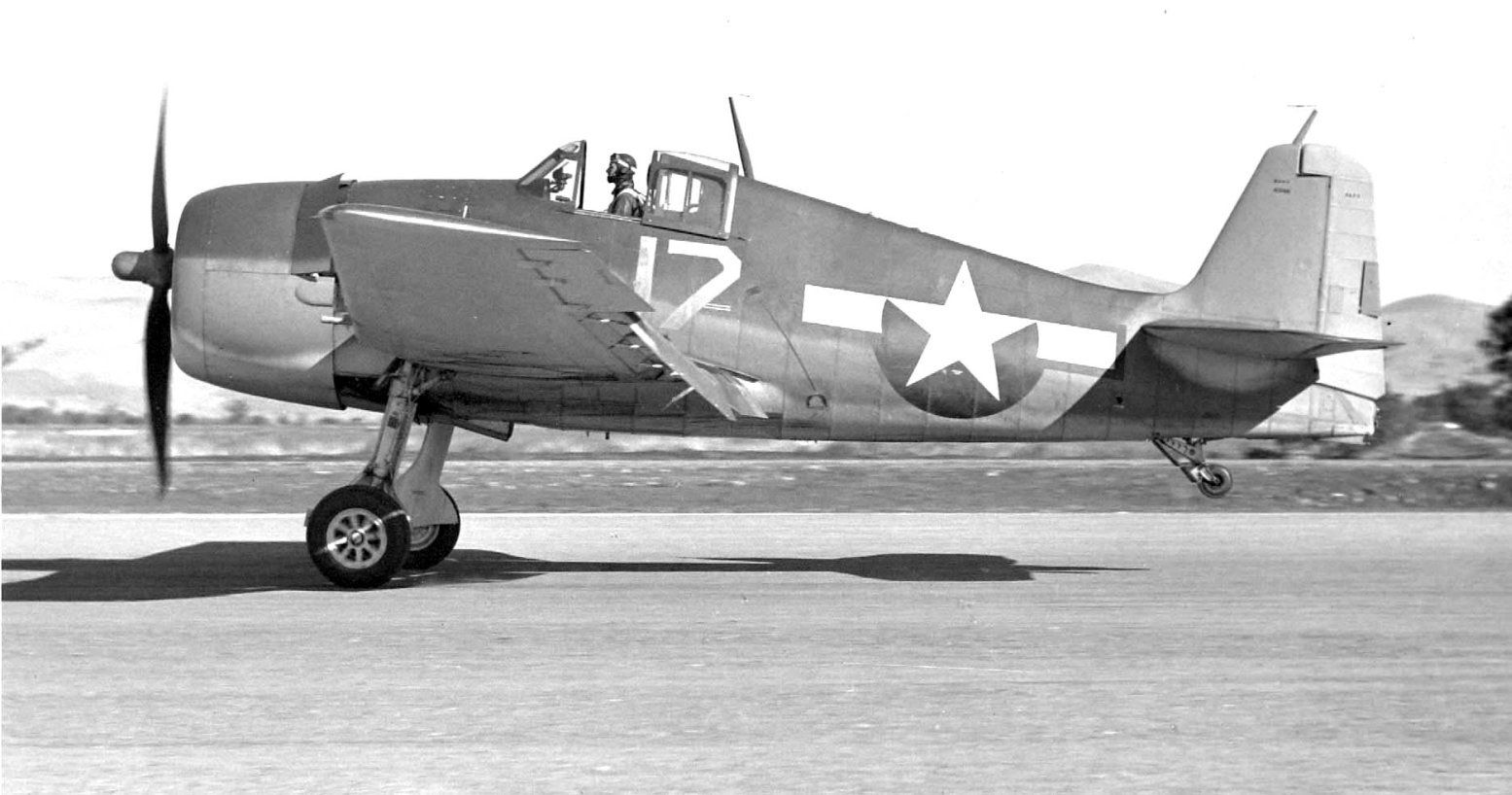
A 1943 photo by Bill Larkins of a Grumman F6F Hellcat at OLF Concord.
This military airfield was located on the southern edge of the Concord Naval Weapons Station.
The Concord Naval Weapons Station Airfield was not yet depicted on a 1939 aerial photo.
According to the book "Two Hours By Crow" by Howard & Judith Campbell (courtesy of Wings of History), “The field was opened in July 1941.
When the Navy paved their asphalt runways in 1941, they just chopped down a bunch of the trees that ran along both sides of an early county road & paved right on through.
This was a minimal facility for daytime use. There were no shops, no hangars, no fuel, and the control tower was a B-2 type portable unit.
There were no facilities for personnel & anyone on duty there was brought in on a daily basis, and returned to Alameda in the evening. The runway was lighted, but we have no indication they were ever used.”
The earliest depiction which has been located of the NWS Concord Airfield was a 1943 photo by Bill Larkins of a Grumman F6F Hellcat.
Bill recalled, "This F6F (BuNo 40198) was there one day in October 1943 when I was home on leave & hung out in the weeds with my Graflex.
Other planes there that day were a Cessna JRC-1, North American SNJ-4, Beech SNB-1, Beech SNB-2C, Douglas SBD-5 & a Grumman F4F-3.
Alameda operated the Outlying Field Concord for practice takeoffs & landings."
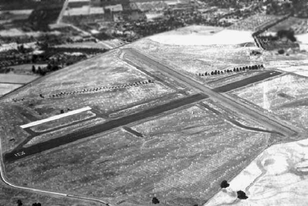
A 1944 USN aerial view looking southwest at OLF Concord (courtesy of Bill Larkins).
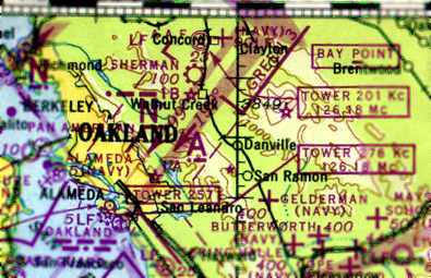
The August 1944 Regional Aeronautical Chart (courtesy of Jonathan Westerling)
depicted the Concord Navy Airfield as an auxiliary airfield.
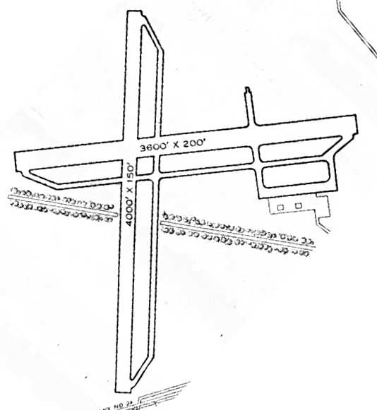
The 1945 AAF Airfield Directory (courtesy of Scott Murdock) described “Alameda NAS Auxiliary (Concord Outlying Field)”
as a 300 acre irregularly-shaped property having 2 asphalt runways, the longest being the 4,000' north/south strip.
The field was not said to have any hangars.
By the time of the 1946 Sectional Chart (courtesy of Dann Shively), the Concord Navy Airfield was still depicted,
but its depiction on the chart had been downgraded to that of an auxiliary airfield.
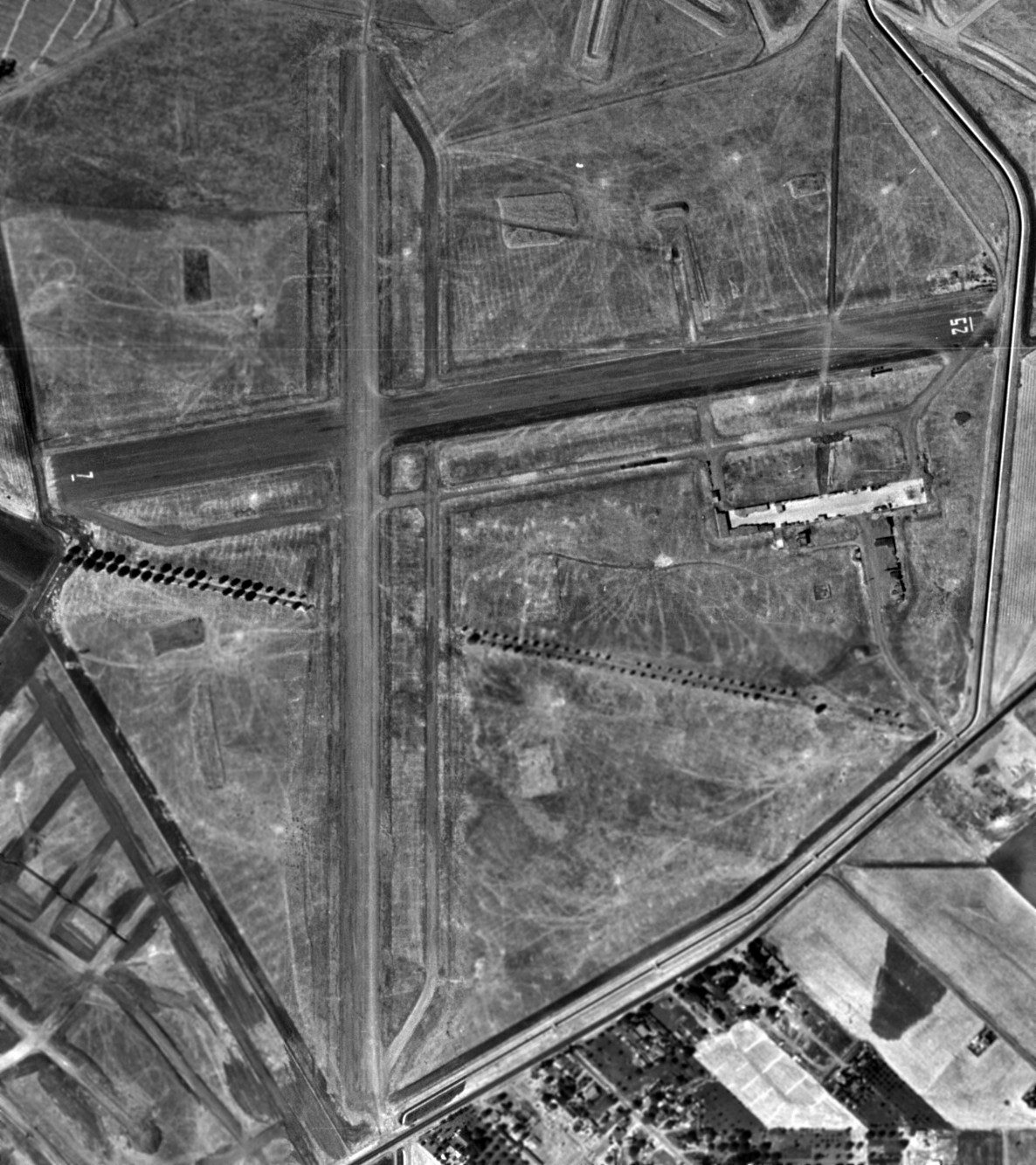
A 1946 aerial view (from the UCSB Library, courtesy of Jonathan Westerling) depicted OLF Concord as having 2 paved runways,
with a paved ramp on the southeast side. There were no buildings or aircraft visible on the field.
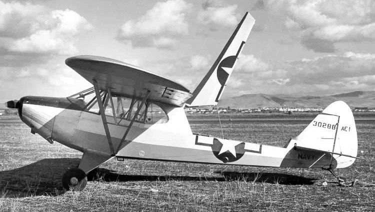
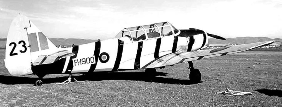
The last photo which has been located of an aircraft at Concord Navy Airfield was a December 1946 photo by Bill Larkins of Fairchild PT-19 Cornell T42-4249 FH900, which was being sold surplus by the Concord WAA Depot.
The last aeronautical chart depiction which has been located
of the Concord Navy Airfield was on the 1948 San Francisco Local Aeronautical Chart (courtesy of Tim Zukas)
It depicted “Concord” as having 2 paved runways, with the longest being 4,000'.
Strangely, the airfield was not depicted with any military label,
so it is possible that it may have been (briefly) relinquished for civilian use.
The Concord Navy airfield was evidently closed at some point between 1948-49,
as it was no longer depicted as an active airfield on the 1949 Sectional Chart.
A 1949 aerial view showed that 2 prominent closed-runway “X” symbols had been painted on the ends of the east/west runway,
and the north/south runway was being used for storage of trailers.
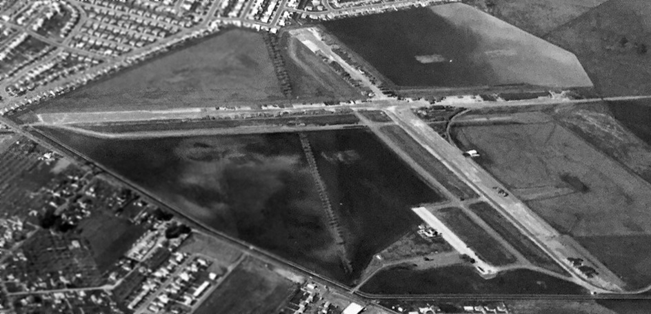
An undated aerial view looking west from a circa 1950s real estate brochure (courtesy of Kevin Walsh) showed Concord Navy Airfield's 2 paved runways remained intact,
but were being used for some type of non-aviation storage.
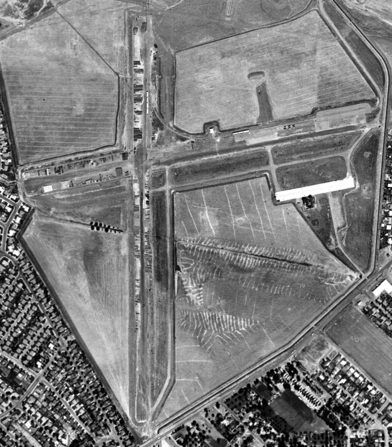
A 1958 aerial view (from the UCSB Library, courtesy of Jonathan Westerling) depicted OLF Concord as remaining intact,
but with the runways being used to store unidentified objects.
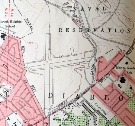
The Concord NWS airfield was depicted on the 1959 USGS topo map (courtesy of Kevin Walsh), but it was not labeled,
which presumably means it was no longer an active airfield at that point.
The Concord airfield was depicted as having 2 paved runways (the largest was 3,300' long), taxiways, and a ramp.
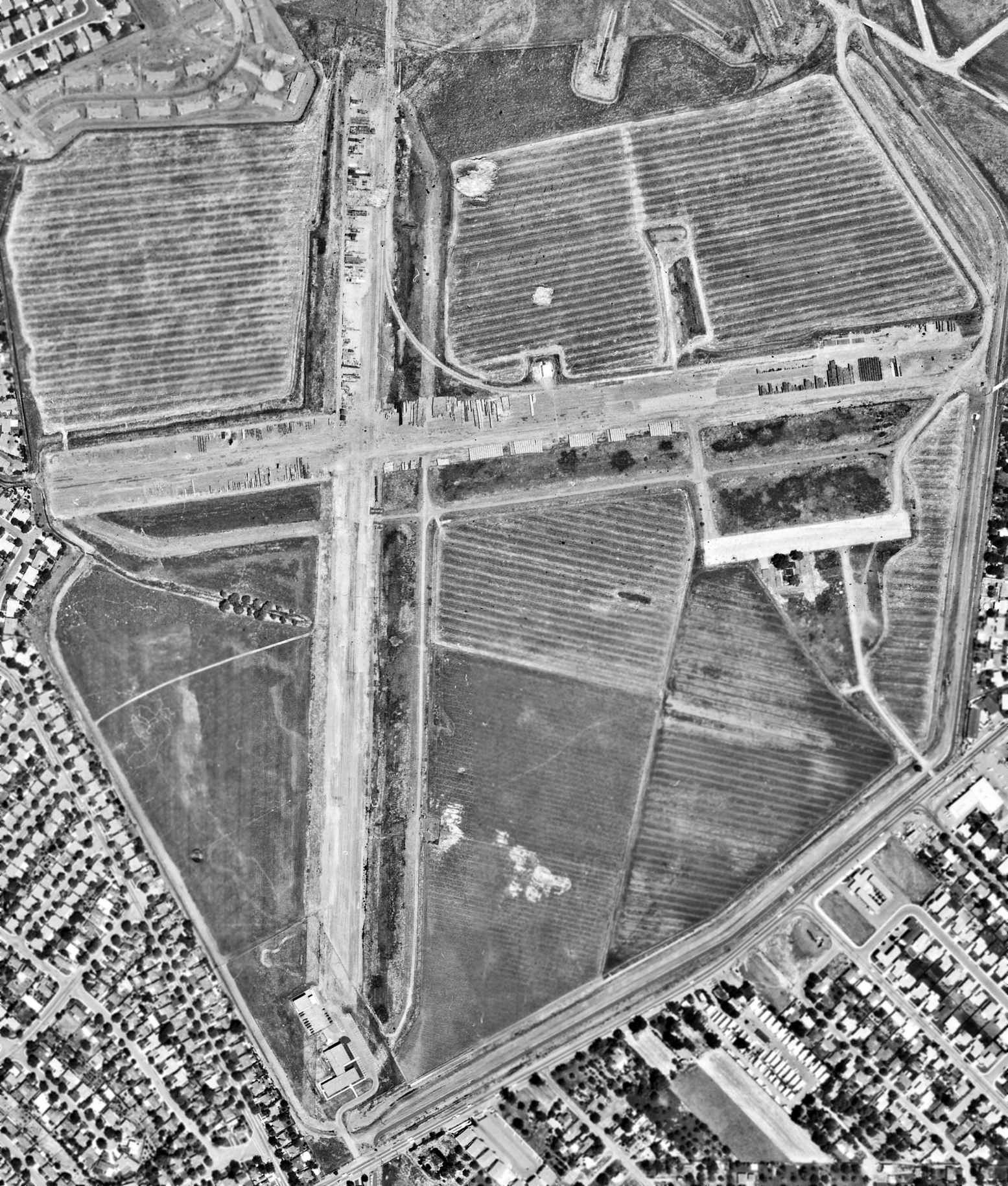
A 1965 aerial view of OLF Concord (from the UCSB Library, courtesy of Jonathan Westerling)
showed that several buildings had been constructed over the southern end of the north/south runway,
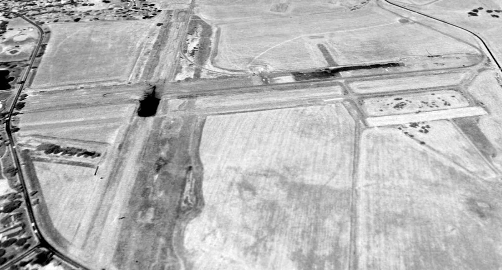
A 1988 USGS aerial view looking north showed the majority of Concord NWS's runways & parking ramp still remained intact.
The 1993 USGS aerial photo showed that the primary (east/west) runway & parking ramp still existed, but the majority of the north/south runway had been removed,
with a residential development having been built at some point between 1988-93 over the northern portion of the former north/south runway.
According to the book "Two Hours By Crow" by Howard & Judith Campbell (courtesy of Wings of History),
“In 1996, the Navy proposed building an 85,000 square foot warehouse on the property but the City of Concord protested.
The Navy was out by 1999 & the Army leased part of it for storage.”
The Concord Naval Weapons Station itself was placed in a "reduced operation status" in 1999.
The station is presently surrounded by dense residential development.
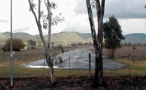
A 2003 photo by Jonathan Westerling looking east along a remaining runway of the former Concord NWS airfield.
Jonathan reported, "The trees at the ends of the runways at the Concord Naval Weapons Station have grown to well over 35' high.
Even though it has been inactive for a long time, the field itself is still very much in evidence,
and fresh yellow X's have been painted on the asphalt runways.
The east/west runway is in better condition than the north/south runway which is mostly overgrown.
Near the runway intersection, a Naval housing complex 'Victory Village' was constructed, though the buildings are almost completely empty.
No other present day reuse of the airfield is evident, though the property is completely fenced off.
The runways can be easily seen from East Olivera Road."
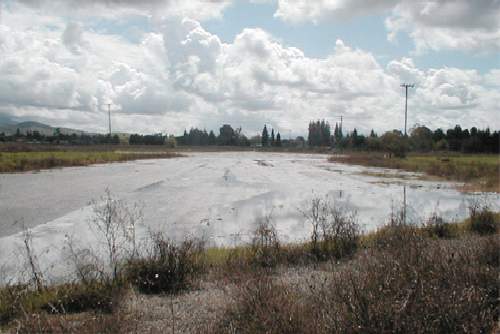
A 2003 photo by Jonathan Westerling looking south along a remaining runway of the former Concord NWS airfield.
Ironically, in 2005 the Mayor of Concord, Laura Hoffmeister, was lobbying the Defense Department to close the Concord Naval Weapons Station,
according to an Associated Press article by Michelle Locke (courtesy of Jonathan Westerling).
At a time when many other municipalities are desperately trying to avoid having their bases closed,
the Concord Mayor is trying to clear the way for 13,500 new homes, planned for the property of the Navy base.
Marshall Carter reported in 2005 that the plan has been reduced to 6,000 houses over the former airfield site,
due to concerns about low-level radiation contamination on other parts of the former Navy facility.
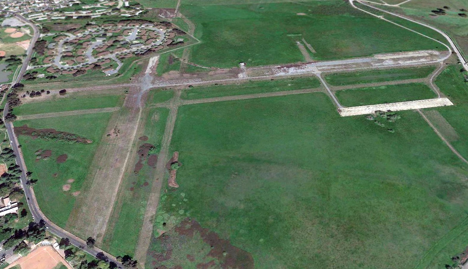
A 4/2/18 aerial photo looking north showed the majority of the NWS Concord Airfield remained intact though deteriorated.
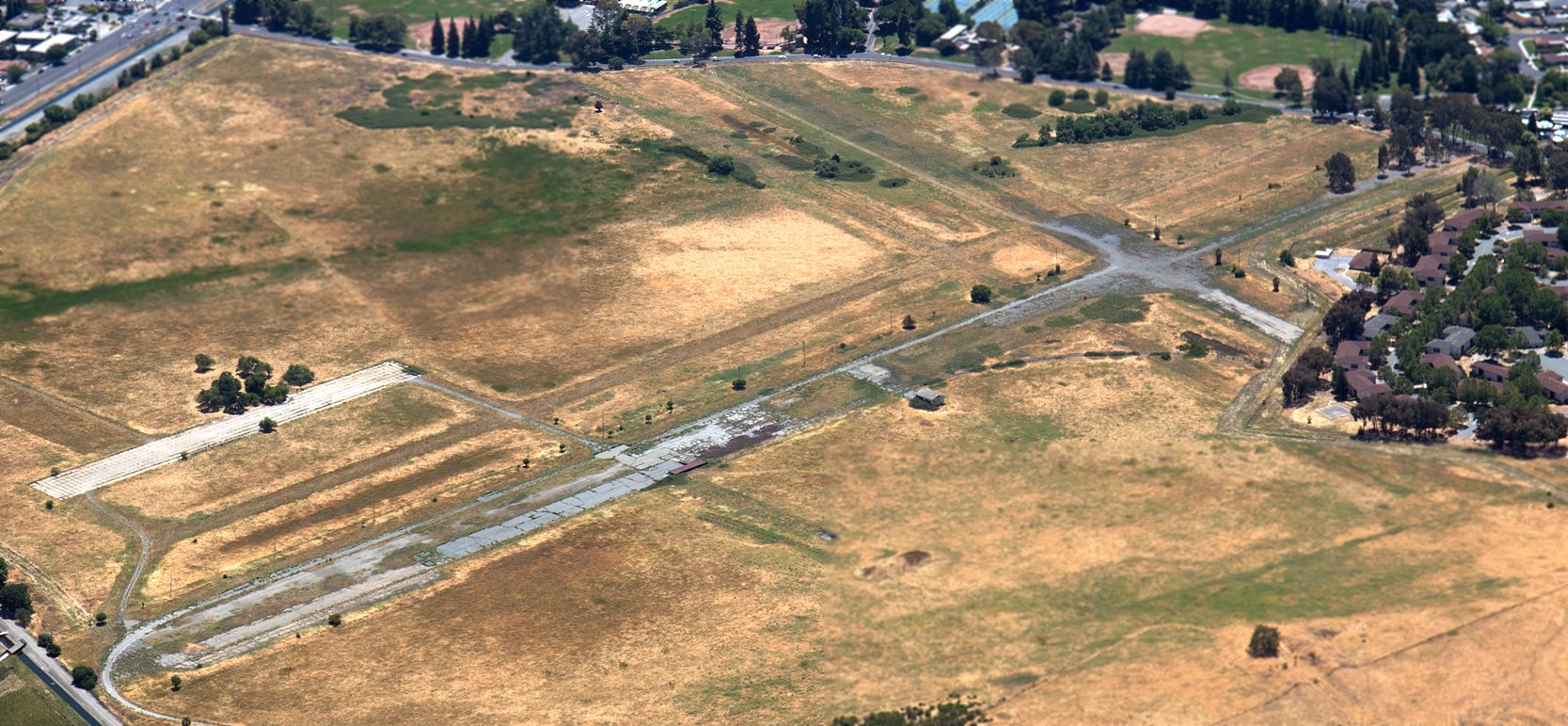
A 6/23/18 aerial view by Roger Cain showed portions of the NWS Concord runways & ramps remained intact.
____________________________________________________
____________________________________________________
This site covers airfields in all 50 states.