
Abandoned & Little-Known Airfields:
California: Southern Oakland area
© 2002, © 2026 by Paul Freeman. Revised 8/5/26.
This site covers airfields in all 50 states: Click here for the site's main menu.
____________________________________________________
Please consider a financial contribution to support the continued growth & operation of this site.
For a 10th year, the CA pages of this website are sponsored by the California Pilots Association:
Alameda Airport / Benton Field / Alameda NAS (revised 8/5/26) - Byron Airpark (revised 5/13/18)
Downtown Oakland Heliport (revised 6/5/26) - Durant Field (revised 6/5/26) - San Francisco Bay Airdrome (revised 5/1/24) - San Leandro Airport (revised 2/1/24)
____________________________________________________
37.751, -122.19 (Southeast of Downtown Oakland, CA)
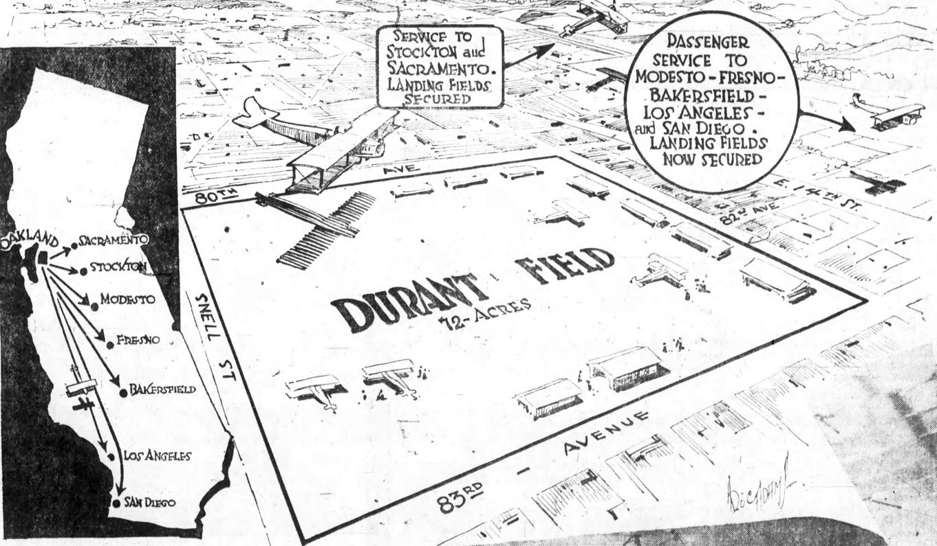
An artist's conception of Durant Field from the 9/28/19 Oakland Tribune (courtesy of Jonathan Westerling).
Jonathan Westerling reported, “Before Oakland's present-day airport was even conceived, a playboy & racecar driver built an airfield in the city & succeeded in igniting local excitement about aviation.
Durant Field was the creation of Russell 'Cliff' Durant, son of William Durant who was co-founder of GM & Chevrolet.
In his 20s, Cliff was appointed Vice President of Sales for the automobile manufacturer's Oakland dealership.
But Cliff's real passion was in the daring world of racing & flying. In 1919, he bought land for a flight school & airport on the southeast outskirts of the city.
Durant's Field is frequently & mistakenly said to be located in San Leandro, however this was not the case.
The airport was between 80th & 83rd Avenues (near San Leandro Boulevard ) in the city of Oakland.”
In his book, “Aviation in Northern California 1919-1939”, Allen Herr describes in great detail the beginnings of the airport:
"Cliff Durant had grandiose plans for his flying venture. He wanted to create one of the largest airplane companies in the world.
He planned to create a company specializing in the sale & service of aircraft and, most ambitious of all, to transport passengers between cities by airplane.
The Durant Airplane Corporation was organized in September 1919 & planned to start operation by October 1.
Durant claimed he would have enough planes available for intercity passenger service.
By November 1, he said he would have prepared a permanent rate schedule determining the cost of such air travel.
On 1/1/20, Durant stated he would have the biggest & best aircraft available for the number of expected passengers. His plans for aircraft sales & service, he reported, would dwarf his transportation business.
Durant's hangars were painted blue with white roofs & all of his planes in service were white with blue trim, his company colors.
Durant developed his airport & began promoting flying in the East Bay.
One of his earliest promotions was awarding an airplane ride at Durant Field to the first man & woman to sell 12 Oakland Tribune newspaper subscriptions.
Durant's chief pilot, F. E. Harding, took the winners, Myrtle Hansen & Lewis Smith, for a flight 10/18/19."
Jonathan Westerling reported, “The best description of Durant Field came from the official pilot's notes given to airmail pilots in 1921 by the federal government (as reprinted in Skyways: The Journal of the Airplane #8):
"At mile 177 [from Reno] Durant Field, Oakland, On the eastern side of San Francisco Bay. The field runs almost due east & west & has a hangar, wind indicator, and T laid out on it.
By coming in from the east over the hangar an unobstructed run of about 2,000' is obtained. North & south the field is rather narrow & somewhat rough. All supplies necessary for reservicing [sic] a ship may be obtained here."
The earliest depiction which has been located of Durant Field was a full-page graphic at the front of the Automotive Section of the 9/28/19 Oakland Tribune (courtesy of Jonathan Westerling).
It depicted Durant Field as a square property on the northeast corner of Snell Street & 83rd Avenue, with hangars along the north, east, and south sides.
The promotion included pictures of locals - including Cliff Durant's mother - all of whom had just taken their first flight with him in his biplane.
Jonathan Westerling reported, “With his airport in full operation, and his Flight School underway,
Durant began to promote his endeavors with numerous aerial circuses, contests with flights for the winners, and flying stunts in the air all around the region.”
Jonathan continued, “In the summer of 1920, Durant Field was the the western terminus of a well-publicized flight demonstrating several all-aluminum Larsen JL-6 monoplanes (the American version of the Junkers F13).”
According to a flight logbook (courtesy of the Auburn University Libraries) kept by manufacturing magnate E. E. Allyne who was a passenger on the journey,
the purpose of the trip was: "Inspection of proposed aerial mail route & initial coast-to-coast mail flight.”
However it is not clear whether any mail was carried on the trip, and most historians cite a flight exactly one month later - which terminated at San Francisco's Marina field - as the actual inaugural flight of the transcontinental air mail service.
According to additional research by Allen Herr, the August 1920 flight that landed at Durant Field "had three basic purposes:
The first was as part of the Army Air Services Pathfinder flights which were carried out over the entire US during 1919 & 1920.
Also the Army had just bought one of Larson's JL-6 planes & wanted to carry to try it out on a long-distance flight.
The second purpose was that Larson wanted to demonstrate to [WW1 Ace Eddie] Rickenbacker that the JL-6 was capable of carrying passengers on a long flight successfully & comfortably; it truly was an airplane ahead of its time.
Rickenbacker & Larson wanted Allyne along, hoping to prove the plane's suitability as an airliner. They wanted [Allyne] to manufacture the plane in the US at his aluminum factory.
Larson also was delivering one of the JL-6s to Mercury Aviation in Los Angeles.
The third purpose, was for Maj. Lent [Superintendent of the Air Mail Service] to come along & observe the suitability of airfields across the country to handle the 8 JL-6s the Post Office had purchased for the Air Mail Service.
He also wanted to see how the JL-6s handled the long flights (they turned out fire-prone & couldn't be used).
Judging from the log entries once they reached San Francisco Bay, fog covered the city & they landed at [Durant Field in] Oakland.
You could say that a fourth purpose of the flight was as a survey flight for the Air Mail Service."
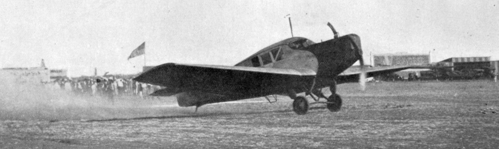
An 8/9/20 photo of the landing of the transcontinental demonstration flight at Durant Field (courtesy of the University of Auburn Special Collections).
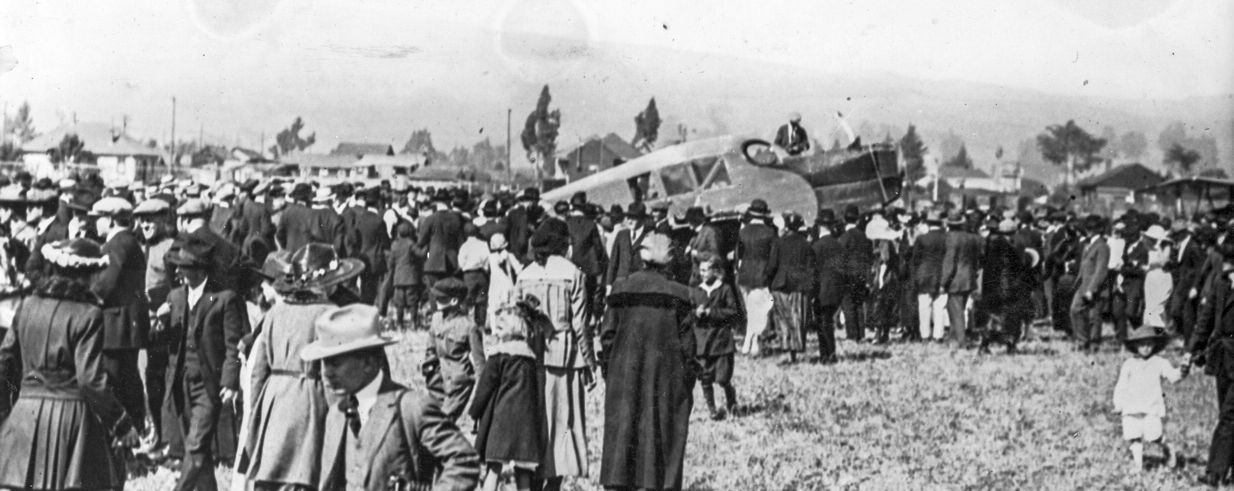
An 8/9/20 photo of crowds gathered for the the landing of the transcontinental demonstration flight at Durant Field (courtesy of Mark Taylor of the Buehl Collection).
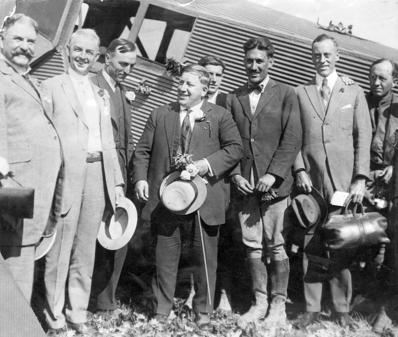
An 8/9/20 photo (courtesy of the Oakland Public Library) of dignitaries gathered at Durant Field for the arrival of the transcontinental demonstration flight.
Left-to-right in front of the JL-6 are: Oakland Mayor John Davie, E.E Allyne, Eddie Rickenbacker, John Larsen, Bert Acosta, Postmaster J. J. Rosborough, and Major L.B Lent.
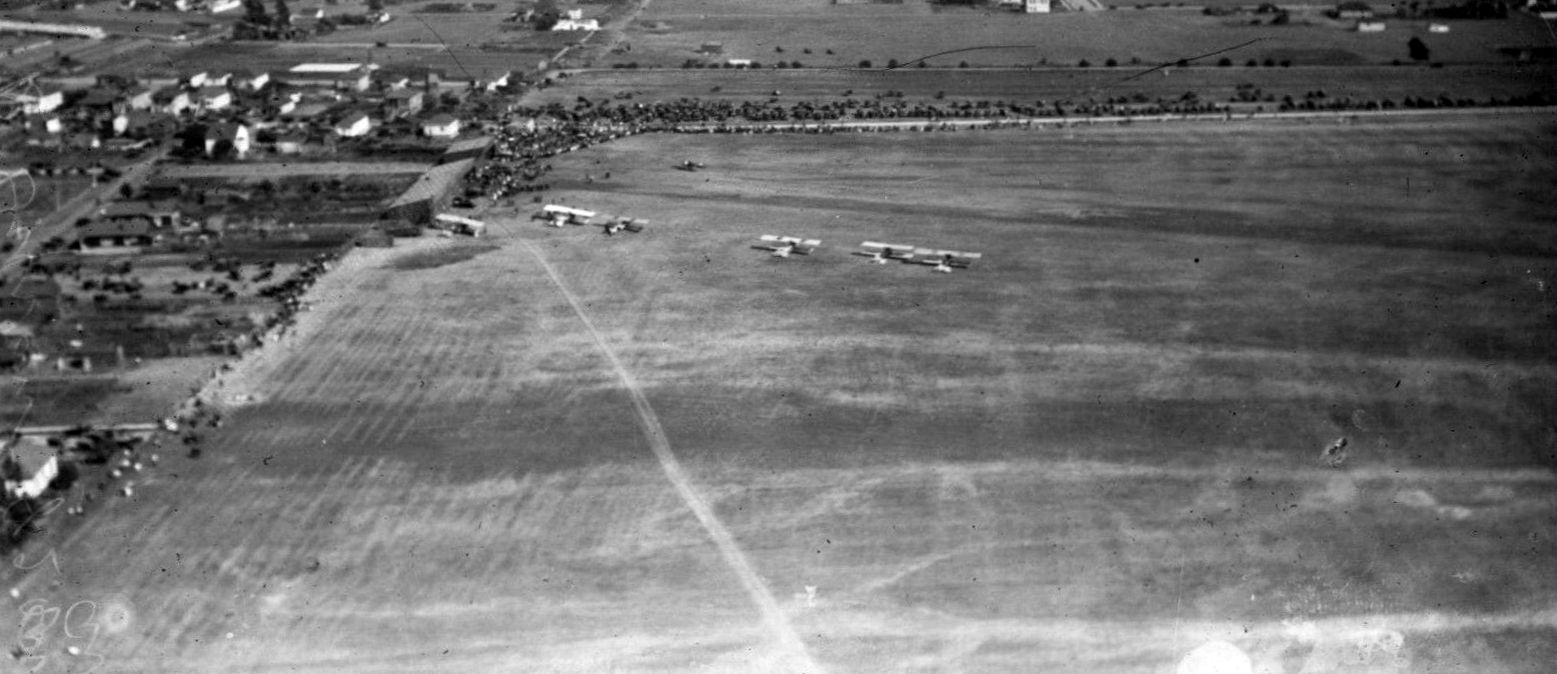
An undated aerial view showing 6 aircraft & a large number of spectators at Durant Field.
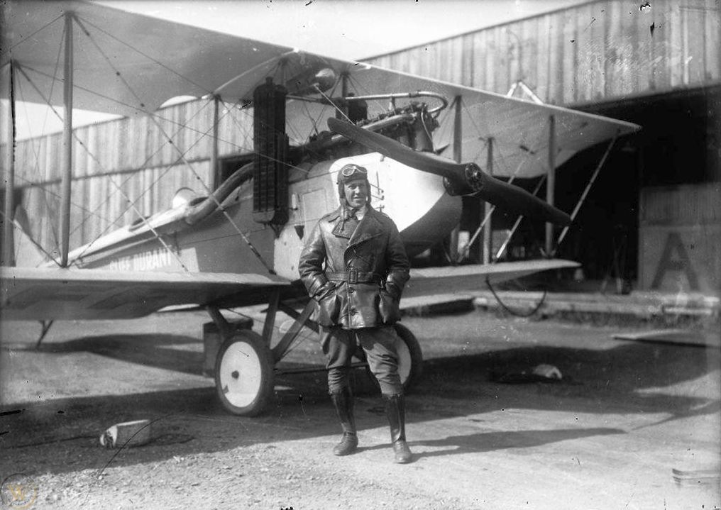
A 1920 photo of Cliff Durant in front of an unidentified biplane & a hangar at Durant Field (courtesy of Mike Grasha).
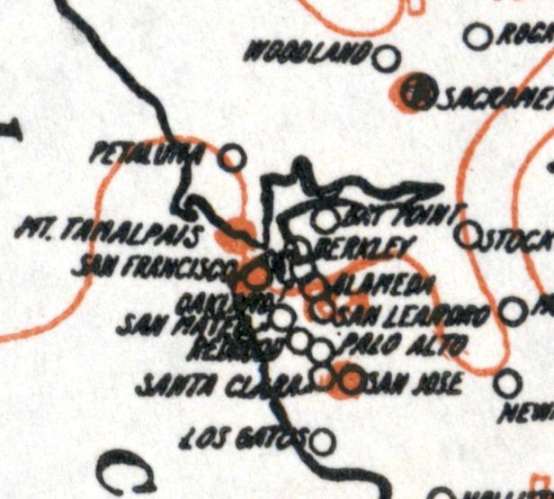
The only map depiction which has been located of Durant Field was on the 1920 Army Aerial Map (courtesy of Jonathan Westerling).
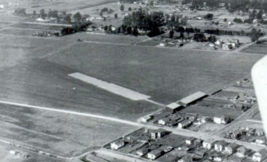
An undated aerial view (courtesy of Kevin Walsh) depicted Durant Field as a rectangular area with hangars along one end, and a paved runway or ramp extending at an angle.
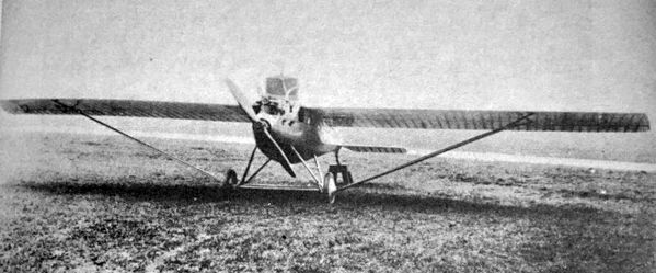
A 1921 photo of a Jacuzzi J7 monoplane at Durant Field (from the Herrington-Olson Collection, via Kevin Walsh).
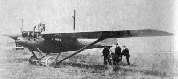
A circa 1921 photo of a Jacuzzi J7 monoplane at Durant Field (from the Smithsonian, via Kevin Walsh).
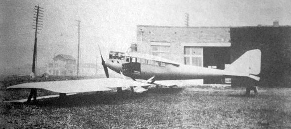
A circa 1921 photo of a Jacuzzi J7 monoplane being modified at Durant Field (from the Herrington-Olson Collection, via Kevin Walsh).
Jonathan Westerling reported, “In his autobiography, WW1 aviator Eddie Rickenbacker noted that he reunited with Cliff Durant in 1920 after Rickenbacker became involved with General Motors' Sheridan Division.
By March 1921 Cliff Durant appointed Eddie Rickenbacker director of Durant Field.”
According to Aviation in Northern California 1919-1939, "Eddie 'dropped a bomb' on the San Francisco aviation community in early March 1921.
He told the press he was granting the request of Major Tomlinson to use Durant Field as the western terminus for the Transcontinental Airmail service.
Several days before Eddie Rickenbacker made his announcement to the press, [Air Mail pilot Stanhope] Boggs, on another run to Reno,
flew low over Durant Field, at East 14th & 82nd Avenue, and dropped Tomlinson's request to Eddie Rickenbacker.
Rickenbacker had become a dedicated advocate of putting the mail terminus on the continental side of the Bay.”
He told the press, "Wind & fog, as well as other undesirable conditions, have given the Marina [Field] a reputation as one of the most dangerous landing fields in the country.
Every pilot who has experienced those conditions fears the Marina Field.”
He also stated Durant Field was building new hangars & the runway would be macadamized (paved) its full length - very unusual for the period.
However in the end, the Air Mail Service ended up moving from Marina Field to San Francisco's Crissy Field in September 1921, and Durant Field never got paved.
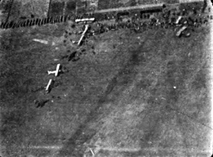
A 1921 aerial view of Durant Field from the “Flying Guide & Log Book” (courtesy of Jonathan Westerling) showing 7 biplanes.
It described Durant Field as having a 2,300' runway, and consisting of 73 acres.
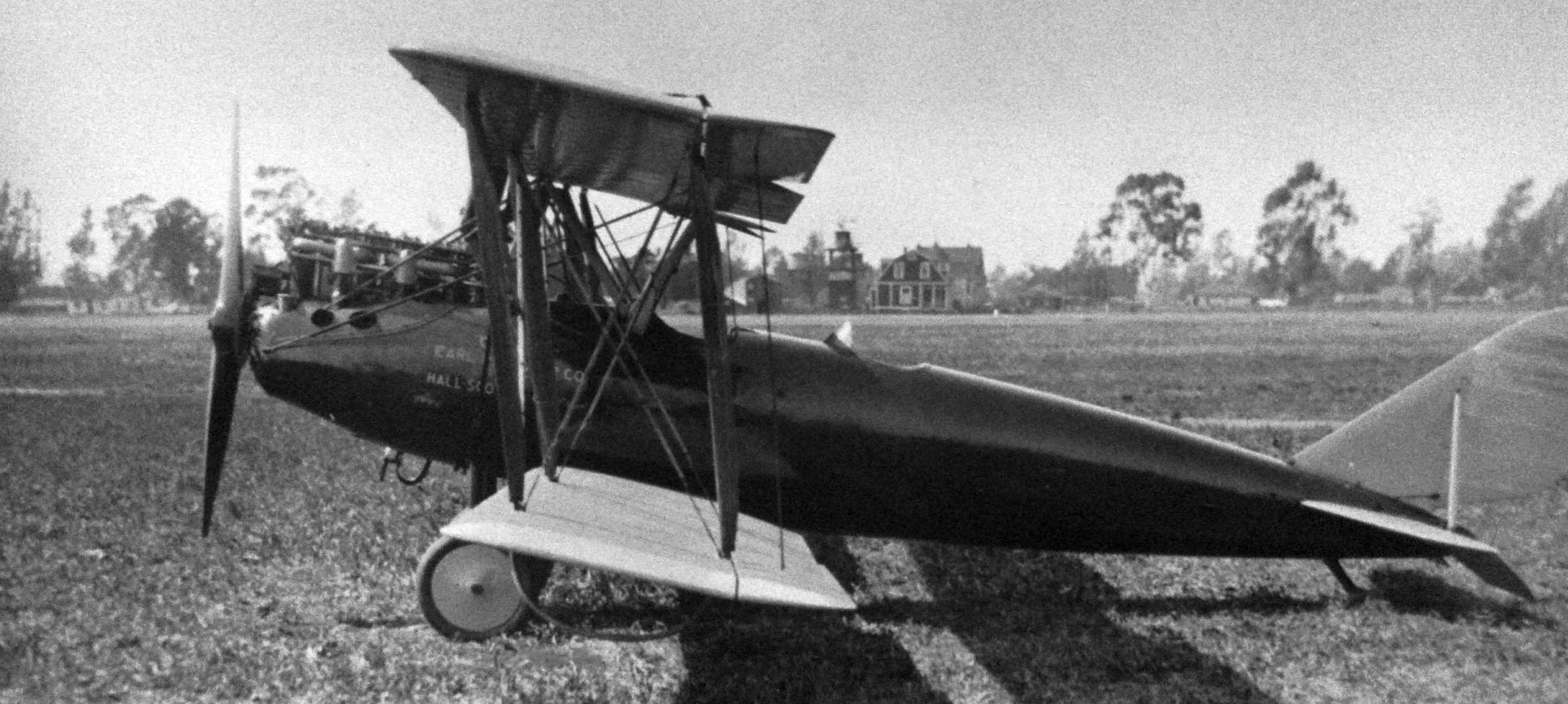
A 1921 photo of Earl Cooper's Curtiss Oriole biplane, presumably at Durant Field (source unknown).
Durant Field was listed in the 1923 Airplane Landings as being a commercial airport measuring 2,000' x 1,300', marked with a white circle.
Durant Field was not depicted on the 1923 USGS topo map.
Jonathan Westerling reported, “Eventually, Durant lost interest in the airfield & moved on to focus on his racing career (he placed a respectable 7th in the 1923 Indianapolis 500).
According to an article in the 9/1/77 Oakland Tribune, real estate records show that 20 acres of Durant field were sold to the Victor Company in 1923.
Durant sold the rest of the land to real estate developer G.B. Hengen in 1924.
It is presumed the airport operations wound down at this point, since around this time the Oakland Chamber of Commerce formed an aviation committee from its membership
to search for a suitable new municipal airport site which would endeavor to continue the aviation enthusiasm that had been fostered at Durant Field."
Durant Field was not depicted on the 1928 USGS topo map or the May 1933 San Francisco Sectional Chart.
A 1946 aerial photo showed no trace remained of Durant Field, with multiple buildings having covered the site.
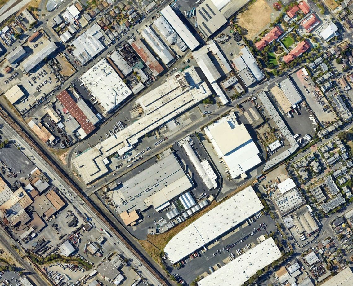
A 2022 aerial photo showed the site of Durant Field covered by dense buildings.
Thanks to Jonathan Westerling for pointing out this airfield.
____________________________________________________
San Leandro Airport, San Leandro, CA
37.709, -122.133 (Southeast of Oakland, CA)
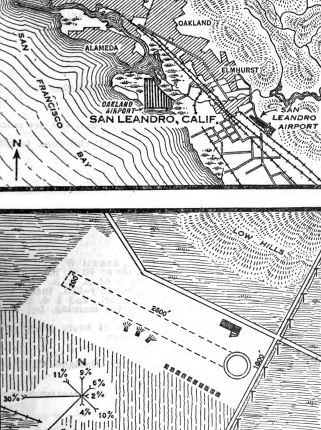
San Leandro Airport, as depicted on the 5/28/29 Commerce Department Airway Bulletin (courtesy of Jonathan Westerling).
Jonathan Westerling reported, “The city of San Leandro had its own airfield for a short time before the depression.
There are several references to an airport in San Leandro as early as 1923.
An 'Emergency' airfield was listed in the US Touring Information Bureau directory as well as in Aeronautical Bulletin #145.”
A biography of Kennth Wayne Nesse on dmairfield.org noted that "In 1928 Kenny became chief pilot for Consolidated Aircraft Corporation in San Leandro where he gave flying lessons.
Flying in an Alexander Eaglerock [serial number] 1854."
San Leandro Airport was not yet depicted on the 1928 USGS topo map.
Jonathan continued, “A more substantial airfield for San Leandro was constructed in 1928 according to a reference in the June 1928 Aero Digest magazine.
The airfield was complete by 1929 as it was listed in both the Landing Fields of the Pacific West & in Aeronautical Bulletin #639.”
The airfield was described as being a commercial airfield operated by the Consolidated Aircraft Corpoation (note, this was not the same company which later became Convair in San Diego).
The airfield was described in the 1929 Landing Fields of the Pacific West as being 1,800' x 1,000' in size & located 1 mile east of San Leandro, 6 miles southeast of Oakland Airport, 3 miles west of Lake Chabot.
There were hills & a highway on its northwest side, high power wires on its east side, and an orchard on its south & west sides.
Three hangars had been built on the southeast side & landing lights were located on the west side, midfield.
The 1929 Airway Bulletin listed the length of the runway as being larger: 2,800'.”
The earliest depiction which has been located of San Leandro Airport was in the 5/28/29 Commerce Department Airway Bulletin (courtesy of Jonathan Westerling).
It described San Leandro Airport as a commercial airport owned & operated by the Consolidated Aircraft Corporation.
It was said to consist of a 36 acre irregularly-shaped plot having one 2,600' runway,
with 10 private hangars on the southeast & a large hangar on the east.
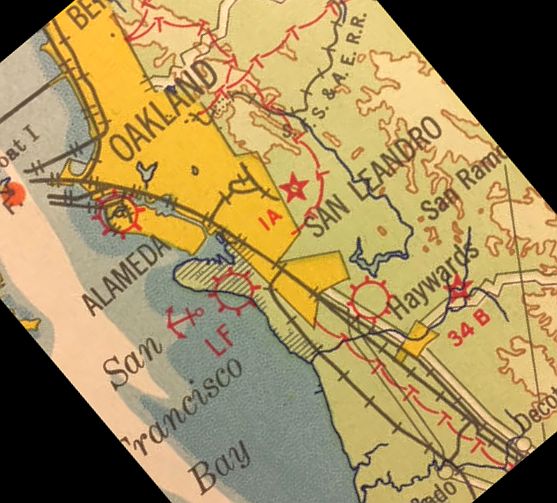
The earliest aeronautical chart depiction which has been located of San Leandro Airport was on a 1929 Flight Chart (courtesy of Kevin Walsh).
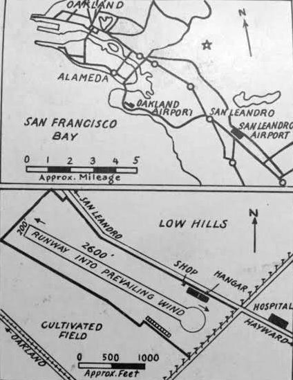
The back of the 1929 Flight Chart (courtesy of Kevin Walsh) depicted San Leandro Airport as a narrow property having a 2,600' northwest/southeast runway, with a shop & hangar on the east side.
Kevin Walsh observed, “The diagonal street with tracks at the lower-left would be the main drag & old state highway, East 14th Street, with its streetcar line connecting Oakland to Hayward.
The hospital at the right would be Fairmont Hospital, and so the street running from center-bottom to center-right is 150th Avenue.
The road running on the east side of the field with the distinctive crook in it is (naturally) Foothill Boulevard, which generally divided the flatlands from the hills.”
According to a staff correspondence in the 1929 Aeronautical Industry Volume 8, the Consolidated Aircraft Corporation of San Leandro changed its name to the "West American Aircraft Corporation”.
Presumably this was to avoid confusion with the larger & similarly-named company in Buffalo, NY.
The same article noted that the company was planning on purchasing additional equipment & make improvements to its landing field.
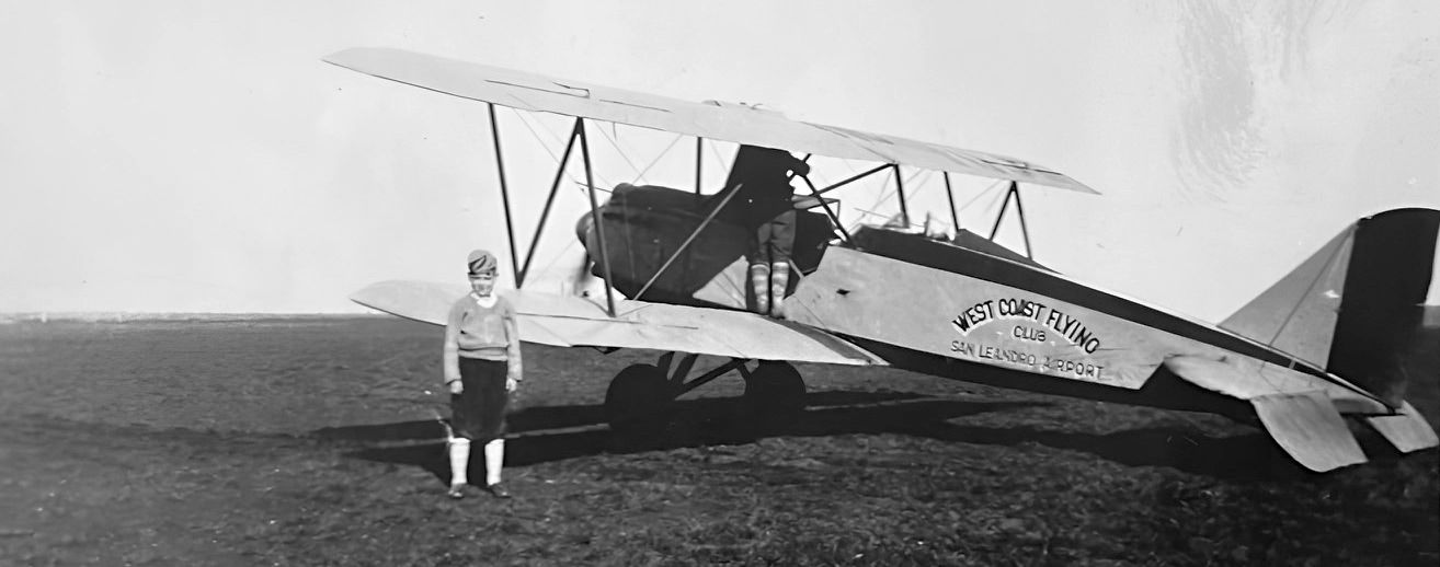
A 1930 photo courtesy of Kathyanne Christine of her 10 year old father Clayton Buckley in front of a biplane (model undetermined) marked of the West Coast Flying Club, San Leandro Airport.
According to an article in the 1930 Aero Digest magazine, an unlicensed pilot was arrested at San Leandro Airport:
"We published an announcement recently concerning the Sheriff of Alameda County, who had a posse with which he pursued unlicensed pilots who landed within his domain.
At San Leandro one James Canavan who committed the mistake of flying without proper credentials, inadvertently landed on the local airport only to find himself chased by the limb of the law & hauled into court.
He was sentenced to serve 125 days in jail, or pay a fine of $250. He said he would pay the fine.
His arrest came about after he had crashed an old 'Jenny' with which he was wobbling about the sky."
The San Leandro Airport was short-lived, presumably due to the depression's impact on its operator.
A note in the 5/1/30 Commerce Department Airway Bulletin indicated that the San Leandro Airport was no longer in operation.
However San Leandro Airport was still listed in the 1931 Pilot's Handbook as having an 1,800' runway.
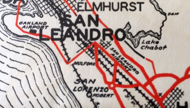
The last depiction which has been located of the San Leandro Airport was on a 1932 map.
A 1936 aerial photo showed no trace remained of San Leandro Airport,
nor was it depicted on the 1939 USGS topo map or a 1944 Thomas Brothers map (courtesy of Kevin Walsh)."durant field" oakland
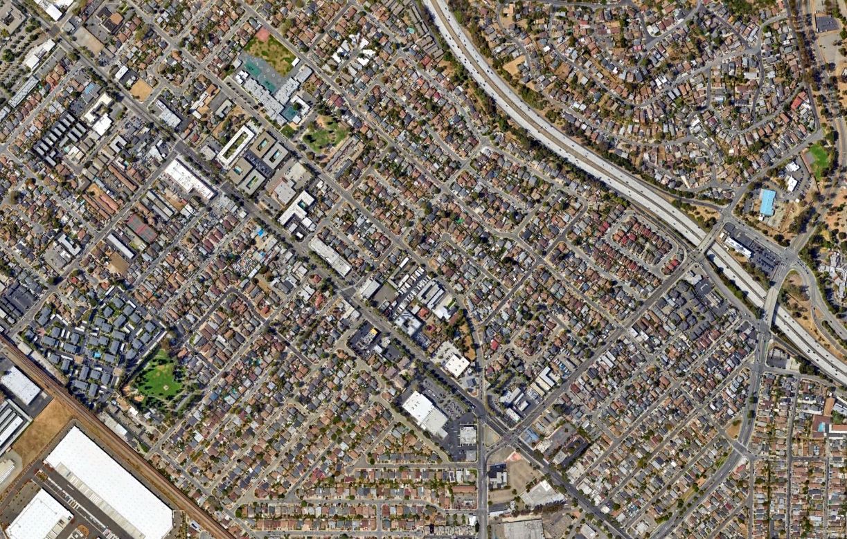
A 2022 aerial photo showed the site of San Leandro Airport covered by dense housing.
Thanks to Kathyanne Christine for pointing out this airfield.
____________________________________________________
Downtown Oakland Heliport, Oakland, CA
37.801, -122.265 (Downtown Oakland, CA)
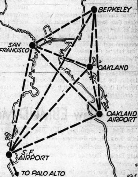
A 1961 diagram of proposed helicopter routes, including Downtown Oakland (courtesy of Jonathan Westerling).
Jonathan Westerling reported, “A 1/11/61 Oakland Tribune article foreshadowed helicopter service by a new business, San Francisco & Oakland (SF&O) Helicopter Airlines,
who was seeking approval to begin operations linking locations around the San Francisco Bay Area.
One of the areas to be served was Oakland, and the airline began inquiries into various downtown locations from which to operate.
The Oakland Port Commission, who operate the Oakland Airport, were initially skeptical fearing that travelers would use the service to ferry across the bay to San Francisco instead of their airport.
But their objections were soon mitigated & the Port decided to support the airline's operations which began in Downtown Oakland on 6/1/61.”
In the August 1961 Airman's Information Guide, a temporary heliport is noted to have been constructed adjacent to Lake Merritt & the Oakland Convention Center.
This location was used for several years while the final location for the heliport was being determined & constructed.
According to a 1/19/64 Oakland Tribune article, the final location for the downtown heliport was selected to be the recently completed Alameda County (ALCO) Parking Garage which had been designed with a helipad on top.
The Port of Oakland invested $150,000 of additional improvements to the structure to facilitate the helipad becoming suitable for public use.
To use the new heliport, the FAA initially required twin-engine helicopters: "The objection of the FAA was centered around the lack of emergency landing areas in the event of a failure of a single-engine craft.
There is no objection to twin-engine operation. Mike Bagan [president of SF&O Helicopter Airlines] said that his' organization's experts are currently locating emergency sites & may be able to prepare them to suit the FAA in less than a year's time."
According to a 1964 timetable for SF&O Helicopter airlines, the one-way fare flying downtown Oakland to SFO was $8.50. When booked with a partner airline, however, the fare was reduced to $5.50 .
According to his testimony before the US Senate's Aviation Subcommittee on the Helicopter Air Service Program,
Mike Bagan noted that "On 3/1/65 we inaugurated service to a new rooftop heliport in downtown Oakland.
The heliport is atop a 120' high municipal garage with express elevator service & constitutes the first scheduled helicopter rooftop passenger service in the world."
According to https://localwiki.org/oakland/Heliport, the elevator in the parking garage even has an "H" button which took passengers up to the heliport waiting area on top.
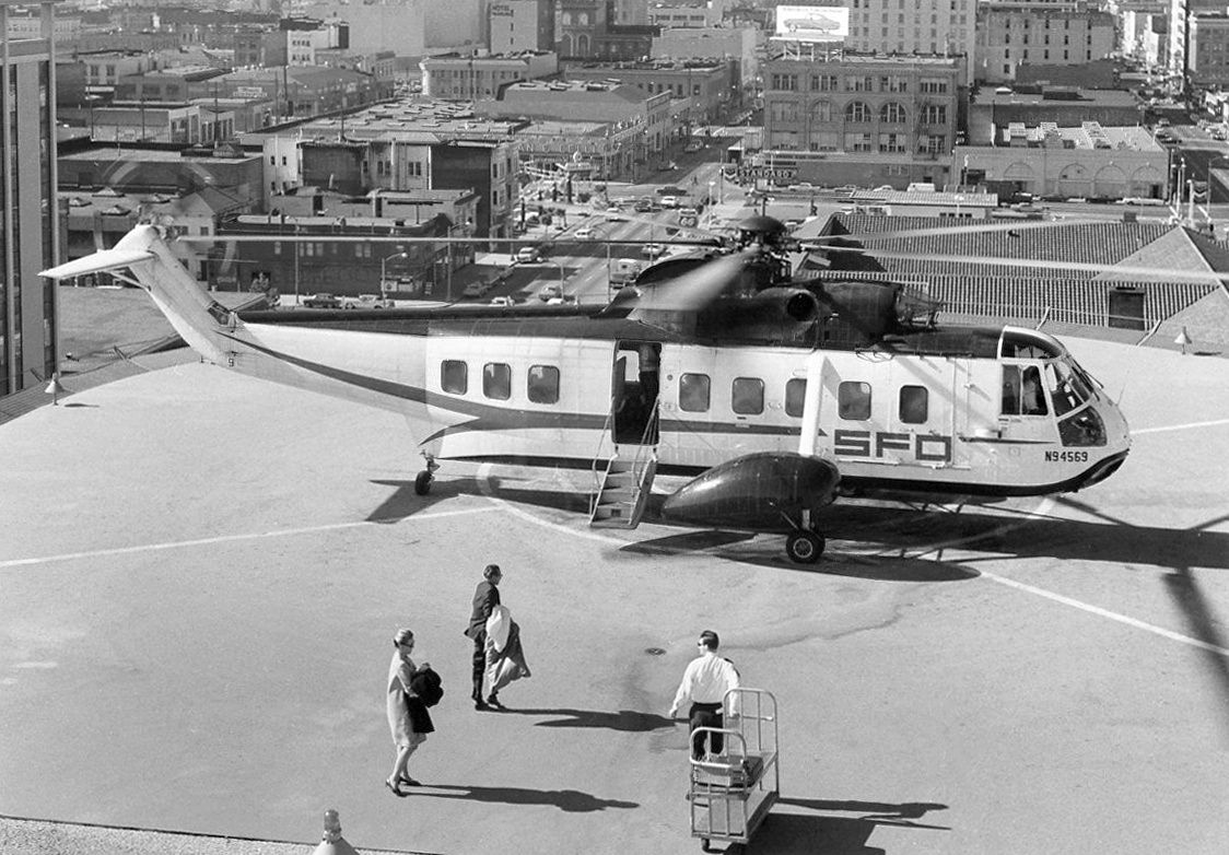

A circa 1960s/70s photo of a San Francisco & Oakland Helicopter Airlines Sikorsky S-61N on the Oakland Alameda County Parking Garage heliport.
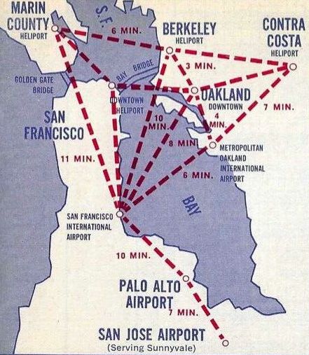
A 1966 SFO Airlines helicopter route map, including Downtown Oakland (courtesy of Jonathan Westerling).
A 1966 Oakland Tribune article detailed a petition by residents of apartment buildings near the heliport who asked that the operations be moved due to the noise from the Sikorsky copters.
Even though the service was well utilized, there were complaints about the helipad's location.
The Downtown Oakland Heliport was evidently not depicted on 1960s/70s San Francisco Sectional Charts.
The 1967 AOPA Airports USA listed the Downtown Oakland Heliport as private & having a 136' x 100' paved landing area at 119' elevation.
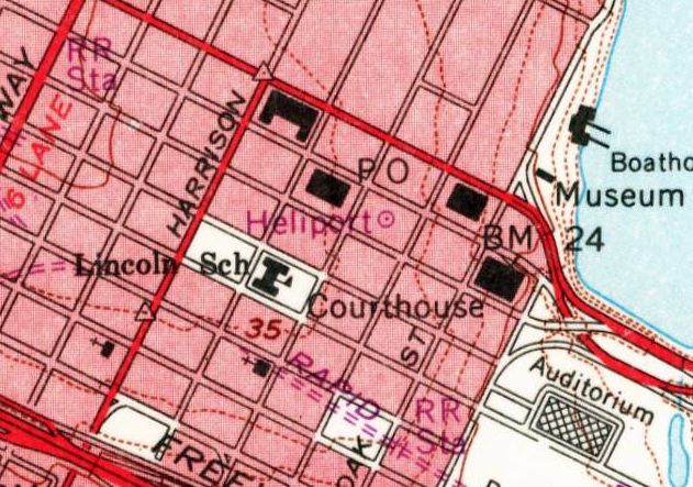
The Downtown Oakland Heliport, as depicted on the 1968 USGS topo map.
According to IMDB.com, the end of a 1975 episode of the Streets of San Francisco "Laborynth" (S3.E22) was filmed at the Downtown Oakland Heliport.
Jonathan Westerling reported, “Several people who worked at SFO Helicopter Airlines have noted that it was severely impacted by a mechanic's strike in 1976 & collapsed, liquidating its helicopters & ceasing all operations.
This was the last scheduled passenger service from the Downtown Oakland heliport, though it remained open as a private helipad.”
According to a 12/2/76 Oakland Tribune article, despite some objections, apparently the helicopter service was popular enough that a possible successor, Pacific Seaboard Helicopter Airlines,
was chastised by the Oakland City Council for not including the Downtown Oakland heliport in the business plan proposed to the CA Public Utilities Commission.
The Downtown Oakland heliport was still listed in the 1981 AIA Directory of Heliports.
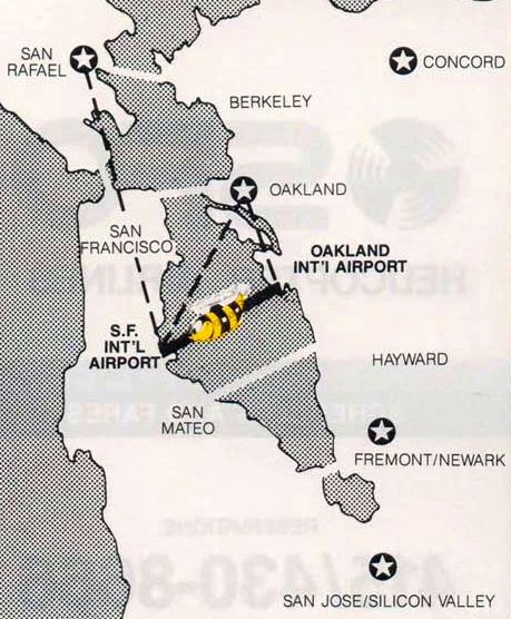
A 1983 SFO Airlines helicopter route map (courtesy of Jonathan Westerling).
Jonathan Westerling noted that SFO Helicopter Airlines had been resurrected post-bankruptcy, and the route map depicted the Downtown Oakland heliport as a "Future Expansion" site,
but there is no record of helicopter flights returning to the helipad.
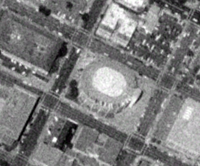
A 1993 aerial photo of the Alco Parking Garage, the site of the Downtown Oakland Heliport.
A 2002 aerial photo showed a yellow closed “X” symbol had been painted across the helipad symbol on the roof of the Alco Parking Garage.
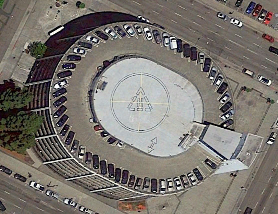
The helipad symbol on the roof of the Alco Parking Garage was still quite evident as of a 2014 aerial photo.
Aerial photos from 2015 & subsequent years showed the heliport symbol was no longer evident on the garage roof.

A 2022 photo by Jonathan Westerling showed the illuminated windsock frame which remained on top of the Alco Parking Garage, former site of the Downtown Oakland Heliport.
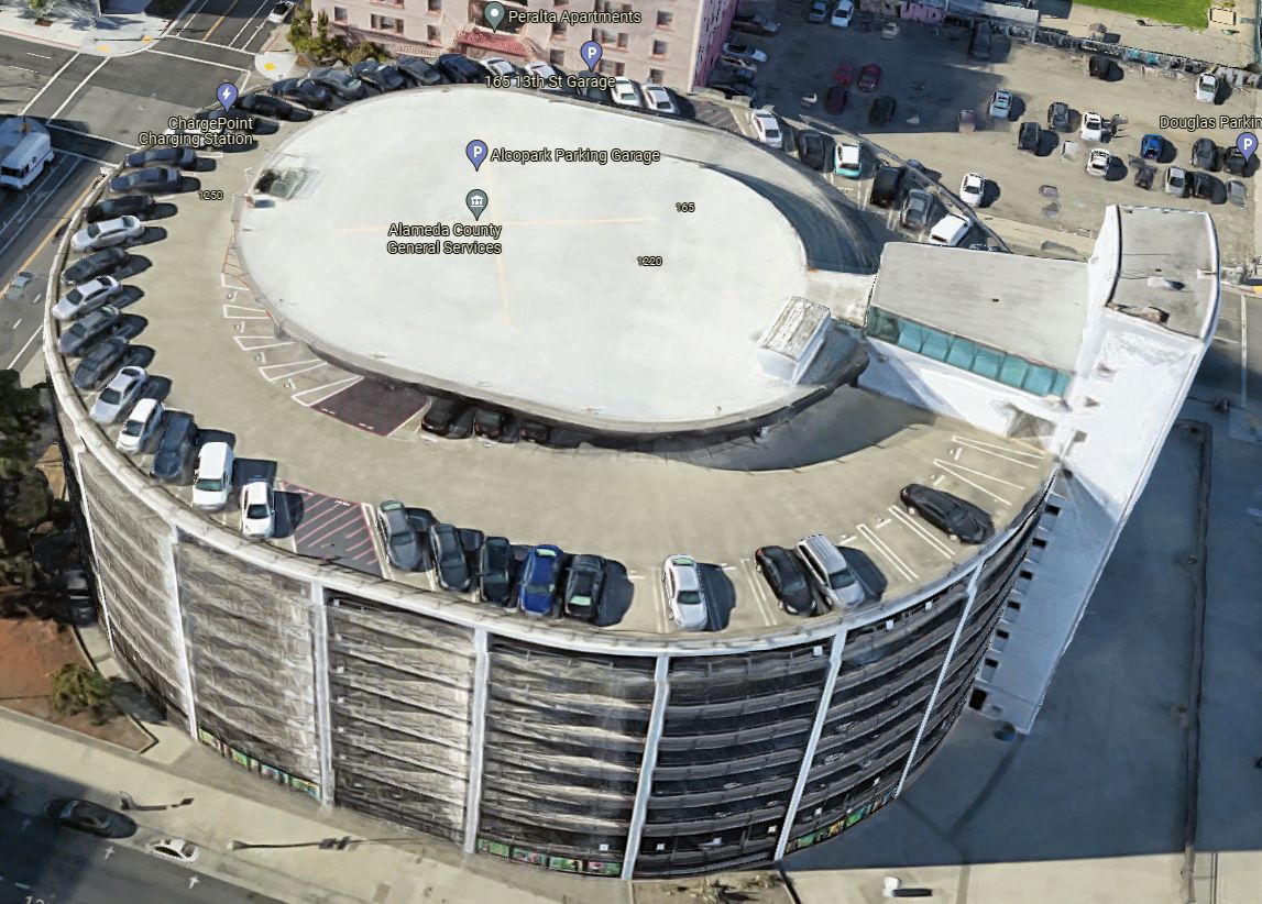
A 2023 3-D aerial image looking north at the Alco Parking Garage, showing the yellow closed “X” symbol painted over the former Downtown Oakland Heliport.
Thanks to Jonathan Westerling for pointing out this airfield.
____________________________________________________
Byron Airpark (4Q5), Byron, CA
37.835, -121.636 (East of Oakland, CA)
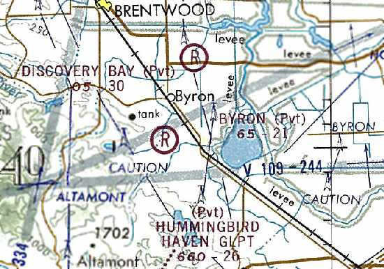
The 1973 San Francisco Sectional Chart (courtesy of Jonathan Westerling)
depicted Byron Airpark as a private airfield having a 2,100' unpaved runway.
No airfield was yet depicted at this location on a 1938 aerial photos.
According to Rich Harrison, “The old Byron Airport... was built sometime during WW2 as an auxiliary training field
(possibly to support Concord Field training) and to support the Byron Hot Springs, which is adjacent to the field.
The Byron Hot Springs was a turn-of-the-century luxury resort that was used during WW2 as an interrogation facility for German and Japanese officers.
(I have heard that there was an airfield on the property some time prior to WW2 & was used by the Hot Springs.”
However no airfield in Byron was depicted on 1943/44/45 San Francisco Sectional Charts.
According to Rich Harrison, “The airfield was closed around the end of WW2.”
The Byron Airpark was not listed among active airfields in the 1945 AAF Airfield Directory (courtesy of Scott Murdock).
Byron Airpark was not yet depicted on a 1959 aerial photo.
According to Jonathan Westerling, the December 2000 Contra Costa County Airport Land Use Compatibility Plan
described the Byron Airpark as “a small, privately-owned, public-use airport which had occupied the current property... since the 1950s.”
According to the book "Two Hours By Crow" by Howard & Judith Campbell (courtesy of Wings of History),
“John & Emily Maggi purchased 124 acres of open pasture land from the Armstrong family on 12/30/64 & used it to open Byron Airpark.
The original plans for the field showed 3 runways. An east/west strip was to run from Armstrong Road to Brushy Creek but was not put in & Runway 14/32 alongside the pipeline was extended by relocating Brushy Creek.”
The earliest photo which has been located of Byron Airpark was a 1966 aerial view, which depicted it as having 3 unpaved runways.
The Byron Airport was not yet depicted on the 1968/75 USGS topo maps or the June 1968 San Francisco Sectional Chart.
The earliest aeronautical chart depiction which has been located of the Byron Airpark was on the 1973 San Francisco Sectional Chart (courtesy of Jonathan Westerling).
It depicted Byron as a private airfield having a 2,100' unpaved runway.
According to the book "Two Hours By Crow" by Howard & Judith Campbell (courtesy of Wings of History),
“The complex was changed to a public airport in 1973, then sold.”
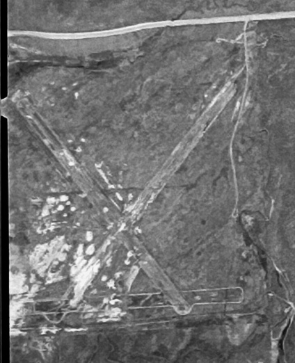
The earliest photo which is available of Byron Airpark was a 4/11/74 USGS aerial view, which wepicted Byron as having 3 unpaved runways.
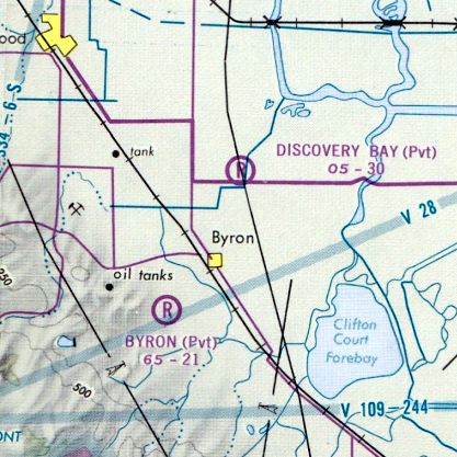
The 1975 San Francisco Terminal Chart depicted Byron Airpark as a private airfield with a 2,100' unpaved runway.
The 1976 AOPA Airports USA Directory (according to Jonathan Westerling) described Byron Airpark
as having 3 dirt runways, all 2,100': Runways 9/29, 4/22, and 14/32.
According to the book "Two Hours By Crow" by Howard & Judith Campbell (courtesy of Wings of History), “ Bay Area Skydiving moved onto the field about 1977.”
According to Rich Harrison, “I was a member of the Concord chapter of the EAA (393) in the mid 1970s to late 1980s.
One of the members was Bud. He & a couple of partners purchased the former airfield some time in the late 1970s.
They asphalted 2 of the 3 original runways & opened it up.
I flew out there in my Grumman Yankee many times for EAA activities, and to just stop in to say hi. Bud built a house adjacent to the airport.
They leased space for people to park their planes & put in Port-a-Ports.”
The 1979 AOPA Airports USA Directory (according to Jonathan Westerling) described Byron (4Q5) as a private airfield.
It was said to have 2 dirt runways in an 'X' pattern: 2,100' Runway 14/32 & 2,000' Runway 4/22.
According to Jonathan Westerling, “The little unpaved runways were home to modest flight operations through the 1980s.”
This included some student training, according to the NTSB Accident Database.
The 1981 San Francisco Sectional Chart (courtesy of Jonathan Westerling)
depicted Byron as a private airfield having 2 paved runways, with the longest being 2,100'.
According to the book "Two Hours By Crow" by Howard & Judith Campbell (courtesy of Wings of History), “The complex filed for bankruptcy in 1986.”
According to Jonathan Westerling, Contra Costa County records stated that “The Byron Airpark was purchased in 1986.
After its purchase, the County made some minor improvements to support operations at Byron Airpark
while the new County airport was planned & constructed just to the south.”
According to Rich Harrison, “When Antioch Airport was closing in the mid to late 1980s, the parachute operation moved to Byron & built their hangar.”
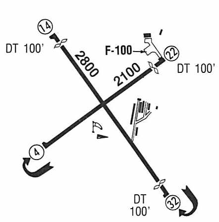
The 1987 Airports Guide (courtesy of Jonathan Westerling)
described Byron Airpark as a public-use airport which conducted ultralight operations.
It depicted the field as having a 2,800' paved Runway 14/32 & a 2,100' paved Runway 4/22.
Several buildings were depicted on the east & northeast sides of the field.
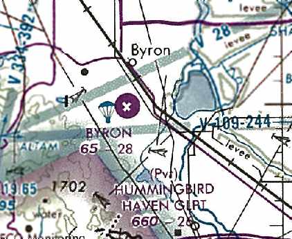
The last aeronautical chart depiction which has been located of the Byron Airpark was on the 1989 San Francisco Sectional Chart (courtesy of Jonathan Westerling).
It depicted Byron as having 2 paved runways, with the longest being 2,800', and also showed that skydiving operations had commenced.
According to the book "Two Hours By Crow" by Howard & Judith Campbell (courtesy of Wings of History), “Byron Airpark sold to the County in 1990.”
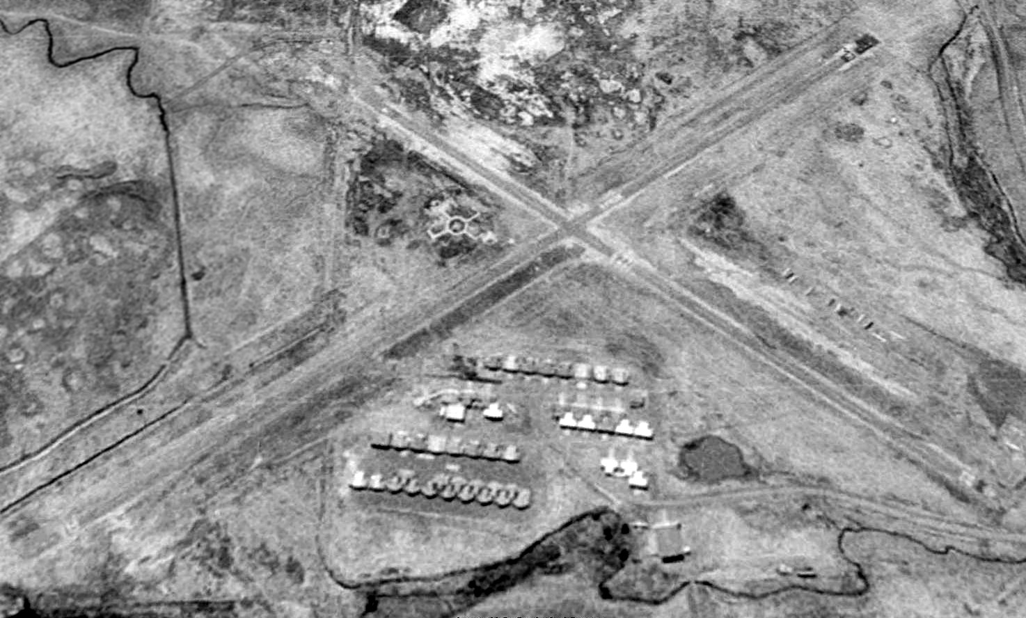
A 1993 USGS aerial view looking west at Byron Airpark depicted an amazing number (over 3-dozen)
of what appeared to be individual T-hangars on the east side of the airfield with 2 paved runways.
According to the Contra Costa County website, “In 1993 Contra Costa County broke ground on a new airport 2 miles south of Byron.”
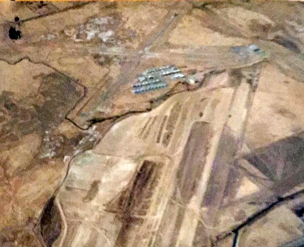
An 11/1/93 aerial view by Ted Schroder (courtesy of Kevin Walsh) looking northwest at Byron Airpark (top of photo),
also showing the new Byron Airport under construction (bottom of photo).
According to the Contra Costa County website, “On 10/8/94 [the new] Byron Airport was dedicated.”
Presumably the old Byron Airpark was closed around the same time the new airfield opened.
According to the book "Two Hours By Crow" by Howard & Judith Campbell (courtesy of Wings of History), “Byron Airpark closed in 1995.
The pavement was ripped up & the land on the western side was turned into wetlands.”
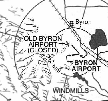
The 1996 Pilots Guide to California Airports (courtesy of Jonathan Westerling)
still depicted the “Old Byron Airport (Closed)” adjacent to the new Byron Airport.
According to the 2004 book "Two Hours By Crow" by Howard & Judith Campbell (courtesy of Wings of History), “Bay Area Skydiving is still there in a hangar just about where the runways crossed.”
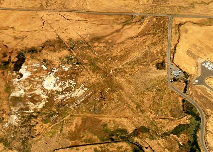
A circa 2006 aerial view looking north at the site of the Byron Airpark
showed that all of the pavement of the 2 former runways had been removed, along with all of the buildings.
Note the runway of the new Byron Airport on the right edge of the photo.
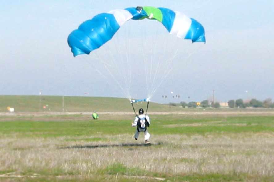
A February 2008 photo by Jonathan Westerling of a skydiver touching down on what used to be Byron Airpark's Runway 22.
Jonathan Westerling reported in 2008, “Today, aviation use of the old Byron Airfield continues to some extent
as the property is the Drop Zone for Bay Area Sky Diving.
A call to their receptionist revealed that they were well aware of the property’s prior use as an airfield.
She mentioned that they are sometimes removing bits of the old runway which poke up out of the ground.
She also stated that the last remnant of the prior airfield,
the segmented circle & runway indicator were lost in a grass fire a few years ago.”
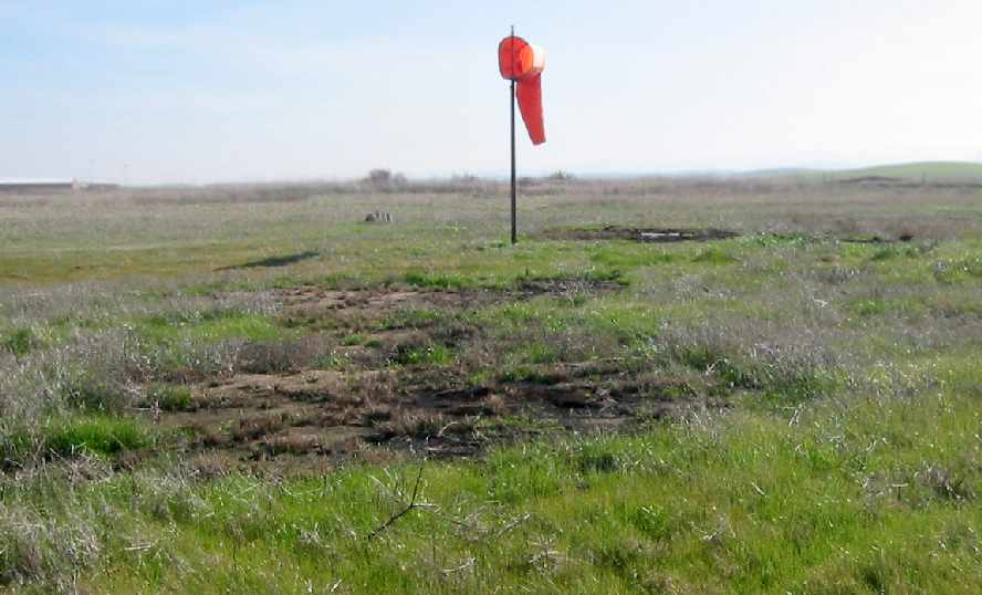
A February 2008 photo by Jonathan Westerling of the windsock at the old Byron Airpark.
According to Jonathan, the windsock “has been restored by Bay Area Skydiving to indicate the wind direction on their drop zone.
The segmented circle which surrounded this windsock was constructed
out of a hundred or more white steel-belted tires which were burned in a recent grass fire.
The rock beyond the windsock is believed to be the remains of the base for the tetrahedron.”
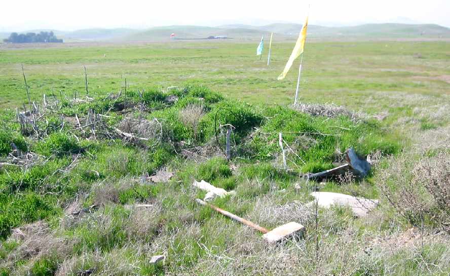
A February 2008 photo by Jonathan Westerling of “All that remains of a building near the hangars of the old Byron Airpark.
The large hangar at the north end of the field was completely removed to make way for the construction of the new County Airport.”
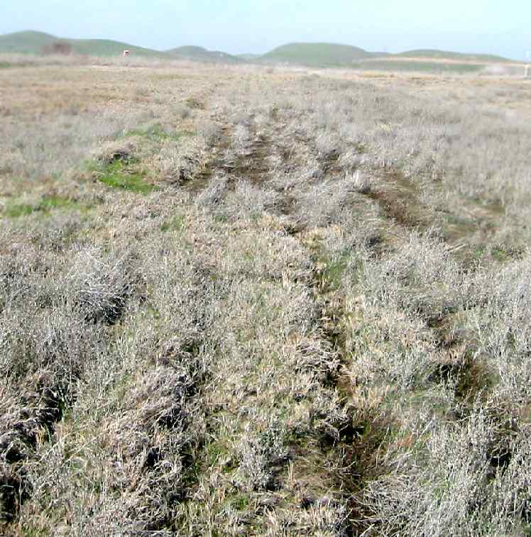
A February 2008 photo by Jonathan Westerling, “Looking up the remains of Runway 32 at the Byron Airpark.
The pavement was plowed under when the airport was decommissioned.”
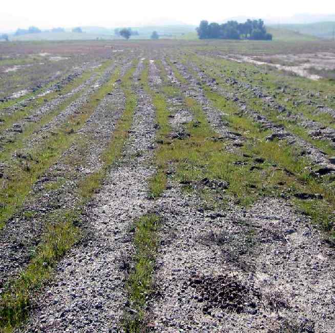
A February 2008 photo by Jonathan Westerling, “Looking West to the eastern end of Runway 4.”
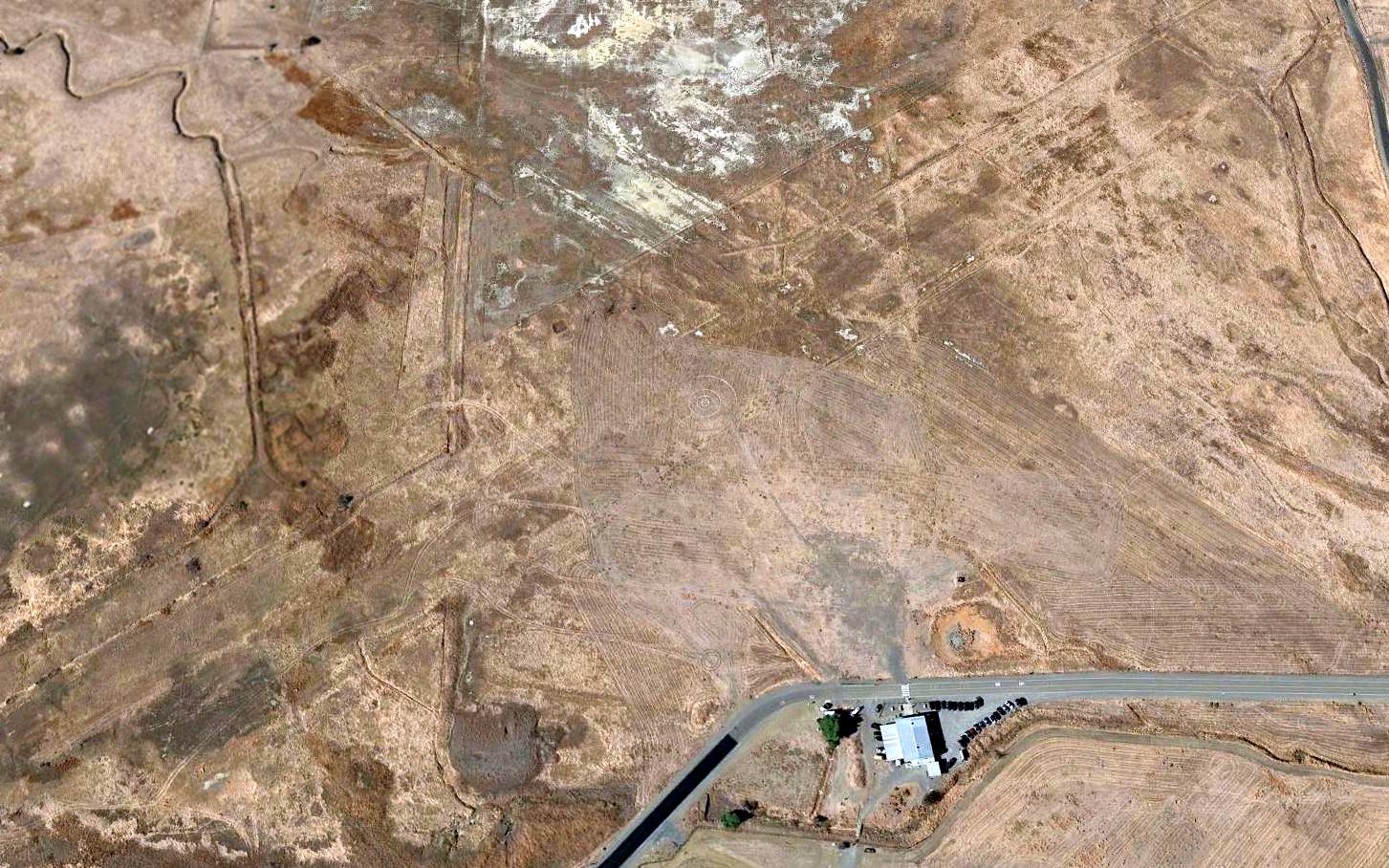
A 2015 aerial view looking west at the site of Byron Airpark showed only the slightest trace of the outline of the 2 runways,
but a parachutist target symbol was still plainly apparent in the center of the site.
The site of Byron Airpark is located southwest of the intersection of Armstrong Road & Falcon Way, adjacent to the west side of the current-day Byron Airport.
____________________________________________________
San Francisco Bay Airdrome, Alameda, CA
37.785, -122.282 (East of San Francisco, CA)

In 1920, as part of an inheritance from a wealthy alumnus,
the University of California received 458 acres of partially filled marshland on both sides of Webster Street.
In 1929, capitalizing on the airplane fever created by Lindbergh's transcontinental flight,
the UC Regents began construction of an airport.
The marsh was drained by a network of ditches from which water was pumped.
After grading the site, crushed oyster shells were barged from Bay Farm Island to pave 3,400' & 1,700' runways,
and the airdrome's business was housed in a single 53,000-square-foot hangar, constructed for $150,000.
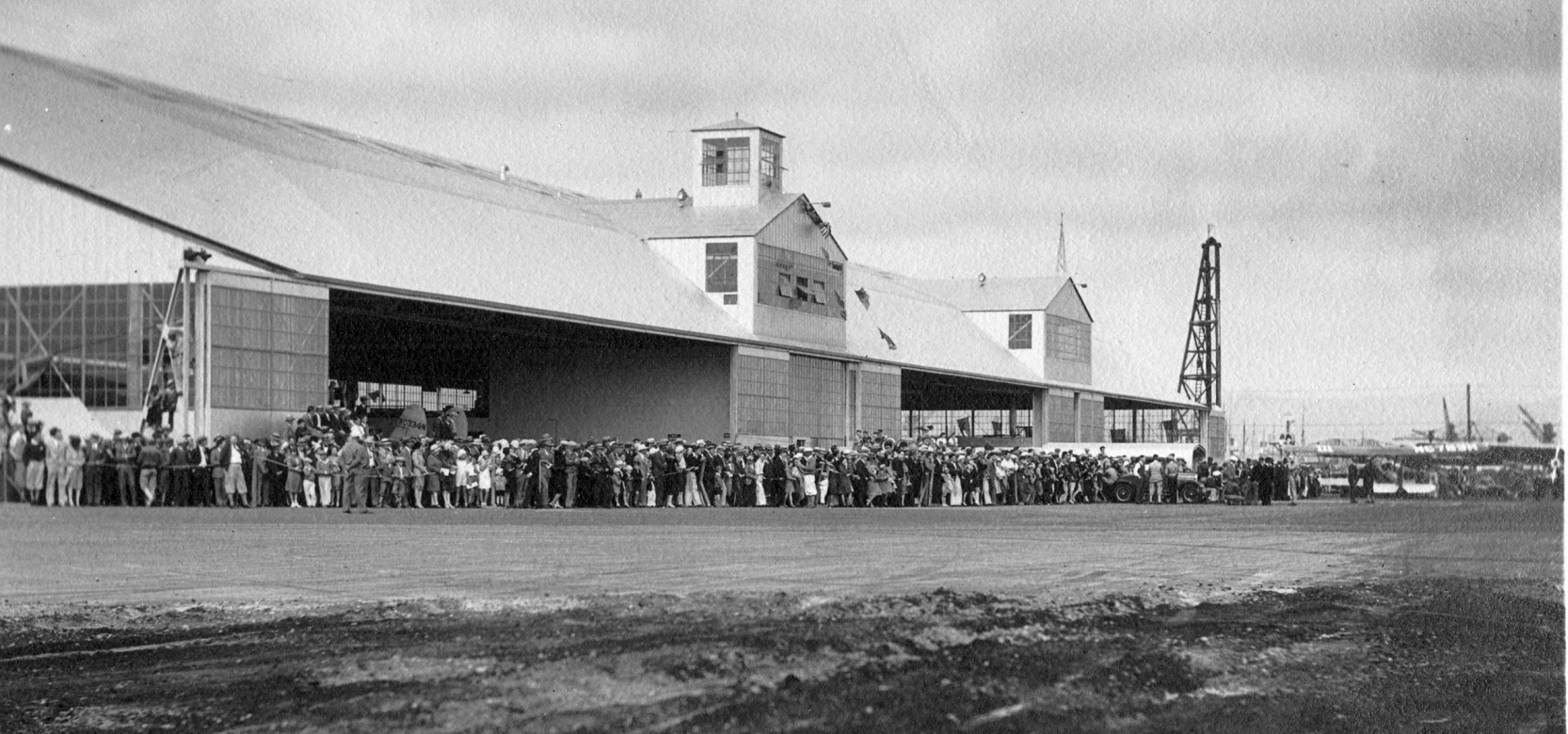
An undated photo of a large gathering in front of the San Francisco Bay Airdrome's hangar, possibly for its 1930 dedication.
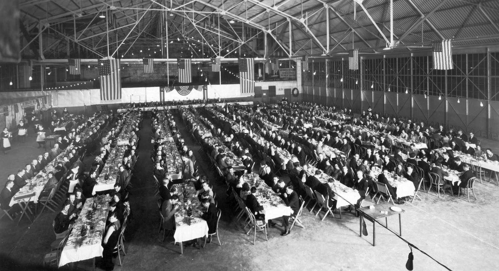
An undated photo of a large gathering inside the San Francisco Bay Airdrome hangar, possibly for its 8/16/30 dedication.
The San Francisco Bay Airdrome had its gala christening party on 8/16/30.
The airfield was a busy place, as an early home base for Coastal Air Freight, Varney Air Lines, West Coast Air Transport,
Western Air Express, the transbay Air Ferries, and Boeing's Pacific Air Transport.
The Standard Oil Company's 1930 "Airplane Landing Fields of the Pacific West" (courtesy of Chris Kennedy)
described San Francisco Bay Airdrome as having 2 shell runways, with the longest being a 3,400' east/west strip.
A 3,600' northeast/southwest runway was listed as being under construction, to be ready in 1931.
San Francisco Bay Airdrome's success during 1930-31 led to a 160' addition to the original hangar & the first 160' of another one.
Three more hangars were soon added, actually attached to the first, then a 5th one, separate & canted at an outward angle.
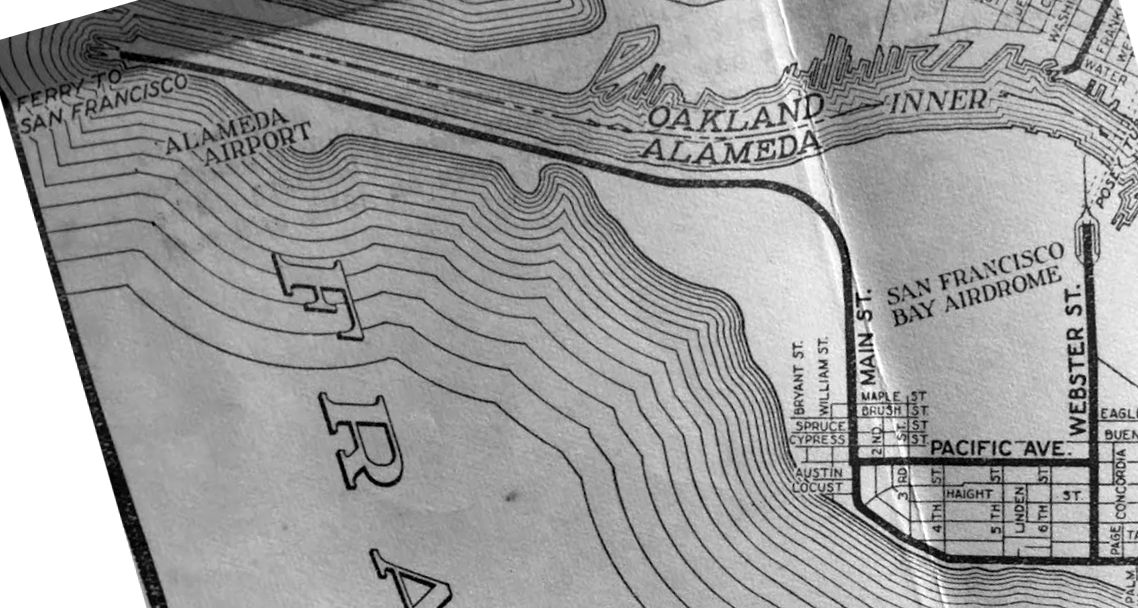
The earliest map depiction which has been located of San Francisco Bay Airdrome
was on a February 1931 CA State Automobile Association map (courtesy of Kevin Walsh).
It also depicted the nearby Alameda Airport to the west.
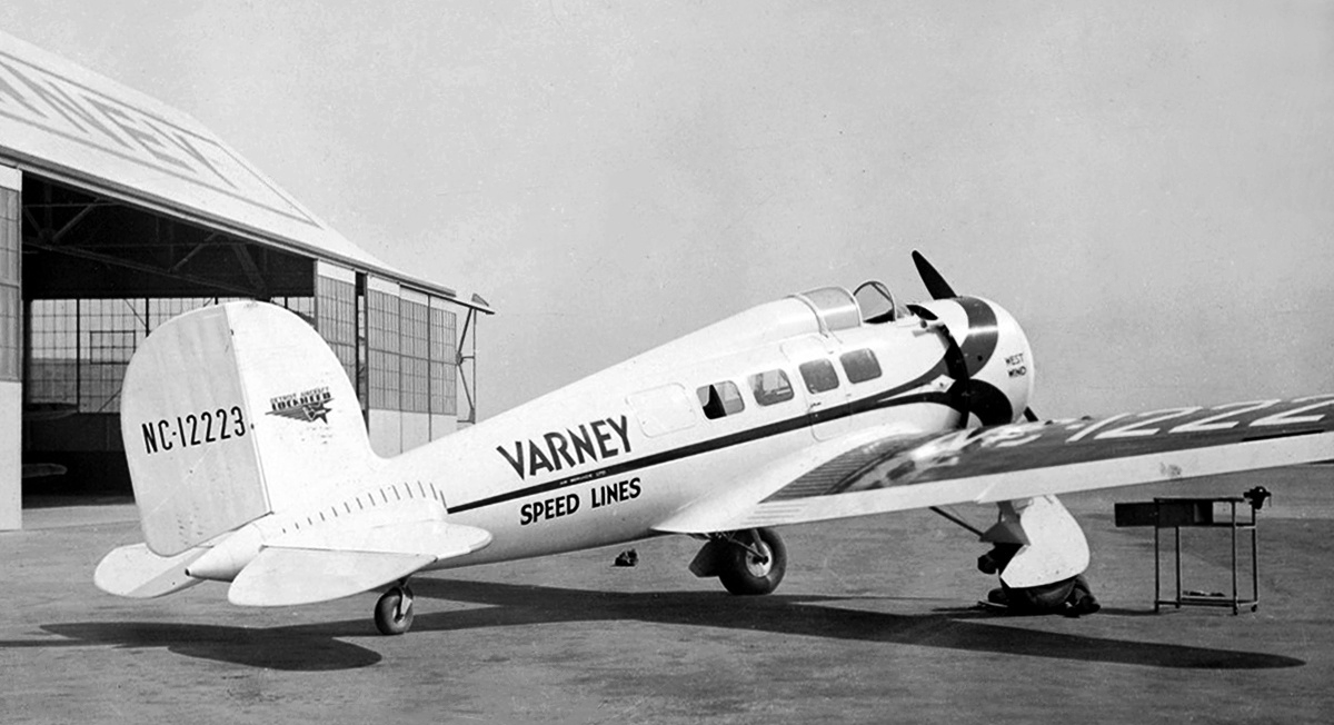
A November 1931 photo of Varney Speed Lines Lockheed Orion 9, NC 12223 C/n 181, in front of San Francisco Bay Airdrome's Varney hangar.
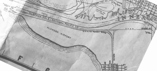
A pre-1933 Bekins Van & Storage map, by Thomas Brothers Maps (courtesy of Kevin Walsh)
did not yet depict anything at the site of San Francisco Bay Airdrome,
although the adjacent Alameda Airport was depicted to the west.
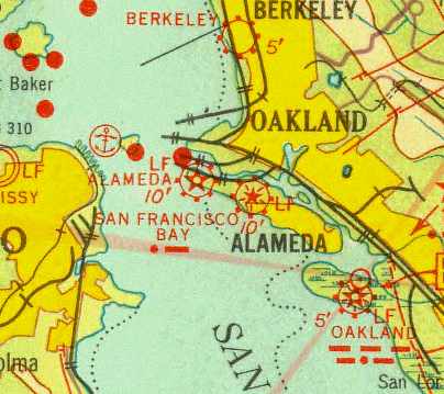
“San Francisco Bay” was depicted as a commercial/municipal airport
on the 1933 San Francisco Airway Map (courtesy of Chris Kennedy).
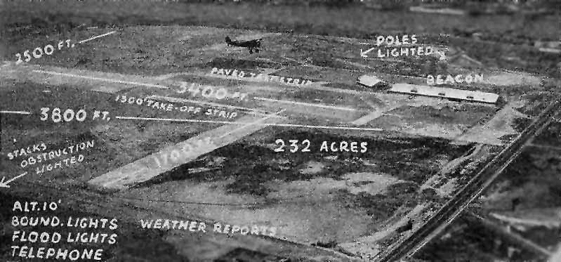
An aerial looking northwest at San Francisco Bay Airdrome,
from The Airport Directory Company's 1933 Airports Directory (courtesy of Chris Kennedy).
Note the aircraft in flight over the center of the field.
The directory described San Francisco Bay Airdrome as having 2 crushed shell runways
(extravagantly described as "one of the finest surfaces ever constructed for airplane landings"),
oriented 3,400' east/west & 1,700' north/south.
The field featured a "modern steel hangar", fueling, passenger waiting room, and "expert mechanical service".
The manager was listed as R.U. St. John.
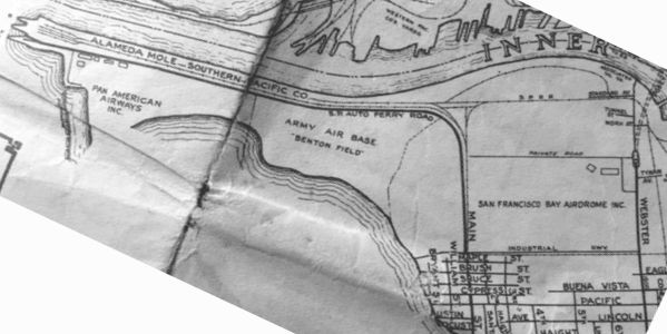
San Francisco Bay Airdrome, as depicted on a circa 1935 Bekins Van & Storage map, by Thomas Brothers Maps (courtesy of Kevin Walsh),
along with the adjacent Army Air Base Benton Field, and Pan American Airways Inc.
A 1936 airport directory described San Francisco Bay Airdrome as having 4 runways,
with the longest being a 3,600' crushed shell northeast/southwest runway.
A blimp anchorage was located on the southwest part of the field.

A 1937 aerial view of the San Francisco Bay Airdrome (courtesy of aerofiles.com).
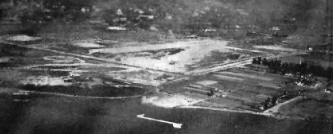
An aerial view looking northeast at San Francisco Bay Airdrome,
from The Airport Directory Company's 1937 Airports Directory (courtesy of Bob Rambo).
The directory described San Francisco Bay Airdrome as having 2 crushed shell runways (3,400' east/west & 1,700' north/south)
and 2 graded runways (3,600' northeast/southwest & 2,500' north/south),
and an asphalt takeoff strip on the east/west runway.
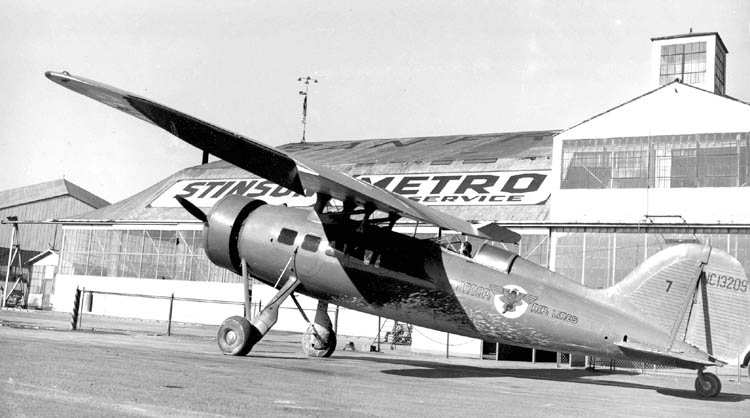
A 1938 photo (courtesy of Bill Larkins) of a Condor Air Lines Consolidated "Fleetster" 20-A in front of the boarding area at SFBA.
Condor Air Lines started a route to Monterey with this plane.
It's still in it's TWA red colors - it was repainted yellow the next year.

A circa 1930s photo of a Consolidated "Fleetster" 20-A in front of the SFBA hangar.

A circa 1930s photo of a Fairchild (model undetermined) landing in front of the SFBA hangar.
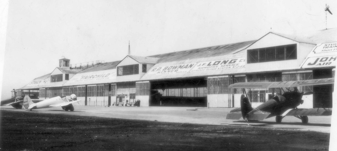
A circa 1930s photo of 2 monoplanes & a biplane in front of the SFBA hangar.
The original caption was “San Francisco Bay Airdrome, the busiest airport in the world.”
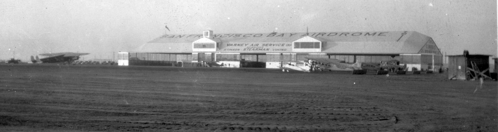
A circa 1930s photo of several monoplanes & a biplane in front of the SFBA hangar.
Airline business at the field was negatively impacted by the depression-era economy,
and the airlines soon departed to the San Francisco & Oakland Airports.
The Airdrome became home to general aviation & a number of operators,
including Johnston Air Service, Monarch Air Service, Pacific Aerial Survey,
dealerships for Stinson, Waco, Stearman-Hammond, Kinner, and Fairchild airplanes,
and the business fleets of Standard, Mohawk, and Richfield oil companies.
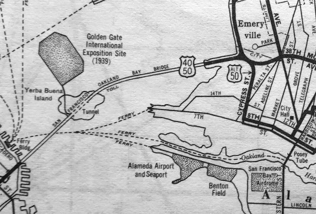
A 1938 street map (courtesy of Kevin Walsh) depicted “Alameda Airport & Seaport”, “Benton Field”, and “San Francisco Bay Airdrome”.
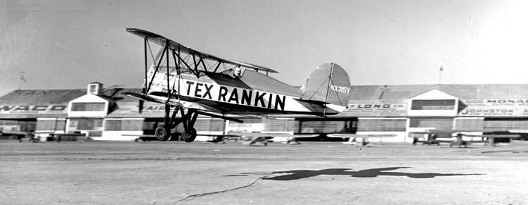
A undated photo of Tex Rankin in his Grear Lakes biplane in front of the hangars at SFBA (courtesy of Bill Larkins).
Aerial extravaganzas in 1938 & 1939 attracted tens of thousands of locals to their airfield.
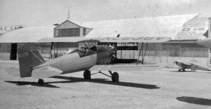
A 1939 photo of a 1931 Fleet biplane in front of the SFBA hangar.
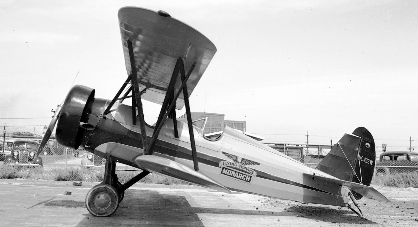
A 1939 photo by Bill Larkins of a 1931 Travel Air 16-K at San Francisco Bay Airdrome.
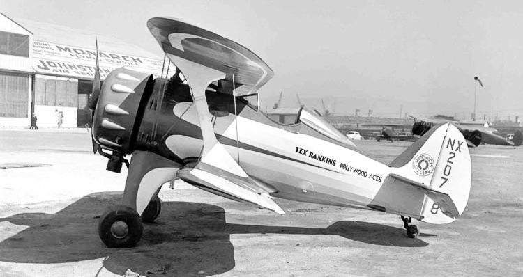
A 1939 photo by Bill Larkins of Melberg-Greenemeyer Falcon MG-2, C/n 102 NX20728 in front of a San Francisco Bay Airdrome hangar.
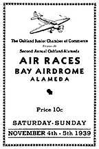
A program for the 11/4/39 Air Races at the “Bay Airdrome, Alameda”.
K.O. Eckland recalled, "SFBA is where I grew up, the classic kid riding his bike
from Berkeley all the way to Alameda after school let out & on weekends just to be around airplanes."
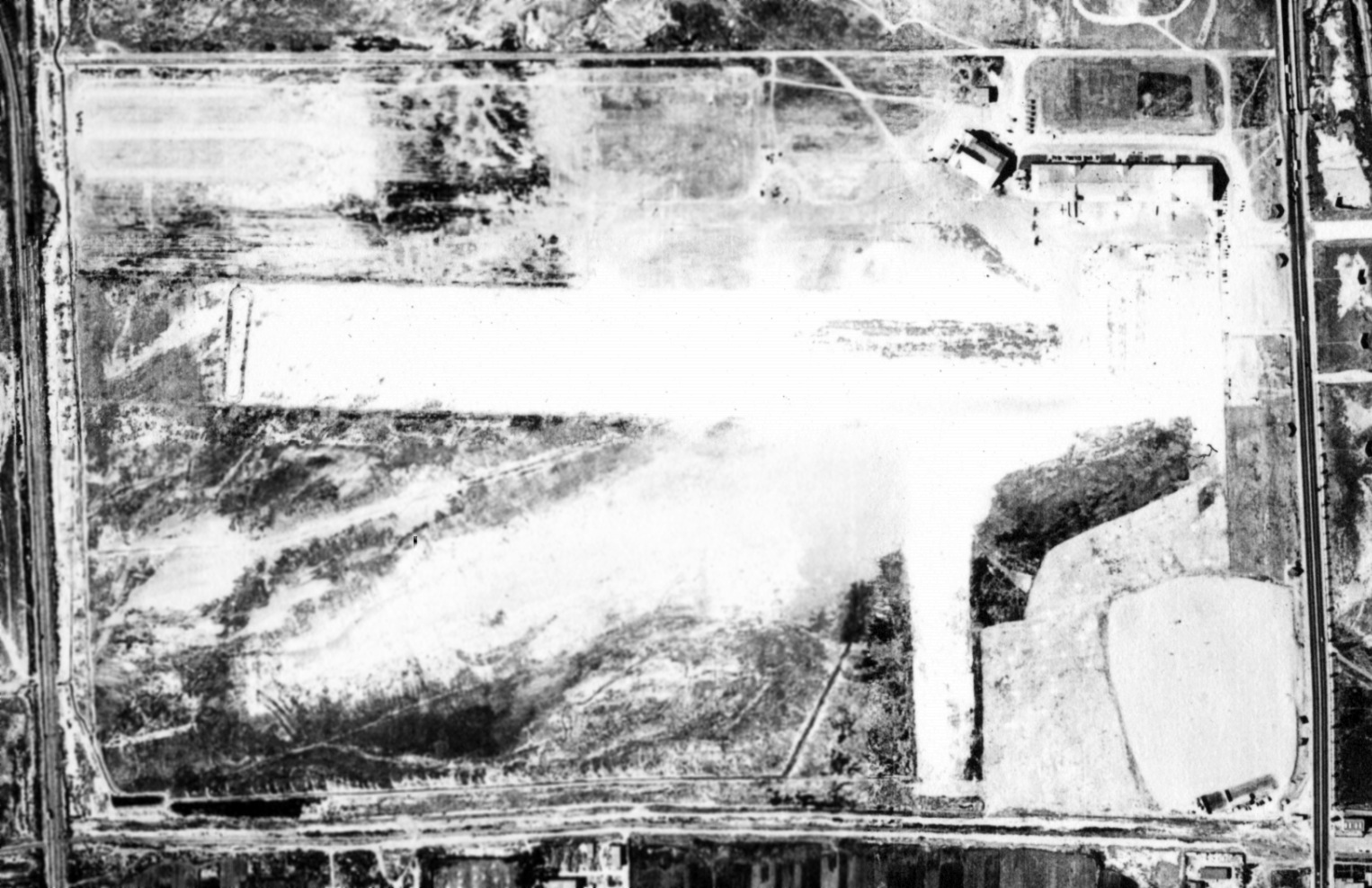
A 1939 aerial view (from the UCSB Library, courtesy of Jonathan Westerling) showed San Francisco Bay Airdrome as having 2 perpendicular unpaved runways,
with several light aircraft parked near the hangars on the northeast corner.
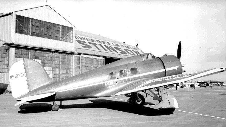
A 1939 photo by Bill Larkins of Paul Mantz's Lockheed Orion 9-C at San Francisco Bay Airdrome.
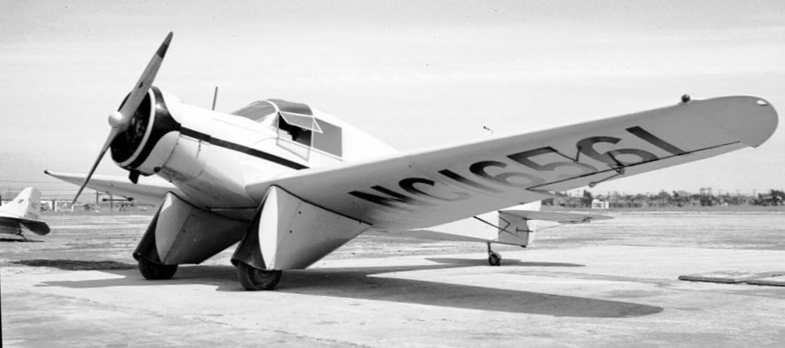
The last photo which has been located showing aircraft at San Francisco Bay Airdrome was a 1939 photo by Bill Larkins of Aeronca LB NC16561.
Bill Larkins recalled, "It had unique hangars & in addition they were different in having advertising painted on the roofs.
A fascinating place!"
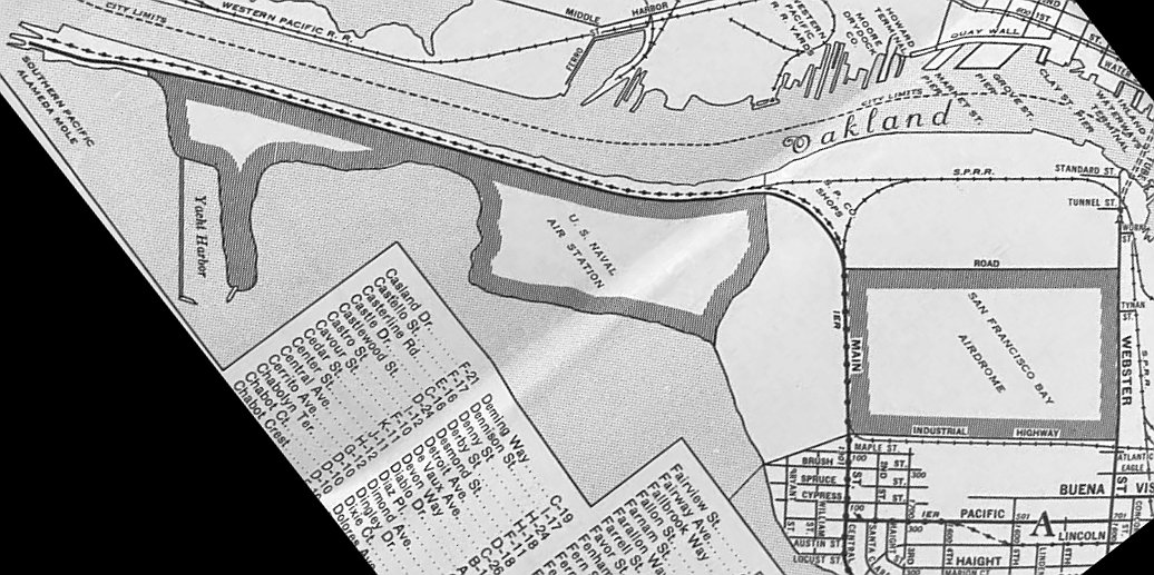
A 1939 street map (courtesy of Kevin Walsh) depicted the San Francisco Bay Airdrome as a rectangular property outline.
A list of aircraft registered as being based at the Airdrome from 1931-40 included aircraft by
Aeromarine-Klemm, Aeronca, Alexander Eaglerock, American Eagle, Bach, Beechcraft, Buhl,
Consolidated, Curtiss, De Havilland, Fairchild, Fleet, Fokker, Keystone, Kinner, Lockheed,
Luscombe, Monocupe, Piper, Porterfield, Ryan, Rearwin, Savoia-Marchetti, Security Airster,
Sikorsky, Stearman, Stinson, Swallow, Taylor, Taylorcraft, Travel Air, Viking, and Waco.
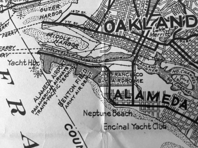
A January 1940 Metsker map (courtesy of Kevin Walsh) depicted “Alameda Airport, Pan American Airways Trans-Pacific Terminys”,
“Benton Field, Army Air Depot”, and “San Francisco Bay Airdrom” all in a row on the peninsula,
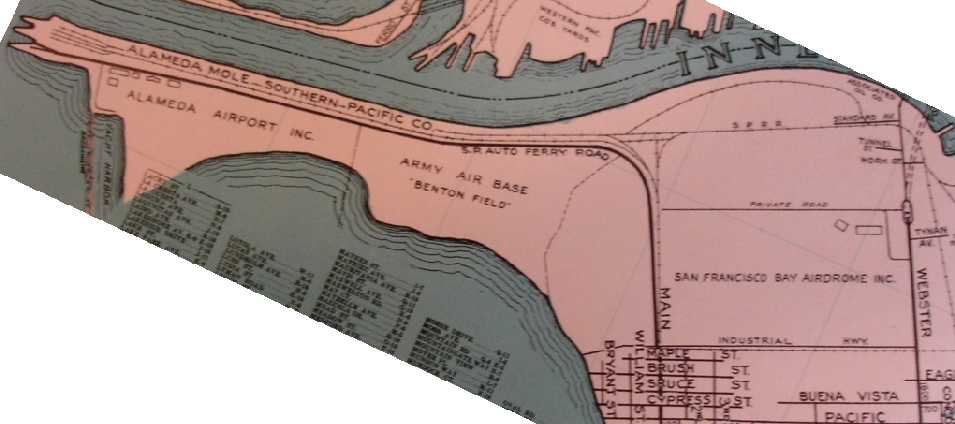
A circa 1940 Thomas Brothers map (courtesy of Rex Ricks) depicted the “San Francisco Bay Airdrome Inc.” on the east side, the “Army Air Base Benton Field” in the center,
and the “Alameda Airport Inc.” on the west end of the peninsula.
Two buildings were depicted along the northeast side of the San Francisco Bay Airdrome.
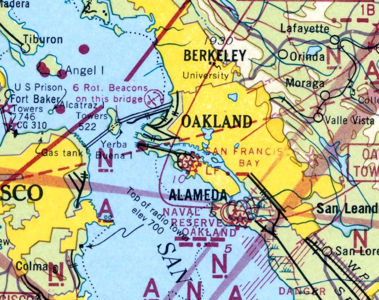
The last aeronautical chart depiction of San Francisco Bay Airdrome which has been located
was on the December 1941 San Francisco Sectional Chart (courtesy of Chris Kennedy).
The new Alameda Naval Air Station had recently been constructed adjacent to the west side of the Airdrome,
and the naval airfield's significant expansion soon spelled the end for the little civil airport.
The Bay Airdrome was closed in 1941 when it was decided that its traffic interfered with operations at NAS Alameda.
The Navy first condemned 70 acres bordering Atlantic Avenue for a housing project, then ordered the abandonment of the Airdrome.
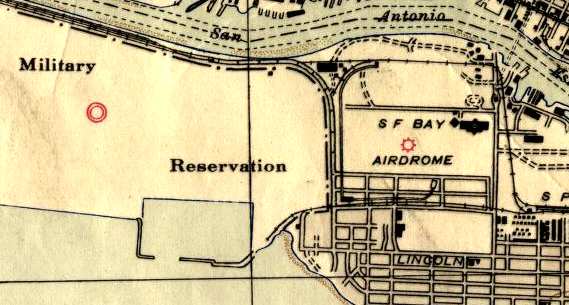
The 1942 USGS topo map still depicted the San Francisco Bay Airdrome,
but the adjacent NAS Alameda was simply left blank (without any depiction of the airfield at all), simply labeled "Military Reservation".
This was omission was apparently due to security concerns during WW2.
The San Francisco Bay Airdrome was no longer depicted at all on the August 1942 San Francisco Sectional Chart or the 1946 USGS topo map.
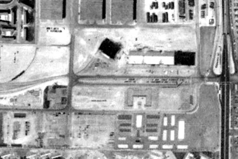
A 1946 aerial photo showed that both hangars from the Airdrome remained standing,
but several buildings & parking lots had been constructed over its former airfield area.

By the time of the 1949 USGS topo map, the open airfield area of the former Airdrome had been filled in with buildings.
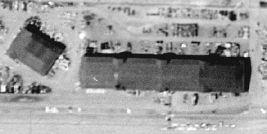
A 1958 aerial view showed that both former hangars from the former San Francisco Bay Airdrome remained standing.
A 1959 aerial view showed that the large former SFBA hangar had been removed at some point between 1958-59,
but the smaller hangar (on the west) remained standing.
In 1970, the College of Alameda opened on the eastern portion of the former Airdrome property.
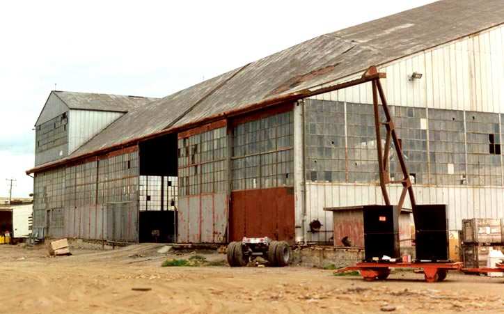
A 1993 photo by Bill Larkins of one of the former hangars of San Francisco Bay Airdrome.
Bill Larkins reported that the former hangars of SFBA still existed as of 2003.
"They were moved by the Navy & still belong to them. Most are abandoned but one is being used as a Navy medical supply warehouse."
Rick Turner reported in 2003, "I went by today & the 2 hangars that had been moved are gone along with some other ex-Navy warehouses.
It looks like some construction will start there soon but I don't know what.
The one hangar that was still in its original position is still there & appears to be being used for some sort of storage."
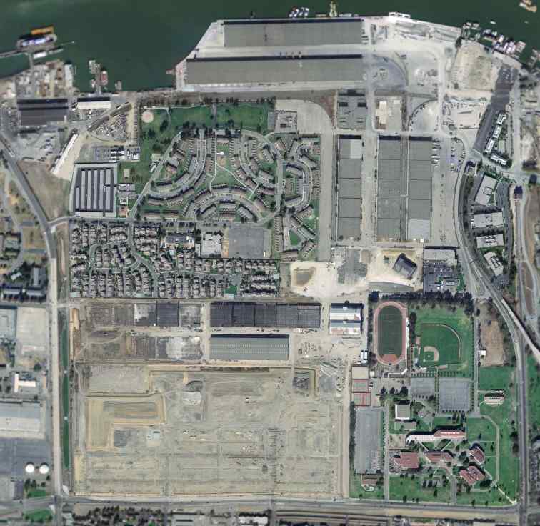
A February 2004 USGS aerial photo of the site of San Francisco Bay Airdrome.
The last hangar from the former Airdrome was evidently removed at some point between 2004-2006,
as a 2006 aerial photo showed that it had been replaced by new housing.
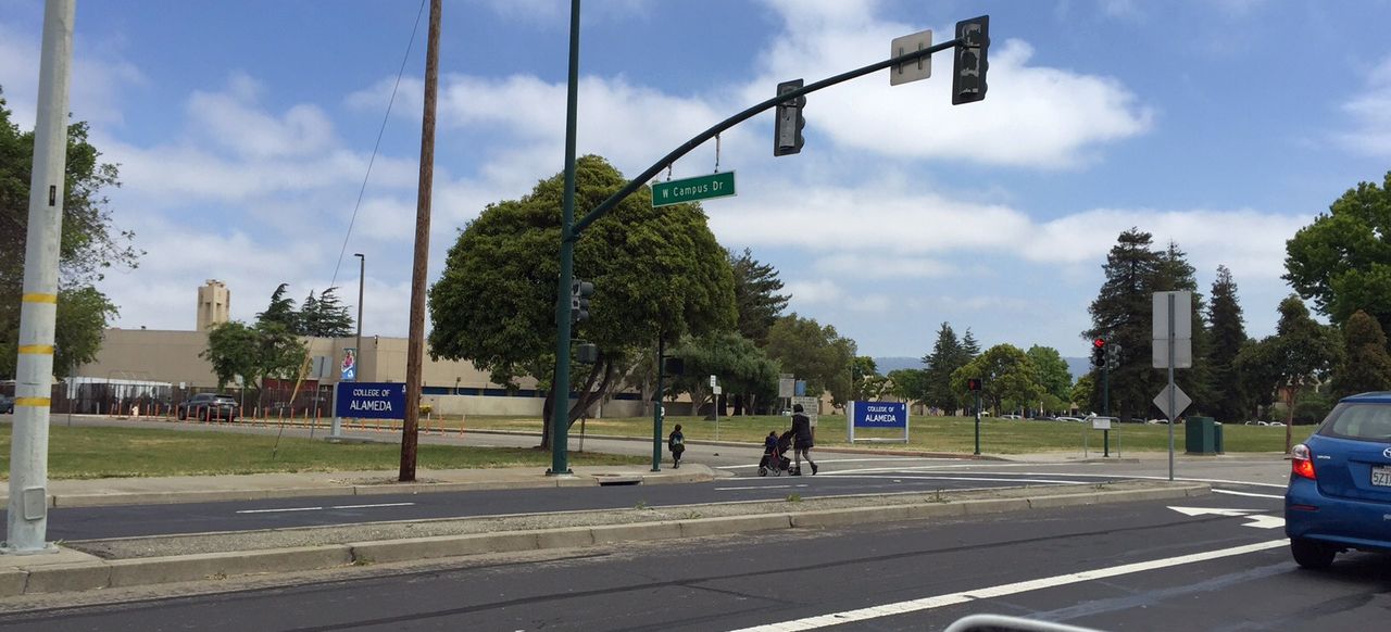
A 5/11/16 photo by Kevin Walsh of the site of San Francisco Bay Airdrome.
The site of San Francisco Bay Airdrome is located northwest of the intersection of Webster Street & Atlantic Avenue.
Thanks to Chris Kennedy for pointing out this airfield.
See also: http://www.aerofiles.com/SFBA/SFBA.html
____________________________________________________
Alameda Airport / Benton Field / Alameda NAS (NGZ), Alameda, CA
37.785, -122.315 (West of Oakland, CA)
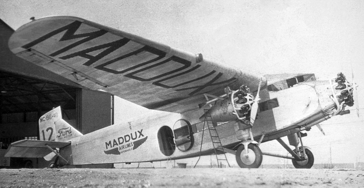
An 8/18/29 photo of Maddux Airlines Ford Tri-Motor NC9640 C/n 5-AT-18 in front of an Alameda Aiport hangar.
In 1927, an airfield was built at Alameda with one east/west runway, 3 hangars, an administration building, and a yacht harbor.
The earliest photo which has been located of Alameda Airport was an 8/18/29 photo of Maddux Airlines Ford Tri-Motor NC9640 C/n 5-AT-18 in front of a hangar.

Alameda Airport & Seaplane Base, as depicted on the 1929 "Rand McNally Standard Map of CA With Air Trails" (courtesy of Chris Kennedy).
The Standard Oil Company's 1929 "Airplane Landing Fields of the Pacific West" (courtesy of Chris Kennedy)
described Alameda Airport as being operated by Curtiss Airport, Inc.
The airfield configuration was said to be a 2,600' east/west runway,
along with the comment, "Field to be enlarged to 5,400' x 3,400'."
A total of 10 hangars, a repair shop, weather bureau, and a hotel were listed as being along the north side of the field.
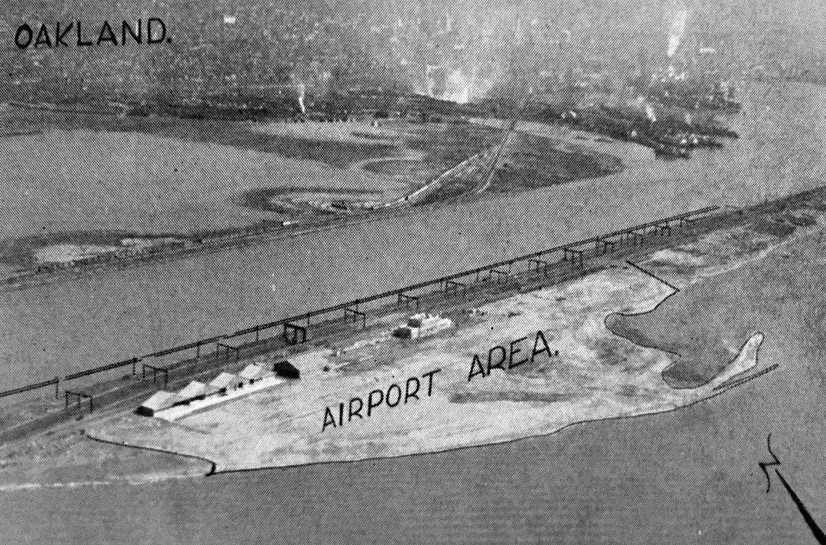
The earliest aerial photo which has been located of Alameda Airport was an undated aerial view looking northeast
from the Richfield Oil Company's 1930 California Airports directory (courtesy of Kathy Vaughn).
The directory described Alameda as a commercial airport having a 2,600' sandy runway, and listed the Manager as Captain W.H. Royle.

A circa 1930s photo looking northeast at the Alameda Airport terminal building & a large number of spectactors.
By 1930, the Army had established a 100 acre Benton Field adjacent to the east side of Alameda Airport.
Alameda Airport was depicted on the February 1931 CA State Automobile Association map (courtesy of Kevin Walsh) as occupying a narrow peninsula.
It also depicted the nearby San Francisco Bay Airdrome to the east.
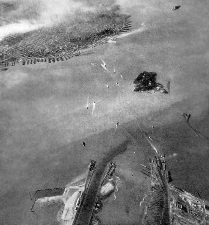
A remarkable 1932 aerial view looking west, with Alameda Airport in the foreground at lower-left,
with the San Francisco skyline at the upper-left (courtesy of Bill Eaton).
Bill observed, “Alameda Airport is at lower left along the south side of the Oakland estuary- the dark channel at lower left.
Goat Island, later renamed Yerba Buena, is at center & the old Key System streetcar/ferry pier is at far right.
No Bay Bridge yet in 1932 so the ferries crowd the bay. Large Southern Pacific railhead & ferry piers are at lower center
and 2 more ferry operators have piers on each side of the mouth of the estuary.”
Alameda Airport, as depicted on a pre-1933 Bekins Van & Storage map, by Thomas Brothers Maps (courtesy of Kevin Walsh).
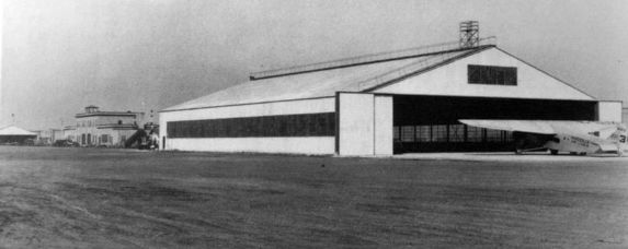
A circa 1930s photo captioned “Maddux Air Line - Alameda Airport, All steel building by Herrick Iron Works, Oakland” (courtesy of Kevin Walsh).

A circa 1930s photo of a Douglas Pan Am DC-2 taking off at Alameda Airport.

A circa 1930s aerial view looking northwest at Alameda Airport, showing a row of hangars & the terminal building on the north side of an unpaved airfield, but it was devoid of aircraft.

A circa 1930s photo of a biplane fighter (model undetermined) in front of an Alameda Airport hangar.

A circa 1930s photo of 2 Navy biplanes (model undetermined) inside an Alameda Airport hangar.
“Alameda” Airport, as depicted on the 1933 San Francisco Airway Map (courtesy of Chris Kennedy).
Over the next few years, the City of Alameda continued to expand the area of the airport by filling in land in the bay.
Pan American Airlines took over the yacht basin in 1935
and inaugurated flying boat service to Hawaii & the Orient.
A circa 1935 Bekins Van & Storage map, by Thomas Brothers Maps (courtesy of Kevin Walsh)
depicted the facilities of Pan American Airways Inc., along with the adjacent Army Air Base Benton Field, and San Francisco Bay Airdrome.
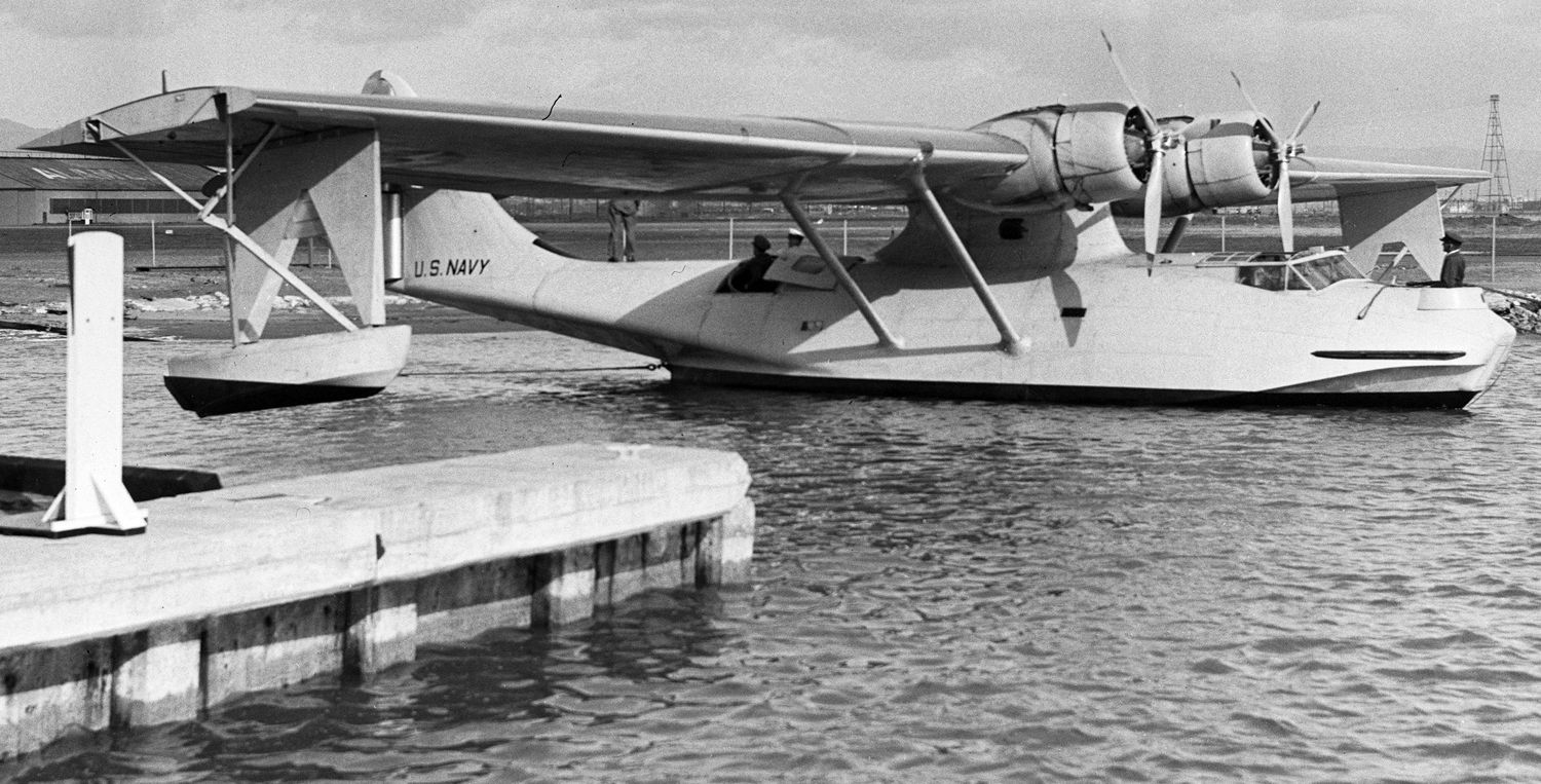
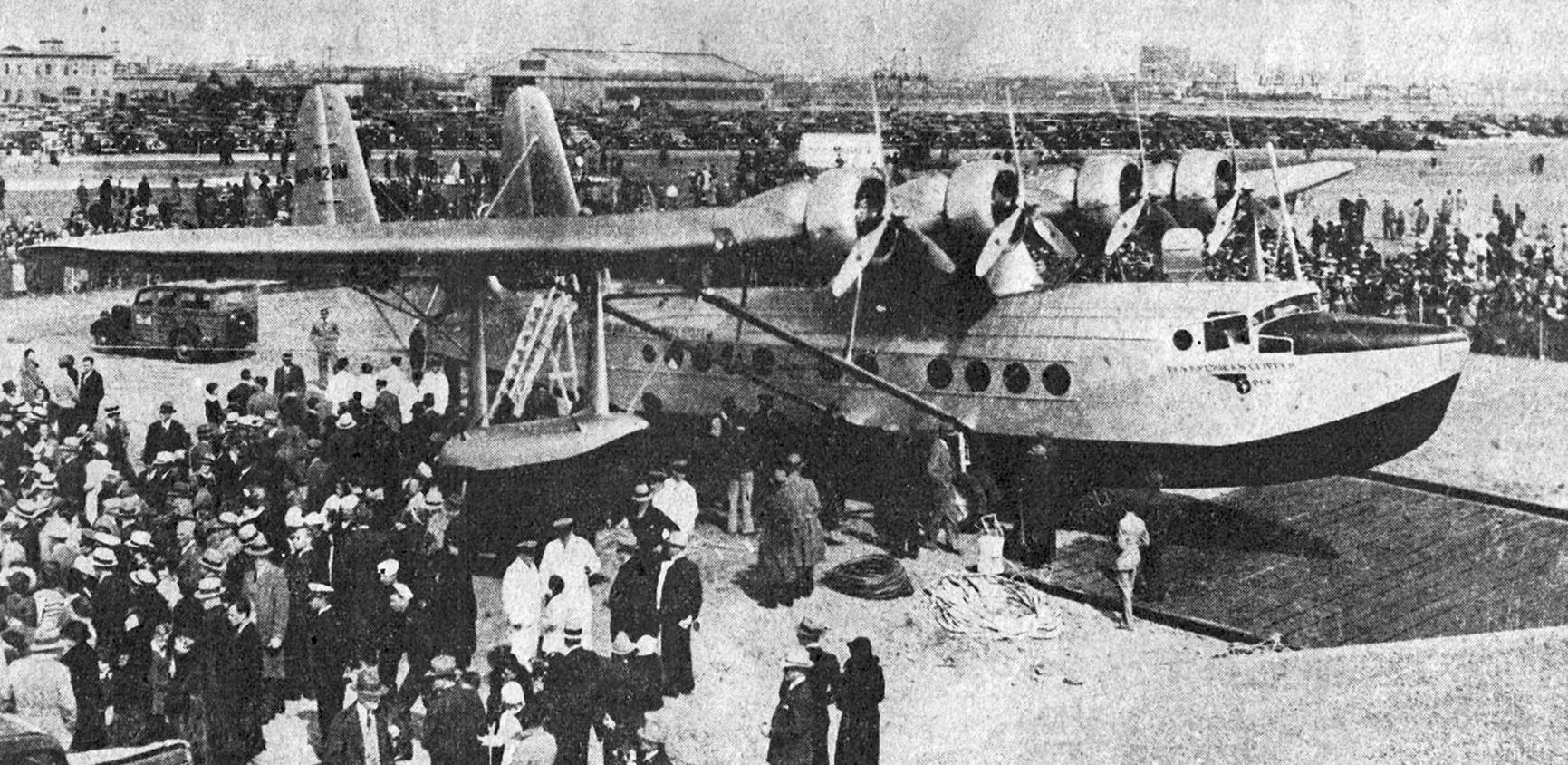
An April 1935 photo (courtesy of Kevin Walsh) of a Pan Am Clipper Sikorsky S-42 flying boat preparing to leave for its historic first flight from Alameda Airport to Honolulu.

A 5/16/35 photo (courtesy of Kevin Walsh) of a Pan Am Clipper Sikorsky S-42 flying boat preparing to leave for its historic first flight from Alameda Airport to Honolulu.
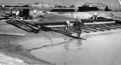
A 2/20/35 photo (courtesy of Kevin Walsh) captioned “The Alameda Airport, where construction work is being pushed to prepare for the arrival of the first of the fleet of seaplanes that will inaugurate California-Hawaii-China air service.”
In this scene, workmen are laying the wood & metal foundation for the ramp on which the Clipper sea planes will will move between land & water. The Alameda Airport hangar is seen in the right background.
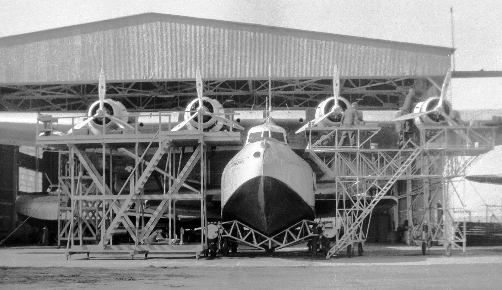
A 1936 photo by Bill Larkins of the Philippine Clipper, Martin M-130 NC14715 C/n 557, in front of an Alameda Airport hangar.
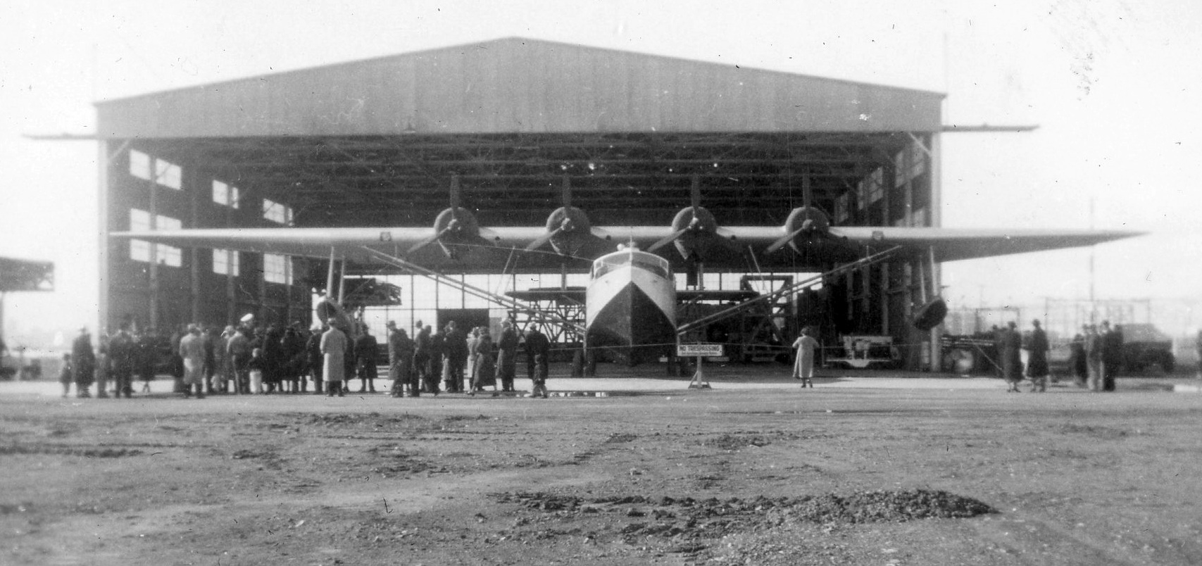
A November 1936 photo (courtesy of Richard Vanfleet) of a Sikorsky S-42 flying boat in front of a hangar at Alameda Airport.
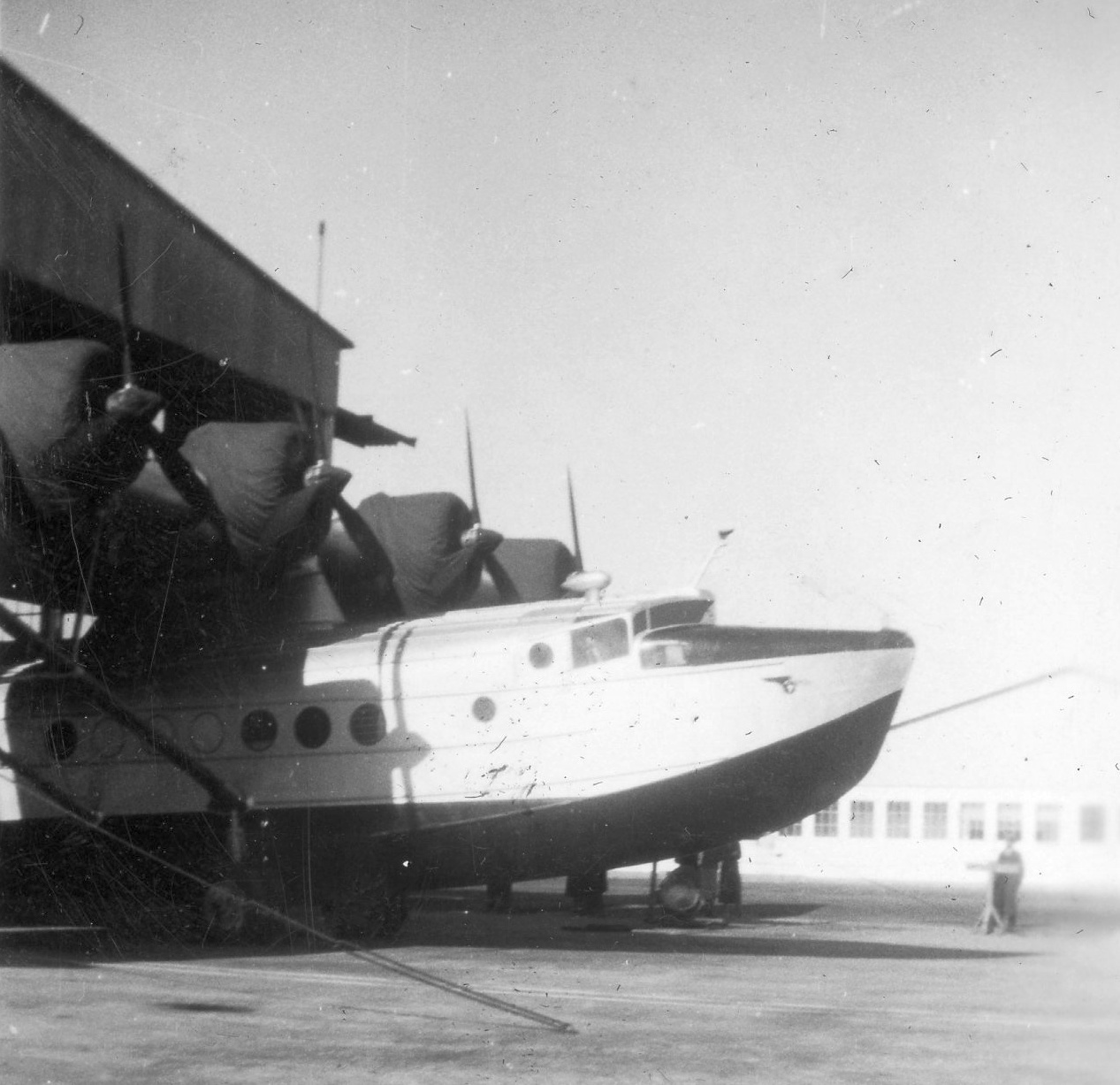
A November 1936 photo (courtesy of Richard Vanfleet) of a Sikorsky S-42 flying boat in front of a hangar at Alameda Airport.
The City of Alameda deeded the airfield property to the Federal Government in 1936,
and the Army turned over its facilities at Benton Field to the Navy.
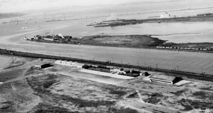
A 1937 photo of Alameda Airport (courtesy of Bill Larkins).
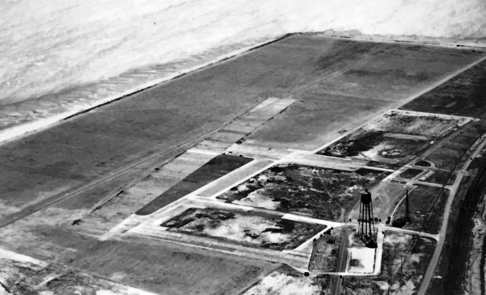
A circa 1938 aerial view looking southwest at Benton Field (photographed in 2018 by Kevin Walsh from a display at Oakland Airport)
depicted Benton Field as having an unpaved rectangular airfield on the south side of the peninsula.
There did not appear to be any hangars or structures, other than a water tower.
A 1938 street map (courtesy of Kevin Walsh) depicted “Alameda Airport & Seaport”, “Benton Field”, and “San Francisco Bay Airdrome”.
The Airport Directory Company's 1938 Airports Directory (courtesy of Jonathan Westerling) directory described Alameda Airport
as a 170 acre sandy field having 3 shell or graded runways, the longest being a 3,250' east/west strip, which also had an asphalt takeoff strip.
Congress appropriated $10 million for the development of a Naval Air Station at the site in 1938.
Pan Am moved its operations to Treasure Island in 1939.
A 1939 street map (courtesy of Kevin Walsh) depicted the outline of the Alameda “US Naval Air Station”.
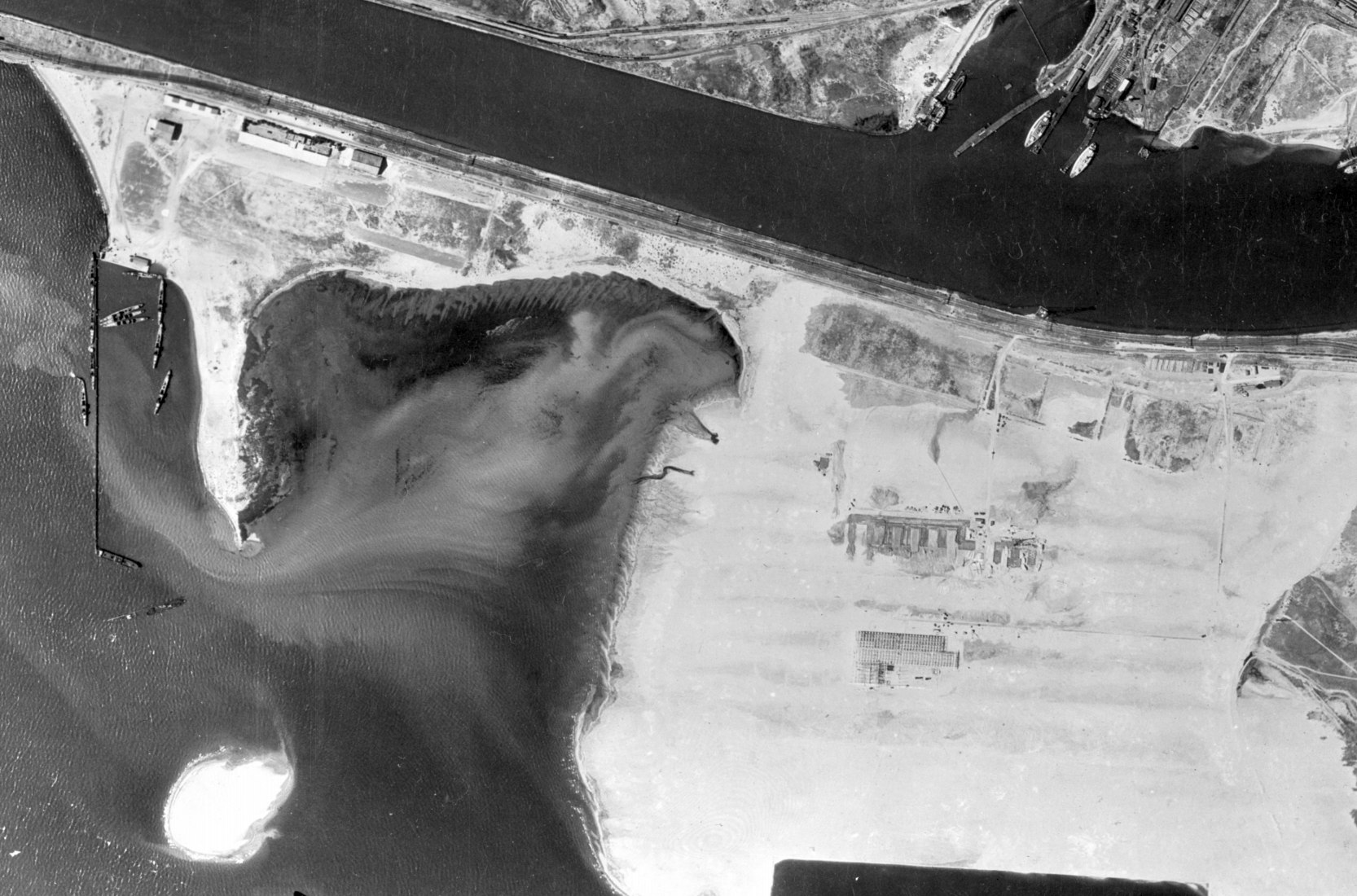
An 8/4/39 USGS aerial view (from the UCSB Library) depicted the hangars of Alameda Airport (at top-left) & the airfield of Benton Field (at bottom-right).
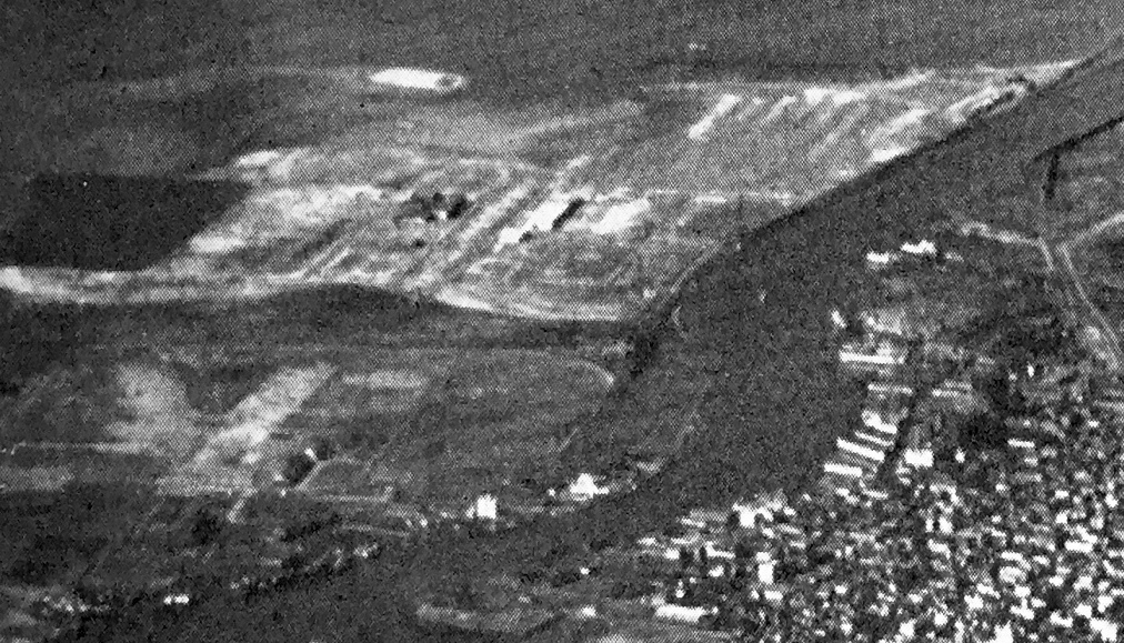
A circa 1939-40 aerial view looking west at Benton Field / Alameda Airdrome (at lower-left) & the fledgling NAS Alameda (upper-right), from a 1945 booklet touting the Bay Area as a place for business relocation (courtesy of Kevin Walsh).
Kevin Walsh noted, “The lagoon at the south seems well-defined. There are a few hangars. The west shoreline & landing strip locations seem nebulous.”
A January 1940 Metsker map (courtesy of Kevin Walsh) depicted “Alameda Airport, Pan American Airways Trans-Pacific Terminys”,
“Benton Field, Army Air Depot”, and “San Francisco Bay Airdrom” all in a row on the peninsula,
A circa 1940 Thomas Brothers map (courtesy of Rex Ricks) depicted the “Alameda Airport Inc.” on the west end of the peninsula,
the “Army Air Base Benton Field” in the center,
and the “San Francisco Bay Airdrome Inc.” to the east.
A total of 5 buildings were depicted along the northwest side of the Alameda Airport.
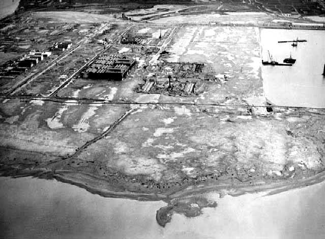
A 1940 aerial view showing NAS Alameda under construction.
The new Naval Air Station was commissioned in 1940.
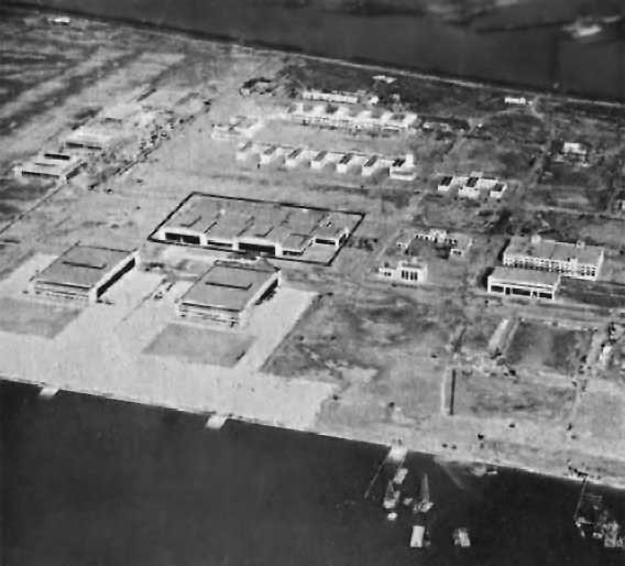
A January 1941 aerial view looking north at the hangars & buildings of NAS Alameda.
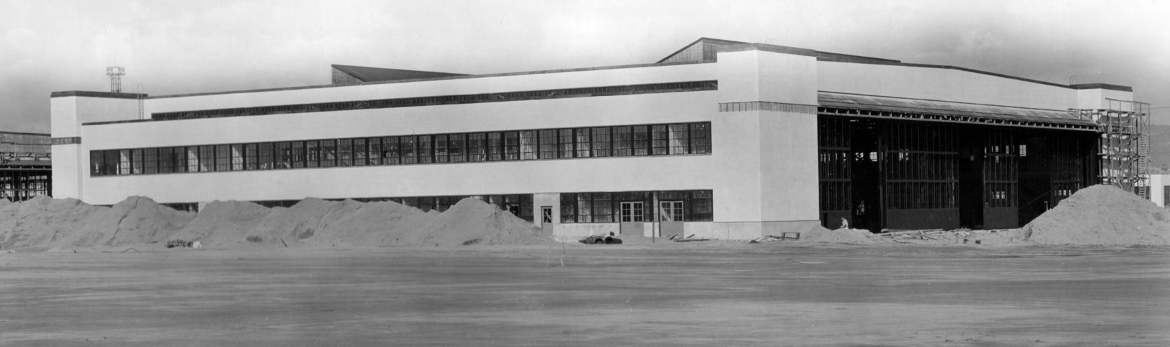
A 1941 photo of a NAS Alameda hangar under construction (courtesy of John Voss).
Inexplicably, no airfield at NAS Alameda was depicted
on the December 1941 San Francisco Sectional Chart (courtesy of Chris Kennedy).
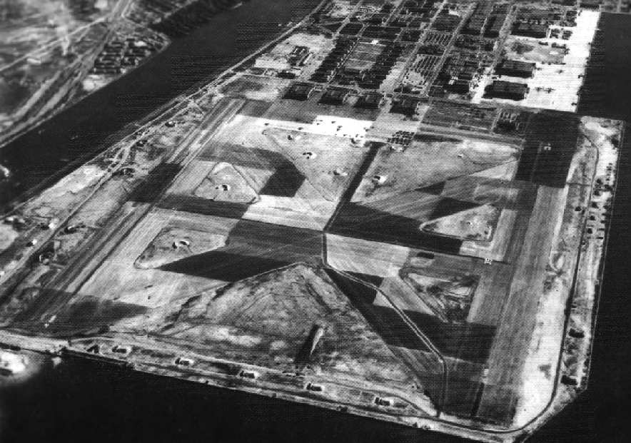
A 1943 National Archives photo looking east at NAS Alameda,
showing the disruptive camouflage pattern painted on the runways.
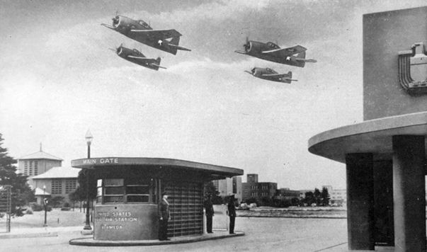
A WW2-era postcard of 4 Grumman F6F Hellcats overflying the NAS Alameda main gate (courtesy of Kevin Walsh).
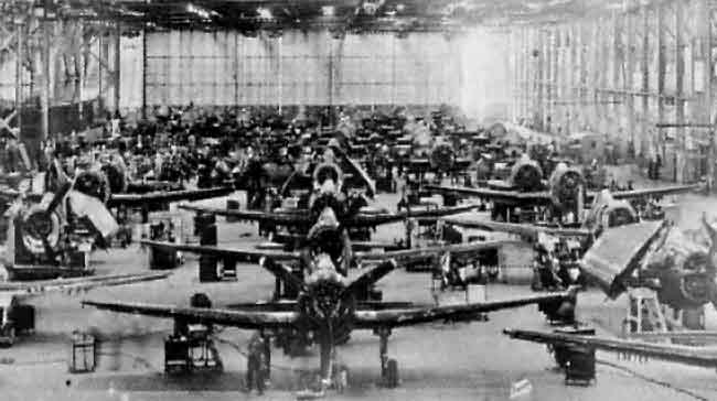
A circa 1944-45 photo of Grumman Hellcats being overhauled at Alameda
(from the 1965 Open House program, courtesy of Bill Eaton).
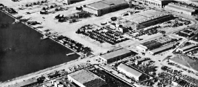
A WW2-era aerial view of the ramp at Alameda
(from the 1965 Open House program, courtesy of Bill Eaton).
Numerous PBYs, Consolidated Coronados, Martin Mariners, and C-47s (R4D?) were visible.
Close inspection seems to reveal a clump of Helldivers at center, judging by the upward wing-folds & round tails,
as well as Grummans, possibly Avengers, on the water side of the ramp.
The base eventually included five runways, a seaplane lagoon & ramps,
& 2 aircraft carrier piers, with a total of 2,720 acres.
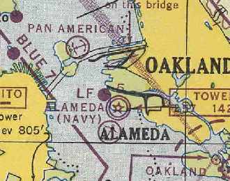
NAS Alameda, as depicted on the March 1945 San Francisco Sectional Chart (courtesy of Chris Kennedy).
In 1945, NAS Alameda had the following outlying fields (according to John Voss):
NOLF Half Moon Bay, NOLF Concord, OLF San Luis Obispo,
NOLF Clear Lake (seaplane only), OLF Tulare Lake (seaplane only), and OLF Paso Robles.
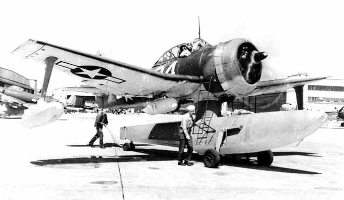
A March 1946 photo by Fred Dickey (courtesy of William Larkins) of a Curtiss SC-1
operating with SOSU-3 approaching NAS Alameda's seaplane ramp.
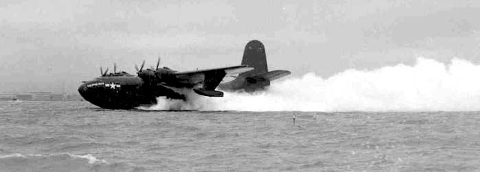
A 1946 photo by Bill Larkins of a Martin JRM-1 Mars (76820) making a JATO-assisted takeoff from Alameda,
headed north on San Francisco Bay on its way to Hawaii.
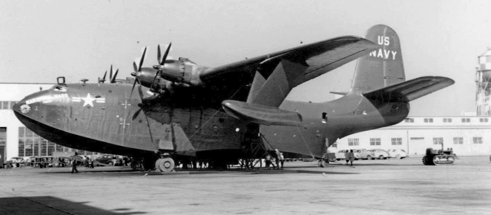
A circa 1946-50 photo of the JRM-1 Marshall Mars on display for civilian visitors at NAS Alameda (courtesy of John Voss).
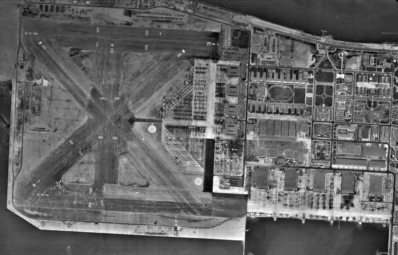
A 7/29/46 USGS aerial view of NAS Alameda (from the UCSB Library), showing 5 paved runways, hangars, and a huge number of Navy aircraft.
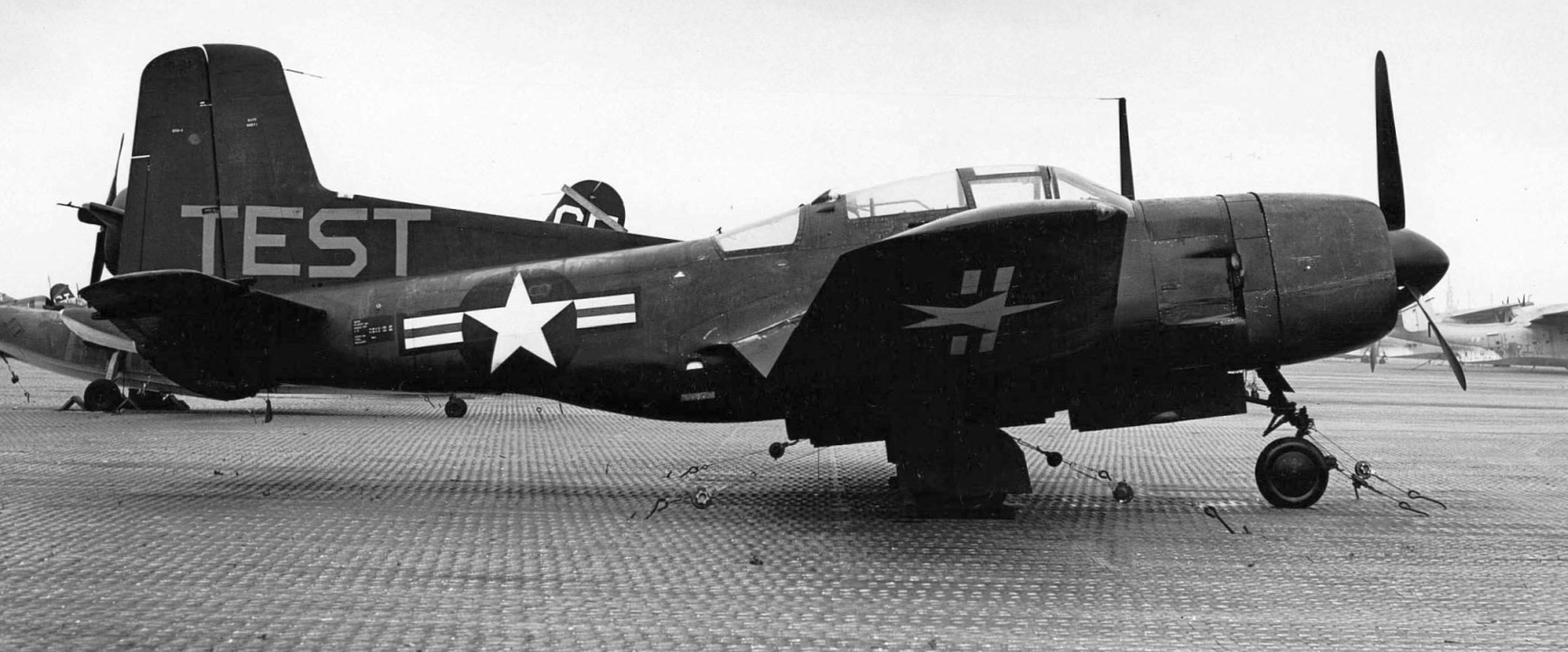
A circa 1947 photo of a rare Douglas BTD-1 Destroyer (BuNo 09086) at NAS Alameda, tied down to Pierced Steel Planking, with a large flying boat visible in the right background.
The Destroyer's “TEST” marking was due to its use in ice research tests by the National Advisory Committee for Aeronautics from 3/11/46-9/4/47.
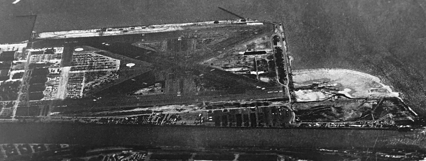
A 1946 aerial view looking south at NAS Alameda (courtesy of Kevin Walsh).
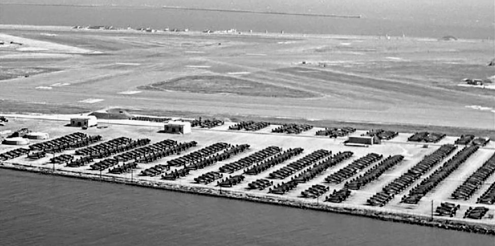
A 5/5/47 aerial view by Bill Larkins of an amazing array of over 400 F6F Hellcat fighters on the west side of NAS Alameda awaiting overhauling or scrapping.
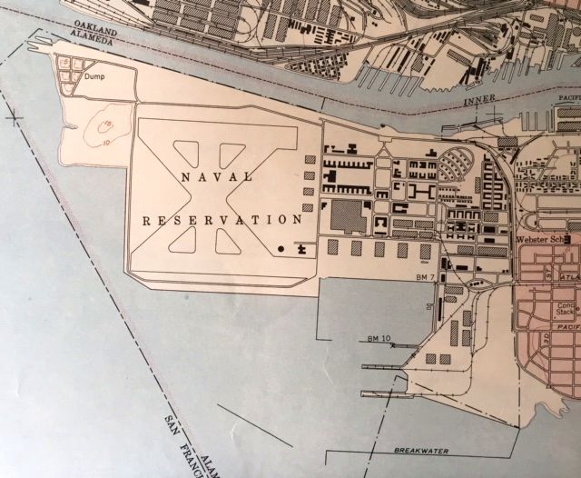
The 1949 USGS topo map (courtesy of Kevin Walsh) depicted Alameda “Naval Reservation” as having 5 runways.
Al Brown recalled, "I was stationed at Alameda in 1953-54. I was a crew member on the JRM Mars seaplane.
We flew to Hawaii & returned twice a week. Travel time was 16 hours flying at 10,000 feet."
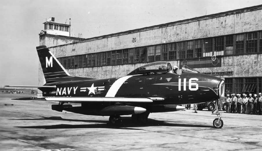
A 1955 USN photo of a sporty FJ3 Fury in front of NAS Alameda's Hangar 20 (courtesy of John Voss).
Compare to the photo of the same building, 48 years later, several paragraphs below.

A 4/15/55 photo of a row of Martin P5M-2 Marlin flying boats at NAS Alameda.
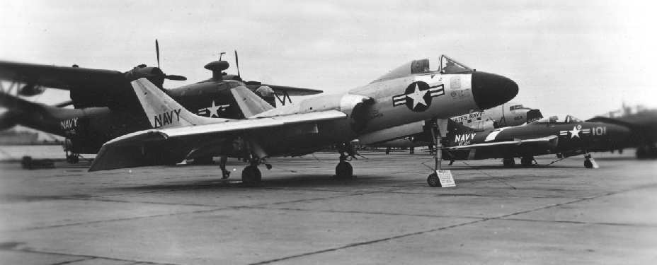
A circa 1950s USN photo of a static display at NAS Alameda, with a F7U-3 Cutlass in the center (courtesy of John Voss).
Lanny Giorgi recalled, “I grew up just outside of the NAS Alameda & had the opportunity to go there often in the 1950s, 1960s & 1970s.
The carriers used to have air operations while docked & we were right under their final approach.
I knew the jets by sound. I loved it but my parents didn't. Especially during night operations.”
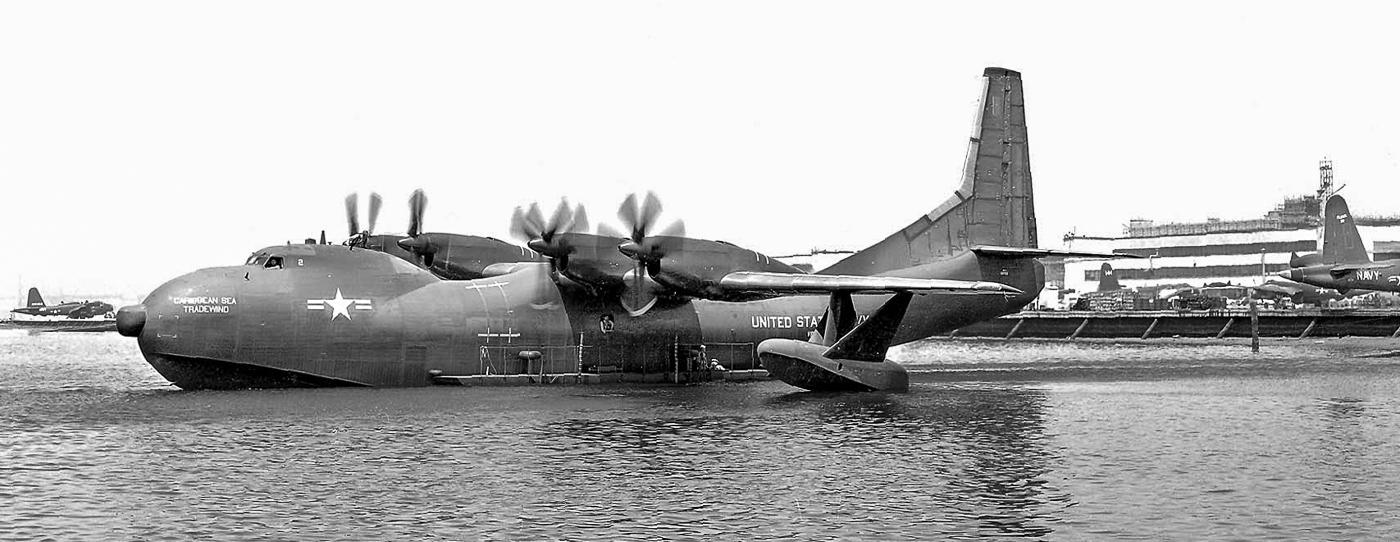
An October 1956 photo by Bill Larkins (courtesy of Bill Larkins) of Convair R3Y-2 Tradewind "Caribbean Sea" (C/n 131723) of VR-2 leaving the Alameda seaplane docks.
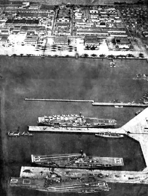
An undated aerial view looking north at the Alameda lagoon & hangars,
with the USS Hancock (CV-19), USS Kearsarge (CV-33), and USS Yorktown (CV-10) in port for the 17th Anniversary of the base opening
(from 11/1/57 issue of The Carrier newspaper).
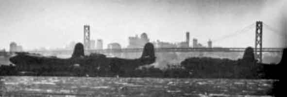
A late 1950s photo by Bill Eaton of the surviving fleet of Martin JRM Mars seaplanes at NAS Alameda after they were retired & put into storage.
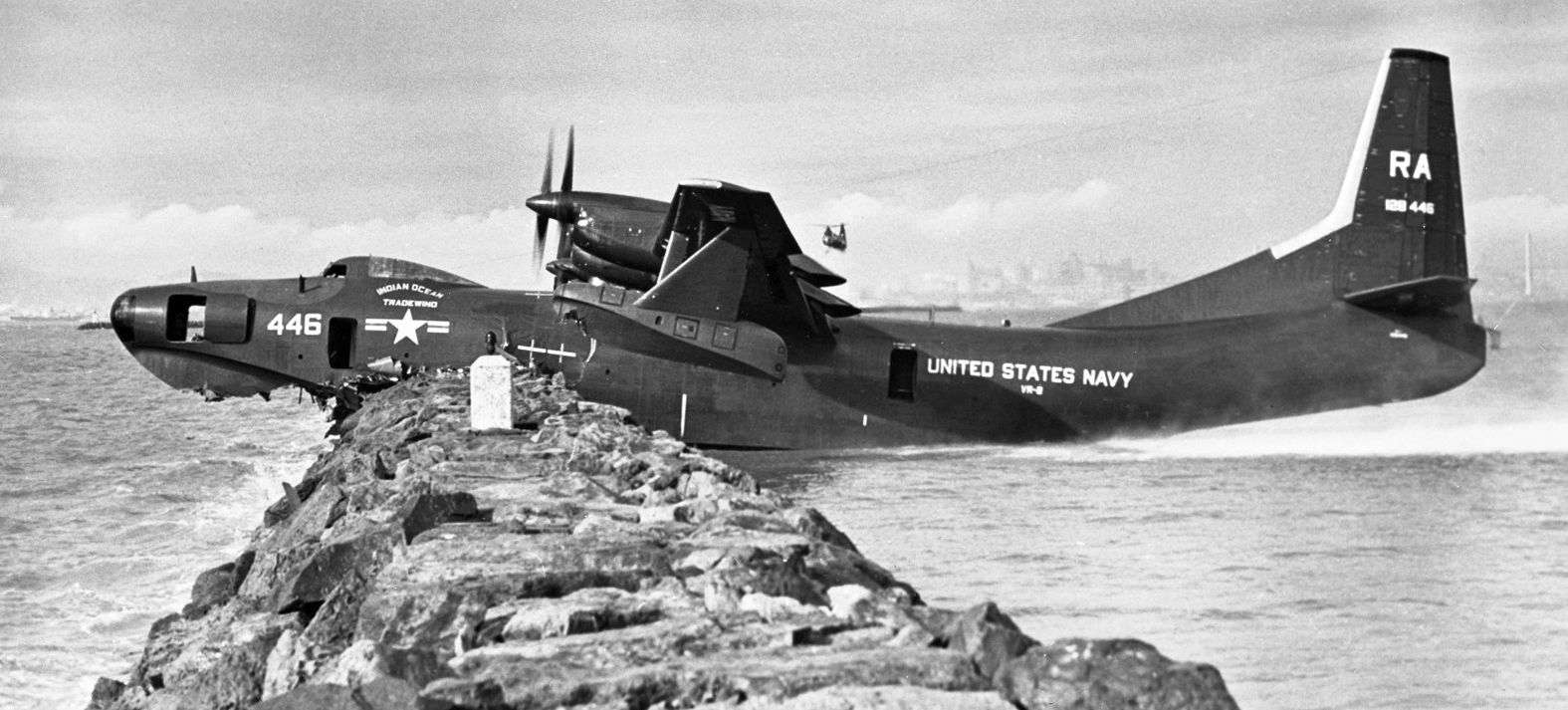
A 1/24/58 photo of VR-2 Convair R3Y-1 Tradewind "Indian Ocean" (C/n 128446) moored on the Alameda seawall, with its crew unable to turn off its problematical engines.
On a flight from Hawaii, there was a catastrophic failure of engine #2's gearbox, and a propeller blade sliced the fuselage (damage visible just below the propellers), causing an explosive decompression.
The crew still managed to land at Alameda, and the flight still set a speed record between Hawaii & San Francisco, so this was probably being pursued.
Note the Bay Bridge on the right and a Piasecki HUP Retriever helicopter overhead.
The accident was the last straw for the Tradewind & its erratic T40 engines. VR-2 was disbanded in April 1958 & all R3Ys were scrapped.
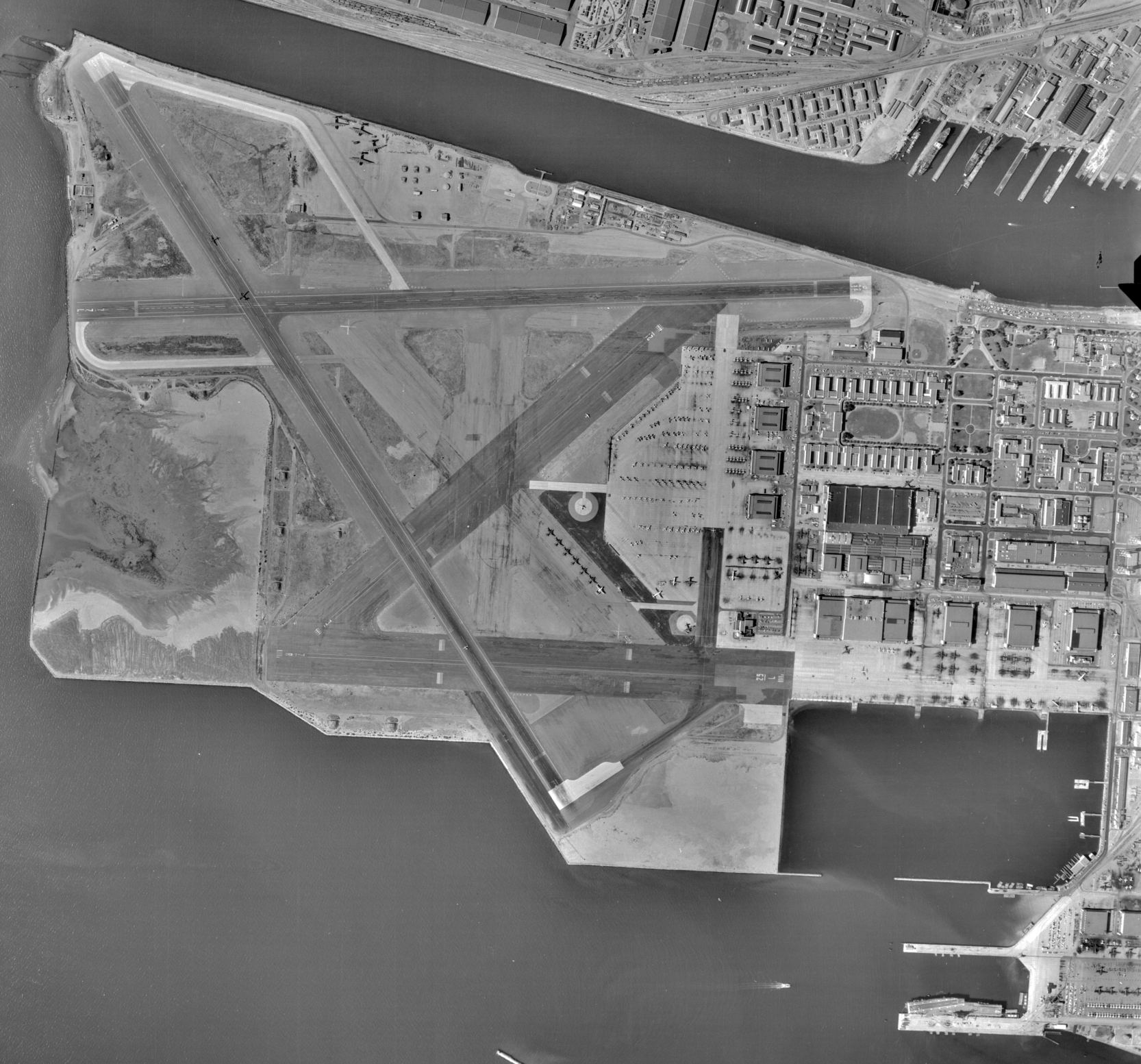
An 8/12/58 USGS aerial view (from the UCSB Library) of the extensive Alameda airfield.
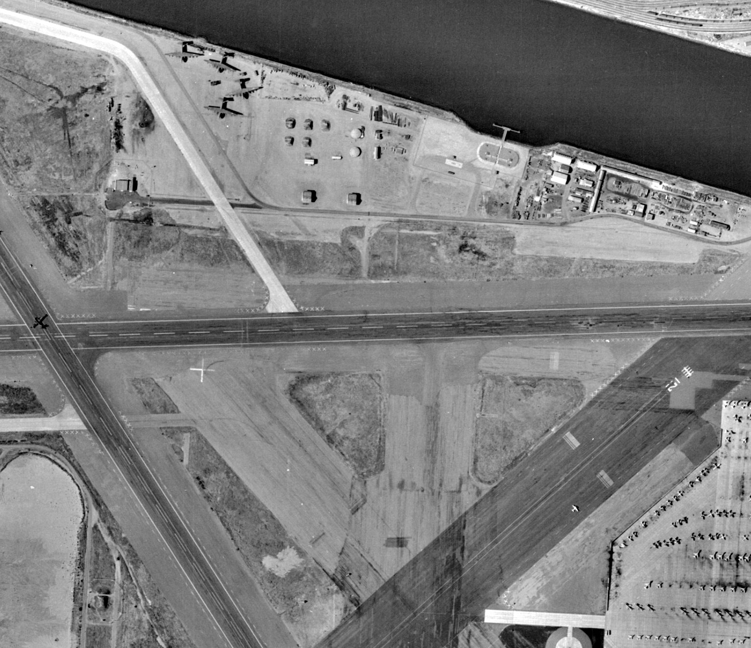
A closeup from the 8/12/58 USGS aerial view (from the UCSB Library) showing the 4 massive Martin JRM Mars seaplanes sitting on the north ramp of NAS Alameda,
and large numbers of supersonic jet aircraft on the ramp at bottom right.
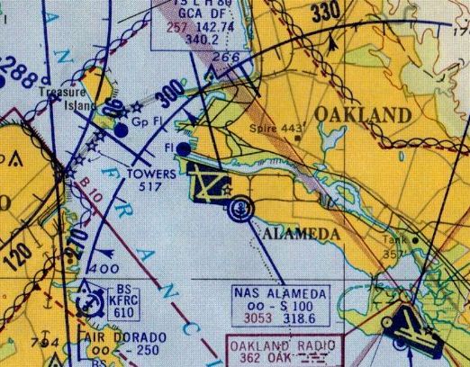
The April 1959 San Francisco Local Aeronautical Chart (courtesy of Paul Columbus)
depicted NAS Alameda as having 4 paved runways, with the longest being 8,000'.
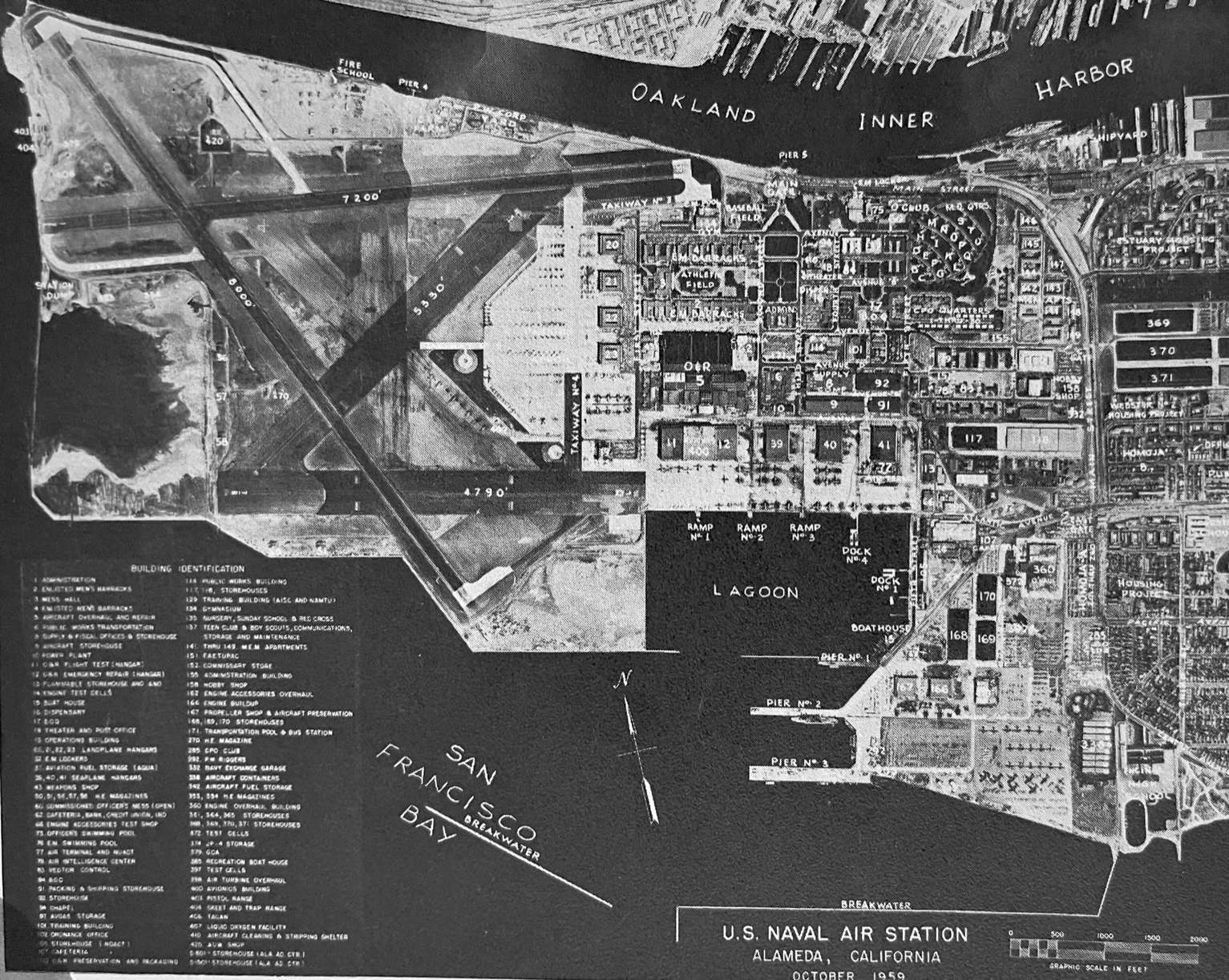
An October 1959 aerial view (from the 1960 NAS Alameda yearbook, courtesy of Kevin Walsh) which identified many of the base's many buildings.
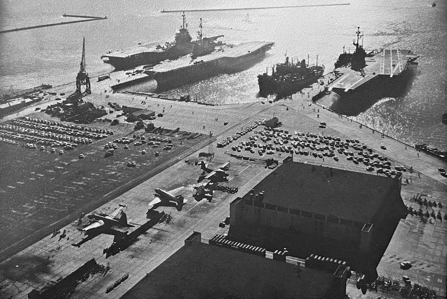
An undated aerial view (from the 1960 NAS Alameda yearbook, courtesy of Kevin Walsh) looking southwest at several aircraft carriers docked at NAS Alameda,
with several land-based aircraft & hangars in the foreground.
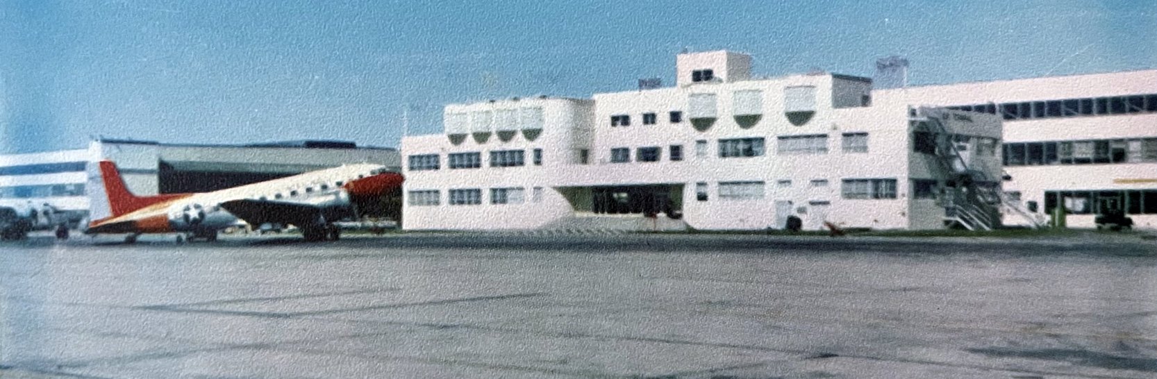
An undated photo (from the 1960 NAS Alameda yearbook, courtesy of Kevin Walsh) of a Douglas R4D in front of NAS Alameda's Air Operations Terminal.
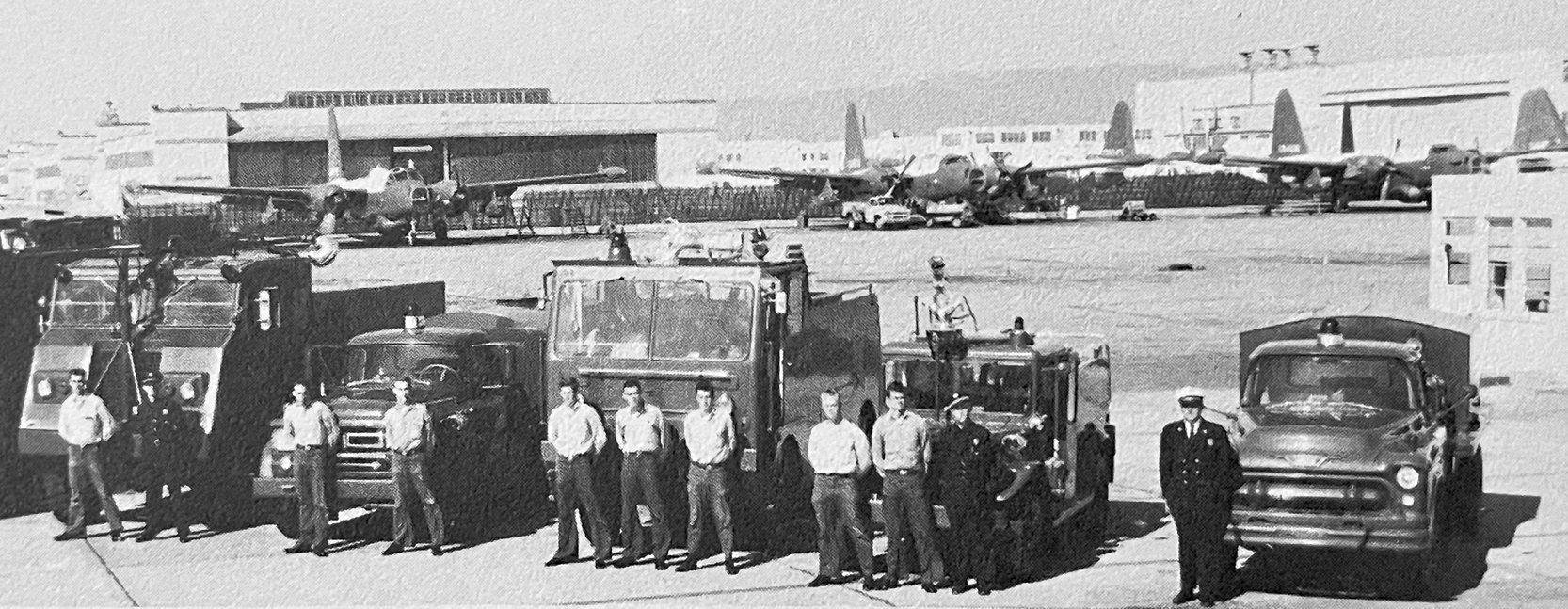
An undated photo (from the 1960 NAS Alameda yearbook, courtesy of Kevin Walsh) of NAS Alameda's fire crews, with several Lockheed P2V Neptunes in the background.
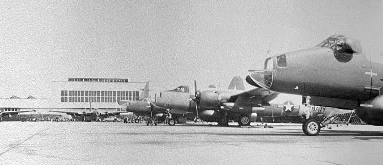
An undated photo (from the 1960 NAS Alameda yearbook, courtesy of Kevin Walsh) of 5 Lockheed P2V Neptunes on the NAS Alameda Overhaul & Repair ramp.
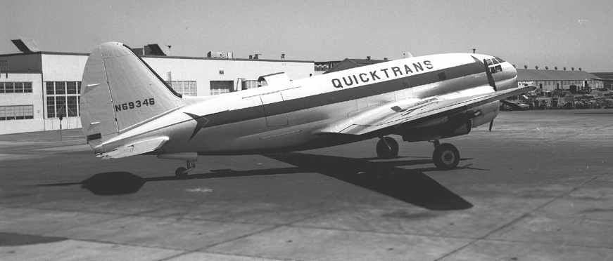
A July 1963 photo by William Larkins of a Curtiss C-46F, N69346 at NAS Alameda.
According to William, “Quicktrans was a contract service at that time for civilian operators to carry freight for the Navy.”
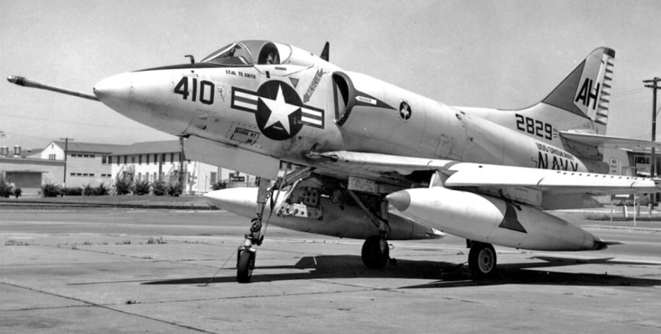
A 7/20/63 photo of a Douglas A-4B Skyhawk BuNo 142829 of VA-164 Ghost Riders at NAS Alameda.
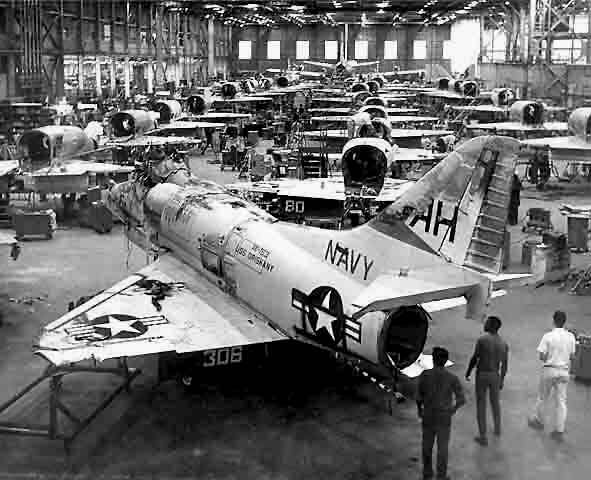
A circa 1960s photo of A-4 Skyhawks in the Alameda Naval Air Rework Facility.
In postwar years, one of the most important tenants at Alameda was the Naval Air Rework Facility,
a depot for various naval aircraft.
A wide variety of Navy & Marine Corps aircraft units were stationed at Alameda.
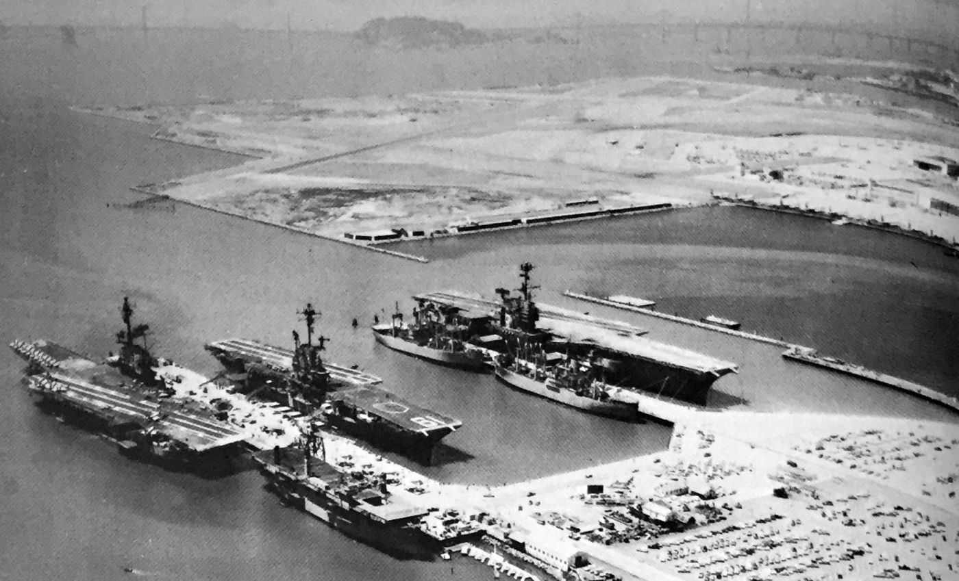
A circa 1960s aerial view looking northwest at 3 carriers docked at NAS Alameda (courtesy of Kevin Walsh) from a 1973 base directory, with NAS Alameda behind them.
Alameda served as the homeport for several aircraft carriers, with piers large enough to accommodate the largest carriers in the fleet.
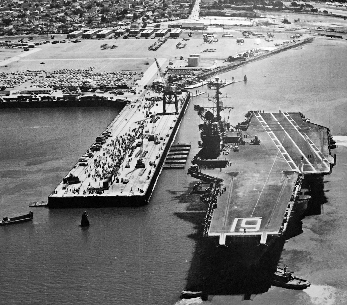
A circa 1960s aerial view looking east at the USS Ranger docked at NAS Alameda (courtesy of Kevin Walsh)
from a 1973 base directory, with rows of planes on the ramp in the background.
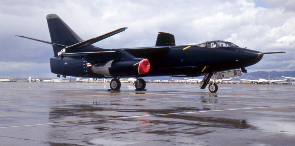
A May 1967 photo of an all-black RA-3B Skywarrior on a wet Alameda ramp.

A December 1967 aerial view by Nick Williams after departing NAS Alameda of several F-1E Furies, a B-26 Invader, A-1E Skyraider and F-3 Demon, all headed to the burn pit in the distance.
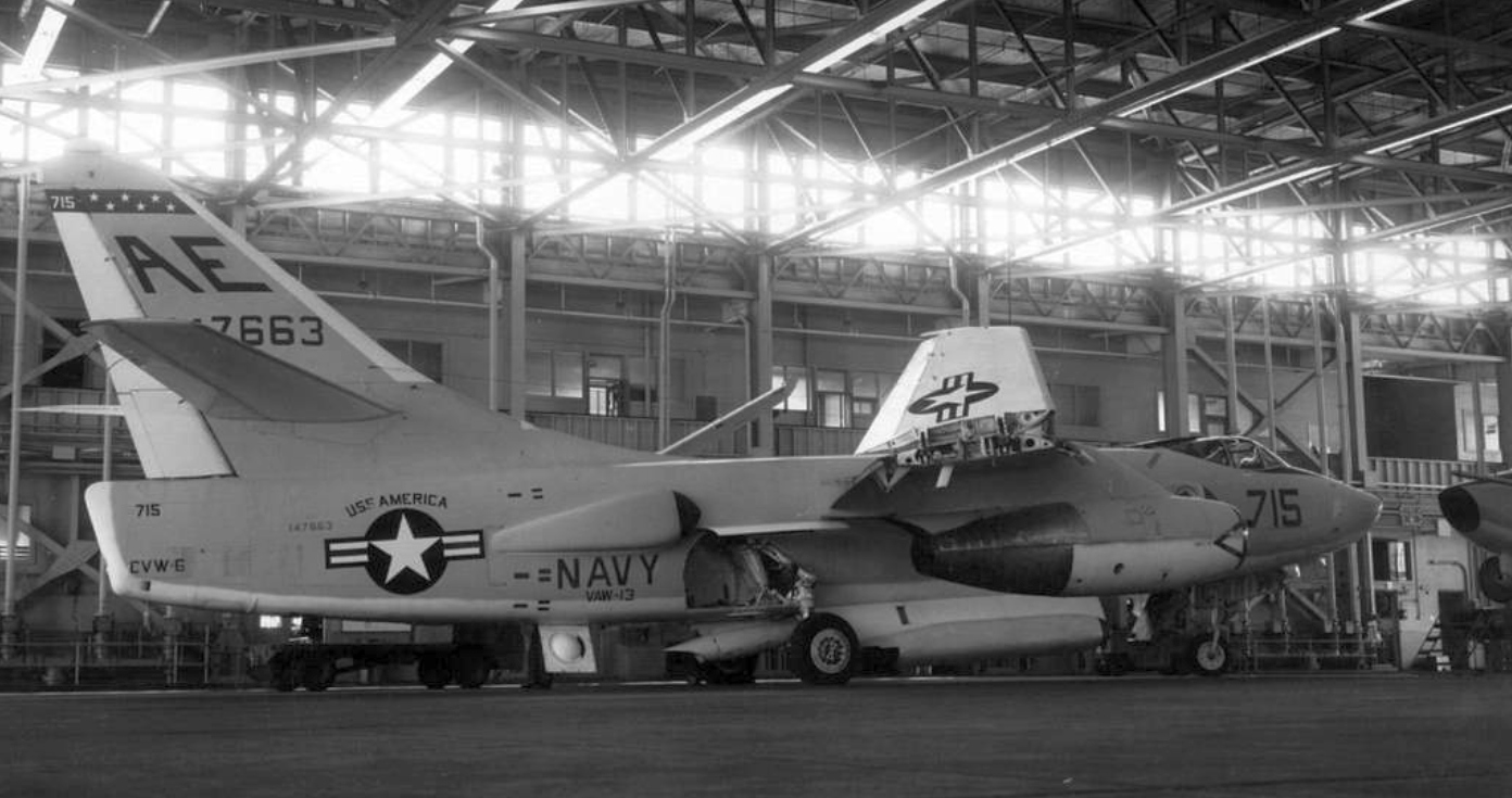
A 1968 USN photo of a Douglas EKA-3B Skywarrior (BuNo 147663) from Airborne Early Warning Squadron VAW-13 Det. 66 Zappers in a NAS Alemda hangar.
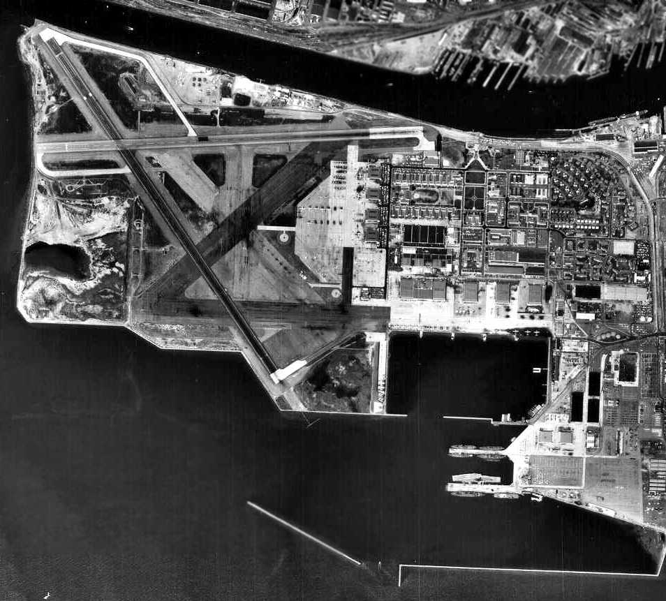
A 4/20/68 aerial view of Alameda.
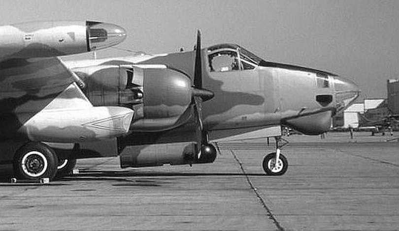
A circa late 1960s photo of a camouflaged Lockheed AP-2H Neptune (BuNo 135620) of VO-67 at NAS Alameda.
The AP-2H was one of only 4 which had been converted in 1968 as a specialized night & all-weather ground attack variant fitted
with FLIR & Low Light TV systems, tail turret, fuselage-mounted grenade launchers, downwards firing miniguns, and bombs & napalm carried on underwing pylons.
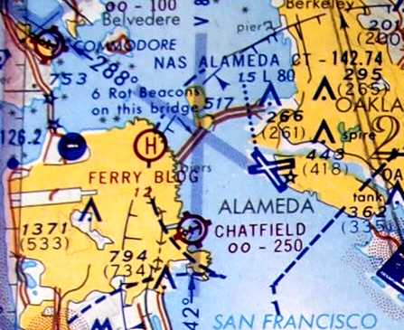
The 5/1/69 San Francisco Sectional Chart depicted NAS Alameda as having 2 paved runways, with the longest being 8,000'.
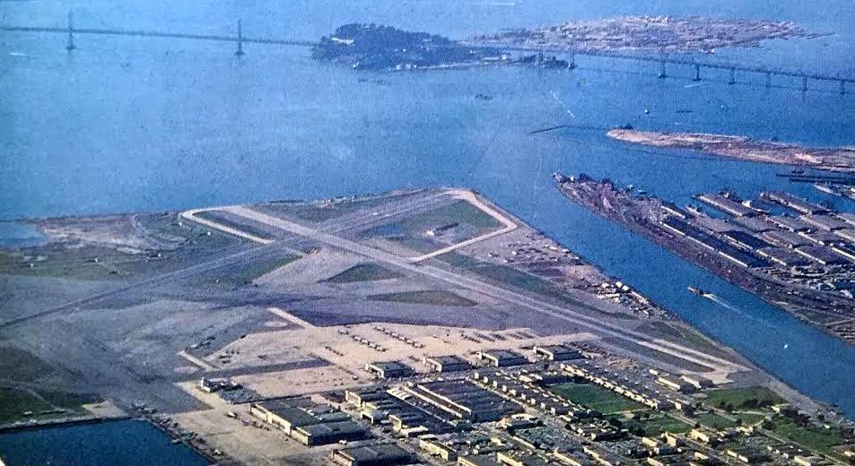
A circa 1960s-70s aerial view looking west at NAS Alameda, with Treasure Island also visible in the background (courtesy of Kevin Walsh).
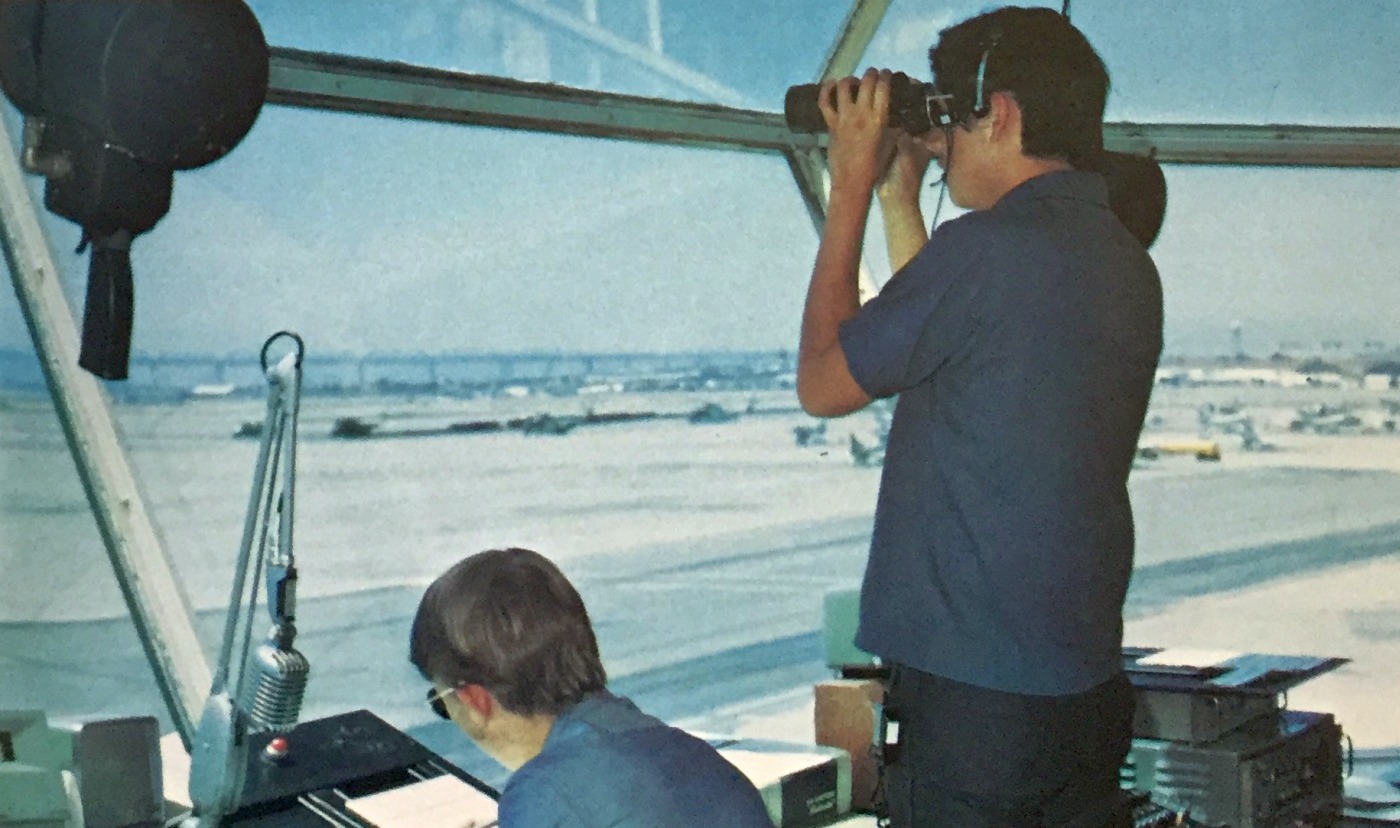
An undated US Navy photo by Matt Perez (courtesy of Kevin Walsh) from a 1973 base directory, looking out from NAS Alameda's control tower.
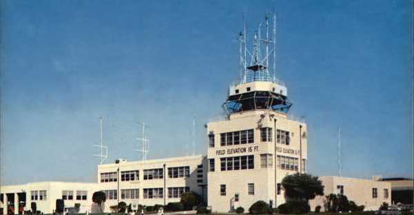
An undated photo of NAS Alameda's control tower.
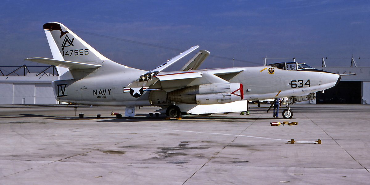
A November 1977 photo of BuNo 147656, a Douglas KA-3B Whale of VAQ-308 at NAS Alameda.
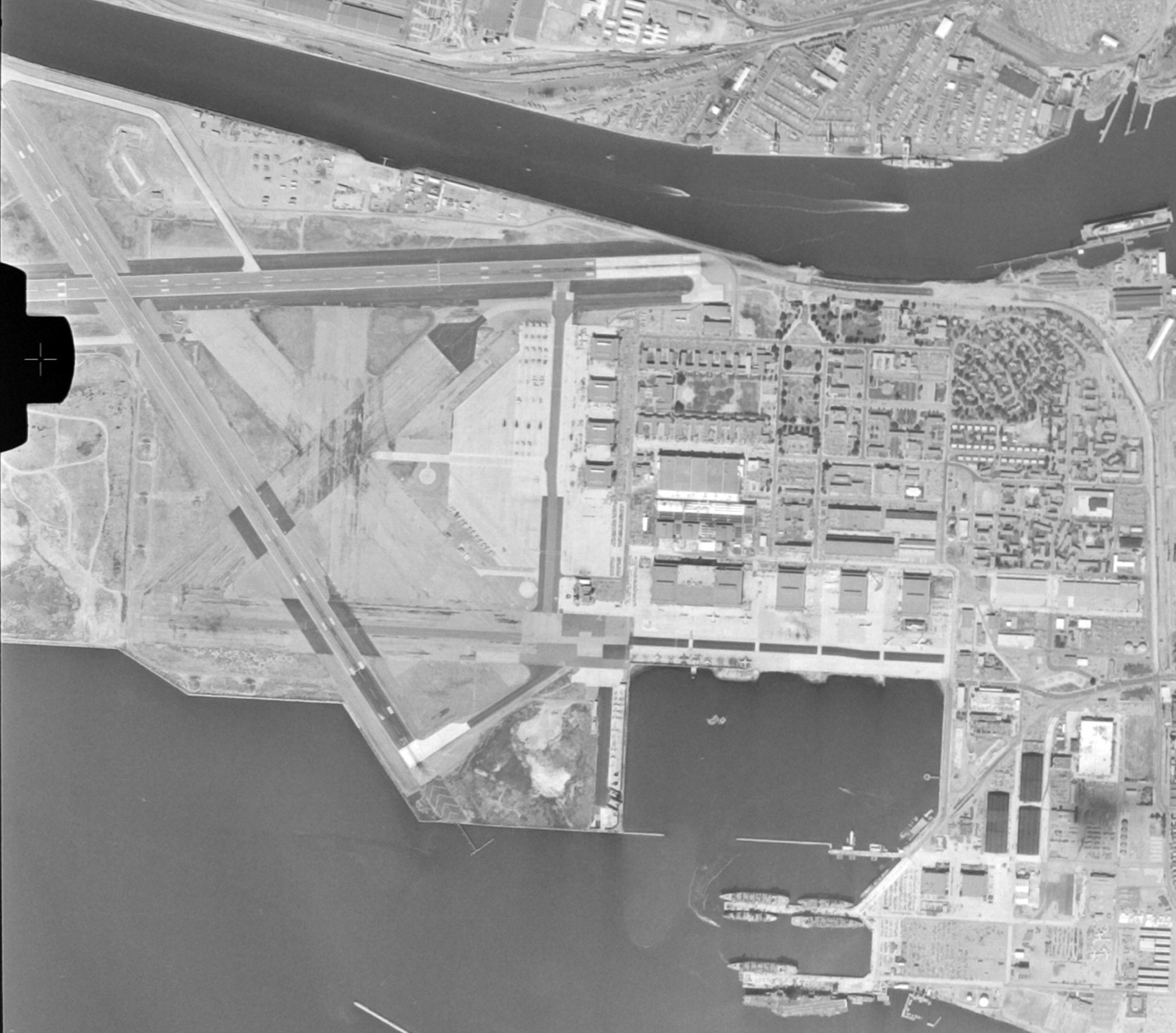
A 10/1/80 USGS aerial view of NAS Alameda (from the UCSB Library), showing 2 paved runways, hangars, and a huge number of Navy aircraft.
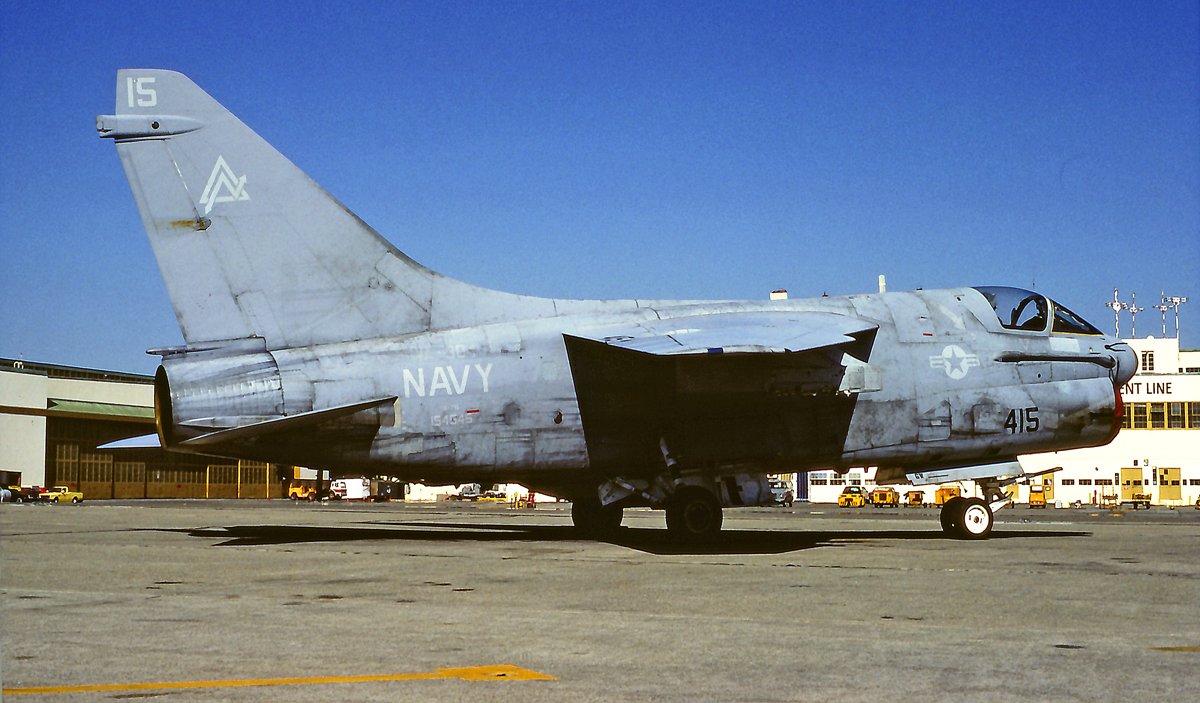
An August 1983 photo of BoNo 154545, a tired-looking Vought A-7E Corsair II of VA-304 at NAS Alameda.
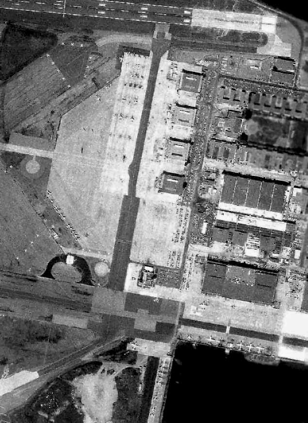
A 1984 aerial view of Alameda, showing a large number of tactical aircraft on the ramp at the bottom,
as well as P-3 Orions along the former seaplane ramp along the east side.
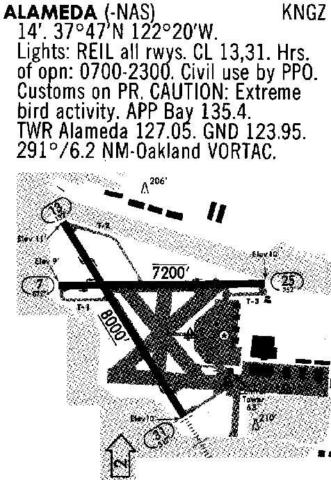
A 1988 airport diagram of Alameda NAS.
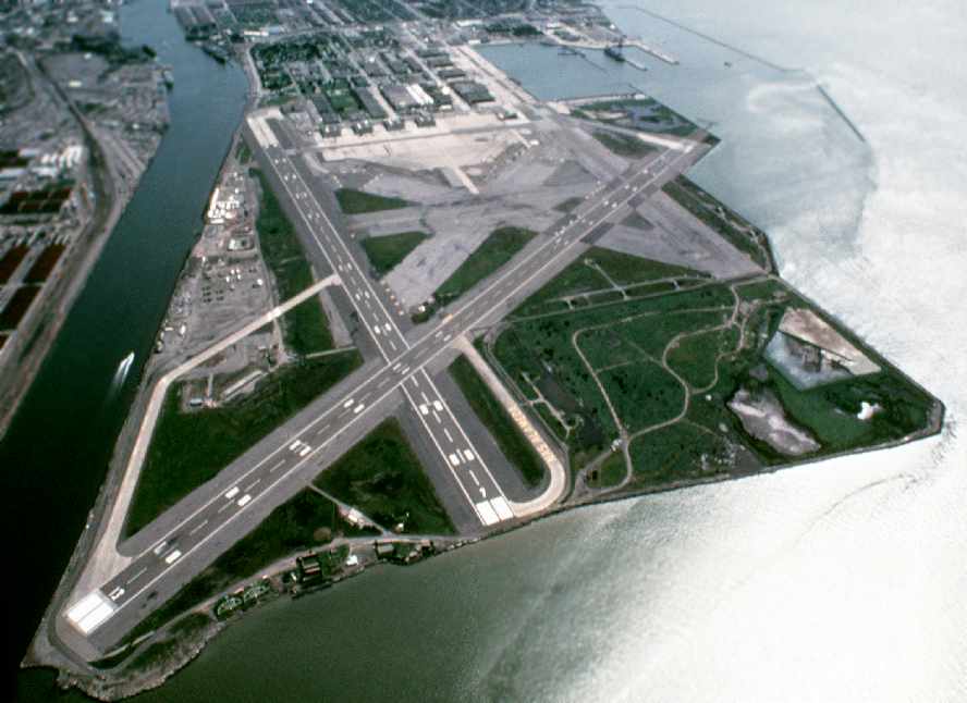
A January 1989 DOD aerial view looking southeast at NAS Alameda.

The last aeronautical chart depiction which has been located of NAS Alameda was on the April 1989 San Francisco Terminal Chart (courtesy of Ken Mercer).
It depicted NAS Alameda as having 2 paved runways, with the longest being 8,000'.
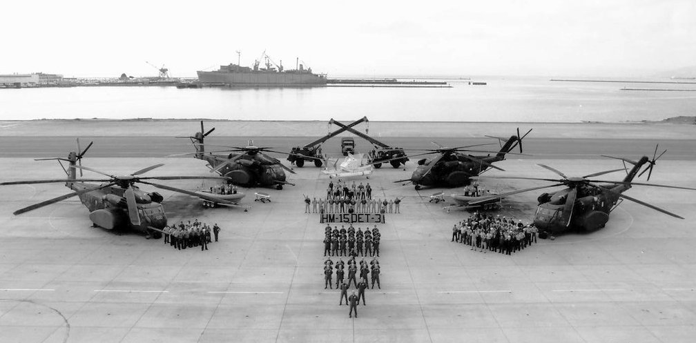
A 1989 photo of 4 Sikorsky MH-53E Sea Dragons of Helicopter Mine Countermeasures Squadron 15 Detachment 3 at NAS Alameda.
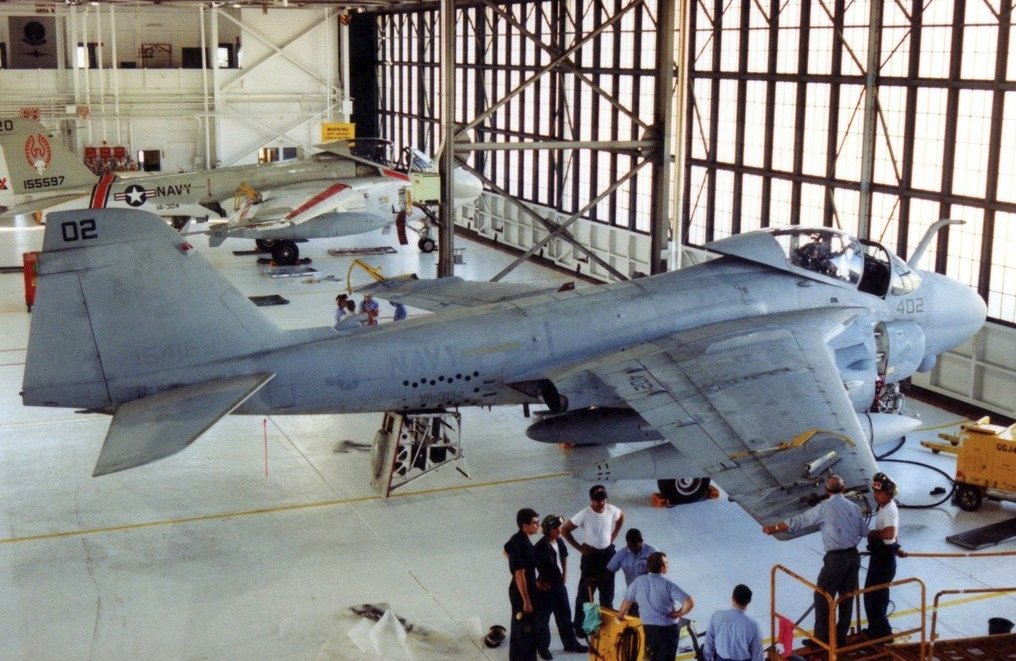
A 10/17/90 photo of 2 Grumman A-6E Intruders inside an NAS Alameda hangar.
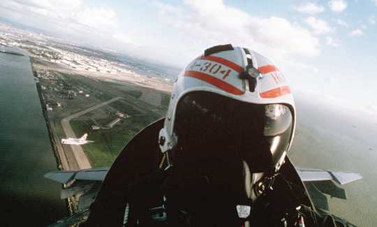
A 10/29/90 view of the pilot of a Naval Air Reserve VA-304 A-7E Corsair II, with his wingman visible on the left,
after having taken off from Alameda, with the base visible below.
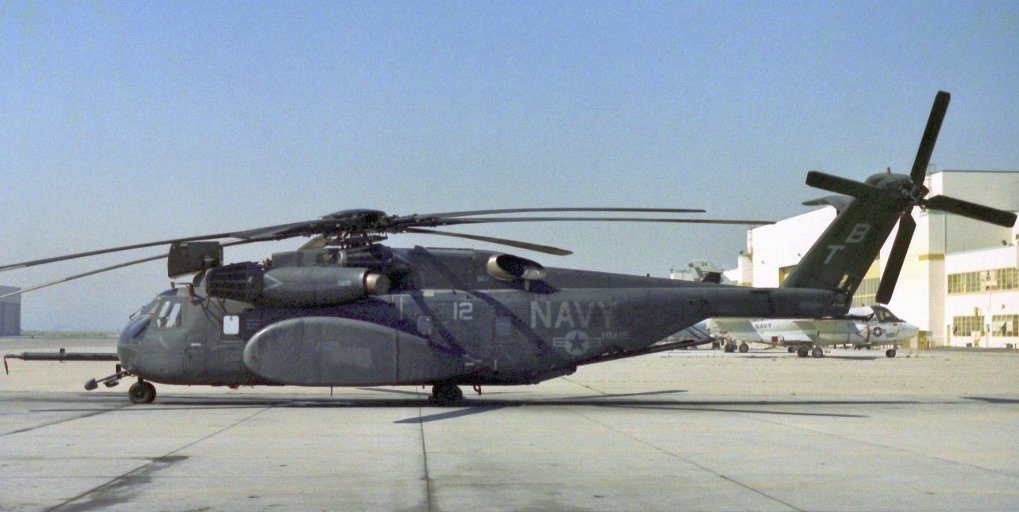
A 3/10/91 photo of a Sikorsky MH-53E Sea Dragon & a Lockheed S-3B Viking in front of an NAS Alameda hangar.
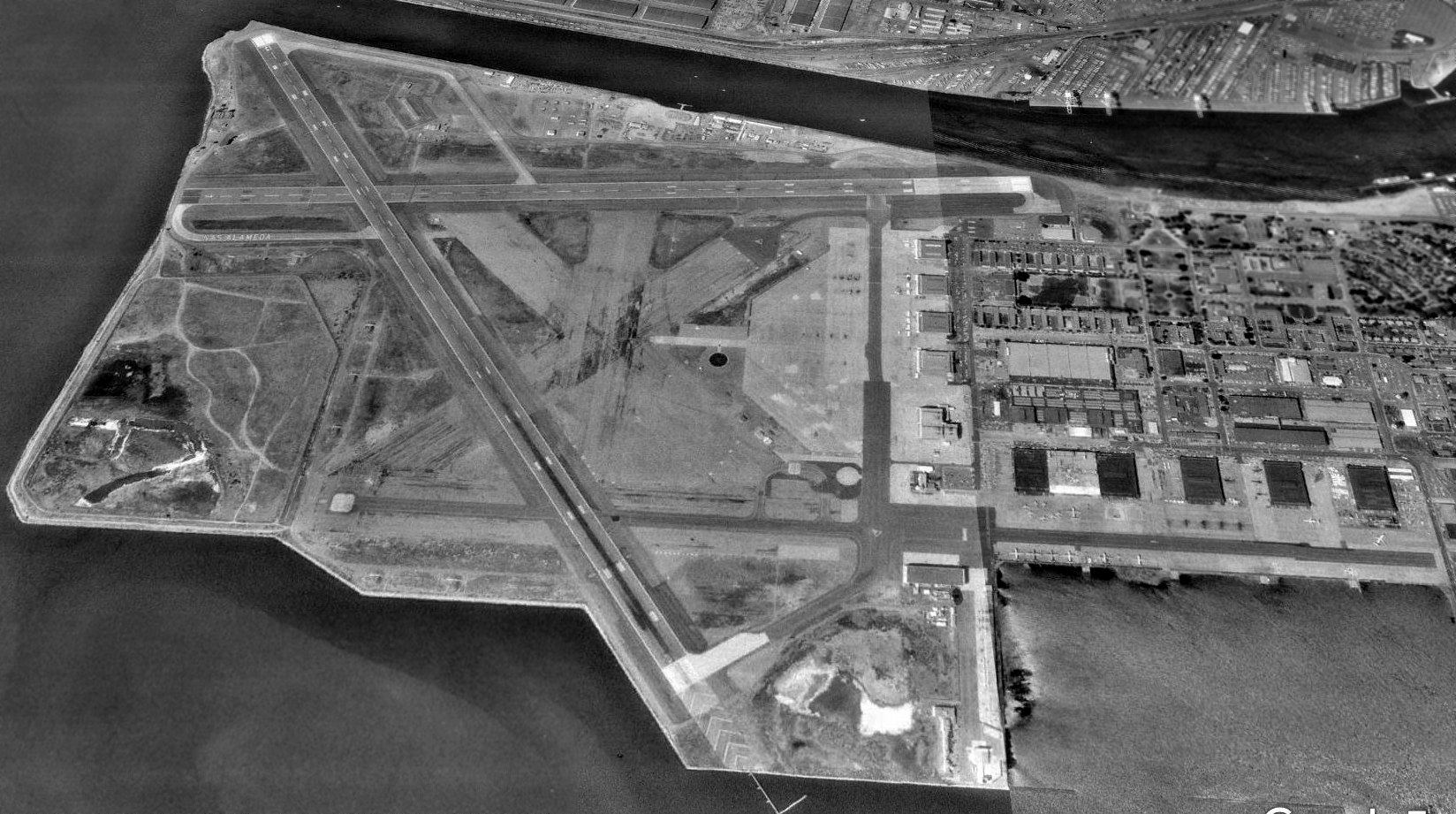
A 1993 USGS aerial view looking north showed NAS Alameda only 4 years before it closed, showing a few aircraft still on the ramps.
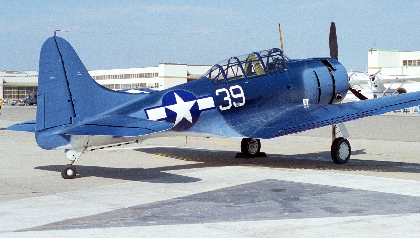
The last photo showing NAS Alameda still in use as an airfield was an October 1995 photo of a Douglas SBD-5 Dauntless dive bomber,
Navy 28536, civil registration N670AM, of the Planes of Fame Air Museum.
It was seen at Alameda;s last Fleet Week open house.
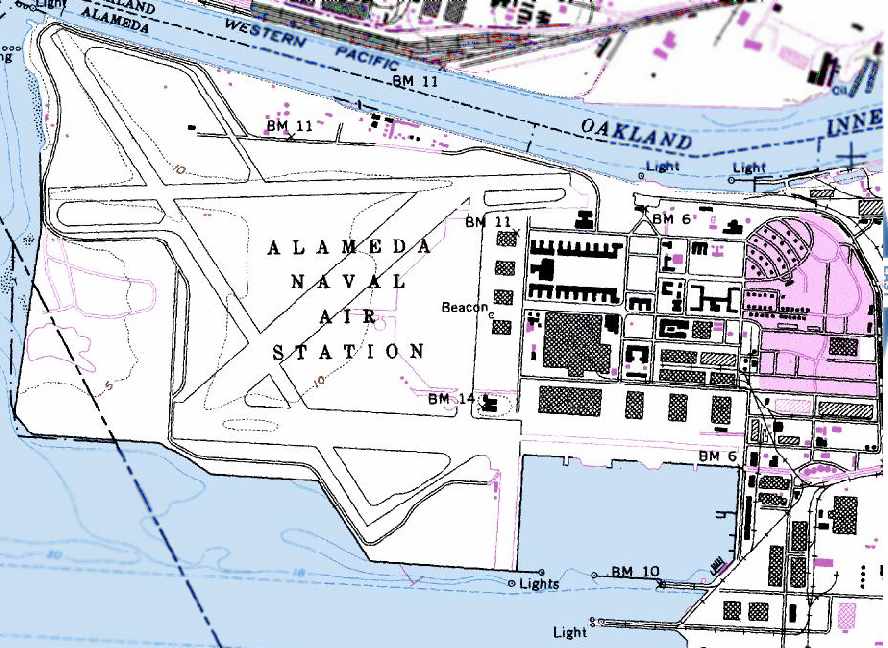
The 1996 USGS topo map depicted the massive airfield infrastructure of the Alameda NAS.
Alameda NAS was closed on 4/25/97 as part of the Base Closure & Realignment process.
At the time of its closure, 2 asphalt runways were still maintained (the largest, 5/31, was 8,400').
Civil reuse plans did not include any aviation uses of the massive NAS Alameda airfield.
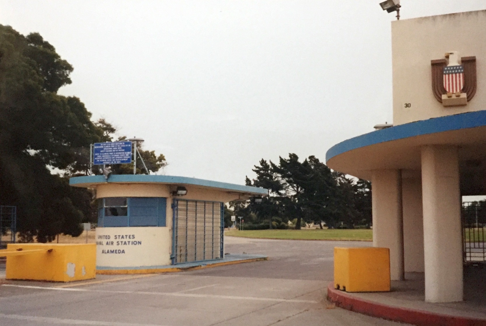
A 2000 photo by Kevin Walsh of NAS Alameda's Art Deco gate.
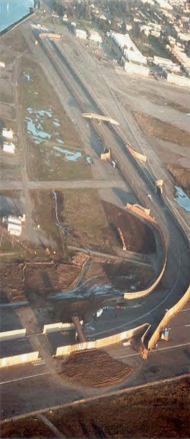
A mile & a quarter long section of "freeway" which was constructed on the former Alameda runways
in 2001 as a movie set for the film "The Matrix Reloaded" (courtesy of Eric Barbour).
According to Eric Barbour, the former runways at Alameda were used in 2001 to film part of the movie "The Matrix 2".
An entire 3-mile-long section of freeway was constructed on part of Runways 13 & 25.
Warner Brothers removed the set after filming,
but the layout of the roadway sections were still perceptible on the runways.
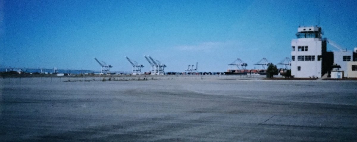
A March 2003 photo by Kevin Walsh looking north at the NAS Alameda control tower.
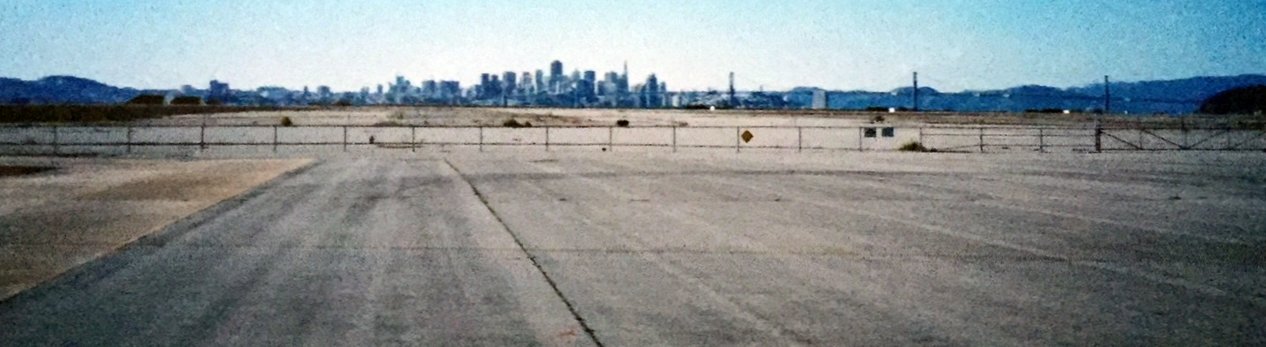
A March 2003 photo by Kevin Walsh looking west along the NAS Alameda runways, with the San Francisco skyline & the San Francisco Oakland Bay Bridge in the background.
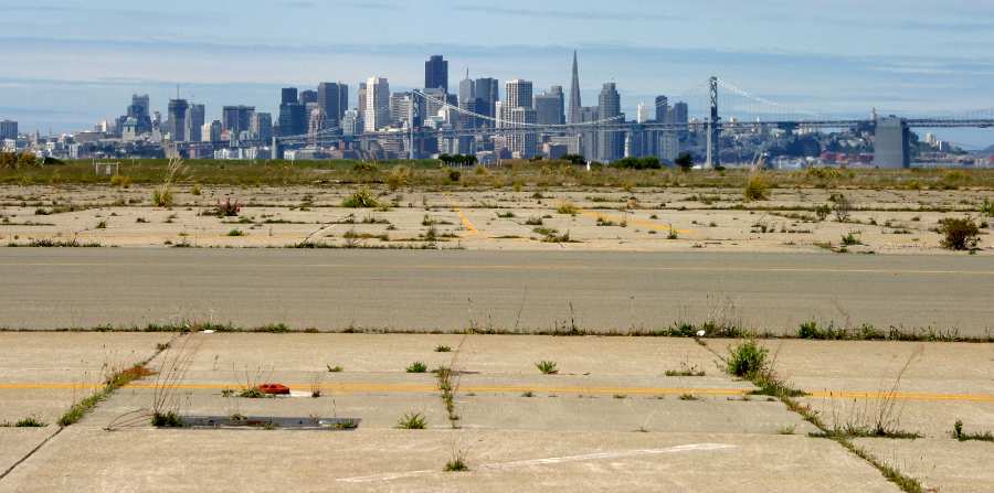
A beautiful 2003 photo by Erick McCarthy of the San Francisco skyline behind the remains of the runways at NAS Alameda.
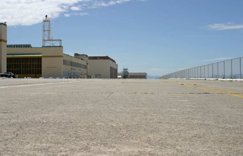
A 2003 photo by Erick McCarthy looking south along the parking apron,
with the hangars & control tower of NAS Alameda visible on the left.
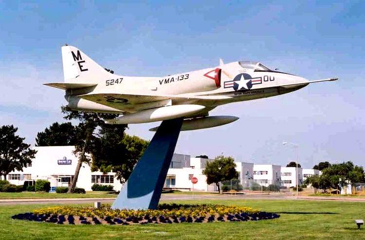
A 2003 photo by Bill Larkins of a Douglas A-4 mounted on a pylon at Alameda.
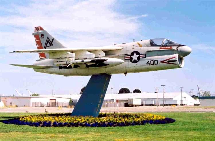
A 2003 photo by Bill Larkins of a loaded Vought A-7, mounted on a pylon at Alameda.
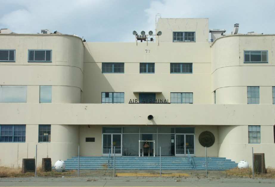
A 2003 photo by Tim Tyler of Building 77 at Alameda - still marked as the "Air Terminal".
Tim Tyler visited the former NAS Alameda in 2003.
His report: "Hello from the ramp area in front (south) of the former NAS Alameda Building 77 - the old Air Terminal Building.
Building 77 is on the east end of this ramp area, with the newer ATC/Terminal Building being on the west end.
The newer ATC building is actually the corner, as the hangars & ramp area basically form an 'L' shape."
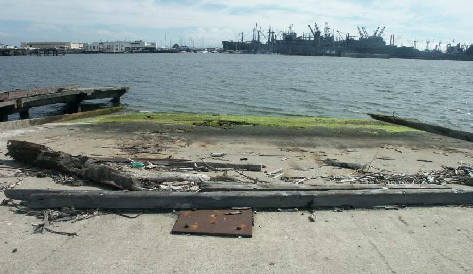
A 2003 photo by Tim Tyler of the remains of a seaplane ramp, with several former Navy ships in the background.
Tim Tyler continued, "I rode my bike all around the ramp area this afternoon, seeing / photographing the numerous old seaplane ramps
(including one that seemed to have been converted from a barge), the faded helicopter LZ markings, and 4 major hangars.
Three in a row & then one located right behind Building 77.
NAS Alameda is now known as Alameda Point, and is pretty much owned by the city of Alameda now.
I'd say maybe 40% of the NAS properties are redeveloped, but that number could be substantially greater
if some companies have just chosen not to put any signs up on their doors or something."
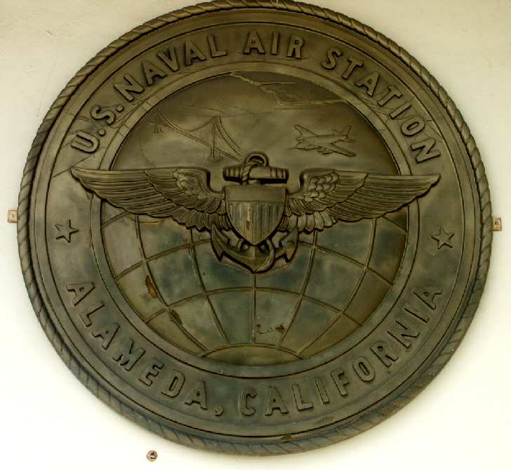
A 2003 photo by Tim Tyler of "a very large, metal NAS Alameda emblem, mounted on the wall next to the doors at the old Air Terminal."
Tim Tyler continued, "Building 77 looks like it dates back to the 1930s or 40s, several stories tall, with 'Air Terminal' lettering on the ramp-side of it.
There are several historical markers around the steps leading to the door,
and a large NAS Alameda emblem is still up on the wall next to the doors.
This building was apparently a NAS Alameda Museum at one point,
however a piece of paper still posted on the glass doors indicated that the museum was still looking for volunteers,
and they were anxious because they had a 2001 opening date.
Peering in through the window, the ground floor area was full of miscellaneous junk, but not dirty or showing any signs of vandalism.
Apparently the museum group suffered from a variety of mismanagement, and was short-lived.
Some of the aircraft that were on loan to them is now aboard the USS Hornet, moored several hundred yards away."
Tim Tyler continued, "The hangar behind the Air Terminal is Hangar 41, the 'AIMD' [Aircraft Intermediate Maintenance Department] Hangar.
It's unusual in that it has a small Quonset hut located along the south side of the doors,
and an old cipher lock on the personnel door, located in between the 20'x40' Quonset hut & the hangar."
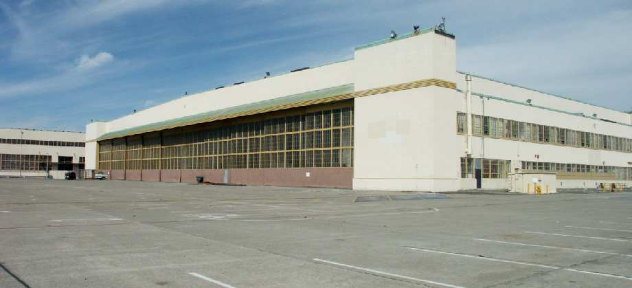
A 2003 photo by Tim Tyler of NAS Alameda's Hangar 40.
"The next major Hangar, number 40, is now the Bladium Sports Club, at 800 West Tower Avenue."
Tim Tyler continued, "Hangar 39, 950 West Tower Ave, is now Delphi Productions,
which based on what I saw when I peered in one of the windows, is involved with helping design, build & ship exhibits for trade shows.
The south side of this hangar is at 37-46.9 N / 122-18.19 W.
Based on some painted-over stenciling ('HS-85 Parking Only') on the side, this hangar had been used by Navy Helicopter Squadron 85."
Tim continued, "The next hangar west is number 12,
which according to some very faded/perhaps painted over lettering was the 'NARF Emergency Repair Hangar 12' once,
but from all external appearances, it seems unused these days.
However, in peeking through a window, I did observe a 2003 calendar on the wall of a work area.
On the ramp about 50' back from this hangar are some 'humps' in the concrete
which seemed to provide some power & liquid receptacles for parked aircraft.
Building 12 is a very large hangar, perhaps 700' long on it's south side.
It has several street addresses - 1090 & 1190 West Tower Avenue.
The '12' numbers are on the hangar doors on the east end of the building.
The doors on the west don't have a hangar number above them, but the doors on the number side indicate it is Hangar 11."
Tim continued, "Hangar 25 is a newer (at least 1970s) hangar & is on the opposite side of the ramp from the ATC Tower.
It had 3 separate bays to it, and the east end is at N 37-46.83 / W 122-18.60.
It seems mostly to be used these days for indoor antique shows & flea markets.
It was used to remove the canons from aircraft, which would then be taken to nearby Building 29.
Behind (south) it seemed to be some sort of power production facility, and then Building 494 (1851 Monarch Street),
which is an ancient looking corrugated steel warehouse type building
with several storage bays that have newer cars in them."
Tim continued, "A couple hundred yards South of Building 494 is Building 29.
It's in an isolated area, with it's own security fencing, and seemed to have old CCTV camera mounts in all 4 corners of the fenceline.
It's a fairly modern poured concrete building, with a variety of ventilation ducts on the roof.
The entrance door was hardened, and next to it is a 10'x15' equipment door.
An American flag is flying on the roof, and per a sign up on the fence, this building is now used by Rosenblum Cellars.
It turned out this is the former aircraft cannon test firing cell facility, and was hardened in case of misfires or explosions."
Tim continued, "Heading back due north, past Hangar 494 a couple hundred yards, is the ATC Tower at 2175 Monarch Street.
This is a fairly modern structure in very good condition, and is attached to some other buildings, which to me indicates it became the new Air Terminal facility.
It's now used by the Alameda Point Community Partners - the name of the entity in charge of redeveloping the former NAS.
The SE corner of this site has 3 Mark-22 naval artillery pieces on their original mounts, built in Detroit, Michigan in the 1940s."
Tim continued, "Right at N 37-46.94 / W 122-18.63 was some sort of large emblem
painted onto the gray concrete ramp area in front the runway-side entrance to this building.
For some reason, it has been painted over in black paint,
but it read 'Naval Air Station Alameda California' & had a red, white & blue shield in the center."
Tim continued, "Continuing north on the ramp area past the ATC/Terminal Building puts you on the other part of the 'L' shape.
The runway area is west, but it's fenced off with numerous 'No Tresspassing' signs,
indicating that the area is now a California Least Tern nesting area.
This was the site in particular I was hoping to be able to access with my bike.
Off in the distance, near the bay I can see 2 munitions igloos near the southwest corner of the runway area.
More towards the center is a series of several small concrete buildings & one Quonset hut structure.
A couple of cars & a motorhome are parked in their vicinity.
One of these buildings is marked as Building 499, and based on the ventilation ducts on the side,
perhaps it was a generator or transformer building for the airfield lighting system?
It turns out that the Terns don't care too much for the peace & quiet,
so there is some discussion amongst the powers-that-be
to re-use some of this valuable bay-front land with spectacular views of the San Francisco skyline.
As it is, the City of Alameda rents out access to the former runways frequently -
Hummer built a temporary course to demonstrate their vehicle's prowess,
General Motors has leased the grounds to provide demo rides of their products, etc."
Tim continued, "Hangar 24 is north-northeast of the Terminal Building a couple hundred feet,
and is a modern hangar with a lot of heavy-duty ventilation on the roof.
It's now used by Coach Specialties Inc. and is the former aircraft painting facility. Coach Specialties uses it to paint large buses."
Tim continued, "The North end of it seems to be used by another firm.
There were about a dozen strange looking 4 door cars known as 'Cayenne Turbos' but no manufacturer name or logo.
Turns out they're a new Porsche product, brought in to test driven by Bay Area Porsche enthusiasts his weekend."
"The next hangar north is number 23, now apparently used by 'WCN' company.
Next is Hangar 22 at 2501 Monarch Street, now used by Creative Technology.
Hangar 21 is/was used as a factory by Kitz Direct Seal Valves, but sure looks like it is unused now.
On the runway side of Hangar 21, 'Welcome from the Firebirds' is still easily legible along the roofline.
These hangars were formerly home to Marine Corps aviation squadrons."
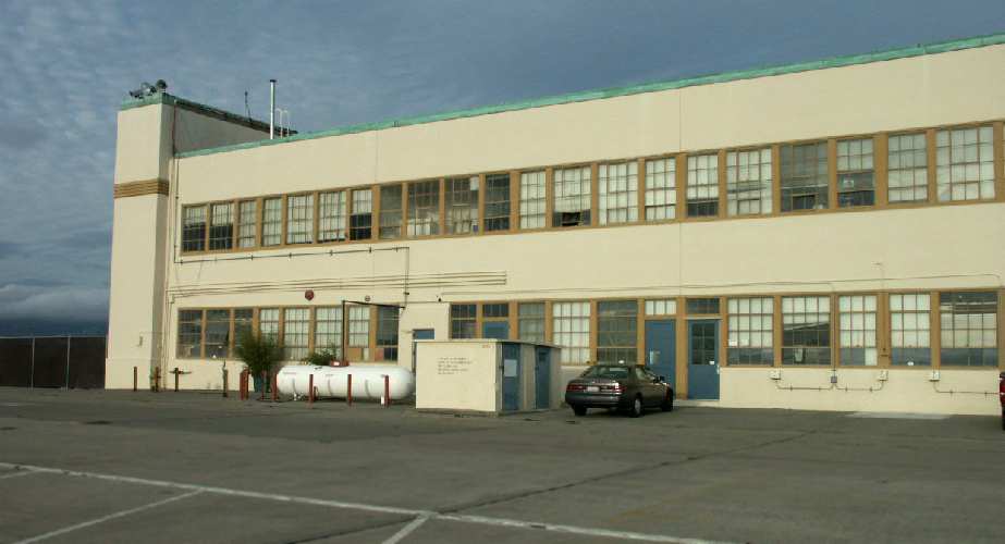
A 2003 photo by Tim Tyler of NAS Alameda's Hangar 20.
Compare to the photo of the same building, 48 years before, several paragraphs above.
Tim Tyler continued, "What should be Hangar 20 does have any Hangar or Building number markings up,
but it is occupied by Ocean Systems Inc, Protector Boats, Juniper Ridge, and Edge Innovations.
Protector Boats is a series of harbor patrol type RIB/RHI boats, and several were stored outside.
On the west (runway) side of this building, at 37-47.3 N / 122-18.60 W should be exactly where
the F-3J 'Fury' aircraft was parked when the photo [several paragraphs above] was taken.
It's kind of eerie to be parked in that exact spot right now, while I look at that photo from 1955.
The tower cab is no longer up on the end of the hangar.
Further north of Hangar 20 is a large, paved area that's vacant,
and then an active Port of Oakland commercial shipping area beyond that."
Tim continued, "On the west-northwest side of the runway area is the former modern WSA for 'special' weapons.
That portion of the base also had a small arms firing range, and south of this area, I spotted the field's tetrahedron."
Tim continued, "The former NAS Alameda is a very large installation,
with lots of areas to explore, however in this visit & report, I'm tending to focus on the aviation-related aspects.
There were numerous other large hangars (I've been informed that Hangar 5 has about 1,000,000 square feet of floor space) that I'm not even mentioning,
because they're set back behind others & not up against the flight line."
Tim continued, "I was extremely lucky to stop & talk with an Alameda PD officer,
who happened to be a retired Marine who was stationed aboard the USS Carl Vinson during the time the Vinson's home-port was NAS Alameda.
He confirmed numerous educated guesses I'd made,
allowing me to revise some tentative wording in this Situation Report to something definitive."
Hugh Black reported in 2003 that he works for Protector Boats & Performance Boats, which is located in Alameda's former Hangar #20.
"This is an old helo hangar. There are still diagrams on the wall of the different types of helos... size, dimensions etc. (very cool)."
Scott reported in 2004 "that a couple of WWII veterans have just opened a museum [the Alameda Naval Air Museum]
in the old Air Terminal Building in Alameda Building 77 of the old Naval Air Station.
It is open on the weekends & features the local history.
As you come through the gate on Atlantic Ave when you reach the fork it is on your right."
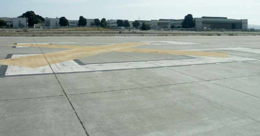
A 2004 photo by Tim Tyler looking east at Alameda's abandoned hangars.
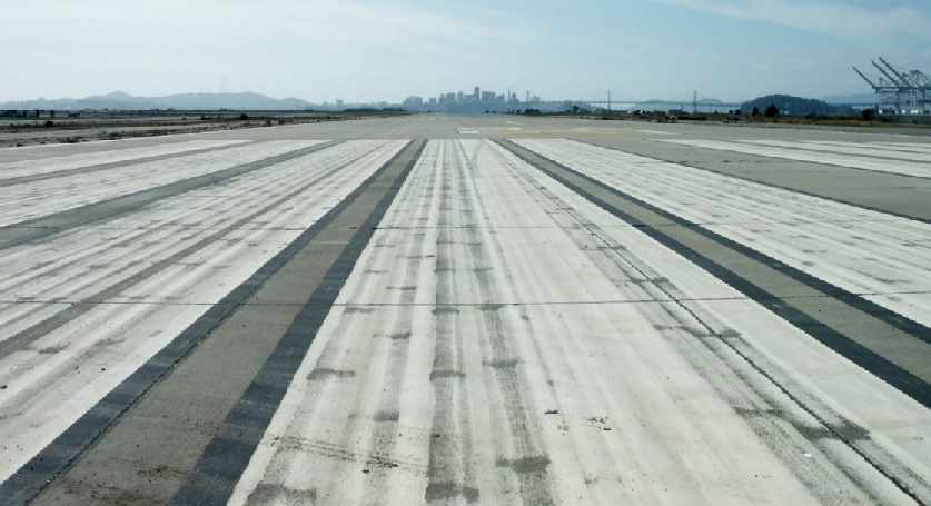
A 2004 photo by Tim Tyler looking west along one of Alameda's abandoned runways, with the San Francisco skyline in the background.
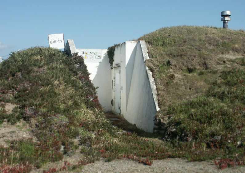
A 2004 photo by Tim Tyler of one of Alameda's abandoned former munitions storage bunkers.
Tim Tyler visited the abandoned NAS Alameda again in 2004.
"The entire airfield area is fenced, but on occasion, the gate for the northern half is open, and I was able to drive around this portion.
Besides part of the runway & taxiway areas, the only thing that's really there is the former weapons storage areas -
an older conventional munitions area, and then an adjacent compound that had been guarded by a contingent of Marines, and stored nuclear weapons."
Tim continued, "There was another fence running East/West & cutting the airfield in half.
This other half of the airfield is this silly wildlife preserve & very much off-limits to unauthorized people,
though there was some sort of truck driving around there.
This half of the airfield has a couple large munitions igloos towards the SW corner,
the old shooting range, windvane, and a couple other miscellaneous buildings."
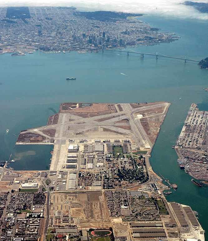
A beautiful August 2004 photo © by AirNikon (used by permission),
looking west with the site of San Francisco Bay Airdrome in the immediate foreground,
the closed NAS Alameda in the middle,
and the skyline of San Francisco in the background.
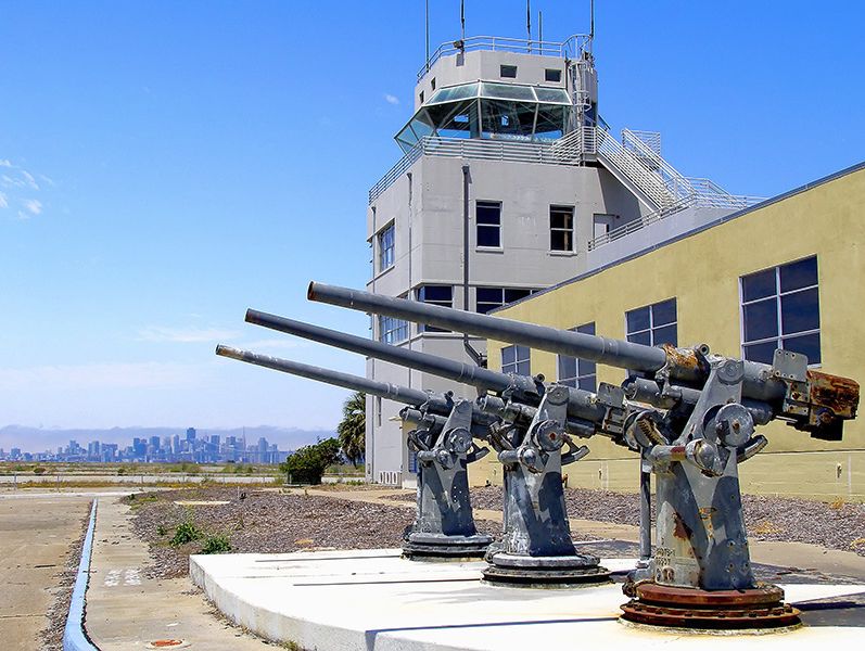
A 6/23/06 photo of 3 Mk.22 naval guns mounted in front of Alameda's former control tower.
According to Jonathan Westerling, “Around 2006, a startup called Makani moved into the control tower building at Alameda NAS.
They were developing a kite to generate wind power more efficiently.
For years Makani flew the flight tests for the various kite designs on the wide open NAS runways.
So Alameda continues to have an aviation role, long after the airfield had been formally closed.”
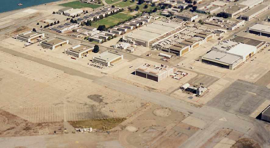
A 2006 aerial view by Bill Larkins looking northeast at the Alameda ramp, hangars, and control tower.
Adrienne Simpson reported in 2006, “I work for Hangar One vodka,
which occupies Hangar 21 on the former Alameda Naval Air Station.”
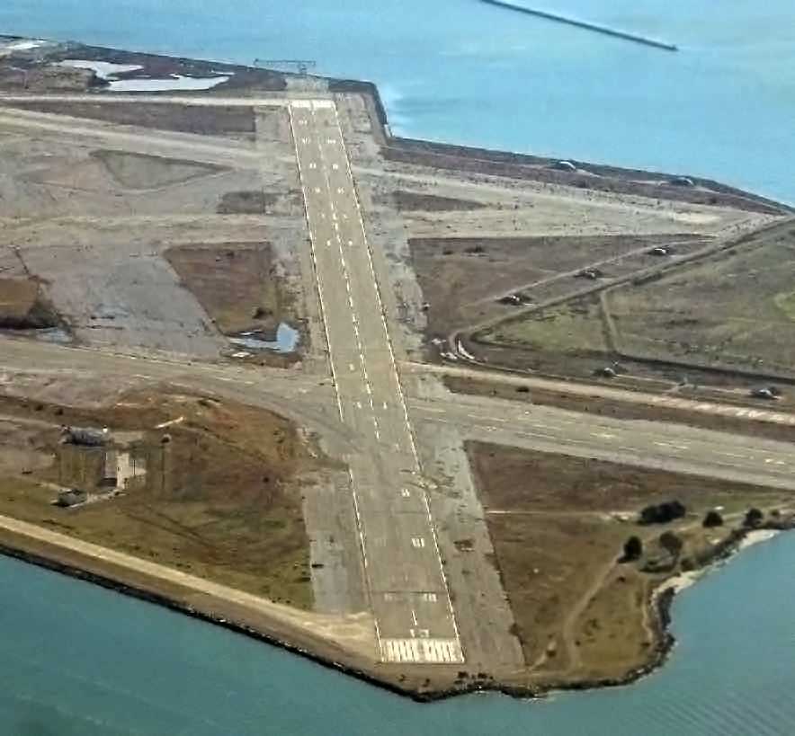
A December 2006 aerial view by Ian Carisi looking southeast along Alameda's Runway 13.
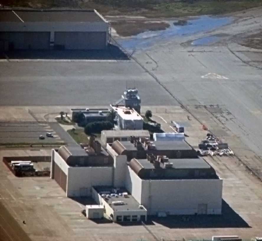
A November 2007 aerial view by Ian Carisi looking south at Alameda's former control tower.
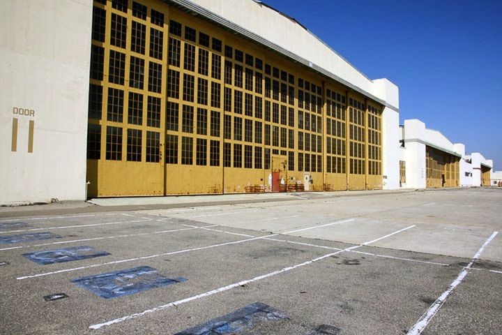
A circa 2008 photo of the hangars of Alameda's Naval Air Rework Facility.
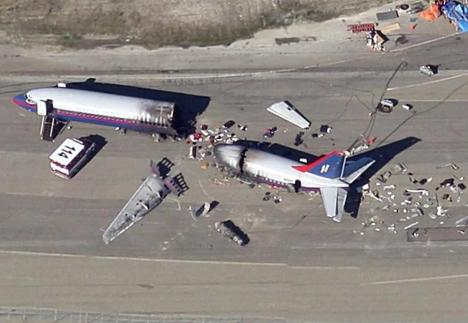
A circa 2009 aerial view looking north at the “wreckage” of a Boeing 737 on Alameda's Runway 7/25.
According to Richard Yokley, this was used to shoot the 'Coming Home' episode of the NBC TV series 'Trauma', which originally aired November 2009.
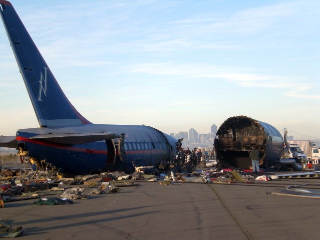
Another circa 2009 photo (courtesy of Richard Yokley) of the “wreckage” of a Boeing 737 on Alameda's Runway 7/25,
used to shoot the 'Coming Home' episode of the NBC TV series 'Trauma', which originally aired November 2009.
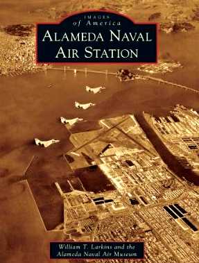
An undated aerial view of 4 A-4 Skyhawks over NAS Alameda,
on the cover of Bill Larkin's 2010 book “Alameda Naval Air Station”.
In June 2011 Alameda's A-4 was seriously damaged when it toppled over when a crane was attempting to re-mount the A-4 on its display pylon.
Tim reported in December 2011, “After only 2 months & 26 days all the damage that occurred in June 2011 was repaired &/or fixed.
It is now remounted & it looks like nothing ever happened. From tragedy to triumph.”
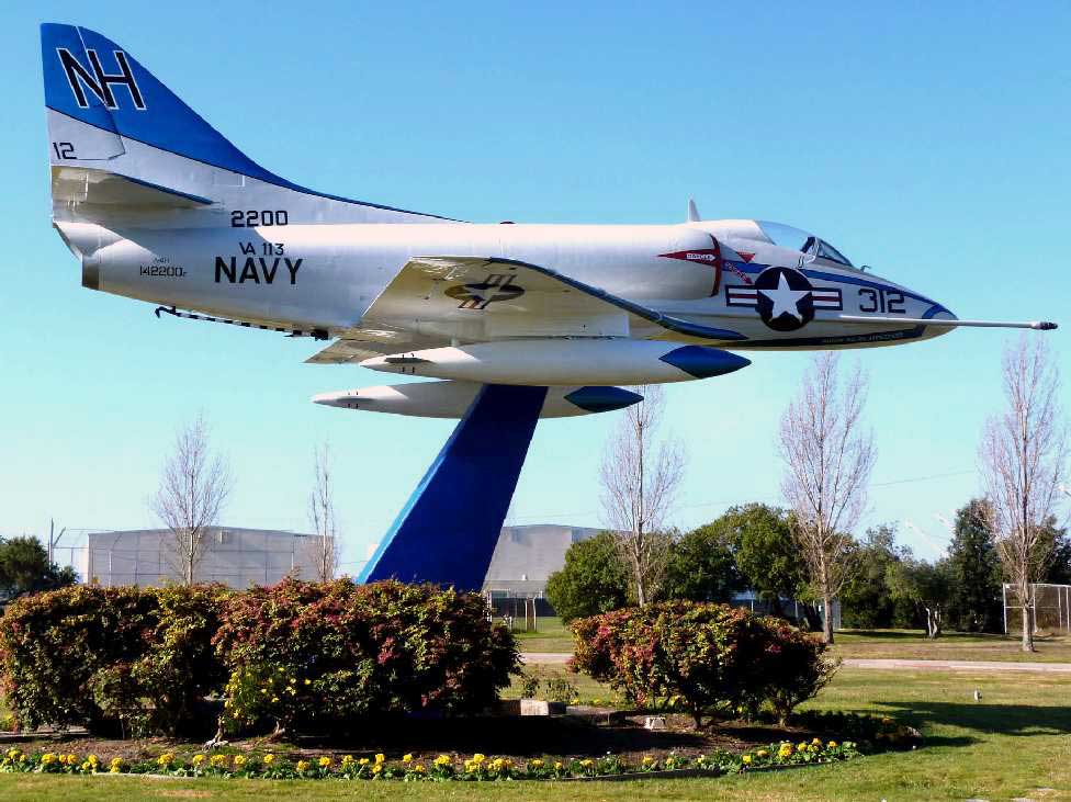
A 1/1/12 photo by William Larkinns of “the beautiful A4D-1 is now mounted at the main entrance to the old NAS Alameda - now called Alameda Point.
It is in its correct historical markings when it was in VA-113.”
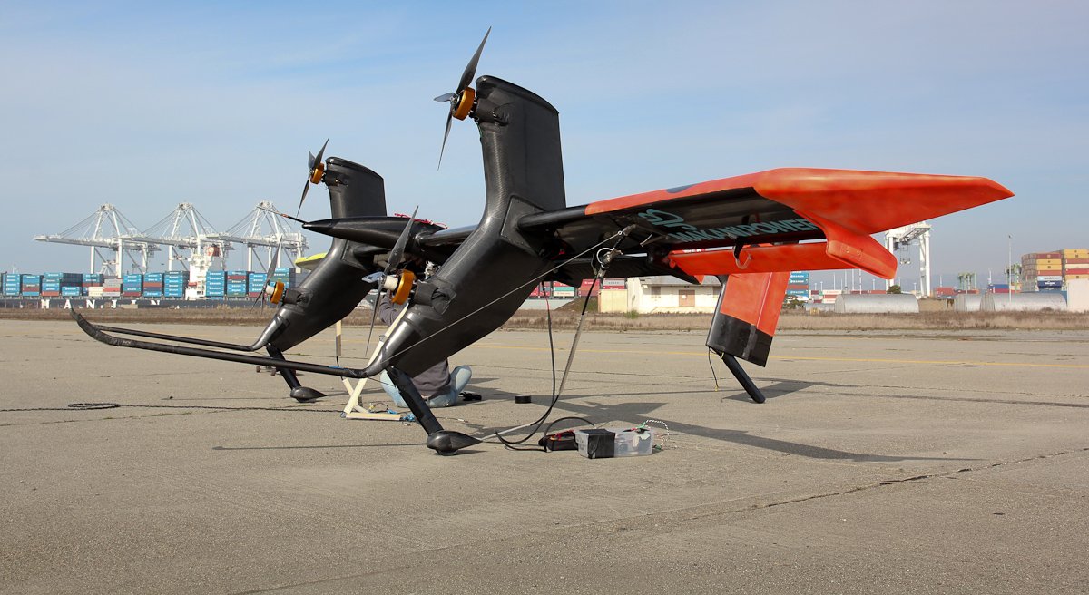
A 1/31/12 photo of the experimental Google Makani wind power generation kite being flight tested on the NAS Alameda runways
(© Makani/Andrea Dunlap used with permission, courtesy of Jonathan Westerling).
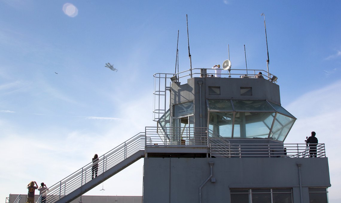
A 9/21/12 photo of the Space Shuttle on top of the Shuttle Carrier Aircraft 747 overfling the NAS Alameda control tower (copyright Makani/Andrea Dunlap used with permission, courtesy of Jonathan Westerling).
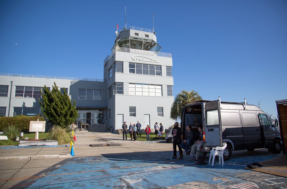
A 2/20/13 photo of the NAS Alameda control tower, now the headquarters of the Google Makani project (copyright Makani/Andrea Dunlap used with permission, courtesy of Jonathan Westerling).
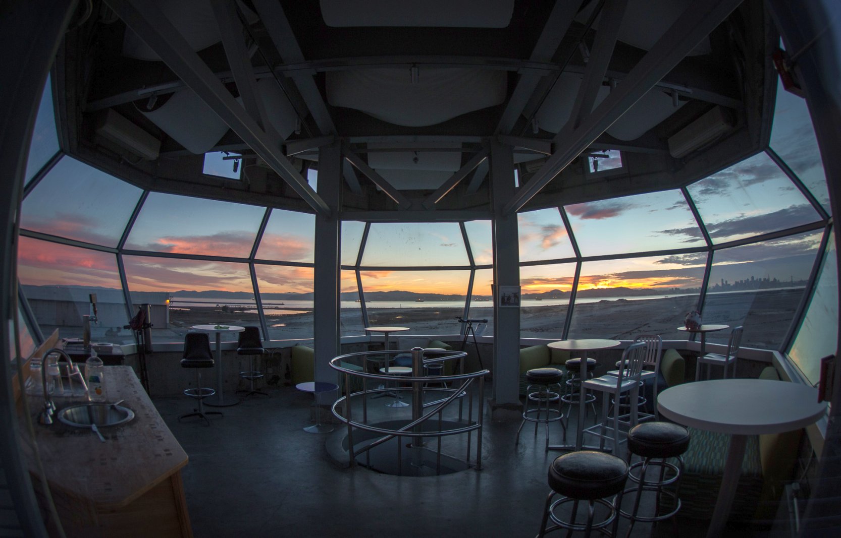
A 2/13/14 photo of the interior of the NAS Alameda control tower, reused as a meeting room (© Makani/Andrea Dunlap used with permission, courtesy of Jonathan Westerling).
Jonathan Westerling reported, “Makani has renovated the interior of the control tower building as office space for their headquarters, and continue to make use of the tower itself as a meeting lounge.”
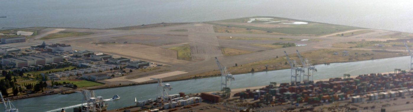
A 4/13/15 aerial view by Dallam Oliver-Lee looking southwest at NAS Alameda.
What a shame to see such a massive amount of aviation infrastructure going to waste.
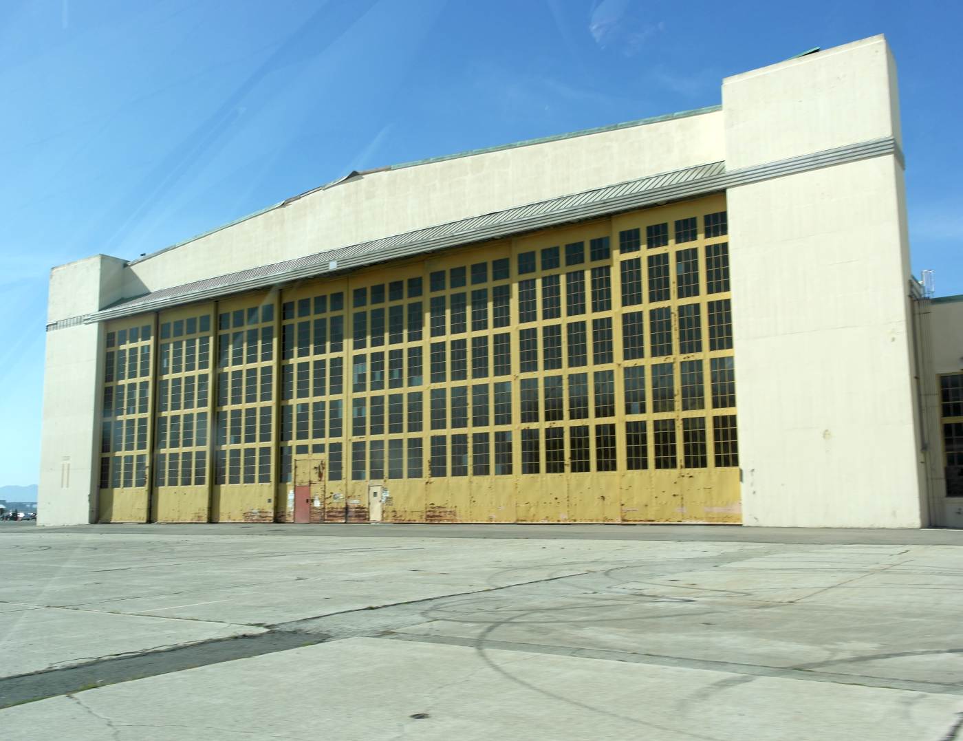
A 4/13/15 photo by Dallam Oliver-Lee of a former NAS Alameda hangar.
Dallam reported, “A lot of the buildings have been rented out by companies. Only a few buildings were abandoned.”
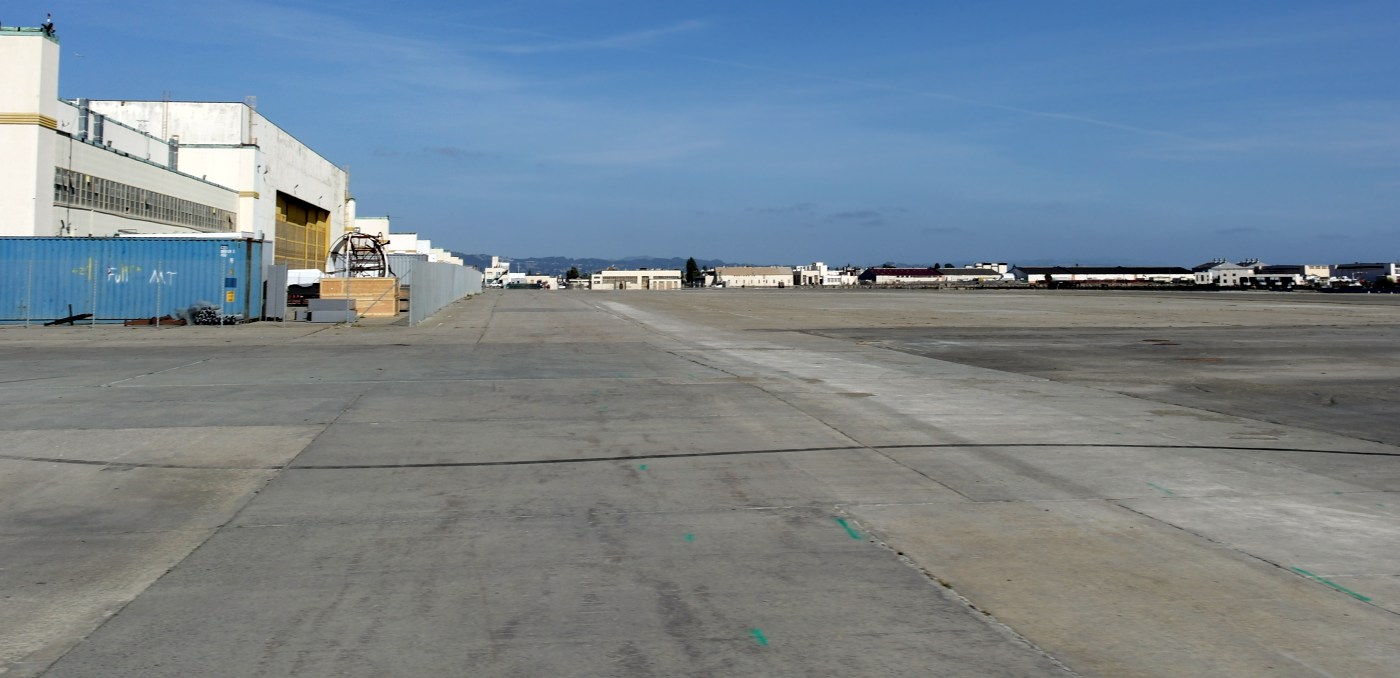
A 4/13/15 photo by Dallam Oliver-Lee of the massive NAS Alameda ramp.
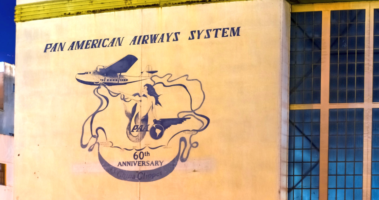
A 10/29/15 photo of the Pan Am logo on the side of an Alameda hangar.
Tim Tyler reported, "The Pan American Airways System artwork is on the side of one of the old hangars behind the old Air Terminal building.
I'm assuming it was a hangar used by Pan Am Clippers back in the day."

A 10/29/15 panoramic photo of an Alameda hangar.
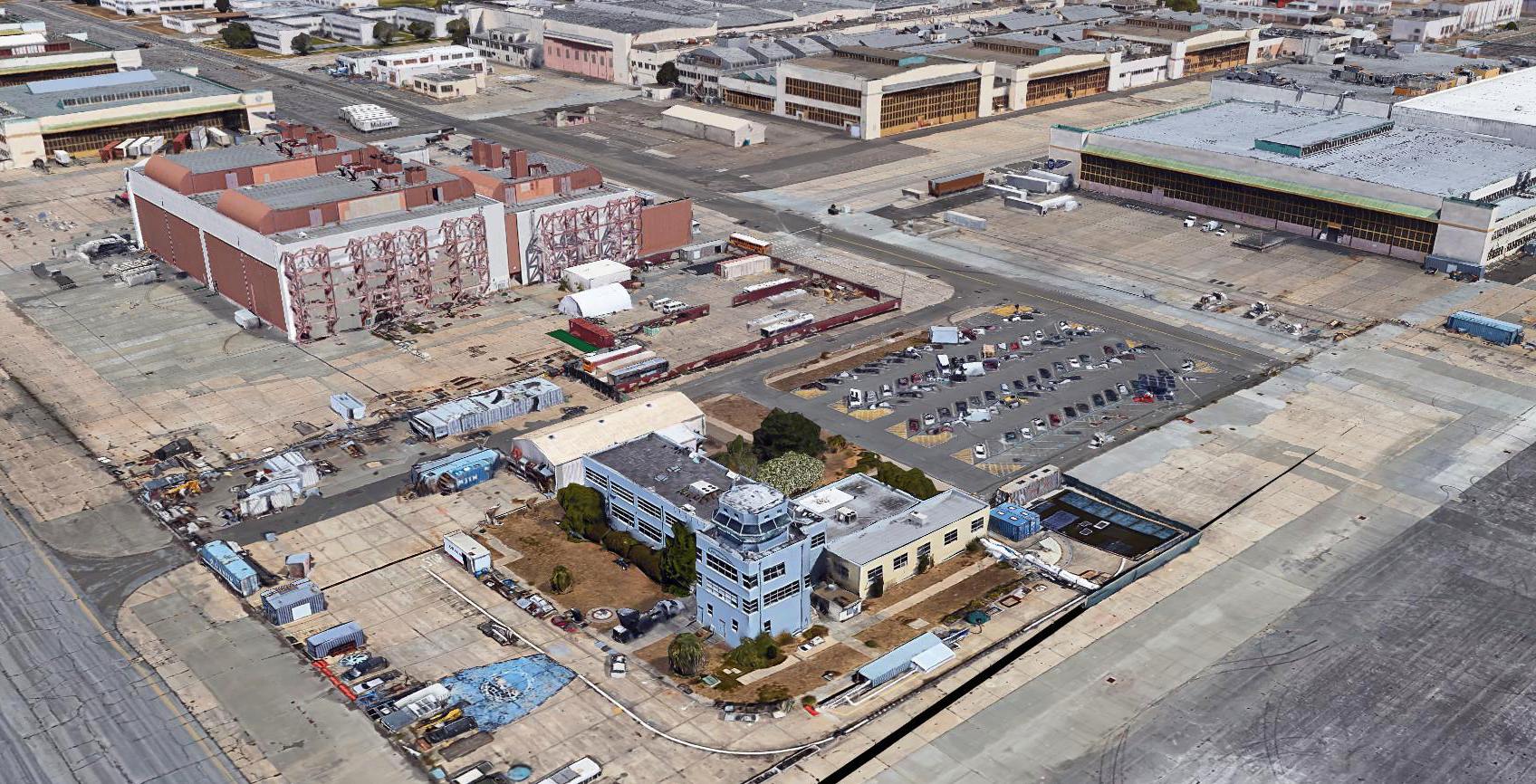
A circa 2015-2018 3D aerial image looking northwest at the NAS Alameda control tower & hangars.
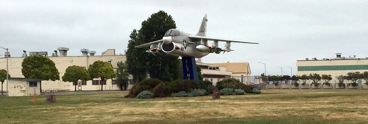
A 5/11/16 photo by Kevin Walsh of the heavily-loaded Vought A-7 mounted on a pylon at Alameda.
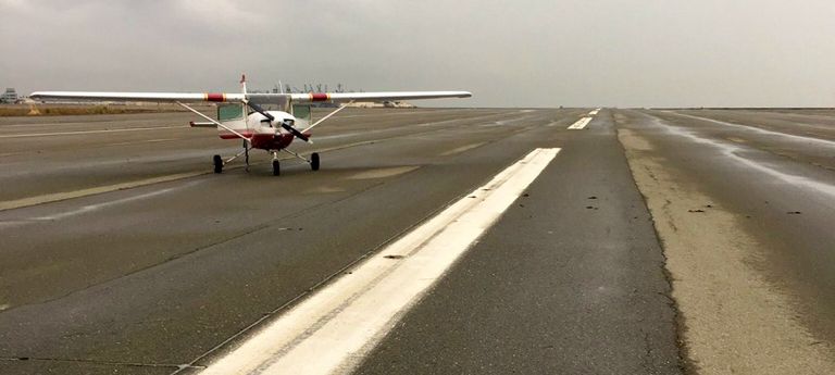
A 10/27/16 photo (courtesy of Kevin Walsh) of the last plane to land (for now) on the NAS Alameda runway - a Cessna 172 which made an emergency landing.
At least all of this extensive infrastructure is still being put to some aviation use.
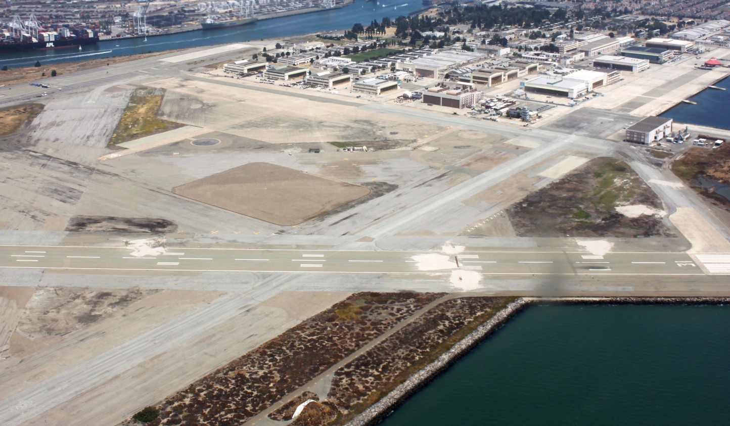
A 7/1/17 aerial view by Ian Carisi looking northeast at the massive aviation infrastructure which remains at the former NAS Alameda.
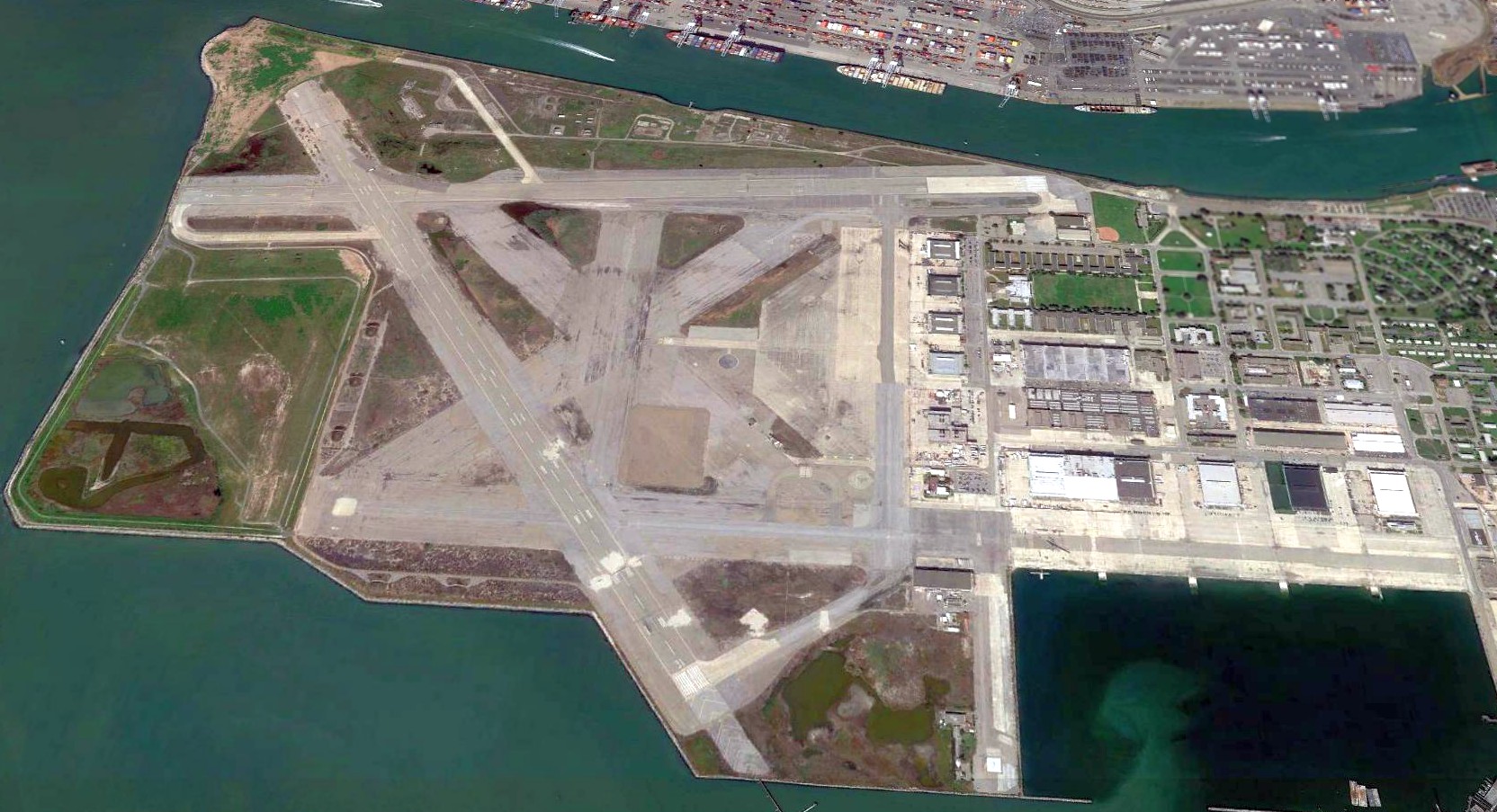
A 4/2/18 aerial view looking north shows the NAS Alameda airfield remained almost completely intact, with an extensive network of runways, taxiways, large ramp areas & numerous hangars.
What a shame to see so much aviation infrastructure, paid for by the taxpayers, going to waste.
Jonathan Westerling reported, “Makani was later purchased by Google & in 2018 continues to use NAS Alameda as their headquarters & manufacturing,
though flight testing of the much-larger kite designs must be done elsewhere.”
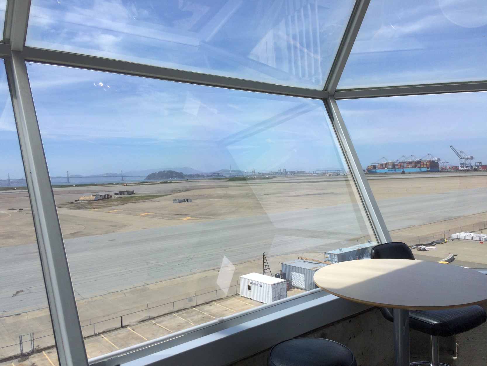
A 5/10/18 photo by Jonathan Westerling looking out from the NAS Alameda control tower, showing the same perspective as the 1973 photo.
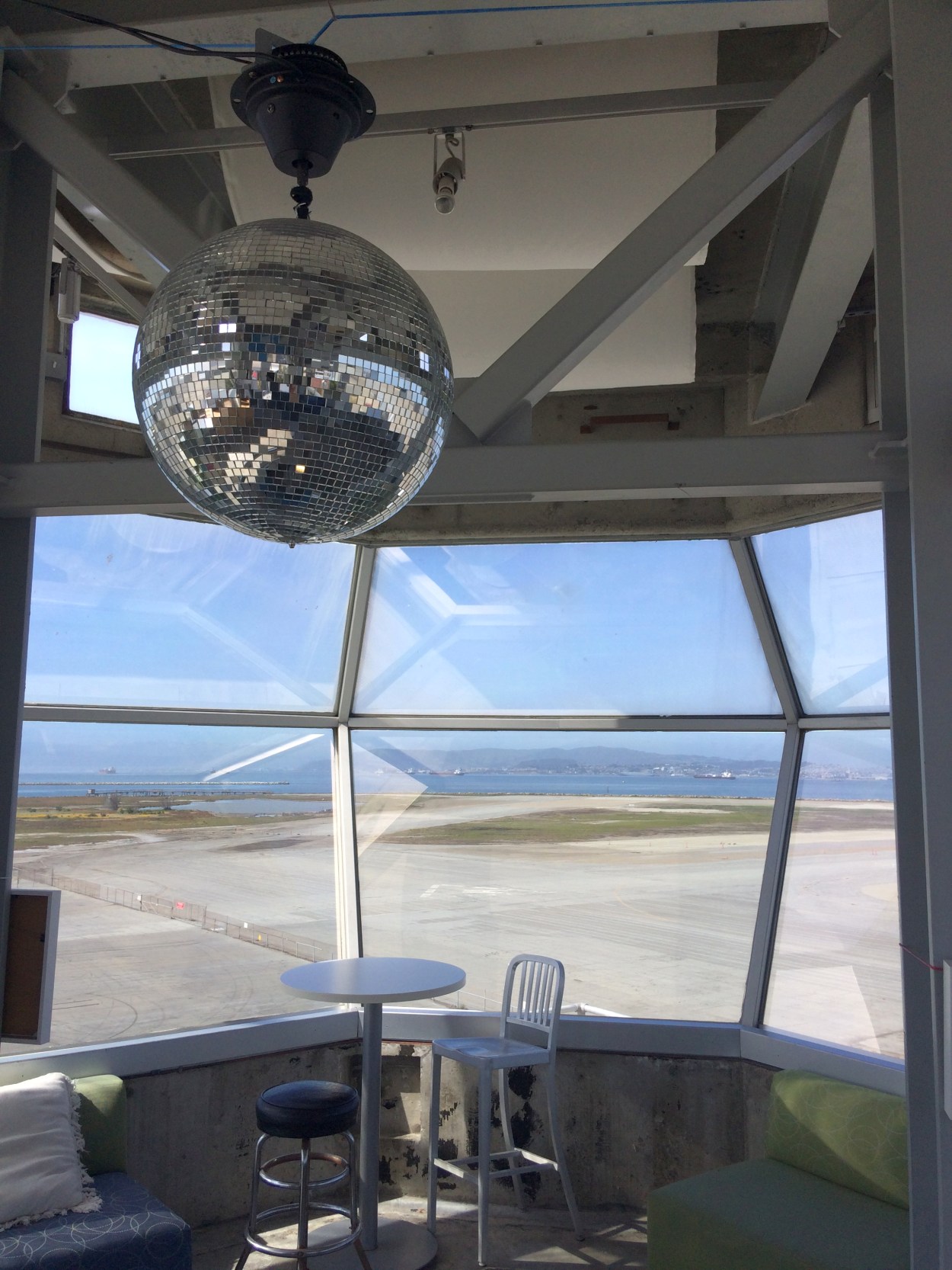
A 5/10/18 photo by Jonathan Westerling of the interior of the NAS Alameda control tower. Jonathan observed, “How many towers have a disco ball?”
A 5/10/18 photo by Jonathan Westerling of the spiral staicase leading down from the NAS Alameda control tower.
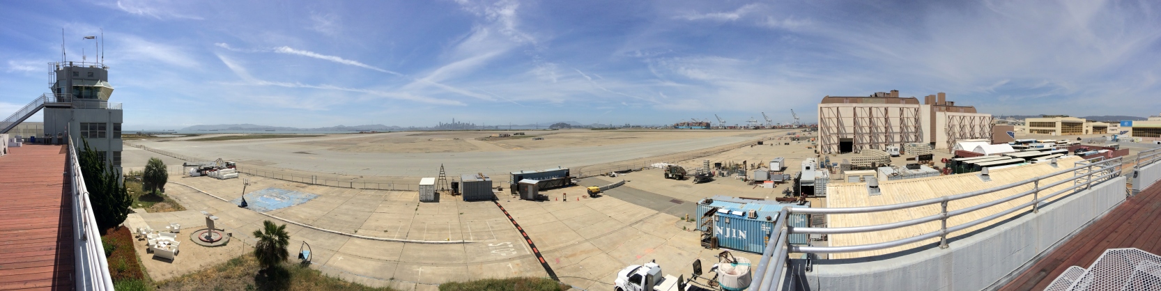
A 5/10/18 panoramic photo by Jonathan Westerling of the NAS Alameda control tower, ramp, runways, and hangars.
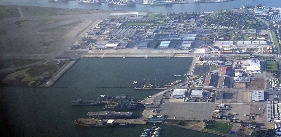
A 4/18/20 aerial view by Kevin Walsh looking north at the former NAS Alameda hangars & ramps.
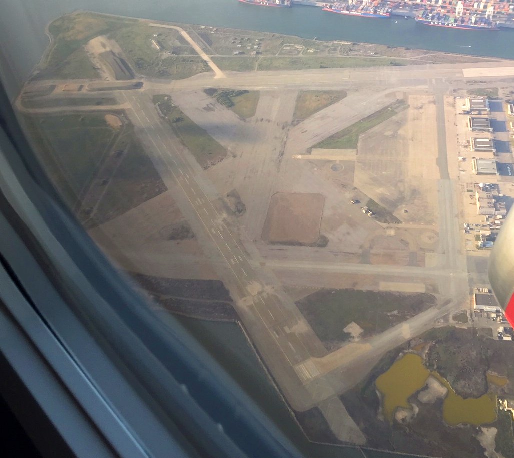
A 4/18/20 aerial view by Kevin Walsh looking north at the former NAS Alameda runways.
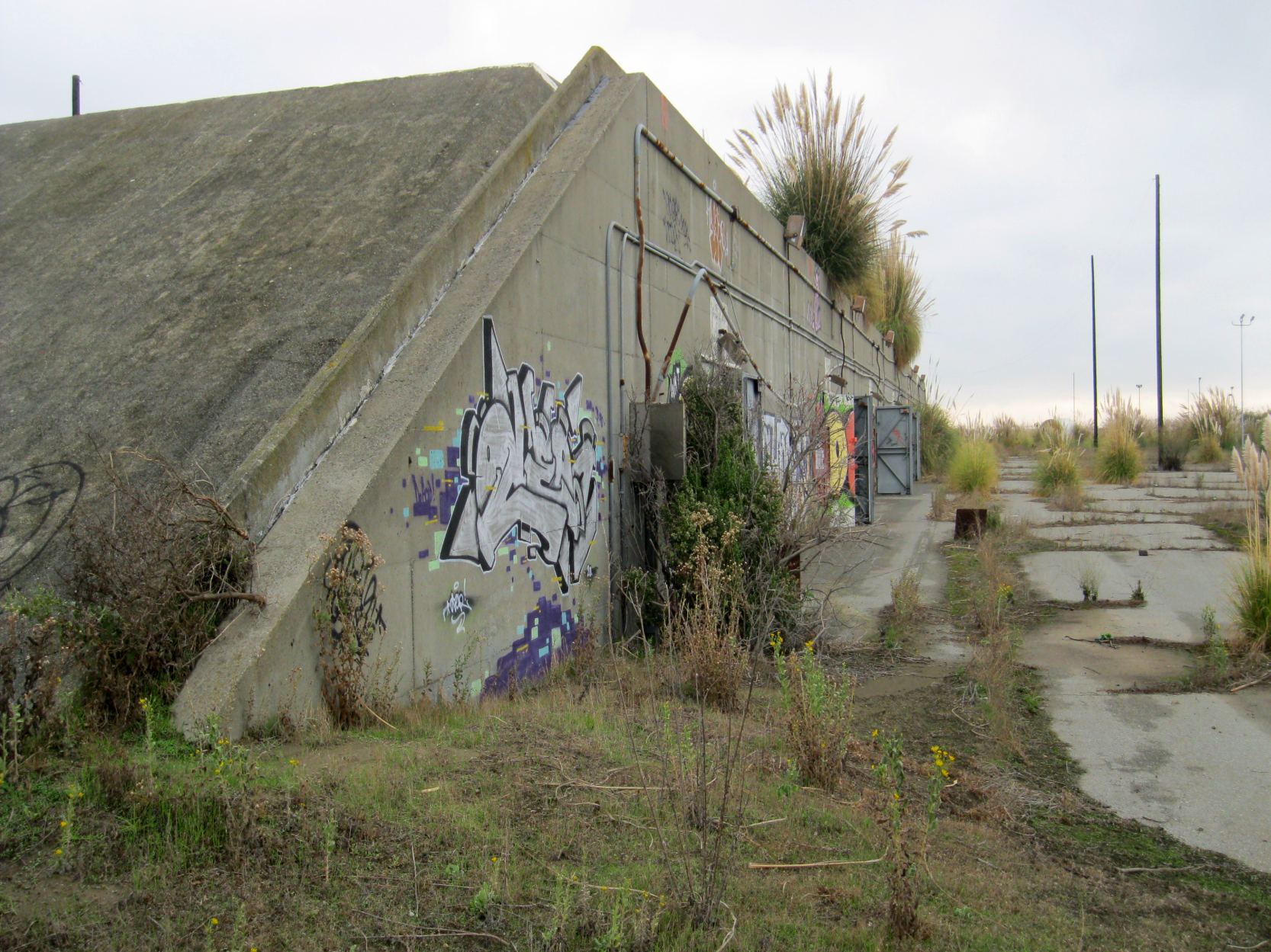
A 6/16/21 photo by Brian Poole of one of Alameda's abandoned former munitions storage bunkers.
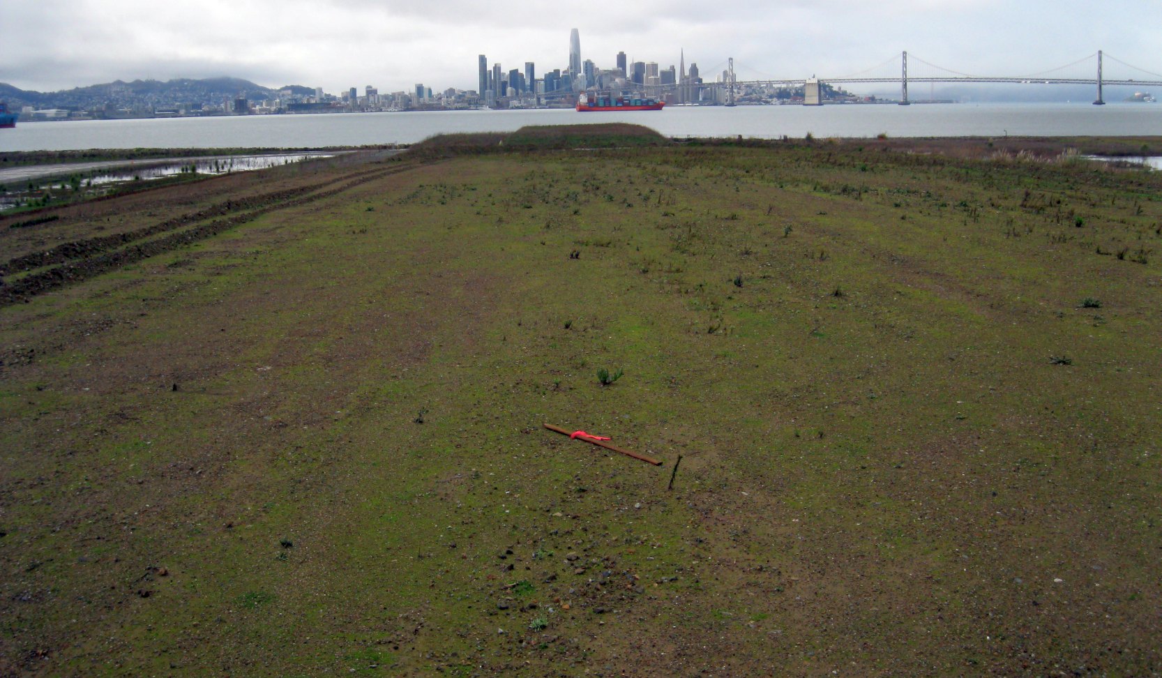
A 1/7/22 photo by Brian Poole looking west along the site of the NAS Alameda runways, with the San Francisco skyline & the San Francisco Oakland Bay Bridge in the background.
Army Corps of Engineers Brian Poole reported in 2022, “Former Alameda Naval Air Station is about to go get some construction.
We have 2 contracts out for bid that would start a pretty good transformation to the former Air Station airfield area.
Part of the work early on will be the demolition of 6 buildings, some of the runways & taxiways.
There currently is stockpiled soil on the east/west runway that has a solid view of the airfield. The entire airfield area is off-limits to the public.
Hangars are still being utilized with different businesses. Spirits Drive has a vodka distillery, a beer distillery, St George’s Spirits distillery and several wineries.
The north/south runway on the south end will get removed & a new wetlands created.”
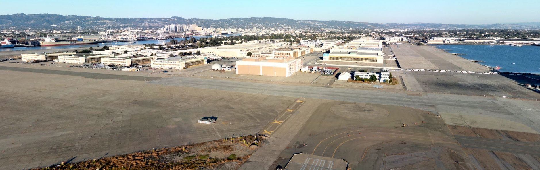
An October 2022 aerial view looking east at the NAS Alameda ramps & hangars.
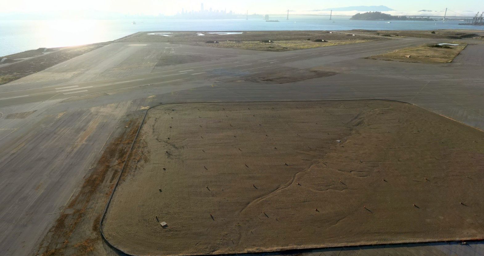
An October 2022 aerial view looking west at the former NAS Alameda runways, with the San Francisco skyline in the background.

A June 2024 aerial view by Rex Ricks looking southwest at the former NAS Alameda.
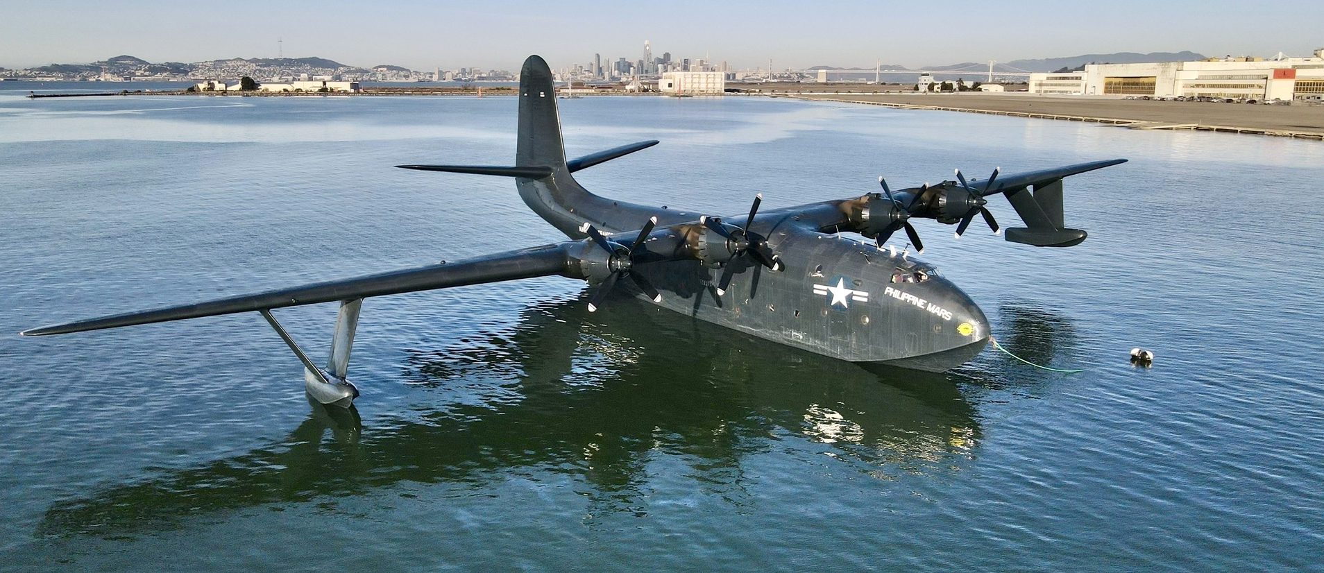
A 2/9/25 photo of Martin JRM-1 Philippine Mars during its stop at Alameda, with the hangars visible in the background.
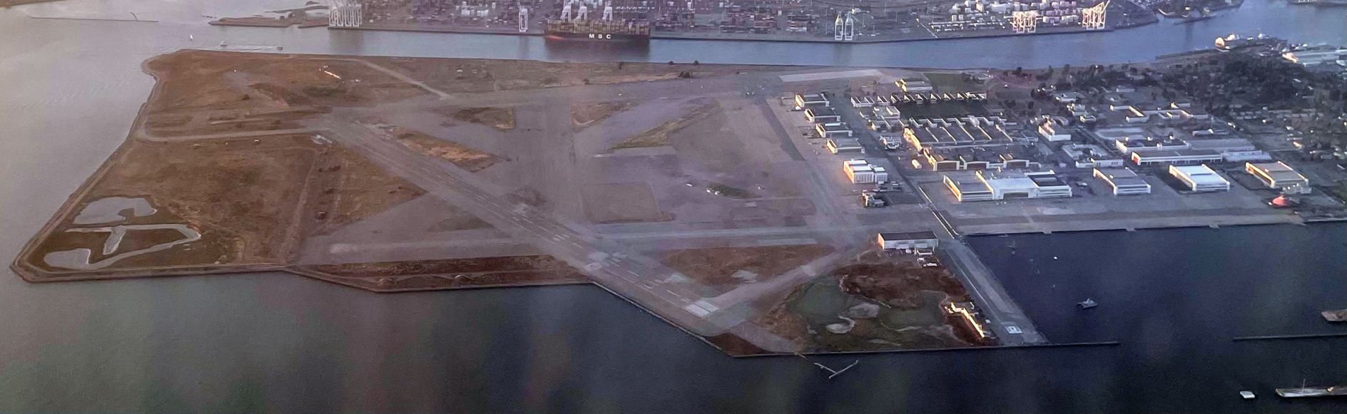
An 8/2/26 aerial view by Kevin Walsh looking north at the former NAS Alameda.
See also: www.vpnavy.com/nasalameda.html
____________________________________________________
____________________________________________________
This site covers airfields in all 50 states.
