
Abandoned & Little-Known Airfields:
California: Southeastern Fresno area
© 2002, © 2023 by Paul Freeman. Revised 5/18/23.
This site covers airfields in all 50 states: Click here for the site's main menu.
____________________________________________________
Please consider a financial contribution to support the continued growth & operation of this site.
For the 8th year, the CA pages of this website are sponsored by the California Pilots Association:
Adams Airport (revised 5/18/23) - El Rico Airfield (added 12/15/22) - Kleinhammer Field / Machado Dusters Airfield (revised 11/15/20) - (Original) Selma Airport (added 9/15/22)
____________________________________________________
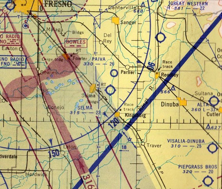
El Rico Airfield, Corcoran, CA
36.046, -119.647 (Southeast of Fresno, CA)
El Rico Airfield, as depicted on the January 1966 Mt. Whitney Sectional Chart.
This private airfield was evidently established at some point between 1965-66,
as it was not yet depicted on the 1957 USGS topo map or the 1965 Mt Whitney Sectional Chart.
The earliest depiction which has been located of El Rico Airfield was on the January 1966 Mt. Whitney Sectional Chart.
It depicted El Rico as a private airfield having a 3,000' paved north/south runway.
El Rico Airfield, as depicted on the 1971 USGS topo map.
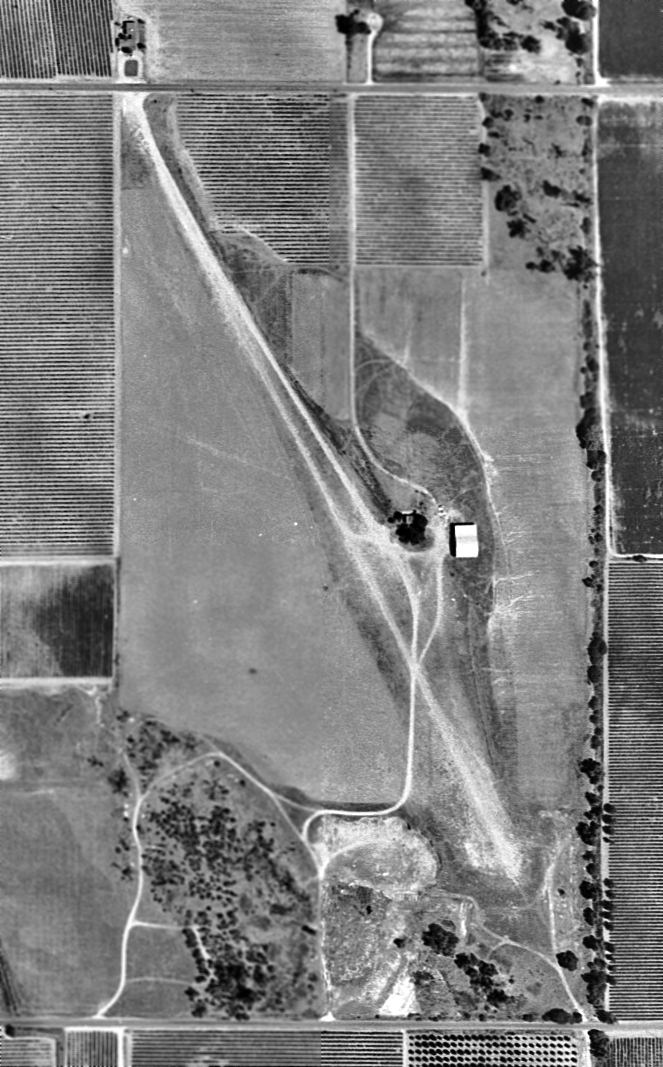
The earliest photo which has been located of El Rico Airfield was a 1985 aerial view.
It depicted El Rico Airfield as having a north/south asphalt runway with an asphalt ramp, hangar, and 1 light aircraft on the east side.
The earliest photo which is available of El Rico Airfield was a 1994 aerial view looking northwest.
It depicted El Rico Airfield as having a north/south asphalt runway with an asphalt ramp & hangar on the east side.
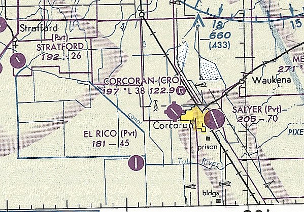
The last aeronautical chart depiction which has been located of El Rico Airfield was on the September 1997 San Francisco Sectional Chart.
It depicted El Rico as a private airfield having a 4,500' paved north/south runway.
El Rico Airfield was evidently closed (for reasons unknown) at some point between 1997-2016,
as it was depicted as an abandoned airfield on the August 2016 San Francisco Sectional Chart.
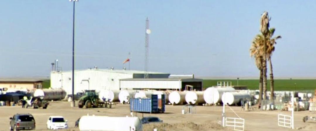
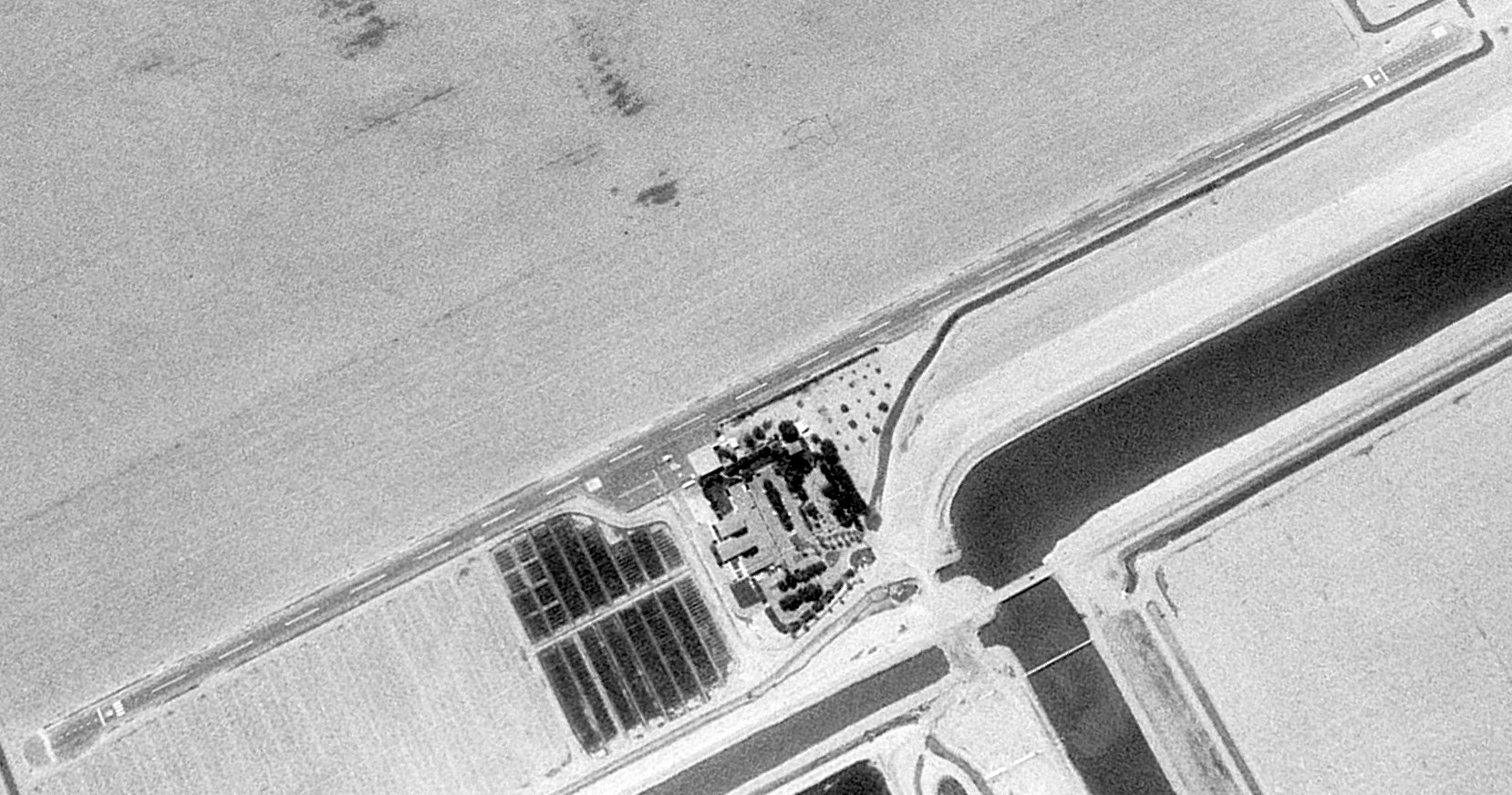
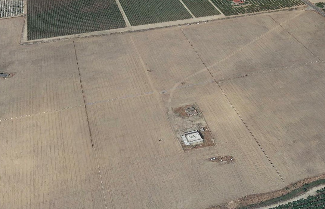
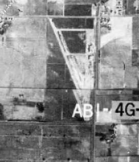
An April 2021 photo looking southwest depicted the hangar with windsock on the east side of El Rico Airfield.
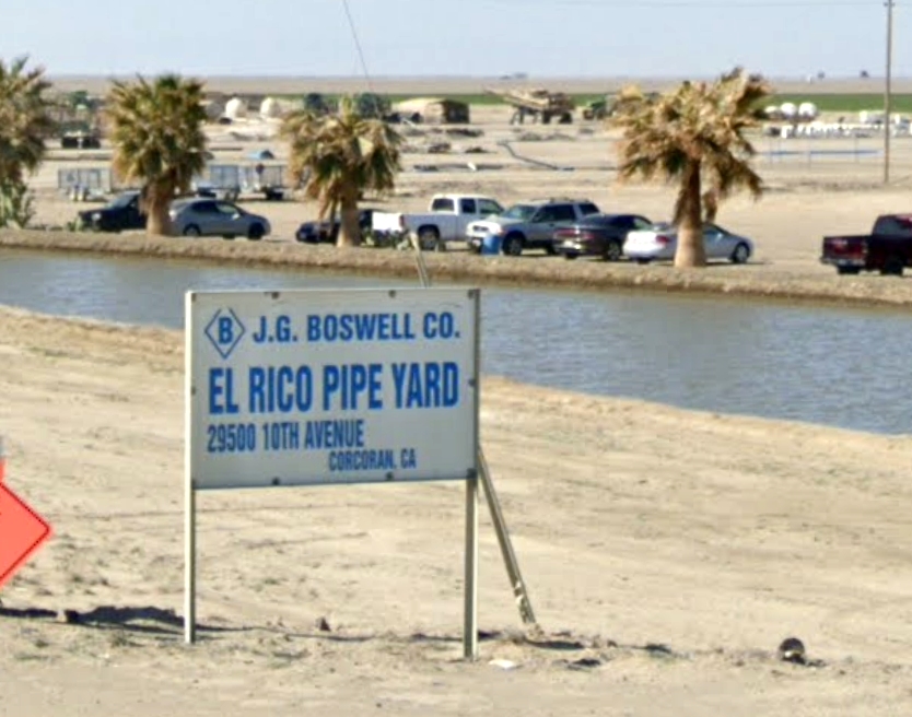
An April 2021 photo looking southwest at the “El Rico Pipe Yard” sign on the site of El Rico Airfield.
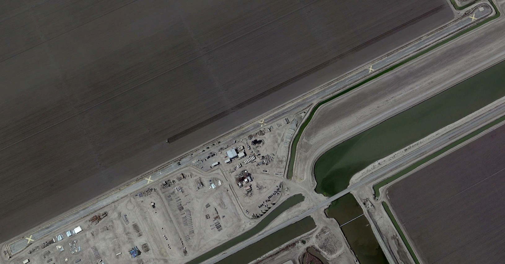
A 2021 aerial view looking northwest showed the El Rico Airfield remained intact, though with multiple closed-runway “X” symbols painted on the runway.
Thanks to Kevin Walsh for pointing out this airfield.
____________________________________________________
(Original) Selma Airport, Selma, CA
36.566, -119.568 (Southeast of Fresno, CA)
Selma Airport, as depicted on the 1946 USGS topo map.
The first airport for the town of Selma was located to the east of the town.
Selma Airport may have been established at some point in 1946,
as it was not yet depicted on the August 1946 Mt Whitney Sectional Chart.
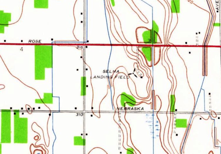
The earliest depiction which has been located of Selma Airport was on the 1946 USGS topo map.
It depicted “Selma Landing Field” as having 1 small building, but did not depict any runways or other details.
The earliest aeronautical chart depiction which has been located of Selma Airport was on the August 1952 Mt Whitney Sectional Chart.
It depicted Selma Airport as having a 2,200' unpaved runway.
The earliest photo which has been located of Selma Airport was an 8/15/57 USGS aerial view (courtesy of Gary Alexander).
It depicted Selma Airport as having a northwest/southeast unpaved runway with a hangar on the east side.
The original Selma Airport was evidently closed (for reasons unknown) at some point between 1952-62,
as it was no longer depicted on the October 1962 Mt Whitney Sectional Chart,
and a 1962 aerial photo showed the airport site covered by the Selma Valley Golf Course.
The original Selma Airport was eventually replaced by another Selma Airport to the west of the town.
Aerial photos show that the golf course covering the airport site apparently was no longer irrigated in 2018.
A 2021 aerial view looking northwest at the site of Selma Airport showed that the golf course which occupied the former airport for 6 decades is itself no longer recognizable.
Ironically, the former alignment of the runway is once again visible, as a road leading diagonally from upper-right to middle of the photo,
and the former airport hangar appears to remain standing in the center of the site.
Thanks to Gary Alexander for pointing out this airfield.
____________________________________________________
Kleinhammer Field / Machado Dusters Airport, Lemoore, CA
36.316, -119.79 (South of Fresno, CA)
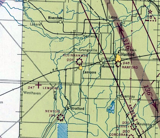
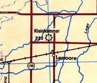
Kleinhammer Field, as depicted on the August 1946 Mt. Whitney Sectional Chart.
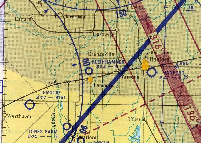
This small general aviation airport was located on the north side of the little town of Lemoore.
According to an article in the 7/3/45 Fresno Bee, “Spencer Kleinhammer, Lemoore district turkey raiser & amateur aviator,
today announced he has received authority from the Civil Aeronautics Administration to establish a private civilian flying field on his ranch one mile north of Lemoore.
Kleinhammer says the new airport will be known as Kleinhammer Field.
He declares work has been started on a hangar & field office.
The new field, as designated officially on CAA maps, has a landing strip 1,800' long & 250' wide.
It is laid out at 345 degrees, approximately in a northwest/southeast direction.
The runway at present is leveled dirt & will be oiled as soon as materials are available.
Kleinhammer says the field will be available to all fliers who wish to use it.”
Kleinhammer Field was not yet depicted on the February 1946 Mt. Whitney Sectional Chart.
The earliest depiction which has been located of Kleinhammer Field was on the August 1946 Mt. Whitney Sectional Chart.
The 1947 World Aeronautical Chart depicted Kleinhammer Field as having a mere 1,500' unpaved runway.
The earliest topo map depiction which has been located of Kleinhammer Field was on the 1948 USGS topo map.
The September 1949 Mt. Whitney Sectional Chart depicted Kleinhammer Field as having a 1,500' unpaved runway.
The last aeronautical chart depiction which has been located of Kleinhammer Field was on the March 1952 Mt. Whitney Sectional Chart.
It depicted Kleinhammer as having a mere 1,400' unpaved runway.
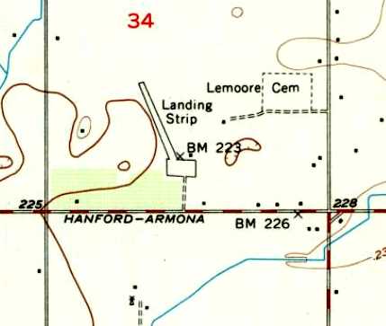
The most detailed depiction which has been located of Kleinhammer Field was on the 1954 USGS topo map.
It depicted a single northwest/southeast runway, labeled simply as “Landing Strip”,
with a ramp & 1 small building at the south end.
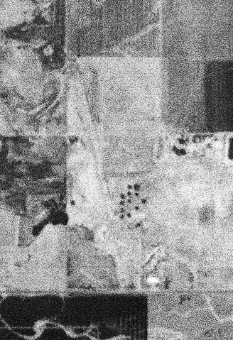
The only photo which is available of Kleinhammer Field was a low-resolution 8/24/54 USGS aerial view,
which depicted a single northwest/southeast runway.
Kleinhammer Field was still depicted on the 1960 USGS topo map.
Kleinhammer Field was evidently closed (for reasons unknown) at some point between 1960-62,
as it was no longer depicted on the 1962 USGS topo map
or the October 1962 Mt. Whitney Sectional Chart (courtesy of Paul Columbus).
At some point between 1952-66, Kleinhammer Field was renamed Machado Dusters Airport.
The only photo which has been located showing planes at Kleinhammer Field / Machado Dusters Airport was a 1966 aerial view (courtesy of Raoul Cruz)
which depicted 3 single-engine biplanes & 2 single-engine high-wing monoplanes
parked near 2 small single-plane hangars, one of which was painted “Machado”.
The Machado Dusters Airport was apparently closed at some point between 1966-76,
as a 1976 USGS aerial photo showed that its runway had been reused as a street for a trailer park.
Kleinhammer Field / Machado Dusters Airport was no longer depicted at all on the April 1980 San Francisco Sectional Chart (courtesy of Mitchell Hymowitz).
A 2013 aerial view looking northeast shows the alignment of the Kleinhammer Field runway remains recognizable as a street in a trailer park.
The site of Kleinhammer Field is located northwest of the intersection of Hanford Armona Road & Antelope Drive.
____________________________________________________
36.705, -119.74 (Southeast of Fresno, CA)
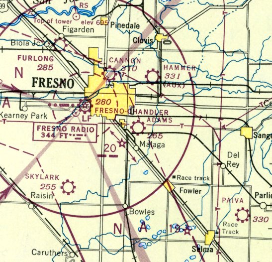
Adams Airport, as depicted on the August 1946 Mt Whitney Sectional Chart.
This small general aviation airport was evidently established at some point between 1945-46,
as it was not yet depicted on the 1923 USGS topo map (courtesy of Dallam Oliver-Lee),
listed among active airfields in the 1945 AAF Airfields Directory (courtesy of Chris Kennedy),
nor depicted on the September 1945 Mt Whitney Sectional Chart.
The earliest depiction which has been located of Adams Airport was on the August 1946 Mt Whitney Sectional Chart.
It depicted Adams as a commercial/municipal airport.
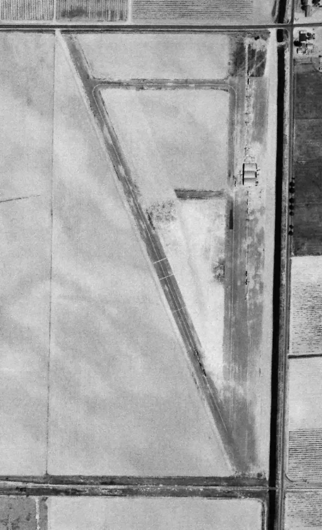
The 1946 USGS topo map (courtesy of Dallam Oliver-Lee) depicted Adams Airport as having a northwest/southeast paved runway with a paved ramp on the east side with 1 small building.
 Adams
Adams
The earliest photo which has been located of Adams Airport was a 4/23/46 USGS aerial view (courtesy of Dallam Oliver-Lee, enhanced by Bill Grasha).
It depicted Adams Airport as having a northwest/southeast runway with a ramp on the east side with over a dozen light aircraft & a hangar.
A 3/13/50 USGS aerial view (courtesy of Dallam Oliver-Lee, enhanced by Bill Grasha) still depicted Adams Airport as remaining intact,
but it may have been abandoned by that point.
Adams Airport was evidently closed (for reasons unknown) at some point between 1946-52,
as it was no longer depicted on the March 1952 Mt Whitney Sectional Chart.
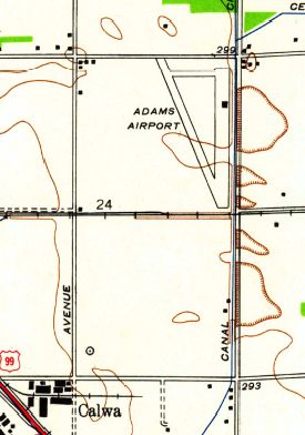
The last depiction which has been located of Adams Airport was on the 1960 USGS topo map (courtesy of Dallam Oliver-Lee).
It depicted Adams Airport as a commercial/municipal airport.
A 1962 aerial photo showed buildings covering the Adams Airport site, but the orientation of the northwest/southeast runway was still recognizable,
and several hangars remained along the east side, and the airport circle marking was still visible just north of the former runway intersection.
Adams Airport was no longer depicted on the 1962 USGS topo map (courtesy of Dallam Oliver-Lee).
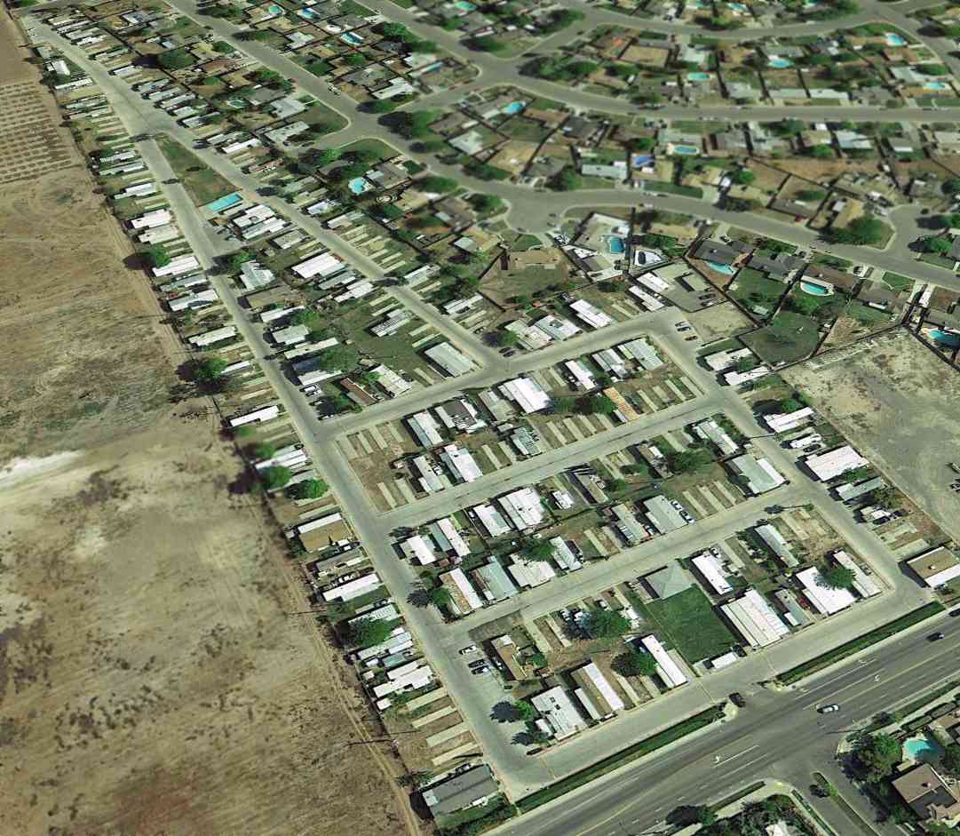
A 1998 aerial view of the Adams Airport site showed no trace still remained of the runway.
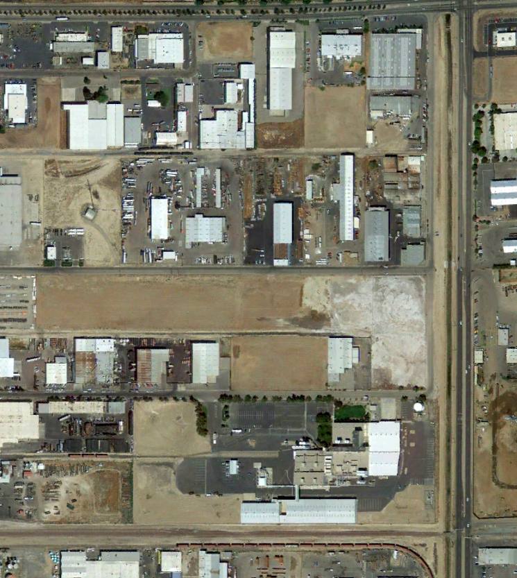
An 8/27/12 aerial view (courtesy of Dallam Oliver-Lee) showed multiple buildings having been built over the site of Adams Airport,
but a row of hangars remained on the east side.
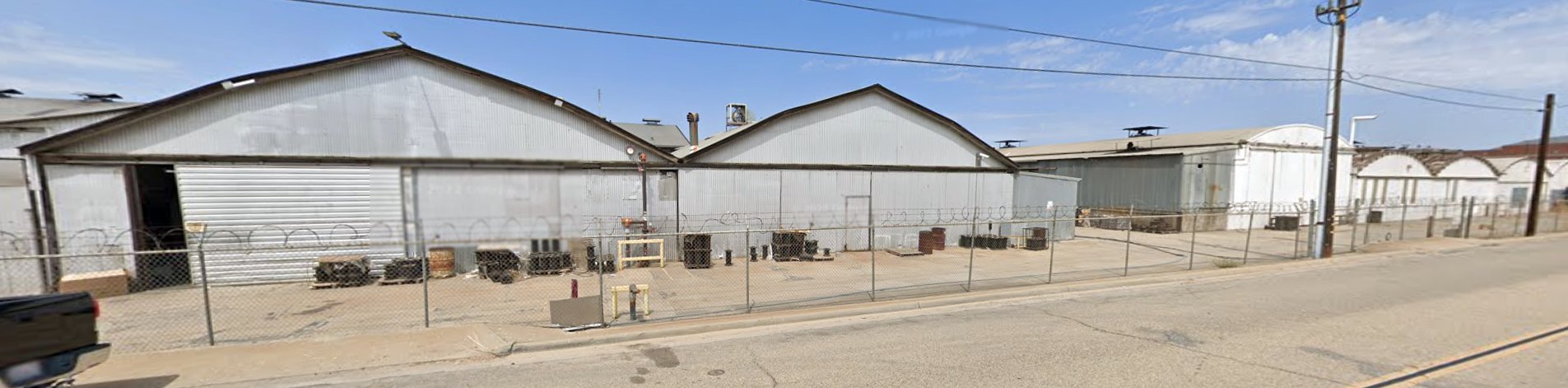
A 2022 photo looking northeast showed a row of hangars which remain on the east side of the Adams Airport site.
The site of Adams Airport is located southwest of the intersection of East Jensen Avenue & South Chestnut Avenue.
____________________________________________________
Since this site was first put on the web in 1999, its popularity has grown tremendously.
If the total quantity of material on this site is to continue to grow,
it will require ever-increasing funding to pay its expenses.
Therefore, I request financial contributions from site visitors,
to help defray the increasing costs of the site
and ensure that it continues to be available & to grow.
What would you pay for a good aviation magazine, or a good aviation book?
Please consider a donation of an equivalent amount, at the least.
This site is not supported by commercial advertising –
it is purely supported by donations.
If you enjoy the site, and would like to make a financial contribution,
you
may use a credit card via
![]() :
:
Please consider checking the box to make a monthly donatation.
For a mailing address to send a check, please contact me at: paulandterryfreeman@gmail.com
If you enjoy this web site, please support it with a financial contribution.
This site covers airfields in all 50 states.