
Abandoned & Little-Known Airfields:
California: San Francisco area
© 2002, © 2025 by Paul Freeman. Revised 11/15/25.
This site covers airfields in all 50 states: Click here for the site's main menu.
____________________________________________________
Please consider a financial contribution to support the continued growth & operation of this site.
For a 10th year, the CA pages of this website are sponsored by the California Pilots Association:
Angel Island Nike Missile Base Heliport (revised 10/3/16) - Belmont Airport (revised 7/20/23) - Crissy Field (revised 10/7/24)
Golden Gate Union Air Terminal / Treasure Island Airport / Treasure Island NAAF (revised 11/15/25) - Montgomery Field / Marina Airfield (revised 10/1/22)
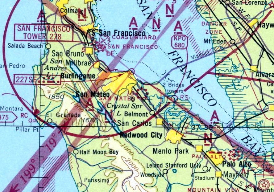
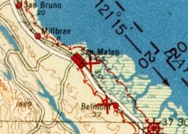
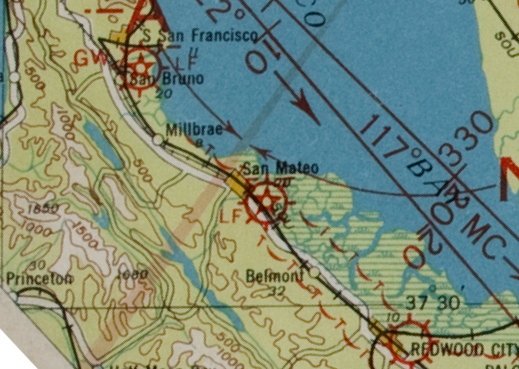
(Original) San Carlos Airport (revised 8/3/23) - San Francisco Ferry Building Heliport / San Francisco Downtown Heliport (revised 8/27/22) - San Mateo Airport (revised 8/27/22)
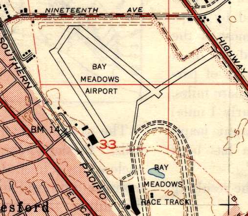
San Mateo Highlands Airfield (revised 7/19/23) - Varney Field / Johnson Field / Curtiss-Wright Airport / Bay Meadows Airport (revised 1/12/23)
____________________________________________________
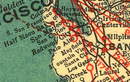
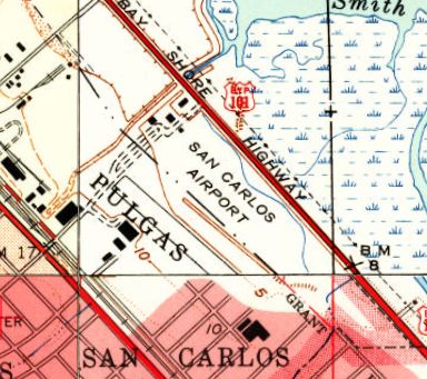
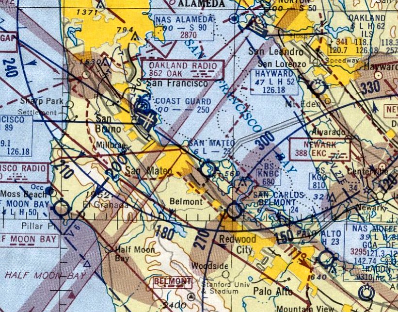
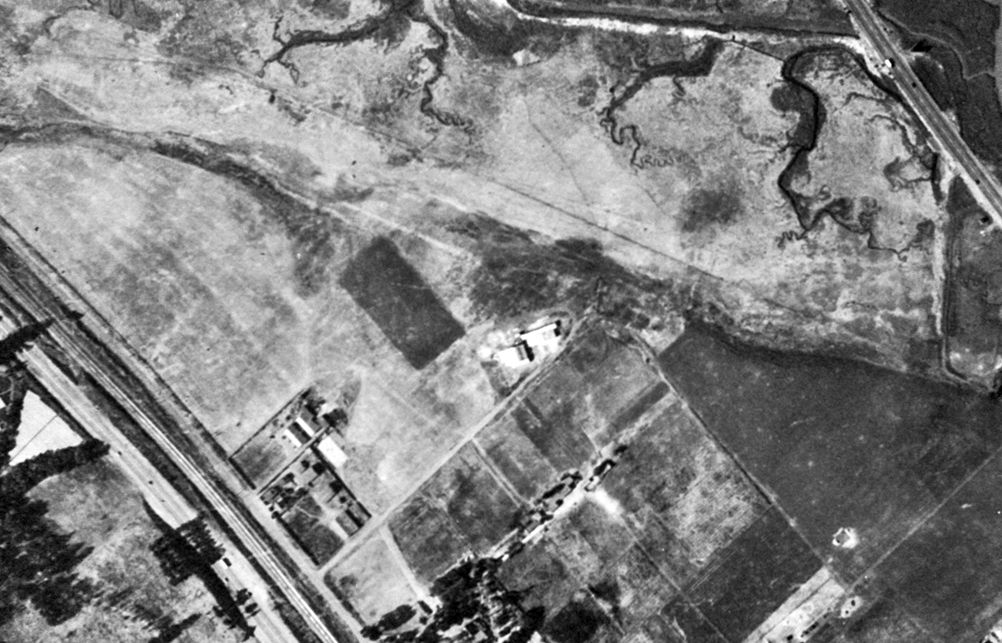
(Original) San Carlos Airport, San Carlos, CA
37.503, -122.246 (South of San Francisco, CA)
San Carlos Airport, as depicted on the 1929 Landing Fields of the Pacific West (courtesy of Jonathan Westerling).
The original location of San Carlos Airport was located south of Route 101.
The date of establishment of San Carlos Airport has not been determined.
The earliest depiction which has been located of San Carlos Airport was on the 1929 Landing Fields of the Pacific West (courtesy of Jonathan Westerling).
It described San Carlos as a commercial airport, operated by Coaley Aircraft.
It was said to have 2 runways, measuring 3,700' east/west & 2,700' north/south, with a hangar & repair shop.

The earliest photo which has been located of San Carlos Airport was a circa 1920s photo (courtesy of Kevin Walsh) of an Army biplane (model unidentified) at San Carlos Airport.
San Carlos Airport may have been closed at some point between 1929-33, as it was not depicted on the May 1933 San Francisco Sectional Chart.
There was no recognizable sign of San Carlos Airport on a March 1941 aerial photo (courtesy of Kevin Walsh).
San Carlos Airport still was not depicted on San Francisco Sectional Charts thru 1944.
San Carlos Airport was evidently reopened at some point between 1944-45,
as it was once again depicted on the September 1945 San Francisco Sectional Chart (courtesy of Jonathan Westerling).
It depicted San Carlos as a commercial/municipal airport.
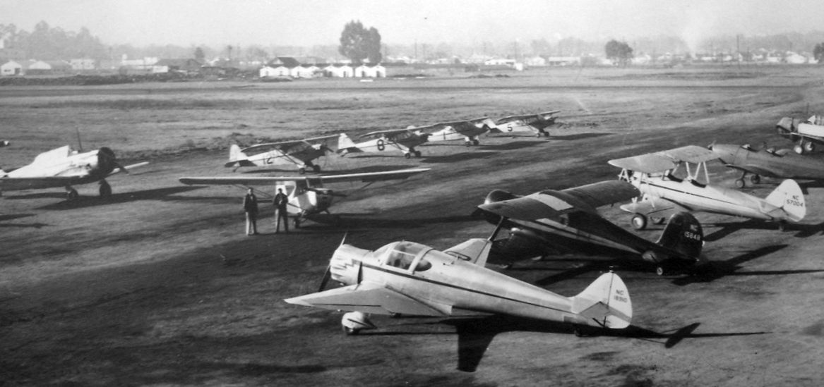
A circa late 1940s photo (courtesy of Jonathan Hull) depicted an AT-6 Texan & a variety of other light single-engine general aviation aircraft at San Carlos Airport.
A 1947 aerial photo (courtesy of Jonathan Westerling) depicted over 20 light aircraft parked at Carlos Airport.
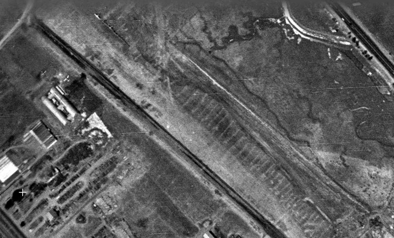
A 1948 aerial photo showed at least 8 light aircraft parked at Carlos Airport.
The February 1948 San Francisco Local Aeronautical Chart depicted San Carlos Airport as having a 2,300' unpaved runway.
The earliest topo map depiction which has been located of San Carlos Airport was on the 1948 USGS topo map (courtesy of Jonathan Westerling).
It depicted San Carlos Airport as a northwest/southeast clearing on the south side of Route 101, with a few small buildings along the northwest side.
The last aeronautical chart depiction which has been located of San Carlos Airport was on the March 1951 San Francisco Sectional Chart.
It depicted San Carlos as having a 2,100' paved runway.
The original San Carlos Airport was evidently closed at some point in 1951,
as it was no longer depicted on the September 1951 San Francisco Sectional Chart.
It was eventually replaced by a larger San Carlos Airport located on the opposite (north) side of Route 101.
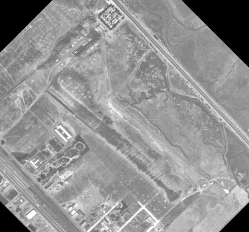
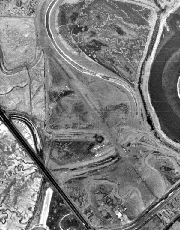
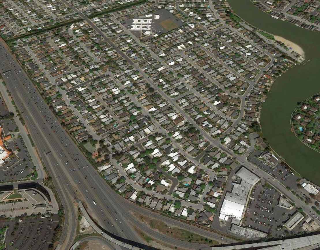
A 1956 aerial view showed all traces of the original San Carlos Airport had been removed between 1948-56.
A 2022 aerial view showed no trace remaining of the original San Carlos Airport.
Thanks to Jonathan Westerling for pointing out this airfield.
____________________________________________________
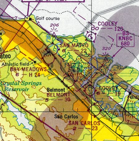
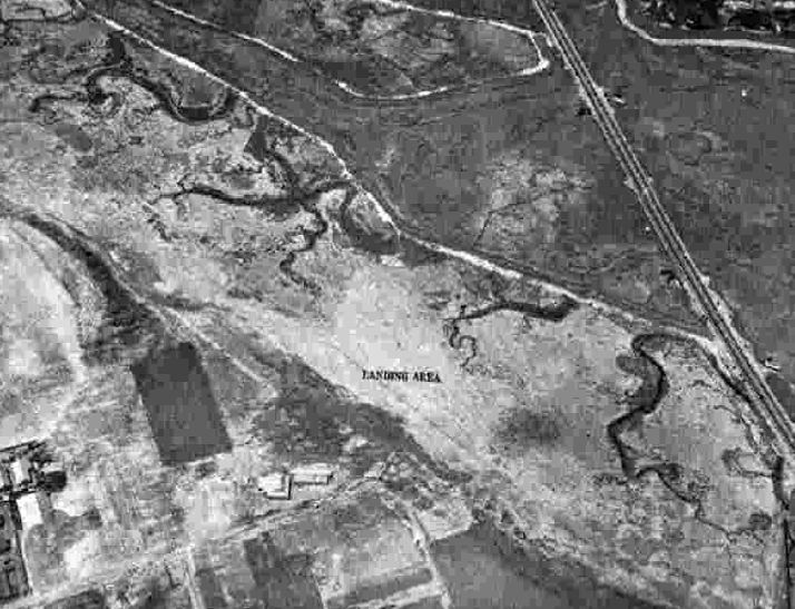
San Mateo Highlands Airfield, San Mateo, CA
37.513, -122.337 (South of San Francisco, CA)
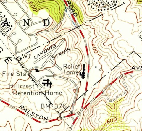
The 1956 USGS topo map (courtesy of Bruce Moore) depicted 3 short runways, labeled generically as “Landing Strips”.
This little airfield was evidently established at some point between 1949-56,
as it was not yet depicted on a 1946 aerial photo, the 1948 San Francisco Local Aeronautical Chart, or on the 1949 USGS topo map.
The earliest depiction which has been located of this airfield was on the 1956 USGS topo map (courtesy of Bruce Moore).
It depicted 3 short runways (the longest being the 1,000' northeast/southwest strip), labeled generically as “Landing Strips”,
with the Hillcrest Detention Home to the south, and a “Relief Home” to the southeast.
Bruce Moore reported, “Just down the hill (southeast of this airstrip) was San Mateo County Fire Station #17.
The fire chief at this station was a pilot & he flew a small high-wing plane, taking off & landing on an airstrip (shown on the topographic map).
He used the plane to help direct wildfire actions, being in contact with ground crews via radio.
An interesting thing about this strip, is that it is on the top of a hill (about 520’ elevation) that quickly drops into a canyon (about 370’ elevation).”
An article entitled “History Buffs on the track of antique airports” by George Golding in the 5/3/86 San Mateo Times (courtesy of Jonathan Westerling) reported,
“Other San Mateo County spots used as landing fields, including the front yard of the Department of Forestry County Fire station at Hillcrest, between Belmont & San Mateo Highlands,
which used to be used with regularity by the firefighting chief.”
According to the book "Two Hours By Crow" by Howard & Judith Campbell (courtesy of Wings of History),
“In 1952, the California Department of Forestry Division Chief Ernest Werder used to fly his personal Taylorcraft J-2 Cub from this field to the Pescadero CDF Strip & several impromptu fields within the County.”
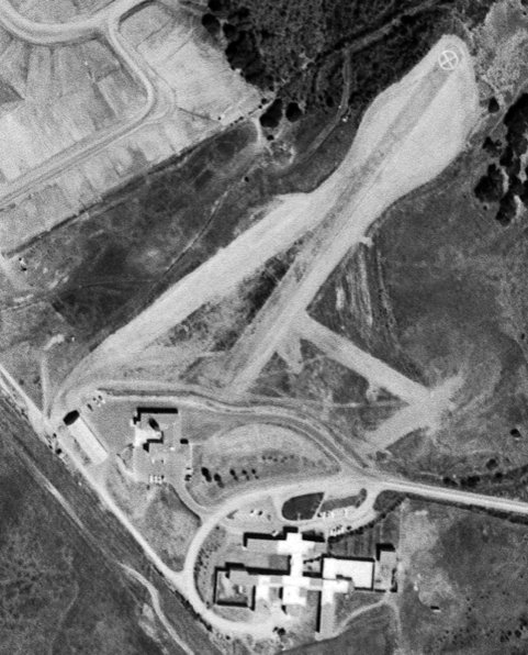
A 9/1/56 aerial photo (courtesy of Bruce Moore) depicted the San Mateo Highlands airfield as having 3 short runways (the longest being the 1,000' northeast/southwest strip),
with a white “X” inside a circle on the northeast end of the longest runway.
What may have been a hangar was located on the southwest side.
Bruce Moore reported, “At some point, the state of California took over all wildfire suppression, forming California Division of Forestry.
The air support was moved to San Carlos Airport & the airstrip was abandoned.”
No airfield was depicted at this location on the April 1959 San Francisco Local Aeronautical Chart.
According to Bruce Moore, “In an 8/15/60 aerial photo, it looks as if the strip has been little-used or even abandoned, though still intact.”
A 1968 aerial photo shows the runways had been removed, but traces were still recognizable.
Bruce Moore reported, “The hangar became a storage building, and it was still in use (fire trucks & equipment) when I was last there.
The runway is now gone, as one of the buildings of the Juvenile Detention Center has expanded & built a structure across it.”
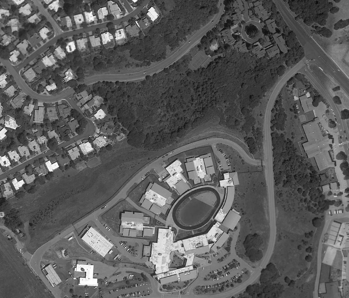
A 2018 aerial view shows the Hillcrest Juvenile Hall has been built over the site of the San Mateo Highlands Airfield.
What may have original been a hangar still remains standing – the building at bottom-left, possibly reused by a fire station.
The site of the San Mateo Highlands Airfield is located north of the western terminus of Tower Road.
Thanks to Bruce Moore for pointing out this airfield.
____________________________________________________
San Mateo Airport, San Mateo, CA
37.558, -122.298 (South of San Francisco, CA)
San Mateo Airport, as depicted on the December 1941 San Francisco Sectional Chart.
San Mateo Airport was evidently established at some point in 1941,
as it was not yet depicted on the April 1941 San Francisco Sectional Chart.
The earliest depiction which has been located of San Mateo Airport was on the December 1941 San Francisco Sectional Chart.
According to the book "Two Hours By Crow" by Howard & Judith Campbell (courtesy of Wings of History),
“The first mention we have of this field is an 8/5/23 government photo that depicts the sod runways.
A group of 6 people formed the San Mateo Airport Corporation, built the field, and ran it during its existence.
Joseph Lorenze, Cecil Smith, Jack Reilly; Ed & Elsie Watson; and Harry Cranston were the partners with the Watsons acting as the Fixed Base Operators.
As all private flight training had to move 150 miles or more inland during the War, we assume the site was dormant until 1945.
In these early years the main runway running parallel to the Bayshore Highway was paved with crushed redrock
and was stable enough to accommodate a Douglas DC-3 using the field to fly bettors in to Bay Meadows Horse races.
Prior to paving, the owners tried to stabilize the soft, gummy, adobe clay surfaces with a layer of crushed rock.
They spread the stones across the shaded runways & were going to roll the surface down to embed the matrix into a firm composite that would allow aircraft to roll out during landing.
Unfortunately, before they could get to the last stage of this idea, a Cessna T-50 Bobcat spotted the beautiful, smooth light gray runway below & came in.
Well-known aircraft photographer William Larkins was able to record the end result, [with] both blades of both props bent back & the wheels sunk down to the hubs in the gravel.”
The earliest photo which has been located of San Mateo Airport was on a 1946 aerial photo (from the UCSB Library, courtesy of Jonathan Westerling).
It depicted the airfield as having a single unpaved northwest/southeast runway, with a small hangar & 8 small single-engine aircraft at the southeast corner.
The 1947 Decker's Guide (courtesy of Jonathan Westerling) described San Mateo Airport as having “Runways under construction.”
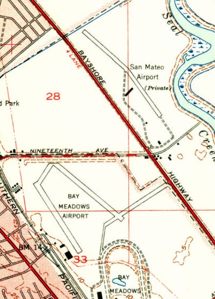
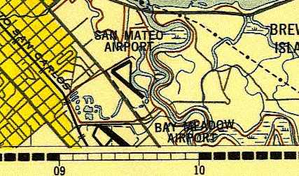
The 1947 USGS topo map depicted San Mateo Airport as a private field having a single northwest/southeast runway, with a slight bend in the middle.
Three small buildings were depicted on the south side of the airfield.
Note it also depicted Bay Meadows Airport across Bayshore Highway to the south.
The 1948 San Francisco Local Aeronautical Chart (courtesy of Tim Zukas) depicted San Mateo Airport as having a 2,200' unpaved runway.
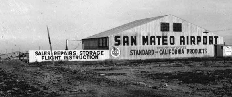
The only ground-level photo which has been located of San Mateo Airport was an undated photo (courtesy of Kevin Walsh)
of the hangar labeled “San Mateo Airport”, advertising sales, repairs, storage, and flight instruction.
A Cessna T-50 twin was visible in the background.
The 1948 USAF Urban Area Chart depicted San Mateo Airport as having a northwest/southeast runway & 2 taxiways.
The 1949 USGS topo map depicted San Mateo Airport in the same fashion as the 1947 USGS topo map.
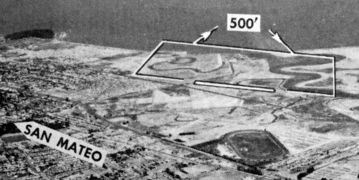
The last photo which has been located of San Mateo Airport was an undated aerial view looking north from the 1950 Air Photo Guide (courtesy of Kevin Walsh).
It described San Mateo Airport as having a 2,600' gravel Runway 13/31 & a 2,000' dirt Runway 6/24, and listed the manager as Edward Watson.
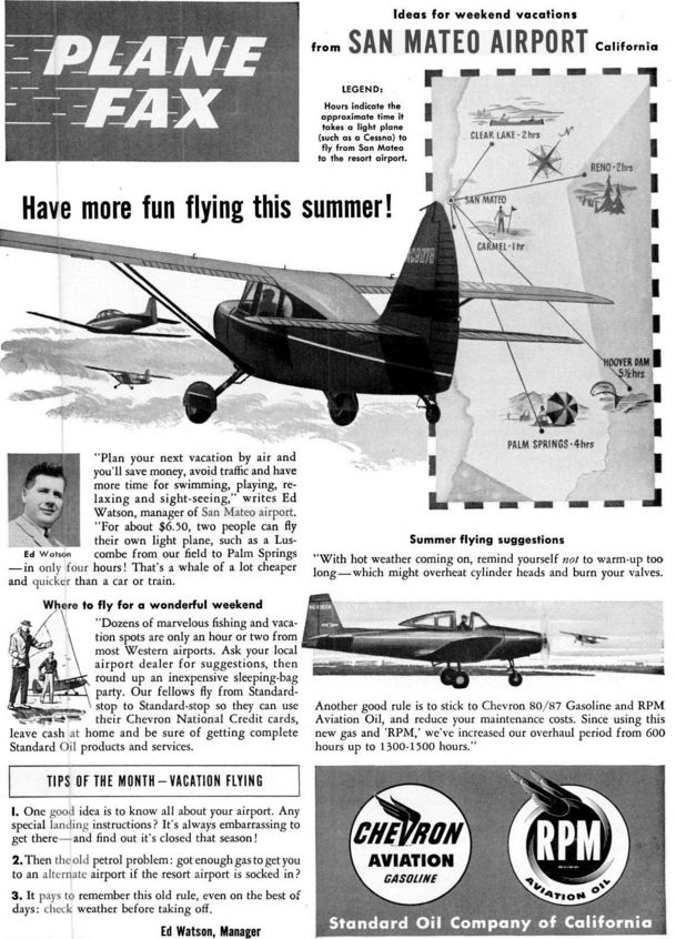
A June 1951 magazine advertisement for San Mateo airport (courtesy of Jonathan Westerling).
The last aeronautical chart depiction which has been located of San Mateo Airport was on the March 1953 San Francisco Sectional Chart.
It depicted San Mateo Airport as having a 2,600' unpaved runway.
San Mateo Airport was evidently closed at some point between 1953-54,
as it was no longer depicted on the September 1954 San Francisco Sectional Chart.
According to the book "Two Hours By Crow" by Howard & Judith Campbell (courtesy of Wings of History),
“By 1955 the Parkside Shopping Center was selling products to their customers & most of the roads were in, with homes sprouting up everywhere.
The San Mateo Airport was gone, an all-too-familiar story.”
A 1956 aerial photo showed streets & houses covering the site of San Mateo Airport.
A 2015 aerial view looking north shows no trace remaining of San Mateo Airport.
The site of San Mateo Airport is located north of the intersection of the 101 Freeway & Route 92.
____________________________________________________
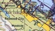
37.53, -122.28 (Southeast of San Francisco, CA)
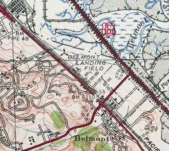
“Belmont Landing Field”, as depicted on the 1942 USGS topo map (courtesy of Kevin Walsh).
According to the book "Two Hours By Crow" by Howard & Judith Campbell (courtesy of Wings of History),
“In 1939 two pilots set up this airport in Belmont right against the San Mateo City line.
While Highway 101 is at about sea level & flat; El Camino Real, Highway 82, has a distinct hump as it leaves San Mateo & enters Belmont glancing off the bay side of Notre Dame Hill.
El Camino Real rises to about 33' above sea level here. The airport property lies in the flat just below this hill.”
The earliest depiction which has been located of Belmont Airport was on the 1942 USGS topo map (courtesy of Kevin Walsh).
It labeled the site as “Belmont Landing Field”, but did not depict any details.
A 1942 ACSC map (courtesy of Kevin Walsh) depicted the Belmont Airport as a rectangular property outline with the “T” airport symbol.
The earliest photo which is available of Belmont Airport was a 1943 aerial view (from the UCB Library, courtesy of Jonathan Westerling).
It depicted Belmont Airport as having an unpaved northwest/southeast runway, with 2 hangars on the south side. No planes were visible on the field.
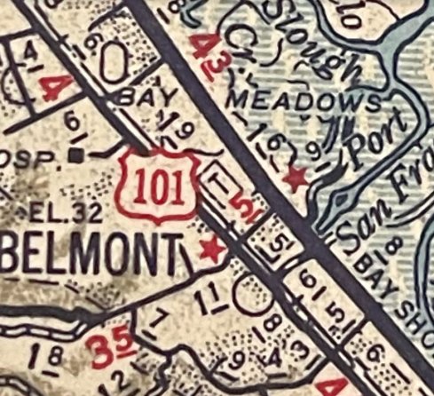
The earliest aeronautical chart depiction which has been located of Belmont Airport was on the August 1943 San Francisco Sectional Chart.
The 1943 Directory of Airfields (courtesy of Jonathan Westerling) included Belmont Airport.
A 8/5/43 aerial view looking north from the 1945 AAF Airfield Directory (courtesy of Scott Murdock) depicted Belmont Airport as an unpaved landing area.
The 1945 AAF Airfield Directory (courtesy of Scott Murdock) described Belmont Airport
as a 114 acre irregularly-shaped property having 2 sod runways, measuring 3,200' east/west & 3,000' northwest/southeast.
The field was said to have 2 wood & metal hangars, the largest being 100' x 50', and to be owned & operated by private interests.
According to the book "Two Hours By Crow" by Howard & Judith Campbell (courtesy of Wings of History),
“Of the two pilots, 'Tex' Harris & Marvin Franklin, it seems that 'Tex' left the partnership after a couple of years as his name is not listed when the field reopened after World War II in 1945.
There were all the usual services; fuel, repairs, sales, training, and hangars.
From 1945-51 the field hosted a very large variety of surplus military planes: PT-13, -15, & -17s, BT-13s, AT-6s, and any number of the lighter L-series [liaison] of smaller aircraft.
Flight instruction was given in these smaller machines as they were cheaper to fly.
Then more advanced ratings were trained in the more expensive units such as a Cessna T-50 (UC- 78).
Three flying clubs were on the field & quite a social atmosphere was present during the weekends; featuring picnics, flight games, flying over-nighters and tours.”
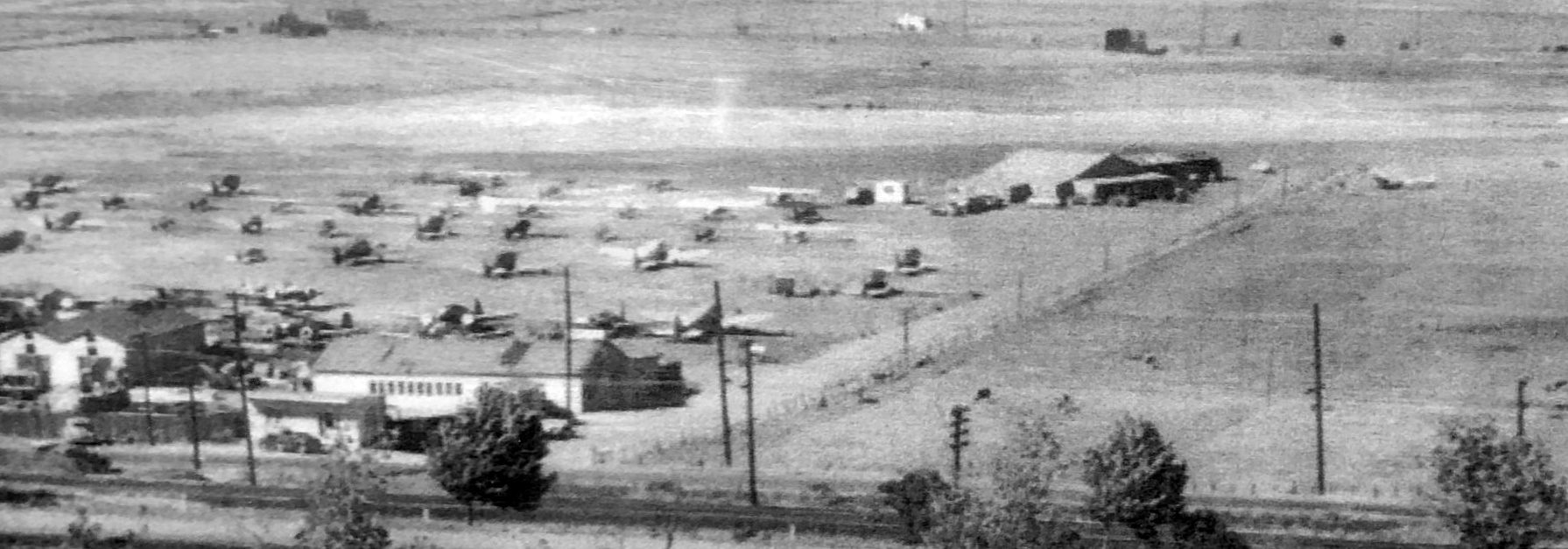
A 1946 aerial view (from the UCB Library, courtesy of Scott Murdock) depicted Belmont Airport as having an unpaved northwest/southeast runway,
with more than a dozen light single-engine aircraft parked near some small buildings on the south side.
A typical healthy little airport in the post-WW2 general aviation boom.
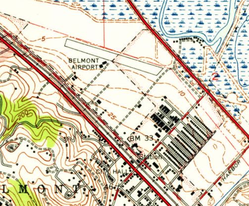
The 1947 USGS topo map depicted Belmont Airport as having a single northwest/southeast runway, with 2 small buildings on the south side.
George Harper observed that his logbook shows “on 6/25/47 I continued my flight training at the Belmont Airport on the San Francisco Peninsula.”
The 1949 San Francisco Local Aeronautical Chart (courtesy of Chris Kennedy) depicted Belmont Airport as having a 3,000' unpaved runway.
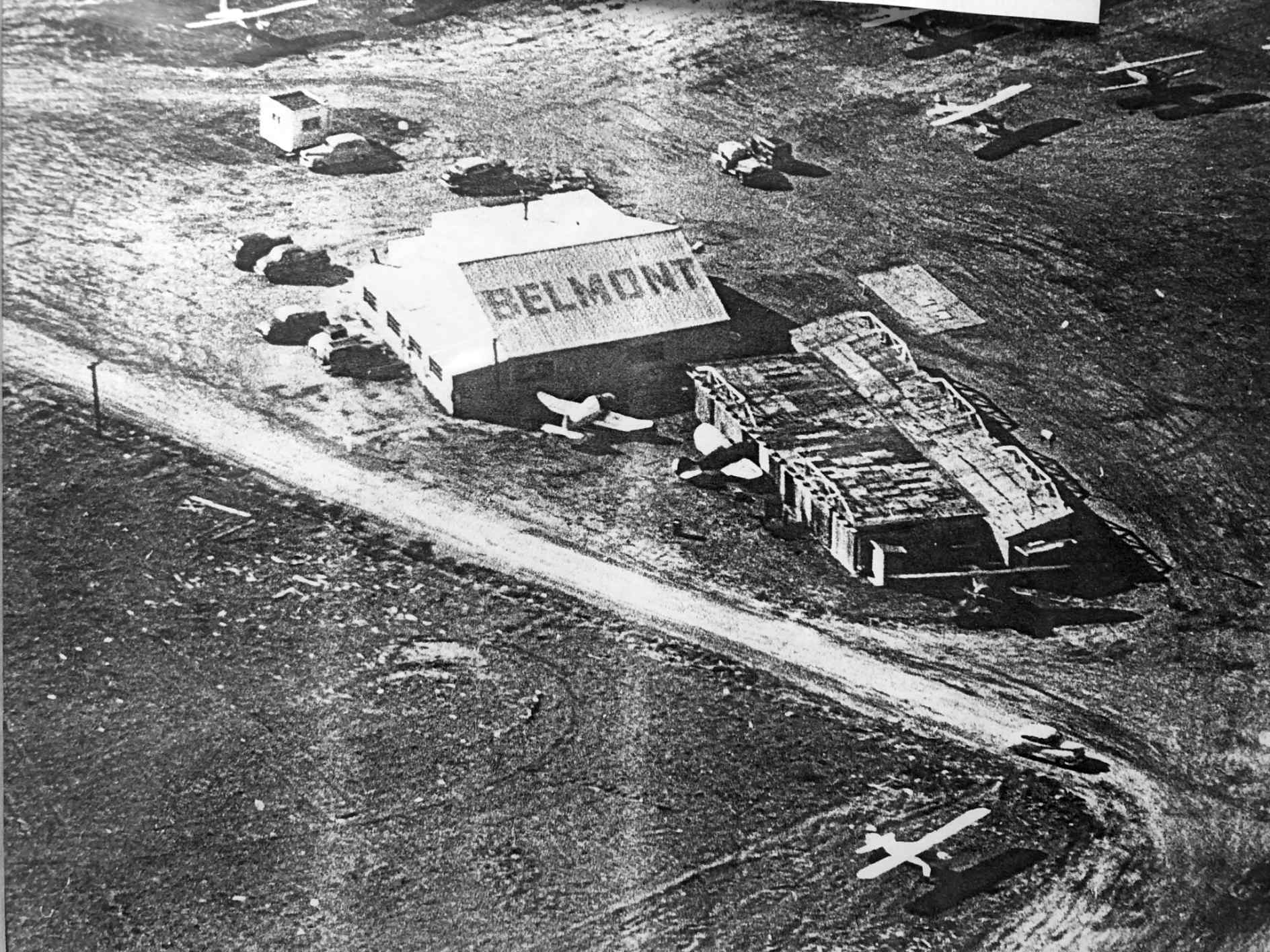
A circa 1940s aerial view of 2 Belmont Airport hangars (courtesy of Jonathan Hull), one of which had the airport name painted on its roof.
A circa 1940s aerial view looking north at Belmont Airport (courtesy of Jonathan Hull), showing a large number of light planes parked near the hangars.
A circa 1940s aerial view looking north at Belmont Airport (courtesy of Jonathan Hull).

The last photo which is available of Belmont Airport was an undated aerial view looking north from the 1950 CA Air Photo Guide (courtesy of Jonathan Westerling).
It described Belmont Airport as having a 3,000' sod Runway 10/28.
The manager was listed as Victor Voit, and there was said to be “Dining, dancing, and cocktails adjacent to airport.”
According to the book "Two Hours By Crow" by Howard & Judith Campbell (courtesy of Wings of History),
“Nothing remains of the field as it was taken over by the Sterling Downs Tract of homes in 1951.”
The last aeronautical chart depiction which has been located of Belmont Airport was on the 1952 San Francisco Sectional Chart (courtesy of Jonathan Westerling).
It depicted Belmont Airport as having a 3,000' unpaved runway.
The May 1952 Airman's Guide (courtesy of Jonathan Westerling) described Belmont Airport as “Reported abandoned”.
A 1956 aerial photo showed new streets & dense houses covering the site of Belmont Airport.
A 2014 aerial view showed no trace of Belmont Airport.
The site of Belmont Airport is located at the intersection of Marine View & Hiller Street.
Thanks to George Harper for pointing out this airfield.
____________________________________________________
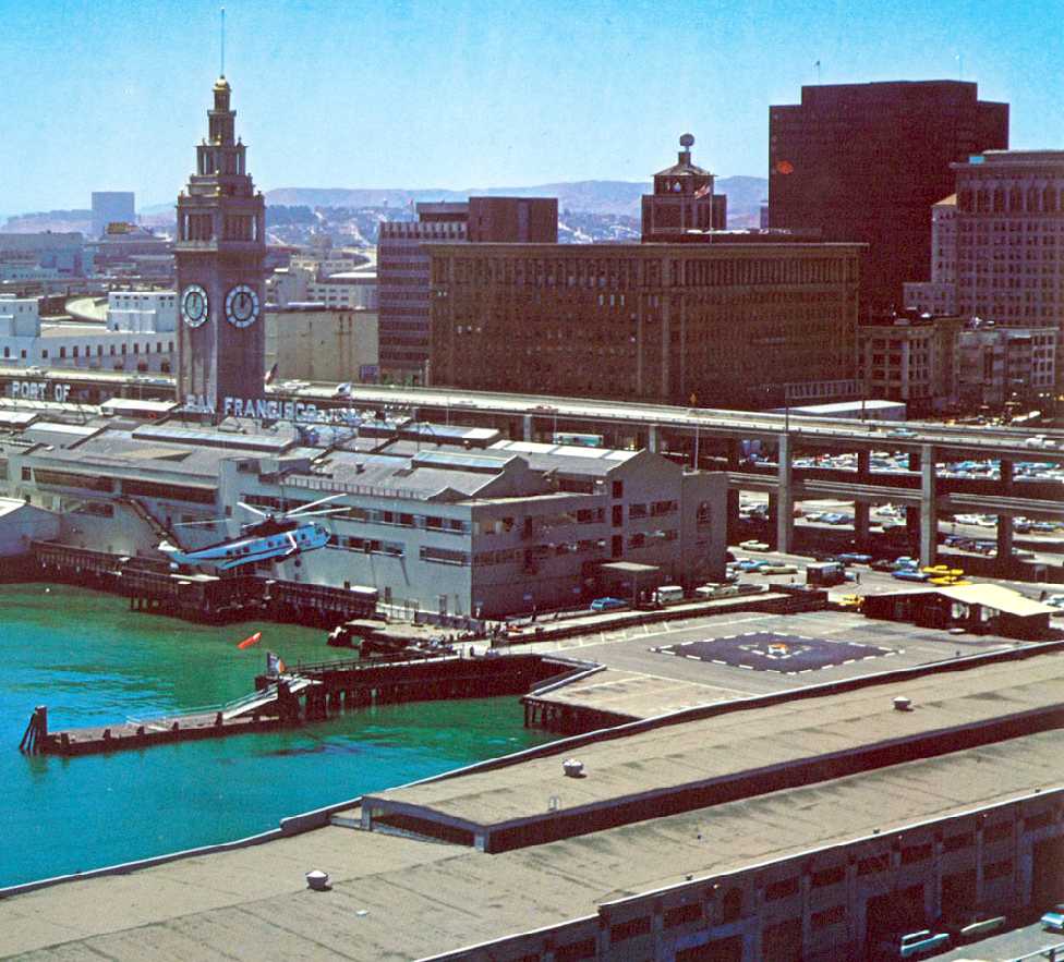
San Francisco Ferry Building Heliport / San Francisco Downtown Heliport, San Francisco, CA
37.797, -122.394 (East of Downtown San Francisco, CA)
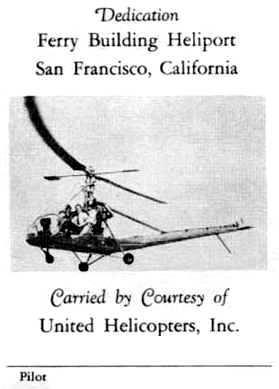
The 1950 Dedication postcard for the San Francisco Ferry Building Heliport (courtesy of Jonathan Westerling),
showing a Hiller UH-12 operated by United Helicopters.
The San Francisco Ferry Building Heliport was not yet depicted on the March 1950 San Francisco Sectional Chart.
Jonathan Westerling reported, “In the 1950s, America experienced an aviation boom,
and embraced many wartime innovations to make their lives more convenient.
One of these innovations was the helicopter.
Government reports & futuristic predictions held that the helicopter was poised to play a pivotal role in urban transportation.
Embracing this, the City of San Francisco began to experiment with the idea of establishing a heliport downtown.”
The first reference which has been located to the San Francisco Heliport
was in the 2/23/50 edition of the San Francisco Chamber of Commerce's “Bay Region Business”.
According to the article, the facility was to be a cooperative effort
between the Chamber, the Board of State Harbor Commissioners & United Helicopters, Inc., of Palo Alto.
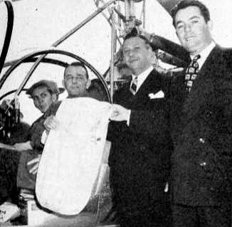
A 1950 photo (courtesy of Jonathan Westerling) of San Francisco Chamber of Commerce President Paul Bissinger
handing over the first airmail sack to leave from the San Francisco Heliport to helicopter pilot J. H. Demming of Hiller Helicopters.
The 3/3/50 edition of “Bay Region Business” said: “Sirens, colored flares & buzzing helicopters
marked the 2/28/50 opening of the San Francisco Heliport at the Ferry Building -
the first licensed public helicopter airport to be established in a metropolitan area west of New York City.
The new base was officially opened at approximately 11am by the igniting of a smoke flare
signaling the landing of the first helicopter piloted by helicopter pioneer & Bay Area native Stanley Hiller.”
The head of the San Francisco Chamber of Commerce Paul Bissinger was quoted in a newspaper article about the opening:
"We believe that these new facilities will do much toward further development of inter-Bay transportation,
and will immediately become a base for commercial & industrial rotary-wing activity in the heart of San Francisco."
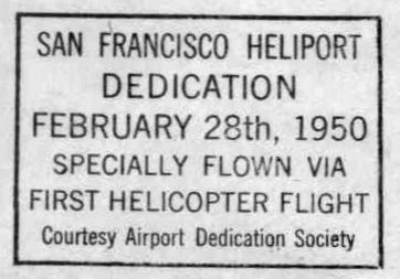
A postmark commemorated the 2/28/50 Dedication of the San Francisco Heliport.
Jonathan Westerling reported, “A 5/8/50 photo of California Senate candidate Helen Douglas shows the heliport.”
The caption under the photograph reads that she is “waving from the her campaign helicopter at the Ferry Building Heliport”.
Jonathan Westerling noted, “The helicopter had loudspeakers installed underneath so she could give speeches to people below as she flew from place to place.”
The earliest aeronautical chart depiction which has been located of the San Francisco Ferry Building Heliport was on the September 1950 San Francisco Sectional Chart.
It labeled it generically as “Helicopter Base”.
Jonathan Westerling reported, “Rick Helicopters Inc. had filed an application to provide service to & from San Francisco Heliport in 1952.
The Civil Aviation Board took years, however, to act on the proposal which was finally approved in 1956.
Rick Helicopters began began a taxi service between the new heliport & San Francisco international Airport in December that same year.
Unfortunately a crash occurred offshore of the San Francisco Heliport just 3 weeks later.
A famous opera singer, Mary Gray had just disembarked the helicopter and, along with dignitaries & reporters who had arrived to greet her witnessed the crash.
The resulting negative publicity halted operations & it took 4 years before another company would re-initiate a similar air taxi.”
The San Francisco Ferry Building Heliport may have gone through a few years of closure,
as it was not depicted on the April 1959 San Francisco Local Aeronautical Chart.
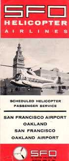
Jonathan Westerling reported, “In 1961, a new helicopter service began from the heliport under the name San Francisco & Oakland Helicopter Airlines.”
In approving operations of the new airline, the Civil Aeronautics Board (Docket 14029) stated
"the public convenience & necessity requires air transportation by rotary wing aircraft, without subsidy eligibility, in the San Francisco Bay area.“
San Francisco & Oakland Helicopter Airlines became the first airline to operate an entirely turbine engine helicopter fleet.
It was founded by former Los Angeles Airways vice president Mike Bagen in 1961.
Passenger service started with 2 leased 10-passenger Sikorsky S-62 single-engine turbine helicopters operating 62 flights a day over their route network.
Jonathan Westerling reported, “From the beginning, the helicopter service operated without any federal funds.
This set it apart from the 4 other rotary-wing airport shuttle operations in other cities.
The first day of service from the downtown heliport was 6/1/61 according to the 1967 World Airline Survey.
The service was successful & profitable.”
A 1963 study entitled “Outlook for Vertical-Lift Aircraft in Scheduled Commercial Transportation” commissioned by the Civil Aeronautics Board,
reported that “San Francisco- Oakland Helicopter Airlines (SFO), began scheduled service in 1960
and a year later reached a level of 10,000 passengers per month.”
A 1962 aerial view looking southwest at the San Francisco Downtown Heliport
from the SFO Airlines 1962 timetable (from the collection of Björn Larsson, www.timetableimages.com).
Jonathan Westerling reported, “According to a 1962 timetable for SFO Helicopter airlines,
the trip from Downtown San Francisco to the San Francisco International Airport took just 8 minutes & cost $6.50.
The helicopter fares from Downtown San Francisco to Oakland International Airport were subsidized by some airlines to increase business from that airport.
The helicopter pilots even provided traffic reports to a local radio station while ferrying passengers.
The airline expanded to serve other Bay Area Cities including Berkeley & Sunnyvale.”
A
circa 1961-69 advertisement for SFO Helicopter Airlines, showing an
SFO Sikorsky S-62 landing at the San Francisco Downtown Heliport.
According to a 11/30/63 Associated Press article,
the airline announced it had to suspend service to the San Francisco heliport “due to deterioration of the pier” that the Heliport was on.
Jonathan Westerling reported, “Left without a way to serve customers in San Francisco,
in August of 1965, SFO Helicopter Airlines was finally able to resume service to San Francisco Heliport.
This time, however it used a novel approach: a pair of hovercraft. The equipment was a Westland SK-5.
According to an article by Neil Harrison the 12/30/65 issue of Flight International, this was the first & only Air Cushion Vehicle scheduled service in America.
The idea came from a 1964 visit to Oakland Airport by Sir Eric Mensforth, chairman of the Westland hovercraft company in the UK who provided the vehicles.
Pilot training & certification began on 2/1/65 & a floating wooden ramp was constructed out into San Francisco Bay on which passengers would enter & exit.
The slope of the ramp, depending on the tide, was about 1 to 10, and the sides were flared to assist in keeping the craft centered.
These hovercrafts were capable of over 60 knots but were limited 50 knots by the Coast Guard
and were equipped with both VOR & radar for operation in rain & fog.
Operation was not permitted when the wind exceeded 25 knots or when a wave height in excess of 3 feet was forecast for the Bay.
The trial was part of a federal study & every passenger was asked to complete a short questionnaire
for the University of California Institute of Transportation & Traffic Engineering
which in turn passed the data along to the Federal Housing & Home Finance Agency (which oversaw mass transit at the time).”
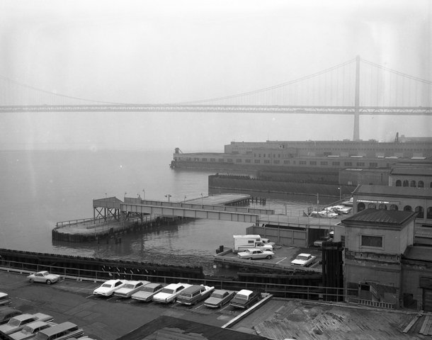
A 2/2/65 photo looking south toward the Bay Bridge, captioned “Proposed site of SFO Helicopter Airlines heliport site adjacent to Ferry Building, Port of San Francisco” (courtesy of Tim Zukas).
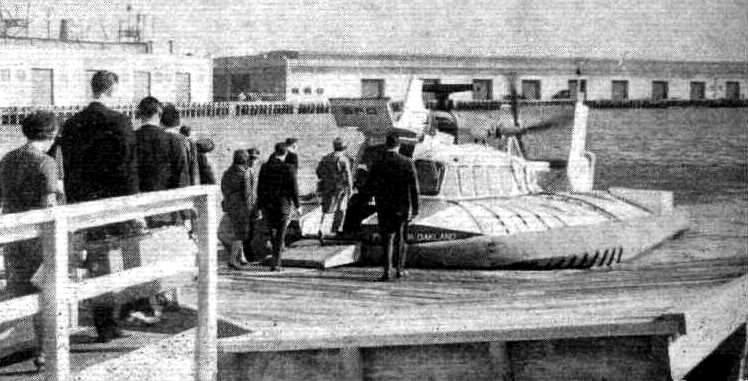
A 1965 photo looking north at an SFO Helicopter Airlines Westland SK-5 hovercraft
picking up passengers at the San Francisco Downtown Heliport (courtesy of Jonathan Westerling).
Jonathan Westerling reported, “Even though the operational cost of the 15-seat SK-5 hovercraft
was half that achieved by the comparable 10-seat S-62 helicopters,
the airline had to charge the same rates as helicopter flights.
This is because the British hovercraft had to be registered as an aircraft
since laws restrict foreign-but water vessels from conducting intra-coastal trade in the US!
As such, the trial was not a commercial success & the service was abandoned after one year.”
A 7/14/66 article in the Oakland Tribune announced that the city of San Francisco’s Public Utility Commission
was funding a $9,000 study of the structural integrity of the piers under the San Francisco Heliport.
When completed this allowed helicopter operations to resume at that location.
Jonathan Westerling reported, “Accordingly service was restored in 1967 according to SFO Helicopter Airlines timetables.
An enclosed waiting area was also constructed adjacent to the landing area.”
By the time of their resumption of service,
SFO Helicopter Airlines had added up to 3 leased 26-seat Sikorsky S-61N twin-engine helicopters to their fleet.
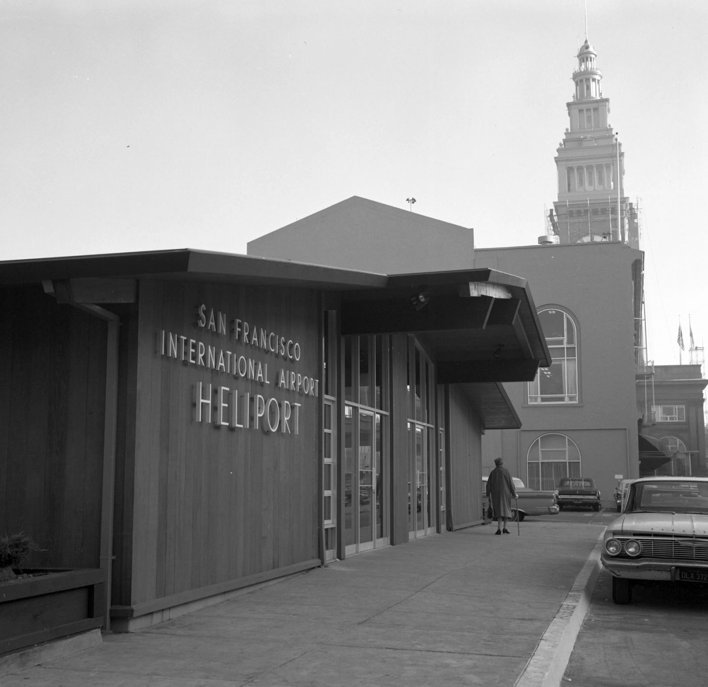
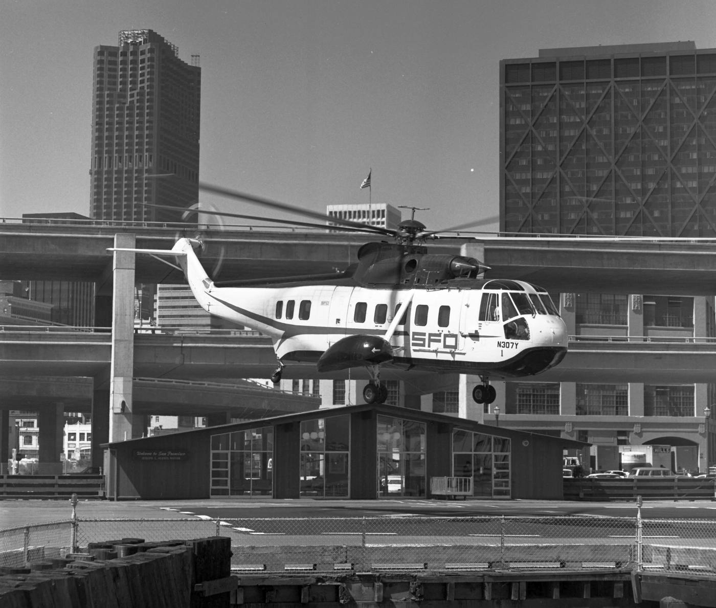
A 1968 photo of the entrance to the San Francisco Downtown Heliport terminal (courtesy of Kevin Walsh).
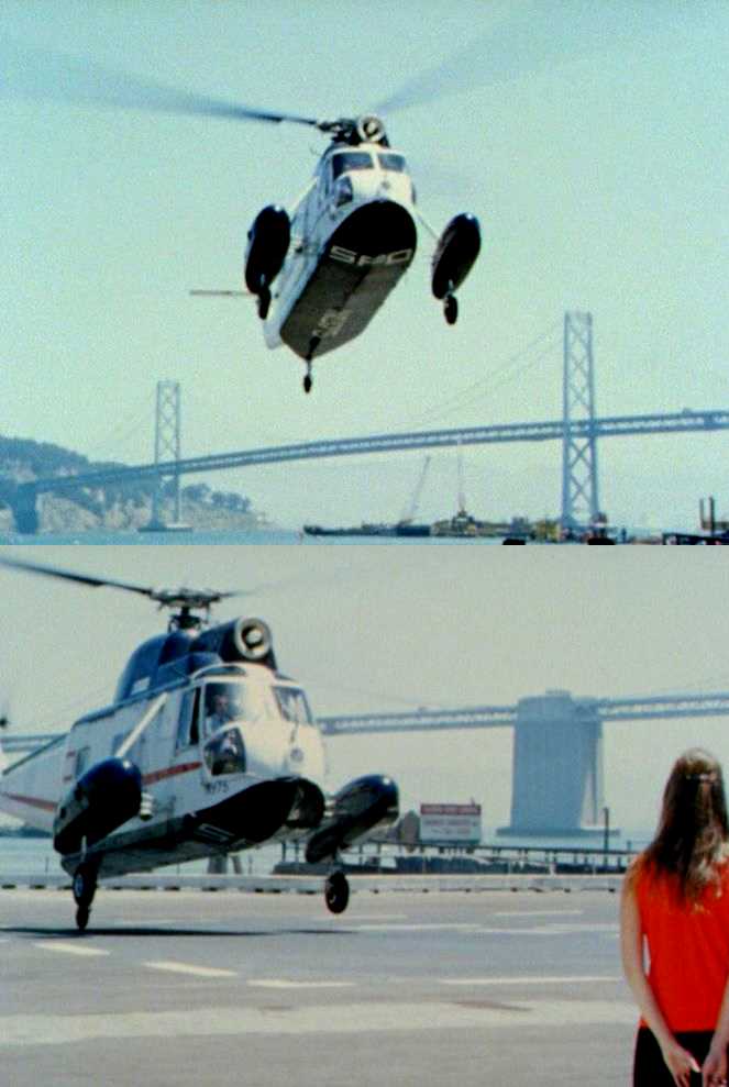
Two undated stills from a 1968 documentary looking east at an SFO Helicopter Airlines Sikorsky S-62A (N975, Serial 62006)
landing at the San Francisco Downtown Heliport, with the Bay Bridge in the background.
A 1969 aerial view looking south at an SFO Helicopter Airlines Sikorsky S-61 helicopter approaching the final iteration of the San Francisco Downtown Heliport
(© Robert W. Cameron, www.cameronbooks.com & www.cameronfolio.com, used with permission).
Jonathan Westerling observed, “Note the passenger waiting area on the far side of the helipad.”
A 4/29/69 photo by Marshall Moxom of an SFO Airlines Sikorsky S-61 helicopter over the San Francisco Ferry Terminal Heliport (courtesy of the Collection of SFO Museum, via Jonathan Westerling).
The last aeronautical chart depiction which has been located of the San Francisco Ferry Building Heliport
was on the 5/1/69 San Francisco Sectional Chart (courtesy of Bob Briggs).
Jonathan Westerling reported, “Service continued through 1969 according to SFO Helicopter Airlines timetables.”
According to Flight International, SFO Helicopter Airlines carried over 15,000 passengers per month
in three 26-seat Sikorsky S-61N twin-engine helicopters, one 10-seat S-62 single-engine helicopter,
and two 15-seat SK-5 hovercraft at the height of its operations.
Jonathan Westerling reported, “The San Francisco Downtown Heliport was closed in 1969 for unknown reasons
and helicopter service to downtown was discontinued as well.”
The San Francisco Ferry Building Heliport was no longer depicted on the September 1971 San Francisco Sectional Chart (courtesy of Ron Plante).
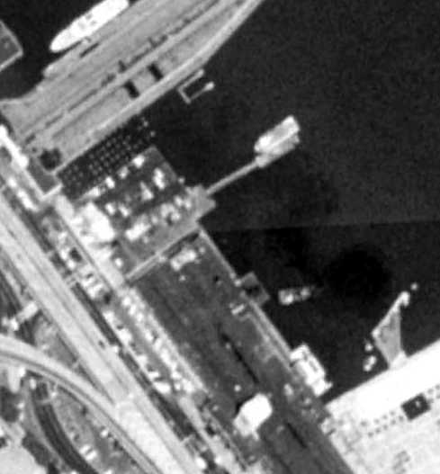
A 6/22/87 USGS aerial view no longer showed any heliport markings at the site of the San Francisco Downtown Heliport.
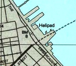
The 1993 USGS topo map still depicted a Helipad.
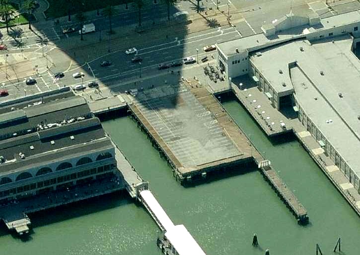
A circa 2005-2011 aerial view looking west showed the pier which previously held the heliport, but the heliport markings & passenger loading building was gone.
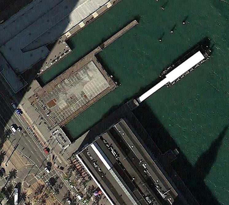
A 11/1/11 aerial view showed the pier which previously held the heliport, but the heliport markings & passenger loading building was gone.
The site of the San Francisco Downtown Heliport is located east of the intersection of The Embarcadero & Washington Street.
____________________________________________________
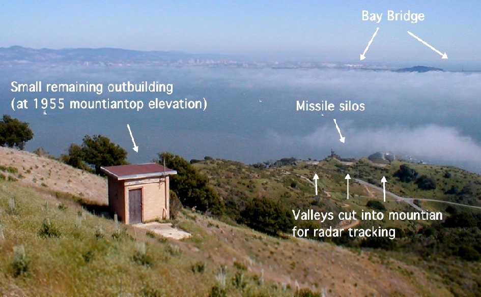
Angel Island Nike Missile Base Heliport, Angel Island, CA
37.86, -122.43 (Northeast of San Francisco, CA)
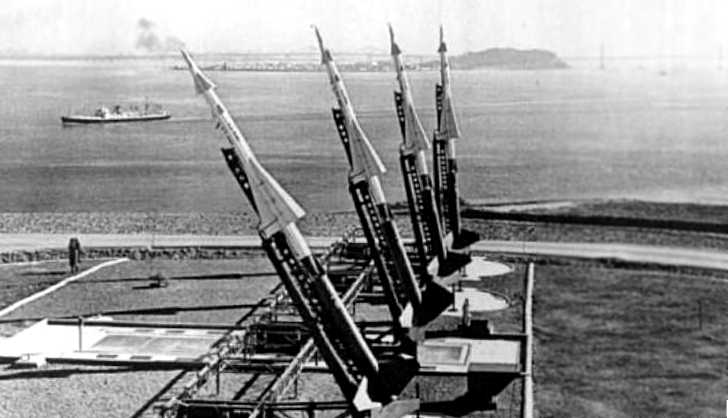
A circa 1950s U.S. Government photo (courtesy of Jonathan Westerling) looking southeast at 4 elevated Nike Ajax missiles on launcher rails at Angel Island,
with Treasure Island & San Francisco Bay in the background.
Jonathan Westerling reported, “From 1954 to 1962, Angel Island served as vital part of the US missile defense shield.
Perhaps the most astounding thing about this is that these missiles were set up in plain sight of, and a mere 3.5 miles away from downtown San Francisco!
Because of the perception that San Francisco was a primary target of Soviet Bombers during the cold war,
the San Francisco Defense Area was set up comprising of several radar & missile sites to defend against incoming enemy aircraft.
The largest of the launching facilities was located at Angel Island.”
According to John Porter of the Nike Missile Museum, the installation was operated by Battery D of the 9th Army Antiaircraft Artillery until 1958
and by the 51st Air Defense Artillery from then onward.
The installation was designated SF-91 & was divided into 2 portions:
SF-91C was the control station on top of the island & SF-91L was the launch pads on the southern shore.
Jonathan Westerling reported, “The facility had not one, but 2 helipads.”
According to the book “Angel Island” by Branwell Fanning & William Wong,
“To provide a level area for the Nike control & radar equipment on the highest point of [Angel Island], the top 16' were removed...
to construct a radar control complex & a helicopter-landing pad.
If fired, the missiles would pass right over the control operations, or ‘over the shoulder’ in military parlance.”
According to Jonathan Westerling, the 1/16/57 Lodi News Sentinel
noted “the crash of a helicopter traveling between Crissy Field in San Francisco & Angel Island the previous day.
From this article we know that the Army air taxi service which served Angel Island used a Bell 47 helicopter.”
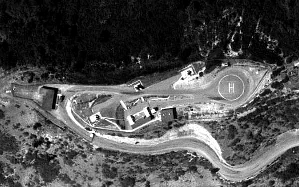
A 6/20/61 aerial view (courtesy of David Ruiz, Imagery Expert with Quantum Spatial Inc.) of the upper (control) heliport on the summit of Angel Island.
Jonathan Westerling observed, “The heliport was just to the east of the support buildings & radar installations on top of the island
and consisted of an asphalt circle about 40' in diameter.”
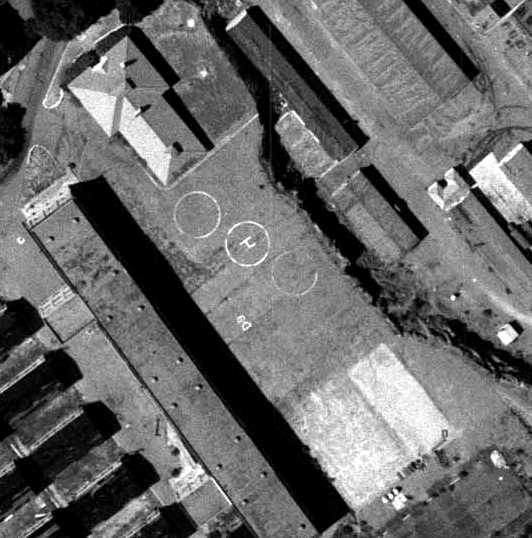
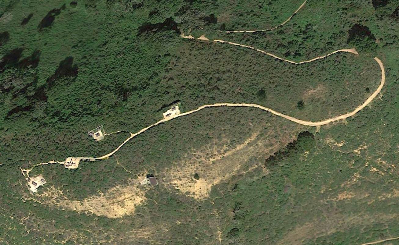
A 6/20/61 aerial view (courtesy of David Ruiz, Imagery Expert with with Quantum Spatial Inc.) of the lower (barracks) heliport on the east side of Angel Island.
Jonathan Westerling reported, “According to Darrell Gafford (who was stationed at the Angle Island Nike site from 1959-61),
the only regular helicopter flights were when the paymaster flew over from the Presidio in a helicopter with their pay. They were paid in cash!”
According to John (Jack) Blau who served in the 51st Air Defense,
the paymaster & his guard would [also] set down on the ball field which is to the south of the Battery Area
and across from the row of houses that the dependents lived.
That would be the 1st Sergeant, some Chief Warrant Officers & other NCOs.
According to Jonathan Westerling, “Many of the Army’s missile sites were upgraded in the early 1960s
to accommodate the Hercules missile infrastructure, but interestingly Angel Island was not.”
According to the Nike Ajax & Hercules Land & Records Collection (courtesy of the Department of the Interior),
“A few sites were not modified, like the Angel Island site, which remained at the Ajax level.”
Jonathan noted, “Within 8 years of its construction,
advances in missile technology made the never-fired missiles obsolete & Angel Island was decommissioned.”
This detailed description of the installation is from a 1999 article by Ed Thelen & used with permission:
“SF-91 Angel Island [consisted of] 3 magazines (1B2C) with 12 launchers...
The park has partially cleared off the tip of the mountain & re-contoured [the control station]
leaving only the pads for the MTR (Missile Tracking Radar) & acquisition radar,
although it’s easy enough to discern the former location of the TTR (Target Tracking Radar).
Other
than a small transformer building – the apparent remnant of the
generator structure – and some foundations, everything else is
gone.
[The launch pads are] in great shape in & around the
storage of 2 prefab buildings & a large woodpile.
One magazine entry port was open & we took a quick peer down into the magazine itself;
another magazine has 'Bee Section' lettering with appropriate artwork.
The assembly building & fueling area are further down the slope,
near the Coast Guard station & a pier which the Army probably used for personnel & equipment transfer.
Overall, SF-91 is probably one of the best-preserved Nike sites in the San Francisco Defense Area.
As mentioned, while the [upper control station] has been heavily modified you can still see directly down to the launchers (through Army-made cuts in the hill),
and overall the facility has great interpretive potential.
Hopefully the state park system will see fit to do so.”
Jonathan Westerling reported, “In 2005, the State Park received a grant to replace the 16' of earth which had been cleared for the Nike installation,
covering up several of the radar remnants at the top of the island.”
A 2005 photo by Jonathan Westerling looking northeast “showing the top of Angel Island.
This photo was taken soon after the 16' of earth were restored at the top of Angel Island.
The 2 concrete areas were the bases for target & missile tracking radar installations.”
A
2005 photo by Jonathan
Westerling looking
southeast “showing the view from the control position down to
the missile silos on Angel Island.
The building shown is the only one remaining at the top of the island, but was fairly insignificant in terms of the Nike operation.
The primary control buildings on top of the island were removed in the 1960s.
It is unknown why this small building was left standing.”
Jonathan Westerling reported in 2010, “The Angel Island Nike Missile site remains accessible to visitors today as part of Angel Island State Park.”
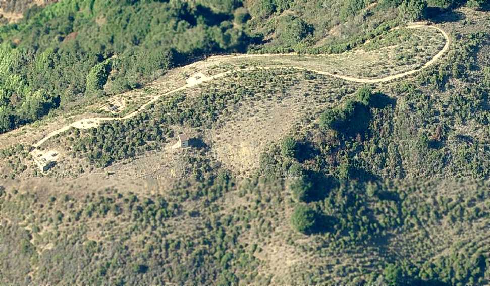
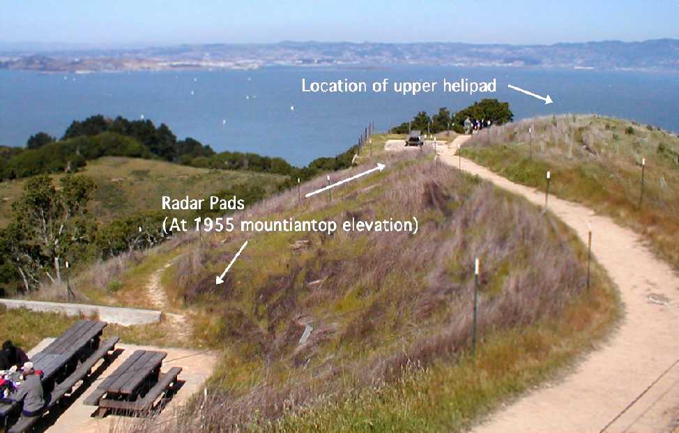
A circa 2007 aerial view looking north showing the location of the former helipad atop the summit of Angel Island.
A circa 2007 aerial view looking north showing the location of the former helipad amidst the buildings on the east side of Angel Island.
A 2016 aerial view of the site of the helipad atop the summit of Angel Island.
____________________________________________________
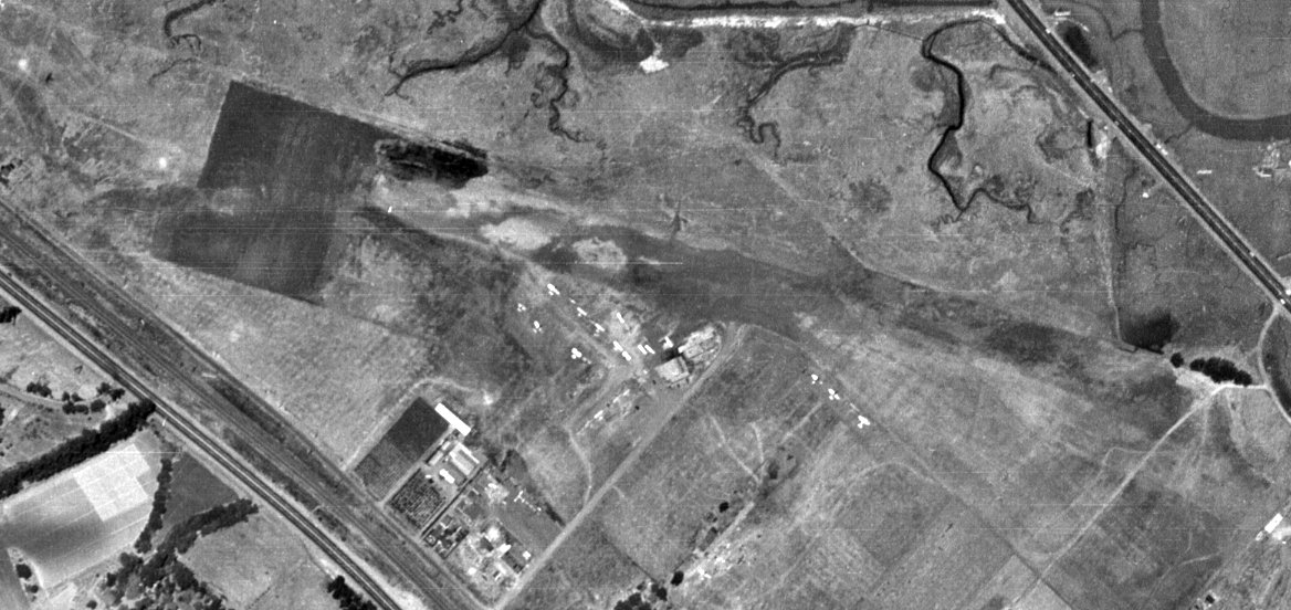
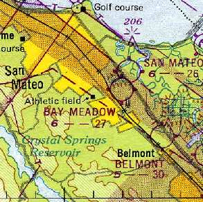
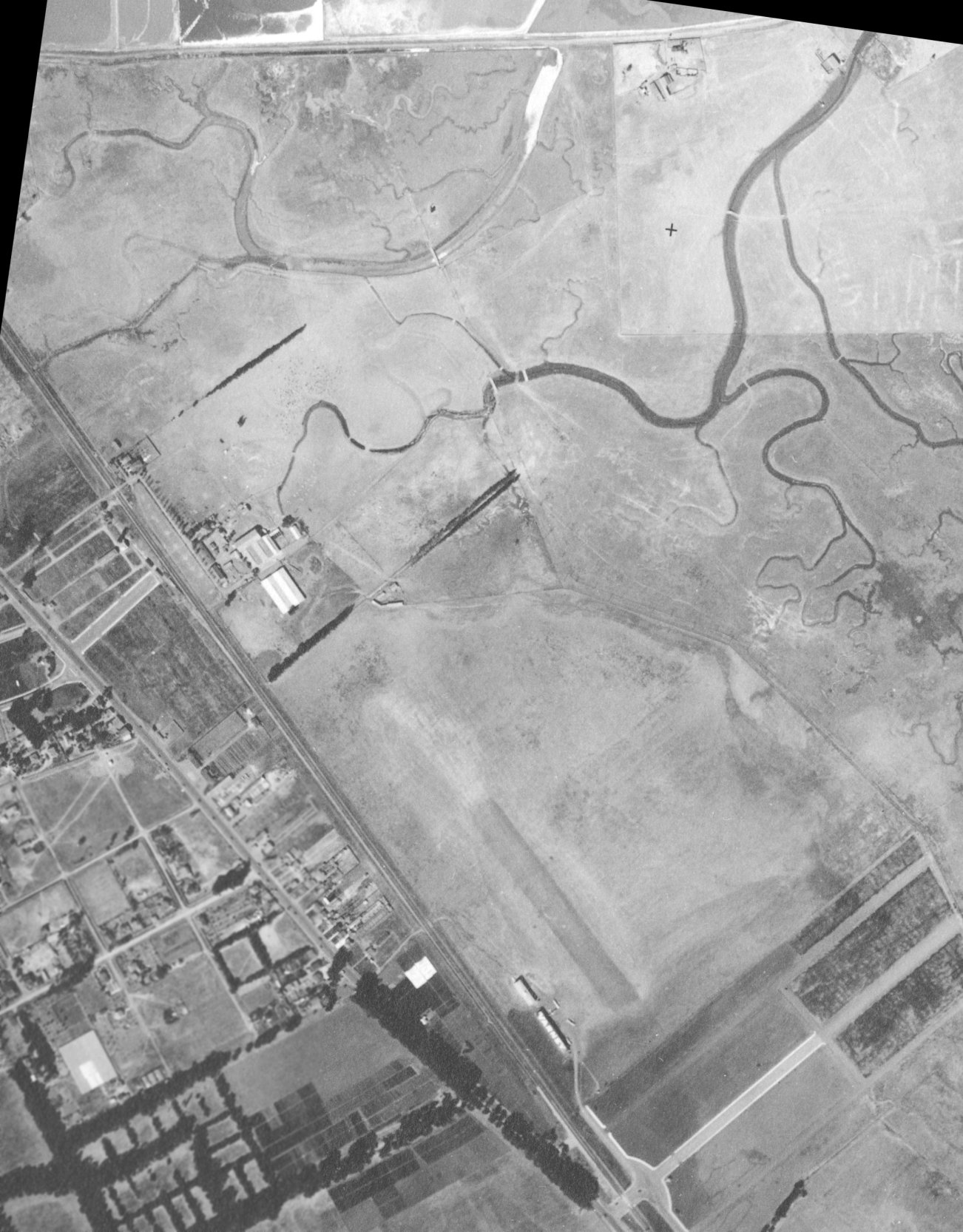
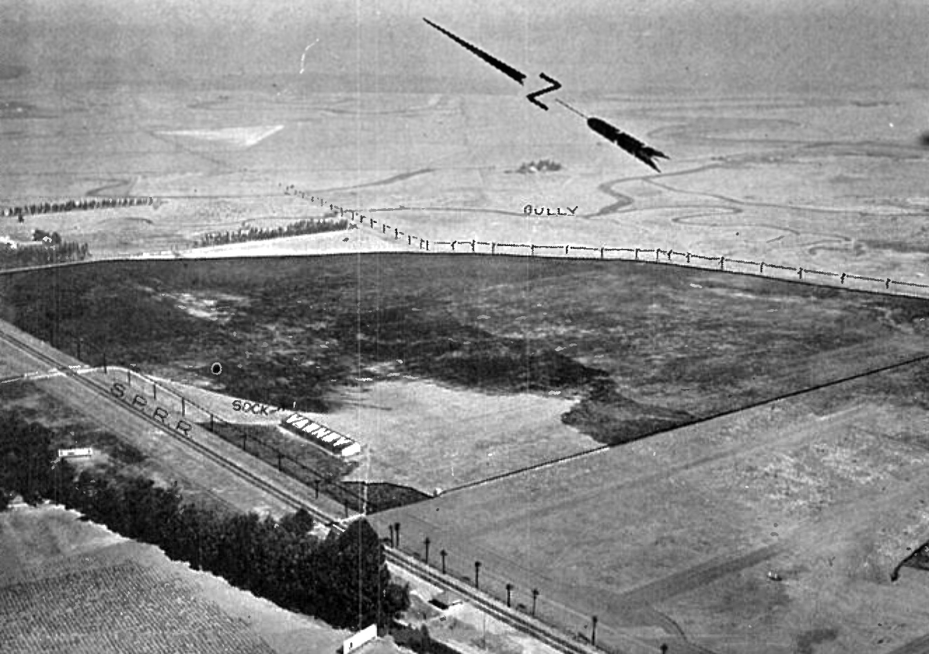
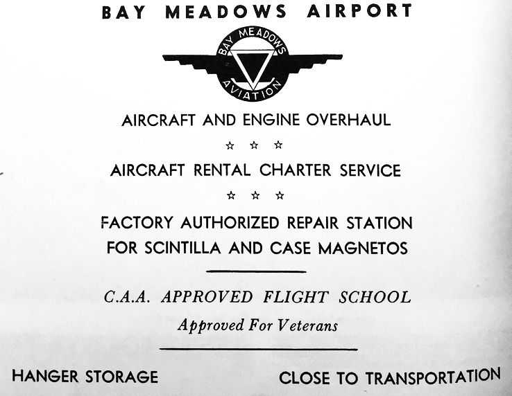
Varney Field / Johnson Field / Curtiss-Wright Airport / Bay Meadows Airport, San Mateo, CA
37.54, -122.3 (South of San Francisco, CA)
Varney Field, as depicted on the 1924 San Francisco – LA Strip Chart (courtesy of Jonathan Westerling).
A series of small airports on this property have gone through a succession of at least 4 names.
This property may have had aeronautical roots going back to 1911.
Jim Douglass recalled, “My dad used to tell me that the property was the site of Northern California's first powered airplane flight in 1911.”
According to “MSS Wings Over San Francisco Bay” by R.T. Reuther (courtesy of Jim Douglass),
“In 1921 Walter Varney moved his flying school [from Redwood City Airport] to San Mateo.”
According to the book "Two Hours By Crow" by Howard & Judith Campbell (courtesy of Wings of History),
“Between 1921-25, this was known as Varney Field, named by Walter Varney (co-founder of United Air Lines) when he started with just a hangar on the site.”
The 1922 Aviation Yearbook (courtesy of Jonathan Westerling) said Walter Varney's “base shelters 15 machines.”
The earliest aeronautical chart depiction which has been located of Varney Field was on the 1924 San Francisco – LA Strip Chart (courtesy of Jonathan Westerling).
According to the book "Two Hours By Crow" by Howard & Judith Campbell (courtesy of Wings of History),
“In 1925-29, Victor 'Speed' Johnson came up from Mountain View Airport to run the field.”
The earliest photo which has been located of Varney Field was a 1928 aerial view (from the UCSB photo archive, courtesy of Jonathan Westerling).
It depicted Varney Field as an irregularly-shaped unpaved field having a single unpaved northwest/southeast runway.
Two small hangars were on the southwest corner, with the southern hangar having “Varney” painted on its roof, and 4 light single-engine planes were parked near the hangars.
Note that a row of trees or bushes at the northwest corner separated the airfield from a cluster of buildings, presumably used for farming.
These buildings would go on in subsequent years to be reused as hangars.
An undated aerial view looking northeast at Varney Field from the 1929 Richfield Airport Directory (courtesy of Jonathan Westerling)
depicted Varney Field as an irregularly-shaped unpaved field measuring 2,600' north/south by 1,500' east/west, with a hangar with “Varney” painted on its roof on the southwest corner.
The field was said to comprise 92 acres.
According to Jonathan Westerling, “Varney Field existed until the late 1920s when Walter Varney left for Idaho to start Varney Air Lines, which went on to become United Airlines.”
According to the book "Two Hours By Crow" by Howard & Judith Campbell (courtesy of Wings of History),
“When Varney moved on from this field, he left 'Speed' Johnson & the Flying School as the operator.”
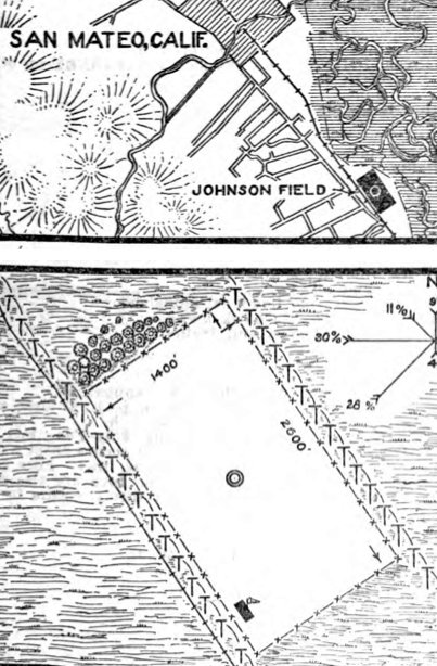
The 11/10/28 Commerce Department Airway Bulletin #231 (courtesy of Jonathan Westerling) depicted Johnson Field
as having a rectangular sandy loam field measuring 2,600' northwest/southeast, with a hangar on the south corner, which was said to have “Johnson” painted on one side of its roof & “Varney” on the other side.
The field was said to comprise 92 acres, and was owned & operated by Victor Johnson.
The 1929 Landing Fields of the Pacific West (courtesy of Jonathan Westerling) described “Speed Johnson Flying School” as a commercial airfield 2 miles south of San Mateo.
The field was said to have 2 sandy loam runways, measuring 2,600' north/south & 1,500' east/west.
It was said to have 2 hangars on the southwest corner, one of which had “Varney” pained on its west side & “Johnson” pained on its east side.
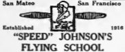
An advertisement in the May 1929 Aero Digest Magazine (courtesy of Jonathan Westerling) for Speed Johnson's Flying School of San Mateo.
An article in the 1/2/30 San Mateo Times (courtesy of Jonathan Westerling) reported:
"Until recently Johnson conducted the 'Speed' Johnson flying school, the oldest established student school on the Peninsula.
Several months ago he sold the land on which his flying school stood to the Curtiss-Wright service, which is now building a new airport on the site."
The article gave Johnson's age as 29.
According to the book "Two Hours By Crow" by Howard & Judith Campbell (courtesy of Wings of History),
“The Curtiss-Wright Corporation (owners of 45 airports throughout the U.S.) bought 400 acres ofl and for $5000,000 at this site in the Beresford District of San Mateo in 1929.
It included the land used by Victor G 'Speed' Johnson & his Flying School.
Curtiss-Wright Field would open for business on 7/4/30.”
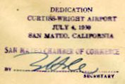
A postmark commemorating the 7/4/30 Dedication of Curtiss Wright Airport, San Mateo (courtesy of Fred Kelso).
According to a biography of noted stunt pilot Paul Mantz (courtesy of Jonathan Westerling),
“In an effort to gain notoriety, on 7/6/30 Mantz set a record in flying 46 consecutive outside loops as a part of the dedication ceremonies of the San Mateo Airport.”
The earliest photo which has been located of Curtiss-Wright Airport was a 1930 aerial view (courtesy of Jonathan Westerling).
One of the hangars of Varney Field had been removed, but one remained standing, to the southwest of the unpaved northwest/southeast runway.
Also note that the row of trees or bushes at the northwest corner had been removed at some point between 1928-30,
which would eventually allow the buildings to the northwest to eventually be reused as hangars.
According to the book "Two Hours By Crow" by Howard & Judith Campbell (courtesy of Wings of History),
“In 1930 Curtiss-Wright picked up the management for 6 more years.
“In 1931 the list of runways was, '500 feet in all directions, surface smooth & grassy. East side of field, muddy in extreme wet weather.'"
Jim Douglass recalled, “My dad used to tell me that in 1931 they had a dedication airshow there
at which the German ace Ernst Udet set a record for the number of successive loops performed at one time.”
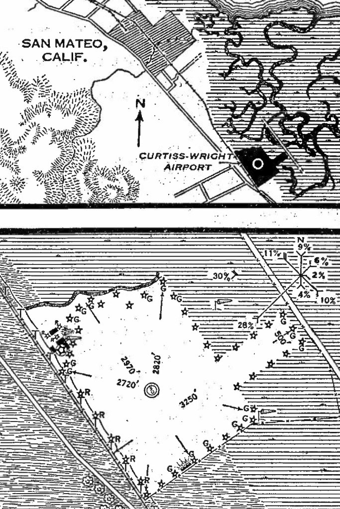
The 2/17/31 Commerce Department Airway Bulletin (courtesy of Jonathan Westerling) described Curtiss-Wright Airport
as a commercial airport owned by California Air Terminals Inc., operated by Curtiss-Wright Flying Service.
It was said to consist of a 141 acre irregularly-shaped sandy loam field, with the longest distance being 3,250' northeast/southwest.
Three small buildings were depicted on the northwest corner, of which one was described as a 180' x 120' hangar.
The 2 original Varney Field hangars at the southwest end had been removed.
The earliest aeronautical chart depiction which has been located of Curtiss Wright Airport was on the 1932 strip chart (courtesy of Jonathan Westerling).
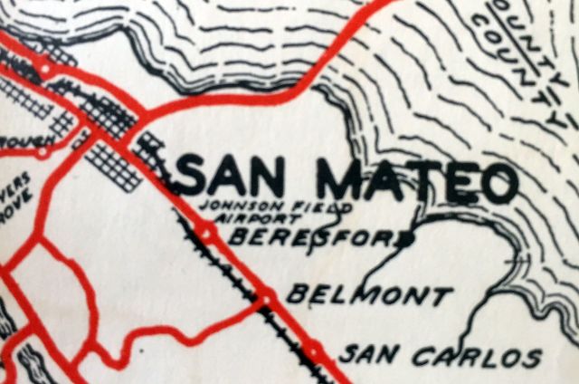
A 1932 road map (courtesy of Kevin Walsh) labeled the airport to the southeast of San Mateo as “Johnson Field Airport”.
This being a non-aviation map, the labeling of the airport as “Johnson Field” was evidently outdated,
as it had become Curtiss-Wright Airport 2 years earlier.

The earliest Sectional Chart depiction which has been located of Curtiss Wright Airport was on the May 1933 San Francisco Sectional Chart.
Curtiss Wright Airport evidently operate for very long, and was evidently closed at some point between 1933-34 (presumably a victim of the Depression),
as it was no longer listed in the 1934 Commerce Department Airway Bulletin (according to Jonathan Westerling).
According to the book "Two Hours By Crow" by Howard & Judith Campbell (courtesy of Wings of History),
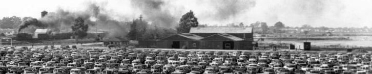
“In 1934, the California Jockey Club opened the Bay Meadows Race Track here.
They offered all forms of horse racing until Thoroughbred Racing proved to be the most profitable type.”
The Bay Meadows horse racing track was built over the southeastern portion of the airport site.
The property evidently had no aviation use for a few years, as no airfield was listed at this location in the 1936 Commerce Department Airway Bulletin (according to Jonathan Westerling)
or depicted on the October 1937 or April 1941 San Francisco Sectional Charts.
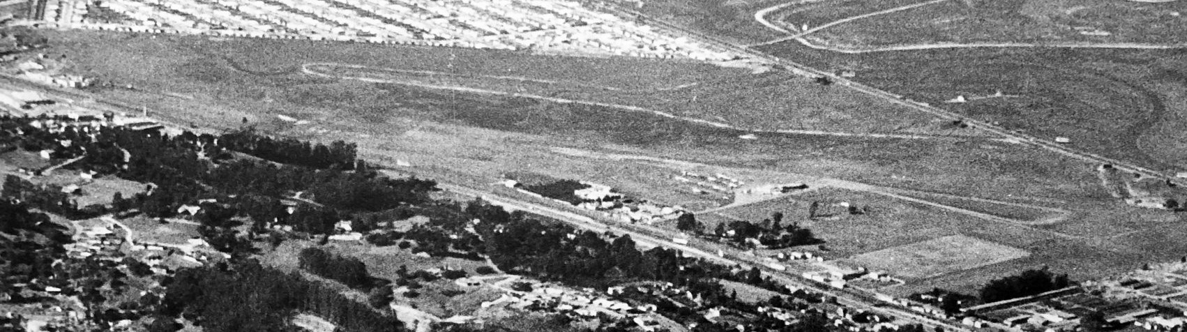
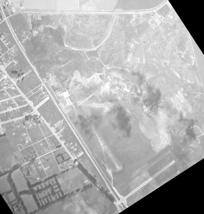
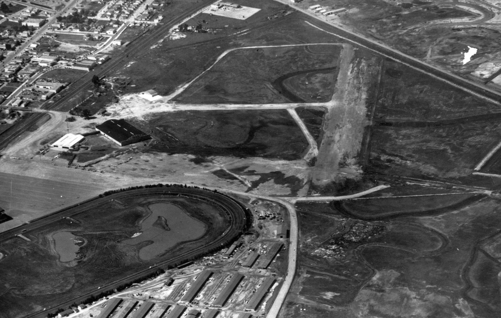
A 1941 aerial view (from the Alexandria Digital Library @ UC Santa Barbara, courtesy of Jonathan Westerling)
showed that a new Bay Meadows Airfield (with 2 unpaved runways in an “X” shape) had been constructed at some point between 1934-41 on the north side of this property.
Taxiways connected these new runways to the buildings to the west (originally presumably farm buildings), which were presumably reused as hangars.
The Bay Meadows horse racetrack was immediately adjacent to the southeast side of the airfield.
Amazingly only 2 years later, a 1943 aerial view (from the Alexandria Digital Library @ UC Santa Barbara, courtesy of Jonathan Westerling)
showed that the runways had been completely removed, perhaps due to wartime security concerns along the west coast.
The hangar remained, but the site was no longer recognizable as an airfield.
An October 1943 photo looking north (courtesy of Kevin Walsh) depicted the 2 hangars at the southwest corner of Bay Meadows Airfield evidently during the period they were not being used for aviation.
The Bay Meadows runways were evidently reconstructed at some point between 1943-45.
According to the book "Two Hours By Crow" by Howard & Judith Campbell (courtesy of Wings of History),
“At the War's end in 1945, the Bay Meadows Aviation Corporation started flying race horses & their entourage into the track.
One of the carriers was National Skyway Freight Corporation flying their Budd RB- I Conestoga twin-engine freighters in that service.
The first race horse to be air transported into Bay Meadows, was El Lobo (the Wolf).
On 10/26/45 El Lobo landed on this field, and next day, he won the Burlingame Handicap Race.”
A history of the race track mentions that "the first horse transported by air landed at Bay Meadows.
That took place in 1945 when El Lobo was flown from Los Angeles by his owner,
country & western entertainer Stuart Hamblem, to contest the Burlingame Handicap.
After landing safely on an airstrip adjacent to Bay Meadows, El Lobo completed the history-making journey by winning the race."
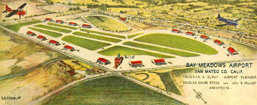
An artist's concept looking southwest at plans for a much-expanded Bay Meadows Airport from the cover of a July 1945 brochure (courtesy of Aaron Becker).
It depicted the field as having 2 parallel runways, oriented northwest/southeast, with a total of 16 (!) hangars lining ramps on the north & south sides of the runways.
This extensive layout of runways & hangars was a grandiose plan which was never completely realized.
The airport engineer was listed as Frederick Dupuy, and the field's architects were listed as Douglas Stone & Lou Mulloy.
Bay Meadows Airport was not yet depicted on the February 1946 San Francisco Sectional Chart.
The earliest aeronautical chart depiction which has been located of Bay Meadows Airport was on the August 1946 San Francisco Sectional Chart.
It depicted Bay Meadows Airport as a commercial/municipal airport.
An obituary in the San Francisco Examiner mentioned Bay Meadows Airport as the departure point of a 1946 flight which ended in a fatal crash.
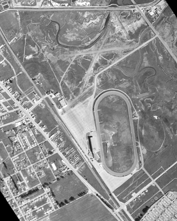
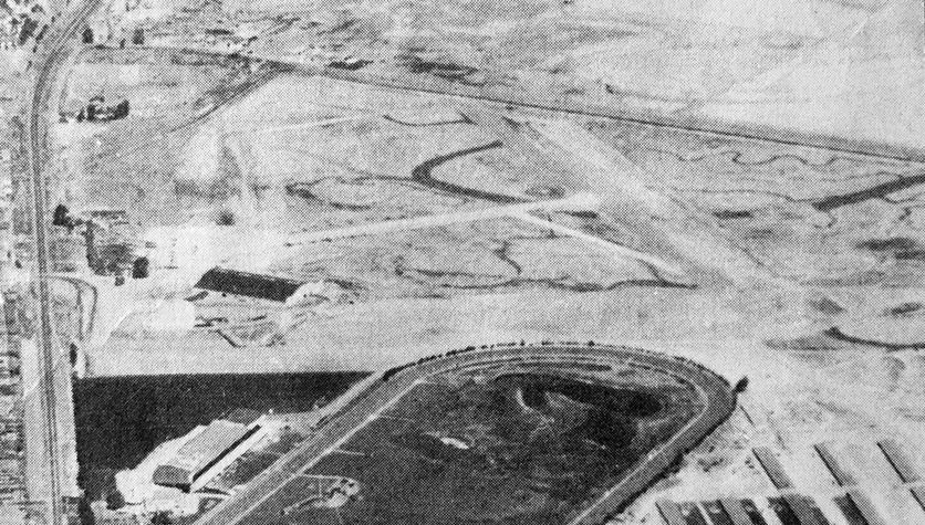
A 7/29/46 aerial view of the Bay Meadows Airport depicted the field as having 2 unpaved runways, with 2 hangars on the southwest side of the field.
A closeup from the 1946 aerial view showed 19 single-engine aircraft parked around a hangar on the southwest side of the Bay Meadows Airport.
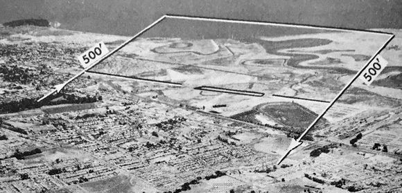
The earliest topo map depiction which has been located of Bay Meadows Airport was on the 1947 USGS topo map.
It depicted Bay Meadows Airport as having a total of three 2,300' runways or taxiways adjacent to the northwest side of the race track.
Two buildings or hangars were depicted on the southwest side of the airfield.
Note it also depicted San Mateo Airport across Bayshore Highway to the north.
The 1948 USAF Urban Area Chart depicted Bay Meadows Airport as having a northwest/southeast runway.
The 1948 San Francisco Local Aeronautical Chart (courtesy of Tim Zukas) depicted Bay Meadows Airport as having a 2,400' paved runway.
A circa 1940s aerial view (courtesy of Jack O'Leary) looking northwest at Bay Meadows Airport showed the field as having 2 unpaved runways,
with 2 hangars on the southwest side of the field, around which were parked a dozen light aircraft.
The Bay Meadows racetrack was visible in the foreground.
A circa 1940s aerial view looking north at Bay Meadows Airport (courtesy of Kevin Walsh), with the racetrack visible in the foreground.
The 1949 San Francisco Local Aeronautical Chart (courtesy of Chris Kennedy)
depicted "Bay Meadow" Airport as having a 2,700' unpaved runway.
The 1949 USGS topo map depicted "Bay Meadows Airport"
as having a total of three 2,300' runways or taxiways adjacent to the northwest side of the race track.
Two buildings or hangars were depicted on the southwest side of the airfield.
The last photo which has been located showing Bay Meadows Airport was an undated aerial view looking north from the 1950 Air Photo Guide (courtesy of Kevin Walsh).
It described Bay Meadowns as having a 2,750' oil surface Runway 13/31.
The field was said to feature a hangar, and the manager was listed as Robert Gunderson.
An advertisement for Bay Meadows Airport from the 1950 Air Photo Guide (courtesy of Kevin Walsh).
The last aeronautical chart depiction which has been located of Bay Meadows Airport was on the March 1951 San Francisco Sectional Chart.
It depicted "Bay Meadow" Airport as having a 2,500' unpaved runway.
Bay Meadows Airport evidently closed at some point in 1951,
as it was no longer depicted on the September 1951 San Francisco Sectional Chart.
Jim Douglass recalled, “I lived about 3/4 of a mile from the Bay Meadows airport from 1958-72.
My father had kept a Cessna 140 there until it closed.
According to him, the field had been privately owned.
When the city first began talking about closing it,
the owner did a study which showed that the airport brought in several million dollars a year to the city coffers
and offered not only to give it to the city if they'd keep it open
but to expand the facilities to where it would support scheduled DC-3 service.
This was, of course, in the days of regulated air carriers & 'feeder' lines which landed every 30 or 40 miles.
Needless to say, the city declined & the field was closed.”
Jim continued, “When we lived there, the property housed the county fairgrounds.
As a kid, I attended several county fairs there,
and at least 4 (maybe as many as 6) large hangars still existed & were used as display halls.
From El Camino Real & 25th Avenue you could still make out the name of the airport
in faded paint on the roof of one of the hangars (I only think it said 'Bay Meadows Airport').”
A 1956 aerial view (from the UCSB Library, courtesy of Jonathan Westerling) showed that houses had been built over the northern portion of the site of Bay Meadows Airport.
The hangar at the southwest corner remained standing.
The 1956 USGS topo map depicted the southern portion of the former airport
as being the location of the Fiesta Gardens School & the Fiesta Grounds (County Fairgrounds).
A 1968 aerial view showed the former hangar at the southwest corner remained standing.
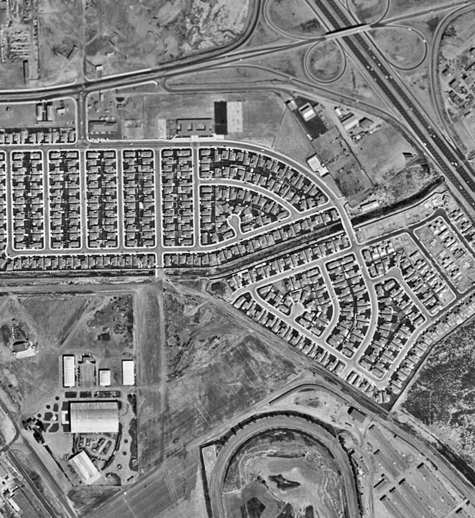
A 1980 aerial view showed the former hangar at the southwest corner had been removed at some point between 1968-80,
erasing the last trace of Bay Meadows Airport.
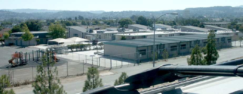
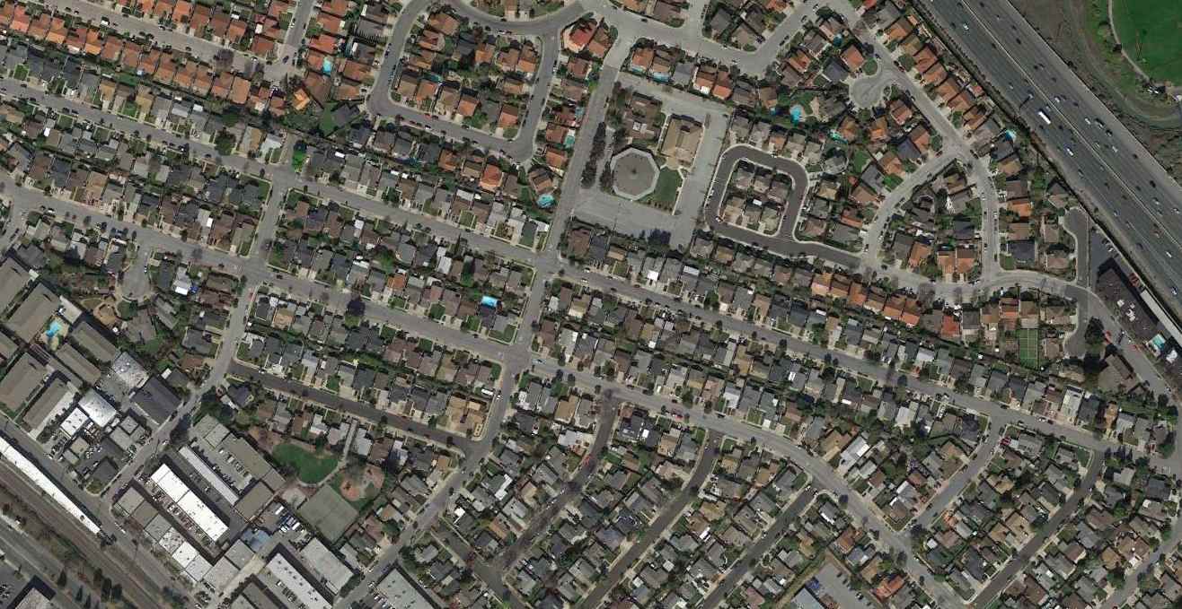
A 2003 photo by Tim Tyler, looking south-southwest at the Fiesta Gardens Elementary School,
which occupies the northeast corner of the site of the Bay Meadows Airfield.
Tim Tyler visited the site of the former Bay Meadows Airfield in 2003,
and reported that "The area is now mostly residential, with a few stores,
some small factory/warehouse type buildings, and a San Mateo - Foster City School District center."
According to the book "Two Hours By Crow" by Howard & Judith Campbell (courtesy of Wings of History),
“The entire complex [the Bay Meadows track] was closed on 8/17/08 & an industrial/housing development replaced it.”
A 2018 aerial view looking north at the site of Bay Meadows Airport.
The site of Bay Meadows Airport is located southwest of the intersection of the 101 Freeway & Route 92.
Thanks to Chris Kennedy for pointing out this airfield.
____________________________________________________
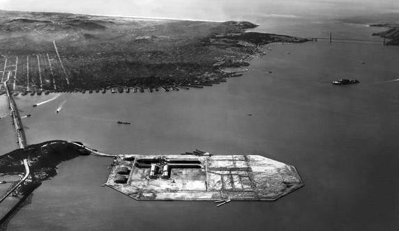
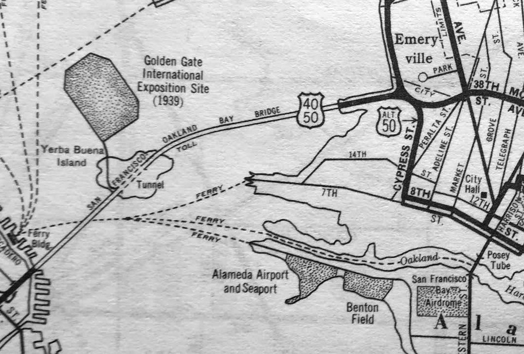
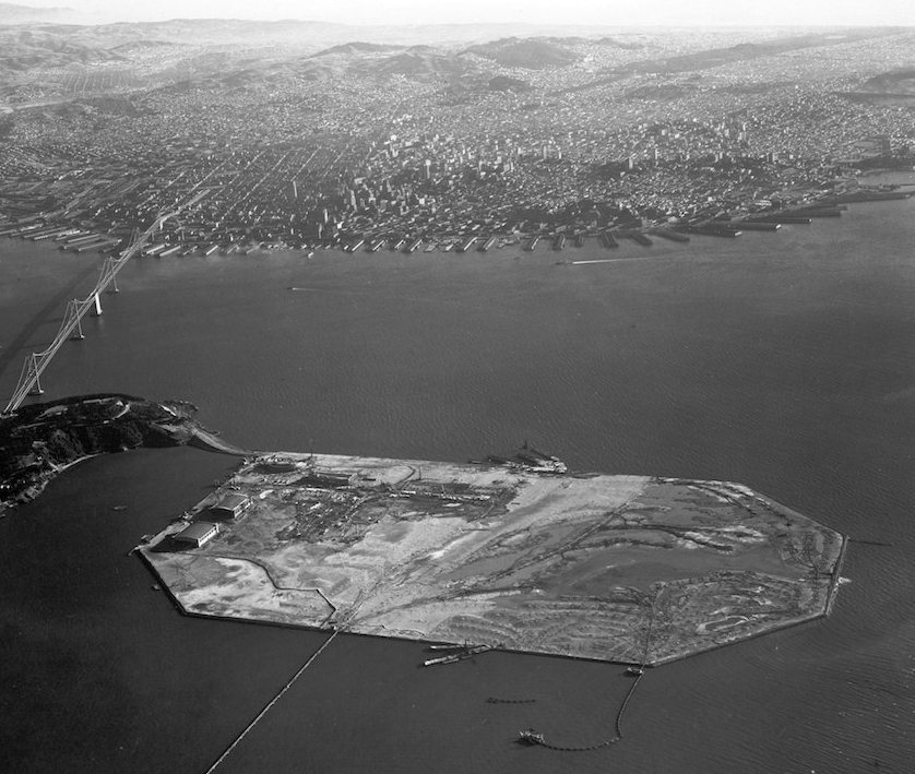
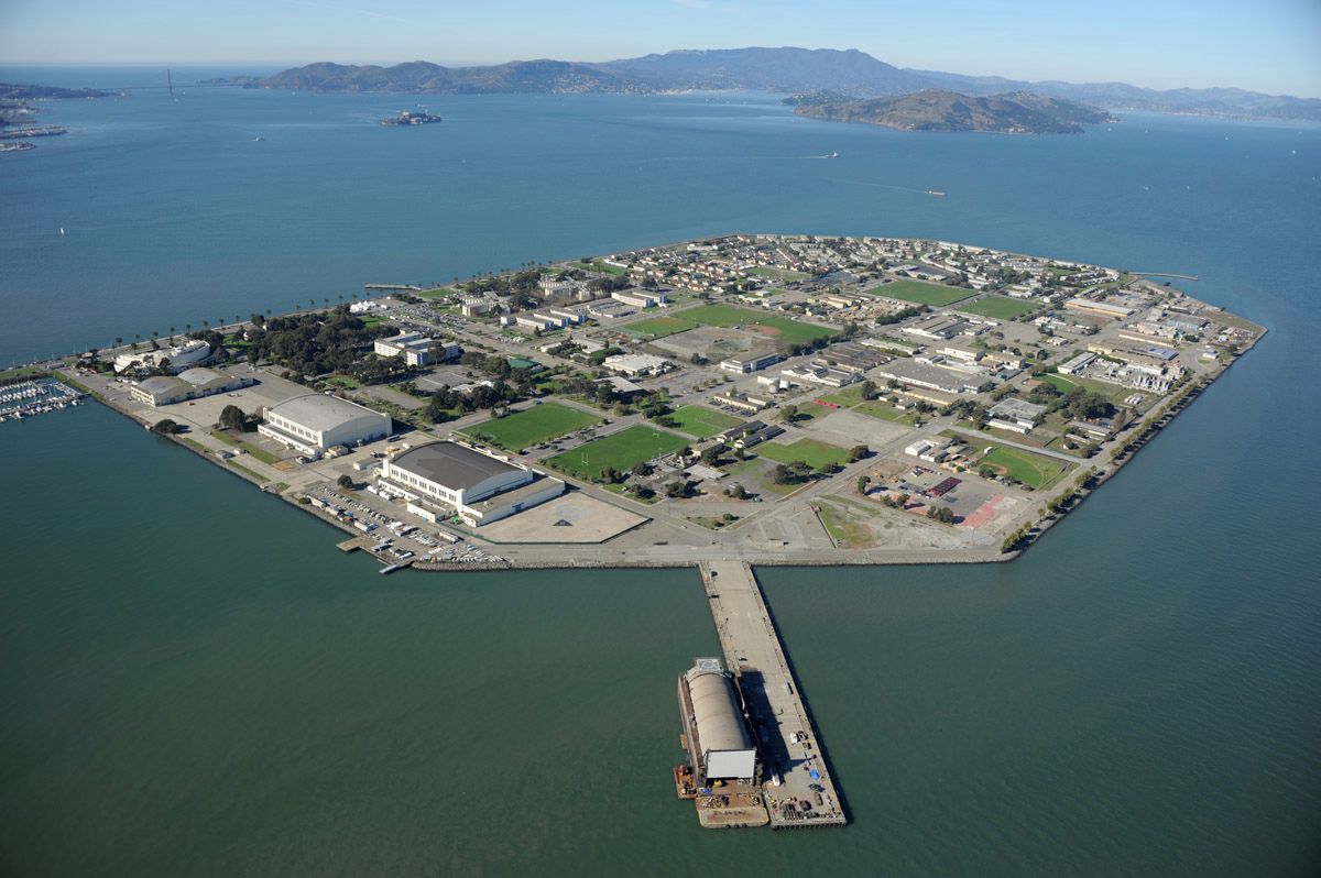
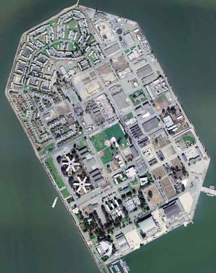
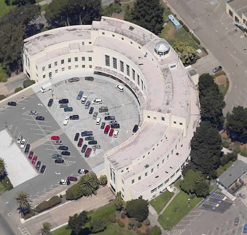
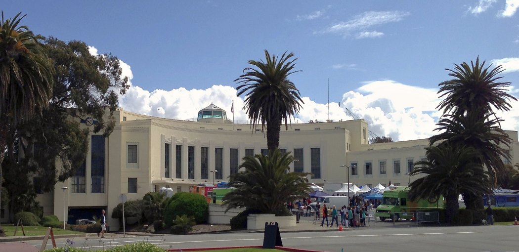
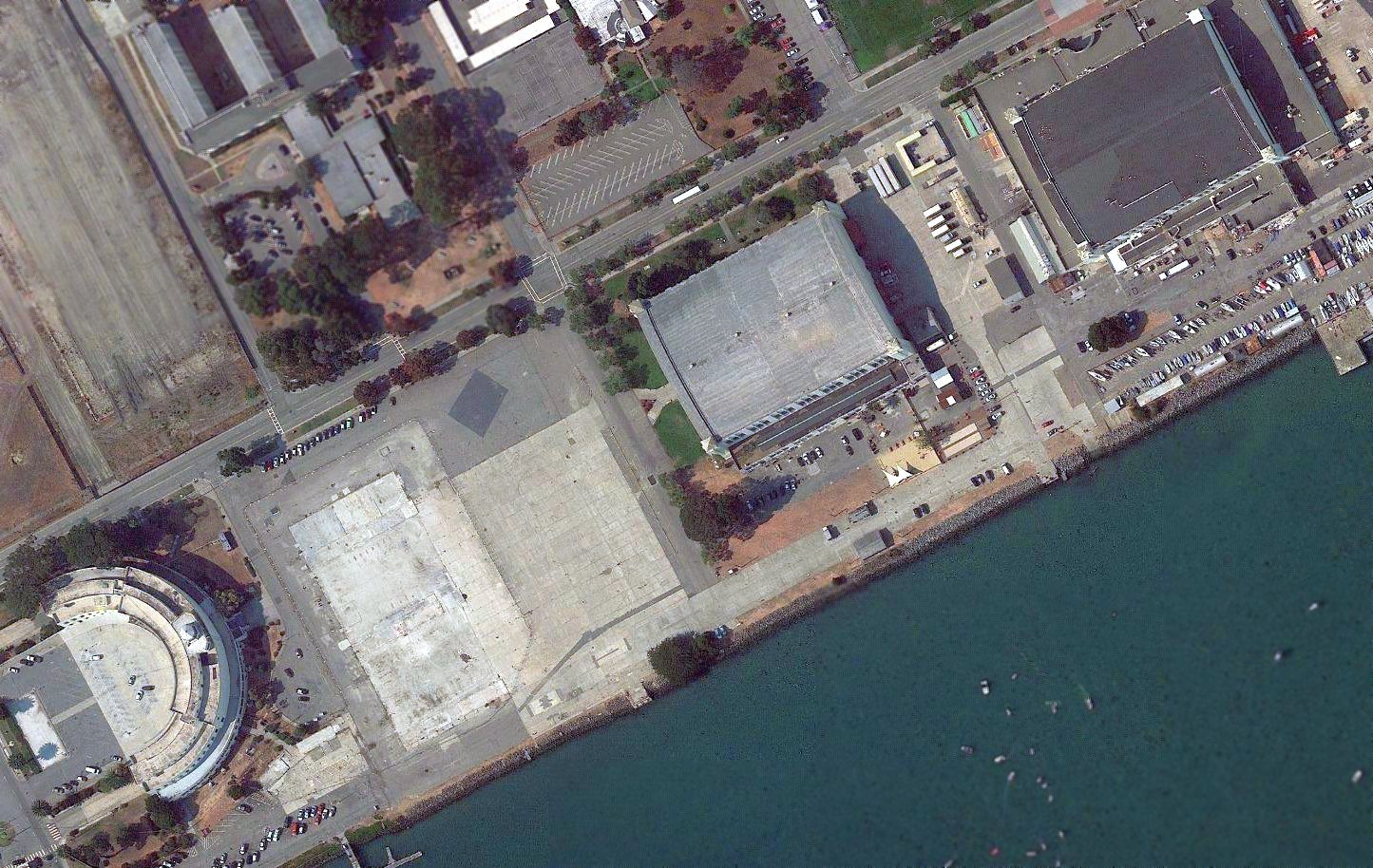
Golden Gate Union Air Terminal / Treasure Island Airport /
Treasure Island Naval Auxiliary Air Facility, San Francisco, CA
37.82, -122.37 (Northeast of Downtown San Francisco, CA)
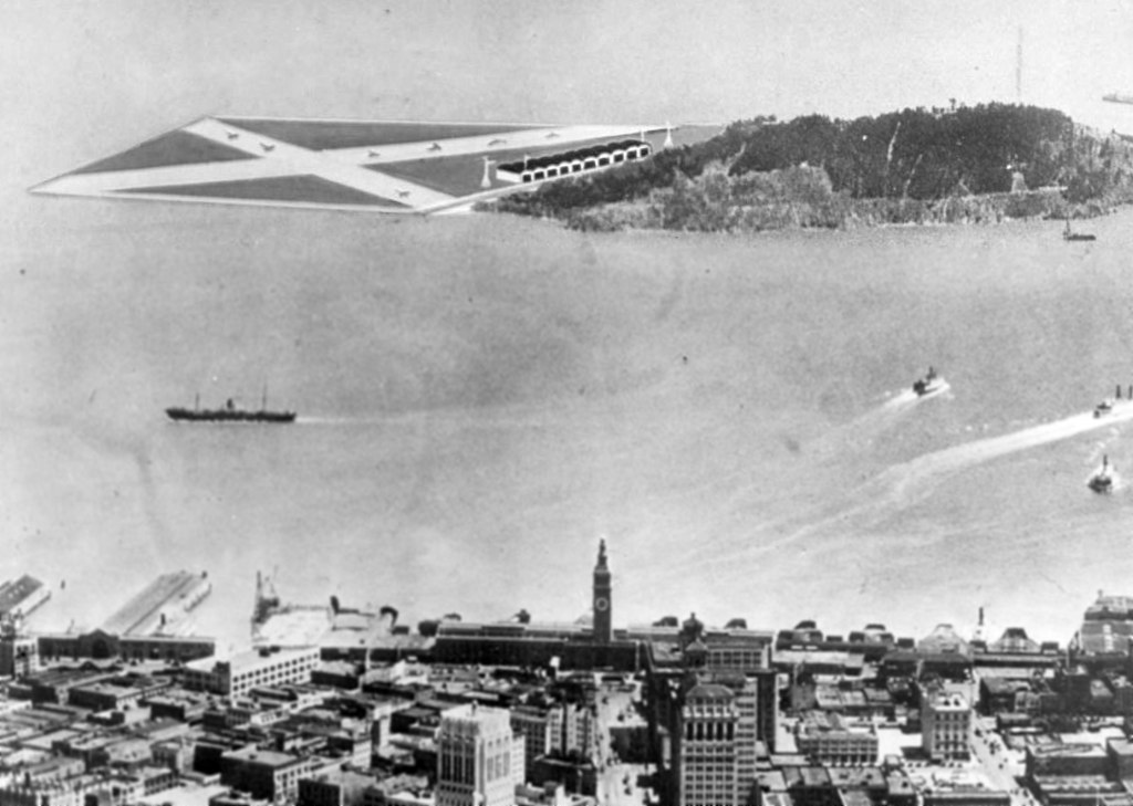
A 3/30/32 rendering looking east at the proposed Golden Gate Union Air Terminal on the north end of Treasure Island (courtesy of Tim Tyler).
In anticipation of international commercial air service, Treasure Island was originally slated to become San Francisco's second airport,
operated simultaneously with Mills Field (now San Francisco International Airport.
A 3/30/32 rendering (courtesy of Tim Tyler) depicted the proposed Golden Gate Union Air Terminal on the north end of the island,
with 2 intersecting runways & a row of hangars on the southern side of the airfield.
According to Anne Schnoebelen, “In 1935, San Francisco decided that it should hold a exposition to celebrate
the engineering of the Golden Gate Bridge & the San Francisco & Oakland Bay Bridge,
as well as to celebrate the ascendancy of California & San Francisco
as an economic, political & cultural force in the increasingly important Pacific region.
This would eventually become the 1939-1940 Golden Gate International Exposition.
The site would also become San Francisco's new municipal airport following the Exposition.
Among 6 sites, a location on the shoals north of Yerba Buena Island was ultimately chosen
because it was accessible from all parts of the San Francisco Bay Area.”
The construction of Treasure Island began in 1936.
A circa 1930s artist's conception looking northeast at the planned Treasure Island Airport.
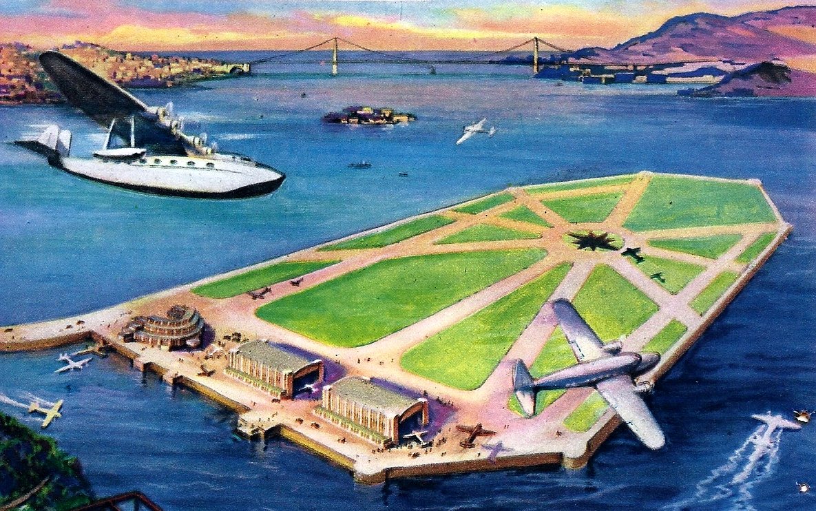
A painting by Ken Sawyer from a November 1938 magazine article looking northwest at the planned Treasure Island Airport (courtesy of Anne Schnoebelen).
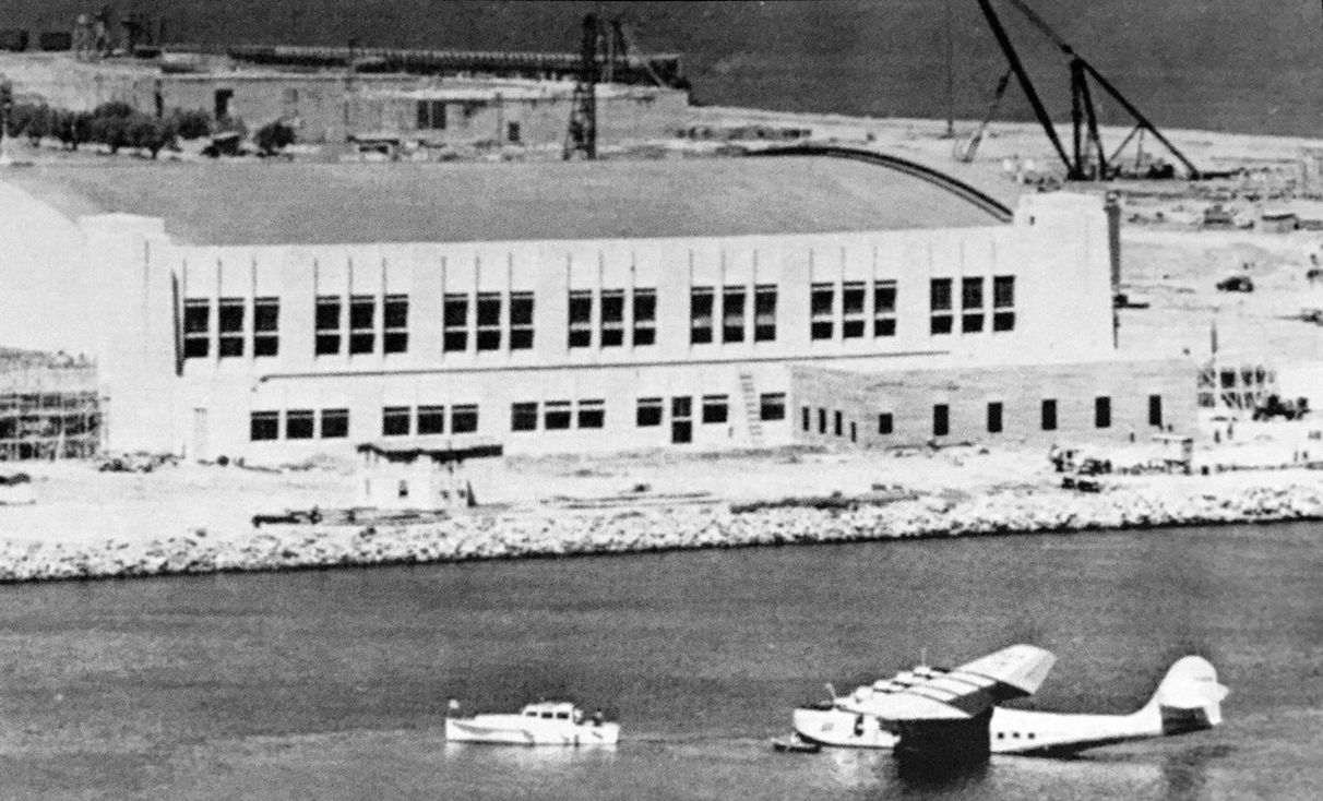
It showed the 2 seaplane hangars & terminal which would eventually be built on the south end,
along with a never-built series of 9 runways emanating from a central point on the north end of the island.
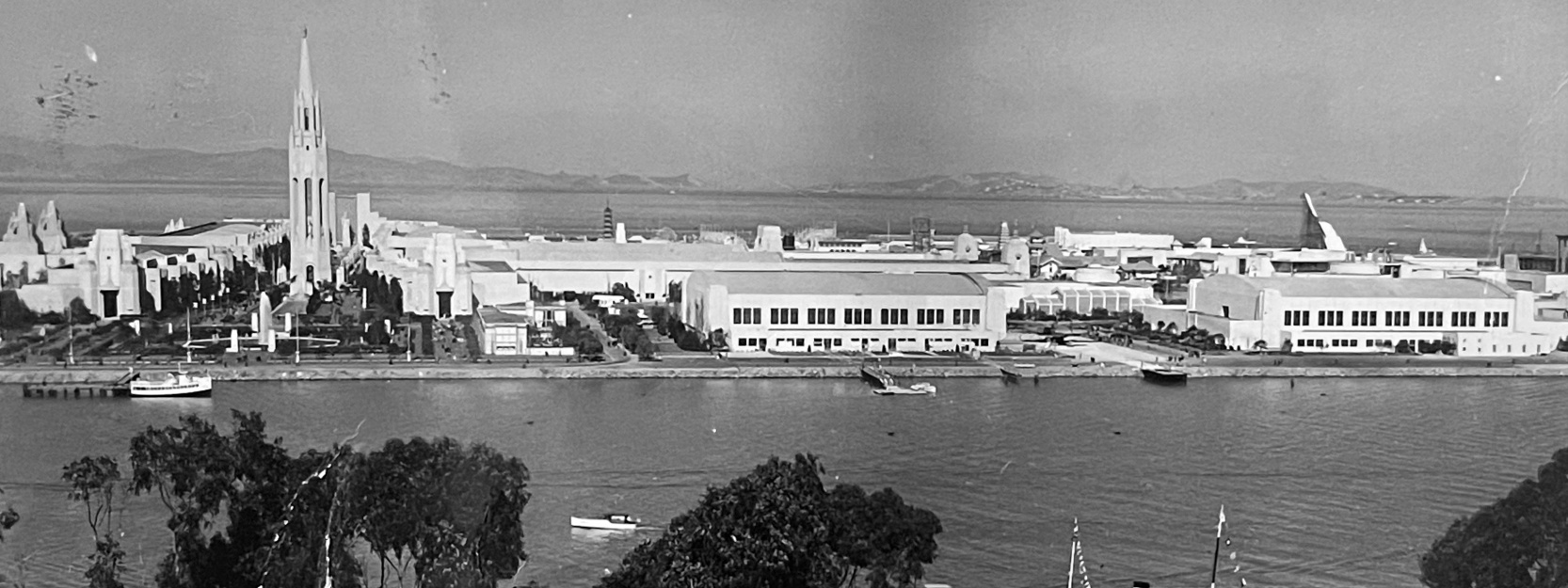
The earliest photo which has been located of Treasure Island was a circa 1938 aerial view looking west (courtesy of Kevin Walsh).
It showed the 2 flying boat hangars having been constructed on the south end of the island,
and other Golden Gate Exposition buildings under construction.
A 1938 street map (courtesy of Kevin Walsh) depicted the “Golden Gate International Exposition Site (1939)”.
A circa 1938 aerial view looking north at Martin M-130 Hawaii Clipper NC17414 moored in front of a Treasure Island hangar (courtesy of Kevin Walsh).
The Exposition grounds were still under construction in the background.
Mark Lincoln noted, “Hawaii Clipper NC17414 vanished between Guam & Manila in 1938.”
The construction of Treasure Island was completed in 1939.
To build the 403 acre island, 29 million cubic yards of sand & gravel
were transported to or dredged from the Bay & the Sacramento River delta.
The name "Treasure Island" refers to the gold-laden fill dirt that washed down from the Sierras into the Bay,
from which fill was dredged to create the island.
Approximately 259 thousand tons of rock were used to create a rock wall to contain the island.
Buildings & structures for the Golden Gate International Exposition were going up even before the Bay fill dried.
The exposition opened in 1939.
A 1939 photo of Jake & Adele King in front of the China Clipper loading ramp on the south side of Treasure Island (courtesy of their great-grandson Kevin Walsh).
A circa 1930s photo looking northwest at the Treasure Island seaplane hangars (courtesy of Kevin Walsh).
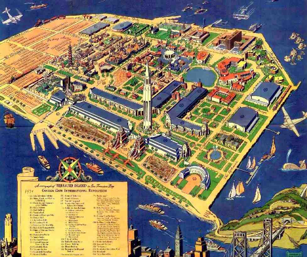
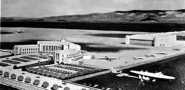
A 1939 map of the Golden Gate International Exposition at Treasure Island, showing the seaplane hangars & terminal on the right.
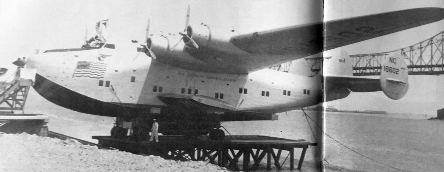
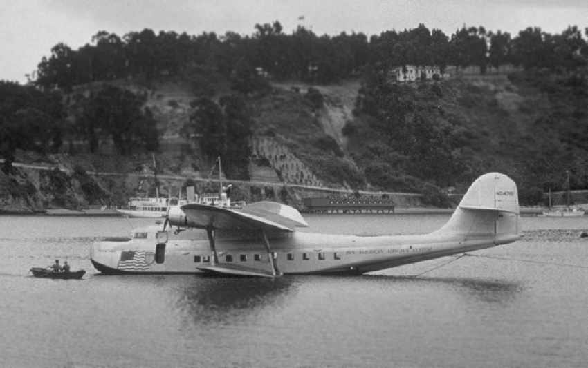
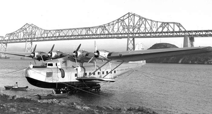
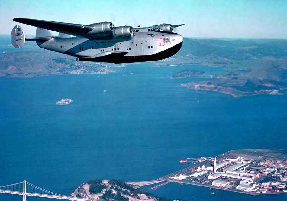
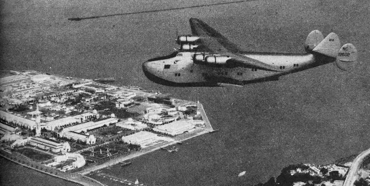
A March 1939 photo by Gordon Williams of a Pan Am Boeing 314 California Clipper NC18602 on its 15 ton beaching cradle being preparing for its christening at Treasure Island (courtesy of Kevin Walsh).
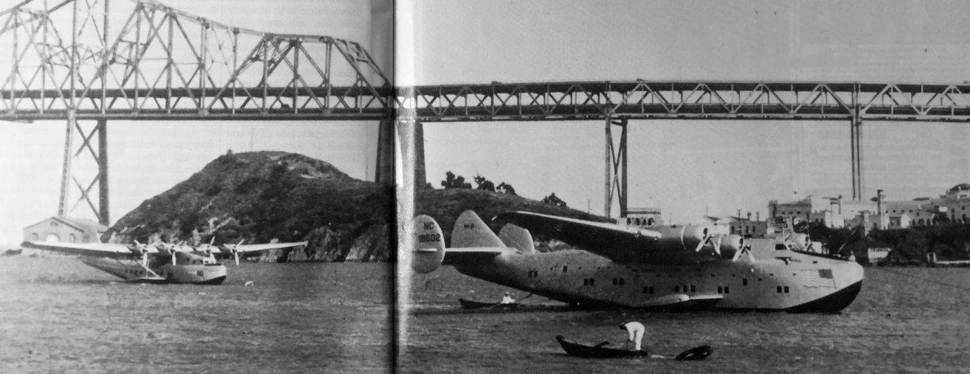
A March 1939 photo by Gordon Williams of a Pan Am Martin Clipper & Boeing 314 California Clipper NC18602 moored at Treasure Island (courtesy of Kevin Walsh).
A 1939 photo of a Martin M-130 flying boat at Treasure Island (from the San Francisco Library via Rex Ricks).
A circa 1939 photo by Bill Larkins of a Martin M-130 China Clipper being moored at Treasure Island.
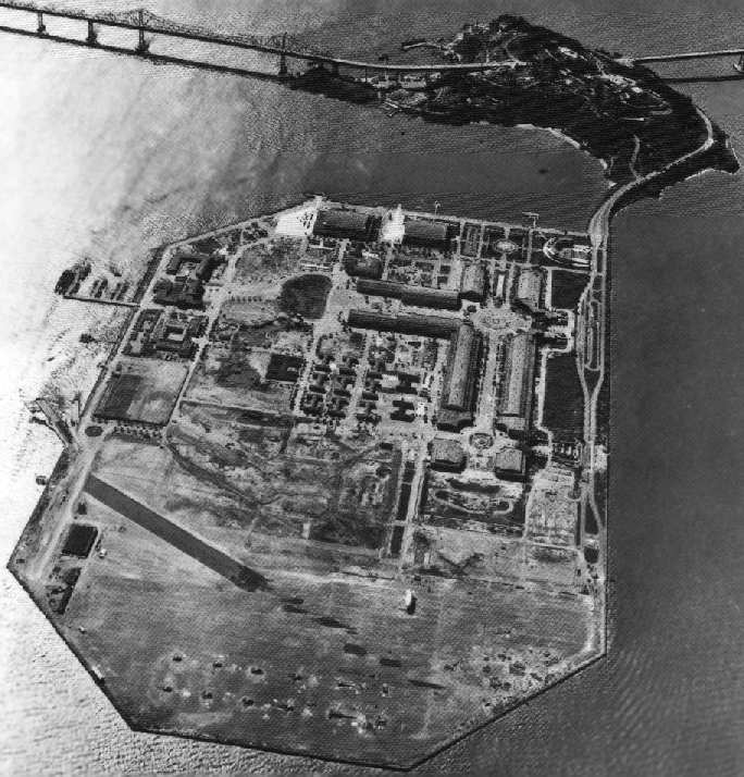
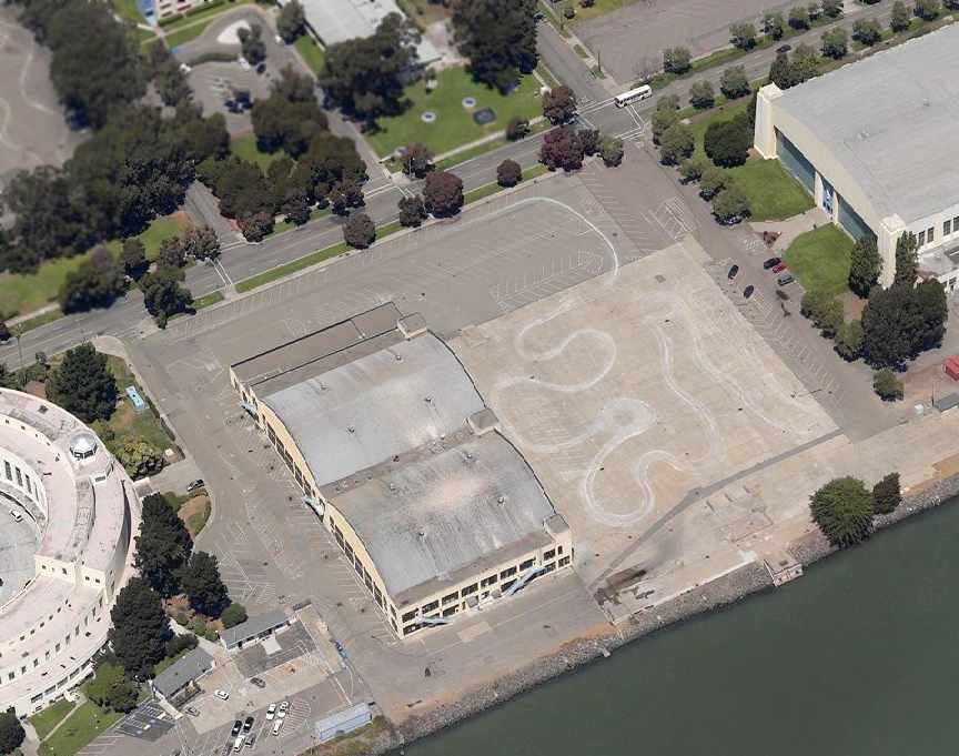
The airfield facilities at Treasure Island included 2 seaplane hangars & a seaplane ramp on the south end, and a 3,300' landplane runway on the north end.
Pan Am moved to Treasure Island from Alameda in 1939.
Their operations were a part of the Exposition, featuring a spectator's gallery to view their aircraft maintenance work.
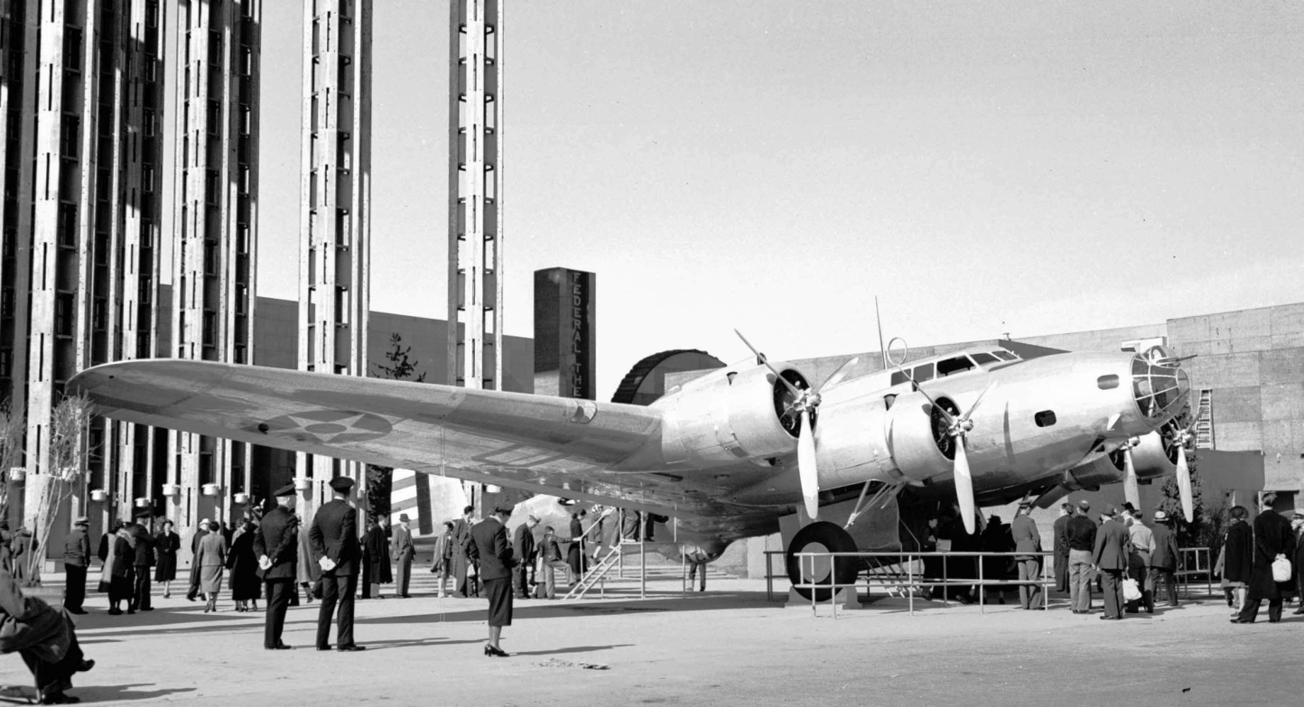
A 1939 photo by Bill Larkins of a Boeing YB-17 Flying Fortress on public display in front of the Federal Building at the Treasure Island Golden Gate International Expo, resplendent in a polished natural metal finish.
This is the only landplane of which any photos have been located at Treasure Island.
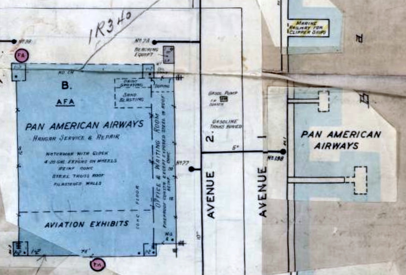
A 1939 plan of the Pan Am Treasure Island facilities (courtesy of Kevin Walsh).
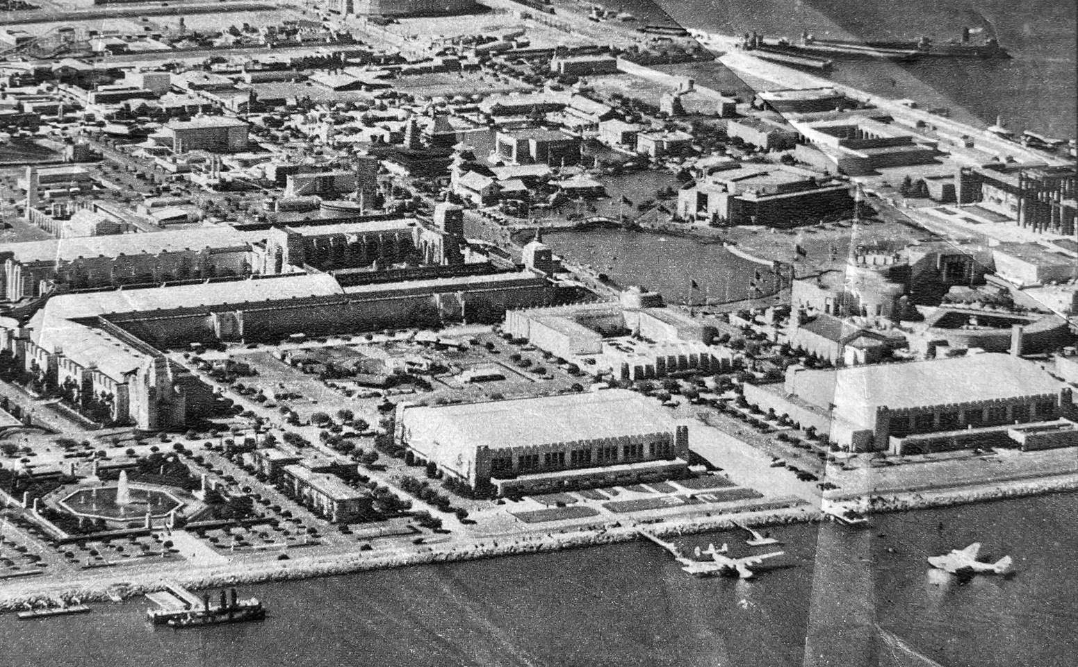
A circa 1939-40 aerial view looking north at Treasure Island (courtesy of Kevin Walsh)
showing 2 Clipper flying boats at the bottom-right, and a smaller sightseeing seaplane along the water's edge at top-right.
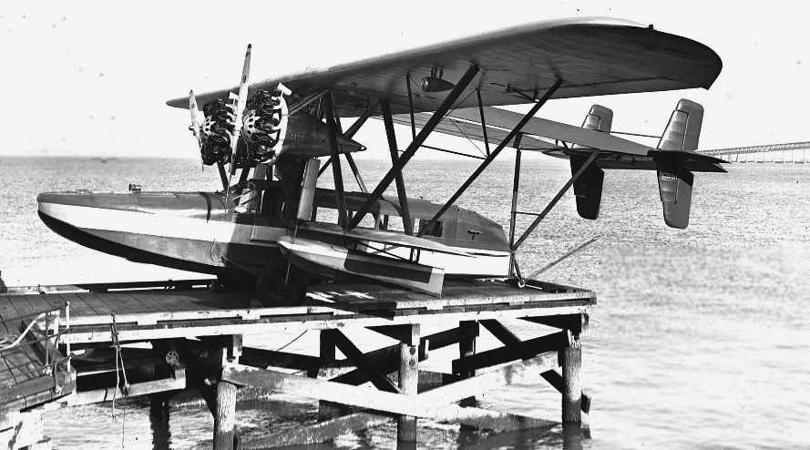
A 1939-40 photo by Bill Larkins of a Sikorsky S-38 flying boat at Treasure Island.
Bill recalled, “Paul Mantz had an active flight service at Treasure Island in 1939-40 on the East side of the Island.
They sold sight seeing flights for the people at the Golden Gate International Exposition.
They would alternate parking the S-38 & S-39 on the parking structure.”
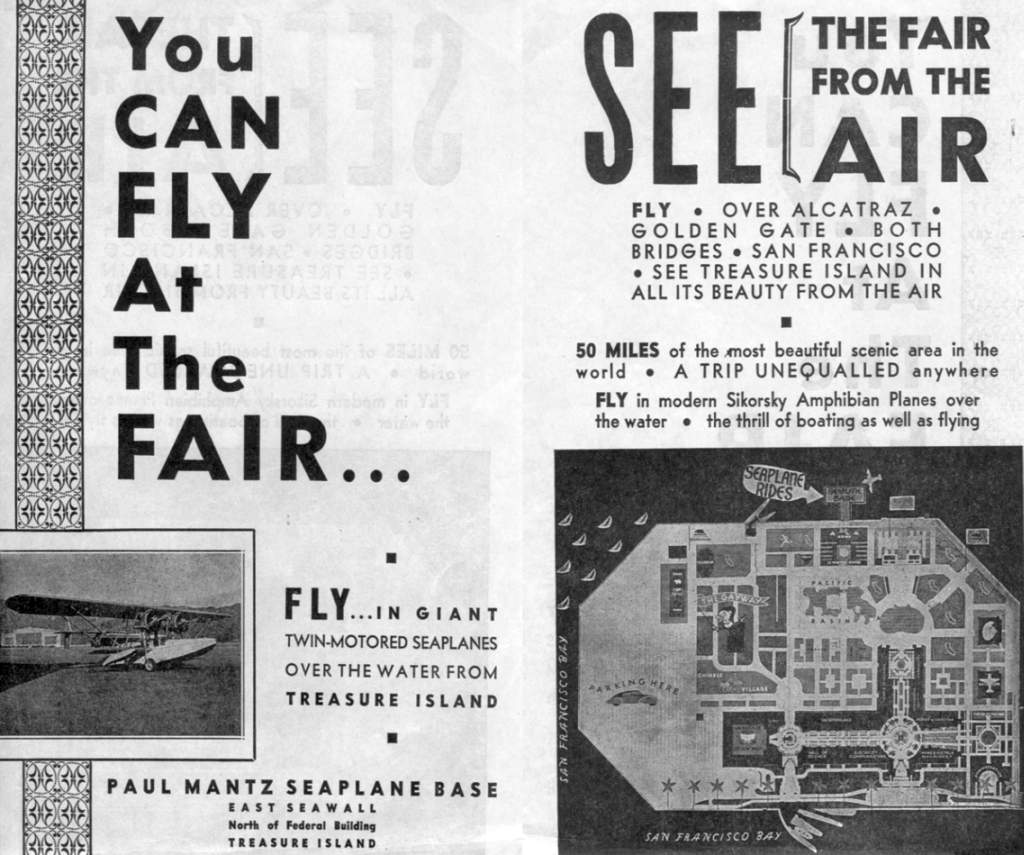
A circa 1939-40 brochure for Treasure Island's Paul Mantz Seaplane Base (courtesy of Tom Heitzman).
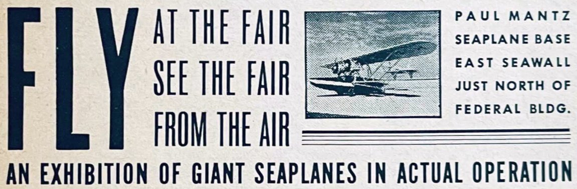
An advertisement for Treasure Island's Paul Mantz Seaplane Base (courtesy of Kevin Walsh) from the 1940 Golden Gate International Exposition guidebook.
The Golden Gate International Exposition at Treasure Island concluded on 9/29/40.
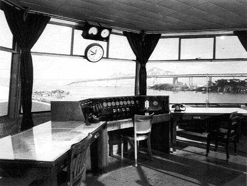
A circa 1930s-40s photo by Robert Knight of the interior of the Treasure Island control tower (courtesy of Craig Knight, via Jonathan Westerling)
Craig recalled, "The picture was taken by my father, Robert Knight, who worked for Pan Am at the time the picture was taken."
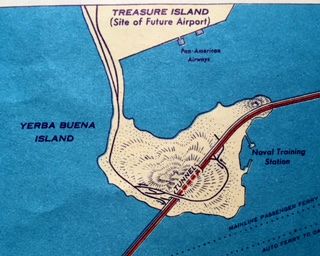
A 1940 street map (courtesy of Kevin Walsh) depicted “Treasure Island (Site of Future Airport)”.
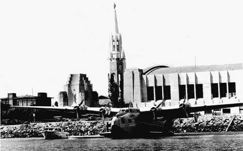
A 1940 photo of a Boeing 314 flying boat in front of one of Treasure Island's hangars,
with the Tower of the Sun in the background.
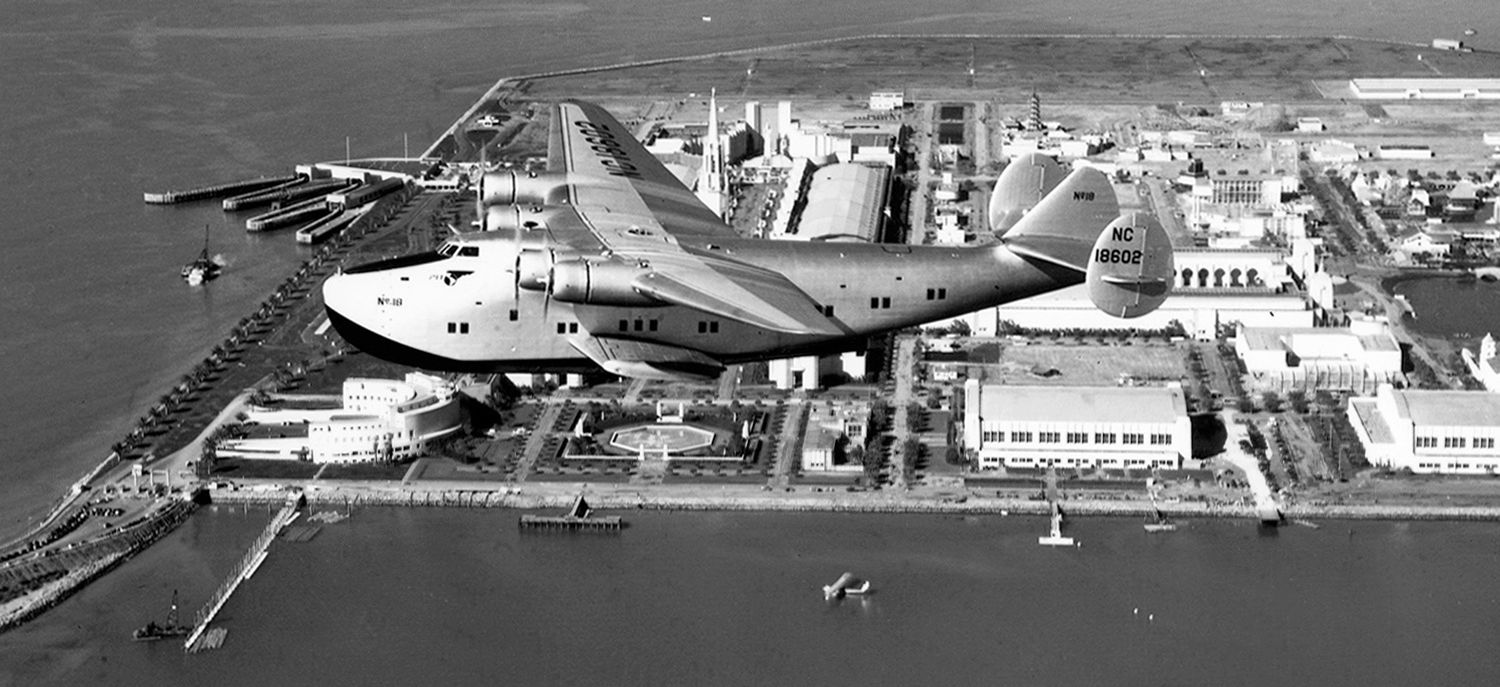
A circa 1940 aerial view looking north at a Boeing 314 flying boat overflying Treasure Island.
A circa 1940 aerial view looking northeast at a Boeing 314 flying boat overflying Treasure Island.
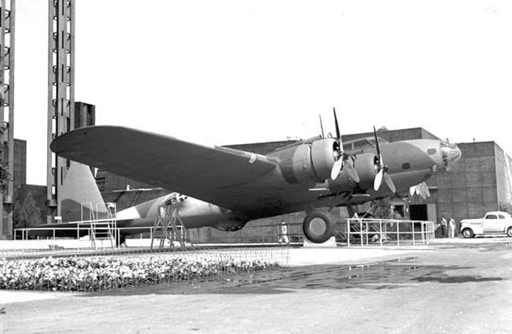
A 1940 photo by Bill Larkins of a Boeing YB-17 Flying Fortress on display in front of the Federal Building at the Treasure Island Golden Gate International Expo.
At some point between 1939-40 the YB-17 had been repainted in camouflage.
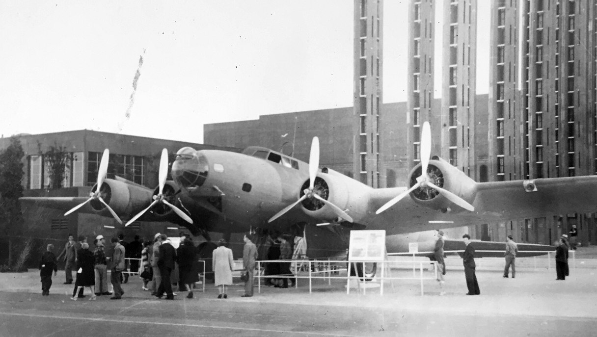
A 1940 photo (courtesy of Kevin Walsh) of a Boeing YB-17 Flying Fortress on display in front of the Federal Building at the Treasure Island Golden Gate International Expo.
Kevin Walsh observed, “I think that north end was a parking lot during the fair, so using it as a landing field wasn't a stretch.”
A circa 1940 aerial view looking west showing how all of the Exposition facilities on Treasure Island had been scraped clean,
with the exception of the 2 aircraft hangars.
Following the nation's entry into WW2, the Navy placed Pan Am under contract in 1942, and commandeered its aircraft.
Treasure Island was commissioned as a Naval Auxiliary Air Facility.
Treasure Island was used by ZP-32 from Moffett Field as a forward base
to operate blimps on antisubmarine patrols of approaches to San Francisco Bay.
A 1942 aerial view looking south at Treasure Island (National Archives photo), showing the seaplane hangars at the south end,
and the landplane runway on the north end, with a blimp on the right side of the airfield.

The August 1942 San Francisco Sectional Chart still did not depict any aviation facilities on Treasure Island.
Pan Am seaplane operations from Treasure Island during the war included
Martin M-130 China Clippers, Boeing 314s, and Navy supplied PB2Y-3R Coronados.
The M-130s operated a shuttle service between Treasure Island & Honolulu.
As ship traffic became heavier in the Bay,
regular Pan Am flight operations were moved to Mills Field (San Francisco International Airport today) in 1944.
Treasure Island remained in use by Pan Am for seaplane overhaul.
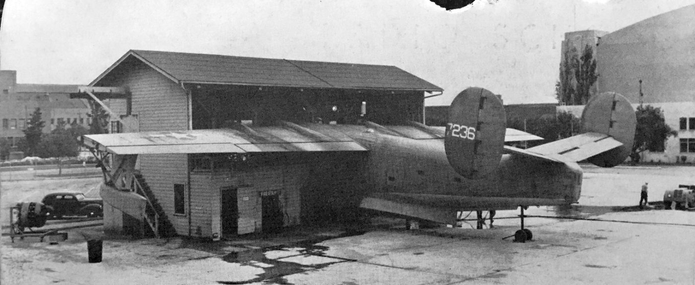
A circa 1942-45 photo of a Consolidated PB2Y Coronado 4-engine flying boat patrol bomber inside a Treasure Island overhaul shed
used for “servicing patrol & transport planes for the squadrons operating out of nearby Alameda Naval Air Station”,
from an undated wartime flier entitled “Treasure Island Naval Training & Distribution Center” (courtesy of Kevin Walsh).


The earliest aeronutical chart depiction which has been located of aviation facilities on Treasure Island was on the August 1943 San Francisco Sectional Chart.
It depicted both the “Treasure Island (Navy)” airfield & the “Pan American” seaplane facility.
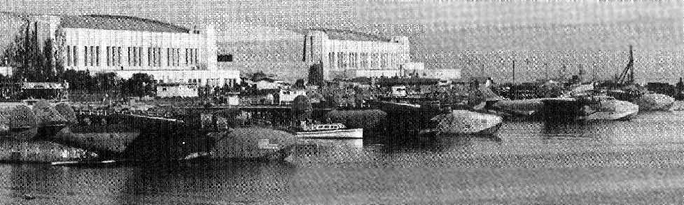
A July 1944 photo of a four camouflaged Boeing 314 flying boats moored at Treasure Island.
Wartime naval construction eventually took over all of Treasure Island.
The primary mission of the Navy facility became the processing of personnel heading to & from the Pacific.
At its peak, 12,000 people per day passed through the station.
After WW2 Treasure Island housed various activities supporting Naval & Marine forces in the bay area.
A 1946 aerial view looking north showed the Treasure Island hangars in the foreground, and the barely recognizable trace of a runway on the north side of the island.
Two smaller hangars had been built just northeast of Building 1 at some point between 1942-46.
The August 1944 San Francisco Sectional Chart still depicted both the “Treasure Island (Navy)” landplane airfield & the “Pan American” seaplane facility.
The last aeronautical chart depiction which has been located of aviation facilities on Treasure Island was on the January 1946 San Francisco Sectional Chart (courtesy of Kevin Walsh).
It depicted the “Treasure Island (Navy)” seaplane facility, but no longer depicted the landplane airfield.
The August 1946 San Francisco Sectional Chart no longer depicted any aviation facilities on Treasure Island.
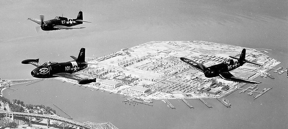
A circa 1947-53 aerial view looking west at a Grumman F6F Hellcat, North American FJ1 Fury, and Chance-Vought F4U Corsair from NAS Oakland overflying Treasure Island (courtesy of John Voss).
John observed, “The seaplane base is void of any aircraft. In the distance you can make out the remnants of the former airfield runway.”
The 1949 USGS topo map did not depict any airfield facilities on the island.
A 1975 aerial view looking northwest at Treasure Island (courtesy of Jonathan Westerling) showed the heliport in the foreground in front of the seaplane hangars.
Amazingly, a top-secret mystery was in plain sight at the bottom of the photo: the Hughes Mining Barge (HMB-1), which had been constructed only a year before as part of Project Azorian,
the top-secret effort mounted by the Central Intelligence Agency to salvage the remains of the Soviet submarine K-129 from the ocean floor.
The HMB-1 was designed to allow the device that would be used to grasp and lift the submarine to be constructed inside the barge and out of sight, and to be installed in the Glomar Explorer in secrecy.
Al Magary reported, “Great-looking Building 1 (Administration Building) at Treasure Island
was used as Berlin's Tempelhof airport in the third Spielberg-Lucas Indiana Jones adventure, Indiana Jones & the Last Crusade (1989).
Sean Connery & Harrison Ford are seen wheeling along the curved drive in a motorcycle with sidecar.”
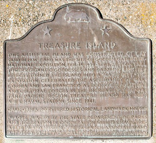
An undated photo (courtesy of Anne Schnoebelen) of a 2/18/90 historical plaque commemorating Treasure Island.
In 1993 the Department of Defense decided to close the Naval Station & return it to civilian use.
The island was to be returned to the City's stewardship
to provide recreation, open space, economic development, and other publicly oriented uses.
According to Tim Tyler, the large hangars built to be used as San Francisco's airport
have been used in recent years for television & movie filming.
"One had been used to house the 'Battlebots' TV program
and also as a sound-stage & offices for the 'Nash Bridges' TV show."
In 2002 one of the Treasure Island hangars was used to film the movie 'The Hulk';
"other parts of Treasure Island were also depicted in the movie as being the 'Joint Tactical Force West' base."

A 2003 photo by Tim Tyler of Treasure Island's Building 1 & hangars, as viewed from the mainland.
Tim Tyler visited Treasure Island in 2003.
His report: "I've explored Treasure Island quite a bit, via car, foot, and best of all, bicycle.
As best as I can tell, there aren't any obvious remains of the NAAF area.
The Navy turned that section of Treasure Island into family housing units, the base brig,
some Training School facilities, an elementary school, and I think also the island's wastewater treatment plant."
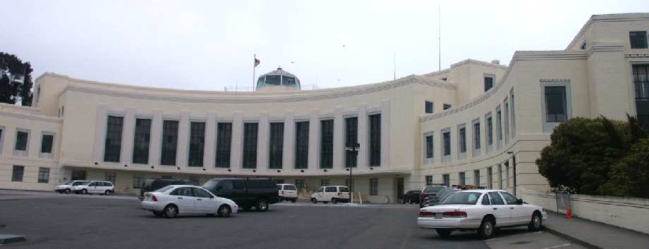
A 2003 photo by Tim Tyler of Treasure Island's Building 1.
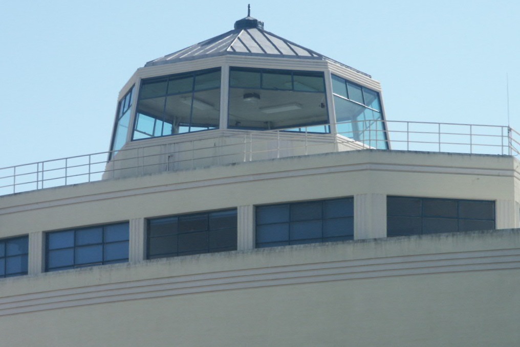
A 2003 photo by Tim Tyler of the control tower which remains atop Building 1.
A 2003 photo by Tim Tyler of a beautiful WPA-style mural which remains in the lobby of Building 1.
"Of course, there is plenty of evidence remaining of the original plan to use the island as San Francisco's main airport.
Building 1 was to be the main airport terminal building,
and is right next to the little cove that the seaplanes used.
The seaplane ramps are long gone.
Building 1 was Naval Station Treasure Island's administrative & operational headquarters.
Admiral Nimitz's command center during WW2 was a series of hardened rooms in the basement of Building 1.
Several of these basement rooms were used as SCIFs (Secure, Compartmentalized Information Facilities)
for HQ 12th Naval District operations until the base closed in the late 1990s."
"Some of the family housing is now in use as apartments ('Treasure Island Villages'),
while other family housing sections are closed off & boarded up.
Many other buildings atop the former NAAF area are either awaiting the Navy to handle any environmental concerns (asbestos)
before being turned over one at a time to the City & County of San Francisco,
and other buildings already turned over to SF are simply awaiting redevelopment."
A 2003 photo by Tim Tyler of the helipad which remains in front of Treasure Island's Hangar 3.
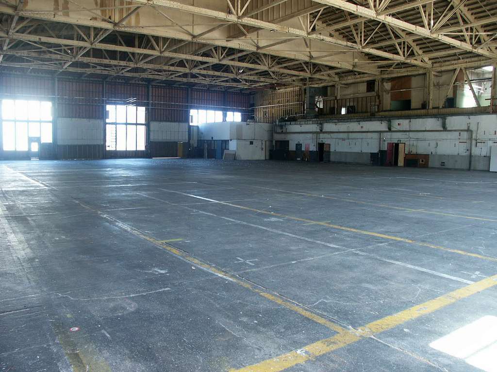
A 2003 photo by Tim Tyler of the interior of one of Treasure Island's hangars.
"The large hangars built to be used as San Francisco's airport are mostly empty now."
In the February 2004 USGS aerial photo, no trace remained of the runway on the north end of the island,
but the 2 Pan Am seaplane hangars remained standing on the south end.
An October 2004 news story (courtesy of Tim Tyler) talked about how director Chris Columbus
was using one of Treasure Island's former hangars to film the movie 'Rent'.
A circa 2005 aerial photo looking north at Treasure Island's Building 1.
A circa 2005 aerial photo looking north at several of Treasure Island's hangars.
A March 2014 photo by Viv Sherwood of the control tower which remains atop Building 1.
A March 2014 photo by Viv Sherwood of “one of the events that happens here at Treasure Island once a month - it’s a very popular flea market.
During Summer Months it moves away from Building One further down the road.
There are also music festivals from time to time & lots of weddings - for beautiful photographic backdrop of Treasure Island & the City of San Francisco.
Once one drives past Clipper Cove, Building One, and a little ways down the road the island shows it run-down state. This particular area is still hopping.”
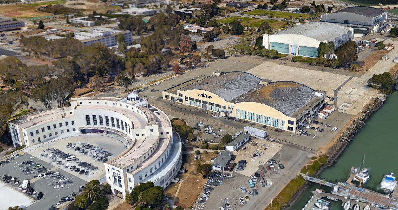
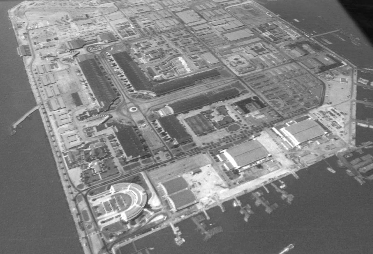
A 2016 3-D aerial view showed that all 4 of Treasure Island's hangars remained intact.
A 2017 aerial photo of Treasure Island, showing that the hangars just northeast of Building 1 had been removed at some point between 2016-2017.
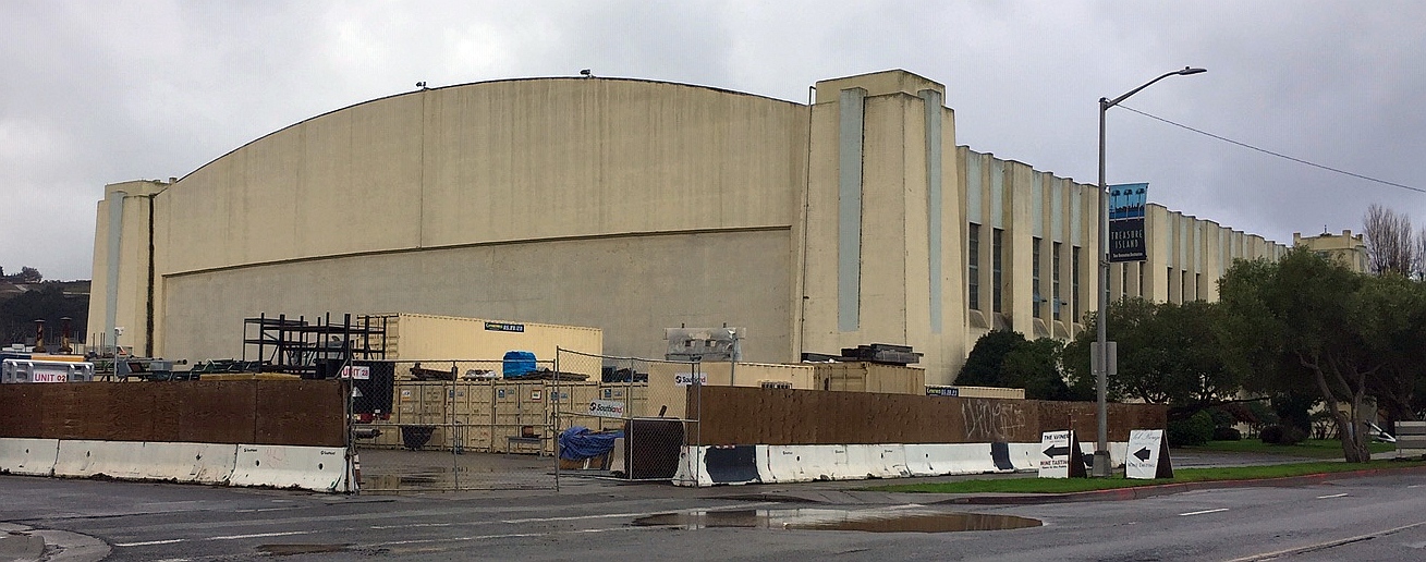
A 12/7/19 photo by Kevin Walsh of one of Treasure Island's remaining hangars.
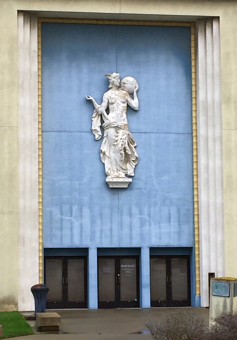
A 12/7/19 photo by Kevin Walsh of an architectural flourish on one of Treasure Island's buildings.

A June 2024 aerial view by Rex Ricks looking west at Treasure Island.
See also: http://www.ci.sf.ca.us/treasureisland/history.htm
____________________________________________________
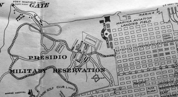
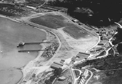
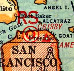
Crissy Field (CSY), San Francisco, CA
37.8, -122.46 (Southeast of the Golden Gate Bridge)
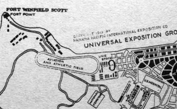
A 1913 map of the Panama-Pacific International Exposition (courtesy of Kevin Walsh),
showing the “Aviation & Athletic Field” which would eventually become Crissy Field.
This military airfield was located on the grounds of the Presidio in downtown San Francisco,
adjacent to the shore of the San Francisco Bay & just SE of the Golden Gate Bridge.
The earliest depiction which has been located of the airfield at Crissy Field
was a 1913 map of the Panama-Pacific International Exposition (courtesy of Kevin Walsh),
showing the “Aviation & Athletic Field” which would eventually become Crissy Field.
Note that this 1913 map may very well be the earliest map depiction to have been made of an American airfield.
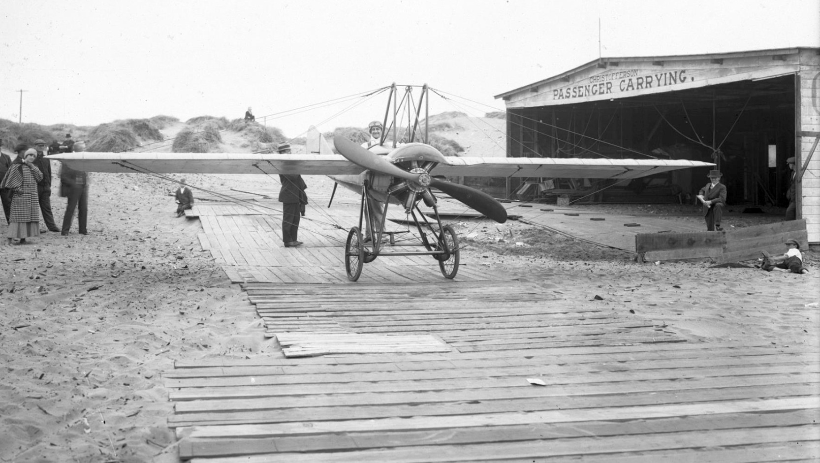
The earliest photo which has been located of Crissy Field was a 1915 photo (courtesy of Kevin Walsh) of Silvio Pettirossi
in the cockpit of a Deperdussin Model "T” monoplane on wooden planks in front of a hangar marked “Christofferson Passenger Carrying”.
A circa 1915 photo (courtesy of Kevin Walsh) looking southeast at hangars on the west side of Crissy Field with the runway in the background.
A circa 1915 photo (courtesy of Kevin Walsh) of a crowd watching a biplane (model unidentified) at Crissy Field.

A 1915 map of the Pan Pacific Exposition (courtesy of Jonathan Westerling), showing the “Drill Ground & Aviation Field” on the west side.
When the the 1915 Panama-Pacific International Exposition closed,
a board of army officers recommended the site for an Air Coast Defense Station -
an airfield whose mission would be to cooperate with the artillery defenses of San Francisco Bay.
From their lofty vantage point, they would scout for the approach of an enemy,
observe & correct the fire of our big guns on the coastal bluffs, and pass messages to troops in the field.
A 1919 Chamber of Commerce map (courtesy of Kevin Walsh) showed a road bisecting the Aviation Field which would eventually become Crissy Field.
The permanent air base was built in 1921 under the supervision of "Hap" Arnold,
a young major destined to lead the largest air force the world has ever known during WW2.
The original facilities consisted of a kidney-shaped field on which the outline of the former racetrack was still visible.
In an era of open-cockpit, fabric-covered biplanes, an airfield was just that:
a wide expanse planted in grass to soften the landing & to slow the plane after touchdown (no brakes in those days!).
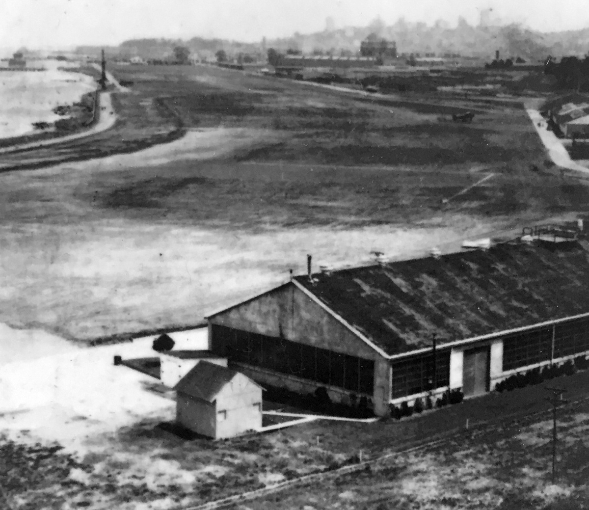
Against the bluffs of the Presidio uplands, the field's southern edge was lined with hangars for seaplanes & landplanes, workshops, and a garage.
Farther east was a cluster that included an administration building, enlisted barracks, flagstaff, and a guardhouse built in attractive Mission Revival style.
On top of the bluff, where the approach to the Golden Gate Bridge would eventually be built,
were bachelor officers' quarters & a row of small homes for married officers.
Later that year, no less an authority than Marshal Ferdinand Foch, commander of the victorious Allied armies in WW1,
inspected the new installation & pronounced it "the last word in airfields."
According to the book "Two Hours By Crow" by Howard & Judith Campbell (courtesy of Wings of History),
“It was 'Hap' that named 'Crissy Field' after Major Dana Crissey, base commander of Mather Field, Sacramento,
who was killed in a crash in Salt Lake City on a record flight attempt on 10/8/19.”
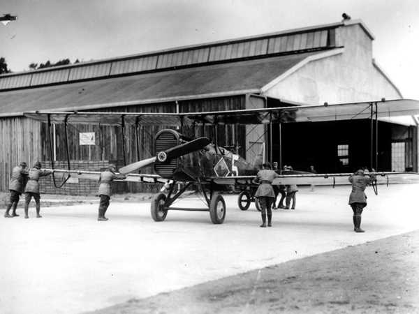
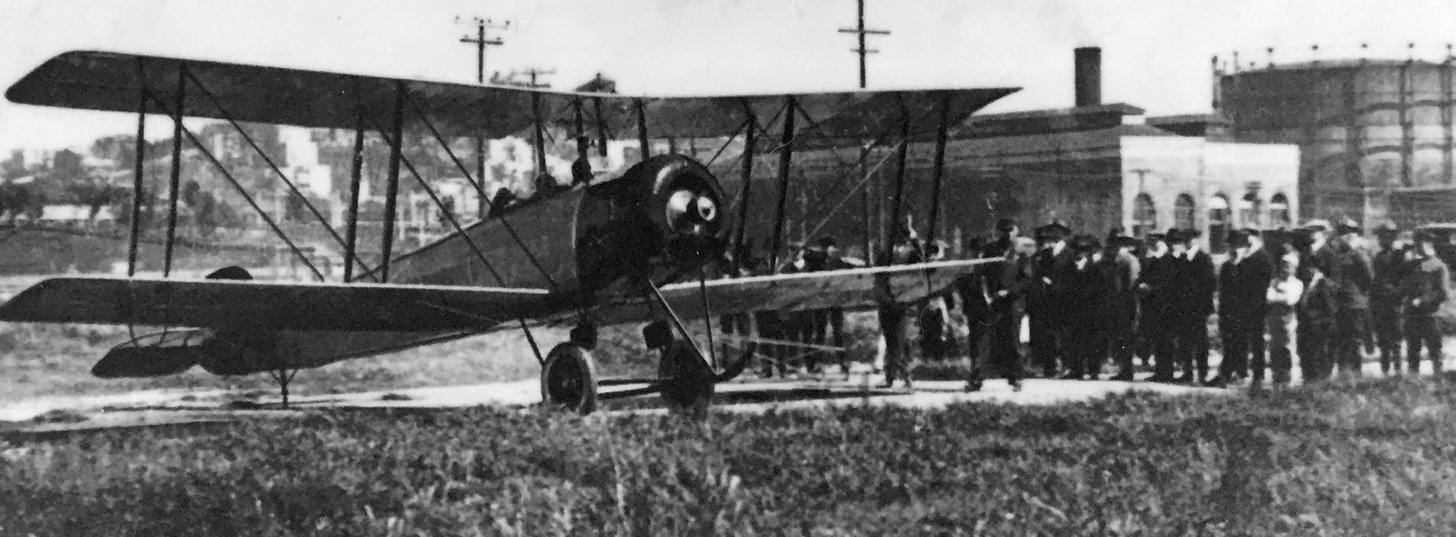
A 1921 photo of Army aviators pushing a deHavilland DH-4 back into a Crissy hangar.
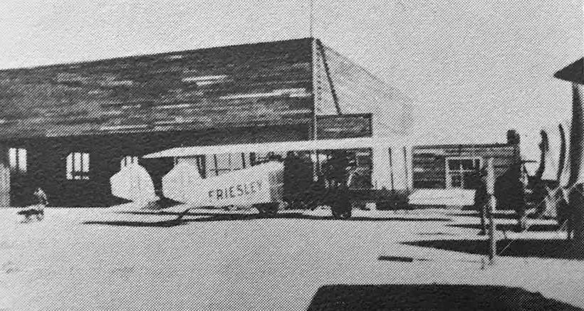
A 1921 photo of the Friesley “Falcon” biplane in front of the Crissy Field Air Mail hangar, from the 1926 Aeronautical Chamber of Commerce of America Aircraft Yearbook (courtesy of Kevin Walsh).
A circa 1921-26 photo looking southeast at a biplane (model undetermined) on Crissy Field, from the 1926 Aeronautical Chamber of Commerce of America Aircraft Yearbook (courtesy of Kevin Walsh),
with the buildings of San Francisco visible on the hills in the background.
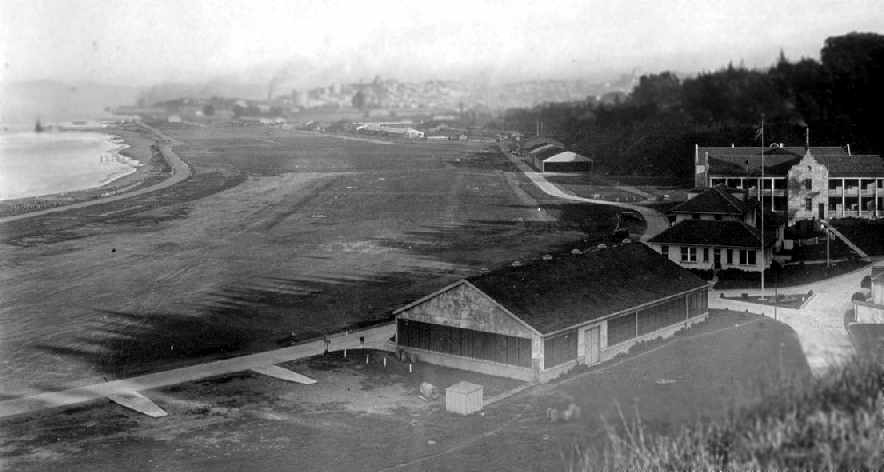
A circa 1921 aerial view looking southeast at Crissy Field (National Archives photo).
The large building on the middle right was the enlisted men's barracks & the administrative headquarters lies directly to the west.
The large hangars at the west end housed seaplanes. The line of houses in the foreground were the pilots quarters.
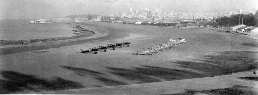
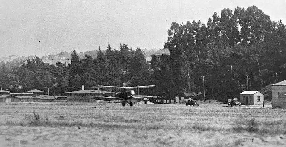
Biplanes lined up on Crissy Field in the 1920s.
Between 1921-36, aerial operations at Crissy Field consisted primarily of observation of artillery fire for the Coast Defenses of San Francisco;
aerial photography; liaison flights for headquarters personnel; special civilian cooperation missions,
such as search-and-rescue & publicity flights; and support for the U.S. Air Mail Service.
The first Western aerial forest fire patrols were undertaken by Crissy Field pilots,
who also checked for diseased trees, identified archaeological sites in remote southwestern deserts,
and participated in the dedication of Lassen National Park from the cockpits of their flying machines.
It was, however, a series of record-breaking long-distance flights during the Roaring Twenties that put Crissy Field
securely in the record books of aviation history & contributed to the growth of the modern aviation industry.
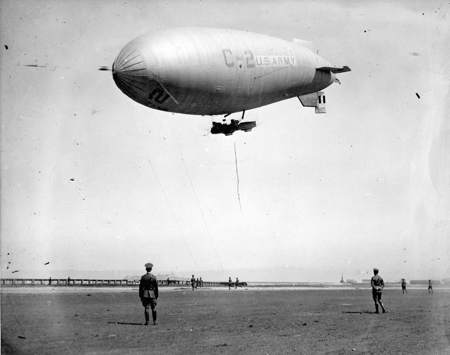
A circa 1923 photo of Army airship C-2 at Crissy Field (from the National Park Service).
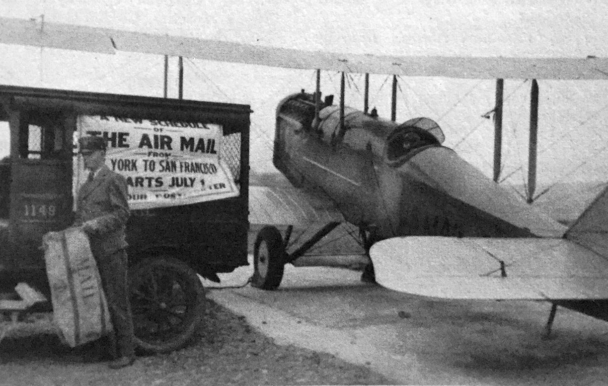
A 7/2/24 photo (courtesy of Kevin Walsh) of the first dawn-to-dusk transcontinental flight arriving at Crissy Field, delivering air mail.
In doing so, one of the "great goals of the Air Service", to "reduce the time for deploying army aircraft from one part of the country to another", had taken a giant practical step forward.
Later that same year, the army's Round-the-World Race stopped at Crissy Field,
with Lieutenant Lowell Smith of Crissy Field leading the flyers upon their return.
This was "the most important pioneering flight of the time in terms of difficulty & international prestige."
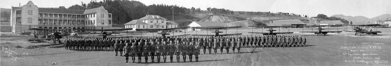
A circa 1920s panoramic photo (Copyright Underwood Archives, used via permission courtesy of Ray Chipault) of military aviators in front of their biplanes at Crissy Field.
In 1925, 2 Navy seaplanes took off from Crissy Field in the first attempt to fly from the mainland to Hawaii.
Expected to last 26 hours, the trip took 12 days & was only partially completed by 1 plane, whose flyers had to be rescued at sea.
A 1925 view looking east along Crissy Field (from the San Francisco Library via Rex Ricks).
The Standard Oil Company of California's 1927 "Airplane Landing Fields of the Pacific Coast" (courtesy of Chris Kennedy)
described Crissy Field as a "Permanent" airfield, with an east/west runway measuring 1 mile x 750'.
The field was said to have several hangars on the extreme west end of the field & the south edge of the field.
The field was said to be "available only as an emergency field for other than Government planes."

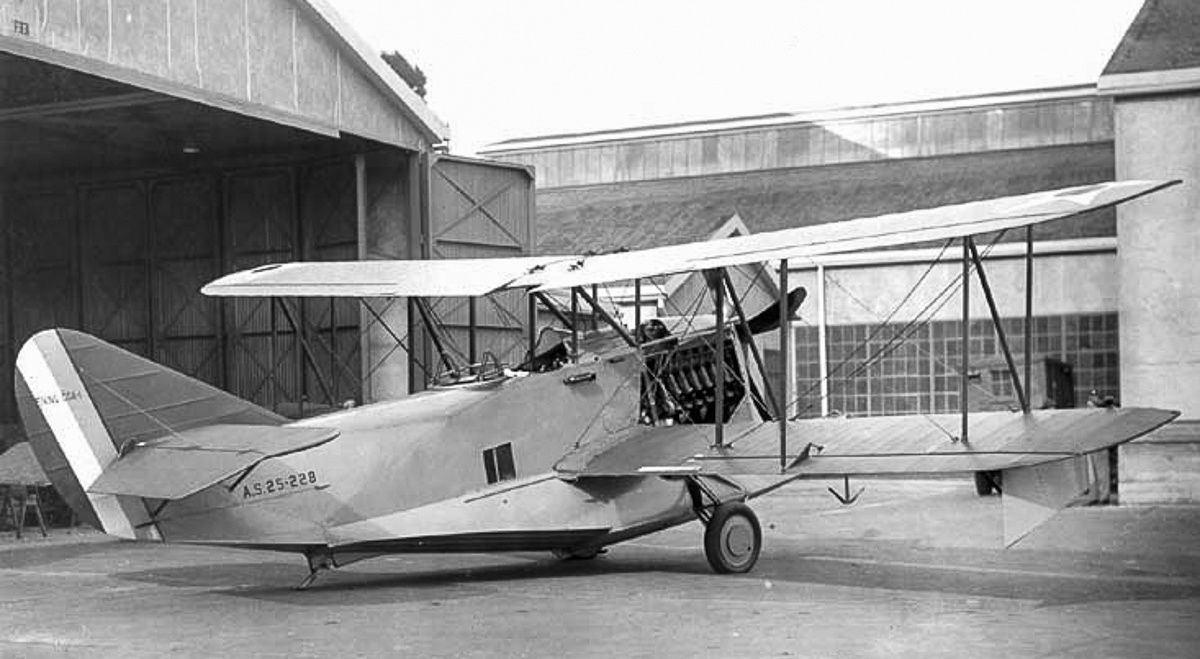
A 1927 photo (from the Bill Larkins collection) of Fokker F.VII C-2 "Bird of Paradise", 26-202, in front of the Crissy Field hangars.
This Fokker had been modified to a long-range version with a larger wing,
and Army lieutenants Lester Maitland & Albert Hegenberger flew the first nonstop flight to Honululu on 6/1/27.
A 1928 plan depicted Crissy Field as having an east/west unpaved runway with hangars along the south side of the field.
The 1929 "Rand McNally Standard Map of CA With Air Trails" (courtesy of Chris Kennedy)
described Crissy Field as measuring 3,050' x 400'.
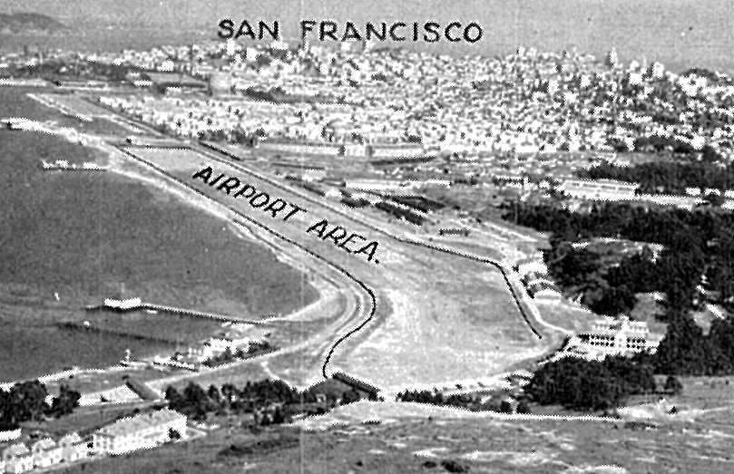
An undated aerial view looking east at Crissy Field from the 1929 Richfield Airport Directory (courtesy of Jonathan Westerling).
The directory described Crissy Field as having a single 3,050' east/west sandy loam runway,
with “Crissy Field” painted on the hangar roof.
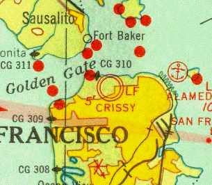
Crissy Field was depicted as a military airfield on the 1933 San Francisco Airway Map (courtesy of Chris Kennedy).
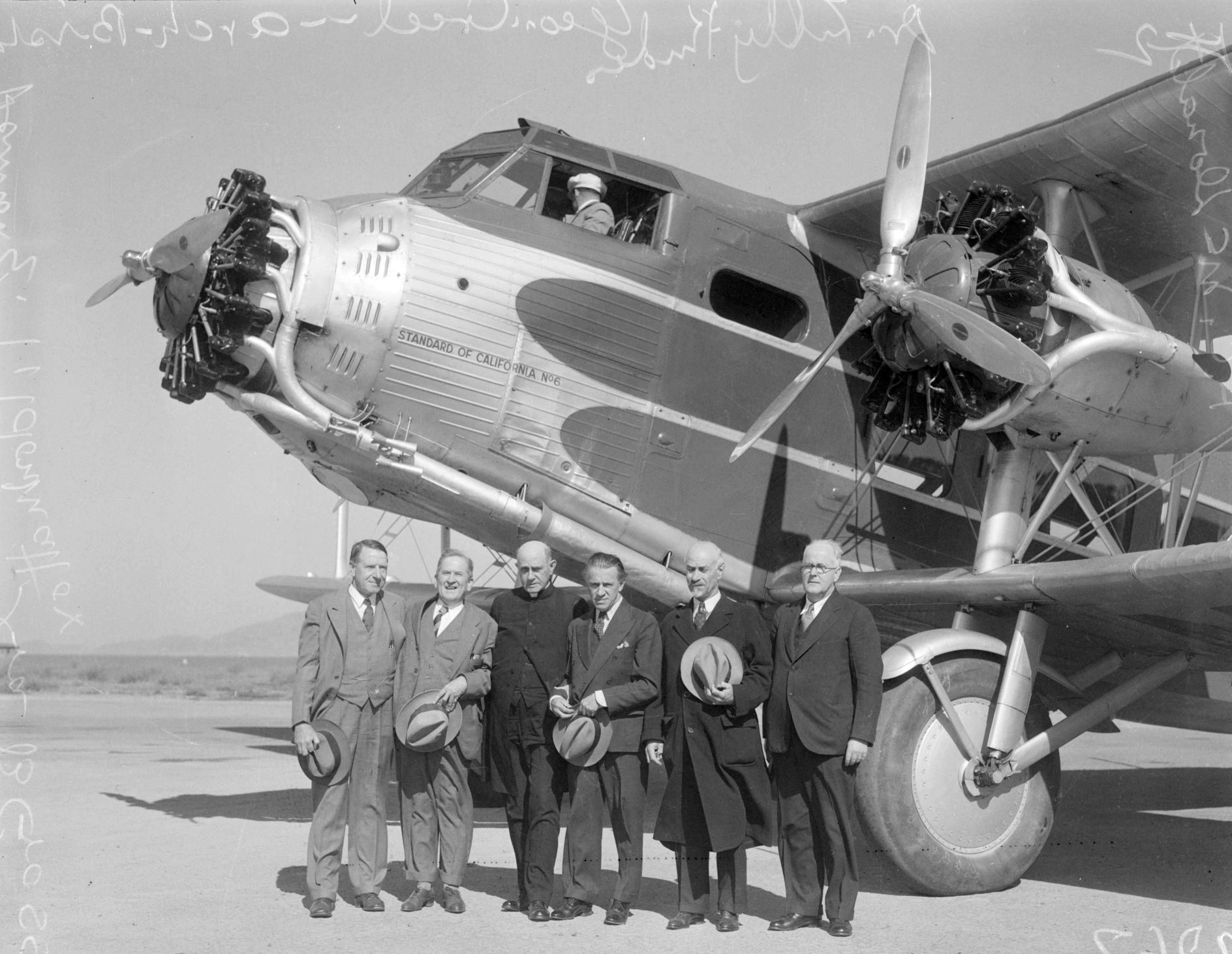
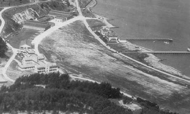
A 1934 aerial view looking northwest at the grass runway of Crissy Field.
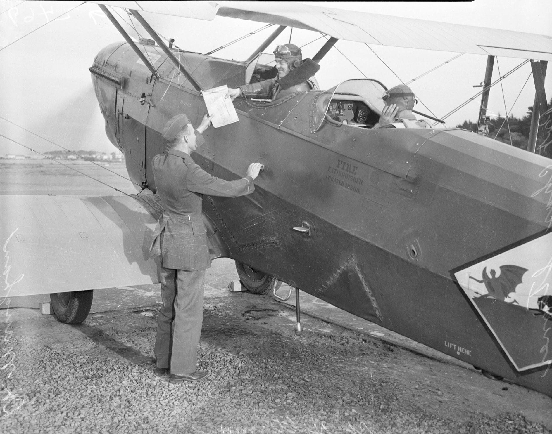
A 10/16/34 photo of military personnel with an unidentified military biplane at Crissy Field.
A 1935 street map (courtesy of Kevin Walsh) depicted Crissy Field as an irregularly-shaped property outline, labeled simply “Aviation Field”.
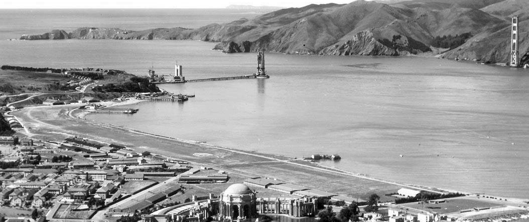
A beautiful circa 1935 aerial view looking northwest at Crissy Field, with the Golden Gate Bridge under construction in the background (courtesy of Kevin Walsh).
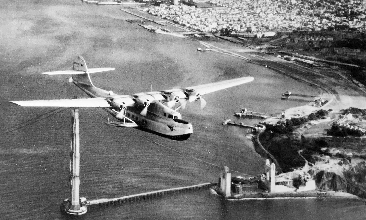
An 11/22/35 aerial view looking southeast at a Pan Am China Clipper overflying the south tower of the still-under-construction Golden Gate Bridge (courtesy of Kevin Walsh),
on the occasion of its first westbound flight, with Crisy Field visible in the background.
By 1936, Crissy Field was no longer being used as a 1st-line air base.
Wind & fog had always made for difficult flying conditions;
the construction of the Golden Gate Bridge made operating aircraft from Crissy Field even more challenging;
and its location near the ocean, though convenient to coast artillery batteries,
also made it vulnerable to enemy bombardment by sea.
There was little room for expansion,
and the activation of Hamilton Field in Marin County offered an up-to date alternative location for the air corps.
Crissy Field's observation & pursuit squadrons were transferred to Hamilton Field.
The Airport Directory Company's 1937 Airports Directory (courtesy of Bob Rambo)
described Crissy as consisting of a 5,000' x 400' sandy loam field, with a 2,000' landing mat.
A hangar was described as having "Crissy Field" painted on the roof,
and the remarks included, "Field temporarily closed due to construction."
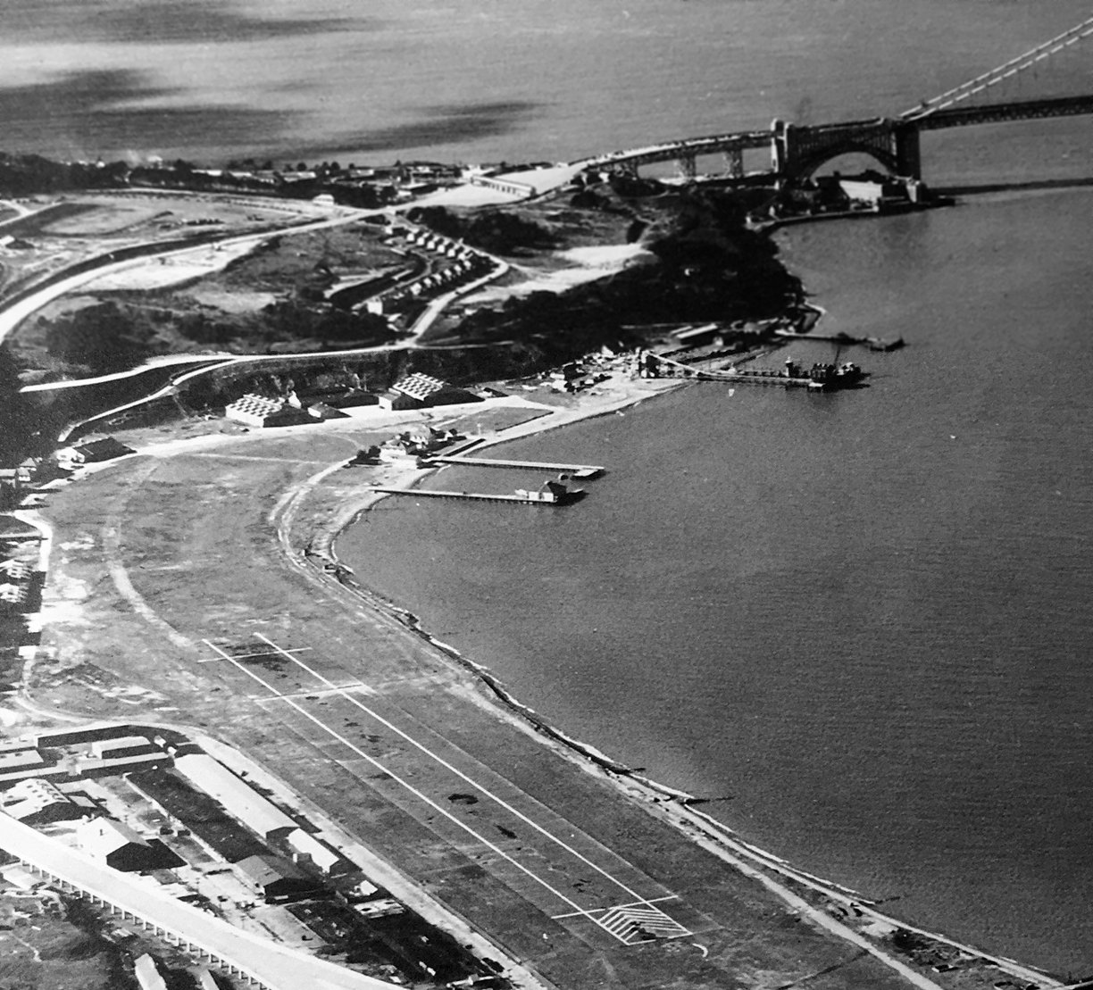
A 1937 aerial view looking northwest at Crissy Field (courtesy of Kevin Walsh),
with the grass runway prominently marked, and checkerboard-roofed hangars at the west (far) side.
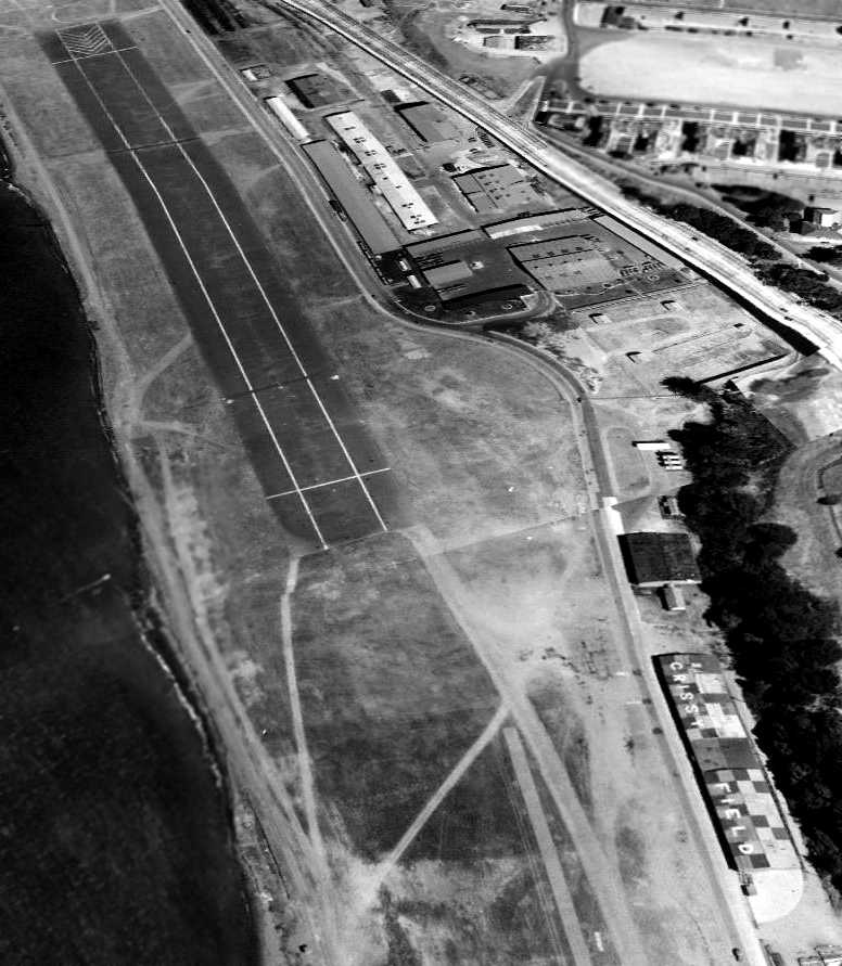
An 8/1/38 aerial view looking southeast at Crissy Field showed it to have a prominently marked grass runway (with a strange bend evidently a result of photo distortion),
and a checkerboard-roofed hangar at bottom-right marked with “Crissy Field”.
After the Air Corps left Crissy Field, the headquarters of the 30th U.S. Infantry Regiment moved into the administration building
and the landing field was routinely used as an assembly area for troop mobilization.
With the coming of WW2, temporary wooden barracks sprang up at both ends of the airfield,
and more of the landing field was paved.
The former air mail hangar became barracks & classrooms
for the army's top-secret Military Intelligence Service Language School.
No airfield at all was depicted at Crissy Field on the December 1941 San Francisco Sectional Chart (courtesy of Chris Kennedy),
on the August 1944 Regional Aeronautical Chart (courtesy of Jonathan Westerling),
in the 1945 AAF Airfield Directory (courtesy of Scott Murdock),
or on the 1946 Sacramento Sectional Chart (courtesy of Dallam Oliver-Lee).
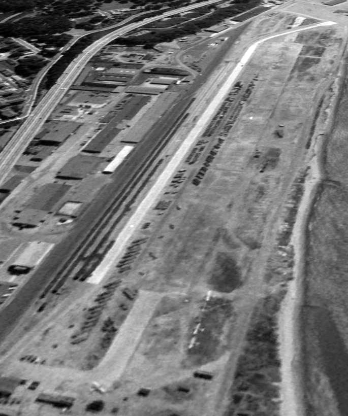
A 7/28/46 aerial view looking southwest showed Crissy Field to have an unpaved runway,
but with some sort of paved surface on the south side that curved over the western portion of the runway.
A total of 4 single-engine aircraft were visible in the foreground, including one turning onto the runway.
An 8/15/48 aerial view (courtesy of Kevin Walsh) showed Crissy Field to have a paved runway,
with some sort of paved track on the south side that curved over the western portion of the runway.
Several light single-engine aircraft parked east of the runway.
Crissy Field still was not depicted at all on the 1948 San Francisco Local Aeronautical Chart (courtesy of Tim Zukas).
USGS topo map 1947.
A 1956 aerial view showed that Crissy Field to have a paved runway, and a total of 4 single-engine aircraft parked on the southwest side of the field.
In the years after WW2, the 6th Army Flight Detachment operated light airplanes & helicopters
from the paved runway that replaced the grass landing field.
By this time, Crissy Field traffic consisted primarily of liaison flights,
and medevac flights bringing soldiers wounded in Vietnam from Travis Air Force Base to Letterman Hospital.
Tim McCoy recalled, "I was in the Civil Air Patrol as a Cadet in the 1950s.
The headquarters for the California Wing of the CAP was at Crissy Field, and they flew out of there also.
I got a ride in an L-5 out of there.
They had a couple of L-17s, L-5s, and at least one L-16; as well as a Beaver & 310."
The April 1959 San Francisco Local Aeronautical Chart (courtesy of Paul Columbus)
depicted Crissy Field as having a 2,900' paved runway & a control tower.
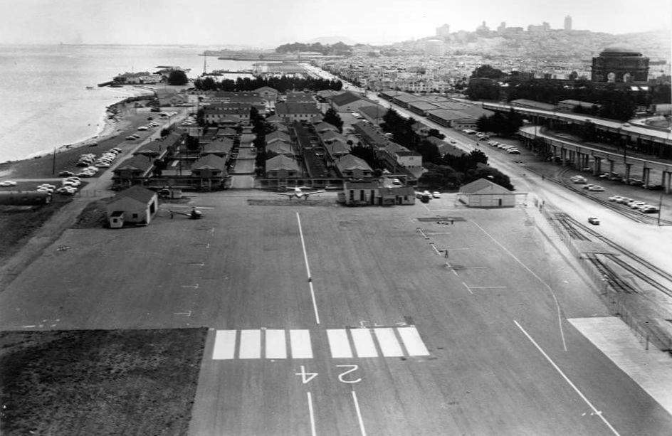
A 1959 aerial view looking east at Crissy Field, showing a twin-engine Beechcraft & a Hiller OH-23 helicopter next to several small buildings & a small hangar.

A 1/12/60 photo of a Army Hiller UH-12D (57-3045, C/n 1003) at Crissy Field.
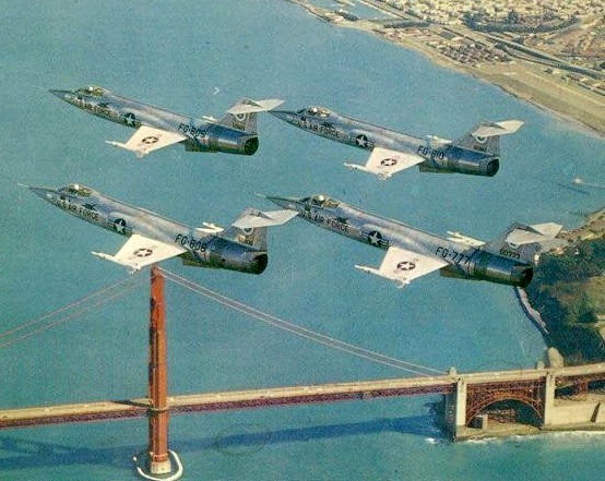
A beautiful undated aerial view from the 1960 Guide to Hamilton AFB (courtesy of Kevin Walsh)
showing 4 Lockheed F-104A Starfighters overflying the Golden Gate Bridge & Crissy Field (at top-right).
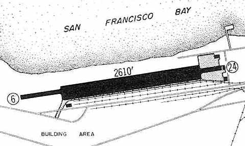
The 1960 Jeppesen Airway Manual (courtesy of Chris Kennedy) depicted Crissy Field as having a single 2,610' paved Runway 6/24,
along with a ramp with 2 small buildings on the east side of the field.
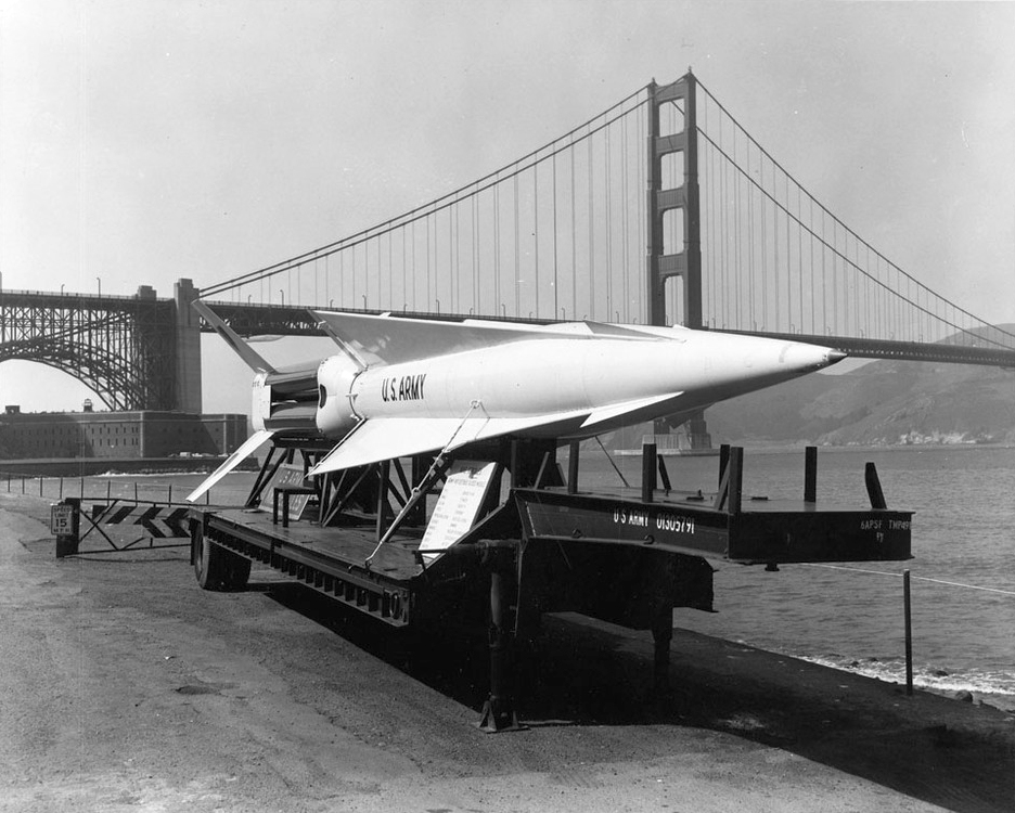
A circa 1960 National Park Service photo of a Nike Hercules surface-to-air missile on a trailer at Crissy Field. What was the Nike doing there?
A 5/14/65 aerial view (from the UCSB Library) depicted Crissy Field as having a paved Runway 6/24,
and 5 single-engine aircraft were visible parked on the southwest ramp.
Crissy Field was depicted as an active airfield on the 1967 Sacramento Sectional Chart (courtesy of John Voss).
The Aerodromes table on the reverse side of the chart described Crissy Field
as having a single 2,160' asphalt Runway 6/24.
A 1967 photo by Henry Rosenfeld looking east at Crissy Field (courtesy of Dave Rosenfeld), showing a helicopter left of the runway, and at least 3 light aircraft to the right.
CW-4 Robert Cordua recalled, "Little is known about the 'hot shot pilots' that flew in & out of Crissy in twin-engine Beechcraft aircraft.
We flew SID [Standard Instrument Departures] during instrument conditions
and if you could see the top of the Palace of Fine Arts you could make a instrument approach to Navy Alameda
and a missed approach direct to Crissy.
Many General Officers sat tight in their seats. I flew out of Crissy during 1967-1968 & I enjoyed the challenge.
If there was a incoming flight from another Army station we would take bets on how many passes it would take them to get on the ground.
It was the bridge & the hill that looked as if you were not going to make it.
If you knew what you were doing it was a piece of cake. I think that experience made me the pilot I am today."
A 1968 aerial view depicted 3 single-engine aircraft & 1 helicopter on the south side of the Crissy runway.
A 12/1/68 photo of a De Havilland U-6 Beaver at Crissy Field.
Don Jordan recalled, “Crissy Army Airfield... I was stationed there in 1968.
My job was 'Line Chief'. I was in charge of the aircraft on the flight line.
We also had T-41s & Choctaw helicopters stationed there.
I think we may have had a couple of Army Beech Barons there also.
The De Havilland U-6 Beaver... I had 3 or 4 of them on the flight line, on which I had to do a ground run-up every morning.
In all likelihood, I was the crew chief on the aircraft shown [above], as I was there from January to September of 1968.
I flew out of Crissy many, many times. Landing to the east was quite a thrill!”
The last aeronautical chart depiction which has been located of Crissy Field
was on the 5/1/69 San Francisco Sectional Chart (courtesy of Bob Briggs).
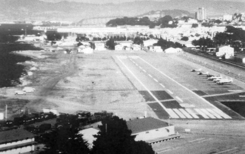
A 1970 aerial view looking east at Crissy Field, with 5 Army aircraft visible on the right (courtesy of Rex Ricks).
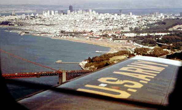
A 1970 aerial view by Bill Comrey looking southeast at Crissy Field.
Bill observed, “On final approach to Crissy Field. We were flying in a U-8 twin-engine Beechcraft from Fort Ord.
Our approach took us over the Golden Gate Bridge, to Alcatraz, right to Fisherman’s Warf & right to Crissy Field.”
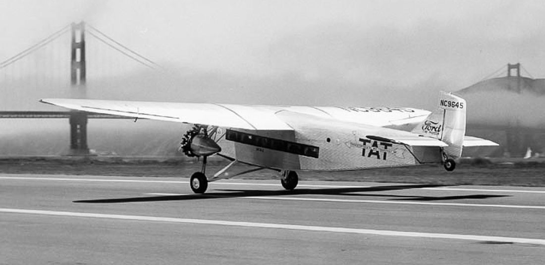
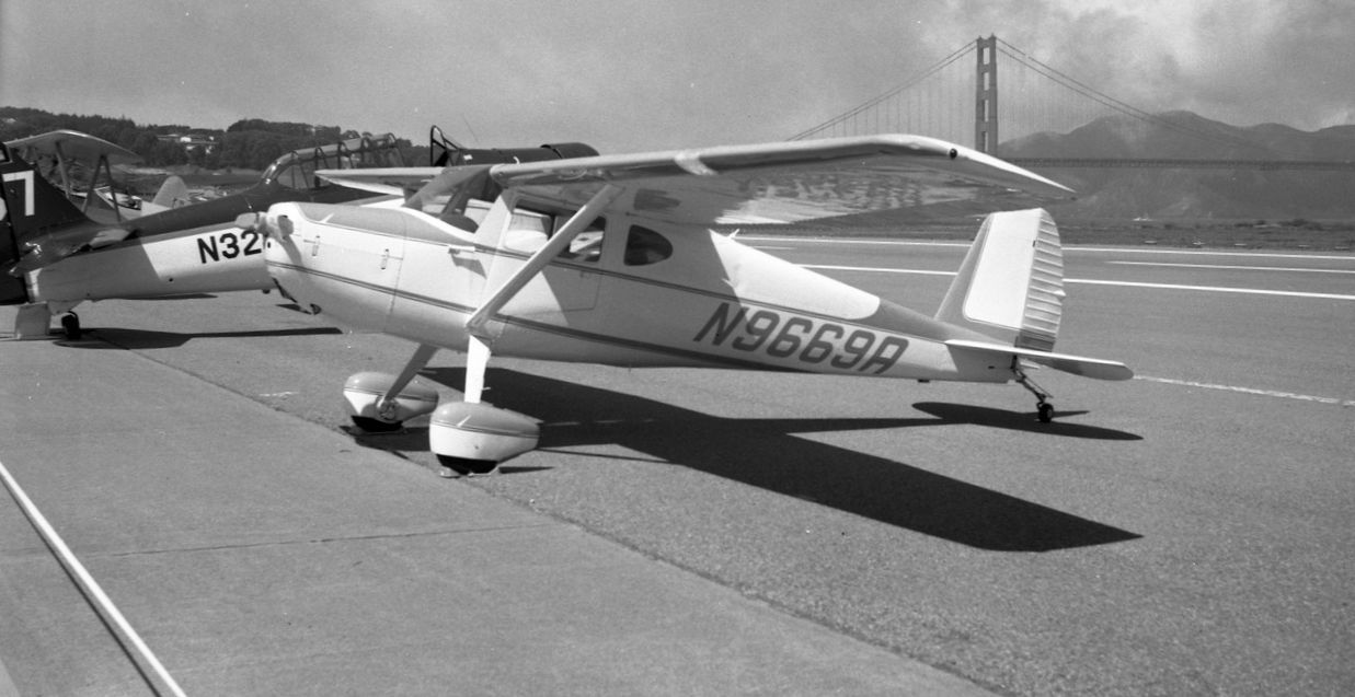
An 8/29/71 photo of N9669A, a 1950 Cessna 140A, serial #15390, at a Crissy Field fly-in.
Chuck Ross recalled, "I flew in & out of Crissy several times in the early 1970s.
My ex-boss, the late Bill Paynter (who owned Union Flights Incorporated out of Sacramento)
told me that he flew governor Ronald Reagan into Crissy in Citation jet N31ST.
I would not have wanted to do that! The runway seemed tight, even in the Beaver."
According to the 1994 Park Service Report “The Last Word in Airfields” by Stephen Haller (courtesy of Philippe Carre),
as of 1972, “Aircraft on hand consisted of 1 Vertol U-21A, 2 Beech U-6, 4 Beech U-8, and 1 T-41 fixed-wing types,
and 10 Bell UH-1H & 1 OH-58 helicopters.”
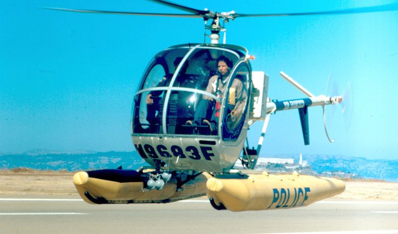
An 8/13/72 photo by Bill Larkins of N9683F, a San Francisco Police Department 1971 Hughes 269C, serial #1010129, at Crissy Field.
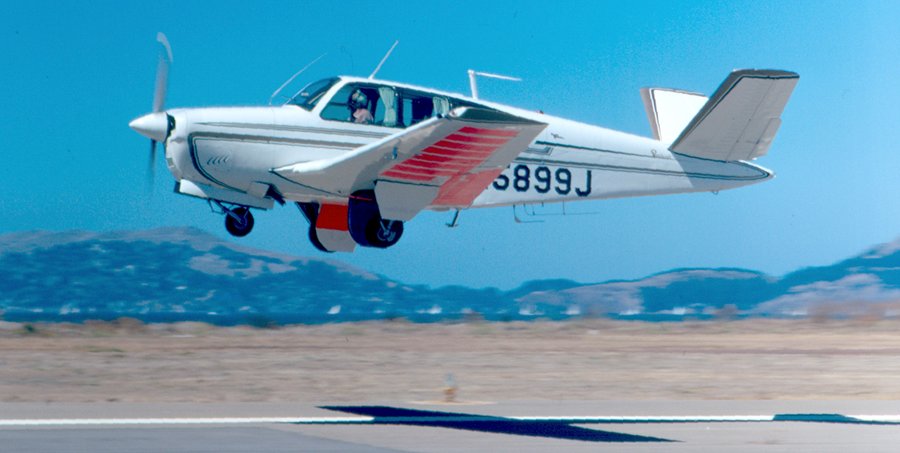
A 1972 photo by Bill Larkins of a Beech S35 Bonanza taking off from Crissy Field.
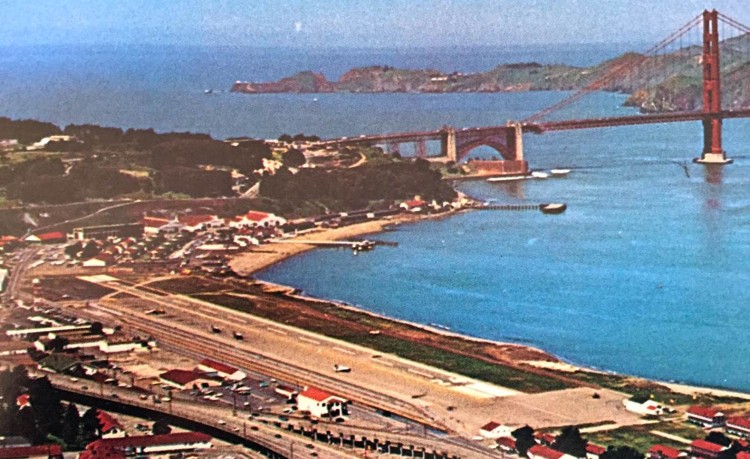
A beautiful 1972 aerial view looking northwest at Crissy Field, with the Golden Gate Bridge in the background (courtesy of Kevin Walsh).
What appear to be several helicopters & fixed-wing aircraft are visible to the left of the runway.
According to the book "Two Hours By Crow" by Howard & Judith Campbell (courtesy of Wings of History),
“The Army closed the heavier-than-air operations in 1974 & used helicopters only on this site.”
At the end of its use as a fixed-wing airfield, Crissy Field consisted of a single East/West 2,500' paved runway.
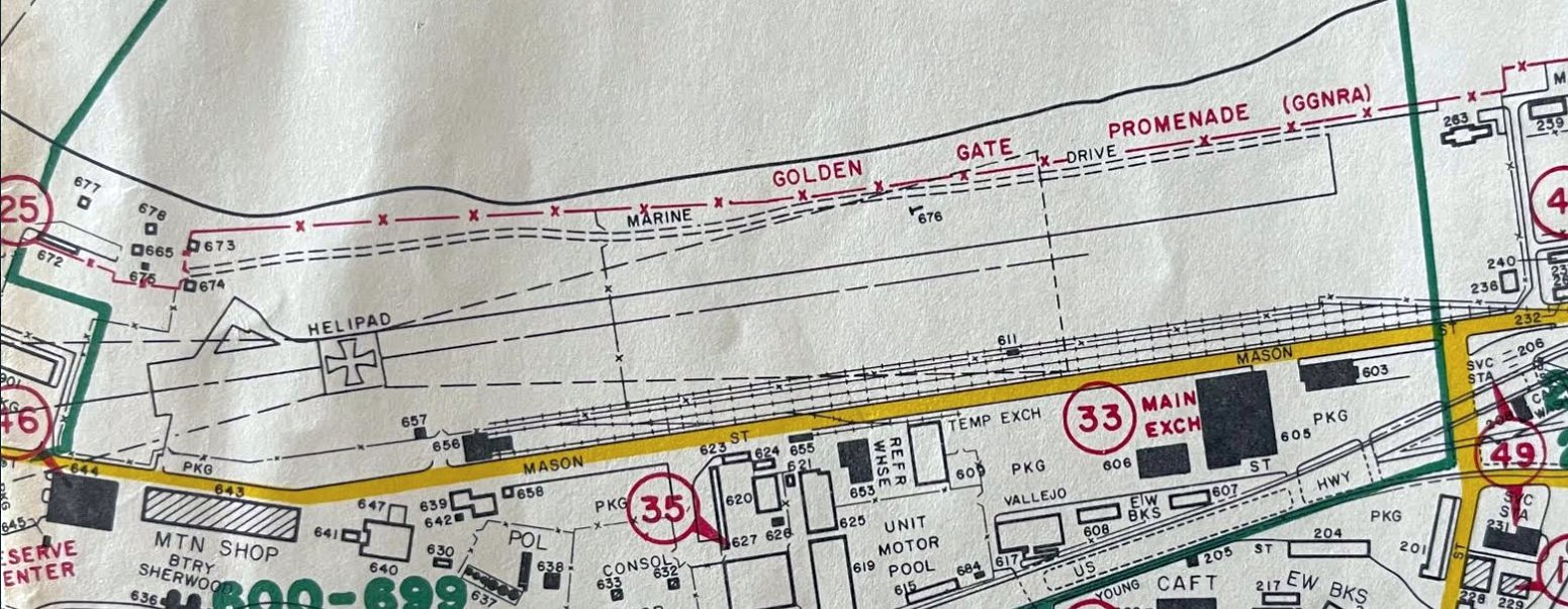
A 1974 map (courtesy of Kevin Walsh) depicted a helipad occupying the western portion of the former Crissy Field runway.
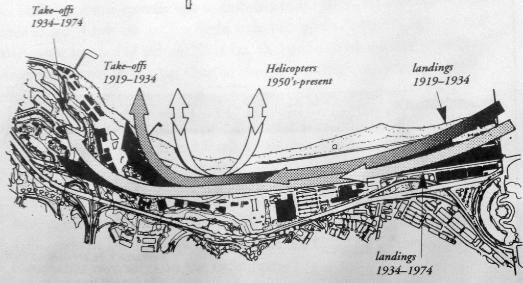
A diagram contrasting Crissy Field's landing & takeoff patterns from 1919 through 1974 (courtesy of Rex Ricks).
A 1980 aerial view showed a road having been built across the Crissy runway.
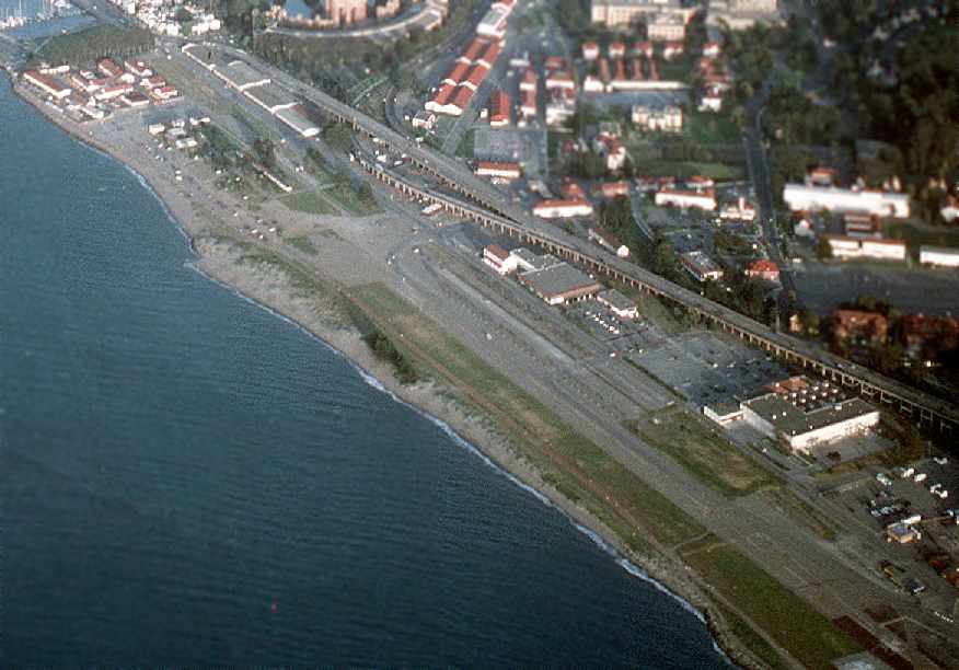
A 1983 Air Force aerial view looking southeast at Crissy's paved runway (courtesy of Rex Ricks).
Crissy Field was no longer depicted at all on the October 1985 San Francisco Sectional Chart (courtesy of Jonathan Westerling).
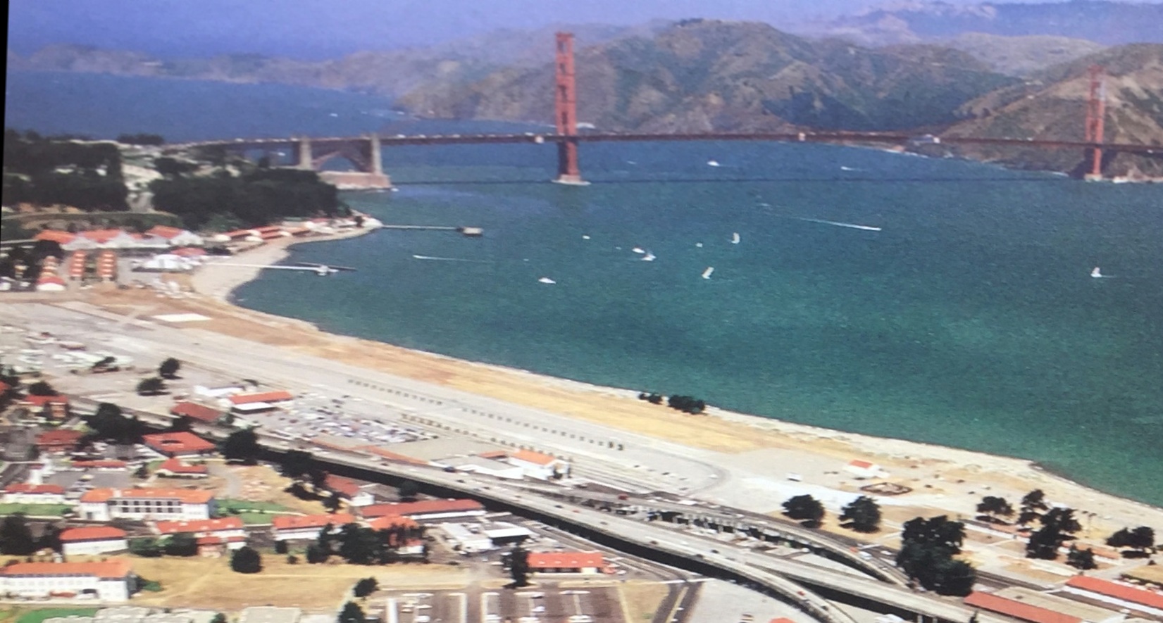
A beautiful 1986 aerial view looking northwest at Crissy Field with the Golden Gate Bridge in the background (courtesy of Kevin Walsh).
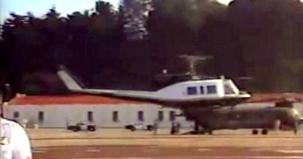
A 1987 video capture (courtesy of Jonathan Westerling) of the Pope landing at Crissy Field in a Bell 212, with a CH-47 Chinook in the background.
The entire Presidio base was closed by the Army & turned over to the National Park Service in the 1980s.

The April 1989 San Francisco Terminal Chart (courtesy of Ken Mercer) depicted Crissy Army Heliport.
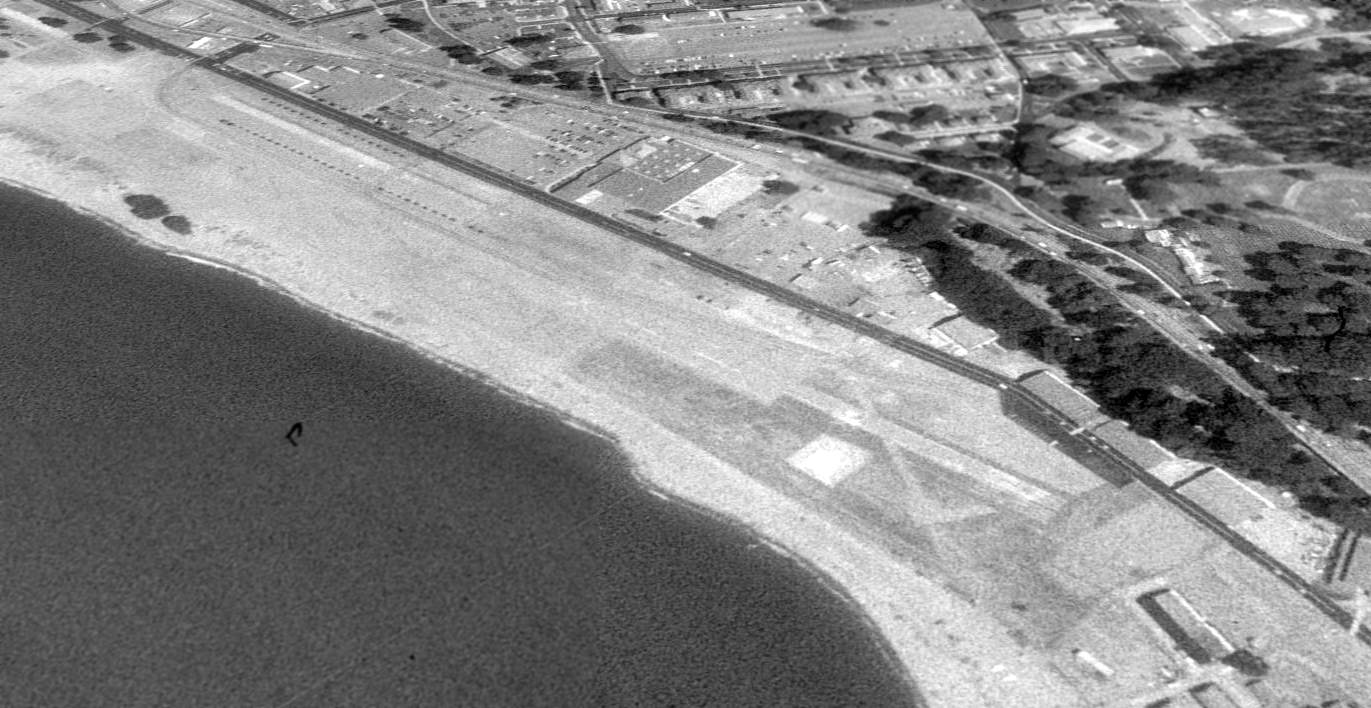
A 1993 USGS aerial view looking southeast showed Crissy Field's paved runway as well as a paved helipad on the northwest side of the runway.
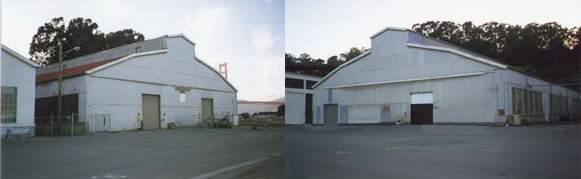
Recent views of the seaplane hangar & the landplane hangar.
A bill was proposed in the Senate in 1996 to break up the runway of Crissy Field & restore the area to a wetland.
Other plans were proposed to "restore the historic airfield".
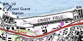
The 1998 USGS topo map still depicted the paved runway at Crissy Field.
Stuart Till reported, "Air ambulance helicopters have been allowed to land [at Crissy Field] until at least 1998, as that was the last time I landed there.
When I landed there the airfield was managed by the U.S. National Park Service, as it is park of the Golden Gate National Recreation Area.
We had to call in advance, and a park service fire engine would stand by there for us. Crissy would provide access to nearby specialized hospitals."
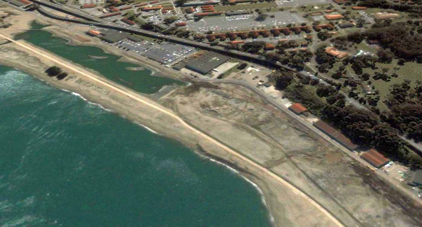
A 2000 aerial view looking southeast showed the significantly reconfigured configuration of the site of Crissy Field -
in which the paved runway had been completely removed, and replaced with a grass field on the western half,
and the eastern half of the former runway had been flooded, creating a 'tidal marsh'.
It is ironic how the Park Service has deemed the "Historic Airfield" to be a grass field which comprises only about half the area of the later paved-runway airfield.
What makes the grass airfield which operated from the 1920s to the 1950s more "historic" than the paved-runway airfield which operated from the 1950s to the 1990s???
Al Magary reported, “Some of the filming for the Eddie Murphy movie Dr. Dolittle 2 (2001) were in & around Crissy Field”.
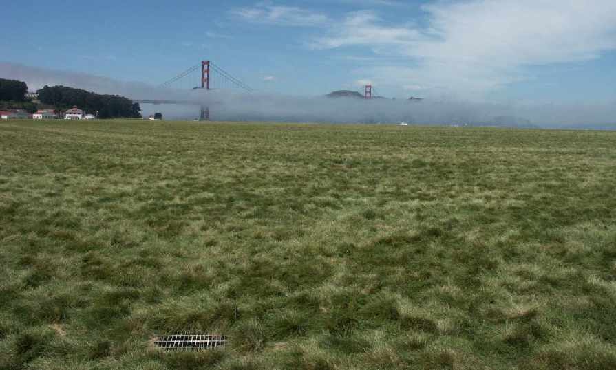
A 2003 photo by Tim Tyler looking across the former Crissy Field runway, at the fog enveloping the Golden Gate Bridge.
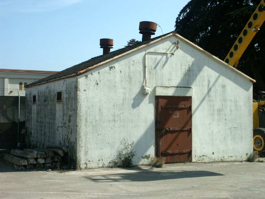
A 2003 photo by Tim Tyler of one of 3 small aircraft munitions storage buildings, apparently constructed in the 1930s.
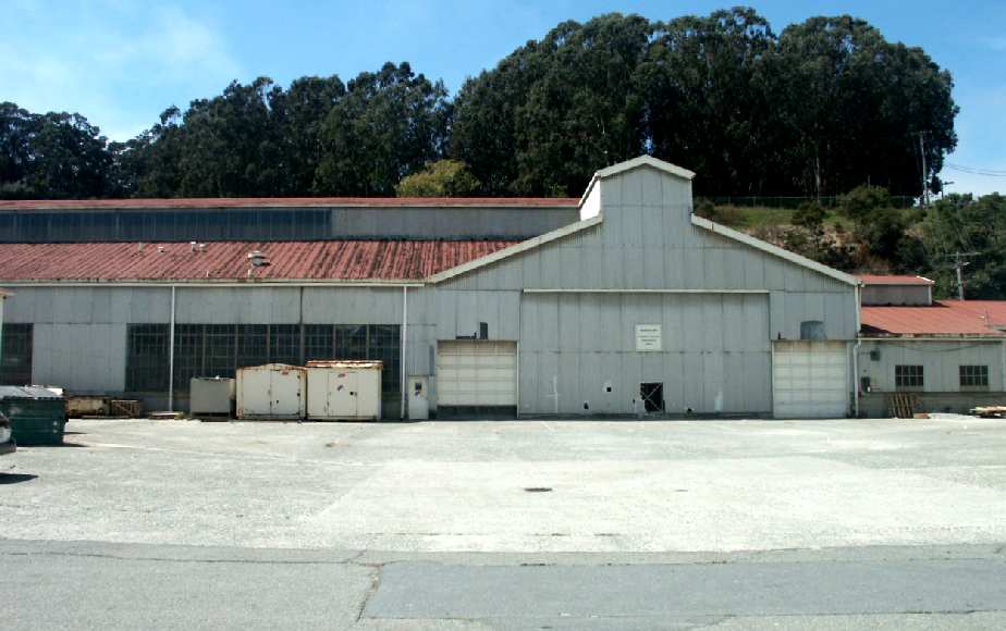
A 2003 photo by Tim Tyler of "Building 933, the former Crissy Field Maintenance Shop with Dope & Boiler Houses."
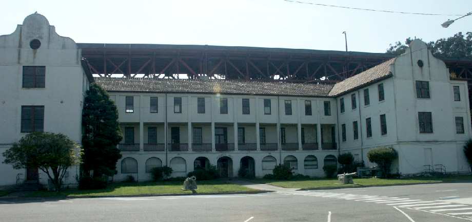
A 2003 photo by Tim Tyler of Stillwell Hall - once the barracks for soldiers assigned to Crissy Field, now empty.
A 2003 photo by Tim Tyler of one of the old VHF & UHF aircraft band antennas
that Crissy Field used to talk with inbound/outbound aircraft, starting in the 1960s.
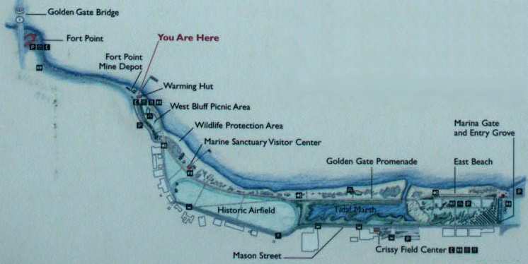
A 2003 photo by Tim Tyler of the Park Service map of Crissy Field.
Tim Tyler visited Crissy Field in 2003, and reported that "The part that's still grass comprises the dimensions
of what was considered to be the size of the field in it's 'historic' time period - up until the early 1930s.
In later years, the length was expanded & it was paved. The 'wetlands' area covers the runway length added after the 1930s.
Also, there is now a gradual slope to the grassy area (it was flat when an active airfield), due to them having excess dirt fill after creating the wetlands area.
The wetlands area isn't working out as planned - it's too small & not functioning as a true wetland could/would."
A September 2006 aerial view by Ian Carisi looking southeast at the restored grass airfield area on the west side of Crissy Field, with original buildings along the right side.
The original location of the paved runway on the east side of Crissy Field has been flooded (top of the picture).
A June 2008 photo by Cris Baker of the interior of the former Crissy Field Maintenance Shop, now reused as an indoor pool.
Chris reported in 2009, “My daughter attends swim classes in one of the old hangars (the former Crissy Field Maintenance Shop).
A pretty nice & well-done reuse in my opinion. The original metal girder roofs are still in place, original windows & siding.
Also nice [to see a] couple of air socks & an old billboard photo of female pilots / passengers on the side of the building.
An adjacent building to the East has been converted to a climbing gym.”
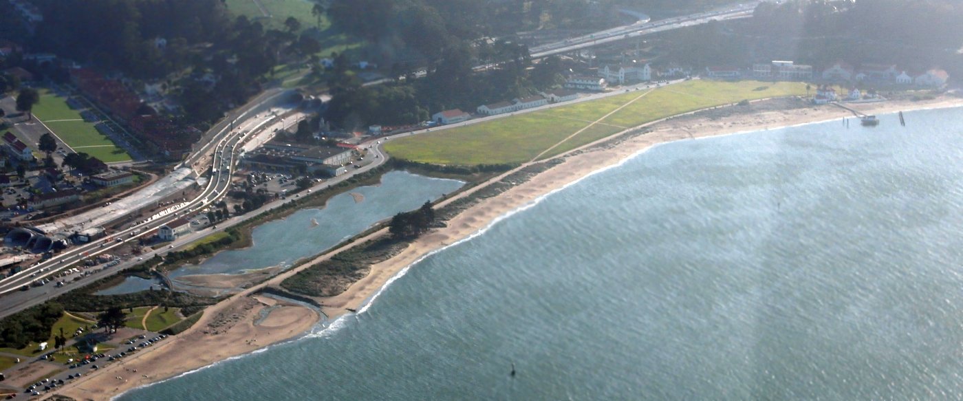
A 4/13/15 aerial view by Dallam Oliver-Lee looking southwest Crissy Field,
showing the location of the paved runway (bottom-left) has been flooded.

A 4/13/15 aerial view by Dallam Oliver-Lee looking south at the west end of Crissy Field, showing the restored 1920s-era hangars.
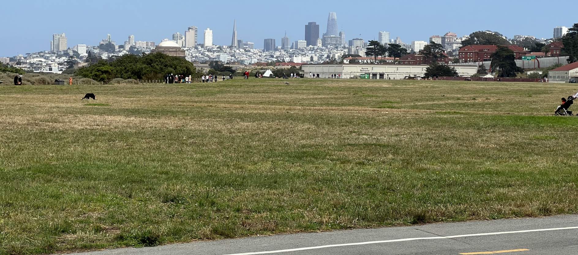
A 7/4/23 photo by Terry Freeman looking east at the site of the Crissy Field runway, with the San Francisco skyline in the background.
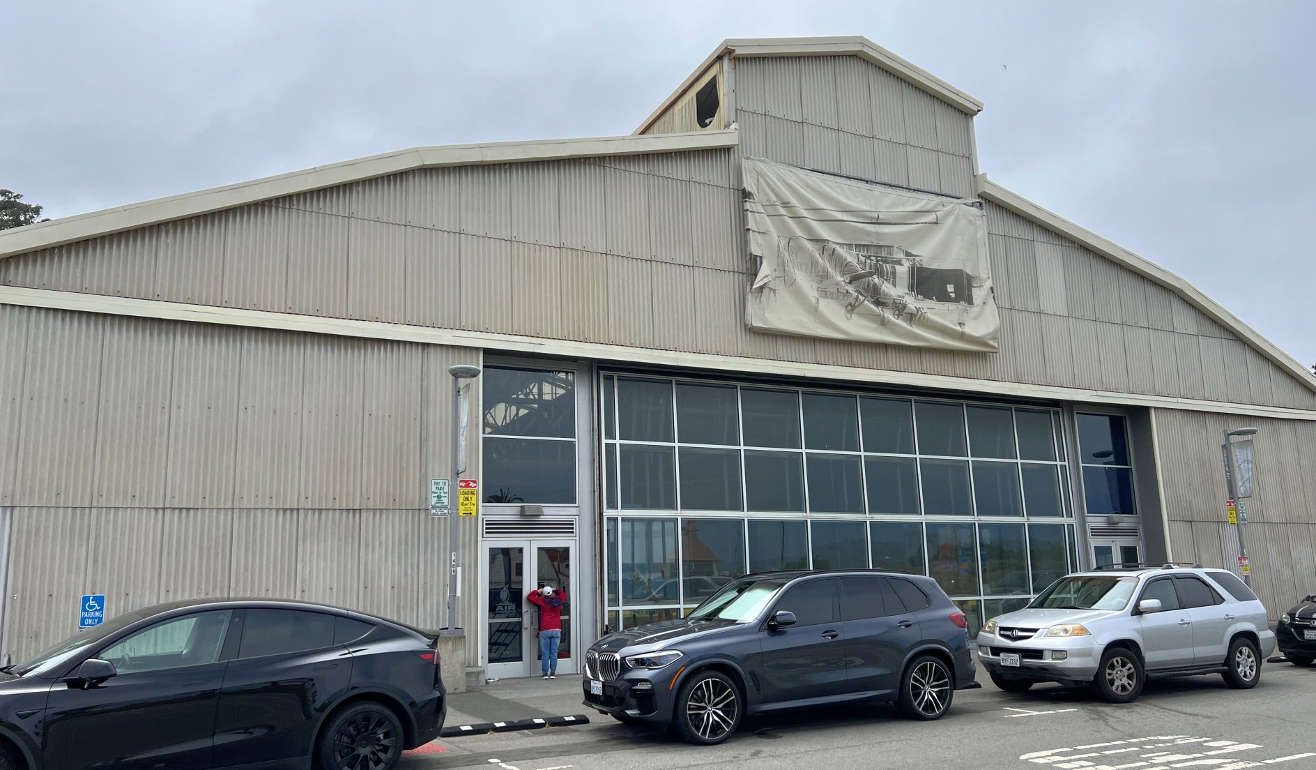
A 7/4/23 photo by Paul Freeman looking west at a restored 1920s-era hangar on the southwest side of Crissy Field.
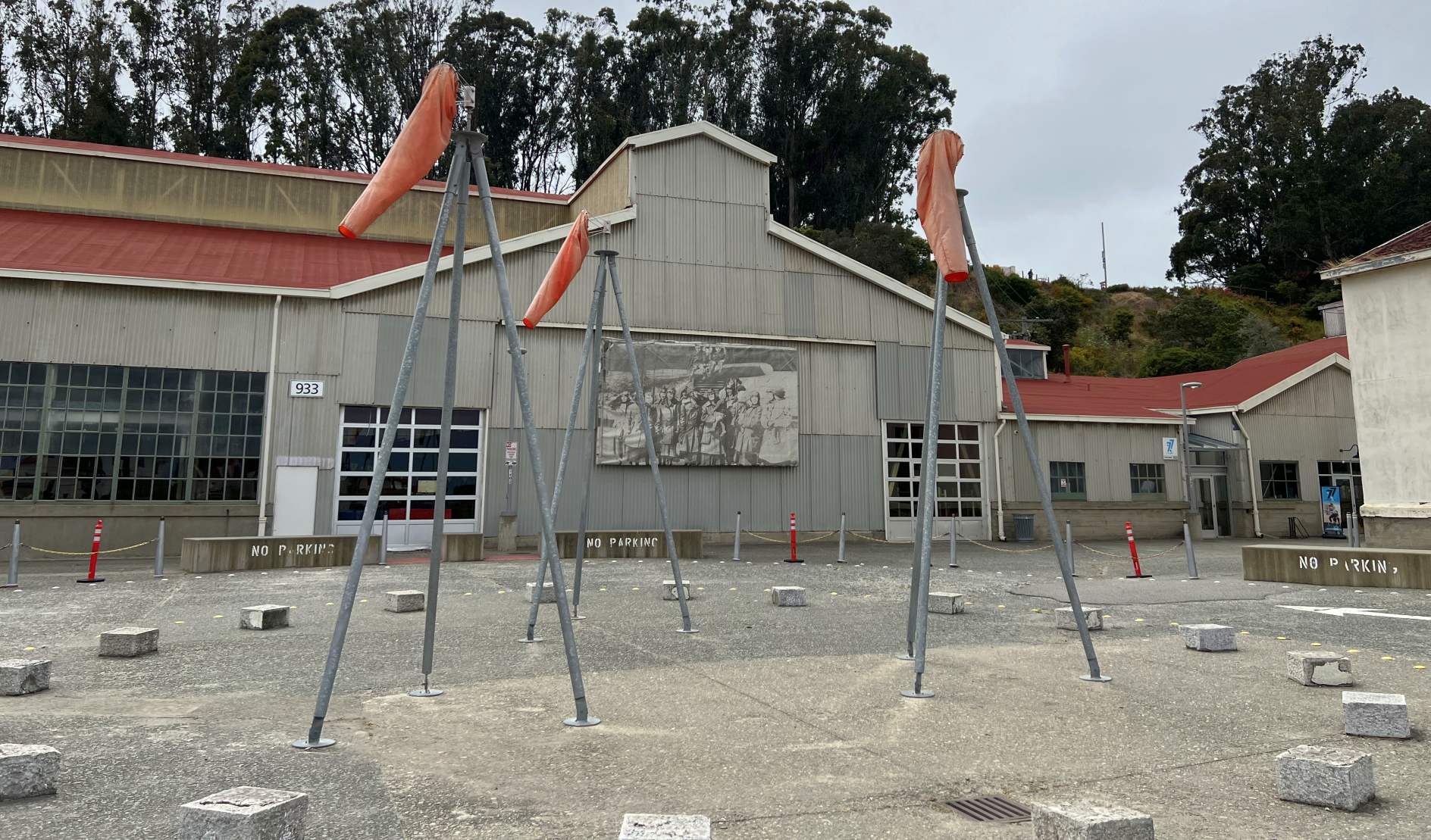
A 7/4/23 photo by Paul Freeman looking southwest at a set of 3 windsocks in front of restored 1920s-era hangars on the southwest side of Crissy Field.
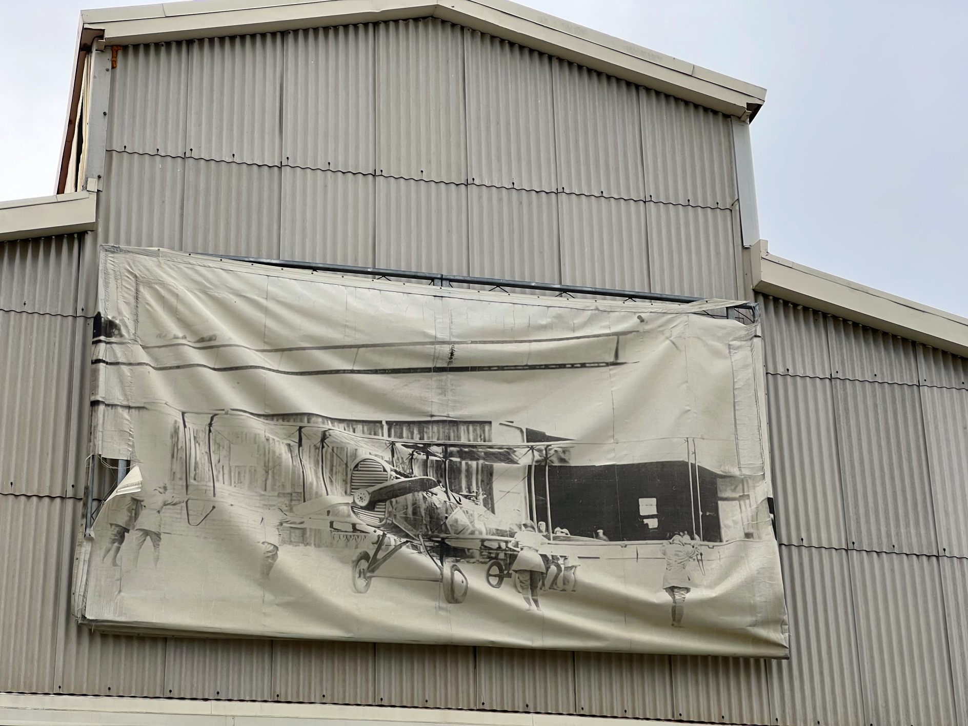
A 7/4/23 photo by Terry Freeman looking south at a 1920s photo of a Jenny biplane draped over the top of a 1920s-era hangars on the southwest side of Crissy Field.
See also:
http://www.nps.gov/prsf/history/crissy/crissyaf.htm
The Crissy Field Aviation Museum
http://sfmuseum.org/hist8/bases.html
____________________________________________________
Montgomery Field / Marina Airfield, San Francisco, CA
37.806, -122.44 (Southeast of the Golden Gate Bridge)
A map of the 1915 Panama-Pacific Exposition (courtesy of Jonathan Westerling),
showing the “North Gardens” on the east side, which would eventually become Marina Airfield.
Adjacent to the east side of Crissy Field on the San Francisco waterfront
was yet another airfield which had a role in early aviation history, Marina Airfield.
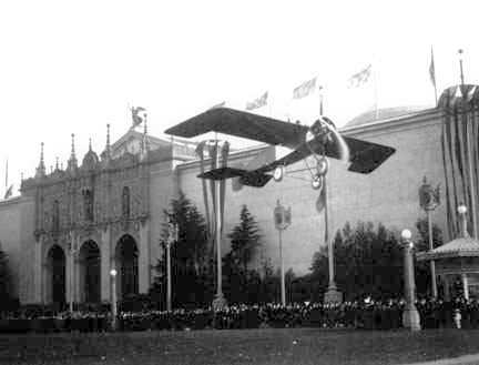
A 1915 photo of Linclon Beachey taking off in his monoplane from the North Gardens of the Pan Pacific Exposition, later Marina Green Airfield
(courtesy of www.lincolnbeachey.com, used with permission).
According to Jonathan Westerling, “This airfield was born as part of the 1915 Pan Pacific Exposition.”
According to “The Last Word in Airfields. A Special History Study of Crissy Field” By Stephen Haller,
“Promoting the new art of aviation was a significant activity at the fair,
and the Exposition was able to employ such men as Lincoln Beachey, Art Smith, Charles Niles,
and Silvio Pettirossi to furnish its visitors demonstrations of flying.
Aviation events took place at an open area known as the North Gardens, on the shoreline between Fillmore & Scott Streets.
This area was later used by the city as an aviation field & Air Mail terminal, and was sometimes called Marina Field.
Certainly the most famous aviator at the exposition was Lincoln Beachey,
who more than any other American exemplified the daredevil flyers of aviation's pioneer days.
He was a native San Franciscan, and the first American to perform a loop-the-Ioop.”
According to Steve Sanders’ article entitled “A Dream Worth Remembering” about the Pan Pacific Exhibition,
“Twice a day demonstrations of aeronautic skill were launched from the long sward of grass known as the North Gardens.
Every day at 3:00 Lincoln Beachey & his mechanician [sic] brother, Hillery,
would push their biplane out onto the east end of the gardens.
The 28 year old Beachey would mount a seat located at the extreme front end of the 'pusher',
turn his cap backwards, and tear off down the lawn.
Quickly gaining speed, he would lift into the air & ascend into the sky at a steep angle then fly out over the waters of the bay
where he would perform his amazing aerial wizardry.”
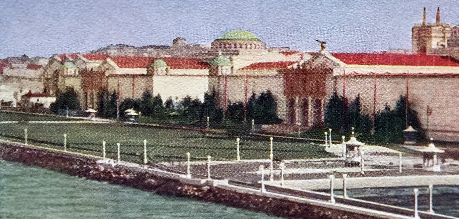
A colorized 1915 aerial view looking southeast at the western portion of the Marina Airfield (courtesy of Kevin Walsh).
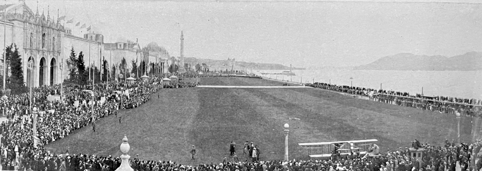
A 1915 photo looking west at Marina Field during the Panama-Pacific International Exposition (courtesy of Kevin Walsh), showing a biplane & a huge number of spectators.
The earliest map depiction which has been located of the Marina Airfield
was on a 1919 Chamber of Commerce map (courtesy of Kevin Walsh), which depicted the “Marina Aviation Landing Field”.
According to a 9/11/20 article in the New York Times, “Carrying 700 pounds of mail,
the first transcontinental postal airplane to leave San Francisco cleared from the Marina Field at 6:15 A.M.
Raymond Little was the pilot.”
The February 1921 U. S. Air Mail Service Pilots’ Directions (according to Jonathan Westerling) described Marina Airfield as #187.
It said that Marina Field “can be identified by the Palace of Fine Arts Building, which has a large dome roof, at the west end of the field;
a monument 150 feet high, the Column of Progress, is on the north side of the field.
A double line of wires borders the eastern edge of the field & this, in conjunction with the gas plant in the same vicinity, force the pilot to come in high.
The pilot should hold the ship off until the runway is reached coming in either direction, as both the east & west edges of the field are very rough.
Landings should not be attempted from any direction other than the east & west.”
A 5/16/21 Berkeley Daily Gazette article (according to Jonathan Westerling) details an airshow which was held at Marina Airfield.
The article mentioned blocked streets & huge crowds which witnessed the events of the day,
but also noted that increasing winds canceled some of the afternoon features.
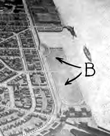
The earliest photo which has been located of the Marina Airfield
was an undated aerial view from the 1921 Eytinge's Flying Guide (courtesy of Alex Sheppard).
It depicted the field as having a single unpaved east/west runway/
The directory described the “Mongtomery (Marina) Field” as an “aerial mail field” with a hangar.
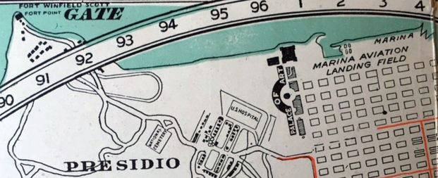
“Marina Aviaton Landing Field”, as depicted on a 1921 map (courtesy of Kevin Walsh).
The 1923 “Complete Camp Site Guide including all Airplane Landings” (courtesy of Jonathan Westerling)
described Marina Field as being a commercial airfield one half mile west of Mort Mason along the edge of the bay.
It listed the airfield configuration as a 1,500' east/west by 500' north/south landing area with gas & oil available on the field.
According to Jonathan Westerling, “In December, 1924, the U.S. Post Office leased a new airfield in Concord
to replace Marina Airfield as terminus of the Air Mail route.
In 1927 the City purchased land further south to establish Mills Field, the present day San Francisco International.
The strong winds & fog coming in through the Golden Gate at Marina Field
were likely a primary reason for the City & Post Office both relocating their operations.”
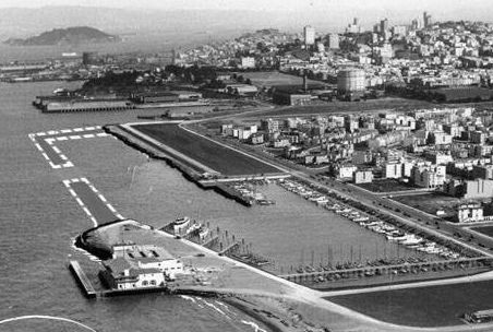
A 5/27/29 aerial view looking southeast at the Marina Airfield (courtesy of Kevin Walsh).
The Marina Airfield was not listed in either the 1928 or 1930 Department of Commerce Bulletin #2 (according to Jonathan Westerling),
so its use had likely been discontinued by then.
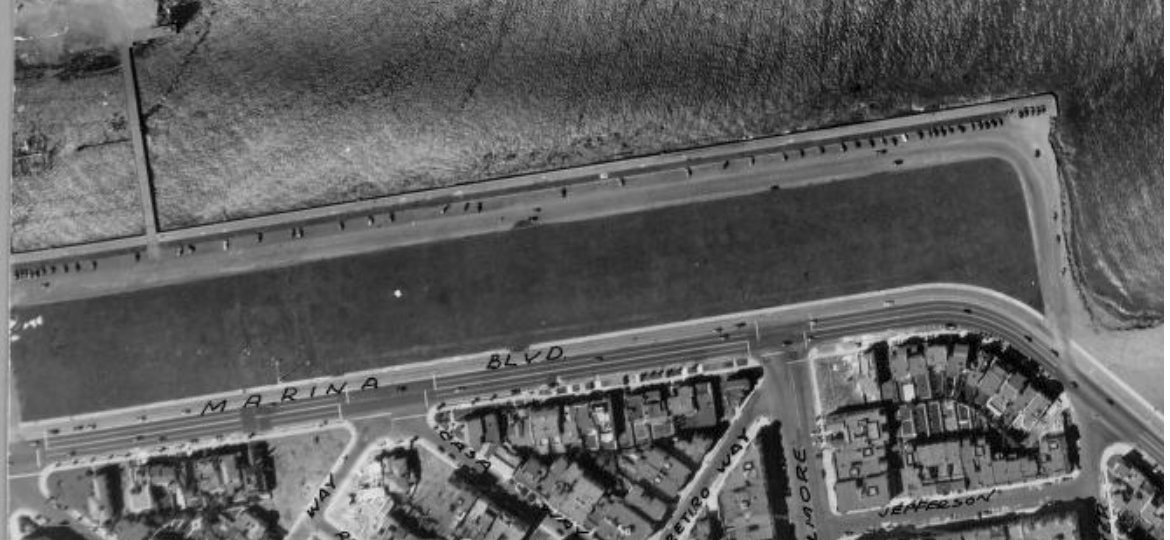
A 1938 aerial view (courtesy of Kevin Walsh) showed the Marina Airfield to have a single east/west grass runway.
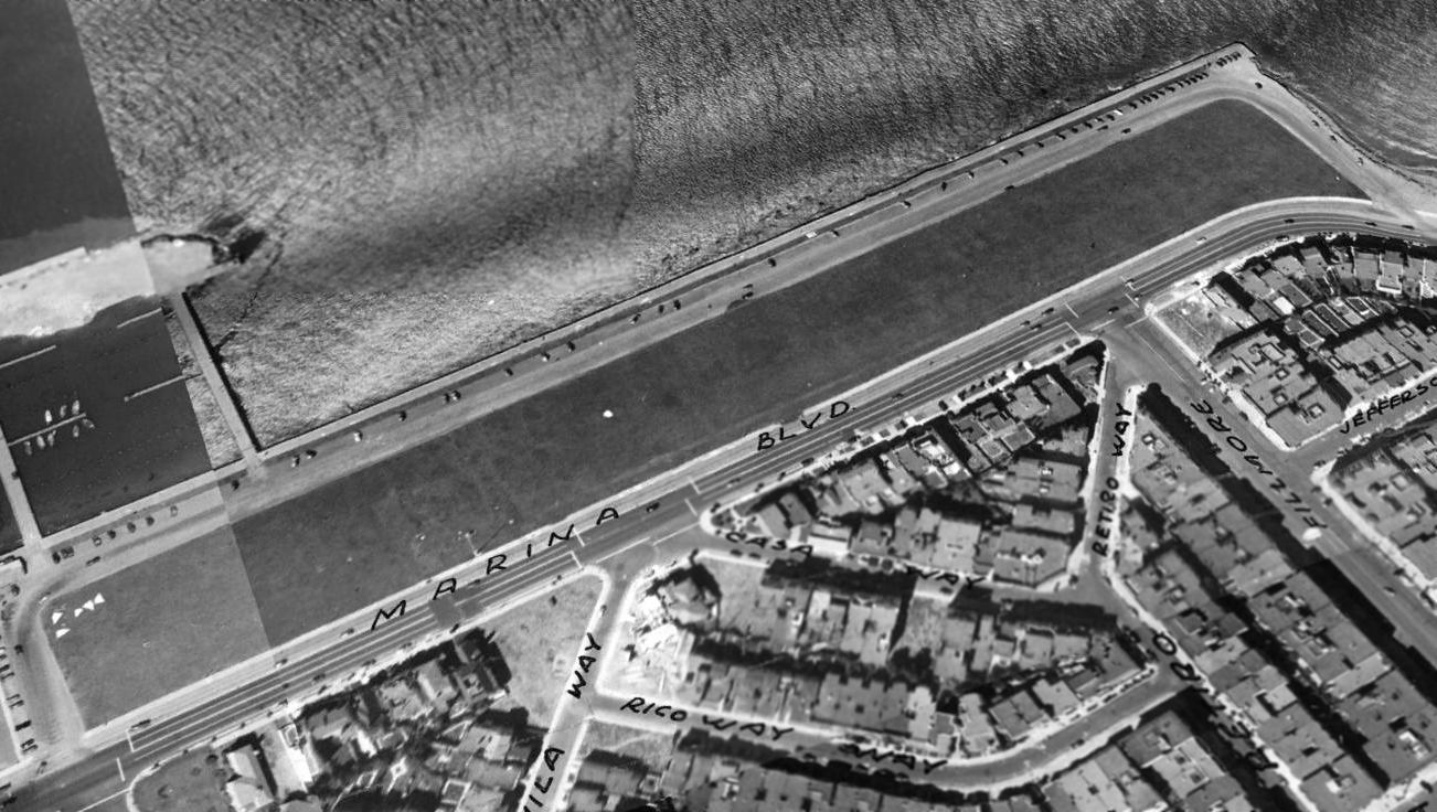
A 1948 aerial view looking northeast showed the Marina Airfield to have a single east/west grass runway, measuring 1,500' x 300'.
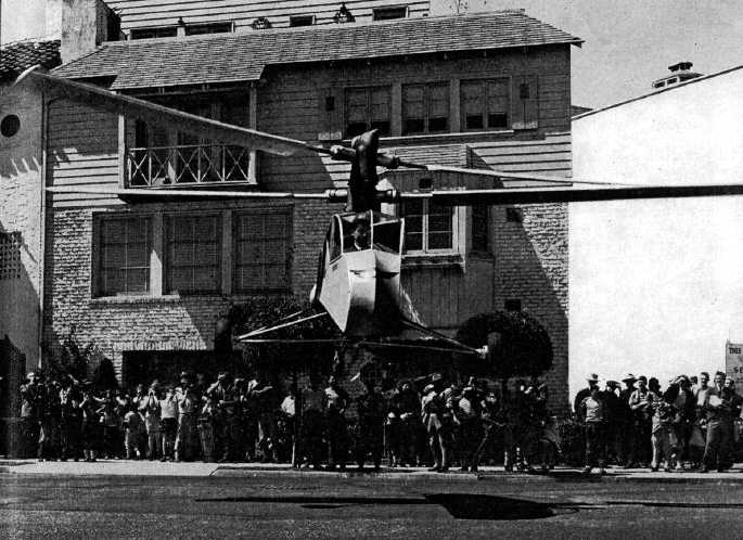
A 8/30/44 photo of Stan Hiller's demonstration flight of the Hiller XH-44 co-axial helicopter on Marina Green
(courtesy the Hiller Aviation Museum Library)
Jonathan Westerling observed in 2010, “The house in the background of this photograph exists to this day unchanged,
thus verifying the location of this historic flight.”
According to Jonathan Westerling, “As a footnote to aviation activities at Marina Airfield,
in 1944 the 19 year old Stan Hiller gave the first public exhibition of his XH-44 'Hiller-Copter'
at the intersection of Webster Street & Marina Boulevard (which is the eastern edge of Marina Airfield).
According to a description of the flight, Hiller took off at the north end of Webster street & set the plane down on Marina Green.
As a result of the successful San Francisco demonstration, Hiller’s design was licensed for military use, and Henry Kaiser hired him to form United Helicopters.”
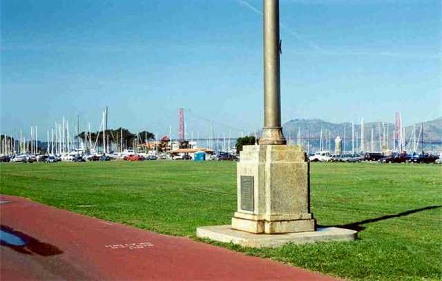
A circa 2000 photo by Bill Larkins of the pole with a historic plaque at the siite of Marina airfield.
Airfield explorer Tim Tyler visited the site of Marina Airfield in 2003.
His report: "While riding my bike in this area a couple weeks ago, I happened to stop to read a marker on a flagpole,
and was amazed to learn that Marina Green is a former civil airfield!"
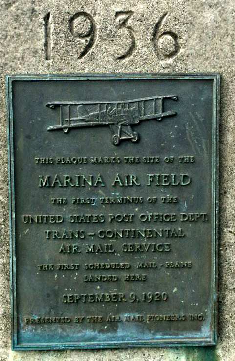
A 2003 photo by Tim Tyler of a memorial plaque at the base of a flagpole (dated 1936),
which reads, "This plaque marks the site of the MARINA AIR FIELD,
the first terminus of the United States Post Office Department Trans-Continental Air Mail Service.
The first scheduled mail-plane landed here 9/9/20. Presented by the Air Mail Pioneers Inc."
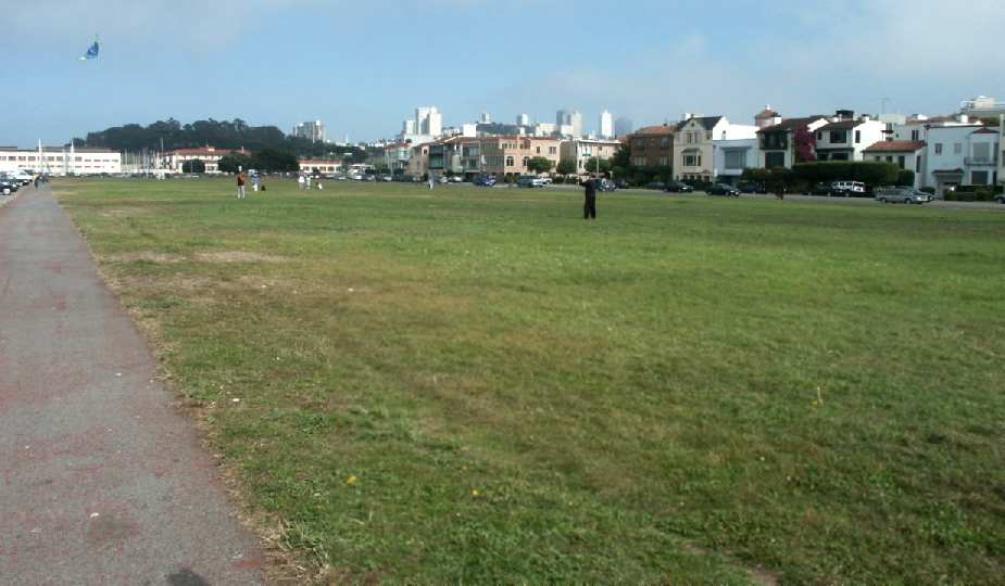
A 2003 photo by Tim Tyler, of the former Marina Airfield,
"taken from the north side, approximately the middle of the field, looking southeast.
You can see the marina & Fort Mason on the left,
and part of downtown San Francisco (including Coit Tower) in the center."
Tim Tyler observed in 2003, "These days, Marina Green is a very popular & well-known spot
to come fly kites, play catch, or just simply hang out.
It's only about half a mile away from the old Chrissy Field area.
The south side of Marina Green, on the other side of Marina Boulevard are very nice, expensive houses
probably dating back at least 60 years.
The north side is the parking lot where I sit at now,
and on the other side of that, San Francisco Bay.
The west side is a marina (and on the other side of that, the Chrissy Field area),
and the east side has a marina, and then the old Fort Mason."
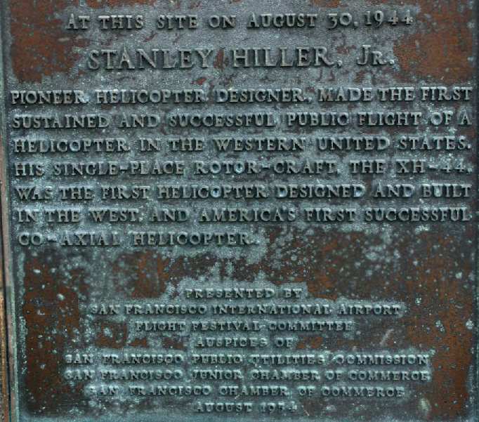
A 2003 photo by Tim Tyler of a another plaque on the opposite side of the flagpole base,
which reads, "At this site on 8/30/44, Stanley Hiller Jr., pioneer helicopter designer,
made the first sustained & successful public flight of a helicopter in the western United States.
His single-place rotorcraft, the XH-44, was the first helicopter designed & built in the west,
and America's first successful co-axial helicopter.
Presented by San Francisco International Airport Flight Festival Committee, August 1954."
Tim also noted, "On the north side of the grassy area at Marina Green is another marker.
It's about 15' tall, and reads, 'Memorial to William C. Ralston.
Erected by San Francisco through the generous gift of Major Edward Bowes, 1941.'
It may be a clue that by 1941, the site was no longer any sort of airfield."
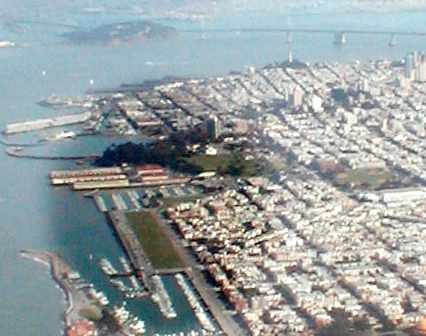
A February 2005 aerial photo by Jonathan Westerling of the site of Marina airfield.
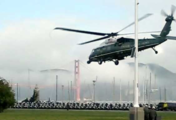
A May 2010 video capture (courtesy of Jonathan Westerling) of Marine One VH-60N taking off from Marina Green with President Obama.
Note the fog-shrouded Golden Gate in the background, and the dozens of SFPD motorcycles.
Jonathan observed, “The plaque with the history of the location is at the base of that flagpole.”
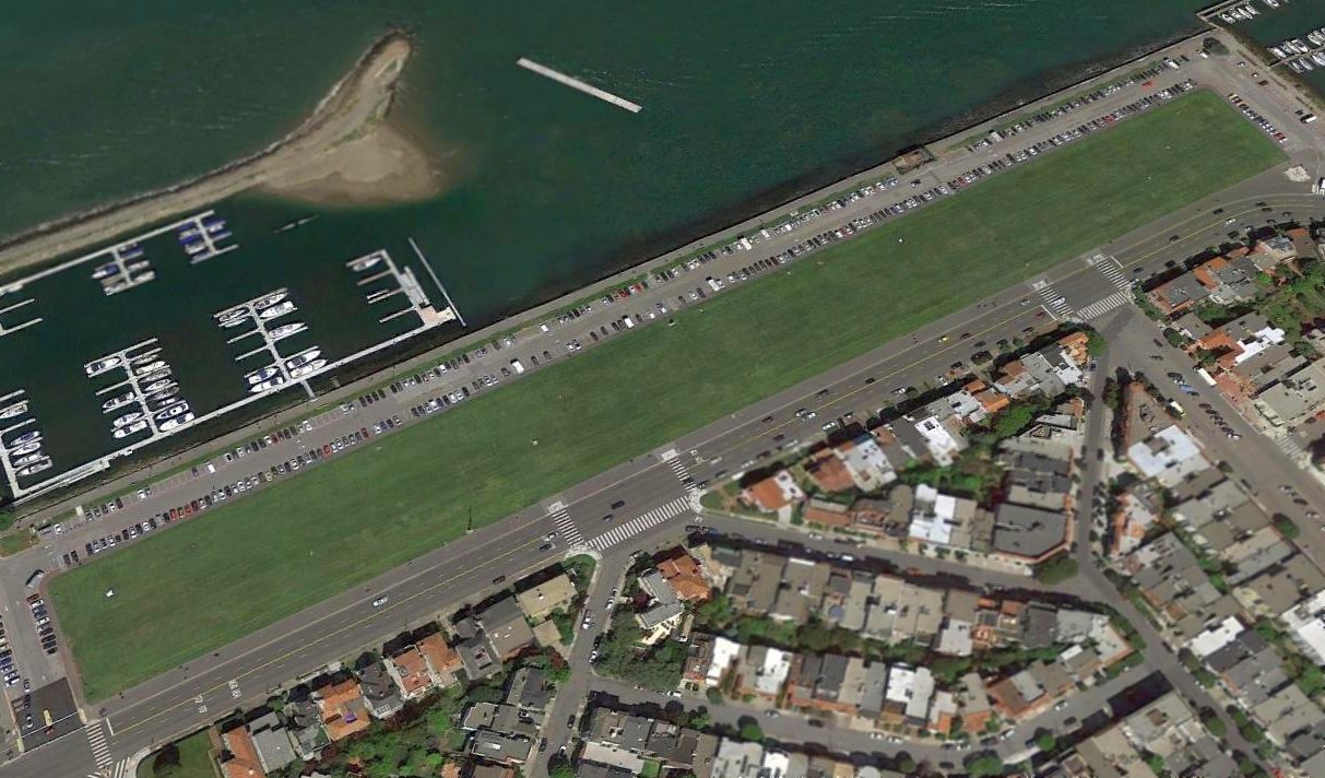
A 2016 aerial view looking northeast showed the Marina Airfield runway to remain intact after many decades.
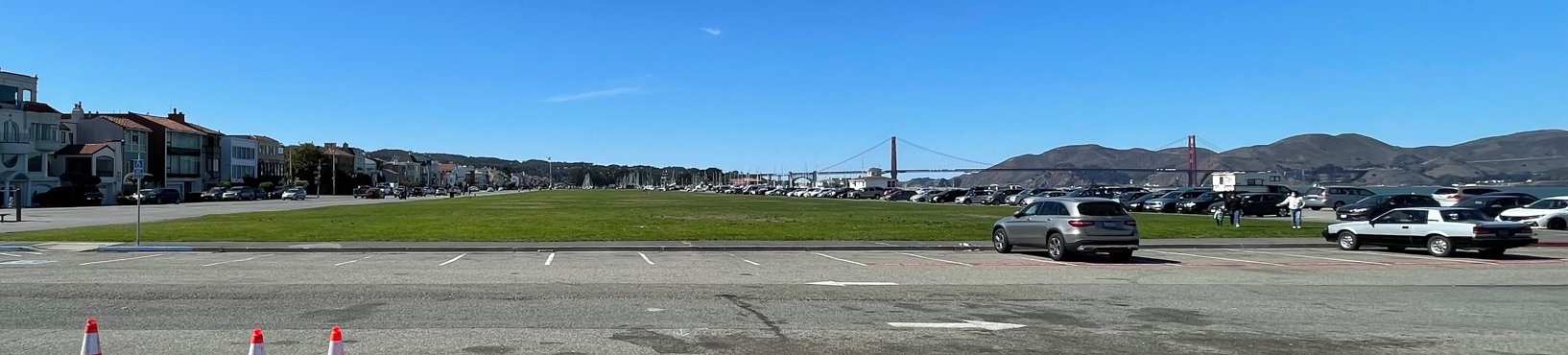
A 10/12/21 photo by Kevin Walsh looking west along the former Marina Airfield runway, with the Golden Gate Bridge in the background.
The site of the Marina Airfield is located northwest of the intersection of Mason Street & Lyon Street.
____________________________________________________
____________________________________________________
This site covers airfields in all 50 states.
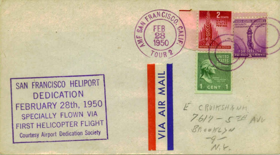