
Abandoned & Little-Known Airfields:
California: Stockton area
© 2002, © 2025 by Paul Freeman. Revised 10/17/25.
This site covers airfields in all 50 states: Click here for the site's main menu.
____________________________________________________
Please consider a financial contribution to support the continued growth & operation of this site.
For a 9th year, the CA pages of this website are sponsored by the California Pilots Association:
Angels Camp Airport / Frog Town Airport (revised 9/6/23) - Buller Field / Atwater Municipal Airport (revised 10/17/25)
(Original) Stockton Airport / Orange Airport / Oranges Airport (revised 1/17/20)
____________________________________________________
(Original) Stockton Airport / Oranges Brothers Airport / Oranges Airport / Orange Airport, Stockton, CA
38.03, -121.32 (East of Stockton, CA)
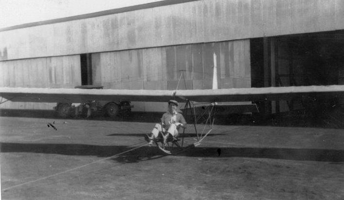
A 1929 photo of Les Oranges in a Eagle Rock glider at Oranges Airport (courtesy of Bob Oranges).
The original airport for the town of Stockton was located on the north side of the town.
Robert Oranges recalled, “My father was Les Oranges who along with his brother Ed Oranges built Oranges Airport.
Originally the airport was named Oranges Airport, then some time later was changed to Orange Airport.
My dad started flying in 1921. The airport was built with my father’s construction company Oranges Brothers Construction.”
The earliest depiction which has been located of Oranges Airport was a 1929 photo
of “Les Oranges in [an] Eagle Rock Glider in front of hangars at Oranges Airport” (courtesy of Bob Oranges).
The Eagle Rock glider was launched via a tow from an automobile.
Robert Oranges recalled, “My dad [Les Oranges] got his transport pilots license on 12/9/29.
I have a 10/30/31 Stockton Record newspaper article about an airshow that was held at the airport, and drew an estimated crowd of 5,000 people.”
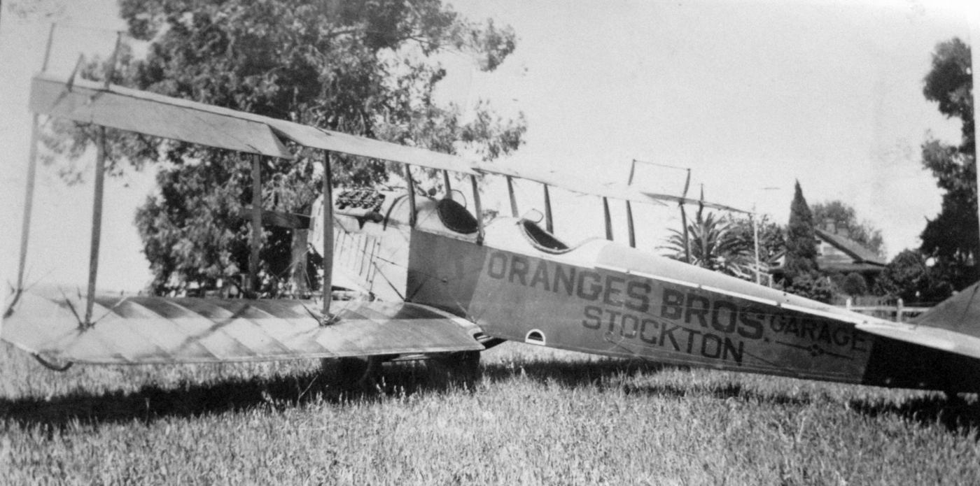
An undated (circa 1930s?) photo of a Curtiss JN-4 Jenny biplane painted “Oranges Bros. Garage Stockton” (courtesy of Bob Oranges).
The earliest aeronautical chart depiction which has been located of Oranges Brothers Airport was on the May 1936 Sectional Chart,
which depicted Oranges Brothers as a commercial/municipal airport.

The 1939 USGS topo map labeled it as Stockton Airport.
The original Stockton Airport may have been closed during WW2 (as was the case with many small civilian airports during the war),
as it was not listed among active airfields in the 1945 AAF Airfield Directory (courtesy of Scott Murdock).
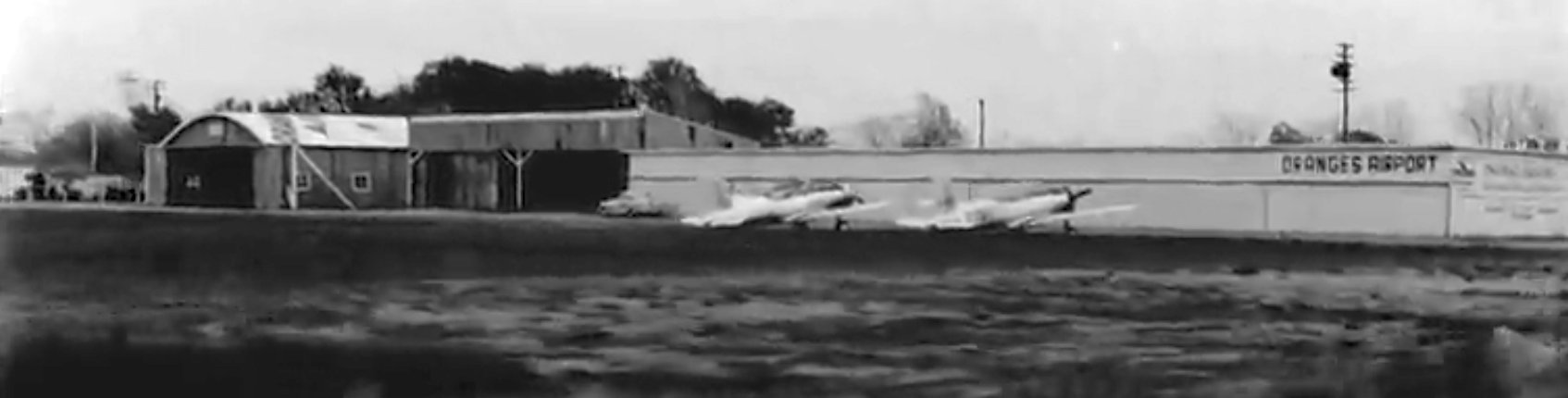
A still from circa 1940s movie footage showing 2 surplus Vultee BT-13 Valiants in front of several hangars, one of which is painted “Oranges Airport” (courtesy of Bill Taylor).
Maureen Liddicoat Roberts recalled, “My uncle Curtis Liddicoat managed Orange Airport at one time, probably shortly after WW2.
He kept his Cessna 120 at the airport & both my brother & I flew with him there.”
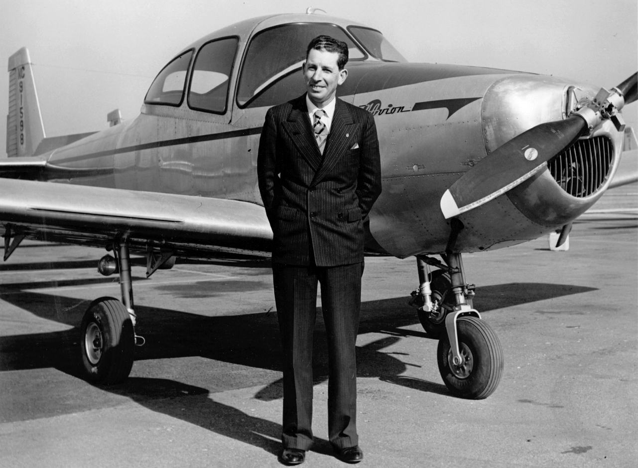
A 1947 photo of Les Oranges in front of his Navion at Oranges Airport (courtesy of Bob Oranges).
The August 1948 Sacramento Sectional Chart (courtesy of Ron Plante) depicted Oranges Airport as having a 2,000' paved runway.
The earliest aerial photo which has been located of Stockton Airport / Oranges Airport was a 1949 aerial view (from the UCSB Library).
It depicted the field as having 2 unpaved runways, with 10 light single-engine aircraft & several hangars on the southwest side.
The airport was evidently reopened under the name of “Oranges Airport” at some point between 1945-53, as that is how it was labeled on the 1953 USGS topo map.
It depicted Oranges as having 2 runways & several small buildings on the southwest side.
Robert Oranges recalled, “I do remember going to the airport around 1953.”
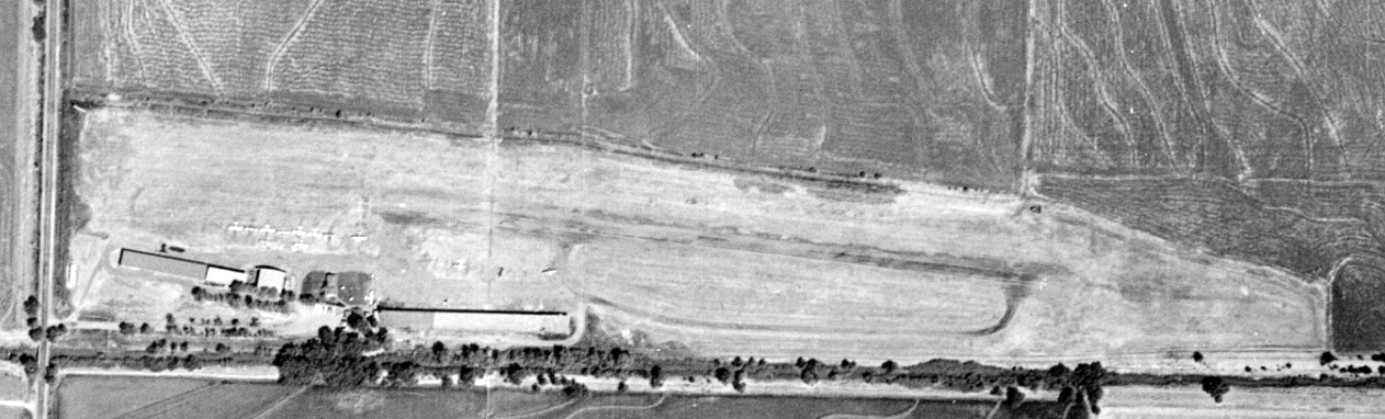
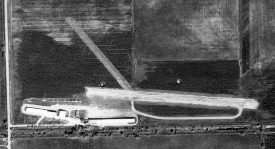
A 9/4/57 aerial view (from the UCSB Library) depicted Oranges Airport as havng a single east/west runway, with no sign still visible of the previous crosswind runway.
A dozen light single-engine aircraft & several hangars were visible on the southwest side.
Brian Cleveland recalled, “Orange Airport in North Stockton... was it was located about a mile north of Hammer Lane
and ran up against & located east of Lower Sacramento Road. The single runway ran east/west.
Among the many aircraft based there, my uncle over the years based a Bonanza, Twin Bonanza, and Sea Bee, along with a couple of Brantley helicopters.
I flew in there with an instructor in a Skylane. I believe it was somewhat paved, but not the smoothest in the world.”
The last aeronautical chart depiction which has been located of Orange Airport was on the September 1960 Sacramento Sectional Chart,
which depicted Orange Airport as having a 3,000' paved runway.
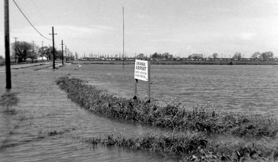
An undated sign for “Orange Airport” advertised plane rental, but also appeared to show the property as completely flooded.
According to Robert Oranges, the photo dated to circa 1961.

A circa 1961 aerial view looking southeast at the flooded Oranges Airport (courtesy of Bob Oranges).
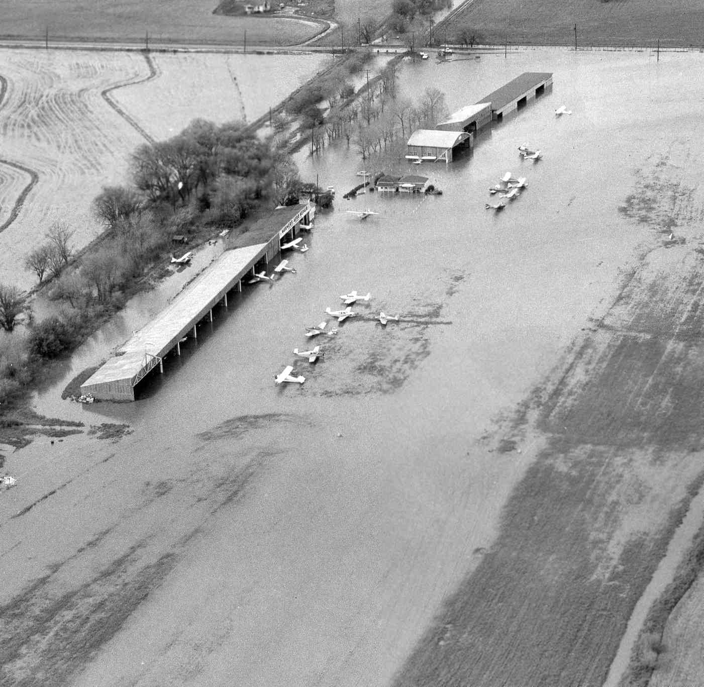
A circa 1961 aerial view looking southwest at the flooded Oranges Airport (courtesy of Bob Oranges),
showing over 20 light aircraft which were affected.
Orange Airport was evidently closed at some point between 1961-65, as it was no longer depicted on the June 1965 Sacramento Sectional Chart.
The last depiction which has been located of Oranges Airport was on the 1966 USGS topo map,
which depicted it in the same fashion as the 1953 USGS topo map.
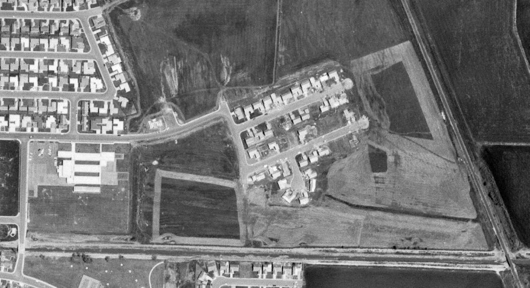
A 5/2/67 USGS aerial view showed that houses had been built over most of the Orange Airport property, but portions of the northwest/southeast runway remained recognizable.
The 1972 USGS topo map showed that the John F. Kennedy School & housing had covered the site of Orange Airport.
A 1993 USGS aerial photo showed no trace remaining of Orange Airport.
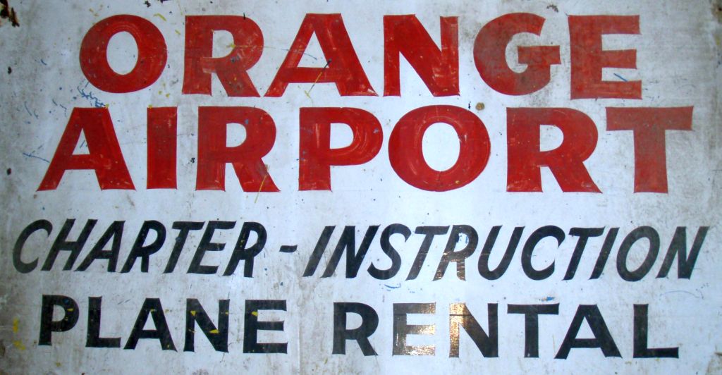
A 2013 photo of the hand-painted sign for Orange Airport (courtesy of Bob Oranges),
which appears to be the same sign pictured in the 1961 flood picture above.
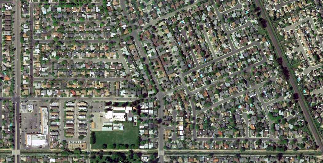
A 4/11/13 aerial photo showed no trace remaining of Orange Airport.
The site of Orange Airport is located east of the intersection of North Lower Sacramento Road & Ponce de Leon Avenue.
Thanks to Brian Cleveland for pointing out this airfield.
____________________________________________________
Angels Camp Airport / Frog Town Airport, Angels Camp, CA
38.05, -120.52 (East of Stockton, CA)
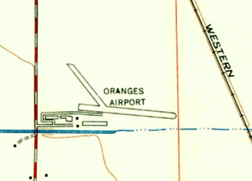
Angels Camp Airport, as depicted on the March 1959 Sacramento Sectional Chart.
This small airport was located on the grounds of the Frog Town Fairgrounds.
Angels Camp Airport was evidently built at some point between 1958-59,
as it was not depicted on the September 1958 Sacramento Sectional Chart.
The earliest depiction which has been located of Angels Camp Airport was on the March 1959 Sacramento Sectional Chart.
It depicted Angels Camp Airport as having a 2,400' unpaved runway.
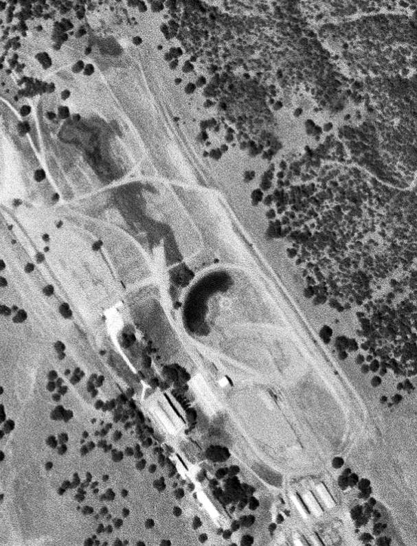
The earliest depiction which has been located of Angels Camp Airport was a 6/6/59 USGS aerial view.
Although the single unpaved northwest/southeast runway adjacent to the east side of the oval track was barely recognizable,
there was an airport circle marking in the center of the photo, just west of the runway.
Angels Camp Airport was evidently quickly renamed Frog Town Airport,
as that is how it was labeled on the September 1959 Sacramento Sectional Chart.
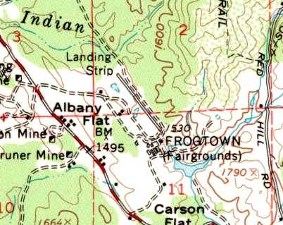
The 1962 USGS topo map depicted Frog Town Airport as a single northwest/southeast runway, labeled simply as “Landing Strip”.
The 1965 San Francisco Sectional chart (courtesy of Chris Kennedy) depicted Frog Town as having a 2,100' unpaved runway.
The runway at Frog Town was evidently paved at some point between 1965-66,
as the 1966 San Francisco Sectional chart (courtesy of John Voss) depicted the field as having a 2,100' paved runway.
The last aeronautical chart depiction which has been located of Frog Town Airport
was on the November 1971 San Francisco Sectional Chart.
It depicted Frog Town as having a 2,100' paved northwest/southeast runway.
Frog Town Airport was listed in the "unattended airport" section of the 1978 Pilot's Guide to California Airports (according to Chris Kennedy).
Frog Town Airport apparently closed at some point between 1978-82.
as it was not listed among active airfields in the 1982 AOPA Airport Directory.
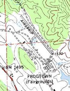
The 1991 USGS topo map depicted Frog Town Airport as a single northwest/southeast runway, labeled simply as “Airstrip”.
On the 1993 USGS topo map, the Frog Town runway was still depicted, but labeled simply "Landing Strip".
Frog Town Airport was no longer depicted on the 1993 San Francisco Sectional Chart.

A 1998 USGS aerial view looking northeast at the site of Frogtown Airport showed the cleared area formerly occupied by the runway was still somewhat discernible,
but the pavement had apparently been removed.
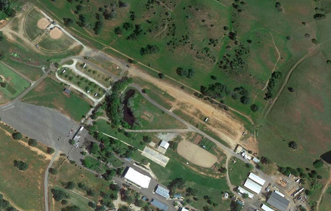
A 2014 USGS aerial view looking northeast showed the site of Frogtown Airport was less recognizable as a former airport,
with 2 baseball diamonds having been built over the northwest portion of the runway.
The site of Frog Town Airport is located east of the intersection of Route 49 & Gun Club Road.
____________________________________________________
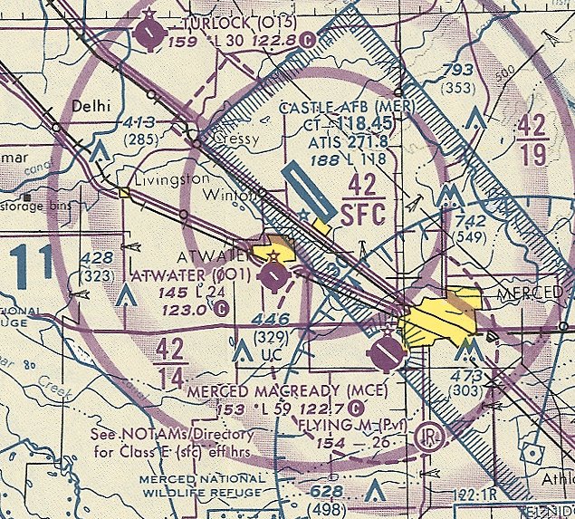
Atwater Airport / Buller Field / Atwater Municipal Airport (0O1), Atwater, CA
37.335, -120.605 (East of San Francisco, CA)
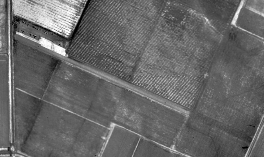
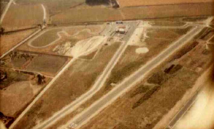
A 5/31/57 USGS aerial view of Atwater Airport (from the UCSB Library).
Atwater Airport was evidently established at some point between 1949-57,
as it was not yet depicted at all on the 1948 USGS topo map
nor on the September 1949 Mt. Whitney World Aeronautical Chart (or subsequent 1950s Sectional Charts).
.
The earliest depiction which has been located of Atwater Airport was a 5/31/57 USGS aerial photo (from the UCSB Library).
It depicted Atwater Airport as having a single northwest/southeast runway.
Six light single-engine aircraft were visible parked on the west side of the runway.
The 1961 USGS topo map depicted the Atwater Airport as having a single northwest/southeast runway.
No buildings were depicted on the field.
Atwater Airport still was not yet depicted on the March 1961 San Francisco Sectional Chart.

At some point between 1961-64 the field was evidently renamed Buller Field
as that is how it was labeled on the June 1964 San Francisco Sectional Chart (courtesy of Chris Kennedy).
It depicted Buller as having a 2,200' unpaved runway.
The Aerodromes table on the 1966 San Francisco Sectional chart (courtesy of John Voss)
described Buller Field as having a single 2,170' treated dirt runway.
At some point between 1966-67, the field apparently was renamed back to Atwater Airport & became private,
as that is how it was depicted on the June 1967 San Francisco Sectional Chart (courtesy of Chris Kennedy).
The listed runway length had also been shortened to only 1,800'.
The field evidently became a public-use airport again at some point between 1967-82,
as it was listed as Atwater Municipal Airport in the 1982 AOPA Airport Directory (courtesy of Ed Drury).
The field had also gained a paved runway, as it was described as having a single 2,450' asphalt Runway 12/30.
The operator was listed as Merced Aviation - Atwater Branch.
Don Jordan recalled , “Atwater Airport...I flew out of there from 1981 until the end in 1991.
I had 2 airplanes hangared there in the 1980s. I had a Piper Colt & a Cessna 210 there.
Traffic was left hand for 30, and right hand for 12.
I think the runway was about 3,600', with trees just across the road on the southeastern end.
The airport FBO operator's name was Stan Swenson.
After he sold the business, a lady bought the business & continued its operation.
My Piper Colt broke a bungee chord on landing there once, and scared the Hell out of me.
My 210 also had its nose gear collapse on the same airport.
Stan, an A&P mechanic, fix both aircraft right in his new hangar.
Stan provided all types of flight training, as well as all types of maintenance. It was a nice little airport.”
Pat Lawler reported, “My dad learned to fly there & I spent numerous hours out there.”
As depicted on the 1987 USGS topo map,
the airfield consisted of paved paved northwest/southeast 2,800' runway, with a taxiway leading to a few small buildings on the west side.
The 1989 Airport/Facility Directory (courtesy of Chris Kennedy)
described Atwater Municipal Airport as having a single 2,670' asphalt Runway 12/30.
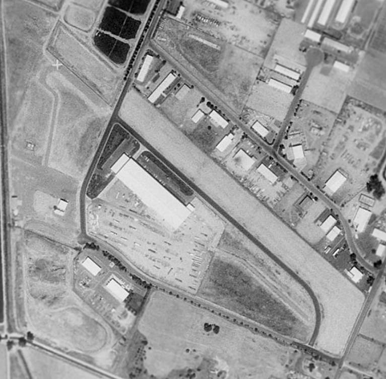
A circa 1989 aerial view by Don Jordan looking southwest at Atwater Airport,
showing the runway, taxiway, ramp, hangar, and several light planes.
Don Jordan recalled , “My last logged flight from Atwater was in December of 1991.”
The last aeronautical chart depiction which has been located of Atwater Municipal Airport was on the October 1993 San Francisco Sectional Chart (courtesy of Ron Plante).
It depicted Atwater Airport as having a 2,400' paved northwest/southeast runway.
Atwater Municipal Airport was closed in 1994, when the much larger former Castle AFB was closed & reused as a civilian airport.
The City of Atwater redeveloped 40 acres of the former airport property into the Atwater Business Park, with construction proceeding in 1995.
Atwater Municipal Airport was no longer depicted on the September 1997 San Francisco Sectional Chart (courtesy of Ron Plante).
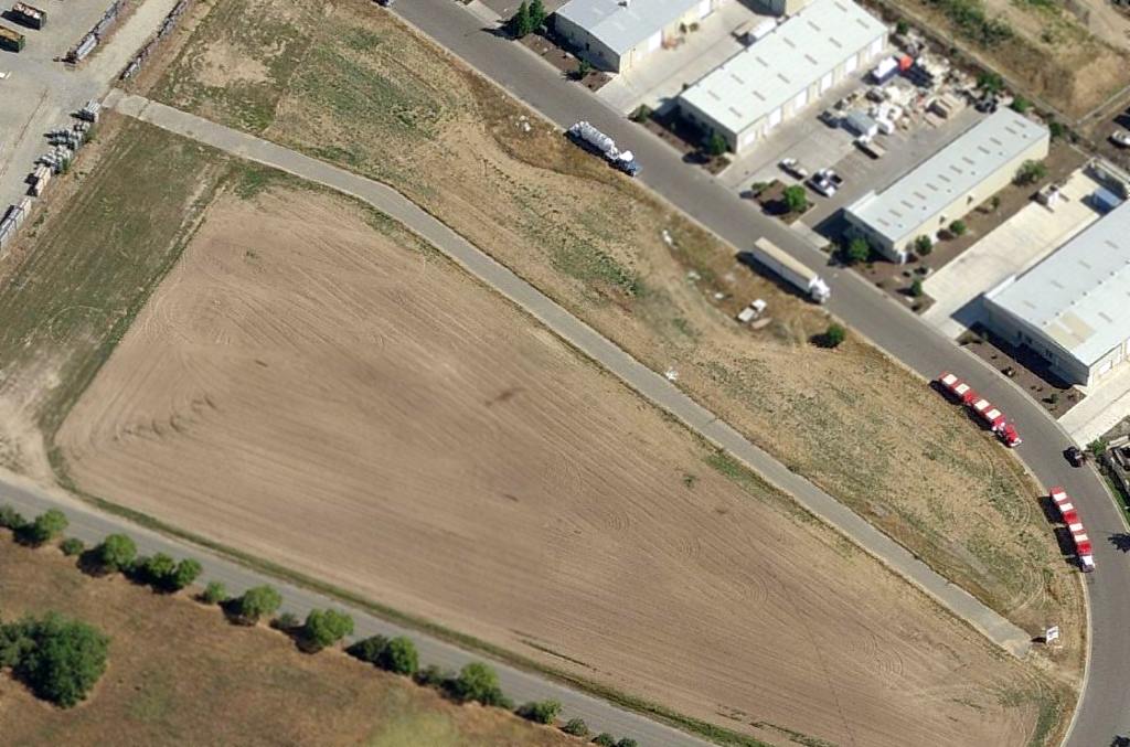
A 1998 USGS aerial view of the site of Atwater Municipal Airport showed a 600' segment of the northwest end of the runway still existed, on the west side of Industry Way,
with a closed runway "X" marking still visible on the pavement.
The southeast portion of the taxiway also still remained.
A circa 2008-2013 aerial view looking north showed the remaining southeast portion of the Atwater Airport taxiway.
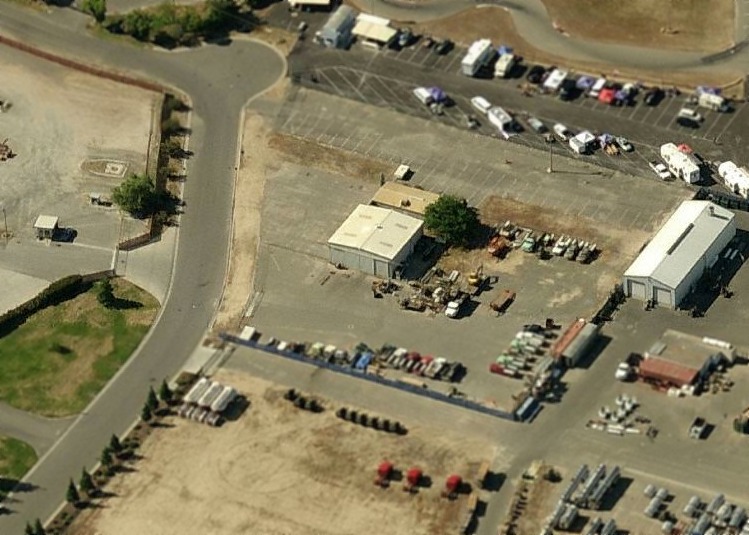
A circa 2008-2013 aerial view looking south showed the former Atwater Airport hangar which remains standing.
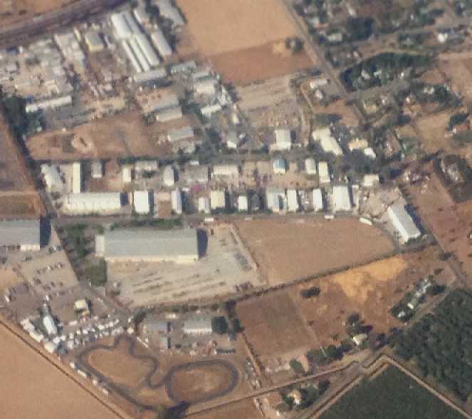
A 5/22/13 aerial view by Joseph O'Keefe (courtesy of Dallam Oliver-Lee) looking east at the site of Atwater Airport.
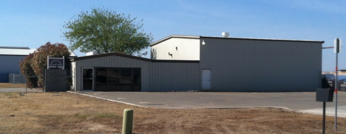
A 4/1/17 photo by Jonathan Westerling of the former Atwater Airport hangar which remains standing.
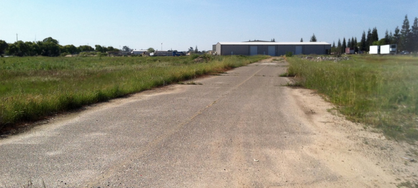
A 4/1/17 photo by Jonathan Westerling of a portion of former Atwater Airport taxiway.

An April 2025 photo looking west at two former Atwater Airport hangars, one of which amazingly still flies a windsock.
The history of the Atwater Airport site is commemorated via the names of the streets which now occupy it: Airpark Road & Aviator Drive.
____________________________________________________
____________________________________________________
This site covers airfields in all 50 states.