Abandoned & Little-Known Airfields:
Illinois: Northern Chicago area
© 2002, © 2026 by Paul Freeman. Revised 2/13/26.
This site covers airfields in all 50 states: Click here for the site's main menu.
Please consider a financial contribution to support the continued growth & operation of this site.
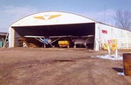
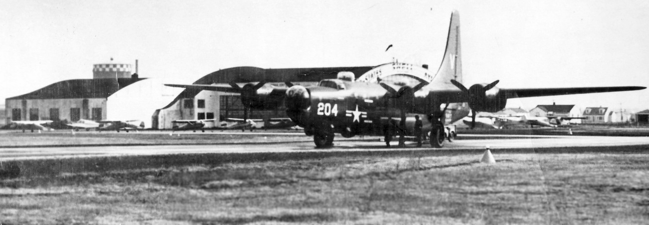
Burris Field / Waukegan Airport (revised 3/30/23) - Curtiss-Reynolds Field / Glenview NAS / CGAF Chicago (revised 1/4/26)
Fort Sheridan Rifle Rangle Field / Ft. Sheridan AAF / Haley AAF (revised 2/21/25) - Greer Airport / Park Ridge Airport / River Road Airport (revised 6/11/17)
Hanson Airport / Taylor Airport (revised 2/21/25) - Polidori RLA Airfield / Victory Aircraft Airfield / Air Estates Airport (revised 2/13/26)
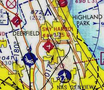
Ravenswood Airport (revised 3/30/23) - Sky Harbor Airport (revised 3/24/24)
____________________________________________________
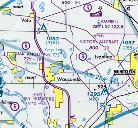
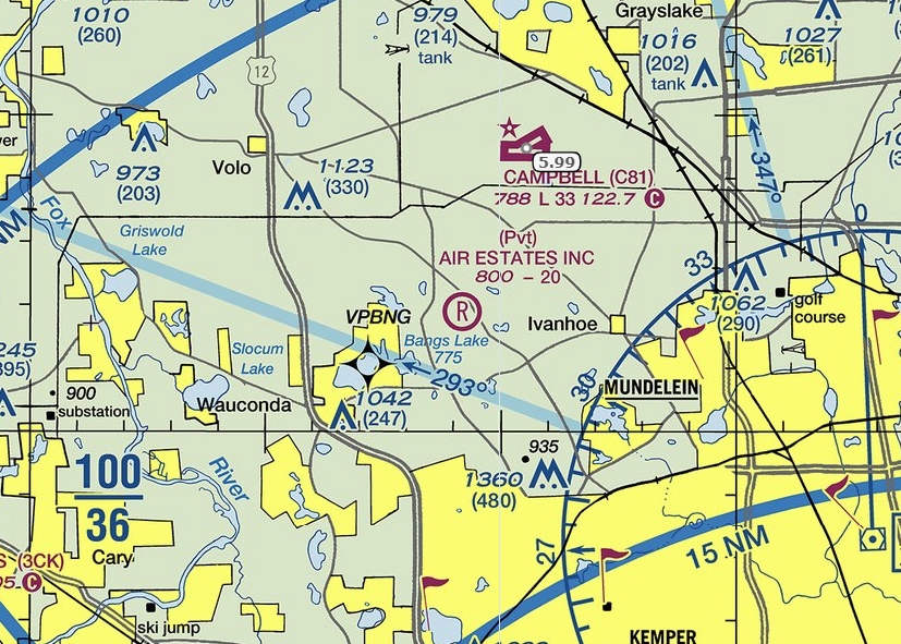
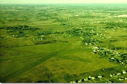
Polidori RLA Airfield / Victory Aircraft Airfield / Air Estates Airport (LL09), Mundelein, IL
42.282, -88.093 (North of Chicago, IL)
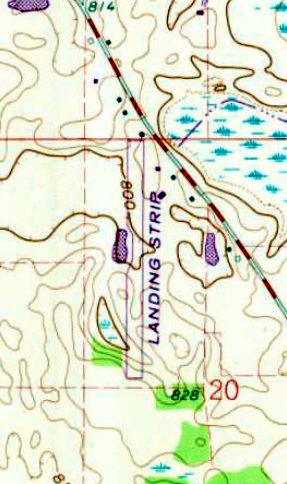
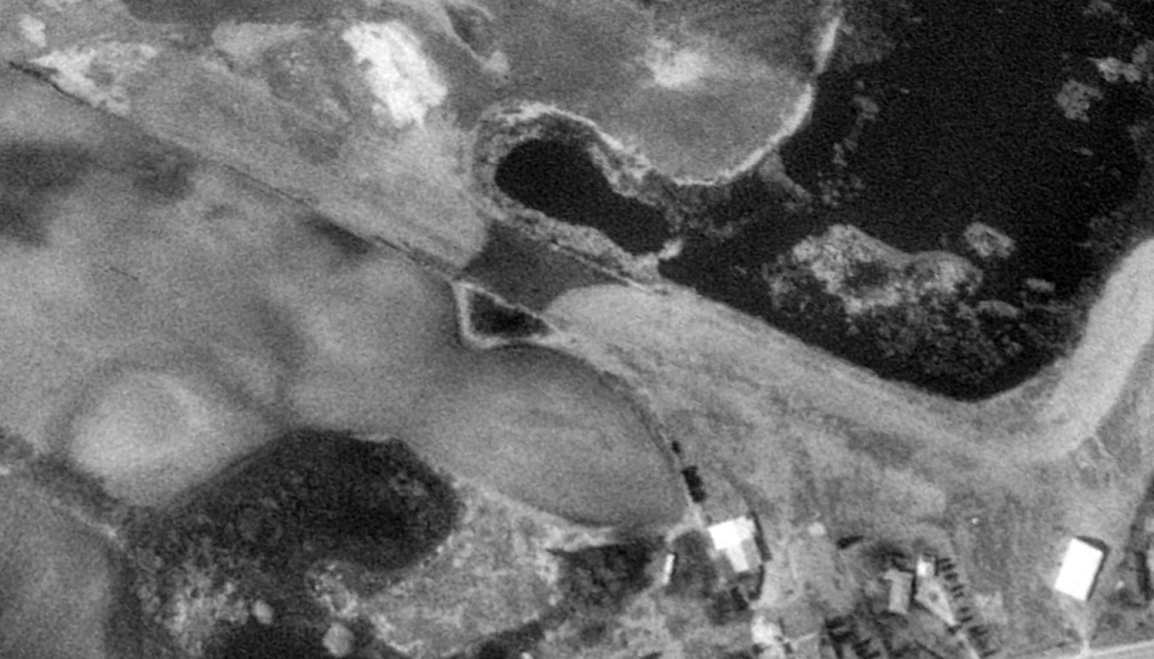
Victory Air Museum Airfield, as depicted on the 1972 USGS topo map.
No airfield was yet depicted at this location on a 1953 aerial photo.
According to Wikipedia, Air Estates Airport opened in 1961.
It was known as Polidori RLA, after pilot & owner Amilio "Paul" Polidori.
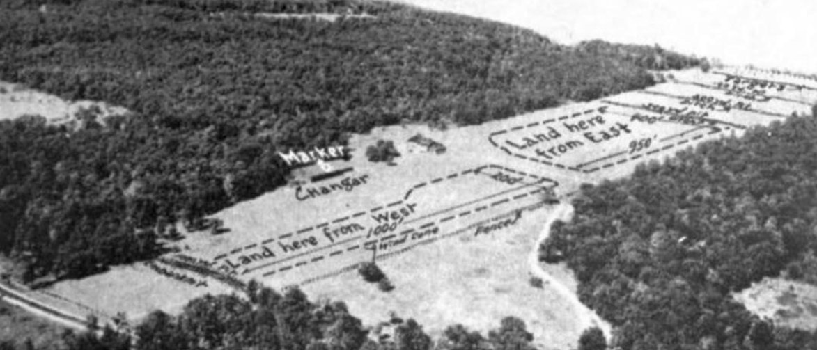
The earliest depiction which has been located of Polidori RLA Airfield was on a 1961 aerial view.
It depicted a single newly-cleared unpaved north/south runway, with a small building each on the north & northeast sides,
and one light aircraft parked on the northeast side.
However, Polidori RLA Airfield was not yet depicted on Milwaukee Sectional Charts from 1961-73.
According to Wikipedia, in 1966, Polidori & an airplane parts trader, Earl Reinert, opened the Victory Air Museum adjacent to the airstrip.
The museum specialized in aircraft used in World War II. Behind the museum structure & partially along the airstrip was an outdoor display of airplanes.
Leo Ladurini recalled, “I flew into Victory Air Museum in the 1960s & 1970s. It was a tough place to fly into & out of.”
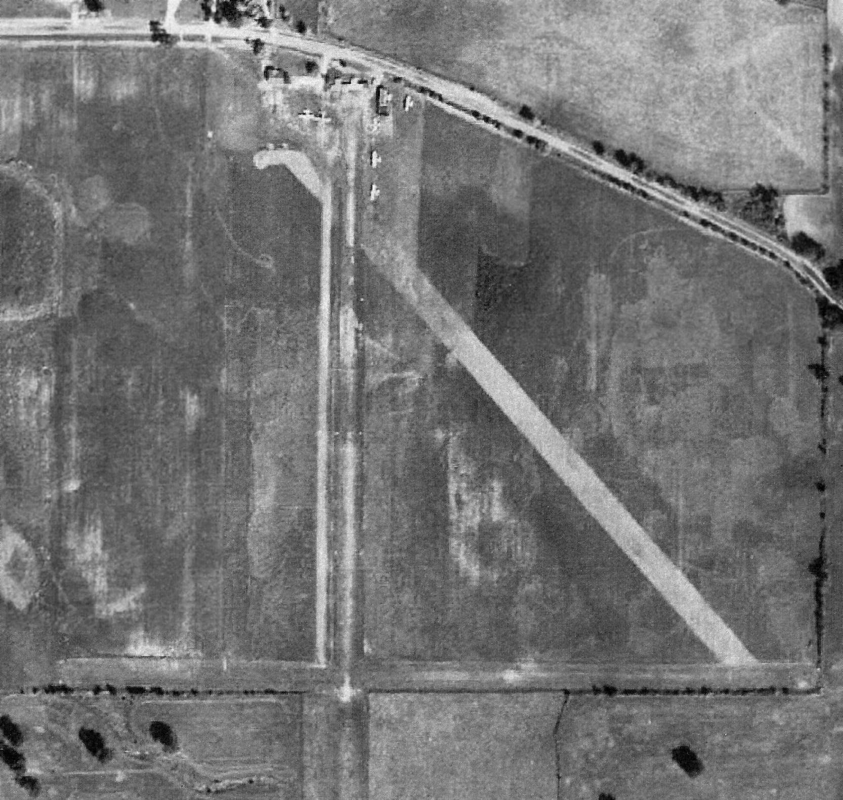
The earliest map depiction which has been located of Victory Air Museum Airfield was on the 1972 USGS topo map.
It depicted a single unpaved north/south runway, generically labeled as “Landing Strip”.
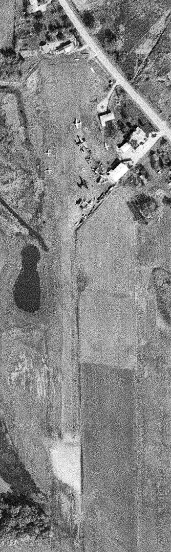
The earliest photo which is available of Victory Air Museum Airfield was a 10/26/72 USGS aerial view.
It depicted in the same physical configuration as the 1961 photo, but a total of 10 museum aircraft were parked on the northeast side.
According to Wikipedia, Polidori reported attracting between 2,000-3,000 visitors to the museum in each of the years 1976 & 1977.”

A Summer 1974 photo of North American B-25J Mitchell “Tokyo Express” at Victory Air Museum.
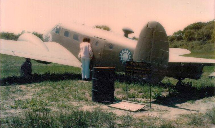
A circa 1974 photo of a Beech C-45 Expeditor in Nationalist Chinese markings at Victory Air Museum.

A Summer 1974 photo of an Ohka Kamikaze rocket bomb at Victory Air Museum.
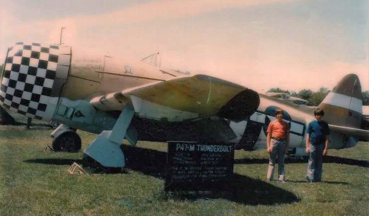
A circa 1974 photo of a Republic P-47M Thunderbolt at Victory Air Museum.
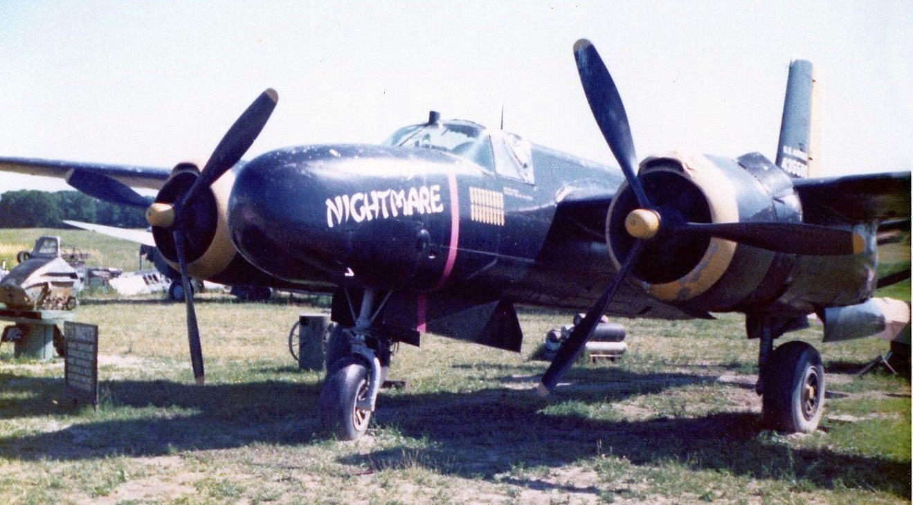
A 1976 photo by D. Miller of Douglas A-26C Invader “Nightmare” at the Victory Air Museum.
D. Miller recalled, “This was one of approximately 15 forlorn warbirds that sat in airfield, part of a privately-owned collection.
Earl Reinert owned these warbirds & had intended on returning the planes to flying status as money became available.
Unfortunately he ran into financial difficulty & had sell all the old birds.”
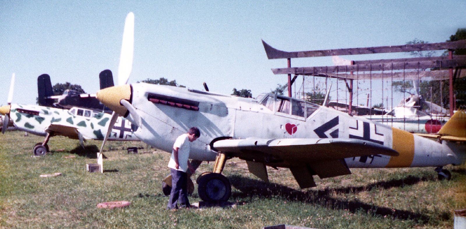
A 1976 photo by D. Miller of several Hispano Ha-1112s at the Victory Air Museum.
The Hispano Aviación HA-1112s were licence-built versions of the Messerschmitt Bf 109G-2 developed in Spain during & after World War II.
D. Miller recalled, “All of the Hispano Messerschmitts were used in the 1969 movie 'The Battle of Britain'.
Many of the Hispano Messerschmitts that are currently in the US came from this collection.”
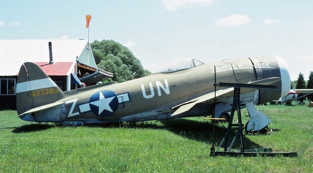
A 6/5/80 photo by Glenn Chatfield of Republic YP-47M Thunderbolt, c/n 2962, N27385 at the Victory Air Museum, Mundelein.
A 1980 aerial view depicted the number of aircraft seen parked at the Victory Air Museum Airfield had decreased slightly, to approximately 6.
The earliest aeronautical chart depiction which has been located of Victory Aircraft Airfield was on the 1981 Chicago Terminal Chart.
It depicted Victory Aircraft as a private airfield having a 2,000' unpaved runway.
According to Wikipedia, from 1982 or earlier, an annual Father's Day fly-in event was held.

The last photos which have been located showing aircraft at Victory Air Museum were a series from February 1983, this one showing the North American B-25J Mitchell “Tokyo Express”.

A February 1983 photo of Republic YP-47M Thunderbolt, c/n 2962, N27385 at the Victory Air Museum.

A February 1983 photo of Douglas A-26C Invader “Nightmare” at the Victory Air Museum.
According to Wikipedia, about 2 weeks after what in 1985 would become the last annual fly-in at the Victory Aircraft Museum Airstrip,
Paul Polidori died at the age of 72, along with an aerial photographer, when the 45-year-old plane Polidori flew crashed while approaching for a landing at the airport.
After Polidori's passing, the museum closed & the airport was sold.
The new airport owner, Air Estates Inc., constructed a dedicated airport building on the north end of the airstrip. The airport's new name was Air Estates Airport.
Air Estates Airport has one unpaved 2,000' north/south runway.
A 1988 aerial view depicted the number of aircraft seen parked at the Air Estates Airfield had decreased to only 2 light single-engine aircraft,
with all the former museum warbirds having left.
A 1994 aerial view showed the Air Estates Airfield seemingly abandoned, devoid of aircraft.
The runway remained intact, along with the former museum building & another hangar.
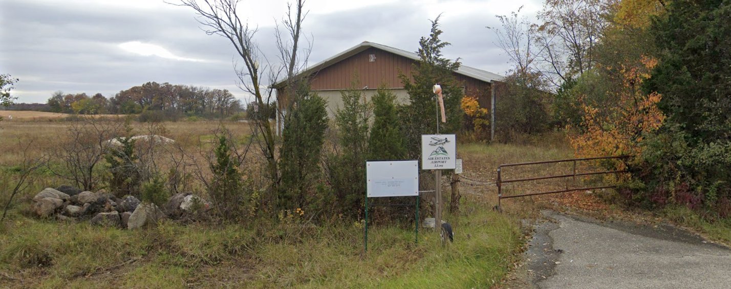
An October 2019 photo looking west at the entrance to Air Estates Airport, with one former hangar on the north end.
The May 2006 Chicago Terminal Chart depicted Air Estates Inc. as a private airfield having a 2,000' unpaved runway.
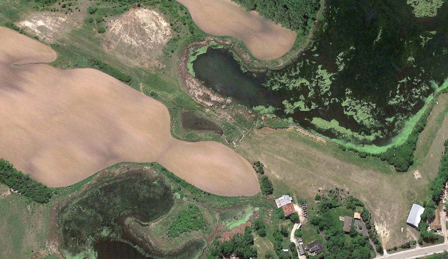
A 2021 aerial view looking southwest showed the Air Estates Airfield runway remained intact though very deteriorated.
The Victory Air Museum hangar & another hangar at the north end remained standing.
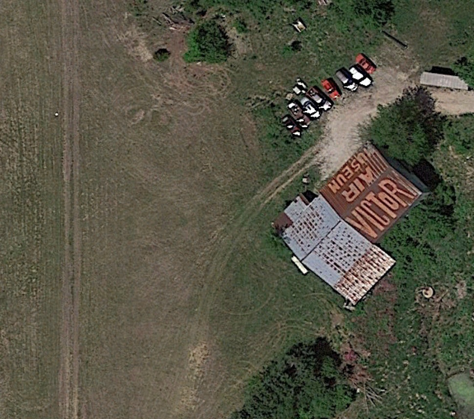
A 2021 aerial view showed the former museum hangar still had "Victory Air Museum" painted on its roof.
Air Estates Airport was still depicted on the 2022 Chicago Terminal Chart as an active private airfield with a 2,000' unpaved runway, even though it has been abandoned & unusable for years.
Thanks to Leo Ladurini for pointing out this airfield.
____________________________________________________
Hanson Airport / Taylor Airport, Round Lake, IL
42.396, -88.077 (North of Chicago, IL)

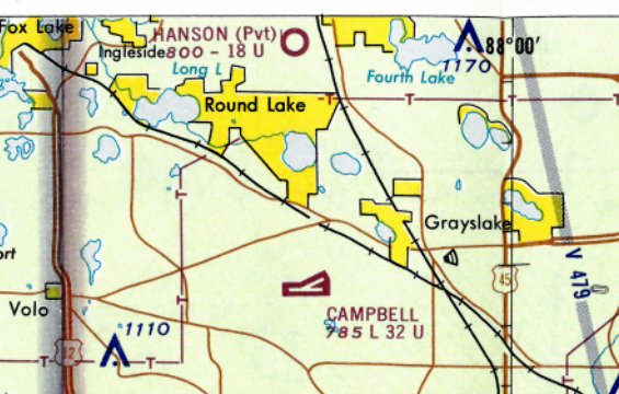
Hanson Airport, as depicted on the November 1960 Milwaukee Sectional Chart.
This little general aviation airport was evidently established at some point between 1946-53, as it was not yet depicted on a 1946 aerial photo.
The earliest depiction which has been located of Hanson Airport was on a 1953 aerial photo.
It depicted the very modest beginnings of the airfield: a single T-hangar on the north side of an unpaved north/south runway.
Hanson Airport was not yet depicted on the May 1960 Milwaukee Sectional Chart.
The earliest depiction which has been located of Hanson Airport was on the November 1960 Milwaukee Sectional Chart.
It depicted Hanson as a private airfield having an 1,800' unpaved runway.
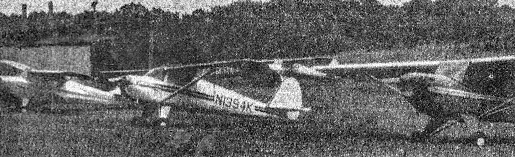
The earliest photo which is available of Hanson Airport was a 1961 aerial view (courtesy of Tony Marsala).
The airport had been expanded since 1953, with a total of 3 unpaved runways, and 3 T-hangars on the north side, near which were parked 5 light single-engine aircraft.
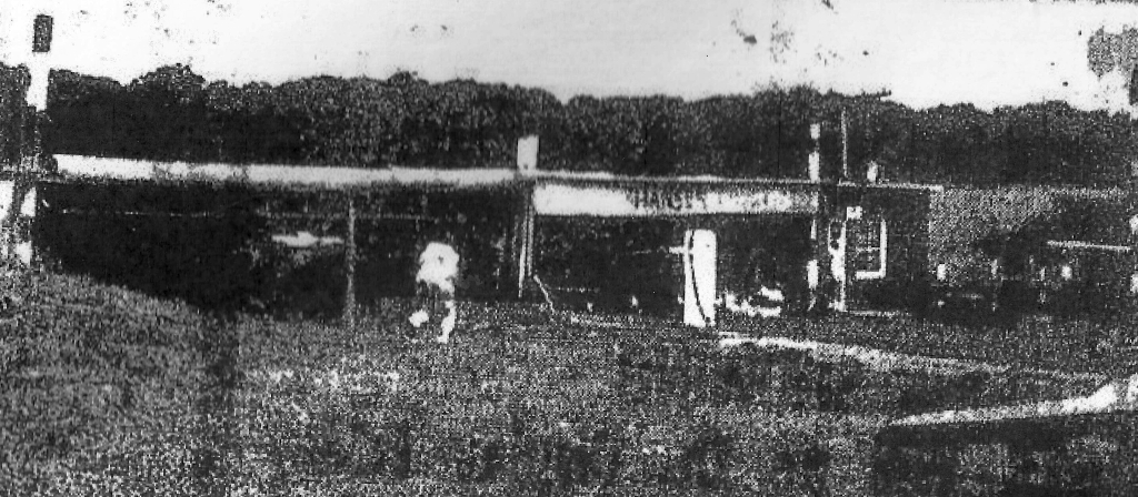
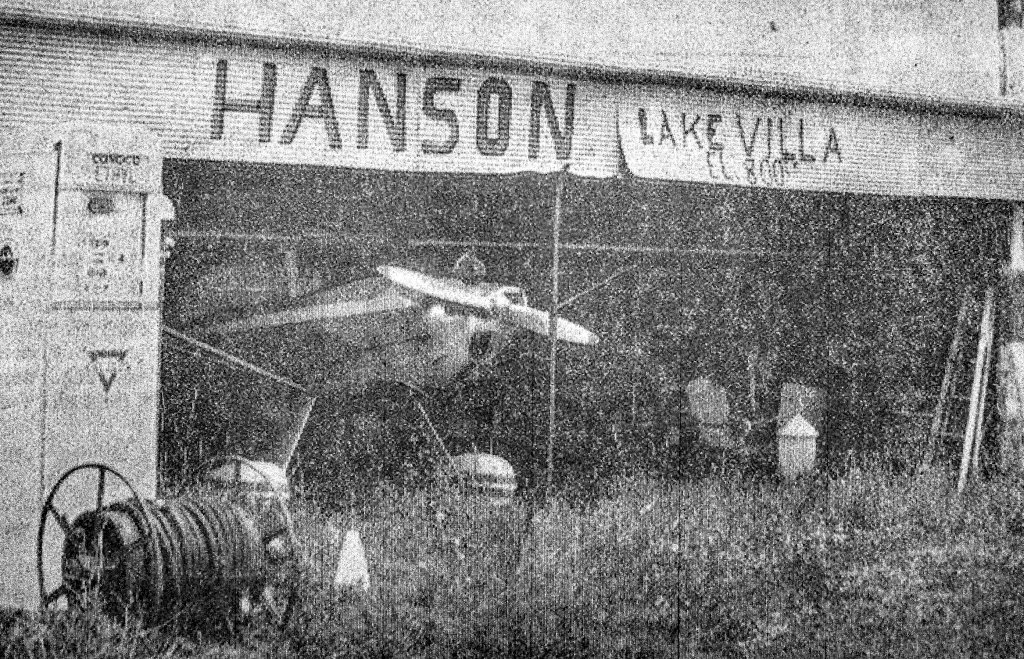
An undated photo of the Hanson Airport hangar from a 1962 newspaper article (courtesy of Tony Marsala).
The caption said “The field has been in operation for some 10 years. It has a north/south runway 1,280' long the can be lighted at night & east/west strip 1,500' in length.
In addition there are hangars, a beacon, windsock, and other flying facilities.”
The 1967 Chicago Local Aeronautical Chart depicted Hanson as a private airfield having an 1,800' unpaved runway.
A circa 1960s photo of 4 single-engine taildraggers at Hanson Airport (courtesy of Tony Marsala).
The caption said “They are a few of the 15 regularly hangared or tie down at the field.
Most belong to the Lake Villa Blue Devils flying club which maintains the field.”
A circa 1960s photo of a single-engine taildragger inside the Hanson Airport hangar (courtesy of Tony Marsala).
Hanson Airport was evidenty renamed Taylor Airport at some point between 1967-70, as that is how it was labeled on the May 1970 Milwaukee Sectional Chart.
It depicted Taylor as a private airfield having an 1,800' unpaved runway.
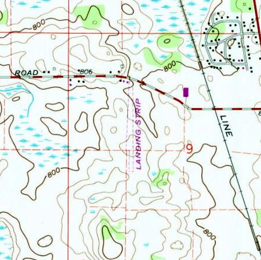
The 1972 USGS topo map depicted Taylor Airport as a single unpaved north/south runway, labeled generically as “Landing Strip”,
with a few small buildings on the northwest side.
The last photo which has been located of Taylor Airport was a 10/26/72 USGS aerial view.
The airport had evidently reverted to its original configuration, with only a single unpaved north/south runway.
The number of T-hangars had also shrunk to only 1, and the number of aircraft visible had reduced to only 2.
Taylor Airport was evidently closed at some point between 1972-80,
as a 1980 aerial view showed a house had been built over the site of the T-hangars,
and the area of the runway had been returned to cultivation.
Yet another of hundreds of American grassroots airports lost forever.
A 2018 aerial view showed no trace remaining of Taylor Airport, with the site covered by housing.
Thanks to Tony Marsala for pointing out this airfield.
____________________________________________________
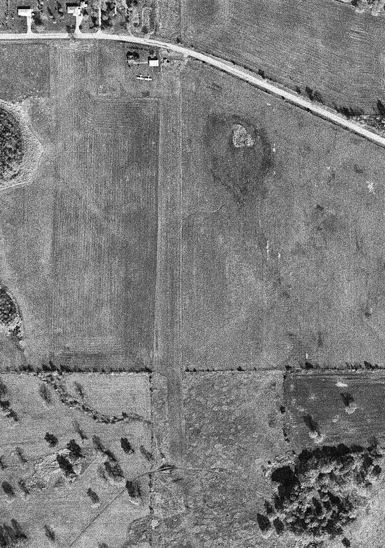
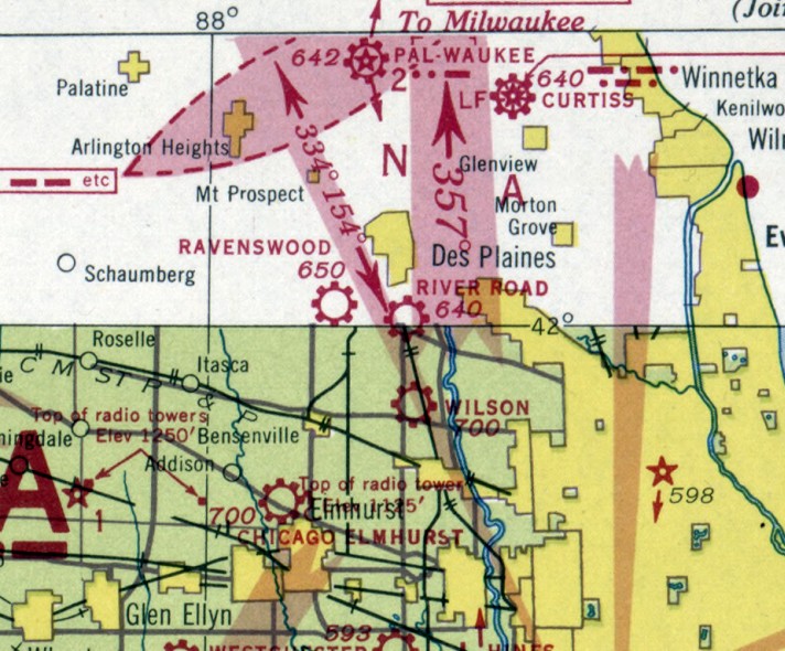
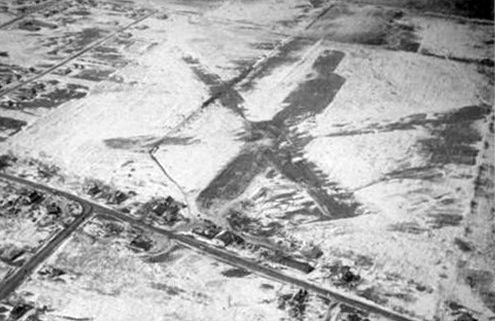
Greer Airport / Park Ridge Airport / River Road Airport, Park Ridge, IL
42.007, -87.873 (Northeast of Chicago O'Hare Airport, IL)
Greer Airport, as depicted on the December 1930 Chicago Sectional Chart.
The date of construction of this little general aviation airport has not been determined.
The earliest depiction which has been located of Greer Airport was on the December 1930 Chicago Sectional Chart,
which depicted Greer as a commercial/municipal airport.
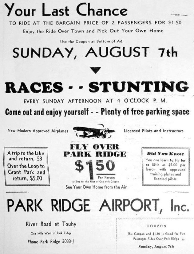
Greer Airport was evidently renamed Park Ridge Airport at some point between 1930-32,
as that is how it was described in an 8/8/32 advertisement (courtesy of Richard Paul).
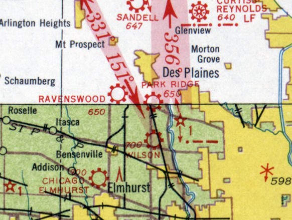
The March 1935 Chicago Sectional Chart depicted Park Ridge as a commercial/municipal airport.
Park Ridge Airport was evidently renamed to River Road Airport at some point between 1935-37,
as that is how it was depicted on the March 1937 Chicago Sectional Chart (courtesy of Chris Kennedy).
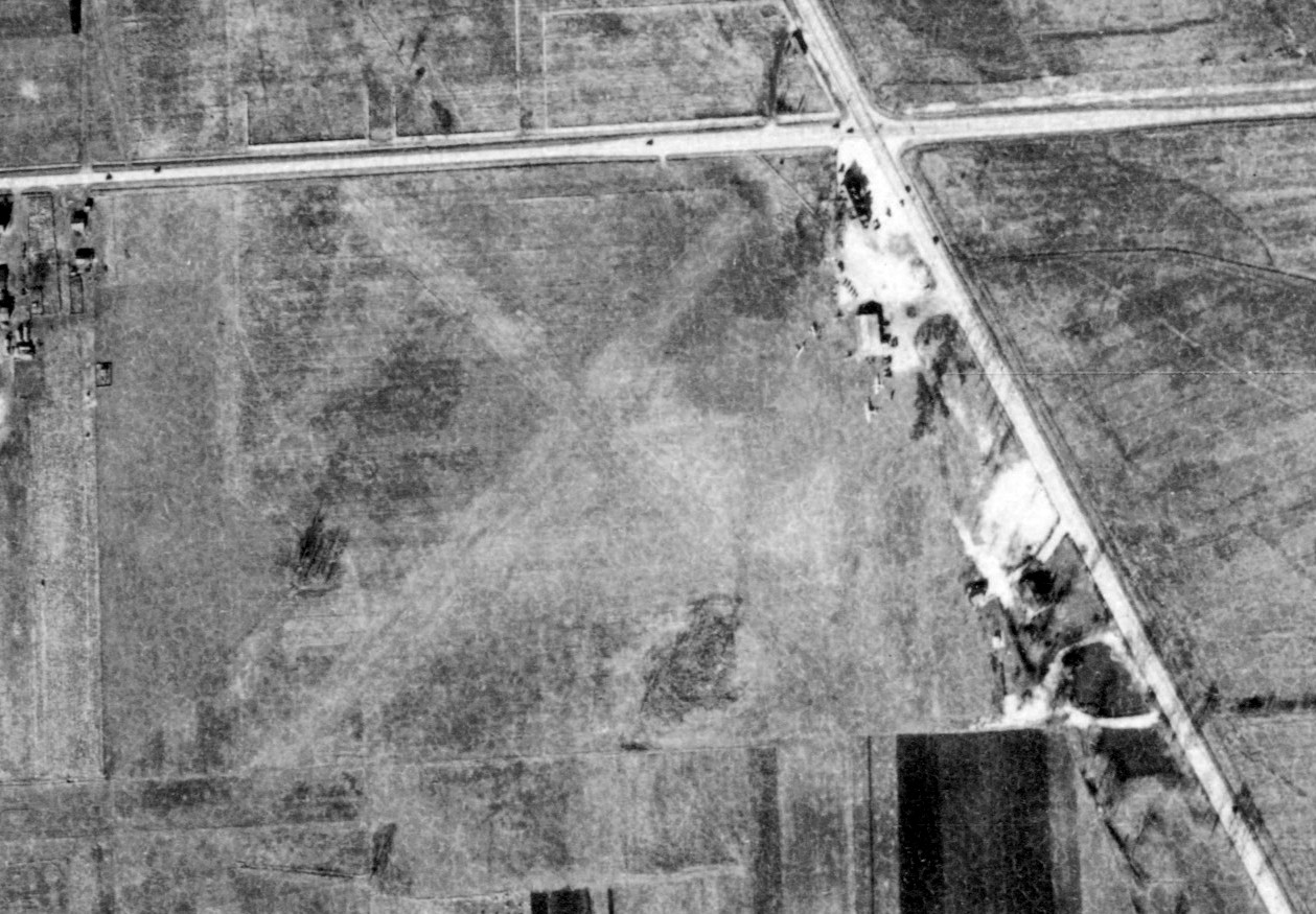
The only photo which has been located of Park Ridge Airport was an 11/20/38 aerial view (courtesy of Richard Paul),
which depicted Park Ridge as having 2 grass runways in an X-shape, with 3 light single-engine planes parked near a building on the east side.
The last depiction which has been located of River Road Airport was on the February 1940 Chicago Sectional Chart.
River Road Airport was evidently closed (for reasons unknown) at some point between 1940-42,
as it was no longer depicted on the October 1942 Chicago Sectional Chart.
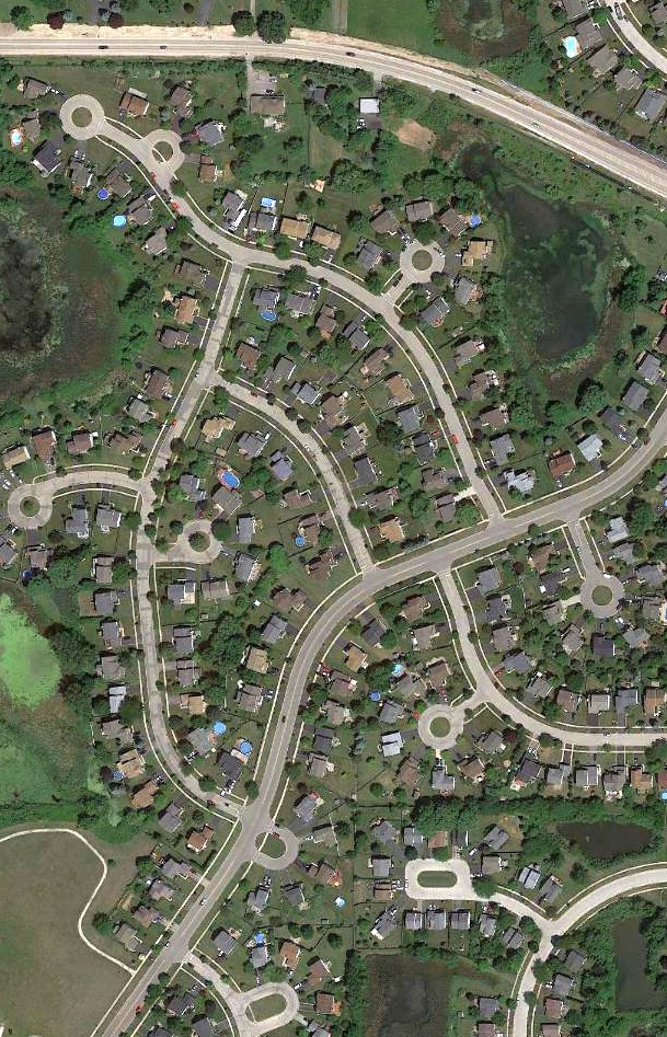
A 1951 aerial photo showed that houses had covered the site of River Road Airport, but the 1930s vintage airport building still remained standing among them.
A 1962 aerial photo showed that more dense houses had built built on the site of River Road Airport,
and the airport building had been removed at some point between 1951-62, erasing the airport's last trace.
A 2016 aerial view showed no trace remaining of River Road Airport.
The site of River Road Airport is located southwest of the intersection of Touhy Avenue & I-294.
Thanks to Richard Paul for pointing out this airfield.
____________________________________________________
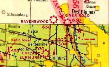
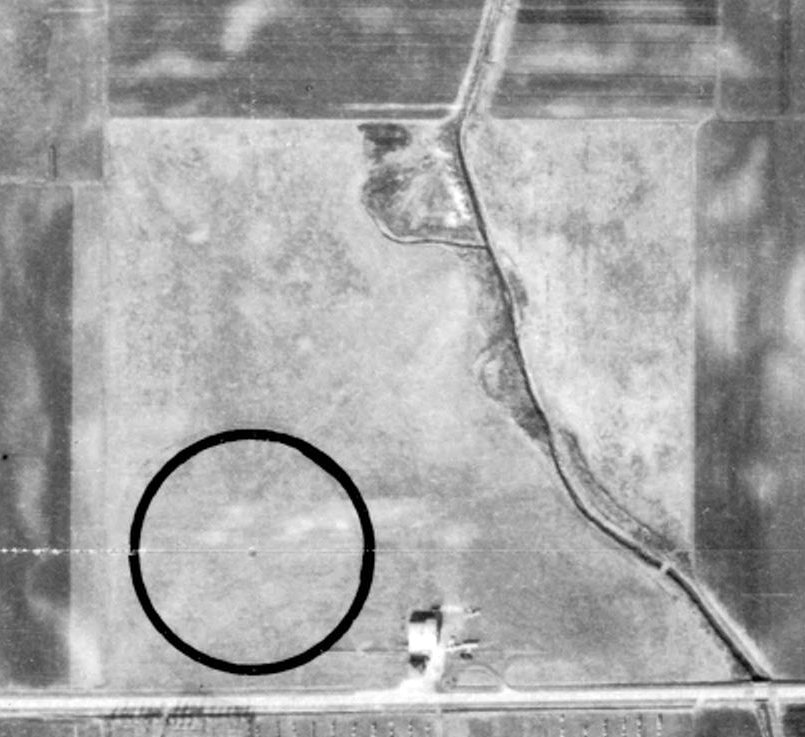
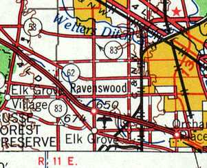
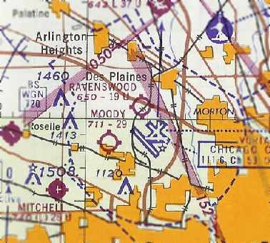
Ravenswood Airport, Rosemont, IL
42.01, -87.93 (Northwest of Chicago O'Hare Airport, IL)
Ravenswood Airport, as depicted on the 1930 Chicago Sectional Chart.
This little general aviation airport was evidently established at some point between 1927-31,
as it was not yet depicted on the 1927 USGS topo map.
According to Michael Hanson, “My grandfather, John Jerger & his 6 brothers built and operated [Ravenswood] Airport.
I believe they built it in the late 1920s.
My Grandfather told stories about building the hangar & he remembered how many bolts were used to do so.”
The earliest depiction which has been located of Ravenswood Airport was on the 1930 Chicago Sectional Chart,
which depicted Ravenswood as a commercial/municipal airport.
Ravenswood Airport, as depicted in the 2/17/31 Commerce Department Airway Bulletin (courtesy of Mike Denja).
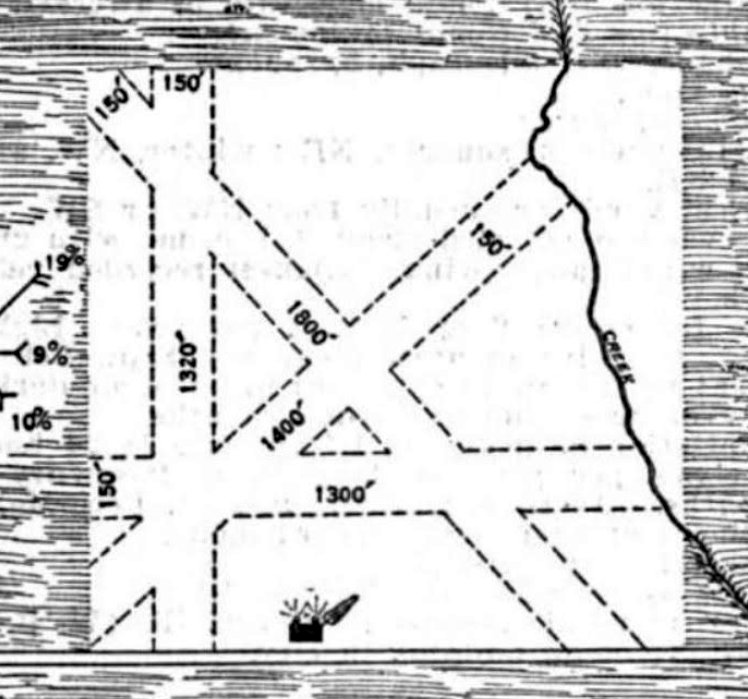
The 2/17/31 Commerce Department Airway Bulletin (courtesy of Mike Denja) described Ravenswood as a commercial airport consisting of a 40 acre irregularly-shaped sod property,
owned & operated by the Ravenswood Aeronautical Corporation.
It contained 4 runways, the longest being the 1,800' northwest/southeast strip, and one 60' x 50' steel hangar was depicted on the south side.
The Airport Directory Company's 1933 Airport Directory (courtesy of Chris Kennedy)
described Ravenswood as a commercial airport, consisting of an irregularly-shaped 40-acre sod field,
containing 4 runways, with the longest being the 1,800' northwest/southeast strip.
The field was said to have a hangar.
The March 1937 Chicago Sectional Chart (courtesy of Chris Kennedy)
depicted Ravenswood as a commercial/municipal airport.
A 1938 aerial photo of Ravenswood Airport from the IL Natural Resources Geospatial Data Clearinghouse (courtesy of Brian Scruggs)
depicted the airport as a square grass field bisected on the northeast corner by a stream.
Three planes were visible parked outside of a single building along the south side of the field.
James Jerger recalled, “Ravenswood Airport in the late 1930s... My father, Nicholas Jerger, was one of 8 brothers.
At one time or other all 7 were associated in some way with Ravenswood Airport, but I think it was actually owned by brothers Frank & Steve Jerger.
They also owned the Ravenswood Garage, an auto repair business on Western Avenue.
Our family made several trips to the airport in the late 1930s. I was 10-12 years old & I remember the airport well.
It consisted of one large yellow hangar which easily held the 2 airplanes they had, and a very large grassy field - there was no real runway.
One plane was a Curtiss Robin, the other a very old biplane.
The youngest brother of the 8 was Henry AKA 'Hank'. I think that he was the only serious pilot they had.
He was in his 20s then & cut quite a dashing figure with his aviator sunglasses & his leather jacket.
Of course I worshiped him so much that I determined to be a pilot myself.
When the war began there was gas rationing & we couldn't take long trips like that any more.
In about 1942 or 1943 my dad told me that he had learned from brother Steve that the Federal Government forced the brothers to close the airport
because it lay in the landing flight path of a new airfield that the government was building south of Ravenswood for military purposes.
After the war that became O'Hare [Airport].”
Ravenswood Airport was depicted as a commercial/municipal airport on the October 1944 Chicago Sectional Chart (courtesy of Richard Doehring).
It also depicted Orchard Place Airport very close to the southeast (which would later grow massively to become O'Hare International Airport).
According to Dave Menard, “Touhy Avenue formed the northern border of what was then O'Hare Field,
and just across this road was Ravenswood Airport, which was strictly general aviation.
The largest aircraft I ever saw there was a Stinson AT-19 Reliant.”
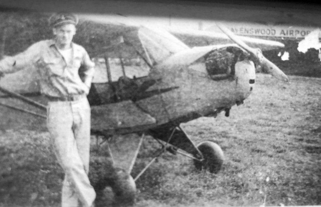
A 1940s photo of Tim Goertz's father & a Piper J-3 Cub in front of a Ravenswood Airport hangar.
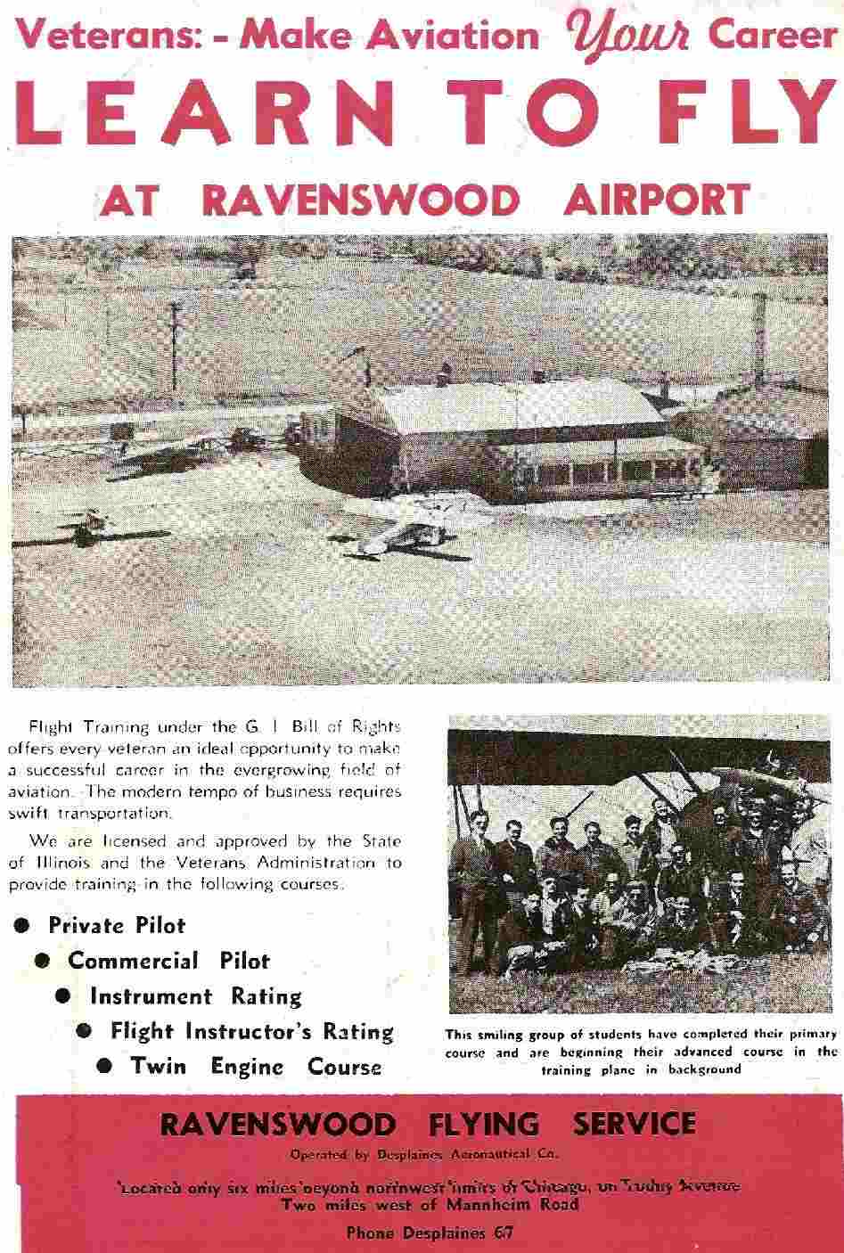
An advertisement for Ravenswood Flying Service from the July-August 1948 issue of The Body Builder magazine (courtesy of Robert Armstrong)
depicted a hangar with several light aircraft.
A 12/13/51 USGS aerial view showed that Ravenswood had gained a 2nd hangar at some point between 1938-51.
A total of 24 light aircraft were clustered around the hangars.
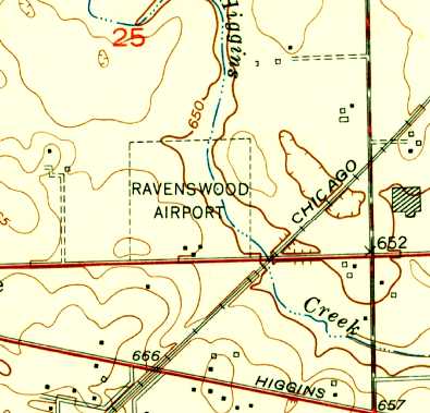
The 1953 USGS topo map depicted Ravenswood Airport as a square outline, with 3 small buildings along the road on the south side.
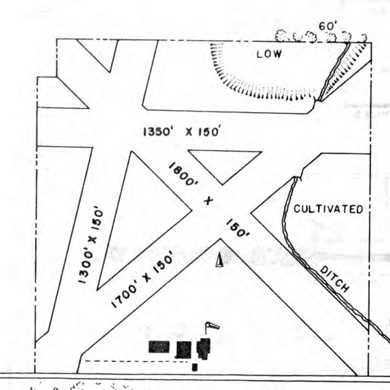
The 1954 IL Airport Directory (courtesy of Lee Corbin) depicted Ravenswood Airport as having 4 unpaved runways, and 3 hangars on the south side.
Bill Pagett recalled, “My love affair with flying began around 1955 when I was 6 years old.
My father, a private pilot, had a friend that owned a Piper Tri-Pacer & we went for a ride.
We departed from Ravenswood Airport just a stone's throw northwest from what is now known as Chicago O'Hare Airport.
I was hooked.”
An undated aerial photo of Ravenswood Airport in the 1956 IL Airport Directory (courtesy of Chris Kennedy)
depicted over 40 light aircraft parked on the south & west sides of the field,
and several hangars on the south side.
The directory depicted Ravenswood as having 4 turf runways (with the longest being the 1,800' northwest/southeast strip).
The operator & manager was listed as Abe Marmel.
Ravenswood Airport, as depicted on the 1958 USGS topo map.
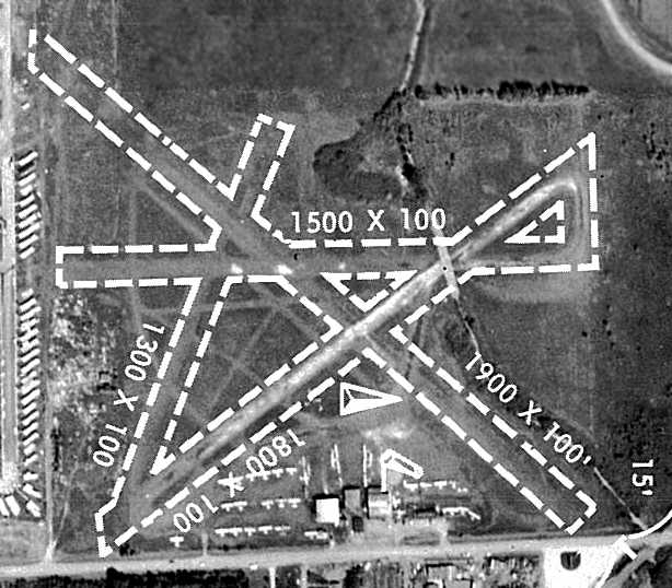
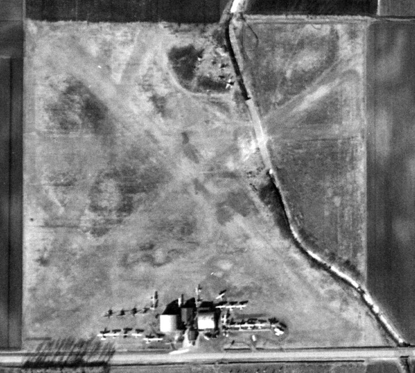
The last photo which has been located showing Ravenswood Airport in operation was a circa 1961 aerial view from the 1962 IL Airport Directory (courtesy of Jonathan Westerling).
It depicted a total of over 30 aircraft parked on the south side of the field along with several hangars.
The directory depicted Ravenswood as having 4 turf runways (with the longest being the 1,900' northwest/southeast strip).
Note 2 of the runways which crossed over the stream. The operator & manager was listed as Abe Marmel.
The end was in sight for this little field, though, as the directory noted, “Scheduled to close 6/30/62.”
The last aeronautical chart depiction which has been located of Ravenswood Airport was on the June 1962 Chicago Sectional Chart (courtesy of William Pagett).
It depicted Ravenswood as having a 1,900' unpaved runway, with the massive complex of O'Hare Airport's runways adjacent to the south.
Dave Menard recalled of Ravenswood, “There were many abandoned airframes all over it & it finally shut down & was not cleaned up.”
Accorrding to Bill Pagett, “Ravenswood closed for 2 reasons.
First O'Hare was expanding north to Touhy Avenue, and the Illinois Tollway Authority was building the Northwest Tollway across the north end of the airport property.”
Ravenswood Airport was evidently closed at some point between 1962-63,
as it was no longer depicted on the May 1963 Chicago Sectional Chart nor or the 1969 USGS topo map.
The 1972 USGS topo map depicted a trailer park on the site of Ravenswood Airport.
A 1974 aerial view showed the airport in an abandoned state, with all of the airplanes gone.
Only the eastern hangar remained standing.
The western hangar had been removed at some point between 1962-74, with just its foundation remaining.
Micheal Bloome recalled, “In the late 1970s I frequently visited the home of one of my father’s friends
who lived within the trailer park & spoke of the former airport that was there.
A hangar was located in the same general area along Toughy Avenue as shown in the 1938 aerial view.
That hangar had the Ravenswood name posted over its large doorway.”
The former Ravenswood Airport property was sadly thrust into the headlines on 5/25/79,
when American Airlines Flight 191 experienced an in-flight separation of its engine #1 after takeoff from nearby Chicago O'Hare Airport.
The DC-10 crashed into the former Ravenswood Airport property, killing all 271 on board & 2 on the ground,
thus becoming the deadliest accidental airplane crash on U.S. soil.
According to Dave Menard, “When that DC-10 lost #1 engine in May 1979,
some early reports mentioned a possible mid-air collision with a light plane as light plane wreckage was found with the airliner's.”
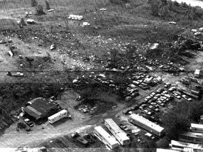
An undated photo of the site of the crash of American Airlines DC-10 Flight 191, which impacted into the former Ravenswood Airport on 5/25/79,
after loosing engine #1 after takeoff from nearby Chicago O'Hare Airport.
The building at bottom-left may have been a former Ravenswood Airport hangar.”
Bill Pagett recalled, “Besides the terrible loss of life, also lost were the last remaining Ravenswood Airport buildings where the owner still sold parts from salvaged Aircoupes -
some 25 years after the closing of the airport.”
According to Michael Hanson (grandson of Ravenswood Airport founder John Jerger),
“I think the hangar was destroyed when AA Flight 191 crashed in 1979.”
Micheal Bloome reported in 2007, “Today the property is made up of several different owners.
The majority of the property is occupied by a trailer park. Closer to Elmhurst road is the O’Hare Airport fuel depot.
In the general vicinity of where the old hangars once resided the City of Chicago’s police canine unit training center now exists.”
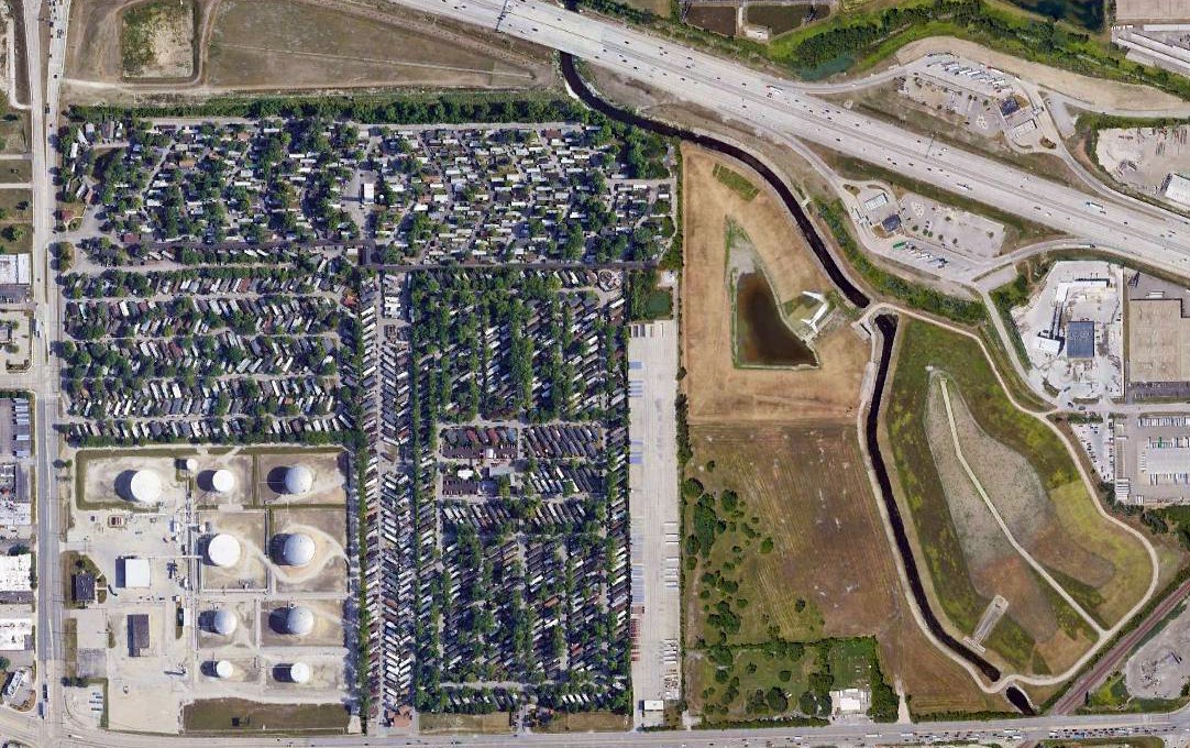
A 2018 aerial view showed the only recognizable element which remained at the site of Ravenswood Airport is Willow Creek which runs along the eastern portion of the property.
No other traces of the former airport appeared to remain.
The site of Ravenswood Airport is located northeast of the intersection of Touhy Avenue & Elmhurst Road.
____________________________________________________
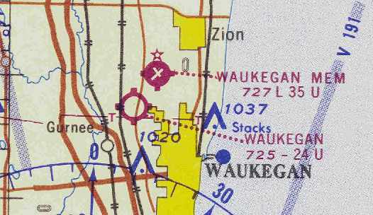
Burris Field / (Original) Waukegan Airport, Waukegan, IL
42.39, -87.88 (North of Chicago, IL)
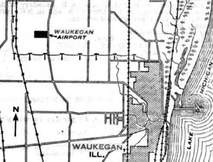
Waukegan Airport, as depicted on the 10/11/30 Commerce Department Airway Bulletin (courtesy of Mike Denja).
The original airport for the town of Waukegan was located on the northwest corner of Green Bay Road & Sunset Avenue.
According to Robbie Culver, the Waukegan Chamber of Commerce chose the Burris Farm as their site for a new airport.
The Chamber of Commerce purchased a Swallow biplane,
and 2 World War I pilots (Johnnie Miller & Edward Hedeen) were hired for the new “National School of Aviation”.
The new “Burris Field” was opened in the summer of 1927.
The National School of Aviation soon became a money-losing venture, and the Chamber of Commerce sold the Swallow.
Linden Burris, the son of the owner of the Burris farm, took over operations at the airport
and several local residents began the Waukegan Flying Club, purchasing a different Swallow biplane to use for club operations.
The club’s first instructor was Vernon Ramsey.
In 1928, Northwest airways used the field as an emergency landing strip for the Chicago-to-Milwaukee airmail/passenger route.
In 1928 or 1929, a steel hangar was assembled, having been shipped by rail from Wisconsin. The hangar was intended for 8 aircraft at that time.
Waukegan native Frederic Stripe (who at the age of 5½ had seen the Jennies being flown from Curtiss Flying Field) assisted in assembling it.
“It came in a kit like an erector set. It had no rivets, just nuts & bolts. My job was to put the bolts in & tighten them up with the nuts.”
Later, a wooden hangar was added.
In the late 1920s, air shows & barnstorming attracted large crowds to the site, featuring “air races, stunt flying, and parachute jumps”, according to Frederic Stripe.
He learned to fly at the airport in 1930 in a OX-5 Swallow trainer.
The earliest depiction which has been located of Waukegan Airport was on the 10/11/30 Commerce Department Airway Bulletin (courtesy of Mike Denja).
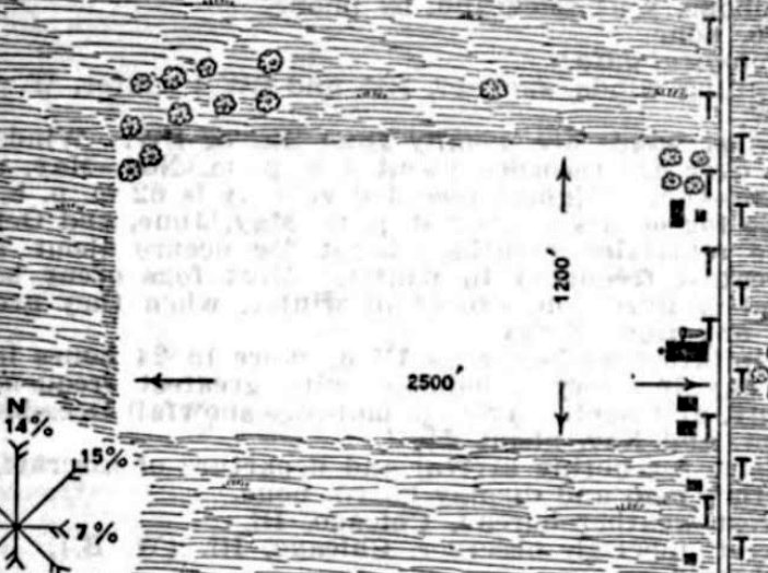
It described Waukeegan Airport as a 64 acre rectangular field measuring 2,500' east/west, owned by Frank Burris & operated by Lindon Burris.
Several buildings were depicted on the east side, including a 80' x 52' steel hangar.
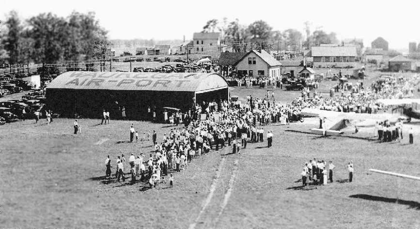
The earliest photo which has been located of Burris Field / Waukegan Airport
was a 1931 photo of a hangar & several planes (courtesy of Frederic Stripe).
The earliest aeronautical chart depiction which has been located of Waukegan Airport was on the June 1931 Milwaukee Sectional Chart.
It depicted Waukegan as a commercial airport.
Waukegan was described as a commercial airport in The Airport Directory Company's 1933 Airport Directory (courtesy of Chris Kennedy).
It was said to consist of a 64-acre rectangular sod field, measuring 2,500' x 1,200'.
A hangar was said to have "Waukegan Airport" on the roof.
By 1934, a rotating beacon & manned weather station were added to the grass field.
At this time, Green Bay Road was still one of the main links between Chicago & Milwaukee,
and the airport expanded to include a service station & garage.
An office, living quarters, and even a small restaurant completed the operation.
Frederic Stripe managed the airport in 1936 & 1937.
Things changed at the little airport in 1938 when Wayne Carpenter took over operations.
Carpenter took over with Stripe remaining for 6 months as a transition.
A 1939 aerial view (courtesy of Robbie Culver) depicted Waukegan Airport's 2 grass runways, as well as a hangar on the east side of the field.
There were no aircraft visible on the field.
The July 1942 Milwaukee Sectional Chart (courtesy of Chris Kennedy) depicted Waukegan as a commercial airport.
An “operator sponsored flying club” (also referred to as the “Economy Flying Club”) began operation at the airport on 5/1/46.
In a 1946 article in Flying Magazine, Wayne Carpenter said that flying rates had been cut
in an effort to spark interest & increase participation in the flying club.
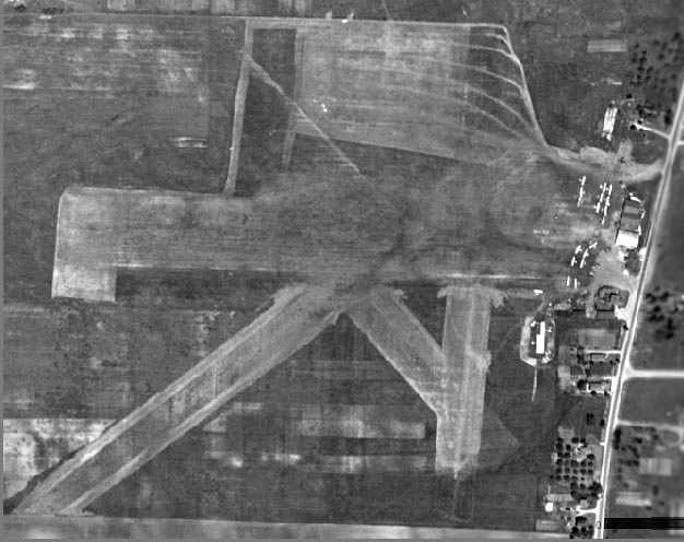
A 1946 aerial view of Waukegan Airport (courtesy of Chris Kennedy)
depicted the field in a well-used state, with over a dozen light aircraft visible on the east side of the airport.
The field had at least 4 grass runways, with a very unusual pattern in the grass on the north side of the field.
The 1949 Milwaukee Sectional Chart (courtesy of Donald Felton) depicted Waukegan Airport as having a 2,500' unpaved runway.
Carl Kangas recalled, “I first went to the airport with my Uncle in summer of 1949.
I knew many of the Burris family. So many of them lived around the airport that the area was called Burrisville.”
Don Page recalled, “I worked as a flight instructor at Waukegan Air Service.”
The 1953 Flight Chart (courtesy of Scott O'Donnell) depicted the original Waukegan Airport as having a 2,500' unpaved runway.

A pre-1954 patch from the “Brewster Flying Club, Waukegan Airport” (courtesy of Carl Kangas).
Carl recalled, “I got the patch when I started working at the airport around 1954 but the club was no longer in operation by then.
It was one of those club deals put on by the owner to increase interest in flying. Brewster was Irene Brewster who ran the office for Wayne Carpenter.
She pretty much ran the airport when I worked there as Wayne had other enterprises to look after.”
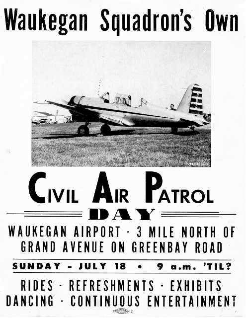
A circa 1954 advertisement for a Civil Air Patrol Day at Waukegan Airport (courtesy of Carl Kangas) showing a surplus Vultee BT-13 Valiant.
Carl recalled, “This was the newly-formed Civil Air Patrol squadron's 1st big event.
The CAP was very popular & most of the local pilots joined.
We Cadets were given classes in basic aviation subjects, close order drill & military discipline at the Tuesday night meetings.
The airshow featured the Cole Brothers Flying Circus, with a parachutist jumping out of a Cub
with an American flag hanging down on a sash-weighted cord tied to his ankle & the National Anthem played over loudspeakers.
Duane Cole in his Great Lakes & Bill Adams in his 450 Stearman flew circles around the flag with their smoke on & the Stearman's prop in high pitch.
There was also a car-top landing & a rope ladder pick up that was quite exiting. It was a hot day with not even the lightest breeze.
The pick-up was to be done from Len Bromstead's 1949 Plymouth convertible (powered by an Olds Rocket 88) on the southwest runway.
The car was plenty fast but the grass was dry & gave poor traction.
After 3 failed attempts to catch up to the Cub, the performer finally grabbed the ladder
and the 65 HP Cub sank under his weight with his ankles dragging the grass,and he was wearing only oxfords.
The Cub could barely climb in the hot air until the poor guy got into the cockpit & pulled the ladder in behind him.
It was an exiting day. We cadets parked cars & worked in the refreshment stand all day after which the Senior Members took Cadets up for airplane rides.
When the Squadron commander, Robert Killian asked I had been up yet I could hardly believe my luck, I finally got my first airplane ride in his Luscombe 8A.”
Carl Kangas recalled, “I hung around the airport & pestered until I was hired as line boy.
I started working at the airport in 1954. I worked 10.5 hours for one hour of dual in a Cub.
My first logged lesson was in April 1955.”

An undated aerial photo from the 1956 IL Airport Directory (courtesy of Chris Kennedy)
depicted the Waukegan Airport as having a somewhat different runway configuration from the 1939 aerial picture:
with 3 grass runways, with the longest being the 2,500' northeast/southwest strip.
A total of 10 light aircraft were visible on the east side of the field.
A 1950s photo by Carl Kangas of an unidentified taildragger at Waukegan Airport, with a Beech 18 running up in the background,
and the “old Burris farm house behind the beacon tower.”
A 1958-59 photo by Carl Kangas of Waukegan Airport, of “Ed Emanual's Stits Playboy, behind it, the airport's Stearman.
It was a rental along with the Cubs & Tri Pacers. Note the canopy that came from a Canadian Stearman.
In the background, partly visible on the left is one of two wooden hangars (one of which blew across the road in a tornado).
The main steel hangar is the original one in the early photos.
Just visible on it's right is the office with lunch counter & small lounge.
This was built in a Quonset Hut with a lean-to added on to the front with a porch for sitting & watching airplanes.”
A July 1958 or 1959 photo by Carl Kangas of the remains of tornado damage at Waukegan Airport.
Carl recalled, “One of the wooden hangers flew across Greenbay road, cleared the power lines without touching them & landed in a heap of sticks.”
The 1960 USGS topo map depicted Waukegan Airport as having 3 unpaved runways.
Carl Kangas recalled, “In 1963 I started out instructing at the old Waukegan Airport.”
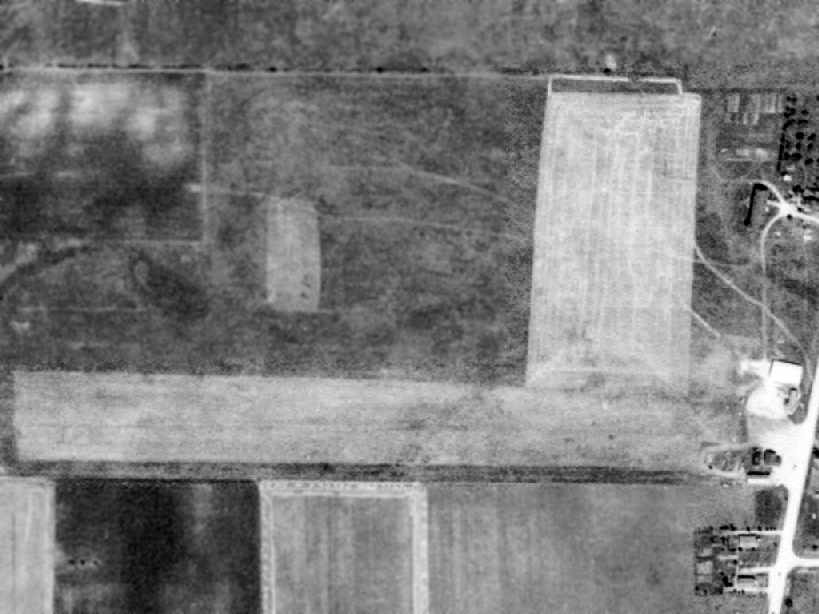
The last photo which has been located of the Waukegan Airport
was a circa 1961 aerial view from the 1962 IL Airport Directory (courtesy of Jonathan Westerling).
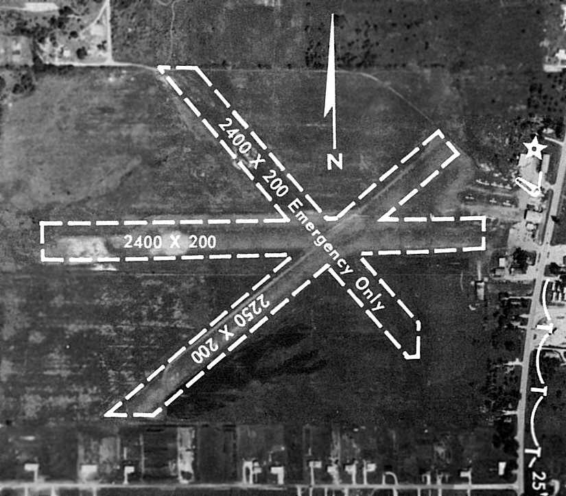
It depicted the Waukegan Airport as having 3 grass runways, with the longest being the 2,400' east/west & northwest/southeast strips
(although the northwest/southeast strip was marked “Emergency only”).
The number of aircraft visible on the field had decreased to only 8.
A 1962 photo by Bert Aldrin of two Pipers inside a Waukegan Airport hangar (courtesy of Ron Riesbeck).
Doug Thornley recalled, “In July 1963 my dad took me to Waukegan Airport (Burris) & my instructor was Wayne Carpenter who eventually soloed me 8/15/63.
I have a cute cartoon showing a mother bird booting the youngster out of the nest, signed by Wayne.”
A December 1963 aerial view by Ron Riesbeck from a 65hp J3 Cub looking northeast at Waukegan Airport.
Ron Riesbeck recalled, “I worked at Waukegan Airport with the grass runway airport in 1963 until about 1970.
We had so much fun out there as a 16 year old could.
We would go out & look for our buddies driving down those quiet county roads & pounce on them with 2 J3s... Sweet.
If it wasn't for Wayne Carpenter & his airport many of us kids would have never had a chance in aviation.”
Chuck Lowrance recalled, “I grew up in Waukegan & started my flying at the old Waukegan Airport with Wayne Carpenter in 1963 while I was still in High School.
I & a classmate got jobs there at $1.25/hour - in flying time (no cash) -as shop helpers & ramp tramps (washing, moving, and refueling the J-3s & rag bags – Tri-Pacers).
I managed to accumulatejust short of the 40 hours I needed for my Private license before I graduated High School - and flew off to attend College at Parks.
My buddy & I split the costs to rent one of the Tri-Pacers & he (who had earned his Private) flew me to school, landing at the college field.
What got me flying was a 'free solo' package he offered.
For those who wanted to startflying& would pay $100 in advance, they sold you a punch card
and, until your 'first solo', they didn't charge anything for either plane of instructor.
That led to some pretty early 'solos' - mine was in 4 hours & was for one circuit of the pattern.
After that, you had to have second (to fly the traffic pattern without an instructor sign-off that day)
and then a third to be able to leave the pattern to go do 'airwork' out by the radio tower at Grayslake.
Bert & I (and a third guy, Ron Reisbeck) would work all week, all summer but, after the weekend,
we always seemed to owe them more than we had earned that week!!”
A winter 1964 aerial view by Ron Riesbeck of Waukegan Airport.
Ron Riesbeck recalled, “Bert Aldrin & Ron Riesbeck both landed in the ladies backyard short of Runway 30.
We both were on lunch break as line boys & were challenging each other to see who could land on the end of the runway.
It was easy as the snow let on where you landed. As you can see most of the runway was covered in snow.
Bert was ahead of me & bounced in the ladies yard with snow going everywhere. I loved it.
As I made my approach low I put in the power but carburetor ice got me as well & fell in the exact spot Bert did.
We both thought that if the lady calls Jo Jo, the big redhead office manager, we will both be fired. Nothing became of it.
As kids, we had nothing but fun out there. Wayne would let us drive anything he had.
Dump trucks, caterpillars & yes even twin-engine aircraft. Everyday was new mischief.”
A 1965 of Ron Riesbeck in front of a Piper at Waukegan Airport.
The last chart depiction which has been located of the original Waukegan Airport as an active airfield
was on the May 1965 Milwaukee Sectional Chart (courtesy of Chris Kennedy).
It depicted the original Waukegan Airport, as well as its eventual replacement, the new Waukegan Memorial Airport just to the northeast.
Wayne Carpenter continued to operate the original Waukegan Airport until 1965
when it was sold off (to the new Waukegan Port Authority) and closed.
It had been replaced by the "Waukegan Memorial" Airport, located 2 miles to the northeast.
The original Waukegan Airport was no longer depicted on the December 1965 Milwaukee Sectional Chart (courtesy of Ron Kunse)
or the 1969 USGS topo map.
A 1988 aerial view showed that Sunset Avenue had been built through the southern portion of the former airport,
and a number of buildings had been constructed over the property.
A few hangars remained standing on the southeast corner of the former airport, though.
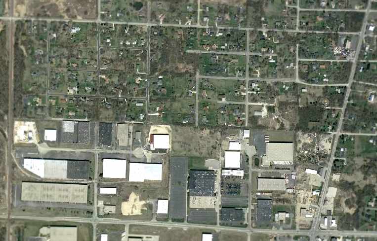
In the 2002 USGS aerial photo, the majority of the former Waukegan Airport had been covered by buildings.
Nearby resident Robbie Culver reported that Waukegan's 1929 hangar still stands as of 2005, on the corner of Sunset Avenue & Green Bay Road
"The hangar is now used by the Burris Equipment Corporation as a storage facility.
On the north edge of the Burris Equipment site, there is a white steel building adjacent to Green Bay Road.
If you look closely with an eye to the shape of the building, you can see it is, indeed, a hangar.”
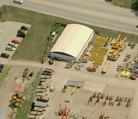
A circa 2006 aerial view looking east at the hangar which remains standing at the southeast corner of the Waukegan Airport site.
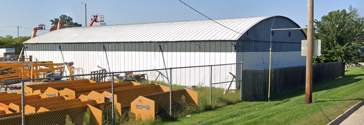
A September 2018 photo looking northwest at the nearly 90-year-old hangar which remains standing at the southeast corner of the Waukegan Airport site.
____________________________________________________
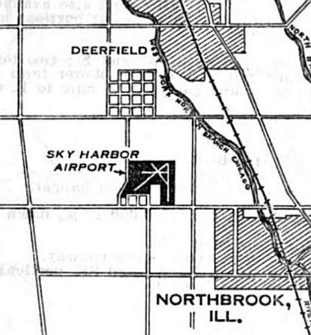
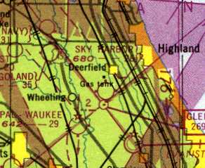
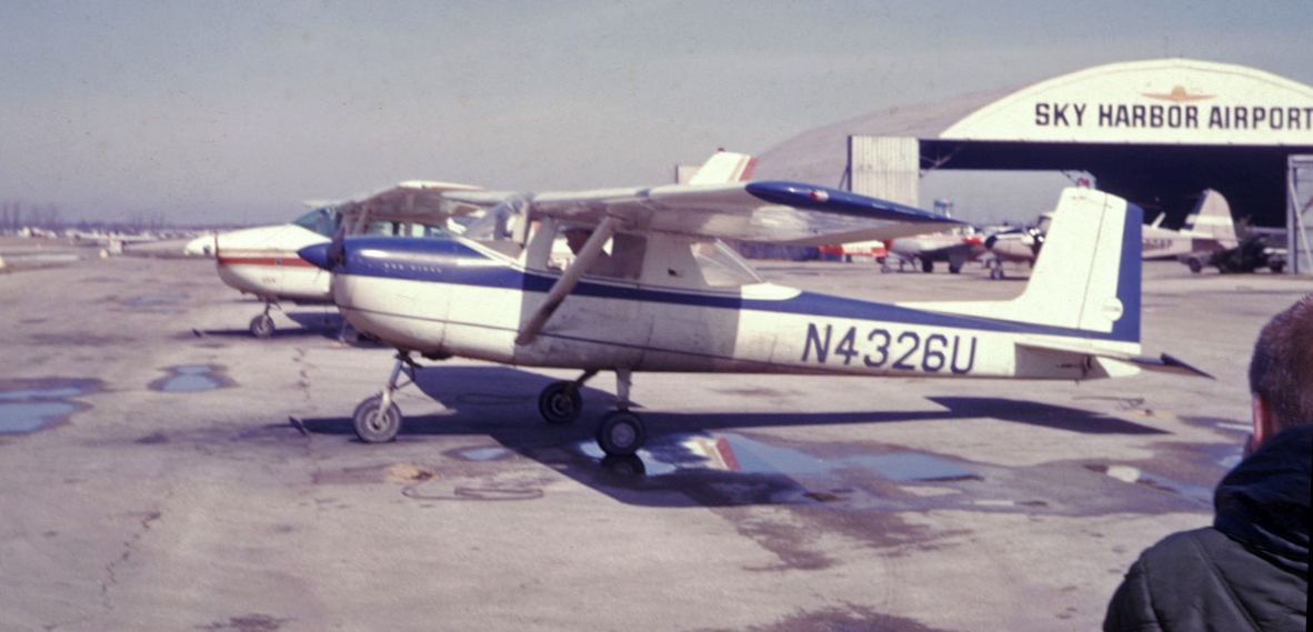
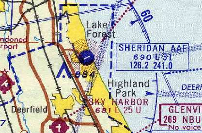
Sky Harbor Airport, Northbrook, IL
42.143, -87.856 (North of Chicago O'Hare Airport, IL)
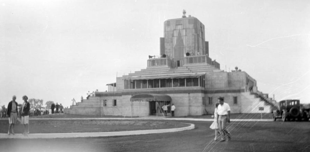
A circa 1920s promotional illustration of the planned Sky Harbor Airport
(courtesy of Judy Hughes of the Northbrook Historical Society, via Mark Bailey).
Sky Harbor Airport was built by the North Shore Airport Company, a division of United Aviation Corporation.
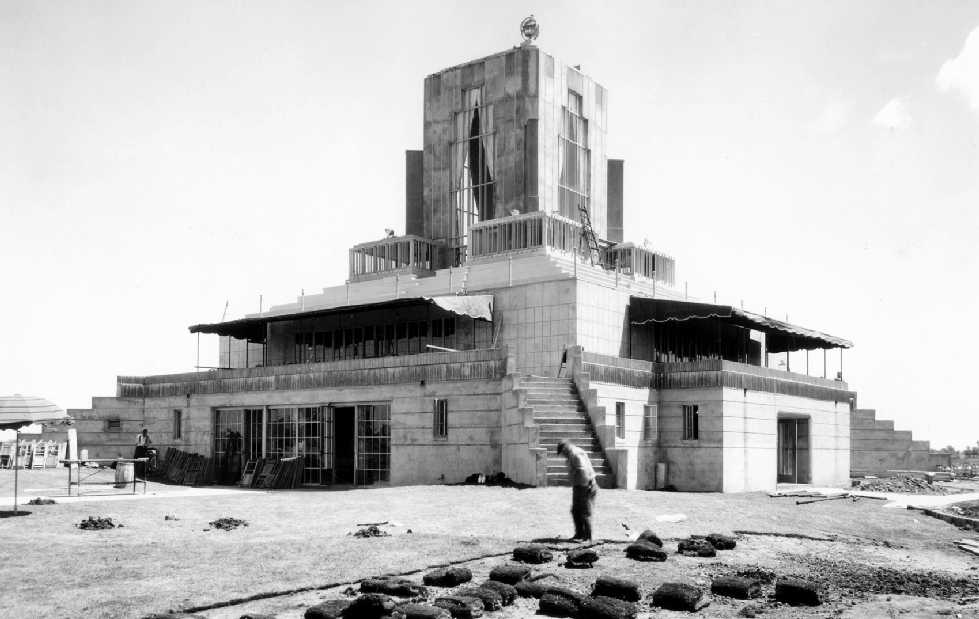
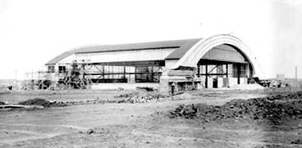
The earliest photo which has been located of Sky Harbor was a 7/2/29 photo of its exotic terminal building under construction (from the North Shore company archives, courtesy of Joe Stupar).
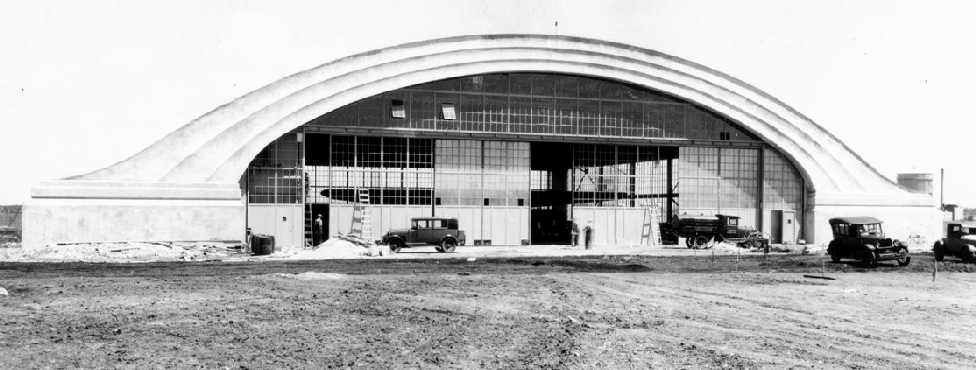
A 7/2/29 photo of Sky Harbor's iconic hangar still under construction (from the North Shore company archives, courtesy of Joe Stupar).
Note that even though construction was still in progress, there appeared to be a large high-wing plane inside the hangar.
Joe noted, “I wonder if they were rushing to get ready for an event on July 4th?”
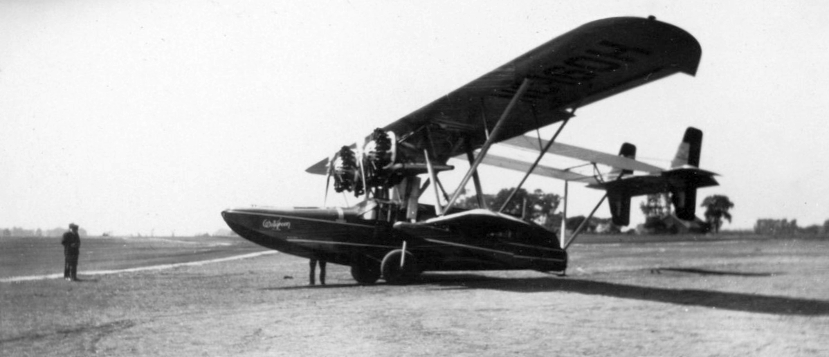
A 1929 photo of Walgreen's Sikorsky S-38 amphibian at Sky Harbor (courtesy of Tracey Earll).
A 1929 photo of Sky Harbor's hangar under construction.
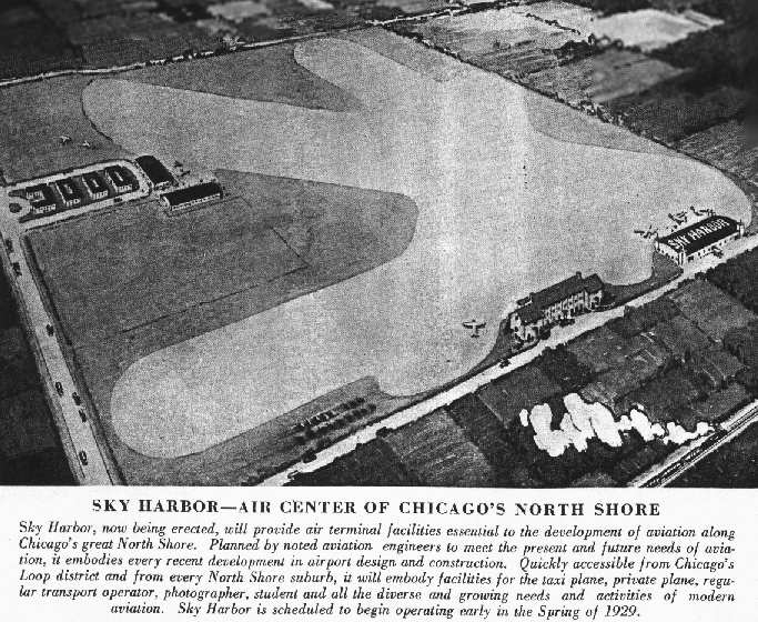
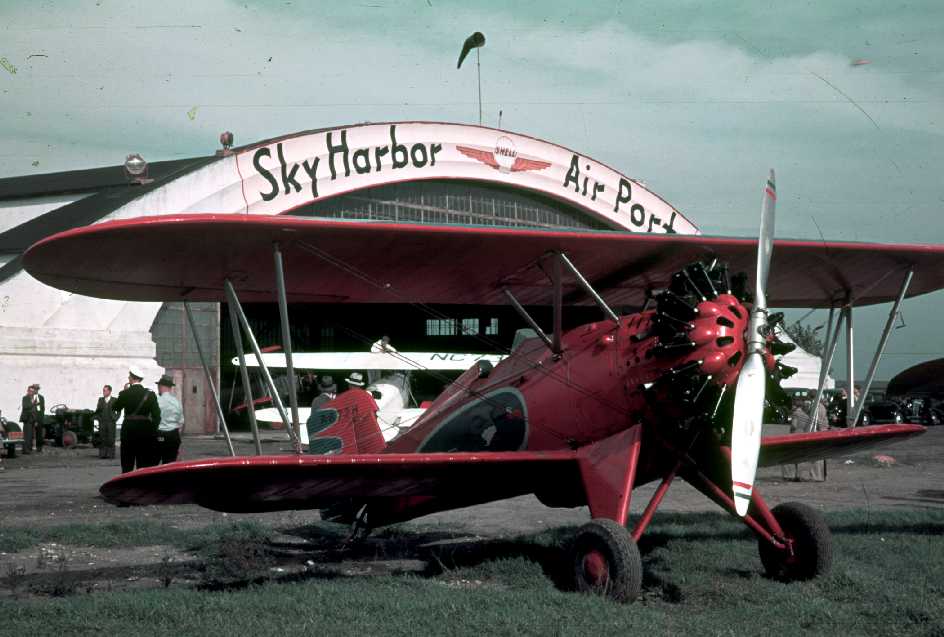
Sky Harbor Airport opened for business in 1929, and was described as "The Airport of Tomorrow".
It was intended to serve as a base for private aircraft, airliners, and sightseeing aircraft.
The company spent a total of $500,000 on the airport's construction, which was a huge sum of money for the 1920s.
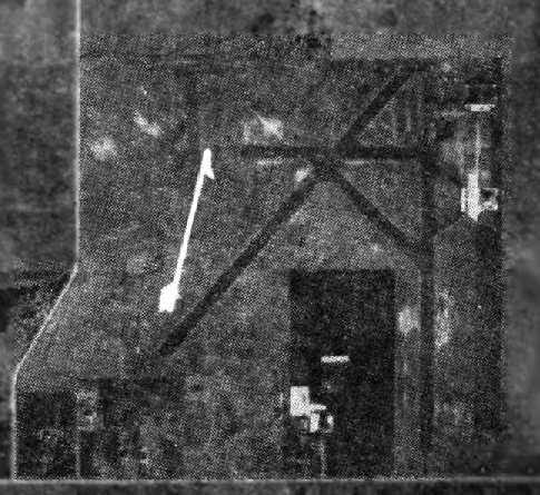
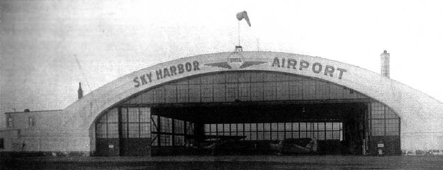
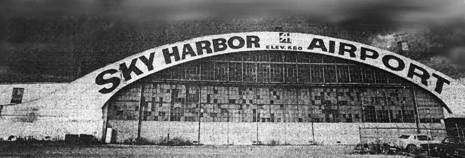
A prominent feature of the airport on its opening day was its elegant arch-roof hangar.
An undated photo of Sky Harbor's exotic terminal building shortly after its 1929 construction (courtesy of Glenn Ragaishis).
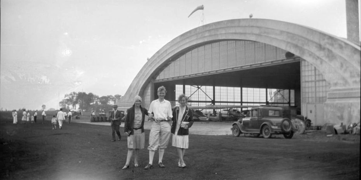
A 1929 photo of Sky Harbor's graceful arch-roof hangar (courtesy of Glenn Ragaishis).
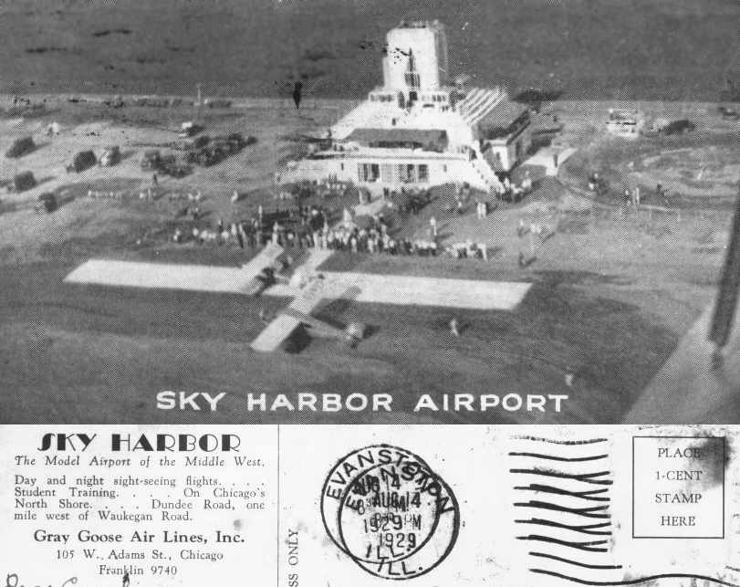
An undated aerial view looking east at a biplane & a monoplane in front of Sky Harbor's exotic terminal building from a postcard postmarked 1929 (courtesy of Stef).
In its early years, a pilot training school was operated at the field by Walter Meyer (according to his son, Richard Meyer).
This was known as the Sky Harbor Aviation Institute.
Geoffrey Parker reported, “My grandfather, Kenneth Parker, took lessons leading to his civil pilots license
at Sky Harbor during late July of 1929, according to his personal journal.
He was a stockholder in Gray Goose Air Lines, which I understand had some connection to the flight school at Sky Harbor.
Instructors were Paul [unknown] & Perry Hodgden.
A friend, 'Babe' Meigs (later associated with Meigs Field), was also an investor in Gray Goose & also used Sky Harbor.
The aircraft used was a Husky Junior / Fleet Model 1, which Kenneth Parker purchased soon after earning his license; registration was NC8600.”
The location of Sky Harbor Airport, as depicted on the 1/11/30 Commerce Department Airway Bulletin (courtesy of Mike Denja).

The 1/11/30 Commerce Department Airway Bulletin (courtesy of Mike Denja) described Sky Harbor Airport as a commercial airport,
owned by North Shore Airport Company & operated bu Gray Goose Air Lines Inc.
It was said to consist of a 124 acre irregularly-shaped sod field containing 4 oiled cinder runways, the longest being the 2,500' north/south & northeast/southwest strips.
Two buildings were depicted along the east side, the clubhouse & hangar.
According to an article (courtesy of Steve Lemieux-Jordan), in 1932, pioneering African-American aviator Fred Hutcherson was hired to manage Sky Harbor Airport at the age of only 20.
Ray Boller reported that his mother "took flying lessons at Sky Harbor in an Aeronca, circa 1933."
A posh clubhouse, the Petrushka Club, was built on top of the terminal.
A circa 1930s photo of an unidentified minimalist glider in front of Sky Harbor's distinctive hangar by Helen Boller (courtesy of Jamie Boller).
Ruth Filstead recalled, "Several times my father took us children to Sky Harbor to see an airshow, and there were lady pilots competing.
Sky Harbor was the scene of my first exhilarating plane ride, about 1933, in an open cockpit, 2-seater biplane.
One especially memorable time we went to the 'posh rooftop clubhouse' for refreshments,
and were excited & thrilled that 2 famous men sat at the adjoining table: Will Rogers & Wiley Post, with his patch over one eye!"
Scott Sorenson reported, “My Grandfather - Eliot Staples - he & Hal Darr leased Sky Harbor in about 1933 in the business for aviation training.”
Sky Harbor Airport, as depicted on the 1935 9M Night Flying Chart.
The Airport Directory Company's 1937 Airports Directory (courtesy of Bob Rambo) described Sky Harbor as having a total of 4 "cinder oiled" runways,
with the longest being the 2,500 north/south & northeast/southwest strips.
The aerial photo in the directory depicted a single hangar at the northeast corner of the field, which was said to have "Sky Harbor" painted on the roof.
An extremely rare 1937 color photo of a beautiful red Boeing 100 single-seat biplane in front of the Sky Harbor hangar (by Norvan Strohmeyer, courtesy of Pete Kramer).
A 1938 aerial view of Sky Harbor (from the IL Natural Resources Geospacial Data Clearinghouse, courtesy of Chris Kennedy).
The terminal building was still seen on the east side of the field, and the hangar at the northeast corner.
The effects of the Depression were evident - as the field appeared abandoned, with not a single aircraft visible anywhere on the field.
By 1939, the fortunes of the airport had declined due to the effect of the Depression.
Sky Harbor was abandoned, and its once-glitzy clubhouse had been gutted by vandals.
The airport was sold to Bill Turgeon & several friends in 1939.
The Petrushka Club [terminal building] was torn down, but the airport became a center of flight training once again - primarily for Navy fliers.
A 2nd hangar was built in 1941 (just north of the original hangar), and an Aviation County Club was established.
A circa 1940s aerial view looking north at Sky Harbor Airport (courtesy of Judy Hughes of the Northbrook Historical Society, via Mark Bailey).
A 3rd hangar had been built on the southeast side of the field (bottom-right).
A circa 1940s view of the elegant 1929 hangar at Sky Harbor (courtesy of Judy Hughes of the Northbrook Historical Society, via Mark Bailey).
The October 1944 Chicago Sectional Chart (courtesy of Richard Doehring) depicted Sky Harbor as a commercial/municipal airport.
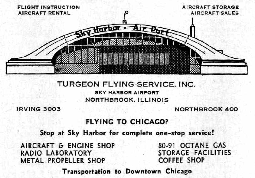
An advertisement for Sky Harbor Airport's Turgeon Flying Service, from the Haire Publishing Company's 1945 Airport Directory (courtesy of Chris Kennedy).
Don Page recalled, “My flying career began in 1948 at Sky Harbor Airport.”
Sky Harbor Airport, as depicted on the 1949 Milwaukee Sectional Chart (courtesy of Donald Felton).
Bob Huettmann recalled, "In 1949 I was attending Northwestern University where most of my fraternity brothers were veterans of WW2.
One fellow named Persinger wanted to go flying to keep up his flying time & talked me into going with him.
We drove to Sky Harbor where he rented a Cessna & off we went on the very first airplane flight of my life.
I couldn't have been more happily amazed. After about 3 flights with him, I knew I had to learn to fly."
Bob continued, "I found an instructor at Sky Harbor who had a Piper Cub & charged $10 per hour instructional time.
Every time I saved up $5 I would go out & get a half-hour of dual flying time.
I remember 2 specific things about Sky Harbor & the Piper Cub:
The landing pattern was at 500' because the field was so close to Glenview NAS
that we overlapped patterns & had to stay below their fighters.
One day I went for a lesson & the wind was blowing about 45 mph.
My instructor didn't want to go up but he also didn't want to miss out on the $5 fee,
as times were tough for a surplus of instructors right out of the service.
So off we went to practice takeoffs & landings.
The wind speed was about what a Cub lands at so the landings were more like a helicopter landing.
Once the wheels touched, the Cub immediately stopped. Great sport! After 5½ hours my instructor soloed me out."
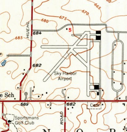
The 1950 USGS topo map depicted Sky Harbor Airport as having 3 runways, with 4 hangars on the east side.
A 12/13/51 USGS aerial view showed that portions of Sky Harbor's runways & taxiways had been covered in asphalt.
The field had 3 hangars: 2 at the northeast, and 1 at the southeast corner. A total of 16 light aircraft were visible on the east side of the field.
A circa 1955-56 photo by R.L. Hoyle of perhaps the most unusual visitor to land at Sky Harbor Airport, sitting in front of the main hangar.
R.L. Hoyle explains: “I was stationed at NAS Glenview for 10 years starting in 1954.
Both airfields [Sky Harbor & nearby NAS Glenview] had runways that ran North/South & were lined up on each other, but separated by a short distance & a couple of fences.
The aircraft was a PB4Y-2... We had several stationed at NAS Glenview & I was one of the aviation electricians assigned to their maintenance.
On one occasion the pilots of a plane returning to Glenview mistook the runways at Sky Harbor for the duty & put the plane down before they figured out they had goofed.
In order to get the plane back to Glenview it had to be stripped of nearly all the fuel & all armament to lighten it for takeoff.
That is where we took everything out & trucked it back to Glenview. That is one plane I do remember working on. I hated it!
I also flew on it & the worst part was walking from the tail section to the forward deck. We had to go through the bomb bays on a 6” wide deck.
If you got caught in there when they opened the bomb bays you could get sucked out in a heartbeat.
Looking down at that time would turn my legs to water & all I could do was hold on for dear life.
I also had to fly the belly turret at times & it had a habit of jamming.
After landing (& that was interesting from that perspective), they had to dismantle most the turret to get you out.
The only warm place on the plane was the tail gunner’s position. It seemed all/any heat at all in the plane funneled out through the tail.
We all wore electrically heated suits, gloves, leather helmets and socks, but it was still very cold, even in mid-summer.”
A circa 1955-56 photo by R.L. Hoyle of Sky Harbor's accidental visitor, the Navy PB4Y-2 departing on its return to NAS Glenview.
R.L. Hoyle observed, “The photo shows the plane as it just cleared the runway on its way back.
There was no need to raise the landing gear as the flight only lasted a few minutes.
The 2 runways lined up & the plane barely got airborne before they were putting her back down, only this time at the right field.
For the return flight there were only pilots, but not the ones that set it down at Sky Harbor.
After the plane got back to base then we had to put everything back in and, of course, nothing wanted to work correctly again. What a plane!”
A circa 1961 aerial view in the 1962 IL Airport Directory (courtesy of Jonathan Westerling)
showed that 3 long rows of T-hangars had been erected on the east side of Sky Harbor at some point between 1951-61.
The operator was listed as Mid-States Aviation Corporation, and the manager was listed as William Turgeon.
A 1961-62 photo (courtesy of John Kielhofer) of John, Jan, Gail, Craig, and Gene Kielhofer in front of a Cessna 182 that Gene Kielhofer flew, in front of Sky Harbor's main hangar.
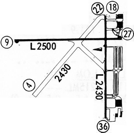
The 1962 AOPA Airport Directory described Sky Harbor as having two 2,500' blacktop runways (18/36 & 9/27) & a single 2,500' cinder Runway 4/22.
The operator was listed as Mid-States Aviation Corporation.
A March 1966 photo (courtesy of Bruce Bruemmer) of Bruce looking at his father Bryan Bruemmer in a Cessna 150D, with a Sky Harbor hangar in the background.
Bruce recalled, “My father had logged an ungodly number of flight hours in C-47s & other planes during WWII.
At one point he wanted to take up aviation again, and rented a Cessna from Sky Harbor.
Ultimately he decided it was too expensive a hobby, which is too bad because I was fascinated with his flying (I was 11 at the time).”
Bill Turgeon sold Sky Harbor when he retired in 1966.
In the 1960s, the airport produced & distributed its own newsletter, the "Sky Harbor Flyer".
A 1967 issue proclaimed Sky Harbor to be "Chicago's oldest Cessna dealer".
Arthur Rubloff bought Sky Harbor in 1968.
The 1968 Flight Guide (courtesy of Robert Levittan) depicted Sky Harbor
as having 2 paved runways (2,500' Runway 9/27 & 2,430' Runway 18/36) along with a 2,430' unpaved Runway 4.22.
An article in another issue of the "Sky Harbor Flyer" gave an amazing list of Chicago-area airports which had already disappeared by the 1960s:
American (Devon & Higgins), Ashburn Airport (Cicero & 79th), Burmeister Field (Eddie Stinson, Dempster Street),
Checkerboard Field (across from Hines Hospital), Chicago Seaplane Base (Navy Pier), Cook County Field,
Chicago Flying Club (Cumberland & Irving), Chicago Airmail Field (site of Hines Hospital), Curtiss Reynolds (Glenview),
Chris Lund (Higgins & Canfield), Dale Smith Seaplane Base (Lake Calumet), Dixie (Chicago Heights),
Elmhurst-Chicago (Elmhurst), Harlem Airport (Harlem Ave), Heath (Main Township High School),
Heath (Grace & Western Ave), Jack Rose (Lawrence & Harlem), Lovers Lane Airport (Prairie, south of Oakton),
Meyers Airport (Morton Grove), Nemo Black (Lincoln Ave), Park Ridge (Touhy & River Rd),
Roy Guthier (Wilwaukee Ave. south of Wheeling), Ravenswood (Toughy & York Rd), Rubinkham (Markham),
Sandell (south of Palwaukee), Dick Sanger (North & Mannheim), Skyhaven (Wolf & North Ave),
Steger Airport (Steger), Stinson Airport (LaGrange), Westlake (95th & Western), Washington Park Airport (Washington Park),
Westchester Airport (Westchester), Wilson Airport (River Rd. & Lawrence).
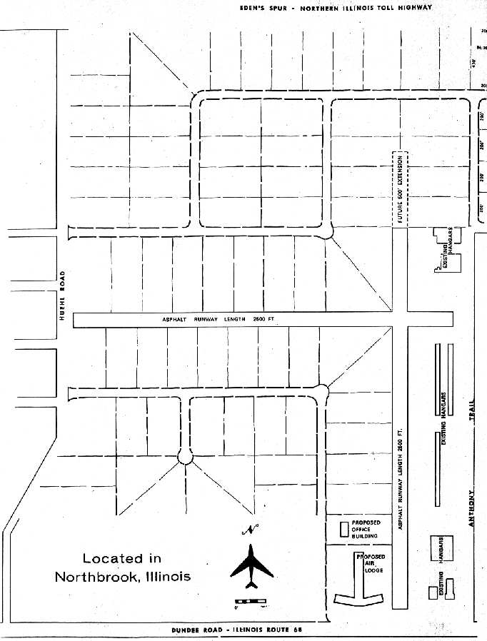
A circa 1960s diagram of proposed improvements to Sky Harbor (courtesy of Judy Hughes of the Northbrook Historical Society, via Mark Bailey).
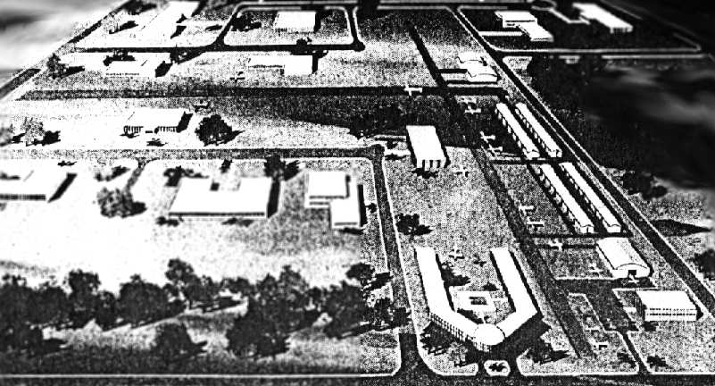
A circa 1960s artist's conception of the never-built "air-industrial park" at Sky Harbor
(courtesy of Judy Hughes of the Northbrook Historical Society, via Mark Bailey).
Ironically, the same issue of the "Sky Harbor Flyer" newsletter contained an article entitled "Sky Harbor Perpetuated",
in which the airport tried to present a brave face in light of other airport closures.
"For quite some time there have been all kinds of rumors about the future of Sky Harbor.
Understandably, with the high cost of real estate, more than one airport has been forced out of business.
However, such is not the case at Sky Harbor. In fact, the situation here is quite the contrary.
Sky Harbor will expand & become the first air-industrial park in this part of the country.
The north/south runway will be lengthened. The east/west runway will remain the same & all existing facilities will remain or be improved.
Future plans call for the addition of an air lodge with swimming pool.
The industrial sites will vary in size. Many companies will hangar their aircraft in their own building."
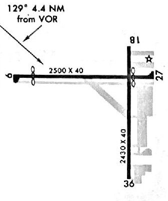
A 1/29/70 approach plate (courtesy of Michael McConnell) depicted Sky Harbor
as having 2 paved runways (2,500' Runway 9/27 & 2,430' Runway 18/36), and a number of ramps on the east side.
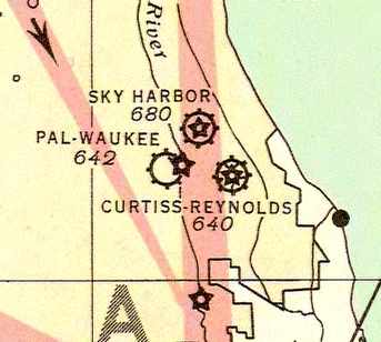
The last aeronautical chart depiction which has been located of Sky Harbor was on the November 1971 Sectional Chart.
It depicted Sky Harbor as having 2 paved runways, with the longest being 2,500'.
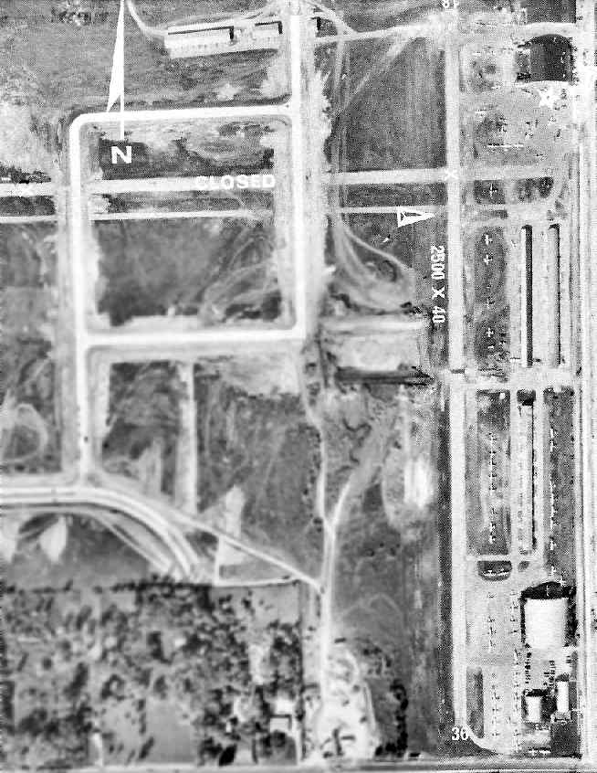
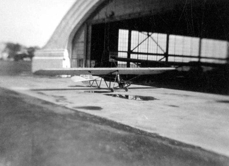
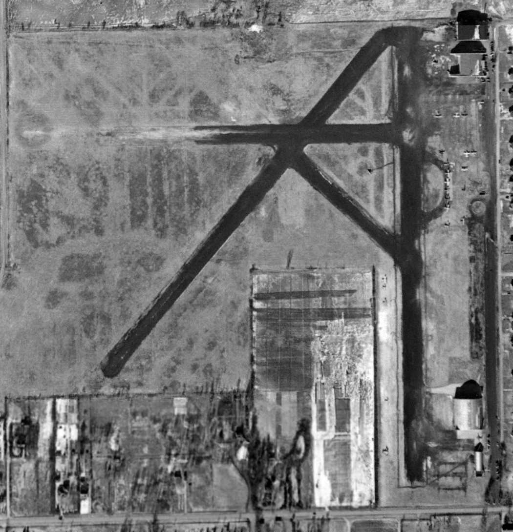
The last photo which has been located showing Sky Harbor in operation was an aerial view from the 1972 IL Airport Directory (courtesy of Bill Pagett).
The directory described Sky Harbor as having a single 2,500' asphalt Runway 18/36.
The airport property had shrunken quite a bit, as the former crosswind east/west runway was still depicted, but was labeled “Closed”.
But the field was obviously well-used right up to the end, with several dozen light aircraft visible on the east side.
The airport manager was listed as James Madden.
Bill Waltman recalled, “My first 8 hours of flight instruction were at Sky Harbor.
Landing to the east terrified me. It wasn't so much the short runway, rather the grave yard immediately across the road.
I could read the markers as we approached the threshold.”
Bill Pagett recalled of Sky Harbor, “Always my favorite as that's where I earned my right to experience true exhilaration.
As you can see from the [1972] directory photo, construction of the industrial park was pressing the airport out of business.
The east/west runway had been closed.
The flying club I was in was in the process of repairing a C-150
that had been overturned by a gust of wind while taxiing shortly before the airport was to cease operations.
We worked almost day & night to repair the aircraft as the owner did not want to have to trailer it out.
I think our 150 was the next to last airplane to depart on Runway 36.”
Former airport owner Bill Turgeon flew the last plane out of Sky Harbor, in 1973.
Bill Pagett recalled, “Upon being officially closed on 1/31/73,
my instructor climbed to the top of that beautifully arched hangar at the north end & made off with the rotating beacon.”
The financial appeal of developing the Sky Harbor property for industrial purposes won out over continuing to operate the airport.
A 1974 aerial view showed that the large hangar on the southeast side & the 3 rows of T-hangars had been removed at some point between 1972-74.
The entire length of Runway 18/36 still remained intact, but buildings & streets had been built on the west side of the former airport property.
Sky Harbor Airport was no longer depicted at all on the November 1974 Chicago Sectional Chart.
A sad 1977 view of the abandoned hangar at the closed Sky Harbor (photo by George Thompson).
A 1988 aerial photo showed that the site of Sky Harbor had been heavily redeveloped,
with buildings & roads covering the site of the former airfield,
with no signs left of the former runway.
Only 2 hangars remained standing, on the east side of the field.
As of 2003, Sky Harbor's former hangar on the east side (located at 500 Anthony Trail) was reused as the "Ceiling Zero" restaurant.
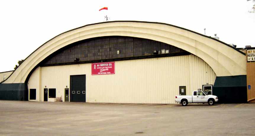
A 2006 photo by Tony Maietta of the 1929 hangar which remains at the site of Sky Harbor.
Tony reported, “There appear to be 2 hangars remaining from Sky Harbor.
The 1929 hangar... is being used as a warehouse of some sort. There's a functioning windsock back on the hangar, and it is in good shape.
Hopefully someone will buy the restaurant & keep the building alive. It's definitely looking better than it did in that picture from 1979.
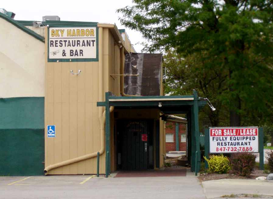
A 2006 photo by Tony Maietta of the “Sky Harbor Restaurant & Bar, which previously occupied part of the 1929 hangar, but is advertised for sale.
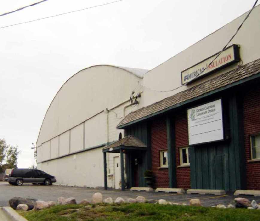
A 2006 photo by Tony Maietta of what appears to be a second remaining former hangar at the site of Sky Harbor, adjacent to the north side of the main hangar.
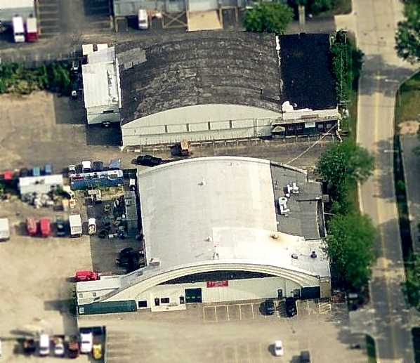
A circa 2006 aerial photo looking north at the only remaining elements of the historic Sky Harbor - two former hangars on the east side of the property.
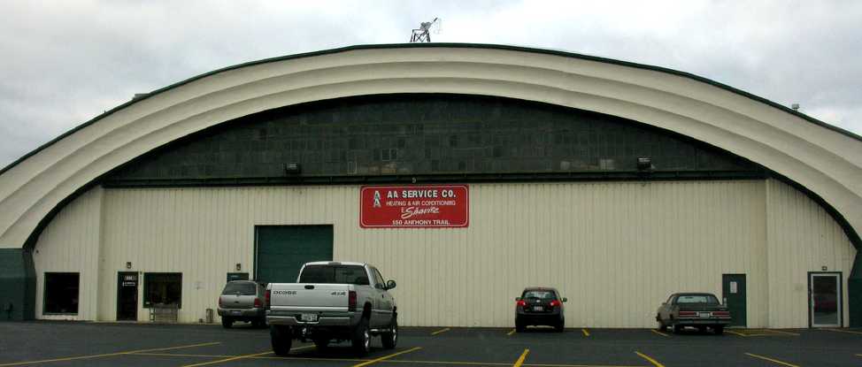
A 10/28/10 photo of the 1929 hangar which remains at the site of Sky Harbor.
A 2017 aerial photo of the site of Sky Harbor shows the site unrecognizable as a former airport,
with the 2 former hangars on the northeast side the only remaining element of the former airfield.
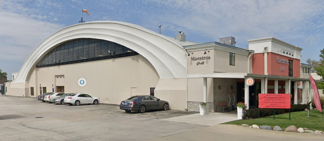
A 2019 photo looking northwest at the 1929 hangar on the northeast corner of the Sky Harbor site, which has been restored & reused as Maestros Grill, complete with a windsock mounted on top.

A 2019 photo looking northwest at the 2nd hangar on the northeast corner of the Sky Harbor site, reused by American Insulation.
The site of Sky Harbor is located northwest of the intersection of Dundee Road & Anthony Trail.
____________________________________________________
Fort Sheridan Rifle Range Field / Fort Sheridan Army Airfield / Haley Army Airfield, Highland Park, IL
42.22, -87.82 (North of Chicago, IL)
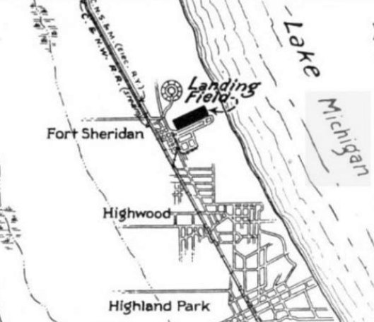
Fort Sheridan “Rifle Range Field”, as depicted on the 12/1/23 Commerce Department Airway Bulletin (courtesy of Mike Denja).
Fort Sheridan was established along the shore of Lake Michigan in 1887.
The date of establishment of Fort Sheridan's airfield has not been determined.
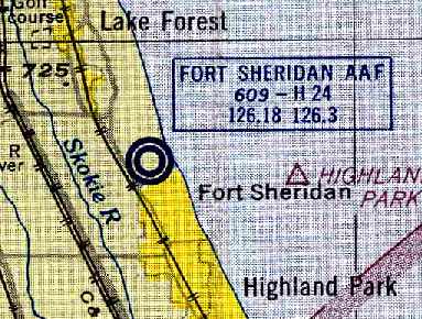
The earliest depiction which has been located of Fort Sheridan's “Rifle Range Field” was on the 12/1/23 Commerce Department Airway Bulletin (courtesy of Mike Denja).
It described the Rifle Range Field as used jointly as a rifle range & aviation field.
It was said to consist of a 1,950' east/west sod field with a steel hangar.
An undated aerial view looking northeast at Fort Sheridan “Rifle Range Field” from the 12/1/23 Commerce Department Airway Bulletin (courtesy of Mike Denja).
It depicted a 1,950' east/west sod field with a single hangar on the north side.
Fort Sheridan's airfield was not yet depicted on the June 1931 Milwaukee Sectional Chart.
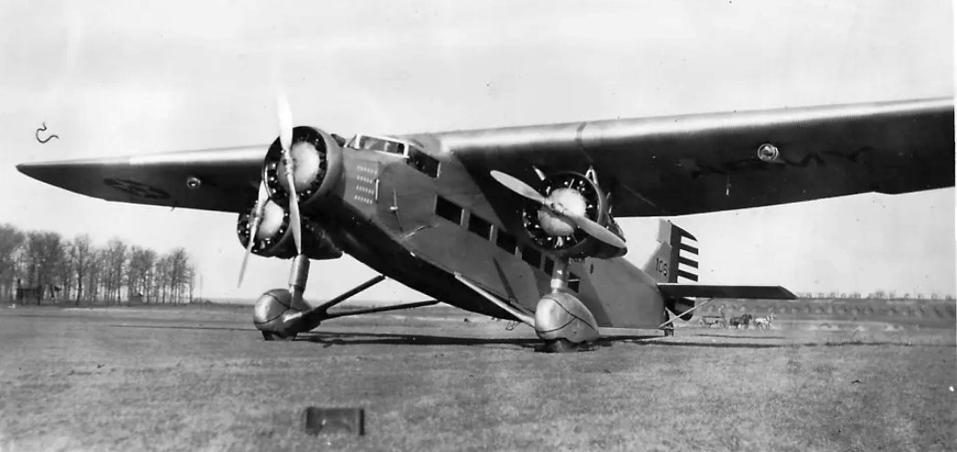
A 1938 photo of an Army Air Corps Fokker Tri-Motor at Sheridan Army Airfield (courtesy of Mike Denja).
A 1939 aerial view depicted Fort Sheridan as having a northeast/southwest grass field with a single hangar on the north side.
A 1946 aerial view showed Fort Sheridan's airfield area remained clear, but the hangar had been removed at some point between 1939-46.
Fort Sheridan's airfield was not yet depicted on the November 1952 Milwaukee Sectional Chart.
At some point between 1952-54 Fort Sheridan's airfield was reestablished for the use of planes supporting anti-aircraft & coastal artillery training.
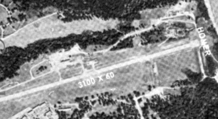
According to a 2023 Army report (courtesy of Sean Kohnke), “Building 117 functioned as an aircraft hangar for Haley Airfield and was constructed in 1953 along with a 3,100' east/west oriented runway.”
The earliest depiction which has been located of the Fort Sheridan Army Airfield was on the 1954 Chicago Local Aeronautical Chart (courtesy of Chris Kennedy).
The Aerodromes table on the chart described Fort Sheridan AAF as having a single 2,400' bituminous runway & a control tower.
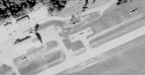
An undated aerial view of Fort Sheridan Army Airfield in the 1956 IL Airport Directory (courtesy of Chris Kennedy).
The directory described Fort Sheridan Army Airfield as having a single 2,400' paved runway,
and the photo depicted a small ramp on the north side of the runway with one small building (a hangar?).
The remarks said "Emergency use only."
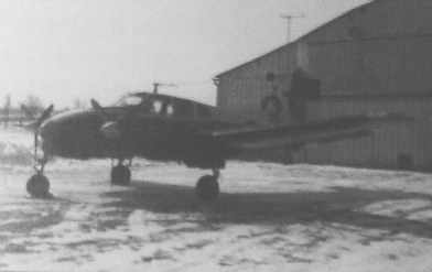
A circa 1950s photo of a Beech U-8 Twin Bonanza at Sheridan AAF (courtesy of Rex Ricks).
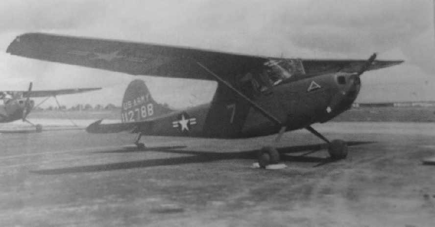
A circa 1950s photo of a Cessna L-19 Bird Dog at Sheridan AAF (courtesy of Rex Ricks).
Curiously, the 1960 IL Airport Directory (courtesy of Randy Seiler)
appeared to have the exact same aerial photo of Fort Sheridan Army Airfield as the 1956 IL Airport Directory,
yet the 1960 directory described the field as having a somewhat longer runway - 3,100'.
The field was now said to have a control tower, but the remarks still said "Emergency use only."
The 1960 Jeppesen Airway Manual (courtesy of Chris Kennedy)
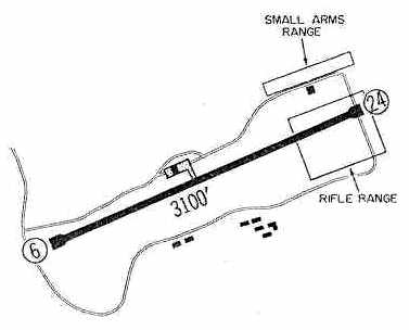
depicted Fort Sheridan AAF as having a single 3,100' Runway 6/24,
and a "Small Arms Range" & "Rifle Range" on either side of the east end of the runway - which must've made flying somewhat interesting!
A 1961 aerial view of Haley AAF showed 1 plane south of the hangar & another parked on the grass to the east.
Bob Huettmann recalled that "As a 12 year-old boy living in Highland Park,
I could watch the searchlights at night light up the target 'sock' being towed behind some kind of aircraft
just off-shore Lake Michigan so that the Fort Sheridan anti-aircraft gunners could be trained.
Very bright searchlights & exploding shells around the target. Marvelous viewing for a 12 year old.
I am sure the tow aircraft flew out of Haley Airfield.
I have no idea what other uses the field had other than for top brass transportation."
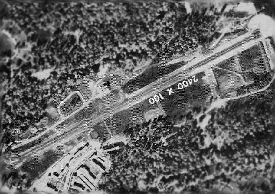
An undated aerial view of Haley AAF from the 1964 IL Airport Directory (from the University of IL, courtesy of Daniel McGill)
depicted Haley as having a 3,100' paved northeast/southwest runway.
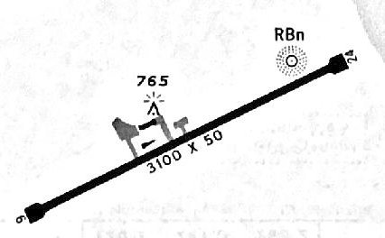
A 1967 approach plate (courtesy of Michael McConnell) depicted Sheridan AAF as having a 3,100' paved Runway 6/24,
with a ramp & a few small buildings on the northwest side.
"Sheridan AAF" was described on the 1967 Milwaukee Sectional Chart (courtesy of Chris Kennedy)
as having a single 3,100' paved runway, a control tower, and an NDB navigational beacon.
Norman Miller recalled, “In early 1967, my father was again assigned to Fifth Army at Fort Sheridan.
We were assigned to quarters on the west end of Nicholson Road, which ran roughly parallel along the south side of the runway of Fort Sheridan Army Airfield.
There were no fences that separated the quarters from the airfield, although there were 2 fairways & greens of the golf course that ran the length of the south side of the runway from east to west.
For an 11 year old boy who was enamored with airplanes, it was the best vantage place on earth.
Every morning was the sound of engines running up & take-offs, and by the afternoon, there were airplanes & helicopters landing.
The layout of the field was pretty basic: a single asphalt runway with run-up pads at both ends & no taxiways.
A maintenance hangar with parking ramps was centered on the north side of the runway.
On the north side of the hangar, there were a couple of wood frame office/utility buildings, and on the west side was a single-bay fire station.
Inside the station was an aircraft crash/rescue truck.
Painted on the south side of the hangar (facing the runway) was a large (6'x6'?) depiction of the Fifth Army emblem.
Sometime later, the name 'Haley Army Airfield' was added below the emblem in honor of Captain Patrick Haley, an Army aviator killed in action in Vietnam in 1967.
There was an open-frame control tower sited at the northeast corner of the hangar.
Based on the size of the hangar, I would estimate the tower was about 50' tall, with an enclosed cab at the top.
The entire frame & the cab were painted in an orange & white checkerboard pattern.”
Norman continued, “Although I didn’t know what a Non-Directional Beacon (NDB) was at time, Haley AAF had one for non-precision instrument approaches; the identifier was FSN, channel 326.
I can’t recall a separate antenna & equipment area in the immediate vicinity of the hangar which would have been a NDB, so I can only assume it was mounted on top of the control tower.
I recall aircraft operating on both runways, taking off & landing in either direction.
I remember hearing (I believe from my parents) that the primary landing runway was Runway 24, with the primary take-off runway being Runway 6.
This would have routed aircraft over Lake Michigan during critical phases of flight.
At the departure (west) end on Runway 24 was George Bell Road that led to the Nike site (active until 1974) and the cemetery.
To the west of Bell Road was a narrow golf course fairway, then the perimeter fence.
Right next to the fence was Sheridan Road. Next to Sheridan Road was the old North Shore Railroad right of way & the Chicago and Northwestern (C&NW) Railroad commuter rail tracks.
And to the west of the railroad tracks was the Cherokee Woods sub-division of Lake Forest, which included an elementary school.
An aircraft that experienced a problem on take-off on Runway 24, or landing on Runway 6, would jeopardize a significant population.”
Norman continued, “In addition to the NDB, the runway was lighted for night & low-visibility conditions,
and there were Visual Approach Slope Indicator (VASI) lights at each end of the runway.
There was also a lighted wind direction indicator on the south side of the runway at about the halfway point, which was considered a hazard for golfers.
To the east of the control tower was a parking area for two 500 gallon tanker trucks.
I assume one contained Avgas for the reciprocating-engine aircraft & the other JP-4 for the turbine aircraft.
Both were painted in aviation yellow appropriate for peacetime operations.”
Norman continued, “I have to brag that for someone my age, I was pretty adroit at identifying Army aircraft.
When we arrived at Fort Sheridan & I found out that we lived right across the street from the airfield, it was like a dream coming true.
The first group of aircraft I’ll discuss are the ones that I would call command support aircraft.
There were at least 4 general officers at Fort Sheridan in 1967 (there may have been 1 or 2 more):
the Commanding General (Lieutenant General), Deputy Commanding General (Major General), and the Chief of Staff of Fifth Army (Major General);
and the Commanding General of the 5th Regional Army Air Defense Command (ARADCOM) (Brigadier General).
With this many general officers at an Army headquarters, it was reasonable to have a number of VIP aircraft assigned at Fort Sheridan,
and there were numerous opportunities to see unique visiting aircraft.”
Norman continued, “The first was a real surprise at Fort Sheridan, a U-9 Commander. I didn’t know at the time how rare they were.
The Army had purchased only 8 of them; 3 A models (Aero Commander 520), 1 B model (Aero Commander 560A), and 4 C models (Aero Commander 680 Super).
I imagine there was a prestige factor associated with the U-9 & a great deal of competition among headquarters to have them assigned.
The Commanding General of Fifth Army in 1967 was Lieutenant General John Michaelis.
It wouldn’t be unusual that such a distinguished general would have a one of these unique aircraft assigned to his headquarters.
In fact, when General Michaelis left Fort Sheridan in 1969 for his new assignment as Commanding General, U.S. Forces Korea and Eighth U.S. Army, the U-9 was noticeably absent from Haley AAF.
While it was at Fort Sheridan, the aircraft was painted in a glistening white over dark olive green paint scheme.
On the vertical stabilizer was the 5th Army emblem, and on the left side of the aircraft, just forward of the national emblem (stars & bars)
was a holder for a general officer’s plate, in this case the red plate with 3 white stars designating a Lieutenant General.
The only time I ever saw this aircraft out of the hangar was when it was being prepared to fly or actually flying; to say that this aircraft was well taken care of would be an understatement.”
Norman continued, “The next aircraft I recall being assigned at Fort Sheridan was the ubiquitous U-8 Seminole.
The U-9 was pretty much assigned to General Michaelis, so the U-8s did a fair amount of flying to and from Fort Sheridan with the other generals.
What is unusual about this aircraft was that is one of only 12 U-8Gs in the Army.
These aircraft had all been either U-8Ds or U-8Es modified by Beech with more powerful engines & an extended cabin.
I also believe there was a standard U-8D assigned at Haley AAF.
Like the others, it was finished in the glossy white over olive paint scheme, but it had the standard size cabin & window arrangement, and over the wing entry stairs.
After the departure of the U-9, another U-8 appeared, this one was a U-8F, the Queen Air model distinguishable by the longer & taller fuselage.
Like the other aircraft, it was painted in the white over olive scheme.
About 1970, the U-8D & G departed and they were replaced by a U-21A Ute in the tactical/low visibility brown paint scheme.
The U-8F & the U-21A remained as command support aircraft until Fifth Army was moved to Fort Sam Houston, TX in 1971.”
Norman continued, “In addition to the command aircraft, there were always a couple of other aircraft on Haley AAF.
I distinctly remember two T-41 trainers being parked at the east end of the hangar.
The military version of the popular Cessna 172, the T-41s were used for pilot proficiency as well as short trips around the Fifth Army’s area of responsibility.
In addition to the T-41s, there was also a U-6 Beaver frequently on the field. It was generally parked at the west end of the hangar.
Like the other aircraft, it was painted in the high visibility, peacetime scheme.
Finally, there was at least one helicopter (there may have been 2) assigned to the Flight Detachment; a UH-1D/H Iroquois.
It too was in the peacetime paint scheme, although I can’t say for certain whether or not it had the 'white top' treatment.”
Norman continued, “Due to Fort Sheridan being Fifth Army headquarters, there were always transient Army aircraft visiting the field. This was a plane watcher’s dream.
Although I never saw any of the Army’s bigger or more exotic aircraft, such as a Caribou, Mohawk, or Chinook, I did see many of the more common utility aircraft.
Bird Dogs & similar aircraft like the Beaver, were often parked on the grass near the hangar.
Occasionally, T-42s would visit & you had to look closely to distinguish the T-42 from the U-8D.
And there was also the chance that a U-3 would show up, as the Army had 38 of them, mostly assigned to the Reserves or National Guard.
Visiting aircraft arrived in a variety of paint schemes, including the then new tactical, low visibility markings as well as high visibility markings.”
In the late 1960s the airfield was renamed Haley AAF, in honor of Captain Patrick Haley,
an Army helicopter pilot killed in action in Vietnam on 4/18/67.
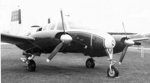
A May 1969 photo of an Army Beech U-8G at Haley AAF (courtesy of Norman Miller).
Jim Glotfelty recalled, "I thought you may be interested in knowing that in 1969-71 when I was stationed there
I served time in both the 204th & 202nd Military Police Companies.
While stationed there we would be detailed from time to time
to fly prisoners from Ft. Sheridan to Ft. Riley, KS or Ft. Carson, CO.
I was also in a Military Honor Guard unit & we would sometimes fly out of Ft. Sheridan to conduct burial details.
On one return flight to Ft. Sheridan the plane I was on lost power coming in over Lake Michigan
to land with just myself & the pilot aboard.
Scary moment but we arrived safely & I'm here to write about it."
"Haley AAF" was depicted on the 1970 Milwaukee Sectional Chart (courtesy of John Voss)
as having a single 3,100' paved runway & an NDB navigational beacon.
Its control tower had evidently been closed at some point between 1967-70.
Norman Miller recalled, “In July, 1971, Fifth Army headquarters was moved to Fort Sam Houston, TX.
The Flight Detachment went with it, although Haley AAF remained open to support the 5th ARADCOM until it was deactivated in 1974.”

A circa 1970s aerial view (courtesy of Sean Kohnke) looking east at Haley AAF, with the Nike missile launch site to the left.

A circa 1970s aerial view (courtesy of Sean Kohnke) looking north at Haley AAF.

A circa 1970s aerial view (courtesy of Sean Kohnke) looking southeast at Haley AAF, with the Nike missile launch site in the foreground.
Dennis Schulmeister recalled, “The Army returned me to Chicago in February, 1972.
There I served at Haley AAF at Ft. Sheridan. I was with the 5th Army Flight Detachment [for 2 years].
I was the fixed-wing maintenance supervisor there
and spent a lot of my time in the maintenance hangar & Flight Operations (attached).
While at Ft. Sheridan, I continued my flying at Chicagoland Airport
and had unique approval to land my civilian airplane at Ft. Sheridan any time I was out flying.
I even transported several of the Army pilots to other airports to pick up aircraft after maintenance & just to switch crews.
I was a big part of that operation during that time & it was a big part of my life.”

A 10/26/72 USGS aerial view showed Ft. Sheridan AAF's runway remained intact, but there were no aircraft on the field.
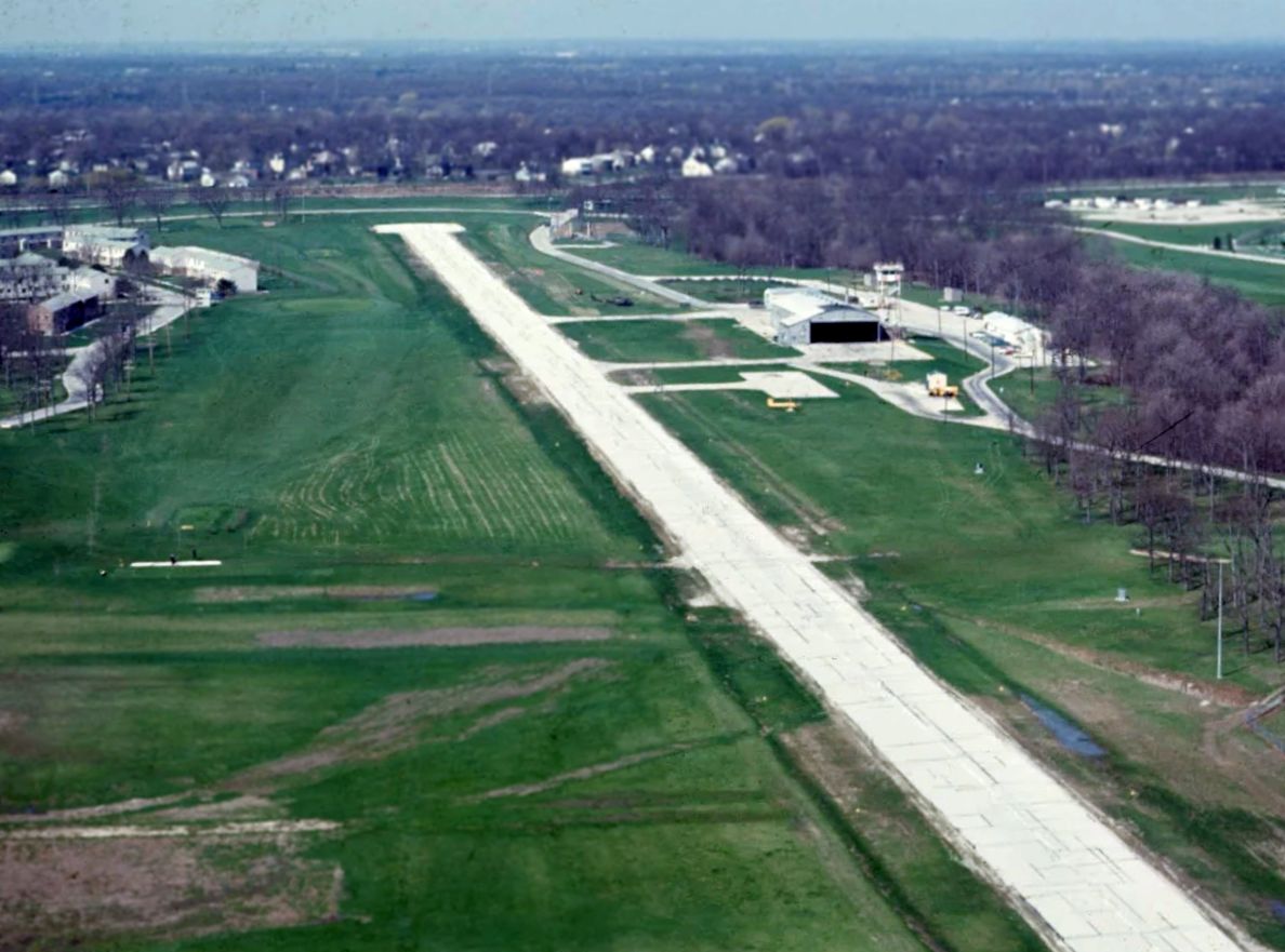
A circa 1972-74 photo by Bob Coveney, which Bob observed was “Looking down Runway 24 at Haley AAF.
The west end of the runway was just short of the access road. Beyond that was a narrow fairway & the perimeter fence for the Fort.
You didn't want to land long in either direction! Notice there is a golf hole in the middle of the runway that teed off on the left & the green is in the trees at lower right.
There are 2 people on the tee box ready to hit.
When we called in for landing the people in operations would blow a siren to stop anyone from hitting or attempting to walk across the runway until after we had landed.
Once they forgot to set off the siren & flying a U-8D aircraft I almost hit a couple walking across.
In this picture the only other aircraft visible is a UH-1H Huey parked in the grass just beyond the last taxiway.”
Bob Coveney recalled, “Returning home from my 3rd tour flying in Vietnam I asked the Warrant Officer Branch to station me as close to upstate NY as possible.
I had never heard of Ft Sheridan, but it turned out to be a great flying assignment in both fixed-wing & helicopters.
I signed into the 45th Air Defense Artillery Brigade the first week of January 1972 & was there until late August 1974.
We had a big underground command center just northwest of O'Hare Airport & 4 outlying missile sites ringing Chicago that we flew the helicopters to.
We flew the fixed-wing on average twice a week to Selfridge ANG Base just north of Detroit (where there were 3 Nike missile sites),
then as far east as Stewart ANG Base in Newburg NY (the headquarters for all the Army Air Defense Commands east of the Mississippi River),
north to Duluth, Minnesota, west to Peterson Air Force Base in CO (headquarters for all air defense), south into southern IL & many points in between.
We were a small tenant flight detachment on the airfield & never had more than 6 pilots assigned to us even though we had 2 UH-1H Huey helicopters & 2 U-8D fixed-wing.
We also had staff pilots from the brigade that flew with us occasionally to kept up their flight pay, but they weren’t assigned to the flight detachment.
The 5th Army Readiness Region Command ran the airfield & they had several fixed-wing & were based in the offices inside the hangar.
Our little flight detachment offices were in 2 very small buildings just to the west of the hangar, one for supply/parts & one for our office.”
Bob continued, “A little background on Haley AAF... one of my extra duties was Safety Officer for our small detachment.
One day I was invited down to Chicago, where the Great Lakes regional headquarters for the FAA was located, by the Army’s representative to that office.
He was a very senior CW4 warrant officer pilot & I had no idea these jobs existed.
After a little tour of the FAA offices he invited me back to his office & went to a locked filing cabinet, extracted a thick file & told me to read it.
It was a listing of all the safety waivers pertaining to the runway at Haley & there were a lot, around 70.
There were too many to remember but a short list of the major ones that I do recall is:
The runway was shorter than 3,050’ which supposedly was 'standard length' for an Army runway.
The runway was too narrow & had no overruns on either end.
The runway’s slope, that ran towards Lake Michigan, was greater than allowed by Army regulations.
There were many obstacles that were too close to the runway.
You can see most of them in the runway picture & a short list of those are:
Military family housing (it’s closer to the runway than the hangar is!), the hangar, the old control tower,
the 2 buildings our detachment was in, numerous light poles, 50’ cliff just off the end of Runway 6 down to Lake Michigan,
pond just off the runway on the north side, the golf hole with the tee box on one side of the runway & the green on the other,
the civilian housing & trees off the end of Runway 24 didn’t allow for engine-out capability,
the road on post just off the end of Runway 24, and many more.
It took a while to finish reading it & when I was done I’ll never forget what he told me:
'Forget what you just read & tell no one about it.'
Seemed strange to me at the time but I guess for liabilities the Army didn’t want to get sued for keeping the airfield open
and then someone getting injured or killed because of the hazards that existed.”
Bob continued, “The first 2 stories involves the par-3 golf hole that crosses the runway.
There was no active control tower at Ft Sheridan even though you can see a control tower structure in some of the pictures.
There was a radio in the 5th Army operations in the hangar that they monitored & would tell you the wind and if there was any other traffic.
When an aircraft called in they were supposed to set off a siren to alert the golfers not to hit across or walk across the runway until the aircraft had landed.
Well, sometimes they forgot to turn on the siren! Both of these incidents happened while I was flying the U-8D fixed-wing.
While short final landing on Runway 24 I noticed an older couple approaching the runway with the woman pulling a golf bag cart.
I thought surely they would stop, but they didn’t and since I was throttled back for landing they didn’t hear us at first.
About the time I realized they weren’t stopping it was too late for a go around & then they heard us & looked up.
The woman was ahead of the man & she took off running & just made it across as we went by.
The man fell over straight backwards, golf bag flying just off my left wing. It was close.”
Bob continued, “The 2nd incident I was flying as copilot in the right seat & we were landing on Runway 6.
You couldn’t see the tee box very well landing to the east & we had already touched down & were rolling out when I noticed people on the tee box.
As we got closer & since they were on my side of the airplane, I noticed that a guy was hitting his tee shot right abeam of us.
I said something to the pilot & we both rapidly laid down in the seat as we rolled by, afraid the ball was going to come through the plexiglass window.
The front seat in the U-8D was like a continuous couch across the cabin with 2 control yokes, one on the left & one in the center.
Supposedly a passenger could sit up there with us on the right side, but we never let anyone else up there.
The copilot would sit by the door on the right where a passenger would normally sit & we would put all of our charts in the center where the copilot would normally sit.
The back seat, which was also like a big soft couch with seating for 3, sat lower & the pax could hardly see forward over the back of our 'couch'.
Riding along back there was this great Captain that we loved flying around with a nickname of 'Groat'.
He was a West Point graduate & got it from having the record for most demerit hours walking around the quadrangle there.
If you knew him you could understand why, but a great guy nonetheless.
Anyway, after the landing he said all was fine, but he couldn’t figure out why we both had disappeared while still rolling down the runway!
We explained why & then had a big laugh over it.”
Bob continued, “The next story is about a night takeoff in one of our U-8D airplanes.
The 45th ADA had a Lt. Colonel as operations officer that we in the flight department called 'Colonel Klink' after the goofy German Colonel in charge of the prison camp in Hogan’s Heroes.
He literally was the same guy in an American uniform. He wasn’t a pilot, had not a clue about aviation, and the flight detachment came under him.
One Friday in late February 1972 right at 4:29 PM as I’m walking out the door & closing up, the phone rings.
It’s just me & one of our helicopter crew chiefs that are still there as everyone else had left for an early start to the weekend since the weather was so bad.
It’s Klink on the phone & he wants the airplane out & ready to take an Air Force Major General that ran part of the Distant Early Warning line back up to Duluth.
They were over at NAS Glenview & his Convair T-29 (a fairly large pressurized piston twin-engine airplane)
was covered in ice, the deicing truck had broken down, and it was taking too long.
Klink thought he’d make brownie points by offering up one of 'his' airplanes.
He wanted us ready to go in 15 minutes as that was about as long as the drive was to Ft Sheridan.
Well no way in hell were we going to be ready. I had to call back another pilot (pre cellphone), preflight the aircraft,
file a flight plan, drag the aircraft out of the hangar, try to figure out how to retrieve a clearance & release over in the 5th Army’s operations (they did that for us & were gone for the weekend),
and of course in the middle of it all they show up & Klink thinks that yelling will get us to go faster.
Right in the middle of this I get a call from the General’s pilot, an Air Force captain & also his aide, who tells me that they might get deiced quicker than was originally thought.
Then he tells me to just go ahead & take the General & if he takes off & sees he’ll beat us up to Duluth that he’ll just circle until we land.
Finally we are ready to go, it’s February so it’s very very cold, very dark, the cloud base is about 100' off the ground, and to top it off, it starts snowing... heavily.
I’m the pilot flying & we are taking off Runway 6 out over Lake Michigan so there is no horizon off the end of the runway, like taking off into a pitch black closet.
The runway was very bumpy from an irregular surface that couldn’t be plowed completely clean,
so right at liftoff from all the bumps the door (a U-8D only has one door on the right side where the copilot sits) comes open with a lot of noise.
To make matters worse, this aircraft always had heater problems & it immediately quits. I think the Air Force General thought he was going to die.
The weather in the whole of the Chicago area is below minimums for us to land so I request clearance for Madison, WI since it’s on our route up to Duluth
and I’m hoping the weather might be a little better so we can land & get this sorted out.
In the meantime the copilot is trying to fix the air leak (it’s even colder now at altitude),
not to mention all the noise, by stuffing navigation charts into the gaping crack where the door was supposed to be closed.
It just keeps sucking the charts out into the night so he finally gave that up, that part was semi-funny.
We had one blanket in the aircraft & the General was wrapped up in that so we are freezing up front.
I then fly the ILS approach down to minimums in a driving snowstorm & as soon as we touch down the heater cranks up!
I almost called it a night, but had the idea maybe it will stay running (should have known better).
The copilot makes extra sure the door closed securely & take off again for Duluth.
You guessed it, back into the snow storm & cold, the heater quits.
To top off the night, about 45 minutes from landing I hear the much faster & higher-flying T-29 call in over the Wausau VOR.
After a short conversation on Center’s frequency he doesn’t seem to care anymore about letting us land first & I’m not about to tell the General his plane just passed us!
Landing at Duluth we taxi around behind the Air Force hangars & rounding the corner what comes into view but the General’s T-29 parked in front of their operations building.
I then hear the thoroughly cold & unhappy Major General say out loud 'That looks like my airplane, what the hell is it doing here?'
I’d like to have been a fly on the wall when the General’s aide explained how he beat him to Duluth.
I do remember my copilot & I treating ourselves to a lobster dinner at the Officers' Club for our efforts.”
Bob continued, “The next story is about a landing the U-8D at Haley AAF in winter.
I’m the pilot flying & we are coming back from Selfridge ANG Base just north of Detroit.
It’s daylight & I’m landing on Runway 24, which is uphill.
Remember, the runway is very uneven & couldn’t be scraped clean of all the snow so it’s very slippery & bumpy too, plus some of the snow has turned to ice.
Right as I start to apply the brakes after touchdown the left pedal is fine but the right one goes completely down to the floor!
From the pictures you’ll notice the runway wasn’t very wide, so I’m trying to keep the aircraft straight & slowed down before running off the end.
By using full right rudder & as much braking with the left brake as I could without running off the side, I can see it’s slowing but soon realize it’s not going to stop by the end!
There was a very small runup area at both runway ends that extended out to either side looking like a T (clearly visible in the picture).
I guide the airplane into the right side of it as best I can with differential power & rudder control then stomp on the left brake & power-up the right engine.
It was quite the sliding & skidding left 180, but now I’m headed down slope on Runway 6 at a pretty good clip towards Lake Michigan.
I‘m trying to slow down by using as much left brake as I can, only braking in between the snow & ice patches & still stay on the runway.
At the runway midpoint I’m staring at Lake Michigan rapidly filling the windscreen & realize I’d better do something quick.
The midpoint is is abeam the hangar, now with an audience watching since we called operations & told them of our predicament,
and with less than 1,500' of runway left to stop I tell myself to heck with it.
I pulled both mixtures to off to kill the engines & push & hold the left brake till we stop.
It was a bigger sliding skidding turn than the first one of at least 270 degrees, thank goodness the gear didn’t collapse, but we finally stopped.
The right side brake system had blown a seal & was completely empty of hydraulic fluid, it had worked fine taking off from Selfridge ANG Base.”
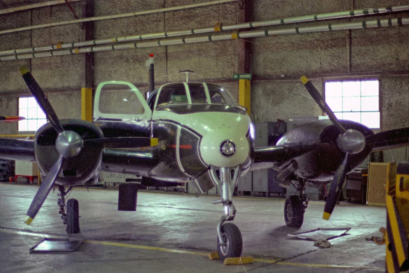
A circa 1972-74 photo at Halley AAF by Bob Coveney, which Bob observed was of “One of our 2 U-8D airplanes in the hangar we shared with the 5th Army Readiness Command.
The engines were supercharged O470s with 345 HP & they had augmenter tubes on the exhausts that added 9% more thrust.
It carried 6 passengers in 2 large bench seats but we didn't let passengers sit up front with us.
145 knots true airspeed through some of the worst winter weather you could imagine: ice, ice, and more ice!”
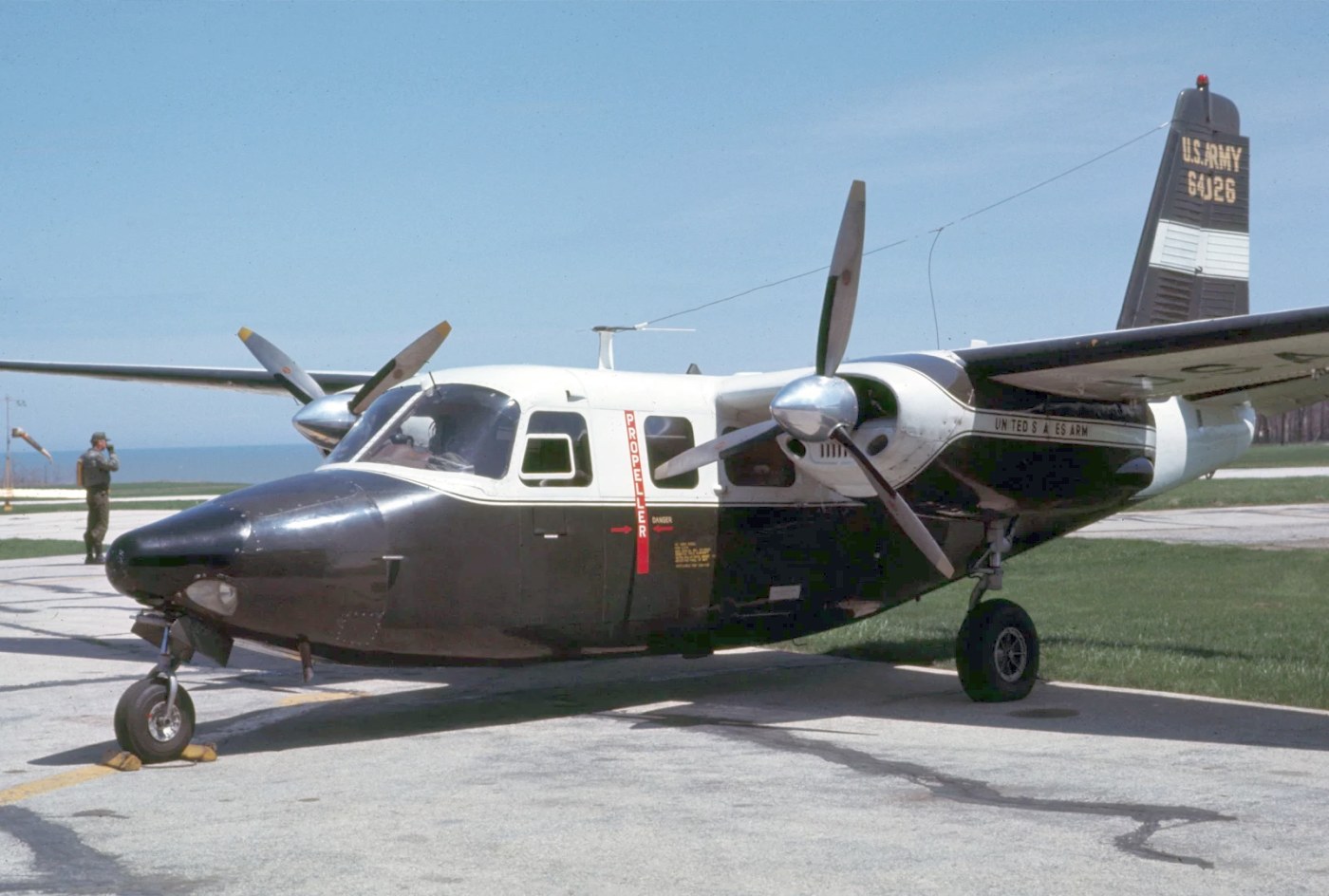
A circa 1972-74 photo by Bob Coveney, which Bob observed was of “An Army U-9 aircraft that landed at Haley AAF one day.
I think it might have belonged to a Reserve unit somewhere.”
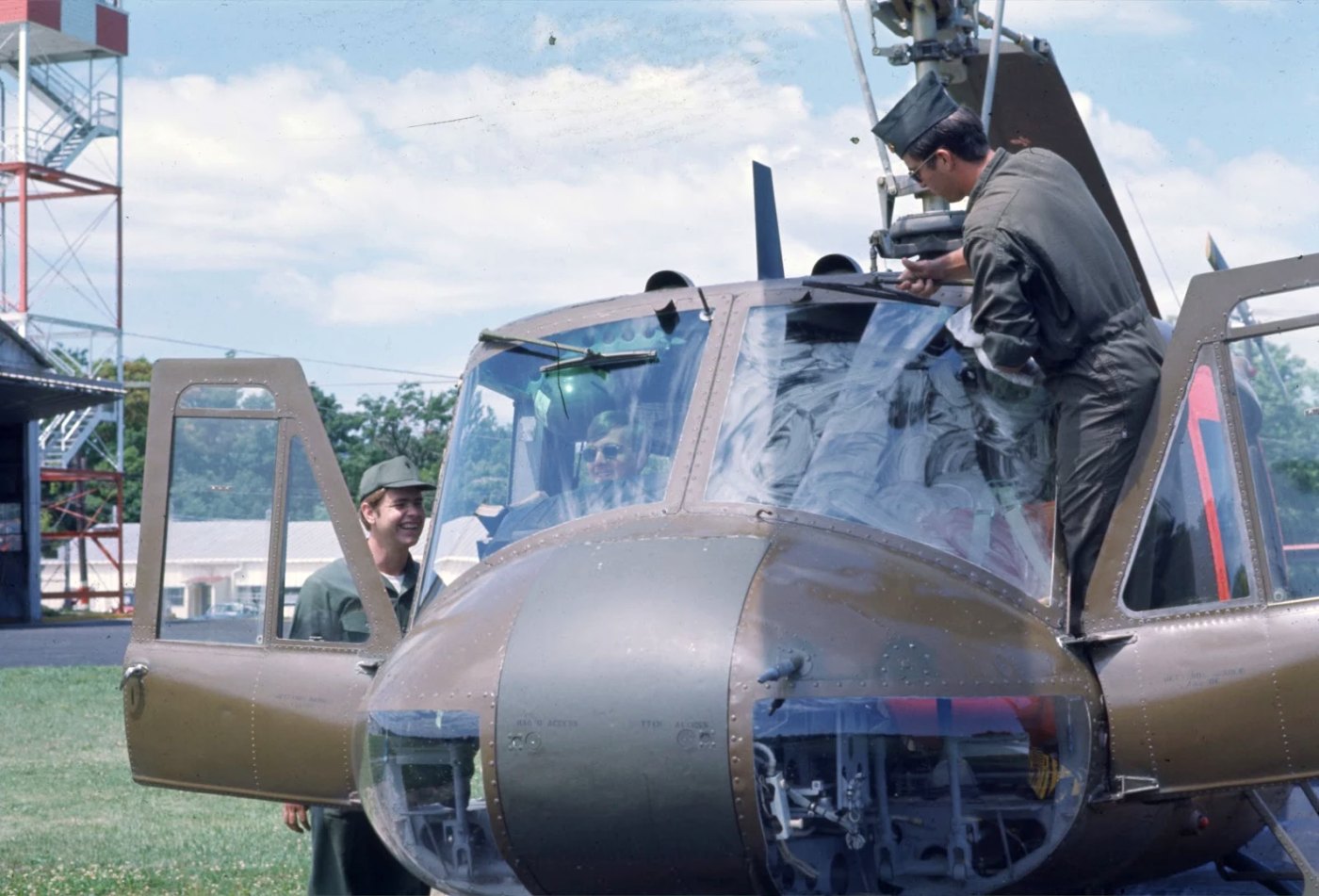
The last photo which has been located of an aircraft at Haley AAF was a 1974 photo by Bob Coveney,
which Bob observed was of a “Crew chief cleaning the windshield of one of our UH-1Hs at Haley AAF. 1st Lt Don Kerrick was in the right seat.”
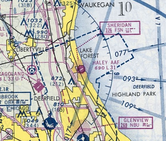
The last aeronautical chart depiction which has been located of Haley AAF
was on the November 1974 Chicago Sectional Chart (courtesy of Ron Plante).
It depicted Haley as having a 3,100' paved runway.
According to a 2023 Army report (courtesy of Sean Kohnke), “Light aircraft used Haley Airfield until 1977, when the airfield was converted to a helipad & used until 1993.”
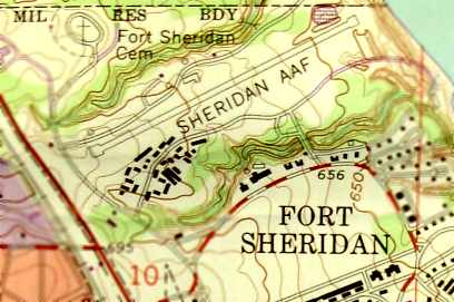
The 1980 USGS topo map (courtesy of Rex Ricks) still depicted Sheridan AAF.
A 1981 aerial view of Haley AAF showed a short middle section of the runway had been repaved in asphalt (presumably for helicopters),
but the remainder of the runway had been allowed to deteriorate.
It was was labeled "Haley AAF (closed)" on the 1983 USGS topo map.
Norman Miller recalled, “In October 1984, Fourth Army headquarters was reactivated at Fort Sheridan, again becoming an Army headquarters commanded by a Lieutenant General.
By that time, Haley Army Airfield had been re-designated as an Army Heliport (AHP), the 3,100' runway had been reduced to 900' & the tower had been demolished.
My stepfather worked there as an Army civilian for Fourth Army headquarters.
He flew out of Haley AHP often, and was able to pass on to me some of the things he saw during his trips.
Aircraft used at Haley AHP during the Fourth Army period were exclusively UH-1D or H aircraft in the Army standard low visibility paint scheme.
The aircraft rarely remained there; especially during bad weather as there were no navigation aids (I assume the NDB was deactivated when the tower was removed).
Parking & maintenance were conducted at the Army Reserve facility at NAS Glenview, which was only 10 miles away.”
Norman Miller recalled, “In December 1988, the BRAC Commission recommended closure of Fort Sheridan and by 1991, Fourth Army had been again been deactivated.
In 1992, the Army Recruiting Command moved from Fort Sheridan to Fort Knox, KY. On 5/28/93, Fort Sheridan was closed.”
According to a 2023 Army report (courtesy of Sean Kohnke), “The helipad was used until 1993.”
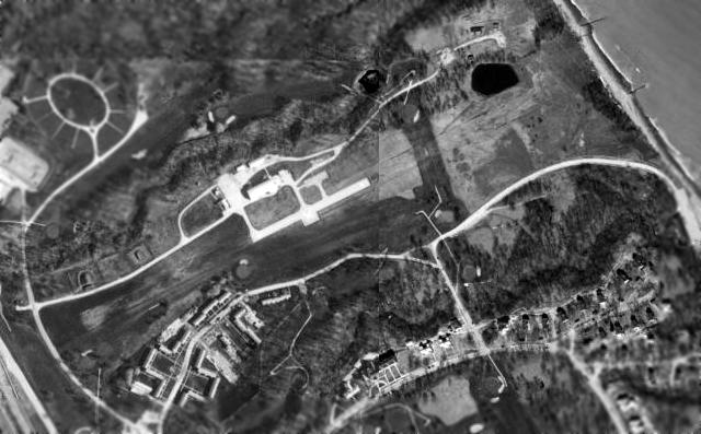
In the 1998 USGS aerial photo, the only airfield facilities remaining were a 900' long concrete helicopter landing area, a small ramp & a few small buildings.
Recent maps label the site as part of the Fort Sheridan Golf Course.
In the words of Highland Park resident Daniel Feldman, "Like we needed another golf course here."
A 1998 aerial photo showed the last portion of the Haley runway pavement had been removed.
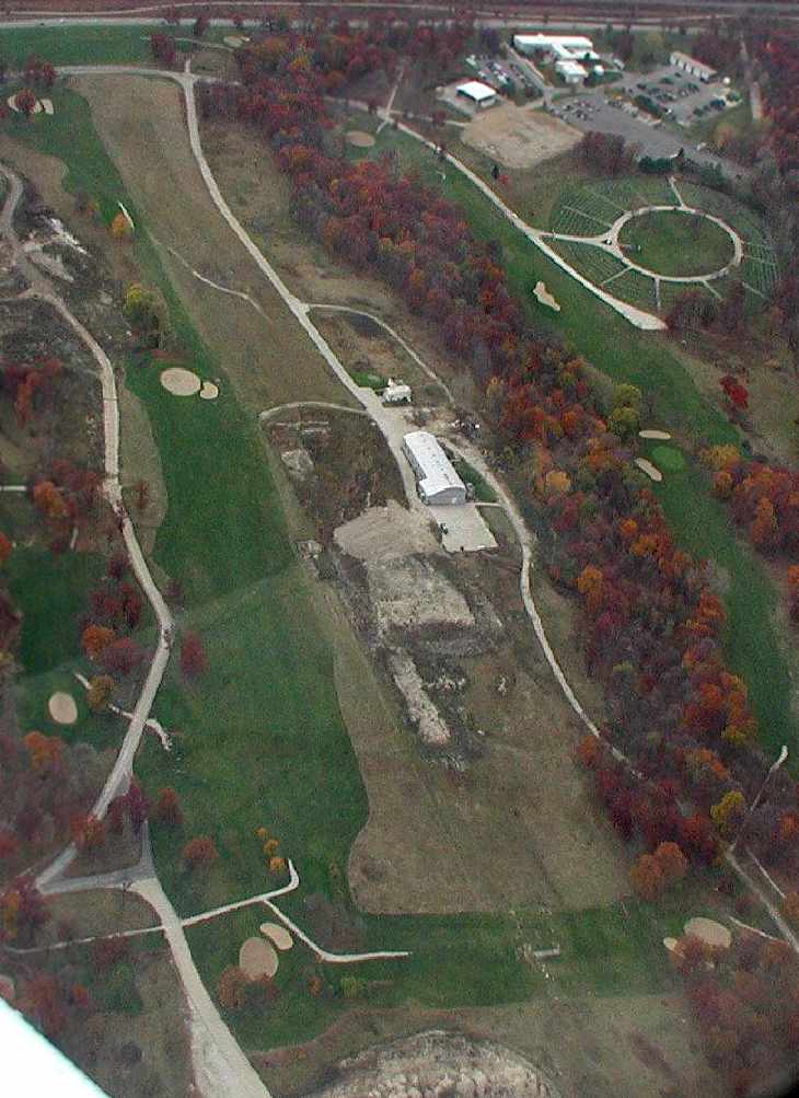
A 2003 aerial view looking west at the remains of Haley AAF, courtesy of Sean.
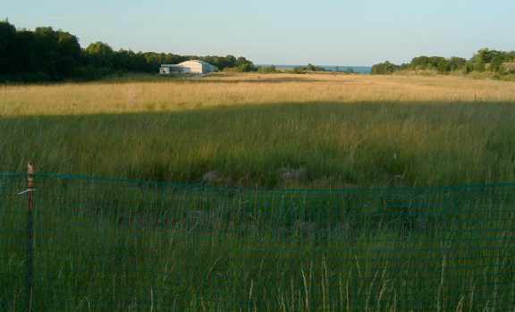
A 2005 photo by Stefan Piechota, looking east along the site of the former runway at Haley AAF, with the former hangar on the left.
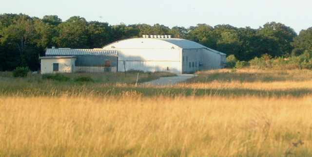
A 2005 photo by Stefan Piechota looking east at the former hangar at Haley AAF.
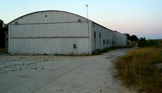
A close-up 2005 photo by Stefan Piechota of the west side of the former hangar at Haley AAF.
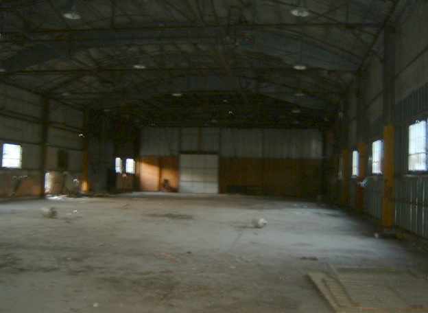
A 2005 photo by Stefan Piechota of the interior of the former hangar at Haley AAF.
A 2007 aerial photo showed the Haley hangar remained.
A 2009 aerial photo showed the Haley hangar had been removed at some point between 2007-2009, erasing the last trace of this airfield.
Norman Miller reported in 2015, “Not much remains of Haley AAF.
Now all of the roads, buildings, and asphalt has been removed, including Bell Road, and the area has been allowed to return to its natural prairie state.”
____________________________________________________
Curtiss-Reynolds Field / Glenview NAS / CGAF Chicago, Chicago, IL
42.09, -87.82 (North of Chicago O'Hare Airport, IL)
The announcement of the 10/20/29 “Dedication & Official Opening of Chicago's Magnificent $3,000,000 Airport”, Curtiss-Reynolds (courtesy of Tom Heitzman).
Much of the following historical information about Naval Air Station Glenview
comes from "Naval Air Station Glenview - The Final Salute" (courtesy of Mike Luxem).
In 1929, Chicago's major existing airport, Metropolitan (later known as Midway),
was quickly becoming surrounded by homes & industry.
Plans were announced that year for the construction of the new Curtiss-Reynolds Field,
named for the developer, Curtis Flying Service, and the land owner, Fred Reynolds.
However, the new Glenview Airport's promise, as a rival public airport to Midway, was not to be.
The field was dedicated nine days before the stock market crash heralded the beginning of the Great Depression.
Fortunately, before the crash, the Curtiss-Reynolds 3-section hangar
(subsequently known as Hangar One) had been completed,
along with concrete taxiways, some lighting & some other bare necessities.
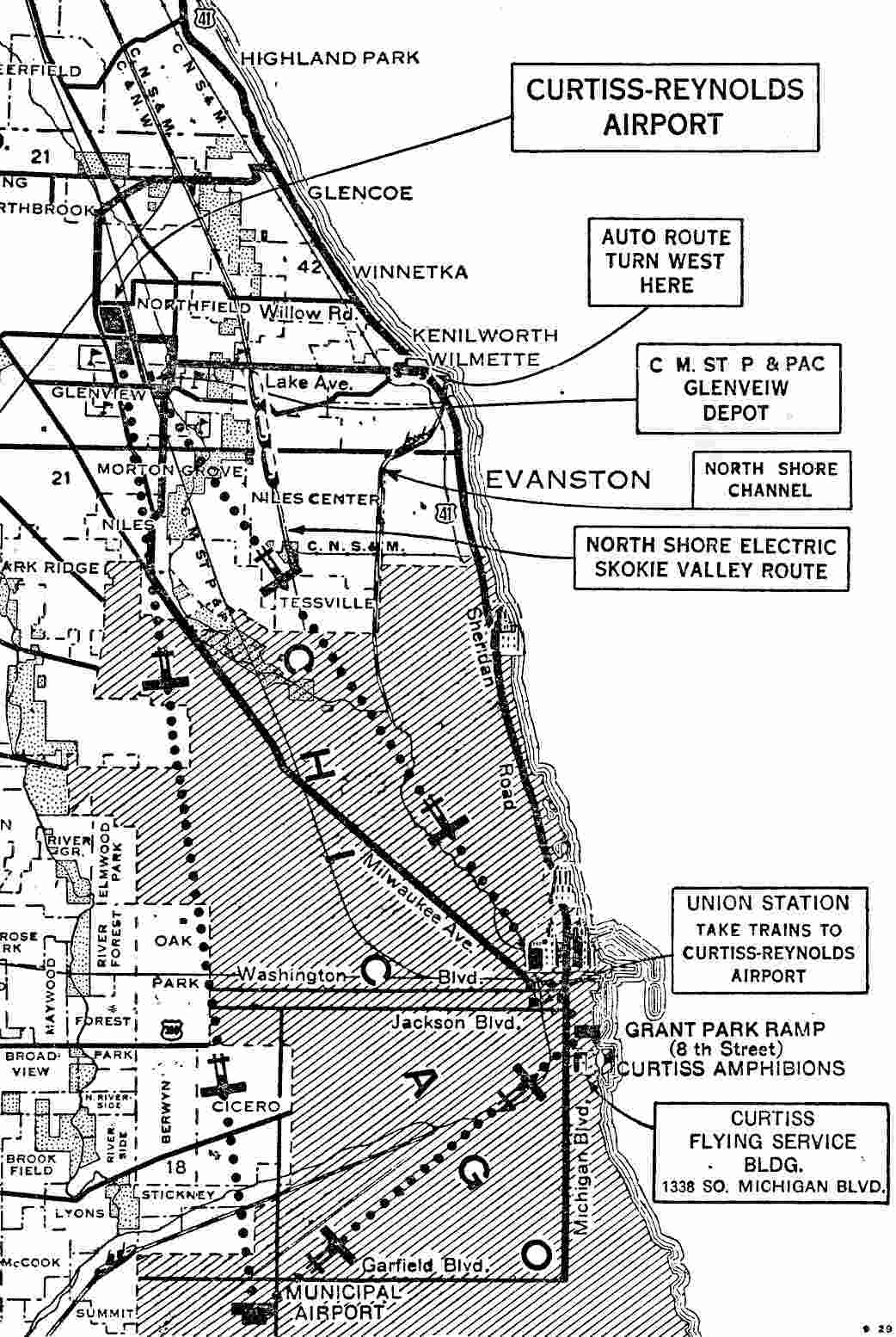
The location of Curtiss-Reynolds Airport from a 10/20/29 Curtiss-Reynolds map (courtesy of Tom Heitzman).
Scott Sorenson reported, “My Grandfather Eliot Staples moved to Glenview in 1929,
and was in business with Hal Darr & a couple other gentlemen in the Chicago Aviation Corporation at Curtiss Reynolds Airport.”
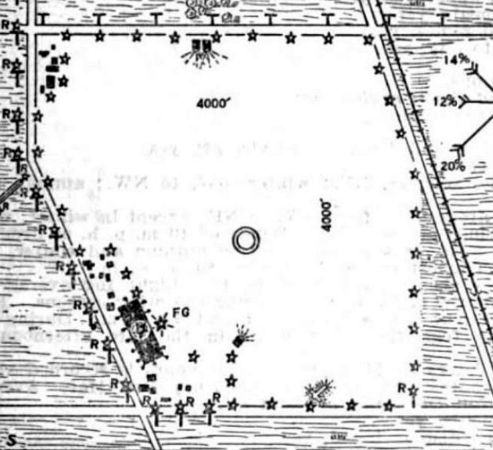
The 5/24/29 Commerce Department Airway Bulletin (courtesy of Mike Denka) described Curtiss-Reynolds Airport
as a 450 acre irregularly-shaped sod field, measuring 4,000' east/west & north/south.
It was described as being owned by Chicago Air Terminals Inc., and operated by the Curtiss-Reynolds Flying Service.
The field was depicted as having one 560' x 120' hangar on the southwest side.
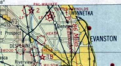
The earliest aeronautical chart depiction which has been located of Curtiss-Reynolds Field was on the 1930 Chicago Sectional Chart.
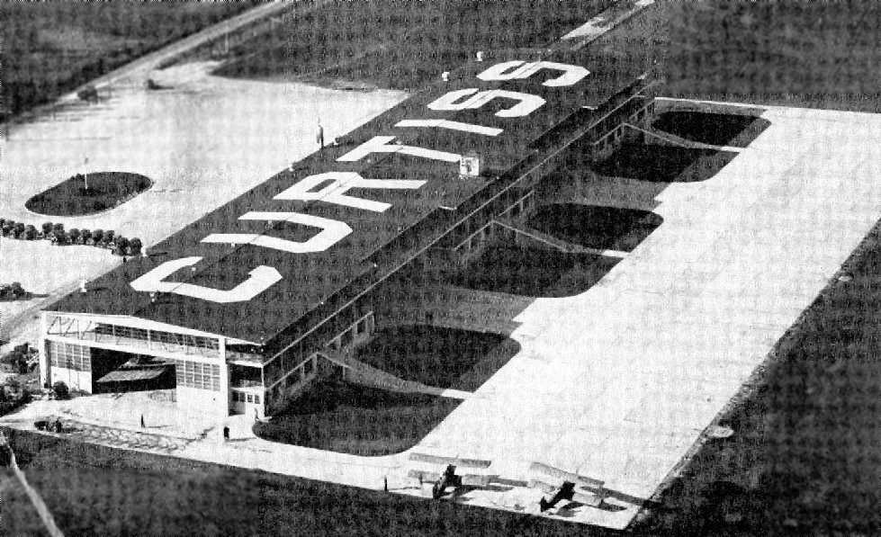
The earliest depiction which has been located of Curtiss-Reynolds Field was a 1930 aerial view looking northwest at the hangar on the west side of the field (courtesy of Brian Wolf),
with “Curtiss” painted across the roof, and 3 ramps leading from the east side of the hangar.
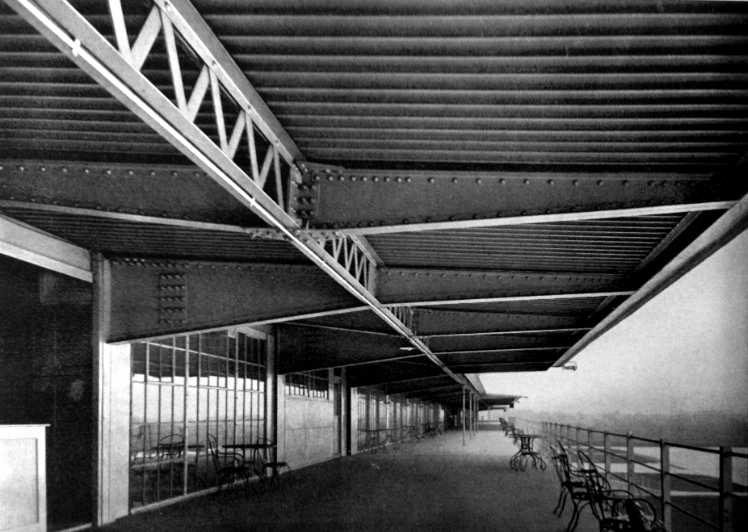
An undated photo (courtesy of Patrick Steffes of www.forgottenchicago.com) originally published in December 1930.
Patrick reported the original caption was “Spectators Promenade of the Hangar Building at Curtiss-Reynolds Airport.”
He observed, “I was surprised how modern this building was.”
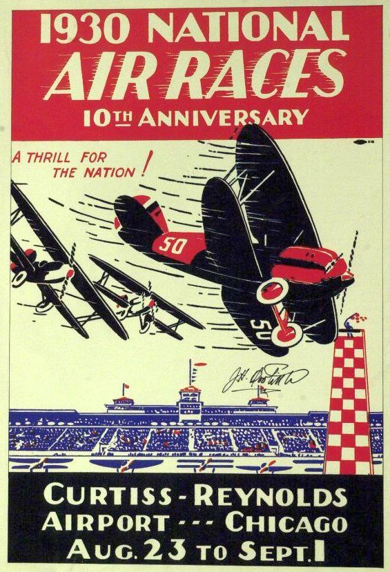
A program for the 8/23/30 National Air Races at Curtiss-Reynolds Airport,
which attracted such top pilots as Jimmy Doolittle, Frank Hawks, Charles Holman, Wiley Post & Roscoe Turner.
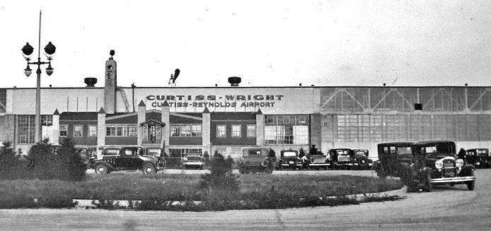
A circa 1930 street-side view of of the hangar of Curtiss-Reynolds Airport.
In 1933, during the "Century of Progress Exposition", it was the site of the International Air Races & also hosted the Graf Zeppelin.
Shortly thereafter, the Curtiss Flying Service merged with Wright Aeronautical to form Curtiss-Wright Corporation.
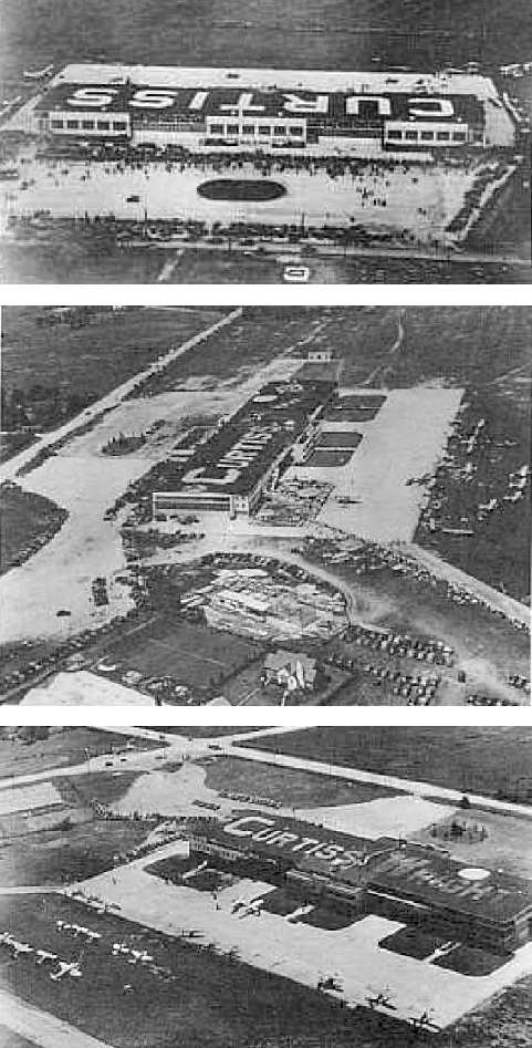
Several undated photos of the Curtiss hangar at Glenview (courtesy of Mike Luxem).
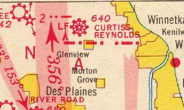
Curtiss-Reynolds Field, as depicted on a 1936-37 Chicago Sectional Chart (courtesy of Chris Kennedy).
By the mid 1930s the Navy had outgrown its Naval Reserve Aviation Base at nearby Great Lakes.
As Curtis-Wright was a nearby air field with plenty of available space,
NRAB Great Lakes moved into leased quarters in the north half of Hangar One in 1937.
Contemporary aerial photos show a dimly visible painted-over "WRIGHT"
underneath a bright fresh "U.S. NAVY" on the north half of Hangar One.
With its formal commissioning in late August, the new operation officially became Naval Reserve Aviation Base (NRAB) Glenview.
For the commissioning ceremony, 18 Grumman fighters & 9 Curtiss Helldivers took to the sky,
demonstrating aerial combat, stunts, dive bombing, and formation flying.
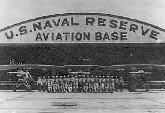
An undated photo of the Naval Reserve Aviation Base at Glenview (courtesy of Mike Luxem).
Aircraft that were used at Glenview from 1937-41 included the N2C-1, FF, O2C, OJ-2, OL-9, SF-1, NP-1 Spartan, and SU.
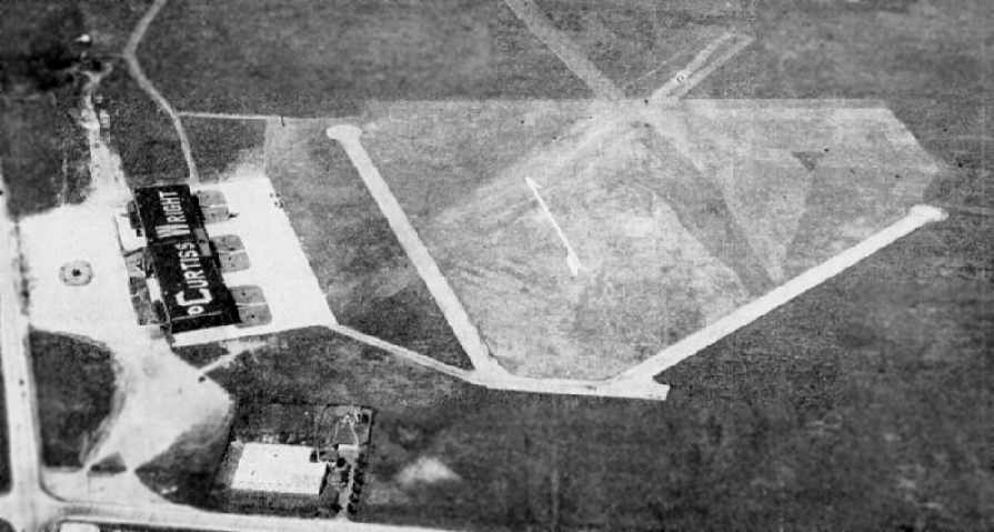
An undated aerial view looking north at Curtiss-Reynolds Field from The Airport Directory Company's 1938 Airport Directory (courtesy of Chris Kennedy).
The directory described the facility as a 4,000' x 4,000' square sod field, within which were two 1,400' asphalt runways (northeast/southwest & northwest/southeast).
The field also appeared to have 2 other grass runways just to the north of the paved runways.
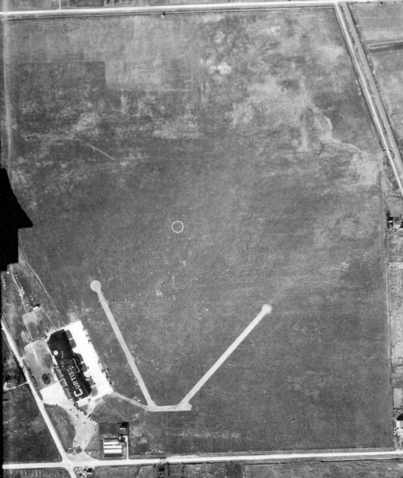
An 11/15/38 aerial view of Curtiss-Reynolds Field (from the Access IL Historical Aerial Photography collection, via Chris Kennedy)
depicted the field as having 2 paved runways within a large grass airfield area, with a single large hangar on the southeast side of the field.
Several aircraft were visible on the ramp in front of the hangar, and one aircraft was on the southeast part of the airfield.
There was no sign of the 3rd & 4th (grass) runways which had been visible in the earlier photo.
The southern portion of the hangar roof still said “Curtiss”, but the “Wright” lettering on the northern portion had been replaced by “U.S. Navy”.
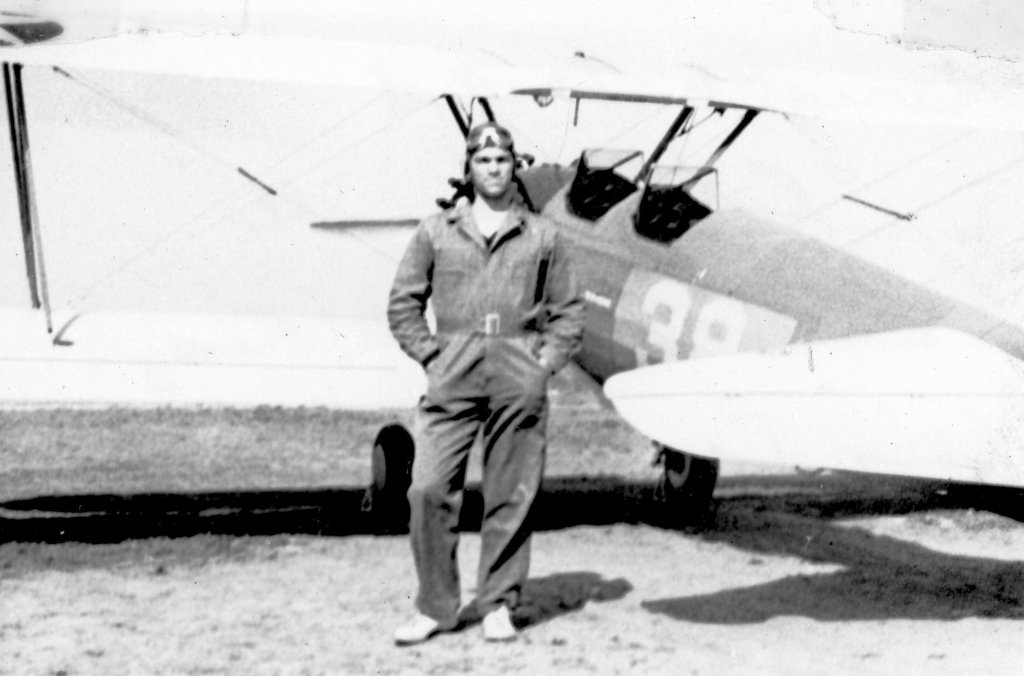
A 1939 photo of Army Air Corps Cadet Melvin McKenzie during his primary flight training at Curtiss Field Glenview (courtesy of Mark McKenzie),
in front of a PT-17 Stearman 'Kaydet' in Air Corps 2-tone markings, baby blue & yellow.
Melvin's training was provided by a contract flight school.
Aircraft that were used at Glenview from 1941-46 included the N3 Yellow Peril, GB-1, Stearman N2S, Howard H-1, Piper NE-1,
SO3C-1 Seagull, SB-2A Buccaneer, SNJ Texan, F4F Wildcat, SB2C Helldiver, Curtiss SNC-1, and SBD Dauntless.

The last photo which has been located showing Glenview in its original configuration was a 1942 aerial view looking east (courtesy of Rex Ricks),
just before it was significantly expanded during WW2.
In 1942 plans for a radical expansion of the base were disclosed.
Hangar One was expanded, new buildings were constructed & runways were lengthened, with the longest reaching 6,600'.
The total area of the airfield more than tripled.
On 3/24/42, LtCdr G.A.T. Washburn assumed command of Glenview, with orders to direct the expansion of the base.
In one of the largest & fastest paving jobs ever undertaken in the Midwest,
1,300,000 square yards of concrete landing mats & runways were poured
in only 121 working days following the awarding of the construction contracts.
Modern barracks, recreation hall & dining facilities,
a gymnasium with a training pool, a firehouse & hospital were all built.
Paved streets, streetlights, sidewalks & the shops, theater,
and chapel in the recreation building all completed the picture of Glenview as a self contained community.
On 8/1/42, the Carrier Qualification Training Unit (CQTU) officially began operations.
Brainchild of Commander Richard F. Whitehead of the Ninth Naval district,
the CQTU fulfilled the need for carrier operations training in the safety of the Great Lakes,
beyond the reach of German & Japanese submarines operating in coastal waters.
Under Commander Whitehead's direction, two coal-burning Great Lakes paddlewheeled excursion ships,
the Seeandbee & the Greater Buffalo, were converted into flattops.
Refitted with a wooden flight deck on a steel structure, they were renamed the USS Wolverine (IX-64) and the USS Sable (IX-81).
They were to be the only inland aircraft carriers ever commissioned by the U.S. Navy
and became part of a fleet familiarly known as the "Corn Belt Fleet".
The 2 carriers, based at Chicago, trained pilots & flight deck personnel 7 days / week, year-round, throughout the war.
Together they logged over 135,000 landings & qualified over 15,000 Navy & Marine Corps pilots,
among them a young aviator named George Bush who would later become President.
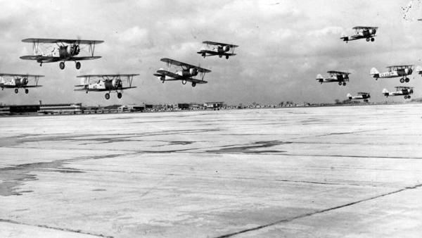
A
March 1943 photo of 11 Naval Aircraft Factory N3N training biplanes
making a formation overflight of NAS Glenview (courtesy of Ron
Plante).
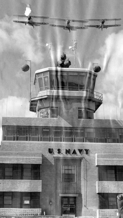
A March 1943 photo of 3 Naval Aircraft Factory N3N training biplanes overflying the NAS Glenview tower (courtesy of Ron Plante).
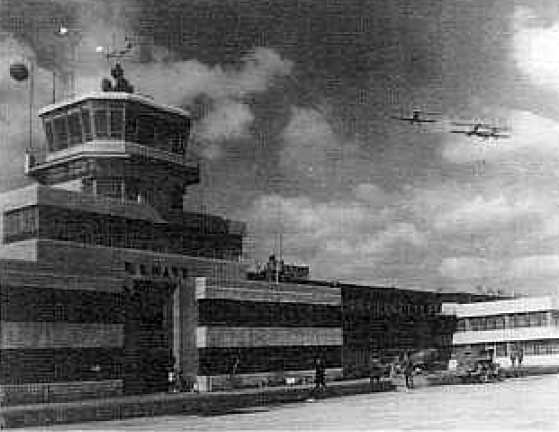
A circa 1940s photo of Naval Aircraft Factory N3N training biplanes passing over Glenview's control tower (courtesy of Mike Luxem).
The Naval Air Primary Training Command was established by the Secretary of the Navy on 10/1/42,
and Glenview was placed under its command.
Approximately 9,000 men received their primary flight training at Glenview during the war years,
flying 786,928 daylight hours & 27,425 night flight hours.
The October 1944 Chicago Sectional Chart (courtesy of Richard Doehring) labeled the airfield as “Glenview (Navy”).
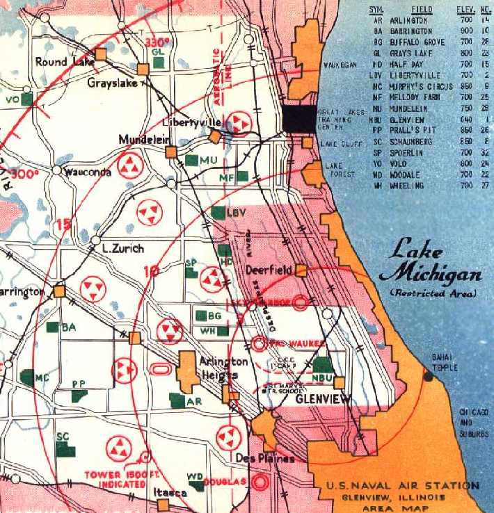
A 1945 map of Glenview NAS & its 15 satellite airfields,
courtesy of Dick Ferron (a Naval Aviation Cadet at Glenview in 1945).
A total of 15 outlying airfields were used by Glenview,
from Volo & Grays Lake down to Schaumburg (some with names like Melody Farm, Murphy's Circus & Prall's Pit).
The cadets logged over 2,225,000 takeoffs & landings.
Manning the outlying fields could be a lonely job at times, particularly in bad weather.
The 1/8/43 issue of the Exhaust (NRAB Glenview's original newspaper)
printed a report from Site 8, Schaumburg Field in Roselle, that included:
"The wind sure does howl & blowout this way and loneliness sometimes gets you,
but we overcome this by holding discussions, on current events, with the field mice."
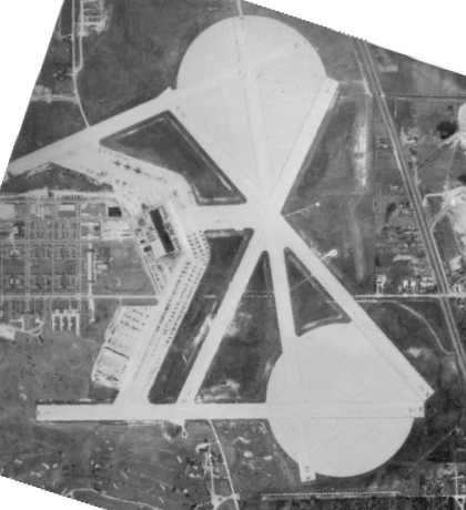
The earliest photo showing Glenview in its massively-expanded airfield configuration was a WW2-era aerial view,
showing the 2 huge paved landing circles, multiple paved runways, ramps, and Hangar 1.
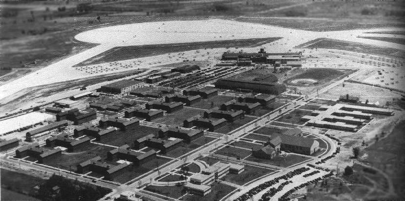
A WW2-era National Archives aerial view looking east at Glenview,
with one of the 2 huge paved landing circles visible in addition to the multiple paved runways, ramps, and Hangar 1.
The 1944 US Army/Navy Directory of Airfields (courtesy of Ken Mercer) described Glenview as having a 6,300' hard-surface runway.
Following WW2, Glenview became a Reserve facility, hosting a large number
of disparate units of the Navy, Marine Corps, Army & Coast Guard.
Both Neil Armstrong & Gerald Ford served at the base in Navy reserve units after WW2.
A 1946 USAAF KS-NY Pilot's Handbook (courtesy of Chris Kennedy) depicted Glenview as having 5 paved runways,
with the longest being the 6,300' Runway 17/35.
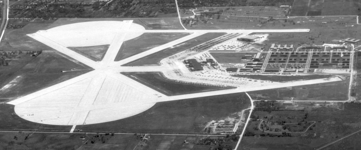
A May 1946 aerial view looking south at NAS Glenview (courtesy of Ron Plante).
On 5/8/46 NAS Glenview was open for a "drive through" inspection (by automobiles only) on the 1st anniversary of V-E Day.
Descriptive posters along the route described the functions of the station buildings & there was a large display of the Navy's latest type service & training planes.
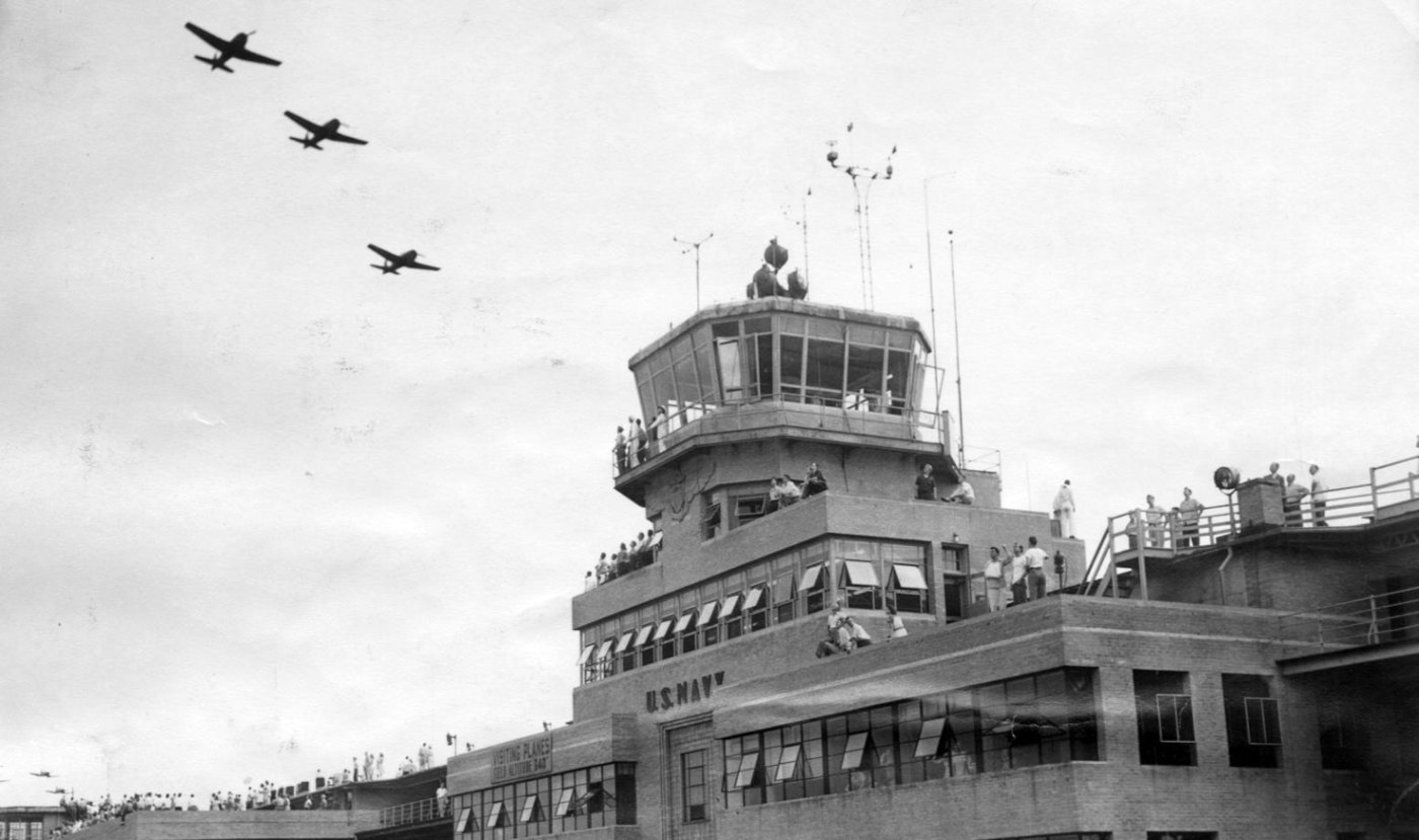
A July 1946 photo of a crowd of 45,000 watching 2 sections of military aircraft overflying the Glenview tower during an airshow (courtesy of Ron Plante).
Aircraft that were used at Glenview from 1946-50 included the PBY Catalina, F6F Hellcat, PV2 Harpoon, F4U Corsair, TBM Avenger,
F8F Bearcat, AM-1 Mauler, FH-1 Phantom, F9F-8 Cougar, JRB-4 Expeditor, and SNB Kansan.
Aircraft that were used at Glenview from 1950-60 included the AD Skyraider, P4Y Privateer, S2F Tracker, F9F-9 Panther, F2H Banshee,
F9F-8 Cougar, Convair C-131, T-34B Mentor, Piper UO-1 Aztec, FJ-4B Fury, F7U Cutlass, and TV-2 Shooting Star.
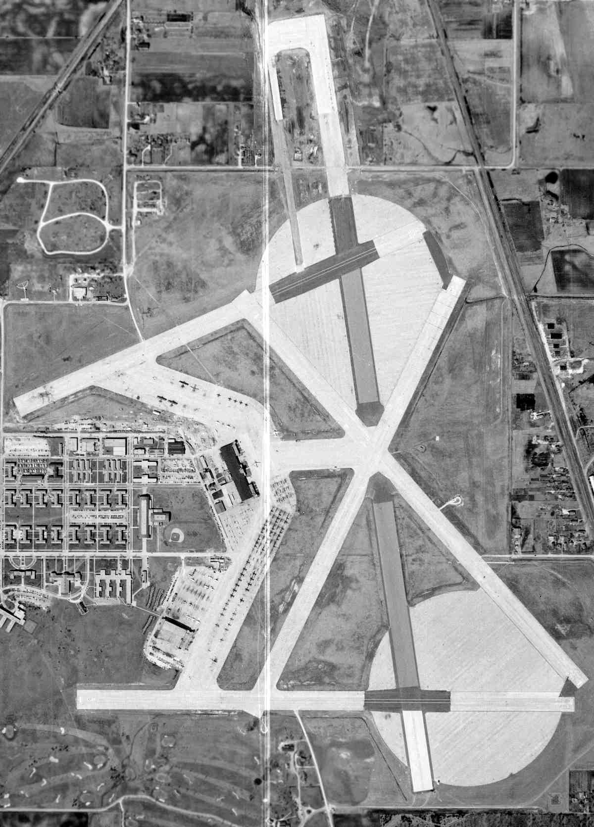
A 4/8/52 USGS aerial view of Glenview showed the airfield as having 2 huge paved landing circles, 5 paved runways,
a large ramp, and 2 large hangars (with a 2nd large hangar having been built southwest of Hangar One).
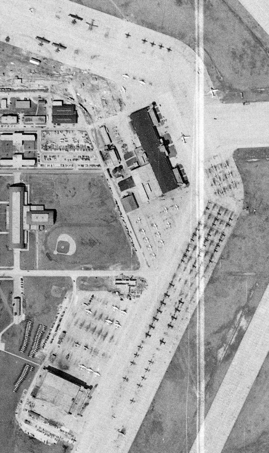
A closeup from the 4/8/52 USGS aerial view showed over a hundred aircraft on Glenview's ramps.
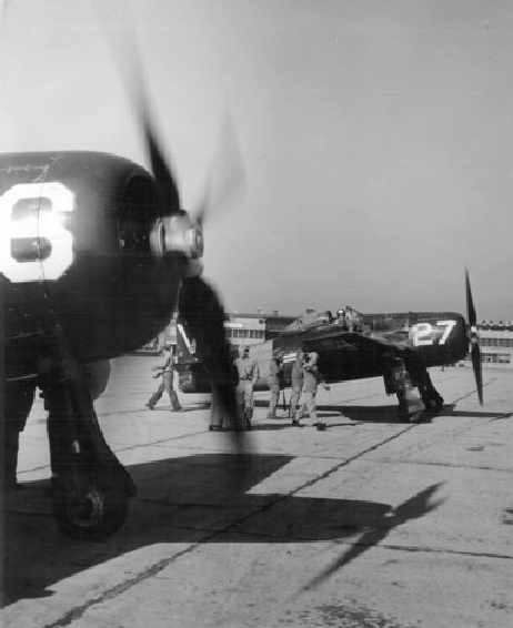
A 1952 USN photo by Martin Reilly of 2 Grumman F8F Bearcat fighters warming up at Glenview (courtesy of Mike Luxem).
Harper Poling recalled of Glenview, “Neil Armstrong joined our squadron, VF-724 in 1952.”
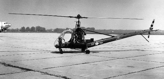
A September 1952 photo of a Hiller HTE-2 training helicopter (Buno 129778) at NAS Glenview.
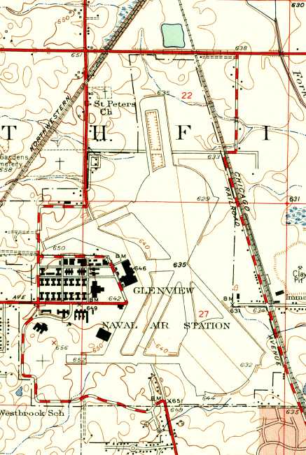
The 1953 USGS topo map depicted Glenview as having multiple paved runways & 2 huge circular landing mats.
A circa 1950s photo (courtesy of Harper Poling) of a Grumman F8F-1 Bearcats on a snowy NAS Glenview ramp.
A circa 1950s photo by Harper Poling of a Lockheed TV-1 Shooting Star & a Navy blimp (model unidentified) at NAS Glenview.
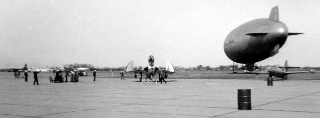
A circa 1950s photo by Harper Poling of a Douglas F4D Skyray , a Navy blimp, and other aircraft at NAS Glenview.
During the 1950s Glenview was home to the Air Barons of VF-725.
The Air Barons, the Naval Air Reserve flight demonstration team,
performed precision aerial maneuvers at air shows & were often referred to as the "Blue Angels" of the Reserves.
They flew the F9F-8 Cougar.
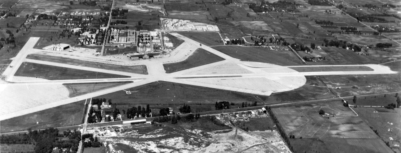
A 6/19/57 aerial view looking west depicted Glenview as having multiple paved runways, 2 huge circular landing mats, and a large number of aircraft on its ramps.
Matt Lockman recalled, “My grandparents owned property that abutted the Naval Air Station and throughout the 1950s & 1960s,
they remember the NAS was a welcome part of the community & one of Glenview’s largest employers.”
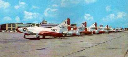
A 1960 photo of a lineup of Grumman F9F Cougars in training markings in front of Glenview's Hangar 1 (courtesy of Rex Ricks).
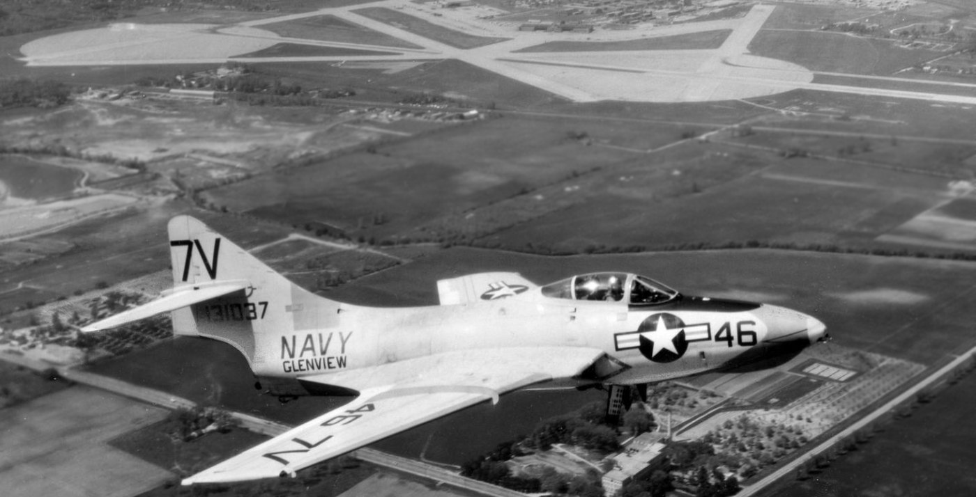
A May 1961 aerial view looking west at a Grumman F9F Cougar with NAS Glenview in the background (courtesy of Ron Plante).
A 1962 aerial view showed dozens of aircraft on Glenview's ramp.
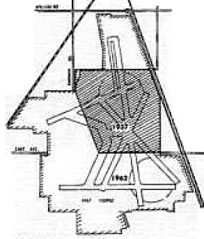
A comparison between the size of the original airfield property in 1937,
compared to the much-expanded Naval Air Station as of 1962 (courtesy of Mike Luxem).
A circa 1960s view of a P-2 Neptune on the Glenview ramp (courtesy of Nate Nickel).
A September 1963 photo of Kim & Jeff Stewart in front of a North American FJ-4 Fury jet fighter at NAS Glenview (courtesy of Ron Plante).
An undated photo of a pilot in front of an A-4 Skyhawk & the Glenview tower from a circa 1960s base telephone directory (courtesy of Dick Paul).
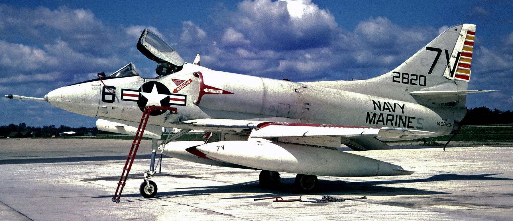
An 8/28/65 photo of Douglas A-4B Skyhawk 142820 C/n 11882 (in “Navy Marines” markings) at NAS Glenview.
In 1965, Glenview pilots & aircrew begin training on the new C-118 flight simulator.
Aircraft that were used at Glenview from 1960-78 included the FJ Fury, R5D Skymaster, P2V Neptune, A-4 Skyhawk,
SH-3 Sea King, US-2A, P-3 Orion, KC-130 Hercules, T-34B Mentor, C-118, UH-1 Huey, and U-8.
Marty Coddington recalled, “The FJ Fury was based there in the mid-1960s.
I was a controller at ORD & we had Approach Control jurisdiction over Glenview working many FJs on the weekends.”
According to Bill Koonce, “In July of 1968, a VA-727 A-4 Skyhawk crashed into a house after takeoff, killing a 13-year-old girl.
This was the 1st civilian fatality in the history of the base.
The pilot survived with 2 broken legs & one broken arm.
He reportedly maneuvered the plane to avoid a grade school, and was shaken up to learn that his plane claimed a life.”
Glenview was also used by the Coast Guard.
With 2 amphibious Sikorsky HH-52A helicopters, the Coast Guard Air Station Chicago became operational at Glenview on 3/1/69.
The primary mission of the area facility was to provide search & rescue assistance for the southern half of Lake Michigan.
Since the Coast Guard Air Station was commissioned, a total of 2,815 emergency flights were made, with 501 lives saved.
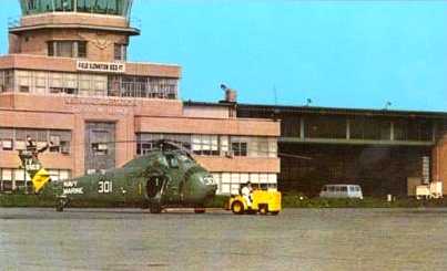
A 1969 photo of a Sikorsky H-34 helicopter in front of Glenview's tower (courtesy of Rex Ricks).
By 1970, the 1,000th Reservist had graduated from Gelnview's C-118 simulator.
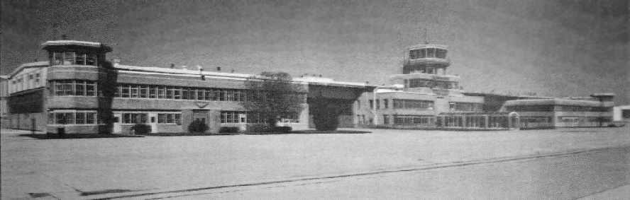
An undated photo looking northwest at Glenview's Hangar 1 (courtesy of Rex Ricks).
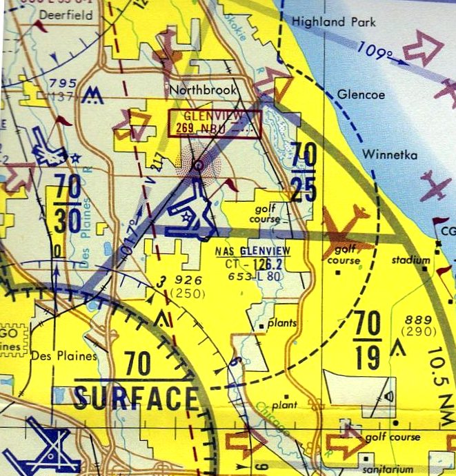
The last aeronautical chart depiction which has been located of NAS Glenview
was on the May 1973 Chicago Terminal Aeronautical Chart (courtesy of Mitchell Hymowitz).
It depicted Glenview as having 4 paved runways, the longest being 8,000'.
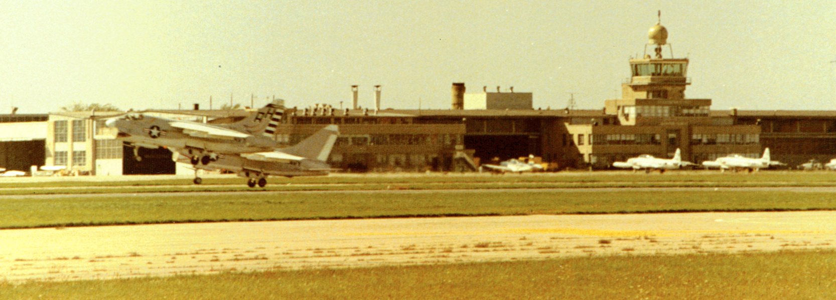
A summer 1973 photo by John Lorentz of 2 Vought A-7 Corsairs taking off from NAS Glenview, with 2 Lockheed T-33 Shooting Stars in front of the control tower.
In 1974, a family of 6 in a private plane safely made an emergency belly landing on a foamed runway at Glenview.
A 1974 aerial view showed that a hangar had been added just north of Hangar One at some point between 1962-74.
It also showed another hangar under construction, to the northwest of Hangar One,
located right in the middle of the former northeast/southwest runway.
In contrast to previous years' photos, there were no longer any tactical aircraft on Glenview's ramps,
with the only aircraft visible being 12 P-3 Orions parked on the south ramp,
and 2 Fairchild C-119s & a Douglas C-9 on the north ramp.

A 1/30/78 USGS aerial view of Glenvie showed a nuber of aircraft on its ramps (P-3s?).
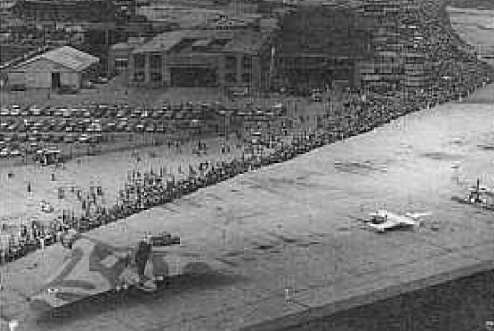
A circa 1970s aerial view of an RAF Vulcan bomber on static display at Glenview (courtesy of Mike Luxem).
In 1978 a Royal Air Force Vulcan bomber crashed at a Glenview airshow, killing the 4 person crew.
According to Nate Nickel, "It crashed into a garbage dump near the base.
Local legend has it that you can still find metal fragments from that aircraft if you look hard enough
(I've looked, never found anything, but makes a good story!)."
Mark Bailey recalled, "I grew up in the shadow of the Glenview Naval Air Station in Chicago.
I remember the facility hosting a number of open houses
and would host the Blue Angels when in town for the Chicago Air & Water Show.
I remember the day the Vulcan bomber crashed - I heard it but did not see it.
It hit the northern part of a garbage dump between Willow & Techny Roads - just outside the base boundary.
I remember seeing some wreckage in Hangar One a few days later."
Bert Tovrog recalled, “When the British Vulcan bomber nose-dived in to the landfill (garbage dump) north of Willow Road,
I was on a business call in the industrial park, 2 buildings away from the Glenview NAS fence on the west side.
The earth really did shake! I could see the smoke spiraling upward.
Choppers were scrambled & I surely thought there would be another crash.
The security fence at the north end was flattened for access to the crash site. It was a real madhouse.
News reports indicated that the Vulcan took off going north & went up & then nose-dived at full speed in to the landfill.”
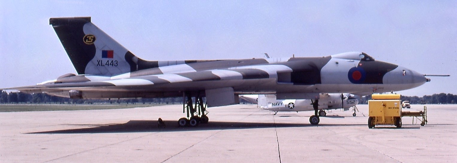
A 7/25/80 photo of RAF Avro Vulcan bomber XL443 C/n SET46 staged at Glenview for the Chicago Air & Water Show.
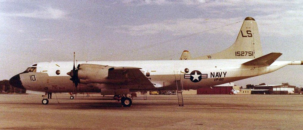
A 10/6/80 photo of a Lockheed P-3B Orion in front of NAS Glenview hangars.
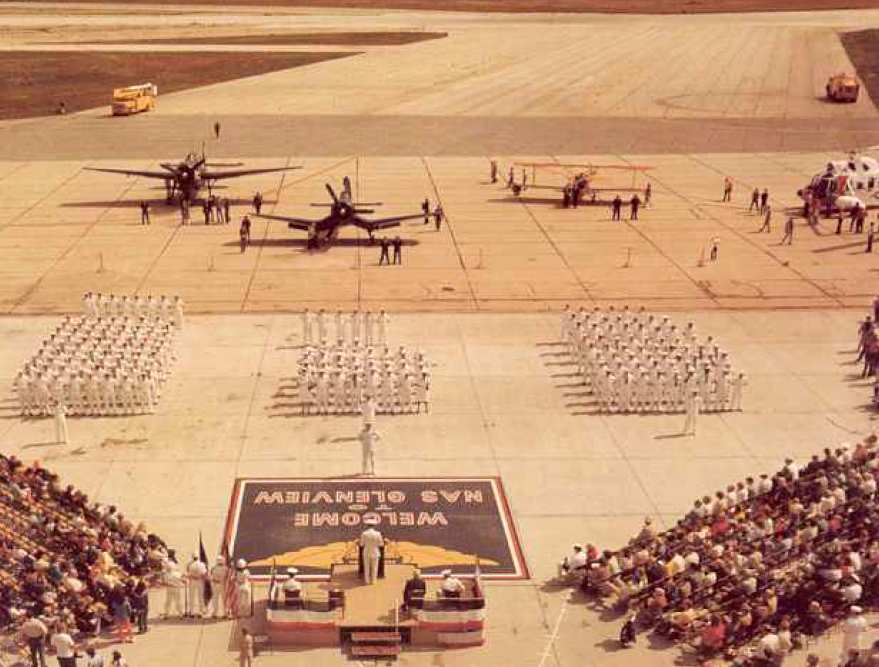
A 1982 Navy photo by PHC Rehm of the NAS Glenview 45th Anniversary Ceremony (courtesy of Mike Luxem).
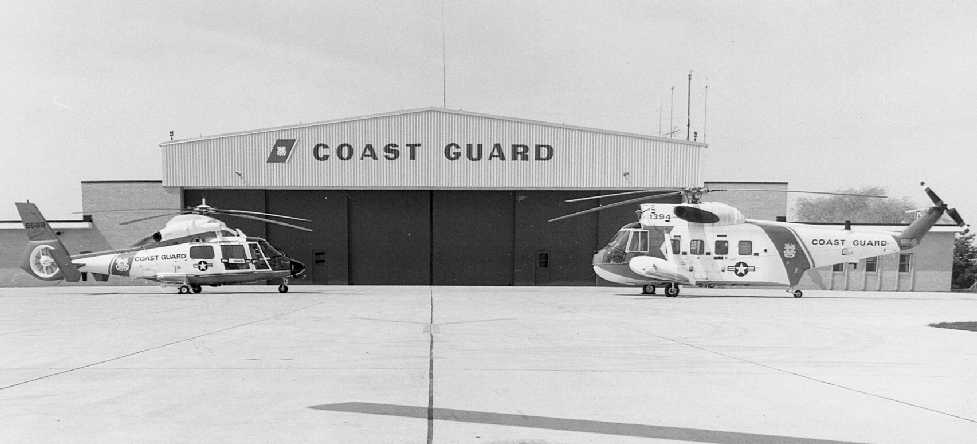
A circa 1980s USCG photo of a HH-65 Dolphin & HH-52 Seaguard in front of the Glenview Coast Guard hangar.
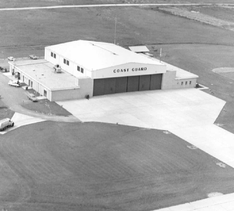
A circa 1980s USCG aerial view looking north at the Glenview Coast Guard hangar.
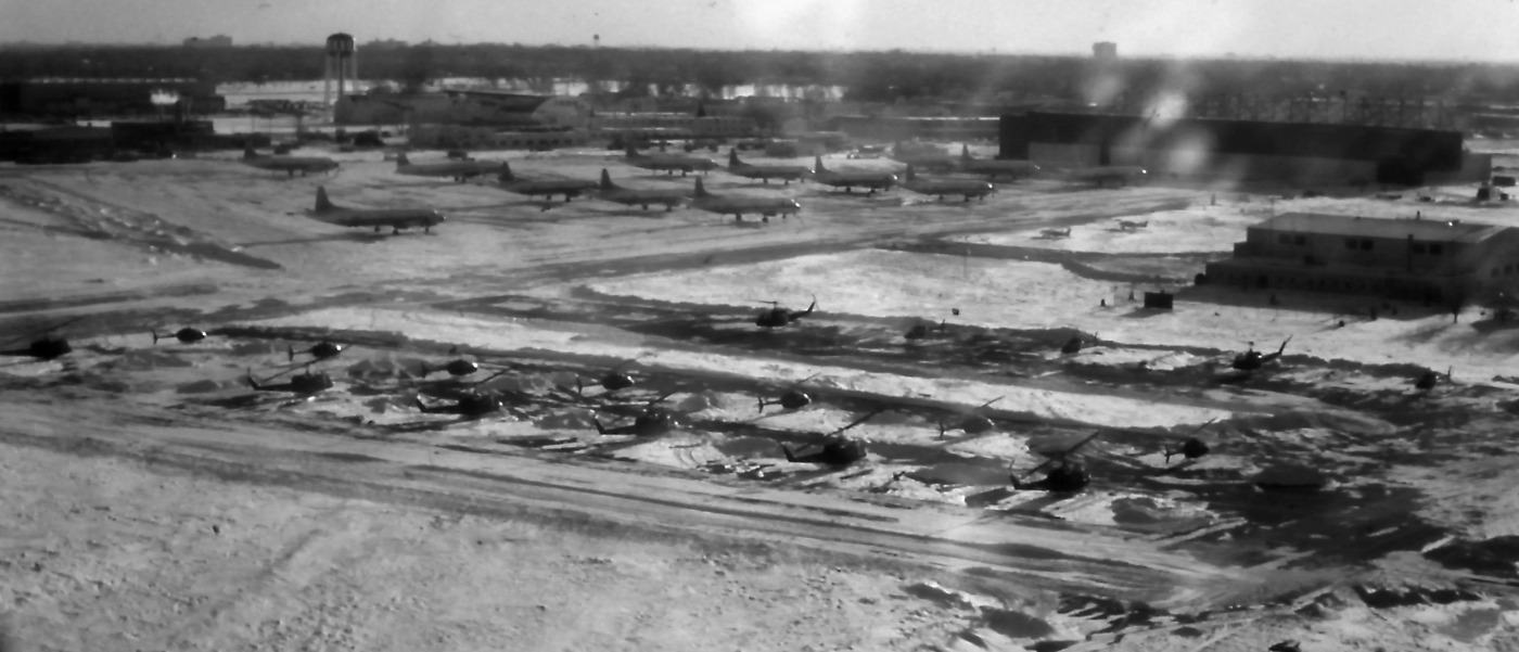
A circa winter 1980/81 aerial view by Bill Pagett looking south at the facilities of the Army 185th Transportation Company to the west of the main north/south.
Bill Pagett recalled, “I was in the 185th Transportation Company (US Army Aviation) under the command of Maj. Richard Stuebing based at Navy Glenview.
Our company consisted of Hueys (UH-1M & H models) & OH-58s. We also cared for the fixed wing aircraft attached to Ft. Sheridan after the closing of Haley AAF.”
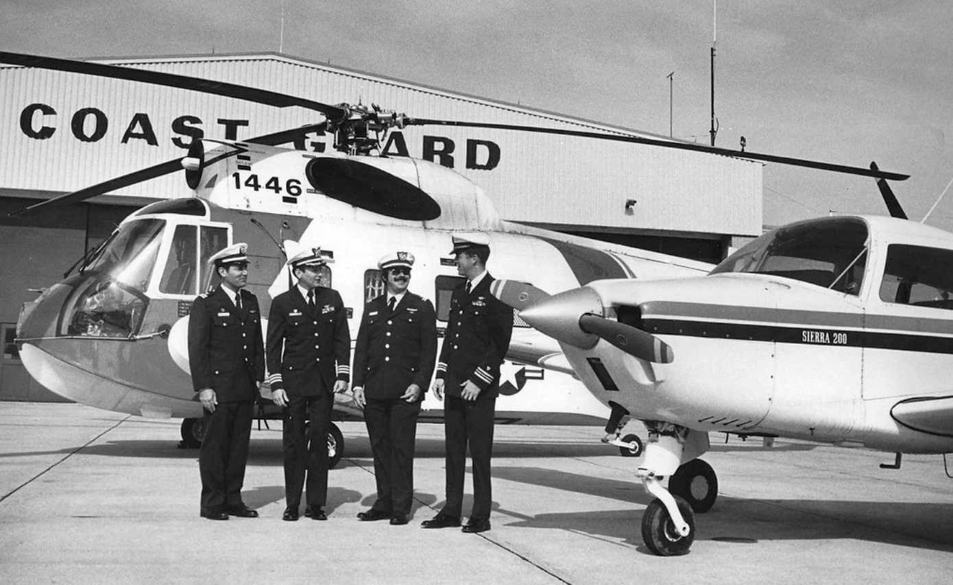
A 1983 photo of Coast Guard personnel & a Sikorsky HH-52 Pelican & a Beech Sierra 200 in front of the Glenview Coast Guard hangar.
A 1988 aerial view showed that the large hangar located on the south ramp had been removed at some point between 1974-88,
and replaced by a new large hangar, just to the north.
Furthermore, two new hangars were also added on the north ramp at some point between 1974-88.
An ironic set of investments, considering that the base would be closed in only another 5 years.
Eleven P-3 Orions were parked on the south & north ramps,
and one swept-wing transport was parked in front of Hangar One.
A 1989 USGS aerial view of Glenview, while the field was still open (note C-141B on ramp).
An undated photo looking west at the Glenview control tower (courtesy of Rex Ricks).
Bill Koonce recalled, “By far my best memory about the base was during its last years of service, when the Blue Angels used it for staging.
They put on a small air show for a crowd that grew every year.
Although I never saw more than a passing view of the private show,
I was getting out of my car in Carriage Hill, and got to see the F/A-18s making their turn to final approach at treetop level.
They were so close, and banking in a way that I could see the pilots' faces.
I made eye contact with one, we exchanged waves, and I got a wing wag before the aircraft disappeared from my view.
A fitting farewell to the last military plane that I saw in the skies above Glenview.”
A May 1991 photo of a Grumman EA-6B Prowler on display at an NAS Glenview Air Expo (courtesy of Ron Plante).
According to Nate Nickel, "There was intense pressure by local residents to close the base because of noise concerns
(NAS Glenview was surrounded by dense, suburban residential development).
A fiery 1991 crash by a Navy T-39 into a residential area also contributed to anti-base feeling
(there is a memorial to the flight crew who died in downtown Glenview)."
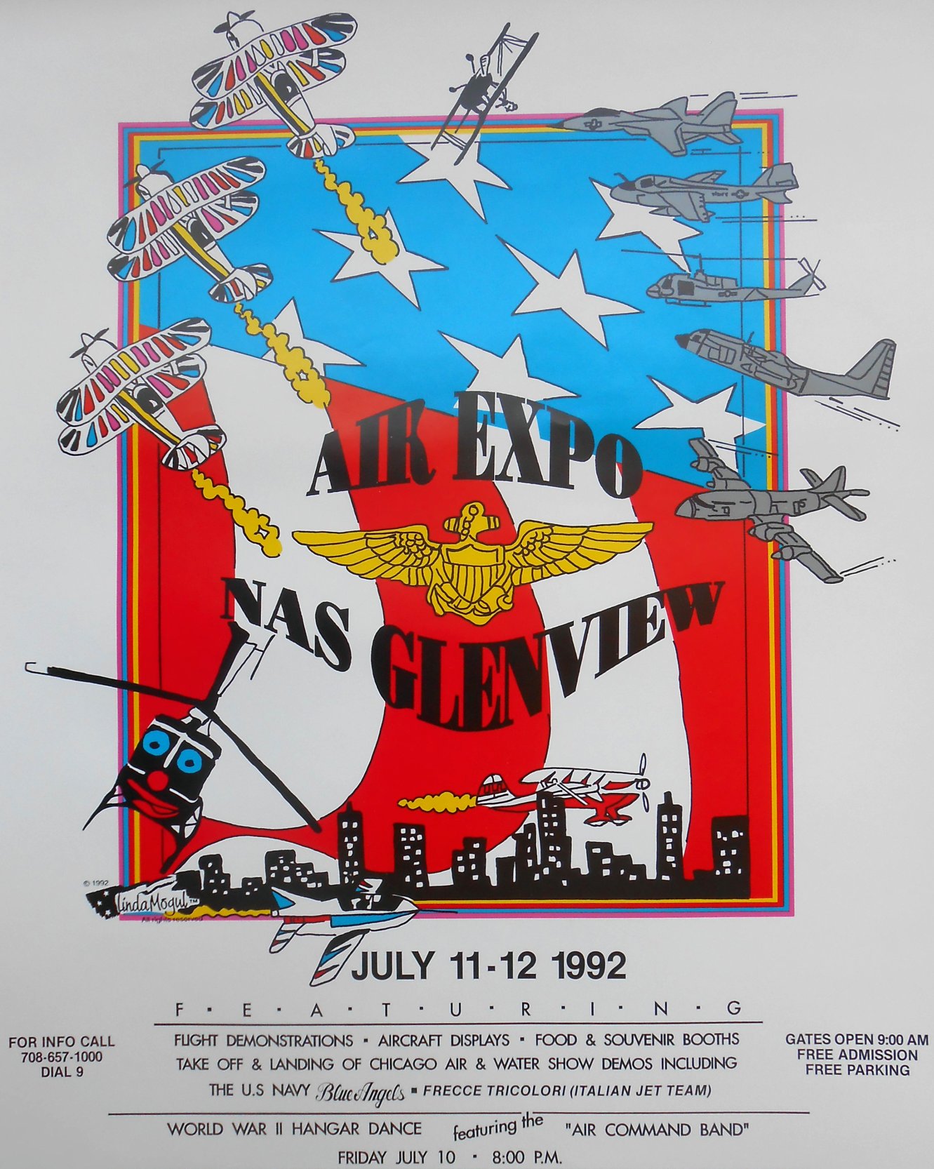
A poster advertising NAS Glenvew's July 11-12, 1992 Air Expo (courtesy of John Lorentz).
Even in the base's later years, improvements in facilities & equipment continued to be made.
A new P-3 flight simulator was installed in 1992.
Also constructed were a new 5-story control tower, 2 barracks, 100 new housing units & an $11 million maintenance facility.
In a shameful example of the waste of taxpayer dollars & infrastructure,
nearby resident David Kaufman reported that shortly before Glenview's closure,
"the Navy spent upward of $10 million to completely tear out & rebuild the main north/south runway.
They did a real 1st-class job, taking about 6 months to replace it with reinforced concrete that would have easily had a 20 or 30 year life.
What a waste. It was entertaining, though, during that period of construction,
to watch the based P-3 Orions land & takeoff on the east/west cross runway, which was only about 4,500' long."
Army Reserve Captain Robert Grierson recalled, “I participated in the BRACC [Base Realignment & Closure Committee]
hearings in 1993 testifying with Colonel Hugh Reed & a Brigadier General from the 86th US ARCOM attempting to keep the base open.
A deal was made by the Department of the Navy to close Glenview in order to keep Great Lakes [Naval Trainer Center] open.
The Navy decided it didn't need training bases in San Diego, Orlando, and Great Lakes.
The deal was one or the other. Glenview, San Diego, and Orlando lost.
I remember the mayor of Glenview being asked by the BRACC Chairman, 'Mayor should we keep it open?'
Her comment... 'I don't care, close it if you want.'"

A circa early 1990s photo of a McDonnell Douglas F/A-18B or 18D Hornet making a low pass in front of Glenview's tower.
Robert Grierson recalled, “In addition to the reconstructed runway,
a new maintenance building was constructed & opened 6 months prior to the base closing.
Road, curb, and gutter improvements continued up until the base closed.”
In April 1993, nearly 56 years after Glenview's commissioning,
the Base Realignment & Closure committee recommended NAS Glenview for closure.
In August 1993, Captain James Schultz relieved Captain Paul Kinneberg as Glenview's final Commanding Officer,
charged with the difficult task of directing the closure of the base & its transition to civilian ownership.
The final NAS Glenview Air Expo was held in 1993.
An estimated total of 70,000 people came to view aircraft including the P2V, Vulcan, F-111, and B-17.
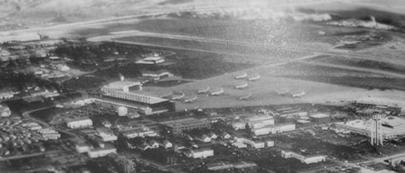
The last photo which has been located showing Glenview while it was still operational
was a 1993 aerial view looking northeast (courtesy of Rex Ricks), showing 11 P-3 Orions on the northern ramp.
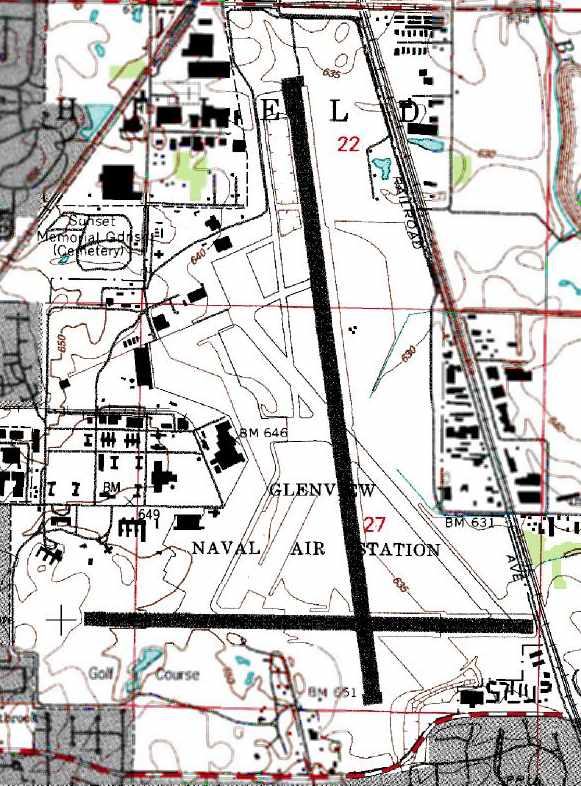
The 1993 USGS topo map depicted Glenview as having 2 runways,
as well as numerous former runways, ramps, hangars, etc.
According to Nate Nickel, "Following announcement of base closure, a group tried to keep the base open as a general aviation airport.
It's 8,000' runway, control tower, ILS approaches & great ramp facilities could have made a great reliever airport for ORD & MDW!
Several Chicago corporations, including Kraft Foods (based in Glenview), lobbied for this as well.
However, residents, once again, complained bitterly to Village officials
and put up very strong, organized opposition to this proposal, thus killing any chances of aviation reuse."
In February 1995, the last fixed-wing plane was launched from NAS Glenview.
According to the last Commanding Officer of NAS Glenview, Captain Jim Schultz,
“The last type of aircraft to officially fly out of NBU... was a P-3 based at NAS Willow Grove which had flown in for the closing ceremony.
I don't remember if it was VP-64 or VP-66 but I think it was piloted by Cdr. Tom Burns, a former VP-90 pilot.”

A 9/5/95 photo of the NAS Glenview closure ceremony, attended by 1,700. Upon closure, the runways painted with yellow "X" markings.
The entrance sign at NAS Glenview, taken by Nate Nickel shortly after the base closed in 1995.
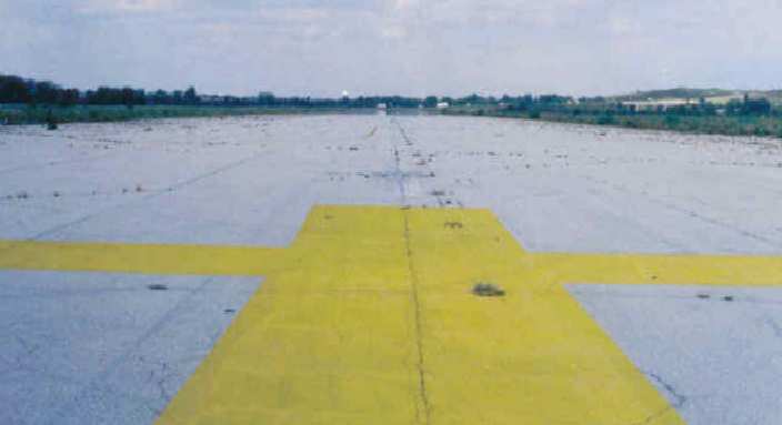
Glenview's Runway 17/35, taken by Nate Nickel shortly after the base closed in 1995.
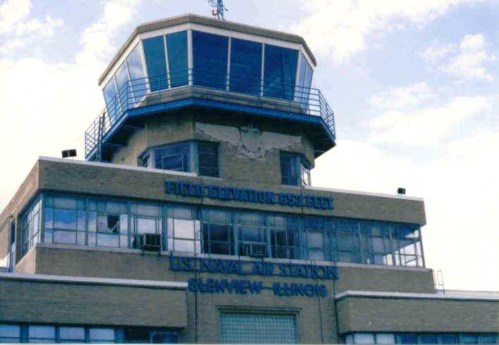
The control tower atop Glenview's historic Hangar One, taken by Nate Nickel shortly after the base closed in 1995.
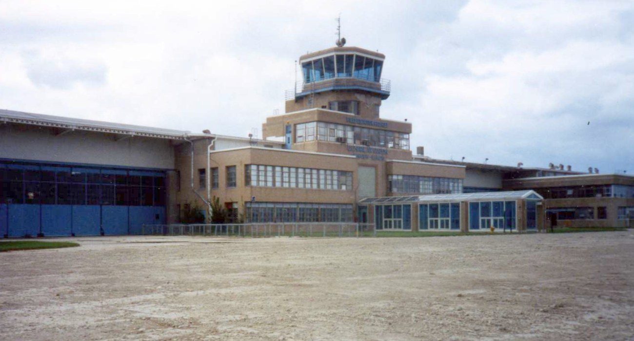
A circa 1996 photo by Harper Poling of Glenview's control tower after the base's closure but before its redevelopment.
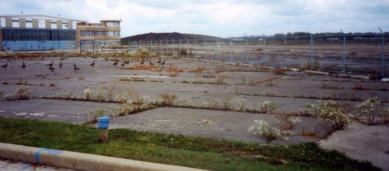
A sad circa 1996 photo by Harper Poling of Glenview's Hangar 1 after the base's closure but before its redevelopment.
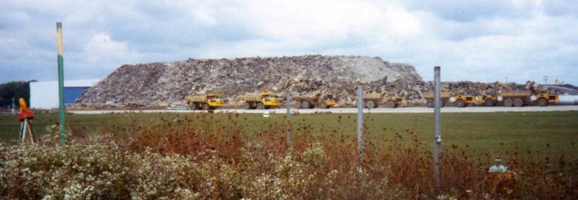
A sad circa 1996 photo by Harper Poling of “the pile of concrete that's left of the runways” after they were removed at Glenview.
According to Matt Lockman recalled, “After the base closed in 1995,
the village of Glenview moved quickly to redevelop the land for residential, commercial, and recreational purposes.
The Hangar One Foundation, NAS Glenview’s historical agency,
had to fight & claw to prevent the entire area from being wiped clean.
The village resisted nearly every effort to save historical buildings
and grudgingly allowed the tower & HQ building to be saved & the establishment of a museum on site.
Village officials who presided over the redevelopment were only concerned with revenue generations through property & sales taxes
and have no concerns whatsoever for historical preservation,
which stems from Glenview’s demographics being predominantly upper-middle-class liberals with neutral or anti-military sentiment.
Ironically, the NAS’s existence had created a restricted area for aircraft flying into & out of O’Hare International Airport nearby.
With the NAS gone, O’Hare flights have filled the airspace & Glenview residents are once again complaining about noise abatement.
I guess some people you just can’t please.”
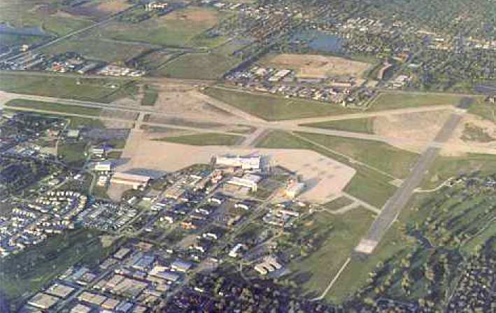
A circa 1990s aerial view looking east at Glenview (courtesy of Mike Luxem).
After the closure of the Naval Air Station in 1995,
the huge Glenview airfield remained briefly operational as a heliport, Coast Guard Air Facility - Chicago.
One HH-65A helicopter remained on duty at Glenview.
According to Nate Nickel, "There was a proposal to keep some of the Glenview runway & a hangar
for the Coast Guard to remain in Glenview after base closure."
According to Mike Luxem, "The Village of Glenview wanted the Coast Guard Rescue unit to stay,
but wanted the base to close, which led the Federal Government to say, 'sorry - when we close a base we close the whole base'."
The Coast Guard unit relocated to CGAS Traverse City, MI, and Glenview was completely closed as a military facility in 1995.
The former Coast Guard hangar was evidently taken over at some point by the Army Reserve.

A 1998 USGS aerial view looking north, after Glenview's closure but before the airfield had been removed.
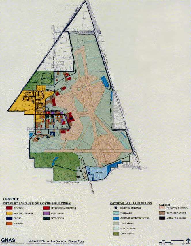
An undated “Reuse Plan” for Glenview NAS (courtesy of Rex Ricks).
As of 2000, all of Glenview's runways had been removed, making way for the construction of 1,500 new housing units.
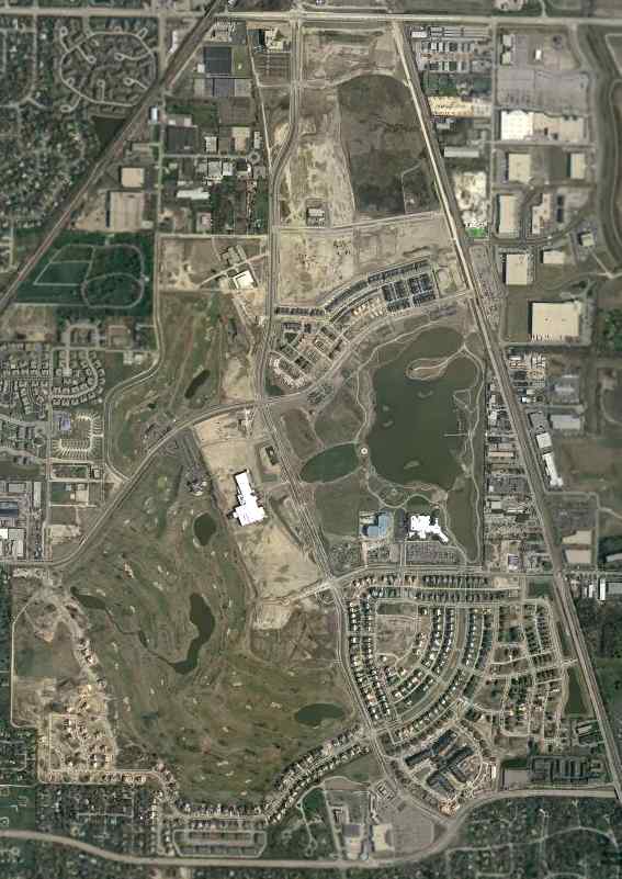
A 2002 USGS aerial view of the site of Glenview, showing that all of the runways had been completely removed.
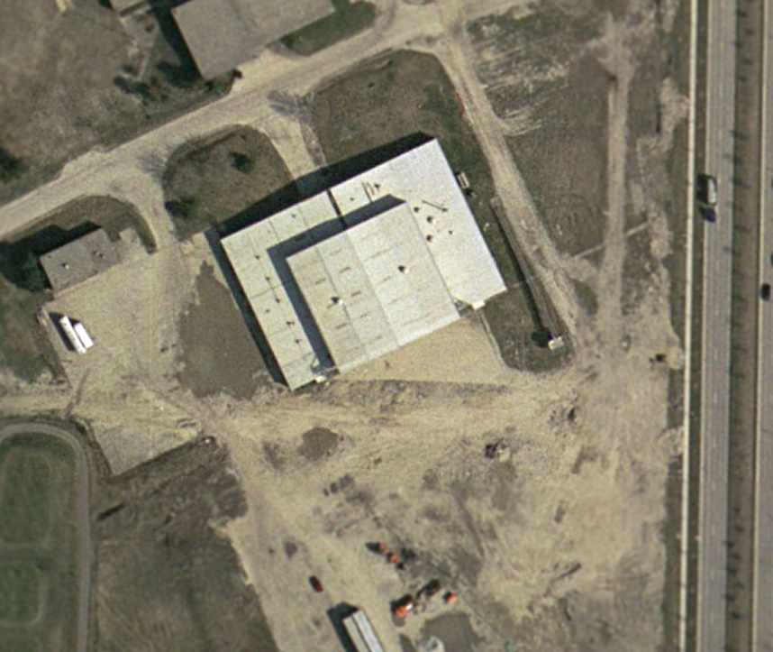
A 2002 USGS aerial view of what was apparently the former Army Reserve hangar (on the north side of the former airfield),
which has escaped demolition & remains standing.
Nate Nickel reported in 2003, "The former Army Reserve aviation hangar
was saved by the Village of Glenview & is still there today.
With federal grant money, it is being upgraded as part of a multi-municipal fire personnel training center
because it's large enough to accommodate ladder trucks."
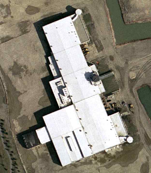
A 2002 USGS aerial view of the former Hangar One, which has been spared from demolition.
Nate continued, "The control tower & historic Hangar One, built in the 1930s by Curtiss-Wright,
was completely gutted & remodeled as part of a new shopping mall.
The Village of Glenview is dedicating a memorial to the base near the base of the tower."
A group named the Hangar One Foundation has also succeeded in preserving Glenview's historic Hangar One.
Robert Grierson recalled in 2005, “I returned to what had been Hangar One in July.
They saved the façade, but converted the building into a large shopping mall [The Glen Town Center].
The offices in the turrets (mine included) were still there, so were the briefing rooms, but you couldn't get to them.
A nice little memorial was in front of the building depicting USN aircrews.
The sad part of it is that the façade wasn't the historic part.
It was the back area (west side) which was the original Curtiss hangar from the 1930s.
That of course is now long gone.”
A circa 2006 aerial view looking west at what has become of Glenview's control tower (now incorporated into a mall building),
as well as one of the remaining turrets on the left side.
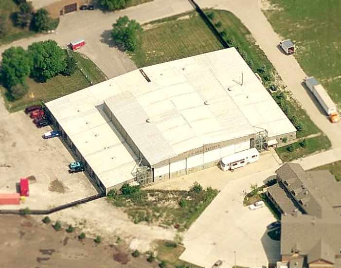
A circa 2006 aerial view looking north at the former Army Reserve hangar (on the north side of the former airfield),
This building was reportedly being reused as a fire personnel training center.
Remarkably, the lettering “U.S. Army Reserve” is still plainly visible over the doors.
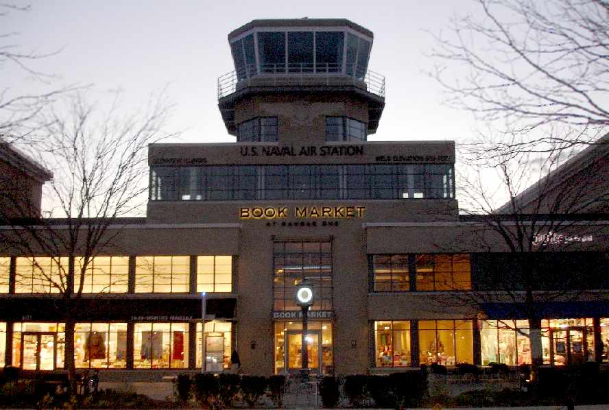
A 2007 photo by Rex Ricks of the former control tower from Hangar 1, which now sits atop a bookstore.
Rex remarked, “While I was there, I did NOT spend one dime in the city.
I refuse to contribute to the tax base of any city that would destroy a perfectly good airfield!”
Bill Koonce reported in 2008, “Words can't express how I feel about what the base that I knew & loved has been turned into.
The Glen just plain sucks. As a day sailor, I sorely miss the Coast Guard presence there.
As an aviation buff, I mourn the loss of a perfectly good airfield;
even more so on 2001-09-11, when I was living in the shadow of the John Hancock Center,
and realized that the nearest F-15 was probably an hour away.
I was furious when I found the stairway to the tower inside a crappy, overpriced bookstore,
and learned that there are no plans to allow public access to the tower!
I gag at the sight of 'Patriot' Drive, an ironic name for what has become a symbol of a peace dividend that never came,
and the poor men & women of the armed forces who got the rawest deal of all.”
A 3/14/11 photo by Mark Pasqualino of an N2S Stearman which hangs on display inside the Von Maur department store at the former Glenview NAS.
John Hazlet pointed out an unusual error: the designation “N3N-3” is painted on this aircraft's tail,
but the aircraft is actually a Stearman N2S, not a Naval Aircraft Factory N3N, which has significant configuration differences.
An August 2019 photo looking west at the former Army Reserve hangar (on the north side of the Glenview airfield site).
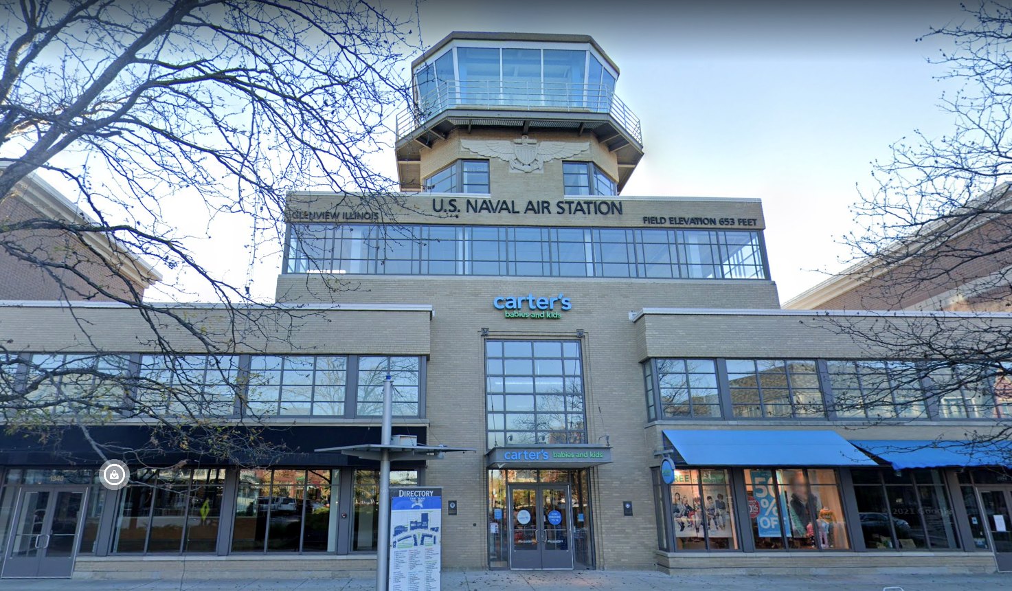
An October 2019 photo looking west at the former Glenview control tower.
See also: http://www.vpnavy.com/nasglenview.html
____________________________________________________
Or if you prefer to contact me directly concerning a contribution (for a mailing address to send a check),
please contact me at: paulandterryfreeman@gmail.com
If you enjoy this web site, please support it with a financial contribution.
____________________________________________________
This site covers airfields in all 50 states.