Abandoned & Little-Known Airfields:
Maryland, Southwestern Baltimore area
© 2002, © 2024 by Paul Freeman. Revised 3/17/24.
This site covers airfields in all 50 states: Click here for the site's main menu.
____________________________________________________
Please consider a financial contribution to support the continued growth & operation of this site.
Granite Nike Missile Battery BA-79 Launch Site (revised 3/17/24) - Granite Nike Missile Battery BA-79 Integrated Fire Control Area (revised 7/22/18)
____________________________________________________
Granite Nike Missile Battery BA-79 Launch Site, Granite, MD
39.37 North / 76.85 West (West of Baltimore, MD)
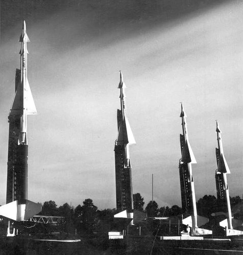
A 1953 photo of 4 Nike Ajax missiles elevated to their launch positions at the Granite Nike Launch Site.
The purpose of this military base was to shoot down incoming aircraft.
It is included here due to its significance in Cold War history, its remarkable state of preservation,
and the fact that it is located only 4 miles from the childhood home of the author of this web site.
Most residents of the Baltimore suburbs were probably unaware of the presence
of nuclear-armed missiles that were kept at the ready in their underground magazines in Granite,
just a few miles from the outer suburbs.
"It was known that there were missiles there," says Joe Tatarewicz, a Granite resident.
"People would see them raised into launch position during drills.
What was not known was that they had nuclear warheads. Folks here were pretty surprised."
Site BA-79 was one of a network of 7 Nike missile batteries that surrounded Baltimore.
The others were located in Phoenix (North of Baltimore), Fork (Northeast), Edgewood (Northeast),
Tolchester (Southeast), Jacobsville (Southeast), and Cronhardt (Northwest).
Site BA-79 also served as the Battalion Headquarters for all of the Baltimore-area Nike units.
Each Nike battery consisted of 2 separate facilities: a Launch Area & an Integrated Fire Control Area.
The layout of all Nike sites was characteristic in that the launch site
was situated 1-3 miles “downrange” from its Integrated Fire Control Area, along the axis toward the anticipated targets,
such that the radars at the IFCA would have a line-of-sight toward both the missiles & the target.
The Nike batteries replaced 90mm anti-aircraft artillery units which had been previously deployed to locations surrounding major American cities.
Granite Site BA-79 was was initially armed with the 1st-generation Nike Ajax missile.
The Nike Ajax missile was very large: each one stood 34 feet tall & weighed 2,400 pounds.
It had a range of 25 miles & a maximum speed of Mach 2.3.
The earliest photo which has been located of the Granite Nike Launch Site was a 1953 photo of 4 Nike Ajax missiles elevated to their launch positions.
Granite Site BA-79 was activated in 1954.
The earliest aerial view which has been located of the Granite Nike Launch Site was a 1957 aerial view,
showing the 6 sets of quadruple launchers for the 1st-generation Nike Ajax missile.
Granite was a "double site", having 6 underground magazines (each with 4 missile launchers), instead of the usual complement of 3 magazines.
Granite had a storage capacity in its original configuration of 30 Nike Ajax missiles.
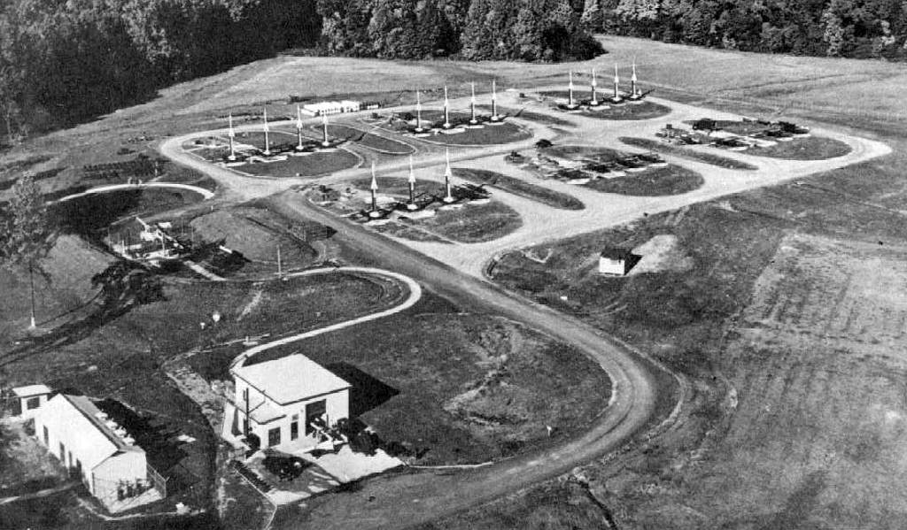
A circa 1950s aerial view looking northeast at the Granite Nike Launch Site showing a total of 15 Nike Ajax missiles elevated on their launchers.
From March 1958 – February 1959, Granite Site BA-79 was among 4 of the Baltimore area batteries that were converted to fire the 2nd-generation Nike Hercules missile.
It was chosen for conversion to the Nike Hercules version as Granite was a "double site",
with 6 underground magazines (each with 4 missile launchers), instead of the usual complement of 3 magazines.
Mark Morgan observed, “From looking at aerial photos, the 3 northerly magazines & the easternmost of the south 3 were the ones modified and retained for Hercules.”
After conversion to the Hercules configuration, Granite had 2 “A” magazines (original Ajax configuration),
2 “B” magazines (Ajax/Hercules universal magazine design),
and 2 “C” magazines (original Ajax magazines converted for Hercules use),
with a total storage capacity of 24 Nike Hercules missiles.
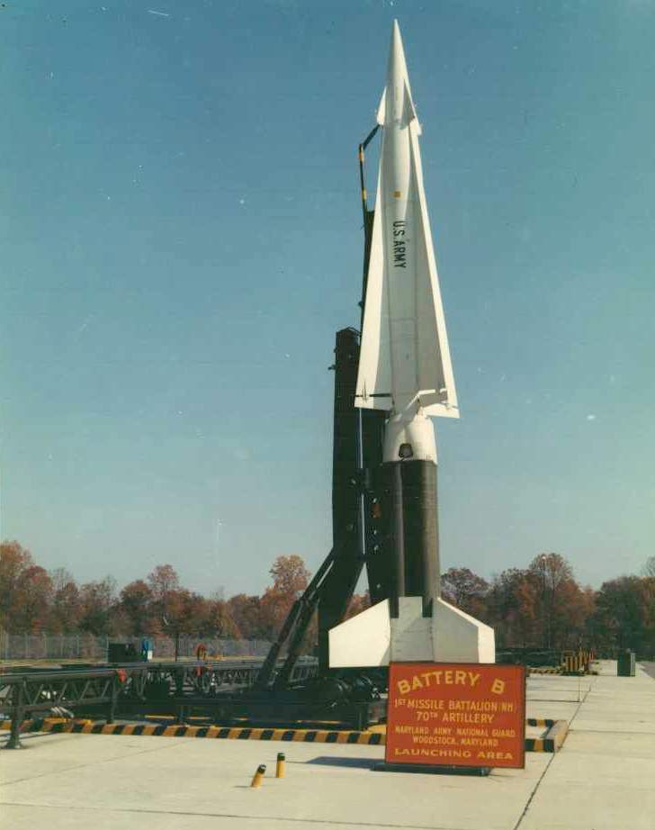
A circa 1960s view of a Nike Hercules missile on its launcher at the Granite site.
The Nike Hercules missile was considerably larger & more powerful than the earlier Nike Ajax version.
It was a truly fearsome weapon: each missile was 41 feet tall, weighed 10,700 pounds,
had a range of 87 miles, and carried either a nuclear or conventional warhead.
The deployment of the nuclear-armed Nike Hercules missiles among the hundreds of Nike batteries
throughout the US probably constituted the most widespread deployment of nuclear weapons in US history.
Operation of the Granite Nike site was taken over by the MD Army National Guard in 1963.
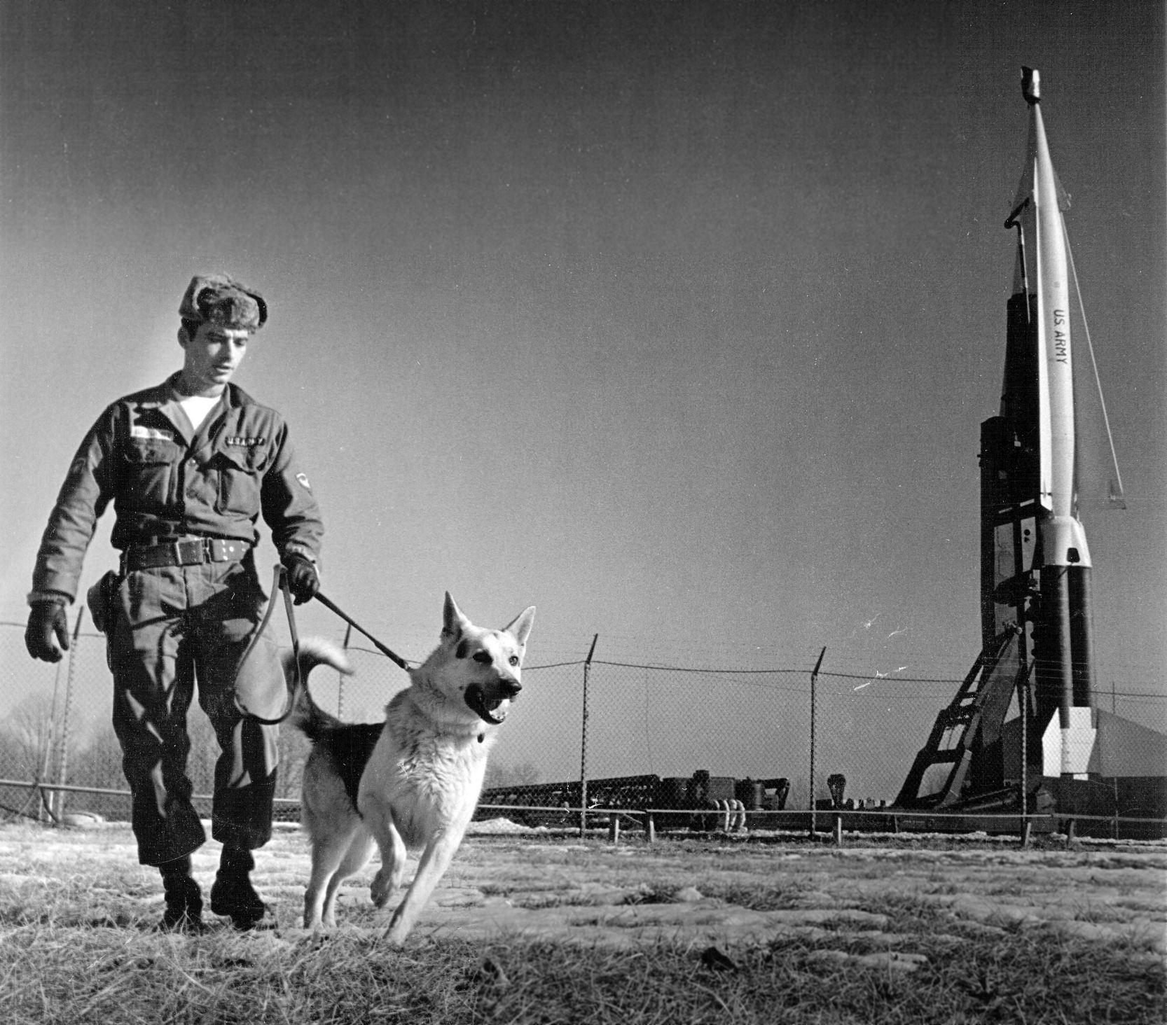
A 3/10/63 photo (courtesy of Tom Reed) of solider Charles Gregory & guard dog Lucky patrolling the Granite Nike missile launch site,
in front of a fearsome Nike Hercules missile fully elevated in the launch position.
Note that this remarkably may have depicted a nuclear-armed Hercules, as it had the pitot tubes on its forward fins which were characteristic of the nuclear variant,
along with the red "mailbox" over the very tip - apparently the protective cover for a delicate altitude fuse.
A 1964 aerial view showed the Granite Nike Launch Site after it had been converted to the Nike Hercules configuration,
but only 13 launchers appeared to be mounted over the concrete base
(out of a total of 24 which could be supported by the 4x6 configuration).
Bruce Dwyer recalled, “Nike Site Granite... I was a soldier on the 326th Maintenance Battalion at this location.”
The 2/21/66 USGS aerial photo appeared to show 4 Nike Hercules missiles mounted on the north row of launchers at Granite.
The 1967 USGS topo map depicted 2 buildings at the launch site, but did not label the installation.
The last photo which has been located showing the Granite Nike Launch Site in operation was a 1971 aerial photo.
Similarly to the 1964 photo, it appeared to show a partial complement of launchers
(only 15, out of a total of 24 which could be supported by the 4x6 configuration).
With the reductions in US air defense forces, Granite Site BA-79 was deactivated in 1974.
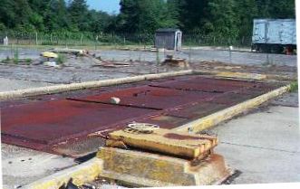
A circa 1998-2000 photo of a missile magazine hatch at the Granite site.
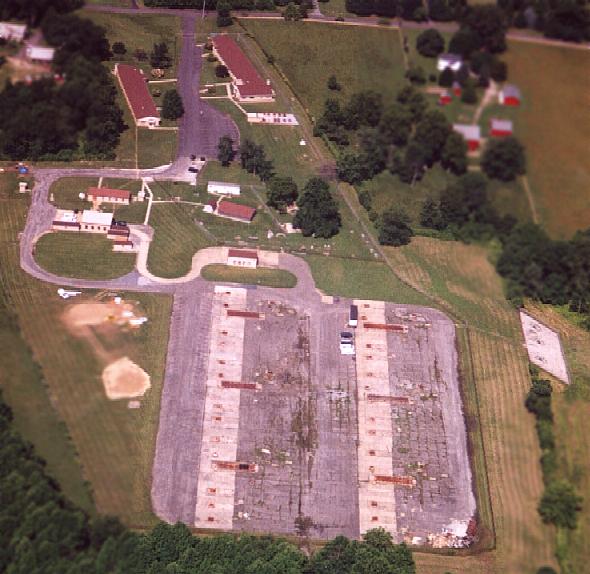
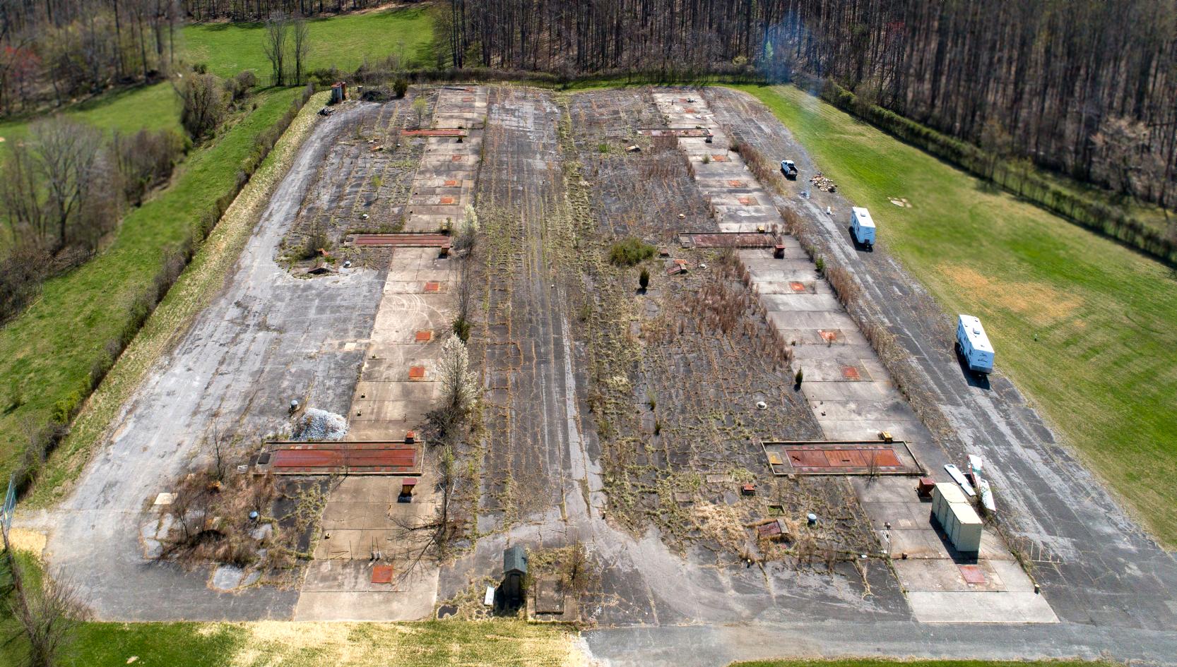
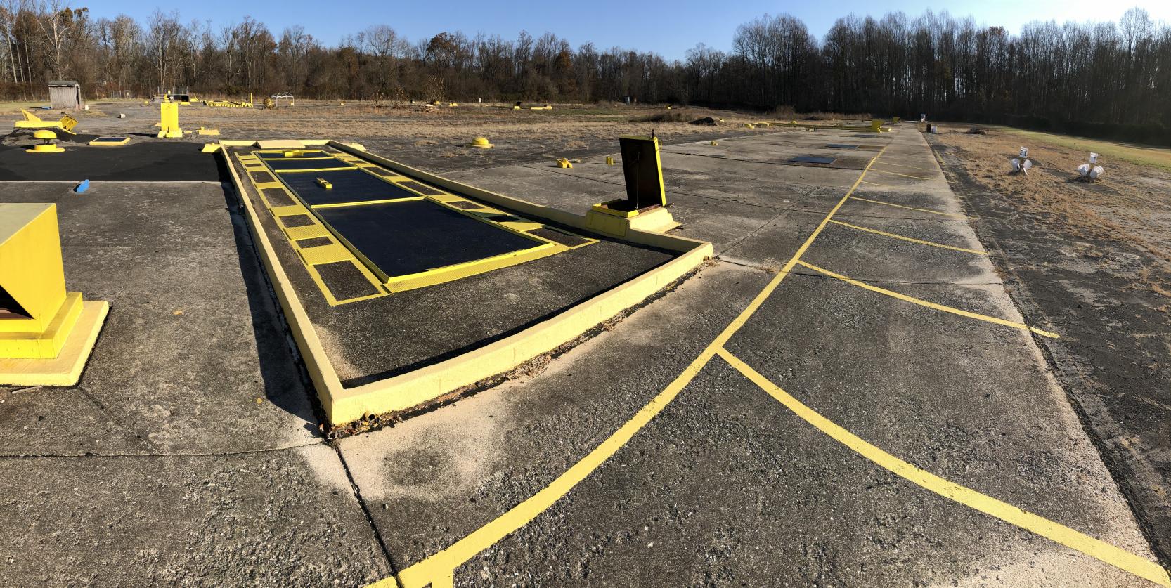
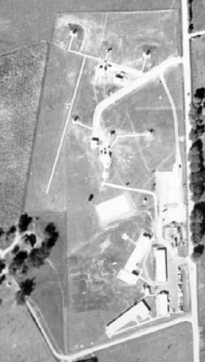
Aerial view of the Granite Nike Launch Site by Paul Freeman, taken 2001 from a Diamond Katana DA20-C1.
The foundations of the 24 Nike missile launchers are in the foreground,
looking almost completely undisturbed, in a remarkable state of preservation.
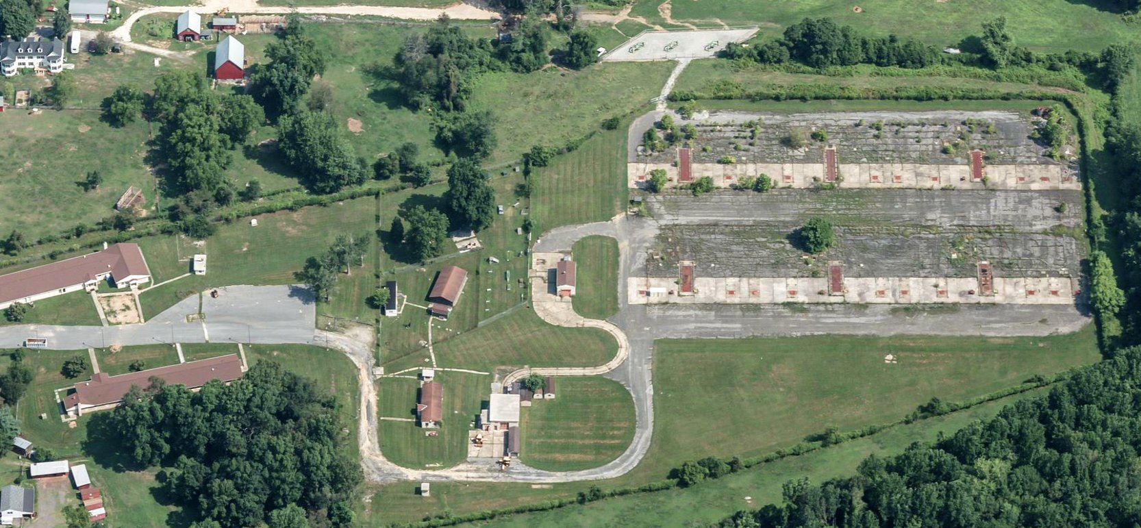
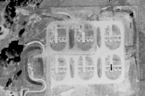
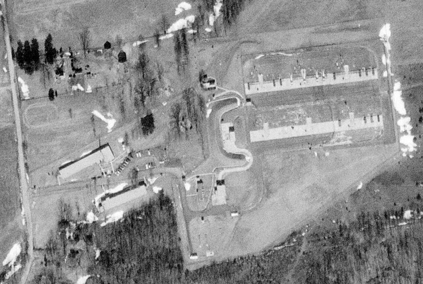
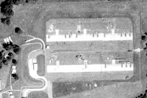
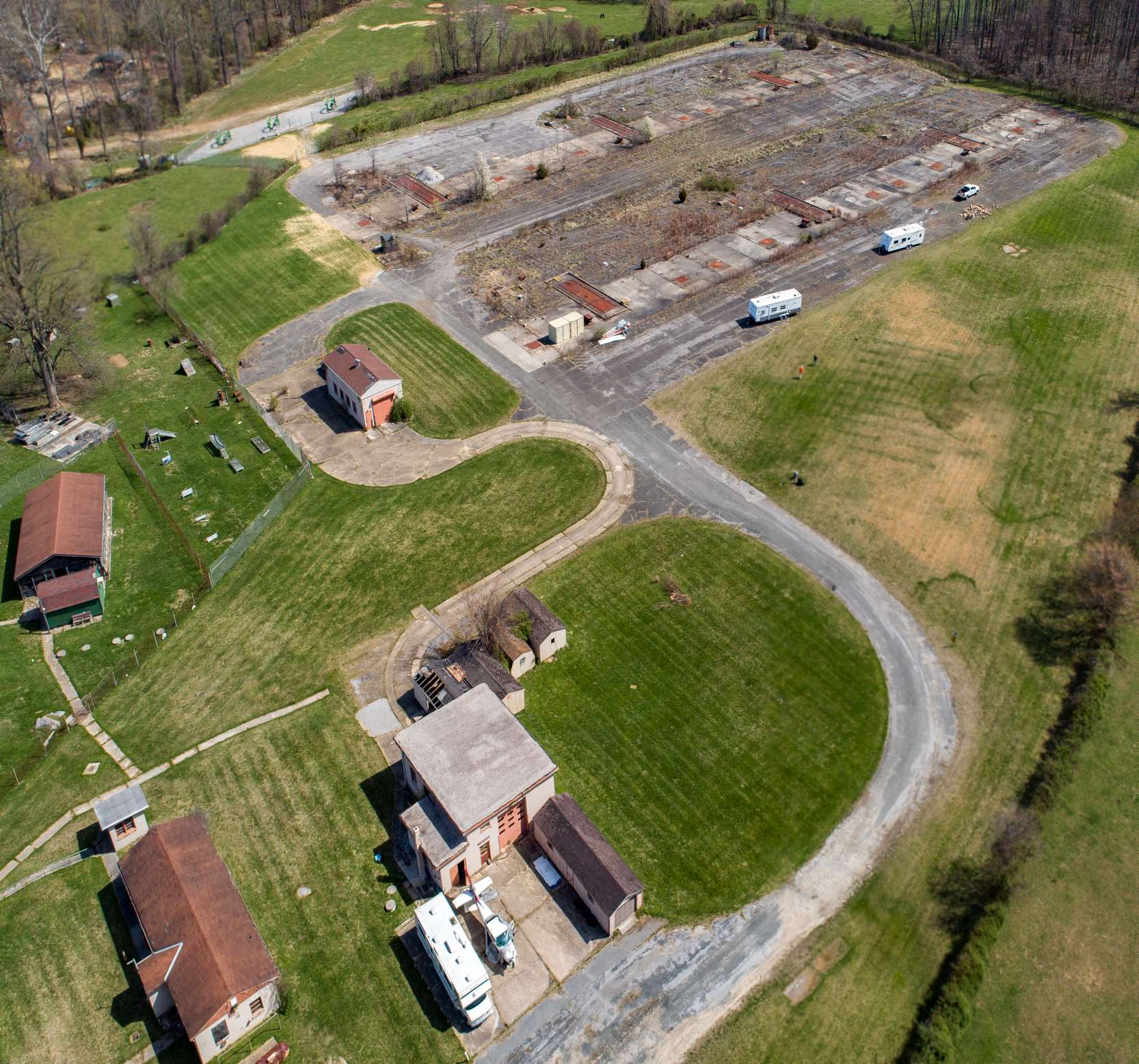
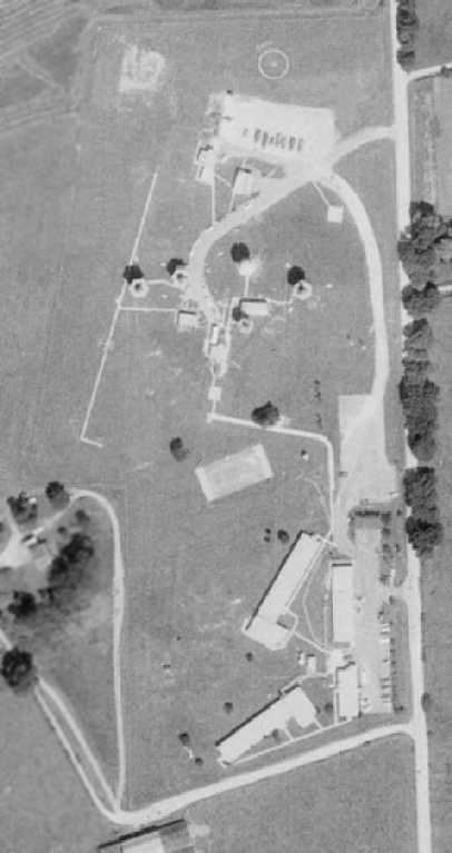
A circa 2010-2018 aerial view looking north at the Granite Nike Launch Site.
A 2014 aerial view looking northwest showed the Granite Nike Launch Site shows it to remain in a remarkable state of preservation.
What a shame that this remarkable remnant of the Cold War, a surface-to-air missile site so close to a major metro area, sits without any acknowledgement.
Tony Vallillo reported in 2017, “The Granite site, or at least the 2 main administration buildings at the entrance, are now the headquarters of the MD Wing of the Civil Air Patrol.
We have been renovating the 2 buildings for the last year or so & began to move in last summer.
The renovations are more or less complete at this time, at least as far as current plans go.”
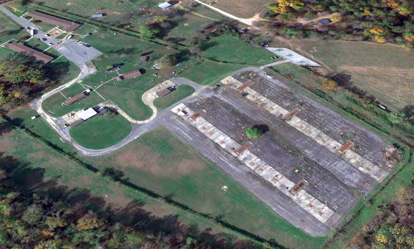
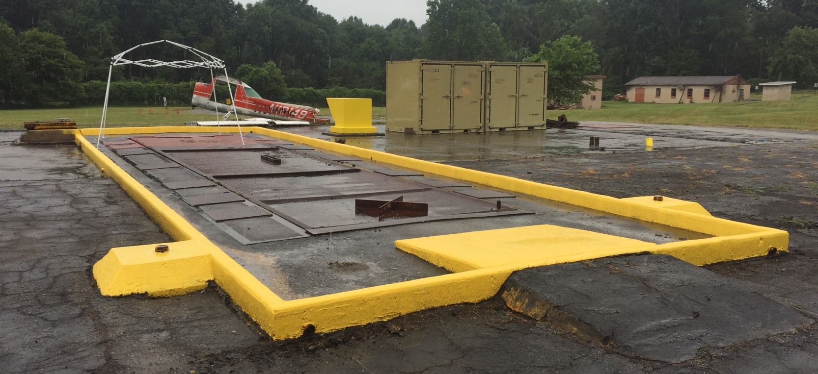
A 4/211/8 aerial view by Hover Solutions (courtesy of Patrick Whang) looking east at the Granite Nike Launch Site, showing the 6 sets of steel doors over the Nike Hercules missile underground magazines.
A 4/21/18 aerial view by Hover Solutions (courtesy of Patrick Whang) looking northeast at the Granite Nike Launch Site.
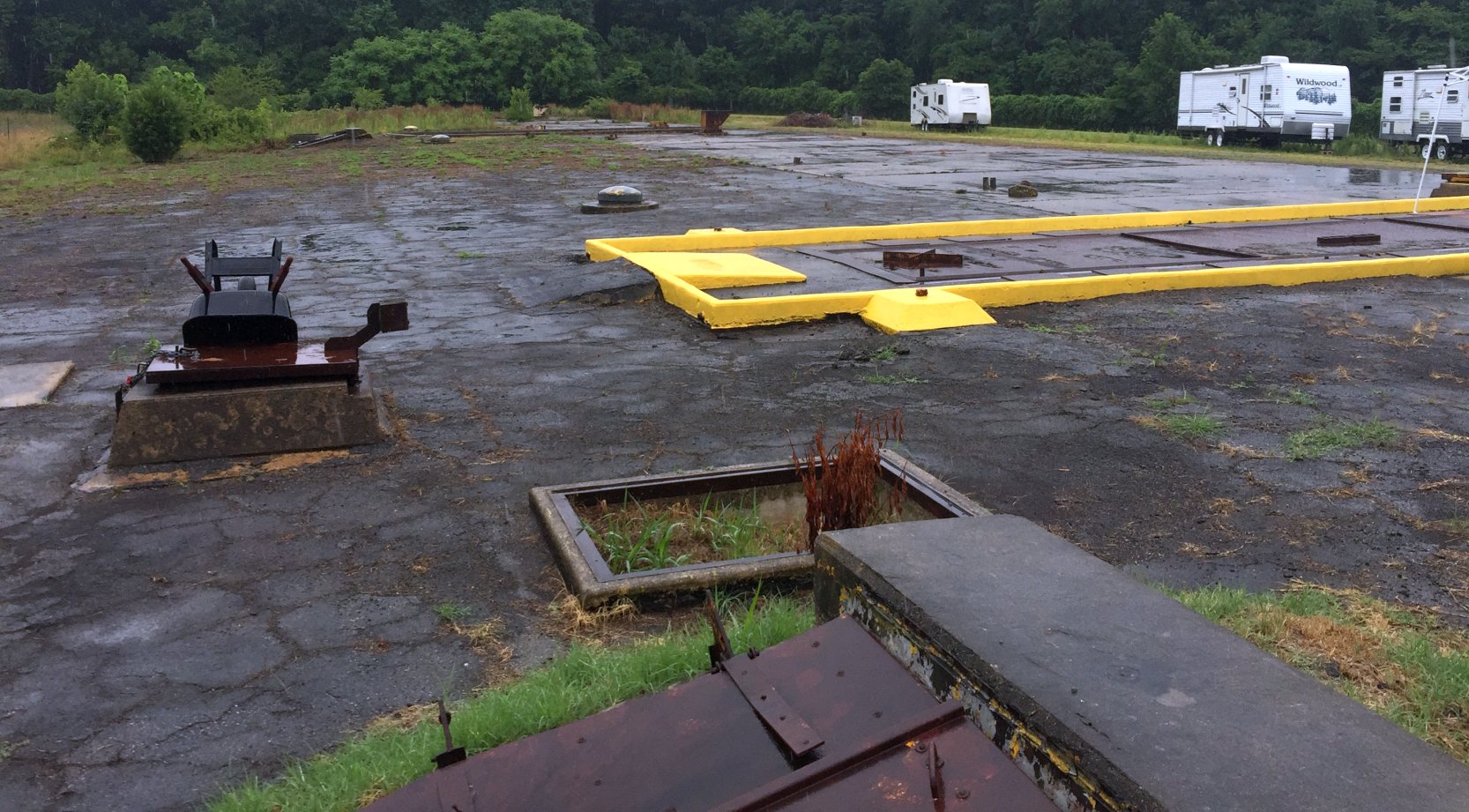
A 7/21/18 photo by Paul Freeman looking east at the southern row of 3 Nike Ajax & Hercules magazine hatches at Granite BA-79 Launch Site.
Thanks to MD Civil Air Patrol's Matt Cauthen for the tour of the site.
The Granite Launch Site is amazingly intact.
A 7/21/18 photo by Paul Freeman looking southwest at the southwest Nike Ajax magazine hatch at Granite BA-79 Launch Site,
which was recently painted by the MD Civil Air Patrol.
According to Matt Cauthen, when the Nike battery was decommissioned the 3 Hercules elevators were left raised (up at ground level), with their doors retracted down into the magazine,
whereas the 3 Ajax magazine doors were left closed.
The rubber seals around the magazine doors have withered away, so the magazines are now flooded with water,
Matt said the CAP hopes to be able to pump the water out at some point.
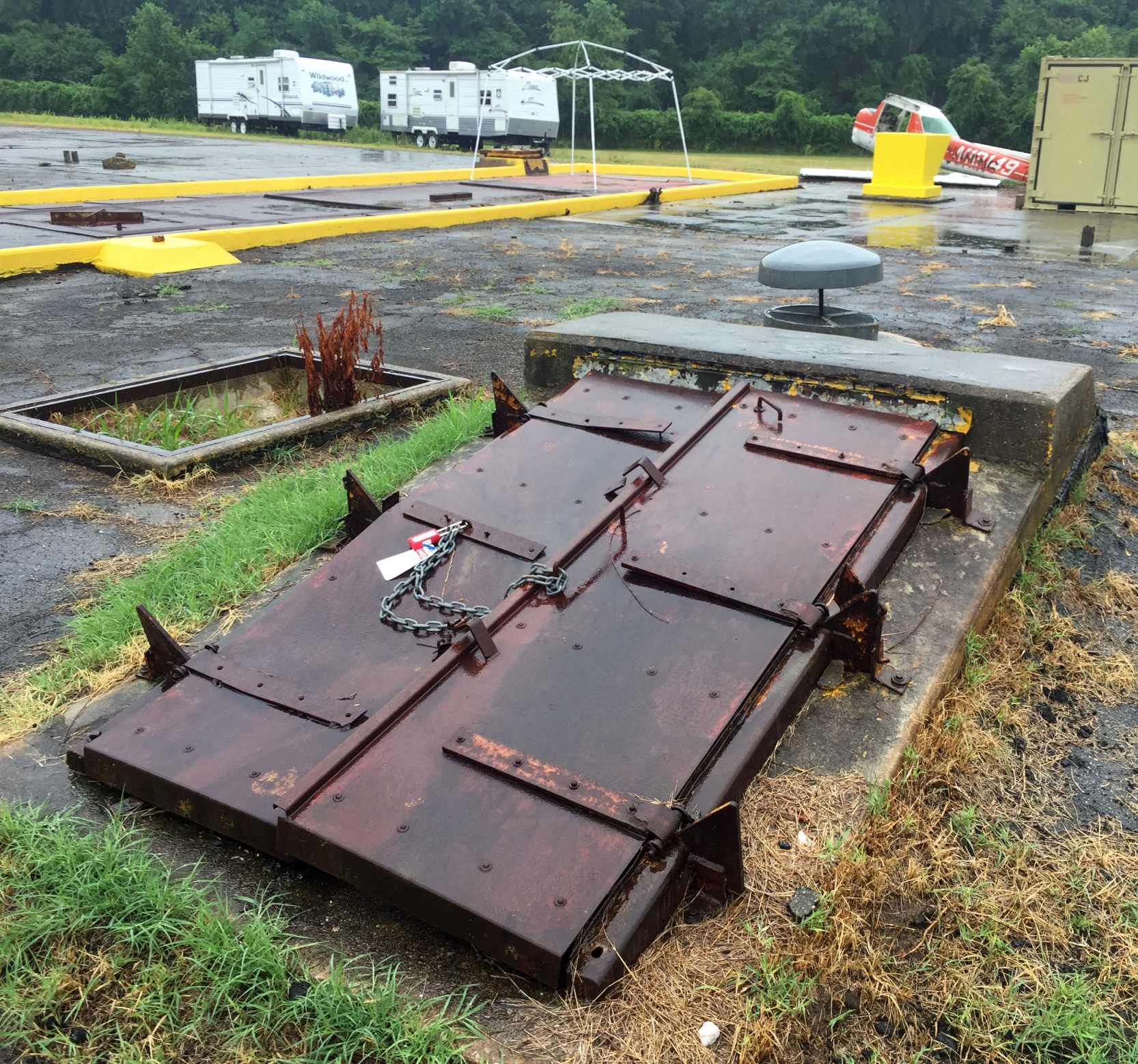
A 7/21/18 photo by Paul Freeman looking southeast at a personnel access hatch to Granite's southeast Nike Ajax magazine.
Also note the circular gray air vent, in the raised (open) position, just beyond the hatch.
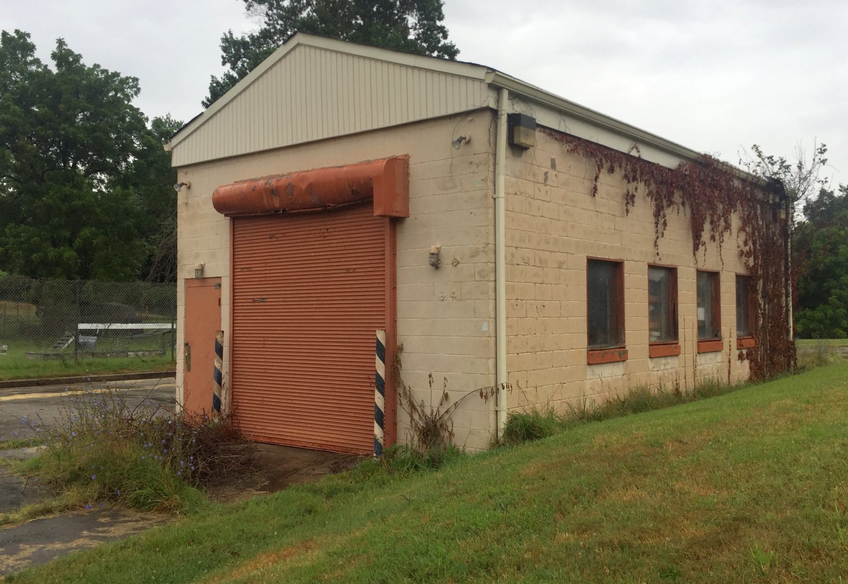
A 7/21/18 photo by Paul Freeman looking northwest at Granite's Nike missile assembly building, on the west side of the battery.
Note the earthern berms which used to surround the building (seen in early photos) have eroded (or been reduced) considerably.
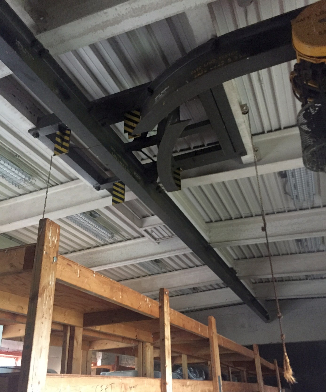
A 7/21/18 photo by Paul Freeman of the interior of Granite's Nike missile assembly building, showing a chain-operated winch (still operable), on a very elaborate 2-axis ceiling rail.
It probably will last forever - who knows how much the taxpayers paid for it.
Tom Reed reported in 2019, “We have made additional improvements to include painting one the of magazines (the top of it)
back to what it looked like back in the 1960s & pumping out 3 of the magazines.”
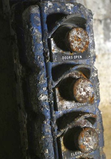
A 9/21/19 photo by Dylan Slagle of the control buttons for the Nike missile elevators & magazine doors, still present in one of the 6 underground magazines at the Granite Launch Site.
An 11/16/19 photo by Paul Freeman looking northeast at the Granite BA-79 Launch Site missile magazines,
with the southwest Nike Ajax magazine hatch in the foreground.
Thanks to MD Civil Air Patrol's Tom Reed for the tour of the site.
Tom reported, “Since [2018] we have made additional improvements to include painting one the of magazines (the top of it)
back to what it looked like back in the 1960s & pumping out 3 of the magazines.”
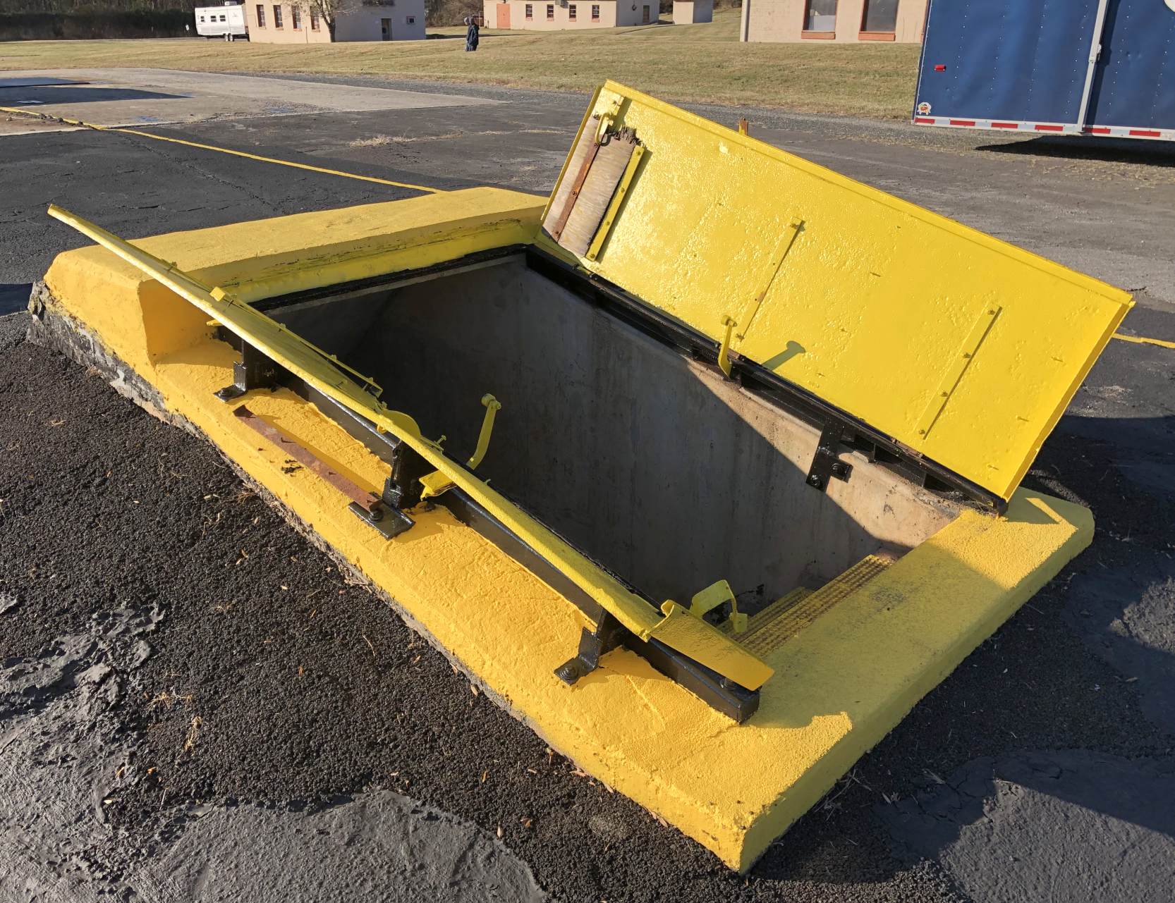
An 11/16/19 photo by Paul Freeman looking southwest at the Granite BA-79 Launch Site's southwest Nike Ajax magazine entrance hatch.
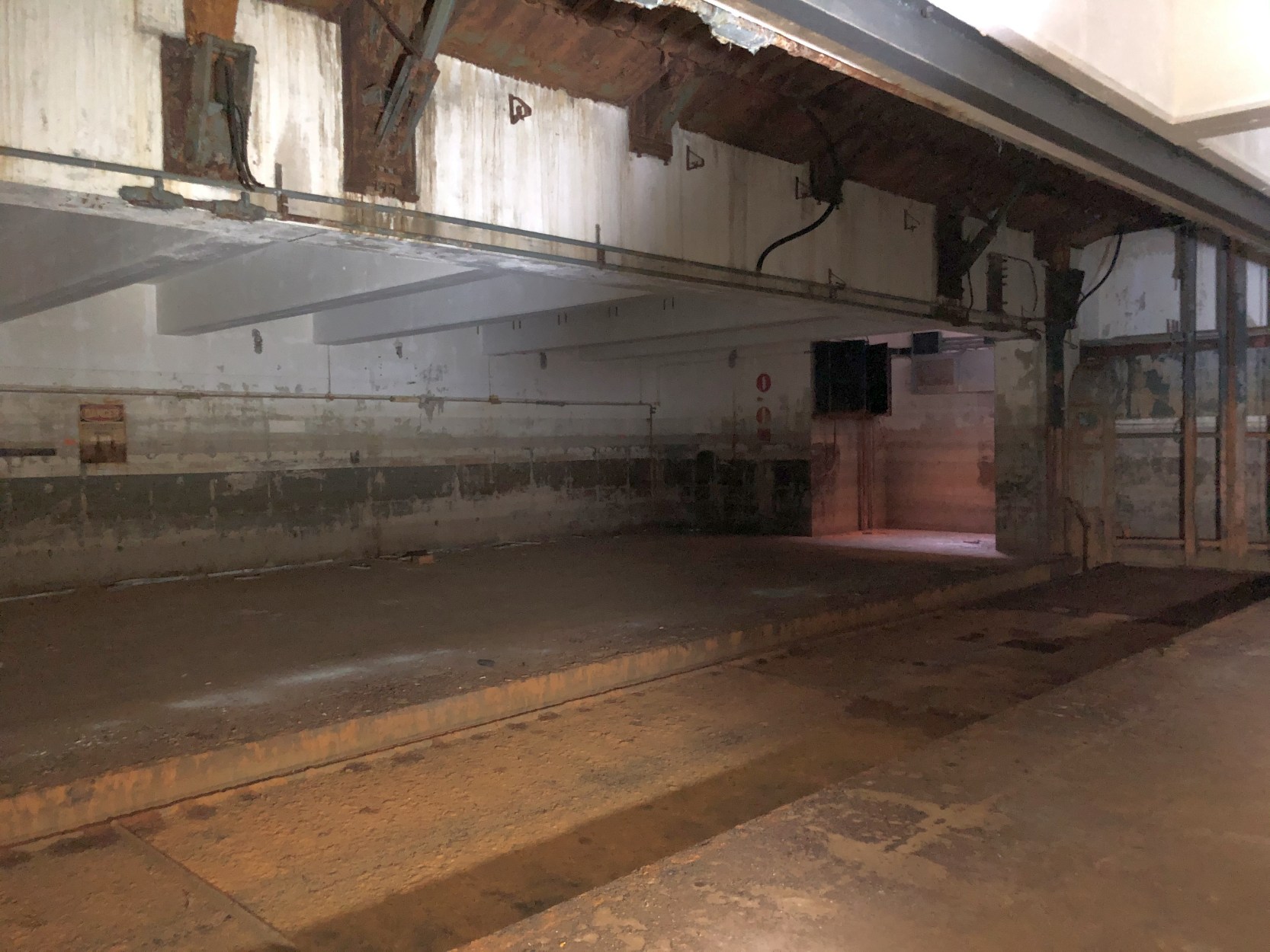
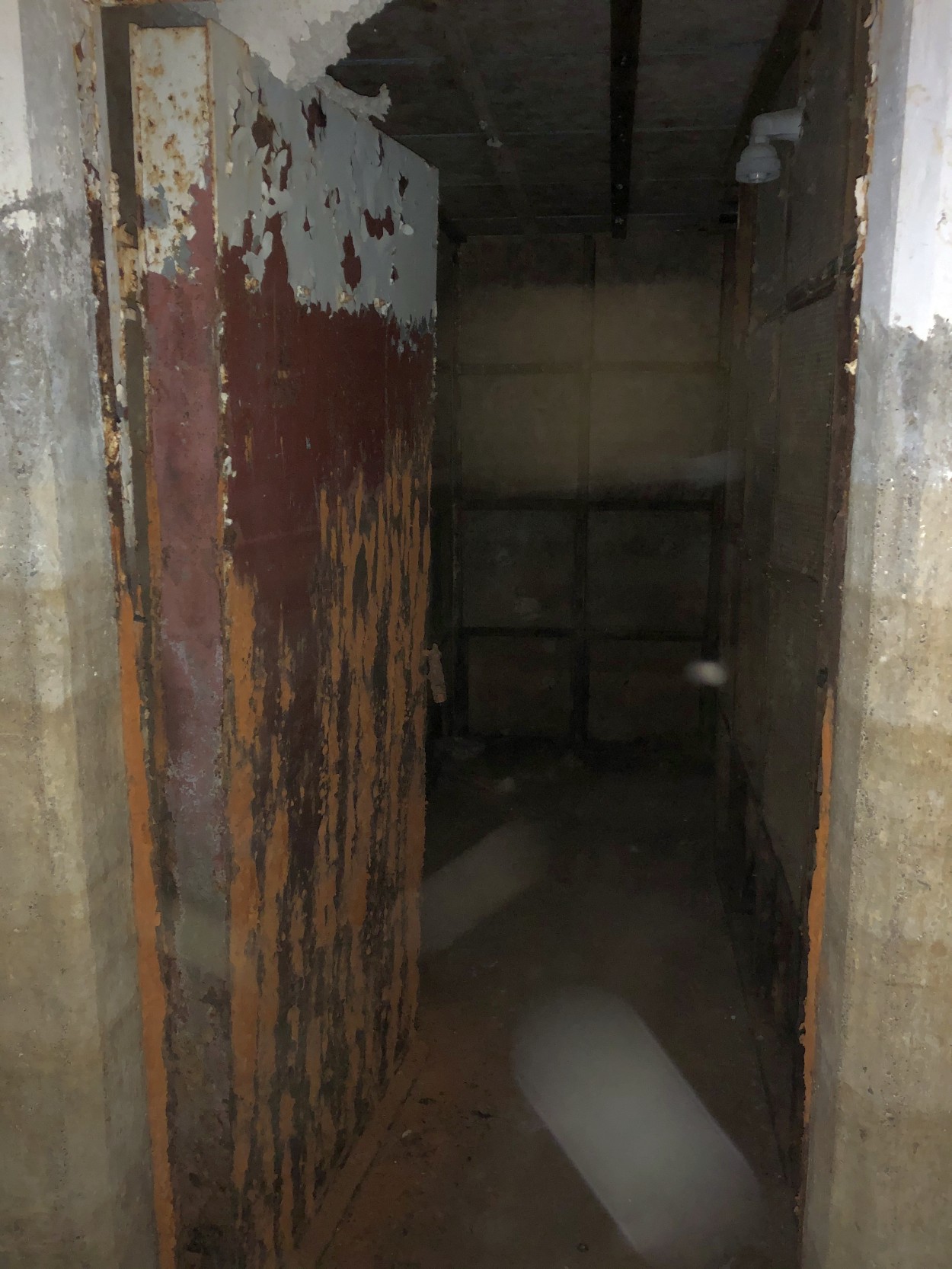
An 11/16/19 photo by Paul Freeman looking southeast at the underground interior of the Granite BA-79 Launch Site's northwest Nike Hercules magazine.
Amazing to see all this relatively intact, after it had been flooded for over 4 decades.
Each Ajax magazine held 4 Nike Ajax missiles, each 34' long & weighing 2,400 pounds.
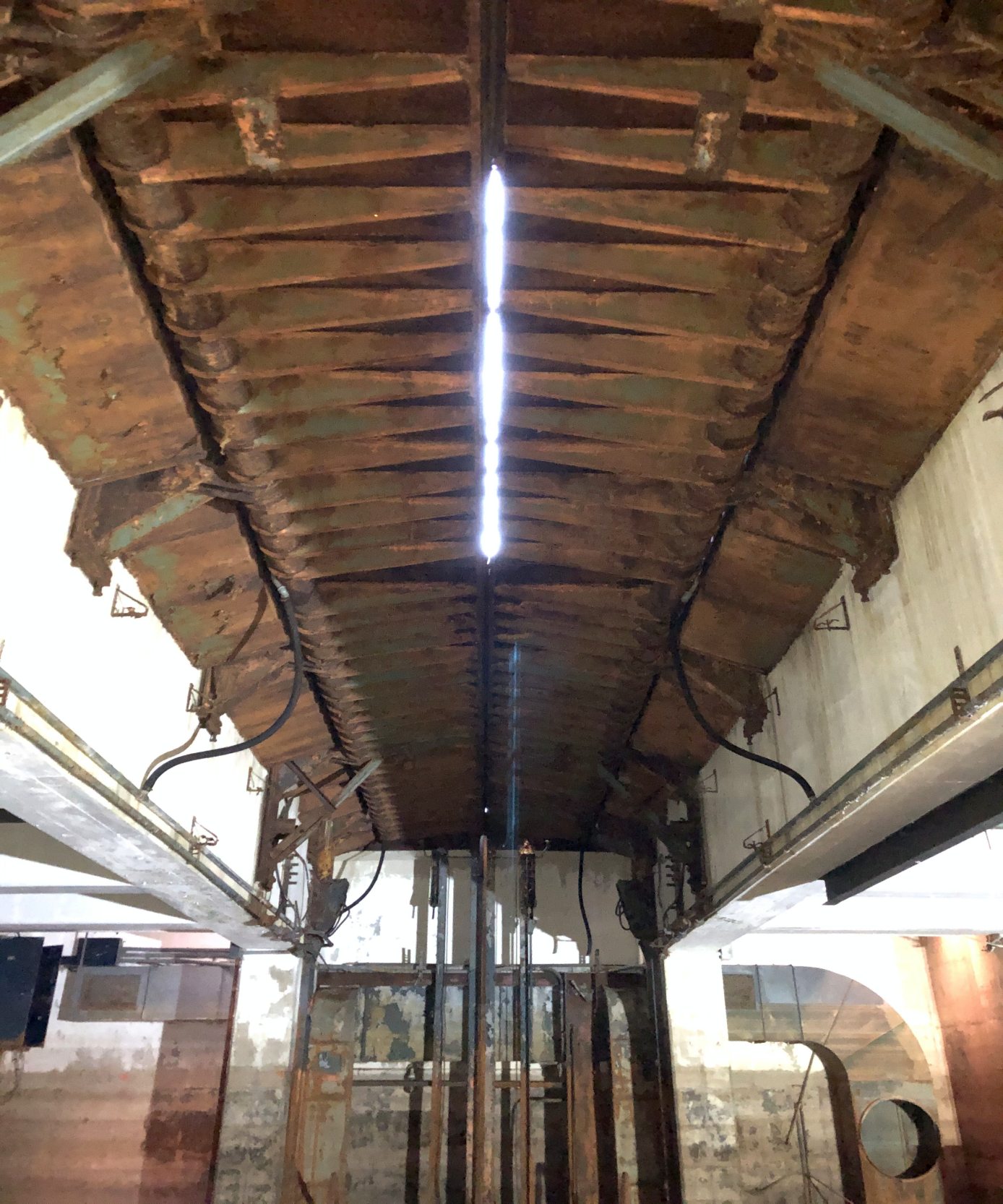
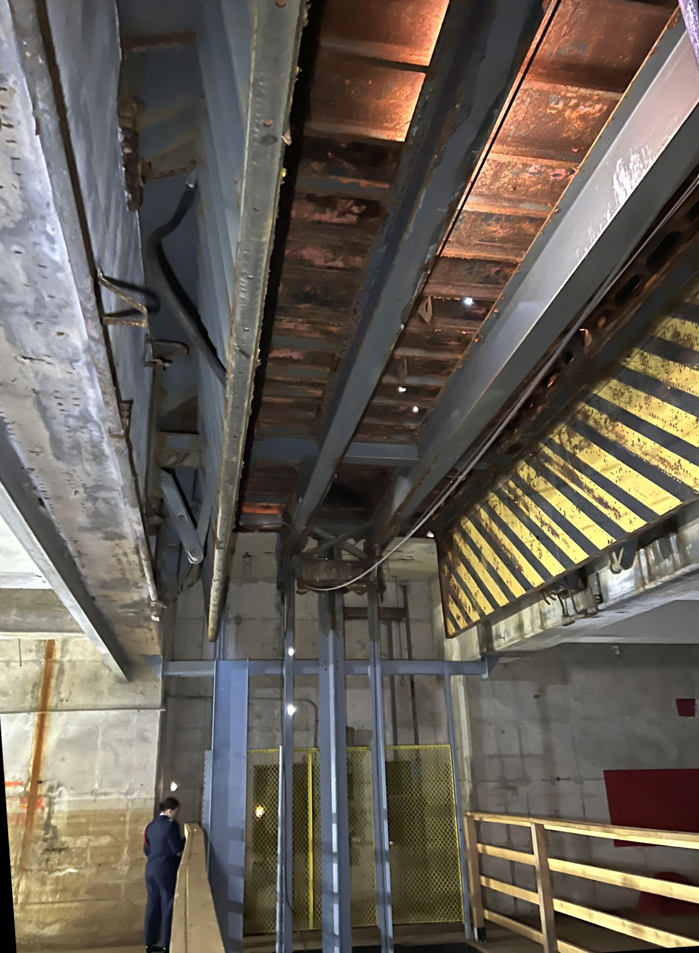
An 11/16/19 photo by Paul Freeman looking up from the underground interior of the Granite BA-79 Launch Site's northwest Nike Hercules magazine at the doors of the missile magazine.
Note the daylight coming through the gap in the doors: after the rubber seals rotted away, this allowed the magazine to flood after it had been abandoned.
The Nike Ajax missile elevator had been left in the lowered position when the launch site was abandoned.
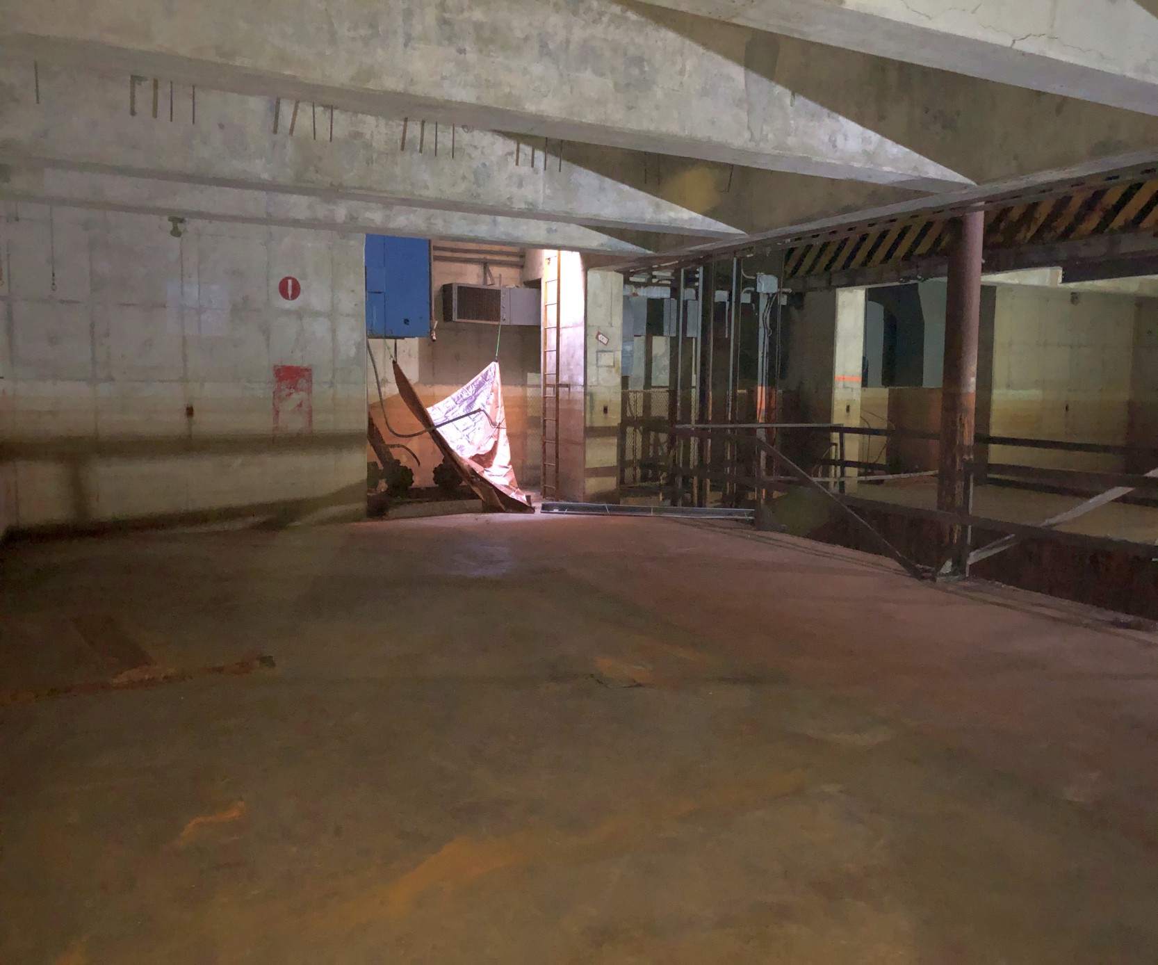
An 11/16/19 photo by Paul Freeman looking southwest at the underground interior of the Granite BA-79 Launch Site's southwest Nike Ajax magazine.
Each Hercules magazine held 4 Nike Hercules missiles, each 41' long & weighing 10,700 pounds.
Amazing to think that nuclear weapons once resided here.

An 11/16/19 photo by Paul Freeman looking up from the underground interior of the Granite BA-79 Launch Site's southwest Nike Ajax magazine at the bottom of the elevated missile elevator.
Note that Nike Hercules missile elevator had been left in the raised position when the launch site was abandoned, the opposite of what was done with the battery's Nike Ajax launchers.
An 11/16/19 photo by Paul Freeman of one of 2 massive steel doors protecting the control room adjacent the Granite BA-79 Launch Site's southwest Nike Ajax magazine.
These doors were presumably to protect the missile crews from the effect of a missile launch &/or accidental detonation.
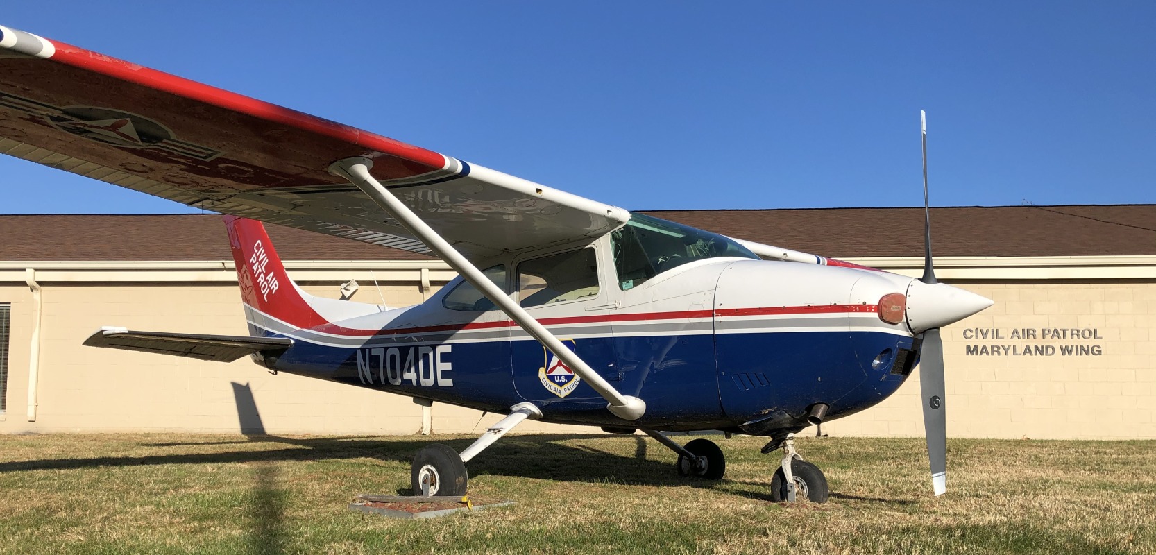
An 11/16/19 photo by Paul Freeman looking north at a retired Cessna 182 on display in front of the MD Civil Air Patrol's facility, one of the former Granite BA-79 Launch Site administration buildings.
On 3/16/24, Paul Freeman was able to help with the repainting of topside elements of Granite BA-79 Launch Site,
and thanks to Tom Reed for the tour of the underground missile magazines.
The MD Civil Air Patrol & associated volunteers continue to do a thankless job in restoring this amazing piece of Cold War historical infrastructure.
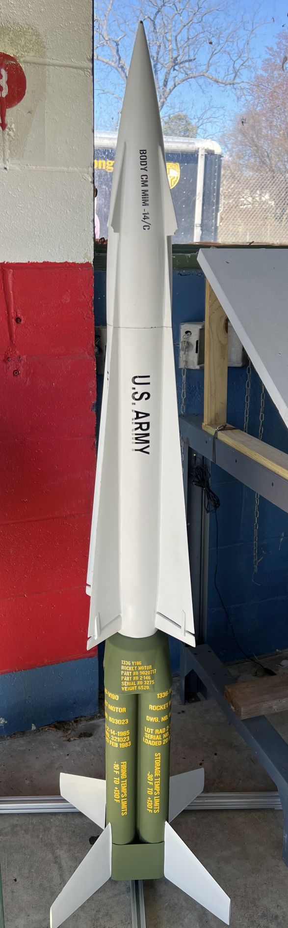
A 3/16/24 photo by Terry Freeman of a Nike Hercules missile model in front of the Granite BA-79 Launch Site Missile Assembly Building.
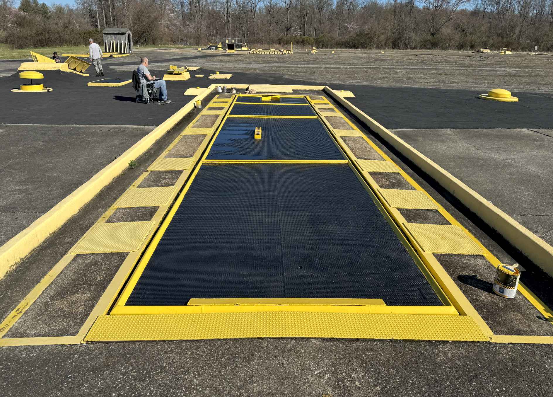
A 3/16/24 photo by Paul Freeman of Granite BA-79 Launch Site's southwest Nike Ajax magazine being repainted.

A 3/16/24 photo by Paul Freeman of Granite BA-79 Launch Site's southwest Nike Ajax missile elevator & doors.
A 3/16/24 photo by Paul Freeman of Granite BA-79 Launch Site's southwest Nike Ajax missile elevator & doors.
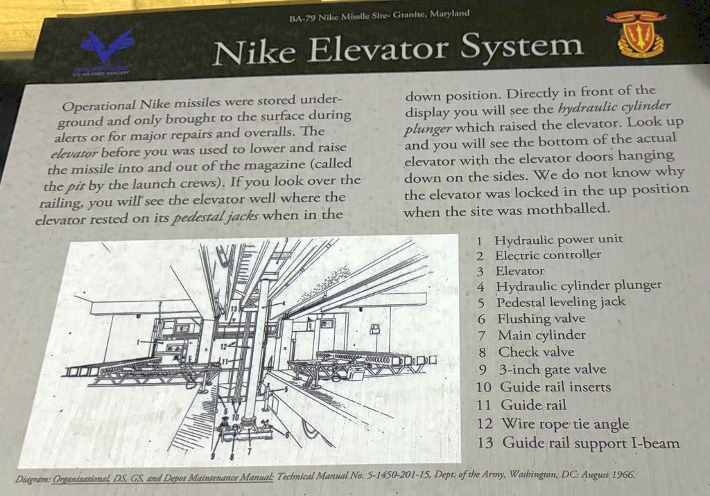
A 3/16/24 photo by Paul Freeman of an interpretive sign for the Nike elevator system inside Granite BA-79 Launch Site's southwest Nike Ajax magazine.
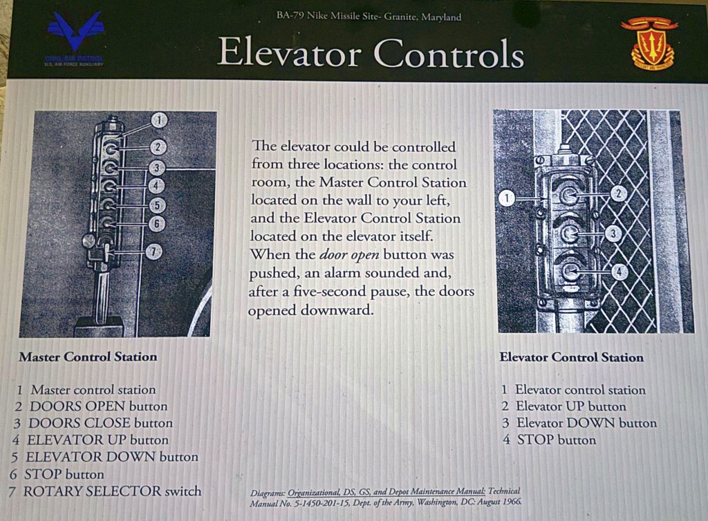
A 3/16/24 photo by Paul Freeman of an interpretive sign for the missile elevator controls inside Granite BA-79 Launch Site's southwest Nike Ajax magazine.
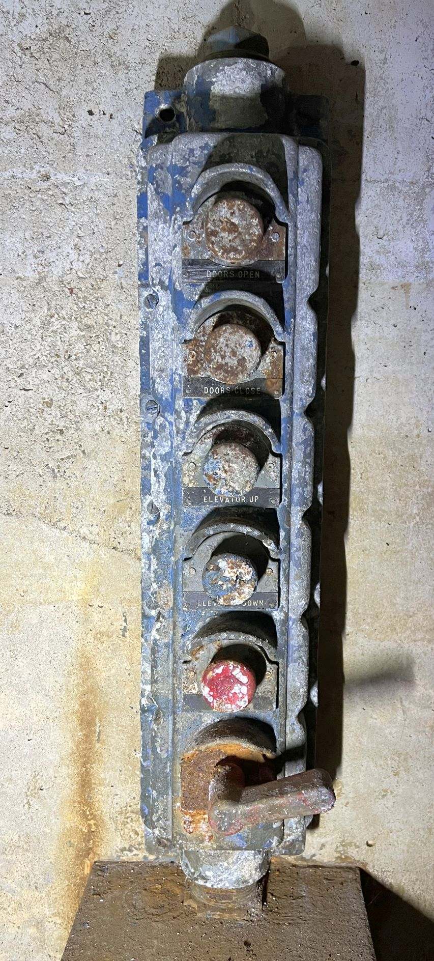
A 3/16/24 photo by Paul Freeman of the missile elevator & door control panel inside Granite BA-79 Launch Site's southwest Nike Ajax magazine.
The Granite battery's companion Integrated Fire Control Site is located just a little further south along Hernwood Road.
For additional description of another Baltimore-Washington area Nike site, see the Herndon Site W-83 in my website's Virginia pages.
See also:
http://www.mde.state.md.us/environment/was/brownfields/factsheets/BC/granite.html
http://www.nikenuke.net/nike/text/nikefrm1.html
http://www.jps.net/ethelen/loc-v.html#Virginia
____________________________________________________
Granite Nike Missile Battery BA-79 Integrated Fire Control Area, Granite, MD
39.35 North / 76.86 West (West of Baltimore, MD)
The earliest depiction which has been located of the Granite Nike Integrated Fire Control Area was a 1957 aerial view,
showing the numerous radar towers on the site.
The Granite Nike Integrated Fire Control Area was the companion site to the Granite Launch Site,
located just a little further along Hernwood Road.
Granite Site BA-79 was activated in 1954, and was initially armed with the first-generation Nike Ajax missile.
It encompassed 17 acres on the west side of Hernwood Road, just north of Old Court Road.
The earliest depiction which has been located of the Granite Nike Integrated Fire Control Area was a 1957 aerial view,
showing the numerous radar towers on the site.
In 1959, Granite Site BA-79 was among 4 of the Baltimore area batteries that were converted
to fire the 2nd-generation Nike Hercules missile.
Operation of the Granite Nike site was taken over by the MD Army National Guard in 1963.
A 1964 aerial view showed the changes that had been made to the Granite Nike Integrated Fire Control Area
after it had been converted to the Nike Hercules configuration,
with the northern set of radar towers having been removed,
and a much larger set of 5 radar towers having replaced those previously located in the center of the facility.
The 1967 USGS topo map depicted 2 buildings at the Fire Control site, but did not label the installation.
The last photo which has been located showing the Granite Nike Integrated Fire Control Area in operation was a 1971 aerial photo,
showing the 5 large radar towers in the center of the base which supported Nike Hercules operations.
With the reductions in US air defense forces, Granite Site BA-79 was deactivated in 1974.
From 1974-92, the Granite Control Site was used by the MD Army National Guard
to house the 70th General Supply Company & the 29th Support Center Rear Area Operations.
In 1992, the Granite site was once again inactivated, but the property was retained under Army ownership.
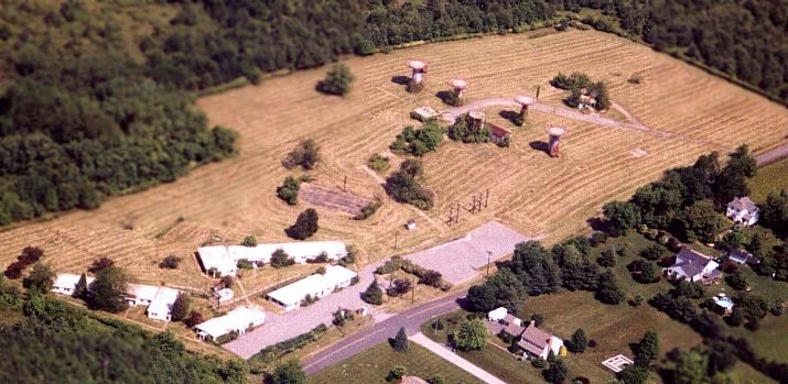
Aerial view of the Granite Nike Integrated Fire Control Site by Paul Freeman, taken 2001 from a Diamond Katana DA20-C1.
The 5 remaining radar towers are in the top right of the clearing.
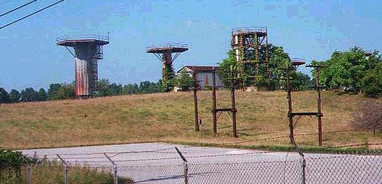
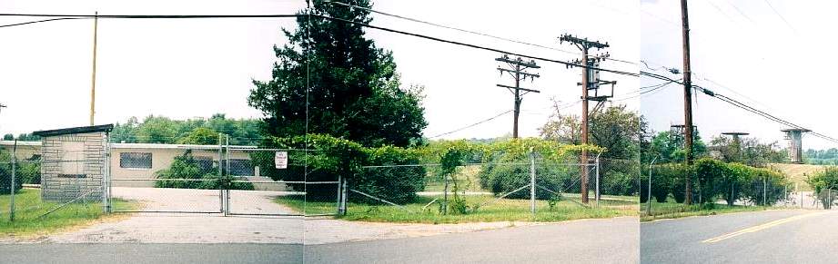
A pair of circa 1990s / early 2000s photos of the remains of the radar towers at the Granite Integrated Fire Control Site.
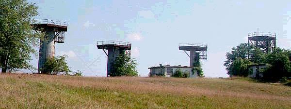
A 2002 panoramic shot by Mike Legeros of the Granite Integrated Fire Control Site,
with the guard shack on the left, radar towers on the right.
Out of all the Baltimore Nike sites,
the Granite Integrated Fire Control Area was the one that remained in the best condition (up through the 1990s).
The primary remaining features which denoted the site as a Nike installation
were the 7 radar towers which remained standing.
These towers once mounted the High-Power Acquisition Radar (HIPAR) & Missile Tracking Radar.
The radomes had long since been removed from the towers.
Army officials from Fort Meade had plans in 2001 to remove all buildings & towers from the Granite Control Area,
taking the site down to vegetation.
Indeed, the radar towers of the Granite base were removed, as Allen Larsen reported in 2004, "The Granite radar base is no more."
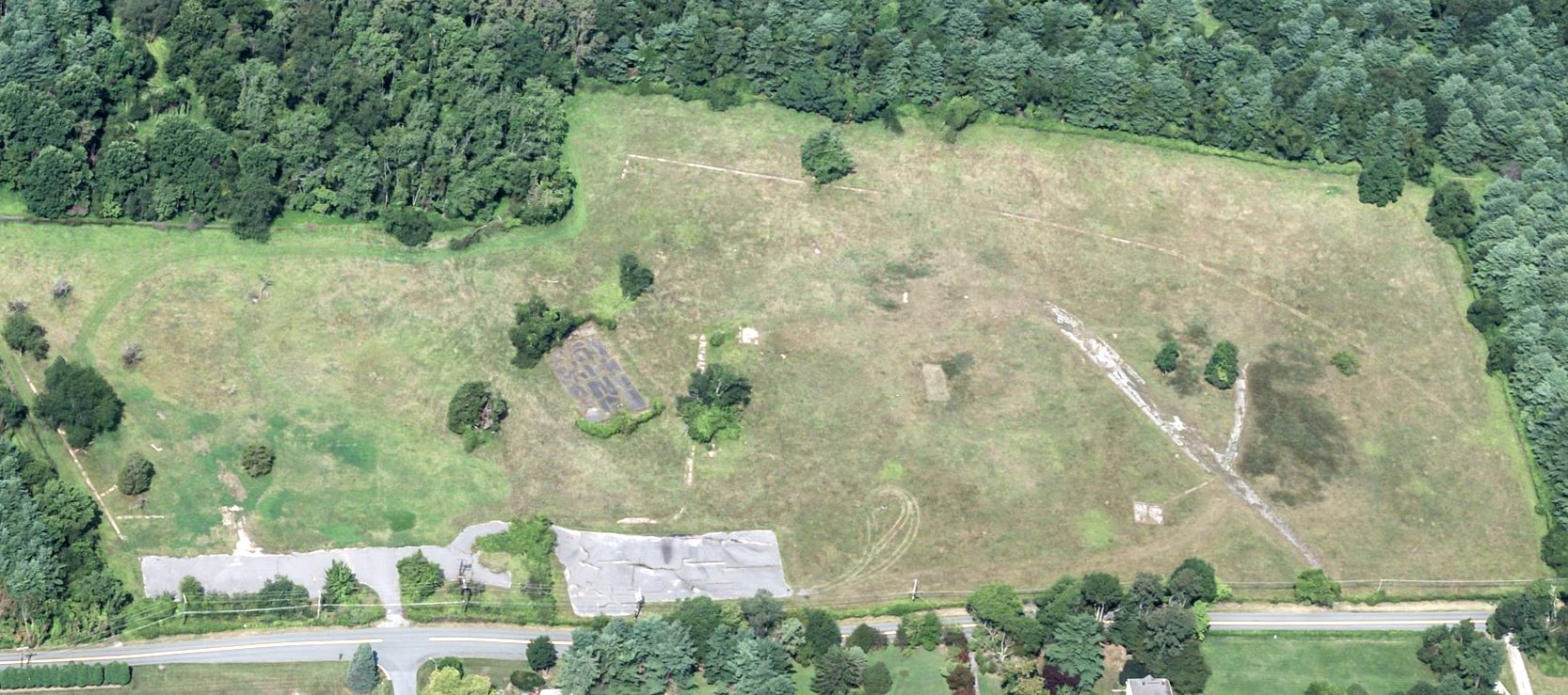
A circa 2010-2018 aerial view looking west at the Granite Nike Integrated Fire Control Area.
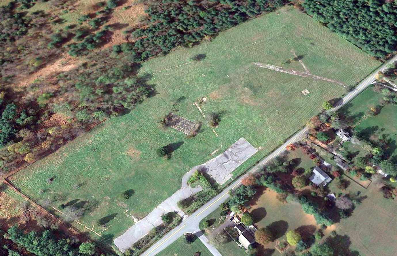
A 2014 aerial view looking northwest showed the Granite Nike Integrated Fire Control Area had been scraped clean, with all structures removed.
The only remains are the paved lots & roads, and the overall property outline.
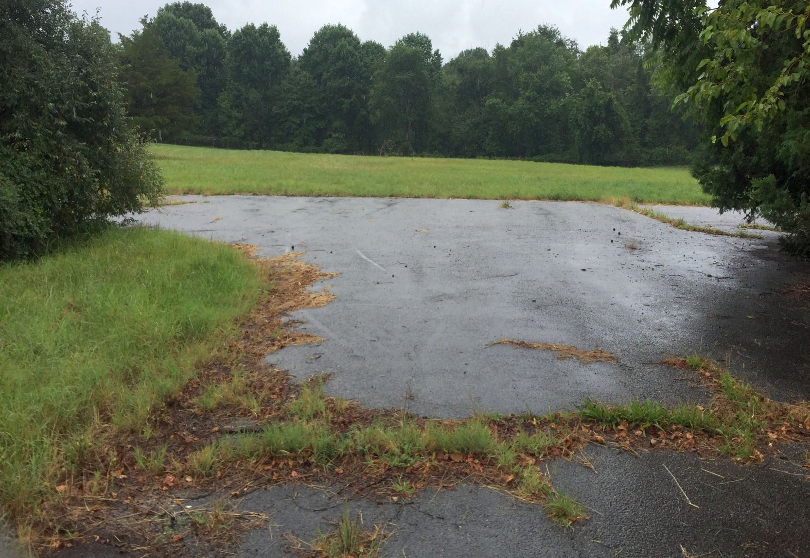
A 7/21/18 photo by Paul Freeman looking west from Hernwood Road at the site of the Granite Nike Integrated Fire Control Area.
According to MD Civil Air Patrol personnel, the only structure remaining on the property is a basketball backboard.
Paul Freeman visited the site of the Granite Nike Integrated Fire Control Area in 2019 & 2024, to find that it remains a vacant field.
For additional description of another Baltimore-Washington area Nike site, see the Herndon Site W-83 on this website's Virginia pages.
See also:
http://www.mde.state.md.us/environment/was/brownfields/factsheets/BC/granite.html
http://www.nikenuke.net/nike/text/nikefrm1.html
http://www.jps.net/ethelen/loc-v.html#Virginia
____________________________________________________
Or if you prefer to contact me directly concerning a contribution (for a mailing address to send a check),
please contact me at: paulandterryfreeman@gmail.com
If you enjoy this web site, please support it with a financial contribution.
____________________________________________________
This site covers airfields in all 50 states.
For the site's main menu: Home