
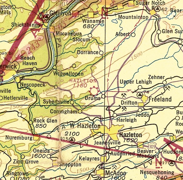
Abandoned & Little-Known Airfields:
Northeastern Pennsylvania
© 2002, © 2025 by Paul Freeman. Revised 8/8/25.
This site covers airfields in all 50 states: Click here for the site's main menu.
____________________________________________________
Please consider a financial contribution to support the continued growth & operation of this site.
Birchwood Pocono Airport (revised 3/24/25) - Carbondale-Clifford Airport / Johnson's Airport (revised 8/8/25) - Hallstead Airport / Ulco Airport (revised 3/20/24)
Honesdale Airport (revised 3/20/24) - Martin Jensen Airport / Lehighton Airport (revised 8/21/22) - Martins Creek Airport (revised 2/1/21)
Merrill-Ronne Airport / Matamoras Municipal Airport (revised 3/17/23) - Mount View Airport / Nicholson Airport (added 8/8/25) - Pipher Airport / Stroudsburg-Pocono Airport (revised 8/8/25)
Stone Castle Motel Airport (revised 2/1/22) - Tobyhanna AAF / Betts AAF (revised 6/21/19)
Scranton Municipal Airport (revised 8/8/25) - Veale Airport / Reifenberger Airport / Hazleton Airport (revised 3/17/23)
____________________________________________________
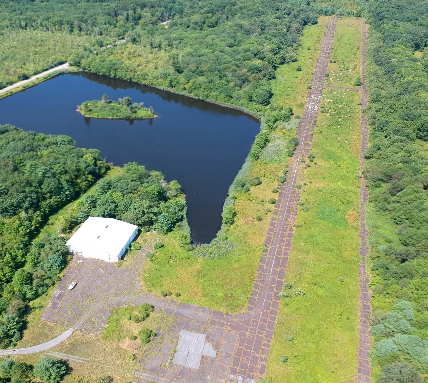
Mount View Airport / Nicholson Airport, Hop Bottom, PA
41.669, -75.692 (Northwest of New York, NY)
Mount View Airport, as depicted on the August 1932 NY Sectional Chart (courtesy of Curtiss Gay).
The date of construction of this early airport has not been determined.
The earliest depiction which has been located of Mount View Airport was on the August 1932 NY Sectional Chart (courtesy of Curtiss Gay),
which depicted Mount View as a commercial/municipal airport.

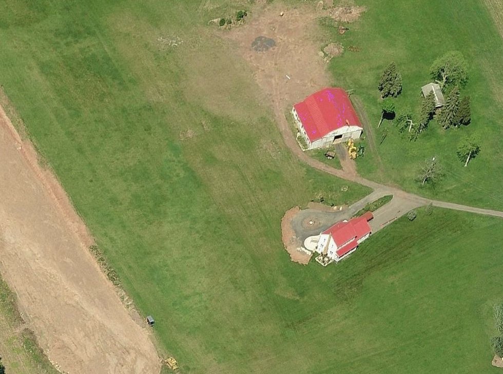
The earliest photo which has been located of Mount View Airport was a 1939 aerial view (from PennPilot, courtesy of Curtiss Gay).
It depicted 2 grass runways & a white airport circle marking, along with the edge of a hangar on the northeast side.
Curtiss Gay reported, “Karsten Wallis from Clifford told me that his grandfather stole a Curtiss Wright Junior from Mountain View with his friend Jack Race & took it for a joyride before either had soloed sometime before World War 2.”

Mount View Airport was still depicted on the 1942 NY Sectional Chart (courtesy of Curtiss Gay).
Curtiss Gay reported, “They had a couple of Cubs based there that they did flight instruction with, possibly even Civilian Pilot Training during the war.”
William Hallstead's book The Rise & Fall of Scranton Municipal Airport mentioned Mount View Airport:
"Struggling to pay for flying lessons with money earned from his father's lumberyard, John Race began flying out of Mount View Airport near Nicholson, first in an Aeronca C-3, then in an Aeronca Chief.
Race's instructor was the ubiquitous Hymie Wintersteen."
Curtiss Gay reported, “It appears to have operated as Mount View until 1948.
Between 1948-50, the airport did not appear on the sectional.”

The earliest topo map depiction which has been located of Mount View Airport was on the 1949 USGS topo map.
It depicted Mount View as having 2 unpaved runways, with 1 small building on the northeast side.

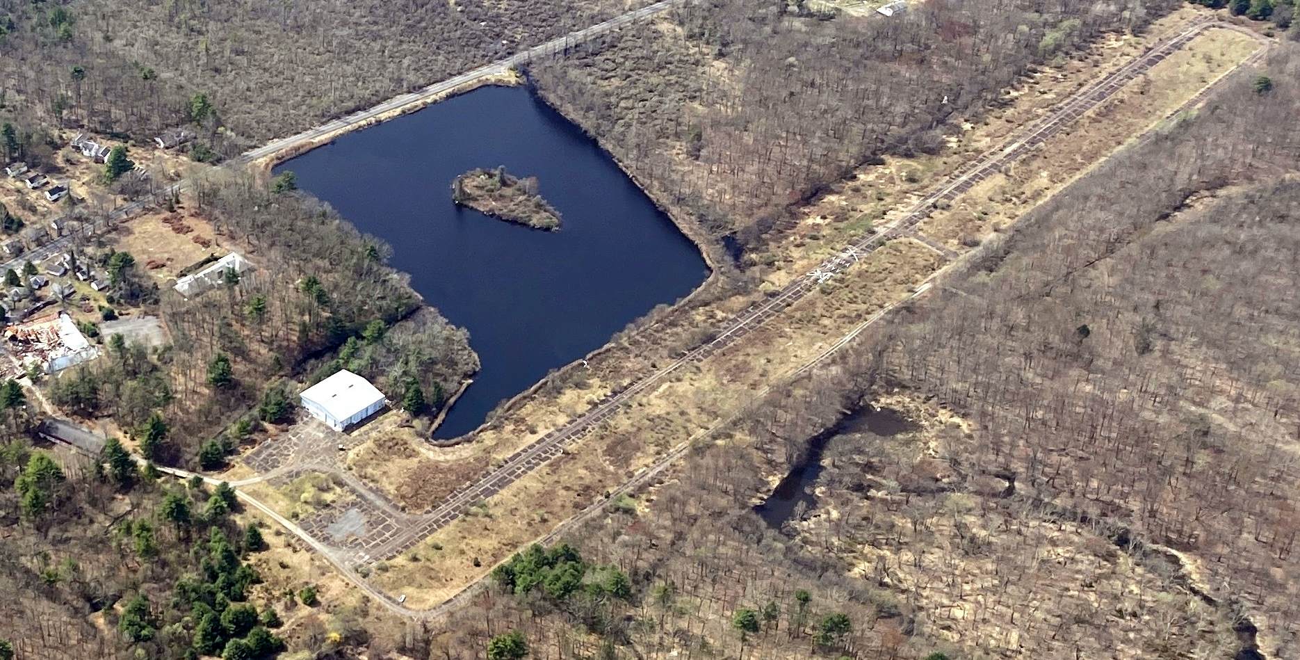
A 1950 aerial view (from PennPilot, courtesy of Curtiss Gay) showed Mount View Airport to remain intact, but there were no aircraft visible on the field.
A 1950 airport directory described Mount View Airport as having 2 runways with the longest being 2,250', and selling 80 octane fuel.
Curtiss Gay reported, “In 1950 the airport returned [on the Sectional Chart] as Nicholson Airport.”

The last depiction which has been located of Nicholson Airport was on the 1952 NY Sectional Chart (courtesy of Curtiss Gay),
which depicted Nicholson as having a 2,200' unpaved runway.
Nicholson Airport was evidently closed (for reasons unknown) after 1952, as it was no longer depicted on Sectional Charts beyond 1952.
Curtiss Gay reported, “Joe Karp grew up on the farm just down the hill from the airport.
He told me it was very busy for a while with at least 10 planes based there.
There were 2 hangars, a small snack shack, and a tiny hotel that later got converted to a chicken coop on wheels.
The airport closed when he was about 16 [1959].”

A 1960 aerial view (from PennPilot, courtesy of Curtiss Gay) showed Mount View Airport to remain intact, but with no sign of recent aviation use.
Curtiss Gay reported, “I've heard stories of people launching balloons there until the 1970s or 80s.”
The 1984 USGS topo map continued to depict Mount View Airport in the same fashion as the 1949 topo.
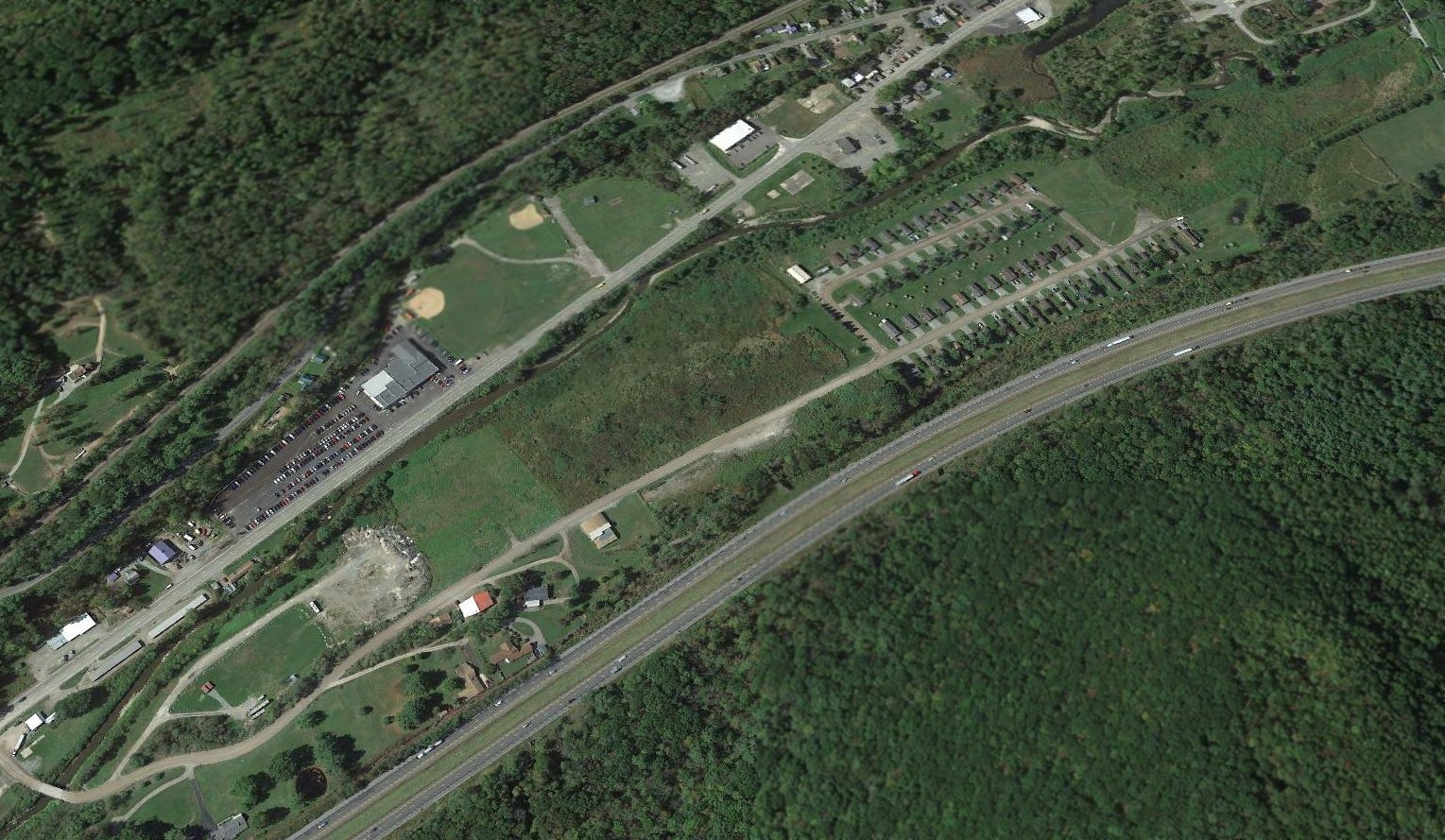
Mount View Airport was no longer depicted on the 2001 USGS topo map.
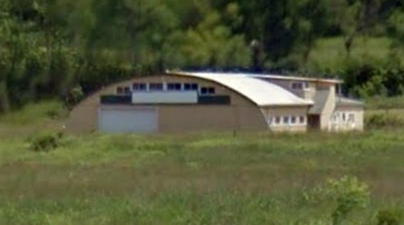
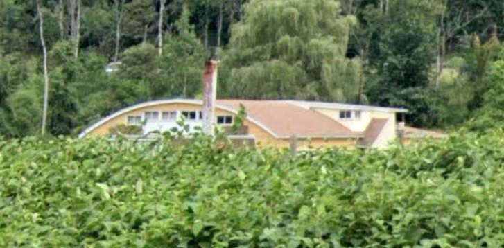
Curtiss Gay reported in 2025, “I drove by it recently & saw no evidence of the hangars, restaurant, or hotel/chicken coop.
Half of the field is grown-over & there is a sign-making business where the hangar used to be.”

A 2025 aerial view showed no recognizable trace remaining of Mount View Airport.
Thanks to Curtiss Gay for pointing out this airfield.
____________________________________________________
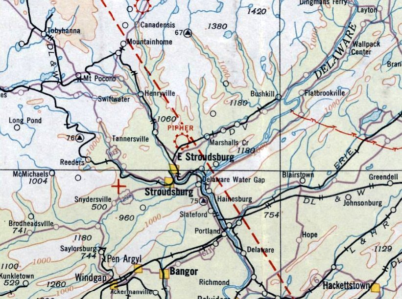
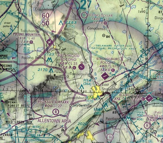
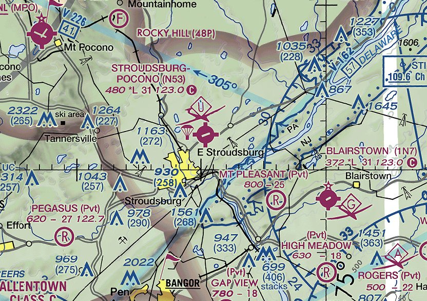
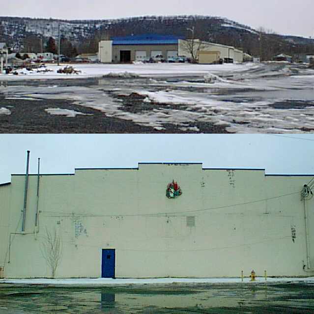
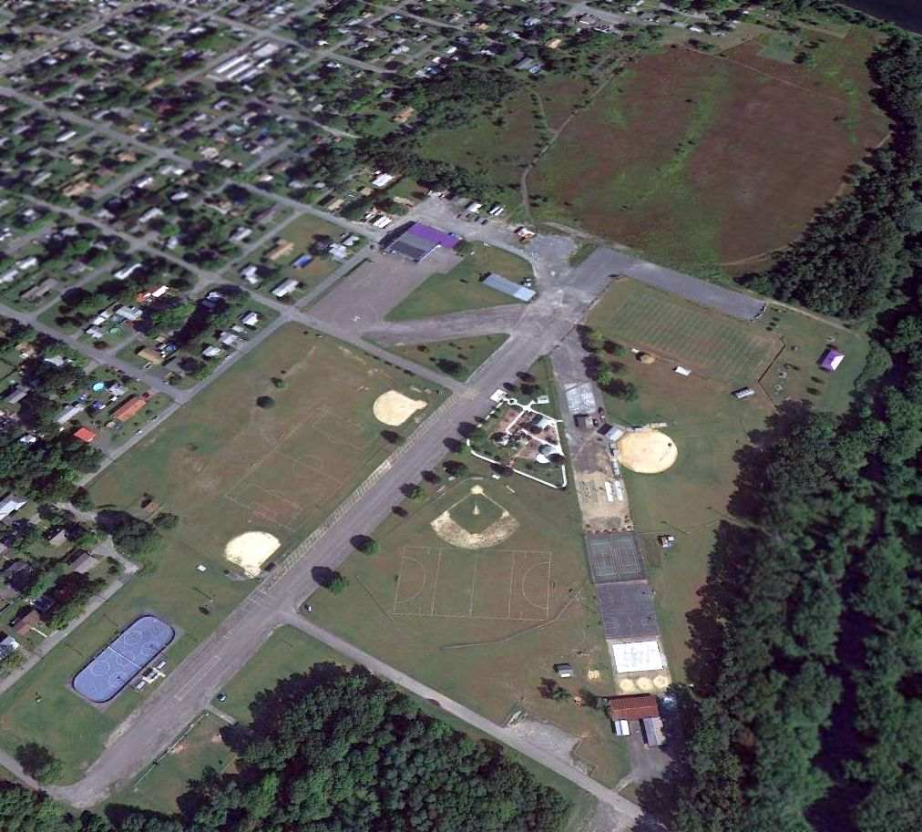
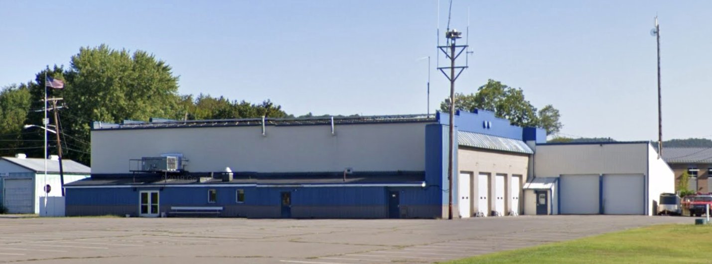
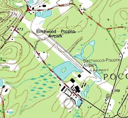
Pipher Airport / Stroudsburg-Pocono Airport (N53), Stroudsburg, PA
41.036, -75.161 (Northwest of New York, NY)
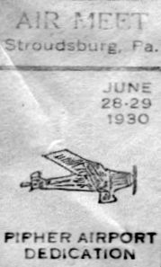
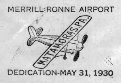
A postmark commemorating the 6/28/30 Pipher Airport Dedication (courtesy of Fred Kelso).
Pipher Airport was dedicated on 6/28/30, as commemorated by a postmark (courtesy of Fred Kelso).
Fred Kelso reported the letter bearing the dedication postmark was “signed by Bernetta Miller, the 5th female pilot to be licensed in the US (1912).
I assume she was flying during the associated air meet.”
The earliest depiction which has been located of Pipher Airport was on the August 1932 NY Sectional Chart,
which depicted Pipher Airport as a commercial/municipal airport.

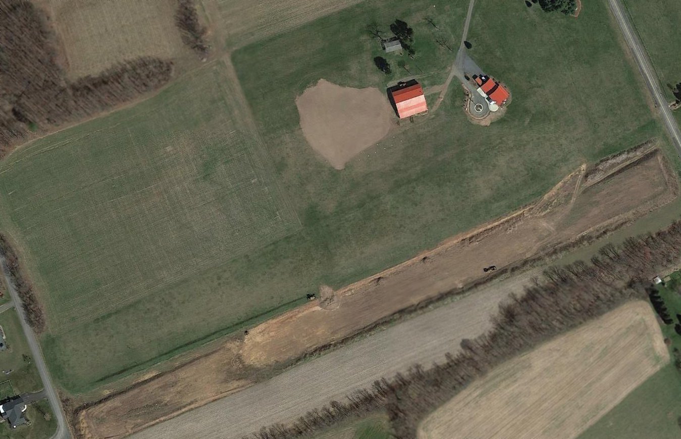
The earliest photo which has been located of Pipher Airport was a 5/10/39 aerial view (from Penn Pilot).
It depicted Pipher as having an irregularly-shaped grass field, with a single hangar along the south side.
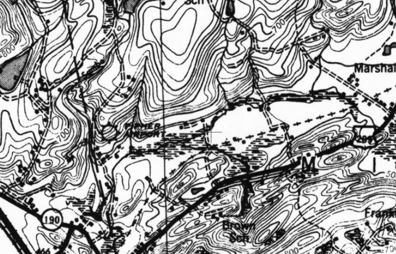
The earliest topo map depiction which has been located of Pipher Airport was on the 1943 USGS topo map.
Note that the Pipher Airport symbol was located slightly to the west of all further depictions of the airport (possibly an example of intentional WW2 map disinformation?),
in a hilly area not suitable for an airfield, not the clear level area to the east where is was depicted on subsequent maps.
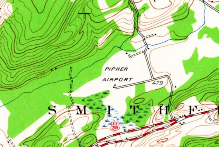
The 1944 USGS topo map depicted Pipher Airport in the same location as seen in all subsequent maps, on a clear level field.
No runways were depicted, just 2 small buildings on the south side of the clearing.

The earliest photo which has been located showing aircraft at of Pipher Airport was a 7/14/52 aerial view (from Penn Pilot).
It depicted 3 light aircraft, including one on the airfield.
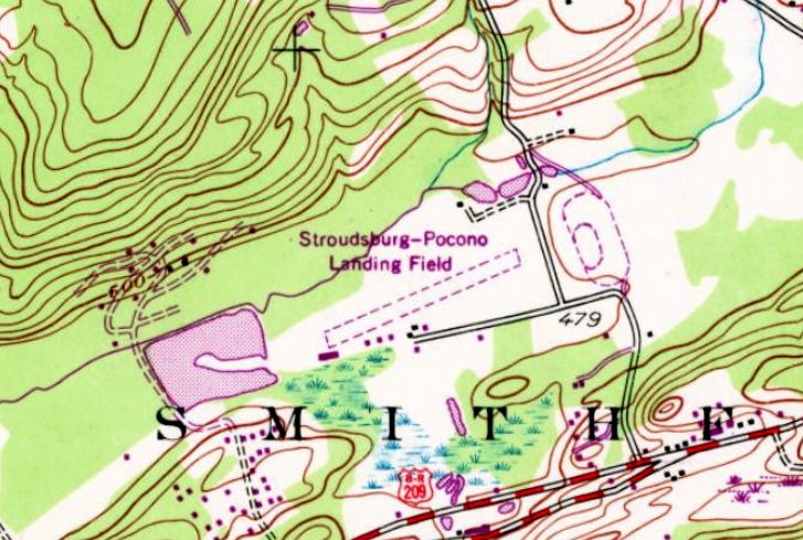
At some point between 1944-68 the airport was renamed,
as the 1968 USGS topo map depicted Stroudsburg-Pocono Landing Field as having a single unpaved northeast/southwest runway,
with a row of small buildings along the southwest side.
The May 1991 NY Sectional Chart (courtesy of Ryan Miller) depicted Stroudsburg-Pocono Airport as having a single 3,100' paved runway.
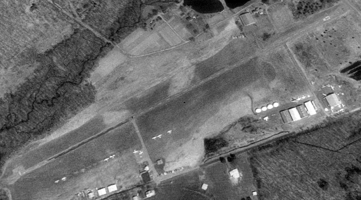
The earliest photo which has been located of Stroudsburg-Pocono Airport was a 1992 USGS aerial view looking north.
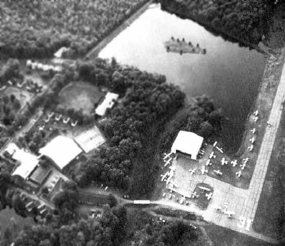
It depicted Stroudsburg-Pocono Airport as having a single paved northeast/southwest runway, with 2-dozen light single-engine aircraft parked near a row of hangars along the southeast side.
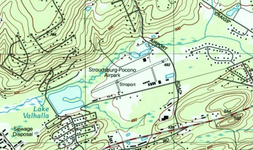
The 1998 USGS topo map depicted Stroudsburg-Pocono Airpark as having a single paved northeast/southwest runway, with a row of small buildings along the southeast side.
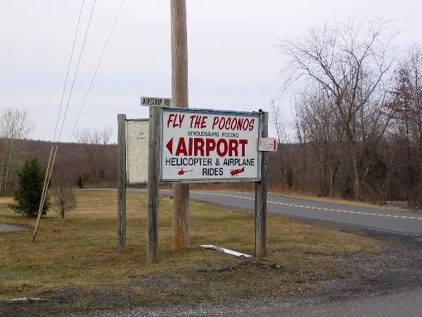
An undated sign for Stroudsburg-Pocono Airport.
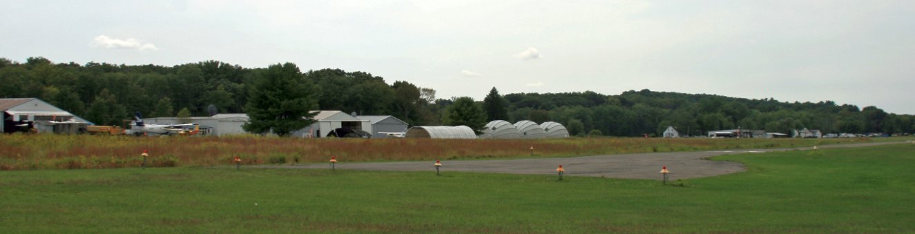
A 9/6/12 photo looking southwest at several aircraft & hangars at Stroudsburg-Pocono Airport.
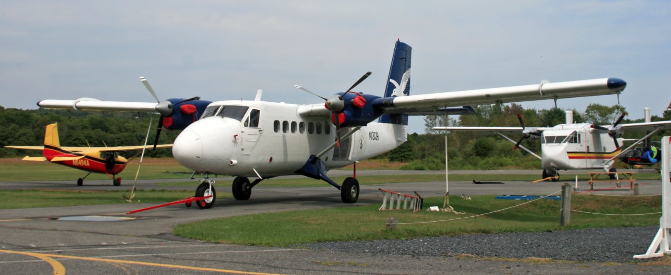
A 9/6/12 photo of a Cessna, Twin Otter, and Shorts Skyvan at Stroudsburg-Pocono Airport.

A 2012 airport directory (courtesy of Rocky) depicted Stroudsburg-Pocono Airport as having a 3,087' paved Runway 8/26.
A July 2015 photo of a Cessna Caravan, Shorts Skyvan, and Twin Otter at Stroudsburg-Pocono Airport.
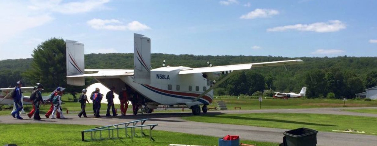
A July 2015 photo of skydivers loading onto a Shorts Skyvan at Stroudsburg-Pocono Airport.
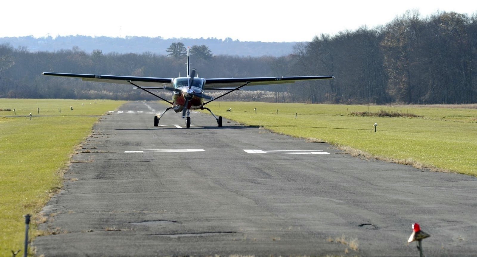
A 2017 photo of a Cessna Caravan taxiing at Stroudsburg-Pocono Airport.
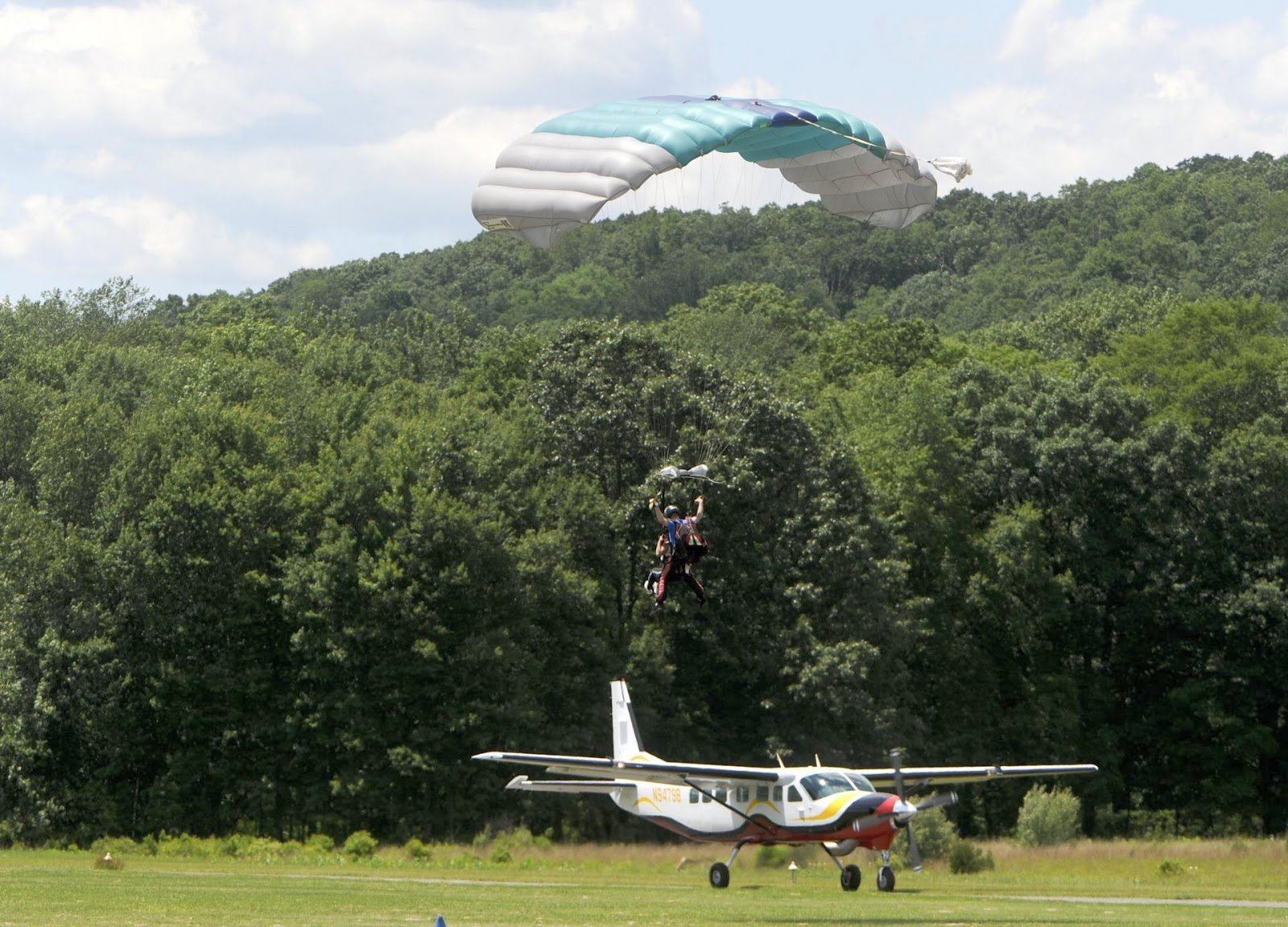
A 2017 photo of a skydiver landing in front of a Cessna Caravan taxiing at Stroudsburg-Pocono Airport.
An August 2019 photo looking west at the hangars & runway of Stroudsburg-Pocono Airport.
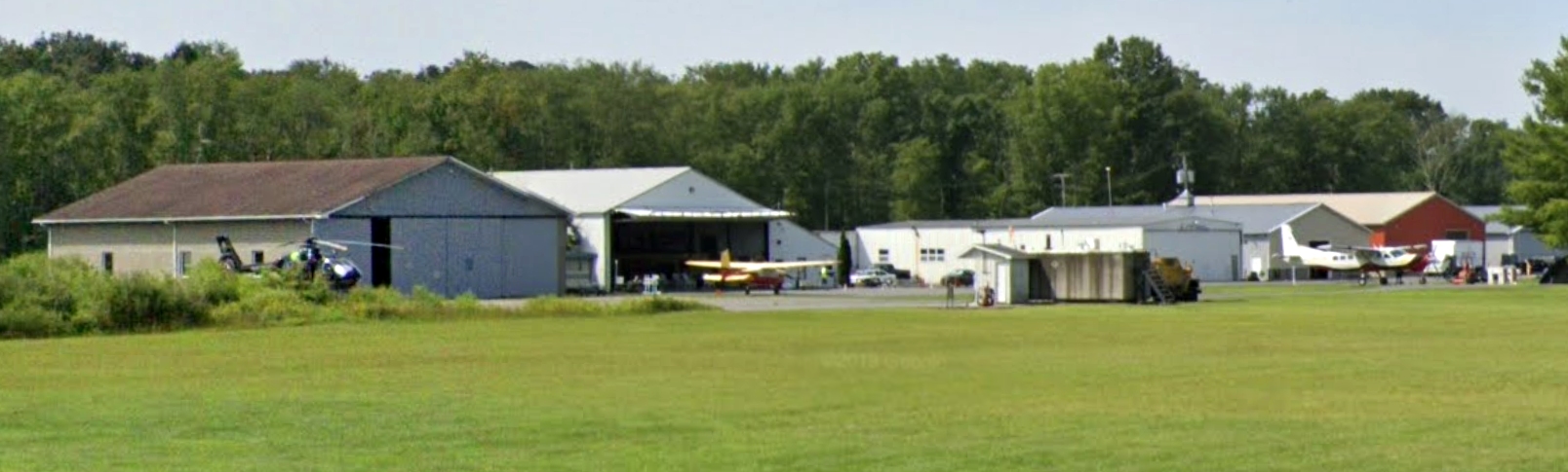
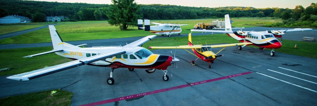
An August 2019 photo looking west at a helicopter, other aircraft, and hangars at Stroudsburg-Pocono Airport.
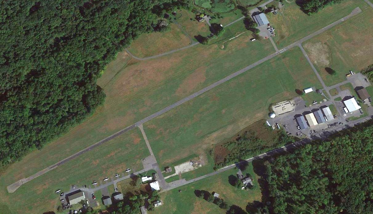
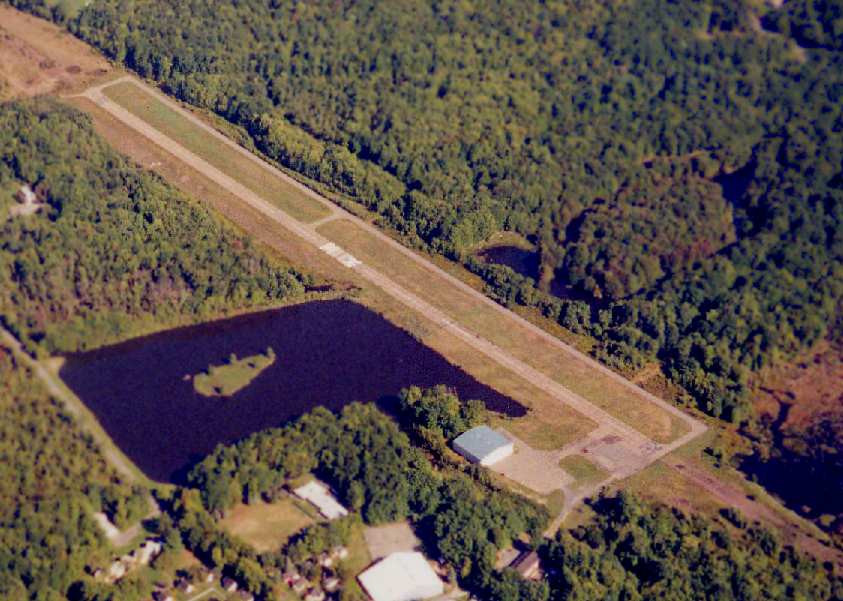
A 2020 aerial view looking north depicted a smaller complement of aircraft at Stroudsburg-Pocono Airport compared to the 1992 photo.
A 2022 photo of a Cesssna Stroudsburg-Pocono Airport.
For the year ending 4/20/21, the FAA Airport/Facility Directory data described Stroudsburg-Pocono Airport as conducting 115 takeoffs or landings per week.
It was said to have 7 based aircraft, including 1 multi-engine & 1 helicopter.
A 12/17/21 press release (courtesy of Ryan Miller) announced the purchase of Stroudsburg-Pocono Airport by Black Buffalo
and described their plan to turn the site into their permanent US production facility for 3D printers.
Ryan Miller reported, “The last I was there it wasn’t in great shape. I think the writing is on the wall for another airport.”
As of 2/24/22, the FAA Airport/Facility Directory data described Stroudsburg-Pocono Airport as being owned by Black Buffalo Land Acquisition, and managed by Micheal Woods.
It was said to have a single 3,087' asphalt runway 8/26, “in poor condition, cracking in pavement, spalling, heaving.”
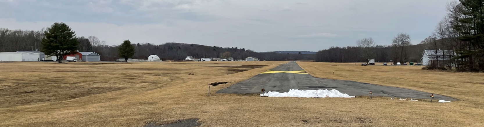
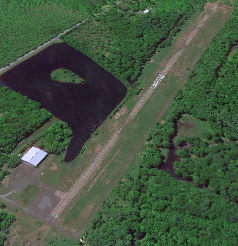
The January 2022 NY Sectional Chart depicted Stroudsburg-Pocono Airport as having a single 3,100' paved northeast/southwest runway, and to conduct glider & parachute operations.
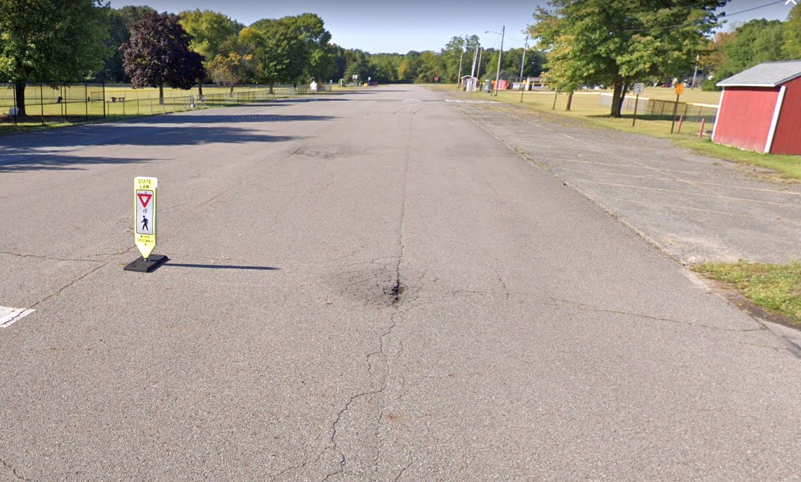
Unfortunately the end came for Stroudsburg-Pocono Airport, when NOTAM 02/332 declared it to be closed effective 3/1/22.
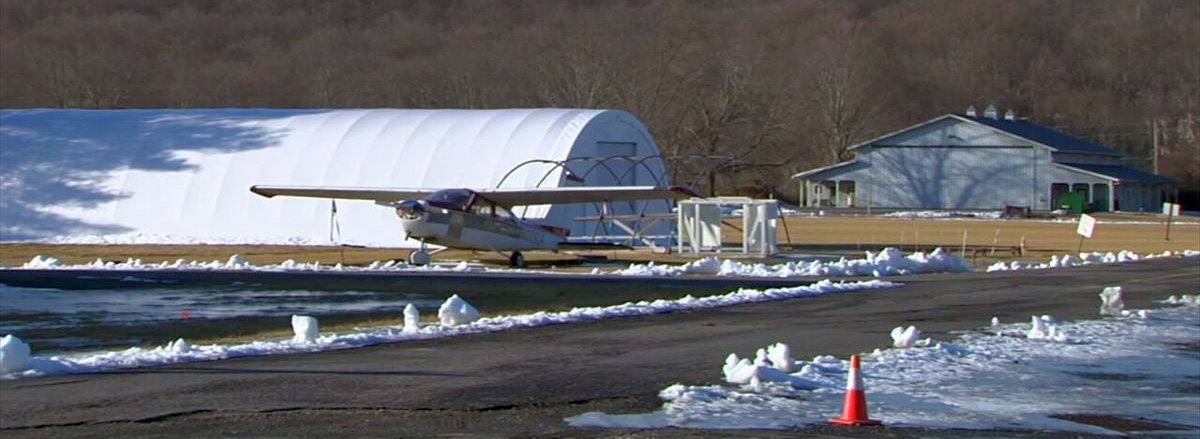
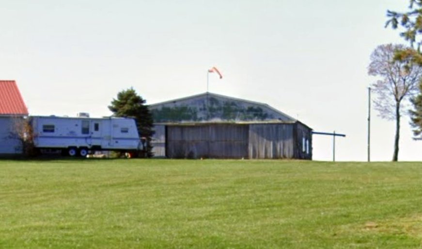
A 3/7/22 photo by Rich Amon at Stroudsburg-Pocono Airport.
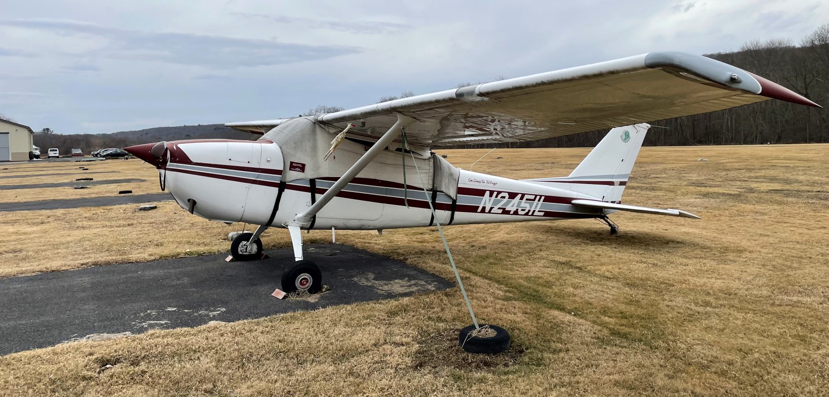
Rich reported, “There are only 2 airplanes on the field. One is a 172 converted to a tail-dragger. It sits outside.”
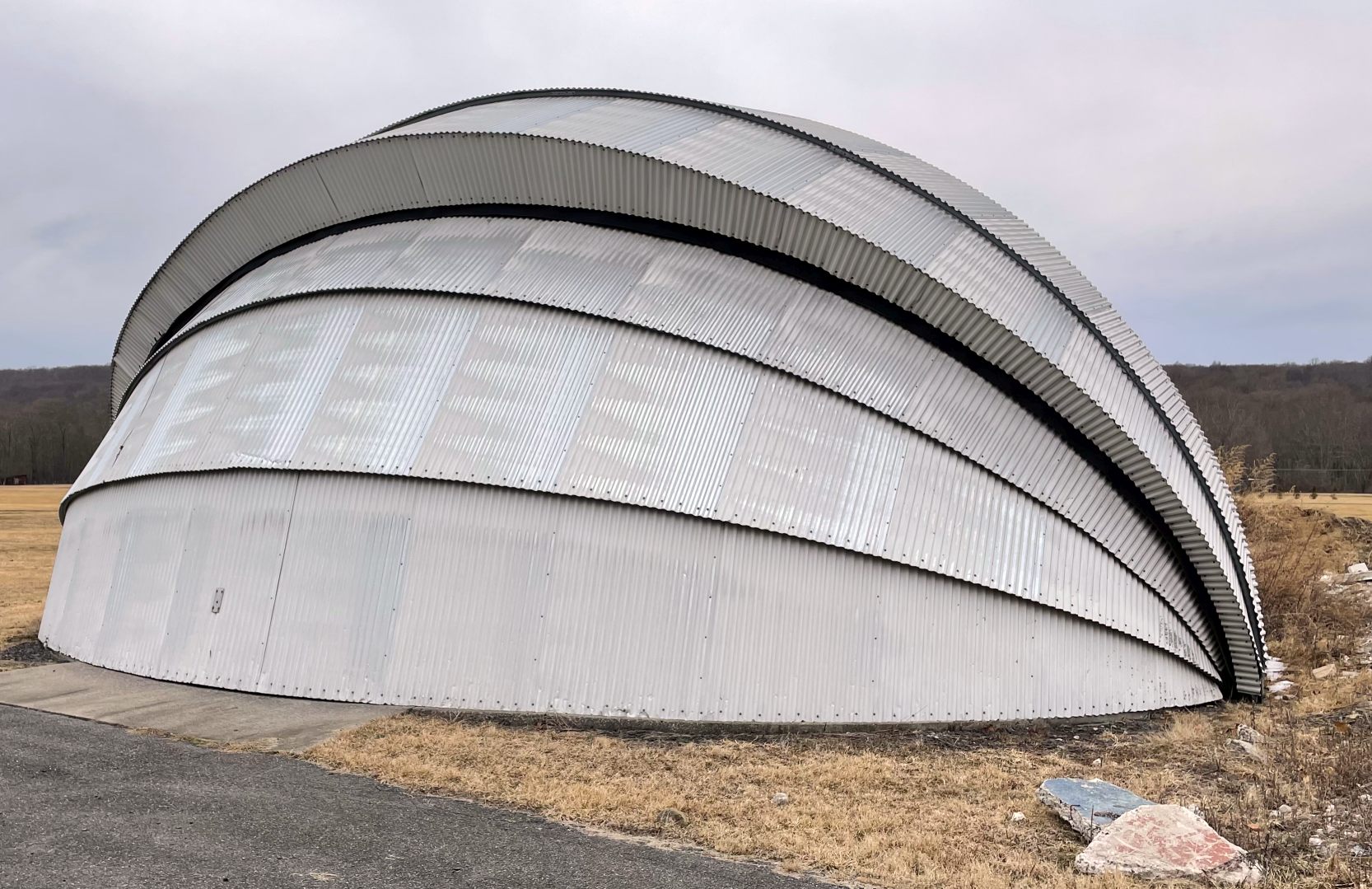
A 3/7/22 photo by Rich Amon of the exterior of the clamshell hangar at Stroudsburg-Pocono Airport.
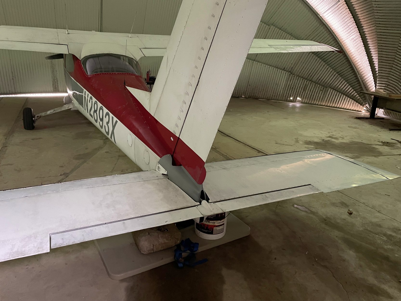
A 3/7/22 photo by Rich Amon of N2893X, a 1967 Cessna 177 which sits inside the clamshell hangar at Stroudsburg-Pocono Airport.
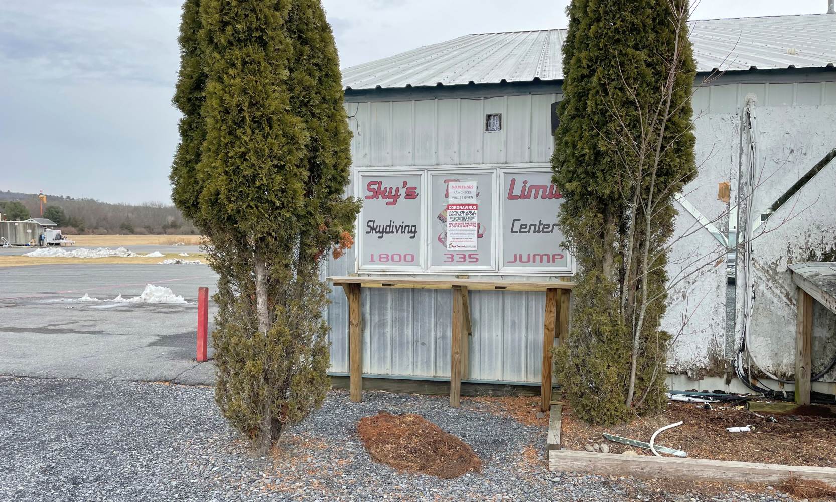
A 3/7/22 photo by Rich Amon of the former Sky's The Limit Skydiving Center at Stroudsburg-Pocono Airport.
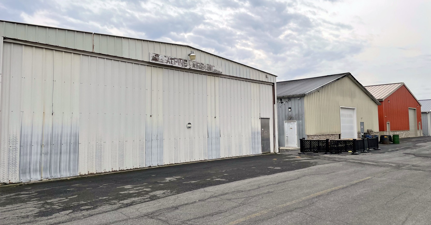
A 3/7/22 photo by Rich Amon of the former Apline Aire hangar at Stroudsburg-Pocono Airport.
A 3/7/22 photo by Rich Amon looking southwest at Stroudsburg-Pocono Airport.
Rich reported, “There is nothing sadder than an unused airport. Especially one that would have had its 90th birthday next year.”
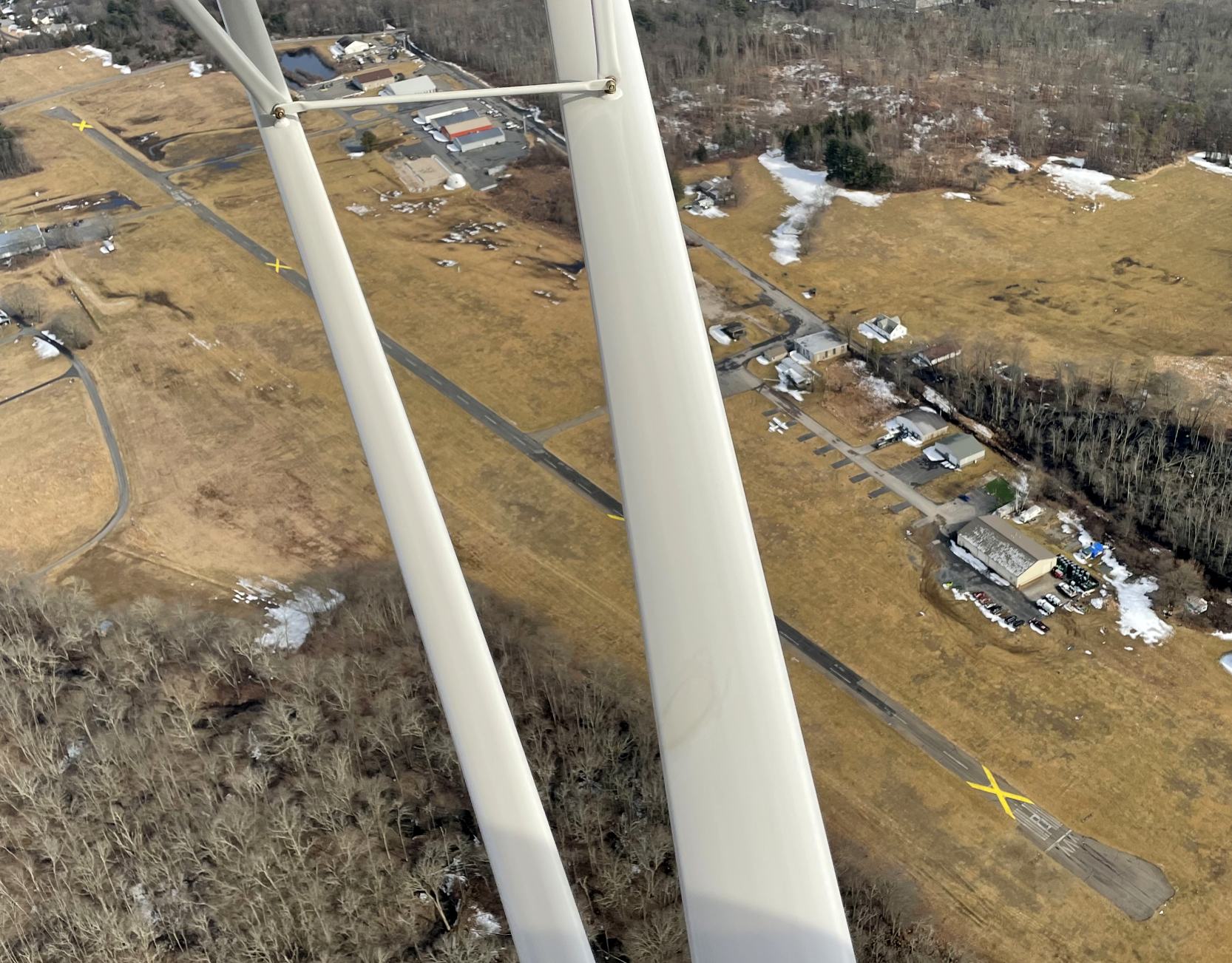
A 3/10/22 aerial view by Rich Amon looking southeast at Stroudsburg-Pocono Airport.
A 3/10/22 aerial view by Rich Amon looking southwest at Stroudsburg-Pocono Airport.

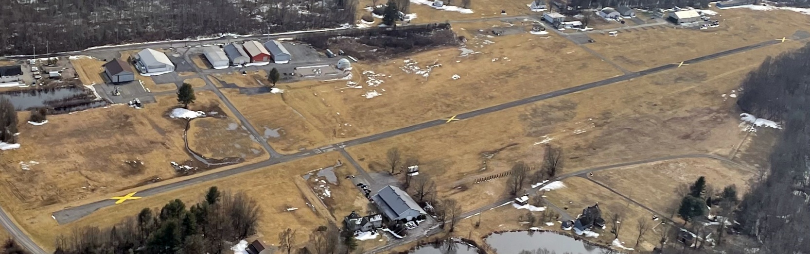
A 3/22/25 aerial view by Ed Figuli looking south at Stroudsburg-Pocono Airport.
Ed reported, “It looks like it go back into operation just like that. There was supposed to be a factory of some sort built on the property but that wasn't to be. Still just there.”
Thanks to Rich Amon for pointing out the closure of this airfield.
____________________________________________________
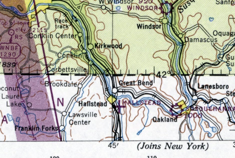
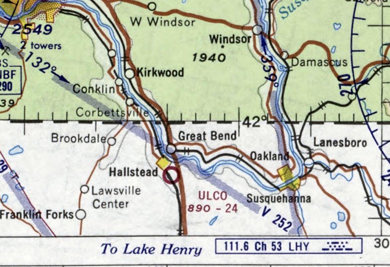
Hallstead Airport / Ulco Airport, Hallstead, PA
41.951, -75.74 (Northwest of New York, NY).
Hallstead Airport, as depicted on the January 1948 Albany Sectional Chart.
This small general aviation airport was evidently established at some point between 1947-48,
as it was not yet depicted on the January 1947 Albany Sectional Chart (courtesy of Ron Plante).
The earliest depiction which has been located of Hallstead Airport was on the January 1948 Albany Sectional Chart,
which depicted Hallstead as an auxiliary airfield.
It was still depicted as Hallstead Airport on the May 1957 Albany Sectional Chart.
It was evidently renamed Ulco Airport at some point between 1957-60,
as that it how it was labeled on the May 1960 Albany Sectional Chart.
The earliest photo which has been located showing Ulco Airport in operation was a 4/26/66 USGS aerial view.
It depicted Ulco Airport as having a northwest/southeast grass runway,
with 2 hangars & 1 light single-engine aircraft on the east side.
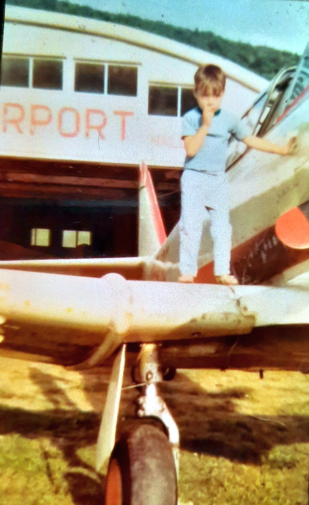
A 1968 photo of 3-year-old Jim Galasyn standing on the wing of one of Mr. Ulco's planes, a surplus T-6 Texan at Ulco Airport, with the hangar in the background.
Jim recalled, “Mr. Ulco took us flying occasionally, which I remember with equal parts thrill & fear.
We lived in the house across the road from the Ulcos’ house, next to the freeway.
Part of the airfield was significantly below grade relative to the surrounding roads, and there was a fairly steep slope from Airport Road to the airstrip.
In the winter, it was the best slope for sledding.”
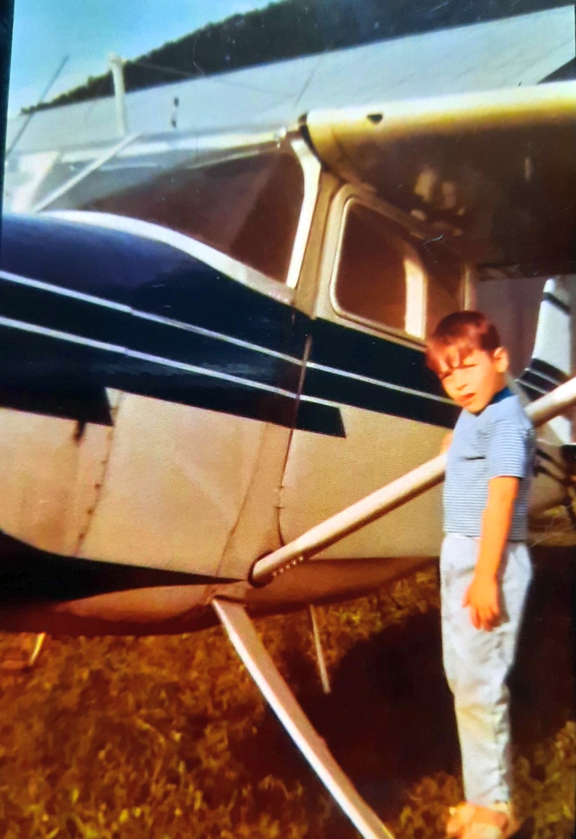
A 1968 photo of 3-year-old Jim Galasyn next to a Cessna at Ulco Airport.
The February 1970 Albany Sectional Chart depicted Ulco Airport as having a 2,400' unpaved runway.
It was still depicted as Ulco Airport on the January 1973 NY Sectional Chart (courtesy of Ron Plante).
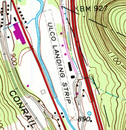
The 1978 USGS topo map depicted “Ulco Landing Strip” as an unpaved northwest/southeast runway, with several small buildings along the east side.
Ulco Airport was evidently renamed back to Halstead Airport at some point between 1973-79,
as that is how it was depicted on the December 1993 NY Sectional Chart (courtesy of Ron Plante).
The last aeronautical chart depiction which has been located of Halstead Airport was on the June 1981 NY Sectional Chart (courtesy of Ron Plante),
which depicted Halstead o as having a 2,500' unpaved runway.
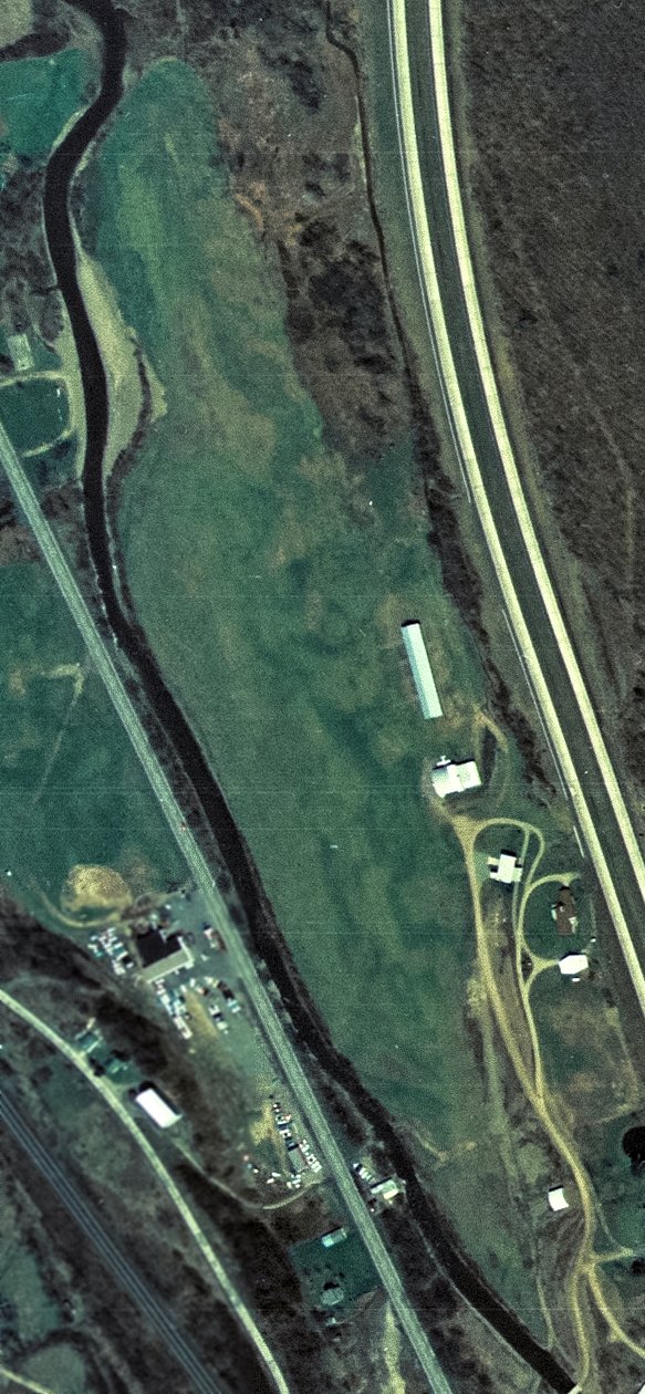
Ulco Airport was evidently closed (for reasons unknown) at some point between 1970-92,
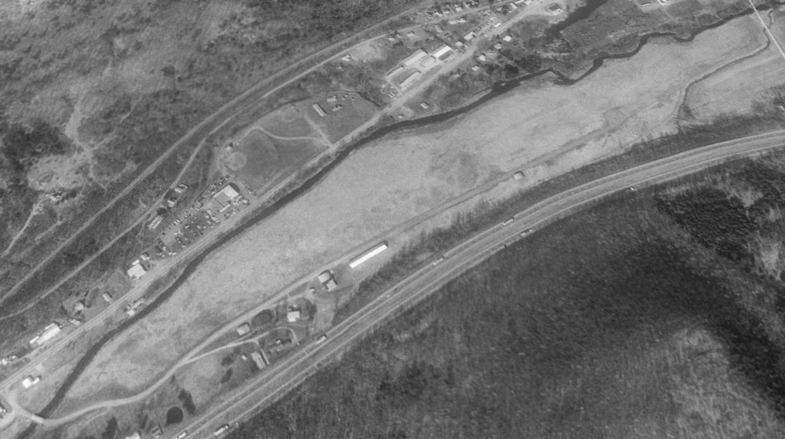
as a 1992 USGS aerial view looking northwest showed a closed-runway “X” symbol on the south end of the runway (bottom-left of picture).
The airport otherwise remained intact, including the grass runway & several small hangars.
Ulco Airport was depicted as an abandoned airfield on the December 1993 NY Sectional Chart (courtesy of Ron Plante).
A June 2012 photo (courtesy of Lee Corbin) looking northeast at what appears to be a former hangar on the east side of the site of Ulco Airport.
A 2017 aerial view looking northwest shows houses were built at some point between 1992-2017 on the middle of the former Ulco Airport runway,
but at least 1 former hangar remains on the east side of the runway (bottom-center of photo).
A July 2022 photo looking northeast at what appears to be a former hangar on the east side of the site of Ulco Airport.
The site of Ulco Airport is located at the northern terminus of Airport Road, appropriately enough.
Thanks to Lee Corbin for pointing out this airfield.
____________________________________________________
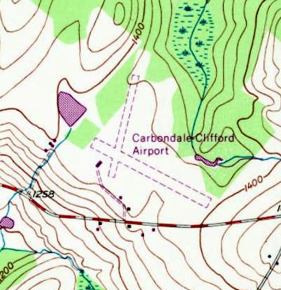
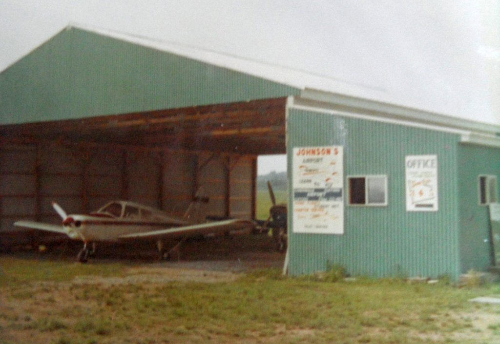
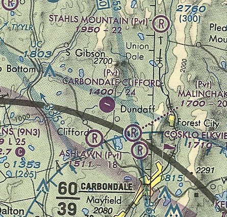
Carbondale-Clifford Airport / Johnson's Airport, Clifford, PA
41.652, -75.58 (Northwest of Philadelphia, PA).
Carbondale-Clifford Airport, as depicted on the July 1949 NY Sectional Chart (courtesy of Ron Plante).
Carbondale-Clifford Airport was not yet depicted on the January 1945 NY Sectional Chart (courtesy of Ron Plante).
According to a photo caption, Carbondale-Clifford Airport was established in 1946
(probably the single biggest year for the establishment of US airports).
Karsten Wallis recalled, “Clifford Airport... My grandfather had a hand in opening this airport.
He was a WW2 instructor & had lots of time in Stearmans.”
The earliest depiction which has been located of Carbondale-Clifford Airport was on the July 1949 NY Sectional Chart (courtesy of Ron Plante).
It depicted Carbondale-Clifford Airport as having a mere 1,900' unpaved runway.

The earliest photo which has been located of Carbondale-Clifford Airport was a 10/14/49 aerial view (from PennPilot).
It depicted Carbondale-Clifford Airport as having 2 unpaved runways, with 5 light single-engine aircraft parked near some small buildings on the southwest side.
The 1969 USGS topo map depicted Carbondale-Clifford Airport as having 2 unpaved runways, with a small building on the southwest side.
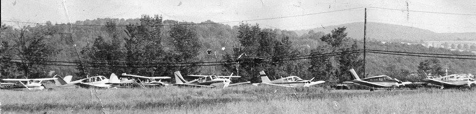
A 7/3/76 photo of 8 light single-engine aircraft at Carbondale-Clifford Airport, on the occasion of the airport's 30th anniversary.
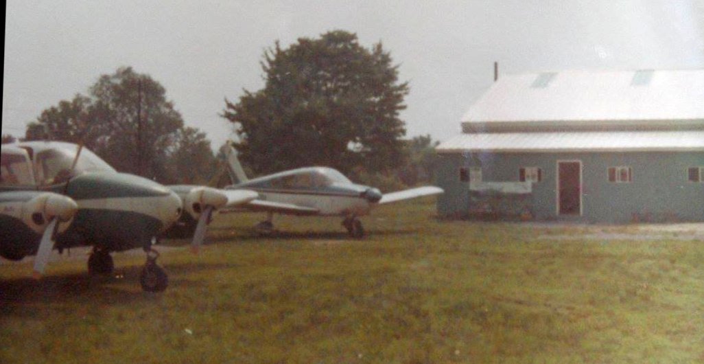
A circa 1970s photo of a Piper Apache & Cherokee next to the Carbondale-Clifford Airport hangar.
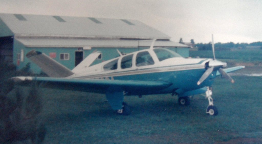
A circa 1970s photo of a Beech Bonanza in front of the Carbondale-Clifford Airport hangar.
A circa 1970s photo of a Piper Cherokee inside the Carbondale-Clifford Airport hangar.
Note that the hangar is marked with “Johnson's Airport”,
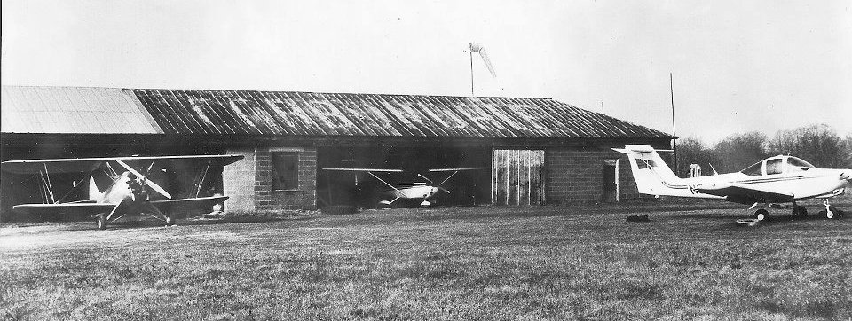
A circa 1978-80s photo of a biplane, Cessna, and a Piper Tomahawk with a hangar with “Carbondale” painted on its roof.
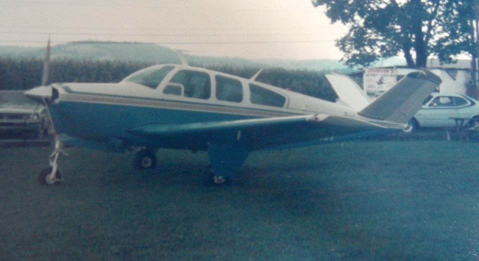
A circa 1970s-80s photo of a Beech Bonanza at Carbondale-Clifford Airport, with a “Johnson's Airport” sign visible in the background.
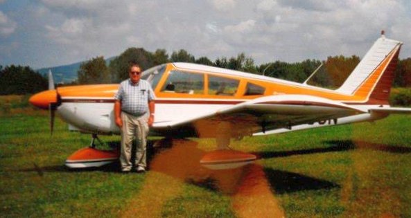
A circa 1970s-80s photo of a Piper Cherokee at Carbondale-Clifford Airport.
The last photo which has been located showing aircraft at Carbondale-Clifford Airport was a 1992 aerial view,
which showed 2 light single-engine aircraft parked near the hangars at the southeast end.
The last aeronautical chart depiction which has been located of Carbondale-Clifford Airport was on the May 2001 NY Sectional Chart (courtesy of Ron Plante).
It depicted Carbondale-Clifford Airport as having a 2,400' paved northwest/southeast runway,
but showed that its status had changed to a private airfield.
A 2005 aerial view showed no aircraft parked outside at Carbondale-Clifford Airport.
Karsten Wallis recalled, “Clifford Airport... My grandfather had an airplane/hangar there until he quit flying in 2010.
Many relatives & friends also had airplanes there.”
Carbondale-Clifford Airport evidently closed (for reasons unknown) at some point between 2010-2016,
as it was no longer depicted on the April 2016 NY Sectional Chart.
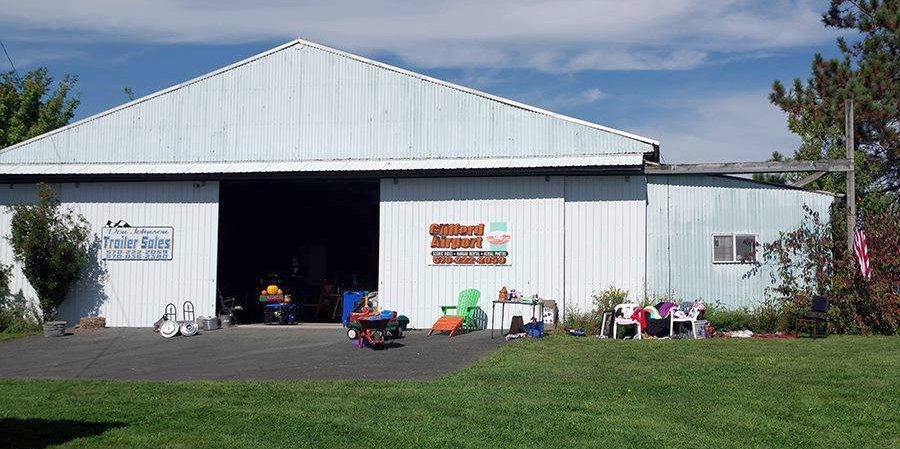
A circa 2001-2017 photo of the Carbondale-Clifford Airport hangar, reused for flea markets, but still bearing a “Clifford Airport” sign.

A 2016 aerial view looking north at the site of Carbondale-Clifford Airport. The outline of the 2 runways remained recognizable, but there was no trace of the runway pavement of the northwest/southeast runway.
The site of Carbondale-Clifford Airport is located northeast of the intersection of Church Street & Airport Road, appropriately enough.
Thanks to Brian Wade for pointing out this airfield.
____________________________________________________
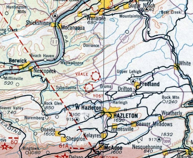
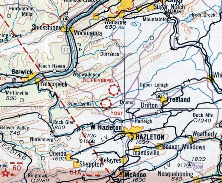
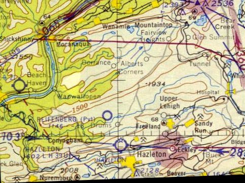
Veale Airport / Reifenberg Airport / (Original) Hazleton Airport, Hazleton, PA
41.035, -76.023 (Northwest of Philadelphia, PA)
Veale Airport, as depicted on the August 1932 NY Sectional Chart.
Photo of the airfield while open has not been located.
Veale Airport was located just northwest of the little town of Drums.
The date of establishment of this early airport has not been determined.
The earliest depiction which has been located of Veale Airport was on the August 1932 NY Sectional Chart.
It depicted Veale as a commercial/municipal airport.
Veale Airport was evidently renamed Reifenberg Airport at some point between 1932-33,
as that is how it was depicted on the April 1933 NY Sectional Chart.
Reifenberg Airport was evidently renamed Hazleton Airport at some point in 1933,
as that is how it was depicted on the June 1933 NY Sectional Chart.
The November 1942 NY Sectional Chart depicted Hazleton as a commercial/municipal airport.
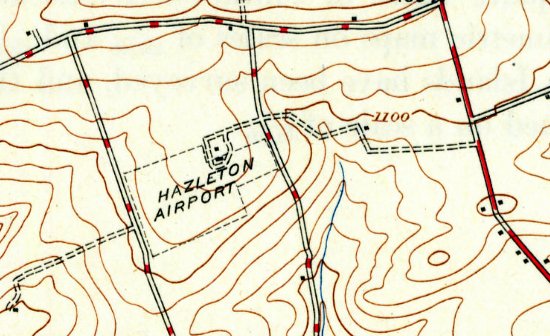
The 1946 USGS topo map (courtesy of Lee Corbin) depicted Hazleton Airport as an irregularly-shaped property outline, oriented northeast/southwest,
with 3 small buildings on the north side.
Hazleton Airport was evidently renamed back to Reifenberg Airfield & changed status to a private airfield,
as that is how it was depicted on the 1958 NY Sectional Chart.
It depicted Reifenberg as having an 1,800' unpaved runway.
A larger Hazleton Airport, with a paved runway, was depicted a few miles to the southeast.
Reifenberg Airfield was evidently closed (for reasons unknown) at some point between 1958-64,
as it was no longer depicted on the 1964 NY Sectional Chart.
A 1966 aerial view showed Hazleton/Reifenberg Airport remained intact (including the grass runway & the hangar),
but there was no sign of any recent aviation use.
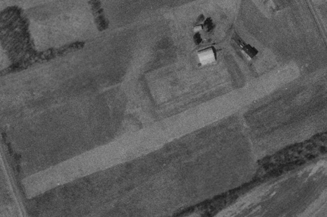
A 1992 USGS aerial view depicted the runway & hangar remaining intact at the site of Hazleton Airport.
A circa 2010-2016 aerial view looking west depicted the runway & hangar remaining intact at the site of Hazleton Airport.
A 2016 aerial view depicted the runway & hangar remaining intact at the site of Hazleton Airport.
A November 2022 photo looking west showed the hangar at the site of Hazleton Airport still has a windsock on top.
The site of Hazleton Airport is located southeast of the intersection of Schweitz Road & Old Airport Road, appropriately enough.
Thanks to Lee Corbin for pointing out this airfield.
____________________________________________________
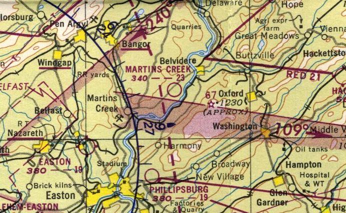
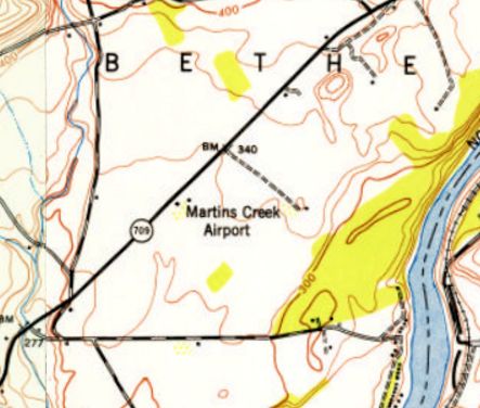
Martins Creek Airport, Martins Creek, PA
40.806, -75.116 (North of Philadelphia, PA).
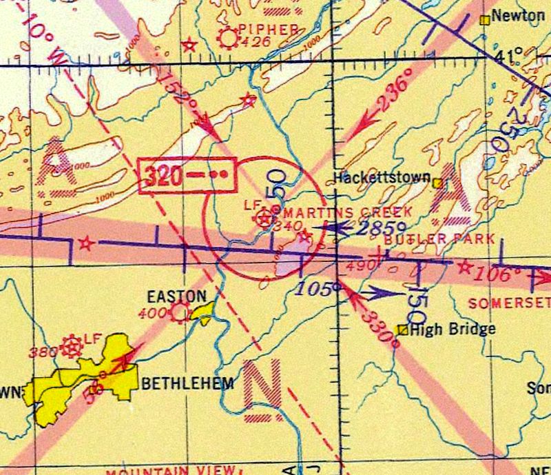
Martins Creek Airport, as depicted on the 1935 Regional Aeronautical Chart.
The date of establishment of this early airport has not been determined.
The earliest depiction which has been located of Martins Creek Airport was on the 1935 Regional Aeronautical Chart.
It depicted Martins Creek Airport as having beacon light & a 4-course radio range navigational aid.
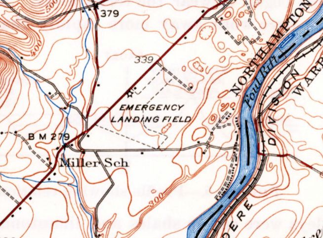
The 1936 USGS topo map depicted Martins Creek Airport as an irregularly-shaped property outline, labeled as “Emergency Landing Field”.
It depicted Honesdale as having a 3,000' unpaved runway.
One small building & a beacon were depicted along the northwest side of the airfield.
The earliest photo which has been located of Martins Creek Airport was a 4/27/37 aerial view looking north (from the Dallin Aerial Survey Collection, courtesy of the Hagley Museum & Library).
It depicted Martins Creek Airport as having 2 grass runways, with an airport circle marking at the runway intersection.
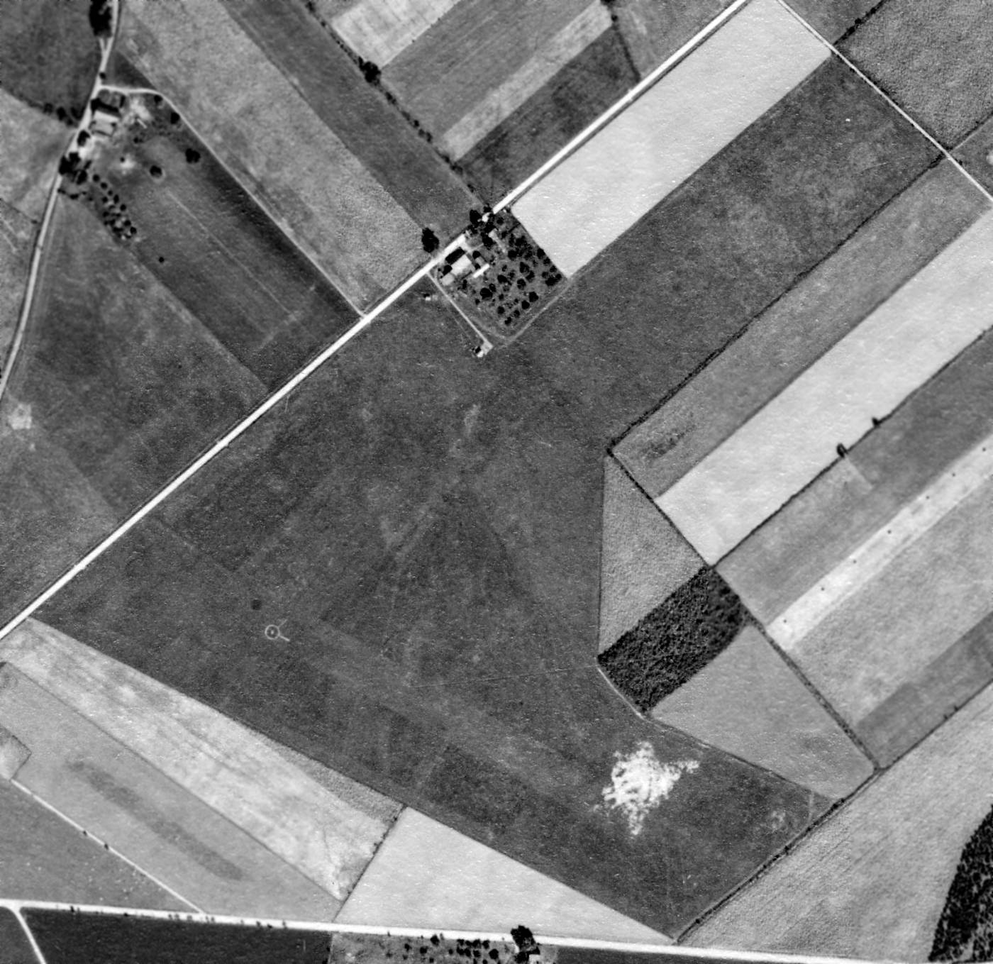
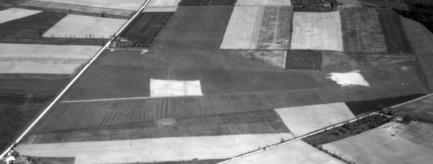
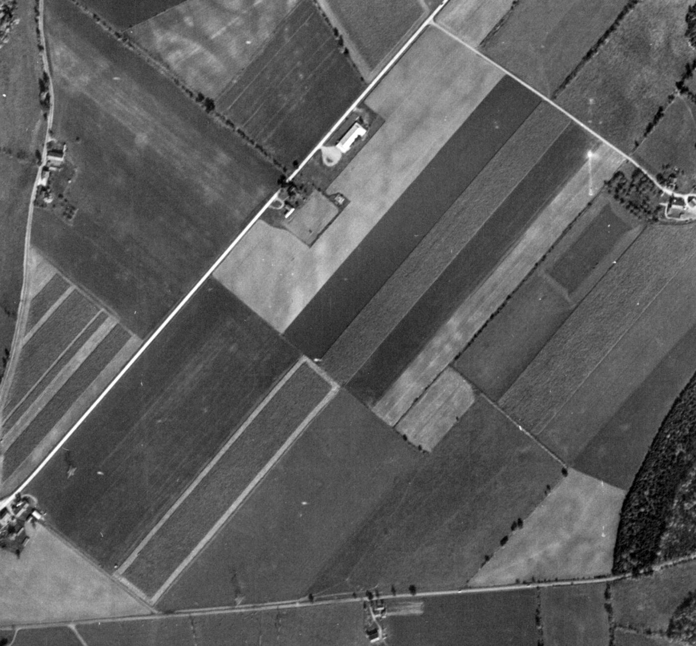
The last photo which has been located showing Martins Creek Airport while it was operational was a 10/3/38 USGS aerial view.
It depicted Martins Creek Aiport as having 2 grass runways, with an airport circle marking at the runway intersection.
A few small buildings were visible along the northwest side of the field, but no aircraft were visible.
George Frost recalled, “One summer I had the opportunity to witness my Uncle Charlie’s activities first hand.
I worked briefly as a line boy at an airport he’d built & operated at Martin’s Creek. There, I had some adventures of my own.
Charlie opened the airport just before 12/7/41 & America’s entry into WWII.
By chance it was just outside the East Coast No-Fly Zone where only military flight was allowed.
There was great interest in aviation & with full employment many had the money to take flying lessons.
They were looking for a place to fly & Charlie’s airport was buzzing with activity.
Many flight students drove to Martin’s Creek or took the Greyhound bus into nearby Belvedere NJ for weekends or their vacations at the airport.
Charlie rented a house on the Delaware River about a mile from the airport, installed a dormitory, and hired Mrs. Reed, a housekeeper who also cooked to provide meals.”
The May 1944 NY Sectional Chart depicted Martins Creek Airport as a commercial/municipal airport.
George Frost recalled, “When the war ended, flights schools popped up everywhere funded by the GI Bill & they all put each other out of business, including Uncle Charlie.
Back then it was a busy & fun place. As a line boy I worked bringing airplanes out of the hangar in the morning, fueled them as required,
and at night scrubbed the accumulated bugs off windshields & wing leading edges before tucking them into the hangar.
I also did anything that needed to be done for which I was qualified.
Fortunately, this was educational as I became qualified for an increasing number of tasks.
I do recall being soloed on a broom & cleaning the shop floor was first added to my duties.
I was continuously trained for new duties more interesting than those. I got to work on airplanes & their engines under the scrutiny of Bob & John, the mechanics.
Often I would think I should not proceed with some task until I checked with Bob or John.
Usually they would tell me they had been watching & I was doing OK or I would have heard from them.
Gradually, I became more confident about what I would need approval for before continuing. This was a great learning experience.”
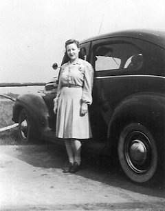
A circa 1940s photo of Elizabeth McClintock presumably at Martins Creek Airport (courtesy of Laurie White).
Laurie White reported, her mother Elizabeth McClintock, had “a lifelong passion for flying.
She was recognized twice in local newspapers for working on a milk delivery route to finance her flying lessons.
She acquired her private license after training at Martins Creek, then joined a flying club, the Jersey Fliers that cooperatively owned a Cessna 120.”
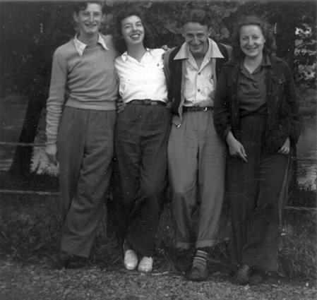
A circa 1940s photo of Kay Hildebrand, Elizabeth McClintock, and 2 young men, presumably at Martins Creek Airport (courtesy of Laurie White).
Martins Creek Airport, as depicted on the 1949 USGS topo map.
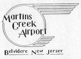
The Martins Creek Airport logo from a circa 1940s brochure for the airport (courtesy of Fred Kelso).
Note that strangely the brochure described the airport (twice) as being in Belvidere NJ, even though it was actually located across the river in PA.

An undated photo of Martins Creek Airport from a circa 1940s brochure for the airport (courtesy of Fred Kelso),
depicting a variety of light single-engine monoplanes & biplanes in front of the hangar.
An undated photo of Martins Creek Airport from a circa 1940s brochure for the airport (courtesy of Fred Kelso),
showing several light single-engine monoplanes in front of the hangar.
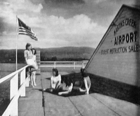
An undated photo of Martins Creek Airport's “observation & sun deck” from a circa 1940s brochure for the airport (courtesy of Fred Kelso).
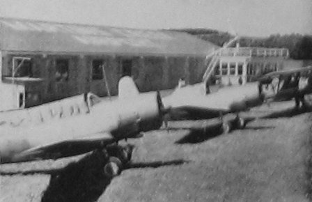
An undated photo of 2 surplus Vultee BT-13 Valiants in front of the Martins Creek Airport hangar from a circa 1940s brochure for the airport (courtesy of Fred Kelso),
originally captioned “Ships for every type rating.”
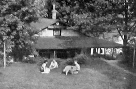
An undated photo of “the Martins Creek Pilots Club on the Delaware” [River] from a circa 1940s brochure for the airport (courtesy of Fred Kelso).
The club was described as “operated by the Airport to provide living accomodations for students. Provides hours of restful enjoyment.”
The last aeronautical chart depiction which has been located of Martins Creek Airport was on the 1950 NY Sectional Chart.
It depicted Martins Creek Airport as having a 2,300' unpaved runway.
The 1953 USGS topo map depicted Martins Creek Airport as having 2 small buildings along the northwest side,
but without any other details.
Martins Creek Airport was evidently closed (for reasons unknown) at some point between 1950-57,
as it was no longer depicted on the 1957 NY Sectional Chart.
A 10/15/58 USGS aerial view showed the land of the Martins Creek Airport had been returned to cultivation,
and the property was no longer recognizable as a former airport.
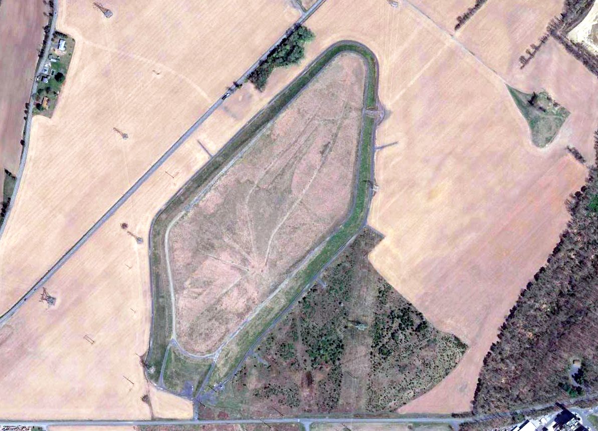
A 2016 aerial view showed no trace remaining of Martins Creek Airport.
The site of Martins Creek Airport is located northeast of the intersection of Martins Creek Belvidere Highway & Depue Ferry Road.
Thanks to Lee Corbin for pointing out this airfield.
____________________________________________________
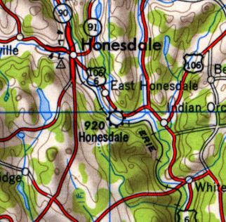
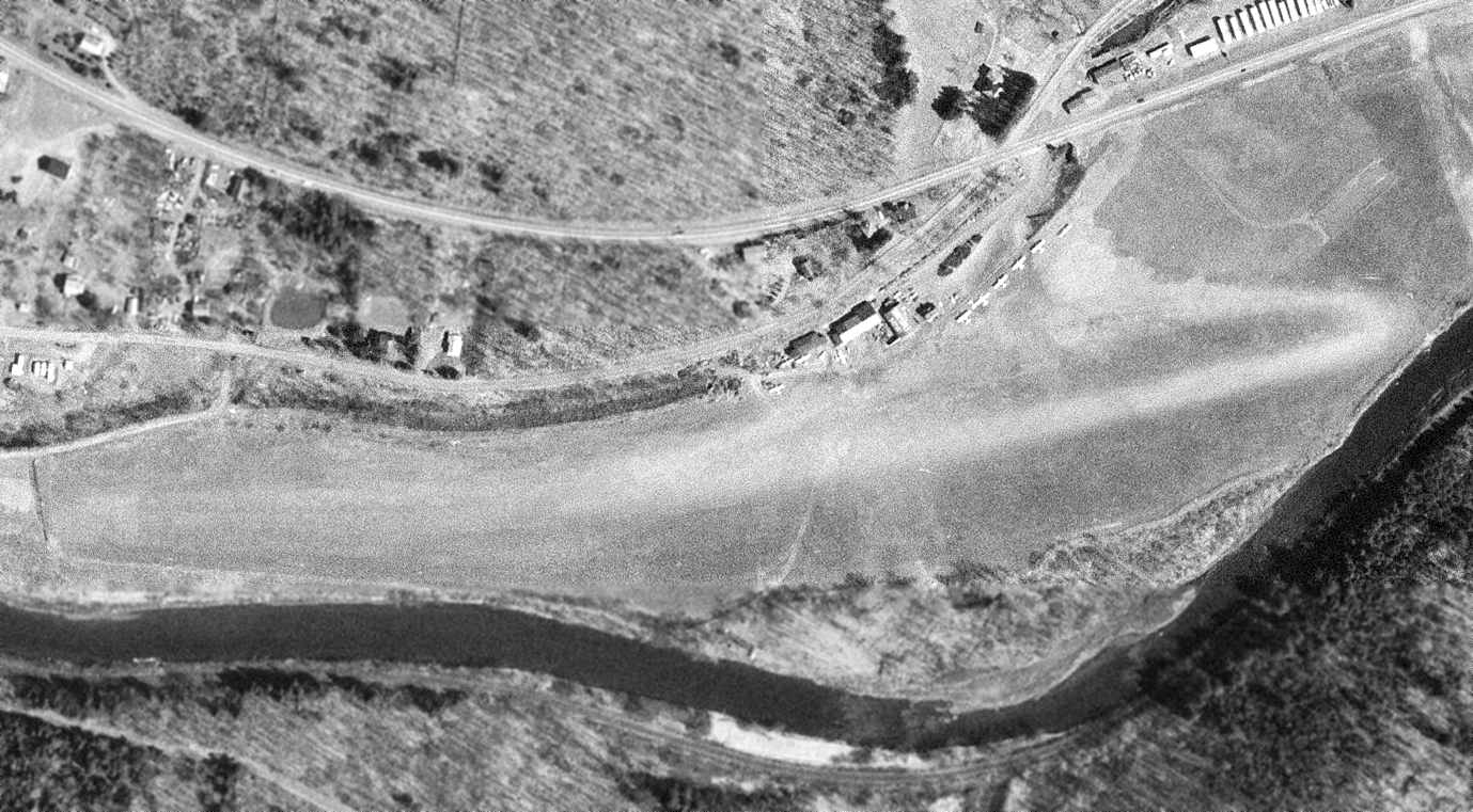
Honesdale Airport, Honesdale, PA
41.552, -75.23 (North of Philadelphia, PA)
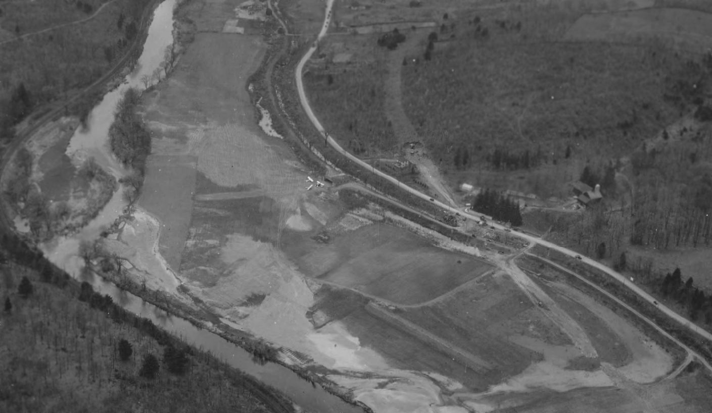
A 5/10/36 aerial view looking northwest at Honesdale Airport (from the Dallin Aerial Survey Collection, courtesy of the Hagley Museum & Library).
The date of establishment of this small general aviation airport has not been determined.
The earliest depiction which has been located of Honesdale Airport was a 5/10/36 aerial view (from the Dallin Aerial Survey Collection, courtesy of the Hagley Museum & Library),
depicted the field as having an east/west unpaved airfield area, with 3 single-engine aircraft parked near a small hangar on the north side.
Honesdale Airport, as depicted on the 1950 USGS topo map.
Harry Ward recalled, “I remember this turf field vividly from my youth.
A pilot known to have used that airport when it was still active [was] Walter Ogden.”
The earliest aeronautical chart depiction which has been located of Honesdale Airport was on the 1957 NY Sectional Chart.
It depicted Honesdale as having a 3,000' unpaved runway.
A 8/5/58 USGS aerial view depicted Honesdale as having a single unpaved east/west runway adjacent to the north side of the river.
A few small buildings & light planes were on the north side of the field.

The 1965 NY Sectional Chart depicted Honesdale Airport as having a 2,900' unpaved runway.
The last photo which has been located of Honesdale Airport was an 4/15/66 USGS aerial view.
It depicted Honesdale as having a single unpaved east/west runway adjacent to the north side of the river.
A few small buildings & 9 light planes were on the north side of the field.
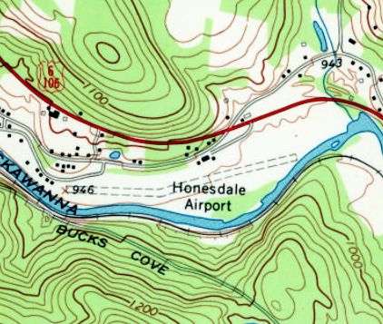
The last topo map depiction which is available of Honesdale Airport was on the 1967 USGS topo map.
It depicted Honesdale as having a single unpaved east/west runway, with a “bend” in the runway following the river.
Three small buildings were depicted on the north side of the field.
A 1969 aerial view showed a markedly different level of usage at Honesdale Airport, with only a single light aircraft visible on the field.
The last aeronautical chart depiction which has been located of Honesdale Airport was on the 1970 NY Sectional Chart.
It depicted Honesdale as having a 2,900' unpaved runway.
Honesdale Airport evidently closed at some point between 1970-73,
as it was no longer depicted on the January 1973 NY Sectional Chart (courtesy of Ron Plante).
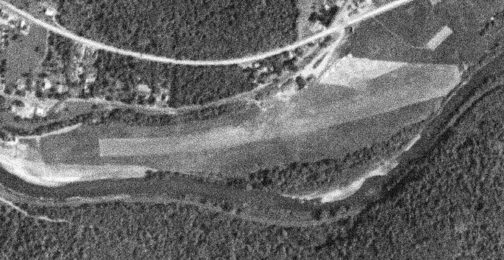
The 1973 USGS topo map showed a large retail building covering the eastern part of the Honesdale Airport site,
although the 3 former airport buildings still remained further west.
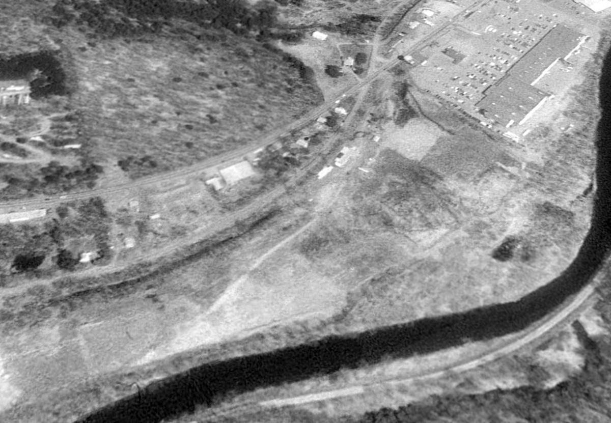
The 3 former Honesdale Airport buildings still remained standing (center of photo) on a 1992 aerial view looking northeast.
A 1999 aerial photo showed the shopping center had been expanded further west, covering the site of the 3 former Honesdale Airport buildings.
A 2014 aerial view looking northeast showed no trace remaining of Honesdale Airport.
The site of Honesdale Airport is located at the eastern terminus of Old Willow Avenue.
Thanks to Harry Ward for pointing out this airfield.
____________________________________________________
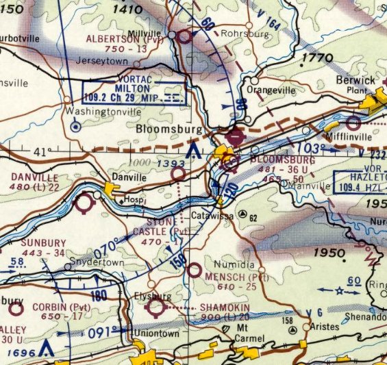
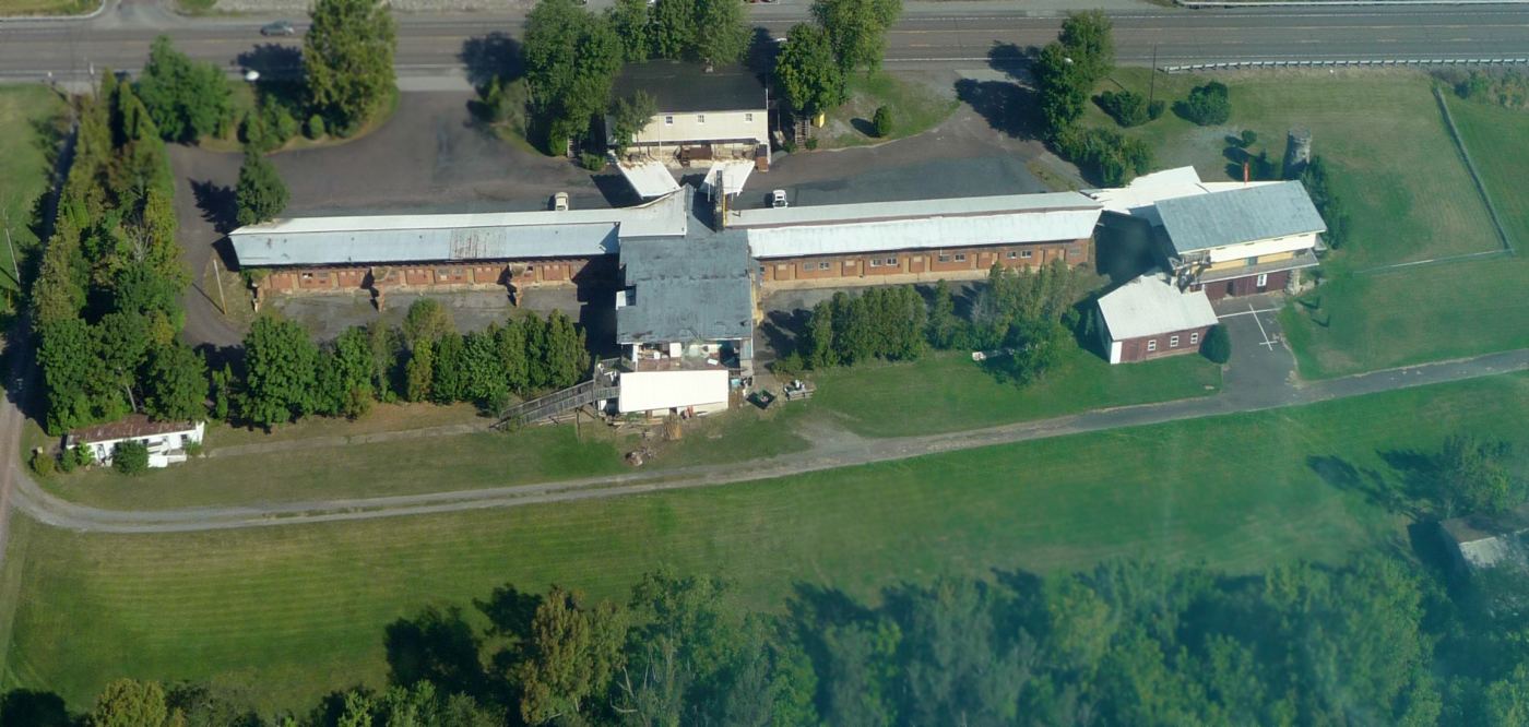
Stone Castle Motel Airport, Grovania, PA
40.973, -76.52 (Northwest of Philadelphia, PA).
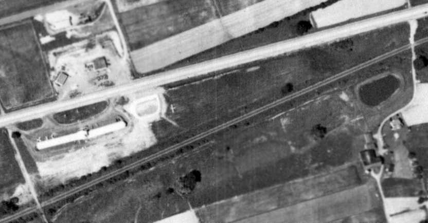
The only photo which has been located showing an aircraft at Stone Castle Motel Airport was a 6/8/59 USGS aerial view.
According to an article in the 3/15/15 Daily Item, the Stone Castle Airport was built in 1958 by Bloomsburg contractor Clyde Yohey,
along with a small private airport runway behind the motel.
The earliest photo which has been located of Stone Castle Motel Airport was a 6/8/59 USGS aerial view.
It depicted one single-engine light aircraft parked next to the motel,
with an unpaved northeast/southwest runway behind the motel.
Stone Castle Motel Airport was not yet depicted on the July 1960 NY Sectional Chart.
The earliest aeronautical chart depiction which has been located of Stone Castle Motel Airport was on the January 1961 NY Sectional Chart.
It depicted Stone Castle as a private airfield having a 1,700' unpaved runway.
In 1965, a single-engine plane was reportedly mounted on the roof of the Stone Castle Motel as an attention-getter.
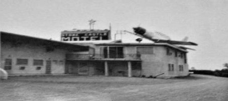
A January 1966 photo (courtesy of Christopher Posadas) of what appears to be a Vultee BT-13 Valiant mounted on the roof of the Stone Castle Motel as an attention-getter.
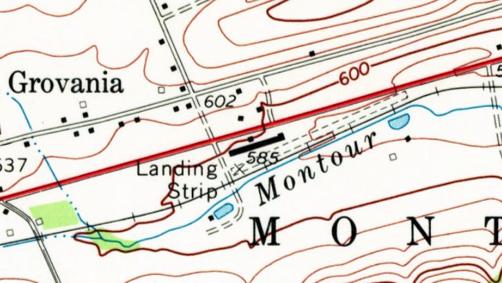
The 1969 USGS topo map depicted the Stone Castle Motel Airport as an unpaved northeast/southwest runway, labeled simply as “Landing Strip”.
Nathan Milarta recalled, “I've seen an airplane land at the Stone Castle Motel Airport once while driving by on the highway.
Being an airplane buff I was shocked to see an airplane land in such a small space. I was shocked that there was even a landing field there!
It's such a small piece of land. No idea why anyone would want to risk flying in & out of that!
I've also seen an airplane parked behind the Motel on a few occasions. My time frame of seeing aircraft there was around 2000-2005.”
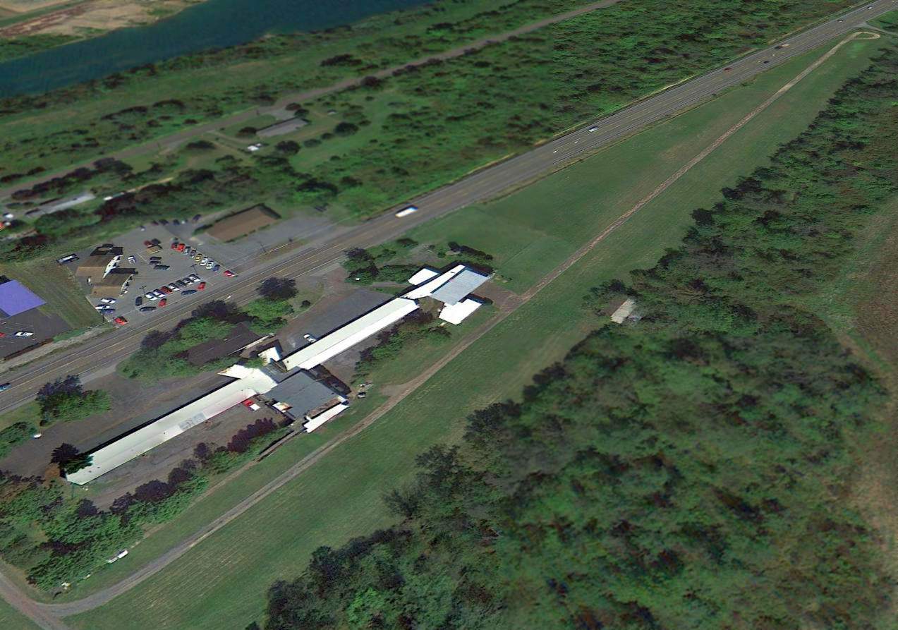
A 2012 aerial view looking northeast showed the Stone Castle Motel Airport runway remained intact, though deteriorated.
There was no sign of any recent aviation usage.
A circa 2013 aerial view looking north showed the Stone Castle Motel Airport runway remained intact, but very narrow (only ~12' wide), and uncomfortably close to the hotel buildings.
The last aeronautical chart depiction which has been located of Stone Castle Motel Airport was on the 2015 NY Sectional Chart.
It depicted Stone Castle as having a 1,700' paved runway.
According to an article in the 3/15/15 Daily Item, John Yohey (son of the motel & airport founder) said the runway had been recently decommissioned.
The motel property was sold to the owner of a nearby recreational vehicle business,
with the intent of removing the motel to provide a 2nd location for the RV business.
A 5/26/15 aerial view by John Clifford looking southwest at the site of the Stone Castle Motel Airport.
John reported, “It appears that the Stone Castle Motel is being demolished (including, I presume, the airport).
The airport is still charted on the Washington Sectional.
It appears the main building is in the process of being torn down. The runway seems to be intact so far.
I've never landed there, but I've flown over it several times. It always sort of struck me as a place I'd only want to land in an emergency.
The runway basically runs right up to US 11, it's quite short, there are trees & power lines encroaching from nearly every angle.
The Motel was a dive. I suspect we're at the end of an era”
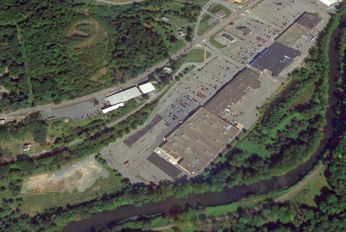
A September 2019 photo showed a new building of Susquehanna RV occupying the site of the Stone Castle Motel.
The site of Stone Castle Motel Airport is located southeast of the intersection of Route 11 & T332.
Thanks to John Clifford for pointing out this airfield.
____________________________________________________
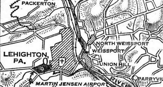
Martin Jensen Airport / Lehighton Airport, Lehighton, PA
40.827, -75.725 (Northwest of Philadelphia, PA)
The location of Martin Jensen Airport, as depicted on the 7/26/29 Commerce Department Airway Bulletin (courtesy of Mike Denja).
According to Bob Beck, “Lehighton Airport was established by Martin Jensen in 1928.”
The earliest depiction which has been located of this airport was in the 7/26/29 Commerce Department Airway Bulletin (courtesy of Mike Denja),
which listed it as Martin Jensen Airport.
The 7/26/29 Commerce Department Airway Bulletin (courtesy of Mike Denja) described Martin Jensen Airport as a municipal airport owned & operated by the Lehighton Chamber of Commerce.
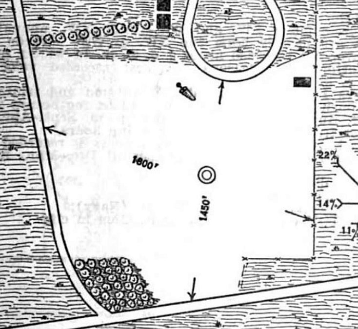
It was depicted as an irregularly-shaped sod field, measuring 1,600' west-northwest/east-southeast, with 1 building on the northeast side.
According to Bob Beck, “Lehighton Airport... After 2 years [in 1930] it was taken over by Jake Arner.”
The earliest aeronautical chart depiction which has been located of Lehighton Airport was on the August 1932 NY Sectional Chart.
It depicted Lehighton as a commercial/municipal airport.
The Airport Directory Company's 1937 Airports Directory (courtesy of Bob Rambo)
described Lehighton as a commercial airport, “adjacent to fair grounds within city limits to the west”.
The field was said to consist of a 50-acre rectangular sod area measuring 1,800' x 1,450'. A hangar was said to have “Lehighton” on the roof.
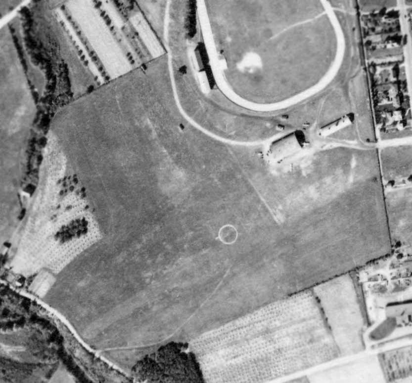
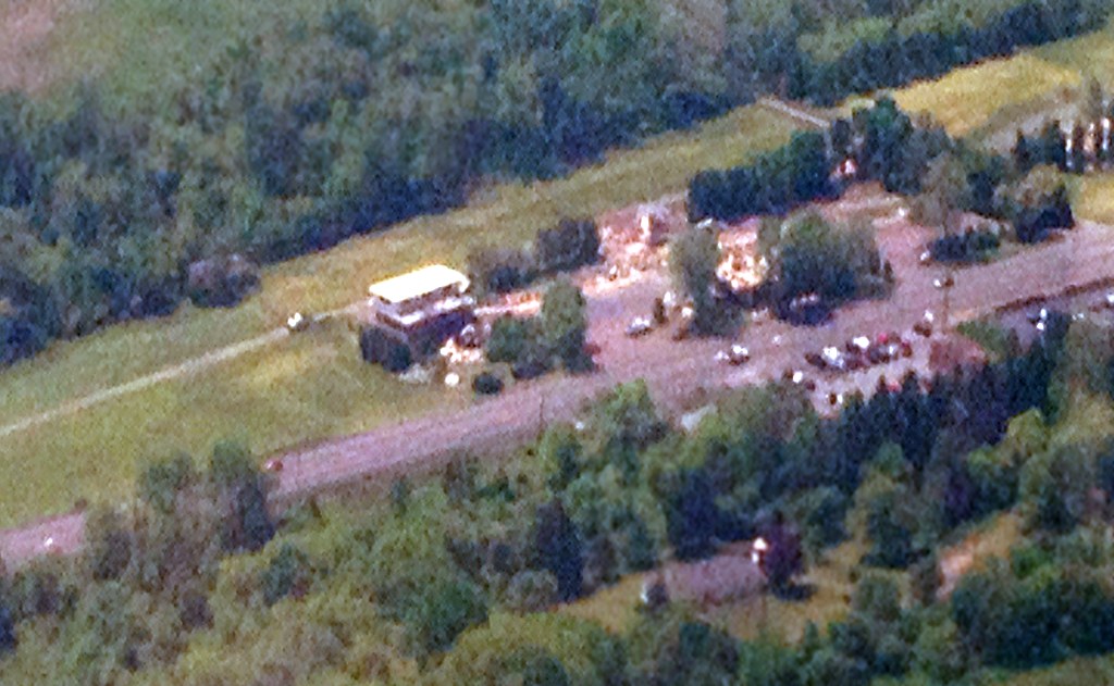
The earliest photo which has been located of Lehighton Airport was a 1938 aerial view (courtesy of Chris Kennedy), showing the circular airport symbol in the center.
The field consisted of 2 grass runways, with a hangar & another small building on the northeast side of the field, around which were visible at least 2 small planes.
The November 1942 Washington Sectional Chart (courtesy of Ron Plante) depicted Lehighton as a commercial/municipal airport.
Lehighton Airport, as depicted on the 1943 USGS topo map.
The 1945 AAF Airfield Directory (courtesy of Scott Murdock) described Lehighton Airport
as a 54 acre irregularly-shaped field having 2 sod runways, measuring 1,800' ENE/WSW & 1,400' NNW/SSE.
The field was said to have a single 120' x 80' concrete block hangar.
The airport was described as being owned & operated by private interests.
A 1952 aerial view showed 5 single-engine aircraft parked around Lehighton's hangar.
A 1962 aerial view by Marv Ritter looking northeast at the snow-covered turf runways of the Lehighton Airport.
Marv flew out of Lehighton in the early 1960s.
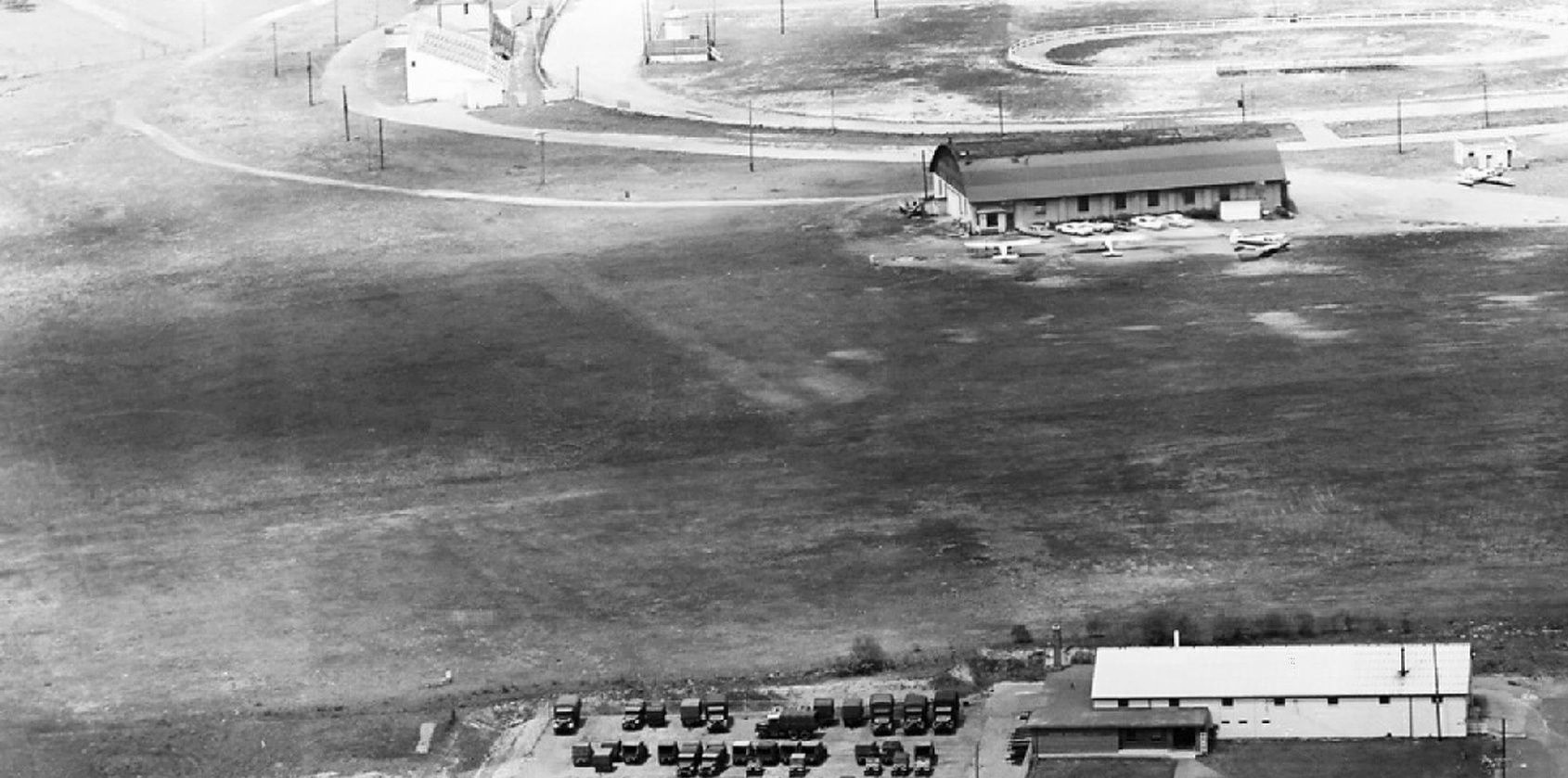
The last photo which is available showing Lehighton Airport still in operation was a 1963 aerial view looking north (courtesy of Mike Denja),
which showed 4 light single-engine aircraft parked around Lehighton's hangar.
Bob Beck recalled of Lehighton Airport, “I learned to fly there in 1965 & remember many old pictures on the walls.”
The last photo which has been located showing Lehighton Airport still in operation was a 1970 aerial view,
which showed 3 single-engine aircraft parked around Lehighton's hangar.
Bob Beck recalled, “Lehighton Airport was... operated by Jake Arner until it was closed.
It was closed & replaced by the Carbon County Airport about 1970.”
The last aeronautical chart depiction which has been located of Lehighton as an active airport was on the June 1972 NY Sectional Chart.
It depicted Lehighton as having a 1,700' unpaved runway.
The 1975 NY Sectional Chart (courtesy of Mike Keefe) no longer depicted Lehighton Airport,
instead showing the replacement Carbon County Airport which had been built to the southwest.
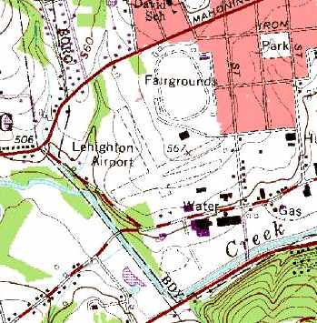
Lehighton Airport was still depicted on the 1985 USGS topo map with 3 unpaved runways.
The 1999 USGS aerial photo showed that the site of Lehighton Airport had been used to construct a high school.
The slightest traces were still perceptible of the former north/south & east/west runways,
but there did not appear as if any buildings still remained from the airport.
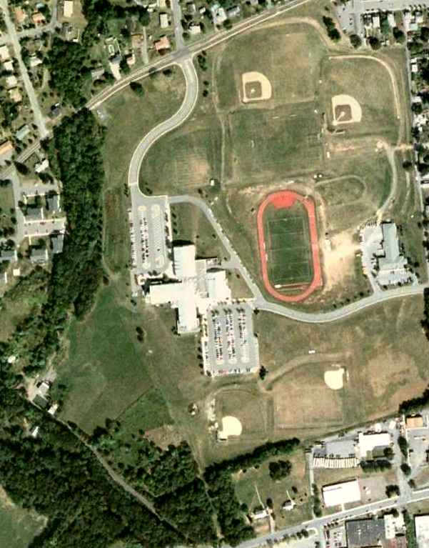
A 5/28/08 aerial view showed no trace remaining of Lehighton Airport.
The site of Lehighton Airport is located west of the intersection of Union Street & South 9th Street.
____________________________________________________
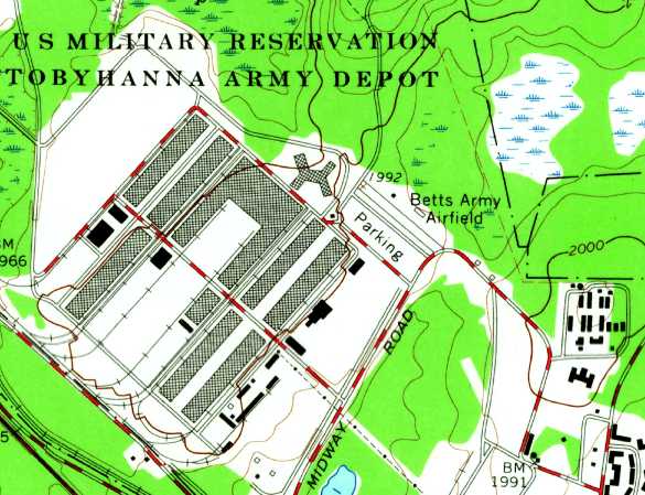
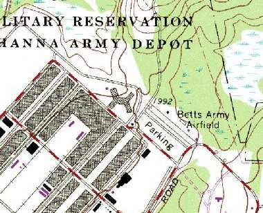
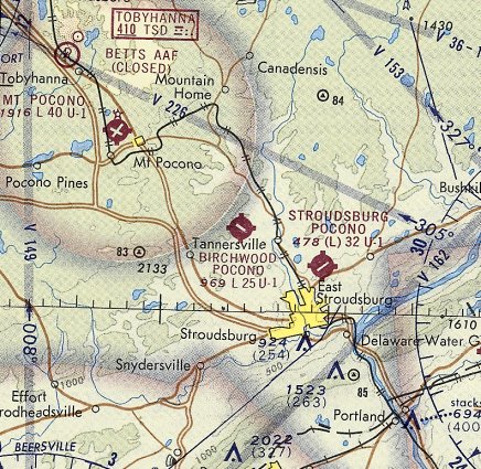
Tobyhanna Army Airfield / Betts Army Airfield, Tobyhanna, PA
41.195, -75.426 (West of New York, NY)
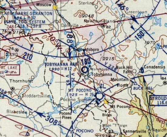
Tobyhanna AAF, as depicted on the June 1956 NY Sectional Chart.
This small military airfield was located on the grounds of the Tobyhanna Army Depot.
The military first established an artillery training ground on the site in 1912.
Tobyhanna was selected as an anti-aircraft artillery training site in 1941,
but this use did not last for long, as the size of the property was not sufficient for modern AAA guns.
Later in the war, Tobyhanna began to be used as a depot.
During WW2, Tobyhanna had several designations,
including the Army Air Force Service Units Training Center & the Tobyhanna Air Corps Storage Depot.
A variety of supplies & material was stored here,
most notably crated gliders destined for use in the D-Day invasion of Normandy & other airborne operations in Europe.
After the end of WW2, one activity conducted at Tobyhanna was the disposal of excess gliders stored at the installation.
These were made available for sale to the general public & proved quite popular.
More than 450 were sold at a grand total of $75 each.
Ironically, it was not the powerless aircraft which local residents sought,
but the high-quality lumber that made up the glider's storage box.
This wood was converted into home additions, porches, and even small cottages by many area residents.
The gliders themselves often were discarded or abandoned in the woods.
The military departed from Tobyhanna in 1945, but then reestablished the base in 1951.
Only a "warehouse" (no airfield) was depicted at Tobyhanna on the January 1956 NY Sectional Chart.
The earliest depiction which has been located of Tobyhanna AAF was on the June 1956 NY Sectional Chart.
It depicted Tobyhanna AAF as having a very short 1,200' paved runway.
Tobyhanna's runway was located adjacent to the east side of the large complex of depot buildings.
The airfield was built to serve the needs of the depot,
like several other Army depots which had similarly sized small airfields (like the Sacramento Army Depot).
According to Frank Zardecki (Deputy Commander of the Tobyhanna Army Depot),
“Tobyhanna AAF/ Betts AAF was in operation [starting] from 1957.
The airfield was used to perform retrofit & upgrade of avionics equipment.
The depot airfield had a 1,150' x 50' macadam runway.
The airfield facilities consisted of a control tower, a 60' x 120' Butler-type hangar, lighting, hardstand, refueling and emergency facilities.”
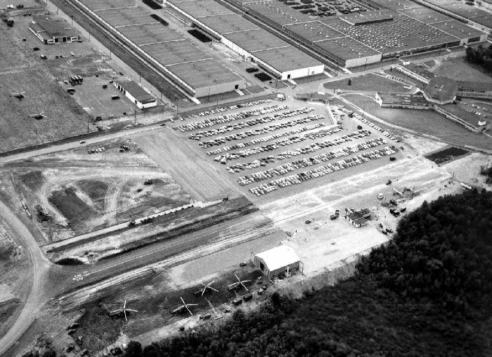
A 1957-59 aerial view looking west at Tobyhanna AAF (courtesy of Frank Zardecki).
The airfield consisted of a single northwest/southeast paved runway, with a single hangar.
A total of 9 aircraft were visible on the field: 2 small 3-bladed helicopters at left,
4 larger 4-bladed helicopters at the bottom, and 3 single-engine taildragger aircraft on the right.
The massive depot fills the background.
According to Frank Zardecki, “The peak years were 1957-59 when over 1,500 aircraft / year received avionics upgrades.
These included H-19s, H-34s, H-21s, H-37 helicopters & L-19s, U-1As, U-8 fixed-wing aircraft & various other aircraft.”
The 9/17/58 USAF & USN Radio Facilities Chart (according to Todd Keator)
described Tobyhanna AAF as having a 1,200' paved runway, lighted by flare pots.
The earliest photo which has been located of Tobyhanna AAF was a 5/9/59 aerial view (from Penn Pilot).
It depicted the field to consist of a single short paved northwest/southeast runway.
A hangar, ramp, and 2 light aircraft were visible on the northeast side of the runway.
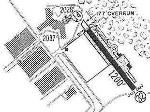
The 1960 Jeppesen Airway Manual (courtesy of Chris Kennedy) depicted Tobyhanna AAF as having a single 1,200' paved Runway 14/32 (with a 177' overrun on the northwest end).
A ramp was depicted on the east side of the field, with 2 small buildings (hangars?).
According to Frank Zardecki (Deputy Commander of the Tobyhanna Army Depot),
“On 8/23/61, Cpt. Clifford Betts was killed & 2 crew members were injured
in an H-21 that crashed in heavy fog returning to Signal Corps Depot, Tobyhanna.
Thus the name Betts Army Airfield.”
A 1963 aerial photo depicted the single paved runway, but no aircraft were visible on the field.
The airfield had been renamed Betts AAF by the time of the 1965 New York Sectional Chart (courtesy of John Voss),
and it had also gained its own NDB navigational radio beacon.
The earliest topo map depiction which has been located of Betts AAF was on the 1965 USGS topo map,
which depicted Betts as having a single short northwest/southeast runway, with 2 buildings on the northeast side.
According to Frank Zardecki, “The NDB code was TSD (Tobyhanna Signal Depot).”
Betts AAF was still depicted as an active airfield on the 1967 NY Sectional Chart (courtesy of Mike Keefe).
According to Frank Zardecki (Deputy Commander of the Tobyhanna Army Depot),
“Tobyhanna AAF/ Betts AAF was in operation through 1967.”
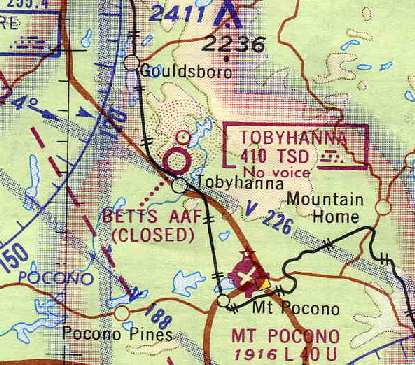
Betts AAF was closed by 1969, as it was labeled "Betts AAF (Closed)" on the 1969 NY Sectional Chart (courtesy of Chris Kennedy).
However, Tobyhanna was apparently still used for some aviation operations for at least a few more years, as reported by Tom Beamer:
"Tobyhanna was / is a Signal Corps depot & overhauled/modified GCA radars for the Army.
I was based at Mt Pocono in 1970-72 & the depot had a C-45 & L-20 at Mt Pocono.
When a GCA radar required calibration the parking lot was closed
and low approaches were made to Betts AAF in both aircraft although only the Beaver actually landed there.
In the spring of 1971 after a severe winter that left 6' snow banks at the edges of the runway
(I remember it as a beautiful day in April) I returned in my E-18S
to see the depot's Beaver on it's back in a snow bank alongside the runway.
Both the C-45 & Beaver were replaced shortly thereafter with a T-42 (Beech Baron)
which landed at Betts AAF a few times prior to closure circa 1972."
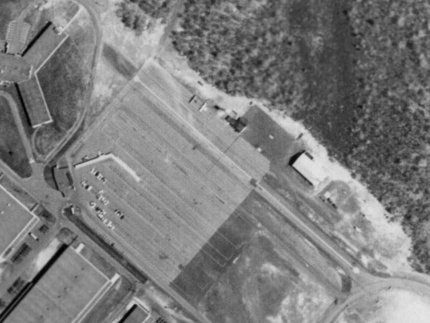
The 1992 USGS aerial photo showed that the Tobyhanna runway had been absorbed into the adjacent automobile parking lot.
However, showing that you can't always trust the USGS topo maps, the runway of Betts AAF was still depicted on the 1995 USGS topo map,
even though the USGS aerial photo from 1992 (3 years prior) showed that the runway had already been covered over by a large automobile parking lot.
As of 2003, the only airfield facility still listed as active on the grounds of Tobyhanna
was the Tobyhanna Army Depot Heliport, located 4 miles east of the site of Betts AAF.
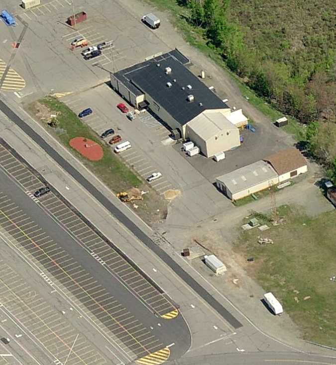
A circa 2008 aerial view looking north at the former hangar which remains standing at the site of Betts AAF,
along with the location of the southern end of the runway, incorporated as part of the parking lot.
Frank Zardecki reported in 2010, “Today Tobyhanna is the largest Communication-Electronics depot in the Department of Defense & has over 5000 employees.
The current helipad, 17PN, is approximately one mile southwest of the old airfield.”
A 5/28/08 aerial view of the site of Betts AAF.
As of 2023, street maps labeled the former Betts AAF hangar as the Mack Fitness & Recreation Center.
The site of Betts AAF is located north of the intersection of Midway Road & McDonough Road.
____________________________________________________
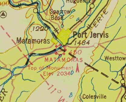
Merrill-Ronne Airport / Matamoras Municipal Airport, Matamoras, PA
41.362, -74.697 (West of New York, NY)
A postmark commemorating the 5/31/30 Dedication of Merrill-Ronne Airport.
Merrill-Ronne Airport was located on the western bank of the Delaware River, on the PA-NY border.
A postmark commemorated the 5/31/30 Dedication of Merrill-Ronne Airport.
The earliest directory listing which has been located of this field
was in the 1934 Department of Commerce Airport Directory (according to Chris Kennedy).
It described "Matamoras (Merrill-Ronne Airport)" as having 2 sandy loam runways, with the longest being 1,800'.
(from the Dallin Aerial Survey Collection, courtesy of Barbara Hall, copyright of the Hagley Museum & Library, Wilmington, DE).
The runways were apparently being paved at this point, as several steamrollers were visible along the runways.
The Airport Directory Company's 1937 Airports Directory (courtesy of Bob Rambo)
described Merrill-Rhone Auxiliary Airfield as having 2 "sandy loam" runways, with the longest being 1,800'.
A 5/7/37 aerial view of looking northwest at Matamoras Airport (from the Dallin Aerial Survey Collection, courtesy of the Hagley Museum & Library)
depicted the field as having hangar & 3 asphalt runways.
John Durant observed that “the mysterious extremely short paved runway was appropriate for the increasingly important autogyros of the era.”
The Airport Directory Company's 1938 Airports Directory (according to Chris Kennedy)
described Matamoras Municipal Airport as having 3 macadam runways.
Matamoras was depicted as a municipal airport on the August 1938 NY Sectional Chart (courtesy of Chris Kennedy).
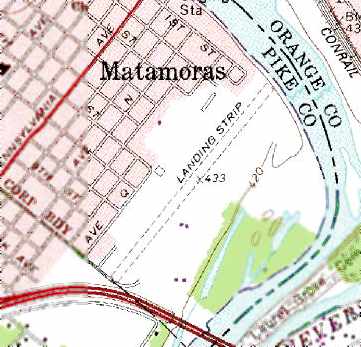
The earliest topo map depiction which has been located of Matamoras Airport was on the 1943 USGS topo map,
which depicted Matamoras simply as an open area with a single building on the northwest side.
John Durant recalled, “Matamoras in the 1940s... I spent many hours idling in the vicinity.
Some time during the War they added a long low frame hangar down near the river for Army flight training.”
The 1945 AAF Airfield Directory (courtesy of Scott Murdock) described Matamoras Municipal Airport
as a 106 acre irregularly-shaped field having 2 bituminous macadam runways, measuring 1,725' northeast/southwest & 1,525' north/south.
The field was said to have a single 100' x 80' concrete block hangar.
The airport was described as being owned by the City of Matamoras & operated by private interests.
Tom McCune recalled, “In July 1952, when I was 16 & on vacation in the Pocono Mountains with my parents,
I began flying lessons at the Dervend Flying School, which was a half-hour drive from our vacation home.
Zeki Dervend was the operator of the airfield & the school, and my instructor was Tony Farrell.
Tony, who I think had been a pilot in WWII, was a very easy-going guy & a good instructor.
The training aircraft was a 2-seat (tandem) Aeronca 7AC Champion powered by a 65Hp Continental engine.
Flight instruments included a magnetic compass, air speed indicator, and turn & bank indicator, but no radio.
The airspace around Matamoras was uncrowded, so it was a good place to learn to fly.
The Champ was a very well-designed airplane.”
Tom continued, “On completing the minimum of 8 hours of instruction, all with Tony Farrell, I soloed at Matamoras on 8/26/52.
That was a pretty heady event for a teenager, especially since I was not yet eligible for a driver's license,
the age in New Jersey (where my permanent home was) being 17.”
Tom continued, “The next summer I returned to Dervend Flying School
and under Tony Farrell's instruction, completed the requirements for a private pilot's license.
On my solo cross-country training flights, I navigated point to point, referencing the aeronautical chart tied to my leg.
Because I had no radio, if my destination airport had a control tower,
I had to circle the airfield until someone in the tower saw me & flashed me a green light, indicating I was cleared to land.
On 9/7/53, Tony Farrell flight checked me & wrote in my Pilot Log that I was 'capable of Accomplishing the Private Pilot Flight Test.'
I did so the next day under the watchful eye of Zeki Dervend. So I had my private pilot's license when I was 17.”
Tom continued, “My usual approach was from the northeast over the Delaware River (Runway 4/22)
and roughly the first half of the runway on this approach was turf & the other half, downfield, was paved.
I typically landed & rolled out on the turf, so I had plenty of extra runway if I needed it.”
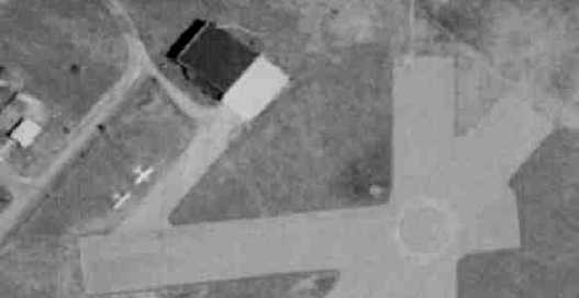
A 1956 aerial view of Matamoras Airport depicted the field's unusual configuration, with 3 paved runways (including an inexplicably short east/west runway),
along with a grass area on the northeast side.
One hangar was located adjacent to the paved runways, and another hangar & one single-engine aircraft were visible adjacent to the grass area.
The 1957 PA Aeronautical Chart (courtesy of Mike Keefe) described Matamoras as having 3 bituminous or turf runways.
The longest runway was the 3,180' northeast/southwest strip, of which 1,700' was bituminous.
The operator was listed as the Dervend Flying School Inc., and the manager was listed as Zeki Dervend.
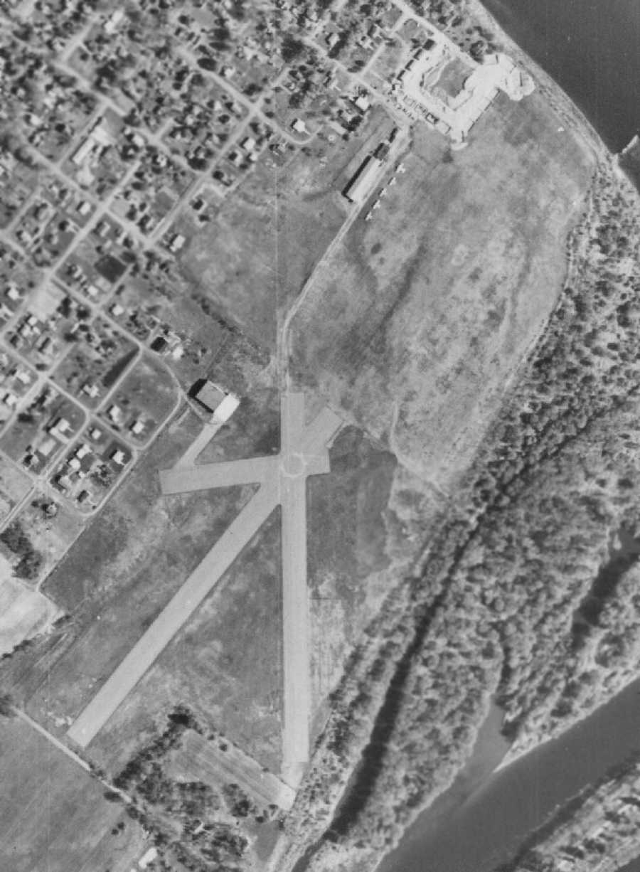
A 5/5/59 aerial view of Matamoras Airport (from Penn Pilot)
depicted the field's unusual configuration, with 3 paved runways (including an inexplicably short east/west runway),
along with a grass area on the northeast side.
One hangar was located adjacent to the paved runways,
and another hangar & 5 light single-engine aircraft were visible adjacent to the grass area.
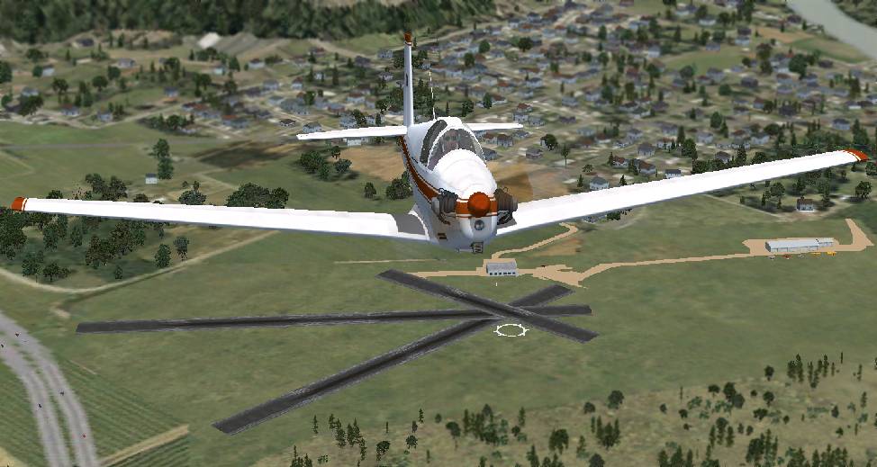
A Flight Simulator scenery re-creation by Richard Finley of a Mooney Mite overflying Matamoras Airport.
The 1962 AOPA Airport Directory described Matamoras Municipal Airport
as having 2 bituminous & turf runways: 3,182' Runway 18/36 & 2,259' Runway 4/22.
The operator was listed as Zeki Dervend.
The last photo which is available showing any aircraft at the Matamoras Municipal Airport was a 1963 aerial view.
It depicted 2 single-engine aircraft parked next to the hangar.
A 1965 aerial view depicted a total of 3 single-engine aircraft at Matamoras Airport.
Matamoras was still depicted as an active airport on the 1966 NY Sectional Chart (courtesy of Mike Keefe).
However, within the next year, Matamoras Municipal Airport was renamed as "Dervend" Airport
(apparently named after Matamoras Airport operator Zeki Dervend).
The runway configuration had been significantly reduced, however,
as the 1967 NY Sectional Chart (courtesy of Mike Keefe) depicted Dervend Airport
as having only a 1,500' unpaved runway.
"Dervend" Airport, as depicted on the 1969 NY Sectional Chart (courtesy of Chris Kennedy).
A 1970 aerial view showed that Matamoras' 3 paved runways were all marked with closed-runway “X” symbols,
and “closed” was painted along the primary runway.
There were no aircraft visible on the field.
No aircraft were visible on the field in a 1975 aerial view.
Dervend Airport was still depicted on the 1975 NY Sectional Chart (courtesy of Mike Keefe).
It was still labeled Dervend Airport on the 1976 USGS topo map.
George Hedinger recalled that "had a little part in the demise" of Matamoras/Dervend Airport.
"In the early 1980's the ultralight aircraft boom began.
A guy started a business known as Mid-East Ultralites at Sussex airport across the river in NJ.
As business grew & we tangled with the regular traffic at Sussex, he looked for somewhere quieter to move to.
He found Dervend which was largely abandoned, except for one lone Cessna 150 in the hangar.
The old farts living in the houses next to Dervend were used to their peace & quiet.
Suddenly, early every morning, ESPECIALLY Saturdays & Sundays,
they were now awakened by the drone of our noisy 2 stroke Kawasaki engines
(everyone knows the BEST time to fly an ultralight is early when it's calm!).
I believe this was the summer of 1982.
One summer of this was all they could stand & by 1983 they managed to get Mid-East evicted somehow.
It was not long afterward that they got the town to build the playground & baseball fields across the end of the runway so it could never be used again."
Dervend Airport was evidently officially closed by 1982,
as it was not listed among active airfields in the 1982 AOPA Airports USA directory (courtesy of Ed Drury).
Runway4/22 was still depicted on the 1983 USGS topo map, but it was labeled simply "Landing Strip".
George Hedinger recalled, "The hangar was still there into the early 1990s. I know because I stopped by to take a look one summer day.
I was only there about 30 seconds before one of the old geezers came out of a nearby house yelling & chased me out of there!”
A 1995 aerial photo showed that several baseball diamonds had been built around the former runways at some point between 1975-95.
A 2001 aerial picture looking northeast at the remains of Matamoras Municipal Airport by Philip K.
The former paved runways were still largely intact,
although several baseball diamonds had been built around the former runways.
The former hangar remained on a paved ramp just northwest of the former runway intersection.
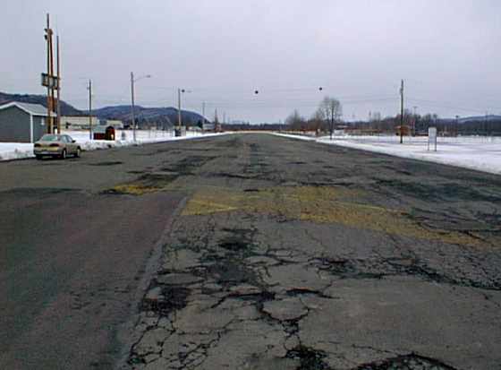
A 2004 photo by Charlie Helms looking north along the remains of Matamoras' Runway 4 (with the closed-runway 'X' still visible).
According to Charlie, “The runway is now used for parking & access to 'Airport Park'."
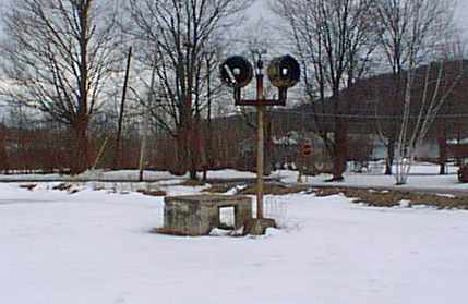
A 2004 photo by Charlie Helms of a "Light that remains near the south side of Runway 4/22;
it may have been in a parking or run up area."
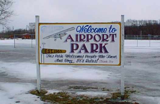
A 2004 photo by Charlie Helms of the sign for the park which occupies the site of the old airport.
A 2004 photo by Charlie Helms of the front & back side of what "Appears to be the only remaining building from the airport -
this hangar is now used by the Matamoras Fire Department."
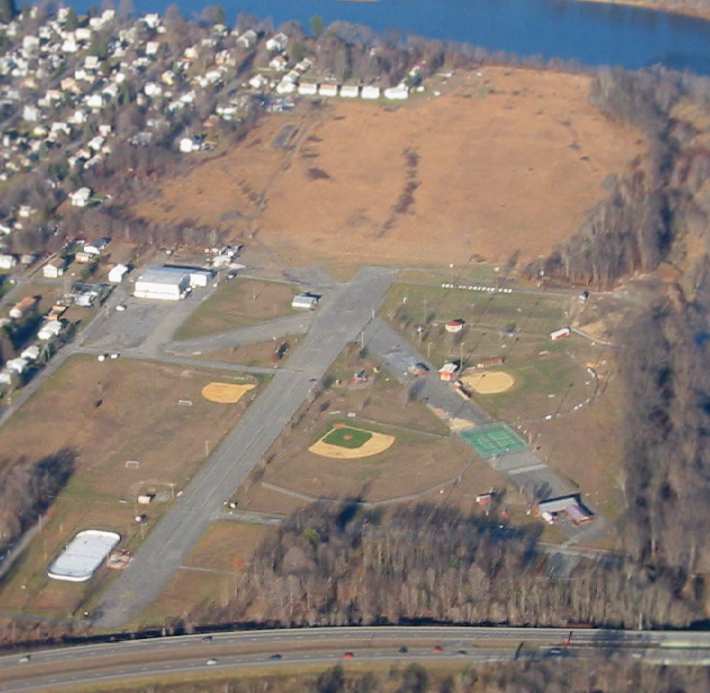
A 9/12/12 aerial view looking north at the remains of Matamoras Municipal Airport, showing the paved runways & hangar which remain,
A September 2019 photo looking southwest along the remains of Matamoras' Runway 22.
A September 2019 photo looking north at the former Matamoras Airport hangar.
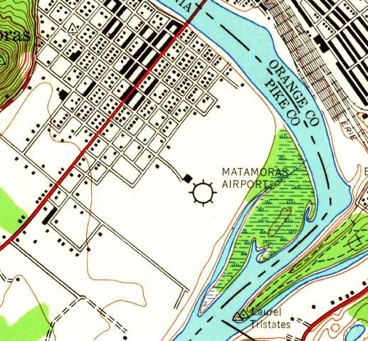
The site of Matamoras Municipal Airport is located north of the intersection of Interstate 84 & the Delaware River.
____________________________________________________
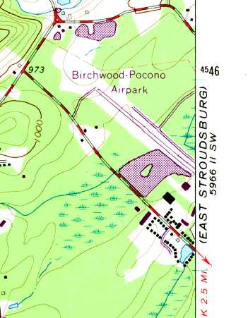
Birchwood Pocono Airpark, Tannersville, PA
41.063, -75.25 (West of New York, NY)
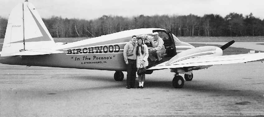
A 1960s photo (courtesy of Don Hamilton) of Don & his wife & Wally Hoffman, in front of a Piper Apache painted in Birchwood markings.
Nothing was yet depicted at this location on a 1963 aerial photo.
According to Tom Beamer, "Birchwood-Pocono Airport was built by Wally Hoffman, who was a Pan Am pilot.
Wally & his wife developed the Birchwood resort & he added the airport in the 1960s.
Prior to opening Birchwood Wally operated Mount Pocono Airport & founded Pocono Airlines with Beech 99s;
the airline eventually moved to AVP."
Constance Woods recalled, “The resort opened in 1953 & Wally built the airport sometime during the early 1960s.
When he was still flying for Pan Am he apparently flew his own plane to JFK to go to work.
The story also goes that he once landed a big twin-engine on that very short runway.
If anyone could have it would have been Wally! He was a character.”
Don Hamilton recalled, “My wife & I spent our honeymoon at the Birchwood resort. It was a beautiful place in [the 1960s].”
He recalled that Wally Hoffman “took us for a flight over the resort & the Delaware water gap as part of our honeymoon package.”
No airfield was yet depicted at this location on the 1966 USGS topo map.
A 1968 aerial photo showed a single northwest/southeast runway, which did not yet appear to be paved.
The Birchwood-Pocono Airport was not yet depicted on the April 1969 NY Sectional Chart (according to Chris Kennedy).
The earliest directory depiction of the Birchwood Pocono Airport which has been located was in the 1971 Flight Guide (courtesy of Chris Kennedy).
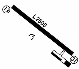
It depicted the field as consisting of a single 2,500' paved Runway 13/31, with a ramp at the southeast corner with 2 buildings.
According to Tom Beamer, "The airport was always a bit challenging but popular.
Sailplane rides were quite popular with the honeymooners."
The earliest aeronautical chart depiction which has been located of Birchwood Pocono Airport was on the January 1973 NY Sectional Chart (courtesy of Ron Plante).
It depicted Birchwood Pocono Airport as having a single 2,500' paved northwest/southeast runway.
Michael Demeyer recalled, “I started learning to fly gliders at Birchwood in 1973 as a junior in high school.
My instructor at Birchwood was Karl Nassauer, an ex-Luftwaffe pilot (Me-109) who loved to share stories from the war.
As I remember, the Stearman was usually flown by a burly guy who went by 'Moose'.
They had another towplane, too - I think a Cessna 207.”
The earliest topo map depiction of the Birchwood Pocono Airport which has been located was on the 1973 USGS topo map.
It depicted Bitchwood-Pocono Airpark as having a single paved northwest/southeast runway.
Steve Zimmermann recalled, "I spent a weekend there [Birchwood-Pocono Airport]
in the early days of the glider operation [approximately] in the spring of 1974."
"The story is that I got a call from the operator; he'd been in touch with the folks at Schweitzer Soaring School in Elmira, NY,
where I had completed a Commercial/CFI rating in gliders the summer before, in 1973.
They had recommended me; he was looking for someone to come sign off his new instructor (!)
in the 2-33 & 2-32 sailplanes they were going to start operating.
So I took a weekend away from college to earn a few bucks, and it turned out to be a very interesting time.
They were using a Stearman as the tow plane, and it was a crosswind day;
we had our hands full keeping the gliders behind the tow early in the takeoff roll,
and the Stearman pilot was having to use a lot of right-wheel braking to keep it straight on the runway at low speeds."
"At the end of a busy day of training & hopping rides, the tow pilot called down on the radio during the last tow of the day
to say he'd locked up the brakes on his right wheel just as he became airborne.
He flew around for an hour or so to burn off most of his fuel, hoping his brakes would cool off & the wheel would free up before he had to land.
In the end, he touched down on the concrete runway (too bad there wasn't enough grass parallel to the strip to land on),
held the locked right wheel off as long as he could; he finally put the wheel down doing about 20 knots,
and as the locked wheel bit the pavement slowly veered off to the side & nosed over on his back.
A sad sight, the Stearman upside down in the grass.
The pilot was fine & the airplane wasn't badly damaged, however, and I guess they got it flying again in a few weeks."
Lonnie McLaughlin recalled, "In the period between 1974-76,
I saw an advertisement for a course for power plane pilots to gliders.
The deal included a 5 day & 4 night stay at the resort (called 'Birchwood in the Poconos')
including all meals & use of the facilities, use of the glider, tow plane & instructor,
and guaranteed 10 flights - the minimum qualification for the license."
Lonnie continued, "I flew over there from Deer Park, L.I. (another field which no longer exists but where I learned to fly)
with my wife to look into it & discovered that Birchwood was a honeymoon haven
(complete with heart shaped tubs) but also had a miniature golf course, a bowling alley, skeet shooting,
a recreation room, bicycling, dancing, roller skating and other group activities.
The dining room was open for breakfast & supper & featured all you could eat of anything on the menu.
We discovered that they had an open bungalow & arranged to stay the night for $75 - including supper & breakfast.
I signed up for the package (cost less than $500), paid an extra $100 to bring my wife with me when I returned 3 weeks later
(she even got a ride in the Stearman tow plane one of the times it towed me up)."
Lonnie continued, "It was one of the best weeks of my life. I qualified for commercial glider, ate like a bear and was so busy I didn't gain an ounce.
By the way, being trained at Deer Park's 2,100' runway,
the Birchwood strip was no problem for my 1969 Piper TriPacer."
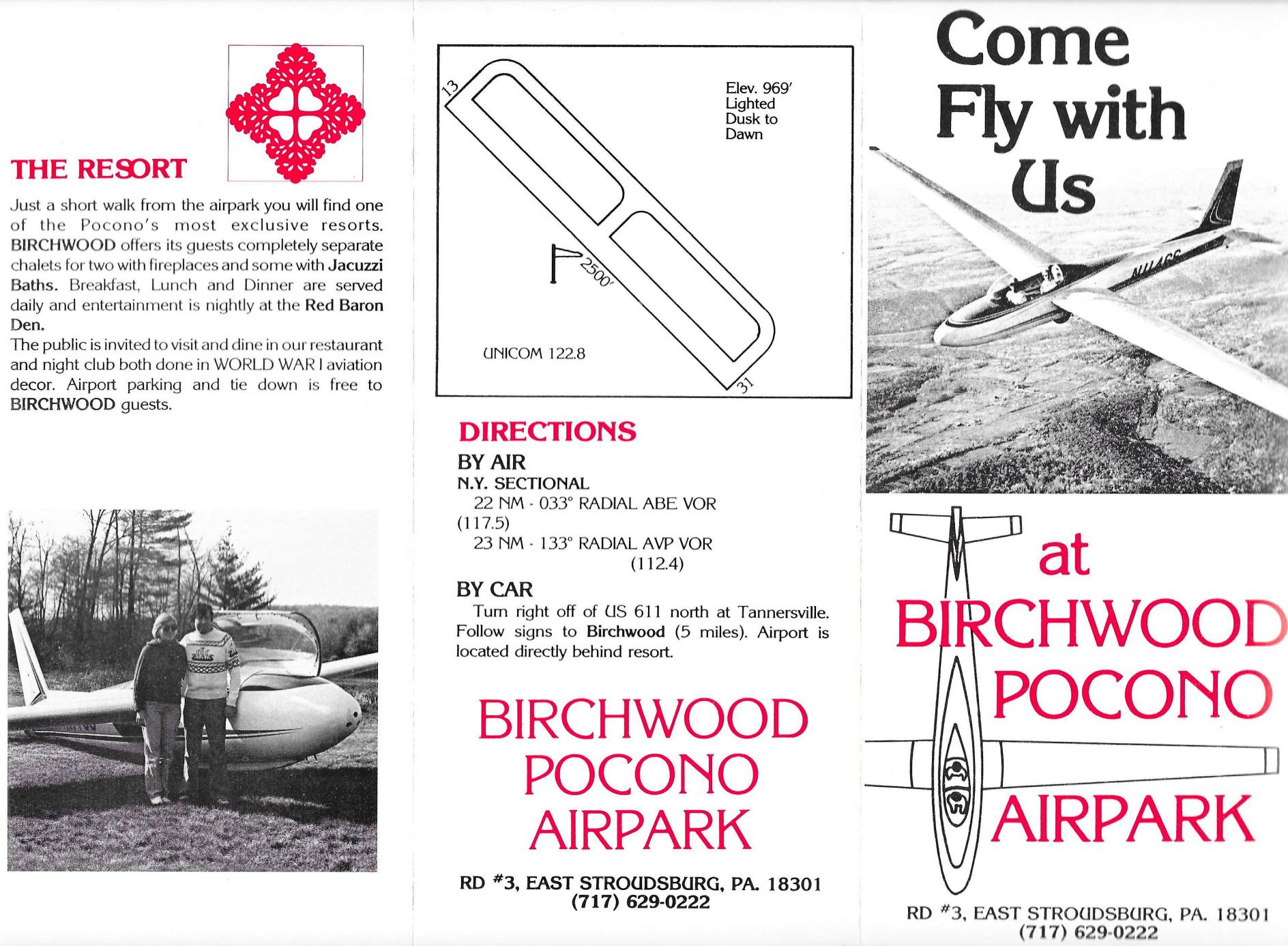
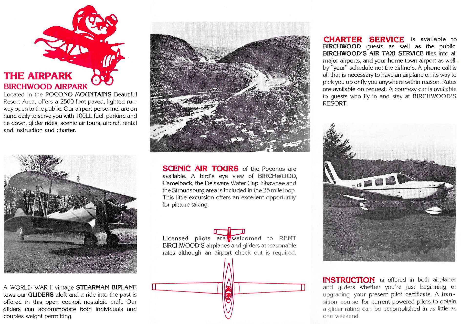
A 1978 Birchwood Pocono Airpark brochure (courtesy of Steve Webster).
Steve Webster recalled, “The airport was an attraction for the resort. It was never profitable.
When I became the manager, my request for money to promote the airport itself was met with a pretty meager budget.
Two colors & black & white photos is all we could afford for that brochure. Compared to the resort brochure, it looked pretty cheap.
That didn’t stop me from stuffing it into every tourist info rack all over the Poconos.”
A 1978 Birchwood Pocono Airpark brochure (courtesy of Steve Webster).
An undated aerial view looking north at Birchwood Pocono Airpark from a 1978 brochure (courtesy of Steve Webster)
depicted a single paved northwest/southeast runway, with a hangar, ramp, and several light aircraft on the south side.
Steve Webster recalled, “I have good memories when I worked at Birchwood Airport when it was in its heyday.
In 1978 Wally Hoffman hired me for the job of Airport Manager. I flew air tours, towed & flew gliders, gave instruction, and did some air taxi work.
Our fleet consisted of 2 Cessna 172s, a Cessna 207, a Piper Cherokee 6, 3 gliders & a Stearman!
I moved on in late 1979 but continued to work there part-time.”
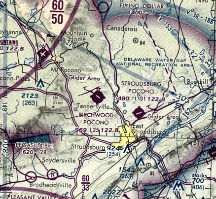
The June 1981 NY Sectional Chart (courtesy of Ron Plante) depicted Birchwood Pocono Airport as having a single 2,500' paved runway.
Steve Webster recalled, “In the early 1980s airport operations ceased but the resort & the airport’s runway remained opened to the public.
Wally decided to sell all of the aircraft, so I purchased one of his 172s with a partner in 1982.
My partner was Moose who was the 'burly guy' mentioned in one of the previous comments.
He was flying the Stearman when it went over on its back.
Wally continued to visit the Poconos after he moved to Florida.
He would come back every Fall with his new wife Gail & invite all of his former employees from Birchwood out to dinner.”
Birchwood Pocono was listed in the 1986 Flight Guide (according to Chris Kennedy),
which described the field as having a single 2,535' "rough" paved Runway 13/31.
An aerial view looking west at the ramp & hangar at Birchwood Pocono, showing over 2-dozen light aircraft parked on the ramp.
The photo was on the cover of the 10/87 issue of New England Weekend Flyers (courtesy of Jay Friedman).
Constance Woods recalled, “My husband was the General Manager of the Birchwood Resort from 1990-96 & we lived on the property of the Resort.
Wally Hoffman ended up with bad luck after his divorce.
Unfortunately for Wally, the bank ended up taking over the property which had been heavily mortgaged to support his airline.
This is when my husband was brought in. We met Wally numerous times as he continued to come back to visit & fly in.”
Constance Woods recalled, “The airfield was in operation when we arrived.
There was a wonderful older gentleman named 'Mickey' that operated the glider rides & sightseeing tours based at the airfield.
Mickey was German & had amazing stories about his time with the German Army as a pilot.
I think Mickey had been around Birchwood for years & was an old & dear friend of Wally's.”
The last aeronautical chart depiction which has been located of Birchwood Pocono Airport
was on the May 1991 NY Sectional Chart (courtesy of Ryan Miller).
It depicted Birchwood Pocono Airport as having a single 2,500' paved runway.
The 1992 USGS topo map depicted the Birchwood Pocono Airpark as having a single paved runway.
Constance Woods recalled, “On a pretty weekend in the 1990s the Resort still had numerous fly-ins for breakfast, lunch, dinner or the whole weekend.
It was a sight to see. I flew with Mickey on a number of occasions & it was always a treat.
I did hear pilots complain though about the crosswind that could kick up from the lake.
The lake was actually dug out to build the airfield.
On a number of occasions we would see pilots circle the runway a couple of times before landing...
I suppose trying to figure out how to deal with the wind.”
The Birchwood Pocono Airfield was evidently closed at some point between 1991-93, as it was no longer depicted on the December 1993 NY Sectional Chart (courtesy of Ron Plante).
According to Tom Beamer, "Unfortunately the resort & the airport fell on hard times
when the Hoffman's personal honeymoon ended in divorce court."
Constance Woods recalled, “Sadly, the PAA & FAA forced Birchwood to close the airport.
There are trees to one end that are not on Birchwood property.
There was concern that the trees had grown too tall for a safe approach or takeoff.
Despite my husband's attempts to get the neighbors to agree to some pruning the trees remained & the airport closed. It was sad.
There was a certain charm about a resort with its own airport, etc.
The resort was sold in 1996 & my husband & I returned to the South.
According to Aaron Gould, "The last time I flew over it, it appeared to be a single concrete strip with few signs of maintenance.”
A 1999 aerial picture looking north at Birchwood Pocono Airpark (after the field's closure) by Philip K.
The airfield consisted of a single 2,500' paved runway
(which was still marked with a displaced threshold for Runway 32, halfway down the length of the strip).
A parallel taxiway sat alongside, and a ramp with a single hangar sat at the southeast end of the runway.
Jay Friedman reported in 2003, "I flew over the Birchwood Pocono Airport last week.
The prevailing winds favored taking off to the west.
The runway has a significant uphill slope in that direction & points you towards rising hills.
I was told that after a 'few' accidents the resort decided to close the runway due to the liability involved.
The runway today has extensive grass growing through the concrete."
Constance Woods reported in 2005, “Since then it is our understanding that the Resort has fallen into disrepair
and is in fact no longer operational at all.”
As of 2007, the “Former Birchwood Resort” was advertised for sale for $4,500,000.
The description read: “Full service resort on 279 acres. Currently not in operation.
Secluded setting yet easy access from Route 611 & Interstate 80.
Most units with fireplaces & jacuzzi tubs. Amenities include: indoor and outdoor pools, gymnasium,
bowling alley, rifle range, nightclub, airstrip & hangar, plus much more!
Price reflects need for repairs for operation. Perfect for camp/retreat use!”
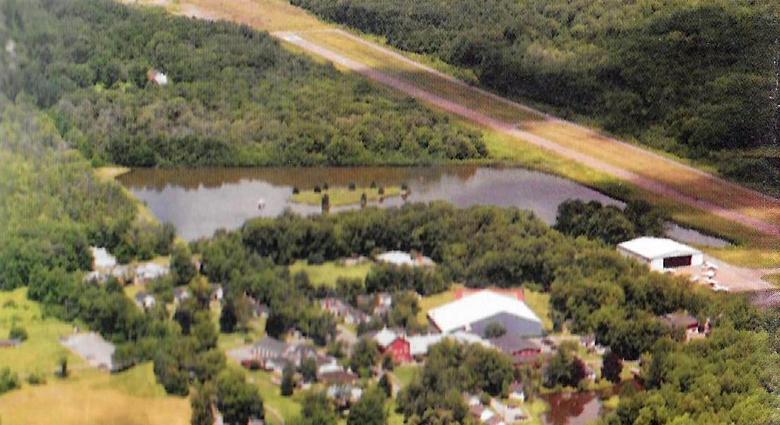
A 9/9/12 aerial view looking northwest at Birchwood Pocono Airpark.
Birchwood Pocono Airpark had a brief moment of notoriety in October 2014,
when fugitive murder suspect Eric Frein was captured after hiding out on the property.
Brad Kurlancheek reported in 2015 of Birchwood Pocono Airpark,
“During a bike trip in the area a few years ago, I'd happened on the resort adjacent to the airport.
All the buildings & facilities from the resort years are still standing, but they are undergoing serious decay. The entire resort is a wreck.
I was going to spend the night in the gym instead of camping out, but the place gave me the heebie jeebies.
What's funny is directly across the street from it are beautiful homes & well-kept lawns.”
Steve Webster recalled, “After he passed in 2017, Gail said Wally requested his ashes be spread over Birchwood.
In May of the following year I was honored to be the one to do it. We used my 172 that I had purchased from him so many years ago.”
An 8/19/19 aerial view by Joe Walmach looking north at the remains of Birchwood Pocono Airport.
A 4/14/23 aerial view by Steve Webster looking west at the remains of Birchwood Pocono Airport. What a shame to see this aviation infrastructure going to waste.
Steve Webster observed, “Unfortunately, the entire resort is in shambles now with some of the buildings burned out.
At the airport, the big hangar is still there. The runway is broken up & everything is overgrown. It breaks my heart to see it this way.”

A 3/22/25 aerial view by Ed Figuli looking east at Birchwood Pocono Airpark.
Ed reported, “Sadly the forrest is taking over & more trees are starting to grow on the runway.”
Birchwood Pocono Airpark is located east of the intersection of Cherry Lane Road & T535.
____________________________________________________
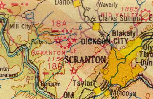
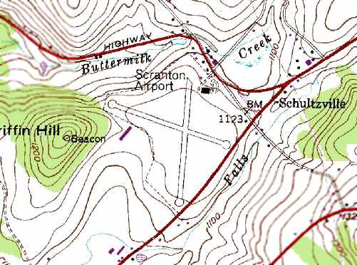
Scranton Municipal Airport, Schultzville, PA
41.48, -75.772 (West of New York, NY)
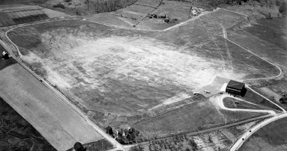
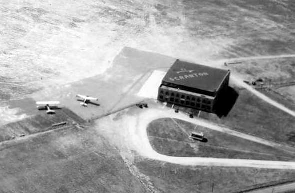
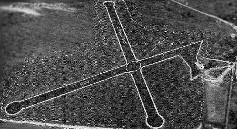
A 4/26/36 aerial view of Scranton Airport, from the Dallin Aerial Survey Collection,
courtesy of Barbara Hall, copyright of the Hagley Museum & Library, Wilmington, DE.
This facility opened in 1928 under the name of "Port Scranton".
It was built by the Scranton Airport Corporation.
At one time it also went by the name of Schultzville Airport,
and was eventually renamed Scranton Municipal Airport.
The 1934 Department of Commerce Airport Directory (according to Chris Kennedy)
described Scranton Airport " as having 3 sod runways:
2,500' east/west, 2,500' north/south, and 2,000' northeast/southwest.
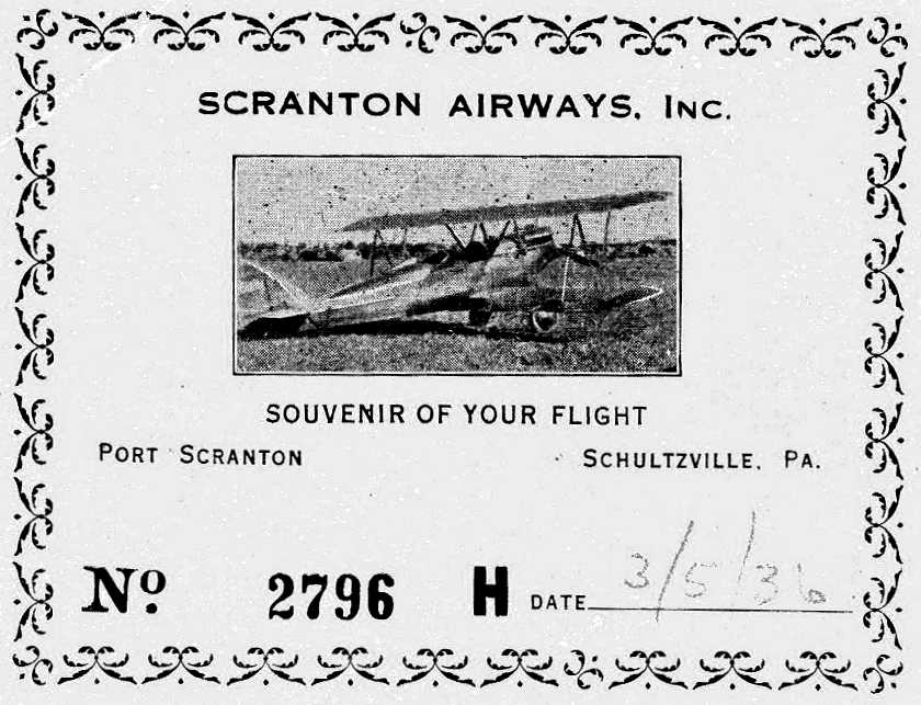
A 3/5/36 ticket for Scranton Airways Inc. (courtesy of Ralph Balfoort), showing an unidentified biplane.
courtesy of Barbara Hall, copyright of the Hagley Museum & Library, Wilmington, DE.
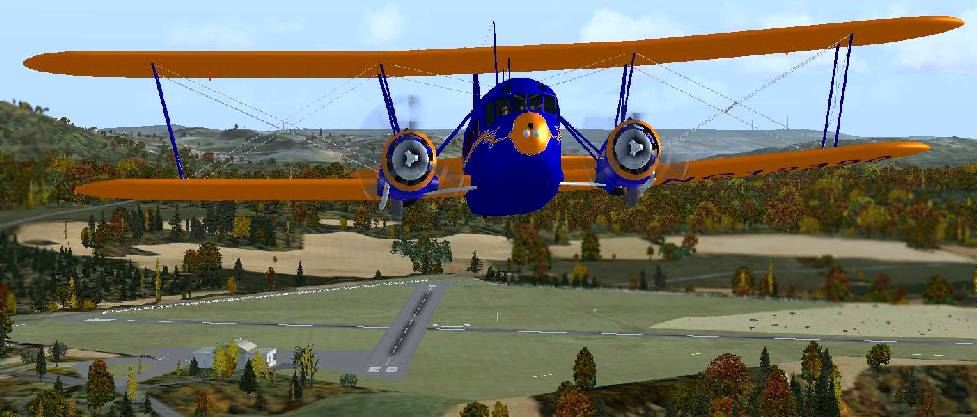
A Flight Simulator scenery re-creation by Richard Finley of a Curtiss Condor biplane overflying Scranton Airport.
Aerial view looking northwest at Scranton Airport,
from the Airport Directory Company's 1937 Airports Directory (courtesy of Bob Rambo).
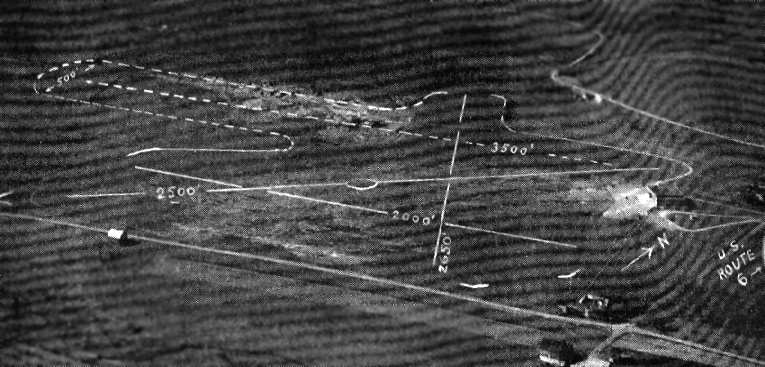
The directory described Scranton Airport as having 2 grass runways:
2,500' north/south & 2,000' east/west, although the east/west runway was described as being lengthened to 3,500').
The aerial photo in the directory depicted a single hangar on the east side of the field.
A 4/17/37 aerial view looking northeast at Scranton Airport (from the Dallin Aerial Survey Collection, courtesy of Barbara Hall of the Hagley Museum & Library)
depicted the field as having a grass airfield with a hangar on the northeast side.
The August 1938 NY Sectional Chart (courtesy of Chris Kennedy)
depicted Scranton as a municipal airport.
An undated aerial view looking northwest at Scranton Airport, from the Airport Directory Company's 1938 Airports Directory (courtesy of Bob Rambo).
The directory depicted Scranton Airport as having two 2,500' grass runways, and a single hangar on the east side of the field.

A 6/4/39 aerial photo (from PennPilot) depicted Scranton Municipal Airport as having 2 paved runways, with a hangar on the northeast side on which “Scranton” was painted.
According to Dick Miles, Scranton Municipal Airport was used during WW2 by the Army & Navy for primary flight training.
However, Scranton Municipal was still depicted as a civilian airport on the 1945 NY Sectional Chart (courtesy of Norman Freed).
The runways at Scranton were evidently paved at some point between 1938-45,
as the 1945 AAF Airfield Directory (courtesy of Scott Murdock) described Scranton Municipal Airport
as a 147 acre irregularly-shaped field having 2 bituminous runways & 2 sod runways, the longest being a 2,420' east/west bituminous strip.
The field was said to have a single 100' square concrete & wood hangar.
The airport was described as being owned & operated by the City of Scranton.
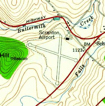
The 1946 USGS topo map depicted Scranton Airport as having 2 paved runways, with a single hangar on the northeast side.

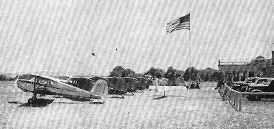
A 10/20/49 aerial photo (from PennPilot) depicted Scranton Municipal Airport as having 6 light aircraft parked on its northeast ramp.
The 1957 PA Aeronautical Chart (courtesy of Mike Keefe)
described Scranton as having 2 bituminous runways: a 2,420' east/west strip & a 2,385' north/south strip.
The operator was listed as Scranton Airways, and the manager was listed as Harold Swank.

A 6/6/60 aerial photo (from PennPilot) depicted Scranton Municipal Airport as having 7 light aircraft, including one just having lifted off Runway 36.
Scranton Municipal was listed among active airfields in the 1962 AOPA Airport Directory,
with 2 bituminous runways (9/27: 2,420' & 18/36: 2,385'), and the operator was listed as Scranton Airways.
A 1966 aerial photo depicted 7 aircraft on the northeast side of the field.
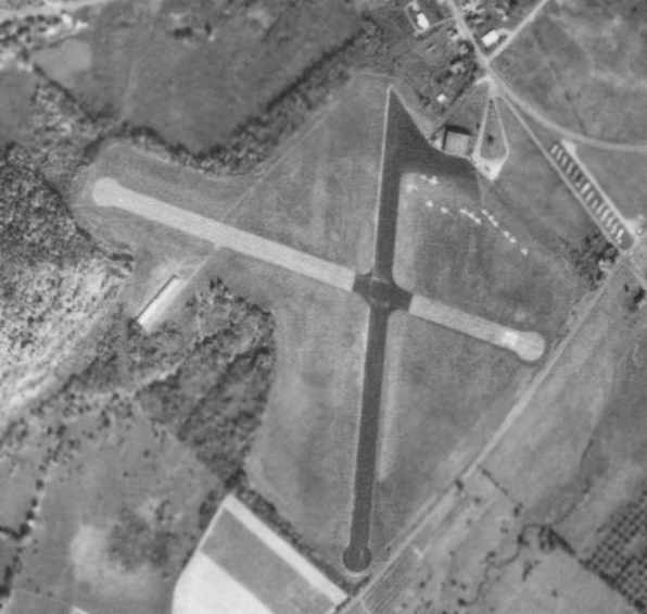
A 10/10/69 aerial photo depicted over a dozen light aircraft parked on the northeast side of Scranton Municipal.
In addition to the original hangar on the northeast side,
it also depicted what appeared to be a newer T-hangar on the west side of the field.
The last aeronautical chart depiction that has been located of Scranton Municipal Airport
was on the December 1979 NY Sectional Chart (courtesy of Ron Plante).
It depicted Scranton Municipal as having 2 paved runways, with the longest being 2,400'.
Scranton Municipal Airport was closed in late 1979, after having been replaced by the much larger Wilkes-Barre / Scranton Airport to the southeast.
Scranton Municipal Airport was depicted as an abandoned airfield on the June 1981 NY Sectional Chart (courtesy of Ron Plante).
“Scranton Airport” was still depicted on the 1995 USGS topo map.
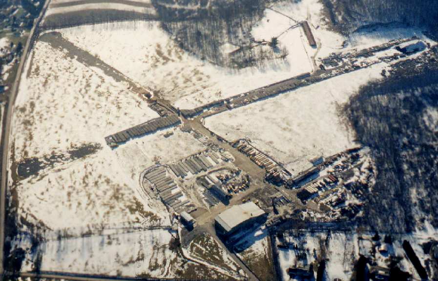
A 1998 aerial picture looking southwest at the remains of Scranton Municipal Airport by Philip K.
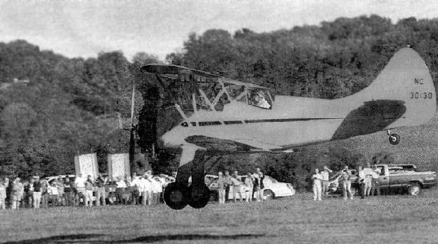
A crowd of more than 100 watches as 80-year-old Jack Race
lands his 1942 Waco UPF-7 biplane at the former Scranton Municipal Airport in 2001.
After 22 years of inactivity, the former Scranton Municipal Airport opened its runway for one final landing in 2001.
A crowd of more than 100 people turned out to see 80-year-old pilot Jack Race touch down his 1942 Waco UPF-7 red biplane
on the exact spot he departed from as a first-time flier some 60 years ago.
That ceremonial landing was staged as a publicity stunt to let the public know that a book,
"The Rise & Fall of the Scranton Municipal Airport" by William Hallstead, was published in 2001 by the University of Scranton Press.
Witnessing the flight brought back many nostalgic feelings for some of the older folks in the crowd.
"This brings back a lot of memories", said Ed Widmer, who took flying lessons at the airport & received his pilot’s license at the age of 15.
"It’s really nice to come back here", said Mr. Race, a Crystal Lake resident who flew 34 years as a commercial pilot for Pan American Airlines.
"This brings back a lot of happy memories."
As of 2002, the runways & main hangar still existed. The property was owned by Frank Columbo, used to store concrete highway barriers.
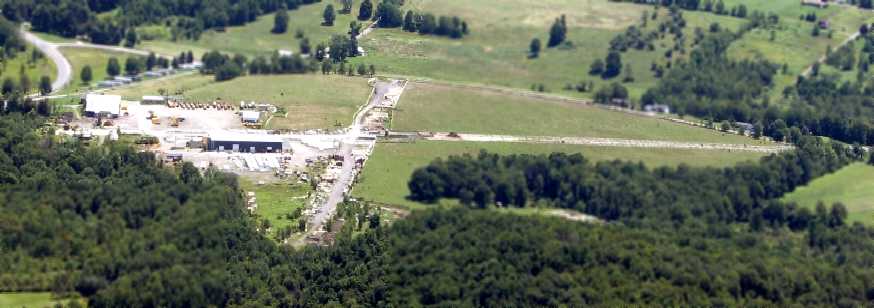
A 5/9/07 aerial view by Philip Kineyko of www.FlyinPhilsPhotos.com,
looking east at the 2 paved runways which remain intact at the site of Scranton Municipal Airport.
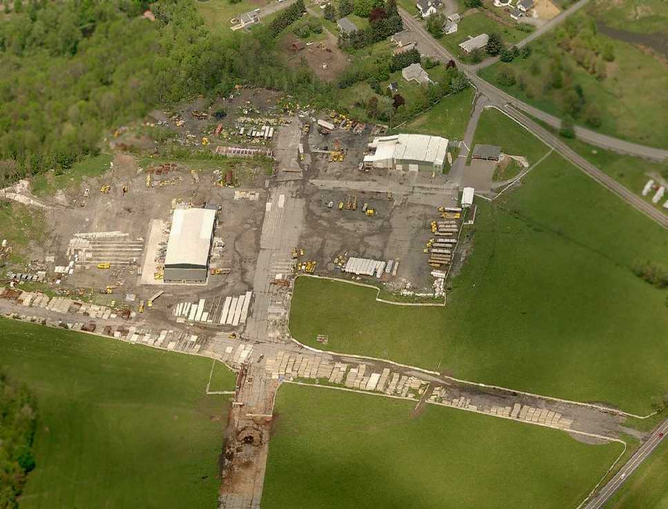
A circa 2008 aerial view looking north at the paved runways, ramps, and hangar which remain intact at the site of Scranton Municipal Airport.
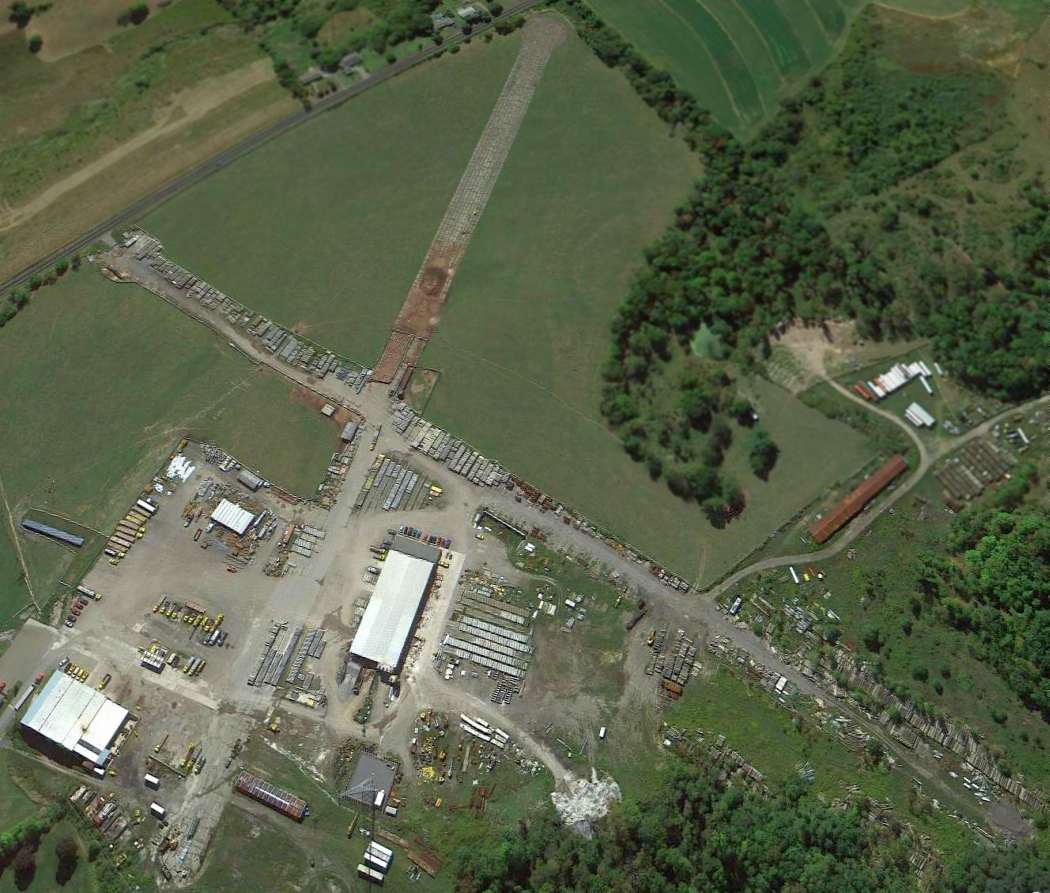
A 9/11/12 aerial view looking southeast at the paved runways, ramps, and hangar which remain intact at the site of Scranton Municipal Airport.
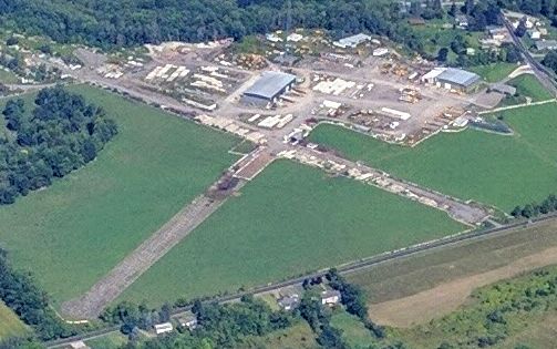
A 9/3/16 aerial view by Steve DiLullo looking northwest at the paved runways, ramps, and hangar which remain intact at the site of Scranton Municipal Airport.
A 2023 photo looking west at the former hangar on the north side of the Scranton Municipal Airport site.
____________________________________________________
Or if you prefer to contact me directly concerning a contribution (for a mailing address to send a check),
please contact me at: paulandterryfreeman@gmail.com
If you enjoy this web site, please support it with a financial contribution.
____________________________________________________
This site covers airfields in all 50 states.
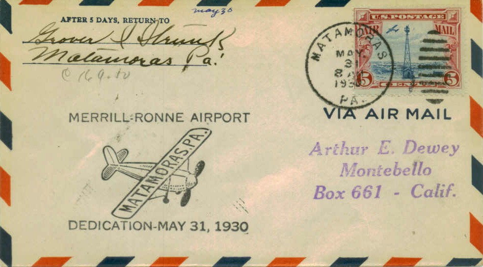